Aim What factors are associated with pedestrian crash risk at intersections in concentrated urban environments?
|
|
|
- Noel Bryant
- 5 years ago
- Views:
Transcription

1
2 Aim What factors are associated with pedestrian crash risk at intersections in concentrated urban environments?
3 Road Trauma Chain Humans Licensed Crossing Speed Hazards Vehicles Roads Registered Roads opened Travel Distance Time Mass System failure Human error
4 Haddon Matrix Human (Road User) Physical Environment Vehicle Pre- Crash Crash Post- Crash
5 Hierarchy of pedestrian data needs Human Behaviour Socioeconomy Demography Lawfulness Cognitive capabilities Employment Income Speeding Jaywalking Fleet composition Education Vehicle Technology Crash avoidance Speed adaptation Pedestrian detection Urban planning Road Geometry Physical Environment Land use Transport system Environment Built roadway Public transport Road hierarchy Traffic management Clutter Micro Road crossing AADT Exposure Macro Vehicle volume Travel speed

6 Pedestrian Data Needs Matrix
7 Rationale Physical Environment Land use mix (Alcohol, Crossroads of shopping strips, Official, Recreational, Residential) Specific road designs 1. Pedestrian hub 2. Walking promotion Transport System Transport modes (bicycle/motorcycle, tram, heavy vehicles, horse-drawn carriage) Speed Ped crash clusters Over-represented road user Road User Over-representation of young and male Tourists Walking under influence Distraction
 of Melbourne City of Melbourne")
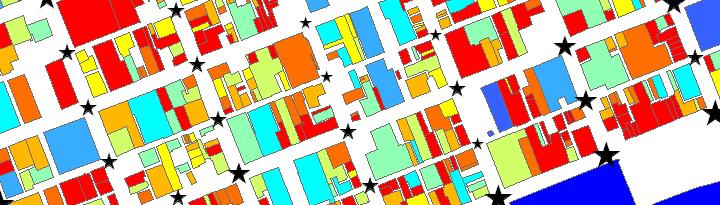
8 Case study Central Business District (CBD) of Melbourne City of Melbourne
9 Dependent variable 1 CBD intersection crashes ( ) 2 Weekday crashes 3 Daytime (07-18) 4 Hours of darkness (19-06) Daytime Hours of darkness Change in trips characteristics (purpose, OD ) Socio-demographic changes Traffic changes Behaviour changes
10 Exposure P 15 m V P V (P V) 0.5
11 Explanatory Variables Vehicle (% heavy vehicles) Land use Human (Sociodemography) Public transport Spatial Built roadway
")
12 0% 10% 20% 30% 40% 50% 60% 70% 80% 90% 100% Spatial data Recreational Social Personal Business Work Related Education Buy Something Blocks 3 Blocks 2 Blocks 1 Block Distance walked for different purposes Victorian Integrated Survey of Travel and Activity (VISTA) 25

13 Land use Amusement and gaming centre Office Entertainment/ recreation (indoor/outdoor) House, institutional accommodation, residential apartment, student apartment All retails Bar, tavern, pub, night club Cinema, theatre, concert hall, stadium Commercial accommodation, hostel, backpacker House, townhouse, residential apartment, serviced apartment, student apartment Café, restaurant, bistro, food court Floor space area Capacity


14 Public transport Sociodemography Bus/Tram Stops Routes Stops Routes Train Distance form the nearest railway station Number of employed people Population
15 Built roadway Geometric design Lanes (major/minor) Left/Right turn lanes Grade Divided/undivided Tram tracks Traffic management Clearance distance of on-street car parks Exclusive bus/bicycle lanes Hook-turn possibility Posted speed (major road) Road hierarchy Major/Minor intersection Number of ways Clutter Number of street signs Legs fronted with shops
16 Method 1 Standard Poisson/Negative Binomial 2 Entering exposure (rate; fixed; normal) 3 Forward stepwise (Likelihood ratio) 4 Zero-inflation (ZIP; ZINB; Vuong s test) 5 Akaike Information Criterion (AIC) 6 Spatial autocorrelation CBD: Moran s I; Semiovariogram Corridor: Generalised Estimating Equations (GEE)
17 Results
18 Vehicle 1. Restaurant, café, bar, pub, club (FS - 800m) 1. Restaurant, Café, bar, pub, club (FS - 100m) Land Use Built Roadway Public Transport Sociodemography 1. Minor intersections 2. Non-divided 3. Hook-turn possibility 4. More legs fronted with shops 5. More left-turn movements (%) 1. Bus routes (500m) 2. Distance from the nearest main railway station (Closer INTs) _ 2. Accommodation (C - 150m) 3. Cinema, theatre, concert hall (C - 300m) 4. Amusement and gaming areas (C - 900m) 1. Minor intersections 2. Non-divided
19 Key messages 1 Temporal and spatial variety of risk 2 Blanket interventions and Safe System 3 Interventions: concentrated v area-wide 4 Risk factor types: immediate/future developments planning
20 Further research 1 Human/vehicle factors 2 Serious (MAIS3+) injuries 3 Spatial/temporal validations
21 Questions?
22 Exposure
23
Development of Decision Support Tools to Assess Pedestrian and Bicycle Safety: Development of Safety Performance Function
 Development of Decision Support Tools to Assess Pedestrian and Bicycle Safety: Development of Safety Performance Function Valerian Kwigizile, Jun Oh, Ron Van Houten, & Keneth Kwayu INTRODUCTION 2 OVERVIEW
Title of the proposed project Development of a Toolbox for Evaluation and Identification of Urban Road Safety Improvement Measures
 Centre of Excellence (CoE) in Urban Transport Department of Civil Engineering, IIT Madras Title of the proposed project Development of a Toolbox for Evaluation and Identification of Urban Road Safety Improvement
Chapter 5 DATA COLLECTION FOR TRANSPORTATION SAFETY STUDIES
 Chapter 5 DATA COLLECTION FOR TRANSPORTATION SAFETY STUDIES 5.1 PURPOSE (1) The purpose of the Traffic Safety Studies chapter is to provide guidance on the data collection requirements for conducting a
IHSDM- HSM Predictive Methods. Slide 1
 IHSDM- HSM Predictive Methods Slide 1 Presentation Outline IHSDM Overview Relationship between HSM and IHSDM Crash Prediction Models and Data Needs IHSDM HSM Predictive Method 2011 Release Preview Questions
Speed Limits in the Hoddle Grid
 Speed Limits in the Hoddle Grid Recent History of speed limits March 2013 Docs # 7738485 1 Introduction Muncipalities have power to Erect speed limit signs BUT Municipalities DO NOT have the power to approve
Topic No January 2000 Manual on Uniform Traffic Studies Revised July Chapter 8 GAP STUDY
 Chapter 8 8.1 PURPOSE GAP STUDY (1) The Gap Study is used to determine the size and the number of gaps in the vehicular traffic stream for unsignalized intersections and access points, pedestrian studies,
Designing a Bicycle and Pedestrian Count Program in Blacksburg, VA
 Designing a Bicycle and Pedestrian Count Program in Blacksburg, VA Steve Hankey (Virginia Tech) Andrew Mondschein (U or Virginia) Ralph Buehler (Virginia Tech) Issue/objective Issue No systematic traffic
Do As I Say Not As I Do: Observed Compliance vs. Stated Understanding of Pedestrian Crossing Laws in Florida
 Do As I Say Not As I Do: Observed Compliance vs. Stated Understanding of Pedestrian Crossing Laws in Florida Achilleas Kourtellis, Ph.D. July 9, 2015 CUTR Webcast Series Center for Urban Transportation
Access Management in the Vicinity of Intersections
 Access Management in the Vicinity of Intersections FHWA-SA-10-002 Technical Summary Photo: Ralph Bentley (used with permission) 0 Access Management is: The design, implementation and management of entry
Traffic Safety Barriers to Walking and Bicycling Analysis of CA Add-On Responses to the 2009 NHTS
 Traffic Safety Barriers to Walking and Bicycling Analysis of CA Add-On Responses to the 2009 NHTS NHTS Users Conference June 2011 Robert Schneider, Swati Pande, & John Bigham, University of California
Active Travel and Exposure to Air Pollution: Implications for Transportation and Land Use Planning
 Active Travel and Exposure to Air Pollution: Implications for Transportation and Land Use Planning Steve Hankey School of Public and International Affairs, Virginia Tech, 140 Otey Street, Blacksburg, VA
Brera - Garibaldi Environmental Island in Milan
 Brera - Garibaldi Environmental Island in Milan Cassani Federico Fabio Casiroli (Systematica s.r.l.) Introduction This project, carried out during the year 2001 and at the moment on the way of implementation,
Implications of the Safe System Approach for young driver safety
 Implications of the Safe System Approach for young driver safety Professor Barry Watson Developing New Approaches to Prevent Young Driver Crashes: 11 May 2018 Overview Historical changes in the way we
Update on Regional Bicycle, Pedestrian, & Trail Planning. Presented to TCC November 21, 2014
 Update on Regional Bicycle, Pedestrian, & Trail Planning Presented to TCC November 21, 2014 Survey Measure Assess Focus Area Performance- Driven Process Policy Policy Implement Plan Criteria Criteria Criteria
2014 Regional Bicycle and Pedestrian Study Evaluation Tools Leslie A. Meehan, AICP MPO Technical Coordinating Committee Meeting April 1, 2015
 Mayor Mayor Kenneth Karl Dean, Wilber, Chairman 2014 Regional Bicycle and Pedestrian Study Evaluation Tools Leslie A. Meehan, AICP MPO Technical Coordinating Committee Meeting April 1, 2015 Evaluation
International Physical Activity Prevalence Study SELF-ADMINISTERED ENVIRONMENTAL MODULE
 International Physical Activity Prevalence Study SELF-ADMINISTERED ENVIRONMENTAL MODULE There is increasing interest in the contextual (environmental) barriers that prevent or limit the opportunity to
Driverless Vehicles Potential Influence on Bicyclist Facility Preferences
 Driverless Vehicles Potential Influence on Bicyclist Facility Preferences MICHAEL BLAU, MCRP, LCI O T E C O C T O B E R 2 6, 2 0 1 6 S E S S I O N # 8 2 - E V A L U AT I N G T H E P E R F O R M A N C E
An evaluation of intersection characteristics associated with crashes at intersections in Melbourne CBD. Jim Scully, Brian Fildes 1
 An evaluation of intersection characteristics associated with crashes at intersections in Melbourne CBD Jim Scully, Brian Fildes 1 ABSTRACT The contribution of crashes occurring at intersections to road
Fixed Guideway Transit Outcomes on Rents, Jobs, and People and Housing
 Fixed Guideway Transit Outcomes on Rents, Jobs, and People and Housing Arthur C. Nelson, Ph.D., ASCE, FAICP Professor of Planning and Real Estate Development University of Arizona 1 Changing Transportation
Chapter 8 Chapter 8 VEHICLE GAP STUDY PURPOSE VEHICLE GAP STUDY (FIGURE 8-1)
") Chapter 8 Chapter 8 Formatted: Heading 1 VEHICLE GAP STUDY 5.48.18.1 PURPOSE (1) The Vehicle Gap Study (Form No. 750-020-08) is used to determine the size and the number of gaps in the vehicular traffic
Chapter 8 Chapter 8 Formatted: Heading 1 VEHICLE GAP STUDY 5.48.18.1 PURPOSE (1) The Vehicle Gap Study (Form No. 750-020-08) is used to determine the size and the number of gaps in the vehicular traffic
CE576: Highway Design and Traffic Safety
 CE576: Highway Design and Traffic Safety Predicting Crash Frequency for Two-Lane Rural Highway Segments Cross Sectional Elements Ahmed Abdel-Rahim, Ph.D., P.E. Civil Engineering Department University of
5858 N COLLEGE, LLC N College Avenue Traffic Impact Study
 5858 N COLLEGE, LLC nue Traffic Impact Study August 22, 2016 Contents Traffic Impact Study Page Preparer Qualifications... 1 Introduction... 2 Existing Roadway Conditions... 5 Existing Traffic Conditions...
Webinar: The Association Between Light Rail Transit, Streetcars and Bus Rapid Transit on Jobs, People and Rents
 Portland State University PDXScholar TREC Webinar Series Transportation Research and Education Center (TREC) 11-15-2016 Webinar: The Association Between Light Rail Transit, Streetcars and Bus Rapid Transit
GIS Based Data Collection / Network Planning On a City Scale. Healthy Communities Active Transportation Workshop, Cleveland, Ohio May 10, 2011
 The Purpose of GIS Based Network Planning GIS Based Data Collection / Network Planning Healthy Communities Active Transportation Conference Tuesday, May 10, 2011 10:00 AM Norman Cox, LLA, ASLA. Ann Arbor,
Non-Motorized Transportation 7-1
 Non-Motorized Transportation 7-1 Transportation facilities no longer mean just accommodating a vehicle powered by a combustion engine. Pedestrian and non-motorized facilities are important modes of travel
AUTOMATED AND ZERO EMISSION VEHICLES HOW THEY MIGHT RESHAPE OUR STREETS
 AUTOMATED AND ZERO EMISSION VEHICLES HOW THEY MIGHT RESHAPE OUR STREETS STURT ST BALLARAT WATERGARDENS TAYLORS LAKES SIMPSON ST YARRAVILLE CHAPEL ST SOUTH YARRA RINGWOOD STATION MONASH FREEWAY SA NSW VIC
MTCF. Michigan Traffic Crash Facts FACT SHEETS
 FACT SHEETS This page left intentionally blank GENERAL FACTS The driver, the roadway, and the motor vehicle contribute in some measure to every crash. A preponderance of evidence, however, points to driver
Classification Criteria
 SCHEDULE D TO RECOMMENDED OFFICIAL PLAN AMENDMENT NO. 40 SCHEDULE C-4 Road Criteria Criteria Traffic Service Objective Land Service/Access Typical Daily Traffic Volume Flow characteristics Travel Speed
An evaluation of pedestrian countdown timers in the Sydney CBD
 An evaluation of pedestrian countdown timers in the Sydney CBD Cleaver, M. A., Hislop, J., de Roos, M. P., Fernandes, R., Prendergast, M. (NSW Centre for Road Safety) Brisbane, G., Levasseur, M., McTiernan,
Urban Traffic Analysis Using HSL (Helsinki Bus) Dataset Kai Zhao University of Helsinki
 Dataset Kai Zhao University of Helsinki") Urban Traffic Analysis Using HSL (Helsinki Bus) Dataset Kai Zhao University of Helsinki April 2015 1 Outline Introduction 1. Analyzing Urban Traffic with Network Analysis methods (What, Why). 2. Correlation
Urban Traffic Analysis Using HSL (Helsinki Bus) Dataset Kai Zhao University of Helsinki April 2015 1 Outline Introduction 1. Analyzing Urban Traffic with Network Analysis methods (What, Why). 2. Correlation
Evaluation of San Diego's First CicloSDias Open Streets Event
 Evaluation of San Diego's First CicloSDias Open Streets Event Funded by a grant from The California Endowment San Diego State University School of Public Affair University of California San Diego Department
MTCF. Michigan Traffic Crash Facts FACT SHEETS
 FACT SHEETS This page left intentionally blank GENERAL FACTS The driver, the roadway, and the motor vehicle contribute in some measure to every crash. A preponderance of evidence, however, points to driver
tattersall park RBY EBSCO RETAIL PROPERTIES
 tattersall park EBSCO PROPERTIES RBY RETAIL the case for tattersall park... The 75-acre site OWNED by the developer (EBSCO) has a unique history. It is one of the most attractive multi use sites in the
Regional Bicycle Barriers Study
 Regional Bicycle Barriers Study Executive Summary Background and Purpose The 2040 Transportation Policy Plan (TPP) sets policies for planning and investment direction in the transportation system in the
Chapter Capacity and LOS Analysis of a Signalized I/S Overview Methodology Scope Limitation
 Chapter 37 Capacity and LOS Analysis of a Signalized I/S 37.1 Overview The Highway Capacity Manual defines the capacity as the maximum howdy rate at which persons or vehicle can be reasonably expected
Public transport and town planning from a retroactive point of view C. Wallstrom, S. Johansson et al
 Public transport and town planning from a retroactive point of view C. Wallstrom, S. Johansson et al The aim of this project is to estimate the effect of town planning on traffic volumes and modal split
REDEVELOPMENT OPPORTUNITY! FOR SALE
 SALE PRICE: Contact Agent LOT SIZE: 0.31 Acres BUILDING SIZE: 2,830 SF YEAR BUILT: 1906 ZONING: CBD Central Business District CROSS STREETS: 2nd Street South PROPERTY OVERVIEW This offering is for the
THIS PAGE LEFT BLANK INTENTIONALLY
 GA SR 25 Spur at Canal Road Transportation Impact Analysis PREPARED FOR GLYNN COUNTY, GEORGIA 1725 Reynolds Street, Suite 300 Brunswick, Georgia 31520 PREPARED BY 217 Arrowhead Boulevard Suite 26 Jonesboro,
Cycling and risk. Cycle facilities and risk management
 Cycling and risk Cycle facilities and risk management Failure to recognize possibilities is the most dangerous and common mistake one can make. Mae Jemison, astronaut 6/11/2010 York Regional Council Cycling
Safer Cycling: How the City of Vancouver is Proactively Improving Cycling Safety
 Safer Cycling: How the City of Vancouver is Proactively Improving Cycling Safety Brian Patterson, MCIP, RPP Urban Systems 2015 Canadian Association of Road Safety Professionals (CARSP) Conference Session
1 Road and HGV danger in London. Hannah White, Freight & Fleet Programme Manager November 2017
 1 Road and HGV danger in London Hannah White, Freight & Fleet Programme Manager November 2017 2 London and its transport networks London: 8.6m residents + 30m visitors 30m journeys per day 6.3m by bus
2015 Florida Main Street Annual Conference. Complete Streets Equal Stronger Main Streets
 WHAT ARE COMPLETE STREETS? CASE STUDIES COMPLETING YOUR MAIN STREET 2015 Florida Main Street Annual Conference St. Petersburg, Florida August 19, 2015 WHAT ARE COMPLETE STREETS? CASE STUDIES COMPLETING
TRAFFIC IMPACT ANALYSIS
 TRAFFIC IMPACT ANALYSIS FOR THE CHAMPAIGN UNIT#4 SCHOOL DISTRICT PROPOSED HIGH SCHOOL (SPALDING PARK SITE) IN THE CITY OF CHAMPAIGN Final Report Champaign Urbana Urbanized Area Transportation Study 6/24/2014
IMPLEMENTATION. PEDESTRIAN USERS (Continued /) A: Class 2 Pedestrian / Cycle Ways. Pedestrian and Cycle Ways:
 A: Class 2 Pedestrian / Cycle Ways. Pedestrian and Cycle Ways:") A: Class 2 Pedestrian / Cycle Ways PLAN VIEW Pedestrian and Cycle Ways: Layout and Geometry (Refer to A): Walkways and cycle to be provided adjacent to all Class 2 Roads (these facilities should always
A: Class 2 Pedestrian / Cycle Ways PLAN VIEW Pedestrian and Cycle Ways: Layout and Geometry (Refer to A): Walkways and cycle to be provided adjacent to all Class 2 Roads (these facilities should always
Prediction of Pedestrian Crashes at Midblock Crossing Areas using Site and Behavioral Characteristics Preliminary Findings
 Prediction of Pedestrian Crashes at Midblock Crossing Areas using Site and Behavioral Characteristics Preliminary Findings Timothy J. Gates, Ph.D., P.E. June 22, 2016 Pedestrian-Involved Crashes Pedestrian-Involved
Pedestrian Road Safety Audit
 Pedestrian Road Safety Audit Middlebrook Road From Father Hurley Boulevard to Waring Station Road December 2017 Montgomery County Department of Transportation Table of Contents 1. Introduction... 1 1.1
Investment in Active Transport Survey
 Investment in Active Transport Survey KEY FINDINGS 3 METHODOLOGY 7 CYCLING INFRASTRUCTURE 8 Riding a bike 9 Reasons for riding a bike 9 Mainly ride on 10 Comfortable riding on 10 Rating of cycling infrastructure
AUTOMATED AND ZERO EMISSION VEHICLES HOW THEY MIGHT RESHAPE OUR STREETS
 AUTOMATED AND ZERO EMISSION VEHICLES HOW THEY MIGHT RESHAPE OUR STREETS BACKGROUND: This study is a collaboration between Urban Circus (Visualisation) and Ethos Urban (Urban Design) Ideas were workshopped
HENDERSON DEVELOPMENT 213, 217, 221, 221 ½, 223 HENDERSON AVENUE and 65 TEMPLETON STREET OTTAWA, ONTARIO TRANSPORTATION OVERVIEW.
 HENDERSON DEVELOPMENT 213, 217, 221, 221 ½, 223 HENDERSON AVENUE and 65 TEMPLETON STREET OTTAWA, ONTARIO TRANSPORTATION OVERVIEW Prepared for: 2294170 Ontario Inc. February 2, 2017 117-652 Report_1.doc
APPENDIX H EXISTING TRAFFIC CONDITIONS ANALYSIS
 APPENDIX H EXISTING TRAFFIC CONDITIONS ANALYSIS MEMO : Peter Steacy, P.Eng. Date: December 3, 2014 : Ian Borsuk, P.Eng. Job No.: 3414015-000 Subject: City of Ottawa O-Train Extension Planning & EA Study
HOW SAFE ARE THE WALKERS IN DHAKA CITY? A COMPREHENSIVE APPROACH TO MODEL PEDESTRIANS SAFETY IN DHAKA
 HOW SAFE ARE THE WALKERS IN DHAKA CITY? A COMPREHENSIVE APPROACH TO MODEL PEDESTRIANS SAFETY IN DHAKA 1. INTRODUCTION Walking is by far the most important mode of transport, as it not only acts as a crucial
GIS Based Non-Signalized Intersection Data Inventory Tool To Improve Traffic Safety
 GIS Based Non-Signalized Intersection Data Inventory Tool To Improve Traffic Safety UNIVERSITY OF ALABAMA JENNA SIMANDL JENNY BLEIHOLDER ANDREW GRAETTINGER TIM BARNETT LUKE TAYLOR RANDY SMITH Introduction
CITY OF SASKATOON COUNCIL POLICY
 ORIGIN/AUTHORITY Clause 1, Report No. 1-1980 and Clause 4, Report No. 22-1990 of the Works and Utilities Committee; Clause 6, Report No. 17-2004 of the Planning and Operations Committee; and Clause D5,
Mathematics of Planet Earth Managing Traffic Flow On Urban Road Networks
 Mathematics of Planet Earth Managing Traffic Flow On Urban Road Networks Adrian George Manager Network Improvements Anthony Fitts Manager Signal Design Melbourne s transport demands are growing 5m people
GREATER DANDENONG ROAD SAFETY STRATEGY
 GREATER DANDENONG ROAD SAFETY STRATEGY 2016-22 Table of Contents Table of Contents... 2 Executive Summary... 3 Road Safety in Greater Dandenong... 4 Context... 5 Community Engagement... 14 Road Safety
Iowa Corridor Management Pilot Project Overview. Recommendations For A Corridor Management Program August 2004
 Iowa Corridor Management Pilot Project Overview Recommendations For A Corridor Management Program August 2004 Presentation Overview Project goals Pilot project selection process Analysis results Segment
Transportation Knowledge
 FE REVIEW COURSE SPRING 2017 Transportation Engineering 4/26/2017 Transportation Knowledge 8-12 problems Traffic safety Traffic capacity Traffic flow theory Traffic control devices Transportation planning
Pedestrian Demand Modeling: Evaluating Pedestrian Risk Exposures
 Pedestrian Demand Modeling: Evaluating Pedestrian Risk Exposures Kelly J. Clifton National Center for Smart Growth University of Maryland May 19, 2008 Study Team University of Maryland National Center
1.3.4 CHARACTERISTICS OF CLASSIFICATIONS
 Geometric Design Guide for Canadian Roads 1.3.4 CHARACTERISTICS OF CLASSIFICATIONS The principal characteristics of each of the six groups of road classifications are described by the following figure
Pedestrian traffic flow operations on a platform: observations and comparison with simulation tool SimPed
 Pedestrian traffic flow operations on a platform: observations and comparison with simulation tool SimPed W. Daamen & S. P. Hoogendoorn Department Transport & Planning, Delft University of Technology,
Frequently asked questions about how the Transport Walkability Index was calculated are answered below.
 Transport Walkability Index The Transport Walkability Index is a relative indicator of how well the built environment in different areas supports walking for transport. The index is frequently used in
ANALYSIS OF PEDESTRIAN ACCIDENTS IN IRBID CITY, JORDAN
 ANALYSIS OF PEDESTRIAN ACCIDENTS IN IRBID CITY, JORDAN Bashar Al-Omari 1 & Eman Obaidat Civil Engineering Department Jordan University of Science & Technology E-Mail: bahomari@just.edu.jo Summary: The
Application of Demographic Analysis to Pedestrian Safety. Center for Urban Transportation Research University of South Florida
 Application of Demographic Analysis to Pedestrian Safety BDV25 TWO 977 30 Pei Sung Lin, Ph.D., P.E., PTOE, FITE Program Director Achilleas Kourtellis, Ph.D. Senior Research Associate CUTR, University of
Measuring Pedestrian Delay
 Measuring Pedestrian Delay Final Report Prepared for: Auckland Design Office, Auckland Council Date: 20 September 2017 Version: Final Document Information Client Auckland Council Job Number NZ2165 Title
Market Factors and Demand Analysis. World Bank
 Market Factors and Demand Analysis Bank Workshop and Training on Urban Transport Planning and Reform. Baku, April 14-16, 2009 Market Factors The market for Public Transport is affected by a variety of
A Framework For Integrating Pedestrians into Travel Demand Models
 A Framework For Integrating Pedestrians into Travel Demand Models Kelly J. Clifton Intersections Seminar University of Toronto September 22, 2017 Portland, Oregon, USA Region Population~ 2.4 M Urban Growth
Planning Guidance in the 2012 AASHTO Bike Guide
 Planning Guidance in the 2012 AASHTO Bike Guide Presentation by: RJ Eldridge Peter Lagerwey August 22, 2012 WEBINAR 2: PLANNING GUIDANCE IN THE 2012 AASHTO BIKE GUIDE Today s Webinar Significant Updates
General References Definitions. (1) Design Guidance. (2) Supporting Information
 Design Guidance. (2) Supporting Information") Chapter 1240 Turning Roadways 1240.01 General 1240.02 References 1240.03 Definitions 1240.04 Turning Roadway Widths 1240.05 Documentation 1240.01 General The roadway on a curve may need to be widened to
Chapter 1240 Turning Roadways 1240.01 General 1240.02 References 1240.03 Definitions 1240.04 Turning Roadway Widths 1240.05 Documentation 1240.01 General The roadway on a curve may need to be widened to
IMPLEMENTATION. PEDESTRIAN USERS (Continued /) Building Frontages: A: Stair Applications. Geometry (Accessed from the Sidewalk) Refer to A:
 Building Frontages: A: Stair Applications. Geometry (Accessed from the Sidewalk) Refer to A:") A: Stair Applications Building Frontages: Geometry (Accessed from the Sidewalk) Refer to A: Ramps should be provided for disabled users at 1:12 (8.3%) gradient. Ramp rises should be stepped at 400mm intervals.
A: Stair Applications Building Frontages: Geometry (Accessed from the Sidewalk) Refer to A: Ramps should be provided for disabled users at 1:12 (8.3%) gradient. Ramp rises should be stepped at 400mm intervals.
POLICY AGENDA For Elder Pedestrian Safety
 POLICY AGENDA For Elder Pedestrian Safety Older adults and people with disabilities often have mobility, cognitive, and sensory limitations that affect their behavior as pedestrians and place them at risk
INDEX. Geometric Design Guide for Canadian Roads INDEX
 Acceleration lane, see Lanes, Acceleration Access, 8.1 Access Management and Functional Classification 8.2 Access Management by Design Classification 8.3 Access Configuration 8.4 Building Set-Back Guidelines
2014 QUICK FACTS ILLINOIS CRASH INFORMATION. Illinois Emergency Medical Services for Children February 2016 Edition
 2014 QUICK FACTS ILLINOIS CRASH INFORMATION February 2016 Edition Illinois Emergency Medical Services for Children www.luhs.org/emsc Illinois Emergency Medical Services for Children TABLE OF CONTENTS
City of Wayzata Comprehensive Plan 2030 Transportation Chapter: Appendix A
 A1. Functional Classification Table A-1 illustrates the Metropolitan Council s detailed criteria established for the functional classification of roadways within the Twin Cities Metropolitan Area. Table
2012 QUICK FACTS ILLINOIS CRASH INFORMATION. Illinois Emergency Medical Services for Children September 2014 Edition
 2012 QUICK FACTS ILLINOIS CRASH INFORMATION September 2014 Edition Illinois Emergency Medical Services for Children www.luhs.org/emsc Illinois Emergency Medical Services for Children TABLE OF CONTENTS
Physical Implications of Complete Streets Policies
 Presentation Overview Physical Implications of Complete Norm Cox, ASLA, LLA Landscape Architect Ann Arbor, Michigan, 10:45 to Noon What Are Complete Streets? What Matters to Bicyclists and Pedestrians
Accessibility, mobility and social exclusion
 Accessibility, mobility and social exclusion Dionisis Balourdos Kostas Sakellaropoulos Aim The aim of this paper is to present data from the four cities in the project SceneSusTech concerning the issues
Post impact trajectory of vehicles at rural intersections
 Post impact trajectory of vehicles at rural intersections Doecke SD., Woolley JE. and Mackenzie JR. Centre for Automotive Safety Research Abstract This report describes the path of vehicles after a collision
Transport attitudes, residential preferences, and urban form effects on cycling and car use.
 Downloaded from orbit.dtu.dk on: Mar 10, 2019 Transport attitudes, residential preferences, and urban form effects on cycling and car use. Nielsen, Thomas Alexander Sick; Olafsson, Anton Stahl; Carstensen,
Unsafe & safe road way design for urban roads
 PIARC International Road Safety Seminar Beijing 18 20 October 2005 Unsafe & safe road way design for urban roads Hans-Joachim Vollpracht Piarc TC 3.1 Chairman 10-1616 1 Main objective of urban planning
KIGALI CITY, RWANDA MODERNIZATION OF TRANSPORT INFRASTRUCTURE AND SERVICES. Presentation to ITC, UTwente Enschede 13 June 2018
 KIGALI CITY, RWANDA MODERNIZATION OF TRANSPORT INFRASTRUCTURE AND SERVICES Presentation to ITC, UTwente Enschede 13 June 2018 Dr. Eng. Alphonse NKURUNZIZA City Engineer, City of Kigali Kigali City Projected
MOBILITY CHALLENGES IN HILL CITIES
 MOBILITY CHALLENGES IN HILL CITIES Lalmuansanga Ralte, MCS Pvt Secretary to Minister & Under Secretary Urban Development & Poverty Alleviation Department Govt. of Mizoram DEMOGRAPHIC OVERVIEW INDIA MIZORAM
CROSSING GUARD PLACEMENT CONSIDERATIONS AND GAP ASSESSMENT
 CROSSING GUARD PLACEMENT CONSIDERATIONS AND GAP ASSESSMENT Many factors contribute to the need for a Crossing Guard. General federal guidance, provided by the FHWA MUTCD, states that adult crossing guards
1 Monash University Accident Research Centre, Monash University, Victoria, RACV, 550 Princes Highway Noble Park, Victoria, 3174.
 Roadside Environment Safety: a statistical analysis of collisions with fixed roadside objects in Victoria Amanda Delaney 1, Stuart Newstead 1, Bruce Corben 1, Jim Langford 1 and Peter Daly 2 1 Monash University
DON MILLS-EGLINTON Mobility Hub Profile
 Mobility Hub Profile Dundas Don Mills-Eglinton West-Bloor Anchor Hub Gateway Hub N MOBILITY HUBS: Places of connectivity between regional and rapid transit services, where different modes of transportation
Florida Class E Knowledge Exam Road Rules Practice Questions
 1. If you are being followed too closely while driving, you should: A. Drive closer to the car in front of you. B. Speed up to increase the distance between you and the following vehicle. C. Slow down
ROAD SAFETY PERFORMANCE REVIEW Capacity Building Workshop for Uganda. irap METHODOLOGY Racheal M. N. Nganwa AfricaRAP Lead 1 & 2 March 2018
 ROAD SAFETY PERFORMANCE REVIEW Capacity Building Workshop for Uganda irap METHODOLOGY Racheal M. N. Nganwa AfricaRAP Lead 1 & 2 March 2018 About irap: Registered charity Vision: a world free of high risk
STATION #3 INITIAL ALTERNATIVES
 www.dot.il.gov www.eisenhowerexpressway.com STATIO #3 IHB RR Heavy Rail Transit (HRT) High capacity transit mode serving urban areas:» Steel wheeled, high performance electric powered rail vehicles» Right-of-way
ALIVE. Proposal. Imagination. The. Toward a More Walkable and Less Car-Dependent Future. Learning. Vision. Action. Environment
 The ALIVE Proposal Toward a More Walkable and Less Car-Dependent Future A Twelve Step Approach to Open Up Our Imagination Prepared for The Community of Corvallis, Oregon and Oregon State University by
Safe System approach A beckoning perspective for children
 Plenary Session 1 Safe System approach A beckoning perspective for children Fred Wegman Emeritus Professor, Traffic Safety at Delft University of Technology, the Netherlands Traditional approach: for example
How to achieve fluid traffic
 Kanton Basel-Stadt How to achieve fluid traffic Objectives, instruments and limits of traffic management Alain Groff, Office for Mobility, Canton of Basel-Stadt Overview Some figures about Basel Tools
NEWMARKET CENTRE Mobility Hub Profile
 Mobility Hub Profile Dundas Newmarket West-Bloor Centre Anchor Hub Gateway Hub N MOBILITY HUBS: Places of connectivity between regional and rapid transit services, where different modes of transportation
HSM Practitioners Guide to Urban and Suburban Streets. Prediction of Crash Frequency for Suburban/Urban Streets
 HSM Practitioners Guide to Urban and Suburban Streets Prediction of Crash Frequency for Suburban/Urban Streets Predicting Crash Frequency of Suburban/Urban Multilane Streets Learning Outcomes: Describe
Existing Pedestrian Conditions. PSAC February 8, 2011
 Existing Pedestrian Conditions PSAC February 8, 2011 Contents 1. Project Background & Goals 2. Pedestrian Activity: Where people walk 3. Pedestrian Safety: The conditions people face Project Background
North Shore Transportation Improvement Strategy
 North Shore Transportation Improvement Strategy Preliminary, Near-term Recommendation 2016 April Transportation Improvement Strategy (TIS) Comprehensive and Analytical A multi-modal transportation strategy
Road safety and bicycle usage impacts of unbundling vehicular and cycle traffic in Dutch urban networks
 Road safety and bicycle usage impacts of unbundling vehicular and cycle traffic in Dutch urban networks Paul Schepers Ministry of Infrastructure and the Environment SWOV Institute for Road Safety Research
3 Palmer Urban Travel Demand Model Development
 3 Palmer Urban Travel Demand Model Development This section discusses the development of the urban travel demand model. The Palmer Urban Transportation Study includes a detailed demand model for the Palmer
The Safe System Approach
 There are very few areas of public discussion and sentiment which generate as much consensus as road safety. Everyone wants safer roads for all users, and road safety is a key priority for governments,
MCTC 2018 RTP SCS and Madera County RIFP Multi-Modal Project Eval Criteria GV13.xlsx
 MCTC 8 RTP SCS and Madera County RIFP Multi-Modal Project Eval Criteria GV.xlsx Madera County Transportation Commission Regional Transportation Plan / Sustainable Communities Strategy Multi-Modal Project
Design of Turn Lane Guidelines
 Design of Turn Lane Guidelines CTS Transportation Research Conference May 24, 2012 Howard Preston, PE Minnesota Department of Transportation Research Services Office of Policy Analysis, Research & Innovation
How Might Connected Vehicles and Autonomous Vehicles Influence Geometric Design? October 10, 2017
 How Might Connected Vehicles and Autonomous Vehicles Influence Geometric Design? October 10, 2017 Overview Design Vehicle Design Driver Potential Geometric Impacts of Autonomous Vehicles Connected Vehicles