A Downtown Transformed Through Partnerships: the Portland Mall Story
|
|
|
- Branden Ellis
- 5 years ago
- Views:
Transcription

1 A Downtown Transformed Through Partnerships: the Portland Mall Story Portland 2010 Chris Kopca, Downtown Development Group Steve Iwata, City of Portland Bureau of Planning and Sustainability Brian McCarter, ZGF Architects Alan Lehto, TriMet Teresa Boyle, City of Portland Bureau of Transportation Tad Savinar, Urban Design Consultant


2 Slide Master In the beginning Lovejoy/Pettygrove Plan established block size, parks, church site 20th century: the backbone is defined After Lewis and Clark Expo, Fifth and Sixth become the core


3 We lost our way Two decades of erosion s and 1960 s Lovejoy/Pettygrove plan was compromised Mobility was compromised


4 1972 Downtown Plan Funded by private sector Redefined original vision Framework plans, goals, guidelines Mall is the first large public project


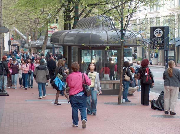
5 The Portland Mall set precedents for quality of design rarely matched in the years to follow

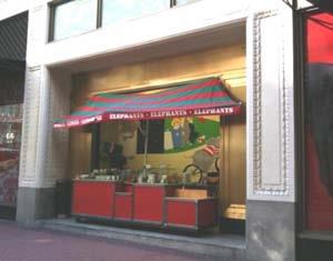
6 Over time, the Mall was deteriorating physically, socially and economically
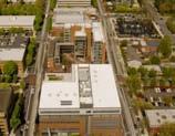
7 Portland 2010 A Downtown Transformed Through Partnerships: the Portland Mall Story Design


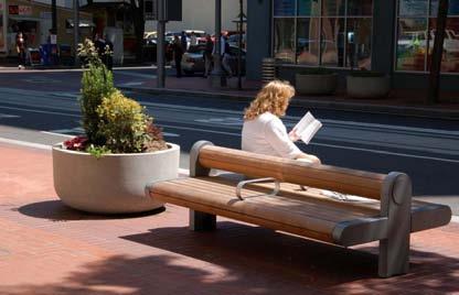
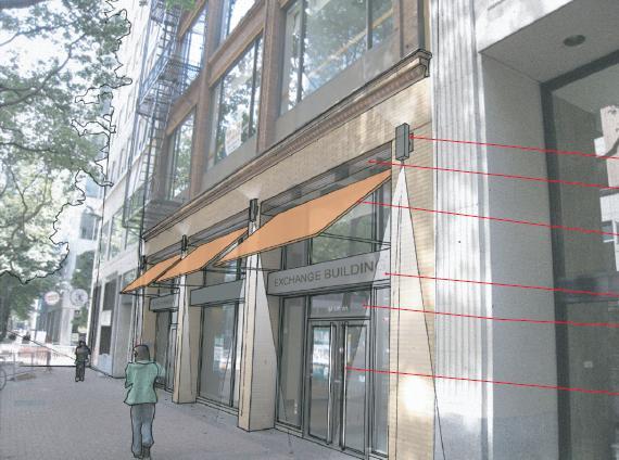
8 Project Goals enliven renovate expand access strengthen the retail and office core


9 Public open houses, website Citizens Advisory Committee District design workshops Field mockups


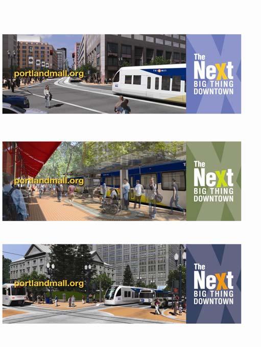
10 Great Streets: design, operations programming and management Fifth Avenue New York City State Street Chicago 16 th Street Mall Denver Market Street San Francisco Nicollett Mall Minneapolis Transit Mall Portland
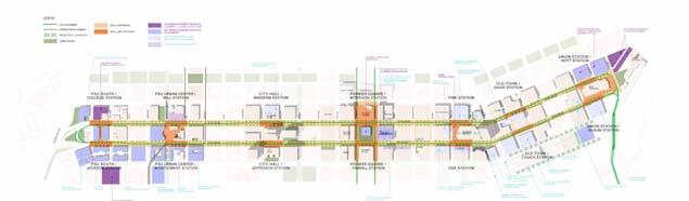
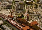
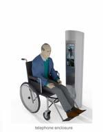
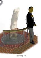
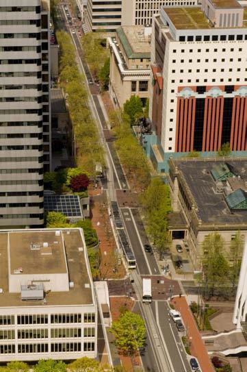
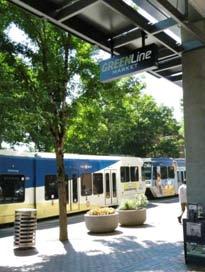
11 The Mall Revitalization Plan: Seven stations, five districts, one pair of unifying streets

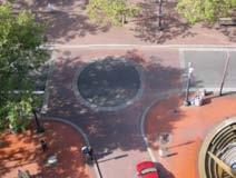
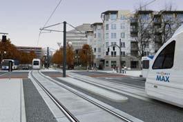
12 Designing the complete environment

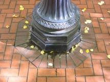
13 Continuity Pedestrian paving system
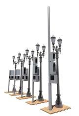
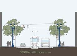
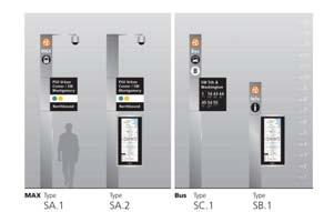
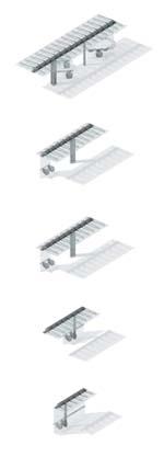
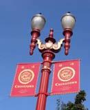
14 Continuity Poles, Lights, Signals, Shelters and Sign Families
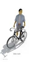


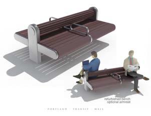

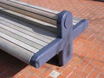
15 Continuity Furnishings Families
16 Continuity Trees
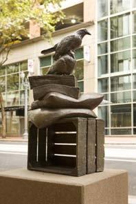
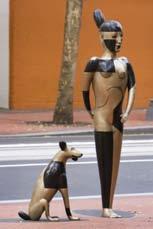
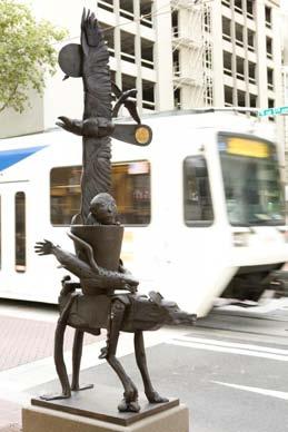
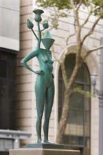
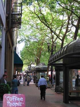
17 Distinction Public art

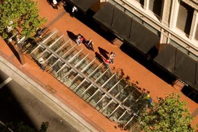
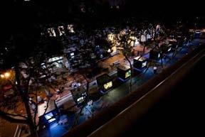
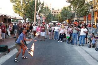
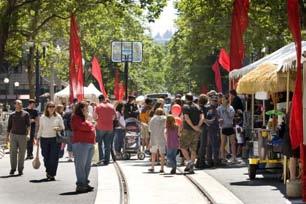
18 Distinction Station as Place: station in a garden
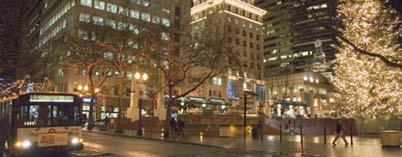
19 Distinction Station as Place: Pioneer Courthouse Square Station

20 Distinction Open view to building from square; extend the plaza

21 Distinction Open view to building from square; extend the plaza


22 Distinction University District: Green Streets


23 Distinction Campus meets City at the Transit Crossroads

24 Distinction PSU/South Terminus Station

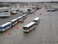
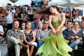
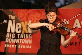
25 September, 2009: Opening Celebration

26 The spine is renewed


27 Stations as the center of districts


28 Transit and street life merged


29 Mobility, civic life and commerce - together in a great street
30 Portland 2010 A Downtown Transformed Through Partnerships: the Portland Mall Story Operations


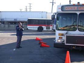
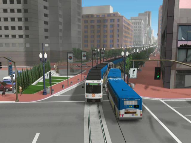
31 Transit Choreography Making trains and buses dance on the Portland Mall


32 Operational Challenges You can t do that I d better retire before that opens
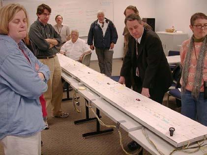
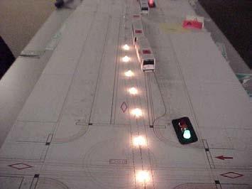
33 Why retire early? Before two bus lanes After add light rail in the same lanes
34 Operations Before Two bus stops per block Pattern repeats every two blocks Through bus yields to curb bus if turn signal is on S SW SW SE SE SW SE
35

36 Train length and train forward shadow Trains are one full block long Blocks cross-streets if anything impedes full progress into block
37 Too Many Conflict Points Multiple locations of potential conflict with varying levels of control if no changes in bus stop operations Bus stopped at red signal holds up train potential conflict points

38 What s the Solution?
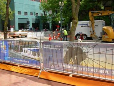
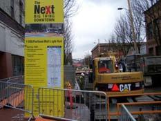
39


40 Field Tests Transit Operations & Transportation Strategy
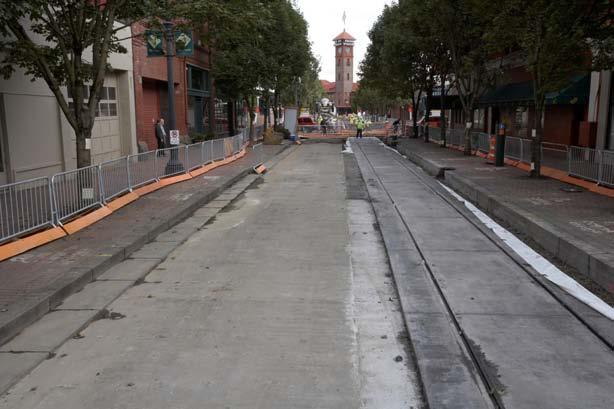
41 How it works Light rail and bus movements are separated by lane, by time, and by standard traffic and train signals. Buses only allowed to merge onto rail lane when signal is green. Autos stay in left lane with positive separation from transit lanes. Buses follow standard traffic signals just like cars and just like everywhere else in the system. Trains follow standard MAX train signals Solid Yellow horizontal = Stop Flashing Yellow = Signal ending; Prepare to proceed Solid White vertical = Proceed with caution Flashing White = Signal ending; Prepare to stop
42 THROUGH PEDESTRIANS MULTIMODAL CAR/BIKE LANE BUS/LIGHT TRANSIT LANES THROUGH PEDESTRIANS FURNISHINGS FURNISHINGS/ TRANSIT BOARDING
43 THROUGH PEDESTRIANS MULTIMODAL CAR/BIKE LANE BUS/LIGHT TRANSIT LANES THROUGH PEDESTRIANS FURNISHINGS FURNISHINGS/ TRANSIT BOARDING
44 Video simulation

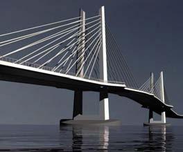
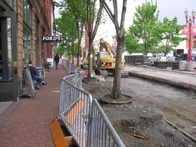
45 We didn t have to retire Portland-Milwaukie Light Rail Multi-modal Bridge Opens 2015
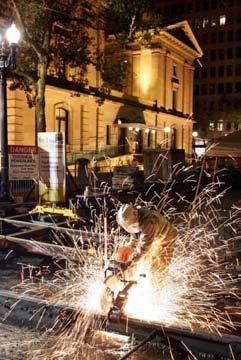
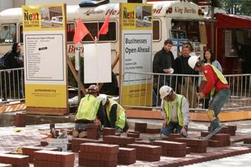
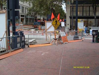
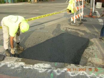
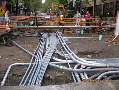
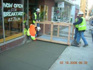
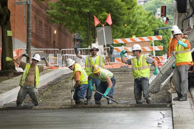
46 Portland 2010 A Downtown Transformed Through Partnerships: the Portland Mall Story Construction
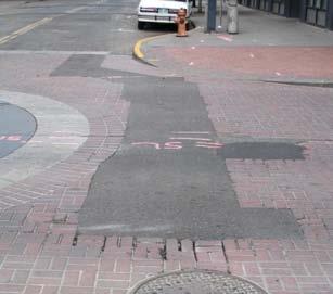
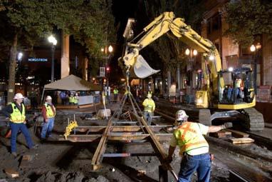
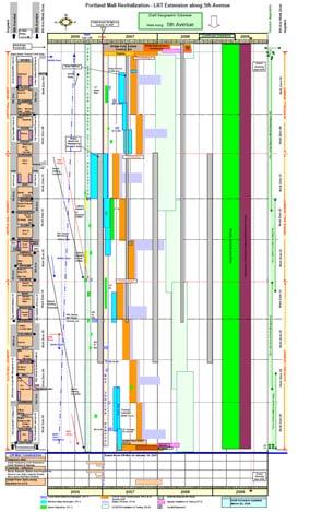
47

48 1970 s Transit Mall

49 1980 s First LRT Construction
50 There must be a better way!
51 CMGC

52 Moved the buses

53 Early utility relocations

54 Concurrent work zones Eight Zones Six Zones Four Zones
55 Double shifts/night work
56
57
58
59
60
61
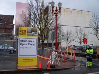
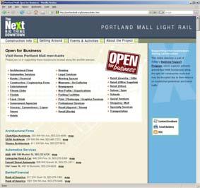
62
63
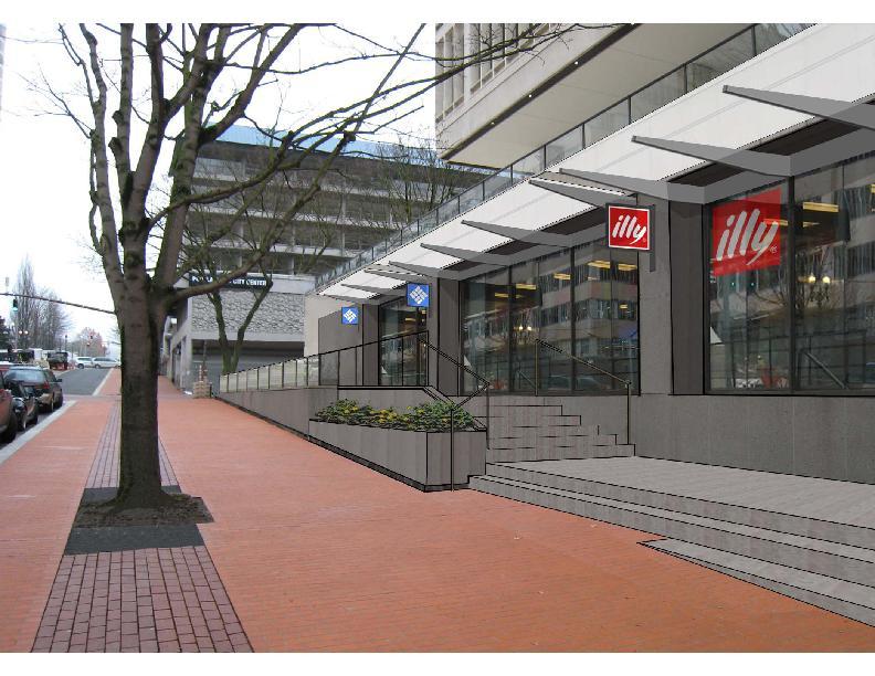
64
65
66
67
68 Portland 2010 A Downtown Transformed Through Partnerships: the Portland Mall Story Leveraging Private Investment
69 The Block By Block Project (BBB) broke up a 7.2 mile urban LRT alignment down into 1,872 twenty foot redevelopment strategies.
70 $1.5 million in public grants leveraged $9 million of private investment Every $1 of public funds leveraged $5 to $30 of private sector investment (during 24 months of a recession)

71 Caffe Viale

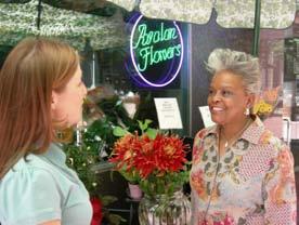
72 $35,000 Private Investment


73 $600,000 Private Investment

74 $315,000 Private Investment

75 $288,000 Private Investment

76 $75,000 Private Investment

77 $250,000 Private Investment

78 $80,100 Private Investment

79 Ongoing private investment

80 Portland Mall Management, Inc.
Ann Arbor Downtown Street Plan
 1 Ann Arbor Downtown Street Plan Public Workshop #1 We know that. 2 Public right-of-way (streets, sidewalks, and alleys) make up 30% of the total District area of downtown. Streets need to provide mobility
JOINT PARTNERSHIPS: Working Together To Support Light Rail in Santa Monica
 JOINT PARTNERSHIPS: Working Together To Support Light Rail in Santa Monica ITY OF ANTA MONICA RAIL-VOLUTION / OCTOBER 17, 2012 SARAH LEJEUNE, PRINCIPAL PLANNER, STRATEGIC + TRANSPORTATION PLANNING DIVISION
224 sera project: damascus street types
 WIESE Tra CLATSOP 145TH 170TH CHELDELIN 190TH REGNER HOGAN RUGG 252ND RODLUN HEMRICK SCHACHT BORGES MONNER HAGEN 172ND TROGE FOSTER VOGEL WINSTON 222ND TILLSTROM BOHNA PARK WILDWOOD 242ND 250TH SUNSHIN
Crystal City Citizen Review Council Meeting. July 10, 2013
 Crystal City Citizen Review Council Meeting July 10, 2013 Topics to be covered Overview of Crystal City Transportation Projects Capital Program Investments Regional Coordination 9 Program Overview Crystal
1 PROJECT DESCRIPTION PROBLEM STATEMENT PROJECT PURPOSE AND NEED Study Purpose Study Need... 4
 January 2014 Table of Contents 1 PROJECT DESCRIPTION... 1 2 PROBLEM STATEMENT... 2 3 PROJECT PURPOSE AND NEED... 3 3.1 Study Purpose... 3 3.2 Study Need... 4 4 GOALS AND OBJECTIVES... 9 4.1 Short-term
STONY PLAIN ROAD STREETSCAPE
 Jasper Place Revitalization Strategy: Vision The people involved in the Jasper Place Revitalization Strategy envision: Goal 1: Feeling safe in our community Create a community where feeling safe is common--where
SPRINGFIELD REVITALIZATION REPORT
 SPRINGFIELD REVITALIZATION REPORT August 2015 Homewood Suites Springfield Town Center Promenade 2 SPRINGFIELD OVERVIEW This report covers recent development activity in the Springfield Commercial Revitalization
Thesis Presentation. Moorhead City Walk: A Master Plan to Reimage Moorhead, Minnesota s Urban Core. Brad Garcia Advisors: Jason Kost & Dominic Fischer
 Thesis Presentation Moorhead City Walk: A Master Plan to Reimage Moorhead, Minnesota s Urban Core Brad Garcia Advisors: Jason Kost & Dominic Fischer MOORHEAD, MN Red River Center Ave 8 TH St N FARGO, ND
BALBOA AREA: TRANSPORTATION PROJECTS & PLANNING
 BALBOA AREA: TRANSPORTATION PROJECTS & PLANNING TRANSPORTATION FOR ALL AGES, ABILITIES & MEANS CHANGING PATTERNS: TRENDING TO WALKING, BIKING, TRANSIT San Francisco s Change in Number of Commuters by Mode
Broward Boulevard Gateway Implementation Project, Downtown Walkability Analysis, & Joint Development Initiative (JDI)
") Broward Boulevard Gateway Implementation Project, Downtown Walkability Analysis, & Joint Development Initiative (JDI) City of Fort Lauderdale ~ Commission Conference July 10, 2012 Page 1 of 15 A Multi-Agency
Broward Boulevard Gateway Implementation Project, Downtown Walkability Analysis, & Joint Development Initiative (JDI) City of Fort Lauderdale ~ Commission Conference July 10, 2012 Page 1 of 15 A Multi-Agency
Table #6 VISION CHARACTERISTICS
 Table #6 VISION White Flint is a place to live, work, play, shop, and walk with sufficient density to encourage quality redevelopment. Vibrant streets and consistent streetscapes are important. CHARACTERISTICS
BROOKLAND Multi-Modal Transportation & Streetscape Study* NE Washington, DC
 BROOKLAND Multi-Modal Transportation & Streetscape Study* NE Washington, DC The study s goal is to create a multi-modal transportation and streetscape design plan to increase transportation efficiency,
Better Market Street Project Update. Urban Forestry Council September 17, 2014
 Better Market Street Project Update Urban Forestry Council September 17, 2014 Project Area Limits Better Market Street Schedule Market Street City s busiest transit corridor Over 85 buses per hour 14 surface
Complete Streets. Designing Streets for Everyone. Sarnia
 Complete Streets Designing Streets for Everyone Sarnia Complete Streets ~ Sarnia ~ 2018 Introduction Our City is made up of a network of streets that we use to go for a walk, cycle to work, drive to the
Community Task Force July 25, 2017
 Community Task Force July 25, 2017 Welcome and Introductions Project Partners Regional Transportation District (RTD) Colorado Department of Transportation (CDOT) Denver Regional Council of Governments
INNER LOOP EAST. AIA Rochester Annual Meeting November 13, 2013 TRANSFORMATION PROJECT. Bret Garwood, NBD Erik Frisch, DES
 INNER LOOP EAST TRANSFORMATION PROJECT AIA Rochester Annual Meeting November 13, 2013 Bret Garwood, NBD Erik Frisch, DES Why? We are building a city that encourages walking, biking and enjoying the outdoor
7 Complete Streets & Roadway Aesthetics
 7 Complete Streets & Roadway Aesthetics 7.1 OVERVIEW Our streets lay the foundation for how we interface with travel needs, physical exercise, social exchanges and access to goods and services. They are
Bus Rapid Transit Plans
 Twin Cities Region Bus Rapid Transit Plans ULI Minnesota Workshop Connecting Bus Rapid Transit to the Community December 15, 2009 John Levin Director of Service Development Metro Transit Metropolitan Area
WELCOME. Purpose of the Open House. Update you on the project. Present a draft recommended plan. Receive your input
 WELCOME Purpose of the Open House The Town of Smiths Falls has initiated the Beckwith Street Redevelopment Plan that includes the preparation of a streetscape functional design for the renewal of Beckwith
DIVISION TRANSIT PROJECT COMMUNITY ADVISORY COMMITTEE MEETING
 DIVISION TRANSIT PROJECT COMMUNITY ADVISORY COMMITTEE MEETING CAC MEMBERS PRESENT Thursday June 15, 6:00 p.m. - 8:00 p.m. Gresham City Hall, 1333 NW Eastman Parkway, Gresham, OR 97030 Chabre Vickers, Portland
Frequently Asked Questions (FAQ)
") Frequently Asked s (FAQ) Study Process... 2 Rapid Transit Service and Operations... 5 Public Consultation... 8 Business Impacts... 8 Design and Property Impacts... 9 Construction Impacts...12 Traffic,
Frequently Asked s (FAQ) Study Process... 2 Rapid Transit Service and Operations... 5 Public Consultation... 8 Business Impacts... 8 Design and Property Impacts... 9 Construction Impacts...12 Traffic,
McLean Main Street Public Forum Follow-up
 McLean Main Street Public Forum Follow-up Sponsored & Hosted by John W. Foust, Dranesville District Supervisor McLean Planning Committee Fairfax County Office of Community Revitalization and Reinvestment
Project Narrative. Albuquerque, NM. July 31, 2015
 Project Narrative Albuquerque, NM July 31, 2015 1 Project Identification As the first bus rapid transit (BRT) project in New Mexico, the Albuquerque Rapid Transit (ART) line will run through the heart
Central Corridor. Light Rail Transit. Improving mobility Easing congestion Strengthening our communities. Committee of the Whole January 30, 2008
 - Committee of the Whole January 30, 2008 Improving mobility Easing congestion Strengthening our communities Today s Agenda Bridges 2 or 3-car trains/platforms Reconstruction of right-ofway Traffic signals
If a person walks within this focus area, these are examples of the places he or she could walk to or from:
 Portland Hillsdale Hillsdale Portland The Hillsdale focus area is located in the City of Portland. It is situated approximately three miles from the City of Portland s downtown, 5.5 miles from the City
Why invest in the 1 Street S.W. Corridor?
 Why invest in the 1 Street S.W. Corridor? This project is an investment in the Beltline Community and Calgary s economy. It is anticipated that The City s investment along this corridor will help with
THIRD&GRAND. Public Workshop #1. Transportation Hub Area Plan. June 12, 2013
 Transportation Hub Area Plan Public Workshop #1 June 12, 2013 Agenda Study Background Who is Involved Process and Schedule Planning Area and Project Site The Opportunity Site Analysis Land Use/Zoning Transportation
Y O R K R O A D. Baltimore, Maryland. ULI Technical Assistance Panel June 18 & 19, York Road Technical Assistance Panel
 Y O R K R O A D Baltimore, Maryland ULI Technical Assistance Panel June 18 & 19, 2013 The York Road TAP Team ULI York Road TAP Chairperson Addison Palmer, STV Incorporated Technical Assistance Panelists
Fitting Light Rail through Well-established Communities
 Fitting Light Rail through Well-established Communities San Francisco 2008 Michael D. Madden Chief, Project Development, Maryland Transit Administration Project Setting Located inside the Capital Beltway
Washington County SW Beaverton-Hillsdale Hwy. & SW Scholls Ferry Rd.
 Washington County SW Beaverton-Hillsdale Hwy. & SW Scholls Ferry Rd. SW Beaverton-Hillsdale Hwy. & SW Scholls Ferry Rd. Washington County The SW Beaverton-Hillsdale Hwy & SW Scholls Ferry Rd. focus area
CHAPTER 7.0 IMPLEMENTATION
 CHAPTER 7.0 IMPLEMENTATION Achieving the vision of the Better Streets Plan will rely on the ability to effectively fund, build and maintain improvements, and to sustain improvements over time. CHAPTER
Good TOD. July 7, 2016 SPUR
 Good TOD July 7, 2016 SPUR Caltrain TOD Context: Growing Demand For Service Extraordinary Ridership Growth Projected Continued Growth High Speed Rail Service on the Peninsula Increasing Land Use Intensities
Beach Cities Living Streets Design Manual and Aviation Boulevard Multimodal Corridor Plan
 Beach Cities Living Streets Design Manual and Aviation Boulevard Multimodal Corridor Plan AGENDA 1 Introductions & Project Scope 2 Public Outreach Recap 3 Living Streets Design Manual 4 Aviation Boulevard
Central Jersey Transportation Forum. March 2007
 Central Jersey Transportation Forum March 2007 Feasibility Analysis of BRT on Dinky Right of Way from Princeton Station to Alexander Rd. in West Windsor (west of Rt. 1) Study spurred by Princeton University's
Sacramento Intermodal Transportation Facility
 Sacramento Intermodal Transportation Facility Working Paper #2: Armchair Tour of Multi-modal Terminals and Downtown Transit-Oriented Development 14 August 2003 City of Sacramento 730 I Street Sacramento,
George Street Concept Design
 George Street Concept Design City of Sydney with Gehl Architects This document sets out the design principles that will guide the detailed design of George Street. It outlines strategies and concepts for
City of Gainesville Transportation/Roadway Needs PROJECT SUMMARY
 A1 Roadway Resurfacing $23,846,000 TYPE: Preservation of existing system Roadway resurfacing A2 Signal Replacement $6,000,000 TYPE: Preservation of existing system Replace traffic signals. B1 W 6th St
San Jose Transportation Policy
 San Jose Transportation Policy Protected Intersections in LOS Policies to Support Smart Growth Presented by: Manuel Pineda City of San Jose Department of Transportation Bay Area Map San Francisco Oakland
Rehabilitating First- and Last- Mile Connections
 Rehabilitating First- and Last- Mile Connections Sept 18, 2017 Rail~ Volution Jeff Owen Senior Planner Active Transportation TriMet, Planning & Policy Portland, Oregon owenj@trimet.org 503-962-5854 Outline
West Capitol Avenue Road Rehabilitation and Safety Enhancement Project
 West Capitol Avenue Road Rehabilitation and Safety Enhancement Project Stakeholder Focus Group Meeting #2 Tuesday, August 28, 2018 7:00 8:00 a.m. West Sacramento City Hall 1110 West Capitol Avenue, West
City of Los Angeles. Presentation on Sidewalk Vending
 City of Los Angeles Presentation on Sidewalk Vending Current Sidewalk Vending Governance and Enforcement Los Angeles Municipal Code Current Law Definitions City of Los Angeles Enforcement Department of
CITY OF COCOA BEACH 2025 COMPREHENSIVE PLAN. Section VIII Mobility Element Goals, Objectives, and Policies
 CITY OF COCOA BEACH 2025 COMPREHENSIVE PLAN Section VIII Mobility Element Goals, Objectives, and Policies Adopted August 6, 2015 by Ordinance No. 1591 VIII MOBILITY ELEMENT Table of Contents Page Number
Chapter 7. Transportation. Transportation Road Network Plan Transit Cyclists Pedestrians Multi-Use and Equestrian Trails
 Chapter 7 Transportation Transportation Road Network Plan Transit Cyclists Pedestrians Multi-Use and Equestrian Trails 7.1 TRANSPORTATION BACKGROUND The District of Maple Ridge faces a number of unique
Gerald Ollivier Lead Transport Specialist World Bank, New Delhi. Transforming Cities through Integrated Planning Corridor Scale
 Gerald Ollivier Lead Transport Specialist World Bank, New Delhi Transforming Cities through Integrated Planning Corridor Scale JOB ACCESSIBILITY: ZHENGZHOU A: LINE 1, 2, AND 3 AND WALKING: 12% B. SCENARIO
Better Market Street. Engineering, Maintenance & Safety Committee (EMSC) February 28, 2018
 February 28, 2018") Better Market Street Engineering, Maintenance & Safety Committee (EMSC) February 28, 2018 1 Market Street Market Street - San Francisco by rulenumberone2 2 Market Street is the... City s busiest pedestrian
Better Market Street Engineering, Maintenance & Safety Committee (EMSC) February 28, 2018 1 Market Street Market Street - San Francisco by rulenumberone2 2 Market Street is the... City s busiest pedestrian
Purpose and Need. Chapter Introduction. 2.2 Project Purpose and Need Project Purpose Project Need
 Chapter 2 Purpose and Need 2.1 Introduction The El Camino Real Bus Rapid Transit (BRT) Project (Project) would make transit and other transportation improvements along a 17.6-mile segment of the El Camino
DALLAS MIDTOWN REDEVELOPMENT PLAN FOCUS NORTH TEXAS Peer Chacko, AICP, Assistant Director, City of Dallas
 DALLAS MIDTOWN REDEVELOPMENT PLAN FOCUS NORTH TEXAS 2014 Peer Chacko, AICP, Assistant Director, City of Dallas Dallas Midtown: Strategic growth area Future transit node 2 Peterson Road Study Area Galleria
Paoli Road Improvement Feasibility Study
 Paoli Road Improvement Feasibility Study & Public Participation Project March 24, 2015 Prepared for: Tredyffrin Township Prepared by: McMahon Associates, Inc. with Town Planning Partnership, LLC Glackin
Berkeley Strategic Transportation Plan A-76
 Berkeley Strategic Transportation Plan A-76 Appendices 1. A Team Effort 2. Where We ve Been A-11 Berkeley Strategic Transportation Plan Alameda County Transportation Plan Alameda County will be served
First and Last Mile Plan. April 2016
 First and Last Mile Plan April 2016 1 First and Last Mile refers to the portion of a transit trip between a transit stop and one s destination, and can include walking, biking, carpooling, rolling or driving,
TLC GRANT K / WATER STREETSCAPE ENHANCEMENTS WILL HANDSFIELD, AICP TRANSPORTATION DIR, GEORGETOWN BID
 TLC GRANT K / WATER STREETSCAPE ENHANCEMENTS Applied Fall 15 Awarded Winter 15/ 16 Notice to Proceed Spring 16 Completion Summer 16 Community Outreach Ongoing WILL HANDSFIELD, AICP TRANSPORTATION DIR,
Cherry Creek Transportation and Land Use Forum September 25, 2013 Meeting Summary
 Cherry Creek Transportation and Land Use Forum September 25, 2013 Meeting Summary I. LEAD-IN TO SMALL GROUP DISCUSSION, POLLING AND STEERING COMMITTEE/TECHNICAL TASK FORCE DISCUSSION The meeting began
Richmond Connects Visioning Update
 Richmond Connects Visioning Update To date there have been four elements of the visioning process: Vision20 Night at Byrd Theatre on May 3rd Advisory Committee Meeting on May 12 th Public Visioning Workshop
Gina M. M. Thomas. HDR, Transit Engineer Seattle, WA
 Tucson Streetcar: A Success Story How a streetcar project helped to re-establish a sense of place for the Tucson community Gina M. M. Thomas P.E., LEED A.P., ENV S.P. HDR, Transit Engineer Seattle, WA
Canada s Capital Region Delegation to the Velo-City Global 2010 Conference
 Canada s Capital Region Delegation to the Velo-City Global 2010 Conference Report of Findings from Visits, Meetings & Presentations In Amsterdam-Den Haag, Utrecht, Berlin & Copenhagen The Itinerary Copenhagen
KEARNY MESA COMMUNITY PLAN UPDATE
 KEARNY MESA COMMUNITY PLAN UPDATE January 18, 2018 SUBCOMMITTEE MEETING Mobility Concepts and Urban Design Presentation Outline Mobility Concepts: Multimodal Planning Toolbox Presentation and Activities
Thank you for this opportunity to discuss with you how we can work together to make our streets more complete.
 Thank you for this opportunity to discuss with you how we can work together to make our streets more complete. 1 2 3 Thank you for this opportunity to discuss with you how we can work together to make
ABERDEEN: CITY OF THE FUTURE
 ABERDEEN: CITY OF THE FUTURE A contribution towards discussions on a future transport strategy for Aberdeen and its Region Prepared by the Centre for Transport Research University of Aberdeen June 2010
Vision: Traditional hamlet with an attractive business/pedestrian friendly main street connected to adjacent walkable neighborhoods
 N D. Focus Area II Vision: Traditional hamlet with an attractive business/pedestrian friendly main street connected to adjacent walkable neighborhoods Transit Road Focus Area II is located in the Hamlet
summary of issues and opportunities
 1 summary of issues and opportunities EXECUTIVE SUMMARY CHAPTER 2: HISTORY - 3: LAND USE This first chapter is an overview of lessons learned from analysis of the existing conditions on El Camino as well
Downtown Grand Rapids Bicycle Parking Working Group Short Term Implementation Strategies
 Downtown Grand Rapids Bicycle Parking Working Group Short Term Implementation Strategies area. Goal: To provide cyclist with both short and long-term bicycle parking options in the downtown Objective #1:
Afeasibility study to evaluate bus rapid transit service in the East-West Corridor connecting major employment and activity centers between downtown
 East-West Bus Rapid Transit Feasibility Study Update and Recommended Locally Preferred Alternative (LPA) Summary City of Wauwatosa, Transportation Affairs Committee June 2016 Afeasibility study to evaluate
Simulating Street-Running LRT Terminus Station Options in Dense Urban Environments Shaumik Pal, Rajat Parashar and Michael Meyer
 Simulating Street-Running LRT Terminus Station Options in Dense Urban Environments Shaumik Pal, Rajat Parashar and Michael Meyer Abstract The Exposition Corridor transit project is a light rail project
lowercase tod Rail~Volution October 22, 2013 Melanie Hare
 lowercase tod Rail~Volution October 22, 2013 Melanie Hare mhare@urbanstrategies.com overview 1 the challenge 2 on the ground 3 strategies the challenge suburban cities planning for re-urbanization and
BUILDING THE CASE FOR TRAVEL OPTIONS IN WASHING TON COUNTY. Image: Steve Morgan. Image: Steve Morgan
 BUILDING THE CASE FOR TRAVEL OPTIONS IN WASHING TON COUNTY Image: Steve Morgan Image: Steve Morgan Image: TriMet Image: TriMet WHAT ARE TRAVEL OPTIONS PROGRAMS? Travel options programs encourage residents,
LANDSCAPE ARCHITECTURE MAGAZINE
 ELECTRONICALLY REPRINTED FROM APR 2013 / vol 103 no 4 LANDSCAPE ARCHITECTURE MAGAZINE the magazine of the american society of landscape architects ZGF Architects makes new sense of Portland s Transit mall,
In station areas, new pedestrian links can increase network connectivity and provide direct access to stations.
 The Last Mile Planning for Pedestrians Planning around stations will put pedestrians first. Making walking to stations safe and easy is important; walking will be a part of every rapid transit Accessible
A Complete Streets Policy for Saratoga Springs. Presented By: Shared Access Saratoga
 A Complete Streets Policy for Saratoga Springs Presented By: Shared Access Saratoga April 17, 2012 Agenda 1. Introduction to Complete Streets (CS) 2. Shared Access Saratoga 3. Why is CS Important 4. What
5 Circulation & Parking
 5 Circulation & Parking Downtown Parking & Circulation Strategy. Downtown Wayne has a somewhat disconnected system of local public streets to connect downtown with the residential neighborhoods, and primary
S T A T I O N A R E A P L A N
 The Circulation and Access Plan describes vehicle, pedestrian, and transit improvements recommended within the Concept Plan. In order to create and sustain a vibrant business district that provides pedestrian-friendly
Illustrated Principles of Good Planning
 Illustrated Principles of Good Planning The Miami 21 Zoning Code incorporates time-tested planning principles into the zoning regulations of our City. These are principles that make for better neighborhoods,
City of Moorhead Committee of the Whole Meeting
 City of Moorhead Committee of the Whole Meeting Corridor Study Limits Center Avenue (Red River to 8th Street) TH 10 (Red River to TH 336) TH 75 (20th Ave S to Main Avenue) 2 Study Need: Project Overview
Sacramento Grid 2.0. The Downtown Transportation Study
 Sacramento Grid 2.0 The Downtown Transportation Study April 20, 2016 The Grid 4.25 square miles Street grid defined at birth of City Lettered and numbered streets spaced every 400 ft East-west alleys halfway
Welcome to the Quebec Alternatives Analysis Public Meeting
 Welcome to the Public Meeting Please sign in. Public Comment Please fill out a comment card and tell us what you think. Check back or comment any time at: www.quebecalternatives.com Project Area Technical
Willamette River Transit Bridge. Portland - Milwaukie Light Rail Willamette River Bridge Citizen Advisory Committee
 Portland - Milwaukie Light Rail Willamette River Bridge Citizen Advisory Committee 05.21.09 Bridge Type Status Update Bicycle Pedestrian Path Width Bridge Type Status Update WRBAC Recommendation: Cable
Presentation to the City of Ottawa Transit Commission. February 20, 2013
 Presentation to the City of Ottawa Transit Commission February 20, 2013 Background 1994: Comprehensive development plan for road networks and public transit(sto, MTQ,NCCandCUO) 1994: Commuter train study
A Guide to Great Streets: The Basics. September 25, 2009
 A Guide to Great Streets: The Basics September 25, 2009 Streets are more than connectors, they are the city 2 Streets are the glue that hold a city together 3 Streets are the means in which a city is perceived
Palou Complete Street Project Barneveld Avenue to Crisp Road Project overview and concept design Community Meeting #2 May 13, 2015
 Palou Complete Street Project Barneveld Avenue to Crisp Road Project overview and concept design Community Meeting #2 May 13, 2015 Agenda Welcome and introductions Project overview, history and goals Concept
Uniting Cleveland through the Euclid Corridor Transportation Project
 Zhang 1 Uniting Cleveland through the Euclid Corridor Transportation Project Jinmeng Zhang As a bus passenger takes a ride to downtown Cleveland through Euclid Avenue, constructions can be seen along the
Complete Streets 101: Placemaking, Mobility and Parking
 Complete Streets 101: Placemaking, Mobility and Parking April 16, 2016 Today s Agenda Welcome Complete Streets 101 Presentation Panel Discussion and Q & A Planning Process Next Steps Open House Summary
I Pedestrian Count Summary 1. II. Comparisons of Previous Years Data 3. III. Exhibits and Projections 5
 Table of Contents Pedestrian Count Summary 2010 Update, Downtown Cincinnati Inc. I. 2010 Pedestrian Count Summary 1 II. Comparisons of Previous Years Data 3 III. Exhibits and Projections 5 List of Figures
Pocatello Regional Transit Master Transit Plan Draft Recommendations
 Pocatello Regional Transit Master Transit Plan Draft Recommendations Presentation Outline 1. 2. 3. 4. What is the Master Transit Plan? An overview of the study Where Are We Today? Key take-aways from existing
complete streets design and construction standards public primer City of Edmonton
 complete streets design and construction standards public primer City of Edmonton introduction Complete Streets are streets for everyone: people who walk, wheel, bike, take transit, or drive. They are
INFRASTRUCTURE: Using the Grid to Create a more Self-Sustaining Downtown. Studio Spring 2013
 EMERGENT FUTURES The San Diego Section of the American Society of Civil Engineers (ASCE) released a new report, the 2012 San Diego County Infrastructure Report Card. Since the last San Diego Report Card
CASE STUDY WALKABLE WASHINGTON WHO WE ARE & WHAT WE DO CITY OF BOTHELL DOWNTOWN REVITALIZATION PLAN BOTHELL, WA
 LKABLE SHNGTON Transformation towards walkability is taking place all over the state of Washington. From urban, suburban and small town initiatives, the program showcases the effects of a renewed focus
Arapahoe Square Zoning + Design Standards & Guidelines Task Force Meeting 9 January 27, 2016
 Arapahoe Square Zoning + Design Standards & Guidelines Task Force Meeting 9 January 27, 2016 Agenda 3:00 Opening/Welcome 3:15 Touch Base on Schedule and Milestones Moving Forward 3:20 Review the Overall
Tigard Tigard Transit Center
 Tigard Tigard Transit Center Tigard Transit Center Tigard The Tigard Transit Center focus area is located in the City of Tigard. It is situated in the City of Tigard s downtown and is 4.5 miles from the
Draft Recommended List of Potential Projects
 Draft Recommended List of Potential Projects To Pursue Using the GID Fund Recommendations are based on results of public outreach, City Council discussion, and staff evaluation of all project ideas identified
Chapter 6 Transportation Plan
 Chapter 6 Transportation Plan Transportation Plan Introduction Chapter 6 Transportation Plan Transportation Plan Introduction This chapter describes the components of Arvada s transportation system, comprised
A District Council of the Urban Land Institute
 A District Council of the Urban Land Institute Thank you to our sponsors! A District Council of the Urban Land Institute Thank you to our Community Partners! A District Council of the Urban Land Institute
COMPLETE STREETS A STEP FORWARD ITE District 10/FSITE Annual Meeting November 3, 2015
 COMPLETE STREETS A STEP FORWARD 2015 ITE District 10/FSITE Annual Meeting November 3, 2015 About Lakeland Incorporated: 1885 Population: 100,728 Area: Approx. 75 sq. mi Major Employers: Publix, Lakeland
Agenda. Overview PRINCE GEORGE S PLAZA METRO AREA PEDESTRIAN PLAN
 PRINCE GEORGE S PLAZA METRO AREA PEDESTRIAN PLAN May 28, 2008 Agenda Welcome and introductions Project overview and issue identification Planning context and strengths Design challenges and initial recommendations
Montco 2040 Implementation Grant Program Award Summary
 Municipality Montco 2040 Implementation Grant Program - 2017 Award Summary Support Downtowns Walk/Bike Montco Name of Project Business Parks Total Project Cost Grant Award Schwenksville Main Street Pedestrian
LONDON s. system TRANSFORMING THE WAY LONDON MOVES
 LONDON s system TRANSFORMING THE WAY LONDON MOVES TRANSFORMING The WAY LONDON MOVES London is Canada s largest urban centre without a modern rapid transit system. That s about to change, with a vision
A Survey of Planning, Design, and Education for Bikeways and Bus Routes on Urban Streets
 A Survey of Planning, Design, and Education for Bikeways and Bus Routes on Urban Streets, Community & Economic Development Agency, Transportation Services Division (510) 238-3983 bikeped@oaklandnet.com
TRANSPORTATION STANDARDS
 INTRODUCTION LOCAL STREETS ON-STREET PARKING SIDEWALKS STREET LIGHTING STREET FURNISHINGS TRAFFIC CALMING STREET TREES MEDIAN PLANTING BOULEVARD LOCATIONS VILLAGE CENTER STREET LOCATIONS RESIDENTIAL STREET
The Naples Park Community Plan DRAFT- MARCH 2003
 The Naples Park Community Plan DRAFT- MARCH 2003 prepared by: Dover, Kohl & Partners Town Planning Agnoli, Barber, & Brundage, Inc. Drainage Analysis Hall Planning and Engineering Transportation Planning
Advisory Group 5 th Avenue Workshop Summary (DRAFT) May 16, 2017./. 5:00 7:00 PM Seattle Municipal Tower Room 3832
 May 16, 2017./. 5:00 7:00 PM Seattle Municipal Tower Room 3832") Advisory Group 5 th Avenue Workshop Summary (DRAFT) May 16, 2017./. 5:00 7:00 PM Seattle Municipal Tower Room 3832 Summary: Nine One Center City Advisory Group members met on May 16, 2017 from 5 to 7 PM
Advisory Group 5 th Avenue Workshop Summary (DRAFT) May 16, 2017./. 5:00 7:00 PM Seattle Municipal Tower Room 3832 Summary: Nine One Center City Advisory Group members met on May 16, 2017 from 5 to 7 PM
Transit Planning at 3 Scales: the Network, Corridor, and Station Levels
 Transit Planning at 3 Scales: the Network, Corridor, and Station Levels Case studies of challenges, solutions and lessons learned Elizabeth Mros-O Hara, John Katz, Charles Carlson, Alicia McIntire, and
TRANSPORTATION COMMISSION Agenda Staff Report
 TRANSPORTATION COMMISSION Agenda Staff Report Agenda Item No. 5.a DATE: JULY 31, 2014 TO: FROM: SUBJECT: TRANSPORTATION COMMISSION COMMUNITY DEVELOPMENT DEPARTMENT - PLANNING DRAFT OLYMPIC CORRIDOR PREFERRED