Route 28 Centerville-Hyannis Corridor Study
|
|
|
- Neal Thomas
- 5 years ago
- Views:
Transcription
1 Route 28 Centerville-Hyannis Corridor Study Old Stage Road to Bearses Way February 2016 Barnstable Route 28 Old Stage Road to Bearses Way 2016
2 This page intentionally left blank Barnstable Route 28 Old Stage Road to Bearses Way 2016
3 Table of Contents Executive Summary... 1 Introduction... 3 Study Area... 3 Study Goals... 5 Previous and Ongoing Studies and Plans... 5 Existing Conditions... 7 Zoning and Land Use... 7 Bicycle/Pedestrian Accommodations and Transit Connections... 8 Traffic Volumes... 9 Speed Limits and Crash History... 9 Site Visits Plan Development Alternatives Development Location 1: Old Stage Road Intersection Location 2: Centerville Four-Lane Segment Location 3: Phinney s Lane Intersection Location 4: West Main Street Intersection Location 5: Strawberry Hill Intersection Location 6: Barnstable Senior Center/Intermediate School Access Location 7: Lincoln Road Intersection Location 8: Pitchers Way Intersection Location 9: Bearses Way Intersection Bicycle/Pedestrian Connectivity Transit Enhancements Landscaping Stormwater Management Best Management Practices (BMPs) Other Potential Improvements Pedestrian Amenities- Lighting, Crosswalks, Street Furniture Access Management Summary of Alternatives Conclusion & Interim Steps Appendix A. Existing Conditions Map Appendix B. Traffic Count Data Appendix C. Crash Diagrams Appendix D. Kickoff Meeting Materials and Notes Appendix E. Stormwater Management Barnstable Route 28 Old Stage Road to Bearses Way 2016
4 Appendix F. Concept Plans Appendix G. Road Safety Audit: Route 28 (Falmouth Road) at Strawberry Hill Road Town of Barnstable [May 2015] List of Figures Figure 1 - Study Area... 4 Figure 2. Route 28 at Bearses Way MassDOT Project... 6 Figure 3 Existing Conditions: Zoning... 7 Figure 4 Existing Conditions: Land Use... 7 Figure 5 Existing Conditions: Bicycle/Pedestrian Accommodation... 8 Figure 6 Existing Conditions: Transit... 8 Figure 7 Existing Conditions: July 4-5pm Traffic Volumes... 9 Figure 8 Daily Volume Counts... 9 Figure 9 Existing Conditions: Crash History Figure 10 Site Visit Photographs Figure 11 Map-Based Activity Sample Figure 12 - Route 28 at Old Stage Road (Aerial View) Figure 13 - Aerial View - Route 28 Centerville Four-lane Segment - Existing Conditions18 Figure 14 - Route 28 Centerville Four-Lane Segment Cross-Section - Existing Conditions Figure 15 - Aerial View Route 28 Centerville Cross-Section Option 2A...20 Figure 16 - Route 28 Centerville Cross-Section - Option 2A...20 Figure 17 - Aerial View Route 28 Centerville Cross-Section Option 2B Figure 18 - Route 28 Centerville Cross-Section - Option 2B Figure 19 - Aerial View Route 28 Centerville Cross-Section Option 2C Figure 20 - Route 28 Centerville Cross-Section - Option 2C Figure 21 - Aerial View Route 28 Centerville Cross-Section Option 2D Figure 22 - Route 28 Centerville Cross-Section - Option 2D Figure 23 - Aerial View Route 28 Centerville Cross-Section OPtion 2E Figure 24 - Route 28 Centerville Cross-Section - Option 2E Figure 25 - Aerial View Route 28 Centerville Cross-Section Option 2F Figure 26 - Route 28 Centerville Cross-Section - Option 2F Figure 27 - Route 28 at Phinneys Lane (Aerial View) Figure 28 - Route 28 at West Main Street (Aerial View) Barnstable Route 28 Old Stage Road to Bearses Way 2016
5 Figure 29 - Route 28 at Strawberry Hill Road (Aerial View) Figure 30 - Route 28/Strawberry Hill Rd Option 5B Figure 31 - Route 28 at Senior Center/Intermediate School Access Figure 32 - Route 28 at Lincoln Road (Aerial View) Figure 33 - Route 28 at Pitchers Way (Aerial View) Figure 34 - Route 28 at Bearses Way (Aerial View) Figure 35 - Route 28 at Bearses Way MassDOT Project Figure 36 - Study Area Development Nodes and Sidewalk Locations Figure 37 - Proposed Conditions for Development Nodes and Sidewalk/Multi-Use Path Figure 38 - Cape Cod Shared Use Path Vision Map Figure 39 - Cape Cod Shared Use Path Vision Map - Barnstable Area Figure 40 - Potential Bus Turnout Design deisplaying a bus shelter and additional pedestrian amenities Figure 41 Tree removal and landscape restoration plan example for the commercial node of the Route 28 corridor Figure 42 - Cross section of a common bioretention system Figure 43 - HDPE sub-surface treatment chambers List of Tables Table 1 - Summary of Improvement Options... 2 Table 2 Key Project Meetings Table 3 - Summary of Improvement Options Table 4 - Summary of Improvement Options Barnstable Route 28 Old Stage Road to Bearses Way 2016
6
7 Executive Summary Route 28 in Barnstable is a key east-west travel corridor that provides access into Hyannis, the largest commercial area on Cape Cod. The 2.5-mile section of Route 28 between Old Stage Road and Bearses Way was identified as a priority for investigation based on demonstrated safety and congestion issues and a need to improve accommodation for all users. The purpose of this study is to develop alternatives that will provide safe and convenient access within the study area for all users of the roadway system including pedestrians, bicyclists, and motorists. With the benefit of active participation by members of the community, a detailed analysis of existing conditions was conducted to pinpoint issues along the corridor. Beginning with recommendations from the public and working closely with Town staff, a host of potential improvement options were developed throughout the corridor. Alternatives were examined in the context of several different issue areas such as traffic congestion, safety, and bicycle/pedestrian accommodation. Below is a summary of the areas examined along the corridor: Options for Corridor Improvements with Concept Plans o Route 28 from Old Stage Road to Phinneys Lane Identification and Preliminary Analysis of Intersection Improvements o Route 28 at Old Stage Road o Route 28 at Phinneys Lane o Route 28 at West Main Street o Route 28 at Pitchers Way o Various other improvements along the corridor Coordination with and Support of Other Planning Efforts o Route 28 at Strawberry Hill Road (Road Safety Audit and MassDOT FY2016 Construction Project) o Route 28 at Barnstable Senior Center/Intermediate School (Town-led comprehensive analysis of access issues) o Route 28 at Lincoln Road (Town-led traffic calming project on Lincoln Road) o Route 28 at Bearses Way (MassDOT FY15 Construction Project) Rather than identify a single preferred alternative, this report outlines the host of improvement options that can be considered and advance as funding becomes available. To assist in prioritizing improvements, the report identifies the relative time frame, cost, and expected benefit in terms of safety and congestion, including bicycle and pedestrian accommodation for each potential improvement. A summary of the improvement options is presented on the following page. Barnstable Route 28 Old Stage Road to Bearses Way P age
8 TABLE 1 - SUMMARY OF IMPROVEMENT OPTIONS Page 2 Barnstable Route 28 Old Stage Road to Bearses Way 2015
9 Introduction Route 28 in Barnstable is one of three major regional east-west transportation corridors on Cape Cod, as well as a commercial destination for visitors and residents alike, with numerous attractions, businesses, hotels and restaurants. The section of Route 28 from Old Stage Road to Bearses Way has been identified as a priority for investigation. This section of roadway is often congested, particularly in the summer months. Congestion is a barrier to reliable and convenient access to Hyannis; the largest commercial destination on Cape Cod and the location of the Cape Cod Hospital, the Barnstable Municipal Airport, the Cape Cod Regional Transportation Authority, the Hyannis Transportation Center, and the Steamship Authority. In addition to congestion issues, high traffic volumes, geometric problems, and a large number of curb cuts on portions of the corridor have resulted in transportation safety issues. One location where concerns have been raised recently is the four-lane, undivided section of Route 28 just east of Old Stage Road where there has been a pair of fatalities in recent years. Another high-crash location is at the intersection of Route 28 and Bearses Way. Plans for reconstruction of this intersection are currently underway as part of an approximately $6 million Massachusetts Department of Transportation (MassDOT) project with construction to begin in Also of key concern is accommodation for all road users including motorists, pedestrians, bicyclists, and transit users ( non-motorists ). This is a heavily used corridor for non-motorized users. Non-motorists can access many jobs and retail destinations from their neighborhoods. The need is particularly pronounced given that much of the corridor is within and adjacent to Environmental Justice communities with a high number of households that may not have access to automobiles and may rely on other forms of transportation to perform their daily tasks. Comments received at public outreach meetings indicate that there is a large number of seasonal foreign workers who travel along this corridor by non-motorized means. Any potential improvements along this corridor must be balanced with impacts on the environment and neighboring properties which includes a significant number of commercial and residential parcels. STUDY AREA The segment of Route 28 in Barnstable identified as the study area is approximately 2.5 miles from Old Stage Road in the Village of Centerville to Bearses Way in the Village of Hyannis. This will build on previous work underway on Route 28 in Barnstable including the Hyannis Access Study that extended as far west as the Cape Cod Mall entrance and the Bearses Way improvement project that picked up at the Cape Cod Mall entrance and will extend through the Bearses Way intersection. The study area is shown in the following figure. Barnstable Route 28 Old Stage Road to Bearses Way P age

10 FIGURE 1 - STUDY AREA Page 4 Barnstable Route 28 Old Stage Road to Bearses Way 2015
11 STUDY GOALS The purpose of this study is to develop alternatives that will provide safe and convenient access within the study area for all users of the roadway system including pedestrians, bicyclists, and motorists. The goals of this study are to: Improve Safety Reduce congestion Improve accommodation of all users PREVIOUS AND ONGOING STUDIES AND PLANS Cape Cod Commission staff reviewed a number of previous studies and plans as well as those that are currently underway. These included: Lane Departure Road Safety Audit for Route 28 in Barnstable, Massachusetts (2007) Hyannis Access Study (August 2008) Road Safety Audit: Route 28 (Falmouth Road)/Bearses Way Town of Barnstable (May 2009) Hyannis Access Study Implementation (June 2013) Road Safety Audit: Route 28 (Falmouth Road) at Strawberry Hill Road Town of Barnstable (May 2015) [MassDOT Project funded in FY2018] Function Design Report (2013) and Design Plans for Route 28 at Bearses Way [MassDOT Project funded in FY2015] (see following figure) Barnstable Senior Center/Barnstable Intermediate School access improvement development (ongoing) Lincoln Road traffic calming installation (ongoing) Barnstable Route 28 Old Stage Road to Bearses Way P age
12 FIGURE 2. ROUTE 28 AT BEARSES WAY MASSDOT PROJECT Page 6 Barnstable Route 28 Old Stage Road to Bearses Way 2016


13 Existing Conditions Commission staff began this study by conducting a thorough analysis of the existing conditions of the study area. This included reviewing the zoning, land use, bicycle and pedestrian accommodations, transit connections, traffic volumes, speed limit, and crash history. Combining the existing conditions analysis with observations made during site visits, the corridor was characterized into different areas. ZONING AND LAND USE Zoning and land use varies through the corridor as shown in the figures below. The western end of the corridor is primarily developed commercial lots consist with the Highway Business (HB) and Highway Office Business (HO) zoning. The rest of the corridor is a mix of residential, business, and government uses some of which fall under their zoning designation while others are pre-existing uses. FIGURE 3 EXISTING CONDITIONS: ZONING FIGURE 4 EXISTING CONDITIONS: LAND USE Barnstable Route 28 Old Stage Road to Bearses Way P age


14 BICYCLE/PEDESTRIAN ACCOMMODATIONS AND TRANSIT CONNECTIONS In addition to serving motorists, the Route 28 corridor provides an important link for bicyclists, pedestrians and transit users. The figures below show the bicycle, pedestrian, and transit accommodations within the corridor along with the transit routes in the vicinity of the corridor. While many multi-modal accommodations exist, there are still deficiencies along the corridor, such as a lack of safe north-south pedestrian connections, which will be discussed later in this report. FIGURE 5 EXISTING CONDITIONS: BICYCLE/PEDESTRIAN ACCOMMODATION FIGURE 6 EXISTING CONDITIONS: TRANSIT Page 8 Barnstable Route 28 Old Stage Road to Bearses Way 2016

15 TRAFFIC VOLUMES Average daily traffic volumes on Route 28 vary from 15,000 to 25,000 vehicles in the offpeak months to over 32,000 during peak months. As shown in the figure below, during a July 4-5pm peak hour the traffic volumes range from 1,700 to 2,300 vehicles per hour with lesser volumes on the intersecting roadways. Location-specific traffic volume data are included in the appendix. FIGURE 8 DAILY VOLUME COUNTS The Cape Cod Commission staff performed corridor-specific traffic counts both manually and by installing automated traffic recorders. Figure 8 provides a summary of peak season weekday evening peak hour traffic data, topping out at 25,000 users in the high summer season. FIGURE 7 EXISTING CONDITIONS: JULY 4-5PM TRAFFIC VOLUMES SPEED LIMITS AND CRASH HISTORY The posted speed limit on the roadway is 45 mph throughout the corridor with the exception of the vicinity of West Main Street where the speed limit drops to 40 mph. There is also a school zone in front of the Barnstable Intermediate School where the speed limit is posted at 20 mph when flashing. Crash records from the MassDOT online crash portal as well as crash reports from the Barnstable Police Department were reviewed to establish the crash history of the corridor. A total of 389 crashes were reported on this stretch of roadway from 2011 through 2013 as shown in the following figure. The highest crash locations along Route 28 were at the intersections: Old Stage Road (41), Bearses Way (37), the Centerville Shopping Area (33), Pitchers Way (28), Lincoln Road (27), the Bell Tower Mall Shopping Plaza (27), Phinneys Lane (23), and Strawberry Hill Road (17). With the exception of the Bearses Way intersection since it will soon be reconstructed by MassDOT, staff compiled detailed collision diagrams of these locations as included in the appendix. Barnstable Route 28 Old Stage Road to Bearses Way P age


16 FIGURE 9 EXISTING CONDITIONS: CRASH HISTORY SITE VISITS To take accurate measurements and gain a more complete awareness of conditions along the corridor, Commission staff made a number of site visits. As shown in the figure below, staff noted vehicle congestion and confusion, multi-use path design and maintenance issues, drainage issues, and evidence of pedestrian desire lines where no accommodations exist. FIGURE 10 SITE VISIT PHOTOGRAPHS Page 10 Barnstable Route 28 Old Stage Road to Bearses Way 2016
17 Plan Development From the outset, the Barnstable 28 Corridor Study project has benefitted from a robust public participation process with the following goals: Gather input from community stakeholders and the public to establish a vision for the corridor; Develop a forum for ideas aimed at achieving this vision as well as concerns regarding potential changes; and Solicit feedback of potential alternatives. As the project advanced, several parallel planning initiatives took place including: Road Safety Audit at the intersection of Route 28 at Strawberry Hill Road, Development of a plan for improved access to the Barnstable Senior Center/Barnstable Intermediate School, and Development of traffic calming options on Lincoln Road. TABLE 2 KEY PROJECT MEETINGS Type Date Attendees Purpose Kickoff Meeting with Town Staff February 14, 2014 Town Staff, CCC Staff To refine the project Scope of Work Initial Kickoff Meeting March 27, 2014 Public Coordination with Senior Center and Intermediate School Focused Listening Sessions April 30, 2014 May 28, 2014 Senior Center and School Staff, Town Staff, CCC Staff Public To present existing conditions, identify issues along the corridor To discuss site access issues Gather comments and feedback on potential solutions to issues Online Comments (Barnstable iforum) June 2014 Public Gather comments Alternatives Development Discussion Coordination with Parallel Planning Efforts August 27, 2014 Various September Town Staff, CCC Staff Various Present concepts for prioritization and solicit endorsement to further study Participate in planning efforts and integrate with corridor study Alternatives Review September 2015 Town Staff, CCC Staff To discuss alternatives and identify next steps Barnstable Route 28 Old Stage Road to Bearses Way P age

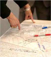
18 Initial Kickoff Meeting The first step of the project was to meet with local stakeholders including local residents, local business owners, and other interested parties. The purpose of this meeting was to review and prioritize project goals and identify opportunity areas and constraints. The presentation from the meeting, meeting notes, and the map based activity are included in the appendix. The map-based activity proved particularly useful in identifying issues along the corridor. The figure below shows a sample of feedback from the map-based activity. FIGURE 11 MAP-BASED ACTIVITY SAMPLE Some of the strengths and issues along the corridor that were identified include: Strengths Services like Post Office, Dunkin Donuts, banks, convenience stores Road is pretty mostly with trees Bike/multi-use path gets used Sidewalks leading to corridor Private easements for sidewalks Mixed use is a plus with small shops and residential Access to Hyannis Local businesses Issues Speeding vehicles and motorcycles as threat to pedestrians Left turns Signals are not coordinated and to not react to traffic 4 lanes to 2 lanes to 4 lanes Lack of safe pedestrian crossing and connections to the mall area Speeding vehicles and motorcycles as threat to pedestrians Traffic enforcement Interconnect not possible between Centerville Shopping Center and Bell Tower Mall Pedestrians in the road Page 12 Barnstable Route 28 Old Stage Road to Bearses Way 2016
19 Focused Listening Sessions Commission staff facilitated a targeted listening session with local landowners and other stakeholders to gather comments and provide feedback on potential solutions for the issues identified in the kickoff meeting. Following the public meetings, and considering all public comments received, staff developed a set of potential improvement alternatives that are discussed later in this report. List of Potential Alternatives from Public Input 1. Old Stage Road Intersection Retiming Addition of LTR Lanes (Particularly SB Leg ) 2. Centerville 4 Lane Segment Median/ Boulevard Left Turn Pockets Center Turn Lane New Signal 3. Phinneys Lane Intersection Retiming Realignment Roundabout 4. West Main St Intersection LT lanes WB 5. Strawberry Hill intersection LT signal phase Ped phase Regrade and realignment 6. Barnstable Intermediate School Entrance/ High School Back Entrance Signal 7. Lincoln Road Turn Lane Signal Roundabout 8. Pitchers Way Intersection Retiming Addition of LT Phase 9. Other Ideas Multi-Use Signage and Maintenance Abandoned Gas Station options o Bus Turnout o Landscaping Access Management Back Access to Strip Malls Sidewalk Connectivity Southside Drainage More Pedestrian Crossings North side Sidewalk on East end Bus Stop at Pitchers Intersection Bus Stop Pullouts Consideration of Comments Commission staff reviewed comments made during the public meetings, from the online Barnstable iforum, and via . These comments helped to inform the development of alternatives. Alternative Development and Review Commission staff met with Town staff to review the potential alternatives for consideration and prioritize the alternatives for further review. Further discussion of alternatives is presented in the following section of the report. Barnstable Route 28 Old Stage Road to Bearses Way P age
20 Alternatives Development The following study goals were used in selecting alternatives for further evaluation: Improve safety Reduce congestion Improve accommodation of all users The alternatives discussed in this section are summarized in the following table. Each option was characterized by time frame (short-, mid-, or long-term); cost (low, medium, high); and magnitude (low, medium, high) of expected benefit to each of three priority areas: safety, congestion, and bicycling/pedestrian needs. It is important to note that the assessments of benefits are developed as an overall comparative measure. While there are not preferred alternatives selected for the study area locations, the expected benefits and potential costs can assist decision-makers in selecting projects for implementation. Page 14 Barnstable Route 28 Old Stage Road to Bearses Way 2016

21 TABLE 3 - SUMMARY OF IMPROVEMENT OPTIONS Barnstable Route 28 Old Stage Road to Bearses Way P age

22 LOCATION 1: OLD STAGE ROAD INTERSECTION This signalized intersection (shown in the following figure) consists of a variety of approach lane characteristics: Route 28 (east leg): left turn lane, through lane, through/right turn lane; two receiving lanes for outbound traffic. Includes a pedestrian push button/signal head and crosswalk with faded pavement markings. A sidewalk is available on the north side, a shared-use path is available on the south side. Route 28 (west leg): left turn lane, through lane, through/right turn lane; two receiving lanes for outbound traffic. Old Stage Road (north leg): left turn lane, through lane with right-turn slip lane & island; narrow landscaped median; wide receiving lane for outbound traffic (can accommodate two cars side-by-side). Includes a pedestrian push button/signal head and crosswalk with faded pavement markings. Old Stage Road (south leg): through/left turn lane, right/through lane; median island; single receiving lane for outbound traffic. Includes a pedestrian push button/signal head and crosswalk with faded pavement markings. A sidewalk is available on the east side. FIGURE 12 - ROUTE 28 AT OLD STAGE ROAD (AERIAL VIEW) Page 16 Barnstable Route 28 Old Stage Road to Bearses Way 2016
23 Options Possible improvements at this location are listed as follows: Option 1A (short-term): Signal Retiming This is a low-cost option that can be expected to provide low-medium congestion benefits and low safety benefits. By optimizing the signal timing and phasing the intersection will operate more efficiently and the reduced delay should minimize driver frustration. Option 1B (medium-term): ADA Pedestrian Accommodation Upgrades This option addresses the need to accommodate users in conformance with the Americans with Disabilities Act (ADA). Upgrades include crosswalk installations/modifications to accommodate wheelchairs and low-vision users. The implementation cost of this option is in the low-medium range and is expected to have low safety and bicycle/pedestrian benefits. Option 1C (long-term): Expand Old Stage Road Southbound Approach to Three Full Lanes As a medium-high cost option, the expansion of the southbound approach from the current two-lane configuration to three lanes (allowing for dedicated left-turn, through-, and right-turn lanes) is expected to provide low safety benefits and low-medium congestion benefits. Barnstable Route 28 Old Stage Road to Bearses Way P age


24 LOCATION 2: CENTERVILLE FOUR-LANE SEGMENT From Old Stage Road to Phinneys Lane, Route 28 in Centerville consists of two travel lanes in each direction within an available right-of-way of 80 feet of width. A narrow sidewalk exists on the north side, often directly adjacent to the traveled way and protected by granite curbing. On the south side there is a substandard bike path approximately 8 feet wide that functions as a wide sidewalk. There are numerous curbcuts and commercial sites on both sides of the road, including two major shopping centers on the north side of Route 28 and a variety of commercial businesses on the south side. Detailed concept plans for this segment of Route 28 are available in the appendix. FIGURE 13 - AERIAL VIEW - ROUTE 28 CENTERVILLE FOUR-LANE SEGMENT - EXISTING CONDITIONS FIGURE 14 - ROUTE 28 CENTERVILLE FOUR-LANE SEGMENT CROSS-SECTION - EXISTING CONDITIONS Mainline traffic waiting to turn left into one of the commercial sites often must wait for a gap in the oncoming traffic, thus blocking other through vehicles and generating queues. To a lesser extent, queueing also occurs due to waiting for right-turning vehicles. For vehicles exiting one of the many site drives and wishing to turn left onto Route 28, these motorists are often faced with the irregular behavior of Route 28 motorists, some of which, but not all, may stop to allow traffic to exit the driveway. When this happens the site traffic noses out into the first (right) lane of Route 28 and then must wait for a Page 18 Barnstable Route 28 Old Stage Road to Bearses Way 2016
25 patient second (left) lane motorist willing to stop and let the motorist proceed. Once this portion of the maneuver is completed the site motorist must still find a gap in traffic to merge to complete the left turn. All of these difficulties that are characteristic of undivided four-lane roadways (and other concerns such as the potential head-on collisions) have led to strategies and policies that fall under the Safety goal of the Cape Cod Regional Transportation Plan (RTP): RTP Safety Policy: For proposed roadways with cross-sections of four or more lanes, landscaped median dividers shall be included to provide a reasonable level of safety and access management. RTP Safety Strategy: Existing multilane roads (cross-sections of four or more lanes) are recommended to be modified via removal of unneeded lanes or installation of landscaped median dividers to provide a reasonable level of safety and access management. Options Possible improvements at this location are listed as follows: Barnstable Route 28 Old Stage Road to Bearses Way P age


26 Option 2A (long-term): Four-Lane, Median, Within Existing Right-Of-Way FIGURE 15 - AERIAL VIEW ROUTE 28 CENTERVILLE CROSS-SECTION OPTION 2A FIGURE 16 - ROUTE 28 CENTERVILLE CROSS-SECTION - OPTION 2A In this option, the roadway within the available right-of-way would be reconfigured to include a six foot landscaped uninterrupted median. An additional change would be to relocate the utilities along roadway on the south side of Route 28 to the southern edge of the right-of-way. This option is estimated to have high cost and provide high safety and congestion benefits and medium-high bicycle/pedestrian benefits. Page 20 Barnstable Route 28 Old Stage Road to Bearses Way 2016


27 Option 2B (long-term): Four Lane, Median w/turn Pockets, Within Existing Right- Of-Way FIGURE 17 - AERIAL VIEW ROUTE 28 CENTERVILLE CROSS-SECTION OPTION 2B FIGURE 18 - ROUTE 28 CENTERVILLE CROSS-SECTION - OPTION 2B This option includes an eleven foot landscaped median with left turn pockets located at high-volume driveways. The south side bike path would be adjacent to the traveled way and the utilities would be relocated to the southern edge of the right-of-way. This option is estimated to have high cost and provide high safety and bicycle/pedestrian benefits and medium-high congestion benefits. Barnstable Route 28 Old Stage Road to Bearses Way P age
.")

28 Option 2C: Five-Lane, Undivided (Two Eastbound Lanes, Two Westbound Lanes, a Two-Way Left Turn Lane, Within Existing Right-Of-Way FIGURE 19 - AERIAL VIEW ROUTE 28 CENTERVILLE CROSS-SECTION OPTION 2C FIGURE 20 - ROUTE 28 CENTERVILLE CROSS-SECTION - OPTION 2C Using nearly the entire right-of-way, this high-cost option includes an eleven-foot wide two-way left turn lane (TWLTL). The south side bike path would be adjacent to the traveled way and the utilities would be relocated to the southern edge of the right-ofway. Due to safety concerns associated with a five-lane TWLTL, this option is not recommended for further consideration. Expansion of this roadway is inconsistent with the Regional Transportation Policy: For proposed roadways with cross-sections of four or more lanes, landscaped median dividers shall be included to provide a reasonable level of safety and access management. A roadway expansion such as identified in this alternative would not be eligible for federal or state funding. Page 22 Barnstable Route 28 Old Stage Road to Bearses Way 2016


29 Option 2D (long-term): Four-Lane, Median w/turn Pockets, Expanded Right-Of-Way FIGURE 21 - AERIAL VIEW ROUTE 28 CENTERVILLE CROSS-SECTION OPTION 2D FIGURE 22 - ROUTE 28 CENTERVILLE CROSS-SECTION - OPTION 2D By acquiring an additional fifteen feet of right-of-way, this option includes an eleven-foot landscaped median with turning lanes at high-volume driveways. There would be landscaped buffers adjacent to both sides of the road and the utilities would be relocated to the southern edge of the right-of-way. This option is estimated to have high cost and provide high safety benefits and medium-high congestion and bicycle/pedestrian benefits. Barnstable Route 28 Old Stage Road to Bearses Way P age


30 Option 2E (long-term): Four Lane, Median, Added Traffic Signal, Within Existing Right-Of-Way FIGURE 23 - AERIAL VIEW ROUTE 28 CENTERVILLE CROSS-SECTION OPTION 2E FIGURE 24 - ROUTE 28 CENTERVILLE CROSS-SECTION - OPTION 2E Identical in typical cross section to Option 2A, the roadway within the available right-ofway would be reconfigured to include a six foot landscaped median. Utilities along the roadway on the south side of Route 28 would be relocated to the southern edge of the right-of-way. This option differs from Option 2A by including a median-break in the vicinity of the major shopping center near the mid-point to allow for the installation of a signal-controlled intersection. This option is estimated to have high cost and provide high safety benefits and medium congestion and bicycle/pedestrian benefits. Page 24 Barnstable Route 28 Old Stage Road to Bearses Way 2016


31 Option 2F (long-term): Three-Lane, Undivided (One Eastbound Lane, One Westbound Lane, a Two-Way Left Turn Lane, within Existing Right-Of-Way FIGURE 25 - AERIAL VIEW ROUTE 28 CENTERVILLE CROSS-SECTION OPTION 2F FIGURE 26 - ROUTE 28 CENTERVILLE CROSS-SECTION - OPTION 2F In this option the number of travel lanes is reduced from four to two, and includes an eleven-foot wide two-way left turn lane (TWLTL). The utilities would be relocated to the southern edge of the right-of-way and landscaped buffers would be provided adjacent to both edges of the roadway. This option is estimated to have high cost and provide high safety benefits and medium bicycle/pedestrian benefits. Commission staff is concerned with the vehicle queuing and congestion impacts associated with this option. Barnstable Route 28 Old Stage Road to Bearses Way P age

32 LOCATION 3: PHINNEY S LANE INTERSECTION This signalized intersection (shown in the following figure) consists of a variety of approach lane characteristics: Route 28 (east leg): left turn lane and two through lanes. From the right through lane there is a dedicated right turn slip lane approximately fifty feet in advance of the traffic signal. There are two outbound receiving lanes. A substandard multiuse path is provided along the south side of Route 28. Route 28 (west leg): left turn lane and two through lanes. From the right through lane there is a dedicated right turn slip lane approximately sixty feet in advance of the traffic signal. There are two outbound receiving lanes. This section of Route 28 includes a substandard multi-use path provided along the south side of Route 28 and a push button activated pedestrian crossing connecting to a narrow sidewalk that has been installed along the north side of Route 28. Phinneys Lane (north leg): left turn lane, through/right turn lane. There is one receiving lane for outbound traffic. Phinneys Lane (south leg): left turn lane, through/right turn lane. This approach includes a push-button activated pedestrian crossing to serve the substandard multi-use path. There is one receiving lane for outbound traffic. FIGURE 27 - ROUTE 28 AT PHINNEYS LANE (AERIAL VIEW) Page 26 Barnstable Route 28 Old Stage Road to Bearses Way 2016
33 The acute approach angles (approximately 30 ) of both legs of Phinneys Lane create safety and operations problems at this intersection. For example, motorists on Phinneys Lane attempting to make a right turn onto Route 28 are forced to turn to look over their left shoulder before pulling out into traffic and have great difficulty in also monitoring the actions of vehicles immediately in front of them. For Phinneys Lane motorists turning left, there is a large amount of pavement to traverse to reach the correct lane, this lengthy maneuver degrades the ability of the intersection to process vehicles efficiently. Options Possible improvements at this location are listed as follows: Option 3A (short-term): Signal Retiming This is a low-cost option that can be expected to provide low-medium congestion benefits and low safety benefits. By optimizing the signal timing and phasing the intersection will operate more efficiently and the reduced delay should minimize driver frustration. Option 3B (medium-term): ADA Pedestrian Accommodation Upgrades This option addresses the need to accommodate users in conformance with ADA requirements. Upgrades include crosswalk installations/modifications to accommodate wheelchairs and low-vision users. The implementation cost of this option is in the lowmedium range and is expected to have low safety and bicycle/pedestrian benefits. Option 3C (long-term): Intersection Realignment This option would address the difficulties experienced by motorists turning into or out of the minor street approaches by improving the alignment of the minor-street approaches. This high-cost option may require an extensive right-of-way acquisition in order to provide safe approach angles. It is expected to have high safety benefits and medium safety and bicycle/pedestrian benefits. Option 3D (long-term): Conversion to Modern Roundabout The well-documented safety and traffic flow benefits of modern roundabouts could be achieved at this location by realigning the roadway approaches and construction of a circulating roadway with pedestrian refuge islands on each approach. The lower design speeds of roundabouts would have a speed-calming effect both upstream and downstream from the facility. This high-cost option would require substantial right-ofway acquisition and is expected to result in high safety benefits, medium bicycle/pedestrian benefits, and possible congestion benefits. Barnstable Route 28 Old Stage Road to Bearses Way P age

34 LOCATION 4: WEST MAIN STREET INTERSECTION This signalized intersection includes the following characteristics: Route 28 (east leg): left turn/through lane, through lane. There is one receiving lane for outbound traffic and a multi-use path along the south side of the roadway. Route 28 (west leg): through lane, right turn slip lane approximately 100 feet in advance of the intersection. There are two outbound receiving lanes and a substandard multi-use path along the south side of the roadway. West Main Street (south leg): left turn lane, left turn/right turn lane. There is one receiving lane for outbound traffic and a pedestrian crosswalk connecting the substandard multi-use path. There are sidewalks along both sides of the road. FIGURE 28 - ROUTE 28 AT WEST MAIN STREET (AERIAL VIEW) The general alignment of West Main Street is approximately at a thirty degree angle allowing for the right turn slip lane from the west leg of Route 28 to operate at higher speeds creating potential conflicts at the merge with left-turning vehicles from the east leg of Route 28. The connection of West Main Street s southwestern sidewalk to Route 28 s south side multi-use path is near roadway grade leading to an accumulation of sand and road debris. Page 28 Barnstable Route 28 Old Stage Road to Bearses Way 2016
35 Options Possible improvements at this location are listed as follows: Option 4A (medium-term): ADA Pedestrian Accommodation Upgrades This option addresses the need to accommodate users in conformance with ADA requirements. Upgrades include crosswalk installations/modifications to accommodate wheelchairs and low-vision users. The implementation cost of this option is in the medium range due to the need for additional signal equipment and is expected to have low safety and bicycle/pedestrian benefits. Option 4B (medium-term): Designate Route 28 Westbound Lane for Left-Turn Use Only Currently westbound Route 28 as it approaches the West Main Street intersection consists of a right-side through lane and a left-side lane used for left-turning and through traffic. This option would prohibit the through movement from the left lane by pavement markings and signage. This low-cost option is expected to have low-medium safety benefits. Further investigation would be required to determine the impacts that this option would have on intersection operations. Barnstable Route 28 Old Stage Road to Bearses Way P age

36 LOCATION 5: STRAWBERRY HILL INTERSECTION This signalized intersection includes the following characteristics: Route 28 (east leg): left turn lane, through/right turn lane; with one receiving lane for outbound traffic. There is a pedestrian crosswalk and a substandard multi-use path along the south side of the roadway. A short segment of sidewalk is available along the north-side of Route 28 within the frontage of the CVS pharmacy. Route 28 (west leg): left turn lane, through/right turn lane; with one receiving lane for outbound traffic. There is a substandard multi-use path along the south side of the roadway. Strawberry Hill Road (north leg): left turn lane, through/right turn lane; with one receiving lane for outbound traffic. There is a sidewalk with landscaped buffer along the east side of the roadway. Strawberry Hill Road (south leg): single lane for all movements and one receiving lane for outbound traffic. There is a pedestrian crosswalk connecting the substandard multi-use path. FIGURE 29 - ROUTE 28 AT STRAWBERRY HILL ROAD (AERIAL VIEW) Page 30 Barnstable Route 28 Old Stage Road to Bearses Way 2016
37 Strawberry Hill Road from the north descends on a downgrade to Route 28; conversely, the southern leg approaches the intersection on an upgrade. This creates a rollercoaster effect for Strawberry Hill Road through traffic and affects safe stopping distance for southbound motorists and acceleration times for northbound vehicles waiting at red signals. A Roadway Safety Audit was completed in the spring of 2015 and is included in the appendix. The audit identified six Safety Issue areas including potential enhancements: Roadway Safety Audit Safety Issue #1: Traffic Control Potential Enhancements: Evaluate speeding enforcement along the Route 28 corridor and at Strawberry Hill Road. Consider signal coordination between the study area intersection and the Route 28 intersections with West Main Street, the Senior Center Driveway, and Pitchers Way to help manage traffic flows throughout the corridor. Evaluate the existing signal timings, specifically the clearance intervals, and propose new timing plans catered to time of day and/or time of year. Check the functionality of signal detection on Route 28 and either repair as needed and/or consider dilemma zone detection for the intersection. Consider installation of left-turn signal arrows and protected left-turn phasing to minimize angle collisions at the intersection. Consider the implementation of a traffic circle at the intersection of Strawberry Hill Road and Wequaquet Lane, north of the Route 28 intersection to slow the southbound approach speeds. Install backplates with reflective borders for overhead signals to minimize the effects of solar glare. Install advance warning signage on all approaches. Consider incorporating emergency preemption to improve emergency response and decrease crash risks. Roadway Safety Audit Safety Issue #2: Traffic Operations Potential Enhancements: Evaluate re-grading at the Strawberry Hill Road southbound approach of the intersection, in the area of the Route 28 gutter line, to improve operations. Barnstable Route 28 Old Stage Road to Bearses Way P age
38 Consider extending the storage length of the left turn lane at the westbound approach of the intersection to avoid excessive queueing. Consider the implementation of a right-turn lane at the westbound approach of the intersection to improve traffic operations. Consider the implementation of a left-turn lane at the northbound approach of the intersection to improve traffic operations. Roadway Safety Audit Safety Issue #3: Intersection Alignment/Visibility Potential Enhancements: Evaluate lane and/or roadway alignment for both Strawberry Hill Road approaches of the intersection to improve sight distance and reduce the risk of head-on collisions. Install an Intersection Ahead (or Signal Ahead) warning sign on the southbound approach, prior to the horizontal curve. Consider trimming the vegetation within the roadway right-of-way on the Strawberry Hill Road northbound approach to improve visibility. Evaluate the feasibility of obtaining easements for vegetation trimming on private property along the northbound approach of the intersection to improve visibility. Evaluate existing right-of-way restrictions and proposed widening improvements where feasible to create a consistent cross section along Strawberry Hill Road, specifically the northbound approach of the intersection. Roadway Safety Audit Safety Issue #4: Pedestrian and Bicycle Accommodations Potential Enhancements: Evaluate ramps for compliance with ADA standards. Install pedestrian signals and push button actuation at the signalized intersection. Evaluate the installation of crosswalks on the southbound and eastbound legs of the intersection. Construct sidewalks adjacent to the intersection to help guide pedestrians around the traffic signal and provide improved access to the church located in the northwestern quadrant of the intersection. Consider improvements of the mixed use path at the southeast corner of the intersection on Route 28. Evaluate crosswalk signage and pavement markings to ensure that they are visible. Page 32 Barnstable Route 28 Old Stage Road to Bearses Way 2016
39 Evaluate STOP sign height on southwest side of the mixed use path. Evaluate lighting along the mixed use path to provide additional safety for pedestrians and cyclists. Roadway Safety Audit Safety Issue #5: Roadway Conditions Potential Enhancements: Evaluate existing pavement markings and consider re-striping the approaches from Strawberry Hill Road to ensure visibility. Repair or replace the damaged curbing on the northwest corner of the intersection. Encourage coordination between Barnstable Department of Public Works and MassDOT for snow plowing activities at the intersection. Roadway Safety Audit Safety Issue #6: Access Management Potential Enhancements: Implement a structural barrier on Route 28 and/or a raised driveway island at the CVS driveway access onto Route 28 to prevent left turn movements. Encourage the use of shared driveways and/or internal driveways along the Route 28 corridor to reduce amount of access point that could cause potential crashes. Options Improvements at this location are listed as follows: Option 5A (MassDOT project funded for FY2016): Signal Equipment and Phasing Upgrades, Improved Pavement Markings, ADA Pedestrian Accommodation Upgrades This project, currently approved for funding in Federal Fiscal Year 2016, includes improvements to traffic signal operations that are expected to result in medium safety benefits and low-median congestion benefits. Crosswalk and other enhancements are expected to result in high bicycle/pedestrian benefits. Option 5B (long-term): Intersection re-grading and realignment Barnstable Route 28 Old Stage Road to Bearses Way P age


40 This option would address the difficulties experienced by motorists turning into or out of Strawberry Hill Road by properly aligning the approaching traffic and adjusting the grade of the approaches. This high-cost option may require an extensive work zone in order to accommodate safe slopes of approach and along the sides of Strawberry Hill Road. It is expected to have medium safety benefits and low safety and bicycle/pedestrian benefits. This option is shown in the following graphic: FIGURE 30 - ROUTE 28/STRAWBERRY HILL RD OPTION 5B Page 34 Barnstable Route 28 Old Stage Road to Bearses Way 2016

41 LOCATION 6: BARNSTABLE SENIOR CENTER/INTERMEDIATE SCHOOL ACCESS This intersection is heavily used during school arrival/departure hours and serves as an important facility for residents and visitors accessing the Barnstable Senior Center and Barnstable High School s recreational fields. It provides direct Route 28 access to Barnstable High School (main access from West Main Street) and secondary access for Barnstable Intermediate School. Intermediate School FIGURE 31 - ROUTE 28 AT SENIOR CENTER/INTERMEDIATE SCHOOL ACCESS In 2015 the Commission staff performed extensive data collection at the intersection and adjacent roadway segments. Town of Barnstable staff are currently developing concepts to address safety, traffic congestion, and improved bicycle/pedestrian accommodation. Options Possible improvements at this location are listed as follows: Barnstable Route 28 Old Stage Road to Bearses Way P age
42 Option 6A (medium-term): Install New and Enhance Existing Crosswalks and Sidewalks This medium-cost option involves installation of crosswalks across Route 28 and across the school access drive, and new sidewalk along the school access drive and on the north side of Route 28 between this intersection and adjacent intersections in order to accommodate users from north-side neighborhoods. This option is expected to provide medium safety benefits and high bicycle/pedestrian benefits. Option 6B (long-term): Install Traffic Signal or Modern Roundabout To safely accommodate turning traffic this high-cost option would include installation of a new traffic signal or modern roundabout. High safety and bicycle/pedestrian benefits would be expected as a result of this option. Further analysis is required to quantify congestion benefits. Page 36 Barnstable Route 28 Old Stage Road to Bearses Way 2016

43 LOCATION 7: LINCOLN ROAD INTERSECTION This unsignalized intersection includes the following characteristics: Route 28 (east leg and west leg): one multipurpose lane and one receiving lane for outbound traffic. There is a multi-use path along the south side of the roadway separated by a landscaped buffer. Lincoln Road (south side): one multipurpose lane and one receiving lane for outbound traffic. This approach includes a crosswalk connecting the multi-use path. This approach is stop-sign controlled. Lincoln Road Extension (north side): there are no lane demarcations. Pavement width is sufficient to replicate one multipurpose lane and one receiving lane for outbound traffic. This approach is also stop-sign controlled. FIGURE 32 - ROUTE 28 AT LINCOLN ROAD (AERIAL VIEW) The Town of Barnstable is expected to construct traffic calming devices (including nine speed humps along Lincoln Road and a raised crosswalk across West Main Street). Commission staff look forward to a before-and-after analysis to review the traffic calming s effects on safety and traffic flow both along Lincoln Road and at the intersection with Route 28. Barnstable Route 28 Old Stage Road to Bearses Way P age
44 Options Possible improvements at this location are listed as follows: Option 7A (long-term): Construct Dedicated Left-Turn Lane for Westbound Route 28 Under this high-cost option, Route 28 would be widened to accommodate a left turn lane for westbound traffic. This is expected to provide medium safety benefits and possible congestion benefits. Option 7B (long-term): Install Traffic Signal or Modern Roundabout In order to accommodate vehicles entering from the side street and better control other maneuvers, this option would replace the two-way stop controlled intersection with a traffic signal or roundabout. To mitigate congestion impacts a signal installation would likely require turning lanes. This high-cost option is expected to have high safety benefits and low-medium bicycle/pedestrian benefits, and possible congestion benefits. Page 38 Barnstable Route 28 Old Stage Road to Bearses Way 2016

45 LOCATION 8: PITCHERS WAY INTERSECTION This signalized intersection includes the following characteristics: Route 28 (east and west legs): left turn lane, right turn/through lane and one receiving lane for outbound traffic. There is a multi-use path along the south side of the roadway separated by a landscaped buffer. Pitchers Way (north leg): left/through lane, right turn lane, and one receiving lane for outbound traffic. Pitchers Way (south leg): left/through lane, right turn lane, and one receiving lane for outbound traffic. This approach includes a crosswalk connecting the multi-use path. FIGURE 33 - ROUTE 28 AT PITCHERS WAY (AERIAL VIEW) Options Possible improvements at this location are listed as follows: Barnstable Route 28 Old Stage Road to Bearses Way P age
46 Option 8A (medium-term): Retime Traffic Signal and Include Left-Turn Phase This is a medium-cost option that can be expected to provide low-medium congestion benefits and medium safety benefits. By optimizing the signal timing and phasing the intersection will operate more efficiently and the reduced delay should minimize driver frustration. The addition of a left-turn phase will offer motorists improved safety by providing protected gaps in the traffic stream in order to turn left. Option 8B (medium- to long-term): ADA Pedestrian Accommodation Upgrades Including Route 28 Crosswalk This option addresses the need to accommodate users in conformance with ADA requirements. Upgrades include crosswalk installations/modifications to accommodate wheelchairs and low-vision users, including a new crossing of Route 28. The implementation cost of this option is in the medium-high range due to the need for additional signal equipment, integration of the south-side Route 28 bike path and is expected to have medium-high safety and bicycle/pedestrian benefits. Page 40 Barnstable Route 28 Old Stage Road to Bearses Way 2016
: left turn lane, through lane, and a right turn/through lane with two outbound receiving lanes.")
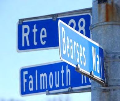
47 LOCATION 9: BEARSES WAY INTERSECTION This signalized intersection includes the following characteristics: Route 28 (east leg): left turn lane, through lane, and a right turn/through lane with two outbound receiving lanes. Route 28 (west legs): left turn lane, through lane, and a right turn/through lane with two outbound receiving lanes. The multi-use path along the south side of Route 28 terminates at the commercial site drive approximately 150 feet in advance of the intersection. Bearses Way (north leg): left turn lane, through lane, right turn lane and one receiving lane for outbound traffic. There is a curbed sidewalk immediately adjacent to the east side of the roadway. Bearses Way (south leg): left turn lane, right/through lane and one receiving lane for outbound traffic. There is a sidewalk separated by a landscaped buffer along the east side of the roadway. FIGURE 34 - ROUTE 28 AT BEARSES WAY (AERIAL VIEW) Barnstable Route 28 Old Stage Road to Bearses Way P age
48 The northwest quadrant is under municipal control (wastewater treatment facility). There a commercial properties situated in the remaining quadrants of the intersection. There are no bicycle/pedestrian accommodations to serve the many destinations to the east (e.g., Cape Cod Mall etc.) and the residential areas accessible from the west via the multi-use path. Options Improvements at this location are listed as follows: Option 9A (MassDOT project funded for FY2015): Intersection Reconstruction with Additional Lanes and Bicycle/Pedestrian Improvements As part of a larger project including the segment of Route 28 to the Cape Cod Mall intersection, this project is approved for funding in Federal Fiscal Year The intersection reconstruction includes enhanced bicycle and pedestrian accommodations, such as shoulders, sidewalks, pedestrian refuge islands, and optimized signal phasing and timing. The project is expected to have high safety, congestion, and bicycle/pedestrian benefits. A graphic detailing some of the improvements is shown in the figure below: FIGURE 35 - ROUTE 28 AT BEARSES WAY MASSDOT PROJECT Page 42 Barnstable Route 28 Old Stage Road to Bearses Way 2016

 side of the figure to the Phinneys Lane the development pattern is primarily commercial in nature.")
49 BICYCLE/PEDESTRIAN CONNECTIVITY The existing conditions of the corridor currently lack the definition with a focus primarily on vehicular movement. Although there is a multi-use path available for pedestrians and cyclists, this path is not connected to other facilities in order to increase the multi modal network in and around Route 28, the Town of Barnstable, or other parts of the Cape. The following figure shows the corridor of Route 28 as a series of nodes between each of the various major intersections. For example, from Old Stage Road on the left (west) side of the figure to the Phinneys Lane the development pattern is primarily commercial in nature. This shifts to a residential pattern from Phinneys Lane to West Main Street. From West Main Street to Pitchers Way we see a mixture of residential and institutional uses and from Pitchers Way to Bearses Way at the right (east) side of the figure there is primarily commercial and office use. The orange-colored bands show the approximate locations of sidewalks along the Route 28 corridor. FIGURE 36 - STUDY AREA DEVELOPMENT NODES AND SIDEWALK LOCATIONS The Route 28 corridor includes the following general patterns of development: Commercial (Old Stage Road to Phinneys Lane): which includes the areas along the Route 28 corridor that give access to the Bell Tower Mall, the Centerville Plaza, the Bayberry Square, and the Post Office Plaza. Residential (Phinneys Lane to West Main Street): which is mainly defined by single-family residential development on both the North and South side of Route 28. Residential/Institutional (West Main Street to Pitchers Way): which also includes highly residential development along the corridor, but that also introduces the Barnstable Intermediate School and connects to the Barnstable High School. Barnstable Route 28 Old Stage Road to Bearses Way P age


50 Commercial/Office (Pitchers Way to Bearses Way): presents single-family residential development, a dense natural buffer along the Route 28 corridor, commercial development at the intersection of Bearses Way, and the office of the Town of Barnstable Public Works Department buildings. Complete Street design promotes enhancements that make road networks safer, more livable, and welcoming to everyone (including bicyclists, public transportation vehicles and riders, pedestrians of all ages and abilities. Living Street design expands upon the Complete Street concept by combining elements of environmental engineering with pedestrian enhancements to create roadways that benefit and enhance the community. An important principle of Living Street design is one of context: more precisely, how the street relates to its surrounding environment. From the previous figure, the characteristics outlined describe the land uses surrounding the Route 28 corridor and the function of that portion of the corridor. The recommended design for these areas does not look to revise or change the existing attributes, but emphasize the differences of the areas, and determine what design principles can best serve the area and the users. These recommendations are shown in the following figure: FIGURE 37 - PROPOSED CONDITIONS FOR DEVELOPMENT NODES AND SIDEWALK/MULTI-USE PATH Many towns on the Cape have made great strides in integrating streets into the public realm. This study looks to further those efforts by giving special care to pedestrian amenities which encourage safe and comfortable walking, biking and social interaction along the roadway. The study recommends the placement of pedestrian scaled lighting at Page 44 Barnstable Route 28 Old Stage Road to Bearses Way 2016
51 gateway intersections, in primary economic zones and at crosswalks, to increase safety and add aesthetic value to the right of way. Joint ventures with local artists toward creating benches and trash receptacles placed at frequent intervals would also serve to improve the pedestrian experience, and could double as public art pieces to add a sense of place to the different nodes of the corridor. One recommendation looks to improve the condition of crosswalks throughout the corridor or installing special pavement treatments to calm traffic and improve roadway appearance. Another idea would be to improve the wayfinding capacities by incorporating a comprehensive directional signage program for the corridor, which would enhance the sense of place of the corridor. Transforming a corridor that was designed to mainly accommodate vehicles into a public amenity for all modes of transportation is a hefty task to accomplish. The expansion of the multi-use path for the corridor lends itself as well to the Shared Use Path Vision Map shown in the following figures. Completion of a shared use path would provide additional options for travel along Route 28, but more importantly, the potential of secondary route connection networks to other existing trails, as well as proposed trails for the region. Barnstable Route 28 Old Stage Road to Bearses Way P age


52 FIGURE 38 - CAPE COD SHARED USE PATH VISION MAP Page 46 Barnstable Route 28 Old Stage Road to Bearses Way 2016


53 The figure below presents the Shared Use Vision Map with the Barnstable area enlarged to show detail: FIGURE 39 - CAPE COD SHARED USE PATH VISION MAP - BARNSTABLE AREA Options Possible improvements along the study area corridor are listed as follows: Option 10A (ongoing): Multi-use path maintenance/rehabilitation This low/medium-cost option includes the rehabilitation of the paved surface of the multi-use path and ongoing maintenance (e.g., debris removal and tree-trimming). This option is expected to provide low-medium safety and bicycle/pedestrian benefits. Barnstable Route 28 Old Stage Road to Bearses Way P age
54 Option 10B (medium-term): Multi-use path signage and wayfinding By providing wayfinding features and routing and safety-related signage along the shared use path, this low/medium-cost option is expected to provide low-medium safety and bicycle/pedestrian benefits. Option 10C (medium-term): Address gaps in sidewalks Under this medium/high-cost option, new sidewalk facilities would be constructed to connect to existing sections of sidewalks. Medium/high benefits are expected for safety and bicycle/pedestrian issue areas. Option 10D (long-term): Improve/increase north-south pedestrian crossings Under this medium/high cost option, new cross walks would be installed at strategic intersections and mid-block locations to facility movements across Route 28. This option is expected to provide high safety and bicycle/pedestrian benefits. Option 10E (long-term): Add north side sidewalk where appropriate This high-cost option involves construction of a new sidewalk along the north side of Route 28 for much of the study area corridor. Some segments may be exempt (e.g., the frontage of the wastewater treatment plant). This option is expected to provide medium/high safety and bicycle/pedestrian benefits. Page 48 Barnstable Route 28 Old Stage Road to Bearses Way 2016
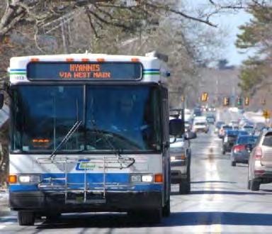
55 TRANSIT ENHANCEMENTS The Cape Cod Regional Transit Authority (CCRTA) buses that travel through the Route 28 corridor employ a flag-down approach to their operation to supplement designated stops along the route. The Sealine service travels between Falmouth and the Hyannis Transportation Center generally on Route 28. There is a diversion to Osterville and historic Centerville village to the west of the study area corridor. The route rejoins Route 28 via Old Stage Road. The only scheduled/designated bus stop within the study area corridor is at the intersection of Route 28/West Main Street. This study recommends additional dedicated bus stops to accommodate transit users along the corridor. These bus stops may be designated with a simple sign and bench or more elaborate public art piece, to lessen rider confusion and create a sense of place. One alternative, as depicted by the following figure, is to provide bus turnouts which incorporate a bus shelter. This configuration would increase safety measures throughout the corridor by separating the users of the corridor and provide greater visibility of multimodal options. Barnstable Route 28 Old Stage Road to Bearses Way P age
: Review/revise bus stop locations This low-cost option involves reviewing the adequacy of existing bus")
56 FIGURE 40 - POTENTIAL BUS TURNOUT DESIGN DEISPLAYING A BUS SHELTER AND ADDITIONAL PEDESTRIAN AMENITIES. Options Possible improvements at this location are listed as follows: Option 10F (short-term): Review/revise bus stop locations This low-cost option involves reviewing the adequacy of existing bus stop locations and identifying new or revised locations to improve the customer experience and transit system efficiency. Expected medium safety and bicycle/pedestrian benefits would be provided by this option. Option 10G (medium-term): Bus shelters Page 50 Barnstable Route 28 Old Stage Road to Bearses Way 2016
57 Construction of new bus shelters as part of this medium-cost option is expected to provide low safety and bicycle/pedestrian benefits. Option 10H (long-term): Bus turnouts Selective widening of Route 28 to provide space for bus turnouts is a high-cost option that is expected to provide medium safety and bicycle benefits and low/medium congestion benefits. Barnstable Route 28 Old Stage Road to Bearses Way P age
58 LANDSCAPING The landscape recommendations focus less on functionality and more on the form and structure of the corridor. The landscape elements look to enhance and enforce the site s functions while building a natural character that could potentially describe the variations in identity between the different areas and types of landscape on the Cape. Put simply, the landscape character is what makes a site unique. It is defined as a distinct, recognizable and consistent pattern of elements throughout the corridor that define and enhance the user s experience. The study also recommends the implementation of a landscape design that incorporates local plant material, non-invasive materials, and environmentally friendly design that emphasizes on the Cape s unique landscape heritage. This study looks to present the following plan for the Commercial Node area as a first step of possible landscape revitalization efforts. Page 52 Barnstable Route 28 Old Stage Road to Bearses Way 2016
59 FIGURE 41 TREE REMOVAL AND LANDSCAPE RESTORATION PLAN EXAMPLE FOR THE COMMERCIAL NODE OF THE ROUTE 28 CORRIDOR. Barnstable Route 28 Old Stage Road to Bearses Way P age
60 Possible improvements at this location are listed as follows: Option 10I (medium-term): Corridor-wide landscaping upgrades This medium/high cost option includes improved landscaped buffers and plantings within existing vegetated spaces, thus increasing the on-site processing of stormwater as well as better defining the separation of non-motorized users from motor vehicles. This option is expected to provide low safety and bicycle/pedestrian benefits. Page 54 Barnstable Route 28 Old Stage Road to Bearses Way 2016
61 STORMWATER MANAGEMENT The goals of stormwater management are 1) To remove water from the roadway surface (thereby reducing hazards such as hydroplaning) and 2) To provide treatment to eliminate untreated stormwater discharging directly to groundwater and surface water sources. Inherent in this goal is the proper management and use of available green space both within and without of the available right-of-way in the Study Area. Staff recommends that MassDOT encourage the use of easements from public and private entities to accommodate the location, construction and maintenance of stormwater infrastructure where limited state road right-of-way would prohibit or complicate Best Management Practices (BMP) siting, construction or maintenance. To ensure proper treatment, staff has identified the contaminants of concern for the Study Area, estimated Water Quality Volume, required land area and the BMPs best suited to capture and treat target contaminants. BEST MANAGEMENT PRACTICES (BMPS) Bioretention Bioretention is a method of treating stormwater by ponding water in shallow depressions underlain by a sandy engineered soil media through which most of the runoff passes. Bioretention systems can easily be incorporated into the landscape to address and maintain many of the natural hydrologic functions. Pollutants within these systems are removed through both chemical and physical means within the bioretention soil mix (BSM). Bioretention systems also encourage biological treatment of nutrients, such as nitrogen, through nutrient uptake by vegetation within the system. Bioretention tends to work best in sandy soils such as are present in many areas of Cape Cod. Bioretention systems achieve excellent removal efficiencies for a wide range of pollutants including Total Suspended Solids (TSS), petroleum hydrocarbons, nitrogen, metals, phosphorus and bacteria. Barnstable Route 28 Old Stage Road to Bearses Way P age

62 FIGURE 42 - CROSS SECTION OF A COMMON BIORETENTION SYSTEM Leaching Catch Basins A leaching catch basin is similar to a traditional catch basin with the added ability to permit the infiltration of captured runoff. Leaching basins are often installed in series with a deep sump catch basin that providing. Because of this pretreatment, the catch basin/leaching basin combination is preferable to the leaching catch basin as a higher removal of TSS may be achieved while also extending the life and minimizing maintenance on the leaching catch basin. Leaching catch basins and leaching basins should only be used in areas with highly permeable soils, making these basins a popular stormwater control throughout the Cape. Leaching catch basins, in series with pre-treatment catch basins, achieve excellent TSS removal in addition to constituents that sorb to fine particulates including petroleum hydrocarbons and metals. Sub-Surface Sediment Chambers Sub-surface sediment chambers function similarly to surface sedimentation systems. Sediment trapping systems remove pollutants (mainly particulates) from stormwater runoff through a pretreatment sedimentation area followed by an infiltration bed containing filter media (typically sand, soil, gravel or a combination of media). This infiltration bed removes fines and the pollutants adsorbed, or attached, to these particulates. Various contaminants including, but not limited to metals, petroleum Page 56 Barnstable Route 28 Old Stage Road to Bearses Way 2016

63 hydrocarbons and bacteria may sorb to fines allowing infiltration systems to achieve removal efficiencies in these categories though the physical process of filtration. Sub-surface sediment chambers traditionally discharge directly to groundwater however systems can be designed with an outflow mechanism returning treated flow to a stormwater conveyance system. FIGURE 43 - HDPE SUB-SURFACE TREATMENT CHAMBERS Options Possible improvements at this location are listed as follows: Option 10J (long-term): Stormwater management upgrades Under this medium/high cost option, new roadside features would be installed to manage stormwater impacts including vegetated swales and infiltration systems. Low safety and bicycle/pedestrian benefits would be expected from this option. More detailed descriptions of proposed stormwater improvements are available in the appendix. Barnstable Route 28 Old Stage Road to Bearses Way P age
64 OTHER POTENTIAL IMPROVEMENTS PEDESTRIAN AMENITIES- LIGHTING, CROSSWALKS, STREET FURNITURE Special care was taken throughout the planning study to consider pedestrian amenities which encourage safe and comfortable walking, biking and social interaction along the roadway. The study recommends the placement of pedestrian scaled lighting at gateway intersections, in primary economic zones and at crosswalks, to increase safety and add aesthetic value to the right of way. Benches and trash receptacles placed at frequent intervals would also serve to improve the pedestrian experience, and could double as public art pieces to add a sense of place to the commercial district. It is recommended that crosswalks utilize pavers or stamped concrete over simple striping, to calm traffic and improve roadway appearance. Amenities such as lighting and street furniture fall outside the purview of typical MassDOT road improvements. The town may wish to consider funding such improvements with Chapter 90 funds or MassWorks grants. ACCESS MANAGEMENT In accordance with earlier planning studies of this roadway, this report recommends that the town work to consolidate curb cuts in order to improve traffic flow on Route 28 and coordinate efforts of future layout alterations with an access management protocol. This work could include an assessment of individual curb cuts, permit search and determination of non-conforming lots according to MassDOT standards. This can result in a formally endorsed access management plan. Option 10K (ongoing): Access management As opportunities arise through property redevelopment and roadway upgrades, this option includes reduction of widths and total numbers of curb cuts, shared access, and other access management techniques that would be expected to provide high safety, congestion, and bicycle/pedestrian benefits. Page 58 Barnstable Route 28 Old Stage Road to Bearses Way 2016
65 Summary of Alternatives A host of potential enhancements were identified in the previous sections of this report. The following table presents the relative time frame and cost, and expected benefit in terms of safety, congestion, and for bicycle and pedestrian accommodation. CONCLUSION & INTERIM STEPS This report lays out a host of potential improvement along the Route 28 corridor. As these potential enhancements are advanced, further analysis will be required. Many of the improvements require many years to implement given the design, permitting, and funding hurdles they face. While medium-term and long-term improvements detailed in the following table are taken under consideration, interim steps to make improvements in the area could be pursued. Along with the short-term improvements identified in the following table, the actions outlined below could prove beneficial to visitors and residents alike: Repainting of existing crosswalks with additional signage as appropriate. Continue working with abutting properties on access management. Locating CCRTA bus stops, shelters, and bicycle racks in key locations as recommended. Implementing ADA ramps at problematic locations. Continue working with local garden clubs and landscaping companies to sponsor landscaping improvements and/or seasonal displays. Barnstable Route 28 Old Stage Road to Bearses Way P age

66 TABLE 4 - SUMMARY OF IMPROVEMENT OPTIONS Page 60 Barnstable Route 28 Old Stage Road to Bearses Way 2016
67 Appendix A - Existing Conditions Map Barnstable Route 28 Old Stage Road to Bearses Way 2016
68 Barnstable Route 28 Old Stage Road to Bearses Way 2016
69 Cross Section Total: 60-70ft Available ROW: 80ft Facing East 6' Sidewalk 11' Vehicle Lane 11' Vehicle Lane 11' Vehicle Lane 11' Vehicle Lane 8' Utility 6' Sidewalk Barnstable Route 28 Corridor Study: Old Stage Road to Phinney's Lane Four-Lane Reconfiguration- Existing Conditions Existing Conditions: Four Lanes undivided Cape Cod Commission Technical Services Staff Draft February 2015 NOTE: Not to scale, location of 80 ft ROW approximate, survey would be required for additional precision
70
71 Appendix B - Traffic Count Data Barnstable Route 28 Old Stage Road to Bearses Way 2016
72 Barnstable Route 28 Old Stage Road to Bearses Way 2016
73 Count Volumes Intersection: Rt Lincoln Timing Plan: NA Site Code: 3867 Node #: Count Date: 7/9/2014 TEV 1530 Lincoln Road Rt 28 Lincoln Road Rt 28 From North From East From South From West Time Period Right Thru Left Right Thru Left Right Thru Left Right Thru Left 4:00-5:00 PM PHF Intersection: Rt Pitchers Way Timing Plan: Yes Site Code: 2811 Node #: Count Date: 6/13/2013 TEV 1703 Pitchers Way Rt 28 Pitchers Way Rt 28 From North From East From South From West Time Period Right Thru Left Right Thru Left Right Thru Left Right Thru Left 4:00-5:00 PM PHF Intersection: Rt Strawberry Hill Rd Timing Plan: Yes Site Code: 2829 Node #: Count Date: 6/20/2013 TEV 1677 Strawberry Hill Rd Rt 28 Strawberry Hil Rd Rt 28 From North From East From South From West Time Period Right Thru Left Right Thru Left Right Thru Left Right Thru Left 4:00-5:00 PM PHF
74 Intersection: Rt West Main St Timing Plan: Yes Site Code: 2836 Node #: Count Date: 6/13/2013 TEV 2308 Rt 28 West Main St Rt 28 From North From East From South From West Time Period Right Thru Left Right Thru Left Right Thru Left Right Thru Left 4:00-5:00 PM PHF Intersection: Rt Phinneys Timing Plan: Yes Site Code: 3798 Node #: Count Date: 6/18/2013 TEV 2731 Phinneys Ln Rt 28 Phinneys Ln Rt 28 From North From East From South From West Time Period Right Thru Left Right Thru Left Right Thru Left Right Thru Left 4:00-5:00 PM PHF Intersection: Rt Old Stage Timing Plan: Yes Site Code: 2852 Node #: Count Date: 6/12/2013 TEV 2917 Old Stage Rd Rt 28 Old Stage Rd Rt 28 From North From East From South From West Time Period Right Thru Left Right Thru Left Right Thru Left Right Thru Left 4:00-5:00 PM PHF
75 Appendix C - Crash Diagrams Barnstable Route 28 Old Stage Road to Bearses Way 2016
76 Barnstable Route 28 Old Stage Road to Bearses Way 2016
77 COLLISION DIAGRAM Location: Falmouth Road at Old Stage Road Period: Jan 2011 Jan 2014 Total Crashes: 39 Injury Crashes:_13 Fatal Crashes: 0 EPDO:_91 Collisions located in diagram: _38_ NOT located in diagram (see reverse): _1 Tue 10/2/ DL-C-D Wed 12/19/ DL-C-D Indicate North by arrow 0804 DL-C-W Thu 10/13/ DL-C-D Thu 3/10/2011 Tue 7/3/ DL-C-D Tue 4/17/ DL-C-D Wed 10/31/ DL-C-W Wed 12/25/ L-C-D Wed 1/6/ L-C-W Mon 7/16/ DL-C-D Thu 1/6/ DL-C-D Wed 1/30/ DL-C-D Wed 7/27/2011 Sun 7/24/ L-C-D 1226 DL-C-D Sat 12/17/2013 Fri 11/22/ L-C-D 1830 L-C-W Mon 6/30/ DL-C-D Thu 12/13/ L-C-D Sun 5/12/ L-C-D Tue 4/5/ DL-C-D Wed 10/31/ DL-C-D Fri 8/12/ DL-C-D Tue 1/8/ DL-C-D Wed 5/23/ DL-C-D Fri 4/27/ L-C-W Mon 1/10/ DL-C-D Wed 10/17/ DL-C-D Sat 8/4/ DL-C-D Tue 7/30/ DL-C-D Sun 8/26/ DL-C-D Thu 4/25/ DL-C-D Mon 5/13/ N-C-D Mon 2/7/ DL-C-D Mon 3/2/ DL-C-D Wed 5/11/ DL-C-D Thu 6/9/ L-C-W Name: Route 28/ Falmouth Rd Sat 2/2/ DL-C-D Mon 3/18/ L-C-D Name: Old Stage Road SYMBOLS Moving Vehicle Backing Vehicle Indirectly Involved Vehicle Pedestrian Bike Parked Vehicle Fixed Object Injury Accident Fatal Injury COLLISION TYPE Rear End Head On Out of Control Sideswipe Angle Turning Movement LIGHTING-WEATHER-PAVEMENT Lighting DL Daylight N Dark - No Lights L Dark - Lighted Weather C Clear, Cloudy R Rain F Foggy S Snowy, Icy O Other Pavement D Dry W Wet EXAMPLE WED 1/1/ DL-C-D Rear End collision with injury at 3:02 PM on Wednesday, January 1st, 2012 in the daylight, with clear weather, and dry pavement NOTES: Many crashes are due to running a red light # of Wet Crashes: 6 Prepared on: 6/16/2013 by: Patrick Tierney
78 Crashes with Unknown Location DATE TIME NOTES 1/15/ Two Vehicle, none injured. Fault was failure to yield while turning left
79 COLLISION DIAGRAM Location: Falmouth Road at Centerville Shopping Plaza Period: May 2011 September 2013 Total Crashes: 25 Injury Crashes:11 Fatal Crashes: 0 EPDO:_69 Collisions located in diagram: _25_ NOT located in diagram (see reverse): _0 Indicate North by arrow Mon 6/13/ DL-C-D Sun 8/14/ DL-C-D Wed 6/8/ DL-C-D Fri 9/27/ DL-C-D Thu 3/7/ DL-C-D Name: Centerville Shopping Plaza Wed 3/13/2013 Wed 7/27/ DL-S-W Tue 5/22/ DL-C-D Fri 8/10/ DL-R-W 1721 DL-C-D Tue 10/30/2012 Wed 5/1/ DL-C-D Sat 9/5/ DL-C-D 1438DL-C-D Tue 7/16/ DL-C-D Sat 11/24/ DL-C-D Mon 9/10/ DL-C-D Tue 8/28/ DL-C-D Fri 4/6/ DL-C-D Sun 10/21/ DL-C-D Thu 6/6/2013 Thu 5/25/2011 Tue 10/23/2012 Wed 12/26/ DL-C-D 1523 DL-C-D 1417 DL-C-D 1519 DL-C-D Sun 2/17/ L-S-W Thu 10/17/ DL-C-D Tue 6/28/2011 Name: Route 28/ Falmouth Rd 1612 DL-C-D Name: South Business Lots SYMBOLS Moving Vehicle Backing Vehicle Indirectly Involved Vehicle Pedestrian Bike Parked Vehicle Fixed Object Injury Accident Fatal Injury COLLISION TYPE Rear End Head On Out of Control Sideswipe Angle Turning Movement LIGHTING-WEATHER-PAVEMENT Lighting DL Daylight N Dark - No Lights L Dark - Lighted Weather C Clear, Cloudy R Rain F Foggy S Snowy, Icy O Other Pavement D Dry W Wet EXAMPLE WED 1/1/ DL-C-D Rear End collision with injury at 3:02 PM on Wednesday, January 1st, 2012 in the daylight, with clear weather, and dry pavement NOTES: Many complaints about sun disabling vision # of Wet Crashes: 3 Prepared on: 6/16/2013 by: Patrick Tierney
80 Crashes with Unknown Location DATE TIME NOTES
81 COLLISION DIAGRAM Location: Falmouth Road at Bell Tower Mall Period: April 2011 November 2013 Total Crashes: 21 Injury Crashes:8 Fatal Crashes: 0 EPDO:_53 Collisions located in diagram: _21_ NOT located in diagram (see reverse): _0 Indicate North by arrow Mon 3/19/ DL-C-D Thu 1/20/ DL-C-D Name: Bell Tower Mall Parking Fri 8/10/ DL-C-D Sun 1/9/ DL-C-D Mon 4/25/2011 Thu 12/6/ DL-C-D Tue 11/22/ DL-C-D Friday 6/22/ DL-S-D Wed 5/25/ DL-S-D Wed 3/12/ DL-S-D Sat 1/4/ DL-C-D Fri 4/20/ DL-C-D Sun 7/8/ DL-C-D Fri 10/11/ DL-C-D 1852 DL-C-D Thu 9/8/ DL-R-W WED 9/4/ DL-C-D Fri 10/18/ DL-C-D Thu 3/21/ DL-C-D WED 9/25/ DL-C-D Thu 2/16/ DL-C-D Fri 1/13/ DL-C-D Name: Route 28/ Falmouth Rd Name: Real Estate / Gas Station SYMBOLS Moving Vehicle Backing Vehicle Indirectly Involved Vehicle Pedestrian Bike Parked Vehicle Fixed Object Injury Accident Fatal Injury COLLISION TYPE Rear End Head On Out of Control Sideswipe Angle Turning Movement LIGHTING-WEATHER-PAVEMENT Lighting DL Daylight N Dark - No Lights L Dark - Lighted Weather C Clear, Cloudy R Rain F Foggy S Snowy, Icy O Other Pavement D Dry W Wet EXAMPLE Rear End collision with injury at 3:02 PM on Wednesday, January 1st, 2012 in the daylight, with clear weather, and dry pavement NOTES WED 1/1/ DL-C-D # of Wet Crashes: 1 Prepared on: 6/16/2013 by: Patrick Tierney
82 Crashes with Unknown Location DATE TIME NOTES
83 COLLISION DIAGRAM Location: Falmouth Road at Phinney s Lane Period: Jan 2011 Nov 2013 Total Crashes: 23 Injury Crashes:_10 Fatal Crashes: 0 EPDO:_63 Collisions located in diagram: _23_ NOT located in diagram (see reverse): _0 Thu 6/30/ DL-C-D Indicate North by arrow Wed 11/9/ DL-C-D Tue 11/12/ DL-S-W Thu 8/29/ DL-C-D Mon 10/10/ DL-C-D Sun 11/24/ DL-C-D Wed 9/21/ DL-C-D Tue 12/11/2012 Tue 8/27/2013 Sat 4/16/ L-C-D 1747 DL-C-D 1413 DL-C-D Thu 12/1/2011 Fri 4/22/ DL-C-D 1633 DL-C-D Tue 7/31/ DL-C-D Fri 7/29/ DL-C-D Sat 1/15/ DL-C-D Fri 7/5/ DL-C-D Wed 2/22/ DL-C-D Thu 12/22/ DL-C-D Thu 5/17/ DL-C-D Sat 2/18/ DL-C-D WED 4/18/ DL-C-D Fri 3/15/ DL-C-D Name: Route 28/ Falmouth Rd Fri 9/28/ DL-C-D Name: Phinney s Lane SYMBOLS Moving Vehicle Backing Vehicle Indirectly Involved Vehicle Pedestrian Bike Parked Vehicle Fixed Object Injury Accident Fatal Injury COLLISION TYPE Rear End Head On Out of Control Sideswipe Angle Turning Movement LIGHTING-WEATHER-PAVEMENT Lighting DL Daylight N Dark - No Lights L Dark - Lighted Weather C Clear, Cloudy R Rain F Foggy S Snowy, Icy O Other Pavement D Dry W Wet EXAMPLE WED 1/1/ DL-C-D Rear End collision with injury at 3:02 PM on Wednesday, January 1st, 2012 in the daylight, with clear weather, and dry pavement NOTES: Many crashes are due to running a red light # of Wet Crashes: 1 Prepared on: 6/16/2013 by: Patrick Tierney
84 Crashes with Unknown Location DATE TIME NOTES
85 COLLISION DIAGRAM Location: Route 28 Falmouth Road at Strawberry Hill Road Period: January January 2014 Total Collisions: 18_ Injuries: _6 Fatalities: 0 EPDO: 42 Collisions located in diagram: 17 NOT located in diagram (see reverse): _1 Indicate North by arrow Tue 8/9/ DL-C-D Fri 6/28/ DL-C-W Fri 5/10/ DL-C-D Thu 8/29/2013 Wed 2/8/ DL-C-D Sun 9/30/ L-C-D Fri 6/8/ DL-C-D Fri 7/27/ DL-C-D Thu 1/9/ DL-C-D Wed 6/13/2012 Sat 1/5/ DL-C-W Wed 12/26/ DL-C-D Thu 7/7/ DL-C-D Sat 10/5/ DL-C-D Wed 3/13/ DL-C-D Tue 6/11/ DL-C-D Sat 2/23/ DL-C-D 2159 L-C-D 1813 DL-C-W Wed 3/16/ DL-R-W Name: Falmouth Road Route 28 Name: _Strawberry Hill Road_ SYMBOLS Moving Vehicle Backing Vehicle Indirectly Involved Vehicle Pedestrian Parked Vehicle Fixed Object Injury Accident Fatal Injury COLLISION TYPE Rear End Head On Out of Control Sideswipe Angle Turning Movement LIGHTING-WEATHER- PAVEMENT Lighting DL Daylight N Dark - No Lights L Dark - Lighted Weather C Clear, Cloudy R Rain F Foggy S Snowy, Icy O Other Pavement D Dry W Wet EXAMPLE WED 1/1/ DL-C-D Rear End collision with injury at 3:02 PM on Wednesday, January 1st, 2012 in the daylight, with clear weather, and dry pavement NOTES 4 Wet Crashes Prepared on: 7/8/2014 by: Patrick Tierney
86 Crashes with Unknown Location DATE TIME NOTES 12/10/ :25 Single Vehicle Crashed into a T-pole, None injured, Travel Direction Unknown
87 COLLISION DIAGRAM Location: Falmouth Road at Lincoln Road Period: April 2011 November 2013 Total Crashes: 28 Injury Crashes:9 Fatal Crashes: 0 EPDO:_73 Collisions located in diagram: _27_ NOT located in diagram (see reverse): _1 Indicate North by arrow Name: Lincoln Road Ext Sat 4/9/ DL-C-D Tue 5/22/ DL-C-W Mon 10/24/ L-C-D Sat 12/21/ L-C-D Thu 1/17/ DL-C-D Tue 11/5/ DL-C-D Sun 10/30/ L-C-D Wed 11/9/ L-C-D Sat 1/21/ DL-C-D Thu 5/3/ L-C-D Mon 2/6/2012 Fri 6/10/ DL-C-D Sun 8/9/ DL-C-D Sat 4/23/2011 Thu 4/28/ L-R-W Mon 11/4/ N-S-D Tue 10/16/ DL-S-D Fri 10/5/ DL C-D Tue 11/13/ L-C-W 1833 N-C-D Fri 10/21/ L-C-D Wed 11/21/ DL-C-D 2053 L-R-W Fri 5/17/ DL-C-D WED 4/24/ L-C-D Mon 12/5/ L-F-W WED 12/14/ DL-C-D Name: Route 28/ Falmouth Rd Tue 4/2/ DL-C-D Name: Lincoln Road SYMBOLS Moving Vehicle Backing Vehicle Indirectly Involved Vehicle Pedestrian Bike Parked Vehicle Fixed Object Injury Accident Fatal Injury COLLISION TYPE Rear End Head On Out of Control Sideswipe Angle Turning Movement LIGHTING-WEATHER-PAVEMENT Lighting DL Daylight N Dark - No Lights L Dark - Lighted Weather C Clear, Cloudy R Rain F Foggy S Snowy, Icy O Other Pavement D Dry W Wet EXAMPLE WED 1/1/ DL-C-D Rear End collision with injury at 3:02 PM on Wednesday, January 1st, 2012 in the daylight, with clear weather, and dry pavement NOTES # of Wet Crashes: 5 Prepared on: 6/16/2013 by: Patrick Tierney
88 Crashes with Unknown Location DATE TIME NOTES 5/29/ Three Car Rear End on Route 28, Direction Unknown, Non-Fatal Injuries Occured
: _1 Indicate North by arrow 1229 DL-C-D Sat 5/11/2013 1704 DL-C-D Thu 10/4/2012 Mon 7/22/2013 Sat 1/28/2012 1743 L-C-D Thu 12/22/2011 1529 DL-C-D Tue 12/31/2013 1503 DL-C-D Fri")
89 COLLISION DIAGRAM Location: Falmouth Road at Pitchers Way Period: Jan 2011 Dec 2013 Total Crashes: 29 Injury Crashes:_13 Fatal Crashes: 1 EPDO:_91 Collisions located in diagram: _28_ NOT located in diagram (see reverse): _1 Indicate North by arrow 1229 DL-C-D Sat 5/11/ DL-C-D Thu 10/4/2012 Mon 7/22/2013 Sat 1/28/ L-C-D Thu 12/22/ DL-C-D Tue 12/31/ DL-C-D Fri 4/22/ DL-C-D Mon 11/12/ DL-S-D Thu 6/14/ N-R-W Thu 10/6/ DL-C-D Mon 1/5/ DL-C-D Fri 11/18/ DL-S-D WED 2/18/ L-C-W Sat 2/9/ N-S-W Tue 10/18/ L-C-D Mon 11/06/ DL-C-D Tue 11/8/ DL-C-D Sat 12/17/ N-C-D 1441 DL-C-D Sun 6/30/ DL-C-D Tue 7/26/ DL-C-D Wed 7/13/ DL-C-D Sat 10/29/ DL-R-W Wed 6/8/ DL-C-D Fri 11/25/ L-C-D Sat 8/17/ N-C-D Name: Route 28/ Falmouth Rd Fri 7/5/ DL-C-D Name: Pitchers Way Sun 8/21/ L-C-D Sat 7/5/ DL-C-D SYMBOLS Moving Vehicle Backing Vehicle Indirectly Involved Vehicle Pedestrian Bike Parked Vehicle Fixed Object Injury Accident Fatal Injury COLLISION TYPE Rear End Head On Out of Control Sideswipe Angle Turning Movement LIGHTING-WEATHER-PAVEMENT Lighting DL Daylight N Dark - No Lights L Dark - Lighted Weather C Clear, Cloudy R Rain F Foggy S Snowy, Icy O Other Pavement D Dry W Wet EXAMPLE WED 1/1/ DL-C-D Rear End collision with injury at 3:02 PM on Wednesday, January 1st, 2012 in the daylight, with clear weather, and dry pavement NOTES # of Wet Crashes: 5 Prepared on: 6/16/2013 by: Patrick Tierney
90 Crashes with Unknown Location DATE TIME NOTES 7/26/ ID: , at Pitchers Way Intersection, 4 Vehicles, Property Damage Only
91 Appendix D - Kickoff Meeting Materials and Notes Barnstable Route 28 Old Stage Road to Bearses Way 2016
92 Barnstable Route 28 Old Stage Road to Bearses Way 2016

93 Notes from Route 28 Centerville-Hyannis Corridor Study Community Kickoff Meeting March 17, :00 p.m. - Hearing Room, Barnstable Town Hall Attendees Steven Tupper, Cape Cod Commission Glenn Cannon, Cape Cod Commission Sharon Rooney, Cape Cod Commission Garry Meus, Cape Cod Commission Jo Anne Miller Buntich, Town of Barnstable Roger Parsons, Town of Barnstable Steve Seymour, Town of Barnstable Mike Trovato, Town of Barnstable Timothy Kochan, MassDOT Pamela Haznar, MassDOT Doug Warren Peggy Warren Peter Murray Raymond B. Lang Rick Pisano Ray Tomlinson Jim Walker Antome Seoiless Clay Schofield Eric Steinhilber Shirley Fisher Pete Fisher Jessica Syver Meg Loughran Jim Skinner Ali Maroney Randy Childs Mark H. Boudren Roy Richardson Georgia Shilling Ted Shilling Marcel Rene Poyant Frederick Chirigotis Sue Rohrback Introduction Project team introduced. Agenda reviewed (attached). Presentation on Project Goals and Existing Conditions See attached presentation. Map Visioning Exercise Public comments were recorded on maps of the three segments of the corridor: Segment 1: Old Barnstable Road to Phinneys Lane Segment 2: Phinneys Lane to Old Strawberry Hill Road Segment 3: Old Strawberry Hill Road to Bearses Way See attached maps with comments.
94 Group Discussion Group discussion focused on things people liked about the corridor (strengths), things people disliked (issues), things people would like to see changes (changes), and other ideas. The following is a summary of the comments. Strengths Services like Post Office, Dunkin Donuts, banks, convenience stores Road is pretty mostly with trees Bike/multi-use path gets used Sidewalks leading to corridor Private easements for sidewalks Mixed use is a plus with small shops and residential Access to Hyannis Local businesses Issues Speed!! Left turns Signals are not coordinated and to not react to traffic 4 lanes to 2 lanes to 4 lanes Lack of safe pedestrian crossing and connections to the mall area Speeding vehicles and motorcycles as threat to pedestrians Traffic enforcement Interconnect not possible between plazas (segment 1) Pedestrians in the road Changes Double left off Old Stage Road southbound Coordinate the signals Turning arrows Sidewalks on north side of segment 3 Pedestrian bridge at intersection Better landscaping on private properties along the corridor Bell Tower Drive traffic signal or roundabout Redirect some traffic to other roadways East-West or North-South Interconnect parcels! Zoning change Improve access at CVS and gas stations Speed control Other Ideas Coordination with the state [MassDOT] is critical to avoid pitfalls CVS and gas stations attract significant traffic
95 Closing The group was informed about the next steps in the project which will include a listening session with more focused discussion of each segment. Each attendee who signed in with contact information will be notified of the date, time, and location of the next meeting. Additionally, the meeting announcement will be publicized through various outlets. [Scheduled for May 28, 2014 at 6pm at the Barnstable Senior Center, 825 Falmouth Road (Route 28), Hyannis] For those who could not attend Project materials are available to on the Cape Cod Commission project website at: cts. A video recording of the meeting is available on the Town of Barnstable at Comments can be sent to Steven Tupper at stupper@capecodcommission.org. All of the comments heard during this meeting and received through the project will be taken into consideration in the during the concept development and concept refinement phases of this project.

96 Route 28 Centerville-Hyannis Corridor Study Community Kickoff Meeting Agenda March 17, :00 p.m. - 8:00 p.m. Hearing Room, Barnstable Town Hall 1. Introductions 2. Presentation on Project Goals and Existing Conditions 3. Visioning Exercise - Map Exercise - Group Discussion 4. Next Steps See back side for information on Living Streets To learn more about the project visit: stupper@capecodcommission.org to be added to the project list. If you are deaf or hard of hearing or are a person with a disability who requires an accommodation, please contact the Cape Cod Commission at or TTY The public discussion of CCJTC and MPO related items at CCJTC, MPO, and transportation public meetings is part of the public hearing requirements of FTA s Section 5307 program. This public notice/meeting is to satisfy the FTA Program of Projects requirements. "This meeting is accessible to people with disabilities and those with limited English proficiency. Accessibility accommodations and language services will be provided free of charge, upon request, as available. "Title VI Notice of Nondiscrimination: The Cape Cod MPO through the Cape Cod Commission complies with Title VI of the Civil Rights Act of 1964 and related federal and state statutes and regulations. It is the policy of the Cape Cod MPO to ensure that no person or group of persons shall on the grounds of Title VI protected categories, including race, color, national origin, or under additional federal and state protected categories including sex, age, disability, sexual orientation, gender identity or expression, religion, creed, ancestry, veteran's status (including Vietnam-era veterans), or background, be excluded from participation in, be denied the benefits of, or be otherwise subjected to discrimination under any program or activity administered by the Cape Cod MPO. To request additional information about this commitment, or to file a complaint under Title VI or a related nondiscrimination provision, please contact the Cape Cod Commission s Title VI Specialist by phone at (508) , TTY at , fax (508) or by at MASSDOT.CivilRights@dot.state.ma.us.


97 Living Street Design can help to improve: Roadway performance Streets that are unsafe for pedestrians and bicyclists Inconvenient street crossings Uninviting or unsightly streets Runoff systems that funnel water into the street or into impaired waterbodies Recent studies show: For every $1 million spent, bicycle/pedestrian projects create a total of 11.4 jobs, versus road only projects which create 7.8 jobs.* Transportation related green infrastructure has been found to reduce costs associated with flood management, pavement maintenance, operations and land acquisition. The promotion of healthy, active living benefits the local tourism economy and quality of life, raising local land values *Banking on Green, ASLA.org, Alliance for Biking and Walking Study See Complete Streets/Living Streets: A Design Manual for Cape Cod for more information. Available on the Cape Cod Commission website at:


98 Route 28 Centerville-Hyannis Corridor Study March 17, 2014 Project Kickoff Meeting Reducing Congestion, Improving Safety, and Accommodating All Users Today s Agenda Welcome/Introductions Project Purpose Existing Conditions Overview Visioning Exercise Next Steps 1
 Roger Parsons Town")
99 Key Project Team Members CCC Project Team Steven Tupper Technical Services Planner Glenn Cannon Technical Services Director Lev Malakoff Senior Transportation Engineer Sharon Rooney Chief Planner Phil Dascombe Senior Community Design Planner Garry Mues Regulatory Planner II Town of Barnstable Staff Jo Anne Miller Buntich Director, Growth Management Department (GMD) Roger Parsons Town Engineer, DPW Elizabeth Jenkins, Principal Planner GMD Stephen Seymour, Special Projects Manager/Parking & Traffic Engineer GMD Art Traczyk, Regulatory/Design Review Planner GMD Michael Trovato, Economic Development Specialist GMD Project Purpose Identified as priority corridor for a planning study to be completed by the Cape Cod Commission under the 2014 Unified Planning Work Program (UPWP) with the Massachusetts Department of Transportation (MassDOT) 2


100 Project Goals Improve Safety Reduce Congestion Accommodate All Users Project Timeline Task Product NOV '13 - JAN '14 FEB MAR APR MAY JUN JUL AUG SEP Task 1: Project Initiation SOW & PPP Task 2: Data Collection, Mapping, and On-Site Reconnaissance Data and Maps for Other Tasks Task 3: Kickoff Meeting - Opportunities and Constraints Summary of Opportunities & Constraints Task 4: Listening Sessions Summary of Listening Sessions Task 5: Concept Development Preliminary Concepts and Feedback Summary Task 6: Concept Refinement Draft Report Task 7: Public Presentation and Final Report Final Report 3
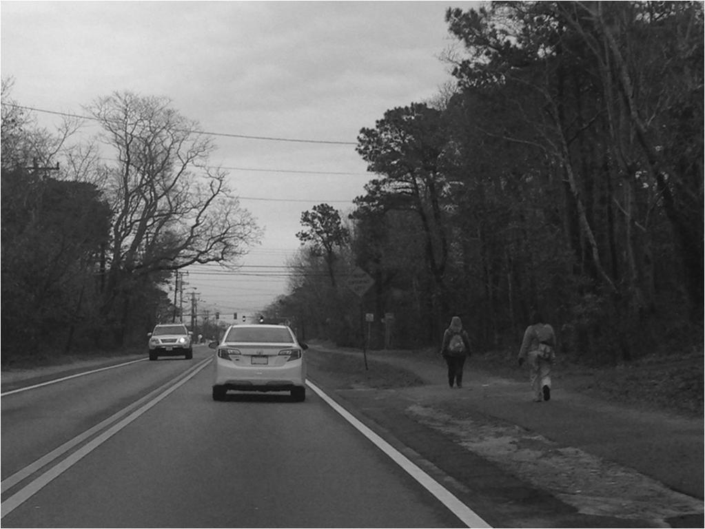
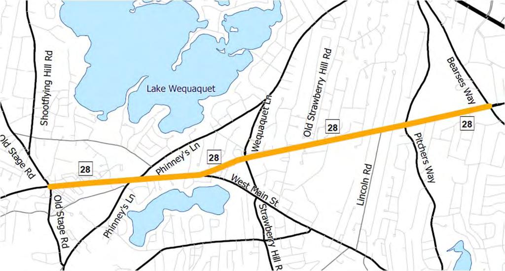
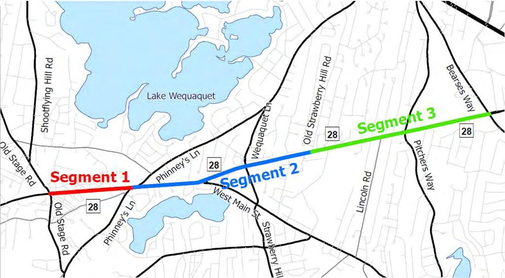
101 Existing Conditions on Route 28 Study Area 4
 during the July 4-5pm hour Relative")
102 Existing Conditions Overview Traffic Count Data Summer 2013 and planned Spring 2014 to capture school trips Crash Data Crash reports from Barnstable Police Department ( ) Site Visits Preliminary visits conducted, more planned in the spring Traffic Counts: Existing Traffic Volumes Rte 28 traffic ranges from 1,700 to 2,300 vehicles per hour (vph) during the July 4-5pm hour Relative volumes on intersecting roadways are shown below (summer 2013 volumes) 2,000 vph 1,000 vph 500 vph Spring counts planned at School Driveway 5

.")
103 Preliminary Crash Analysis Over 200 crashes along the 2.5 mile corridor from 2011 through 2013 Below are intersections with highest crash totals Based on preliminary analysis of MassDOT ( ) and Barnstable Police Department records ( ). Results may be refined with further analysis. Site Visit 6
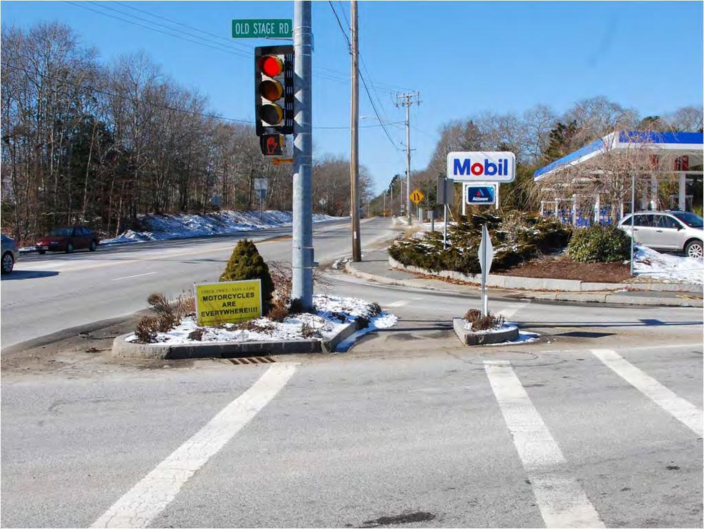
104 7
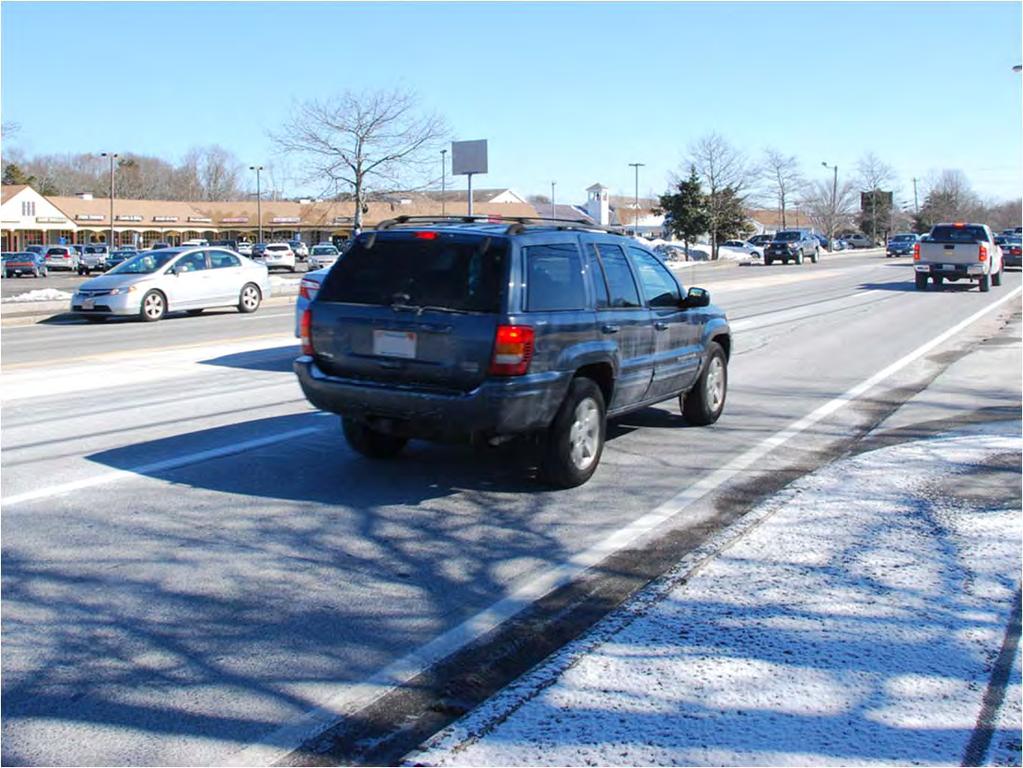
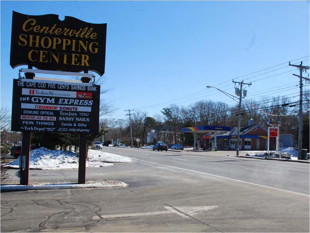
105 8

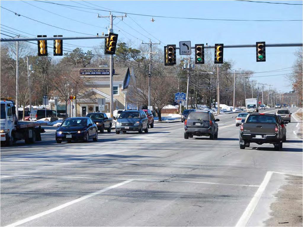
106 9
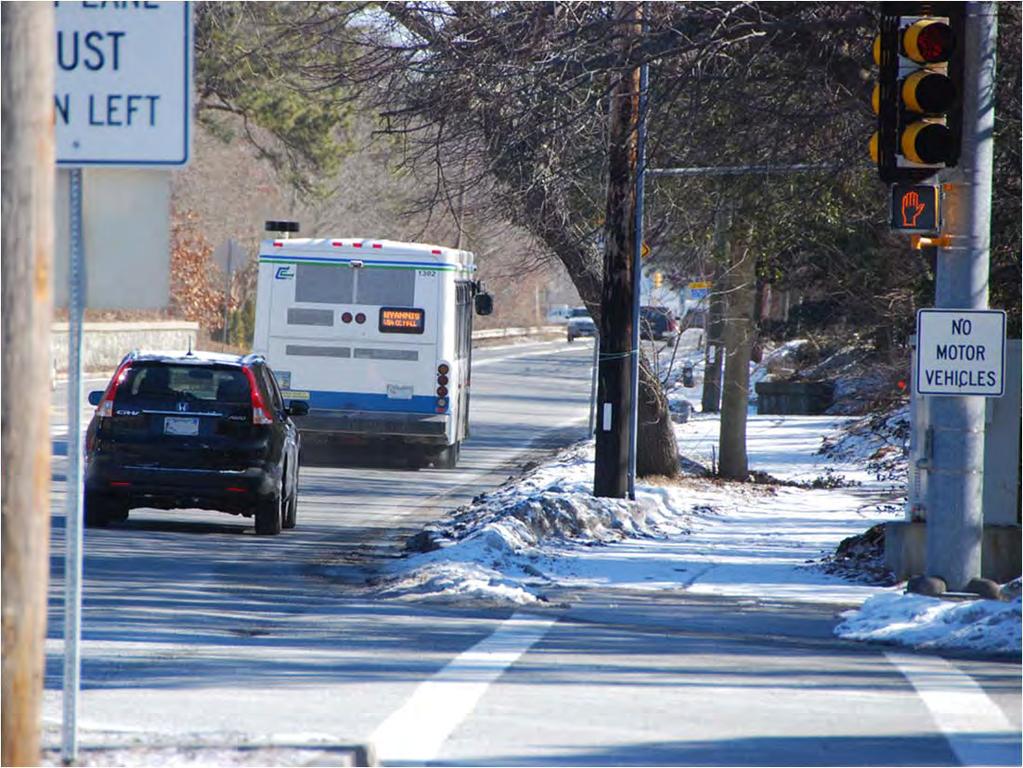
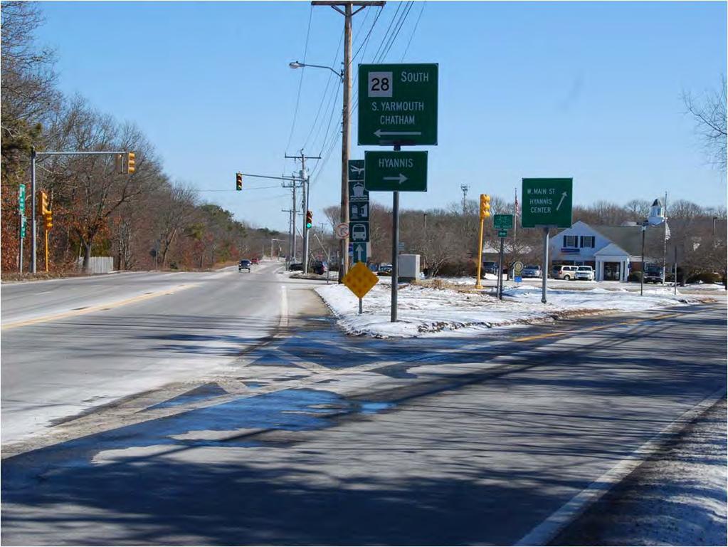
107 10
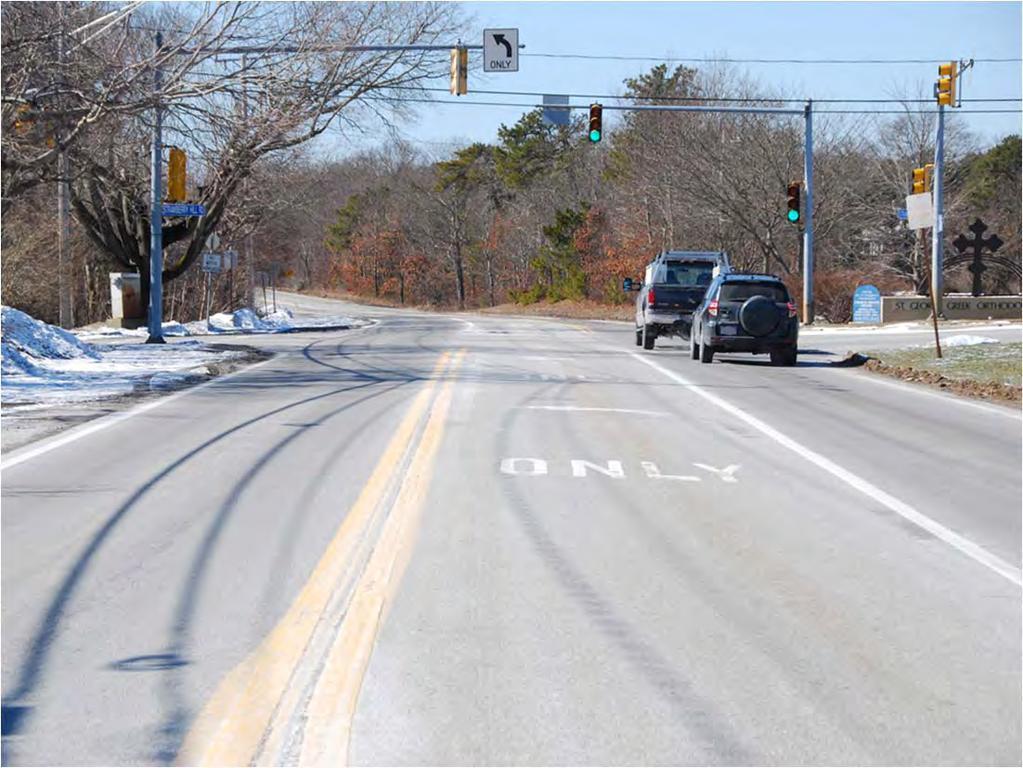
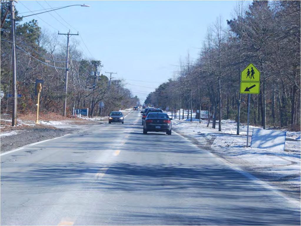
108 11

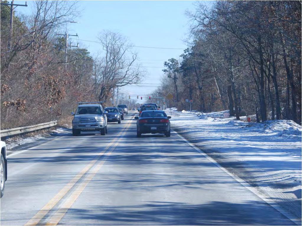
109 12
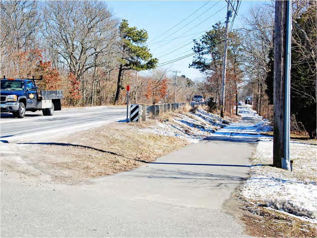
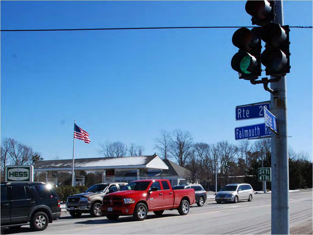
110 13


111 Visioning Exercise 14
112 Visioning Exercise What are the things you like in this area? What are the issues you see? What would you like to see changed? Focus on the roadway, sidewalks, and paths. ALL thoughts are welcomed. Sign up on the maps to be involved with follow-up meetings and be included in the project list. Next Steps Review Issue Areas/Problem Identification Next Meeting Focused Listening Sessions Last Week of April, Time and Date TBD Analyses and Development of Alternatives Concept Refinement Technical Review Presentation of Draft Report Recommendations/Final Report 15

113 Feedback? Contact Steven Tupper Technical Services Planner Phone: Thank You for attending! Project materials available at: transportation/projects 16
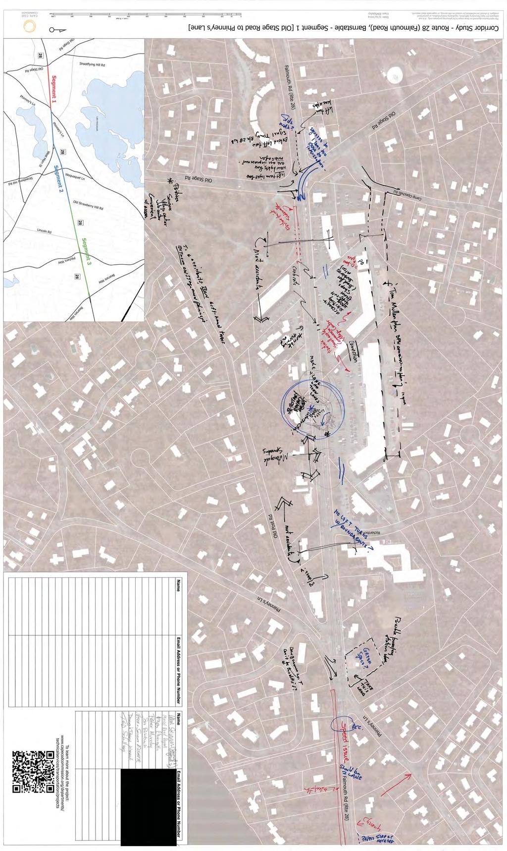
114
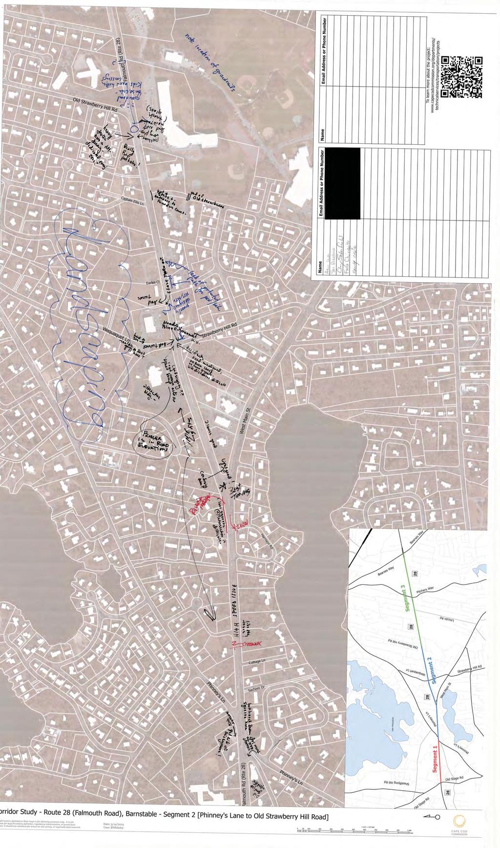
115
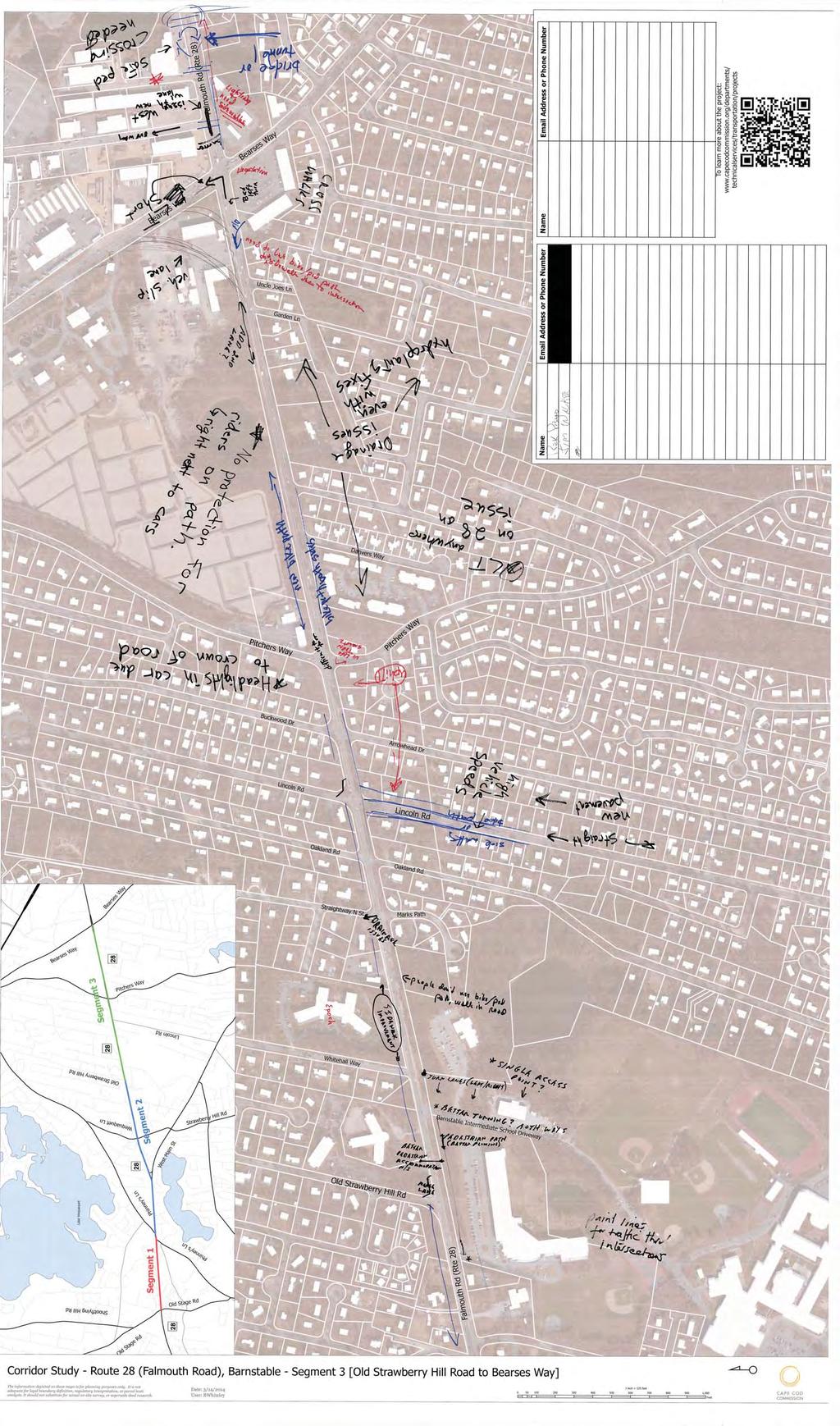
116
117 Appendix E Stormwater Management Barnstable Route 28 Old Stage Road to Bearses Way 2016
118 Barnstable Route 28 Old Stage Road to Bearses Way 2016
119 Stormwater Management A strong stormwater management plan is essential to meeting the safety, environmental and public access goals for the RT 28 Study Area goals. The following plan describes stormwater issues and a recommended strategy. PROJECT DRAINAGE GOALS As put forth in the Massachusetts Storm Water Manual and adopted by the Cape Cod Commission, the primary goal of the proposed stormwater management strategy is to eliminate untreated stormwater discharging directly to groundwater and surface water sources. To ensure proper treatment, Commission Staff will determine the contaminants of concern for the Study Area, estimated Water Quality Volume, required land area and the Best Management Practices (BMPs) best suited to capture and treat target contaminants. Inherent in this goal is the proper management and use of available green space both within and without of the available right-of-way in the Study Area. The Cape Cod Commission recommends that MassDOT encourage the use of easements from public and private entities to accommodate the location, construction and maintenance of stormwater infrastructure where limited state road right-of-way would prohibit or complicate BMP siting, construction or maintenance. CHARACTERIZATION OF STUDY AREA EXISTING CONDITIONS Segments of the study which do not always drain adequately during storm events have been mapped by local stakeholders to assist Commission Staff in the creation of this report. These locations include, but are not limited to, properties on the south side of RT 28 between Pitchers Way and Garden Lane, the intersection between RT 28 and Straightaway N and the entrance to Cape Maid Farms. Depending on storm conditions, portions of the Study Area, described in detail below, may flood with significant sheet flow over the surface, pond in low Barnstable Rt 28 Old Stage Rd to Bearses Way Stormwater Management Page 1
120 areas, and/or retain large volumes of water at the road edge-of-pavement. With the exception of the stretch of RT 28 adjacent to the Bell Tower Plaza, the roadway does not have a paved shoulder; instead, the edge of pavement is typically finished with a low paved curb, which has the effect of collecting and channelizing stormwater. Sheet flow off of the roadway, or traditional country drainage, is inhibited by the presence of this paved curb and channels the runoff to roadway intersections and connected driveways. The Route 28 Study Area remains fairly consistent with each section containing similar right-of-way width, pavement edge, median and existing stormwater controls. These analysis segments, in conjunction with elevation above sea level, are depicted in Figure 3 below and summarized in Table 1. TABLE 1: ROUTE 28 STUDY AREA SEGMENT OVERVIEW Section (West to East) # lanes Row Width Shoulders Pavement Edge Median Stormwater Controls Old Stage Rd. to Phinneys Ln ft. < 1 ft. Granite Curb None Leaching Catch Basins Phinneys Ln to W. Main St ft. < 1 ft. to 3 ft. Granite Curb for 800 ft then Bermed None Country Drainage 1 W. Main St. to Strawberry Hill Rd. 2W, 1E ft. < 1ft. Bermed None Country Drainage Strawberry Hill Rd. to Bearses Way ft. < 1ft. * Bermed None Country Drainage 1 Limited Leaching Catch Basins Many potential drainage issues are alleviated by the highly porous soils on Cape Cod making leaching catch basins and country drainage and attractive and affordable option. Even with the benefit of porous soils, drainage problems arise affecting pedestrian access, increasing drivers hydroplaning risk and transporting contaminated runoff into our surface and ground waters. While drainage issues may not arise in each drainage sub-section (Table 4) stormwater controls may still be required to capture and treat contaminated runoff from contributing to water quality problems as listed in Table 3. As such, the entire Study Area should be considered for upgraded stormwater controls. Figure 1 depicts the Study Area for this report including locations where Route 28 intersects nitrogen sensitive watersheds and Wellhead Protection Areas (WHPA) as defined in the 2009 Cape Cod Commission Regional Policy Plan. Nitrogen sensitive watersheds have been determined by the Massachusetts Estuaries Project (MEP) and nitrogen removal percentages provided in Figure 1 reflect those put forth by the MEP analysis. Many Cape Cod watersheds listed as Page 2 Barnstable Rt 28 Old Stage Rd to Bearses Way Stormwater Management

121 nitrogen sensitive through the MEP process have been assigned a TMDL for nitrogen from the Department of Environmental Protection (DEP). Many of the watersheds not yet assigned a TMDL have pending TMDLS. Pending TMDLs should be considered finalized for the purpose of this analysis. FIGURE 1: NITROGEN SENSITIVE WATERSHEDS AND WELLHEAD PROTECTION AREAS Figure 2 includes locations where Route 28 contributes to water bodies mapped as impaired on the MassDEP 2012 Integrated List. Water body categories provided in Figure 2 reflect those put forth by MassDEP and depict varying types of impairment and TMDL status. Under section 303(d) of the Clean Water Act, States are required to develop lists of impaired waters. These waters are too polluted or otherwise degraded to meet acceptable water quality standards. The law requires that priority rankings are established for waters on the lists in addition to developing TMDLs for these waters. For more detailed information visit the MassDEP website at ( Barnstable Rt 28 Old Stage Rd to Bearses Way Stormwater Management Page 3
, 303 (D) Page 4 Barnstable Rt 28 Old Stage Rd to Bearses Way Stormwater")
122 FIGURE 2: MASSACHUSSETS DEPARTMENT OF ENVIRONMENTAL PROTECTION 2012 INTEGRATED LIST OF WATERS 305 (B), 303 (D) Page 4 Barnstable Rt 28 Old Stage Rd to Bearses Way Stormwater Management

123 FIGURE 3: ROUTE 28 HYDROPLANING STUDY ANALYSIS SEGMENTS Figure 3 depicts elevation above sea level in addition to Study Area planning segments. Depth to groundwater is a significant factor in BMP selection and placement and will play an important role in the formation of any drainage plan. Barnstable Rt 28 Old Stage Rd to Bearses Way Stormwater Management Page 5
124 CONTAMINANTS OF CONCERN The Study Area crosses across two major watersheds, Centerville River and Lewis Bay, and a number of sub-watersheds including; Centerville River East, Long Pond, Craigville Wells #8, Halls Creek, Simmons Hyannisport Wells, Fawcetts Pond and Stewarts Creek. As shown in Figure 1 and Figure 2, nitrogen sensitive watersheds and impaired water bodies are defined in Table 2 and Table 3. Table 2: MEP Watershed Nitrogen TMDL Status Water Body Centerville Harbor Lewis Bay MEP Nutrient TMDL Status Final Draft Table 3: MassDEP 2012 Integrated List Water Body Integrated List Category Impairment Cause Centerville Harbor Category 2 Attaining some uses; other uses not assessed Centerville River Category 4A Estuarine Bioassessments, Fecal Coliform and Nitrogen Long Pond Category 4C Non-Native Aquatic Plants (TMDL not required) Lake Elizabeth Category 3 No uses assessed Red Lilley Pond Category 5 Fecal Coliform and Nutrient/Eutrophication Biological Indicators Halls Creek Category 4A Fecal Coliform Stewarts Creek Category 4A Fecal Coliform Lewis Bay Category 5 Estuarine Bioassessments, Fecal Coliform According to the MEP Technical Report the Centerville River East subembayment requires a 62% reduction in the total controllable nitrogen load to prevent eutrophication of the water body. Seven (7) percent of the total controllable nitrogen load contributing to Centerville River East is from impervious sources with an additional 4% from fertilizer sources. In addition to nitrogen loading impairments, the MassDEP 2012 List of Impaired Waters Centerville River and Red Lilley Pond are both impaired by fecal coliform (Table 3). According to the MEP Technical Report Lewis Bay proper requires a 16% reduction in the total controllable nitrogen load to prevent eutrophication of the water body. Nine (9) percent of the total controllable nitrogen load contributing to Lewis Bay is from impervious sources with an additional 6% from fertilizer sources. While Lewis Bay proper requires an overall reduction in nitrogen, the Page 6 Barnstable Rt 28 Old Stage Rd to Bearses Way Stormwater Management
125 sub-watersheds intersected by the study are currently un-impaired by nutrients. As such, focus should be placed on fecal coliform which each sub-watershed intersected by the Study Area is listed as impaired on the 2012 Integrated list (Table 3). NITROGEN Transported by stormwater runoff, pollutants from land use development, including nitrogen, find their way into the ground and surface waters throughout the Cape. These waters, along with their increased pollutant loads ultimately discharge to coastal embayments. The presence of increased nitrogen loading from land use development has a significant effect on the nitrogen-limited coastal embayments. Nitrogen limited ecosystems are ecosystems that have adapted under low nitrogen conditions. When an excess of nitrogen is introduced to an embayment changes in the community composition will occur. A common result from excess nitrogen loading is the increase of fast growing species (i.e. algae), which often outcompete other life forms resulting in the loss of species diversity and community richness. This is referred to as the process of eutrophication. In some severe cases eutrophication creates anoxic environments resulting in fish kills and aesthetically unpleasing conditions. The nitrogen load that changes a healthy system to a eutrophic condition is defined as a critical threshold, which under the federal Clean Water Act is referred to as a Total Maximum Daily Load (TMDL) and requires the restoration of impaired surface water bodies. There are a limited number of stormwater management technologies which effectively remove nitrogen from stormwater. The primary method of effective bacteria removal for BMPs through creating an anoxic, or oxygen free, environment for denitrifying bacteria to convert nitrogen in stormwater to inert nitrogen gas. These practices include primarily bioretention systems, sub-surface constructed wetlands and Retention Ponds. A number of BMPs such as tree box and various media filters achieve lesser nitrogen removal through nutrient uptake. BACTERIA (Fecal Coliform) Sources of bacteria in stormwater vary and may include animal wastes, agricultural activities, untreated human wastes, landfills, inappropriate discharges from residential or commercial activities and naturally occurring sources. Understanding sources of bacteria is essential while selecting Barnstable Rt 28 Old Stage Rd to Bearses Way Stormwater Management Page 7
126 appropriate BMPs. As with all sources of pollutants, proper management of the source is the most effective and often the cheapest course of action. There are few stormwater management technologies which effectively remove bacteria from stormwater with a number of BMPs actually increasing bacterial pollution. The primary method of effective bacteria removal for BMPs is by filtration through a filter media. These filtration approaches vary and include tree box filters, bioretention systems, porous pavements, constructed wetlands and sub-surface sediment chambers. This last approach is commonly manufactured and marketed as a proprietary solution. RECOMMENDED BEST MANAGEMENT PRACTICES BIORETENTION Bioretention is a method of treating stormwater by ponding water in shallow depressions underlain by a sandy engineered soil media through which most of the runoff passes ( Design considerations associated with bioretention practices 20th Anniversary Conference on Water Management in the'90s Coffman et al., 1993). Bioretention systems can easily be incorporated into the landscape to address and maintain many of the natural hydrologic functions. Pollutants within these systems are removed through both chemical and physical means within the bioretention soil mix (BSM). Bioretention systems also encourage biological treatment of nutrients, such as nitrogen, through nutrient uptake by vegetation within the system. Bioretention tends to work best in sandy soils such as are present in many areas of Cape Cod. Bioretention systems achieve excellent removal efficiencies for a wide range of pollutants including TSS, petroleum hydrocarbons, nitrogen, metals, phosphorus and bacteria. Page 8 Barnstable Rt 28 Old Stage Rd to Bearses Way Stormwater Management
127 FIGURE 4: CROSS SECTION OF A COMMON BIORETENTION SYSTEM LEACHING CATCH BASINS A leaching catch basin is similar to a traditional catch basin with the added ability to permit the infiltration of captured runoff. Leaching basins are often installed in series with a deep sump catch basin that providing. Because of this pretreatment, the catch basin/leaching basin combination is preferable to the leaching catch basin as a higher removal of TSS may be achieved while also extending the life and minimizing maintenance on the leaching catch basin. Leaching catch basins and leaching basins should only be used in areas with highly permeable soils, making these basins a popular stormwater control throughout the Cape. Leaching catch basins, in series with pre-treatment catch basins, achieve excellent TSS removal in addition to constituents that sorb to fine particulates including petroleum hydrocarbons and metals. SUB-SURFACE SEDIMENT CHAMBERS Sub-surface sediment chambers function similarly to surface sedimentation systems. Sediment trapping systems remove pollutants (mainly particulates) from stormwater runoff through a pretreatment sedimentation area followed by an infiltration bed containing filter media (typically sand, soil, gravel or a combination of media). This infiltration bed removes fines and the pollutants sorbed, or attached, to these particulates. Various contaminants including, but not limited to metals, petroleum hydrocarbons and bacteria may sorb to fines Barnstable Rt 28 Old Stage Rd to Bearses Way Stormwater Management Page 9

128 allowing infiltration systems to achieve removal efficiencies in these categories though the physical process of filtration. Sub-surface sediment chambers traditionally discharge directly to groundwater however systems can be designed with an outflow mechanism returning treated flow to a stormwater conveyance system. FIGURE 5: HDPE SUB-SURFACE TREATMENT CHAMBERS (PHOTO COURTESY LINDSAY COOK, CAPE COD CONSERVATION DISTRICT INTERN) Page 10 Barnstable Rt 28 Old Stage Rd to Bearses Way Stormwater Management
129 WATER QUANTITY In natural ecosystems runoff is infiltrated into groundwater and slowly discharged, in some cases over tens to hundreds of years, to freshwater streams, ponds, lakes, rivers and marine estuaries. Flooding is less significant in these natural systems due to the presence of pervious surfaces passing runoff from the surface to the groundwater. In urbanized areas these natural systems are replaced with dense impervious cover reducing the amount of infiltration that can occur. Even in the Cape, an area with a naturally high infiltration rate, flooding can occur in urbanized areas causing damage to infrastructure and making roadways unsafe for travel. WATER QUALITY VOLUME The Water Quality Volume (WQV) represent the runoff generated by a design depth of rainfall from a given drainage area. This provides a minimum quantity (ft³) of water to capture and treat for the constituents of concern. To capture the full volume of each rain event would be costly and require large dedicated portions of land. In its essence, the goal of stormwater management is twofold and includes treating contaminated runoff and minimizing flooding issues for the majority of storm events. The WQV calculation guarantees that the most contaminated runoff, or the first flush, of each event is captured. The first flush typically includes the most polluted runoff of an event as it re-suspends contaminants that have been gathering on impervious surfaces during dry periods. Therefore, guaranteeing the capture and treatment of this initial runoff stream is the most important from a water quality standpoint. As defined by the Massachusetts Stormwater Design Handbook, the required WQV for the below land use types equals 1.0 of runoff times the total impervious area. The remaining land use types require a design depth of 0.5. from a land use with a higher potential pollutant load; within an area with a rapid infiltration rate (greater than 2.4 inches per hour); within a Zone II or Interim Wellhead Protection Area; near or to the following critical areas: Barnstable Rt 28 Old Stage Rd to Bearses Way Stormwater Management Page 11
130 o o o o o Outstanding Resource Waters, Special Resource Waters, Bathing beaches, Shellfish growing areas, Cold-water fisheries. For the purposes of this report the WQV is calculated following Equation 1 and as defined below. Where: EQUATION 1: WATER QUALITY VOLUME CALCULATION WQV = P * Rv * I * A P = precipitation (in.) Rv = unitless volumetric runoff coefficient I = percent impervious cover draining to structure A = contributing drainage area to BMP (acre) REQUIRED LAND AREA The drainage areas for the sub-sections (Table 4) include all land area within the ROW for the Study Area (Appendix A). While this approach likely overestimates the actual WQV for the Study Area, the values below will provide a high end estimate for stormwater quantity management. Contributions from minor intersections are not included in the estimated drainage area and should be included in a more detailed drainage analysis. Page 12 Barnstable Rt 28 Old Stage Rd to Bearses Way Stormwater Management
131 TABLE 4: DRAINAGE SUB-SECTIONS AND ASSOCIATED WQV AND DRAINAGE AREAS WQV Drainage Area WQV 1 Gravel Wetland Estimated Land Bioretention Estimated Land Drainage Sub-Section (0.5") (1.0") Area 2 Area 3 acre ft 3 ft 3 acre acre Old Stage Rd. Intersection 3.8 5,931 11, Old Stage Rd. to Phinneys Ln 2.9 4,495 8, Phinneys Ln Intersection 1.9 2,897 5, Phinneys Ln to W. Main St ,702 7, W. Main St. Intersection 1.8 2,839 5, W. Main St. to Strawberry Hill Rd ,707 3, Strawberry Hill Rd. Intersection 1.4 2,175 4, Strawberry Hill Rd. to Bearses Way ,626 37, Bearses Way Intersection 2.9 4,567 9, Total ,940 93, Assumes 90% Impervious Cover (I=0.9) 2 Values Estimated from UNHSC 2012 Biennial Report for Gravel Wetlands 3 Values Estimated from UNHSC 2012 Biennial Report for Bioretention (Parking Lot Landscaped Area Retrofit System Bio 4) Leaching catch basins, which are widely used on Cape Cod, may receive runoff from an acre or less. However, traditional spacing on roadways tends to reduce catchment area further. For the purposes of this report leaching catch basins will be spaced 250 apart as suggested in the spacing guidelines put forth in the MassDOT Design Guide: Chapter 8. This spacing approach will drive cost estimates for areas of the study segment utilizing leaching catch basins as a component of the stormwater management approach. Barnstable Rt 28 Old Stage Rd to Bearses Way Stormwater Management Page 13
132 SUGGESTED STORMWATER MANAGEMENT APPROACH In short, the suggested stormwater management approach for the Route 28 Study area is that nitrogen reducing technologies would benefit Segment #1 the greatest, a small portion of the easternmost stretch of Segment #3, and a portion of the westernmost section of Segment #4. In all other locations local drainage concerns and addressing the pathogen TMDL s is of most importance. The removal of berms from the non-nitrogen sensitive sections may decrease pathogens from stormwater in addition to subsurface infiltration systems similar to those going in near Salt Pond in Eastham. Lastly, any areas with known drainage/safety issues should have strategic flood control methods implemented. Page 14 Barnstable Rt 28 Old Stage Rd to Bearses Way Stormwater Management

133 COSTS The following table presents estimated costs for various stormwater management techniques. Barnstable Rt 28 Old Stage Rd to Bearses Way Stormwater Management Page 15


134 DRAINAGE SUB-SECTION FIGURES FIGURE 6: OLD STAGE RD INTERSECTION FIGURE 7: SECTION BETWEEN OLD STAGE RD AND PHINNEYS LN Page 16 Barnstable Rt 28 Old Stage Rd to Bearses Way Stormwater Management


135 FIGURE 8: PHINNEYS LN INTERSECTION FIGURE 9: SECTION BETWEEN PHINNEYS LN AND W. MAIN ST. FIGURE 10: W. MAIN ST. INTERSECTION Barnstable Rt 28 Old Stage Rd to Bearses Way Stormwater Management Page 17


136 FIGURE 11: SECTION BETWEEN W. MAIN ST. AND STRAWBERRY HILL RD. FIGURE 12: STRAWBERRY HILL RD. INTERSECTION Page 18 Barnstable Rt 28 Old Stage Rd to Bearses Way Stormwater Management


137 FIGURE 13: SECTION BETWEEN STRAWBERRY HILL RD. AND BEARSES WAY FIGURE 14: BEARSES WAY INTERSECTION Barnstable Rt 28 Old Stage Rd to Bearses Way Stormwater Management Page 19
138
139 Appendix F - Concept Plans Barnstable Route 28 Old Stage Road to Bearses Way 2016
140 Barnstable Route 28 Old Stage Road to Bearses Way 2016


141 Cross Section Total: 60-70ft Available ROW: 80ft Facing East 6' Sidewalk 11' Vehicle Lane 11' Vehicle Lane 11' Vehicle Lane 11' Vehicle Lane 8' Utility 6' Sidewalk Barnstable Route 28 Corridor Study: Old Stage Road to Phinney's Lane Four-Lane Reconfiguration- Existing Conditions Existing Conditions: Four Lanes undivided Cape Cod Commission Technical Services Staff Draft February 2015 NOTE: Not to scale, location of 80 ft ROW approximate, survey would be required for additional precision


142 Cross Section Total: 80ft Available ROW: 80ft Facing East 5' Sidewalk 11' Vehicle Lane 11' Vehicle Lane 6' Median 11' Vehicle Lane 11' Vehicle Lane 6' Buffer 8' Path 5' Utility Barnstable Route 28 Corridor Study: Old Stage Road to Phinney's Lane Four-Lane Reconfiguration- Alternative One Alternative One: 6' Median without turn lanes, within 80' ROW Cape Cod Commission Technical Services Staff Draft October 2014 NOTE: Not to scale, location of 80 ft ROW approximate, survey would be required for additional precision


143 Cross Section Total: 80ft Available ROW: 80ft Facing East 5' Sidewalk 11' Vehicle Lane 11' Vehicle Lane 11' Median/ Turning Lane 11' Vehicle Lane 11' Vehicle Lane 8' Path 5' Utility Barnstable Route 28 Corridor Study: Old Stage Road to Phinney's Lane Four-Lane Reconfiguration- Alternative Two Alternative two: 11' Median with turn lanes, within 80' ROW Cape Cod Commission Technical Services Staff Draft October 2014 NOTE: Not to scale, location of 80 ft ROW approximate, survey would be required for additional precision


144 Cross Section Total: 80ft Available ROW: 80ft Facing East 5' Sidewalk 11' Vehicle Lane 11' Vehicle Lane 11' Turning Lane 11' Vehicle Lane 11' Vehicle Lane 8' Path 5' Utility Barnstable Route 28 Corridor Study: Old Stage Road to Phinney's Lane Four-Lane Reconfiguration- Alternative Three Alternative Three: 11' center turning lane, within 80' ROW Cape Cod Commission Technical Services Staff Draft October 2014 NOTE: Not to scale, location of 80 ft ROW approximate, survey would be required for additional precision


145 Cross Section Total: 95ft Available ROW: 80ft Facing East 5' Sidewalk 6' Buffer 11' Vehicle Lane 11' Vehicle Lane 11' Median/ Turning Lane 11' Vehicle Lane 11' Vehicle Lane 8' Buffer 10' Path 5' Utility Barnstable Route 28 Corridor Study: Old Stage Road to Phinney's Lane Four-Lane Reconfiguration - Alternative Four Alternative Four: 11' median with turn lanes, expanding ROW to 95' Cape Cod Commission Technical Services Staff Draft October 2014 NOTE: Not to scale, location of 80 ft ROW approximate, survey would be required for additional precision


146 Cross Section Total: 80ft Available ROW: 80ft Facing East 5' Sidewalk 11' Vehicle Lane 11' Vehicle Lane 6' Median 11' Vehicle Lane 11' Vehicle Lane 6' Buffer 8' Path 5' Utility Barnstable Route 28 Corridor Study: Old Stage Road to Phinney's Lane Four-Lane Reconfiguration Alternatives Alternative Five: 6' median with new signalized intersection Cape Cod Commission Technical Services Staff Draft October 2014 NOTE: Not to scale, location of 80 ft ROW approximate, survey would be required for additional precision


147 Cross Section Total: 74ft Available ROW: 80ft Facing East 6' Sidewalk 8' Buffer 11' Vehicle Lane 11' Turning Lane 11' Vehicle Lane 8' Buffer 10' Path 5' Utility Barnstable Route 28 Corridor Study: Old Stage Road to Phinney's Lane Four-Lane Reconfiguration- Alternative Six Alternative Six: 11' center turning lane, within 80' ROW, removing one lane in each direction Cape Cod Commission Technical Services Staff NOTE: Not to scale, location of 80 ft ROW approximate, survey would be required for additional precision Draft February2015
148
149 Appendix G - Road Safety Audit: Route 28 (Falmouth Road) at Strawberry Hill Road Town of Barnstable [May 2015] Barnstable Route 28 Old Stage Road to Bearses Way 2016
150 Barnstable Route 28 Old Stage Road to Bearses Way 2016
151 ROAD SAFETY AUDIT Route 28 (Falmouth Road) at Strawberry Hill Road Town of Barnstable May 2015 Prepared For: MassDOT Prepared By: McMahon Associates, Inc. 300 Myles Standish Blvd. Suite 201 Taunton, MA 02780
152 Road Safety Audit Route 28 at Strawberry Hill Road - Barnstable, MA Prepared by McMahon Associates, Inc. FINAL Table of Contents Background... 1 Project Data... 1 Project Location and Description... 1 Road Safety Audit Observations and Potential Improvements... 5 Recommendations List of Appendices Appendix A. Appendix B. Appendix C. RSA Meeting Agenda RSA Audit Team Contact List Detailed Crash Data List of Figures Figure 1: Location Map... 4 List of Tables Table 1. Participating Audit Team Members... 1 Table 2. Estimated Time Frame and Costs Breakdown Table 3. Potential Safety Enhancement Summary... 11
153 Road Safety Audit Route 28 at Strawberry Hill Road - Barnstable, MA Prepared by McMahon Associates, Inc. FINAL Background The Federal Highway Administration (FHWA) defines a Road Safety Audit (RSA) as the formal safety examination of an existing or future road or intersection by an independent, multidisciplinary team. The purpose of an RSA is to identify potential safety issues and possible opportunities for safety improvements considering all roadway users. A key objective of the RSA is to identify both short-term and long-term safety improvements that can be made at the subject intersections. This RSA evaluates the intersection of Route 28 and Strawberry Hill Road in Barnstable, MA, as shown in Figure 1. Project Data A Road Safety Audit was completed for the intersection of Route 28 at Strawberry Hill Road in the Town of Barnstable on April 24, The agenda for the RSA meeting held at the Barnstable Senior Center is provided in Appendix A of this report. As shown below in Table 1, the audit team consisted of a multidisciplinary team with representatives from state, regional and local agencies providing expertise in the engineering, planning, maintenance and emergency response fields. Contact information for the RSA attendees is provided in Appendix B of this report. Table 1. Participating Audit Team Members Audit Team Member Kevin Chiang Richard Madsen Patrick Tierney Jo Anne Miller Buntich Michael Perry Clay Schofield Phil Viveiros Alex Bulhoes Agency/Affiliation MassDOT - Boston Traffic MassDOT District 5 Projects Cape Cod Commission Town of Barnstable - Growth Management Town of Barnstable - Highway Division Town of Barnstable - Department of Public Works McMahon Associates McMahon Associates Within the invitation sent on April 15, 2015 to each participant in the RSA, background material was provided. This information included turning movement counts, local speed regulations, collision diagrams, and MassDOT crash data summaries. During the RSA meeting, these materials were reviewed as a group before the team discussed potential safety issues and solutions for the intersection. Project Location and Description Study Area Roadways As shown in Figure 1, Route 28 is generally a three-lane roadway west of the Strawberry Hill Road intersection and a two-lane roadway east of the intersection within the study area. It should be noted that Route 28 is designated as a North-South highway, with Route 28 North oriented to the west at this particular intersection. However, through the Town of Barnstable, Route 28 generally runs in an east-west direction and the intersection approaches will be classified as eastbound and westbound throughout the rest of this report. At its intersection with Strawberry Hill Road, Route 28 is a two-lane roadway in both Page 1
154 Road Safety Audit Route 28 at Strawberry Hill Road - Barnstable, MA Prepared by McMahon Associates, Inc. FINAL the eastbound and westbound directions; in addition, an exclusive left-turn lane is provided for both the eastbound and westbound approaches. The speed limit on Route 28 is posted as 45 miles per hour in both directions. Direct access to retail and residential land uses is provided by Route 28 while generally running parallel to Route 6. Route 28 also provides access to the Barnstable Municipal Airport at its intersection with Route 132, approximately 2 ¼ miles east of the Route 28 at Strawberry Hill Road intersection. In addition, Route 28 provides access to subdivisions on its northern side and to schools (Barnstable Intermediate School and Barnstable High School) and the Barnstable Senior Center on its southern side via a shared driveway. The Cape Cod Hospital also uses Route 28 as an emergency vehicle access corridor. Route 28 is classified as an urban principal arterial under MassDOT jurisdiction. Within the immediate vicinity of the study area intersection, Route 28 is approximately 34 feet wide with 11-foot travel lanes and shoulders measuring less than 1 foot on either side. There is a multi-use path located on the southern side of Route 28 for use by cyclists and pedestrians. While sidewalks are present directly adjacent to the CVS/pharmacy located at the northeast corner of the Strawberry Hill Road intersection, there are otherwise no sidewalks present along the northern side of Route 28. Strawberry Hill Road is a two-lane urban minor arterial under Town of Barnstable jurisdiction that runs in a north-south direction through Barnstable. Strawberry Hill Road has a single lane of travel in either direction on the northbound approach with lane widths measuring 12 feet wide at the intersection with Route 28. At the southbound approach of the intersection with Route 28, there is also a left-turn lane present with varying lane widths. While sidewalks are present directly adjacent to the CVS/pharmacy located at the northeast corner of the Route 28 intersection, there are otherwise no sidewalks or shoulders present on either side of Strawberry Hill Road. Study Area Intersections The intersection of Route 28 at Strawberry Hill Road is a four-legged signalized intersection maintained by MassDOT. The eastbound and westbound approaches each consist of a left-turn lane and a shared through-right travel lane. The northbound approach consists of a single lane and the southbound approach consists of a left-turn lane and a shared through-right travel lane. The storage lengths provided for the left turn lanes on the westbound and eastbound approaches are approximately 250 feet and 300 feet, respectively. The southbound left turn lane provides a storage length of approximately 50 feet. The traffic signals for all four approaches are mounted on mast arms, either overhead or on the mast arm shaft. The multi-use path on the southern side of Route 28 traverses the southbound approach of the intersection at Strawberry Hill Road. The CVS in the northeast corner has access points onto both Route 28 and Strawberry Hill Road near the intersection. There is also a driveway for the Saint George Greek Orthodox Church located on the southbound approach of Strawberry Hill Road near the intersection. There are pedestrian crosswalks located at the northbound and westbound approaches, but there is no signal equipment in place for pedestrians at the intersection. There are also residential driveways located along the eastern side of Route 28 from the intersection. The intersection is also situated in a region that experiences a significant seasonal peak in traffic, with buses potentially stopping safely along Route 28 to the west of the intersection to pick up patrons that wave them down. Crash Data Crash data was received from MassDOT for the three years between 2010 and Based on this data, there were a total of 16 crashes reported from the beginning of 2010 through the end of 2012 at the intersection of Route 28 and Strawberry Hill Road. Of the crashes that occurred, eight (50%) were angle collisions, including two crashes in the eastbound direction and three crashes in the westbound direction on Route 28. Additionally, there were six rear-end collisions, one single vehicle crash, and one pedestrian related crash reported at the intersection. Of the reported crashes, nine resulted in property damage and Page 2
155 Road Safety Audit Route 28 at Strawberry Hill Road - Barnstable, MA Prepared by McMahon Associates, Inc. FINAL seven resulted in personal injury; no fatalities were reported at the intersection. Based on the crash data, it appeared that neither driver age nor lighting conditions were significant factors in the observed crashes. Detailed crash diagrams are provided in Appendix C. Page 3


156 ³ STRAWBERRY HILL ROAD WEQUAQUET LANE STUDY INTERSECTION «28 FALMOUTH ROAD STRAWBERRY HILL ROAD WEST MAIN STREET Feet FIGURE 1 SITE LOCATION MAP ROAD SAFETY AUDIT BARNSTABLE, MA

157 Road Safety Audit Route 28 at Strawberry Hill Road - Barnstable, MA Prepared by McMahon Associates, Inc. FINAL Road Safety Audit Observations and Potential Improvements During the RSA meeting, a brief introduction of the RSA process and a summary of the study area and crash information were presented to the audit participants. Following this brief presentation, the members of the audit team were asked to discuss the existing issues that may affect safety at the intersection of Route 28 at Strawberry Hill Road. Provided below is a list of the safety concerns that were identified during the RSA along with potential enhancements that address these concerns. Safety Issue #1: Traffic Control Observations: Traffic control at the intersection of Route 28 and Strawberry Hill Road is impacted by the traffic signal, access to nearby land uses, and the seasonal peak volumes. During the RSA discussion, there was a strong concern surrounding the speeding on Strawberry Hill Road, specifically from the southbound approach. According the team, the speeding appeared to be a result of impatient drivers attempting to avoid impediment at a red light, and the issue is related to all four of the approaches. Upon review of the past three years of crash data, it becomes apparent that a number of the rear end crashes throughout the intersection could be a result of the traffic control. Another observation was made regarding the significant morning peak volume in the eastbound direction at the intersection. Although the intersection possesses exclusive left turn lanes in both the eastbound and westbound directions, there is a lack of a left-turn signal arrow in either direction. Given the seasonal peak volume on Route 28 in combination with the speed limit of 45 mph, the lack of a left turn signal arrow presents a safety concern. Lack of Backplates on Existing Signal Heads In regards to the signal visibility, it was mentioned that the solar glare, specifically in the eastbound and westbound directions, presented a safety concern. During the site visit, the RSA team witnessed that the signal heads are lacking backplates, which improve the visibility issues pertaining to solar glare. Crash data supports solar glare potentially being an issue, as 38% of crashes occurring at this intersection are during the 4 pm to 6 pm time frame, when solar glare is at a maximum. In addition, review of the crash data presented a recurring issue of rear-end crashes, which accounted for six (38%) of the total crashes. The significant amount of rear-end crashes in the eastbound and westbound directions appear to coincide with the fact that the signal heads are lacking backplates. Audit members noticed a general lack of signage at all approaches to the intersection, particularly along the southbound approach, to warn of the traffic signal and the potential presence of pedestrian and bicyclists. Also, the emergency response was discussed during the RSA and the majority agreed that there is a need for emergency preemption equipment, particularly as the intersection borders two of the town s fire districts. Page 5
158 Road Safety Audit Route 28 at Strawberry Hill Road - Barnstable, MA Prepared by McMahon Associates, Inc. FINAL Enhancements: Evaluate speeding enforcement along the Route 28 corridor and at Strawberry Hill Road. Consider signal coordination between the study area intersection and the Route 28 intersections with West Main Street, the Senior Center Driveway, and Pitchers Way to help manage traffic flows throughout the corridor. Evaluate the existing signal timings, specifically the clearance intervals, and propose new timing plans catered to time of day and/or time of year. Check the functionality of signal detection on Route 28 and either repair as needed and/or consider dilemma zone detection for the intersection. Consider installation of left-turn signal arrows and protected left-turn phasing to minimize angle collisions at the intersection. Consider the implementation of a traffic circle at the intersection of Strawberry Hill Road and Wequaquet Lane, north of the Route 28 intersection to slow the southbound approach speeds. Install backplates with reflective borders for overhead signals to minimize the effects of solar glare. Install advance warning signage on all approaches. Consider incorporating emergency preemption to improve emergency response and decrease crash risks. Safety Issue #2: Traffic Operations Observations: The intersection of Route 28 and Strawberry Hill Road is impacted by traffic operations on the Route 28 corridor. The RSA team mentioned the impact of the steep roadway grades on the northbound and southbound approaches of the intersection. The discussion pertained to the crown and gutter line on the southbound approach, as well as the uphill grade on the northbound approach of Strawberry Hill Road. During the field visit, the RSA team observed the influence of the grade on traffic operations along the Strawberry Hill Road approaches. A member of the RSA team also raised a concern regarding the excessive queuing that occurs beyond the left-turn lane on the westbound approach along Route 28. The traffic operations can be impacted in scenarios where the queuing exceeds the storage length of the leftturn lane, which can result in a safety issue. Enhancements: Evaluate re-grading at the Strawberry Hill Road southbound approach of the intersection, in the area of the Route 28 gutter line, to improve operations. Consider extending the storage length of the left turn lane at the westbound approach of the intersection to avoid excessive queueing. Consider the implementation of a right-turn lane at the westbound approach of the intersection to improve traffic operations. Consider the implementation of a left-turn lane at the northbound approach of the intersection to improve traffic operations. Page 6


159 Road Safety Audit Route 28 at Strawberry Hill Road - Barnstable, MA Prepared by McMahon Associates, Inc. FINAL Safety Issue #3: Intersection Alignment / Visibility Observations: During the RSA discussion, some members of the team provided insight on the current alignment of the northbound and southbound approaches of Strawberry Hill Road at the intersection with Route 28. The concern focused on the offset of the roadway at the intersection and the perception of drivers that they may be directed toward the opposing lanes as they approach the intersection. Another discussion point related to the visibility of signal heads, specifically on the northbound and southbound approaches to the intersection, which is impacted by vegetation encroaching on the roadway. Sight distance at the intersection was also raised as an issue by several RSA participants. From the northbound approach, the sight distance is impacted by vegetation on the southeast corner that is encroaching onto the roadway, as well as the uphill grade on the northbound approach. In regards to the southbound approach, there is a horizontal curve at the intersection of Strawberry Hill Road and Wequaquet Lane, which impacts the sight distance of drivers approaching the intersection. Roadway Alignment and Grade from Strawberry Hill Road Northbound Approach Enhancements: Evaluate lane and/or roadway alignment for both Strawberry Hill Road approaches of the intersection to improve sight distance and reduce the risk of head-on collisions. Install an Intersection Ahead (or Signal Ahead) warning sign on the southbound approach, prior to the horizontal curve. Consider trimming the vegetation within the roadway right-of-way on the Strawberry Hill Road northbound approach to improve visibility. Evaluate the feasibility of obtaining easements for vegetation trimming on private property along the northbound approach of the intersection to improve visibility. Evaluate existing right-of-way restrictions and proposed widening improvements where feasible to create a consistent cross section along Strawberry Hill Road, specifically the northbound approach of the intersection. Safety Issue #4: Pedestrian and Bicycle Accommodations Observations: Observations made during the RSA indicate that the intersection is lacking pedestrian amenities, including pedestrian signals and sidewalks on the northern side of Route 28. Another observation was made regarding the lack of tactile pads on the existing handicapped ramps. It was also mentioned that the residential neighborhoods on the north side of Route 28 lack pedestrian connectivity due to the lack of pedestrian Existing Crosswalk Markings and Ramp Page 7

160 Road Safety Audit Route 28 at Strawberry Hill Road - Barnstable, MA Prepared by McMahon Associates, Inc. FINAL amenities and the operations on Route 28 effectively acting as a barrier. There is a significant amount of the pedestrian movement across Route 28 to the east dedicated to the Barnstable Intermediate School and Barnstable High School. During the discussion, it was also mentioned that there is a corridor study currently being conducted by the Cape Cod Commission along Route 28 in the vicinity of the intersection. Due to the intersection s close proximity to the Barnstable Senior Center and Barnstable High School, the safety implications involved with both inexperienced and older drivers were considered during the RSA. In addition, the crosswalk signage may need improvement to avoid compromising the safety of the pedestrians that are utilizing the crosswalks. In regards to the mixed use path, the section that is located on the eastern side of the intersection exhibits poor conditions and the lack of curbing presents a safety concern. During the field visit, it was observed that the mixed use path stop sign height may present an issue for cyclists crossing the southern leg of the intersection. The group also recognized the lack of lighting along the mixed use path and raised that as a safety concern. Mixed Use Path on Southeastern Corner of Route 28 and Strawberry Hill Road Intersection Enhancements: Evaluate ramps for compliance with ADA standards. Install pedestrian signals and push button actuation at the signalized intersection. Evaluate the installation of crosswalks on the southbound and eastbound legs of the intersection. Construct sidewalks adjacent to the intersection to help guide pedestrians around the traffic signal and provide improved access to the church located in the northwestern quadrant of the intersection. Consider improvements of the mixed use path at the southeast corner of the intersection on Route 28. Evaluate crosswalk signage and pavement markings to ensure that they are visible. Evaluate STOP sign height on southwest side of the mixed use path. Evaluate lighting along the mixed use path to provide additional safety for pedestrians and cyclists. Safety Issue #5: Roadway Conditions Observations: During the site visit portion of the RSA, the team observed the conditions of the existing roadway. In general, the pavement conditions at the intersection of Strawberry Hill Road at Route 28 did not appear to exhibit significant signs of distress. However, some of the observations were related to the conditions of the pavement markings on the approaches on Strawberry Hill Road. In addition, there was a portion of curbing that appeared to be damaged on the northeast corner of the intersection. Page 8


161 Road Safety Audit Route 28 at Strawberry Hill Road - Barnstable, MA Prepared by McMahon Associates, Inc. FINAL Throughout the discussion, one of the RSA team members presented a safety issue related to the snow plowing efforts at the intersection. The issue pertains to the placement of the snow bank on the southwest corner of the intersection during snow removal. In regards to safety, the snow bank must be placed further back to avoid impeding traffic on that particular leg of the intersection. It was noted that MassDOT performs plowing along Route 28, while the Town plows Strawberry Hill Road, which often leaves the intersection corners unplowed during snowstorms. Curbing Damage on Northeastern Corner of Intersection Enhancements: Evaluate existing pavement markings and consider re-striping the approaches from Strawberry Hill Road to ensure visibility. Repair or replace the damaged curbing on the northwest corner of the intersection. Encourage coordination between Barnstable Department of Public Works and MassDOT for snow plowing activities at the intersection. Safety Issue #6: Access Management Observations: Throughout the Route 28 corridor, there are several driveways that provide access to commercial and residential land uses. According to members of the RSA team, efforts have been made to minimize the amount of access points along the corridor through the use of shared driveways. One particular driveway discussed during the audit was the right-in, right-out CVS driveway east of the intersection, which provides access from and to Route 28 in the westbound direction. The egress point of the driveway onto the corridor is currently restricted to right turns only by a sign and a scored median. However, the consensus amongst the RSA team was that left turns into and out of this driveway continue to occur, creating a potential safety risk. In general, the concerns in terms of access management related to the egress from the CVS driveway onto Route 28, as well as the frequency of driveways along the corridor. Egress Point from CVS to Route 28 Enhancements: Implement a structural barrier on Route 28 and/or a raised driveway island at the CVS driveway access onto Route 28 to prevent left turn movements. Encourage the use of shared driveways and/or internal driveways along the Route 28 corridor to reduce amount of access point that could cause potential crashes. Page 9
162 Road Safety Audit Route 28 at Strawberry Hill Road - Barnstable, MA Prepared by McMahon Associates, Inc. FINAL Recommendations After the discussing the various safety deficiencies within the study area, participants discussed potential solutions. The audit participants were encouraged to consider both short and long-term improvements for each of the existing safety issues. Each improvement considered has been categorized as short-term, midterm, or long-term based on the definitions shown in Table 2. Additionally, a cost category has been assigned to each improvement based on the parameters set forth in Table 2. Table 2. Estimated Time Frame and Costs Breakdown Time Frame Costs Short-Term <1 Year Low <$10,000 Mid-Term 1-3 Years Medium $10,001-$50,000 Long-Term >3 Years High >$50,000 Summary of Road Safety Audit A summary of the potential recommendations discussed by the RSA audit team are summarized in Table 3. The recommendations are summarized based on the potential safety payoff, time frame, approximate cost and responsible agency. The safety payoff is a subjective judgment of the potential effectiveness of the safety recommendations listed below. Page 10
163 Road Safety Audit Route 28 at Strawberry Hill Road - Barnstable, MA Prepared by McMahon Associates, Inc. FINAL Safety Issue Traffic Control Traffic Control Traffic Control Traffic Control Traffic Control Traffic Control Traffic Control Traffic Control Table 3. Potential Safety Enhancement Summary Potential Safety Enhancement Safety Payoff Route 28 at Strawberry Hill Road Evaluate speeding enforcement along the Route 28 corridor and at Strawberry Hill Road Consider signal coordination between the study area intersection and the Route 28 intersections with West Main Street, the Senior Center Driveway, and Pitchers Way Evaluate the existing signal timings, specifically the clearance intervals, and propose new timing plans Check the functionality of signal detection on Route 28 and either repair as needed and/or consider dilemma zone detection Consider installation of left-turn signal arrows and protected left-turn phasing Consider the implementation of a traffic circle at the intersection of Strawberry Hill Road and Wequaquet Lane to slow southbound approach speeds Install backplates with reflective borders for overhead signals Install advance warning signage on all approaches. Time Frame Cost Medium Short-Term Medium Responsible Agency Town of Barnstable Medium Mid-Term Medium MassDOT Medium Short-Term Low MassDOT Medium Mid-Term Medium MassDOT High Mid-Term High MassDOT Medium Long-Term High Town of Barnstable Medium Short-Term Low MassDOT Medium Short-Term Low Traffic Control Consider incorporating emergency preemption Medium Mid-Term Medium Traffic Operations Evaluate re-grading at the Strawberry Hill Road southbound approach Medium Long-Term High MassDOT/Town of Barnstable MassDOT/Town of Barnstable MassDOT/Town of Barnstable Page 11
164 Road Safety Audit Route 28 at Strawberry Hill Road - Barnstable, MA Prepared by McMahon Associates, Inc. FINAL Safety Issue Traffic Operations Traffic Operations Traffic Operations Intersection Alignment / Visibility Intersection Alignment / Visibility Intersection Alignment / Visibility Intersection Alignment / Visibility Intersection Alignment / Visibility Pedestrian Accommodations Pedestrian Accommodations Pedestrian Accommodations Potential Safety Enhancement Consider extending the storage length of the left turn lane at the westbound approach of the intersection Consider the implementation of a right turn lane on the westbound approach of the intersection Consider the implementation of a left turn lane on the northbound approach of the intersection Evaluate lane and/or roadway alignment for both Strawberry Hill Road approaches of the intersection Install an Intersection Ahead (or Signal Ahead) warning sign on the southbound approach Consider trimming the vegetation within the roadway right-of-way on the Strawberry Hill Road northbound approach Evaluate the feasibility of obtaining easements for vegetation trimming on private property Evaluate existing right-of-way restrictions and propose widening improvements to create a consistent cross section along Strawberry Hill Road Evaluate ramps for compliance with ADA standards Install pedestrian signals and push button actuation Evaluate the installation of crosswalks across the southbound and eastbound approaches of the intersection Safety Payoff Time Frame Cost Responsible Agency Medium Mid-Term High MassDOT Medium Long-Term High MassDOT Medium Long-Term High High Long-Term High Medium Short-Term Low High Short-Term Low High Mid-Term Medium High Long-Term High Medium Mid-Term Medium MassDOT/Town of Barnstable MassDOT/Town of Barnstable Town of Barnstable Town of Barnstable Town of Barnstable MassDOT/Town of Barnstable MassDOT/Town of Barnstable High Mid-Term Medium MassDOT Medium Mid-Term Medium MassDOT/ Page 12
165 Road Safety Audit Route 28 at Strawberry Hill Road - Barnstable, MA Prepared by McMahon Associates, Inc. FINAL Safety Issue Pedestrian Accommodations Pedestrian Accommodations Pedestrian Accommodations Pedestrian Accommodations Pedestrian Accommodations Roadway Conditions Roadway Conditions Roadway Conditions Access Management Access Management Potential Safety Enhancement Construct sidewalks adjacent to the intersection to help guide pedestrians around the traffic signal and provide enhanced access to the church located in the northwestern quadrant of the intersection Consider improvements of mixed use path at the southeast corner of the intersection Evaluate crosswalk signage and pavement markings to ensure that they are visible Evaluate STOP sign height on southwest side of the mixed use path Safety Payoff Time Frame Cost Medium Long-Term High Medium Mid-Term Medium Medium Short-Term Low Low Short-Term Low Evaluate lighting along the mixed use path Low Mid-Term Low Evaluate existing pavement markings and consider re-striping the approaches from Strawberry Hill Road Repair or replace the damaged curbing on the northwest corner of the intersection Encourage coordination between Barnstable Department of Public Works and MassDOT for snow plowing activities Implement a structural barrier on Route 28 and/or a raised driveway island at the CVS driveway on Route 28 to prevent left turn movements Encourage the use of shared driveways and/or internal driveways along the Route 28 corridor Low Short-Term Low Responsible Agency MassDOT/Town of Barnstable MassDOT/Town of Barnstable MassDOT/ Town of Barnstable Town of Barnstable Town of Barnstable Town of Barnstable Low Short-Term Medium MassDOT Low Short-Term Low MassDOT/Town of Barnstable High Long-Term High MassDOT Medium Long-Term High Town of Barnstable Page 13
166 Road Safety Audit Route 28 at Strawberry Hill Road - Barnstable, MA Prepared by McMahon Associates, Inc. FINAL Appendix A. RSA Meeting Agenda
167
CAPE COD COMMISSION 3225 MAIN STREET P.O. BOX 226 BARNSTABLE, MA (508) Fax (508) Transportation Safety Report
 Fax (508) Transportation Safety Report") CAPE COD COMMISSION 3225 MAIN STREET P.O. BOX 226 BARNSTABLE, MA 02630 (508) 362-3828 Fax (508) 362-3136 2006 Transportation Safety Report Bourne: Otis Rotary Harwich: Route 137/Route 39 Orleans: Route
CAPE COD COMMISSION 3225 MAIN STREET P.O. BOX 226 BARNSTABLE, MA 02630 (508) 362-3828 Fax (508) 362-3136 2006 Transportation Safety Report Bourne: Otis Rotary Harwich: Route 137/Route 39 Orleans: Route
Broad Street Bicycle Boulevard Design Guidelines
 Broad Street Bicycle Boulevard Design Guidelines Building from the strategies introduced in the 2013 Bicycle Transportation Plan and community input received thus far, City Transportation Staff have identified
Draft North Industrial Area-Wide Traffic Plan
 Summary of North Industrial and Hudson Bay Industrial Recommended Improvements Table 1. Summary of s Item Location 1 2 3 4 5 6 7 8 9 10 11 12 Millar Ave north of 51st St Super 8 Motel back lane 400 Block
Multi-Modal Traffic Analysis. Parisi and Associates
 Mill Valley to Corte Madera Bicycle and Pedestrian Corridor Study Appendix D: Multi-Modal Traffic Analysis Prepared by Parisi and Associates August 2009 Appendix D - Multi-Modal Traffic Analysis Table
TRAFFIC ACTION PLAN. Laurie Meadows Neighborhood CITY OF SAN MATEO
 TRAFFIC ACTION PLAN Laurie Meadows Neighborhood CITY OF SAN MATEO Draft January 2017 Table of Contents Introduction... 2 The Traffic Forum Process... 5 Neighborhood Traffic Issues... 7 Neighborhood Recommendations
Appendix C. TRAFFIC CALMING PROGRAM TOOLBOX
 Appendix C. TRAFFIC CALMING PROGRAM TOOLBOX PHASE I...2 Do Not Enter Sign...3 One-Way Sign...4 Turn Prohibition...5 Pavement Markings...6 Speed Monitoring Trailer...7 Neighborhood Speed Watch...8 Police
Route 28 (South Orleans Road)/Route 39 (Harwich Road)/Quanset Road Intersection
/Route 39 (Harwich Road)/Quanset Road Intersection") TRAFFIC FEASIBILITY STUDY Route 28 (South Orleans Road)/Route 39 (Harwich Road)/Quanset Road Intersection Orleans, Massachusetts Prepared for: Town of Orleans Prepared by: Fay, Spofford & Thorndike, LLC
TRAFFIC FEASIBILITY STUDY Route 28 (South Orleans Road)/Route 39 (Harwich Road)/Quanset Road Intersection Orleans, Massachusetts Prepared for: Town of Orleans Prepared by: Fay, Spofford & Thorndike, LLC
Chapter 2: Standards for Access, Non-Motorized, and Transit
 Standards for Access, Non-Motorized, and Transit Chapter 2: Standards for Access, Non-Motorized, and Transit The Washtenaw County Access Management Plan was developed based on the analysis of existing
Bridgewater Complete Streets Prioritization Plan and Pedestrian Safety Assessment
 Bridgewater Complete Streets Prioritization Plan and Pedestrian Safety Assessment Presented by Luciano Rabito Manager of Complete Streets Presented to Bridgewater, MA Wednesday, April 26, 2017 6:30 P.M.
APPENDIX G: INTERSECTION NEEDS AT OKEECHOBEE BOULEVARD
 APPENDIX G: INTERSECTION NEEDS AT OKEECHOBEE BOULEVARD INTERSECTION NEEDS AT SR 7 and OKEECHOBEE BOULEVARD SR 7 Extension Project Development and Environment (PD&E) Study From Okeechobee Boulevard (SR
Access Management in the Vicinity of Intersections
 Access Management in the Vicinity of Intersections FHWA-SA-10-002 Technical Summary Photo: Ralph Bentley (used with permission) 0 Access Management is: The design, implementation and management of entry
Cycle Track Design Best Practices Cycle Track Sections
 Design Best Practices Sections It is along street segments where the separation and protection methods of cycle tracks offer more comfort than conventional bicycle lanes, and are more attractive to a wide
Ottawa Beach Road Study
 Ottawa Beach Road Study Prepared For: Park Township September 30, 2014 Project No. G140303 OTTAWA BEACH ROAD STUDY PREPARED FOR: PARK TOWNSHIP SEPTEMBER 30, 2014 PROJECT NO. G140303 TABLE OF CONTENTS 1.0
Paoli Road Improvement Feasibility Study
 Paoli Road Improvement Feasibility Study & Public Participation Project March 24, 2015 Prepared for: Tredyffrin Township Prepared by: McMahon Associates, Inc. with Town Planning Partnership, LLC Glackin
Off-road Trails. Guidance
 Off-road Trails Off-road trails are shared use paths located on an independent alignment that provide two-way travel for people walking, bicycling, and other non-motorized users. Trails specifically along
Pedestrian Road Safety Audit
 Pedestrian Road Safety Audit Middlebrook Road From Father Hurley Boulevard to Waring Station Road December 2017 Montgomery County Department of Transportation Table of Contents 1. Introduction... 1 1.1
State Street and Pierce Park Lane Intersection Concept Report
 State Street and Pierce Park Lane Intersection Prepared for September 2017 Prepared by CITATION Parametrix. 2017. State Street & Pierce Park Lane Intersection. Prepared by Parametrix, Boise, ID. September
AGENDA REPORT. Issue: Discussion of potential improvements on Barnwell Road at Niblick Drive
 AGENDA REPORT To: From: By: Honorable Mayor and City Council Members Warren Hutmacher, City Manager Tom Black, Public Works Director Date: March 23, 2016 Agenda: March 28, 2016 WORK SESSION AGENDA: Barnwell
APPENDIX A: Complete Streets Checklist DRAFT NOVEMBER 2016
 APPENDIX A: Complete Streets Checklist DRAFT NOVEMBER 2016 Complete Streets Checklist MetroPlan Orlando s Complete Streets Checklist is an internal planning tool for staff to further implementation of
Los Altos Hills Town Council - June 18, 2015 Palo Alto City Council June 22, AGENDA ITEM #2.B Presentation
 Los Altos Hills Town Council - June 18, 2015 Palo Alto City Council June 22, 2015 AGENDA ITEM #2.B Presentation Previous Presentations Los Altos Hills Town Council in May 2014 and February 2015 Palo Alto
Public Works Committee Meeting Richard E. Mastrangelo Council Chamber November 20, 2017
 Public Works Committee Meeting Richard E. Mastrangelo Council Chamber November 20, 2017 Purpose of Meeting Why are we here? Project Recap/Updates Project Limits/Segments Road Diet Concept Lessons Learned
Caltrans Sloat Boulevard Pedestrian Safety Project Response to Community Questions, Comments & Concerns
 Caltrans Sloat Boulevard Pedestrian Safety Project Response to Community Questions, Comments & Concerns Revised: May 10, 2016 The California Department of Transportation (Caltrans) is planning various
CITY OF WEST LAKE HILLS. Forest View Neighborhood Traffic Calming Study
 CITY OF WEST LAKE HILLS 901 South Mopac Expressway Building V, Suite 220 Austin, Texas 78746 Texas P.E. Firm Registration No. F-929 Klotz Associates Final Report Submittal: March 20, 2015 Revised Final
Agenda. Overview PRINCE GEORGE S PLAZA METRO AREA PEDESTRIAN PLAN
 PRINCE GEORGE S PLAZA METRO AREA PEDESTRIAN PLAN May 28, 2008 Agenda Welcome and introductions Project overview and issue identification Planning context and strengths Design challenges and initial recommendations
Lee s Summit Road Improvement Study Public Open House June 7, 2007 Summary of Comment Card Responses
 Lee s Summit Road Improvement Study Public Open House June 7, 2007 Summary of Comment Card Responses Introduction At the Lee s Summit Road Improvement Study Public Open House held Thursday, June 7, 2007
A plan for improved motor vehicle access on Railroad Avenue in Provincetown
 A plan for improved motor vehicle access on Railroad Avenue in Provincetown February 2011 A plan for improved motor vehicle access on Railroad Avenue in Provincetown INTRODUCTION AND PROBLEM IDENTIFICATION
Residential Traffic Calming Program Guide. Town of Ashland, Virginia
 Residential Traffic Calming Program Guide Town of Ashland, Virginia August 1, 2006 TABLE OF CONTENTS A. INTRODUCTION... 1 B. GOALS... 1 C. CRITERIA... 1 D. IDENTIFYING NEIGHBORHOOD TRAFFIC CONCERNS...
Summary: Mercer County Princeton Avenue & Spruce Street Study January 2009
 Summary: Several recent studies have assessed potential development and redevelopment opportunities in the Mercer Crossing area of Trenton, Ewing, and Lawrence. This Princeton Avenue and Spruce Street
Active Transportation Facility Glossary
 Active Transportation Facility Glossary This document defines different active transportation facilities and suggests appropriate corridor types. Click on a facility type to jump to its definition. Bike
What Is a Complete Street?
 Session 5 Charleen Zimmer, AICP, Zan Associates May 5-7, 2010 What Is a Complete Street? May 2010 5-1 Not a Complete Street More of a Complete Street May 2010 5-2 Benefits of Complete Streets Safety for
Transportation Planning Division
 Transportation Planning Division Presentation Outline Study Tasks Recap of Previous Meetings Data Collected Focus Areas within Study Limits Design Principles Tool Box Recommended Concepts Schedule Moving
Item to be Addressed Checklist Consideration YES NO N/A Required Description Complete Streets Guidelines
 Passaic County Complete Streets Checklist - Concept Development Project Name Item to be Addressed Checklist Consideration YES NO N/A Required Description Complete Streets Guidelines Existing Plans Have
Proposed. City of Grand Junction Complete Streets Policy. Exhibit 10
 Proposed City of Grand Junction Complete Streets Policy Exhibit 10 1 City of Grand Junction Complete Streets Policy Vision: The Complete Streets Vision is to develop a safe, efficient, and reliable travel
City of Seattle Edward B. Murray, Mayor
 City of Seattle Edward B. Murray, Mayor Department of Transportation Scott Kubly, Director Eastlake Community Council 117 E Louisa St. #1 Seattle, WA 98102-3278 January 28, 2016 RE: Roosevelt to Downtown
City of Gainesville Transportation/Roadway Needs PROJECT SUMMARY
 A1 Roadway Resurfacing $23,846,000 TYPE: Preservation of existing system Roadway resurfacing A2 Signal Replacement $6,000,000 TYPE: Preservation of existing system Replace traffic signals. B1 W 6th St
Tonight is for you. Learn everything you can. Share all your ideas.
 Strathcona Neighbourhood Renewal Draft Concept Design Tonight is for you. Learn everything you can. Share all your ideas. What is Neighbourhood Renewal? Creating a design with you for your neighbourhood.
Guidance. ATTACHMENT F: Draft Additional Pages for Bicycle Facility Design Toolkit Separated Bike Lanes: Two-Way to One-Way Transitions
 ATTACHMENT F: Draft Additional Pages for Bicycle Facility Design Toolkit Separated Bike Lanes: Two-Way to One-Way Transitions This treatment provides a transition from two-way separated bike lanes to one-way
COWETA HIGH SCHOOL AND EAST HIGHWAY 51
 COWETA HIGH SCHOOL AND EAST HIGHWAY 51 Lack of sidewalks along Ben Lumpkin Rd. Lack of crosswalks and ramps at intersection. Hwy 51 is wide to cross as a pedestrian. No ADA compliance or connection to
HYANNIS, MASSACHUSETTS TRANSPORTATION IMPROVEMENT PROGRAM
 PROJECT ACCESS (INCLUDED IN SITE DEVELOPMENT COSTS) Access to the Project will be provided by way of the private way to the south of the Project site that intersects the west side of Enterprise Road approximately
MEMORANDUM. Discussion of the planned crosswalk improvement on Mount Vernon Road near Stratham Drive
 MEMORANDUM To: From: Mayor and City Council Michael Smith, Public Works Director Date: August 24, 2015 Subject: Discussion of the Mount Vernon Road Crosswalk Improvement ITEM DESCRIPTION Discussion of
BETHEL ROAD AND SEDGWICK ROAD CORRIDOR STUDY
 DRAFT PLAN City Council Meeting August 14, 2017 STUDY AREA Sedgwick Corridor State Route 160, principal arterial with Class 3 access management designation, commuter and freight route, connection to SR
Moving Together Conference Complete Streets from the MassDOT District 5 Perspective
 Moving Together Conference Complete Streets from the MassDOT District 5 Perspective Timothy Kochan, Transportation Planner and Bicycle/ Pedestrian Coordinator District 5 Office Taunton S Overview of District
M-58 HIGHWAY ACCESS MANAGEMENT STUDY Mullen Road to Bel-Ray Boulevard. Prepared for CITY OF BELTON. May 2016
 M-58 HIGHWAY ACCESS MANAGEMENT STUDY Prepared for CITY OF BELTON By May 2016 Introduction Missouri State Highway 58 (M-58 Highway) is a major commercial corridor in the City of Belton. As development has
Bay to Bay Boulevard Complete Streets Project
 Bay to Bay Boulevard Complete Streets Project Dale Mabry Highway to Bayshore Boulevard February 08, 2018 Photo Source: Tampa Bay Times Alessandra Da Pra Meeting Format Introduction Resurfacing Information
MAG Town of Cave Creek Bike Study Task 6 Executive Summary and Regional Significance Report
 Page 1 MAG Town of Cave Creek Bike Study Task 6 Executive Summary and Regional Significance Report August 1, 2012 MAG Project #481 Page 2 Task 6 Executive Summary and Regional Significance Report Introduction
Military Road Safety Improvements
 Military Road Safety Improvements 26 th Road North to 31 st Street North SUMMARY OF DATA REVIEW AND PRELIMINARY RECOMMENDATIONS Prepared for: Department of Environmental Services Traffic Engineering and
Executive Summary Route 30 Corridor Master Plan
 Route Corridor Master Plan Project Overview The Route Corridor Master Plan is a coordinated multimodal transportation and land use plan for the entire stretch of Route through East Whiteland Township,
5. RUNNINGWAY GUIDELINES
 5. RUNNINGWAY GUIDELINES These guidelines should be considered collectively when making runningway decisions. A runningway is the linear component of the transit system that forms the right-of-way reserved
Albany Shaker Road Corridor Study Public Meeting # 2
 Albany Shaker Road Corridor Study Public Meeting # 2 Scope / Meeting Purpose This project is a CDTC Linkage Study. The Linkage Program is designed to implement the adopted planning and investment principles
PRINCE GEORGE S PLAZA METRO AREA PEDESTRIAN PLAN
 PRINCE GEORGE S PLAZA METRO AREA PEDESTRIAN PLAN May 28, 2008 Agenda Welcome and introductions Project overview and issue identification Planning context and strengths Design challenges and initial recommendations
Appendix A: Crosswalk Policy
 Appendix A: Crosswalk Policy Appendix A: Crosswalk Policy Introduction This citywide Crosswalk Policy is aimed at improving pedestrian safety and enhancing pedestrian mobility by providing a framework
City of Elizabeth City Neighborhood Traffic Calming Policy and Guidelines
 City of Elizabeth City Neighborhood Traffic Calming Policy and Guidelines I. Purpose: The City of Elizabeth City is committed to ensure the overall safety and livability of residential neighborhoods. One
ROAD SAFETY AUDIT. Blue Hill Avenue (Route 28) and Warren Street High Crash Locations City of Boston. November 1, 2016
 and Warren Street High Crash Locations City of Boston. November 1, 2016") ROAD SAFETY AUDIT Blue Hill Avenue (Route 28) and Warren Street High Crash Locations City of Boston November 1, 2016 Prepared For: MassDOT Highway Division Prepared By: BETA Group, Inc. Table of Contents
ROAD SAFETY AUDIT Blue Hill Avenue (Route 28) and Warren Street High Crash Locations City of Boston November 1, 2016 Prepared For: MassDOT Highway Division Prepared By: BETA Group, Inc. Table of Contents
Long Island Rail Road Expansion Project Floral Park to Hicksville
 Long Island Rail Road Expansion Project Floral Park to Hicksville Final Environmental Impact Statement Appendix 1-D Complete Streets Policy Checklist April 2017 0902ML PIN: Project Location: 18A-4 Floral
MASHPEE ROTARY CORRIDOR STUDY. Public Listening Session Mashpee Public Library April 11, 2019
 MASHPEE ROTARY CORRIDOR STUDY Public Listening Session Mashpee Public Library April 11, 2019 AGENDA Welcome + Introductions Project Overview Existing Conditions Visioning Exercise Next Steps BACKGROUND
Make Lincoln Highway an economically vibrant corridor that is safe, efficient, and beautiful for local residents and visitors.
 Lincoln Highway Streetscape Plan Stakeholder Workshop #2 Handout Contents Introduction and Project Vision Planning Principles Specific Recommendations including a Proposed Typical Roadway Section Renderings
St. Francis Drive through the City of Santa Fe Corridor Study
 VII. ENGINEERING AND ENVIRONMENTAL EVALUATION TRAIL CONNECTIVITY In the southern portion of the Corridor there is a lack of a sidewalk, trail or bicycle facility within the right-ofway. However, the City
Station 1: Street & Sidewalk Upgrades
 Station 1: Street & Sidewalk Upgrades Existing no left turn; Potential left turn arrow, see Circulation Study boards for more information Thru-lane guidance Improved lead-in green bike lane 17TH ST CASTRO
AGENDA ITEM 6 D THOMASVILLE ROAD (HERMITAGE BOULEVARD TO LIVE OAK PLANTATION ROAD) ROADWAY SAFETY AUDIT
 ROADWAY SAFETY AUDIT") May 15, 2018 AGENDA ITEM 6 D THOMASVILLE ROAD (HERMITAGE BOULEVARD TO LIVE OAK PLANTATION ROAD) ROADWAY SAFETY AUDIT TYPE OF ITEM: Discussion STATEMENT OF ISSUE The Florida Department of Transportation
May 15, 2018 AGENDA ITEM 6 D THOMASVILLE ROAD (HERMITAGE BOULEVARD TO LIVE OAK PLANTATION ROAD) ROADWAY SAFETY AUDIT TYPE OF ITEM: Discussion STATEMENT OF ISSUE The Florida Department of Transportation
Seattle Department of Transportation (SDOT) Preliminary Responses to Madison-Miller Community List of Site-Specific Concerns
 Preliminary Responses to Madison-Miller Community List of Site-Specific Concerns") Seattle Department of Transportation (SDOT) Preliminary Responses to Madison-Miller Community List of Site-Specific Concerns Background In July 2002 SDOT staff met with a small group of community residents
Seattle Department of Transportation (SDOT) Preliminary Responses to Madison-Miller Community List of Site-Specific Concerns Background In July 2002 SDOT staff met with a small group of community residents
Duwamish Way-finding and CTR Report
 V. North Tukwila When the North Tukwila Manufacturing and Industrial Center was designated in 1992 as part of the region s land use and transportation plan, the plan called for the area to set a light-rail
ALLEY 24 TRAFFIC STUDY
 ALLEY 24 TRAFFIC STUDY in City of Frostburg, Maryland January 2013 3566 Teays Valley Road Hurricane, WV Office: (304) 397-5508 www.denniscorporation.com Alley 24 Traffic Study January 2013 Frostburg, Maryland
NEIGHBORHOOD TRAFFIC CALMING POLICY
 NEIGHBORHOOD TRAFFIC CALMING POLICY I. PURPOSE The City of Kent continually strives to strengthen and protect its neighborhoods by improving the quality of life in residential areas. Traffic conditions
ROAD SAFETY AUDIT. State Road (Route 6) Corridor Town of Dartmouth. March Prepared For: MassDOT
 Corridor Town of Dartmouth. March Prepared For: MassDOT") ROAD SAFETY AUDIT State Road (Route 6) Corridor Town of Dartmouth March 2015 Prepared For: MassDOT Prepared By: McMahon Associates, Inc. 300 Myles Standish Blvd. Suite 201 Taunton, MA 02780 Table of Contents
ROAD SAFETY AUDIT State Road (Route 6) Corridor Town of Dartmouth March 2015 Prepared For: MassDOT Prepared By: McMahon Associates, Inc. 300 Myles Standish Blvd. Suite 201 Taunton, MA 02780 Table of Contents
TRAFFIC ACTION PLAN. North Central Neighborhood CITY OF SAN MATEO
 TRAFFIC ACTION PLAN North Central Neighborhood CITY OF SAN MATEO Draft February 2017 Table of Contents Introduction... 1 The Traffic Forum Process... 4 Neighborhood Traffic Issues... 6 Neighborhood Recommendations
122 Avenue: 107 Street to Fort Road
 : 107 Street to Fort Road November 24, 2015 4:30 8:00 p.m. Meeting Purpose Summarize project work completed to date Share results of public input from Phase 1 Share the draft concept plan and proposed
Comments EXECUTIVE SUMMARY
 Comments 1. Under any Alternatives, MCDOT should provide better at-grade pedestrian crossing of Georgia Avenue and Forest Glen Road, including improved crosswalks with wider medians and adequate signal
6.4 RECOMMENDED IMPROVEMENTS
 6.4 RECOMMENDED IMPROVEMENTS 6.4.1 Williston Road Recommendations While all alternatives would be an improvement over existing conditions, Alternative 3B is recommended over the others because it provides
Watertown Complete Streets Prioritization Plan. Public Meeting #1 December 14, 2017
 Watertown Complete Streets Prioritization Plan Public Meeting #1 December 14, 2017 Goals for Public Meeting Overview of MassDOT Complete Streets Funding Program Educate the community on Complete Streets
MEMORANDUM. Charlotte Fleetwood, Transportation Planner
 MEMORANDUM Date: Updated August 22, 2017 To: Organization: Charlotte Fleetwood, Transportation Planner Boston Transportation Department From: Jason DeGray, P.E., PTOE, Regional Director of Engineering
West Dimond Blvd Upgrade Jodhpur Street to Sand Lake Road
 West Dimond Blvd Jodhpur St to Sand Lake CSS Transportation Project Summary Municipality of Anchorage Project # 05 005 Project Manager: John Smith, P.E. (MOA PM&E) Project Administrator: Julie Makela,
Newport City Thoroughfare Plan
 Newport City Thoroughfare Plan Summary This plan is intended to review and make recommendations for Newport City s thoroughfare network, in consideration of the full range of uses of the city s streets.
HARRISON STREET/OAKLAND AVENUE COMMUNITY TRANSPORTATION PLAN
 HARRISON STREET/OAKLAND AVENUE Community Workshop #4: Draft Plan Review December 3, 2009 D E S I G N, C O M M U N I T Y & E N V I R O N M E N T INTRODUCTIONS Key Project Staff: Alisa Shen, Project Manager,
Complete Streets Policy DAVID CRONIN, P.E., CITY ENGINEER
 Complete Streets Policy DAVID CRONIN, P.E., CITY ENGINEER Complete Streets City Commission adopted a Complete Streets policy in 2012 Complete Streets are road networks that are designed for all users:
TRAFFIC CALMING GUIDE FOR TORONTO CITY OF TORONTO TRANSPORTATION SERVICES DIVISION
 TRAFFIC CALMING GUIDE FOR TORONTO CITY OF TORONTO TRANSPORTATION SERVICES DIVISION CITY OF TORONTO TRANSPORTATION SERVICES DIVISION 2016 TRAFFIC CALMING GUIDE FOR TORONTO TABLE OF CONTENTS Introduction
Houma-Thibodaux Metropolitan Planning Organization STP<200K Funding Application APPLICATION
 APPLICATION HOUMA-THIBODAUX METROPOLITAN PLANNING ORGANIZATION (HTMPO) FOR SURFACE TRANSPORTATION PROGRAM (STP
CURBSIDE ACTIVITY DESIGN
 5 CURBSIDE ACTIVITY DESIGN This chapter provides design guidance for separated bike lanes adjacent to curbside activities including parking, loading and bus stops. Typical configurations are presented
Solana Beach Comprehensive Active Transportation Strategy (CATS)
") Solana Beach Comprehensive Active Transportation Strategy (CATS) 3.0 Goals & Policies The Solana Beach CATS goals and objectives outlined below were largely drawn from the Solana Beach Circulation Element
Solana Beach Comprehensive Active Transportation Strategy (CATS) 3.0 Goals & Policies The Solana Beach CATS goals and objectives outlined below were largely drawn from the Solana Beach Circulation Element
COMMUNITY MEETING AGENDA
 COMMUNITY MEETING AGENDA Welcome and Introductions SAFE Presentation Project Presentation Priorities Feedback Next Steps Q&A Santa Cruz Avenue Corridor Study 1 Santa Cruz Avenue Corridor Study Community
NJDOT Complete Streets Checklist
 Background The New Jersey Department of Transportation s Complete Streets Policy promotes a comprehensive, integrated, connected multi-modal network by providing connections to bicycling and walking trip
TOWN OF IRONDEQUOIT ACTIVE TRANSPORTATION PLAN
 TOWN OF IRONDEQUOIT March 2017 FINAL DRAFT: EXECUTIVE SUMMARY PREPARED FOR SUBMITTED BY IN ASSOCIATION WITH Town of Barton & Loguidice, DPC Sprinkle Consulting, Inc. 1280 Titus Avenue Rochester, New York
This page intentionally left blank.
 This page intentionally left blank. COMMUNITY Coweta Community Overview Coweta Coweta, a residential community located in Wagoner County, is a suburb of Tulsa situated southeast of the metropolitan area
Bikeway action plan. Bicycle Friendly Community Workshop March 5, 2007 Rochester, MN
 Bikeway action plan Summary The was held on March 5, 2007 at the Rochester Mayo Civic Center. The workshop was hosted by Rochester-Olmsted County Planning Department in collaboration with the League of
Intersection Traffic Control Feasibility Study
 Intersection Traffic Control Feasibility Study CSAH 9 at CSAH 60 (185th Avenue) Prepared For: Dakota County Transportation Department Western Service Center 14955 Galaxie Avenue, 3rd Floor Apple Valley,
City of Wayzata Comprehensive Plan 2030 Transportation Chapter: Appendix A
 A1. Functional Classification Table A-1 illustrates the Metropolitan Council s detailed criteria established for the functional classification of roadways within the Twin Cities Metropolitan Area. Table
INDEX. Geometric Design Guide for Canadian Roads INDEX
 Acceleration lane, see Lanes, Acceleration Access, 8.1 Access Management and Functional Classification 8.2 Access Management by Design Classification 8.3 Access Configuration 8.4 Building Set-Back Guidelines
DRAFT. Corridor study. Honeysuckle Road. October Prepared for the City of Dothan, AL. Prepared by Gresham, Smith and Partners
 DRAFT Corridor study Honeysuckle Road October 2017 Prepared for the City of Dothan, AL Prepared by TABLE OF CONTENTS SECTION I... 1 STUDY SUMMARY... 1 INTRODUCTION... 1 CONCLUSIONS... 5 SECTION II... 7
Public Information Centre
 WELCOME Public Information Centre Father Tobin Road Lougheed Middle School - Library Wednesday November 7, 2012 7:00 p.m.to 9:00 p.m. Please sign in Neighbourhood Traffic Calming Guide Background The City
City of Wilsonville 5 th Street to Kinsman Road Extension Project
 City of Wilsonville 5 th Street to Kinsman Road Walking Tour & Neighborhood Workshop Summary Report Public Outreach Overview On July 18 th, 2017, the City of Wilsonville hosted a neighborhood walking tour
Final Sidewalk Feasibility Study
 Garfield Drive From Anastasia Drive to Elizabeth Place City of South Daytona July 23, 2009 Final Sidewalk Feasibility Study Prepared for: Prepared by: Final Sidewalk Feasibility Study Garfield Drive 2
June 29, Dear Mr. Walter:
 From: CountyBoard@arlingtonva.us To: chickandsandy@msn.com Subject: County Board Response Regarding the Arlington Ridge Road Improvement Project (Intranet Quorum IMA00252707) Date: Wed, 29 Jun 2011 08:09:53-0400
Evaluation of M-99 (Broad Street) Road Diet and Intersection Operational Investigation
 Road Diet and Intersection Operational Investigation") Evaluation of M-99 (Broad Street) Road Diet and Intersection Operational Investigation City of Hillsdale, Hillsdale County, Michigan June 16, 2016 Final Report Prepared for City of Hillsdale 97 North Broad
Evaluation of M-99 (Broad Street) Road Diet and Intersection Operational Investigation City of Hillsdale, Hillsdale County, Michigan June 16, 2016 Final Report Prepared for City of Hillsdale 97 North Broad
ACTIVE TRANSPORTATION
 ACTIVE TRANSPORTATION Mobility 2040 Supported Goals Improve the availability of transportation options for people and goods. Support travel efficiency measures and system enhancements targeted at congestion
TRAFFIC ACTION PLAN. North Shoreview Neighborhood CITY OF SAN MATEO
 TRAFFIC ACTION PLAN North Shoreview Neighborhood CITY OF SAN MATEO Draft February 2017 Table of Contents Introduction... 1 The Traffic Forum Process... 4 Neighborhood Traffic Issues... 6 Neighborhood Recommendations
Meadow Woods Elementary School
 Drag and drop pic and stretch/crop to the limits of the blue rectangle (delete this text box) Meadow Woods Elementary School Drag and drop pic and stretch/crop to the limits of the blue rectangle (delete
Meeting Schedule 7:00-7:15 Open House 7:15-7:45 Existing Conditions/Short-Term Improvements Study Presentation 7:45-8:00 Q&A Session 8:00-8:10
 Meeting Schedule 7:00-7:15 Open House 7:15-7:45 Existing Conditions/Short-Term Improvements Study Presentation 7:45-8:00 Q&A Session 8:00-8:10 Long-Term Study Presentation 8:10-8:40 Table Discussions 8:40-9:00
Chapter 4 Traffic Analysis
 Chapter 4 Traffic Analysis PURPOSE The traffic analysis component of the K-68 Corridor Management Plan incorporates information on the existing transportation network, such as traffic volumes and intersection
TOWN OF PORTLAND, CONNECTICUT COMPLETE STREETS POLICY
 TOWN OF PORTLAND, CONNECTICUT COMPLETE STREETS POLICY I. VISION, GOALS & PRINCIPLES VISION To improve the streets of Portland making them safer and more accessible for all users including pedestrians,
Broad Street Bicycle Boulevard City Council Study Session Summary
 Broad Street Bicycle Boulevard City Council Study Session Summary Overview: On August 15 th, 2017, a City Council Study Session was held to invite community input and request City Council guidance on a
CHAPTER 16 PEDESTRIAN FACILITIES DESIGN AND TECHNICAL CRITERIA TABLE OF CONTENTS
 CHAPTER 16 PEDESTRIAN FACILITIES DESIGN AND TECHNICAL CRITERIA TABLE OF CONTENTS Section Title Page 16.1 General... 16-1 16.1.1 AASHTO Reference... 16-1 16.1.2 ADA Requirements... 16-1 16.2 Sidewalks...