South Florida Commuter Travel Survey Summary and Preliminary Results. Southeast Florida FSUTMS User Group Meeting June 1, 2012
|
|
|
- Percival Heath
- 6 years ago
- Views:
Transcription
1 South Florida Commuter Travel Survey Summary and Preliminary Results Southeast Florida FSUTMS User Group Meeting June 1, 2012
2 Agenda Introduction Survey Design Survey Implementation Preliminary Findings Summary 2
3 Introduction Both Regional and Microsimulation Models Make Assumptions about People s Route Choice: Regional model shortest path Microsimulation vehicle interactions (gap, car following) Based on Theories without Empirical Evidence Need to Understand People s Route Choice Behavior and Identify Factors Influencing People s Choices Help Improve Travel Forecasting Models Intended dto be a Pilot Study: Test survey instruments Collect empirical evidence 3
4 Survey Design On line Survey with Google Map Volunteers with Smartphones to Track the Actual Route Information Actual Travel Time Route Variation 4


5 5


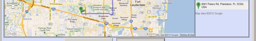
6 Using Google Map to Select the Route 6


7 Using Smartphones Solicit Volunteers and Install Free APP (GPS Tracker) Work Trip in the Morning Only Data Collection for Five (5) Weekdays Confidentiality Guaranteed Can Terminate Any Time 7
8 Survey Implementation From Feb 17, 2012 to March 22, Invitations Employment centers Professional organizations Local social and cultural organizations Social Media Survey Announcement Cards Residential communities Shopping centers Office buildings Dedicated Account for Communications 8
9 Route Comparison Tool 9
10 Example of Same Route 10
11 Example of Different Route 11
12 Preliminary Findings 12
13 1 & 2. Responds Home & Work Addresses Home Work 13
14 3. Stated Routes vs. Google Default Routes 0.0% 10.0% 20.0% 30.0% 40.0% 50.0% 60.0% 70.0% Different 37.8% Same 62.2% 14
15 5. Reported vs. Google Default Travel Time tes Reported Travel Time, minu Google Default Time, minutes 15
16 6.How Often Do You Use This Route? 0.0% 10.0% 20.0% 30.0% 40.0% 50.0% 60.0% 70.0% Every Weekday 62.6% Almost Every Workday 16.2% Often. Use Alternate Route 13.1% Sometimes. Routinely Use Alt. 3.8% Rarely. Make Mk Regular Int. Stops 35% 3.5% Refused 0.8% 16
17 7a.Travel time the route takes to work? 17
18 7b. Distance of the route? 18
19 7c. Amount of tolls to pay? 19
20 7d. Reliability of travel time? 20
21 7e. Number of traffic lights? 21
22 7f. Number of left turns? 22
23 7g. Real time road condition info? 23
24 7h. Presence of School zones? 24
25 7i. Safety of the neighborhood? 25
26 7j. Road construction? 26
27 7k. Scenic view of the road? 27
28 7l. Familiarity with the route? 28
29 7. Scores for Influencing Factors Physical Conditions Travel time the route takes to work Distance of the route 7.47 Amount of tolls to pay 6.18 Number of traffic lights 7.00 Number of left turns 4.59 Presence of School zones 6.75 Traffic Conditions Reliability of travel time 8.88 Availability of real time road condition information 5.77 Road construction 7.10 Other Conditions Safety of the neighborhood to go through 6.17 Scenic view of the road 3.81 Familiarity with the route
30 8. Other Factors Sample Comments Avoids traveling west to I 95 all other routes are typically just as congested i I prefer to ride my bike. I do not like question 6 Please note that I am a full time telecommuter. Other drivers using the roadway/safety More roadway Safety, less truck volumes, less tran i sometimes stop at the sheridan train station and finish the construction on I595 ASAP Avoid railroad crossings 30 The most important thing for me in choosing a rout Direct route connection. Amount of traffic most efficient, less traffic route Congestion quickest route have to factor in traffic lights, Avoid 1 95
31 9. Survey Respondents Gender Distribution 0.0% 10.0% 20.0% 30.0% 40.0% 50.0% 60.0% Female 42.9% Male 53.5% Refused 3.5% 31
32 10. Respondents Age Distribution 0.0% 10.0% 20.0% 30.0% 40.0% 50.0% 60.0% 70.0% 80.0% 29 or Younger 8.8% Years Old 69.4% 55 or Older 20.7% Refused 1.0% 32
33 11.Respondents Income Distribution 0.0% 10.0% 20.0% 30.0% 40.0% 50.0% 60.0% 70.0% Lower than $25, % $25,001 $40, % 9.3% $40,001 $ 75, % More than $75, % Refused 2.0% 33
34 12. Smartphone Use 0.00% 5.00% 10.00% 15.00% 20.00% 25.00% 30.00% 35.00% 40.00% No SmartPhone 21.21% iphone 36.87% Android 24.49% BlackBerry 13.13% Other 4.04% (blank) 0.25% 34
35 13. Use Cell Phone for Survey? 0.00% 10.00% 20.00% 30.00% 40.00% 50.00% 60.00% 70.00% No 57.58% Yes 20.45% (blank) 21.97% 35
36 GPS Route vs. Google Route Sample 1 Google Survey Route 36
37 GPS Route vs. Google Route Sample 1 GPS Route 37


38 GPS Route vs. Google Route Sample 2 Google Survey Route 38
39 GPS Route vs. Google Route Sample 2 GPS Route 39
40 Cell Phone GPS Data Very Small Sample Often Different from Google Default or Stated Routes Sometimes Missing Data Points Speed Data Inconsistent GPS Data Not Used for Analysis 40
41 Scores for Influencing Factors by Gender Physical Conditions Travel time the route takes to work Distance of the route Amount of tolls to pay Number of traffic lights Number of left turns Presence of School zones Traffic Conditions Reliability of travel time Availability of real time road condition information Road construction Other Conditions Safety of the neighborhood to go through Scenic view of the road Familiarity with the route Total Male Female


42 Model Route SERPM 652l 2005 AM Loaded Network Cube Path Building AM Congested Travel Time as Cost Variable 42


 12")
43 Example 1: Zone 873 Zone 210 Google Default and Reported SERPM 2005 AM Loaded Network Source Google Default Surveyor Reported Model Congested Travel Time (minutes)


")
44 Example 2: Zone 3984 Zone 3440 Google Default and Reported SERPM 2005 AM Loaded Network Source Google Default Surveyor Reported Model Congested Travel Time (minutes)


")
45 Example 3: Zone 2049 Zone 3228 Google Default and Reported SERPM 2005 AM Loaded Network Source Google Default Surveyor Reported Model Congested Travel Time (minutes)


")
46 Example 4: Zone1999 Zone1766 Google Default and Reported SERPM 2005 AM Loaded Network Source Google Default Surveyor Reported Model Congested Travel Time (minutes)
47 Example 4 Influencing Factors (175) Physical Conditions Group Individual Travel ltime the route tk takes to work Distance of the route Amount of tolls to pay Number of traffic lights Number of left turns Presence of School zones Traffic Conditions Reliability of travel time Availability of real time road condition information Road construction Other Conditions Safety of the neighborhood to go through Scenic view of the road Familiarity with the route


")
48 Example 5: Zone 3901 Zone 3261 Google Default and Reported SERPM 2005 AM Loaded Network Source Google Default Surveyor Reported Model Congested Travel Time (minutes)
49 Example 5 Influencing Factors (272) Physical Conditions Group Individual Travel time the route takes to work Distance of the route Amount of tolls to pay Number of traffic lights Number of left turns Presence of School zones Traffic Conditions Reliability of travel time Availability of real time road condition information Road construction Other Conditions Safety of the neighborhood to go through Scenic view of the road Familiarity with the route
50 Preliminary Findings Many Factors other than Time and Distance Influence People s Route Choice Decisions Reported Travel Times are in Five (5) Minutes Increment and Usually Longer Than Actual Travel Times Over 60% of Commuters Use the Same Routes Modeled Paths Could be Different from Actual Paths, thought More Analyses are Needed. 50
51 Summary Google Map Effective for the Survey More Tests Needed Due To Varying OS and Browsers Reached Target Sample Links More Effective than Announcement Cards Clear Description of the Purpose of the Survey More Encouragement/Incentives Needed for Using Personal Smartphones for the Survey 51
Executive Summary. TUCSON TRANSIT ON BOARD ORIGIN AND DESTINATION SURVEY Conducted October City of Tucson Department of Transportation
 Executive Summary TUCSON TRANSIT ON BOARD ORIGIN AND DESTINATION SURVEY Conducted October 2004 Prepared for: City of Tucson Department of Transportation May 2005 TUCSON TRANSIT ON BOARD ORIGIN AND DESTINATION
SoundCast Design Intro
 SoundCast Design Intro Basic Design SoundCast and Daysim 3 Land use attributes Households & Individuals SoundCast DaySim Travel demand simulator Trips and Households, Excel Summary Sheets, EMME network
1999 On-Board Sacramento Regional Transit District Survey
 SACOG-00-009 1999 On-Board Sacramento Regional Transit District Survey June 2000 Sacramento Area Council of Governments 1999 On-Board Sacramento Regional Transit District Survey June 2000 Table of Contents
STRAVA - DATA ACCESS AND USES. March 9, 2016 Shaun Davis + Dewayne Carver Florida Dept. of Transportation
 STRAVA - DATA ACCESS AND USES March 9, 2016 Shaun Davis + Dewayne Carver Florida Dept. of Transportation AGENDA Training Accessing the Data Data Characteristics Potential Uses Question and Answer WHAT
Cobb Community Transit
 Cobb Community Transit Ridership Survey January 2014 1 Methodology Paper survey of 315 CCT riders 165 on local routes (margin of sampling error: ± 7.6%) 150 on express routes (margin of sampling error:
EXECUTIVE SUMMARY... vii 1 STUDY OVERVIEW Study Scope Study Area Study Objectives
 Contents EXECUTIVE SUMMARY... vii 1 STUDY OVERVIEW... 1-1 1.1 Study Scope... 1-1 1.2 Study Area... 1-1 1.3 Study Objectives... 1-3 2 EXISTING CONDITIONS... 2-1 2.1 Existing Freeway Conditions... 2-4 2.1.1
Investigating Commute Mode and Route Choice Variability in Jakarta using multi-day GPS Data
 Investigating Commute Mode and Route Choice Variability in Jakarta using multi-day GPS Data Zainal N. Arifin Kay W. Axhausen Conference paper STRC 2011 Investigating Commute Mode and Route Choice Variability
Market Factors and Demand Analysis. World Bank
 Market Factors and Demand Analysis Bank Workshop and Training on Urban Transport Planning and Reform. Baku, April 14-16, 2009 Market Factors The market for Public Transport is affected by a variety of
Using SHRP 2 s NDS Video Data to Evaluate the Impact of Offset Left-Turn Lanes on Gap Acceptance Behavior Karin M. Bauer & Jessica M.
 Using SHRP 2 s NDS Video Data to Evaluate the Impact of Offset Left-Turn Lanes on Gap Acceptance Behavior Karin M. Bauer & Jessica M. Hutton 4 th International Symposium on Naturalistic Driving Research
U.S. Bicycling Participation Study
 U.S. Bicycling Participation Study Report of findings from the 2016 survey Conducted by Corona Insights Commissioned by PeopleForBikes Released July 2017 Table of Contents Background and Objectives 3 Research
BUILDING THE CASE FOR TRAVEL OPTIONS IN WASHING TON COUNTY. Image: Steve Morgan. Image: Steve Morgan
 BUILDING THE CASE FOR TRAVEL OPTIONS IN WASHING TON COUNTY Image: Steve Morgan Image: Steve Morgan Image: TriMet Image: TriMet WHAT ARE TRAVEL OPTIONS PROGRAMS? Travel options programs encourage residents,
METROPOLITAN TRANSPORTATION PLAN OUTREACH: INTERACTIVE MAP SUMMARY REPORT- 10/03/14
 METROPOLITAN TRANSPORTATION PLAN OUTREACH: INTERACTIVE MAP SUMMARY REPORT- 10/03/14 INTRODUCTION This document summarizes the results of the online interactive mapping exercise implemented by MIG for the
VI. Market Factors and Deamnd Analysis
 VI. Market Factors and Deamnd Analysis Introduction to Public Transport Planning and Reform VI-1 Market Factors The market for Public Transport is affected by a variety of factors No two cities or even
Eliminate on-street parking where it will allow for a dedicated bus only lane %
 Traffic Dashboard Priorities Survey Responses Introduction 1) Are you familiar with bus rapid transit (BRT)? a. No, BRT is new to me. 597 23.5% b. I ve heard of BRT, but I don t know much about it. 1,136
The specific activities consisted of:
 Mount Olive Development Corporation (MODCO) Speak Up Broward Program for Empowering People Dates of program: May 2014 August 2014 Communities Served: 33311, 33313, and 33301 Zip Code Areas Target Audience:
A Comprehensive HCM 2010 Urban Streets Analysis Using HCS 2010 US 31W in Elizabethtown, KY
 A Comprehensive HCM 2010 Urban Streets Analysis Using HCS 2010 US 31W in Elizabethtown, KY Ashley McLain, PE, PTOE Abstract The HCS 2010 Streets module was used to analyze a segment of the US 31W corridor
US 1 Express Lanes Public Kick-Off Meeting
 US 1 Express Lanes Project Development & Environment (PD&E) Study Public Kick-Off Meeting September 7 & 8, 2011 Miami Dade County, Florida 1 Presentation Agenda Introduction to MDX Background to PD&E studies
Model Applications for Oakland Park Boulevard Transit Corridor Study
 Model Applications for Oakland Park Boulevard Transit Corridor Study Southeast Florida FSUTMS Users Group June 13, 2014 Vikas Jain, AICP, GISP FDOT District Four Auditorium 3400 West Commercial Boulevard,
Baseline Survey of New Zealanders' Attitudes and Behaviours towards Cycling in Urban Settings
 Baseline Survey of New Zealanders' Attitudes and Behaviours towards Cycling in Urban Settings Highlights 67% of urban New Zealanders, 18 years of age or more own or have access to a bicycle that is in
Rail Station Fact Sheet University of Dallas Station
 Rail Station Fact Sheet University of Dallas Station Station Overview University of Dallas Station is located on John Carpenter Freeway and west of Loop 12 across from the University of Dallas in Irving.
BIKEPLUS Public Bike Share Users Survey Results 2017
 BIKEPLUS Public Bike Share Users Survey Results 2017 September 2017 Public Bike Share Users Survey Results 2017 The second annual Bikeplus survey combines robust data, and expert opinion to provide a snapshot
Title: Modeling Crossing Behavior of Drivers and Pedestrians at Uncontrolled Intersections and Mid-block Crossings
 Title: Modeling Crossing Behavior of Drivers and Pedestrians at Uncontrolled Intersections and Mid-block Crossings Objectives The goal of this study is to advance the state of the art in understanding
JONESBORO HIGHWAY 63 HIGHWAY 18 CONNECTOR STUDY
 JONESBORO HIGHWAY 63 HIGHWAY 18 CONNECTOR STUDY Craighead County May 2007 JONESBORO HIGHWAY 63 HIGHWAY 18 CONNECTOR STUDY Craighead County May 2007 Prepared by Planning and Research Division Arkansas State
Double Pair Comparisons PART III AGE & GENDER. Age and Crash Risk. Subject & control groups Relative risk or rate. Relative Accident Involvement Ratio
 Double Pair Comparisons PART III AGE & GENDER Subject & control groups Relative risk or rate Ratio of subject to control Relative Accident Involvement Ratio Age and Crash Risk RAIR = % at-fault % not at-fault
Clackamas County Comprehensive Plan
 ROADWAYS The County s road system permits the movement of goods and people between communities and regions, using any of a variety of modes of travel. Roads provide access to virtually all property. They
Project Report. South Kirkwood Road Traffic Study. Meadows Place, TX October 9, 2015
 Meadows Place, TX October 9, 2015 Contents 1 Introduction... 1 2 Data Collection... 1 3 Existing Roadway Network... 2 4 Traffic Volume Development... 2 5 Warrant Analysis... 3 6 Traffic Control Alternative
511 Public Information Materials for America s Cup Partners
 Joseph P. Bort MetroCenter 101 Eighth Street, Oakland, CA 94607-4700 511 Public Information Materials for America s Cup Partners Logo and Messaging Guidelines 2 Talking Points 4 Fact Sheet 5 Text for Partner
Travel and Rider Characteristics for Metrobus
 Travel and Rider Characteristics for Metrobus 040829040.15 Travel and Rider Characteristics for Metrobus: 2012-2015 Overview The Miami Dade County Metropolitan Planning Organization (MPO) conducted a series
Key objectives of the survey were to gain a better understanding of:
 3 COMMUNITY INPUT Community input is an essential part of corridor studies. For the SR 87 corridor study, VTA staff conducted an extensive online survey of people living and commuting along the corridor.
City of Hamilton s Transportation Master Plan (TMP) Public Consultation 3 December 2015
 Public Consultation 3 December 2015") City of Hamilton s Transportation Master Plan (TMP) Public Consultation 3 December 2015 McPhail Transportation Planning Services Ltd. AGENDA 6:00 7:00 pm Viewing Boards / Q & A with the Team 7:00 7:50
City of Hamilton s Transportation Master Plan (TMP) Public Consultation 3 December 2015 McPhail Transportation Planning Services Ltd. AGENDA 6:00 7:00 pm Viewing Boards / Q & A with the Team 7:00 7:50
2017 North Texas Regional Bicycle Opinion Survey
 2017 North Texas Regional Bicycle Opinion Survey Sustainable Development Program Kevin Kokes, AICP Public Meetings April, 2018 North Central Texas Council of Governments MPO for the Dallas-Fort Worth Region
BETHEL ROAD AND SEDGWICK ROAD CORRIDOR STUDY
 DRAFT PLAN City Council Meeting August 14, 2017 STUDY AREA Sedgwick Corridor State Route 160, principal arterial with Class 3 access management designation, commuter and freight route, connection to SR
Typical Rush Hour Commute. PennyforTransportation.com
 Typical Rush Hour Commute In the News Overview of the Plan Collaborative plan with projects in every community Prioritizing connectivity and congestion relief Dedicated transportation-specific funding;
Community & Transportation Preferences Survey
 Community & Transportation Preferences Survey Webinar: August 5, 2015 Hugh Morris, AICP, LEED Realtor.org Jennifer Dill, Ph.D. trec.pdx.edu 1 Introduction National Association of Realtors Over 1,000,000
WILMAPCO Public Opinion Survey Summary of Results
 Wilmington Area Planning Council WILMAPCO Public Opinion Survey Summary of Results Prepared by: 2955 Valmont Road, Suite 300 Boulder, Colorado 80301 t: 303-444-7863 f: 303-444-1145 www.n-r-c.com Table
A Conceptual Approach for Using the UCF Driving Simulator as a Test Bed for High Risk Locations
 A Conceptual Approach for Using the UCF Driving Simulator as a Test Bed for High Risk Locations S. Chundi, M. Abdel-Aty, E. Radwan, H. Klee and E. Birriel Center for Advanced Transportation Simulation
Minnesota Toward Zero Deaths: It's more than just a slogan
 Minnesota Toward Zero Deaths: It's more than just a slogan Kristine Hernandez, MBA Minnesota Toward Zero Deaths Program Coordinator May 2017 Toward Zero Deaths & Traffic Safety Culture Minnesota Timeline
CITY OF ABBOTSFORD TRANSPORTATION AND TRANSIT MASTER PLAN
 CITY OF ABBOTSFORD TRANSPORTATION AND TRANSIT MASTER PLAN EXECUTIVE COMMITTEE MONDAY, OCTOBER 2, 2017 TRANSPORTATION & TRANSIT AGENDA 1. Plan Overview 2. Shaping Influences 3. Existing Conditions and What
US 41 COMPLETE STREETS CORRIDOR PLANNING STUDY from University Parkway to Whitfield Avenue
 41 US 41 COMPLETE STREETS CORRIDOR PLANNING STUDY from University Parkway to Whitfield Avenue EXECUTIVE SUMMARY DRAFT FEBRUARY 2019 Project Overview The US 41 Complete Streets Corridor Planning Study,
Chapter 13 ORANGE COVE
 Chapter 13 ORANGE COVE This chapter describes the current status and future plans for biking and walking in the City of Orange Cove. RELATIONSHIP TO CITY PLANS AND POLICIES The Orange Cove General Plan
Rail Station Fact Sheet CentrePort/DFW Airport Station
 Rail Station Fact Sheet CentrePort/DFW Airport Station Station Overview CentrePort/DFW Airport Station is located by Statler Boulevard at Breezewood Drive in Fort Worth. Free shuttles connect the station
VISION Long Range Plan Update Board Workshop. February 10, 2016
 VISION 2040 Long Range Plan Update Board Workshop February 10, 2016 Vision 2040 Key Milestones UNDERSTAND THE NEED IDENTIFY A RANGE OF OPTIONS EVALUATE COMMUNITY OPTIONS DEFINE PROJECTS & PLANS Vision
Pre-Plan Consultation Summary
 Transportation Master Plan Pre-Plan Consultation Summary Thursday July 7, 2011 Presentation ti Outline Consultation Objectives Scope of Consultation Who Responded? What did we hear? How well did we connect?
2018 Transportation Survey October 17, Prepared by:
 Transportation Survey October 17, Prepared by: Overview Methodology Systemwide results Strengths/Weaknesses by mode Importance of possible improvements Conclusions Methodology 500 Chittenden County residents
Purpose and Need. For the. Strava Bicycle Data Project
 Purpose and Need For the Strava Bicycle Data Project April 2014 ODOT Strava Workgroup Margi Bradway*, Active Transportation Section Alex Bettenardi*, Transportation Planning Analysis Unit Phil Smith*,
Bike/Multipurpose Trail Study for Glynn County, Georgia MAY 16, 2016
 Bike/Multipurpose Trail Study for Glynn County, Georgia MAY 16, 2016 Agenda» Project Status Update» Draft Recommendations Overview» Next Steps» Questions/Discussion Project Overview» Comprehensive Bikeway
DKS & WASHINGTON COUNTY Washington County Transportation Survey
 PREPARED FOR: DKS & WASHINGTON COUNTY Washington County Transportation Survey April 2013 PREPARED BY: DHM RESEARCH (503) 220-0575 239 NW 13 th Ave., #205, Portland, OR 97209 www.dhmresearch.com 1 INTRODUCTION
New in the MUTCD: The Flashing Yellow Arrow Presented at the 57 th Annual Traffic and Safety Conference May 17, 2006
 New in the MUTCD: The Flashing Yellow Arrow Presented at the 57 th Annual Traffic and Safety Conference May 17, 2006 David A. Noyce, Ph.D., P.E. University of Wisconsin - Madison The FYA Story Research
Transportation 2040 Update: Eudora Public Input As of June 1, 2017
 Transportation 2040 Update: Eudora Public Input As of June 1, 2017 Overview... 1 Survey Responses... 2 Overview The Lawrence Douglas County Metropolitan Planning Organization (MPO) is updating our long
AAMPO Regional Transportation Attitude Survey
 AAMPO Regional Transportation Attitude Survey Traditionally Underserved Populations helping organizations make better decisions since 1982 2018 Submitted to the AAMPO By: ETC Institute 725 W. Frontier
February 2018 HIGHWAY 316 IMPROVEMENTS PROJECT
 February 2018 HIGHWAY 316 IMPROVEMENTS PROJECT Agenda 1 2 3 4 5 A Message from the City Project Area Traffic Conditions Pedestrian/Bicycle Comfort & Safety Next Steps Q&A City of Hastings Supports a study
The Who and What: Bus Rapid Transit Riders and Systems in the U.S.
 The Who and What: Bus Rapid Transit Riders and Systems in the U.S. Cheryl Thole December 12, 2013 Webinar Center for Urban Transportation Research University of South Florida Pre presentation How familiar
How familiar are you with BRT?
 The Who and What: Bus Rapid Transit Riders and Systems in the U.S. Cheryl Thole December 12, 2013 Webinar Center for Urban Transportation Research University of South Florida Pre presentation How familiar
Travel Survey November 2014
 Travel Survey November 2014 Minutes per person per week Introduction 60 Time spent cycling per week by age group 50 40 30 5 12 13 17 18+ 20 10 0 1989/90 1997/98 2003-06 2004-07 2005-08 2006-09 2007-10
Rail Station Fact Sheet DFW Airport North Station* (*station under construction with anticipated start of service in late 2018)
") Rail Station Fact Sheet DFW Airport North Station* (*station under construction with anticipated start of service in late 018) Station Overview DFW Airport North Station will be located on DFW nternational
Rail Station Fact Sheet DFW Airport North Station* (*station under construction with anticipated start of service in late 018) Station Overview DFW Airport North Station will be located on DFW nternational
Richmond, Adelaide and Simcoe Street Pilot Cycle Tracks. Special Report: Opinions of Property Representatives & Drivers
 Richmond, Adelaide and Simcoe Street Pilot Cycle Tracks Public Consultation Summary Special Report: Opinions of Property Representatives & Drivers Prepared by: Jason Diceman, Sr. Public Consultation Coordinator
2014 Regional Bicycle and Pedestrian Study Evaluation Tools Leslie A. Meehan, AICP MPO Technical Coordinating Committee Meeting April 1, 2015
 Mayor Mayor Kenneth Karl Dean, Wilber, Chairman 2014 Regional Bicycle and Pedestrian Study Evaluation Tools Leslie A. Meehan, AICP MPO Technical Coordinating Committee Meeting April 1, 2015 Evaluation
PASSENGER SURVEY RESULTS
 ROGUE VALLEY TRANSPORTATION DISTRICT PASSENGER SURVEY RESULTS Date: December 12, 2018 Project #: 21289 To: Paige West, RVTD From: Susan Wright, PE; Molly McCormick; (Kittelson & Associates, Inc.) Subject:
STUDY ADVISORY COMMITTEE. October 8, 2015
 STUDY ADVISORY COMMITTEE October 8, 2015 Study Purpose evaluate the long-term transportation strategies and investments needed to sustain the county s economic health and quality of life in the coming
Exhibit 1 PLANNING COMMISSION AGENDA ITEM
 Exhibit 1 PLANNING COMMISSION AGENDA ITEM Project Name: Grand Junction Circulation Plan Grand Junction Complete Streets Policy Applicant: City of Grand Junction Representative: David Thornton Address:
National Association of REALTORS National Smart Growth Frequencies
 September 520, 2017 3,000 Weighted Online Respondents National Association of REALTORS National Smart Growth Frequencies Q.2 The first question is about the quality of life in your community. How satisfied
Bicycle Helmet Use Among Winnipeg Cyclists January 2012
 Bicycle Helmet Use Among Winnipeg Cyclists January 2012 By: IMPACT, the injury prevention program Winnipeg Regional Health Authority 2 nd Floor, 490 Hargrave Street Winnipeg, Manitoba, R3A 0X7 TEL: 204-940-8300
Travel Demand Management. Travel Reduction Program Sun Rideshare Tucson On The Move
 Travel Demand Management Travel Reduction Program Sun Rideshare Tucson On The Move Travel Demand Management TDM in Tucson has changed over the last two to three years: Outreach and marketing to all residents,
GIS Based Non-Motorized Transportation Planning APA Ohio Statewide Planning Conference. GIS Assisted Non-Motorized Transportation Planning
 The Purpose of GIS Assisted Network GIS Assisted Non-Motorized Transportation 2011 APA Ohio Statewide Conference Friday, 10:45 AM to Noon Focus on near-term projects wwwgreenwaycollabcom The purpose of
Transportation Master Plan Advisory Task Force
 Transportation Master Plan Advisory Task Force Network Alternatives & Phasing Strategy February 2016 BACKGROUND Table of Contents BACKGROUND Purpose & Introduction 2 Linking the TMP to Key Council Approved
DOI /HORIZONS.B P23 UDC : (497.11) PEDESTRIAN CROSSING BEHAVIOUR AT UNSIGNALIZED CROSSINGS 1
 PEDESTRIAN CROSSING BEHAVIOUR AT UNSIGNALIZED CROSSINGS 1") DOI 10.20544/HORIZONS.B.03.1.16.P23 UDC 656.142.054:159.922(497.11) PEDESTRIAN CROSSING BEHAVIOUR AT UNSIGNALIZED CROSSINGS 1 JelenaMitrovićSimić 1, Valentina Basarić, VukBogdanović Department of Traffic
DOI 10.20544/HORIZONS.B.03.1.16.P23 UDC 656.142.054:159.922(497.11) PEDESTRIAN CROSSING BEHAVIOUR AT UNSIGNALIZED CROSSINGS 1 JelenaMitrovićSimić 1, Valentina Basarić, VukBogdanović Department of Traffic
Route User Intercept Survey Report
 Route User Intercept Survey Report Hills Road, Cambridge Fieldwork: October 2016 Report published: December 2016 1 About Sustrans Sustrans makes smarter travel choices possible, desirable and inevitable.
Traffic Safety Barriers to Walking and Bicycling Analysis of CA Add-On Responses to the 2009 NHTS
 Traffic Safety Barriers to Walking and Bicycling Analysis of CA Add-On Responses to the 2009 NHTS NHTS Users Conference June 2011 Robert Schneider, Swati Pande, & John Bigham, University of California
February Funded by NIEHS Grant #P50ES RAND Center for Population Health and Health Disparities
 Urban Use and Physical Activity Deborah Cohen, Thom McKenzie, Amber Sehgal, Stephanie Williamson, Daniela Golinelli, Multi-Cultural Area Health Education Center (MAHEC) Funded by NIEHS Grant #P50ES012383
6.0 PEDESTRIAN AND BICYCLE FACILITIES 6.1 INTRODUCTION 6.2 BICYCLE DEMAND AND SUITABILITY Bicycle Demand
 6.0 PEDESTRIAN AND BICYCLE FACILITIES 6.1 INTRODUCTION Bicycle and pedestrian travel along and in the vicinity of the corridor is part of the vision of Somerset and Hunterdon counties and the integrated
Merced County Association of Governments: Voter Survey
 Merced County Association of Governments: Voter Survey Page 1 Overview and Research Objectives Merced County Association of Governments commissioned Godbe Research to conduct a survey of local voters with
NO BUILD TRAFFIC OPERATIONS
 3. 23 NO BUILD TRAFFIC OPERATIONS This section addresses the operations of the transportation system and details how it would be expected to function under year 23 No Build conditions with the projected
Land Use and Transportation Town Hall September 17, 2018
 Land Use and Transportation Town Hall September 17, 2018 Welcome! Tonight s Agenda: 7:00-7:30 OVERVIEW PRESENTATIONS 7:30-8:15 BREAKOUT SESSIONS 8:15 - End TOWN HALL CITIZEN S TIME Purpose of Tonight s
Public Event 1 Community Workshops
 Public Event 1 Community Workshops Nov. 24 & Dec. 3, 2016 Welcome Workshop Purpose We re looking to you for ideas and insights to help guide future transportation infrastructure planning in the Park Lawn
Utilizing QR Codes and SurveyMonkey to Generate High School Travel Tally Data
 Utilizing QR Codes and SurveyMonkey to Generate High School Travel Tally Data Tuesday, August 13, 2013 Safe Routes to School National Conference Tonya Veitch, LCI Santa Clara County Public Health & Traffic
GIS Based Data Collection / Network Planning On a City Scale. Healthy Communities Active Transportation Workshop, Cleveland, Ohio May 10, 2011
 The Purpose of GIS Based Network Planning GIS Based Data Collection / Network Planning Healthy Communities Active Transportation Conference Tuesday, May 10, 2011 10:00 AM Norman Cox, LLA, ASLA. Ann Arbor,
Corridor Advisory Group and Task Force Meeting #10. July 27, 2011
 Corridor Advisory Group and Task Force Meeting #10 July 27, 2011 1 Agenda Recap CAG/TF #9 Public Meeting #2 Summary Single Mode Alternatives Evaluation Results Next Steps 2 3 CAG/TF #9 Recap CAG /TF #9
Online Open House Survey Report. December 2016
 December 216 I. OVERVIEW & OUTREACH SUMMARY Introduction Washington County evaluated long-term transportation investments and strategies as part of the Transportation Futures Study. The purpose of the
Community & Transportation Preferences Survey U.S. Metro Areas, 2015 July 23, 2015
 Community & Transportation Preferences Survey U.S. Metro Areas, 2015 July 23, 2015 Realtor.org trec.pdx.edu 1 Highlights: Generation gaps in everyday travel Only 71% of Millennials like driving (the lowest
395 Express Lanes Extension
 395 Express Lanes Extension January 2016 Building a network of Express Lanes Project overview Add capacity on I-395 with addition of a third HOV lane and active traffic management Generate guaranteed transit
City of Palo Alto Transportation Division Update
 Attachment 4 City of Palo Alto Transportation Division Update CAC Transportation Sub-Committee December 9, 20151 Agenda Transportation Project Updates Bike Program Update Parking Management Shuttle Re-Visioning
Encouragement. Chapter 4. Education Encouragement Enforcement Engineering & Facilities Evaluation & Planning. Encouragement Chapter 4
 Encouragement Education Encouragement Enforcement Engineering & Facilities Evaluation & Planning Photo above: Children show off their ribbons at the Tour de Virginia Beach. Virginia Beach Bikeways and
City of Cape Coral Traffic Calming. City Council May 16,
 City of Cape Coral Traffic Calming City Council May 16, 2016 1 In This Presentation Why Traffic Calming? What is Traffic Calming? Examples Traffic Calming in the City of Cape Coral How to develop a Traffic
2011 Countywide Attitudinal and Awareness Survey Results
 2011 Countywide Attitudinal and Awareness Survey Results Purpose of Study Establish baseline for measuring future performance Identify perceptions about transportation system, issues, priorities Assess
Satisfaction with getting to work 56% 15% 6% 6% Total distance travelled. miles per week
 Page/... Headlines Emersons Green Travel to Work Survey March 0 Number of respondents Main modes of travel (%) 0% Satisfaction with getting to work % % Satisfaction with getting % % % (driver with others/
The City of Newark Pedestrian and Bicycle Safety
 The City of Newark Pedestrian and Bicycle Safety Action Plan process involved significant community outreach efforts, including four Stakeholder/Steering Committee meetings and three Public Information
Satisfaction with getting to work 54% 14% 6% 5% Total distance travelled. miles per week
 Page/... Travel to Work Survey March 0 Headlines South Gloucestershire LA Area Number of respondents Main modes of travel (%) Satisfaction with getting to work % Satisfaction with getting % (driver with
Balboa Area Transportation Demand Management
 Balboa Area Transportation Demand Management April 2016 Presented by: Jeff Tumlin What Are We Aiming For? Transportation is not an end in itself. It is merely a means by which we support the community.
I-25 PEL: CO Springs Denver South Connection. Presentation to Castle Rock Town Council
 I-25 PEL: CO Springs Denver South Connection Presentation to Castle Rock Town Council June 20, 2017 An Important Corridor to Colorado Links the state s two major metropolitan areas and communities between
Detroiters need to be able to conveniently and reliably get to work, school, church, stores, and parks.
 Environment & MOBILITY Detroiters need to be able to conveniently and reliably get to work, school, church, stores, and parks. Several surveyed challenges related to lack of mobility ranked in the top
Citizen Advisory Group Meeting #8 May 5, Welcome. Today s meeting will focus on: Land Use & Transportation CHARLOTTEPLANNING.
 Citizen Advisory Group Meeting #8 May 5, 2010 Welcome. Today s meeting will focus on: Land Use & Transportation CHARLOTTEPLANNING.ORG Meeting Agenda Handouts: o Meeting Agenda o Summary of East Seventh
June 3, Attention: David Hogan City of San Mateo 330 W. 2oth Avenue San Mateo, CA 94403
 June 3, 2015 Attention: David Hogan City of San Mateo 330 W. 2oth Avenue San Mateo, CA 94403 Regarding: PA # 15-030, Bridgepointe Shopping Center 2202 Bridgepointe Parkway, APN 035-466-10 Dear David: Enclosed
Gold Team: Tempe Transportation. Group Members: Melissa Dobroski, Skylie Dosier, Jake Damle, Joseph Dean
 Gold Team: Tempe Transportation Group Members: Melissa Dobroski, Skylie Dosier, Jake Damle, Joseph Dean Outline Order of presentation: Introduction: Whats the Problem? Riding the 81 Line & Surveys Commuter
Application of Demographic Analysis to Pedestrian Safety. Center for Urban Transportation Research University of South Florida
 Application of Demographic Analysis to Pedestrian Safety BDV25 TWO 977 30 Pei Sung Lin, Ph.D., P.E., PTOE, FITE Program Director Achilleas Kourtellis, Ph.D. Senior Research Associate CUTR, University of
Tracking Bicyclists' Route Choices, Case Study: The Ohio State University
 MN WI MI IL IN OH USDOT Region V Regional University Transportation Center Final Report NEXTRANS Project No. 171OSUY2.2 Tracking Bicyclists' Route Choices, Case Study: The Ohio State University By Gulsah
Look Up! Positioning-based Pedestrian Risk Awareness. Shubham Jain
 Look Up! Positioning-based Pedestrian Risk Awareness Shubham Jain Does this look familiar? Pedestrians account for 14% of all traffic fatalities in the US *. In the last decade, 688,000 pedestrians injured
Data Analysis February to March Identified safety needs from reported collisions and existing travel patterns.
 Welcome! Thank you for participating in today s Valencia Bikeway Improvements workshop. Data Analysis February to March Identified safety needs from reported collisions and existing travel patterns. Initial
KING STREET TRANSIT PILOT
 STREET TRANSIT PILOT Update toronto.ca/kingstreetpilot #kingstreetpilot HIGHLIGHTS PREVIOUS HIGHLIGHTS TRANSIT RELIABILITY TRANSIT TRAVEL TIMES 85% of streetcars arriving within 4 minutes westbound during
MCTC 2018 RTP SCS and Madera County RIFP Multi-Modal Project Eval Criteria GV13.xlsx
 MCTC 8 RTP SCS and Madera County RIFP Multi-Modal Project Eval Criteria GV.xlsx Madera County Transportation Commission Regional Transportation Plan / Sustainable Communities Strategy Multi-Modal Project
LOOP 360 IMPROVEMENT STUDY
 LOOP 360 IMPROVEMENT STUDY Overview and Preliminary Analysis August 2015 1 STUDY PROCESS 2 Study Background Loop 360 serves a wide range of users, including residents, businesses, bicyclists, and commuters