Options. Agenda. Program
|
|
|
- Garey Sharp
- 5 years ago
- Views:
Transcription


1 July 2013 Workshops
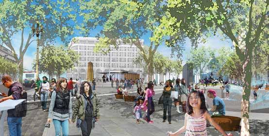
2 Agenda Parc 55 Main Library Open house 6-6:15pm 10-10:15am Presentation 6:15-7:00pm 10:15-11am Exhibit stations review & comments 7-8:20pm 11am - 12:20pm Meeting close 8:20-8:30pm 12:20-12:30pm Program Station 1: Three options and OWLs Proposals for three different design and transportation options. The options are also represented in a 3-D viewfinder. Options Station 2: Market Street - Six districts Help us create unique identities for Market Street s six districts - be creative! Stations 3-8: Representative blocks & plazas Conceptual designs for four blocks of Market and Mission Streets, illustrating the three design options, two plazas and two examples of proposed wayfinding signage. 3-1st Street to 2nd Street 4-3rd Street to 4th Street 5 - Hallidie Plaza & wayfinding at Stockton and Market 6-6th Street to 7th Street & 5th Street to 6th Street 7 - UN Plaza & wayfinding at Larkin Street and Market Street 8-9th Street to 10th Street
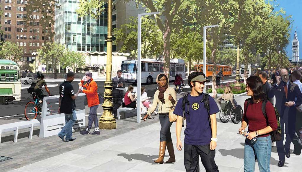
3 Option 1: Market Street Option 2: Market Street 15 ft 20 ft 13 ft 12 ft 12 ft 8.5 ft 15 ft 9,5 ft 15 ft 15 ft 7 ft 7 ft 8 ft 11 ft 12 ft 12 ft 8.5 ft 12 ft 7 ft 5.5 ft 15 ft SIDEWALK CURBSIDE BOARDING SHARED LANE TRANSIT LANE TRANSIT LANE BOARDING ISLAND SHARED LANE STREETLIFE ZONE SIDEWALK SIDEWALK STREETLIFE BICYCLE TRACK CURBSIDE ZONE BOARDING TRAVEL LANE TRANSIT LANE TRANSIT LANE BOARDING ISLAND TRAVEL LANE BICYCLE TRACK STREETLIFE ZONE SIDEWALK 35 ft 25 ft 12 ft 48 ft 37 ft 23 ft 12 ft 48 ft 60 ft 60 ft Market Street section 60 ft 60 ft Market Street section Streetlife Narrows sidewalk only where new boarding islands are located, leaving plenty of room for Streetlife Zone. Bicycle The existing cycletrack from Octavia to 8th remains with an improved super sharrow shared lane from 8th to Steuart. Pedestrian Retains most of the existing sidewalk space. Improvements include sidewalk widening, redesign of north side crosswalks, and traffic signal improvements. Auto restrictions Due to the shared bicycle / vehicular lane east of 8th, auto restrictions are recommended 7am to 7pm from Fremont to 8th to accommodate peak transit flow from the Transbay Terminal to 5th. Transit Retains four vehicular travel lanes and transit only center lanes. Boarding islands are upgraded to meet accessibility standards and improve waiting experience. Streetlife This cycletrack in this option requires narrowing of the sidewalk, leaving less room for Streetlife opportunities. Bicycle One-way cycletrack in each direction, from Steuart to Grant and 5th to Octavia, provides a safe, comfortable cycling experience. Pedestrian The cycletrack buffers pedestrians from vehicular traffic. The redesign of north side crosswalks and traffic signal improvements enhance pedestrian comfort and safety. Auto restrictions Due to the shared bicycle / vehicular lane from Grant to 5th, auto restrictions are recommended 7am to 7pm from Fremont to 5th to accommodate peak transit flow on Market from the Transbay Terminal, at 1st and Mission, to 5th. Transit Retains four vehicular travel lanes and transit-only center lanes. Boarding islands are upgraded to meet accessibility standards and improve waiting experience.
4 Option 3: Mission Street + Market Street Mission Street improvements in combination with Option 1- Market Street P 15 SIDEWALK 6.5 CYCLE TRACK 4 BUFFER 11.5 TRAVEL LANE 11.5 TRAVEL LANE 83 8 PARKING 5 BUFFER 6.5 CYCLE TRACK 5th Street-6th Street Section MISSION STREET Streetlife Invites an integrated district that connects Market to SoMa and activates the network of streets and alleys in between. Bicycle A one-way, buffered cycletrack on Mission, in each direction, from South Van Ness to the Embarcadero, with greenwave signal timing (synchronized lights for bicycles). Pedestrian The cycletrack provides a buffer for pedestrians from vehicular traffic, opportunity for additional mid-block signalized crosswalks on Mission, and wider sidewalks at 1st to 2nd and 3rd to 4th. Auto restrictions Maximum auto restrictions on Market are recommended 7am to 7pm from Steuart to Van Ness. New left turns from Mission help facilitate traffic crossing Market. Transit The 14/14L, Golden Gate Transit and SamTrans bus lines move to Market. This proposal requires making Market the transit priority corridor. Bicycles and automobiles would primarily use Mission. Parking and loading Parking on one side of Mission retained on most blocks west of 4th. Also, there will be locations for floating parking and loading between the vehicular lane and the cycletrack buffer. 15 SIDEWALK Mission Street section Market A-Z


5 BART portals BART is in the design phase of a project to install canopies over selected entrances to protect customers, employees and the escalators by providing better lighting at the entrance, the addition of security cameras and a way to close off the escalator stairwell when a station is closed. Current concepts call for a durable, transparent shelter which fits into the surrounding cityscape and incorporates environmentally sustainable features such as natural lighting and ventilation. The canopy is intended to not only provide a welcoming entryway into BART but to also extend the service life of the escalator, reduce repairs and improve reliability. The raised cycletrack will be a 7- to 8-foot wide lane with a 3-inch rolled curb for easy transition into the adjacent vehicle lane. It increases safety by reducing conflicts with buses and vehicles. Based on the current operating conditions on Market Street, cyclists traveling in a dedicated cycletrack will be able to maintain an average speed of 12 mph. The cycletrack makes it easier to pause, stop outside a store or use other amenities along the street; making a safer experience for cyclists of all ages; and minimizes maintenance costs because of limited motor vehicle wear. Cycletrack on Market - raised A cycletrack is part of a long-term investment requiring curb changes, utility upgrades, and other infrastructure modifications. This model is more costly and allows less flexibility for future growth, but adds a permanent dedicated bicycle facility.

 Financial (Fremont-3rd) Retail (3rd-5th) Mid-Market")


6 ST OV Market Street - six districts E HY DE GR ST EXPANDED PEDESTRIAN ZONE SHORTER CROSSING Eliminating pedestrian islands A unified design is proposed for Market Street with each district s unique identity expressed through Streetlife Zone furnishings. Help us create unique identities for Market Street s six districts by visiting Station 2! Market Street s six districts: Embarcadero (Embarcadero-Fremont) Financial (Fremont-3rd) Retail (3rd-5th) Mid-Market (5th-7th) Civic Center (7th-Van Ness) Octavia (Van Ness-Octavia) Pedestrian improvements bulbout SHORTER CROSSING NEW BULB-OUT AT CORNER 8TH ST WIDENED SIDEWALK STREETLIFE ZONE 8th Street & Hyde Street Hot Spot CYCLE TRACK OPTION CYCLE TRACK PEDESTRIAN ZONE Bulbouts TRANSIT LANE ONLY Adding bulbouts and redesigning the complicated north-side intersections creates a safer, more comfortable pedestrian experience. Bulbouts slow traffic crossing Market Street enhancing pedestrian safety. Eliminating pedestrian islands Extending the sidewalks would eliminate the need for midintersection pedestrian islands, improving safety and comfort and speeding the crossing time. The Embarcadero District extends from the Embarcadero to Fremont Street


7 Pedestrian throughway A 15-foot area of the sidewalk between buildings and the Streetlife Zone for clear pedestrian movement. Stormwater treatment planters Streetlife Zone stormwater runoff planter inlet bio-filter planter bio-filter soil media under drainage cleansed water to storm drain The stormwater planter is a functional landscape area designed to allow rainwater to flow into the ground instead of the overburdened sewer system, reducing the chance for flooding. It provides a high-density spacing of trees, shrubs, and groundcover that maximizes the ability for plant roots to clean pollutants and absorb runoff. Road surface variation A super sharrow is a wide green area striped to emphasize a shared space for bikes and vehicles. They contribute to traffic calming, increased awareness and a more pedestrian-friendly environment. Unique paving between sidewalk and boarding islands to alert vehicles this is a highvolume pedestrian area. Shared lane with super sharrow


8 Streetlife Hub Areas on Market Street for street furnishings, art and other activities where there is adequate space and key adjacent activities. Streetlife Hubs are within the Streetlife Zone. Streetlife Zone The Streetlife Zone is a multi-use zone located within the existing sidewalk width, between the curb and the pedestrian throughway. The zone creates a unique Market Street experience through design, materials and furnishing elements, which accentuate the best elements of each district.

9 Transit Boarding islands Current transit boarding islands are neither wide nor long enough for customer comfort and vehicle needs. The new designs will accommodate three or more buses, give waiting passengers more space, and comply with ADA guidelines to incorporate wheelchair ramps. (Minimum 8-feet wide x 175-feet long) Enhanced Local In the Enhanced Local transit option, the Local and Limited buses will stop at common locations. Bus lines will run in the center or curb lanes depending on their destination: Ferry Building lines in the center and Transbay Transit Center (TTC) lines curbside. Rapid In the Rapid transit option, Local and Limited buses will have separate stops. Limited buses will stop at the boarding islands and Local buses will stop at curbside stops. The Local and Limited stops will be 1/2 to 1 block apart.

10 Mission Street cycletrack with buffer The Mission Street cycletrack is 6- to 8-feet wide and separated from vehicular traffic by various types of 2- to 5-foot buffers such as paint, landscaping and safe-hit posts. A cycletrack makes it easier to pause, stop outside a store or use other amenities along the street; makes people, especially young and senior bicyclists, feel more safe; and minimizes maintenance costs because of reduced motor vehicle wear. Mission A-Z With bicycle-preferential signal timing (green waves), people on bicycles will receive fewer red lights and maintain an average speed of 14 mph. The Mission Street design will also allow left turns.


11 Continuous sidewalk A continuous sidewalk or table crossing enhances pedestrian safety and comfort by identifying the crosswalk as primarily pedestrian space. The sidewalk remains at curb level across the intersection requiring cars to drive over an elevated crosswalk that functions like a speed bump. This design is proposed for alleyways along Mission Street. Owl World premiere! Linden Alley, SF There are sections along the Mission Street where a wide cycletrack buffer is proposed, creating an opportunity for flex space. Due to Mission Street s 15-foot sidewalk, there is little space for street furnishings or other streetscape amenities. Flex space could be used for street furnishings, a bike corral, more robust landscape planting, or other urban design ideas identified for each location. Flex space 9th Avenue, Manhattan via NYC DOT s Street Design Manual The OWL allows users to immerse themselves in a 3-D model of Mission and Market streets of the future based on the designs presented at this workshop. OWL was designed to be a civic engagement tool to give the public a more detailed, immersive look at proposed construction projects. It is styled after art deco-style coin-operated binoculars, providing a familiar and inviting user experience. OWL was created by San Francisco-based Owlized and is powered by Autodesk, maker of 3-D design software. The device prototypes were designed using Autodesk Fusion 360 cloud service and run Autodesk InfraWorks software. They were 3-D printed at the Autodesk Gallery at One Market St.
12
13 Agency Teams Working on the Better Market Street Project: City Team San Francisco Department of Public Works San Francisco Municipal Transportation Agency San Francisco Planning Department San Francisco County Transportation Authority San Francisco Public Utilities Commission Office of Economic and Workforce Development Design Team Gehl Architects - Prime, Urban Design Lead Perkins+Will - Project Management CMG Landscape Architects - Streetscape Design Transportation Team Parisi Associates - Transportation Planning Nelson\Nygaard - Transit Planning Fehr & Peers - Bicycle and Vehicular Planning Specialists Kate Keating Associates - Wayfinding CHS Consulting Group - Transit Planning Urban Design Consulting - Civil Engineering CirclePoint - Outreach William Kanemoto Associates - Visualization A&M Printers - Printing Stormwater Management Study Nevue Ngan - Lead Design Wilsey Ham - Engineering bettermarketstreetsf.org
Better Market Street Project Update. Urban Forestry Council September 17, 2014
 Better Market Street Project Update Urban Forestry Council September 17, 2014 Project Area Limits Better Market Street Schedule Market Street City s busiest transit corridor Over 85 buses per hour 14 surface
Mission-Geneva Transportation Study Community Workshop 2 July 8, 2006
 Community Workshop 2 July 8, 2006 Small Group Workbook 1 Basic Improvements on Mission Street Streetscape. Pedestrian-scale lighting; landscaping; community art on utility boxes; more (possibly unique)
FOLSOM-HOWARD STREETSCAPE OVERVIEW
 FOLSOM-HOWARD STREETSCAPE OVERVIEW SoMa residents should have the same kinds of amenities that other neighborhoods have. The Folsom- Howard Streetscape Project will make SoMa more livable by making it
Better Market Street. Engineering, Maintenance & Safety Committee (EMSC) February 28, 2018
 February 28, 2018") Better Market Street Engineering, Maintenance & Safety Committee (EMSC) February 28, 2018 1 Market Street Market Street - San Francisco by rulenumberone2 2 Market Street is the... City s busiest pedestrian
Better Market Street Engineering, Maintenance & Safety Committee (EMSC) February 28, 2018 1 Market Street Market Street - San Francisco by rulenumberone2 2 Market Street is the... City s busiest pedestrian
Better Market Street Project. Project Update January 15, 2015
 Better Market Street Project Project Update January 15, 2015 Better Market Street Project Area Limits Market Street 2.2 Miles Mission Street Better Market Street Schedule Market Street City s busiest transit
Active Transportation Facility Glossary
 Active Transportation Facility Glossary This document defines different active transportation facilities and suggests appropriate corridor types. Click on a facility type to jump to its definition. Bike
APPENDIX A: Complete Streets Checklist DRAFT NOVEMBER 2016
 APPENDIX A: Complete Streets Checklist DRAFT NOVEMBER 2016 Complete Streets Checklist MetroPlan Orlando s Complete Streets Checklist is an internal planning tool for staff to further implementation of
CURBSIDE ACTIVITY DESIGN
 5 CURBSIDE ACTIVITY DESIGN This chapter provides design guidance for separated bike lanes adjacent to curbside activities including parking, loading and bus stops. Typical configurations are presented
MASONIC AVENUE STREET DESIGN STUDY Community Workshop 2. Masonic Ave Street Design Study Community Workshop 2 August 10, 2010
 Masonic Ave Street Design Study Community Workshop 2 August 10, 2010 Introduction MASONIC AVENUE STREET DESIGN STUDY Community Workshop 2 SF Municipal Transportation Agency Javad Mirabdal, Project Manager
Memo. Ocean Avenue Corridor Design Project Public Workshop #2 Summary
 Ocean Avenue Corridor Design Project Public Workshop #2 Summary The second public workshop for the Ocean Avenue Corridor Design Project was held on Wednesday, May 14, 2014 from, 6 to 8 pm at Lick Wilmerding
Chapter 3: Multi-Modal Circulation and Streetscapes
 CHAPTER 3: MULTI-MODAL CIRCULATION AND STREETSCAPES Chapter 3: Multi-Modal Circulation and Streetscapes Overview Streetscape improvements have already been completed for Depot Street between Main Avenue
San Jose Transportation Policy
 San Jose Transportation Policy Protected Intersections in LOS Policies to Support Smart Growth Presented by: Manuel Pineda City of San Jose Department of Transportation Bay Area Map San Francisco Oakland
Polk Streetscape Project
 What is this project? The Polk Streetscape Project is an effort to improve safety for everyone traveling on Polk Street between Union and McAllister streets. Also included in this project are paving, sewer
Bicycle and Pedestrian Advisory Committee (BPAC) November 21, 2013
 November 21, 2013") Bicycle and Pedestrian Advisory Committee (BPAC) November 21, 2013 OVERALL LAND USE CONCEPT Overall Broadway Valdez District: 95.5 acres (35.1 acres right-of ways + 60.4 acres developable land) Plan Subareas:
Bicycle and Pedestrian Advisory Committee (BPAC) November 21, 2013 OVERALL LAND USE CONCEPT Overall Broadway Valdez District: 95.5 acres (35.1 acres right-of ways + 60.4 acres developable land) Plan Subareas:
A CHANGING CITY. of Edmonton, it is essential that it reflects the long-term vision of the City.
 A CHANGING CITY By the year 2040, Edmonton will be home to more than 1 million people. To accommodate growth and support a healthy and compact city, we need a new approach to development/redevelopment
Omaha s Complete Streets Policy
 Omaha s Complete Streets Policy (Adopted August 2015) VISION To create great places and enhance our quality of life, the City of Omaha will provide safe, accessible streets for all users. Complete Streets
Replace century-old sewer & water pipes Pedestrian-scale sidewalk lighting
 PROJECT OVERVIEW The Masonic Avenue Streetscape Project is an effort to improve safety for everyone travelling on Masonic Avenue between Geary Boulevard and Fell Street. This project will bring a variety
STREETSCAPE CONCEPTS
 STREETSCAPE S CARGO WAY CARGO WAY CYCLE TRACK Streetscape Concepts JENNINGS ST Illustrative Plan EVANS AVE PG&E BAY TRAIL HERON S HEAD PARK The recommended improvements build off the planned improvements
Ocean Park Boulevard Green Street Project Alternatives & Trade Offs
 Planning Commission March 4, 2009 Ocean Park Boulevard Green Street Project Alternatives & Trade Offs Purpose of Tonight s Meeting Review concept plans and options Provide input on alternatives and trade-offs
Broad Street Bicycle Boulevard Design Guidelines
 Broad Street Bicycle Boulevard Design Guidelines Building from the strategies introduced in the 2013 Bicycle Transportation Plan and community input received thus far, City Transportation Staff have identified
Item to be Addressed Checklist Consideration YES NO N/A Required Description Complete Streets Guidelines
 Passaic County Complete Streets Checklist - Concept Development Project Name Item to be Addressed Checklist Consideration YES NO N/A Required Description Complete Streets Guidelines Existing Plans Have
A Guide to Great Streets: The Basics. September 25, 2009
 A Guide to Great Streets: The Basics September 25, 2009 Streets are more than connectors, they are the city 2 Streets are the glue that hold a city together 3 Streets are the means in which a city is perceived
Palou Complete Street Project Barneveld Avenue to Crisp Road Project overview and concept design Community Meeting #2 May 13, 2015
 Palou Complete Street Project Barneveld Avenue to Crisp Road Project overview and concept design Community Meeting #2 May 13, 2015 Agenda Welcome and introductions Project overview, history and goals Concept
THE ALAMEDA CONCEPT DESIGN COMMUNITY MEETING 3. A Plan for The Beautiful Way JANUARY 28, 2010
 CONCEPT DESIGN COMMUNITY MEETING 3 JANUARY 28, 2010 AGENDA INTRODUCTION COMMUNITY INPUT ROADWAY STUDIES STREETSCAPE DESIGN STATIONS DISCUSSION SUMMARY AND DISCUSSION NEXT STEPS CLOSE INTRODUCTION SCHEDULE
Protected Bike Lanes in San Francisco Mike Sallaberry SFMTA NACTO Workshop - Chicago IL
 Protected Bike Lanes in San Francisco Mike Sallaberry SFMTA 10 14 2011 NACTO Workshop - Chicago IL San Francisco 2 nd Highest Density in the U.S. 47 square miles Mild Climate Market Population ~810,000
MASONIC AVENUE STREET DESIGN STUDY Community Workshop 3. Masonic Ave Street Design Study Community Workshop 3 September 30, 2010
 Masonic Ave Street Design Study Community Workshop 3 September 30, 2010 Introduction MASONIC AVENUE STREET DESIGN STUDY Community Workshop 3 SF Municipal Transportation Agency Javad Mirabdal, Project Manager
6.4 RECOMMENDED IMPROVEMENTS
 6.4 RECOMMENDED IMPROVEMENTS 6.4.1 Williston Road Recommendations While all alternatives would be an improvement over existing conditions, Alternative 3B is recommended over the others because it provides
Report. Typical Sections. City of Middleton, WI
 Report Typical Sections City of Middleton, WI December 2006 Report for City of Middleton, Wisconsin Typical Sections repared by: Traffic Associates LLC and STRAND ASSOCIATES, INC. 910 West Wingra Drive
NJDOT Complete Streets Checklist
 Background The New Jersey Department of Transportation s Complete Streets Policy promotes a comprehensive, integrated, connected multi-modal network by providing connections to bicycling and walking trip
Active Transportation Rail to River Corridor. Community Meeting - Segment A
 Active Transportation Rail to River Corridor Community Meeting - Segment A June 29, 2017 Tonight s Agenda > Open House (30 min) > Welcome / Project Overview > Presentation of 30% Design Refinements > Next
Ann Arbor Downtown Street Plan
 1 Ann Arbor Downtown Street Plan Public Workshop #1 We know that. 2 Public right-of-way (streets, sidewalks, and alleys) make up 30% of the total District area of downtown. Streets need to provide mobility
Safe Routes to School Action Plan Aberdeen, Idaho
 Background Aberdeen, Idaho is a largely agricultural community of nearly 2,000 people and is located in the southeast portion of the state on the western edge of American Falls Reservoir. The community
RZC Appendix 8A Marymoor Subarea Street Requirements
 RZC Appendix 8A Marymoor Subarea Street Requirements For additional design details for Marymoor Subarea infrastructure, refer to the 2017 Marymoor Subarea Infrastructure Planning Report. STREET REQUIREMENTS
Streetscape: Core Shopping District
 Streetscape: Core Shopping District DRAFT DRAFT DRAFT May 00 Core Shopping District: Phase Blue Island s Core Shopping District is located along Western Avenue, between Grove and Union Streets. Streetscape
14 TH STREET TRANSPORTATION & STREETSCAPE DESIGN STUDY PLAN B PLAN B TRANSPORTATION & STREETSCAPE RECOMMENDATIONS
 14 TH STREET TRANSPORTATION & STREETSCAPE DESIGN STUDY PLAN B PLAN B TRANSPORTATION & STREETSCAPE RECOMMENDATIONS 141 Symbols Recommendations - Southern End of 14th Street Study Area Streetscape Each icon
Community Meeting February 27, 2007 Dorchester Avenue Transportation & Streetscape Improvements Action Plan February 27, 2007
 Community Meeting Tonight s Agenda 6:00 Introductions South Boston/Dot Ave Improvement Study Background 6:15 Consultant Introductions Review of Scope and Schedule Review of Proposed Corridor Wide Guidelines
El Camino Real Specific Plan. TAC/CAC Meeting #2 Aug 1, 2018
 El Camino Real Specific Plan TAC/CAC Meeting #2 Aug 1, 2018 Land Use Alternatives Goals and Tradeoffs Parks & open space Housing Retail & services Civic spaces Parking Community gathering spaces 3 Alternatives
Chapter 4 TOOLBOX AND SAMPLE BIKE BOULEVARD LAYOUT
 Chapter 4 TOOLBOX AND SAMPLE BIKE BOULEVARD LAYOUT OVERVIEW This chapter describes a cohesive set of strategies to create a bicycle boulevard, namely to make streets safer and more efficient for bicycle
HARRISON STREET/OAKLAND AVENUE COMMUNITY TRANSPORTATION PLAN
 HARRISON STREET/OAKLAND AVENUE Community Workshop #4: Draft Plan Review December 3, 2009 D E S I G N, C O M M U N I T Y & E N V I R O N M E N T INTRODUCTIONS Key Project Staff: Alisa Shen, Project Manager,
Lawrence Avenue Streetscape Concepts August 30, 2011
 Lawrence Avenue Streetscape Concepts August 30, 2011 Neighborhood Context Phase II: River to Western Ave. Phase I: Western Ave. to Clark St. Key Map Lawrence Ave. Existing Streetscape Conditions East of
Pedestrian and Bicycle Conditions
 Pedestrian and Bicycle Conditions Geary Citizens Advisory Committee May 8, 2014 SAN FRANCISCO COUNTY TRANSPORTATION AUTHORITY SAN FRANCISCO MUNICIPAL TRANSPORTATION AGENCY Topics Pedestrian Conditions
TRANSPORTATION COMMISSION Agenda Staff Report
 TRANSPORTATION COMMISSION Agenda Staff Report Agenda Item No. 5.a DATE: JULY 31, 2014 TO: FROM: SUBJECT: TRANSPORTATION COMMISSION COMMUNITY DEVELOPMENT DEPARTMENT - PLANNING DRAFT OLYMPIC CORRIDOR PREFERRED
MAG Town of Cave Creek Bike Study Task 6 Executive Summary and Regional Significance Report
 Page 1 MAG Town of Cave Creek Bike Study Task 6 Executive Summary and Regional Significance Report August 1, 2012 MAG Project #481 Page 2 Task 6 Executive Summary and Regional Significance Report Introduction
Cycle Track Design Best Practices Cycle Track Sections
 Design Best Practices Sections It is along street segments where the separation and protection methods of cycle tracks offer more comfort than conventional bicycle lanes, and are more attractive to a wide
FOCUS AREA 1 - Alberta Avenue Pocket Park 3 (121 Ave and 92 St)
") FOCUS AREA 1 - Alberta Avenue Pocket Park 3 (121 Ave and 92 St) New benches Plant evergreen trees Widen existing sidewalk from 1.5m to 1.8m Marked crosswalk 1.8m wide sidewalk Add pedestrian oriented lights
FOCUS AREA 1 - Alberta Avenue Pocket Park 3 (121 Ave and 92 St) New benches Plant evergreen trees Widen existing sidewalk from 1.5m to 1.8m Marked crosswalk 1.8m wide sidewalk Add pedestrian oriented lights
Welcome. If you have any questions or comments on the project, please contact:
 Welcome This drop-in public open house is intended to provide information about the Bay Street bike lanes project. This project proposes a dedicated cycling facility along Bay Street between Aberdeen Avenue
Figure 4-10: Pedestrian Improvements Types of Potential Station Area Improvements - Place-Making Improvements
 INCORPORATE FEATURE PAVIN IN CROSSWALK AND INTERSECTION FIELDS Identifies high-priority pedestrian areas and create a station identity through colorful and interesting patterns ADD CURB EXTENSIONS Extending
EXECUTIVE SUMMARY. Vision
 Vision Walking and bicycling in Salt Lake City will be safe, convenient, comfortable, and viable transportation options that connect people to places, foster recreational and economic development opportunities,
Geary Corridor Bus Rapid Transit: Staff-Recommended Alternative
 Geary Corridor Bus Rapid Transit: Staff-Recommended Alternative Urban Forestry Council January 24, 2014 SAN FRANCISCO COUNTY TRANSPORTATION AUTHORITY SAN FRANCISCO MUNICIPAL TRANSPORTATION AGENCY Today
Ocean Park Boulevard Streetscape Improvement Project Alternatives & Trade Offs
 City Council Study Session January 27, 2009 Ocean Park Boulevard Streetscape Improvement Project Alternatives & Trade Offs Scope of Work Purpose of Tonight s Meeting Review work to date and direct staff
5 CIRCULATION AND STREET DESIGN
 5 CIRCULATION AND STREET DESIGN This chapter describes circulation and streetscape improvements proposed for the Northwest Chico Specific Plan Area. It includes detailed design specifications for existing
Welcome to the Quebec Alternatives Analysis Public Meeting
 Welcome to the Public Meeting Please sign in. Public Comment Please fill out a comment card and tell us what you think. Check back or comment any time at: www.quebecalternatives.com Project Area Technical
City of Seattle Edward B. Murray, Mayor
 City of Seattle Edward B. Murray, Mayor Department of Transportation Scott Kubly, Director Eastlake Community Council 117 E Louisa St. #1 Seattle, WA 98102-3278 January 28, 2016 RE: Roosevelt to Downtown
INDOT Complete Streets Guideline & Policy
 INDOT Complete Streets Guideline & Policy INTRODUCTION The Complete Streets guidelines build upon multiple efforts and promote a multimodal transportation system that is integrated and sustains land use
Observations and Ideas: Toomer s Corner Streetscape Improvements
 Observations and Ideas: Toomer s Corner Streetscape Improvements AUBURN DOWNTOWN MASTER PLAN planning downtown s future August 26, 2013 Observations: Vertical Clutter at Corners 6 3 7 5 9 2 8 4 1 Excess
9/25/2018. Multi-Modal Level of Service (MMLOS) Bianca Popescu, Transportation Planner
 Bianca Popescu, Transportation Planner") Multi-Modal Level of Service (MMLOS) Bianca Popescu, Transportation Planner 1 What is MMLOS? Is this a nice place to walk? Is this a nice place to bike? Is transit convenient? Bottom line - Are there options
Multi-Modal Level of Service (MMLOS) Bianca Popescu, Transportation Planner 1 What is MMLOS? Is this a nice place to walk? Is this a nice place to bike? Is transit convenient? Bottom line - Are there options
STEERING COMMITTEE MEETING June 17, Streetscape Overview Burlington Comprehensive Master Plan
 STEERING COMMITTEE MEETING June 17, 2015 Streetscape Overview Burlington Comprehensive Master Plan 1 Introduction Slide This slide show was presented to the Burlington Steering Committee on June 17, 2015
SAN FRANCISCO MUNICIPAL TRANSPORTATION AGENCY
 THIS PRINT COVERS CALENDAR ITEM NO. : 10.2 DIVISION: Sustainable Streets BRIEF DESCRIPTION: SAN FRANCISCO MUNICIPAL TRANSPORTATION AGENCY Adopting Conceptual Proposal for Streetscape Improvements to Broadway,
Environment and Public Works Committee Presentation
 Mixed Use Centers Complete Streets Guidelines Project Environment and Public Works Committee Presentation December 10, 2008 Project Objectives: Conduct an inter-departmental and agency process to study
Multimodal Through Corridors and Placemaking Corridors
 68 Multimodal Through Corridors and Placemaking Corridors Corridors have different functions in a region. Some corridors are used to get smoothly and rapidly through a region or to get quickly to major
NEWMARKET UPHAM S CORNER
 SOUTH STATION Planning Initiative NEWMARKET UPHAM S CORNER COLUMBIA ROAD (P) FOUR CORNERS/GENEVA Working Advisory Group (WAG) Meeting #5 TALBOT AVENUE MORTON STREET BLUE HILL AVE/CUMMINS HWY (P) RIVER
Clybourn Ave. Protected Bike Lane Study Halsted St. to Division St.
 Clybourn Ave. Protected Bike Lane Study Halsted St. to Division St. Nathan Roseberry, Senior Engineer Pam Broviak, Project Manager July 24, 2014 Agenda Project Goals Existing Roadway Conditions Traffic
California Department of Transportation, District 4. Sloat Boulevard Project Skyline Blvd. to 19 th Ave. Community Update January 13, 2016
 California Department of Transportation, District 4 Sloat Boulevard Project Skyline Blvd. to 19 th Ave. Community Update January 13, 2016 Agenda Welcome and introductions Project overview, history and
7/23/2017 VIA . Michael Hanebutt City of Sacramento Community Development Department 300 Richards Boulevard, 3 rd Floor Sacramento, CA 95811
 7/23/2017 VIA EMAIL Michael Hanebutt City of Sacramento Community Development Department 300 Richards Boulevard, 3 rd Floor Sacramento, CA 95811 RE: 65 th Street Apartments (DR17-220) Dear Mr. Hanebutt:
TLC GRANT K / WATER STREETSCAPE ENHANCEMENTS WILL HANDSFIELD, AICP TRANSPORTATION DIR, GEORGETOWN BID
 TLC GRANT K / WATER STREETSCAPE ENHANCEMENTS Applied Fall 15 Awarded Winter 15/ 16 Notice to Proceed Spring 16 Completion Summer 16 Community Outreach Ongoing WILL HANDSFIELD, AICP TRANSPORTATION DIR,
El Centro Mobility Hub
 The El Centro drive shed comprises a major portion of the El Centro downtown area, which is well served by bus routes. The proposals intend to promote use of public transit through improvements and enhancements
Outreach Approach RENEW SF served as the primary liaison with the North Beach community; the Chinatown. Executive Summary
 Executive Summary Executive Summary The Columbus Avenue Neighborhood Transportation Study s objective is to identify changes to transportation infrastructure and policies that could enhance the livability
What Is a Complete Street?
 Session 5 Charleen Zimmer, AICP, Zan Associates May 5-7, 2010 What Is a Complete Street? May 2010 5-1 Not a Complete Street More of a Complete Street May 2010 5-2 Benefits of Complete Streets Safety for
DRAFT - CITY OF MEDFORD TRANSPORTATION SYSTEM PLAN Roadway Cross-Sections
 Roadway Cross-Sections Medford s roadway cross-section standards apply to new and reconstructed roads. The crosssections take into consideration roadway function and operational characteristics, including
Design Guidelines. Overview. Design Vision for Yellow Brick Road
 Design Guidelines Overview This section presents the design vision for the Yellow Brick Road network. The Yellow Brick Road is envisioned to be an interconnected network of safe and secure roadways where
SAN FRANCISCO MUNICIPAL TRANSPORTATION AGENCY
 THIS PRINT COVERS CALENDAR ITEM NO. : 10.3 DIVISION: Sustainable Streets Division BRIEF DESCRIPTION: SAN FRANCISCO MUNICIPAL TRANSPORTATION AGENCY Approving traffic and parking modifications to install
Southside Pilot Proposal
 To improve bicycle access and mobility to UC Berkeley, Downtown Berkeley, and the Southside area, a pilot project could include a two-way parking-protected cycle track. Turn pockets and island bus stops
WORKSHOP 2 SUMMARY OVERVIEW GENERAL COMMENTS. Walking and Biking. Greening & Stormwater. Transportation & Parking. Lighting, Art and Identity
 WORKSHOP 2 SUMMARY OVERVIEW On May 9, 2016, 55 people came to the second public meeting for the Lower Haight Public Realm Plan. Roughly 34 of attendees were neighborhood residents. The open house was a
Caltrans Sloat Boulevard Pedestrian Safety Project Response to Community Questions, Comments & Concerns
 Caltrans Sloat Boulevard Pedestrian Safety Project Response to Community Questions, Comments & Concerns Revised: May 10, 2016 The California Department of Transportation (Caltrans) is planning various
Make Lincoln Highway an economically vibrant corridor that is safe, efficient, and beautiful for local residents and visitors.
 Lincoln Highway Streetscape Plan Stakeholder Workshop #2 Handout Contents Introduction and Project Vision Planning Principles Specific Recommendations including a Proposed Typical Roadway Section Renderings
UPTOWN REGIONAL BIKE CORRIDORS PROJECT SAN DIEGO ASSOCIATION OF GOVERNMENTS
 UPTOWN REGIONAL BIKE CORRIDORS PROJECT SAN DIEGO ASSOCIATION OF GOVERNMENTS SUMMARY REPORT: COMMUNITY UPDATE MEETING February 6, 2014 6 8:30 p.m. Roosevelt Middle School Library 3366 Park Blvd, San Diego
C C C
 C-012-001 Thank you for your support for the creation of new public space and nonmotorized access between downtown and the waterfront through the Overlook Walk, the East-West Connections, and the Promenade.
25th Avenue Road Diet Project A One Year Evaluation. Transportation Fund for Clean Air Project #05R07
 25th Avenue Road Diet Project A One Year Evaluation Transportation Fund for Clean Air Project #05R07 Submitted by: The San Francisco Municipal Transportation Agency Dan Provence May 22, 2009 EXECUTIVE
ABOUT THIS OPEN HOUSE
 ABOUT THIS OPEN HOUSE Welcome, and thanks for joining us today for the Folsom-Howard Near-Term Project! The purpose of today s open house is to: Understand how the near-term project ties into the larger
Community Task Force November 15, 2017
 Community Task Force November 15, 2017 Welcome and Introductions Project Partners Regional Transportation District (RTD) Colorado Department of Transportation (CDOT) Denver Regional Council of Governments
Complete Streets. Designing Streets for Everyone. Sarnia
 Complete Streets Designing Streets for Everyone Sarnia Complete Streets ~ Sarnia ~ 2018 Introduction Our City is made up of a network of streets that we use to go for a walk, cycle to work, drive to the
WELCOME. Purpose of the Open House. Update you on the project. Present a draft recommended plan. Receive your input
 WELCOME Purpose of the Open House The Town of Smiths Falls has initiated the Beckwith Street Redevelopment Plan that includes the preparation of a streetscape functional design for the renewal of Beckwith
Miami Health District
 Miami Health District Streetscapes, Gateways, and Signage Basis of Design Report Study Miami Partnership Meeting July 21, 2008 Gannett Fleming EDAW The Corradino Group Sponsored by the Miami Partnership:
TRANSPORTATION NEEDS ASSESSMENT
 TRANSPORTATION NEEDS ASSESSMENT A travel demand analysis was carried out to determine the operational issues and the potential benefit that adding traffic capacity would have on the road network. All the
COWETA HIGH SCHOOL AND EAST HIGHWAY 51
 COWETA HIGH SCHOOL AND EAST HIGHWAY 51 Lack of sidewalks along Ben Lumpkin Rd. Lack of crosswalks and ramps at intersection. Hwy 51 is wide to cross as a pedestrian. No ADA compliance or connection to
Agenda. Overview PRINCE GEORGE S PLAZA METRO AREA PEDESTRIAN PLAN
 PRINCE GEORGE S PLAZA METRO AREA PEDESTRIAN PLAN May 28, 2008 Agenda Welcome and introductions Project overview and issue identification Planning context and strengths Design challenges and initial recommendations
Project Goal and Description. Why Broadway? Broadway SFMTA.COM/BROADWAY. The goal of the Broadway Safety Improvement
 PROJECT OVERVIEW Project Goal and Description The goal of the Broadway Safety Improvement d St Van Ness Ave Project is to improve safety and comfort for all who Franklin St Hyde St Octavia St Gough St
COMPLETE STREETS PLANNER S PORTFOLIO
 COMPLETE STREETS PLANNER S PORTFOLIO ISSUE 3 APRIL 2016 PLANNER S PORTFOLIO COMPLETE STREETS 1 2 6 10 14 OVERVIEW MATURE NEIGHBORHOODS GROWING SUBURBS CENTRAL PLACES ACTIVITY CORRIDORS Planner s Portfolio
TOWN OF MORAGA MORAGA WAY AND CAMINO PABLO/CANYON ROAD IMPROVEMENTS Town Council Meeting March 13, 2019
 TOWN OF MORAGA MORAGA WAY AND CAMINO PABLO/CANYON ROAD IMPROVEMENTS Town Council Meeting March 13, 2019 1 Edric Kwan, Public Works Director Josh Peterman, Principal, Fehr and Peers Shawn Knapp, Senior
Figure 5-1 Complete Street Zones. Roadside. May include frontage, pedestrian throughway, furnishings and curbside areas.
 Design Guidelines 5 The design guidelines presented in this section provide descriptions related to the form and function of the four Complete Streets zones: roadside, parking, roadways and lanes, median,
STONY PLAIN ROAD STREETSCAPE
 Jasper Place Revitalization Strategy: Vision The people involved in the Jasper Place Revitalization Strategy envision: Goal 1: Feeling safe in our community Create a community where feeling safe is common--where
CURB EXTENSIONS BULB OUTS DPS 201 NECKDOWNS
 CURB EXTENSIONS BULB OUTS DPS 201 NECKDOWNS WHY WHEN & WHERE When Limited Sight Distance Pedestrians & Vehicles Vehicles and Signs Want to put two curb ramps in Discourage High speed turning High number
MARTIN LUTHER KING JR. WAY
 OCTOBER 2011 40 Vision and Goals The Martin Luther King, Jr. Way Illustrative Master Plan that follows has been developed through a process of community involvement. It expresses a long term vision for
 COMPLETE STREETS CHECKLIST City of Philadelphia The City of Philadelphia's Complete Streets policies are designed ensure that city streets are safe, comfortable and convenient for people of all ages and
Fulton Market Streetscape
 Fulton Market Streetscape Ogden Avenue to Halsted Street Public Meeting Recommended Improvements December 10th, 2014 Meeting Purpose and Goals Present Existing Conditions Community Input and Charrette
Street Design Workshop. Existing cross section Traffic volumes Examine adjacent land uses You design future improvements
 Street Design Workshop Existing cross section Traffic volumes Examine adjacent land uses You design future improvements Primary Tools for Street Redesign Road diets Bike lanes Cycle tracks Trails Crosswalks
PUBLIC REALM MASTER PLAN
 WESTSHORE BUSINESS DISTRICT PUBLIC REALM MASTER PLAN MASTER PLAN COMMITTEE MEETING MARCH 20, 2013 WESTSHORE BUSINESS DISTRCT PUBLIC REALM MASTER PLAN MACRO-SCALE CONCEPT: A PUBLIC REALM FRAMEWORK DEFINED
TRAVEL PLAN: CENTRAL EUROPEAN UNIVERSITY CAMPUS REDEVELOPMENT PROJECT TRAVEL PLAN. Central European University Campus Redevelopment Project.
 TRAVEL PLAN Central European University Campus Redevelopment Project Page 1 Table of Contents Introduction... 3 Background... 7 Building Users... 7 Transportation in Community Consultation... 7 Summary
Transportation Assessment
 Transportation Assessment Midtown Open House February 10, 2018 Overview Midtown in Focus Overview & Purpose of Today Transportation Assessment overview Summary of Transportation work to date Review & Analysis
Off-road Trails. Guidance
 Off-road Trails Off-road trails are shared use paths located on an independent alignment that provide two-way travel for people walking, bicycling, and other non-motorized users. Trails specifically along