Cycle Tracks: Concept and Design Practices. February 17, 2010
|
|
|
- Russell Hodge
- 6 years ago
- Views:
Transcription
1 Cycle Tracks: Concept and Design Practices February 17, 2010
2 Today s webinar presenters APBP Board Member Host Brett Hondorp, Principal, Alta Planning + Design Guest Moderator Zach Vanderkooy, Bicycling Design Best Practices Project Coordinator, Bikes Belong Peter Furth, Professor of Civil Engineering, Northeastern University Cara Seiderman, Transportation Program Manager, City of Cambridge, Mass. Rob Burchfield, City Traffic Engineer, Portland (Ore.) Bureau of Transportation Hayes Lord, Director, Bicycle Program, NYC Department of Transportation

3 Cycle Tracks: Concept and Design Practices Part 1: General Design, Intersection Safety Treatments, and Safety Studies Peter Furth Northeastern University apbp webinar, Feb 17, 2010

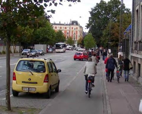
4 Cycle track (n): A bicycle path along a road, physically separated from motor traffic, and distinct from the sidewalk. 4 Not a shared use path not used by pedestrians Other terms: sidepath, bike path, raised lane, separated lane One-way and two-way versions exist
5 Why Cycle Tracks? #1 reason for not riding a bike = Traffic danger Dutch Guide recommended treatments Multilane road with speed limit > 20 mph: Cycle Track AASHTO Guide for the Development of Bicycle Facilities doesn t understand this desire for separation. Consider two options: mph multi-lane highway with 5-ft shoulder 2. Parallel route on local streets connected by bike paths most experienced and many casual adult riders will continue to use the shoulder for the sake of speed and convenience. 5
6 Engineering Guidance AASHTO Guide has no guidance on cycle tracks It has 9 warnings about parallel shared use paths: Not relevant to one-way cycle tracks 2-way cycle tracks have intersection and endpoint concerns similar to shared use paths, which can be addressed Other 7 concerns about parallel paths are silly Other sources of engineering guidance: Dutch Design Manual for Bicycle Traffic (CROW) 6


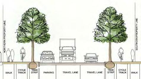
7 Physical Separation from motor traffic: Curb, raised median, parking lane, planting buffer, bollards, Levels: Street level, sidewalk level, in between 7


8 Separation from Pedestrians Painted line Change in level full or partial Vertical elements Different surface 8
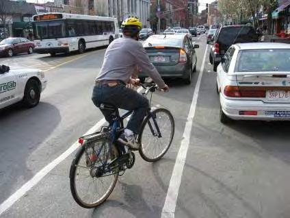
9 Width and Functionality About 3.75 ft/ lane Buffers at edges Provision for Passing? One-way with passing: 7.5 ft Two-way, 2 lane 7.5 ft Obvious space advantage of 2-way Wider is better, but Narrow can work, too 9

10 Safety: One-Way or Two-Way? Europe: Better safety record with one-way cycle tracks Reasons for 2-way Space limitations Wrong-way bicyclists Difficult street crossings 10
 Color")
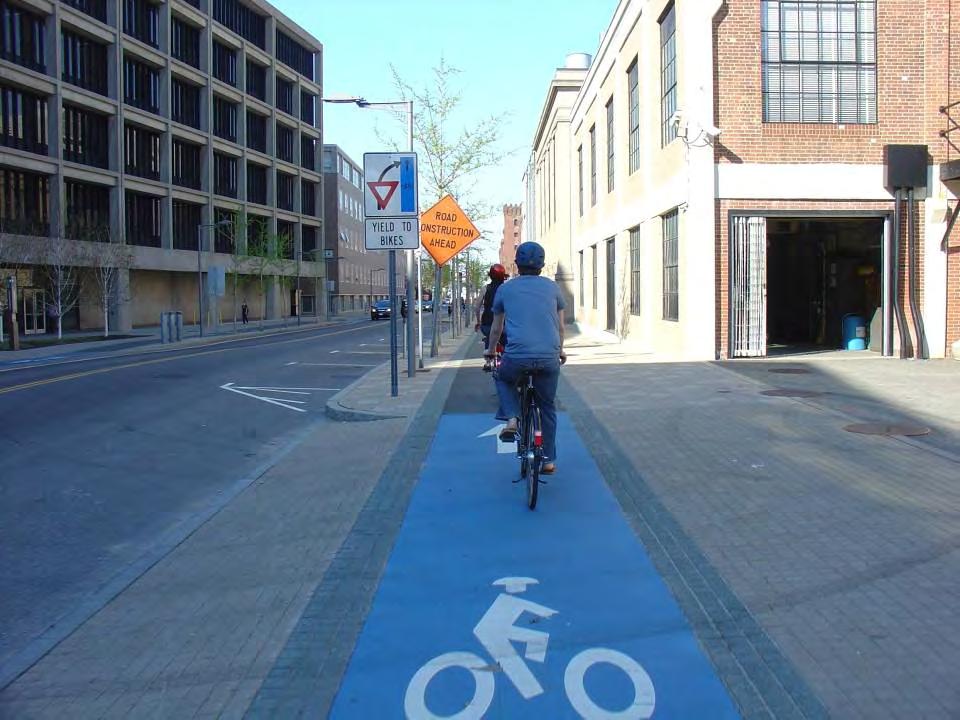
11 Safety at Driveways & Minor Intersections: Make it look like a bicycle crossing, not a parking lane or sidewalk Bike silhouettes (Paris, Montreal) Color (Copenhagen) 11

12 Raise sidewalk & cycle track Makes priority clear Speed bump effect 12
13 At signalized intersections Left turn on green arrow only ( Protected left ) Bicycle signal heads if bikes green period will differ from cars 13


14 Leading thru arrow protects first flush of waiting bikes 14

15 Right-Turn Lanes Controlled by Green Arrows 15


16 Endpoints and Transitions Don t dump wrong-way traffic into street 16

17 Jughandles for Safer Crossovers B 17 A


18 18 Corral for turning bikes to wait
19 Myth of the Danger of Separated Paths False Sense of Security Origin: Vehicular cycling theory, not data Massive European experiment dismissed I ve heard that separated paths have 5 times greater crash risk. Moritz (TRR, 1997) 12 crashes (4.1%) on Other : sidewalks, parking lots,? Less than 1% of bicycling-miles on Other facilities Other Sidewalk Separated path??? Confused data, insufficient exposure 19
20 Comparative Studies of Bicycling, In- Street vs on-path Wachtel & Lewiston (ITE Journal, 1994) compared sidewalk bikeways to streets : Relative crash risk on sidewalk is1.8 Intersection crashes only! Accounting for mid-block crashes: relative risk is equal Ride in same direction as closest travel lane: sidewalk risk is 50% of instreet risk Montreal cycle tracks (publication pending), 10 years data, hundreds of crashes Crash risk in cycle track is 28% smaller than in-street risk In spite of non-ideal cycle track designs Conclusion: Perceived safety and Statistical safety are not at odds 20
21 Cycle Tracks: Concept and Design Practices APBP Webinar February 17, 2010 Cara Seiderman City of Cambridge, MA
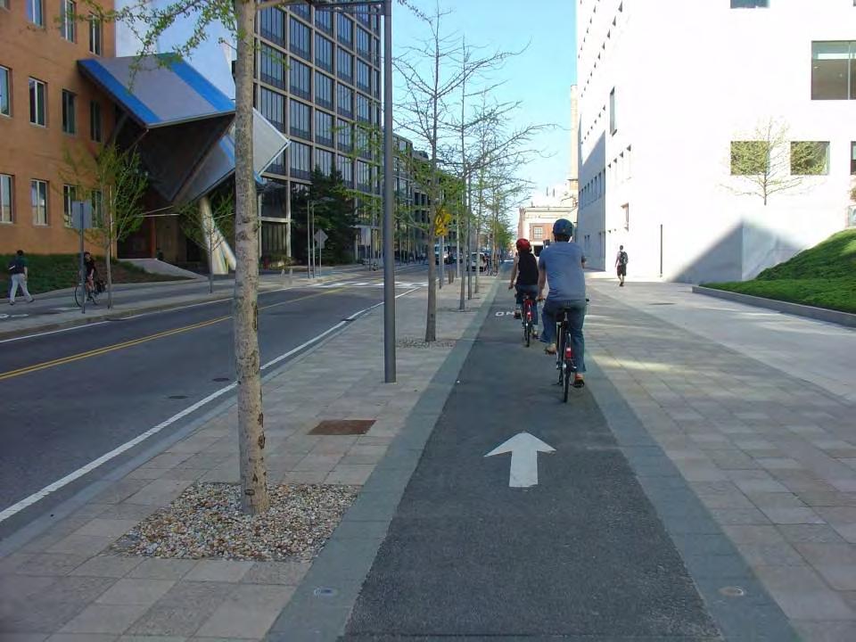
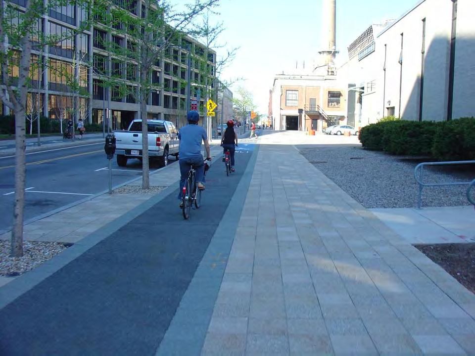
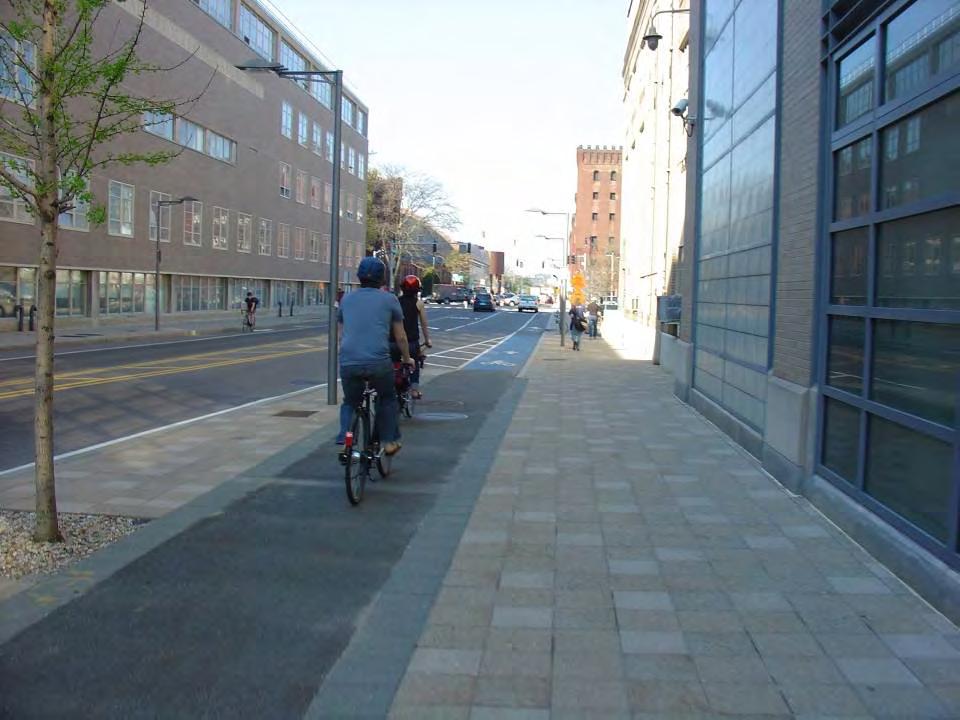
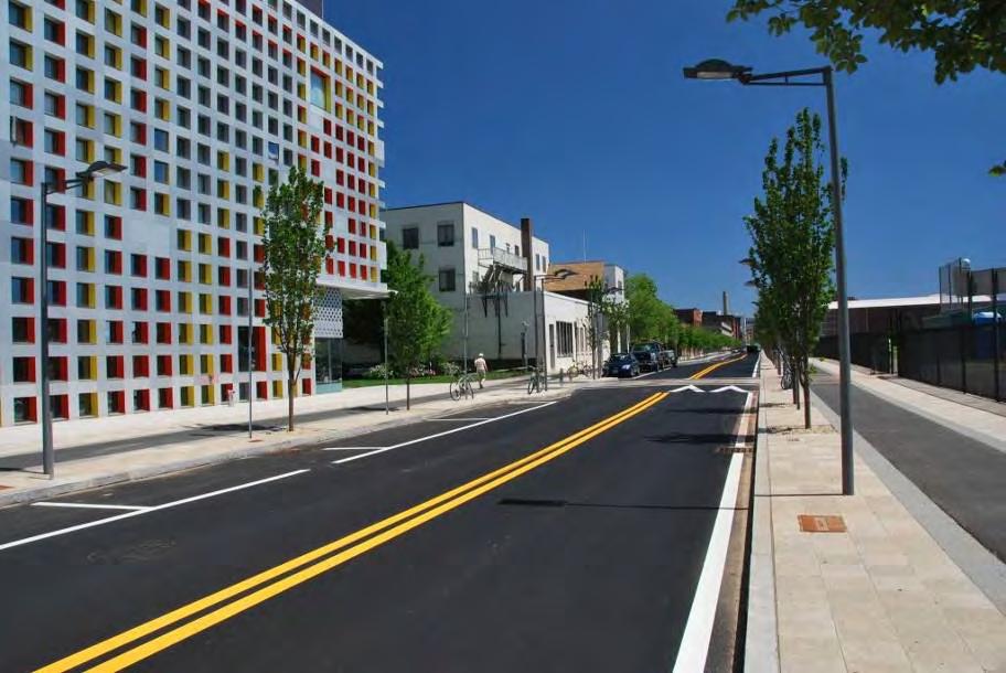
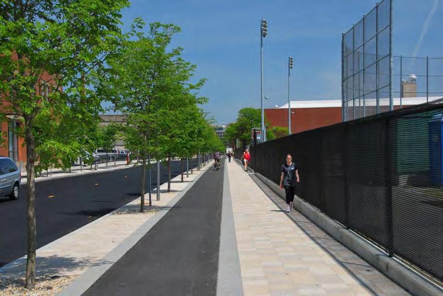
22 Improve Safety Why Cycle Tracks? Eliminate Bike Lane/Shared Lane Obstructions Comfort, especially on High Speed/Volume Roadways Continuity of Pathway Experience Attract new riders Support Economic Development Enhance Pedestrian Environment/Urban Design Support Environmental/Climate Goals Support Transportation Goals Support Quality of Life Goals Support Public Health Goals, Especially for Children


23 Design Users

24 The Real World


25 People prefer cycle tracks

26 You Choose

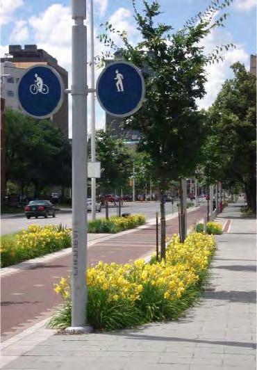
27 Cambridge, MA Our Fair City
28
29


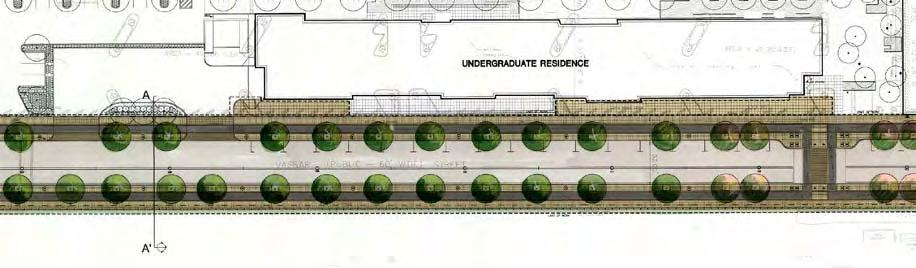
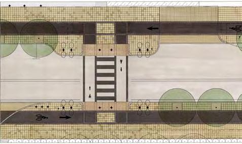
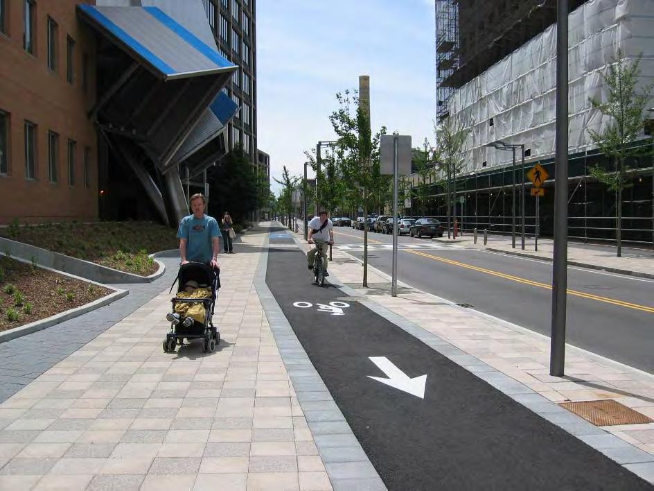
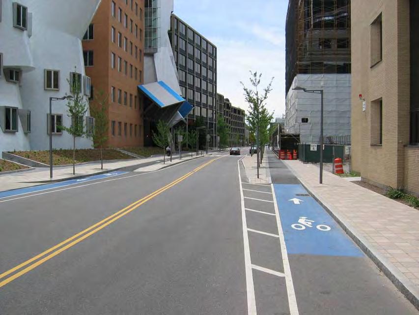
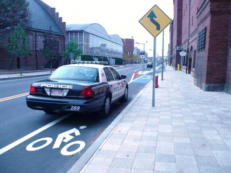
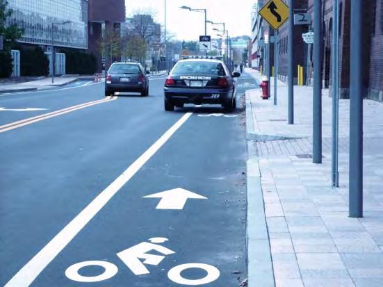
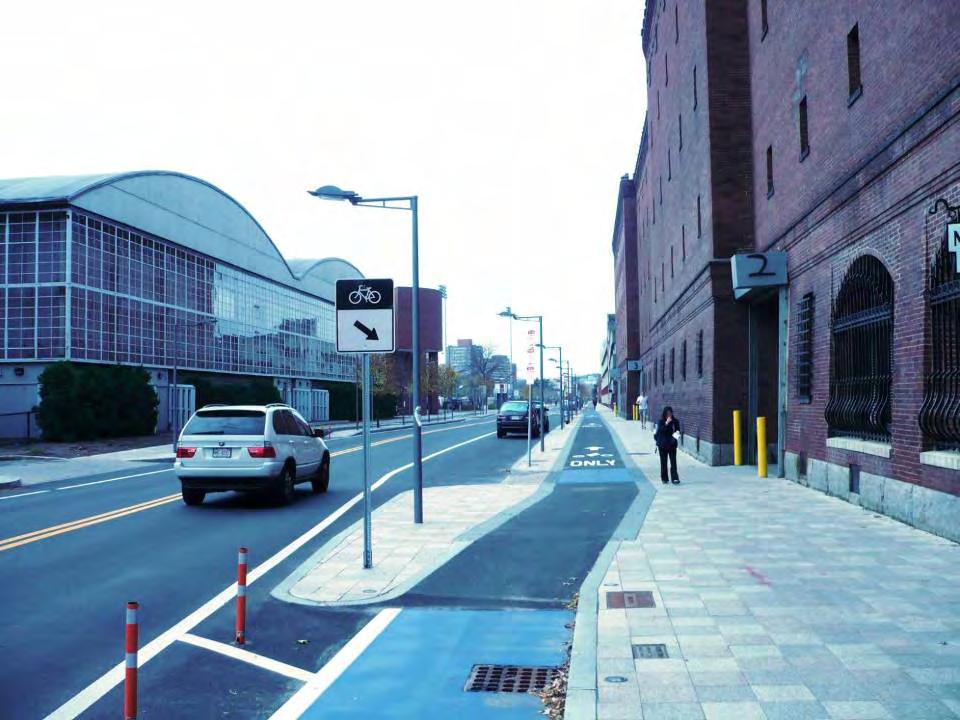
30 Vassar Street
31
32
33
34
35
36
37
38
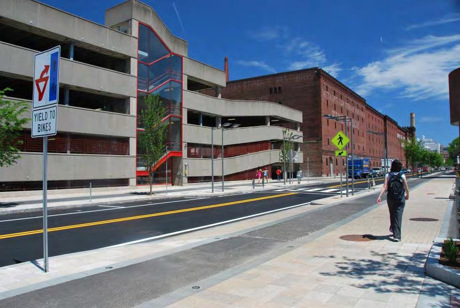
39
40
41
42
43
44
45
46

47 Binney Street
48 Binney Street

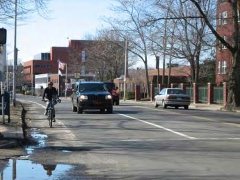
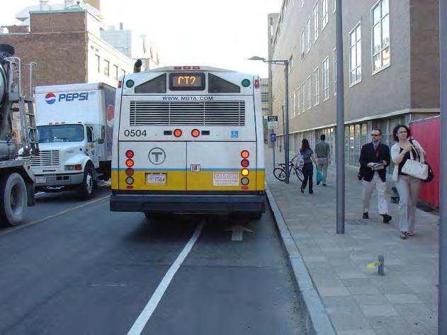
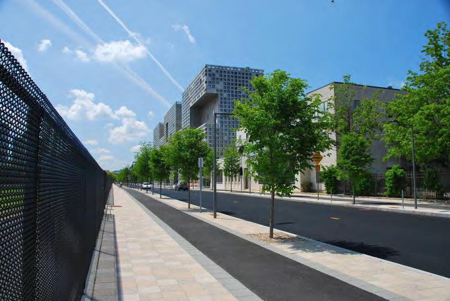
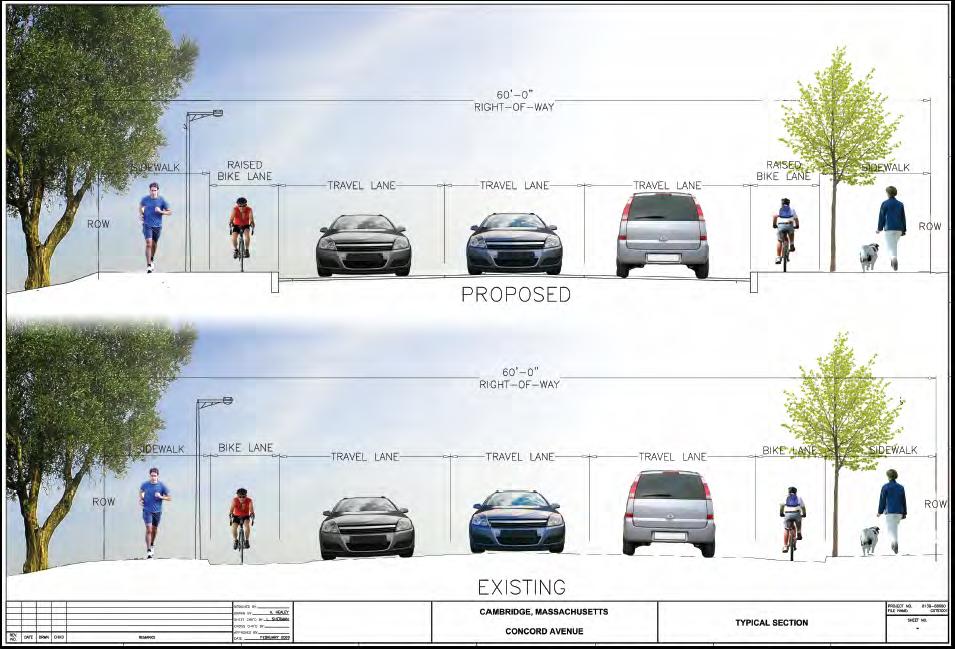
49 Concord Avenue
50

51
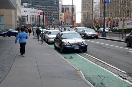
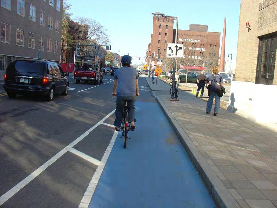
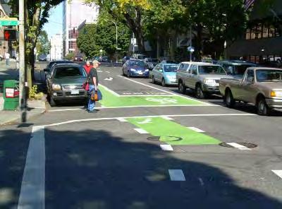
52 Portland s CYCLE TRACK SW Broadway (SW Clay to SW Jackson) By Robert Burchfield, PE Portland Bureau of Transportation Cycle Tracks: Concept and Design Practices The Association of Pedestrian and Bicycle Professionals FEBRUARY 17, 2010


53 PORTLAND BUREAU OF TRANSPORTATION Project OVERVIEW Cycle track project stretches seven blocks along SW Broadway on the PSU campus Originally 3 lanes one-way southbound Outside southbound lane converted to on-street parking Seven foot wide bike lane at curbside Three foot shy zones separate cycle track from parking stalls PORTLAND STATE BROADWAY BROADWAY JACKSON CLAY DOWNTOWN PORTLAND

54 PORTLAND BUREAU OF TRANSPORTATION Broadway Cycle Track CROSS SECTION SW Broadway Cycle Track Portland, Oregon 50


55 Broadway Cycle Track PUBLIC OUTREACH PORTLAND BUREAU OF TRANSPORTATION


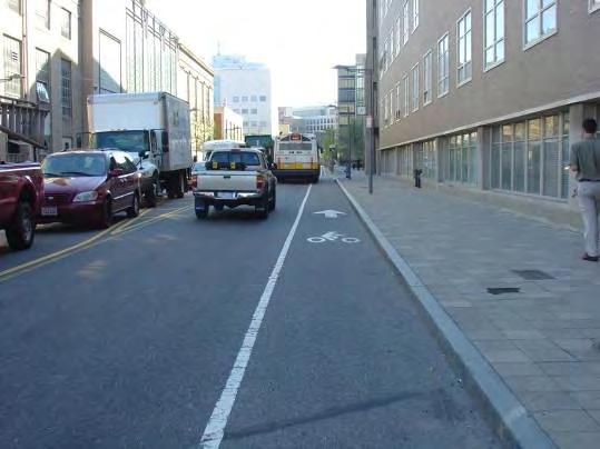
56 PORTLAND BUREAU OF TRANSPORTATION Broadway Cycle Track MARKINGS Looking south from SW Montgomery Typical mid-block marking Looking north from SW Clay

57 PORTLAND BUREAU OF TRANSPORTATION BUS STOP Treatment During morning peak hours, buses service at two stops along the cycle track. Buses will still pull to the curb TriMet bus zone along cycle track north of SW Montgomery (looking south)


58 LEFT HAND TURN Treatment Two Stage, with Bike Box Cyclist left hand turn area at SW Montgomery Street PORTLAND BUREAU OF TRANSPORTATION JONATHAN MAUS / BIKEPORTLAND.ORG

59 PORTLAND BUREAU OF TRANSPORTATION Broadway Cycle Track CHALLENGES Parking Enforcement Pay Stations Enforcement Officers use buffer area when placing citation Temporary parking removal using magnetic base flexible posts Street Cleaning Cycle Track plus buffer is wide enough to accommodate a street sweeper Leaf fall is heavy in autumnextra cleaning needed JONATHAN MAUS / BIKEPORTLAND.ORG Wheel Chair User Access Concerns from users regarding wheelchair van loading Cycle Track may be used by wheelchairs


60 PORTLAND BUREAU OF TRANSPORTATION Future CYCLE TRACK project NE Cully Boulevard Cycle track Parking Crossing with left hand turn boxe Cycle track Cycle track Cycle track

61 PORTLAND BUREAU OF TRANSPORTATION Thank You. Robert Burchfield, PE City Traffic Engineer Portland Bureau of Transportation 1120 SW 5 th Avenue, Suite 800 Portland, OR Phone: Robert.burchfield@pdxtrans.org JONATHAN MAUS / BIKEPORTLAND.ORG


62 Cycle Tracks: Concept and Design Practices. The New York City Experience Broadway Hayes A. Lord Director, Bicycle Program NYC Department of Transportation February 17, 2010

63 3 years 200 miles ,650 commuter cyclists 420 lane miles 0.8 miles of on-street protected paths ,495 commuter cyclists Over 645 lane miles Over 10 miles of onstreet protected paths


64 NYC s Toolbox of Design Treatments Signal Protected Path 2-Way Protected Path Separated Path with Mixing Zone Cycle Track
65 9 th Avenue Existing Conditions 2006
: Peak Hour traffic volume: 1,700 vph 4 Travel Lanes S I D E W A L K East 10 Buffer 6 10 Parking Lane 12 Moving Lane 70 feet 11 Moving Lane 11 Moving Lane 10 Parking/ Loading Lane")
66 9 th Avenue Existing Conditions (2006): S I D E W A L K 11 Parking/ Loading Lane West 12 Moving Lane 12 Moving Lane 12 Moving Lane 70 feet 12 Moving Lane 11 Parking/ Loading Lane East S I D E W A L K New Design (2009): Peak Hour traffic volume: 1,700 vph 4 Travel Lanes S I D E W A L K East 10 Buffer 6 10 Parking Lane 12 Moving Lane 70 feet 11 Moving Lane 11 Moving Lane 10 Parking/ Loading Lane West S I D E W A L K High Collision Rates High Vehicle Speeds 780 Cyclists (12-hour period: 2007) Primary land use: Multi-family residential

67 9 th Avenue Signal Protected Bike Path

68 9th Avenue Signal Protected Bike Path % increase in cyclists

69 2007 Grand Street Existing Conditions

70 Grand Street Existing Conditions (2007): S I D E W A L K 9 Parking/ Loading Lane South 11 Moving Lane 34 feet 5 9 Parking/ Loading Lane North S I D E W A L K Land Use New Design (2008): 3 Buffer Popular cross-town bicycle route Link to Manhattan Bridge and Williamsburg Bridge Existing bike lane S I D E W A L K 5 8 Parking/ South Loading Lane 10 Moving Lane 34 feet 8 Parking/ Loading Lane North S I D E W A L K Disorderly traffic 647 Cyclists (12-hour period: 2008) Primary land use: Mixed commercial/residential

71 Grand Street Protected Bicycle Path with Mixing Zone

72 Grand Street Protected Bicycle Path with Mixing Zone 2008

73 Grand Street Protected Path with Mixing Zones 29% Increase in cyclists

74 Kent Avenue Existing Conditions 2007

75 Kent Avenue Existing Conditions: East S I D E W A L K Moving Lane New Design (2009): CENTERLINE 40 feet 11 Moving Lane 6 West S I D E W A L K East S I D E W A L K 8 Loading Lane 11 Moving Lane 40 Feet 8 Parking Lane S I D E W A L K Two-way Traffic No Curbside access Existing Curbside Bike Lanes Peak Hour SB traffic volume: 429 Primary land use: industrial
76 Kent Avenue Two-way Bike Path 2009

77 Kent Avenue Two-way Bike Path

78 Sands Street Cycle Track XX% increase in cyclists Before After


79 Safety Statistics 9th Avenue: Injuries to all street users down 56% Reportable crashes down 48% Injuries to pedestrians down 29% Injuries to cyclists down 57% Broadway: Injuries to all street users down 50% Reportable crashes down 49% Injuries to pedestrians down 40% Injuries to cyclists down 50% Grand Street: Injuries to all street users down 27% Injuries to pedestrians down 28%


 Cycle Track $13")
80 Comparative Costs Estimates Signal Protected Bike Path $1.5 million per mile (approx) Separated Path with Mixing Zone $139,000 per mile (approx) Cycle Track $13 million per mile (approx)
81 Contact Information Hayes A. Lord Director, Bicycle Program NYC Department of Transportation (212)
Small Town & Rural Multimodal Networks
 Small Town & Rural Multimodal Networks Fred Young, PLA Andrea Clinkscales, AICP, PMP Alta Planning + Design Funding Partners Project Team Existing Design Guidance AASHTO Flexibility Guide 2004 AASHTO Bike
2018 AASHTO BIKE GUIDE
 2018 AASHTO BIKE GUIDE Your presenter Rob Burchfield, PE NW Regional Engineering Director 35 years of experience in traffic engineering and bicycle facility design Toole Design Group Toole Design Group
Broadway Complete Streets Project
 Broadway Complete Streets Project Megan Johnson, P.E. Associate Civil Engineer James Pangburn, P.E. Consultant Project Manager After the construction of the highway system, Broadway was cut off
On Road Bikeways Part 1: Bicycle Lane Design
 On Road Bikeways Part 1: Bicycle Lane Design Presentation by: Nick Jackson Bill Schultheiss, P.E. September 04, 2012 FOLLOW THE CONVERSATION ON TWITTER Toole Design Group is live tweeting this webinar
2014/2015 BIKE ROUTE PLAN 83 AVENUE PROTECTED BIKE LANE
 About the Project The City of Edmonton is planning a major bike route on the southside of Edmonton. The Strathcona Bike Route will connect the communities of Strathcona, Garneau and the University area,
Who is Toole Design Group?
 2018 AASHTO Bike Guide Status Update NCHRP 15 60 Amalia Leighton Cody, PE, AICP & Kenneth Loen, PE Washington APWA October 4, 2018 Who is Toole Design Group? TDG is a full service engineering, planning
Broad Street Bicycle Boulevard Design Guidelines
 Broad Street Bicycle Boulevard Design Guidelines Building from the strategies introduced in the 2013 Bicycle Transportation Plan and community input received thus far, City Transportation Staff have identified
Bicycle Facilities Planning
 Bicycle Facilities Planning Overview Types of Cyclists Purpose for Riding Types of Facilities Bike Lanes Bicycle Boulevards Cycle Tracks Intersections Signals Signing and Marking Discussion Types of Bicyclists
FEDERAL HIGHWAY ADMINISTRATION APPLICATION
 FEDERAL HIGHWAY ADMINISTRATION APPLICATION REQUEST FOR PERMISSION TO EXPERIMENT WITH A BICYCLE BOX INTERSECTION TREATMENT Submitted by: City of Columbus Department of Public Service Date: June 26, 2009
Appendix C. TRAFFIC CALMING PROGRAM TOOLBOX
 Appendix C. TRAFFIC CALMING PROGRAM TOOLBOX PHASE I...2 Do Not Enter Sign...3 One-Way Sign...4 Turn Prohibition...5 Pavement Markings...6 Speed Monitoring Trailer...7 Neighborhood Speed Watch...8 Police
Multimodal Through Corridors and Placemaking Corridors
 68 Multimodal Through Corridors and Placemaking Corridors Corridors have different functions in a region. Some corridors are used to get smoothly and rapidly through a region or to get quickly to major
Overview. Illinois Bike Summit IDOT Complete Streets Policy Presentation. What is a Complete Street? And why build them? And why build them?
 Overview Illinois Bike Summit IDOT Complete Streets Policy Presentation Aren Kriks, P.E. District One Bicycle Coordinator and Bureau of Programming Project Engineer History of Complete Streets IDOT Policy
Off-road Trails. Guidance
 Off-road Trails Off-road trails are shared use paths located on an independent alignment that provide two-way travel for people walking, bicycling, and other non-motorized users. Trails specifically along
Lessons Learned from Cycle Tracks (Class IV Bikeways) Design Practice
 Design Practice") Lessons Learned from Cycle Tracks (Class IV Bikeways) Design Practice By: Min Zhou, P.E., Principal/Vice President KOA Corporation 1 What is a Cycle Track (Class IV) TYPICAL BIKEWAY CLASSIFICATION CLASS
Lessons Learned from Cycle Tracks (Class IV Bikeways) Design Practice By: Min Zhou, P.E., Principal/Vice President KOA Corporation 1 What is a Cycle Track (Class IV) TYPICAL BIKEWAY CLASSIFICATION CLASS
Multimodal Design Guidance. October 23, 2018 ITE Fall Meeting
 Multimodal Design Guidance October 23, 2018 ITE Fall Meeting Introductions Jessica Wilson TDOT Multimodal Division Office of Multimodal Planning Program Supervisor Jessica.L.Wilson@tn.gov Ali Hangul TDOT
2.0 LANE WIDTHS GUIDELINE
 2.0 LANE WIDTHS GUIDELINE Road Engineering Design Guidelines Version 2.0.1 May 2018 City of Toronto, Transportation Services City of Toronto Page 0 Background In early 2014, Transportation Services initiated
Planning Guidance in the 2012 AASHTO Bike Guide
 Planning Guidance in the 2012 AASHTO Bike Guide Presentation by: RJ Eldridge Peter Lagerwey August 22, 2012 WEBINAR 2: PLANNING GUIDANCE IN THE 2012 AASHTO BIKE GUIDE Today s Webinar Significant Updates
2018 AASHTO BIKE GUIDE
 2018 AASHTO BIKE GUIDE Your presenters Jessica Fields, PE Denver Office Director Sagar Onta, PE, PTOE Denver Engineering Director 35 years of combined experience street design, transportation planning,
PBIC Webinar. How to Create a Bicycle Safety Action Plan: Planning for Safety [IMAGE] Oct. 2, 2014, 2 pm
![PBIC Webinar. How to Create a Bicycle Safety Action Plan: Planning for Safety [IMAGE] Oct. 2, 2014, 2 pm](/thumbs/86/93953441.jpg "PBIC Webinar. How to Create a Bicycle Safety Action Plan: Planning for Safety [IMAGE] Oct. 2, 2014, 2 pm") PBIC Webinar How to Create a Bicycle Safety Action Plan: Planning for Safety [IMAGE] Bill Schultheiss, Vice President, Toole Design Peter Lagerwey, Regional Director, Toole Design Oct. 2, 2014, 2 pm Today
PBIC Webinar How to Create a Bicycle Safety Action Plan: Planning for Safety [IMAGE] Bill Schultheiss, Vice President, Toole Design Peter Lagerwey, Regional Director, Toole Design Oct. 2, 2014, 2 pm Today
APPENDIX D LEVEL OF TRAFFIC STRESS METHODOLOGY
 APPENDIX D LEVEL OF TRAFFIC STRESS METHODOLOGY 01 WHAT IS LEVEL OF TRAFFIC STRESS? When people bicycle on roadways, they encounter varying levels of stress from traffic. A quiet residential street with
DRAFT - CITY OF MEDFORD TRANSPORTATION SYSTEM PLAN Roadway Cross-Sections
 Roadway Cross-Sections Medford s roadway cross-section standards apply to new and reconstructed roads. The crosssections take into consideration roadway function and operational characteristics, including
Road Diets FDOT Process
 Florida Department of TRANSPORTATION Road Diets FDOT Process Humberto Castillero, PE, PTOE Roadway Design Office Purpose of Guide Develop a statewide lane elimination review process Balance state & local
Eliminate on-street parking where it will allow for a dedicated bus only lane %
 Traffic Dashboard Priorities Survey Responses Introduction 1) Are you familiar with bus rapid transit (BRT)? a. No, BRT is new to me. 597 23.5% b. I ve heard of BRT, but I don t know much about it. 1,136
Physical Implications of Complete Streets Policies
 Presentation Overview Physical Implications of Complete Norm Cox, ASLA, LLA Landscape Architect Ann Arbor, Michigan, 10:45 to Noon What Are Complete Streets? What Matters to Bicyclists and Pedestrians
Tunnel Reconstruction South 5 th Street Association October 16, 2018
 Tunnel Reconstruction South 5 th Street Association October 16, 2018 Reconstructing the Tunnel 2 Service During Tunnel Reconstruction April 2019 through July 2020 3 Projected Cross River Travel Paths of
Dr. M.L. King, Jr. Street North Complete Streets Resurfacing Opportunities HOUSING, LAND USE, AND TRANSPORTATION COMMITTEE MARCH 22, 2018
 Dr. M.L. King, Jr. Street North Complete Streets Resurfacing Opportunities HOUSING, LAND USE, AND TRANSPORTATION COMMITTEE MARCH 22, 2018 What s Happening The City plans to mill and resurface Dr. M.L.
FHWA Bikeway Selection Guide
 FHWA Bikeway Selection Guide Tamara Redmon Federal Highway Administration Bill Schultheiss Toole Design Lauren Blackburn VHB March 26, 2019 PBIC Webinar pedbikeinfo.org @pedbikeinfo Housekeeping Problems
Dear Mr. Tweed: Sincerely, Min Zhou, P.E. Vice President
 December 17, 2012 Mr. Steve Tweed City of Long Beach, Department of Public Works Traffic & Transportation Bureau, 10 th Floor City Hall 333 West Ocean Boulevard Long Beach, CA 90802 Subject: Broadway and
Off-Road Facilities Part 1: Shared Use Path Design
 Off-Road Facilities Part 1: Shared Use Path Design Presentation by: Eric Mongelli, P.E. Tom Huber October 9, 2012 FOLLOW THE CONVERSATION ON TWITTER Toole Design Group is live tweeting this webinar @tooledesign
Complete Streets Policy DAVID CRONIN, P.E., CITY ENGINEER
 Complete Streets Policy DAVID CRONIN, P.E., CITY ENGINEER Complete Streets City Commission adopted a Complete Streets policy in 2012 Complete Streets are road networks that are designed for all users:
Active Transportation Facility Glossary
 Active Transportation Facility Glossary This document defines different active transportation facilities and suggests appropriate corridor types. Click on a facility type to jump to its definition. Bike
Tunnel Reconstruction Brooklyn CB 1 August 14, 2018
 Tunnel Reconstruction Brooklyn CB 1 August 14, 2018 Reconstructing the Tunnel 2 Service During Tunnel Reconstruction April 2019 through July 2020 3 Projected Cross River Travel Paths of Customers The Service
Chestnut Street Bikeway Pilot. A Cycle Track From College Ave. to Mulberry St.
 Chestnut Street Bikeway Pilot A Cycle Track From College Ave. to Mulberry St. Prepared by the Department of Public Works - November 2015 Overview In cities across the nation, and internationally, there
DRAFT Montgomery County Bicycle Master Plan Design Toolkit
 DRAFT Montgomery County Bicycle Master Plan Design Toolkit Fall 2016 Sidepaths Sidepaths are shared use paths located parallel to and within the road right-of-way providing twoway travel for walking, bicycling,
Report. Typical Sections. City of Middleton, WI
 Report Typical Sections City of Middleton, WI December 2006 Report for City of Middleton, Wisconsin Typical Sections repared by: Traffic Associates LLC and STRAND ASSOCIATES, INC. 910 West Wingra Drive
Bay to Bay Boulevard Complete Streets Project
 Bay to Bay Boulevard Complete Streets Project Dale Mabry Highway to Bayshore Boulevard February 08, 2018 Photo Source: Tampa Bay Times Alessandra Da Pra Meeting Format Introduction Resurfacing Information
General Design Factors
 Chapter 3: 3-1.0 Introduction General Design Factors Mn/DOT s goals include encouraging and accommodating safe bicycling. From a design perspective, these goals are achieved by first having an understanding
Bellevue Downtown Association Downtown Bike Series
 Bellevue Downtown Association Downtown Bike Series Meeting 2 Franz Loewenherz Andreas Piller Kyle Potuzak Chris Long October 26, 2017 Today s Agenda: 1) Meeting Purpose 2) 9/28 Meeting Recap 3) Candidate
2014/2015 BIKE ROUTE PLAN 83 AVENUE PROTECTED BIKE LANE
 About the Project 2014/2015 BIKE ROUTE PLAN The City of Edmonton is planning a major bike route on the south side of Edmonton. This bike route is one part of a plan to provide citizens with transportation
A Summary of Recent Evaluations of Cycling Facilities in Portland, OR
 A Summary of Recent Evaluations of Cycling Facilities in Portland, OR Christopher Monsere, Ph.D., P.E. Civil & Environmental Engineering Jennifer Dill, Ph.D. Urban Studies & Planning Nathan McNeil Center
Making Signals Work for Bicyclists and Pedestrians
 Making Signals Work for Bicyclists and Pedestrians Peter Koonce, PE Portland, OR October 18, 2017 PBIC Webinar pedbikeinfo.org @pedbikeinfo Housekeeping Problems with audio? Dial into the phone line instead
Bicycle + Pedestrian Connectivity Gap Analysis
 Accelerated Bridge Program Bicycle + Pedestrian Connectivity Gap Analysis Tuesday, October 11 Shriners Hospital, Boston 6:30-8:00 PM Thursday, October 13 Community Rowing, Brighton 6:30-8:00 PM Tuesday,
What Is a Complete Street?
 Session 5 Charleen Zimmer, AICP, Zan Associates May 5-7, 2010 What Is a Complete Street? May 2010 5-1 Not a Complete Street More of a Complete Street May 2010 5-2 Benefits of Complete Streets Safety for
APPENDIX A: Complete Streets Checklist DRAFT NOVEMBER 2016
 APPENDIX A: Complete Streets Checklist DRAFT NOVEMBER 2016 Complete Streets Checklist MetroPlan Orlando s Complete Streets Checklist is an internal planning tool for staff to further implementation of
Appendix 3 Roadway and Bike/Ped Design Standards
 Appendix 3 Roadway and Bike/Ped Design Standards OTO Transportation Plan 2040 4/20/2017 Page A3-1 Adopted Standards The adopted OTO Design Standards and Major Thoroughfare Plan are contained herein.
Cycle Track Design Best Practices Cycle Track Sections
 Design Best Practices Sections It is along street segments where the separation and protection methods of cycle tracks offer more comfort than conventional bicycle lanes, and are more attractive to a wide
LOUISIANA COMPLETE STREETS POLICY. Ellen W. Soll, AICP Principal Soll Planning
 LOUISIANA COMPLETE STREETS POLICY Ellen W. Soll, AICP Principal Soll Planning How is the LOUISIANA COMPLETE STREETS POLICY a success story in context sensitivity? Louisiana s Policy Related state legislation
Chapter 2. Bellingham Bicycle Master Plan Chapter 2: Policies and Actions
 Chapter 2 Bellingham Bicycle Master Plan Chapter 2: Policies and Actions Chapter 2: Policies and Actions The Bicycle Master Plan provides a road map for making bicycling in Bellingham a viable transportation
Monroe Street Reconstruction
 Total participants: 45+ Monroe Street Reconstruction Cross Section Workshop Notes September 29, 2016, Wingra School Workshop Orientation, Technical and Functional Considerations: The workshop began with
Chapter 3 DESIGN SPECIFICATIONS
 Brampton PathWays Planning and Design Guidelines 27 Chapter 3 DESIGN SPECIFICATIONS 3.1 CLASS 1 MULTI-USE PATH Off-road multi-use trails are the backbone of the Brampton PathWays Network. They are typically
Seattle Bicycle Advisory Board August 3, 2011
 First Hill Streetcar Project Seattle Bicycle Advisory Board August 3, 2011 S teve Durrant Alta Planning + Des ign Mark Dorn UR S J im Peters DK S Context First Hill Cycle Track Key Strategies Segment 1
Road Diets: Reconfiguring Streets for Multi-Modal Travel
 Road Diets: Reconfiguring Streets for Multi-Modal Travel Tom Grant, P.E., PTOE What is a Road Diet? Reconfiguration of travel lanes to benefit all roadway users (i.e., Complete Street) Reclaiming the space
Pedestrian & Bicycle Safety Innovations & Applications
 Pedestrian & Bicycle Safety Innovations & Applications County Engineers Association of Maryland Spring, 2017 Conference May 25, 2017 George Branyan Pedestrian Program Coordinator District Department of
Welcome. If you have any questions or comments on the project, please contact:
 Welcome This drop-in public open house is intended to provide information about the Bay Street bike lanes project. This project proposes a dedicated cycling facility along Bay Street between Aberdeen Avenue
CURRENT ORIGINAL REFERENCE SECTIONS. (Typical Section) (Typical Section) The Parade Island Bay : Concept Option Summary Sheets.
 (Typical Section) The Parade Island Bay : Concept Option Summary Sheets.") ORIGINAL (Typical Section) CURRENT (Typical Section) 3,900 3,000 2,000 1,500 3,100 1,600 3,100 1,500 2,000 2,500 3,900 3,000 1,800 600 2,000 3,000 3,000 2,000 600 1,800 2,500 Existing Planting Traffic
ORIGINAL (Typical Section) CURRENT (Typical Section) 3,900 3,000 2,000 1,500 3,100 1,600 3,100 1,500 2,000 2,500 3,900 3,000 1,800 600 2,000 3,000 3,000 2,000 600 1,800 2,500 Existing Planting Traffic
Potential Bicycle Facility on Bayou Street Mobile, Alabama
 Potential Bicycle Facility on Bayou Street Mobile, Alabama By Richard A. Hall, P.E. Prepared For Mobile Downtown Alliance Hall Planning & Engineering, Inc. March 28, 2018 Introduction Review of the February
Bicycle Corrals Portland Designing Streets NYC October 25, 2012 Roger Geller, Bicycle Coordinator Portland, OR
 Bicycle Corrals Portland 8-80 Designing Streets NYC October 25, 2012 Roger Geller, Bicycle Coordinator Portland, OR Build it and they will come 1990 2012 Build it better 2012 background With bike boxes
COMPLETE STREETS PLANNER S PORTFOLIO
 COMPLETE STREETS PLANNER S PORTFOLIO ISSUE 3 APRIL 2016 PLANNER S PORTFOLIO COMPLETE STREETS 1 2 6 10 14 OVERVIEW MATURE NEIGHBORHOODS GROWING SUBURBS CENTRAL PLACES ACTIVITY CORRIDORS Planner s Portfolio
The 2012 AASHTO Bike Guide: An Overview
 The 2012 AASHTO Bike Guide: An Overview Presentation by: Jennifer Toole, AICP, ASLA Peter Lagerwey August 10, 2012 {Enter Module Name on Master Slide} WEBINAR #1: OVERVIEW OF 2012 AASHTO BIKE GUIDE Today
Toronto Complete Streets Guidelines
 88 90 5.1 Cycling Design Principles 92 5.2 Context-sensitive Cycling Facilities 96 5.3 Key Cycling Elements Cycling infrastructure provides choice in how people are able to move around the city. Cyclists
Governance and Priorities Committee Report For the July 2, 2015 Meeting
 CITY OF VICTORIA For the July 2, 2015 Meeting To: Governance and Priorities Committee Date: From: Subject: Brad Dellebuur, A/Assistant Director, Transportation and Parking Services Executive Summary The
Prince George s County plans, policies, and projects
 Prince George s County plans, policies, and projects Over 250 projects for trails, bikeways, designated bike lanes and sidewalk construction Trail projects that improve access to Metro Sidewalk and trail
Clybourn Ave. Protected Bike Lane Study Halsted St. to Division St.
 Clybourn Ave. Protected Bike Lane Study Halsted St. to Division St. Nathan Roseberry, Senior Engineer Pam Broviak, Project Manager July 24, 2014 Agenda Project Goals Existing Roadway Conditions Traffic
MASTER BICYCLE AND PEDESTRIAN PLAN
 VILLAGE OF NORTHBROOK MASTER BICYCLE AND PEDESTRIAN PLAN DRAFT PLAN OPEN HOUSE May 2, 2018 AGENDA 1. Community Engagement 2. Vision and Goals 3. General Structure of Plan 4. Recommendations Overview 5.
Atwood Avenue Fair Oaks Avenue Cottage Grove Road
 Atwood Avenue Fair Oaks Avenue Cottage Grove Road Agenda Purpose Review project scope & goals Present design alternatives Gather feedback Answer Questions Format Open House Presentation Q&A Open House
Designing Complete Streets: What you need to know
 Designing Complete Streets: What you need to know Getting from this to this. Continuous sidewalk Buffer w/trees Bicycle lane Raised median Buildings close to the street Flexibility in design Design and
Color your stress away
 Color your stress away Learn about the Bicycle Master Plan s comfortable, low-stress bicycling network in Montgomery County. Unwind as you color the bicycling scenes. Check out montgomeryplanning.org/bikeplan
ITS-NY ANNUAL MEETING Bus Rapid Transit in New York City: Bus Lane Operations on One-Way Arterial Streets
 ITS-NY ANNUAL MEETING Bus Rapid Transit in New York City: Bus Lane Operations on One-Way Arterial Streets June 9, 2011 Ted Orosz AICP, Director Long Range Bus Planning MTA New York City Transit 1 Overview
CURBSIDE ACTIVITY DESIGN
 5 CURBSIDE ACTIVITY DESIGN This chapter provides design guidance for separated bike lanes adjacent to curbside activities including parking, loading and bus stops. Typical configurations are presented
RZC Appendix 8A Marymoor Subarea Street Requirements
 RZC Appendix 8A Marymoor Subarea Street Requirements For additional design details for Marymoor Subarea infrastructure, refer to the 2017 Marymoor Subarea Infrastructure Planning Report. STREET REQUIREMENTS
and Rural Multimodal Networks 2017 ALTA PLANNING + DESIGN
 Small Town and Rural Multimodal Networks 2017 ALTA PLANNING + DESIGN SMALL TOWN AND RURAL MULTIMODAL NETWORKS GUIDE Why a Rural and Small Town Focused Guide? ONE SIZE DOES NOT FIT ALL. The new FHWA-endorsed
ADVISORY BICYCLE LANES REALITY VERSUS DESIGN GUIDANCE
 Michael Williams 0 ADVISORY BICYCLE LANES REALITY VERSUS DESIGN GUIDANCE Michael Williams (Corresponding author) Alta Planning + Design SE Grand Avenue Portland, OR Email: michaelwilliams@altaplanning.com
 Community and Business Outreach November 2015 Goal #1: Improve safety in the corridor Goal #2: Make a more livable corridor Goal #3: Improve mobility for all Data Collection Alternatives Recommendations
G AT E WAY PLAN. Community BRIEFING KIT GATEWAY BIKE
 G AT E WAY PLAN GATEWAY BIKE Community BRIEFING KIT PLAN August 2016 TABLE OF CONTENTS INTRODUCTION... 1 THE BENEFITS OF A BIKEABLE COMMUNITY... 2 ECONOMY...2 SAFETY...3 HEALTH...3 HOUSEHOLD SPENDING...3
DOWNTOWN MIAMI PEDESTRIAN PRIORITY ZONE
 DOWNTOWN MIAMI PEDESTRIAN PRIORITY ZONE AUGUST 6, 2013 DOWNTOWN MIAMI BY THE NUMBERS more than 200,000 people live, work, and play here every day is home to more than 1,000 events each year hosts more
Brian D. Hare, P.E. Bureau of Design PennDOT PA APA Annual Conference Investing in a Sustainable Future October 5, 2009
 Brian D. Hare, P.E. Bureau of Design PennDOT 2009 PA APA Annual Conference Investing in a Sustainable Future October 5, 2009 1 What is Smart Transportation? Photographer: heyjude. Used through license
LANCASTER CITY BICYCLE NETWORK
 LANCASTER CITY BICYCLE NETWORK Downtown Merchants Meeting Wednesday, July 19, 2017 http://www.lancasteratp. DOWNTOWN WALKABILITY ANALYSIS What changes can be made, in the least amount of time, and for
INTERSECTION DESIGN TREATMENTS
 Designing for Bicyclist Safety INTERSECTION DESIGN TREATMENTS LEARNING OUTCOMES Understand intersection design options and features Select appropriate design feature for a bikeway in a given context C1
March 2008 FINAL DRAFT. Supplemental Bikeway Design Guidelines
 March 2008 FINAL DRAFT Supplemental Bikeway Design Guidelines Prepared for: Marin County Department of Public Works Marin County Unincorporated Area Bicycle and Pedestrian Master Plan Prepared by: Alta
Zlatko Krstulich, P.Eng. City of O9awa
 Zlatko Krstulich, P.Eng. City of O9awa 1. Introduction to the Ontario Traffic Manual Series 2. What is OTM Book 18: Bicycle Facilities? 3. Study / Committee Team Members 4. Brief overview of the content
DEPARTMENT OF ENVIRONMENTAL SERVICES. North Harrison Street (Lee Highway to Little Falls Road) Comparative Analysis. Prepared for:
 Comparative Analysis. Prepared for:") DEPARTMENT OF ENVIRONMENTAL SERVICES North Harrison Street (Lee Highway to Little Falls Road) Comparative Analysis Prepared for: Arlington County Department of Environmental Services 2100 Clarendon Boulevard,
DEPARTMENT OF ENVIRONMENTAL SERVICES North Harrison Street (Lee Highway to Little Falls Road) Comparative Analysis Prepared for: Arlington County Department of Environmental Services 2100 Clarendon Boulevard,
REGIONAL BICYCLE AND PEDESTRIAN DESIGN GUIDELINES
 REGIONAL BICYCLE AND PEDESTRIAN DESIGN GUIDELINES November 16, 2011 Deb Humphreys North Central Texas Council of Governments Bicycle and Pedestrian Advisory Committee Snapshot of the Guide 1. Introduction
Access Management in the Vicinity of Intersections
 Access Management in the Vicinity of Intersections FHWA-SA-10-002 Technical Summary Photo: Ralph Bentley (used with permission) 0 Access Management is: The design, implementation and management of entry
5. RUNNINGWAY GUIDELINES
 5. RUNNINGWAY GUIDELINES These guidelines should be considered collectively when making runningway decisions. A runningway is the linear component of the transit system that forms the right-of-way reserved
Bikeway action plan. Bicycle Friendly Community Workshop March 5, 2007 Rochester, MN
 Bikeway action plan Summary The was held on March 5, 2007 at the Rochester Mayo Civic Center. The workshop was hosted by Rochester-Olmsted County Planning Department in collaboration with the League of
WELCOME! We want to hear from you! CAMBIE BRIDGE INTERIM IMPROVEMENTS KEY OBJECTIVES:
 WELCOME! CAMBIE BRIDGE ITERIM IMPROVEMETS The City of Vancouver is planning to make interim improvements to Cambie Bridge to make it safer and more comfortable for people of all ages and abilities to walk
Duwamish Way-finding and CTR Report
 V. North Tukwila When the North Tukwila Manufacturing and Industrial Center was designated in 1992 as part of the region s land use and transportation plan, the plan called for the area to set a light-rail
The Transformation of Portland into a Two-Wheeled Mecca. Mia Birk, Principal, Alta Planning + Design
 The Transformation of Portland into a Two-Wheeled Mecca Mia Birk, Principal, Alta Planning + Design Development of Portland s Bikeway Network 1990 Early 1990s Infrastructure Growing Public Support Growing
CURB EXTENSIONS BULB OUTS DPS 201 NECKDOWNS
 CURB EXTENSIONS BULB OUTS DPS 201 NECKDOWNS WHY WHEN & WHERE When Limited Sight Distance Pedestrians & Vehicles Vehicles and Signs Want to put two curb ramps in Discourage High speed turning High number
EUCLID AVENUE PARKING STUDY CITY OF SYRACUSE, ONONDAGA COUNTY, NEW YORK
 EUCLID AVENUE PARKING STUDY CITY OF SYRACUSE, ONONDAGA COUNTY, NEW YORK CITY OF SYRACUSE DEPARTMENT OF PUBLIC WORKS 1200 CANAL STREET EXTENSION SYRACUSE, NEW YORK 13210 DRAFT REPORT DATE: November 13,
APPENDIX 1 CITY OF CALGARY SHARE THE PATHWAY PROGRAM
 APPENDICES APPENDIX 1 CITY OF CALGARY SHARE THE PATHWAY PROGRAM Share the Pathway Share the pathway and share the responsibilities. Those who use the pathway get along better when they show courtesy and
Chapter 5: Crossing the Street
 Chapter 5: Crossing the Street Whether walking or bicycling, a student s journey to school will more than likely require crossing one or more streets. Per the Safe Routes to School Guide, maintained by
Transportation Planning Division
 Transportation Planning Division Presentation Outline Study Tasks Recap of Previous Meeting Stakeholder Interviews Data Collection Design Principles Tool Box Recommendations Schedule Moving Forward North
01. VICINITY OF GREENBRAE POC: EXISTING CONDITIONS
 01. VICINITY OF GREENBRAE POC: EXISTING CONDITIONS Existing Bus Stop Existing US101 On-ramp Existing POC Old Redwood Highway Rich Street City ROW Environmental Study Limit Industrial Way NO DESIGNATED
Protected Bike Lanes in San Francisco Mike Sallaberry SFMTA NACTO Workshop - Chicago IL
 Protected Bike Lanes in San Francisco Mike Sallaberry SFMTA 10 14 2011 NACTO Workshop - Chicago IL San Francisco 2 nd Highest Density in the U.S. 47 square miles Mild Climate Market Population ~810,000
Peter Kremer, WSP/Parsons Brinckerhoff
 Peter Kremer, WSP/Parsons Brinckerhoff COMPLETE STREETS IMPLEMENTATION OVERVIEW Level-of-Traffic-Stress Analysis Somers Point Regional Trail Network Atlantic County Technical Assistance Outreach, Training
On-Street Bicycle Facilities
 On-Street Bicycle Facilities A. General 12B-3 Design Manual Chapter 12 - Sidewalks and Bicycle Facilities 12B - Bicycle Facilities Cyclists have similar access and mobility needs as other transportation
WELCOME Public Information Centre
 WELCOME Public Information Centre Fernforest Drive Brampton Soccer Centre Community Room #2 Tuesday January 19, 2016 6:30 p.m.to 9:00 p.m. Please sign in Neighbourhood Traffic Calming Guide Background
A Insert design-related public comment here.
 Design Guidelines A Insert design-related public comment here. - Public Comment, 2016 This regional plan focuses on connecting regional nodes, such as Wilmington, NC (Gary Shell Cross-City Trail shown
Traffic Signals at Bike Boulevards
 Traffic Signals at Bike Boulevards A Review of Eight Locations in Seattle Presented at ITE Western District Annual Meeting July 13 th, 2016 Introduction What? Analysis of eight intersections before and