Physical Features, Where People Live, & How They Trade
|
|
|
- Ami Green
- 6 years ago
- Views:
Transcription


1 Physical Features, Where People Live, & How They Trade
2

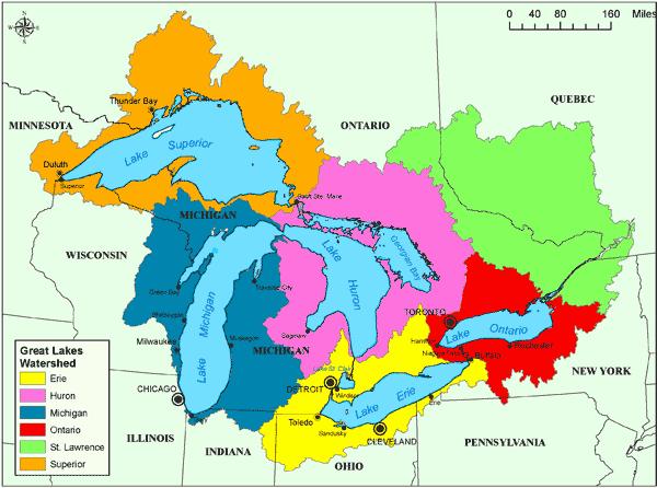
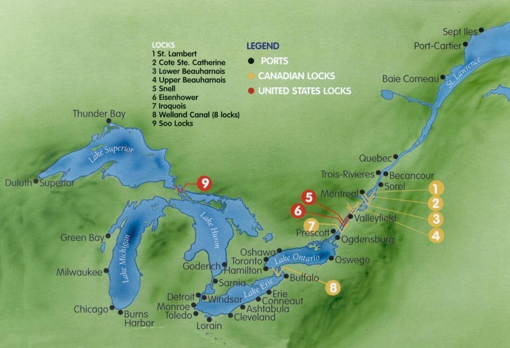
3 5 large freshwater lakes in central North America HOMES (Huron, Ontario, Michigan, Erie, Superior) Serve as the industrial heartland of the continent because of all of the factories One of the world s busiest shipping areas Most of Canada s population lives in this region
4
5
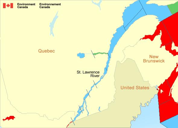
6 Major source of overseas and US/Canada shipping & trade Shortcut that connects the Great Lakes to the Atlantic Ocean Huge producer of hydroelectricity
7
8
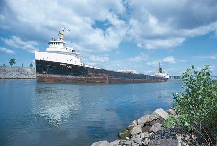
9 A canal completed in 1959 at the eastern end of the Great Lakes Connects the Great Lakes with the St. Lawrence River Provides passage for ships to travel from the great lakes to the Atlantic Ocean. Major source of overseas and US/Canada shipping & trade Closed from November to April (frozen) Seaway has made cities in Eastern Canada home to many successful manufacturing companies
10
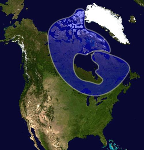
11

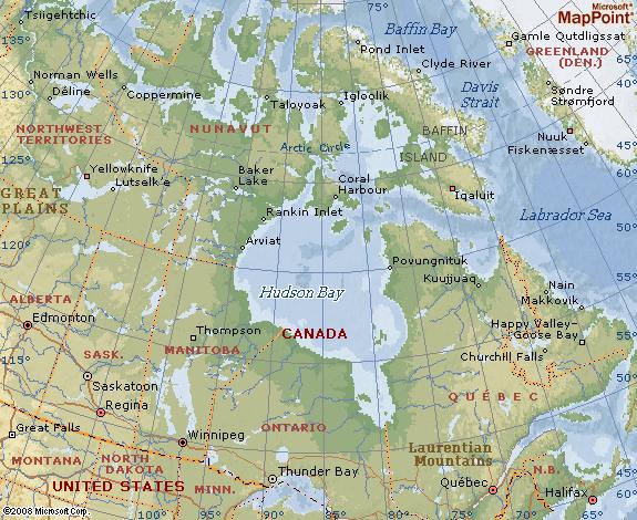
12 HUGE inland sea in east central Canada an arm of the Atlantic Ocean Grain from Alberta & Saskatchewan is shipped from Hudson Bay out to the Atlantic and on to other countries Only navigable from July to October
13
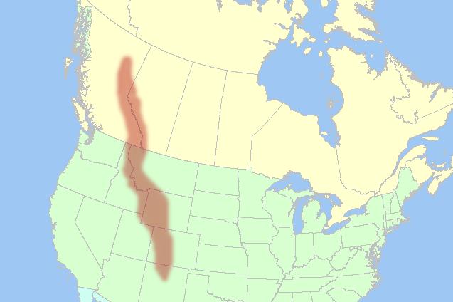
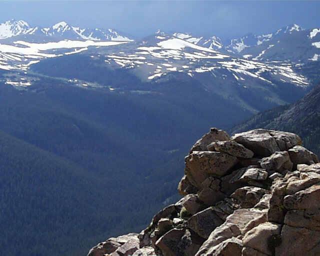
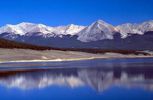
14
15
16 This is the 2 nd largest of the earth s 5 oceans. It s also the most heavily traveled ocean. It forms the eastern border of Canada. It s a major shipping route to Europe & Africa.

17 Largest & deepest of the world s 5 oceans Covers 1/3 of the earth s surface! Western border of Canada Major shipping route to Asia
18 Stretches from Great Lakes to Arctic Ocean; covers over 20% of Canada. Horseshoe region around Hudson Bay Region of mostly thin soil lying on top of rock, with many bare outcrops of rock & thousands of lakes Major source of natural resources: timber, minerals, & water Region is sparsely populated.
19

20
21 Mountains located in Western Canada Includes western Alberta and eastern British Columbia Stretch a distance of 2,000 miles! Mining is the biggest industry in the region, followed closely by logging. Major minerals include: iron ore, copper, coal, gold. Sparsely populated & contain few cities
22
23
24

25 Your Task: Choose 1 of the physical features Fold your paper hamburger style to make a desk tent On the front : Imagine that you are one of the features. Write 5 facts about yourself. On the back: draw an illustration of the feature We will walk around and try to guess the features!

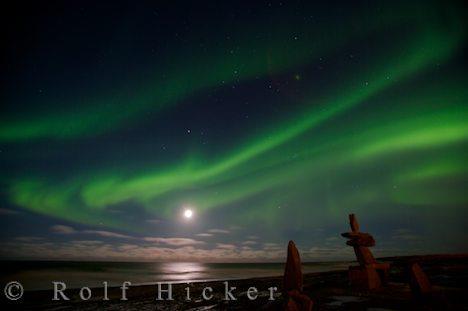
26 Brrrrr! I am always so cold!! It s chilly up here in northern Canada. I am so tired of everybody always picking on me. Dig, dig, dig all day long. I wish I had some pretty trees to look at All that I can see is scraggly trees and flat, rocky land. It s so lonely. No one lives near me.

27

28
29 Teachers Project the following slide on the board/wall, and have students point out or label the physical features.
30

31 2 nd largest country in the world (Russia is larger) Surrounded by three oceans: Atlantic, Arctic, & Pacific Southern border is the US Alaska also forms part of the western border. Population is 33 million, which is small compared to its size (US population is 9 times larger!) 90 percent of population lives within 100 miles of the US- Canadian border WHY?

32
33 Canada s location in the world helps it to be a leader in world trade: It s uniquely located on 3 oceans, so it has opportunities to trade with Europe & Asia. Great Lakes and the St. Lawrence Seaway allow goods to be shipped to and from central Canada and the Atlantic Ocean A major benefit for Canada is its border with the US (#1 trading partner). Share over 3,000 miles of border & trade is relatively easy 80% of Canada s exports come to US

34 Southeastern part of Canada has a MUCH warmer climate than the rest of the country. Warm to hot summers & cold winters Allows for a long growing season Pacific coast has a temperate climate. Pacific ocean cools the region in summer and warms it in winter. Over 100 inches of precipitation per year Northern Canada is COLD! Few people live here temperatures can be below freezing even in summer!
35 Canada s location in the world helps it to be a leader in world trade: It s uniquely located on 3 oceans, so it has opportunities to trade with Europe & Asia. Great Lakes and the St. Lawrence Seaway allow goods to be shipped to and from central Canada and the Atlantic Ocean A major benefit for Canada is its border with the US (#1 trading partner). Share over 3,000 miles of border & trade is relatively easy 80% of Canada s exports come to US
36 Rich in natural resources: coal, oil, natural gas, iron ore, nickel, zinc, copper, gold, lead, molybdenum, potash, diamonds, & silver Rivers and lakes have an abundance of fish, fresh water, & hydroelectric power. Good soil allows farmers to grow crops for Canadians--with enough left over to trade with other countries Timber is also a major natural resource.
.")
37 Sells oil and natural gas, fish, agricultural products, & timber to other countries Hydroelectricity is used in Canada and also sold to the US. 5% of the land in Canada is arable (actually a large amount because there is so much land). Rich soil produces valuable crops that are consumed in Canada and traded to other countries.
38

39 Inside of the suitcase, draw FIVE things that you are going to take with you on our class trip to Canada. Think about the location, climate, physical features, and natural resources of the country. Look in your notebook for clues about what you might need on your trip. Next, include a brief description of why you chose to bring that particular item. Color your suitcase be creative! Example: I m bringing a snowboard so that I can go down the Rocky Mountains!
40
41 Teachers I give my students the following handout at the beginning of our Canada unit. I tell them to keep it handy in their Interactive Notebook, and whenever we discuss any words that begin with certain letters, they are to write them down. The first person to complete the chart wins a prize. *The words have to be things that we ve discussed in class, not things that they already know, so they must always pay attention!
42
43
44
45
46 Teachers Thank you for downloading this file. I hope you enjoy using it with your students, and I can t wait to read your feedback in my TPT store! For more social studies materials, please visit my store: I teach 6 th grade Language Arts and Social Studies in Georgia, so my products are aligned with Common Core (LA) and Georgia Performance Standards (SS). Copyright Brain Wrinkles. All rights reserved. Permission is granted to copy pages specifically designed for student or teacher use by the original purchaser or licensee. The reproduction of any other part of this product is strictly prohibited. Copying any part of this product and placing it on the Internet in any form (even a personal/classroom website) is strictly forbidden. Doing so makes it possible for an Internet search to make the document available on the Internet, free of charge, and is a violation of the Digital Millennium Copyright Act (DMCA).
SCIENCE AND TECHNOLOGY: CANADA COAST TO COAST
 ACTIVITY DESCRIPTION: This activity shows the abundance of water in and around Canada. By identifying and labeling a number of water bodies and courses, students realize the magnitude of Canada s water
STUDY GUIDE. The Land. Physical Geography of Europe. Chapter 11, Section 1. Terms to Know DRAWING FROM EXPERIENCE ORGANIZING YOUR THOUGHTS
 For use with textbook pages 271 276. The Land Terms to Know dikes Large banks of earth and stone that hold back water (page 272) polder Drained area of land (page 272) glaciation The process in which glaciers
Answers to Ontario Quiz
 Answers to Ontario Quiz Test Your Knowledge What do you remember from your review of the Ontario section of the E-Atlas? 1. Ontario is one of the biggest contributors to Canada s gross domestic product
AMERIGO VESPUCCI ( )
") AMERIGO VESPUCCI (1451-1512) Amerigo Vespucci was born in Italy in 1451. Vespucci went on several expeditions to South America. In 1501, he sailed in service to the King of Portugal. This was his third
AMERIGO VESPUCCI (1451-1512) Amerigo Vespucci was born in Italy in 1451. Vespucci went on several expeditions to South America. In 1501, he sailed in service to the King of Portugal. This was his third
Essential Question:
 Essential Question: I CAN... Cyprus Cyprus 15 Directions: As we go through the information, you are to copy down the location and a description of each of SW Asia s important physical features.
STUDY GUIDE. Physical Features. The Land. Chapter 23, Section 1. Landforms. Rivers. Natural Resources. Terms to Know DRAWING FROM EXPERIENCE
 For use with textbook pages 569 574. The Land Terms to Know subcontinent A landmass that is large and distinct but joined to a continent (page 569) alluvial plain An area of fertile soil deposited by river
OCEANOGRAPHY STUDY GUIDE
 OCEANOGRAPHY STUDY GUIDE Chapter 2 Section 1 1. Most abundant salt in ocean. Sodium chloride; NaCl 2. Amount of Earth covered by Water 71% 3. Four oceans: What are they? Atlantic, Pacific, Arctic, Indian
Name: Date: Day/Period: CGC1P1: Interactions in the Physical Environment. Factors that Affect Climate
 Name: Date: Day/Period: CGC1P1: Interactions in the Physical Environment PART A: Weather and Climate Factors that Affect Climate 1. The words weather and climate are often incorrectly used interchangeably.
Performance Task: World Mountains
 Performance Task: World s Teacher Directions: In this activity, students will demonstrate their understanding of world mountains using both a map and a written assignment. Ask students to annotate the
ELA & Science Grades 4 nd to 9 th Created by Piyush & Ilaxi
 ELA & Science Grades 4 nd to 9 th Created by Piyush & Ilaxi 2014 Brilliant Classes by Piyush Page 1 Directions to use Climate Scavenger Hunt Purpose : At the end of this scavenger hunt on climate students
Introducing the Great Lakes
 Introducing the Great Lakes Just a few years ago, geologically speaking, a glacier passed this way, and that's why the Midwest has the Great Lakes. Size The Great Lakes and their connecting channels form
Canada s Natural Systems. Canadian Geography 1202
 Canada s Natural Systems Canadian Geography 1202 Canada s Natural Systems Natural System: A system found in nature Here are the four natural systems that we will explore in the next few weeks 1. Canada
our for TERMS OF USE (TOU) click to follow Font & Clipart Credits: Click HERE to have this and more delivered to your inbox. blog posts & resources
 click to follow Font & Clipart Credits: Click HERE to have this and more delivered to your inbox. blog posts & resources") click to follow TERMS OF USE (TOU) I know that you have many options when choosing to purchase learning resources so I want to thank you personally for purchasing this from A Dab of Glue Will Do. If you
click to follow TERMS OF USE (TOU) I know that you have many options when choosing to purchase learning resources so I want to thank you personally for purchasing this from A Dab of Glue Will Do. If you
Great Lakes Shipping Across The Country & Around The World Great Lakes Floor Map: Shipping and Receiving Cargo on the Great Lakes
 Lesson #1 Lesson #2 Great Lakes Shipping Across The Country & Around The World Great Lakes Floor Map: Shipping and Receiving Cargo on the Great Lakes Laura Mikesell Laura.Mikesell@gpschools.org Parcells
CHAPTER 2. Native Americans and Their Land
 CHAPTER 2 Native Americans and Their Land 2.1 INTRODUCTION Native Americans are believed to be the first people to live in North America They first migrated into the Americas from the continent of Asia
Close-Reading Questions
 Name Date Close-Reading Questions Refer to this week s cover story, Running Wild, to respond to the questions below. Reread the article to find details that support your answers. Remember to write in complete
Deserts. Locations of deserts WORDS
 1 WORDS certain =special cover =here: make up create = make cut off =separate little = not very much rise = go up surface =the top layer of an object trade wind = a tropical wind that blows to the equator
Lesson X: 6: Wildlife Under Fire
 Grades 3 5: Lessons Lesson X: 6: Wildlife Under Fire Source: HEART Overview: By teaching their peers and reading real world accounts of animals affected by human activity, students will make tangible connections
Biyani's Think Tank. Concept based notes. Geography of Asia BA-III. Shweta Modi Deptt. of Arts Biyani Girls College, Jaipur
 Biyani's Think Tank Concept based notes Geography of Asia BA-III Shweta Modi Deptt. of Arts Biyani Girls College, Jaipur 2 Published by : Think Tanks Biyani Group of Colleges Concept & Copyright : Biyani
Success Criteria: Ch. 7 China
 Log in to Geography of China ppt Success Criteria: Ch. 7 China Last Name 1. Identify China, the Huang He River, the Gobi Desert, and the Plateau of Tibet on any map. 2. Identify where the first civilization
Air Masses and Fronts
 Air Masses and Fronts A huge body of air that has similar temperature, humidity, and air pressure at any given height is called an air mass. A single air mass may spread over millions of square kilometers
Climate Scavenger Hunt
 Climate Scavenger Hunt ELA & Science Grades 4nd to 9th Created by Piyush & Ilaxi Directions to use Climate Scavenger Hunt Purpose : At the end of this scavenger hunt on climate students will be able to
Gayaza High School Geography Department
 THE DEVELOPMENT OF THE SAINT LAWRENCE SEAWAY This is an inland water way partly artificially constructed from the Gulf of St. Lawrence to the Western end of Lake Superior. It covers a distance of 3,800
Arctic Mining, Shipping and Oil and Gas
 Arctic Mining, Shipping and Oil and Gas AON-HD Team Meeting Leverett,, Massachusetts September 7, 28 Sharman Haley Professor of Economics and Public Policy Institute of Social and Economic Research University
Inuit Learning Station Ideas Informational Cards Graphic Organizer
 Leah Crown, 2013 1 Inuit Learning Station Ideas --------3 Informational Cards-----------------4-7 Graphic Organizer---------------------8 Informational Passage--------------9 Comprehension Questions -------10
1.3: CLIMATE GEOGRAPHY. pgs
 1.3: CLIMATE GEOGRAPHY pgs. 76-89 INTRODUCTION WEATHER: Is the combination of temperature, precipitation, cloud cover and wind that we experience EACH DAY. Example: 22 0 C and clear skies. CLIMATE: The
170 points. 38 points In your textbook, read about modern oceanography. For each item write the word that meets the description.
 Ch 15 Earth s Oceans SECTION 15.1 An Overview of Oceans 38 points In your textbook, read about modern oceanography. For each item write the word that meets the description. (5 points) 1. German research
Of the Salmon and For the Salmon
 Of the Salmon and For the Salmon for millions of years the wild salmon has helped nourish the plant and animal life of the temperate rain forest. Born in the streams and rivers of the forest, the salmon
Station 1: Ocean Currents Use the ocean currents map copied from page 4 of the ESRT and the passage to answer the questions that follow.
 Station 1: Ocean Currents Use the ocean currents map copied from page 4 of the ESRT and the passage to answer the questions that follow. The Map: Questions: 1. Name the cool current off the West coast
Cambridge International Examinations Cambridge Primary Checkpoint
 Cambridge International Examinations Cambridge Primary Checkpoint ENGLISH 0844/01 Paper 1 October 2016 1 hour Candidates answer on the Question Paper. No Additional Materials are required. READ THESE INSTRUCTIONS
A New Route across the Top of the World
 Gulf of Alaska Bering Sea Sea of Okhotsk Alaska (USA) Canada 10 Arctic Ocean North Pole CHAPTER Greenland Russia A New Route across the Top of the World The New Ocean Route between Europe and Asia Average
The 21 st Annual Dr. Feinberg Geography Challenge Study Book. Grade 1. Spring 2016
 The 21 st Annual Dr. Feinberg Geography Challenge Study Book Grade 1 Spring 2016 Mary Lee Burbank School 266 School Street Belmont, Massachusetts 02478 U.S.A. Dr. Tricia Clifford, Principal Parents: Please
Section 2- Migration
 Section 2- Migration Today, most scientists agree that the first people in North America came from Asia. This migration is estimated to have taken place during the last ice age, at least 12,500 years ago.
Terms to Know. archipelago tsunami loess
 Chapter Objectives Identify East Asia s varied landforms, water systems, and natural resources. Explain the factors that influence East Asia s diverse climates and vegetation. The Land Section 1 Objectives
The following resources were used in writing the texts:
 Lesson Plans CANADA Vancouver, Canada s West Coast City (Level 2) The purpose of LessonPlansCanada is to provide well-structured and interesting reading texts and other classroom activities. These lesson
SCIENCE INTERACTIVE NOTEBOOK
 1 SCIENCE INTERACTIVE NOTEBOOK Hello I m pretty sure she meant a different kind of wave Howdy Hi Dr. Erica Colón 2013 www.nittygrittyscience.blogspot.com Graphics www.djinkers.com License #0812169551 Table
Alaska s Natural Resource Commodities: A 10-Year Outlook
 Alaska Resources Development Council November 14-15, 2018 Alaska s Natural Resource Commodities: A 10-Year Outlook David R. Hammond, Ph.D. Principal Mineral Economist Hammond International Group Commodities
LOTTERY CIRCLE MANUAL
 LOTTERY CIRCLE MANUAL ACE LEE COPYRIGHT 2016 WWW.LOTTERYCIRCLE.COM COPYRIGHT, LEGAL NOTICE AND DISCLAIMER: THE BOOK LOTTERY CIRCLE MANUAL IS COPYRIGHT 2016 BY WWW.LOTTERYCIRCLE.COM. NO PART OF THIS BOOK
Geography Week Which continent is your state closest to: Asia, South America, or Europe?
 Geography Week 24 1. Which continent is your state closest to: Asia, South America, or Europe? 2. Which state would have the coolest weather: Montana, Georgia, or Oklahoma? 3. What are the only two continents
Life in the Current. Beyond the Book. FOCUS Book
 FOCUS Book Eddies often form on the edges of a fast-moving ocean current. Make a model of an eddy. Fill a clear plastic bowl with warm tap water. Slowly stir the water to make it swirl. Predict what will
and the Link between Oceans, Atmosphere, and Weather
 Geography Worksheet Instructions Using a map, atlas, or any other materials your teacher suggests, label the following on the blank map provided. 1. Label East, West, North, and South. 2. Label the following
2 For education only. Not for sale. All Rights Reservied ButterfliesandBarefootLasses.blogspot.com
 Hi! We're reading Paddle to the Sea by Holling C. Holling this year with our American History studies, and I wanted to flesh things out a little bit with some notebooking. The first page (page 2) is a
MONSOONS. Summer Monsoon
 MONSOONS A monsoon is a seasonal change in the direction of the prevailing, or strongest, winds of a region. Monsoons cause wet and dry seasons throughout much of the tropics. Monsoons are most often associated
Reading and Vocabulary Study Guide
 Reading and Vocabulary Study Guide Boston, Massachusetts Upper Saddle River, New Jersey The map on page 20 is based on a map by DK Cartography. Copyright by Pearson Education, Inc., publishing as Pearson
Geography/IEW ages All Saints Home School Cooperative 8:30 9:20 Instructor: Mary Kratz,
 / ages 10 11 All Saints Home School Cooperative 8:30 9:20 Instructor: Mary Kratz, deers.cry@gmail.com, 651 815 7688 Supplies Needed for class: Paddle to the Sea Tree in the Trail Minn of the Mississippi
Early Cultures. Most people believe that the first people who lived in North America came from Asia.
 Name Date Early Cultures Most people believe that the first people who lived in North America came from Asia. These people possibly used a land bridge. The bridge linked Siberia in eastern Russia with
Vocabulary: Headwaters, watershed, tributaries, estuary, replica, point source pollution, nonpoint source pollution, amd river miles.
 From Source To Sea: Lesson Plan Concepts: 1. Understanding the path the Hudson River takes from the headwaters in the Adirondacks to the New York Harbor 2. Identifying the Hudson River watershed area,
1 Currents. TAKE A LOOK 2. Read a Map In what direction does the Gulf Stream flow?
 CHAPTER 5 1 Currents SECTION The Movement of Ocean Water BEFORE YOU READ After you read this section, you should be able to answer these questions: What factors affect ocean currents? Why are ocean currents
Have homework out for me to check Need notes from yesterday Teaching Point: Understanding the terms of MAIN IDEA
 1. Unpack/ Use the Restroom 2. Sharpen 2 pencils 3. Write down homework 4. Show me your agenda 5. GET ALL READING MATERIALS 6. Work on Math Muscle 7. Work on i-ready when finished 8. Global Read Aloud
Ecology. Professor Andrea Garrison Biology 3A Illustrations 2014 Cengage Learning unless otherwise noted
 Ecology Professor Andrea Garrison Biology 3A Illustrations 2014 Cengage Learning unless otherwise noted Ecology Ecology (oikos = house) is the study of where an organism lives and all the interactions
Name Date L.O: SWBAT explain what breezes, planetary winds, ocean currents & monsoons are.
 Name Date L.O: SWBAT explain what breezes, planetary winds, ocean currents & monsoons are. 1. A cool breeze is blowing toward the land from the ocean on a warm, cloudless summer day. This condition is
World and Brazilian Exploration Trends
 World and Brazilian Exploration Trends David Cox Senior Sales Executive SimeXmin Ouro Preto, Brazil May 13, 2014 Corporate Exploration Strategies Methodology CES is the acknowledged source for worldwide
Lesson 1 - Meet the White Sturgeon
 Big Idea: The mighty sturgeon has been on earth for more than 250 million years and can grow to over 6 metres in length. How could one of the longest surviving animal species that grows to the length of
BAY-SIC RATIOS. W. A.V.E. BAY-SIC Ratios
 BAY-SIC RATIOS INTRODUCTION: The land that surrounds the Chesapeake Bay spans 64,000 square miles and includes portions of six states Virginia, West Virginia, Maryland, Pennsylvania, Delaware, and New
The Greenlanders House
 The Greenlanders House Social counselling, social projects Administration and counselling for greenlandic students Students home with 20 rooms Cultural and informational services Greenlanders associations,
Table of Contents. Meeting Standards
 Meeting Standards........................ 2 Every Four Years......................... 3 The 2012 Olympic Games.................. 4 Host Countries........................... 5 Follow the Flags... 6 Map
4th GRADE MINIMUM CONTENTS- SOCIAL SCIENCE UNIT 2: THE EARTH S WATER
 THE HYDROSPHERE 4th GRADE MINIMUM CONTENTS- SOCIAL SCIENCE UNIT 2: THE EARTH S WATER All the water on Earth is called the hydrosphere. Most of the water on the Earth s surface is salt water, and only a
Equatorial upwelling. Example of regional winds of small scale
 Example of regional winds of small scale Sea and land breezes Note on Fig. 8.11. Shows the case for southern hemisphere! Coastal upwelling and downwelling. Upwelling is caused by along shore winds, that
Mountains and Oceans Mount Everest
 Mountains and Oceans Mount Everest Illustration by Lynn M. Hanousek Mount Everest is the highest mountain in the world. It sits in the Himalayan mountain range. It is located north of India on the border
E D U C ATIO N A L A C TIVIT Y G UID E
 E D U C ATIO N A L A C TIVIT Y G UID E An Amazing Journey Across Our Planet Starting April 22, 2009 the 40 th anniversary of Earth Day you and your students are invited to share an unforgettable true-life
Arctic Storm: Giving back SEA. To The.
 Arctic Storm: Giving back To The SEA www.arcticstorm.com July 2010 www.businessreviewusa.com Arctic Storm 3 Giving back To SEA The Arctic Storm President Doug Christensen discusses how his company catches
Chapter 8 Air Masses
 Chapter 8 Air Masses Air Masses - 1 1. An Air Mass is a large body of air usually about 1500 km across and several km thick, that has homogeneous physical properties. 2. The important physical properties
;DG:HIH Plankton
 or coral reefs near the shore of the ocean it is easy for us to see the various parts of an ecosystem, especially because the near-shore ecosystems tend to be particularly productive and have a high level
Ocean Current Worksheet
 Ocean Current Worksheet Temperature Affects and Surface Currents: Surface waters of the Earth s oceans are forced to move, primarily by winds. Where winds blow in the same direction for a long period of
National Maritime Center
 National Maritime Center Providing Credentials to Mariners (Sample Examination) Page 1 of 8 Choose the best answer to the following Multiple Choice Questions. 1. Assume that your vessel has just entered
2010 Teacher Created Resources, Inc.
 Editor Erica N. Russikoff, M.A. Illustrator Clint McKnight Cover Artist Brenda DiAntonis Editor in Chief Ina Massler Levin, M.A. Creative Director Karen J. Goldfluss, M.S. Ed. Art Coordinator Renée Christine
3/22/11. General Circulation of the Atmosphere. General Circulation of the Atmosphere
 Chapter 10 General refers to the average air flow, actual winds will vary considerably. Average conditions help identify driving forces. The basic cause of the general circulation is unequal heating of
Approximate Grade Level: Objectives: Common Core State Standards: Class Sessions (45 minutes): Teaching Materials/Worksheets: Student Supplies:
: Teaching Materials/Worksheets: Student Supplies:") Habitats Grade Level: 1-3 Teacher Guidelines Instructional Pages Activity Page Practice Page Answer Key pages 1 2 pages 3 5 pages 6 page 7 page 8-9 Classroom Procedure: 1. List and display student responses
Habitats Grade Level: 1-3 Teacher Guidelines Instructional Pages Activity Page Practice Page Answer Key pages 1 2 pages 3 5 pages 6 page 7 page 8-9 Classroom Procedure: 1. List and display student responses
Grade 8 Science: Unit 1 Water Systems Chapter 3
 Heat Capacity Grade 8 Science: Unit 1 Water Systems Chapter 3 Heat capacity ( ) is the amount of heat that a substance can hold. has a high heat capacity it can take in a large amount of heat before its
Lesson 6: Water, Water Everywhere
 Earth -> 6: Water, Water Everywhere Getting Started Lesson 6: Water, Water Everywhere? Big Ideas P How do living things depend on the Earth for survival? P What are examples of matter found on Earth? P
Cambridge International Examinations Cambridge International General Certificate of Secondary Education
 Cambridge International Examinations Cambridge International General Certificate of Secondary Education *7429369695* ENVIRONMENTAL MANAGEMENT 0680/43 Paper 4 October/November 2016 1 hour 30 minutes Candidates
Adapting and Developing Hands Free Mooring for Navigation Locks Speaker: Benoit Nolet
 Adapting and Developing Hands Free Mooring for Navigation Locks Speaker: Benoit Nolet The Great Lakes St. Lawrence Seaway System A gateway to the heartland of North America 3,700 km (2,300 m) marine highway
Sample study: Inuit of northern Canada (page 197)
") Sample study: Inuit of northern Canada (page 197) The Inuit are one of the three Indigenous groups of Canada. For many centuries, outsiders called them Eskimos. Inuit no longer find this term acceptable.
Sample study: Inuit of northern Canada (page 197) The Inuit are one of the three Indigenous groups of Canada. For many centuries, outsiders called them Eskimos. Inuit no longer find this term acceptable.
9-1: What Causes Climate. 6 th Grade Earth Science
 6 th Grade Earth Science What is Climate? 9-1: What Causes Climate Climate is the long-term average conditions of temperature, precipitation, winds, and clouds in an area. Examples of Climate The Mojave
SAUSD Common Core First Grade Unit of Study. Student Learning Journal. Exploring Our World. Name
 Exploring Our World Student Learning Journal Name SAUSD Common Core First Grade Unit of Study Songs of Higher Learning www.songsofhigherlearning.com Lesson 1 2 Continents and Ocean Song In this world,
Michigan. Sample file. Content Adviser: Roger Rosentreter, Michigan Historical Society, Lansing, Michigan
 t h i s l a n d i s y o u r l a n d Michigan b y a n n h e i n r i c h s Content Adviser: Roger Rosentreter, Michigan Historical Society, Lansing, Michigan Reading Adviser: Dr. Linda D. Labbo, Department
Module 3, Investigation 1: Briefing 1 What are the effects of ENSO?
 Background The changing temperatures of the tropical Pacific Ocean affect climate variability all over Earth. Ocean warming and cooling dramatically affect human activities by changing weather patterns
- terminology. Further Reading: Chapter 07 of the text book. Outline. - characteristics of ENSO. -impacts
 (1 of 14) Further Reading: Chapter 07 of the text book Outline - terminology - characteristics of ENSO -impacts (2 of 14) Today: Introduction We want to look at another source of variability in the atmosphere
The Land Where Continents Collided. Physical Geography and Climate of South Asia
 The Land Where Continents Collided Physical Geography and Climate of South Asia South Asia Countries include: 1. Pakistan 2. India 3. Nepal 4. Bhutan 1 2 3 5 4 5. Bangladesh 6. Sri Lanka 7. Maldives 7
Before we get started, where in the world is Georgia? Do you know?
 Before we get started, where in the world is Georgia? Do you know? Georgia is in the Southeastern part of the United States, on the continent of North America. There it is! Georgia itself is divided into
There are two types of selective commercial fisheries conducted by Talok Fisheries:
 Lake Babine Nation Inland Fishery The inland commercial fishery on Lake Babine is operated by a private fishing company named Talok that is owned by the Lake Babine Nation (LBN). This company is governed
Mobarakeh Steel Company (MSC) Can Iranian slabs & HRC support SE Asian steel industries?
 Can Iranian slabs & HRC support SE Asian steel industries?") (MSC) Can Iranian slabs & HRC support SE Asian steel industries? JAKARTA June 2018 Iranian slab, an opportunity for SE Asia flat producers Overview of global slab trade Slab trade in SE Asia (MSC) An overview
(MSC) Can Iranian slabs & HRC support SE Asian steel industries? JAKARTA June 2018 Iranian slab, an opportunity for SE Asia flat producers Overview of global slab trade Slab trade in SE Asia (MSC) An overview
Name: OBJECTIVES: By the end of today s lesson, you will be able to
 7 th Grade Science Unit: Water s Cycles and Patterns Lesson: WCP 21 Name: Date: Monday, October 3, 2016 Homeroom: _ OBJECTIVES: By the end of today s lesson, you will be able to SWBAT Explain how currents
Draw a picture of a water source. Don t forget to include yourself in the picture!
 Name Date Draw a picture of a water source. Don t forget to include yourself in the picture! My water source is Students describe the characteristics of a water source: stream, river, lake, pond, ocean,
California By Michael Stahl
 California California By Michael Stahl California is the third largest state in America. Only Texas and Alaska have greater areas of landmass than California. However, the Golden State, as it is sometimes
Location Guess the Country Game
 Location Guess the Country Game This activity is designed to help you develop your skills with location, and your ability to use relative location. Africa has many countries, and each can be described
The St. Lawrence Seaway--To Mid-Continent by Ocean Vessel
 Case Western Reserve Law Review Volume 11 Issue 1 1959 The St. Lawrence Seaway--To Mid-Continent by Ocean Vessel Lewis W. Britton Follow this and additional works at: http://scholarlycommons.law.case.edu/caselrev
Lesson 2 Fur. Preparation. Introduction. World History for Us All Big Era 6 Landscape 4
 Fur Preparation Have you ever thought about where your favorite hat comes from? Was it made in one place? How did it get from where it was made to your favorite store? What kind of profit do hat makers
Aftercooler Owner s Manual
 Aftercooler Owner s Manual SUPERIOR PERFORMANCE And Quality In Blast Cleaning Equipment! WARNING Read Manual Failure to read, understand & follow all safety and operation procedures in this manual can
Popular Book Company (Canada) Limited
 Limited") 2 4 12 16 20 24 2 32 36 3 40 44 1-30 1-2 Copyright 2009 Popular Book Company (Canada) Limited All rights reserved. No part of this book can be reproduced in any form or mechanically stored in any retrieval
2 4 12 16 20 24 2 32 36 3 40 44 1-30 1-2 Copyright 2009 Popular Book Company (Canada) Limited All rights reserved. No part of this book can be reproduced in any form or mechanically stored in any retrieval
SECTION XI - COAST PILOT UPDATING. 1. To acquire a general knowledge of the responsibilities of the Auxiliary in COAST PILOT UPDATING activities.
 SECTION XI - COAST PILOT UPDATING INTRODUCTION: The United States Coast Pilot published by the NOS-C&GS, is a series of volumes that supplement the navigational data shown on nautical charts. Sources for
RESOURCE BOOKLET M13/4/ENVSO/SP2/ENG/TZ0/XX/T ENVIRONMENTAL SYSTEMS AND SOCIETIES PAPER 2. Tuesday 7 May 2013 (afternoon) 2 hours
 2 hours") M13/4/ENVSO/SP2/ENG/TZ0/XX/T 22136303 ENVIRONMENTAL SYSTEMS AND SOCIETIES Standard level PAPER 2 Tuesday 7 May 2013 (afternoon) 2 hours RESOURCE BOOKLET INSTRUCTIONS TO CANDIDATES Do not open this booklet
M13/4/ENVSO/SP2/ENG/TZ0/XX/T 22136303 ENVIRONMENTAL SYSTEMS AND SOCIETIES Standard level PAPER 2 Tuesday 7 May 2013 (afternoon) 2 hours RESOURCE BOOKLET INSTRUCTIONS TO CANDIDATES Do not open this booklet
In Activity 36, Storing Waste, you evaluated Yucca Mountain,
 49 Comparing Site Risk TA L K I N G I T O V E R In Activity 36, Storing Waste, you evaluated Yucca Mountain, Nevada as a site for storing nuclear waste. The U.S. Congress considered several other sites
Ocean Inter-annual Variability: El Niño and La Niña. How does El Niño influence the oceans and climate patterns?
 Name: Date: Guiding Question: Ocean Inter-annual Variability: El Niño and La Niña How does El Niño influence the oceans and climate patterns? Introduction What is El Niño/La Niña? The El Niño/La Niña cycle
HYDROSPHERE, OCEANS AND TIDES
 HYDROSPHERE, OCEANS AND TIDES Revision 10x10learning.com 1 Chapter 12. In the Earth s Atmosphere On surface of the Earth Under the ground Hydrosphere comprises of ALL WATER Water Vapour = 0.001% Is very
The 21 st Annual Dr. Feinberg Geography Challenge Study Book Grade 3 and 4 Spring 2016
 The 21 st Annual Dr. Feinberg Geography Challenge Study Book Grade 3 and 4 Spring 2016 Mary Lee Burbank School 266 School Street Belmont, Massachusetts 02478 U.S.A. Dr. Tricia Clifford, Principal Parents:
Major Issues and Trends Facing the Port and Marine Transportation Industry
 Major Issues and Trends Facing the Port and Marine Transportation Industry Presented to: AAPA Marine Terminal Management Training Program April 24, 2006 Charleston Riverview Hotel Charleston, SC - USA
West Africa Desertification in West Africa
 Non-fiction: West Africa Desertification in West Africa West Africa Desertification in West Africa In Arabic, Sahel means shore, or coast. The Sahel is the place where the waves of the ocean crash onto
2015 Evelyn Browning Garriss. El Niño, the Twisted Atlantic and the Effect on Global Agriculture
 2015 Evelyn Browning Garriss El Niño, the Twisted Atlantic and the Effect on Global Agriculture Conclusions Climate change is not linear. It ebbs and flows. Recent polar volcano eruptions created a cool
Lawrence J. Lau 刘遵义. CSIS Forum Washington, D.C., 22nd May 2013
 U.S.-China Economic Relations in the Next Ten Years: Towards Deeper Engagement and Mutual Benefit Lawrence J. Lau 刘遵义 Ralph and Claire Landau Professor of Economics, The Chinese Univ. of Hong Kong and