Schedule 1, Part 4 Local Infrastructure - Transportation
|
|
|
- Maximillian Singleton
- 6 years ago
- Views:
Transcription
1 Schedule 1, Part 4 Local Infrastructure - Transportation
2 Schedule 1 -Part 4 Local Infrastructure - Transportation Contents 1. Introduction Local Transportation Design Paraeters Carriageway Widths Traffic Generation Basis for Costing Paraeters for Cost Estiates Cost Sharing for Carriageways Over 8 Wide Other Wori<s Bethlehe West Bethlehe Pyes Pa Pyes Pa West Ohauiti Welcoe Bay Papaoa Wairakei Tauriko Business Estate 238 Developent Contributions Policy Page 29
3 Transportation 1. Introduction The transportation network is an essential coponent of the physical environent. Its aintenance is necessary, not only to protect the resource in its own right, but is essential if the counity is to be able to provide for its social and econoic well-being. Therefore, planning of the roads ust ensure a safe and efficient syste of oving people and goods about the district. This is achieved by ensuring correct carriageway widths are allowed for now to cater for the predicted traffic densities of the future and the alignents are located so that the ost efficient network can be achieved, while all the tie addressing safety issues. The structure plans and developent contribution syste is designed to ensure that each growth area is provided with the trunk services that are required to service the ultiate developent of the area and that the developer pays a fair share of the cost of this work. In the case of transportation, the trunk services are the arterial, collector and sub-collector roads as defined in Council's City Plan and Infrastructure Developent Code. In addition to the streets listed within the Urban Growth Areas, the status of a nuber of peripheral streets identified in the roading hierarchy as arterials and collectors will require to be iproved and widened to accoodate the increased traffic generated as a result of urban growth. 1.1 Local Transportation Funding Needs Assessent in Relation to the Requireents of SI 1 (3) ofthe LGA. Scope of Projects Covered by this Activity The projects funded by Tauranga City Council (TCC) through transportation local developent contributions are those projects that will priarily be used by residents within that growth area as connector and arterial roads within that area. Projects that relate to providing road access to individual households are norally copleted by individual developers and given (vested) to TCC. Any other assets (such as walkways) will be funded based on the benefits received. Council Outcoes The provision of access to the transportation network within a growth area contributes to all of the Council Outcoes, and the following City Vision Stateents; Easy to Move Around Vibrant Healthy and Diverse Counities Built to Fit Our Hills Harbour and Coast Strong Sustainable Econoy Living Well Wasting Less These projects are also iportant in ipleenting Western Bay of Plenty's growth anageent strategy, Sartgrowth. Distribution of Benefits The principal benefit of these projects is that they extend the transportation network and allow local residents to gain access to (and be accessed fro) the wider transportation network. For non priary arterial roads this benefit is conferred on new households and businesses in the growth areas. Households and businesses located outside the growth areas gain a relatively inor benefit in being able to access properties located in the grov\/th areas. However, given the restricted geographic nature of ost of these capital works and the connectedness of those households and businesses to an existing network, Council believes that any ipact on geographic areas beyond the individual growth areas is likely to be neutral or inor. Projects that relate to priary arterial roads will be exained using Council's traffic odelling software. This software will be used to assess what vehicles are likely to use the roads and how often. The costs of this road will then be apportioned according to the distribution of road usage. The proportion of road usage by existing residents will be funded fro rates. The cost of replacing any Page 21 Developent Contributions Policy

4 Schedule 1 - Part 4 - Local Infrastructure - Transportation portion of the road that already exists will also be paid for by existing ratepayers. The proportion of road usage by new residents will be funded fro Developent Contributions. For ost growth areas there was (or will be) an existing population (norally with a significantly lower housing density) before the growth area was opened up for intensification. These existing properties already had/will have a transportation network in place. Therefore the benefits to existing residents within these growth areas is assessed as low. The only benefit identified is a short-ter reduction in congestion, but in the long ter expected to be neutral. Given that, at the local road coponent level, the road widening will not actually create an extra lane. The actual ipact on congestion will not be significant. Also given that the upgrading to the roading will generally be done in sections as the growth area is developed the benefit would be relatively short lived, aybe only two to three years. The replaceent portion of any existing roading upgrade will be paid for by the existing ratepayers. On this basis we consider that projects funded by the transportation local developent contribution provide no significant benefit to the existing population in growth areas. Period In or Over which Benefits Occur The capital projects included are designed to ensure that all units of deand within the growth area are able to connect to Council's transportation network. We have therefore assessed the period over which the benefits will be received is the developent period of the urban growth area, fro when the growth area is first opened up until it is full (to the axiu allowed density). The divisor used in our calculations is the expected nuber of new lots over this period. Extent to Which Groups or Individuals Contribute to the Need to Undertake the Activity The group that creates the need for these works is residential and non-residential growth (i.e. new households and businesses) in the specified growth areas. Developent contributions allocate the cost of these works to that growth counity. Costs and Benefits of Funding the Activity Distinctly fro Other Activities Given the benefits and causation factors outlined above, it is considered appropriate (in particular for transparency and accountability reasons) for these works to be funded through this particular contribution, rather than the citywide developent contribution or other funding sources such as rates or a Unifor Annual General Charge. Given the low nature of the ipact and the relatively short duration of the benefit, we do not believe that collecting funds fro existing ratepayers in a growth area, such as through a targeted rate, to be an efficient process, or justified in the circustances. Social, Econoic, Environental and Cultural Well-being Council has considered the ipact, for all sectors of the counity, including the growth counity which pays developent contributions, of the proposed allocation of costs in ters of their social, econoic, environental and cultural well-being. It considers this allocation of costs to be fair and reasonable. The allocation details for this activity are clearly set out in this section. 2. Design Paraeters 2.1 Carriageway Widths The following paraeters have been used for the developent of the Urban Grov\/th Area structure plans and are taken fro Council's Infrastructure Developent Code. Road Type Secondary Arterial Collector Local Coercial Industrial Indicative Traffic Volue (VPD) 7,->15, 3,->15, <3,5 Varies Varies Carriageway width 12 plus 1 plus 3-1 Varies Varies Developent Contributions Policy Page 211


5 Schedule 1 - Part 4 - Local Infrastructure Transportation 2.2 Traffic Generation Residential Coercial/Industrial 1 vehicle trips per day per dwelling unit. Specific design based on the Road Traffic Authority of NSW "Guide to Traffic Generating Developents". ; the Transfund research report No. 29 "Trips and Parking Related to Land Use" (TRR29); and the Institution of Transportation Engineers Trip Generation ("ITE Guide"). Data sourced in New Zealand, Australia and United States is adopted in that order of preference dependant on the availability of relevant data. 3. Basis for Costing 3.1 Paraeters for Cost Estiates Unit Rates for various aspects of the construction works have been deterined fro recent Council contract rates. In soe instances substantial earthworks will be required and this has been independently assessed and built into the estiate. These rates are reviewed annually. The rates are suarised as follows; Infrastructure: Kerb and channel (per side) Sups 15 ea/7 spacing) Concrete footpaths, 1.4 wide (per side) Earthworks: Strip topsoil and stockpile Cut to fill Cut to waste Iport fill Undercut soft aterial Tri and copact subgrade Respread topsoil and sow in grass Paveent: Basecourse (supply and copact) Basecourse overlay (1 x 4 depth) 1st coat seal 2nd coat seal Asphalt / concrete (3 thick) Road arkings Miscellaneous: Street 5 spacing (standard) Street lighting - inor road Street lighting - ajor road Preliinary and general Records and reporting Environental works Traffic anageent areas, incl signs and associated infrastructure Contingency Consultancy and adinistration fees Single lane roundabout 24 dia roundabout Traffic lights % % 1.% 1.5% 1.% 2.% 1.% 63, 19, 37, Cost perl per per per^ per^ per^ per ^ per ^ per ^ per^ per^ per per ^ per^ per^ per per per each each each Page 212 Developent Contributions Policy

6 Schedule 1 - Part 4 - Local Infrastructure - Transportation 3.2 Cost Sharing for Carriageways Over 8 Wide In the case where the structure plan shows a requireent for a road over eight etres wide, and that road benefits other land outside the subdivision, the Local Developent Contributions are designed to recopense the developer for the extra road width. A coparison of construction costs for carriageway widths has shown that the relationship between an eight, ten, twelve and fifteen etre carriageway is; Road Width (M) Cost C/W 8 Carriageway Reiburseent Rate Nil 15% 18% 37% 51% 3.3 Other Works In addition to quantified iproveents in the widths and lengths of road, the consequences of urban growth can also extend to the requireent for the provision and iproveents of traffic control easures to anage the increased traffic volues. These easures range fro intersection controls based on signals, roundabouts or grade-separated facilities, to traffic caling easures designed to anage the consequences of increased traffic speeds resulting fro "add-on" sequential growth. These consequences ay also require the provision of pedestrian facilities, particularly where residential suburbs are reote fro counity services. Developent Contributions Policy Page 213
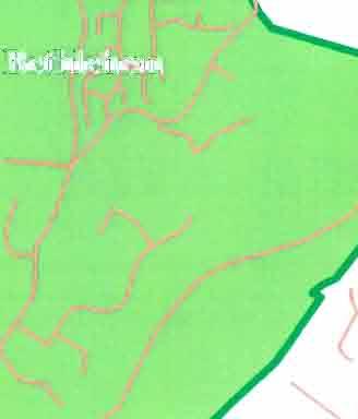
7 Schedule 1 - Part 4 - Local Infrastructure Transportation 4. Bethlehe The whole length of Bethlehe Rd and the north-east portion of Carichael Rd (fro Bethlehe Rd) needs upgrading to cope with the design traffic flows. The section of Carichael Rd fro SH2 to Bethlehe Rd has been included within the West Bethlehe Local Developent Contributions. There will be soe increase in traffic on the road but the developent of the proposed coercial centre will have a far ore draatic effect. These traffic ipacts are require to be addressed strictly by that developent. A new road fro the northern end of Mayfield Lane across the low-lying far land to link with Millers Rd is also included, along with the upgrading of Millers Rd and its intersection with Bellevue Rd. This is seen as an essential link to provide an alternative access to the north Bethlehe area rather than placing sole reliance on SH2. It is not seen as desirable to aintain the access fro Mayfield Lane on to SH2 so allowance has been ade to close this off, with access being provided fro a new road off Carichael Rd and the link road fro Millers Rd. Soe of the cost of this extension is included within the ipact fees as there are sections of it which will have no direct benefit to any one developer. This extension is also planned to carry on fro Carichael Rd to eet the end of Bethlehe Rd. The portion of the cost of new or upgraded roads that is attributable to new growth ust be assessed for each section of road to ensure that the contribution fee is fair and reasonable. This has been done using the ratio of existing dwelling units to predicted dwelling units on each road, except for the first portion of Bethlehe Rd adjacent to the proposed coercial developent. In this case the ratio of predicted traffic fro the coercial operation to the predicted traffic fro residential developent was used. Page 214 Developent Contributions Policy
8 Schedule 1 - Part 4 - Local Infrastructure - Transportation Qty Unit Unit Rate Est Cost 4 BETHLEHEM 4.1 Cabridge Rd (Moffat Rd intersection north) - 1.6k Existing foration: 6.7 and 8 wide seal, no kerb, channel or footpath. Proposed upgrade: (a) Realign corners, widen to 1, no kerb and channel, footpath one side (b) Widen fro 1 to 12, kerb, channel, footpath (a) Widen and realign (LIPS 28225) (b) Widen, kerb and channel, footpath (LIPS 142) ,47 462, 841, Cabridge Rd (Moffat Rd intersection south) k (LIPS 2829) Existing foration: 8.4 wide seal, no kerb, channel, footpath Proposed upgrade: Widen to 1, realign corners, no kerb, channel, safety footpath and in lighting Widen and realign corners 2,22 776, , Moffat Rd-2.1k (LIPS 283) Existing foration: First 65 is 12 wide seal, kerb and channel. Rest is 8 wide seal, no kerb, channel or footpath Proposed upgrade: 15 wide kerb and channel, footpath (a) Widen fro 12 to 15. kerb and channel 1.3 (b) Widen fro 8 to 15. kerb and channel , ,44 943, Road Widening.- Land Purchase (LIPS 2831) Moffat Road (2.5 either side) Rural zone Residential zone.5.5 ha ha 275, 1.. Survey and Negotiation 7.5% 1,275, 95,625 1,37,625 Cabridge Road (2.5 on the western side) (LIPS 2832).35 ha Survey and Negotiation 7.5% 14,438 26,938 Developent Contributions Policy Page 215

 -.7k (LIPS 2834) Existing foration: 6.")
9 Schedule 1 - Part 4 - Local Infrastructure Transportation Qty Unit Unit Rate Est Cost 4.5 Orange Lane -.465k (LIPS 2833) Existing foration: 5.4 seal, no shoulder or footpath Proposed upgrade: Widen to 1, kerb, channel and footpaths , , Beauaris Boulevard-.16k (LIPS 145) Existing foration: None Proposed upgrade: 9 wide carriageway with urban infrastructure, incl kerb and channel Consents and Legal Fees (LIPS 28273) Land Purchase (LIPS 28273) 294 3,166,79 177,35 223,996 3,567, Bethlehe Road (SH2 to Carichael Rd) -.7k (LIPS 2834) Existing foration: 6.2 wide seal, l wide shoulder, no kerb, channel, footpath Proposed upgrade: (a) Widen fro 6.2 to 1, no kerb, footpath on one side (b) Widen fro 1 to 12, kerb, channel, footpath, plus 22-wide road reserve (a) Widen, footpath (b) Widen, kerb, channel, footpath ,647 54, ,271 Cosf sharing: -47 Traffic fro coercial developent Predicted flow fro rezoned area 8, 4,6 vpd vpd 12,6 vpd Traffic %age due to rezoning 47-7 Existing lots Lots after rezoning 37% Traffic %age due to rezoning 86% 4.8(a) Bethlehe Rd (Carichael Rd to Marae) -.4k (LIPS 163) Existing foration: 6.2 wide seal, no shoulder, no footpath Proposed upgrade: (a) Widen fro 6.2 to 12, kerb, channel and footpath (a) Road widening, kerb, channel and footpath 4 842,855 Cost sharing: 7-15 Existing lots Lots after rezoning % 86% Page 216 Developent Contributions Policy
10 Schedule 1 - Part 4 - Local Infrastructure - Transportation Qty Unit Unit Rate Est Cost Traffic %age due to rezoning This 86 % is split 66 % Bethlehe and 2 % West Bethlehe % 86% 4.8 Bethlehe Rd (Carichael Rd to Marae) -.51k (LIPS 2247) (b) Road widening, kerb, channel and footpath 51 (c) Renewals (d) Roundabout 24 Dia M 1, ,54 211,65 19, 99,19 b) Road widening 51 North East Bethlehe West Bethlehe Renewal 43% 43% 14% 1% Bethlehe Road (Marae for -.61k) (LIPS 164) Existing foration: 6.2 wide seal, no kerb, channel, footpath; 16 wide road reserve Proposed upgrade: Local Road 8 wide with kerb and channel and footpath both sides Widening Land Purchase (including negotiation and price contingency) ney) Renewal ,86 145,79 1,237,126 Cosf sharing: Existing lots Lots after rezoning % 83% 277 1% Traffic %age due to rezoning 83% 965,16 76% Bethlehe Road (To the end-.15k) (LIPS 165) Existing foration: 5.2 seal, no kerb, channel, footpath; 16 wide road reserve Proposed upgrade: Local road standard, 8 carriageway, kerb, footpath, street lighting, etc Widening 15 Renewal Cosf sharing: Existing lots Lots after rezoning Traffic %age due to rezoning ,5 31,65 167, Carichael Rd (Bethlehe to end) -.48k (LIPS 28263) Existing foration; Developent Contributions Policy Page 217
11 Schedule 1 - Part 4 - Local Infrastructure Transportation Qty Unit Unit Rate Est Cost 5.6 seal, no kerb, channel, footpath. Proposed upgrade: Collector standard, 12 carriageway, kerbing, footpath, street lights, etc Widening ,88 Cost sharing: Existing lots Lots after rezoning Traffic %age due to rezoning % Mayfield Lane (Northern end towards S H 2) -.375k (LIPS 175) Existing foration: 5.5 unsealed, no kerb, channel, footpath Proposed foration: Local road standard, 8 carriageway, kerb, footpath, (one side only) street lights, etc Note: not connected to S H 2) Widening 12 31,279 Cosf sharing: Existing lots Lots after rezoning Traffic %age due to rezoning % Millers Rd (Bellevue to end) -.39k (LIPS 28274) Existing foration: 8 seal, kerb, channel, soe footpaths, street lighting Proposed upgrading: Collector standard. 12 carriageway, kerb, footpath, street lights, etc Widening Cost sharing: Totally as a result of developent 39 63% 767, Millers Rd (Unfored Section) (LIPS 2835) Existing foration: No foration. Deep gully and wet floodplain Proposed upgrading: Collector standard, 12 carriageway, kerb, footpath, street lights, etc Widening Cost sharing: & These areas could have been sections in the Parkvale subdivision, and are therefore a full cost on the area The area developent pays for the widening fro a 8 carriageway to % 1% 37% 615, Millers Rd (Extension to Mayfield Lane) Page 218 Developent Contributions Policy
12 Schedule 1 - Part 4 - Local Infrastructure - Transportation Qty Unit Unit Rate Est Cost Existing foration: No foration; crosses wet floodplain paddocks Proposed upgrading: Collector standard,12 carriageway, kerb, footpath, street lights, etc Earthworks (LIPS 28226) Construction (LIPS 177) 3 Cosf sharing: Totally as a result of developent 1% Bethlehe / Carichael Intersection Upgrade (LIPS 28258) Existing foration: on grade intersection at: Bethlehe Rd/Carichael Rd Proposed upgrading: Construct roundabout Roundabout 1 Cosf sharing: The growth share ofthis intersection is 86 %. Ofthis West Bethlehe's share is 46 % and NE Bethlehe's share is 4 % (see 5.5) 3, ,85 1,156,569 53, Mayfield Lane to Carichael Rd (new road) k Existing foration: Nil Proposed upgrading: Collector standard. 12 carriageway, kerb, footpath, street lights, etc Construction (LIPS 28278) (LIPS 227) Cost sharing: -545: One side ofthis road fronts undevelopable land, therefore half the cost should be paid by area developent : No one developer gains fro constructing this portion of the road therefore the total costs should be borne by the area, ie 775-1,45: Developers benefit fro both sides of this road, however the difference in cost between a 9 foration and a foration should be borne by the area % 1 % Meters % ,54 238,931 94, Carichael Rd Extension -.24k (LIPS 228) REMOVED Walkways (LIPS 229) Existing foration: Nil Proposed upgrading: 2.5 foration with a 1.4 concrete footpath Westwood Dr / Carichael Rd - 1,5 Construction Contingencies Design and supervision Mayfield Lane extension / Bethlehe Rd - 97 Construction % 7.5% 112,5 11,25 9, , ,75 Developent Contributions Policy Page 219

 Mayfield Subdivision, access (8-11) 18 % share 565 431,8 Land Purchase (15 X 3-rural zone land).")
13 Schedule 1 - Part 4 - Local Infrastructure Transportation 1% 7,275 Design and 7.5% 6,2 86,27 219,58 Total Cost of Walkways Cost sharing: Due to the shared benefit of the walkways between the rezoned areas and the district, the costs have been shared on the sae basis as the sub-district reserves 57% 4.9 Paveent Widening (LIPS 2836) Mayfield Subdivision, access (8-11) 18 % share ,8 Land Purchase (15 X 3-rural zone land).31 ha 1,85 442,65 TRANSPORTATION UPGRADE COST FOR BETHLEHEM AREA 16,881,463 Page 22 Developent Contributions Policy
14 Schedule 1 - Part 4 - Local Infrastructure - Transportation 5. West Bethlehe A new collector road links the roundabout with Carichael Rd, Carichael Rd requires upgrading to subdivision standard and is to be closed to arterial traffic at the SH 2 intersection. Cost sharing of the Carichael Rd/Bethlehe Rd roundabout is required including a l widening of a section of Bethlehe Rd. 5. WEST BETHLEHEM Qty 1 Unit Unit Rate Est Cost 5.1 New roundabout on S H 2 (LIPS 23) Land purchase splays Land Area A Land purchase splays Land Area B Roundabout construct Extend services both sides of roundabout.6.4 @ 1,5, Eng. Est 5, 1,13,76 6, 1,887, ,6,592 Cost sharing: Other funding sources Cost for West Bethlehe developent 1,887, % 51.% 5.2 Carichael Rd - Bethlehe Rd to S H 2 (LIPS 235) Existing foration: 5.2 wide seal, no kerb, channel, footpath on one side Proposed upgrade: (a) Widen to 12, kerb and channel and footpath (b) Widen to 8, kerb and channel and footpath (a) 12, kerb and channel, footpath 4 473,28 (b) 8, kerb and channel, footpath (c) Renewal ,16 254,52 1,17,96 Cost shanng: Existing lots West Bethlehe 81 Lots after rezoning Traffic % due to rezoning 85% 5.3 Bethlehe Rd Widening (LIPS 163) Existing foration: 6.2 wide seal, kerb and channel, footpath Proposed upgrade: 11 wide seal, kerb and channel , , Bethlehe / Carichael Intersection Upgrade (LIPS 28258) Existing foration: on grade intersection at Bethlehe RD/Carichael Rd Proposed upgrading: Construct roundabout at intersection 53, Designation process for roads in Bethlehe Plan Change 15 (LIPS 28275) Designation costs L.S 2,113 2,113 Developent Contributions Policy Page 221
 (b) Road widening, kerb, channel and footpath 51 1,154 588,54 (c) Renewals 51 415 211,65 d) Roundabout 24 Dia 19, 99,19 ROADING UPGRADE COST FOR WEST BETHLEHEM 6,957,591 Page 222")
15 Schedule 1 - Part 4 - Local Infrastructure Transportation 5.6 Signalised Pedestrian crossing on SH 2 (LIPS 237) Qty Unit Unit Rate Est Cost 2, 5.7 Bethlehe Road (Carichael Rd to Marae)-.51k (LIPS 2247) (b) Road widening, kerb, channel and footpath 51 1, ,54 (c) Renewals ,65 d) Roundabout 24 Dia 19, 99,19 ROADING UPGRADE COST FOR WEST BETHLEHEM 6,957,591 Page 222 Developent Contributions Policy
16 Schedule 1 - Part 4 - Local Infrastructure - Transportation 6. Pyes Pa Qty Unit Unit Rate Est Cost 6. Pyes Pa 6.1 Cheyne Rd k (LIPS 28259) Existing foration: Mixture of rehabilitated chip seal 7.5 wide, new construction and 4 wide etal ski Proposed upgrade: Reconstruct to 11 wide, two-coat seal, kerb, channel, footpaths (a) Widen 7.5 to 11, kerb, channel, footpaths (b) Pyes Pa Rd intersection (c) New subdivisional road (d) Widen fro 4 (etal foration) to 11, kerb, channel, footpath 46 1,17 1, ,38 17, ,349 1,341, ,442 1,911, Pyes Pa Rd k Existing foration: (a) 8.8 seal, kerb, channel, one footpath (b) 6.8 seal, no kerb, channel or footpath (c) 9.8 seal, recently upgraded, no kerb or footpath Proposed upgrade; (a) Pedestrian underpass (b) Widen fro 8.8 to 15. kerb, channel, footpath (a) Widen fro 8.8 to 15 (LIPS 2826) (b) Widen fro 6.8 to 15 (LIPS 2826) (c) Widen fro 9.8 to 15, kerb, channel footpath (LIPS 2826) (d) Widen fro 9.8 to 15 (LIPS 1167) Underpass (LIPS 2826) , ,839 61,982 1, , ,223,23 Land Purchase (LIPS 28261) Residential Lots Large Block Residential Rural Residential Coercial 647 1, ^ ^ ^ ^ 67,935 61,3 7,4 11,9 Survey and Negotiation Injurious affection 148,535 11,1 29,7 189,335 Total 3,412, Unfored Road (LIPS 44) (Pyes Pa Rd collector to Cheyne Rd) Construct to an 11 wide foration (LIPS 28227) Construct to an 11 wide foration (LIPS 28227) (Payent for extra widening only -18%) ,294 16, ,161 Construct 11 wide foration (LIPS 44) Construct 11 wide foration (LIPS 44) 23 Actual Cost Actual Cost 14,64 85,13 Developent Contributions Policy Page 223
 24,687 TRANSPORTATION UPGRADE COST FOR PYES PA AREA 6,299,654 Page 224 Developent Contributions")
17 Schedule 1 - Part 4 - Local Infrastructure Transportation Construct to an 11 wide foration 15,34 (Payent for extra widening 18% only shown) 24,687 TRANSPORTATION UPGRADE COST FOR PYES PA AREA 6,299,654 Page 224 Developent Contributions Policy
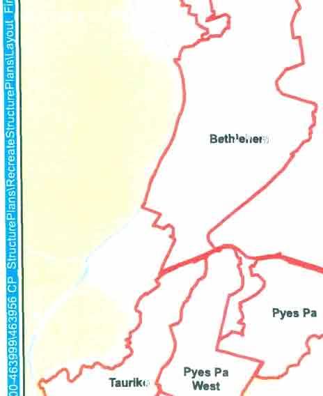
18 Schedule 1 - Part 4 - Local Infrastructure - Transportation 7. Pyes Pa West The Local Developent Contribution syste for the Pyes Pa West Urban Growth area is designed to ensure that the cost of providing services to new developent in the Urban Growth area is allocated equitably to that developent. In the case of Transportation the trunk services are the non-local roads defined in Council's City Plan and Infrastructure Developent Code and shown on the Structure Plan for the Urban Growth Area. Cost Sharing for Carriageways Over 8 Wide In the case where the Structure Plan shows a requireent for a road over eight etres wide, and that road benefits other land outside the subdivision, the Local developent Contributions are designed to recopense the developer for the extra width. Route K Extension (New Arterial) The total construction cost is being shared by TCC, Transit New Zealand, developent in the Pyes Pa West Urban Growth Area and Tauriko Business Estate. The costs for the first 4 - stage 1, of the arterial (Strategic Arterial Road) is apportioned equally between the Tauriko Business Estate area west of the Kopurererua Strea and residential developent in the Pyes Pa West Urban Growth Area. This provides for the length of road as a twolane highway to the first roundabout, which is sufficient to serve the needs of the developent area. The design will accoodate any future grade separation of the Route K Extension/SH 29 intersection if required. Upgrading of Existing Roads Traffic odelling indicates that Pyes Pa Rd fro the creatoriu to Kennedy Rd is likely to experience a drop in traffic nubers as a result of the construction of Route K Extension. There is therefore no requireent for this portion of Pyes Pa Rd to be upgraded as a cost to the UGA. Fro Kennedy Rd to Joyce Rd at the District Boundary (36), Pyes Pa Rd needs to be upgraded as a consequence of the developent of the UGA and this cost is allocated to the UGA including an intersection upgrade at Kennedy Rd and pedestrian crossing facilities. Other road upgrades required are; Kennedy Rd Hastings Rd Pedestrian Access Over Route K Two overbridges and one underpass are required to provide access across Route K Extension and are fully local developent contribution funded, with a portion allocated to Tauriko Business Estate. Developent Contributions Policy Page 225
 Widen 9.")
19 Schedule 1 - Part 4 - Local Infrastructure Transportation Qty Unit Unit Rate Est Cost 7. Pyes Pa West 7.1 Pyes Pa Rd Upgrade (36) (LIPS 45) Existing foration: 9.8 seal, no kerbing, channel Proposed upgrade: District arterial standard, 13 carriageway, intersection widening, kerb, channel, footpath one side, street lighting and pedestrian crossing (a) Widen 9.8 to 13, kerb, channel, footpath 1, ,32 697, Kennedy Rd Upgrade (LIPS 56) Existing foration: seal, no kerb, channel or footpath Proposed upgrade: Collector standard 9 carriageway, widening and bank protection, kerb and channel, footpath on one side, street lighting, safety barriers Widen fro 6 to 9 1, ,4 Existing foration: seal, no kerb, channel or footpath Proposed upgrade: Collector standard 12 carriageway, widening and high level access, bank protection, kerb and channel, footpaths, street lighting Reconstruct to 12 kerb and channel Renewal Coponent 2, ,59 1,173,48 Land Purchase Land Purchase 1,7 3 ^ ^ 116,522 16, 132,522 Contingency and Negotiation costs 31, ,476 2,225, Hastings Rd Upgrade (LIPS 59) Existing foration: 4.1 average seal, no kerb and channel or footpath Proposed upgrade: Local standard, 8 carriageway, kerb and channel. 1, Footpath one side, street lighting Renewal Coponent ,75 Cost sharing: Existing dwellings 41 Future dwellings 2,885 Total dwellings 2,926 Page 226 Developent Contributions Policy 189,
 unfored (LIPS 26262) Construct to 12 wide carriageway (Payent for extra widening only = 37% 35 428,4 428,4 7.4(a) Lakes Boulevard - Underpass (LIPS 28326) Underpass: 3 of 3 x 2.")
20 Schedule 1 - Part 4 - Local Infrastructure - Transportation Qty Unit Unit Rate Est Cost Traffic % due to rezoning 98.6% 7.4 Lakes Boulevard (25) unfored (LIPS 26262) Construct to 12 wide carriageway (Payent for extra widening only = 37% ,4 428,4 7.4(a) Lakes Boulevard - Underpass (LIPS 28326) Underpass: 3 of 3 x 2.4 box culvert al cost 437, , (a) South Collector (145)-unfored (LIPS 1684) Construct to 12 wide carriageway (Payent for extra widening only = 37% 93 2,37 1,894,41 1,894,41 7.5(b) South Collector (145)-unfored (LIPS 2378) Construct to 12 wide carriageway 52 2,37 1, ,59, Kennedy Road - South Collector Roundabout (LIPS 2641) Roundabout 63, 63, 7.6 Kennedy Rd Extension (9) - unfored (LIPS 28325) Construct to 12 wide carriageway (LIPS 28325) 6 Construct to 12 wide carriageway (LIPS 1685) 3 (Payent for extra widening only = 37% 2, 1,394,899 6, 1,994, Land Cost Cost of land required to connect transportation network to adjacent properties (a) 1 lot at 8^ (LIPS 2379) 8 (b) 3 lots at 8^ (1% SIF funded) (LIPS 63) 2,4 ' , , , Capital Contribution to Route K Southern Extension to Pyes Pa Rd SH 36 (LIPS 28264) Cost sharing for this new strategic arterial road has been agreed between Transit, TCC, WBOPDC and Grasshopper: Less non-slf funded portion Portion to be SIF funded 54,354, - 47,754, 6,6, Pyes Pa West Residential Share =3,3, / 54,354, Tauriko Business Estate Share =3,3, / 54,354, Note: Cobined SP 13 an SP14 share reduced by 1,1, (Transit funded land purchase cost in bypass agreeent) 6.7% 6.7% 3,3, 3, Overpasses/Underpasses - Route K Ext. Overbridge: (LIPS 12) 3 wide x 3 plus 7 rap either end (1,3 per ^ excluding raps) 663, 1,326, Developent Contributions Policy Page 227
 1 Actual Cost 75, 2,76, Cost sharing: Costs need to be shared between Residential and Business zones based on the nuber of equivalent")
 296 Total lots 3,3 Residential share (Pyes Pa West) = 34/33 @ 91.3% 1,889,789 Business share (Tauriko) = 296/33 @ 8.97% 186,211 7.")
21 Schedule 1 - Part 4 - Local Infrastructure Transportation Qty Unit Unit Rate Est Cost Underpass: (LIPS 28324) 5 of 3 x 2.4 box culvert (15, per etre) 1 Actual Cost 75, 2,76, Cost sharing: Costs need to be shared between Residential and Business zones based on the nuber of equivalent lots. The cost sharing is as follows: Residential lots (Total) 3,4 Business HUEs (19.7Ha x 15 lots/ha) 296 Total lots 3,3 Residential share (Pyes Pa West) = 91.3% 1,889,789 Business share (Tauriko) = 8.97% 186, Noise wall (LIPS 2397) Noise wall 449,23 449,13 TRANSPORTATION UPGRADE COST FOR PYES PA WEST 16,,964 Page 228 Developent Contributions Policy
 Existing foration: 6 seal, no kerb, channel, footpaths Proposed upgrade: Widen to 12, kerb, channel, footpath Widen to 12, kerb, channel, footpath 1,4 Less Transit New Zealand funding")
22 Schedule 1 - Part 4 - Local Infrastructure - Transportation 8. Ohauiti Qty Unit Unit Rate Est Cost 8.1 Poike Rd-1.4k (LIPS 2837) Existing foration: 6 seal, no kerb, channel, footpaths Proposed upgrade: Widen to 12, kerb, channel, footpath Widen to 12, kerb, channel, footpath 1,4 Less Transit New Zealand funding 734,178 ( 5.) 684, Hollister Lane -.57k (LIPS 2838) Existing foration: 4.8 seal, no kerb, channel, footpath Proposed upgrade: Widen to 11, kerb, channel, footpath on both sides. (a) Widen fro 4.8 to 11, kerb, channel, footpath 57 on both sides , Ohauiti Rd (fro Taylor St)-1.945k (LIPS 13) Existing foration: 5.8 seal, no kerb, channel, footpath Proposed upgrade: Widen to 12, kerb, channel, footpaths, with corner iproveents a) Widen to 12, kerb, channel, footpaths (1st stage) (LIPS 28228) b) Boscabel to City Boundary. 12 wide. Corner iproveents 1,3 2 jal cost 1,72 752, ,4 1, 1,66, Hollister Lane Extension (1.4K.) Costing allows for payent for the extra width fro 8 to 11. (18% of total cost) Widen fro 8 to 11 (LIPS 14) Construction cost (LIPS 28229) 32,24 262, ,34 FOR OHAUITI AREA 2,471,254 Developent Contributions Policy Page 1 229
 Widen to 16, kerb, channel, footpath 87 9.2 Waikite Rd-1.58k (LIPS 2827) Existing foration: 5.")
 Existing foration: First 24 is 12 seal, kerb and channel both sides, one footpath. Reainder is 6.")
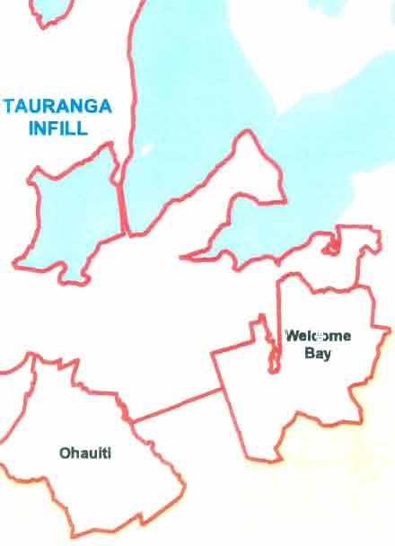
23 Schedule 1 - Part 4 - Local Infrastructure Transportation 9. Welcoe Bay Qty Unit Unit Rate Est Cost 9. WELCOME BAY 9.1 Welcoe Bay Rd (arterial) -.87k (LIPS 15) Existing foration: Varies fro 9 to 14.4 Proposed upgrade: To arterial standard, 16 carriageway, kerb, channels, footpaths a) Widen to 16, kerb, channel, footpath Waikite Rd-1.58k (LIPS 2827) Existing foration: 5.2 seal, no kerb, channel, footpath Proposed upgrade: Widen to 11, kerb, channel, footpath a) Widen to 11, kerb, channel, footpath 1,58 1,484 1,291,8 1,291,8 1,286,795 1,286, Waitaha Rd-1.71k (LIPS 17) Existing foration: First 24 is 12 seal, kerb and channel both sides, one footpath. Reainder is 6.5 seal, kerb & channel, one footpath Proposed upgrade: (a) 24-92, widen to 12, kerb, channel, footpath (b) , widen to 8, kerb, channel, footpath (a) Widen, kerb, channel, footpath (LIPS 2823) 1,18 (b) 118 to , ,529 TRANSPORTATION UPGRADE COST FOR WELCOME BAY AREA 3,391,44 Page 23 Developent Contributions Policy
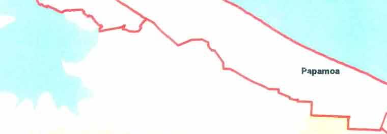
24 Schedule 1 - Part 4 - Local Infrastructure - Transportation 1. Papaoa 1. PAPAMOA 1.1 Girven Rd (arterial) -.78k See City-wide Transportation (BIF) Qty Unit Unit Rate Est Cost 1.2 Maranui St-1.46k (LIPS 24) Existing foration: 1 or 1.5 wide, one section with kerb, channel and footpath one side, one section with no kerbing, one section with kerb only Proposed upgrade: (a) Widen -52 to 12. kerb, channel, footpath on one side (b) Widen to 12, kerb, channel, footpath on both sides (c) Widen to 12, kerb, channel, footpath on one side, footpath on other side (a) Widen, kerb, channel, footpath one side (LIPS ) (b) Widen, kerb, channel, footpath both sides (LIPS 94 24) , Papaoa Beach Rd k (LIPS 2839) Existing foration: Varies fro 13 at western end to 5.5 at eastern end. Most of road has kerbing and channels, but footpaths varied Proposed upgrade: (a) 1.33k - 2.4k, widen fro 7.2 to 12, kerb, channel, footpaths both sides (b) 6.3k k, widen fro 5.5 to 1, kerb, channel, footpaths both sides (c) 8.28k 8.52k, widen fro 5.5 to 8. kerb, channel, footpaths both sides (a) Widen, kerb, channel, footpaths 1,7 (b) Widen, kerb, channel, footpaths 98 (c) Widen, kerb, channel, footpaths 1, ,577, Doain Road (arterial) -.78k (LIPS 244) Existing foration: Varies fro 8.4 to 11.8 Proposed upgrade: Arterial standard with 16 carriageway, kerbing. footpath, etc (including land purchase) Plus Renewals Plus Land purchase (LIPS 563) Eng Est 6.294, 1, ,397 1,15,2 7, ,921 8,49, Range Rd-.91k (LIPS 284) Existing foration: 5.5 wide seal, no kerb, channel, footpath Proposed upgrade: Widen first 64 to 8, kerb, channel, footpath both sides. Reaining 27 unchanged Widen, kerb, channel, footpaths 64 24,174 24,174 Developent Contributions Policy Page 231
25 Schedule 1 - Part 4 - Local Infrastructure Transportation Qty Unit Unit Rate Est Cost 1.6 Logan Road -. 9k (LIPS 2841) Existing foration: 5.5 seal, no kerb, channel footpath Proposed upgrade; Widen to 8, kerb, channel, footpath both sides Widen, kerb, channel, footpaths 9 13,992 13,992 Note that projects (Karewa Parade, Short Place, Taylor Rd) have been deleted as they were not SIF related. 1.7 Percy Rd -.75k (LIPS 2842) Existing foration: (a) -15, 5.6 wide, no kerb, channel, footpaths (b) 15-4, 7 wide, kerb, channel, footpath on one side (c) 4-75, 8 wide, kerb, channel, footpath on both sides Proposed upgrade: Widen first 4 to 8, kerb, channel, footpath on one or both sides, as required. (a) Widen to 8, kerb, channel, footpath both sides 15 4,781 (b) Widen to 8, kerb, channel, footpath other side 25 36,99 76, Stella Place -.9k (LIPS 2843) Existing foration: 5.6 wide, no kerb, channel, footpath Proposed upgrade: Widen to 8, kerb, channel, footpath both sides Widen, kerb, channel, footpaths 9 23,5 23,5 1.9 Dickson Rd -.88k (LIPS 2844) Existing foration: 7 wide, kerb, channel, footpath on one side Proposed upgrade: Widen to 8 Widen 88 89,83 89, Grant Place-.11k (LIPS 2845) Existing foration: 5.8 wide, no kerb, channel, footpath Proposed upgrade: Widen to 8, kerb, channel, footpath both sides Widen, kerb, channel, footpath both sides 11 33,763 33, McCallu Place-.11k (LIPS 2846) Existing foration: 5.8 wide, no kerb, channel, footpath Proposed upgrade; Widen to 8, kerb, channel, footpath both sides Page 232 Developent Contributions Policy
 Widen to 15, kerb, channel, footpaths (a) Widen to 15, kerb, channel, footpath (b) Plus Renewal coponent 95 Actual Cost 1,715,339 417,648")
26 Schedule 1 - Part 4 - Local Infrastructure - Transportation Widen, kerb, channel, footpath both sides Qty Unit Unit Rate Est Cost 11 26,967 26, Parton Rd -.95k (LIPS 245) Existing foration: 5.8 wide, no kerb, channel, footpath Proposed upgrade: (a) Widen to 15, kerb, channel, footpaths (a) Widen to 15, kerb, channel, footpath (b) Plus Renewal coponent 95 Actual Cost 1,715, ,648 2,132, Sipson Rd -.97k (LIPS 2847) Existing foration: 5.9 wide, no kerb, channel, footpath Proposed upgrade: Widen to 1, kerb, channel, footpath both sides Widen, kerb, channel, footpaths , , Kirkpatrick Place-.1k (LIPS 2848) Existing foration: 5.9 wide, no kerb, channel, footpath Proposed upgrade: Widen to 8. kerb, channel, footpath both sides Widen, kerb, channel, footpaths 1 28,67 28, Paveent Widening Gravatt Road (LIPS 2831) Gravatt Rd (LIPS 257) ,72 3,718, ,4 4,381,579 Grenada Street (LIPS 2832) Grenada St (LIPS 264) 1,5 2, ,78 2,133,195 3,291,273 Doncaster Drive (LIPS 2833) Doncaster Dr (LIPS 265) , ,89 1,427,6 Sandhurst Dr (a.) Grenada - Gravatt (includes land) (LIPS 258) Sandhurst Dr (b.) Gravatt - State Highway (includes land) (LIPS 26) Gloucester St (LIPS 252) Longview Dr (LIPS 2849) Shopping Centre to Wairakei Strea (LIPS 1169) 1,127,65 3,196, ,4 254, , Developent Contributions Policy Page 233

 for detail and cost sharing. Papaoa Share = 22% 2.92.62 ha ha 5, 327,3 1,882,431 1.")
 Construct Roundabout Land Purchase (LIPS 28232) See file 6482-16 (Vol 19) for cost sharing. 1.1 L.S. Ha. @ 2,14345 929,748 3,7,93 1.")
27 Schedule 1 - Part 4 - Local Infrastructure Transportation Qty Unit Unit Rate Est Cost Golden Sands Subdivision to Wairakei Strea (LIPS 285) Eerald Shores Subdivision to Wairakei Strea (LIPS 2851) 38, 315,1 = 16,27, Tara Rd - Construction (LIPS 246) Reconstruct as an Arterial Rd -15 Carriageway Reconstruct as an Arterial Rd -15 Carriageway,8 Eng Est 6,255,423 3,8,5 Tara Rd - Land Purchase (LIPS 564) Land Purchase x 1 Land Purchase - 62 x 5 Survey and Negotiation See file (Vol 19) for detail and cost sharing. Papaoa Share = 22% ha ha 5, 327,3 1,882, Tara Rd / Doncaster Dr Roundabout (LIPS 248) Construct Roundabout Less 2% Ministry of Education share See file (Vol 19) for cost sharing. = 63, 126, 54, 1.18 Tara Rd / Parton Rd Roundabout (LIPS 249) Construct Roundabout Land Purchase (LIPS 28232) See file (Vol 19) for cost sharing. 1.1 L.S. 2, ,748 3,7, Wairakei Strea Crossings Longview Dr (LIPS 2853) Pal Springs Boulevard (LIPS 267) Golden Sands Subdivision (LIPS 268) Eerald Shores subdivision (LIPS 269) Actual Cost Eng Est Eng Est 3, , ,918, Gravatt Rd - Evans Drain Crossing (LIPS 2852) Construct crossing over Evans Drain 2 37, Mangatawa Interchange SH2 -Sandhurst Link (LIPS 137) Construct interchange with Sandhurst Dr and S H 2 1 L.S. Eng Estiate 9,85, 1.22 Parton Rd/Papaoa Rd Roundabout (LIPS 2259) Construct roundabout 1 L.S. Eng Estiate 63, 1.23 Sandhurst Drive - Maranui Street Intersection Upgrade (LIPS 2355) Intersection upgrade Land Purchase.7 Contingency and Negotiation Eng Estiate 6, 17, ,43 73,434 TRANSPORTATION UPGRADE COST FOR PAPAMOA AREA 57,671,692 Page 234 Developent Contributions Policy

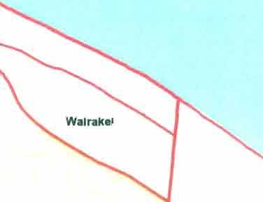
28 Schedule 1 - Part 4 - Local Infrastructure - Transportation 11. Wairakei All of the Wairakei transportation projects in below are funded fro developent across the whole urban growth area except Ite 11.7 which is funded solely fro Catchent A. The boundaries of Catchent A (Area A) are shown in section 12. of Schedule 1 - Part 4 - Local Infrastructure - Storwater for the boundary of Catchent A. In addition to this, the funding of soe Wairakei transportation projects is shared with the neighbouring Papaoa or Te Tuu urban growth areas. Quantity Unit Unit rate Est Cost 11.1 Te Okuroa Drive - Parton Rd to Wairakei Boundary (LIPS 226) a) Construction and land purchase 77 3,861 2,729,8 2,729,8 b) Te Okuroa Drive - Boundary to Main Road (LIPS 259) Land purchase to date (Papaoa Junction).7 Ha 867,588 Land Purchase 1.68 Ha 214,654 2,292,5 Road Construction 872 6,199 5,45,528 Road Construction 2,981 5,36 15,12,316 23,577,932 Te Okuroa Drive - Main Road to Te Tuu (LIPS 2261) Land Purchase 1.7 Ha 35, 595, Road Construction 35 6,41 2,114,35 2,79,35 d) Te Okuroa Drive - Boulevard Intersection (LIPS 2262) Road construction Estiate 2,, e) Te Okuroa Drive - Main Road Intersection (LIPS 2263) Extra over costs for intersection construction Estiate 818,6 818,6 Parton Road / Papaoa Roundabout (LIPS 2259) Construct Roundabout 11.2 Tara Road / Parton Road Roundabout (LIPS 249) Construct Roundabout Land Purchase (LIPS 28232) Total L.S. 63, 1 L.S..1 Ha 63, 63, 2,14, ,748 3,7,93 Developent Contributions Policy Page 235
 ) Reconstruct as an Arterial Rd.")
29 Schedule 1 - Part 4 - Local Infrastructure - Transportation 11.3 Tara Road - Construction (LIPS 246) Quantity Unit Unit rate Est Cost Reconstruct as an Arterial Rd. (15 Carriageway) ) Reconstruct as an Arterial Rd. (15 Carriageway 28 Eng Estiate 6,255,423 3,8,5 = 1,55,428 Tara Road - Land Purchase (LIPS 564) Land Purchase x 1 (LIPS 564) Land Purchase - 62 x 5 (LIPS 564) Ha Ha 5, 327,3 827, Tara Road / Doncaster Dr. Roundabout Wairakei Share is nil as this is not required for the Wairakei developent Wairakei Strea Crossings Pal Springs Boulevard (LIPS 267) Golden Sands Subdn. (LIPS 268) Eerald Shores Subdn. (LIPS 269) 12 Estiate 12 Estiate 12 Estiate 415,92 761, ,52 1,626, Papaoa East Interchange (LIPS 262) a) Stage 1 Land required to service Stage 2 Land required to service Stage 1 Overbridge and Raps Landscaping Ha Ha Ha Actual 35, Estiate 3, 2,557,484 1,51,5 21,292,194 6, 25,411, Access through Lot 5 DPS (LIPS 117) Construct 13 wide industrial access road to serve ultiple properties 4 4,423 1,769,2 Please note that ite 11.7 is funded solely fro developent in Catchent A. Refer section 12. of Schedule 1 - Part 4 - Local Infrastructure - Storwater for the boundary of Catchent A (Area A) Bus Bays and Shelters (LIPS 1171) Te Okuroa Dr. Estiate 1, 1, 11.9 Main Road (LIPS 261) Construct the Main Road between Te Okuroa Dr. and the Boulevard 3 Estiate 1,7, Page 236 Developent Contributions Policy
30 Schedule 1 - Part 4 - Local Infrastructure - Transportation 11.1 Designations (LIPS 28277) Designations for Te Okuroa Dr and the ^^,^3, ^^^^ 35, Interchange Total Cost of Wairakei Roading (Exc Stage 2 share of Interchange) 577 ggo 382 Developent Contributions Policy Page 237
31 Schedule 1 - Part 4 - Local Infrastructure - Transportation 12. Tauriko Business Estate Route K Extension (New arterial) Stage 1 of Route K extension is a shared cost with TCC, NZTA and Pyes Pa West Urban Growth Area. Priary Transport Network Fro Route K extension, a sub-arterial (Spine Rd) provides the priary transport network for this area. The Spine Rd includes intersections that will be controlled by large roundabouts. Additional road reserve width of 5 is provided to accoodate traffic functioning and landscape developent. A priary public transport network is provided along Spine Rd, with opportunities for secondary routes along collector roads if required. Provision for cycles and pedestrians include; Links to Pyes Pa West residential area. Crossing points separated fro roundabouts. Median refuges on Spine Rd. Off-road routes along storwater corridors. Local developent contribution funding is based on the additional cost over and above a 13 standard industrial collector road. Land for road widening fro 22 to 27 is included in the local developent contributions. An extension of the Kennedy Rd collector linking to Pyes Pa West will facilitate traffic oveent to the east. This includes a new bridge across the Kopurererua Strea. The full costs of land and construction are local developent contribution funded as this route is also planned as a bulk services corridor. Gargan Rd also requires upgrading to an industrial standard. Minor iproveents will be required to the intersections at Route K/SH29 and Belk Rd/SH29 as a result of the developent at Tauriko. Belk Rd also requires upgrading to industrial standards. Pedestrian Access Over Route K A portion of the two overbridges and one underpass required to provide access across Route K Extension are allocated to Tauriko Business Estate with the balance being funded by Pyes Pa West UGA. Belk Rd /SH29 Intersection Agreeent Suary Tauranga City Council has reached a funding agreeent with IMF New Zealand Liited regarding developent contributions for the Belk Rd/SH 29 Intersection. The Dataworks nuber for the funding agreeent is ) and the funding agreeent is generally outlined below; A solution for the Belk Rd/SH29 Intersection has yet to be finalised. There is soe uncertainty regarding the final solution for this intersection. - NZTA is still assessing and negotiating options with IMF over options for a Tauriko bypass (indicated on the Structure Plan). Developent Contribution funding of the Belk Rd/SH29 intersection, has been based on cost estiates for a solution Transit have approved in principle. Page 238 Developent Contributions Policy
32 Schedule 1 - Part 4 - Local Infrastructure - Transportation Council's share ofthis cost estiate is the 6.2 illion and was included in the contribution schedules fro 27/28. The design proposal on which the 6.2 illion is based ay not reflect the final outcoe. SIFs will be payable in accordance with the 27/8 figures. If the intersection and/or the estiate (6.2) increases or decreases IMF will be either required to pay additional ipact fees or receive a refund on fees they have already paid. Developent Contributions Policy Page 239
 Construct to arterial standard, 12 carriageway and 19 carriageway, 3.6 edian, cycle lane and bus bays. 27 and 34 road reserve.")
33 Schedule 1 - Part 4 - Local Infrastructure Transportation NB: "EST COST" ROUNDED TO NEAREST 1 Qty Unit Unit Rate Est Cost 12. TAURIKO BUSINESS ESTATE 12.1 Spine Rd, sub-arterial (unfored) Construct to arterial standard, 12 carriageway and 19 carriageway, 3.6 edian, cycle lane and bus bays. 27 and 34 road reserve. a) Construct to 19 wide carriageway including first two roundabouts - 53 (LIPS 28233) Payent for extra cost above 13 industrial road Insert Base Industrial road cost per etre 53 31% 2,95 1,262,9 b) Construct 12 wide carriageway with Island (LIPS 2894) Construct 12 carriageway (LIPS 7) Construct 12 carriageway (LIPS 7) Construct 12 carriageway (LIPS 7) Construct 12 wide carriageway with Island (LIPS 7) Payent for extra cost above 13 industrial road Insert base industrial road cost per etre ,714 8% 1,731 86,363 21,429 39,516 1, ,731 2,966,935 6,916, % SIFs (a) Extra over for roundabouts (LIPS 1173) (a) Extra over for roundabouts (LIPS 1173) Extra over for roundabouts (LIPS 1173) 137,145 13, 65, 455, 722,145 (b) Landark entry feature (LIPS 1) Landark entry feature (LIPS 1) (c) Bus bay and shelter (LIPS 71) 1 @ 1, 2, 72,28 2, 2, 472,28 (d) Land purchase splays for two roundabouts (LIPS 68).246 Ha 45,749 (d) Land purchase splays for one roundabout (LIPS 68).493 Ha 135,174 (d) Land purchase splays for one roundabout (LIPS 68).1267 Ha 145,686 (d) Land purchase splays for eight roundabouts (LIPS 68) ha 1,43,415 (e) Land purchase - 22 to 27: 5 x 3262 (LIPS 68) 1.17 ha 1,394,953 (e) Land purchase - 22 to 27: 5 x 3262 (LIPS 68).2944 ha - 49,977 3,966,954 (e) Land purchase - 22 to 27: (LIPS 2895).795 Ha 5,223 (e) Land purchase - 22 to 27: (LIPS 2895).2554 Ha 141,333 (f) Land purchase - 22 to 34: Actual area for first 41 (LIPS 2895).488 ha 1,735,822 6,344,332 7,538,685 Page 24 Developent Contributions Policy
34 Schedule 1 - Part 4 - Local Infrastructure - Transportation NB: "EST COST" ROUNDED TO NEAREST 1 Qty Unit Unit Rate Est Cost 12.2 Kennedy Rd collector, link to SP13-37 (unfored) (a) Construct to 13 wide industrial carriageway (LIPS 73) (a) Construct to 13 wide industrial carriageway (LIPS 73) (b) Bridge over Kopurererua Strea incl design (LIPS 74) (c) Land purchase - 22 x 37 (LIPS 72) (Including price contingency and negotiation costs) (c) Land purchase - 22 x 54 (LIPS 72) (Including price contingency and negotiation costs) L.S @ 2,487 Actual 1,4, Actual Cost 23, ,55 183,53 1,4, 69, ,653 2,554,558 Cost sharing: 1% SIF for land and carriageway as key waterain corridor and transportation link with SPl 3 area NB:EST COST "ROUNDED TO NEAREST 1 QTY Unit Unit Rate Est Cost 12.3 Gargan Rd upgrade (LIPS 75 / 76) Costs identified for possible urbanisation of Gargan Plateau to ensure infrastructure options are covered. Existing foration: Rural standard, 5.8 seal, no kerb and channel or storwater Proposed upgrade: (a) Reconstruct to 13 wide Industrial standard (LIPS 76) 2,796 (b) Road widening land purchase - 2 x 35 (LIPS 75).7 922, , Gargan Rd, Spine Rd intersection (LIPS 146) Reoved to reflect Environent Court decision per Tauriko Subission 28/ Belk Rd upgrade (LIPS 1172) Existing Foration: Rural standard, 6.6 seal, no kerb and channel Proposed upgrade: (a) Construct to 13 wide industrial carriageway (b) New roundabout Belk/Spine intersection (c) Land purchase for roundabout splays (5) 2,148 63, 2,878,32 63, 6,57 3,568, Belk/SH 29 Intersection upgrade (LIPS 145) Upgrade intersection to approved standard in consultation with Transit New Zealand. Proposed Upgrade: (a) Land Purchase, Construction, SH29 realignent Note: 6.2 illion has been agreed between Transit New Zealand, IMF Ltd and TCC for a roundabout solution at the Belk Rd/S H 29 intersection. This is the final solution in ters of developent contributions outlined in the TCC/IMF agreeent suary at the beginning of the Tauriko Business Estate Transportation section. 6,2, 6,2, Developent Contributions Policy Page 241
 Land purchase for 9 wide accessways (a) Access A - 9 x 5 (a) Access A - 9 x 5 (b) Access C - 9 X 6 (c) Access D - 9 X 6 (walkway construction in")
35 Schedule 1 - Part 4 - Local Infrastructure Transportation 2.7 Accessways - Pedestrian and cycleway (LIPS 82) Land purchase for 9 wide accessways (a) Access A - 9 x 5 (a) Access A - 9 x 5 (b) Access C - 9 X 6 (c) Access D - 9 X 6 (walkway construction in storwater section) ,63 34,6 13, , Capital Contribution to Route K Southern Extension to Pyes Pa Rd SH 36 (LIPS 28264) Cost sharing for this new strategic arterial road has been agreed between Transit, TCC, WBOPDC and Grasshopper: Less Non-funded SIF portion Portion to be SIF funded (c) Pyes Pa West UGA cost - residential (d) Tauriko Business Estate 54,354, - 47,754, 6,6, 3,3, 3,3, Pyes Pa West Residential share = 3,3,/54,354, Tauriko Business Estate share = 3,3,/54,354, Note: Cobined SP 13 an SPl 4 share reduced by 1,1, (Transit-funded land purchase cost in bypass agreeent) 6.7% 6.7% 12.9 Route K Extension Iproveents (LIPS 27) This ite includes slip lane to Route K, slip lane to Route K extension/sh29 southbound, slip lane to Route K extension/sh29 northbound. Route K extensions widening, slip lane to Pyes Pa West, slip lane to Spine Rd, bridge iproveents to Pyes Pa West. Ites include contingencies and design as per Opus International Consultants Ltd review of estiate, July 26. L.S. Land Purchase Coercial Land Purchase Non-developable Land Purchase Non-developable ha ha ha Survey and Negotiation on Land 4, 7.5% 2,6, 71,111 46,8 18,8 2,736,711 1,253 2,746, Overpasses/Underpasses - Route K Ext Overbridge (LIPS 12) 3 wide x 2 plus 7 rap either end 663, 1,326, Underpass (LIPS 28324) 5 of 3 x 2.4 box culvert Cost sharing fro Pyes Pa West cost estiates: Tauriko Business Estate share 8.97% Actual Cost 75, 2,76, ROADING COST FOR TAURIKO BUSINESS ESTATE 36,9,226 Page 242 Developent Contributions Poiicy
 COS.")
 Road widening (Moffat Rd) 943,763 26,938 1,37,625 54 36 54 46 64 46 59,632 74,498 74,138 399 399 399 164.")
 Bethlehe Rd (Marae for 61) 99,19 1,237,126 34.5 7.")
 Millers Rd (Bellevue Rd to end. - 39) Millers Rd (39-93) 31,279 767,456 615,785 92 63 33 8 37 67 28,777 483,497 23,29 399 399 399 9.29 156.2 65.")

 1,85 1 1,85 399 3.5 Cost of Inflation 125,17 1 125,17 399 4.37 Cost of Capital BETHLEHEM LDC 845,438 17,89,917 1 845,438 1,8,361 399 272.81 3,485.")
36 Schedule 1 - Part 4 - Local Infrastructure - Transportation TRANSPORTATION DEVELOPMENT IMPACT FEES - LOCAL INFRASTRUCTURE (LDC) LIPS 1 "^ LDC FOR 1 NON I'S^HTR^I 1 1 GROWTH LDC/CDC ARpT/ct COST PROJECT ^^^n^r"^ """^^ '^^'^ "^ OR CDC COST HUEs PER cost) COS., 1 P-^«1 I I BETHLEHEM 142/ Cabridge Rd (Moffat intersection north) Cabridge Rd (Moffat intersection south) 1 Orange Lane 841,47 776, , , , , Moffat Road Road widening (Cabridge Rd) Road widening (Moffat Rd) 943,763 26,938 1,37, ,632 74,498 74, / Beauaris Boulevard Bethlehe Rd (S H 2/Carichael) - 47 Bethlehe Rd (S H 2/Carichael) - 23 Bethlehe Rd (Carichael/Marae) 3,567,38 54, , , ,85,7 186, ,176 29, Bethlehe Road (Carichael/Marae) Bethlehe Rd (Marae for 61) 99,19 1,237, , , Bethlehe Road (to the end - 15) Carichael Rd (Bethlehe Rd to end) 167,7 454, , , Mayfield Lane (Millers Road/SH2) Millers Rd (Bellevue Rd to end. - 39) Millers Rd (39-93) 31, , , , ,497 23, Millers Road (extension to Mayfield Lane) Millers Rd (extension to Mayfield Lane) - Actual Intersection upgrade: Bethlehe/Carichael Wew Roads: 855,85 3,764 53, , ,481 21, Mayfield to Carichael , , Mayfield to Carichael. 23 Paveent widening: Walkways 238, , , , Mayfield subdivision access 431, , Mayfield subdivision access (land purchase) 1,85 1 1, Cost of Inflation 125, , Cost of Capital BETHLEHEM LDC 845,438 17,89, ,438 1,8, , PYES PA Cheyne Rd 1,911, ,796, Pyes Pa Road Pyes Pa Road collector to Cheyne Rd Pyes Pa Road collector to Cheyne Rd 3,412, ,161 24, ,16, ,89 24, Cost of Inflation Cost of Capital 1 2,17 198, ,17 198, PYES PA LDC [ 6,518, ,519, , Developent Contributions Policy Page 243


 2,42,45 1429 1429 1429 1429 1429 424.64 819.44 54.83 127.64 (218.78) 1,693.")
37 Schedule 1 - Part 4 - Local Infrastructure Transportation TRANSPORTATION DEVELOPMENT IMPACT FEES - LOCAL INFRASTRUCTURE (LDC) NON '- '^ ^ ^ LDC FOR idctcv ER GROWTH LL)c/CUO AREA(g) "l^^ PROJECT P-IOJICT AREA '-^fj^ OR CDC cost HUEs ID COST (% of total Y, (% of / / OHAUITI Poike Rd Hollister Lane Ohauiti Road Hollister Lane extension Cost of Inflation Cost of Capital OHAUITI LDC 734, ,223 1,66, ,34 19,66 219,912 2,71,826 P-J-' cost) pro ''' t ' '«' project cost) , ,223 39,378 53,16 19,66 219,912 1,497, COST PER UNIT ,92.86 WELCOME BAY / 2823 Welcoe Bay Rd Waikite Rd Waitaha Rd Cost of Inflation Cost of Capital WELCOME BAY LDC 1,291,8 1,286, , ,398 (312,637) 3,261, ,88 1,17, , ,398 (312,637) 2,42, (218.78) 1, PAPAMOA Maranui St Maranui St - Actual Papaoa Beach Rd Doain Rd - Construction Doain Rd/ Land Purchase Range Rd Logan Rd Percy Rd Stella Place Dickson Rd Grant Place McCallu Place Parton Rd Parton Rd/Papaoa Rd Roundabout Sipson Rd Kirkpatrick Place Tara Rd (Construction) Tara Rd (Land) Tara Rd/Doncaster Dr roundabout Tara Rd / Parton Rd roundabout Tara Rd / Parton Rd roundabout Sandhurst Dr-Maranui St Intersection Upgrade Gravatt Rd Evans Drain Crossing Paveent Widening: 751,6 4,869 1,577,791 7,499,597 99,921 24,174 13,992 76,88 23,5 89,83 33,763 26,967 2,132,987 63, 243,571 28,67 1,55, ,3 63, 2,14, ,748 73,434 37, ,21 3,262 1,57,12 3,95,4 555,52 12,87 6,996 9,994 2,997 66,812 28,361 22,652 1,68, ,686 24,6 25,822 3,65, , ,84 1,41, ,415 73,434 37, Gloucester Street Gravatt Road Gravatt Road Sandhurst Dr (a) 1,331,4 3,718, ,4 1,127, ,618 1,375, ,325 1,127, Sandhurst Drive (b) 3,196, ,196, Page 244 Developent Contributions Policy
 264/283/ i Grenada Street 3,291,273 265 2833 2849 1169 1 Doncaster Dr 1 Doncaster Drive 1 Longview Dr 1 Shopping Centre to Wairakei Strea 497,89 929,791 254,346 565, 285 Golden")

 1 63 63 63 85 63 63 63 63 COST HUES ~S;,r </ f ' «l P^'^f cost) 1,217,771 161.87 48.78 48.")
38 Schedule 1 - Part 4 - Local Infrastructure - Transportation TRANSPORTATION DEVELOPMENT IMPACT FEES - LOCAL INFRASTRUCTURE fldc) LDC FOR 1 GROWTH 1 Z^ ID PROJECT PRO^IPT COST AREA (% of total 1 project 1 cost) 264/283/ i Grenada Street 3,291, Doncaster Dr 1 Doncaster Drive 1 Longview Dr 1 Shopping Centre to Wairakei Strea 497,89 929, , , 285 Golden Sands subdivision to Wairakei Strea 38, Eerald Shores subdivision to Wairakei Strea 315,1 1 Wairakei Strea Crossings: Longview Dr Pal Springs Blvd Strea Crossing 291, , Golden Sands Dr Strea Crossing r Eerald Shores Strea Crossing Sandhurst Dr. Interchange 761, ,52 9,85, Cost of Inflation 614,78 Cost of Capital (678,274) PAPAMOA LDC 57, '^ torj -"- total project cost) COST HUES ~S;,r </ f ' «l P^'^f cost) 1,217, , , ,152 29,5 14,6 116, , ,34 389,968 23,244 3,644,5 614,78 (678,274) 27,82, (9.16) 3,698.6 PYES PA WEST Road Upgrades/Widening: Pyes Pa Rd Kennedy Rd Hastings Rd New Roads: Lakes Boulevard Lakes Boulevard - Underpass South collector South collector Kennedy Road - South Collector Roundabout Kennedy Road Extension Kennedy Road Extension Land cost for connections Land cost for connections Route K Extension Underpass Over-bridge Noise wall Cost of Inflation Cost of Capital PYES PA WEST LDC *Total cost Route K Extension [ =54,354, 697,32 2,225, , 428,4 437,597 1,894,41 1,59,24 63, 1,394,899 6, 85,2 534,312 6,6, 75, 1,326, 449,23 1,145,871 (1,36,58) 19,14, ,558 1,947, , ,58 437,597 7, ,919 63, 516, , 85,2 534,312 3,3, 682,725 1,27,58 449,23 1,145,871 (1,36,58) 11,99, , (52.31) 4, WEST BETHLEHEM New roundabout on S H 2 Bethlehe Rd (Carichael Rd northwards) Carichael Rd (Bethlehe Rd to SH2) 1 3,6, ,855 1,17, ,836,32 29, , , Developent Contributions Policy Page 245
 Intersection Upgrade: Bethlehe/Carichael) Designation process for Roads in Bethlehe")
 34.5 4 1 1 1 31 2 34.5 4 341,616 21,552 2,113 194,317 3,669,33 6,892,274 6,82,274 616 616 616 616 616 1 COST PER UNIT 554.57 327.2 3.43 315.45 5,956.66 11,188.76 (7,672.66) 3,516.")
39 Schedule 1 - Part 4 - Local Infrastructure Transportation 2247 TRANSPORTATION DEVELOPMENT IMPACT FEES - LOCAL INFRASTRUCTURE (LDC) ^O^ LDC FOR LDC FOR NON OTHER GROWTH LUUCUC AREA(S) Zn^ PROJECT P'S'IPT AREA '-^,"9 OR CDC cost HUEs ID COST (% of total Y ; {%of Bethlehe Rd (Carichael Rd to Marae) Intersection Upgrade: Bethlehe/Carichael) Designation process for Roads in Bethlehe Plan Change 15 Cost of Inflation Cost of Capital SUB Less discount adopted by Council WEST BETHLEHEM LDC 99,19 53,881 2, ,317 3,669,33 1,821,211 1,821,211 P-J-' pros. ' '^'. ^ ^*> cost) P^ J«.f ' cost) ,616 21,552 2, ,317 3,669,33 6,892,274 6,82, COST PER UNIT , , (7,672.66) 3,516.1 WAIRAKEI Te Okuroa Drive -Main Rd to Te Tuu Te Okuroa Drive - Main Rd Intersection Bell Road Interchange (Stage 1) Main Road Designations Te Okuroa Drive - Boulevard Intersection Te Okuroa Drive - Parton Rd to Wairakei Boundary Te Okuroa Drive -Boundary to Main Rd Parton Rd / Papaoa Roundabout Tara Rd. / Parton Rd. Roundabout. Tara Rd. / Parton Rd. Roundabout. Tara Road Tara Road - Land Purchase Bus Bays and Shelters Wairakei Strea Crossings: Pal Springs Blvd Strea Crossing Golden Sands Dr Strea Crossing Eerald Shores Strea Crossing Cost of Inflation Cost of Capital 2,79,35 818,6 25,411,178 1,7, 35, 2,, 2,729,8 23,577,932 63, 929,748 2,14,345 1,55, ,3 1, 415,92 761, ,52 1,222,766 4,431, too ,156, ,86 1,31, ,18 14,938 2,, 1,815,317 22,399,35 37,314 43, ,836 3,432, ,339 1, 22, ,39 219,276 1,222,766 4,431, , , , , , , , , , ,227.4 Subtotal 89,945,127 59,71, ,5.64 Catchent A 117 Access through Lot 5 DPS ,769,2 Cost of Inflation 227,852 Cost of Capital 83,18 Subtotal 2,8, ,769,2 227,852 83,18 2,8, , , , , WAI RAKEI LDC 91,37,97 6,793,97 TAURIKO BUSINESS ESTATE Page 246 Developent Contributions Policy
 Z^^ ID PROJECT P-IO^IPT COST AREA (% of total ^ ^ ^ ^ 9 \Z, OR CDC (%of cost HUEsh S;''M UNIT P-J-» prost total 1 1 1 I '= ^*' cost) P'- '«=t I I <^ ^t) 1 I I 1 28233 Spine Road sub-arterial")
40 Schedule 1 - Part 4 - Local Infrastructure - Transportation TRANSPORTATION DEVELOPMENT IMPACT FEES - LOCAL INFRASTRUCTURE (LUC) MON 1 LDC FORI 1 1 LDC FOR, nc7cdc O"^"^" GROWTH LIJUCOC ^REA(S) Z^^ ID PROJECT P-IO^IPT COST AREA (% of total ^ ^ ^ ^ 9 \Z, OR CDC (%of cost HUEsh S;''M UNIT P-J-» prost total I '= ^*' cost) P'- '«=t I I <^ ^t) 1 I I Spine Road sub-arterial (- 148) 1,262, , Spine Road sub-arterial (53-148) 86, , , Spine Road sub-arterial ( ) Roundabouts Landark features and Bus Shelters Land purchase, Bus bays, Roundabouts Kennedy Road Collector Gargan Road Upgrade Belk Road Upgrade Belk Road/SH29 upgrade Accessways - Pedestrian & Cycleway 'Route K Extension Route K extension Iproveents Route K Overpasses Route K Underpasses Cosf of Inflation Cost of Capital 4,793, , ,28 6,344,333 2,554,47 986,838 3,568,377 6,2, 121,17 6,6, 2,746,964 1,326, 75, 3,548,627 3,791,28 TAURIKO BUSINESS ESTATE LDC 46,648, , , ,28 6,344,333 2,554,47 986,838 3,568,377 6,2, 121,17 3,3, 2,746, ,942 67,275 3,548,267 3,791,28 35,386, , Developent Contributions Policy Page 247
41 Page 248 Developent Contributions Policy Schedule 1 - Part 4 - Local Infrastructure Transportation
42 Schedule 1, Part 4 Local Infrastructure - Reserves and Counity Infrastructure
43 Schedule 1 - Part 4 Local Infrastructure - Reserves and Connunity Infrastructure Contents 1. Introduction Funding Needs Assessent - Section 11(3) of the LGA Council Outcoes for Local Reserves and Counity Infrastructure Distribution of benefits Period in or over which benefits occur Extent to which groups or individuals contribute to the need to undertake the activity Costs and benefits of funding the activity distinctly fro other activities Social, Econoic, Environental and Cultural Well-being Key Considerations Methodology Calculations Projects for other growth areas (to be taken as financial contributions) Annual Review and Updating Frequency Suary of Fees Schedule 254 Developent Contributions Policy Page 249
44 Local Infrastructure - Reserve and Counity Infrastructure 1. Introduction Reserve Contributions are collected for the purchase of land for neighbourhood reserves. Counity Infrastructure Contributions are collected for the developent of neighbourhood reserves. The Reserves and Counity Infrastructure Contributions for Neighbourhood Reserves apply to the following urban growth areas; West Bethlehe Pyes Pa West - Kennedy Road and Hastings Road (the land outside The Lakes developent) The Papaoa urban growth area in relation to resource consents granted in circustances where applications were ade between 1 July 24 and 3 June 29. The reserve requireent for these areas has been deterined by Council's Open Space Level of Service Policy and supported by the relevant structure plan and Plan Change inforation. The Policy outlines the open space level of service standards relating to the quality, function, quantity and accessibility of the open space network. This replaced the previous hectares of reserve land per 1 people standard. Reserve contributions for the purchase of open space and counity infrastructure contributions for the developent of open space in the Papaoa urban growth area will be taken as financial contributions under the Operative Tauranga City Plan rather than as developent contributions under this Policy. For convenience these level of service projects and contributions are shown in the suary of fees schedule at the end of this section even though they are not required as developent contributions. Reserve contributions for the purchase of neighbourhood reserves and counity infrastructure contributions for the developent of neighbourhood reserves are not required in The Lakes developent in Pyes Pa West, or in Wairakei as Council has (or intends to have) agreeents with the developers in these areas that they will provide and develop the reserve land instead of Council. As per Council's Open Space Level of Service Policy, contributions towards local reserves and the developent of local reserves are not required in areas outside the urban growth areas or in the Rural Residential, Rural Marae Counity, Urban Marae Counity and Ngati Kahu Papakainga zones within the urban growth areas. In addition, contributions towards local reserves and the developent of local reserves are not required on ultiple-owned Maori land within 5 etres ofthe Rural Marae Counity, Urban Marae Counity and Ngati Kahu Papakainga zones. 2. Funding Needs Assessent - Section 11(3) of the LGA Council Outcoes for Local Reserves and Counity Infrastructure The provision of neighbourhood reserves within a growth area contributes to all of the Council Outcoes, and the following City Vision Stateents; Vibrant, Healthy and Diverse Counities A Great Place to Grow Up Built to Fit Our Hills Harbour and Coast Page 25 Developent Contributions Policy
45 Schedule 1, Part 4 - Local Infrastructure - Reserves and Counity Infrastructure Strong Sustainable Econoy Easy to Move Around The provision of neighbourhood reserves is also iportant in ipleenting Western Bay of Plenty's growth anageent strategy called SartGrowth. 2.2 Distribution of benefits The principal benefit of providing neighbourhood reserves is that they provide a focal point for local counities and space for a diverse range of leisure opportunities within a local area (within 4 or 5 etres of each property). The benefit of this activity is conferred on both new and existing households in the growth areas. Given the restricted geographic nature of these capital works Council believes that copleting, or not copleting these works will have little if any ipact at all on households and businesses in geographic areas beyond the individual growth areas. 2.3 Period in or over which benefits occur The capital projects included are designed to ensure that all households within the growth area are able to have access to neighbourhood reserves. Council has therefore assessed that the period over which the benefits will be received is the developent period of the greenfield area, fro when the growth area is first opened up until it is full (to the axiu allowed density). The divisor used in Council's calculations is the expected nuber of new lots over this period. 2.4 Extent to which groups or individuals contribute to the need to undertake the activity The group that creates the need for these works is residential growth (i.e. new households) in the specified growth areas. Developent contributions allocate the cost of these works to that growth counity. 2.5 Costs and benefits of funding the activity distinctly fro other activities Given the benefits and causation factors outlined above, it is considered appropriate (in particular for transparency and accountability reasons) for these works to be funded through this particular contribution, rather than the citywide developent contribution or other funding sources such as rates or a Unifor Annual General Charge. 2.6 Social, Econoic, Environental and Cultural Well-being The Council has considered the ipact, for all sectors of the counity, including the growth counity which pays developent contributions, of the proposed allocation of costs in ters of their social, econoic, environental and cultural well-being. It considers this allocation of costs to be fair and reasonable. The allocation details for this activity are clearly set out in this section. 3. Key Considerations Section 23(1) sets out the axiu contribution that ay be required for reserves. Reserve contributions ust not exceed the greater of 7.5 percent of the value of the additional allotents created by a subdivision or the value equivalent of 2^ of land for each additional household unit created by a developent. Schedule 13 of the Local Governent Act 22 outlines the ethodology for relating the cost of counity infrastructure to units of deand. Soe rounding has occurred in the calculations. This has generally been to the nearest hundred and applies to total value. Developent Contributions Policy Page 251
46 Schedule 1, Part 4 - Local Infrastructure - Reserves and Counity Infrastructure Land values used to deterine revenue and expenditure are gst exclusive. 4. Methodology The ethodology for calculation of neighbourhood reserve requireents is based on applying the open space level of service standards (outlined in the Open Space Level of Service Policy) to each grov\/th area. The neighbourhood reserve requireents and the associated cost of this is then calculated as a total cost and divided by the nuber of household units projected to be accoodated within the relevant planning period for the relevant growth area. 5. Calculations Refer to Suary of Fees Schedule for allocation of total project cost to developent contributions and total cost per unit, including inflation and cost of capital. West Bethlehe Reserve Purchase Area Te Paeroa Reserve Catchent B (part of Parau Fars) LIPS 632 Size Estiated cost Total Project Cost 1,836,677 13,5 1,94,177 Reserve Developent (Counity Infrastructure) Area Catchent A Catchent B (part of Parau Fars) LIPS Size Estiated cost Estiated cost 168,75 58,5 227,25 Pyes Pa West - excludes The Lakes developent Reserve Purchase (LIPS 2181) Neighbourhood reserve 6 Walkways Neighbourhood reserve 13 3'' ^ Estiated cost Estiated cost Estiated cost 363,2 63,4 333,4 76, Reserve Developent (Counity Infrastructure) (LIPS 2183) Neighbourhood reserve 6 Walkway reserve Neighbourhood reserve 7 Neighbourhood reserve 13 (counity share) Estiated cost Estiated cost Estiated cost Estiated cost 122,4 122,4 13,5 75, 333,3 6. Projects for other growth areas (to be taken as financial contributions) Refer to Suary of Fees Schedule for total cost per unit, including inflation and cost of capital. Page 252 Developent Contributions Policy
47 Schedule 1, Part 4 - Local Infrastructure - Reserves and Counity Infrastructure Papaoa Urban Growth Area LIPS Project Total Project Cost Aount allocated to Financial Contributions 2211 Open Space Level of Service - Land Purchase 1,753,552 1,175, Open Space Level of Service - Land Developent 412,4 412,4 Total 2,165,952 1,587, Annual Review and Updating Frequency Developent contributions for neighbourhood reserves and counity infrastructure shall be reviewed annually to take into account changes which ay affect these activities. The review will consider the following; Changes in the assuptions and inputs Land value changes deterined by a registered valuer Incorporation of the actual cost of copleted capital projects Changes to the estiated costs of capital projects The inclusion of new capital projects New inforation on the factors used in calculating the developent contribution. Developent Contributions Policy Page 253

 UGA Total 1,94,177 1,84,956 4,536.")
48 Schedule 1, Part 4 - Local Infrastructure - Reserves and Counity Infrastructure 8. Suary of Fees Schedule Service: Reserve Land Purchase UGA: West Bethlehe Project ID Project Nae Project Total DC o/o Cost HUE'S Cost Per Unit 632 Neighbourhood Reserve Land Purchase - West Bethlehe Urban Growth Area 1,836, , , Catchent B (part of Parau Fars) 13,5 9 93, UGA Sub-Total 1,94,177 1,84,956 2, Cost of Capital 3, Cost of Inflation Reduction adopted by Council (2,5.28) UGA Total 1,94,177 1,84,956 4,536.9 UGA: Pyes Pa West Project ID Project Nae Project Total DC»/o Cost HUE'S Cost Per Unit 2181 Pyes Pa West (Kennedy Rd/Hastings Rd) Reserve Land Purchase 76, 1 76, UGA Sub-Total 76, 76, Cost of Capital (244.39) Cost of Inflation UGA Total Service: Counity Infrastructure UGA: West Bethlehe Project ID Project Nae Project Total DC o/o Cost HUE'S Cost Per Unit West Bethlehe neighbourhood reserve (Catchent B - part of Parau Fars developent) Neighbourhood Reserve Developent - West Bethlehe Growth Area 58,5 168, ,65 151, Page 254 Developent Contributions Policy
 UGA Total 51,15 42,75 816.")
49 Schedule 1, Part 4 - Local Infrastructure - Reserves and Counity Infrastructure UGA Sub-Total 227,25 24, Cost of Capital Cost of Inflation Reduction adopted by Council (18.36) UGA Total 51,15 42, UGA: Pyes Pa West Project ID Project Nae Project Total DC o/o Cost HUE'S Cost Per Unit 2183 Pyes Pa West (Kennedy Rd/Hastings Rd) Reserve Land Developent 333, , UGA Sub-Total 333,3 333, Cost of Capital (76.94) Cost of Inflation UGA Total 333,3 333, Developent Contributions Policy Page 255
 UGA Total 536.")
50 Schedule 1, Part 4 - Local Infrastructure - Reserves and Counity Infrastructure Financial Contributions: Service: RESERVES (LAND PURCHASE) UGA: Papaoa Project Nae Project Total DC o/o Cost HUE'S Cost Per Unit 2211 Open Space Level of Service Land Purchase 1,753, ,175, UGA Sub-Total 1,753,552 1,175, Cost of Inflation 8.33 Cost of Capital (2.64) UGA Total Service: RESERVES AND COMMUNITY INFRASTRUCTURE UGA: Papaoa Project ID Project Nae Project Total DC o/o Cost HUE'S Cost Per Unit 2586 Open Space Level of Service Developent 412, , UGA Sub-Total 412,4 412, Cost of Inflation Cost of Capital (38.28) UGA Total Page 256 Developent Contributions Policy
51 Schedule 1, Part 4 Local Infrastructure - Maps and Structure Plans
52 Schedule 1 - Part 4 Local Infrastructure - Maps and Structure Plans Contents structure Plans 258 Urban Growth Area Maps: Tauranga City - Urban Growth Areas Urban Growth Area Boundaries - Bethlehe & West Bethlehe Urban Growth Area Boundaries - Tauriko, Pyes Pa West, Pyes Pa, Ohauiti & Welcoe Bay Urban Growth Area Boundaries - Papaoa & Wairakei Urban Growth Area Structure Plans: Bethlehenn North - Structure Plan 1 Bethlehe Triangle - Structure Plan 2 Bethlehe West - Structure Plan 3 Bethlehe South - Structure Plan 4 Pyes Pa- Structure Plan 5 Ohauiti - Structure Plan 6 Welcoe Bay - Structure Plan 7 Papaoa-Maranui St - Structure Plan 8 Papaoa-Doain Rd - Structure Plan 9 Papaoa-Parton Rd - Structure Plan 1 Papaoa-Marjorie Lane - Structure Plan 11 Carichael West (West Bethlehe) - Structure Plan 12 Pyes Pa West - Structure Plan 13 Tauriko Business Estate - Structure Plan 14 Wairakei - Structure Plan 15 Urban Growth Area Catchent Maps Wairakei - Areas A, B & C Developent Contributions Policy Page 257
53 Maps and Structure Plans structure Plans Structure Plans have been prepared for specific urban growth areas within Tauranga City. The purpose of these Structure Plans is two-fold: 1. To guide subdivision and developent generally within an urban growth area so that there is a consistency between the land-use and subdivision pattern that will evolve and Council's planning objectives and policies for that area - as outlined in the Tauranga City Plan. 2. To provide a clear illustration of the bulk services infrastructure needed to support urbanisation of the urban growth area including the projects to be funded by developent contributions for local infrastructure. The details of these projects are set out in detail in Schedule 1 - Part 4 for the various services. Structure Plans are reviewed annually, along with the various service's projects, and will be aended as required fro that review process. These aendents would be undertaken as part of the aendents to the LTCCP, as required by the Local Governent Act 22. Page 258 Developent Contributions Policy


 387.")


54 tu o s. 8 i o i 1! 1 I l i X 9i I I Approx. Scale 1:76,469 (at A3) ,1 Tauratt' Developent And Financial Contribution Urban Growth Areas - Tauranga City Council - Inforation shown on this plan is indicative only The Council accepts no liability for its accuracy and il is your responsibility lo ensure that the data contained herein is appropriale and applicable to the end use intended


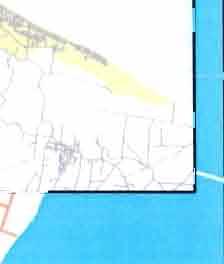


55 i I \ «I /^ i THIS IS NOT THE DISTRICT P Not To Scale Cadastral Infonnation sourced fro Land Inforation New Zealand CROWN COPYRIGHT RESERVED N Urban Growth Area Location (West Tauranga) - Tauranga City Council - Urban Growth Area UGA on Other Sheet


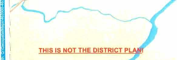
56 Produced by inforation Manageent - Copyright Tauranga City Council THIS IS NOT THE DISTRICT PLAN! Taurait^a Cadastral Inforation sourced fro Land Inforation New Zealand CROWN COPYRIGHT RESERVED V ^ ^ E Not To Scale Urban Growth Area Location (South Tauranga) Urban Growth Area UGA on Other Sheet ( / D ir:wilhmvsie«i


57 Produced by Infoiation Manageent - Copyriglit Tauranga City Council P:\TCC Project.LnvironcntaliMicy ni.stiictinanre\ie\v UrbanGrinvth.UibaiiCiiowlh.l.id- 16, 3/21 («2;26:44 p.. f^'-^. THIS IS NOT THE DISTRICT PLAN! Taunt iti^a ' Cadastral Inforation sourced fro Land Inforation New Zealand CROWN COPYRIGHT RESERVED IN Not To Scale Urban Growth Area Location Papaoa Urban Growth Area y 7 UGAon Other Sheet.a


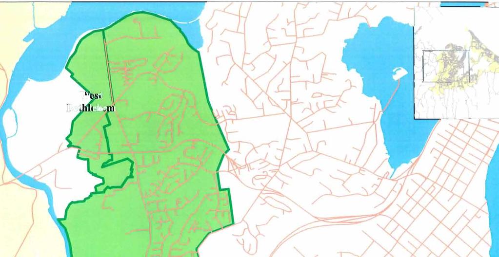
58 Produced In- Infoiation Maiiagenie - Cop\ right Tauraiiga Citv rouncil SPl_Norlli EasLBetlilelieni nixd - 27/2e(Kl«di IXl Section 8 SPl nr STORMWATER CATCHMENT BDV ' ^ ^ " SEWER RISING MAIN f^ ^-- SEWER -. «. SEWER PUMPSTATION Q RS STORMVWTER " " i ^ V\ATER SEWER CATCHMENT BDY.. - ROAD IMPROVEMENT WORK REQUIRED PROPOSED ROADS WALKWAYS RETENTION PONDS LOCALAUTHORITY BOUNDARY PROPOSED ZONES/RESERVES (NEW) LOCAUNEIGHBOURHOOD RESERVE CATCHMENT TrtMrviHijwf vr,' REVISED: 22/2/28 Cadastral Inforation sourced fro Land Inforation f-jew Zealand CROWN COPYRIGHT RESERVED Not To Scale Tauranga District Plan - Urban Growth Area Structure Plans Bethlehe North East i\ E3> ;4V^ SPl


' REVISED:")

59 Produced by Inforation Manageent - Copvriglil Tauranga ('it> Council SP2_Bctlilelieni_Tn.TiiElc nixd - 27/l)2/2(Kl«iS 16 22:3 Section 8 SPl KEY; SAMTARYSEWEII STORW.VHTEH TOTHWMN STRI.MAIHtC»7:HMEHraDV CATCHKonauY GREHioaTaoy ROJID tsi^rov^uehrvnirx RiOEISD yio YEAR to KiCif KEM» CHA.SKa 1 FOOTJAn- I n I I nnuwdevaoflshtahea I 1 ktlghbolrhooo RESEIWE arcieht BDY Tnurartftnlft)' REVISED: 22/2/28 Cadastral Inforation sourced fro Land Inforation NewZealand CROWN COPYRIGHT RESERVED Not To Scale Tauranga District Plan - Urban Growth Area Structure Plans Bethlehe Triangle IM 4- B. SP2
60 Produced by Inforniation Manageent - Copyright Tauranga Cily Councii SP3_Belhleheni_Wesl xd - 27/2/2(1X.* 1633:53 Section 8 SPS AREA1^-^.1ha DV/ELLING LNrrS EXISTING 2 FUTURE 5 ULTIWRTE STOfiilWATER CATCHklENT SW.UNE SW. OPEN DRAIN RESERVE CATCHMEffl" DDY IMENT BOUNDARV PEDESTRIAN WAIXWAV ^aviaod: 72JZ1 Tiinniii<^aO!y REVISED: 22/2/28 Cadastral Inforation sourced fro Land Inforation NewZealand CROWN COPYRIGHT RESERVED Not To Scale Tauranga District Plan - Urban Growth Area Structure Bethlehe West Plans N S o SPS
61 Produced by Inforation Manageent - Copyright Tauranga City Council SP4 Belhlelieni Soulh \d - 27/()2/2» «. 16 3X18 Section 8 SP4 AREA13-2D2hj DWELLING UNITS EXISTMG 7 FUTURE 25 ULTIMATE 32 AREA14-4.3ha OWELLINC UNITS EXISTING 2 FUTURE S ULTI(.«Tc AREAI7-43,ha ovueiling UNrrs EXIST IN 13 FUTURE ULTIMATE NON RESID. AHHA lozfia AREAB- 4a,Eto DWELLING UNrrs EXISTUG «FUTURE 11 ULTIMATE NON RESID. AR A 37.5Jia STORMWATER ICATCHMENT SW. LINE SW. OPEN DRAIN RESERVE CATCHMENT BDY CATCH ME KT BOUNDARY PEDESTHIAN WALKWAY AREAf)-13e.4lui DWELLING UNn-S EXISTING FUTURE ULTIMATE 16 2 ISO 1 ^^ v POAD WIDENING CATCHMEf>jrBDlES 'I'niirnn^nC'fy REVISED: 22/2/28 Cadastral Inforation sourced fro Land Inforation New Zealand CROWN COPYRIGHT RESERVED Not To Scale Tauranga District Plan - Urban Growth Area Structure Bethlehe South Plans IN SP4


62 Produced by Inforation Manageent - Copyright Tauranga City Council SPS Pves Panixd-27/2/28(a) 16:55:37 Section 8 SPS STOHMMTEB CATCHMENT BDY SAARY SEWERTOBIlllG U).IT CATCHMENT ' GREaiOELtBOr ROADIMFROVEM.KTWORXREQUSED PBflPOSED HJ6UC ACCESSWAYWAUOVAY YEAR 1 KEra s ana. i FOOTPATH NEBHDIJURHOOD RESERVE CATCW<E}IT BOY Tauriin^itCkv REVISED: 22/2/28 Cadastral Inforation sourced fro Land Inforation NewZealand CRO\ COPYRIGHT RESERVED Not To Scale Tauranga District Plan - Urban Growth Area Structure Plans Pyes Pa IN ' -^, SPS


 MPRDVBIEKT OTBK")


63 Produced by Infonnation Manageent - Copyright Tauranga City Council SP6_hauiti.xd - 27/2/28 («) 17: 17 Section 8 SP6 STORMWATER CATCHUEMT BOY SASTTAHY SEWEMTAt LLING U>itT WTMJtVT BDY CREEHEaTlDY ROU) MPRDVBIEKT OTBK REOtJREO PROPOSED FU5UC ACCESS'JVAYWAIKWA* YEAR 1 KERB t CHAwa i footpath NElGiaOURHOOO RESERVE CATCH«E1(T BOY TauransfnC REVISED: 22/2/28 Cadastral Inforation sourced fro Land Inforation NewZealand CROWN COPYRIGHT RESERVED Not To Scale Tauranga District Plan - Urban Growth Area Structure Plans Ohauiti. ^ E c / r-t3 J. SP6


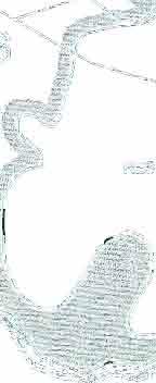
64 Produced by Infonnation Manageent - Copyright Tauranga Cily Council SP7_Welcoe_Bay,xd - 27/2/28 (t^ 17:11:14 Section 8 SP7 SrORJlWATER CA1C161ENT BUY SANITARYSEWEriVElilMGUSIT CATCHMENT BDY GBELraElTBOY ROAD \»r^it.>bn WORK REOUHED PRDFOSEU PuauC ACCESSWAY/flAUtiVAY YEAR to KEBB i a. i FOOTPATH K3GKEOUaHOD RESERVE CMWlBn BDY I RlaitaagOg] Tauranga District Plan - Urban Growth Area Structure Plans Welcoe Bay


65 Produced by Infoiniation Manageent - Copyright Tauranga City Council SP8_Papaiiioa_Maranui Slreel iiixd - 17:12:31 Section 8 SPS OA AREA '^' SEfWCEDAREA UNSERVICEDAKEA DV.'EaWG UNITS DaG SERVICED FUTURE UNSERVICED UVAT^ 2e,4h a aihj PRcroSEDS^WAHYSEWEH FHCPOSEIIStOialWATEn StOFLVIWATEB CATCrtJENT BDY ROAO OJFROVEMEMT lf.ork REQUIRED YIB K4C4F EXISTING PIM> STATION KOTOSEDFIWPSTATIOM YEAH III KERB» CHAWB.» FOOIPAIH e O O O e e SAJIITARYSEVlrERCATClftlENTBOY KEGHBOUHHOCO RESERVE atomehtedy AMENDMENTS oq AREA 34,ha ' ^ Di'/EU.WGUS ija 97 TOTAIARHA ' ' SERVICED AREA UNSEfWlCEDAREA '^LLING UNITS EXTG SERVICED - HAZARD ZONE - ^COXIIIFIU. EXTGUNSERVICED FUTURE UNSERVICED ULTIfMTE 4471a 23.5ha OQ TOTAI AREA ^ " LESS DRAINAGE RES. DV/ELLING UNITS EXISTl.NG FUTURE -635 ULTIMATE BS5 BB.4ho 4.ttl3 62.3ha ^t^ylaad: 22W2QCB Taurangn'. REVISED: 22/2/28 Cadastral Inforation sourced fro Land Inforation NewZealand CROWN COPYRIGHT RESERVED Tauranga District Plan - Urban Growth Area Structure Plans Papaoa - Maranui Street SP8

_Papanioa_Doaiii_Road")


66 Produced by Infotation Manageent - Copyright Tauranga City Council SP<)_Papanioa_Doaiii_Road xd-27/2/28 i3l 17,1'):44 Section 8 SP9 P9i=OSEDSAWrARYEE»EB FBOFOSEDSTOWiHATES STOflUWATER CATDWLII BOY DOSTl'IG PIMP STATION PROPOSED FU)J> STATION YIO TEAJ! 1 laclf EKalCHAStJELi FOOTPATH bdl bai till ROAD luprovubittoekheoured CATCHUENTEDY NE1CH3UHHD RESRVE CATCIMENt BOV 'litiiranifiic REVISED: 22/2/28 Cadastral Inforation sourced fro Land Inforation NewZealand CROWN COPYRIGHT RESERVED Tauranga District Plan - Urban Growth Area Structure Plans Papaoa - Doain Road


 PUMP")


67 Produced by Inforation Manageent - Copyright Tauranga City Council SPIO_Papaiiioa_Parlon_Road.xd - 28/2/28 (Sl 7:56:52 Section 8 SPIO IC ASa a '^ DWRUNE UNITS EXISTING 13 + BOSlNFIIi 61 UWTE 164 IC AREA OV<ELtJNG UNITS EXISTING UUIf.'ATE IW PRCP3ED SANITARY SFiVSl PnCPOSEOSTORlMAISl STOafNATBCATCHMEKTBDY YU KICIF EXEUNG PUMPSTATION PROPOSH) PUMP STATION YEARtO KERB 1 CHANNEL 1 FOOTPATH la Ml BUT Ra»D «PROVEMEKTWOSKREOlJ!RE > CATTJlllEHrBOY s^sa^^^g KHGHXUSHOOQ RESERVE CATCMJEIT BDY 9 TOTAIAHEA ISBSia DV-tLLING UNITS EXISTING»6%INFia DEVELOPMENT ULTIMATE Rflvtocd: 2 TaiiranAfii. REVISED: 22/2/28 Cadastral Inforation sourced fro Land Inforation NewZealand CROWN COPYRIGHT RESERVED Tauranga District Plan - Urban Growth Area Structure Plans Papaoa - Parton Road


68 Produced by Inforniation Manageent - Copyright 'fauranga City Council SPl l_papaoa_marjorie,xd 28/2/28 ig 8:18 2 Section 8 SPll 8 AREA 22.Eh3 DV^LUNG UdiTS EXISTING - HAZARD ZE ecaisfia IITIMATE -2* PROPOSED SAh'ITARYSBffiT FRCFOSEOSTOaiMAira STOT.(AATERCATITOENraOY v n i- RQADK?aCVEWENTV(OH<REQlliRtD O YIO XACIF EXISDICPlWPSTATlOa PROPOEED PIMP STATION YEAR 1 KERB t CHAN.SEL t FOOTPATH > B e e e SANDAAYSEWI CATCHMENT 3DY FRCrOSED FUBUCACCESSiYAY lielghbcushooa RESERVE CATCW.E.NTBOY AMENDMENTS AREA tajsha D\-ffiUJ,'J3 UMTS EXISTIHG ULTIMATE AREA DV/iNG UNITS EXlSn.lG 59 -HAZARD ZONE 14 es tbohin.=tl 51 ULTIMATE 15 Tuurtinti^it. Cadastral Inforation sourced fro Land Inforation NewZealand CROWN COPYRIGHT RESERVED Tauranga District Plan Urban Growth Area Structure Plans Papaoa - Marjorie Lane -^5
 o o (D ) CO? Q) O 5\" ^ z) 2.")
 ' S^ 5 C3 CU O o o c :3 o O I-Ic (D -D > 3 1 CD")


 < :D XI ^ fo /V i-\ P^\")

![5 X) TJ T] * «# \» z Fn i 33 S > z ll^ z Fn S 1 CO H Fn ^](/docs-images/75/71858129/images/69-11.jpg "in Fn 3) T3 C CO o * **,' * ' z Fn 1 H FH > 5 33 2 > 2 N S,")

69 IJIIB.H.B!MlilMtii.ll=kUMI=t.UHJJJclM aas n.aiuif n:? < o o a. to3 1 \ d^ \ ^ C7 Q) o o (D ) CO? Q) O 5" ^ z) 2. i o ^ o S Bl?J o CD I/) ' S^ 5 C3 CU O o o c :3 o O I-Ic (D -D > 3 1 CD W I-I- CX3 (D rl- 3- (D 3- (D 3,,1 s CO TJ ND 73 < co' CD Q. go o N S 't s-?^ - O o o c a S o "> 5 -* 5 c cn c 1 a z o CO FTI H cn O > ^ 2 Fn > CO TJ Fn CO FH I T CO H O o 7] CO 7] < Fn z TTl I CD O 73 I O o 33 fti CO Fn 33 < TTl CD J. uu O c Zl X n O u 33 III CO Fn 7) < :D XI ^ fo /V i-\ P^\ V\.i Vs/J z Fn ^ CO 3 s ^ ^ Fn O z D *,*,' *^ ' Z CO H o 33 S? 5 X) TJ T] * «# \» z Fn i 33 S > z ll^ z Fn S 1 CO H Fn ^ in Fn 3) T3 C CO o * **,' * ' z Fn 1 H FH > > 2 N S, / y \ \ z Fn 1 CB H Fn? ^ CO z o > -H -r X) rn 5.fc ~H CO ^? 3J O C z 3 o c H Z Fn > 33 Fn CO o CO o c z o I CO c 13 Tl Fn D 33 O > D > o CO CO 33 Fn CO H 33 O o z 33 O > D i 2 Fn z -i \ >^ >. z? 3J O > ^ 1^ 2- ^ O ai 2 rh c^ 5 (D (Q (D 3 Q. o a o o ^^ 2 " ( I c- CAJ


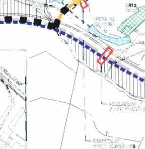
70 Mi Pi BDAi); SECTION 8 SPn YIELD CATCWEHT SOUNDARY STORMWATER CATCHMENT BOUNDARY STORMWATER SEWER CATCHMENT BOUNDARY SANITARY SEWER SEWER RISING MAIN WATER MAIN FUTURE LOCAL ROAD LOCAL ROAO COLLECTOR ROAO NETWORK ARTERIAL ROAD = ^ = ^ = = ^ ^ = = PUBLIC WALKWAY/CYCLEWAY ^ M ROAD IMPROVEMENT WORK REDUKED 'f^'l,'lslj^'jiii':^', KlC o 1** IMPROVEMENT - COST FOR DEVELOPER KERB t CHANNEL t FOOTPATH HEVH n/nnt


![scd W astcwaier Pup Stalion ] -Q Proposed Outlet Spillway Reieniion Pond C 1 I Roads;- Taurikurj Drive](/docs-images/75/71858129/images/71-5.jpg "shall be eonsiructed to ero.ss section Tl.l.i All other interna!")

![/liliinn Cross (SeeiionTLVl] SH29 i2sr //V ' "i 5{>^; CabridgeRo^ -WhSagll^ 'Industrial Business Zone:](/docs-images/75/71858129/images/71-7.jpg ">).2ha.-\".' o,, Industrial Busines: Zone: 29.ha Industrial Business Zone: 11.")


 INol in SlF'sl ri 1111111 IIT")

71 nuluccii liv IjifoiniiUion Manaycincril - Copyiighl riiurangii tily Council Section 8 SPl4 KEY: ////// T T T i 1 1 Kscatpeni liiduslrial ss Proposed Sanitary Sewer RM Proposed Sanitary Seuer Rising Main Proposed Watennain Roaci Proposed Storwater I'jpe :.--^^^^ [*»%** o Coercial L'nsuiiable for Buildg Platfor Greenbeh -J- 4- -^ Storwater Caichern g ^ y y g y y ^ l-nrc Road^ (De\eloper Funded) I I H H I K"^^ Iproveent Work Required (SIF Funded) C * ^ * ) Storwater Detention Pond O PS Propu.scd W astcwaier Pup Stalion ] -Q Proposed Outlet Spillway Reieniion Pond C 1 I Roads;- Taurikurj Drive shall be eonsiructed to ero.ss section Tl.l.i All other interna! roads shall be constructed lo eross-scciion T134 1 I 1 V r I I industrial Business Zonc;36.8ha \ \»? /2OO SSRM ^15SS R^^djobi^cd Intersection lyiie & locjition yet to-- be resolved i >o,. /liliinn Cross (SeeiionTLVl] SH29 i2sr //V ' "i 5{>^; CabridgeRo^ -WhSagll^ 'Industrial Business Zone: >).2ha.-".' o,, Industrial Busines: Zone: 29.ha Industrial Business Zone: 11.8ha Indusirial Business Zone:2,71ha 1 I I 1 T -1 e.1 PouSUSSl-, Indusirial Business Zone; 29.7hi Industrial Business Zone: 2l.4ha n ]^-^-i-4- ^?% sj L l ^ ^ WU ^^ k4( I industrial Business 1 1 I txislinp Ease" "' industrial Business Zone; 4.1ia ^Ph Cross ITI.IJ V -,:t7(ini r I t 1 1 T \ogoss_ 25 Water Industrial Business Zone: 11.2ha hidusirial Business Zone: 13.42ha flf\*t*. "^ * R:elenIioi lelenlion Pond B1 * : *J Retention P«nd A (Pond 12C-SP13) INol in SlF'sl ri IIT 1 * **?'-.s r: ;"*~ -,^nverted Siphon Twin Pipes ss Connection to Xopurererua Bridge' Pup Slalion Coercial Busine.<JS ] Zone: 11...ilia Reieniion (SP13)-( csl,-' 1\S?- T Industrial Bu.siness Zone: 25..Iha 3 Waiei- \' Unboosled Walennan \\ w ^Bridee \ (Kennedy tu Taurikura D ' Kennedy Road Connection 25 Boosted \\\ ' Water Al'^^'. Reieniion Pond Jll (NotinSlF'sl M.^^ Tauran<^aCity Cadastral Inforaiion sourced fro Land Inforation New Zealand CROWN COPYRIGHT RESERVED Tauranga District Plan - Not To Scale Urban Growth Area Structure Plan.j.^^^^^^ gusiness Estate 2U1- SPM


 Road Iprovee Work Required (SIF")


72 Produced by Infonnation Manageeni Copynghl Tauranga Cily Council WairakciSlRicturePtanFrac.xd- l7/8/2ioc<^; 1:26:4 a.. Section 8 SPl5 proposed Sanitary Sc^vc^ -~ Proposed Sanitary Sewer Rising Main Proposed Waterain Proposed Sionnwaier Pipe Slorwaler Calchenl Wairalcet Strea Storwater Catchents Stonnwaler Catchents for Ponds G and I Slorwaler Swale _ WVHBBVra I I Future Roads (Developer Funded) Road Iprovee Work Required (SIF Funded) Slorwaler Deteion Pond Q PS Proposed Waslewaler Pup Slalion ^ Q Proposed Outlet Spillway ( j Waslewaler Pup Station C aichcnl Boundaries Storwater Detention Ponds Pond Area Required 2.1 Ha 6.2Ha 8.3Ha Taurait^iCity Cadastral Inforation sourced fro Land Inforation New Zealand CROWN COPYRIGHT RESERVED Tauranga District Plan Wairakei


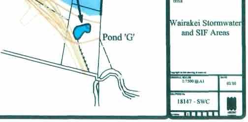

73 W: o DQ ( CO < I ( < JZ UOiltaanM.C c n SX ) IS CD S * L CX)NSULTANIS LTD itvit«u-i I I t» Wairakei Storwater and SIF Areas III I I I i
471 Council - Long Term Plan Deliberations
 TaurangaCity 471 Council - Long Term Plan Deliberations DC No: 166 Purpose 1. To respond to public submissions on transportation issues in the Papamoa area to the 2015-2025 Tauranga City Council Long Term
A5.1 Permitted activities
 Section A5 Transportation A5.1 Permitted activities A5.1.1 Activities within roads Note: Refer to Section D for the definition of road (a) Any activity associated with the movement of traffic and the functioning
Appendix B Option 1 Design, Plans and Estimates
 19 Appendix B Option 1 Design, Plans and Estimates Opus International Consultants Ltd Design Details All options where designed using NZTA MOTSAM part 2, NCC Land development manual 2010 and Cycling
Memorandum INTRODUCTION METHODOLOGY. Smart Growth. Bruce Robinson, Transport Advisor, Infrastructure Planning
 Memorandum To: Smart Growth From: Bruce Robinson, Transport Advisor, Infrastructure Planning Subject: Te Tumu Transportation Assessment: Stage 1 Sensitivity Analysis Date: 1 June 2016 INTRODUCTION This
PLAN 20 PUBLIC TRANSPORT NETWORK
 KEY Bus Route / 400m Coverage Existing Recommended Secondary Potential Secondary Indicative Stop Locations Principle Standard Sub-regional Transit Corridor Reservation PLAN 0 PUBLIC TRANSPORT NETWORK Date:
WHANGAREI IMPROVEMENTS
 WHANGAREI IMPROVEMENTS PROJECT OVERVIEW The NZ Transport Agency (NZTA) is working with Whangarei District Council (WDC) to improve the state highway through Whangarei. In addition to the recently completed
501 Interchange Design Interchange Design Considerations... 10
 5 Interchange Design Table of Contents 51 Interchange Design... 1 51.1 General...1 51.2 Interchange Type...1 51.2.1 Diaond Interchanges... 1 51.2.1.1 Tight Urban Diaond Interchange (TUDI)... 1 51.2.1.2
Transit boulevard: A new road type for Sydney s Growth Centres
 Transit boulevard: A new road type for Sydney s Growth Centres Cleaver, M. A., de Roos, M. P., NSW Centre for Road Safety, Roads and Traffic Authority, NSW Collins, G., Network Services, Roads and Traffic
PROPOSED RESIDENTIAL SUBDIVISION
 PROPOSED RESIDENTIAL SUBDIVISION PART OF TARNEIT ROAD & 1121 DOHERTYS ROAD, TARNEIT Prepared For: TCG (RM) Developments Pty Ltd MARCH 2014 OUR REF: 16740R#1 PROPOSED RESIDENTIAL SUBDIVISION PART OF TARNEIT
MODELLING THE EFFECTS OF PEDESTRIANS ON INTERSECTION CAPACITY AND DELAY WITH ACTUATED SIGNAL CONTROL
 MODELLING THE EFFECTS OF PEDESTRIANS ON INTERSECTION CAPACITY AND DELAY WITH ACTUATED SIGNAL CONTROL ABSTRACT Zong Tian, Ph.D., P.E. Feng Xu, Graduate Assistant Departent of Civil and Environental Engineering
DESIGN CODE. Enterprise West Harlow London Road North Design Code 21
 DESIGN CODE Enterprise West Essex @ Harlow London Road North Design Code 21 4 MAXIMUM BUILDING HEIGHTS 4.1 Table 4A sets out maximum building height standards for each character area within the LDO boundary.
Section 2 Strategic Alignment. Contents
 Section 2 Strategic Alignment Contents 2 Strategic Alignment... 2 2.1 General... 2 2.2 SmartGrowth Strategy and Implementation Plan... 2 2.3 Walking and Cycling Strategy... 3 2.4 Built Environment Strategy...
WYDOT DESIGN GUIDES. Guide for. Non-NHS State Highways
 WYDOT DESIGN GUIDES Guide for Non-NHS State Highways 2014 GUIDE FOR Non-NATIONAL HIGHWAY SYSTEM (Non-NHS) STATE HIGHWAYS PRESERVATION REHABILITATION RECONSTRUCTION INTRODUCTION This Guide is directed to
Traffic and Transport Assessment
 Traffic and Transport Assessment Section 96 Residential Subdivision, Davis Road Tarneit CG120370 Prepared for Stockland Pty Ltd 19 February 2013 Document Information Prepared for Stockland Pty Ltd Project
Auranga B1 Proposed Plan Change, Bremner Road, Drury. Integrated Transportation Assessment Report
 Auranga B1 Proposed Plan Change, Bremner Road, Drury Integrated Transportation Assessment Report 12 May 2017 Project: Report title: Document reference: Proposed Plan Change, Bremner Road, Drury Integrated
Devonport City Cycling Network Strategy
 Devonport City Cycling Network Strategy 2010-2013 Devonport City Cycling Network Strategy Introduction In February 2010 a draft master plan for cycleways was presented to the community. The feedback received
2. Context. Existing framework. The context. The challenge. Transport Strategy
 Transport Strategy Providing quality connections Contents 1. Introduction 2. Context 3. Long-term direction 4. Three-year priorities 5. Strategy tree Wellington City Council July 2006 1. Introduction Wellington
Corporate. Report COUNCIL DATE: June 26, 2006 NO: C012 COUNCIL-IN-COMMITTEE. TO: Mayor & Council DATE: June 22, 2006
 Corporate NO: C012 Report COUNCIL DATE: June 26, 2006 COUNCIL-IN-COMMITTEE TO: Mayor & Council DATE: June 22, 2006 FROM: General Manager, Engineering FILE: 0410-20(MoT/Gate) SUBJECT: Surrey Response on
ARTINSVILLE ENRY OUNTY REA RANSPORTATION TUDY
 ARTINSVILLE ENRY OUNTY REA RANSPORTATION TUDY DEVELOPED BY THE TRANSPORTATION AND MOBILITY PLANNING DIVISION OF THE VIRGINIA DEPARTMENT OF TRANSPORTATION IN COOPERATION WITH THE U.S. DEPARTMENT OF TRANSPORTATION,
PAEKĀKĀRIKI HILL ROAD / BEACH ROAD / SH1 INTERSECTION PROGRESS REPORT
 Chairperson and Committee Members ENVIRONMENT AND COMMUNITY DEVELOPMENT COMMITTEE 6 DECEMBER 2011 Meeting Status: Public Purpose of Report: For Decision PAEKĀKĀRIKI HILL ROAD / BEACH ROAD / SH1 INTERSECTION
Active Transportation Infrastructure Investment A Business Case
 Active Transportation Infrastructure Investment A Business Case In 2016, the Real Estate Foundation awarded the Capital Regional District a $50,000 grant for Shifting Gears: Land Use Change through Active
TGSI Tactile Ground Surface Indicators
 TGSI Tactile Ground Surface Indicators Introduction: This Design Note, No 11, provides guidelines and requirements for the use and installation of Tactile Ground Surface Indicators (TGSI s). References
Classification Criteria
 SCHEDULE D TO RECOMMENDED OFFICIAL PLAN AMENDMENT NO. 40 SCHEDULE C-4 Road Criteria Criteria Traffic Service Objective Land Service/Access Typical Daily Traffic Volume Flow characteristics Travel Speed
Seal Extension Guidelines. Asset Management and Systems
 Seal Extension Guidelines 1. Guideline Definitions AADT - Annual Average Daily Traffic is measured at regular annual (or greater) intervals and adjusted for seasonal effects, using an approved traffic
March Maidstone Integrated Transport Strategy Boxley Parish Council Briefing Note. Context. Author: Parish Clerk 2 March 2016
 Context. Author: Parish Clerk 2 The Draft Integrated Transport Policy (DITS) sets out a vision and objectives, and identifies a detailed programme of interventions to support the Maidstone Borough Local
City of Wayzata Comprehensive Plan 2030 Transportation Chapter: Appendix A
 A1. Functional Classification Table A-1 illustrates the Metropolitan Council s detailed criteria established for the functional classification of roadways within the Twin Cities Metropolitan Area. Table
Services Department A September 18, 2006 Region of Durham Recommended Arterial Corridor All Wards Guidelines Study
 Report To: From: Subject: Development Services Committee Commissioner, Development Item: Date of Report: DS-06-55 September 13, 2006 File: Date of Meeting: Services Department A-2261-0002 September 18,
DRAFT OPERATIONAL RESPONSIBILITY FOR PUBLIC ROADS IN WESTERN AUSTRALIA DRAFT VERSION 2
 DRAFT OPERATIONAL RESPONSIBILITY FOR PUBLIC ROADS IN WESTERN AUSTRALIA DRAFT VERSION 2 DECEMBER 2009 TABLE OF CONTENTS PART 1 INTRODUCTION...1 1. Purpose of Document...1 2. Consultation...1 3. Roads Which
Ministry of Education Flat Bush School Notice of Requirement. Integrated Transportation Assessment Report. February 2016
 Ministry of Education Flat Bush School Notice of Requirement Integrated Transportation Assessment Report February 2016 TDG Ref: 12988-2 151105 ita flat bush.docx Ministry of Education Flat Bush School
WYDOT DESIGN GUIDES. Guide for. NHS Arterial (Non-Interstate)
") WYDOT DESIGN GUIDES Guide for NHS Arterial (Non-Interstate) 2014 GUIDE FOR NATIONAL HIGHWAY SYSTEM (NHS) HIGHWAYS (NHS ARTERIALS, Non-Interstate) PRESERVATION REHABILITATION RECONSTRUCTION INTRODUCTION
WYDOT DESIGN GUIDES Guide for NHS Arterial (Non-Interstate) 2014 GUIDE FOR NATIONAL HIGHWAY SYSTEM (NHS) HIGHWAYS (NHS ARTERIALS, Non-Interstate) PRESERVATION REHABILITATION RECONSTRUCTION INTRODUCTION
Chapter 5 FUNCTIONAL CLASSIFICATION
 Chapter 5 FUNCTIONAL CLASSIFICATION Functional classification is a system by which streets and roadways may be distinguished by types according to their function within the entire transportation network.
Ministry of Education Notice of Requirement, North City High School. Transportation Assessment Report. July 2010
 Ministry of Education Notice of Requirement, North City High School Transportation Assessment July 2010 PO Box 1261, Level 1, 7 Hardley Street Hamilton 3240 P: +64 7 839 550 www.tdg.co.nz New Zealand 10574ta_v6.doc
TRANSPORT AND MOVEMENT
 TRANSPORT AND MOVEMENT Movement Strategy Public Transport Cycling and Walking Road Network Parking Standards Transport Impact Assessments Traffic Management Policies DRAFT POOLBEG PLANNING SCHEME Movement
21.07 TRANSPORT CONNECTIVITY AND INFRASTRUCTURE
 21.07 TRANSPORT CONNECTIVITY AND INFRASTRUCTURE 21.07-1 Connectivity and Choice Transport connectivity and mode choice are critical to achieving productive, sustainable and socially just cities. Travel
SH1 Western Belfast Bypass Transportation Assessment
 SH1 Western Belfast Bypass Transportation Assessment WBB- Transportation Assessment i This report has been prepared on behalf of the NZ Transport Agency (NZTA). No liability is accepted by this company
CURRENT ORIGINAL REFERENCE SECTIONS. (Typical Section) (Typical Section) The Parade Island Bay : Concept Option Summary Sheets.
 (Typical Section) The Parade Island Bay : Concept Option Summary Sheets.") ORIGINAL (Typical Section) CURRENT (Typical Section) 3,900 3,000 2,000 1,500 3,100 1,600 3,100 1,500 2,000 2,500 3,900 3,000 1,800 600 2,000 3,000 3,000 2,000 600 1,800 2,500 Existing Planting Traffic
ORIGINAL (Typical Section) CURRENT (Typical Section) 3,900 3,000 2,000 1,500 3,100 1,600 3,100 1,500 2,000 2,500 3,900 3,000 1,800 600 2,000 3,000 3,000 2,000 600 1,800 2,500 Existing Planting Traffic
VEHICLE CROSSING AND PEDESTRIAN CUTDOWN SET OUT
 Crossing Width 0 min./5 max. - Residential Vehicle Crossing 0 min./7 max. - Commercial/Industrial Vehicle Crossing 1800 min./2400 Des. - Pedestrian Cut Down Crossing Width 0 min./5 max. - Residential 0
New Measure A Expenditure Categories DEFINITIONS OF ELIGIBLE EXPENDITURES Adopted March 8, 2007
 New Measure A Expenditure Categories DEFINITIONS OF ELIGIBLE EXPENDITURES Adopted March 8, 2007 City Street and County Road Maintenance Program The preservation and keeping of public street and road rights-of-way
Appendix 5B Accessway standards and guidelines Appendix 5B Accessway standards and guidelines
 Appendix 5B standards and guidelines Appendix 5B standards and guidelines 204 Appendix 5B standards and guidelines Introduction This Appendix sets out Transit s safety standards for accessways onto state
Response to further information request Ministry of Education Notice of Requirement (200 & 252 Park Estate Road)
") 21 Pitt Street PO Box 6345, Auckland 1141, New Zealand T: +64 9 300 9000 // F: +64 9 300 9300 E: info@beca.com // www.beca.com Auckland Council Private Bag 92300 Victoria Street West Auckland 1142 15 August
21 Pitt Street PO Box 6345, Auckland 1141, New Zealand T: +64 9 300 9000 // F: +64 9 300 9300 E: info@beca.com // www.beca.com Auckland Council Private Bag 92300 Victoria Street West Auckland 1142 15 August
Dr. Naveed Anwar Executive Director, AIT Consulting Affiliated Faculty, Structural Engineering Director, ACECOMS
 Dr. Naveed Anwar Executive Director, AIT Consulting Affiliated Faculty, Structural Engineering Director, ACECOMS Overview Highway Functions and Classifications Highway Design Components Design Control
Liveable Neighbourhoods Design Code and Policy
 CNU London Transportation Summit, November 2007 The West Australian Liveable Neighbourhoods Design Code and Policy Incorporating a New Urbanist Street Design Manual for New Communities Wendy Morris Ecologically
CHECKLIST 2: PRELIMINARY DESIGN STAGE AUDIT
 CHECKLIST 2: PRELIMINARY DESIGN STAGE AUDIT 2.1 General topics 2.1.1 Changes since previous audit Do the conditions for which the scheme was originally designed still apply? (for example, no changes to
MOUNTAIN HOUSE SPECIFIC PLAN I 9.1 INTRODUCTION ASSUMPTIONS TRANSPORTATION FACILITIES TRANSPORTATION IMPROVEMENTS PHASING 9.
 CHAPTER NINE: TRANSPORTATION AND CIRCULATION 9.1 INTRODUCTION 9.1 9.2 ASSUMPTIONS 9.1 9.3 TRANSPORTATION FACILITIES 9.1 9.4 TRANSPORTATION IMPROVEMENTS PHASING 9.3 LIST OF FIGURES LIST OF TABLES Figure
Fish Habitat Design, Operation and Reclamation Worksheets for
 Fish Habitat Design, Operation and Reclaation Worksheets for Appendix A Project Location Worksheet Applicant Nae: Strea Nae: Watershed Nae: Fish Habitat Suitability Classification Water Quality Zone Operation
DATABASE HEALTH INDEX - DASHBOARD
 Page 1 of 7 DATABASE HEALTH INDEX - DASHBOARD Carriageway Asset Inventory Collected Data Non-Carriageway Asset Inventory Area: Date: MARLBOROUGH 26/07/2013 Category Measures Result Measure Capital Projects
land transport road assets
 land transport road assets land transport road assets Westland District West Coast Region Information as at June 2006 land transport road assets 2 Purpose of this publication Land Transport New Zealand
10 SHERFORD Town Code
 Key Fixes (Ref: Masterplan Book, section 4a. Land Use Budget and Key Fixes ) The Town Plan designs and allocates buildings, streets and spaces as accurately as possible in the understandable absence of
INDEX. Geometric Design Guide for Canadian Roads INDEX
 Acceleration lane, see Lanes, Acceleration Access, 8.1 Access Management and Functional Classification 8.2 Access Management by Design Classification 8.3 Access Configuration 8.4 Building Set-Back Guidelines
Building a Liveable Ottawa 2031 Backgrounder 4: Kanata/Stittsville
 Building a Liveable Ottawa 2031 Backgrounder 4: Kanata/Stittsville Wards 4, 6 and 23 Official Plan Transportation Master Plan Cycling Plan Pedestrian Plan October 2013 ottawa.ca/liveableottawa Building
1 VicRoads Access Management Policies May 2006 Ver VicRoads Access Management Policies May 2006 Version 1.02
 1 VicRoads Access Management Policies May 2006 Ver 1.02 VicRoads Access Management Policies May 2006 Version 1.02 2 VicRoads Access Management Policies May 2006 Ver 1.02 FOREWORD FOR ACCESS MANAGEMENT
Urban Street Design and Development
 Urban Street Design and Development Ashok Bhattacharjee, Advisor, Clean Air and Sustainable Mobility, Centre for Science and Environment CSE Workshop on Safe Access and Parking - Lytton Hotel, Kolkata
Ajax: The Road to Complete Streets
 Ajax: The Road to Complete Streets Hubert Ng, Senior Transportation Planner Elysia Leung, Transportation Demand Management Coordinator Complete Streets Forum October 1, 2015 Overview 1 2 Introduction to
PennDOT Access Management Model Ordinances Training
 PennDOT Access s Training Trainers: Chad Dixson, AICP, TPD Angela Watson, PB Objective of Today Assist Pennsylvania s municipalities and transportation professionals in better understanding the benefits
Bluffdale/ UDOT South High-T Intersection Project Type Operations
 Bluffdale/ UDOT 14600 South High-T Intersection Project Type Operations 14600 South and Redwood Road $ 600,000 $ 550,000 This project is to install a new High-T intersection at Redwood Road and 14600 South
TRAFFIC IMPACT STUDY CRITERIA
 Chapter 6 - TRAFFIC IMPACT STUDY CRITERIA 6.1 GENERAL PROVISIONS 6.1.1. Purpose: The purpose of this document is to outline a standard format for preparing a traffic impact study in the City of Steamboat
Transportation Corridor Studies: Summary of Recommendations
 Transportation Corridor Studies: Summary of Recommendations Route 4 Corridor Study: Route 10 Corridor Study: Route 44 Corridor Study: Route 175 Corridor Study: Route 5/15 Corridor Study: Rentschler Field
KIGALI CITY, RWANDA MODERNIZATION OF TRANSPORT INFRASTRUCTURE AND SERVICES. Presentation to ITC, UTwente Enschede 13 June 2018
 KIGALI CITY, RWANDA MODERNIZATION OF TRANSPORT INFRASTRUCTURE AND SERVICES Presentation to ITC, UTwente Enschede 13 June 2018 Dr. Eng. Alphonse NKURUNZIZA City Engineer, City of Kigali Kigali City Projected
Strategy for Walking & Cycling Action Plan
 Strategy for Walking & Cycling Action Plan To achieve higher levels of walking and cycling activity, the destinations which people access have to be available within suitable distances and designed to
PEDESTRIAN ACTION PLAN
 ATTACHMENT 2 CITY OF SANTA MONICA PEDESTRIAN ACTION PLAN CITY OF SANTA MONICA PEDESTRIAN ACTION PLAN This page intentionally left blank EXECUTIVE SUMMARY CHAPTER 1 EXECUTIVE SUMMARY Setting the Stage
Shotover Country. Proposed Private Plan Change. Transportation Assessment Report. February 2010
 Shotover Country Proposed Private Plan Change February 2010 PO Box 13 835, Armagh Christchurch 8141 P: +64 3 379 2404 www.tdg.co.nz New Zealand Shotover Country Proposed Private Plan Change Quality Assurance
Frome Street Bicycle Route
 The Adelaide City Council invites engagement from the community about Frome Street Bicycle Route Project Summary Adelaide City Council is seeking feedback on design options to construct bicycle facilities
Warfield Neighbourhood Plan: 4.4 Infrastructure
 Warfield Neighbourhood Plan: 4.4 Infrastructure Previously decided Policy headings: Policy WNP16 Transport Impact of Development Policy WNP17 Transport Proposals Policy WNP18 New School Buildings Policy
Manukau City Council Plan Change 20 - Flatbush Stage 2. Integrated Transport Assessment (ITA)
") Manukau City Council Plan Change 20 - Flatbush Stage 2 Integrated Transport Assessment (ITA) October 2010 Flatbush Stage 2 Integrated Transport Assessment 51/28971/01/Flatbush ITA_V01.doc Contents 1. Introduction
Manukau City Council Plan Change 20 - Flatbush Stage 2 Integrated Transport Assessment (ITA) October 2010 Flatbush Stage 2 Integrated Transport Assessment 51/28971/01/Flatbush ITA_V01.doc Contents 1. Introduction
Developing a Birmingham Transport Space Allocation policy. David Harris Transport Policy Manager Economy Directorate Birmingham City Council
 Developing a Birmingham Transport Space Allocation policy David Harris Transport Policy Manager Economy Directorate Birmingham City Council Birmingham s Sustainable Urban Mobility Plan Birmingham Connected
EXECUTIVE SUMMARY OF CALEDON TRANSPORTATION NEEDS STUDY
 EXECUTIVE SUMMARY OF CALEDON TRANSPORTATION NEEDS STUDY The Caledon Transportation Needs Study has been undertaken as a joint project by the Town of Caledon and the Region of Peel to determine the existing
EXECUTIVE SUMMARY Callan Park accommodates travel from a wide range of transport modes, including walking, cycling, bus and light rail.
 TRANSPORT AND ACCESS EXECUTIVE SUMMARY Callan Park accommodates travel from a wide range of transport modes, including walking, cycling, bus and light rail. Whilst there are some walking facilities within
Option 1: Investment Logic Map
 Option 1: Investment Logic Map Benefit Objective Weighting Scoring reviewed based on new Safety (30%) Safety 30% technical information Economic Economic efficiency 20% New additions to RLTP performance
AIRPORT ROAD ENVIRONMENTAL ASSESSMENT
 WELCOME TO PUBLIC INFORMATION CENTRE #1 AIRPORT ROAD ENVIRONMENTAL ASSESSMENT From Braydon Boulevard/Stonecrest Drive to Countryside Drive November 23, 2017 6:30 PM 8:30 PM Please sign in and fill out
TRASBURG RANSPORTATION
 TRASBURG RANSPORTATION LAN DEVELOPED BY THE TRANSPORTATION PLANNING DIVISION OF THE VIRGINIA DEPARTMENT OF TRANSPORTATION IN COOPERATION WITH THE U.S. DEPARTMENT OF TRANSPORTATION, FEDERAL HIGHWAY ADMINISTRATION
land transport road assets
 land transport road assets land transport road assets Otago Region Information as at June 2007 land transport road assets 2 Purpose of this publication Land Transport New Zealand annually publishes comparative
Transportation Master Plan Advisory Task Force
 Transportation Master Plan Advisory Task Force Network Alternatives & Phasing Strategy February 2016 BACKGROUND Table of Contents BACKGROUND Purpose & Introduction 2 Linking the TMP to Key Council Approved
CONTENTS SECTION 4 TRANSPORT
 CONTENTS SECTION 4 TRANSPORT 4.1 INTRODUCTION...1 4.1.1 Objectives... 1 4.1.1.1 Transport Network... 2 4.1.1.2 Road Design... 2 4.1.1.3 Construction... 3 4.1.2 Key References... 3 4.2 TRANSPORT NETWORK...5
Launceston's Transport Futures. Greater travel options for the people of Launceston
 Launceston's Transport Futures Greater travel options for the people of Launceston Final Draft 13 Jan 2014 1 Page Number Executive summary 3 What is Transport Futures? 4 Vision 6 Economy, access and liveability
Alberta Infrastructure HIGHWAY GEOMETRIC DESIGN GUIDE AUGUST 1999
 Alberta Infrastructure HIGHWAY GEOMETRIC DESIGN GUIDE AUGUST 1999,1'(; A ACCELERATION Data on acceleration from stop D-29 Effects of grade D-35 Intersections D-97, D-99 Lanes D-97, F-5, F-7, F-15, F-21,
Roadway Classification Design Standards and Policies. Pueblo, Colorado November, 2004
 Roadway Classification Design Standards and Policies Pueblo, Colorado November, 2004 Table of Contents Page Chapter 1. General Provisions 1.1 Jurisdiction 3 1.2 Purpose and Intent 3 1.3 Modification 3
CITY OF SASKATOON COUNCIL POLICY
 ORIGIN/AUTHORITY Clause 1, Report No. 1-1980 and Clause 4, Report No. 22-1990 of the Works and Utilities Committee; Clause 6, Report No. 17-2004 of the Planning and Operations Committee; and Clause D5,
Delivering the. Strategy 7.0
 7.0 Delivering the Strategy 7.1 Introduction This chapter presents a framework for the delivery of the strategy. Key challenges and opportunities are identified that will have an impact on the successful
West Dimond Blvd Upgrade Jodhpur Street to Sand Lake Road
 West Dimond Blvd Jodhpur St to Sand Lake CSS Transportation Project Summary Municipality of Anchorage Project # 05 005 Project Manager: John Smith, P.E. (MOA PM&E) Project Administrator: Julie Makela,
Regional Transportation Needs Within Southeastern Wisconsin
 Regional Transportation Needs Within Southeastern Wisconsin #118274 May 24, 2006 1 Introduction The Southeastern Wisconsin Regional Planning Commission (SEWRPC) is the official areawide planning agency
Sixth Line Development - Transit Facilities Plan
 Memorandum Date: November 13, 2012 To: From: c.c. Subject: Rob Freeman (Freeman Planning) Kevin Phillips Sixth Line Development - Transit Facilities Plan 33016631 This memo was prepared to review the transit
6. BREENS/GARDINERS/HAREWOOD INTERSECTION - SAFETY IMPROVEMENT PROJECT
 6. BREENS/GARDINERS/HAREWOOD INTERSECTION - SAFETY IMPROVEMENT PROJECT General Manager responsible: Officer responsible: Author: Jane Parfitt General Manager City Environment DDI 941 8656 Michael Aitken
Welcome to the Open House
 Leslie Street Between 19 th Avenue and Stouffville Road Addendum to Class Environmental Assessment Study Welcome to the Open House Please sign in at the front desk. March 28, 2017 Richmond Green Sports
Tonight is for you. Learn everything you can. Share all your ideas.
 Strathcona Neighbourhood Renewal Draft Concept Design Tonight is for you. Learn everything you can. Share all your ideas. What is Neighbourhood Renewal? Creating a design with you for your neighbourhood.
Unit Activity Answer Sheet
 Geoetry Unit Activity Answer Sheet Unit: Extending to Three Diensions This Unit Activity will help you eet these educational goals: Matheatical Practices You will use atheatics to odel real-world situations.
TRANSPORT PUBLIC SAFETY SERVICES THAT SUPPORT COMMUNITIES. Provide access to, from and for emergency services
 Transport - 128 - Road Network KEY FACTS Council operates and maintains a network of some 2,53 km which includes: o 864 km of sealed roads o 1,666 km of unsealed roads o 7 bridges and large culverts o
DEVELOPMENT FRAMEWORK
 DEVELOPMENT FRAMEWORK 2.3.3 Advantages and Disadvantages Whilst PTAL is a simple calculation (easily performed by a spreadsheet) that offers an obvious indication of the density of public transport provision
TABLE OF CONTENTS 7.0 THOROUGHFARE PLAN. Analysis of Future Conditions Thoroughfare Plan Proposed Cross-Sections.. 7.
 TABLE OF CONTENTS 7.0 THOROUGHFARE PLAN Analysis of Future Conditions.. 7.2 Thoroughfare Plan.. 7.3 Proposed Cross-Sections.. 7.4 Arterials Minor Arterials Collectors Local Streets Thoroughfare Plan Map
TECHNICAL PAPER PLANNING TRANSPORT ACTIVITIES FOR URBAN GROWTH AREAS AT A LOCAL LEVEL
 TECHNICAL PAPER PLANNING TRANSPORT ACTIVITIES FOR URBAN GROWTH AREAS AT A LOCAL LEVEL Author and Presenter: Paul Durdin BE(Hons), MIPENZ, CPEng Director Abley Transportation Consultants paul@abley.com
road safety issues 2001 road toll for Gisborne district July 2002 Road user casualties Estimated social cost of crashes*
 GISBORNE DISTRICT road safety issues July 22 The Land Transport Safety Authority (LTSA) has prepared this Road Safety Issues Report. It is based on reported crash data and trends for the 1997 21 period.
Highway 49, Highway 351 and Highway 91 Improvements Feasibility Study Craighead County
 Highway 49, Highway 351 and Highway 91 Improvements Feasibility Study Craighead County Executive Summary March 2015 Highway 49, Highway 351 and Highway 91 Improvements Feasibility Study Craighead County
SCHEME DESIGN AND ENGINEERING
 THE NORTH SOMERSET COUNCIL (SOUTH BRISTOL LINK CLASSIFIED ROAD) SIDE ROADS ORDER 2013 THE NORTH SOMERSET COUNCIL (SOUTH BRISTOL LINK) COMPULSORY PURCHASE ORDER 2013 THE NORTH SOMERSET COUNCIL (SOUTH BRISTOL
Access Management Guidelines February 2013 THE CITY OF
 Access Management Guidelines February 2013 THE CITY OF Table of Contents Introduction 2 Review and Approval Process 5 Technical Guidelines 9... 10... 12 3. Separation Distance: Non-Signalized All-Turns
Additional Policies & Objectives for Local Area Plans Ashbourne LAP. Ashbourne
 Ashbourne Strategic Policies SP 1 To operate an Order of Priority for the release of residential lands in compliance with the requirements of CS OBJ 6 of the County Development Plan as follows: i) The
DUNBOW ROAD FUNCTIONAL PLANNING
 DUNBOW ROAD FUNCTIONAL PLANNING Final Report August 3, 216 #31, 316 5th Avenue NE Calgary, AB T2A 6K4 Phone: 43.273.91 Fax: 43.273.344 wattconsultinggroup.com Dunbow Road Functional Planning Final Report
Complete Streets Policy DAVID CRONIN, P.E., CITY ENGINEER
 Complete Streets Policy DAVID CRONIN, P.E., CITY ENGINEER Complete Streets City Commission adopted a Complete Streets policy in 2012 Complete Streets are road networks that are designed for all users:
Crash Patterns in Western Australia. Kidd B., Main Roads Western Australia Willett P., Traffic Research Services
 Crash Patterns in Western Australia Kidd B., Main Roads Western Australia Willett P., Traffic Research Services Abstract Examination of crash patterns is one way of identifying key factors on which focus
Chapter 7. Transportation. Transportation Road Network Plan Transit Cyclists Pedestrians Multi-Use and Equestrian Trails
 Chapter 7 Transportation Transportation Road Network Plan Transit Cyclists Pedestrians Multi-Use and Equestrian Trails 7.1 TRANSPORTATION BACKGROUND The District of Maple Ridge faces a number of unique
5. MODIFICATIONS AT JEANNE D ARC BOULEVARD/REGIONAL ROAD 174 INTERCHANGE INTERSECTION - PUBLIC HEARING COMMITTEE RECOMMENDATION
 5. MODIFICATIONS AT JEANNE D ARC BOULEVARD/REGIONAL ROAD 174 INTERCHANGE INTERSECTION - PUBLIC HEARING COMMITTEE RECOMMENDATION Having held a public hearing, that Council approve the preliminary designs
Route 7 Corridor Study
 Route 7 Corridor Study Executive Summary Study Area The following report analyzes a segment of the Virginia State Route 7 corridor. The corridor study area, spanning over 5 miles in length, is a multi