PO01 - THE PO BETWEEN THE LODI AND CREMONA AREAS
|
|
|
- Esmond Jennings
- 6 years ago
- Views:
Transcription
1 PO01 - THE PO BETWEEN THE LODI AND CREMONA AREAS Start node info End node info Total length Category Suggested type of bycicle Cycle time Uphill Downhill Max height Difficulty by cycle Coated Offroad Cyclability On cycle road How to arrive How to get back Piacenza, railway station Cremona, railway station 53.6 km Cycling Hybrid 02:50 (hh:min) 47 m 43 m 53 m Easy 81 % 19 % 100 % 15 % Railway Line Milan-Bologna, Piacenza station Railway Line Cremona-Milan by way of Codogno and by way of Treviglo Description This itinerary unfolds chiefly on bankside roads between the Basso Lodigiano, the Adda Sud park and Cremona.Water supply is not available outside cities and towns. Must-sees: Villa Stanga in Crotta d'adda, the Maccastorna castle and Cremona's old town centre. Elevation Ref. Km partial Km total Description From the Railway station square in Piacenza take a right onto the bicycle path of viale S. Ambrogio cross the bridge on the Po along the cycle path
2 Ref. Km partial Km total Description continue along the cycle path towards Cremona at the roundabout take via Ottobre 2000 for S. Sisto keep on the asphalt road that stretches alongside the railway line at the fork immediately after keep to the right on the bank keep on the bank for a long stretch past the unpaved side roads and keep to the right at the first fork follow the road signs to S.Stefano L. and Castelnuovo B.A. along the cycle route of Po near the hydraulic work of Mortizza follow the cycle route of Po towards Cremona take the bank on the left towards Passone right after leave to Provincial Road 116 and keep to the right towards a mine once at Ponte continue straight ride past the road bump of a methane pipeline continue on the dirt bank at the end of the dirt stretch take the asphalt road on the left at the stop sign keep to the left on Provincial road when the Provincial road starts going downhill and Castelnuovo Bocca d'adda is visible on the horizon, keep to the right on the bank take the dead end road towards the mouth of Adda continue on the cycle route of Po and the mouth of Adda once in Brevia continue along the bank that becomes unpaved towards Cremona, on the right you can see the mouth of Adda at the Chiavicone continue straight ahead, passing a bar always keep the left at the two consecutive Forks, remaining on the main bank cross the bridge on the Adda towards Crotta d'adda at the crossroads by the bridge over river Adda continue for Acquanegra at the fork follow the sign for Caselle Basse 2
3 Ref. Km partial Km total Description at the fork, when the bank terrain turns to dirt, take a left on the asphalt road cross the built up area of Caselle and at the end of the village the road terrain turns to dirt go straight at the first fork at the T junction turn left and follow the main road until you get back on the bank and turn left for Spinadesco once you get to a no entry sign ride off the bank on the left turn left and cross the little bridge at the end of the dirt stretch keep to the left and cross the bridge right after the bridge at the crossroads turn right towards the canal follow the Milan-Cremona-Po canal towards Cremona at the end of the the canal towpath turn left on the bridge and cross it take the road on the right and cross the bridge take the bicycle path on the other side of the road at the crossroads go straight cross the road on the right following the bicycle path by the motocross track follow the signs to the left for the Canottieri bicycle path ride past the navigation basins, keep to the right towards the bicycle path and get to Largo Marinai d'italia in Cremona at largo Marinai d'italia take via del Porto at the roundabout go straight on via Po towards the centre go straight at the roundabout at p.zza Stradivari turn left into via Verdi at the traffic light go straight and get to the railway station end 3


4 Overview map Detail map #1 4

5 Detail map #2 Detail map #3 5

6 Detail map #4 Detail map #5 6

7 Detail map #6 Detail map #7 7

8 Detail map #8 Detail map #9 8

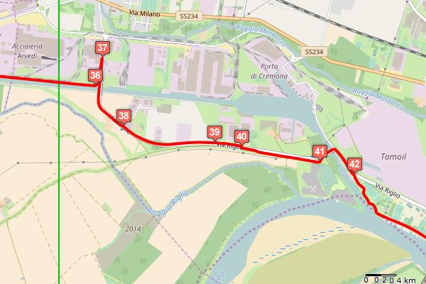
9 Detail map #10 Detail map #11 9

10 Detail map #12 10
The Po cycling track
 The Po cycling track An enrapturing path, seemingly suspended over time: the river's silence rules supreme as countless rows of poplar trees reaching out to infinity and the flight of the herons accompany
PO06 - THE DESTRA PO CYCLING TRACK
 PO06 - THE DESTRA PO CYCLING TRACK Start node info End node info Total length Category Suggested type of bycicle Cycle time Uphill Downhill Max height Difficulty by cycle Coated Offroad Cyclability On
The Via Francigena road by bike
 The Via Francigena road by bike Four days of cycling to discover the Lombard itinerary of the Via Francigena road. The itinerary is 160 km long and goes from Palestro to Piacenza, crossing the whole Pavia
FB01 - THE VIA FRANCIGENA ROAD BY BIKE - LEG I
 FB01 - THE VIA FRANCIGENA ROAD BY BIKE - LEG I Start node info End node info Total length Category Suggested type of bycicle Cycle time Uphill Downhill Max height Difficulty by cycle Coated Offroad Mountain
PV05 - FROM VIGEVANO AND THE SFORZESCA ALONG THE E1 PATH
 PV05 - FROM VIGEVANO AND THE SFORZESCA ALONG THE E1 PATH Start node info End node info Total length Category Suggested type of bycicle Cycle time Uphill Downhill Max height Difficulty by cycle Coated Offroad
MN05 - THE MORAINIC CORRIDOR
 MN05 - THE MORAINIC CORRIDOR Start node info End node info Total length Category Suggested type of bycicle Cycle time Uphill Downhill Max height Difficulty by cycle Coated Offroad Cyclability On cycle
Cilgerran Wildlife Park Circular Walk
 Walking embrokeshire Cilgerran Wildlife ark Circular Walk It s good to walk, so why not step out and sample some of the walks your neighbourhood has to offer. This pleasant and interesting walk which starts
Map and Directions. Walking to raise funds for North London Hospice #bigfunwalk
 Map and Directions Walking to raise funds for North London Hospice 020 8446 2288 www.bigfunwalk.co.uk #bigfunwalk BFW_MAP_2018.indd 1 22/04/2018 21:32 START The Blue Line is the regular route and the Red
Hammer Vale and Linchmere Common
 point your feet on a new path Hammer Vale and Linchmere Common Distance: 9 km=5½ miles or 6 km=3¾ miles easy walking with one steep section Region: Hampshire, West Sussex Author: Botafuego Refreshments:
Cycle routes from Guildford
 Cycle routes from Guildford The following five pages give practical information about following the main cycle routes from Guildford. There are now several good trafficfree routes in the area, and Guildford
RILLINGTON TO MALTON by Tania Dickinson
 RILLINGTON TO MALTON by Tania Dickinson This walk takes you from the Vale of Pickering up on to the Wold scarp, before dropping down again through the pretty village of Settrington and joining the Centenary
Italy Venice Lands Road Bike Tour 2019 Individual Self-Guided 8 days / 7 nights
 Italy Venice Lands Road Bike Tour 2019 Individual Self-Guided 8 days / 7 nights A tour in the land of cycling, where many champions were born and train and home to some of the most prestigious companies
YHA RAVENSTOR Ideas for walks in the local area
 YHA RAVENSTOR Ideas for walks in the local area How to use this book This book contains some suggestions for enjoyable walks in the countryside immediately surrounding YHA Ravenstor. We hope that our guests
Bakewell Club Site - Robin Hood's Stride
 Bakewell Club Site - Robin Hood's Stride Camping and Caravanning Route Summary A circular walk with fabulous views winding it's way through the beautiful White Peak scenery. Points of interest include
HARDMOORS 26.2 WHITE HORSE HALF ROUTE DESCRIPTION - 018
 HARDMOORS 26.2 WHITE HORSE HALF ROUTE DESCRIPTION - 018 Follow Cleveland Way, keeping to the left hand path (right path is a bike trail) Ignoring any turnings to the left or right At path junction (after
TOUR INFO GETTING THERE START CHARACTERISTICS VARIATIONS HISTORY ROADBOOK ALTITUDE
 TOUR INFO GETTING THERE START CHARACTERISTICS VARIATIONS HISTORY ALTITUDE TOUR INFO RIDING TIME Riding time at Riding time at Riding time at 14 Riding time at 16 Riding time at 18 Riding time at 20 % of
The Hundred Parishes
 The Hundred Parishes Walks from railway stations number 9 6.4 miles (10kms) from Bishop s Stortford to Stansted Mountfitchet Start: Bishop s Stortford station (Grid Reference TL492209) (ample parking and
9.5 km Circular 3 hours
 RANMORE CIRCULAR A 6 mile (9.5km) circular walk from Boxhill and Westhumble Station in the village of Westhumble, passing through part of the Polesden Lacey Estate, Ranmore Common and Denbies Vineyard.
Ovington and Itchen Stoke
 Trail Activity Type Terrain Author Distance Ascent Location : HAMPTR0057 : Walk : Pub : Towpaths and Cycle Tracks : Peter Carne : 1.4 miles / 2.2 kms : 62 feet / 19 metres : SU560318 / SO24 0RE Bush Inn,
10 km Circular 3 hours
 FRIMLEY AND FRIMLEY GREEN 10 km Circular 3 hours Easy Terrain 250716 A 10km (6 mile) circular walk exploring the canal towpath, riverside path, woodland, heath and small settlements around Frimley in Surrey.
Gainsborough and Fledborough Circular
 Trent Vale Cycle Route TVCR18 Gainsborough and Fledborough Circular Gainsborough Old Hall. One of the biggest and best preserved Medieval Manor Houses in England. Start Point: Gainsborough Marshall s Yard
France South Burgundy Bike Tour 2018 Individual Self-Guided 8 days / 7 nights
 France South Burgundy Bike Tour 2018 Individual Self-Guided 8 days / 7 nights Famous wines of Côte d Or and one of the most varied and finest cuisines of France are the first things you think of when hearing
Stage 5 Overview. 5 miles: Out of cricket club, follow path under A413 (by stream MIND YOUR HEAD!), and onto Old Amersham Rd
, and onto Old Amersham Rd") Stage 5 Overview Start time: 12:53 Saturday Distance: 13.5 miles Emergency: 07966 542315 Start: From Common Road, left to path then join Cockpit Road, then over BUSY ROAD to Heath End Road. 2 miles: off
Stage 5 Overview Start time: 12:53 Saturday Distance: 13.5 miles Emergency: 07966 542315 Start: From Common Road, left to path then join Cockpit Road, then over BUSY ROAD to Heath End Road. 2 miles: off
Harlington - Sharpenhoe - Pulloxhill
 Harlington - Sharpenhoe - Pulloxhill ID: 3676, Distance: 8 miles, Height gain: 140 Metres, Map: Explorer 193 Luton & Stevenage, Contributor: Dennis Jeanes Duration: 3 Hours 27 Mins Features Church,Great
VELINDRE VALLEYS WALK FOR STEFFAN
 VELINDRE VALLEYS WALK FOR STEFFAN IMPORTANT INFORMATION FOR WALKERS AND MARSHALS 1 Table of Contents Key Contact Numbers:... 3 Timetable and locations... 4 T-shirts... 4 Important Advice for Walkers...
Husthwaite to Byland Abbey
 Husthwaite to Byland Abbey This walk begins with a loop round the village of Husthwaite and continues towards Coxwold along a disused railway line, which is now a right of way. It passes through Coxwold
The Mendip Way. Route Directions and Maps Wells to Frome
 The Mendip Way Route Directions and Maps Wells to Frome Website: www.mendiphillsaonb.org.uk Email: mendip@mendiphillsaonb.org.uk Facebook & Twitter: @MendipHillsAONB Phone: 01761462338 1 Wells to Shepton
10 Miles Circular 5 hours
 VISIT RYEDALE PICKERING AND CAWTHORN CAMPS 10 Miles Circular 5 hours Moderate Terrain 120616 A 10 mile (16km) there and back walk from the market town of Pickering in Ryedale. The route heads north through
Dorridge & District Residents Association A Walk Along The Green Belt From Dorridge to Catherine-de-Barnes
 Dorridge & District Residents Association A Walk Along The Green Belt From Dorridge to Carine-de-Barnes The starting section of this walk through open fields would be destroyed by building of motorway
Danbury Words and pictures by Laurie Page of the Public Rights of Way team at Essex County Council.
 Danbury Words and pictures by Laurie Page of the Public Rights of Way team at Essex County Council. An undulating walk from Danbury village to the bluebells at the National Trust property of Blakes Wood.
Risk Assessment: Monday Run Date Assessed by Location Date of next review
 Risk Assessment: Monday Run Date Assessed by Location Date of next review 24 May 2016 Sarah Ov, Rachel Wickham and Richard Wingfield Elephant and Castle to Battersea Park via Lambeth, Vauxhall and Pimlico
BALCOMBE AND ARDINGLY RESERVOIR, WEST SUSSEX
 BALCOMBE AND ARDINGLY RESERVOIR, WEST SUSSEX 7 miles Circular 4 hours 080816 Challenging Terrain Hi, I'm Luke and this is my West Sussex Weekends walk It's a 7 mile loop from Balcombe rail station, taking
Clyde Walkway Community Links: Crossford Stonebyres Nemphlar- Kirkfieldbank
 Clyde Walkway Community Links: Crossford Stonebyres Nemphlar- Kirkfieldbank Crossford Stonebyres Nemphlar - Kirkfieldbank Digital Trail Difficulty (out of 3) 2 Distance 1. Crossford to Kirkfield Bank Bridge
Tideswell to Castleton
 Tideswell to Castleton 1 Walk summary Length: 14 km, 8.5 miles Maps: OS Explorer OL1 The Peak District - Dark Peak Area, OS Explorer OL24 The Peak District - White Peak Area, OS Landranger 110 Sheffield
LOCAL CIRCUIT EM1: EAST MALLING & BARMING HEATH. N 2m ROADS: Significant roads PATHS: Starting direction Barming Longsole Mission Church
 Ditton Church Scott Close LOCAL CIRCUIT EM1: EAST MALLING & BARMING HEATH 6 Community Centre F Open fields (see 'Introductory Notes') 1m 88 Direction label (as in the walk notes) East Malling Church -
Race Advance Program. Leeuwarden July 5-7, Version 2 ( )
") Race Advance Program Leeuwarden July 5-7, 2018 Version 2 (03-07-2018) Schedule Thursday July 5 20:30 General Team Briefing (SSO) Friday July 6 08:00 09:00 Boats in water (SSO) 09:00 Convoy to start area
Race Advance Program Leeuwarden July 5-7, 2018 Version 2 (03-07-2018) Schedule Thursday July 5 20:30 General Team Briefing (SSO) Friday July 6 08:00 09:00 Boats in water (SSO) 09:00 Convoy to start area
Blackheath and Shamley Green
 point your feet on a new path and Shamley Green Distance: 14 km=9 miles Region: Surrey Author: Schwebefuss Refreshments:, Shamley Green easy walking with one climb Date written: 27-jun-2009 Date revised:
NETTLESTEAD & YALDING
 NETTLESTEAD & YALDING ULL CIRCUIT - Sheet 1 (first and last sections) Open fields (see 'Introductory Notes') 88 Direction label (as in the walk notes) ROADS: 81 10m Significant roads Redhill arm North
Thornton le Dale Walks
 Thornton le Dale Walks A collection of walks in and around the village Thornton le Dale Traders Forum www.visitthorntonledale.co.uk Thornton le Dale Walks Walk 1: Beck Isle Cottage and All Saints Church
Biking Trails near Invermere, BC. Lillean Lake Along the Johnson Bike Trails. Spirit Trail Columbia Lake
 Biking Trails near Invermere, BC Lillean Lake Along the Johnson Bike Trails - To get there: From Invermere, take the Panorama Road Mount Swansea Biking and Hiking Trails Spirit Trail Columbia Lake IMBA
Tuskendammen - Oenkerk
 MAP 44 6,1 KM Tuskendammen - Oenkerk Follow the street. At the next intersection, go straight onto Klaas Douwesweg. Take the first forest path on the right, pass through cycle barriers. At the intersection,
9.5 km Circular 3 hours
 MEDIEVAL WAVERLEY Challenging Terrain A 6 mile (9.5km) undulating circular walk from Tilford village passing close to The Sands village and the historic ruins of Waverley Abbey. From the top of Crooksbury
Dragonflies and a Church-on-the-Hill Chantries, Shalford, Blackheath
 point your feet on a new path Dragonflies and a Church-on-the-Hill Chantries, Shalford, Blackheath Distance: 16 km=10 miles Region: Surrey Author: Schwebefuss Refreshments: Shalford (choice of two) easy-to-moderate
RANS WOOD WALK circa 3 miles/ 5 kilometres
 RANS WOOD EXCURSION This walk is about an hour. It is rarely frequented by tourists or by visitors to the National Park. It is a secret favourite amongst local dog walkers and cyclists. The walk is in
A mainly flat walk along the Peak Forest Canal to Castle Hill and returning along the River Tame via Hulmes Wood and Haughton Dale.
 Walk 9 Haughton Green, Peak Forest Canal, Castle Hill, Hulmes Wood, River Tame, Haughton Dale Circular Miles: 3.9 Time: 1 Hour 30 Minutes Grade: Easy To Moderate Starting Point: Junction Of Gibraltar Lane/Newport
8 Miles Circular 4 hours
 VISIT RYEDALE HELMSLEY AND RICCAL DALE 8 Miles Circular 4 hours 090616 Challenging Terrain An 8 mile (13km) circular walk from the market town of Helmsley in Ryedale. The route heads out across sheep pastures
Follow the road to Figueira and once there turn left at the road junction. 30 Minutes
 Follow the road to Figueira and once there turn left at the road junction. 30 Minutes Continue along this road, before the bridge turn right into Largo 1 st Maio and keeping left turn into Rua do Meia
Lloyds Banking Group Lean On Me Challenge 2017
 Lloyds Banking Group Lean On Me Challenge 2017 Mapbook Halifax Hike September 29 In aid of Mental Health UK Join the Facebook Group Lean On Me Challenge For updates on the event Or follow on Twitter under
The «RER-Velo/Fiets GEN» Mathieu Strale Université Libre de Bruxelles
 The «RER-Velo/Fiets GEN» Mathieu Strale Université Libre de Bruxelles The project THE DESIRED CYCLING RER The cycling RER is a network of fast cycle lanes which targets long distance cycling (up to 15
The Griffon Guide The North Walsham and Dilham Canal Trail
 The Griffon Guide The North Walsham and Dilham Canal Trail This trail explores some of the most accessible and interesting parts of the North Walsham and Dilham Canal. The canal was built in 1825 to allow
Our Edale Meeting Point, Peak District
 Our Edale Meeting Point, Peak District Don t leave home without these instructions Please use the following details to arrive at the meeting point 15 minutes prior to your course start time to enable us
Spain - Cycling Asturias from Mountains to Sea Bicycle Tour 2019 Individual Self-Guided 8 days / 7 nights
 Spain - Cycling Asturias from Mountains to Sea Bicycle Tour 2019 Individual Self-Guided 8 days / 7 nights The tour begins in the plains of northern Castilla with two nights in historic towns, and time
Fertile farms in the heart of Kent
 55 55 Fertile farms in the heart of Kent A bright sunny day is perfect for enjoying the rich and fertile Kent countryside and outstanding views across the valley of the Great Stour to the North Downs.
Hitchin Nomads Cycling Club
 Hitchin Nomads Cycling Club Risk Assessment of Course Course Identification 1U/25 25 Miles - Southill / Old Warden Reviewed By Paul Riley Reviewed On 02/01/2018 Course Details https://www.plotaroute.com/route/346809
Bonnie Prince Charlie Walk
 Bonnie Prince Charlie Walk A waymarked route from Ashbourne to Derby to celebrate the 60th anniversary (1995) of the formation of the Ramblers' Association. This route follows the general direction of
Policies and actions for a bicycle friendly city
 Policies and actions for a bicycle friendly city Gianni Stefanati Bicycle Manager City of Ferrara 22nd October 2010 First steps...for a City for Cyclists XXXXXXX XXX Political vision Co-operation of local
Masson Hill. Walk. Approximately 4 km. Moderate Walk Begins from Matlock Railway Station
 Masson Hill Walk Approximately 4 km Moderate Walk Begins from Matlock Railway Station TOWN WALKS Masson Hill walk is approx. 4 km. It can be walked in a couple of hours or so. Enjoy your walk and the beautiful
sessions. The opinions of local people will help decide which of these two options is taken forward to be built.
 A4018 FAQs Why are no bus lanes proposed north of Crow Lane? Inbound and outbound bus lanes were considered north of the Crow Lane junction, but they took away capacity from other traffic on the approach
Regulatory traffic signs
 Section 21: Regulatory traffic signs This section includes the signs that show a road regulation is in place. These must be obeyed. Regulatory signs show the course a driver must follow and an action they
Willamette River Transit Bridge. Portland - Milwaukie Light Rail Willamette River Bridge Citizen Advisory Committee
 Portland - Milwaukie Light Rail Willamette River Bridge Citizen Advisory Committee 05.21.09 Bridge Type Status Update Bicycle Pedestrian Path Width Bridge Type Status Update WRBAC Recommendation: Cable
Italy Rivers of the Piedmont Bike Tour 2018 Individual Self-Guided Tour 8 days / 7 nights
 Italy Rivers of the Piedmont Bike Tour 2018 Individual Self-Guided Tour 8 days / 7 nights Starting from Turin you will discover a different side to the Piedmont region. Towns such as Vercelli, Casale and
Year of Mercy Pilgrimage St Ignatius Toowong to the Cathedral of St Stephen
 Year of Mercy Pilgrimage St Ignatius Toowong to the Cathedral of St Stephen Distance Directions Photograph 0.0km Start St Ignatius Church, Kensington Terrace, Toowong. Park any vehicles in nearby streets
Village Amble VILLAGE AMBLE. Turunç Walks. .kml file of this route. Start point: Turunç Mosque End point: Turunç Mosque
 Turunç Walks VILLAGE AMBLE Village Amble Category: Easy Total distance: 4.2 km Moving time: 2 hours Start point: Turunç Mosque End point: Turunç Mosque Downloads:.pdf this document.gpx file of this route.kml
Loch Ness Shores Club Site
 Loch Ness Shores Club Site Camping and Caravanning Falls of Foyers Route Summary A strenuous walk from Loch Ness Shores Club Site. The route climbs through forest to The Upper Foyers Waterfall and then
Thornton le Dale Walks
 Thornton le Dale Walks A collection of circular walks in, and around, the village www.visitthorntonledale.co.uk Thornton-le-Dale Traders Forum and Thornton le Dale Parish Council 1 Thornton le Dale Circular
10Km Road Race - Race Day Info Sheet
 Denmead Striders Running Club 10Km Road Race - Race Day Info Sheet Sunday 14 th October 2018 at 10:00am (UKA Licence No: 2018-33481) Thank you for entering the fifth running of the Denmead 10km Road Race
EuroVelo. European Certification Standard for the European cycle route network. Second revised edition
 EuroVelo European Certification Standard for the European cycle route network Second revised edition 1 PICTURE 2 Goals, definition and contents Goals of the European Certification Standard: Improve the
The Right to Come Home: Shared Space, Woonerfs, and Safe Streets for All Road Users. Johan Diepens, CEO Mobycon
 The Right to Come Home: Shared Space, Woonerfs, and Safe Streets for All Road Users Johan Diepens, CEO Mobycon info sports 2015-10-07 4 From a Dutch perspective 5 MOBILITY Mobility; a condition for functioning
Hascombe and Winkworth Arboretum Downs Link Path, Smithbrook Kilns
 point your feet on a new path Hascombe and Winkworth Arboretum Downs Link Path, Smithbrook Kilns Distance: 18 km=11 miles Region: Surrey Author: RDC easy walking Date written: 7-may-2016 Last update: 30-aug-2018
Clyde Walkway Community Links: Nemphlar Moor Road to Braidwood
 Clyde Walkway Community Links: Nemphlar Moor Road to Braidwood Nemphlar Moor Road to Braidwood Digital Trail Difficulty (out of 3) 2 Distance Main route to Braidwood (shortest) 2.5km, 5km return. Detours
Cycling policy of the Province of Groningen. Öresund som cykelregion Malmö 13th of December 2012
 Cycling policy of the Province of Groningen Öresund som cykelregion Malmö 13th of December 2012 Presentation by: COR VAN DER KLAAUW c.j.vander.klaauw@provinciegroningen.nl Presentation Facts & Figures
AUSTRIA 2018 SALZBURG TO VIENNA 310 KM SELF GUIDED CYCLE TOUR 9 DAYS/8 NIGHTS
 AUSTRIA 2018 SALZBURG TO VIENNA 310 KM SELF GUIDED CYCLE TOUR 9 DAYS/8 NIGHTS This tour is a brilliant combination of culture, history and nature Austria at its absolute best! Starting in Salzburg, the
Do more cycling. EIGHT CYCLE ROUTES AROUND dornoch
 Do more cycling EIGHT CYCLE ROUTES AROUND dornoch cycle routes Around dornoch route 1 Loch Fleet 12.5 miles Easy Description: Route 1 takes you past the fishing village of Embo and to Loch Fleet, an internationally-renowned
AUSTRALIAN GRAVEL CHAMPIONSHIPS TECHNICAL REGULATIONS. Version 0.4 (Published Monday, 23 July 2018)
") AUSTRALIAN GRAVEL CHAMPIONSHIPS TECHNICAL REGULATIONS Version 0.4 (Published Monday, 23 July 2018) 1 SCOPE Gravel Grinding is riding a bike on gravel, loose stones or any unpaved surface using any type
AUSTRALIAN GRAVEL CHAMPIONSHIPS TECHNICAL REGULATIONS Version 0.4 (Published Monday, 23 July 2018) 1 SCOPE Gravel Grinding is riding a bike on gravel, loose stones or any unpaved surface using any type
THE PONTON PLOD - 27 MILE ROUTE
 THE PONTON PLOD - 27 MILE ROUTE Emergency Phone Number 07771 813514 Abbreviations: BW Bridleway X Cross immd immediately FP Footpath TL Turn left L Left thro through KG Kissing Gate TR Turn right R Right
Walk Description. Directions
 Title: Saffron Trail: Battlesbridge to Chelmsford Distance: 14¾ miles Time taken: 6 hours Start Point: Outside the Barge Inn, Battlesbridge OS Explorer Map: 175 & 183 Grid Ref.: TQ 780 947 Transport: Rail:-
Germany - Berlin Lakes Bicycle Tour 2019 Individual Self- Guided 8 days /7 nights
 Germany - Berlin Lakes Bicycle Tour 2019 Individual Self- Guided 8 days /7 nights The urban hinterland of Berlin is well-wooded, shaped by many lakes. And so you have the possibility to go swimming or
0 QUALIFICATION OAXACA - OAXACA SECTION
 Thursday, Stage 0 QUALIFICATION OAXACA - OAXACA SECTION CH STARTING ARC AT EXIT FROM OAXACA TO ISTMO. CH 0.000 0.000. 4.560 ON MITLA - HIERVE EL AGUA ROAD La Carrera SPECIAL STAGE 4.77 km. AVERAGE 6 k/h
Getting to The Celtic Bards School The Thatch, Carrowcrory, Ballinafad, Co. Sligo
 Getting to The Celtic Bards School The Thatch, Carrowcrory, Ballinafad, Co. Sligo Google Map link : http://bit.ly/tocarrowcrory Coming from Limerick, Shannon estimated time, 3 to 4 hours follow N18 and
Rhossili - Tears Point - Mewslade Bay - Talgarth's Well - Rhossili - ID: 148. Walk description:
 Walk description: A glorious walk combining thrilling cliffs with beautiful wild beaches and a bird's-eye view of the Gower peninsula from Rhossili Down. The adventurous can walk out to the Worm's Head
Clyde Walkway Community Links: Rosebank Circular via Ashgill and Dalserf
 Clyde Walkway Community Links: Rosebank Circular via Ashgill and Dalserf Rosebank Circular via Ashgill and Dalserf Digital Trail Difficulty (out of 3) 1 Distance 7 km / 4.35 miles. Time 2 hours Terrain
How to get there. Respect - Protect - Enjoy
 How to get there Driving: Postcode is RG9 5PF and there is a car park just across from the pub. Nearest station: Henley-on-Thames station is 5.6 miles away. We re delighted to present three circular walks
Road Traffic Signs in Germany
 Warning signs Road Traffic Signs in Germany General danger Curve left Curve right Double curve Double curve Accident hazard Sliding danger Winter sports along road Soft shoulder Rough road edge Steep upgrade
TOUR INFO GETTING THERE START CHARACTERISTICS VARIATIONS HISTORY ROADBOOK ALTITUDE
 TOUR INFO GETTING THERE START CHARACTERISTICS VARIATIONS HISTORY ALTITUDE TOUR INFO RIDING TIME Riding time at Riding time at Riding time at 14 Riding time at 16 Riding time at 18 Riding time at 20 % of
Strolls on your Doorstep. Short walks in Hinckley and Burbage
 Your details We understand that you may want to keep some information private. However, by answering the following questions we can use it to improve services and support for specific groups. Are you male
Module 5: Navigating Roadways
 Module 5: Navigating Roadways Topic 1: Intersections 1. One out of FATAL crashes occur at intersections. 2. Label the intersection warning signs: 3. When possible, begin searching seconds ahead of the
Accident Case Studies
 Accident Case Studies Study Practise PASS! Contents 1. Head on at crossroad 2. Corner cut flash crash 3. Roundabout truck crash 4. T-junction signal crash 5. Y-junction crash 6. Mini-roundabout crash 7.
Weatherman Walking. Approximate distance: 5.5 miles For this walk we ve included OS grid references should you wish to use them. Start.
 Approximate distance: 5.5 miles For this walk we ve included OS grid references should you wish to use them. 4 1 Start End 3 2 N W E S Reproduced by permission of Ordnance Survey on behalf of HMSO. Crown
Carrington Park to Leura Forest and pass loop
 Carrington Park to Leura Forest and pass loop 3 hrs Hard track 4.8 km Circuit 4 674m This walk is a fantastic way to see Leura Forest. The walk descends from Carrington Park, visiting Leura Forest and
Hever Castle Triathlon Adult Training Day at the time of publication this information is subject to confirmation.
 Hever Castle Triathlon Adult Training Day at the time of publication this information is subject to confirmation. Thetrilife.com as coaching partner to Castle Triathlon Series is delighted to be hosting
How to get there. Respect - Protect - Enjoy
 How to get there Driving: Postcode is OX49 5HL with a car park for customers Nearest station: Henley on Thames station is 9.5 miles away. We re delighted to present three circular walks all starting and
RIDERS GUIDE TO THE 2015 RAMAPO RALLY
 RIDERS GUIDE TO THE 2015 RAMAPO RALLY Bicycle Touring Club off North Jersey ARRIVING AT CAMPGAW You should arrive at Campgaw at least 45 minutes before the suggested start of your ride. That will give
Walking Pembrokeshire.
 Walking Pembrokeshire Canaston Woods Walk It s good to walk, so why not step out and sample some of the walks your neighbourhood has to offer. This pleasant and interesting walk which starts and finishes
Side Roads and Other Non-Signalised Junctions
 Green Surfacing Sections of the Cycle Superhighway are marked with green paint these highlight sections where people cycling the Superhighway are likely to come into contact with walkers, drivers, or other
Direction to the Department of Linguistics, Seoul National University
 Page 1/8 Direction to the Department of Linguistics, Seoul National University 1. From Incheon Airport by Airport Limousine (Click here for the detailed information) [Highly Recommended] Take #6017 Airport
The Foreshore Walk. 24m. 1m Lake Macquarie LGA. 1 hr 15 mins 2.9 km One way. Hard track 81m
 The Foreshore Walk 1 hr 15 mins 2.9 km One way Hard track 81m This walk traverses the coastline of the Green Point reserve. By following a variety of tracks and occasionally traveling inland through eucalyptus
Wentworth Falls Conservation Hut Loop
 Wentworth Falls Conservation Hut Loop 3 hrs Hard track 6.7 km Circuit 4 341m This scenic walk from Wentworth Falls Station, winds along the Nature Trail to Conservation Hut, then drops into the magnificent
CHINTHURST HILL AND THE GRANTLEY ARMS, SURREY
 CHINTHURST HILL AND THE GRANTLEY ARMS, SURREY 4 miles Circular 2 hours 110417 Challenging Terrain A 4 mile (can be shortened to 3 miles) circular pub walk near Wonersh in Surrey. The walk begins with an
Waterfall to Heathcote
 Waterfall to Heathcote 5 hrs Hard track 10.8 km One way 4 467m This walk explores the heart of Heathcote National Park, and is easily accessed with a train station at either end. Although relatively close
Skyline 10km Series Race Information 15th November, 6th December, 17th January, 14th February 11:00am Start University of Bath, Bath, BA2 7JY.
 Skyline 10km Series Race Information 15th November, 6th December, 17th January, 14th February 11:00am Start University of Bath, Bath, BA2 7JY. Important Notices New Location We are now in West Car Park!