Rerouting Mode Choice Models: How Including Realistic Route Options Can Help Us Understand Decisions to Walk or Bike
|
|
|
- Jayson McCarthy
- 6 years ago
- Views:
Transcription

1 Portland State University PDXScholar TREC Friday Seminar Series Transportation Research and Education Center (TREC) Rerouting Mode Choice Models: How Including Realistic Route Options Can Help Us Understand Decisions to Walk or Bike Joseph Paul Broach Portland State University, Let us know how access to this document benefits you. Follow this and additional works at: Part of the Transportation Commons, Urban Studies Commons, and the Urban Studies and Planning Commons Recommended Citation Broach, Joseph Paul, "Rerouting Mode Choice Models: How Including Realistic Route Options Can Help Us Understand Decisions to Walk or Bike" (2016). TREC Friday Seminar Series This Book is brought to you for free and open access. It has been accepted for inclusion in TREC Friday Seminar Series by an authorized administrator of PDXScholar. For more information, please contact
 Portland State University Friday Transportation Seminar - April")
2 Rerouting Mode Choice Models: H ow Including Realistic Route Options Can Help Us Understand Decisions to Walk or Bike Joseph Broach, PhD, Research Associate Urban Studies and Planning Transportation Research and Education Center (TREC) Portland State University Friday Transportation Seminar - April 1, 2016


3 Motivation 1. Understand behavior 2. Inform policy 3. Improve prediction Trip Generation Trip Distribution Mode Choice Route Assignment April 1, 2016 Friday Transportation Seminar - Joe Broach 2


4 The story so far Revealed Preference Bike Route Choice Bike GPS Study Transferability of Bike Route Choice Preferences Revealed Preference Walk Route Choice Family Activity Study Revealed Preference Mode Choice April 1, 2016 Friday Transportation Seminar - Joe Broach 3


5 The conceit 1. Given trip from A to B 2. Routes that would be taken are considered for each mode 3. Attributes along those routes affect mode choice April 1, 2016 Friday Transportation Seminar - Joe Broach 4
6 The plot Given: Trip from Origin to Destination Predict: Highest Utility Best Walk and Bike Routes Estimate: Maximum Likelihood Mode Choice Utility Function April 1, 2016 Friday Transportation Seminar - Joe Broach 5

7 The setting Only trips starting and ending within the City of Portland Rich GIS data from Metro & City walk/bike network facilities land-use terrain April 1, 2016 Friday Transportation Seminar - Joe Broach 6

8 The characters (1) Adult participants in the Family Activity Study ( ) Compared with block group and typical Portland household with children more educated 60% college less diverse 85% white more women 62% female more owners 81% own home similar income $50-75k more cars 1.7 cars more biking 11% trips more driving 75% trips April 1, 2016 Friday Transportation Seminar - Joe Broach 7
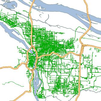
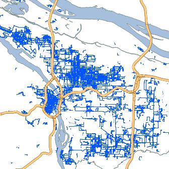
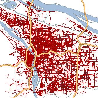
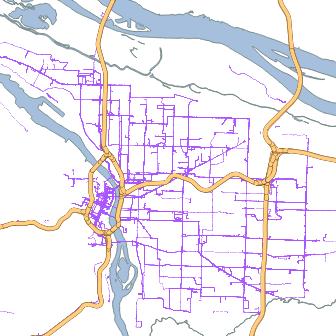


9 The characters (2) GPS Trips (& tours) 1,419 (11%) 1,501 (11%) N 9,957 (75%) 384 (3%) April 1, 2016 Friday Transportation Seminar - Joe Broach 8
10 Editing walk considered an option <- trips over 7mi excluded -> Density th %tiles walk, bike walk bike auto transit miles (shortest path) April 1, 2016 Friday Transportation Seminar - Joe Broach 9
11 Editing data means (trips <= 7mi) Density walk bike auto transit miles (shortest path) NHTS 2009 (means for trips <= 7mi) April 1, 2016 Friday Transportation Seminar - Joe Broach 10
 Model 1: Shortest Paths & OD Buffers")

12 The action All models include: socio-demographics (gender, car ownership), trip context (purpose, day of week, transit access) Model 1: Shortest Paths & OD Buffers ( mi) Model 2: Predicted Walk & Bike Routes Model 3: Combination of Route, OD + Home area Shortest Path Buffer + April 1, 2016 Friday Transportation Seminar - Joe Broach 11

13 Big reveal #1 Measuring along single best walk & bike routes predicts mode choice significantly better than within origin-destination buffer areas. April 1, 2016 Friday Transportation Seminar - Joe Broach 12
 FAR (OD) Bike (½ mi) Connectivity (Home & OD) Bike Facilities (Home & OD) Transit (¼ mi) Mixed Use (Home & OD) April 1,")
14 Big Reveal #2 Route and area measures complementary to route measures, in some cases. Walk (½ mi) FAR (OD) Bike (½ mi) Connectivity (Home & OD) Bike Facilities (Home & OD) Transit (¼ mi) Mixed Use (Home & OD) April 1, 2016 Friday Transportation Seminar - Joe Broach 13
15 Big reveal #3 Bike and walk facilities matter in decisions of whether to bike or walk. when present, change in probability of biking for 10% increase in -12% -10% -8% -6% -4% -2% 0% 2% 4% shortest path miles detour off-street path bike blvd high traffic (ADT>20k) when present, change in probability of walking for 10% increase in shortest path miles off-street path arterial commercial missing sidewalk not shown, each arterial crossing without a signal: -31% prob. walking April 1, 2016 Friday Transportation Seminar - Joe Broach 14


 April 1, 2016 Friday")
16 Big reveal #4 Gender matters for decisions of whether to bike, unlike decisions of where to bike. -38% Overall, for similar trip -70% When best route entirely along moderate traffic streets (ADT 5-20k) +68% When best route entirely along lowtraffic bike boulevard +0% On trips that cross Willamette River (Men: 2.2x as likely) April 1, 2016 Friday Transportation Seminar - Joe Broach 15
17 Big reveal #5 Sensitivity to corridor-level policies substantially increased using predicted routes. A Route 1: follows shortest path along busy street* with bike lane shortest path distance is 2 miles B Route 2: requires 10% detour, but uses quiet, local streets Initial Probability of Biking ( best route is Route 1) Male Female Area Model 1.7% 1.3% Route Model 3.1% 2.1% Probability of Biking w/ proposed bike boulevard treatment along Route 2 ( best route shifts) Male Female Area Model 1.7% 1.5% Route Model 21.5% 30.1% * ADT 20k (cars per day) April 1, 2016 Friday Transportation Seminar - Joe Broach 16
18 Plot twist! Self-selection: Could those wanting to bike or walk more just live where facilities are better? Importance (1-5) in choice of current home good walking neighborhood (mean=4.2) good biking neighborhood (mean=3.8) Significant impact but w/in range of travel environment effects (+22% walk, +39% bike) Significance and magnitude of route attributes largely unchanged, suggesting complementary effects April 1, 2016 Friday Transportation Seminar - Joe Broach 17
19 Critics always find something! Trip-based model (though included tour distance) Assumed order entirely destination -> mode Panel data (though controlled for time effects) Single best route for everyone Transit/Auto missing variables Preferences can only be revealed within existing conditions (new facility types, different urban forms) Attitudes not included April 1, 2016 Friday Transportation Seminar - Joe Broach 18
20 Morals of the story Quality bike and walk routes not only improve experience on existing trips but also encourage new trips by walking and biking. Low traffic-stress facilities are good for all users and may be especially important to encourage women to bike. For maximum value, bike facilities should follow shortest paths; however, still have value even when that s not feasible, particularly when other options poor. April 1, 2016 Friday Transportation Seminar - Joe Broach 19


21 Questions? Ideas? Special thanks to: NITC Dissertation Fellowship Portland Metro City of Portland Jennifer Dill & FAS Team April 1, 2016 Friday Transportation Seminar - Joe Broach 20
22 Further reading Contact me at if you need help accessing any of my articles*: Bike Route Choice *Broach, J., Dill, J., & Gliebe, J. (2012). Where Do Cyclists Ride? A Route Choice Model Developed with Revealed Preference GPS Data. Transportation Research Part A: Policy and Practice, 46(10), *Broach, J., Gliebe, J., & Dill, J. (2010). Calibrated labeling method for generating bicyclist route choice sets incorporating unbiased attribute variation. Transportation Research Record. Hood, J., Sall, E., & Charlton, B. (2011). A GPS-based bicycle route choice model for San Francisco, California. Transportation Letters: The International Journal of Transportation Research, 3(1), Menghini, G., Carrasco, N., Schüssler, N., & Axhausen, K. W. (2010). Route choice of cyclists in Zurich. Transportation Research Part A: Policy and Practice, 44(9), Pedestrian Route Choice *Broach, J., & Dill, J. (2015). Pedestrian Route Choice Model Estimated from Revealed Preference GPS Data. In Transportation Research Board 94th Annual Meeting. Washington, DC. Retrieved from *Broach, J. P. (2016). Travel Mode Choice Framework Incorporating Realistic Bike and Walk Routes. Portland State University. Retrieved from Guo, Z., & Loo, B. P. Y. (2013). Pedestrian environment and route choice: evidence from New York City and Hong Kong. Journal of Transport Geography, 28, Rodríguez, D. A., Merlin, L., Prato, C. G., Conway, T. L., Cohen, D., Elder, J. P., Veblen-Mortenson, S. (2015). Influence of the Built Environment on Pedestrian Route Choices of Adolescent Girls. Environment and Behavior (Vol. 47). Mode Choice *Broach, J. P. (2016). Travel Mode Choice Framework Incorporating Realistic Bike and Walk Routes. Portland State University. Retrieved from *Broach, J., & Dill, J. (in press). Using Predicted Bicyclist and Pedestrian Route Choice to Enhance Mode Choice Models. Transportation Research Record. Hood, J., Erhardt, G., Frazier, C., & Schenk, A. (2014). Estimating Emissions Benefits of Bicycle Facilities with Stand-Alone Software Tools: Incremental Nested Logit Analysis of Bicycle Trips in California s Monterey Bay Area. Transportation Research Record: Journal of the Transportation Research Board, (2430), pp April 1, 2016 Friday Transportation Seminar - Joe Broach 21
The Cycling Gender Gap: What Can We Learn From Girls?
 Portland State University PDXScholar TREC Friday Seminar Series Transportation Research and Education Center (TREC) 6-5-2016 The Cycling Gender Gap: What Can We Learn From Girls? Jennifer Dill Portland
A Framework For Integrating Pedestrians into Travel Demand Models
 A Framework For Integrating Pedestrians into Travel Demand Models Kelly J. Clifton Intersections Seminar University of Toronto September 22, 2017 Portland, Oregon, USA Region Population~ 2.4 M Urban Growth
Impact of Bike Facilities on Residential Property Prices
 Portland State University PDXScholar TREC Friday Seminar Series Transportation Research and Education Center (TREC) 2-24-2017 Impact of Bike Facilities on Residential Property Prices Wei Shi Portland State
Driverless Vehicles Potential Influence on Bicyclist Facility Preferences
 Driverless Vehicles Potential Influence on Bicyclist Facility Preferences MICHAEL BLAU, MCRP, LCI O T E C O C T O B E R 2 6, 2 0 1 6 S E S S I O N # 8 2 - E V A L U AT I N G T H E P E R F O R M A N C E
Webinar: Development of a Pedestrian Demand Estimation Tool
 Portland State University PDXScholar TREC Webinar Series Transportation Research and Education Center (TREC) 2-18-2016 Webinar: Development of a Pedestrian Demand Estimation Tool Kelly Clifton Portland
Efficiency of Choice Set Generation Methods for Bicycle Routes
 Efficiency of Choice Set Generation Methods for Bicycle Routes Katrín Halldórsdóttir * Nadine Rieser-Schüssler Institute for Transport Planning and Systems, Swiss Federal Institute of Technology Zurich,
Where do People Bicycle? The Role of Infrastructure in Determining Bicycle Behavior
 Portland State University PDXScholar Urban Studies and Planning Faculty Publications and Presentations Nohad A. Toulan School of Urban Studies and Planning 4-11-2008 Where do People Bicycle? The Role of
Bike Planner Overview
 Bike Planner Overview A Web-based Sketch Planning Tool for Los Angeles County presented by William E. Walter, GISP April 12, 2017 GIS-T Transportation leadership you can trust. Bike Planner Overview Guiding
Webinar: Impacts of Roadway and Traffic Characteristics on Air Pollution Risks for Bicyclists
 Portland State University PDXScholar TREC Webinar Series Transportation Research and Education Center (TREC) 4-23-2015 Webinar: Impacts of Roadway and Traffic Characteristics on Air Pollution Risks for
Enhancing Active Transportation Sensitivities of an Activity Based Model
 Enhancing Active Transportation Sensitivities of an Activity Based Model Jeff Hood, Hood Transportation Consulting Joe Castiglione, Resource Systems Group Joel Freedman & Chris Frazier, Parsons Brinckerhoff
Traffic Safety Barriers to Walking and Bicycling Analysis of CA Add-On Responses to the 2009 NHTS
 Traffic Safety Barriers to Walking and Bicycling Analysis of CA Add-On Responses to the 2009 NHTS NHTS Users Conference June 2011 Robert Schneider, Swati Pande, & John Bigham, University of California
Roadway Bicycle Compatibility, Livability, and Environmental Justice Performance Measures
 Roadway Bicycle Compatibility, Livability, and Environmental Justice Performance Measures Conference on Performance Measures for Transportation and Livable Communities September 7-8, 2011, Austin, Texas
FHWA Bikeway Selection Guide
 FHWA Bikeway Selection Guide Tamara Redmon Federal Highway Administration Bill Schultheiss Toole Design Lauren Blackburn VHB March 26, 2019 PBIC Webinar pedbikeinfo.org @pedbikeinfo Housekeeping Problems
Physical Implications of Complete Streets Policies
 Presentation Overview Physical Implications of Complete Norm Cox, ASLA, LLA Landscape Architect Ann Arbor, Michigan, 10:45 to Noon What Are Complete Streets? What Matters to Bicyclists and Pedestrians
Health, Transportation and Bicycling: Connecting the Dotted Lines
 Portland State University PDXScholar Urban Studies and Planning Faculty Publications and Presentations Nohad A. Toulan School of Urban Studies and Planning 11-17-2010 Health, Transportation and Bicycling:
Estimating a Toronto Pedestrian Route Choice Model using Smartphone GPS Data. Gregory Lue
 Estimating a Toronto Pedestrian Route Choice Model using Smartphone GPS Data Gregory Lue Presentation Outline Introduction Background Data Smartphone Data Alternative Route Generation Choice Model Toronto
Cyclist Compliance at Signalized Intersections
 Portland State University PDXScholar TREC Friday Seminar Series Transportation Research and Education Center (TREC) 11-15-2013 Cyclist Compliance at Signalized Intersections Sam R. Thompson Portland State
Webinar: A Comprehensive Evaluation of Protected Cycling Facilities: Lessons from Five Cities
 Portland State University PDXScholar TREC Webinar Series Transportation Research and Education Center (TREC) 3-19-2015 Webinar: A Comprehensive Evaluation of Protected Cycling Facilities: Lessons from
Memorandum. Drive alone
 Memorandum To: Cc: From: Kimberly Kerr, Assistant Chief Administrative Officer Natalie Porter, PE, TE Shawna Purvines Claudia Wade, PE Michael Schmitt, AICP CTP, PTP Re: Technical Memorandum #2: Model
Planning Suburban Bike Networks
 Planning Suburban Bike Networks Stacey Meekins, AICP 28 October, 2015 Bikeway design guidance Different Cyclists Have Different Needs No interest 33% Strong and Fearless 1% Enthused and Confident 7% Interested,
Pedestrian Demand Modeling: Evaluating Pedestrian Risk Exposures
 Pedestrian Demand Modeling: Evaluating Pedestrian Risk Exposures Kelly J. Clifton National Center for Smart Growth University of Maryland May 19, 2008 Study Team University of Maryland National Center
Travel Mode Choice Framework Incorporating Realistic Bike and Walk Routes
 Portland State University PDXScholar Dissertations and Theses Dissertations and Theses Winter 2-26-2016 Travel Mode Choice Framework Incorporating Realistic Bike and Walk Routes Joseph Paul Broach Portland
Kevin Manaugh Department of Geography McGill School of Environment
 Kevin Manaugh Department of Geography McGill School of Environment Outline Why do people use active modes? Physical (Built environment) Factors Psychological Factors Empirical Work Neighbourhood Walkability
Complete Streets at CalPoly San Luis Obispo
 California Polytechnic State University, San Luis Obispo From the SelectedWorks of William W. Riggs Summer June 16, 2015 Complete Streets at CalPoly San Luis Obispo William W Riggs, California Polytechnic
Goodlettsville Bicycle and Pedestrian Plan Executive Summary
 Goodlettsville Bicycle and Pedestrian Plan July 2010 In Cooperation with the Nashville Area Metropolitan Planning Executive Organization Summary Introduction Progressive and forward thinking communities
Living Streets Policy
 Living Streets Policy Introduction Living streets balance the needs of motorists, bicyclists, pedestrians and transit riders in ways that promote safety and convenience, enhance community identity, create
GIS Based Data Collection / Network Planning On a City Scale. Healthy Communities Active Transportation Workshop, Cleveland, Ohio May 10, 2011
 The Purpose of GIS Based Network Planning GIS Based Data Collection / Network Planning Healthy Communities Active Transportation Conference Tuesday, May 10, 2011 10:00 AM Norman Cox, LLA, ASLA. Ann Arbor,
Aditi Misra Dr. Kari E. Watkins Dr. Christopher A. Le Dantec
 Cycle Atlanta Aditi Misra School of Civil and Environmental Engineering Dr. Kari E. Watkins School of Civil and Environmental Engineering Dr. Christopher A. Le Dantec School Literature, Media, and Communication
City of Charlottesville Bicycle and Pedestrian Master Plan Update
 City of Charlottesville Bicycle and Pedestrian Master Plan Update September 17, 2014 I. Welcome and meeting overview II. Project status update III. Network overview IV. Break-out groups Pedestrian Network
Annual Metro Regional Trail Count and Why Local Extrapolation Factors Matter
 Portland State University PDXScholar TREC Friday Seminar Series Transportation Research and Education Center (TREC) 5-26-2017 Annual Metro Regional Trail Count and Why Local Extrapolation Factors Matter
APPENDIX D LEVEL OF TRAFFIC STRESS METHODOLOGY
 APPENDIX D LEVEL OF TRAFFIC STRESS METHODOLOGY 01 WHAT IS LEVEL OF TRAFFIC STRESS? When people bicycle on roadways, they encounter varying levels of stress from traffic. A quiet residential street with
IBPI: Bicycle and Pedestrian Education Program
 Portland State University PDXScholar Urban Studies and Planning Faculty Publications and Presentations Nohad A. Toulan School of Urban Studies and Planning 12-1-2010 IBPI: Bicycle and Pedestrian Education
FROM: CITY MANAGER DEPARTMENT: PLANNING AND COMMUNITY ENVIRONMENT DATE: OCTOBER 4, 2004 CMR:432:04
 TO: HONORABLE CITY COUNCIL FROM: CITY MANAGER DEPARTMENT: PLANNING AND COMMUNITY ENVIRONMENT DATE: OCTOBER 4, 2004 CMR:432:04 SUBJECT: FINANCE COMMITTEE RECOMMENDATION TO ADOPT TRANSPORTATION STRATEGIC
Webinar: Exploring Pedestrian Responsive Traffic Signal Timing Strategies in Urban Areas
 Portland State University PDXScholar TREC Webinar Series Transportation Research and Education Center (TREC) 1-29-2015 Webinar: Exploring Pedestrian Responsive Traffic Signal Timing Strategies in Urban
Matt Dykstra PSU MGIS Program
 Matt Dykstra PSU MGIS Program Outline Background Objective Existing Research Methodology Conclusions Significance and Limitations Two-way cycle track: Streetsblog.org Background What is bicycle infrastructure?
Presentation Summary Why Use GIS for Ped Planning? What Tools are Most Useful? How Can They be Applied? Pedestrian GIS Tools What are they good for?
 1 2 Pedestrian GIS Tools What are they good for? Pro Walk / Pro Bike 2006 Presentation Summary Why Use GIS for Ped Planning? What Tools are Most Useful? How Can They be Applied? Matt Haynes Fehr & Peers
LESSONS FROM THE GREEN LANES: EVALUATING PROTECTED BIKE LANES IN THE U.S.
 LESSONS FROM THE GREEN LANES: EVALUATING PROTECTED BIKE LANES IN THE U.S. FINAL REPORT: APPENDIX C BICYCLIST ORIGIN AND DESTINATION ANALYSIS NITC-RR-583 by Alta Planning and Design Matt Berkow Kim Voros
The Transit Last-Mile Problem
 The Transit Last-Mile Problem Thus far, we have treated the travel time thresholds as if they were the same in all environments. However, the experience of a short walk to or from a transit stop can be
TOWN OF WILLIAMSTON, SC BICYCLE AND PEDESTRIAN MASTER PLAN TOWN OF WILLIAMSTON, SC BICYCLE AND PEDESTRIAN MASTER PLAN
 TOWN OF WILLIAMSTON, SC BICYCLE AND PEDESTRIAN MASTER PLAN Americans Want Choices 55% of Americans would rather drive less & walk more. Transit use is growing faster than population or highway travel.
Multi-modal performance measures: Are we getting an A? Madeline Brozen Herbie Huff UCLA Institute of Transportation Studies Webinar 9/16/14
 Multi-modal performance measures: Are we getting an A? Madeline Brozen Herbie Huff UCLA Institute of Transportation Studies Webinar 9/16/14 Agenda Why measure the street for walking and bicycling? Measures
Investigating Commute Mode and Route Choice Variability in Jakarta using multi-day GPS Data
 Investigating Commute Mode and Route Choice Variability in Jakarta using multi-day GPS Data Zainal N. Arifin Kay W. Axhausen Conference paper STRC 2011 Investigating Commute Mode and Route Choice Variability
Chapter 2. Bellingham Bicycle Master Plan Chapter 2: Policies and Actions
 Chapter 2 Bellingham Bicycle Master Plan Chapter 2: Policies and Actions Chapter 2: Policies and Actions The Bicycle Master Plan provides a road map for making bicycling in Bellingham a viable transportation
MTP BICYCLE ELEMENT UPDATE. November 2017
 MTP BICYCLE ELEMENT UPDATE November 2017 TIME FOR AN UPDATE Bicycle Element adopted in July 2008 Almost 10 years old Many planned facilities have been implemented 10 years more experience in planning,
Development of Arlington County s Marked Crosswalk Guidelines. Jon Lawler, P.E. Design Engineer Arlington County, VA
 Development of Arlington County s Marked Crosswalk Guidelines Jon Lawler, P.E. Design Engineer Arlington County, VA April 13, 2015 Transportation System Users Residents Estimated 215,000 in 2014 Lowest
Proposed White Flint Separated Bike Lane Network September 2015
 Proposed White Flint Separated Bike Lane Network September 2015 Abstract This report includes a proposed separated bike lane network for the White Flint Sector Plan area. Separated bike lanes create a
El Camino Real Specific Plan. TAC/CAC Meeting #2 Aug 1, 2018
 El Camino Real Specific Plan TAC/CAC Meeting #2 Aug 1, 2018 Land Use Alternatives Goals and Tradeoffs Parks & open space Housing Retail & services Civic spaces Parking Community gathering spaces 3 Alternatives
Bicycle Boulevards and Neighborhood Greenways
 Bicycle Boulevards and Neighborhood Greenways Traffic Safety is Improving for Everyone 90 80 70 60 50 40 30 20 10 0 PORTLAND: TOTAL TRAFFIC FATALITIES 1986-2008 1986 1987 1988 1989 1990 1991 1992 1993
Kevin Proft NRS 509 Final Project: Written Overview & Annotated Bibliography GIS Applications in Active Transportation Planning
 Kevin Proft NRS 509 Final Project: Written Overview & Annotated Bibliography 12.13.16 GIS Applications in Active Transportation Planning Geographic Information Systems (GIS) play an important role in developing
CONTEXT SENSITIVE STREETS STANDARDS COMMITTEE
 CONTEXT SENSITIVE STREETS STANDARDS COMMITTEE February 23, 2015 Prepared by: Denise Chaplick, AICP City Jacksonville Bicycle and Pedestrian Coordinator Source: NCDOT Complete Streets Planning and Design
Bicycle Master Plan Goals, Strategies, and Policies
 Bicycle Master Plan Goals, Strategies, and Policies Mobilizing 5 This chapter outlines the overarching goals, action statements, and action items Long Beach will take in order to achieve its vision of
Who is Toole Design Group?
 2018 AASHTO Bike Guide Status Update NCHRP 15 60 Amalia Leighton Cody, PE, AICP & Kenneth Loen, PE Washington APWA October 4, 2018 Who is Toole Design Group? TDG is a full service engineering, planning
GIS Based Non-Motorized Transportation Planning APA Ohio Statewide Planning Conference. GIS Assisted Non-Motorized Transportation Planning
 The Purpose of GIS Assisted Network GIS Assisted Non-Motorized Transportation 2011 APA Ohio Statewide Conference Friday, 10:45 AM to Noon Focus on near-term projects wwwgreenwaycollabcom The purpose of
RESOLUTION NO ?? A RESOLUTION OF THE CITY OF NEPTUNE BEACH ADOPTING A COMPLETE STREETS POLICY
 RESOLUTION NO. 2018-?? A RESOLUTION OF THE CITY OF NEPTUNE BEACH ADOPTING A COMPLETE STREETS POLICY WHEREAS, safe, convenient, and accessible transportation for all users is a priority of the City of Neptune
APPENDIX E BIKEWAY PRIORITIZATION METHODOLOGY
 APPENDIX E BIKEWAY PRIORITIZATION METHODOLOGY INTRODUCTION The network of bikeways recommended in the Bicycle Master Plan is extensive and is likely to be only partially completed during the 25-year life
Active Travel and Exposure to Air Pollution: Implications for Transportation and Land Use Planning
 Active Travel and Exposure to Air Pollution: Implications for Transportation and Land Use Planning Steve Hankey School of Public and International Affairs, Virginia Tech, 140 Otey Street, Blacksburg, VA
Toronto Complete Streets Guidelines
 88 90 5.1 Cycling Design Principles 92 5.2 Context-sensitive Cycling Facilities 96 5.3 Key Cycling Elements Cycling infrastructure provides choice in how people are able to move around the city. Cyclists
Chapter 7: Six-Step Implementation Process
 Chapter 7: Six-Step Implementation Process The purpose of this chapter is to explain how the perspectives of all stakeholders interested in or affected by existing or future streets can be incorporated
Complete Streets Successes, Opportunities, and Challenges
 Complete Streets Successes, Opportunities, and Challenges Juliet Walker, Transportation Planner, City of Portsmouth Rob Houseman, Director of Planning and Development, Town of Wolfeboro Chris Parker, Director
Priority 1: Ala Wai Pedestrian and Bicycle Safety and Mobility Project
 Priority 1: Ala Wai Pedestrian and Bicycle Safety and Mobility Project The full application can be found here: http://www.oahumpo.org/wp-content/uploads/2015/05/alawai_application.pdf Description The Ala
appendix b BLOS: Bicycle Level of Service B.1 Background B.2 Bicycle Level of Service Model Winston-Salem Urban Area
 appendix b BLOS: B.1 Background Winston-Salem Urban Area Bicycle Level of Service Level of Service (LOS) is a framework that transportation professionals use to describe existing conditions (or suitability)
DRAFT - CITY OF MEDFORD TRANSPORTATION SYSTEM PLAN Roadway Cross-Sections
 Roadway Cross-Sections Medford s roadway cross-section standards apply to new and reconstructed roads. The crosssections take into consideration roadway function and operational characteristics, including
Table #6 VISION CHARACTERISTICS
 Table #6 VISION White Flint is a place to live, work, play, shop, and walk with sufficient density to encourage quality redevelopment. Vibrant streets and consistent streetscapes are important. CHARACTERISTICS
2018 AASHTO BIKE GUIDE
 2018 AASHTO BIKE GUIDE Your presenter Rob Burchfield, PE NW Regional Engineering Director 35 years of experience in traffic engineering and bicycle facility design Toole Design Group Toole Design Group
Preliminary Transportation Analysis
 Preliminary Transportation Analysis Goals of a Robust, Multimodal Transportation Network Safe Accessible/Connected Efficient Comfortable Context-Sensitive Motor Vehicle: Continue to analyze the data to
9/25/2018. Multi-Modal Level of Service (MMLOS) Bianca Popescu, Transportation Planner
 Bianca Popescu, Transportation Planner") Multi-Modal Level of Service (MMLOS) Bianca Popescu, Transportation Planner 1 What is MMLOS? Is this a nice place to walk? Is this a nice place to bike? Is transit convenient? Bottom line - Are there options
Multi-Modal Level of Service (MMLOS) Bianca Popescu, Transportation Planner 1 What is MMLOS? Is this a nice place to walk? Is this a nice place to bike? Is transit convenient? Bottom line - Are there options
Hennepin County Bicycle and Pedestrian Planning
 Hennepin County Bicycle and Pedestrian Planning 1 Value of bicycle and sidewalk systems Safety Livability Mobility Health Personal Finances Economic Sustainability Clean Air Recreation Parking and congestion
Urban planners have invested a lot of energy in the idea of transit-oriented
 DOES TRANSIT-ORIENTED DEVELOPMENT NEED THE TRANSIT? D A N I E L G. C H AT M A N Urban planners have invested a lot of energy in the idea of transit-oriented developments (TODs). Developing dense housing
Plant City Walk-Bike Plan
 Plant City Walk-Bike Plan Plant City Commute Mode Share 2.2% 1.4% 2.9% Drove alone 10.2% Carpooled Public transportation (0.1%) Walked Used a Bike (0.4%) 82.9% Taxicab, motorcycle, or other means Worked
Implementing Complete Streets in Ottawa. Project Delivery Process and Tools Complete Streets Forum 2015 October 1, 2015
 Implementing Complete Streets in Ottawa October 1, 2015 The Essentials Complete Streets Implementation Framework will become part of the routine delivery of City transportation projects Approach uses every
Complete Street Analysis of a Road Diet: Orange Grove Boulevard, Pasadena, CA
 Complete Street Analysis of a Road Diet: Orange Grove Boulevard, Pasadena, CA Aaron Elias, Bill Cisco Abstract As part of evaluating the feasibility of a road diet on Orange Grove Boulevard in Pasadena,
Welcome. If you have any questions or comments on the project, please contact:
 Welcome This drop-in public open house is intended to provide information about the Bay Street bike lanes project. This project proposes a dedicated cycling facility along Bay Street between Aberdeen Avenue
The Wiggle Route in Context
 The Wiggle Route in Context In a city of hills, the Wiggle is an important route because it winds its way along the flattest streets from Market to the Panhandle, bringing residents to local parks and
A New Approach in the GIS Bikeshed Analysis Considering of Topography, Street Connectivity, and Energy Consumption
 A New Approach in the GIS Bikeshed Analysis Considering of Topography, Street Connectivity, and Energy Consumption ACSP Conference, Cincinnati, OH November 1, 2012 Hiroyuki Iseki, Ph.D. & Matthew Tingstrom
Discussion: Bicycle Benefits
 Discussion: Bicycle Benefits 3 Bicycling has increased in popularity over the last decade as Americans realize its health, transportation, and financial benefits. Cities across the United States and within
A Traffic Operations Method for Assessing Automobile and Bicycle Shared Roadways
 A Traffic Operations Method for Assessing Automobile and Bicycle Shared Roadways A Thesis Proposal By James A. Robertson Submitted to the Office of Graduate Studies Texas A&M University in partial fulfillment
Update of the Master Transportation Plan s (MTP) Bicycle Element
 Bicycle Element") Update of the Master Transportation Plan s (MTP) Bicycle Element April 23, 2019 Background & Context Arlington has an established reputation for advanced bicycle infrastructure and planning Bicycling addresses
Update of the Master Transportation Plan s (MTP) Bicycle Element April 23, 2019 Background & Context Arlington has an established reputation for advanced bicycle infrastructure and planning Bicycling addresses
Beach Cities Living Streets Design Manual and Aviation Boulevard Multimodal Corridor Plan
 Beach Cities Living Streets Design Manual and Aviation Boulevard Multimodal Corridor Plan AGENDA 1 Introductions & Project Scope 2 Public Outreach Recap 3 Living Streets Design Manual 4 Aviation Boulevard
El Paso County 2040 Major Transportation Corridors Plan
 El Paso County 2040 Major Transportation Corridors Plan Connect-our-County Online Transportation User Survey Preliminary Results June 24, 2010 Years of Residence 2. How many years have you LIVED HERE?
Understanding Travel Modes to Non-work Destinations: Analysis of an Establishment Survey in Portland, Oregon
 Portland State University PDXScholar Dissertations and Theses Dissertations and Theses Spring 6-21-2013 Understanding Travel Modes to Non-work Destinations: Analysis of an Establishment Survey in Portland,
Determining bicycle infrastructure preferences A case study of Dublin
 *Manuscript Click here to view linked References 1 Determining bicycle infrastructure preferences A case study of Dublin Brian Caulfield 1, Elaine Brick 2, Orla Thérèse McCarthy 1 1 Department of Civil,
Better Market Street Project Update. Urban Forestry Council September 17, 2014
 Better Market Street Project Update Urban Forestry Council September 17, 2014 Project Area Limits Better Market Street Schedule Market Street City s busiest transit corridor Over 85 buses per hour 14 surface
MASTER BICYCLE AND PEDESTRIAN PLAN
 VILLAGE OF NORTHBROOK MASTER BICYCLE AND PEDESTRIAN PLAN DRAFT PLAN OPEN HOUSE May 2, 2018 AGENDA 1. Community Engagement 2. Vision and Goals 3. General Structure of Plan 4. Recommendations Overview 5.
Built Environment Childhood Obesity Forum September 15, 2010
 Built Environment Childhood Obesity Forum September 15, 2010 TITLE Why do we have cities? Boston MA To minimize travel & maximize exchange (bring people closer together) How have we built our urban roadway
and Rural Multimodal Networks 2017 ALTA PLANNING + DESIGN
 Small Town and Rural Multimodal Networks 2017 ALTA PLANNING + DESIGN SMALL TOWN AND RURAL MULTIMODAL NETWORKS GUIDE Why a Rural and Small Town Focused Guide? ONE SIZE DOES NOT FIT ALL. The new FHWA-endorsed
SoundCast Design Intro
 SoundCast Design Intro Basic Design SoundCast and Daysim 3 Land use attributes Households & Individuals SoundCast DaySim Travel demand simulator Trips and Households, Excel Summary Sheets, EMME network
Automobile Alternatives. S. Handy TTP282 Transportation Orientation Seminar 10/28/11
 Automobile Alternatives S. Handy TTP282 Transportation Orientation Seminar 10/28/11 Why worry about them? Air quality Climate change Congestion Sprawl Equity Health U.S. Mode Split in 2001 Share of Person
Central Freeway and Octavia Circulation Study
 Central Freeway and Octavia Circulation Study Final Report Plans and Programs Committee San Francisco County Transportation Authority September 18, 2012 Presentation Outline Background and Study Purpose
Evaluation of Bike Boxes at Signalized Intersections [Presentation]
![Evaluation of Bike Boxes at Signalized Intersections [Presentation]](/thumbs/89/98792206.jpg "Evaluation of Bike Boxes at Signalized Intersections [Presentation]") Portland State University PDXScholar Urban Studies and Planning Faculty Publications and Presentations Nohad A. Toulan School of Urban Studies and Planning 10-1-2010 Evaluation of Bike Boxes at Signalized
Portland State University PDXScholar Urban Studies and Planning Faculty Publications and Presentations Nohad A. Toulan School of Urban Studies and Planning 10-1-2010 Evaluation of Bike Boxes at Signalized
A Survey of Planning, Design, and Education for Bikeways and Bus Routes on Urban Streets
 A Survey of Planning, Design, and Education for Bikeways and Bus Routes on Urban Streets, Community & Economic Development Agency, Transportation Services Division (510) 238-3983 bikeped@oaklandnet.com
By: Bill Baranowski, PE TRAFFIC CALMING EXAMPLES IN SUGARHOUSE, DAYBREAK, AND WEST JORDAN CITY
 By: Bill Baranowski, PE TRAFFIC CALMING EXAMPLES IN SUGARHOUSE, DAYBREAK, AND WEST JORDAN CITY 1977 HIGHLAND RUGBY TOUR 1945 WHERE??? What is more contentious than traffic calming? 1951 LOOKING SOUTHEAST
THESE DAYS IT S HARD TO MISS the story that Americans spend
 WHICH COMES FIRST: THE NEIGHBORHOOD OR THE WALKING? BY SUSAN HANDY AND PATRICIA MOKHTARIAN THESE DAYS IT S HARD TO MISS the story that Americans spend more time stuck in traffic than ever, that they re
ADOT Statewide Bicycle and Pedestrian Program Summary of Phase IV Activities APPENDIX B PEDESTRIAN DEMAND INDEX
 ADOT Statewide Bicycle and Pedestrian Program Summary of Activities APPENDIX B PEDESTRIAN DEMAND INDEX May 24, 2009 Pedestrian Demand Index for State Highway Facilities Revised: May 29, 2007 Introduction
SAN FRANCISCO WOMEN AND BIKING A CASE STUDY ON THE USE OF SAN FRANCISCO BIKE LANES SYNTHESIS
 SAN FRANCISCO WOMEN AND BIKING A CASE STUDY ON THE USE OF SAN FRANCISCO BIKE LANES SYNTHESIS WOMEN AND BIKING: A CASE STUDY ON THE USE OF SAN FRANCISCO BIKE LANES 2 TAKEAWAY KEY Increasing biking is a
Rail Station Fact Sheet CentrePort/DFW Airport Station
 Rail Station Fact Sheet CentrePort/DFW Airport Station Station Overview CentrePort/DFW Airport Station is located by Statler Boulevard at Breezewood Drive in Fort Worth. Free shuttles connect the station
Update on Regional Bicycle, Pedestrian, & Trail Planning. Presented to TCC November 21, 2014
 Update on Regional Bicycle, Pedestrian, & Trail Planning Presented to TCC November 21, 2014 Survey Measure Assess Focus Area Performance- Driven Process Policy Policy Implement Plan Criteria Criteria Criteria
Beyond First First Last Last Mile Strategies. APA National Conference April 3, 2016 Chelsea Richer, AICP Fehr & Peers
 Beyond First First Last Last Mile Strategies APA National Conference April 3, 2016 Chelsea Richer, AICP Fehr & Peers 1 Beyond First Last Mile Strategies APA National Conference Jeremy Klop, AICP, Fehr
COASTAL RAIL TRAIL ROSE CREEK BIKEWAY PROJECT COMMUNITY WORKSHOP #2 AUGUST 15, 2013
 COASTAL RAIL TRAIL ROSE CREEK BIKEWAY PROJECT COMMUNITY WORKSHOP #2 AUGUST 15, 2013 CHRIS CARTERETTE, AICP PROJECT MANAGER Chris.Carterette@sandag.org Direct: 619-699.7319 REGIONAL PLANNING BACKGROUND
WALKNBIKE DRAFT PLAN NASHVILLE, TENNESSEE EXECUTIVE SUMMARY NASHVILLE, TENNESSEE
 NASHVILLE, TENNESSEE EXECUTIVE SUMMARY Executive Summary A world-class multi-modal transportation system is essential to a vibrant city and better quality of life. -Mayor Barry The WalknBike plan aims
Building Community Partnerships for Mobility:
 Building Community Partnerships for Mobility: San Francisco 2008 Presented by: Cynthia Hoyle, AICP Transportation Planning Consultant Champaign-Urbana Mass Transit District Background The Heartland Champaign-Urbana,
Policy Context & Network Planning Principles UBC Bike Design Course, Vancouver Dale Bracewell, Manager, Active Transportation
 Policy Context & Network Planning Principles UBC Bike Design Course, Vancouver Dale Bracewell, Manager, Active Transportation Work With our Partners Municipal Regional Provincial Federal Railways, borders,