Access Management Manual
|
|
|
- Benedict Freeman
- 6 years ago
- Views:
Transcription


1 Access Management Manual January 2013 Alabama Department of Transportation
2 Alabama Department of Transportation ACCESS MANAGEMENT MANUAL January 2013 Prepared by: The University Transportation Center for Alabama Sain Associates, Inc. Skipper Consulting, Inc. Editors: Steven L. Jones, Ph.D. Jim Meads, P.E. Darrell Skipper, P.E. Jeff Stephenson, P.E., P.T.O.E. Cody Long, P.E. Technical Steering Committee: William Adams, P.E. Randy Braden George Conner, P.E. Stacey Glass, P.E. Mike Harper, P.E. Stacey Houston Jim Ippolito John Lorentson, P.E. Steve Walker, P.E.
3 TABLE OF CONTENTS 1. Introduction 1.1. Purpose Authority Limitations Organization Definitions, Abbreviations and Acronyms Legend Types of Permits With Access Management Permit Review Process Exceptions/Variances Department Contacts Principles of Access Management 2.1. Functional Classification Accessibility vs. Mobility Safety Benefits of Access Management Other Benefits of Access Management Reasonable Access Traffic Impact Study Requirements 3.1. General Information When is a Traffic Impact Study Required? Trip Generation Memorandum Requirements Traffic Impact Study Contents Access Design 4.1. Connections Full/Directional Median Crossover Connection Spacing Requirements Driveway Geometric Design Left Turn Lanes Right Turn Lanes Interstate Interchange Vicinity Accommodating Other Modes Signage Retrofitting Access Management to Existing Roads 5.1. Application of Access Management Techniques to Existing Roadways When to Apply Access Management Techniques Techniques Applicable to Retrofit Access Permitting and Developing a Retrofit Plan
4 Appendix A Location of Documents referred to in the ALDOT Access management Manual Appendix B ALDOT Division and District contacts Appendix C Directions to Functional Classification Maps of Alabama Roadways Appendix D Left/Right Turn Lane Quick Guide Appendix E Left Turn Storage Calculations
5 Chapter 1 Introduction 1.1 Purpose The purpose of the Alabama Department of Transportation (ALDOT) Access Management Manual is to set out standards for managing access to and from state roads and highways. Goals of access management include: protecting the health, safety and welfare of the public maintaining the highway rights-of-way preserving the functional level of state roads and highways while meeting the needs of the motoring public 1.2 Authority This Access Management Manual is authorized by statute of the Code of Alabama The access management standards contained in this manual are applicable to all classes of state highways. Local agencies (municipalities, counties, etc.) that handle access permitting for non-state roadways within their jurisdiction are encouraged to develop their own access management guidelines. They can also adopt the guidelines contained in this manual. Since local jurisdictions have authority to implement subdivision and zoning regulations, local agencies also have the ability to apply a host of access management techniques: shared access, cross access, lot width requirements, driveway throat length, internal street circulation, and general thoroughfare planning. It is through a cooperative relationship between the Department and local agencies that the safety and operational benefits of access management can be fully realized on all roads in Alabama. 1.3 Limitations The materials in this manual are current at the time of publishing. ALDOT will update this manual as needed to reflect changing practices and new design standards. It is the responsibility of the applicant to check the ALDOT website periodically for updates to this manual. ALDOT recommends that the designer check for updates prior to each new permit application.
6 Introduction Organization The organization of the ALDOT Access Management Manual is described in the following text. Chapter 1 provides an introduction to the manual. Chapter 2 is a general discussion of the principles of access management. It describes the concepts on which access management is based and present benefits of proper access management. Chapter 3 describes the current ALDOT requirements for a Traffic Impact Study. The information in this section supersedes Appendix A of the ALDOT Permit Manual. Chapter 4 presents the ALDOT Access Design Standards. The information in this section supersedes any conflicting information from the ALDOT Permit Manual or ALDOT standard drawings. Chapter 5 presents guidance on retrofitting Access Management treatments to existing conditions. 1.5 Definitions, Abbreviations and Acronyms For the purposes of this manual, the following definitions will apply: 1. AADT: the two-way annual average daily traffic volume. It represents the total annual traffic volume divided by the days in the year. 2. AASHTO: American Association of State Highway and Transportation Officials 3. Acceleration Lane: a speed-change lane, including tapered area, to enable a vehicle entering the traffic stream to accelerate to a speed where it can merge with traffic. 4. Access Connection: any driveway; approach; or connecting street, road, or highway that connects to a state highway. 5. Access Point: the location of the intersection of a highway, street, road, driveway, or approach with a state highway. 6. ADT: the two-way average traffic volume counted over a period of time, two days or greater, but less than one year, and divided by the number of days that traffic was counted. 7. ALDOT: Alabama Department of Transportation. 8. Applicant: The entity requesting the permit. The applicant for work on the ROW shall be the property owner. The exception to this rule would be the placement of monitoring wells on ROW by a contractor through the authority of another governmental agency. 9. Average Peak Hour Volume: for the purpose of these standards, this is the same as design hour volume (DHV). 10. Auxiliary lane: the portion of the roadway adjoining the traveled way for speed change, turning, weaving, truck climbing, maneuvering of entering and leaving traffic, and other purposes supplementary to through-traffic movement.
7 Introduction CAD: Computer-aided Drafting software. 12. Central Office: main office of ALDOT located in Montgomery, Alabama. 13. Commercial Access: access from an abutting parcel that is privately owned and is for the commercial use of the property owner. 14. Connection: the intersection of a public roadway and a private driveway or other public roadway. 15. Control of Access: the right of access to property adjacent to a highway is partially or fully controlled by public authority. 16. Corner Clearance: the distance measured along the curbline between the curvature of the corner radius (curb return) or curb cut and the point of curvature of the corner radius (curb return) of the nearest intersection. 17. Curb Cut: a depressed curb driveway that is allowed for single family residences only. 18. Curbline: the line, whether curbing exists or not, that is the outer edge of the paved portion of a highway. 19. Department: Used to refer to ALDOT. 20. Deceleration Lane: a speed-change lane, including the tapered areas, that allows vehicles exiting the through traffic lanes to slow or stop before turning from the highway. 21. Denied Access Highway: a highway designed and built specifically for high-speed uninterrupted vehicular traffic. Its primary purpose is to provide an unhindered flow of traffic, with no traffic signal intersections or property access. 22. Design Hour Volume, also DHV: the 30th highest hour traffic (vehicle) volume during a one year period. Highways are designed to accommodate this volume of traffic. 23. Directional Design Hour Volume, also DDHV: the 30th highest hour traffic (vehicle) volume during a one year period, in one direction only. 24. District: Local office within a Division of ALDOT that covers one or more counties. 25. District Manager: Senior officer of a District. 26. Divided Highway: a highway with opposing traffic movements physically separated by medians, concrete barrier rails, raised traffic islands, or pavement markings. Due to conflicting traffic movements a two way left turn lane does not establish a divided highway. 27. Division: The state is split into geographical Divisions. Each Division is then further subdivided into Districts. 28. Division Engineer: senior officer of an ALDOT Division. 29. Driveway (also referred to as a Turnout): an access point to public roads from private, publicly owned, and commercial facilities.
8 Introduction E.O.P. or E.P.: edge of the through traveled lanes. 31. Emergency Access: an access for the exclusive use by police, fire, and emergency service vehicles when responding to an emergency service situation. Such accesses shall not include the access to a police station, firehouse, or other emergency service facility. 32. Frontage Road (also referred to as a Service Road): any public street or road providing service and access from areas adjacent to a freeway or highway. 33. Functional Classification: a classification system that identifies a public roadway according to its purpose and hierarchy in the local or statewide highway system. 34. Hardscape: sidewalks, bike paths, planting beds, brick pavers, ornamental lighting, etc. 35. Highway (also referred to as a Roadway): for permit purposes, the area between the outermost limits of the ROW. 36. Horizon Year: future year in which traffic generated by a proposed development is projected to impact traffic operations on adjacent roads. Refers to the timeframe for projection of future traffic conditions to be analyzed as part of a traffic impact study. 37. Interchange: a facility where grade separates intersecting roadways and provides directional ramps for movements between the roadways. The grade separation structure and ramps are considered to be part of the interchange. 38. Institute of Transportation Engineers (ITE): an international educational and scientific association of transportation professionals who are responsible for meeting mobility and safety needs. ITE facilitates the application of technology and scientific principles to research, planning, functional design, implementation, operation, policy development, and management for any mode of ground transportation. 39. Intersection: the location where two or more roadways meet at grade. 40. Lane: the portion of a roadway for the movement of a single line of vehicles and does not include the gutter or shoulder of the roadway. 41. Limited-Access Highway: every highway to which owners or occupants of abutting lands and other persons are prohibited from having direct private access to or from the highway. Access is allowed only at selected public roads. 42. Maintenance Bureau: final approval authority for all permits in the state except for those approved in the District or Division. 43. *Maintenance Manual: manual that describes the organization, administration, and operational procedures of ALDOT with respect to maintenance employees and maintenance activities. 44. Major Development: anything beyond a simple commercial entrance with a right turn lane and the drainage associated with that entrance and turn lane. To access a copy of the latest version of this document refer to Appendix A
9 Introduction Median: the portion of a highway separating opposing traffic flows except two way left turn lanes. 46. MPH: a rate of speed expressed in miles per hour. 47. MPO: Metropolitan Planning Organization. 48. *MUTCD: Manual on Uniform Traffic Control Devices. 49. Peak Hour Volume: for the purpose of these standards, the same as design hour volume (DHV). 50. Permit: form submitted by the applicant requesting to perform work on ALDOT right-of-way. 51. Private Access: access from an abutting parcel that is privately owned and is for the private use of the property owner. 52. Professional Engineer: a person who has been granted a certificate of registration by the Alabama Board of Professional Engineers and Land Surveyors based on his/her professional education and practical experience to practice professional engineering in Alabama. 53. Public Access: a roadway connection provided for a public way. 54. Ramp: all types, arrangements, and sizes of turning roadways that connect two or more legs at an interchange. The geometry of the connecting road usually involves some curvature and a grade. 55. Roadway (also referred to as a Highway): for permit purposes, the area between the outermost limits of the ROW. 56. ROW: limits of property owned by ALDOT. 57. Signal and Signalization: electrically operated traffic control device. 58. Signal Spacing: the distance (measured from center of intersection to center of intersection) between signalized intersections along a roadway. 59. *Special and Standard Highway Drawings: most recent edition of ALDOT s standard plans for construction within the ROW. 60. *Standard Specifications for Highway Construction: most recent edition of ALDOT s standard specifications for materials and procedures used within the ROW. 61. State Highway: any road, street, or highway that is on the state highway system and to which a current state route number has been assigned. 62. Traffic Signal: an electrically operated traffic control device that assigns right-of-way or directs the flow of traffic. To access a copy of the latest version of this document refer to Appendix A
10 Introduction Traveled Way: that portion of the highway available to the through movement of traffic. It does not include shoulders, sidewalks, gutters, medians, or auxiliary lanes. 64. *Utility Manual: manual that outlines general practices, guidelines, and procedures that affect the relationships among ALDOT and those utility entities with which the Department engages in contracts, agreements, and permits. 1.6 Legend All symbols used in this document conform to ALDOT CAD and drafting standards. 1.7 Types of Permits Associated With Access Management ALDOT issues three types of permits in conjunction with proposed development and access to State roads and highways. These are turnout permits, permits for median crossovers, and permits for installation of traffic signals Turnout Permits Turnouts (also referred to as driveways) are access points to public roads from private, publicly owned, and commercial facilities. Since turnouts affect drainage and safety characteristics of the highway, a permit is required so that the location and construction methods are acceptable. A complete description of turnout permits and application procedures are provided in Chapter Two of the ALDOT Permit Manual * Median Crossover Permits A complete description of median crossover permits and application procedures are provided in Chapter Three of the ALDOT Permit Manual * Traffic Signal Installation Permits Traffic signals are to be installed only when justified by an engineering analysis to include the satisfaction of one or more traffic safety warrants and only after other reasonable alternatives have been considered. The satisfaction of a warrant does not imply that a traffic signal is required. A complete description of the Traffic Signal Warrant procedure is provided in Section 2 of the ALDOT Traffic Signal Timing and Design Manual *. 1.8 Permit Review Process When a permit application is submitted to ALDOT for consideration, the review/approval process includes up to three levels of internal review within ALDOT. At each review level, the permit application is evaluated for, among other things, safety, proper traffic function, and adherence to ALDOT standards. A description of the permit review process can be found in the ALDOT Permit Manual *. 1.9 Exceptions/Variations For special circumstances where it is infeasible to meet the minimum access management criteria set out in the manual, the applicant shall submit a detailed description and explanation of variation to the Department. The statement shall address both the constraining site conditions and the serviceability To access a copy of the latest version of this document refer to Appendix A
11 Introduction 1-7 and safety of the roadway(s) to which the application applies. Proposed variations will be evaluated according to the following criteria (including but not limited to): Denial of the requested variations will result in loss of reasonable access to the site. The requested variations are reasonably necessary for the convenience and welfare of the public. All reasonable alternatives that meet access requirements have been evaluated and determined to be infeasible. Reasonable alternative access cannot be provided. The variations will not result in any violations of the pedestrian accessibility in accordance with relevant ALDOT-accepted guidelines. The applicant must submit written justification for the requested variation including any associated traffic impact studies deemed applicable by the applicant or as required by the Department. Restrictions and conditions on the scope of the permit will be imposed as required to keep potential hazards to a minimum. The permit may contain specific terms and conditions providing for the expiration of the variation if in the future the grounds for the variation no longer exist Department Contacts A list of Division and District contacts can be found in the Appendix B and on the ALDOT website at
12 Chapter 2 Principles of Access Management Access management involves balancing the two competing functions of roadways providing mobility for through traffic and providing accessibility to property. The mobility function is defined as the provision of capacity for through traffic traveling along a roadway from point to point. The accessibility function of a roadway is defined as the provision of ingress and egress for adjacent property. The most basic example of the accessibility function is a driveway. A roadway can be very good at either of these functions, but it cannot perform both functions optimally at the same time. For example, a roadway lined with commercial driveways provides maximum access to adjacent businesses, but traffic entering and exiting these businesses creates congestion and driver frustration and significantly decreases the mobility function of the roadway. In simple terms, access management is a tool that provides safe and efficient traffic mobility while allowing reasonable accessibility to adjacent property. The key concept behind good access management is the application of proper roadway design principles and traffic engineering practices. Application of these principles and practices results in carefully planning, designing, and operating roadways, access connections, and the interaction among them. For example: Drivers searching for the access connection to a particular destination may hesitate, become distracted, slow down, and/or make abrupt lane changes. Once the access connection is located, a poorly designed driveway (e.g., a small turning radius) may cause further uncertainty for drivers and cause them to turn from the main roadway at an excessively slow speed, creating delays and potentially unsafe conditions on the main roadway. Poor parking lot designs may require a car to wait for a preceding vehicle to park, creating a queue of vehicles that extends into the main roadway. Drivers should be able to see their destinations early (i.e., the proper driveway), easily maneuver their vehicles to the exit, and quickly and safely leave the roadway. Drivers making left turns also must wait for a gap in the opposing traffic flow. Once off the main roadway, vehicles should be able to move toward the center of the parking area to prevent backups. These and other driver-friendly elements can be provided through good roadway design, appropriate traffic control devices, and good access management practices.


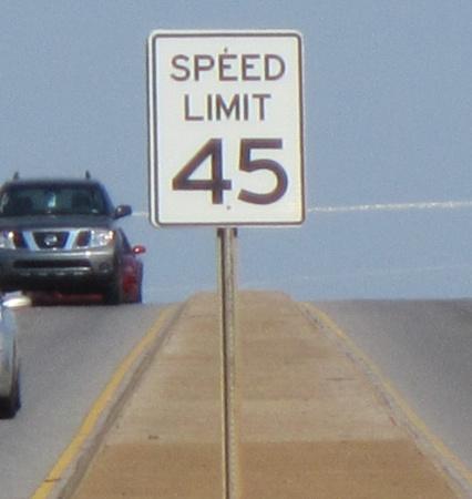
13 Principles of Access Management Functional Classification An important means of managing a roadway system is to maintain a clear understanding of how each roadway or individual segment of roadway are intended to function. This understanding is generally developed and maintained by having a functional classification system. ALDOT maintains a functional classification system with twelve types of roadways. Maps depicting the functional classification of Alabama s roadways can be found in the Appendix C. In addition to roadway type, ALDOT differentiates between urban and rural roadways to further classify the expected functionality of a given roadway. The twelve functional classifications used by ALDOT are listed below. Figure 2.1 provides a snapshot from the ALDOT Highway Functional Classification (HFC) map for the Birmingham area to illustrate the functional relationship among the various classifications (note the numbers next to the classification names in Figure 2.1 are FHWA reference numbers). Urban Interstate Freeway Urban Principal Arterial Urban Minor Arterial Collector Urban Local Rural Interstate Rural Principal Arterial Rural Minor Arterial Rural Major Collector Rural Minor Collector Rural Local Figure 2.1 Sample ALDOT Functional Classification System Functional classification is important in the context of access management because of the expected speed ranges on different types of roadways and whether they are located in urban or rural areas. As explained in Chapter 4, the operational differences between roadways with speeds less than 45 mph and those with speeds greater than that affect access management criteria (e.g., driveway spacing, turn lane requirements). For this reason it is important to understand what type of roadway is being considered for access so the correct access requirements are used. Principal arterials, whether urban or rural, typically have speed limits of 45 mph or greater. In some cases it is reasonable to expect that rural minor arterials may also exhibit speeds greater than 45 mph. Urban minor arterials, collector roadways, and local roadways typically exhibit speeds less than 45 mph. As such the access
14 Principles of Access Management 2-3 management criteria for lower speed ranges in Chapter 4 would be expected to apply. As always, engineering judgment and knowledge of local conditions shall be considered by ALDOT on a case-bycase basis. The overall speed on the roadway correlates to how the roadway is expected to function. Higher-speed roadways provide mobility between different areas, regions, cities, etc., whereas lower speed roadways are intended to provide access to adjacent roadside development (business, residencies, schools, etc.). The concepts of accessibility and mobility are described further in Chapter Accessibility vs. Mobility Proper access management requires that a roadway be planned, designed, and operated to provide the balance of accessibility and mobility appropriate for its functional classification. Figure 2.2 shows the relationship between the provision of mobility and accessibility and the ALDOT functional classification system. Interstate (Urban/Rural) Freeway Principal Arterial (Urban/Rural) Minor Arterial (Urban/Rural) Increasing Mobility Collector Rural Major Collector Rural Minor Collector Local (Urban/Rural) Increasing Accessibility Figure 2.2 Relationship Between Accessibility/Mobility and the ALDOT Functional Classification System Allowing roadways to operate according to their functional classification increases efficiency and enhances safety for all roadway users. 2.3 Safety Benefits of Access Management In addition to increasing efficiency, proper access management increases safety for all roadway users. The increase in safety is attributable to the reduction of traffic conflicts resulting from properly managing
15 Principles of Access Management 2-4 access to and from a roadway. Traffic conflict points occur where vehicle paths cross, merge, or weave. Connections along roadways are where traffic conflict points occur. Traffic conflicts cause one or more drivers to take evasive action to avoid a collision. Crossing movements have the potential for high-speed impacts and are referred to as major conflicts. Different types of connections result in different levels of traffic conflicts. The number of conflict points is a function of the number of legs at an intersection and the number of allowed traffic movements. Three-way intersections have 9 conflict points (Figure 2.3), while four-way intersections have 32 conflict points (Figure 2.4) if all possible movements are allowed. Vehicular Conflict Points 3 Crossing 3 Diverge 3 Merge 9 Total Figure 2.3 Traffic Conflicts at a Three-leg Intersection Vehicular Conflict Points 16 Crossing 8 Diverge 8 Merge 32 Total Figure 2.4 Traffic Conflicts at a Four-leg Intersection Access management increases safety by reducing the occurrence of traffic conflicts. For example, a driveway can be viewed as a typical three-leg intersection. As shown in Figure 2.3, a three-leg intersection exhibits nine conflict points. Installing a non-traversable median at a driveway to prevent vehicles from turning left out of the driveway reduces the potential traffic conflicts to five as shown in Figure 2.5. Installing a non-traversable median to provide right-in-right-out (RIRO) access at a driveway reduces the potential traffic conflicts to two as shown in Figure 2.6.

16 Principles of Access Management 2-5 Vehicular Conflict Points 1 Crossing 2 Diverge 2 Merge 5 Total Figure 2.5 Traffic Conflicts at a Three-leg Intersection with a Non-traversable Median Figure 2.6 Traffic Conflicts at a RIRO Three-leg Intersection Vehicular Conflict Points 0 Crossing 1 Diverge 1 Merge 2 Total In addition to the configuration of individual driveways, traffic conflicts are also affected by the location and spacing of access connections. It is well documented that closely spaced intersections and access connections increase the complexity of the driving task. When access connections are too closely spaced, drivers must navigate complex traffic situations where other vehicles may be entering or exiting the roadway to and from many directions at once. Reducing this level of complexity creates safer driving conditions for all roadway users. Proper access management can be used to reduce the complexity of driving by requiring: Minimum spacing between successive access connections, Minimum spacing between successive median openings, Minimum spacing between access connections and adjacent intersections, and Maximum numbers of access connections for a given length of property frontage. Numerous traffic engineering studies have shown that access management reduces conflicts and, therefore, crashes. Access management makes it safer for the motoring public to enter and exit property adjacent to the roadway. Proper access management balances site access needs with the need to provide safe and efficient traffic operations for all roadway users by specifying acceptable spacing and combinations of access connections for a given property. Specific standards for design of proper access management in Alabama are presented in Chapter 4 of this manual.
17 Principles of Access Management Other Benefits of Access Management In addition to increasing safety, access management has been shown to have the following positive effects: Roadway capacity and, therefore, useful life is preserved; Travel times and congestion are reduced; The need for new roadways and widening projects is reduced resulting in fewer work zones; and Access to properties is improved. In particular, it has been documented that good access management positively impacts the viability of commercial development and property values. These positive effects are derived from the fact that proper access management makes it easier for the motoring public to enter and exit property adjacent to the roadway. 2.5 Reasonable Access Reasonable access is defined as access that is generally considered a matter of physical necessity for use of the property, not a matter of convenience or competiveness in the marketplace. If alternate access locations and routes are available and do not significantly impair access to the property, the criteria for reasonable access is generally considered satisfied. Circuity of route and off site turning movements en route to the site are not factors that should normally be used when determining reasonable access.
18 Chapter 3 Traffic Impact Study Requirements The ALDOT Access Management Manual covers requirements for traffic impact studies for proposed developments/conditions that may impact traffic operations on the State maintained roadway network. 3.1 General Information Traffic impact studies are often required by the Alabama Department of Transportation (ALDOT) to adequately assess the impact of a proposed development on the existing and/or planned highway system. The applicant shall have the primary responsibility for assessing the traffic impacts associated with a proposed development, with ALDOT serving in a review and approval capacity. The traffic impact study shall be the responsibility of the applicant and shall be prepared and sealed by an engineer licensed in Alabama who has expertise in traffic impact studies and transportation planning. The applicant shall submit the traffic impact study to the appropriate ALDOT District Manager, unless otherwise instructed by ALDOT personnel. Upon receipt of a traffic impact study, ALDOT will review the study data (sources, methods, and findings) and will respond with written comments. ALDOT must approve the traffic impact study before a permit application will be approved. Applicants and their traffic engineering consultant shall have a pre-scoping meeting or, at a minimum, a conference call to discuss traffic impact study requirements with ALDOT prior to commencing the study effort. Items that should be discussed include: the extent of the proposed projects (including initial, intermediate, and final phases); definition of the study area; directional distribution of traffic; critical analysis requirements; development horizon year; crash history/safety evaluation; and any other information relevant to the project and traffic impact study.
19 Traffic Impact Study Requirements When is a Traffic Impact Study Required? A traffic impact study is encouraged for any development requiring an access permit along any state highway. A traffic impact study may not be required for developments whose trip generation estimates are less than 100 total (inbound and outbound) peak-hour vehicle trips. A small development generates so little traffic that its impact is not measureable, even on nearby intersections. When a development is projected to generate less than 100 total (inbound and outbound) peak-hour vehicle trips, the applicant shall provide ALDOT with a documentation of the anticipated land uses and associated densities and an accompanying site plan for consideration of waiving the traffic impact study requirement. The method used to calculate the trip generation estimate shall meet the requirements in Section 3.3. For developments that generate more than 100 total (inbound and outbound) peak-hour vehicle trips, a traffic impact study shall be required. Figure 3.1 presents a decision tree that shows the ALDOT requirements for conducting a Traffic Impact Study. A trip generation estimate memorandum may be required if the land use is atypical or if it cannot easily be derived from Figure 3.1 that the total peakhour trips from all land uses in a mixed-use development proposal will be fewer than 100 total (inbound and outbound) peak-hour trips. A traffic impact study is required when conducting a traffic signal warrant analysis as stated in the ALDOT Traffic Signal Timing and Design Manual *. The need for a traffic impact study is not totally absolved when traffic generation estimates fall below 100 total (inbound and outbound) peak-hour vehicle trips. A traffic impact study may still be required at ALDOT s discretion. The following are conditions where ALDOT personnel may require traffic impact studies regardless of development density: 1. Impact to state highway system Developments that do not directly access the state highway system but will impact the traffic conditions on the existing highway system. 2. Change in land use and/or development density A change in the land use or development density of a property accessing a previously permitted connection point. 3. Update to previous traffic impact study Previous traffic impact study that is more than two (2) years old when construction commences on the permitted access point(s) shall be updated. ALDOT may waive this requirement if it can be demonstrated that the conclusions of the original traffic impact study are valid for current conditions. 4. Deficient Conditions If in the opinion of ALDOT personnel significant operational deficiencies and/or safety concerns exist or would be created as a result of traffic expected to be generated by a development. 5. Currently Congested Areas Developers/property owners who are proposing developments along congested corridors are strongly recommended to contact ALDOT to discuss traffic impact study requirements and limits. To access a copy of the latest version of this document refer to Appendix A

20 Traffic Impact Study Requirements 3-3 TYPICAL VALUES land use type and approximate density expected to generate approximately 50 and 100 total peak hour vehicle trips: Unique Site Consult Traffic Engineer LAND USE 50 TRIPS 100 TRIPS Single Family Home 50 units 100 units Apartments 80 units 160 units Condominium/Townhouse 95 units 190 units Assisted Living 225 beds 450 beds Shopping Center 2,500 SF 7,000 SF Fast Food Restaurant w/ Drive-Thru 1,000 SF 2,000 SF High Turnover Sit Down Restaurant 4,500 SF 9,000 SF Quality Restaurant 6,500 SF 13,000 SF Gas Station w/ Convenience Store 3 fuel pos. 7 fuel pos. Bank 2,000 SF 4,000 SF General Office 32,500 SF 65,000 SF Medical/Dentist Office 14,000 SF 30,000 SF Light Industrial/Warehousing 50,000 SF 100,000 SF Manufacturing Plant 70,000 SF 135,000 SF Hotel/Motel 85 rooms 170 rooms Pharmacy w/ Drive-Thru 5,000 SF 10,000 SF Free Standing Discount Store 10,000 SF 20,000 SF EXPECTED Total Peak Hour Trips < 50 > 50 & < 100 Unknown > 100 Trip Generation Memorandum ESTIMATED Total Peak Hour Trips (Trip Generation Memorandum) < 50 > 50 & < 100 > 100 Traffic Impact Study Generally not required * Generally not required * REQUIRED Figure 3.1 ALDOT Traffic Impact Study Requirements Guide * Generally not required, but may be required at the discretion of ALDOT based on local conditions. See Section 4 for complete turn lane analysis procedure.
21 Traffic Impact Study Requirements Trip Generation Estimate Memorandum Requirements Trip generation estimates shall be provided in memorandum format and adhere to the following requirements: Must be completed, signed, and sealed by an engineer licensed to practice in Alabama Must include trip generation estimates compliant with requirements set forth in Section 3.4 Trip generation estimate memorandum shall be submitted to the appropriate ALDOT District Manager for review and concurrence, unless otherwise directed by ALDOT personnel. 3.4 Traffic Impact Study Contents Specific requirements for each traffic impact study will vary depending on site location and type of development. However, all traffic impact studies shall contain, at a minimum, the information in Figure 3.2. Figure 3.2 shows a recommended table of contents for a typical Traffic Impact Study with suggested headings and subheadings. The following sections provide details and guidance for each of the sections of the recommended Traffic Impact Study.
22 Traffic Impact Study Requirements 3-5 Preface Preface Overview and Executive Summary Existing Conditions Project Study Area Existing Geometric Data Existing Traffic Counts Hourly Approach Counts Peak Hour Turning Movements Traffic Distribution Summary Existing Conditions Analysis Future Traffic Conditions Description of Proposed Development Trip Generation Estimate Direction Distribution of Development Traffic Development Horizon Year Background Traffic Growth Projected Future Year Traffic Volumes Future Signal Warrant Analysis (as applicable) Future Traffic Conditions Analysis Conclusions/Recommendations Appendices A Proposed Site Layout B Signal Timing Sheets (as applicable) C Traffic Count Data D Level of Service Description E Existing Capacity Analysis F Signal Warrant Analysis (as applicable) G Future Capacity Analysis Figure 3.2 Recommended Traffic Impact Study Table of Contents Title/Cover Page The report Title Page shall include: Title of the report - States the type of study (Traffic Impact Study, etc.). Development name Lists the name of the development and the general location of the development (city/town and county located in). Date Date that this study/report was created, month and year only. Prepared For Name of the firm, entity, or development that this report was prepared for, if applicable. Prepared By Name of the firm or entity that produced this report, to include address and phone number. Seal and signature of engineer of record.
23 Traffic Impact Study Requirements 3-6 Table of Contents At a minimum, shall include a listing of the main sections of this study and appendices. Should a List of Tables and/or List of Figures be included, they shall precede the Appendices listing. Overview and Executive Summary This section contains an overview of the purpose and a summary of results for the study. The following items shall be included in this section: Vicinity Map This is a map of the general area, at a scale of 1 = 2 to 5 miles. This map should clearly show the project/development location in relation to the nearest town/city and the major roadways in and around the development area. Zoomed Map The zoomed map shall show where the affected and/or proposed intersections are located with enough detail to locate the intersection(s) and the surrounding, affected roadways/intersections (scale: 1 = ½ mile or less). Project Description This is a brief project description describing why this study was required, to include the location, type, and size of the development; roadways adjacent to the development; and the anticipated completion date and/or a schedule of phase completion dates. The location of any proposed intersections on any state highways anticipated because of this development shall be included, giving distances from known/existing intersections. A more detailed map/aerial photo could be used to more clearly locate the areas of concern for this study. Master Site Plan This is a scaled site plan that shows all planned construction through ultimate buildout. Study Summary This is a concise summary of the results of this study. Briefly state the recommended roadway and intersection improvements. Resources This is a list of resources used for this study, to include applicable editions or revisions. This shall also include a list of any programs used in the analysis, along with their versions. Additional Information This shall list the supporting agencies and what data were supplied by them along with all other information sources used in the generation of this study. All other background information about this location and project that has not been previously addressed and is required for clarity should be included in this section. Existing Conditions This section shall be used to present the current/existing conditions at the development site and the surrounding areas. This shall include, but is not limited to, the following: Project Study Area The study area of the project shall be determined by the type of development and the nature of adjacent roadways and intersections. ALDOT has developed criteria to follow when determining the study area for all traffic impact studies. Table 3.1 illustrates the required study area selection criteria.
24 Traffic Impact Study Requirements 3-7 TABLE 3.1 ALDOT Criteria to Determine Traffic Impact Study Area Requirements Development Land Use Type Required Study Area for Traffic Impact Study Sample Small Commercial Developments (Outparcel/Small Tract) Fast food restaurant Convenience store (with or without gas pumps) Any small single tract development generating 200 or less trips during any peak hour Proposed connection point -&- All intersections (signalized or unsignalized) within 1,000 ft of proposed connection point Sample Moderate Developments (Commercial, Industrial & Residential) Shopping center or commercial/industrial (<70,000 ft 2 floor space) Residential developments generating less than 500 trips during any peak hour Any development generating between 200 and 500 trips during any peak hour Proposed connection point(s) -&- All signalized intersections within ¼ mile and all un-signalized intersections within ¼ mile of the site property boundaries Sample Large Developments (Commercial, Industrial & Residential) Shopping center or commercial/industrial (>70,000 ft 2 floor space) Proposed connection point(s) Residential developments generating 500 trips or more during any peak hour Any development generating more than 500 trips during any peak hour -&- All signalized and un-signalized intersections within ½ mile of the extreme access points Note: Any proposed development that has access points within ½ mile of an interchange ramp shall include all ramp intersections as a part of the required study area. ALDOT reserves the right to require additional intersections (beyond those outlined in Table 3.1) and any access driveways within the applicable study area boundary to be studied as a part of the Traffic Impact Study. Existing Geometric Data This includes a detailed geometric layout of the required study area roadways and intersections. The following shall be included where applicable: number of lanes and/or approach lanes; lane and/or approach lane usage (left only, thru/left combined, etc.); lane width; turn lane length (full width lane and taper); channelization dimensions; site distance limitations; details of any medians and shared left-turn center lanes; posted speed limits; existing traffic control measures; traffic signal timings from study area traffic signals; and any other roadway or intersection details that might be pertinent to the study/analysis (driveways, median crossovers, etc.).
25 Traffic Impact Study Requirements 3-8 Improvements proposed by governmental agencies and/or other developments not associated with this development but will be completed before this development and/or any phase of this development shall be considered as part of the existing conditions of this study. Information about the type of improvement, extent of the improvement, completion schedule, and the responsible agency shall be included for each improvement. Existing Traffic Counts Hourly Approach Counts A minimum of 24 continuous hours of approach counts for each study area roadway will be required. The counts shall be for the same time period, for the same day, for each roadway. These shall be taken on a typical weekday, unaffected by holidays or special events. For proposed intersections, roadway counts shall be taken at the proposed intersection location. These counts shall be displayed as a summary of the approach counts for each approach, and the raw counts shall be included in the study s appendices. Peak Hour Turning Movements AM and PM peak hour turning movement count summaries shall be included for each approach of each existing study intersection. It would be preferable to have these counts taken on the same day as the approach counts, but turning movement counts from a different typical day comparable to the approach counts are acceptable as long as they are collected within two weeks of the approach counts. However, these counts shall be normalized with the approach counts, or vice-versa, so that a proper comparison can be made. Justification for the way these counts are normalized shall be provided. Different peak hour counts, other than the AM and PM, may need to be considered depending on the prevailing traffic conditions such as peak flows during national holidays, schools hours, industry working hours, etc. Raw counts shall be included in the study s appendices. Traffic Distribution Summary Current traffic distribution for the location and posted speeds of all roadways within the area of the proposed development. A speed study may be required to validate realistic speeds along critical roadways. Age of Traffic Data - Traffic data for existing conditions analyses shall not be over 24 months old. Existing Conditions Capacity Analysis An intersection capacity analysis of existing peak hour traffic conditions (as determined during scoping discussions with ALDOT) shall be included for each study area intersection. The capacity analysis should conform to the type of intersection it is (signalized or unsignalized). A complete analysis summary from an ALDOT approved traffic analysis methodology shall be included in the study s appendices. Existing Conditions Signal Warrant Analysis A signal warrant analysis summary of any existing intersection requested for signalization shall be required. The signal warrant analysis shall conform to current ALDOT standards for traffic signal warrants, including approach count requirements, turning movement counts, and right turn reduction (where applicable). The Traffic Impact Study shall include any supporting data for the justification of
26 Traffic Impact Study Requirements 3-9 any Warrants met. The completed ALDOT warrant analysis worksheet for each intersection shall be included in the study s appendices. A description of ALDOT traffic signal warrant analysis procedures is provided in the ALDOT Traffic Signal Timing and Design Manual *. The Warrant Analysis Worksheet is posted on ALDOT s website under Maintenance Bureau Publications*. All five pages of this worksheet shall be included for each intersection. Reports generated by analysis software are acceptable provided they show the status of all warrants and applicable data verifying a satisfied warrant. ADT counts (without hourly approaches) shall not be used, nor will they be accepted, for the justification of traffic control signal installation. An existing traffic control signal that, after warrant analysis and engineering investigation of traffic conditions and physical characteristics, fails to meet the minimum requirements of the Manual on Uniform Traffic Control Devices (MUTCD)* should be removed according to established guidelines for removal of unwarranted traffic signals in the latest currently approved version of the MUTCD. A complete analysis summary from an ALDOT approved traffic analysis methodology shall be included in the study s appendices. Future Traffic Conditions This section of the study shall show how the existing and proposed traffic will integrate together and its effects on the surrounding areas of the development. The following is a minimum that shall be contained in this section: Trip Generation Estimates This section contains a detailed breakdown of the traffic generation for the development in accordance with the ITE Trip Generation Manual*. This breakdown shall show peak hour traffic generation for each affected intersection. The data obtained shall be from Peak Hour of Adjacent Street Traffic for the applicable peak hours. Any deviation from this data shall be adequately justified. These generated traffic volumes shall be for the development only. Adjacent roadway traffic would only be considered and combined with traffic generated volumes for use in the capacity analysis. Internal/Mixed-Use trip generation within the study area shall be clearly defined and justified in the study. The edition of the Trip Generation Manual shall be the current edition in print at the time of the study. For land uses not included in the ITE Trip Generation Manual*, specific trip generation characteristics shall be provided. Hourly traffic generation estimates for land uses other than Shopping Centers shall be accompanied by the data used to develop the estimates. To access a copy of the latest version of this document refer to Appendix A
27 Traffic Impact Study Requirements 3-10 Directional Distribution of Development Traffic Directional distribution of the generated traffic for and by the development in graphic form along with the justification of this distribution shall be included, especially when the development contains more than one driveway/access point. Development Horizon Year Considering the nature of certain types of developments, it is understood that not all developments are completed/built out and occupied at the same time. Therefore, traffic conditions for developments with multiple construction phases shall be evaluated for future time periods after opening day. Table 3.2 sets out the required analyses parameters (horizon years, study periods) for different types and scales of proposed developments. TABLE 3.2. Required Traffic Impact Study Analysis Parameters for Different Development Types Development Type Horizon Years/ Required Analysis Scenarios Single Phase Construction Existing Conditions and Opening Day Conditions Multiple Phase Construction Existing Conditions, Conditions upon completion of each Phase, and Build Out Conditions Multiple Phase Construction - Large Developments Existing Conditions, Conditions Upon Completion of each (As defined in Table 3.1) Phase, and Build Out Conditions. ALDOT reserves the right to require additional analyses scenarios beyond those included in the table above. Background Traffic Growth Should the completion date of the development occur over 24 months from the time the existing traffic data was collected, the traffic data shall be adjusted based on the projected growth percentage for the area before development traffic is added as described below. Justification for this projected growth shall be included. NOTE: Historical counts shall not be utilized; rather, correct practice requires current traffic counts accurately reflecting existing traffic conditions or characteristics. If the study has been put on hold or delayed for over a year, then a sample count shall be taken on the main route to determine the growth from the initial data acquisition. All other traffic counts shall be adjusted accordingly, whether up or down. If ALDOT is not satisfied with this, then a full data collection as described above shall be conducted. Projected Future Traffic Volumes These are proposed hourly counts for each intersection impacted by the development, if hourly counts were generated in Section 3.3 above. This shall include the combination of both the generated and existing approach counts. Future Signal Warrant Analysis A signal warrant analysis summary of any intersection where signalization is proposed in conjunction with the development is required. The analysis shall include any supporting data for the justification of any warrants met. The full warrant analysis worksheet for each intersection shall be included in the study s appendices.
28 Traffic Impact Study Requirements 3-11 The Warrant Analysis Worksheet is posted on ALDOT s website under Maintenance Bureau Publications *. All five pages of this worksheet shall be included for each intersection. Reports generated by analysis software are acceptable provided they show the status of all warrants and applicable data verifying a satisfied warrant. ADT counts shall not be used, nor will they be accepted, for the justification of traffic control signal installation. Future Traffic Conditions Capacity Analysis Unsignalized Capacity Analysis Analysis shall be performed for each peak-hour period for each intersection in the development, around the development, and impacted by the development. Refer to Table 3.1 for guidance on which unsignalized intersections are to be analyzed. A summary from an ALDOT approved traffic analysis for each intersection shall be included in the study s appendices. Should the capacity fail for a given period for any unsignalized intersection, then intersection improvements, failing volumes, and degree of failure shall be reviewed to determine if the intersection should be signalized. A valid justification to signalize any unsignalized intersection shall be included. Signalized Capacity Analysis Analysis required for each peak period for any intersection, whether signalized or unsignalized, to determine whether delay would be improved via traffic signalization or adjustment to existing signal timing elements. Refer to Table 3.1 for guidance on which signalized intersections are to be analyzed. An analysis summary from an ALDOT approved traffic analysis methodology for each intersection shall be included in the study s appendices. Conclusions/Recommendations This section shall contain a summary of the conclusions and recommendations in the development study area, to include a detailed description of the proposed site modifications with a justification for each. Detailed descriptions of improvement recommendations shall provide as much information as possible and at a minimum should be consistent with the level of detail provided in the description of existing geometric conditions and traffic control measures outlined in Section 3.2. A graphic representation of improvement recommendations is recommended for providing additional detail. The satisfaction of a traffic signal warrant or warrants shall not in itself justify the installation of a traffic control signal, as outlined in the MUTCD. Signal justification shall be based on geometric limitations, safety concerns, capacity analysis, and all other requirements set out in the ALDOT Traffic Signal Timing and Design Manual *. Appendices This section shall include any supporting data not listed previously in the study, copies of analysis printouts, raw data counts, etc. This is the minimum information that shall be contained in the appendices. Any other pertinent information to include in the appendices shall be added logically based on where it is covered in the body of the traffic impact study. Should there be no information for a given appendix, the area shall be indicated with a page stating that there is no information for this particular appendix. To access a copy of the latest version of this document refer to Appendix A
29 Traffic Impact Study Requirements 3-12 The following is the required order of the appendices area: A. Proposed Site Layout A detailed proposed site layout to include all impacted intersections and roadways. Scale shall be 1 = 100. B. Signal Timing Sheets Timing plan sheets for each existing signalized intersection in required study area (refer to Table 3.1). Shall include timing plans for peak hour, where applicable. C. Traffic Count Data Raw data section for the existing traffic data for each roadway/intersection impacted by the development. o o o Existing hourly approach counts Existing peak hour turning movement counts Any other pertinent field data D. Levels of Service Description Description of level of service criteria based on the latest version of the Highway Capacity Manual *, expressed as levels of service (LOS) ranging from A to F. Generally, LOS C is considered desirable, while LOS D is considered acceptable during peak hours of traffic flow. A detailed description of each level of service designation shall be included in the Appendix. E. Existing Capacity Analysis Capacity analysis printouts for each existing intersection/approach impacted by the development. Shall show the current level-of-service for the intersection/approach. Shall be based on existing geometric and traffic control conditions. F. Signal Warrant Analysis (as applicable) Warrant Analysis for each intersection proposed for signalization and intersections within the study area (refer to Table 3.1) projected to operate below an acceptable LOS as a result of the proposed development. This shall either be the five page form from the ALDOT Traffic Signal Timing and Design Manual* or computer printouts of the analysis. G. Future Capacity Analysis Capacity analysis printouts for each current intersection/approach impacted by the development and each proposed intersection based on the proposed/future traffic for each intersection/approach. Analysis shall show the projected level of service for the intersection/approach. Future conditions capacity analysis shall show unsignalized intersections first followed by signalized intersections. To access a copy of the latest version of this document refer to Appendix A
30 Chapter 4 Access Design The Alabama Department of Transportation (ALDOT) Access Management Manual covers the design of access connections to and from the State maintained roadway network. 4.1 Connections A roadway connection can be defined as the location of the intersection of a public roadway and a private driveway or other public roadway. As discussed in Chapter 2, connection points create opportunities for traffic conflicts and crashes. For this reason, it is good access management practice to allow no more connections than necessary to provide accessibility to and from the roadway network. In addition to being considered a driveway or public roadway, connection points also can be grouped by their type. ALDOT defines three types of connections on its roadway network: directional, unsignalized, and signalized. Each connection type is appropriate for different locations within the roadway network to serve different accessibility purposes. The connection types are described in the following sections Directional Connections Directional connections are generally used to provide access to and from commercial and industrial land uses. Directional connections refer to: right-in/right-out access drives, right-in-only access drives, right-out-only access drives, and left & right-in/right-out access drives. Figure 4.1 presents graphical examples of each connection type.
31 Access Design 4-2 Figure 4.1a Geometric Elements of a Right In/Right Out Driveway (Not to Scale) Figure 4.1b Geometric Elements of a Right-in-Only Driveway (Not to Scale) Figure 4.1c Geometric Elements of a Right-Out-Only Driveway (Not to Scale) Figure 4.1d Geometric Elements of a Left and Right In/Right Out Driveway (Not to Scale) As shown in Chapter 2, directional connections provide access to and from the roadway with less impact on traffic safety and efficiency than full access connections (unsignalized and signalized).
32 Access Design Unsignalized Connections Unsignalized connections refer to full access intersections that operate under side street stop traffic control. Examples include: Minor road intersecting a major road, Minor road intersecting a minor road, or Driveway intersecting a major or minor road Signalized Connections Signalized connections refer to intersections that operate under traffic signal control. Examples include: Major road intersecting a major road, Minor road intersecting a major road, Interchange ramp intersecting a major road, or Driveway to a large traffic generator road intersecting a major road. Appropriate traffic signal spacing is a key element in promoting efficient traffic signal operations. Signal spacing that is too close can hinder traffic progression and cause excessive queues at high-volume intersections. Traffic signals spaced as widely and as evenly as possible help to improve vehicle fuel efficiency, reduce vehicle emissions, and lower crash rates by reducing unnecessary stop-and-go traffic. Also, traffic signals should only be erected when warranted based on federal guidelines as outlined in Chapter 2 of the ALDOT Traffic Signal Timing and Design Manual *. Signals installed at improper locations can degrade traffic progression. Properly installed signals, however, allow access to and from the roadway while preserving safe and efficient traffic operations Full/Directional Median Crossover Median-divided roadways require median openings to allow for crossing the opposing traffic lanes to access property or for crossing the median to make a U-turn. Median openings shall be strategically located to provide appropriate access to adjacent property and roadways while protecting the capacity and traffic operations of the mainline roadway. Successful access management requires the median design to be non-traversable to restrict vehicles crossing at disallowed locations. Non-traversable medians include raised curb medians with either grass-covered or hard-surface fill or depressed medians with grass-covered fill, as shown in Figure 4.2. To access a copy of the latest version of this document refer to Appendix A


33 Access Design 4-4 Figure 4.2a Raised Grass Median Figure 4.2b Raised Curb Median

34 Access Design Full Median Crossover Figure 4.2c Depressed Grass Median The ALDOT minimum spacing for full median openings shall be 1,320 ft. On roads with speed limits greater than 45 mph, ALDOT desires a minimum median opening spacing of 2,640 ft. The minimum spacing is measured from the centerlines of openings along the traveled way, as shown in Figure Directional Median Crossover The ALDOT minimum spacing for directional median openings shall be 660 ft. On roads with speed limits greater than 45 mph, ALDOT desires a minimum median opening spacing of 1,320 ft.
35 Access Design 4-6 Figure 4.3 Full Median Opening Spacing Diagram (Not to Scale) 4.3 Connection Spacing Requirements ALDOT requires specific spacing between connection points on its roadways in addition to minimum design standards for each connection point type. The spacing requirements for each connection type are summarized in Table 4.1.
36 Access Design 4-7 TABLE 4.1 Connection Spacing Requirements (See Section for Corner Clearance Connection Spacing Requirements) Connection Type Minimum Required Spacing without Median 2-lane rural * < 45 mph All other Minimum Required Spacing with Median > 45 mph < 45 mph > 45 mph Directional Access 250 ft 440 ft 660 ft 440 ft 660 ft Full Access (unsignalized) 250 ft 660 ft 1,320 ft 1,320 ft 1,320 ft Full Access (signalized) 1,320 ft 1,320 ft 2,640 ft 1,320 ft 2,640 ft * Minimum spacing criteria only applies to two-lane rural roads exhibiting ALL of the following characteristics: 1. Outside of Metropolitan Planning Organization (MPO) boundaries 2. Current ADT levels < 2, Peak hour trip generation potential of the proposed development < 50 total peak hour trips In the case of large developments with outparcels, access for outparcels should be provided only internally; however, shared or individual direct connections may be permitted provided that twice the normal spacing requirements are met. It should be noted that recognizing different uses and owner/user needs, ALDOT treats residential and commercial/industrial connections differently. The following sections define special conditions and considerations relating to residential and commercial connection locations Residential Driveway Spacing Requirements ALDOT will allow a maximum of one access point or one connection per existing parcel for single-family residential homes. For conditions that do not meet minimum criteria outlined in this manual, ALDOT may require alternative access configurations such as (but not limited to): shared use accesses, service roads, and back frontage roads Commercial /Industrial Connection Spacing Requirements ALDOT requires minimum driveway spacing criteria based on the posted speed/classification of the roadway. However, there are certain special conditions that may require further examination to determine acceptable property access. Commercial/industrial driveways often present challenges to spacing criteria based on the amount of roadway frontage and the size of the parcels. Therefore, the size and type of access required should be considered. As routes redevelop, there will be a desire by developers to have multiple driveways for certain land uses. The authorization of multiple driveways will be considered based on the amount of continuous parcel frontage. ALDOT will consider additional driveways only for parcels with frontage exceeding 660 feet. ALDOT criteria for the number of allowable commercial/industrial driveways are shown in Table 4.2. A listing of MPOs in Alabama can be found at
37 Access Design 4-8 TABLE 4.2 Required Parcel Frontage for Driveways Desired Number of Required Parcel Driveways* Frontage ft - 1,980 ft 3 or more >1,980 ft *Subject to minimum trip criteria and other roadway conditions such as proximity to driveways from adjacent properties, ALDOT may require fewer driveways. Although multiple driveways may be allowed, access to additional driveways is subject to the roadway cross section and median opening locations. Driveways with no corresponding median opening shall be limited to directional connections. Connection types allowed within a parcel will be determined by the connection spacing requirements of Section 4.3 and will consider existing and proposed (if known) connection types adjacent to the parcel on both sides of the roadway. If certain types of connections are desired, the allowable number of connections will be subject to reduction Corner Driveway Clearance In some cases, parcel boundaries may require driveways near intersection corners. The required corner driveway clearance refers to the distance from an intersection of a cross road to the nearest driveway connection either before or after the intersection. It is desirable to maximize this distance to preserve traffic flow in the vicinity of intersections. The corner driveway clearance is the distance measured from the closest edge of pavement from the intersecting road measured along the travel way (through lanes) to closest edge of a proposed driveway. Requirements for corner connection clearance access are shown in Tables 4.3 and 4.4. TABLE 4.3 Corner Clearance Connection Spacing Requirements WITHOUT MEDIAN Connection Type Minimum Required Corner Clearance WITHOUT MEDIAN 2-lane rural * < 45 mph All other > 45 mph Right-In (upstream only) 125 ft 250 ft 440 ft Right-Out (downstream only) 125 ft 250 ft 660 ft Right-In/Right-Out 250 ft 275 ft 660 ft Full Access (unsignalized) 250 ft 660 ft 1,320 ft Full Access (signalized) 1,320 ft 1,320 ft 2,640 ft * Minimum spacing criteria only applies to 2-LANE RURAL roads exhibiting ALL of the following characteristics: 1. Outside of Metropolitan Planning Organization (MPO) boundaries 2. Current ADT levels < 2, Peak hour trip generation potential of the proposed development < 50 total peak hour trips Note: It is desirable to maximize the distance between the corner parcel connection and the adjacent intersection. Minimum connection spacing criteria for corner clearance should only be considered when greater spacing cannot be achieved. A listing of MPOs in Alabama can be found at
38 Access Design 4-9 TABLE 4.4 Corner Clearance Connection Spacing Requirements WITH MEDIAN Connection Type Minimum* Required Corner Clearance WITH MEDIAN Urban < 45 mph All other > 45 mph Right-In (upstream only) 125 ft 250 ft 440 ft Right-Out (downstream only) 125 ft 250 ft 660 ft Right-In/Right-Out 250 ft 275 ft 660 ft Full Access (unsignalized) 660 ft 1,320 ft 1,320 ft Full Access (signalized) 1,320 ft 2,640 ft 2,640 ft 1. Minimum connection spacing criteria for corner clearance should only be considered when greater spacing cannot be achieved. 2. Minimum spacing criteria only applies to roads in MPO areas (see Appendix) with high density traffic conditions. 3. It is desirable to maximize the distance between the corner parcel connection and adjacent intersections Examples of corner clearance requirements are illustrated in Figures 4.4 and 4.5.
39 Access Design 4-10 Figure 4.4 Corner Spacing Criteria for Approaching Intersections (Not to Scale) (Refer to Tables 4.3 and 4.4 for additional corner spacing criteria)
40 Access Design 4-11 Figure 4.5 Corner Spacing Criteria for Departing Intersections (Not to Scale) Refer to Tables 4.3 and 4.4 for additional corner spacing criteria. 4.4 Driveway Geometric Design Driveway design is a critical component to the transportation system and essential to achieve efficient operations. Entry width, radius, and offset are the key components to driveway design. The following sections outline general required driveway design characteristics. For detailed driveway design characteristics see the ALDOT Permit Manual * and ALDOT Standard & Special Drawings*. To access a copy of the latest version of this document refer to Appendix A
41 Access Design Driveway Width The entry width is the most critical component of driveway design because it has to serve both right turning and left turning vehicles. It should be sufficient to allow a vehicle to enter without having to slow down excessively and it should allow vehicles to enter and exit simultaneously. Inadequate driveway design creates conflicts that can be detrimental to safety and operations on the mainline. With this in mind, the minimum driveway width shall be 24 ft wide two-lane driveways intersecting ALDOT roadways as shown in Figure 4.6. The following should be considered when determining the required driveway widths: AASHTO vehicle turning paths * should be evaluated to determine the required width beyond ALDOT minimums. Directional driveways shall provide additional lane widths depending on driveway radii, angle of entry, AASHTO vehicle turning paths*, and any other specific site conditions. Multi-lane driveways (undivided or median divided) shall provide a minimum of 12 ft wide lanes on ALDOT right of way. In the case of median divided driveways, care should be taken to limit the width of the median to a minimum along ALDOT right of way to limit the overall width of the intersection Driveway Radii Figure 4.6 Minimum Driveway Width Driveway radii should be designed to provide safety and ease of vehicle movement for the largest vehicle that will regularly use the driveway. The applicant should check the latest edition of the ALDOT Permit Manual for latest applicable minimum driveway radii requirements. Table 4.5 indicates minimum radii for various types of driveways based on the land use served. TABLE 4.5 Minimum Radii by Driveway Type Driveway Type Min. Driveway Radius (ft) Residential 25 Commercial/Industrial 50 Truck access 75 Although not required for all permits, AASHTO vehicle turning paths* should be examined for every driveway proposed to access an ALDOT right of way. It should be noted that if a high volume of trucks To access a copy of the latest version of this document refer to Appendix A
42 Access Design 4-13 are expected to use an access, ALDOT may require that turning analysis be submitted with the permit application. The selected design vehicle should maintain a 2 ft clearance from the traveled way, curb line, or median during a right turn maneuver Driveway Storage/Circulation Throat length can be defined as the distance from the edge of the traveled way along the main roadway to the first conflict point on a driveway or roadway. The throat length distance is a key component for safe and efficient traffic operations along the main roadway. The throat length should be designed to facilitate the movement of vehicles off the roadway to prevent the queuing of vehicles onto the traveled way. It is recommended that additional distance (as much as practical) be provided for signalized driveways and higher-volume unsignalized driveways where driveway queue lengths could impact the ability of vehicles leaving the roadway to transition into the internal circulation system. ALDOT may require an analysis of the applicable location of internal circulation to demonstrate that the throat length is adequate for projected traffic conditions. Frontage roadways that run parallel to ALDOT roadways are recommended to provide a 200 throat length (or greater) whenever possible. It is recommended that throat lengths be discussed with ALDOT whenever considering frontage roadways. Figure 4.7 shows a typical spacing required from the main roadway at a connection point to an adjacent frontage road. Figure 4.7 Typical Driveway Layout With Frontage Road (Not to Scale) 4.5 Left Turn Lanes Left turns at unsignalized connections and at signalized intersections with permitted left turn movements require turning vehicles to yield to oncoming traffic and wait for an acceptable gap to make the left turn maneuver. In cases where there is no exclusive left turn lane, these vehicles must slow down or stop in a through lane while awaiting an acceptable gap. These conditions increase the risk of a rear-end crash and may result in left turning vehicles taking risks and accepting gaps in oncoming
43 Access Design 4-14 traffic that are too small, thus increasing the chance of a right-angle crash. For these reasons, an exclusive left turn lane may need to be provided. Although there are clear safety and operational benefits of exclusive left turn lanes, they may not be required or even feasible for all locations. For this reason, an analysis must be performed to determine whether or not an exclusive left-turn lane is warranted. The following sections provide procedures for performing left turn lane warrant analyses and describe the ALDOT geometric requirements (deceleration length and width) for left-turn lanes Left Turn Lane Warrants ALDOT requires left turn lanes at any new access unless a left turn lane warrant analysis shows definitively that one is not necessary. Left turn lane warrant procedures for two-lane and multi-lane roadways are discussed in the following sections. These procedures apply to left turn lanes at unsignalized connections (e.g., intersections, driveways, and median crossovers). The procedures also apply to signalized connections where left turns operate as permissive requiring turning vehicles to yield to oncoming traffic and wait for an acceptable gap to make the left turn maneuver (as in the case of unsignalized left turns). In many cases, left turns at a signalized intersection may need to operate as protected with an exclusive left turn phase (i.e., left turn arrow). Protected left turn phasing and warrants for exclusive left turn phases at signalized intersections are addressed in Section 3.3 and 3.4 of the ALDOT Traffic Signal Timing and Design Manual *. For initial screening, refer to ALDOT quick reference sheet for turn lanes in the Appendix D Two-lane Roadways A left turn lane is considered warranted on a two-lane roadway when any of the following conditions are met: An engineering evaluation indicates insufficient stopping sight distance for traffic movements opposing the left turn as per AASHTO criteria; An evaluation of crash experience (if left turn movement exists) indicates that there have been five or more crashes within a 12 month period that could have been mitigated by the installation of a left-turn lane; An engineering evaluation of the impacts of heavy vehicles (percent trucks, grades effects, etc.) on left turn operations and safety; or An evaluation of applicable traffic volumes shows a left turn lane to be warranted. A left/right Turn Lane Quick Guide is available in Appendix D of this manual. It can be used as a screening tool to determine whether a turn lane is warranted. If the left/right Turn Lane Quick Guide indicates a turn lane is warranted, then Section of this manual should be consulted to determine dimensional requirements for left turn lanes. If the applicant does not concur with the results of the left/right Turn Lane Quick Guide or it does not apply to a particular situation, a full left turn lane warrant analysis based on the procedures documented in NCHRP Report 457* should be conducted and the results submitted to ALDOT with the permit application. To access a copy of the latest version of this document refer to Appendix A
44 Access Design Multi-Lane Roadway A left turn lane shall be required at all connections on median divided roadways. This applies not only to new median openings and connections but also existing connections and median openings when there is a change of use resulting from a proposed development. Left turn lanes shall also be considered in certain circumstances for multi-lane undivided roadways. In the event a turn lane is considered for a multi-lane, undivided roadway, the applicant shall discuss with ALDOT prior to filing a permit request Left Turn Lane Geometric Design Once the need for an exclusive left turn lane has been established, the design of the new lane must conform to all applicable ALDOT standards. The following sections describe the ALDOT geometric requirements (storage length, taper dimensions and width) for exclusive left turn lanes Turn Lane Lengths Single turn lanes along ALDOT routes shall provide space for turning vehicles to decelerate as well as storage for turning vehicles to queue. As stated in the AASHTO Policy on Geometric Design of Highways and Streets *. The length of the auxiliary lanes for turning vehicles consists of three components: (1) entering taper, (2) deceleration length, and (3) storage length. Desirably the total length of the auxiliary lane should be the sum of the length for these three components. Common practice, however, is to accept a moderate amount of deceleration within the through lanes and to consider taper length as a part of the deceleration within the through lanes. Therefore, the critical length components of left turn lanes along ALDOT routes are considered to be the following: deceleration length and storage length. The various geometric design elements of a left turn lane are shown in Figure 4.8. To access a copy of the latest version of this document refer to Appendix A
45 Access Design 4-16 Figure 4.8 Geometric Design Elements of a Left Turn Lane (Not to Scale)
46 Access Design 4-17 Minimum ALDOT requirements for the geometric design elements of left turn lanes are shown in Table 4.6. TABLE 4.6 Minimum Lengths for Left Turn Geometric Design Elements Design Speed Total Turn Lane Transition Taper Taper Length (ft) (MPH) Length (ft) Length (ft) * W * W * W * W * W * W * W 1. All turn lane lengths shown in Table 4.6 account for a 10MPH reduction in the through travel lane prior to entering the turn lane. 2. All turn lane lengths are minimums. Vehicle storage requirements shall be verified and turn lanes shall be lengthened where required. 3. W = width of transition (feet). Lengths illustrated in Table 4.6 are stated minimum values only. Minimum left turn lane lengths will only be allowed in instances where projected peak vehicle queue does not exceed the minimum storage length. A vehicle queue analysis for morning and afternoon peak periods must be included to justify the proposed storage length component for any left turn lane permit application (see Section ) Left Turn Lane Tapers ALDOT requires a straight line taper for left turn lanes. For median left-turn lanes, a minimum median width of 18 ft (12 ft lane width, 2 ft offset, and a 4 ft median divider) is recommended to accommodate a single left-turn lane. The absolute minimum median width is 14 ft. Where pedestrians may be present, the divider must be at least 5 ft. wide and preferably at least 6 ft. wide. Where a raised divider extends into the pedestrian cross-walk, a cut-through that is a minimum of 5 ft. x 5 ft. must be provided as shown in Figure 4.9. Figure 4.9 Geometric Design Elements of a Left Turn Lane With Marked Crossing (Not to Scale) Left Turn Storage Turn lanes shall provide sufficient storage length to accommodate the number of vehicles likely to accumulate during specific intervals within periods of peak traffic.
47 Access Design 4-18 Unsignalized intersections The storage length may be based upon the number of turning vehicles arriving in an average two-minute period within the peak hour. The required vehicle storage length shall be calculated to verify that minimum storage lengths are sufficient. When completing left turn lane storage analysis, special care should be given to accommodate the truck storage requirements of the left turn lane (where required). Signalized intersections Storage length at signalized intersections depends upon signal cycle length, signal phasing, and the arrival/departure rate of turning vehicles. The required storage length shall be based upon two times the average number of vehicles that would be expected to queue in the left turn lane per cycle. When completing left turn lane storage analysis, special care should be given to accommodate the queuing of adjacent through lanes. For reference, a procedure to estimate the required storage length for left turn lanes is provided in the appendix. It is recommended that the required left turn storage for unsignalized and signalized intersections be obtained using an ALDOT approved traffic model Dual Left Turn Lanes Certain situations may warrant dual left turn lanes. ALDOT requires a capacity analysis for situations where the left-turning volume exceeds 250 vph to determine whether a dual left turn lane is warranted. In some cases, lower volumes may warrant dual left turn lanes (e.g., side street property access) to maintain or improve capacity and/or operational efficiency. For example, the addition of dual left turn lanes (major street and/or side street) typically results in a higher percentage of green time in a signal cycle being available to through traffic for the major street. Such special cases also require a capacity analysis. Minimum deceleration and taper lengths shown in Table 4.5 apply to dual left turn lanes. Storage requirements for dual left turns require a detailed capacity analysis using an ALDOT approved traffic model. Where dual left-turns are provided, a minimum median width of 30 ft. is recommended (two 12 ft. lanes, 2 ft offset, and a 4 ft. divider) Two-way Left Turn Lanes Situations with existing two-way left turn lanes (TWLT) are handled as special cases and are addressed in Chapter 5 on retrofitting access management. 4.6 Right Turn Lanes Right turn lanes are installed to increase the safety and capacity of a roadway. This is accomplished by separating slower-moving right turning traffic from through traffic by providing an exclusive lane. Although there are clear safety and operational benefits of right turn lanes, they may not be required or even feasible for all locations. They may also impact adjacent connections. For this reason, an analysis must be performed to determine whether a right turn lane is warranted. The following sections provide procedures for performing right turn lane warrant analyses and describe the ALDOT geometric requirements (deceleration length and width) for right turn lanes. For initial screening, refer to ALDOT quick reference sheet for turn lanes in Appendix D.
48 Access Design Right Turn Lane Warrants A right turn lane is considered warranted when any of the following conditions are met: An engineering evaluation indicates insufficient stopping sight distance for traffic movements impacted by the right turn; An evaluation of crash experience (if right turn movement is existing) indicates that there have been five or more crashes within a 12 month period that could have been mitigated by the installation of a right-turn lane; An engineering evaluation of the impacts of heavy vehicles (percent trucks, grade effects, etc.) on right turn operations and safety; or An evaluation of applicable traffic volumes shows a right turn lane to be warranted. A left/right Turn Lane Quick Guide is available in Appendix D of this manual. It can be used as a screening tool to determine whether a turn lane is warranted. If the left/right Turn Lane Quick Guide indicates a turn lane is warranted, then Section of this manual should be consulted to determine dimensional requirements for right turn lanes. If the applicant does not concur with the results of the left/right Turn Lane Quick Guide or it does not apply to a particular situation, a full right turn lane warrant analysis based on the procedures documented in NCHRP Report 457 * should be conducted and the results submitted to ALDOT with the permit application. Right turn lanes should also be considered whenever possible at major connections and through use of engineering judgment in conjunction with the following: Corridor-specific access management plans; Roadway widening plans; and Roadway resurfacing projects Right Turn Lane Geometric Design Once the need for a right turn lane has been established by a warrant analysis, the design of the new lane must conform to strict standards to ensure optimal safety and efficiency of traffic flow. The following sections describe the ALDOT geometric requirements (storage length, taper dimensions, and width) for right turn lanes. A diagram of right turn lane components is included as Figure Figure 4.10 Geometric Design Elements of a Right Turn Lane (Not to Scale) To access a copy of the latest version of this document refer to Appendix A
49 Access Design Right Turn Lane Lengths The geometric design standards for right turn lanes shall follow the policy set forth in the left turn lane Section of this manual. Just as outlined for left turn lanes, a right turn lane is composed of entering taper, deceleration length, and storage length. All minimum turn lane lengths specified in Table 4.6 shall also be applied to right turn lanes Right Turn Lane Tapers ALDOT requires a taper to be a straight line taper. Required taper lengths based upon design speed are included in Table Right Turn Lane Storage Right turn lanes shall provide sufficient storage length to accommodate the number of vehicles likely to accumulate during specific intervals within periods of peak traffic. The following is required for right turn lanes: Unsignalized intersections The storage length may be based upon the number of turning vehicles arriving in an average two-minute period within the peak hour. Storage for right turn lanes should be increased whenever the 100 minimum storage length is determined to be insufficient. Signalized intersections Storage length at signalized intersections depends upon signal cycle length, signal phasing, and the arrival/departure rate of turning vehicles. The required storage length shall be based upon two times the average number of vehicles that would be expected to queue in the left turn lane per cycle. When completing right turn lane storage analysis, special care should be given to accommodate the queuing of adjacent through lanes. Queue lengths for right-turning vehicles may either be completed by the equation listed in the Turn Lane Quick Guide in Appendix D of this manual or by an ALDOT approved traffic simulation model. 4.7 Interstate Interchange Vicinity One of the most important access management challenges occurs in the immediate vicinity of interchanges. The following section discusses access management issues specific to the area near an interchange. The appropriate level of access near an interchange is a function of the type (i.e., classification) of the crossroad, the connection type and the nature of the land use in the vicinity (i.e., along the crossroad). Two major elements affecting location of connection points along an interchange crossroad are: the distance from the interchange to the first connection along the crossroad (especially if it is a signalized intersection) and the appropriate spacing of connections along the crossroad. Table 4.7 shows the ALDOT minimum spacing for the first access crossroad from the ramp.
50 Access Design 4-21 TABLE 4.7 Minimum Connection Spacing Requirements in the Vicinity of Interchanges Fully Developed Suburban/Urban Access Type Rural (> 55mph) Urban (< 45mph) (> 45mph) First RIRO access from the off-ramp First directional median opening First full access before ramp First signalized intersection Accommodating Other Transportation Modes When pedestrians and bicycles are to use a connection or if there are sidewalks and bicycle paths crossing a connection, driveway turning radii and widths must be designed to safely accommodate the these modes. Turning radii and driveway widths for connections serving transit vehicles must be designed to accommodate the appropriate design vehicle. 4.9 Signage ALDOT requires that all signage conform to the ALDOT Miscellaneous Guide Sign Manual * (latest edition). To access a copy of the latest version of this document refer to Appendix A
51 Chapter 5 Retrofitting Access Management to Existing Roadways The ALDOT Access Management Manual provides guidance on implementing access management in developed areas along the State maintained highway network. The primary objectives of this chapter include the following: 1) Introduce the reader to the difficulty of retrofitting access management techniques. 2) Outline techniques that can be used to retrofit access management to existing roadways. The information presented and the reference materials provided in this chapter will assist in the successful implementation of access management techniques on roadways within Alabama. 5.1 Application of Access Management Techniques to Existing Roadways Access management techniques can be applied to existing/developed roadways as part of a process commonly referred to as retrofit by application of the guidelines set forth in this manual. Access management techniques can also be applied to undeveloped roadways using the same process. Introduction of access management techniques on roadways that are currently developed will often be difficult and controversial. Innovative solutions will be needed to achieve the desired goals of improved safety and traffic operations along state roadways. Access management techniques should be considered whenever property access is considered along a state roadway. Each permit/construction project is an opportunity to provide an access management solution that will make roadways safer and improve traffic operations. Wherever possible the guidelines outlined in this Manual should be followed when developing retrofit solutions to current roadways.
52 Retrofitting Access Management to Existing Roadways 5-2 It is common for there to be opposition to the application of access management principles along a roadway. In general, opposition to the principals of access management makes the implementation process difficult. Common constraints and arguments that will be raised include: physical limitations; impacts on business; traffic flow effects; costs and benefits; and compliance with the AASHTO Policy on Geometric Design of Highways and Streets *. In many instances, access management techniques can improve symptoms along existing roadways such as congestion (as evidenced by long queues at intersections), low travel speeds, and traffic crashes. It can be demonstrated that the benefits of fewer crashes, saved time, and reduced fuel consumption exceed the cost associated with the implementation of access management improvements. 5.2 When to Apply Access Management Techniques As mentioned, access management techniques should be considered whenever property access is considered along a state highway. In addition, they should also be considered during roadway improvement/construction projects or whenever conditions along a roadway present concerns. Conditions that might be encountered on Alabama highways that could warrant an access management retrofit program include: Safety: increased congestion and crashes along a given section of roadway exists that can be attributed to random or inadequate access. Major Reconstruction: major reconstruction of a roadway with the development of design plans makes access management and control essential. Roadway Expansion: improvements that can be implemented as part of a roadway expansion project make it practical to reorient access to a cross street and remove (or reduce) roadway access. Coordinating Driveways: planned new driveways on one side of the roadway lead to coordination of existing driveways on the other side. 5.3 Techniques Applicable to Retrofit The variety of access techniques that can be used in the retrofit of existing roadways can be grouped as to the length of roadway affected (point improvement or route segment) and by the physical elements involved, as identified in Table 5.1. General methods by which these physical improvements might be implemented are identified in Table 5.2. To access a copy of the latest version of this document refer to Appendix A
53 Retrofitting Access Management to Existing Roadways 5-3 TABLE 5.1 Classification of Physical Improvements Physical Element Point Improvement Route Segment Improvement Driveways Medians X X Auxiliary Lanes Frontage Roadways Signal Removal X X X X X TABLE 5.2 Techniques for Implementing point and route improvements Physical Elements Implementation Techniques Driveways Relocate Eliminate Consolidate Improve throat width/curb return radii and vertical alignment Increase corner clearance Medians, Point Close Redesign to permit specific movement only Add turn bay/improve turn by geometry Medians, Route Segment Add non-traversable median Close/redesign median openings 2-way continuous left-turn lane Auxiliary Lanes Right-turn deceleration lanes Continuous right-turn lane Right-turn acceleration lanes Left-turn bays Frontage Roadways Reverse frontage to increase throat length (see Figure 4.7) Increase separation from through roadway One-way operation Inter-parcel circulation Retrofit Techniques to Limit the Number of Conflict Points Specific actions that can be included in a retrofit program to limit the number of conflict points on a roadway segment either as a reconstruction process or when requests for new access points are considered are summarized as follows: 1) Install median barrier or raised median divider with no direct left-turn access. 2) Install raised median divider with left-turn deceleration lanes. 3) Install one-way operation to the roadway. 4) Install traffic signals at high-volume driveways that meet spacing criteria and applicable traffic signal warrants. 5) Channelize median openings to prevent left-turn ingress and/or egress maneuvers. 6) Widen right through lanes to limit right-turn encroachment onto the adjacent lane to the left. 7) Install channelizing islands to prevent left-turn deceleration lane vehicle from returning to the through lanes. 8) Install physical barrier to prevent uncontrolled access along property frontages.
54 Retrofitting Access Management to Existing Roadways 5-4 9) Locate driveway opposite a three-leg intersection and install traffic-signals where they meet spacing criteria outlined in this manual and minimum signal warrant criteria. 10) Install driveway channelizing island to prevent left-turn maneuvers. 11) Install driveway channelizing island to prevent driveway encroachment conflicts. 12) Install channelizing islands to control the merge area of right-turn egress vehicle situations Retrofit Techniques Used to Separate Conflict Areas Specific actions that can be included in a retrofit program for a roadway to separate conflict points on a roadway segment either as a reconstruction process or when requests for new access points are considered are summarized as follows: 1) Regulate the minimum spacing of driveways as outlined in this manual. 2) Regulate the minimum corner clearance as outlined in this manual. 3) Optimize driveway spacing and meet the requirements outlined in this manual wherever possible. 4) Regulate the maximum number of access points per property frontage based on the criteria outlined in this manual wherever possible. 5) Consolidate access for adjacent properties in an effort to meet the spacing criteria outlined in this manual where possible. 6) Consolidate existing access whenever separate parcels are assembled under one purpose, plan, entity, or usage. 7) Designate the maximum number of driveways regardless of future subdivision of property. 8) Require access on lower classified roadways in lieu of additional driveways on arterials where possible Retrofit Techniques for Speed Limit Issues Specific actions that can be included in retrofit programs as part of a reconstruction project or when requests for new access points are made to address speed limit adjustment issues on a roadway segment are summarized as follows: 1) Improve driveway sight distances. 2) Restrict parking on the roadway next to driveways to increase turning speeds. 3) Regulate minimum sight distance. 4) Increase the effective approach width of a driveway. 5) Improve driveway profile. 6) Regulate driveway construction and maintenance (require performance bonds). 7) Install channelizing islands to prevent driveway vehicles from backing onto a state roadway. 8) Install channelizing islands to move ingress merge points laterally away from the roadway. 9) Move sidewalk-driveway crossing laterally away from the roadway Retrofit Techniques to Remove Turning Vehicles from Through Lanes The removal of turning vehicles from through lanes can have significant benefits in improving traffic operations within a roadway segment. Additionally, fewer crashes from such actions have also been shown to be a significant result. The following techniques can be applied to retrofit situations where the removal of turning vehicles from through lanes is desired.
55 Retrofitting Access Management to Existing Roadways 5-5 1) Install left turn lanes. 2) Install median deceleration lanes to store left-turning vehicles. 3) Install left-turn deceleration lanes in lieu of right-angle crossovers. 4) Install sufficient median storage for left-turning vehicles. 5) Increase storage capacity of existing left and right turn lanes. 6) Construct a service/frontage roadway (front or back of property). 7) Install supplementary access on lower classified roadways (collectors and locals) when available. 8) Encourage connections between adjacent properties. 9) Require adequate internal design and circulation plans for adjacent property Removal of Unwarranted or Poorly Spaced Traffic Signals Benefits of removing unwarranted signals and those which interfere with efficient progression include: smoother traffic flow, lower crash rates, reduced delay, reduced vehicular emissions, improved fuel economy, and reduced congestion. It is generally recognized that removal of such unwarranted and improperly spaced signals will improve safety and reduce maintenance costs. Although costs vary considerably, the one-time cost of removing an unwarranted signal and replacing it with side-street stop signs has been estimated to be approximately equal to the annual costs of operation and maintenance of the existing traffic signal. Where signals are closely spaced, removal of signals that interfere with efficient progression will improve traffic flow on roadways. Consideration of removal of existing traffic signals as part of an access management retrofit plan should be done through appropriate technical studies as outlined in the ALDOT Traffic Signal timing and Design Manual * 5.4 Access Permitting and Developing a Retrofit Plan Access to all roadways maintained by the State of Alabama is regulated by the Alabama Department of Transportation. For specific requirements related to permitting of access to state roadways, applicants should refer to the ALDOT Permit Manual*. If a request for access to a state-maintained roadway is anticipated in a particular segment that is: in a developed area, in areas where congestion exists, in the vicinity of an interchange, or within the influence area of major intersections, or if the particular segment involves a development that would require multiple access points, then the applicant should contact the Alabama Department of Transportation to discuss the impending request for access. To access a copy of the latest version of this document refer to Appendix A
56 Retrofitting Access Management to Existing Roadways 5-6 This initial contact with the Alabama Department of Transportation should be through the District Manager s office within the county in which the request will be made. See Appendix for list of ADLOT District offices and phone numbers. The District Manager, through discussions with the applicant, will make an initial determination of the level of study and coordination required by the Alabama Department of Transportation. Subsequent to contact with the District Manager, the need for a project concept meeting will be determined. The best time to determine the need for the application of access management principles is during the initial contact phases of the project. The applicant should work with ALDOT officials to determine if an access management retrofit plan should be developed. If it is determined by ALDOT that a retrofit plan is needed for the consideration of the requested access permit, the plan shall be developed by the applicant and submitted to the ALDOT District Manager s office for review and comment. The development of retrofit plans shall be developed utilizing the techniques outlined in this manual. The District Manager will provide comments on the retrofit plan as well as the request for access from his office and/or in association with the Division office or Maintenance Bureau. The results of this process would be the development of an access concept for property proposed for development and a plan for retrofitting for a particular segment of roadway that the Alabama Department of Transportation would issue a concept approval. Permitting of elements of the approved concept plan would be subject to the criteria outlined in the ALDOT Permit Manual * and ALDOT Standard & Special Drawings*. To access a copy of the latest version of this document refer to Appendix A
57 Appendix A Manuals, Documents and Maps Referenced in the ALDOT Access Management Manual Manual, Document or Map Referenced Where to Find It AASHTO Highway Capacity Manual (HCM2010) American Association of State Highway and Transportation Officials website: AASHTO Policy on Geometric Design of Highways and Streets American Association of State Highway and Transportation Officials website: ALDOT Highway Functional Classification (HFC) Maps 1. Go to ALDOT Home Page at 2. Under Bureaus/Divisions/Offices, select Transportation Planning from the pick list. 3. Under Navigation, click on Surveying and Mapping 4. Then click on HFC Maps ALDOT Maintenance Bureau Publications 1. Go to ALDOT Home Page at 2. Under Bureaus/Divisions/Offices, select Maintenance from the pick list. 3. Under Quick Links, click on Maintenance Bureau Publications ALDOT Maintenance Manual 1. Go to ALDOT Home Page at 2. Under Bureaus/Divisions/Offices, select Maintenance from the pick list. 3. Under Quick Links, click on Maintenance Bureau Publications 4. Then click on Maintenance Manual ALDOT Miscellaneous Guide Sign Manual 1. Go to ALDOT Home Page at 2. Under Bureaus/Divisions/Offices, select Maintenance from the pick list. 3. Under Quick Links, click on Maintenance Bureau Publications 4. Then click on Miscellaneous Sign Manual ALDOT Permit Manual 1. Go to ALDOT Home Page at 2. Under Bureaus/Divisions/Offices, select Maintenance from the pick list. 3. Under Quick Links, click on Maintenance Bureau Publications 4. Then click on Permit Manual ALDOT Standard and Special Drawings 1. Go to ALDOT Home Page at 2. Under Doing Business, select Standard Specifications and Drawings from the pick list. ALDOT Standard Specifications for Highway Construction 1. Go to ALDOT Home Page at 2. Under Bureaus/Divisions/Offices, select Construction from the pick list. 3. Under Resources, click on Specifications 4. Then click on Standard Specifications for Highway Construction
58 Appendix A Manuals, Documents and Maps Referenced in the ALDOT Access Management Manual Manual, Document or Map Referenced Where to Find It ALDOT Traffic Signal Timing & Design Manual 1. Go to ALDOT Home Page at 2. Under Bureaus/Divisions/Offices, select Maintenance from the pick list. 3. Under Quick Links, click on Maintenance Bureau Publications 4. Then click on ALDOT Traffic Signal Design & Timing Manual ALDOT Utilities Manual 1. Go to ALDOT Home Page at 2. Under Doing Business, select Publications from the pick list. 3. Under Design Documents, select ALDOT Utilities Manual ALDOT Warrant Analysis Worksheet 1. Go to ALDOT Home Page at 2. Under Bureaus/Divisions/Offices, select Maintenance from the pick list. 3. Under Quick Links, click on Maintenance Bureau Publications 4. Then click on Warrant Analysis Worksheet ITE Trip Generation Manual Institute of Transportation Engineers website MUTCD Manual on Uniform Traffic Control Devices Federal Highway Administration website: NCHRP Report 457 Transportation Research Board wesbite It is the responsibility of the Applicant to ensure that all aspects of the permit governed by the referenced documents comply with the latest version of each adopted by ALDOT.
59 Appendix B ALDOT Division and District Contacts Office Address Phone Number Division US Hwy 431, Guntersville, AL District Governor's House Drive, Huntsville, AL District AL Hwy 71, Dutton, AL District Hwy 69 North, Joppa, AL District Airport Road, Gadsden, AL District nd Avenue West, Oneonta, AL Division Highway 20 East, Tuscumbia, AL District Highway 20 East, Tuscumbia, AL District AL Hwy 101, Town Creek, AL District Industrial Drive, Hamilton, AL District Hwy 20 West, Tanner, AL Division Bankhead Highway West, Birmingham, AL District Bankhead Highway West, Birmingham, AL District Cordova Cutoff Road, Jasper, AL District Highway 31, Calera, AL Division Highway 280, Alexander City, AL District Highway 280, Alexander City, AL District US Hwy 431 N, Anniston, AL District US Hwy 280 West, Auburn, AL District Highway 9, Delta, AL District AL Hwy 21, Talladega, AL District Silver Run Road, Seale, AL Division East Skyland Boulevard, Tuscaloosa, AL District th Street NW, Fayette, AL District East Skyland Boulevard, Tuscaloosa, AL District Hwy 17 South, Carrollton, AL District AL Hwy 22 West, Maplesville, AL District Hwy 14, Greensboro, AL Division Coliseum Boulevard, Montgomery, AL District AL Hwy 143, Elmore, AL District Hwy 82 East, Union Springs, AL District Chisholm Street, Montgomery, AL District Fort Dale Road, Greenville, AL District US Hwy 80 W, Marion Junction, AL
60 Appendix B ALDOT Division and District Contacts Division Elba Highway, Troy, AL District Sam Houston Boulevard, Dothan, AL District Plaza Drive, Enterprise, AL District Lavon Shaddix Lane, Andalusia, AL District Black Forest Drive, Ozark, AL District Elba Highway, Troy, AL District Highway 30, Eufaula, AL Division Grove Hill Avenue, East, Grove Hill, AL District Smith Avenue, Livingston, AL District Range St., Thomaston, AL District Camden Bypass, Camden, AL District Max Gillis Road, Grove Hill, AL Division I- 65 West Service Road North, Mobile, AL District I- 65 West Service Road North, Mobile, AL District Rabun Road, Bay Minette, AL District Hwy 31, Evergreen, AL

61 Appendix B ALDOT Division and District Contacts
Recommended Roadway Plan Section 2 - Land Development and Roadway Access
 Recommended Roadway Plan Section 2 - Land Development and Roadway Access SECTION 2 Land Development and Roadway Access 2.1 Land Use and Access Management The Federal Highway Administration (FHWA) defines
Access Location, Spacing, Turn Lanes, and Medians
 Design Manual Chapter 5 - Roadway Design 5L - Access Management 5L-3 Access Location, Spacing, Turn Lanes, and Medians This section addresses access location, spacing, turn lane and median needs, including
4.0 TRAFFIC IMPACT STUDIES
 SECTION 4 4.0 TRAFFIC IMPACT STUDIES 4.1 TRAFFIC IMPACT STUDY REQUIREMENTS The City has established Traffic Impact Study (TIS) requirements for the purpose of ensuring that both the quantitative and qualitative
Traffic Impact Study. Westlake Elementary School Westlake, Ohio. TMS Engineers, Inc. June 5, 2017
 TMS Engineers, Inc. Traffic Impact Study Westlake Elementary School Westlake, Ohio June 5, 2017 Prepared for: Westlake City Schools - Board of Education 27200 Hilliard Boulevard Westlake, OH 44145 TRAFFIC
Transportation Impact Study for Abington Terrace
 Transportation Impact Study for Abington Terrace Abington Township, Montgomery County, PA Sandy A. Koza, P.E., PTOE PA PE License Number PE059911 Prepared by McMahon Associates, Inc. 425 Commerce Drive,
TRAFFIC STUDY GUIDELINES Clarksville Street Department
 TRAFFIC STUDY GUIDELINES Clarksville Street Department 9/1/2009 Introduction Traffic studies are used to help the city determine potential impacts to the operation of the surrounding roadway network. Two
Traffic Impact Analysis Chatham County Grocery Chatham County, NC
 Chatham County Grocery Chatham County, NC TABLE OF CONTENTS 1. INTRODUCTION... 1 1.1. Location and Study Area... 1 1.2. Proposed Land Use and Access... 2 1.3. Adjacent Land Uses... 2 1.4. Existing ways...
TRAFFIC IMPACT STUDY CRITERIA
 Chapter 6 - TRAFFIC IMPACT STUDY CRITERIA 6.1 GENERAL PROVISIONS 6.1.1. Purpose: The purpose of this document is to outline a standard format for preparing a traffic impact study in the City of Steamboat
Chapter 4 Traffic Analysis
 Chapter 4 Traffic Analysis PURPOSE The traffic analysis component of the K-68 Corridor Management Plan incorporates information on the existing transportation network, such as traffic volumes and intersection
TRANSPORTATION ANALYSIS REPORT US Route 6 Huron, Erie County, Ohio
 TRANSPORTATION ANALYSIS REPORT US Route 6 Huron, Erie County, Ohio December 12, 2012 Prepared for: The City of Huron 417 Main Huron, OH 44839 Providing Practical Experience Technical Excellence and Client
Traffic Impact Analysis Walton Acres at Riverwood Athletic Club Clayton, NC
 Traffic Impact Analysis Walton Acres at Riverwood Athletic Club Clayton, NC 1. TABLE OF CONTENTS INTRODUCTION...1 1.1. Site Location and Study Area...1 1.2. Proposed Land Use and Site Access...2 1.3.
TRAFFIC IMPACT STUDY And A TRAFFIC SIGNAL WARRANT ANALYSIS FOR A SENIOR LIVING AND APARTMENT DEVELOPMENT
 TRAFFIC IMPACT STUDY And A TRAFFIC SIGNAL WARRANT ANALYSIS FOR A SENIOR LIVING AND APARTMENT DEVELOPMENT DEERFIELD TOWNSHIP, WARREN COUNTY, OHIO Nantucket Circle and Montgomery Road () Prepared for: ODLE
Access Management Regulations and Standards
 Access Management Regulations and Standards Efficient highway operation Reasonable property access Concept of Access Management The way to manage access to land development while simultaneously preserving
Access requests to County streets and roadways are processed through one of the following methods:
 13.1 GENERAL APPLICATION PROCESS Access requests to County streets and roadways are processed through one of the following methods: A. Planned Developments may set general locations for access points.
CHAPTER 7 ACCESS MANAGEMENT. Background. Principles of Access Management. Hennepin County Transportation Systems Plan (HC-TSP)
") CHAPTER 7 ACCESS MANAGEMENT Background Principles of Access Management Hennepin County Transportation Systems Plan (HC-TSP) Chapter 7 Access Management 7.1 Background Access management has become an important
CHAPTER 7 ACCESS MANAGEMENT Background Principles of Access Management Hennepin County Transportation Systems Plan (HC-TSP) Chapter 7 Access Management 7.1 Background Access management has become an important
Access Management Regulations and Standards
 Access Management Regulations and Standards January 2014 Efficient highway operation Reasonable property access Concept of Access Management The way to manage access to land development while preserving
Driveway Design Criteria
 Design Manual Chapter 5 - Roadway Design 5L - Access Management 5L-4 Driveway Design Criteria A. General For efficient and safe operations, access drives and minor public street intersections can be improved
Access Management Regulations and Standards for Minor Arterials, Collectors, Local Streets
 Access Management Regulations and Standards for Minor Arterials, Collectors, Local Streets September 2009 Paul Grasewicz Access Management Administrator Concept of Access Management The way to manage access
Truck Climbing Lane Traffic Justification Report
 ROUTE 7 (HARRY BYRD HIGHWAY) WESTBOUND FROM WEST MARKET STREET TO ROUTE 9 (CHARLES TOWN PIKE) Truck Climbing Lane Traffic Justification Report Project No. 6007-053-133, P 101 Ι UPC No. 58599 Prepared by:
This Chapter sets forth the minimum design, technical criteria and specifications to be used in the preparation of all roadway plans.
 4.1 GENERAL This Chapter sets forth the minimum design, technical criteria and specifications to be used in the preparation of all roadway plans. These Roadway Standards are for new construction and modification
SECTION 1 - TRAFFIC PLANNING
 SECTION 1 - TRAFFIC PLANNING 1.1 TRAFFIC OPERATIONS 1.1.1 Roadway Functional Classification The Multnomah County Comprehensive Framework Plan s Policy 34: Trafficways and the Functional Classification
CITY OF SASKATOON COUNCIL POLICY
 ORIGIN/AUTHORITY Clause 1, Report No. 1-1980 and Clause 4, Report No. 22-1990 of the Works and Utilities Committee; Clause 6, Report No. 17-2004 of the Planning and Operations Committee; and Clause D5,
1 VicRoads Access Management Policies May 2006 Ver VicRoads Access Management Policies May 2006 Version 1.02
 1 VicRoads Access Management Policies May 2006 Ver 1.02 VicRoads Access Management Policies May 2006 Version 1.02 2 VicRoads Access Management Policies May 2006 Ver 1.02 FOREWORD FOR ACCESS MANAGEMENT
City of Wayzata Comprehensive Plan 2030 Transportation Chapter: Appendix A
 A1. Functional Classification Table A-1 illustrates the Metropolitan Council s detailed criteria established for the functional classification of roadways within the Twin Cities Metropolitan Area. Table
METHODOLOGY. Signalized Intersection Average Control Delay (sec/veh)
") Chapter 5 Traffic Analysis 5.1 SUMMARY US /West 6 th Street assumes a unique role in the Lawrence Douglas County transportation system. This principal arterial street currently conveys commuter traffic
Chapter 5 Traffic Analysis 5.1 SUMMARY US /West 6 th Street assumes a unique role in the Lawrence Douglas County transportation system. This principal arterial street currently conveys commuter traffic
MUTCD Part 6G: Type of Temporary Traffic Control Zone Activities
 MUTCD Part 6G: Type of Temporary Traffic Control Zone Activities 6G.01 Typical Applications Each temporary traffic control (TTC) zone is different. Many variables, such as location of work, highway type,
TOWN OF CHAPEL HILL POLICY AND PROCEDURES FOR TRAFFIC CALMING MEASURES
 TOWN OF CHAPEL HILL POLICY AND PROCEDURES FOR TRAFFIC CALMING MEASURES (Adopted by the Town Council on June 30, 2004) (Revised December 6, 2010) (Revised February 8, 2016) POLICY AND PROCEDURES FOR TRAFFIC
Glenn Avenue Corridor Traffic Operational Evaluation
 Glenn Avenue Corridor Traffic Operational Evaluation PREPARED FOR: THE CITY OF AUBURN PREPARED BY: DECEMBER 2007 Glenn Avenue Corridor Study--Auburn, Alabama TABLE OF CONTENTS Introduction... 1 Background
Access Management Standards
 Access Management Standards Section 1: Application of Access Standards This chapter describes the Department's access management standards for access connections on the county roadway system. The standards
Highway 111 Corridor Study
 Highway 111 Corridor Study June, 2009 LINCOLN CO. HWY 111 CORRIDOR STUDY Draft Study Tea, South Dakota Prepared for City of Tea Sioux Falls Metropolitan Planning Organization Prepared by HDR Engineering,
APPENDIX F. Access Management Design Standards for Entrances and Intersections
 APPENDIX F Access Management Design Standards for Entrances and Intersections PREFACE The access management regulations and standards do not apply in cities, towns of more than 3,500 and in counties (Henrico
Roadway Classification Design Standards and Policies. Pueblo, Colorado November, 2004
 Roadway Classification Design Standards and Policies Pueblo, Colorado November, 2004 Table of Contents Page Chapter 1. General Provisions 1.1 Jurisdiction 3 1.2 Purpose and Intent 3 1.3 Modification 3
FOR HISTORICAL REFERENCE ONLY
 To: From: Subject: Electronic Distribution Recipients MINNESOTA DEPARTMENT OF TRANSPORTATION Engineering Services Division Technical Memorandum No. 12-14-B-03 December 18, 2012 Jon M. Chiglo, P.E. Division
Central Arkansas Regional Transportation Study Area ROADWAY DESIGN STANDARDS And Implementation Procedures
 Central Arkansas Regional Transportation Study Area ROADWAY DESIGN STANDARDS And Implementation Procedures These standards have been prepared for the use of all jurisdictions to incorporate into their
Technical Memorandum TRAFFIC IMPACT STUDY. RIDLEY ROAD CONVENIENCE STORE Southampton County, VA. Prepared for: Mr. David Williams.
 Technical Memorandum TRFFIC IMPCT STUDY RIDLEY ROD CONVENIENCE STORE Southampton County, V Prepared for: Mr. David Williams By: Charles Smith, P.E., PTOE EPR Charlottesville, V July 2014 1 TBLE OF CONTENTS
Background on the Revisions to VDOT s Access Management Spacing Standards
 December 2011 Background on the Revisions to VDOT s Access Management Spacing Standards Spacing Standards for Commercial Entrances, Signals, Intersections, and Crossovers The spacing standards were located
City of Homewood Transportation Plan
 City of Homewood Transportation Plan Prepared for: City of Homewood, Alabama Prepared by: Skipper Consulting, Inc. May 2007 TABLE OF CONTENTS INTRODUCTION... 1 BACKGROUND INFORMATION... 1 EXISTING TRANSPORTATION
Chapter 2: Standards for Access, Non-Motorized, and Transit
 Standards for Access, Non-Motorized, and Transit Chapter 2: Standards for Access, Non-Motorized, and Transit The Washtenaw County Access Management Plan was developed based on the analysis of existing
Access Management Design Standards for Entrances and Intersections
 Access Management Design Standards for Entrances and Intersections July 2012 APPENDIX F VDOT Road Design Manual PREFACE The access management regulations and standards do not apply in cities, towns of
THE FUTURE OF THE TxDOT ROADWAY DESIGN MANUAL
 THE FUTURE OF THE TXDOT ROADWAY DESIGN MANUAL Kenneth Mora, P.E. (Design Division) 10/10/2017 Table of contents 1 2 Reduction in FHWA design controlling criteria Innovative Intersection Guidance 3-7 8-42
Access Management Guidelines February 2013 THE CITY OF
 Access Management Guidelines February 2013 THE CITY OF Table of Contents Introduction 2 Review and Approval Process 5 Technical Guidelines 9... 10... 12 3. Separation Distance: Non-Signalized All-Turns
WYDOT DESIGN GUIDES. Guide for. Non-NHS State Highways
 WYDOT DESIGN GUIDES Guide for Non-NHS State Highways 2014 GUIDE FOR Non-NATIONAL HIGHWAY SYSTEM (Non-NHS) STATE HIGHWAYS PRESERVATION REHABILITATION RECONSTRUCTION INTRODUCTION This Guide is directed to
Roadway Design Manual
 Roadway Design Manual Manual Notice Archive by Texas Department of Transportation (512) 302-2453 all rights reserved Manual Notice 2009-1 From: Manual: Mark A. Marek, P.E Roadway Design Manual Effective
WYDOT DESIGN GUIDES. Guide for. NHS Arterial (Non-Interstate)
") WYDOT DESIGN GUIDES Guide for NHS Arterial (Non-Interstate) 2014 GUIDE FOR NATIONAL HIGHWAY SYSTEM (NHS) HIGHWAYS (NHS ARTERIALS, Non-Interstate) PRESERVATION REHABILITATION RECONSTRUCTION INTRODUCTION
WYDOT DESIGN GUIDES Guide for NHS Arterial (Non-Interstate) 2014 GUIDE FOR NATIONAL HIGHWAY SYSTEM (NHS) HIGHWAYS (NHS ARTERIALS, Non-Interstate) PRESERVATION REHABILITATION RECONSTRUCTION INTRODUCTION
1609 E. FRANKLIN STREET HOTEL TRAFFIC IMPACT STUDY EXECUTIVE SUMMARY
 1609 E. FRANKLIN STREET HOTEL TRAFFIC IMPACT STUDY EXECUTIVE SUMMARY Prepared for: The Town of Chapel Hill Public Works Department Traffic Engineering Division Prepared by: HNTB North Carolina, PC 343
5858 N COLLEGE, LLC N College Avenue Traffic Impact Study
 5858 N COLLEGE, LLC nue Traffic Impact Study August 22, 2016 Contents Traffic Impact Study Page Preparer Qualifications... 1 Introduction... 2 Existing Roadway Conditions... 5 Existing Traffic Conditions...
Geometric Design Tables
 Design Manual Chapter 5 - Roadway Design 5C - Geometric Design Criteria 5C-1 Geometric Design Tables A. General The following sections present two sets of design criteria tables - Preferred Roadway Elements
CHAPTER 4 TRANSPORTATION IMPACT STUDY TABLE OF CONTENTS
 CHAPTER 4 TRANSPORTATION IMPACT STUDY TABLE OF CONTENTS Section Title Page 4.1 Introduction... 4-1 4.1.1 General... 4-1 4.1.2 Applicant Responsibility... 4-1 4.1.3 Capacity and Safety Issues... 4-1 A.
Median Design. Course No: C Credit: 4 PDH. Debra Kennaugh, P.E.
 Median Design Course No: C04-041 Credit: 4 PDH Debra Kennaugh, P.E. Continuing Education and Development, Inc. 9 Greyridge Farm Court Stony Point, NY 10980 P: (877) 322-5800 F: (877) 322-4774 info@cedengineering.com
Existing Conditions. Date: April 16 th, Dan Holderness; Coralville City Engineer Scott Larson; Coralville Assistant City Engineer
 Date: April 16 th, 2015 To: From: Re: Dan Holderness; Coralville City Engineer Scott Larson; Coralville Assistant City Engineer Darian Nagle-Gamm, Traffic Engineering Planner Highway 6 (2 nd Street) /
City of Charlottesville Traffic Calming Handbook
 City of Charlottesville Traffic Calming Handbook July 2008 CITY OF CHARLOTTESVILLE NEIGHBORHOOD DEVELOPMENT SERVICES Telephone: (434)970-3182 Fax: (434) 970-3359 Introduction The City of Charlottesville
Donahue Drive Corridor Traffic Operational Evaluation
 Donahue Drive Corridor Traffic Operational Evaluation PREPARED FOR: THE CITY OF AUBURN PREPARED BY: JANUARY 2007 Donahue Drive Corridor Study--Auburn, Alabama TABLE OF CONTENTS Introduction... 1 Background
INDEX. Geometric Design Guide for Canadian Roads INDEX
 Acceleration lane, see Lanes, Acceleration Access, 8.1 Access Management and Functional Classification 8.2 Access Management by Design Classification 8.3 Access Configuration 8.4 Building Set-Back Guidelines
TABLE OF CONTENTS TABLE OF CONTENTS... I APPENDICES... III LIST OF EXHIBITS... V LIST OF TABLES... VII LIST OF ABBREVIATED TERMS...
 TABLE OF CONTENTS TABLE OF CONTENTS... I APPENDICES... III LIST OF EXHIBITS... V LIST OF TABLES... VII LIST OF ABBREVIATED TERMS... IX 1 INTRODUCTION... 1 1.1 Project Overview... 1 1.2 Analysis Scenarios...
PennDOT Access Management Model Ordinances Training
 PennDOT Access s Training Trainers: Chad Dixson, AICP, TPD Angela Watson, PB Objective of Today Assist Pennsylvania s municipalities and transportation professionals in better understanding the benefits
Traffic Impact Analysis (TIA) Process and Procedures Manual. September 2017
 Process and Procedures Manual. September 2017") Traffic Impact Analysis (TIA) Process and Procedures Manual Post Office Box 664 101 Huntersville-Concord Road Huntersville, NC 28070 Phone 704-766-2220 Fax 704-992-5528 www.huntersville.org (c) 2017, Town
Traffic Impact Analysis (TIA) Process and Procedures Manual Post Office Box 664 101 Huntersville-Concord Road Huntersville, NC 28070 Phone 704-766-2220 Fax 704-992-5528 www.huntersville.org (c) 2017, Town
APPENDIX B Boonville Code of Ordinances. BOONVILLE, MISSOURI Access Management Manual. March Revised April 2009 INDEX
 APPENDIX B Boonville Code of Ordinances BOONVILLE, MISSOURI Access Management Manual March 2002 Revised April 2009 INDEX Section Page 1.0 Introduction and Definitions. 2 2.0 Roadway Classification System.
Traffic Impact Study. Roderick Place Columbia Pike Thompson s Station, TN. Transportation Group, LLC Traffic Engineering and Planning
 F i s c h b a c h Transportation Group, LLC Traffic Engineering and Planning Traffic Impact Study Roderick Place Columbia Pike Thompson s Station, TN Prepared March 2016 Ms. Gillian L. Fischbach, P.E.,
M-58 HIGHWAY ACCESS MANAGEMENT STUDY Mullen Road to Bel-Ray Boulevard. Prepared for CITY OF BELTON. May 2016
 M-58 HIGHWAY ACCESS MANAGEMENT STUDY Prepared for CITY OF BELTON By May 2016 Introduction Missouri State Highway 58 (M-58 Highway) is a major commercial corridor in the City of Belton. As development has
INTRODUCTION THOROUGHFARE SYSTEM CLASSIFICATIONS
 INTRODUCTION The thoroughfare plan will assist public officials in the development of a specialized system for efficient and safe movement of vehicular traffic while minimizing potential conflicts with
Traffic Impact Study WestBranch Residential Development Davidson, NC March 2016
 Traffic Impact Study WestBranch Residential Development Davidson, NC March 216 TRAFFIC IMPACT STUDY FOR THE WestBranch Residential Development LOCATED IN DAVIDSON, NC Prepared For: Lennar Carolinas, LLC
CIRCLE DRIVE TRAFFIC AND ACCESS MANAGEMENT POLICY GUIDE. Management Principles and Implementation Concepts
 CIRCLE DRIVE TRAFFIC AND ACCESS MANAGEMENT POLICY GUIDE A. PREFACE Management Principles and Implementation Concepts The intent of this policy guide is to provide interim guidance on the implementation
Traffic Calming Policy
 Article I. Purpose and Goal. The purpose of this policy is to establish criteria and procedures the City will use to evaluate requests for, and if appropriate, implement traffic calming measures. Neighborhood
Classification Criteria
 SCHEDULE D TO RECOMMENDED OFFICIAL PLAN AMENDMENT NO. 40 SCHEDULE C-4 Road Criteria Criteria Traffic Service Objective Land Service/Access Typical Daily Traffic Volume Flow characteristics Travel Speed
Technical Memorandum. Subject: Interchange Ramp Terminal Configuration. Expiration. Implementation. Introduction
 Minnesota Department of Transportation Engineering Services Division Technical Memorandum To: Electronic Distribution Recipients From: Nancy T. Daubenberger, P.E. Assistant Commisioner, Engineering Services
ENHANCED PARKWAY STUDY: PHASE 2 CONTINUOUS FLOW INTERSECTIONS. Final Report
 Preparedby: ENHANCED PARKWAY STUDY: PHASE 2 CONTINUOUS FLOW INTERSECTIONS Final Report Prepared for Maricopa County Department of Transportation Prepared by TABLE OF CONTENTS Page EXECUTIVE SUMMARY ES-1
Multimodal Through Corridors and Placemaking Corridors
 68 Multimodal Through Corridors and Placemaking Corridors Corridors have different functions in a region. Some corridors are used to get smoothly and rapidly through a region or to get quickly to major
List of Attachments. Location Map... Site Plan... City of Lake Elsinore Circulation Element... City of Lake Elsinore Roadway Cross-Sections...
 List of Attachments Exhibits Location Map... Site Plan... City of Lake Elsinore Circulation Element... City of Lake Elsinore Roadway Cross-Sections... Existing Lane Geometry and Traffic Controls... Existing
DEFINITIONS Activity Area - Advance Warning Area Advance Warning Sign Spacing Advisory Speed Approach Sight Distance Attended Work Space
 DEFINITIONS Activity Area - that part of a TTC zone activity area where the work actually takes place. It consists of the work space, traffic space and one or more buffer spaces. Advance Warning Area -
Intersection Traffic Control Feasibility Study
 Intersection Traffic Control Feasibility Study CSAH 9 at CSAH 60 (185th Avenue) Prepared For: Dakota County Transportation Department Western Service Center 14955 Galaxie Avenue, 3rd Floor Apple Valley,
City of Elizabeth City Neighborhood Traffic Calming Policy and Guidelines
 City of Elizabeth City Neighborhood Traffic Calming Policy and Guidelines I. Purpose: The City of Elizabeth City is committed to ensure the overall safety and livability of residential neighborhoods. One
CHAPTER 2G. PREFERENTIAL AND MANAGED LANE SIGNS
 2011 Edition - Revision 2 Page 275 Section 2G.01 Scope CHAPTER 2G. PREFERENTIAL AND MANAGED LANE SIGNS 01 Preferential lanes are lanes designated for special traffic uses such as high-occupancy vehicles
APPENDIXB. Traffic Operations Technical Memorandum
 APPENDIXB Traffic Operations Technical Memorandum Environmental Assessment - Lincoln County, SD 85 th Street: Sundowner Avenue to Louise Avenue November 2017 MEMORANDUM Transportation Jim Kollbaum, PE
Alberta Infrastructure HIGHWAY GEOMETRIC DESIGN GUIDE AUGUST 1999
 Alberta Infrastructure HIGHWAY GEOMETRIC DESIGN GUIDE AUGUST 1999,1'(; A ACCELERATION Data on acceleration from stop D-29 Effects of grade D-35 Intersections D-97, D-99 Lanes D-97, F-5, F-7, F-15, F-21,
Roads that are intended to be included in the VDOT system of maintained roadways must meet the standards and specifications prescribed by the VDOT.
 SECTION 1 - GENERAL 1-1 Purpose This Manual has been prepared to promote uniform design procedures for designers and technicians in the development of property and roads in the County of Henrico, Virginia.
Chapter 5 DATA COLLECTION FOR TRANSPORTATION SAFETY STUDIES
 Chapter 5 DATA COLLECTION FOR TRANSPORTATION SAFETY STUDIES 5.1 PURPOSE (1) The purpose of the Traffic Safety Studies chapter is to provide guidance on the data collection requirements for conducting a
City of Albert Lea Policy and Procedure Manual 4.10 ALBERT LEA CROSSWALK POLICY
 4.10 ALBERT LEA CROSSWALK POLICY PURPOSE: Pedestrian crosswalks are an integral part of our transportation infrastructure. To be effective and promote safety, marked crosswalks must be installed after
INDUSTRIAL BUILDING 3009 HAWTHORNE ROAD CITY OF OTTAWA TRANSPORTATION OVERVIEW REVISED. Prepared for: Canada Inc.
 INDUSTRIAL BUILDING 3009 HAWTHORNE ROAD CITY OF OTTAWA TRANSPORTATION OVERVIEW REVISED Prepared for: 7849648 Canada Inc. Octiober 1, 2015 114-598 Overview_2.doc D. J. Halpenny & Associates Ltd. Consulting
A plan for improved motor vehicle access on Railroad Avenue in Provincetown
 A plan for improved motor vehicle access on Railroad Avenue in Provincetown February 2011 A plan for improved motor vehicle access on Railroad Avenue in Provincetown INTRODUCTION AND PROBLEM IDENTIFICATION
Subject: Use of Pull-off Areas in Work Zones Page: 1 of 13. Brief Description: Guidance for the use and placement of pull-off area in work zones.
 6 - G2 Subject: Use of Pull-off Areas in Work Zones Page: 1 of 13 MdMUTCD REF. NO. None Date Issued: 09/09 Effective Date: 09/09 Brief Description: Guidance for the use and placement of pull-off area in
2.0 LANE WIDTHS GUIDELINE
 2.0 LANE WIDTHS GUIDELINE Road Engineering Design Guidelines Version 2.0.1 May 2018 City of Toronto, Transportation Services City of Toronto Page 0 Background In early 2014, Transportation Services initiated
Walmart (Store # ) 60 th Street North and Marion Road Sioux Falls, South Dakota
 60 th Street North and Marion Road Sioux Falls, South Dakota") Walmart (Store #4865-00) 60 th Street North and Marion Road Sioux Falls, South Dakota Prepared for: Wal-Mart Stores, Inc. Bentonville, Arkansas Prepared by: Kimley-Horn and Associates, Inc. ã2013 Kimley-Horn
Walmart (Store #4865-00) 60 th Street North and Marion Road Sioux Falls, South Dakota Prepared for: Wal-Mart Stores, Inc. Bentonville, Arkansas Prepared by: Kimley-Horn and Associates, Inc. ã2013 Kimley-Horn
SELECTED ROADWAY CAPACITY ANALYSIS
 CHAPTERFOUR SELECTED ROADWAY CAPACITY ANALYSIS 4.1 SELECTED ROADWAY CAPACITY ANALYSIS Introduction Capacity analysis was performed on six selected roadways within the Dearborn County study area using the
Appendix B MoDOT Access Management Guidelines
 Appendix B MoDOT Access Management Guidelines Meramec Regional Transportation Plan Page B-1 MISSOURI DEPARTMENT OF TRANSPORTATION ACCESS MANAGEMENT GUIDELINES September 12, 2003 Meramec Regional Transportation
Design of Turn Lane Guidelines
 Design of Turn Lane Guidelines CTS Transportation Research Conference May 24, 2012 Howard Preston, PE Minnesota Department of Transportation Research Services Office of Policy Analysis, Research & Innovation
QUICKIE C STORE AND GAS BAR 1780 HERON ROAD OTTAWA, ONTARIO TRANSPORTATION BRIEF. Prepared for:
 QUICKIE C STORE AND GAS BAR 1780 HERON ROAD OTTAWA, ONTARIO TRANSPORTATION BRIEF Prepared for: Quickie Convenience Stores Larny Holdings Ltd. c/o PBC Group April 15, 2015 115-615 Report_1.doc D. J. Halpenny
TRAFFIC SIGNAL WARRANT STUDY
 TRAFFIC SIGNAL WARRANT STUDY 5 th STREET & ENCHANTED PINES DRIVE JANUARY 2013 TRAFFIC OPERATIONS ENGINEERING SERVICES/PUBLIC WORKS DEPARTMENT TABLE OF CONTENTS INTERSECTION LOCATION MAP ii INTRODUCTION
DRAFT. Corridor study. Honeysuckle Road. October Prepared for the City of Dothan, AL. Prepared by Gresham, Smith and Partners
 DRAFT Corridor study Honeysuckle Road October 2017 Prepared for the City of Dothan, AL Prepared by TABLE OF CONTENTS SECTION I... 1 STUDY SUMMARY... 1 INTRODUCTION... 1 CONCLUSIONS... 5 SECTION II... 7
1.3.4 CHARACTERISTICS OF CLASSIFICATIONS
 Geometric Design Guide for Canadian Roads 1.3.4 CHARACTERISTICS OF CLASSIFICATIONS The principal characteristics of each of the six groups of road classifications are described by the following figure
Off-road Trails. Guidance
 Off-road Trails Off-road trails are shared use paths located on an independent alignment that provide two-way travel for people walking, bicycling, and other non-motorized users. Trails specifically along
Highway 49, Highway 351 and Highway 91 Improvements Feasibility Study Craighead County
 Highway 49, Highway 351 and Highway 91 Improvements Feasibility Study Craighead County Executive Summary March 2015 Highway 49, Highway 351 and Highway 91 Improvements Feasibility Study Craighead County
CHAPTER 1 STANDARD PRACTICES
 CHAPTER 1 STANDARD PRACTICES OBJECTIVES 1) Functions and Limitations 2) Standardization of Application 3) Materials 4) Colors 5) Widths and Patterns of Longitudinal Pavement Marking Lines 6) General Principles
Appendix T CCMP TRAIL TRAFFIC & TRANSPORTATION DESIGN STANDARD
 Appendix T CCMP 3.3.4 TRAIL TRAFFIC & TRANSPORTATION DESIGN STANDARD 3.3.4 Trail Traffic and Transportation Design Multi-use trails have certain design standards, which vary depending on the agency that
TRAFFIC IMPACT STUDY COMPREHENSIVE UPDATE TOWN OF THOMPSON S STATION, TENNESSEE PREPARED FOR: THE TOWN OF THOMPSON S STATION
 TRAFFIC IMPACT STUDY COMPREHENSIVE UPDATE TOWN OF THOMPSON S STATION, TENNESSEE PREPARED FOR: THE TOWN OF THOMPSON S STATION Transportation Consultants, LLC 1101 17 TH AVENUE SOUTH NASHVILLE, TN 37212
Multimodal Design Guidance. October 23, 2018 ITE Fall Meeting
 Multimodal Design Guidance October 23, 2018 ITE Fall Meeting Introductions Jessica Wilson TDOT Multimodal Division Office of Multimodal Planning Program Supervisor Jessica.L.Wilson@tn.gov Ali Hangul TDOT
ALLEY 24 TRAFFIC STUDY
 ALLEY 24 TRAFFIC STUDY in City of Frostburg, Maryland January 2013 3566 Teays Valley Road Hurricane, WV Office: (304) 397-5508 www.denniscorporation.com Alley 24 Traffic Study January 2013 Frostburg, Maryland
TOWN OF PORTLAND, CONNECTICUT COMPLETE STREETS POLICY
 TOWN OF PORTLAND, CONNECTICUT COMPLETE STREETS POLICY I. VISION, GOALS & PRINCIPLES VISION To improve the streets of Portland making them safer and more accessible for all users including pedestrians,
TRAFFIC IMPACT ANALYSIS
 TRAFFIC IMPACT ANALYSIS FOR THE CHAMPAIGN UNIT#4 SCHOOL DISTRICT PROPOSED HIGH SCHOOL (SPALDING PARK SITE) IN THE CITY OF CHAMPAIGN Final Report Champaign Urbana Urbanized Area Transportation Study 6/24/2014
JONESBORO HIGHWAY 63 HIGHWAY 18 CONNECTOR STUDY
 JONESBORO HIGHWAY 63 HIGHWAY 18 CONNECTOR STUDY Craighead County May 2007 JONESBORO HIGHWAY 63 HIGHWAY 18 CONNECTOR STUDY Craighead County May 2007 Prepared by Planning and Research Division Arkansas State
THIS PAGE LEFT BLANK INTENTIONALLY
 GA SR 25 Spur at Canal Road Transportation Impact Analysis PREPARED FOR GLYNN COUNTY, GEORGIA 1725 Reynolds Street, Suite 300 Brunswick, Georgia 31520 PREPARED BY 217 Arrowhead Boulevard Suite 26 Jonesboro,