Jeff Gagnon Norris Dodd Sue Boe. Scott Sprague Ray Schweinsburg Arizona Game and Fish Department
|
|
|
- Doreen Mason
- 5 years ago
- Views:
Transcription


1 EVALUATION OF AN ANIMAL ACTIVATED ACTIVATED HIGHWAY CROSSWALK INTEGRATED WITH RETROFIT FENCING Jeff Gagnon Norris Dodd Sue Boe Kari Ogren Scott Sprague Ray Schweinsburg Arizona Game and Fish Department
2 PRESENTATION OBJECTIVES Discuss Why We Need Wildlife Crossings, Fencing and Detection Systems. The Problem Motorist Safety and Habitat Fragmentation The Solution Wildlife Crossings and Fencing Wildlife Detection Systems as an Alternative Describe the Preacher Canyon crosswalk and fencing project components. Present results of 3+ years research evaluation including motorist and wildlife response. Discuss Constraints of Wildlife Detection Systems.

3 Human Safety #1
4 Cost of Wildlife-Vehicle Collisions to Society Huijser et al Report to Congress
5 Cost of Wildlife-Vehicle Collisions to Society.If No One is Sued Booth VS State of Arizona = >$4,000,000!


6 Winter Range Maintain Connectivity #2 FOOD H 2 O Summer Range H 2 O 2 FOOD COVER COVER HABITAT FRAGMENTATION
7 Winter Range Maintain Connectivity #2 FOOD H 2 O MIGRATION ROUTE Summer Range H 2 O 2 FOOD COVER COVER HABITAT FRAGMENTATION


 and")
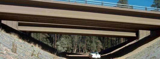
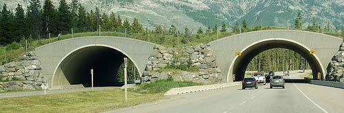
8 We Already Know How to Address These Issues STATE ROUTE 260 Arizona Existing 2 lane highway Reconstructed 4 lane highway Reconstruction raises issues of highway safety with increased standard (e.g., speed) and maintenance of wildlife permeability across highway
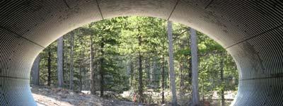
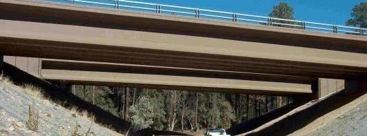
9 STATE ROUTE 260 PROJECT Wildlife Underpasses (11 of 17 completed) Wildlife Underpasses (11) Bridges (6)
10 STATE ROUTE 260 PROJECT Wildlife Underpasses (11 of 17 completed) Wildlife Underpasses (11) Bridges (6)
11 STATE ROUTE 260 PROJECT Wildlife Underpasses (11 of 17 completed) Wildlife Underpasses (11) Bridges (6)

")
")
12 STATE ROUTE 260 PROJECT Wildlife Underpasses (11 of 17 completed) Wildlife Underpasses (11) Bridges (6)
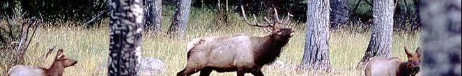
13 Christopher Creek Section 2004 ELK VEHICLE COLLISIONS (Before Fencing) 51 collisions (11.3/km)
14 Christopher Creek Section 2005 ELK VEHICLE COLLISIONS (After Fencing) 8 collisions (1.7/km) 84% reduction in collisions
15 CHRISTOPHER CREEK SECTION Pre- and Post-Fencing Wildlife Use of Underpasses Completion of Fencing Total elk / deer 50 0 Mar-04 May-04 Jul-04 Sep-04 Nov-04 Jan-05 Mar-05 May-05
16 WILDLIFE UNDERPASS VIDEO MONITORING State Route 260
17 FUNNEL CONCEPT WILDLIFE
18 FUNNEL CONCEPT WILDLIFE FENCES
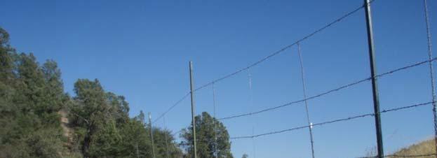
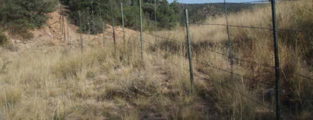
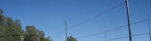
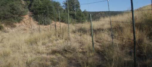
19 FUNNEL CONCEPT WILDLIFE FENCES CROSSING STRUCTURE
20 FUNNEL CONCEPT WILDLIFE FENCES CROSSING STRUCTURE HIGHWAY


21 We Know What Works Why Even Consider Wildlife Detection?
22 Wildlife Detection Systems in Lieu of Wildlife Passage Structures t Compromise Topography p g p y - Cost Timeline of Construction Complement When used in conjunction with wildlife crossing structures
23 Wildlife Underpasses and Fencing Attempt to Modify Only Wildlife Behavior


24 Animal Detection Systems Attempt to Modify Only Driver Behavior
25 Animal Activated Crosswalks Attempt to Modify Both Wildlife and Motorist t Behavior


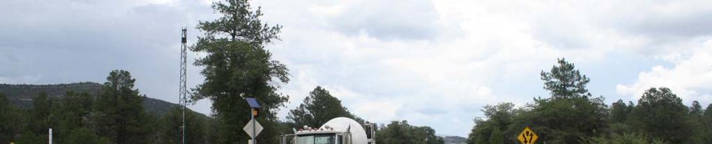
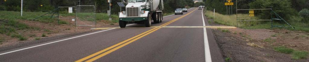
26 Animal Activated Crosswalks Attempt to Modify Both Driver and Wildlife Behavior Preacher Canyon wildlife fence and crosswalk enhancement project evaluation- State Route 260
27 AFTER RECONSTRUCTION ELK VEHICLE COLLISIONS Preacher Canyon Section collisions lk vehicle Before Reconstruction Mean = 11.6 No. of e Year
 i")
 Underpass (2) Weighted 40 20 0 20 30 40 50 60 0.")
28 ELK CROSSINGS and INTERCEPTION BY FENCING Preacher Canyon Section 140 no. elk cros ssings Original project fencing (24 % crossing interception) i 120 Bridge (1) TEA 21 enhancement fencing (75 % crossing interception) Underpass (2) Weighted km highway segment
29 PREACHER CANYON FENCING TREATMENTS ElectroBraid Modified ROW Fence 2.4m (Electric and Barbed Wire) 2.4 m Wire Mesh Ungulate Proof Fence 2.4 m ROW Fence and ROW Extensions (Barbed wire) 2.4 m Wire Mesh Ungulate Proof Fence (2001) Project resulted in fencing entire 3 mile (5 km) corridor.. Roadway Animal Detection System (MP 259.9) Preacher Canyon Bridge (MP 261.0) West Underpass (MP 262.8) East Underpass (MP 262.9)


 West")

 (MP")
30 PREACHER CANYON FENCING TREATMENTS 8 Wire Mesh Ungulate Proof Fence (2000) West Underpass East Underpass West Underpass East Underpass (MP 262.8) (MP 262.9)


 Raised")


31 PREACHER CANYON FENCING TREATMENTS Raised fence with new T posts 8 ROW Fence and ROW Extensions (Barbed wire) Raised fence with T post extensions Applied 2 right of way (ROW) barbed wire fence retrofit treatments


")
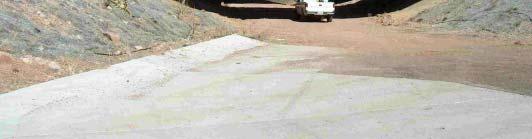
32 PREACHER CANYON FENCING TREATMENTS 8 Wire Mesh Ungulate Proof Fence Preacher Canyon Bridge Wildlife Escape Ramp at Preacher Canyon Bridge Preacher Canyon Bridge (MP 261.0)


 electric fence")

33 PREACHER CANYON FENCING TREATMENTS ElectroBraid Modified ROW Fence 2.4 m (Electric and Barbed Wire) Applied right of way (ROW) electric fence retrofit treatment Solar powered on north side AC powered on south side
 2.4 m Wire Mesh Ungulate Proof Fence (2001) Animal Detection System at Crosswalk (MP 259.")
34 PREACHER CANYON FENCING TREATMENTS ElectroBraid Modified ROW Fence 2.4 m (Electric and Barbed Wire) 2.4 m Wire Mesh Ungulate Proof Fence 2.4 m ROW Fence and ROW Extensions (Barbed wire) 2.4 m Wire Mesh Ungulate Proof Fence (2001) Animal Detection System at Crosswalk (MP 259.9) Needed to address potential end run effect at the western terminus of the fencing

35


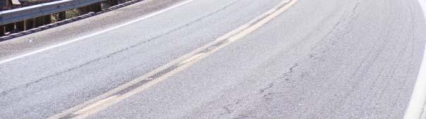
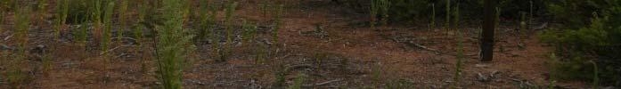
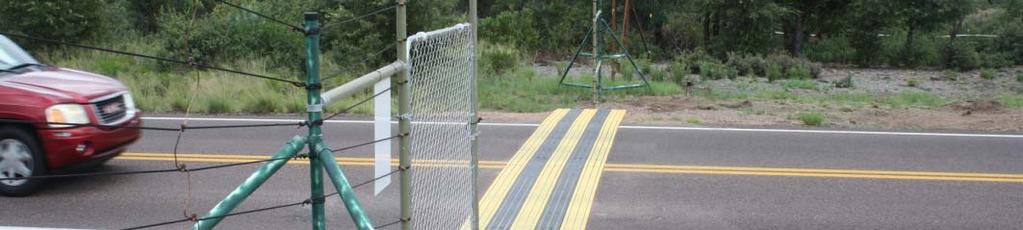
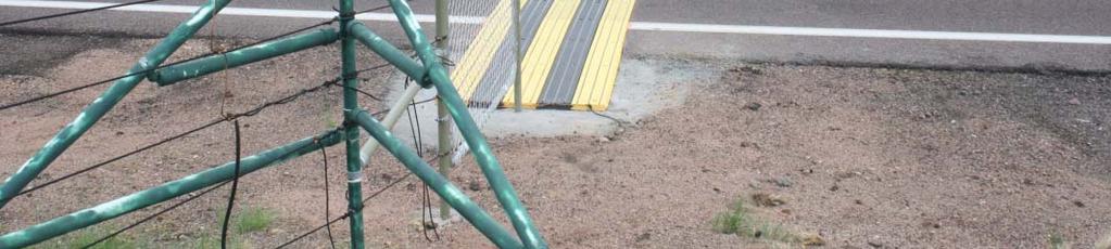
36 PREACHER CANYON CROSSWALK CONFIGURATION Defined crosswalk Crosswalk Defined Crosswalk Zone


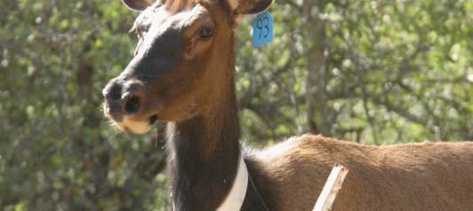
 If")

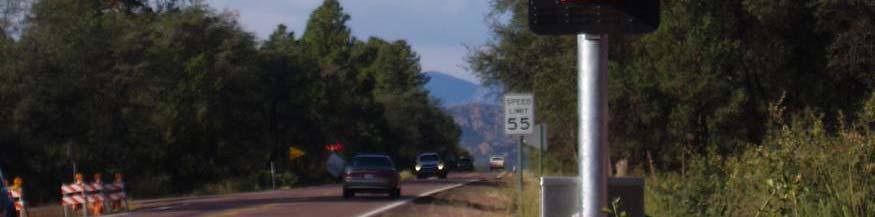
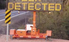
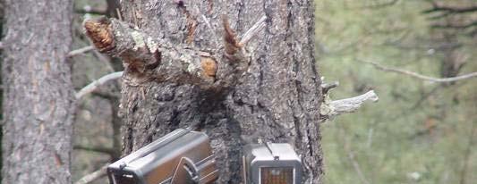
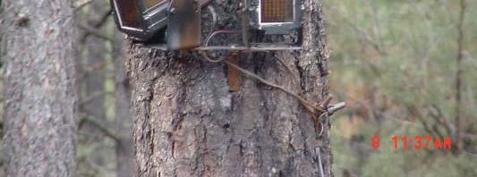
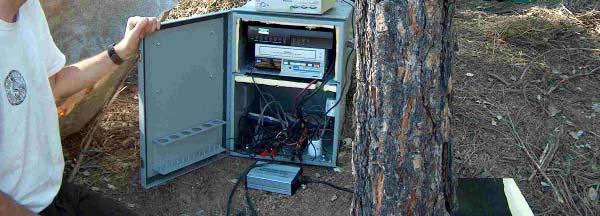
37 CROSSWALK ANIMAL DETECTION SYSTEM Infrared cameras detect animal movement within detection zones Integrated with target acquisition software to analyze movement and size of objects (to minimize false positives ) If target acquired, radio signals sent to warning signs Camera Detection Zone
38 THERMAL IMAGING CAMERA INTEGRATED WITH TARGET ACQUISITION SOFTWARE Target tracking box
39 THERMAL IMAGING CAMERA INTEGRATED WITH TARGET ACQUISITION SOFTWARE
40 THERMAL IMAGING CAMERA INTEGRATED WITH TARGET ACQUISITION SOFTWARE
41 THERMAL IMAGING CAMERA INTEGRATED WITH TARGET ACQUISITION SOFTWARE
42 THERMAL IMAGING CAMERA INTEGRATED WITH TARGET ACQUISITION SOFTWARE
43 THERMAL IMAGING CAMERA INTEGRATED WITH TARGET ACQUISITION SOFTWARE
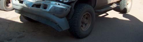
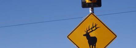
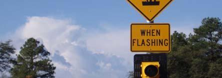
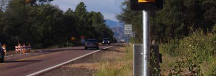
44 PREACHER CANYON ENHANCEMENT PROJECT Motorist Alert Signs
45 PREACHER CANYON ENHANCEMENT PROJECT Motorist Alert Signs Variable Message Sign

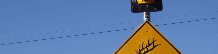
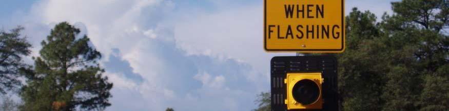
46 PREACHER CANYON ENHANCEMENT PROJECT Motorist Alert Signs Variable Message Sign Crosswalk warning sign

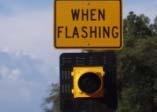
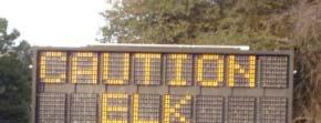

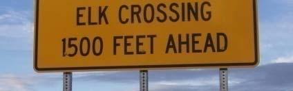
47 PREACHER CANYON CROSSWALK CONFIGURATION Motorist Warning Signage Layout m 450 m 450 m m m


48 INDEPENDENTPROJECT PROJECT EVALUATION System performance and reliability Animal A i ldt Detection ti System and Signage Fencing and other components Motorist response to warning signage Vehicle speed Alertness t Wildlife Vehicle Collisions Preacher Canyon Section Adjacent unfenced section Highway permeability
49 SYSTEM PERFORMANCE AND RELIABILITY We assessed animal detection system reliability by making periodic status checks at crosswalk 275 status checks made System operational 98% of the time (269 visits) System inoperable 2% of time (6 visits) False l positives occurred 4% of the time (12 visits) Functioning Properly 93.4%
50 CROSSWALK VIDEO CAMERA SURVEILLANCE Independent Infrared Video Camera Systems Pole-mounted cameras Triggers Infrared Illuminators Recording Devices
51 Testing System Performance and Reliability 8 fence Detection Zone Detection Zone 8 fence
52 Testing System Performance and Reliability 8 fence fence
53 Testing System Performance and Reliability 8 fence 50 Is The System Activated When Wildlife Are Within 50 ft Of Roadway? 50 Lighted Indicator Lets Us Know When The Signs Are On? 8 fence
54
55 SYSTEM PERFORMANCE AND RELIABILITY 801 total animals of 8 species were recorded at the crosswalk by videosurveillance Species Groups ( 1) approaching w/in 50 roadway Times signs activated before 50ft of roadway Times signs activated after 50ftof roadway No sign activation i (false negatives) Percentage of time signs activated Elk % White tailed tailed % Deer Total %
56 Modifying Driver Behavior How Did We Do?


57 MOTORIST RESPONSE TO WARNING SIGNAGE (From Huijser et al. 2006)


58 MOTORIST RESPONSE TO WARNING SIGNAGE (From Huijser et al. 2006)
59 ASSESSING MOTORIST SPEED RESPONSE Installed permanent traffic counters Conducted 256 paired 15 min samples Compared C daverage speeds with and without t signs activated to assess motorist response Compared average speeds by year to assess motorist habituation 22,064 total vehicles counted Installing Piezo Strip traffic counter at crosswalk
60 Num mber of 15-Min nute Intervals MOTORIST RESPONSE TO SIGNAGE SPEED 35 Average with signs Average with signs on = 44.3 mph off = 53.2 mph 30 (71.3 km/hr) (85.8 km/hr) signs off signs on Average Speed (MPH) A significant 17% reduction in average speed occurred when signs were activated (t = 1.97, df = 256, P < 0.001)
61 ASSESSING MOTORIST ALERTNESS RESPONSE Hid and counted vehicles approaching crosswalk and assessed if motorists applied brakes Conducted 286 paired 15 min samples with and without t warning signs activated t Compared the proportion of braking vehicles with and without signs activated 8,089 total vehicles counted
62 MOTORIST RESPONSE TO SIGNS ALERTNESS Warning sign Vehicles Proportion status counted braking Not activated t (off) 3, Activated (on) 4, Odds of motorists exhibiting a braking response were 21:1 with warning signs activated compared to when they were not activated (χ 2 =3206, df = 1, P < 0.001) 001) There was no difference between years (2007 and 2008)
63 ELK VEHICLE COLLISIONS WITH FENCING AND CROSSWALK Preacher Canyon Section 97% reduction in elk vehicle collisions (not including 2009 with no collisions)
64 ELK VEHICLE COLLISIONS WITH FENCING AND CROSSWALK Preacher Canyon Section There was NO significant change in elk vehicle collisions on the adjacent Lion Springs Section thus there was no displacement in collisions from the Preacher Canyon Section 97% reduction in elk vehicle collisions (not including 2009 with no collisions)
65 Cost of Wildlife-Vehicle Collisions to Society Elk-Vehicle Collisions = Huijser et al Report to Congress
66 Cost of Wildlife-Vehicle Collisions to Society Elk-Vehicle Collisions = Huijser et al Report to Congress
67 Cost of Wildlife-Vehicle Collisions to Society Elk-Vehicle Collisions = $18,561/ Collision Huijser et al Report to Congress
68 Cost of Wildlife-Vehicle Collisions to Society Elk-Vehicle Collisions = $18,561/ Collision $220,00/ Year on Average in Study Area Huijser et al Report to Congress
69 Modifying Wildlife Behavior How Did We Do?

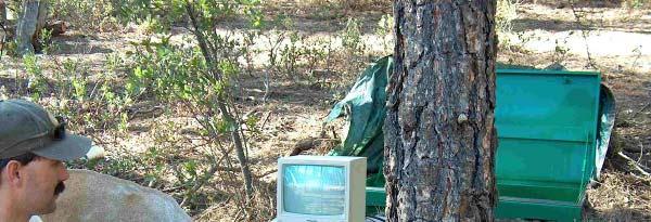
70 CROSSWALK VIDEO CAMERA SURVEILLANCE Independent Infrared Video Camera Systems Pole-mounted cameras Triggers Infrared Illuminators Recording Devices
71 What Happened Once Animals Approached the Road? 8 fence Detection Zone Detection Zone 8 fence
72 What Happened Once Animals Approached the Road? 8 fence Detection Zone? Detection Zone 8 fence
73 Elk (N=523) Enter Highway R-W at Detection Zone
74 Elk (N=523) Enter Highway R-W at Detection Zone Successful Crossing 32%
75 CROSSWALK CROSSINGS BY TIME AND TRAFFIC VOLUME
76 CROSSWALK CROSSINGS BY TIME AND TRAFFIC VOLUME 86% of crossings occurred when traffic volumes averaged 32 vehicles/ hour Traffic volumes averaged 308 vehicles/hour over 24 hours for the same time period
77 PROBABILITY OF CROSSWALK CROSSING BY TRAFFIC VOLUME 0.14 Succesful Crossing Pro obability of Elk White tailed tailed deer elk deer Vehicles / minute
78 Elk (N=523) Enter Highway R-W at Detection Zone Successful Crossing Unsuccessful Crossing 32% 68%
79 Elk (N=523) Enter Highway R-W at Detection Zone Successful Crossing Unsuccessful Crossing 32% 68% Left R-W via Left R W via same path 48%
80 Unsuccessful Crossings 8 fence Detection Zone Detection Zone 8 fence
81 Unsuccessful Crossings 8 fence Detection Zone Detection Zone 8 fence
82 Elk (N=523) Enter Highway R-W at Detection Zone Successful Crossing Unsuccessful Crossing 32% 68% Left R-W via same path 48% Entered R-W via Gap in Fence 20%
83 Wildlife Entering R W Via Gap at Roadway 8 fence Detection Zone Detection Zone Dangerous Situation Motorists Can Encounter Wildlife Without Warning 8 fence
84 Wildlife Entering R W Via Gap at Roadway 8 fence Detection Zone Detection Zone Dangerous Situation Motorists Can Encounter Wildlife Without Warning 8 fence
85 Wildlife Entering R W Via Gap at Roadway 8 fence Detection Zone Detection Zone Dangerous Situation Motorists Can Encounter Wildlife Without Warning 8 fence

86 ElectroMat Installation in July 2010
87 Gap at Road Closed With ElectroMat 8 fence Detection Zone Detection Zone EVALUATION THROUGH fence
88 Gap at Road Closed With ElectroMat 8 fence Detection Zone Detection Zone EVALUATION THROUGH fence
89 Gap at Road Closed With ElectroMat 8 fence Detection Zone Detection Zone EVALUATION THROUGH fence
90 ELK HIGHWAY PERMEABILITY COMPARISON Preacher Canyon Section Permeability determined from GPS telemetry Passage rate = no. highway crossings no. approaches to within 0.25 mi Before Fencing and Crosswalk Mean passage rate = crossings/approach After Fencing and Crosswalk 0.09 crossings/approach ( 73%)


91 ELK HIGHWAY PERMEABILITY COMPARISON Preacher Canyon Section Permeability determined from GPS telemetry no. highway crossings no. approaches to within 0.25 mi Passage Mean rate spacing = between passage structures = 1.5 mi (2.4 km) 2.5 times greater spacing than Before Christopher Fencing and Creek Crosswalk Section (Passage Rate = 0.82) Mean passage rate = crossings/approach After Fencing and Crosswalk 0.09 crossings/approach ( 73%)
92 0.14 Before Fencing and Crosswalk (n = 35 elk) CHANGE IN DISTRIBUTION OF GPS ELK CROSSINGS After Fencing and 0.10 mile Crosswalk segment (n = 17 elk) Preacher Canyon Section ortion of Crossingss Propor rtion of Crossings Crosswalk Preacher Canyon Little Green Valley Unfenced section mile segment Prop
93 CROSSWALK ARE A COST EFFECTIVE ALTERNATIVE TO A PASSAGE STRUCTURE
94 CONSTRAINTS Effectiveness of Animal Detection Systems Constrained by (assuming a fully functioning system?): 1. Traffic Volumes 2. Vehicle Speeds 3. Individual Species 4. Spacing (Full RADS VS Xwalk)
95 More information on the research Evaluation: Gagnon, J. W., N. L. Dodd, S. Sprague, K. Ogren, and R. E. Schweinsburg Preacher Canyon wildlife fence and crosswalk enhancement project evaluation- State Route 260. Final project report submitted to Arizona Department of Transportation, Phoenix, Arizona, USA...OR Google Arizona Elk Crosswalk More information on the Project Components: Visit the ElectroBraid Booth
APPENDIX 1. Cost Estimates for Mitigation Measures
 APPENDIX 1. Cost Estimates for Mitigation Measures We estimated the cost of the mitigation measures listed in Table 1 based on a review of the literature and interviews with researchers, manufacturers,
Advances in Wildlife Crossing Technologies
 1 de 14 14/05/2011 20:57 Featuring developments in Federal highway policies, programs, and research and technology. This magazine is an archived publication and may contain dated technical, contact, and
Kari Gunson & Andrew Healy 1 MONITORING EFFECTIVENESS OF ROAD WILDLIFE MITIGATION FOR LARGE ANIMALS IN ONTARIO, CANADA
 Kari Gunson & Andrew Healy 1 MONITORING EFFECTIVENESS OF ROAD WILDLIFE MITIGATION FOR LARGE ANIMALS IN ONTARIO, CANADA Kari E. Gunson (705-874-0330 kegunson@eco-kare.com) Road Ecologist/Principal, Eco-Kare
KC Scout Kansas City s Bi-State Transportation Management Center
 KC Scout Kansas City s Bi-State Transportation Management Center Operations Report May 216 This report contains statistical and operational data of activities at the Scout TMC for the period Sunday, May
KC Scout Kansas City s Bi-State Transportation Management Center
 KC Scout Kansas City s Bi-State Transportation Management Center Operations Report August- 215 This report contains statistical and operational data of activities at the Scout TMC for the period Saturday,
Wildlife Crossings: A Solution for Moose Vehicle Collisions in Alaska
 Wildlife Crossings: A Solution for Moose Vehicle Collisions in Alaska M elchisedek Jean & Katy Wright April 8, 2017 Prepared for: Dr. Protasel PADM A628: Public Financial M anagement Statement of Need
Saskatchewan Drive Roadway Rehabilitation and Shared-Use Path Widening
 Saskatchewan Drive Roadway Rehabilitation and Shared-Use Path Widening We are here today to present the draft plan for the Saskatchewan Drive Roadway Rehabilitation and Shared-Use Path Widening project
MPC-432 January 1, December 31, 2013
 MPC-43 January 1, 013- December 31, 013 Project Title: Finding Innovative Solutions to Prevent Wildlife Access to Highways at Wildlife Guards University: Utah State University Principal Investigators:
Evaluation of Wildlife Mitigation Measures,
 Evaluation of Wildlife Mitigation Measures, US93 Evaro-Polson: Preconstruction Monitoring and Research Results Marcel Huijser, Amanda Hardy, Julie Fuller, Angela Kociolek, Meredith Evans, Pat McGowen September
Broad Street Bicycle Boulevard Design Guidelines
 Broad Street Bicycle Boulevard Design Guidelines Building from the strategies introduced in the 2013 Bicycle Transportation Plan and community input received thus far, City Transportation Staff have identified
Evaluation of Measures to Reduce Wildlife-Vehicle Collisions and Promote Connectivity in a Sonoran Desert Environment State Route 77
 Progress Report Evaluation of Measures to Reduce Wildlife-Vehicle Collisions and Promote Connectivity in a Sonoran Desert Environment State Route 77 Santa Catalina Tortolita Mountain Corridor Presented
VT15 / Allen Martin Drive Intersection Scoping Study
 VT15 / Allen Martin Drive Intersection Scoping Study ALTERNATIVES PRESENTATION MEETING DECEMBER 19, 2016 Agenda Study Area Project Background Existing Conditions Identified Issues Proposed Alternatives
RAMP CROSSWALK TREATMENT FOR SAN DIEGO AIRPORT, TERMINAL ONE
 RAMP CROSSWALK TREATMENT FOR SAN DIEGO AIRPORT, TERMINAL ONE AUTHORS Faisal Hamood, P.Eng, M.Eng. Scott O. Kuznicki, P.E. Leonard Perry, Ph.D. SUBMITTAL DATE Friday, May 12 th, 2017 SUBMITTED FOR THE Annual
ALTERNATIVE WORKSHOP JULY
 WELCOME - ALTERNATIVE WORKSHOP JULY 27, 2017 MEETING GOALS ITD is committed to working collaboratively with stakeholders to ensure safe and efficient mobility through Island Park and Targhee Pass. TONIGHT
CHAPTER 1 STANDARD PRACTICES
 CHAPTER 1 STANDARD PRACTICES OBJECTIVES 1) Functions and Limitations 2) Standardization of Application 3) Materials 4) Colors 5) Widths and Patterns of Longitudinal Pavement Marking Lines 6) General Principles
In-Roadway Warning Light Systems Overview, Evaluation, Installation and Investment Considerations
 Overview, Evaluation, Installation and Investment Considerations Traffic Safety Corp www.xwalk.com 888-446-9255 IMSA Vancouver, WA June 5, 2012 Copyright 2011 Traffic Safety Corp. All rights reserved Traffic
ALLEY 24 TRAFFIC STUDY
 ALLEY 24 TRAFFIC STUDY in City of Frostburg, Maryland January 2013 3566 Teays Valley Road Hurricane, WV Office: (304) 397-5508 www.denniscorporation.com Alley 24 Traffic Study January 2013 Frostburg, Maryland
Emergency Vehicle Preemption
 Emergency Vehicle Preemption Brian Willham, PE, PTOE Traffic Engineer November 18, 2014 Emergency Vehicle Preemption is a type of system that allows the normal operation of traffic signals to be preempted
MnPASS System Today and the Future
 MnPASS System Today and the Future April 2010 By Nick Thompson Minnesota Department of Transportation Topics Minnesota s Current and Future MnPASS High Occupancy Toll Systems Overview of the MnPASS System
Transportation Planning Division
 Transportation Planning Division Presentation Outline Study Tasks Recap of Previous Meetings Data Collected Focus Areas within Study Limits Design Principles Tool Box Recommended Concepts Schedule Moving
Fish Passage Design Aids Wildlife Crossing in Washington State State of the Practice
 Fish Passage Design Aids Wildlife Crossing in Washington State State of the Practice 0 Submission date: November, 0 Word Count:, Jon Peterson, corresponding author (0-0-, peterjn@wsdot.wa.gov) Fish Passage
AASHTO NATIONAL ENVIRONMENTAL STEWARDSHIP COMPETITION. Please check the appropriate category for which you are submitting the application:
 AASHTO NATIONAL ENVIRONMENTAL STEWARDSHIP COMPETITION Please check the appropriate category for which you are submitting the application: Category: [X] Project [ ] Program [ ] Institutionalization/Organization
Transportation Planning Division
 Transportation Planning Division Presentation Outline Study Tasks Recap of Previous Meeting Stakeholder Interviews Data Collection Design Principles Tool Box Recommendations Schedule Moving Forward North
Bicycle Boulevards and Neighborhood Greenways
 Bicycle Boulevards and Neighborhood Greenways Traffic Safety is Improving for Everyone 90 80 70 60 50 40 30 20 10 0 PORTLAND: TOTAL TRAFFIC FATALITIES 1986-2008 1986 1987 1988 1989 1990 1991 1992 1993
Appendix T CCMP TRAIL TRAFFIC & TRANSPORTATION DESIGN STANDARD
 Appendix T CCMP 3.3.4 TRAIL TRAFFIC & TRANSPORTATION DESIGN STANDARD 3.3.4 Trail Traffic and Transportation Design Multi-use trails have certain design standards, which vary depending on the agency that
PEDESTRIAN ACCOMMODATIONS DPS 201 AT ROUNDABOUTS
 PEDESTRIAN ACCOMMODATIONS DPS 201 AT ROUNDABOUTS WHY THEY WORK FOR PEDESTRIANS IF DESIGNED CORRECTLY Separated sidewalks direct peds to crosswalks Splitter island Slow speed exit Truck apron Crosswalk
City of Wilsonville 5 th Street to Kinsman Road Extension Project
 City of Wilsonville 5 th Street to Kinsman Road Walking Tour & Neighborhood Workshop Summary Report Public Outreach Overview On July 18 th, 2017, the City of Wilsonville hosted a neighborhood walking tour
ROADWAY LIGHTING Literature Summary
 ROADWAY LIGHTING There have been a number of studies done about the effect of roadway lighting, but little research has focused on its deer-vehicle crash (DVC)-reduction potential. Most DVCs occur in the
REGIONAL BICYCLE AND PEDESTRIAN DESIGN GUIDELINES
 REGIONAL BICYCLE AND PEDESTRIAN DESIGN GUIDELINES November 16, 2011 Deb Humphreys North Central Texas Council of Governments Bicycle and Pedestrian Advisory Committee Snapshot of the Guide 1. Introduction
Figure 3B-1. Examples of Two-Lane, Two-Way Marking Applications
 Figure 3B-1. Examples of Two-Lane, Two-Way Marking Applications A - Typical two-lane, two-way marking with passing permitted in both directions B - Typical two-lane, two-way marking with no-passing zones
I-25 South Gap Project Monument to Castle Rock
 I-25 South Gap Project Monument to Castle Rock Project Overview Castle Rock Town Council April 3, 2018 by Chuck Attardo I-25 South: Monument to C-470 An Important Corridor to Colorado Links the state s
Appendix C. Bicycle Route Signage
 Appendix C Bicycle Route Signage This page intentionally left blank. APPENDIX C - BICYCLE ROUTE AND WAYFINDING SIGNAGE Bicycle route signs are wayfinding signs that guide bicyclists along preferred, designated
Overview. Updated pictures of the intersection are shown in Exhibits 1 thru 4, and the aerial photo provided by Google Maps is shown in Exhibit 5.
 Overview The (here in after referred to as the Village ) is submitting the follow up interim RLRC Safety Report for the intersection of Lincoln Highway (US 30) at Orchard Drive. Additional reports, as
TECHNICAL MEMORANDUM VDOT Central Region On Call Task Order
 Kittelson & Associates, Inc. T R A N S P O R T A T I O N E N G I N E E R I N G / P L A N N I N G 1850 Centennial Park Drive, Suite 130, 20191 P 703-885-8970 F 703-885-8971 TECHNICAL MEMORANDUM VDOT Central
CITY OF WEST LAKE HILLS. Forest View Neighborhood Traffic Calming Study
 CITY OF WEST LAKE HILLS 901 South Mopac Expressway Building V, Suite 220 Austin, Texas 78746 Texas P.E. Firm Registration No. F-929 Klotz Associates Final Report Submittal: March 20, 2015 Revised Final
SUPERSTREETS IN TEXAS. ITS Texas Annual Meeting San Marcos, Texas Session 6A - Operations November 11, 2011
 SUPERSTREETS IN TEXAS ITS Texas Annual Meeting San Marcos, Texas Session 6A - Operations November 11, 2011 1 Superstreet Corridor Location 2 3 US Highway 281 2007 Looking south above Evans Road, pm peak
TRAFFIC CONTROL DEVICES MANUAL FOR WORK ZONES
 TRAFFIC CONTROL DEVICES MANUAL FOR WORK ZONES APPLICATION Delineation devices are used to warn and alert motorists of hazards created by work activities in or near the travelled way and to guide and direct
THE EFFECTS OF LEAD-VEHICLE SIZE ON DRIVER FOLLOWING BEHAVIOR: IS IGNORANCE TRULY BLISS?
 THE EFFECTS OF LEAD-VEHICLE SIZE ON DRIVER FOLLOWING BEHAVIOR: IS IGNORANCE TRULY BLISS? James R. Sayer, Mary Lynn Mefford Human Factors Division University of Michigan Transportation Research Institute
Chapter 5: Crossing the Street
 Chapter 5: Crossing the Street Whether walking or bicycling, a student s journey to school will more than likely require crossing one or more streets. Per the Safe Routes to School Guide, maintained by
Bicycle - Motor Vehicle Collisions on Controlled Access Highways in Arizona
 Bicycle - Motor Vehicle Collisions on Controlled Access Highways in Arizona Analysis from January 1, 1991 to June 30, 2002 Richard C. Moeur, PE Traffic Design Manager, Northern Region Michelle N. Bina
Wildlife Vehicle Collision Study
 Wildlife Vehicle Collision Study HIGHWAY 3 SCIENCE WORKSHOP FERNIE, B.C. January 28-29, 2008 Rob Ament Road Ecology Program Manager Western Transportation Institute Wildlife Vehicle Collision Reduction
Operational Comparison of Transit Signal Priority Strategies
 Operational Comparison of Transit Signal Priority Strategies Revision Submitted on: November, 0 Author: Adriana Rodriguez, E.I Assistant Engineer Parsons Brinckerhoff 0 South Orange Avenue, Suite 00 Orlando,
180 Grand Avenue, Suite x117 Dowling Associates, Inc.
 180 Grand Avenue, Suite 250 510.839.1742 x117 Oakland, CA 94612 510.839.0871 fax www.dowlinginc.com mbowman@dowlinginc.com Dowling Associates, Inc. Date: Memorandum To: CC: From: Ms. Leah Greenblat City
Access Location, Spacing, Turn Lanes, and Medians
 Design Manual Chapter 5 - Roadway Design 5L - Access Management 5L-3 Access Location, Spacing, Turn Lanes, and Medians This section addresses access location, spacing, turn lane and median needs, including
WELCOME. City of Eden Prairie West 70 th Street
 WELCOME City of Eden Prairie West 70 th Street Project Schedule Sep Oct Nov Dec Jan Feb Mar Apr May Jun Jul Aug >>> May WEST SEGMENT Concept Plan Fall 2014 Plan Development Winter 2014 Summer 2015 Construction
J Street and Folsom Boulevard Lane Conversion Project (T ) Before and After Traffic Evaluation
 Before and After Traffic Evaluation") J Street and Folsom Boulevard Lane Conversion Project (T15125400) Before and After Traffic Evaluation Prepared by Transportation Division June 2014 Executive Summary On February 12, 2013, the City of Sacramento
J Street and Folsom Boulevard Lane Conversion Project (T15125400) Before and After Traffic Evaluation Prepared by Transportation Division June 2014 Executive Summary On February 12, 2013, the City of Sacramento
I-10 AT SCENIC LOOP RD. Open House
 I-10 AT SCENIC LOOP RD Open House General Information I-10 At Scenic Loop Rd KENDALL COUNTY OPEN HOUSE June 30, 2015 Currey Creek Baptist Church 35 Cascade Cavern 5:00 7:00 Boerne, TX 78015 2 Public Meeting
Paul Vraney Bureau of Project Development 02/11/2016
 Paul Vraney Bureau of Project Development 02/11/2016 ADA background & alterations definition Design considerations Provide sufficient layout data Curb ramp selection Maximum curb ramp and gutter slopes
November 2012: The following Traffic and Safety Notes were revised:
 CHANGE LIST for MDOT Traffic and Safety, TRAFFIC AND SAFETY NOTES Located at http://mdotcf.state.mi.us/public/tands/plans.cfm JANUARY 2014: The following Traffic and Safety Note was added: Note 705A Angled
Appendix A. Knoxville TPO Greenway Signage Guidelines. Appendix A: Knoxville TPO Greenway Signage Guidelines Knox to Oak Ridge Greenway Master Plan
 Appendix A Knoxville TPO Greenway Signage Guidelines 75 Overview: Adequate signing and marking are essential on shared-use paths, especially to alert bicyclists to potential conflicts and to convey regulatory
Cycle Track Design Best Practices Cycle Track Sections
 Design Best Practices Sections It is along street segments where the separation and protection methods of cycle tracks offer more comfort than conventional bicycle lanes, and are more attractive to a wide
Enhancing Connectivity
 Recommendations for Enhancing Connectivity for Terrestrial and Aquatic Wildlife along the I-70 Mountain Corridor CONTENTS Recommendations for Terrestrial Connectivityy LIZ-2011 LIZ A: Dotsero LIZ B: Wolcott
APPENDIX D LEVEL OF TRAFFIC STRESS METHODOLOGY
 APPENDIX D LEVEL OF TRAFFIC STRESS METHODOLOGY 01 WHAT IS LEVEL OF TRAFFIC STRESS? When people bicycle on roadways, they encounter varying levels of stress from traffic. A quiet residential street with
SCOPE Application, Design, Operations,
 SCOPE Application, Design, Operations, Maintenance, etc.: Typical Traffic Control Signals Pedestrian Hybrid Beacons Emergency Vehicle One-Lane/Two-Way Facilities, Freeway Entrance Ramps, and Movable Bridges
Appendix C. TRAFFIC CALMING PROGRAM TOOLBOX
 Appendix C. TRAFFIC CALMING PROGRAM TOOLBOX PHASE I...2 Do Not Enter Sign...3 One-Way Sign...4 Turn Prohibition...5 Pavement Markings...6 Speed Monitoring Trailer...7 Neighborhood Speed Watch...8 Police
EFFCTIVENESS OF RETURN RAMPS FOR REDUCING BIG GAME HIGHWAY MORTALITY IN UTAH FINAL REPORT
 EFFCTIVENESS OF RETURN RAMPS FOR REDUCING BIG GAME HIGHWAY MORTALITY IN UTAH FINAL REPORT UTAH DEPARTMENT OF TRANSPORTATION UTAH DIVISION OF WILDLIFE RESOURCES TECHNICAL ADVISORY COMMITTEE John A. Bissonette
DDI s Can Move More Than Cars! 2016 Western ITE Conference Albuquerque, NM July 12, 2016 Alex Ariniello, P.E. Public Works Director, Town of Superior
 DDI s Can Move More Than Cars! 2016 Western ITE Conference Albuquerque, NM July 12, 2016 Alex Ariniello, P.E. Public Works Director, Town of Superior Overview How did we get to the DDI concept? What s
Chapter Twenty-eight SIGHT DISTANCE BUREAU OF LOCAL ROADS AND STREETS MANUAL
 Chapter Twenty-eight SIGHT DISTANCE BUREAU OF LOCAL ROADS AND STREETS MANUAL Jan 2006 SIGHT DISTANCE 28(i) Chapter Twenty-eight SIGHT DISTANCE Table of Contents Section Page 28-1 STOPPING SIGHT DISTANCE
TRANSPORTATION NEEDS ASSESSMENT
 TRANSPORTATION NEEDS ASSESSMENT A travel demand analysis was carried out to determine the operational issues and the potential benefit that adding traffic capacity would have on the road network. All the
CHAPTER 2G. PREFERENTIAL AND MANAGED LANE SIGNS
 2011 Edition - Revision 2 Page 275 Section 2G.01 Scope CHAPTER 2G. PREFERENTIAL AND MANAGED LANE SIGNS 01 Preferential lanes are lanes designated for special traffic uses such as high-occupancy vehicles
Potential Bicycle Facility on Bayou Street Mobile, Alabama
 Potential Bicycle Facility on Bayou Street Mobile, Alabama By Richard A. Hall, P.E. Prepared For Mobile Downtown Alliance Hall Planning & Engineering, Inc. March 28, 2018 Introduction Review of the February
Tonight is for you. Learn everything you can. Share all your ideas.
 Strathcona Neighbourhood Renewal Draft Concept Design Tonight is for you. Learn everything you can. Share all your ideas. What is Neighbourhood Renewal? Creating a design with you for your neighbourhood.
Why Zone In on Speed Reduction?
 Learn it. Do it. Live it! SPEED REDUCTION IN THE ZONE Why Zone In on Speed Reduction? Speeding is a serious issue that plays a major role in the risk of serious injury and pedestrian fatality in a crash.
INDEX. Geometric Design Guide for Canadian Roads INDEX
 Acceleration lane, see Lanes, Acceleration Access, 8.1 Access Management and Functional Classification 8.2 Access Management by Design Classification 8.3 Access Configuration 8.4 Building Set-Back Guidelines
TECHNICAL NOTE TRIAL OF VEHICLE ACTIVATED ELECTRONIC SIGNS FOR IMPROVED DRIVER AWARENESS AT KNOWN CRASH SITES IN TASMAN AND MARLBOROUGH DISTRICTS
 TECHNICAL NOTE TRIAL OF VEHICLE ACTIVATED ELECTRONIC SIGNS FOR IMPROVED DRIVER AWARENESS AT KNOWN CRASH SITES IN TASMAN AND MARLBOROUGH DISTRICTS Authors and Presenters: Robyn Gardener NZCD, GDip RS, GCert
Chapter 3: Multi-Modal Circulation and Streetscapes
 CHAPTER 3: MULTI-MODAL CIRCULATION AND STREETSCAPES Chapter 3: Multi-Modal Circulation and Streetscapes Overview Streetscape improvements have already been completed for Depot Street between Main Avenue
City of Vallejo Traffic Calming Toolbox
 City of Vallejo Traffic Calming Toolbox June 1, 2013 Final Table of Contents Introduction... 1 Non-Physical Devices... 3 High-Visibility Crosswalk... 3 In Pavement Lighted Crosswalk... 4 Rapid Flashing
Frequently Asked Questions
 Frequently Asked Questions Business US 190 in Copperas Cove From Avenue D to Constitution Drive What is access management? A. Access Management is a growing effort by government agencies to improve how
Paul Huston, P.E., Design-Build Coordinator Chuck Gonderinger, HDR Engineering. Minnesota Department of Transportation (the Department)
") To: From: Paul Huston, P.E., Design-Build Coordinator Chuck Gonderinger, HDR Engineering Date: March 20, 2001 Subject: Roadway Geometric Design Criteria Project: TH 14/218 Design-Build Project, SP 7408-29,
To: From: Paul Huston, P.E., Design-Build Coordinator Chuck Gonderinger, HDR Engineering Date: March 20, 2001 Subject: Roadway Geometric Design Criteria Project: TH 14/218 Design-Build Project, SP 7408-29,
MINNESOTA FLAGGING HANDBOOK
 MINNESOTA FLAGGING HANDBOOK January, 2018 Flagging Handbook This Flagging Handbook has been developed following the guidelines of the 2011 edition of the Minnesota Manual on Uniform Traffic Control Devices,
MAG Town of Cave Creek Bike Study Task 6 Executive Summary and Regional Significance Report
 Page 1 MAG Town of Cave Creek Bike Study Task 6 Executive Summary and Regional Significance Report August 1, 2012 MAG Project #481 Page 2 Task 6 Executive Summary and Regional Significance Report Introduction
Freeway ramp intersection study
 Freeway ramp intersection study Supporting Vision Zero: Zero traffic deaths in San Francisco by 2024 Study Goals: Primary Improve Safety Improve Accessibility Secondary Provide Efficient Circulation Accommodate
EWC EARLY WARNING CONTROL OPERATIONAL PRESENTATION. Charles Dickens (757)
") EARLY WARNING CONTROL OPERATIONAL PRESENTATION Charles Dickens (757) 831-2626 Controls still continue to use the foundations of technologies that were developed in the 1970 s. Because of the perceived
EARLY WARNING CONTROL OPERATIONAL PRESENTATION Charles Dickens (757) 831-2626 Controls still continue to use the foundations of technologies that were developed in the 1970 s. Because of the perceived
APPENDIX A: Complete Streets Checklist DRAFT NOVEMBER 2016
 APPENDIX A: Complete Streets Checklist DRAFT NOVEMBER 2016 Complete Streets Checklist MetroPlan Orlando s Complete Streets Checklist is an internal planning tool for staff to further implementation of
Public Workshop #2. September 14, 2016
 Public Workshop #2 September 14, 2016 Agenda Welcome Project Overview Where We Have Been Alternatives for State Street Land Use Street Design Next Steps 2 Project Overview Create a Vibrant State Street
Designing for Pedestrian Safety
 Designing for Pedestrian Safety Treatments at Unsignalized Pedestrian Crossings Presented by: Charlie Zegeer PBIC Director August 17, 2010 Crossing Crashes Part 1: General Principles 3 2 Why do people
Washington St. Corridor Study
 FIGURE 7.17 Bridge Alternatives - Cross Sections 86 Discarded Alternative: Short-Term Bridge Repair Short-term repairs and west bridge span replacement were considered during analysis. Short-term repairs
Active Transportation Facility Glossary
 Active Transportation Facility Glossary This document defines different active transportation facilities and suggests appropriate corridor types. Click on a facility type to jump to its definition. Bike
School Zone Traffic Control Policy
 School Zone Traffic Control Policy I. GE ERAL CITY OF BILLINGS SCHOOL ZONE TRAFFIC CONTROL POLICY (Approved by Traffic Control Board 10/27/99) (Approved by Billings City Council on 6/25/01) This policy
Chapter 4 On-Road Bikeways
 Chapter 4: 4-1.0 Introduction On-Road Bikeways This chapter provides guidelines to help select and design safe on-road bikeways. On-road bikeways include bicycle lanes, shared lanes, shoulders, and wide
ENHANCED PARKWAY STUDY: PHASE 2 CONTINUOUS FLOW INTERSECTIONS. Final Report
 Preparedby: ENHANCED PARKWAY STUDY: PHASE 2 CONTINUOUS FLOW INTERSECTIONS Final Report Prepared for Maricopa County Department of Transportation Prepared by TABLE OF CONTENTS Page EXECUTIVE SUMMARY ES-1
Access Management Regulations and Standards
 Access Management Regulations and Standards January 2014 Efficient highway operation Reasonable property access Concept of Access Management The way to manage access to land development while preserving
RIVERSIDE DRIVE: 21st to 41st
 RIVERSIDE DRIVE: 21st to 41st Traffic Calming, Parking Lane, and Bike Lane Traffic Calming Options Traffic Calming Design Alternatives and Recommendations by Road Section Parking Lane & Bike Lane Guidance
Arterial Traffic Analysis Actuated Signal Control
 Arterial Traffic Analysis Actuated Signal Control Dr. Gang-Len Chang Professor and Director of Traffic Safety and Operations Lab. University of Maryland-College Park Actuated Signal Control Fully Actuated
Appendix A-6. Signing and Marking Guidelines. Number Name Pages. 2B.06 Signing at T Intersections 1. 2B.12 Pedestrians in Crosswalk 1
 MARYLAND STATE HIGHWAY ADMINISTRATION Office of Traffic and Safety Traffic Engineering Design Division Traffic Control Devices Design Manual Appendix A-6 Signing and Marking Guidelines Number Name Pages
MONITORING WILDLIFE-VEHICLE COLLISIONS: ANALYSIS AND COST- BENEFIT OF ESCAPE RAMPS FOR DEER AND ELK ON U.S. HIGHWAY 550
 Applied Research and Innovation Branch MONITORING WILDLIFE-VEHICLE COLLISIONS: ANALYSIS AND COST- BENEFIT OF ESCAPE RAMPS FOR DEER AND ELK ON U.S. HIGHWAY 550 Jeremy L. Siemers, Kenneth R. Wilson, and
Ottawa Beach Road Study
 Ottawa Beach Road Study Prepared For: Park Township September 30, 2014 Project No. G140303 OTTAWA BEACH ROAD STUDY PREPARED FOR: PARK TOWNSHIP SEPTEMBER 30, 2014 PROJECT NO. G140303 TABLE OF CONTENTS 1.0
APPENDIX A TWO-LANE RURAL ROADS ELEMENTS OF DESIGN CREST VERTICAL CURVES
 APPENDIX A TWO-LANE RURAL ROADS ELEMENTS OF DESIGN CREST VERTICAL CURVES 1. Two-lane Rural Roads 1.1 Introduction The definition of rural area can be derived from the definition of urban areas. Officially,
DEPARTMENT OF ENVIRONMENTAL SERVICES. North Harrison Street (Lee Highway to Little Falls Road) Comparative Analysis. Prepared for:
 Comparative Analysis. Prepared for:") DEPARTMENT OF ENVIRONMENTAL SERVICES North Harrison Street (Lee Highway to Little Falls Road) Comparative Analysis Prepared for: Arlington County Department of Environmental Services 2100 Clarendon Boulevard,
DEPARTMENT OF ENVIRONMENTAL SERVICES North Harrison Street (Lee Highway to Little Falls Road) Comparative Analysis Prepared for: Arlington County Department of Environmental Services 2100 Clarendon Boulevard,
CHAPTER 5 LITERATURE REVIEW
 CHAPTER 5 LITERATURE REVIEW This task includes identification of suitable pedestrian safety countermeasures for research at high pedestrian crash sites in high risk zones. Pedestrian Safety Countermeasures
Orange County Rail-Highway Grade Crossing Safety Enhancement Program. City of San Juan Capistrano April 17, 2012
 Orange County Rail-Highway Grade Crossing Safety Enhancement Program City of San Juan Capistrano April 17, 2012 Orange County Rail-Highway Grade Crossing Safety Enhancement Program (OCX) 52 crossings 8
Acknowledgements. Mr. David Nicol 3/23/2012. Daniel Camacho, P.E. Highway Engineer Federal Highway Administration Puerto Rico Division
 Daniel Camacho, P.E. Highway Engineer Federal Highway Administration Puerto Rico Division Acknowledgements Mr. David Nicol Director, FHWA Office of Safety FHWA Office of Safety http://safety.fhwa.dot.gov/provencountermeasures/
Automated Traffic Enforcement Technology Guidelines
 Automated Traffic Enforcement Technology Guidelines Province of Alberta (September 2014) Revised Automated Traffic Enforcement Technology Guidelines Province of Alberta A. PREAMBLE Automated traffic enforcement
Design Overview. Section 4 Standard Plans for Design. Pedestrian Access Routes. Pedestrian Access Routes. Overview. Cross Slope
 Design Overview Section 4 Standard Plans for Design Fall, 2017 Ann Johnson, PE Services Brady Rutman, SRF Consulting Group Overview Design Basics Recommendations: The Zone System Driveway Crossings Pedestrian
In the spring of 2006, national newspaper headlines screamed
 Toll vs. Nontoll: Toll Facilities Are Safer By Jeff Campbell In the spring of 2006, national newspaper headlines screamed that toll plazas were the most dangerous place on the highway. The articles were
4/27/2016. Introduction
 EVALUATING THE SAFETY EFFECTS OF INTERSECTION SAFETY DEVICES AND MOBILE PHOTO ENFORCEMENT AT THE CITY OF EDMONTON Karim El Basyouny PhD., Laura Contini M.Sc. & Ran Li, M.Sc. City of Edmonton Office of
Document 2 - City of Ottawa Pedestrian Crossover (PXO) Program
 Program") 40 Document 2 - City of Ottawa Pedestrian Crossover (PXO) Program OVERVIEW The City of Ottawa Pedestrian Crossover (PXO) Program provides the basis for PXO implementation in Ottawa. The program s processes
40 Document 2 - City of Ottawa Pedestrian Crossover (PXO) Program OVERVIEW The City of Ottawa Pedestrian Crossover (PXO) Program provides the basis for PXO implementation in Ottawa. The program s processes
Bicyclist Signing Guidelines
 Bicyclist Signing Guidelines April, 2009 1 Introduction This paper describes the Montana Department of Transportation s (MDT) current practices related to bicyclist safety and signing issues and presents
Golden s Plan. For the Highway 6 & 93 Corridor
 Golden s Plan For the Highway 6 & 93 Corridor Purpose of the Study Accommodate regional traffic needs on Highways 6 and 93, as defined by the Northwest Quadrant Feasibility Study. Find a solution that
Idaho Driver Education and Training
 Idaho Driver Education and Training Strategies for Controlled Access Highways Part I M13-1 Introduction to Controlled Access Highways Plans for the Interstate System," began in the late 1930s The system