Irving Streetscape Project. Department of Public Works
|
|
|
- Jesse Austin
- 5 years ago
- Views:
Transcription


1 Irving Streetscape Project Department of Public Works


2 Depa artment t of Pub blic Works TONIGHT S AGENDA Irving Street Character and Existing Conditions Community Meeting #1 Survey Results Site Process Diagrams Design Inspiration Streetscape Design Elements Questions/Answers Breakout Group Discussion Next Steps
3 Depa artment t of Pub blic Wo orks PROJECT BUDGET AND SCHEDULE Total Project Budget: $3.0M Funded by the 2011 Road Repaving & Street Safety Bond Project Schedule Planning 06 /13 01/14 Design 02/14 10/14 Bid & Award 11/14 01/15 Construction 02/15 01/16
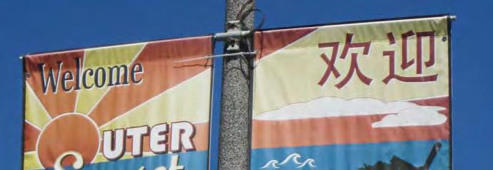
4 IRVING STREET CHARACTER
5 Project includes Irving from 19 th to 27 th Avenues Irving Streetscape Project Project Context Department of Public Works


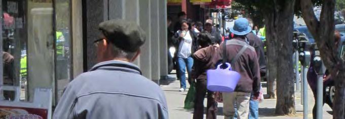


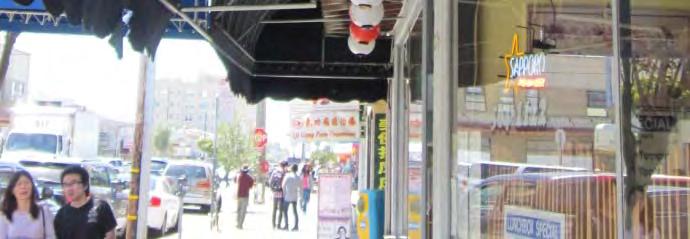


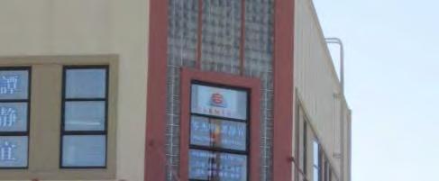
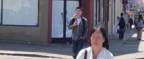
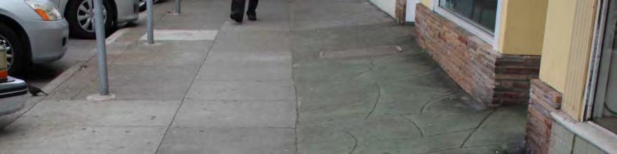
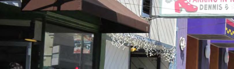
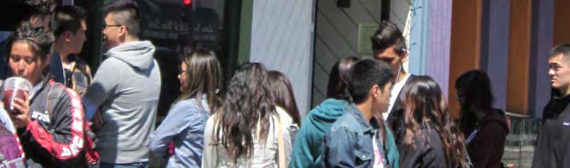
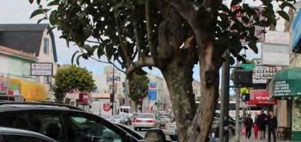
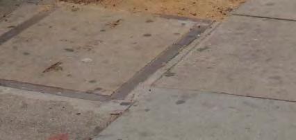
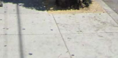
6 Irving Streetscape Project Irving Street Character Department of Public Works
7 Irving Streetscape Project Irving Street Character Department of Public Works


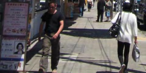


8 Irving Streetscape Project Irving Street Character Department of Public Works


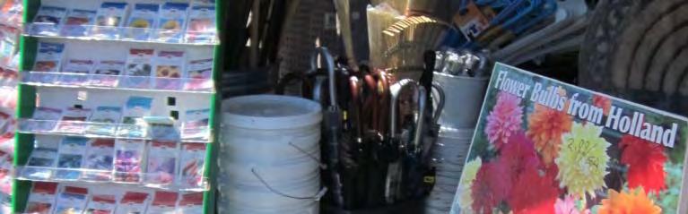


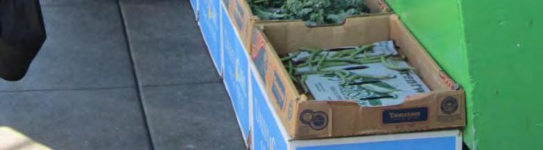
9 Irving Streetscape Project Irving Street Character Department of Public Works


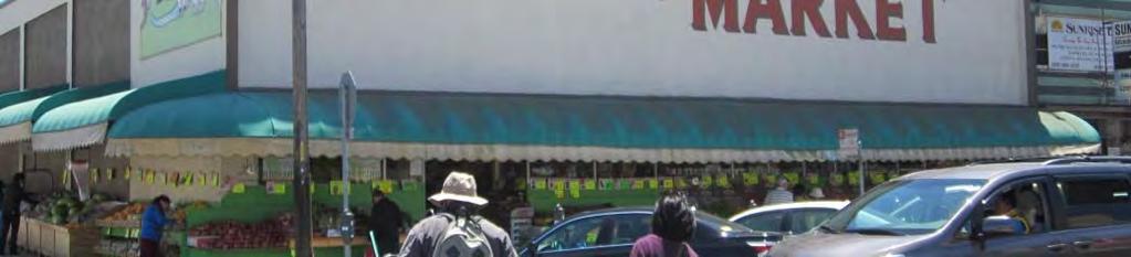


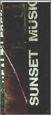
10 Irving Streetscape Project Irving Street Landmarks Department of Public Works


11 COMMUNITY MEETING 1 RECAP PROJECT INTRODUCTION GROUP DISCUSSION SURVEY Irving Streetscape Project Community Meeting 1 Recap Department of Public Works
12 SURVEY RESULTS
13 What do you like about Irving Street? Lots of foot traffic Diversity of commerce & shoppers (quintessential SF) Food and restaurants 15% Businesses and Bustling, large variety of shops Culture and shopping 46% diversity Diversity of businesses 39% can get anything I want or need Irving Streetscape Project Survey Results Department of Public Works
14 What do you dislike about Irving Street? Low priority to pedestrians and bikes Other 10% shabby, unwelcoming Parking and traffic Lack of cleanliness Lack of public spaces 23% 42% (plazas, seating) Narrow sidewalks, lack of greenery, too many cars, road too wide Lackof open space 25% Irving Streetscape Project Survey Results Department of Public Works
15 How do you get to Irving Street (walk, bike, drive, public transportation)? Bike 13% Transit 16% Walk 48% Drive 23% Irving Streetscape Project Survey Results Department of Public Works
16 What days of the week or time of the day do you usually visit it Irving Street? t? Midday 9% Afternoon 12% Evening 35% Morning 21% Business Hours 23% Irving Streetscape Project Survey Results Department of Public Works
17 What do you do when you visit Irving Street (shop, eat, etc.)? 22nd & Irving Market Sunset Super 12.5% 28.1% Pharmacy Talk Pass through 2% 3% 5% Exercise 3% Walgreens 63% 6.3% Walk 5% Lucca Deli 6.3% Wells Fargo 6.3% Bank 8% Shop 45% Win Long 6.3% Underdogs 6.3% Eat 29% Irving Streetscape Project Survey Results Department of Public Works
18 What is your overall impression of Irving Street? Diverse place but I don t want to linger not inviting but has potential Lively neighborhood that could be greatly improved Senior citizens love the district Has potential 15.8% Love it 15.8% Lively 10.5% Good Shopping 5.3% Very favorable 5.3% Eclectic 5.3% Traffic 5.3% Isolated 53% 5.3% Homogenous 5.3% Dirty 21.1% Litter 5.3% Needs cleaning 21% Needs other improvements 26% Really Like Shopping 53% Irving Streetscape Project Survey Results Department of Public Works
19 What improvements along Irving Street would you most like to see? Address needs of all age groups Traffic calming Aesthetics, more pleasant to walk, feng shui compliant plantings Enhanced crosswalks Seating/ short benches that don t encourage sleeping Traffic 6% Transients 6% Underground Wire 6% Pedestrian Improvements 20% Parking 11% Cleanliness 23% Greening 29% Irving Streetscape Project Survey Results Department of Public Works
20 Survey Results Summary Most common activity on Irving Street is Shopping/Eating A common dislike of Irving Street is its lack of cleanliness/open space Majority of people who visit Irving Street walk to their destination Evening is the most popular time of day for visiting Irving Street Pedestrian, greening, and cleanliness improvements are what most people would like to see implemented Irving Streetscape Project Survey Results Department of Public Works
21 PROJECT DESIGN GOALS INCREASE PEDESTRIAN SAFETY IMPROVE PEDESTRIAN EXPERIENCE STRENGTHEN IDENTITY OF DISTRICT BETWEEN 19 TH AND 27 TH INCREASE ECONOMIC VITALITY SITE DIAGRAMS
22 SITE DIAGRAMS
23 SITE DIAGRAMS
24 SITE DIAGRAMS
25 SITE DIAGRAMS
26 SITE DIAGRAMS
27 SITE DIAGRAMS
28 SITE DIAGRAMS
29 PROJECT DESIGN GOALS INCREASE PEDESTRIAN SAFETY IMPROVE PEDESTRIAN EXPERIENCE STRENGTHEN IDENTITY OF DISTRICT BETWEEN 19 TH AND 27 TH INCREASE ECONOMIC VITALITY SITE DIAGRAMS
30 DESIGN INSPIRATION


31 Around the Corner, Around the World DESIGN INSPIRATION
32 PROPOSED IMPROVEMENTS


33 SIDEWALK IMPROVEMENT
34 PARKING METER CLUTTER
35 NEW SIDEWALK
36 PARKING METER REDUCTION
37 PARKING METER REDUCTION


38 PEDESTRIAN


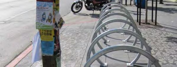
39 CROSSWALK TREATMENTS


40 REST AREA FEATURES
41 BULBOUT/REST AREA


42 EXISTING TREES


43 Square Planter Feature Round Planter Feature PLANTER FEATURE


44 Bamboo Windmill Palm VEGETATION


45 Hopseed Pittosporum Flax VEGETATION


46 PARKLET/BIKE AMENITIES
47 Small Group Breakout (20 Minutes) Break out into groups of ~10 people What are your preferred improvements? Are there any other improvements you would like to see?


48 Next Steps Review community feedback Prepare conceptual plan to reflect community feedback Community meeting #3 will be in September
49 Questions and Additional Comments 如有問題或其他意見 Project Website 項目網址 /i d Contact Info 詳請 : Meghan Tiernan Meghan.Tiernan@sfdpw.org Irving Streetscape Project Department of Public Works
50 THANK YOU! 謝謝
51
Memo. Ocean Avenue Corridor Design Project Public Workshop #2 Summary
 Ocean Avenue Corridor Design Project Public Workshop #2 Summary The second public workshop for the Ocean Avenue Corridor Design Project was held on Wednesday, May 14, 2014 from, 6 to 8 pm at Lick Wilmerding
Ann Arbor Downtown Street Plan
 1 Ann Arbor Downtown Street Plan Public Workshop #1 We know that. 2 Public right-of-way (streets, sidewalks, and alleys) make up 30% of the total District area of downtown. Streets need to provide mobility
A CHANGING CITY. of Edmonton, it is essential that it reflects the long-term vision of the City.
 A CHANGING CITY By the year 2040, Edmonton will be home to more than 1 million people. To accommodate growth and support a healthy and compact city, we need a new approach to development/redevelopment
MASONIC AVENUE STREET DESIGN STUDY Community Workshop 2. Masonic Ave Street Design Study Community Workshop 2 August 10, 2010
 Masonic Ave Street Design Study Community Workshop 2 August 10, 2010 Introduction MASONIC AVENUE STREET DESIGN STUDY Community Workshop 2 SF Municipal Transportation Agency Javad Mirabdal, Project Manager
UNIVERSITY AVENUE CORRIDOR REDESIGN. January 8, 2017 PUBLIC OPEN HOUSE
 January 8, 2017 PUBLIC OPEN HOUSE COLLABORATIVE COMMUNITY-BASED DESIGN IS THE FOUNDATION TO A SUCCESSFUL PROJECT AGENDA FOR TONIGHT 1 INTRODUCTIONS 2 WHY ARE WE HERE PROJECT NEED 3 SCHEDULE & GOALS 4 OPEN
UDC Street Cross Sections
 UDC Street Cross Sections Local Street - Downtown Local Street Mountable Curb Local Street Vertical Curb Alley Major Arterial Minor Arterial Residential Lane Residential Collector Residential Collector
Town of Ashland. Downtown Planning Initiative 2 nd Community Workshop. March 29, Presented by:
 Town of Ashland Downtown Planning Initiative 2 nd Community Workshop Presented by: March 29, 2018 Agenda Tonight Review project & goals Recap 1st workshop (September 18, 2017) Present design alternatives
Knox Street Complete Streets Project
 Knox Street Complete Streets Project Meeting Purpose Get community feedback on two conceptual street design options Meeting Agenda Presentation (20 minutes) Project background and schedule Summary of preferences
Streetscape: Core Shopping District
 Streetscape: Core Shopping District DRAFT DRAFT DRAFT May 00 Core Shopping District: Phase Blue Island s Core Shopping District is located along Western Avenue, between Grove and Union Streets. Streetscape
COWETA HIGH SCHOOL AND EAST HIGHWAY 51
 COWETA HIGH SCHOOL AND EAST HIGHWAY 51 Lack of sidewalks along Ben Lumpkin Rd. Lack of crosswalks and ramps at intersection. Hwy 51 is wide to cross as a pedestrian. No ADA compliance or connection to
Enhancing Downtown
 Enhancing Downtown 2014-2015 Process Masterplan reviewed TIF scope, fund availability, and timing Conceptual cost estimate stage things may change with full engineering Sequencing Coordination with businesses
MASONIC AVENUE STREET DESIGN STUDY Community Workshop 3. Masonic Ave Street Design Study Community Workshop 3 September 30, 2010
 Masonic Ave Street Design Study Community Workshop 3 September 30, 2010 Introduction MASONIC AVENUE STREET DESIGN STUDY Community Workshop 3 SF Municipal Transportation Agency Javad Mirabdal, Project Manager
PEDESTRIAN CIRCULATION & STREETSCAPE DESIGN
 CHAPTER 4 Chapter 4 Pedestrian Circulation & Trails PEDESTRIAN CIRCULATION & STREETSCAPE DESIGN In recent years, the City has constructed new sidewalks and enhanced existing ones in the downtown with brick
Palou Complete Street Project Barneveld Avenue to Crisp Road Project overview and concept design Community Meeting #2 May 13, 2015
 Palou Complete Street Project Barneveld Avenue to Crisp Road Project overview and concept design Community Meeting #2 May 13, 2015 Agenda Welcome and introductions Project overview, history and goals Concept
Sloat Blvd. Pedestrian Safety Improvement Project
 Sloat Blvd. Pedestrian Safety Improvement Project Department of Public Works Project team and background Budget Schedule Scope of work Sloat Blvd - Everglade Drive Sloat Blvd - Forest View Drive Sloat
A Plan for The Beautiful Way NOVEMBER 16, 2009
 COMMUNITY VISION WORKSHOP NOVEMBER 16, 2009 AGENDA INTRODUCTION COMMUNITY INPUT REVIEW AND SURVEY RESULTS VISIONING IMAGERY SMALL GROUP VISIONING SESSION NEXT STEPS CLOSE SCHEDULE COMMUNITY SURVEY 198
A Complete Streets Policy for Saratoga Springs. Presented By: Shared Access Saratoga
 A Complete Streets Policy for Saratoga Springs Presented By: Shared Access Saratoga April 17, 2012 Agenda 1. Introduction to Complete Streets (CS) 2. Shared Access Saratoga 3. Why is CS Important 4. What
Vision: Traditional hamlet with an attractive business/pedestrian friendly main street connected to adjacent walkable neighborhoods
 N D. Focus Area II Vision: Traditional hamlet with an attractive business/pedestrian friendly main street connected to adjacent walkable neighborhoods Transit Road Focus Area II is located in the Hamlet
PRINCE GEORGE S PLAZA METRO AREA PEDESTRIAN PLAN
 PRINCE GEORGE S PLAZA METRO AREA PEDESTRIAN PLAN May 28, 2008 Agenda Welcome and introductions Project overview and issue identification Planning context and strengths Design challenges and initial recommendations
Ocean Park Boulevard Green Street Project Alternatives & Trade Offs
 Planning Commission March 4, 2009 Ocean Park Boulevard Green Street Project Alternatives & Trade Offs Purpose of Tonight s Meeting Review concept plans and options Provide input on alternatives and trade-offs
Chapter 3: Multi-Modal Circulation and Streetscapes
 CHAPTER 3: MULTI-MODAL CIRCULATION AND STREETSCAPES Chapter 3: Multi-Modal Circulation and Streetscapes Overview Streetscape improvements have already been completed for Depot Street between Main Avenue
Henderson Ave. Complete Streets Project
 Henderson Ave. Complete Streets Project Meeting Purpose To finalize conceptual components of project prior to proceeding with preliminary engineering www.dallascompletestreets.wordpress.com MeetingAgenda
Commerce Street Complete Street Project from Good Latimer Expressway to Exposition Avenue
 Commerce Street Complete Street Project from Good Latimer Expressway to Exposition Avenue T A N Y A B R O O K S A S S I S T A N T D I R E C T O R M O B I L I T Y P L A N N I N G M O B I L I T Y A N D S
City of Darlington Beautification Report
 City of Darlington Beautification Report Approved by the City of Darlington Beautification Board February 2016 The New Downtown Darlington has seen many changes during the past decade with the rehabilitation
A Guide to Great Streets: The Basics. September 25, 2009
 A Guide to Great Streets: The Basics September 25, 2009 Streets are more than connectors, they are the city 2 Streets are the glue that hold a city together 3 Streets are the means in which a city is perceived
Lawrence Avenue Streetscape Concepts August 30, 2011
 Lawrence Avenue Streetscape Concepts August 30, 2011 Neighborhood Context Phase II: River to Western Ave. Phase I: Western Ave. to Clark St. Key Map Lawrence Ave. Existing Streetscape Conditions East of
WORKSHOP 2 SUMMARY OVERVIEW GENERAL COMMENTS. Walking and Biking. Greening & Stormwater. Transportation & Parking. Lighting, Art and Identity
 WORKSHOP 2 SUMMARY OVERVIEW On May 9, 2016, 55 people came to the second public meeting for the Lower Haight Public Realm Plan. Roughly 34 of attendees were neighborhood residents. The open house was a
Cross Street Corridor Non-Motorized Enhancement Project Project Description
 Cross Street Corridor Non-Motorized Enhancement Project Project Description A cooperative study of the Cross Street neighborhood was completed in May 2002 by the City of Ypsilanti, the Depot Town Downtown
COBB COUNTY COMMUNITY DEVELOPMENT AGENCY
 COBB COUNTY COMMUNITY DEVELOPMENT AGENCY Planning Division P.O. Box 649 Marietta, Georgia 30061 (770) 528-2018 fax: (770) 528-2126 Dana Johnson, AICP Division Manager Johnson Ferry Urban Design Public
Community Task Force November 15, 2017
 Community Task Force November 15, 2017 Welcome and Introductions Project Partners Regional Transportation District (RTD) Colorado Department of Transportation (CDOT) Denver Regional Council of Governments
Ocean Park Boulevard Streetscape Improvement Project Alternatives & Trade Offs
 City Council Study Session January 27, 2009 Ocean Park Boulevard Streetscape Improvement Project Alternatives & Trade Offs Scope of Work Purpose of Tonight s Meeting Review work to date and direct staff
Ocean Park Boulevard Green Street Project Community Workshop
 Ocean Park Boulevard Green Street Project Community Workshop 2.2.10 Project Objectives Community Priority: reclaim OPB for public open space. Build upon LUCE principles; neighborhood enhancement, connectivity,
THE ALAMEDA CONCEPT DESIGN COMMUNITY MEETING 3. A Plan for The Beautiful Way JANUARY 28, 2010
 CONCEPT DESIGN COMMUNITY MEETING 3 JANUARY 28, 2010 AGENDA INTRODUCTION COMMUNITY INPUT ROADWAY STUDIES STREETSCAPE DESIGN STATIONS DISCUSSION SUMMARY AND DISCUSSION NEXT STEPS CLOSE INTRODUCTION SCHEDULE
CONNECTIVITY PLAN. Adopted December 5, 2017 City of Virginia Beach
 CONNECTIVITY PLAN Adopted December 5, 2017 City of Virginia Beach CONTENTS 1.0 Background & Purpose... 2 2.0 Existing Inventory & Analysis... 3 ViBe District Existing Walking Conditions... 4 3.0 ViBe District
Introduction. North 12 th Complete Street Project Overview
 Introduction On Wednesday, March 1, 2017, the City of Sacramento, in partnership with Sacramento Regional Transit District and the Sacramento Housing and Redevelopment Agency, hosted a community outreach
Citizen Advisory Group Meeting #8 May 5, Welcome. Today s meeting will focus on: Land Use & Transportation CHARLOTTEPLANNING.
 Citizen Advisory Group Meeting #8 May 5, 2010 Welcome. Today s meeting will focus on: Land Use & Transportation CHARLOTTEPLANNING.ORG Meeting Agenda Handouts: o Meeting Agenda o Summary of East Seventh
Figure 4-10: Pedestrian Improvements Types of Potential Station Area Improvements - Place-Making Improvements
 INCORPORATE FEATURE PAVIN IN CROSSWALK AND INTERSECTION FIELDS Identifies high-priority pedestrian areas and create a station identity through colorful and interesting patterns ADD CURB EXTENSIONS Extending
Bicycle and Pedestrian Advisory Committee (BPAC) November 21, 2013
 November 21, 2013") Bicycle and Pedestrian Advisory Committee (BPAC) November 21, 2013 OVERALL LAND USE CONCEPT Overall Broadway Valdez District: 95.5 acres (35.1 acres right-of ways + 60.4 acres developable land) Plan Subareas:
Bicycle and Pedestrian Advisory Committee (BPAC) November 21, 2013 OVERALL LAND USE CONCEPT Overall Broadway Valdez District: 95.5 acres (35.1 acres right-of ways + 60.4 acres developable land) Plan Subareas:
BYRES ROAD: PUBLIC REALM Public Consultation
 Public Consultation Introduction As a vibrant commercial, shopping and residential location within the heart of the West End Byres Road is an important destination. Its proximity to the University of Glasgow
Transportation Planning in Western SoMa
 Transportation Planning in Western SoMa Michelle Reyes Natasha Casanares Ryan Dodge Matthew West San Francisco State University Urban Studies Program Senior Seminar Spring 2007 Outline Background Deliverables
7/23/2017 VIA . Michael Hanebutt City of Sacramento Community Development Department 300 Richards Boulevard, 3 rd Floor Sacramento, CA 95811
 7/23/2017 VIA EMAIL Michael Hanebutt City of Sacramento Community Development Department 300 Richards Boulevard, 3 rd Floor Sacramento, CA 95811 RE: 65 th Street Apartments (DR17-220) Dear Mr. Hanebutt:
Mission-Geneva Transportation Study Community Workshop 2 July 8, 2006
 Community Workshop 2 July 8, 2006 Small Group Workbook 1 Basic Improvements on Mission Street Streetscape. Pedestrian-scale lighting; landscaping; community art on utility boxes; more (possibly unique)
Fordham Plaza. Conceptual Design Study
 Fordham Plaza Conceptual Design Study WASHINGTON AVE. N Project Scope Timeline Urban Design Transportation Economics/Market Research A Multi-Disciplinary Study Based on meetings and interviews with Stakeholders:
Community Meeting February 27, 2007 Dorchester Avenue Transportation & Streetscape Improvements Action Plan February 27, 2007
 Community Meeting Tonight s Agenda 6:00 Introductions South Boston/Dot Ave Improvement Study Background 6:15 Consultant Introductions Review of Scope and Schedule Review of Proposed Corridor Wide Guidelines
Thesis Presentation. Moorhead City Walk: A Master Plan to Reimage Moorhead, Minnesota s Urban Core. Brad Garcia Advisors: Jason Kost & Dominic Fischer
 Thesis Presentation Moorhead City Walk: A Master Plan to Reimage Moorhead, Minnesota s Urban Core Brad Garcia Advisors: Jason Kost & Dominic Fischer MOORHEAD, MN Red River Center Ave 8 TH St N FARGO, ND
Living Streets Policy
 Living Streets Policy Introduction Living streets balance the needs of motorists, bicyclists, pedestrians and transit riders in ways that promote safety and convenience, enhance community identity, create
PROJECT SUMMARY ALBERTA STREETSCAPE PROJECT
 ALBERTA STREETSCAPE PROJECT Revitalizing a Street Rebuilding a Community Realizing a Dream PROJECT SUMMARY December 2001 Project Background In 1998 and 1999, the Alberta Street community was engaged in
Presentation Starts at 5:30 PM
 Presentation Starts at 5:30 PM Public Meeting #1 September 22, 2016 Purpose of Study Conceptual Complete Streets Study on South Carson Street 5 th Street to Roland Drive Approximately 2.5 miles Consider
FONTAINE AVENUE STUDY Final Report
 FONTAINE AVENUE STUDY Final Report March 28, 2005 FONTAINE AVENUE STUDY City of Charlottesville March 28, 2005 Renaissance Planning Group Kenneth Schwartz, FAIA, AICP Director of Design Leigh Wilkerson,
Agenda. Overview PRINCE GEORGE S PLAZA METRO AREA PEDESTRIAN PLAN
 PRINCE GEORGE S PLAZA METRO AREA PEDESTRIAN PLAN May 28, 2008 Agenda Welcome and introductions Project overview and issue identification Planning context and strengths Design challenges and initial recommendations
Miami Health District
 Miami Health District Streetscapes, Gateways, and Signage Basis of Design Report Study Miami Partnership Meeting July 21, 2008 Gannett Fleming EDAW The Corradino Group Sponsored by the Miami Partnership:
STREETSCAPE CONCEPT PLAN
 03 STREETSCAPE CONCEPT PLAN Zone 1 This zone includes the gateway into both the downtown and the Village at Harlem. The gateway features are shown closer to the Harlem intersection to make them more prominent.
Downtown Naples Mobility and Connectivity Study. Naples City Council Presentation January 2017
 Downtown Naples Mobility and Connectivity Study Naples City Council Presentation January 2017 Agenda 1. Introduction 2. Scope Review 3. Project Schedule 4. Existing Conditions 5. Public Charrette 6. Mobility
APPENDIX A: Complete Streets Checklist DRAFT NOVEMBER 2016
 APPENDIX A: Complete Streets Checklist DRAFT NOVEMBER 2016 Complete Streets Checklist MetroPlan Orlando s Complete Streets Checklist is an internal planning tool for staff to further implementation of
Outreach Approach RENEW SF served as the primary liaison with the North Beach community; the Chinatown. Executive Summary
 Executive Summary Executive Summary The Columbus Avenue Neighborhood Transportation Study s objective is to identify changes to transportation infrastructure and policies that could enhance the livability
CHAPTER 3: Vision Statement and Goals
 Davidson Walks & Rolls: Active Transportation Master Plan CHAPTER 3 Contents: Overview Vision Statement Measurable Goals Public Outreach CHAPTER 3: Vision Statement and Goals Overview The vision statement
Environment and Public Works Committee Presentation
 Mixed Use Centers Complete Streets Guidelines Project Environment and Public Works Committee Presentation December 10, 2008 Project Objectives: Conduct an inter-departmental and agency process to study
 Phasing and Cost Estimate of Downtown Oxford Master Plan Prepared By: Phasing and Cost Estimate of Downtown Oxford Master Plan Purpose of the Study The primary objective of this study is to identify priority
Technical Working Group November 15, 2017
 Technical Working Group November 15, 2017 Welcome and Introductions Project Partners Regional Transportation District (RTD) Colorado Department of Transportation (CDOT) Denver Regional Council of Governments
Clarkson Walkability Audit: Results and Recommendations Summary
 Clarkson Walkability Audit: Results and Recommendations Summary The following document was prepared by the Region of Peel and includes a summary of comments made by participants during our breakout discussion
WELCOME. Purpose of the Open House. Update you on the project. Present a draft recommended plan. Receive your input
 WELCOME Purpose of the Open House The Town of Smiths Falls has initiated the Beckwith Street Redevelopment Plan that includes the preparation of a streetscape functional design for the renewal of Beckwith
CML s 91 st Annual Conference June 18 21, 2013 Vail, Colorado. Why a Campaign? Learn More. City of Brush! 6/13/2013
 REVITALI ZE Your Community with LiveWell Colorado s HEAL Cities & Towns Campaign CML s 91 st Annual Conference June 18 21, 2013 Vail, Colorado Vicky Quinlin, Council Member, Brush! Monty Torres, City Administrator,
Neighborhood Pedestrian Safety and Traffic Calming Study
 Neighborhood Pedestrian Safety and Traffic Calming Study for the area bounded by Foster Avenue, Bedford Avenue, Farragut Road and Ocean Avenue Flatbush, Brooklyn, New York prepared by Michael King, miking@trafficcalmer.com
Montford Drive Parking & Circulation Study
 Montford Drive Parking & Circulation Study Parking & Circulation Study Follow up to the Area Plan based on what we heard Purpose 1 2 3 4 To look closer and evaluate parking and network related issues (including
MAG Town of Cave Creek Bike Study Task 6 Executive Summary and Regional Significance Report
 Page 1 MAG Town of Cave Creek Bike Study Task 6 Executive Summary and Regional Significance Report August 1, 2012 MAG Project #481 Page 2 Task 6 Executive Summary and Regional Significance Report Introduction
PROJECT OBJECTIVES. Improve vehicle capacity for the intersection. Improve pedestrian and bicycle access
 COMMUNITY MEETING Project Update March 15, 2010 Purcellville, Virginia OVERVIEW Project need / objectives Project recap Design elements Proposed improvements Summary of project benefits / next steps PROJECT
Community Workshop #1 Summary October 2017
 Community Workshop #1 Summary October 2017 1 Background Pleasure Point has a unique character and strong community identity. In 2008, the community and the County developed the Pleasure Point Community
NEWMARKET UPHAM S CORNER
 SOUTH STATION Planning Initiative NEWMARKET UPHAM S CORNER COLUMBIA ROAD (P) FOUR CORNERS/GENEVA Working Advisory Group (WAG) Meeting #5 TALBOT AVENUE MORTON STREET BLUE HILL AVE/CUMMINS HWY (P) RIVER
5 Circulation & Parking
 5 Circulation & Parking Downtown Parking & Circulation Strategy. Downtown Wayne has a somewhat disconnected system of local public streets to connect downtown with the residential neighborhoods, and primary
Monroe Street Reconstruction Business Focus Group Notes July 18, 2016, HotelRED
 Monroe Street Reconstruction Business Focus Group Notes July 18, 2016, HotelRED Total participants: 31 Focus Group Conversation #1: During this exercise, participants talked in small table groups in response
Tonight is for you. Learn everything you can. Share all your ideas.
 Strathcona Neighbourhood Renewal Draft Concept Design Tonight is for you. Learn everything you can. Share all your ideas. What is Neighbourhood Renewal? Creating a design with you for your neighbourhood.
ROUTE 81 CORRIDOR STUDY DESIGN CONCEPTS
 RT 81 Corridor Study CLINTON ROUTE 81 CORRIDOR STUDY DESIGN CONCEPTS View north on High Street, with potential improvements to the streetscape Draft Recommendations November 8 th, 2018 TOWN OF CLINTON
5. Automobile Circulation, Wayfinding and Signage
 5. Automobile Circulation, Wayfinding and Signage Policy: The City Center should have a balanced, safe, and interconnected circulation system that provides expanded travel opportunities for transit, pedestrian,
Chinatown Broadway Street Design Summary of Public Comment Workshop #3
 Chinatown Broadway Street Design Summary of Public Comment Workshop #3 Workshop Details: The third community workshop for the Broadway Street Design took place on November 16, 2011 at Gordon J. Lau Elementary
MARTIN LUTHER KING JR. WAY
 OCTOBER 2011 40 Vision and Goals The Martin Luther King, Jr. Way Illustrative Master Plan that follows has been developed through a process of community involvement. It expresses a long term vision for
Dewey Area Traffic Calming Project
 SFMTA Municipal Transportation Agency Image: Crosswalk of California Street and Grant Avenue Dewey Area Traffic Calming Project 10 08 2013 SAN FRANCISCO, CALIFORNIA Tonight s Agenda Introductions Project
KEARNY MESA COMMUNITY PLAN UPDATE
 KEARNY MESA COMMUNITY PLAN UPDATE January 18, 2018 SUBCOMMITTEE MEETING Mobility Concepts and Urban Design Presentation Outline Mobility Concepts: Multimodal Planning Toolbox Presentation and Activities
Bentleigh GLEN EIRA COUNCIL TRANSFORMATIONAL CONCEPTS 15
 2 Bentleigh GLEN EIRA COUNCIL TRANSFORMATIONAL CONCEPTS 15 Bentleigh Bentleigh urban design context The Bentleigh activity centre is a busy strip shopping centre that runs along Centre Road and is dissected
Chicago Safe Routes to High School (SRHS) Kelly High School Recommended Improvements
 Kelly High School Recommended Improvements") Chicago Safe Routes to High School (SRHS) Kelly High School Recommended Improvements March 18, 2014 Presentation Outline Goals Related Programs Project Location/Area Existing Conditions Improvement Types
Chicago Safe Routes to High School (SRHS) Kelly High School Recommended Improvements March 18, 2014 Presentation Outline Goals Related Programs Project Location/Area Existing Conditions Improvement Types
Front and Myrtle Improvement Project
 Front and Myrtle Improvement Project MAKING BOISE THE MOST LIVABLE CITY IN THE COUNTRY DOWNTOWN: Our unique and vibrant urban neighborhood GUIDING PRINCIPLES: Innovation Celebration Transportation Downtown
MEMO. Executive Summary
 MEMO TO: Steve Wheeler FROM: Scott Vanden Bos, Elaine Howard RE: Hood River Heights Urban Renewal Area Public Input Live and Online DATE: November 30, 2017 Executive Summary Following the conclusion of
DALLAS MIDTOWN REDEVELOPMENT PLAN FOCUS NORTH TEXAS Peer Chacko, AICP, Assistant Director, City of Dallas
 DALLAS MIDTOWN REDEVELOPMENT PLAN FOCUS NORTH TEXAS 2014 Peer Chacko, AICP, Assistant Director, City of Dallas Dallas Midtown: Strategic growth area Future transit node 2 Peterson Road Study Area Galleria
STONY PLAIN ROAD STREETSCAPE
 Jasper Place Revitalization Strategy: Vision The people involved in the Jasper Place Revitalization Strategy envision: Goal 1: Feeling safe in our community Create a community where feeling safe is common--where
FOCUS AREA 1 - Alberta Avenue Pocket Park 3 (121 Ave and 92 St)
") FOCUS AREA 1 - Alberta Avenue Pocket Park 3 (121 Ave and 92 St) New benches Plant evergreen trees Widen existing sidewalk from 1.5m to 1.8m Marked crosswalk 1.8m wide sidewalk Add pedestrian oriented lights
FOCUS AREA 1 - Alberta Avenue Pocket Park 3 (121 Ave and 92 St) New benches Plant evergreen trees Widen existing sidewalk from 1.5m to 1.8m Marked crosswalk 1.8m wide sidewalk Add pedestrian oriented lights
Fulton Market Streetscape
 Fulton Market Streetscape Ogden Avenue to Halsted Street Public Meeting Recommended Improvements December 10th, 2014 Meeting Purpose and Goals Present Existing Conditions Community Input and Charrette
4 GENERIC COST ESTIMATING TOOL
 4 GENERIC COST ESTIMATING TOOL Table 4-1 presents a generic cost estimating tools that can serve as a conceptual planning tool for local jurisdictions to estimate the costs of pedestrian improvements.
MERRIMACK TOWN CENTER PEDESTRIAN AND TRAIL MASTER PLAN
 MERRIMACK TOWN CENTER PEDESTRIAN AND TRAIL MASTER PLAN NOVEMBER 12, 2009 PREPARED BY: NASHUA REGIONAL PLANNING COMMISSION Cover art designed at www.wordle.net/create. This design is based upon the words
Land Use and Transportation Town Hall September 17, 2018
 Land Use and Transportation Town Hall September 17, 2018 Welcome! Tonight s Agenda: 7:00-7:30 OVERVIEW PRESENTATIONS 7:30-8:15 BREAKOUT SESSIONS 8:15 - End TOWN HALL CITIZEN S TIME Purpose of Tonight s
Replace century-old sewer & water pipes Pedestrian-scale sidewalk lighting
 PROJECT OVERVIEW The Masonic Avenue Streetscape Project is an effort to improve safety for everyone travelling on Masonic Avenue between Geary Boulevard and Fell Street. This project will bring a variety
1000 FRIENDS OF FLORIDA PALM BEACH COUNTY 2070 OCTOBER 2018
 1000 FRIENDS OF FLORIDA PALM BEACH COUNTY 2070 OCTOBER 2018 HEALTHIER COMMUNITIES & BETTER ECONOMIES THROUGH COMPLETE STREETS PRESENTED BY TREASURE COAST REGIONAL PLANNING COUNCIL The Question of Safety
MAYFIELD ROAD CORRIDOR MULTIMODAL TRANSPORTATION PLAN. Public Workshop
 MAYFIELD ROAD CORRIDOR MULTIMODAL TRANSPORTATION PLAN Public Workshop 06.06.18 AGENDA Project Process & Schedule Document Review Summary Project Goals Initial Findings Concept Development Next Steps PROJECT
Executive Summary Route 30 Corridor Master Plan
 Route Corridor Master Plan Project Overview The Route Corridor Master Plan is a coordinated multimodal transportation and land use plan for the entire stretch of Route through East Whiteland Township,
Southview Blvd & 3 rd Avenue Improvement Project. Public Open House December 4, to 7pm
 Southview Blvd & 3 rd Avenue Improvement Project Public Open House December 4, 2014 5 to 7pm Southview Blvd & 3 rd Avenue Public Information Meeting Agenda Presentation 5:30 to 6:15 pm Purpose of Project
GARLAND ROAD/GASTON AVENUE/ GRAND AVENUE INTERSECTION IMPROVEMENT STUDY
 MEETING OF AFFECTED PROPERTY OWNERS AND STAKEHOLDERS GARLAND ROAD/GASTON AVENUE/ GRAND AVENUE INTERSECTION IMPROVEMENT STUDY CSJ 0009-02-067 Meeting Agenda 1 2 3 4 5 6 7 8 9 10 Opening Remarks State Representative
Summaries from the Concentric Circle Exercises 10 Neighborhood Forums held in April and May 2018 Various locations around Town
 Summaries from the Concentric Circle Exercises 10 Neighborhood Forums held in April and May 2018 Various locations around Town A Concentric Circle exercise was conducted at all 10 neighborhood meetings.
Cherry Creek Transportation and Land Use Forum September 25, 2013 Meeting Summary
 Cherry Creek Transportation and Land Use Forum September 25, 2013 Meeting Summary I. LEAD-IN TO SMALL GROUP DISCUSSION, POLLING AND STEERING COMMITTEE/TECHNICAL TASK FORCE DISCUSSION The meeting began
Richmond Connects Visioning Update
 Richmond Connects Visioning Update To date there have been four elements of the visioning process: Vision20 Night at Byrd Theatre on May 3rd Advisory Committee Meeting on May 12 th Public Visioning Workshop
The Naples Park Community Plan DRAFT- MARCH 2003
 The Naples Park Community Plan DRAFT- MARCH 2003 prepared by: Dover, Kohl & Partners Town Planning Agnoli, Barber, & Brundage, Inc. Drainage Analysis Hall Planning and Engineering Transportation Planning
Polk Streetscape Project
 What is this project? The Polk Streetscape Project is an effort to improve safety for everyone traveling on Polk Street between Union and McAllister streets. Also included in this project are paving, sewer
Elm Street Business District: Streetscape and Signage Plan
 Winnetka Preliminary Streetscape & Signage Village Council Presentation 1 Elm Street Business District: Streetscape and Signage Plan VILLAGE OF WINNETKA DOWNTOWN MASTER PLAN VILLAGE COUNCIL PRESENTATION