I-69 Corridor Program. Corridor Segment Committee 1 Meeting
|
|
|
- Maurice Gaines
- 5 years ago
- Views:
Transcription
1 I-69 Corridor Program Corridor Segment Committee Meeting MEMORANDUM OF MEETING SUBJECT: Corridor Segment Committee 1 Meeting DATE: February 19, 2010 LOCATION: Lufkin City Hall, Lufkin, Texas ATTENDING: Attendees are listed on attached sign-in sheets (Attachment 1) The purpose of this meeting was to: 1) review the Corridor Segment Committee 1 (CSC 1) October 21, 2009 meeting notes; 2) review the results of the activity to identify transportation facilities that should be considered when developing the I-69 Corridor Program and solicit further input; 3) review corridor mapping and locate planning/environmental features and constraints that could influence the development of the I-69 Corridor Program and the destinations it may serve; 4) review an example Conceptual Interstate Layout that is being prepared to help guide the development of an I-69 Corridor Program. The example Conceptual Interstate Layout is for planning purposes only and is preliminary, subject to change. The meeting agenda is included as Attachment 2. Welcome/Introductions: Jerry Sparks, CSC 1 Chair, welcomed the attendees. He then introduced Jim Wehmeier of the Lufkin/Angelina Economic Development Corporation who welcomed everyone to the City of Lufkin. Following this, Leah Olivarri, the CSC 1 facilitator, had the meeting attendees introduce themselves. She then explained that the maps and information being presented today is work in progress and very preliminary. She further explained that each of the five CSCs are in the process of working towards the common goal of providing input to the development of an I-69 Corridor Program. The information that will be presented over the course of the next few CSC meetings is intended to assist the CSCs in this effort. Also, it is intended to accurately reflect the input that each CSC provides. Administrative: 1. October CSC meeting notes review and summary No changes were made or comments received on the notes. 2. Leah Olivarri asked if there were any comments on the table included in the October meeting notes which categorized the transportation problems and challenges defined by the CSC members. The CSC members had no further comments. 3. Leah then requested that the CSC members review an 11x17 map included in their meeting packet which presented the results of the October activity to identify transportation facilities that should be considered when developing the I-69 Corridor Program. Leah asked if the CSC members had any edits or additional input on which Page 1 of 5
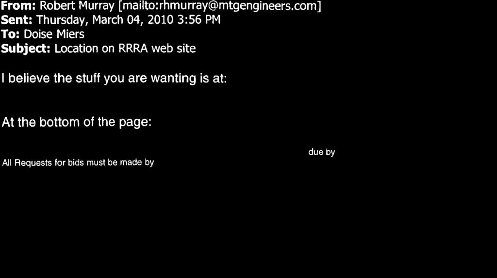
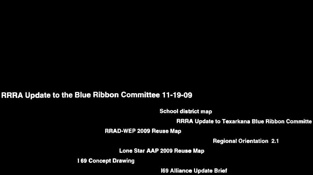
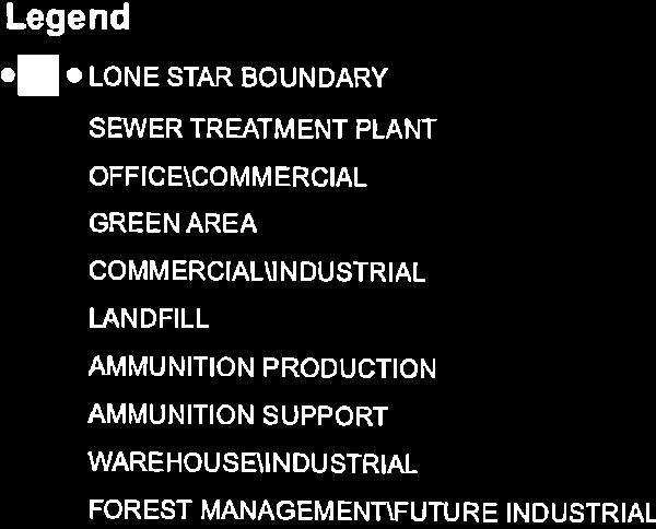
2 I-69 Corridor Program Corridor Segment Committee Meeting specific routes should be upgraded to interstate standards as a part of I-69 or which facilities the interstate should connect to and why. The CSC members offered the following input: a. The Red River Army Depot should point to a different location on the map. b. SH 204 should be considered a connecting facility. It would connect to US 59 via US 259 to Nacogdoches. This was drawn on the map. c. SH 294 should also be considered a connecting facility. It would connect to US 59 via SH 21 to Nacogdoches. This route provides connectivity to Austin. d. It was reiterated that SH 204 and US 259 in combination with US 175 could collectively function as a connecting facility providing access between Dallas and I-69 in the Nacogdoches area. e. The CSC 1 Chair presented displays showing an industrial redevelopment plan for the Red River Army Depot and Lone Star Army Ammunition Plant area (Two handouts were provided at the meeting and links to the displays were forwarded electronically via on March 4, 2010 and are shown in Attachment 3). The CSC members discussed that the I-69 Corridor Program has the potential to support the redevelopment of the area by providing improved access. The plan depicts a desired location for the I-69 corridor. i. TxDOT staff requested that the group provide an electronic copy of this redevelopment plan. f. It was noted that the airplane symbol located near Texarkana was in the wrong location. g. It was suggested that the location of the I-49/US 59 intersection be confirmed. Also, the planned location of I-49 in Arkansas needs to be confirmed. h. It was noted that the Texarkana Loop on the MPO plan goes around the Texarkana Airport. i. It was indicated that Loop 224 in Nacogdoches should not be depicted as a facility to become I-69. j. It was also emphasized that connectivity to Lake Naconiche was important. k. It was also emphasized that connectivity to the wet port in Louisiana was important. l. During this activity, the CSC members asked several questions which are summarized below: i. Would the interstate route be required to follow US 59, or could it extend through Mount Enterprise and closer to Henderson on the way to Texarkana? TxDOT staff replied that I-69 will connect to the national I-69 corridor near Logansport, Louisiana. Also, the CSC can recommend consideration of another route other than US 59 that an interstate type facility could follow as it heads north to Texarkana. ii. How would TxDOT determine which side of Nacogdoches I-69 would be routed, for example US 59 or Loop 224? TxDOT staff responded that the CSC, the community, and the public will have input to determine where to locate I-69. Also, it would be important to assess the available capacity of the existing Page 2 of 5
3 I-69 Corridor Program Corridor Segment Committee Meeting routes, as part of the process for determining the location of an interstate. To conclude this activity, Leah indicated that the map will be updated to reflect the input received on the transportation facilities to be considered when developing the I-69 Corridor Program. During future CSC meetings, the CSC members will continue to have the opportunity to review and make further edits to this map. CSC Activity to Identify Important Planning/Environmental Features Leah requested that the CSC members break into five groups in preparation to conduct this activity. The CSC members were directed to review the instructions for this group activity. Leah also requested that as they mark-up the planning features map booklets they put a large asterisk in the lower right legend to indicate that they have identified an important planning feature on that page. Once the groups completed the activity, the map booklets were collected, and Leah explained that the features the CSC members marked on the maps will be added to the I-69 Corridor Program mapping. Finally, Leah wrapped-up the activity by explaining that an updated I-69 planning features map booklet will be available at all future CSC meetings. The CSC members will have the opportunity to continue to update the mapping as they learn of new planning features that may be important to current and future I-69 corridor planning efforts. It was noted that the map booklets should be updated to show the industrial redevelopment plan for the Red River Army Depot and Lone Star Army Ammunition Plant area (Attachment 3). Presentation of an example Conceptual Interstate Layout Marc Williams introduced this activity. He explained that the CSC members will be shown what upgrading specified routes within the I-69 Corridor to a controlled access interstate highway would potentially look like. An example Conceptual Interstate Layout for a portion of US 59 (from Nacogdoches to Tenaha) within the CSC 1 limits was presented for review. The example Conceptual Interstate Layout that was presented showed interstate mainlanes, potential interchange locations, and approximate existing and potential ROW limits. Continuous new access roads were also shown for planning purposes. Both rural and urban typical sections were also included on the upper corner of the example Conceptual Interstate Layout. He emphasized that the example Conceptual Interstate Layout is not a design because it does not take into account topography, drainage, and many other detailed design elements. It was explained that the example Conceptual Interstate Layout was meant to be a preview of what will be presented at the next CSC meeting. A Conceptual Interstate Layout along the entire stretch of US 59 from Lufkin to I-30 and the portion of US 84 from Tenaha to the Louisiana border will be presented at the next meeting. Marc explained that the Conceptual Interstate Layout is being developed using TxDOT and federal standards. Again, he emphasized that the Conceptual Interstate Layout is not a design because it does not take into account topography, drainage, and many other detailed design Page 3 of 5
4 I-69 Corridor Program Corridor Segment Committee Meeting elements. Also, the Conceptual Interstate Layout generally follows the centerline of the specified routes being considered for the upgrade. The Conceptual Interstate Layout is being developed for planning purposes only and is subject to change. It is intended to assist the CSCs in developing an I-69 Corridor Plan Report. The CSC members then reviewed the example Conceptual Interstate Layout exhibits. After the review, Marc explained that at the next meeting the CSC members will be asked to: Give their impression of the suitability of upgrading the existing specified routes to interstate standards. Suggest where consideration should be given to relief routes, shifts in location, the need for adjacent access roads, and the types and locations of interchanges. Marc then asked the CSC members if they would like the Conceptual Interstate Layout to show what it would look like to upgrade the specified routes through the individual towns in CSC 1, if there was not already a relief route in place. He explained that the narrower urban interstate cross section would be used to show the limits of the interstate facility as it extended at-grade through the towns. He indicated that by seeing this the CSC members may be better able to determine if a relief route should be considered when developing the I-69 Corridor Program. In response to this question, the CSC members provided the following direction: The Conceptual Interstate Layout should follow US 59 around Nacogdoches. The Conceptual Interstate Layout should not show an upgrade through Garrison. Instead, a box should be drawn around the city limits of Garrison with the note: to be determined later. It should not show an upgrade through Timpson, Tenaha, and Joaquin. Instead, boxes should be drawn around the city limits with the note: a relief route should be considered added to each box. The Carthage city limits should be boxed out and include the note: to be determined later. The Marshall city limits should be boxed out and include the note: to be determined later. The Jefferson city limits should be boxed out and include the note: to be determined later. The Linden city limits should be boxed out and include the note: to be determined later. The Conceptual Interstate Layout should follow US 59 through Atlanta and Queen City. The Texarkana city limits should be boxed out and include the note: a relief route has been suggested. The Texarkana representatives indicated that they will provide a computer file showing where an I-69 Corridor facility should be located. Marc then asked the members whether or not they would like the Conceptual Interstate Layout to follow the existing US 59 route or the previously planned US 59 relief route between Diboll and Nacogdoches. It was explained that the planning and environmental process for the US 59 relief route began ten years ago. A preliminary draft environmental document was prepared before the project was put on hold because of the proposed I-69/Trans-Texas Corridor (TTC) Project. The draft environmental document identified a preferred US 59 relief route. The CSC Page 4 of 5
5 I-69 Corridor Program Corridor Segment Committee Meeting responded that the Conceptual Interstate Layout should follow existing US 59 and not the previously planned US 59 relief route within the CSC 1 limits. Discussion of Next Meeting (May 2010) Activities Leah indicated that May 2010 was the target date for the next meeting. At the next meeting the CSC members will: Review the updated CSC 1 map identifying the suggested transportation facilities to be considered when developing the I-69 Corridor Program. Review the updated CSC 1 planning features map booklet reflecting the input received at the February 2010 meeting. Review the full Interstate Conceptual Layout within the CSC Limits. Give their impression of the suitability of upgrading the specified existing highways to interstate standards. Suggest where consideration should be given to relief routes, shifts in location, need for adjacent access roads, and the types and location of interchanges. Wrap Up Doise Miers indicated that a Carthage or Marshall location will be reserved for the next meeting. I-69 Corridor Advisory Update Judge James Carlow provided an I-69 Corridor Advisory Committee update. Adjourn The meeting was then adjourned. Attachments: 1. Sign-In Sheet 2. Agenda 3. Red River Army Depot/Lone Star Army Ammunition Plant Redevelopment Plan Displays Meeting Staff included: Ed Pensock-TxDOT/TTA, Doug Booher-TxDOT/TTA, Dieter Billek-TxDOT/TTA, Doise Miers- TxDOT/GPA, Leah Olivarri-Consultant, Marc Williams-Consultant, Joe Shalkowski-Consultant, Tina Brown-Consultant, Ariel Carmona-Consultant, Michael Sexton-Consultant Page 5 of 5
6

7

8


9
10

11
12

13

14


15


16

17


18


19
I-69 Program Segment Committee
 I-69 Program Segment Committee MEMORANDUM OF CONFERENCE CALL SUBJECT: I-69 Segment Four and Five Committees Conference Call DATE: February 16, 2011 PARTICIPANTS: Participants List (Attachment 1) Purpose:
I-35 Corridor Segment Committee NW Loop 410 San Antonio, Texas. February 11, :00 AM to Noon
 I-35 Corridor Segment Committee 4 3500 NW Loop 410 San Antonio, Texas February 11, 2010 9:00 AM to Noon Welcome Nancy Parker Facilitator Committee Work Session Nancy Parker Facilitator Discussion of Proposed
I-20 ODESSA-MIDLAND CORRIDOR STUDY. Public Meeting for Schematic Design
 I-20 ODESSA-MIDLAND CORRIDOR STUDY Public Meeting for Schematic Design The environmental review, consultation, and other actions required by applicable Federal environmental laws for this project are being,
IH 20 RANGER HILL PUBLIC MEETING
 IH 20 RANGER HILL PUBLIC MEETING AUGUST 25, 2015 IH 20, Eastland County, TX CSJ 0007-06-084 IH 20 from 3.5 mi. East of LP 254 to SH 16 (Ranger Hill) August 25, 2015 Agenda Introductions Purpose of the
US 69 RELIEF ROUTE STUDY
 US 69 RELIEF ROUTE STUDY Jacksonville, Texas PUBLIC MEETING #2 May 29 th, 2018 Welcome to the public meeting for the US 69 Relief Route Study in Jacksonville. This is the second public meeting for this
Owl Canyon Corridor Project Overview and Summary
 Owl Canyon Corridor Project Overview and Summary December 22, 2008 The Owl Canyon corridor (generally the connection between the I-25 / Larimer County Road 70 interchange and the US 287 / Larimer County
NORTH HOUSTON HIGHWAY IMPROVEMENT PROJECT
 NORTH HOUSTON HIGHWAY IMPROVEMENT PROJECT Project Briefing Packet April 2015 RECOMMENDED ALTERNATIVES Project divided into 3 Segments Segment 1 Beltway 8 to I-610 Segment 2 I-610 to I-10 Segment 3 Downtown
Introduction...pg. 1. Study Area...pg. 1. Study Purpose and Need...pg. 2. Study Coordination and Development... pg. 3. Public Involvement...pg.
 Table of Contents Introduction...pg. 1 Study Area...pg. 1 Study Purpose and Need...pg. 2 Study Coordination and Development... pg. 3 Public Involvement...pg. 4 Evaluation of Alternatives...pg. 4 Preferred
SH 68. Meeting with Affected Property Owners September 9, 2014
 SH 68 Meeting with Affected Property Owners September 9, 2014 SH 68 US 83/I-2 TO US 281/I-69C Meeting with Affected Property Owners (MAPO) September 9, 2014 Agenda Open Meeting with Affected Property Owners
Subject: Solberg Avenue / I-229 Grade Separation: Traffic Analysis
 MEMORANDUM Transportation Bill Troe, AICP Jason Carbee, AICP 12120 Shamrock Plaza Suite 300 Omaha, NE 68154 (402) 334-8181 (402) 334-1984 (Fax) To: Project File Date: Subject: Solberg Avenue / I-229 Grade
AAMPO MOBILITY PROJECT DISCUSSION. July/August 2015
 AAMPO MOBILITY PROJECT DISCUSSION July/August 2015 Proposition 1 FY 16 & 17 $1.74 billion transferred to State Highway Fund in FY 2015 $147.3 million let in SAT district in FY 2015 US 90, IH 10, IH 410
Click to edit Master title style
 Route N Study Community Advisory Group (CAG) Meeting #2 December 12, 2018 Click Agenda to edit Master title style Introductions Recap of the CAG Meeting #1 and Public Meeting #1 Purpose & Need Review Review
Corridor Studies. LA 415 and LA 73
 Corridor Studies LA 415 and LA 73 Project Approach for Both Corridors 1. Data Collection 2. Data Summary 3. Traffic Analysis 4. Micro-Simulation modeling 5. Generation of alternatives 6. Modeling alternatives
Chapter 4 Traffic Analysis
 Chapter 4 Traffic Analysis PURPOSE The traffic analysis component of the K-68 Corridor Management Plan incorporates information on the existing transportation network, such as traffic volumes and intersection
BASS PRO DRIVE TO: WEST OF FARM-TO-MARKET ROAD (FM)
") NOTICE OF PUBLIC MEETING INTERSTATE HIGHWAY 30 (Rockwall) FROM: BASS PRO DRIVE TO: WEST OF FARM-TO-MARKET ROAD (FM) 2642 CSJs: 0009-11-238; 0009-12-215; 0009-12-908 Dallas County and Rockwall County, Texas
NOTICE OF PUBLIC MEETING INTERSTATE HIGHWAY 30 (Rockwall) FROM: BASS PRO DRIVE TO: WEST OF FARM-TO-MARKET ROAD (FM) 2642 CSJs: 0009-11-238; 0009-12-215; 0009-12-908 Dallas County and Rockwall County, Texas
Proposed Project I 35 from Denton to Cooke County Line
 Proposed Project I 35 from Denton to Cooke County Line The existing I 35 facility is four lanes from I 35E/I 35W to Farm to Market Road (FM) 3002. The purpose of the proposed project is to increase capacity
Public Meeting. I-35 Corridor from John Kilpatrick Turnpike North to Waterloo Road October 26, 6:00pm Edmond Community Center Auditorium
 Public Meeting I-35 Corridor from John Kilpatrick Turnpike North to Waterloo Road October 26, 2017 @ 6:00pm Edmond Community Center Auditorium Before we get started Please turn off or mute any electronic
Chapter 5 Future Transportation
 Chapter 5 Future Transportation The Future Land Use Plan identifies the desired land use designations. The land uses desired for Crozet depend, in large part, on the success of the transportation system,
US Route 4 Traffic and Pedestrian Improvement Project
 Welcome to the public meeting for US Route 4 Traffic and Pedestrian Improvement Project June 5, 2018 Introduction Project Team Town of North Greenbush, Tony Germano, Town Comptroller Lou Desso, Town Supervisor
ROUTES 55 / 42 / 676 BUS RAPID TRANSIT LOCALLY PREFERRED ALTERNATIVE
 ROUTES 55 / 42 / 676 BUS RAPID TRANSIT LOCALLY PREFERRED ALTERNATIVE April, 2012 1 INTRODUCTION The need for transit service improvements in the Routes 42/55/676 corridor was identified during the Southern
Chapter 3.6 Elementary School Z. Volusia County MPO. March Page 13.0
 Chapter 3.6 Elementary School Z DeLand, FL Volusia County MPO March 2008 Page 13.0 Volusia County MPO Bicycle and Pedestrian School Safety Review Study Introduction Elementary School Z is a planned elementary
Developing a Bike/Pedestrian Plan Using ArcInfo and Public Participation Rob Shumowsky, Madison County Council of Governments
 Developing a Bike/Pedestrian Plan Using ArcInfo and Public Participation Rob Shumowsky, Madison County Council of Governments Abstract: The Madison County Council of Governments is creating a bike/pedestrian
APPENDIX 2 LAKESHORE ROAD TRANSPORTATION REVIEW STUDY EXECUTIVE SUMMARY
 APPENDIX 2 LAKESHORE ROAD TRANSPORTATION REVIEW STUDY EXECUTIVE SUMMARY Appendix 2 City of Mississauga Lakeshore Road FINAL REPORT Transportation Review Study December 2010 EXECUTIVE SUMMARY Study Purpose
SECTION 1 - TRAFFIC PLANNING
 SECTION 1 - TRAFFIC PLANNING 1.1 TRAFFIC OPERATIONS 1.1.1 Roadway Functional Classification The Multnomah County Comprehensive Framework Plan s Policy 34: Trafficways and the Functional Classification
100 Most Congested Roadways in Texas
 100 Most Congested Roadways in Texas 2017 EXECUTIVE SUMMARY In response to increased roadway congestion throughout the state, in 2009 the Texas Legislature mandated that the Texas Department of Transportation
Montgomery County Life Sciences Center Loop Trail
 Montgomery County Life Sciences Center Loop Trail Advisory Committee Meeting #1 February 10, 2015 Agenda 1. Project Background 2. Existing Conditions Analysis 3. Examples from Elsewhere 4. Discussion Project
Proposed Action, Purpose and Need Technical Memorandum
 Proposed Action, Purpose and Need Technical Memorandum MoPac (State Loop 1) Intersections, Austin District From North of Slaughter Lane to South of La Crosse Avenue CSJ: 3136-01-015 Travis County, Texas
APPENDIXB. Traffic Operations Technical Memorandum
 APPENDIXB Traffic Operations Technical Memorandum Environmental Assessment - Lincoln County, SD 85 th Street: Sundowner Avenue to Louise Avenue November 2017 MEMORANDUM Transportation Jim Kollbaum, PE
CHAPTER 7 ACCESS MANAGEMENT. Background. Principles of Access Management. Hennepin County Transportation Systems Plan (HC-TSP)
") CHAPTER 7 ACCESS MANAGEMENT Background Principles of Access Management Hennepin County Transportation Systems Plan (HC-TSP) Chapter 7 Access Management 7.1 Background Access management has become an important
CHAPTER 7 ACCESS MANAGEMENT Background Principles of Access Management Hennepin County Transportation Systems Plan (HC-TSP) Chapter 7 Access Management 7.1 Background Access management has become an important
I 10 Phoenix to California Border Multimodal Corridor Profile Study
 I 10 Phoenix to California Border Multimodal Corridor Profile Study December 2012 Prepared by Arizona Department of Transportation 206 S. 17th Ave. Phoenix, AZ 85007 In cooperation with U.S. Department
Casablanca Boulevard & GO Station Access
 Casablanca Boulevard & GO Station Access Class Environmental Assessment STAKEHOLDER WORKSHOP Thursday September 27th, 2018 5:30PM 8:00PM 1 WORKSHOP PURPOSE Provide an overview of the Design Alternatives
AASHTO Use Only Establishment of a U.S. (Interstate) Route IH 69 Action taken by SCOH: Extension of a U.S. (Interstate)Route
 Route IH 69 Action taken by SCOH: Extension of a U.S. (Interstate)Route") American Association of State Highway and Transportation Officials An Application from the State Highway or Transportation Department of Texas for: Elimination of a U.S. (Interstate) Route AASHTO Use Only
American Association of State Highway and Transportation Officials An Application from the State Highway or Transportation Department of Texas for: Elimination of a U.S. (Interstate) Route AASHTO Use Only
Technical Advisory Committee Meeting
 Technical Advisory Committee Meeting US 181 Harbor Bridge Project July 11, 2013 2:30 pm 4:30 pm Oveal Williams Activity Center, 1414 Martin Luther King Drive, Corpus Christi, TX Display Items Meeting Summary
DUNBOW ROAD FUNCTIONAL PLANNING
 DUNBOW ROAD FUNCTIONAL PLANNING Final Report August 3, 216 #31, 316 5th Avenue NE Calgary, AB T2A 6K4 Phone: 43.273.91 Fax: 43.273.344 wattconsultinggroup.com Dunbow Road Functional Planning Final Report
Safety Impacts: Presentation Overview
 Safety Impacts: Presentation Overview The #1 Theme How Access Management Improves Safety Conflict Points The Science of Access Management By Treatment Studies Themes for Texas Access Management Improve
I-25 PEL: CO Springs Denver South Connection. Presentation to Castle Rock Town Council
 I-25 PEL: CO Springs Denver South Connection Presentation to Castle Rock Town Council June 20, 2017 An Important Corridor to Colorado Links the state s two major metropolitan areas and communities between
CHARLOTTE COUNTY-PUNTA GORDA METROPOLITAN PLANNING ORGANIZATION BICYCLE/PEDESTRIAN ADVISORY COMMITTEE (BPAC)
") BPAC Minutes 03-16-2017 Page 1 CHARLOTTE COUNTY-PUNTA GORDA METROPOLITAN PLANNING ORGANIZATION BICYCLE/PEDESTRIAN ADVISORY COMMITTEE (BPAC) MINUTES OF THE MEETING HELD ON MARCH 16, 2017 AT THE CULTURAL
BPAC Minutes 03-16-2017 Page 1 CHARLOTTE COUNTY-PUNTA GORDA METROPOLITAN PLANNING ORGANIZATION BICYCLE/PEDESTRIAN ADVISORY COMMITTEE (BPAC) MINUTES OF THE MEETING HELD ON MARCH 16, 2017 AT THE CULTURAL
GARLAND ROAD/GASTON AVENUE/ GRAND AVENUE INTERSECTION IMPROVEMENT STUDY
 MEETING OF AFFECTED PROPERTY OWNERS AND STAKEHOLDERS GARLAND ROAD/GASTON AVENUE/ GRAND AVENUE INTERSECTION IMPROVEMENT STUDY CSJ 0009-02-067 Meeting Agenda 1 2 3 4 5 6 7 8 9 10 Opening Remarks State Representative
HARRISON STREET/OAKLAND AVENUE COMMUNITY TRANSPORTATION PLAN
 HARRISON STREET/OAKLAND AVENUE Community Workshop #4: Draft Plan Review December 3, 2009 D E S I G N, C O M M U N I T Y & E N V I R O N M E N T INTRODUCTIONS Key Project Staff: Alisa Shen, Project Manager,
Closing Plenary Session
 TRAFFIC SAFETY CONFERENCE Closing Plenary Session June 9, 2017 Las Colinas, TX Order of Report Out June 9, 2017 Las Colinas, TX Distracted Driving Prioritized Countermeasures Countermeasure 4a Systemically
Figure 1: Vicinity Map of the Study Area
 ARIZONA TEXAS NEW MEXICO OKLAHOMA May 5, 2016 Mr. Anthony Beach, P.E. BSP Engineers 4800 Lakewood Drive, Suite 4 Waco, Texas 76710 Re: Intersection and Access Analysis along Business 190 in Copperas Cove
Southbend to Prima Vista. October 30, Floresta Corridor Master Plan
 Application of a Complete Street initiative and how it might function operationally 8 8 Southbend to Prima Vista October 30, 2017 Presentation Agenda 2 Perspective and History Traffic projections, Levels
Access Management Regulations and Standards
 Access Management Regulations and Standards Efficient highway operation Reasonable property access Concept of Access Management The way to manage access to land development while simultaneously preserving
Alberta Highway 881. Corridor Management Plan. Session Forum 1 - Highways. Tri-Party Transportation Conference Moving Alberta Into the Future
 Tri-Party Transportation Conference Moving Alberta Into the Future Alberta Highway 881 Corridor Management Plan Lac La Biche to Anzac Session Forum 1 - Highways March 2017 INTRODUCTION + 241 km long, 2
NORTH HOUSTON HIGHWAY IMPROVEMENT PROJECT DRAFT NEED AND PURPOSE
 NORTH HOUSTON HIGHWAY IMPROVEMENT PROJECT DRAFT NEED AND PURPOSE APPROVED BY FHWA: JULY 2010 UPDATED: OCTOBER 2011 Section 1 Need for and Purpose of Proposed Action Per Council on Environmental Quality
Transportation Advisory Board
 C I T Y O F WEATHERFORD Transportation Advisory Board AGENDA REPORT Meeting Date: October 15,2015 Staff Contact: Manny Palacios Jr. Phone: E-mail: 817-598-4296 mpalacios@weatherfordtx.gov SUBJECT: Discuss
LIVERPOOL TRANSPORTATION MODELING TECHNICAL MEMO MAY 2009
 LIVERPOOL TRANSPORTATION MODELING TECHNICAL MEMO MAY 2009 Syracuse Metropolitan Transportation Council 100 Clinton Square 126 N. Salina Street, Suite 100 Syracuse, NY 13202 Telephone (315) 422-5716; Fax
Southwest Bus Rapid Transit (SW BRT) Functional Planning Study - Executive Summary January 19 LPT ATTACHMENT 2.
 Functional Planning Study - Executive Summary January 19 LPT ATTACHMENT 2.") Southwest Bus Rapid Transit (SW BRT) Functional Planning Study - Executive Summary 2011 January 19 1 of 19 Introduction This executive summary presents the results of the Southwest Bus Rapid Transit (SW
Southwest Bus Rapid Transit (SW BRT) Functional Planning Study - Executive Summary 2011 January 19 1 of 19 Introduction This executive summary presents the results of the Southwest Bus Rapid Transit (SW
CHAPTER 2D. GUIDE SIGNS CONVENTIONAL ROADS Section 2D.01 Scope of Conventional Road Guide Sign Standards Standard:
 2009 Edition Page 137 CHAPTER 2D. GUIDE SIGNS CONVENTIONAL ROADS Section 2D.01 Scope of Conventional Road Guide Sign Standards 01 The provisions of this Chapter shall apply to any road or street other
City of Wayzata Comprehensive Plan 2030 Transportation Chapter: Appendix A
 A1. Functional Classification Table A-1 illustrates the Metropolitan Council s detailed criteria established for the functional classification of roadways within the Twin Cities Metropolitan Area. Table
Access Management Regulations and Standards for Minor Arterials, Collectors, Local Streets
 Access Management Regulations and Standards for Minor Arterials, Collectors, Local Streets September 2009 Paul Grasewicz Access Management Administrator Concept of Access Management The way to manage access
Bicycle and Pedestrian Facilities Toolbox (Excerpt from Figure 3.1)
") Appendix B Neighborhood Connections Summaries This Appendix is a supplement to the information presented in Chapter 3 Connect People. The Appendix includes a summary or profile for each of the proposed
Appendix B Neighborhood Connections Summaries This Appendix is a supplement to the information presented in Chapter 3 Connect People. The Appendix includes a summary or profile for each of the proposed
Exhibit 1 PLANNING COMMISSION AGENDA ITEM
 Exhibit 1 PLANNING COMMISSION AGENDA ITEM Project Name: Grand Junction Circulation Plan Grand Junction Complete Streets Policy Applicant: City of Grand Junction Representative: David Thornton Address:
Chapter 3: Multi-Modal Circulation and Streetscapes
 CHAPTER 3: MULTI-MODAL CIRCULATION AND STREETSCAPES Chapter 3: Multi-Modal Circulation and Streetscapes Overview Streetscape improvements have already been completed for Depot Street between Main Avenue
BENTON COUNTY TRANSPORTATION SYSTEM PLAN UPDATE JOINT TECHNICAL AND STAKEHOLDER ADVISORY COMMITTEES MEETING #2
 BENTON COUNTY TRANSPORTATION SYSTEM PLAN UPDATE JOINT TECHNICAL AND STAKEHOLDER ADVISORY COMMITTEES MEETING #2 Summary Thursday, December 7, 2017, 1:00 3:00 pm Sunset Meeting Room, 4077 SW Research Way,
SR 693 (Pasadena Avenue) Corridor Study from Shore Drive South to 66 th Street
 Corridor Study from Shore Drive South to 66 th Street") Welcome and Introduction Sign-in and comment sheets Restrooms and exits Meeting agenda and timeline Meeting goals / expectations Provide input to guide study recommendations Actively participate throughout
Welcome and Introduction Sign-in and comment sheets Restrooms and exits Meeting agenda and timeline Meeting goals / expectations Provide input to guide study recommendations Actively participate throughout
!!!!!!!!!!!!!!!!!! Metro!Denver!MTD!Governance!Committee! October!23,!2013!!9:00!AM!to!10:00!AM! Denver!Regional!Council!of!Governments!
 MetroDenverMTDGovernanceCommittee October23,2013 9:00AMto10:00AM DenverRegionalCouncilofGovernments MeetingRecord MetroDenverMTDGovernanceCommittee October23,2013 9:00AM Agenda: 9:00AM Welcome&Introductions
3 FRAMEWORK FOR IMPLEMENTATION OF LAKE-TO-LAKE CYCLING ROUTE
 3 FRAMEWORK FOR IMPLEMENTATION OF LAKE-TO-LAKE CYCLING ROUTE The Planning and Economic Development Committee recommends the adoption of the recommendations contained in the following report dated December
Alternatives Public Workshop
 US 1 Express Lanes Project Development & Environment (PD&E) Study Alternatives Public Workshop August 2013 1 Today s Agenda Project Background and Overview Tier 1 Alternatives Development Tier 2 Decision-Making
DISTRICT BICYCLE PROGRAM
 DISTRICT BICYCLE PROGRAM TxDOT Fort Worth District Public Hearing Bicycle Use on the State Highway System Public Hearing Agenda 1 2 3 4 5 6 Introduction Susan Howard TxDOT Public Involvement Specialist
WELCOME. FM 2818 (Harvey Mitchell Parkway) Open House. Tuesday, Nov. 14, 2017
 Open House. Tuesday, Nov. 14, 2017") WELCOME FM 2818 (Harvey Mitchell Parkway) Open House Tuesday, Nov. 14, 2017 Why am I here? Review the planned improvements Provide comments on the proposed project The environmental review, consultation,
WELCOME FM 2818 (Harvey Mitchell Parkway) Open House Tuesday, Nov. 14, 2017 Why am I here? Review the planned improvements Provide comments on the proposed project The environmental review, consultation,
APPENDIX G: INTERSECTION NEEDS AT OKEECHOBEE BOULEVARD
 APPENDIX G: INTERSECTION NEEDS AT OKEECHOBEE BOULEVARD INTERSECTION NEEDS AT SR 7 and OKEECHOBEE BOULEVARD SR 7 Extension Project Development and Environment (PD&E) Study From Okeechobee Boulevard (SR
Stakeholder Communication and Public Involvement Plan
 Stakeholder Communication and Public Involvement Plan Arkansas Statewide Bicycle and Pedestrian Transportation Plan Plan purpose: The Arkansas State Bicycle and Pedestrian Plan will establish a framework
Community engagement guide May 2018
 Community engagement guide May 2018 Greater Wellington Regional Council (GWRC), Hutt City Council (HCC) and the New Zealand Transport Agency (NZTA) are working together to achieve some big improvements
TRAFFIC ACTION PLAN. Laurie Meadows Neighborhood CITY OF SAN MATEO
 TRAFFIC ACTION PLAN Laurie Meadows Neighborhood CITY OF SAN MATEO Draft January 2017 Table of Contents Introduction... 2 The Traffic Forum Process... 5 Neighborhood Traffic Issues... 7 Neighborhood Recommendations
DESIGN MEMORANDUM WITH DESIGN EXCEPTIONS SP SP
 DRAFT NOT FINAL (Note: document was not finalized due to an eastbound stopping site distance design issue that requires more detailed bridge and roadway design considerations. This discussion starts on
City of Homewood Transportation Plan
 City of Homewood Transportation Plan Prepared for: City of Homewood, Alabama Prepared by: Skipper Consulting, Inc. May 2007 TABLE OF CONTENTS INTRODUCTION... 1 BACKGROUND INFORMATION... 1 EXISTING TRANSPORTATION
Paul Huston, P.E., Design-Build Coordinator Chuck Gonderinger, HDR Engineering. Minnesota Department of Transportation (the Department)
") To: From: Paul Huston, P.E., Design-Build Coordinator Chuck Gonderinger, HDR Engineering Date: March 20, 2001 Subject: Roadway Geometric Design Criteria Project: TH 14/218 Design-Build Project, SP 7408-29,
To: From: Paul Huston, P.E., Design-Build Coordinator Chuck Gonderinger, HDR Engineering Date: March 20, 2001 Subject: Roadway Geometric Design Criteria Project: TH 14/218 Design-Build Project, SP 7408-29,
ADOT Statewide Bicycle and Pedestrian Program Summary of Phase IV Activities APPENDIX B PEDESTRIAN DEMAND INDEX
 ADOT Statewide Bicycle and Pedestrian Program Summary of Activities APPENDIX B PEDESTRIAN DEMAND INDEX May 24, 2009 Pedestrian Demand Index for State Highway Facilities Revised: May 29, 2007 Introduction
Pedestrian Project List and Prioritization
 To: Kyle Wagenschutz, City of Memphis CC: From: Anne Conlon and John Cock, Alta Planning + Design Date: December, 2014 Re: Project List Development (Task 3.1-3.2) and Project List Prioritization (Task
MARLWOOD GOLF & COUNTRY CLUB WASAGA BEACH, ONTARIO
 MARLWOOD GOLF & COUNTRY CLUB WASAGA BEACH, ONTARIO Prepared for: Marlwood Golf & Country Club 445 Golf Course Road Wasaga Beach, Ontario L0L 2P0 Prepared by: MBTW Golf Design 255 Wicksteed Avenue Unit
Broaddus Loop. Lufkin & Angelina County Bicycle Route. Total Miles:
 Lufkin & Angelina County Bicycle Route Total Miles: 72.6 www.visitlufkin.com Route Directions: Segment Distance Direction of Total Distance Road Traveled (miles) Turn (miles) Start Lufkin High School
The Route 29 Corridor Study was initiated at the request of Virginia s Commonwealth
 CHAPTER 2: Study Background and approach The Route 29 Corridor Study was initiated at the request of Virginia s Commonwealth Transportation Board in response to requests from members of the General Assembly
JONESBORO HIGHWAY 63 HIGHWAY 18 CONNECTOR STUDY
 JONESBORO HIGHWAY 63 HIGHWAY 18 CONNECTOR STUDY Craighead County May 2007 JONESBORO HIGHWAY 63 HIGHWAY 18 CONNECTOR STUDY Craighead County May 2007 Prepared by Planning and Research Division Arkansas State
East Downtown Tax Increment Reinvestment Zone (TIRZ) No. 15 Infrastructure Assessment Study
 No. 15 Infrastructure Assessment Study") East Downtown Tax Increment Reinvestment Zone (TIRZ) No. 15 Infrastructure Assessment Study Houston, TX Technical Memorandum April 15 th, 2009 Prepare by: 2950 North Loop West, Ste. 900 Houston, TX 77092
East Downtown Tax Increment Reinvestment Zone (TIRZ) No. 15 Infrastructure Assessment Study Houston, TX Technical Memorandum April 15 th, 2009 Prepare by: 2950 North Loop West, Ste. 900 Houston, TX 77092
PRELIMINARY DRAFT FIRST AMENDMENT TO VISION 2050: A REGIONAL LAND USE AND TRANSPORTATION PLAN FOR SOUTHEASTERN WISCONSIN
 PRELIMINARY DRAFT FIRST AMENDMENT TO VISION 2050: A REGIONAL LAND USE AND TRANSPORTATION PLAN FOR SOUTHEASTERN WISCONSIN ESTABLISHING TARGETS FOR FEDERAL PERFORMANCE MEASURES: HIGHWAY SAFETY SOUTHEASTERN
SECTION 8 - INDUSTRIAL PROPERTY AERIAL PHOTOGRAPH: RED OAK INDUSTRIAL PROPERTY INFRASTRUCTURE IMPROVEMENTS (~530 ACRES)
") TABLE OF CONTENTS SECTION 1 - SUPERIOR LOCATION MAP: STATE OF TEXAS - RED OAK LOCATION DEPICTED AERIAL PHOTOGRAPH: NORTH CENTRAL TEXAS REGION - RED OAK LOCATION DEPICTED MAP: COUNTY OF ELLIS - RED OAK
TABLE OF CONTENTS SECTION 1 - SUPERIOR LOCATION MAP: STATE OF TEXAS - RED OAK LOCATION DEPICTED AERIAL PHOTOGRAPH: NORTH CENTRAL TEXAS REGION - RED OAK LOCATION DEPICTED MAP: COUNTY OF ELLIS - RED OAK
MINUTES. BROWARD COUNTY BICYCLING AND PEDESTRIAN ADVISORY COMMITTEE (BPAC) MEETING WEDNESDAY, March 9 th, :30 PM
 MEETING WEDNESDAY, March 9 th, :30 PM") MINUTES BROWARD COUNTY BICYCLING AND PEDESTRIAN ADVISORY COMMITTEE (BPAC) MEETING WEDNESDAY, March 9 th, 2016 6:30 PM BROWARD COUNTY GOVERNMENTAL CENTER 115 South Andrews Avenue, Room 329 F Ft. Lauderdale,
MINUTES BROWARD COUNTY BICYCLING AND PEDESTRIAN ADVISORY COMMITTEE (BPAC) MEETING WEDNESDAY, March 9 th, 2016 6:30 PM BROWARD COUNTY GOVERNMENTAL CENTER 115 South Andrews Avenue, Room 329 F Ft. Lauderdale,
CTH M Reconstruction
 CTH M Reconstruction ID 5992 09 81 City of Madison, South Pleasant View Road (Cross Country Road Prairie Hill Road) CTH M Dane County Public Information Meeting Thursday, May 24, 2012 6 p.m. to 8 p.m.
I-10 AT SCENIC LOOP RD. Open House
 I-10 AT SCENIC LOOP RD Open House General Information I-10 At Scenic Loop Rd KENDALL COUNTY OPEN HOUSE June 30, 2015 Currey Creek Baptist Church 35 Cascade Cavern 5:00 7:00 Boerne, TX 78015 2 Public Meeting
REGIONAL SAFETY ADVISORY COMMITTEE North Central Texas Council of Governments Transportation Council Room Friday, October 26, :00 am AGENDA
 REGIONAL SAFETY ADVISORY COMMITTEE North Central Texas Council of Governments Transportation Council Room Friday, October 26, 2018 10:00 am AGENDA 1. Approval of August 24, 2018 Meeting Summary Matt Hotelling,
Include autoturn exhibits of WB-67 trucks at each roundabout.
 1 Along the through path, the desired relationship is R1>R2
Existing LBJ Traffic Conditions and Motorist Travel Characteristics
 JOSEY LN WEBBS CHAPEL RD MARSH LN TOLLWAY Existing LBJ Traffic Conditions and Motorist Travel Characteristics This Chapter summarizes data collected pertaining to existing traffic counts and travel characteristics
Overview: Phase 3 Draft Development and Circulation Plans, White Bear Station
 Overview: Phase 3 Draft Development and Circulation Plans, White Bear Station This overview explains how to get more involved and provides information on the Phase 3 draft circulation and development plans
Transportation Master Plan Advisory Task Force
 Transportation Master Plan Advisory Task Force Network Alternatives & Phasing Strategy February 2016 BACKGROUND Table of Contents BACKGROUND Purpose & Introduction 2 Linking the TMP to Key Council Approved
STANLEY STREET December 19, 2017
 STANLEY STREET December 19, 2017 Welcome Mike Wiza, Mayor Scott Beduhn, Director of Public Works Agenda 1. Introduction 2. Existing Roadway Conditions 3. Current Alternative Improvements 4. Summary of
PLEASE BE ADVISED THAT SOME OF THE INFORMATION IN THIS PRESENTATION IS OUTDATED SO IT IS ABLE TO SHOW CHANGES IN THE PLAN OVER TIME.
 1 PLEASE BE ADVISED THAT SOME OF THE INFORMATION IN THIS PRESENTATION IS OUTDATED SO IT IS ABLE TO SHOW CHANGES IN THE PLAN OVER TIME. - SANDRA GREEN, CITY SECRETARY FARMERSVILLE CITY COUNCIL MEETING February
Corridor Advisory Group and Task Force Meeting #10. July 27, 2011
 Corridor Advisory Group and Task Force Meeting #10 July 27, 2011 1 Agenda Recap CAG/TF #9 Public Meeting #2 Summary Single Mode Alternatives Evaluation Results Next Steps 2 3 CAG/TF #9 Recap CAG /TF #9
THE CORPORATION OF THE DISTRICT OF CENTRAL SAANICH. COMMITTEES - 7:00 PM Monday, April 27, 2015 Council Chambers AGENDA
 THE CORPORATION OF THE DISTRICT OF CENTRAL SAANICH COMMITTEES - 7:00 PM Monday, April 27, 2015 Council Chambers AGENDA 1. CALL TO ORDER 2. ADOPTION OF AGENDA 3. ADOPTION OF MINUTES 4. PRESENTATIONS AND
Lee s Summit Road Improvement Study Public Open House June 7, 2007 Summary of Comment Card Responses
 Lee s Summit Road Improvement Study Public Open House June 7, 2007 Summary of Comment Card Responses Introduction At the Lee s Summit Road Improvement Study Public Open House held Thursday, June 7, 2007
Chapter V TRAFFIC CONTROLS. Tewodros N.
 Chapter V TRAFFIC CONTROLS www.tnigatu.wordpress.com tedynihe@gmail.com Lecture Overview Traffic markings Longitudinal markings Transverse markings Object markers and delineator Traffic signs Regulatory
Chapter 6 Transportation Plan
 Chapter 6 Transportation Plan Transportation Plan Introduction Chapter 6 Transportation Plan Transportation Plan Introduction This chapter describes the components of Arvada s transportation system, comprised
Project Update May 2018
 Project Update May 2018 Dakota County, in cooperation with the City of Lakeville, is planning to reconstruct 202 nd Street West (County Road 50) from Holyoke Avenue to Cedar Avenue (County Road 23). 202
Highway 49, Highway 351 and Highway 91 Improvements Feasibility Study Craighead County
 Highway 49, Highway 351 and Highway 91 Improvements Feasibility Study Craighead County Executive Summary March 2015 Highway 49, Highway 351 and Highway 91 Improvements Feasibility Study Craighead County
PROPOSAL: Review of Alaska DOT&PF project 68471, Glacier Highway reconstruction and pedestrian improvements from
 PROPOSAL: Review of Alaska DOT&PF project 68471, Glacier Highway reconstruction and pedestrian improvements from Fritz Cove Rd to Seaview Ave, for consistency with locally adopted plans and ordinances.
MoPac South: Impact on Cesar Chavez Street and the Downtown Network
 MoPac South: Impact on Cesar Chavez Street and the Downtown Network Prepared by: The University of Texas at Austin Center for Transportation Research Prepared for: Central Texas Regional Mobility Authority
Bar Harbor Route 3 Gateway Project Advisory Committee September 21, 1-3 PM Atlantic Oakes Hotel Minutes
 Bar Harbor Route 3 Gateway Project Advisory Committee September 21, 1-3 PM Atlantic Oakes Hotel Minutes Attending: Dick Cough, Edith Milbury, James Blanchard, Chris Fogg, Paul MacQuinn Millard Billings,
Executive Summary BEYOND THE B-LINE: RAPID TRANSIT LINE PHASE II - COMMERCIAL DRIVE WEST. Final Draft December 13, Appendix B BROADWAY/LOUGHEED
 BEYOND THE B-LINE: BROADWAY/LOUGHEED RAPID TRANSIT LINE PHASE II - COMMERCIAL DRIVE WEST Appendix B Executive Summary Final Draft December 13, 1999 UMA Lloyd Lindley Davidson Yuen Simpson Architects BROADWAY/LOUGHEED
Wyldewood Estates. Pre-Application Public Engagement Summary of Issues and Responses
 Wyldewood Estates Pre-Application Public Engagement Summary of Issues and Responses March 2016 Executive Summary Morguard Residential Properties has been thoughtfully planning the redevelopment of Wyldewood
Preliminary Engineering Study
 Preliminary Engineering Study Open House # 2 June 6, 2018 PREPARED FOR: PREPARED BY: Agenda Background and status of preliminary engineering study County Road 26 design summary County Road 63 design summary