Development Opportunities Golden, Colorado Case Study
|
|
|
- Quentin Welch
- 5 years ago
- Views:
Transcription


1 Development Opportunities Golden, Colorado Case Study Minnesota Roundabout Conference April 5-6, Alex J. Ariniello, P.E., P.T.O.E.
2 Overview Golden Roundabouts Other roundabout applications Retail/business Residential Roundabout Market Potential
3

4 Golden Roundabouts City of Golden 17,000 people Colorado School of Mines Coors Brewery
5
6

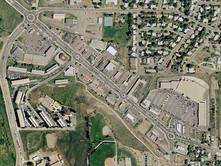
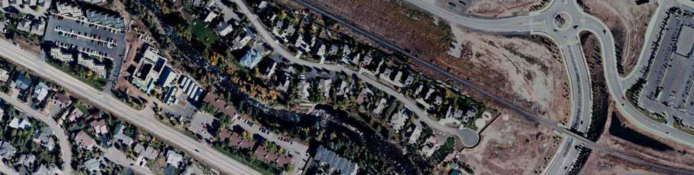
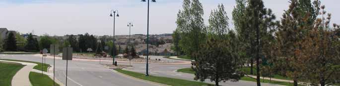
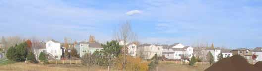
7 Suburban Highway Four Travel Lanes Center Turn Lane Parking/Shoulders 84 feet in Width Driveways allowed indiscriminately South Golden Road


8 Strip Retail Area Many Businesses, including Several Fast Food Restaurants Small Shopping Center

9 Safety Concerns Unrestricted Access Center Turn Lane Width of roadway encouraged speeding Was difficult to cross

10 Impetus To Project Start Development proposal for a shopping center Need for a traffic signal at Utah Street

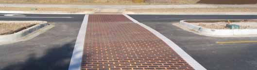
11 City Objectives for South Golden Road Reduce vehicular conflicts and increase safety Create a more aesthetically pleasing area Create a more pedestrian- friendly environment Reduce delays for entering traffic at Utah Street Reduce queue delays to reduce travel time
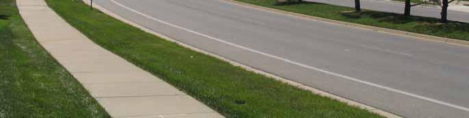
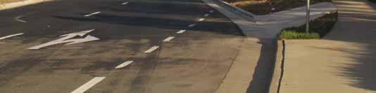
12 Initial Concept for South Golden Road Narrow the roadway Provide medians and wide detached sidewalks Construct two roundabouts at Utah St. and Ulysses St.

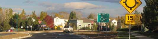
13 City Reaction Receptive to roundabout concept Traffic calming aspects Obvious operational qualities of roundabout concept Ease of U-Turns U at the roundabouts Requested addition of a third roundabout
14 Selling the Roundabout Biggest opponent was King Soopers,, the major tenant of the new shopping center City offered to tear roundabout out if sales revenues didn t t meet expectations
15 Selling The Roundabout Meeting with local merchants Fourth roundabout

16 Implementation King Soopers exceeded its sales projections Ulysses roundabout constructed on fast track schedule Opened in November, 1998 The other three roundabouts were completed in 1999
 lane) Utah Street Lunnanhaus Drive")
17 Roundabout Dimensions S. Golden Road Roundabouts Ulysses Street (single-lane) lane) Utah Street Lunnanhaus Drive Johnson Road Inside Diameter Outside Diameter

18 The 3/4mile long project cost 1.3 million: Four Roundabouts Roadway Reconstruction Medians, Detached Sidewalks, Utility Relocations Design and Landscaping Project Costs
19 Accident History Pre-Roundabout Number of Accidents Post-Roundabout Accidents Injury Accidents Year
20 South Golden Road Experience 4 Roundabouts within I mile % 3 years prior 5 years after Reduction Total Accidents in Corridor % Injuries % Average Daily Traffic 15,000 21, % Accident Rate % (per million vehicle miles)

21 Slower Speeds But Faster Travel Times Prior to roundabouts: 2 traffic signals Travel time of 78 sec. With 3rd signal Predicted travel time of 103 seconds After the Roundabouts: Travel time reduced to 68 seconds

22 Business Access Seconds of Delay Before After Average Delay at Access Points Maximum Delay at Access Points
23 Sales Tax Revenues 60% increase in sales tax revenues Only area to experience continued sales tax growth Sales Tax Revenues $1,800,000 $1,600,000 $1,400,000 $1,200,000 $1,000,000 $800,000 $600,000 $400,000 $200,000 $ Year
24 Summary and Conclusions Roundabouts in a Strip Commercial Area Slower Speeds, Faster Travel Reduced Delay at Access Points 62% Reduction in Accident Rates 60% Increase in Sales Tax Revenues
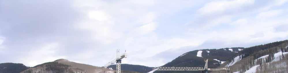
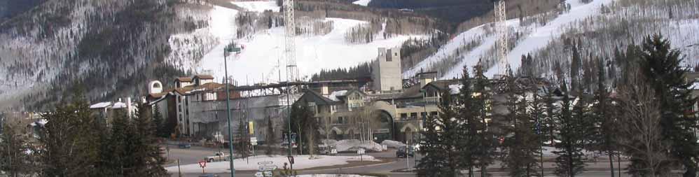
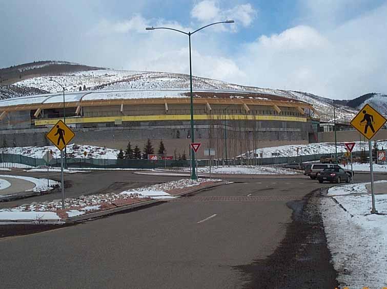
25 Vail

26 Roundabout Applications Within Shopping Centers Adjacent to Shopping Centers Major Collectors Rural/Urban Interface Mini Roundabouts


27 Acceptance by Business Community Within Shopping Centers Superior Marketplace Superior, Colorado 750,000 SF Shopping Center

28 Shopping Centers Northlands, Broomfield, CO


29 Adjacent to Shopping Centers Factory Outlets, Loveland, CO In operation since 1998
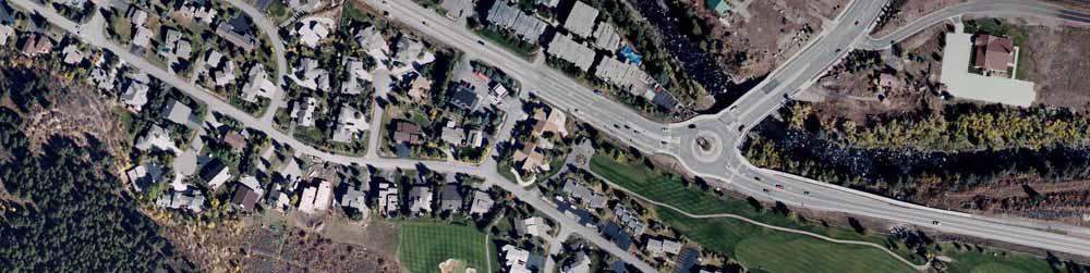
30 Avon, CO
31 Avon
32 Adjacent to Shopping Centers Centerra Lifestyle Mall, Loveland 5 Legs Entry Statement

33 Adjacent to Shopping Centers Harvest Junction, Longmont, CO


34 Douglas County, CO Super Target Future Light Rail Station Transit-Oriented Development 1,200 Acres 2,000 Dwelling Units 5 million SF Office/Retail Major Hospital Light Rail Station School Rec. Center


35 Mixed Use Development 670 acres 5,000 employees 1,500 Dwelling Units 300 SF Retail Promontory, Greeley, CO

36 Mini-Roundabouts Internal Distribution Smaller Design Vehicle Smaller size

37 Mini-Roundabouts Front Range Community College, Westminster, CO Connect parking lots/main access to 112 th Ave Back-ups during peak hours Entry Statement
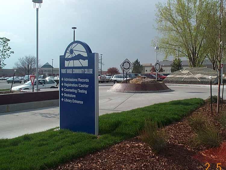
38

39 Mini-Roundabouts Roxborough Marketplace 100 ft. Dia. Close Spacing

40 Major Collectors Rock Creek Parkway, Superior, CO Residential area 4 through lanes Turn lanes at major intersections High Speeds Difficult for Pedestrians to cross

41 Rock Creek Parkway

42 Major Collectors Rock Creek Parkway/88 th Street


43 Major Collectors Rock Creek Parkway/88 th Street Reduced Delays Reduced Queues Accidents reduced from 8 to 2


44 Major Collectors Bike/Pedestrian Treatments
45 Mountain Shadows, Arvada Major Collectors

46 Major Collectors Deer Valley Drive, Festival Ranch, AZ Linear Park Grid Network

47 Deer Valley Drive, Festival Ranch, AZ
48 Eagle, CO Rural/Urban Interface


49 Eagle, CO 2-lane roadway Slow speeds Delay need for 4 lanes May eliminate need to widen structures Rural/Urban Interface
50 Rural/Urban Interface

51 Roundabout Market Potential Roundabouts in France 20,000 Extrapolation to US 93,000 At $1 million each $93 billion

52 Minnesota Roundabout Potential 337 roundabouts per 1 million people 5.15 million people in Minnesota Extrapolation to Minnesota 1,735 Roundabouts - 35 Existing 1,700 To be constructed or 85/yr for 20 years
53 Motor Fuel Savings for 1,700 new roundabouts 20,000 gallons per year per intersection 34 million gallons per year savings for 1,700 roundabouts ½ to 1% of total Minnesota motor fuel consumption
54 Roundabouts and Highway Safety 2003 Fatalities (FARS) 42,600 Injuries 2,889,000 Intersection/intersection related crashes 8,700 fatality (23% of all) 894,000 injury 1,664,000 property damage
55 Traffic Signals and Highway Safety Signal Percentage of all intersection/intersection related crashes: 23% - 2,700 fatality 51% - 451,000 injury 47% - 789,000 property damage
56 Recent Research Signalization and Safety Richard G. Sarchet 112 signals on Colorado State Highways Collected Accident Data 3 years before and 3 years after Fatalities Injuries Prop. Dam 3 Years Before Years After ,199-50% +52% +81%
57 Full Deployment of Roundabouts For U.S. Reduce Fatalities by 25% or 2,000 Reduce Injuries by 25% or 200,000 For Minnesota (1,700 new roundabouts) Reduce Fatalities by 30 per year Reduce Injuries by 3,000 per year
58 Summary Roundabouts Are Good For Business Can Be Integrated Into New Development At Little Cost Becoming Accepted By Planning & Development Community Significant Safety Benefits
Roundabouts and Access Management
 Roundabouts and Access Management ABSTRACT This paper discusses the implementation of a series of four roundabouts on a suburban arterial serving a strip commercial area. The project is located on South
Roundabouts In Colorado
 Roundabouts In Colorado ABSTRACT The first modern roundabout in Colorado was built in Colorado Springs in 1983. The construction of roundabouts in Vail and Avon, Colorado in the mid 1990 s aroused the
Roundabouts are good for business
 Roundabouts are good for business What is a roundabout Rules 0f Roundabouts 1. Slow down when approaching a roundabout 2. Yield to vehicles in the roundabout 3. When clear, proceed right into the roundabout
Carmel, Indiana Illinois Street and 126th Street Westfield Boulevard and 96th Street Arts and Design District RAB
 Sustainability Benefits Of Network Wide Roundabout Use Case Study of Carmel, Indiana Presented By: Michael McBride PE Carmel City Engineer Carmel, Indiana Carmel, Indiana 1996 Carmel, Indiana Population
Park City, Utah s Access Management for the Olympic Transit Center/Roundabout in Old Town
 Park City, Utah s Access Management for the Olympic Transit Center/Roundabout in Old Town By: Bill Baranowski, P.E. Presentation Outline Access Control and Roundabouts Roundabouts Near Traffic Signals
Intersection Improvement: Sturgeon Road, Silver Avenue and Murray Park Road Roundabout. Welcome. Public Information Session
 Intersection Improvement: 1 Welcome WHY IS AN INTERSECTION IMPROVEMENT NEEDED? 2 Traffic volumes for Sturgeon Road, Silver Avenue and Murray Park Road exceed the capacity of the existing 4-way stop controlled
INNOVATIVE INTERSECTION SOLUTIONS. Jay Bockisch, PE, PTOE Senior Associate
 INNOVATIVE INTERSECTION SOLUTIONS Jay Bockisch, PE, PTOE Senior Associate INNOVATIVE INTERSECTION SOLUTIONS Innovative intersection overview Case studies Continuous flow intersection Modern roundabouts
Modern Roundabouts: a guide for application
 Modern Roundabouts: a guide for application Kentucky Community Transportation Innovation Academy 2005 The contents of this booklet reflect the views of the authors who are responsible for the facts and
M-58 HIGHWAY ACCESS MANAGEMENT STUDY Mullen Road to Bel-Ray Boulevard. Prepared for CITY OF BELTON. May 2016
 M-58 HIGHWAY ACCESS MANAGEMENT STUDY Prepared for CITY OF BELTON By May 2016 Introduction Missouri State Highway 58 (M-58 Highway) is a major commercial corridor in the City of Belton. As development has
INNOVATIVE INTERSECTION DESIGN
 INNOVATIVE INTERSECTION DESIGN J. Eddie Valtier, P.E. ELP TP&D Director Introduction Why Do We Need To Start Looking For Innovative Intersection Designs? Congestion is worsening and traffic volumes and
Access Management Regulations and Standards
 Access Management Regulations and Standards Efficient highway operation Reasonable property access Concept of Access Management The way to manage access to land development while simultaneously preserving
Roundabouts in a System of Intersections
 Roundabouts in a System of Intersections 1.Signals and Roundabouts in Close Proximity 2. A System of Roundabouts www.ghd.com www.ourston.com Queue Length Consider Spill-over Effects from Adjacent Intersections
ORANGE COUNTY PUBLIC WORKS TRAFFIC INVESTIGATIONS
 ORANGE COUNTY PUBLIC WORKS TRAFFIC INVESTIGATIONS STAFF REPORT OF: January 6, 2019 SUPERVISORIAL DISTRICT: 5 SUBJECT: LOCATION: INVESTIGATOR: O Neill Drive at Roanoke Drive; Ladera Ranch; TB 922-E6 Clever
HIGHBURY AVENUE/HAMILTON ROAD INTERSECTION IMPROVEMENTS PUBLIC INFORMATION CENTRE 1 MAY 14, 2015
 HIGHBURY AVENUE/HAMILTON ROAD INTERSECTION IMPROVEMENTS Municipal Class Environmental Assessment PUBLIC INFORMATION CENTRE 1 MAY 14, 2015 ACCESSIBILITY Under the Accessibility Standards 2015 for Customer
COWETA HIGH SCHOOL AND EAST HIGHWAY 51
 COWETA HIGH SCHOOL AND EAST HIGHWAY 51 Lack of sidewalks along Ben Lumpkin Rd. Lack of crosswalks and ramps at intersection. Hwy 51 is wide to cross as a pedestrian. No ADA compliance or connection to
Access Location, Spacing, Turn Lanes, and Medians
 Design Manual Chapter 5 - Roadway Design 5L - Access Management 5L-3 Access Location, Spacing, Turn Lanes, and Medians This section addresses access location, spacing, turn lane and median needs, including
Implementation challenge 2: Is there room for Complete Streets? Does street classification enable Complete Streets?
 Implementation challenge 2: Is there room for Complete Streets? Does street classification enable Complete Streets? 1 Do we have to widen roads to fit everything? 2 There s room; it needs to be recaptured
Bay to Bay Boulevard Complete Streets Project
 Bay to Bay Boulevard Complete Streets Project Dale Mabry Highway to Bayshore Boulevard February 08, 2018 Photo Source: Tampa Bay Times Alessandra Da Pra Meeting Format Introduction Resurfacing Information
Mineral Avenue Corridor Assessment. ITE 2017 Western District Annual Meeting San Diego, CA June 21 st
 Mineral Avenue Corridor Assessment ITE 2017 Western District Annual Meeting San Diego, CA June 21 st Biography - Aaron Heumann, PE, PTOE Currently City of Littleton Transportation Engineering Manager 24
6.4 RECOMMENDED IMPROVEMENTS
 6.4 RECOMMENDED IMPROVEMENTS 6.4.1 Williston Road Recommendations While all alternatives would be an improvement over existing conditions, Alternative 3B is recommended over the others because it provides
5/31/2016 VIA . Arwen Wacht City of Sacramento Community Development Department 300 Richards Blvd., 3 rd Floor Sacramento, CA 95811
 5/31/2016 VIA EMAIL Arwen Wacht City of Sacramento Community Development Department 300 Richards Blvd., 3 rd Floor Sacramento, CA 95811 RE: El Pollo Loco (P16-028) Dear Ms. Wacht: WALKSacramento has reviewed
Report. Typical Sections. City of Middleton, WI
 Report Typical Sections City of Middleton, WI December 2006 Report for City of Middleton, Wisconsin Typical Sections repared by: Traffic Associates LLC and STRAND ASSOCIATES, INC. 910 West Wingra Drive
PennDOT Access Management Model Ordinances Training
 PennDOT Access s Training Trainers: Chad Dixson, AICP, TPD Angela Watson, PB Objective of Today Assist Pennsylvania s municipalities and transportation professionals in better understanding the benefits
INNER LOOP EAST. AIA Rochester Annual Meeting November 13, 2013 TRANSFORMATION PROJECT. Bret Garwood, NBD Erik Frisch, DES
 INNER LOOP EAST TRANSFORMATION PROJECT AIA Rochester Annual Meeting November 13, 2013 Bret Garwood, NBD Erik Frisch, DES Why? We are building a city that encourages walking, biking and enjoying the outdoor
Broadway Complete Streets Project
 Broadway Complete Streets Project Megan Johnson, P.E. Associate Civil Engineer James Pangburn, P.E. Consultant Project Manager After the construction of the highway system, Broadway was cut off
Atwood Avenue Fair Oaks Avenue Cottage Grove Road
 Atwood Avenue Fair Oaks Avenue Cottage Grove Road Agenda Purpose Review project scope & goals Present design alternatives Gather feedback Answer Questions Format Open House Presentation Q&A Open House
City of Wausau Wausau Center Urban Design and Transportation Master Plan. Design Workshop // October 18, 2018
 City of Wausau Wausau Center Urban Design and Transportation Master Plan Design Workshop // October 18, 2018 Design Workshops // October 15-18 Workshop Study Evaluate circulation and parking patterns around
Appendix C. NORTH METRO STATION AREA TRAFFIC IMPACT STATEMENT 88th Avenue Station
 Appendix C NORTH METRO STATION AREA TRAFFIC IMPACT STATEMENT 88th Avenue Station Prepared for: Regional Transportation Department and URS Corporation as part of the North Metro EIS David Evans and Associates,
PROJECT OBJECTIVES. Improve vehicle capacity for the intersection. Improve pedestrian and bicycle access
 COMMUNITY MEETING Project Update March 15, 2010 Purcellville, Virginia OVERVIEW Project need / objectives Project recap Design elements Proposed improvements Summary of project benefits / next steps PROJECT
San Jose Transportation Policy
 San Jose Transportation Policy Protected Intersections in LOS Policies to Support Smart Growth Presented by: Manuel Pineda City of San Jose Department of Transportation Bay Area Map San Francisco Oakland
King Soopers #116 Thornton, Colorado
 Traffic Impact Study King Soopers #116 Thornton, Colorado Prepared for: Galloway & Company, Inc. 1.0 EXECUTIVE SUMMARY King Soopers #116, a grocery marketplace anchored commercial development, is proposed
HSM PREDICTIVE METHODS IN PRELIMINARY ENGINEERING
 HSM PREDICTIVE METHODS IN PRELIMINARY ENGINEERING 2017 ILLINOIS THE CONFERENCE Filiberto Sotelo & Steven Schilke, P.E. OUTLINE Safety & Transportation Management Process What is HSM? Illinois HSM Predictive
Roundabouts A Case Study and Brief Overview
 Roundabouts A Case Study and Brief Overview Presented by: Matt Loeffler, PE, Traffic Engineer, Butler County Ohio And Jack Pflum, PE, Transportation Planning Consultant At The Traffic Engineering Workshop,
Transportation Corridor Studies: Summary of Recommendations
 Transportation Corridor Studies: Summary of Recommendations Route 4 Corridor Study: Route 10 Corridor Study: Route 44 Corridor Study: Route 175 Corridor Study: Route 5/15 Corridor Study: Rentschler Field
Retrofitting Urban Arterials into Complete Streets
 Retrofitting Urban Arterials into Complete Streets John N. LaPlante, P.E., P.T.O.E., T.Y. Lin International Prepared for: Illinois Traffic Engineering & Safety Conference Urbana, Illinois October 18, 2007
Road Diets FDOT Process
 Florida Department of TRANSPORTATION Road Diets FDOT Process Humberto Castillero, PE, PTOE Roadway Design Office Purpose of Guide Develop a statewide lane elimination review process Balance state & local
This Chapter sets forth the minimum design, technical criteria and specifications to be used in the preparation of all roadway plans.
 4.1 GENERAL This Chapter sets forth the minimum design, technical criteria and specifications to be used in the preparation of all roadway plans. These Roadway Standards are for new construction and modification
CITY OF FRANKLIN, TENNESSEE. Columbia Avenue. Widening & Improvements Project. Public Meeting May 16, 2017
 CITY OF FRANKLIN, TENNESSEE Columbia Avenue Widening & Improvements Project Public Meeting May 16, 2017 Agenda 6:00 6:30 Formal Presentation 6:30 8:00 Town Hall Forum City of Franklin Columbia Avenue Alternatives
LSC TRANSPORTATION CONSULTANTS, INC. 516 North Tejon Street Colorado Springs, CO (719) FAX (719)
 FAX (719)") LSC TRANSPORTATION CONSULTANTS, INC. 516 North Tejon Street Colorado Springs, CO 80903 (719) 633-2868 FAX (719) 633-5430 E-mail: lsc@lsccs.com May 15, 2009 Mr. Davis Farrar Western Slope Consulting, LLC
LSC TRANSPORTATION CONSULTANTS, INC. 516 North Tejon Street Colorado Springs, CO 80903 (719) 633-2868 FAX (719) 633-5430 E-mail: lsc@lsccs.com May 15, 2009 Mr. Davis Farrar Western Slope Consulting, LLC
3.0 Future Conditions
 3.0 Future Conditions In order to be able to recommend appropriate improvements to the transportation system of the Town, it is important to first understand the nature and volume of traffic that is expected
DRAFT. A fifth objective, other considerations, has been added to capture considerations not captured by the four primary objectives.
 TECHNICAL MEMORANDUM Albany - Washington Avenue Traffic Calming Evaluation Matrix of Conceptual Alternatives Date: May 17, 2017 Project #: 17356 To: Aleida Andrino-Chavez From: Laurence Lewis, Sara Muse,
RIVERSIDE, Newton MA BH NORMANDY RIVERSIDE LLC. Riverside Station. A green, transit-oriented community
 Riverside Station A green, transit-oriented community October 6, 2011 TONIGHT S AGENDA: 1. Project Update (5 min.) 2. Master Plan Update (10 min.) 3.Traffic Plan Update (10 min.) Questions & Answers MASTER
Designing for Pedestrian Safety
 Designing for Pedestrian Safety Roundabouts: How They Work for Pedestrians Presented by: Fred Ranck FHWA Resource Center Safety Design Engineer October 5, 2010 Roundabouts: Learning Objectives At the end
West Dimond Blvd Upgrade Jodhpur Street to Sand Lake Road
 West Dimond Blvd Jodhpur St to Sand Lake CSS Transportation Project Summary Municipality of Anchorage Project # 05 005 Project Manager: John Smith, P.E. (MOA PM&E) Project Administrator: Julie Makela,
Roundabouts. By: Nezamuddin, Valparaiso University. February 19, 2015
 Roundabouts By: Nezamuddin, Valparaiso University February 19, 2015 Outline 1. Background on Roundabouts 2. Silhavy Rd. Corridor Improvement Project in Valparaiso, IN 3. 5-points Roundabout in Valparaiso,
Mark Malone, P.E. SD DOT
 Mark Malone, P.E. SD DOT SD10 Grading & Surfacing From 8 th Ave W to 8 th Ave E 1 mile plus transition lengths Complete Urban Reconstruction Grading, C&G, Storm Sewer, Sidewalk, Concrete Surfacing Railroad
Mission-Geneva Transportation Study Community Workshop 2 July 8, 2006
 Community Workshop 2 July 8, 2006 Small Group Workbook 1 Basic Improvements on Mission Street Streetscape. Pedestrian-scale lighting; landscaping; community art on utility boxes; more (possibly unique)
Road Diets and Roundabouts
 Road Diets and Roundabouts Paul Zykofsky, AICP Local Government Commission Sacramento, CA Classic Road Diet 4 to 3 lanes San Antonio TX On-street parking Median Bike Lanes Center Turn-Lane Seattle WA Road
MINERAL AVENUE CORRIDOR ASSESSMENT STUDY IMPLEMENTATION STRATEGY
 MINERAL AVENUE CORRIDOR ASSESSMENT STUDY IMPLEMENTATION STRATEGY INTRODUCTION City Personnel Sign-in Sheet Comment Forms Please Write Down Any Feedback INTRODUCTION List of Topics for Presentation Study
AGENDA REPORT. Issue: Discussion of potential improvements on Barnwell Road at Niblick Drive
 AGENDA REPORT To: From: By: Honorable Mayor and City Council Members Warren Hutmacher, City Manager Tom Black, Public Works Director Date: March 23, 2016 Agenda: March 28, 2016 WORK SESSION AGENDA: Barnwell
Safety Impacts: Presentation Overview
 Safety Impacts: Presentation Overview The #1 Theme How Access Management Improves Safety Conflict Points The Science of Access Management By Treatment Studies Themes for Texas Access Management Improve
Los Altos Hills Town Council - June 18, 2015 Palo Alto City Council June 22, AGENDA ITEM #2.B Presentation
 Los Altos Hills Town Council - June 18, 2015 Palo Alto City Council June 22, 2015 AGENDA ITEM #2.B Presentation Previous Presentations Los Altos Hills Town Council in May 2014 and February 2015 Palo Alto
Access Management Regulations and Standards
 Access Management Regulations and Standards January 2014 Efficient highway operation Reasonable property access Concept of Access Management The way to manage access to land development while preserving
5 CIRCULATION AND STREET DESIGN
 5 CIRCULATION AND STREET DESIGN This chapter describes circulation and streetscape improvements proposed for the Northwest Chico Specific Plan Area. It includes detailed design specifications for existing
State Road 54/56 Tampa Bay s Northern Loop. The Managed Lane Solution Linking I-75 to the Suncoast Parkway
 State Road 54/56 Tampa Bay s Northern Loop The Managed Lane Solution Linking I-75 to the Suncoast Parkway SUNCOAST PARKWAY Both I 75 and the Suncoast Parkway are planning, or in the process of constructing,
ROUTE 81 CORRIDOR STUDY DESIGN CONCEPTS
 RT 81 Corridor Study CLINTON ROUTE 81 CORRIDOR STUDY DESIGN CONCEPTS View north on High Street, with potential improvements to the streetscape Draft Recommendations November 8 th, 2018 TOWN OF CLINTON
Information on display. Inside this handout. Triangle Area revisions. Project need displays. Preferred alternative on aerial maps
 Public information meeting #4 4 to 7 p.m., September 30, 2009 Hales Corners Welcome Thank you for attending this public information meeting for the WIS 100 Corridor Study. Your interest and comments are
Agenda. Overview PRINCE GEORGE S PLAZA METRO AREA PEDESTRIAN PLAN
 PRINCE GEORGE S PLAZA METRO AREA PEDESTRIAN PLAN May 28, 2008 Agenda Welcome and introductions Project overview and issue identification Planning context and strengths Design challenges and initial recommendations
DDI s Can Move More Than Cars! 2016 Western ITE Conference Albuquerque, NM July 12, 2016 Alex Ariniello, P.E. Public Works Director, Town of Superior
 DDI s Can Move More Than Cars! 2016 Western ITE Conference Albuquerque, NM July 12, 2016 Alex Ariniello, P.E. Public Works Director, Town of Superior Overview How did we get to the DDI concept? What s
TRAFFIC IMPACT STUDY And A TRAFFIC SIGNAL WARRANT ANALYSIS FOR A SENIOR LIVING AND APARTMENT DEVELOPMENT
 TRAFFIC IMPACT STUDY And A TRAFFIC SIGNAL WARRANT ANALYSIS FOR A SENIOR LIVING AND APARTMENT DEVELOPMENT DEERFIELD TOWNSHIP, WARREN COUNTY, OHIO Nantucket Circle and Montgomery Road () Prepared for: ODLE
Bluffdale/ UDOT South High-T Intersection Project Type Operations
 Bluffdale/ UDOT 14600 South High-T Intersection Project Type Operations 14600 South and Redwood Road $ 600,000 $ 550,000 This project is to install a new High-T intersection at Redwood Road and 14600 South
How to Develop a Pedestrian Safety Action Plan
 How to Develop a Pedestrian Safety Action Plan Course Introduction Presented by: Peter Eun FHWA RC Safety Engineer Ryan Snyder President, Ryan Snyder Associates, LLC Paul Zykofsky Director, Land Use and
Frequently Asked Questions
 Frequently Asked Questions Business US 190 in Copperas Cove From Avenue D to Constitution Drive What is access management? A. Access Management is a growing effort by government agencies to improve how
Appendix B. Environmental Resource Technical Memorandum. Assessment on Travel Pattern and Access Impacts
 Appendix B Environmental Resource Technical Memorandum Assessment on Travel Pattern and Access Impacts TECHNICAL MEMORANDUM ENVIRONMENTAL RE-EVALUATION FOR UNION STATION TO OAK CLIFF DALLAS STREETCAR To:
Street Design Workshop. Existing cross section Traffic volumes Examine adjacent land uses You design future improvements
 Street Design Workshop Existing cross section Traffic volumes Examine adjacent land uses You design future improvements Primary Tools for Street Redesign Road diets Bike lanes Cycle tracks Trails Crosswalks
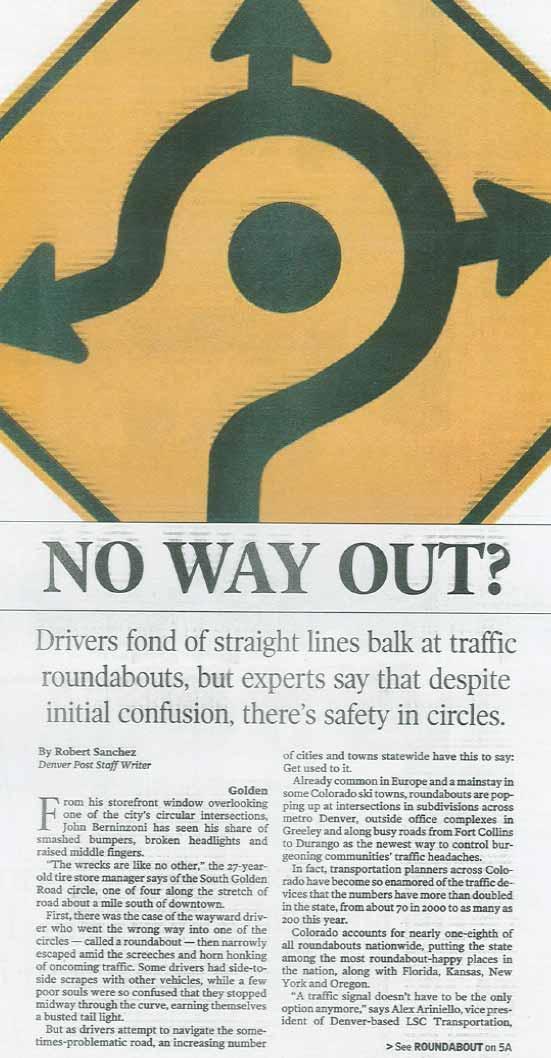
Way. Roundabout (FUNCTIONING AS A ROUNDABOUT) Driving the
 Driving the") (FUNCTIONING AS A ROUNDABOUT) Roundabouts are becoming more common across the U.S. as a way to improve traffic flow and reduce serious accidents. But for drivers who have never used a roundabout, it can
(FUNCTIONING AS A ROUNDABOUT) Roundabouts are becoming more common across the U.S. as a way to improve traffic flow and reduce serious accidents. But for drivers who have never used a roundabout, it can
A CHANGING CITY. of Edmonton, it is essential that it reflects the long-term vision of the City.
 A CHANGING CITY By the year 2040, Edmonton will be home to more than 1 million people. To accommodate growth and support a healthy and compact city, we need a new approach to development/redevelopment
Highway 111 Corridor Study
 Highway 111 Corridor Study June, 2009 LINCOLN CO. HWY 111 CORRIDOR STUDY Draft Study Tea, South Dakota Prepared for City of Tea Sioux Falls Metropolitan Planning Organization Prepared by HDR Engineering,
Chapter 6 Transportation Plan
 Chapter 6 Transportation Plan Transportation Plan Introduction Chapter 6 Transportation Plan Transportation Plan Introduction This chapter describes the components of Arvada s transportation system, comprised
Southside Road. Prepared for: City of St. John s Police & Traffic Committee. Prepared by: City of St. John s Traffic Division
 Southside Road Prepared for: City of St. John s Police & Traffic Committee Prepared by: City of St. John s Traffic Division January 2007 Southside Road - Traffic Report Page 1 of 9 BACKGROUND: th At the
City of Albert Lea Policy and Procedure Manual 4.10 ALBERT LEA CROSSWALK POLICY
 4.10 ALBERT LEA CROSSWALK POLICY PURPOSE: Pedestrian crosswalks are an integral part of our transportation infrastructure. To be effective and promote safety, marked crosswalks must be installed after
Tonight is an opportunity to learn about the Study and ask questions of the Study Team members.
 Exhibit 1 Welcome Second Open House Tonight is an opportunity to learn about the Study and ask questions of the Study Team members. A first Public Open House was held on September 18th, 2013 which presented
By: Bill Baranowski, PE TRAFFIC CALMING EXAMPLES IN SUGARHOUSE, DAYBREAK, AND WEST JORDAN CITY
 By: Bill Baranowski, PE TRAFFIC CALMING EXAMPLES IN SUGARHOUSE, DAYBREAK, AND WEST JORDAN CITY 1977 HIGHLAND RUGBY TOUR 1945 WHERE??? What is more contentious than traffic calming? 1951 LOOKING SOUTHEAST
LARIMER COUNTY: ENGINEERING DOUGLAS ROAD (CR 54)
") LARIMER COUNTY: ENGINEERING DOUGLAS ROAD (CR 54) INTRODUCTIONS * Pipeline 1041 Application Coordinator Todd Blomstrom Public Works Director Mark Peterson County Engineer Terry Gilbert Community Development
LARIMER COUNTY: ENGINEERING DOUGLAS ROAD (CR 54) INTRODUCTIONS * Pipeline 1041 Application Coordinator Todd Blomstrom Public Works Director Mark Peterson County Engineer Terry Gilbert Community Development
TOWN OF PAYSON TRAFFIC CALMING MANUAL
 TOWN OF PAYSON TRAFFIC CALMING MANUAL APPROVED BY THE PAYSON TOWN COUNCIL SEPTEMBER 6, 2007 TOWN OF PAYSON TRAFFIC CALMING POLICY 1.0 Introduction Traffic Calming involves retrofitting physical devices
TRANSPORTATION FACILITY PLANNING Waugh Chapel Road Maytime Drive to New Market Lane
 July 24, 2018 TRANSPORTATION FACILITY PLANNING Waugh Chapel Road Maytime Drive to New Market Lane DPWandYOU.com Making a difference, together Meeting Agenda Purpose of the project Overview of work conducted
Traffic Impact Study for Rolling Ridge Redevelopment
 Traffic Impact Study for Rolling Ridge Redevelopment Webster Groves, Missouri October 19, 2018 Prepared For: Gershman Commercial Real Estate 150 North Meramec Avenue Suite 500 St. Louis, Missouri 63105
MASONIC AVENUE STREET DESIGN STUDY Community Workshop 2. Masonic Ave Street Design Study Community Workshop 2 August 10, 2010
 Masonic Ave Street Design Study Community Workshop 2 August 10, 2010 Introduction MASONIC AVENUE STREET DESIGN STUDY Community Workshop 2 SF Municipal Transportation Agency Javad Mirabdal, Project Manager
Designing for Pedestrian Safety
 Designing for Pedestrian Safety Introduction to Pedestrian Safety Design and Planning Principles Presented by: Craig Allred FHWA Resource Center Technical Specialist and Michael Ronkin Owner, Designing
Town of Mooresville, North Carolina Neighborhood Traffic Calming and Control Device Policy
 Town of Mooresville, North Carolina Neighborhood Traffic Calming and Control Device Policy Adopted January 6, 2014 Town of Mooresville Development Services Department TOWN OF MOORESVILLE NEIGHBORHOOD TRAFFIC
133 rd Street and 132 nd /Hemlock Street 132 nd Street and Foster Street MINI ROUNDABOUTS. Overland Park, Kansas
 133 rd Street and 132 nd /Hemlock Street 132 nd Street and Foster Street MINI ROUNDABOUTS Overland Park, Kansas September 1, 2017 TABLE OF CONTENTS 1. INTRODUCTION... 1 2. LITERATURE REVIEW... 1 3. CONCEPT
REPORT CONCURRENCE. City Manager. The General Manager concurs with the recommendation of this report.
 COUNCIL REPORT Report No. ENG 08-018 Executive Committee Date: May 0, 018 File No: 5400-1 To: From: Subject: Mayor and Council Purvez Irani, Senior Transportation Engineer Bluejay Street Road Improvements
Public Information Meeting. Orange Camp Road. Dr. Martin Luther King Jr. Beltway to I-4. Presented by: Volusia County August 2, 2018
 Public Information Meeting Orange Camp Road Dr. Martin Luther King Jr. Beltway to I-4 Presented by: Volusia County August 2, 2018 1 Project Goals To improve the operations and safety for Orange Camp Road
4/14/2017 VIA . Miriam Lim, Junior Planner City of Sacramento Community Development Department 300 Richards, 3 rd Floor Sacramento, CA 95811
 4/14/2017 VIA EMAIL Miriam Lim, Junior Planner City of Sacramento Community Development Department 300 Richards, 3 rd Floor Sacramento, CA 95811 RE: Mack & Franklin Development (P17-016) Dear Ms. Lim:
Board of Supervisors February 27, 2017
 : Traffic Analysis Results & Draft Conceptual Plan Board of Supervisors February 27, 2017 Transportation Solutions Building Better Communities Presentation Overview Background Summary of Traffic Analysis
Innovative Intersections Presented by: Matt Crim P.E., PTOE Stantec Consulting Services Inc. October 29, 2015
 Innovative Intersections Presented by: Matt Crim P.E., PTOE Stantec Consulting Services Inc. October 29, 2015 1 Traditional Intersections Traditional Intersections allow left turns from all approaches.
Downtown BRT Corridor Alternatives Review: 1 st, 2 nd, 3 rd and 4 th Avenue. Bus Rapid and Conventional Transit Planning and Design Services
 Downtown BRT Corridor Alternatives Review: 1 st, 2 nd, 3 rd and 4 th Avenue Bus Rapid and Conventional Transit Planning and Design Services City of Saskatoon February 2018 Project Team HDR Corporation
ROUNDABOUTS. Improving Safety and Efficiency. SR83 & Smithville Western Rd. Joel Montgomery, PE Director of Administration
 ROUNDABOUTS Improving Safety and Efficiency SR83 & Smithville Western Rd. Joel Montgomery, PE Director of Administration The Ohio Department of Transportation District 3 906 North Clark Ave. Ashland, OH
Tonight is for you. Learn everything you can. Share all your ideas.
 Strathcona Neighbourhood Renewal Draft Concept Design Tonight is for you. Learn everything you can. Share all your ideas. What is Neighbourhood Renewal? Creating a design with you for your neighbourhood.
Off-road Trails. Guidance
 Off-road Trails Off-road trails are shared use paths located on an independent alignment that provide two-way travel for people walking, bicycling, and other non-motorized users. Trails specifically along
Moving Together Conference Complete Streets from the MassDOT District 5 Perspective
 Moving Together Conference Complete Streets from the MassDOT District 5 Perspective Timothy Kochan, Transportation Planner and Bicycle/ Pedestrian Coordinator District 5 Office Taunton S Overview of District
Safety Emphasis Areas & Safety Project Development Florida Department of Transportation District Seven Tampa Bay
 Safety Emphasis Areas & Safety Project Development Florida Department of Transportation District Seven Tampa Bay Stephen L. Benson, AICP, CNU-A FDOT District Seven Safety Office Presentation Overview Safety
Project Goals and Objectives
 Project Goals and Objectives Goal 1: Goal 2: Goal 3: Transform Coast Highway into a Complete Street that accommodates all roadway users (pedestrians, bicyclists, and autos) Objectives: Improve the pedestrian
Complete Streets Policy DAVID CRONIN, P.E., CITY ENGINEER
 Complete Streets Policy DAVID CRONIN, P.E., CITY ENGINEER Complete Streets City Commission adopted a Complete Streets policy in 2012 Complete Streets are road networks that are designed for all users:
5858 N COLLEGE, LLC N College Avenue Traffic Impact Study
 5858 N COLLEGE, LLC nue Traffic Impact Study August 22, 2016 Contents Traffic Impact Study Page Preparer Qualifications... 1 Introduction... 2 Existing Roadway Conditions... 5 Existing Traffic Conditions...
PRINCE GEORGE S PLAZA METRO AREA PEDESTRIAN PLAN
 PRINCE GEORGE S PLAZA METRO AREA PEDESTRIAN PLAN May 28, 2008 Agenda Welcome and introductions Project overview and issue identification Planning context and strengths Design challenges and initial recommendations
WISCONSIN AVENUE EXTENSION SECOND PUBLIC INFORMATION MEETING. March 28, 2017
 WISCONSIN AVENUE EXTENSION SECOND PUBLIC INFORMATION MEETING March 28, 2017 STUDY AREA N MEETING AGENDA Introductions Study Background Alternatives Studied Recommended Alternative Discussion STUDY BACKGROUND
Access Management Regulations and Standards for Minor Arterials, Collectors, Local Streets
 Access Management Regulations and Standards for Minor Arterials, Collectors, Local Streets September 2009 Paul Grasewicz Access Management Administrator Concept of Access Management The way to manage access
Prepared By: Town of Waxhaw Traffic Calming Policy
 Policy For Resolutions for Town Meetings Prepared By: Town Manager Michael McLaurin Director Greg Mahar CPD Waxhaw N.C. Community Planning &Development Administrative Department Department: Date Approved
City of Prince Albert Statement of POLICY and PROCEDURE. Department: Public Works Policy No. 66. Section: Transportation Issued: July 14, 2014
 Page: 1 of 8 1 POLICY 1.01 The City shall follow all of the specifications in the Manual of Uniform Traffic Control Devices for Canada, prepared by the National Committee of Uniform Traffic Control, and