Portage Bay Park Design Commission Review 4: 90% Design Development January 5, 2017
|
|
|
- Ada Hutchinson
- 5 years ago
- Views:
Transcription

1 to be updated to reflect base bid condition Portage Bay Park Design Commission Review 4: 90% Design Development January 5, 2017
2 Previous Site Plan POTENTIAL PARK CONNECTION & MID-BLOCK CROSSING BOAT STREET PICNIC AREA MULTI-USE LAWN SAKUMA VIEWPOINT LAWN TERRACES PLANTED AREAS SHORELINE HABITAT BEACH SHORELINE HABITAT N
3 Current Site Plan Base Bid POTENTIAL PARK CONNECTION & MID-BLOCK CROSSING Boat St. area site plan to be updated BOAT STREET SEATING AREA PICNIC TERRACE MULTI-USE LAWN SAKUMA VIEWPOINT LAWN TERRACES PLANTED AREAS SHORELINE HABITAT BEACH SHORELINE HABITAT PIER Add Alternate: Pavilion & Restroom N

4 Grading Plan Boat St. area site / grading plan to be updated with new base bid condition

5 Birds-Eye View to be updated with new base bid condition at Boat. St and trees

6 Pier to be updated - will show trees

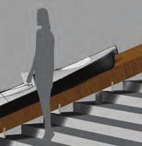
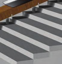
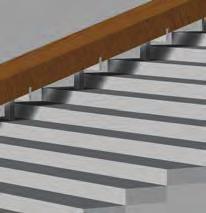
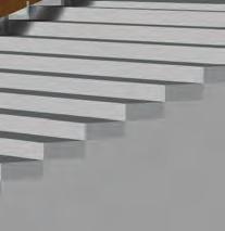
7 Beach and Terraces

8 Boat Street to be updated with trees / sidewalk condition
9 Boat Street view of updated base bid condition at terrace/ planting


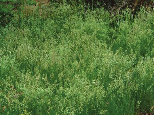
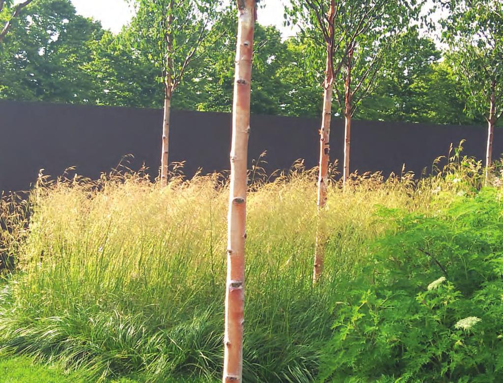
10 Tree Planting Plan LAWN RIPARIAN MEADOW RIPARIAN EMERGENT section cuts to be added yellowwood spring yellowwood fall red oak fall paper birch spring paper birch fall images showing tree habit and captions to be added
11 Site Section A-A to be updated - full section showing riparian slope up to street
12 Site Section B-B to be updated - full section showing lawn terraces up to picnic area
13 Site Elevation C-C to be updated - elevation showing pier and oaks
14 Site Section D-D to be updated - full section showing emergent planting through meadow up to street
15 Interpretive Strategy MEADOW PORTAGE TRAIL RECLAIMED TIMBER ELEMENTS PARK SIGN/ MARITIME HISTORY N


16 Interpretive Strategy Site Narratives: Maritime History Latona Bridge 1917 Lake Union Mills near Fremont, Box and Lumber Company Seattle Motor Boat Company, etc Seattle Motor Boat Company The first Seattle Boat Show, which Bryant s established in 1946.


17 Maritime History KAYAK SLIDE ENTRY SIGNAGE / MARITIME HISTORY ARCHITECTURAL CANOPY (ADD ALTERNATE)


18 Interpretive Strategy Site Narratives: Portage Map from Aqua Terra Cultural Resources Report Mohai Map of Native American Village Sites and Major Trails Burke Museum Waterlines Map sx w aćadwit Carry a Canoe Chudups John & Others Cheshiahud carving a canoe Salish Canoe Profiles Montlake from Roanoke bike trail, c.1899

19 Portage Trail trail materials/ edge design to be updated Portage Bay Park Design Commission Review 4 January 5, 2017
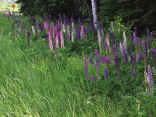
20 Cultivated Meadow along Portage Trail captions to be added Portage Bay Park Design Commission Review 4 January 5, 2017


21 Native Riparian and Emergent Planting captions to be added emergents to be added


22 Material Transitions at Portage Trail 1 1 CONCRETE PAVING FSC HARDWOOD DECKING AGGREGATE PATH WITH STONE SLAB PAVERS FIBERGRATE DECKING 5 GRAVEL BEACH


23 Material Transitions at Portage Trail detail to be replaced with axon sketch


24 Portage Trail Threshold ELEVATION perspective PERSPECTIVE
25 ADA Access & Seating LOADING RESTROOM LOADING +28 A _ update to reflect base bid condition at Boat St. ACCESSIBLE SEATING AREAS ADA ACCESS ROUTES N
26 Furnishings MOVABLE TABLES & CHAIRS STONE SEATS BENCH TIMBER SEAT AT CONCRETE SEATWALL DECK CHAIR update to reflect base bid condition at Boat St. N

27 Furnishings Stone Seats Timber Seats image to be added image to be added image to be added Movable Tables and Chairs Deck Chairs Backed Bench
28 Lighting update to reflect base bid condition at Boat St. * * * * * *** POLE LIGHTING * BOLLARD LIGHTING PARKING LOT LIGHTING PORTAGE TRAIL CURB LIGHTING INTERPRETIVE IN-GRADE LIGHTING N

29 Lighting add image Bollards Pole Lights Portage Trail Curb Light

30 Add Alternate POTENTIAL PARK CONNECTION & MID-BLOCK CROSSING BOAT STREET SEATING AREA RESTROOM & SHADE STRUCTURE MULTI-USE LAWN SAKUMA VIEWPOINT LAWN TERRACES PLANTED AREAS SHORELINE HABITAT BEACH SHORELINE HABITAT N
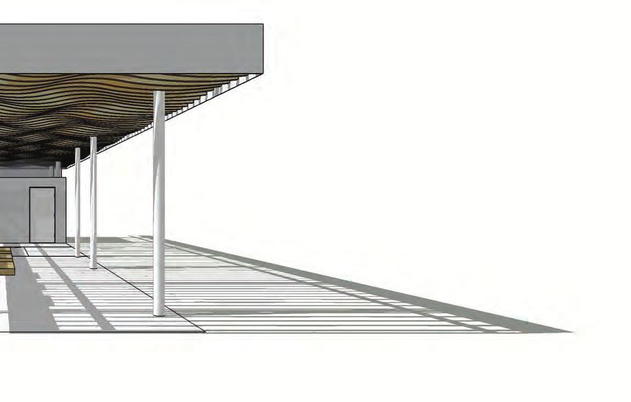
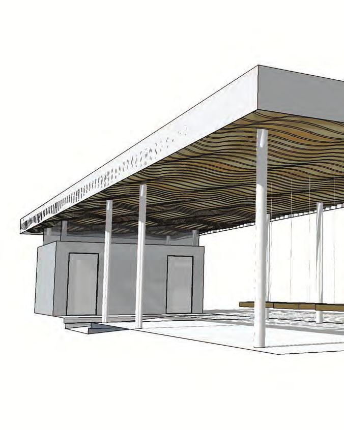
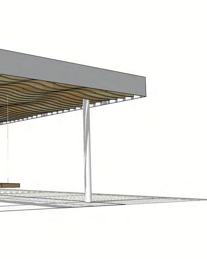
31 Architecture - Shade Pavilion 3D View from Boat St.
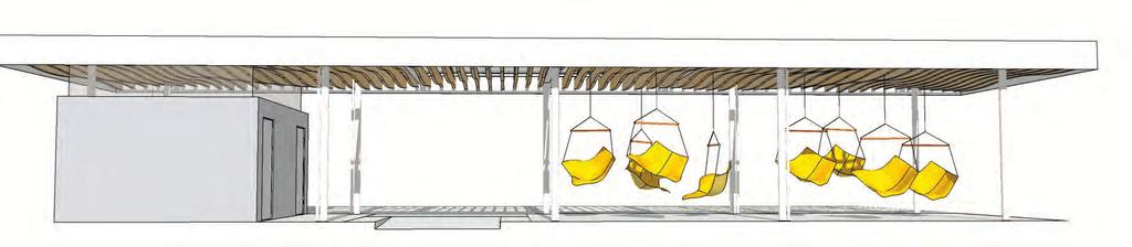
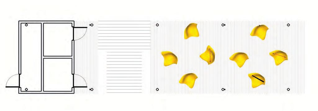
32 Architecture - Shade Pavilion

33 Architecture - Shade Pavilion

34 Future Context: UW Master Plan
35 to be updated to reflect base bid condition
36 End / Discussion
AN EARTHWORK HILL, RINGED WITH SEATING AND SHAPED TO SLOPE DOWN TO THE RIVER, FORMS THE CENTERPIECE TO A NEW SOCIAL PIER. A WOOD SEATING TERRACE
 AN EARTHWORK HILL, RINGED WITH SEATING AND SHAPED TO SLOPE DOWN TO THE RIVER, FORMS THE CENTERPIECE TO A NEW SOCIAL PIER. A WOOD SEATING TERRACE FACES SOUTH. A DRAMATIC RAMP RISES ALONG THE NORTH FACE
Elm Street Business District: Streetscape and Signage Plan
 Winnetka Preliminary Streetscape & Signage Village Council Presentation 1 Elm Street Business District: Streetscape and Signage Plan VILLAGE OF WINNETKA DOWNTOWN MASTER PLAN VILLAGE COUNCIL PRESENTATION
Hope Mills Lake Recreational Improvement Plan. Lake Advisory Committee
 Hope Mills Lake Recreational Improvement Plan Phase I Phase II Phase III This Phase is the time period prior to impoundment of the Lake. These items must be accomplished prior to the Lake level rising
The Foreshore Walk. 24m. 1m Lake Macquarie LGA. 1 hr 15 mins 2.9 km One way. Hard track 81m
 The Foreshore Walk 1 hr 15 mins 2.9 km One way Hard track 81m This walk traverses the coastline of the Green Point reserve. By following a variety of tracks and occasionally traveling inland through eucalyptus
Typical Cross Section: DOWNTOWN (Observer Highway - 8th Street)
") Typical Cross Section: DOWNTOWN (Observer Highway - 8th Street) DRAFT SEPTEMBER 23, 14 1 Washington Street Typical Block Downtown Typical Block: DOWNTOWN (Observer Highway - 8th Street) New crosswalks
Typical Cross Section: DOWNTOWN (Observer Highway - 8th Street) DRAFT SEPTEMBER 23, 14 1 Washington Street Typical Block Downtown Typical Block: DOWNTOWN (Observer Highway - 8th Street) New crosswalks
Schutte Park Master Plan February 14, 2017
 Schutte Park Master Plan February 14, 2017 Overview The Schutte Park Master Plan is a product of the City of Dover Recreation Needs Assessment. This primary planning document for all of the city parks
STREETSCAPE CONCEPT PLAN
 03 STREETSCAPE CONCEPT PLAN Zone 1 This zone includes the gateway into both the downtown and the Village at Harlem. The gateway features are shown closer to the Harlem intersection to make them more prominent.
Emerson Circle Entrance
 Emerson Circle Entrance It is not clear that there is a park in this location without a sign. Access from Emerson Circle: The present sloped granite curb does not provide access immediately at the park
Obey Creek PEDESTRIAN CIRCULATION EAST WEST PARTNERS PEDESTRIAN CIRCULATION CREEK SIDE LANE SLIP STREET SCOTT MURRAY MAIN STREETS EAST/WEST
 THE VILLAGE AT PEDESTRIAN CIRCULATION MAIN STREETS NORTH/SOUTH MAIN STREETS EAST/WEST SLIP STREET CREEK SIDE LANE PEDESTRIAN CIRCULATION DESCRIPTION: Circulation through the downtown of is organized by
COPE PARK MASTER PLAN
 COPE PARK MASTER PLAN CBJ Parks & Recreation Department is in the process of creating a Master Plan for the Cope Park Area. New restrooms are designated to be constructed in the park in the next year.
DRAFT. System Components. Greenway Trails. Introduction. Trail Types. Zebulon Greenway Master Plan
 5 System Components Wakefield Street Photo Simulation showing Sharrows Introduction The Master Plan identifies various system components that, together, create a comprehensive greenway system. These components
Brooklyn Boulevard (County Road 152) Reconstruction Project Phase I. OPEN HOUSE June 20, 2017
 Reconstruction Project Phase I. OPEN HOUSE June 20, 2017") Brooklyn Boulevard (County Road 152) Reconstruction Project Phase I OPEN HOUSE June 20, 2017 Brooklyn Boulevard (County Road 152) Phase I Project Partners Project Lead Other Project Partners include Brooklyn
Brooklyn Boulevard (County Road 152) Reconstruction Project Phase I OPEN HOUSE June 20, 2017 Brooklyn Boulevard (County Road 152) Phase I Project Partners Project Lead Other Project Partners include Brooklyn
01. VICINITY OF GREENBRAE POC: EXISTING CONDITIONS
 01. VICINITY OF GREENBRAE POC: EXISTING CONDITIONS Existing Bus Stop Existing US101 On-ramp Existing POC Old Redwood Highway Rich Street City ROW Environmental Study Limit Industrial Way NO DESIGNATED
Androscoggin River Trail Access Sites. Mahoosucs. 168 miles from its source at Lake Umbagog to Merrymeeting Bay
 Androscoggin River Trail Access Sites Mahoosucs 168 miles from its source at Lake Umbagog to Merrymeeting Bay Trail Under Construction More than 40 Public Access Sites Available Androscoggin River Watershed
CHAPTER X: PORTAGES AROUND DAMS
 CHAPTER X: PORTAGES AROUND DAMS A. General Description Portages are land routes used by paddlers to transport their boats to and from a launch area or between access sites. Often located along water bodies
MAG Town of Cave Creek Bike Study Task 6 Executive Summary and Regional Significance Report
 Page 1 MAG Town of Cave Creek Bike Study Task 6 Executive Summary and Regional Significance Report August 1, 2012 MAG Project #481 Page 2 Task 6 Executive Summary and Regional Significance Report Introduction
Parking. Parking 11/27/2012. On street parking. Off-street parking is space provided for vehicular parking outside the dedicated street right-of-way.
 Parking On street parking Off-street parking is space provided for vehicular parking outside the dedicated street right-of-way. At-grade parking lot Parking garages SITE Parking 90 degree (20 x 9 stalls)
WELCOME! TOWN CENTRE PARK INFORMATION SESSION WHAT IS HAPPENING? GOALS FOR TODAY. TOWN STAY CONNECTED WITH US! #1 INFORM WE ARE HERE
 1 WELCOME! Thank you for coming to the Information Session! Please provide us with your comments and ideas. We will use your input to inform the visioning process and creation of the framework for the
BOLAND DRIVE PATH PROJECT. Martin Le Jack Reilly Paul Rodriguez Allison Rotella Maria Wilson
 BOLAND DRIVE PATH PROJECT Martin Le Jack Reilly Paul Rodriguez Allison Rotella Maria Wilson INTRODUCTION TO PROJECT The purpose: to construct a multi-purpose path, which will connect two existing bike
RLRC COMMUNITIES EAST GRAND FORKS AREA CHARACTER THE RED LAKE RIVER & THE RED RIVER OF THE NORTH CONFLUENCE EAGLE POINT BOAT LAUNCH DESIGN
 AREA CHARACTER THE RED LAKE RIVER & THE RED RIVER OF THE NORTH CONFLUENCE EAGLE POINT BOAT LAUNCH DESIGN DESIGN DETAILS 135 AREA CHARACTER East Grand Forks a city of 7,501 people is located across the
Community Advisory Committee (CAC) Workshop #6
 Workshop #6") Community Advisory Committee (CAC) Workshop #6 MEETING SUMMARY HELD Tuesday, September 9, 2014 6:30 8:30 PM Nokomis Community Center 2401 E. Minnehaha Pkwy Minneapolis, MN 55417 Meeting Purpose: Discuss
Community Advisory Committee (CAC) Workshop #6 MEETING SUMMARY HELD Tuesday, September 9, 2014 6:30 8:30 PM Nokomis Community Center 2401 E. Minnehaha Pkwy Minneapolis, MN 55417 Meeting Purpose: Discuss
Parks, Open Space, Trails and Recreation Master Plan
 5.3 DEFINITIONS AND VOCABULARY In order to fully understand the range of trails that have been developed, and should be developed, throughout the community, a vocabulary needs to be established for the
Microscale Audit of Pedestrian Streetscapes (MAPS), Mini Version
, Mini Version") Microscale Audit of Pedestrian Streetscapes (MAPS), Mini Version Training Manual & Picture Guide Developed by: Carrie Geremia Kelli Cain Revised February 11, 2014 Tool and protocol developed by: James
Microscale Audit of Pedestrian Streetscapes (MAPS), Mini Version Training Manual & Picture Guide Developed by: Carrie Geremia Kelli Cain Revised February 11, 2014 Tool and protocol developed by: James
Neil Street Plaza Placemaking Plan
 Neil Street Plaza Placemaking Plan MARSHALL ST. SITE ORIENTATION VINE ST. COLUMBIA AVE. NEIL ST. HICKORY ST. WALNUT ST. MARKET ST. WASHINGTON ST. STATE ST. HILL ST. CHURCH ST. RANDOLPH ST. PLAZA SITE WALNUT
San Francisco Bay Area Water Trail Site Description for. Cuttings Wharf
 1 San Francisco Bay Area Water Trail Site Description for Cuttings Wharf Location, Ownership, and Management: Cuttings Wharf is a public boat launch on the Napa River, located at 1230 Cuttings Wharf Road
Androscoggin River Trail Access Sites. Mahoosucs. 168 miles from its source at Lake Umbagog to Merrymeeting Bay
 Androscoggin River Trail Access Sites Mahoosucs 168 miles from its source at Lake Umbagog to Merrymeeting Bay Trail Under Construction More than 40 Public Access Sites Available Androscoggin River Watershed
FRANKLIN RANCH COMMUNITY PARK
 HIGHLIGHTS OF AMENITIES ATHLETIC FIELDS Baseball/Softball - Field 1 Fence distance - 315 left field, 375 center field, 315 right field Base distance able to place bases at 50, 60, 65, 70, 80, 90 (This
PUBLIC REALM MASTER PLAN
 WESTSHORE BUSINESS DISTRICT PUBLIC REALM MASTER PLAN MASTER PLAN COMMITTEE MEETING MARCH 20, 2013 WESTSHORE BUSINESS DISTRCT PUBLIC REALM MASTER PLAN MACRO-SCALE CONCEPT: A PUBLIC REALM FRAMEWORK DEFINED
Clarkson Walkability Audit: Results and Recommendations Summary
 Clarkson Walkability Audit: Results and Recommendations Summary The following document was prepared by the Region of Peel and includes a summary of comments made by participants during our breakout discussion
Muizenberg Accessibility: Removing barriers to public spaces.
 Muizenberg Accessibility: Removing barriers to public spaces. Refer to SANS 10400-S:2011 Edition 3 of the building code. Note: Facilities that are not in accordance with the requirements of this part of
Green Point Circuit Walk
 Green Point Circuit Walk 3 hrs 7.7 km Circuit Hard track 269m This walk visits all of the popular locations in Green Point Reserve, as well as some of the lesser-visited areas inland. Taking in Sea Eagle
Directions for Day 1: Colwood To Metchosin
 Colwood-Metchosin Page 1 of 8 Directions for Day 1: Colwood To Metchosin Start: Royal Roads University, Birds of a Feather B&B, or at Esquimalt Lagoon Finish: Your accommodation in Metchosin Time: 4-5
Guthriesville Village Manual of Written & Graphic Design Guidelines
 Exhibit B Revisions: May 23, June 21, July 20, September 20, & October 9, 2012 Updated: December 13, 2012; June 27, 2013; February 7, 2014 Outline of Contents: 1. Purpose and Applicability 2. Overall Form
Montgomery County Life Sciences Center Loop Trail
 Montgomery County Life Sciences Center Loop Trail Advisory Committee Meeting #1 February 10, 2015 Agenda 1. Project Background 2. Existing Conditions Analysis 3. Examples from Elsewhere 4. Discussion Project
6925 & 6965 LUSK BOULEVARD CLASS A LAB AND OFFICE SPACE
 6925 & 6965 LUSK BOULEVARD CLASS A LAB AND OFFICE SPACE UTC TORREY PINES 5 ACCESS TO MOUNTAIN AND ROAD BIKING TRAILS 805 WATERIDGE CIRCLE LUSK BOULEVARD 6965 6925 COME ON IN CAFE TELESIS COURT WATERIDGE
NJDOT Complete Streets Checklist
 Background The New Jersey Department of Transportation s Complete Streets Policy promotes a comprehensive, integrated, connected multi-modal network by providing connections to bicycling and walking trip
TRANSPORTATION ALTERNATIVES PROGRAM: SELECTED PROJECTS AND FUNDING ALLOCATIONS
 ITEM #9: TRANSPORTATION ALTERNATIVES PROGRAM: SELECTED PROJECTS AND FUNDING ALLOCATIONS The Transportation Alternatives Program (TAP) created by MAP-21 requires that 50% of the program funds received by
CONCERNS / CHALLENGES
 CONCERNS / CHALLENGES Time frame Transit Pedestrian Access & Comfort Bicycle Access & Comfort Neighborhood Spillover Public Info & Signange Connection to Downtown Physical Contraints of site 0-5 years
14 TH STREET TRANSPORTATION & STREETSCAPE DESIGN STUDY PLAN B PLAN B TRANSPORTATION & STREETSCAPE RECOMMENDATIONS
 14 TH STREET TRANSPORTATION & STREETSCAPE DESIGN STUDY PLAN B PLAN B TRANSPORTATION & STREETSCAPE RECOMMENDATIONS 141 Symbols Recommendations - Southern End of 14th Street Study Area Streetscape Each icon
Sarasota High School June 26, 2018
 June 6, 08 June 9, 08 Review of SHS Security & Safety, Community Input & Ideas June 6, 08 Review of Community Concerns and Ideas, Confirm Community Enhancement Priorities July/August, 08 Vacation Application
MIAMI & ERIE CANAL SHARED USE TRAIL
 New Bremen, Ohio Survey Transportation Engineering Grant Writing Project Cost Engineers Estimate: $509,358 Bid Amount $480,892 Size 1.12 miles $597,696 ODOT TEP $249,815 ODNR Completion Projected 11/15/14
WHITE STREET/ ENGLISH PLAZA STREETSCAPE IMPROVEMENT PROJECT
 WHITE STREET/ ENGLISH PLAZA STREETSCAPE IMPROVEMENT PROJECT 1 Project Goals 1 Improved Safety: Lighting, Multi-Modal Circulation, Emergency Access, Tripping Hazards; Stormwater 4 Environmental Performance:
Bicycle and Pedestrian Facilities Toolbox (Excerpt from Figure 3.1)
") Appendix B Neighborhood Connections Summaries This Appendix is a supplement to the information presented in Chapter 3 Connect People. The Appendix includes a summary or profile for each of the proposed
Appendix B Neighborhood Connections Summaries This Appendix is a supplement to the information presented in Chapter 3 Connect People. The Appendix includes a summary or profile for each of the proposed
ACTIVE TRANSPORTATION Active Community Checklist
 ACTIVE TRANSPORTATION Active Community Checklist Safe, accessible spaces to walk, hike, bike and play is an important part of building strong, healthy and active communities for residents and visitors.
*Sandy Point State Park Paddling Routes
 *Sandy Point State Park Paddling Routes *Paddleboards are crazy popular in Anne Arundel County creeks and rivers. The life guards on this park s beaches have paddleboards to use in recusing swimmers. Not
APPENDIX A: Complete Streets Checklist DRAFT NOVEMBER 2016
 APPENDIX A: Complete Streets Checklist DRAFT NOVEMBER 2016 Complete Streets Checklist MetroPlan Orlando s Complete Streets Checklist is an internal planning tool for staff to further implementation of
FY 2016 TRANSPORTATION ALTERNATIVES PROGRAM PROJECT SELECTION
 AGENDA ITEM #8: FY 2016 TRANSPORTATION ALTERNATIVES PROGRAM PROJECT SELECTION The Transportation Alternatives Program (TAP) created by MAP-21 requires that 50% of the program funds received by the state
Thoreau Path Master Plan Final Draft. prepared for: The Boston Redevelopment Authority West End Community November 2007
 Thoreau Path Master Plan Final Draft prepared for: The Boston Redevelopment Authority West End Community November 2007 Introduction Carol R. Johnson Associates ( CRJA ) was retained by the Boston Redevelopment
CITY OF SEATTLE RESOLUTION. WHEREAS, the Washington State Department of Transportation (WSDOT) led the Seattle
 led the Seattle") SDOT SR0 Design Refinements RES August, 0 Version #D 0 CITY OF SEATTLE RESOLUTION..title A RESOLUTION relating to the State Route 0, Interstate to Medina Bridge Replacement and High Occupancy Vehicle Project;
SDOT SR0 Design Refinements RES August, 0 Version #D 0 CITY OF SEATTLE RESOLUTION..title A RESOLUTION relating to the State Route 0, Interstate to Medina Bridge Replacement and High Occupancy Vehicle Project;
CONNECTIVITY PLAN. Adopted December 5, 2017 City of Virginia Beach
 CONNECTIVITY PLAN Adopted December 5, 2017 City of Virginia Beach CONTENTS 1.0 Background & Purpose... 2 2.0 Existing Inventory & Analysis... 3 ViBe District Existing Walking Conditions... 4 3.0 ViBe District
Wellsville Recreational, Sporting and Outdoor Resources Summary
 Island Park Located off NYS 417 across from West Dyke Street Owned by the Village of Wellsville; Maintained by the Town of Wellsville Sporting Facility with Little League Field in it; pavilions, trails,
Dan Andrews. Expert Advisor to the Ontario Ministry of Tourism, Culture & Sport OPA Ed Conference, Burlington, ON March 1, 2018
 Dan Andrews Expert Advisor to the Ontario Ministry of Tourism, Culture & Sport OPA Ed Conference, Burlington, ON March 1, 2018 I Will Share With You Typical New User Experience Leading Towards Classification:
Appendix B - Street Sections
 Appendix B - Street Sections 6TH STREET CORRIDOR PLAN STREET SECTIONS The street sections in Appendix B include recommended improvements to streets for North Glenwood. They include existing conditions
Off-road Trails. Guidance
 Off-road Trails Off-road trails are shared use paths located on an independent alignment that provide two-way travel for people walking, bicycling, and other non-motorized users. Trails specifically along
RapidRide Roosevelt Seat Sea t t le t le Depa De r pa t r men men t of Sept T an r sp an or sp t or a t t a ion
 RapidRide Roosevelt Seattle Bicycle Advisory Board 1 Our mission, vision, and core values Mission: deliver a high-quality transportation system for Seattle Vision: connected people, places, and products
XI TERMINAL A TER T A W
 135 136 137 existing 138 The view from the Potomac River to the Georgetown waterfront is uninviting and cold. WISCONSIN AV ENUE 60. The view of the Potomac River is almost always obstructed by the Whitehurst
Tonight is for you. Learn everything you can. Share all your ideas.
 Strathcona Neighbourhood Renewal Draft Concept Design Tonight is for you. Learn everything you can. Share all your ideas. What is Neighbourhood Renewal? Creating a design with you for your neighbourhood.
Bowling Green Parks and Recreation Department Policy- Trail and Facility Accessibility for Mobility Devices Updated July 25, 2011
 Bowling Green Parks and Recreation Department Policy- Trail and Facility Accessibility for Mobility Devices Updated July 25, 2011 The Bowling Green Parks and Recreation Department strives to serve all
Trail Feasibility. 1. Introduction FINAL. October What s inside?
 VOLUSIA COUNTY MPO CITY OF PORT ORANGE FINAL Trail Feasibility October 2006 What s inside? 1 Introduction 2 Project Purpose & Scope 3 Physical Inventory & Assessment of Right-of- Way 4 Trail Concept Plan
Introduction Parks Open Space Standards Recreation & Open Space Land Use Design Principles
 Chapter Seven: Parks, Recreation, & Open Space Chapter Seven: Parks, Recreation, & Open Space Introduction Parks Open Space Standards Recreation & Open Space Land Use Design Principles September 2008 Page
S T A T I O N A R E A P L A N
 The Circulation and Access Plan describes vehicle, pedestrian, and transit improvements recommended within the Concept Plan. In order to create and sustain a vibrant business district that provides pedestrian-friendly
TRANSPORTATION STANDARDS
 INTRODUCTION LOCAL STREETS ON-STREET PARKING SIDEWALKS STREET LIGHTING STREET FURNISHINGS TRAFFIC CALMING STREET TREES MEDIAN PLANTING BOULEVARD LOCATIONS VILLAGE CENTER STREET LOCATIONS RESIDENTIAL STREET
Villa Rica Trail Master Plan
 Public Meeting April 18, 2018 v Presentation Outline Introductions & Benefits of Trails Master Planning Process Preliminary Findings Trail Branding Construction Standards Next Steps & Schedule PATH Planning
UNDERWATER BRIDGE INSPECTION REPORT STRUCTURE NO MSAS 123 (2 ND AVE. SW) OVER THE CANNON RIVER CITY OF FARIBAULT, RICE COUNTY
 OVER THE CANNON RIVER CITY OF FARIBAULT, RICE COUNTY") UNDERWATER BRIDGE INSPECTION REPORT STRUCTURE NO. 66546 MSAS 123 (2 ND AVE. SW) OVER THE CANNON RIVER CITY OF FARIBAULT, RICE COUNTY SEPTEMBER 13, 2012 PREPARED FOR THE MINNESOTA DEPARTMENT OF TRANSPORTATION
UNDERWATER BRIDGE INSPECTION REPORT STRUCTURE NO. 66546 MSAS 123 (2 ND AVE. SW) OVER THE CANNON RIVER CITY OF FARIBAULT, RICE COUNTY SEPTEMBER 13, 2012 PREPARED FOR THE MINNESOTA DEPARTMENT OF TRANSPORTATION
Launch Site Accessibility Evaluation & Design Recommendations
 Access Recreation Group, LLC Cindy Burkhour, MA, CTRS, CPRP 2454 Lamplighter Drive, Jenison, MI 49428-9127 Phone (616)669-9109 Mobile (616)560-2378 AccessRecreationGroup@juno.com Location: New Buffalo
WELCOME. City of Eden Prairie West 70 th Street
 WELCOME City of Eden Prairie West 70 th Street Project Schedule Sep Oct Nov Dec Jan Feb Mar Apr May Jun Jul Aug >>> May WEST SEGMENT Concept Plan Fall 2014 Plan Development Winter 2014 Summer 2015 Construction
Enhancing Downtown
 Enhancing Downtown 2014-2015 Process Masterplan reviewed TIF scope, fund availability, and timing Conceptual cost estimate stage things may change with full engineering Sequencing Coordination with businesses
1. In Reach 3, Perry, Knox, Lowell, and Hooker have crossings identified. What are these?
 Round 3 Integration Plan Integration Plan Public Meeting Denver Urban Waterways Study Meeting Date: Location: Hosted by: Attendees: August 30 2016, 5:30-7:30pm Barnum Recreation Center City and County
10/20/2010 Version 3. Guidelines for Developing Non-motorized Boat Launches in Florida
 Guidelines for Developing Non-motorized Boat Launches in Florida 1 These guidelines were prepared by the Florida Fish and Wildlife Conservation Commission with input from a Non-motorized Boating (NMB)
Chapter 6: Along the Street
 Chapter 6: Along the Street This section describes the types of infrastructure that should be in place along school routes to make walking and bicycling to school safer. Sidewalks In communities with sidewalks,
STOP! Town Hall Mee/ng Sarasota, The Vue, and You September 22, 2016 How Sarasota can have wide sidewalks.
 STOP! Town Hall Mee/ng Sarasota, The Vue, and You September 22, 2016 How Sarasota can have wide sidewalks. By Mike Lasché, MPPM Bicycle/Pedestrian Advocates Florida Walks and Bikes mike@floridawalksandbikes.org
JAP Additional Information Sheet
 JAP Additional Information Sheet Block 15: Purpose and Need The USACE purpose of the project is to provide a safe and reliable whitewater park for the recreational public in a city park, which will provide
 Time of Change We Are Growing We Are An Attractive Place To Live We Are Age Diverse + Living Longer 50000 40000 30000 20000 10000 0 2010 Census Job Density Housing Sheds Transit Sheds The Project FUNDING
MARTIN LUTHER KING JR. WAY
 OCTOBER 2011 40 Vision and Goals The Martin Luther King, Jr. Way Illustrative Master Plan that follows has been developed through a process of community involvement. It expresses a long term vision for
Point Defiance Park. Master Plan
 Point Defiance Park Master Plan Public Participation 1/29, 2/26, 3/26 & 4/23 Owen Beach Ferry Zoo Fort Nisqually Mildred Street Pearl Street Triangle Hare & Hare Master Plan - 1911 2008 Concept Plan Comments
Ocean Park Boulevard Green Street Project Community Workshop
 Ocean Park Boulevard Green Street Project Community Workshop 2.2.10 Project Objectives Community Priority: reclaim OPB for public open space. Build upon LUCE principles; neighborhood enhancement, connectivity,
Roosevelt Estates Neighborhood Improvements
 Roosevelt Estates Neighborhood Improvements Transportation Alternatives Application May 5 th, 2016 Qualifying Activities Construction of on-road and off-road trail facilities for pedestrians, bicyclists,
4.0 STREETSCAPE ELEMENTS
 .0 Table 3 lists streetscape elements and their maintenance requirements. The figures that follow the table illustrate the streetscape elements. With respect to maintenance, if an element is required as
ROUTE 81 CORRIDOR STUDY DESIGN CONCEPTS
 RT 81 Corridor Study CLINTON ROUTE 81 CORRIDOR STUDY DESIGN CONCEPTS View north on High Street, with potential improvements to the streetscape Draft Recommendations November 8 th, 2018 TOWN OF CLINTON
Of the following, which best describes you?
 Summary of Downtown Des Moines Dam Debate April 26 th, 2016 The following are the responses we heard from participants in the Dam Debate cohosted by the Register and the Des Moines Area Metropolitan Planning
Complete Streets. Designing Streets for Everyone. Sarnia
 Complete Streets Designing Streets for Everyone Sarnia Complete Streets ~ Sarnia ~ 2018 Introduction Our City is made up of a network of streets that we use to go for a walk, cycle to work, drive to the
APPENDIX L: COST ESTIMATING TOOLS
 APPENDIX L: COST ESTIMATING TOOLS Rural Arterial From LRE MOT * Mobilization * Subtotal Scope Contingency (25%) Total PE Design (15%) CEI (15%) Total Project ** New (2-Lane Roadway) with 5' Paved Shoulders
DRAFT. Malibu Bluffs Park Skate Park Facility Site Assessment. Prepared For: The City of Malibu Parks and Recreation Department
 Malibu Bluffs Park Skate Park Facility Site Assessment Prepared For: The City of Malibu Parks and Recreation Department Prepared on February 28, 2013 By: 1 INTRODUCTION AND PROJECT BACKGROUND For more
NACTO Designing Cities 2016 Seattle September 26 29
 NACTO Designing Cities 2016 Seattle September 26 29 nacto.org/conference Now in its fifth year, the NACTO Designing Cities conference is the nation's premier gathering of transportation leaders and practitioners
City of North Mankato Parks Master Plan 2015 Citizen Input
 Date/Name What park do you visit most? Why? 1/23/15 Bluff and King Arthur 1/23/15 Reserve - It is the closest park to our house and the only park we have access to if we want to walk on a sidewalk/trail
San Francisco Bay Area Water Trail Site Description for. Islais Creek
 1 San Francisco Bay Area Water Trail Site Description for Islais Creek Location, Ownership, and Management: Islais Creek Park is a small park with a gravel beach and high freeboard dock, located on the
Victoria Park Master Plan
 Victoria Park Master Plan Phase I Presented By: ARCHITECTURAL ALLIANCE & HUGHES HUGHES INC. History of Victoria Park Phase I Purpose Inventory of Existing Conditions Identification of Options by Type (for
Complete Streets Funding Program Project Prioritization Plan
 Funding Program Project Prioritization Plan Location and Type Needs South Street Crosswalk Installation Stripe a new formalized crosswalk across South Street at the Anne T. Dunphy School pedestrian path
Animas River Recreation village: A recreational Masterplan along the san juan mountain range
 Christopher Zito University of Florida Senior Capstone Project Spring 2017 Animas River Recreation village: A recreational Masterplan along the san juan mountain range Animas River Recreational Plan Prepared
INTEGRATED ACCESSIBILITY STANDARDS REGULATION. Training Module for the Design of Public Spaces Standard
 INTEGRATED ACCESSIBILITY STANDARDS REGULATION Training Module for the Design of Public Spaces Standard DISCLAIMER This training resource provides an overview of Part IV.1 of the Integrated Accessibility
Shoreline Studies Program, Department of Physical Sciences, VIMS
 Living Shoreline Training Class 2017 1 Demonstration sites discussed in this talk. 2 A shoreline management plan for the entire creek made conceptual shoreline management recommendations along every stretch
SECTION 14: LANDSCAPING AND BEAUTIFICATION
 SECTION 14: LANDSCAPING AND BEAUTIFICATION RULE 14.1 GENERAL PROVISIONS 14.1.1 The rules and guidelines contained in this section have been established to provide proper guidelines for the beautification
DEFINING THE STREETSCAPE DRAFT
 3 DEFINING THE STREETSCAPE Context Sensitive Design Context Sensitive Design The structuring elements of streetscapes for the City of Vaughan are road classifi cation, streetscape type and level of service.
The University of Alabama Pedestrian System Plan
 The University of Alabama Pedestrian System Plan 1 Introduction The University of Alabama Campus Master Plan was developed with a comprehensive open space, accessibility, and circulation system in mind,
4 GENERIC COST ESTIMATING TOOL
 4 GENERIC COST ESTIMATING TOOL Table 4-1 presents a generic cost estimating tools that can serve as a conceptual planning tool for local jurisdictions to estimate the costs of pedestrian improvements.
PROJECT KEY TYPICAL SECTION 1 =60
 6 WASHINGTON BLVD - BETWEEN NE 1ST ST AND NE 3RD ST Washington Boulevard is a low volume, low speed one-way road, signed for no street between NE 1st Street and NE 2nd Street, and closed to traffic between
SELF GUIDED TOURING ROUTE
 SELF GUIDED TOURING ROUTE Things to see and places to go on the loop from Orbost to Marlo, Cape Conran, Cabbage Tree and back to Orbost (or onwards to Cann River) V6 April 2017 This guide should be read
SR-203 Sidewalks and Town-Wide Mobility Improvements. Town Council Presentation September 7, 2016
 SR-203 Sidewalks and Town-Wide Mobility Improvements Town Council Presentation September 7, 2016 SR-203 Sidewalks and Town- Wide Mobility Improvements SR-203 Sidewalks and Appurtenances Town-Wide Mobility
Make CSUN Shine Brighter: Pedestrian and Vehicular Traffic Improvement Initiative. Progress Update February 21, 2013
 Make CSUN Shine Brighter: Pedestrian and Vehicular Traffic Improvement Initiative Progress Update February 21, 2013 Question No. 1: As we continually strive to improve and plan for a more user-friendly
STREETSCAPE CONCEPTS
 STREETSCAPE S CARGO WAY CARGO WAY CYCLE TRACK Streetscape Concepts JENNINGS ST Illustrative Plan EVANS AVE PG&E BAY TRAIL HERON S HEAD PARK The recommended improvements build off the planned improvements