Original Application Packet
|
|
|
- Lee Wilson
- 5 years ago
- Views:
Transcription
1 MARN WOODS Attahment A: Original Appliation Paket

2 City of Oak Harbor Development Servies Department 865 SE Barrington Drive, Oak Harbor, WA Phone: Fax: Projet nformation Development Appliation Marin Woods Projet Name: SW Swantown Avenue Projet Address: Oak Harbor, Washington Desription of Work: 43 lot Preliminary Plat/PRO for single family residenes. AssessorPar~ Numbe«s~_R_13_2 4_-_4_59_-_4_2 _ Land Area sq. ft. or ares): _ 1._ 6 _A r_es Zoning Distrit: _R_-_ 1 What is the Projet Valuation best guess, if neessary) $ Appliant nformation Appliant Name:_ George F. Marin Trust Address: Christine R. Marin, Exeutor ---F. R. Rik Duran, Development Mgr City/State: 245 N Vine Street, Apt 31 Salt Lake City, UT t;: ~A.~ 1 l'j e_ L -PS u-\ A fl_...h. ~G- Appliant's nterest to Property* hek one): Hf\'\ ~o -'" 32 Z o ~~L- 6 \ - q '' r' 9'7 b7_ 6 o \ - 2-+o - -S 2 'j l\.) K'. Downer Downer's Agent DLessee DContrator Dliensed Arhitet DLiensed Engineer DOther {speify) Primary Contat if othp.r th:m ;:innlbmt) F. R. Rik Duran, Development Mgr Name: The Arhinomis Group, n. Address: 342 Forest Street, Suite 3 Winnetka, L City/State: frduran@a rhi nomis.om Property Owner{s) if other than appliant) RECEVED ~Q\J 6 t.g\5 \<- t1ar\3r C\T" \ epan111ent 1 Se1' ie ~ De' e\opn1en Name: s_ A-tYt~-~-~A ~S~M~f_L_l M~~,-~ Address: City/State: Zip: Phone/Fax: *Doumentation demonstrating authorization to sign appliations on behalf of the Owners) is required.

3 All Persons/Firms having an ownership interest in the property: Arhitet Engineer: Mihael E. Ryan, PE Harmsen, n Name: 84 SE 8th Street, Suite 12 City/State: Oak Harbor, WA MihaelR@Har msenin. om Arhitet Engineer: City/State: Zip: Phone/Fax: Contrator: Name of Business: _ Contat Person: Address: City/State: Zip: Phone/Fax: WA State Contrators Liense: Exp City of Oak Harbor Business Liense: Authorization delare under penalty of the perjury laws that the information have provided on this form/appliation is true, orret, and omplete. Appliant Signature Date *Doumentation demonstrating authorization to sign appliations on behalf of the Owners) is required

4 Permit Type hek all that apply) Building Oland Use OEngineering Grading Only Oland Clearing Only Demolition Only Residential Constrution Commerial Constrution Please Note: Additional appliations or supplementary pages may apply to your projet. Permits Requested hek all that apply) DAessory Dwelling Unit LJGrading Site Plan - Type,, V LJBinding Site Plan Oland Clearing Short Plat LJBoundary Line Adjustment DLot Combination DShoreline Substantial Development Civil Plan Review DPre-Appliation D Transportation Conurreny LJ Conditional Use - ~Preliminary PRO Simple Variane - Consolidated Consolidated LJ Conditional Use - Simple DPreliminary Plat DVariane - Simple Are you requesting to proess the appliations individually per OHMC )? DYes No LJFinal Plat ~EPA Review LJZoning Code Text Amendment Projet Details fill in all appliable setions) Ground Disturbane{8Jves DNo f yes, ompletes the following questions: s disturbane greater than 1 ubi yards? 18Jves DNo Type of equipment to be used onventional learing, earth moving and paving equipment Total ubi yards of exavation 12, y Total ubi yards of fill 1?, y Critial Areas: Does the site ontain a ritial area as defined in OHMC ) DYes [8)No OUnknown f yes, please state ritial area types) Shoreline Development: s onstrution planned within 2 feet of ordinary high water? DYes 18.JNo DUnknown Floodplain: Vl s the projet site /property/or portions of the property within a floodplain? DYes ~No OUnknown
 26,2 SF What is the stormwater faility types) proposed to be used for the projet?")
5 Projet Details fill in all appliable setions) Stormwater: Will the ompleted projet result in 2, or more square feet of impervious surfae? 18Jv'es DNo DUnknown Total replaed new and impervious surfae in sq. ft) 26,2 SF What is the stormwater faility types) proposed to be used for the projet?_ Bioswale, infiltration, onveyane Land Clearing: 18Jves ONo f yes, omplete the following questions: Perentage of land to be leared_ 8% Types of vegetation to be removed native forest and understory Garry Oaks on the property? DYes ~No Estimated date of learing Future. this is a oerlim olat aoo. Type of equipment to be used onventional learing, earth moving and paving equipment Transportation Conurreny: Liensed Traffi Engineer Matt Pallmer, PE, Gibson Traffi, MattP@Gibso~Traffi.om Total length of publi streets 2 64 LF' approx Existing property use One SFR, forest Total length of private streets none ~ Land Use Data: One SFR ~rest.. One SFR forest Sq ft of new onstrution ' 1 ' Existing property use ' Proposed Property Use Residential PRO Housing Type Proposed SFR Proposed Number of Buildings SFR lots Number of Existing Dwelling Units_O_n_e Number of Proposed Dwelling Units 43 SFR Number of New Parking Spaes 4 per SFR, 172 Number of Existing Parking Spaes_ 4 Number of Existing Lots 1 Number of New Lots Proposed_ 4 _ 3 _s_f_r_l_ot_s Proposed Density Approx 4du/a, gross al. -Approx 5du/ disounting roads and open spae.

6 CTY OF OAK HARBOR Development Servies Department Critial Area dentifiation Form Projet Name if appliable): Marin Woods Assoiated Appliations): Brief Desription of Proposal: A 43 lot, preliminary PRO. APPLCANT NAME/CONTACT PERSON F. R. Rik Duran, Development Manager George F. Marin Trust The Arhinomis Group, n. Christine R. Marin, Exeutor 342 Forest Street, Suite 3 F. R. Rik Duran, Development Manager Winnetka, L ~ fr~yrgn@ar~bin2mi~~.~qm Phone and Fax: ell: PROPERTY OWNER NAME list multiple Address: George F. Marin Trust 245 N VNE ST APT 31 Christine R. Marin, Exeutor SALT LAKE CTY, UT Addre~~ frg~r~o@2r~hinqmi~~ ~Qm Phone and Fax: ell: AUTHORZATON: The undersigned hereby ertifies that the property affeted by this appliation is in the exlusive ownership of the appliant or that the appliant has submitted the appliation with the onsent of all owners of the affeted property. n addition, the undersigned hereby ertifies that all information submitted with this appliation is omplete and orret. False statements, errors, and/or omissions may be suffiient ause for denial of the request. delare under penalty of the perjury true, orret and omplete. Authorized Signature he information have provided on this form/appliation is OGN CJU 2 7 Date Staff use only below this line Yes No Critial Area Report Needed? Wetland Fish and Wildlife Habitat Conservation Area Geologially Sensitive Area Frequently Flooded Area D Critial Aquifer Reharge Area P:\Perrnit Coordinator\Permit Applialions\Development Servies Permits & Handouts\Critial Area dentifiation Form.do REV. 1/6/14
 R e11!le\ Dt!")
7 CTYOE.1 ~ 1 CTY OF OAK HARBOR Development Servies Department ~ ~;;;;;;;;;;;;;;;;;;;;;;;;;;;;;;-=-=-=-=-=-=-=~ CEVED Ttansportation Conurteny OaR~ar or \NHOB ~"Y SAN D \l\.~ H N G f 1 Appliation Forrn NOV o Pro1'et Name: Marin \Yoo d s PRO l try 1 A1' HA1wo De1 elupmenr.) R e11!le\ Dt!panniem Desription of Proposal: Preliminary Plat appliation for a 43 lot single-family home development with PRO overlay APPLCANT NAME/CONTACT PERSON Address:... George F. Marin Trust F. R. Rik Duran, Development Manager The Arhinomis Group, n. Christine R. Marin, Exeutor F. R. 342 Forest Street, Suite 3 Rik Duran, Development Mgr Winnetka, L frgur~n@~r~hiaqrni~~.qm ell: PROPERTY OWNER NAME list multiple Address: owners on a s~arate sheet): 245 North Vine Street #31 George F. arin Trust Salt Lake City, UT 9413 /o Christine Marin Address: Phone and Fax: n/a Fax: LCENSED TRAFFC ENGNEER: Address: 282 Wetmore A venue Suite 22 Gibson Traffi Engineers Everett, WA ~ddregs: Phone and Fax: in o@gi sontraffi.om P: PROJECT STE NFORMATON Number of Lots: address/loation): 1292 SW Swantown Ave 43 Oak Harbor, WA Total Length of Private Streets: Total Length of Publi Streets: 22' +/- Zoning: Existing Property Use Residential/Commerial): Rl Residential Legal Desription attah separate sheet): Parel Numbers): Attahed Rl SetionfTownship/Range: Size of Property sq.ft./ares): NE 1/4, Setion 4, Township 32N, R E W.'N. 1.6 Ares AUTHORZATON: The undersigned hereby ertifies that this appliation has been made with the onsent of the lawful property owners) and that all information submitted with this appliation is omplete and orret. False statements, errors, and/or omissions may be suffiient ause for denial of the request. Date P:\Permit Coordinator\Permit Appliations\Development Servies Permits & Handouts\Transportation Conurreny app do 4 REV

8 CTY OF OAK HARBOR Development Servies Department Subd,vlslon Waiver AppUatlon Form R.1_, ~ ED Nov 6 zo15 C"JTy 1- De1e/opinen1 '>~A/\ HARuoR '''t:e.s De ilrtmen Submittal requirements are subdivider must make the request onurrently with subdivision appliation as desribed in setion OHMC. Subdivider must inlude desription of any and all detail neessary to support the appliation. 5 opies) Projet name: Marin Woods Subdivision Waiver Appliation for Road Grade t APPLCANT NAME/CONTACT PERSON Address: George F. Marin Trust F. R. Rik Duran, Development Manager Christine R. Marin, Exeutor The Arhinomis Group, n. _ F. R. Rik Duran, Development Manager 342 Forest Street, Suite 3 frd ~ r~ n@~ r ~ hi o om i~~ ~Q rn Winnetka, L PROPERTY OWNER NAME list multiple Address: Christine R. Marin, Trustee 245 N Vine St Apt 31 George F. Marin Trust Salt Lake City, UT Address: Phone and Fax: ENGNEER/SURVEYOR: Address: Harmsen & Assoiates, n. 84 SE 8th Street, Suite 12 Attn: Mihael E. Ryan, PE Oak Harbor, WA MihaelR@Harmsenln.om PROJECT STE NFORMATON Parel Numbers): Marin Woods PRO R SW Swantown Ave SW Swantown@ Fariway Ln, Oak Harbor Legal Desription attah separate sheet): Please see Exhibit B Areage of Original Parels): 1.6 Ares AUTHORZATON: The undersigned hereby ertifies that this appliation has been made with the onsent of the lawful property owners) and that all information submitted with this appliation is omplete and orret. False statements, errors, and/or omissions may be suffiient ause for denial of the request. delare under penalty of the perjury laws that the information have provided on this form/appliation is true, orret and omplet Date P:\Permit Coordinator\Permit Appliations\Development Servies Permits & Handouts\Subdivision Waiver form.do

9 HARMSEN LAND SURVEYNG & ASSOCATES NC CVL ENGNEERNG City of Oak Harbor Development Servies Department 865 SE Barrington Drive Oak Harbor, WA RECEVED NOV O n m OAK HARUOR 19 September, 214 De' dopment Sen ie~ Department Re: Marin Woods Subdivision Waiver Appliation - Road Grade Exhibits B: Narrative Exhibit A: Legal Desription Greetings, Following pages are exhibits that ontain the narrative to support the Subdivision Waiver Appliation submitted for an exeption to the residential road grade as per OHMC a. This waiver appliation is being submitted along with the preliminary PRO plans and douments and are inluded by referene. n short, we are requesting to exeed the l % road grade for a short segment of a publi roadway within this PRO. will eagerly address any questions that you may have. Please feel free to all or me as needed. On Behalf of Landed Gentry and Marin Woods, Mihael E. ya Diretor, Oak Harbor MihaelR@Hannsenln.om ' Oaii:: Habel' L:ind9d Gem1y Mar1rl'CeDosW:11vers Mann WiJiver E~M>1ts Road GrJrle dox SLAND COUNTY 84 SE 8th Avenue, Ste. 12 Oak Harbor, Washington tel: 36) fax : 36) SNOHOMSH COUNTY 125 East Main Street, Ste. 14 Monroe, Washington tel: 36) fax : 36) Antiipate Understand Guide Deliver SKAGT COUNTY 63 South First Street Mount Vernon, Washington tel: 36) / fax: 36)

10 Marin Woods September 19, 214 Subdivision Waiver Appliation - Road Grade Exhibit A: We are seeking a subdivision deviation to exeed the City's road grade of 1% Maximum Grade as stated inohmc a. n partiular, we are seeking a waiver to allow approximately 35 feet of road grade on proposed SW Marin Drive at approximately 14%, measured PV to PV. Please See Sheet P4, SW Marin Drive Profile, sta 5+5 to sta 9+. All other internal roads as proposed do not exeed 1% and have ADA ompliant rosswalks at all interseting roads. Constraints: Existing and exessive grade: Marin Woods is dominated by a native grade slightly in exess of 11 % that spans the majority of the width of the projet and about the enter third of the projet length. Existing Aess points: SW Putnam Drive and SW Roberstson Drive urrently exist and terminate abruptly at the boundary of this projet site. A third aess is available at Swantown, no other aess points exist or are proposed. Conneting these aess points require traversing this hillside. \'...1k Harhm 4 28 anded Gnlly M,mn C'E' Do~~ \\"a1vrs\::!o MJnn \\ a1vr xhib1t; Road Grade.don

11 Marin Woods September 19, 214 Subdivision Waiver Appliation - Road Grade Justifiation: To aommodate adequate vehiular aess and to aommodate City blok length onepts, two publi streets were oneived as illustrated in the image above and per the aompanying preliminary PRD submittal. May other road onfigurations were onsidered, none of whih provided a more benefiial grade and far less benefiial lot and trat geometry. As presented, the exeptional grade ours on a vertial tangent for 5ft, with vertial urves at either end for a total length of 35 ft measured PV to PV, transitioning between a downhill road grade of 5% and an uphill grade of7.6%. This exessive grade ours on a tangent in plan view with no ompromise to sight distane. Reasons to onsider this Waiver: The topography of the trat: Native grades are steeper than the 1% maximum road grade allowed by the City. Obtaining 1% max grades throughout would require signifiant grading and earth movement. Condition or nature of adjoining areas: Vehiular aess points exist as SW Putnam Drive and SW Robetston Drive, both of whih urrently terminate at this site boundary. Connetivity to these fixed points adds additional onstraints for grade management. The existene of unusual, physial onditions: n addition to the topography of the site, the shape of the site is not onduive to alternate alignment options that may result in favorable grades without further ompromising other ity elements as to Blok struture, lot aess and lot geometry. A large rok, a glaial errati, has been disovered in Trat A. This rok is sizable, and situated suh that alternate road and lot onfigurations to avoid this rok were undesirable and further onstrained lot and road geometry. n order to provide ADA ompliant rosswalks, grade and rossfall values are further restrained to obtain suitable ADA ompliant grades at interseting roadways. Meeting ADA ompliant intersetion rosswalks results in adjaent roadway profile segments adjustments to reover grade and elevations differenes. Suh adjustments would otherwise require more signifiant earth moving and/or fewer intersetions X Oah. larbo anded Genlly f\l,mn CE' Do~ \\ J1vrs l'vhmn \\ a1ver bh1b1ts Road Grnk do'\

12 Marin Woods September 19, 214 Subdivision Waiver Appliation - Road Grade Exhibit B: Legal Desription LEGAL DESCRPTON: Per Land Title Order #LT-17737, dated April 21, 214) The West 44 feet of the Northeast Quarter of the Northeast Quarter, Setion 4, Township 32 North, Range 1, East of the Willamette Meridian. EXCEPT the following desribed trat: Beginning at the point 7.5 feet South of the Northwest orner of the Northeast Quarter of the Northeast Quarter of said Setion 4, and running thene South 34.6 feet to the North side of the ounty road; thene South 5 38' East 15.8 feet; thene North 39 22' East feet; thene North 5.26' West feet to the point of beginning. AND EXCEPT that portion lying Southwesterly of the Northeasterly right of way margin of sland County road right of way known as Swantown Road. ALSO, that portion of the following desribed trat lying Northeasterly of the ounty road in the Southeast Quarter of the Northeast Quarter, Setion 4, Township 32 North, Range 1, East of the Willamette Meridian: Beginning at the Northwest omer of said Southeast Quarter of the Northeast Quarter; thene South along the West line of said Setion a distane of 6 feet; thene Northeasterly in a straight line to a point of the North line of said Southeast Quarter of the Northeast Quarter that is 336 feet East of the point of beginning; thene West along the North line 336 feet to the point of beginning. Situate in the County of sland, State of Washington. );.1!..!!arbor Landed Gently M.mn CE\DOL> \\ aiwrs.] M.mn \\ :uwr Fxh1b1t; Road GrJde do~
13 \~~\) ~ ~~ _\J\~,\~ ~ ~... o~,_marin Woods Preliminary Plat/ PRD "-\',..~v ~e,\\ ".1 \\ r \,,._\.\ t>-'<'- oev' -- -\'{ )~ oses'\e" ntrodutory Narrative L \ e\'\ - \\" e\o, Th~ esubjet 1.6 site, originally in the City of Oak Harbor's Urban Growth Area was annexed from sland County into the City in Otober 212. A previous appliation PLN-14-1) by a proposed developer was removed from onsideration in Deember, 214. The urrent appliant is the landowner, George F. Marin Trust representing the six siblings who grew up on this property, and have ties to the ommunity exeeding half a entury. Planned are 43 single-family homes, and assoiated neighborhood parks, and open spae. To meet City requirements, the existing home on property would require demolition, for a City request for a new street onnetion from Swantown Road tied into the Fairway Lane intersetion. The site is bounded on three sides by existing built-out plats. On the north and west sides is Patton's Hillrest Village, Div No 1, an sland County plat. On the east side is Highlands West, Div No 6, a City of Oak Harbor plat with two onneting streets into the subjet. Swantown Road is on the south side, and the requested new street would modt likely be the primary entrane to the plat. Whidbey Golf and Country Club is aross Swantown Road. The property rises approximately 1 feet from Swantown Road to the northerly rear of the site, whih is similar grade hange to the adjaent Highlands West Div No 6. A hallenge is, with 8 feet of grade hange aross many of the lots, reating usable building sites. Retaining walls and lot-perimeter drainage between the lots will help mitigate the grade. The grade also provides most of the lots with great views to the south-southwest. Most building sites will have long views of water. Existing City of Oak Harbor utilities are loated at the perimeter of the site at all three onneting points and have been desribed by City departments as generally suffiient to serve the s.ubjet site. Storm-water is governed by a 22 Water Drainage Agreement Golf Course Basin) and a 1997, revised 27) drainage model whih requires the site to disharge first into the surrounding system. The City and County are also signatories of this agreement. Three trats of open spae have been established where the existing native forestation will remain, and additionally a site-perimeter will also preserve nature forestation. PC Marin Woods ATTACHMENT A
14 The antiipated market for the ompleted homes is the Navy personnel housing needs in the oming years with expeted prie range of $3, to $325,. The proposed new street onneting to the Fairway Lane intersetion would eliminate the existing home on property, originally planned for renovation and upgrade to fit the new surrounding development. Work on-site is antiipated to begin in first quarter 216, infrastruture onstrution beginning in the seond quarter 216, and first housing starts beginning in the third quarter 216. George F. Marin Trust F. R. Rik Duran Development Manager for the Trust

15 SEPA ENVRONMENTAL CHECKLST CTY OF OAK HARBOR 865 SE BARRNGTON DRVE OAK HARBOR, WA Purpose of heklist: Governmental agenies use this heklist to help determine whether the environmental impats of your proposal are signifiant. This information is also helpful to determine if available avoidane, minimization or ompensatory mitigation measures will address the probable signifiant impats or if an environmental impat statement will be prepared to further analyze the proposal. nstrutions for appliants: [help] This environmental heklist asks you to desribe some basi information about your proposal. Please answer eah question aurately and arefully, to the best of your knowledge. You may need to onsult with an ageny speialist or private onsultant for some questions. You may use "not appliable" or "does not apply" only when you an explain why it does not apply and not when the answer is unknown. You may also attah or inorporate by referene additional studies reports. Complete and aurate answers to these questions often avoid delays with the SEPA proess as well as later in the deisionmaking proess. The heklist questions apply to all parts of your proposal, even if you plan to do them over a period of time or on different parels of land. Attah any additional information that will help desribe your proposal or its environmental effets. The ageny to whih you submit this heklist may ask you to explain your answers or provide additional information reasonably related to determining if there may be signifiant adverse impat. nstrutions for Lead Agenies: Additional information may be neessary to evaluate the existing environment, all interrelated aspets of the proposal and an analysis of adverse impats. The heklist is onsidered the first but not neessarily the only soure of information needed to make an adequate threshold determination. One a threshold determination is made, the lead ageny is responsible for the ompleteness and auray of the heklist and other supporting douments. Use of heklist for non-projet proposals: [help] For non-projet proposals suh as ordinanes, regulations, plans and programs), omplete the appliable parts of setions A and B plus the SUPPLEMENTAL SHEET FOR NON PROJECT ACTONS part D). Please ompletely answer all questions that apply and note that the words "projet," "appliant," and "property or site" should be read as
![A. BACKGROUND [help] 1. Name of proposed projet, if appliable: [help] Marin Woods PRD 2. Name of appliant: [help] George F Marin Trust [1] Christine R.](/docs-images/91/107478734/images/16-0.jpg "Marin, Exeutor [2] F R Rik Duran, Development Manager 3.")
16 A. BACKGROUND [help] 1. Name of proposed projet, if appliable: [help] Marin Woods PRD 2. Name of appliant: [help] George F Marin Trust [1] Christine R. Marin, Exeutor [2] F R Rik Duran, Development Manager 3. Address and phone number of appliant and ontat person: [help] [1] Christine R Marin 245 Vine ST APT 31, Salt Lake City, UT [2] FR Rik Duran, 342 Forest ST STE 3 Winnetka, L Date heklist prepared: [help] 6 Nov Ageny requesting heklist: [help] City of Oak Harbor 6. Proposed timing or shedule inluding phasing, if appliable): [help] Plat onstrution Early Spring Do you have any plans for future additions, expansion, or further ativity related to or onneted with this proposal? f yes, explain. [help] No 8. List any environmental information you know about that has been prepared, or will be prepared, diretly related to this proposal. [help] Storm Drainage Report 9. Do you know whether appliations are pending for governmental approvals of other proposals diretly affeting the property overed by your proposal? f yes, explain. [help] No 1. List any government approvals or permits that will be needed for your proposal, if known. [help] Preliminary and Final Plat Approval from City of Oak Harbor
17 11. Give brief, omplete desription of your proposal, inluding the proposed uses and the size of the projet and site. There are several questions later in this heklist that ask you to desribe ertain aspets of your proposal. You do not need to repeat those answers on this page. Lead agenies may modify this form to inlude additional speifi information on projet desription.) [help] 43 lot residential subdivision to inlude grading, installation of utilities, road onstrution 12. Loation of the proposal. Give suffiient information for a person to understand the preise loation of your proposed projet, inluding a street address, if any, and setion, township, and range, if known. f a proposal would our over a range of area, provide the range or boundaries of the sites). Provide a legal desription, site plan, viinity map, and topographi map, if reasonably available. While you should submit any plans required by the ageny, you are not required to dupliate maps or detailed plans submitted with any permit appliations related to this heklist. [help] Site address: 1292 Swantown Road, Oak Harbor, WA Tax Parel: R Loated on the NE A, NE 1A, Se 4, Twp 32 N, Range 1 E WM Complete plan set and reports aompanies this heklist.
![B. ENVRONMENTAL ELEMENTS [help] 1. Earth a. General desription of the site [help] irle one): Flat, rolling, hilly, steep slopes, mountainous, other approximate 95 feet of grade hange aross the 1.](/docs-images/91/107478734/images/18-0.jpg "6 ares over 13 LF. b. What is the steepest slope on the site approximate perent slope)? [help] 15%. What general types of soils are found on the site for example, lay, sand, gravel, peat, muk)?")
18 B. ENVRONMENTAL ELEMENTS [help] 1. Earth a. General desription of the site [help] irle one): Flat, rolling, hilly, steep slopes, mountainous, other approximate 95 feet of grade hange aross the 1.6 ares over 13 LF. b. What is the steepest slope on the site approximate perent slope)? [help] 15%. What general types of soils are found on the site for example, lay, sand, gravel, peat, muk)? f you know the lassifiation of agriultural soils, speify them and note any agriultural land of long-term ommerial signifiane and whether the proposal results in removing any of these soils. [help] mostly glaial till d. Are there surfae indiations or history of unstable soils in the immediate viinity? f so, desribe. [help] none known e. Desribe the purpose, type, total area, and approximate quantities and total affeted area of any filling, exavation, and grading proposed. ndiate soure of fill. [help] roads will be onstruted with Whidbey sland pit run and proessed gravels otherwise attempts will be made to balane the onsite uts and fills. f. Could erosion our as a result of learing, onstrution, or use? f so, generally desribe. [help] yes, normal to this type of onstrution Appliant proposes to use appropriate management praties. g. About what perent of the site will be overed with impervious surfaes after projet onstrution for example, asphalt or buildings)? [help] 47% Roadways 92, 7 SF, driveways 27,7 SF, Roofs 85,8 SF = 26,2 461, 736 SF h. Proposed measures to redue or ontrol erosion, or other impats to the earth, if any: [help] See storm drainage analysis report storm water will be olleted, run through bioretention system prior to disharge to existing exit dith.
19 2. Air a. What types of emissions to the air would result from the proposal during onstrution, operation, and maintenane when the projet is ompleted? f any, generally desribe and give approximate quantities if known. [help] During onstrution - equipment exhaust and dust Dust ontrol measures will be employed After onstrution - new home heating system exhaust b. Are there any off-site soures of emissions or odor that may affet your proposal? f so, generally desribe. [help] none known. Proposed measures to redue or ontrol emissions or other impats to air, if any: [help] Dust emissions will be ontrolled by dampening the open soils to minimize dust
![3. Water a. Surfae Water: [help] 1) s there any surfae water body on or in the immediate viinity of the site inluding year-round and seasonal streams, saltwater, lakes, ponds, wetlands)?](/docs-images/91/107478734/images/20-0.jpg "f yes, desribe typeand provide names. f appropriate, state what stream or river it flows into. [help] No 2) Will the projet require any work over, in, or adjaent to within 2 feet) the desribed waters?")
20 3. Water a. Surfae Water: [help] 1) s there any surfae water body on or in the immediate viinity of the site inluding year-round and seasonal streams, saltwater, lakes, ponds, wetlands)? f yes, desribe typeand provide names. f appropriate, state what stream or river it flows into. [help] No 2) Will the projet require any work over, in, or adjaent to within 2 feet) the desribed waters? f yes, please desribe and attah available plans. [help] Not appliable 3) Estimate the amount of fill and dredge material that would be plaed in or removed from surfae water or wetlands and indiate the area of the site that would be affeted. ndiate the soure of fill material. [help] Not appliable 4) Will the proposal require surfae water withdrawals or diversions? Give general desription, purpose, and approximate quantities if known. [help] Not appliable 5) Does the proposal lie within a 1-year floodplain? f so, note loation on the site plan. [help] No 6) Does the proposal involve any disharges of waste materials to surfae waters? f so, desribe the type of waste and antiipated volume of disharge. [help] No b. Ground Water: 1) Will groundwater be withdrawn from a well for drinking water or other purposes? f so, give a general desription of the well, proposed uses and approximate quantities withdrawn from the well. Will water be disharged to groundwater? Give general desription, purpose, and approximate quantities if known. [help] No ground water withdrawn or disharged to groundwater. The existing well will be formally deommissioned. 2) Desribe waste material that will be disharged into the ground from septi tanks or other soures, if any for example: Domesti sewage; industrial, ontaining the following hemials... ; agriultural; et.). Desribe the general size of the system, the number of suh systems, the number of houses to be served if appliable), or the number of animals or humans the systems) are expeted to serve. [help]
21 Sanitary sewer will serve the site, so no sewage drainfield will be installed. The existing drainfield serving the existing house will be deommissioned along with the removal of the existing house.. Water runoff inluding stormwater): 1) Desribe the soure of runoff inluding storm water) and method of olletion and disposal, if any inlude quantities, if known). Where will this water flow? Will this water flow into other waters? f so, desribe. help] See Coneptual Storm Water Analysis for the subjet projet. Soure of runoff will be roadways, driveways and roofs that will be olleted treated and disharged to existing exit dith. 2) Could waste materials enter ground or surfae waters? f so, generally desribe. [help] No 3) Does the proposal alter or otherwise affet drainage patterns in the viinity of the site? f so, desribe. No d. Proposed measures to redue or ontrol surfae, ground, and runoff water, and drainage pattern impats, if any: Use BMP's per DOE manual
![4. Plants [help] a.](/docs-images/91/107478734/images/22-0.jpg "Chek the types of vegetation found on the site: [help] _X _deiduous tree: alder, maple, aspen, other _X_evergreen tree: fir, edar, pine, other _shrubs _X_grass _pasture _rop or grain _ Orhards,")
22 4. Plants [help] a. Chek the types of vegetation found on the site: [help] _X _deiduous tree: alder, maple, aspen, other _X_evergreen tree: fir, edar, pine, other _shrubs _X_grass _pasture _rop or grain _ Orhards, vineyards or other permanent rops. _wet soil plants: attail, butterup, bullrush, skunk abbage, other _water plants: water lily, eelgrass, milfoil, other _other types of vegetation b. What kind and amount of vegetation will be removed or altered? [help] As part of the projet the City of Oak Harbor ordinanes require 15% of site must be left or replanted as native vegetation.. List threatened and endangered speies known to be on or near the site. [help] None known d. Proposed landsaping, use of native plants, or other measures to preserve or enhane vegetation on the site, if any: [help] Per "B" above, graphially displayed on the attahed landsape plans. e. List all noxious weeds and invasive speies known to be on or near the site. None Known

23 5. Animals a. List any birds and other animals whih have been observed on or near the site or are known to be on or near the site. Examples inlude: [help] YES YES birds: hawk, heron, eagle, songbirds, other: mammals: deer, bear, elk, beaver, other: fish: bass, salmon, trout, herring, shellfish, other b. List any threatened and endangered speies known to be on or near the site. [help] None Known. s the site part of a migration route? f so, explain. [help] This site lies within the Paifi flyway, as does most of the Puget Sound basin. d. Proposed measures to preserve or enhane wildlife, if any: [help] A entral park with most of the existing forest is planned to be retained. e. List any invasive animal speies known to be on or near the site. None Known
24 6. Energy and natural resoures a. What kinds of energy eletri, natural gas, oil, wood stove, solar) will be used to meet the ompleted projet's energy needs? Desribe whether it will be used for heating, manufaturing, et. [help] PSE & Casade Natural Gas will be provided to eah new lot for domesti residential use b. Would your projet affet the potential use of solar energy by adjaent properties? f so, generally desribe. [help] Possibly in a favorable way - muh of the forest site will be leared opening areas adjaent to more sunlight. What kinds of energy onservation features are inluded in the plans of this proposal? List other proposed measures to redue or ontrol energy impats, if any: [help] The new homes will be built to the urrent energy odes.
25 7. Environmental health a. Are there any environmental health hazards, inluding exposure to toxi hemials, risk of fire and explosion, spill, or hazardous waste, that ould our as a result of this proposal? f so, desribe. [help] None Known 1) Desribe any known or possible ontamination at the site from present or past uses. Very little as the site is surrounded on three sides by existing homes and a golf ourse on the fourth side. 2) Desribe existing hazardous hemials/onditions that might affet projet development and design. This inludes underground hazardous liquid and gas transmission pipelines loated within the projet area and in the viinity. Constrution noise during plat and home onstrution short term during ity authorized hours. Long term, some additional traffi. 3) Desribe any toxi or hazardous hemials that might be stored, used, or produed during the projet's development or onstrution, or at any time during the operating life of the projet. Work during ity authorized hours 4) Desribe speial emergeny servies that might be required. Normal residential needs for 43 homes. 5) Proposed measures to redue or ontrol environmental health hazards, if any: Community to omply with appliable City standards b. Noise 1) What types of noise exist in the area whih may affet your projet for example: traffi, equipment, operation, other)? [help] Normal residential noise for 43 homes. 2) What types and levels of noise would be reated by or assoiated with the projet on a short-term or a long-term basis for example: traffi, onstrution, operation, other)? ndiate what hours noise would ome from the site. [help] Normal residential noise patterns for 43 homes. 3) Proposed measures to redue or ontrol noise impats, if any: [help] Community to omply with appliable City standards

26 8. Land and shoreline use a. What is the urrent use of the site and adjaent properties? Will the proposal affet urrent land uses on nearby or adjaent properties? f so, desribe. [help] Currently the site is a forested vaant site. Residential uses on three sides, and b. Has the projet site been used as working farmlands or working forest lands? f so, desribe. How muh agriultural or forest land of long-term ommerial signifiane will be onverted to other uses as a result of the proposal, if any? f resoure lands have not been designated, how many ares in farmland or forest land tax status will be onverted to nonfarm or non-forest use? [help] No 1) Will the proposal affet or be affeted by surrounding working farm or forest land normal business operations, suh as oversize equipment aess, the appliation of pestiides, tilling, and harvesting? f so, how: No. Desribe any strutures on the site. [help] One existing residene that is proposed to be moved off site or demolished d. Will any strutures be demolished? f so, what? [help] Yes, the existing home will be moved or demolished e. What is the urrent zoning lassifiation of the site? [help] R 1 f. What is the urrent omprehensive plan designation of the site? [help] Residential g. f appliable, what is the urrent shoreline master program designation of the site? [help] Not appliable h. Has any part of the site been lassified as a ritial area by the ity or ounty? f so, speify. [help] No i. Approximately how many people would reside or work in the ompleted projet? [help] 43 homes at 3 persons per home equals 129 people. j. Approximately how many people would the ompleted projet displae? [help] - the existing two resident swill move to one of the new homes k. Proposed measures to avoid or redue displaement impats, if any: [help] None
27 L. Proposed measures to ensure the proposal is ompatible with existing and projeted land uses and plans, if any: [help] The PRD overlay assumes a more planned neighborhood to be built out by appliant m. Proposed measures to ensure the proposal is ompatible with nearby agriultural and forest lands of long-term ommerial signifiane, if any: The reation of open spaes, and lustering of native vegetation. No agriulture nearby.
![9. Housing a. Approximately how many units would be provided, if any? ndiate whether high, middle, or low-inome housing. [help] 43 homes for middle inome families b.](/docs-images/91/107478734/images/28-0.jpg "Approximately how many units, if any, would be eliminated? ndiate whether high, middle, or low-inome housing. [help] one unit eliminated.")
28 9. Housing a. Approximately how many units would be provided, if any? ndiate whether high, middle, or low-inome housing. [help] 43 homes for middle inome families b. Approximately how many units, if any, would be eliminated? ndiate whether high, middle, or low-inome housing. [help] one unit eliminated. Proposed measures to redue or ontrol housing impats, if any: [help] The projet enhanes the housing hoies in the City of Oak Harbor. 1. Aesthetis a. What is the tallest height of any proposed strutures), not inluding antennas; what is the prinipal exterior building materials) proposed? [help] 35 foot proposed to be within residential building ode envelope b. What views in the immediate viinity would be altered or obstruted? [help] By seletive removal of some of the trees, some neighboring views ould be enhaned - site slopes westerly over the golf ourse.. Proposed measures to redue or ontrol aestheti impats, if any: [help] t will be a planned ommunity by one builder intended to enhane the surrounding neihghborhood
!['. 11. Light and glare a. What type of light or glare will the proposal produe? What time of day would it mainly our? [help] Street light and residential home lighting b.](/docs-images/91/107478734/images/29-0.jpg "Could light or glare from the finished projet be a safety hazard or interfere with views? [help] Not likely. What existing off-site soures of light or glare may affet your proposal?")
29 '. 11. Light and glare a. What type of light or glare will the proposal produe? What time of day would it mainly our? [help] Street light and residential home lighting b. Could light or glare from the finished projet be a safety hazard or interfere with views? [help] Not likely. What existing off-site soures of light or glare may affet your proposal? [help] None Known d. Proposed measures to redue or ontrol light and glare impats, if any: [help] None needed - street lighting fixture seletion 12. Rereation a. What designated and informal rereational opportunities are in the immediate viinity? [help] Whidbey Golf & Country Club aross the street. City parks and the on-site one-are park b. Would the proposed projet displae any existing rereational uses? f so, desribe. [help] No. Proposed measures to redue or ontrol impats on rereation, inluding rereation opportunities to be provided by the projet or appliant, if any: [help] On-site park and pedestrian onnetors and sidewalks
30 ' 13. Histori and ultural preservation a. Are there any buildings, strutures, or sites, loated on or near the site that are over 45 years old listed in or eligible for listing in national, state, or loal preservation registers loated on or near the site? f so, speifially desribe. [help] No b. Are there any landmarks, features, or other evidene of ndian or histori use or oupation? This may inlude human burials or old emeteries. Are there any material evidene, artifats, or areas of ultural importane on or near the site? Please list any professional studies onduted at the site to identify suh resoures. [help] No. Desribe the methods used to assess the potential impats to ultural and histori resoures on or near the projet site. Examples inlude onsultation with tribes and the department of arheology and histori preservation, arhaeologial surveys, histori maps, GS data, et. [help] None d. Proposed measures to avoid, minimize, or ompensate for loss, hanges to, and disturbane to resoures. Please inlude plans for the above and any permits that may be required. None

31 14. Transportation a. dentify publi streets and highways serving the site or affeted geographi area and desribe proposed aess to the existing street system. Show on site plans, if any. [help] The main entrane will be off Swantown Road but SW Putnam Drive and SW Robertson DR will onnet to the east side of the plat. Site plan attahed. b. s the site or affeted geographi area urrently served by publi transit? f so, generally desribe. f not, what is the approximate distane to the nearest transit stop? [help] No. How many additional parking spaes would the ompleted projet or non-projet proposal have? How many would the projet or proposal eliminate? [help] Eah lot will have a minimum of two off-street parking pots. Some of the home will have three-ar garages. d. Will the proposal require any new or improvements to existing roads, streets, pedestrian, biyle or state transportation failities, not inluding driveways? f so, generally desribe indiate whether publi or private). [help] Yes - a new publi street system will be built to serve the new lots e. Will the projet or proposal use or our in the immediate viinity of) water, rail, or air transportation? f so, generally desribe. [help] No f. How many vehiular trips per day would be generated by the ompleted projet or proposal? f known, indiate when peak volumes would our and what perentage of the volume would be truks suh as ommerial and nonpassenger vehiles). What data or transportation models were used to make these estimates? [help] see attahed traffi impat analysis TA) 42 PM peak hour trips g. Will the proposal interfere with, affet or be affeted by the movement of agriultural and forest produts on roads or streets in the area? f so, generally desribe. No h. Proposed measures to redue or ontrol transportation impats, if any: [help] Pay traffi mitigation fees and omply with the reommendations of the traffi impat analysis

32 15. Publi servies a. Would the projet result in an inreased need for publi servies for example: fire protetion, polie protetion, publi transit, health are, shools, other)? f so, generally desribe. [help] Only as typial of a normal middle-inome residential ommunity of forty three homes. b. Proposed measures to redue or ontrol diret impats on publi servies, if any. [help] partiipate in the urrent impat fee struture of the ity 16. Utilities a. Cirle utilities urrently available at the site: [help] eletriity, natural gas, water, refuse servie, telephone, sanitary sewer, septi system, other able TV b. Desribe the utilities that are proposed for the projet, the utility providing the servie, and the general onstrution ativities on the site or in the immediate viinity whih might be needed. [help] Sanitary sewer, refuse olletion, water - City of Oak Harbor Eletriu - PSE Natural Gas - Casade Natural Gas Telephone & Cable - Frontier, Comast C. SGNATURE [HELP] The above answers are true and omplete to the best of my knowledge. understand that the lead ageny is relying on them to make its deision. delare under penalty of the perjury laws that the information have provided on this form/appliation is true ret a omplete. Signature: Name ofsignee f. f<., i.t?/ Duf.k.} Position and Ageny /Organization JyrU~P/f /;,AJT 11'~ /Ef/;J;:fYM/A:i Date Submitted: D6' A.Jt;tJ b S-
 575.5973 t 26) 794-7811 f 36) 85-9732 www.")
33 u PC Marin Woods ATTACHMENT A ' r l CONCEPTUAL STORM DRANAGE ANALYSS FOR the PRD of Marin Woods SW Swantown Avenue Loated at the intersetion of Swantown Ave and Fairway Lane Oak Harbor, Washington September 23, 214 Mihael E. Ryan, PE _ r HARMSEN & ASSOCATES NC ANTCPATE UNDERSTAND GUDE DELVER 84 se 8 1 h Ave, Oak Harbor, WA t 36) t 26) f 36)

34 Coneptual Storm Drainage Report September 23, 214 Marin Woods PAGE l Table of Contents PROJECT DESCRPTON... 3 SUMMARY OF THE 1997 STUDY AND 27 UPDATE:... 5 METHODOLOGY... 6 SOLS DATA... 6 DRANAGE ANALYSS... 7 EXSTNG CONDTONS... 7 DEVELOPED CONDTONS... 8 STORM DRAN ANALYSS... 1 Minimum Requirement #1: Preparation of Storm water Site Plans... 1 Minimum Requirement #2: Constrution Storm water Pollution Prevention... 1 Minimum Requirement #3: Soure Control of Pollution... 1 Minimum Requirement #4: Preservation of Natural Drainage System... 1 Minimum Requirement #5: On-site Stormwater Management... 1 Minimum Requirement #6: Runoff Treatment Minimum Requirement #7: Flow Control Minimum Requirement #8: Wetlands Protetion Minimum Requirement #9: Basin Planning Minimum Requirement #1: Operation and Maintenane Marin Drainage Rpt Coneptual MER/dwh

35 Coneptual Storm Drainage Report September 23, 214 Marin Woods PAGE2 Table of Figures Figure 1 Marin Woods Coneptual Landsape Plan by eos Design... 3 Figure 2 Existing Conditions Aerial... 7 Figure 3 Developed Conditions... 8 Appendix A B D E F G H 214 WWHM3 Sreen Shots 214 NRSC Soil Data 214 Plan Sheet Pl, "Existing Conditions/Topographi Survey" 214 Plan Sheet P2, "Preliminary Grading Plan "1997 Study", Golf Course Drainage Basin Stormwater Mitigation Study, August 1997 "27 Update", Golf Course Drainage Basin, North Basin Build-Out Stormwater Evaluation, published in 27 "22 Drainage Agreement", Basin Study Agreement between the City of Oak Harbor, sland County and the Whidbey Golf Course "214 Agreement Letter", Van Ness Feldman letter to Landed Gentry re "22 Drainage Agreement" Marin Drainage Rpt Coneptual MER/dwh l

36 Coneptual Storm Drainage Report September 23, 214 Marin Woods PAGE3 PROJECT DESCRPTON This report is a Coneptual Drainage Report that is being submitted with Preliminary PRD plans of Marin Woods to the City of Oak Harbor for onsideration and approval. A Final Drainage Reports and PRD Constrution plans shall be submitted at a later date and after preliminary approval of this PRD is ahieved. Marin Woods is a proposed Planned Residential Development that is situated in approximately 1. 6 ares of undeveloped area east of the intersetion of Swantown Road at Fairway Lane. This nearly retangular site is bound on three sides by developed residential neighborhoods, and slopes approximately and generally at 1% towards Swantown Road whih borders the fourth side. This PRD proposes 43 individual lots for single family homes, publi roadways with utilities and three trats. The 1.6 Ares of trats inlude opens spae, preserved native vegetation, rereational areas and a bioretention ell that provides water quality for all pollution generating surfaes. Figure 1 Marin Woods Coneptual Landsape Plan by eos Design Low mpat Development onsiderations inlude redued roadway setion standards per the City of Oak Harbor's "Loal Residential, Narrow" and "Loal LD Street #1 ". This onsists of two drive lanes with one parking lane in areas ontaining homes, and two lanes without parking where the publi road passes between trats A and B. The hillside development will ontain terraes with short MSE walls or rokeries to redue the ross fall of yards. Roof runoff shall be provided by BMP T5.1 via perforated stub-outs as infiltration and vegetated flow paths are both unsuitable for infiltration or dispersion tehniques in the viinity of the homes. Disturbed soils shall be amended per BMP T5.13 and permanently landsaped. Additionally, this projet is seeking administrative approval to redue the publi sidewalks from the 5 ft typial width to 4 ft width on eah side of the roadways within the PRD. The rosswalks have ADA ompliant widths with 5% max slope or rossfall at intersetions per WSDOT 151.6, and United Stated Aess Board USAB) hapter Marin Drainage Rpt Coneptual MER/dwh

37 Coneptual Stonn Drainage Report September 23, 214 Marin Woods PAGE4 Sidewalks also ross driveways frequently whih have the effet of a wider sidewalk at those loations and provide the pedestrian "passing lanes" per the ADA requirements for redued sidewalk widths per WSDOT 151.6, and USAB hapter 3. Water quality is ahieved via a bioretention ell loated in Trat C at the downhill edge of the development and parallel to Swantown Road. The bioretention faility is loated in an area that may ontain a different soil profile than the upland home sites) that may be onduive to infiltration. Currently, this report assumes that infiltration is unavailable or inadequate, and the water quality faility has been designed with underdrains that will allow infiltration to our at whatever apaity is available but provide a method for adequate drainage. Although the bioretention faility will retard the disharge of stormwater and have some storage apaity, no stormwater detention is proposed. Per the Golf Course Drainage Basin Stormwater Mitigation Study published August Study), and the subsequent 27 Golf Course North Basin Build-Out Stonnwater Evaluation 27 Update) whih updated 1997 Study, this development proposes rapid release of stormwater for Marin Woods. The 1997 Study and the 27 Update are attahed as Appendies E and F. A three-party agreement Drainage Agreement) between the City of Oak Harbor, sland County and the Whidbey sland Golf Course was established in Marh of 22. The 22 Drainage Agreement outlines how future development shall be oordinated per the 1997 Study. n June of 214, the 22 Drainage Agreement was reviewed by Jay Derr, atty, with Van Ness Feldman, LLP, and an evaluation of the 22 Drainage Agreement Evaluation of Drainage Agreement) was prepared for Landed Gentry. The 22 Drainage agreement and the 214 Evaluation of Drainage Agreement are attahed as Appendies G and H Marin Drainage Rpt Coneptual MER/dwh l

38 Coneptual Storm Drainage Report September 23, 214 Marin Woods PAGE5 SUMMARY OF THE 1997 STUDY AND 27 UPDATE: Marin Woods dominates the undeveloped areas labeled as Nl and N2 in 1997 Study and 27 Update. Areas Nl and N2 are reommended for rapid release via the "Exit Dith" whih is the natural and histori waterway for all of area Nl and N2 whih terminate into the Sound at West Beah. The 1997 Study analyzed storm drainage of the existing onditions of areas surrounding the Whidbey Golf Course and proposed a basin approahed solution for stormwater management. The 1997 Study predited growth and development of the undeveloped areas, then was updated in 27 to aount for growth that had ourred and re-predit growth that was available. This PRD proposes more hardsape than did the original 1997 basin study, but signifiantly less hardsape than was measured and proposed in the 27 Update. Marin Woods is the last of the undeveloped 1.6 are spae available in the approximately 3 ares of basins Nl and N2. All other areas of Nl and N2 are urrently platted into lots with single family homes in existene. Additional growth in areas Nl and N2 an only result in sub dividing existing, developed lots, or by removing existing homes and reonfiguring lot lines. Additional growth is possible, but not likely to our on a large sale. Disharge from this site, the golf ourse basins and signifiantly larger ontributing area that drains into Loer's Pond ultimately join and flow through the "Exit Dith" to a release point to the Sound at West Beah. The basi premise of the 1997 Study whih was upheld in the 27 Update, is that the release from the 24 are golf ourse basin and even larger release potential from Loer's Pond is signifiant and somewhat delayed as ompared to the release from the 3 are drainage basin Nl and N2 whih ontain 1.6 ares of Marin Woods). Areas Nl, N2 and N3 and Loer's Pond release all gravity flow to West Beah whereas the Golf Course basin ontains a pumped disharge from the Golf Course itself. The Marin Woods disharge peak flow and veloity is substantially less than the Golf ourse release and Loer' s Pond release. The 1997 Study reommend that the release from areas Nl, N2 and N3 whih ontain Marin Woods) shall be allowed to flow ahead of/prior to the golf ourse surge and Loer's Pond surge, and thus not ompound either subsequent surge Marin Drainage Rpt Coneptual MER/dwh
 as adopted by the City of Oak Harbor.")
39 Coneptual Stonn Drainage Report September 23, 214 Marin Woods METHODOLOGY PAGE6 The drainage design for the site was prepared using the requirements of the Washington State Department of Eology Storm Water Management Manual for Westem Washington, 25, DOE Manual) as adopted by the City of Oak Harbor. Western Washington Hydrology Model, Version 3 WWHM3), as supplied by the Department of Eology, was used to prepare runoff alulations. L SOLS DATA Aording to the Us Department of Agriulture Natural Resoures Conservation Servie NRSC), this site ontains more than 95% Everett-Alderwood omplex overing all of the residential sites, and less than 5% Whidbey-Hoypus Complex in the viinity of the bioretention faility along Swantown Road. The Everetet-Alderwood soil profile onsists of a mixture of well draining soil Everett) and non-draining soil Alderwood) suggesting that the soil is very well draining in some loations and nearly impervious in others loations, not unommon in the Oak Harbor area. The nature of the slopes ombined with NRSC's predited depths to impervious layers, infiltration of stormwater at home sites is neither likely nor advisable as infiltrate is likely to perh and follow impervious layers to downhill loations. The Wbidbey-Hoypus soil type near the bioretention faility is suggestive of favorable permeability as well as favorable depth to water tables. The bioretention faility is proposed with under drains, but infiltration may be likely. nfiltration testing in this loation may determine infiltration abilities. Relatively shallow depths to impervious layers suggest a high hazard for erosion on upland soil areas. C C See Appendix B for NRSC soils data Marin Drainage Rpt Coneptual MER/dwh

40 Coneptual Storm Drainage Report September 23, 214 Marin Woods PAGE? DRANAGE ANALYSS Figure 2 Existing Conditions Aerial EXSTNG CONDTONS Marin Woods is urrently a forested area with no wetlands, streams or ritial areas, see Figure 2 Existing Conditions Aerial. Currently, the ground over is first and seond growth timber with understory on grades that generally fall northeast to southwest. The middle third of the site ontains slopes that tease 12% whereas as the upper third of the site is loser to 9% and the lower third approahes 6%. Aess to this site urrently onsists of two publi streets, SW Robertson Drive and SW Putnam Drive, eah of whih are trunated at the east property line. Aess is also available along the southern border along Swantown Rd. Offsite runoff is expeted to arrive along the northern and eastern boundaries, but in very redued quantities as the ontributing area is rear yards from developed neighborhoods that apture and onvey roof and street runoff elsewhere. Contours and a tree survey are depited within the preliminary plan set on the Sheet P 1 "Existing Conditions and Topogoraphy Survey", attahed as Appendix C Marin Drainage Rpt Coneptual MER/dwh

41 Coneptual Storm Drainage Report September 23, 214 Marin Woods PAGES L Figure 3 Developed Conditions DEVELOPED CONDTONS Three aess points are proposed for Marin Woods. From the east, SW Robertson Drive and SW Putnam Drive shall be ontinued through Marin Woods to a new, third onnetion with an improved intersetion to Swantown Road at Fairway Lane. 43 lots with single family homes are proposed, as are at least two trats to ontain open spae and rereational area, and one trat that will ontain the water quality faility, a vegetated bioretention faility in addition to buffer plantings. The entire area is a single drainage basin, and the natural and histori disharge route is followed as ontained in the 1997 Study. Figure 3: Developed Conditions, indiates the extent of work and graphially shows the drainage basin area Marin Drainage Rpt Coneptual MER/dwh

42 Coneptual Stonn Drainage Report Marin Woods PC Marin Woods ATTACHMENT A September 23, 214 PAGE9 The proposed impervious surfaes are as follows: Roadway mprovements, inluding Swantown frontage Driveways Rooftops Total 92,7 sf 27,7 sf 85.8 sf 26,2 sf The proposed drainage system is as follows: Roadway Runoff: Runoff from the roadway, sidewalks, driveways and any tributary landsape areas will be olleted and onveyed to the bioretention ell loated in Trat C. Roof Runoff: Roof downspouts shall be per 3.1 of the 25 DOE Manual. Per the NRSC soil profiles and slopes of the site, downspout infiltration is neither likely nor advisable in the form of infiltration trenhing or dry wells. Roof downspout ontrols are proposed following the DOE manual, setion Perforated Stub-Out Connetions. As this development is terraed to a large degree, many walls exist at the terrae, separating adjaent parels. Eah wall shall be onstruted with a drain. Wall and footing drains shall be direted to the storm drain system whih passes through the bioretention faility in Trat C at the toe of the development. NRSC soil profiles suggest that the bioretention faility may lie on a more suitable soil that is onduive to infiltration. The loation of the bioretention faility is less likely to promote flow along impervious layers. Downspouts and the Bioretention faility are further addressed in Minimum Requirement 6 & 7. See Appendix A for site runoff alulations via WWHM3. See Storm Drain Analysis setion of the report for water quantity ontrol sizing. Offsite runoff is expeted from the adjaent rear yards of developed and landsaped home sites, whih is small in area and the quantity is expeted to be minimal and from non pollution generating surfaes. This offsite flow will be olleted via an intereptor trenh loated along the east perimeter of the site. This intereptor shall ontain perforated pipe and be onveyed to an existing storm ath basin loated in Swantown Road. The proposed onditions are also depited in more detail within the preliminary plan set on the Sheet P7 "Preliminary Grading Plan", attahed as Appendix D Marin Drainage Rpt Coneptual MER/dwh

43 Coneptual Storm Drainage Report September 23, 214 Marin Woods STORM DRAN ANALYSS PAGE lo The storm drain plan for this development will be prepared using the 25 DOE Manual, whih allows for drainage basin plans. As suh, we are omplying with the 1997 Drainage basin study and subsequent 27 Update to that study whih reommends no detention for this geographi area whih is a deviation from the typial Minimum Requirement #7. This proposal and Constrution Storm Water Site Plan will need to meet Minimum Requirements #1-1 with the exeption #7. These requirements and the proposed storm drain system are listed below:. Minimum Requirement #1: Preparation of Storm water Site Plans. A Coneptual Storm Drainage Plan is submitted with the plans set aompanying this report. A Final Storm Drainage Plan shall be part of the onstrution drawings submitted to the City of Oak Harbor for review and approval. Minimum Requirement #2: Constrution Storm water Pollution Prevention. The 12 elements of the erosion and sediment ontrol plan will be detailed in a SWPPP Narrative, prepared as part of the onstrution permit douments. Minimum Requirement #3: Soure Control of Pollution The proposed development is a single-family residential site. As suh, it falls outside of the land uses desribed in Chapter 4 of the 25 DOE Manual. The one soure ontrol that speifially applies is the Maintenane of Stormwater Drainage and Treatment Systems. An Operations and Maintenane Manual shall be prepared as a separate doument for use by the Property Owners in maintaining the proposed storm drainage system. A Maintenane Manual will be provided with the Constution Plans for review after preliminary approval is ahieved. C C Minimum Requirement #4: Preservation of Natural Drainage System The natural drainage basins and disharge routes are preserved and in agreement with the 1997 Study and 27 Update. Minimum Requirement #5: On-site Stormwater Management The following On-site Stormwater Management BMP's are proposed; BMP T5.13: Soil Quality and Downspout nfiltration per Setion BMP TS.13: Soil Quality:. All areas subjet to learing and grading that have not been overed by impervious surfae, inorporated into a drainage faility or engineered as strutural fill or slope shall, at projet ompletion, demonstrate the following: 1. A topsoil layer with a minimum organi matter ontent of ten perent dry weight in planting beds, and 5% organi matter ontent in turf areas, and a ph from 6. to 8. or mathing the ph of the original undisturbed soil. The topsoil layer shall have a minimum depth of eight inhes exept where tree roots limit the Marin Drainage Rpt Coneptual MER/dwh C

44 Coneptual Storm Drainage Report September 23, 214 Marin Woods PAGE l l depth of inorporation of amendments needed to meet the riteria. Subsoils below the topsoil layer should be sarified at least 4 inhes with some inorporation of the upper material to avoid stratified layers, where feasible. 2. Planting beds must be mulhed with 2 inhes of organi material 3. Quality of ompost and other materials used to meet the organi ontent requirements: a. The organi ontent for "pre-approved" amendment rates an be met only using ompost that meets the definition of "omposted materials" in WAC This ode is available online at: The ompost must also have an organi matter ontent of 35% to 65%, and a arbon to nitrogen ratio below 25: 1. The arbon to nitrogen ratio may be as high as 35:1 for plantings omposed entirely of plants native to the Puget Sound Lowlands region. b. Calulated amendment rates may be met through use of omposted materials as defined above; or other organi materials amended to meet the arbon to nitrogen ratio requirements, and meeting the ontaminant standards of Grade A Compost. The resulting soil should be onduive to the type of vegetation to be established. mplementation Options: The soil quality design guidelines listed above an be met by using one of the methods listed below 1. Leave undisturbed native vegetation and soil, and protet from ompation during onstrution 2. Amend existing site topsoil or subsoil either at default "preapproved" rates, or at ustom alulated rates based on speifiers tests of the soil and amendment. 3. Stokpile existing topsoil during grading, and replae it prior to planting. Stokpiled topsoil must also be amended if needed to meet the organi matter or depth requirements, either at a default "pre-approved" rate or at a ustom alulated rate. 4. mport topsoil mix of suffiient organi ontent and depth to meet the requirements. More than one method may be used on different portions of the same site. Soil that already meets the depth and organi matter quality standards, and is not ompated, does not need to be amended. Roof Downspout Controls: Downspouts shall be managed via DOE setion Perforated Stub-out Connetions. Per the NRSC soil profiles, infiltration is not Marin Drainage Rpt Coneptual MER/dwh

45 Coneptual Storm Drainage Report September 23, 214 Marin Woods PAGE 12 expeted at the home sites. Vegetated flow paths of adequate length are not available to support splash blok release per The water quality faility has been adequately sized to reeive all roof runoff. The sizing of this system is set forth in Minimum Requirement #7: Flow Control. Minimum Requirement #6: Runoff Treatment The proposed impervious subjet to vehiular traffi is greater than 5, sf. This is a residential neighborhood and is absent of elements that trigger oil ontrol BMP's for a "High use site" per DOE, Oil Control is not speifially required. Enhaned treatment is not required as the proposal is a single-family residential development. Therefore, Basi Treatment is required. L C C The bioretention ell ontains soils amended speifially in the 25 DOE Volume hapter 3 to adequately treat residential runoff, inluding phosphorus. Stormwater not infiltrated within the bioretention ell will be onveyed via underdrain to an existing storm ath basin loated on Swantown Road. The proposed method for providing this treatment is a Bioretention Cell. The Bioretention Cell uses a layer of amended soil to treat runoff prior to infiltration into the sub-soils. n this ase, runoff from all PGS areas as well as sidewalks, rooftops, walls and foundations are direted through this bioretention ell. 99.8% of all runoff entering this ell will pass through the water quality soils. NRSC soil profiles suggest that the loation of this faility is likely to have adequate soil types and depths to groundwater to allow infiltration to our. This system provides Runoff Treatment for the entire projet site and is further desribed in Minimum Requirement #7. These systems are sized as follows: Bioretention Cell: Based on the 25 DOE Appendix -C. Soils: The soil of the bioretention faility is a priniple design element for determining infiltration apaity, sizing and rain garden type. The planting soil mix plaed in the ell is a highly permeable soil mixed thoroughly with ompost amendment, and a surfae mulh layer. Soil depth should be a minimum of 18 inhes to provide aeptable minimum pollutant attenuation and good growing onditions for seleted plants. The texture for the soil omponent of the bioretention soil mix should be a loamy sand USDA Soil Textural Classifiation). Clay ontent for the final soil mix should be less than 5 perent. The final soil mixture should have a minimum organi ontent of approximately 1 perent by dry weight. The ph for the soil mix should be between 5.5 and 7.. Mulh layer: Bioretention areas an be designed with or without a mulh layer. _ Marin Drainage Rpt Coneptual MER/dwh
.")
46 Coneptual Storm Drainage Report September 23, 214 Marin Woods PAGE 13 Compost: Material must be in ompliane with WAC hapter This ode is available online at The ph should be between 5.5 and 7. with arbon nitrogen ratio between 2: 1 and 35: 1 35: 1 CN ratio reommended for native plants). Organi matter ontent should be between 35% and 65%. nstallation: Minimize ompation of the base and sidewalls of the bioretention area. Exavation should not be allowed during wet or saturated onditions. Exavation should be performed by mahinery operating adjaent to the bioretention faility and no heavy equipment with narrow traks, narrow tires or large lugged, high pressure tires should be allowed on the bottom of the bioretention faility. On-site soil mixing or plaement should not be performed if soil is saturated. The bioretention soil mixture should be plaed and graded by exavators and/or bakhoes operating adjaent to the bioretention faility. Plant materials: Plants should be tolerant of ponding flutuations and saturated soil onditions for the length of time antiipated by the faility design, and drought during the summer months. n general, the predominant plant material utilized in bioretention areas are faultative speies adapted to stresses assoiated with wet and dry onditions. Maximum ponding depth: A maximum ponding depth of 12 with a maximum surfae pool drawdown time of 24 hours is reommended. Ponding depth and system drawdown should be speified so that soils dry out periodially in order to: Restore hydrauli apaity to reeive flows from subsequent storms. Maintain infiltration rates. Maintain adequate soil oxygen levels for healthy soil biota and vegetation. Provide proper soil onditions for biodegradation and retention of pollutants. nfiltration Rate: The amended soil is to have a long term infiltration rate of 2 in/hr. This may be lower than the long term infiltration rate of the subsurfae soils provided by NRSC, and an underdrain is proposed at this time. With an underdrain, the amended soil is the ontrolling element in the sizing alulations. As suh, 2in/hr was used to alulate that 99.8% of the stormwater will pass through the bioretention faility, per WWHM3. nfiltration, to whatever apaity is available, may our beneath the bioretention faility. Overflow and the underdrain shall be onneted to the existing storm drain onveyane system in Swantown Road and exit to the Sound at West beah via a series of pipes and open dithes Marin Drainage Rpt Coneptual MER/dwh
 with a ompation rate of 8% using ASTM 1557 Test Method for Laboratory Compation Charateristis of Soil Using Modified Effort.")
47 Coneptual Storm Drainage Report September 23, 214 Marin Woods PAGE 14 Use the following method of determining the infiltration rate for the imported soil in a bioretention faility: Use ASTM D 2434 Standard Test Method for Permeability of granular Soils Constant Head) with a ompation rate of 8% using ASTM 1557 Test Method for Laboratory Compation Charateristis of Soil Using Modified Effort. Use 4 as the infiltration redution orretion fator. WWHM3 was used to size the bioretention ell to infiltrate 99.8% of the tributary runoff through the amended soils and thus into the subsurfae soils. Per the modeling software, the required bottom area is 3,22 sf. See Appendix A for WWHM3 modeling output and sizing alulations. Roof Downspout Management: Based on Setion of the DOE Manual, downspouts shall be onneted to perforated stub-out onnetions. C A detail for the perforated stub outs shall be inluded on the onstrution plans. Minimum Requirement #7: Flow Control Per the 197 Study and the 27 Update, Flow ontrol is not required. However, flow will be redued and slowed through the use of a bioretention ell and roof downspout perforation stub-outs. Additionally, Marin Woods is using redued width roadways in form of City Standard setions "Loal Residential, Narrow" and "Loal LD #1". A waiver is applied for to also redue the standard 5ft sidewalk width to 4ft wide. The redued pavement and sidewalk widths are all aimed at reduing storm water flow. Minimum Requirement #8: Wetlands Protetion There are no wetlands on or near the site. Minimum Requirement #9: Basin Planning The basin ontaining this development is in ompliane with the 1997 Drainage Basin Study. Minimum Requirement #1: Operation and Maintenane An Operations and Maintenane Manual shall be provided with the onstrution plans Marin Drainage Rpt Coneptual MER/dwh l
 675-5973 26) 794-7811 f 36) 85-9732 www.")
48 Appendix A WWHM3 Sreen Shots Loation and Rainfall Data 3 Site nformation Site Name!Marin Woods Address Fariway & Swantoy City Oak Harbor Gage!Everett Preip Fator l.-o-.sg Use DOT data m Map Controls ~~ffi ANTCPATE U N D E R S T A N D G U D E DELVER 84 se 8 1 h Ave, Oak Harbor, WA ) ) f 36)
49 Coneptual Storm Drainage Report PC Marin Woods ATTACHMENT A September 23, 214 Marin Woods r--~----- Subbasin Namelll_?i _ _1 ~ Flows To : Sud ae lntedlow Area in Basin Available Pervious ~~~~;;~ r., =53:-...,..., ~~:;;;::~;::::::::::; ~~;:::~=::: 1 53 iii ~o==~ ~~=~:;:=:::::::;: ~-~ PAGE = Perv1USTolal ft.53 Ares lmpemouslolal ~!J._ 1 ~1 Ao.. Ban1 Total P~._63,AoO Marin Drainage Rpt Coneptual MER/dwh

50 Coneptual Stonn Drainage Report September 23, 214 Marin Woods PAGE2 Mitigated Basin, Pollution Generating Surfaes SCENAROS ~ ~- Subbaain Name f~e-~ ~1_-PG~S ---~ s.. fae lnl111h- Groundwal111 Flows To : ~ie _..., ~ e1_enlion _._1 ~l ""'l eio1-11"'11.;., 11iar ;_1_1 Area in Basin Available PeNious Non-Pollution Generating Surfaes. -~-..-,,-- Subbasin Name -=[ e..., -,,- 1.'"" NPG=-!j r QiiiiiiiiUiJiiiiiiliiJ'Ol:il Flows To : Surfae lnl1111lrw Groundwater l eior ::.;:..., ;;_;::::;m': :'.1::~;;,~;li-;.,-;;_-;,-;-;.--:;--_-_-_-_-_ -.~ '.; lea:;e1.. :;111oo :;:1:1:::::::;1 :;'. Area in Basin Available PeNious, F-.,.., 23 "- "''"' 81 P- Flot 1.27 L.P-- M..i 159 PllMDUSTolal!i9 Aret l~tolal i;..; ft ;:;;; ,,.. Bom Talol '" p111 =----.Aaa Marin Drainage Rpt Coneptual MER/dwh

51 Coneptual Stonn Drainage Report Marin Woods Bioretention Cell Q ess Sand Filter 1 Mitigated Faility Name Downstream Connetions Faility Type r;1 Pr~alion Applied to F~ PC Marin Woods ATTACHMENT A September 23, 2 l4 PAGE3 routlet 1 Oudet 2 Outlet 3 o.._,_@:_? ~lo ~ Sendfht =:J Quik Fitter l., Faility Dimensions Bollom length Bottom\Ydh Effetive Depth 4 Left Side Slope 3 Bottom Side Slope R;g,t Sode Slope Top Side Slope nfiltration ~-:-! Hydrd Condibvitl'f onlht) Filter material depth{ft) T olal VokJrne Filrate<are-lt) T olal VokJrne Tlvough R1serjaie lt) TolalV<Mne [ate-lt) Perent Foftered Outlet Struture Riser Height [ft) ~-:-! Riser Diameteif11) ~-:-! Riser Tl'Pe Aat -:-! Noth Type Orifie Diameter Height OMll.X Number n) Ft) fs) ri---:-1 1 ro--:-! ro--:-! r;:s--:-! 2 ro--:-! ro--:-! ro--:-! ro--:-! ~er ~!<Hge Vol.me al Riser Heed.525 Pond nrement Q.iii-:-! Show Pond Table!Open Table -:-! Marin Drainage Rpt Coneptual MER/dwh

52 Appendix B 214 NRSC Soil data

53 USDA United States??;-777 Department of Agriulture NRCS Natural Resoures Conservation Servie A produt of the National Cooperative Soil Survey, a joint effort of the United States Department of Agriulture and other Federal agenies, State agenies inluding the Agriultural Experiment Stations, and loal partiipants PC Marin Woods ATTACHMENT A Custom Soil Resoure Report for sland County, Washington Marin Woods and Adjaent Area August 27, 214
54 Prefae Soil surveys ontain information that affets land use planning in survey areas. They highlight soil limitations that affet various land uses and provide information about the properties of the soils in the survey areas. Soil surveys are designed for many different users, inluding farmers, ranhers, foresters, agronomists, urban planners, ommunity offiials, engineers, developers, builders, and home buyers. Also, onservationists, teahers, students, and speialists in rereation, waste disposal, and pollution ontrol an use the surveys to help them understand, protet, or enhane the environment. Various land use regulations of Federal, State, and loal governments may impose speial restritions on land use or land treatment. Soil surveys identify soil properties that are used in making various land use or land treatment deisions. The information is intended to help the land users identify and redue the effets of soil limitations on various land uses. The landowner or user is responsible for identifying and omplying with existing laws and regulations. Although soil survey information an be used for general farm, loal, and wider area planning, onsite investigation is needed to supplement this information in some ases. Examples inlude soil quality assessments mes/main/soils/health/) and ertain onservation and engineering appliations. For more detailed information, ontat your loal USDA Servie Center offies.s.egov.usda.gov/loator/app?ageny=nrs) or your NRCS State Soil Sientist id=nrs142p2_53951 ). Great differenes in soil properties an our within short distanes. Some soils are seasonally wet or subjet to flooding. Some are too unstable to be used as a foundation for buildings or roads. Clayey or wet soils are poorly suited to use as septi tank absorption fields. A high water table makes a soil poorly suited to basements or underground installations. The National Cooperative Soil Survey is a joint effort of the United States Department of Agriulture and other Federal agenies, State agenies inluding the Agriultural Experiment Stations, and loal agenies. The Natural Resoures Conservation Servie NRCS) has leadership for the Federal part of the National Cooperative Soil Survey. nformation about soils is updated periodially. Updated information is available through the NRCS Web Soil Survey, the site for offiial soil survey information. The U.S. Department of Agriulture USDA) prohibits disrimination in all its programs and ativities on the basis of rae, olor, national origin, age, disability, and where appliable, sex, marital status, familial status, parental status, religion, sexual orientation, geneti information, politial beliefs, reprisal, or beause all or a part of an individual's inome is derived from any publi assistane program. Not all prohibited bases apply to all programs.) Persons with disabilities who require alternative means 2
55 for ommuniation of program information Braille, large print, audiotape, et.) should ontat USDA's TARGET Center at 22) voie and TDD). To file a omplaint of disrimination, write to USDA, Diretor, Offie of Civil Rights, 14 ndependene Avenue, S.W., Washington, D.C or all 8) voie) or 22) TDD). USDA is an equal opportunity provider and employer. PC Marin Woods ATTACHMENT A 3

56 Contents Prefae Soil Map... 5 Soil Map... 6 Legend... 7 Map Unit Legend... 8 Map Unit Desriptions... 8 sland County, Washington Whidbey-Hoypus omplex, 2 to 15 perent slope... 1 O 317-Everett-Alderwood omplex, 3 to 15 perent slopes Everett-Alderwood omplex, 15 to 4 perent slopes Referenes

57 Soil Map The soil map setion inludes the soil map for the defined area of interest, a list of soil map units on the map and extent of eah map unit, and artographi symbols displayed on the map. Also presented are various metadata about data used to produe the map, and a desription of eah soil map unit. 5
sheet -------=======-------------============ 3 6 12 18 Metes -------=====::.")
58 Custom Soil Resoure Report Soil Map PC Marin Woods ATTACHMENT A 48" 17 SO"N J2SO " 17 35"N ~ N A Map Salle: 1:2,29 f printal on A portrait {8.5'' x 11 ")sheet ======= ============ Metes =====:: ============::ifeet Map prnjedlon: Web Merator Comer <XXlldinates: WGS84 Edge les: ljtm Zone lon WGS84 6
 ~ ::.")
59 Custom Soil Resoure Report MAP LEGEND Area of nterest AO) El Spoil Area D Soils D Area of nterest {AO} Soil Map Unit Polygons,,,.., Soil Map Unit Lines Cl Soil Map Unit Points Speial Point Features w Blowout Borrow Pit a Clay Spot - Stony Spot X) ~ ::. Very Stony Spot Wet Spot Other Water Features Transportation H-t Speial Line Features Streams and Canals Rails Closed Depression,,., nterstate Highways. Gravel Pit ~,,., US Routes.. Gravelly Spot Major Roads Landfill Loal Roads Lava Flow A. Bakground Marsh or swamp Aerial Photography ~ Mine or Quarry Misellaneous Water Perennial Waler v Rok Outrop +.. Saline Spot.. Severely Eroded Spot Sinkhole J» Slide or Slip fj Sadie Spot MAP NFORMATON The soil surveys that omprise your AO were mapped at 1 :12,. Warning: Soil Map may not be valid at this sale. Enlargement of maps beyond the sale of mapping an ause misunderstanding of the detail of mapping and auray of soil line plaement. The maps do not show the small areas of ontrasting soils that ould have been shown at a more detailed sale. Please rely on the bar sale on eah map sheet for map measurements. Soure of Map: Natural Resoures Conservation Servie Web Soil Survey URL: Coordinate System: Web Merator EPSG:3857) Maps from the Web Soil Survey are based on the Web Merator projetion, whih preserves diretion and shape but distorts distane and area. A projetion that preserves area, suh as the Albers equal-area oni projetion, should be used if more aurate alulations of distane or area are required. This produt is generated from the USDA-NRCS ertified data as of the version dates) listed below. Soil Survey Area: Survey Area Data: sland County, Washington Version 11, De 7, 213 Soil map units are labeled as spae allows) for map sales 1 :5, or larger. Dates) aerial images were photographed: Jul 9, 21-Aug 28, 211 The orthophoto or other base map on whih the soil lines were ompiled and digitized probably differs from the bakground imagery displayed on these maps. As a result, some minor shifting ' n nn ) n n n n n n /"'"'

60 Custom Soil Resoure Report Map Unit Legend sland County, Washington WA29) Map Unit Symbol Map Unit Name AresinAO Perent of AO 21 Whidbey-Hoypus omplex, 2 to.7 15 perent slope 317 Everett-Alderwood omplex, 3 to perent slopes 319 Everett-Alderwood omplex, to 4 perent slopes Totals for Area of nterest % 65.3% 3.3% 1.% Map Unit Desriptions The map units delineated on the detailed soil maps in a soil survey represent the soils or misellaneous areas in the survey area. The map unit desriptions, along with the maps, an be used to determine the omposition and properties of a unit. A map unit delineation on a soil map represents an area dominated by one or more major kinds of soil or misellaneous areas. A map unit is identified and named aording to the taxonomi lassifiation of the dominant soils. Within a taxonomi lass there are preisely defined limits for the properties of the soils. On the landsape, however, the soils are natural phenomena, and they have the harateristi variability of all natural phenomena. Thus, the range of some observed properties may extend beyond the limits defined for a taxonomi lass. Areas of soils of a single taxonomi lass rarely, if ever, an be mapped without inluding areas of other taxonomi lasses. Consequently, every map unit is made up of the soils or misellaneous areas for whih it is named and some minor omponents that belong to taxonomi lasses other than those of the major soils. Most minor soils have properties similar to those of the dominant soil or soils in the map unit, and thus they do not affet use and management. These are alled nonontrasting, or similar, omponents. They may or may not be mentioned in a partiular map unit desription. Other minor omponents, however, have properties and behavioral harateristis divergent enough to affet use or to require different management. These are alled ontrasting, or dissimilar, omponents. They generally are in small areas and ould not be mapped separately beause of the sale used. Some small areas of strongly ontrasting soils or misellaneous areas are identified by a speial symbol on the maps. f inluded in the database for a given area, the ontrasting minor omponents are identified in the map unit desriptions along with some harateristis of eah. A few areas of minor omponents may not have been observed, and onsequently they are not mentioned in the desriptions, espeially where the pattern was so omplex that it was impratial to make enough observations to identify all the soils and misellaneous areas on the landsape. The presene of minor omponents in a map unit in no way diminishes the usefulness or auray of the data. The objetive of mapping is not to delineate pure taxonomi lasses but rather to separate the landsape into landforms or landform segments that have similar use and management requirements. The delineation of suh segments 8

61 Custom Soil Resoure Report on the map provides suffiient information for the development of resoure plans. f intensive use of small areas is planned, however, onsite investigation is needed to define and loate the soils and misellaneous areas. An identifying symbol preedes the map unit name in the map unit desriptions. Eah desription inludes general fats about the unit and gives important soil properties and qualities. Soils that have profiles that are almost alike make up a soil series. Exept for differenes in texture of the surfae layer, all the soils of a series have major horizons that are similar in omposition, thikness, and arrangement. Soils of one series an differ in texture of the surfae layer, slope, stoniness, salinity, degree of erosion, and other harateristis that affet their use. On the basis of suh differenes, a soil series is divided into soil phases. Most of the areas shown on the detailed soil maps are phases of soil series. The name of a soil phase ommonly indiates a feature that affets use or management. For example, Alpha silt loam, o to 2 perent slopes, is a phase of the Alpha series. Some map units are made up of two or more major soils or misellaneous areas. These map units are omplexes, assoiations, or undifferentiated groups. A omplex onsists of two or more soils or misellaneous areas in suh an intriate pattern or in suh small areas that they annot be shown separately on the maps. The pattern and proportion of the soils or misellaneous areas are somewhat similar in all areas. Alpha-Beta omplex, O to 6 perent slopes, is an example. An assoiation is made up of two or more geographially assoiated soils or misellaneous areas that are shown as one unit on the maps. Beause of present or antiipated uses of the map units in the survey area, it was not onsidered pratial or neessary to map the soils or misellaneous areas separately. The pattern and relative proportion of the soils or misellaneous areas are somewhat similar. Alpha Beta assoiation, to 2 perent slopes, is an example. An undifferentiated group is made up of two or more soils or misellaneous areas that ould be mapped individually but are mapped as one unit beause similar interpretations an be made for use and management. The pattern and proportion of the soils or misellaneous areas in a mapped area are not uniform. An area an be made up of only one of the major soils or misellaneous areas, or it an be made up of all of them. Alpha and Beta soils, to 2 perent slopes, is an example. Some surveys inlude misellaneous areas. Suh areas have little or no soil material and support little or no vegetation. Rok outrop is an example. 9

62 Custom Soil Resoure Report ) sland County, Washington 21-Whidbey-Hoypus omplex, 2 to 15 perent slope Map Unit Setting National map unit symbol: 2dvrw Elevation: to 3 feet Mean annual preipitation: 2 to 35 inhes Mean annual air temperature: 48 to 5 degrees F Frost-free period: 2 to 24 days Farmland lassifiation: Prime farmland if irrigated Map Unit Composition Whidbey and similar soils: 6 perent Hoypus and similar soils: 4 perent Estimates are based on observations, desriptions, and transets of the mapunit. Desription of Whidbey Setting Landform: Hillslopes Landform position two-dimensional): Bakslope Landform position three-dimensional): Side slope Down-slope shape: Linear Aross-slope shape: Linear Parent material: Glaial drift over dense glaial drift Typial profile Oi - Oto 2 inhes: slightly deomposed plant material A - 2 to 6 inhes: gravelly loam Bw - 6 to 2 inhes: very gravelly sandy loam Bg - 2 to 37 inhes: very gravelly sandy loam 2Cd - 37 to 6 inhes: gravelly sandy loam Properties and qualities Slope: 2 to 1 O perent Depth to restritive feature: 2 to 4 inhes to densi material Natural drainage lass: Moderately well drained Capaity of the most limiting layer to transmit water Ksat): Very low to moderately low. to.6 in/hr) Depth to water table: About 12 to 2 inhes Frequeny of flooding: None Frequeny of ponding: None Available water storage in profile: Low about 3.3 inhes) nterpretive groups Land apability lassifiation irrigated): 4e Land apability lassifiation nonirrigated): 4s Hydrologi Soil Group: BD Eologial site: Pseudotsuga menziesii-arbutus menziesii/holodisus disolor/ goodyera oblongifolia F2XN91WA) Desription of Hoypus Setting Landform: Hillslopes 1

63 Custom Soil Resoure Report Landform position two-dimensional): Bakslope Landform position three-dimensional): Side slope Down-slope shape: Linear Aross-slope shape: Linear Parent material: Glaial outwash Typial profile Oi - o to 1 inhes: slightly deomposed plant material A - 1 to 5 inhes: sandy loam Bw1-5 to 2 inhes: loamy sand Bw2-2 to 36 inhes: very gravelly loamy sand -36 to 6 inhes: extremely gravelly sand Properties and qualities Slope: 5 to 15 perent Depth to restritive feature: More than 8 inhes Natural drainage lass: Somewhat exessively drained Capaity of the most limiting layer to transmit water Ksat): High 1.98 to 5.95 in/hr) Depth to water table: More than 8 inhes Frequeny of flooding: None Frequeny of ponding: None Available water storage in profile: Low about 3.5 inhes) nterpretive groups Land apability lassifiation irrigated): 4e Land apability lassifiation nonirrigated): 4s Hydrologi Soil Group: A Eologial site: Pseudotsuga menziesil-arbutus menziesii/holodisus disolor/ goodyera oblongifolia F2XN91WA) 317-Everett-Alderwood omplex, 3 to 15 perent slopes Map Unit Setting National map unit symbol: 2dz6 Elevation: O to 59 feet Mean annual preipitation: 25 to 4 inhes Mean annual air temperature: 48 to 5 degrees F Frost-free period: 2 to 24 days Farmland lassifiation: Prime farmland if irrigated Map Unit Composition Everett and similar soils: 7 perent Alderwood and similar soils: 3 perent Estimates are based on observations, desriptions, and transets of the mapunit. Desription of Everett Setting Landform: Hillslopes Landform position two-dimensional): Bakslope Landform position three-dimensional): Side slope 11

64 Custom Soil Resoure Report Down-slope shape: Linear Aross-slope shape: Linear Parent material: Glaial outwash Typial profile Oi - O to 2 inhes: slightly deomposed plant material A - 2 to 9 inhes: sandy loam Bw1-9 to 13 inhes: gravelly sandy loam Bw2-13 to 3 inhes: very gravelly oarse sand C - 3 to 6 inhes: extremely gravelly oarse sand Properties and qualities Slope: 3 to 15 perent Depth to restritive feature: More than 8 inhes Natural drainage lass: Somewhat exessively drained Capaity of the most limiting layer to transmit water Ksat): High 1.98 to 5.95 in/hr) Depth to water table: More than 8 inhes Frequeny of flooding: None Frequeny of ponding: None Available water storage in profile: Low about 3.4 inhes) nterpretive groups Land apability lassifiation irrigated): 4e Land apability lassifiation nonirrigated): 4s Hydrologi Soil Group: A Eologial site: Tsuga heterophylla-thuja pliata/vainium parvifolium-gaultheria shallon/polystihum munitum F2XN96WA) Desription of Alderwood Setting Landform: Hillslopes Landform position two-dimensional): Bakslope Landform position three-dimensional): Side slope Down-slope shape: Linear Aross-slope shape: Linear Parent material: Glaial drift over dense glaiomarine deposits Typial profile Oi - O to 1 inhes: slightly deomposed plant material A - 1 to 1 inhes: extremely gravelly sandy loam Bw- 1 to 18 inhes: extremely gravelly oarse sandy loam Bg- 18 to 36 inhes: extremely gravelly oarse sandy loam 2Cd - 36 to 6 inhes: gravelly silty lay loam Properties and qualities Slope: 3 to 15 perent Depth to restritive feature: 2 to 4 inhes to densi material Natural drainage lass: Moderately well drained Capaity of the most limiting layer to transmit water Ksat): Very low to moderately low. to.6 in/hr) Depth to water table: About 12 to 2 inhes Frequeny of flooding: None Frequeny of ponding: None Available water storage in profile: Very low about 1.9 inhes) nterpretive groups Land apability lassifiation irrigated): 4s 12
 319-Everett-Alderwood omplex, 15 to 4 perent slopes Map Unit Setting National map unit symbol: 2dz8 Elevation: to 59 feet Mean annual preipitation: 25 to 4 inhes Mean annual air")
65 Custom Soil Resoure Report Land apability lassifiation nonirrigated): 4s Hydrologi Soil Group: BD Eologial site: Tsuga heterophylla-thuja pliata/vainium parvifolium-gaultheria shallon/polystihum munitum F2XN96WA) 319-Everett-Alderwood omplex, 15 to 4 perent slopes Map Unit Setting National map unit symbol: 2dz8 Elevation: to 59 feet Mean annual preipitation: 25 to 4 inhes Mean annual air temperature: 48 to 5 degrees F Frost-free period: 2 to 24 days Farmland lassifiation: Not prime farmland Map Unit Composition Alderwood and similar soils: 45 perent Everett and similar soils: 45 perent Minor omponents: 1 O perent Estimates are based on observations, desriptions, and transets of the mapunit. Desription of Everett Setting Landform: Hillslopes Landform position two-dimensional): Bakslope Landform position three-dimensional): Side slope Down-slope shape: Linear Aross-slope shape: Linear Parent material: Glaial outwash Typial profile Oi - to 2 inhes: slightly deomposed plant material A - 2 to 9 inhes: sandy loam Bw1-9 to 13 inhes: gravelly sandy loam Bw2-13 to 3 inhes: very gravelly oarse sand C - 3 to 6 inhes: extremely gravelly oarse sand Properties and qualities Slope: 15 to 4 perent Depth to restritive feature: More than 8 inhes Natural drainage lass: Somewhat exessively drained Capaity of the most limiting layer to transmit water Ksat): High 1.98 to 5.95 in/hr) Depth to water table: More than 8 inhes Frequeny of flooding: None Frequeny of ponding: None Available water storage in profile: Low about 3.4 inhes) nterpretive groups Land apability lassifiation irrigated): 7e Land apability lassifiation nonirrigated): 6e 13
 Desription of Alderwood Setting Landform: Hillslopes Landform position two-dimensional): Bakslope Landform position three-dimensional): Side slope")
66 Custom Soil Resoure Report Hydrologi Soil Group: A Eologial site: Tsuga heterophylla-thuja pliata/vainium parvifolium:.gaultheria shallon/polystihum munitum F2XN96WA) Desription of Alderwood Setting Landform: Hillslopes Landform position two-dimensional): Bakslope Landform position three-dimensional): Side slope Down-slope shape: Linear Aross-slope shape: Linear Parent material: Glaial drift over dense glaiomarine deposits Typial profile Oi - O to 1 inhes: slightly deomposed plant material A - 1 to 1 inhes: extremely gravelly sandy loam Bw - 1 O to 18 inhes: extremely gravelly oarse sandy loam Bg - 18 to 36 inhes: extremely gravelly oarse sandy loam 2Cd - 36 to 6 inhes: gravelly silty lay loam Properties and qualities Slope: 15 to 4 perent Depth to restritive feature: 2 to 4 inhes to densi material Natural drainage lass: Moderately well drained Capaity of the most limiting layer to transmit water Ksat): Very low to moderately low. to.6 in/hr) Depth to water table: About 12 to 2 inhes Frequeny of flooding: None Frequeny of ponding: None Available water storage in profile: Very low about 1.9 inhes) nterpretive groups Land apability lassifiation irrigated): 7e Land apability lassifiation nonirrigated): 6e Hydrologi Soil Group: BD Eologial site: Tsuga heterophylla-thuja pliata/vainium parvifolium-gaultheria shallon/polystihum munitum F2XN96WA) Minor Components Moranreek, ool Perent of map unit: 1 O perent Landform: Hillslopes Landform position two-dimensional): Bakslope Landform position three-dimensional): Side slope Down-slope shape: Linear Aross-slope shape: Linear Eologial site: Tsuga heterophylla-thuja pliata/vainium parvifolium-gaultheria shallon/polystihum munitum F2XN96WA) 14
67 Referenes Amerian Assoiation of State Highway and Transportation Offiials AASHTO). 24. Standard speifiations for transportation materials and methods of sampling and testing. 24th edition. Amerian Soiety for Testing and Materials ASTM). 25. Standard lassifiation of soils for engineering purposes. ASTM Standard D Cowardin, L.M., V. Carter, F.C. Golet, and E.T. LaRoe Classifiation of wetlands and deep-water habitats of the United States. U.S. Fish and Wildlife Servie FWS/OBS-79/31. Federal Register. July 13, Changes in hydri soils of the United States. Federal Register. September 18, 22. Hydri soils of the United States. Hurt, G.W., and L.M. Vasilas, editors. Version 6., 26. Field indiators of hydri soils in the United States. National Researh Counil Wetlands: Charateristis and boundaries. Soil Survey Division Staff Soil survey manual. Soil Conservation Servie. U.S. Department of Agriulture Handbook detail/national/soils/?id=nrs 142p2_ Soil Survey Staff Soil taxonomy: A basi system of soil lassifiation for making and interpreting soil surveys. 2nd edition. Natural Resoures Conservation Servie, U.S. Department of Agriulture Handbook nrs/detail/national/soils/?id=nrs 142p2_ Soil Survey Staff. 21. Keys to soil taxonomy. 11th edition. U.S. Department of Agriulture, Natural Resoures Conservation Servie. portal/nrs/detail/national/soils/?id=nrs 142p2_ 5358 Tiner, R.W., Jr Wetlands of Delaware. U.S. Fish and Wildlife Servie and Delaware Department of Natural Resoures and Environmental Control, Wetlands Setion. United States Army Corps of Engineers, Environmental Laboratory Corps of Engineers wetlands delineation manual. Waterways Experiment Station Tehnial Report Y United States Department of Agriulture, Natural Resoures Conservation Servie. National forestry manual. home/?id=nrs 142p2_ United States Department of Agriulture, Natural Resoures Conservation Servie. National range and pasture handbook. detail/national/landuse/rangepastu re/?id=stelprdb
68 Custom Soil Resoure Report United States Department of Agriulture, Natural Resoures Conservation Servie. National soil survey handbook, title 43-V. nrs/detai /soi ls/sientists/?id=nrs 142p2_ United States Department of Agriulture, Natural Resoures Conservation Servie. 26. Land resoure regions and major land resoure areas of the United States, the Caribbean, and the Paifi Basin. U.S. Department of Agriulture Handbook id=nrs 142p2_ United States Department of Agriulture, Soil Conservation Servie Land apability lassifiation. U.S. Department of Agriulture Handbook MENTS/nrs 142p2_ 5229.pdf 16
69 Appendix C 214 Plan Sheet Pl, Existing Conditionsffopographi Survey

70 A PORTON OF THE NORTHEAST 1/4, SECTON 4, TOWNSHP 32 NORTH, RANGE 1 EAST, W.M. PC Marin Woods ATTACHMENT A NOTE: FOR CLARTY ONLY WATER, SEWER AND STORM DRAN UTLTES ARE SHOWN N THS AREA FOUND 4-N CONCRETE MONUMENT lflllth TACK ANO WASHER N CASE AT NTERSECTON OF SW SWANTOV\N RD. AND FARWAY LN. R1324-2'2-272 WHOBEY GOlF & COUNTRY CLUB \--- \ \ \ R t34 WOLF- \ \ -- A WTO ASCHER >-- -- / i; / ~ "! ; -- --l / / / / / -- 1: : /,, / / S76a EVANS / / 571 JHl5.DD3&. WARNER -- GENERAL LEGEND & ABBREVATONS E9 SURVEY PLAT MONUMENT, AS SURVEY MONUMENT N CASE, AS NOTED 8 FOUND RON PPE, AS NOTED CJ STORM CATCH BASN OD STORM MANHOLE 5 sewer MANHOLE -!- TRAFFC SGN.a. GENERC SGN POST 'Yf WATER VALVE EB WATER COTTON WOOD TREE CEDARTREE Q DECDUOUS TREE HEMLOCK TREE PRELMNARY PRO /,, / / / / / / / " /,... /, '\..,.,, /! },., J U - ~1 ' H L <> /,-- l ~~~ : CONC CONCRETE CL - CENTER LNE CPP CORRUGATED PLASTC PPE CULV CULVERT D DEED BEARNG OR DSTANCE DA - DAMETER EX- EXSTNG FF - FNSHED FLOOR FT - U.S SURVEY FEET G-GAS G.E., GRATE ELEVATON GOVT GOVERNMENT HH - HAND HOLE.E. - NVERT ELEVATON N,NCH MON - MONUMENT MPH - MLE PER HOUR P - PLAT BEARNG OR DSTANCE PVC-POLY-VNYL-CHLORDE RD-ROAD SF - SQUARE FEET SD - STORM DRAN SS - SANTARY SEWER ST-STREET TYP - TYPCAL UP-UNDERGROUNDPOWER UT UNDERGROUND TELEPHONE W-WTH W-WATER W.M. WLLAMETTE MERDAN R1l HAWKNS,. R COSO HENMAN ::? 3, <?l> / ~./ FOUND 3" ALUMNUM SURFACE MONUMENT J /...-._... \ WTH PUNCH. / \ \ / / \/): \ S7132$.G17. "'- \ z '8 \ SANDEFUR \ "'\ \ ~r.o'' ' \ "" ' ' '\ V'~,, \ '1'r.''-... ' ' ~a ', ----J \.>,111 D -- '.., -- '," ""<.1?. - - X: \OAK HARSOR\14-28 LANOfD GENTRY M'.4RN\C \OWG\PRD SUBMTTAL SET\14-28 M'.4RN WOOOS Pf-TOPO.DWG 9/ 19/214 _L " / " y / / / ~ VAN CLEEF f ' snes.oo.o11.o " FOUND RON P1PE VVTH CAP MARKED BOWERS LS1 DELAFELD S~1l. DAZ PLAT Of PATTON'S HLLCREST VLLAGE DV NO. S76a5-<JD.11J3. WEK>ENBENNER S7U5-).1C. BRKELAND S7eas.oo.o15- JENNNGS S7U5--1D&.Q WELLS «J.17.Q / NAVY FEDERAL CREDT UNON, FOUND " X 4" CONC. MON WJTH J" DA LEAD DOME DENOTED AS hwcorner NE 114. NE 1/4, SEC 4, PER PLAT VLLAGE DV N1 34.6" D) < -7.b r /. -, OF PATTON'S HLLLCREST /~ ' ff ' - r. '. \ ~ - ' %' r, "Df) ~,..\.., ' ',~.: " 4 1 r,-,s'., S76"'CMl1-1 r r F, F r "':-V,, r YOUNG.. \ r r r -;-.-~ " -,;v.,..-". fil""' U"-A:Jl.f- ' ' '../.A,!J i' :..!D., f.!!' q:l / r -~,. -,_._. ' QlU.. i).., ~ ~..' r {1)D '., ~ QT ' ' r r r ~ # ' l,' ', : rfj> D ' r..."!} r ' - ' ' royj.... ' r.~.i,', / / ~,,' Q,--lARG ROCKfB /,',',ff>.: -.- -!} ' ' ~- / - ' <ff.g:j '.' ~ 'r ;) 'S. '. ' ' \.. <!:\ -"~ <. ffe_ ~,, i ''. r ". : -?1, ff... i. /'. [jd \ '!},!.' ;.. i,,,!) h.. r,y : --, '. J, ; r r r )~.;...-r.{r)',...,.,.. :,! ' / '_.,' fi\ -. /, ".-'QJ!r" f!) -..._µ,- / o %..' ' ' '<O : l!j n...,_ / i) ' ' 1 /,' ' "-' ' ' / ' '..' :,,, ~. -~ <!:,,{i"\, '! '! 1 1 <[:l[fd,,...,,.,,'./ ' r.:w).' ~ 1. al.!.!. " ',....i,, -., ~ ~ ~ / 1 ~ 1!1., 1 ; j) i, / r. ~<9 µ:.~-. ".. 1. ''.. '.- -,.-!2_ j) ' ~-",.- ' 1/ ' ' ' ff). " n-.- -r... - " ' 1) / r ' 'found1rokp1p.' ' ~/ ' / / 1 i1r 1 ~" / // fbd,,., "..-.,, """-' \!) -- ~ " ".:'. 'f> _ - t[). / / -, ~ _' 57 ~~- lmthcapmarked ', r ' 1 ' r i 1!J r.. _... r... ""=- ' Ci,, -. / {!:1 ~ r \!: \!Y,,,..- r " ~ r,, ' : r _, '~ t \ J i F ~ ; / CD i ', / / ' / ' : ' r :..., " / \a; h,,. ~ r. - ' ". ;.r.\ " " / ' " ~'t:!j - r,;. l!j, r /<.. r,- ',,, ". '. ;; / <v--:. / ', ". "G ' ',,' /, -,' 'ib'. /..- <&J.- - -' Fi:J '.' i; ' 'J ""m"s LS1228 '; 1 ;?~ _. / /'. i r r ' <'.', - -- ~',... ~, r.:v"i' r.' / ',. 1? ~. D R ~ i i)...,r:!j - D,. ' ---,_JD, " /.: -.'.. ~~"""' ;- - /'::\ '1212SWSWANT<>MAVE -~., Q) ~.: J. - ~,. -!<) / ' / 1 ' H).,t!:! /! r ) \! f / ; / tr\-, ~r i,,1.!jaf :' -ef'.. /. r /?1...,,, _., 'rl l ' /'::\, '-'l!.h'.1)- r / t;'\.'!j. - : ', / \!A A 'lj. r 'l:f. - v....,...--~ ~ -- - " - - g:> r r ", ' ~.l <! \ ~, ; --','!. ' ~,/3 1' ~ : '," {!) r / \ _\!) D ' \.V ;... ~ ~ ; _, '.,, 1./ //~ A \ ) 1 r.. / r ',.-. a... <l?---sd ~ / ", - 1~% Jfi <P ~,}if>' <l> ' 1 ' / i rq ' 1 ' <!}!{) -@ ' <!;,. ' ' 1!J '.',.- q> / [ff) ~ 1 ;.', /; ; / ;;.; p ~ /., Ui "' ' a,~.!. -- <P./. ;,_,~ _ i' GE} /' : <l - "'. r ' ' ' r.. 1 ' i i ''... '. '., "-A!..,,.,. D "', -. ' l!j, ~ ;, - W, r r. r fi\ _,..- f - "' ' A ",O r, : ', 'lj,1 r r ti:," ~ r,.~ " "'"'{', ~,, r ',..' ;, ~, 1 ' /~ ' / ' ~- ' i 1 ~ ' t) / - /.'~. - $D' '. - ' r _,,.. A'\ ' r '""'f JlpK \ ' / '. a, / ','. r J / r r.17>1 W ' " ~- i, <ij ' / 1,~r ' r,. l!;..,, ' ' ', ' -- <:!;:.1'; '&> _ Q 1 / t f \ \ ;) ~ )D ; r:j$!? : il; g:i. i' ' -. a.. <rb ' "'- A ' gjv 17\ ~ _;') ', ',<ffp ' /, '. 1, ~ ',,.f.!f : fi.\.. \. i r ~, w / ~,, ~ /.', \\ ", o&-16- KLENKE GAS LNE _..., ""_ UNDERGROUND POWER LNE -ss--ss- SEWER LNE --T--T-- TELEPHONE LNE -ut--ut- TELEPHONE LNE UNDERGROUND -ro--ro- FBER OPTC LNE -w--w-- WATER LNE FENCE, AS DESCRBED -<>'--<>'- POWERLNEOVERHEAD) -SD--SD- STORM DRAN LNE EDGE OF GRAVEL - - DTCH CENTER LNE PROPERTY LNE - PLATLNE RGHT-OF-WAY LNE RGHT-OF-WAY CENTER LNE EASEMENTLNE SECTON LNE ADJONNG PROPERTY LNE. "1t) <T 1 1 l r) <?<Qi;» ~ "'- /'/ :l:o ~ -- ~ %- : J ',,,.- '..,~!J o&-OCXtlS-O DAVSON S71J24.))14- DANZ QS..13-.Q BONO S QOCl12. ECKARDT PLAT OF HGHLANDS WEST DV. NO. 6 {;') {;') 1'l-, a '. '. t!} - fl: ',r / / -;:!h. fil.. ~ oe-oao11. ZUNGA LEGAL DESCRPTON: Per Land TiUe Order#LT-17737, dated April ) The West 44 feet of the Northeast Quarter of the Northeast Quarter, Setion 4, Township 32 North, Range 1, East of the 'Mllamette Meridian. EXCEPT the following desribed trat: Beginning at the point 7.5 feet South of the Northwest orner of the Northeast Quarter of the Northeast Quarter of said Setion 4, and running thene South 34.6 feet to the North side of the ounty road; thene South 5"38' East 15.8 feet; thene North 39"22' East fee~ thene North 5.26' West feet to the point of beginning AND EXCEPT that portion lying Southwesterly of the Northeasterly right of way margin of sland County mad right of way known as Swantown Road. ALSO, that portion of the following desribed trat lying Northeasterly of the ounty road n the Southeast Quarter of the Northeast Quarter. Setion 4, Township 32 North, Range 1, East of the 'Mllamette Meridian: Beginning at the Northwest omer of said Southeast Quarter of the Northeast Quarter, thene South along the West line of said Setion a distane of 6 feet; thene Northeasterly in a straight line to a point of the North line of said Southeast Quarter of the Northeast Quarter that is 336 feet East of the point of beginning, thene West along the North line 336 feet to the point of beginning. Situate n the County of sland, State of Wsshington. ) DURAN r +-,. so D 25 5D DD MERDAN: NAO 8J/9 S E ALONG MONUMENTED CENTCRLNE, SWANTOWN ROAD 57132~1.. WATSON 1t ' -,_ - 1 ;'\/ 11 l"ll_!!' ~ Lo:.C.~oN. 'MTH LEAD PLUG & TACK : t1 ~ ~ : CHRSTENSEN ~ f'a'llng ':::! S7132.Q5.QJ14 ~ "'/ 1 :J a. :;: en Lt- / ~ PLAT OF HGHLANDS WEST DV. NO. 5 '"'Q),..,. _J / &-2 BOZER S D-1 VER S7'6a5oOM>111. EVELAND 57fi85.4.CD115-4 PNNCK TREE NFORMATON THE TREES SHOWN ON THS PLAN \NERE LOCATED DURNG TOPOGRAPHC FELD SURVEY CONDUCTED N MAY AND JUNE OF 214. ALL TREES LOCATED ARE EQUAL TO OR GREATER THAN 12,NCHES N DAMETER 'M-iEN MEASURED AT 4 FT ABOVE THE BASE OF THE GROUND, THS SURVEY LOCATED 973 TREES 'MTHN THE PROJECT BOUNDARES WHCH MEET THE AFOREMENTONED CRTERA. d z i5 ~ < ~ ii ~ u ;;;l :!'l -~ ~ ~ ~ ~~~ ~ ~ DERVED NAVO BY 88 GP S -- REVSONS ~ lii ~.... ~ *!! 7: ~ < ~ :-. '... ~ ~~ ~m~~ S?... ~ "'"... " ~~~ -"' ~~~ "' ~ :s.. ~"".;.. ~~~m~fil ~&;a:~~~ :z=:l&..l~\,qtrpt) ~8'::' C 1C5!!!.!::!.~ ~" ~:z!3 "'"' ffi ~ "' Ci: ~ ll~~ ft.ju t:: ~o ::! i5 «'"'"'a:..:"ii"'~~...': is""... rj!;'5 '... ~ s Ci: ~ :3!> E~ 81 u.!: l: ";.. ~ ~ ~ ':~ 6 ~ :3 "' 5i a e ~~ ;t! 11: :i:b ~ F SHEET SZE S LESS THAN 2TX34~ rt S A REDUCED PRNT. REDUCE SCALE ACCORDNGLY UJ 3: z :: <C ::E -. zu wz :!: - a. 1- o Z...1W-> W:i:U>w >a.z> wooo:..ji=~...1w-u> -Wz_ <>CO 1-oOJ: Z>-Oo. ~g:c>~ Cl)z~C> ww1-a : Cl!!2 D. fafa~~ Zo Zz ::s ::s a. DRAWNG REF; P1
71 Appendix D 214 Plan Sheet P2, Preliminary Grading Sheet

72 A PORTON OF THE NORTHEAST 1/4, SECTON 4, TOWNSHP 32 NORTH, RANGE 1 EAST, W.M. PC Marin Woods ATTACHMENT A NOTE: FOR CLARTY ONLY WATER, SEWER AND STORM DRAN UTLTES ARE SHOWN N THS AREA FOUND 4-N CONCRETE MONUMENT WTH TACK ANO WASHER N CASE AT NTERSECTON OF SW SWANTOWN RO. AND FARWAY Uil. R132' '\> " WOLF- " - S7~J-1!Ml EVANS /, /,, /,, /, /,,,/,, / / / R1J24.429"391 HAWKNS R ~ HENf.W.l l'-2' WALL UNDF:R SDF:WALK " / " y / / / R VN-CLEEF _L 9:. OPENSl'ACE ' "-.: S76a5-G-11- DELAFELD 57~12. DAZ PLAT OF PATTON'S HLLCREST VLLAGE DV NO WEDENBENNER ~ : ' ', : ~ J r:vllagedv.n1 : TRACTB - ',,, ; / ~~e::=~---/, EDERAl. UNON FOUND 4" X Jo CONC, MON. WTH :r DA LEAD DOME DENOTED AS NW CORNER, NE 114 NE 114 SEC4, PER Pl.AT OF PATTON'S...U.CREST / N '- l.--7 -,,. A' 57~-, 1'.,,,. / TRACT A / PA~KTRA~:.,',~..,' - / - S76a BOZER S76&5-CMJ1oot.o LARSEN VER ~ > i5 ~ ~!!!> - ~!; ~ ~ ~ REVSONS... ~"' i: N 5! ~ < ~ - z -... ;; ~!a ~i~a ".., "' " tj ~ rt~~ ~ o~.. ~l'rl:a ~~gfll~i ~ o:' 'o:"'"'g ~!;; E~ o;:go~~;i: C). ~~~~!!!! ;:io::iiil:s>< ~.V)"' l.u ~:Z:~ffi...,._ ;z ~ ;z ~: ~ ~ ~.. V)..:~6 l... s ~ l'\,jl :Q... "' "':... ~ ~V~~ -..,.;..: ill""!'.. as <5 ~ s: ;z ~ s.le ug : -~ fii~ ~~ ~ u g ~ \-- \ \ \ R132Q U ASCHER \,.,,. -' > L 57132~ WARNER ~~ FOUND3"Al.UMNUM ~ SURFACE MONUMENT }. WTH PUNCH. \111 ""'\ \ \'Q ' \ \ \<i ' ' ~ '8\ \ \,~, '' )8.))17- SANDEFUR... \ ~ \' 'b..' - v>... ~..._ ---J ,_, ~-? o&-16- KLEN<E )6.)15"' DAVSON DANZ S7132-S-13- BONO $ ECKARDT PLAT OF HGHLANDS WEST DV. NO. 6 GRADNG PLAN SCALE: 1 5' 571~11- ZUNGA ) o&-1. DURAN r +-,_ ---, so 2S SO RDAN: NAO BJ/91 S 44-,9'47 ALONG llonu11 NT D C N1 RUN, SWANTOllH ROAD '\... M.mb MON.,,~=,~,: ~ l~l~::pl. SW PUTN~+~~~f J 6'~ < Z _ ' 111 l- 11 ;~ ~ : PLAT OF HGHLANDS WEST DV. NO. 5., 2:l8,, 57~111- EVELNO FOUND4"X4" C.ONC MON. WTH T 3" DlA LEAD DOME S76as.<) PNNCK tf SHEET S1ZE 15 LESS THAN 22"X34" T S A REDUCED PRNT. REDUCE SCALE ACCORDNGl Y U) 3: z :: < :E -. zu wz ::: ~ z a. z :s g w a. w ::E!) ii~ z _J - _J w ~ :t> ::: i= ~!) ~~~ Q- < Cl) z z Ww- ::: C9!.J WwW Zo ::: z z a. ~~ a. DRAWNG REF: PRELMNARY PRO X: \OAK HMSOR\14-2" L/oNDED GtHlliY llarn\cl:\dllg\pro SUBMTTAL SCT\ MARN WOODS RMD-STllflll.DllG 9/19/214 ~ ~ ltf:rncal DA TUii, Rllt D NAO BY BB GPS Col- -- P7
73 Appendix E "1997 Study" Golf Course Drainage Basin Stormwater Mitigation Study, August 1997
74 GOLF COURSE DRANAGE BASN. i - STORMWATER-il11TGATON STUDY AUGUST 1997 PREPARED BY: FAKKE~fA AND KNGMA, NC. 84 SE 8TH A VENUE, SUTE 12 OAK HARBOR, 1-VA )
 675-5973")
75 GOLF COURSE DRANAGE BASN STORMWATER MTGATON STUDY AUGUST 1997 PREPARED BY: GREGORY R. CANE, P.E. EXPRES 12/21/ <:\ 5 OF FAKKEMA AND KNGMA, NC. 84 SE 8TH A VENUE, SUTE 2 OAK HARBOR, WA )

76 TABLE OF CONTENTS PC Marin Woods ATTACHMENT A NTRODUCTON EXSTNG CONDTONS ANALYSS OF EXSTNG SYSTEM ANALYSS OF POSTDEVEWPMENT CONDTONS STUDY RESULTS - RECOMMENDED MPROVEMENTS COMMENTS AND CORRESPONDENCE - DRAFT STUDY - NOVEMBER APPENDCES under separate over) APPENDX A HYDROLOGC PARAMETERS OF STUDY APPENDXB RANFALL HSTORY APPENDXC CAUBRATON RUNS APPENDXD APPENDXE APPENDXF APPENDXG APPENDXH APPENDX! MAPS ANALYSS OF CONVEYANCE POSTDEVELOPMENT PARAMETERS MSCELLANEOUS PREDEVELOPMENT MODEL RUNS POSTDEVELOPMENT MODEL RUNS LOERS' POND STORMWATER LEVELS-AFTER MPROVEMENTS PRE- AND POSTDEVELOPMENT PARAMETERS
.")
77 GOLF COURSE DRANAGE BASN STORMWATER MTGATON STUDY NTRODUCTON Historially, the geographial depression ontaining the 18 hole golf ourse of the Whidbey Golf and Country Club WGCC) has been the olletion point for the 2,4 are drainage basin lying to the southwest of the City of Oak Harbor on North Whidbey sland Figure 1). n reent years, largely as a result of inreased rainfall run-off from residential development within the " Golf Course Basin", low lying homes adjaent to the Golf Course have been subjet to an inreased frequeny of flooding. Most of the golf ourse basin area north of Ft. Nugent Road is designated in the Oak Harbor Comprehensive Plan for Low Density Residential 3 to 6 dwelling units/are) growth. n line with the Washington State Growth Management At diretives regarding mitigation of development impats, the proponents of various future residential developments within the Golf Course Drainage Basin 1 have ommissioned this stormwater analysis and report to address the ontrol of inreased run-off The goals of this study are as follows: ) Consider the use ofbasin-wide'detention in aordane with the expanded environmental heklist submitted under SEP A, prepared for the annexation of the golf ourse and adjaent properties. 2) Utilize stormwater omputer modeling to assess the existing and proposed rates and volumes of surfae water run-off for appliable storms. 3) Propose apital and operational improvements to mitigate the impats of the residential developments. n aordane with the City of Oak Harbor Comprehensive Plan, the proponents are planning the onstrution of new homes in sub-basins N3, N4, NS, N7a, N7b, NS, and NlO Figure 13) 2 1 Approximately 35 single family and townhouse units proposed. The Swantown Ridge and Shannon Forest subdivisions will add an additional 23 +/-)houses. 2 Two single family residential plats, Shannon Forest and Swantown Ridge, are urrently under onstrution in sub-basin N6. The inrease in impervious surfae and the onstruted drainage failities have been inorporated into the postdevelopment analysis.

78 2 PC Marin Woods ATTACHMENT A OAK HARBOR \ '"' \ \. a:: ~ m i --rr-:ty LMTS \ \,_...: , l._.,,_... ' : ;;i2--...j--l ' Cl ~- ~ - / '~ ~ OUTER JASN - \ ~ BOUNDARY - '\ GOLF COURSE DRANAGE BASN 1 = 2. " FGURE 1
.")
79 GOLF COURSE DRANAGE BASN STORMWATERMTGATON STUDY 3 With the exeption of predevelopment parameters, this report has been prepared by the staff of Fakkema and Kingma. Predevelopment parameters were prepared by Keilwitz Engineering, Coupeville, WA in the apaity as subonsultant see Appendix A). EXSTNG CONDTONS GOLF COURSE BASN The assessment of existing onditions was performed by the use of the City of Oak Harbor aerial topographi maps 1991), sland County aerial photography 1985 and 1992), SCS soils maps, onstrution reord drawings and field investigation. For the purpose of analysis, the Golf Course Basin has been divided into 12 existing sub-basins: Figure 2) S 1712 ares) - This sub-basin lying south of Ft. Nugent Road largely onsists of farm and forest land and a low housing density. Although it is sparsely developed, by virtue of its size, S ontributes more run-off during large rainstorms than the sum of all other sub-basins ombined. Given the size of S and the existene of a large wetland approximately 1,5 feet south of Ft. Nugent Road, the downstream impats of a given rainfall event are delayed by about 2 hours and signifiantly dereased. This lag and attenuation of run-off, typial of large sub-basins in a natural state, redues stormwater impats to the Gplf Course and surrounding properties. S outlets into Loers' Pond through two 18" ulverts rossing Ft. Nugent Road. NO 24 ares) - Primarily forested, the run-off from this basin flows to the southeast omer of the golf ourse. N9 8 ares) - The State of Washington Department of Fish and Wildlife maintains a wetland and forested area within this sub-basin. n order to impound water for the reation of the wetland, a berm was onstruted on the north line of the sub-basi.n. Run-off from the wetland is direted over the berm to the southeast omer of sub-basin NS.

80 C\ ~ ~ : - ~ <.:> z J: U1 < 3:: t a. t J 5 1 ~ i > ~1~ ~ l:i1 ~ 1s ;<:. 11 1,.. a\o~ W o p.

81 GOLF COURSE DRANAGE BASN STORMWATER MTGATON STUDY 5 N8a 73 ares) - This area is haraterized by a ombination of forest land and residential development along with a small portion of the golf ourse greens and fairways surrounding Loers' Pond. Run-off travels overland from this sub-basin to Loers' Pond. The are Loers' Pond, operated as a transit for the stormwater flow from the sizeable basin south of Ft. Nugent Road and for the storage of irrigation water, was enlarged to its urrent size by WGCC in Based on limited soundings performed for this study {Appendix F), it is estimated that the urrent useful storage volume in the Pond is 47 are-feet 5 feet of useful storage; one foot offreeboard). The outlet struture for Loers' Pond onsists of a 24" pipe with a retangular overflow weir. During the dry season the 24" disharge pipe is bloked to raise the water level for golf ourse irrigation. The board is removed in the wet season, permitting the pond water level to drop approximately 4 feet below the overflow level. Reduing the pond level inreases run-off storage, thereby attenuating rain storm peaks. mmediately downstream of the pond outlet struture there is a ulvert pipe with a small sandbag impoundment onstruted around the upstream pipe end. The effet of this impoundment is to diret the flow from the 24" disharge pipe into the 12" pipe, effetively reduing the disharge apaity from the pond. N8b 16 ares) - Like N8a this area is omposed of sattered housing and forested land. Run-off from N8b enters the perimeter dith. N7 68 ares)- The sub-basin N7 is omprised of the Crosswoods residential subdivision approx. 4% of area), forest 4%) and a marsh area bordering sub-basins N5 and N7 2%). The natural ontours of the sub-basin route some storm run-off to the golf ourse through the marsh, with the remainder traveling overland into the southeast portion of the ourse. N6 69 ares) - When this study was initiated, the Plat of Shannon Forest had been partly onstruted. n order to assess the impats of new subdivisions, and to establish a baseline for measuring the effetiveness of proposed mitigation measures, sub-basin N6 was modeled in its natural state for the µredevelopment ondition. Prior to subdivision, N6 onsisted of forest and farmland.

82 GOLF COURSE DRANAGE BASN STORMWATER MTGATON STUDY 6 NS 125 ares)-the major portion of the WGCC 18 hole golf ourse lies within NS. Prior to the siting of a farm at this loation in the l 9's, the area ontained a small lake. n order to by-pass the large volume of water entering the sub-basin from the south, the Loers family onstruted an elevated flume from an area near the urrent loation ofloers' pond to the viinity of the "exit" dith to the north. With the sale of the Loers' farm, the flume fell into disrepair and was replaed in the 195's with the perimeter dith in existene today. The perimeter dith is generally in fair ondition. A reonnaissane level field review of the dith and appurtenanes indiated some requirement for removal of aumulated siltation. Vegetation and grasses are overgrown along portions of the dith. Area residents and WGCC staff have indiated that the dith has overflowed its banks under ertain onditions following large storm events. Suh large events have additionally overtopped Loers' Pond. Currently run-off from sub-basins N2, N3, N6, N7, NS, N9 and NO ombines with run-off from NS and travels, through a series of ponds, pipes and swales to the Fairway Pond, atually an interonneted series of ponds at the lowest point in the golf ourse. WGCC personnel indiate that stormwater is pumped from the Fairway 1 Pond to the exit dith through an 8" pipe utilizing from 1 to 3 pumps, as ditated by the level of rainfall intensity and antiipated flooding: C C Level 1: Single eletri powered pump operated; Rate approx.)= 25 gallons per minute gpm). Level 2: Trator powered pump put on-line. Both pumps disharge through the grr pipe; Rate approx.)= 1,35 gpm; Total rate= 1,6 gpm. Level 3: Additional diesel powered pump plaed into servie with 6" pipe laid overland to exit dith; Rate approx.)= 1,35 gpm; Total Rate= 2,95 gpm. N4 197 ares) - Area N4 is similar to N8 in that it ontains a sparse density of residential housing along with forested land. A portion of the golf ourse lies within its westerly boundary. Run-off from N4 enters the perimeter dith and, given its lose proximity to the golf ourse, run-off peaks reah the dith and leave the basin muh earlier than the run-off peak from S 1.

83 GOLF COURSE DRANAGE BASN STORMWATER MTGATON STUDY 7 N2 and N3 73 ares, total) - About 6% of the land area in these sub-basins is omposed of single family residential development, with the remainder primarily in forest. Stormwater is direted through two ulverts aross Swantown Road to the marsh on the N5/N7 border and then to NS. N 23 ares) - This sub-basin onsists of single family residential housing and forest land. Runoff bypasses the golf ourse by being direted through a 12 inh ulvert aross Swantown Road and through a road dith along Fairway Lane to the exit dith. DOWNSTREAM DRANAGE To inrease flow apaity, the exit dith was deepened for a distane of approximately 8 feet north of Fairway Lane in early Prior to this rehanneling, a large storm event in late November 1995 reated a situation where the ombination of run-off in the perimeter dith and the disharge from all three of the golf ourse pumps aused stormwater to overflow the banks of the perimeter dith near the exit dith. Water ran south over Fairway Lane bak into the golf ourse, worsening the ongoing flooding of low-lying golf ourse areas. Drainage proeeds in a well defined, but somewhat overgrown, hannel and through ulverts at farm aess roads to a large 38 are) impoundment east of West Beah Road. The impoundment is drained to Admiralty nlet by two tidegate strutures. During site visits in April and May, 1996, water was standing in the low area to a depth of several feet. n previous years a pump station had been operating at the site that, in ombination with the tide gates, would permit farming of the area the pump station has sine been abandoned). Given previous flooding problems, sland County replaed the tidegates in July, 1991, and has maintained the West Beah outfall sine that time. ANALYSS OF EXSTNG SYSTEM NTRODUCTON n the seletion of an approah to analysis of a given drainage basin the following should be onsidered:

84 GOLF COURSE DRANAGE BASN STORMWATERMTGATON STUDY PC Marin Woods ATTACHMENT A 8 - Are there easily erodible hannels downstream? - What is the hydrauli apaity of downstream onveyane failities? - Are there large detention ponds to analyze? Field review of stream hannels within the basin and in downstream reahes did not reveal erosive ativity in existing dithes. Although some speifi areas appear to lak suffiient hydrauli apaity and require upsizing see mprovements setion). with proper maintenane, as well as proedures and failities to ontrol the total stormwater flow, the onveyane system will be able to pass large rainstorm events. Given these fators, whih are typial for Whidbey sland, the City and County governments have not usually required analysis and ontrol of the relatively small 6-month and 2-year storm events. 3 The sope of this projet required the onsideration of the use ofloers'_ pond as a regional detention faility pond). nherent in the design oflarge ponds is the harateristi of filling quikly during large storms and then "metering out" water slowly over a period of time. Problems arise when ponds remain partially full from an earlier storm when another storm arrives. Adequate pond apaity may not be available for ontrol of the seond storm. Given the above onsiderations, it was deided to analyze the Golf Course Basin for the following storms: Figures 4 through 6) - 1 year- 24 hour 4 abbreviated O yr herein) - 25 year - 24 hour abbreviated 25 yr) - 1 year - 24 hour for use in sizing onveyane) abbreviated 1 yr) - 25 year - 24 hour preeded by 2 year - 24 hour abbreviated 2-25 yr) - 1 year - 24 hour preeded by 2 year - 24 hour abbreviated 2-1 yr) 3 A notable exeption is the detention pond onstruted for pr~jets within N6 where ll1e downstream onveyane system onsists of golf ourse pumps with a limited disharge apaity. The pond was designed and onstruted to onlrol lhe peak release rate for the 2,, and year stonn. 4 More readily interpreted as ll1e stom1 that has a in hane of ou11"ing during a given year. A l year storm has a in l hane of ou1ting in a gi\'n year. "24 hour" relates lo ll1 deplll of rainfall over a 24 hour period.
 omputer model was set up see flowhart, Figure 7) and alibrated, run-off peak rates were determined for the appliable storms.")
85 GOLF COURSE DRANAGE BASN STORMWATER MTGATON STUDY 9 Hydrologi analysis was performed using Waterworks omputer software, Ver The summarized results of the analysis are shown in Table 1. One the existing system often alled "Predevelopment") omputer model was set up see flowhart, Figure 7) and alibrated, run-off peak rates were determined for the appliable storms. The resulting run-off pattern, displayed in time vs. flow rate format hydrograph), is shown in Figures 8 through 12 at the end of this setion. Capital improvements are proposed herein to prevent exeedene of these predevelopment release rates. CALBRATON n order to inrease the level of onfidene in the results of the analysis, the omputer modei was heked alibrated) against atual field onditions, as desribed by WGCC staff, existing during two reent storms. Rainfall data was obtained from the weather station at the Whidbey sland Naval Air Station for storms on November 26-29, 1995 and February 5-8, 1996 see alibrated runs - Appendix C). 5 As indiated in Table 2, a reasonable alibration was obtained. Where possible, the model was additionally heked against the modeling performed for the 1994 City of Oak Harbor Comprehensive Storm Drainage Plan. 5 Rainfall data is olleted every three how-s al the Naval Air Station, making it useful for alibration. Daily rainfall reords are also kept al WGCC. On Februal}' 7, 1996 reords for the two stations did not agree. Additional researh inluding review ofrainfall reords kept at the City of Oak Harbor Wastewater Treatment Plant supported the theory that the storm dropped variable rainfall depths in different areas. "lle reorded rninfall depth from WGCC was utilized, proportioning over the 3 hour pattern of the Air Sta lion.

86 1U PC Marin Woods ATTACHMENT A C PREDEVELOPED CONDTONS GOLF COURSE BASN STORMWA TER ROUTNG EXT DTCH~ TO WEST -... BEACH OUlf Al.L 51 FGURE 3
3 Notes 25 yr-24 hr 37.2 Slightly Over Top 2.4<5) 2,95 175.5 Golf Course Flood Stage Est: 172. ft looyr- 24 hr 87.7 Over Top o.s<'> 2,95 279.5 25 yr- 24hr Preeded by 2 yr - 24hr 95.")
87 TABLE 1 - Resul f C ModelR GolfC PREDEVELOPMENT RUNS B Runs Hydrograph Exiting Basin Peak Rate - CFS) 1 Loer 1 1Pond Level Golf Course Level Below Flood Peak Pumping Stage ft) RateGPM) 2 Total Runoff Volume A-Ft)3 Notes 25 yr-24 hr 37.2 Slightly Over Top 2.4<5) 2, Golf Course Flood Stage Est: 172. ft looyr- 24 hr 87.7 Over Top o.s<'> 2, yr- 24hr Preeded by 2 yr - 24hr 95.1 Over Top.7 2, yr- 24 hr Preeded by 2 yr - 24hr Over Top -o.s< > 2, POSTDEVELOPMENT RUNS 25 yr- 24 hr ft Below Overflow Spillway 2.9 2, yr- 24 hr ftbelow Overflow Spillway 1.8 2, yr- 24 hr Preeded by 2 yr - 24 hr ftabove Overflow Spillway 2. 2, yr- 24 hr Preeded by 2 yr - 24 hr ubi feet per seond 2 - gallons per minute 3 - are-feet 4 - negative sign indiates above flood stage 1. ft Over Overflow Spillway.6 2,95 ' - reords indiate that rainfall w/intensities between 25 year and 1 year stonns have in reality resulted in flooding at the No. pond. The model did not aount for water overtopping the perimeter dith at loations within the golf ourse and may not math observed onditions in the predeveloped onditions l 11
 C\ >- l/) C\ a: CW)..,... C\ - z~: : H :::> --~ >- lo..,... CW) ~..,... er:... l{) CW)..,... >-..,... S3HJN) llv.")
88 12 PC Marin Woods ATTACHMENT A - tz tz zz ~z oz - 6~ L~ - sn 9~ - : s~ < - - ~.. ~: &~ ~ en ~ o~ : a: 6 w :E - en 9 t= a: J. ::> 9 : -.:t s N t - - t z a: -.::t" o o CW) C\ >- l/) C\ a: CW)..,... C\ - z~: : H :::> --~ >- lo..,... CW) ~..,... er:... l{) CW)..,... >-..,... S3HJN) llv.::jnvl:: FGURE 4
 N N ti) S3H:>N - TTV:N~ FGURE 5")
89 13 ::? a:._ fl) :: > N > m w w w a: ll. :: >.,, N r: !... ~- " M ti) N N ti) S3H:>N - TTV:N~ FGURE 5
 ts w is~ 8t: St~ Zt : 6t w ~ 9 i= Ct LZ tz ~z e~ 14 ) lo..,.")
90 :E ::... "' :: >- C'll m >- w w w :: A. :: - > ± ±...L...L l i ± l...l LB ts ~B SL SL ZL t9 9 t- :: LS~ ) ts w is~ 8t: St~ Zt : 6t w ~ 9 i= Ct LZ tz ~z e~ 14 ) lo..,. '<f LO lo ~ C") N N S3H:>N - 11\f :lnvcj -- ~ ~ 9lllL LO lo ~ 6 6 FGURE 6

91 PC Marin Woods ATTACHMENT 15 A GOLF COURSE BASN STUDY - PREDEVELOPMENT MODEL FLOWCHART N1 N2 N3 N4 N5 N6 N7 N8o N8b N9 NlO Sl HYD1 HYD2 HYD3 HYD4 HYD5 HYD6 HYD7 HYDB HYD12 HYD9 HYD1 HYD11 OTCH1A OTCH2A OTCH3A DTCH1A HY1 HYD2 HYD3 HYD1 "'HYD3 HYD1 DTCH28 DTCH9A DTCH2C -- HYD3 HYD _ HYD7 CUL9 HYD1 LPOOL5 HYD11 LPOOL2 DTCHS1 HY7 LPOOL6 HY11 LPOOL3 HYD15...,.... HYD13 HYD5~ LPOOL4 HYD14PUMP) LPOOL7 HYD15 HYD15 OTCH8A DTCHBB CU LB A CULBB OTCHBC HYD15 HYD16 HY16 DTCHOUT HYD16 HYD17 FGURE 7
92 :~ ~. ~... :1 :. ; t o4. ". a ~,/:, ' ~.../ :... ~ ~ a:. '. ' : :. ' f : ' '. l. '.! \...,a;; y CL.VrlVCl9t 1 YR - 24 HR STORM '"' "'~...,..,\ \. '.. _... LElED Hyd No. 14_...,.. Ho Tine in Hours 16 PC Marin Woods ATTACHMENT A Hyd No.: 14 ~ Rate: 5.91 f s Time: 26. hr Vol : A-ft nt: 6. min Hyd No.: 17 Basil OutfloN Rate: fs Time: 12. hr Vol A-ft nt: 6. min. F1GURE 8

93 t'hl:uevewpment 25 YR - 24 HR STORM 17 PC Marin Woods ATTACHMENT A f l' " u ~o!o E ~ of..., ;,.. '... : :' '. ' v. :i ' '.. ",. ' :''.. i...!. '. ' '; ' i.' ' ; \ '. LEH ltyd lfo. 14_ ltyd Ho. 17 L_, _ ~. 'M, - ;, :iiuio"...,..._...! Tine in Hours Hyd No.: 14 PmlJed Rate: 6.57 f s Time: 27. hr Vol : A-ft nt: 6. min Hyd No.: 17 Basil OUtfloN Rate: fs Time: 39. hr Vol : A-ft nt: 6. min RGURE 9
94 . w! t- ~. \. D.. : ~ :.. l.!.!.!... : ~ \.. i ~ \, '\ a \. : ; ~ ' r-nu1: Vl:Lut'Mt:NT 1 YR - 24 HR STORM LEB> H!!d Ho. 14 _ lfyd Ho PC Marin Woods ATTACHMENT A ~ ~ \., ' ~. L ~ :::::::.::... :.::::::::::::::. :.:::: Tine in Hours Hyd No.: 14 ~ Rate: 6.57 f s Time: 29. hr Vol A-ft nt: 6. min Hyd No.: 17 Basil OutfloN Rate: fs Time: 3. hr Vol A-ft nt: 6. min. FGURE 1
95 t4 PREDEVELOPMENT 25 YR PRECEDED BY 2 YR STORM '\ LED Hyd Ho Hyd Ho. 17 PC Marin Woods ATTACHMENT 19 A n t- '.' '! n N,, '... ''... "' '. ;. i. '!. ; \. \ t."'. i, ~... :. \. i ~ n ~ ~ m ~ ~ ~ Tine in Hours Hyd No.: 14 PLmped Rate: 6.57 f s Time: 64. hr Vol A-ft nt: 6. min Hyd No.: 17 Basil OutfloN Rate: 95.5 f s Time: 63. hr Vol : A-ft nt: 6. min RGURE 11
96 . ) ol. o " a o1...., a: ' PREDEVELOPMENT 1 YR PRECEDED BY 2 YR STORM ; i ~ :.. ' a i ' '.... '. : '.: l i ' ~ ' '.. '.. '.. ;. l... ~ \.. \ '\._,, ; "..., '--\ LEE> Hyd Ho. 14_ Hyd Ho. 17,-~~~~~ ~----~ ,..,.,..,..,...,,.. ~ n ~ ~ ~ m ~ ~ ~ T ilte in Hours PC Marin Woods ATTACHMENT A Hyd No. ~ Rate: 6.58 f s Time: 65. hr Vol A-ft nt: 6. min Hyd No.: 17 Basin OutftoN Rate: f s Time: 6. hr Vol A-ft nt: 6. min. RGURE 12

97 !... PC Marin Woods ATTACHMENT A TABLE 2 - Model Calibration - Table of Results City of Oak Harbor Storm Drain Calibration Storm Parameter Model Result Field Observation 1 Comprehensive Plan 2 Notes February 5-9, 1996 NS/N7Marsh Slightly Below Road Almost Overtopped Ft. Nugent Rd. Crown 1.6' Below Crown Not Over Road Fairway 1 Pond Elevation Elevation Loers' Pond.1' Below Top 1.' Below Top Fairway 8 Pond Slightly Over Top Over Top November 26-29, 1995 NS/N7Marsh Over Road Over Road Ft. Nugent Rd. Crown.7' Over Crown Not Over Crown Minor Flooding of Fairway 1 Pond Elevation 17.8 Home{> 172.) Overflow of Loer' s Pond and Along Fairway Lane nrease Flooding in Golf Course - Overflows not Modeled, Se Note S, Table Loers'Pond Over Top NA Fairway 8 Pond Over Top Over Top Storm Volume, looyr- 24 hr Basin Sl 23.3 Are-Feet Are-Feet Hydrograph Peak at O yr- 24 hr Ft. Nugent 25.2 CFS 26 CFS Notes: l - Elevations and 'distans are estimated; from onversations w/wgcc staff and loal residents 2 - Comparison of model results of two studies, not a true alibration; NA - Not Available City of Oak Harbor Comprehensive Plan, Basins GC 1-GC 1 City of Oak Harbor Comprehensive Plan, Basins GC 1-GC 1 21
, adopted the Oak Harbor Comprehensive Plan.")
98 GOLF COURSE DRANAGE BASN STORMWATER MTGATON STUDY 22 ANALYSS OF POSTDEVELOPMENT CONDTONS DESCRPTON OF SUB-BASNS n 1995, the City of Oak Harbor, in aordane with the Washington State Growth Management At RCW 36. 7A.4), adopted the Oak Harbor Comprehensive Plan. As part of the Plan, the Urban Growth Area Report has analyzed that portion of the study area ontained within the Urban Growth Area UGA) and assigned residential densities to those undeveloped parels planned for housing. The UGA planning riteria was used for estimating future postdevelopment) onditions. A 2 year planning horizon was used for estimating future onditions. t is assumed herein that those residential sub-divisions proposed for sub-basins N3, NS, N7a, N7b, N8, and NO will be fully developed by the end of the planning period. Additionally, a bakground growth rate of3.5% was assumed for the undeveloped areas in the sub-basins within the Urban Growth Area. t would not be. possible to predit the loation of future development for this bak-ground growth rate. A larger proportion of new homes and assoiated impervious surfae) were loated in sub-basins with antiipated higher growth, following existing growth patterns in the area see Table 3). The land use map for the Urban Growth Area projets Low Density Residential development for most sub-basins north of Ft. Nugent Road. Per the Comprehensive Plan, areas with a Low Density Residential land use designation are proposed for development at 3-6 dwelling units/are. Coneptual plans, as provided by the proponents, were used to more preisely determine the densities used in this study. For analysis of the postdevelopment onditions, the Golf Course Basin was divided in 12 subbasins, similar to the predevelopment sub-basins: Figure 3). S - Although S is nearly all outside the Urban Growth Area, this basin was modeled in the postdeveloped ondition with a signifiant inrease in impervious surfae area. Utilizing a 3.5% bakground growth rate over the 2 year study period, impervious surfae is approximately doubled. This is likely a onservative assumption, but is useful to onfirm the apaity ofloers' Pond improvements and downstream onveyanes.

99 23 ~ ~ ' sou:,. rm llo :SUHASlllS CJNlRllUNJ TO!.F COUR$E DRNNAGE lla5n. -OJ PROPOSED @ 4SO LF OF 12" PPE TO REDUCE O\ERLAND RUNOFF UPSZE ElQSTlNG CULl/ERT ON PRVATE PROPERTY 6 FT Of 12" PPE FOR STORMWATER PUMP-OUT NEW STORM WATER PUMP, MSC. UPGRADES MSC. CHANNEL AND CULVERT MPROVEMENTS ALONG PERMETER DTCH DSCHARGE STRUCl\JRE. NCLUDNG ADJACENT DTCH ENLARGEMENT RASE BERM TO ADD FREEBOARD TO LOERS' POND RECHANNEL 485 FT EXSTNG DTCH RECHANNEL 115 FT EXSTNG DTCH 3 FT 24" CULVERT, NCLUDNG CROSSNG 45 FT 24" CULVERT,t,CROSS EXSTNG BERM,t,ODTONAL CUL\/ERT Af:ROSS FNRW,t,Y LANE PARAl.lEL TO ElQSTNG CULVERT 1 YR CONVEYANCE OPTON ONLY) COORDNATE WlH GOLF COURSE TO NSTALL MOWABLE SWALES OR STORM LNES FOR LOT DRANAGE. DSCHARGE TO F"1RWAY 17 POND OR PERMETER DTCH. RECHANNEL DTCH AND UPSZE-CuL11 RTS TO MEET CAPACTY REQUREMENTS. PARTCPATE N COOPERAll\/E SOLUTON TO MTGATE GOLF COURSE BASN d~ ~ r "'' r r - :r., Q MPACT ON YEST BEACH POND. u: - - ~ p!... ~....., L ~...!!'...:. ~.. m.fe 13 REVSONS fl/ff... MSC. OAK HARBOR "' --- -f.,_,,,... R f

100 GOLF COURSE DRANAGE BASN STORMWATER MTGATON STUDY 25 remainder resulting from the bakground growth rate. N4 will ontinue to drain to the perimeter dith. N3 - The onstrution of additional single family units within this sub-basin will inrease impervious surfae from ares to approximately 19.1 ares. Given the existene oflarge individual lots within the sub-basin, average density at buildout is estimated to be 2.5 units/are. Nearly all of the additional houses are part of planned developments. Run-off from N3 will be direted to the exit dith. N2 - t is estimated that bakground growth will add 15 new homes to this area. Run-off will be diverted to the exit dith. N - Twenty 2) new homes from bakground growth are estimated for sub-basin N. Run-off will ontinue to drain toward the exit dith. A summary of dwelling units, by basin, is inluded on the following page: 6 The predeveloped ondition for N3 is taken prior to reent lighlands West Divisions. The postdeveloped ondition inludes existing and proposed Highlands West Divisions.
 97 119 216 N8 Combined) 19 13 43 N9 NlO 3 85 88 31 652 9 1,52 Not detnnind.")
101 GOLF COURSE DRANAGE BASN STORMWATER MTGATON STUDY 26 TABLE3 DWELLNG UNTS, BY BASN SUB-BASN S N N2 PREDEVELOPMENT UNTS PROPOSED UNTS BACKGROUND UNTS TOTAL ESTMATED UNTS N21.-. :. -,, :.....,,, N NS N N7 Combined) N8 Combined) N9 NlO ,52 Not detnnind. Total impervious surfae for sub-basin S 1 estimated to double by 216. Estimated 48 units - future onstrution. To fully aount for inreased runoff, predevelopd ondition for N3 onsidered to be prior to some Highlands West Divisions. TOTAL Nl-NlO STUDY RESULTS - RECOMMENDED MPROVEl\1ENTS A number of model iterations were performed to assess the impat of the inreased run-off and the rediretion of run-off around the golf ourse area. Model runs were performed aording to the logi detailed in Figures 14 and 15. As expeted, without mitigation, peak run-off rates were inreased for both "early" from sub-basins near the exit dith) and "delayed" from sub-basin S) hydrographs Figures 16 through 2). and total run-off volume inreased. As an be seen in Figure 16 for the year storm, the early hydrograph has a higher peak rate than the delayed hydrograph; both postdevelopment peaks are higher than predevelopment peaks.

102 GOLF COURSE DRANAGE BASN STORMWATER MTGATON STUDY 27 As the early hydrograph is mainly the result of the lose-in basins {Nl - N4), reduing the postdevelopment peak to the predevelopment rate would require the onstrution of a to 2 arefeet detention pond in the viinity of the Exit Dith and Fairway Lane. Attenuating the postdevelopment peak on the delayed hydrograph requires the installation of a relatively small orifie on Loers' Pond to ontrol the release rate of stormwater for the 1 year storm. The undesired side effet of installing a 1 year ontrol orifie on Loers' Pond is the exeptionally long period of time it would take after a given rainstorm to drain the pond. Calulations indiate that a full pond would drain at a rate of less than one inh per day. By not draining more rapidly, the pond would not have suffiient storage apaity to ontrol a large follow-up storm. Given: 1) that a prolonged detention of stormwater in Loers' Pond ould in some instanes, leave downstream areas without adequate stormwater ontrol for larger storms and, 2) that the O year post-development peak run-off rate would not ause signifiant erosion in downstream dithes, it was deided to use the larger storms those with the highest likelihood for ausing property damage) for the postdevelopment analysis. Modeling indiated that for ontrol of peak disharge for the larger 25 year, 1 year, 2-25 year, 2-1 year) storms, the strutural improvements detailed below would be required: Loers' Pond Reommended hanges to Loers' Pond are as follows: Figures 21-23) a) Raise level of pond berm approximately 1 O" to provide needed freeboard at full pond onditions. b) Construt disharge struture with orifie tee for ontrol of25 year storm. Construt onrete weir and spillway for ontrol of 2-25 year and 2-1 year storms, respetively. Control manhole will be designed with a low-level entrane pipe for wet season referene Figure 24) pond operation maximum storage) and a mid-level entrane pipe to allow for some filling of the pond in Spring. During the dry season, valves on both entrane pipes will be shut to maintain the pond at its highest level.
 Extend 8-inh drain line, urrently in plae in the pond berm, to outlet in the reonstruted dith.")
103 GOLF COURSE DRANAGE BASN STORMWATER MTGATON STUDY 28 ) Reonstrut existing dith immediately downstream of pond. Provide for golf art rossmg. d) Extend 8-inh drain line, urrently in plae in the pond berm, to outlet in the reonstruted dith. Modeling indiates that the implementation of these hanges will redue the postdevelopment run-off peak flow to less than predevelopment peak rates as shown in Table and Figures Prior to the use of Loers' Pond as a detention faility, it should be determined whether this will onflit with wetland ordinanes and regulations. Preliminary indiations are that, given that the pond is man-made and urrently level-ontrolled, use as a detention pond may be allowable. Further disussions with the City of Oak Harbor, Washington State Department ofeology, and the Army Corps of Engineers are required in order to make a formal determination. Golf Course Pump-out Capaity The diversion of run-off from sub-basins N2, N3, N7b, N9, and NO results in a net derease in run-off volume into the golf ourse for the storms evaluated e.g. 45 Are-Feet to 38 Are-Feet for the 1 year storm). Given this dereased in flow volume, the existing estimated golf ourse pump apaity of 2,95 gpm should be adequate to maintain the water level at 1.8 feet below flood stage during the 1 year storm. Although pump apaity appears to be adequate for golf ourse run-off ontrol, the existif!g pumps and outlet pipes would not be onsidered reliable in an emergeny situation. t is. reommended that a 2,5 gpm eletri pump station be installed at Pond 1 in order to replae most of the existing apaity. The pump station will inorporate a manifold onnetion for the existing trator-mounted and portable pumps. These pumps will provide additional apaity during large storm events, and bakup during power outages. Outlet piping apaity should be inreased by the installation of a permanent 12-inh pipeline, plaed parallel to the existing line. 6 6 The flow apoity of the existing pump-out pipe should be verified p1ior lo final design.

104 GOLF COURSE DRANAGE BASN STORMWATER MTGATON STUDY 29 Conveyane System The postdevelopment onveyane system was heked for apaity during the 25 year and 1 year storms. 7 To route stormwater around the golf ourse, 24-inh storm lines would be required as follows: 3 linear feet east of the Swantown Road/Fairway Lane intersetion to divert sub-basins N2 and N3 around the golf ourse. 45 linear feet along the northern boundary ofn9, aross the existing berm to divert stormwater from N7b, N9, and NO into Loers' Pond. Preliminary sizing alulations for ulverts downstream ofloers' Pond indiated the need to upsize some of the ulverts as indiated on Table 4 and Figure 14. n most areas, the hydrauli apaity of the perimeter dith was adequate to arry the 25 year storm run-off Some areas will need to be widened and deepened for the 1 year storm as indiated in Table 4. Downstream and West Beah mprovements Aompanied by the land owners, the apaity of the Exit Dith was evaluated in January, Portions of the dith require re-exavation to inrease apaity. Additionally, replaement.of an existing single 18" ulvert will be required. The Exit Dith travels adjaent to field aess roads and, as suh. apaity upgrades and maintenane would not be diffiult. Projet proponents have agreed to make apaity improvements see Table 4) herein desribed. As indiated above, the impoundment tidegates at West Beah appeared to be stuk in the open position there have been some problems with maintaining tidegate funtion in the past. Although it is beyond the sope of this study, an evaluation of the tidegate elevations, operations, and 7 Beause of the high ost of onst111lion, many muniipal slonn drainage systems do not have adequate apaity to onvey a 1 year sto1m. Based on a review or osts vs. benefits for providing a year system, agenies will often opt for onveyane systems with lower apaity, e.g. 25 year or less. for this reason, the onveyane system was additionally analyzed for its ability to pass the 25 year stmms without overtopping.

105 GOLF COURSE DRANAGE BASN STORMWATER MTGATON STUDY 3 apaity would likely indiate that upgrades to these outlet pipes would result in a more rapid draining of the impoundment area. City of Oak Harbor and sland County Engineering staff have indiated that, given the existing drainage problems in the West Beah Area, it is their expetation that the proponents of the projets desribed herein partiipate in the mitigation of downstream stormwater volume. Mitigation is required and would require oordinating with ounty staff with respet to tidegate improvements. Given the unknowns and the need for ontinuing oordination between the governmental agenies and the proponents, it is not lear at this point how the impats of inreased volume should be handled. The impat of the proposed projets, and bakground growth over the 2 year period is to inrease the run-off volume from 293 Are-Feet to 31 Are-Feet during the 1 year storm, approximately 6%. When the bakground growth rate is exluded, the impat of the proposed projets adjaent to the Golf Course is to inrease the runoff volume for the 1 year storm by approximately 3%. mprovement Priorities n order to provide the proponents, WGCC, and governmental agenies with guidane, the improvements desribed herein have been ranked in order of priority. The ordering is based upon the opinion of the author and relies on the following riteria: A) Will the improvement enhane publi safety? B) Will the improvement redue the risk of property damage? C) Will the improvement redue publi inonveniene aused by flooding? This is a reommended ranking. The order of implementation may be modified by the involved parties: Raise berm to add freeboard to Loers' Pond. Construt Loers' Pond disharge struture and assoiated work. Divert N2 and N3 to Exit Dith with assoiated storm pipe and dith improvements along Swantown Road and Fairway Lane.

106 GOLF COURSE DRANAGE BASN STORMWATER MTGATON STUDY 31 nstall 12" pipe for stonnwater pump-out from Fairway O Pond to Exit Dith. Upsize existing ulvert in bakyard of private property on Fairway lane northerly of Oldenburg Lane. nstall new stormwater pump and assoiated upgrades at Fairway 1 Pond. Construt other ulvert and hannel improvements alo_ng perimeter dith. nstall dith and ulvert improvements along Exit Dith. Partiipate in mitigation of Golf Course Basin Stonnwater mpat on West Beah impoundment. Construt parallel ulvert on Fairway Lane - year onveyane option only. nstall 12" storm line to redue overland flow from Fairway 8 Pond to lower ponds. Some proposed improvements should be installed in onjuntion with an assoiated development. The following are examples; eah plat will have its own assoiated internal and off-site stormwater faility requirements, as ditated by site onditions: Construt 24" stonn line aross N9 berm; install with development ofn7b and NO. Construt swale/storm line improvement to better hannel runoff to perimeter dith and Fairway 17 Pond; install with proposed development on southern portion ofn4. Long-Term Maintenane and Operation of Basin Drainage Failities At this time, maintenane for the drainage failities in the Golf Course Basin appears to be performed by WGCC, sland County, the City of Oak Harbor, and individual landowners.-. Stormwater ontrol, by its nature, is best managed by a publi authority. For long term reliability, it is reommended that the maintenane and operation of the Golf Course Basin failities be transferred entirely to a publi entity. The first step in a long-term maintenane plan would be the establishment of easements along drainage ways. Easements to the City of Oak Harbor along the perimeter dith from Ft. Nugent, northerly to the rossing at Fairway lane were seured as a part of the annexation of the golf ourse into the City. For that portion of the perimeter dith from Fairway Lane to the Exit Dith and for the Exit Dith to West Beah additional researh and/or negotiations will be required to seure the required maintenane easements. For referene, an estimate of annual maintenane osts has been ompiled, and is inluded in Appendix F.

107 TDEGAlE AND POSSBl. OlHER MPROVEMENTS TO DRAN WEST BEACH MPOUNDMENT RECOMMENDED MPROVEMENTS GOLF COURSE BASN EXT DTCH~ TO WEST -... BEACH OUTFALL DTCH MPROVEMENTS DTCH MPROVEMENTS TO NCREASE FLOW CAPACllY NSTALL ADD'L DSCHARGE PPE VAROUS NlERNAL DRANAGE MPROVEMENTS NCLUDNG 12 DRAN. PPE BE'WEEN POND 8 AND POND 1 MPROVE PUMPNG REUABUlY f GOLF \ COURSE POND "' \ STORAGE ~ '\ "-. / l._ N5 ~N7A ', ~ // ' / ' / ' // \ NB-~POND N7B,N9,N1 -N~EASE USEABLE CAPACllY -RASE PORTON OF BERM APPROX. 1 FT -NSTALL DSCHARGE SlRUCTURE TO PERMT USE OF MORE POND DEPTH S1 -MANTAN LOW l.e\el DURNG RANY SEASON -KEEP LEVEL HGH N SUMMER. FGURE 14 SWAN
 LPOOL7 DTCHBA OTCHBB CUL8A CUL88 OTCH8C HY15 HY16 DTCHOUT HY16 HY17 FGURE")
108 33 PC Marin Woods ATTACHMENT A GOLF COURSE BASN STUDY POSDEVELOPMENT MODEL FLOWCHART Nl N2 NJ N4 NS N6 N7o N7b N8 N9 NlO Sl HY1 HY2 HYOJ LCUL3 HYOJ DTCH2 HY3 HY4 HYOS HY6 HY7 LPOOL1 OTCH6A HY6 "'HY7 HY12 HY8 HY9 HY1 HY11 L j j CUL9B --- ~ HY1 LPOOLS OTCHS1 DTCH1A LPOOL2 HYOJ LPOOL3 HY13 HYOS~ LPOOL4 HY14PUMP) LPOOL7 DTCHBA OTCHBB CUL8A CUL88 OTCH8C HY15 HY16 DTCHOUT HY16 HY17 FGURE 15

109 ,-'-" UC Y CLUt"'MCN 1 YR - 24 HR STORM 34 PC Marin Woods ATTACHMENT A!!... '.. :' ~:.,-., t:?~~ l=. ' "" u o ' ~ i ~! f!. :; \.. \.BEi) Hyd Ho. 14_ Hyd Ho G t 36 ' \ ' '; ' ~....!... \ '' ~~~ J.8o 2i Tine in Hours Hyd No.: 14 Pumped Rate: 3.57 f s Time: 25. hr Vol nt: 6. min Hyd No.: 17 Basin Outflow Rate: 2.93 fs Time: 1. hr Vol A-ft nt: 6. min. FGURE 16
110 -- _._ W._._...,. Wl._. 25 YR - 24 HR STORM PC Marin Woods ATTACHMENT A 35 Hyd Hyd ; ~ l' : ;;. ~;:! : : ~ :.. " : '"" "u rt ~ l..! G) oj! a: ff oj :. ; D '-' ' '! \\\ v~ i \. \,._ \ ' l.eletd lfyd Ho. 14 Hyd Ho Ul Tine in Hours No.: 14 Pumped Rate: ~.57 f s Time: 24. hr Vol A-ft nt: 6. min No.: 17 Basin Outflow fate: fs Time: 1. hr Vol A-ft nt: 6. min. FGURE 17
111 1 YR - 24 HR STORM PC Marin Woods ATTACHMENT A..... ;.. n r-. : " u :..O :. +' ' ~ n '.. a:.,. : \.~.:. :... \ : \... \. n "\ l..ewd Hyd Ho Hyd Ho. 17 " ~. "". ~ ll Zii! T itte in Hours Hyd No.: 14 Pumped Rate: 6.57 f s Time: 27. hr V.ol A-ft nt: 6. min Hyd No.: 17 Basin Outflow Rate: fs Time: 32. hr Vol : A-ft nt: 6. min FGURE 18
112 --.,.._ 1f a.;;,'-"'r Wl' YR PRECEDED BY 2 YR STORM 37 PC Marin Woods ATTACHMENT A -1 n,.. " u '11., Ul ' a: n ft..... '.. :., '.. ~ ~ :. ~ ~.. l '!~!: : :.. ' L. :. i \ ~ ~ LEB> Hyd llo. 14 Hyd llo Tine in Haurs Hyd No.: 14 Pumped Rate: 6.57 f s Time: 62. hr Vol A-ft nt: 6. min Hyd No.: 17 Basin Outflow Rate: fs Time: 66. hr vol A-ft nt: 6. min. FGURE 19

113 1 YR PRECEDED BY 2 YR STORM PC Marin Woods ATTACHMENT A ) n o ; ;. :. LBlll> Hyd Ho. 14 ltyd to. 17 " : ' n...,...;. :: :... ;. ~ :...:. Byd No.: 14 Pumped Rate: 6.57 fs Time: 63. hr Vol : A-ft nt: 6. min Byd No. : 17 Basin Outflow Rate: fs Time: 64. hr Vol : A-!t nt: 6. min FGURE 2

114 39 _ 2 SCALE N FEET 4 '" NSTALL 24 CULVERT. FROM BASN N1 NSTALL 12 CULVERT. - MA Tai YEllAND SPLL WAY ELEV. AT UPSlR END. LOERS' POND 1REES WLL NOT BE NUNDATED. MAX POND LEVEL DURNG 1 YR STORM BASE OF TREES MN. ~ ~' - - 8: ~' ' FORT NUGENT RD. GOLF COURSE DRANAGE BASN STORMWA TER MlllGA llon STUDY PROPOSED CHANGES TO LQERS' POND ELEVATONS SHOWN ARE ESTMATES. TO BE REVSED) DURNG DESGN PHASE ' ' AGURE 21

115 4 PC Marin Woods ATTACHMENT A Loers' Pond 25 Year Storm Control Orifie // 11 / / Cort Path PLAN VEW 2-25 Yeor Storm Control Weir 2-1 Year Storm Control Weir FRONT VEW Valve DSCHARGE STRUCTURE RGURE 22

116 41 PC Marin Woods ATTACHMENT A \',x ~ ~,o \ 1, \ \\ \\ " ~~ ' -~~~ o?? ~ \ ~ t ~ ~~ ~~ ~\ \.Jlu.J tto -~t ~- o~ l 1 - f 4 t l a z J lr. o_ - {\J {\J s /) fr w _J <l {/) w z J_r - O f- - FGURE 23
, 6~ ~ ~ Jl\11 FEB MAR APR.")
117 WASHNGT Chart 1 PC Marin Woods ATTACHMENT A WHDBEY SLAND AND VCNTY PROPORTON OF ANNUAL RANFALL - BY MONTH ~'),, J DRY SEASON OPERATON ' ~ '" 1 ~ 6'), 6~ ~ ~ Jl\11 FEB MAR APR.L ' '\ WET SEASON OPERATON MAY JUN JUL AUG SEP < OCT NOV UEC.: > ~. WET SEASON OPERATON ~ t--.:
 North Side of Fairway Lane From Swantown Road,, 1 SO LF Westerly Along Road) ESTMATED COST $4,5 $6,5 DTCHES YEAR")
118 TABLE 4 - GOLF COURSE BASN - SUMMARY OF MPROVEMENTS DTCHES 25 YEAR CONVEYANCE SYSTEM> The followin2 dithes will reauire rehanneline: ~1... ~-;. DESCRPTON North Side off airway Lane From Exit Dith, 485 LF Easterly Along Road) North Side of Fairway Lane From Swantown Road,, 1 SO LF Westerly Along Road) ESTMATED COST $4,5 $6,5 DTCHES YEAR CONVEYANCE SYSTEM) The followine dithes will reauire rehannelin,'"' -' ~~i\1 ;;ilt ~ : :..: :;.::. ~ ::~> DESCRPTON North Side off airway Lane From Exit Dith 485 LF Easterly Along Road) North Side off airway Lane From Swantown Road,, SO LF Westerly Along Road) Loer's to Fairway 17 Pond Fairway 17 Pond to Oldenburg Lane Oldenburg Lane to Ekit Dith Costs inlude estimated engineering fees and pennits. 2 Dith depth inludes at least one foot of freeboard. ESTMATED COST $4,5 $6,5 $5,5 $17, $6,5 ~ )) ) 43 ") ")!""'
 North of Oldenburg Lane existing 24 \") Misellaneous Golf Course Culvert Upgrades New Pipe From Pond 8 to Pond 1 ESTMATED COST $4, $2, $1, $1, $11,5 CULVERTS AND [ifl~~ fjjfp!")
119 DESCRPTON New pipe from proposed developments in nlo and n7b North side of Swantown Rd. inluding road rossing) North of Oldenburg Lane existing 24 ") Misellaneous Golf Course Culvert Upgrades New Pipe From Pond 8 to Pond 1 ESTMATED COST $4, $2, $1, $1, $11,5 CULVERTS AND [ifl~~ fjjfp!: ;t DESCRPTON New pipe from proposed developments in nl and n7b North side of Swantown Rd. inluding road rossing), :::;.iurje<lutfitenmlfdraun::e-rnift~yllkm;,1-,, W... V i'""'r.v..y,-_,,.. ~.l'./"f', ~,... ~--~.v-,_,...,,,...\"l''l'n'no'n;".~..... w,.._..._., " ' ',..,,,.._.,T/,f,... v;!;-;.<; ;o; ; :: :: ::~i~~:~<:~~~:t~~t-~~~~~~~~~!b~w::1-:~:~~::::: :: ::b~~~:..'!~~m:~ ~-: \~J:~i{iflt~gu1~~~~f~lt~~~l~fil~:~i}~\::..?tf±~i~[~ j~~: :;~~t\&jm~f.~g~l_qgilfl-til'=s:i=fl~ ;. :_ ~:.)11~;t~!il ESTMATED COST $4, $2, ~~i~~~i North of Oldenburg Lane existing 24 ") Crosses Fairway Lane.. h- -~~'i'.jj&@bi~~ttt1~4!;~:;2.-:: ;~.\- :~~;~w~. -,:qtt'@±tu~if'1q ~W ~~if:z".{":::-.:.. ~-~:; }}~t~~w $26, $1, Misellaneous Golf Course Culvert Upgrades New Pipe From Pond 8 to Pond 1 1;~-+<C $1, $11,5 44

120 LOER'S POND MPROVEMENTS ESTMATED COST $28,5 PC Marin Woods ATTACHMENT A $8,5 RRGATON & PUMPOUT MPROVEMENTS ESTMATED COST $35, $4, ~~~tj:::;:;:;~\[,,:,,., xit Dith and West Beah ESTMATED COST $3, $2, 45 '\ ) ) n n

121 COMMENTS AND CORRESPONDENCE RELATED TO DRAFf STUDY NOVEMBER, 1996
 wishes to be a good neighbor and to work with the surrounding land owners, the City of Oak Harbor, sland County and the State to develop an effetive")
122 46 PC Marin Woods ATTACHMENT A WB l DBEY COi.i.\~~D COUNTllY Cl.l'B 141 W. fhirway Lane Oak Hall.;1. WA t9277 Mr. llyan Kingma Fakkema and Kingma. rn th AVP. West Oak Harbor. WA Dear Mr. Kingma: The Whidbey Golf and Country Club Club) wishes to be a good neighbor and to work with the surrounding land owners, the City of Oak Harbor, sland County and the State to develop an effetive and fitting drainage plan for stormwater. We believe it is in the Club's best interest to support suh a plan. Following are our omments and suggestions regarding the draft Golf Course Drainage Basin Stormwater Mitigation Study Study) dated November These omments and suggestions are made in a positive fashion in an effort to improve the draft study to make it more effetive and fitting to the situation in the sub-basin of the larger watershed drainage basin. The introdution to the Study, page 1, provides four goals of the study. f '. With regard to the first goal, we suggest that the goal of this stormwater mitigation study should be to develop a program leading to the effiient handling of the urrent and inreasing future flows of stormwater due to development ativities in areas Nl thru N1 as shown on Figure 1 page 2) bearing in mind the signifiant flows north from area Sl. This program goal should ~over the golf ourse sub-basin inluding the exit dith from the golf ourse to Pug~l Sound from the standpoint or developing and maintaining an effetive means of moving the stormwater to Puget Sound.., -~-. The refer:.ned Oak Harbor Mitigated Determination of Non Signifiane for the 1992 Swanlown Annexation doas not mention and :{'1lainly does nol require the golf ourse itself lo be lhe detention loation for -development" stormwater. This, of oui :;e, lo~s not ~>relurfe th~ use for other J{jatior1s, suh as the Homestead site, for suh detention fail it1es nor the r i nt ;;;urd u;;e of \~ertain ~luh fi\iiids a~ transit fai ities. t;=: :h r ' ~Ci. rt:i t\:1 thr:. thii"rl 5,;a:. ~; :,~r the i><-l3l :..; e \ -- C: 1 i"o. : yea.rs.hf! t ~ub hh;.; ::;~; ;- n!. : ln8id ~ i'<tf;lr-: timr~ 1nd pff11t ::-. iii i ' i"i:~- a::-;e ;t,s w<1f. o ;..... Ct. ' _-, i ' l. ~,,... l ' CJ l.-;t f :.:; ~- t :; i 1 :; f ;.t t: i ~ i t i ~~ rt l t. h i :~ ~,-; H : b 1 : r: : i m i n Cl t t ~ d.
123 47 rhf' ii ~:-.:t :; t: i'"i \ ~ ;:; of ex is i ng ond it i ans. i nmml ~ nt:~ relate t.. ; t \.., ~ 1.11 Sl.udy :; :.:;-",. t iii ii...., ' 11 l. On page 4. we suggesl..hat the last sentene in the d i:'~ :.;; r;pti._ n of N8b be hanged to n~ad nun -off from N8b. ulher than from LliP small setion of fairway, enters the dith at lhe border nf the properties and flows into the dith whih reeives the water from Loe rs Pond... This is the atual ondition.., L... Also on page 4 in the seond paragraph, it should be not.ad thal the extension of Loers Pond was from an existing pond-welland ombination. Therefore, we suggest the first senten~e raad. "The 1 are Loers Pond, operated as a transit for the slormwater flow f ram the sizable area south of Ft. NugP-n t noad and f o r :. he: storage of irrigation water, was extended in 1979 hy the WGCC... On page 5, we suggest that "N8" be removed from the f irsl sentene of the last paragraph sine this storrnwater exits the perimeter dith. -; U.:> ~ 3. On the bottom of page 5, the single eletri 7hp submersible pump is rated approx.) at 25 gprn. The level 2 pump is rated 1,35 gprn total 1,6 gpm). The level 3 pump is rated 1,35 gpm {total 2,94 gpm). 4. On page 6 and regarding the last paragraph, it is our understanding that the pump station and tide gates have not been operating for at least ten years. You might add this omment to the text. 5. On page 7 in the paragraph starting "Field review". we suggest the seond sentene be modified to read.. setion), with some additional work and proper maintenane as well as proedures and failities to ontrol the total stormwater flow, the onveyane system will be able to pass large rain storm events.- This is not presently the ase. 6. On page 9, we believe it would be helpful to show the Clut)'s property tine on this figure and also on Figure 13 page 3l) on Figure l {page 2) ll..l 7. On page to, Figure 3 should show N8A flowing to the perim ~ ter dith and not to Loers Pond to be onsistant with pagr 3. We realize a portion of this water flows to Loers Pond by mpan:; nf the dith along ft. Nugent Road. Before we list our omments and suggestions regarding the Ana y:; i:;; n f Post. dev l opmen l. Condi lions st.art.in~ on j.>a.ge 2:-l. ~.- 1 ii';;d lo merit i nn thrt ~ e items whi:li f~i ir. the bakir;p f::1r r;u1 _ :r } mmnt:~.

124 48 PC Marin Woods ATTACHMENT A A:.;; ment 1um~rl ob ' the fin,;t page, we be! ieve we have suffiient storage for ~ummer irrigation and are not looking for additional slormwat.er runoff during that period. 1n any event, very i tt le if any :->ummer st.ormwat.er reahe::> the onvergene point just prior to the exit d i Leh t.o Puget Sound. Therefore, we do not believe the study should onsider bak -f lowing stormwater from the onvergene point to fairway lo pond. Wilh regard lo the onveyane system down-stream of Fairway Lane, it. is our understanding that the dith to the pond at West Beah an aommodale a regulated amount of stormwater flow if some further dithing work is done and if a larger ulvert is installed at the dam on this property. n order for this system to funtion, we believe lhe tidegates and other mehanism at West Beah need to be opnralirna. and maintained and the dith maintained. More than half of the stormwater runoff in the sub-basin during large storms omes from the sizeable area south of Ft. Nugent Road. Currently, Loers Pond an not aommodate large flows that we have been experiening without overflowing. Additional work may be severely limited at Loers Pond. n any event, we believe this pond should ontinue lo handle only water from the large area to the south and not be burdened with a signifiant portion of the other half of lhe sub- basin's runoff. The large runoff from the south an only inrease in rate and ~rtainly total volume as development takes plae in this area. Loers Pond must be available to aommodate this flow. The fol lowing omments and suggestions, therefore, are based on ll the items mentioned on the previous page regarding existing onditions, 2) no summer runoff to the Club at Fairway Lane, 3) an effetive and maintained onveyane system from Fairway Lane to Puget Sound and 4) Loers Pond ontinuing to absorb only waters rossing ft. Nugent Hoarl. Starling ;n the northeast, we agree in general with items 8, 9 and lo regarding 3 feet of 24 inh ulvert along the north side of Swant own llaad... i th a road rossing to the rehanne led dith a J-ong Fairway Lnii<"' leading to tile e;~u. dith. However, we quest i on the use of a ulverl along Swantown Road when so muh of the stormwater reahe~ Lh~ dith opposite the Club's property arriving at a right angle from the up hill developm~nts in Nl, N2 and N3. The other portions of th~ dith should lje reworked to assure adequate flow. You m i g h t ;:;.:.ir i-" i d e r a on re l. e l i n e d d i t h at some d i s lane on e i th r side of the ul.- ert rossing :.o Fairway Lane. Beause of lhe urrp.nl sign i fi ant flm..: of stormwat.er from lhis area and its inrease due lo planned futur e development. a retention pond may be requirad..,..

125 49 PC Marin Woods ATTACHMENT A We also a.>;;ree nth items :3 amj 4 regardili,5 {WO f; P.: uf :~ iih' li piljc'l from fairway l3 pond Lo Lhe exit dit. :h and a new :.;;tormwat;- ; piimp whih we would prefer to be eletri. Fairway ponds lo and 18 an~ very sh a 1 l ow and i mp roved eon t r o l o f s t o rm w a l P. r w o u J d ; e ::> u f 1 om the dredging of these ponds. t is also appropriate to upsize the l7 feet of existing ulvert. item 2. to 48 inhes and to add a seond ~lvert aross Fairway Lane, item 12. We agree that the perimeter dith, item 5, along and adjaent to Fairway Lane needs to be reworked. We also agree that the perimeter dith between fairway 17 pond and Fairway Lane needs lo be deepened and the ulverts under the four art paths replaed with bridges lo allow unobstruted flow of stormwater. We also believe the perimeter dith and pipe between Loers Pond, other than near the disharge struture, and fairway 17 pond needs to he enlarged. The Fairway Lane road dithes, partiularly to the south of the rossing of the perimeter dith, need to be reworked to prevent flows to the fairways. Additionally, the dith on the north side of Ft. Nugent Road should be reviewed to see if some stormwater an be diverted away from Loers Pond. To the southwest, the dith along fairway 16 ending in fairway 17 pond - needs to be reworked to be able to handle the inreased flow of development storm water. The urrent dith along the property line to the west of Loers Pond also needs to be reworked and a more definitive entrane made to the perimeter dith north of Loers Pond. Additionally, the dith along the property line on the urve in fairway 3 needs to be reworked to handle the inrease in volume. We need a better understanding of the need for and design of item 6, the $2, new disharge struture at Loers Pond. One of the most signif ianl inreased flows of development stormwater urrently and in the near future, based on existing de\te 1 opment and the p ans of the proponents! w i l oma f r Jm areas N5, NB, N7 and NlO. This flow will inrease in both rate and in tota: volume. We are not prepared to handle the signifiantly inreas~d flows due Lo development. Therefore, the Study should look to alternate proposals whih would gather this stormwater and direlly transport it in some fashion to the exit dith to West 8P.ah. We believe the stormwater flows need lo be analyzed lo determine that the various flows reah the exit. di Leh in a manner onsislent with the ability of that faility. AL year-end l996. w~ ~itnassed a flow of stormwaler quikly hara~terized as a 2 or 3 yaar storm whih realed signifiant problems.

126 5 PC Marin Woods ATTACHMENT A ~s yoti indiated. the study would nol be omplete without a 16ngrange operating and maintenane plan based on a program identifying the liming and finaning of the neessary drainage failities. The draft Study is a good start toward developing an effet i ve plan. We believe our omments and suggestions, whih are based on our knowledge of the physial onditions and not on an engineering evaluation, will make the Study more effetive and useful. We are prepared to work with you and others to omplete an effetive and fitting drainage plan. We hope the disussion of our omments and suggestions today has answered any questions you may have. Please feel free to ontat me willi any additional questions or omments. Sinerely, ~ ~~ no~ i kerson President CC: Mr. Roy Allen, sland County Engineer Mr. Rihard Fakkema Mr. nobert Fakkema Mr. Ryan Goodman, City Engineer, City of Oak Harbor 5
.")
127 SLANL... ~OUNTY PUBLC WORK~ DEP1-... fment PO. Box 5 < oupl \ ilk. WA 982 ''J 51 PC Marin Woods ATTACHMENT A _Gregory R. Cane, P.E. Fakkema & Kingma, n. 83 S.E. 8th A venue, Suite 2 Oak Harbor, WA Marh 3, '111>111:.!.lCiO tt 71J. 7 l From Camano:! ~9 l'i?'.! 1-rom S. Whidh<'.y: SCAN:.'.W2-7JJ FAX: 1>7H-455 Roy Allen. Coun1y Engineer Lw _ l~~~~~ssisrant C~~ ~!~ ~~~~.~:er i.,. ' ' Min i...,. - f). Subjet: Golf Course Drainage Basin Plan Dearqt'eg: One of sland County's g~als is to support the initiative of land owners who are seeking to solve basin-wide surfae water problems. One of the primary vehiles that is available to land owners is the formation of a surfae water utility. To be onsidered for adoption as the basis of a surfae water utility plan, the draft Golf Course Basin Plan would have to be amended to omply with statutory. administrative and grant planning requirements. This would inlude developing a program for onstrution of apital failities, suggest a funding mehanism with a rate shedule, identify affeted property owners, prepare list of easements needed for proposed improvements. A "omprehensive" plan should inlude the entire watershed and not be restrited to only those areas most likely to develop. One of the major defiienies of the existing draft study is that it does not effetively analyze the downstream onditions. As an example, the Marshall Drainage Basin Plan was drafted after repeated requests for assistane from property owners affeted by loal flooding. Extensive publi review and omment preeded the final draft and adoption of the Plan. The Golf Course Study does not propose or present opportunities for itizen input. To date, we have not heard from loal property owners re~iding in the Swantown Drainage Basin about proposed stonnwater improvements. Only land owners planning development in the Golf Course Basin have voied support for the Study. While the BOCC supports watershed based utilities to solve area drainage problems, there needs to be a demonstration of broad based "loal" support, partiularly from properties impated by inadequate surfae water systems. The Golf Course Basin Plan suggests that a "publi entity" aept responsible for longterm maintenane and operation of the Golf Course Basin drainage failities, Funding for M&O and apital improvements would have to ome from a loal Stonn and Surfae Water Utility similar to the Marshall Utility. Given the fat that the majority of the property delineated as the "Golf Course Drainage Basin" is loated either within the

128 Gregory R. Cane Marh 3, 1997 Page2 52 PC Marin Woods ATTACHMENT A inorporated area of the City of Oak Harbor or within the UGA of Oak Harbor, it would appear to be appropriate that the City take the lead in the reation of a surfae water utility. f proponents expand the Basin Plan to inlude the entire Swantown watershed, then a City/County joint utility would more aurately represent the property owners. On Deember 19, 1996, sland County staff members met with Greg Cane, Robert Fakkema, and representatives from the City of Oak Harbor and Whidbey Golf and Country Club. Mr. Fakkema explained the phased installation of the Swantown drainage system. This phasing requires the Golf Course to aept inreasing volumes of water until ompletion of the improvements. Reent omments from the Golf Course suggest alternate detention may be needed. n summary, we would like to see a "Comprehensive" Golf Course Drainage Basin Plan inlude the following: analysis of downstream onditions, as well as upstream, with assoiated drainage improvements; represent an effort by the existing ommunity to solve an area drainage problem; onform with planning requirements for a storm and surfae water utility; resolve issues with Whidbey Golf and Country Club regarding inigation and the use ofloer's Pond as a detention faility. appreiate the opportunity to omment on the Draft Golf Course Drainage B~in Plan. The County looks forward to ontinued involvement in the development of the Swantown drainage improvements. Please feel free to all me at 36) if you have any questions. Sinerely, Julie Buktenia, Surfae Water Manager : Board of County Commissioners Ryan Goodman, City of Oak Harbor Robert Fakkema Roy Dikerson, Whidbey Golf and Country Club :\\jb97\.~wntn\gdblet.do 2

129 Fakkeana l\nh1 fl i) 1 1.1, t ;. And.. 111'1 ) ' '',. >;ol\ ~ \.l:u ' i King1na, n. 53 l h ud~ l. 1. t1! n, ~ f't i.. Civil Engineers & Land Surveyors sr:.s1hAw.. \1111.:1'.! O a kll : 1rhor. w.,.,x~n,1n1:.1:..-, n.' 1i,1 : ~ 1 n.i::i ~ April 3, 1997 PC Marin Woods ATTACHMENT A Roy Dikerson, President Whidbey Golf & Country Club 1411 W. Fairway Lane Oak Harbor, WA RE: Response to Whidbey Golf & Country Club Letter Golf Course Basin Study Dear Roy: Thank you for your response to the Draft Golf Course Drainage Basin - Stormwater Mitigation Study. Your input is ritial to this proess, and we appreiate the thoroughness that you and the Drainage Committee have shown in the review of the draft doument. As detailed below, we have responded to WGCC's omments and onerns by either: ) making revisions to the draft study and/or 2) responding herein, in detail, to your onerns. n order to better oordinate our letters, have keyed my responses to the format of your February 19, 1997, letter. t is our intent that both letters, along with other plan omments, be inorporated into the appendix of the final study. Page. tem. 2nd Paragraph This goal has been reworded to say, "Consider the use of basin-wide detention in aordane with the expanded envirorunental hek.list submitted under SEP A as prepared for the annexation of the golf ourse and adjaent properties." Page. tem 2 Per WGCC omment, this goal has been eliminated. Referenes to, and onsiderations of, improvements to irrigation have been eliminated from the study. Pa< 2 tem.:;:>..... ~ Thi!' typographial error has been orreted Some modifiation has been made to the sentene ald1essd in paragraph 2.

130 RESPONSE TO WG&CC LETTER GOLF COURSE BASN STUDY ROY DCKERSON 54 PC Marin Woods ATTACHMENT A 2 Page 2. tem 2 "n8" deleted. Page 2. tem 3 The revised pump apaities have been inluded in the report. The stonnwater model was rerun with the hanged pump apaities. As would be expeted, the flood levels in the Fairway 1 area of the golf ourse rose for the alibration runs. The model now more losely represents observed onditions during the two alibration storms. Page 2. tem 4 WGCC omment aknowledged. Page 2. tem 5 WGCC omment aknowledged. Page 2. tem 6 WGCC property lines added to Figures 1, 2, and 13. Page 2. tem 7 The typographial errors in the text on pages 3 and 4 of the study have been modified to onform to Figure 3, and the stonnwater model. Page 3. Paragraph 5 Given that the study is, by its nature, an analysis and planning doument, the onfiguration of proposed improvements are oneptual, utilizing available information. Sine the preparation of the draft study in November, 1996, the design of the stormwater onveyane from Swantown Road, along Fairway Lane to the exit dith has been ompleted. Given the slopes, it was possible to onvey the 1 year stonn runoff through an 18" stonnwater pipe. The stonnwater pipe will run the entire length from Swantown Road to the exit dith along Fairway Lane. Page 4. ParagraQh WGCC omments aknowlgdged.

131 )) RESPONSE TO WG&CC LETTER GOLF COURSE BASN STUDY ROY DCKERSON 3 Page 4, Paragraph 2 WGCC omments aknowledged. Page 4, Paragraph 3 WGCC onunents aknowledged. Page 4. Paragraph 4 The onerns regarding existing dithes along Fairway Lane south ofthe rossing with the exit dith are aknowledged. With respet to the diversion of Ft. Nugent dithes around Loers Pond, given the signifiant ability of Loers to attenuate runoff peaks, routing of stoi:mwater around the pond would inrease the rate of runoff flow to downstream property owners. Page 4, Paragraph 5 WGCC omments aknowledged. Page 4. Paragraph 6 Meetings with the appropriate WGCC members are planned to better explain the operation of the disharge struture. Page 4. Paragraph 7 i [ - Loers' Pond has available storage for stormwater ontrol if a disharge struture similar to the one modeled in the study is onstruted at the outlet. Given: ) that with the proposed modifiations to Loers an adequately store and attenuate future runoff with the addition of stormwater from the proposed developments without overtopping, 2) that regional detention is an aknowledged responsible method for the management of inreased runoff volumes, and 3) that alternatives for routing runoff from the basins would signifiantly inrease pumping requirements and would not likely result in an equivalent moderation of downstream flows we strongly believe that the use of Loers' Pond for stormwater ontrol for the proposed projets is likely the most responsible of available alternatives

132 56 PC Marin Woods ATTACHMENT A RESPONSE TO WG&CC LETTER GOLF COURSE BASN STUDY ROY DCKERSON 4 Page 4. Paragraph 8 G1ven the available storage in a faility the size of Loers' Pond, the study proposes that by detaining stonnwater during the peak storm period, it is possible to redue the runoff rate below that whih is experiened by omparable storms in the present ondition. We aknowledge that some existing downstream onveyane failities are inadequate, even for existing onditions, and have been working with.property owners to determine the need for dith and ulvert improvements. Page 5. Paragraph 1 More than 97% of the runoff volume analyzed in the study results from soures and areas other than the proponents projets. Given that the large majority of the water is from other soures and that the maintenane of stonnwater failities is inherently a funtion of publi entities, it is reasonable to expet that the City or County would take the lead in faility maintenane. The improvements proposed herein do not require speialized or unique maintenane. t is expeted that ongoing disussions with the City, County, and WGCC will result in effetive and ongoing maintenane of proposed and existing failities. Again, thank you for your input to the draft study. f we an be of additional servie in answering questions or omments, do not hesitate to all. Sinerely, F AKKEMA AND KNGMA, NC.. /~~ ~R.A-~ Gregory R.lC~ P.E. fil"""- Ryan H. Kingma, P.E. kg,n:wgcc-grc.rhk

133 57 PC Marin Woods ATTACHMENT A WHDBEY GOLF AND COUNTRY CLUB 1411 W. Fairway Lane Oak Harbor, WA Apr i 22, 1997 Mr. Ryan Kingma Fakkema and Kingma n th Ave. West Oak Harbor, WA Dear Mr. Kingma: The Whidbey Golf and Country Club Club) wishes to modify and amplify the letter to you of February 19, 1997 based upon your letter of April 3, 1997 and meetings with Greg Cane. This letter does not replae our February letter sine it deals with only a few aspets of the Golf Course Drainage Basin Stormwater Mitigation Study. Third paragraph on page 4. We prefer that the ulverts under the four art paths be replaed by larger ulverts, or more than one ulvert, as appropriate, rather than by bridges. The required flow an be ahieved with lower initial ost as well as lower maintenane osts. We also suggest that a berm be plaed on the north side of fairway 17 pond to aommodate more water, partiularly sine water from fairway 16 lots, plus a ouple of Jots along fairway 3, will flow diretly to this pond, avoiding Loers Pond. Additionally, the revised draft should provide the speifis of the dithing disussed at the April 7 meeting along fairways 16, 3 and 4 leading to fairway 17 pond. Sixth paragraph on page 4 Your revised proposal for Loers Pond will likely be aeptable when we see it in the revised draft. Greg Cane's disussion wi~h us on April 7 was very helpful. t would be useful if the drawing "Proposed Changes To Loers Pond" also provided the loation of the swale to the west of fairway 4, the lengthening of the berm near the ladies' tee and the entry pipe to Loers Pond near this loation. We also disussed the possible need for additional berming at the Northeast orner of the pond based on a detailed evaluatioon of the Pond's ontours as well as the ritial importane of the apaity of Loers Pond. We believe the water exiting the Swantown Estates retention pond would be besl handled by the installation of a pipe from the exit point diretly lo fairway 8 pond. This pipe with an enlargement of the exisling gravjty pipe between fairway 8 pond and fairway 1 pond, and the dredging of both fairway 1/18 and J.3 ponds, will provide an adequate pathway for this signifiant volume of waler. n so doing il will also protel Lhe road to, and the area around, the new sewer if l s ta Li on.
134 .. 58 PC Marin Woods ATTACHMENT A Fifth paragraph on page 3 Now that Homestead Northwest ha~ a~reed to do the propose~ improvements 1dent1r1ed as e1gnf ana ntne in the sfuay, as we1l as work on the Fakkema Farm dith, as a trade-off for the Study sponsors assuming responsibility for the NS area stormwater and sine the Club is doing a portion of proposed improvement ten, we suggest the revised draft reflet these ations. n this regard, the ost to Lhe lub of the Swantown Road rossing should remain as a ost to be reimbursed by the Study sponsors. C C We hope these omments and suggestions are helpful to you in developing the revised draft of tfie Study. Please feel free to ontat me with any questions or omments. Sinerely, ;f,,~~~ President CC: Mr. Roy Allen, sland County Engineer Mr. flihard Fakkema Mr. nobert Fakkema Mr. flyan Goodman, City Engineer, City of Oak Harbor

135 59 COMMENTS FROM TELEPHONE CONVERSATON JUNE 2, 1997 WGCC drainage ommittee in general is dissatisfied with the level of detail provided in the study. Some areas of onern inluded the need for more information regarding the volume ofloers' Pond, the berm and swale proposed for the northwest omer ofloers' Pond, the drainage failities and disharge loations for the proposed housing in the southeast orner ofn5, and the method of transmitting water from N6 detention pond to Pond 8. Response of Author: t is ritial in the design phase that improvements desribed in this study be evaluated in detail. The author feels that a prudent onservatism has been inorporated into the study e.g. signifiantly inreasing impervious area in the postdevelopment model for S 1 and determining that Loers' Pond has a storage volume apaity in exess of that required to ontrol the year - 24 hour storm) so that "surprises" during the design phase will,not nullify the ore findings ofthis study. The study inorporates a level of detail omparable to studies of this type and should be taken as a first major) step. Further oordination will be required between the projet proponents and WGCC members to ome to agreement allowing the use of golf ourse failities for stormwater ontrol. A disussion of these details herein is beyond the slope.of this study.

136 PC Marin Woods ATTACHMENT 6 A August Mr. Ryan Kingma Fakkema ani Kingma n th Ave. West Oak Harbor. WA After a Stormwaler Committee meeting and disussions with Ryan Goodman. City of Oak Harbor. we ontinue to believe there are seve ral sig11ifiant defiieni~s in the July draft of the Golf CoursF Drainage Basin Stormwater Mitigation Study. Until these defiienies, listed below, are appropriately dealt with, we believe it makes little sense to further onsider other matters in the draft report. 1. Page 24 - NB - The Study offers no oneptual plan for the drainage of this stormwater other than it will go to Loers Pond. n our proposal, the existing dith or a swale or drain along the boundary ontinues to drain the stormwater from Ba entering the dilh to fairway 17 pond north of fairway 3 green - as it does urrently. 2. Page 24 - N6 - We reommended that the "routed to N5" be identified as a pipe from the detention pond to fairway 8 pond. We believe this is the proper way to handle this inreasing flow of stormwater rather than to let it simply flow aross the Golf Course and its maintenane road until it reahes fairway 8 pond. 3. Page 24 - N5 - What is the oneptual plan for stormwater drainage for the approximately 2 duplex units? 4. Page 25 - t should be noted that the run-off from N2 and N3 has been handled by an agreement dated January 29, 1997 wherein the Club agreed to take the water from the detention pond on a short term temporary basis and provided that this stormwater be inluded in the mitigation of the Stu.dy proponents. The Club and Homestead are urrently inurring expenditures to move the proponent stormwater by drainage pipe from Swantown load through Fairway Lane to the exit dith. 5. Page 27 states "Raise leve: of pond berm approximately 1" to provide needed freeboard at full pond onditions." We suggest adding "at the two low areas" to be onsistent with page 45 and our lalesl understanding of your proposal.

137 61 S. Page 29 - n the last sentene in the first paragraph of the setion "Downstream and West Beah mprovements", it appears that Homestead Northwest. n. is now one of the projet's proponents. t this true? We understand the fiejd west of the south end of the exit dith will have additional soil added to raise its level. We hope we have again made lear our onerns. please see page 59 of the July draft. Pleas~ n this regard, feel free lo ontat me with any questions or omments. f these onerns are adequately addressed, feel the CommilleP is prepared to move ahead. We look forward to your response. Sinerely,,}& 4~ Clary ~el President CC: Mr. loy Allen, sland County Engineer Mr. Rihard Fakkema Mr. Robert Fakkema Mr. Ryan Goodman, City Engineer, City of Oak Harbor
138 Appendix F "27 Update" Golf Course Drainage Basin North Basin Build-Out Stormwater Evaluation published in 27
139 GOLF COURSE DRANAGE BASN NORTH BASN BULD-OUT- STORMWATER EVALUATON Bakground n September 25, the stormwater model initially prepared for the 1997 Golf Course Drainage Basin - Stormwater Mitigation Study was updated by Thomas Cleverdon, P.E., to reflet most onstruted failities resulting from the Study's reommend apital improvements. 1 As with the 1997 Study, this "arhive" model-run evaluated the 1-year, 24-hour storm event for impervious surfae areas alulated for the Study's design year 216). Also, as with the 1997 model, the large southerly Sub-basin "S1" was modeled with two times the impervious surfae determined at the time of the Study. This deision relative to S1 impervious area was initially made to apply a degree of onservatism to the Study, and a fator of safety to its reommended faility upgrades. The Build-out analysis disussed herein leaves in plae this onservative assumption. Build-Out Stormwater Model This model was prepared in order to aompany a request for the establishment of a lateomers' agreement for ost reovery for apital improvements in the north portion of the Golf Course Basin. The reovery period for a lateomers' agreement is 15 years. t is therefore neessary to reflet, by analysis, a long-term adequate apaity of the stormwater system improvements for the proposed ost reovery period. The purpose of this model, therefore, was to adjust the program's input parameters in order to represent a situation that refleted "worst-ase" onditions at the end of the lateomers' period. To be safe, the north sub-basins n1 through n1) were evaluated for build-out density and impervious surfae area, as refleted in Table. 1 Construted improvements that affeted only the sub-basins were not neessarily modeled in this update.

140 North Basin Build-out - Stormwater Evaluation Page 2 of 4 Model Results As desribed in greater detail in the 1997 Study, runoff harateristis of the Golf Course Basin are strongly influened by the 1, 7 are sub-basin S 1. This sub-basin's size and attenuated hydrograph have a onsiderable impat on the runoff harateristis within the main onveyanes in the northerly sub-basins. This overarhing influene ontinues to be evident in the build-out ondition. Figure 1 is a snapshot of model results of the 25 arhive and the build-out runs. As refleted therein, runoff parameters are little influened by the inreased impervious surfae. Two exeptions are as follows: The runoff peak for Sub-basin n4 is signifiantly higher than in the arhived run inreased from 26.2 fs to 38.2 fs). As with any stormwater model, sub-basin hydrographs are added at the downstream end of the sub-basin. The impat of this onvention is that runoff from n4 is not routed through the Perimeter Dith and assoiated ulverts. t therefore beomes neessary to manually hek the onveyane apaity of this setion of the Golf Course Basin by adding the n4 hydrograph to the Loers' disharge hydrograph. This, in essene, adds the n4 runoff at the upper end of the Perimeter dith and provides a good hek of the apaity of all the elements along the dith length. Figure 2 reflets these two hydrographs individually, and ombined. As shown therein, the first ombined peak ours at 9 hours after the start of the storm event. This peak oinides with the n4 hydrograph peak and reflets a total runoff rate of 41.6 fs. The seond peak ours at 33 hours, reflets a runoff rate of 61.1 fs and is a result of the sub-basin S1 hydrograph. This analysis reflets a onservative assumption that n4 will enter the perimeter dith at its upper reah. Even with this onservative assumption, the predited peak of the

141 North Basin Build-out - Stormwater Evaluation Page 3 of 4 ombined hydrographs is negligibly.5%) greater than the Loers' disharge hydrograph alone. Given the size of n4, the runoff will enter the Perimeter Dith at multiple loations. During the planning for future development, the engineer will be required to size the onveyanes from a given projet to the Perimeter Dith.2 The other area whih will experiene a signifiant inrease in runoff in the build-out ondition is sub-basin n8. This analysis evaluates an inrease in impervious surfae from 16.9 ares to 36.9 ares and an assoiated inrease in peak runoff from 12.8 fs to 18.3 fs. Sub-basin n8 is routed through Loers Pond. The alulated maximum water surfae level for Loers Pond Figure 1) is unhanged between the 25 Arhive model and the Build-out model. This inreased disharge from n8, therefore, does not notably impat the operation of this detention struture during the analyzed storm event. Summary and Conlusions The model disussed herein is signifiantly onservative for the purpose of heking available stormwater system apaity during the lateomers' reovery period. The onservative assumptions employed in this analysis are as follows: Sub-basin S 1 is modeled with a more impervious surfae than is antiipated for this area. The Build-out impervious surfae modeled herein is larger than the impervious surfae that is predited to be onstruted during the 15 year lateomers' period. ' - To get a feel for the magnitude of required improvements, it is instrutive to look at the size of onveyanes) required to arry a peak disharge of 38.2 fs. This flow rate an typially be handled by 2-24 inh ulverts

142 North Basin Build-out - Stormwater Evaluation Page 4 of 4 With the onservative assumptions made herein, this analysis reflets that the stormwater apaity of the onstruted apital failities is greater than that whih would be required during the lateomers' period. t would therefore follow that landowners, whih are inluded in the lateomers' reovery area, ould reasonably expet to reeive value for their lateomer fee in the form of adequately sized stormwater apaity in the Golf Course Basin. Two notes: 1) This model onservatively estimates the runoff during the time period disussed, and serves the purpose of verifying the apaity of onstruted improvements. t does not represent an up-to-date model in all respets. As with any planning tool, the model will require further updating inluding alibration) in order to address hanges within the individual sub-basin areas. 2) The 1997 Study reommended a hange in the water surfae level of Leers Pond during the wet and dry seasons. t is important to be ognizant of this requirement, and to perform this seasonal adjustment, in order to safely mitigate large rainfall events.
 new homes from bakground n1 growth are estimated for sub-basin N1. Run- 22.9 6. 8.7 off will ontinue to drain toward the exit dith. 3.")
143 l TABLE Build-Out Model - mpervious Surfae - North Sub-Basins Total Sub Report Build-out 1997 Report Desription Area Basin mpervious Ares) mpervious Ares) Ares) Build-Out Model Assumptions Density Gross lmnerviousl Notes Twenty 2) new homes from bakground n1 growth are estimated for sub-basin N1. Run off will ontinue to drain toward the exit dith. 3.S DU/ A 38%) t is estimated that bakground growth will add n2 1 S new homes to this area. Run-off will be diverted to the exit dith. 3.S DU/ A 38%) The onstrution of additional single family units within this sub-basin will inrease impervious surfae from S.B ares to approximately 19.1 ares. Given the existene n3 of large individual lots within the sub-basin, average density at buildout is estimated to be 2.S unitslare. Nearly all of the additional houses are part of planned developments. Rur off from N3 will be direted to the Exit Dith. 3. DU/ A 34%) An estimated total of 91 additional homes are analyzed in the postdevelopment ondition. Forty-seven 47) of these homes are to be n4 loated within proposed developments with the 196.S remainder resulting from the bakground growth rate. N4 will ontinue to drain to the Perimeter Dith. Approximately 2 duplex units 4 homes) are planned for the southeast omer of NS. Some additional impervious surfae has been ns fatored into the analysis to aount for 12S expansion to WGCC failities. Run-off from this inrease in impervious surfae will ontinue to flow toward the Golf Course.... approximately 23 single family homes will be onstruted in this subbasin. Runoff will be n6 direted through a S S Are-Feet detention 68.S 27.S 27.S pond in order to redue peak rate of disharge, and then routed to NS. 3. DU/ A 34%) nreased by S ares No Change - Currently at 4% impervious. This sub-basin onsists of the N7 area that will ontinue to drain to the golf ourse. Proposed n7a development inludes the onstrution of S duplexes and approximately 17 single family units within the sub-basin. 3.S DU/ A 38%) Residential development within the sub-basin n7b is proposed at a 3.S unitlare density. Runoff will be diverted to Leers' Pond. 3.S DU/ A 38%) n8 A portion of a proposed residential subdivision will lie within the eastern part of NB. Based on the owner's plans and an estimate of growth from bakground development, the run-off impats from a total of 24 units were analyzed. Presently a portion of NB drains to the Perimeter Dith. The postdevelopment ondition will route all run-off to Loers Pond Leers Pond= 1 Ares mpervious. Remaining 79.1 Ares at 3. DU/ A Change was made in run-off parameters from the predeveloptnent onditions. As with N1, n9 sub-basin disharge will be interepted and 7.S direted to Loers' Pond. No hange in the N9 pond elevation is planned. Based on the oneptual plans of the owner, this sub-basin is antiipated for development n1 at a density of 3.S single family units per are, or approximately 8S homes. Run-off will be interepted and direted to Leers Pond 3.S DU/ A 38%) 3.S DU/ A 38%)
,,, \/ / ~ ~ \" / ~ =oo ~ N5 \_/ ~u \ l l @ /- J-- \"@'~\";;;;;:tf\-1r-~\"----~ \ /_ {>A~'1~ l ~ 1 2 3 4 @ CD Q) BULD-OUT MODEL MOOB.")
144 L j 4 PC Marin Woods ATTACHMENT A ") D C. Bl Al, ~ _...,,,. / BASN / BOUNDARY / ~, / rt..jl...j ~ /- / SCALE N FEET / / / tx1r..._ / if ;;~MRWAY 1 POND / ),,, \/ / ~ ~ " / ~ =oo ~ N5 \_/ ~u \ l /- J-- "@'~";;;;;:tf\-1r-~"----~ \ /_ {>A~'1~ l ~ CD Q) BULD-OUT MODEL MOOB.. RESULTS RUNOFF CHARACTERSTCS 25 ARCHVE MOOB.. BULD-OUT LOER'S POND- MAXMUM WATER 27.5 FT FT. SURFACE ELEVATON 48 N. CULVERT- " FULL EXT DTCH- MAXMUM DSCHARGE 72" 73" 67 CFS 68 CFS FARWAY 1 POND- MAXMUM WATER 17.2 FT FT. SURFACE ELEVATON LOER'S POND- MAXMUM DSCHARGE SUB-BASN N4- PEAK RUNOFF SUB-BASN NB- PEAK RUNOFF LOER'S NLET- PEAK FLOW RA TE 6.8 CFS 61.1 CFS 26.2 CFS 38.2 CFS 12.8 CFS 18.3 CFS 7. CFS 7.2 CFS DTCH - NORTH SDE OF FARWAY LANE- 1.7 FT. 1.8 FT. FLOW DEPTH PERMETER DTCH- FLOW DEPTH 1.1 FT. 1.1 FT. 5 11=19Ur11,~ bl) ~ -[) Q) ~ -bl) ~ ~ Q) u ~ i e... = ti f Q ~1 ~~ i. ~! l ~d D ,., z en > <{ ::: D W m6 :::.) ::J w :::.) t u. en _J.) C) i en ~ ::J en w ::: _J w Cl ~ 1- ::J q Cl _J ::J :a B k A PD'r. a:-clc't o C.U: /S SHOYtN GD GRC ~ ll - KJB...,,_...:4-QS.T1 agl: DU...aJD.: SHEET 1OF1 ir nar aunm 1J1A1U11 nua a"l:m'" TH KA& KA MPUCD

145 \. ) PC Marin Woods ATTACHMENT A Perimeter Dith - Combined Hydrographs 7. -r ~ Loers' Disharge 6. "' l-e-sub-basin n4 - Combined Hydrographs 5. --t- " ~ UJ LL fl--...=--:j.'-----~ ~------::: _., ~ 2. -l "!r, ~ t i" ~ ~ Hours Sine Start of Storm CD \)
146 Appendix G "22 Drainage Agreement" Basin Study Agreement between the City of Oak Harbor, sland County and the Whidbey Golf Course

147 l SLAND COUNTY AUDTOR RETURN TO: City of Oak Harbor 865 SE Barrington Drive Oak Harbor, WA ~. ~'\l\a ~tcw>- AGR DRANAGE AGREEMENT THS Drainage Agreement, is entered into this /"-/' day of >-zz~, 22, by and between the following parties; sland County, hereinafter referred to as "County"; the City of Oak Harbor, hereinafter referred to as the "City"; and Whidbey Golf & Country Club, a Washington non-profit orporation, hereinafter referred to as "Golf Club"; PTN Portion NE SW 4-32-lE; See Attahment B for full legal; Assessor parel no. Rl ; WHEREAS in the City and County, surfae water from Waterloo and Swantown drainage basins, in Setion 4, Township 32 North, Range 2 East, W.M., sland County, Washington flow onto Golf Club property through ulverts under Fort Nugent Road and from other areas within the Swantown Basin; WHEREAS, the Golf Club property has, during periods of intense rainfall, the potential to reel.ve a large volume of water.runoff; and WHEREAS, during peak drainage periods the water ould possibly overwhelm and impede the apaity of the Golf Club drllinage system ausipg flooding and assoiated nuisanes on and in the viinity of the Golf Club property; and WHEREAS, the parties hereto are desirous of entering into an agreement to establish drainage system operation and maintenane responsibilities to assure fair and reliable system performane; and WHEREAS, the Golf Club has previously entered into a memorandum of understanding regarding drainage with ertain property owners regarding system improvements, attahed to this agreement as Attahment C; and ~.,_. WHEREAS, most system apital and maintenane needs have been identified in a study entitled "Golf Course Drainage Basin Stormwater Mitigation Study" by Fakkema and Kingma, dated August, 1997, hereinafter referred to as the Study; and

148 , PC Marin Woods ATTACHMENT A WHEREAS, the City has established a stormwater utility with the purpose of providing reliable storm system operation and maintenane, and reent development and annexations ontribute or will ontribute runoff that affets the Golf Club system; and WHEREAS, pursuant to Chapter RCW, the use of County funds for the purpose of installing stormwater ontrol failities within suh County is delared to be a County purpose; and WHEREAS, the Golf Club has established a program for managing and ontrolling stormwater runoff and provisions for irrigation on the Golf Club property; and WHEREAS, the Golf Club desires to ontim~e to operate this system hi its best interest; and WHEREAS, in onsideration of the mutual and valuable benefits to be derived by the parties pursuant to this agreement; WTNESSETH: t is hereby agreed by and among the parties; the City, the County, and the Golf Club, as follows: 1. The Golf Club agrees to the following: Drainage Agreement Whidbey Golf & Country Club Page2 of7 a. Assume responsibility for the operation and maintenane of the stonnwater ontrol and onveyane system as outlined on Attahment A and as shown in the Study within the property of the Golf Club, identified as Property A in Attahment B; when obtained, the dith easement near Fairway Lane, identified as Property Bin Attahment B; and when obtained, the exit dith easement through Beahview Farm and other properties until it reahes the County property at Lake Swantown, identified as property C in Attahment B. b. Use all City and County monetary ontributions solely for the purposes stated in l.a above, inluding maintenane and future replaement of the 2,5 GPM.stormwater pump.. Provide annual operating and maintenane expenses for City and County review and reord keeping by February 15 of eah sueeding year. d. Comply with urrent standards for stonnwa~er quality and best management praties, in managing properties desribed in 1.a. above, as identified in the urrent Department of Eology Tehnial Manual as adopted by the City and County. e. Use good faith efforts to obtain drainage easements of a variable width for the benefit of, and at no ost to the County as required to provide maintenane aess to the drainage system within lots of the plat

149 ~. ~ ' 1 f PC Marin Woods ATTACHMENT A ~.... of Whidbey Country Club Estates, Division # 1, and the properties within Beahview Fanns, from Fairway Lane, where it meets fairway fifteen of the Golf Club, to Lake Swantown identified as Property B and C in Attahment B. f. That total reimbursements sought for operation and maintenane of the system desribed in.a. shall not exeed $1, annually without written authorization of the parties. 2. The City agrees to the following: ' ; '.. ~ ' '\ j! ~. ~'..,~ ',. f'. i < o..:.. a. Coordinate proposed development under City jurisdition within this basin and drainage improvements as identified within the study. b. Reimburse the Golf Club a proportionate share of maintenane and operation osts defined in Attahment A of this agreement. Reimbursement shall be made annually by April 1 based upon the previous year's expenses. This reimbursement shall be the City's only responsibility in the operation and maintenane of the drainage system between Fort Nugerit Road and the County's property known as Lake Swantown.. As new development ours and mitigation measures are required: 1) nform the Golf Club of any proposed development ativity that requires a permit and ould affet storm water runoff; and give the Golf Club notie of proposed mitigation measures; 2) Proposed mitigation measures may inlude improvements on Golf Club property if the Golf Club approves; and. 3) The purposes for suh measures, if required, should inlude protetion of Golf Club property. d. City rews will be available on an emergeny basis in onsideration of other itywide emergeny situations, and assistane will be rendered based upon priorities established by the City. Labor and materials shall be reimbursable to the City or redited to the annual payment as agreed upon by the parties. e. Refund the.golf Club for the operation and maintenane portion of the storm water utility fee paid. Suh refund shall be paid by April 1 along with the amount identified in 2.b., above, or in another manner aeptable to the Golf Club. 3. The County agrees to the following: Drainage Agreement Whidbey Golf & Country Club Page 3 of7 a. Coordinate proposed development under County jurisdition within this basin and drainage improvements as identified within the study. b. Reimburse the Golf Club a proportionate share of maintenane and operation osts defined in Attahment A of this agreement.
150 . ' PC Marin Woods ATTACHMENT A Reimbursement shall be made annually by April 1 based upon the previous year's expenses. This reimbursement shall be the County's only responsibility for the drainage system. from Fort Nugent Road to Lake Swantown.. As new development ours and mitigation measures are required: 1) nform the Golf Club of any proposed development ativity that requires a permit and ould affet storm water runoff; and give the Golf Club notie of proposed mitigation measures; 2) Proposed mitigation measures may inlude improvements on Golf Club property if the Golf Club approves; and 3) The pwposes for suh measures, if required, should inlude protetion of Golf Club property. d. County rews will be available on an emergeny basis in onsideration of other ountywide emergeny situations, and assistane will be rendered based upon priorities established by the County. Labor and materials shall be reimbursable to the County or redited to the annual payment as agreed upon by the parties. e. Aept the publi easements obtained by the Golf Club desribed in l.e. above. 4. Exept for. any atio~, laim, demand, liability, loss or damage arising out of.negligent ats or omissions of.the City and/or County, their agents or employees, Golf Club, for itself, its heirs, exeutors, administrators, suessors and assigns, jointly and severally, does hereby agree to and does hereby release the City and/or County, their offiials, agents, employees, and ontrators and does hereby remise and relinquish to them all ations or auses of ation, laims, demands, liabilities, loss, damage or expense of whatsoever kind or nature inluding attorney's fees, whih said Golf Club has sustained or shall at any time sustain or inur by reason or in onsequene of any work done or whih should be done on that portion of the drainage system to be onstruted, operated and/o~ maintained by the Golf Club. 5. t is mutually understood and agreed by the parties hereto that the Golf Club is in no sense an agent of or employed by the City or County, shall not represent itself as suh, and have no authority to bind the City and/or County to any suh agreement or at as agents of the City and/or County in any way. 6. t is agreed that any amendment, modifiations, or hanges to this agreement must be in writing and approved by all parties to this agreement. 7. This agreement shall take effet upon its exeution by Whidbey Golf & Country Club, the City of Oak Harbor and the Board of County Commissioners of sland County, Washington and shall have a term of twenty 2) years. Prior to the Drainage Agreement Whidbey Golf & Country Club Page4 of7 ',

151 .. PC Marin Woods ATTACHMENT A L ompletion of the term, the parties agree to renegotiate in good faith an extension of this agreement. 8. Attahment A shall be reviewed and amended annually by July 15 of eah year speifially for City and County pro-rata share ost adjustments, due to fators suh as land use, annexation, environmental laws and other unspeified impats. Amendments to Attahment A will beome effetive for the following alendar year. aknowledgement attahed) a:-'~~.._ William F. Thom, Member Attest: laine Marlow~ erkoftireboard Drainage Agreement Whidbey Golf & Country Club Page 5 of7...
.) -.")
152 City of Oak Harbor: a~a., 1v. df/!, L,l. Patriia A. Cohen, Mayor Attest: Approved as to form:.).) -.. Drainage Agreement Whidbey Golf & Country Club Page 6 of7

153 STATE OF WASHNGTON ) ) ss: COUNTY OF SLAND ) PC Marin Woods ATTACHMENT A L THS S TO CERTFY that on this -QLJ+'~ay of J::e.b., 22, before me, the un~ersigned, a notary publi in and for!h.,r... State of Washington, duly ommissioned and sworn, personally appeared Vik,Y>BoltZ, fo me known to be President of ~dbey Golf and Country Club, the orporation that exeuted the within and foregoing instrument, and aknowledged the said instrument to be the free and voluntary at and deed of said orporation for the uses and purposes therein mentioned, and on oath stated that said individual was authorized to exeute said instrument. 1 l \ l ~. >.. r ~. " above written. WTNESS my hand and offiial seal the day and year in this ertifiate first ~ ~''''""''"'''l.. ~ M. ~.,~ '~va-:_\;.ion".~.~~ S : ~OTARr s~;.; 7~ 'iii: 1ii! S = :. : = am~ PUBL\C l~e -.~.dk!....~.~s ~.,,.i. ~ a F _~ ~: o-;:w &~~# "'''''"'r."'''~ STATE OF WASHNGTON ) ) ss: COUNTY OF SLAND ). MARY M. MARTN ~'On. JnaA-,~ Notary Publi in and for the State of Washington, sland County. Commission expires: t)q /}.~/O'f THS S TO CERTFY that on this JA>thday of R.-b, 22, before me, the undersigned, a notary publi in and for t1:i.e State of Washington, duly ommissioned and sworn, personally appeared Lois Rojthf!d ~e known to be Seretary of Whidbey Golf and Country Club, the orporation that exeuted the within and foregoing instrument, and aknowledged the said instrument to be the free and voluntary at and deed of said orporation for the uses and purposes therein mentioned, and on oath stated that said individual was authorized to exeute said instrument. W1NESS my h~ 1fl)j1,pffiial seal the day and year in this ertifiate first above written. ~''~ M. 1-A]!!~ ~';,s;. ~. ~~~ Drainage Agreement Wbidbey Golf & Country Club P~ge 7 of7 ~~;;.*.. on~~~ MARY M. MARTN ~ C:1 ". ii!! s t ~otar,.. ~ i,,...~ ~A AL'\_. - e : - 61J OJ. OHA/CHL-- %~. PUBL\C /61 Notary Pub 1 in and for the State of ~.,,~~ 2'l. 1t.+~~ Washington, sland County. ~//171: W~:s,,.~,~ Commission expires: {)::>//'), ';l./4 ''""'"'~'

154 ATTACHMENT A Antiipated GoJf Club Operating and Maintenane tems and Estimated Normal Costs Golf Club Property - Annual Mowing, weeding and spraying of grass lined dithes Clearing, trimming and pruning of trees and bushes of other dithes nspeti9n of dithes and other failities, inluding adjaent areas Eletri power for pump Other - inluding pump setup, maintenane and repair, valve ontrol and maintenane; and trator pump) maintenane Pump replaement - $45, pump with a 1 year life span. $ $1.JiQ Other than Golf Club Property Cleaning of Fairway Lane dith and the Beahview F~ dith every two.years or as needed $4-5.;. ' Total annual estimated range of osts $1,85-$6,85 The type of ost _inurred is limited to those listed above unless otherwise agreed upon by the parties in writing. Proportional Reimbursement Formula Based upon atual Golf Club operating and maintenane osts submitted in detail in a fprm aeptable to the City, by the Golf Club by February 15 of the year followmg expenditures the City and County will reimburse the Golf Club by April l of that same year based on the following: 34% County; 56% City; l % Golf Club. J ; The formula determining City and County ost alloation is based upon alulated flows taken from the "Golf Course Drainage Basin Stormwater Mitigation Study", July 1997, by Fakkema & Kingma, n. The formula is based upon predited stormwater volume inreases in the "Golf Course Drainage Basin Summary of Runoff Volumes" as shown in the study attahed; City stormwater post development flows expressed as a perentage of the total being the responsibility of the City; and the remainder the responsibility of the County. The Golf Club responsibility shall be held at 1% in reognition of their administrative responsibilities ~d ooperative efforts. t is understood that existing onditions at the time of the study are to be onsidered the baseline for this alulation; that existing flows from basin S 1 are not to be used in alulating ost distribution without mutual onsent. Drainage Agreement Whidbey Golf & Country Club Attahment A Page 1 of2
 Total 65.5 fs!! \";'..,.,.,, f Pre-Development Runoff Volume AF) Basin 25 Year 1 Year nl 1.9 3.1 n2.5.8 n3 4.6 7.5 n4 14.l 23.2 n5 13.7 2.6 n6.8 2.- n7 7.4 1.5 n8a 6.2 9.7 n8b.8 1.5 n9.7 l.")
155 ATACHMENT A Perentages by Contributing Flow GOLF COURSE DRANAGE BASN SUMMARY OF RUNOFF VOLUMES 1. Contributing Flows County S) 2.l fs City S) +2.4 n5) 34.4 fs Golf Club 11. fs n5) Total 65.5 fs!! ";'..,.,.,, f Pre-Development Runoff Volume AF) Basin 25 Year 1 Year nl n2.5.8 n n4 14.l 23.2 n n n n8a n8b n9.7 l. nlo S Totals Estimated Volumes by Jurisdition AF) City County 25 Year 1 Year 25 Year 1 Year l r ' 2. Perentage by ageny: n5 detail Total area= City County. County 125 a Total Flow 22/125= 18% x 13.4 = /125= 82% x 13.4 = =3.7% 65.5 City 34.4 =52.5% 65.5 Golf Club 11 --=16.8% ~ Drainage Agreement Whidbey Golf & Country Club Attahment A Page 2 of2

156 J ' PC Marin Woods ATTACHMENT A ATTACHMENT B LAND DESCRPTON > PROPERTY A - Golf Club. nluded in the Golf Club property is a 2,5 GPM storm water pump with onnetion to the exit dith on Beahview Farm > PROPERTY B - Fairway Lane > PROPERTY C - Lake Swantown > PROPERTY J? - Swantown Ridge Detention Pond.. Drainage Agreement Wbidbey Golf & Country Club SwantDWU Basin Pagel ofz

157 -., ) ;... :-..,, ~~l'-f 5 l " Wl~l llfaot PC Marin Woods ATTACHMENT A OAK HARBOR P~PEJZT '{ A. /.... / l,. ""' \ ' ' '.. \. '~.C ',.'. CUTER./.', BASN -,,.,; SOUHDANY ' -... GOLF _COURSE DRANAGE BASN Pag-:2 oil -~, _ --. /. """,. / '"" FGURE 1 _:

158 PC Marin Woods ATTACHMENT A PROPERTY A BXHBT A Pa9e 1 Assessor's parel no. S841--A-O & S841-2-B- 'rltill 1 & rth11t uf l'111>:lhm ~. T hlp-'~~ N ~rtlt, 1u111r.n :uul, W.H,1,,oirllu ul lnwtu 11uil11nl11 11 tho SmtlH"mnnrly ur "r J,111 41,,ur thn r1:11 uf Uhldb '7 Cnunlry Club t:.1111u11, UvJatm to. 2, na pnr l'lnl Fl'l'C>rdud '" \'eth1111! of rlnta S,, RPt:ord11 f lalnnl C«nnly, W;1aihl11r,1on; lh''"''' llm1cl1 3J JO' DO" Vrnt 11li11a hu' S«t11tl11N1turl7 xh11111htn ur thp :lthllhl11uth u f,oht 11. s1 r eo1 ; the1a11 &'HUtrl1 boundnry of 11nld!All 44 n djulllluc 41f JOS. C11t1t; l111n* SDl lb )9 ) 1 36" r.aat hat; thtne11 lo11rh st 24 1 J4" A11t UJ.6 fetat; Marth rha11h J" r.aht ~6. r et; thane& So11th f 52' lnat p~rojj11j to lit a..1rll h1 af thi ll11rtl1 J/Z al Lha lautl- 1/4 of 11t11 aral'hnld lll'lt:un dlatnt111. of HJ, feol; thenh 1.Uth >o 24' tnat 19. fa11t n'11 leutll oo 46' JO'' " 'r paraj.lol o tlta lla8t Una af thu llor1l1111oat J/4 of, thil lolltl1eo11t J/4 or tho afotu111ld Sr:Utn 4 11 ljau11au uf lll1.go Nt ro ll1u Nnrt:llerl1 lluf&ln -of lllo Fort llu1ent lnod; tbr11ee...,...,. O' 22" l!ast alon1..,,,j llortllorl)' l'ajn dl1tu111ra or l r tp 1hu W l lln11 ul ll1 l'.j t J/2 or ll1e r.aar 1/2 of lllu SCl<hv.iit J/11 11 lite Soutl1t-11at J/4 et Suri.on 4; rhu1,u 1i11rtb oo 31' 29" Eu11t JJOl.tA fuel to the KoralawHL urn11r or th11 ofur&1 1tld /2; tllono Enat 1. fatgl; tl1nne M" Wa& 611.SS leoa; tbln 42" 11': uot ; t llflflh M...:..., 4. fuat ll the Eaat 1111 of thu JfnrthWl'lll 1/4 of the Su11then11l l/4 of aalj Setlo11 4; tl1me Nortt1 oo J' 111rtll 4o 35' lloralt JJ 4>' lnntll ot torl11 oo JS' 56" lut lout to tho llorheo11t or11ur etl rhu 11nJl atort11vtt t Jiit of Lhfl llottthon"l 1/4; then:u Mort ao " ln l alo111 lit to11t J lne of Lh S1 lltwdat &/4 etf tl11t. lktrth aot )/4 of aald Seel a tliala114'u of 72S.Q2 f.. tl lhollo:o Harth " Eaat tu tho SouthwoaLrrJy nr1tn nr ffv;mtown llt1td; tlhmi:a. Nurtl1waaturly - - along aold Sm1tbw11larly UGfH tn tlw 5«111thrrJ7 ur- 11 o Folrway l.11nu. 16 "''"'"' on tltu t JnL "f l.'hldllay Cou11try Ch1b &at.atu, Hvh1h111 No. l, ~"' prr Pint reord.. n VofollO 7 or t'lnr.a, ""A 65 Ru>rtl11 or bland Coun11, Ua11hhlgtun; llttme Snulh 17 J~' 37" 1111"' alnn& 11ald S&1utharJ1 :tre;ln 111 rllu H11rrltrr11a1L rjy r~rnor 11r A\ or anld t'l11r; 11tu ' ' ~ ,._._...,~... GJJRL BK PG ;;: t.l::.
!t l7\" U\"r.1 ~CO.VJ \"\"\"'; t.11.,p '\" fl H..,.,,., zu \" W11111 l27.of h ;!et :n u S11tllll ) )\1 )7\" lh 111 t,~.flo r11..-1; ll1l t1.:&1.")
159 ' ' h '.1 { ' ', \. PROPERTY A ZXHBJT A Pa9e 2 tltoitlh rl)' '""' ~... u,rly : 11t.:O:J K1 Kl.irr 11r 1111ld l'htl hollu>1ln1; t nur11& wl l " ,,.,, t p;t 21' :n" K S.ll!l i1 "1 : 11tr11r1 S1 111 t ~1 )!t l7" U"r.1 ~CO.VJ """'; t.11.,p '" fl H..,.,,., zu " W11111 l27.of h ;!et :n u S11tllll ) )\1 )7" lh 111 t,~.flo r11..-1; ll1l t1.:&1. Catrt t i1 JO" " llc1nl tr.n.11. h ul ; lt.:p: tnrlh B!J ~z 41" ll& r:~ h11. l; 11tm11 Sr111l11 oo 7 1 JJ" Uua<l J2;i, fl'l.'; Ll11111:" Sr1111l1 79 O'' " H11111 l:sl.ol f rl; Ll11mo S1 nllt 25" 41' )O'' JSS. h:e11 i tlttttcll liu111 h 42 )to' O~" SC r e111; ll1& 11:r )!J 2' t,o" B~ r..., 9 1l11 no :111t'lh )4 )~ 1 2'' lldlll rr.c!l U llld Cortl11111a1orly 1 nrn1 r 11 t'11frull)f 1Ano, A 11lir111n on &ho alor1111jd r.lnl of Wllldbo1 Coun~ry Cl.ub ft Lnl" Dhrtulon 11. 2; rlar11n r.tul.. 1rl1 11nl ll111uarly long 11tu :11a1:rrl:r bou11dar7 or 1U1ld Plnl or llhldbay Collltll'J' Club l1t1a1ea, PJvhh 11 K11. 2, llw ru1jn11lna our a 11l d fluu L a: 51iutl1 1\ 1' S" "est fml; Ll1t1n:" l11ulh 119 9' 2" tm11t 171.~2 leer; 1l1& n11 Sie ' 4" lla11l 245. Ya r erl : tl1l"t1l'r : S1K1tl ' 4" Roal Jee&; 1:hu1'CO SC't!'!''ii 31 4" ll'"' Ln Lill" bn&l11nju1 or urvtt lu 1:11 JrH; 11111\lCll 511ulliw11u1dy n1plt; 11-.hl "urv" &u &be Jeh, hnvlnr. n r11tlh of 17.,,. tltruuala n rr uf 1so " dl111fmi:a ar 49.ll f1:er r11 <u hl"elnnlna of 11 rurvu Lu 1l11t Joh; lhon lfklllt1 rl1 OH 11old rurve ro rite Jdl, 1t11vlnr. rndhin of OS. lea&, 11.r11uah 11n OTC: of 1so 4~ 1 SS",. dj111anr11f 1'1.69 feor; lll~ Snnllt oo ll U 6'\.54 fool tn Pulnl or lll!1tnnltt11 Also nluded n this onveyene are the fohowlng two trats situated n sland County, Washington~... Trat A, P.lat of Whl.dbey ountry Club Estates, Div. No. 1, as reorded n Yolune 7 of Plats, page 65, reords of.sland Cpunty, Washl.ng,oni and, :.. Trat B, Plat of. Whldttey Country Club Estates, Div. No. 2, as. reorded n Volume 9 of Plats, page 59, reord~ of sland County. W1shlngton. - -::::;::::>... :...,, \. t t~ <..F=-~G?a?1-1-, TED D. ZYLSTRA. date) rt. '..,. f... ~ a... ' i - ~ :.-1.,> ' , : ~. ' GNRL OK 83 PG allg ~.... _... -_... _

160 GNRL BK 83 PG 2131 PC Marin Woods ATTACHMENT A

161 ....., _..... PC Marin Woods ATTACHMENT A L. ATTACHMENT C MEMORANDUM OF UNDEilSTAND~G.. Th-J s Memorandum or Understand ltig CJ1U)" 1 s lhe basis. of an 3 stigvj ri1 t o~ff~~~~lj11}i 11 A_fJ~~faM8 1 Abll-~ fruy L~r fi~:p l"~g l~[;>ggp~ ~u6t:t:t ' or uwruh. by WG&CC. This group pumusls. t~f llrntam. ln. OLP. f'ukki "m;.1 amj. n. U. Kingma>,.K. Kr l eg and MK: Par r.uersh p CK. Manni ai1d K. K1 eig) 1 CCollet.lvely referred to as Lhe Pro}'onen~s). BACKGllOUND..,.. r. ;' AJ par.lies wer.e p.ware or the ltfslury or flood probjolns u.l and near Lba." golr oursh a.ud at Lhe Beahvlaw f'~rm, that lunrj.- uround lht gulf uoursa js planned fur. rv~ji.hrnt. luj _ llrvt;jop11t nl a _m.1 Lhul UJJY ~&u Ji ifh..,,'cdollnleut woultj e:xaer.b11te mdnling flnod.jnlt 1>r1blems. 1'J1u r~roj:-.onenta Ju1va rune.jed a alm mwu.ler dral1uigr:s sludy, Llt.h~d "C:iuJ r ourses Drainage Basin Stormwa:t.er Miligaliuu.St.aidy" C:Sludy). J>rJ,uu, uj t.jy C.reg Cu.m~. r'e. o.c Fukkeinu. and Kingma, "!1i., wh-ih wa.s :omplet ;d ill J.al~ HJ37. Tha Slu1Jy.ontu.ins ~n unujy,;js of -~xist.lng ondil.ions 1 ~ 1 )t.1.be Jtroµoaed isnprovemenls naed.<~d to orr;t bu.tj_a exl&ljng proljjam 8 1uad Lim impat. <>C.turUu~r basin develoj:im,;nt., inludftig millgb"l.inn. ur tbs.so impo."ls. Tfle.st.udy and assulal.b&.l lttllkra J.h -o-yids L b~ J1.uda rt>r.lhii:i MOU Tho pµrp-osa or lha MOU is to. tl.jlnoal.o. lhf? ras11onsjbilf"lje 11 of. lhe nrj iv iduaj Proponen~s re:gartli mt.n~w df.>vg opment on. proimrl.i e "s,. whose slur111wat"or rjrain.2' to Lhu propor:t>: uf Llu-J)G&CC". n.a1a MOU wi J be. Col l9w&d aa aooti a~ pra.liu.r.l-f i th o.n f1!{1~otmt n t whiuh wit J.. inorporalt>.lhi;s Jlan1~ i1! Lhe _MOU, J.ltttaq.lhr Pro1,ouenL~ fhuim~ing arran~~munl, "tle~~r.lbe u.us~rutl~l N l.u L.tu; f"roj>.,nuntz. u.1.1d Lbe.WG\lCC 11sst>CJut,ed.wilb AU' ndd1t1ohal deveh>j1~n~nl Ju.Jr~ goj/.our.se ha.t; Ju'. ds~ lh1; rn~i n l~na11e resj>om:dbi ii. i es am.. 11.ny. o Lhar p~r Li.~nuat. l l;ums... A-s.fndi1~t.1.L~d ahova, wbeu.1u opfft Li.es ol.lmr Ll:m.n. Lhos or. Lht:. rro.p.onuols lth:u'l_if'i-od herein rtjrih the JeveloJ)menl stage. Lhe VC&.p wi 11 work. with Lhe.f.lrQponanls Lu n1::t1mmru..l.ult" Ju.lo-rrnmtsrs..o1~ oth-sr ~ip1u opr i ~Ltl agreemau ~s... '. Al. tlil~ ir)i Lialion ot LJ>~ fi.rsl 'prvj.,t idan1.ujed on S:JmdlJJ~ A l.he -. rruponenli;. wi 1t install -Lhe pu~p and disharge_ Jirw l~antjrim, ~s il11.~11 2 ou Suhedule A. l11slajja.um will bis oinplet..1 us ti t~ondil.h;n ur rinuj pjal of _ thi~!jrsl;.projel. Tiu; inalaljalloh wi.il iialutlt!.a 11~w pumh. slallrm, a 'ui:iw J2." ~lisblu->.rge.. lin~ ~r1ru'f 1irw11y tam-$ mit>ab.j~ or volu1nus UJ)l.o "3, gpm and onl11jui'ug "tjuik-r.ounel" i>orl~ for,~,hi 11. j r;itu pur l.al>l a pump. uo1mtn~ Uu1~ fui.a r11rtb~1:.jak-up. rnoros"tm.mpro\.'.ements Th.t> atta.:l>ed J isl. of lmjh~oveme1il~ s heduje A.) is - a summary Of Lht::J mi tigo._li.on Lo be om;1 1at~d : by t.he r>rop.onenls as a oonr.11 L.ion.to.final ph1l.u.µp_rova~ o~ lhel1 -l~v~;jopment projrwt~~..addtu1i~.ij iurormatlon 1;a.ii be found. in ttl~ Sl:urJy. -. <

162 ATTACHMENT C ont~d). -. '. ~ \ ~--. Th~ - prtd imi~iar.y.- pj.at. ro; eah µro.prly µc:or."t>sed for dev~ij1pmnt.;"j_ J J hie J u _~e.. ~: dr~inil.g _e.p.1 fl.!1.as.ra~lil rod. lw J.w CHY. O.f Oa" '.. uu; tm~:. a:.; 1µar-L ~f LJ~e.. apjirlj.~8:1. : pro":e1hl 'fhe"ss pj.~ ~1. s w-i.j _J tn~j~le ~ra.il"ia.i{r;' :o j. t;t;l ; on 1JH l.fl i J.s arid. d r a Ghu1 Afli p1.1-. h.s Lu..it' v11r i.ou a..le. n l ; 1 po11tl~ r,;, ' i.inu. dj l.l~lrn1.s> and wi U atlr.lr~ss.- Lt~i bakin-. mj 1;iglli l~n _ :1iir ~1ne.nls~ _. l;jrth~a~ ~p1;,ffiapy. u.'1:ii,~ uvr~1j h y. ;1.l~u WC&.C.C. ~l~i.;. d r;li 1 ;ia,.l{e ny ~ t.. enis: W,l J.. be '_1.1Jpa. tu:j l'>jl l.ht;j J 1 1 ~>l>.rmeut s.' '..J1i r.1j.w r y o l ht : r Lhnn.:o~ns ted l.ru:ns it L.1 n~:.:; 1. tlh! WG.$.CC' o " p~nds.- a.11.d : per i ml! Lur d; tt:i-;:. iihs th Li Os... j '".PO' l.alll.fo the wa:1o "!''"' ld th~ 1 rgp.o' >Cn L.s.a'i.. J. ih. rjesl.1!11 inur;l..l.ak.e-.. Lb._js ~nl.o. <.~or1sj~h ~r f~ 1u11..'l'htt rropomhj.1. 1; agr,t-tu Lha l. tlud J".. r~ sjh~'. 1 "~.'d AV~) opljl~~l. L.. vr..uj>,u~:itll g '.l:tl.. r.r.. th:l ~ \''e. '.)*', ft hi. : i\f.1-pruva.. on'l 'y - H. r l r?'i-. omp ) <tsl l n1' L!1.a u.ppl'oj>;r ~u l:h. mi.l j gij. l i ng_ "i.l~m. or i t-jms ; " ".... < _..... '..,;.. :.. "._ : "... ' Ti1~.,~,; J ~ ~ ~ ~.i d ~ nn~~ ~ a~ f.i> i:.a ~Ji j;r Jo<J L.~! ~. L 'i,,, ~~~ r o~ ;,.j j,y Lh.". WGti Cl:'.l!a,.,,,..,; O " Lb~ >.Oil. and. ~~.Co ~ii r uum.e. l,r CR~ ) l ug ',..,,;.. -l h $ )JOll:. ~J;nif ~~u;~i... 11vJJr~v1~J " s~aj J.. iol' ' b':. w.t. ~J,J.url..~J.1~11r : 1.RQ,n.~ f:jf>" " : Jr.a:~1µruv1i. r i ~ bu :.. j "'i~j~) a._1):)'.!l:.f.1t.n.lel;i". ar~d _ a:1r a.g r1.:.m~r) l.. rm:si., uo.l: :;:b~-- r~ai~'h_1.:.: d,. Lisi: Ouk. Hn.rl>_f1r /;U.l:Y...'f~~1~J r:~. r.t4 1.- stiil.j:r-. iwl... li~ " iu.: ~~:i.ll-'t1 ~9r: o.r. ~ ll. t\ i,~t.::r~l f>t :lhi:i,.... ~Olf..;.,:. Qi1~:. P.. {::.o ~:rl>. t~ ~.. d~s _.l',1fil _ i H-... i~ta"tj ~~ :. up.)~h " '.\llg&cp- ~ r J.. rtrn isr. - r. i J)a.:r..... o;ui>~ ~"~! :!' ~». " ' "'"~ A ~r. ::... ~. 8 w.. L <>... u" ~ : ' u., l r J,,..." d.,,...i!d :,;.,-,;,_,... s :. :.. : o ilti!i! i>".~t"' :.<1~& l1[1i <... ~.... ; ~l1e :. ~1.t..at~h.~<,t ; sh~l.l ul-t?.a_.. ~~n Latns a.ij ~-Ll;1n-J~~~ : ' J~:st..~t.-dr;i1Ju'gi. ~~ ~rpvt::m.~n ~~._ -. ~ : : pr-~e ~. ~s.~l '. ~pli ull '.!H,~~h. l'?j~.ro" ~mu~l... L he &~~me,; or. lh& r -nsp>i)s,j.hll-s 1 t1ptj.nonl S). Sl}~mdul. ~d ljj. CJ!~~. '!.~ ~ ~hu. U.Hl'>l or llui: i mi)ri_~...-:~.mt' 1.!:t t1-:1ll ' ~ h~. _.rfts~~r:>j. opro 11 ~. 1;-r - l>r."''.i~: r ; ~.11 iy,~l "'. 1 r! ". Lr i ~gt; r t 11~ i-inpro vr.m1 i1..,. -~.;..... ~....., :...'."-....>,'." - :..: -_:....'. '. -:.. " ". :. ". '. "... ". 1>'rtV ~l.ol'ment US NO ":TUE. LOBJlS POND t\'t~.p J'f.fl~HETf:"'~.J>JTCJJ S.)' STEM. w.~ r ~ ~~. ~ b Ls i ;.~~~ a~ ~d,.:y" ~~.;; ~ i>,i;,; ~; [ ~~ ~ ;~ ~. ~,;;,. ~.: ; ~ ~~ ;,;P ~ l ><d..;; :rl~ '., '. t, hf{ :.' WO~C~. 1:1.gr e~~-.. t.hi1:t; n: ~ar~ ;btt. t~ni1')_ th8:d'.":i ''.. ~ ~o i> tb,gt~s.. Th~;. ~" l h'o:t; 'lb~;, e i t.ji~. o ~ sy-s teip i.s.. i 1n1>'. fq'v.~. l. :.-... J,1$r;o g~i h; l rig u,,,._ ~ os 1.or'. Lh. i $::' ri ri; 1. _i.;-ti:j.jl& o " b:e u'inu:?lalad fj.s.e... r~o~il-l Uoi.1 >f:. rl~~al. p.j.~f. f'oj;'. ll1~ C r r.s l µ roj ~.L.. U$ i g' tt:i i S sy.~.; ~em. ; : _w J \ f Ct~p N i. St.-.:. f? f: i t!'m.$. :J, and. 4 ; Oil :;t-:hm:h.i e A. 'Th~. ~e.md. s Lage ;. lr> bt;t o1~p1 ts Led." Wj th l n'.: una ;i, a~r.or n :si.o.j 'p"lal " Co.f. ljn~' r'lrse: pr,o Je~ ~ u~ _-l:n' ; tb._i,.~ ',.$)~~L~~ -.win: C;n~b;, or i: tp.ins.5 tl.nt;l.' 6- on Sh~du ~ A._ The _ s~.1:.".t1llll' ~.LO.!t~, u.ul.tl... r.~.r~~~ J9inl.. a.~ ssve ra.1 : d~vbju11~t:nlli t1re v.ssud1i.led w.l.u.1 us~ _u.r: l.fl. r intuh-:l.ng - L... : ,...: ~~.~. om : YSTF.M "MAJNTENANCE. tmv~n~~jl';ntal. 1msroNS.BlLT'l.. ;~. ' : T11,; r ru i?<>; i en.s.a :. r. t -h.l$ dni.1 m:il{li ~~ s l.f\111 oi..rnnd.th.l by. Urn ~Gr... 1 s ess~~ L 1 n. to.ho m.:... ui s.t.11;\.'..ht)pme_ul.:.. ~ he rroj>rjni=;nl~, ll~er1t.foro s~jpporl.lht-: J.!!fforL;;: of Lhr ~.. WG1lCC". l i. slw k a r~asfua.1.11;;; om1h;mw.. i~jn. rrom Lb~ C.i Ly of.oat-. l.u i bn,. r or t'iu """~~ op6 i a L b.n.:n~ 11 d. i. b": WG/!.C ;."gr e t:ha t L ~~ "n~_.,. t fi ~'P. nm int~ na~c ma n f """""". <> r l tie s lo riium L r t1 u ina~1-1 ~; :~l.1.~11i fu ~J\~ h11sln i1u:iudtog. a flow!'1'1'~~1surt:.inenl ljn i1.ie.d. : -1.. Nufl11l..-t1t111d ri 'ml U1 'f~ 1ljl.d1.t.l H11: \H :.;;l of F~>"i1 \my Lr t111~. 11nl nn '1G&.r.. 11ro111~'i ly. t\'hir:h ejl'l.ln at!lw ~-:lurl: rif lhr t::dt ii.hehr.in ~1~11.1. : hv. i.1.;.;. F~i 1 m..r..... "

163 ' ' " PC Marin Woods ATTACHMENT A \,. " -. : :! - -;.:ro --.., f~.:.:.'v'f~~.:., r.:r, eslf:l 'ent...:: '.'.." :;.' : : " ".,~a.~!_ ll'. :..'..: :;. :P.r :ssl~'!~~... ~..:... :...;: '. :::, ;.. ';: : :.,.:: ~:!i.. ' :. '.'.:: ::}: ~~- ::~~1- :.: Mati;Jii.. :,r:..ti_r, ~~e.-. ~ =..': ::.'. ~ : ,..,.:.,,..~, ', '. ',., t. : ,.. :'.".. ".. <. ~.. :- :..... :.: : ~.:.> :.,,. :. ~ ' :...' ~ : :! - " ""..... ~ , '!...,. :.'':: ' ;. ". i.. '.. ~- :.. "; :_... : '.....:. ' ;. ' " "....

164 '.... :: -. :. ~ ~ ',. ~ " " ~ ~~~x:. '.;,/.,~# :::<... zt : r <?t :'; ".J.:~:,3;. ;;;12;:;;~'.?,..... :. :,!.... ~. ).,...:. :". :., :'. :.'. : :.~f;~~-;~;i~i;.. ~,:..!'. :.. : : "..,.-"'.~..... G'oU Cl~r.-d>J'a~liJ''' JW!ln " : : :.... sior.mwat.er~t.lla~ lan StGllr. :. > :.. " ' ". "'"..-,:-.-.: '"..,: '.".'. :. ' -.Sihedll-le A'. S:f.Udy.. : :..., '..'. ". : -.".."'. "... " : " " - ~-. -,,,._ ;..,._ L._ nr!i!.. ~auon a~ -the- ~au Course Dr~t-~~ ~ia. lj\ xii'~ \.l'oia ~~~~- -.. '.'.' '.. '., : -~ ~. : :~~i}'r.~n.t S:.'..... " _. :l311p!~td ~ew. 1~.ii n1i F,..:t l ttt.. ; :. " :...:> "-.'. ". ':.:':...-. ;,,.. -, }.'... : ). <" '> :.<-.: :{.. : 'i/ :''.'_:,:_. :-:-: _..:~ '.;., ":: :."'-.:. _:.: _.. ~ :.. ~ ~....::.. r.> t..:..,.~.. :'_:'S~ : i,,tt t : piulj!cs> ". 1.~i.-ia a;_&f. 1_3- pjiil.. ~.. at>11r~:1.tl!&tl.l:r.. Joo" :.. ;-; -~! :..,_.. ".A~ 1 =rr~rae~} :''" -. ~ " i!u.: s,~ ~J~t ~: i nl t. lat:ad.". f"t o!. ;p!pe '.f ro111 '- ~be.' P~P = -l~r:ia.:. ~1t, 1s1~U~, p1119.,_~r~~~l)'.vn : :.._- ', _.,_....:" :, : ~;~~;~:;tz~:i:~ ::;;.. ~;.~~ \.,.. :} : < './ '.,-:;: ;:-.;.,;: ; - ~'/.: z......o ~. n o :s -- _s... ;/ :. / <.. ":~;.-.,.ltis~al: l : ".t~et p.t ;.4, ; {n~, JJJ1 J.1t,pla... o~ ~1n~~ : a- - :~,. 3t...." " ~ -' : -~img>;"e...- :- b&a- ;: -::... :. _..:.. '.'... - ;" t'ri9.~,jh ~~: ilat.~b.' 9f-. O~d.81Jvr_s._'~. : 114 ;es~~'!!' :.~_l r.~'ll!~~ r:.' t_n.:':.' :'::._, :: ~ : ~ r ~~l~_lh~y~ '. '!r]f.. r~l.b)'.. tlia. flts t... deve-1 op111init :.. >...: ~r:'-l_!si~ll!" 4 l th : ~ra!l ' f~f~.. ~.. ~!'-}~. ~~ ~ '~ ~-~~~:~~:~.' "'~ -_. :;. t. ::~ :-'. ~'. ::_:, :.:: :...:.. '. '.... t~.'" ~-~b~ ';oap'l'":-'..' ~t.~i:u ~,.~:.... wr~ P.l'Qpert7) ,, r... - : ' &.. l> v: f~ nt.'..q olat.ad 'wl th ' : ".. - "... '.. ;-;,.. ;.: : -; ':"..;.. :""... :- \,: : :.":...,,....:.. : 'il...-.i'o';t.d.it "l':ind ar"t:'d " -t:~ " ~ih9.nal.: ~'Hyo.r.- t -ur~..:<f ~r.ff.'r' ~~: ~~u ~ ~!. z~,uar.; ; :. ":.: : _., 4'. _:. ~..: ' :'::.... :.~.. : ". : u,e :e,rj ~~.. 1.f~i:h :f_n:: r.-t 11 t -. :,.'~. ~~ f'!>t : ~;.."r.-t~~~ ~ ~t~b..,.., '.'...: '.-!.'.:" :. ;_.. ". <., -....,... : : :......,._~ 1tr ~..-.t"j:ulf «Cz::i"!: the ) 1.r_ea: _...._ : , ,,......_ ,..... adja-an~ t.o : C&i rways 3 and 4, ".': :5 ~... :.~.. l' r'ti.-.:-t.r.:'dlteh s.llln.'~ xo&v"~ r~~ ~~. :..tr '....."-:.....;. Si... ~!... :' :.: '..... :..... :,or.:.....: ', ;...:~.;~~~'Ji:.;l'a.a~ 1o::.f~trt:iay'. t.ns;.. - U.Jill~~ =. ~r:. ~lfr.-:v111 vut;~ ; -!'.~ ~..:::.':...\-. : ~ ~ -." _,,. ;.. :.",.'..... '. b. _. D \'.l qp!lelj~ i!"s. ei.:: 1a hd tti..-' -'.: '. -.;,.,';1'~~' t'e1' ~U:~h, ra_, ~llf..;.o~r.t:~!-!'.~~;,..:...,.' ;.. f'.-."; : 1. -.,:.; " " :.: """' :...-. :, ".. "." ' : :., L,:s~-.' t!>{ l."l- ~d.or. ta!'. 1 " _. ;-,, _,,,....,....-._....: ,. ". ::. _ ' :.. -. '.. '.."'"h"'...,. ~....-:.,. _ P~~.l11. t. ~ ~~ 41 tb.. for:; q1t.onnwa t.st ~ ~i. '-.. \\ P- ~ ~... ex t~t.~c L~i 1!~11.s. dls~r~~ ' ~ta:11,t1ir ; -:.-1.~~~1i~.1~...: :.i:..._ /. '. \.' ' ~. ~ -.: s..~.""':...: :; :".. -_: ~ ':.. :. :.. " -..!i.!-t.~nf, :,~11Ah11, ~a,r.e" -~.:: :.:.-. - ;'. itl.jij: nt,4 1'\i~J.ei'Jar_,.!len~.a~ ~.ad:llf~i~~ :,:tl -~. :~ ::~~;.:_...,. :.. i,.:." :-....:,..- " :...! " '. ;"-.._;.,,o~.n. l\t'.' : t;9_, ~.a~r~~y.-:3 ~n~. ll>r :::.~~:~: ~ ". ~: ~ :.. ; ; :~.:.::~.: :z..\; :x;\'..,'.:"; : ;. ~; ~ :::. ~ ::.>.. :,...;._,~~:-.r~~~:~~~~~ ~ :~ -._ ;'Cl."_;:..... _.: :...:. _...,... ".--,:..-:.:-- ::.:-:?,\.-~ :: >":--..,.. :~-~ -- >.- :; :;" _, ~ : ":>: ~._ :..; - :,; :,1'...;.;. <s t 17 Oo: ran -'or"-iilp... ~J~:. tfoa i11.-.: ".- -:.._... ".T, : a.:i~.: 111;..... ;~", F-... ~.."'~ :" -.. ' "!-rl?l'... ' Dil i... ~- ~ w\ua il;p.jir'p:pr-i tt' nl v.; _ ' :,,... ; '.,.~ ~J. i1;s~._, f ~P~r:oz!'ut.~ry '. 4Jo eet or Pll'! rr~ -9 : ~111l.t4 t.9 "~";.'... _8,.... S~.... :. "...;.' ' '. ' >... : f ' ' /' ;~ <.'...:.. ;:~ : "b.n 111 'Ja. ~a~ "11n th 1 t1ar:.ccj.\"~w.l.- Jl: t..;.a1 '.l:ttll~tl~ -- :t..9'... '.... " ;)l;..iti'f,~.. :. :~t: l.oril-i.. oi-"auba n t.ui.' ~ &iaiir.lnf.~fl,:~>" r~1 C&~..11. :~rt:< '. :-.. : '... :' : ~ '..>;.'..;,..._ ;~~~-::?::: ~..:. '~ :. > :.:'..... S<.>::. :.. ~«:ff: '.!?:!: :....~. ~_~.; ;~~,~~~~;1~r5=~; : " ;~. ":.. / / =,...,. -. : ~... J. ~ r. ~......'.. ~ j. ~ '1 " l ~
165 Appendix H "214 Agreement Letter" Van Ness Feldman letter to Landed Gentry re "22 Drainage Agreement"

166 Van Ness Feldman LLP PC Marin Woods ATTACHMENT A 719 Seond Avenue, Suite 115 Seattle, WA vnf.om L June 27, 214 Brian Gentry Landed Gentry Homes & Communities Old City Hall Building 54 E. Fairhaven Ave. Burlington, WA Dear Brian: Re: Marin Woods Evaluation of Drainage Agreement This letter summarizes my evaluation of the Marh 14, 22, Drainage Agreement "Drainage Agreement") among sland County "County"), the City of Oak Harbor "City"), and the Whidbey Golf & Country Club "Golf Club") addressing plans and ommitments to manage surfae water drainage in the Waterloo and Swantown drainage basins inluding, but not limited to, parels N-1 and N-2 "Marin Woods"). have reviewed the following publi information whih you provided: 1. Marh 14, 22 Drainage Agreement 2. August 1997 Golf Course Drainage Basin Stormwater Mitigation Study "Drainage Study") Based on that information, it is my opinion that development of parels N-1 and N-2 are subjet to and entitled to rely upon the stormwater management design as reommended in the Drainage Study and as established and enfored by the ommitments in the Drainage Agreement. The Drainage Agreement learly establishes mutual ontrat obligations and ommitments regarding storm water management for these properties. The Agreement further establishes the duration of those ommitments through 222, with the potential for a "good faith" negotiation of an additional extension beyond that date. Thus development of parels N-1 and N-2 at this time fall within the duration and the express provisions of the Drainage Agreement. Key provisions of the Drainage Agreement that support this onlusion inlude the following: Agreement Setion 1: The Golf Club has assumed responsibility for operation and maintenane of the various stormwater management failities for these drainage basins as they are desribed in the Drainage Study. Agreement Setion 2 City) and Setion 3 County): Stormwater utility funds are used to reimburse the Golf Club for operation and maintenane osts of the drainage improvements in the Drainage Study. Parels N-1 and N-2 are within that City Stormwater Utility all properties within the City limits, OHMC Chapter 12.4), have

167 Brian Gentry June 27, 214 been paying assessments to the utility, and are inluded in the proportionate share alulations in the Drainage Agreement. Agreement Setions 2 and 3: The City and County are both obligated to "oordinate" proposed development within their respetive jurisditions in the affeted drainage basins onsistent with the drainage improvements identified within the Drainage Study. Agreement Setion 7: Drainage Agreement duration is 2 years, plus agreement to negotiate extension in good faith. n addition to these legal reasons why parels N-1 and N-2 are entitled to be developed in reliane on the stormwater mitigation measures established in the Drainage Study and the Drainage Agreement, it is my understanding that the nature and timing of peak stormwater flows in these basins further support diret disharge so that the stormwater detention faility apaity is not exeeded when upstream peak flows pass through the same stormwater detention failities. Thus, not only does the ontrat support this onlusion, but sound stormwater engineering praties do so as well. The 25 Stormwater Manual, as adopted by the City in OHMC Chapter 12.3, speifially provides for drainage basin or subbasin planning to modify stormwater minimum requirements. t is my understanding that you may hoose to share this letter with the City of Oak Harbor, to assist the City in its evaluation of the Drainage Agreement and its impliations for stormwater management for Marin Woods development. However, in doing so, that should not be deemed by any party as a waiver of other attorney-lient ommuniations between us regarding this issue, or any other issues related to the Marin Woods projet development. Very truly yours, VAN NESS FEl.DMJ\ SOJ<

168 '.) PC Marin Woods ATTACHMENT A RECEVED Nov OB 215 CTY 1- OA De"e/opment S K HARBOR erv1es eparzmeni Gibson Traffi Consultants 282 Wetmore Avenue Suite 22 Everett, WA 982 l r r r r Marin Woods Traffi mpat Analysis Prepared for: Landed Gentry Development, n. Jurisdition: City of Oak Harbor August 214 l GTC #14-175

169 Marin Woods Traffi mpat Analysis TABLE OF CONTENTS 1. NTRODUCTON METHODOLOGY STREET SYSTEM AND TRAFFC CONTROL TRP GENERATON TRP DSTRBUTON AND ASSGNMENT LEVEL OF SERVCE Existing Analysis Baseline 217 Analysis Future 217 With Development ACCESS ANALYSS Sight Distane Channelization Warrants MTGATON CONCLUSONS LST OF FGURES Figure 1: Site Viinity... 4 Figure 2: Development Trip Distribution PM Peak-Hour... 6 Figure 3: Existing Turning Movements... 8 Figure 4: Baseline 217 Turning Movements... 9 Figure 5: Future 217 with Development Turning Movements... 1 LST OF TABLES Table 1: Level of Servie Criteria for ntersetions... 3 Table 2: Trip Generation Summary... 5 Table 3: 217 Future Level of Servie Summary-PM Peak-Hour ATTACHMENTS Trip Generation Calulations... A Count Data... B Turning Movement Calulations... C Existing PM Peak-Hour Level of Servie Analysis... D Baseline PM Peak-Hour Level of Servie Analysis... E Future With Development PM Peak-Hour Level of Servie Analysis... F Channelization Warrants... G Site Plan... H Gibson Traffi Consultants, n. info@gibsontraffi.om - August 214 GTC#14-175
 has been retained to provide a traffi impat study for the proposed Marin Woods residential development.")
170 Marin Woods 1. NTRODUCTON PC Marin Woods ATTACHMENT A Traffi mpat Analysis Gibson Traffi Consultants GTC) has been retained to provide a traffi impat study for the proposed Marin Woods residential development. This traffi impat analysis is intended to provide the City of Oak Harbor the neessary traffi generation, trip distribution, level of servie, and sight distane analysis to failitate their onurreny and SEP A reviews of for the proposed residential development. C The proposed development will onsist of 43 new single-family residential units. There is an existing single-family residene on the site that will be removed. The development site is loated on the northeast side of SW Swantown Rd opposite Fairway Lane. The site will also have aess to the ity street system via SW Putnam Dr and SW Robertson Dr. The proposed future build-out is antiipated to be ompleted and oupied by 217; therefore, 217 was used for future analysis to satisfy SEP A requirements. 2. METHODOLOGY The trip generation alulations for the site are based on the latest edition of the nstitute of Transportation Engineers' TE) Trip Generation, 9 11 Edition 212). TE Land Use Code 21, single-family residential unit, was used for the trip generation alulations for the proposed use. The trip distribution is based on peak-hour turning movement ounts, surrounding uses, and prior traffi studies ompleted in the site viinity. Soping onversations with City of Oak Harbor staff have identified the following seven intersetions to do level of servie analysis: C 1. Langley Blvd at Ault Field Rd - Signalized 2. Clover Valley Rd at Ault Field Rd - Unsignalized 3. Heller Rd at Whidbey Ave - Signalized 4. SW Swantown Rd at Fairway Lane - Unsignalized 5. Heller Rd at SW Swantown Rd- Unsignalized 6. SW Fort Nugent Ave at SW Swantown - Signalized 7. SW Swantown Rd at SR-2 - Signalized Traffi ongestion is generally measured in terms of level-of-servie LOS). Peak-hour level-ofservie was onduted and was detennined using the methodology desribed in the 21 Highway Capaity Manual HCM). n aordane with the Manual, road failities or intersetions are rated between LOS A and F, with LOS A being free flow and LOS F being fored flow or over-apaity onditions. A summary of the level-of-servie riteria has been inluded in Table 1. The level-of-servie at intersetions is measured in terms of average delay per vehile in seonds. For unsignalized intersetions, the level-of-servie is determined by the worst ase of all the alulated lane groups at the intersetion. For signalized intersetions, the level-of-servie is determined as an average delay for all the entering vehiles. The Synhro 8. Build 85) software was used to analyze the study intersetions. l Gibson Traffi Consultants, n. info@gibsontraffi.om 2 August 214 GTC #14-175

171 Marin Woods Traffi mpat Analysis Table 1: Level of Servie Criteria for ntersetions ntersetion Control Delay Level of l Expeted Seonds per Vehile) Servie Delay Unsignalized Signalized ntersetions ntersetions A Little/No Delay.:S lo.:s lo B Short Delays > 1 and _:s l5 > lo and.:s2 Average Delays > 15 and95 >2 and,:s35 D Long Delays >25 and.:s35 >35 and _:s55 E Very Long Delays >35 and _:s5 >55 and _:s8 F Extreme Delays2 >5 >8 The City of Oak Harbor has identified LOS D for ity streets and LOS E as the aeptable level of servie standard for the SR-2 orridor. 3. STREET SYSTEM AND TRAFFC CONTROL ) The City street system in the viinity of the development site is shown on Figure 1. The major roadway in the site viinity are Swantown Road. Swantown Road is a two lane roadway with a posted speed of 35 mph whih onnets SR-2 to Crosby Road to the northwest. Swantown Road has a 1-2 foot paved shoulder on the north side of the roadway along and a urb, gutter, sidewalk along the south side east of Fairway Lane. Daily traffi volumes based on the PM peak-hour ounts are less than 1,8 daily trips along Swantown Road. 1 Soure: Highway Capaity Manual 21. LOS A: Free-flow traffi onditions, with minimal delay to stopped vehiles no vehile is delayed longer than one yle at signalized intersetion). LOS B: Generally stable traffi flow onditions. LOS C: Oasional bak-ups may develop, but delay to vehiles is short term and still tolerable. LOS D: During short periods of the peak hour, delays to approahing vehiles may be substantial but are tolerable during times ofless demand i.e. vehiles delayed one yle or less at signal). LOS E: ntersetions operate at or near apaity, with long queues developing on all approahes and long delays. LOS F: Jammed onditions on all approahes with exessively long delays and vehiles unable to move at times. 2 When demand volume exeeds the apaity of the lane, extreme delays will be enountered with queuing whih may ause severe ongestion affeting other traffi movements in the intersetion. Gibson Traffi Consultants, n. info@gibsontraffi.om 3 August 214 GTC #14-175
 CTY OF OAK HARBOR LEGEND ~ DEVELOPOMENT STE STUDY")
172 CLOVER VALLEY RD n ~ i ~ m ; #1 PC Marin Woods ATTACHMENT A AULTRELDRD L CROSBY RD OAK HARBOR HGH SCHOOL #3 WHDBEYAVE O.H. M.S. O.H. E.S. l!i ~ m FORT NUGENT RD N G BSON TRAFFC CONSULTANTS TRAFFC MPACT STUDY GTC# MARN WOODS 42 NEW SNGLE-FAMLY UNTS) CTY OF OAK HARBOR LEGEND ~ DEVELOPOMENT STE STUDY NTERSECTON FGURE 1 STE VCNTY MAP _

173 Marin Woods Traffi mpat Analysis 4. TRP GENERATON Trip generation alulations for the Marin Woods are based on national statistis ontained in TE's Trip Generation, Edition 212). The average trip generation rates for TE Land Use Code 21, single-family residential units, were used to alulate the trips generated by the development. The development will onsist of 43 total units; there is an existing single-family unit on the site that will be redited towards the developments trips. Therefore, 42 new units will be adding trips to the surrounding street system. The development will generate 4 ADT with 31 AM peak-hour trips 8 inbound/23 outbound) and 42 PM peak-hour trips 26 inbound/16 outbound). A Trip Generation summary has been inluded in Table 2. Table 2: Trip Generation Summary Average AM Peak-Hour Trips PM Peak-Hour Trips Land Use Units Daily Trips nbound Outbound Total nbound Outbound Total Single-Family 43 SFD Single-Family Removed) -1 SFD Total 42 SFD The trip generation alulations have been inluded in the attahments. The proposed development will generate fewer trips during the AM peak-hour than the PM peak-hour; this onfirms that the PM peak-hour is the ritial ommuter peak for level of servie impat analysis. S. TRP DSTRBUTON AND ASSGNMENT Trip distribution and assignments for the proposed Marin Woods are based on existing ounts, adjaent land uses, and previous traffi studies for residential developments in the site viinity. The distribution has been approved by Brad Gluth at the City of Oak Harbor. t is antiipated that 4% of the site traffi will travel along Swantown Road, thirty-five perent to the east and five perent to the west. Approximately 45% of the site traffi will travel along Heller Road, thirty-five perent to the north and ten perent to the south. The remaining 15% will travel to and from the east along Whidbey Avenue. The PM peak-hour trip distribution is inluded in Figure 2. Gibson Traffi Consultants, n. info@gibsontraffi.om 5 August 214 GTC #14-175

174 CLOVER VALLEY RD i; LOCAL 2 ~ ~ ~t i! a: ~ w :: 3 ; m &-3 i g PC Marin Woods ATTACHMENT A AULT FELD RD L ' -2 CROSBY RD 9 ~t 9 7~ 6 #'~ OAK HARBOR HGH SCHOOL SW6THAVE ~! t l,y_, v 2 ~ WHDBEYAVE O.H. M.S. 3 ~~~~~1-~~ NE7THAVE t; g O.H. E.S. l!i ~ ~ ~ FORT NUGENT RD N ~t 1 G BSON T RAFFC CONSULTANTS TRAFFC MPACT STUDY GTC# MARN WOODS 42 NEW SNGLE-FAMLY UNTS) CTY OF OAK HARBOR PM "1111 LEGEND )lo PEAK NEW STE TRAFFC PEAK HOUR) TRP DSTRBUTON % FGURE2 DEVELOPMENT PM PEAK-HOUR TRP DSTRBUTON

175 J Marin Woods 6. LEVEL OF SERVCE 6.1 Existing Analysis PC Marin Woods ATTACHMENT A Traffi mpat Analysis Existing traffi volumes during the PM peak-hour were olleted by dax Data at the study intersetions on August 12, 214. The existing turning movements are shown in Figure 3. The level of servie analysis shows that the intersetions all urrently operate at level of servie C or better. The existing level of servie is summarized in Table Baseline 217 Analysis Baseline traffi volumes were fatored by an annually ompounding growth rate of 3% to ahieve baseline 217 horizon planning year) onditions with bakground growth. The baseline 217 turning movements are shown in Figure 4. The level of servie analysis shows that the intersetions all ontinue to operate at level of servie D or better. The baseline 217 level of servie is summarized in Table Future 217 With Development The future 217 with development volumes were alulated by adding the development trip assignments to the baseline 217 turning movements. The future 217 with development turning movements are shown in Figure 5. The level of servie analysis shows that the intersetions all will ontinue to operate at level of servie D or better. The future 217 with development level of servie is summarized in Table 3. ) Table 3: 217 Future Level of Servie Summary -PM Peak-Hour ntersetions. Langley Blvd at Ault Field Rd 2. Clover Valley Rd at Ault Field Rd 3. Heller Rd at Whidbey Ave 4. SW Swantown Rd at Fairway Lane 5. Heller Rd at SW Swantown Rd 6. SW Fort Nugent Ave at Swantown Rd 7. SR-2 at Swantown Rd Existing Conditions LOS B A B Delay 2.7 se 21.9 se 15.7 se 9.3 se 16.5 se 28.2 se l 5.8 se 217 Future Conditions without Development LOS Delay D B A B 21.9 se 28. se 16.4 se 9.4 se 19.4 se 3.1 se 18.9 se with Development LOS D B B B Delay 22.1 se 28.9 se 16.8 se l.5 se 2.2 se 3.4 se 19. se Gibson Traffi Consultants, n. info@gibsontraffi.om 7 August 214 GTC #14-175

176 CLOVER VALLEY RD ~ o \..193!lloE\i -186.J \.. r3 a1-' '"\ 1 r 172 -,... v in 1, CROSBY RD OAK HARBOR HGH SCHOOL WHDBEYAVE O.H. M.S ~~~~~-1--~---- NE7THAVE ~t; ~ O.H. E.S. ~ ~ i GBSON TRAFFC CONSULTANTS LEGEND MARN WOODS 42 NEW SNGLE-FAMLY UNTS) 2- CTY OF OAK HARBOR PM PEAK-HOUR TURNNG MOVEMENT VOLUMES TRAFFC MPACT STUDY GTC# FGURE3 EXSTNG 214 PM PEAK-HOUR TURNNG MOVEMENT

177 CLOVER VALLEY RD ~ x '--211 Melo! -23..J "' r3 AULT FELD RD CROSBY RD OAK HARBOR HGH SCHOOL WHDBEYAVE O.H. M.S. i----~,-----~~~~~ NE7THAVE ii; ~ O.H. E.S. 15 ~ ~ ~ G BsON T RAFFC CONSULTANTS LEGEND MARN WOODS 42 NEW SNGLE-FAMLY UNTS) 25- CTY OF OAK HARBOR PM PEAK-HOUR TURNNG MOVEMENT VOLUMES TRAFFC MPACT STUDY GTC# FGURE4 BASELNE 217 PM PEAK-HOUR TURNNG MOVEMENTS
 l \...,3 AULT FELD RD CROSB")
178 _ CLOVER VALLEY RD ~ ;.) l 111--' \l "'"' ~.,, :!: \ Plo!o'S - 28.) l \...,3 AULT FELD RD CROSBY RD OAK HARBOR HGH SCHOOL WHDBEYAVE 1--~~~~~.,jll'.-~ NE7THAVE ~;; ~ O.H. E.S. O.H. M.S. G BSON T RAFFC CONSULTANTS LEGEND MARN WOODS 42 NEW SNGLE-FAMLY UNTS) 21- CTY OF OAK HARBOR PM PEAK-HOUR TURNNG MOVEMENT VOLUMES TRAFFC MPACT STUDY GTC# FGURES FUTURE 217 WTH PM PEAK-HOUR TURNNG MOVEMENTS <.. l

179 Marin Woods Traffi mpat Analysis 7. ACCESS ANALYSS 7.1 Sight Distane Sight distane was analyzed for the proposed aess to Swantown Road opposite Fairway Lane. The existing speed along Swantown Road is 35 mph. The sight distanes have been evaluated based on riteria desribed in the Amerian Assoiation of State Highway and Transportation Offiials AASHTO) A Poliy on Geometri Design of Highways and Streets 211). Per AASHTO guidelines; a 35 mph design faility requires 25 feet of stopping sight distane and 39 feet of intersetion sight distane. To the east and west of the proposed aess there is lear stopping sight distane to 25 feet and lear intersetion sight distane to 39 ft. Therefore, the proposed aess will meet or exeed safe stopping sight distane requirements and meet the intersetion sight distane requirements. 7.2 Channelization Warrants The future with development turning movement volumes were used to assess if left-tum and right-tum hannelization are required on Swantown Road at the new proposed Site Aess. Based on WSDOT's hannelization standards, Exhibit 131-7a Left-tum) and Exhibit Right-tum) of the Design Manual, and a posted speed limit of 35 mph an eastbound left-tum and westbound right-tum lane are not warranted based on the future volumes. 8. MTGATON The City of Oak Harbor has a set traffi mitigation fee of $97. per residential unit. The development will onsist of 42 new residential units, whih will result in traffi mitigation fees of $38, CONCLUSONS The 42 new single-family residenes in the Marin Woods development are antiipated to generate 4 new daily trips with 42 new PM peak-hour trips. The new units will result in traffi mitigation fees of $38,94.. All of the study intersetion will operate at aeptable LOS D or better with the addition of development trips. There is adequate sight distanes at the existing publi intersetions of Swantown Road at Fairway Lane and hannelization lanes are not warranted at the new site aess to Swantown Road. Gibson Traffi Consultants, n. info@gibsontraffi.om 11 August 214 GTC #14-175
180 Trip Generation Calulations PC Marin Woods ATTACHMENT A L A
181 L Marin Woods GTC # Trip Generation for: Weekday a.k.a.): Average Weekday Daily Trips AWDTJ LAND USES VARABLE Gross Trips TELU Trip % % ode Rate N OUT Single-family Residential 43 units % 5% ln+out Total) 49 nternal Crossover %of Gross Trips Trips ln+out Total) % TOTAL ln+out Total) 49 NET EXTERNAL TRPS BY TYPE N BOTH DRECTONS DRECTONAL ASSGNMENTS DVERTED PASS-BY DVERTED LNK NEW PASS-BY NEW LNK %of %of ln+out ln+out ln+out Ext. Ext. n Out n Out n Out Total) Total) Total) Trips Trips % % Single-family Residential Removed) -1 units % 5% -1 % -1 % % Totals >

182 Marin Woods GTC # Trip Generation for: Weekday, Peak Hour of Adjaent Street Traffi, One Hour between 7 and 9 AM a.k.a.): Weekday AM Peak Hour NET EXTERNAL TRPS BY TYPE N BOTH DRECTONS DRECTONAL ASSGNMENTS Gross Trips nternal DVERTED TOTAL PASS-BY DVERTED LN< NEW PASS-BY Crossover LNK NEW LAND USES VARABLE %of Trips %of %of TELU Trip % % ln+out ln+out ln+out ln+out ln+out Gross ln+out Ext. Ext. ode Rate N OUT Total) Total) Total) Total) Total) Trips Total) Trips Trips n Out n Out n Out Single-family Residential 43 units % 75% 32 % 32 % % Single-family Residential Removed) -1 units % 75% -1 % -1 % % -1-1 Totals :> N \. \. \. f\.r"lfi n n )) ))j)j ){)) ) n nnr
183 Marin Woods GTC # Trip Generation for: Weekday, Peak Hour of Adjaent Street Traffi, One Hour between 4 and 6 PM a.k.a.): Weekday PM Peak Hour Gross Trips nternal Crossover NET EXTERNAL TRPS BY TYPE N BOTH DRECTONS DRECTONAL ASSGNMENTS TOTAL PASS-BY DVERTED LN< NEW PASS-BY DVERTED LNK %of Trips %of %of TELU Trip % % ln+out ln+out ln+out ln+out ln+out LAND USES VARABLE Gross ln+out Ext. Ext. n Out n Out n Out ode Rate N OUT Total) Total) Total) Total) Total) Trips Total) Trips Trips Single-family Residential 43 units % 37% 43 % 43 % % Single-family Residential Removed) -1 units % 37% -1 % -1 % % -1-1 Totals NEW ;i:. VJ
184 Marin Woods GTC # PC Marin Woods ATTACHMENT A AM Version New % ADT 1% 4 1% 4. 2% 8. 3% 12. 4% % % % % % % % % % % % % % % % % % % % % % % % % % o/ % % % % / % % % % % % % % % / % % % % o/ New AM Peak Hour Trips n Out Total % %.8 oz.31 51% % % % % % % % % o/ % E % % % o/ % % % % C 6.2 7o/ % % % % ! % e % % l % % C 9.3 8o/ J % E % % % % e % % % % C % J % % % % ! % e % % % % C % New ADT New AM Peak Hour Trips n Out Total r C E ! e ' ! C ~ H A-4
185 Marin Woods GTC # New % ADT 1% 4 1% 4. 2% 8. 3% 12. 4% % % % % / % % % % o/ % % % % o/ % % % % / % % % % / % % % % / % % % % / % % % % o/ % % % % / PM Version New PM Peak Hour Trips n Out Total % 26 1e 42 1% % % % % S / :: % S % % % ~ / % e % % H! % : o/ S % ~ % % E % o/ E % ~ % % ~ % ! o/ % % ! % % / ~ % % % % % % % % % % % % % % /, H % J % E % % % New New PM Peak Hour Trips ADT n Out Total ' E ~ f C ~ e ~ ~ E : ~ C E , ~ E ~ S E S :: ! C ~ , : A-5
186 Count Data B L PC Marin Woods ATTACHMENT A
 GO O> ::5... N N....J J l. 11... AULT FELD RD L Jo J-morn~~~ 488 193 382 g. ~ ~ 87.,,., TEV: 1,231... 186 26 1 455 t,.. AUL t-lt:lu ~u ~ \" J o EJ ~ El ) 172... PHF:.92 r 3 ) = = o--?")
187 PC Marin Woods ATTACHMENT A LANGLEY BLVD AULT FELD RD ~~ s:::::::. Date: Tue, Aug 12, 214 N Peak Hour Count Period: 4: PM to 6: PM Peak Hour: 4: PM to 5: PM til p >... D >- w... <!> z t) GO O> ::5... N N....J J l AULT FELD RD L Jo J-morn~~~ g. ~ ~ 87.,,., TEV: 1, t,.. AUL t-lt:lu ~u ~ " J o EJ ~ El ) PHF:.92 r 3 ) = = o--?v i Two-Hour Count Summaries.....,. t) J i~ > HV%: PHF ~ ::;::i,~dd~drl... D EB 3.5%.89 >- w WB.8% <!> z NB.%.8 ::5 SB.2%.77 TOTAL 1.1%.92 AULT FELD RD AULT FELD RD LANGLEY BLVD LANGLEY BLVD nterval 15-mln Rolling Eastbound Westbound Northbound Southbound Start Total One Hour LT TH RT LT TH RT LT TH RT LT TH RT 4:PM :15 PM :3 PM :45PM ,231 5: PM , 163 5:15 PM ,92 5:3 PM ,4 5:45 PM Count Total ,229 Peak Hr ,231 Note: Two-hour ount summary volumes inlude heavy vehiles but exlude biyles in overall ount. nterval Heavy Vehile Totals Biyles Pedestrians Crossing Leg) Start EB WB NB SB Total EB WB NB SB Total East West North South Total 4: PM 1 1 a a 4:15 PM a a 4:3 PM 3 3 a a 4:45 PM a 5:PM :15 PM :3 PM :45 PM 1 1 Count Total Peak Hr a a,_ o~ Mark Skaggs: mark.skaggs@idaxdata.om B _ 1

188 PC Marin Woods ATTACHMENT A s::::::::. N HELLER RD AULT FELD RD Peak Hour Date: Tue, Aug 12, 214 Count Period: 4: PM to 6: PM Peak Hour: 4: PM to 5: PM AULT FELD RD 98 < --) , TEV: 896 PHF: <--- r 397 > 263 Jo o~ CLuvt::K vall t::y,...u ~ a: a: ~...J w ::i:: HV o/o: EB 1.2% WB.4% NB 4.3% TOTAL 1.3% Two-Hour Count Summaries CLOVER VALLEY RD AULT FELD RD HELLERRD HELLERRD nterval Eastbound Start Westbound Northbound Southbound LT TH RT LT TH RT LT TH RT LT TH RT 4:PM 3 55,_ :15PM :3 PM :45PM : PM :15 PM :3 PM :45 PM Count Total Peak Hr Note: Two-hour ount summary volumes inlude heavy vehiles but exlude biyles in overall ount. PHF N o~ 15-mln Total , Rolling One Hour nterval Start 4: PM 4:15PM 4:3PM 4:45PM 5: PM 5:15 PM 5:3 PM 5:45 PM Count Total Peak Hr EB Heavy Vehile Totals WB NB SB Total EB 1 Biyles WB NB SB Total East 1 1 Pedestrians Crossing Leg) West North South Total Mark Skaggs: mark.skaggs@idaxdata.om B _ 2
189 ) HELLER RD WHDBEY AVE PC Marin Woods ATTACHMENT A ~, Date: Tue, Aug 12, 214 N Peak Hour Count Period: 4: PM to 6: PM Peak Hour: 4:15 PM to 5:15 PM ~ ;l Cl :: :: w - - w N M ClO r~ Jo 3 o j l l..._ WHDBEY AVE _, 148 L TEV: 1, , :;;.. 61 PHF: VVniu. Y f\vt:..., Two-Hour Count Summaries nterval Start J ooooo~~ g ~ 1 o~ OES ~ ES N.95 r 121 :;;.. ~ = =., t,.. " 1 2rnf ~t?-... o... Cl ClO O> :: HV%: PHF... :: w EB 4.2% w WB.8%.87 NB 2.3%.93 ~1 r~ SB 1.%.87 TOTAL 1.6%.95 WHDBEYAVE WHDBEY AVE HELLER RD HELLER RD Eastbound Westbound Northbound Southbound LT TH RT LT TH RT LT TH RT LT TH RT 4: PM :15PM :3 PM o~ 15-mln Total Rolling One Hour 4:45 PM , 119 5: PM ,134 5:15 PM ,88 5:3 PM ,39 5:45 PM Count Total , 112 Peak Hr ,134 Note: Two-hour ount summary volumes inlude heavy vehiles but exlude biyles in overall ount. r nterval Heavy Vehlle Totals Biyles Pedestrians Crossing Leg) Start EB WB NB SB Total EB WB NB SB Total East West North South Total 4: PM 4:15 PM j 2 2 4:3 PM :45 PM : PM :15 PM :3 PM :45 PM Count Total B Peak Hr Mark Skaggs: mark.skaggs@idaxdata.om B _ 3

190 PC Marin Woods ATTACHMENT A ~ HV%: PHF N lj EB 1.1%.59 z...j WB 2.2%.81 i NB 15.4%.65 ~ SB - - NWB 16.7%.75 Jo 1 ~~ Date: Tue, Aug 12, 214 ll Count Period: 4: PM to 6: PM Peak Hour: 4:3 PM to 5:3 PM ~... DDDDDDDDDDDO... > TOTAL 3.8%.77 SWANTOWNRD A E 1 _, 1 SWANTOWN RD 6 o~ :::J :::J :::J L 91 E 62 - :::J FARWAY LN :::J ' B 1 :::J 62 ~ ~ 1 :::J :::J Peak Hour :::J ) 89 :::J :::J r TEV: :::J 8 Jo 1 ) ~ PHF:.77 ~ SWANTOWN RD ""'-..._ 11 2 # ' 9,o) ~~ <-.. OD DODD DD DD OQ... > ~~ 1 J:.' " rr r z...j >- ~ ) a:: ~ 1 ~ ~ ~ " 1-o ~o~~ ' ~8 )' '1a ~ '$- is')l ~o to """ Mark Skaggs: mark.skaggs@idaxdata.om r--r-rr~nnnnnnnnnnnnnnnnnnnnnnnnnn~~~~nnnr v-i-o

191 PC Marin Woods ATTACHMENT A Two-Hnnr l"::n1 nt~ 11unn "u "'"... ~ ~n ~ LN l"akyvat LN l"fu' nn1;;;;> mln nterval Start Eastbound Westbound Northbound Southbound Northwestbound Total LT TH BR RT HL LT TH RT LT TH RT HR LT BL TH RT HL BL BR HR Mnur 4:t'M u u u 2 u u u u u u u u u JU 4:15 PM :3PM u z--a- 4:45PM :PM :15 PM :3 PM :45 PM Count Total Peak Hr Note: Two-hour ount summary volumes inlude heavy veliick:is-but exlikjes 6iyles in overall ount. KOlllng One nterval Heavv ven11e 1 D.BS t:scvc""' r11n1esmans t1jrossma Lea1 Start EB WB NB SB NWB Total EB WB NB SB NWB Total East West North South SE Total 4:1'M u 1 u u u 1 ~ u u u u! u u u u u u 4:15 PM - 4:3PM , 4 w o-- o~ -- jj - o :45PM :PM :15 PM 1 1 5:3 PM :45 PM Count Total Peak Hr ' Vt Mark Skaggs: mark.skaggs@idaxdata.om
 N,... : t) O N...ii.J J l. SWANTOWNRD JoooCm~~ 168 L 191 37 < g. ~ 2~ 43..J TEV: 926... 11 < ob ~ Bo 138 5., 38., ;:i ;:::i Jo 1-----?y ~ t,... 1 -rnotl ) 9... PHF:.")
192 HELLER RD SWANTOWN RD PC Marin Woods ATTACHMENT A ~~ L Date: Tue, Aug 12, 214 N Peak Hour Count Period: 4: PM to 6: PM Peak Hour: 4:3 PM to 5:3 PM ~ ::: ~1 r~ ::: Jo w...j...j,... w t) N,... : t) O N...ii.J J l. SWANTOWNRD JoooCm~~ 168 L < g. ~ 2~ 43..J TEV: < ob ~ Bo , 38., ;:i ;:::i Jo ?y ~ t, rnotl ) 9... PHF:.94 r 6 ) <;>V Vl"\~ UVV 1 ~ t\u "',... Two-Hour Count Summaries M... C") ~1 i~ "'it... ::: HV%: PHF ::: w EB 2.9%.82...J...J WB 1.6%.87 w : NB 1.8%.75 SB.7%.91 TOTAL 1.4%.94 SWANTOWNRD SWANTOWNRD HELLER RD HELLER RD nterval 15-mln Rolling Eastbound Westbound Northbound Southbound Start Total One Hour LT TH RT LT TH RT LT TH RT LT TH RT 4: PM :15 PM :3 PM :45PM : PM :15 PM :3 PM :45 PM Count Total ,75 Peak Hr n Note: Two-hour ount summary volumes inlude heavy vehiles but exlude biyles in overall ount. o~ nterval Heavy Vehile Totals Biyles Pedestrians Crossing Leg) Start EB WB NB SB Total EB WB NB SB Total East West North South Total 4: PM 1 1 a 2 2 4:15 PM :3 PM ,_ 4:45PM :PM :15 PM :3 PM :45 PM Count Total Peak Hr Mark Skaggs: n mark.skaggs@idaxdata.om B _ 6

193 ,... PC Marin Woods ATTACHMENT A FT NUGENT AVE SWANTOWN RD ~~ Date: Tue, Aug 12, 214 N Peak Hour Count Period: 4: PM to 6: PM Peak Hour: 4:15 PM to 5:15 PM w ~ ~1 r~ - z ~ w C> ::> - z N ti: - "" N Jooorn~~ SWANTOWN RD.J l l. 282 L J., TEV: 1, o l ~ l o ) PHF:.97 r 262 ) = ;:i = :;::::i Jo 1--?-.v ~ ' ;:JVVl'\N vvv'n t'u " t,.. " 1 -DD~Dr en N... w o... HV%: PHF ~ Two-Hour Count Summaries ~1 r~ - Cl - EB 1.%.9 z w WB.8%.93 C> ::> NB 2.8%.78 z ti: SB 2.7%.93 TOTAL 1.4%.97 Jo g. ~ ~ SWANTOWN RD SWANTOWNRD FT NUGENT AVE FT NUGENT AVE nterval 15-mln Rolling Eastbound Start Westbound Northbound Southbound Total One Hour LT TH RT LT TH RT LT TH RT LT TH RT 4: PM :15 PM :3 PM ~ - 4:45PM ,126 5: PM ,171 5:15 PM ,167 5:3 PM ,146 5:45 PM ,98 Count Total ,224 Peak Hr ,171 Note: Two-hour ount summary volumes inlude heavy vehiles but exlude biyles in overall ount. o~ nterval Heavy Vehile Totals Biyles Pedestrians Crossing Leg) Start EB WB NB SB Total EB WB NB SB Total East West North South Total 4: PM :15 PM :3 PM :45PM : PM :15 PM :3 PM :45 PM Count Total Peak Hr Mark Skaggs: mark.skaggs@idaxdata.om B _ 7

194 ~ N >~ 35..J vvvml'l UVVl' KU,.,. SR2 SWANTOWNRD N,.._ CO ~ o "''.J J en M o,,_,~ Two-Hour Count Summaries Peak Hour Date: Tue, Aug 12, 214 Count Period: 4: PM to 6: PM Peak Hour: 4:3 PM to 5:3 PM Jo _J{]DD rrn~ 2:::i TEV: 2,165 PHF:.95 M ~., l o N CO... in N ~ en Joo~! DDDDDGt 3 HV%: PHF ---~~~~~~- EB 1.6%.92 NB 2.3%.93 A SB 1.6%.96 Of) TOTAL 1.8%.95 PC Marin Woods ATTACHMENT A SWANTOWN RD SWANTOWNRD SR2 SR2 nterval 15-mln Start Eastbound Westbound Northbound Southbound Total LT TH RT LT TH RT LT TH RT LT TH RT 4: PM :15 PM :3 PM :45PM : PM :15 PM :3 PM :45 PM Count Total ,45 1, ,154 Peak Hr ,165 Note: Two-hour ount summary volumes inlude heavy vehiles but exlude biyles in overall ount. Rolling One Hour 2,134 2,157 2,165 2,121 2,2 L nterval Start 4: PM 4:15 PM 4:3PM 4:45 PM 5: PM 5:15 PM 5:3 PM 5:45PM Count Total Peak Hr EB Heavy Vehile Totals Biyles WB NB SB Total EB WB NB SB Total ~~ ~~~~~~~ o o o o a 2 4 so o o o a 3 4 B o o o o a a a East Pedestrians Crossing Leg) West North South Total a Mark Skaggs: mark.skaggs@idaxdata.om B _ 8
195 Turning Movement Calulations
196 Synhro D: Existing PC Marin Woods ATTACHMENT A 1 Langley Ault Field Rd Page 1of Average Weekday PM Peak Hour r2 ~ ~ Langley Blvd '::> 193 Year: 8/12/ > 382 r? t Data Soure: ldax Data 748 Ault Field Rd Ault Field Rd 837 North 87 {) Q 455 ~ Langley Blvd '::> ft {) Average Weekday Future without Projet PM Peak Hour r? ~ ~ Langley Blvd '::> 211 Year: > Growth Rate = 3.% r2 3 t Years of Growth= Ault Field Rd Ault Field Rd 914 North Total Growth = {) Q 497 ~ Langley Blvd '::> ft {) Total Projet Trips Average Weekday 3 PM Peak Hour r? ~ ~ Langley Blvd '::> 8 > 5 5 r2 t 13 Ault Field Rd D] Ault Field Rd 8 North 2 {) 5 3 Q 3 ~ Langley Blvd '::> ft {) Future with Projet Average Weekday 325 o 34 : PM Peak Hour r2 ~ ~ Langley Blvd '::> > r2 3 t 83 Ault Field Rd 1,3571 Ault Field Rd 922 North 97 {) Q 5 ~ Langley Blvd '::> ft {) C- l l.. l
197 Synhro D: 2 Existing 2 Clover Valley Ault Field Page 2 of Average Weekday PM Peak Hour t? ~ ~ Ault Field Rd ~ Year: 8/12/14 98 ' t? t Data Soure: ldax Data 343 Clover Valley Rd ~ North 17 &l 245 Q ~ Heller Rd Future without Projet Average Weekday PM Peak Hour t? ~ ~ ~ 1)' &l Ault Field Rd ~ Year: ' Growth Rate = 3.% t? t Years of Growth= Clover Valley Rd ~ North Total Growth= &l 268 Q 151 ~ Heller Rd ~ 1)' &l Total Projet Trips Average Weekday 8 PM Peak Hour t? ~ ~ Future with Projet Ault Field Rd ~ ' t? t Clover Valley Rd DD North &l Q ~ Heller Rd Average Weekday PM Peak Hour t? ~ ~ ~ 1)' &l Ault Field Rd ~ 17 ' t? t 375 Clover Valley Rd []fil North 117 &l 268 Q 151 ~ Heller Rd ~ 1)' &l PC Marin Woods ATTACHMENT A C-2

198 C-3
199 4 Swantown Fairay Ln Page 4 of 7 Synhro D: 4 Existing Average Weekday PM Peak Hour r2 ~ <;:, Swantown Rd C::) Year: 8/12/14 56 l Data Soure: ldax Data 88 SW Fairway Lane [3gJ Site Aess North 9 /) 32 Q 23 <;:, Swantown Rd C::) 1l' /) Future without Projet Average Weekday 3 68 PM Peak Hour r2 ~ <;:, Swantown Rd C::) Year: l Growth Rate = 3.% r2 t Years of Growth= 3 97 SW Fairway Lane ~ Site Aess North 116 Total Growth= /) 35 Q 25 <;:, Swantown Rd C::) 1l' /) Total Projet Trips 1 2 Average Weekday PM Peak Hour r2 ~ <;:, r2 Swantown Rd C::) l 6 SW Fairway Lane D] Site Aess North /) Q 1 <;:, Swantown Rd C::) 1l' /) Future with Projet Average Weekday 3 68 PM Peak Hour r2 ~ <;:, Swantown Rd C::) 1 62 l 6 r2 5 t 97 SW Fairway Lane ~ Site Aess 16 North 1 /) r2 35 Q 1 25 <;:, Swantown Rd C::) 1l' /) PC Marin Woods ATTACHMENT A t t C-4
200 5 Heller Swantown Rd Synhro D: 5 Existing 424 Average Weekday PM Peak Hour } -- ~ Year: 8/12/ Heller Rd Data Soure: idax Data 36 Swantown Rd ~ ::> ~ Heller Rd Future without Projet Average Weekday PM Peak Hour } -- ~ Heller Rd Year: Grow1h Rate = 3.% Years of Growth = Swantown Rd Total Growth= ::> 5 ~ Heller Rd Total Projet Trips 1 2 Average Weekday PM Peak Hour } -- ~ 9 Heller Rd 14 Swantown Rd DD 5 5 ::> ~ Heller Rd Future with Projet 465 Average Weekday PM Peak Hour } -- ~ Heller Rd 347 Swantown Rd ::> ~ Heller Rd ~ ~ ~ ~ 275 Swantown Rd 1l' ~ :> } 31 Swantown Rd 1l' Swantown Rd 1l' ~ :> } ~ :> } 32 Swantown Rd 1l' PC Marin Woods ATTACHMENT A ~ :> } Page 5 of? t North t North t North t North L C-5

201 Synhro D: 6 Existing Average Weekday PM Peak Hour!? -- ~ 6 Ft Swantown Rd Page 6 of Ft Negent Ave ~ 14 Year: 8/12/ > !? 262 t Data Soure: ldax Data 69 Swantown Rd OJZT Swantown Rd 944 North 11 ~ ~ ~ Ft Negent Ave ~ i}' ~ Future without Projet Average Weekday PM Peak Hour!? -- ~ Ft Negent Ave ~ 15 Year: > Growth Rate = 3.%!? 286 t Years of Growth= Swantown Rd Swantown Rd 1,31 North Total Growth= ~ 446 ~ ~ Ft Negent Ave ~ i}' ~ Total Projet Trips ) Average Weekday PM Peak Hour!? -- ~ ) Ft Negent Ave ~ 1 > 8 8!? t 16 Swantown Rd [J] Swantown Rd 12 North ~ 6 4 ~ 4 2 ~ Ft Negent Ave Future with Projet Average Weekday PM Peak Hour!? -- ~ ~ i}' ~ Ft Negent Ave ~ > !? 286 t 77 Swantown Rd 1,2941 Swantown Rd North 12 ~ ~ ~ Ft Negent Ave 761 ~ i}' ~ PC Marin Woods ATTACHMENT A C-6
202 7 Swantown Rd Page 7 of? Synhro D: 7 Existing 1, Average Weekday PM Peak Hour r2 ~ ~ SR-2 ~ Year: 8/12/ l r2 t Data Soure: ldax Data 937 Swantown Rd 2,1651 North 35 ti 444 ::> 139 ~ SR-2 ~ ft ti 1126 sao : 76 Future without Projet 1, Average Weekday PM Peak Hour r2 ~ ~ SR-2 ~ Year: l Growth Rate = 3.% r2 t Years of Growth= 3 1,24 Swantown Rd l 2.366l North Total Growth = /;J 485 ::> 152 ~ SR-2 ~ ft /;J : 772 Total Projet Trips Average Weekday 5 PM Peak Hour r2 ~ ~ SR-2 ~ 8 l r2 t 12 Swantown Rd D] North 3 /;J 4 ::> ~ SR-2 ~ ft /;J Future with Projet 1, Average Weekday PM Peak Hour r2 ~ ~ SR-2 ~ 547 l r2 t 1,36 Swantown Rd North ti 489 ::> 153 ~ SR-2 ~ ft /;J : 775 C- 7 L
203 Existing PM Peak-Hour Level of Servie Analysis D
 87 172 1 3 186 193 7 4 5 278 295 deal Flow vphpl) 19 19 19 19 19 19 19 19 19 19 19")
204 H:\214\14-175\Synhro\Existing.syn 1: Ault Field Rd & Lanale~ Blvd Marin Woods ) ~ --+ "'). f +-- PC Marin Woods ATTACHMENT A ' ~ t,,. \. i 4' Lane Grou~ EBL EBT EBR WBL WBT WBR NBL NBT NBR SBL SBT SBR Lane Configurations 1i f+ 1i t '' ~ 4 '' Volume vph) deal Flow vphpl) Storage Length ft) Storage Lanes Taper Length ft) Lane Util. Fator Frt Flt Proteted Satd. Flow prot) Flt Permitted Satd. Flow perm) Right Turn on Red Yes Yes Yes Yes Satd. Flow RTOR) Link Speed mph) Link Distane ft) Travel Time s) Peak Hour Fator Heavy Vehiles%) 1% 1% 1% 1% 1% 1% 1% 1% 1% 1% 1% 1% Adj. Flow vph) Shared Lane Traffi%) Lane Group Flow vph) Number of Detetors Detetor Template Left Thru Left Thru Right Left Thru Left Thru Right Leading Detetor ft) Trailing Detetor ft) Detetor 1 Positionft) Detetor 1 Sizeft) Detetor 1 Type Cl+ Ex Cl+Ex Cl+ Ex Cl+Ex Cl+ Ex Cl+ Ex Cl+Ex Cl+ Ex Cl+ Ex Cl+Ex Detetor 1 Channel Detetor 1 Extend s) Detetor 1 Queue s) Detetor 1 Delay s) Detetor 2 Positionft) Detetor 2 Sizeft) Detetor 2 Type Cl+ Ex Cl+ Ex Cl+ Ex Cl+ Ex Detetor 2 Channel Detetor 2 Extend s).... Tum Type Prat NA Prot NA Perm Perm NA Perm NA Perm Proteted Phases Permitted Phases Detetor Phase Swith Phase Minimum nitial s) Minimum Split s) Total Split s) Total Split%) 15.6% 3.% 8.9% 23.3% 23.3% 22.2% 22.2% 38.9% 38.9% 38.9% Maximum Green s) Yellow Time s) GTC MJP) Existing 214 D-
 4. 4. 4. 4. 4. 4. 4. 4. Lead/Lag Lead Lag Lead Lag Lag Lead Lead Lag Lag Lag Lead-Lag Optimize? Yes Yes Yes Yes Yes Yes Yes Yes Yes Yes Vehile Extension s) 3.")
205 H:\214\ \Synhro\Existing.syn 1: Ault Field Rd & Lanale:t Blvd Marin Woods ) ; -+ "'). +- f " ~ t " \. i ~ Lane GrouE EBL EBT EBR WBL WBT WBR NBL NBT NBR SBL SBT SBR All-Red Time s) Lost Time Adjust s) Total Lost Time s) Lead/Lag Lead Lag Lead Lag Lag Lead Lead Lag Lag Lag Lead-Lag Optimize? Yes Yes Yes Yes Yes Yes Yes Yes Yes Yes Vehile Extension s) Reall Mode None None None None None Min Min Min Min Min Walk Time s) Flash Dant Walk s) Pedestrian Calls #/hr) At Efft Green s) Atuated g/c Ratio v/ Ratio Control Delay Queue Delay Total Delay LOS B D A B Approah Delay Approah LOS B B Queue Length 5th ft) Queue Length 95th ft) nternal Link Dist ft) Turn Bay Length ft) Base Capaity vph) Starvation Cap Redutn Spillbak Cap Redutn Storage Cap Redutn Redued v/ Ratio ntersetion Summa~ Area Type: Other Cyle Length: 9 Atuated Cyle Length: 62.4 Natural Cyle: 7 Control Type: Atuated-Unoordinated Maximum v/ Ratio:.68 ntersetion Signal Delay: 2.7 ntersetion Capaity Utilization 46.7% Analysis Period min) 15 ntersetion LOS: C CU Level of Servie A Splits and Phases: 1: Ault Field Rd & Langley Blvd ~t~ ~6 f ~ 3 ~4 2s 35 s 18 s 27s ; ~7 ~ ~8 114 s 71 GTC MJP) Existing 214 D-2
 ntersetion nt Delay, s/veh 6 Movement EBL Vol, veh/h 17 Confliting Peds, #/hr Sign Control Stop RT Channelized")
206 H:\214\ \Synhro\Existing.syn 2: Heller Rd & Clover Valley Rd PC Marin Woods ATTACHMENT A Marin Woods ) ntersetion nt Delay, s/veh 6 Movement EBL Vol, veh/h 17 Confliting Peds, #/hr Sign Control Stop RT Channelized Storage Length Veh in Median Storage, # Grade,% Peak Hour Fator 88 Heavy Vehiles, % 1 Mvmt Flow 122 EBR 138 Stop None NBL NBT SBT SBR Free Free Free Free None None Major/Minor Minor2 Confliting Flow All 693 Stage 1 54 Stage Critial Hdwy 6.41 Critial Hdwy Sig Critial Hdwy Stg Follow-up Hdwy 3.59 Pot Cap-1 Maneuver 411 Stage 1 69 Stage Platoon bloked, % Mov Cap-1 Maneuver 49 Mov Cap-2 Maneuver 49 Stage 1 69 Stage Aeeroah EB HCM Control Delay, s 21.9 HCMLOS Minor Lane/Major Mvmt NBL NBT Capaity veh/h) 119 HCM Lane V/C Ratio.6 - HCM Control Delay s) 8.6 HCM Lane LOS A HCM 95th %tile Qveh) EBLn SBT Major1 Major NB SB.3 SBR GTCMJP) Existing 214 D - 3
 24 61 11 121 87 43 17 186 97 81 362 44 deal Flow vphpl) 19 19 19 19 19 19 19 19 19")
207 J PC Marin Woods ATTACHMENT A H:\214\ \Synhro\Existing.syn 3: Heller Rd & Whidbe~ Ave Marin Woods ),,. -+ "')..f +- -\.. ~ t " \. i "" Lane Grau~ EBL EBT EBR WBL WBT WBR NBL NBT NBR SBL SBT SBR Lane Configurations ~ ~ ~ ~ ~ 'ft ~ 'ft Volume vph) deal Flow vphpl) Storage Length ft) Storage Lanes Taper Length ft) Lane Util. Fator Frt Flt Proteted Satd. Flow prot) Flt Permitted Satd. Flow perm) Right Turn on Red Yes Yes Yes Yes Satd. Flow RTOR) Link Speed mph) Link Distane ft) Travel Time s) Peak Hour Fator Adj. Flow vph) Shared Lane Traffi%) Lane Group Flow vph) Number of Detetors Detetor Template Left Thru Left Thru Left Thru Left Thru Leading Detetor ft) Trailing Detetor ft) Detetor 1 Positionft) Detetor 1 Sizeft) Detetor 1 Type Cl+Ex Cl+ Ex Cl+ Ex Cl+ Ex Cl+Ex Cl+ Ex Cl+ Ex Cl+ Ex Detetor 1 Channel Detetor 1 Extend s) Detetor 1 Queue s) Detetor 1 Delay s) Detetor 2 Positionft) Detetor 2 Sizeft) Detetor 2 Type Cl+ Ex Cl+ Ex Cl+Ex Cl+ Ex Detetor 2 Channel Detetor 2 Extend s).... Tum Type pm+pt NA pm+pt NA pm+pt NA pm+pt NA Proteted Phases Permitted Phases Detetor Phase Swith Phase Minimum nitial s) Minimum Split s) Total Split s) Total Split%) 8.9% 24.4% 14.4% 3.% 8.9% 48.9% 12.2% 52.2% Maximum Green s) Yellow Time s) All-Red Time s) GTC MJP) Existing 214 D-4
 3. 3. 3. Reall Mode None None None Walk Time s) 5. Flash Dont Walk s) 11. Pedestrian Calls #/hr) At Efft Green s) 11.6 8.4 18.6 Atuated g/c Ratio.15.11.24 vie Ratio.12.")
208 H:\214\ \Synhro\Existing.syn.. 3: Heller Rd & Whidbe~ Ave.,,,. -+ f Lane Grou~ EBL EBT EBR WBL Lost Time Adjust s)... Total Lost Time s) Lead/Lag Lead Lag Lead Lead-Lag Optimize? Yes Yes Yes Vehile Extension s) Reall Mode None None None Walk Time s) 5. Flash Dont Walk s) 11. Pedestrian Calls #/hr) At Efft Green s) Atuated g/c Ratio vie Ratio Control Delay Queue Delay... Total Delay LOS D Approah Delay 32.5 Approah LOS Queue Length 5th ft) Queue Length 95th ft) nternal Link Dist ft) 272 Turn Bay Length ft) Base Capaity vph) Starvation Cap Redutn Spillbak Cap Redutn Storage Cap Redutn Redued vie Ratio ntersetion Summa~ Area Type: Other Cyle Length: 9 Atuated Cyle Length: 78.9 Natural Cyle: 6 Control Type: Atuated-Unoordinated Maximum vie Ratio:.41 ntersetion Signal Delay: 15.7 ntersetion Capaity Utilization 49.% Analysis Period min) ' t ~ /"" WBT WBR NBL NBT NBR Lag Lead Lag Yes Yes Yes None None Max A B B ntersetion LOS: B CU Level of Servie A PC Marin Woods ATTACHMENT A Marin Woods ) '. i..,, SBL SBT SBR Lead Lag Yes Yes None Max A B 9.8 A L Splits and Phases: 3: Heller Rd & Whidbey Ave '-i:s1 11s l44s ~!:SS as! i:s6 47s ti:s2 fi:s3 ~4 13s 22s.,,,. i:s7..,... ~ i:sa R! 27s GTC MJP) Existing 214 D-5

209 ) H:\214\14-175\Synhro\Existing.syn 4: Swantown Rd & SW Fairway Ln PC Marin Woods ATTACHMENT A Marin Woods ) ntersetion nt Delay, s/veh 2.4 Movement EBL Vol, veh/h 9 Confliting Peds, #/hr Sign Control Stop RT Channelized Storage Length 25 Veh in Median Storage, # Grade,% Peak Hour Fator 77 Heavy Vehiles, % 4 Mvmt Flow 12 EBR NBL NBT SBT SBR Stop Free Free Free Free None None None Major/Minor Minor2 Confliting Flow All 254 Stage 1 98 Stage Critial Hdwy 6.44 Critial Hdwy Stg Critial Hdwy Stg Follow-up Hdwy Pot Cap-1 Maneuver 73 Stage Stage Platoon bloked, % Mov Cap-1 Maneuver 71 Mov Cap-2 Maneuver 71 Stage Stage Major1 Major Aeeroah EB HCM Control Delay, s 9.3 HCM LOS A NB SB 2.4 Minor Lane/Major Mvmt NBL NBT Capaity veh/h) 146 HCM Lane V/C Ratio.26 HCM Control Delay s) 7.5 HCM Lane LOS A A HCM 95th %tile Qveh).1 EBLn1 EBLn2 SBT SBR B A.1.1 GTC MJP) Existing 214 D-6

210 H:\214\ \Synhro\Existing.syn 5: SW Heller St & Swantown Rd Marin Woods ) ntersetion nt Delay, s/veh 8.6 Movement EBL EBT Vol, veh/h 43 9 Confliting Peds, #/hr Sign Control Free Free RT Channelized Storage Length 8 Veh in Median Storage,# Grade,% Peak Hour Fator Heavy Vehiles, % 2 2 Mvmt Flow EBR 5 Free None WBL WBT WBR NBL NBT NBR Free Free Free Stop Stop Stop None None Major/Minor Major1 Confliting Flow All 117 Stage 1 Stage 2 Critial Hdwy 4.12 Critial Hdwy Stg 1 Critial Hdwy Stg 2 Follow-up Hdwy Pot Cap-1 Maneuver 1471 Stage 1 Stage 2 Platoon bloked, % Mov Cap-1 Maneuver 1471 Mov Cap-2 Maneuver Stage 1 Stage 2 A~~roah EB HCM Control Delay, s 2.3 HCM LOS Minor Lane/Major Mvmt NBLn1 EBL Capaity veh/h) HCM Lane VC Ratio HCM Control Delay s) HCM Lane LOS B A HCM 95th %tile Qveh).3.1 EBT EBR - Minor Major WB NB B WBL WBT WBR SBLn1 SBLn A B GTCMJP) Existing 214 D-7
 ntersetion nt Delay, s/veh Movement SBL SBT Vol, veh/h 277 92 Confliting Peds, #/hr Sign Control Stop Stop RT")
211 H:\214\14-175\Synhro\Existing.syn 5: SW Heller St & Swantown Rd PC Marin Woods ATTACHMENT A Marin Woods ) ntersetion nt Delay, s/veh Movement SBL SBT Vol, veh/h Confliting Peds, #/hr Sign Control Stop Stop RT Channelized Storage Length 13 Veh in Median Storage, # Grade,% Peak Hour Fator Heavy Vehiles, % 2 2 MvmtFlow SBR 55 Stop None Major/Minor Minor2 Confliting Flow All Stage Stage Critial Hdwy Critial Hdwy Stg Critial Hdwy Stg Follow-up Hdwy Pot Cap-1 Maneuver Stage Stage Platoon bloked, % Mov Cap-1 Maneuver Mov Cap-2 Maneuver Stage Stage Approah SB HCM Control Delay, s 16.5 HCM LOS Minor Lane/Major Mvmt GTC MJP) Existing 214 D- 8
212 H:\214\ \Synhro\Existing.syn 6: Ft Nugent Ave & Swantown Rd Marin Woods )...,_ PC Marin Woods ATTACHMENT A.,)'. ' t ~ ~ \. i ~ Lane Grou~ EBL EBT EBR WBL WBT WBR NBL NBT NBR SBL SBT SBR Lane Configurations 4~ 4~ 4.,, ~ Volume vph) deal Flow vphpl) Storage Length ft) 1 Storage Lanes 1 Taper Length ft) Lane Util. Fator Frt Flt Proteted Satd. Flow prot) Flt Permitted Satd. Flow perm) Right Turn on Red Yes Yes Yes Yes Satd. Flow RTOR) Link Speed mph) Link Distane ft) Travel Time s) Peak Hour Fator Adj. Flow vph) Shared Lane Traffi%) Lane Group Flow vph) Number of Detetors Detetor Template Left Thru Left Thru Left Thru Right Left Thru Leading Detetor ft) Trailing Detetor ft) Detetor 1 Positionft) Detetor 1 Sizeft) Detetor 1 Type Cl+ Ex Cl+Ex Cl+Ex Cl+ Ex Cl+Ex Cl+Ex Cl+Ex Cl+ Ex Cl+ Ex Detetor 1 Channel Detetor 1 Extend s) Detetor 1 Queue s) Detetor 1 Delay s) Detetor 2 Positionft) Detetor 2 Sizeft) Detetor 2 Type Cl+Ex Cl+ Ex Cl+ Ex Cl+ Ex Detetor 2 Channel Detetor 2 Extend s).... Tum Type Split NA Split NA Split NA Perm Split NA Proteted Phases Permitted Phases 2 Detetor Phase Swith Phase 6 6 Minimum nitial s) Minimum Split s) Total Split s) Total Split%) 25.% 25.% 25.% 25.% 25.% 25.% 25.% 25.% 25.% Maximum Green s) Yellow Time s) All-Red Time s) GTC MJP) Existing 214 l... D-9
 4. 4. 4. 4. 4. Lead/Lag Lead-Lag Optimize? Vehile Extension s) 3. 3. 3. 3. 3. 3. 3. 3. 3. Reall Mode None None None None Max Max Max Max Max Walk Time s) 5.")
213 H:\214\ \Synhro\Existing.syn 6: Ft Nuaent Ave & Swantown Rd Marin Woods ),,. -+ ~ "' +- -\.. ~ t ~ '.! ~ Lane Grou~ EBL EBT EBR WBL WBT WBR NBL NBT NBR SBL SBT SBR Lost Time Adjust s)..... Total Lost Time s) Lead/Lag Lead-Lag Optimize? Vehile Extension s) Reall Mode None None None None Max Max Max Max Max Walk Time s) Flash Dont Walk s) Pedestrian Calls #/hr) At Efft Green s) Atuated g/c Ratio vie Ratio Control Delay Queue Delay..... Total Delay LOS D A Approah Delay Approah LOS D B Queue Length 5th ft) Queue Length 95th ft) nternal Link Dist ft) Turn Bay Length ft) 1 Base Capaity vph) Starvation Cap Redutn Spillbak Cap Redutn Storage Cap Redutn Redued v/ Ratio ntersetion Summa!}'. Area Type: Other Cyle Length: 8 Atuated Cyle Length: 75.5 Natural Cyle: 8 Control Type: Atuated-Unoordinated Maximum v/ Ratio:. 74 ntersetion Signal Delay: 28.2 ntersetion Capaity Utilization 45.1 % Analysis Period min) 15 ntersetion LOS: C CU Level of Servie A Splits and Phases: 1~ ~2 ~ J ~~6 ~ 6: Ft Nugent Ave & Swantown Rd J~4 2 1 J~~B ~ l GTCMJP) Existing 214 D-1
 35 139 126 58 648 367 deal Flow vphpl) 19 19 19 19 19 19 Storage Length ft) 65 15 Storage Lanes 1 1 1 1 Taper Length ft) 25 25")
214 H:\214\14-175\Synhro\Existing.syn 7: SR-2 & Swantown Rd Marin Woods ),>... ~ t i..; Lane Grou~ EBL EBR NBL NBT SBT SBR Lane Configurations Volume vph) deal Flow vphpl) Storage Length ft) Storage Lanes Taper Length ft) Lane Util. Fator Frt Flt Proteted Satd. Flow prot) Flt Permitted Satd. Flow perm) Right Turn on Red Yes Yes Satd. Flow RTOR) Link Speed mph) Link Distane ft) Travel Time s) Peak Hour Fator Adj. Flow vph) Shared Lane Traffi%) Lane Group Flow vph) Number of Detetors " '{' " t t '{' Detetor Template Left Right Left Thru Thru Right Leading Detetor ft) Trailing Detetor ft) Detetor 1 Positionft) Detetor 1 Sizeft) Detetor 1 Type Cl+ Ex Cl+Ex Cl+ Ex Cl+Ex Cl+Ex Cl+Ex Detetor 1 Channel Detetor 1 Extend s) Detetor 1 Queue s) Detetor 1 Delay s) Detetor 2 Positionft) Detetor 2 Sizeft) 6 6 Detetor 2 Type Cl+Ex Cl+Ex Detetor 2 Channel Detetor 2 Extend s).. PC Marin Woods ATTACHMENT A Tum Type Prot Perm pm+pt NA NA Free Proteted Phases Permitted Phases 4 2 Free Detetor Phase Swith Phase Minimum nitial s) Minimum Split s) Total Split s) Total Split%) 32.% 32.% 13.% 68.% 55.% Maximum Green s) Yellow Time s) All-Red Time s) GTC MJP) Existing 214 D -
 11.")
215 H:\214\ \Synhro\Existing.syn 7: SR-2 & Swantown Rd Marin Woods },,,. " t ~ i ~ Lane Grou~ EBL EBR NBL NBT SBT SBR Lost Time Adjust s}..... Total LostTime s} Lead/Lag Lead Lag Lead-Lag Optimize? Yes Yes Vehile Extension s} Reall Mode None None None Min Min Walk Time s} Flash Dont Walk s) Pedestrian Calls #/hr) At Efft Green s} ii Atuated g/c Ratio vie Ratio Control Delay Queue Delay Total Delay LOS A A B A Approah Delay Approah LOS B B Queue Length 5th ft) Queue Length 95th ft) nternal Link Dist ft) Tum Bay Length ft) Base Capaity vph) Starvation Cap Redutn Spillbak Cap Redutn Storage Cap Redutn Redued vie Ratio ntersetion Summa!l'. Area Type: Other Cyle Length: 1 Atuated Cyle Length: 71.7 Natural Cyle: 6 Control Type: Atuated-Unoordinated Maximum vie Ratio:.77 ntersetion Signal Delay: 15.8 ntersetion Capaity Utilization 68.% Analysis Period min} 15 ntersetion LOS: B CU Level of Servie C Splits and Phases: 7: SR-2 & Swantown Rd ""f 2 < 4 68 s ~2 ~ 5 i 6 1"1 S r;r; S PC Marin Woods ATTACHMENT A GTC MJP) Existing 214 D-12
216 Baseline PM Peak-Hour Level of Servie Analysis E

217 H:\214\ \Synhro\Baseline.syn 1: Ault Field Rd & Lanale~ Blvd Marin Woods ),> " +- '- ~ t ;-- '. ~.l Lane Grau~ ESL EST EBR WBL WBT WBR NBL NBT NBR SSL SST SBR Lane Configurations Volume vph) deal Flow vphpl) Storage Length ft) Storage Lanes Taper Length ft) Lane Util. Fator Frt Flt Proteted Satd. Flow prot) Flt Permitted Satd. Flow perm) Right Turn on Red Yes Yes Yes Yes Satd. Flow RTOR) Link Speed mph) Link Distane ft) Travel Time s) Peak Hour Fator Heavy Vehiles %) 1% 1% 1% 1% 1% 1% 1% 1% 1% 1% 1% 1% Adj. Flow vph) Shared Lane Traffi%) Lane Group Flow vph) Number of Detetors Detetor Template Left Thru Left Thru Right Left Thru Left Thru Right Leading Detetor ft) Trailing Detetor ft) Detetor 1 Positionft) Detetor 1 Sizeft) Detetor 1 Type Cl+Ex Cl+ Ex Cl+ Ex Cl+Ex Cl+ Ex Cl+ Ex Cl+ Ex Cl+ Ex Cl+ Ex Cl+Ex Detetor 1 Channel Detetor 1 Extend s) Detetor 1 Queue s) Detetor 1 Delay s) Detetor 2 Positionft) Detetor 2 Sizeft) Detetor 2 Type Cl+ Ex Cl+Ex Cl+Ex Cl+ Ex Detetor 2 Channel Detetor 2 Extend s).... Tum Type Prat NA Prat NA Perm Perm NA Perm NA Perm Proteted Phases Permitted Phases Detetor Phase Swith Phase Minimum nitial s) Minimum Split s) Total Split s) Total Split%) 15.6% 3.% 8.9% 23.3% 23.3% 22.2% 22.2% 38.9% 38.9% 38.9% Maximum Green s) Yellow Time s) " f+ " +.,, +ft 4.,, GTC MJP) Baseline 217 E-l
218 H:\214\ \Synhro\Baseline.syn.. 1: Ault Field Rd & Lan51le;t Blvd,>- -+ f Lane Grau~ EBL EBT EBR WBL All-Red Time s) Lost Time Adjust s)... Total Lost Time s) Lead/Lag Lead Lag Lead Lead-Lag Optimize? Yes Yes Yes Vehile Extension s) Reall Mode None None None Walk Time s) 5. Flash Dant Walk s) 11. Pedestrian Calls #/hr) At Efft Green s) Atuated g/c Ratio vie Ratio Control Delay Queue Delay... Total Delay LOS D D Approah Delay 25.8 Approah LOS Queue Length 5th ft) Queue Length 95th ft) nternal Link Dist ft) 314 Turn Bay Length ft) 7 5 Base Capaity vph) Starvation Cap Redutn Spillbak Cap Redutn Storage Cap Redutn Redued vie Ratio ntersetion Summa!X Area Type: Other Cyle Length: 9 Atuated Cyle Length: 65.1 Natural Cyle: 7 Control Type: Atuated-Unoordinated Maximum vie Ratio:. 71 ntersetion Signal Delay: 21.9 ntersetion Capaity Utilization 49.5% Analysis Period min) ' ~ t /"" WBT WBR NBL NBT NBR Lag Lag Lead Lead Yes Yes Yes Yes None None Min Min A ntersetion LOS: C CU Level of Servie A PC Marin Woods ATTACHMENT A Marin Woods ) \. i..,, SBL SBT SBR Lag Lag Lag Yes Yes Yes Min Min Min B Splits and Phases: 1: Ault Field Rd & Langley Blvd f "2 2s 35s "'6 f "'3 ~4 Bs 27s,>- "'7 ~ "'8 14! GTC MJP) Baseline 217 E-2

219 H:\214\ \Synhro\Baseline.syn 2: Heller Rd & Clover Valley Rd PC Marin Woods ATTACHMENT A Marin Woods ) ntersetion nt Delay, s/veh 7.7 Movement EBL Vol, veh/h 117 Confliting Peds, #/hr Sign Control Stop RT Channelized Storage Length Veh in Median Storage, # Grade,% Peak Hour Fator 88 Heavy Vehiles, % 1 MvmtFlow 133 EBR NBL NBT SBT SBR Stop Free Free Free Free None None None Major/Minor Minor2 Confliting Flow All 756 Stage Stage 2 25 Critial Hdwy 6.41 Critial Hdwy Stg Critial Hdwy Stg Follow-up Hdwy 3.59 Pot Cap-1 Maneuver 377 Stage Stage Platoon bloked, % Mov Cap-1 Maneuver 375 Mov Cap-2 Maneuver 375 Stage Stage Major1 Major Aeeroah EB HCM Control Delay, s 28 HCM LOS D NB SB.2 Minor Lane/Major Mvmt NBL NBT Capaity veh/h) 974 HCM Lane V/C Ratio.6 HCM Control Delay s) 8.7 HCM Lane LOS A HCM 95th %tile Qveh) EBLn1 SBT SBR D 4.9 GTC MJP) Baseline 217 E - 3

220 H:\214\ \Synhro\Baseline.syn 3: Heller Rd & Whidbe~ Ave Marin Woods ).,, \.. "" PC Marin Woods ATTACHMENT A t /"' \. i ~ Lane Grou~ EBL EBT EBR WBL WBT WBR NBL NBT NBR SBL SBT SBR Lane Configurations 'i t. 'i t. 'i i. 'i t. Volume vph) deal Flow vphpl) Storage Length ft) Storage Lanes Taper Length ft) Lane Util. Fator Frt Flt Proteted Satd. Flow prot) Flt Permitted Satd. Flow perm) Right Turn on Red Yes Yes Yes Yes Satd. Flow RTOR) Link Speed mph) Link Distane ft) Travel Time s) Peak Hour Fator Adj. Flow vph) Shared Lane Traffi%) Lane Group Flow vph) Number of Detetors Detetor Template Left Thru Left Thru Left Thru Left Thru Leading Detetor ft) Trailing Detetor ft) Detetor 1 Positionft) Detetor 1 Sizeft) Detetor 1 Type Cl+Ex Cl+Ex Cl+ Ex Cl+Ex Cl+ Ex Cl+ Ex Cl+Ex Cl+ Ex Detetor 1 Channel Detetor 1 Extend s) Detetor 1 Queue s) Detetor 1 Delay s) Detetor 2 Positionft) Detetor 2 Sizeft) Detetor 2 Type Cl+ Ex Cl+ Ex Cl+ Ex Cl+ Ex Detetor 2 Channel Detetor 2 Extend s).... Tum Type pm+pt NA pm+pt NA pm+pt NA pm+pt NA Proteted Phases Permitted Phases Detetor Phase Swith Phase Minimum nitial s) Minimum Split s) Total Split s) Total Split%) 8.9% 24.4% 14.4% 3.% 8.9% 48.9% 12.2% 52.2% Maximum Green s) Yellow Time s) All-Red nme s) GTC MJP) Baseline 217 E-4
221 H :\214\ \Synhro\Baseline.syn.. 3: Heller Rd & Whidbe~ Ave Marin Woods ),,> -+.f +- ' t ~ " '.. i ~ Lane GrouE EBL EBT EBR WBL WBT WBR NBL NBT NBR SBL SBT SBR Lost Time Adjust s) Total Lost Time s) Lead/Lag Lead Lag Lead Lag Lead Lag Lead Lag Lead-Lag Optimize? Yes Yes Yes Yes Yes Yes Yes Yes Vehile Extension s) Reall Mode None None None None None Max None Max Walk Time s) Flash Dant Walk s) Pedestrian Calls #/hr) At Efft Green s) Atuated g/c Ratio v/ Ratio Control Delay Queue Delay Total Delay LOS D A B A B Approah Delay Approah LOS B B Queue Length 5th ft) Queue Length 95th ft) nternal Link Dist ft) Turn Bay Length ft) Base Capaity vph) Starvation Cap Redutn Spillbak Cap Redutn Storage Cap Redutn Redued v/ Ratio ntersetion Summa~ Area Type: Other Cyle Length: 9 Atuated Cyle Length: 78.9 Natural Cyle: 6 Control Type: Atuated-Unoordinated Maximum v/ Ratio:.45 ntersetion Signal Delay: 16.4 ntersetion Capaity Utilization 52.% Analysis Period min) 15 ntersetion LOS: B CU Level of Servie A Splits and Phases: 3: Heller Rd & Whidbey Ave \,'1 f 2 f3 ~4 lls l44s 13s 22s ~ ~8 Bs l47s Rs :27!1 ~5 i... 6 ;~7 GTC MJP) Baseline 217 E-5

222 H:\214\14-175\Synhro\Baseline.syn 4: Swantown Rd & SW Fairway Ln PC Marin Woods ATTACHMENT A Marin Woods ) ntersetion nt Delay, s/veh 2.4 Movement EBL Vol, veh/h 1 Confliting Peds, #/hr Sign Control Stop RT Channelized Storage Length 25 Veh in Median Storage, # Grade,% Peak Hour Fator 77 Heavy Vehiles, % 4 Mvrnt Flow 13 EBR NBL Stop Free None NBT SBT SBR Free Free Free None None Major/Minor Minor2 Confliting Flow All 279 Stage 1 18 Stage Critial Hdwy 6.44 Critial Hdwy Stg Critial Hdwy Stg Follow-up Hdwy Pot Cap-1 Maneuver 77 Stage Stage2 854 Platoon bloked, % Mov Cap-1 Maneuver 685 Mov Cap-2 Maneuver 685 Stage Stage Major Major2 A22roah EB HCM Control Delay, s 9.4 HCM LOS A Minor Lane/Major Mvrnt NBL NBT Capaity veh/h) 1447 HCM Lane VC Ratio.29 - HCM Control Delay s) 7.6 HCM Lane LOS A A HCM 95th %tile Qveh).1 NB 2.4 EBLn1 EBLn2 SBT B A.1.1 SBR SB GTCMJP) Baseline 217 E-6
 ntersetion nt Delay, s/veh 1 Movement EBL EBT Vol, veh/h 47 98 Confliting Peds, #/hr Sign Control Free Free RT")
223 H:\214\14-175\Synhro\Baseline.syn 5: SW Heller St & Swantown Rd PC Marin Woods ATTACHMENT A Marin Woods ) ntersetion nt Delay, s/veh 1 Movement EBL EBT Vol, veh/h Confliting Peds, #/hr Sign Control Free Free RT Channelized Storage Length 8 Veh in Median Storage,# Grade,% Peak Hour Fator Heavy Vehiles, % 2 2 Mvmt Flow 5 14 EBR 5 Free None WBL WBT WBR NBL NBT NBR Free Free Free Stop Stop Stop None None Major/Minor Major1 Confliting Flow All 128 Stage 1 Stage 2 Critial Hdwy 4.12 Critial Hdwy Stg 1 Critial Hdwy Stg 2 Follow-up Hdwy Pot Cap-1 Maneuver 1458 Stage 1 Stage 2 Platoon bloked,% Mov Cap-1 Maneuver 1458 Mov Cap-2 Maneuver Stage 1 Stage 2 Major2 Minor Aeeroah EB HCM Control Delay, s 2.4 HCM LOS WB NB B Minor Lane/Major Mvmt NBLn1 EBL Capaity veh/h) HCM Lane V/C Ratio HCM Control Delay s) HCM Lane LOS B A HCM 95th %tile Qveh).4.1 EBT EBR - WBL WBT WBR SBLn1 SBLn A B GTC MJP) Baseline 217 E- 7
 ntersetion nt Delay, s/veh Movement SBL SBT Vol, veh/h 33 11 Confliting Peds, #/hr Sign Control Stop Stop RT")
224 H:\214\ \Synhro\Baseline.syn 5: SW Heller St & Swantown Rd PC Marin Woods ATTACHMENT A Marin Woods ) ntersetion nt Delay, s/veh Movement SBL SBT Vol, veh/h Confliting Peds, #/hr Sign Control Stop Stop RT Channelized Storage Length 13 Veh in Median Storage, # Grade,% Peak Hour Fator Heavy Vehiles, % 2 2 Mvmt Flow Major/Minor Minor2 Confliting Flow All Stage Stage Critial Hdwy Critial Hdwy Stg Critial Hdwy Stg Follow-up Hdwy Pot Cap-1 Maneuver Stage Stage Platoon bloked, % Mov Cap-1 Maneuver Mov Cap-2 Maneuver Stage Stage Aeeroah SB HCM Control Delay, s 19.4 HCM LOS Minor Lane/Major Mvmt SBR 6 Stop None GTC MJP) Baseline 217 E-8
225 H:\214\ \Synhro\Baseline.syn 6: Ft Nuaent Ave & Swantown,,. Rd.,. Marin Woods ) _. +- ~ -\.. ~ t /» '. i ~ Lane Grou~ EBL EBT EBR WBL WBT WBR NBL NBT NBR SBL SBT SBR Lane Configurations 4ft 4ft 4 '' 4+ Volume vph) deal Flow vphpl) Storage Length ft) 1 Storage Lanes 1 Taper Length ft) Lane Util. Fator Frt Flt Proteted Satd. Flow prot) Flt Permitted Satd. Flow perm) Right Turn on Red Yes Yes Yes Yes Satd. Flow RTOR) Link Speed mph) Link Distane ft) Travel Time s) Peak Hour Fator Adj. Flow vph) Shared Lane Traffi%) Lane Group Flow vph) Number of Detetors Detetor Template Left Thru Left Thru Left Thru Right Left Thru Leading Detetor ft) Trailing Detetor ft) Detetor 1 Positionft) Detetor 1 Sizeft) Detetor 1 Type Cl+Ex Cl+Ex Cl+ Ex Cl+ Ex Cl+ Ex Cl+Ex Cl+ Ex Cl+ Ex Cl+ Ex Detetor 1 Channel Detetor 1 Extend s) Detetor 1 Queue s) Detetor 1 Delay s) Detetor 2 Positionft) Detetor 2 Sizeft) Detetor 2 Type Cl+ Ex Cl+ Ex Cl+ Ex Cl+ Ex Detetor 2 Channel Detetor 2 Extend s).... Tum Type Split NA Split NA Split NA Perm Split NA Proteted Phases Permitted Phases 2 Detetor Phase Swith Phase Minimum nitial s) " Minimum Split s) Total Split s) Total Split%) 25.% 25.% 25.% 25.% 25.% 25.% 25.% 25.% 25.% Maximum Green s) Yellow Time s) All-Red Time s) GTC MJP) Baseline 217 E-9
 4. 4. 4. 4. 4. Lead/Lag Lead-Lag Optimize? Vehile Extension s) 3. 3. 3. 3. 3. 3. 3. 3. 3. Reall Mode None None None None Max Max Max Max Max Walk Time s) 5.")
226 H:\214\ \Synhro\Baseline.syn.. 6: Ft Nuaent Ave & Swantown Rd Marin Woods ).,)' ~ Lane Grou~ EBL EBT EBR WBL WBT WBR NBL NBT NBR SBL SBT SBR ' ~ t " '. i ~ Lost Time Adjust s)..... Total Lost Time s) Lead/Lag Lead-Lag Optimize? Vehile Extension s) Reall Mode None None None None Max Max Max Max Max Walk Time s) Flash Dont Walk s) Pedestrian Calls #/hr) At Efft Green s) Atuated g/c Ratio v/ Ratio Control Delay Queue Delay..... Total Delay LOS D A Approah Delay Approah LOS D B Queue Length 5th ft) Queue Length 95th ft) 138 # nternal Link Dist ft) Turn Bay Length ft) 1 Base Capaity vph) Starvation Cap Redutn Spillbak Cap Redutn Storage Cap Redutn Redued v/ Ratio ntersetion Summa~ Area Type: Other Cyle Length: 8 Atuated Cyle Length: 76.6 Natural Cyle: 8 Control Type: Atuated-Unoordinated Maximum v/ Ratio:.79 ntersetion Signal Delay: 3.1 ntersetion LOS: C ntersetion Capaity Utilization 47.7% CU Level of Servie A Analysis Period min) 15 # 95th perentile volume exeeds apaity, queue may be longer. Queue shown is maximum after two yles. Splits and Phases: 6: Ft Nugent Ave & Swantown Rd 1~2 J ~6 J~4 2s 2 s 2s J "7oa 2s J GTC MJP) Baseline 217 E- O
227 H:\214\14-175\Synhro\Baseline.syn 7: SR-2 & Swantown Rd Marin Woods ),>... "'\ t i ~ Lane GrouE EBL EBR NBL NBT SBT SBR Lane Configurations 'i,, 'i t t,, Volume vph) deal Flow vphpl) Storage Length ft) Storage Lanes Taper Length ft) Lane Ulil. Fator Frt Flt Proteted Satd. Flow prot) Flt Permitted Satd. Flow perm) Right Turn on Red Yes Yes Satd. Flow RTOR) Link Speed mph) Link Distane ft) Travel Time s) Peak Hour Fator Adj. Flow vph) Shared Lane Traffi%) Lane Group Flow vph) Number of Detetors Detetor Template Left Right Left Thru Thru Right Leading Detetor ft) Trailing Detetor ft) Detetor 1 Positionft) Detetor 1 Sizeft) Detetor 1 Type Cl+ Ex Cl+ Ex Cl+ Ex Cl+ Ex Cl+Ex Cl+ Ex Detetor 1 Channel Detetor 1 Extend s) Detetor 1 Queue s) Detetor 1 Delay s) Detetor 2 Positionft) Detetor 2 Sizeft) 6 6 Detetor 2 Type Cl+ Ex Cl+ Ex Detetor 2 Channel Detetor 2 Extend s).. Tum Type Prat Perm pm+pt NA NA Free Proteted Phases Permitted Phases 4 2 Free Detetor Phase Swith Phase Minimum nitial s) Minimum Split s) Total Split s) Total Split%) 32.% 32.% 13.% 68.% 55.% Maximum Green s) Yellow Time s) All-Red Time s) PC Marin Woods ATTACHMENT A GTC MJP) Baseline 217 E - 11
228 H:\214\ \Synhro\Baseline.syn 7: SR-2 & Swantown Rd,> ~ ~ Lane Grou~ EBL EBR NBL Lost Time Adjust s)... Total Lost Time s) Lead/Lag Lead Lead-Lag Optimize? Yes Vehile Extension s) Reall Mode None None None Walk Time s) Flash Dont Walk s) Pedestrian Calls #/hr) At Efft Green s) Atuated g/c Ratio v/ Ratio Control Delay Queue Delay... Total Delay LOS D A B Approah Delay 3.3 Approah LOS Queue Length 5th ft) Queue Length 95th ft) nternal Link Dist ft) 452 Tum Bay Length ft) 65 Base Capaity vph) Starvation Cap Redutn Spillbak Cap Redutn Storage Cap Redutn Redued v/ Ratio ntersetion Summa!l'. Area Type: Other Cyle Length: 1 Atuated Cyle Length: 8.1 Natural Cyle: 6 Control Type: Atuated-Unoordinated Maximum v/ Ratio:.85 ntersetion Signal Delay: 18.9 ntersetion Capaity Utilization 73.4% Analysis Period min) 15 t i 4' NBT SBT SBR Lag Yes Min Min B A B B ntersetion LOS: B CU Level of Servie D PC Marin Woods ATTACHMENT A Marin Woods ) "-., Splits and Phases: f s 7: SR-2 & Swantown Rd,> s ~OS i 6 13s ll'i.'i!l GTCMJP) Baseline 217 E- 12
229 Future With Development PM Peak-Hour Level of Servie Analysis F
 97 191 1 3 28 211 8 4 5 34 325 deal Flow vphpl) 19 19 19 19 19 19 19 19 19 19 19 19")
230 H:\214\14-175\Synhro\FutureW.syn 1: Ault Field Rd & Lana le~ Blvd Marin Woods ),> -+.. f +- ' ~ t /"' '. i. Lane GrouE EBL EBT EBR WBL WBT WBR NBL NBT NBR SBL SBT SBR Lane Configurations 'i ~ 'i t '{' ~ 4' '{' Volume vph) deal Flow vphpl) Storage Length ft) Storage Lanes Taper Length ft) Lane Util. Fator Frt Flt Proteted Satd. Flow prot) Flt Permitted Satd. Flow perm) Right Turn on Red Yes Yes Yes Yes Satd. Flow RTOR) Link Speed mph) Link Distane ft) Travel Tirne s) Peak Hour Fator Heavy Vehiles%) 1% 1% 1% 1% 1% 1% 1% 1% 1% 1% 1% 1% Adj. Flow vph) Shared Lane Traffi%) Lane Group Flow vph) Number of Detetors Detetor Template Left Thru Left Thru Right Left Thru Left Thru Right Leading Detetor ft) Trailing Detetor ft) Detetor 1 Positionft) Detetor 1 Sizeft) Detetor 1 Type Cl+ Ex Cl+ Ex Cl+Ex Cl+ Ex Cl+Ex Cl+Ex Cl+ Ex Cl+ Ex Cl+ Ex Cl+ Ex Detetor 1 Channel Detetor 1 Extend s) Detetor 1 Queue s) Detetor 1 Delay s) Detetor 2 Positionft) Detetor 2 Sizeft) Detetor 2 Type Cl+ Ex Cl+ Ex Cl+Ex Cl+ Ex Detetor 2 Channel Detetor 2 Extend s).... Tum Type Prot NA Pro! NA Perm Perm NA Perm NA Perm Proteted Phases Permitted Phases Detetor Phase Swith Phase Minimum nitial s) Minimum Split s) ~ Total Split s) Total Split%) 15.6% 3.% 8.9% 23.3% 23.3% 22.2% 22.2% 38.9% 38.9% 38.9% Maximum Green s) Yellow Time s) GTC MJP) Future 217 With Development F-
231 ) H:\214\14-175\Synhro\FutureW.syn 1: Ault Field Rd & Langley Blvd Marin Woods ),,. -+ " +-.f Lane Grau~ EBL EBT EBR WBL WBT WBR NBL NBT NBR SBL SBT SBR PC Marin Woods ATTACHMENT A ' ' t " \.! "41' All-Red Time s) Lost Time Adjust s) Total Lost Time s) Lead/Lag Lead Lag Lead Lag Lag Lead Lead Lag Lag Lag Lead-Lag Optimize? Yes Yes Yes Yes Yes Yes Yes Yes Yes Yes Vehile Extension s) Reall Mode None None None None None Min Min Min Min Min Walk Time s) Flash Dant Walk s) Pedestrian Calls #/hr) At Efft Green s) Atuated g/c Ratio vie Ratio Control Delay Queue Delay Total Delay LOS D D A B Approah Delay Approah LOS Queue Length 5th ft) Queue Length 95th ft) nternal Link Dist ft) Turn Bay Length ft) Base Capaity vph) Starvation Cap Redutn Spillbak Cap Redutn Storage Cap Redutn Redued vie Ratio ntersetion Summa~ Area Type: Other Cyle Length: 9 Atuated Cyle Length: 65.2 Natural Cyle: 7 Control Type: Atuated-Unoordinated Maximum vie Ratio:.71 ntersetion Signal Delay: 22.1 ntersetion Capaity Utilization 49.8% Analysis Period min) 15 ntersetion LOS: C CU Level of Servie A... f 2..i-.6.f3 ~ s as 27s,,. 7 ~ s Splits and Phases: 1: Ault Field Rd & Langley Blvd GTC MJP) Future 217 With Development F-2

232 H:\214\ \Synhro\FutureW.syn 2: Heller Rd & Clover Valley Rd PC Marin Woods ATTACHMENT A Marin Woods ) ntersetion nt Delay, s/veh 7.8 Movement EBL EBR Vol, veh/h Confliting Peds, #/hr Sign Control Stop Stop RT Channelized None Storage Length Veh in Median Storage, # Grade,% Peak Hour Fator Heavy Vehiles, % 1 1 Mvmt Flow NBL NBT Free Free - None SBT SBR Free Free - None Major/Minor Minor2 Confliting Flow All Stage 1 56 Stage 2 21 Critial Hdwy Critial Hdwy Stg Critial Hdwy Stg Follow-up Hdwy Pot Cap-1 Maneuver Stage Stage Platoon bloked, % Mov Cap-1 Maneuver Mov Cap-2 Maneuver 368 Stage Stage Aeeroah EB HCM Control Delay, s 28.9 HCM LOS D Major NB.2 Major2 SB Minor Lane/Major Mvmt NBL NBT EBLn1 SBT Capaity veh/h) HCM Lane V/C Ratio HCM Control Delay s) HCM Lane LOS A D HCM 95th %tile Qveh) 5.1 SBR GTC MJP) Future 217 With Development F - 3 _
233 H:\214\14-175\Synhro\FutureW.syn 3: Heller Rd & Whidbe~ Ave Marin Woods }.,> _.,.f ~ -\.. ' t " \. i ~ Lane Grau~ EBL EBT EBR WBL WBT WBR NBL NBT NBR SBL SBT SBR " ft " ft " ft " 'ft Lane Configurations Volume vph} deal Flow vphpl} Storage Length ft} Storage Lanes Taper Length ft} Lane Ulil. Fator Frt Flt Proteted Satd. Flow prot) Flt Permitted Satd. Flow perm) Right Turn on Red Yes Yes Yes Yes Satd. Flow RTOR) Link Speed mph) Link Distane ft) Travel Time s} Peak Hour Fator Adj. Flow vph} Shared Lane Traffi%} Lane Group Flow vph) Number of Detetors Detetor Template Left Thru Left Thru Left Thru Left Thru Leading Detetor ft) Trailing Detetor ft) Detetor 1 Positionft) Detetor 1 Sizeft} Detetor 1 Type Cl+ Ex Cl+ Ex Cl+Ex Cl+ Ex Cl+ Ex Cl+ Ex Cl+ Ex Cl+ Ex Detetor 1 Channel Detetor 1 Extend s) Detetor 1 Queue s) Detetor 1 Delay s} Detetor 2 Positionft) Detetor 2 Sizeft) Detetor 2 Type Cl+Ex Cl+Ex Cl+Ex Cl+ Ex Detetor 2 Channel Detetor 2 Extend s}.... Tum Type pm+pt NA pm+pt NA pm+pt NA pm+pt NA Proteted Phases Permitted Phases Detetor Phase Swith Phase Minimum nitial s) Minimum Split s) Total Split s) Total Split%) 8.9% 24.4% 14.4% 3.% 8.9% 48.9% 12.2% 52.2% Maximum Green s) Yellow Time s) All-Red Time s) GTC MJP) Future 217 With Development F-4
234 H :\214\ \Synhro\FutureW.syn.. 3: Heller Rd & Whidbe~ Ave.,,. -+ f Lane Grou~ EBL EBT EBR WBL Lost Time Adjust s)... Total Lost Time s) Lead/Lag Lead Lag Lead Lead-Lag Optimize? Yes Yes Yes Vehile Extension s) Reall Mode None None None Walk Time s) 5. Flash Dont Walk s) 11. Pedestrian Call~ #/hr) At Efft Green s) Atuated g/c Ratio vie Ratio Control Delay Queue Delay... Total Delay LOS D Approah Delay 33. Approah LOS Queue Length 5th ft) Queue Length 95th ft) nternal Link Dist ft) 272 Turn Bay Length ft) Base Capaity vph) Starvation Cap Redutn Spillbak Cap Redutn Storage Cap Redutn Redued v/ Ratio ntersetion Summa~ Area Type: Other Cyle Length: 9 Atuated Cyle Length: 78.9 Natural Cyle: 6 Control Type: Atuated-Unoordinated Maximum v/ Ratio:.45 ntersetion Signal Delay: 16.8 ntersetion Capaity Utilization 52.6% Analysis Period min) ' ~ WBT WBR NBL Lag Lead Yes Yes None None A ntersetion LOS: B CU Level of Servie A PC Marin Woods ATTACHMENT A Marin Woods ) t /"' '. i. NBT NBR SBL SBT SBR Lag Lead Lag Yes Yes Yes Max None Max B A B B B Splits and Phases: \ 'll f "'2 lls +ts 3: Heller Rd & Whidbey Ave 13s f o3 ~4 22s ~ l:l S i 6 8!1 1 4 ]!1:.,,. 7 A!!: ~ 'f l:l8 27!1 GTC MJP) Future 217 With Development F-5

235 H:\214\14-175\Synhro\FutureW.syn 4: Swantown Rd & SW Fairway Ln PC Marin Woods ATTACHMENT A Marin Woods ) ntersetion nt Delay, s/veh 2.6 Movement EBL EBT EBR Vol, veh/h 1 25 Confliting Peds, #/hr Sign Control Stop Stop Stop RT Channelized - None Storage Length Veh in Median Storage, # Grade,% Peak Hour Fator Heavy Vehiles, % MvmtFlow WBL WBT WBR 5 1 Stop Stop Stop - None NBL NBT NBR SBL SBT SBR Free Free Free Free Free Free - None - None Major/Minor Minor2 Confliting Flow All Stage Stage Critial Hdwy Critial Hdwy Stg Critial Hdwy Stg Follow-up Hdwy Pot Cap-1 Maneuver Stage Stage Platoon bloked, % Mov Cap-1 Maneuver Mov Cap-2 Maneuver Stage Stage Minor Major1 Major Aeeroah EB HCM Control Delay, s 9.5 HCM LOS A WB 1.5 B NB SB Minor Lane/Major Mvmt NBL NBT NBR EBLn1 EBLn2WBLn1 SBL Capaity veh/h) HCM Lane V/C Ratio HCM Control Delay s) HCM Lane LOS A A B A B A HCM 95th %tile Qveh) SBT A SBR GTC MJP) Future 217 With Development F-6

236 H:\214\ \Synhro\FutureW.syn 5: SW Heller St & Swantown Rd PC Marin Woods ATTACHMENT A Marin Woods ) ntersetion nt Delay, s/veh 1.3 Movement EBL EBT EBR Vol, veh/h Confliting Peds, #/hr Sign Control Free Free Free RT Channelized - None Storage Length 8 Veh in Median Storage, # Grade,% Peak Hour Fator Heavy Vehiles, % MvmtFlow Major/Minor Major1 Confliting Flow All 137 Stage 1 Stage 2 Critial Hdwy 4.12 Critial Hdwy Stg 1 Critial Hdwy Stg 2 Follow-up Hdwy Pot Cap-1 Maneuver 1447 Stage 1 Stage 2 Platoon bloked, % Mov Cap-1 Maneuver 1447 Mov Cap-2 Maneuver Stage 1 Stage 2 Aeeroah EB HCM Control Delay, s 2.3 HCMLOS WBL 7 Free Major WB.2 Minor Lane/Major Mvmt NBLn1 EBL EBT EBR WBL Capaity veh/h) HCM Lane VC Ratio HCM Control Delay s) HCM Lane LOS B A A HCM 95th %tile Qveh).4.1 WBT WBR NBL NBT NBR SBL SBT SBR Free Free Stop Stop Stop Stop Stop Stop - None - None - None Minor1 Minor WBT WBR SBLn1 SBLn B NB SB B GTC MJP) Future 217 With Development F-7
237 H:\214\ \Synhro\FutureW.syn 6: Ft Nuaent Ave & Swantown Rd Marin Woods ) ~ _....f PC Marin Woods ATTACHMENT A,. ' ""\ t /"' '. i '*' Lane Graue EBL EBT EBR WBL WBT WBR NBL NBT NBR SBL SBT SBR Lane Configurations 4'f. +ff. 4'.,, Volume vph) deal Flow vphpl) Storage Length ft) 1 Storage Lanes 1 Taper Length ft) Lane Util. Fator Frt Flt Proteted Satd. Flow prot) Flt Permitted Satd. Flow perm) Right Turn on Red Yes Yes Yes Yes Satd. Flow RTOR) Link Speed mph) Link Distane ft) Travel Time s) Peak Hour Fator Adj. Flow vph) Shared Lane Traffi%) Lane Group Flow vph) Number of Detetors Detetor Template Left Thru Left Thru Left Thru Right Left Thru ;) Leading Detetor ft) Trailing Detetor ft) Detetor 1 Positionft) J Detetor 1 Sizeft) Detetor 1 Type Cl+Ex Cl+ Ex Cl+Ex Cl+ Ex Cl+ Ex Cl+ Ex Cl+Ex Cl+ Ex Cl+Ex Detetor 1 Channel Detetor 1 Extend s) Detetor 1 Queue s) Detetor 1 Delay s) Detetor 2 Positionft) Detetor 2 Sizeft) Detetor 2 Type Cl+Ex Cl+ Ex Cl+ Ex Cl+ Ex Detetor 2 Channel Detetor 2 Extend s).... Tum Type Split NA Split NA Split NA Perm Split NA Proteted Phases Permitted Phases 2 Detetor Phase Swith Phase Minimum nitial s) Minimum Split s) Total Split s) Total Split%) 25.% 25.% 25.% 25.% 25.% 25.% 25.% 25.% 25.% Maximum Green s) Yellow Time s) All-Red Time s) GTC MJP) Future 217 With Development F-8
238 H :\214\ \Synhro\FutureW.syn 6: Ft Nuaent Ave & Swantown Rd Marin Woods ),> -+ ~ f... "'- ' t ~ '.! ~ Lane Grou~ EBL EBT EBR WBL WBT WBR NBL NBT NBR SBL SBT SBR Lost Time Adjust s)..... Total Lost Time s) Lead/Lag Lead-Lag Optimize? Vehile Extension s) Reall Mode None None None None Max Max Max Max Max Walk Time s) Flash Dont Walk s) Pedestrian Calls #/hr) At Efft Green s) Atuated g/c Ratio v/ Ratio Control Delay Queue Delay..... Total Delay LOS D A Approah Delay Approah LOS D B Queue Length 5th ft) Queue Length 95th ft) 14 # nternal Link Dist ft) Turn Bay Length ft) 1 Base Capaity vph) Starvation Cap Redutn Spillbak Cap Redutn Storage Cap Redutn Redued vie Ratio ntersetion Summa!}'. Area Type: Other Cyle Length: 8 Atuated Cyle Length: 76.8 Natural Cyle: 8 Control Type: Atuated-Unoordinated Maximum vie Ratio:.8 ntersetion Signal Delay: 3.4 ntersetion LOS: C ntersetion Capaity Utilization 47.9% CU Level of Servie A Analysis Period min) 15 # 95th perentile volume exeeds apaity, queue may be longer. Queue shown is maximum after two yles. PC Marin Woods ATTACHMENT A Splits and Phases: 1~~2 l'21 6: Ft Nugent Ave & Swantown Rd J ~~6 J~4 "211 ~ J 4f~a "' l GTC MJP) Future 217 With Development F-9
 336 153 141 634 78 46 deal Flow vphpl) 19 19 19 19 19 19 Storage Length ft) 65 15 Storage Lanes 1 1 1 1 Taper Length ft) 25 25 Lane Util. Fator 1. 1. 1. 1. 1. 1. Frt.85.")
239 H:\214\14-175\Synhro\FutureW.syn 7: SR-2 & Swantown Rd Marin Woods ),,.... ' t i Lane Grau~ EBL EBR NBL NBT SBT SBR Lane Configurations.., 7'.., t t 7' Volume vph) deal Flow vphpl) Storage Length ft) Storage Lanes Taper Length ft) Lane Util. Fator Frt Flt Proteted Satd. Flow prot) Flt Permitted Satd. Flow perm) Right Turn on Red Yes Yes Satd. Flow RTOR) Link Speed mph) Link Distane ft) Travel Time s) Peak Hour Fator Adj. Flow vph) Shared Lane Traffi%) Lane Group Flow vph) Number of Detetors Detetor Template Left Right Left Thru Thru Right Leading Detetor ft) Trailing Detetor ft) Detetor 1 Positionft) ) Detetor 1 Sizeft) Detetor 1 Type Cl+ Ex Cl+ Ex Cl+ Ex Cl+ Ex Cl+ Ex Cl+ Ex Detetor 1 Channel Detetor 1 Extend s) Detetor 1 Queue s) Detetor 1 Delay s) Detetor 2 Positionft) Detetor 2 Sizeft) 6 6 Detetor 2 Type Cl+ Ex Cl+ Ex Detetor 2 Channel Detetor 2 Extend s).. Tum Type Prat Perm pm+pt NA NA Free Proteted Phases Permitted Phases 4 2 Free Detetor Phase Swith Phase Minimum nitial s) Minimum Split s) Total Split s) Total Split%) 32.% 32.% 13.% 68.% 55.% Maximum Green s) Yellow Time s) All-Red Time s) <tc' PC Marin Woods ATTACHMENT A GTC MJP) Future 217 With Development F - 1
 Reall Mode Walk Time s) Flash Dant Walk s) Pedestrian Calls #/hr) At Efft Green s) Atuated g/c Ratio v/ Ratio Control Delay Queue Delay Total Delay LOS Approah Delay Approah LOS")
240 H:\214\14-175\Synhro\FutureW.syn 7: SR-2 & Swantown Rd Lane Group Lost Time Adjust s) Total Lost Time s) Lead/Lag Lead-Lag Optimize? Vehile Extension s) Reall Mode Walk Time s) Flash Dant Walk s) Pedestrian Calls #/hr) At Efft Green s) Atuated g/c Ratio v/ Ratio Control Delay Queue Delay Total Delay LOS Approah Delay Approah LOS Queue Length 5th ft) Queue Length 95th ft) nternal Link Dist ft) Tum Bay Length ft) Base Capaity vph) Starvation Cap Redutn Spillbak Cap Redutn Storage Cap Redutn Redued v/ Ratio ntersetion Summary Area Type: Other Cyle Length: 1 Atuated Cyle Length: 8.4 Natural Cyle: 6 Control Type: Atuated-Unoordinated Maximum v/ Ratio:.85 ntersetion Signal Delay: 19. ntersetion Capaity Utilization 73. 7% Analysis Period min) 15 Splits and Phases: t s ~5 i 6 113!!1 1r;r;!!: EBL EBR None None D A : SR-2 & Swantown Rd NBL. 4. Lead Yes 3. None B t NBT Min B 11.7 B i SBT. 4. Lag Yes 3. Min B SBR A ntersetion LOS: B CU Level of Servie D Marin Woods ).,,> 4 32s PC Marin Woods ATTACHMENT A ' GTC MJP) Future 217 With Development F - l l
241 Channelization Warrants ) ) J G

242 Marin Woods GTC # PC Marin Woods ATTACHMENT A GBSON TRAFFC CONSULTANTS Swantown Road at Site Aess - Future 217 Left-Turn Storage Guidelines 11 Below Curve, storage not needed for apaity. Above urve, further analysis reommended. *DHV is total volume from both diretions speeds are posted speeds 1 9 * > ::: rn _ _..._..._..,, _,,.._+-..._.._.._""'-- % 5% 1% 15% 2% 25% % Total DHV Turning Left single turning movement) Total DHV: 28 Left Turns: 1 % Left:.5% Posted Speed: - Below Graph 35 mph Based on WSDOT July 213 Design Manual: Exhibit 131-?a, Page G-

243 Marin Woods GTC # GBSON TRAFFC CONSULTANTS Swantown Road at Site Aess Future 217 Right-Turn Lane Guidelines 1 :!: : L.. ::J - Ī..:: 8 6 C> a:: L.. ::J.::t::. a Q) a Consider right-tum pokdt or taper [4] Radius: only [3] Consider right-tum lane [5] <!> ' Peak Hour Approah Volume DDVH) [ Right Turn Volume: 9 [DDHV] Posted Speed: 35 mph Adjusted Right Turn Volume: 9 [DDHV] Pk Hr Curb Ln Approah Vol: 19 [DDHV] [1] For two-lane highways, use the peak hour DDHV through + right turn). For multilane, high speed highways posted speed 45 mph or above), use the right-lane peak hour approah volume through+ right turn). [2] When all three of the following onditions are met, redue the right-tum DDHV by 2: - The posted speed is 45 mph or less - The right-tum volume is greater than 4 VPH - The peak hour approah volume DDHV) is less than 3 VPH. [3] For right-tum orner design, see Exhibit [4] For right-tum poket or taper design, see Exhibit [5] For right-tum lane design, see Exhibit Based on WSDOT July213 Design Manual: Exhibit , Page G- 2
244 Site Plan H " ' PC Marin Woods ATTACHMENT A

245 A PORTON OF THE NORTHEAST 114, SECTON 4, TOWNSHP 32 NORTH, RANGE 1 EAST, W.M. / 3 4 \ ' \_1_ l,' " 1 ' \ \ \\ \ \ \ \ 6 \ \ \ ','." \ \ ' "',, \ ~ PEDESmlAN ACCESS PONT x-... >.---~ L ~RJ ,.. 9,8JOSF 7 B "" 23. CJPE..::t:A'iff ;:;; B ~ 41 n "' '",,,.,, lpe~wjaccempojnt Q,.. /.,,.,~.; REQURED OPEN SPACE 1 " 46,26 SF CONDTON MET AS PROPOSED 5 "ACTVE OPEN SPACE REQURED l t - 5' LEGAL DESCRPTON.,,..,,_ r:~ a--,,., 111J1 ~...,, } n.. ll'nt 44,_.., of ltle Ho<~"11f G.llrltr t> 1"- lqrtllftl f ~- R_,. r. lnt ol M lft'-n tt W.ndoDrl CKC!Pr "'' ro11o..,, lfnef'ib.., rro:f,_,,, '"-'C Sou11t 5'.Ja' gst 11.a '"'' tit.nu H"''" J9'21 Cosl 161 '"' S.CtoOft 4, fo...,.,.., J2 Hef'lft, ~ftg D tf\e pa.ti 1.5 Ml $oulh ol 111 Horlh.nl t- ot ~ Htlt1eo1t "'- fer t>,,,. Htl1l- Cluorter.,._, Seer-... ond """"..., ltln S..J' J4Q& lttt to '"- Htllt... Ollltr llt...c: Horllt _, J111 '"' lo llt ~ D """"'"'9 AHO!XCP lltol porl' '" 11""9 Soullt nlllt'ly ot tit Horl1t-tsrt1 9"1 ot OJ' mllwv"' ol lllorta w w..j ZS C-11 rood 'V' ot OJ' no.n n S onlo.., RDed KROAH: HAD a.j/511 ALSO. tltol port' " ol fltl!' tollo '"'f S ":59' r "" 'ililfl lrixl ""9 NOf'flt-lltf'J' ol llt tounty rood., tit ::!E~ g ~ ALONG UCNUKHTCD Soullt-1 ~rer ot llte NO'llt-.r ""''.,. Seel.-. fg..,lltip JZ Norllt. Rortf8' osl ol the CEHrE:RLJN. SWAH1DW ROAD waom.u. u.,..., 8 Ww ll. Z o... al llte NO'lttornl omer ol sa<d Soulheosl Q.irler ol 11'1 HO'tl'l-1..'tw Zz 11'1..-ie Soull' oion9 ltte Well line ot SOfd.S.Clion o at.ol'tce ol 6 fh, 11'1...:e Norttteostl!'rly., a!i!lf'd911,.,. ta a pwil ef ll'le NOtttt '"' of s4'd Soull'll!'O!lll Q.iO'fC'' f 11'11!' :5 :5 ll. Norll'leall CNarrer tltol JJli '"f mt ot 11'1 PCM"ll ol.,...,""9: DRAFT -CONCEPT LAYOUT ~ :::.'.:"~:::;.:: :::;..:.:::- - [,!],.. REVSONS ~G ~ 1 ii' i ~ a~i~~!!~ ~~! ~ a ~ ~~ ~~ii 5~5~~~ %:lj~o"'..,.. u~~~i ~i 2~Hil E "1 ::. ~ ~ ~ ~~ >11. X ~ 8~ i ~ ~.. ~ r P ~ ~ ~ ~ :::~ ~ 2 ' ~ KO&l!: U. U"Ul'lf AUUCW wz ~u :::;:- 25 ~ z /)-':::;: :5 a~ a. a. O wo w...j... o... ~ ;;; > :! w > >- ~ z ii] >- ~ -o~ - a: ;; z ;!!! :::

246

247
248

249

250

251
252

253

254

255
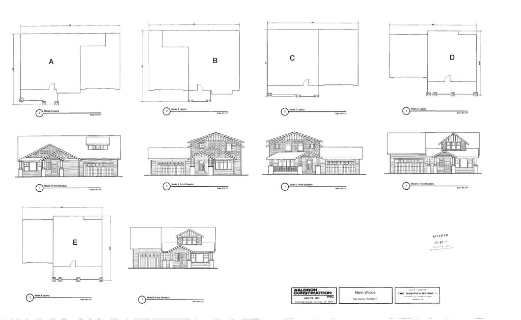
256
EMPLOYER SAMPLE PROCEDURES FOR HEAT ILLNESS PREVENTION
 EMPLOYER SAMPLE PROCEDURES FOR HEAT ILLNESS PREVENTION FEB 2010 California Employers with any outdoor plaes of employment must omply with the Heat Illness Prevention Standard T8 CCR 3395. These proedures
Comparison of the South Dakota Road Profiler with Other Rut Measurement Methods
 TRANSPORTATION RESEARCH RECORD 1311 Comparison of the South Dakota Road Profiler ith Other Rut Measurement Methods ]AMES B. DuBosE During the fall of 1989, the Illinois Department of Transportation ompleted
RoboGolf (aka RoboPutting) Robofest 2016 Game
 Robofest 2016 Game") RooGolf (aka RooPutting) Roofest 201 Game 12-2-2015 V1.1 (Kik-off version. Offiial Version will e availale on Jan 8, 201) 4 3 2 1 a A. Game Synopsis Figure 1. RooGolf Playing Field (Jr. Division) There
RooGolf (aka RooPutting) Roofest 201 Game 12-2-2015 V1.1 (Kik-off version. Offiial Version will e availale on Jan 8, 201) 4 3 2 1 a A. Game Synopsis Figure 1. RooGolf Playing Field (Jr. Division) There
Effect of Pavement/Shoulder Drop-Offs on Highway Safety
 Effet of Pavement/Shoulder Drop-Offs on Highway Safety John C. Glennon Transportation Consulting Engineer Overland Park, Kansas Drop-offs at the pavement/shoulder (or shoulder/roadside) edge have been
Distribution Restriction Statement Approved for public release; distribution is unlimited.
 CCW-PO egulation No. 1165-2-132 Department of the rmy U.S. rmy Corps of ngineers Washington, DC 20314-1000 Water esoures Poliies and uthorities HZDOUS, TOXC ND DOCTV WST (HTW) GUDNC FO CVL WOKS POJCTS
IKGAtl Kenneth Grubb Associates Ltd
 IKGAtl Kenneth Grubb Assoiates Ltd BURO HAPPOLD COPPERHOUSE SLUICE GATE DOCUMENT REVISION RECORD Doument Number: Number of Pages: Doument Title: Saved as: C0395/006/DOC 31 REPORT ON THE MECHANICAL SURVEY
HURRICANE SANDY LIMITED REEVALUATION REPORT UNION BEACH, NEW JERSEY DRAFT ENGINEERING APPENDIX SUB APPENDIX E OVERTOPPING & FAILURE ANALYSIS
 HURRICANE SANDY LIMITED REEVALUATION REPORT UNION BEACH, NEW JERSEY DRAFT ENGINEERING APPENDIX SUB APPENDIX E OVERTOPPING & FAILURE ANALYSIS Revised 18 Feb 2015 1 OVERTOPPING & FAILURE ANALYSIS 1.0 Introdution
Rules of Beach Hockey including explanations
 Rules of Beah Hokey inluding explanations Effetive from 1 June 2016 (updated 31 May 2016) Copyright FIH 2016 The International Hokey Federation Rue du Valentin 61 CH 1004, Lausanne Switzerland Telephone:
Harbour Dues (Pleasure Vessels, House Boats, Large Commercial Yachts and Tall Ships) Regulations 2013
 Regulations 2013") Harbour Dues (Pleasure Vessels, House Boats, Large Commerial Yahts and Tall Ships) Regulations 2013 Index HARBOUR DUES (PLEASURE VESSELS, HOUSE BOATS, LARGE COMMERCIAL YACHTS AND TALL SHIPS) REGULATIONS
Harbour Dues (Pleasure Vessels, House Boats, Large Commerial Yahts and Tall Ships) Regulations 2013 Index HARBOUR DUES (PLEASURE VESSELS, HOUSE BOATS, LARGE COMMERCIAL YACHTS AND TALL SHIPS) REGULATIONS
Rules of Hockey5s including explanations
 Rules of Hokey5s inluding explanations Effetive from 1 January 2015 (updated 18 May 2015) Copyright FIH 2015 The International Hokey Federation Rue du Valentin 61 CH 1004, Lausanne Switzerland Telephone:
Rules of Hockey5 including explanations
 Rules of Hokey5 inluding explanations Effetive from 1 September 2012 Copyright FIH 2012 The International Hokey Federation Rue du Valentin 61 CH 1004, Lausanne Switzerland Telephone: ++41 21 641 0606 Fax:
Wind energy potential of Ban village
 Available online at www.pelagiaresearhlibrary.om Advanes in Applied Siene Researh, 2013, 4(3):220-225 ISSN: 0976-8610 CODEN (USA): AASRFC Wind energy potential of Ban village Maren. I. Borok 1, Gyang Y.
Operating Instructions
 Operating life time Normal expeted servie life (expressed in the number of yles over the full adjustment range) is appr. 1 million for the pressure swith. This may be extended to 2.5 million yles max.
MECHANICAL INTEGRITY ASSESSMENT OF A LARGE HORIZONTAL NGL PRESSURE VESSEL: CASE STUDY
 Abstrat MECHANICAL INEGRIY ASSESSMEN OF A LARGE HORIZONAL NGL PRESSURE VESSEL: CASE SUDY A methodology for assessing the strutural integrity of a large horizontal NGL (Natural Gas Liquid) vessel has been
IV. Environmental Impact Analysis K. Traffic, Access, and Parking
 IV. Environmental Impat Analysis K. Traffi, Aess, and Parking 1. Introdution This setion analyzes the potential projet impats assoiated with traffi, aess, and parking. The analyses in this setion are based
CONTROLLED MARINE AREA (SEISMIC SURVEY WORKS) REGULATIONS 2016
 REGULATIONS 2016") Controlled Marine Area (Seismi Survey Works) Regulations 2016 Statutory Doument No. 2016/0362 Marine Infrastruture Management At 2016 CONTROLLED MARINE AREA (SEISMIC SURVEY WORKS) REGULATIONS 2016 Laid
Controlled Marine Area (Seismi Survey Works) Regulations 2016 Statutory Doument No. 2016/0362 Marine Infrastruture Management At 2016 CONTROLLED MARINE AREA (SEISMIC SURVEY WORKS) REGULATIONS 2016 Laid
General Technical Data and Calculations
 18 Bosh Rexroth AG R31EN 232 (26.4) General Produt Desription General Tehnial Data and Calulations Fores and load moments In Rexroth the running traks are arranged at a ompression angle of 45. This results
Vaccine Storage and Handling Guidelines
 Vaine Storage and Handling Guidelines Table of Contents 2 Introdution 3 Definitions 3 The Importane of the Cold Chain 3 Proteting Ontario s Vaine Supply 4 Maintaining Vaine Poteny and Minimizing Wastage
Traffic Impact Study Little Egypt Road Development Denver, North Carolina June 2017
 Traffic Impact Study Little Egypt Road Development Denver, North arolina June 2017 N. Little Egypt Road DQ\ QDQFLQJ VDOHV RU RWKHU SHUIRUPDQFH EDVHG FULWHULD Proposed Site Driveways Site Driveway 1 TRAFFI
WHISTLESTOP'S MISSION PLAZA A0.0 COVER SHEET
 PROJET DIRETORY DEVELOPER ARHITET LAND SURVEYOR Eden Housing Whistlestop Van Meter Williams Pollack ILS Associates 22645 Grand Street 930 Tamalpais Avenue 333 Bryant Street 79 Galli Drive Suite A Hayward,
BKR: 3-way ball valve with female thread, PN 40
 Regulating valves, ombined with atuator CV5.60 en Produt Data Sheet BKR015...050 BKR: 3-way ball valve with female thread, PN 40 ow energy effiieny is improved Preision ontrol and working without losses
PRELIMINARY STORM DRAINAGE REPORT
 PRELIMINARY STORM DRAINAGE REPORT DRURY LANE DEVELOPMENT 704 1ST STREET SULTAN, WA 98294-94240 PARCEL #28083200305500 AUDITOR S FILE NO. 1090255 CITY OF SULTAN SNOHOMISH COUNTY, WASHINGTON PREPARED FOR:
Operating Instructions Single/Dual Bourdon Tube Pressure Switches Type BS/BT/BX
 pproval data for Ex i swithes (BT and BX) pproval: II 1 G D Ex ia IIC T6 Ex ia D 20 T0 Operating Instrutions Single/Dual Bourdon Tube Pressure Swithes Type BS/BT/BX Certifiate no.: ISSeP08TEX016X Permissible
Analysis of a Twin Screw Expander for ORC Systems using Computational Fluid Dynamics with a Real Gas Model
 Purdue University Purdue e-pubs International Compressor Engineering Conferene Shool of Mehanial Engineering 2014 Analysis of a Twin Srew Expander for ORC Systems using Computational Fluid Dynamis with
VKR: 2-way regulating ball valve with female thread, PN 40
 Produt data sheet 7.1 56.090 VKR: 2-way regulating ball valve with female thread, PN 40 ow energy effiieny is improved Effiieny means preise ontrol and working with minimum leakage Features 2-way regulating
BKR: 3-way regulating ball valve with female thread, PN 40
 Produt data sheet 5.1 56.091 BKR: 3-way regulating ball valve with female thread, PN 40 ow energy effiieny is improved Effiieny means preise ontrol and working with minimum leakage Features 3-way regulating
MIHTO WEST COHCORREHCY TRAFFIC IMPACT AHALYSIS
 MIHTO WEST COHCORREHCY TRAFFIC IMPACT AHALYSIS Preparrd for MIHTO SPW. LLC Preparrd by PIHDER TROOTMAH COHSOL TIHG. IHC. Certifiate of Authorization Homber: 7989 25 VIsta Parkway. Soite 111 West Palm Beah.
The following excerpt are pages from the North American Product Technical Guide, Volume 2: Anchor Fastening, Edition 17.
 The following exerpt are pages from the North Amerian Produt Tehnial Guide, Volume 2: Anhor Fastening, Edition 17. Please refer to the publiation in its entirety for omplete details on this produt inluding
La Crescent Township Zoning Ordinance
 La Crescent Township Zoning Ordinance Table of Contents SECTION 1 ~ PREAMBLE, TITLE, SHORT TITLE AND PURPOSE... 1 0101 Preamble... 1 0102 Title... 1 0103 Short Title... 1 0104 Purpose... 1 SECTION 2 ~
Name of estate or trust (If a grantor type trust, see the instructions.) C Employer identification number I I
 C Employer identification number I I") Form 4 À¾µº Department of the Treasury - nternal Revenue Servie U.S. nome Tax Return for Estates and Trusts OMB No. 545-0092 nformation aout Form 4 and its separate instrutions is at www.irs.gov/form4.
Form 4 À¾µº Department of the Treasury - nternal Revenue Servie U.S. nome Tax Return for Estates and Trusts OMB No. 545-0092 nformation aout Form 4 and its separate instrutions is at www.irs.gov/form4.
76.111/1. BUD: Flanged three-way valves, PN 6. Sauter Components
 76.111/1 BUD: Flanged three-way valves, PN 6 ow energy effiieny is improved urate ontrol with high reliability. reas of appliation Continuous ontrol of old/hot water and air in losed networks 1) and flow
BKTA: 3-way change-over ball valve (T) with male thread, PN 40
 with male thread, PN 40") BKTA: 3-way hange-over ball valve (T) with male thread, PN 40 ow energy effiieny is improved Effiieny means preise hangeover with minimum leakage Features 3-way hange-over ball valve with T-bore for use
BKTA: 3-way hange-over ball valve (T) with male thread, PN 40 ow energy effiieny is improved Effiieny means preise hangeover with minimum leakage Features 3-way hange-over ball valve with T-bore for use
BKR: 3-way ball valve with female thread, PN 40
 Regulating valves, ombined with atuator PDS 56.091 en Produt Data Sheet BKR015...050 BKR: 3-way ball valve with female thread, PN 40 ow energy effiieny is improved Preision ontrol and working without losses
i e SD No.2016/0057 HARBOUR DUES (FISHING VESSELS, WORK BOATS AND CONSTRUCTION BARGES) REGULATIONS 2016
 REGULATIONS 2016") i e SD No.2016/0057 HARBOUR DUES (FISHING VESSELS, WORK BOATS AND CONSTRUCTION BARGES) REGULATIONS 2016 Harbour Dues (Fishing Vessels, Work Boats and Constrution Index HARBOUR DUES (FISHING VESSELS, WORK
i e SD No.2016/0057 HARBOUR DUES (FISHING VESSELS, WORK BOATS AND CONSTRUCTION BARGES) REGULATIONS 2016 Harbour Dues (Fishing Vessels, Work Boats and Constrution Index HARBOUR DUES (FISHING VESSELS, WORK
Oakmont Area Structure Plan
 Oakmont Area Structure Plan Bylaw 12/97 Consolidated by Bylaw 25/2013 (Approved August 26, 2013) CITY OF ST. ALBERT CONSOLIDATION OF BYLAW 12/97 Consolidated by Bylaw 25/2013 Being a bylaw to adopt the
Slow gas expansion in saturated natural porous media by gas injection and partitioning with nonaqueous
 MMaster University From the SeletedWorks of Sarah E Dikson 2008 Slow gas expansion in saturated natural porous media by gas injetion and partitioning with nonaqueous phase liquids Kevin G Mumford, Queen's
BUL: 3-way unit valve, PN 16
 Produt data sheet 55.009 BU: 3-way unit valve, PN 16 Improving energy effiieny inear mixture and no loss through leakage in the ontrol passage for energy-effiient regulation Features Flat-sealing standard
Impact of Using Freeway Shoulders as Travel Lanes on Fuel Consumption
 Transportation Researh Reord 901 l Impat of Using reeway Shoulders as Travel Lanes on uel Consumption WILLIM R. MCSLN general proedure, based on data derived from the merian ssoiation of State Highway
DOCUMENTS IN THIS PACKET INCLUDE: LETTERS FROM CITIZENS TO THE MAYOR OR CITY COUNCIL RESPONSES FROM STAFF TO LETTERS FROM CITIZENS
 DOCUMNTS IN THIS PACKT INCLUD: LTTRS FROM CITIZNS TO TH MAYOR OR CITY COUNCIL RSPONSS FROM STAFF TO LTTRS FROM CITIZNS ITMS FROM MAYOR AND COUNCIL MMBRS ITMS FROM OTHR COMMITTS AND AGNCIS ITMS FROM CITY,
Effectiveness of a law to reduce alcohol-impaired driving in Japan
 1 Takemi Program, Department of International Health, Harvard Shool of Publi Health, Boston, MA, USA; 2 Department of Emergeny Mediine, St Mary s Hospital, Kurume, Japan; 3 Division of Pharmaoepidemiology
East Downtown Tax Increment Reinvestment Zone (TIRZ) No. 15 Infrastructure Assessment Study
 No. 15 Infrastructure Assessment Study") East Downtown Tax Increment Reinvestment Zone (TIRZ) No. 15 Infrastructure Assessment Study Houston, TX Technical Memorandum April 15 th, 2009 Prepare by: 2950 North Loop West, Ste. 900 Houston, TX 77092
East Downtown Tax Increment Reinvestment Zone (TIRZ) No. 15 Infrastructure Assessment Study Houston, TX Technical Memorandum April 15 th, 2009 Prepare by: 2950 North Loop West, Ste. 900 Houston, TX 77092
ROAD OCCUPANCY PERMIT APPLICATION # Damascus Township, 60 Conklin Hill Road, Damascus, PA Tel Fax
 Instructions: For a driveway access permit, fill in sections 1, 2, 3 and 4, and the appropriate drawings and sign. For a Utility access, fill in sections 1, 2, 3 and 5, and figures 1 and 3. Prepare a detailed
Bradford s Landing. Preliminary Plan Abandonment AB753 & AB754 MONTGOMERY COUNTY PLANNING DEPARTMENT
 Bradford s Landing Preliminary Plan 120170060 Abandonment AB753 & AB754 1 Overview Staff recommends Approval of Preliminary Plan 120170060 with revised conditions and Adoption of the Resolution. 244 lots
Experimental Study on the Limits of Flow Regimes for Different Configurations of Stepped Spillway
 Civil and Environmental Researh Experimental Study on the Limits of Flow Regimes for Different Configurations of Stepped Spillway Najm Obaid Salim Alghazali 1*, Salam M. Jasim 2 1. Asst. Prof. Dotor, Civil
55.109/1. BUT: Three-way unit valve, PN 16. Sauter Components
 55.109/1 UT: Three-way unit valve, PN 16 How energy effiieny is improved Linear mixture and no leak losses in the ontrol passage for energy-effiient regulators. reas of appliation Regulating valve for
Midway City Council 15 January 2019 Regular Meeting. Homestead Villas / Preliminary Approval
 Midway City Council 15 January 2019 Regular Meeting Homestead Villas / Preliminary Approval CITY COUNCIL MEETING STAFF REPORT DATE OF MEETING: January 15, 2018 NAME OF PROJECT: NAME OF APPLICANT: AGENDA
WIND TUNNEL MEASUREMENT AND ASSESSMENT ON THE PEDESTRIAN WIND ENVIRONMENT A CASE STUDY OF JINYING HIGH RISE BUILDING IN TAIPEI, TAIWAN
 WIND TNNEL MEASREMENT AND ASSESSMENT ON THE PEDESTRIAN WIND ENVIRONMENT A CASE STDY OF JINYING HIGH RISE BILDING IN TAIPEI, TAIWAN Bao-Shi Shiau 1 and Ben-Jue Tsai 2 ABSTRACT In this paper, wind tunnel
EXHIBITOR MANUAL. Organiser
 EXHIBITOR MANUAL 2018 Organiser ABOUT THE EXHIBITION Exhibition Name : 22nd EAST MEDITERRANEAN INTERNATIONAL TOURISM & TRAVEL EXHIBITION - EMITT Exhibition Conept : International Tourism and Travel Exhibition
Planning & Zoning Commission
 Preliminary Plat Westwood, Section 3 Planning & Zoning Commission Planning & Development Department March 21, 2016 Request Subdivide approximately 38.1 acres of previously unplatted property to create
The following excerpt are pages from the North American Product Technical Guide, Volume 2: Anchor Fastening, Edition 16.
 The following exerpt are pages from the North Amerian Produt Tehnial Guide, Volume 2: Anhor Fastening, Edition 16. Please refer to the publiation in its entirety for omplete details on this produt inluding
The following excerpt are pages from the North American Product Technical Guide, Volume 2: Anchor Fastening, Edition 16.1.
 The following exerpt are pages from the North Amerian Produt Tehnial Guide, Volume 2: Anhor Fastening, Edition 16.1. Please refer to the publiation in its entirety for omplete details on this produt inluding
Union Pacific Railroad
 Input Questions: 404/401 Pre Application Meeting, December 18, 2013, Portland, Oregon 1. What is the project purpose and need? The purpose of the project is to improve the efficiency and average velocity
Stabilized Fly Ash Base
 8 TRANSPORTATION RESEARCH RECORD 144 Performane Evaluation of a Cement Stabilied Fly Ash Base. H. GRAY, E. TONS, AND T. R. THIRUVENGADAM The performane of a ompated, aggregate-free, ement-stabilied fly
Comments EXECUTIVE SUMMARY
 Comments 1. Under any Alternatives, MCDOT should provide better at-grade pedestrian crossing of Georgia Avenue and Forest Glen Road, including improved crosswalks with wider medians and adequate signal
RESPIRATORY PROTECTIVE EQUIPMENT
 RESPIRATORY PROTECTIVE EQUIPMENT SETTING Correspondene to: Dr R M Howie, 12 Morningside Close, Edinburgh EH10 4DB, UK; robin.howie@ btlik.om T RMHowie Oup Environ Med 2005; 62:423 428. doi: 10.1136/oem.2002.004424
NARRATIVE FOR SERENITY HILL OF HALSTED BAY SERENITY HILL OF LAKE MINNETONKA, LLC
 NARRATIVE FOR SERENITY HILL OF HALSTED BAY SERENITY HILL OF LAKE MINNETONKA, LLC January 31, 2016 Written statements providing information regarding your proposal. Please provide a separate answer for
MODEL FOR PREDICTING BATHYMETRIC AND GRAIN SIZE CHANGES BASED ON BAGNOLD S CONCEPT AND EQUILIBRIUM SLOPE CORRESPONDING TO GRAIN SIZE COMPOSITION
 MODEL FOR PREDICTING BATHYMETRIC AND GRAIN SIZE CHANGES BASED ON BAGNOLD S CONCEPT AND EQUILIBRIUM SLOPE CORRESPONDING TO GRAIN SIZE COMPOSITION Yasuhito Noshi, Takaaki Uda 2, Masumi Serizawa 3, Takayuki
m. ANmYSIS OF RESULTS
 Aordingly, the U. S. Government retains a nonexlusive, royaltyfree liense to publish Effets of Vertial Aperture on Beam Lifetime at the Advaned Photon Soure ( A P S ) Storage Ring* Hana M. Bizek Advaned
RZC Appendix 8A Marymoor Subarea Street Requirements
 RZC Appendix 8A Marymoor Subarea Street Requirements For additional design details for Marymoor Subarea infrastructure, refer to the 2017 Marymoor Subarea Infrastructure Planning Report. STREET REQUIREMENTS
Peel Viking Longboat Races Order 2012 PEEL VIKING LONGBOAT RACES ORDER 2012
 Peel Viking Longboat Raes Order 2012 Index PEEL VIKING LONGBOAT RACES ORDER 2012 Index Artile Page 1 Title... 3 2 Commenement... 3 3 Interpretation... 3 4 Authorisation of use of the longboat area for
Wind Energy Potential of Jordan
 M. A. Alghoul et al. / International Energy Journal 8 (7) 7-78 7 Wind Energy Potential of Jordan M. A. Alghoul *, M.Y.Sulaiman +, B.Z.Azmi + and M. Abd. Wahab + www.serd.ait.a.th/reri Abstrat - The daily
Bicycle and Pedestrian Facilities Toolbox (Excerpt from Figure 3.1)
") Appendix B Neighborhood Connections Summaries This Appendix is a supplement to the information presented in Chapter 3 Connect People. The Appendix includes a summary or profile for each of the proposed
Appendix B Neighborhood Connections Summaries This Appendix is a supplement to the information presented in Chapter 3 Connect People. The Appendix includes a summary or profile for each of the proposed
SUPPLEMENTARY REPORT
 TO: RGULATORY SRVICS COMMITT TABLD AT 2 5 NOV 214 MTING FROM: TH DIRCTOR OF NVIRONMNTAL AND PLANNING SRVICS MTING DAT: TUSDAY 25 NOVMBR 214 SUPPLMNTARY RPORT I SPA POOL XMPTION RQUST FOR 228 FILLUL STRT,
Headwater elevation water surface elevation just. Tailwater elevation water surface elevation just
 : Culvert Hydraulis Bob Pitt University of Alabama and Sirley Clark Penn State - Harrisburg Culvert Flow Culvert Systems Culverts typially used in roadway rossings and detention pond outlets. Headwater
Access requests to County streets and roadways are processed through one of the following methods:
 13.1 GENERAL APPLICATION PROCESS Access requests to County streets and roadways are processed through one of the following methods: A. Planned Developments may set general locations for access points.
Enclosed are the original and one copy of your income tax returns for the period ended June 30, 2017 for:
 Florida Breast Caner Coalition Researh Foundation, n. 11900 Bisayne Blvd., Suite 288 North Miami, FL 181 Dear Client, Enlosed are the original and one opy of your inome tax returns for the period ended
Short Form Return of Organization Exempt From Income Tax
 Form 990-EZ Short Form Return of Organization Exempt From nome Tax Under setion 501(), 57, or 4947(a)(1) of the nternal Revenue Code (exept private foundations) OMB No. 1545-1150 À¾µ¹ Open to Puli nspetion
TRAFFIC STUDY GUIDELINES Clarksville Street Department
 TRAFFIC STUDY GUIDELINES Clarksville Street Department 9/1/2009 Introduction Traffic studies are used to help the city determine potential impacts to the operation of the surrounding roadway network. Two
TRAFFIC IMPACT STUDY CRITERIA
 Chapter 6 - TRAFFIC IMPACT STUDY CRITERIA 6.1 GENERAL PROVISIONS 6.1.1. Purpose: The purpose of this document is to outline a standard format for preparing a traffic impact study in the City of Steamboat
Traffic Impact Memorandum. May 22, 2018
 BISHOP PROFESSIONAL DEVELOPMENT BUILDING Proposed Land-use Change & Parking Modification 3601 SW 31st Street Topeka, Kansas 66614 CFS Project No. 185077 Traffic Impact Memorandum May 22, 2018 Prepared
Trigonometry. terminal ray
 terminal ray y Trigonometry Trigonometry is the study of triangles the relationship etween their sides and angles. Oddly enough our study of triangles egins with a irle. r 1 θ osθ P(x,y) s rθ sinθ x initial
Compliance with Section 18-52(4) City of Thornton Development Code
 City of Thornton Development Code") May 25, 2016 Jay Ruchti City of Thornton City Development Department 9500 Civic Center Drive Thornton, CO 80229 RE: Golf Safety Netting TOPGOLF Entertainment Complex (Southeast Corner of East 136 th Avenue
May 25, 2016 Jay Ruchti City of Thornton City Development Department 9500 Civic Center Drive Thornton, CO 80229 RE: Golf Safety Netting TOPGOLF Entertainment Complex (Southeast Corner of East 136 th Avenue
Non-Motorized Overpass at SR 5/US1
 Non-Motorized Overpass at SR 5/US1 And SR 97/SW th Street (Bird Road) Executive Summary March 9, 17 Prepared By: MARLIN Engineering Inc 17 NW th Avenue, Ste. 1 Plantation, FL 33313 P: 35.77.7575 www.marlinengineering.com
Join host, Bob Harris, and hit a hole in one for Hull Services!
 Join host, Bob Harris, and hit a hole in one for Hull Servies! Thursday, September 13, 2018 Heritage Pointe Golf Club Hull Servies is dediated to helping Calgary s most at-risk hildren. Please join me
I Information about Form 990 and its instructions is at Inspection
 OMB No. 1545-0047 Return of Organization Exempt From nome Tax Form 990 Under setion 501(), 527, or 4947(a)(1) of the nternal Revenue Code (exept private foundations) À¾µ¹ Do not enter soial seurity numers
STATE OF VERMONT ENVIRONMENTAL COURT } } } } } Decision and Order
 STATE OF VERMONT ENVIRONMENTAL COURT In re: Appeal of Ted S. Gladstone and Kathleen Hoisington Docket No. 190-10-99 Vtec Decision and Order Appellants appealed from a decision of the Planning Commission
Interim Transit Ridership Forecast Results Technical Memorandum
 Interim Transit Ridership 401 South Jackson Street Seattle, WA 98104-2826 September 2012 Table of Contents 1 INTRODUCTION... 1-1 1.1 Project Background... 1-1 2 RIDERSHIP FORECASTS... 2-1 2.1 System Ridership
I-290 Phase I Study Area OAK PARK AVE AUSTIN BLVD. Reconstruction Area (9 miles) Oak Park RIDGELAND AVE CENTRAL AVE HARLEM AVE. Cicero.
 Oak Park RIDGELAND AVE CENTRAL AVE HARLEM AVE. Cicero.") RIDGELAND AVE OAK PARK AVE AUSTIN BLVD UP-RR BRC-RR ASHLAND AVE Study Area Map I-290 Phase I Study Area 294 UP RR Metra UP-W Illinois Prairie Path 38 Berkeley WOLF RD Hillside MANNHEIM RD Bellwood 290
RIDGELAND AVE OAK PARK AVE AUSTIN BLVD UP-RR BRC-RR ASHLAND AVE Study Area Map I-290 Phase I Study Area 294 UP RR Metra UP-W Illinois Prairie Path 38 Berkeley WOLF RD Hillside MANNHEIM RD Bellwood 290
City of Sammamish. Welcome. Issaquah-Fall City Road Improvements Project Phase I Design: 242nd Avenue SE to Klahanie Drive SE
 Welcome Welcome to the third community meeting for the Issaquah-Fall City Road Improvements Project. AGENDA 6:00 p.m. Welcome and sign-in 6:10 p.m. Presentation 6:50 p.m. Open house Learn about the roadway
CFD Simulations of Contaminant Transport between two Breathing Persons Bjørn, Erik; Nielsen, Peter Vilhelm
 Aalborg Universitet CFD Simulations of Contaminant Transport between two Breathing Persons Bjørn, Erik; Nielsen, Peter Vilhelm Publiation date: 1998 Doument Version Publisher's PDF, also known as Version
State Route 28 Shared Use Path & Safety/Stormwater Enhancements Public Information Meeting
 State Route 28 Shared Use Path & Safety/Stormwater Enhancements Public Information Meeting Thursday, March 30, 2017 4-7 p.m. Presentation at 5:30 p.m. The Chateau at Incline Village 955 Fairway Blvd. Incline
section 4 Existing Conditions, Issues, and Options
 section 4 Existing Conditions, Issues, and Options 4.0 Existing Conditions, Issues, and Options This section analyzes each segment of the corridor on a street to street basis. Each segment is discussed
The Blue Heron Slough Conservation Bank
 1 The Blue Heron Slough Conservation Bank CONSERVATION BANKING July 19-23, 2010 CASE STUDY SERIES The Blue Heron Slough Conservation Bank (Washington) I. OVERVIEW & BACKGROUND: Location: Snohomish River
Modelling the decrease in wave height over the shoreface due to slope-induced changes in bottom friction.
 Chapter : Modelling the derease in wave height over the shorefae due to slope-indued hanges in bottom frition. Abstrat Wave height-redution on the shorefae is partly indued by frition at the bottom. The
11/ This paper not to be cited without prior reference to the author. I'
 / 11/ This paper not to be ited without prior referene to the author. I' International Counil for the Exploration of the Sea C. M. 197 2/H : 3 0 Pelagi Fish (N) Committee THE EFFECTS OF REGULATIONS OF
3.0 Basin and Watershed Characteristics
 3.0 Basin and Watershed Characteristics 3.1 Basin Characteristics 3.1.1 Crystal Lake Crystal Lake, located in the cities of Burnsville and Lakeville (Dakota County), covers an area of approximately 292
Sauter Components
 55.009/1 U: Unit threeway valve, PN 1 How energy effiieny is improved inear mixing and no losses through leakage for energyeffiient ontrol. reas of appliation Control valve for ontrolling heating zones,
Implementing Actuated Signal-Controlled Intersection Capacity Analysis with Pedestrians
 Ipleenting Atuated Signal-Controlled Intersetion Capaity Analysis with Pedestrians DingXin Cheng, Zong Z. Tian, and Honghao Liu For an atuated signalized intersetion, pedestrian alls are likely to affet
ANSWERS TO COMMONLY ASKED QUESTIONS
 NSWERS TO COMMONLY SKE QUESTIONS Should we onentrate on passing or dribbling at Uw6? The game at the U-6 level is haraterized by awkward, rudimentary attempts at dribbling mixed with enthusiasti kiking
Poor pavement condition Substandard Intersections. / Substandard bike/pedestrian/transit accommodations. Driveway access Environmental concerns
 Public Informational Meeting University Avenue (Allen Boulevard Segoe Road) March 23, 2011 City of Madison City of Middleton Village of Shorewood Hills Dane County Existing Roadway Conditions Poor pavement
GONE! Coastal Erosion Happens During Storms! Why Worry About Coastal Setbacks? Goals for Today
 RI Regulatory Setbacks & Buffers: Coastal Zone Management Issues New England Onsite Wastewater Training Program @ URI OWT 155 November 21, 2013 Goals for Today Understand the impacts of storms, coastal
PLAN FOR SUPPLEMENTAL PRODUCTION SALMON AND STEELHEAD FOR COOK INLET RECREATIONAL FISHERIES
 PAN FOR SUPPEMENTA PRODUCTION OF SAMON AND STEEHEAD FOR COOK INET RECREATIONA FISHERIES I I I I., I..'..:.... _..... : '.......,;; '. 1981 Division of Sport Fish Alaska Department of Fish and Game Rupert
CHAPTER 13 DESIGNATING LEGAL BOUNDARIES ARTICLE 4 - AGRICULTURAL DISTRICTS
 CHAPTER 13 DESIGNATING LEGAL BOUNDARIES ARTICLE 4 - AGRICULTURAL DISTRICTS SECTIONS: Sections 13-4-101 to 108, inclusive. Agricultural District "A" - general provisions. Section 13-4-101. Legal boundary
Maywood Town Hall Meeting. May 4, 2016
 Maywood Town Hall Meeting May 4, 2016 1 AGENDA Overall I-290 Study Background Maywood Advisory Working Group (AWG) findings to date Noise Wall Update Next Steps 2 Questions? Study team members also available
"COPY FOR PUBLIC INSPECTION" Return of Private Foundation
 Form 990-PF Department of the Treasury nternal Revenue Servie Return of Private Foundation OMB No. 1545-005 or Setion 4947(a)(1) Trust Treated as Private Foundation Do not enter Soial Seurity numers on
Preliminary Engineering Study
 Preliminary Engineering Study Open House # 2 June 6, 2018 PREPARED FOR: PREPARED BY: Agenda Background and status of preliminary engineering study County Road 26 design summary County Road 63 design summary
Three Springs Design Guidelines Fencing and Wall Standards
 Three Springs Design Guidelines Fencing and Wall Standards Original Adopted: June 12, 2006 Minor Amendment: December 2012 Minor Amendment: March 23, 2017 TABLE OF CONTENTS: FENCING AND WALLS 1.0 INTRODUCTION
Investigation on the Vortex Thermal Separation in a Vortex Tube Refrigerator
 doi: 1.236/sieneasia13-1874.2.31.2 SieneAsia 31 (2): 2-223 Investigation on the Vortex Thermal Separation in a Vortex Tube Refrigerator Pongjet Promvonge* and Smith Eiamsa-ard Department of Mehanial Engineering,
5.0 Roadway System Plan
 Southwest Boise Transportation Study Page 16 5.0 Roadway System Plan The Roadway System Plan outlines roadway improvements in the Initial Study Area. It forecasts future deficiencies on the arterial system,
Reams Road RCA Study. Board of County Commissioners Public Hearing
 Reams Road RCA Study Board of County Commissioners Public Hearing April 24, 2018 Presentation Overview Study Overview Existing Conditions Development of Alternatives Preferred Alternative Public Involvement