CRANE ROAD/FOX MEADOW ROAD WEST QUAKER RIDGE AREA. VILLAGE OF SCARSDALE Scarsdale, New York
|
|
|
- Allen Parks
- 5 years ago
- Views:
Transcription

1 Results you can rely on TRAFFIC AND PEDESTRIAN SUMMARY REPORT POPHAM ROAD/CHASE ROAD/OVERHILL ROAD CRANE ROAD/FOX MEADOW ROAD WEST QUAKER RIDGE AREA SCARSDALE, NEW YORK Prepared for VILLAGE OF SCARSDALE Scarsdale, New York Prepared by TRC ENGINEERS, INC. Hawthorne, New York July 21, 2016 TRC Project No
2 TABLE OF CONTENTS SECTION DESCRIPTION PAGE EXECUTIVE SUMMARY ES-1 1. INTRODUCTION 1 2. POPHAM ROAD AND CHASE ROAD/OVERHILL ROAD 2 3. CRANE ROAD/FOX MEADOW ROAD & CRANE ROAD/ STONEHOUSE ROAD WEST QUAKER RIDGE AREA 29
3 LIST OF APPENDICES APPENDIX A APPENDIX B APPENDIX C FIGURES AND PHOTOGRAPHS LEVEL OF SERVICE STANDARDS ANALYSES
4 ES-1 EXECUTIVE SUMMARY Overview TRC Engineers, Inc. (TRC) has performed traffic observations and has made recommendations as a result of resident comments received by the Village for the following three locations within the Village: 1. The intersection of Popham Road and Chase Road/Overhill Road 2. The intersection of Crane Road and Fox Meadow Road 3. The West Quaker Ridge Neighborhood The majority of the comments were received from the West Quaker Ridge Neighborhood Association and a Report prepared by the Scarsdale Forum. The specific detailed information, findings and recommendations for these locations are contained in the Traffic and Pedestrian Summary Report. Popham Road and Chase Road/Overhill Road Introduction The functionality of Popham Road plays a role in what can be done in the area. Popham Road serves as Scarsdale s major east-west connector and is limited by existing buildings, the Metro North railroad tracks and the Bronx River Parkway. The traffic signals in this area are very close together. In addition, there are a number of pedestrians in the area, including senior citizens. The intersection of Popham Road and Chase Road/Overhill Road has been studied in the past for different reasons. One of the modifications performed by the Village as a result of a prior study was the relocation of the crosswalk at the eastern side of the intersection. The crosswalk was shifted farther east than the previous typical location at the traffic signal. There has been a request to re-examine the crosswalk location, as not all drivers are yielding to pedestrians in the crosswalk and vehicles on westbound Popham Road are not stopping before the crosswalk. Currently there are no pedestrian push buttons and the pedestrian phases occur automatically. The traffic signal timing has been recently adjusted by the Village s Traffic Signal Consultant. In general, the traffic signal timing in conjunction with the traffic signal coordination works well. Analysis Field observations of the intersection were performed at different times of the day, both on weekdays and weekends. Traffic counts were conducted. Capacity analyses and simulations were performed to review existing conditions and the possible impacts of the potential modifications. These included the effects of the adjacent intersection of Popham Road and Job No July 21, 2016
5 ES-2 East Parkway/Scarsdale Avenue. Recommendations (Pages of main Report) Various different options/alternatives were considered along with various traffic signal timing and phasing modifications. The following are the recommendations for modifications along with other alternatives that the Village could consider. Alternatives that have been considered and are not recommended are listed at the end of this section. Concern: Pedestrians, especially those that are mobility-challenged or impaired, including senior citizens living nearby, sometimes struggle to cross Popham Road in the allotted pedestrian phasing time. Alternatives: A. Extended Flashing Don t Walk Time: Recommended This Alternative is recommended on certain movements/phases including crossing Chase Road at Popham Road, crossing Popham Road at Chase Road, and crossing Popham Road at East Parkway as discussed on page 19 of the main Report. This is based upon field observations and measurements to allow the proper time for people, particularly senior citizens, to cross the various streets. This can be performed by modifying the Flashing Don t Walk time, including the time shown on the countdown timer, without changing the overall signal phasing and timing. B. Colored/High Visibility Crosswalk: Recommended A colored/high visibility crosswalk is recommended, possibly with striping/wording on the pavement ahead of it. Such an improvement would enhance its visibility to motorists and improve the frequency of vehicles stopping before entering the crosswalk. C. Additional Traffic Signal Head for Westbound Popham Road Motorists: Recommended It is recommended that an additional traffic signal head be added on the right-hand side of westbound Popham Road just prior to the crosswalk. This would further enforce the vehicle stop location and reduce the number of motorists stopping in the crosswalk, as the existing signal heads are farther away. D. Lane Assignment Sign: Recommended A sign graphically indicating lane assignments should be added to Popham Road westbound prior to the intersection with Chase Road to establish appropriate lane assignments, particularly the right turn lane. Job No July 21, 2016
6 ES-3 E. Installing Turning Vehicles Yield to Pedestrian Sign and No Turn on Red Sign: Recommended A Turning Vehicles Yield to Pedestrian sign similar to what is utilized in other locations in the Village would be appropriate here and is recommended. No Turn on Red signs should be placed adjacent to the corresponding overhead traffic signal head. There are some cases where they are placed adjacent to the signal head. F. Backplates: Recommended Backplates, the rectangular shields that fit behind the traffic signal head, could be added to the traffic signal heads to help drivers with the glare issues. G. Blinking Pedestrian Sign: Recommended (if installed with passive detection) A blinking pedestrian sign could be added instead of Rectangular Rapid Flashing Beacons (RRFB s), which are not recommended (see item N Below); this may be more practical for this location. These should also be installed with passive detection, thus they would start to blink when a person walks between two bollards. If they are not installed with passive detection, then they would be constantly blinking, even when no pedestrian is present, thereby diminishing their effectiveness. H. Additional Street Lighting: Recommended for consideration Additional street lighting could be added to assist drivers at night. I. Lead pedestrian phase: Recommended for Consideration This Alternative, which provides a few seconds upon a traffic signal change to allow pedestrians to establish themselves in the crosswalk prior to a motorist receiving a green, is recommended for consideration; however, its implementation would likely cause an increase in driver delays and intersection queueing. Additionally, the added delay could frustrate drivers as the phase would still occur even if no pedestrians are present. J. Elimination of Popham Road Right Turn Lane: Not Recommended This Alternative is not recommended as, although it would not have a significant impact on the delays experienced as this intersection and would reduce the crossing distance between Chase Road and Overhill Road, it would extend the vehicle queueing along Popham Road. In addition, Bee Line buses use this lane to turn right onto Chase Road and these turning maneuvers must be accounted for in conjunction with any modifications to this intersection. Job No July 21, 2016
7 ES-4 K. Eliminating Crosswalk: Not Recommended Eliminating the crosswalk on Popham Road east of Chase Road is not recommended. This was previously considered because of the limited visibility resulting from the glare/shadows from the 50 Popham Road building (the Village has since relocated the crosswalk farther east). However, some pedestrians would still cross at this location, even without the crosswalk. The elimination of this crosswalk would cause inconvenience for some pedestrians, including senior citizens, as they may then have to cross three legs of the intersection each time they cross. L. Raised Crosswalk and Embedded Flashing Lights: Not Recommended An option that was considered but is not recommended at this time is the provision of a raised crosswalk to enhance visibility, better alert motorists to its presence, and deter vehicles from stopping on top of the raised crosswalk. However, raised crosswalks are generally not designed to be installed on main roadways or emergency routes. They would also increase the noise in this area, which is abutted on both sides by apartment buildings. Also, some residents have suggested a raised crosswalk with blinking lights within the crosswalk. These blinking lights are effective in alerting motorists of the crosswalk but establish certain expectations, such as that they will blink whenever a pedestrian is present, while requiring frequent maintenance and are not recommended. M. Exclusive Pedestrian Traffic Signal Phase: Not Recommended This Alternative is not recommended due to the significant adverse traffic impacts, resulting in long delays and queues which would lead to congestion and potentially aggravated/ aggressive drivers. N. Rectangular Rapid Flashing Beacons: Not Recommended Rectangular Rapid Flashing Beacons (RRFB s) were evaluated for deployment at the crosswalks, but are not recommended. As added background, RRFB s are a new pedestrian alert device that some jurisdictions are testing at non-signalized intersections. The RRFB s are flashing lights that are typically attached to a pedestrian crossing sign and are activated by the pedestrian or bicyclist; they are not typically employed at a signalized intersection. O. Installing Stop Sign: Not Recommended Installing a Stop sign at the crosswalk is not recommended as this could lead to significant driver confusion and accidents. P. Bumpouts: Not Recommended It would be difficult to do any significant bumpouts that would have much effect, so these are not recommended. Job No July 21, 2016
8 ES-5 Q. Change Speed Limit: Not Recommended Changing the speed limit on Popham Road would not have an impact on the subject issue and thus is not recommended. Crane Road and Fox Meadow Road Introduction TRC reviewed the intersections of Crane Road/Fox Meadow Road and of Crane Road/Stonehouse Road as the result of resident comments received by the Village. Due to its close proximity, the impacts of the intersection safety of Crane Road/East Parkway/Bronx River Parkway were also factored in. TRC held discussions with the Village Police Department and obtained traffic accident history data. Analysis Both intersections operate at acceptable Levels of Service from a pure capacity standpoint. Some pedestrians cross Crane Road at Fox Meadow Road; however, there is a sidewalk along the north side of Crane Road that leads to a crosswalk at East Parkway. TRC conducted a Sight Distance Analysis for both Crane Road & Fox Meadow Road and Crane Road & Stonehouse Road to determine whether adequate sight distance is provided. Certain sight distances at these two locations are restricted due to the crest of the hill, as part of the natural topography, as well as vegetation and the embankment. Sight distances for both intersections were checked against standards published by the American Association of State Highway Transportation Officials (AASHTO). Some sight distances, including looking left and right when exiting Fox Meadow Road, as well as looking right when exiting Stonehouse Road, do not meet the recommended sight distances; however, the minimum stopping sight distances are met for all movements. Vehicles exiting the side streets have to inch up toward Crane Road. Recommendations (Pages of main Report) Concern: Sight distance is limited for vehicles exiting the intersecting streets onto Crane Road. To improve these conditions, the following remedial work is recommended: A. Removal of Vegetation: Recommended At the intersection of Fox Meadow Road and Crane Road for the sightline to the left of Fox Meadow Road, it is recommended that the bushes be removed or pulled back, if feasible, and that the embankment be modified as feasible to provide increased sight distance. The right- Job No July 21, 2016
9 ES-6 of-way in this area should be confirmed. At the intersection of Stonehouse Road and Crane Road, similar issues are prohibiting motorists from having the recommended sight distances. The sightline to the right of Stonehouse Road is visually obstructed by bushes and other vegetative foliage. As such, the vegetation should be cut back or removed completely to provide additional sight distance. However, there are some existing rock outcroppings that may limit the additional sight distance that can be provided without performing rock removal. The modifications will only provide a limited benefit due to the sight distance limitations resulting from the crest of the hill, which cannot be easily rectified. However, the clearing of the vegetation will provide benefits. B. Signage: Recommended On Crane Road in the eastbound direction between Fox Meadow Road and Stonehouse Road, the yellow diamond-shaped Intersection Ahead sign should indicate that Stonehouse Road is approaching, as it currently only indicates Chase Road. The additional signage may not make a significant impact, though. C. East Parkway Signage: Recommended The intersection of Crane Road and East Parkway has recently had some modifications as a result of the reconstruction of the Crane Road Bridge. Some additional signage could be added to this intersection, such as a sign along East Parkway stating Traffic Exiting Parkway Does Not Stop. Actions that are Not Recommended The following are not recommended: D. Speed Humps: Not Recommended Speed humps are generally not to be placed on hills that have grades of more than eight percent and are not recommended. In addition, other issues such as noise creation, impact to snow and ice removal operations, the presence of bike and motorcycle users, and other concerns make speed humps an undesirable alternative for this location. Finally, observed speeds are not excessive, and the vegetative visual obstructions appear to be the primary issue requiring attention. E. Stop Signs: Not Recommended Posting Stop signs along Crane Road at both Fox Meadow Road and at Stonehouse Road is also not recommended. Placing Stop signs in these locations could result in more accidents Job No July 21, 2016
10 as drivers along Crane Road are not expecting other vehicles to stop, possibly resulting in rear-end collisions. F. Eliminating Left Turns: Not Recommended ES-7 The possibility of eliminating left turns from Fox Meadow Road was also considered. However, as the minimum sight distance requirements are met and can possibly be improved with removal of vegetative visual obstructions, as well as based upon a review of the number of accidents, it does not appear to be necessary to perform this measure at this time. Thus, this is not recommended. West Quaker Ridge Neighborhood Introduction TRC has reviewed the comments/concerns and information submitted by residents of the West Quaker Ridge Area regarding traffic operating conditions. These include concerns regarding speeds, traffic control, cut-thru traffic and vehicular /pedestrian safety. The following information constitutes a high-level summary of recommendations in regard to the concerns cited by the residents. Additional details are contained in the Report. Analysis Field observations of the intersection were performed at different times of the day, both on weekdays and weekends, including morning and evening commuting periods, as well as during drop-off and pick-up times for Quaker Ridge School. Discussions were held with the Village Police Department, which also provided accident data and speed data. During the field observations, there were some delays and queues experienced at some of the traffic signals along Weaver Street. The majority of the delays were experienced by vehicles traveling northbound on Weaver Street. Limited traffic was observed traveling through the neighborhood of the Quaker Ridge Area, and the majority observed appeared to be residents of the neighborhood. Speed measurements conducted by the Village Police Department indicated that vehicles are traveling at speeds consistent with the speed limits in the area and there does not appear to be a significant amount of speeding in the area. Recommendations (Pages of main Report) The following are some of the concerns that the residents expressed and the corresponding recommendations: Community Concern 1: It is difficult to make a left turn from Old Lyme Road onto Weaver Job No July 21, 2016
11 Street due to traffic backups on Weaver Street during peak hours. If vehicles were permitted to turn left out of the Quaker Ridge School Driveway/Normandy Lane onto Old Lyme Road, they would then be able utilize the traffic signal to turn left from Hutchison Avenue to Weaver Street. The traffic from the school adds to the congestion in the area. Recommendation: No Change (alternative below examined). A. Left Turn Prohibition: Not Recommended ES-8 A full detailed review/analysis of the Quaker Ridge School was not undertaken as part of this Study. Allowing vehicles to make a left out of the Quaker Ridge School Driveway and diverting them towards the signalized intersection of Weaver Street and Hutchinson Avenue to make a left onto Weaver Street would make it easier for them to turn left onto Weaver Street than making a left at Old Lyme Road. A disadvantage of this is that more vehicles would be traveling through the neighborhood. However, based upon discussions with Village representatives including the Police Department, the main reason vehicles are not permitted to turn left out of the Quaker Ridge School Driveway/Normandy Lane onto Old Lyme Road is based upon the Village s and residents concerns of the conflict created between vehicles turning left out of the school and children crossing the intersection. Thus, while permitting the left turn would assist motorists, the modification of the left turn prohibition is not recommended due to the pedestrian safety conflicts. Community Concern 2: People cut through the area to Crossway, possibly to avoid the traffic signals at Stratton Road and at the Five Corners. Recommendation: Condition not validated. B. Cut-Through Elimination: Heavy Cut-Through Not Observed In general, most of the vehicles observed driving in the area were residents of the area. Significant cut-through traffic was not observed, nor were high speeds. A particular recommendation to reduce the delays experienced at the Stratton Road signal is discussed in item K below. Community Concern 3: There is a concern about traveling speeds along Haverford Avenue, Penn Boulevard, Franklin Road and Rural Drive. Recommendation: Condition not validated (alternative below also examined). C. Speed Humps: Not Recommended Based upon our observations and the data provided by the Police Department, speeds are not a major issue in the area. Additionally, and as related in response to Community Concern 2 above, significant cut-through traffic was not observed. It should also be noted speed humps Job No July 21, 2016
12 result in noise being generated, including when vehicles hit their brakes before them or when a vehicle such as a landscaping truck traverses them; they can also slightly slow emergency vehicles, and adversely impact drainage, road maintenance, and snow plowing. Thus, based upon the speed observations and anticipated speed hump impacts, speed humps are not recommended. Community Concern 4: There is a need for a Stop sign along northbound Swarthmore Road at Penn Boulevard. Recommendation D. Stop Sign: Recommended Adding a Stop sign and Stop bar to the northbound approach of Swarthmore Road at Penn Boulevard will further encourage drivers to stop. ES-9 Community Concern 5: Modifications should be made to the geometry of the intersection of Penn Boulevard and Franklin Road due to the offsets that exist. The offsets result in drivers from eastbound Penn Boulevard cutting the corner and traveling in the wrong lane when turning left along with drivers traveling southbound on Franklin Road traveling on the wrong side of the road. The residents feel that this is the worst intersection in the area and have asked for the northwest corner of the intersection to be shaved back. Recommendation E. Striping: Recommended for Consideration The provision of some striping may be helpful in this location; however, it is acknowledged that some vehicles will drive over it and some residents would prefer no striping in the neighborhood. F. Cutting Back Corner: Not Recommended If circulation is improved too much, such as at the intersection of Franklin Road and Penn Boulevard, then the roads may become more enticing for higher speeds and more cut-thru traffic. Cutting back the corner at the intersection of Penn Boulevard and Franklin Road is not recommended as it would increase speeds and also would likely require right-of-way acquisition from the property owner, along with relocation of a utility pole and the removal of a major tree, as well as some likely drainage modifications. G. Small Medians/Mini Traffic Circles: Not Recommended While small medians are aesthetically pleasing and, under the right circumstances, can help a driver to visualize the proper path, roads in this area are already generally narrow and small Job No July 21, 2016
13 ES-10 medians would likely be hit by traveling vehicles in addition to creating operational problems for snow and ice removal. Some residents have requested mini-traffic circles for the area which do provide some benefits including slowing traffic as long as there is sufficient room (some of the roads are narrow). However, they also can cause certain issues for snow plows. They can be further investigated in the future but do not appear to be necessary at this time based upon the speeds and volumes observed and thus are not recommended. Community Concern 6: More enforcement should be provided throughout the area, particularly along Franklin Road. Recommendation H. Additional Enforcement: Recommended (Underway) The Police Department is aware of the residents concerns regarding the area and has undertaken measures to address them. Community Concern 7: Stop signs should be added in both directions along Stratton Road at Franklin Road to form a four-way stop. Recommendation I. Vegetation Trimming: Recommended It is recommended that some of the vegetation be trimmed to improve sight distance. J. Stop Signs for Four-Way Stop: Not Recommended Stop signs are only to be used for traffic control and not for speed control, as per the Federal Manual on Uniform Traffic Control Devices. They are to be used when there are other factors such as the need to control traffic/right-of-way or limited sight distance. Unwarranted Stop signs can have negative effects and drivers tend to ignore them or roll through the Stop signs and vehicles regain their speed within a short distance, or in some cases increase their speed to make up for lost time. Thus, a four-way Stop is not appropriate at the intersection of Stratton Road and Franklin Road. Community Concern 8: The left turn movement from northbound Weaver Street to Daisy Farm Road/Crossway (as indicated on their map, but they may have meant Stratton Road) clogs the road. Recommendation K Left-Turn Storage Lane: Recommended for Consideration (requires NYSDOT approval) Job No July 21, 2016
14 ES-11 At the intersection of Weaver Street and Stratton Road it appears that a left-turn storage lane may possibly be able to be installed on the northbound Weaver Street approach. The left turn lane would be narrow and relatively short. A left-turn lane may have possibly existed previously at this location. Another possibility is to provide a left-turn advance signal phase, however, this would require modifications to the traffic signal. Either modification would require approval from the New York State Department of Transportation (NYSDOT). Community Concern 9: A Fuel sign should be added to the Hutchison River Parkway southbound exit ramp to indicate where drivers could travel to reach a fuel station. Recommendation L. Fuel Sign: Recommended for Consideration (requires NYSDOT approval) Signage could be added to the Hutchison River Parkway southbound exit ramp to indicate the closest refueling location. This would need to be coordinated with the NYSDOT. Job No July 21, 2016
15 1 SECTION 1- INTRODUCTION 1.1 Introduction As a result of recent public comments received by the Village of Scarsdale, TRC Engineers, Inc. (TRC) has performed various traffic reviews, analyses and evaluations at selected locations within the Village to potentially improve vehicular traffic flow and pedestrian operation and safety. This Report focuses on the following three locations within the Village: 1. The intersection of Popham Road and Chase Road/Overhill Road (Figure No. 1) 2. The intersection of Crane Road and Fox Meadow Road (Figure No. 2) 3. The West Quaker Ridge Neighborhood (Figure No. 3) In preparation of this Study, TRC performed several field observations at each of the locations at different times of the day and different days of the week. In addition, TRC held various discussions with Village representatives including representatives from the Village Police Department and the Village Engineering Department, among others. Various comments from the public including comments from the West Quaker Ridge Neighborhood Association and in the Study by the Scarsdale Forum have been received and reviewed. Information was also received from the Village s Traffic Signal Consultant and the Westchester County Traffic Engineer. Previous studies for the subject areas were also reviewed. Field observations were conducted at the subject intersections and were analyzed to determine current conditions and to make recommendations for future improvements. Supplemental traffic counts, traffic signal timing, and sight distance observations were also performed. Where appropriate, detailed capacity analyses were conducted to determine the impacts that would result from potential modifications. Job No July 21, 2016
16 2 SECTION 2- POPHAM ROAD AND CHASE ROAD/OVERHILL ROAD 2.1 Introduction The intersection of Popham Road and Chase Road/Overhill Road has had various studies performed of it in the past for different reasons including improving traffic flow, pedestrian safety and determining the impacts of the reconstruction of the Popham Road Bridge. The most significant recent modification performed by the Village was the relocation of the crosswalk at the eastern side of the intersection, shifting the crosswalk further east than the original typical location. There has been a request by residents including in the Study by the Scarsdale Forum to re-examine the crosswalk as not all drivers are yielding to pedestrians in the crosswalk and vehicles on westbound Popham Road are not stopping before the crosswalk. Several years ago, an elderly pedestrian was killed while crossing Popham Road at the intersection. The pedestrian was hit by a truck that was turning, the driver of which did not see the pedestrian due to sun glare. Since that time, modifications have been performed by the Village at this location. There have been other pedestrian/vehicle accidents at the intersection. One of the modifications previously performed was the relocation of the crosswalk at the eastern side of the intersection. The crosswalk was shifted further east than the previous typical location. The intersection itself is not completely cookie-cutter either due to the width of some of the approaches, the curb layouts, and the intersecting angles of the roadways. The functionality of Popham Road plays a role in what can be done in the area. Popham Road serves as a major east-west connector and is limited by existing buildings, the bridge, the railroad tracks and the Bronx River Parkway. The traffic signals in this area are very close together. In addition, there are a number of pedestrians in the area, including elderly residents and there are various pedestrian draws. Field observations of the intersection were performed at different times of the day, both on weekdays and weekends. Traffic counts were conducted. Capacity analyses and simulations were performed to review existing conditions and the possible impacts of the potential modifications. These included the effects of the adjacent intersection of Popham Road and East Parkway/Scarsdale Avenue. Previous field observations indicated pedestrian compliance was poor as several pedestrians were observed jaywalking and several others were observed walking during the Don t Walk period. In addition, many motorists were also observed violating traffic signs and road markings. Job No July 21, 2016
17 3 Based upon discussions with Village and Police officials, it was determined that glare/shadows at the intersection of Popham Road and Chase Road was the main factor in the fatal accident, as the driver traveled from the light into the shadow area and thus had difficulty seeing the pedestrian. This condition tends to occur more frequently in the winter. Currently, these two intersections have pedestrian phases running concurrently with the non-conflicting traffic volume phases. There are no active pedestrian push buttons. Due to the pedestrian volumes along this corridor, as well as the occurrence of some vehicular/pedestrian accidents, including the one fatality, and in an effort to improve the safety of the pedestrians, an exclusive pedestrian phase was one of several modifications previously reviewed for both intersections. 2.1 Traffic Volumes/Exisiting Conditions The base vehicular traffic and pedestrian volumes utilized in this Study for the intersection of Popham Road and Chase Road are traffic/pedestrian counts performed by TRC in December These were compared and supplemented with traffic/pedestrian counts previously performed for the area. The Peak Hours at the two key times of a weekday were determined to be: Peak AM Hour: Peak PM Hour: 8:00 AM 9:00 AM 5:00 PM 6:00 PM The Existing Peak Hour Traffic Volumes are illustrated on Figure No. 4. The Existing Peak Hour Pedestrian Volumes for the intersection of Popham Road and Chase Road/Overhill Road and illustrated on Figure No. 5. The existing roadway geometry and infrastructure is limited due to the presence of the various buildings and the natural features. Thus, this intersection and the adjacent intersections such as the intersection of Popham Road and East Parkway/Scarsdale Avenue are not completely standard and there are various offsets and angles at the intersections. In addition, the intersections are relatively close to each other, limiting the distance for storage/queuing of vehicles. The sidewalks and crosswalks are of appropriate widths to support the number of pedestrians. Field observations revealed that some modifications should be made to the Flashing Don t Walk times provided based upon current standards. Also, as there is multi-family housing with many seniors residing in the Village Center, as well as other facilities involving seniors, consideration could be given to extending the pedestrian walk time. Increasing the crossing time would result in further vehicular delays experienced by motorists at the Popham Road intersections in the Village Center. Seniors were observed crossing the intersection of Popham Road and Chase Road/Overhill Road. Over the past few years, the Village has adjusted traffic Job No July 21, 2016
18 4 signal times to attempt to improve traffic flow and coordination while balancing pedestrian safety. Accident data was obtained from the Village Police Department for the intersection of Popham Road and Chase Road/Overhill Road (some of the accidents were recorded as at Popham Road/Chase Road while others were recorded as Popham Road/Overhill Road so both listings are included in the table below although they are all part of one intersection). For each of the last three years, the number of accidents per year has been pretty consistent at 5-6 per year. Specific details of the accidents were not provided at this time but this number of accidents is typical for a busy signalized intersection like this. TABLE No. 1 - POPHAM ROAD ACCIDENT DATA SUMMARY Intersection/Year Total Popham Road / Chase Road Popham Road/ Overhill Road Total Previous Potential Modifications Various potential modification options that could be performed at the study locations were considered in the previous Studies after several field observations, discussions with various Village and Police representatives as well as the Village s Traffic Signal Consultant and the Westchester County Traffic Engineer, and a review of the traffic/pedestrian volumes as well as detailed analysis. Some of the potential modifications reviewed previously included the provision of an exclusive four-way pedestrian phase at each of the traffic signals, an advance pedestrian phase, and the elimination of a crosswalk, among others. The following is a summary of these options. These same options as well as others were further reviewed and are discussed in a later Section. 1. Provision of an Exclusive Pedestrian Phase One option that was seriously considered previously was the provision of an exclusive pedestrian phase. An exclusive pedestrian phase is where traffic on all Job No July 21, 2016
19 5 approaches at the intersection is stopped and pedestrians are provided an exclusive period to cross the streets. This provides a period for all pedestrians to cross with no conflicting vehicle movements. This generally provides the safest condition for pedestrians. However, to provide this phase would result in a significant loss of green time at each of the respective intersections, thus causing significant queuing and back-ups. This would cause the intersections to break down and could cause further driver frustration and result in vehicles running red lights. Since the intersections are coordinated, if the exclusive pedestrian phase is activated at one intersection, it then would be activated at all locations at the same time, otherwise the coordination of the traffic signals would be lost. Pedestrian buttons would be required at each corner of each intersection. Thus, if pedestrian buttons are added and one pedestrian pushes a pedestrian button at Chase Road, there would be significant lost time at each of the other intersections. Another disadvantage with this type of phasing is that some pedestrians are accustomed to walking when the parallel approach of traffic is also moving. Some pedestrians would then cross while traffic is moving and not wait for the exclusive pedestrian phase. Thus, this was not recommended at the time and is not recommended currently. 2. An Advance Pedestrian Phase An Advance Pedestrian Phase is when the pedestrian Walk sign is illustrated to permit pedestrians to walk a few seconds ahead of when the vehicular green light occurs, and thus pedestrians have a few second advantage and are thus in the crosswalk prior to the vehicles traveling. The advantage of this is when there are significant numbers of pedestrians as well as a high number of vehicles turning right or left, the pedestrians are able to start crossing before the vehicles turning cut them off. The disadvantage to this is that pedestrians would be in the crosswalk when vehicles are moving and due to the glare/shadow situation in the instance of the Popham Road/Chase Road intersection, may still not be able to be properly seen by motorists that are turning. Also, green time is lost and further back-ups result. In addition, based upon previous discussions with the Village s Traffic Signal Consultant, implementation of the advance pedestrian phase requires purchase of new computer software to support this type of traffic signal phasing. Thus, this was not previously recommended but is discussed later in the Report as a potential improvement. 3. Elimination of Crosswalk Based upon discussions with the Police Department, a major factor in the fatal pedestrian accident was the glare from the sun and shadows from the Two Overhill Road building located at the southeast quadrant of the intersection of Popham Road and Chase Road/Overhill Road. The combination of this glare and Job No July 21, 2016
20 6 the shadows created results in drivers turning from Chase Road onto Popham Road eastbound having a difficult time seeing pedestrians in the crosswalk. Thus, elimination of this crosswalk would essentially eliminate this interaction. However, some pedestrians will still continue to cross at this location, particularly those who would then have to make multiple crossing maneuvers as opposed to crossing at just the one crosswalk. Thus, this was not recommended at the time and is not recommended currently. 4. Reflectors in Crosswalk Providing reflectors or blinking lights in the crosswalks would provide some benefits in highlighting the crosswalk during parts of the day but would not have a significant impact on the glare/shadow situation (this was considered before the crosswalk was relocated). Also, the blinking lights within the crosswalk do cause a maintenance issue. Thus, this was not recommended at the time and is not recommended currently. 5. Raised Crosswalks Providing raised crosswalks could provide some benefits in highlighting the crosswalk during parts of the day but would not have a significant impact on the glare/shadow situation (this was considered before the crosswalk was relocated). Also, these are generally not designed to be installed on main roadways or emergency routes. Thus, this was not recommended at the time and is not recommended currently but is discussed further later in this Report. 6. Modifications to Speed Limit Based upon discussions with Village and Police officials, speed was not a factor in the pedestrian accidents, including the fatal accident. In that case, the pedestrian was in the crosswalk between Chase Road and Overhill Road and the driver of a vehicle turning left from Chase Road onto Popham Road did not see the pedestrian. The vehicle had been stopped at the intersection and was not driving fast. Field observations did indicate that some vehicles accelerate quickly to make some left turns to avoid oncoming traffic and the roadway configuration but this is not a result of the speed limit. Thus, this was not recommended at the time and is not recommended currently. 7. Relocation of Pedestrian Signal Head The pedestrian signal head in the northeast corner of the intersection of Popham Road and East Parkway was relocated by the Village to be closer to the intersection and thus be seen easier by pedestrians crossing East Parkway. Thus Job No July 21, 2016
21 7 this has been performed. Further discussion on relocation of traffic signal heads are discussed later in this Report. 8. Educational Campaign The Village previously performed an Education Campaign through various media outlets and dissemination of literature, as significant numbers of pedestrians were observed jaywalking or not following the pedestrian signals. Some pedestrians did not seem to understand the pedestrian countdown signals. Also, the Educational Campaign helped alert motorists to improve their awareness of the situation in the Village Center and their responsibility to drive safely and lawfully. 9. Police Enforcement of Traffic Regulations In conjunction with the Educational Campaign, the Village has increased enforcement of vehicular and pedestrian traffic regulations to further reinforce the necessity of adhering to proper traffic safety practices. 10. Stop Bar on Chase Road Relocation of the stop bar on Chase Road was considered to bring it further back from the Popham Road intersection but this would provide minimal benefits. Many vehicles would pull up past the stop bar and thus the visibility of pedestrians would not be any different than the current situation. Also, pulling the stop bar back would shorten the storage prior to Harwood Court. Thus, this was not recommended at the time and is not recommended currently. 11. Left-Turn Advance from Chase Road to Popham Road An advance left-turn phase for vehicles turning left from Chase Road onto Popham Road was considered. However, this was not recommended and is not currently recommended because although pedestrians cannot cross during the advance phase, there will still be permitted left turns from Chase Road after the advance phase and the glare/shadow condition would still occur (allowing the left turns to only move during the protected phase would result in longer queues). Additional green time would be required, which would offset the signal coordination and result in longer delays on the other approaches. Pedestrians would be entering the intersection after vehicles from Chase Road are already moving. 12. Additional Lighting and Glare Mitigation Providing additional lighting at the intersection could provide some benefits in Job No July 21, 2016
22 8 highlighting the crosswalk during the night but would not have a significant impact on the glare situation. Thus, this was not recommended at the time. Additional discussion on providing additional lighting, which would help at nighttime but not with the glare situation is discussed later in this Report. 13. Right Turn from Popham Road onto Chase Road A number of vehicles traveling westbound on Popham Road enter the right turn only lane and stop past the stop bar and in the crosswalk. The Village has since added additional signage and modified the delineators. An additional right turn traffic signal could be installed near the stop bar to indicate where vehicles need to stop and when they are allowed to make a right turn. Additional recommendations are provided later in this Report. 2.4 Traffic Signal Operation and Phasing Alternatives The traffic signals at the intersections are currently pre-timed and are coordinated based upon previous studies performed to determine the appropriate timings. These timings were recently tweaked by the Village s Traffic Signal Consultant. The time-based coordination means that the traffic signals along Popham Road in this area are timed to work with each other to improve traffic flow. TRC performed traffic capacity and progression analyses to determine existing conditions and to identify the impacts associated with various modifications, including the proposed exclusive pedestrian phase as well as an advanced pedestrian phase, along with the removal of the westbound Popham Road right turn lane, utilizing Synchro/SimTraffic software. These analyses incorporate the traffic volumes, pedestrians, roadway geometry, and traffic signal timing to determine operating conditions. Capacity analyses were conducted for the study locations to identify the impacts associated with the existing phasing as well as the phasing modifications. The following is a brief description of the procedures utilized in preparation of this analysis: Capacity analysis is a method by which traffic volumes are compared to the calculated roadway and intersection capacities to evaluate future traffic conditions. The Highway Research Board describes the methodology used in the 2010 Highway Capacity Manual. In general, the terminology "Level of Service" is used to provide a "qualitative" evaluation based on certain "quantitative" calculations related to empirical values. Levels of Service range from A to F. In general, Level of Service A represents the best traffic operating condition. Level of Service for unsignalized and signalized intersections is defined in terms of average delay. Delay is used as a measure of driver discomfort, frustration, efficiency, etc. Job No July 21, 2016
23 9 A more complete description of the above is contained in Appendix B. Capacity analyses were performed for the study locations as described below including the various phasing options. The capacity analysis worksheets for the study locations are contained in Appendix C. Location A Popham Road and Chase Road/Overhill Road Existing Conditions Popham Road forms the east/west direction approaches of this intersection. The eastbound approach has a left-turn lane and a shared through/right-turn lane. The westbound approach has a shared left/through lane and a delineated right only lane. The northbound approach is formed by Overhill Road which has one left only lane and a shared through/right-turn lane. The southbound approach is formed by Chase Road which has one left only lane and a shared through/right-turn lane. The intersection is signalized and there is an advanced phase for Popham Road eastbound traffic (which permits Popham Road eastbound traffic to begin moving prior to the westbound traffic). Capacity Analysis Capacity analyses were conducted for this intersection using the existing traffic volumes as well as the options described in the previous section for the Weekday AM and PM Peak Hours on a weekday. The results of the analysis are shown in the tables below: Job No July 21, 2016
24 10 TABLE No. 2-A EXISTING CONDITIONS POPHAM ROAD & CHASE ROAD/OVERHILL ROAD Approach Peak AM Hour Peak PM Hour v/c Ratio LOS Delay v/c Ratio LOS Delay Popham Road Eastbound L 0.25 A A 5.9 Eastbound TR 0.41 A A 8.6 Eastbound Overall A 8.1 A 8.1 Westbound LT 0.60 C C 25.1 Westbound R 0.11 B B 16.1 Westbound Overall C 23.3 C 23.8 Chase Road/Overhill Road Northbound L 0.06 C C 29.5 Northbound TR 0.07 C B 17.9 Northbound Overall C 26.9 C 23.1 Southbound L 0.17 C C 32.8 Southbound TR 0.13 B B 10.8 Southbound Overall C 22.5 C 22.5 OVERALL 0.60 B B 17.4 Job No July 21, 2016
25 11 TABLE No. 2-B EXISTING CONDITIONS WITH EXCLUSIVE PEDESTRIAN PHASE POPHAM ROAD & CHASE ROAD/OVERHILL ROAD Approach Peak AM Hour Peak PM Hour v/c Ratio LOS Delay v/c Ratio LOS Delay Popham Road Eastbound L 0.47 B B 19.8 Eastbound TR 0.55 B B 12.4 Eastbound Overall B 11.8 B 13.9 Westbound LT 0.81 D E 57.1 Westbound R 0.14 C C 33.1 Westbound Overall D 51.5 D 53.6 Chase Road/Overhill Road Northbound L 0.07 D D 48.7 Northbound TR 0.10 D C 28.5 Northbound Overall D 44.1 D 37.5 Southbound L 0.23 D D 54.3 Southbound TR 0.16 C B 16.4 Southbound Overall D 36.3 D 36.5 OVERALL 0.81 C C 34.8 Job No July 21, 2016
26 12 TABLE No. 2-C EXISTING CONDITIONS WITH 5-SECOND LEAD PEDESTRIAN PHASE POPHAM ROAD & CHASE ROAD/OVERHILL ROAD Approach Peak AM Hour Peak PM Hour v/c Ratio LOS Delay v/c Ratio LOS Delay Popham Road Eastbound L 0.27 A A 7.3 Eastbound TR 0.43 A A 9.8 Eastbound Overall A 9.2 A 9.3 Westbound LT 0.63 C C 28.6 Westbound R 0.11 B B 18.3 Westbound Overall C 26.5 C 27.1 Chase Road/Overhill Road Northbound L 0.06 C C 32.0 Northbound TR 0.07 C B 19.4 Northbound Overall C 29.2 C 25.0 Southbound L 0.18 C D 35.5 Southbound TR 0.13 B B 11.5 Southbound Overall C 24.3 C 24.3 OVERALL 0.63 B B 19.6 Job No July 21, 2016
27 13 TABLE No. 2-D EXISTING CONDITIONS ELIMINATING THE RIGHT TURN LANE ON WESTBOUND POPHAM ROAD POPHAM ROAD & CHASE ROAD/OVERHILL ROAD Approach Peak AM Hour Peak PM Hour v/c Ratio LOS Delay v/c Ratio LOS Delay Popham Road Eastbound L 0.23 A A 5.7 Eastbound TR 0.41 A A 8.6 Eastbound Overall A 8.1 A 8.1 Westbound LTR 0.72 C C 29.9 Westbound Overall C 28.5 C 29.9 Chase Road/Overhill Road Northbound L 0.06 C C 29.5 Northbound TR 0.07 C B 17.9 Northbound Overall C 26.9 C 23.1 Southbound L 0.17 C C 32.8 Southbound TR 0.13 B B 10.8 Southbound Overall C 22.5 C 22.5 OVERALL 0.72 B B 19.9 Intersection Summary As illustrated in the above tables, the addition of an exclusive pedestrian phase to the existing signal timings and phasing would deteriorate Levels of Service in each peak hour. Overall Levels of Service C or better would occur during the Peak AM and PM Hours, while Levels of Service E would occur on one movement. The average overall delay per vehicle for the intersection would approximately double. The Queue lengths would be extended and would likely result in backups into the adjacent intersections. With the provision of the Lead Pedestrian Phase, the impacts are much less severe. The elimination of the westbound Popham Road right turn lane would shorten the pedestrian crossing across Popham Road between Chase Road and Overhill Road. The elimination would have some impact on Levels of Service/Delay but not a significant amount. It will increase the queueing for vehicles on westbound Popham Road. If the right turn lane is to be eliminated, the design of the curb and radius must account for Westchester Job No July 21, 2016
28 14 Bee-Line Buses as well as delivery trucks performing this turn. Location B Popham Road and East Parkway/Scarsdale Avenue Existing Conditions Popham Road forms the east/west direction approaches to this intersection. East Parkway forms the southbound approach and Scarsdale Avenue forms the northbound approach. The eastbound and westbound approaches have a left only, a right only and a through lane. The southbound has a left only, a through, and right only lane. The northbound approach has a shared left/through/right lane. The intersection is signalized. The mis-alignment of the Scarsdale Avenue northbound lanes at the intersection creates various problems for other movements, particularly the lefthand turn from Popham Road eastbound onto East Parkway northbound, as well as the turning movements from East Parkway and Scarsdale Avenue. Capacity Analysis Capacity analyses were performed for this intersection using the existing volumes. The options described above were compared with the existing conditions. The tables below summarize the Levels of Service of the options: Job No July 21, 2016
29 15 TABLE No. 3-A EXISTING CONDITIONS POPHAM ROAD & EAST PARKWAY/SCARSDALE AVENUE Approach Peak AM Hour Peak PM Hour v/c Ratio LOS Delay v/c Ratio LOS Delay Popham Road Eastbound L 0.51 B B 15.3 Eastbound T 0.44 B B 16.2 Eastbound R 0.09 A A 2.7 Eastbound Overall B 14.5 B 14.6 Westbound L 0.07 A A 6.4 Westbound T 0.48 A A 8.1 Westbound R 0.03 A A 0.4 Westbound Overall A 6.1 A 7.4 East Parkway/Scarsdale Avenue Northbound LTR 0.71 D D 40.6 Northbound Overall D 48.7 D 40.6 Southbound L 0.16 D D 39.2 Southbound T 0.25 D D 36.5 Southbound R 0.32 A A 7.7 Southbound Overall C 21.9 C 20.5 OVERALL 0.71 B B 15.8 Job No July 21, 2016
30 16 TABLE No. 3-B EXISTING CONDITIONS WITH EXCLUSIVE PEDESTRIAN PHASE POPHAM ROAD & EAST PARKWAY/SCARSDALE AVENUE Approach Peak AM Hour Peak PM Hour v/c Ratio LOS Delay v/c Ratio LOS Delay Popham Road Eastbound L 0.96 F E 69.1 Eastbound T 0.59 D D 38.8 Eastbound R 0.11 A A 2.2 Eastbound Overall D 47.0 D 42.1 Westbound L 0.12 A B 10.9 Westbound T 0.64 B B 16.0 Westbound R 0.04 A A 0.4 Westbound Overall B 11.2 B 14.5 East Parkway/Scarsdale Avenue Northbound LTR 1.07 F E 70.8 Northbound Overall F E 70.8 Southbound L 0.28 E E 66.9 Southbound T 0.34 E E 56.7 Southbound R 0.39 B B 10.8 Southbound Overall C 33.9 C 32.1 OVERALL 1.07 E C 34.2 Job No July 21, 2016
31 17 TABLE No. 3-C EXISTING CONDITIONS WITH 5-SECOND LEAD PEDESTRIAN PHASE POPHAM ROAD & EAST PARKWAY/SCARSDALE AVENUE Approach Peak AM Hour Peak PM Hour v/c Ratio LOS Delay v/c Ratio LOS Delay Popham Road Eastbound L 0.55 B B 18.3 Eastbound T 0.46 B B 18.8 Eastbound R 0.09 A A 1.0 Eastbound Overall B 16.9 B 16.8 Westbound L 0.08 A A 7.2 Westbound T 0.50 A A 9.2 Westbound R 0.03 A A 0.2 Westbound Overall A 6.8 A 8.4 East Parkway/Scarsdale Avenue Northbound LTR 0.74 D D 44.5 Northbound Overall D 54.3 D 44.5 Southbound L 0.14 D D 40.7 Southbound T 0.27 D D 39.2 Southbound R 0.33 A A 8.1 Southbound Overall C 23.3 C 21.6 OVERALL 0.74 B B 17.6 Job No July 21, 2016
32 18 TABLE No. 3-D EXISTING CONDITIONS WITH ELIMINATING THE RIGHT TURN LANE ON WESTBOUND POPHAM ROAD POPHAM ROAD & EAST PARKWAY/SCARSDALE AVENUE Approach Peak AM Hour Peak PM Hour v/c Ratio LOS Delay v/c Ratio LOS Delay Popham Road Eastbound L 0.51 B B 15.3 Eastbound T 0.44 B B 16.2 Eastbound R 0.09 A A 2.7 Eastbound Overall B 14.5 B 14.6 Westbound L 0.07 A A 6.8 Westbound T 0.48 A A 8.9 Westbound R 0.03 A A 0.5 Westbound Overall A 6.3 A 8.2 East Parkway/Scarsdale Avenue Northbound LTR 0.71 D D 40.6 Northbound Overall D 48.7 D 40.6 Southbound L 0.16 D D 39.2 Southbound T 0.25 D D 36.5 Southbound R 0.32 A A 7.7 Southbound Overall C 21.9 C 20.5 OVERALL 0.71 B B 16.0 Intersection Summary As illustrated in the above tables, the existing condition operates with acceptable Levels of Service. The Levels of Service become much worse by adding an exclusive pedestrian phase to the existing phasing and queues will be significantly increased. Various movements would operate at Levels of Service E or F during the peak hours. With the provision of the Lead Pedestrian Phase, the impacts are much less severe. The elimination of the westbound Popham Road right turn lane at Chase Road would also not have a significant impact on this intersection. Job No July 21, 2016
33 Conclusions and Additional Improvements The Report from the Scarsdale Forum has requested a review of the operating conditions and potential improvements for the intersection. The following is a summary of our conclusions and recommendations regarding additional improvements: Currently there are no pedestrian push buttons and the pedestrian phases occur automatically. The traffic signal timing has been recently adjusted by the Village s Traffic Signal Consultant. In general, the traffic signal timing in conjunction with the traffic signal coordination works well. Regarding pedestrian crossing times, the crossing speeds (in feet per second) to be utilized to determine the length of the Flashing Don t Walk Phase has been decreased since TRC s earlier Study. The standard now is a walking speed of 3.5 feet per second, and this can be further reduced to 3.0 feet per second when there are a significant amount of elderly or handicapped people crossing. At the intersection of Popham Road and Chase Road/Overhill Road, the Flashing Don t Walk time should be extended on some approaches, particularly for crossing Chase Road (so walking parallel with Popham Road) as well as for crossing Popham Road. This can be performed by modifying the Flashing Don t Walk time, including the time shown on the countdown timer, during the corresponding signal phases, without changing the overall signal phasing and timing. At the intersection of Popham Road and East Parkway, some Walk time should be switched to Flashing Don t Walk time for pedestrians crossing Popham Road on the western side of the intersection. The provision of an exclusive pedestrian phase at the two intersections could improve safety for pedestrians as the pedestrians would be crossing at a time when there are no vehicles moving. However, when added to the existing traffic signal phasing, vehicular delays would increase significantly for motorists in the Village Center and result in long queues and gridlock at times. To maintain the signal coordination, the exclusive phase would have to occur at each of the signalized intersections at the same time. Thus, there would be times when no pedestrians are present and all traffic is sitting for an extended period of time. It is the opinion of TRC that the provision of an exclusive pedestrian phase would cause significant congestion in the Village Center area which would result in additional problems including potentially aggravated/aggressive drivers which could pose further risks to pedestrians. It is also questionable whether pedestrians would wait for the exclusive pedestrian phase, especially based upon field observations. Also, pedestrian push buttons and signal system modifications would be required. Exclusive pedestrian phases work best when there is significant distance/storage between intersections and tend to be implemented where there are higher numbers of pedestrians. Job No July 21, 2016
34 20 The provision of the Advanced or Lead Pedestrian Phase (for pedestrians crossing Popham Road) could be considered and could provide some benefits to pedestrians. Advanced or Lead Pedestrian Phases provide a few seconds to allow the pedestrian to establish themselves in the crosswalk. However, this does not have the same impact if the pedestrian does not begin to cross as soon as the phase is activated or, if the pedestrian is crossing from Chase Road to Overhill Road, if the pedestrian has not yet made it to the middle of the road. In addition, because of the coordination of the traffic signals, it would then occur at each of the intersections. This will cause an increase in delays experienced and queues at the intersections, although not as much as the exclusive pedestrian phase. Another issue with this is drivers could get frustrated if no pedestrians are present and they are stuck there waiting. Eliminating the westbound Popham Road right turn lane at Chase Road, a comment from a resident, was considered. An advantage to this is that it would shorten the pedestrian crossing distance across Popham Road between Chase Road and Overhill Road. A disadvantage of this is that it would slightly increase the delays experienced by vehicles traveling westbound on Popham Road as well as extend the vehicle queue in that direction. This will add to the delays and queues for vehicles on westbound Popham Road and is not currently recommended. As Bee Line buses use this lane to turn right onto Chase Road, these turning maneuvers must be accounted for in conjunction with any modifications to this intersection. An additional traffic signal head could be added on the right hand side of westbound Popham Road just prior to the crosswalk. This would further enforce the vehicle stop position and reduce the number of vehicles stopping on the crosswalk, as the existing signal heads are further away. No Turn on Red signs should be placed adjacent to the corresponding overhead traffic signal head. There are some cases where they are placed adjacent to the signal head. Eliminating the crosswalk crossing Popham Road east of Chase Road was previously considered because of the limited visibility resulting from the glare/shadows from the 50 Popham Road building (the Village has since relocated the crosswalk further east). However, some pedestrians would still cross at this location, even without the crosswalk. The elimination of this crosswalk would cause inconvenience for some pedestrians, including senior citizens, as they may now have to cross three legs of the intersection each time that they would be crossing. Thus, this is not recommended. An option that was considered is providing either a raised crosswalk (see photo in Appendix A) or a colored/high visibility crosswalk (it would not necessarily need to be brick) so that the crosswalk stands out more. A raised crosswalk would be visible to drivers to alert them of the location of the crosswalk. Vehicles would not tend to stop on top of the raised crosswalk. However, raised crosswalks are generally not designed to be installed on main Job No July 21, 2016
35 21 roadways or emergency routes. A raised crosswalk would also increase the noise in this area, which is abutted on both sides by apartment buildings. Some residents have suggested a raised crosswalk with blinking lights within the crosswalk. These blinking lights are effective in alerting of the crosswalk but have serious maintenance issues. Since a raised crosswalk is not recommended, then a colored/high visibility crosswalk with striping/painting in front of the crosswalk could be considered. Another option is the addition of two Rectangular Rapid Flashing Beacons (RRFB s) at the crosswalks. RRFB s are a new pedestrian alert device containing beacons that flash when someone is crossing (see photo is Appendix A). They are currently being tested by some jurisdictions as a new safety/traffic control item for the Manual on Uniform Traffic Control Devices (MUTCD). They would not typically be utilized at a signalized intersection crossing and thus are not recommended. If they were to be installed, the RRFB s would need to be connected to the signal system and the Village s Traffic Signal Consultant would need to review if these could be connected to the existing controller. Also, push buttons on the RRFB would have to be added. Otherwise, the RRFB s would flash during every signal cycle whether a pedestrian is present or not. This would cause a loss of effectiveness. If RRFB s are not installed, a blinking pedestrian sign could be added instead (see photo in Appendix A). This may be more practical for this location. If installed, they should have passive detection, thus they would start to blink when a person walks between two bollards. Otherwise they would be constantly blinking even when no pedestrian is present, thereby diminishing their effectiveness. In addition, a sign graphically indicating lane assignments should be added to Popham Road westbound prior to the intersection with Chase Road to establish appropriate lane assignments, particularly the right turn lane. There is a verbal Right Lane Must Turn Right verbal sign. A comment from a resident was to put a Stop sign at the crosswalk. This is not legal and is not recommended as it could lead to significant driver confusion and accidents. A Turning Vehicles Yield to Pedestrian Sign similar to what is utilized in other locations in the Village would be appropriate here (see photo in Appendix A). Additional street lighting could be added to assist drivers at night. It would be difficult to do any significant bumpouts that would have much effect, so these are not recommended. Backplates, the rectangular shields that fit behind the traffic signal head, could be added to the signal heads to help drivers with the glare issues. Based on New York State Law, Villages are to have a Village-wide speed limit of 30 mph, but it can designate certain roads at 25 mph. Changing the speed limit on Popham Road would not have an impact on the subject issue and thus is not recommended. Some of the above recommendations are illustrated on Figure No. 6. Job No July 21, 2016
36 22 SECTION 3 - CRANE ROAD/FOX MEADOW ROAD & CRANE ROAD/ STONEHOUSE ROAD 3.1 Introduction TRC reviewed the intersections of Crane Road/Fox Meadow Road and of Crane Road/Stonehouse Road as the result of resident comments received by the Village. Initially only the Crane Road/Fox Meadow Road was being considered but after additional field observations, the intersection of Crane Road/Stonehouse Road was added. Due to its close proximity, the impacts of the intersection of Crane Road/East Parkway/Bronx River Parkway were also factored in. The resident comments were mainly regarding the sight distance for vehicles exiting Fox Meadow Road and turning left onto Crane Road as well as for pedestrians crossing Crane Road. To perform our analysis, TRC conducted various field observations at the intersection during times of the day and week, including, but not limited to, performing traffic volume counts as well as performing sight distance measurements. While in the field, TRC, also performed similar observations of the intersection of Crane Road and Stonehouse Road. In addition, TRC held discussions with the Village Police Department and obtained traffic accident history data. The findings of our analysis is discussed below. Some pedestrians cross Crane Road at Fox Meadow Road. However, there is a sidewalk along Crane Road that leads to a crosswalk at East Parkway. 3.2 Accident Data Accident Data was obtained from the Village Police Department for the intersections of Crane Road and Fox Meadow Road as well as the intersection of Crane Road and East Parkway. Neither location had more than two accidents occurring in a calendar year. Job No July 21, 2016
37 23 TABLE No. 4 - CRANE ROAD ACCIDENT DATA SUMMARY Intersection/Year Total Crane Road / Fox Meadow Road Crane Road / East Parkway Thus, there is not a high incidence of accidents at either of the locations but there have been accidents. The intersection of Crane Road and East Parkway has recently had some modifications as a result of the reconstruction of the Crane Road Bridge. Some additional signage could be added to this intersection such as a sign along East Parkway stating Traffic Exiting Parkway Does Not Stop. This would need to be coordinated with Westchester County. 3.2 Traffic Volumes/Exisiting Conditions TRC conducted traffic volume counts at the intersection of Crane Road and Fox Meadow Road on Tuesday, December 15, 2015 from 7:00 AM to 9:00 AM and at the intersection of Crane Road and Stonehouse Road on Thursday, December 17, 2015 from 7:00 AM to 9:00 AM. The Roadway Peak Hour during the traffic counts was determined to be 8:00 AM to 9:00 AM. The Peak Hour Traffic Volumes are summarized on Figure No. 7. Traffic patterns during other times and days of the week were also observed. During the traffic counts, there were a limited number of pedestrians who cross Crane Road at the Fox Meadow intersection. There is a sidewalk that travels along the south side of Crane Road as well as a sidewalk on the north side of Crane Road from Fox Meadow Road to East Parkway. There is also a sidewalk on the west side of Fox Meadow Road. There are no sidewalks on Stonehouse Road. The speed limit on Crane Road is 30 mph. Capacity analyses were conducted for the study locations to identify the Existing Conditions. The following tables summarize the results: Job No July 21, 2016
38 24 TABLE No. 5 EXISTING CONDITIONS Crane Road & Fox Meadow Road Approach Peak AM Hour v/c Ratio LOS Delay Crane Road Eastbound LT a 8.1 Eastbound Overall a 1.2 Fox Meadow Road Southbound LR b 12 Southbound Overall b 12 OVERALL b 12 TABLE No. 6 EXISTING CONDITIONS Crane Road & Stonehouse Road Approach Peak AM Hour v/c Ratio LOS Delay Crane Road Eastbound LT a 7.9 Eastbound Overall a 0.1 Stonehouse Road Southbound LR b 11.5 Southbound Overall b 11.5 OVERALL b 11.5 As illustrated in the tables above, both intersections operate at acceptable Levels of Service from a pure capacity standpoint. 3.3 Sight Distance In addition to the Intersection Capacity Analysis conducted, TRC conducted a Sight Distance Analysis for both Crane Road & Fox Meadow Road and Crane Road & Job No July 21, 2016
39 25 Stonehouse Road to determine whether adequate Sight Distance is provided. Certain sight distances at these two locations are restricted due to the crest of the hill as well as vegetation and the embankment (see photos in Appendix A). Sight Distances for both intersections were checked against standards published by the American Association of State Highway Transportation Officials (AASHTO). The following table summarizes the Sight Distance Analysis: Job No July 21, 2016
40 26 TABLE No. 7 SIGHT DISTANCE SUMMARY TABLE Movement Available Sight Distance AASHTO Recommended Sight Distance (not necessarily minimum required) Fox Meadow Road and Crane Road Left Sightline from Fox Meadow Road to Crane Road (for a vehicle on Fox Meadow Road turning left onto Crane Road looking to the left) 131 feet 335 feet Right Sightline from Fox Meadow Road to Crane Road (for a vehicle on Fox Meadow Road turning left onto Crane Road looking to the right) 217 feet 335 feet Rear End Sightline for a vehicle on eastbound Crane Road approaching a Left Turning Vehicle on eastbound Crane Road (or Stopping Sight Distance for vehicle on eastbound Crane Road to see vehicle exiting Fox Meadow Road) 215 feet 200 feet Left Sightline from Crane Road to Fox Meadow Road (for a vehicle on eastbound Crane Road looking straight to see an approaching vehicle traveling in the westbound direction) 250 feet 245 feet Rear End Sightline for a vehicle on westbound Crane Road approaching a Right Turning Vehicle on Crane Road (or Stopping Sight Distance for vehicle on westbound Crane Road to see vehicle exiting Fox Meadow Road) 242 feet 200 feet Stonehouse Road and Crane Road Left Sightline from Stonehouse Road to Crane Road (for a vehicle on Stonehouse Road turning left onto Crane Road looking to the left) 415 feet 335 feet Right Sightline from Stonehouse Road to Crane Road (for a vehicle on Stonehouse Road turning left onto Crane Road looking to the right) 224 feet 335 feet Rear End Sightline for a vehicle on eastbound Crane Road approaching a Left Turning Vehicle on eastbound Crane Road (or Stopping Sight Distance for vehicle on eastbound Crane Road to see vehicle exiting Stonehouse Road) 222 feet 200 feet Left Sightline from Crane Road to Stonehouse Road (for a vehicle on eastbound Crane Road looking straight to see an approaching vehicle traveling in the westbound direction) 358 feet 245 feet Rear End Sightline for a vehicle on westbound Crane Road approaching a Right Turning Vehicle on Crane Road (or Stopping Sight Distance for vehicle on eastbound Crane Road to see vehicle exiting Stonehouse Road) 410 feet 200 feet Note: Sight Distance per AASHTO standards for a 30 MPH Design Speed Job No July 21, 2016
41 27 As illustrated in the Table above, some sight distances, including looking left and right when exiting Fox Meadow Road as well as look right when exiting Stonehouse Road, do not meet the Recommended Sight Distances, however, the Minimum Sight Distances, the Stopping Sight Distances, are met for all of them. The Sight Distances listed above are for the standard of a distance of 14.5 feet back from the edge of travel way. If a vehicle moves up, the sight distance is improved. To improve these conditions, a couple of suggestions are recommended. At the intersection of Fox Meadow Road and Crane Road, the sightline to the left of Fox Meadow Road is limited by an embankment and bushes (see Photo in Appendix A). It is recommended that the bushes be removed or pulled back, if feasible, and that the embankment be modified as feasible to provide increased sight distance. The right-ofway in this area should be confirmed. At the intersection of Stonehouse Road and Crane Road similar issues are prohibiting vehicles from having the recommended sight distances. The sightline to the right of Stonehouse Road is limited by bushes and vegetative foliage (see Photo in Appendix A). As a result, the recommendation is to remove the bushes and foliage to the right or to pull them back, in order to provide better sight distance. There are some existing rock outcroppings that may limit the additional sight distance that can be obtained. The above modifications (see Figure No. 8) will only provide a limited benefit due to the sight distance limitations resulting from the crest of the hill, which cannot be easily rectified. However, the clearing of the vegetation will provide some benefits. 3.4 Signage There is some advance signage for these intersections along Crane Road. Additional signage could be added but would not make a significant impact. On Crane Road in the eastbound direction between Fox Meadow Road and Stonehouse Road, the yellow diamond-shaped intersection ahead sign should indicate that Stonefield Road is ahead as it currently only indicates Chase Road. 3.5 Traffic Calming Some residents have expressed an interest in traffic calming measures along Crane Road. Speed humps are generally not to be placed on hills that have grades of more than eight percent. In addition, other issues such as noise creation, impact to snow and ice removal operations, the presence of bike and motorcycle users, and other concerns make speed humps an undesirable alternative for this location. Finally, observed speeds are not excessive, and the vegetative visual obstructions appears to be the primary issue requiring attention. Thus speed humps are not recommended for this location. Job No July 21, 2016
42 28 Posting stop signs along Crane Road at both Fox Meadow Road as well as at Stonehouse Road is also not recommended. These could result in more accidents as drivers along Crane Road are not expecting other vehicles to stop and rear end collisions could possibly occur. 3.6 Other Measures The possibility of eliminating left turns from Fox Meadow Road was also considered. However, as the minimum sight distance requirements are met and can possibly be improved with the removal of the vegetative visual obstructions, as well as based upon a review of the number of accidents, it does not appear to be necessary to perform this measure at this time. Thus this is not recommended. Job No July 21, 2016
43 29 SECTION 4 WEST QUAKER RIDGE AREA 4.1 Intoduction TRC has reviewed the comments/concerns and information submitted by residents of the West Quaker Ridge Area regarding traffic operating conditions. These include concerns regarding speeds, traffic control, cut-thru traffic and traffic /pedestrian safety. The following are some of the concerns that the residents of the West Quaker Ridge Area expressed: 1. It is difficult to make a left turn from Old Lyme Road onto Weaver Street due to traffic backups on Weaver Street during peak hours. If vehicles were permitted to turn left out of the Quaker Ridge School Driveway/Normandy Lane onto Old Lyme Road, they would then be able utilize the traffic signal to turn left from Hutchison Avenue to Weaver Street. The traffic from the school adds to the congestion in the area. 2. People cut through the area to Crossway, possibly to avoid the traffic signals at Stratton Road and at the five corners. 3. There is a concern about traveling speeds along Haverford Avenue, Penn Boulevard, Franklin Road and Rural Drive for vehicles traveling between Weaver Street and Crossway. 4. There is a need for a Stop sign along northbound Swarthmore Road at Penn Boulevard. 5. Modifications should be made to the geometry at the intersection of Penn Boulevard and Franklin Road due to the offsets that exist which result in drivers from eastbound Penn Boulevard cutting the corner and traveling in the wrong lane when turning left along with drivers traveling southbound on Franklin Road traveling on the wrong side of the road due to the offset. The residents feel that this is the worst intersection and have asked for the northwest corner of the intersection to be shaved back. 6. More enforcement should be provided throughout the area, particularly along Franklin Road. 7. Stop signs should be added in both directions along Stratton Road at Franklin Road to form a four-way stop. 8. The left turn movement from northbound Weaver Street to Daisy Farm Road/Crossway (as indicated on their map but they may have meant Stratton Road) clogs the road. 9. A Fuel sign should be added to the Hutchison River Parkway southbound exit ramp to indicate where drivers could travel to reach a fuel station. In conducting our review, TRC held discussions with various representatives from the Village, including the Village Police Department. The Police Department provided speed and accident data. TRC also conducted various observations of the area at different times of the day and week, including morning and evening commuting periods as well as during drop-off and pick-up times for Quaker Ridge School and on weekends. Weaver Street is a 30 mph roadway in this area. North of the Hutchison River Parkway, Weaver Street is under the jurisdiction of the New York State Department of Transportation (NYSDOT) while south of the Parkway, Weaver Street is under the Job No July 21, 2016
44 30 jurisdiction of Westchester County. 4.2 Field Observations and Speed Measurements During the field observations, there were some delays and queues experienced at some of the traffic signals along Weaver Street, including at: Hutchison Avenue Hutchison River Southbound Off Ramp Stratton Road Wilmot Road/Heathcote Road/Palmer Avenue The majority of the delays were experienced by vehicles traveling northbound on Weaver Street. It was observed that traffic would occasionally back up from the intersection of Weaver Street and the Hutchinson Parkway Southbound Off-Ramp to Weaver Street and Hillandale Drive/Hillandale Close. Queues in the morning were observed to hit their peak between 8:45 AM to 9:05 AM and then start to slowly dissipate. The delays observed at the intersection of Weaver Street and Stratton Road as well as the intersection of Weaver Street and Crossway were not that significant at that time. During school dismissal and the evening commuter period, some back-ups along Weaver Street were observed. It was observed that school traffic turning left from Old Lyme Road to Weaver Street did have difficulty making this maneuver due to the traffic volumes on Weaver Street. In addition, when vehicles going northbound on Weaver Street are backed up to Old Lyme Road, they become an obstruction to those vehicles making a left onto Weaver Street and result in reduced sightlines. Limited traffic was observed traveling through the neighborhood of the Quaker Ridge Area, and the majority observed appeared to be residents of the neighborhood. Speed measurements were conducted by the Village Police Department. The following is a summary of this speed measurement: Job No July 21, 2016
45 31 TABLE No. 8 - WEST QUAKER RIDGE AREA SPEED DATA SUMMARY Location/ Speed (mph) >45 Franklin Road near Harvest Drive Total % Stratton Road near Heathcote Road Total % Penn Boulevard Total % A review of the speed data obtained from the Village Police Department indicates that vehicles are traveling at speeds consistent with the speed limits in the area. Only one percent was recorded at being above 35 mph. In a residential area, vehicles traveling by will sometimes appear to be traveling faster than they actually are. Thus, from the above speed data as well as TRC s field observations and travel runs, there does not appear to be a significant amount of speeding in the area. The Village Police Department also provided accident data for the West Quaker Ridge Area. There was a bump in the number of accidents in However, even in 2014, there was an average of less than one accident per intersection per year. TABLE No. 9 - WEST QUAKER RIDGE AREA ACCIDENT DATA SUMMARY Location/Year Total West Quaker Ridge Area (approximately 20 intersections) Job No July 21, 2016
46 Conclusions and Recommendations (See Figure No. 9 for some of these recommendations) A full detailed review/analysis of the Quaker Ridge School was not undertaken as part of this Study. Allowing vehicles to make a left out of the Quaker Ridge School Driveway and diverting them towards the signalized intersection of Weaver Street and Hutchinson Avenue to make a left onto Weaver Street would make it easier for them to turn left onto Weaver Street than making a left at Old Lyme Road. This would reduce the issue of these vehicles being obstructed by the northbound queues that build up on Weaver Street when making a left from Old Lyme Road. A disadvantage of this is that more vehicles would be traveling through the neighborhood. However, based upon discussions with Village representatives, the main reason vehicles are not permitted to turn left out of the Quaker Ridge School Driveway/Normandy Lane onto Old Lyme Road is based upon the Village s and residents concerns of the conflict created between vehicles turning left out of the school and children crossing the intersection. Thus, while permitting the left turn would assist motorists, the modification of the left turn prohibition is not recommended due to the pedestrian safety conflicts. Stop signs are only to be used for traffic control and not for speed control as per the Federal Manual on Uniform Traffic Control Devices but are to be used when there are other factors such as the need to control traffic/right-of-way or limited sight distance. Unwarranted Stop signs can have negative effects and drivers tend to ignore them or roll through the Stop signs and vehicles regain their speed within a short distance, or in some cases increase their speed to make up for lost time. It is our opinion that a four-way Stop is not appropriate at the intersection of Stratton Road and Franklin Road. It is recommended that some of the vegetation be trimmed to improve sight distance. Speed humps were also considered. Based upon our observations and the data provided by the Police Department, speeds are not a major issue in the area. Additionally, significant cut-through traffic was not observed. It should also be noted speed humps result in noise being generated, including when vehicles hit their brakes before them or when a vehicle such as a landscaping truck traverses them; they can also slightly slow emergency vehicles, and adversely impact drainage, maintenance and snow plowing. Thus, based upon the speed observations and anticipated speed hump impacts, speed humps are not recommended If circulation is improved too much, such as at the intersection of Franklin Road and Penn Boulevard, then the roads may become more enticing for higher speeds and more cut-thru traffic. Cutting back the corner at the intersection of Penn Boulevard and Franklin Road is not recommended as it would increase speeds. Cutting back the corner also would likely require right-of-way acquisition from the property owner, along with relocation of a utility pole and the removal of a major tree as well as some likely drainage modifications. Job No July 21, 2016
47 33 If the corner is to be shaved back, the right-of-way is to be verified. Shaving this corner back could have the less than desirable impact of increasing speeds as some movements would be able to operate more efficiently. The provision of some striping could be beneficial here and could be installed, although it is acknowledged that some vehicles will drive over it and some residents would prefer no striping in the neighborhood. Another alternative mentioned were the use of small medians that would help drivers better visualize the path that needs to be taken at the intersection. While small medians are aesthetically pleasing and, under the right circumstances, can help a driver to visualize the proper path, roads in this area are already generally narrow and small medians would likely be hit by traveling vehicles in addition to creating operational problems for snow and ice removal. Some residents have requested mini-traffic circles (see Photo in Appendix A) for the area which do provide some benefits including slowing traffic as long as there is sufficient room (some of the roads are narrow). However, they also can cause certain issues for snow plows. They can be further investigated in the future but do not appear to be necessary at this time based upon the speeds and volumes observed and thus are not recommended. Adding a Stop sign and Stop bar to the northbound approach of Swarthmore Road at Penn Boulevard will further encourage drivers to stop at this location. At the intersection of Weaver Street and Stratton Road it appears that a left-turn storage lane may possibly be able to be installed on the northbound Weaver Street approach. The left turn lane would be narrow and relatively short. Another possibility is to provide a left-turn advance signal phase, however, this would require modifications to the traffic signal. Either modification would require approval from the New York State Department of Transportation (NYSDOT). The Police Department is aware of the residents concerns regarding the area and has undertaken measures to address them. Signage could be added to the Hutchison River Parkway southbound exit ramp to indicate the closest refueling location. This would need to be coordinated with the NYSDOT. Q:\PROJECTS200\246495\Reports\Traffic\TrafficSummary D.doc Job No July 21, 2016
48 APPENDIX A FIGURES AND PHOTOGRAPHS


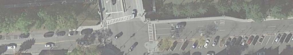


49


50

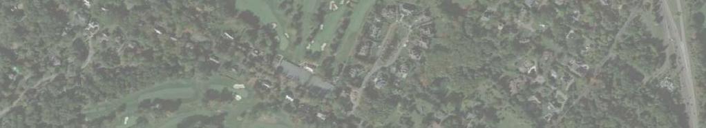


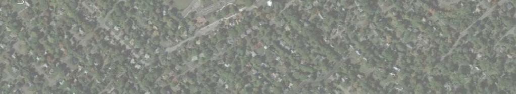
51
52
53
54
55
56
57

58 Popham Road Crosswalk

59 Raised Crosswalk

60 Rectangular Rapid Flash Beacon (RRFB)

61 Pedestrian Crossing Sign with Blinkers

62 Turning Vehicles Yield to Pedestrian Sign

63 Looking Left from Fox Meadow Road at Crane Road

64 Looking Right from Fox Meadow Road at Crane Road

65 Looking Left from Stonehouse Road at Crane Road

66 Looking Right from Stonehouse Road at Crane Road

67 Mini-Roundabout

68 Intersection of Haverford Avenue and Swarthmore Road (Looking Eastbound)

69 Intersection of Haverford Avenue and Franklin Road (Looking Eastbound)

70 Intersection of Franklin Road and Penn Blvd/Penn Road (Looking Northbound)

71 Intersection of Penn Blvd and Swarthmore Road (Looking Westbound)

72 Intersection of Haverford Road and Swarthmore Road (Looking Northbound)

73 Intersection of Franklin Road and Penn Blvd (Looking Eastbound)
")
74 Intersection of Franklin Road and Stratton Road (Looking Eastbound)
Project Report. South Kirkwood Road Traffic Study. Meadows Place, TX October 9, 2015
 Meadows Place, TX October 9, 2015 Contents 1 Introduction... 1 2 Data Collection... 1 3 Existing Roadway Network... 2 4 Traffic Volume Development... 2 5 Warrant Analysis... 3 6 Traffic Control Alternative
Appendix C. TRAFFIC CALMING PROGRAM TOOLBOX
 Appendix C. TRAFFIC CALMING PROGRAM TOOLBOX PHASE I...2 Do Not Enter Sign...3 One-Way Sign...4 Turn Prohibition...5 Pavement Markings...6 Speed Monitoring Trailer...7 Neighborhood Speed Watch...8 Police
Draft North Industrial Area-Wide Traffic Plan
 Summary of North Industrial and Hudson Bay Industrial Recommended Improvements Table 1. Summary of s Item Location 1 2 3 4 5 6 7 8 9 10 11 12 Millar Ave north of 51st St Super 8 Motel back lane 400 Block
Broad Street Bicycle Boulevard Design Guidelines
 Broad Street Bicycle Boulevard Design Guidelines Building from the strategies introduced in the 2013 Bicycle Transportation Plan and community input received thus far, City Transportation Staff have identified
MEMORANDUM. Charlotte Fleetwood, Transportation Planner
 MEMORANDUM Date: Updated August 22, 2017 To: Organization: Charlotte Fleetwood, Transportation Planner Boston Transportation Department From: Jason DeGray, P.E., PTOE, Regional Director of Engineering
M-58 HIGHWAY ACCESS MANAGEMENT STUDY Mullen Road to Bel-Ray Boulevard. Prepared for CITY OF BELTON. May 2016
 M-58 HIGHWAY ACCESS MANAGEMENT STUDY Prepared for CITY OF BELTON By May 2016 Introduction Missouri State Highway 58 (M-58 Highway) is a major commercial corridor in the City of Belton. As development has
TRAFFIC IMPACT STUDY And A TRAFFIC SIGNAL WARRANT ANALYSIS FOR A SENIOR LIVING AND APARTMENT DEVELOPMENT
 TRAFFIC IMPACT STUDY And A TRAFFIC SIGNAL WARRANT ANALYSIS FOR A SENIOR LIVING AND APARTMENT DEVELOPMENT DEERFIELD TOWNSHIP, WARREN COUNTY, OHIO Nantucket Circle and Montgomery Road () Prepared for: ODLE
AGENDA ITEM 6 D THOMASVILLE ROAD (HERMITAGE BOULEVARD TO LIVE OAK PLANTATION ROAD) ROADWAY SAFETY AUDIT
 ROADWAY SAFETY AUDIT") May 15, 2018 AGENDA ITEM 6 D THOMASVILLE ROAD (HERMITAGE BOULEVARD TO LIVE OAK PLANTATION ROAD) ROADWAY SAFETY AUDIT TYPE OF ITEM: Discussion STATEMENT OF ISSUE The Florida Department of Transportation
May 15, 2018 AGENDA ITEM 6 D THOMASVILLE ROAD (HERMITAGE BOULEVARD TO LIVE OAK PLANTATION ROAD) ROADWAY SAFETY AUDIT TYPE OF ITEM: Discussion STATEMENT OF ISSUE The Florida Department of Transportation
A plan for improved motor vehicle access on Railroad Avenue in Provincetown
 A plan for improved motor vehicle access on Railroad Avenue in Provincetown February 2011 A plan for improved motor vehicle access on Railroad Avenue in Provincetown INTRODUCTION AND PROBLEM IDENTIFICATION
City of Vallejo Traffic Calming Toolbox
 City of Vallejo Traffic Calming Toolbox June 1, 2013 Final Table of Contents Introduction... 1 Non-Physical Devices... 3 High-Visibility Crosswalk... 3 In Pavement Lighted Crosswalk... 4 Rapid Flashing
CITY OF WEST LAKE HILLS. Forest View Neighborhood Traffic Calming Study
 CITY OF WEST LAKE HILLS 901 South Mopac Expressway Building V, Suite 220 Austin, Texas 78746 Texas P.E. Firm Registration No. F-929 Klotz Associates Final Report Submittal: March 20, 2015 Revised Final
ALLEY 24 TRAFFIC STUDY
 ALLEY 24 TRAFFIC STUDY in City of Frostburg, Maryland January 2013 3566 Teays Valley Road Hurricane, WV Office: (304) 397-5508 www.denniscorporation.com Alley 24 Traffic Study January 2013 Frostburg, Maryland
Windy Ridge Elementary School
 Windy Ridge Elementary School SCHOOL ROUTE PLAN For WINDY RIDGE ELEMENTARY SCHOOL LOCATION 54 ORANGE COUNTY Prepared for: ORANGE COUNTY SCHOOL ASSESSMENT PROGRAM ORANGE COUNTY PUBLIC WORKS Traffic Engineering
Meadow Woods Elementary School
 Drag and drop pic and stretch/crop to the limits of the blue rectangle (delete this text box) Meadow Woods Elementary School Drag and drop pic and stretch/crop to the limits of the blue rectangle (delete
The Corporation of the City of Sarnia. School Crossing Guard Warrant Policy
 The Corporation of the City of Sarnia School Crossing Guard Warrant Policy Table of Contents Overview And Description... 2 Role of the School Crossing Guard... 2 Definition of a Designated School Crossing...
SCHOOL ROUTE PLAN. For HUNTER S CREEK ELEMENTARY SCHOOL LOCATION 14 ORANGE COUNTY. Prepared for:
 SCHOOL ROUTE PLAN For HUNTER S CREEK ELEMENTARY SCHOOL LOCATION 14 ORANGE COUNTY Prepared for: ORANGE COUNTY SCHOOL ASSESSMENT PROGRAM ORANGE COUNTY PUBLIC WORKS Traffic Engineering Division 42 South John
Traffic Impact Analysis Walton Acres at Riverwood Athletic Club Clayton, NC
 Traffic Impact Analysis Walton Acres at Riverwood Athletic Club Clayton, NC 1. TABLE OF CONTENTS INTRODUCTION...1 1.1. Site Location and Study Area...1 1.2. Proposed Land Use and Site Access...2 1.3.
Corporate. Report COUNCIL DATE: May 25, 1998 NO: R1500 REGULAR COUNCIL. TO: Mayor & Council DATE: April 27, 1998
 R1500 : Traffic Safety at 25 Avenue and 128 Street Intersection Corporate NO: R1500 Report COUNCIL DATE: May 25, 1998 REGULAR COUNCIL TO: Mayor & Council DATE: April 27, 1998 FROM: General Manager, Engineering
Orange Center Elementary School
 Drag and drop pic and stretch/crop to the limits of the blue rectangle (delete this text box) Orange Center Elementary School Drag and drop pic and stretch/crop to the limits of the blue rectangle (delete
Military Road Safety Improvements
 Military Road Safety Improvements 26 th Road North to 31 st Street North SUMMARY OF DATA REVIEW AND PRELIMINARY RECOMMENDATIONS Prepared for: Department of Environmental Services Traffic Engineering and
Route 28 (South Orleans Road)/Route 39 (Harwich Road)/Quanset Road Intersection
/Route 39 (Harwich Road)/Quanset Road Intersection") TRAFFIC FEASIBILITY STUDY Route 28 (South Orleans Road)/Route 39 (Harwich Road)/Quanset Road Intersection Orleans, Massachusetts Prepared for: Town of Orleans Prepared by: Fay, Spofford & Thorndike, LLC
TRAFFIC FEASIBILITY STUDY Route 28 (South Orleans Road)/Route 39 (Harwich Road)/Quanset Road Intersection Orleans, Massachusetts Prepared for: Town of Orleans Prepared by: Fay, Spofford & Thorndike, LLC
DEPARTMENT OF ENVIRONMENTAL SERVICES. North Harrison Street (Lee Highway to Little Falls Road) Comparative Analysis. Prepared for:
 Comparative Analysis. Prepared for:") DEPARTMENT OF ENVIRONMENTAL SERVICES North Harrison Street (Lee Highway to Little Falls Road) Comparative Analysis Prepared for: Arlington County Department of Environmental Services 2100 Clarendon Boulevard,
DEPARTMENT OF ENVIRONMENTAL SERVICES North Harrison Street (Lee Highway to Little Falls Road) Comparative Analysis Prepared for: Arlington County Department of Environmental Services 2100 Clarendon Boulevard,
Summary: Mercer County Princeton Avenue & Spruce Street Study January 2009
 Summary: Several recent studies have assessed potential development and redevelopment opportunities in the Mercer Crossing area of Trenton, Ewing, and Lawrence. This Princeton Avenue and Spruce Street
Active Transportation Facility Glossary
 Active Transportation Facility Glossary This document defines different active transportation facilities and suggests appropriate corridor types. Click on a facility type to jump to its definition. Bike
QUICKIE C STORE AND GAS BAR 1780 HERON ROAD OTTAWA, ONTARIO TRANSPORTATION BRIEF. Prepared for:
 QUICKIE C STORE AND GAS BAR 1780 HERON ROAD OTTAWA, ONTARIO TRANSPORTATION BRIEF Prepared for: Quickie Convenience Stores Larny Holdings Ltd. c/o PBC Group April 15, 2015 115-615 Report_1.doc D. J. Halpenny
Traffic Impact Analysis Chatham County Grocery Chatham County, NC
 Chatham County Grocery Chatham County, NC TABLE OF CONTENTS 1. INTRODUCTION... 1 1.1. Location and Study Area... 1 1.2. Proposed Land Use and Access... 2 1.3. Adjacent Land Uses... 2 1.4. Existing ways...
Traffic Circulation Study for Neighborhood Southwest of Mockingbird Lane and Airline Road, Highland Park, Texas
 ARIZONA TEXAS NEW MEXICO OKLAHOMA February 13, 2015 Mr. Meran Dadgostar P.E., R.S. Town of Highland Park 4700 Drexel Dr. Highland Park, Texas 75205 Re: Traffic Circulation Study for Neighborhood Southwest
Town of Mooresville, North Carolina Neighborhood Traffic Calming and Control Device Policy
 Town of Mooresville, North Carolina Neighborhood Traffic Calming and Control Device Policy Adopted January 6, 2014 Town of Mooresville Development Services Department TOWN OF MOORESVILLE NEIGHBORHOOD TRAFFIC
METHODOLOGY. Signalized Intersection Average Control Delay (sec/veh)
") Chapter 5 Traffic Analysis 5.1 SUMMARY US /West 6 th Street assumes a unique role in the Lawrence Douglas County transportation system. This principal arterial street currently conveys commuter traffic
Chapter 5 Traffic Analysis 5.1 SUMMARY US /West 6 th Street assumes a unique role in the Lawrence Douglas County transportation system. This principal arterial street currently conveys commuter traffic
Caltrans Sloat Boulevard Pedestrian Safety Project Response to Community Questions, Comments & Concerns
 Caltrans Sloat Boulevard Pedestrian Safety Project Response to Community Questions, Comments & Concerns Revised: May 10, 2016 The California Department of Transportation (Caltrans) is planning various
5. RUNNINGWAY GUIDELINES
 5. RUNNINGWAY GUIDELINES These guidelines should be considered collectively when making runningway decisions. A runningway is the linear component of the transit system that forms the right-of-way reserved
ROUTE 22 CORRIDOR STUDY: CORRIDOR MANAGEMENT PLAN APPENDIX A A-12
 ROUTE 22 CORRIDOR STUDY: CORRIDOR MANAGEMENT PLAN APPENDIX A A-12 3.0 HARLEM VALLEY TRANSPORTATION PLAN Incorporates transportation systems management and safety improvements. Location: Route 22 corridor
Traffic Signal Phasing Study Summary & Staff Recommendations
 Traffic Signal Phasing Study Summary & Staff Recommendations Consultant Study by Skipper Consulting, Inc. Staff Committee Recommendations by Randy Pewitt, Executive Director of Emergency Mgt. and Safety
Harrah s Station Square Casino
 Transportation Analysis Harrah s Station Square Casino Pittsburgh, Pennsylvania Submitted To: City of Pittsburgh and Pennsylvania Gaming Control Board Prepared By: DKS Associates GAI Consultants December
Edgemont Village Traffic and Parking Technical Report January 2014
 Edgemont Village Traffic and Parking Technical Report January 2014 In the fall of 2013, the District of North Vancouver engaged consultants to assess existing intersection and parking conditions in Edgemont
Chapter 2: Standards for Access, Non-Motorized, and Transit
 Standards for Access, Non-Motorized, and Transit Chapter 2: Standards for Access, Non-Motorized, and Transit The Washtenaw County Access Management Plan was developed based on the analysis of existing
TRAFFIC ACTION PLAN. Laurie Meadows Neighborhood CITY OF SAN MATEO
 TRAFFIC ACTION PLAN Laurie Meadows Neighborhood CITY OF SAN MATEO Draft January 2017 Table of Contents Introduction... 2 The Traffic Forum Process... 5 Neighborhood Traffic Issues... 7 Neighborhood Recommendations
CITY OF OTTAWA ROADWAY MODIFICATION APPROVAL UNDER DELEGATED AUTHORITY
 RMA-2015-ATM-038 CITY OF OTTAWA ROADWAY MODIFICATION APPROVAL UNDER DELEGATED AUTHORITY DATE: April 22, 2015 SUBJECT Approval of Roadway Modifications Recommended through an Area Traffic Management Study
Southside Road. Prepared for: City of St. John s Police & Traffic Committee. Prepared by: City of St. John s Traffic Division
 Southside Road Prepared for: City of St. John s Police & Traffic Committee Prepared by: City of St. John s Traffic Division January 2007 Southside Road - Traffic Report Page 1 of 9 BACKGROUND: th At the
Appendix A: Crosswalk Policy
 Appendix A: Crosswalk Policy Appendix A: Crosswalk Policy Introduction This citywide Crosswalk Policy is aimed at improving pedestrian safety and enhancing pedestrian mobility by providing a framework
St. Francis Drive through the City of Santa Fe Corridor Study
 VII. ENGINEERING AND ENVIRONMENTAL EVALUATION TRAIL CONNECTIVITY In the southern portion of the Corridor there is a lack of a sidewalk, trail or bicycle facility within the right-ofway. However, the City
CONTENTS EXECUTIVE SUMMARY 1
 CONTENTS CHAPTER PAGE EXECUTIVE SUMMARY 1 1 ISSUES AND PURPOSE OF THE ANALYSIS 2 1.1 Background 2 1.2 Analysis Area 2 1.3 Issues and Observations 3 1.4 Project and Public Meetings 3 2 LIST OF PREFERRED
Multi-Modal Traffic Analysis. Parisi and Associates
 Mill Valley to Corte Madera Bicycle and Pedestrian Corridor Study Appendix D: Multi-Modal Traffic Analysis Prepared by Parisi and Associates August 2009 Appendix D - Multi-Modal Traffic Analysis Table
THIS PAGE LEFT BLANK INTENTIONALLY
 GA SR 25 Spur at Canal Road Transportation Impact Analysis PREPARED FOR GLYNN COUNTY, GEORGIA 1725 Reynolds Street, Suite 300 Brunswick, Georgia 31520 PREPARED BY 217 Arrowhead Boulevard Suite 26 Jonesboro,
Washington St. Corridor Study
 FIGURE 7.17 Bridge Alternatives - Cross Sections 86 Discarded Alternative: Short-Term Bridge Repair Short-term repairs and west bridge span replacement were considered during analysis. Short-term repairs
TRAFFIC IMPACT ANALYSIS
 TRAFFIC IMPACT ANALYSIS FOR THE CHAMPAIGN UNIT#4 SCHOOL DISTRICT PROPOSED HIGH SCHOOL (SPALDING PARK SITE) IN THE CITY OF CHAMPAIGN Final Report Champaign Urbana Urbanized Area Transportation Study 6/24/2014
Evaluation of M-99 (Broad Street) Road Diet and Intersection Operational Investigation
 Road Diet and Intersection Operational Investigation") Evaluation of M-99 (Broad Street) Road Diet and Intersection Operational Investigation City of Hillsdale, Hillsdale County, Michigan June 16, 2016 Final Report Prepared for City of Hillsdale 97 North Broad
Evaluation of M-99 (Broad Street) Road Diet and Intersection Operational Investigation City of Hillsdale, Hillsdale County, Michigan June 16, 2016 Final Report Prepared for City of Hillsdale 97 North Broad
Shockoe Bottom Preliminary Traffic and Parking Analysis
 Shockoe Bottom Preliminary Traffic and Parking Analysis Richmond, Virginia August 14, 2013 Prepared For City of Richmond Department of Public Works Prepared By 1001 Boulders Pkwy Suite 300, Richmond, VA
Alternative Traffic Calming Methods
 Alternative Traffic Calming Methods In-street Pedestrian Crossing Sign Cost: approximately $300 per sign not including the installation cost Advantages of in-street pedestrian crossing signs 1. Typically
Ottawa Beach Road Study
 Ottawa Beach Road Study Prepared For: Park Township September 30, 2014 Project No. G140303 OTTAWA BEACH ROAD STUDY PREPARED FOR: PARK TOWNSHIP SEPTEMBER 30, 2014 PROJECT NO. G140303 TABLE OF CONTENTS 1.0
Date: April 4, Project #: Re: A Street/Binford Street Traffic/Intersection Assessment
 To: Peter Cavanaugh General Electric From: David Bohn, PE Ryan White, PE Date: April 4, 217 Project #: 13421. Re: / Traffic/Intersection Assessment Consistent with the Cooperation Agreement between the
Memorandum. Sunday, July 13, Saturday, July 19, 2014
 Memorandum To: David Lowin, Brooklyn Bridge Park Corporation From: Daniel Schack, AICP, PTP Date: Re: Brooklyn Bridge Park Pier 5/6 Loop Road Traffic Study Project No: 14-01-2407 At the request of Brooklyn
Swamp Road Residents Study
 Swamp Road Residents Study SRRG Meeting with PennDot and Elected Officials Newtown and Wrightstown, PA April 25, 2008 Newtown Township Section of Swamp Road Limited Public Funds No reconstruction of a
List of Attachments. Location Map... Site Plan... City of Lake Elsinore Circulation Element... City of Lake Elsinore Roadway Cross-Sections...
 List of Attachments Exhibits Location Map... Site Plan... City of Lake Elsinore Circulation Element... City of Lake Elsinore Roadway Cross-Sections... Existing Lane Geometry and Traffic Controls... Existing
MEMORANDUM. Our project study area included the following locations:
 MEMORANDUM Date: To: From: Subject: Najib O. Habesch Nick M. Fomenko, PE, PTOE Bushnell Park North Traffic Assessment BETA Project #: 4461 As part of our contract to undertake the design of the Bushnell
Seattle Department of Transportation (SDOT) Preliminary Responses to Madison-Miller Community List of Site-Specific Concerns
 Preliminary Responses to Madison-Miller Community List of Site-Specific Concerns") Seattle Department of Transportation (SDOT) Preliminary Responses to Madison-Miller Community List of Site-Specific Concerns Background In July 2002 SDOT staff met with a small group of community residents
Seattle Department of Transportation (SDOT) Preliminary Responses to Madison-Miller Community List of Site-Specific Concerns Background In July 2002 SDOT staff met with a small group of community residents
Chapter 4 TOOLBOX AND SAMPLE BIKE BOULEVARD LAYOUT
 Chapter 4 TOOLBOX AND SAMPLE BIKE BOULEVARD LAYOUT OVERVIEW This chapter describes a cohesive set of strategies to create a bicycle boulevard, namely to make streets safer and more efficient for bicycle
Appendix T CCMP TRAIL TRAFFIC & TRANSPORTATION DESIGN STANDARD
 Appendix T CCMP 3.3.4 TRAIL TRAFFIC & TRANSPORTATION DESIGN STANDARD 3.3.4 Trail Traffic and Transportation Design Multi-use trails have certain design standards, which vary depending on the agency that
EUCLID AVENUE PARKING STUDY CITY OF SYRACUSE, ONONDAGA COUNTY, NEW YORK
 EUCLID AVENUE PARKING STUDY CITY OF SYRACUSE, ONONDAGA COUNTY, NEW YORK CITY OF SYRACUSE DEPARTMENT OF PUBLIC WORKS 1200 CANAL STREET EXTENSION SYRACUSE, NEW YORK 13210 DRAFT REPORT DATE: November 13,
Broadway Street Pedestrian Safety Study Cass Street to 700 Feet North of Randall Avenue
 Broadway Street Pedestrian Safety Study Cass Street to 700 Feet North of Randall Avenue Prepared for: City of De Pere, Wisconsin Prepared by: June, 2017 Broadway Street Pedestrian Safety Study Cass Street
INDUSTRIAL BUILDING 1660 COMSTOCK ROAD CITY OF OTTAWA TRANSPORTATION OVERVIEW. Prepared for:
 INDUSTRIAL BUILDING 1660 COMSTOCK ROAD CITY OF OTTAWA TRANSPORTATION OVERVIEW Prepared for: Simluc Contractors Limited 2550 Blackwell Street, Ottawa K1B 5R1 October 18, 2013 113-584 Overview_1.doc D. J.
TRANSPORTATION ANALYSIS REPORT US Route 6 Huron, Erie County, Ohio
 TRANSPORTATION ANALYSIS REPORT US Route 6 Huron, Erie County, Ohio December 12, 2012 Prepared for: The City of Huron 417 Main Huron, OH 44839 Providing Practical Experience Technical Excellence and Client
City of Albert Lea Policy and Procedure Manual 4.10 ALBERT LEA CROSSWALK POLICY
 4.10 ALBERT LEA CROSSWALK POLICY PURPOSE: Pedestrian crosswalks are an integral part of our transportation infrastructure. To be effective and promote safety, marked crosswalks must be installed after
Lake Whitney Elementary School
 Lake Whitney Elementary School SCHOOL ROUTE PLAN For LAKE WHITNEY ELEMENTARY SCHOOL LOCATION 18 ORANGE COUNTY Prepared for: ORANGE COUNTY SCHOOL ASSESSMENT PROGRAM ORANGE COUNTY PUBLIC WORKS Traffic Engineering
10.0 CURB EXTENSIONS GUIDELINE
 10.0 CURB EXTENSIONS GUIDELINE Road Engineering Design Guidelines Version 1.0 March 2017 City of Toronto, Transportation Services City of Toronto Page 0 Background In early 2014, Transportation Services
CITY OF LOS ANGELES INTER-DEPARTMENTAL MEMORANDUM
 CITY OF LOS ANGELES INTER-DEPARTMENTAL MEMORANDUM Date: April 1, 219 To: Honorable City Council c/o City Clerk, Room 395, City Hall Attention: Honorable Mike Bonin, Chair, Transportation Committee From:
Date: September 7, Project #: Re: Spaulding Youth Center Northfield, NH Property. Traffic Impact Study
 To: Ms. Susan C. Ryan Spaulding Youth Center 72 Spaulding Road Northfield, NH 03276 Date: September 7, 2017 Project #: 52455.00 From: Robin Bousa Director of Transportation Systems Re: Spaulding Youth
Highway 111 Corridor Study
 Highway 111 Corridor Study June, 2009 LINCOLN CO. HWY 111 CORRIDOR STUDY Draft Study Tea, South Dakota Prepared for City of Tea Sioux Falls Metropolitan Planning Organization Prepared by HDR Engineering,
133 rd Street and 132 nd /Hemlock Street 132 nd Street and Foster Street MINI ROUNDABOUTS. Overland Park, Kansas
 133 rd Street and 132 nd /Hemlock Street 132 nd Street and Foster Street MINI ROUNDABOUTS Overland Park, Kansas September 1, 2017 TABLE OF CONTENTS 1. INTRODUCTION... 1 2. LITERATURE REVIEW... 1 3. CONCEPT
Downtown Traffic Study
 City of Lynn Massachusetts Downtown Traffic Study March 2005 315 Norwood Park South, Norwood, MA 02062 781.255.1982 email: beta@beta-inc.com LYNN DOWNTOWN TRAFFIC STUDY INTRODUCTION The City of Lynn is
INDUSTRIAL BUILDING 3009 HAWTHORNE ROAD CITY OF OTTAWA TRANSPORTATION OVERVIEW REVISED. Prepared for: Canada Inc.
 INDUSTRIAL BUILDING 3009 HAWTHORNE ROAD CITY OF OTTAWA TRANSPORTATION OVERVIEW REVISED Prepared for: 7849648 Canada Inc. Octiober 1, 2015 114-598 Overview_2.doc D. J. Halpenny & Associates Ltd. Consulting
City of Elizabeth City Neighborhood Traffic Calming Policy and Guidelines
 City of Elizabeth City Neighborhood Traffic Calming Policy and Guidelines I. Purpose: The City of Elizabeth City is committed to ensure the overall safety and livability of residential neighborhoods. One
Transportation Planning Division
 Transportation Planning Division Presentation Outline Study Tasks Recap of Previous Meetings Data Collected Focus Areas within Study Limits Design Principles Tool Box Recommended Concepts Schedule Moving
CITY OF SARATOGA SPRINGS PEDESTRIAN CROSSING TOOLBOX
 CITY OF SARATOGA SPRINGS PEDESTRIAN CROSSING TOOLBOX This toolbox is to be used to guide pedestrian crossing improvements within the City of Saratoga Springs. Details for each crossing type are provided.
Residential Traffic Calming Program Guide. Town of Ashland, Virginia
 Residential Traffic Calming Program Guide Town of Ashland, Virginia August 1, 2006 TABLE OF CONTENTS A. INTRODUCTION... 1 B. GOALS... 1 C. CRITERIA... 1 D. IDENTIFYING NEIGHBORHOOD TRAFFIC CONCERNS...
MEDICAL/OFFICE BUILDING 1637 BANK STREET OTTAWA, ONTARIO TRANSPORTATION OVERVIEW. Prepared for:
 MEDICAL/OFFICE BUILDING 1637 BANK STREET OTTAWA, ONTARIO TRANSPORTATION OVERVIEW Prepared for: 2434984 Ontario Inc. 13-5510 Canotek Road Ottawa, Ontario K1J 9J5 June 4, 2015 115-613 Report_2.doc D. J.
Hidden Oaks Elementary School
 Hidden Oaks Elementary School SCHOOL ROUTE PLAN For HIDDEN OAKS ELEMENTARY SCHOOL LOCATION 13 ORANGE COUNTY Prepared for: ORANGE COUNTY SCHOOL ASSESSMENT PROGRAM ORANGE COUNTY PUBLIC WORKS Traffic Engineering
Overview. Updated pictures of the intersection are shown in Exhibits 1 thru 4, and the aerial photo provided by Google Maps is shown in Exhibit 5.
 Overview The (here in after referred to as the Village ) is submitting the follow up interim RLRC Safety Report for the intersection of Lincoln Highway (US 30) at Orchard Drive. Additional reports, as
HILTON GARDEN INN HOTEL HOTEL EXPANSION 2400 ALERT ROAD, OTTAWA TRANSPORTATION BRIEF. Prepared for:
 HILTON GARDEN INN HOTEL HOTEL EXPANSION 2400 ALERT ROAD, OTTAWA TRANSPORTATION BRIEF Prepared for: Bona Building & Management Co. Ltd. Place Vanier, 333 North River Road Vanier, Ontario K1L 8B9 October
MEMORANDUM. Date: 9/13/2016. Citywide Crosswalk Policy
 MEMORANDUM Date: 9/13/2016 Re: Citywide Crosswalk Policy Foreword Through the s Circulation Element and Complete Streets Policy, it is the City s goal to promote walking trips and provide safe facilities
Pedestrian Road Safety Audit
 Pedestrian Road Safety Audit Middlebrook Road From Father Hurley Boulevard to Waring Station Road December 2017 Montgomery County Department of Transportation Table of Contents 1. Introduction... 1 1.1
TRAFFIC CONTROL DEVICES ON EDGEWATER BOULEVARD AT PORT ROYAL AVENUE (NORTH)
") Attachment 2 DATE: August 6, 2012 TO: VIA: FROM: SUBJECT: Mayor and Members of the City Council James C. Hardy, City Manager Ramon Towne, Director of Public Works Leah Edwards, Assistant Engineer TRAFFIC
Attachment 2 DATE: August 6, 2012 TO: VIA: FROM: SUBJECT: Mayor and Members of the City Council James C. Hardy, City Manager Ramon Towne, Director of Public Works Leah Edwards, Assistant Engineer TRAFFIC
Appendix C. NORTH METRO STATION AREA TRAFFIC IMPACT STATEMENT 88th Avenue Station
 Appendix C NORTH METRO STATION AREA TRAFFIC IMPACT STATEMENT 88th Avenue Station Prepared for: Regional Transportation Department and URS Corporation as part of the North Metro EIS David Evans and Associates,
DISTRIBUTION: Electronic Recipients List TRANSMITTAL LETTER NO. (17-01) MINNESOTA DEPARTMENT OF TRANSPORTATION. MANUAL: Road Design English Manual
 MINNESOTA DEPARTMENT OF TRANSPORTATION. MANUAL: Road Design English Manual") DISTRIBUTION: Electronic Recipients List MINNESOTA DEPARTMENT OF TRANSPORTATION DEVELOPED BY: Design Standards Unit ISSUED BY: Office of Project Management and Technical Support TRANSMITTAL LETTER NO.
DISTRIBUTION: Electronic Recipients List MINNESOTA DEPARTMENT OF TRANSPORTATION DEVELOPED BY: Design Standards Unit ISSUED BY: Office of Project Management and Technical Support TRANSMITTAL LETTER NO.
ROAD SAFETY AUDIT. State Road (Route 6) Corridor Town of Dartmouth. March Prepared For: MassDOT
 Corridor Town of Dartmouth. March Prepared For: MassDOT") ROAD SAFETY AUDIT State Road (Route 6) Corridor Town of Dartmouth March 2015 Prepared For: MassDOT Prepared By: McMahon Associates, Inc. 300 Myles Standish Blvd. Suite 201 Taunton, MA 02780 Table of Contents
ROAD SAFETY AUDIT State Road (Route 6) Corridor Town of Dartmouth March 2015 Prepared For: MassDOT Prepared By: McMahon Associates, Inc. 300 Myles Standish Blvd. Suite 201 Taunton, MA 02780 Table of Contents
Traffic Impact Study WestBranch Residential Development Davidson, NC March 2016
 Traffic Impact Study WestBranch Residential Development Davidson, NC March 216 TRAFFIC IMPACT STUDY FOR THE WestBranch Residential Development LOCATED IN DAVIDSON, NC Prepared For: Lennar Carolinas, LLC
Public Information Centre
 WELCOME Public Information Centre Father Tobin Road Lougheed Middle School - Library Wednesday November 7, 2012 7:00 p.m.to 9:00 p.m. Please sign in Neighbourhood Traffic Calming Guide Background The City
OTTAWA TRAIN YARDS PHASE 3 DEVELOPMENT CITY OF OTTAWA TRANSPORTATION IMPACT STUDY. Prepared for:
 OTTAWA TRAIN YARDS PHASE 3 DEVELOPMENT CITY OF OTTAWA TRANSPORTATION IMPACT STUDY Prepared for: The Ottawa Train Yards Inc. 223 Colonnade Road South, Suite 212 Nepean, Ontario K2E 7K3 January 17, 2012
TRAFFIC CALMING GUIDE FOR TORONTO CITY OF TORONTO TRANSPORTATION SERVICES DIVISION
 TRAFFIC CALMING GUIDE FOR TORONTO CITY OF TORONTO TRANSPORTATION SERVICES DIVISION CITY OF TORONTO TRANSPORTATION SERVICES DIVISION 2016 TRAFFIC CALMING GUIDE FOR TORONTO TABLE OF CONTENTS Introduction
DIMARCO CANANDAIGUA PROPERTIES HOUSING PROJECT CANANDAIGUA, ONTARIO COUNTY, NEW YORK
 TRAFFIC IMPACT STUDY FOR THE DIMARCO CANANDAIGUA PROPERTIES HOUSING PROJECT CANANDAIGUA, ONTARIO COUNTY, NEW YORK MARCH 14, 2017 PREPARED FOR: 1950 Brighton Henrietta Town Line Rd Rochester, NY 14623 PREPARED
CAPE COD COMMISSION 3225 MAIN STREET P.O. BOX 226 BARNSTABLE, MA (508) Fax (508) Transportation Safety Report
 Fax (508) Transportation Safety Report") CAPE COD COMMISSION 3225 MAIN STREET P.O. BOX 226 BARNSTABLE, MA 02630 (508) 362-3828 Fax (508) 362-3136 2006 Transportation Safety Report Bourne: Otis Rotary Harwich: Route 137/Route 39 Orleans: Route
CAPE COD COMMISSION 3225 MAIN STREET P.O. BOX 226 BARNSTABLE, MA 02630 (508) 362-3828 Fax (508) 362-3136 2006 Transportation Safety Report Bourne: Otis Rotary Harwich: Route 137/Route 39 Orleans: Route
TRAFFIC ACCIDENT ANALYSIS
 TRAFFIC ACCIDENT ANALYSIS Westheimer at Chimney Rock and Westheimer at Dunvale Prepared for Prepared by Klotz Associates, Inc. 1160 Dairy Ashford, Suite 500 Houston, Texas 77079 The preparation of this
Traffic Circulation & Pedestrian Safety Study
 Lyons Township High School North Campus La Grange, Illinois Parking Lot Vaughan Building N Main Building Prepared for: Prepared by: July 23, 2015 Contents List of Figures, iii 1. Introduction...1 2. Existing
URBAN QUARRY HEADQUARTERS 2717 STEVENAGE DRIVE CITY OF OTTAWA TRANSPORTATION OVERVIEW. Prepared for: Urban Quarry 4123 Belgreen Drive, Ottawa K1G 3N2
 URBAN QUARRY HEADQUARTERS 2717 STEVENAGE DRIVE CITY OF OTTAWA TRANSPORTATION OVERVIEW Prepared for: Urban Quarry 4123 Belgreen Drive, Ottawa K1G 3N2 February 27, 2014 113-584 Overview_1.doc D. J. Halpenny
OFFICE/RETAIL DEVELOPMENT 1625 BANK STREET OTTAWA, ONTARIO TRANSPORTATION BRIEF. Prepared for: Canada Inc.
 OFFICE/RETAIL DEVELOPMENT 1625 BANK STREET OTTAWA, ONTARIO TRANSPORTATION BRIEF Prepared for: 9402209 Canada Inc. December 15, 2015 115-625 Report_2.doc D. J. Halpenny & Associates Ltd. Consulting Transportation
CONTENTS EXECUTIVE SUMMARY. 1 SUMMARY OF EXISTING CONDITIONS Issues and Observations Public Meeting (December 2005) 1
 1") CONTENTS CHAPTER PAGE EXECUTIVE SUMMARY ES-1 1 SUMMARY OF EXISTING CONDITIONS 1 1.1 Issues and Observations 1 1.2 Public Meeting (December 2005) 1 2 LIST OF POTENTIAL IMPROVEMENT STRATEGIES 2 2.1 Traffic
CONTENTS CHAPTER PAGE EXECUTIVE SUMMARY ES-1 1 SUMMARY OF EXISTING CONDITIONS 1 1.1 Issues and Observations 1 1.2 Public Meeting (December 2005) 1 2 LIST OF POTENTIAL IMPROVEMENT STRATEGIES 2 2.1 Traffic
2007 TRAFFIC SIGNAL PRIORITY LIST SUMMARY OF STAFF RECOMMENDATIONS TO PEDESTRIAN/BICYCLE/MOTOR VEHICLE COMMISSION.
 Traffic Engineering and Parking Divisions David C. Dryer, City Traffic Engineer and Parking Manager 215 Martin Luther King, Jr. Boulevard P.O. Box 2986 Madison, Wisconsin 53701-2986 Phone 608 266 4761
CITY OF ROCK HILL, SOUTH CAROLINA. Neighborhood Traffic Calming Program A Policy for Use of Traffic Calming on Local (Residential) Streets
 Streets") CITY OF ROCK HILL, SOUTH CAROLINA Neighborhood Traffic Calming Program A Policy for Use of Traffic Calming on Local (Residential) Streets I. Statement of Purpose: This program provides a process and a
CITY OF ROCK HILL, SOUTH CAROLINA Neighborhood Traffic Calming Program A Policy for Use of Traffic Calming on Local (Residential) Streets I. Statement of Purpose: This program provides a process and a
Traffic Study of Fuller Street, Cady Street, West Street and West Avenue. Final Report
 Traffic Study of Fuller Street, Cady Street, West Street and West Avenue Final Report July 2005 Prepared for: Town of Ludlow Prepared by: Pioneer Valley Planning Commission 26 Central Street West Springfield,
MEETING FACILITY 2901 GIBFORD DRIVE CITY OF OTTAWA TRANSPORTATION BRIEF. Prepared for: Holiday Inn Express 2881 Gibford Drive Ottawa, ON K1V 2L9
 MEETING FACILITY 2901 GIBFORD DRIVE CITY OF OTTAWA TRANSPORTATION BRIEF Prepared for: Holiday Inn Express 2881 Gibford Drive Ottawa, ON K1V 2L9 December 18, 2012 112-566 Brief_1.doc D. J. Halpenny & Associates