Downtown Traffic Study
|
|
|
- Derek Wood
- 5 years ago
- Views:
Transcription


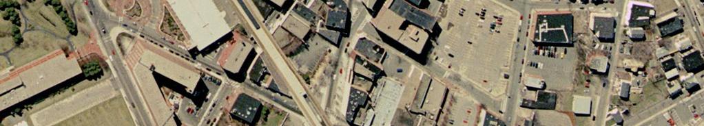
1 City of Lynn Massachusetts Downtown Traffic Study March Norwood Park South, Norwood, MA
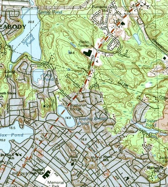
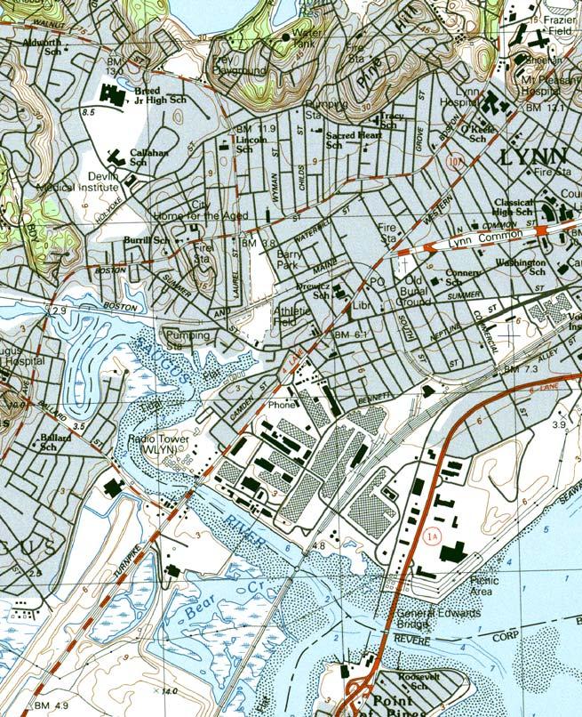
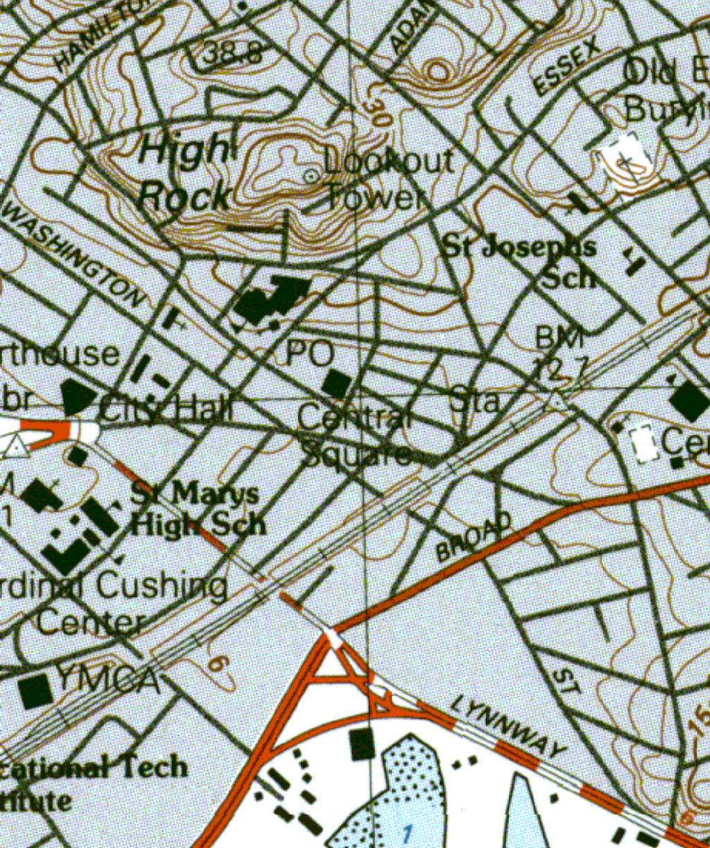
2 LYNN DOWNTOWN TRAFFIC STUDY INTRODUCTION The City of Lynn is embarking on a Downtown Traffic Study to evaluate the existing deficiencies with regards to roadway and intersection capacity, geometry, traffic signal control and overall safety operations within the downtown area. The evaluation focuses on roadway and intersection level of service (LOS), accident experience, delays, queuing, traffic circulation, on-street parking, and existing signal equipment operations including hardware conformance with current state and federal traffic signal standards and conformance with Architectural Access Board (AAB) accessibility requirements. The goal of the Downtown Traffic Study is to address issues of congestion within the downtown area and mitigation through improved intersection operations, design and safety. In addition to traffic and geometric improvements, the project will also develop recommendations associated with pedestrians. The limits of the traffic study are defined as within the area bordered by the following streets: Essex Street/Market Street/Broad Street/Silsbee Street/Baldwin Street as depicted in Figures 1 and 2. STUDY AREA The study area consists of approximately 38 intersections, 15 of which are signalized (although 2 are currently set on flash), while 23 are currently unsignalized. Based on our field investigation of the study area, and the projected study cost consideration, not all 38 intersections were analyzed. BETA Group selected the intersections that serve as major gateways to the downtown area and the most critical intersections for the study. The following intersections were selected for analysis; Signalized Market Street/Central Avenue/Common Street/Essex Street Market Street/Tremont Street/Liberty Street Market Street/State Street/Oxford Street Market Street/Broad Street Essex Street/Washington Street Washington Street/Liberty Street Exchange Street/Union Street Broad Street/Silsbee Street/Newhall Street Unsignalized Essex Street/Rodgers Street/Stewart Street Essex Street/Liberty Street/High Street Exchange Street/Central Avenue/Willow Street/Munroe Street/Blake Street Page 1
3 DATA COLLECTION In an effort to obtain information on the existing traffic signals, BETA contacted to city to obtain the traffic signal permits for the signalized intersections. Unfortunately, information was not available for all of the signalized intersections. Additional information was determined from our field reconnaissance. In addition, during the course of the study, we used information from the Traffic Impact Study performed for the Lynn Police Headquarters Relocation in June Manual turning movement counts were conducted for the following six intersections on Wednesday, June 9 and Thursday June 10, 2004 at the following study intersections between the hours of 7:00-9:00 AM and 4:00-6:00 PM. Market Street/State Street/Oxford Street Market Street/Broad Street Exchange Street/Union Street Broad Street/Silsbee Street/Newhall Street Exchange Street/Central Avenue/Willow Street/Munroe Street/Blake Street The traffic counts were conducted before Lynn public schools closed for summer vacation. In addition, traffic data was collected from the Traffic Impact Study performed for the Lynn Police Headquarters Relocation in June Since the Police Department has already been constructed, the traffic volumes were taken from the 2007 Build conditions at the following intersections; Market Street/Central Avenue/Common Street/Essex Street Market Street/Tremont Street/Liberty Street Essex Street/Washington Street Washington Street/Liberty Street Essex Street/Rodgers Street/Stewart Street Essex Street/Liberty Street/High Street Since the turning movement counts were conducted in 2004, an annual growth rate was utilized to factor the traffic volumes to the 2005 existing conditions. To be consistent with previous studies completed in the area, used a 1% annual growth rate to factor the traffic volumes to 2005 volumes. The existing AM and PM peak hour volumes are shown in Figures 3 and 4 respectively. In addition to turning movement counts, continuous traffic count information was collected at several locations, including Market Street, Broad Street, Washington Street and Union Street. These daily volume counts were planned for 7 days, but due to street sweepers some of the data was collected for only 24 hours. Page 2
 Union Street North of Exchange Street (one-way) 12,200 53% northbound 47% southbound INTERSECTION CONFIGURATIONS All of the")

4 Table 1 Daily Traffic Volumes Roadway Average Daily Volume Split Market Street South of Essex Street 12,800 54% southbound 46% northbound Broad Street East of Union Street 19,300 55% eastbound 45% westbound Washington Street 8, % southbound South of Munroe (one-way) Union Street North of Exchange Street (one-way) 12,200 53% northbound 47% southbound INTERSECTION CONFIGURATIONS All of the study area roadways and intersections are owned and maintained by the City of Lynn. The critical intersection locations are described as follows: Signalized Intersections Market Street/Central Avenue/Common Street/Essex Street This intersection consists of Essex Street approaching the intersection as a one-way street. The Essex Street left turn and right turn lanes are separated by an island. Through vehicles are not allowed to turn from Essex Street to Market Street. Central Avenue is a one-way roadway departing the intersection. Market Street is a two way roadway, and Common Street is a two way roadway with each movement separated by an island. Because of the islands and one-way roadways configuration, this intersection operates efficiently with a two-phase signal. We want to note that during our field investigation, this signal controller malfunctioned twice. Market Street/Tremont Street/Liberty Street Market Street is a two-way roadway system. Tremont Street is two-way, while Liberty Street is one-way eastbound departing the intersection. This signalized intersection operates with a two-phase signal. The Market Street northbound approach is currently striped and operates as one approach lane. Due to the heavy northbound left turn volume, it would be beneficial to make this a two lane Page 3


5 approach. This leg of Market Street is approximately 53 feet wide, which would be sufficient to accommodate a left turn pocket. Some on-street parking spaces may need to be removed. During our field visit, the traffic signal at this also malfunctioned. Market Street /Andrew Street Market Street is a two-way roadway system. Andrew Street is one-way roadway westbound approaching the intersection. This intersection operates with a two-phase signal. Market Street at this intersection is approximately 60 feet wide. This is wide enough for two lanes in each direction. Based on field observations, although Market Street usually operates as a two lane approach, lane lines appear to be missing at the intersection approaches. It was noted that pedestrians have difficulty crossing from the east side of Market Street to the west side of Market Street at this location. When the pedestrian button is pushed on the west side of Market Street, the exclusive pedestrian phase is called, but when the pedestrian button is pushed on the east side of Market Street only the Andrews Street concurrent pedestrian phase is called. Market Street/State Street/Oxford Street Market Street is a two way roadway. State Street is two-way, while Oxford Street is one-way westbound approaching the intersection. According to the traffic signal permit, this signalized intersection operates with a three-phase signal: Market Street northbound has a leading phase to accommodate the heavy northbound left turns, however a left turn signal arrow is not provided. Market Street from Andrew Street to Broad Street is wide enough for two lanes in each direction, and it operates as two lanes in each direction. However, lane lines are badly faded or missing. On the State Street approach, a R3-7R sign (Right Lane Must Turn Right) is present, however right turn pavement markings are not present on this approach. In addition, it appears this is a two lane approach, but there was no lane lines provided on this approach. Page 4


6 Market Street/Broad Street Both legs of Market Street are two-way roadways with the approaches separated from the departures by a concrete median. The eastern leg of Broad Street is two way, while the western leg of Broad Street is one-way westbound departing the intersection. This intersection operates as a two-phase signal. The northbound Market Street right turn is allowed to overlap the Broad Street westbound phase. The Market Street southbound approach is wide enough for two lanes, and usually operates as a two lane approach. However, there are no lane lines separating the two approach lanes. In addition, the Market Street departure north of Broad Street is wide enough and operates as two lanes; however no lane lines are present separating these lanes. On the Market Street northbound approach an R3-7R sign (Right Lane Must Turn Right) is present, however right turn pavement markings are not present on this approach. Due to the lack of pavement markings, the three lanes are not fully utilized. Essex Street/Washington Street Both legs of Essex Street at this intersection are one-way westbound. Washington Street is a two lane roadway. This traffic signal operates as a two-phase signal. Due to the high traffic volumes on the Washington Street northbound approach, the northbound approach needs two lanes to operate properly. However, the southern leg of Washington Street is currently only 33 feet wide from curb to curb. Even if on-street parking was removed, the existing roadway width would not be enough to accommodate an additional lane. It should be noted that this intersection is listed in the State Top 1,000 High Crash Locations report. Page 5


7 Washington Street/Liberty Street Washington Street at this intersection is a twoway roadway system. Liberty Street is one-way in the eastbound direction. This intersection operates as a two-phase signal. Washington Street consists of one lane in each direction. Due to the high Washington Street southbound left turn volume; this approach needs an additional left turn lane. The Washington Street southbound approach measures 33 feet wide. The width is not sufficient to create a Washington Street southbound left turn lane even with the elimination of on-street parking on the west side of Washington Street. It should be noted that this intersection is listed in the State Top 1,000 High Crash Locations report. Exchange Street/Union Street The southwestern leg of Union Street is oneway approaching the intersection. A large island separates Union Street northbound left turn, allowing this turn to be excluded from the traffic signal and operate with a yield control. The northeastern leg of Union Street is twoway, but in the southbound direction only right turns are allowed. The southeastern led of Exchange Street is two-way, while the northwestern leg of Exchange Street is one-way westbound away from the intersection. This intersection operates as a two-phase signal. Broad Street/Silsbee Street/Newhall Street Broad Street in this area is a two-way roadway with a median island. Both Silsbee Street and Newhall Street are twoway roadway systems. This intersection operates as a three phase signal, including a leading phase from Broad Street left turns. Pedestrians cross Broad Street, Silsbee Street and Newhall Street concurrently with traffic. On the Silsbee Street southbound approach, the Stop Line extends all the way across Silsbee Street. Since the leg of the intersection is two-way, the Stop Page 6


8 Line should only extend halfway across the street. Overall, the pavement marking at the intersection are badly faded and need replacing. Although Broad Street is wide enough to accommodate two lanes in each direction, lane lines are not present separating the lanes. On the Broad Street westbound approach, a R3-7L sign (Left Lane Must Turn Left) is present, however left turn pavement markings are not present on this approach Unsignalized Locations Essex Street/Rodgers Street/Stewart Street Essex Street in this location is one-way westbound. Both Rogers Street and Stewart Street are both two-way roadways, and are slightly offset from each other. Stewart Street is a dead end roadway. Rogers Street and Stewart Street are both required to stop. Essex Street is one way westbound, is very wide (42-45 feet), and does not contain any pavement markings. Essex Street/Liberty Street/High Street The eastern leg of Essex Street is two way, while the northern leg of Essex Street is oneway northbound departing the intersection. A large island separates the heavy Essex Street westbound right turn. Liberty Street is one-way eastbound approaching the intersection. High Street is a two-way roadway. Liberty Street, High Street, and Essex Street westbound left turns are all required to stop. On the Liberty Street approach, an R3-7L sign (Left Lane Must Turn Left) is present, however left turn pavement markings are not present on this approach. In addition, although this is a two lane approach, lane lines do not show the two lanes. Page 7

9 Exchange Street/Central Avenue/Willow Street/Munroe Street/Blake Street At this location the eastern leg of Exchange Street is one-way westbound approaching the intersection. On the west side of the intersection both Central Avenue and Willow Street are one-way westbound departing the intersection. Munroe Street is one-way approaching the intersection from the southwest, and Blake Street is One-way departing the intersection. Blake Street is the only approach that is required to stop, and are allowed to turn left onto Exchange or Willow or travel through to Blake Street Level of Service A level of service (LOS) analysis was conducted at the study area intersections using the procedures outlined in the 2000 Highway Capacity Manual 1. Level of service is a quantitative measure used to describe the operation of an intersection. Level of service values range from LOS A to LOS F. LOS A represents very good operation and LOS F represents very poor operations. Generally, LOS A through D are considered acceptable while LOS E and F are considered deficient. Synchro analysis software was used to analyze all of the selected analysis intersections. For the signalized analysis, the LOS was reported for all of the approaches are shown in Table 2 for the weekday AM and PM peak hours. For the unsignalized intersections the LOS the stoppedcontrolled approaches are noted in Table 3 for the weekday AM and PM peak hours Highway Capacity Manual; Transportation Research Board. Page 8
10 Table Existing Condition Signalized Level of Service Results AM Peak Hour PM Peak Hour Intersection Approach 95% 95% LOS Delay LOS Delay Queue Queue Common Street eastbound B B Market Street/Central Avenue/ Essex Street southbound left C B Common Street/Essex Street Essex Street southbound right A A Market Street northbound C C OVERALL B 12.6 B 17.2 Market Street/ Tremont Street/Liberty Street Market Street/State Street/ Oxford Street Market Street/Broad Street Essex Street/Washington Street Washington Street/ Liberty Street Exchange Street/Union Street Broad Street/Silsbee Street/ Newhall Street Market Street southbound B B Market Street northbound D C Liberty Street westbound D D OVERALL C 27.7 C 27.1 Market Street southbound B B Market Street northbound B B State Street eastbound A A Oxford Street westbound B C OVERALL B 11.5 B 14.1 Broad Street westbound B C Market Street southbound B B Market Street northbound A B OVERALL B 13.9 B 16.5 Washington Street eastbound C C Washington Street westbound F > F > Essex Street southbound C C OVERALL F >120 F >120 Washington Street southbound F > F > Washington Street northbound B C Liberty Street eastbound B C OVERALL F >120 F >120 Exchange Street westbound B B Union Street northbound B B Union Street southbound A A OVERALL A 7.6 A 9.3 Broad Street eastbound B C Broad Street westbound C C Newhall Street northbound C B Silsbee Street southbound C C OVERALL B 18.6 C 25.0 Delay is in terms of average delay (in seconds) per vehicle. 95% Queue listed in feet. Page 9
11 Intersection Essex Street/Rodgers Street/Stewart Street Essex Street/Liberty Street/ High Street Exchange Street/Central Avenue/Willow Street/ Munroe Street/Blake Street Table Existing Conditions Unsignalized Level of Service Results AM Peak Hour PM Peak Hour Approach 95% 95% LOS Delay LOS Delay Queue Queue Rogers Street southbound C B Stewart Street northbound E C High Street northbound A 8.8 A 9.3 Liberty Street eastbound B 12.3 D 34.2 Essex Street westbound B 10.1 A 9.2 Blake Street eastbound B C Delay is in terms of average delay (in seconds) per vehicle. 95% Queue listed in feet. Crash Data Analysis A crash data history was obtained from the Massachusetts Registry of Motor Vehicles, via the MassHighway Department database for the three most recent years available: 2001, 2002 and The crash data is summarized in Table 4. The crash rate has been calculated for each of the study area intersections and summarized in the table below. Based on MassHighway statistics, the average statewide crash rate for signalized intersections is 0.87 accidents per million entering vehicles (acc/mev) while the average crash rate for unsignalized intersections is 0.66 accidents per million entering vehicles (acc/mev). The intersection of Washington Street/Liberty Street experiences a higher than average crash rate, while the intersection of Market Street/Central Avenue/Common Street/Essex Street experiences an average crash rate. The crash data summary is shown in Table 4. Most of the accident experience at the Washington Street/Liberty Street intersection are angle collisions which is an indication of an over congested intersection with deficiencies in the overall intersection operations. It should also be noted that the intersections of Essex Street/Washington Street and Liberty Street/Washington Street were both listed in the State s Top 1000 High Crash Locations Report produced by MassHighway in August MassHighway uses a weighted scoring system to develop the high frequency location, giving higher weight to accident involving injury or fatalities. Table 4 Accident Data Summary Intersection Total Angle Rear End Head On Other/ Unknown Property Injury Fatality Crash Rate (in MEV) SIGNALIZED INTERSECTIONS Market Street/Central Avenue/ Common Street/Essex Street Market Street/Tremont Street/Liberty Street Market Street/State Street/Oxford Street Market Street/Broad Street Essex Street/Washington Street Washington Street/Liberty Street Exchange Street/Union Street Page 10
12 Table 4 Accident Data Summary Intersection Total Angle Rear End Head On Other/ Unknown Property Injury Fatality Crash Rate (in MEV) Broad Street/Silsbee Street/Newhall Street Market Street/Andrew Street N/A Broad Street/Union Street N/A Broad Street/Washington Street/Spring Street N/A Broad Street/Exchange Street N/A Willow Street/Oxford Street (currently flashing) N/A Central Avenue/Oxford Street/Washington Street (currently flashing) N/A Washington Street/Union Street N/A UNSIGNALIZED INTERSECTIONS Essex Street/Rodgers Street/Stewart Street Essex Street/Liberty Street/High Street Exchange Street/Central Avenue/Willow Street/Munroe Street/Blake Street Market Street/Munroe Street N/A Essex Street/Johnson Street/Sutton Street N/A Central Avenue/Sutton Street N/A Central Avenue/Liberty Street N/A Central Avenue/Washington Street/Andrew Street N/A Washington Street/Munroe Street N/A Liberty Street/Willow Street N/A Exchange Street/Spring Street/Mt. Vernon Street N/A Essex Street/Lawton Avenue N/A Liberty Street/Buffum Street N/A Buffum Street/Oxford Street N/A Buffum Street/Blake Street N/A Buffum Street/Union Street/Baldwin Street/Silsbee Street N/A Baldwin Street/High Street N/A High Street/Oxford Street N/A Silsbee Street/Ellis Street N/A Silsbee Street/Mt. Vernon Street (Ped) N/A Silsbee Street/Friend Street N/A Source: Massachusetts Highway Department Crash Rate expressed as accidents per million entering vehicles; State Average = 0.87 for signalized Intersections, 0.66 for unsignalized intersections N/A: Traffic Volumes not available Page 11


13 FINDINGS Intersection Analysis Currently, a few of the analyzed intersections are operating at poor levels of service. The two intersections that operate at LOS F include the signalized intersections of Essex Street/Washington Street and Washington Street/Liberty Street. At both of these locations, the poor operations are due to the lack of turn lanes on the Washington Street approaches. In addition, both of these intersections were both listed in the State s Top 1000 High Crash Locations Report produced by MassHighway in August In addition, at the signalized intersections of Market Street/Tremont Street/Liberty Street, the Market Street northbound approach operates at LOS D/C with excessive queues of 673/894 feet during the AM and PM peak hours respectively. The Market Street northbound approach is currently striped and operates as one approach lane. Due to the heavy northbound left turn volume, it would be beneficial to make this a two lane approach. This leg of Market Street is approximately 53 feet wide, which would be sufficient to accommodate a left turn pocket. Some on-street parking spaces may need to be removed. Signage Overall, there is a lack of street signs within the entire study area. During our field visit investigation we encountered a number of lost drivers circulating around the study area unable to find a particular street. These lost drivers who are needlessly recirculating the study area are generating unnecessary vehicular trips within the downtown area. Pavement Markings There are also poor pavement markings within the study area. Many lane lines were faded or missing. Although there were signs designated foe exclusive left turn or right turn lanes the corresponding pavement arrows were often missing. Proper lane marking will encourage the proper use of lanes and will lead to more efficient operations. Traffic Signal Equipment The existing traffic signal equipment at the majority of the study intersections are approximately years old and do not appear to be coordinated. During our field investigations, we have found the traffic signal controllers at the intersections of Market Street/Central Avenue/Common Street/Essex Street and Market Street/Tremont Street/Liberty Street to malfunction. These signals should be upgraded and placed in a closed loop system. Page 12
14 PRELIMINARY RECOMMENDED ROADWAY IMPROVEMENTS Based on the above data and analyses, the improvements identified in Table5 are recommended to address the safety and operational deficiencies found at each study intersection as well as to meet current standards. The recommendations are separated into short-term and long term improvements so that the city can better prioritize the improvements needed for each intersection based on cost/budget consideration. A summary of the recommended roadway improvements is provided in Table 5. Study Area Location Market Street/Central Avenue/Common Street/Essex Street Market Street/Andrew Street Market Street/Tremont Street/Liberty Street Market Street/State Street/Oxford Street Market Street/Broad Street Essex Street/Washington Street Washington Street/Liberty Street Exchange Street/Union Street Broad Street/Silsbee Street/Newhall Street Essex Street/Rodgers Street/Stewart Street Essex Street/Liberty Street/High Street Table 5 Recommended Roadway improvements Proposed Improvement Short-Term Install Street Name Signs and poles (assume 10 ) Replace Controller Unit Time based coordination Update exclusive pedestrian phase to respond to pedestrian buttons on east side of Market Street. Add northbound Market Street left turn lane. Replace controller unit. Time based coordination. Add northbound left turn arrow. Time based coordination. Replace Controller Unit. Time based coordination. Time based coordination Time based coordination Time based coordination Reinstall the Stop line on Silsbee Street so it only extends halfway across Silsbee Street. Long-Term Install a closed loop system with system detection and emergency preemption. Install a new cabinet and controller system and closed loop system with system detection and emergency preemption. Replace cabinet and controller system. Install a closed loop system system with system detection and emergency pre-emption. Replace cabinet and controller system. Install a closed loop system with system detection and emergency pre-emption. Install a closed loop system with system detection and emergency preemption. Replace cabinet and controller system. Install a closed loop system with system detection and emergency pre-emption. Consider widening southern leg of Washington Street and restrict parking to allow a left turn lane. Replace cabinet and controller system. Install a closed loop system with system detection and emergency pre-emption. Replace cabinet and controller system. Install a closed loop system with system detection and emergency pre-emption. Replace cabinet and controller system. Install a closed loop system with system detection and emergency pre-emption. Short Term $2,000 $5000 to $8000 $1,500 to $2,500 $5,000 to $10,000 $2,500 to $5,000 $5,000 to $10,000 $2,500 to $4,000 $2,500 to $4,000 $2,500 to $4,000 Upgrade pavement markings. $1,000 Upgrade pavement markings $500 Cost Long Term $25,000 to $35,000 $35,000 to $50,000 $35,000 to $50,000 $35,000 to $50,000 $25,000 to $35,000 $80,000 to $100,000 $35,000 to $50,000 $35,000 to $50,000 $1,000 $35,000 to $50,000 Page 13
15
16


17
18
Evaluation of M-99 (Broad Street) Road Diet and Intersection Operational Investigation
 Road Diet and Intersection Operational Investigation") Evaluation of M-99 (Broad Street) Road Diet and Intersection Operational Investigation City of Hillsdale, Hillsdale County, Michigan June 16, 2016 Final Report Prepared for City of Hillsdale 97 North Broad
Evaluation of M-99 (Broad Street) Road Diet and Intersection Operational Investigation City of Hillsdale, Hillsdale County, Michigan June 16, 2016 Final Report Prepared for City of Hillsdale 97 North Broad
METHODOLOGY. Signalized Intersection Average Control Delay (sec/veh)
") Chapter 5 Traffic Analysis 5.1 SUMMARY US /West 6 th Street assumes a unique role in the Lawrence Douglas County transportation system. This principal arterial street currently conveys commuter traffic
Chapter 5 Traffic Analysis 5.1 SUMMARY US /West 6 th Street assumes a unique role in the Lawrence Douglas County transportation system. This principal arterial street currently conveys commuter traffic
Route 28 (South Orleans Road)/Route 39 (Harwich Road)/Quanset Road Intersection
/Route 39 (Harwich Road)/Quanset Road Intersection") TRAFFIC FEASIBILITY STUDY Route 28 (South Orleans Road)/Route 39 (Harwich Road)/Quanset Road Intersection Orleans, Massachusetts Prepared for: Town of Orleans Prepared by: Fay, Spofford & Thorndike, LLC
TRAFFIC FEASIBILITY STUDY Route 28 (South Orleans Road)/Route 39 (Harwich Road)/Quanset Road Intersection Orleans, Massachusetts Prepared for: Town of Orleans Prepared by: Fay, Spofford & Thorndike, LLC
DIMARCO CANANDAIGUA PROPERTIES HOUSING PROJECT CANANDAIGUA, ONTARIO COUNTY, NEW YORK
 TRAFFIC IMPACT STUDY FOR THE DIMARCO CANANDAIGUA PROPERTIES HOUSING PROJECT CANANDAIGUA, ONTARIO COUNTY, NEW YORK MARCH 14, 2017 PREPARED FOR: 1950 Brighton Henrietta Town Line Rd Rochester, NY 14623 PREPARED
Project Report. South Kirkwood Road Traffic Study. Meadows Place, TX October 9, 2015
 Meadows Place, TX October 9, 2015 Contents 1 Introduction... 1 2 Data Collection... 1 3 Existing Roadway Network... 2 4 Traffic Volume Development... 2 5 Warrant Analysis... 3 6 Traffic Control Alternative
ALLEY 24 TRAFFIC STUDY
 ALLEY 24 TRAFFIC STUDY in City of Frostburg, Maryland January 2013 3566 Teays Valley Road Hurricane, WV Office: (304) 397-5508 www.denniscorporation.com Alley 24 Traffic Study January 2013 Frostburg, Maryland
Date: April 4, Project #: Re: A Street/Binford Street Traffic/Intersection Assessment
 To: Peter Cavanaugh General Electric From: David Bohn, PE Ryan White, PE Date: April 4, 217 Project #: 13421. Re: / Traffic/Intersection Assessment Consistent with the Cooperation Agreement between the
Gateway Transportation Study
 Gateway Transportation Study Amherst, Massachusetts SUBMITTED TO University of Massachusetts Amherst Town of Amherst SUBMITTED BY Vanasse Hangen Brustlin, Inc. Watertown, Massachusetts March 213 Back of
Traffic Impact Analysis Chatham County Grocery Chatham County, NC
 Chatham County Grocery Chatham County, NC TABLE OF CONTENTS 1. INTRODUCTION... 1 1.1. Location and Study Area... 1 1.2. Proposed Land Use and Access... 2 1.3. Adjacent Land Uses... 2 1.4. Existing ways...
Figure 1: Vicinity Map of the Study Area
 ARIZONA TEXAS NEW MEXICO OKLAHOMA May 5, 2016 Mr. Anthony Beach, P.E. BSP Engineers 4800 Lakewood Drive, Suite 4 Waco, Texas 76710 Re: Intersection and Access Analysis along Business 190 in Copperas Cove
Shockoe Bottom Preliminary Traffic and Parking Analysis
 Shockoe Bottom Preliminary Traffic and Parking Analysis Richmond, Virginia August 14, 2013 Prepared For City of Richmond Department of Public Works Prepared By 1001 Boulders Pkwy Suite 300, Richmond, VA
Traffic Circulation Study for Neighborhood Southwest of Mockingbird Lane and Airline Road, Highland Park, Texas
 ARIZONA TEXAS NEW MEXICO OKLAHOMA February 13, 2015 Mr. Meran Dadgostar P.E., R.S. Town of Highland Park 4700 Drexel Dr. Highland Park, Texas 75205 Re: Traffic Circulation Study for Neighborhood Southwest
CAPE COD COMMISSION 3225 MAIN STREET P.O. BOX 226 BARNSTABLE, MA (508) Fax (508) Transportation Safety Report
 Fax (508) Transportation Safety Report") CAPE COD COMMISSION 3225 MAIN STREET P.O. BOX 226 BARNSTABLE, MA 02630 (508) 362-3828 Fax (508) 362-3136 2006 Transportation Safety Report Bourne: Otis Rotary Harwich: Route 137/Route 39 Orleans: Route
CAPE COD COMMISSION 3225 MAIN STREET P.O. BOX 226 BARNSTABLE, MA 02630 (508) 362-3828 Fax (508) 362-3136 2006 Transportation Safety Report Bourne: Otis Rotary Harwich: Route 137/Route 39 Orleans: Route
Traffic Impact Analysis Walton Acres at Riverwood Athletic Club Clayton, NC
 Traffic Impact Analysis Walton Acres at Riverwood Athletic Club Clayton, NC 1. TABLE OF CONTENTS INTRODUCTION...1 1.1. Site Location and Study Area...1 1.2. Proposed Land Use and Site Access...2 1.3.
Traffic Study of Fuller Street, Cady Street, West Street and West Avenue. Final Report
 Traffic Study of Fuller Street, Cady Street, West Street and West Avenue Final Report July 2005 Prepared for: Town of Ludlow Prepared by: Pioneer Valley Planning Commission 26 Central Street West Springfield,
TRAFFIC ACCIDENT ANALYSIS
 TRAFFIC ACCIDENT ANALYSIS Westheimer at Chimney Rock and Westheimer at Dunvale Prepared for Prepared by Klotz Associates, Inc. 1160 Dairy Ashford, Suite 500 Houston, Texas 77079 The preparation of this
4.0 TRANSPORTATION SYSTEMS
 Transportation Systems 4.0 TRANSPORTATION SYSTEMS This chapter examines the impacts of the Central Corridor Extension on existing roadways and traffic operations and discusses the transit service, operations,
Date: September 7, Project #: Re: Spaulding Youth Center Northfield, NH Property. Traffic Impact Study
 To: Ms. Susan C. Ryan Spaulding Youth Center 72 Spaulding Road Northfield, NH 03276 Date: September 7, 2017 Project #: 52455.00 From: Robin Bousa Director of Transportation Systems Re: Spaulding Youth
A plan for improved motor vehicle access on Railroad Avenue in Provincetown
 A plan for improved motor vehicle access on Railroad Avenue in Provincetown February 2011 A plan for improved motor vehicle access on Railroad Avenue in Provincetown INTRODUCTION AND PROBLEM IDENTIFICATION
TRAFFIC IMPACT STUDY And A TRAFFIC SIGNAL WARRANT ANALYSIS FOR A SENIOR LIVING AND APARTMENT DEVELOPMENT
 TRAFFIC IMPACT STUDY And A TRAFFIC SIGNAL WARRANT ANALYSIS FOR A SENIOR LIVING AND APARTMENT DEVELOPMENT DEERFIELD TOWNSHIP, WARREN COUNTY, OHIO Nantucket Circle and Montgomery Road () Prepared for: ODLE
Forest Hills Improvement Initiative
 Forest Hills Improvement Initiative Transportation Action Plan Short Term Recommendations ONLY Final Draft as of April 30, 2008 For Community Review and Feedback Prepared for: The City of Boston Boston
Optimizing The Operations of Closely Spaced Traffic Signals. Gordon E. Meth, P.E., PTOE ITE District 1 Annual Meeting May 21, 2004
 Optimizing The Operations of Closely Spaced Traffic Signals Gordon E. Meth, P.E., PTOE ITE District 1 Annual Meeting May 21, 2004 Closely Spaced Signals - The Challenges According to many sources, minimum
TRAFFIC IMPACT ANALYSIS
 TRAFFIC IMPACT ANALYSIS FOR THE CHAMPAIGN UNIT#4 SCHOOL DISTRICT PROPOSED HIGH SCHOOL (SPALDING PARK SITE) IN THE CITY OF CHAMPAIGN Final Report Champaign Urbana Urbanized Area Transportation Study 6/24/2014
Harrah s Station Square Casino
 Transportation Analysis Harrah s Station Square Casino Pittsburgh, Pennsylvania Submitted To: City of Pittsburgh and Pennsylvania Gaming Control Board Prepared By: DKS Associates GAI Consultants December
THIS PAGE LEFT BLANK INTENTIONALLY
 GA SR 25 Spur at Canal Road Transportation Impact Analysis PREPARED FOR GLYNN COUNTY, GEORGIA 1725 Reynolds Street, Suite 300 Brunswick, Georgia 31520 PREPARED BY 217 Arrowhead Boulevard Suite 26 Jonesboro,
Glenn Avenue Corridor Traffic Operational Evaluation
 Glenn Avenue Corridor Traffic Operational Evaluation PREPARED FOR: THE CITY OF AUBURN PREPARED BY: DECEMBER 2007 Glenn Avenue Corridor Study--Auburn, Alabama TABLE OF CONTENTS Introduction... 1 Background
DEPARTMENT OF ENVIRONMENTAL SERVICES. North Harrison Street (Lee Highway to Little Falls Road) Comparative Analysis. Prepared for:
 Comparative Analysis. Prepared for:") DEPARTMENT OF ENVIRONMENTAL SERVICES North Harrison Street (Lee Highway to Little Falls Road) Comparative Analysis Prepared for: Arlington County Department of Environmental Services 2100 Clarendon Boulevard,
DEPARTMENT OF ENVIRONMENTAL SERVICES North Harrison Street (Lee Highway to Little Falls Road) Comparative Analysis Prepared for: Arlington County Department of Environmental Services 2100 Clarendon Boulevard,
MEMORANDUM. Our project study area included the following locations:
 MEMORANDUM Date: To: From: Subject: Najib O. Habesch Nick M. Fomenko, PE, PTOE Bushnell Park North Traffic Assessment BETA Project #: 4461 As part of our contract to undertake the design of the Bushnell
133 rd Street and 132 nd /Hemlock Street 132 nd Street and Foster Street MINI ROUNDABOUTS. Overland Park, Kansas
 133 rd Street and 132 nd /Hemlock Street 132 nd Street and Foster Street MINI ROUNDABOUTS Overland Park, Kansas September 1, 2017 TABLE OF CONTENTS 1. INTRODUCTION... 1 2. LITERATURE REVIEW... 1 3. CONCEPT
TRANSPORTATION IMPACT STUDY PROPOSED RIVERFRONT 47 MIXED USE DEVELOPMENT
 November 2016 TRANSPORTATION IMPACT STUDY PROPOSED RIVERFRONT 47 MIXED USE DEVELOPMENT & Aspinwall Borough, Sharpsburg Borough & O Hara Township, Allegheny County, Pennsylvania Prepared for: Riverfront
Roundabout Feasibility Memorandum
 Roundabout Feasibility Memorandum To From Gwen Pipkin Bill Howell Date June 18, 2013 Subject Roundabout Feasibility Study SR 29 PD&E Study From Oil Well Road to SR 82 Collier County, FL FPID 417540-1-22-01
MEMORANDUM. Layout Of Study Intersections And Traffic Control
 BOSTON REGION METROPOLITAN PLANNING ORGANIZATION Richard A. Davey, MassDOT Secretary and CEO and MPO Chairman Karl H. Quackenbush, Executive Director, MPO Staff DATE November 15, 2012 TO FROM RE Town of
Traffic Impact Study Little Egypt Road Development Denver, North Carolina June 2017
 Traffic Impact Study Little Egypt Road Development Denver, North arolina June 2017 N. Little Egypt Road DQ\ QDQFLQJ VDOHV RU RWKHU SHUIRUPDQFH EDVHG FULWHULD Proposed Site Driveways Site Driveway 1 TRAFFI
List of Attachments. Location Map... Site Plan... City of Lake Elsinore Circulation Element... City of Lake Elsinore Roadway Cross-Sections...
 List of Attachments Exhibits Location Map... Site Plan... City of Lake Elsinore Circulation Element... City of Lake Elsinore Roadway Cross-Sections... Existing Lane Geometry and Traffic Controls... Existing
Existing Conditions. Date: April 16 th, Dan Holderness; Coralville City Engineer Scott Larson; Coralville Assistant City Engineer
 Date: April 16 th, 2015 To: From: Re: Dan Holderness; Coralville City Engineer Scott Larson; Coralville Assistant City Engineer Darian Nagle-Gamm, Traffic Engineering Planner Highway 6 (2 nd Street) /
Military Road Safety Improvements
 Military Road Safety Improvements 26 th Road North to 31 st Street North SUMMARY OF DATA REVIEW AND PRELIMINARY RECOMMENDATIONS Prepared for: Department of Environmental Services Traffic Engineering and
MEMORANDUM. Charlotte Fleetwood, Transportation Planner
 MEMORANDUM Date: Updated August 22, 2017 To: Organization: Charlotte Fleetwood, Transportation Planner Boston Transportation Department From: Jason DeGray, P.E., PTOE, Regional Director of Engineering
CITY OF OAKLAND. 27th Street Bikeway Feasibility and Design. Final Report (v3) March 23, Kimley-Horn and Associates, Inc.
 March 23, Kimley-Horn and Associates, Inc.") CITY OF OAKLAND 27th Street Bikeway Feasibility and Design Final Report (v3) March 23, 2007 PREPARED BY: Kimley-Horn and Associates, Inc. Table of Contents 1. Introduction 3 2. 27 th Street/Bay Place Corridor
CITY OF OAKLAND 27th Street Bikeway Feasibility and Design Final Report (v3) March 23, 2007 PREPARED BY: Kimley-Horn and Associates, Inc. Table of Contents 1. Introduction 3 2. 27 th Street/Bay Place Corridor
STILLWATER AVENUE CORRIDOR STUDY Old Town, Maine
 Draft Study STILLWATER AVENUE CORRIDOR STUDY Old Town, Maine SUBMITTED TO: BANGOR AREA COMPREHENSIVE TRANSPORTATION SYSTEM SUBMITTED BY: I MAY 23, 2017 DRAFT STILLWATER AVENUE STUDY FINAL REPORT Table
MEMORANDUM. DATE March 1, 2012 TO Town of Milton Mark Abbott, Seth Asante, and Efi Pagitsas Boston Region MPO Staff
 MEMORANDUM DATE March 1, 212 TO Town of Milton FROM RE Mark Abbott, Seth Asante, and Efi Pagitsas Boston Region MPO Staff FFY 211 Safety and Operations Analyses at Selected Boston Region MPO Intersections:
Traffic Study North Shore School District 112
 Traffic Study North Shore School District 112 Proposed Expansion of Northwood Junior High School Prepared By: May 1, 2015 1. Introduction Kenig, Lindgren, O Hara, Aboona, Inc. (KLOA, Inc.) has been retained
Washington St. Corridor Study
 FIGURE 7.17 Bridge Alternatives - Cross Sections 86 Discarded Alternative: Short-Term Bridge Repair Short-term repairs and west bridge span replacement were considered during analysis. Short-term repairs
DUNBOW ROAD FUNCTIONAL PLANNING
 DUNBOW ROAD FUNCTIONAL PLANNING Final Report August 3, 216 #31, 316 5th Avenue NE Calgary, AB T2A 6K4 Phone: 43.273.91 Fax: 43.273.344 wattconsultinggroup.com Dunbow Road Functional Planning Final Report
INTERSECTION SAFETY STUDY State Route 57 / Seville Road
 INTERSECTION SAFETY STUDY State Route 57 / Seville Road City of Wadsworth, Medina County, Ohio Prepared For: City of Wadsworth Engineering Department 120 Maple Street Wadsworth, OH 44281 Prepared By: GPD
CITY OF LOS ANGELES INTER-DEPARTMENTAL MEMORANDUM
 CITY OF LOS ANGELES INTER-DEPARTMENTAL MEMORANDUM Date: April 1, 219 To: Honorable City Council c/o City Clerk, Room 395, City Hall Attention: Honorable Mike Bonin, Chair, Transportation Committee From:
Traffic Impact Study WestBranch Residential Development Davidson, NC March 2016
 Traffic Impact Study WestBranch Residential Development Davidson, NC March 216 TRAFFIC IMPACT STUDY FOR THE WestBranch Residential Development LOCATED IN DAVIDSON, NC Prepared For: Lennar Carolinas, LLC
Donahue Drive Corridor Traffic Operational Evaluation
 Donahue Drive Corridor Traffic Operational Evaluation PREPARED FOR: THE CITY OF AUBURN PREPARED BY: JANUARY 2007 Donahue Drive Corridor Study--Auburn, Alabama TABLE OF CONTENTS Introduction... 1 Background
BENNING ROAD & BRIDGES TRANSPORTATION IMPROVEMENTS CRASH DATA AND SAFETY ANALYSIS TECHNICAL MEMORANDUM DRAFT MAY 2016
 BENNING ROAD & BRIDGES TRANSPORTATION IMPROVEMENTS CRASH DATA AND SAFETY ANALYSIS TECHNICAL MEMORANDUM DRAFT MAY 2016 This page left intentionally blank. Table of Contents 1.0 Introduction... 1 1.1 Crash
TRANSPORTATION ANALYSIS REPORT US Route 6 Huron, Erie County, Ohio
 TRANSPORTATION ANALYSIS REPORT US Route 6 Huron, Erie County, Ohio December 12, 2012 Prepared for: The City of Huron 417 Main Huron, OH 44839 Providing Practical Experience Technical Excellence and Client
Traffic Impact Study for Rolling Ridge Redevelopment
 Traffic Impact Study for Rolling Ridge Redevelopment Webster Groves, Missouri October 19, 2018 Prepared For: Gershman Commercial Real Estate 150 North Meramec Avenue Suite 500 St. Louis, Missouri 63105
Edgemont Village Traffic and Parking Technical Report January 2014
 Edgemont Village Traffic and Parking Technical Report January 2014 In the fall of 2013, the District of North Vancouver engaged consultants to assess existing intersection and parking conditions in Edgemont
March 11, Lynnfield Board of Selectmen Town of Lynnfield 55 Summer Street Lynnfield, MA Walnut Street Traffic Assessment
 March 11, 2015 Lynnfield Board of Selectmen Town of Lynnfield 55 Summer Street Lynnfield, MA 01940 Re: Walnut Street Traffic Assessment Dear Board of Selectmen Members: As requested, BETA Group, Inc. (BETA)
MEMORANDUM. Nantasket Road at Kingsley Road Kingsley Road at Sumner Street Kingsley Road at Revere Street Kingsley Road at Kenberma Street
 MEMORANDUM Date: June 28, 2012 To: From: Subject: Mr. Joseph Stigliani, Director of Public Works Kenneth J. Petraglia, P.E., PTOE Greg E. Lucas, P.E., PTOE Kingsley Road Stop Sign Warrant Analysis BETA
BOSTON REGION METROPOLITAN PLANNING ORGANIZATION
 PLANNING ORGANIZATIO BOSTON REGION MPO NMETROPOLITAN BOSTON REGION METROPOLITAN PLANNING ORGANIZATION Stephanie Pollack, MassDOT Secretary and CEO and MPO Chair Karl H. Quackenbush, Executive Director,
APPENDIX E Evaluation of Improvement Alternatives
 APPENDIX E Evaluation of Improvement Alternatives Table E-1 Preliminary Comparison of Design Alternatives, Concord Table E-2 Preliminary Comparison of Route 2 Improvement Packages, Acton and Concord TABLE
M-58 HIGHWAY ACCESS MANAGEMENT STUDY Mullen Road to Bel-Ray Boulevard. Prepared for CITY OF BELTON. May 2016
 M-58 HIGHWAY ACCESS MANAGEMENT STUDY Prepared for CITY OF BELTON By May 2016 Introduction Missouri State Highway 58 (M-58 Highway) is a major commercial corridor in the City of Belton. As development has
OFFICE/RETAIL DEVELOPMENT 1625 BANK STREET OTTAWA, ONTARIO TRANSPORTATION BRIEF. Prepared for: Canada Inc.
 OFFICE/RETAIL DEVELOPMENT 1625 BANK STREET OTTAWA, ONTARIO TRANSPORTATION BRIEF Prepared for: 9402209 Canada Inc. December 15, 2015 115-625 Report_2.doc D. J. Halpenny & Associates Ltd. Consulting Transportation
East 12 th Street Bikeway Feasibility Study
 Final Report East 12 th Street Bikeway Feasibility Study Prepared for: City of Oakland Public Works Agency Submitted by: 180 Grand Avenue, Suite 250 Oakland, CA 94612 Phone: (510) 839-1742; Fax: (510)
December 4, Merrimac Zoning Board of Appeals 2-8 School Street Merrimac, MA Attn: Kathy Marshall. Dear Board Members:
 December 4, 28 Merrimac Zoning Board of Appeals 2-8 School Street Merrimac, MA 86 Attn: Kathy Marshall RE: RAMSHEAD MERRIMAC, MA Dear Board Members: Bayside Engineering, Inc. has received the MDM Transportation
TRAFFIC IMPACT STUDY
 TRAFFIC IMPACT STUDY for the GLEN ELLEN COUNTRY CLUB SENIOR RESIDENTIAL REDEVELOPMENT 84 Millis, Massachusetts Prepared by: McMahon Associates, Inc. Prepared for: Toll Brothers, Inc. August 216 DRAFT
INNOVATIVE INTERSECTION DESIGN
 INNOVATIVE INTERSECTION DESIGN J. Eddie Valtier, P.E. ELP TP&D Director Introduction Why Do We Need To Start Looking For Innovative Intersection Designs? Congestion is worsening and traffic volumes and
Public Involvement Outreach Requirements for Public Information Open House Meeting: C.N , HSIP-5003(12) 132 nd and West Center Road, Omaha
 132 nd and West Center Road, Omaha") To: NDOR Environmental From: Randy McCart, HDR Date: 4 April 2017 RE: Public Involvement Summary Report, HSIP-5003(12) 132 nd and West Center Road, Omaha; C.N. 22629 Public Involvement Outreach Requirements
To: NDOR Environmental From: Randy McCart, HDR Date: 4 April 2017 RE: Public Involvement Summary Report, HSIP-5003(12) 132 nd and West Center Road, Omaha; C.N. 22629 Public Involvement Outreach Requirements
INDUSTRIAL BUILDING 1660 COMSTOCK ROAD CITY OF OTTAWA TRANSPORTATION OVERVIEW. Prepared for:
 INDUSTRIAL BUILDING 1660 COMSTOCK ROAD CITY OF OTTAWA TRANSPORTATION OVERVIEW Prepared for: Simluc Contractors Limited 2550 Blackwell Street, Ottawa K1B 5R1 October 18, 2013 113-584 Overview_1.doc D. J.
Walton Acres at Riverwood Athletic Club Clayton, North Carolina
 9. CONCLUSIONS This Traffic Impact Analysis Update was conducted to determine the potential traffic impacts of the proposed Walton Acres at Riverwood Athletic Club residential development, located east
Meeting Schedule 7:00-7:15 Open House 7:15-7:45 Existing Conditions/Short-Term Improvements Study Presentation 7:45-8:00 Q&A Session 8:00-8:10
 Meeting Schedule 7:00-7:15 Open House 7:15-7:45 Existing Conditions/Short-Term Improvements Study Presentation 7:45-8:00 Q&A Session 8:00-8:10 Long-Term Study Presentation 8:10-8:40 Table Discussions 8:40-9:00
Intersection of Massachusetts Avenue and Maple Street in Lexington Signalized Intersection and Roundabout Comparison
 Intersection of Massachusetts Avenue and Maple Street in Lexington Signalized Intersection and Roundabout Comparison Michael Wallwork, Roundabout Expert, Orange Park, Florida Tom Bertulis (MS, PE, PTOE),
Harbord Street and Hoskin Avenue (Queens Park Crescent to Ossington Avenue) Final Report
 Final Report") Consultant Services for Updating Intersections Operations to Accommodate Bi-Directional Cycle Tracks Harbord Street and Hoskin Avenue (Queens Park Crescent to Ossington Avenue) January 30, 2014 Consultant
Consultant Services for Updating Intersections Operations to Accommodate Bi-Directional Cycle Tracks Harbord Street and Hoskin Avenue (Queens Park Crescent to Ossington Avenue) January 30, 2014 Consultant
Traffic Analysis and Design Report. NW Bethany Boulevard. NW Bronson Road to NW West Union Road. Washington County, Oregon
 Traffic Analysis and Design Report NW Bethany Boulevard NW Bronson Road to NW West Union Road Washington County, Oregon May 2011 Table of Contents Table of Contents Section 1 Executive Summary... 2 Section
1609 E. FRANKLIN STREET HOTEL TRAFFIC IMPACT STUDY EXECUTIVE SUMMARY
 1609 E. FRANKLIN STREET HOTEL TRAFFIC IMPACT STUDY EXECUTIVE SUMMARY Prepared for: The Town of Chapel Hill Public Works Department Traffic Engineering Division Prepared by: HNTB North Carolina, PC 343
5858 N COLLEGE, LLC N College Avenue Traffic Impact Study
 5858 N COLLEGE, LLC nue Traffic Impact Study August 22, 2016 Contents Traffic Impact Study Page Preparer Qualifications... 1 Introduction... 2 Existing Roadway Conditions... 5 Existing Traffic Conditions...
EXISTING (2006) CONDITIONS
 CONDITIONS") Section 2 EXISTING (2006) CONDITIONS This section provides a description of the existing transportation system in the study area and a comprehensive analysis of existing traffic operations and crash history.
Section 2 EXISTING (2006) CONDITIONS This section provides a description of the existing transportation system in the study area and a comprehensive analysis of existing traffic operations and crash history.
Chapter 16: Traffic and Parking A. INTRODUCTION
 Chapter 6: Traffic and Parking A. ITRODUCTIO This chapter examines the potential traffic and parking impacts of the proposed Fresh Kills Park roads. The analysis of transit and pedestrians is presented
Pedestrian Road Safety Audit
 Pedestrian Road Safety Audit Middlebrook Road From Father Hurley Boulevard to Waring Station Road December 2017 Montgomery County Department of Transportation Table of Contents 1. Introduction... 1 1.1
Task Force Meeting #5, August 3, Prepared by DKS Associates
 Task Force Meeting #5, August 3, 2018 Prepared by DKS Associates Agenda 1. Agenda Review and Meeting #4 Recap 2. Review Project Goal, Data, and Project Ideas 3. Recommendations and Reporting a) Recommended
Orange County Rail-Highway Grade Crossing Safety Enhancement Program. City of San Juan Capistrano April 17, 2012
 Orange County Rail-Highway Grade Crossing Safety Enhancement Program City of San Juan Capistrano April 17, 2012 Orange County Rail-Highway Grade Crossing Safety Enhancement Program (OCX) 52 crossings 8
Ottawa Beach Road Study
 Ottawa Beach Road Study Prepared For: Park Township September 30, 2014 Project No. G140303 OTTAWA BEACH ROAD STUDY PREPARED FOR: PARK TOWNSHIP SEPTEMBER 30, 2014 PROJECT NO. G140303 TABLE OF CONTENTS 1.0
Road Safety Audit for the Intersection of VFW Highway & Bridge Street in Lowell, Massachusetts
 Road Safety Audit for the Intersection of VFW Highway & Bridge Street in Lowell, Massachusetts Prepared by University of Massachusetts Traffic Safety Research Program Prepared for Massachusetts Highway
TRAFFIC IMPACT ANALYSIS OF PROPOSED CHESTNUT HILL COLLEGE MASTER PLAN DEVELOPMENT
 TRAFFIC IMPACT ANALYSIS OF PROPOSED CHESTNUT HILL COLLEGE MASTER PLAN DEVELOPMENT Prepared by Orth-Rodgers & Associates, Inc. December 14, 2009 Updated November 9, 2010 230 South Broad Street Philadelphia
DRAFT. Corridor study. Honeysuckle Road. October Prepared for the City of Dothan, AL. Prepared by Gresham, Smith and Partners
 DRAFT Corridor study Honeysuckle Road October 2017 Prepared for the City of Dothan, AL Prepared by TABLE OF CONTENTS SECTION I... 1 STUDY SUMMARY... 1 INTRODUCTION... 1 CONCLUSIONS... 5 SECTION II... 7
Low Level Road Improvements Traffic Analysis. Report
 Low Level Road Improvements Traffic Analysis Report June, 22 Table of Contents. INTRODUCTION.... LOW LEVEL ROAD PROJECT....2 STUDY AREA....2. West-End Corridor Improvements... 2.2.2 East-End Corridor Improvements...
Appendix C. NORTH METRO STATION AREA TRAFFIC IMPACT STATEMENT 88th Avenue Station
 Appendix C NORTH METRO STATION AREA TRAFFIC IMPACT STATEMENT 88th Avenue Station Prepared for: Regional Transportation Department and URS Corporation as part of the North Metro EIS David Evans and Associates,
Water Street Corridor Streetscape TRAFFIC STUDY
 TRAFFIC STUDY November 12, 2015 WATER STREET CORRIDOR STREETSCAPE IMPROVEMENTS PROJECT BOROUGH OF MANHATTAN EDC Contract No.: 48480002 Prepared for: Prepared by: TABLE OF CONTENTS I. INTRODUCTION/ EXECUTIVE
BLOSSOM AT PICKENS SIGNALIZED INTERSECTION IMPROVEMENT STUDY
 BLOSSOM AT PICKENS SIGNALIZED INTERSECTION IMPROVEMENT STUDY Class Project Report for ECIV 542 Traffic Engineering Submitted by Omor Sharif Muchun Song Narges Kaveshgar Quyen Pham Chih-Yao Lin Submission
I-95 Northbound at US 1 (Exit 126) Design and Study Final Report
 Design and Study Final Report") I-95 Northbound at US 1 (Exit 126) Design and Study Final Report July 2018 Prepared by: Prepared for: TABLE OF CONTENTS 1 Introduction... 1 Study Area Limits... 1 Purpose and Need of the Study... 1 Safety
I-95 Northbound at US 1 (Exit 126) Design and Study Final Report July 2018 Prepared by: Prepared for: TABLE OF CONTENTS 1 Introduction... 1 Study Area Limits... 1 Purpose and Need of the Study... 1 Safety
Appendix B. Environmental Resource Technical Memorandum. Assessment on Travel Pattern and Access Impacts
 Appendix B Environmental Resource Technical Memorandum Assessment on Travel Pattern and Access Impacts TECHNICAL MEMORANDUM ENVIRONMENTAL RE-EVALUATION FOR UNION STATION TO OAK CLIFF DALLAS STREETCAR To:
Readington Road (C.R. 637) Construction
 Construction") Public Information Meeting Thursday, August 2, 2012 Readington Road (C.R. 637) Construction from Dreahook Road to Harlan School Road Branchburg Township, Somerset County Readington Township, Hunterdon
Public Information Meeting Thursday, August 2, 2012 Readington Road (C.R. 637) Construction from Dreahook Road to Harlan School Road Branchburg Township, Somerset County Readington Township, Hunterdon
CITY OF OTTAWA ROADWAY MODIFICATION APPROVAL UNDER DELEGATED AUTHORITY
 RMA-2015-ATM-038 CITY OF OTTAWA ROADWAY MODIFICATION APPROVAL UNDER DELEGATED AUTHORITY DATE: April 22, 2015 SUBJECT Approval of Roadway Modifications Recommended through an Area Traffic Management Study
Boston Post Road Design Feasibility Study
 Boston Post Road Design Feasibility Study Prepared for the City of Rye Final Report July 18, 2007 Prepared by: Buckhurst Fish & Jacquemart (BFJ) 115 Fifth Avenue New York, NY 10003 www.bfjplanning.com
OTTAWA TRAIN YARDS PHASE 3 DEVELOPMENT CITY OF OTTAWA TRANSPORTATION IMPACT STUDY. Prepared for:
 OTTAWA TRAIN YARDS PHASE 3 DEVELOPMENT CITY OF OTTAWA TRANSPORTATION IMPACT STUDY Prepared for: The Ottawa Train Yards Inc. 223 Colonnade Road South, Suite 212 Nepean, Ontario K2E 7K3 January 17, 2012
THE INSTALLATION OF PRE-SIGNALS AT RAILROAD GRADE CROSSINGS
 THE INSTALLATION OF PRE-SIGNALS AT RAILROAD GRADE CROSSINGS Lisa D. Sherman, Kenneth J. Petraglia, P.E. INTRODUCTION Each signalized intersection adjacent to a highway-rail grade crossing presents the
URBAN QUARRY HEADQUARTERS 2717 STEVENAGE DRIVE CITY OF OTTAWA TRANSPORTATION OVERVIEW. Prepared for: Urban Quarry 4123 Belgreen Drive, Ottawa K1G 3N2
 URBAN QUARRY HEADQUARTERS 2717 STEVENAGE DRIVE CITY OF OTTAWA TRANSPORTATION OVERVIEW Prepared for: Urban Quarry 4123 Belgreen Drive, Ottawa K1G 3N2 February 27, 2014 113-584 Overview_1.doc D. J. Halpenny
Public Information Meeting. Orange Camp Road. Dr. Martin Luther King Jr. Beltway to I-4. Presented by: Volusia County August 2, 2018
 Public Information Meeting Orange Camp Road Dr. Martin Luther King Jr. Beltway to I-4 Presented by: Volusia County August 2, 2018 1 Project Goals To improve the operations and safety for Orange Camp Road
Small Area Study U.S. Route 220 and VA Route 615 Intersection. Bath County, Virginia
 Small Area Study U.S. Route 220 and VA Route 615 Intersection Bath County, Virginia Prepared by the Central Shenandoah Planning District Commission Final Report February 2018 Table of Contents 1. INTRODUCTION...
Chapter 4 Traffic Analysis
 Chapter 4 Traffic Analysis PURPOSE The traffic analysis component of the K-68 Corridor Management Plan incorporates information on the existing transportation network, such as traffic volumes and intersection
PEER REVIEW. This letter is to provide a peer review to the City of Leavenworth for the Leavenworth Adventure Park TIA dated October 2018.
 PEER REVIEW To: City of Leavenworth Staff From: Brad Lincoln, P.E. Subject: Project: Leavenworth Adventure Park GTC #18-292 Date: October 24, 2018 This letter is to provide a peer review to the City of
Multi-Modal Traffic Analysis. Parisi and Associates
 Mill Valley to Corte Madera Bicycle and Pedestrian Corridor Study Appendix D: Multi-Modal Traffic Analysis Prepared by Parisi and Associates August 2009 Appendix D - Multi-Modal Traffic Analysis Table
FINAL DESIGN TRAFFIC TECHNICAL MEMORANDUM
 FINAL DESIGN TRAFFIC TECHNICAL MEMORANDUM July 2014 FINAL (SR 43) Project Development and Environment Study From State Road 60 (Adamo Drive) to I-4 (SR 400) Hillsborough County, Florida Work Program Item
Memorandum Pershing Road Suite 400 Kansas City, MO Tel Fax
 Memorandum 2400 Pershing Road Suite 400 Kansas ity, MO 64108 Tel 816 329 8600 Fax 816 329 8601 www.transystems.com To: Mr. avid Gurss Kansas epartment of Transportation wight. Eisenhower State Office ldg.
ROAD SAFETY AUDIT. Blue Hill Avenue (Route 28) and Warren Street High Crash Locations City of Boston. November 1, 2016
 and Warren Street High Crash Locations City of Boston. November 1, 2016") ROAD SAFETY AUDIT Blue Hill Avenue (Route 28) and Warren Street High Crash Locations City of Boston November 1, 2016 Prepared For: MassDOT Highway Division Prepared By: BETA Group, Inc. Table of Contents
ROAD SAFETY AUDIT Blue Hill Avenue (Route 28) and Warren Street High Crash Locations City of Boston November 1, 2016 Prepared For: MassDOT Highway Division Prepared By: BETA Group, Inc. Table of Contents
ROAD SAFETY AUDIT MDM. Columbia Road at Dorchester Avenue. Dorchester, MA 10/14/2016. Prepared For: MassDOT. On Behalf Of: Edens
 ROAD SAFETY AUDIT Columbia Road at Dorchester Avenue Dorchester, MA 10/14/2016 Prepared For: MassDOT On Behalf Of: Edens Prepared By: MDM Transportation Consultants, Inc. 28 Lord Road Suite 280 Marlborough,