STILLWATER AVENUE CORRIDOR STUDY Old Town, Maine
|
|
|
- Ruth Carroll
- 5 years ago
- Views:
Transcription


1 Draft Study STILLWATER AVENUE CORRIDOR STUDY Old Town, Maine SUBMITTED TO: BANGOR AREA COMPREHENSIVE TRANSPORTATION SYSTEM SUBMITTED BY: I MAY 23, 2017
2 DRAFT STILLWATER AVENUE STUDY FINAL REPORT Table of Contents Executive Summary Introduction... 3 Previous Studies... 3 Existing Conditions... 4 Study Area... 4 Traffic Volumes... 6 Capacity Analysis... 7 Crash History... 9 Future Conditions Future Conditions Annual Growth Rate Potential Development Postdevelopment Traffic Volumes Capacity Analysis Level of Service Comparison of Scenarios Queue Analysis Signal Equipment Upgrades / Timing / Phasing Pedestrian Accommodations Bicycle Accommodations Transit Accommodations Summary of Recommendations By Sheet Opinions of Cost Meeting Summary Kick-Off Meeting: November 18, First Public Meeting: January 18, Advisory Committee Meeting: March 1, Advisory Committee Meeting: May 17, Second Public Meeting: May 25,
3 Appendix A TURNING MOVEMENT FIGURES B CAPACITY ANALYSIS C CONCEPTUAL PLANS D OPINION OF COST E MEETING MINUTES Acknowledgements Gorrill Palmer would like to thank BACTS, Old Town, Orono, the University of Maine, Maine Department of Transportation, Advisory Committee and the General Public for their tremendous contributions and assistance in the completion of this study. 2
4 Executive Summary The following executive summary was developed with assistance from the Stillwater Avenue Advisory Committee and BACTS. Old Town, Orono and other surrounding communities, along with the University of Maine are excited about revitalizing and improving a critical corridor of the area, serving thousands of vehicles, pedestrians, and bicyclists every day and creating a gateway to the communities and University. This study dovetails with efforts by the MaineDOT who are currently working on design plans for the bridges over the Stillwater River, which could blend seamlessly into upgrades along the Stillwater Avenue corridor. The full technical report, including backup material, essential data, and various options considered and evaluated, is extensive and included with this study. This Executive Summary focuses on the end results and the positive direction the Advisory Committee and BACTS identified for improving the corridor for all modes of travel. Included in this study are plans depicting revisions to the two key signalized intersections as well as the links between them. Listed below, from south to north, are brief discussions of essential modifications: The signalized intersection of Bennoch Road and Stillwater Avenue will be improved through upgrading an antiquated signal system, pedestrian accommodations including a new blank out sign and leading pedestrian interval, geometric improvements and the discontinuance of Franklin Street, the fifth leg into an already confusing intersection. Traveling north from the intersection with Bennoch Road, a center turn lane is introduced, allowing vehicles turning onto and off from driveways and side streets such as Spring Street to do so more safely and without interfering with through traffic along Stillwater Avenue. Edge lines will be introduced along Stillwater Avenue to provide a shoulder for bicyclists to ride and may have the added benefit of potentially slowing Stillwater Avenue traffic. Both Spring Street approaches to Stillwater Avenue will be reconstructed to remove existing confusing islands and provide better guidance with new channelization islands. A new mid-block crosswalk is proposed at the end of Free Street, supplemented with ADA landings, and new striping and flashing beacons actuated by the crossing pedestrian to alert motorists of the crossing pedestrian. 1
5 Separate from this project, but a critical component, the MaineDOT will be replacing the Stillwater Avenue bridges with a single travel lane in each direction, shoulders to accommodate bicycles, and a sidewalk on the westerly side to accommodate pedestrians. Upgrades are also proposed from the new bridge to the College Avenue signalized intersection. The cross-section will be widened to provide for two travel lanes in each direction, shoulders for bicycles, and a sidewalk along the westerly side of Stillwater Avenue to support the sidewalk on the new bridges. The intersection of Stillwater Avenue and College Avenue will see significant improvements, including: Upgrades to the antiquated signal equipment (including emergency pre-emption and transit priority), Stillwater Avenue northbound approach will be widened for an additional through lane with associated receiving lane, College Avenue westbound approach will be widened to provide two left turn lanes with associated receiving lane, new pedestrian accommodations will be provided on each corner with well striped crosswalks. In addition, an existing dysfunctional left turn lane into McDonalds will be replaced with a functional center turn lane that can be used by all the businesses in the immediate area on that leg of the intersection. Bicycle lanes are being added throughout the study area to better accommodate bicycles and make them more visible to vehicular traffic. This study represents the first step in a multi-step process. As identified previously, the MaineDOT is currently designing the bridges across the Stillwater River. The next step for the improvements identified in this study is to collect survey and utility information and complete construction drawings. 2
6 Introduction The Bangor Area Comprehensive Transportation System (BACTS) requested this study of Stillwater Avenue from the Orono / Old Town municipal line northerly to College Avenue, a distance of approximately 3,400 feet. At the municipal line, which is located at the northerly end of the Dunkin Donuts Driveway, the corridor begins a transition from five lanes to three, reducing to two at the bridges over the Stillwater River. This is a corridor of significant regional importance, not only to all modes of travel, but also to the residences and businesses with accesses along the corridor. It is heavily congested at times with limited opportunities for pedestrians and bicyclists and is not efficient for transit. Congestion and safety issues are of particular concern during the commuting times when UMaine is in session and when special events occur. A 2003 traffic study completed for BACTS covering a much larger area of which this corridor was a part of, recommended that four lanes should be constructed in the future when the bridges over the Stillwater River are replaced. However, a preliminary study completed last year by the MaineDOT found that only two lanes would be required plus bicycle and pedestrian facilities and that the primary cause of congestion along the corridor is the intersections of Stillwater Avenue and its approaches. This revised finding is not surprising given a reduction in traffic growth caused by the recent recession, and also more awareness by the public of the need to seek alternatives to the single occupant vehicle and policy maker s prioritization of viable alternatives. The purpose of this study was to determine what improvements could be made along this section of Stillwater Avenue and its approaches to result in a vibrant Complete Street, safely serving not only motorized traffic and transit at an acceptable level of service, but also non-motorized users such as bicyclists and pedestrians. There are many stakeholders in this effort including Orono, Old Town and other surrounding communities, residents and businesses with access along the corridor, UMaine, BACTS, MaineDOT and others. The recommendations developed during this study listened closely to those interests and developed a plan fully considering what was heard and the issues raised during the process. Previous Studies To gain a thorough understanding and form a complete picture of the corridor, GP collected background information and studies to identify previous recommendations. There were two studies completed that were especially relevant to this study. The first was a 2003 Stillwater Avenue Corridor Study for Orono and Old Town completed for BACTS, which identified very similar goals to this study. The second study is the 2015 Stillwater Avenue Bridge Study completed by MaineDOT, which was completed to determine the number of lanes required for a bridge replacement across the Stillwater River. 3
7 The information, conclusions, and recommendations provided in these two studies were considered in the completion of this study. Existing Conditions Study Area The study area for this project includes an approximately 0.65 mile section of Stillwater Avenue from the Old Town / Orono municipal Town line extending northerly to College Avenue. This section of Stillwater Avenue is classified as a minor arterial with an annual average daily traffic volume of approximately 16,000 vehicles per day. There are two signalized intersections located in the study area; the intersection of Bennoch Road and Franklin Street with Stillwater Avenue and the intersection of College Avenue with Stillwater Avenue. These intersections have been identified as key intersections and their operation has a significant impact on the operation of the corridor as a whole. The unsignalized intersection of Stillwater Avenue with Spring Street has also been identified as a key intersection. The attached Figure 1 shows the study area. The following is a description of the intersections and roadway segments being studied: Intersection of Bennoch Road / Franklin Street with Stillwater Avenue This is a signalized, five leg intersection, with Stillwater Avenue running north-south, Bennoch Road running northwest-southeast, and Franklin Street running northeast-southwest. The Franklin Street approach is one-way northeast-bound, away from the intersection and is restricted to local traffic. On Stillwater Avenue, both the northbound and southbound approaches have a left turn lane, a through lane, and a right turn slip lane that is separated from the intersection with a channelization island. The Bennoch Road northwest and southeast approaches have a left-through lane and a right turn lane. There are pedestrian crosswalks across the Stillwater Avenue southbound approach and the Bennoch Road southeast approach. None of the pedestrian landings appear to meet ADA standards. Sidewalks are provided on the west side of Stillwater Avenue and the north side of the Bennoch Road southeast approach. It is our understanding that the signal at this intersection operates under pre-timed control running on max time with no operational vehicle detection, which is extremely inefficient and lends itself to long queues of traffic during peak times of the day and before and after events at the University of Maine. Intersection of Spring Street / Stillwater Avenue This is an unsignalized, four leg intersection. Stillwater Avenue is running north-south and Spring Street runs northwest-southeast. The Stillwater Avenue northbound and southbound approaches are free flowing, while the Spring Street northwest and southeast approaches are stop controlled. 4
8 There are triangular islands in both of the Spring Street approaches that separate the vehicles entering and exiting Spring Street. There are sidewalks on the south side of the southeast approach of Spring Street and on the west side of both Stillwater Avenue approaches. There are no marked crosswalks at this intersection. It is our understanding that the public is concerned about the operation of this intersection due to the skewed angle, high traffic volumes on Stillwater Avenue, and the perceived delays / queuing at the intersection of Bennoch Road with Stillwater Avenue. Stillwater Avenue from Bennoch Road to College Avenue This portion of Stillwater Avenue is primarily a two lane roadway segment. It widens to three lanes as it approaches the intersections on the north and south ends. The speed limit on this segment of Stillwater Avenue is 25 mph. Two consecutive bridges are located within this roadway segment, which are currently being evaluated by the MaineDOT for replacement in the near future. Sidewalks are provided on the west side of the road from Bennoch Road to a point approximately 550 feet north of the intersection. There is a crosswalk that provides a pedestrian connection to the east side of Stillwater Avenue. Sidewalks are provided on the east side of Stillwater Avenue starting at a point approximately 550 feet north of the intersection with Bennoch Road and extending north to the intersection with College Avenue. Intersection of College Avenue with Stillwater Avenue The intersection of College Avenue with Stillwater Avenue is a signalized four leg intersection. Stillwater Avenue has a north-south orientation and College Avenue has an east-west orientation. The Stillwater Avenue northbound approach has a left turn lane, a through lane, and a right turn lane. The southbound approach has a left turn lane and a through-right lane. Both the eastbound and westbound approaches of College Avenue have a left turn lane and a through-right lane. There are sidewalks on the east side of the Stillwater Avenue northbound approach, on the west side of the Stillwater Avenue southbound approach, and on the north side of the College Avenue westbound approach. There are pedestrian crosswalks across the southbound Stillwater approach and across the College Ave westbound approach. None of the pedestrian landings appear to meet ADA standards. It is our understanding that the signal at this intersection is not operating to its fullest potential due to older equipment that is not programed and fully functional. This aids in creating long queues during peak times of the day and before and after events at the University of Maine. 5
9 Traffic Volumes Intersection Traffic Volumes To evaluate the existing traffic conditions in the study area, traffic counts were collected at the two signalized intersections in the study area. The Bangor Area Comprehensive Transportation System (BACTS) completed turning movement counts at the intersections of Bennoch Road / Franklin Street with Stillwater Avenue and College Avenue with Stillwater Avenue on Wednesday November 9, 2016 from 7:00 AM to 9:00 AM and again from 4:00 PM to 6:00 PM. Additional turning movement counts were collected for the intersection of College Avenue with Stillwater Avenue on Saturday November 5, 2016 from 10:00 AM to 6:00 PM and Saturday November 19, 2016 from 10:00 AM to 6:00 PM. These turning movements were collected while there were special events occurring on the University of Maine campus. The following identifies some of the major events occurring on those days: Saturday November 5, 2016 o Women s Swimming and Diving vs University of Vermont (11 AM 2 PM) o Football vs Villanova (12 PM 2 PM) o Men s Basketball vs University of Maine at Fort Kent (3:30 PM 5:30 PM) o Men s Ice Hockey vs Boston College (7:30 PM 9:30 PM) Saturday November 19, 2016 o Football vs New Hampshire (1 PM 3 PM) Additional turning movement counts were collected at the intersections of Spring Street / Stillwater Avenue and Gould Street / Spring Street on Wednesday, March 29, 2017 from 6:00 AM to 6:00 PM. The results of all turning movement counts are shown on the attached Figure Design Hour Volumes Typically, the design hour for traffic volumes is the 30 th highest hour of the year, which usually occurs in the mid-summer. However, the University is not fully operational in the mid-summer. For the purposes of this study, GP seasonally adjusted the through Stillwater Avenue traffic volumes at the Bennoch Road intersection, and the through Stillwater Avenue traffic volumes as well as all the volumes onto or off from College Avenue at the College Ave / Stillwater Avenue intersection. The volumes are seasonally adjusted using the weekly group mean factors published by MaineDOT. This seasonal adjustment resulted in an increase of 6.8% for the College Avenue and Bennoch Road intersections and an increase of 8.0% for the Spring Street intersection. This may be slightly conservative since the volumes collected in November and March include the University at full operation and then adjusted to August when there is seasonal traffic but the 6
10 University is not at full operations. So, it combines the effects of the University in full operation with some residual seasonal summer traffic volumes. In addition to seasonally adjusting the traffic volumes, they were also adjusted by an annual growth rate to represent 2017 design hour volumes. The MaineDOT yearly traffic counts show an average decrease in traffic volumes over the past five years. However, MaineDOT recently completed a study for the Stillwater Avenue Bridge, in which they utilized an annual straight-line growth rate of 1% per year. To be consistent with this study, GP has also used a growth rate of 1% per year to increase the seasonally adjusted traffic volumes to 2017 design hour volumes. The resulting 2017 existing conditions traffic volumes are shown on the attached Figure 3 in Appendix A. It should be noted that due to the methodology used to forecast the Design Hour Volumes, these volumes are most likely in excess of what is actually being experienced along the corridor. Roadway Segment Traffic Volume Traffic volumes for the segment of Stillwater Avenue between Bennoch Road and College Avenue were collected by BACTS. An Automatic Traffic Recorder (ATR) was placed north of Bennoch Road and south of the Stillwater Bridge from Monday October 3, 2016 to Wednesday October 5, This ATR counted all vehicles traveling northbound and southbound on Stillwater Avenue. The result of the count is an estimated Average Daily Traffic (ADT) volume for the roadway segment of 15,174 vehicles. The ADT is typically then adjusted to the Annual Average Daily Traffic (AADT) using the weekly group mean factors published by MaineDOT. This would result in an AADT for this section of Stillwater Avenue of approximately 14,415 vehicles. However, due to the impact of the University traffic, the seasonal adjustment typically used may not be entirely appropriate for this location. MaineDOT has identified on their website that this section of Stillwater Avenue has an AADT of approximately 16,320 vehicles, slightly higher than what was calculated. Their calculated AADT in their Stillwater Avenue Bridge study (completed in November 2015) was 16,640 vehicles. It is our opinion that the actual AADT falls between 15,174 and 16,640 vehicles per day. Capacity Analysis To assess the existing operation of the study area signalized intersections, capacity analyses were completed using Synchro/SimTraffic computer analysis software. The intersections are evaluated on a Level of Service scale A through F. Levels of service are ranked where an A is very short control delays and an F represents very poor traffic conditions. If the level of service falls below a D, an evaluation should be made to determine if mitigation is warranted. The Level of Service for this evaluation represents the average of five SimTraffic runs. 7
11 These capacity analyses are based on the intersection geometry, timing, phasing, and factors used in the capacity analyses completed by MaineDOT for their 2015 Stillwater Avenue Bridge Study. However, we have used the adjusted traffic volumes discussed previously since the traffic volumes used for the MaineDOT study were collected in In addition to the AM and PM weekday peak hours, capacity analysis for the intersection of Stillwater Avenue / College Avenue was also completed for two Saturdays with special events occurring on the University campus. The following table summarizes the relationship between control delay and level of service for signalized intersections: Level of Service Criteria for Signalized Intersections Level of Service Control Delay per Vehicle (seconds) A Less than 10.0 B 10.1 to 20.0 C 20.1 to 35.0 D 35.1 to 55.0 E 55.1 to 80.0 F Greater than 80.0 Level of Service Criteria for Unsignalized Intersections Level of Service Control Delay per Vehicle (seconds) A Less than 10.0 B 10.1 to 15.0 C 15.1 to 25.0 D 25.1 to 35.0 E 35.1 to 50.0 F Greater than 50.0 The results of the capacity analyses are summarized as follows. The detailed analyses are attached in Appendix B. Level of Service Summary Approach Level of Service AM PM Sat ( ) Sat ( ) Stillwater Ave / College Ave (S) College EB C [C] C [C] C C College WB B [B] D [D/C] C B Stillwater NB B [B] D [E/F] C B Stillwater SB B [B] B [B] B B Overall B [B] C [D] C B 8
12 Approach Level of Service AM PM Sat ( ) Sat ( ) Stillwater Ave / Spring St (U) Stillwater NB A A N/A N/A Stillwater SB A A N/A N/A Spring SE C C N/A N/A Spring NW C D N/A N/A Stillwater Ave / Bennoch Rd (S) Stillwater NB A [A] A [A/B] N/A N/A Stillwater SB B [B] B [B] N/A N/A Bennoch SE B [B] B [B] N/A N/A Bennoch NW B [C/B] B [B] N/A N/A Overall B [B] B [B] N/A N/A (S) = Signalized Intersection (U) = Unsignalized Intersection [XX] = Levels of Service as provided in the MaineDOT Capacity Analysis for the Stillwater Avenue Bridge, Old Town, Maine dated November As shown in the table, the current capacity analysis is extremely close to that completed by MaineDOT in November The current capacity analysis identifies that all intersection approaches operate at levels of service D or better. The intersection of Stillwater Avenue with College Avenue operates at slightly lower levels of service during the PM peak hour than the AM peak hour, however the levels of service are still acceptable. Crash History Gorrill Palmer obtained the most recent three year collision data for the study area from MaineDOT for the period of , the most recent period available at the time this study was completed. To determine whether a location has a high incidence of crashes, MaineDOT uses two criteria to define a High Crash Location (HCL). Both criteria must be met in order to be classified as an HCL. 1. A critical rate factor (CRF) of 1.00 or more for a three year period. A CRF compares the actual crash rate to the rate for similar intersections in the state. A CRF of less than 1.00 indicates a crash rate that is not significantly above average and: 2. A minimum of eight crashes over the same three year period. The following table summarizes the crash data provided by MaineDOT including intersections and roadway segments: 9
13 Crash Data Summary Location CRF Crashes HCL? Intersections Orono / Old Town Municipal Line No Bennoch / Franklin / Stillwater No Spring / Stillwater No Free / Stillwater No Stillwater Bridge No Michael / Stillwater No College / Stillwater No Roadway Segments Orono/Old Town TL to Bennoch Rd No Bennoch Rd to Spring St No Spring St to Free St No Free St to Stillwater Bridge No Stillwater Bridge to Michael St No Michael St to College Ave No As shown in the table, there are no high crash locations within the study area. However, it should be noted that the two signalized intersections within the study area have relatively high numbers of crashes. In addition, the roadway link from the Orono / Old Town TL to Bennoch Road also has a relatively high number of crashes. Since the signalized intersections of Bennoch Road / Franklin Street with Stillwater Avenue and College Avenue with Stillwater Avenue have been identified as key intersections in the study area, GP obtained the police reports and created collision diagrams for the two intersections. Although the intersection of Spring Street with Stillwater Avenue was identified at a public meeting as a key intersection, crashes were isolated to one rear end collision, so a collision diagram was not created. The collision diagrams allow GP to further evaluate the intersections and identify if there are correctable crash patterns. For this evaluation, a crash pattern has been considered three or more similar crashes in the three year time period. The following is a more detailed discussion of the crashes reviewed at the two signalized intersections: Bennoch Road / Franklin Street / Stillwater Avenue (Signalized) This location has a CRF of 0.70 and experienced 17 collisions from 2013 to This is a five leg signalized intersection, although Franklin Street is one-way eastbound (away from the intersection). The collision diagram identified one crash pattern of rear-ends on Stillwater Avenue southbound. Based on a review of the police reports, of the six rear-end collisions, four were caused by vehicles following too closely. Additionally, three of the six rear end collisions occurred when the road surface was ice, snow, or slush. This intersection may benefit from 10
14 additional winter maintenance to improve road conditions and a field evaluation of the yellow time for the traffic signal to ensure it is sufficient. Retiming, potentially re-phasing, and upgrade of signal equipment at this intersection as a result of this study may decrease the number of crashes. One of the collisions at this intersection involved a bicyclist. This collision is discussed in more detail in the Pedestrian and Bicycle Collisions section, below. College Avenue / Stillwater Avenue (Signalized) This location has a CRF of 0.47 and experienced 12 collisions from 2013 to This is a four leg, signalized intersection that is one of the primary routes to the University of Maine campus. The collision diagram identified one crash pattern of rear-end collisions on College Avenue northbound. Based on a review of the police reports, all six of the rear-end collisions were caused by vehicles following too closely. The yellow time for the traffic signal should be reviewed to ensure it is sufficient. Retiming, potentially re-phasing, and upgrade of signal equipment at this intersection as a result of this study may decrease the number of crashes. Pedestrian and Bicycle Collisions In areas near schools and universities, or other locations that may experience high volumes of pedestrian and bicycle traffic, the number of collisions involving pedestrians and bicycles should be considered when evaluating the safety of the corridor. Based on the information provided by MaineDOT, there were no collisions in which a pedestrian was hit by a vehicle in the study area from 2013 to However, there were two rear end collisions that involved vehicles waiting for a pedestrian in the crosswalk on Stillwater Avenue north of Bennoch Road. There was one bicycle collision in the study area from 2013 to 2015 and it occurred at the intersection of Bennoch Road with Stillwater Avenue. Based on a review of the police report, the bicyclist was crossing the eastbound approach of Bennoch Road and was struck by a vehicle. The collision was a hit and run, so the cause of the crash is not known. 11
15 Future Conditions 2037 Future Conditions To evaluate future traffic conditions in the study area, traffic volumes were forecast to a 20 year horizon, which yields a design year of To forecast the 2037 traffic volumes, GP applied an annual growth to the 2017 Existing Volumes and added forecast traffic that would use the Stillwater Avenue corridor from potential developments in the area. The following is a summary of the future traffic volumes evaluation: Annual Growth Rate To forecast the 2037 traffic volumes, an annual growth rate has been applied to the 2017 existing volumes. The annual growth rate estimates the increase in traffic due to projects that have not been identified or are anticipated to have minor impact individually. GP adjusted the 2017 existing traffic volumes using a straight line growth of 1% per year. This is consistent with the growth rate used in the MaineDOT s Capacity Analysis for the Stillwater Avenue Bridge, Old Town, Maine dated November The 2037 Predevelopment traffic volumes are shown on the attached Figure 4 in Appendix A. Potential Development Although the annual growth rate is applied to forecast the increase in traffic due to various unknown developments, GP also included traffic from any potential projects that are being planned in the 2037 Predevelopment volumes. GP has worked with the Town of Orono, the City of Old Town, and the University of Maine to identify any specific developments that would add significant traffic to the Stillwater Avenue corridor. These projects should be included in the traffic volumes for this study since they are anticipated to be occupied before The following is a summary of the developments that have been identified for the Town of Orono, the City of Old Town, and the University of Maine: Town of Orono: o No significant developments in the vicinity of the study area City of Old Town: o Convenience Store on the corner of Stillwater Avenue and College Avenue with employees o Forest Industry buildings on Main Street with up to 200 employees o 100,000 sf manufacturing facility on Gilman Falls Road with 65 new employees o Additional manufacturing in Old Town with 50 employees 12
16 o Commercial development on Stillwater Avenue between Old Town Elementary School and the United Methodist Church o Redevelopment of Old Town Canoe with commercial space up to 100 employees University of Maine: o Increase number of students from 11,219 to 12,200 by 2020 GP evaluated each of the identified projects to estimate the impact on the corridor and made the following assumptions to forecast the trip generation for the potential developments: City of Old Town projects: o Convenience store convenience store with fueling positions based on a 2006 Traffic Movement Permit Application completed by Gorrill Palmer o Forest Industry Buildings office space with 200 employees o Gilman Falls Manufacturing 100,000 sf manufacturing with 65 employees o Additional Manufacturing the trip generation is assumed to be covered by the background traffic growth o Commercial buildings the trip generation is assumed to be covered by the background traffic growth o Old Town Canoe redevelopment hotel with 100 employees University of Maine growth: o Increase of 981 students The assumptions made are the best approximation for the uses and sizes at this time. All of these projects are subject to change. Although the type or size of a development may change, these assumptions allow potential development to be factored in to the future traffic volumes. The trip generation for these potential developments was estimated using the Institute of Transportation Engineers (ITE) publication, Trip Generation, Seventh Edition. The results of the trip generation calculations are summarized in the following table: Potential Development Trip Generation Summary Land Use Size AM Peak Hour PM Peak Hour Entering Exiting Total Entering Exiting Total Old Town Convenience Store 5,857 sf Office Space 200 employees Manufacturing 100,000 sf / 65 employees Hotel 100 employees
17 University of Maine College 981 students Total It should be noted that the total potential development trip generation is not equivalent to the traffic from the developments that is anticipated to be added to the Stillwater Avenue corridor because the projects are located throughout Old Town and not exclusively on Stillwater Avenue. The potential development traffic that is anticipated to use Stillwater Avenue is shown on the attached Figure 6 (Appendix A) Postdevelopment Traffic Volumes To forecast the 2037 Postdevelopment traffic volumes, the trip assignment for the potential development in the area shown on Figure 6 was combined with the 2037 Predevelopment Volumes on Figures 4 & 5. The forecasted 2037 Postdevelopment traffic is shown on the attached Figures 7 & 8. It should be noted that due to the methodology used to arrive at the 2037 Postdevelopment volumes, the forecasted volumes are most likely higher than what will actually be experienced along the corridor. Capacity Analysis The future operation of the Stillwater Avenue corridor was evaluated for the unsignalized and signalized intersections using the same Synchro / SimTraffic computer software and methodology that was used for the 2017 Existing Conditions analysis. The results are based on the average of five SimTraffic runs. The same level of service scale of A to F for signalized and unsignalized intersections was used to evaluate the operation of the intersections. The evaluation was completed using three different intersection geometrics; the existing geometry, the Stillwater Avenue at College Avenue proposed alternative in MaineDOT s Capacity Analysis for the Stillwater Avenue Bridge, Old Town, Maine dated November 2015, and the alternative geometrics as proposed as a result of this study. The following is a summary of the capacity analyses for each scenario. Existing Intersection Geometry The capacity analyses for the 2037 future conditions with existing intersection geometry are based on the timing, phasing, and factors used in the capacity analysis completed by MaineDOT for their 2015 Stillwater Avenue Bridge Study. The following table summarizes the results of the model. The predevelopment is without the potential development (described previously) added and the postdevelopment adds the potential development. Detailed reports are included in Appendix A. 14
18 Approach AM Level of Service Summary 2037 Level of Service with Existing Geometry Predevelopment Postdevelopment Sat Sat Sat PM AM PM (11/5) (11/19) (11/5) Sat (11/19) Stillwater Ave / College Ave (S) College EB C D C C C D C C College WB B F D C B F D B Stillwater NB B F D C B F F D Stillwater SB B B B B C C C C Overall B F D C C F E C Stillwater Ave / Spring St (U) Stillwater NB A C N/A N/A A D N/A NA Stillwater SB A A N/A N/A A A N/A N/A Spring SE E F N/A N/A E F N/A N/A Spring NW D F N/A N/A D F N/A N/A Stillwater Ave / Bennoch Rd (S) Stillwater NB A E N/A N/A B F N/A N/A Stillwater SB B B N/A N/A B B N/A N/A Bennoch SE B B N/A N/A B B N/A N/A Bennoch NW B B N/A N/A B B N/A N/A Overall B D N/A N/A B F N/A N/A (S) = Signalized Intersection (U) = Unsignalized Intersection Signalized Intersections As shown in the table, both signalized intersections are forecast to operate at acceptable levels of service during the 2037 AM peak hour predevelopment and postdevelopment conditions. The intersection of Stillwater Avenue with College Avenue is forecast to operate at very low levels of service during the 2037 PM condition both predevelopment and postdevelopment. The Stillwater Avenue with Bennoch Road intersection is forecast to operate at low levels of service during the PM Peak hour. Based on a review of the model, the failing level of service is due to the queue of northbound through traffic at the intersection of Stillwater Avenue with College Avenue extending south past Bennoch Road. 15
19 The intersection of College Avenue with Stillwater Avenue operates at overall acceptable levels of service during both Saturday predevelopment scenarios. However, during the 2037 Saturday peak hour with a University event postdevelopment condition the Stillwater Avenue northbound approach operates at a failing level of service. Unsignalized Spring Street / Stillwater Avenue Evaluation and Signal Warrant Analysis At the unsignalized intersection of Stillwater Avenue with Spring Street, the Spring Street approaches are forecast to operate at low levels of service during both the predevelopment and postdevelopment conditions. This is typical for a STOP controlled approach to a free flowing arterial during peak hours of the day. Additionally, during the PM predevelopment and postdevelopment conditions, the Stillwater Avenue northbound approach is shown as operating at a level of service of C or below, even though the traffic for the approach should be free flowing. This delay is due to the northbound queue of the intersection of Stillwater Avenue with College Avenue extending south past Spring Street. At the first public meeting, the desire to signalize this intersection was raised. As a result, BACTS collected 12 hours of turning movement counts for the intersection on March 29, In order to install a traffic signal, it must meet at least one of nine signal warrants, as identified in the Manual on Uniform Traffic Control Devices (MUTCD). Based on a review of the data, field observations, and previous information identified in this study, this intersection would not be expected to meet any of the warrants for signalization. MaineDOT Proposed Intersection Alternative MaineDOT s Capacity Analysis for the Stillwater Avenue Bridge, Old Town, Maine dated November 2015 evaluated several alternatives for the Stillwater Avenue Bridge and the and the signalized intersections of College Avenue with Stillwater Avenue and Bennoch Road with Stillwater Avenue to evaluate the number of lanes required for the Bridge and to improve the operation of the corridor for future conditions. Based on their analysis, they recommended maintaining the bridge width at two lanes. The Study also recommended the following improvements to the intersection of Stillwater Avenue with College Avenue: The addition of a second westbound left turn lane on College Avenue with an additional receiving lane on Stillwater Avenue Changing the northbound right turn lane to a through-right lane on Stillwater Avenue with an additional receiving lane on the opposite side of the intersection Since the traffic volumes used in this study are slightly different than those used in the MaineDOT study, the timing of the signalized intersections was adjusted slightly, but the phasing remained as proposed by MaineDOT. The following table summarizes the results of the capacity analyses with the MaineDOT proposed geometrics. The detailed analyses are provided in Appendix B. 16
20 Level of Service Summary 2037 Level of Service with MaineDOT Alternative Predevelopment Postdevelopment Approach Sat Sat AM PM Sat (11/5) AM PM Sat (11/5) (11/19) (11/19) Stillwater Ave / College Ave (S) College EB C C C C C C C C College WB B C C B B C C B Stillwater NB B C B B B C B B Stillwater SB B B B B B C B B Overall B C B B B C B B Stillwater Ave / Spring St (U) Stillwater NB A A N/A N/A A A N/A N/A Stillwater SB A A N/A N/A A B N/A N/A Spring SE E D N/A N/A E E N/A N/A Spring NW B E N/A N/A D F N/A N/A Stillwater Ave / Bennoch Rd (S) Stillwater NB A B N/A N/A B B N/A N/A Stillwater SB B B N/A N/A B C N/A N/A Bennoch SE B B N/A N/A B B N/A N/A Bennoch NW B B N/A N/A B B N/A N/A Overall B B N/A N/A B B N/A N/A (S) = Signalized Intersection (U) = Unsignalized Intersection As shown in the table, the proposed alternative at the intersection of College Avenue with Stillwater Avenue is anticipated to operate at acceptable levels of service during all peak hour conditions. The corridor is forecast to operate at higher levels of service with the MaineDOT alternative than with the existing geometry. This layout does not require widening the Stillwater Avenue Bridge; however, it would require widening both Stillwater Avenue and College Avenue to accommodate the additional lanes. Study Intersection Alternative In addition to evaluating the MaineDOT proposed intersection alternative, GP also created an alternative geometric layout for the corridor including both signalized intersections and the intersection of Spring Street with Stillwater Avenue. The intersection of Spring Street with Stillwater Avenue and the intersection of College Avenue with Stillwater Avenue both have two 17
21 options for their design. The alternatives include the following geometric features and are graphically shown on the plans provided in Appendix C: Intersection of Bennoch Road with Stillwater Avenue (Signalized) o Stillwater Avenue southbound right turn lane Intersection of Spring Street with Stillwater Avenue (Unsignalized) o Option 4A: Raised center median, restricting both Spring Street approaches to right in, right out only o Option 4B: a two-way center left turn lane on Stillwater Avenue Intersection of College Avenue with Stillwater Avenue (Signalized) o College Avenue eastbound left turn lane and through-right lane o Option 6A: College Avenue westbound dual left turn lanes and a through-right lane o College Avenue westbound left turn lane, through-left lane, and right turn lane (Not shown on the plans but analyzed below) The following table summarizes the results of the capacity analyses for the study alternative. The detailed analyses are included in Appendix B. Level of Service Summary 2037 Level of Service with Study Alternative Predevelopment Postdevelopment Approach Sat Sat Sat Sat AM PM AM PM (11/5) (11/19) (11/5) (11/19) Stillwater Ave / College Ave (S) Option 6A College EB C C C C C C C C College WB B C C B B C C B Stillwater NB A B B B A C B B Stillwater SB B C B B C C B B Overall B C B B B C B B Stillwater Ave / College Ave (S) (College left-left / thru / right) College EB C C C C C C C C College WB C C C C C C C C Stillwater NB B B B B B C B B Stillwater SB B B B B C C B B Overall B C B B B C B B Stillwater Ave / Spring St (U) Option 4A (Center Median) Stillwater NB A A N/A N/A A A N/A N/A Stillwater SB A A N/A N/A A A N/A N/A Spring SE B C N/A N/A B C N/A N/A Spring NW C C N/A N/A D C N/A N/A 18
22 2037 Level of Service with Study Alternative Predevelopment Postdevelopment Approach Sat Sat Sat Sat AM PM AM PM (11/5) (11/19) (11/5) (11/19) Stillwater Ave / Spring St (U) Option 4B (Center Turn Lane) Stillwater NB A A N/A N/A A A N/A N/A Stillwater SB A A N/A N/A A A N/A N/A Spring SE E D N/A N/A F F N/A N/A Spring NW C E N/A N/A E F N/A N/A Stillwater Ave / Bennoch Rd (S) Stillwater NB A B N/A N/A A B N/A N/A Stillwater SB B B N/A N/A A B N/A N/A Bennoch SE B B N/A N/A C C N/A N/A Bennoch NW B C N/A N/A C C N/A N/A Overall B B N/A N/A B B N/A N/A It should be noted that the change interval times (yellow plus all red) used in the Synchro/SimTraffic software are consistent with those used in the MaineDOT analysis, in order to compare apples to apples. However, GP recommends reevaluating the change interval times for the selected intersection geometry when finalizing the intersection design. Additionally, the capacity analysis assumes that signal timing will be adjusted as development increases. As shown in the table above, the signalized intersections are forecast to operate at acceptable levels of service during both the predevelopment and postdevelopment conditions. The unsignalized intersection of Spring Street with Stillwater Avenue is forecast to operate at acceptable levels of service if Option 4A (right in / right out only) is implemented. If Option 4B (center two-way left turn lane) is implemented, the Spring Street approaches are forecast to operate at level of service E or F. However, this is not uncommon for unsignalized intersections in a congested area. Level of Service (LOS) Comparison Of Scenarios The following table is a summary of the 2037 Postdevelopment LOS for the different intersection geometries: 19
23 Level of Service Summary 2037 Level of Service Comparison Existing Geometry MaineDOT Alternative Study Alternative* Approach Sat Sat Sat Sat Sat Sat AM PM AM PM AM PM 11/5 11/19 11/5 11/19 11/5 11/19 Stillwater Ave / College Ave (S) College EB C D C C C C C C C (C) C (C) C (C) C (C) College WB B F D B B C C B B (C) C (C) C (C) B (C) Stillwater NB B F F D B C B B A (B) C (C) B (B) B (B) Stillwater SB C C C C B C B B C (C) C (C) B (B) B (B) Overall C F E C B C B B B (B) C (C) B (B) B (B) Stillwater Ave / Spring St (U) Stillwater NB A D N/A NA A A N/A N/A A (A) A (A) N/A N/A Stillwater SB A A N/A N/A A B N/A N/A A (A) A (A) N/A N/A Spring SE E F N/A N/A E E N/A N/A B (F) C (F) N/A N/A Spring NW D F N/A N/A D F N/A N/A D (E) C (F) N/A N/A Stillwater Ave / Bennoch Rd (S) Stillwater NB B F N/A N/A B B N/A N/A A B N/A N/A Stillwater SB B B N/A N/A B C N/A N/A A B N/A N/A Bennoch SE B B N/A N/A B B N/A N/A C C N/A N/A Bennoch NW B B N/A N/A B B N/A N/A C C N/A N/A Overall B F N/A N/A B B N/A N/A B B N/A N/A *X = Option A, (X) = Option B As shown in the table, both the MaineDOT Alternatives and the Study Alternatives are forecast to improve the levels of service of the signalized intersections. The proposed alternatives, both MaineDOT and Study, are forecast to maintain or improve the levels of service at the unsignalized intersection for most approaches. The Spring Street approaches are forecast to operate at low levels of service with all layouts, which is not uncommon for an unsignalized intersection in a congested area. The intersection of Spring Street with Stillwater Avenue operates at better levels of service with Study Alternative 4A than any other layouts. Queue Analysis GP also completed a queue analysis for the 2037 Postdevelopment conditions with existing geometry and with MaineDOT s proposed mitigation. The queue analysis includes comparing the 95 th percentile queue lengths to the available storage lengths to evaluate if the storage lanes are long enough to accommodate the queuing vehicles. The queue analysis also includes evaluating the impact of the mitigation on the queue lengths along the corridor. The queue analysis was completed using the same Synchro/SimTraffic computer analysis software that was used to complete the capacity analyses. The queue analysis is also based on the average of five SimTraffic 20
24 runs. The following table summarizes the storage lengths of the existing and proposed lanes, the 95 th percentile queue lengths with existing geometry, and the 95 th percentile queue lengths with the proposed mitigation. Approach Storage Length (ft) Queue Analysis Summary 2037 Postdevelopment 95 th Percentile Queue Length (ft) Existing Geometry MaineDOT Layout Study Alt.* Sat Sat AM PM 11/5 11/19 AM PM Sat Sat Sat Sat AM PM 11/5 11/19 11/5 11/19 Stillwater Ave / College Ave College EB L 125 (A) (115) (65) (85) (90) College EB TR 100 (B) (115) (75) (95) (100) College WB L 300 (C) N/A N/A N/A N/A (85) (200) (175) (85) College WB L College WB LT N/A N/A N/A N/A N/A N/A N/A N/A (40) (260) (135) (65) College WB TR 275 (D) College WB R 230 (E) N/A N/A N/A N/A N/A N/A N/A N/A (110) (255) (150) (130) Stillwater NB L 50 (F) (35) (55) (40) (55) Stillwater NB T (185) (230) (240) (220) Stillwater NB TR 505 (G) N/A N/A N/A N/A (310) (290) (225) (220) Stillwater NB R N/A N/A N/A N/A N/A N/A N/A N/A Stillwater SB L 125 (H) (130) (130) (160) (170) Stillwater SB TR (550) (395) (305) (395) Stillwater Ave / Spring St Stillwater NB LTR N/A N/A N/A N/A N/A N/A N/A N/A Stillwater NB L 100 N/A N/A N/A N/A N/A N/A N/A N/A --- (5) N/A N/A Stillwater NB TR N/A N/A N/A N/A N/A N/A N/A N/A N/A N/A Stillwater SB LTR N/A N/A N/A N/A N/A N/A N/A N/A Stillwater SB L 100 N/A N/A N/A N/A N/A N/A N/A N/A (5) (5) N/A N/A Stillwater SB TR N/A N/A N/A N/A N/A N/A N/A N/A N/A N/A (20) (95) 21
25 2037 Postdevelopment 95 Storage th Percentile Queue Length (ft) Existing Geometry Approach Length MaineDOT Layout Study Alt.* Sat Sat (ft) AM PM 11/5 11/19 AM PM Sat Sat Sat Sat AM PM 11/5 11/19 11/5 11/19 Spring SE LTR 5 45 N/A N/A N/A N/A (15) (20) N/A N/A Spring SE R N/A N/A N/A N/A N/A N/A N/A N/A N/A N/A Spring NW LTR 5 10 N/A N/A 5 15 N/A N/A (10) (5) N/A N/A Spring NW R N/A N/A N/A N/A N/A N/A N/A N/A N/A N/A Stillwater Ave / Bennoch Rd Stillwater NB L N/A N/A N/A N/A N/A N/A Stillwater NB T N/A N/A N/A N/A N/A N/A Stillwater NB R N/A N/A N/A N/A N/A N/A Stillwater SB L 150 (I) N/A N/A N/A N/A N/A N/A Stillwater SB TR N/A N/A N/A N/A N/A N/A N/A N/A Stillwater SB T N/A N/A N/A N/A N/A N/A N/A N/A N/A N/A Stillwater SB R 135 (J) N/A N/A N/A N/A N/A N/A N/A N/A N/A N/A Bennoch SE LT N/A N/A N/A N/A N/A N/A Bennoch SE R N/A N/A N/A N/A N/A N/A Bennoch NW LT N/A N/A N/A N/A N/A N/A Bennoch NW R 100 (K) N/A N/A N/A N/A N/A N/A *## = Option A, (##) = Option B (A) Study Alt. only (E) Study Alt. only (I) Study Alt. is 200 feet (B) Existing and MaineDOT Layout (F) Study Alt. is 65 feet (J) Study Alt. only (C) Study Alt. is 215 feet (G) Study Alt. only (K) Study Alt. is 65 feet (D) Study Alt. is 230 feet (H) Study Alt. is 85 feet As shown in the table, the queue lengths are forecast to exceed the available storage lengths during several peak hours. The results that are shown in bold (and highlighted) are those that exceed the available storage lengths. At the intersection of Stillwater Avenue with College Avenue, the northbound queue lengths exceed 3000 feet during the PM peak hour and the Saturday peak hour with an event if no mitigation is applied during future conditions. Additionally, the College Avenue westbound left turn queue length is anticipated to exceed 3000 ft during the PM peak hour. In the model, the Stillwater Avenue northbound queue lengths at College Avenue were observed extending south past the intersection of Stillwater Avenue with Bennoch Road during the PM peak hour, which caused the northbound queue length of Stillwater Avenue at Bennoch Road to extend over 3000 ft. At the intersection of Stillwater Avenue with Spring Street, based on a review of the model, the northbound queue length on Stillwater Avenue is primarily due to the northbound queue length at College Avenue extending past Spring Street. The Stillwater Avenue southbound queue at Spring Street is due to left turning vehicles onto Spring Street waiting for a gap to turn. This 22
26 occurs very few times during the peak hour, but when it occurs it has a significant impact on the through traffic. Signal Equipment Upgrades / Timing / Phasing New signal controllers, video equipment New signal equipment can be timed and phased to adapt to increases and decreases in traffic volumes as they occur, thus significantly reducing the existing long queues than can occur. These revisions can include special event timing, and timing that incrementally increases green time for short durations of high volume traffic. The new signal system should be capable of both allowing emergency vehicles to pre-empt the signal and for transit vehicles to receive green priority. Leading Pedestrian Interval (LPI) This is a walk time that allows pedestrians to start their crossing before conflicting traffic, so that they can more easily be seen by drivers in the crosswalk. Blank Out signs This sign is one that is on the overhead mast arm and is blank until a pedestrian pushes the walk button. When the pedestrian receives a walk symbol, the sign will light up telling conflicting drivers to YIELD to crossing pedestrians. Pedestrian Accommodations Additional Sidewalks Additional sidewalks are being proposed throughout the study area to better accommodate pedestrians. According to the MaineDOT, the bridges currently being designed over the Stillwater River will have a sidewalk on the westerly side of the bridge. Rectangular Rapid Flashing Beacons (RRFBs) These pedestrian actuated yellow flashing signs are being proposed at the mid-block crosswalk at the end of Free Street crossing Stillwater Avenue. ADA Ramps New pedestrian accessible ramps are proposed at all termini of pedestrian crosswalks throughout the study area Pedestrian Push Buttons and Countdown heads New pedestrian push buttons and countdown heads are being proposed at the termini of all the crosswalks at the signalized intersections. Bicycle Accommodations To better accommodate bicyclists, five foot paved shoulders are being proposed throughout the corridor. The edge lines that delineate the shoulder for the bicycles may also help to slow vehicular traffic and separate them from the bicyclists. 23
27 Transit Accommodations The University has access to a variety of great transit systems to assist in transporting students who either do not wish to drive their vehicle or do not have a vehicle to drive. More information regarding the systems are provided as follows: Black Bear Orono Express: Free for all riders Operates all day Monday-Friday and Saturday afternoon/early evening Community Connector: UMaine Students and Faculty ride free, fee for other riders Operates Monday-Saturday (Saturday schedule is typically different than weekdays) Old Town Route goes on Campus, but riders can transfer busses to other routes taking them to Hampden, Bangor, Veazie and Brewer Concord Coach Lines: Only operates on campus during Spring and Fall semesters Appears to only operate on Fridays and Sundays Greyhound Bus Lines has a stop at the Dysart s in Bangor, but no UMaine specific service. To encourage the use of the Transit Systems, we recommend that the new signal systems as identified as part of this study as well as others in the area be capable of transit priority, reducing the travel time of riding on the bus as well as the headways, making it more attractive for ridership. Summary of Recommendations by Sheet In addition to the above conceptual improvements, the following is a description of each sheet of the concept plans provided in Appendix C. Sheet 2: Improve channelization Traveling northbound on Stillwater Avenue just after crossing over the Orono / Old Town municipal line, there is some ambiguity as to how many lanes there actually are, and then as one approaches the Bennoch Road intersection a driver can get trapped into a left turn lane when they wanted to go through. The proposed channelization will assist with the ambiguity and lane entrapment by channelization traffic into a single lane and then tapering out for those who desire to turn left. 24
28 Sheet 3: Reconstruct Bennoch Road Islands Widen the island on the easterly leg of the intersection for better channelization and reconstruct the right turn slip lane on the westerly leg for better pedestrian accommodations such as ADA landings and pedestrian push buttons. Add SB Right Turn Lane A longer right turn lane is proposed to both allow longer queuing of right turning vehicles without effecting through traffic as well as allow access to the right turn lane when there is a queue in the through lane. Dead End Franklin The concept plan shows discontinuing Franklin Street into the signalized intersection with Bennoch Road. This will decrease the size and confusion of the intersection and potentially improve the vehicular, pedestrian and bicyclist s safety. The traffic that was counted using Franklin Street through this intersection was minimal. Replace / Upgrade Signal Equipment (Including LPI and Blank Out Sign) Described in detail previously herein. Replace / Upgrade Pedestrian Accommodations Replace or Upgrade the intersection pedestrian accommodations including safer crosswalk locations, pedestrian push buttons, pedestrian countdown heads and ADA ramps. This would also include adding an LPI and Blank Out Sign as described previously herein. Sheet 4A: Add Center Turn Lane Add a center turn lane on Stillwater Avenue from approximately Spring Street to Free Street. This will provide an area for left turns on Stillwater Avenue wait out of the traffic stream and no longer block through traffic on Stillwater Avenue. It will also allow for left turning traffic from the side streets to use the center turn lane for two stage gap acceptance, which means the driver waits for a gap on one direction, pulls into the center turn lane, then waits for a gap in the other direction. Add Mid-Block Crosswalk with RRFB This plan shows a proposed mid-block crosswalk across Stillwater Avenue at the end of Free Street. This crosswalk will be supplemented with pedestrian actuated Rectangular Rapid Flashing Beacons (RRFBs), which are basically pedestrian crossing signs with flashing yellow lights below them. It should be noted that at this cross walk, as well as all others throughout the corridor, should be illuminated for night time visibility of crossing pedestrians. Potential Cross Connection between Spring Street and Bennoch Road Although not shown on the plan, and the location is to be determined, a note suggests a possible cross connection between Spring Street and Bennoch Road. This cross connection would provide users of Spring Street access to the signalized intersection of Stillwater Ave and Bennoch Road. 25
29 Reconstruct Channelization Islands Both approaches of Spring Street currently have a small island at the intersection with Stillwater Avenue. The islands are an odd shape and located such that they can cause confusion to drivers. Those islands are proposed to be removed and replaced with more formal islands providing better guidance to drivers. Remove Existing Mid-block Crosswalk There is an existing mid-block crosswalk located across Stillwater Avenue between Free Street and the bridge. It does not appear that the crosswalk has been painted in a while and does not have any supporting signage. It was mentioned at the public meeting that it was difficult to see pedestrians in the crosswalk, which is located on a slight vertical curve. We recommend the existing crosswalk not be repainted and efforts be focused instead on the proposed crosswalk at the end of Free Street. Access Management Island Currently in front of the Market Café is one large curb cut that blends into Free Street. An access management island is proposed to improve the safety of customers using the Café as well as drivers on Stillwater Avenue and Free Street. Sheet 4B: This plan is an alternative to that shown on Sheet 4A. The intent is that this alternative would only be implemented if safety issues arose at the intersection of Stillwater Avenue / Spring Street. This plan is similar to Sheet 4A with the exception that a raised center median would be added on Stillwater Avenue that restricts Spring Street to right turn in and right turn out. Sheet 5: The bridge is still being designed, but this plan shows the terminus of the bridge at the northerly end and the proposed lane design on Stillwater Avenue. How exactly they will blend together is still being finalized. Sheet 6A: Right turn slip lane A right turn slip lane is being proposed for Stillwater Avenue northbound traffic turning onto College Avenue. This right turn slip lane will assist pedestrians by reducing the distance they need to travel across College Avenue and also reduce the potential vehicular pedestrian conflicts with the right turning traffic. Additional Approach Lanes on College Avenue with receiving lanes The east leg of the intersection (College Avenue) is proposed to be widened to provide for an additional westbound approach lane, providing a total of three approach lanes and one lane traveling away from the intersection. The approach lanes are proposed as dual left turn lanes and a thru/right lane. In the future, if volumes dictated, this could be revised to a left, left/thru, and a right turn lane. Since two left turn lanes are being proposed, two receiving lanes on Stillwater Avenue southbound are also proposed. The two receiving lanes will merge to a single lane prior to the bridge. 26
30 Center median on College Avenue As a result of the widening of College Avenue as discussed above, there would then be three separate approach lanes to the intersection. It could be unsafe to allow left turning movements to cross three lanes of traffic in order to complete their maneuver (either in or out). For that reason, a raised center median is proposed starting at the intersection and continuing easterly to approximately Old Mill Road. Additional Approach Lane on NB Stillwater with receiving lane To improve the capacity of the intersection, an additional northbound through lane on Stillwater Avenue with an associated through lane is being proposed. Introduction of Center Turn Lane Currently, an informal northbound left turn lane on Stillwater Avenue is provided for left turning vehicles into McDonalds. This informal left turn lane requires northbound through traffic to shift to the right in going through the intersection. This movement is not ideal and was identified through field observations as actually lowering the capacity of an already overburdened intersection. A formal center turn lane is being proposed for this section of Stillwater Avenue to improve the safety and capacity of the roadway network and signalized intersection. Closure of McDonalds Southerly Driveway To improve the operations of the signalized intersection, it is preferred to reduce potential conflicts within the immediate area. For that reason, it is recommended that the southerly most right out only driveway (less than 40 feet from the STOP bar of Stillwater Avenue) of McDonalds be discontinued as shown on the plan. McDonalds has two other locations on site in which they can exit and not directly impact the operations of the intersections. Replace / Upgrade Signal Equipment - Described in detail previously herein. Replace / Upgrade Pedestrian Equipment Replace or Upgrade the intersection pedestrian accommodations including pedestrian push buttons, pedestrian countdown heads and ADA ramps. This would also include adding an LPI as described previously herein. It should be noted that two crosswalks are being added to the intersection, one across the westerly leg and one across the southerly leg of the intersection. Sheet 7A: This plan shows the extension of the Stillwater Avenue center turn lane from Sheet 6A and where it would approximately match into the existing striping. Sheet 8A: The purpose of this sheet is to show the College Avenue approach to Stillwater Avenue as shown in more detail on Sheet 6A. 27
31 Sheet 6B: This plan is an alternative to that shown on Sheet 6A. The intent is that this alternative would only be implemented if safety issues arose at the intersection of Stillwater Avenue / College Avenue, and more specifically on the roadway segment to the north of the intersection. This plan is similar to Sheet 6A with the exception that a raised center median would be added on Stillwater Avenue that restricts driveways within that section of Stillwater Avenue to right-in / right-out only. As shown on Sheet 9B, businesses on the westerly side of Stillwater Avenue can access out the back of the property to College Avenue and then to the signalized intersection with Stillwater Avenue. Businesses on the easterly side of Stillwater Avenue would be restricted to right-in / right-out only, with the exception of Maine Savings Federal Credit Union which would also be somewhat restricted, but would have more options than just right-in / right-out only. Sheet 7B: This plan shows the extension of the raised center median on Stillwater Avenue from Sheet 6B and how it would terminate. Sheet 8B: As described previously under Sheet 6B, the purpose of this plan is to show how the businesses on the westerly side of Stillwater Avenue could access College Avenue out to Stillwater Avenue, thus allowing vehicles to / from all directions without any restrictions. It should be noted that a center median on Stillwater Avenue would still restrict some movements for businesses along the easterly side of Stillwater Avenue to the north of College Avenue. Opinions of Cost Opinions of construction costs will be provided after the Second Public Meeting. Meeting Summary Gorrill Palmer (GP) held several meetings throughout the process of the study. The meetings were held so stakeholders could provide input and public comments could be heard. The following summarizes the meetings held with meeting minutes provided in Appendix D: 28
32 Kick-Off Meeting: November 18, 2016 This meeting was attended by GP and the Advisory Committee, which includes representatives from the City of Old Town, the Town of Orono, Bangor Area Comprehensive Transportation System (BACTS), MaineDOT and the University of Maine. The goals of the meeting were as follows: Develop the Purpose and Need Identify local issues associated with pedestrians and bicycles, traffic patterns, and abutters Discuss the previous studies and confirm additional data collection needs Review and refine the Scope of Work as necessary Discuss the land use vision of the Stakeholders and request a spreadsheet and map of the forecast land uses for discussion at the next meeting First Public Meeting: January 18, 2017 This meeting was attended by GP, representatives from the City of Old Town, the Town of Orono, BACTS, MaineDOT and many members of the community. The purpose of this meeting was to introduce the public to the study, review the motivation of the study, review the scope of the Study, receive public comments on the corridor, and discuss the next steps of the study. Advisory Committee Meeting: March 1, 2017 This meeting was attended by GP and the Advisory Committee. The goals of the meeting were as follows: Review existing conditions reports Receive input on existing deficiencies Receive input on potential alternatives Discuss next steps Advisory Committee Meeting: May 17, 2017 This meeting was attended by GP and the Advisory Committee. The goal of the meeting was to review the Draft Report and the conceptual plans and to receive feedback on which alternatives to pursue. Second Public Meeting: May 25, 2017 To be completed after meeting 29
33 Appendix A Turning Movement Figures

34 Location Map Figure No. 1 STILLWATER AVENUE CORRIDOR STUDY OLD TOWN, MAINE Design: Draft: Checked: ET LAN RED Scale: NONE Date: NOV 2016 File Name: 3193-TRAFF.dwg G RRILL P LMER Relationships. Responsiveness. Results
35 Raw Volumes Figure No. 2 3 (4) [4] {8} 590 (387) [432] {511} 122 (117) [84] {104} 71 (257) [145] {116} 4 (16) [19] {9} 53 (303) [255] {99} College Avenue (9) 6 (4) 14 Gould Street (9) 3 (0) 0 9 (32) 4 (19) Bennoch Road {48} [45] (38) 36 {32} [24] (19) 50 {54} [47] (25) 38 PEAK HOURS 7:00AM - 8:00AM 4:00PM - 5:00PM Stillwater Avenue 10 (52) 626 (622) 2 (1) (3) 4 (0) 0 (7) 3 3 (25) 593 (573) 17 (36) * {8} [5] (9) 8 {487} [517] (611) 380 {297} [115] (145) 313 (2) 0 (735) 696 (1) 0 3 (3) 0 (0) 3 (4) PEAK HOURS 7:00AM - 8:00AM 4:15PM - 5:15PM 2:00PM - 3:00PM (SAT) 11:45AM - 12:45PM (SAT FOOTBALL) Franklin Street * 32 (33) 12 (21) 12 (12) Spring Street TRAFFIC TURNING ONTO * FRANKLIN STREET IS NEGLIGIBLE COUNTS COLLECTED: 11/5/2016, 11/9/2016, 11/19/2016, AND 3/29/2017 BY BACTS (55) 130 (7) 22 * (64) 102 (125) 39 (744) 560 (35) 19 * PEAK HOURS 7:15AM - 8:15AM 4:30PM - 5:30PM XX = AM PEAK HOUR (XX) = PM PEAK HOUR [XX] = SATURDAY PEAK HOUR WITH SPECIAL EVENT {XX}=SATURDAY WITH FOOTBALL GAME STILLWATER AVENUE CORRIDOR STUDY OLD TOWN, MAINE Design: Draft: Checked: ET RED Scale: NONE Date: APR 2017 File Name: 3193-TRAFF.dwg G RRILL P LMER Relationships. Responsiveness. Res
36 2017 Existing Volumes Figure No. 3 3 (4) [4] {8} 637 (418) [466] {551} 132 (126) [91] {112} SEASONAL ADJUSTMENT: 0.94 = ANNUAL GROWTH: 1% PER YEAR 77 (277) [156] {125} 4 (16) [19] {9} 57 (327) [275] {107} College Avenue (9) 6 (4) 14 Gould Street (9) 3 (0) 0 9 (32) 4 (19) Bennoch Road {48} [45] (38) 36 {32} [24] (19) 50 {54} [47] (25) 38 3 (25) 640 (618) Stillwater Avenue 10 (52) 676 (671) 2 (1) (3) 4 (0) 0 (7) 3 17 (36) * {8} [5] (9) 8 {525} [558] (659) 410 {320} [124] (156) 338 (2) 0 (793) 751 (1) 0 3 (3) 0 (0) 3 (4) SEASONAL ADJUSTMENT: Franklin Street * (33) 12 (21) 12 (12) = Spring Street TRAFFIC TURNING ONTO * FRANKLIN STREET IS NEGLIGIBLE (55) 130 (7) 22 * (64) 102 (125) 39 (803) 604 * (35) 19 SEASONAL ADJUSTMENT: 0.94 = XX = AM PEAK HOUR (XX) = PM PEAK HOUR [XX] = SATURDAY PEAK HOUR WITH SPECIAL EVENT {XX}=SATURDAY WITH FOOTBALL GAME ANNUAL GROWTH: 1% PER YEAR STILLWATER AVENUE CORRIDOR STUDY OLD TOWN, MAINE Design: Draft: Checked: ET RED Scale: NONE Date: APR 2017 File Name: 3193-TRAFF.dwg G RRILL P LMER Relationships. Responsiveness. Res
37 2037 Predevelopment - 4A Figure No. 4 4 (5) [5] {10} 764 (502) [559] {661} 158 (151) [109] {134} 92 (332) [187] {150} 5 (19) [23] {11} 68 (392) [330] {128} College Avenue (7) 2 (9) 22 Gould Street Bennoch Road 5 (4) (13) 4 (0) 0 11 (36) 5 (23) 2 (0) {58} [54] (46) 43 {38} [29] (23) 60 {65} [56] (30) 46 (8) 4 4 (30) 768 (742) Stillwater Avenue 12 (62) 815 (810) 20 (43) * {10} [6] (11) 10 {630} [670] (791) 492 {384} [149] (187) 406 (956) (4) Franklin Street * 38 (40) 14 (25) 14 (14) Spring Street TRAFFIC TURNING ONTO * FRANKLIN STREET IS NEGLIGIBLE ANNUAL GROWTH: 1% PER YEAR (66) 161 * (8) 26 (77) 122 (152) 47 (42) 23* (962) 725 XX = AM PEAK HOUR (XX) = PM PEAK HOUR [XX] = SATURDAY PEAK HOUR WITH SPECIAL EVENT {XX}=SATURDAY WITH FOOTBALL GAME STILLWATER AVENUE CORRIDOR STUDY OLD TOWN, MAINE Design: Draft: Checked: ET RED Scale: NONE Date: APR 2017 File Name: 3193-TRAFF.dwg G RRILL P LMER Relationships. Responsiveness. Res
38 2037 Predevelopment - 4B Figure No. 5 4 (5) [5] {10} 764 (502) [559] {661} 158 (151) [109] {134} 92 (332) [187] {150} 5 (19) [23] {11} 68 (392) [330] {128} College Avenue (11) 7 (5) 17 Gould Street (11) 4 (0) 0 11 (38) 5 (23) Bennoch Road {58} [54] (46) 43 {38} [29] (23) 60 {65} [56] (30) 46 Stillwater Avenue 12 (62) 811 (805) 2 (1) (4) 5 (0) 0 (8) 4 4 (30) 768 (742) 20 (43) * {10} [6] (11) 10 {630} [670] (791) 492 {384} [149] (187) 406 (2) 0 (952) 901 (1) 0 4 (4) 0 (0) 4 (5) Franklin Street * 38 (40) 14 (25) 14 (14) Spring Street TRAFFIC TURNING ONTO * FRANKLIN STREET IS NEGLIGIBLE ANNUAL GROWTH: 1% PER YEAR (66) 156 (8) 26 * (77) 122 (150) 47 (42) 23* (964) 725 XX = AM PEAK HOUR (XX) = PM PEAK HOUR [XX] = SATURDAY PEAK HOUR WITH SPECIAL EVENT {XX}=SATURDAY WITH FOOTBALL GAME STILLWATER AVENUE CORRIDOR STUDY OLD TOWN, MAINE Design: Draft: Checked: ET RED Scale: NONE Date: APR 2017 File Name: 3193-TRAFF.dwg G RRILL P LMER Relationships. Responsiveness. Res
39 Potential Development Figure No. 6 1 (1) [1] {1} 24 (46) [41] {41} 21 (24) [10] {10} 17 (41) [13] {13} 1 (1) [0] {0} 7 (31) [0] {0} College Avenue {3} [3] (1) 4 {0} [0] (2) 6 {0} [0] (1) 1 {0} [0] (1) 1 {43} [43] (35) 47 {0} [0] (13) 43 Gould Street Bennoch Road Stillwater Avenue 32 (78) 1 (3) 31 (71) 0 (4) (49) 91 Franklin Street 3 (1) Spring Street (3) 14 (1) 1 (1) 1 (45) 74 XX = AM PEAK HOUR (XX) = PM PEAK HOUR [XX] = SATURDAY PEAK HOUR WITH SPECIAL EVENT {XX}=SATURDAY WITH FOOTBALL GAME STILLWATER AVENUE CORRIDOR STUDY OLD TOWN, MAINE Design: Draft: Checked: ET RED Scale: NONE Date: APR 2017 File Name: 3193-TRAFF.dwg G RRILL P LMER Relationships. Responsiveness. Res
40 2037 Postdevelopment - 4A Figure No. 7 5 (6) [6] {11} 788 (548) [600] {702} 179 (175) [119] {144} 109 (373) [200] {163} 6 (20) [23] {11} 75 (423) [330] {128} College Avenue (7) 2 (9) 22 Gould Street Bennoch Road 5 (4) (13) 4 (0) 0 11 (36) 5 (23) 0 (2) {61} [57] (47) 47 {38} [29] (25) 66 {65} [56] (31) 47 (8) 4 5 (33) 799 (813) Stillwater Avenue 12 (62) 847 (888) 20 (47) * {10} [6] (12) 11 {673} [713] (826) 539 {384} [149] (200) 449 (1005) 997 (1) 0 4 (4) Franklin Street * 41 (41) 14 (25) 14 (14) Spring Street TRAFFIC TURNING ONTO * FRANKLIN STREET IS NEGLIGIBLE ANNUAL GROWTH: 1% PER YEAR (73) 175 (8) 26 * (78) 123 (153) 48 (42) 23* (1007) 799 XX = AM PEAK HOUR (XX) = PM PEAK HOUR [XX] = SATURDAY PEAK HOUR WITH SPECIAL EVENT {XX}=SATURDAY WITH FOOTBALL GAME STILLWATER AVENUE CORRIDOR STUDY OLD TOWN, MAINE Design: Draft: Checked: ET RED Scale: NONE Date: APR 2017 File Name: 3193-TRAFF.dwg G RRILL P LMER Relationships. Responsiveness. Res
41 2037 Postdevelopment - 4B Figure No. 8 5 (6) [6] {11} 788 (548) [600] {702} 179 (175) [119] {144} 109 (373) [200] {163} 6 (20) [23] {11} 75 (423) [330] {128} College Avenue (11) 7 (5) 17 Gould Street (11) 4 (0) 0 11 (38) 5 (23) Bennoch Road {61} [57] (47) 47 {38} [29] (25) 66 {65} [56] (31) 47 Stillwater Avenue 12 (62) 843 (883) 2 (1) (4) 5 (0) 0 (8) 4 5 (33) 799 (813) 20 (47) * {10} [6] (12) 11 {673} [713] (826) 539 {384} [149] (200) 449 (2) 0 (1001) 992 (1) 0 4 (4) 0 (0) 4 (5) Franklin Street * 41 (41) 14 (25) 14 (14) Spring Street TRAFFIC TURNING ONTO * FRANKLIN STREET IS NEGLIGIBLE ANNUAL GROWTH: 1% PER YEAR (69) 170 (8) 26 * (78) 123 (151) 48 (42) 23* (1009) 799 XX = AM PEAK HOUR (XX) = PM PEAK HOUR [XX] = SATURDAY PEAK HOUR WITH SPECIAL EVENT {XX}=SATURDAY WITH FOOTBALL GAME STILLWATER AVENUE CORRIDOR STUDY OLD TOWN, MAINE Design: Draft: Checked: ET RED Scale: NONE Date: APR 2017 File Name: 3193-TRAFF.dwg G RRILL P LMER Relationships. Responsiveness. Res
42 Appendix B Capacity Analysis (Available Upon Request)
43 Appendix C Conceptual Plans
44 Appendix D Opinion of Cost
45 Appendix E Meeting Minutes
46 BACTS KICK OFF MEETING STILLWATER AVENUE CORRIDOR STUDY 707 Sable Oaks Drive, Suite 30 South Portland, Maine Project: Date/Location of Meeting: Prepared By: Attendees: Distribution: Stillwater Avenue Corridor Study November 18, 2016; Old Town, Maine Randy Dunton / Tom Gorrill, GP See attached Sign-In Sheet All Attendees Please contact GP within one week of receiving if you would like to add, change, or revise the below minutes. Purpose of Meeting: To kick off the Stillwater Avenue Corridor Study. Receive comments and feedback on the corridor Presentation by MaineDOT on the potential Stillwater Avenue bridge replacement Discuss Next Steps Summary of Notes: The following are items discussed at the meeting: UMaine special events (such as homecoming, commencement, sports events, move-in) can cause significant traffic congestion and delay on College Ave and Stillwater Ave. There is a potential development on Stillwater Avenue on the southeast corner of Bennoch Road and Stillwater Ave. It has recently been sold and may be developed as a restaurant or retail use. Sargent (northwest of intersection) uses Bennoch Road to travel to and from their contracting yard to the interstate ramps on Stillwater. Turning movements onto and off from Bennoch Road can be difficult for their trucks. There is no protected left turn phase for southbound left turning traffic from Stillwater onto Bennoch Road. This creates close calls because of the wide width of the intersection. The controller at the intersection of Stillwater and Bennoch Road is old and is in need of replacement. It is our understanding that the intersection is currently operating pre-timed because the vehicle detection is no longer operable. Randy requested the time of day plans if they are available. Early recommendations for improvements to this intersection from the study would be appreciated. The signal equipment at the intersection of Stillwater Ave and College Ave is also old and in need of replacement.
47 November 28, 2016 Page 2 A roundabout is planned to be constructed at the Park St entrance to UMO. Traffic patterns are likely to change while it is being constructed and may increase traffic on Stillwater Ave. The Town of Orono would like to be sure the study includes consideration for all modes of transportation including pedestrians, bicycles, and transit. Traffic on Route 2 has increased as the delays on Stillwater Ave increase. This traffic may shift back to Stillwater Ave once the improvements recommended by this study are implemented. This shift should be included in the traffic forecast. The City of Old Town would like a list and documentation of the need for short term improvements as soon as they are available so the City can apply for funding. AD Electric reviewed the functionality of the corridor. John Cyr of Bangor public works maintains the signal for the City. Rob said that TMSI prepared a signal coordination plan for the Orono section of the corridor. It was suggested that a timing plan should be implemented for special events at the University. This may be especially helpful when the events get out. Rob said UMaine homecoming, the craft fair, move in day, and commencement are all special events that generate a lot of traffic. Preemption should be considered in recommendations for emergency vehicles and plowing. Left turn into McDonalds causes safety and congestion issues. Stillwater Ave entrance perhaps could be eliminated (or restricted to right-in / right-out) but would need to consider the effect that would have on the on-site drive-thru. RH Foster is considering development of a parcel adjacent to and on the north side of Maine Savings. The study should mention and likely put to rest alternative crossings of the Stillwater River to connect to the campus from the Stillwater Avenue interchange. The Bennoch Road intersection geometry is unique because of the angles of the intersecting roads and recommendations should include improvements. A northbound right turn slip lane from Stillwater Avenue onto College Avenue should be considered. This may require land from the Webber Lot. It was mentioned that there has been cut through traffic observed through the bank on the northeast corner of the Stillwater Avenue / College Ave intersection. The Ames parking lot is underutilized and should be considered for a commuter lot since it is serviced by a transit stop. The City of Bangor is looking at changes to the Community Connector to implement designated stops. UMO card users can ride for free on any bus system, which needs to be publicized more. Concord Trailways stops on campus. Black Bear express is free to anyone. Also, the Avenue bus could be utilized to a fuller extent. It is free and was part of the TMP for the project on Washburn- The Avenue project. The standalone bike path on UMO campus extends from The Avenue to the intersection of Long Road / Rangely Road. Wednesdays seem to work best for the next advisory committee meeting. Contacts for municipalities:
48 November 28, 2016 Page 3 o Orono - Dave Milan-planning and Economic development o UMO - Jeff Aceto o Old Town - David Russell In addition to the above discussion, the MaineDOT presented traffic modeling of the Stillwater Avenue / College Avenue intersection and a discussion on where they are regarding the replacement of the bridge. At this point they are considering their options but strongly leaning toward a two lane bridge and not a three or four lane bridge. The traffic modeling focused on the PM peak hour, since that appeared to be the most congested time period. The intersection was evaluated as actuated and isolated It was mentioned that McDonalds left turn in off Stillwater Avenue is suspected of creating capacity issues for the area A roundabout was not considered for this intersection because of the expected significant conflict of lefts from College Avenue and northbound through volume on Stillwater Avenue
49 707 Sable Oaks Drive, Suite 30 South Portland, Maine BACTS FIRST PUBLIC MEETING STILLWATER AVENUE CORRIDOR STUDY Project: Date/Location of Meeting: Prepared By: Attendees: Distribution: Stillwater Avenue Corridor Study January 18, 2017; Old Town, Maine Randy Dunton / Tom Gorrill, GP See attached Sign-In Sheet All Attendees Please contact GP within one week of receiving if you would like to add, change, or revise the below minutes. Purpose of Meeting: To review the History/ Reason behind the Study. To review the scope of the Stillwater Avenue Corridor Study. Receive public comments and feedback on the corridor. Discuss Next Steps. Summary of Notes: Rob Kenerson, Director of BACTS opened the meeting explaining how the study came about and BACTS role in the study. He introduced those in attendance who are members of the Corridor Advisory Committee; DOT, City of Old Town, BACTS representatives, and members of the project study team. Rob explained that the approximate boundaries of the study area along Stillwater Avenue are from Bennoch Road to College Avenue. He said a key issue for the study is to confirm MaineDOT s preliminary finding that the two bridges within the corridor which are scheduled for replacement do not need to be widened to accommodate additional lanes of traffic. He stated that the 2003 corridor study forecast the volumes of traffic to increase from approximately 16,000 vehicles per day (vpd) in 2003 to 30,000 vpd in 2023 but that this growth has not occurred and the volume remains at approximately 16,000 vpd. Rob emphasized that the primary purpose of this meeting is to listen to the public comments and gain input as to what should be considered in the study. He said no concepts or visions for the corridor have been created yet. He noted that a sign in sheet was circulating and requested everyone sign in. He introduced Randy Dunton to go over the scope of the study. Randy reviewed the scope of the study including the following:
50 January 18, 2017 Page 2 Advisory Committee Meeting-Nov 18, 2016 Data Collection Identification of future trends and needs Traffic system management plan Transportation improvement plan Recommendations Meetings- Several advisory committee meetings and two public meetings Randy emphasized the need for public comment and input for the study and opened up the meeting to public comment. The following is a summary of the comments received: Nancy Leavitt, 10 Spring Street, had the following comments: o Where the traffic is coming from and going to? Randy explained that determining this would be very involved and beyond the scope of the study. He explained we do have the traffic volumes and know the direction traffic is turning at each intersection such as the amount of traffic turning onto and off of College Avenue. He said turning movement counts were done during several athletic events at the University including football and basketball games to document the traffic these events contribute to the traffic flow on Stillwater Ave Avenue. He said we have also obtained traffic counts completed by the MaineDOT. o There is a lack of facilities for safe pedestrian activity at the intersection of Spring Street and Bennoch Road. o The recent changes to the lights at the interstate ramps have made it more difficult to exit South Spring Street o Vehicles run the red lights which fills the gaps at the intersection of Stillwater Ave and Bennoch Rd. They also speed. o She asked if a camera could be installed at Stillwater Ave/Bennoch Rd 15 years ago when the last study was done to catch illegal activity but it was not done. o There needs to be a left turn arrow to turn left onto Bennoch Rd. o The No left turn sign exiting the southbound approach of Spring Street is ignored. o The Bus system should be reviewed to insure that people picked up at Spring Street can get to UMO. o The island is Spring Street is awkward. o Sight distance exiting Spring Street is poor. Eric Damboise, 664 College Avenue, asked if the study will consider the effect of traffic lights outside the corridor have on the corridor. Rob responded that both Orono and Old Town are working on a signal coordination study. Ralph Whedon,15 Spring Street, handed out a page containing his comments which is included as an attachment to these minutes.
51 January 18, 2017 Page 3 Chris Avila,7 Franklin Street, questioned the accuracy of the traffic count of only 16,000 vpd. He also suggested that elimination of the right on red exiting Bennoch Rd be considered since it conflicts with the right turn onto Franklin Street from Stillwater Ave. He noted that there is also a pedestrian crossing of Stillwater Ave Avenue adjacent to North Street. Kelly Hasselbrack, 358 Bennoch Rd Road, commented that the bridges are unsafe for pedestrians and bicyclists. Rob responded that the replacement bridges will have sidewalks and bike lanes. Erik dasilva representing the Bicycle Coalition of Maine and lives in Orono. Erik handed out Heatmaps showing relative levels of bicycle activity. A copy of the handout is included as an attachment to these minutes. He encouraged the consideration of wide shoulders for bicyclists. He noted that the long northbound queues at the intersection of College Ave causes bicyclists making lefts to use Michael Street to get to College Avenue. Chris Ford, 17 Old Mill Road, asked that a rotary be considered in the Spring Street area. Mike Schillep, 1121 Stillwater Ave, had the following comments: o Agree that a rotary should be considered at Bennoch Rd. o Suggested the study consider signage on I-95 directing trucks to use the Gilman Falls exit. o The operation of the traffic lights needs to be reviewed. o Need to add a pedestrian lights for a crossing just north of Free Street. o The bridge is a gateway and the design should reflect that. Gary Young, 245 Kirkland Road, commented that the north end of Spring Street is a racetrack. He said vehicles bypass the traffic backed up at Bennoch Rd by turning right onto Spring St then right onto Gould St followed by a right turn onto Bennoch Rd to get to Stillwater Ave. He said this can save a lot of time during peak traffic. He suggested a potential alternative was to make Spring Street on way. He also said the slip lane for at Bennoch Rd and Spring is too short. Al Dickey, 625 College Ave, had the following comments: o As a pedestrian, you cannot go straight from College Ave to College Ave extension. The crossing of Stillwater Ave is too dangerous. o As a pedestrian or bicyclist, there is no way to go from McDonalds south on Stillwater Ave. Need to add pedestrian and bicycle facilities to this area. o The right turn from Stillwater Ave onto College is sharp. o The Stillwater Ave bridge is dangerous for pedestrians. o Traffic queues up at Bennoch Rd in both directions and there is a lot of traffic crossing Bennoch Rd. o The whole corridor needs to be improved for pedestrians and bicyclists. Erik dasilva commented that coming from College traveling southwest toward Bennoch Rd, the only way to get to a sidewalk is to cut up Old Mill Road. Need to extend sidewalks. Rob pointed out Mr. Rose from the bike shop is on the project Advisory Committee and will be advocating for bicyclists. Judy Avila, 7 Franklin Street, commented when she walks from the post office she jaywalks across Stillwater Ave Avenue at Spring Street since she does not feel safe crossing at Bennoch Rd.
52 January 18, 2017 Page 4 Beth Wallinga, 11 Franklin Street, had the following comments: o Could you block off Franklin Street? o People don t yield to pedestrians at Bennoch Rd. o Bridge is dangerous for pedestrians and bicyclists. o The Recreation center is on Bennoch Rd across from the church which generates pedestrians. o Get rid of the island. o Worst time for traffic along the corridor is from 3 to 5 PM in both directions. Traffic queues to Hannaford. o Right turn onto Bennoch Rd heading north is a big issue. Lots of traffic does this. o A new bridge from Godfrey to the Streamplant lot at the University should be considered. Nancy Leavitt, 10 South Spring Street, said she does not walk to the Post office because she could be hit crossing Stillwater Ave. She also said the angle of Bennoch Rd is an issue. Chris Avila, 7 Franklin, said that Franklin Street is one way with no exit but this is ignored. There are lots of trucks on Stillwater Ave. Unidentified Comment- Are you looking at a third lane? Randy responded that nothing is off the table but if a third lane is needed it would be part of a long range plan. Nancy Leavitt said the widening question was asked 15 years ago and people did not want it widened. Al Dickey noted that Umaine owns the land adjacent to Irving and we may want to see if they have any plans for development. Gary Young said there is a need to look at Stillwater Ave inbound to downtown Old Town as people are using the third lane as a travel lane (beyond scope of study). Beth Wallinga said she was concerned with the impact of the bridge construction. City Manager, Bill Mayo, said that City would want two lanes maintained during construction. Al Dickey asked if updates and information sent to the advisory committee could be sent via to people in attendance at tonight s meeting. Rob responded that they are represented by the people on the Advisory Committee and encourage them to communicate with them. Randy reviewed the target dates for the study as summarized below: Initial finding submitted to Advisory Committee- Feb 17, 2018 Advisory Committee Meeting- Feb 24, 2017 Draft Report Submitted to Advisory Committee- March 24, 2017 Advisory Committee Meeting- March 31, 2017 Second Public Meeting-April 14, 2017 Final Report Submitted-April 21, 2017 Contract Deadline-April 30, 2017
53 January 18, 2017 Page 5 Rob concluded the meeting by noting that and major recommendations from the study would likely not be fully implemented for at least 5 years.
54 BACTS ADVISORY COMMITTEE MEETING STILLWATER AVENUE CORRIDOR STUDY Project: Date/Location of Meeting: Prepared By: Attendees: Distribution: Stillwater Avenue Corridor Study March 1, 2017; Old Town, Maine Randy Dunton Gorrill Palmer (GP) See attached Sign-In Sheet All Attendees Please contact GP within one week of receiving if you would like to add, change, or revise the below minutes. Purpose of Meeting: Review Existing Conditions Reports Receive Input on Existing Deficiencies Receive Input on Potential Alternatives Discuss Next Steps Summary of Notes: Randy Dunton from GP and Rob Kenerson, Director of BACTS opened the meeting explaining the reason for the meeting. Brief introductions were given and a sign-in sheet was passed around. In addition, two memos were distributed; Draft Crash History, February 2017 and Draft Existing Conditions, February Each memo was discussed as follows: Draft Crash History Draft Existing Conditions The committee was then asked to identify deficiencies and / possible alternatives for the area. The following were identified (in no particular order). Southern Portion of the Corridor: It was acknowledged that signal systems at both signalized intersections within the study needed to be upgraded. It was identified that the Bennoch Road intersection has received new vehicle detection cameras. Improve striping and channelization on the roadway section between the Old Town Orono Town line and the Stillwater Ave / Bennoch Road intersection. This section has varying widths of
55 Meeting Minutes March 1, 2017 Page 2 pavement that appears to confuse drivers as to the number of lanes and where they should be within those lanes. Discussion about AADT. The potential to dead end Franklin Street at the Stillwater Avenue end. This could improve the safety and capacity of the intersection. There was a discussion regarding people s complaints about difficulty in turning left from the unsignalized side streets such as Spring or Free. Randy expressed that this is not uncommon for side street left turn movements on major travel ways such as Stillwater. The need for a southbound protected left turn from Stillwater onto Bennoch was discussed. This existing permitted movement was identified during BACTS turning movement counts as being a safety issue and observed numerous near misses. The Police Chief also acknowledged that they receive numerous calls about making that movement. Because the southbound right turn from Stillwater onto Bennoch is not that long, during peak hours the through traffic queue blocks the rights from using it. It was discussed that there is a perception of drivers using Spring Street onto Gould Street to avoid the wait associated with the queued traffic. Right turn volumes may be a little low. Old Town Police Chief said speeding detail did not identify that there was a speeding issue on Spring Street Adequacy and safety of the pedestrian and bicycle accommodations, specifically at the two signalized intersections, are a concern. The pedestrian mid-block crossing adjacent to Free Street was raised as a safety concern. Currently, there is no distinguishable crossing (no pavement markings or signage). The potential signalization of the Stillwater Ave / Spring Street intersection was raised as a potential alternative. BACTS will be collecting turning movement counts at that location so GP can conduct a Signal Warrant analysis. The islands on each of the Spring Street approaches to Stillwater were discussed as not having any benefit and causing some driver confusion. Their removal was suggested. There was some desire expressed to provide a sidewalk on the easterly side of Stillwater between Spring Street and the bridge. There was a desire expressed that the new bridge provide sidewalk on each side of the bridge. This will provide for potential future pedestrian accommodations and reduce the need for midblock crosswalks across Stillwater. Northern Portion of the Corridor: It was identified that the left turn into McDonalds from Stillwater appeared to be causing driver confusion and northbound through traffic was operating at a capacity less than the southbound traffic due to this left turn movement. This situation is exacerbated by the fact that northbound through traffic is required to shift to the right while going through the intersection to keep in the through lane. The general consensus was that the left turn lane should be removed. There was some discussion whether a raised median or a striped median (with monitoring) should be installed to discourage left turning traffic into the site. Potentially talk with other McDonalds to discuss if they have been effected. Discussion about channelization island vs median. Discussed who would pay in or outside of ROW. Discussed MaineDOT study and number of lanes
56 Meeting Minutes March 1, 2017 Page 3 Bridge Life 75 years / Design of Signals 20 years Bridge Project may have 5 million to do other work outside of the bridge Randy reviewed the target dates for the study as summarized below: Initial finding submitted to Advisory Committee- Feb 17, 2018 Advisory Committee Meeting- Feb 24, 2017 Draft Report Submitted to Advisory Committee- March 24, 2017 Advisory Committee Meeting- March 31, 2017 Second Public Meeting-April 14, 2017 Final Report Submitted-April 21, 2017 Contract Deadline-April 30, 2017 Rob concluded the meeting by noting that and major recommendations from the study would likely not be fully implemented for at least 5 years.
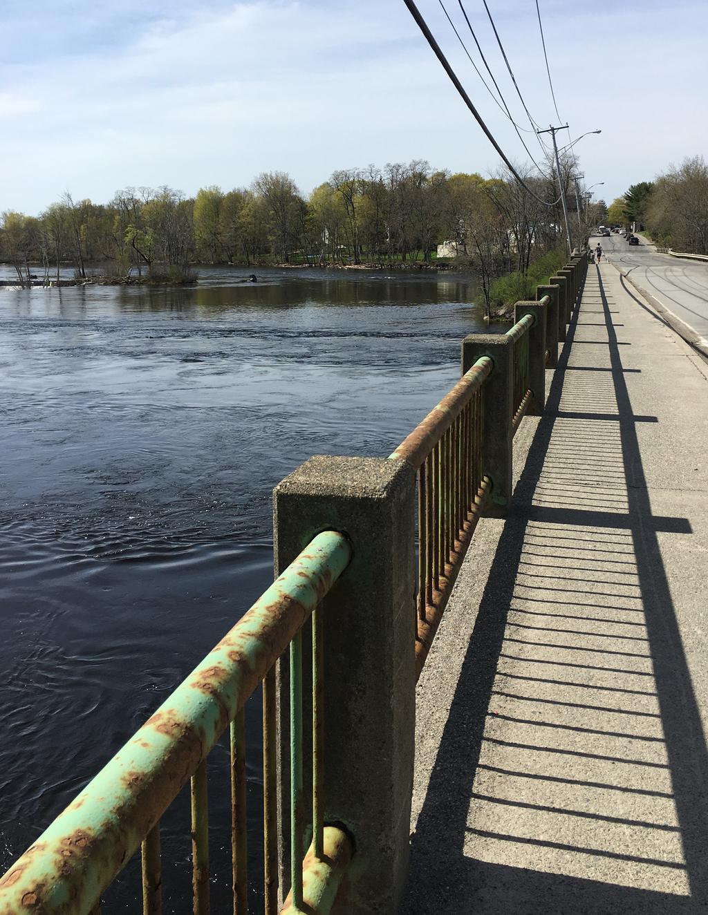
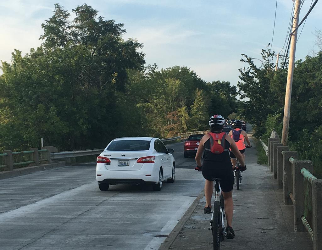
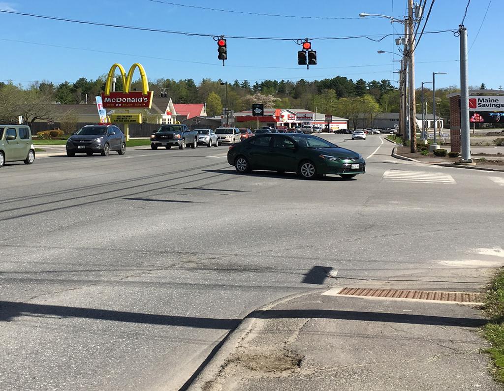

57
Traffic Impact Analysis Chatham County Grocery Chatham County, NC
 Chatham County Grocery Chatham County, NC TABLE OF CONTENTS 1. INTRODUCTION... 1 1.1. Location and Study Area... 1 1.2. Proposed Land Use and Access... 2 1.3. Adjacent Land Uses... 2 1.4. Existing ways...
Traffic Impact Analysis Walton Acres at Riverwood Athletic Club Clayton, NC
 Traffic Impact Analysis Walton Acres at Riverwood Athletic Club Clayton, NC 1. TABLE OF CONTENTS INTRODUCTION...1 1.1. Site Location and Study Area...1 1.2. Proposed Land Use and Site Access...2 1.3.
METHODOLOGY. Signalized Intersection Average Control Delay (sec/veh)
") Chapter 5 Traffic Analysis 5.1 SUMMARY US /West 6 th Street assumes a unique role in the Lawrence Douglas County transportation system. This principal arterial street currently conveys commuter traffic
Chapter 5 Traffic Analysis 5.1 SUMMARY US /West 6 th Street assumes a unique role in the Lawrence Douglas County transportation system. This principal arterial street currently conveys commuter traffic
5858 N COLLEGE, LLC N College Avenue Traffic Impact Study
 5858 N COLLEGE, LLC nue Traffic Impact Study August 22, 2016 Contents Traffic Impact Study Page Preparer Qualifications... 1 Introduction... 2 Existing Roadway Conditions... 5 Existing Traffic Conditions...
TRANSPORTATION ANALYSIS REPORT US Route 6 Huron, Erie County, Ohio
 TRANSPORTATION ANALYSIS REPORT US Route 6 Huron, Erie County, Ohio December 12, 2012 Prepared for: The City of Huron 417 Main Huron, OH 44839 Providing Practical Experience Technical Excellence and Client
Glenn Avenue Corridor Traffic Operational Evaluation
 Glenn Avenue Corridor Traffic Operational Evaluation PREPARED FOR: THE CITY OF AUBURN PREPARED BY: DECEMBER 2007 Glenn Avenue Corridor Study--Auburn, Alabama TABLE OF CONTENTS Introduction... 1 Background
Traffic Impact Study WestBranch Residential Development Davidson, NC March 2016
 Traffic Impact Study WestBranch Residential Development Davidson, NC March 216 TRAFFIC IMPACT STUDY FOR THE WestBranch Residential Development LOCATED IN DAVIDSON, NC Prepared For: Lennar Carolinas, LLC
List of Attachments. Location Map... Site Plan... City of Lake Elsinore Circulation Element... City of Lake Elsinore Roadway Cross-Sections...
 List of Attachments Exhibits Location Map... Site Plan... City of Lake Elsinore Circulation Element... City of Lake Elsinore Roadway Cross-Sections... Existing Lane Geometry and Traffic Controls... Existing
Donahue Drive Corridor Traffic Operational Evaluation
 Donahue Drive Corridor Traffic Operational Evaluation PREPARED FOR: THE CITY OF AUBURN PREPARED BY: JANUARY 2007 Donahue Drive Corridor Study--Auburn, Alabama TABLE OF CONTENTS Introduction... 1 Background
Harrah s Station Square Casino
 Transportation Analysis Harrah s Station Square Casino Pittsburgh, Pennsylvania Submitted To: City of Pittsburgh and Pennsylvania Gaming Control Board Prepared By: DKS Associates GAI Consultants December
Project Report. South Kirkwood Road Traffic Study. Meadows Place, TX October 9, 2015
 Meadows Place, TX October 9, 2015 Contents 1 Introduction... 1 2 Data Collection... 1 3 Existing Roadway Network... 2 4 Traffic Volume Development... 2 5 Warrant Analysis... 3 6 Traffic Control Alternative
Gateway Transportation Study
 Gateway Transportation Study Amherst, Massachusetts SUBMITTED TO University of Massachusetts Amherst Town of Amherst SUBMITTED BY Vanasse Hangen Brustlin, Inc. Watertown, Massachusetts March 213 Back of
Traffic Study of Fuller Street, Cady Street, West Street and West Avenue. Final Report
 Traffic Study of Fuller Street, Cady Street, West Street and West Avenue Final Report July 2005 Prepared for: Town of Ludlow Prepared by: Pioneer Valley Planning Commission 26 Central Street West Springfield,
ALLEY 24 TRAFFIC STUDY
 ALLEY 24 TRAFFIC STUDY in City of Frostburg, Maryland January 2013 3566 Teays Valley Road Hurricane, WV Office: (304) 397-5508 www.denniscorporation.com Alley 24 Traffic Study January 2013 Frostburg, Maryland
Shockoe Bottom Preliminary Traffic and Parking Analysis
 Shockoe Bottom Preliminary Traffic and Parking Analysis Richmond, Virginia August 14, 2013 Prepared For City of Richmond Department of Public Works Prepared By 1001 Boulders Pkwy Suite 300, Richmond, VA
Traffic Circulation Study for Neighborhood Southwest of Mockingbird Lane and Airline Road, Highland Park, Texas
 ARIZONA TEXAS NEW MEXICO OKLAHOMA February 13, 2015 Mr. Meran Dadgostar P.E., R.S. Town of Highland Park 4700 Drexel Dr. Highland Park, Texas 75205 Re: Traffic Circulation Study for Neighborhood Southwest
INDUSTRIAL BUILDING 3009 HAWTHORNE ROAD CITY OF OTTAWA TRANSPORTATION OVERVIEW REVISED. Prepared for: Canada Inc.
 INDUSTRIAL BUILDING 3009 HAWTHORNE ROAD CITY OF OTTAWA TRANSPORTATION OVERVIEW REVISED Prepared for: 7849648 Canada Inc. Octiober 1, 2015 114-598 Overview_2.doc D. J. Halpenny & Associates Ltd. Consulting
Evaluation of M-99 (Broad Street) Road Diet and Intersection Operational Investigation
 Road Diet and Intersection Operational Investigation") Evaluation of M-99 (Broad Street) Road Diet and Intersection Operational Investigation City of Hillsdale, Hillsdale County, Michigan June 16, 2016 Final Report Prepared for City of Hillsdale 97 North Broad
Evaluation of M-99 (Broad Street) Road Diet and Intersection Operational Investigation City of Hillsdale, Hillsdale County, Michigan June 16, 2016 Final Report Prepared for City of Hillsdale 97 North Broad
Walmart (Store # ) 60 th Street North and Marion Road Sioux Falls, South Dakota
 60 th Street North and Marion Road Sioux Falls, South Dakota") Walmart (Store #4865-00) 60 th Street North and Marion Road Sioux Falls, South Dakota Prepared for: Wal-Mart Stores, Inc. Bentonville, Arkansas Prepared by: Kimley-Horn and Associates, Inc. ã2013 Kimley-Horn
Walmart (Store #4865-00) 60 th Street North and Marion Road Sioux Falls, South Dakota Prepared for: Wal-Mart Stores, Inc. Bentonville, Arkansas Prepared by: Kimley-Horn and Associates, Inc. ã2013 Kimley-Horn
OFFICE/RETAIL DEVELOPMENT 1625 BANK STREET OTTAWA, ONTARIO TRANSPORTATION BRIEF. Prepared for: Canada Inc.
 OFFICE/RETAIL DEVELOPMENT 1625 BANK STREET OTTAWA, ONTARIO TRANSPORTATION BRIEF Prepared for: 9402209 Canada Inc. December 15, 2015 115-625 Report_2.doc D. J. Halpenny & Associates Ltd. Consulting Transportation
EXECUTIVE SUMMARY. Page 1 of 6
 EXECUTIVE SUMMARY The purpose of this report is to identify conformance with the original traffic impact study for the proposed retail development on Lot 5 of Riverdale Retail Filing No. 1 located on the
Route 28 (South Orleans Road)/Route 39 (Harwich Road)/Quanset Road Intersection
/Route 39 (Harwich Road)/Quanset Road Intersection") TRAFFIC FEASIBILITY STUDY Route 28 (South Orleans Road)/Route 39 (Harwich Road)/Quanset Road Intersection Orleans, Massachusetts Prepared for: Town of Orleans Prepared by: Fay, Spofford & Thorndike, LLC
TRAFFIC FEASIBILITY STUDY Route 28 (South Orleans Road)/Route 39 (Harwich Road)/Quanset Road Intersection Orleans, Massachusetts Prepared for: Town of Orleans Prepared by: Fay, Spofford & Thorndike, LLC
Highway 111 Corridor Study
 Highway 111 Corridor Study June, 2009 LINCOLN CO. HWY 111 CORRIDOR STUDY Draft Study Tea, South Dakota Prepared for City of Tea Sioux Falls Metropolitan Planning Organization Prepared by HDR Engineering,
MEMORANDUM. Charlotte Fleetwood, Transportation Planner
 MEMORANDUM Date: Updated August 22, 2017 To: Organization: Charlotte Fleetwood, Transportation Planner Boston Transportation Department From: Jason DeGray, P.E., PTOE, Regional Director of Engineering
TRAFFIC IMPACT STUDY And A TRAFFIC SIGNAL WARRANT ANALYSIS FOR A SENIOR LIVING AND APARTMENT DEVELOPMENT
 TRAFFIC IMPACT STUDY And A TRAFFIC SIGNAL WARRANT ANALYSIS FOR A SENIOR LIVING AND APARTMENT DEVELOPMENT DEERFIELD TOWNSHIP, WARREN COUNTY, OHIO Nantucket Circle and Montgomery Road () Prepared for: ODLE
Traffic Impact Study. Westlake Elementary School Westlake, Ohio. TMS Engineers, Inc. June 5, 2017
 TMS Engineers, Inc. Traffic Impact Study Westlake Elementary School Westlake, Ohio June 5, 2017 Prepared for: Westlake City Schools - Board of Education 27200 Hilliard Boulevard Westlake, OH 44145 TRAFFIC
1609 E. FRANKLIN STREET HOTEL TRAFFIC IMPACT STUDY EXECUTIVE SUMMARY
 1609 E. FRANKLIN STREET HOTEL TRAFFIC IMPACT STUDY EXECUTIVE SUMMARY Prepared for: The Town of Chapel Hill Public Works Department Traffic Engineering Division Prepared by: HNTB North Carolina, PC 343
Date: September 7, Project #: Re: Spaulding Youth Center Northfield, NH Property. Traffic Impact Study
 To: Ms. Susan C. Ryan Spaulding Youth Center 72 Spaulding Road Northfield, NH 03276 Date: September 7, 2017 Project #: 52455.00 From: Robin Bousa Director of Transportation Systems Re: Spaulding Youth
Transportation Impact Study for Abington Terrace
 Transportation Impact Study for Abington Terrace Abington Township, Montgomery County, PA Sandy A. Koza, P.E., PTOE PA PE License Number PE059911 Prepared by McMahon Associates, Inc. 425 Commerce Drive,
Traffic Impact Study Little Egypt Road Development Denver, North Carolina June 2017
 Traffic Impact Study Little Egypt Road Development Denver, North arolina June 2017 N. Little Egypt Road DQ\ QDQFLQJ VDOHV RU RWKHU SHUIRUPDQFH EDVHG FULWHULD Proposed Site Driveways Site Driveway 1 TRAFFI
Draft Report. Traffic Impact Study. Superstore, Wal-Mart, and Kent Development. Yarmouth, Nova Scotia. Prepared for
 oad & Traffic Management Road & Traffic Management R Atlantic Traffic Engineering Specialists Draft Report Traffic Impact Study Superstore, Wal-Mart, and Kent Development Yarmouth, Nova Scotia Prepared
FINAL Albertville Business Park AUAR Update Traffic Study
 FINAL Albertville Business Park AUAR Update Traffic Study Prepared for City of Albertville, MN July 20, 2017 SRF No. 10060.00 Table of Contents Introduction... 1 Existing Conditions... 1 Data Collection...
MEMORANDUM. DATE March 1, 2012 TO Town of Milton Mark Abbott, Seth Asante, and Efi Pagitsas Boston Region MPO Staff
 MEMORANDUM DATE March 1, 212 TO Town of Milton FROM RE Mark Abbott, Seth Asante, and Efi Pagitsas Boston Region MPO Staff FFY 211 Safety and Operations Analyses at Selected Boston Region MPO Intersections:
CITY OF OAKLAND. 27th Street Bikeway Feasibility and Design. Final Report (v3) March 23, Kimley-Horn and Associates, Inc.
 March 23, Kimley-Horn and Associates, Inc.") CITY OF OAKLAND 27th Street Bikeway Feasibility and Design Final Report (v3) March 23, 2007 PREPARED BY: Kimley-Horn and Associates, Inc. Table of Contents 1. Introduction 3 2. 27 th Street/Bay Place Corridor
CITY OF OAKLAND 27th Street Bikeway Feasibility and Design Final Report (v3) March 23, 2007 PREPARED BY: Kimley-Horn and Associates, Inc. Table of Contents 1. Introduction 3 2. 27 th Street/Bay Place Corridor
TRANSPORTATION IMPACT STUDY PROPOSED RIVERFRONT 47 MIXED USE DEVELOPMENT
 November 2016 TRANSPORTATION IMPACT STUDY PROPOSED RIVERFRONT 47 MIXED USE DEVELOPMENT & Aspinwall Borough, Sharpsburg Borough & O Hara Township, Allegheny County, Pennsylvania Prepared for: Riverfront
HILTON GARDEN INN HOTEL HOTEL EXPANSION 2400 ALERT ROAD, OTTAWA TRANSPORTATION BRIEF. Prepared for:
 HILTON GARDEN INN HOTEL HOTEL EXPANSION 2400 ALERT ROAD, OTTAWA TRANSPORTATION BRIEF Prepared for: Bona Building & Management Co. Ltd. Place Vanier, 333 North River Road Vanier, Ontario K1L 8B9 October
J Street and Folsom Boulevard Lane Conversion Project (T ) Before and After Traffic Evaluation
 Before and After Traffic Evaluation") J Street and Folsom Boulevard Lane Conversion Project (T15125400) Before and After Traffic Evaluation Prepared by Transportation Division June 2014 Executive Summary On February 12, 2013, the City of Sacramento
J Street and Folsom Boulevard Lane Conversion Project (T15125400) Before and After Traffic Evaluation Prepared by Transportation Division June 2014 Executive Summary On February 12, 2013, the City of Sacramento
Chapter 4 Traffic Analysis
 Chapter 4 Traffic Analysis PURPOSE The traffic analysis component of the K-68 Corridor Management Plan incorporates information on the existing transportation network, such as traffic volumes and intersection
MEETING FACILITY 2901 GIBFORD DRIVE CITY OF OTTAWA TRANSPORTATION BRIEF. Prepared for: Holiday Inn Express 2881 Gibford Drive Ottawa, ON K1V 2L9
 MEETING FACILITY 2901 GIBFORD DRIVE CITY OF OTTAWA TRANSPORTATION BRIEF Prepared for: Holiday Inn Express 2881 Gibford Drive Ottawa, ON K1V 2L9 December 18, 2012 112-566 Brief_1.doc D. J. Halpenny & Associates
Existing Conditions. Date: April 16 th, Dan Holderness; Coralville City Engineer Scott Larson; Coralville Assistant City Engineer
 Date: April 16 th, 2015 To: From: Re: Dan Holderness; Coralville City Engineer Scott Larson; Coralville Assistant City Engineer Darian Nagle-Gamm, Traffic Engineering Planner Highway 6 (2 nd Street) /
Truck Climbing Lane Traffic Justification Report
 ROUTE 7 (HARRY BYRD HIGHWAY) WESTBOUND FROM WEST MARKET STREET TO ROUTE 9 (CHARLES TOWN PIKE) Truck Climbing Lane Traffic Justification Report Project No. 6007-053-133, P 101 Ι UPC No. 58599 Prepared by:
Traffic Impact Study. Roderick Place Columbia Pike Thompson s Station, TN. Transportation Group, LLC Traffic Engineering and Planning
 F i s c h b a c h Transportation Group, LLC Traffic Engineering and Planning Traffic Impact Study Roderick Place Columbia Pike Thompson s Station, TN Prepared March 2016 Ms. Gillian L. Fischbach, P.E.,
THIS PAGE LEFT BLANK INTENTIONALLY
 GA SR 25 Spur at Canal Road Transportation Impact Analysis PREPARED FOR GLYNN COUNTY, GEORGIA 1725 Reynolds Street, Suite 300 Brunswick, Georgia 31520 PREPARED BY 217 Arrowhead Boulevard Suite 26 Jonesboro,
TRAFFIC IMPACT STUDY
 TRAFFIC IMPACT STUDY for the GLEN ELLEN COUNTRY CLUB SENIOR RESIDENTIAL REDEVELOPMENT 84 Millis, Massachusetts Prepared by: McMahon Associates, Inc. Prepared for: Toll Brothers, Inc. August 216 DRAFT
MEDICAL/OFFICE BUILDING 1637 BANK STREET OTTAWA, ONTARIO TRANSPORTATION OVERVIEW. Prepared for:
 MEDICAL/OFFICE BUILDING 1637 BANK STREET OTTAWA, ONTARIO TRANSPORTATION OVERVIEW Prepared for: 2434984 Ontario Inc. 13-5510 Canotek Road Ottawa, Ontario K1J 9J5 June 4, 2015 115-613 Report_2.doc D. J.
INDUSTRIAL BUILDING 1660 COMSTOCK ROAD CITY OF OTTAWA TRANSPORTATION OVERVIEW. Prepared for:
 INDUSTRIAL BUILDING 1660 COMSTOCK ROAD CITY OF OTTAWA TRANSPORTATION OVERVIEW Prepared for: Simluc Contractors Limited 2550 Blackwell Street, Ottawa K1B 5R1 October 18, 2013 113-584 Overview_1.doc D. J.
FRONT RANGE CROSSINGS TRAFFIC IMPACT STUDY
 FRONT RANGE CROSSINGS TRAFFIC IMPACT STUDY Prepared for: City of Thornton And Colorado Department of Transportation Prepared by: 11 Blake Street, Suite 2 Denver, Colorado 822 Contact: Brian Bern, PE, PTOE
DIMARCO CANANDAIGUA PROPERTIES HOUSING PROJECT CANANDAIGUA, ONTARIO COUNTY, NEW YORK
 TRAFFIC IMPACT STUDY FOR THE DIMARCO CANANDAIGUA PROPERTIES HOUSING PROJECT CANANDAIGUA, ONTARIO COUNTY, NEW YORK MARCH 14, 2017 PREPARED FOR: 1950 Brighton Henrietta Town Line Rd Rochester, NY 14623 PREPARED
TRAFFIC IMPACT STUDY. Creekside Thornton, Colorado. For. August 2015 November 2015 Revised: August Prepared for:
 TRAFFIC IMPACT STUDY For Creekside Thornton, Colorado August 215 November 215 Revised: August 216 Prepared for: Jansen Strawn Consulting Engineers 45 West 2 nd Avenue Denver, Colorado 8223 Prepared by:
INTERSECTION SAFETY STUDY State Route 57 / Seville Road
 INTERSECTION SAFETY STUDY State Route 57 / Seville Road City of Wadsworth, Medina County, Ohio Prepared For: City of Wadsworth Engineering Department 120 Maple Street Wadsworth, OH 44281 Prepared By: GPD
DEPARTMENT OF ENVIRONMENTAL SERVICES. North Harrison Street (Lee Highway to Little Falls Road) Comparative Analysis. Prepared for:
 Comparative Analysis. Prepared for:") DEPARTMENT OF ENVIRONMENTAL SERVICES North Harrison Street (Lee Highway to Little Falls Road) Comparative Analysis Prepared for: Arlington County Department of Environmental Services 2100 Clarendon Boulevard,
DEPARTMENT OF ENVIRONMENTAL SERVICES North Harrison Street (Lee Highway to Little Falls Road) Comparative Analysis Prepared for: Arlington County Department of Environmental Services 2100 Clarendon Boulevard,
Capital Region Council of Governments
 March 23, 2018 Capital Region Council of Governments PROJECT CONCEPT REPORT Realignment of Swamp and Northfield Road s approaches to Route 44 (Boston Turnpike) Town of Coventry SUMMARY: The Town of Coventry
Draft North Industrial Area-Wide Traffic Plan
 Summary of North Industrial and Hudson Bay Industrial Recommended Improvements Table 1. Summary of s Item Location 1 2 3 4 5 6 7 8 9 10 11 12 Millar Ave north of 51st St Super 8 Motel back lane 400 Block
TRAFFIC IMPACT ANALYSIS
 TRAFFIC IMPACT ANALYSIS FOR THE CHAMPAIGN UNIT#4 SCHOOL DISTRICT PROPOSED HIGH SCHOOL (SPALDING PARK SITE) IN THE CITY OF CHAMPAIGN Final Report Champaign Urbana Urbanized Area Transportation Study 6/24/2014
MEMORANDUM. Layout Of Study Intersections And Traffic Control
 BOSTON REGION METROPOLITAN PLANNING ORGANIZATION Richard A. Davey, MassDOT Secretary and CEO and MPO Chairman Karl H. Quackenbush, Executive Director, MPO Staff DATE November 15, 2012 TO FROM RE Town of
FINAL DESIGN TRAFFIC TECHNICAL MEMORANDUM
 FINAL DESIGN TRAFFIC TECHNICAL MEMORANDUM July 2014 FINAL (SR 43) Project Development and Environment Study From State Road 60 (Adamo Drive) to I-4 (SR 400) Hillsborough County, Florida Work Program Item
DUNBOW ROAD FUNCTIONAL PLANNING
 DUNBOW ROAD FUNCTIONAL PLANNING Final Report August 3, 216 #31, 316 5th Avenue NE Calgary, AB T2A 6K4 Phone: 43.273.91 Fax: 43.273.344 wattconsultinggroup.com Dunbow Road Functional Planning Final Report
OTTAWA TRAIN YARDS PHASE 3 DEVELOPMENT CITY OF OTTAWA TRANSPORTATION IMPACT STUDY. Prepared for:
 OTTAWA TRAIN YARDS PHASE 3 DEVELOPMENT CITY OF OTTAWA TRANSPORTATION IMPACT STUDY Prepared for: The Ottawa Train Yards Inc. 223 Colonnade Road South, Suite 212 Nepean, Ontario K2E 7K3 January 17, 2012
NEW YORK CENTRAL PARK SUBDIVISION BLAIS STREET/ST-PIERRE STREET EMBRUN, ONTARIO TRAFFIC IMPACT STUDY. Prepared for:
 NEW YORK CENTRAL PARK SUBDIVISION BLAIS STREET/ST-PIERRE STREET EMBRUN, ONTARIO TRAFFIC IMPACT STUDY Prepared for: Solidex Holdings Limited & Investissement Maurice Lemieux Investments Attn: Mr. Anthony
Traffic Study North Shore School District 112
 Traffic Study North Shore School District 112 Proposed Expansion of Northwood Junior High School Prepared By: May 1, 2015 1. Introduction Kenig, Lindgren, O Hara, Aboona, Inc. (KLOA, Inc.) has been retained
HOLIDAY INN HOTEL 235 KING EDWARD AVENUE CITY OF OTTAWA TRANSPORTATION BRIEF. Prepared for:
 HOLIDAY INN HOTEL 235 KING EDWARD AVENUE CITY OF OTTAWA TRANSPORTATION BRIEF Prepared for: Momentum Planning & Communications 1165 Greenlawn Crescent Ottawa, ON K1L 6C2 June 29, 2015 115-618 Brief_1.doc
The Cape Cod Five Cents Savings Bank
 TRAFFIC IMPACT AND ACCESS STUDY The Cape Cod Five Cents Savings Bank Hyannis, Massachusetts PREPARED FOR The Cape Cod Five Cents Savings Bank 19 West Road Orleans, Massachusetts 0263 PREPARED BY 1 Walnut
Waterford Lakes Small Area Study
 Waterford Lakes Small Area Study Existing Traffic Conditions PREPARED FOR: ORANGE COUNTY PUBLIC WORKS DEPARTMENT TRAFFIC ENGINEERING DIVISION ORLANDO, FLORIDA PREPARED WITH: INWOOD CONSULTING ENGINEERS
Henderson Avenue Mixed-Use Development
 Zoning Case: Z145-3 Traffic Impact Analysis Henderson Avenue Mixed-Use Development Dallas, TX October 26 th, 216 Kimley-Horn and Associates, Inc. Dallas, Texas Project #644827 Registered Firm F-928 Traffic
TRAFFIC IMPACT STUDY COMPREHENSIVE UPDATE TOWN OF THOMPSON S STATION, TENNESSEE PREPARED FOR: THE TOWN OF THOMPSON S STATION
 TRAFFIC IMPACT STUDY COMPREHENSIVE UPDATE TOWN OF THOMPSON S STATION, TENNESSEE PREPARED FOR: THE TOWN OF THOMPSON S STATION Transportation Consultants, LLC 1101 17 TH AVENUE SOUTH NASHVILLE, TN 37212
Grant Avenue Streetscape
 REPORT TYPE GOES HERE Grant Avenue Streetscape PREPARED FOR City of Manassas 9027 Center Street Manassas, VA 20110 PREPARED BY 8300 Boone Boulevard Suite 700 Vienna, Virginia 22182 571.389.8121 July 31,
PRELIMINARY DRAFT WADDLE ROAD / I-99 INTERCHANGE PROJECT ALTERNATIVE ANALYSIS FINAL TRAFFIC SUMMARY REPORT
 PRELIMINARY DRAFT WADDLE ROAD / I-99 INTERCHANGE PROJECT ALTERNATIVE ANALYSIS FINAL TRAFFIC SUMMARY REPORT Prepared by: In Association with: November 2013 EXECUTIVE SUMMARY Patton Township, in partnership
Deer Street Parking Garage & Deer Street Associates Development
 Traffic Impact and Access Study Deer Street Parking Garage & Deer Street Associates Development Portsmouth, New Hampshire Submitted to: City of Portsmouth, New Hampshire 1 Junkins Avenue Portsmouth, New
COMMERCIAL DEVELOPMENT 2015 ROBERTSON ROAD OTTAWA, ONTARIO TRANSPORTATION BRIEF. Prepared for:
 COMMERCIAL DEVELOPMENT 2015 ROBERTSON ROAD OTTAWA, ONTARIO TRANSPORTATION BRIEF Prepared for: First Bay Properties Inc. 311 Richmond Road, Suite 203 Ottawa, ON K1Z 6X3 August 8, 2017 117-663 Brief_1.doc
QUICKIE C STORE AND GAS BAR 1780 HERON ROAD OTTAWA, ONTARIO TRANSPORTATION BRIEF. Prepared for:
 QUICKIE C STORE AND GAS BAR 1780 HERON ROAD OTTAWA, ONTARIO TRANSPORTATION BRIEF Prepared for: Quickie Convenience Stores Larny Holdings Ltd. c/o PBC Group April 15, 2015 115-615 Report_1.doc D. J. Halpenny
FAIRFIELD INN & SUITES HOTEL 135 THAD JOHNSON PRIVATE OTTAWA TRANSPORTATION BRIEF. Prepared for:
 FAIRFIELD INN & SUITES HOTEL 135 THAD JOHNSON PRIVATE OTTAWA TRANSPORTATION BRIEF Prepared for: Bona Building & Management Co. Ltd. Place Vanier, 333 North River Road Vanier, Ontario K1L 8B9 August 12,
Traffic Impact Analysis
 Traffic Impact Analysis Isle of Capri Casinos, Inc. Waterloo, Iowa SEH No. A-CLAAS0501.00 November 16, 2004 Table of Contents (Continued) Table of Contents Certification Page Table of Contents Page 1.0
Public Involvement Meeting Tuesday, June 13, Albany Shaker Road Corridor Study
 Public Involvement Meeting Tuesday, June 13, 2017 Albany Shaker Road Corridor Study Agenda / Meeting Outline 1. Introduce the project 2. Complete Streets 3. Share/confirm our findings 4. Your Opinion 5.
Intersection Traffic Control Feasibility Study
 Intersection Traffic Control Feasibility Study CSAH 9 at CSAH 60 (185th Avenue) Prepared For: Dakota County Transportation Department Western Service Center 14955 Galaxie Avenue, 3rd Floor Apple Valley,
Troutbeck Farm Development
 Troutbeck Farm Development Willistown Township, Chester County PA For Submission To: Willistown Township Last Revised: October, 4 TPD# INLM.A. 5 E. High Street Suite 65 Pottstown, PA 9464 6.36.3 TPD@TrafficPD.com
Figure 5A: Diagram of Crashes, May 2005 to May 2008 (Part 1)
") Figure 5A: Diagram of Crashes, May 2005 to May 2008 (Part 1) Canal Pointe Boulevard Study - March 2015 10 Table of Contents INTRODUCTION... 1 EXISTING CONDITIONS... 1 Existing Roadway Conditions and Controls...
Figure 5A: Diagram of Crashes, May 2005 to May 2008 (Part 1) Canal Pointe Boulevard Study - March 2015 10 Table of Contents INTRODUCTION... 1 EXISTING CONDITIONS... 1 Existing Roadway Conditions and Controls...
Street / Bob Billings Parkway Lawrence, Kansas CFS Project No
 Drive Improvements 6 th Street to 15 th Street / Bob Billings Parkway Lawrence, Kansas 6644 CFS Project No. 15-56 Traffic Impact Study July 15, 15 Prepared for: City of Lawrence Public Works Department
Abrams Associates. Transportation Impact Analysis. City of Rocklin. Prepared for: David Mohlenbrok City of Rocklin 4081 Alvis Court Rocklin, CA 95677
 Transportation Impact Analysis Sierra College Boulevard Commercial Project City of Rocklin Prepared for: David Mohlenbrok City of Rocklin 081 Alvis Court Rocklin, CA 95677 Prepared by: 1875 Olympic Boulevard,
NO BUILD TRAFFIC OPERATIONS
 3. 23 NO BUILD TRAFFIC OPERATIONS This section addresses the operations of the transportation system and details how it would be expected to function under year 23 No Build conditions with the projected
Traffic Impact Study for Rolling Ridge Redevelopment
 Traffic Impact Study for Rolling Ridge Redevelopment Webster Groves, Missouri October 19, 2018 Prepared For: Gershman Commercial Real Estate 150 North Meramec Avenue Suite 500 St. Louis, Missouri 63105
Comments EXECUTIVE SUMMARY
 Comments 1. Under any Alternatives, MCDOT should provide better at-grade pedestrian crossing of Georgia Avenue and Forest Glen Road, including improved crosswalks with wider medians and adequate signal
Albany Shaker Road Corridor Study Public Meeting # 2
 Albany Shaker Road Corridor Study Public Meeting # 2 Scope / Meeting Purpose This project is a CDTC Linkage Study. The Linkage Program is designed to implement the adopted planning and investment principles
TRAFFIC ASSESSMENT River Edge Colorado
 TRAFFIC ASSESSMENT River Edge Colorado Submitted by: Fehr & Peers 621 17th Street, Ste. 231 Denver, CO 8293 (33) 296-43 December, 21 App. M-2 Traffic Assessment River Edge Colorado December 21 TABLE OF
Road Conversion Study Plumas Street
 Plumas Street Phase I Submitted to The Regional Transportation Commission of Washoe County Submitted by Zong Tian, Ph.D., P.E. Saeedeh Farivar Haiyuan Li, Ph.D. Center for Advanced Transportation Education
DRAFT. Corridor study. Honeysuckle Road. October Prepared for the City of Dothan, AL. Prepared by Gresham, Smith and Partners
 DRAFT Corridor study Honeysuckle Road October 2017 Prepared for the City of Dothan, AL Prepared by TABLE OF CONTENTS SECTION I... 1 STUDY SUMMARY... 1 INTRODUCTION... 1 CONCLUSIONS... 5 SECTION II... 7
WEST AVENUE AND NEW ROAD TRAFFIC STUDY PART III WEST AVENUE CLOSURE ALTERNATIVES ANALYSIS
 WEST AVENUE AND NEW ROAD TRAFFIC STUDY PART III WEST AVENUE CLOSURE ALTERNATIVES ANALYSIS CITY OF LINWOOD ATLANTIC COUNTY, NEW JERSEY March 30, 2006 PREPARED FOR: City of Linwood 400 Poplar Avenue Linwood,
Northbound San Jose Avenue & I-280 Off-Ramp Road Diet Pilot Project
 Project Overview Fed by a two-lane Interstate-280 (I-280) off-ramp, high vehicular volumes and speeds are longstanding issues along San Jose Avenue. Residents in the surrounding neighborhoods have expressed
Marina Loft (DRC 51-R-12)
") Marina Loft (DRC 51-R-12) traffic study prepared for: Cymbal Development OCtober 2012 Traf Tech October 1, 2012 Mr. Asi Cymbal - President Cymbal Development 3470 North Miami Avenue Upper Suite Miami,
Marina Loft (DRC 51-R-12) traffic study prepared for: Cymbal Development OCtober 2012 Traf Tech October 1, 2012 Mr. Asi Cymbal - President Cymbal Development 3470 North Miami Avenue Upper Suite Miami,
4.0 TRANSPORTATION SYSTEMS
 Transportation Systems 4.0 TRANSPORTATION SYSTEMS This chapter examines the impacts of the Central Corridor Extension on existing roadways and traffic operations and discusses the transit service, operations,
Dr. M.L. King, Jr. Street North Complete Streets Resurfacing Opportunities HOUSING, LAND USE, AND TRANSPORTATION COMMITTEE MARCH 22, 2018
 Dr. M.L. King, Jr. Street North Complete Streets Resurfacing Opportunities HOUSING, LAND USE, AND TRANSPORTATION COMMITTEE MARCH 22, 2018 What s Happening The City plans to mill and resurface Dr. M.L.
Military Road Safety Improvements
 Military Road Safety Improvements 26 th Road North to 31 st Street North SUMMARY OF DATA REVIEW AND PRELIMINARY RECOMMENDATIONS Prepared for: Department of Environmental Services Traffic Engineering and
EXISTING (2006) CONDITIONS
 CONDITIONS") Section 2 EXISTING (2006) CONDITIONS This section provides a description of the existing transportation system in the study area and a comprehensive analysis of existing traffic operations and crash history.
Section 2 EXISTING (2006) CONDITIONS This section provides a description of the existing transportation system in the study area and a comprehensive analysis of existing traffic operations and crash history.
Date: April 4, Project #: Re: A Street/Binford Street Traffic/Intersection Assessment
 To: Peter Cavanaugh General Electric From: David Bohn, PE Ryan White, PE Date: April 4, 217 Project #: 13421. Re: / Traffic/Intersection Assessment Consistent with the Cooperation Agreement between the
Lake Whitney Elementary School
 Lake Whitney Elementary School SCHOOL ROUTE PLAN For LAKE WHITNEY ELEMENTARY SCHOOL LOCATION 18 ORANGE COUNTY Prepared for: ORANGE COUNTY SCHOOL ASSESSMENT PROGRAM ORANGE COUNTY PUBLIC WORKS Traffic Engineering
Gene Dillon Elementary School Traffic Study Division Street Site
 To: From: Dr. James Hess, Superintendent Jordan Schwarze, PE, Senior Engineer Matt Pacyna, PE, Senior Associate Date: March 30, 2016 Subject: Gene Dillon Elementary School Traffic Study reet Site Memorandum
Public Information Meeting. Orange Camp Road. Dr. Martin Luther King Jr. Beltway to I-4. Presented by: Volusia County August 2, 2018
 Public Information Meeting Orange Camp Road Dr. Martin Luther King Jr. Beltway to I-4 Presented by: Volusia County August 2, 2018 1 Project Goals To improve the operations and safety for Orange Camp Road
ORLEANS GARDENS SHOPPING CENTRE 1615 ORLEANS BOULEVARD CITY OF OTTAWA, ONTARIO TRANSPORTATION IMPACT STUDY. Prepared for:
 ORLEANS GARDENS SHOPPING CENTRE 1615 ORLEANS BOULEVARD CITY OF OTTAWA, ONTARIO TRANSPORTATION IMPACT STUDY Prepared for: Orleans Gardens Shopping Centre Inc. 2851 John Street, Suite 1 Markham, ON K3R 5R7
Figure 1: Vicinity Map of the Study Area
 ARIZONA TEXAS NEW MEXICO OKLAHOMA May 5, 2016 Mr. Anthony Beach, P.E. BSP Engineers 4800 Lakewood Drive, Suite 4 Waco, Texas 76710 Re: Intersection and Access Analysis along Business 190 in Copperas Cove
URBAN QUARRY HEADQUARTERS 2717 STEVENAGE DRIVE CITY OF OTTAWA TRANSPORTATION OVERVIEW. Prepared for: Urban Quarry 4123 Belgreen Drive, Ottawa K1G 3N2
 URBAN QUARRY HEADQUARTERS 2717 STEVENAGE DRIVE CITY OF OTTAWA TRANSPORTATION OVERVIEW Prepared for: Urban Quarry 4123 Belgreen Drive, Ottawa K1G 3N2 February 27, 2014 113-584 Overview_1.doc D. J. Halpenny
List of Exhibits...ii
 One Brickell Traffic Study TABLE OF CONTENTS List of Exhibits...ii EXECUTIVE SUMMARY...1 1. INTRODUCTION...2 1.1 Study Area...2 1.2 Study Objective...5 2. EXISTING TRAFFIC CONDITIONS...6 2.1 Data Collection...6