Public Information Meeting & Open House Welcome. Please Sign-in at the Registration Table
|
|
|
- Marianna Collins
- 5 years ago
- Views:
Transcription


1 Public Inormation Meeting & Open House Welcome Please Sign-in at the Registration Table
2 Purpose and Goals The purpose o the study is to examine the McCook County transportation network rom a multi-modal perspective and develop a series o solutions to address saety, Multi-Modal Master Transportation Plan Components Existing Conditions Analysis Public Participation Major Roads Plan inrastructure, and operations needs within the constraints o existing and orecasted transportation unding. When complete, the Master Transportation Plan will guide elected and appointed oicials, developers, and residents as McCook County continues to expand economic and residential opportunities over the next 20 years. Bridge Plan Roadway Preservation and Maintenance Plan Roadway Design, Analysis, and Policy Guidelines Transportation Funding Project Implementation Plan
3 Get Involved Leave a Comment Today, please provide eedback on the preliminary recommendations, priorities, and projects incorporated into the Master Transportation Plan. Comment orms are available at the registration table. Completed orms may be placed by the entryway or mailed/ ed to Jon Wiegand or Steve Gramm by August 22, Contact Us Jon Wiegand Consultant Project Manager HR Green, Inc jwiegand@hrgreen.com Steve Gramm SDDOT Project Manager Stay Connected Through the remainder o the study, materials will be posted on the project website to keep the public inormed on the progress. Following completion o the study, the inal Master Transportation Plan report will be posted to the SDDOT website and available through McCook County. South Dakota Department o Transportation steve.gramm@state.sd.us Michael Kreutzeldt Highway Superintendent McCook County Highway Department mchwy@triotel.net Project website:


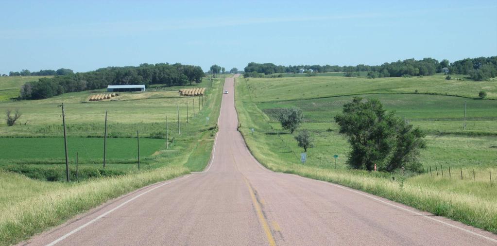
4 Typical Roadway Sections
5 Roadway Preservation and Maintenance Scenarios What are the two scenarios? Two roadway preservation and maintenance scenarios were developed or the Master Transportation Plan, ocusing on the thickness o the roadway base. McCook County has ound that the bituminous roadways with a thicker base, greater than 9 inches, perorm better and can go longer between costly resuracing projects than a bituminous roadway with less than 9 inches o base material. McCook County has achieved upwards o 30 years between overlays on roadways with a base greater than 9 inches. On roadways with less base material, common overlay requency is every 20 years (+/-). Upront costs to mill the entire roadway and add material to the base are the most notable initial consideration, however, be neits are realized in uture years with less requent need or costly overlays and intense crack sealing or spot patching. Roadway Needs Scenario A (No Base Improvements) This scenario overlays County highways when the time comes or an overlay, regardless o base thickness. Annual Cost (2017$): $1.8 million Roadway Needs Scenario B (Base Improvements) When the time comes to overlay a bituminous roadway, segments with a base less than 9 inches are completely milled and material is added to thicken the base to 9 or 10 inches. Many times, the millings rom the existing road can be used as the additional material and blended with the existing base prior to placement o bituminous material. Annual Cost (2017$): $2.3 million What do these costs include? For each scenario, the annual costs include all activities associated with maintaining and preserving the bituminous roadways as identiied in the Major Roads Plan. These activities include: Construction (Overlays) and Chip Seals Patching/Pavement Maintenance Pavement Markings, Signs, and General Maintenance

6 Planning or the Future - Needs and Revenue Annual Funding Needs Based on identiied needs or the entire McCook County transportation network, the ollowing provides an estimated outlay o annualized needs or the next 20 years. The primary dierence between Scenarios A and B is whether base thickness is improved or not, per the Roadway Preservation and Maintenance Plan scenarios. Bituminous Overlays and Chip Seals Bituminous Roadway Maintenance 2018 (Year 1) Snapshot Needs Scenario A (2017 $) Needs Scenario B (2017 $) $1,20,000 $1,80,000 $90,000 $90,000 Gravel Resuracing $20,000 $20,000 Gravel Maintenance $10,000 $10,000 Bridge Replacement $1,000 $1,000 Bridge Preservation $108,000 $108,000 Culvert Replacement $100,000 $100,000 Bridge Maintenance $8,000 $8,000 High Priority Projects $1,000 $1,000 Total Year 1 $3,28,000 $3,8,000 Total 20-Year Need $,720,000 $77,320,000 McCook County Transportation Funding Primary sources o unding or McCook County include (2017 orecasts): Wheel Tax ($1,000) Motor Vehicle License Fees ($77,000) Property Tax (up to $1,00,000) Federal Funds (Surace Transportation Funds converted to State unds) ($13,000) Other unding sources include: Bridge Improvement Grant (BIG) Funds (Application based selection, not guaranteed) 2037 (Year 20) Snapshot with Inlation Needs Scenario A (YOE $) Needs Scenario B (YOE $) 2037 Total (Year 20) $,890,000 $,70,000 Total 20-Year Need (YOE) ( , with inlation) $81,0,000 $9,810,000

7 Transportation Needs 21 2 ST 17 2A 8 AVE AVE Bridge Condition Structurally Deicient Bridge XW Bridge Posted or Weight Limit Traic Increasing Corridor Volumes Due to Development Increasing Corridor Volumes Due to Seasonal Demand Intersection Traic Control Truck Accommodations and Connectivity Roadway Geometry Section Line Corrections Skewed Intersections Right-o-Way and Roadway Surace Width Vertical Curves/Grade Roadway Suracing Candidate Bituminous to Gravel Conversion Segments Multi-Modal Sidewalk/Trail Corridors Urban and Recreational Area (Multimodal acilities) Growth Lake Vermillion Recreational Area Drainage Flooding/Road Closures Railroad Crossings GF Crossing Improvement Location 31 AVE 2 Spencer 2A 27 ST 21 ST 23A 32 AVE 22 ST 1A 3 AVE 21A A 8A Bridgewater 1A Unityville 17A 38 AVE ST 81 Salem 22 ST 1 3 AVE 1 8 AVE 28 ST Canistota AVE 7 AVE 21 ST 23 ST VALLEY 1 AVE RD Montrose 19A 3A BH20 AVE 2TH ST 1A 11A 9A 7A 3 2 ST HAWK DR Lake Vermillion 1 22 ST 28 ST 3 AVE 18 1A 3 AVE 10 Legend Interstate Highway State Highway County Road Township Road Railroad Rivers/Streams Lakes City inch = 3 miles Miles

8 Miner County Canova Lake County A 2A 2 ST 27 ST Unityville 28 ST 8 AVE 3 2 AVE 1 Legend Interstate Highway Farmer Hanson County Emery 2 21 Spencer 31 AVE 2A 22 ST 32 AVE ST 21 ST 3 AVE 21A BH20 AVE 8A 1A 17 19A 2TH ST Bridgewater 17A 11A 38 AVE 1A 81 Salem 3 AVE 1 1A 22 ST AVE Canistota AVE 9A 7 AVE 7A 21 ST 1 AVE VALLEY RD Montrose 18 1A 23 ST 3A Lake Vermillion 2 ST HAWK DR 22 ST 3 AVE 3 AVE 1 Minnehaha County Humboldt State Highway Township Road Urban Road Railroad Rivers/Streams Lakes City McCook County Highways Bituminous - Primary Truck Route Bituminous Gravel Miles 23A Dolton Monroe 28 ST 1 inch = 3 miles Hutchinson County Turner County
9 1A 32 AVE 7A 11A 1 Wol 2 AVE 18 City Bridge (State) (29) No Weight Restriction () Posted Load Restriction (1) We Sk st Br un k C anch ree k McCook County Inspected Bridges (9) er av Be reek C inch = 3 miles Monroe ng Lo ek e Cr rk r Fo Rive st Ea illion rm Ve Turner County Lakes 1A 28 ST Rivers/Streams Bridge Weight Restrictions Humboldt 3A 9A k r or ive tf R es on W illi rm Ve Elm 23 ST Dolton Hutchinson County HAWK DR 22 ST Railroad Township Road Minnehaha County 1 Canistota County Road Urban Road 10 Montrose State Highway 1 ce El eek Cr 2TH ST 19A Bridgewater 23A 1A 17A BH20 AVE Bl o om Cr ee k 2A Interstate Highway 3 8 Legend 3 AVE 21 ST 38 AVE 21A 3 AVE Wol 1 2 ST le Batt k Cree Emery 1A Salem AVE Lak 1 Verm e illion Hanson County 27 ST 8A Spencer 31 AVE reek Pierre C 22 ST 28 ST lo a Bu reek C County & Township Bridge Weight Restrictions RD VALLEY 2 17 Farmer 21 8 AVE Unityville 2A rk r t Fo e Eas on Riv milli Ver A 2 7 AVE r ive T 27 S AVE nr 2 ST AVE illio 3 AVE Wol Little iver R illion Verm rm Ve Roc Cree k k nk Sku k Cree Lake County rk Fo Canova st We Miner County 3 Miles
10 ST T 27 S * A * Salem 2A AVE 17A 2 ST 19A Bridgewater AVE AVE A Canistota Wol 22 ST 23 ST City Bridge (State) (29) 0-0 () 1-0 (7) 1-70 () (8) (20) (22) Bridge Closure * 1A Candidate or Future Closure* Redundant Bridge Clusters McCook County Inspected Bridges (9) er av Be reek C Monroe ng Lo ek e Cr rk r Fo Rive st Ea illion rm Ve Turner County Lakes Bridge Suiciency Rating Humboldt 3A Rivers/Streams Railroad Minnehaha County ST k r or ive tf R es on W illi rm Ve Elm Township Road Dolton Hutchinson County 9A HAWK DR County Road Urban Road State Highway 1 ce El eek Cr A A 3 AVE 38 AVE 1A BH20 AVE Cr ee k A Montrose AVE 21 ST * om 3 AVE 31 AVE reek Pierre C Wol 27 ST 1A le Batt k Cree Emery Bl o 7A Interstate Highway * Legend Hanson County * * 2 ST Candidate Bridges or Future Closure Consideration 28 ST 1 8A Spencer Farmer ST RD VALLEY * Unityville 21 2A We Sk st Br un k C anch ree k AVE AVE 2 ST lo a Bu reek C AVE Lak 1 Verm e illion rk r t Fo e Eas on Riv milli Ver nk Sku k Cree Lake County 8 AVE Roc Cree k k Canova Little iver R illion Verm Wol Miner County *Bridges identiied or uture consideration to close involve passive closures. The bridge would remain open until closure is required due to bridge condition inch = 3 miles 3 Miles
11 Miner County Canova Lake County Farmer Hanson County Emery Spencer 31 AVE 2 2A 27 ST 22 ST 27 ST 21 ST 1A 21A Bridgewater Unityville 19A 17 2A Salem Canistota Montrose 23A 3A 32 AVE 1A A 21 3 AVE BH20 AVE 2 ST 8A 2TH ST 38 AVE AVE 1A 28 ST 11A AVE 9A 2 1 7A A 1A AVE 7 AVE 8 AVE 23 ST 1 AVE 2 AVE VALLEY RD Lake Vermillion 1 2 ST 1 10 HAWK DR 22 ST 28 ST 3 AVE Minnehaha County Humboldt Existing Bituminous Roadway Base Thickness Legend Interstate Highway State Highway Gravel County Roads Township Road Urban Road Railroad Rivers/Streams Lakes City Bridge (County) (9) Bridge (State) (29) County Road Base Thickness* At Least 9 Inch Base Less Than 9 Inch Base *Based on roadway core samples, as o 201. "Less Than 9 Inch Base" segments exhibit at least one core location between sections that indicated less than 9 inches o base thickness inch = 3 miles Miles Dolton Monroe Hutchinson County Turner County
12 Miner County Canova Lake County 2 27 ST A 21 2 ST Unityville 17 2A 1 28 ST 2 8 AVE 3 2 AVE VALLEY RD Legend Proposed Suracing Changes Interstate Highway State Highway Township Road Farmer Hanson County Spencer 31 AVE 22 ST ST 1A 21A 8A 38 AVE Salem 3 AVE 11A AVE 7 AVE 7A Montrose 1 AVE 1 2 ST 1 10 HAWK DR Minnehaha County Humboldt Urban Road Railroad Rivers/Streams Lakes City County Roads and Planned Improvements Bituminous Gravel/Dirt Emery 2A 21 ST 1A 3 AVE 23A 3A 32 AVE 19A Bridgewater BH20 AVE 1A Canistota 17A 1A 2TH ST AVE 9A 1 23 ST 18 Lake Vermillion 22 ST 3 AVE Candidate Bituminous to Gravel Conversion Segments Candidate Gravel to Bituminous Conversion Segments Miles 28 ST 1 inch = 3 miles Dolton Monroe Hutchinson County Turner County
13 Miner County Canova 81 Lake County 2 ST 2A 2 2 AVE Hanson County Farmer Emery Spencer 31 AVE 2 2A 27 ST 27 ST 22 ST 21 ST 1A A 21 1A 21A Bridgewater 19A Unityville 8A Salem 8 1A 11A Canistota 9A 7A 1 3 Montrose 23A 3A 32 AVE 3 AVE BH20 AVE 2TH ST 38 AVE 1 3 AVE 28 ST AVE 17A 1A AVE 7 AVE 8 AVE 23 ST 18 VALLEY RD 1 AVE Lake Vermillion 1 2 ST 81 Minnehaha County 10 1 HAWK DR 22 ST 3 AVE Humboldt Legend Urban and Recreational Area (Multimodal acilities) Proposed Sidewalks/Shared-Use Paths Primary Bicycle Route w/ Paved Shoulder or Shared-Use Path State Route with Limited Bicycle or Pedestrian Accommodations Rural Bicycle Route w/ Paved Shoulder or Shared-Use Path Rural Bicycle Route County Route With Limited Bicycle or Pedestrian Accommodations State Highway Rivers/Streams Lakes City Miles 28 ST 1 inch = 3 miles Dolton Monroe Hutchinson County Turner County
14 Elce Rock Miner County Canova Little Vermillion River East Fork Vermillion River Lake County Skunk ST 2A AVE Bualo 202/202 A 27 ST 21 Unityville ST Pierre 2 Wol 1 Little Vermillion River VALLEY RD Farmer Hanson County Spencer 31 AVE 22 ST ST 1A 21A 3 AVE 8A 38 AVE West Fork Vermillion River Salem 3 AVE AVE 11A 7 AVE 7A 3 Montrose 1 2 ST 1 10 HAWK DR Humboldt Emery 2A 21 ST 1A Bridgewater Dolton 1A Canistota 17A 1A 23A 3A 32 AVE AVE 9A 8 AVE Legend West Branch Skunk Interstate Highway State Highway Township Road Battle 2022/ Minnehaha County Urban Road Railroad Rivers/Streams Lakes City McCook County Highways Bituminous - Primary Truck Route Bituminous Gravel Bloom Elm Wol BH20 AVE A 2TH ST 2023 West Fork Vermillion River 23 ST 1 Monroe 18 1 AVE Lake Vermillion 22 ST Hutchinson County Turner County 202 East Fork Vermillion River AVE 28 ST Long Beaver Bituminous Overlay Project Bituminous Roadway Surace Conversion Project Bituminous to Gravel Gravel to Bituminous * Note: See companion tables or chip seal projects and optional segment improvements inch = 3 miles Miles
15 Year Route From To Bituminous Roadway Segment 10-Year Project Outlay (Scenario A No Base Improvements) Project Length (miles) Planning Level Estimated Cost (2017 $) Comments Total Planned Cost (2017 $) 2018 Countywide Chip Seal $09,00 Chip Seal: 19ABW, 21ASB, 0AB, 0WB, 09AB $09, Countywide Chip Seal $2,00 Chip Seal: 2B, 2ANB, 0MB, 0SB, 0EB, 08AEB $2, st Avenue 28 th Street SD38.0 $737,333 Overlay 31 st Avenue SD38 22 nd Street 1.0 $17,7 Overlay Countywide Chip Seal $9,700 Chip Seal: 1WBW, 1AEB, 1AWB, 21B, 03SB 2021 Countywide Chip Seal $,00 Chip Seal: 10B, 1WBE, 1EB, 02EB, 03NB, 08AWB $, st Avenue 22 nd Street 28 th Street.0 $00,000 Overlay 31 st Avenue 22 nd Street 27 th Street.0 $00,000 Overlay 1 st Avenue SD2 2 th Street 11.0 $700,000 Overlay; Costs are or initial 7 o the 11 miles Countywide Chip Seal $0,00 Chip Seal: 20B, 21ANB, 2ASB, 09AB 2 th Street 3 th Avenue 0. Miles East 0. $18,000 Surace Conversion: Bituminous to gravel conversion (19ABE) 2 th Street US81 3 rd Avenue 2.0 $0,000 Surace Conversion: Bituminous to gravel conversion (02WB) 0 th Avenue 2 th Street 2 th Street 2.0 $0,000 Surace Conversion: Bituminous to gravel conversion (02AB) 8 th Avenue 2 th Street 2 th Street 1.0 $30,000 Surace Conversion: Bituminous to gravel conversion (0NB) 3 rd Avenue 2 th Street 22 nd Street 3.0 $, ROW: ROW acquisition or gravel to bituminous surace conversion (01A) 1 st Avenue 28 th Street US $2,000 Overlay 2 th Street 3 th Avenue 3 th Avenue 1.0 $100,000 Overlay 1 st Avenue SD2 2 th Street 11.0 $00,000 Overlay; Costs are or remaining o the 11 miles 1 st Avenue 28 th Street SD2.0 $00,000 Overlay 3 rd Avenue 2 th Street 22 nd Street 3.0 $00,000 Surace Conversion: Gravel to bituminous conversion (01A) Countywide Chip Seal $393,300 Chip Seal: 11AB, 21ASB, 2B, 2ANB 2 th Street SD38 th Avenue 3.8 $380,000 Overlay 27 th Street 30 th Avenue US $00,000 Overlay; Costs are or initial o the 11 miles 28 th Street 8 th Avenue th Avenue.1 $10,000 Overlay Countywide Chip Seal $27,000 Chip Seal: 0WB, 08B, 08AEB 3 th Avenue SD38 2 th Street 9.0 $900,000 Overlay 27 th Street 30 th Avenue US $00,000 Overlay; Costs are or remaining o the 11 miles th Avenue SD2 21 st Street.0 $00,000 Overlay Countywide Chip Seal $0,800 Chip Seal: 1AWB, 2B, 2ANB, 0MB, 0SB 21 st Street th Avenue 1 st Avenue.0 $00,000 Overlay 22 nd Street 1 st Avenue 3 rd Avenue 2.0 $200,000 Overlay Countywide Chip Seal $82,10 Chip Seal: 1B,1WBW,1AEB,19ABW,03SB,03ANB,03ASB,08AWB,01A th Avenue 21 st Street SD $800,000 Overlay BH2O Avenue 28 th Street SD2 3.1 $310,000 Overlay 9/0 th Avenue 28 th Street 2 th Street.1 $10,000 Overlay Countywide Chip Seal $227,700 Chip Seal: 10B, 0EB 22 nd Street 3 rd Avenue th Avenue 2.0 $0,000 Surace Conversion: Bituminous to gravel conversion (08B) $1,79,00 -Year Cumulative Total (2017 $) $2,313,9 $,17,0 $1,918,300 $,82,9 $1,7,000 $7,922,3 $2,30,800 $8,793, $1,22,10 $9,901,20 $1,907,700 $9,9,90 -
16 Bituminous Roadway Segment 10-Year Project Outlay (Scenario B w/roadway Base Improvements) Year Route From To Project Length (miles) Planning Level Estimated Cost (2017 $) Comments Total Planned Cost (2017 $) 2018 Countywide Chip Seal $09,00 Chip Seal: 19ABW, 21ASB, 0AB, 0WB, 09AB $09, Countywide Chip Seal $2,00 Chip Seal: 2B, 2ANB, 0MB, 0SB, 0EB, 08AEB $2, st Avenue 28 th Street SD38.0 $737,333 Overlay 31 st Avenue SD38 22 nd Street 1.0 $17,7 Overlay Countywide Chip Seal $9,700 Chip Seal: 1WBW, 1AEB, 1AWB, 21B, 03SB 2021 Countywide Chip Seal $,00 Chip Seal: 10B, 1WBE, 1EB, 02EB, 03NB, 08AWB $, st Avenue 22 nd Street 28 th Street.0 $90,000 Base Improvement: Approximately miles potential base improvements 31 st Avenue 22 nd Street 27 th Street.0 $1,17,000 Base Improvement: Approximately miles potential base improvements 1 st Avenue SD2 2 th Street 11.0 $1,037,00 Base Improvement: Approximately 2. miles potential base improvements Countywide Chip Seal $0,00 Chip Seal: 20B, 21ANB, 2ASB, 09AB 2 th Street 3 th Avenue 0. Miles East 0. $18,000 Surace Conversion: Bituminous to gravel conversion (19ABE) 2 th Street US 81 3 rd Avenue 2.0 $0,000 Surace Conversion: Bituminous to gravel conversion (02WB) 0 th Avenue 2 th Street 2 th Street 2.0 $0,000 Surace Conversion: Bituminous to gravel conversion (02AB) 8 th Avenue 2 th Street 2 th Street 1.0 $30,000 Surace Conversion: Bituminous to gravel conversion (0NB) 3 rd Avenue 2 th Street 22 nd Street 3.0 $, ROW acquisition or gravel to bituminous surace conversion (01A) 1 st Avenue 28 th Street US $2,000 Overlay 2 th Street 3 th Avenue 3 th Avenue 1.0 $23,000 Base Improvement: Approximately 1 mile potential base improvements 1 st Avenue SD2 2 th Street 11.0 $70,000 Base Improvement: Approximately 2 miles potential base improvements 1 st Avenue 28 th Street SD2.0 $90,000 Base Improvement: Approximately miles potential base improvements 3 rd Avenue 2 th Street 22 nd Street 3.0 $00,000 Gravel to bituminous conversion (01A) Countywide Chip Seal $393,300 Chip Seal: 11AB, 21ASB, 2B, 2ANB 2 th Street SD38 th Avenue 3.8 $380,000 Overlay 27 th Street 30 th Avenue US $1,17,000 Base Improvement: Approximately miles potential base improvements 28 th Street 8 th Avenue th Avenue.1 $10,000 Overlay Countywide Chip Seal $27,000 Chip Seal: 0WB, 08B, 08AEB 3 th Avenue SD38 2 th Street 9.0 $2,11,000 Base Improvement: Approximately 9 miles potential base improvements 27 th Street 30 th Avenue US $1,10,000 Base Improvement: Approximately miles potential base improvements th Avenue SD2 21 st Street.0 $90,000 Base Improvement: Approximately miles potential base improvements Countywide Chip Seal $0,800 Chip Seal: 1AWB, 2B, 2ANB, 0MB, 0SB 21 st Street th Avenue 1 st Avenue.0 $1,17,000 Base Improvement: Approximately miles potential base improvements 22 nd Street 1 st Avenue 3 rd Avenue 2.0 $70,000 Base Improvement: Approximately 2 miles potential base improvements Countywide Chip Seal $82,10 Chip Seal:1B,1WBW,1AEB,19ABW,03SB,03ANB,03ASB, 08AWB,01A th Avenue 21 st Street SD $1,070,000 Base Improvement: Approximately 2 miles potential base improvements BH2O Avenue 28 th Street SD2 3.1 $728,00 Base Improvement: Approximately 3.1 miles potential base improvements 9/0 th Avenue 28 th Street 2 th Street.1 $1,198,00 Base Improvement: Approximately.1 miles potential base improvements Countywide Chip Seal $227,700 Chip Seal: 10B, 0EB 22 nd Street 3 rd Avenue th Avenue 2.0 $0,000 Surace Conversion: Bituminous to gravel conversion (08B) $1,79,00 -Year Cumulative Total (2017 $) $3,8, $,72, $2,83,300 $9,080, $2,1,000 $11,09,8 $,91,800 $1,31,1 $2,97,10 $1,83,70 $3,28,700 $1,001,90 -
17 2A ( Wol Unityville A A Hanson County Salem ive r Montrose 81 7A A Canistota 1A 17A 19A 2TH ST 32 AVE 23A Lakes McCook County Highways 1 Bituminous - Primary Truck Route Humboldt Bituminous Gravel Bridge Projects* ST ST A 1A Monroe Turner County Small Structure/Culvert Replacement Replacement 0-10 Year Timerame Replacement Year Timerame * Note: see companion tables or supplemental notes and candidates or bridge preservation projects. 28 ST k or er t F Riv es n W illio rm Ve Dolton Hutchinson County A BH20 AVE Rivers/Streams Minnehaha County 2 ST HAWK DR Bridgewater Railroad 3 AVE 1 East Fork Vermillion Ri ver Urban Road 11A Township Road AVE Lak 1 Verm e illion State Highway ranch West B reek C Skunk City 7 AVE 21A 38 AVE 1A AVE 3 AVE 90 AVE 2A Elm Battle k Cree 21 ST W Cr o l ee k Cr ee k 8 3 AVE 31 AVE 27 ST om 3 Ve rm Little illio nr Interstate Highway Emery Bl o Legend ork West F River lion Vermil Spencer Bridge Replacement Project Outlay ( ) RD 22 ST eek Bualo Cr VALLEY Farmer 28 ST re er Pi reek C ST Small Structure 1 ek Long Cre rk r t Fo e Eas on Riv milli Ver 2 ST Lake County k ree Elce kc un Sk 2 AVE Canova 8 AVE Ro Cre ck ek Little er lion Riv Vermil Miner County Be a Cre ver ek inch = 3 miles 3 Miles
18 BIG Ranking Bridge # Route Waterway Bridge Replacement Project Outlay (0-10 Year Timerame) Major Roads Plan Designation Planning Level Estimated Replacement Cost (2017 $) Deiciency th Street West Fork Vermillion River Township Closure SR, S, P Proposed bridge closure st Avenue Wol Gravel $1,20,000 SR, P rd Street East Fork Vermillion River Gravel $7,000 SR, S, P Programmed or 2018 replacement st Avenue West Fork Vermillion River Township Closure SR, S, P Proposed bridge closure Comments nd Street East Fork Vermillion River Bituminous $,000 SR, P Consider widening or bicycle and pedestrian accommodations th Street East Fork Vermillion River Gravel $2,000 SR, S, P Programmed or 2019 replacement st Avenue creek Bituminous $,000 SR, P Consider widening or bicycle and pedestrian accommodations th Street West Fork Vermillion River Township $0,000 SR, S, P Programmed or 2017 replacement th Street West Fork Vermillion River Gravel $3,000 SR st Avenue Wol Bituminous $20,000 SR, P st Avenue East Vermillion Lake Bituminous $3,000 S Deck rehabilitation programmed or 2018, relected in cost th Street creek Township $2,000 SR, S Programmed or 2017 replacement Small Structure 1 2 th Street creek Gravel $00,000 - New structure may qualiy or biennial inspection requirements, depending on length. Consider improvements in conjunction with next major roadway suracing activity. BIG Ranking Bridge # Route Waterway Bridge Replacement Project Outlay (11-20 Year Timerame) Major Roads Plan Designation Planning Level Estimated Replacement Cost (2017 $) Deiciency th Avenue Little Vermillion River Township Closure SR, S, P th Avenue Little Vermillion River Bituminous $7,000 SR, P Comments Pile cap preservation programmed or 2017/2018 Proposed bridge closure th Avenue Little Vermillion River Township $397,000 SR, P Consider closure o this structure or th Avenue West Fork Vermillion River Gravel $73,000 SR, S, P th Avenue Little Vermillion River Township $7,000 P Consider closure o this structure or th Street creek Township $373,000 SR, S rd Street Wol Township Closure SR, S Proposed bridge closure th Avenue West Fork Vermillion River Township $20,000 SR, S th Street Little Vermillion River Township $8, th Street West Fork Vermillion River Township $7, rd Avenue West Fork Vermillion River Township $37, nd Street West Fork Vermillion River Bituminous $93, nd Street Wol Gravel $392,000 - Watch nd Avenue creek Township $01,000 SR, S, P Watch list st Avenue East Vermillion Lake Bituminous $1,28,000 S Watch list st Street Battle Bituminous $3,000 - Watch list th Street West Fork Vermillion River Township $2,000 S Watch list Construction costs shown or 2017, 2018, and 2019 programmed bridges SR = Suiciency Rating < 70 S = Structurally Deicient P = Posted or Load
19 BIG Ranking Bridge # Route Waterway Bridge Preservation Project Outlay (0-10 Year Timerame) Major Roads Plan Designation Planning Level Estimated Preservation Cost (2017 $) Timber Pile Bridge Preservation Other Bridge Preservation th Street Wol Township $37, st Street Wol Township $9, st Avenue Wol Gravel $30, th Street Wol Township $38, rd Street Wol Gravel $30,000 Replacement in year timerame; consider observation and replacement rd Avenue creek Township $3, th Street West Fork Vermillion River Gravel $20,000 SR Replacement in year timerame; consider observation and replacement th Avenue West Fork Vermillion River Gravel $12,000 SR, S, P th Avenue West Fork Vermillion River Township $1,000 SR, S, P th Street West Fork Vermillion River Township $38, th Street West Fork Vermillion River Township $1, th Street West Fork Vermillion River Township $39,000 S th Street West Fork Vermillion River Gravel $20,000 S th Street West Fork Vermillion River Township $9, nd Street West Fork Vermillion River Township $9, th Street Little Vermillion River Township $20, rd Street West Fork Vermillion River Gravel $1, th Street creek Township $8,000 SR, S th Street West Fork Vermillion River Township $20, rd Avenue West Fork Vermillion River Township $20, th Street West Fork Vermillion River Township $20, th Avenue Little Vermillion River Township $3,000 SR, S, P Programmed or 2017/ th Avenue Little Vermillion River Township $0, th Avenue Little Vermillion River Bituminous $2,000 SR, P st Street Little Vermillion River Township $, th Avenue Little Vermillion River Township $9,000 P st Street Battle Bituminous $29, th Avenue Little Vermillion River Township $19,000 SR, P th Street East Fork Vermillion River Township $2, st Avenue East Vermillion Lake Bituminous $18,000 S st Avenue creek Bituminous $3, nd Street East Fork Vermillion River Bituminous $20,000 SR, P Replacement in year timerame; consider observation and replacement nd Avenue creek Township $7,000 SR, S, P Construction costs shown or 2017, 2018, and 2019 programmed bridges SR = Suiciency Rating < 70 S = Structurally Deicient P = Posted or Load Deiciency Comments
20 Elce Rock Miner County Canova Little Vermillion River East Fork Vermillion River Lake County Skunk Bloom Pierre Farmer Hanson County Emery Elm 31 AVE 2 Wol Spencer E.7 B.7 D. Wol C. 2A 27 ST 22 ST 27 ST A.1 32 AVE 21 ST 1A 1A A 3 AVE 21 21A Bridgewater 2 ST Unityville 8A 38 AVE A 81 Salem Dolton 8 1A 11A Canistota 23A 3A BH20 AVE D.2 E.8 C.3 Hutchinson County D. D. C. West Fork Vermillion River 1 3 AVE 28 ST AVE 9A 2 7A 1 18 Monroe 3 Montrose Lake Vermillion 17A 1A 19A 2TH ST D.1 D. B.9 B. B.2 C.1 C.2 B. AVE West Fork Vermillion River Little Vermillion River B.10 7 AVE 8 AVE D.7 B.3 B.1 C. D.8 A.2 Battle E. 23 ST D.8 E.1 E. 1 AVE 2 AVE VALLEY RD A. A.3 A.7 E.3 B.8 E. A. 1 2 ST D HAWK DR 22 ST East Fork Vermillion River B. E.2 3 AVE 28 ST Turner County A. C.7 Bualo West Branch Skunk Minnehaha County Humboldt Long Beaver Figure 10-3 Transportation Network Enhancement Projects Legend Interstate Highway State Highway Township Road Urban Road Railroad Rivers/Streams Lakes City McCook County Highways Bituminous - Primary Truck Route Bituminous Gravel Projects A. Intersection Projects B. Roadway Improvement Projects C. Bituminous to Gravel C. Gravel to Bituminous D. ROW Widening and Reconstruction Projects E. Multi-Modal Projects inch = 3 miles Miles \\hrgsdc\data\010029\design\gis\mxd\figures\figure10-3_transnetworkprojects.mxd
21 Project No. Intersection Planning Level Estimated Cost (2017 $) A. Intersection Projects Priority Need Addressed Comments A.1 21 st Street & 31 st Avenue $1,00 H Intersection Traic Control Modiication to intersection traic control: change rom all-way stop-control to two-way stop-control (north/south directions) A.2 23 rd Street & 7 th Avenue $2,00 H Intersection Traic Control Modiication to direction o travel being stopped: two-way stop-control change rom north/south traic being stopped to east/west A.3a* 2 th Street & SD38 (east) $7,00 H Skewed Intersection Minor adjustment within existing pavement ootprint on 2 th Street to reduce skew and provide closer to 90 degree approach to SD38 A.a* 2 th Street & SD38 (west) $7,00 H Skewed Intersection A.* 3 rd Avenue & 2 th Street $31,000 M A.* 1 st Avenue & Lake Vermillion Recreation Area Entrance $0,000 M Truck Accommodations and Connectivity Increasing Corridor Volumes Due to Development and Seasonal Demand Minor adjustment within existing pavement ootprint on 2 th Street to reduce skew and align approach vehicles closer to 90 degree approach to SD38 Realigns 3 rd Avenue south o 2 th Street to the east to create a single intersection and remove oset T intersections Remove turning vehicles rom through travel lane by adding southbound let-turn lane and bypass lane and northbound right-turn lane See 1 st Avenue roadway segment project or longer-range improvement through intersection A.3b* 2 th Street & SD38 (east) $0,000 L Skewed Intersection Realignment o 2 th Street to intersection with SD38 at 90 degree angle A.b* 2 th Street & SD38 (west) $,000 L Skewed Intersection Realignment o 2 th Street to intersection with SD38 at 90 degree angle A.7* 1 st Avenue & SD38 $380,000 L Skewed Intersection * Conceptual design layout available Realigns 1 st Street to remove skew May include shared-use path as part o this project (see multi-modal project list or more inormation)
22 Project No. Route From To Project Length (miles) B. Roadway Segment Projects Planning Level Estimated Cost (2017 $) B.1a* 7 th Avenue 28 th Street 28 th Street 0.3 $70,000 H Priority Need Addressed Comments Section Line Corrections; Truck Accommodations and Connectivity B.2 28 th Street 3 rd Avenue th Avenue.0 $20,000 H Drainage B.3a* BH20 Road 28 th Street 28 th Street 0. $0,000 M B.* 3 rd Avenue 2 th Street 2 th Street A) 0. B) 0.8 C) 0.1 A) $7,000 B) $2,000 C) no County cost M Section Line Corrections; Skewed Intersections Drainage Shoulder widening through horizontal curves to make it easier or opposing direction trucks to pass through the curves at the same time Construct overlow segment just west o structure , west o th Avenue to help alleviate looding impact Shoulder widening through horizontal curves to make it easier or opposing direction trucks to pass through the curves at the same time Remove 2 intersection approaches Options A & B: Realign 3 rd Avenue to the east and raise proile outside o typical lood area to minimize risk o looding closing the roadway Option C: Realign driveway outside o lood area B. 27 th Street 3 rd Avenue th Avenue.0 $20,000 M Drainage Construct overlow segment just west o structure , east o 3 rd Avenue to help alleviate looding impact B.* 22 nd Street 1 st Avenue 3 rd Avenue 0. $2,912,000 M Vertical Curves/Grade Flatten hill to increase sight distance and decrease roadway grade B.7 31 st Avenue Spencer SD38 0. $70,000 M B.1b* 7 th Avenue 28 th Street 28 th Street 0.7 $98,000 L B.3b* BH20 Road 28 th Street 28 th Street 0.3 $7,000 L B.8* 1 st Avenue 22 nd Street Lake Vermillion Recreation Area Entrance 0.8 $,000 L B.9 21 st Street US81 Canistota. $1,800,000 L B.10 th Avenue Canistota SD2 3. $,000,000 L Truck Accommodations and Connectivity; ROW and Roadway Surace Width Section Line Corrections; Skewed Intersections; Truck Accommodations and Connectivity Section Line Corrections; Skewed Intersections Increasing Corridor Volumes Due to Development and Seasonal Demand; Growth Area Truck Accommodations and Connectivity Truck Accommodations and Connectivity; ROW and Roadway Surace Width Designated as Major Roads Plan Bituminous Primary Truck Route Current ROW is 80 and would require reconstruction with wider ROW Project also noted in ROW Widening and Multi-Modal project lists Reconstruct horizontal curves to higher design speed Reconstruct intersections with 28 th Street to remove skewed intersections Realign 28 th Street to remove skewed intersections Remove all other intersection approaches Construct 3-lane segment with center let-turn lane at driveways and intersections to remove let-turning vehicles rom through lane. Consider right-turn lanes at highvolume driveways and intersections. See 1 st Avenue & Lake Vermillion Recreation Area Entrance intersection project or shorter-range improvement Designated as Major Roads Plan Bituminous Primary Truck Route Addition o shoulders and resuracing. Designated as Major Roads Plan Bituminous Primary Truck Route Current ROW is 80 and would require reconstruction with wider ROW Project also noted in ROW Widening list * Conceptual design layout available
23 C. Roadway Segment Projects Roadway Suracing Conversions Project No. Route From To Project Length (miles) Planning Level Estimated Cost (2017 $) Priority Need Addressed Comments C.1 2 th Street 0 th Avenue Valley Road 9 C.2 22 nd Street 3 rd Avenue th Avenue 2 C.3 2 th Street 3 th Avenue 37 th Avenue 0. C. 31 st Avenue SD22 SD2 3 C. 0 th Avenue 2 th Street 2 th Street 1 C. 8 th Avenue 2 th Street 2 th Street 1 C.7 3 rd Avenue 22 nd Street SD2 3 Convert to Gravel: $270,000 Maintain AC: $900,000 Convert to Gravel: $0,000 Maintain AC: $200,000 Convert to Gravel: $1,000 Maintain AC: $0,000 Convert to Gravel: $90,000 Maintain AC: $300,000 Convert to Gravel: $30,000 Maintain AC: $100,000 Convert to Gravel: $30,000 Maintain AC: $100,000 Convert to AC: $00,000 Maintain Gravel: $0,000 H Roadway Suracing Proposed conversion to gravel suracing H Roadway Suracing Proposed conversion to gravel suracing H Roadway Suracing Proposed conversion to gravel suracing H Roadway Suracing Proposed conversion to gravel suracing H Roadway Suracing Proposed conversion to gravel suracing H Roadway Suracing Proposed conversion to gravel suracing H Increasing Corridor Volumes Due to Development; Growth Area; ROW and Roadway Surace Width Proposed conversion to asphaltic concrete suracing with ROW widening D. Roadway Segment Projects ROW Widening and Reconstruction Project No. Route From To Project Length (miles) Planning Level Estimated Cost (2017 $) Priority Need Addressed Comments D.1 2 th Street US81 3 rd Avenue 2 miles $1,0,000 M D.2 22 nd Street 3 th Avenue 38 th Avenue 3 miles $2,10,000 M D.3 Hawk Drive 1 st Avenue 28 th Street 3. miles $2,20,000 M D. 27 th Street US81 3 rd Avenue 2 miles $1,0,000 M D. 31 st Avenue Spencer SD38 0. miles D. 38 th Avenue 2 th Street 27 th Street 27 th Street SD2 3 miles 8 miles D.7 th Avenue 21 st Street SD2 miles D.8 7 th Avenue I rd Street 21 st Street SD2.2 miles 2 miles See Roadway Segment Project List (#B.7) $2,10,000 $,70,000 See Roadway Segment Project List (#B.10) $3,020,000 $1,0,000 M M M M ROW and Roadway Surace Width ROW and Roadway Surace Width ROW and Roadway Surace Width ROW and Roadway Surace Width ROW and Roadway Surace Width ROW and Roadway Surace Width ROW and Roadway Surace Width ROW and Roadway Surace Width Remaining segments along 2 th Street to widen ROW to 100 eet and roadway surace to 30 eet (-oot existing ROW) Remaining segments along 22 nd Street to widen ROW to 100 eet and roadway surace to 30 eet (-oot existing ROW) Remaining segments along Hawk Drive to widen ROW to 100 eet and roadway surace to 30 eet (-oot existing ROW) Remaining segments along 27 th Street to widen ROW to 100 eet and roadway surace to 30 eet (-oot existing ROW) Remaining segments along 31 st Avenue to widen ROW to 100 eet and roadway surace to 30 eet (80-oot existing ROW) Remaining segments along 38 th Avenue to widen ROW to 100 eet and roadway surace to 30 eet (-oot existing ROW) Remaining segments along th Avenue to widen ROW to 100 eet and roadway surace to 30 eet (80-oot existing ROW) Remaining segments along 7 th Avenue to widen ROW to 100 eet and roadway surace to 30 eet (-oot existing ROW)
 Shared-Use Path Add Shoulders Priority Bicycle and Pedestrian Plan Element Kluckholm Street Lynn Avenue 0.")
 1.0 (0.) $900,000 ($30,000) $0,000 ($180,000) $200,000 ($320,000) $00,000 ($10,000) E. 21 st Street Canistota 1 st Avenue.0 $2,20,000 $2,000,000 L E.")
24 Project No. E.1 Route From To 1 st Avenue (Montrose) E.2 22 nd Street E.3 1 st Avenue Project Length (miles) E. Multi-Modal Segment Projects Planning Level Estimated Cost (2017 $) Shared-Use Path Add Shoulders Priority Bicycle and Pedestrian Plan Element Kluckholm Street Lynn Avenue 0. - $20,000 H Urban and Recreational Area 1 st Avenue (Sundal Drive) 21 st Street (Lake Vermillion Recreation Area Entrance) 3 rd Avenue (Sunset Blu Drive) 22 nd Street (Quail Drive) 2.0 (0.8) 1.0 (0.) $900,000 ($30,000) $0,000 ($180,000) $200,000 ($320,000) $00,000 ($10,000) E. 21 st Street Canistota 1 st Avenue.0 $2,20,000 $2,000,000 L E. 1 st Avenue 22 nd Street (Lake Vermillion Recreation Area) SD2 3.0 $1,30,000 $1,200,000 L M M Urban and Recreational Area; Rural Bicycle Route w/paved Shoulder or Shared-Use Path Urban and Recreational Area; Rural Bicycle Route w/paved Shoulder or Shared-Use Path Rural Bicycle Route w/paved Shoulder or Shared-Use Path Urban and Recreational Area; Rural Bicycle Route w/paved Shoulder or Shared-Use Path Comments Shared-use path along 1 st Avenue to connect residential neighborhood south o SD38 with the school area north o SD38 May be constructed independently or in conjunction w/ Intersection Project #A.7 Tie into multi-modal accommodations o new structure (210103) Provides multi-modal accommodations outside o travel lane Alternate connection between Quail Drive to Sunset Blu Drive shown in ( ) Does not include pedestrian structure over river Recommend to incorporate with Roadway Segment Project #B. Provides multi-modal accommodations outside o travel lane Alternate connection between Quail Drive Lake Vermillion Recreation Area Entrance shown in ( ) Does not include modiications to pedestrian structure over river Part o long-term connectivity goal to link developed areas and state highways with multi-modal acilities outside o the motor vehicle travel lane Links Canistota and Lake Vermillion Recreation Area Recommend to incorporate with any uture roadway improvements Part o long-term connectivity goal to link developed areas and state highways with multi-modal acilities outside o the motor vehicle travel lane Recommend to incorporate with any uture roadway improvements E. 1 st Avenue Lynn Avenue (Montrose) 21 st Street (Lake Vermillion Recreation Area). $2,92,000 $2,00,000 L Urban and Recreational Area; Rural Bicycle Route w/paved Shoulder or Shared-Use Path Part o long-term connectivity goal to link developed areas and state highways with multi-modal acilities outside o the motor vehicle travel lane Links Lake Vermillion Recreation Area and Montrose Recommend to incorporate with any uture roadway improvement E.7 31 st Avenue Spencer SD38 0. $22,000 See Roadway Segment Project List (#B.7) L Rural Bicycle Route w/paved Shoulder or Shared-Use Path Part o long-term connectivity goal to link developed areas and state highways with multi-modal acilities outside o the motor vehicle travel lane Recommend to incorporate with any uture roadway improvements E.8 SD38 31 st Avenue US $,00,000 $,000,000 L Primary Bicycle Route w/paved Shoulder or Shared-Use Path Identiies a need or a multi-modal connection between Spencer and Salem, outside o the through travel lanes on SD38 or gravel-suraced roadways Illustrative rendering o potential shareduse path along 1 st Avenue in Montrose Let: Looking north rom SD38; Right: Looking north towards SD38)
Bluffdale/ UDOT South High-T Intersection Project Type Operations
 Bluffdale/ UDOT 14600 South High-T Intersection Project Type Operations 14600 South and Redwood Road $ 600,000 $ 550,000 This project is to install a new High-T intersection at Redwood Road and 14600 South
PRESENTATION WILL BEGIN AT APPROXIMATELY 6:05 P.M. I-90 EXIT 406 INTERCHANGE MODIFICATION STUDY AND ENVIRONMENTAL ASSESSMENT MARKET
 PRESENTATION WILL BEGIN AT APPROXIMATELY 6:05 P.M. MARKET I-90 EXIT 406 INTERCHANGE MODIFICATION STUDY AND ENVIRONMENTAL ASSESSMENT JANUARY 23, 2017 Public Meeting & Open House #2 TODAY S MEETING Purpose:
El Paso County 2040 Major Transportation Corridors Plan
 El Paso County 2040 Major Transportation Corridors Plan Connect-our-County Online Transportation User Survey Preliminary Results June 24, 2010 Years of Residence 2. How many years have you LIVED HERE?
Basalt Creek Transportation Refinement Plan Recommendations
 Basalt Creek Transportation Refinement Plan Recommendations Introduction The Basalt Creek transportation planning effort analyzed future transportation conditions and evaluated alternative strategies for
Recommended Roadway Plan Section 2 - Land Development and Roadway Access
 Recommended Roadway Plan Section 2 - Land Development and Roadway Access SECTION 2 Land Development and Roadway Access 2.1 Land Use and Access Management The Federal Highway Administration (FHWA) defines
WYDOT DESIGN GUIDES. Guide for. Non-NHS State Highways
 WYDOT DESIGN GUIDES Guide for Non-NHS State Highways 2014 GUIDE FOR Non-NATIONAL HIGHWAY SYSTEM (Non-NHS) STATE HIGHWAYS PRESERVATION REHABILITATION RECONSTRUCTION INTRODUCTION This Guide is directed to
4. ENVIRONMENTAL IMPACT ANALYSIS 9. TRANSPORTATION AND TRAFFIC
 4. ENVIRONMENTAL IMPACT ANALYSIS 9. TRANSPORTATION AND TRAFFIC 4.9.1 INTRODUCTION The following section addresses the Proposed Project s impact on transportation and traffic based on the Traffic Study
Chapter 5 Future Transportation
 Chapter 5 Future Transportation The Future Land Use Plan identifies the desired land use designations. The land uses desired for Crozet depend, in large part, on the success of the transportation system,
DUNBOW ROAD FUNCTIONAL PLANNING
 DUNBOW ROAD FUNCTIONAL PLANNING Final Report August 3, 216 #31, 316 5th Avenue NE Calgary, AB T2A 6K4 Phone: 43.273.91 Fax: 43.273.344 wattconsultinggroup.com Dunbow Road Functional Planning Final Report
HIGHWAY 11 CORRIDOR STUDY
 HIGHWAY 11 CORRIDOR STUDY Executive Summary August 2016 Roseau County?æA@?çA@ Warroad Lake of the Woods Roseau Roosevelt Badger?ÄA@ Greenbush Legend N Hwy 11 Study Area Figure 1: Corridor Study Limits
Washington St. Corridor Study
 FIGURE 7.17 Bridge Alternatives - Cross Sections 86 Discarded Alternative: Short-Term Bridge Repair Short-term repairs and west bridge span replacement were considered during analysis. Short-term repairs
Municipal Class EA To Address Traffic Congestion On The Ontario Street Corridor (Grand Bend) Public Information Meeting June 4, 2018
 Public Information Meeting June 4, 2018") Municipal Class EA To Address Traffic Congestion On The Ontario Street Corridor (Grand Bend) Public Information Meeting June 4, 2018 Background Agenda Traffic Study Update Class EA Alternatives Bridge
Municipal Class EA To Address Traffic Congestion On The Ontario Street Corridor (Grand Bend) Public Information Meeting June 4, 2018 Background Agenda Traffic Study Update Class EA Alternatives Bridge
Intersection Traffic Control Feasibility Study
 Intersection Traffic Control Feasibility Study CSAH 9 at CSAH 60 (185th Avenue) Prepared For: Dakota County Transportation Department Western Service Center 14955 Galaxie Avenue, 3rd Floor Apple Valley,
San Tomas Expressway
 Implementation Plan San Tomas Expressway Roads and Airports Department August 19, 2003 Implementation Plan San Tomas Expressway County of Santa Clara Roads and Airports Department 101 Skyport Drive San
Mark Malone, P.E. SD DOT
 Mark Malone, P.E. SD DOT SD10 Grading & Surfacing From 8 th Ave W to 8 th Ave E 1 mile plus transition lengths Complete Urban Reconstruction Grading, C&G, Storm Sewer, Sidewalk, Concrete Surfacing Railroad
Readington Road (C.R. 637) Construction
 Construction") Public Information Meeting Thursday, August 2, 2012 Readington Road (C.R. 637) Construction from Dreahook Road to Harlan School Road Branchburg Township, Somerset County Readington Township, Hunterdon
Public Information Meeting Thursday, August 2, 2012 Readington Road (C.R. 637) Construction from Dreahook Road to Harlan School Road Branchburg Township, Somerset County Readington Township, Hunterdon
Freeway System Considerations
 Session 11 Jack Broz, PE, HR Green May 5-7, 2010 Freeway System Considerations Mainline Transit: Shoulder Operations, BRT, Stations HOV, HOT, UPA Interchanges Exit Ramps Entrance Ramps Bridges Local Crossings
ARTINSVILLE ENRY OUNTY REA RANSPORTATION TUDY
 ARTINSVILLE ENRY OUNTY REA RANSPORTATION TUDY DEVELOPED BY THE TRANSPORTATION AND MOBILITY PLANNING DIVISION OF THE VIRGINIA DEPARTMENT OF TRANSPORTATION IN COOPERATION WITH THE U.S. DEPARTMENT OF TRANSPORTATION,
CSAH 101 Preliminary Design
 CSAH 101 Preliminary Design Public Open House No. 2 January 29, 2013 CSAH 62 to Hutchins Drive Welcome / Introductions Hennepin County Craig Twinem, Transportation Maury Hooper, Transportation Nick Peterson,
Welcome to the Open House
 Leslie Street Between 19 th Avenue and Stouffville Road Addendum to Class Environmental Assessment Study Welcome to the Open House Please sign in at the front desk. March 28, 2017 Richmond Green Sports
WYDOT DESIGN GUIDES. Guide for. NHS Arterial (Non-Interstate)
") WYDOT DESIGN GUIDES Guide for NHS Arterial (Non-Interstate) 2014 GUIDE FOR NATIONAL HIGHWAY SYSTEM (NHS) HIGHWAYS (NHS ARTERIALS, Non-Interstate) PRESERVATION REHABILITATION RECONSTRUCTION INTRODUCTION
WYDOT DESIGN GUIDES Guide for NHS Arterial (Non-Interstate) 2014 GUIDE FOR NATIONAL HIGHWAY SYSTEM (NHS) HIGHWAYS (NHS ARTERIALS, Non-Interstate) PRESERVATION REHABILITATION RECONSTRUCTION INTRODUCTION
State Road 54/56 Tampa Bay s Northern Loop. The Managed Lane Solution Linking I-75 to the Suncoast Parkway
 State Road 54/56 Tampa Bay s Northern Loop The Managed Lane Solution Linking I-75 to the Suncoast Parkway SUNCOAST PARKWAY Both I 75 and the Suncoast Parkway are planning, or in the process of constructing,
City of Wayzata Comprehensive Plan 2030 Transportation Chapter: Appendix A
 A1. Functional Classification Table A-1 illustrates the Metropolitan Council s detailed criteria established for the functional classification of roadways within the Twin Cities Metropolitan Area. Table
Secondary Road Program
 Secondary Road Program Joint Legislative Transportation Oversight Committee October 5, 2012 1 Secondary Roads Program The Big Picture The Secondary Road System Needs and Project Types Paved and Unpaved
Duwamish Way-finding and CTR Report
 V. North Tukwila When the North Tukwila Manufacturing and Industrial Center was designated in 1992 as part of the region s land use and transportation plan, the plan called for the area to set a light-rail
Station Plan: Penn & 43rd Avenue
 Station Plan: Penn & 43rd Avenue This station will serve the northern portion of the Penn Avenue corridor, including the commercial node at 44th Avenue. Ridership and roadway geometry support station siting
CHAPTER 16 PEDESTRIAN FACILITIES DESIGN AND TECHNICAL CRITERIA TABLE OF CONTENTS
 CHAPTER 16 PEDESTRIAN FACILITIES DESIGN AND TECHNICAL CRITERIA TABLE OF CONTENTS Section Title Page 16.1 General... 16-1 16.1.1 AASHTO Reference... 16-1 16.1.2 ADA Requirements... 16-1 16.2 Sidewalks...
Project Update May 2018
 Project Update May 2018 Dakota County, in cooperation with the City of Lakeville, is planning to reconstruct 202 nd Street West (County Road 50) from Holyoke Avenue to Cedar Avenue (County Road 23). 202
FY STATEWIDE TRANSPORTATION IMPROVEMENT PROGRAM New Jersey Department of Transportation Projects
 ROUTE/ Project ID No. TIP No. Electrical Load Center Replacement - North 04324 04324 This project will provide for the betterment of the existing highway lighting facilities located along Routes 3, 17
Welcome. Thank you for your interest in the Lewis & Clark Viaduct Concept Study
 Welcome Thank you for your interest in the Lewis & Clark Viaduct Concept Study Please use the arrows in the upper left hand corner to navigate through the presentation. Use the envelope icon to ask a question
Project Description Form 8EE
 Project Description Form 8EE Basic Project Information Submitting Jurisdiction/Agency: Town of Dumfries Project Title: Route 1 (Fraley Blvd) Widening: Brady's Hill Road to Dumfries Road Project Location:
Executive Summary. September 3, 2014
 D Executive Summary September 3, 2014 Study Background and Purpose Citizens for Picture Rocks is a community advocacy group representing the Picture Rocks Fire Department, Pima County Sheriff s Department,
5.0 Roadway System Plan
 Southwest Boise Transportation Study Page 16 5.0 Roadway System Plan The Roadway System Plan outlines roadway improvements in the Initial Study Area. It forecasts future deficiencies on the arterial system,
Swamp Road Residents Study
 Swamp Road Residents Study SRRG Meeting with PennDot and Elected Officials Newtown and Wrightstown, PA April 25, 2008 Newtown Township Section of Swamp Road Limited Public Funds No reconstruction of a
TRASBURG RANSPORTATION
 TRASBURG RANSPORTATION LAN DEVELOPED BY THE TRANSPORTATION PLANNING DIVISION OF THE VIRGINIA DEPARTMENT OF TRANSPORTATION IN COOPERATION WITH THE U.S. DEPARTMENT OF TRANSPORTATION, FEDERAL HIGHWAY ADMINISTRATION
Alberta Highway 881. Corridor Management Plan. Session Forum 1 - Highways. Tri-Party Transportation Conference Moving Alberta Into the Future
 Tri-Party Transportation Conference Moving Alberta Into the Future Alberta Highway 881 Corridor Management Plan Lac La Biche to Anzac Session Forum 1 - Highways March 2017 INTRODUCTION + 241 km long, 2
APPENDIX L. Design Criteria
 APPENDIX L Design Criteria DRAFT PRELIMINARY DESIGN CRITERIA Page 1 of 18 APPROVALS MANAGER, ENGINEERING CITY OF HAMILTON MANAGER, ENGINEERING REGION OF HALTON DATE This Design Criteria for the New East-West
Modal Interrelationships: A bicycle lane is proposed between Harrington Ave and Swanns Station Rd.
 DRAFT PROJECT PAGE July 12, 2007 Main St / Broadway Rd (SR 1579) Project Statement Project Recommendation: From Avent Ferry Rd (NC 42) to the Harnett County line, Broadway Rd/Main St is recommended to
Route 7 Corridor Study
 Route 7 Corridor Study Executive Summary Study Area The following report analyzes a segment of the Virginia State Route 7 corridor. The corridor study area, spanning over 5 miles in length, is a multi
Paul Huston, P.E., Design-Build Coordinator Chuck Gonderinger, HDR Engineering. Minnesota Department of Transportation (the Department)
") To: From: Paul Huston, P.E., Design-Build Coordinator Chuck Gonderinger, HDR Engineering Date: March 20, 2001 Subject: Roadway Geometric Design Criteria Project: TH 14/218 Design-Build Project, SP 7408-29,
To: From: Paul Huston, P.E., Design-Build Coordinator Chuck Gonderinger, HDR Engineering Date: March 20, 2001 Subject: Roadway Geometric Design Criteria Project: TH 14/218 Design-Build Project, SP 7408-29,
S.R. 3009, Section A20 South Park & Logan Road Intersection Improvement Project
 Open House Public Meeting S.R. 3009, Section A20 South Park & Logan Road Intersection Improvement Project Municipality of Bethel Park, Allegheny County Bethel Park Municipal Building 5001 West Library
Regional Transportation Needs Within Southeastern Wisconsin
 Regional Transportation Needs Within Southeastern Wisconsin #118274 May 24, 2006 1 Introduction The Southeastern Wisconsin Regional Planning Commission (SEWRPC) is the official areawide planning agency
Appendix O. Assessment of Bicycle Facility Alternatives
 Appendix O Assessment of Bicycle Facility Alternatives FINAL ASSESSMENT OF CROSS-SECTION ELEMENTS Lakeshore Road, from Mississaga Street to Dorval Drive Town of Oakville Submitted to: Town of Oakville
APPENDIXB. Traffic Operations Technical Memorandum
 APPENDIXB Traffic Operations Technical Memorandum Environmental Assessment - Lincoln County, SD 85 th Street: Sundowner Avenue to Louise Avenue November 2017 MEMORANDUM Transportation Jim Kollbaum, PE
Roads and Vehicular Traffic Design Principles. Roads and Vehicular Traffic Recommendations
 CIRCULATION AND PARKING roads and vehicular traffic The Campus Master Plan updates the campus transportation network through a multi-modal approach that encourages walking and biking while improving vehicular
CTH M HIGHWAY PROJECT CTH Q to STH 113
 CTH M HIGHWAY PROJECT CTH Q to STH 113 PUBLIC INFORMATIONAL MEETING #3 Wednesday, May 25, 2005 Town of Westport Administration Building 5387 Mary Lake Road 6:00 p.m. to 8:00 p.m. PUBLIC INFORMATIONAL MEETING
I-10 Bypass Project Banning to Cabazon
 I-10 Bypass Project Banning to Cabazon Presentation to City of Banning Town Hall Meeting April 11, 2018 June 17 th, 2005 Emergency Action Plan Conceptual Project Purpose Summary Construct a new roadway
Roadway Design Manual
 Roadway Design Manual Manual Notice Archive by Texas Department of Transportation (512) 302-2453 all rights reserved Manual Notice 2009-1 From: Manual: Mark A. Marek, P.E Roadway Design Manual Effective
FY 2006 TRANSPORTATION CAPITAL PROGRAM
 Eden Lane Bridge over Whippany River NS9908 The existing structure was built in 1972 as a temporary single-span structure. The bridge consists of simply supported steel acrow panel trusses and is supported
FY STIP. Austin District. November Quarterly Revisions HIGHWAY STATEWIDE TRANSPORTATION IMPROVEMENT PROGRAM
 FY 2011-2014 STIP STATEWIDE TRANSPORTATION IMPROVEMENT PROGRAM HIGHWAY Austin District November Quarterly Revisions November 2011 FY 2011-2014 Transportation Improvement Program Amendments October 10,
Regional Transportation Priorities Survey Results. Introduction
 Regional Transportation Priorities Survey Results Introduction Northern Maine Development Commission completed a regional transportation priorities survey in August 2015. The survey was completed using
ROUTE 22 CORRIDOR STUDY: CORRIDOR MANAGEMENT PLAN APPENDIX A A-12
 ROUTE 22 CORRIDOR STUDY: CORRIDOR MANAGEMENT PLAN APPENDIX A A-12 3.0 HARLEM VALLEY TRANSPORTATION PLAN Incorporates transportation systems management and safety improvements. Location: Route 22 corridor
2.0 Existing Conditions
 20 2.0 Existing Conditions 2.1 Land Use, Future Growth Patterns, Physical Barriers Geographic Overview Sutter County s land use pattern is characterized by extensive agricultural areas, significant natural
I-20 ODESSA-MIDLAND CORRIDOR STUDY. Public Meeting for Schematic Design
 I-20 ODESSA-MIDLAND CORRIDOR STUDY Public Meeting for Schematic Design The environmental review, consultation, and other actions required by applicable Federal environmental laws for this project are being,
Glenn Avenue Corridor Traffic Operational Evaluation
 Glenn Avenue Corridor Traffic Operational Evaluation PREPARED FOR: THE CITY OF AUBURN PREPARED BY: DECEMBER 2007 Glenn Avenue Corridor Study--Auburn, Alabama TABLE OF CONTENTS Introduction... 1 Background
Dr. M.L. King, Jr. Street North Complete Streets Resurfacing Opportunities HOUSING, LAND USE, AND TRANSPORTATION COMMITTEE MARCH 22, 2018
 Dr. M.L. King, Jr. Street North Complete Streets Resurfacing Opportunities HOUSING, LAND USE, AND TRANSPORTATION COMMITTEE MARCH 22, 2018 What s Happening The City plans to mill and resurface Dr. M.L.
MNDOT PAVEMENT DESIGN MANUAL
 MNDOT PAVEMENT DESIGN MANUAL Chapter 6 Ramps, Shoulders, Turn Lanes & Miscellaneous Pavements MnDOT Pavement Engineer Date Contents Introduction... 1 600 Ramps and Loops... 1 610 - Shoulders... 2 620 -
Project Overview. Rolling Road Widening Fairfax County. Get Involved. Design Public Hearing. Contact Information
 Get Involved VDOT representatives will review and evaluate information received as a result of this meeting. Please fill out the comment sheet provided in this brochure if you have any comments or questions.
Simons Run Corridor Study
 Simons Run Corridor Study Campbell County & City of Lynchburg, Virginia Prepared on: September 30, 2014 Prepared for: Central Virginia Metropolitan Planning Organization 277 Bendix Road, Suite 500 Virginia
MAG Town of Cave Creek Bike Study Task 6 Executive Summary and Regional Significance Report
 Page 1 MAG Town of Cave Creek Bike Study Task 6 Executive Summary and Regional Significance Report August 1, 2012 MAG Project #481 Page 2 Task 6 Executive Summary and Regional Significance Report Introduction
Multi Modal Transit Access Plan KIPDA ID # 239. Project Type: STUDY
 Multi Modal Transit Access Plan KIPDA ID # 239 Project Type: STUDY Description: In conjunction with the results from Project Gobility and the Transit LOS Analysis, TARC seeks to examine the possibilities
Parks Highway: MP Lucus Road to Big Lake Road
 2 Purpose and Need 2.1 Corridor History The Parks Highway is a 324-mile long Rural Interstate Highway that extends from its intersection with the Glenn Highway north to Fairbanks, Alaska. The Parks Highway
Chapter 4 Traffic Analysis
 Chapter 4 Traffic Analysis PURPOSE The traffic analysis component of the K-68 Corridor Management Plan incorporates information on the existing transportation network, such as traffic volumes and intersection
RED BANK CORRIDOR. Community Partners Committee Meeting Madisonville Recreation Center. May 21,
 RED BANK CORRIDOR Community Partners Committee Meeting Madisonville Recreation Center May 21, 2013 RED BANK CORRIDOR PROJECT Create a balance of mobility and access to better serve local communities, businesses
Water Street Promenade Engineering and Design Services
 Preliminary Design Presentation Parking & Traffic Safety Committee Water Street Promenade Engineering and Design Services July 16,2014 November 3, 2016 Education / Infrastructure / Innovation 1 Project
Alberta Infrastructure HIGHWAY GEOMETRIC DESIGN GUIDE AUGUST 1999
 Alberta Infrastructure HIGHWAY GEOMETRIC DESIGN GUIDE AUGUST 1999,1'(; A ACCELERATION Data on acceleration from stop D-29 Effects of grade D-35 Intersections D-97, D-99 Lanes D-97, F-5, F-7, F-15, F-21,
BRIDGE REPLACEMENT AND REHABILITATION PROGRAM
 BRIDGE REPLACEMENT AND REHABILITATION PROGRAM INTRODUCTION An integral element of the City's transportation infrastructure is a network of bridges designed to carry vehicular, railroad, light rail, pedestrian,
FI N A N C I A L RESOURCER S REVIEW AND UPDATE M I A M I-DADE LO N G R A N G E TRANSPORT T ATION PLAN UPDATE TO THE YE
 Appendix B: Miami-Dade LRTP Cost Feasible Projects (Fully Funded and Partially Funded Projects) Fully Funded Projects Existing County roads O&M $317.9 $316.7 $811.5 Non Motorized set aside $27.9 $24.7
VIII. Project Prioritization & Implementation
 Transportation Plan 2030 July 2006 VIII. Project Prioritization & Implementation Public Transit Service Investigation into the development of a demand responsive service route system through a process
LSC TRANSPORTATION CONSULTANTS, INC. 516 North Tejon Street Colorado Springs, CO (719) FAX (719)
 FAX (719)") LSC TRANSPORTATION CONSULTANTS, INC. 516 North Tejon Street Colorado Springs, CO 80903 (719) 633-2868 FAX (719) 633-5430 E-mail: lsc@lsccs.com May 15, 2009 Mr. Davis Farrar Western Slope Consulting, LLC
LSC TRANSPORTATION CONSULTANTS, INC. 516 North Tejon Street Colorado Springs, CO 80903 (719) 633-2868 FAX (719) 633-5430 E-mail: lsc@lsccs.com May 15, 2009 Mr. Davis Farrar Western Slope Consulting, LLC
Building Great Neighbourhoods BELLEVUE AND VIRGINIA PARK
 Building Great Neighbourhoods BELLEVUE AND VIRGINIA PARK This is Meeting 2 Unfortunately, some residents in Bellevue and Virginia Park received the wrong information for this public open house (Meeting
Building Great Neighbourhoods BONNIE DOON
 Building Great Neighbourhoods BONNIE DOON We Are Here Today To Explain the Neighbourhood Renewal Process Show you the Westwood Preliminary Design Ask for local knowledge Highlight the Local Improvement
Design Criteria. Design Criteria
 F Design Criteria Design Criteria Ministry of Transportation Ministère des Transports DESIGN CRITERIA Page: 1 of 13 WORK PROJECT NO. N/A GO Bloomington Station TYPE OF PROJECT LOCATION Bloomington Road
M-58 HIGHWAY ACCESS MANAGEMENT STUDY Mullen Road to Bel-Ray Boulevard. Prepared for CITY OF BELTON. May 2016
 M-58 HIGHWAY ACCESS MANAGEMENT STUDY Prepared for CITY OF BELTON By May 2016 Introduction Missouri State Highway 58 (M-58 Highway) is a major commercial corridor in the City of Belton. As development has
Bay to Bay Boulevard Complete Streets Project
 Bay to Bay Boulevard Complete Streets Project Dale Mabry Highway to Bayshore Boulevard February 08, 2018 Photo Source: Tampa Bay Times Alessandra Da Pra Meeting Format Introduction Resurfacing Information
MEMORANDUM. DATE March 1, 2012 TO Town of Milton Mark Abbott, Seth Asante, and Efi Pagitsas Boston Region MPO Staff
 MEMORANDUM DATE March 1, 212 TO Town of Milton FROM RE Mark Abbott, Seth Asante, and Efi Pagitsas Boston Region MPO Staff FFY 211 Safety and Operations Analyses at Selected Boston Region MPO Intersections:
5 CIRCULATION AND STREET DESIGN
 5 CIRCULATION AND STREET DESIGN This chapter describes circulation and streetscape improvements proposed for the Northwest Chico Specific Plan Area. It includes detailed design specifications for existing
Houma-Thibodaux Metropolitan Planning Organization STP<200K Funding Application APPLICATION
 APPLICATION HOUMA-THIBODAUX METROPOLITAN PLANNING ORGANIZATION (HTMPO) FOR SURFACE TRANSPORTATION PROGRAM (STP
MEDICAL/OFFICE BUILDING 1637 BANK STREET OTTAWA, ONTARIO TRANSPORTATION OVERVIEW. Prepared for:
 MEDICAL/OFFICE BUILDING 1637 BANK STREET OTTAWA, ONTARIO TRANSPORTATION OVERVIEW Prepared for: 2434984 Ontario Inc. 13-5510 Canotek Road Ottawa, Ontario K1J 9J5 June 4, 2015 115-613 Report_2.doc D. J.
Legislative Update Williamsburg Residency
 Hampton Roads District Legislative Update Williamsburg Residency Jim Brewer, Resident Administrator 757-253-5140 Projects Under Way Warwick Boulevard Project http://www.warwickboulevard.org/ Contractors:
Develop a Multi-Modal Transportation Strategy (Theme 6)
") DEVELOP A MULTI-MODAL TRANSPORTATION STRATEGY (THEME 6) WHY IS THIS THEME ADDRESSED? Develop a Multi-Modal Transportation Strategy (Theme 6) Statement of Ideal Reduce resident and visitor reliance on single
DEVELOP A MULTI-MODAL TRANSPORTATION STRATEGY (THEME 6) WHY IS THIS THEME ADDRESSED? Develop a Multi-Modal Transportation Strategy (Theme 6) Statement of Ideal Reduce resident and visitor reliance on single
Multimodal Design Guidance. October 23, 2018 ITE Fall Meeting
 Multimodal Design Guidance October 23, 2018 ITE Fall Meeting Introductions Jessica Wilson TDOT Multimodal Division Office of Multimodal Planning Program Supervisor Jessica.L.Wilson@tn.gov Ali Hangul TDOT
Executive Summary June 2015
 Executive Summary June 2015 Highway 112 Corridor Study Benton and Washington Counties Executive Summary June 2015 Prepared by Transportation Planning and Policy Division Arkansas State Highway and Transportation
!!!!!!!!!!!!!!!!!! Metro!Denver!MTD!Governance!Committee! October!23,!2013!!9:00!AM!to!10:00!AM! Denver!Regional!Council!of!Governments!
 MetroDenverMTDGovernanceCommittee October23,2013 9:00AMto10:00AM DenverRegionalCouncilofGovernments MeetingRecord MetroDenverMTDGovernanceCommittee October23,2013 9:00AM Agenda: 9:00AM Welcome&Introductions
West Dimond Blvd Upgrade Jodhpur Street to Sand Lake Road
 West Dimond Blvd Jodhpur St to Sand Lake CSS Transportation Project Summary Municipality of Anchorage Project # 05 005 Project Manager: John Smith, P.E. (MOA PM&E) Project Administrator: Julie Makela,
FOR HISTORICAL REFERENCE ONLY
 To: From: Subject: Electronic Distribution Recipients MINNESOTA DEPARTMENT OF TRANSPORTATION Engineering Services Division Technical Memorandum No. 12-14-B-03 December 18, 2012 Jon M. Chiglo, P.E. Division
CONNECTIVITY PLAN. Adopted December 5, 2017 City of Virginia Beach
 CONNECTIVITY PLAN Adopted December 5, 2017 City of Virginia Beach CONTENTS 1.0 Background & Purpose... 2 2.0 Existing Inventory & Analysis... 3 ViBe District Existing Walking Conditions... 4 3.0 ViBe District
Table 1.0 Grade Crossing Enhancements PVL San Jacinto Branch Line
 Grade Crossing Enhancements CPUC 1 2 3 4 5 Citrus Avenue, Riverside County Palmyrita Ave., Columbia Avenue, Marlborough Ave., Spruce St., MP 0.57 002X-0.6 027301Y MP 1.00 002X-1.0 027302F MP 1.24 002X-1.3
BIKE ON ROAD NETWORKS: URBAN & RURAL. Non-motorized Transportation Networks. Madison County Council of Governments
 ON ROAD NETWORKS: URBAN & RURAL Non-motorized Transportation Networks Madison County Council of Governments 16 E. 9 th Street Anderson, IN 46016 99 th ANNUAL PURDUE ROAD SCHOOL MARCH 5-7, 2013 PRESENTATION
Poor pavement condition Substandard Intersections. / Substandard bike/pedestrian/transit accommodations. Driveway access Environmental concerns
 Public Informational Meeting University Avenue (Allen Boulevard Segoe Road) March 23, 2011 City of Madison City of Middleton Village of Shorewood Hills Dane County Existing Roadway Conditions Poor pavement
Ottawa Beach Road Study
 Ottawa Beach Road Study Prepared For: Park Township September 30, 2014 Project No. G140303 OTTAWA BEACH ROAD STUDY PREPARED FOR: PARK TOWNSHIP SEPTEMBER 30, 2014 PROJECT NO. G140303 TABLE OF CONTENTS 1.0
CITY OF WEST LAKE HILLS. Forest View Neighborhood Traffic Calming Study
 CITY OF WEST LAKE HILLS 901 South Mopac Expressway Building V, Suite 220 Austin, Texas 78746 Texas P.E. Firm Registration No. F-929 Klotz Associates Final Report Submittal: March 20, 2015 Revised Final
APPENDIX I-A Kings County Regional Transportation Plan. Appendix A Page A-1 STATE ROUTES
 APPENDIX I-A STATE ROUTES Interstate 5 SR 33 SR 41 SR 43 SR 137 SR 198 SR 269 (See under City of Avenal) (See Figure 4-2 and 4-3 for Rural and Urban Functional Classifications) Appendix A Page A-1 INTERSTATE
Off-road Trails. Guidance
 Off-road Trails Off-road trails are shared use paths located on an independent alignment that provide two-way travel for people walking, bicycling, and other non-motorized users. Trails specifically along
Chapter 3 DESIGN SPECIFICATIONS
 Brampton PathWays Planning and Design Guidelines 27 Chapter 3 DESIGN SPECIFICATIONS 3.1 CLASS 1 MULTI-USE PATH Off-road multi-use trails are the backbone of the Brampton PathWays Network. They are typically
Reams Road RCA Study. Board of County Commissioners Public Hearing
 Reams Road RCA Study Board of County Commissioners Public Hearing April 24, 2018 Presentation Overview Study Overview Existing Conditions Development of Alternatives Preferred Alternative Public Involvement
Brian McHugh, Buckhead Community Improvement District. SUBJECT: Wieuca Road at Phipps Boulevard Intersection Improvements Project
 MEMO TO: FROM: Brian McHugh, Buckhead Community Improvement District Jagan Kaja, AICP, WSP Parsons Brinckerhoff SUBJECT: Wieuca Road at Phipps Boulevard Intersection Improvements Project DATE: October
Public Information Meeting. Orange Camp Road. Dr. Martin Luther King Jr. Beltway to I-4. Presented by: Volusia County August 2, 2018
 Public Information Meeting Orange Camp Road Dr. Martin Luther King Jr. Beltway to I-4 Presented by: Volusia County August 2, 2018 1 Project Goals To improve the operations and safety for Orange Camp Road
Donahue Drive Corridor Traffic Operational Evaluation
 Donahue Drive Corridor Traffic Operational Evaluation PREPARED FOR: THE CITY OF AUBURN PREPARED BY: JANUARY 2007 Donahue Drive Corridor Study--Auburn, Alabama TABLE OF CONTENTS Introduction... 1 Background
PREFERRED ALTERNATIVE IMPLEMENTATION PLAN. Prepared for. Ohio Department of Transportation, District South SR 741 Lebanon, Ohio 45036
 HAM-32F-0.00 PID 86461 PREFERRED ALTERNATIVE IMPLEMENTATION PLAN Prepared for Ohio Department of Transportation, District 8 505 South SR 741 Lebanon, Ohio 45036 Prepared by URS Corporation 564 White Pond