Simons Run Corridor Study
|
|
|
- Claire Davis
- 5 years ago
- Views:
Transcription


1 Simons Run Corridor Study Campbell County & City of Lynchburg, Virginia Prepared on: September 30, 2014 Prepared for: Central Virginia Metropolitan Planning Organization 277 Bendix Road, Suite 500 Virginia Beach, VA URSCorp.com
2 SIMONS RUN CORRIDOR STUDY FINAL REPORT FINAL REPORT September 30, 2014 Prepared for: Central Virginia Metropolitan Planning Organization Lynchburg, Virginia Prepared by: URS CORPORATION Virginia Beach, Virginia The contents of this report reflect the view of the author(s) who are responsible for the facts and accuracy of the data presented herein. The contents do not necessarily reflect the views or policies of the Federal Highway Administration and/or the Commonwealth of Virginia Transportation Board. This report does not constitute a standard, specification or regulation. FHWA acceptance of this report as evidence of fulfillment of the objectives of this planning study does not constitute endorsement/approval of the need for any recommended improvements nor does it constitute approval of their location and design or a commitment to fund any such improvements. Additional project level environmental studies of alternatives may be necessary.
3 Simons Run Corridor Analysis EXECUTIVE SUMMARY The Region 2000 Local Government Council has engaged URS Corporation to conduct a corridor analysis along Simons Run in Campbell County, Virginia. The purpose of this report is to document a study of the alternatives for extending Simons Run to the west to intersect with Airport Road and to identify the appropriate pavement section for all of Simons Run, including the existing pavement section. The study will evaluate the costs, benefits, and impacts of the proposed extension Simons Run was built by a consortium of owners of land the Simons Run alignment. Simons Run is not incorporated to VDOT s roadway system. The alignment of Simons Run is within Campbell County right-of-way.future Land Use Two alternative scenarios for future development along the corridor were evaluated. Both Build Alternative scenarios propose development of eight of the vacant parcels along Simons Run. For Scenario 1, land use is a mix of residential and commercial uses, while Scenario 2 shifts exclusively towards office and medical land use. The residential land use in Scenario 1 provides for 300 apartment/condo units. Transportation Capacity Traffic from the future development along the corridor can be accommodated with either the existing configuration of Simons Run or with the proposed extension to Airport Road. With the existing configuration, improvements will be needed at the Leesville Road intersection in the event traffic signal warrants are met. If warrants are not met, services levels will be low (LOS F) for motorists attempting to exist to the south on Leesville Road during the PM peak hour. With the extension to Airport Road, service at Leesville Road will improve to LOS D during the PM peak hour. Service at the intersection of the Simons Run extension with Airport Road (Assuming a partial intersection) is forecast at D or better. Pavement Section With the added traffic from planned development, the existing pavement section on Simons Run, the existing two-lane pavement section will present issues in providing access to adjacent parcels. To address potential deficiencies, two pavement sections were evaluated: one that can be accommodated within the existing 60 foot wide right-of-way and a second that would require a 68 foot wide right-of-way. The narrower section provides wide outside lanes to accommodate bicyclists and a sidewalk; the wider section provides a separate 10 foot wide multi-purpose trail for bicyclists and pedestrian. Both sections include a two-way center left turn lane and curb and gutter drainage. Simons Run Extension The extension of Simons Run to Airport Road cannot be installed in compliance with VDOT s access management guidelines. The configuration that would most closely comply includes a Partial access intersection at Airport Road, which would provide for left turning movements into Simons Run from eastbound Airport Road but prohibit left turning movements from southbound Simons Run to eastbound Airport Road. Partial access would also allow for right-in/right-out turning movements at the intersection of Simons Run and Airport Road. Simons Run September 30, 2014 Corridor Analysis Campbell County, Virginia Page i
4 Cost Estimates Simons Run Corridor Analysis 1. Simons Run Extension to Airport Road a. 60 foot wide ROW Pavement Sections $2,730,000 b. 68 foot wide ROW Pavement Section $2,421, Upgrading Existing Simons Run Pavement Section a. 60 foot wide ROW Pavement Sections $6,530,000 b. 68 foot wide ROW Pavement Section $6,599,000 All costs are forecasted year 2015 dollars. Travel Time Impacts Travel time cost savings were calculated to determine the benefits to motorists from the installation of the Simons Run Extension. Two destinations were considered: the intersection of Greenview Drive/Airport Road with Leesville Road, and the US Route 460 interchange with Airport Road To calculate travel time, the number of vehicles on a given roadway segment were multiplied by the length of that segment, and then divided by the speed limit of that segment. Next, the delay encountered at any intersections between the origin and destination was added to arrive at an estimated overall travel time from origin to destination. Time savings was monetized by applying an hourly rate of $18.08 for each hour of travel time saved. Cost Benefit Analysis Comparing the annualized costs through the design year 2037 for construction of the extension of Simons Run to the monetized benefits of travel time savings through the same period, the total benefits exceeded the total costs by a factor of 1.58, or approximately $2.8 million. Recommendations 1. Extend Simons Run to a Partial Intersection with Airport Road: The benefits of time savings for motorists more than offsets construction costs. Moreover, while the assessed property values may not be increased, the likelihood of development is increased with the enhanced access to the corridor from Route Install the Simons Run Extension as the 60 foot wide ROW pavement section: This section will adequately accommodate limited expected number of bicyclists and pedestrians. It will also accommodate and be consistent with future upgrades to the existing pavement section. 3. Add Bus Stops: As detailed in Chapter IV, it is recommended that bus stops be added on Simons Run between Parcels 9A and 9B to serve as a central stopping point on the corridor. 4. Add directional guidance signage as shown in Figure 17 (page 28) to the northbound Simons Run approach to the intersections with Wards Ferry Road. Simons Run September 30, 2014 Corridor Analysis Campbell County, Virginia Page ii
5 TABLE OF CONTENTS Simons Run Corridor Analysis EXECUTIVE SUMMARY... i I. INTRODUCTION... 1 II. EXISTING CONDITIONS... 2 III. FORECASTS OF FUTURE TRAFFIC VOLUMES IV. PAVEMENT SECTION EVALUATION V. COST-BENEFIT EVALUATION OF EXTENSION OF SIMONS RUN TO AIRPORT ROAD VI. FINDINGS, CONCLUSIONS AND RECOMMENDATIONS LIST OF TABLES 1. Existing Conditions: Signalized Vehicle Delay and Service Levels Existing Conditions: Unsignalized Vehicle Delay and Service Levels Trip Generation Build Alternative Scenario Trip Generation Build Alternative Scenario Build Conditions Year 2024: Vehicle Delay and Service Levels Simons Run Extension Cost-Benefit Analysis Summary of Planning Level Cost Estimates Simons Run September 30, 2014 Corridor Analysis Table of Contents Campbell County, Virginia Page iii
6 Simons Run Corridor Analysis LIST OF FIGURES 1. Simons Run Corridor Study Area Existing Conditions, Lane Geometry & Peak Hour Volumes Key Land Use Features Zoning Districts Planned Land Use Simons Run Build Alternative Scenario Simons Run Build Alternative Scenario Build Conditions Trip Distribution Existing Geometry Scenario 1 Build Conditions Existing Geometry Traffic Volumes Scenario 2 Build Conditions Existing Geometry Traffic Volumes Build Conditions Trip Distribution - Simons Run Extension Scenario 1 Build Conditions Modified Lane Geometry Traffic Volumes Scenario 2 Build Conditions Modified Lane Geometry Traffic Volumes Typical Sections Existing Geometry 60 ROW Extents Existing Geometry 68 ROW Extents Simons Run Guide Signing at Wards Ferry Road Proposed Intersection Spacing Modified Geometry 60 ROW Extents Modified Geometry 60 ROW Simons Run Intersections Modified Geometry 68 ROW Extents Modified Geometry 68 ROW Simons Run Intersections Simons Run September 30, 2014 Corridor Analysis Table of Contents Campbell County, Virginia Page iv

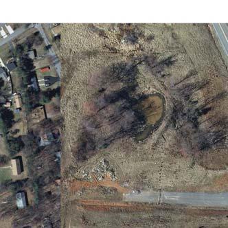
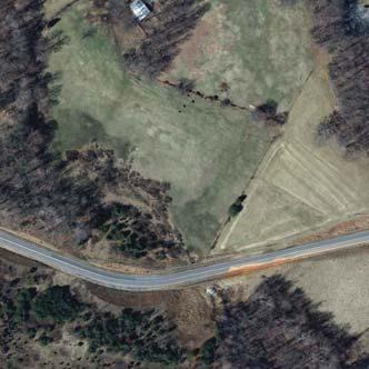
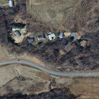
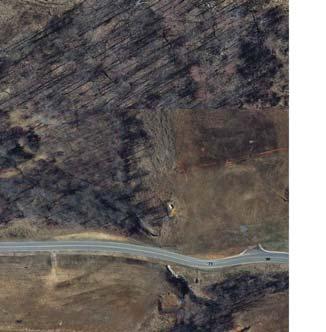
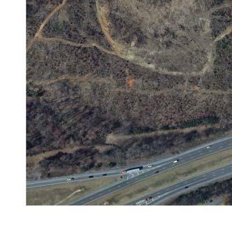
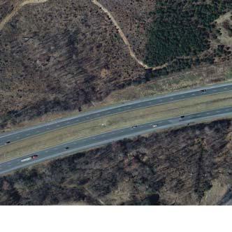
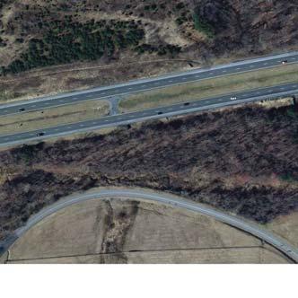
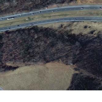
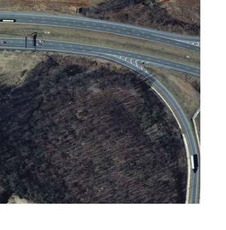
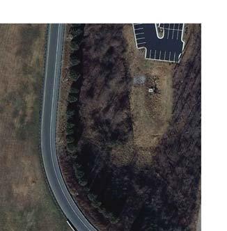
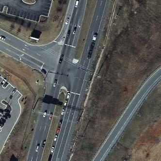
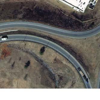
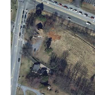
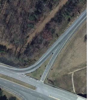
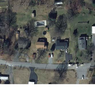
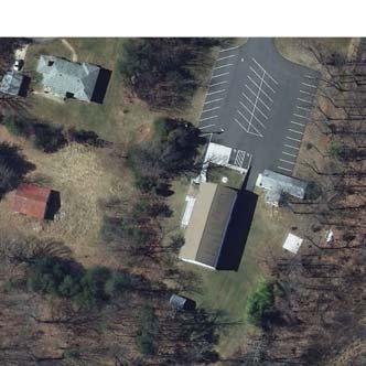
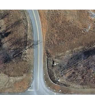
7 I. INTRODUCTION Simons Run Corridor Analysis The Region 2000 Local Government Council (Region 2000) has engaged URS Corporation (URS) to conduct a corridor analysis along Simons Run in Campbell County, Virginia. The Simons Run corridor connects to Wards Ferry Road in the east and to Leesville Road in the west. It is located to the west of Richmond Highway (US Route 29/460) and north of Airport Road (Route 678) see Figure 1. The purpose of this report is to document a study of the alternatives for extending Simons Run to the west to intersect with Airport Road. Additionally, this study evaluates the ideal typical section (for all modes of transportation) for Simons Run in order to support future development. The study will evaluate the costs, benefits, and impacts of the proposed extension. In this effort, the study will detail traffic impacts of the proposed land development on the surrounding roadway network. After this introduction, traffic data collection and existing conditions will be documented. Next, forecasts of traffic from the proposed development will be developed. Then, existing pavement sections will be evaluated. Next, a cost-benefit evaluation of a possible extension of Simons Run to Airport Road will be conducted. Finally, recommended improvements to the Simons Run roadway section will be developed. Wards Ferry Road Figure 1 Simons Run Corridor Study Area Simons Run September 30, 2014 Corridor Analysis Campbell County, Virginia Page 1
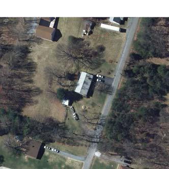
8 II. EXISTING CONDITIONS Simons Run Corridor Analysis Daily directional traffic counts on Simons Run were conducted from September 13, 2013 through September 15, 2013 approximately 0.13 miles west of the A.C. Moore commercial driveway; these counts were conducted by VDOT and provided to URS by Region Peak period turning movement counts at the intersection of Wards Ferry Road with Simons Run were conducted on February 21, 2013 by Peggy Malone & Associates, Inc. as part of the Wards Ferry Road Corridor Study, dated June Lastly, peak period turning movement counts at the intersections of Greenview Drive/Airport Road (Route 678) with Leesville Road, and Simons Run with Leesville Road were conducted on August 4, 2014 and August 5, 2014 by URS. The results of the traffic counts are documented in the Technical Appendix. The Existing Conditions lane geometry and peak hour (7:00 8:00 AM and 4:30 5:30 PM) traffic volumes can be found in Figure 2. Existing land use data was compiled with the use of Campbell County and City of Lynchburg GIS resources. Figure 3 depicts land use characteristics in the study area, including roadways, land parcels, and hydrographic features, in addition to other noteworthy items. Figure 4 portrays zoning districts in both localities, and Figure 5 shows future planned land uses as recommended in the respective comprehensive plans. Simons Run was built by a consortium of land owners along the Simons Run alignment. Simons Run is not incorporated into VDOT s roadway system. The alignment of Simons Run is within Campbell County right-of-way. The pavement section along the majority of the Simons Run corridor, from immediately west of Wards Crossing West to Leesville Road, is a two-lane road with 24 feet of asphalt pavement with earthen shoulders in an open drainage system (ditches). In front of Wards Crossing West shopping center drainage is managed by curb and gutter. Nearly all of the right-of-way along the existing alignment is 60 feet in width. Simons Run is approximately 1.3 miles in length with approximately 0.90 miles having open drainage. There are presently no bicycle or pedestrian accommodations provided on Simons Run. With two stops on the corridor, Simons Run is currently serviced by Bus Route #6 of the Greater Lynchburg Transit Company. The first stop is on the eastern end of the corridor, just west of Wards Ferry Road. The second stop is on the western end of the corridor, on Leesville Road. The bus operates on an hourly schedule Monday through Friday, from 6:15 AM to 7:10 PM; it also operates on a two-hour schedule on Saturday, from 7:15 AM to 6:10 PM; it does not operate on Sunday. Simons Run September 30, 2014 Corridor Analysis Campbell County, Virginia Page 2
9 Capacity Analysis Simons Run Corridor Analysis Using the peak hour traffic volumes shown in Figure 2, capacity analysis was conducted. Synchro 8 software was used for the analysis using 2010 Highway Capacity Manual procedures. Tables 1 and 2 summarize the results of the Existing Conditions capacity analysis. The signalized intersection of Greenview Drive/Airport Road with Leesville Road exhibits inadequate overall intersection service levels with level of service (LOS) D and E conditions in the AM and PM peak hours, respectively. Several individual movements operate with LOS F conditions in the PM peak hour. This intersection accommodates a large traffic volume and the signal timing plan consists entirely of split phasing (each individual approach is provided a separate green phase). While appropriate for current volumes and approach patterns, split phasing produces an inefficient allocation of green time, resulting in excessive delay on all approaches. In contrast, the signalized intersection of Simons Run with Wards Ferry Road operates with good overall intersection service level conditions with LOS B conditions in both peak hours. The unsignalized intersection of Leesville Road with Simons Run operates with good service level conditions, with most movements operating at LOS A. The most noteworthy movement is the westbound left movement, which operates at LOS B and C in the AM and PM peak hours, respectively. Lastly, the unsignalized intersection of the Wards Crossing West driveway with Wards Ferry Road operates with excellent service level conditions, with most movements operating at LOS A. In the PM peak hour, the side streets operate at LOS B. Simons Run September 30, 2014 Corridor Analysis Campbell County, Virginia Page 3
10 NOT TO SCALE Leesville Rd Simons Run Simons Run Wards Ferry Rd Wards Ferry Rd S Leesville Rd Wards Crossing West Greenview Dr Airport Rd Simons Run Corridor Study S Existing Conditions Lane Geometry & Peak Hour Traffic Volumes LEGEND XXX XXX AM Peak Hour Volume PM Peak Hour Volume XXX Daily Volume S FIGURE 2 Signalized Intersection Existing Lane Geometry
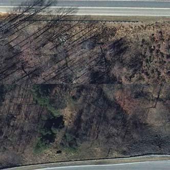
11 A B C D E F G 1 1 î î 2 2 Simons Run Corridor Study Figure 3 - Key Land Use Features Region 2000 Local Government Council Campbell County, Virginia î î 5 5 Legend Point of Interest î House of Worship Cemetery Stream Area Floodzone Roadway Stream Centerline Lake 6 6 September A B C D E F G Miles ²
12 A B C D E F G Simons Run Corridor Study Figure 4 - Zoning Districts Region 2000 Local Government Council Campbell County, Virginia Legend Lynchburg Zoning Districts Zone B1 B2 B3 B5 I2 R1 R2 R3 R4 RC Campbell County Zoning Districts Zone Agricultural Agricultural, Conditional Business - General Commercial Business - General Commercial, Conditional Business - Heavy Commercial Business - Heavy Commercial, Conditional Industrial - General Industrial - General, Conditional Industrial - Heavy N/A Residential - Multi Family Residential - Multi Family, Conditional Residential - Single Family Right-of-Way Roadway September A B C D E F G Miles ²
13 A B C D E F G Simons Run Corridor Study Figure 5 - Future Planned Land Use Region 2000 Local Government Council Campbell County, Virginia Legend Lynchburg Future Land Use Land Use Community Commercial Employment 2 High Density Residential Institution Low Density Residential Medium Density Residential Neighborhood Commercial Office Public Use Regional Commercial Resource Conservation Campbell County Future Land Use Land Use Medium to High Density Commercial Medium to High Density Residential Urban Development Area Commercial Urban Development Area Residential Roadway September A B C D E F G Miles ²
14 Simons Run Corridor Analysis Table 1 Existing Conditions Average Signalized Vehicle Delay and Service Levels HCM 2010 Methodology AM Peak Hour PM Peak Hour Approach Delay Delay LOS LOS (sec.) (sec.) Greenview Drive/Airport Leesville Road EB Left/Through 45.3 D 85.1 F EB Through/Right 38.8 D 67.3 E WB Left 25.2 C 34.1 C WB Through/Right 43.6 D 70.5 E NB Left/Through 50.0 D 74.3 E NB Through/Right 45.5 D 66.6 E SB Left/Through 50.8 D F SB Through/Right 45.9 D 83.4 F Overall Intersection 43.6 D 72.1 E Simons Wards Ferry Road EB Left 14.5 B 18.6 B EB Through/Right 15.6 B 23.1 C WB Left 14.6 B 17.5 B WB Through/Right 15.8 B 23.3 C NB Left 8.1 A 12.6 B NB Through 11.1 B 15.4 B NB Right 9.4 A 13.5 B SB Left 8.2 A 11.8 B SB Through 10.1 B 18.7 B SB Right 9.2 A 14.7 B Overall Intersection 10.9 B 17.2 B Simons Run September 30, 2014 Corridor Analysis Campbell County, Virginia Page 8
15 Simons Run Corridor Analysis Table 2 Existing Conditions Average Unsignalized Vehicle Delay and Service Levels HCM 2010 Methodology AM Peak Hour PM Peak Hour Approach Delay Delay LOS LOS (sec.) (sec.) Simons Leesville Road WB Left 12.4 B 17.7 C WB Right 9.3 A 9.4 A NB Through/Right 0.0 A 0.0 A SB Left 8.0 A 8.0 A SB Through 0.0 A 0.1 A Wards Crossing Wards Ferry Road EB Right 9.2 A 13.6 B WB Left/Right 0.0 A 10.3 B NB Through/Right 0.0 A 0.0 A SB Left 0.0 A 8.6 A SB Through/Right 0.0 A 0.5 A Simons Run September 30, 2014 Corridor Analysis Campbell County, Virginia Page 9
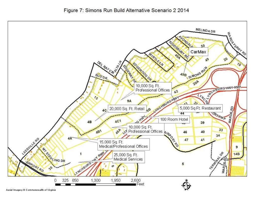
16 III. FORECASTS OF FUTURE TRAFFIC VOLUMES Simons Run Corridor Analysis Two alternative scenarios for future development of currently undeveloped land along the corridor were provided to URS by Campbell County. Both Build Alternative scenarios propose development of eight of the vacant parcels along Simons Run. The two scenarios are shown in Figures 6 and 7. For Scenario 1, land use is a mix of residential and commercial uses, while Scenario 2 shifts exclusively towards office and medical land use. Trip Generation 9th Edition (published by the Institute of Transportation Engineers) was used to compute estimates trip volumes. Trip generation values for the two development scenarios are summarized in Tables 3 and 4. Parcel Land Use Size 1 4A 4B 4C1 9A 9B 42 49B Home Improvement Superstore Shopping Center Shopping Center Shopping Center Condo/ Townhouse Hotel Quality Restaurant New Car Sales Table 3 Trip Generation Build Alternative Scenario 1 100,000 sq. ft. 10,000 sq. ft. 20,000 sq. ft. 10,000 sq. ft. 300 Dwelling Units 100 Rooms 5,000 sq. ft. 20,724 sq. ft. Daily Trips Enter AM Peak Hour Exit Pass- By Enter PM Peak Hour Exit Pass- By 3, , Total 8, Simons Run September 30, 2014 Corridor Analysis Campbell County, Virginia Page 10
17
18
19 Parcel Land Use Size 1 4A 4B 4C1 9A 9B 42 49B Medical- Dental Office Building Pharmacy w/ Drive-Thru Shopping Center General Office General Office Hotel Quality Restaurant New Car Sales Table 4 Trip Generation Build Alternative Scenario 2 25,000 sq. ft. 15,000 sq. ft. 20,000 sq. ft. 10,000 sq. ft. 10,000 sq. ft. 100 Rooms 5,000 sq. ft. 20,724 sq. ft. Daily Trips Enter Simons Run Corridor Analysis AM Peak Hour PM Peak Hour Simons Run September 30, 2014 Corridor Analysis Campbell County, Virginia Page 13 Exit Pass- By Enter Exit Pass- By , Total 5, Forecasted trip distribution patterns for traffic from the two Build Alternative scenarios using the existing roadway geometry (without the extension to Airport Road) are displayed in Figure 8. The trip distribution pattern has been based on the existing traffic patterns and surrounding land uses. Applying distribution patterns to forecasted volumes, Figures 9 and 10 display peak period turning movement counts for both Build Alternative scenarios using the existing roadway geometry. Background traffic volume growth on all study area roads has been accounted for by applying a 1% annual growth rate to the existing conditions volumes for a period of ten years. The 1% annual growth rate is consistent with that used and documented in the Wards Ferry Road Corridor Study, which was conducted in The design year for this project was chosen to be 2024, ten years beyond the existing conditions, in order to provide sufficient time for build-out of the proposed land uses. It should be noted that the intersection of Greenview Drive/Airport Road with Leesville Road is programmed to be improved from its current geometry to include separate left and right turn lanes on all four approaches. This improvement is scheduled separately from this project, and is to be completed by the time the development on Simons Run is fully developed.
20 NOT TO SCALE Leesville Rd (3%) 7% 2% (4%) 57% (59%) Simons Run 78% (48%) (10%) 7% Simons Run (8%) 9% (17%) 18% Wards Ferry Rd 5% (20%) 3% (19%) Wards Ferry Rd S Leesville Rd (8%) (13%) (38%) 3% 6% 48% 38% (30%) Wards Crossing West (12%) 14% Greenview Dr (7%) 10% 30% (11%) Airport Rd Simons Run Corridor Study S LEGEND Build Conditions Trip Distribution Existing Geometry XX% (XX%) AM (PM) Entering % XX% (XX%) AM (PM) Exiting % S FIGURE 8 Signalized Intersection Existing Lane Geometry Proposed Lane
21 NOT TO SCALE Leesville Rd Simons Run Simons Run Wards Ferry Rd Wards Ferry Rd S Leesville Rd Wards Crossing West Greenview Dr Airport Rd Simons Run Corridor Study S Scenario 1 Build Conditions Existing Lane Geometry & Peak Hour Traffic Volumes LEGEND XXX XXX AM Peak Hour Volume PM Peak Hour Volume XXX Daily Volume S FIGURE 9 Signalized Intersection Existing Lane Geometry Proposed Lane
22 NOT TO SCALE Leesville Rd Simons Run Simons Run Wards Ferry Rd Wards Ferry Rd S Leesville Rd Wards Crossing West Greenview Dr Airport Rd Simons Run Corridor Study S Scenario 2 Build Conditions Existing Lane Geometry & Peak Hour Traffic Volumes LEGEND XXX XXX AM Peak Hour Volume PM Peak Hour Volume XXX Daily Volume S FIGURE 10 Signalized Intersection Existing Lane Geometry Proposed Lane
23 Simons Run Corridor Analysis This study also included an alternate scenario to provide for an extension of Simons Run to the south to create a new partial-access intersection with Airport Road. Figure 11 displays the adjusted trip distribution utilizing this new connection. Figures 12 and 13 display peak period turning movement volumes for both Build Alternative scenarios using the modified roadway geometry. Capacity Analysis Using the peak hour traffic volumes found in Figures 9, 10, 12, and 13, Build Alternative conditions capacity analysis was conducted for both land use scenarios, using both the existing geometry and the Simons Run extension modification. Synchro 8 software was used for the analysis using 2010 Highway Capacity Manual procedures. Table 5 summarizes the results of the various Build Alternative analyses. For the signalized intersections, the overall intersection delay and LOS were reported; for the unsignalized intersections, the single worst movement delay and LOS were reported. The signalized intersection of Greenview Drive/Airport Road with Leesville Road exhibits marked improvement in performance, coinciding with its scheduled reconstruction; it operates with adequate (LOS C or better) overall intersection service level conditions in all Build Alternative conditions. The signalized intersection of Simons Run with Wards Ferry Road is forecasted to operate with adequate (LOS C or better) overall intersection service levels for all Build Alternative conditions. With the existing geometry, the unsignalized intersection of Leesville Road with Simons Run is forecasted to operate with poor (LOS F) service levels. Specifically, the PM peak hour analysis results exhibit LOS F conditions. However, with the extension of Simons Run to Airport Road, the results are forecasted to improve to LOS D and C in the PM peak hour for Scenarios 1 and 2, respectively. In contrast, without the extension of Simons Run, the intersection of Leesville Road and Simons Run will likely meet warrants for a traffic signal. The unsignalized intersection of Wards Crossing West with Wards Ferry Road is forecasted to operate with adequate (LOS C or better) service levels, with LOS A and C conditions in the AM and PM peak hours, respectively, for all Build Alternative conditions. Lastly, the proposed new unsignalized intersection of Simons Run with Airport Road is forecasted to operate with adequate (LOS C or better) service levels, with LOS B and C conditions in the AM and PM peak hours, respectively. Simons Run September 30, 2014 Corridor Analysis Campbell County, Virginia Page 17
24 NOT TO SCALE Leesville Rd (3%) 7% 2% (4%) 48% (38%) Simons Run (10%) 7% Simons Run (8%) 9% (17%) 18% Wards Ferry Rd 5% (20%) 3% (19%) Wards Ferry Rd S (38%) Leesville Rd Wards Crossing West (12%) 14% 48% 3% (8%) Greenview Dr 6% (13%) Airport Rd (7%) 10% 30% (11%) Simons Run Simons Run Corridor Study (21%) 9% 38% (30%) S (18%) 40% Airport Rd Build Conditions Trip Distribution Simons Run Extension FIGURE 11 LEGEND XX% (XX%) AM (PM) Entering % XX% (XX%) AM (PM) Exiting % S Signalized Intersection Existing Lane Geometry Proposed Lane
25 NOT TO SCALE Leesville Rd Simons Run Simons Run Wards Ferry Rd Wards Ferry Rd S Leesville Rd Wards Crossing West Greenview Dr Airport Rd Simons Run Simons Run Corridor Study S Airport Rd Scenario 1 Build Conditions Modified Lane Geometry & Peak Hour Traffic Volumes FIGURE 12 LEGEND XXX XXX AM Peak Hour Volume PM Peak Hour Volume S Signalized Intersection Existing Lane Geometry XXX Daily Volume Proposed Lane


26 NOT TO SCALE Leesville Rd Simons Run Simons Run Wards Ferry Rd Wards Ferry Rd S Leesville Rd Wards Crossing West Greenview Dr Airport Rd Simons Run Simons Run Corridor Study S Airport Rd Scenario 2 Build Conditions Modified Lane Geometry & Peak Hour Traffic Volumes FIGURE 13 LEGEND XXX XXX AM Peak Hour Volume PM Peak Hour Volume S Signalized Intersection Existing Lane Geometry XXX Daily Volume Proposed Lane
27 Simons Run Corridor Analysis Table 5 Build Conditions Year 2024 Vehicle Delay and Service Levels HCM 2010 Methodology Existing Geometry Simons Run Extension Intersection Scenario 1 Scenario 2 Scenario 1 Scenario 2 AM Peak Hour PM Peak Hour AM Peak Hour PM Peak Hour AM Peak Hour PM Peak Hour AM Peak Hour PM Peak Hour Delay (sec.) LOS Delay (sec.) LOS Delay (sec.) LOS Delay (sec.) LOS Delay (sec.) LOS Delay (sec.) LOS Delay (sec.) LOS Delay (sec.) LOS Greenview Drive/Airport Leesville Road 25.9 C 26.9 C 23.9 C 26.3 C 29.5 C 30.6 C 26.3 C 30.1 C Simons Wards Ferry Road 13.1 B 22.4 C 12.2 B 21.0 C 13.1 B 22.4 C 12.2 B 21.0 C Simons Leesville Road* 17.6 C 79.1 F 14.8 B 66.7 F 16.5 C 29.8 D 14.4 B 27.7 D Wards Crossing Wards Ferry Road* 9.5 A 16.4 C 9.4 A 16.3 C 9.5 A 16.4 C 9.4 A 16.3 C Simons Airport Road* 10.7 B 16.2 C 10.6 B 15.6 C *Unsignalized intersection Simons Run September 30, 2014 Corridor Analysis Campbell County, Virginia Page 21
28 IV. PAVEMENT SECTION EVALUATION Simons Run Corridor Analysis In the analysis of the Build Alternative Scenarios, eight currently undeveloped parcels have been assumed to be developed: one with a mix of residential and commercial uses and the other with exclusively commercial uses. With the added traffic volumes from either of these development scenarios, determining the appropriate pavement section is a key component for developing forecasts of costs estimates. The design speed for the existing Simons Run alignment is 40 MPH, and there are no major design deficiencies on the current corridor. However, added traffic volumes from future planned development will likely present challenges to maintaining an adequate pavement configuration. For example, considering that several parcels have relatively narrow frontage, it is not likely that a driveway to each parcel could be installed while at the same time complying with access management driveway spacing guidelines along the overall roadway. As a result, considering the forecasted volumes and parcel layout, the typical section should include a travel lane in each direction with a shared center left turn lane. Currently, the typical section on Simons Run is comprised of a single 12-foot travel lane in each direction, with an additional 5-foot earthen shoulder. The existing Campbell County right-of-way (ROW) width spans 60 feet. Two possible typical sections for the corridor were developed and are shown in Figure 14. Both of the typical sections were developed to meet VDOT design standards. Based on the type and amount of development being proposed the VDOT standard chosen for developing alternatives was the urban collector street with curb and gutter drainage (GS-7) with a design speed of 40 MPH. The first typical section can be installed within the available 60-foot ROW. It uses a center left turn lane, as well as two 14-foot travel lanes. The wider travel lanes (wide outside travel lanes) will adequately allow bicyclists to share the road with automobiles without separate bicycle lanes. Furthermore, this typical section includes a 5-foot wide sidewalk to accommodate pedestrian traffic. The year 2015 planning level cost estimate to install this typical section from the northern end of the corridor in front of the proposed car dealership to the 90 degree curve in the road south of the intersection with Leesville Road is $6,530,000 (a distance of 0.76 miles). This cost estimate includes extending the sidewalk through to Leesville Road. Conceptual plans for this typical section are displayed in Figure 15. Simons Run September 30, 2014 Corridor Analysis Campbell County, Virginia Page 22
29
30
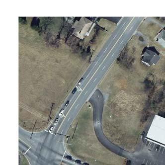
31 Simons Run Corridor Analysis An alternative typical section was also developed to provide separate accommodation of bicycle and pedestrian traffic. The travel lanes revert to the typical 12-foot width, and the center left turn lane expands to 14 feet. Instead of a 5-foot sidewalk, a 10-foot shared use path has been included. However, this wider shared-use path also necessitates a wider buffer between the road and the path. Consequently, the required ROW expands from 60 feet to 68 feet. The year 2015 planning level cost estimate to install this typical section from the northern end of the corridor (in front of the proposed car dealership) to the 90 degree curve in the road south of the intersection with Leesville Road (a distance of 0.76 miles) is $6,599,000. This cost estimate includes extending the shared-use path through to Leesville Road. Conceptual plans for this typical section are displayed in Figure 16. It should be noted that the planning level cost estimates do not include ROW acquisition costs, utility relocation costs, or loss of property taxes. Multi-Modal Build Alternative Scenario 1 provides for a 300-bedroom townhouse/apartment complex in addition to mixed commercial uses. It is estimated that this scenario would generate 2 bicycle trips and 5 pedestrian trips in each peak hour. In contrast, Build Alternative Scenario 2 is exclusively oriented for development of commercial uses. The result is that Scenario 2 is estimated to generate 1 bicycle trip and 2 pedestrian trips in each peak hour. Bus stops are currently located at each end of Simons Run as part of the Greater Lynchburg Transit Company s network. It is recommended that an additional bus stop be located between Parcels 9A and 9B; this location will serve as a central stop between the bus stops on either end of the corridor, and will directly serve both the residential complex on Parcel 9A in Scenario 1, and the hotel on Parcel 9B in both Scenarios. Signing The geometry of Simons Run at its eastern end near Wards Ferry Road is not intuitive as motorists travel eastbound: the roadway itself continues straight to an unsignalized directional intersection with Wards Ferry Road, whereas Simons Run officially turns left and snakes around the Wards Crossing West parking lot just before it intersects Wards Ferry Road to the north of the aforementioned unsignalized directional intersection. Unfamiliar motorists traveling eastbound on Simons Run may not know that they need Simons Run September 30, 2014 Corridor Analysis Campbell County, Virginia Page 25
32 Simons Run Corridor Analysis to turn left at the unsignalized four-way intersection in front of the small strip shopping center to the southeast in order to continue to Wards Ferry Road northbound. Traveling straight through this intersection forces motorists to make a right turn onto southbound Wards Ferry Road which then immediately intersects with Wards Road. The project management team brought up this issue and requested that additional signage be developed to help alleviate the confusion caused by the non-intuitive geometry and restricted access. URS developed proposed signing to help inform motorists which direction to take in order to reach their destination. URS followed MUTCD standards when developing the proposed signage. Figure 17 displays the recommended guide signage to assist eastbound Simons Run motorists in making destination decisions when the approach Wards Ferry Road. Simons Run September 30, 2014 Corridor Analysis Campbell County, Virginia Page 26
33
34
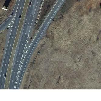
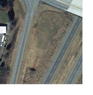
35 Simons Run Corridor Analysis V. COST-BENEFIT EVALUATION OF EXTENSION OF SIMONS RUN TO AIRPORT ROAD The proposed extension of Simons Run south would create a new intersection with Airport Road (Route 678). The original intent of this extension was to provide a fullaccess intersection to Airport Road using the existing median crossover located approximately 95 feet west of the westbound US Route 460 off-ramp. However, according to the VDOT Road Design Manual, a full-access intersection next to an interchange requires a minimum spacing of 1,320 feet nearly the distance from the Route 460 interchange to the Leesville Road intersection. An alternative design would provide a partial-access intersection, which requires spacing of 750 feet. Partial access would provide for left turning movements into Simons Run from eastbound Airport Road but prohibit left turning movements from southbound Simons Run to eastbound Airport Road. Partial access would also allow for rightin/right-out turning movements at the intersection of Simons Run and Airport Road. Consequently, for the proposed extension of Simons Run, the design provides for a partial access intersection located farther west on Airport Road, closer to the intersection of Greenview Drive/Airport Road with Leesville Road. However, due to the intersection improvements previously discussed at that location, as well as the residential parcels located on the north side of Airport Road, separation of only 395 feet from the US Route 460 interchange was attainable. Therefore, an access management exemption will have to be requested from VDOT to allow for substandard spacing of the intersection to the interchange. Figure 18 displays the horizontal distances from the proposed intersection of the Simons Run extension with Airport Road to the US Route 460 interchange, and the intersection of Greenview Drive/Airport Road with Leesville Road, as well as the horizontal distance from the existing median break on Airport Road to the US Route 460 interchange. Both of the two typical sections previously displayed in Figure 14 were evaluated for use as the extension of Simons Run. Figure 19 displays the conceptual plans for an extended segment of Simons Run with the 60-foot ROW typical section, and Figure 20 displays both the modified internal Simons Run intersection, and the new intersection of Simons Run with Airport Road. In both layouts, the westbound US Route 460 off-ramp onto westbound Airport Road is extended as a right turn onto the intersection with the proposed Simons Run extension. Simons Run September 30, 2014 Corridor Analysis Campbell County, Virginia Page 29
36
37
38
39 Simons Run Corridor Analysis The planning level cost estimate for the 60-foot-wide ROW extension of Simons Run is $2,730,000 in year 2015 dollars. Figure 21 displays the conceptual plans for an extended segment of Simons Run with the 68-foot ROW typical section, and Figure 22 displays both the modified internal Simons Run intersection, and the new intersection of Simons Run with Airport Road. The planning level cost estimate for the 68-foot-wide ROW extension of Simons Run is $2,721,000 in year 2015 dollars. Here also, it should be noted that these planning level cost estimates do not include ROW acquisition costs nor do they include utility relocation costs. Furthermore, costs for the proposed extension may be mitigated by installing the extension concurrent with development activity as parcels are developed. All planning level construction cost estimates may be found in the Technical Appendix. Simons Run September 30, 2014 Corridor Analysis Campbell County, Virginia Page 33


40


41
42 Travel Time Impacts Simons Run Corridor Analysis Travel time cost savings were calculated to determine the benefits to motorists from the installation of the Simons Run Extension. Two destinations were considered: the intersection of Greenview Drive/Airport Road with Leesville Road, and the US Route 460 interchange with Airport Road. A centroid point was used to approximate the center of the development, based on the size and location of the various parcels to be developed. This centroid was placed on Simons Run between Parcels 9A and 9B, at a distance of 0.58 mile from the intersection of Simons Run with Leesville Road. Daily volumes were then applied from the centroid to the two aforementioned destinations, and vice versa. To estimate daily volumes, AM peak hour volumes were used. AM peak hour volumes generally comprise 7% of the total daily volumes at any given intersection; specifically, AM peak hour volumes for both the existing geometry and the Simons Run extension geometry were extrapolated to give an estimate of the daily volumes. Once daily volumes were calculated, they were applied to the roadway network given the trip distribution patterns previously shown in Figures 8 and 11. To calculate travel time, the number of vehicles on a given roadway segment were multiplied by the length of that segment, and then divided by the speed limit of that segment. Next, the delay encountered at any intersections between the origin and destination was added to arrive at an estimated overall travel time from origin to destination. According to the Bureau of Labor Statistics, the mean hourly wage for the Lynchburg Metropolitan Statistical Area (MSA) is $ By multiplying the overall travel time by the mean hourly wage, an estimate of daily travel cost savings was calculated. To create a more accurate picture of the full cost-benefit analysis, it was assumed that the extra cost of the Simons Run extension would be financed, rather than paid in full up front. Assuming a 22-year loan beginning payments in 2016 at a 5% annual interest rate, annual payments were calculated for both the 60-foot-wide and 68-footwide ROW options. The calculations assumed that the extension would be completed in 2017, and any travel cost benefits would gradually increase over the next several years, coming to the maximum level upon the full development of the parcels on Simons Run in Travel costs were annually increased at an inflation rate of 3% through the design year and loan payoff year of Table 6 displays a summary of the costbenefit analysis of the proposed extension of Simons Run to Airport Road. According to the Campbell County Assessor, any extension of the Simons Run corridor will not have any measurable impact on assessed property values on the undeveloped Simons Run September 30, 2014 Corridor Analysis Campbell County, Virginia Page 36
43 Simons Run Corridor Analysis parcels along the Simons Run corridor. Consequently, no additional annual property tax revenues are anticipated to be realized by installation of the extension. Year Table 6 Simons Run Extension Cost-Benefit Analysis 60-Foot ROW 68-Foot ROW Annual Costs Annual Benefits Annual Costs Annual Benefits 2016 $220,035 $0 $219,267 $ $220,035 $38,292 $219,267 $38, $220,035 $78,881 $219,267 $78, $220,035 $121,871 $219,267 $121, $220,035 $167,369 $219,267 $167, $220,035 $215,488 $219,267 $215, $220,035 $266,343 $219,267 $266, $220,035 $320,055 $219,267 $320, $220,035 $376,751 $219,267 $376, $220,035 $388,053 $219,267 $388, $220,035 $399,695 $219,267 $399, $220,035 $411,686 $219,267 $411, $220,035 $424,036 $219,267 $424, $220,035 $436,758 $219,267 $436, $220,035 $449,860 $219,267 $449, $220,035 $463,356 $219,267 $463, $220,035 $477,257 $219,267 $477, $220,035 $491,574 $219,267 $491, $220,035 $506,322 $219,267 $506, $220,035 $521,511 $219,267 $521, $220,035 $537,157 $219,267 $537, $220,035 $553,271 $219,267 $553,271 Totals $4,840,780 $7,645,586 $4,823,869 $7,645,586 Benefit/ Cost Ratio Simons Run September 30, 2014 Corridor Analysis Campbell County, Virginia Page 37
44 Simons Run Corridor Analysis VI. FINDINGS, CONCLUSIONS AND RECOMMENDATIONS Findings & Conclusions Both alternative typical sections provide a three-lane typical section with a two-way center left turn lane, which will provide for better vehicular service to Simons Run as development along the corridor proceeds. Additionally, both alternatives provide facilities for pedestrians and bicycles as well as for vehicular transportation. The respective costs for both alternatives are nearly identical. Table 7 displays a summary of the planning level cost estimates for the two typical sections. Alternative 60-Foot ROW 68-Foot ROW Table 7 Summary of Planning Level Cost Estimates Year 2015 Dollars Description Existing Alignment Improvements Length Costs (mi.) Simons Run Extension Length Costs (mi.) 3-Lane Urban Section (41-foot 0.76 $6,266, $2,638,000 pavement width) 5-foot Sidewalk 0.92 $264, $92,000 Total 0.92 $6,530, $2,730,000 3-Lane Urban Section (38-foot 0.76 $5,808, $2,445,000 pavement width) 10-foot Shareduse Path 0.92 $791, $275,000 Total 0.92 $6,599, $2,721,000 However, the 68-foot-wide typical section would require the acquisition of land from the land owners because the existing right-of-way is only 60 feet wide. The major difference in the two typical sections is how multi-modal facilities are provided. The 60- foot-wide typical section provides wide outside lanes (14 feet wide) that provide for onroad bike accommodations, and it also provides a 5-foot sidewalk for pedestrians. The 68-foot-wide typical section provides accommodations for bikes and pedestrians in the form of a 10-foot-wide shared-use trail on one side of the road. The recommended posted speed limit on the corridor is to be 35 MPH in both alternatives. Figure 14 displays the typical section, while Figures 16, 21, and 22 displays the conceptual plans throughout the study area. Simons Run September 30, 2014 Corridor Analysis Campbell County, Virginia Page 38
45 Simons Run Corridor Analysis While there is an existing break in the median on Airport Road, according to the VDOT Road Design Manual a partial-access intersection adjacent to an interchange requires a minimum of 750 feet of horizontal spacing. The existing break is only 95 feet from the interchange, and therefore installing an access driveway at the existing median crossover would not comply with the intersection spacing standards. If the alignment of the extension of Simons Run were to be moved so that the intersection with Airport Road could be located as far west as possible, a maximum horizontal separation of only 395 feet from the interchange would result still not in compliance with the 750 feet of separation provided in the VDOT guidelines. Consequently, regardless of the location of the extension intersection with Airport Road, an access management exemption will be required from VDOT as part of the access permit application process. Ultimately both typical section alternatives provide a benefit/cost ratio that exceeds one: both alternatives provide a benefit/cost ratio of 1.58 over the design life (20 years) of the road. The decision in choosing a particular typical-section is primarily differentiated by the right-of-way impacts (no right-of-way acquisition or 8 feet of right-of-way acquisition) and type of bicycle and pedestrian facilities that are desired (on road bike facilities and a sidewalk versus a shared-use path). Recommendations 1. Extend Simons Run to a Partial Intersection with Airport Road: The benefits of time savings for motorists more than offset construction costs. Moreover, while the assessed property values may not be increased, the likelihood of development is increased with the enhanced access to the corridor from Route 460. The improvements to Simons Run should be designed to meet current VDOT standards for an urban collector street standard (GS-7) with curb and gutter drainage and a 40 MPH design speed. 2. Install the Simons Run Extension as the 60-foot-wide ROW pavement section: This section will adequately accommodate limited expected number of bicyclists and pedestrians. It will also accommodate and be consistent with future upgrades to the existing pavement section. 3. Add Bus Stops: As detailed in Chapter IV, it is recommended that bus stops be added on Simons Run between Parcels 9A and 9B to serve as a central stopping point on the corridor. Simons Run September 30, 2014 Corridor Analysis Campbell County, Virginia Page 39
46 Simons Run Corridor Analysis 4. Add directional guidance signage as shown in Figure 17 (page 28) to the northbound Simons Run approach to the intersections with Wards Ferry Road. Simons Run September 30, 2014 Corridor Analysis Campbell County, Virginia Page 40
Traffic Impact Analysis Chatham County Grocery Chatham County, NC
 Chatham County Grocery Chatham County, NC TABLE OF CONTENTS 1. INTRODUCTION... 1 1.1. Location and Study Area... 1 1.2. Proposed Land Use and Access... 2 1.3. Adjacent Land Uses... 2 1.4. Existing ways...
DUNBOW ROAD FUNCTIONAL PLANNING
 DUNBOW ROAD FUNCTIONAL PLANNING Final Report August 3, 216 #31, 316 5th Avenue NE Calgary, AB T2A 6K4 Phone: 43.273.91 Fax: 43.273.344 wattconsultinggroup.com Dunbow Road Functional Planning Final Report
THIS PAGE LEFT BLANK INTENTIONALLY
 GA SR 25 Spur at Canal Road Transportation Impact Analysis PREPARED FOR GLYNN COUNTY, GEORGIA 1725 Reynolds Street, Suite 300 Brunswick, Georgia 31520 PREPARED BY 217 Arrowhead Boulevard Suite 26 Jonesboro,
Traffic Impact Analysis Walton Acres at Riverwood Athletic Club Clayton, NC
 Traffic Impact Analysis Walton Acres at Riverwood Athletic Club Clayton, NC 1. TABLE OF CONTENTS INTRODUCTION...1 1.1. Site Location and Study Area...1 1.2. Proposed Land Use and Site Access...2 1.3.
Highway 111 Corridor Study
 Highway 111 Corridor Study June, 2009 LINCOLN CO. HWY 111 CORRIDOR STUDY Draft Study Tea, South Dakota Prepared for City of Tea Sioux Falls Metropolitan Planning Organization Prepared by HDR Engineering,
Shockoe Bottom Preliminary Traffic and Parking Analysis
 Shockoe Bottom Preliminary Traffic and Parking Analysis Richmond, Virginia August 14, 2013 Prepared For City of Richmond Department of Public Works Prepared By 1001 Boulders Pkwy Suite 300, Richmond, VA
MEETING FACILITY 2901 GIBFORD DRIVE CITY OF OTTAWA TRANSPORTATION BRIEF. Prepared for: Holiday Inn Express 2881 Gibford Drive Ottawa, ON K1V 2L9
 MEETING FACILITY 2901 GIBFORD DRIVE CITY OF OTTAWA TRANSPORTATION BRIEF Prepared for: Holiday Inn Express 2881 Gibford Drive Ottawa, ON K1V 2L9 December 18, 2012 112-566 Brief_1.doc D. J. Halpenny & Associates
INDUSTRIAL BUILDING 3009 HAWTHORNE ROAD CITY OF OTTAWA TRANSPORTATION OVERVIEW REVISED. Prepared for: Canada Inc.
 INDUSTRIAL BUILDING 3009 HAWTHORNE ROAD CITY OF OTTAWA TRANSPORTATION OVERVIEW REVISED Prepared for: 7849648 Canada Inc. Octiober 1, 2015 114-598 Overview_2.doc D. J. Halpenny & Associates Ltd. Consulting
Technical Memorandum TRAFFIC IMPACT STUDY. RIDLEY ROAD CONVENIENCE STORE Southampton County, VA. Prepared for: Mr. David Williams.
 Technical Memorandum TRFFIC IMPCT STUDY RIDLEY ROD CONVENIENCE STORE Southampton County, V Prepared for: Mr. David Williams By: Charles Smith, P.E., PTOE EPR Charlottesville, V July 2014 1 TBLE OF CONTENTS
QUICKIE C STORE AND GAS BAR 1780 HERON ROAD OTTAWA, ONTARIO TRANSPORTATION BRIEF. Prepared for:
 QUICKIE C STORE AND GAS BAR 1780 HERON ROAD OTTAWA, ONTARIO TRANSPORTATION BRIEF Prepared for: Quickie Convenience Stores Larny Holdings Ltd. c/o PBC Group April 15, 2015 115-615 Report_1.doc D. J. Halpenny
Traffic Impact Study. Westlake Elementary School Westlake, Ohio. TMS Engineers, Inc. June 5, 2017
 TMS Engineers, Inc. Traffic Impact Study Westlake Elementary School Westlake, Ohio June 5, 2017 Prepared for: Westlake City Schools - Board of Education 27200 Hilliard Boulevard Westlake, OH 44145 TRAFFIC
Traffic Impact Study WestBranch Residential Development Davidson, NC March 2016
 Traffic Impact Study WestBranch Residential Development Davidson, NC March 216 TRAFFIC IMPACT STUDY FOR THE WestBranch Residential Development LOCATED IN DAVIDSON, NC Prepared For: Lennar Carolinas, LLC
5858 N COLLEGE, LLC N College Avenue Traffic Impact Study
 5858 N COLLEGE, LLC nue Traffic Impact Study August 22, 2016 Contents Traffic Impact Study Page Preparer Qualifications... 1 Introduction... 2 Existing Roadway Conditions... 5 Existing Traffic Conditions...
TRANSPORTATION ANALYSIS REPORT US Route 6 Huron, Erie County, Ohio
 TRANSPORTATION ANALYSIS REPORT US Route 6 Huron, Erie County, Ohio December 12, 2012 Prepared for: The City of Huron 417 Main Huron, OH 44839 Providing Practical Experience Technical Excellence and Client
Henderson Avenue Mixed-Use Development
 Zoning Case: Z145-3 Traffic Impact Analysis Henderson Avenue Mixed-Use Development Dallas, TX October 26 th, 216 Kimley-Horn and Associates, Inc. Dallas, Texas Project #644827 Registered Firm F-928 Traffic
Chapter 4 Traffic Analysis
 Chapter 4 Traffic Analysis PURPOSE The traffic analysis component of the K-68 Corridor Management Plan incorporates information on the existing transportation network, such as traffic volumes and intersection
MEDICAL/OFFICE BUILDING 1637 BANK STREET OTTAWA, ONTARIO TRANSPORTATION OVERVIEW. Prepared for:
 MEDICAL/OFFICE BUILDING 1637 BANK STREET OTTAWA, ONTARIO TRANSPORTATION OVERVIEW Prepared for: 2434984 Ontario Inc. 13-5510 Canotek Road Ottawa, Ontario K1J 9J5 June 4, 2015 115-613 Report_2.doc D. J.
METHODOLOGY. Signalized Intersection Average Control Delay (sec/veh)
") Chapter 5 Traffic Analysis 5.1 SUMMARY US /West 6 th Street assumes a unique role in the Lawrence Douglas County transportation system. This principal arterial street currently conveys commuter traffic
Chapter 5 Traffic Analysis 5.1 SUMMARY US /West 6 th Street assumes a unique role in the Lawrence Douglas County transportation system. This principal arterial street currently conveys commuter traffic
NEW YORK CENTRAL PARK SUBDIVISION BLAIS STREET/ST-PIERRE STREET EMBRUN, ONTARIO TRAFFIC IMPACT STUDY. Prepared for:
 NEW YORK CENTRAL PARK SUBDIVISION BLAIS STREET/ST-PIERRE STREET EMBRUN, ONTARIO TRAFFIC IMPACT STUDY Prepared for: Solidex Holdings Limited & Investissement Maurice Lemieux Investments Attn: Mr. Anthony
Project Description Form 8EE
 Project Description Form 8EE Basic Project Information Submitting Jurisdiction/Agency: Town of Dumfries Project Title: Route 1 (Fraley Blvd) Widening: Brady's Hill Road to Dumfries Road Project Location:
SECTION 1 - TRAFFIC PLANNING
 SECTION 1 - TRAFFIC PLANNING 1.1 TRAFFIC OPERATIONS 1.1.1 Roadway Functional Classification The Multnomah County Comprehensive Framework Plan s Policy 34: Trafficways and the Functional Classification
Glenn Avenue Corridor Traffic Operational Evaluation
 Glenn Avenue Corridor Traffic Operational Evaluation PREPARED FOR: THE CITY OF AUBURN PREPARED BY: DECEMBER 2007 Glenn Avenue Corridor Study--Auburn, Alabama TABLE OF CONTENTS Introduction... 1 Background
OFFICE/RETAIL DEVELOPMENT 1625 BANK STREET OTTAWA, ONTARIO TRANSPORTATION BRIEF. Prepared for: Canada Inc.
 OFFICE/RETAIL DEVELOPMENT 1625 BANK STREET OTTAWA, ONTARIO TRANSPORTATION BRIEF Prepared for: 9402209 Canada Inc. December 15, 2015 115-625 Report_2.doc D. J. Halpenny & Associates Ltd. Consulting Transportation
Intersection Traffic Control Feasibility Study
 Intersection Traffic Control Feasibility Study CSAH 9 at CSAH 60 (185th Avenue) Prepared For: Dakota County Transportation Department Western Service Center 14955 Galaxie Avenue, 3rd Floor Apple Valley,
HENDERSON DEVELOPMENT 213, 217, 221, 221 ½, 223 HENDERSON AVENUE and 65 TEMPLETON STREET OTTAWA, ONTARIO TRANSPORTATION OVERVIEW.
 HENDERSON DEVELOPMENT 213, 217, 221, 221 ½, 223 HENDERSON AVENUE and 65 TEMPLETON STREET OTTAWA, ONTARIO TRANSPORTATION OVERVIEW Prepared for: 2294170 Ontario Inc. February 2, 2017 117-652 Report_1.doc
CITY OF WEST LAKE HILLS. Forest View Neighborhood Traffic Calming Study
 CITY OF WEST LAKE HILLS 901 South Mopac Expressway Building V, Suite 220 Austin, Texas 78746 Texas P.E. Firm Registration No. F-929 Klotz Associates Final Report Submittal: March 20, 2015 Revised Final
OTTAWA TRAIN YARDS PHASE 3 DEVELOPMENT CITY OF OTTAWA TRANSPORTATION IMPACT STUDY. Prepared for:
 OTTAWA TRAIN YARDS PHASE 3 DEVELOPMENT CITY OF OTTAWA TRANSPORTATION IMPACT STUDY Prepared for: The Ottawa Train Yards Inc. 223 Colonnade Road South, Suite 212 Nepean, Ontario K2E 7K3 January 17, 2012
Transportation Impact Study for Abington Terrace
 Transportation Impact Study for Abington Terrace Abington Township, Montgomery County, PA Sandy A. Koza, P.E., PTOE PA PE License Number PE059911 Prepared by McMahon Associates, Inc. 425 Commerce Drive,
TRAFFIC IMPACT STUDY And A TRAFFIC SIGNAL WARRANT ANALYSIS FOR A SENIOR LIVING AND APARTMENT DEVELOPMENT
 TRAFFIC IMPACT STUDY And A TRAFFIC SIGNAL WARRANT ANALYSIS FOR A SENIOR LIVING AND APARTMENT DEVELOPMENT DEERFIELD TOWNSHIP, WARREN COUNTY, OHIO Nantucket Circle and Montgomery Road () Prepared for: ODLE
Evaluation of M-99 (Broad Street) Road Diet and Intersection Operational Investigation
 Road Diet and Intersection Operational Investigation") Evaluation of M-99 (Broad Street) Road Diet and Intersection Operational Investigation City of Hillsdale, Hillsdale County, Michigan June 16, 2016 Final Report Prepared for City of Hillsdale 97 North Broad
Evaluation of M-99 (Broad Street) Road Diet and Intersection Operational Investigation City of Hillsdale, Hillsdale County, Michigan June 16, 2016 Final Report Prepared for City of Hillsdale 97 North Broad
Following are our comments and findings based on the site visit and review of the complete Traffic Impact Study:
 3600 Horizon Boulevard Suite 250 Trevose, Pennsylvania 19053-4900 Voice 215.355.3577 Fax 215.355.3147 www.ekcorp.com November 1, 2006 Pennsylvania Department of Transportation Bureau of Highway Safety
DRAFT. Corridor study. Honeysuckle Road. October Prepared for the City of Dothan, AL. Prepared by Gresham, Smith and Partners
 DRAFT Corridor study Honeysuckle Road October 2017 Prepared for the City of Dothan, AL Prepared by TABLE OF CONTENTS SECTION I... 1 STUDY SUMMARY... 1 INTRODUCTION... 1 CONCLUSIONS... 5 SECTION II... 7
COMMERCIAL DEVELOPMENT 2015 ROBERTSON ROAD OTTAWA, ONTARIO TRANSPORTATION BRIEF. Prepared for:
 COMMERCIAL DEVELOPMENT 2015 ROBERTSON ROAD OTTAWA, ONTARIO TRANSPORTATION BRIEF Prepared for: First Bay Properties Inc. 311 Richmond Road, Suite 203 Ottawa, ON K1Z 6X3 August 8, 2017 117-663 Brief_1.doc
Traffic Impact Study Little Egypt Road Development Denver, North Carolina June 2017
 Traffic Impact Study Little Egypt Road Development Denver, North arolina June 2017 N. Little Egypt Road DQ\ QDQFLQJ VDOHV RU RWKHU SHUIRUPDQFH EDVHG FULWHULD Proposed Site Driveways Site Driveway 1 TRAFFI
Marina Loft (DRC 51-R-12)
") Marina Loft (DRC 51-R-12) traffic study prepared for: Cymbal Development OCtober 2012 Traf Tech October 1, 2012 Mr. Asi Cymbal - President Cymbal Development 3470 North Miami Avenue Upper Suite Miami,
Marina Loft (DRC 51-R-12) traffic study prepared for: Cymbal Development OCtober 2012 Traf Tech October 1, 2012 Mr. Asi Cymbal - President Cymbal Development 3470 North Miami Avenue Upper Suite Miami,
Table of Contents FIGURES TABLES APPENDICES. Traffic Impact Study Hudson Street Parking Garage MC Project No.: A Table of Contents
 Traffic Impact Study Hudson Street Parking Garage MC Project No.: 151714A Table of Contents Table of Contents I. INTRODUCTION... 2 II. EXISTING CONDITIONS... 5 III. 215 EXISTING TRAFFIC CONDITIONS... 6
Walmart (Store # ) 60 th Street North and Marion Road Sioux Falls, South Dakota
 60 th Street North and Marion Road Sioux Falls, South Dakota") Walmart (Store #4865-00) 60 th Street North and Marion Road Sioux Falls, South Dakota Prepared for: Wal-Mart Stores, Inc. Bentonville, Arkansas Prepared by: Kimley-Horn and Associates, Inc. ã2013 Kimley-Horn
Walmart (Store #4865-00) 60 th Street North and Marion Road Sioux Falls, South Dakota Prepared for: Wal-Mart Stores, Inc. Bentonville, Arkansas Prepared by: Kimley-Horn and Associates, Inc. ã2013 Kimley-Horn
FAIRFIELD INN & SUITES HOTEL 135 THAD JOHNSON PRIVATE OTTAWA TRANSPORTATION BRIEF. Prepared for:
 FAIRFIELD INN & SUITES HOTEL 135 THAD JOHNSON PRIVATE OTTAWA TRANSPORTATION BRIEF Prepared for: Bona Building & Management Co. Ltd. Place Vanier, 333 North River Road Vanier, Ontario K1L 8B9 August 12,
INDUSTRIAL BUILDING 1660 COMSTOCK ROAD CITY OF OTTAWA TRANSPORTATION OVERVIEW. Prepared for:
 INDUSTRIAL BUILDING 1660 COMSTOCK ROAD CITY OF OTTAWA TRANSPORTATION OVERVIEW Prepared for: Simluc Contractors Limited 2550 Blackwell Street, Ottawa K1B 5R1 October 18, 2013 113-584 Overview_1.doc D. J.
Los Altos Hills Town Council - June 18, 2015 Palo Alto City Council June 22, AGENDA ITEM #2.B Presentation
 Los Altos Hills Town Council - June 18, 2015 Palo Alto City Council June 22, 2015 AGENDA ITEM #2.B Presentation Previous Presentations Los Altos Hills Town Council in May 2014 and February 2015 Palo Alto
City of Wayzata Comprehensive Plan 2030 Transportation Chapter: Appendix A
 A1. Functional Classification Table A-1 illustrates the Metropolitan Council s detailed criteria established for the functional classification of roadways within the Twin Cities Metropolitan Area. Table
TABLE OF CONTENTS TABLE OF CONTENTS... I APPENDICES... III LIST OF EXHIBITS... V LIST OF TABLES... VII LIST OF ABBREVIATED TERMS...
 TABLE OF CONTENTS TABLE OF CONTENTS... I APPENDICES... III LIST OF EXHIBITS... V LIST OF TABLES... VII LIST OF ABBREVIATED TERMS... IX 1 INTRODUCTION... 1 1.1 Project Overview... 1 1.2 Analysis Scenarios...
TRAFFIC IMPACT STUDY COMPREHENSIVE UPDATE TOWN OF THOMPSON S STATION, TENNESSEE PREPARED FOR: THE TOWN OF THOMPSON S STATION
 TRAFFIC IMPACT STUDY COMPREHENSIVE UPDATE TOWN OF THOMPSON S STATION, TENNESSEE PREPARED FOR: THE TOWN OF THOMPSON S STATION Transportation Consultants, LLC 1101 17 TH AVENUE SOUTH NASHVILLE, TN 37212
TRAFFIC IMPACT ANALYSIS
 TRAFFIC IMPACT ANALYSIS FOR THE CHAMPAIGN UNIT#4 SCHOOL DISTRICT PROPOSED HIGH SCHOOL (SPALDING PARK SITE) IN THE CITY OF CHAMPAIGN Final Report Champaign Urbana Urbanized Area Transportation Study 6/24/2014
ALLEY 24 TRAFFIC STUDY
 ALLEY 24 TRAFFIC STUDY in City of Frostburg, Maryland January 2013 3566 Teays Valley Road Hurricane, WV Office: (304) 397-5508 www.denniscorporation.com Alley 24 Traffic Study January 2013 Frostburg, Maryland
BLUE SEA VILLAGE MER BLEUE 2159 MER BLEUE ROAD OTTAWA, ONTARIO TRANSPORTATION IMPACT ASSESSMENT. Prepared for: Ontario Limited.
 BLUE SEA VILLAGE MER BLEUE 2159 MER BLEUE ROAD OTTAWA, ONTARIO TRANSPORTATION IMPACT ASSESSMENT Prepared for: 2534189 Ontario Limited April 6, 2018 117-668 TIA Report_2.doc D. J. Halpenny & Associates
ARTINSVILLE ENRY OUNTY REA RANSPORTATION TUDY
 ARTINSVILLE ENRY OUNTY REA RANSPORTATION TUDY DEVELOPED BY THE TRANSPORTATION AND MOBILITY PLANNING DIVISION OF THE VIRGINIA DEPARTMENT OF TRANSPORTATION IN COOPERATION WITH THE U.S. DEPARTMENT OF TRANSPORTATION,
INTERSECTION SAFETY STUDY State Route 57 / Seville Road
 INTERSECTION SAFETY STUDY State Route 57 / Seville Road City of Wadsworth, Medina County, Ohio Prepared For: City of Wadsworth Engineering Department 120 Maple Street Wadsworth, OH 44281 Prepared By: GPD
STILLWATER AVENUE CORRIDOR STUDY Old Town, Maine
 Draft Study STILLWATER AVENUE CORRIDOR STUDY Old Town, Maine SUBMITTED TO: BANGOR AREA COMPREHENSIVE TRANSPORTATION SYSTEM SUBMITTED BY: I MAY 23, 2017 DRAFT STILLWATER AVENUE STUDY FINAL REPORT Table
Multimodal Through Corridors and Placemaking Corridors
 68 Multimodal Through Corridors and Placemaking Corridors Corridors have different functions in a region. Some corridors are used to get smoothly and rapidly through a region or to get quickly to major
URBAN QUARRY HEADQUARTERS 2717 STEVENAGE DRIVE CITY OF OTTAWA TRANSPORTATION OVERVIEW. Prepared for: Urban Quarry 4123 Belgreen Drive, Ottawa K1G 3N2
 URBAN QUARRY HEADQUARTERS 2717 STEVENAGE DRIVE CITY OF OTTAWA TRANSPORTATION OVERVIEW Prepared for: Urban Quarry 4123 Belgreen Drive, Ottawa K1G 3N2 February 27, 2014 113-584 Overview_1.doc D. J. Halpenny
6060 North Central Expressway Mixed-Use Site Dallas, Texas
 Volume 1 Traffic Impact Analysis 6060 North Central Expressway Mixed-Use Site Dallas, Texas April 30, 2018 Kimley-Horn and Associates, Inc. Dallas, Texas Project #063238300 Registered Firm F-928 Traffic
Queensgate Drive Corridor Traffic Study
 January 2015 Prepared for: City of Richland Prepared by: J-U-B ENGINEERS, Inc. 2810 W. Clearwater Avenue, Suite 201 Kennewick, Washington 99336 Table of Contents Introduction and Background... 1 Existing
HILTON GARDEN INN HOTEL HOTEL EXPANSION 2400 ALERT ROAD, OTTAWA TRANSPORTATION BRIEF. Prepared for:
 HILTON GARDEN INN HOTEL HOTEL EXPANSION 2400 ALERT ROAD, OTTAWA TRANSPORTATION BRIEF Prepared for: Bona Building & Management Co. Ltd. Place Vanier, 333 North River Road Vanier, Ontario K1L 8B9 October
Figure 1: East West Connector Alignment Alternatives Concept Drawing
 Page 2 of 9 Figure 1: East West Connector Alignment Alternatives Concept Drawing The Montebello Drive extension will run north south and connect Wilsonville Road to the Boones Ferry Road to Brown Road
HOLIDAY INN HOTEL 235 KING EDWARD AVENUE CITY OF OTTAWA TRANSPORTATION BRIEF. Prepared for:
 HOLIDAY INN HOTEL 235 KING EDWARD AVENUE CITY OF OTTAWA TRANSPORTATION BRIEF Prepared for: Momentum Planning & Communications 1165 Greenlawn Crescent Ottawa, ON K1L 6C2 June 29, 2015 115-618 Brief_1.doc
List of Attachments. Location Map... Site Plan... City of Lake Elsinore Circulation Element... City of Lake Elsinore Roadway Cross-Sections...
 List of Attachments Exhibits Location Map... Site Plan... City of Lake Elsinore Circulation Element... City of Lake Elsinore Roadway Cross-Sections... Existing Lane Geometry and Traffic Controls... Existing
PINESTONE TRAFFIC IMPACT STUDY Travelers Rest, South Carolina
 PINESTONE TRAFFIC IMPACT STUDY Travelers Rest, South Carolina Prepared for Longbranch Development Prepared by January 13, 219 ii Table of Contents Subject Page Signature Page... i Table of Contents...
APPENDIX G: INTERSECTION NEEDS AT OKEECHOBEE BOULEVARD
 APPENDIX G: INTERSECTION NEEDS AT OKEECHOBEE BOULEVARD INTERSECTION NEEDS AT SR 7 and OKEECHOBEE BOULEVARD SR 7 Extension Project Development and Environment (PD&E) Study From Okeechobee Boulevard (SR
Harrah s Station Square Casino
 Transportation Analysis Harrah s Station Square Casino Pittsburgh, Pennsylvania Submitted To: City of Pittsburgh and Pennsylvania Gaming Control Board Prepared By: DKS Associates GAI Consultants December
Date: September 7, Project #: Re: Spaulding Youth Center Northfield, NH Property. Traffic Impact Study
 To: Ms. Susan C. Ryan Spaulding Youth Center 72 Spaulding Road Northfield, NH 03276 Date: September 7, 2017 Project #: 52455.00 From: Robin Bousa Director of Transportation Systems Re: Spaulding Youth
Figure 1: Vicinity Map of the Study Area
 ARIZONA TEXAS NEW MEXICO OKLAHOMA May 5, 2016 Mr. Anthony Beach, P.E. BSP Engineers 4800 Lakewood Drive, Suite 4 Waco, Texas 76710 Re: Intersection and Access Analysis along Business 190 in Copperas Cove
Truck Climbing Lane Traffic Justification Report
 ROUTE 7 (HARRY BYRD HIGHWAY) WESTBOUND FROM WEST MARKET STREET TO ROUTE 9 (CHARLES TOWN PIKE) Truck Climbing Lane Traffic Justification Report Project No. 6007-053-133, P 101 Ι UPC No. 58599 Prepared by:
REDEVELOPMENT TRAFFIC IMPACT STUDY
 REDEVELOPMENT TRAFFIC IMPACT STUDY For Wendy s Parker, Colorado January 215 Prepared for: Sterling Design Associates, LLC 29 W. Littleton Boulevard #3 Littleton, Colorado 812 Prepared by: 1233 Airport
East 12 th Street Bikeway Feasibility Study
 Final Report East 12 th Street Bikeway Feasibility Study Prepared for: City of Oakland Public Works Agency Submitted by: 180 Grand Avenue, Suite 250 Oakland, CA 94612 Phone: (510) 839-1742; Fax: (510)
Appendix C. NORTH METRO STATION AREA TRAFFIC IMPACT STATEMENT 88th Avenue Station
 Appendix C NORTH METRO STATION AREA TRAFFIC IMPACT STATEMENT 88th Avenue Station Prepared for: Regional Transportation Department and URS Corporation as part of the North Metro EIS David Evans and Associates,
Proposed Action, Purpose and Need Technical Memorandum
 Proposed Action, Purpose and Need Technical Memorandum MoPac (State Loop 1) Intersections, Austin District From North of Slaughter Lane to South of La Crosse Avenue CSJ: 3136-01-015 Travis County, Texas
5.0 Roadway System Plan
 Southwest Boise Transportation Study Page 16 5.0 Roadway System Plan The Roadway System Plan outlines roadway improvements in the Initial Study Area. It forecasts future deficiencies on the arterial system,
Traffic Circulation Study for Neighborhood Southwest of Mockingbird Lane and Airline Road, Highland Park, Texas
 ARIZONA TEXAS NEW MEXICO OKLAHOMA February 13, 2015 Mr. Meran Dadgostar P.E., R.S. Town of Highland Park 4700 Drexel Dr. Highland Park, Texas 75205 Re: Traffic Circulation Study for Neighborhood Southwest
Donahue Drive Corridor Traffic Operational Evaluation
 Donahue Drive Corridor Traffic Operational Evaluation PREPARED FOR: THE CITY OF AUBURN PREPARED BY: JANUARY 2007 Donahue Drive Corridor Study--Auburn, Alabama TABLE OF CONTENTS Introduction... 1 Background
Bridge Street Corridor Study Report
 Bridge Street Corridor Study Report Prepared for: Prepared by: BRIDGE STREET CORRIDOR STUDY REPORT PREPARED FOR: CITY OF ARROYO GRANDE COMMUNITY DEVELOPMENT DEPARTMENT 300 EAST BRANCH STREET ARROYO GRANDE,
Traffic Analysis and Design Report. NW Bethany Boulevard. NW Bronson Road to NW West Union Road. Washington County, Oregon
 Traffic Analysis and Design Report NW Bethany Boulevard NW Bronson Road to NW West Union Road Washington County, Oregon May 2011 Table of Contents Table of Contents Section 1 Executive Summary... 2 Section
TRAFFIC IMPACT STUDY. Creekside Thornton, Colorado. For. August 2015 November 2015 Revised: August Prepared for:
 TRAFFIC IMPACT STUDY For Creekside Thornton, Colorado August 215 November 215 Revised: August 216 Prepared for: Jansen Strawn Consulting Engineers 45 West 2 nd Avenue Denver, Colorado 8223 Prepared by:
EXECUTIVE SUMMARY. Page 1 of 6
 EXECUTIVE SUMMARY The purpose of this report is to identify conformance with the original traffic impact study for the proposed retail development on Lot 5 of Riverdale Retail Filing No. 1 located on the
Waterford Lakes Small Area Study
 Waterford Lakes Small Area Study Existing Traffic Conditions PREPARED FOR: ORANGE COUNTY PUBLIC WORKS DEPARTMENT TRAFFIC ENGINEERING DIVISION ORLANDO, FLORIDA PREPARED WITH: INWOOD CONSULTING ENGINEERS
Appendix 3 Roadway and Bike/Ped Design Standards
 Appendix 3 Roadway and Bike/Ped Design Standards OTO Transportation Plan 2040 4/20/2017 Page A3-1 Adopted Standards The adopted OTO Design Standards and Major Thoroughfare Plan are contained herein.
MEMORANDUM. Our project study area included the following locations:
 MEMORANDUM Date: To: From: Subject: Najib O. Habesch Nick M. Fomenko, PE, PTOE Bushnell Park North Traffic Assessment BETA Project #: 4461 As part of our contract to undertake the design of the Bushnell
TRAFFIC ASSESSMENT River Edge Colorado
 TRAFFIC ASSESSMENT River Edge Colorado Submitted by: Fehr & Peers 621 17th Street, Ste. 231 Denver, CO 8293 (33) 296-43 December, 21 App. M-2 Traffic Assessment River Edge Colorado December 21 TABLE OF
Complete Street Analysis of a Road Diet: Orange Grove Boulevard, Pasadena, CA
 Complete Street Analysis of a Road Diet: Orange Grove Boulevard, Pasadena, CA Aaron Elias, Bill Cisco Abstract As part of evaluating the feasibility of a road diet on Orange Grove Boulevard in Pasadena,
Route 29 Solutions Projects
 Route 29 Solutions Route 29 Solutions Projects www.route29solutions.org October 10, 2014 Route 29 Widening to Six Lanes Albemarle County This project will widen a 1.8-mile segment of Route 29 from four
Gateway Transportation Study
 Gateway Transportation Study Amherst, Massachusetts SUBMITTED TO University of Massachusetts Amherst Town of Amherst SUBMITTED BY Vanasse Hangen Brustlin, Inc. Watertown, Massachusetts March 213 Back of
State Street and Pierce Park Lane Intersection Concept Report
 State Street and Pierce Park Lane Intersection Prepared for September 2017 Prepared by CITATION Parametrix. 2017. State Street & Pierce Park Lane Intersection. Prepared by Parametrix, Boise, ID. September
FRONT RANGE CROSSINGS TRAFFIC IMPACT STUDY
 FRONT RANGE CROSSINGS TRAFFIC IMPACT STUDY Prepared for: City of Thornton And Colorado Department of Transportation Prepared by: 11 Blake Street, Suite 2 Denver, Colorado 822 Contact: Brian Bern, PE, PTOE
4.0 TRANSPORTATION SYSTEMS
 Transportation Systems 4.0 TRANSPORTATION SYSTEMS This chapter examines the impacts of the Central Corridor Extension on existing roadways and traffic operations and discusses the transit service, operations,
Gene Dillon Elementary School Traffic Study Division Street Site
 To: From: Dr. James Hess, Superintendent Jordan Schwarze, PE, Senior Engineer Matt Pacyna, PE, Senior Associate Date: March 30, 2016 Subject: Gene Dillon Elementary School Traffic Study reet Site Memorandum
Roadway Classification Design Standards and Policies. Pueblo, Colorado November, 2004
 Roadway Classification Design Standards and Policies Pueblo, Colorado November, 2004 Table of Contents Page Chapter 1. General Provisions 1.1 Jurisdiction 3 1.2 Purpose and Intent 3 1.3 Modification 3
Route 28 (South Orleans Road)/Route 39 (Harwich Road)/Quanset Road Intersection
/Route 39 (Harwich Road)/Quanset Road Intersection") TRAFFIC FEASIBILITY STUDY Route 28 (South Orleans Road)/Route 39 (Harwich Road)/Quanset Road Intersection Orleans, Massachusetts Prepared for: Town of Orleans Prepared by: Fay, Spofford & Thorndike, LLC
TRAFFIC FEASIBILITY STUDY Route 28 (South Orleans Road)/Route 39 (Harwich Road)/Quanset Road Intersection Orleans, Massachusetts Prepared for: Town of Orleans Prepared by: Fay, Spofford & Thorndike, LLC
FORM A PASCO COUNTY ACCESS CONNECTION PERMIT APPLICATION
 FORM 901.3.A PASCO COUNTY ACCESS CONNECTION PERMIT APPLICATION The following information is required from all applicants directly or indirectly accessing any collector or arterial road or as otherwise
ENHANCED PARKWAY STUDY: PHASE 2 CONTINUOUS FLOW INTERSECTIONS. Final Report
 Preparedby: ENHANCED PARKWAY STUDY: PHASE 2 CONTINUOUS FLOW INTERSECTIONS Final Report Prepared for Maricopa County Department of Transportation Prepared by TABLE OF CONTENTS Page EXECUTIVE SUMMARY ES-1
Highway 49, Highway 351 and Highway 91 Improvements Feasibility Study Craighead County
 Highway 49, Highway 351 and Highway 91 Improvements Feasibility Study Craighead County Executive Summary March 2015 Highway 49, Highway 351 and Highway 91 Improvements Feasibility Study Craighead County
9 Leeming Drive Redevelopment Ottawa, ON Transportation Brief. Prepared By: Stantec Consulting Ltd.
 9 Leeming Drive Redevelopment Ottawa, ON Transportation Brief Prepared By: Stantec Consulting Ltd. TIA GUIDELINES CHECKLIST Report Context Municipal Address Comment: Section 1.1 Location relative to major
TRASBURG RANSPORTATION
 TRASBURG RANSPORTATION LAN DEVELOPED BY THE TRANSPORTATION PLANNING DIVISION OF THE VIRGINIA DEPARTMENT OF TRANSPORTATION IN COOPERATION WITH THE U.S. DEPARTMENT OF TRANSPORTATION, FEDERAL HIGHWAY ADMINISTRATION
MEMORANDUM. Charlotte Fleetwood, Transportation Planner
 MEMORANDUM Date: Updated August 22, 2017 To: Organization: Charlotte Fleetwood, Transportation Planner Boston Transportation Department From: Jason DeGray, P.E., PTOE, Regional Director of Engineering
Abrams Associates. Transportation Impact Analysis. City of Rocklin. Prepared for: David Mohlenbrok City of Rocklin 4081 Alvis Court Rocklin, CA 95677
 Transportation Impact Analysis Sierra College Boulevard Commercial Project City of Rocklin Prepared for: David Mohlenbrok City of Rocklin 081 Alvis Court Rocklin, CA 95677 Prepared by: 1875 Olympic Boulevard,
Appendix T CCMP TRAIL TRAFFIC & TRANSPORTATION DESIGN STANDARD
 Appendix T CCMP 3.3.4 TRAIL TRAFFIC & TRANSPORTATION DESIGN STANDARD 3.3.4 Trail Traffic and Transportation Design Multi-use trails have certain design standards, which vary depending on the agency that
Access Management Regulations and Standards
 Access Management Regulations and Standards Efficient highway operation Reasonable property access Concept of Access Management The way to manage access to land development while simultaneously preserving
1609 E. FRANKLIN STREET HOTEL TRAFFIC IMPACT STUDY EXECUTIVE SUMMARY
 1609 E. FRANKLIN STREET HOTEL TRAFFIC IMPACT STUDY EXECUTIVE SUMMARY Prepared for: The Town of Chapel Hill Public Works Department Traffic Engineering Division Prepared by: HNTB North Carolina, PC 343
Implementing Complete Streets in Ottawa. Project Delivery Process and Tools Complete Streets Forum 2015 October 1, 2015
 Implementing Complete Streets in Ottawa October 1, 2015 The Essentials Complete Streets Implementation Framework will become part of the routine delivery of City transportation projects Approach uses every
Northwest Corridor Project Interchange Modification, Interchange Justification and System Analysis Report Reassessment (Phase I)
") Northwest Corridor Project Interchange Modification, Interchange Justification and System Analysis Report Reassessment (Phase I) Introduction The Georgia Department of Transportation (GDOT) prepared a
Northwest Corridor Project Interchange Modification, Interchange Justification and System Analysis Report Reassessment (Phase I) Introduction The Georgia Department of Transportation (GDOT) prepared a
Geometric Design Tables
 Design Manual Chapter 5 - Roadway Design 5C - Geometric Design Criteria 5C-1 Geometric Design Tables A. General The following sections present two sets of design criteria tables - Preferred Roadway Elements