PENNSYLVANIA CONGESTION MANAGEMENT SYSTEM US I / BALTIMORE PIKE CORRIDOR. Delaware County
|
|
|
- Clifton Baldwin
- 5 years ago
- Views:
Transcription
1 PENNSYLVANIA CONGESTION MANAGEMENT SYSTEM US I / BALTIMORE PIKE CORRIDOR Delaware County Delaware Valley Regional Planning Commission June 2000
2
3 Pennsylvania Congestion Management System US 1/Baltimore Pike Corridor Delaware Valley Regional Planning Commission June 2000
4 Created in 1965, the Delaware Valley Regional Planning Commission (DVRPC) is an interstate, intercounty and intercity agency that provides continuing, comprehensive and coordinated planning to shape a vision for the future growth of the Delaware Valley region. The region includes Bucks, Chester, Delaware, and Montgomery counties, as well as the City of Philadelphia, in Pennsylvania; and Burlington, Camden, Gloucester and Mercer counties in New Jersey. DVRPC provides technical assistance and services; conducts high priority studies that respond to the requests and demands of member state and local governments; fosters cooperation among various constituents to forge a consensus on diverse regional issues; determines and meets the needs of the private sector; and practices public outreach efforts to promote two-way communication and public awareness of regional issues and the Commission. Our logo is adapted from the official DVRPC seal, and is designed as a stylized image of the Delaware Valley. The outer ring symbolizes the region as a whole, while the diagonal bar signifies the Delaware River. The two adjoining crescents represent the Commonwealth of Pennsylvania and the State of New Jersey. DVRPC is funded by a variety of funding sources including federal grants from the U.S. Department of Transportation s Federal Highway Administration (FHWA) and Federal Transit Administration (FTA), the Pennsylvania and New Jersey departments of transportation, as well as by DVRPC s state and local member governments. The authors, however, are solely responsible for its findings and conclusions, which may not represent the official views or policies of the funding agencies.
5 Pennsylvania Congestion Management System - US 1/Baltimore Pike Corridor Page i TABLE OF CONTENTS I. EXECUTIVE SUMMARY...1 II. PURPOSE...3 III. STUDY AREA DESCRIPTION...5 IV. HIGHWAY NETWORK EXISTING CONDITIONS...9 Designation of Arterial Sections...9 Measures of Performance...9 V. MOST CONGESTED SUBCORRIDORS US 1 from Baltimore Pike to PA Baltimore Pike from US 1 to PA Baltimore Pike from Church Lane to Springfield Road I-476 (Blue Route) from PA 3 to MacDade Boulevard PA 420 from MacDade Blvd to Baltimore Pike PA 3 from Lansdowne Avenue/Darby Road to 69 th Street Terminal Lansdowne Avenue from Baltimore Pike to Garrett Road...23 VI. MOST CONGESTED INTERSECTIONS AND RECOMMENDED IMPROVEMENTS US 1 at Springfield Road Springfield Road at Bishop Avenue US 1 at PA Baltimore Pike at Church Lane PA 420 at Morton Avenue PA 3 at Eagle Road PA 3 at 69 th Street Terminal State Road at PA US 1 at Burmont Road Garrett Road at PA PA 420 at MacDade Blvd Garrett Road at Lansdowne Avenue Lansdowne Avenue at State Road Baltimore Pike at PA
6 Page ii Pennsylvania Congestion Management System - US 1/Baltimore Pike Corridor TABLE OF CONTENTS (Continued) VII. TRANSIT SERVICE...34 Recommended Improvements...35 A.Immediate...35 B. Long Term...37 VIII. SUPPORTIVE PROGRAMS...43 TransitChek...43 Mobility Alternatives Program (MAP)...43 Transportation Management Association...43 FIGURES 1. Transportation Network AM Peak Levels of Service PM Peak Levels of Service Worst Levels of Service...15 TABLES Worst Performing Arterial Sections Based on Peak Period Travel Speed as Percentage of Ideal Speed Top 14 Worst Performing Intersections Based on Peak Period Delays Summary of Highway Strategies - Corridor Improvements Summary of Transit Strategies - Station Enhancements Summary of Transit Strategies - Subcorridor Improvements...41
7 Pennsylvania Congestion Management System - US 1/Baltimore Pike Corridor Page 1 I. EXECUTIVE SUMMARY As a component of the Pennsylvania Congestion Management System (CMS), this report provides an examination of congestion at key intersections and arterial segments within the US 1/Baltimore Pike Corridor in Delaware County, and identifies improvement strategies that are both practical and implementable. Conditions at the major intersections within the corridor were evaluated during peak periods. A total of 25 intersections experienced 70 or more seconds of delay during one or more of these periods which is considered failure. Of these critical intersections, the 14 most congested were examined in further detail. Proposed measures to be employed to alleviate current and future congestion were identified. Proposed congestion relief includes the following: signal coordination along major arteries to facilitate a progressive traffic flow; road widening on approaches to major intersections to increase traffic passing through the intersection; installing protected left turn signals; and restricting on-street parking within designated areas. In specific segments of the corridor, additional studies have been recommended to arrive at more comprehensive solutions. The Baltimore Pike corridor between PA 452 and PA 352 should be studied further to determine the feasibility of widening to eliminate bottlenecks at signalized intersections by constructing acceleration/deceleration lanes in each direction. It is also proposed that a parking study be done along Baltimore Pike in Media to examine the feasibility of reducing on-street parking. Transit service improvements as a means of reducing traffic congestion were also explored. Transit improvements do not constitute a traditional approach to congestion management. However, due to high residential density and existence of a dense transit network within the corridor, the use of transit is a viable tool towards congestion mitigation in the corridor. Recommendations were made for improvements which would result in reduced transit travel time, increased accessibility, and increase in customer comfort and convenience. Transit will become a more desired commuting option with improvements to the safety and attractiveness of the station environment. This can partly be achieved by improving waiting areas through installing adequate shelter such as canopies, benches, and glass windscreens designed for customer comfort. The placement of Trailblazer signs at strategic locations along arterials will also make transit more visible and accessible to people currently not using transit. Travel time savings is a key factor in attracting customers to transit. Both the age and condition of existing low-level platforms and the need to improve service indicates that a station improvement program will be necessary to provide a responsive, quality service. High-level platforms will facilitate easier boardings and alightings which in turn leads to shorter dwell times at stations. The result is faster travel times for all rail customers, enhancing the competitive advantage of transit versus autos. Adequate parking at transit stations is necessary to accommodate existing demand and future growth
8 Page 2 Pennsylvania Congestion Management System - US 1/Baltimore Pike Corridor in transit ridership. Furthermore, the lack of parking negates much of the potential to attract new riders. By the year 2020, the utilization rate of parking at 11 of 12 regional rail stations along the R3 line in Delaware County is expected to be at 99 percent of capacity. It is therefore necessary for SEPTA to actively explore additional opportunities for surface or structure parking at the existing stations to accommodate existing and future demand. It is recommended that a study be done toward implementation of a circulator bus service for all types of development in the study area and for commercial development in areas that may be served by transit from the US 1/Baltimore Pike Corridor. It is also proposed that public/private partnership funding be investigated. In addition to these site specific recommendations, regionwide Travel Demand Management (TDM) measures and TransitChek should also be promoted. Mobility Alternatives Program (MAP) is a PennDOT-sponsored, DVRPC-managed program which provides commuters in Southeastern Pennsylvania with alternatives to driving to work alone. The Delaware County Transportation Management Association should be supported in its efforts to promote non-traditional transportation such as carpools, vanpools, demand responsive paratransit and subscription buses in order to reduce regionwide congestion.
9 Pennsylvania Congestion Management System - US 1/Baltimore Pike Corridor Page 3 II PURPOSE A Congestion Management System (CMS) study identifies traffic congestion, determines its causes, and develops and prioritizes the most effective strategy or group of strategies to mitigate congestion. The CMS developed by the Delaware Valley Regional Planning Commission (DVRPC) for the Pennsylvania portion of its region, (Pennsylvania Congestion Management System - Phase 2 Report, July 1997) represents a comprehensively planned regional approach to managing the area's transportation infrastructure and improving efficiency and effectiveness of the overall transportation system. The Pennsylvania CMS, completed in 1997, is the first such CMS for the region under the mandate of the Intermodal Surface Transportation Efficiency Act (the precursor to the Transportation Equity Act for the 21st Century - TEA21), and is a departure from previous DVRPC practice of performing CMS studies in response to transportation needs and proposed improvements on a facility-by-facility basis. Creating a corridor specific CMS is an effective extension of the regional CMS which will allow transportation projects in a given area to be developed according to a cohesive plan and programmed in a logical, prioritized manner. The US 1/Baltimore Pike Corridor, chosen from those corridors identified originally in the Year 2020 Long Range Plan and the Pennsylvania CMS, is the first to be subjected to a sub-regional CMS study. The corridor is considered particularly suitable for CMS study due to its consistent, corridor-wide traffic congestion over a dense network of arterial roadways and its substantial transit network. Conducting individual CMS studies for corridors that have been identified as major connectors for activity centers within the region by DVRPC s Year 2020 Long Range Plan, is the next step in the CMS process. The Year 2020 Plan, identified the region s major travel corridors that serve as connectors for activity centers. DVRPC s CMS process calls for conducting CMS studies for those individual corridors, providing more detailed analysis and local input. The US 1/Baltimore Pike Corridor CMS study is designed to: 1. Identify locations of traffic congestion and document its severity and duration 2. Identify highway deficiencies and other causes of traffic congestion 3. Identify, document and analyze alternatives to manage traffic congestion including Traffic operations Transit service and related elements Programs and policies that reduce traffic within the corridor 4. Develop a recommended program of improvements to reduce traffic congestion
10 Page 4 Pennsylvania Congestion Management System - US 1/Baltimore Pike Corridor Page intentionally Left Blank
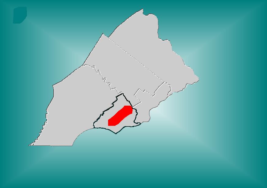
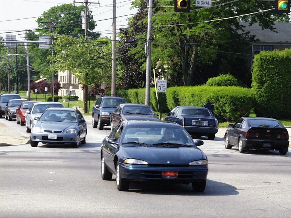
11 Pennsylvania Congestion Management System - US 1/Baltimore Pike Corridor Page 5 III. STUDY AREA DESCRIPTION The CMS study area spans the US 1/Baltimore Pike Corridor from just west of PA 452 through central Delaware County to the Philadelphia City limit. The width of the study corridor extends approximately one mile north of US 1 to approximately one mile south of Baltimore Pike and encompasses area transit lines and other related roadways. The study area includes, or is adjacent to, the following Delaware County municipalities: Aldan Borough, Aston Township, Chester Heights Borough, Clifton Heights Borough, East Lansdowne Borough, Edgmont Township, Haverford Township, Lansdowne Borough, Marple Township, Media Borough, Middleton Township, Millbourne Borough, Morton Borough, Nether Providence Township, Ridley Township, Rose Valley Borough, Springfield Township, Swarthmore Borough, Upper Darby Township, Upper Providence Township and Yeadon Borough. The study area also borders on Lower Merion Township in Montgomery County, and West and Southwest Philadelphia. Figure 1 is an outline of the transportation network in the study area. The roadway network includes all principal arterials and approximately 25 percent of the minor arterials within the study area. The CMS study focuses on east-west travel through and within the corridor, emphasizing US 1 and Baltimore Pike. The transit network for the CMS study includes all mass-transit within the study area including segments of the R3 Elwyn regional rail line, Route 101 Media trolley, Route 102 Sharon Hill trolley, and the 69 th Street terminal.
12 Page 6 Pennsylvania Congestion Management System - US 1/Baltimore Pike Corridor Page intentionally Left Blank
13
14
15 Pennsylvania Congestion Management System - US 1/Baltimore Pike Corridor Page 9 IV. HIGHWAY NETWORK EXISTING CONDITIONS Designation of Arterial Sections The study area highway network includes all principal arterials and selected minor arterials as illustrated by Figure 1. This network comprises several arterial segments which transverse the study area of approximately 74 miles of two-way roadway. For the purpose of traffic operation analysis, these arterial segments were divided into sections of roadway with similar characteristics of roadway capacity/geometry, traffic demand, and/or adjacent development. Measures of Performance Based on the results of comprehensive data analysis for each section (analysis of recorded times for each checkpoint of each travel run) and for each arterial segment as a whole, several criteria are used to gauge traffic performance. These are: Travel Time Study - For the purpose of this analysis, travel time studies were conducted to measure actual travel speeds within particular corridors and delays at intersections. Congestion and overall traffic performance of the network was measured. Travel runs were conducted by driving along study area arterial segments during the morning and afternoon peak traffic periods - emulating the behavior of median speed through traffic - and recording elapsed time at intersections, queues, and other checkpoints. The peak periods were generally considered to be from 7:00 a.m. to just past 8:30 a.m. and from 4:00 p.m. until about 6:00 p.m. Arterial segments for travel runs were less than 20-minutes in duration. As a result, at least three runs could be performed in the primary traffic direction during the morning and in each direction during the afternoon for each road segment. Typically, three runs in each direction were performed during the morning and four during the afternoon. In this manner, a representative sample of traffic conditions throughout the peak period was documented to assure that the duration of congestion and variation throughout the period was taken into account. Travel runs were conducted on Tuesday, Wednesday, and Thursday of nonholiday weeks, while school was in session, to capture typical weekday traffic conditions. In addition to the peak periods, travel runs were performed along US 1, Baltimore Pike, and State Road throughout midday to study traffic performance in the corridor's primary east-west travel direction. Level of Service (LOS) The Transportation Research Board (TRB) applies a standard which defines a LOS for arterial sections of highway based on their design characteristics, functional classification (principal or minor arterial) and measured travel speed. This LOS is useful to evaluate a given arterial section according to national standards for similar types of roads. From methodology described in the Highway Capacity Manual (Special Report 209, TRB, 1994), arterials are designated as Class I, II or III based on the free-flow speed over the arterial being traveled. The LOS is determined by the travel speed along the section and its classification. The resulting LOS is a valid indicator of traffic performance, within a range, but the method is not without its limitations; particularly because, in some cases, the choice of classification remains subjective.
16 Page 10 Pennsylvania Congestion Management System - US 1/Baltimore Pike Corridor Three evaluation models were used to calculate the LOS for roadway segments within the study area based on Highway Capacity Manual guidelines: a) Basic freeway segments, b) Multilane highways, and c)arterials. Freeway LOS criteria was used to evaluate I-476 and the segment of US 1 just west of I-476 to Baltimore Pike. The section of US 1 extending from PA 352 to the western boundary of the study area was evaluated as a multi-lane highway to determine congestion. LOS for arterials such as PA 420 and similar arterials, were also evaluated by using the Highway Capacity Manual guidelines. The levels of service for the most congested arterial sections in the AM and PM peak periods are illustrated in Figures 2 and 3 respectively. Figure 4 illustrates the level of service for the most congested arterial sections in either the AM or PM peak period. Travel Speed Average peak period travel speed throughout the CMS highway network is 25- mph. System wide, the average peak period travel speed for all non-freeway arterial segments is 22- mph; ranging from 10-mph, for northbound Lansdowne Avenue from south of Garrett Road to Bond Avenue during the morning peak, to 49-mph for Baltimore Pike west of Media to US 1. Peak period travel speed on freeways averaged 60-mph, with a range of 45-mph to 67-mph. Although travel speed alone is not a valid performance measure to establish level of service or compare unlike arterials, it is useful for identifying arterial sections with comparatively poor traffic flow. Travel Time versus Ideal Travel Time The ideal travel time for any segment is taken as the time it would take the typical driver (or at least typical for peak hour drivers wishing to travel as fast as conditions permit) to drive the segment as if there were no non-permanent impediments to traffic flow, such as red-lights, turning and slow vehicles, or school zones. Thus, the ideal travel time is simply the time it would take to drive a segment at the average free-flow speed. The free-flow speed for each arterial segment or section is calculated by averaging observed free-flow speeds noted for links during the travel runs. It should be noted that the designation of free-flow speed is not necessarily a goal but serves as a benchmark by which the effect of traffic congestion and operational deficiencies can be gauged. The concept of travel speed versus free-flow speed forms the basis for the level of service measure previously presented. However, since free-flow speeds were actually recorded in the field, a straightforward comparison of travel time, speed versus freeflow time or speed, is less subjective and more precise than level of service. Throughout the network as a whole, average peak period travel speed was 56 percent of ideal travel speed. The ten arterial sections having the lowest measured peak period travel speed, as compared to estimated ideal travel speed, are listed in Table 1.
17
18
19
20
21
22
23 Pennsylvania Congestion Management System - US 1/Baltimore Pike Corridor Page 17 Table 1 below shows the worst performing arterial sections in the peak periods both in terms of levels of service as well as travel speed. TABLE 1 10 Worst Performing Arterial Sections Based on Peak Period Travel Speed as Percentage of Ideal Speed Arterial Section Peak Period Average Travel Speed (mph) Ideal* Speed (mph) Travel Speed as Percentage of Ideal Speed AM Peak LOS PM Peak LOS Midday LOS 1. NB Lansdowne Ave from south of Garrett Rd to Bond Ave 2. WB PA 3 from 62nd St to Garrett Rd 3. EB PA 3 from Garrett Road to 62nd St 4. WB US 1 from Dermond Road to PA 320 underpass 5. WB Baltimore Pike from Beatty Rd to Brook St (through Media) 6. EB PA 3 from Lansdowne Ave to Garrett Rd 7. SB Lansdowne Ave from Manoa Road to Bond Ave 8. EB Springfield Rd from PA 320 to Bishop Ave 9. WB PA 3 from Lansdowne Ave to Glendale Rd 10. SB Lansdowne Ave from Bond Ave to south of Garrett Road AM % E D - PM % D E - AM % E E - AM % D C A PM % D E D AM % E D - PM % E E - PM % D E - AM % D C - PM % D E - * Ideal Travel Speed for any segment is taken as the travel time it would take the typical driver to drive the segment if there were no non-permanent impediments to traffic flow such as red-lights, turning and slow vehicles, or school zones.
24 Page 18 Pennsylvania Congestion Management System - US 1/Baltimore Pike Corridor Page Intentionally Left Blank
25 Pennsylvania Congestion Management System - US 1/Baltimore Pike Corridor Page 19 V. MOST CONGESTED SUBCORRIDORS The most congested subcorridors within the study area were analyzed, and recommendations were made regarding the policies and actions necessary to have an impact in reducing congestion. These subcorridors encompasses several of the most congested arterial segments identified in Table 1. The following is an analysis of the subcorridors identified; they are listed generally from west to east as they appear in the study area. 1. US 1 from Baltimore Pike to PA 452 Existing Conditions Traffic along this segment of highway is impeded by five different elements. Because of the short distance between each impediment, the cumulative impact has resulted in an exaggerated condition which needs to be addressed by a comprehensive solution. Congestion is first impacted by the intersection of US 1 and PA 452 and this is characterized by heavy flow from PA 452 and US 1. This is also the area where US 1 transitions from a high speed highway to a suburban arterial. Just to the east of this intersection is Granite Run Mall and a series of retail outlets with numerous curb cuts. East of this second segment is the grade separated interchange between US 1 and PA 352 which, with almost non-existent acceleration/deceleration lanes, does not meet current design standards. At the easternmost end of this segment is the Baltimore Pike/US 1 interchange. This is at the terminus of the US 1 Media bypass. There are weaving problems associated with traffic traveling from PA 352 to US 1/Baltimore Pike due to short on/off ramps. Finally, entering this area, westbound traffic on US 1 is delayed because of the problems described above. The congestion at the PA 452/US 1 intersection is described in greater detail in the intersection analysis section. Recommended Improvements Middletown Township is studying improvements to the PA 452/US 1 intersection. There are two Transportation Improvement Program (TIP) projects: one for intersection design, the other for signal coordination. What is needed is a corridor-wide analysis which is outlined below. a. A multi-modal transportation plan for the corridor should be developed to define the needs and deficiencies, identify alternative improvement options and funding sources, and continue developing a local consensus on what needs to be done. b. Alternatives that should be examined should include: S Widening the highway from PA 452 to Baltimore Pike from four to six lanes. S Reconfigure the PA 352/US 1 and Baltimore Pike/US 1 interchanges. S Increase capacity at the US 1/PA 452 intersection. S Improve signal coordination along the corridor. S Improve access management to commercial/retail uses along the highway. S Integrating transit, bicycles and walking as potential design elements in the above alternatives.
26 Page 20 Pennsylvania Congestion Management System - US 1/Baltimore Pike Corridor 2. Baltimore Pike from US 1 to PA 252 Existing Conditions While the larger subcorridor extends from US 1 to approximately PA 252, the boundaries encompassing the most congested segment extends from Beatty Road in the east to Lemon Street in the west. There are 8 traffic signals within this two mile section of Baltimore Pike in Media. The character of this area is that of a CBD with many short turn lanes, one travel lane in each direction, on-street parking, and vehicles exiting parking lots. Travel time surveys showed that the most congested area was at the intersection of PA 252 and Baltimore Pike which was rated as the 14 th most congested intersection in the corridor. Other intersections that consistently showed modest congestion were found at Jackson, Monroe, and Olive Streets. Recommended Improvements a. Implement intersection improvements to PA 252 and Baltimore Pike as described in the intersection improvement section. b. Conduct a parking study along Baltimore Pike in Media to examine the feasibility of reducing on-street parking or consolidate parking to locations which will minimize interference with traffic flow, and time restrictions for on-street parking. We recognize this as being a viable commercial district and as such, on street parking is essential. However, parking should be rationalized so as not to impede access to the business area. c. If the parking problem is not successfully addressed, then additional improvements such as traffic signal improvements and the addition of left turn lanes should be considered. 3. Baltimore Pike from Church Lane to Springfield Road Existing Conditions This segment of highway experiences long delays in places due partly to impedance from on-street parking as well as delays at major intersections. There are 12 signalized intersections between Church Lane and Springfield Road. With the exception of major intersections, left turn lanes are absent at most signalized intersections particularly at the eastern end of this segment. Left turning vehicles, in effect, restricts through traffic to one lane. This section of Baltimore Pike also has metered parking on both sides of the street - most of which are not utilized. Recommended Improvements a. Better signal coordination along Baltimore Pike from its intersection with Church Lane to Springfield Road. This is being addressed in the current TIP.
27 Pennsylvania Congestion Management System - US 1/Baltimore Pike Corridor Page 21 b. Restrict on-street parking to one side of the street so as to secure an additional travel lane for through traffic. This should be implemented primarily between Church Lane and 4 th Street where only approximately 50 percent of the parking spaces are utilized. A special effort should be made to consolidate on-street parking in the vicinity of retail establishments. c. Install protected left turn signals at all signalized intersections to reduce congestion at intersections. 4. I-476 (Blue Route) from PA 3 to MacDade Boulevard Existing Conditions This is a 4-lane interstate within the study area. The speeds are generally constant except for the interchanges at Baltimore Pike and US 1 where traffic slows considerably. Generally, traffic at this location operates at the E/F level of service. Congestion at the interchange with I-95 has resulted in southbound traffic spilling back on to the Blue Route, resulting in congestion upstream. Recommended Improvements a. Pennsylvania Department of Transportation has installed ramp metering at all access ramps. As the equipment is activated, it should be monitored to see if it addresses congestion deficiencies. b. Although the I-95 interchange is outside the study area, it is recognized that it is a cause for back-ups on the Blue Route. A study should be done to address capacity constraints at the interchange with the Blue Route and I-95. c. If improvements resulting from a. and b. above do not adequately address congestion problems, a study should be done to determine the feasibility of adding one additional lane in each direction to relieve congestion. 5. PA 420 from MacDade Blvd to Baltimore Pike Existing Conditions PA 420 is a heavily-traveled corridor with very high volumes in comparison to the rest of the study area. Delays are caused by lack of capacity, long traffic signal cycle lengths and lack of coordination with adjacent signals. The R3 Regional Rail line at-grade crossing causes significant delays in the peak periods on both the northern and southern segments of PA 420. Delays are compounded when a train enters or leaves the station which results in delays on the affected roads. Additional analysis of the key intersections within this segment can be found in the congested intersections section of this report.
28 Page 22 Pennsylvania Congestion Management System - US 1/Baltimore Pike Corridor Recommended Improvements. a. Improve signal coordination to move traffic efficiently along PA 420. Traffic signals at the MacDade Boulevard intersection should be coordinated with the signals at Academy Avenue. The traffic signals north of Morton Avenue to Baltimore Pike should be coordinated with the signals at Baltimore Pike. The signal timing at Morton Avenue is dependent on train movement. b. Widen PA 420 north of MacDade Boulevard to Academy Avenue, to two through lanes in each direction. This would allow traffic to clear the PA 420/MacDade Boulevard intersection quickly due to the added capacity. Right-of-way could be obtained from the fringes of the vacant parking lot at the northeast quadrant and the open lot at the northwest quadrant. c. Improvements to the intersection of PA 420 and Green Briar Lane will have a corresponding positive impact to the traffic flow to and from Baltimore Pike. The left turn lane unto Green Briar Lane should be eliminated. Subsequently, left turn movements should be prevented. Traffic will be permitted to make a left turn one block to the south at Eaton Road. At this intersection, a left turn lane should be constructed. 6. PA 3 from Lansdowne Avenue/Darby Road (Haverford,Upper Darby) to 69 th Street Terminal Existing Conditions There is heavy east-west traffic flow along PA 3 in both AM and PM peak periods. A maximum of three through lanes and one left turn lane exist on eastbound PA 3. While westbound, there are generally two through lanes and one left turn lane at most intersections. At the easternmost end near the 69 th Street terminal, the corridor is congested primarily due to numerous intersections close together, and high traffic volumes. Poor signal timing and coordination are currently being addressed by PennDOT. Additional analysis of the major intersections within this segment is in the Most Congested Intersection section of this report. Recommended Improvements. a. Improve signal coordination along PA 3. Currently, signals within the corridor extending along PA 3 from 69 th Street to Brighton Avenue are being upgraded. These include intersections at Leighton Terrace, State Road, Pennock Avenue, Carol Boulevard, Cedar Lane, Windsor Avenue, Lynn Boulevard, and Linden Avenue. The new signals should be coordinated once they are on line. b. Enforce on-street parking restrictions within 30 feet of signalized intersections along PA 3 between 69 th Street and US 1. On-street parking should be prohibited before 10:00 am in the direction of peak traffic flow in high traffic commercial areas along PA 3, Garrett Road, and 69 th Street. This would provide an additional travel lane and minimize conflict between through traffic and parked cars. c. Install overhead destination signs along PA 3 primarily at major intersections such as 69 th
29 Pennsylvania Congestion Management System - US 1/Baltimore Pike Corridor Page 23 Street, Garrett Road/Cardington Avenue, State Road, US 1 and Lansdowne Avenue. These signs are necessary to guide traffic along a route or towards a destination. At this location, traffic volume is at or near capacity during the AM and PM peaks; sight distance is restricted; there is insufficient space for ground signs; and there is a background of street lighting which obscures less prominent signs. 7. Lansdowne Avenue from Baltimore Pike to Garrett Road Existing Conditions This segment of highway is characterized by numerous signalized intersections with left turning traffic. Traffic is primarily along one through lane in each direction. During the AM and PM peak periods, through traffic is restricted by left turning traffic from Lansdowne Avenue to the intersecting streets. Where there are seven signalized intersections within this segment, not all have signalized left turn lanes. The result is long queues at intersections where there are no left turning lanes. There is an absence of signal progression which, when combined with the absence of left turn signals, result in slow peak period travel speeds. Recommended Improvements a. Install left turn lanes and protected phasing left turn signals at all signalized intersections to reduce congestion. b. Improve signal progression along this segment of Lansdowne Avenue. Signal timing should be responsive to peak traffic flow patterns.
30 Page 24 Pennsylvania Congestion Management System - US 1/Baltimore Pike Corridor Page Intentionally Left Blank
31 Pennsylvania Congestion Management System - US 1/Baltimore Pike Corridor Page 25 VI. MOST CONGESTED INTERSECTIONS AND RECOMMENDED IMPROVEMENTS The major intersections within the corridor were evaluated and a total of 25 experienced 70 or more seconds of delay which is considered failure. The 14 most congested intersections with 88 or more seconds of delay were evaluated in an effort to determine the order of magnitude of delays that occurred. Table 2 below ranks the congestion experienced at these intersections in seconds of delay experienced in AM and PM peak periods. TABLE 2 Top 14 Worst Performing Intersections Based on Peak Period Delays Intersection Direction Peak Period Delay in Seconds 1. US 1 at Springfield Road (approach leg) US 1 at Springfield Road US 1 at Springfield Road (approach leg) US 1 at Springfield Road WB WB WB EB AM AM PM PM Springfield Road at Bishop Ave. EB PM US 1 at PA 452 PA 452 at US 1 EB SB PM PM Baltimore Pike at Church Lane Baltimore Pike at Church Lane EB WB PM PM PA 420 at Morton Ave SB PM PA 3 at Eagle Rd. WB AM PA 3 at 69 TH Street WB PM State Road at PA 3 WB PM US 1 at Burmont Road US 1 at Burmont Road EB EB AM PM Garrett Road at PA 3 EB AM PA 420 at MacDade Blvd. NB PM Garrett Road at Lansdowne Ave WB PM Lansdowne Ave at State Road State Road at Lansdowne Ave NB WB AM AM Baltimore Pike at PA 252 WB PM 88
32 Page 26 Pennsylvania Congestion Management System - US 1/Baltimore Pike Corridor An analysis was done of the 14 most congested intersections to identify improvement strategies. At a few of these intersections (PA 3 at Eagle Road, US 1 at Burmont Road, and PA 452 at US 1), no practical solutions were arrived at that would have a significant impact on reducing congestion. The following is a description of the most congested intersections, and the recommended measures to alleviate current and future congestion. I. US 1 at Springfield Road (Springfield Township) Existing Conditions Excessive traffic volumes on all approaches lead to delays at this intersection. On Springfield Road, there is one through lane and one left turn lane in both directions. Approaching US 1, Springfield Road has a right-of-way width of 36 feet and a posted speed limit of 35 miles per hour. On US 1, there are two through lanes, one left turn and one right turn lane in both directions. More than 219 seconds of delay is experienced on US 1 westbound in the AM peak. During the PM peak, US 1 is congested in both directions. Heavy turning movements are observed from US 1 to Springfield Road southbound and from Springfield Road northbound to US 1 east and west. Recommended Improvements. a. Extend the left turn lane on Springfield Road south of US 1 to accommodate left turn volumes. However, operational improvements alone will not result in a significant reduction in delays. b. Long term solution could include making the intersection a grade separated interchange by depressing US 1. This would necessitate widening US 1 and Springfield Road to accommodate access ramps similar to what exists at the adjacent intersection of US 1 and PA Springfield Road at Bishop Avenue (Springfield Township) Existing Conditions The intersection of Springfield Road with Bishop Avenue is frequently congested and is above capacity for much of the PM peak period. Both eastbound and westbound Springfield Road is extremely congested due to excess volumes with eastbound PM traffic being the worst. Heavy volumes also exists on westbound Bishop Avenue in the PM. Recommended Improvements a. Install left turn signals at Springfield Road. These are already in place on Bishop Avenue. This will prevent through traffic from being delayed behind left turning traffic. b. Upgrade traffic controller to permit exclusive left turns and overlap phasing. 3. US 1 at PA 452 (Middletown Township)
33 Pennsylvania Congestion Management System - US 1/Baltimore Pike Corridor Page 27 Existing Conditions This intersection has left turn lanes and left turn signals at all approaches. One through lane exists on PA 452 (Pennell Road) in each direction north and south of US 1. AM traffic on PA 452 is heavier from the south. The intersection with US 1 is beyond capacity for critical movements for most of the time during the peak periods. Congestion is most severe in the westbound AM peak and eastbound PM peak. Northbound traffic on PA 452 turning left to westbound US 1, experiences delays leading to long queuing. Northbound traffic from PA 452 to eastbound US 1 clears the intersection easily via a channelized right turn lane. Extensive delays exists on US 1 in both directions during the peak periods. Recommended Improvements Because of the severe congestion which exists along US 1 from points just west of PA 452 to the interchange with Baltimore Pike, it is recommended that a need and feasibility study be conducted for this sub-corridor. Among the options the study would examine are: a. Constructing a double left turn lane from US 1 to PA 452 south. b. Improve the interchange between PA 352 and US 1 with longer auxiliary lanes. There is a TIP funded study for this location. c. Widening approaches to and from US 1 at Baltimore Pike. 4. Baltimore Pike at Church Lane (East Lansdowne Borough) Existing Conditions This intersection is beyond capacity particularly in the PM peak period resulting in long delays. Traffic is heavy on Church Lane as it approaches Baltimore Pike. At this intersection, left turn lanes exists only from Church Lane to Baltimore Pike. Retail/commercial uses at three of the four corners of this intersection contributes to the congestion. Recommended Improvements a. Protected left turning phase from Baltimore Pike to north- and southbound Church Lane. This is essential to facilitate the heavy left turn movements onto Church Lane. 5. PA 420 at Morton Avenue (Morton Borough) Existing Conditions PA 420 is a heavily-traveled corridor with very high volumes in comparison to the rest of the study area. The R3 Regional Rail line at-grade crossing causes significant delays in the peak periods on both the northern and southern segments of PA 420. Delays are compounded when a train enters or leaves the station. Crossing gates at PA 420 remain down whenever an eastbound train is in the station which results in delays on the affected roads.
34 Page 28 Pennsylvania Congestion Management System - US 1/Baltimore Pike Corridor Recommended Improvements. a. The westbound train should stop further west away from the intersection with PA 420. This would permit the train to enter the station at a greater rate of speed and therefore minimize the time the railroad crossing gates are down on PA 420. As an extra benefit, this would also bring the train closer to the 100 space commuter parking lot on Church Road. The feasibility of keeping the railroad crossing gates up once the train is in the station should also be considered. b. Realign the intersection of Morton and Taylor Avenues at PA 420 to minimize conflicting vehicular movements. 6. PA 3 at Eagle Road (Haverford Township) Existing Conditions This intersection fails due to heavy volumes on all four legs. PA 3 is a major route for commuters entering and leaving the City of Philadelphia. Eagle Road is a connector between US 1 in the south and Darby Road in the north. There are two through lanes and one protected left turn lane on both PA 3 approaches to this intersection. Eagle Road has one through, one left turn, and one right turn lane from the north, and one through and one left turn lane from the south. Both left turn lanes are protected. The traffic signals at this intersection are all optimized. The adjacent land use is retail with no available vacant land. Recommended Improvements. a. Congestion will not be alleviated significantly with minor improvements such as changes in signal timing due to excess volumes. Substantial capital outlay and property takings will be necessary in order to effectuate major congestion relief. The incremental reduction in congestion could not justify the negative economic impact of condemning property at this location in order to widen the intersection. 7. PA 3 at 69 th Street Terminal (Upper Darby Township ) Existing Conditions The 69 th Street terminal area is geometrically complex, with complicated signal patterns and long cycle lengths. Traffic flow is exacerbated by: operations of trolleys and buses; on-street parking; retail activity; turning movements; poor signal timing; poor signal coordination; and heavy through volumes. Maximum delay occurs westbound during the PM peak period.
35 Pennsylvania Congestion Management System - US 1/Baltimore Pike Corridor Page 29 Recommended Improvements. Because this intersection is in a built-out urban setting, major infrastructure improvements to alleviate congestion would be very costly and is beyond the scope of this study. The following are a series of low cost alternatives which could have a positive impact on congestion reduction in the short term. [See also recommendations for PA 3 at Garrett Road (#10)] a. A one hour time limit should be instituted for on-street parking in high traffic commercial areas along PA 3, Garrett Road and 69 th Street to minimize long term parking. b. Enforce No Parking Zones along PA 3, between Garrett Road and 69 th Street. c. Install prominent street name signs at the major streets near the terminal (69 th Street, PA 3, Garrett Road and Cardington Avenue) which will aid in alleviating congestion as well as improving safety by providing clear directions to drivers unfamiliar with the area. 8. State Road at PA 3 (Upper Darby Township ) Existing Conditions There is heavy east-west traffic flow along PA 3 in both AM and PM peak periods. There are three through lanes and one left turn lane on eastbound PA 3. Westbound, there are two through lanes and one left turn lane. Northbound State Road has one through lane, one left turn, and one right turn lane. The right turn lane has a short stacking capacity with storage for approximately 2 cars, which is often blocked by through traffic. Recommended Improvements a. Extend right turn lane on State Road south of PA 3 by approximately 30 feet to permit better stacking and a smoother transition. b. Improve turn radius for traffic turning from PA 3 eastbound to State Road south. This may involve acquiring right-of-way adjacent to the southbound lane where a Burger King restaurant is located. This is expected to have only a minor impact on its operations. 9. US 1 at Burmont Road (Upper Darby Township ) Existing Conditions The heaviest volumes at this intersection are experienced by traffic traveling east on US 1 in both the AM and PM peaks. US 1 has two through lanes and one left turn lane in both direction. Burmont Road has one through lane and one left turn lane approaching the intersection from both directions. All four quadrants of this intersection are built-out. Three of the four contain retail establishments, and the fourth contains a church.
36 Page 30 Pennsylvania Congestion Management System - US 1/Baltimore Pike Corridor Recommended Improvements Congestion will not be alleviated significantly with minor improvements to this intersection. Expansion to include additional travel lanes on US 1 to accommodate the heavy volumes is needed. This would require substantial capital outlay and property takings which might not be practical at this time. 10. PA 3 at Garrett Road (Upper Darby Township ) Existing Conditions Heavy volumes and complex geometry of intersecting streets have severely reduced travel speed at this intersection. Buses and trolleys entering and leaving the 69 th Street Terminal at frequent intervals have resulted in long cycle lengths at this intersection. Recommended Improvements. Improvement at this intersection should be coordinated with signal upgrade work underway along the PA 3 corridor. [See recommendations for PA 3 at 69 th Street Terminal (#7)] a. Reduce on-street parking at or near the intersection so as not to impede traffic flow. 11. PA 420 at MacDade Blvd (Ridley Township ) Existing Conditions Delays caused by lack of capacity, long traffic signal cycle lengths, and lack of coordination with adjacent signals. There is heavy through movement on PA 420. MacDade westbound left onto PA 420 southbound also experiences heavy traffic. The signals at this intersection are actuated but are not fully responsive. Recommended Improvements. a. On northbound PA 420, the stop bar for the left turn lane onto MacDade Boulevard should be set back from the intersection to accommodate turning vehicles from MacDade Boulevard. b. Optimize traffic signal to maximize traffic flow through the intersection. Signal timing appears not to be responsive to peak traffic flow. Signals should be reprogrammed to respond to changing conditions. c. Coordinate traffic signals at the intersections of PA 420/MacDade Boulevard and at PA 420/Academy Avenue.
37 Pennsylvania Congestion Management System - US 1/Baltimore Pike Corridor Page Garrett Road at Lansdowne Avenue (Upper Darby Township ) Existing Conditions The AM peak is impacted by northbound traffic on Lansdowne Avenue to Upper Darby High School, Monsignor Bonner High School, Archbishop Prendergast High School and Delaware County Hospital, all located between Garrett Road and State Road. The presence of a trolley station at the northwest corner of the intersection further contributes to congestion. Trolley passengers traverse Lansdowne Avenue to and from the station to access the schools as well as the hospital. PM peak traffic flow on Lansdowne is particularly heavy southbound between State Road and Garrett Road. This is exacerbated by heavy pedestrian activity at the end of the school day. Recommended Improvements. a. Relocate trolley station east of its current location east of Lansdowne Avenue to minimize pedestrian conflict at the intersection. This may require obtaining a sliver of land from Monseigneur Bonner/Archbishop Prendergast High School to accommodate the trolley station. This would improve pedestrian safety by minimizing the number of pedestrians entering the intersection. PennDOT will be conducting a traffic study along the 101/102 trunk line which will in part, examine the impact of the trolleys on this intersection. 13. Lansdowne Avenue at State Road (Upper Darby Township) Existing Conditions This intersection experiences delays caused by excess volumes on both roads. School traffic, both vehicular and pedestrian, on Lansdowne Avenue results in long delays especially in AM peak on all approaches. Recommended Improvements. a. Congestion will not be alleviated significantly with minor improvements such as changes in signal timing due to excess volumes. Substantial capital outlay and property takings will be necessary in order to effectuate major congestion relief. The incremental reduction in congestion could not justify the negative economic impact of condemning property at this location in order to widen the intersection.
38 Page 32 Pennsylvania Congestion Management System - US 1/Baltimore Pike Corridor 14. Baltimore Pike at PA 252 (Media Borough) Existing Conditions Westbound PM peak travel at this intersection experiences significant delays due to heavy volumes. Train movements along the Route 101 Media trolley causes delays at the intersection of State Street to the north on PA 252 which spills back to Baltimore Pike. Because there is only one left turning lane on southbound PA 252, traffic making a left turn to the shopping center frequently impedes traffic making a left onto eastbound Baltimore Pike. Recommended Improvements a. Widen or re-stripe PA 252 from Baltimore Pike to just north of State Street to accommodate an additional left turn lane to eastbound Baltimore Pike. b. Extend PA 252 left turn lane south of Baltimore Pike to permit additional storage for left turning traffic. c. Coordinate signals at the intersections of PA 252 and Baltimore Pike, and PA 252 and State Street.
39 Pennsylvania Congestion Management System - US 1/Baltimore Pike Corridor Page 33 TABLE 3 Summary of Highway Strategies - Corridor Improvements Location Signal Coord. Road Widening/ Reconfig. Further Study Grade Separation Over long Term Signal Timing Parking Restrict. Study Transit Imprvmt. Improve Directional Signage Left Turn Lanes Left Turn Signals 1. US 1 at Springfield X X X 2. Springfield at Bishop X X X 3. US 1 at PA 452 X X X 4. Balt. Pk. at Church X X 5. PA 420 at Morton X X X 6. PA 3 at Eagle Road 7. PA 3 at 69 th St. X X X 8.State Rd. at PA 3 X 9. US 1 at Burmont Road 10. Garrett Rd. at PA 3 X 11. PA 420 at MacDade X X X 12. Garrett at Lansdowne X 13. Lansdowne at State 14. Balt. Pk at PA 252 X X X X X
Executive Summary Route 30 Corridor Master Plan
 Route Corridor Master Plan Project Overview The Route Corridor Master Plan is a coordinated multimodal transportation and land use plan for the entire stretch of Route through East Whiteland Township,
Chapter 4 Traffic Analysis
 Chapter 4 Traffic Analysis PURPOSE The traffic analysis component of the K-68 Corridor Management Plan incorporates information on the existing transportation network, such as traffic volumes and intersection
Operational Comparison of Transit Signal Priority Strategies
 Operational Comparison of Transit Signal Priority Strategies Revision Submitted on: November, 0 Author: Adriana Rodriguez, E.I Assistant Engineer Parsons Brinckerhoff 0 South Orange Avenue, Suite 00 Orlando,
APPENDIX E: Transportation Technical Report
 New Jersey Pennsylvania Lackawanna Cut-Off Passenger Rail Service Reston Project Environmental Assessment APPENDIX E: Transportation Technical Report E.1 Introduction As part of the overall environmental
TRAFFIC IMPACT STUDY COMPREHENSIVE UPDATE TOWN OF THOMPSON S STATION, TENNESSEE PREPARED FOR: THE TOWN OF THOMPSON S STATION
 TRAFFIC IMPACT STUDY COMPREHENSIVE UPDATE TOWN OF THOMPSON S STATION, TENNESSEE PREPARED FOR: THE TOWN OF THOMPSON S STATION Transportation Consultants, LLC 1101 17 TH AVENUE SOUTH NASHVILLE, TN 37212
Traffic Impact Analysis Chatham County Grocery Chatham County, NC
 Chatham County Grocery Chatham County, NC TABLE OF CONTENTS 1. INTRODUCTION... 1 1.1. Location and Study Area... 1 1.2. Proposed Land Use and Access... 2 1.3. Adjacent Land Uses... 2 1.4. Existing ways...
4. ENVIRONMENTAL IMPACT ANALYSIS 9. TRANSPORTATION AND TRAFFIC
 4. ENVIRONMENTAL IMPACT ANALYSIS 9. TRANSPORTATION AND TRAFFIC 4.9.1 INTRODUCTION The following section addresses the Proposed Project s impact on transportation and traffic based on the Traffic Study
ROUTES 55 / 42 / 676 BUS RAPID TRANSIT LOCALLY PREFERRED ALTERNATIVE
 ROUTES 55 / 42 / 676 BUS RAPID TRANSIT LOCALLY PREFERRED ALTERNATIVE April, 2012 1 INTRODUCTION The need for transit service improvements in the Routes 42/55/676 corridor was identified during the Southern
Highway 49, Highway 351 and Highway 91 Improvements Feasibility Study Craighead County
 Highway 49, Highway 351 and Highway 91 Improvements Feasibility Study Craighead County Executive Summary March 2015 Highway 49, Highway 351 and Highway 91 Improvements Feasibility Study Craighead County
M-58 HIGHWAY ACCESS MANAGEMENT STUDY Mullen Road to Bel-Ray Boulevard. Prepared for CITY OF BELTON. May 2016
 M-58 HIGHWAY ACCESS MANAGEMENT STUDY Prepared for CITY OF BELTON By May 2016 Introduction Missouri State Highway 58 (M-58 Highway) is a major commercial corridor in the City of Belton. As development has
7.0 FREEWAYS CONGESTION HOT SPOT PROBLEM & IMPROVEMENT PROJECT ANALYSIS & DEFINITION
 7.0 FREEWAYS CONGESTION HOT SPOT PROBLEM & IMPROVEMENT PROJECT ANALYSIS & DEFINITION 7.1 INTRODUCTION & METHODOLOGY FEASIBILITY REPORT Congestion hot spot problem locations have been assessed using the
Regional Transportation Needs Within Southeastern Wisconsin
 Regional Transportation Needs Within Southeastern Wisconsin #118274 May 24, 2006 1 Introduction The Southeastern Wisconsin Regional Planning Commission (SEWRPC) is the official areawide planning agency
Appendix C. NORTH METRO STATION AREA TRAFFIC IMPACT STATEMENT 88th Avenue Station
 Appendix C NORTH METRO STATION AREA TRAFFIC IMPACT STATEMENT 88th Avenue Station Prepared for: Regional Transportation Department and URS Corporation as part of the North Metro EIS David Evans and Associates,
Harrah s Station Square Casino
 Transportation Analysis Harrah s Station Square Casino Pittsburgh, Pennsylvania Submitted To: City of Pittsburgh and Pennsylvania Gaming Control Board Prepared By: DKS Associates GAI Consultants December
Figure 1: Vicinity Map of the Study Area
 ARIZONA TEXAS NEW MEXICO OKLAHOMA May 5, 2016 Mr. Anthony Beach, P.E. BSP Engineers 4800 Lakewood Drive, Suite 4 Waco, Texas 76710 Re: Intersection and Access Analysis along Business 190 in Copperas Cove
5858 N COLLEGE, LLC N College Avenue Traffic Impact Study
 5858 N COLLEGE, LLC nue Traffic Impact Study August 22, 2016 Contents Traffic Impact Study Page Preparer Qualifications... 1 Introduction... 2 Existing Roadway Conditions... 5 Existing Traffic Conditions...
Traffic Circulation Study for Neighborhood Southwest of Mockingbird Lane and Airline Road, Highland Park, Texas
 ARIZONA TEXAS NEW MEXICO OKLAHOMA February 13, 2015 Mr. Meran Dadgostar P.E., R.S. Town of Highland Park 4700 Drexel Dr. Highland Park, Texas 75205 Re: Traffic Circulation Study for Neighborhood Southwest
TRANSPORTATION ANALYSIS REPORT US Route 6 Huron, Erie County, Ohio
 TRANSPORTATION ANALYSIS REPORT US Route 6 Huron, Erie County, Ohio December 12, 2012 Prepared for: The City of Huron 417 Main Huron, OH 44839 Providing Practical Experience Technical Excellence and Client
Transportation Impact Study for Abington Terrace
 Transportation Impact Study for Abington Terrace Abington Township, Montgomery County, PA Sandy A. Koza, P.E., PTOE PA PE License Number PE059911 Prepared by McMahon Associates, Inc. 425 Commerce Drive,
JONESBORO HIGHWAY 63 HIGHWAY 18 CONNECTOR STUDY
 JONESBORO HIGHWAY 63 HIGHWAY 18 CONNECTOR STUDY Craighead County May 2007 JONESBORO HIGHWAY 63 HIGHWAY 18 CONNECTOR STUDY Craighead County May 2007 Prepared by Planning and Research Division Arkansas State
City of Wayzata Comprehensive Plan 2030 Transportation Chapter: Appendix A
 A1. Functional Classification Table A-1 illustrates the Metropolitan Council s detailed criteria established for the functional classification of roadways within the Twin Cities Metropolitan Area. Table
MoPac South: Impact on Cesar Chavez Street and the Downtown Network
 MoPac South: Impact on Cesar Chavez Street and the Downtown Network Prepared by: The University of Texas at Austin Center for Transportation Research Prepared for: Central Texas Regional Mobility Authority
TRAFFIC IMPACT ANALYSIS
 TRAFFIC IMPACT ANALYSIS FOR THE CHAMPAIGN UNIT#4 SCHOOL DISTRICT PROPOSED HIGH SCHOOL (SPALDING PARK SITE) IN THE CITY OF CHAMPAIGN Final Report Champaign Urbana Urbanized Area Transportation Study 6/24/2014
Recommended Roadway Plan Section 2 - Land Development and Roadway Access
 Recommended Roadway Plan Section 2 - Land Development and Roadway Access SECTION 2 Land Development and Roadway Access 2.1 Land Use and Access Management The Federal Highway Administration (FHWA) defines
ARTINSVILLE ENRY OUNTY REA RANSPORTATION TUDY
 ARTINSVILLE ENRY OUNTY REA RANSPORTATION TUDY DEVELOPED BY THE TRANSPORTATION AND MOBILITY PLANNING DIVISION OF THE VIRGINIA DEPARTMENT OF TRANSPORTATION IN COOPERATION WITH THE U.S. DEPARTMENT OF TRANSPORTATION,
Traffic Impact Study. Westlake Elementary School Westlake, Ohio. TMS Engineers, Inc. June 5, 2017
 TMS Engineers, Inc. Traffic Impact Study Westlake Elementary School Westlake, Ohio June 5, 2017 Prepared for: Westlake City Schools - Board of Education 27200 Hilliard Boulevard Westlake, OH 44145 TRAFFIC
i TABLE OF CONTENTS Executive Summary 01 Chapter 1 Introduction 03 Chapter 2 Roadway and Traffic Characteristics 04 Chapter 3 Traffic Safety 09
 Created in 1965, the Delaware Valley Regional Planning Commission (DVRPC) is an interstate, intercounty and intercity agency that provides continuing, comprehensive and coordinated planning to shape a
#!! "$% ##! &! # '#! % $ #!
 Executive Summary US Highway 16 (US 16) is the primary corridor connecting Rapid City to the Black Hills region. It serves a growing population of commercial and residential traffic, as well as seasonal
PRELIMINARY DRAFT WADDLE ROAD / I-99 INTERCHANGE PROJECT ALTERNATIVE ANALYSIS FINAL TRAFFIC SUMMARY REPORT
 PRELIMINARY DRAFT WADDLE ROAD / I-99 INTERCHANGE PROJECT ALTERNATIVE ANALYSIS FINAL TRAFFIC SUMMARY REPORT Prepared by: In Association with: November 2013 EXECUTIVE SUMMARY Patton Township, in partnership
State Street Transit Signal Priority Study
 State Street Transit Signal Priority Study April 2015 The Delaware Valley Regional Planning Commission is dedicated to uniting the region s elected officials, planning professionals, and the public with
METHODOLOGY. Signalized Intersection Average Control Delay (sec/veh)
") Chapter 5 Traffic Analysis 5.1 SUMMARY US /West 6 th Street assumes a unique role in the Lawrence Douglas County transportation system. This principal arterial street currently conveys commuter traffic
Chapter 5 Traffic Analysis 5.1 SUMMARY US /West 6 th Street assumes a unique role in the Lawrence Douglas County transportation system. This principal arterial street currently conveys commuter traffic
Highway 217 Corridor Study. Phase I Overview Report
 Highway 217 Corridor Study Phase I Overview Report November 3, 24 BACKGROUND AND OVERVIEW Study purpose The Highway 217 Corridor Study is developing multi-modal transportation solutions for traffic problems
Donahue Drive Corridor Traffic Operational Evaluation
 Donahue Drive Corridor Traffic Operational Evaluation PREPARED FOR: THE CITY OF AUBURN PREPARED BY: JANUARY 2007 Donahue Drive Corridor Study--Auburn, Alabama TABLE OF CONTENTS Introduction... 1 Background
University Hill Transportation Study Technical Memorandum Alternatives Modeling and Analysis May 2007
 Technical Memorandum May 2007 Syracuse Metropolitan Transportation Council Edwards and Kelcey with Wallace Roberts and Todd Alta Planning and Design CONTENTS SECTION ONE- INTRODUCTION...1 SECTION TWO-
Congestion Management Report
 Congestion Management Report F.E. EVERETT TURNPIKE (NORTH), MERRIMACK Segment Length: 7.0 miles Daily Traffic Volumes: 60,000-69,000 Analysis Period: May 2015 Number of Traffic Signals: 0 Number of travel
Glenn Avenue Corridor Traffic Operational Evaluation
 Glenn Avenue Corridor Traffic Operational Evaluation PREPARED FOR: THE CITY OF AUBURN PREPARED BY: DECEMBER 2007 Glenn Avenue Corridor Study--Auburn, Alabama TABLE OF CONTENTS Introduction... 1 Background
Southwest Bus Rapid Transit (SW BRT) Functional Planning Study - Executive Summary January 19 LPT ATTACHMENT 2.
 Functional Planning Study - Executive Summary January 19 LPT ATTACHMENT 2.") Southwest Bus Rapid Transit (SW BRT) Functional Planning Study - Executive Summary 2011 January 19 1 of 19 Introduction This executive summary presents the results of the Southwest Bus Rapid Transit (SW
Southwest Bus Rapid Transit (SW BRT) Functional Planning Study - Executive Summary 2011 January 19 1 of 19 Introduction This executive summary presents the results of the Southwest Bus Rapid Transit (SW
TRANSPORTATION IMPACT STUDY PROPOSED RIVERFRONT 47 MIXED USE DEVELOPMENT
 November 2016 TRANSPORTATION IMPACT STUDY PROPOSED RIVERFRONT 47 MIXED USE DEVELOPMENT & Aspinwall Borough, Sharpsburg Borough & O Hara Township, Allegheny County, Pennsylvania Prepared for: Riverfront
Waterford Lakes Small Area Study
 Waterford Lakes Small Area Study Existing Traffic Conditions PREPARED FOR: ORANGE COUNTY PUBLIC WORKS DEPARTMENT TRAFFIC ENGINEERING DIVISION ORLANDO, FLORIDA PREPARED WITH: INWOOD CONSULTING ENGINEERS
Walmart (Store # ) 60 th Street North and Marion Road Sioux Falls, South Dakota
 60 th Street North and Marion Road Sioux Falls, South Dakota") Walmart (Store #4865-00) 60 th Street North and Marion Road Sioux Falls, South Dakota Prepared for: Wal-Mart Stores, Inc. Bentonville, Arkansas Prepared by: Kimley-Horn and Associates, Inc. ã2013 Kimley-Horn
Walmart (Store #4865-00) 60 th Street North and Marion Road Sioux Falls, South Dakota Prepared for: Wal-Mart Stores, Inc. Bentonville, Arkansas Prepared by: Kimley-Horn and Associates, Inc. ã2013 Kimley-Horn
THIS PAGE LEFT BLANK INTENTIONALLY
 GA SR 25 Spur at Canal Road Transportation Impact Analysis PREPARED FOR GLYNN COUNTY, GEORGIA 1725 Reynolds Street, Suite 300 Brunswick, Georgia 31520 PREPARED BY 217 Arrowhead Boulevard Suite 26 Jonesboro,
Traffic Study North Shore School District 112
 Traffic Study North Shore School District 112 Proposed Expansion of Northwood Junior High School Prepared By: May 1, 2015 1. Introduction Kenig, Lindgren, O Hara, Aboona, Inc. (KLOA, Inc.) has been retained
A plan for improved motor vehicle access on Railroad Avenue in Provincetown
 A plan for improved motor vehicle access on Railroad Avenue in Provincetown February 2011 A plan for improved motor vehicle access on Railroad Avenue in Provincetown INTRODUCTION AND PROBLEM IDENTIFICATION
Welcome! San Jose Avenue Open House August 25, 2015
 Welcome! San Jose Avenue Open House August 25, 2015 Vision Zero The City and County of San Francisco adopted Vision Zero San Francisco Vision Zero High Injury Network as a policy in 2014, committing an
EXECUTIVE SUMMARY OF CALEDON TRANSPORTATION NEEDS STUDY
 EXECUTIVE SUMMARY OF CALEDON TRANSPORTATION NEEDS STUDY The Caledon Transportation Needs Study has been undertaken as a joint project by the Town of Caledon and the Region of Peel to determine the existing
Classification Criteria
 SCHEDULE D TO RECOMMENDED OFFICIAL PLAN AMENDMENT NO. 40 SCHEDULE C-4 Road Criteria Criteria Traffic Service Objective Land Service/Access Typical Daily Traffic Volume Flow characteristics Travel Speed
Shockoe Bottom Preliminary Traffic and Parking Analysis
 Shockoe Bottom Preliminary Traffic and Parking Analysis Richmond, Virginia August 14, 2013 Prepared For City of Richmond Department of Public Works Prepared By 1001 Boulders Pkwy Suite 300, Richmond, VA
Capital Region Council of Governments
 March 23, 2018 Capital Region Council of Governments PROJECT CONCEPT REPORT Realignment of Swamp and Northfield Road s approaches to Route 44 (Boston Turnpike) Town of Coventry SUMMARY: The Town of Coventry
INTRODUCTION THOROUGHFARE SYSTEM CLASSIFICATIONS
 INTRODUCTION The thoroughfare plan will assist public officials in the development of a specialized system for efficient and safe movement of vehicular traffic while minimizing potential conflicts with
HIGHBURY AVENUE/HAMILTON ROAD INTERSECTION IMPROVEMENTS PUBLIC INFORMATION CENTRE 1 MAY 14, 2015
 HIGHBURY AVENUE/HAMILTON ROAD INTERSECTION IMPROVEMENTS Municipal Class Environmental Assessment PUBLIC INFORMATION CENTRE 1 MAY 14, 2015 ACCESSIBILITY Under the Accessibility Standards 2015 for Customer
Preliminary Transportation Analysis
 Preliminary Transportation Analysis Goals of a Robust, Multimodal Transportation Network Safe Accessible/Connected Efficient Comfortable Context-Sensitive Motor Vehicle: Continue to analyze the data to
Purpose and Need. Chapter Introduction. 2.2 Project Purpose and Need Project Purpose Project Need
 Chapter 2 Purpose and Need 2.1 Introduction The El Camino Real Bus Rapid Transit (BRT) Project (Project) would make transit and other transportation improvements along a 17.6-mile segment of the El Camino
CITY OF LOS ANGELES INTER-DEPARTMENTAL MEMORANDUM
 CITY OF LOS ANGELES INTER-DEPARTMENTAL MEMORANDUM Date: April 1, 219 To: Honorable City Council c/o City Clerk, Room 395, City Hall Attention: Honorable Mike Bonin, Chair, Transportation Committee From:
City of Homewood Transportation Plan
 City of Homewood Transportation Plan Prepared for: City of Homewood, Alabama Prepared by: Skipper Consulting, Inc. May 2007 TABLE OF CONTENTS INTRODUCTION... 1 BACKGROUND INFORMATION... 1 EXISTING TRANSPORTATION
Subject: Solberg Avenue / I-229 Grade Separation: Traffic Analysis
 MEMORANDUM Transportation Bill Troe, AICP Jason Carbee, AICP 12120 Shamrock Plaza Suite 300 Omaha, NE 68154 (402) 334-8181 (402) 334-1984 (Fax) To: Project File Date: Subject: Solberg Avenue / I-229 Grade
TRAFFIC ASSESSMENT River Edge Colorado
 TRAFFIC ASSESSMENT River Edge Colorado Submitted by: Fehr & Peers 621 17th Street, Ste. 231 Denver, CO 8293 (33) 296-43 December, 21 App. M-2 Traffic Assessment River Edge Colorado December 21 TABLE OF
Northbound San Jose Avenue & I-280 Off-Ramp Road Diet Pilot Project
 Project Overview Fed by a two-lane Interstate-280 (I-280) off-ramp, high vehicular volumes and speeds are longstanding issues along San Jose Avenue. Residents in the surrounding neighborhoods have expressed
3.0 PROJECT DESCRIPTION
 The following section of the Draft EIR contains a description of the proposed Elk Grove Boulevard/SR 99 Interchange Modification project, consistent with the requirements of CEQA Guidelines Section 15124.
TRAFFIC STUDY GUIDELINES Clarksville Street Department
 TRAFFIC STUDY GUIDELINES Clarksville Street Department 9/1/2009 Introduction Traffic studies are used to help the city determine potential impacts to the operation of the surrounding roadway network. Two
STREET AND HIGHWAY PLAN
 STREET AND HIGHWAY PLAN Introduction The street and highway system in the Winston-Salem Urban Area consists of thousands of miles of traffic carrying facilities, ranging from short local residential streets
Chapter 5 Future Transportation
 Chapter 5 Future Transportation The Future Land Use Plan identifies the desired land use designations. The land uses desired for Crozet depend, in large part, on the success of the transportation system,
APPENDIX G: INTERSECTION NEEDS AT OKEECHOBEE BOULEVARD
 APPENDIX G: INTERSECTION NEEDS AT OKEECHOBEE BOULEVARD INTERSECTION NEEDS AT SR 7 and OKEECHOBEE BOULEVARD SR 7 Extension Project Development and Environment (PD&E) Study From Okeechobee Boulevard (SR
FINAL DESIGN TRAFFIC TECHNICAL MEMORANDUM
 FINAL DESIGN TRAFFIC TECHNICAL MEMORANDUM July 2014 FINAL (SR 43) Project Development and Environment Study From State Road 60 (Adamo Drive) to I-4 (SR 400) Hillsborough County, Florida Work Program Item
Comments EXECUTIVE SUMMARY
 Comments 1. Under any Alternatives, MCDOT should provide better at-grade pedestrian crossing of Georgia Avenue and Forest Glen Road, including improved crosswalks with wider medians and adequate signal
Abrams Associates. Transportation Impact Analysis. City of Rocklin. Prepared for: David Mohlenbrok City of Rocklin 4081 Alvis Court Rocklin, CA 95677
 Transportation Impact Analysis Sierra College Boulevard Commercial Project City of Rocklin Prepared for: David Mohlenbrok City of Rocklin 081 Alvis Court Rocklin, CA 95677 Prepared by: 1875 Olympic Boulevard,
DEPARTMENT OF ENVIRONMENTAL SERVICES. North Harrison Street (Lee Highway to Little Falls Road) Comparative Analysis. Prepared for:
 Comparative Analysis. Prepared for:") DEPARTMENT OF ENVIRONMENTAL SERVICES North Harrison Street (Lee Highway to Little Falls Road) Comparative Analysis Prepared for: Arlington County Department of Environmental Services 2100 Clarendon Boulevard,
DEPARTMENT OF ENVIRONMENTAL SERVICES North Harrison Street (Lee Highway to Little Falls Road) Comparative Analysis Prepared for: Arlington County Department of Environmental Services 2100 Clarendon Boulevard,
Pennsylvania Congestion Management System - PA 413 Corridor. July 2003
 Pennsylvania Congestion Management System - PA 413 Corridor July 2003 Pennsylvania Congestion Management System - PA 413 Corridor July 2003 Created in 1965, the Delaware Valley Regional Planning Commission
MUTCD Part 6G: Type of Temporary Traffic Control Zone Activities
 MUTCD Part 6G: Type of Temporary Traffic Control Zone Activities 6G.01 Typical Applications Each temporary traffic control (TTC) zone is different. Many variables, such as location of work, highway type,
MEDICAL/OFFICE BUILDING 1637 BANK STREET OTTAWA, ONTARIO TRANSPORTATION OVERVIEW. Prepared for:
 MEDICAL/OFFICE BUILDING 1637 BANK STREET OTTAWA, ONTARIO TRANSPORTATION OVERVIEW Prepared for: 2434984 Ontario Inc. 13-5510 Canotek Road Ottawa, Ontario K1J 9J5 June 4, 2015 115-613 Report_2.doc D. J.
Evaluation of M-99 (Broad Street) Road Diet and Intersection Operational Investigation
 Road Diet and Intersection Operational Investigation") Evaluation of M-99 (Broad Street) Road Diet and Intersection Operational Investigation City of Hillsdale, Hillsdale County, Michigan June 16, 2016 Final Report Prepared for City of Hillsdale 97 North Broad
Evaluation of M-99 (Broad Street) Road Diet and Intersection Operational Investigation City of Hillsdale, Hillsdale County, Michigan June 16, 2016 Final Report Prepared for City of Hillsdale 97 North Broad
APPENDIX F SUPPLEMENTAL TRAFFIC DATA
 APPENDIX F SUPPLEMENTAL TRAFFIC DATA Environmental and Planning Consultants 440 Park Avenue South 7th Floor New York, NY 10016 tel: 212 696-0670 fax: 212 213-3191 www.akrf.com Draft Memorandum To: Michael
EXECUTIVE SUMMARY... vii 1 STUDY OVERVIEW Study Scope Study Area Study Objectives
 Contents EXECUTIVE SUMMARY... vii 1 STUDY OVERVIEW... 1-1 1.1 Study Scope... 1-1 1.2 Study Area... 1-1 1.3 Study Objectives... 1-3 2 EXISTING CONDITIONS... 2-1 2.1 Existing Freeway Conditions... 2-4 2.1.1
TABLE TRAFFIC ANALYSIS SCENARIOS
 4.11 TRANSPORTATION The potential traffic impacts of the proposed project are evaluated in the Buena Park Beach/Orangethorpe Mixed Use Project Traffic Analysis (Traffic Analysis) by Austin-Foust Associates
Philadelphia Bus Network Choices Report
 Philadelphia Bus Network Choices Report JUNE 2018 SEPTA Table of Contents Executive Summary...7 What if transit gave us more freedom?... 8 What is this report?... 8 The main conclusions... 9 What is happening
Route 7 Corridor Study
 Route 7 Corridor Study Executive Summary Study Area The following report analyzes a segment of the Virginia State Route 7 corridor. The corridor study area, spanning over 5 miles in length, is a multi
OFFICE/RETAIL DEVELOPMENT 1625 BANK STREET OTTAWA, ONTARIO TRANSPORTATION BRIEF. Prepared for: Canada Inc.
 OFFICE/RETAIL DEVELOPMENT 1625 BANK STREET OTTAWA, ONTARIO TRANSPORTATION BRIEF Prepared for: 9402209 Canada Inc. December 15, 2015 115-625 Report_2.doc D. J. Halpenny & Associates Ltd. Consulting Transportation
List of Exhibits...ii
 One Brickell Traffic Study TABLE OF CONTENTS List of Exhibits...ii EXECUTIVE SUMMARY...1 1. INTRODUCTION...2 1.1 Study Area...2 1.2 Study Objective...5 2. EXISTING TRAFFIC CONDITIONS...6 2.1 Data Collection...6
Request for Authorization to Open Public Comment Period
 Request for Authorization to Open Public Comment Period May 12, 2015 LRP, TIPs, and Conformity Reasons for Requested Action: LRP and TIP Amendment to Connections 2040 LRP, and Draft FY 2016 TIP for New
Highway 111 Corridor Study
 Highway 111 Corridor Study June, 2009 LINCOLN CO. HWY 111 CORRIDOR STUDY Draft Study Tea, South Dakota Prepared for City of Tea Sioux Falls Metropolitan Planning Organization Prepared by HDR Engineering,
OTTAWA TRAIN YARDS PHASE 3 DEVELOPMENT CITY OF OTTAWA TRANSPORTATION IMPACT STUDY. Prepared for:
 OTTAWA TRAIN YARDS PHASE 3 DEVELOPMENT CITY OF OTTAWA TRANSPORTATION IMPACT STUDY Prepared for: The Ottawa Train Yards Inc. 223 Colonnade Road South, Suite 212 Nepean, Ontario K2E 7K3 January 17, 2012
MOUNTAIN HOUSE SPECIFIC PLAN I 9.1 INTRODUCTION ASSUMPTIONS TRANSPORTATION FACILITIES TRANSPORTATION IMPROVEMENTS PHASING 9.
 CHAPTER NINE: TRANSPORTATION AND CIRCULATION 9.1 INTRODUCTION 9.1 9.2 ASSUMPTIONS 9.1 9.3 TRANSPORTATION FACILITIES 9.1 9.4 TRANSPORTATION IMPROVEMENTS PHASING 9.3 LIST OF FIGURES LIST OF TABLES Figure
Traffic Impact Analysis Walton Acres at Riverwood Athletic Club Clayton, NC
 Traffic Impact Analysis Walton Acres at Riverwood Athletic Club Clayton, NC 1. TABLE OF CONTENTS INTRODUCTION...1 1.1. Site Location and Study Area...1 1.2. Proposed Land Use and Site Access...2 1.3.
North Shore Transportation Improvement Strategy
 North Shore Transportation Improvement Strategy Preliminary, Near-term Recommendation 2016 April Transportation Improvement Strategy (TIS) Comprehensive and Analytical A multi-modal transportation strategy
Project Report. South Kirkwood Road Traffic Study. Meadows Place, TX October 9, 2015
 Meadows Place, TX October 9, 2015 Contents 1 Introduction... 1 2 Data Collection... 1 3 Existing Roadway Network... 2 4 Traffic Volume Development... 2 5 Warrant Analysis... 3 6 Traffic Control Alternative
Congestion Management Report
 Congestion Management Report DANIEL WEBSTER HIGHWAY, MERRIMACK Segment Length: 9.9 miles Daily Traffic Volumes: 13,000-21,000 Analysis Period: July August 2015 Number of Traffic Signals: 14 Number of travel
Santa Clara I-280 CORRIDOR STUDY
 Santa Clara I-280 CORRIDOR STUDY OCTOBER 2017 PREPARED BY: 1.1 Background The I-280 Corridor Study within Santa Clara County is a high-level highway planning study led by the Santa Clara VTA, in partnership
SANTA MONICA BOULEVARD CORRIDOR
 CIRCULATION ELEMENT WHITE PAPER NO. 3 SANTA MONICA BOULEVARD CORRIDOR INTRODUCTION From the 1930s to the beginning of Los Angeles freeway era, Santa Monica Boulevard, (previously Route 66, the Beverly
City of Elizabeth City Neighborhood Traffic Calming Policy and Guidelines
 City of Elizabeth City Neighborhood Traffic Calming Policy and Guidelines I. Purpose: The City of Elizabeth City is committed to ensure the overall safety and livability of residential neighborhoods. One
Executive Summary Introduction Methodology...3 Level of Service (LOS) Analysis...4. Study Location... 5
 Analysis...4. Study Location... 5") The Delaware Valley Regional Planning Commission is dedicated to uniting the region s elected officials, planning professionals, and the public with a common vision of making a great region even greater.
The Delaware Valley Regional Planning Commission is dedicated to uniting the region s elected officials, planning professionals, and the public with a common vision of making a great region even greater.
Chapter 6 Transportation Plan
 Chapter 6 Transportation Plan Transportation Plan Introduction Chapter 6 Transportation Plan Transportation Plan Introduction This chapter describes the components of Arvada s transportation system, comprised
Rank #1 Highest Priority Intersection
 Rank #1 Highest Priority Intersection Attachment 3: Proposed Interventions Pedestrian Safety City of Toronto s 10 Priority Intersections Sheppard Avenue East and Ambrose Road/Provost Drive Located in the
US 130 NJ TURNPIKE AREA INFRASTRUCTURE NEEDS ANALYSIS
 US 130 NJ TURNPIKE AREA INFRASTRUCTURE NEEDS ANALYSIS DELAWARE VALLEY REGIONAL PLANNING COMMISSION JUNE 2001 861-7XUQSLNH$UHD,QIUDVWUXFWXUH 1HHGV$QDO\VLV June, 2001 DELAWARE VALLEY REGIONAL PLANNING COMMISSION
ENHANCED PARKWAY STUDY: PHASE 2 CONTINUOUS FLOW INTERSECTIONS. Final Report
 Preparedby: ENHANCED PARKWAY STUDY: PHASE 2 CONTINUOUS FLOW INTERSECTIONS Final Report Prepared for Maricopa County Department of Transportation Prepared by TABLE OF CONTENTS Page EXECUTIVE SUMMARY ES-1
Defining Purpose and Need
 Advanced Design Flexibility Pilot Workshop Session 4 Jack Broz, PE, HR Green May 5-6, 2010 Defining Purpose and Need In your agency s project development process, when do design engineers typically get
HENDERSON DEVELOPMENT 213, 217, 221, 221 ½, 223 HENDERSON AVENUE and 65 TEMPLETON STREET OTTAWA, ONTARIO TRANSPORTATION OVERVIEW.
 HENDERSON DEVELOPMENT 213, 217, 221, 221 ½, 223 HENDERSON AVENUE and 65 TEMPLETON STREET OTTAWA, ONTARIO TRANSPORTATION OVERVIEW Prepared for: 2294170 Ontario Inc. February 2, 2017 117-652 Report_1.doc
Table of Contents FIGURES TABLES APPENDICES. Traffic Impact Study Hudson Street Parking Garage MC Project No.: A Table of Contents
 Traffic Impact Study Hudson Street Parking Garage MC Project No.: 151714A Table of Contents Table of Contents I. INTRODUCTION... 2 II. EXISTING CONDITIONS... 5 III. 215 EXISTING TRAFFIC CONDITIONS... 6
Freeway System Considerations
 Session 11 Jack Broz, PE, HR Green May 5-7, 2010 Freeway System Considerations Mainline Transit: Shoulder Operations, BRT, Stations HOV, HOT, UPA Interchanges Exit Ramps Entrance Ramps Bridges Local Crossings
INTERMODAL TRANSPORTATION PLAN
 INTRODUCTION INTERMODAL TRANSPORTATION PLAN Effective intermodal transportation implies a public policy for actively decreasing the demand for automobile trips and consequently reducing automobile related
SECTION 1 - TRAFFIC PLANNING
 SECTION 1 - TRAFFIC PLANNING 1.1 TRAFFIC OPERATIONS 1.1.1 Roadway Functional Classification The Multnomah County Comprehensive Framework Plan s Policy 34: Trafficways and the Functional Classification
CONNECTING PEOPLE TO PLACES
 CONNECTING PEOPLE TO PLACES 82 EAST BENCH MASTER PLAN 07 Introduction The East Bench transportation system is a collection of slow moving, treelined residential streets and major arteries that are the