SR 1005 SECTION PTC PAOLI TRANSPORTATION CENTER HIGHWAY IMPROVEMENTS CONCEPTUAL ALTERNATIVES ANALYSIS CHESTER COUNTY, PENNSYLVANIA TREDYFFRIN TOWNSHIP
|
|
|
- Clifford Hicks
- 5 years ago
- Views:
Transcription

1 SR 1005 SECTION PTC PAOLI TRANSPORTATION CENTER HIGHWAY IMPROVEMENTS CONCEPTUAL ALTERNATIVES ANALYSIS CHESTER COUNTY, PENNSYLVANIA TREDYFFRIN TOWNSHIP Submitted To: Pennsylvania Department of Transportation District 6-0 February 2017
2 Paoli Transportation Center Highway Improvements SR 1005 Section PTC Agreement # E03578 Tredyffrin Township, Chester County, PA Conceptual Alternatives Analysis Prepared by: Michael Baker International February, 2017 Executive Summary: The Paoli Transportation Center Highway Improvements Project is Phase 2 of the Paoli Intermodal Transportation Center project. The Paoli Intermodal Transportation Center project is comprised of three phases. Phase 1 is currently in construction and includes improvements to the Paoli train station and ADA enhancements. Phase 2 includes highway improvements associated with the Relocated North Valley Road over the Amtrak railroad tracks, removal of the existing North Valley Road Bridge over the tracks, and modifications to the parking lots on both side of the tracks. Although a standalone project, Phase 2 builds off of the work that will be completed in Phase 1, and will be built to accommodate the construction of a parking garage in the existing south parking lot that will be completed in a future phase. The alternatives presented in the Alternatives Analysis Report were developed to accomplish the project s purpose and needs, which were identified based on the following conditions: Geometric and operational deficiencies of the proximate road network Multimodal operations around the station The existing functionally obsolete rating of the structure carrying SR 1005 over the railroad tracks Existing bicycle and pedestrian facilities leading to the station Existing linkages between the station area and local business district A total of five alternatives were developed and evaluated. These alternatives include different roadway alignments for the relocation of North Valley Road, the surrounding road network, and various intersection configurations. Some of these alternatives incorporated elements from previous studies, including the Paoli Intermodal Transportation Center 15% Site Alternatives Report, dated November 29, 2012 by Gannett Fleming and the Paoli Road Improvement Feasibility Study & Public Participation Project, dated March 24, 2015, completed by McMahon Associates, Inc. The primary differences in the alternatives involve the following elements: A realigned North Valley Road and West Central Avenue/East Central Avenue intersection Signalized intersection versus roundabout configurations Configuration of the North Valley Road/relocated North Valley Road and Bracken Avenue intersection Alignment and limits of the relocated North Valley Road To compare the traffic impacts associated with each alternative, design year 2040 volumes were developed and capacity and queueing analyses were performed for the road network immediately surrounding the station. Due to the location and nature of the project, a number of assumptions were made regarding future regional growth, development and redevelopment build outs, as well as trip diversions based on the reconfigured road network.
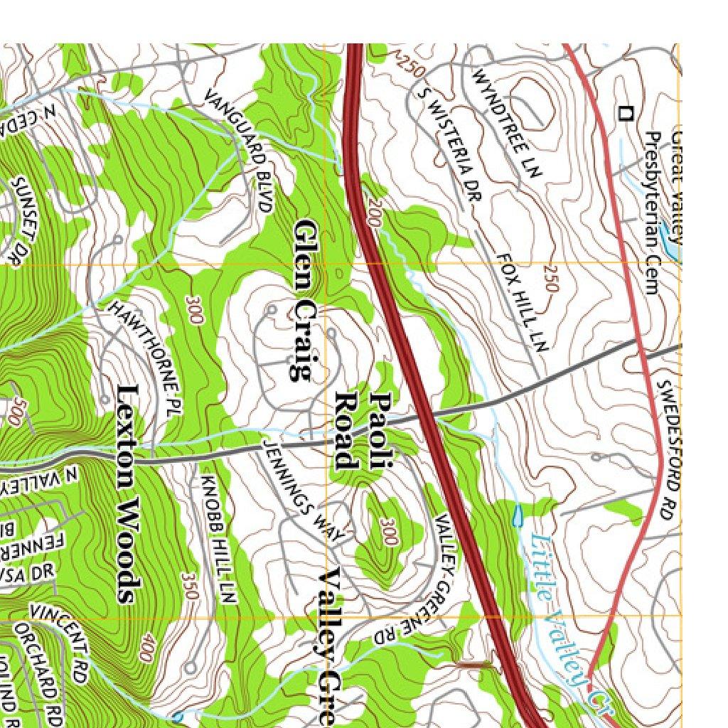
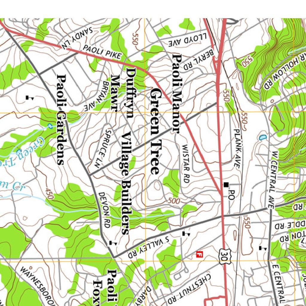
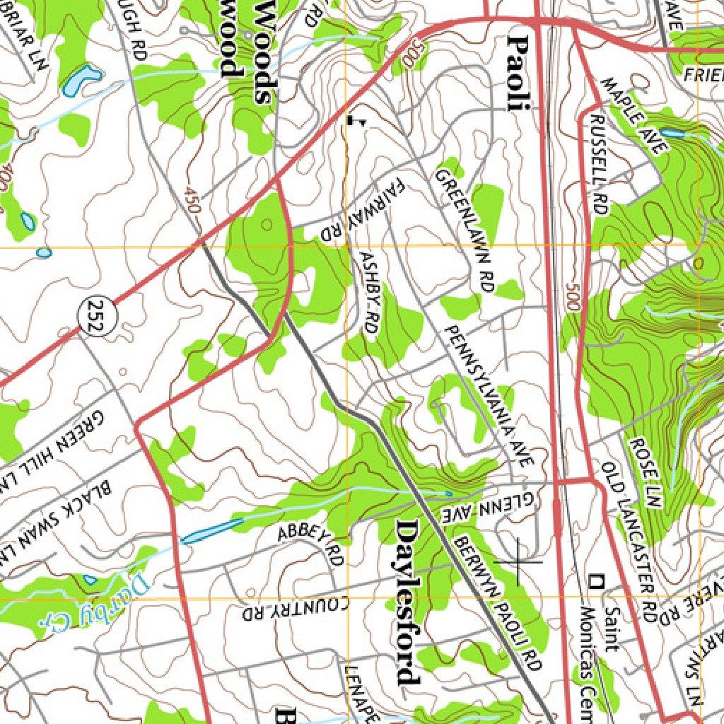
3 Paoli Transportation Center Highway Improvements SR 1005 Section PTC Agreement # E03578 Tredyffrin Township, Chester County, PA Conceptual Alternatives Analysis Prepared by: Michael Baker International February, 2017 I. Introduction The Pennsylvania Department of Transportation (PennDOT), in cooperation with The National Railroad Passenger Corporation (Amtrak) and Southeastern Pennsylvania Transportation Authority (SEPTA), is advancing the Paoli Transportation Center Highway Improvements Project. The highway improvements included in this project are Phase 2 of the Paoli Intermodal Transportation Center project. The Paoli Intermodal Transportation Center project is comprised of three phases. Phase 1 is currently in construction and includes station improvements and ADA enhancements. Phase 2 includes highway improvements associated with the relocation of North Valley Road over the railroad tracks, removal of the existing North Valley Road Bridge over the tracks, and modifications to the parking lots on both sides of the tracks. Although a standalone project, Phase 2 builds off of the work that will be completed in Phase 1, and will be built to accommodate the construction of future phases. The future phases of the project include the construction of a parking garage in the existing south parking lot. The project is located in Tredyffrin Township, Chester County, PA. A variety of alternatives were developed and evaluated, including different roadway alignments for the relocation of North Valley Road, the surrounding road network, and various intersection configurations. Some of these alternatives incorporated elements from previous studies. The Paoli Intermodal Transportation Center 15% Site Alternatives Report, dated November 29, 2012 by Gannett Fleming (SEPTA Study) was developed for SEPTA and includes preliminary site plans for the station redevelopment and roadway improvements. These plans are the basis for the Phase 1 construction. Additional transportation improvement recommendations were made in the Paoli Road Improvement Feasibility Study & Public Participation Project, dated March 24, 2015, completed by McMahon Associates, Inc. (Township Feasibility Study). This study was completed for Tredyffrin Township to identify solutions that address existing and future multi-modal transportation needs for Paoli. The primary goals of the study were to implement an effective outreach program, develop conceptual transportation improvement options that accommodate all roadway users and multi-modal transportation choices and to support the Township in the selection of a preferred transportation improvement plan. The study focused on Lancaster Avenue, East & West Central Avenue, the North Valley Road/East & West Central Avenue intersections and the Lancaster Avenue/Paoli Pike intersection. Concepts for each of the focus areas were vetted through the public involvement process to obtain rankings of community support and included a recommended implementation plan for short-term, intermediate, and long-term improvements. Both of the studies mentioned above included the build-out of the Amtrak Railyard redevelopment into their analysis. The railyard redevelopment is a planned mixed-use development project that is planned for the Amtrak parcel adjacent to the existing northwest lot. As part of the redevelopment, a spine road will be constructed through the development that extends Bracken Avenue to the vicinity of the Central Avenue and Cedar Hollow Road intersection. A location map of the project is included on the following page (Figure 1).

4 2
5 II. Existing Condition The project area for the proposed roadway improvements is bounded by North Valley Road, Lancaster Avenue, East and West Central Avenue and commercial properties to the east of the existing station. The land uses include residential, transportation and a mixed use of retail and commercial. Amtrak owns and operates the Keystone passenger railroad line that runs through the project study area. Amtrak s Keystone line services Paoli, connecting it to Harrisburg, Philadelphia and New York City, among other destinations. The Southeastern Pennsylvania Transportation Authority (SEPTA) also operates a commuter rail service on the rail line as the Paoli/Thorndale route. The Thorndale/Paoli route provides transportation services from Paoli to Philadelphia and other communities along the route from 4:30 AM to 12:15 AM. During weekday peak hours, there are departures bound for Center City (Philadelphia) approximately every half-hour. During the nonpeak and weekend hours, trains run approximately every hour. The Paoli Station is located on Lancaster Avenue (US 30) at the intersection of North Valley Road (SR 1005). The station building is owned by Amtrak. SEPTA leases the station from Amtrak with both agencies having joint maintenance of the building. Both Amtrak and SEPTA operate ticketing in the building. The existing Paoli Station is unattractive, small, cramped and congested. It is unable to adequately accommodate the full range of intermodal opportunities (onsite transfer to connecting buses, employer vans, taxis and private vehicles) that would be appropriate at a major transportation facility. The existing station is currently served by three adjacent parking lots. Lancaster Avenue (US 30) supports regional mobility, as well as local access to residential areas, businesses and the Paoli Train Station. Several intersections along Lancaster Avenue operate with poor levels of service and are congested during the weekday commuter peak periods. Pedestrian facilities are inconsistent, incomplete and inadequate to support safe access to the Train Station and other destinations in the heart of Paoli. Speeding and cut through traffic are concerns within the project limits, particularly on East and West Central Avenues. There are currently two ongoing transportation projects that are located in the vicinity of the project limits. Tredyffrin Township was awarded funds through PennDOT s Automated Red Light Enforcement (ARLE) Grant Program to upgrade signalized intersections along US 30 between Plank Avenue and SR 252 to incorporate an adaptive traffic control system and provide pedestrian improvements at the intersections. Tredyffrin Township was also awarded funds through the TAP Grant Program to install bike lanes and traffic calming along East Central Avenue from SR 252 to Fennerton Lane. Coordinate will take place between our project and these two projects moving forward in design. There is one active redevelopment project that will be directly impacted by this project. The Station Square office park is an existing commercial development located north of Paoli Station that currently is being planned for redevelopment as mixed-use. The developer of Station Square submitted a Conditional Use Application to Tredyffrin Township for the project in March The Tredyffrin Township Planning Commission recommended a conditional approval for the project in May The conditions of approval included a provision that the project dedicates sufficient right-of-way to accommodate the proposed realigned intersections of North Valley Road and East/West Central Avenue as shown in the Township Feasibility Study. Impacts to this parcel vary depending on the preferred alternative and will be discussed in further detail shortly. An existing conditions map is shown on Figure 2.

6 Figure 2: Existing Conditions Map III. Project Purpose and Need The purpose of the Paoli Transportation Center Highway Improvements Project addresses the following: Improve vertical geometry on North Valley Road. Remove the existing functionally obsolete rating of the structure carrying North Valley Road over the railroad tracks. Improve the offset configuration of East/West Central Avenue and North Valley Road. Improve bicycle and pedestrian access to the station. Relieve congestion within the local roadways and intersections surrounding the Paoli Train Station. Strengthen the linkage between the train station and local businesses. Provide safe, efficient travel for the commuting vehicular and pedestrian traffic.
7 The following needs for this project have been developed based on the existing conditions, future transportation demands, future socioeconomic demands and coordination activity among Tredyffrin Township, Chester County, The Delaware Valley Regional Planning Commission, SEPTA, Amtrak, public officials, and the local communities: The existing bridge carrying North Valley Road (SR 1005) over the Amtrak/SEPTA tracks is functionally obsolete and has substandard vertical geometry. The existing local roadways and intersections surrounding the Paoli Station are inadequate and do not adequately accommodate turn movements. There is high potential for pedestrian and vehicular conflicts due to location of the station relative to local roadway and parking facilities. There is a lack of bicycle infrastructure connecting to the station. The current linkage between the station and local business district is weak. IV. Conceptual Alternatives Development and Evaluation An alternatives development and evaluation process was performed to define and analyze a range of reasonable transportation alternatives for the alignments of North Valley Road, relocated North Valley Road, Central Avenue and all of the aforementioned intersections. The alternatives were developed and analyzed based upon consideration of their ability to meet the identified purpose and need of the project. Alternatives were then advanced or dismissed when their impacts were further evaluated on environmental resources and fiscal constraints of the District. In each of the conceptual alternatives, a design exception is required for the minimum vertical clearance (MVC) of 20-4 from the bridge to the tracks. Due to site constraints and the proximity of Lancaster Avenue to the South of the railroad, there is not enough distance along the Relocated North Valley Road alignment to provide the 24-3 MVC and maintain proper sight distances. The proposed MVC will be greater than the at the existing North Valley Road Bridge but less than Amtrak s minimum requirement of Once the AMTRAK design exception is approved, the alignment will be further evaluated and formally processed. A copy of the MVC design exception request that was submitted to the District on December 2 nd as well as a previously sent letter to Amtrak is included in Appendix A. Design criteria sheets are provided in Appendix B for Central Avenue, Relocated North Valley Road and North Valley Road (North of Central Avenue). A total of five alternatives were developed and evaluated. Four of the five alternatives were developed with the intent of keeping the relocated North Valley Road Bridge over the railroad tracks on the skewed alignment that was previously developed in the SEPTA study to accommodate the catenary placement in Phase 1. These four alternatives also include a realigned North Valley Road and West Central Avenue/East Central Avenue intersection to address the deficiencies of the existing offset configuration. The fifth alternative was developed to carry the relocated North Valley Road over the railroad tracks on a different alignment in order to minimize the structure length and minimize traffic on West Central Avenue. Under the fifth alternative, the relocated North Valley Road intersects East Central Avenue in the vicinity of Fennerton Road. The North Valley Road and West Central Avenue/East Central Avenue intersection would not be realigned under this alternative. However, access would be modified at the North Valley Road and East Central Avenue intersection.
8 In order to analyze future operations of the intersection improvements, Design Year 2040 capacity and queueing analyses were performed. Design Year 2040 traffic volumes were developed with the following assumptions: The Amtrak Railyard redevelopment planned for the Amtrak parcel adjacent to the existing northwest lot will be built out per the approved zoning. This build out has been carried out for the Design Year 2040 analysis only. The spine road/bracken Avenue through the railyard redevelopment will divert 50% of traffic from West Central Avenue. This diversion has been carried out for the Design Year 2040 analysis only. The Station Square redevelopment in the parcel east of North Valley Road will be built out per the proposed zoning. The parking garage to be constructed in a future phase will be built out. Access to the garage was assumed via a full-movement driveway along the adjacent North Valley Road segment, a right-turn only egress drive onto the relocated North Valley Road, and a to be determined ramp off of the northbound relocated North Valley Road for ingress. An annual traffic growth rate of 0.52% will occur per historic growth trends. This growth rate results in a 15.6% total growth in Design Year The relocated North Valley Road will divert 75% of the existing North Valley Road through movements to northbound Darby Road through movements in the future. The relocated North Valley Road will divert 25% of the existing northbound Darby Road left turn movements to South Valley Road left turn movements in the future. Correspondence related to the development of these alternatives is included in Appendix C. V. Alternatives Considered The following alternatives and a No-Build alternative were carried forward for detailed analysis. The operational performance, proposed impacts, anticipated costs and ability to meet the purpose and needs were analyzed for each alternative. A summary of how the alternatives address the criteria relating to these measures of effectiveness is discussed in Section VIII - Alternatives Analysis Matrix. Preliminary cost estimates for each alternative can be found in Appendix D. A summary of the anticipated property impacts for each alternative is included in Appendix E. A summary of the traffic operations analysis is shown in Section VI. A detailed analysis of the traffic operations is included in Appendix F. Preliminary plans and profiles for each alternative have been prepared and will accompany this report.
9 Alternative A: This alternative combines an alignment for the relocated North Valley Road that was developed previously for the SEPTA study and a realigned single-lane roundabout configuration at the North Valley Road and Central Avenue intersection that was previously developed in the Township Feasibility Study. Under this configuration, the relocated North Valley Road crosses the railroad tracks on a skew and then curves sharply to intersect with North Valley Road at an approximate 90 degree angle. In this alternative, the old North Valley Road T s into the relocated North Valley Road/Bracken Avenue and a channelized right turn has been provided for the relocated North Valley Road right turn movement onto North Valley Road. The relocated North Valley Road intersects with Lancaster Avenue at the existing Darby Road terminus and provides one through lane and dedicated left and right turn lanes. Advantages: Provides more developable land for the Station Square Redevelopment than Alternatives C through E. Is compatible with Phase 1 improvements that are currently under construction. Matches existing grades slightly better than other alternatives. Eliminates the offset intersection between East and West Central Avenues. Received more community support than the realigned signalized alternative and offset signalized intersection alternative in the Township Feasibility Study. Directs more non-local traffic through the railyard development and reduces impacts to West Central Avenue. Disadvantages: Creates a stop condition for the north-south movements at the North Valley Road and the relocated North Valley Road/Bracken Ave intersection. Alters North Valley Road southbound thru movement to a left turn movement onto the relocated North Valley Road. A conceptual drawing of Alternative A is included on the following page.
10
11 Alternative B: This alternative is similar to Alternative A with the primary difference being a realigned signalized intersection at the North Valley Road and Central Avenue intersection instead of a roundabout. Left turn lanes are provided on all approaches to the traffic signal and a dedicated right turn lane is also provided for the northbound North Valley Road approach. The relocated North Valley Road intersects with Lancaster Avenue at the existing Darby Road terminus and provides one through lane and dedicated left and right turn lanes. Under Alternatives A through D, the old North Valley Road/relocated North Valley Road/Bracken Avenue intersection is analyzed as a signalized intersection in Design Year 2040, but would not require signalization at opening year. A phased traffic signal warrant would be completed during the design phase to determine when a traffic signal would be required at the intersection. Advantages: Provides more developable land for the Station Square Redevelopment than Alternatives C through E. Is compatible with Phase 1 improvements that are currently under construction. Matches existing grades slightly better than other alternatives. Eliminates the offset intersection between East and West Central Avenues. Directs more non-local traffic through the railyard development and reduces impacts to West Central Avenue. Disadvantages: Creates a stop condition for the north-south movements at the North Valley Road and relocated North Valley Road/Bracken Ave intersection. Alters North Valley Road southbound through movement to a left turn movement onto the relocated North Valley Road. Requires more right-of-way than Alternative A in order to develop turn lanes that are necessary to accommodate queued vehicles between closely spaced intersections. A conceptual drawing of Alternative B is included on the following page.
12
13 Alternative C: This alternative maintains the alignment of the relocated North Valley Road over the railroad tracks as developed in the SEPTA study and continues the alignment on a similar skew towards the realigned singlelane roundabout configuration at the North Valley Road and Central Avenue intersection that was previously developed in the Township Feasibility Study. An S-curve is required along the relocated North Valley Road in order to obtain proper deflection prior to entering the roundabout. Bracken Avenue T s into the relocated North Valley Road/old North Valley Road in this alternative. Dedicated left and right turn lanes are provided along the relocated North Valley Road and North Valley Road for the turns onto Bracken Avenue. The relocated North Valley Road intersects with Lancaster Avenue at the existing Darby Road terminus and provides one through lane and dedicated left and right turn lanes. Advantages: Is compatible with Phase 1 improvements that are currently under construction. Maintains Bracken Avenue as the minor street teeing into North Valley Road/relocated North Valley Road. Maintains North Valley Road as a main through movement, where Alternatives A, B and E do not. Eliminates the offset intersection between East and West Central Avenues. Provides similar improvements at the intersection of North Valley Road and East Central Avenue/West Central Avenue to Alternative A, which received more community support than the realigned signalized alternative and offset signalized intersection alternative in the Township Feasibility Study. Disadvantages: Provides less developable land for the Station Square Redevelopment than Alternatives A & B. Does not provide relief to West Central Avenue cut through traffic volumes by creating a natural route through the Rail Yards Development (spine road/bracken Avenue) A conceptual drawing of Alternative C is included on the following page.
14
15 Alternative D: This alternative is similar to Alternative C with the primary difference being a realigned signalized intersection at the North Valley Road and Central Avenue intersection instead of a roundabout. The S - curve is maintained on relocated North Valley Road in this alternative to align with the north leg of the intersection. Left turn lanes are provided on all approaches to the traffic signal and a dedicated right turn lane is also provided for the northbound North Valley Road approach. Relocated North Valley Road intersects with Lancaster Avenue at the existing Darby Road terminus and provides one through lane and dedicated left and right turn lanes. Advantages: Provides more developable land for the Station Square Redevelopment than Alternative E. Is compatible with Phase 1 improvements that are currently under construction. Maintains Bracken Avenue as the minor street teeing into North Valley Road/relocated North Valley Road. Maintains North Valley Road as a main through movement, where Alternatives A, B and E do not. Eliminates the offset intersection between East and West Central Avenues. Disadvantages: Provides less developable land for the Station Square Redevelopment than Alternatives A & B. Requires more right-of-way than Alternative C (roundabout) in order to develop turn lanes. Does not provide relief to West Central Avenue cut through traffic volumes by creating a natural route through the Rail Yards Development (spine road/bracken Avenue) A conceptual drawing of Alternative D is included on the following page.
16
17 Alternative E: In this alternative, the relocated North Valley Road crosses over the railroad tracks at a roughly perpendicular angle and continues straight to intersect with East Central Avenue opposite Fennerton Road. In order to align the bridge perpendicularly with the tracks, the skew of the relocated North Valley Road with Lancaster Avenue and Darby Road is increased. The North Valley Road and West Central Avenue/East Central Avenue intersection would not be realigned under this alternative. A cul-de-sac would be installed on East Central Avenue prior to North Valley Road to eliminate the offset through movement to West Central Avenue at the intersection. Bracken Avenue would be extended to create a new intersection at relocated North Valley Road. Roundabouts are proposed at the East Central Avenue and relocated North Valley Road/Fennerton Road intersection and at relocated North Valley Road/Bracken Avenue intersection. Relocated North Valley Road intersects with Lancaster Avenue at the existing Darby Road terminus and provides one through lane and dedicated left and right turn lanes. Advantages: Requires shortest bridge span length. Disadvantages: Is not compatible with all of the Phase 1 improvements and would require the relocation of two major catenary structures placed in Phase 1. Eliminates the connection of East Central Avenue with West Central Avenue. Continuing from East Central Avenue to West Central Avenue would require traversing four intersections compared to one intersection in Alternatives A through D. Provides least amount of developable land for the Station Square Redevelopment. Requires more displacements than Alternatives A through D. Requires a greater skew between Darby Road and relocated North Valley Road than Alternatives A through D. The relocated North Valley Road/Bracken Avenue roundabout requires a northbound through bypass lane to reduce queueing and improve delay. Queueing problems will occur between the closely spaced signalized intersection at North Valley Road and Bracken Avenue and the roundabout at relocated North Valley Road/Bracken Avenue. A conceptual drawing of Alternative E is included on the following page.
18
19 VI. Traffic Operations This section summarizes the evaluation of peak hour traffic operations under future conditions for each of the previously described improvement alternatives. morning commuter peak hour and weekday afternoon commuter peak hour conditions were analyzed consistent with other recent studies. Future traffic operations include both regional traffic growth and local traffic growth associated with the Paoli Intermodal Transportation Center and parking garage, the Station Square residential development, and the redevelopment of the Paoli Rail Yards property (2040 only). A comparison of design year 2040 traffic operating conditions measures of effectiveness for each analyzed intersection are displayed below in Tables 1 through 6. A detailed analysis of the traffic operations is included in Appendix F. This appendix summarizes the evaluation of peak hour traffic operations under existing conditions (refer to Appendix F, Figure 3), future no-build conditions (refer to Appendix F, Figures 4 and 5), and future conditions for each of the previously described improvement alternatives (refer to Appendix F, Figures 6 through 15). Future traffic operations were evaluated in the anticipated opening year 2020, and the design year Lancaster Avenue Intersections: The two Lancaster Avenue study intersections at North Valley Road/South Valley Road (SR 1005) and at Darby Road (SR 2026) will function with nearly identical levels of service and queuing results in the future conditions, and therefore, the future conditions for each condition/alternative are summarized together below. Under existing conditions, traffic congestion builds between these two intersections during the peak hours, a result of the close intersection spacing and poor access to the Paoli Train Station, and creates long queues that extend beyond the adjacent intersections. Future traffic growth will exacerbate these conditions in the future without improvements (see future no-build conditions below). In the future improvement condition (regardless of the improvement alternative), conditions along the Lancaster Avenue corridor and at these intersections will generally improve, despite a few problematic movements. The results of the future no-build and future build conditions (for Alternatives A through E) are summarized in more detailed below for the opening year (2020) and design year (2040). The delay and queuing results are based on the HCM 2010 methodology for signalized/unsignalized intersections and HCM 6 th Edition methodology for roundabouts (utilizing applicable PennDOT variables). It is recognized that additional enhancements to the operational performance of the Lancaster Avenue (US 30) and Darby Road intersection could be accomplished by constructing additional left turn lanes. For the purposes of the alternatives analysis, a dual left turn configuration was not analyzed in order to focus the analysis on the differences between the various alignments. Furthermore, limiting the footprint of intersections is consistent with the project s purpose and need by promoting a walkable environment and striking a balance between the different modes of travel that will be present within the vicinity of the station. Additional analysis of impacts and benefits to accomplish additional turn lanes can be completed during a later phase of the design.
20 Table 1. Traffic Operating Conditions Measures of Effectiveness Comparison Lancaster Avenue (US Route 30) and North Valley Road (SR 1005) Measures of Effectiveness Overall Delay (seconds) Queue Summary 2040 No-Build 2040 Alternatives A, B, C, D, & E AM PM AM PM EB, WB & SB approaches queue through adjacent intersections in both peak hours. - WB & SB queues are significantly reduced compared to no-build conditions. - EB queues are similar to no-build conditions. Table 2. Traffic Operating Conditions Measures of Effectiveness Comparison Lancaster Avenue (US Route 30) and Darby Road (SR 2026)/Relocated North Valley Road Measures of Effectiveness Overall Delay (seconds) Queue Summary 2040 No-Build 2040 Alternatives A & B AM PM AM PM NB queue extend beyond existing turn lane storage. - EBL and WB approach queues extend beyond adjacent signalized intersections. - NBL queue extends beyond existing turn lane storage Alternatives C & D AM PM EBL and WB approach queues extend beyond adjacent signalized intersections. - NBL queue extends beyond existing turn lane storage. Table 3. Traffic Operations Measures of Effectiveness Comparison North Valley Road (SR 1005) and Relocated North Valley Road/Bracken Avenue Measures of Effectiveness Overall Delay (seconds) Queue Summary AM Alternative A Alternative B Alternative C Alternative D PM AM PM AM PM AM PM EB queues extend beyond adjacent internal intersection during weekday PM peak hour. - EB queues extend beyond adjacent internal intersection during weekday PM peak hour. - EBR queue extends beyond adjacent internal intersection during weekday PM peak hour. - EBR queue extends beyond adjacent internal intersection during weekday PM peak hour.
21 Table 4. Traffic Operations Measures of Effectiveness Comparison North Valley Road (SR 1005) and West Central Avenue (SR 1053)/East Central Avenue Measures of Effectiveness North Valley Road (SR 1005) and West Central Avenue North Valley Road (SR 1005) and East Central Avenue AM PM AM PM Overall Delay (seconds) Queue Summary - Significant queuing along EB approach - Significant queuing along WB approach during weekday PM peak hour Table 5. Traffic Operations Measures of Effectiveness Comparison North Valley Road (SR 1005) and Realigned West Central Avenue (SR 1053)/East Central Avenue Measures of Effectiveness Overall Delay (seconds) Queue Summary AM Alternative A 1 Alternative B 2 Alternative C 1 Alternative D 2 PM AM PM AM PM AM PM Queues fit within proposed intersection spacing (stop barto-stop bar) Queues fit within proposed intersection spacing (stop barto-stop bar) Queues fit within proposed intersection spacing (stop barto-stop bar) 1 Delay and queue results are based on HCM 6 th Edition methodology for roundabouts. 2 Delay and queue results are based on HCM 2010 methodology for signalized intersections. Queues fit within proposed intersection spacing (stop barto-stop bar) Measures of Effectiveness Overall Delay (seconds) Queue Summary Table 6. Traffic Operations Measures of Effectiveness Comparison Alternative E Intersections North of SEPTA Station Relocated North Valley Road and Bracken Avenue AM PM Relocated North Valley Road and East Central Avenue AM PM North Valley Road and Bracken Avenue AM PM North Valley Road and West Central Avenue AM PM EB queues through adjacent signal during weekday PM peak hour - No queueing issues - WBT queues through adjacent roundabout during weekday AM peak hour - No queueing issues
22 VII. Pedestrian Traffic Operations The pedestrian crosswalks under existing conditions, future no-build conditions, and future conditions for each of the previously described improvement alternatives. morning commuter peak hour and weekday afternoon commuter peak hour conditions were analyzed consistent with other recent studies. As previously noted, future traffic operations were evaluated in the anticipated opening year 2020, and the design year 2040, and include both regional traffic growth and local traffic growth associated with the Paoli Intermodal Transportation Center and parking garage, the Station Square residential development, and the redevelopment of the Paoli Rail Yards property (2040 only). According to HCM 2010, a Pedestrian Level of Service (LOS) Score is an indication of the typical pedestrian s perception of the overall crossing experience at signalized intersections. HCM 2010 provides a LOS result associated with each range of the reported scoring. Pedestrian Crosswalk LOS is determined by utilizing the vehicular turning volumes, speeds, number of right-turn channelization islands, and intersection geometry. Under the 2020 and 2040 no-build and alternative conditions, the following signalized intersections operate at Pedestrian LOS D or better for all crosswalks, with the majority of crosswalks functioning with even better levels of service. Lancaster Avenue (US Route 30) and North Valley Road (SR 1005) Lancaster Avenue (US Route 30) and Darby Road (SR 2026)/relocated North Valley Road North Valley Road (SR 1005) and relocated North Valley Road/Bracken Avenue North Valley Road (SR 1005) and West Central Avenue (SR 1053)/East Central Avenue VIII. Safety Performance This section summarizes the evaluation of the safety performance under future conditions for each of the previously described improvement alternatives. One of the metrics used to compare relative safety between alternatives is conflict points. The number and type of conflict points influence the frequency and severity of intersection crashes. Roundabouts have fewer conflict points than conventional intersections. Additionally, roundabouts eliminate right angle and left turn head-on conflict points, which are the most hazardous types. Single lane roundabouts also contain less pedestrian conflict points than conventional intersections and simpler crossing maneuvers. Although conventional intersections may be signalized to enhance safety for pedestrian crossings, pedestrians must still be cognizant of turning vehicles from two different directions while crossing unless vehicular turn restrictions are present. Pedestrians crossing a leg of a single lane roundabout cross one lane at a time with no other potential conflicts. Additionally, the amount of exposure for a pedestrian is generally higher at conventional intersections than in roundabouts. Conventional intersections generally have wider crossings due to the need for turn lanes and may or may not have refuge islands. The splitter islands required for roundabouts provide refuge for pedestrians along each leg of an intersection. For these reasons, roundabouts are generally considered to have a greater safety benefit than conventional intersections for both vehicular and pedestrian traffic. A conflict point analysis was performed to determine the amount of vehicular and pedestrian conflict points for each alternative. The results of the conflict point analysis are shown below in Tables 7 through 10.
23 Alternatives A and C both contain the least amount of conflict points, while Alternatives B and D both contain the most conflict points. Although Alternative E is comprised of two roundabouts, the number of conflict points contained in the alternative is higher than Alternative A and C and the No-Build Alternative due to the additional intersections that are created by the alternative. The single lane roundabout configuration shown in Alternative A and C also provides for shorter crossing distances and more refuge than the conventional intersection configuration in Alternatives B and D. Portions of on-street bike lanes will be provided to enhance connectivity between the station area, residential neighborhoods, and Lancaster Avenue. Alternatives A through D all provide similar facilities to promote this connectivity. However, the configuration of Alternative E makes these connections more difficult due to the additional intersections and turning movements. Table 7. Number of Conflict Points No-Build 2040 NO-BUILD Intersection Control Type Number of Legs Number of Intersection Conflict Points Vehicular Pedestrian U.S. Route 30 and Valley Signalized U.S. Route 30 and Darby Signalized driveways Valley and W. Central Unsignalized Valley and E. Central Unsignalized Total Conflicts by Type Total Conflicts by Alternative 158 Table 8. Number of Conflict Points Alternatives A and C 2040 ALTERNATIVES A and C Intersection Control Type Number of Legs Number of Intersection Conflict Points Vehicular Pedestrian U.S. Route 30 and Valley Signalized U.S. Route 30 and Darby Signalized Valley and Bracken / Rel Valley Signalized Valley and Central Roundabout Total Conflicts by Type Total Conflicts by Alternative 130
24 Table 9. Number of Conflict Points Alternatives B and D 2040 ALTERNATIVES B and D Intersection Control Type Number of Legs Number of Intersection Conflict Points Vehicular Pedestrian U.S. Route 30 and Valley Signalized U.S. Route 30 and Darby Signalized Valley and Bracken / Rel Valley Signalized Valley and Central Signalized Total Conflicts by Type Total Conflicts by Alternative 162 Table 10. Number of Conflict Points Alternative E 2040 ALTERNATIVE E Intersection Control Type Number of Legs Number of Intersection Conflict Points Vehicular Pedestrian U.S. Route 30 and Valley Signalized U.S. Route 30 and Darby Signalized Darby and Bracken Roundabout Valley and Bracken Signalized Valley and W. Central Signalized Darby and E. Central Roundabout Total Conflicts by Type Total Conflicts by Alternative 160 IX. Alternatives Analysis Matrix As a basis for comparison, a matrix was created to summarize the various alternatives against different metrics. The matrix utilized the following measures of effectiveness categories: Purpose and Need Traffic Operations Environmental Impacts Engineering Design Risk / Project Development Time Estimated Cost The Alternatives Analysis Matrix is included on the following page.
25 Paoli Transportation Center Highway Improvements Alternatives Analysis Matrix Measures of Effectiveness February 2017 PURPOSE & NEED Improve vertical geometry on North Valley Road No Yes Yes Yes Yes Yes Remove the existing functionally obsolete rating of the structure carrying SR 1005 over the railroad tracks No Yes Yes Yes Yes Yes Improve the offset configuration of East/West Central Avenue and SR 1005 No Yes Yes Yes Yes No Improve bicycle and pedestrian access to the station No Yes Yes Yes Yes Yes Relieve congestion within the local roadways and intersections surrounding the Paoli Train Station No Yes Yes Yes Yes Yes Strengthen the linkage between the train station and local businesses No Yes Yes Yes Yes Yes Provide safe and efficient travel for the commuting vehicular and pedestrian traffic No Yes Yes Yes Yes Yes TRAFFIC OPERATIONS Average Peak Hour Delays (weighted average of both AM & PM peaks in seconds) Queuing Conditions (queues not accommodated by expected storage/spacing) Non Local Traffic Impacts to Local Roads High Low Med Med High Med Vehicular Conflict Points (total) Pedestrian Conflict Points (total) Bicycle Connectivity Low High High High High Low ENVIRONMENTAL IMPACTS Right of Way Impacts (Affected Properties) Approximate Required Right of Way Area (Acre) Properties with Building 50 years or Older Potentially Affected Displacements (residential/commercial or industrial)¹ Approximate Residual Acreage Available for Station Square Redevelopment Approximate Displaced Parking Spaces in the Church Parking Lot ENGINEERING DESIGN Anticipated Design Exceptions Number of Road Network Intersections within Limits (Valley Rd, Central Ave, Relocated Valley Rd, Bracken Ave) Complexity of Construction (Low Med High) Med Med Med Med Med Additional Railroad/Catenary Impacts No No No No Yes Risk / Project Development Time Right of Way / Station Square Low Low Low Low High ESTIMATED COST TOTAL COST $15.3 M $15.9 M $12.9 M $12.7 M $12.1 M No Build (DY 2040) Alternative A SR 1005 Section PTC Concepts Alternative B Alternative C Alternative D Alternative E Notes: 1 Does not include displacement of buildings on the proposed Station Square re development site. 2 Community support based on results from the McMahon study, Paoli Road Improvement Feasibility Study & Public Participation Project, dated March Assumes community support would be similar to support shown for Alternatives A & B in the McMahon study based on similarities between the alternatives.
26 X. Conceptual Stormwater Management All alternatives would require similar sizes of stormwater management (SWM) facilities except for Alternative E which would require slightly more due to more or the proposed alignment being off of the existing alignment. The Potential SWM Locations have been shown on the displays for each alternative. The shapes shown are intended to show conservative areas where SWM will be considered and do not reflect the exact size of the facilities that will be required. For all alternatives the facility in the Southeast quadrant of the Central Ave and North Valley Road intersection will handle the most volume since it is the lowest on the site. Stormwater Management will be considered on proposed vegetated areas south of the railroad crossing, but if required it can be investigated to include subsurface storage in conjunction with the train station parking facility. Contaminated soils will be investigated further in final design, but it is not anticipated that any of the Potential SWM Locations are in areas where contaminated soils exist.
27 APPENDIX A DESIGN EXCEPTION REQUEST
28
29
30
 444-0888 (215) 444-0889(Fax) Letter of Transmittal SR 1005 Section PTC To: Pennsylvania Department of Transportation S.O. No.")

31 Michael Baker International, Inc. 500 Office Center Drive, Suite 210 Fort Washington, Pennsylvania (215) (215) (Fax) Letter of Transmittal SR 1005 Section PTC To: Pennsylvania Department of Transportation S.O. No.: Geerdes Blvd. Date: December 2, 2016 King of Prussia, PA Project: SR 1005 Sec PTC Attn: Mirlene Saintval Doc. No.: We are forwarding the following: Attached Under Separate Cover Other DWG. NO. NO. COPIES TITLE OR DESCRIPTION COMMENTS 1 Amtrak Design Exception Request THESE ARE TRANSMITTED as checked below: As requested No exception taken Revise and resubmit For review and comment Rejected - See remarks Submit specified items For your information Proceed subject to corrections noted Other GENERAL COMMENTS: Enclosed is the Amtrak design exception request form for the minimum vertical clearance of the proposed Darby Road extension over the railroad track, to be submitted to Amtrak for consideration. Should you have any questions, please feel free to give me a call at Michael Baker International, Inc. By: Chris Stanford, P.E.,PMP Title: Project Manager Page 1 Of 1 Cc:
32 DESIGN EXCEPTION REQUEST (DER) This form is to be used when a project warrants an exception to established design standards. Complete Section 1 and 2 and attach supporting documents prior to submission to Amtrak for consideration. Section 1: Request Information Project Name Paoli Transportation Center Highway Improvements (SR 1005 Section PTC) Project DER No. DE #1 Date Exception Location Paoli Transportation Center Roadway Structure over Rail (MP# 19.80) Requesting Agency PennDOT Requester Mirlene Saintval Section 2: Design Exception Description (Provide brief concise statements) Excepted Design Standard and section No. Attach Design Standard, unless it is an Amtrak or AREMA Standard Description of Exception This design exception request is for the minimum vertical clearance (MVC) of the proposed relocated North Valley Road Bridge over the southernmost track (Track 1) in the vicinity of the Paoli Station. The proposed MVC of 20-4 is greater than the existing North Valley Road bridge MVC of but less than Amtrak s standard MVC of This proposed bridge is at MP# The existing North Valley Road bridge is in poor condition, has substandard clearances and is not adequate for safe vehicular and pedestrian travel. This bridge also provides access for all Amtrak and SEPTA passengers between the inbound and outbound platforms and parking. This project is proposing to extend Darby Road to the north over Amtrak and eliminate the existing North Valley Road bridge. This will enable construction of a new bridge with a vertical roadway profile that meets the PennDOT site distance requirements for a 25 mph speed limit. The proposed bridge will be higher, improving vertical clearances for rail operations. Distance between abutments will be widened, allowing for installation of high level platforms and a reconfigured interlocking. Reason for Request The proposed relocated North Valley Road profile increases in elevation as it moves south of north over the tracks, with the peak occurring on the north side. This project proposes providing a minimum 20 4 vertical clearance at the southernmost track (Track 1). This is greater than the existing at the North Valley Road but less than Amtrak s MVC requirement of However, due to site constraints and the proximity of Lancaster Avenue to the south of the railroad, there is not adequate distance along the Darby Road alignment to provide the required MVC while maintaining proper sight distances. Below is a summary of the existing vertical clearances of various overhead bridges in the area of the subject bridge: W. Bridge Avenue vertical clearance to bridge (MP#17.74) N. Valley Road vertical clearance to bridge (MP#19.86) Bridge Street vertical clearance to bridge(mp#21.45)
33 DESIGN EXCEPTION REQUEST (DER) As you can see, there are numerous existing structures within the vicinity of this project that have MVC that are less than our proposed vertical clearance of Although our proposed bridge does not meet Amtrak s MVC requirements, it improves safety and it provides the ability to implement significant improvements to rail operations. It also provides the opportunity to create a gateway into Amtrak s planned future development on the north side of the tracks. The potential impacts of a DER on: safety, capital costs, life cycle costs, future maintenance, or the right-of-way should be described in the Reason for Request field. Additional pages may be attached. Section 3: Amtrak Review Comments Comments and Recommendation Reviewer Name Title Section 4: Amtrak Approval / Denial Status APPROVE or DENY Signature Name Date Title
34 APPENDIX B DESIGN CRITERIA SHEETS
35 Design Criteria Paoli Transportation Center Highway Improvements Central Avenue Road Designation SR 1053 and G 630 Calc By: SMW 07/01/2016 Begin SEG/OFF N/A Rev By: STS 12/19/2016 End SEG/OFF N/A Roadway Typology Functional Classification Current ADT (2016) Design Year ADT (2040 with 1.0% Growth) K DHV (2040) D T% DDHV Trucks DESCRIPTION Design Speed Posted Speed Lane Width Paved Shoulder Width Parking Lane Bike Lane Median Width (if needed) Cross Slope (DM2) S.E. Maximum S.E. Minimum Vertical Grade (Rolling Terrain) Maximum (AASHTO) Minimum (DM2) Horizontal Radius (AASHTO) Minimum Vertical Sight Distance (Min) Stopping (AASHTO) Passing (AASHTO) Horizontal Sight Distance - Curve (Min) Stopping (AASHTO) Urban Community Collector Town/Village Neighborhood REQUIRED CRITERIA PROPOSED mph a 25 mph 25 mph Posted 25 mph Posted 10'-0" to 11'-0" a 4'-0" a 7'-0" to 8'-0" a 5'-0" to 6'-0" a N/A a 11'-0" to 13'-0" N/A (5'-0" Bike Lane - East Central Ave.) N/A (13'-0" Curbed Lane - West Central Ave.) N/A 5'-0" (East Central Ave.) N/A (West Central Ave.) N/A 6.0% a 2.0% 2.0% a 2.0% 12.0% (25 mph) <12.0% 0.5% a >0.5% 134' (25 mph) >134' 155' (25 mph) >155' 900' (25 mph) N/A 155' (25 mph) >155' Clear Zone Width (DM2 Table 12.1) Bridge Width (DM2) Minimum Vertical Clearance (DM2) 14'-0" 40'-0" b Minimum: 14' - 6" a <14'-0" (existing facility) N/A N/A a) From Smart Transportation Guidebook, Community Collector Road, Design Criteria DM 2, Table 1.5, Page b) From Minimum Width Criteria for Bridges, Design Criteria DM-2, Page * Design Exception Required Alternative Analysis Report
36 Design Criteria Paoli Transportation Center Highway Improvements North Valley Road (North of Central Ave.) Township Road SR 1005 Calc By: SMW 07/01/2016 Begin SEG/OFF N/A Rev By: STS 12/19/2016 End SEG/OFF N/A Roadway Typology Functional Classification Current ADT (2016) Design Year ADT (2040 with 1.0% Growth) K DHV (2040) D T% DDHV Trucks Urban Community Collector Town Center DESCRIPTION Design Speed Posted Speed Lane Width Paved Shoulder Width Parking Lane Bike Lane Median Width (if needed) Cross Slope (DM2) S.E. Maximum S.E. Minimum Vertical Grade (Rolling Terrain) Maximum (AASHTO) Minimum (DM2) Horizontal Radius (AASHTO) Minimum Vertical Sight Distance (Min) Stopping (AASHTO) Passing (AASHTO) Horizontal Sight Distance - Curve (Min) Stopping (AASHTO) REQUIRED CRITERIA PROPOSED mph a 25 mph 35 mph Posted 35 mph Posted 10'-0" to 11'-0" a 4'-0" a 7'-0" to 8'-0" a 5'-0" to 6'-0" a N/A a 12'-0" 2'-0" N/A N/A N/A 6.0% a 2.0% 2.0% a 2.0% 10.0% (35 mph) <10.0% 0.5% a >0.5% 314' (35 mph) >314' 250" (35 mph) >250' 1280' (35 mph) N/A 250' (35 mph) >250' Clear Zone Width (DM2 Table 12.1) Bridge Width (DM2) Minimum Vertical Clearance (DM2) 14'-0" 40'-0" b Minimum: 14' - 6" a 14'-0" N/A N/A a) From Smart Transportation Guidebook, Community Collector Road, Design Criteria DM 2, Table 1.5, Page b) From Minimum Width Criteria for Bridges, Design Criteria DM-2, Page * Design Exception Required Alternative Analysis Report
37 Design Criteria Paoli Transportation Center HIghway Improvements Relocated North Valley Road Road Designation SR 1005 Calc By: SMW 7/01/2016 Begin SEG/OFF N/A Rev By: STS 12/19/2016 End SEG/OFF N/A Roadway Typology Functional Classification Current ADT (2016) Design Year ADT (2040 with 1.0% Growth) K DHV (2040) D T% DDHV Trucks DESCRIPTION Design Speed Posted Speed Lane Width Paved Shoulder Width Parking Lane Bike Lane Median Width (if needed) Cross Slope (DM2) S.E. Maximum S.E. Minimum Vertical Grade (Rolling Terrain) Maximum (AASHTO) Minimum (DM2) Horizontal Radius (AASHTO) Minimum Vertical Sight Distance (Min) Stopping (AASHTO) Passing (AASHTO) Horizontal Sight Distance - Curve (Min) Stopping (AASHTO) Urban Community Collector Town Center REQUIRED CRITERIA PROPOSED mph a 25 mph 25 mph Posted 25 mph Posted 10'-0" to 11'-0" a 4'-0" a 7'-0" to 8'-0" a 5'-0" to 6'-0" a N/A a 12'-0" 5'-0" N/A N/A N/A 6.0% a 2.0% 2.0% a 2.0% 12.0% (25 mph) <12.0% 0.5% a >0.5% 134' (25 mph) >134' 155' (25 mph) >155' 900' (25 mph) N/A 155' (25 mph) >155' Clear Zone Width (DM2 Table 12.1) Bridge Width (DM2) Minimum Vertical Clearance (DM2) 14'-0" 40'-0" b Minimum: 14' - 6" a N/A protected with guide rail/barrier 54'-0" 20'-4" a) From Smart Transportation Guidebook, Community Collector Road, Design Criteria DM 2, Table 1.5, Page b) From Minimum Width Criteria for Bridges, Design Criteria DM-2, Page * Design Exception Required Alternatives Analysis Report
38 APPENDIX C COST ESTIMATES
39 December 2016 Item Description Unit Estimated Quantity Estimated Unit Price Full Depth Roadway SY $45.00 $586, Excavation CY 6929 $25.00 $173, Embankment Foreign Borrow CY 1871 $36.00 $67, Embankment Common Borrow CY 6929 $18.00 $124, Curb LF 4825 $32.00 $154, Retaining Wall LF 1375 $2, $3,238, ADA Curb Ramps EACH 29 $1, $43, Sidewalk LF 3050 $60.00 $183, Mountable Median (Truck Apron, Rounabout 8" Depth) SY 771 $35.00 $26, Cement Concrete Pavement 8" Depth SY 349 $75.00 $26, Plain Cement Concrete Mountable Curb Type A LF 884 $40.00 $35, Guiderail LF 327 $ $49, Permanent Impact Attenuating Device. Type III EACH 1 $3, $3, Median Barrier LF 380 $55.00 $20, Lighting LS 1 $65, $65, Signs (Sign, Post and Install) EACH 47 $30.00 $1, Pavement Markings LF $1.75 $19, Traffic Signal Modifications (Darby Road extension/lancaster Avenue) LS 1 $225, $225, Traffic Signal (North Valley Road/Bracken Avenue) LS 1 $225, $225, Landscaping LS 1 $50, $50, Subtotal Darby Road Extension Bridge LS 1 $3,018, $3,018, SEPTA Access Road LS 1 $380, $380, SEPTA Southern Parking Lot Improvements LS 1 $251, $251, SEPTA Northern Parking Lot Improvements LS 1 $333, $333, SUBTOTAL $9,301,694 E&S (2% of SUB) $186,034 MAINTENANCE OF TRAFFIC (10% of SUB) $930,169 STORMWATER MANAGEMENT (2% of SUB) $186,034 DRAINAGE (2% of SUB) $186,034 CLEARING AND GRUBBING (1% of SUB) $93,017 SURVEY, EQUIPMENT PACKAGE, INSPECTION FACILITIES (1% of SUB) $93,017 MOBILIZATION (5%) $548,800 CONTINGENCY (20%) $2,304,960 CONSTRUCTION SUBTOTAL $13,829,759 CM/CI (10%) $1,382,976. TOTAL PRELIMINARY COST ESTIMATE $15,300,000 Preliminary Cost Estimate Alternative A *Note: Does not include Right of Way Cost or Demolition Costs* Paoli Transportation Center Highway Improvements
40 December 2016 Item Description Unit Estimated Quantity Estimated Unit Price Full Depth Roadway SY $45.00 $599, Excavation CY 2778 $25.00 $69, Embankment Foreign Borrow CY 5012 $36.00 $180, Embankment Common Borrow CY 2778 $18.00 $50, Curb LF 5688 $32.00 $182, Retaining Wall LF 1499 $2, $3,530, ADA Curb Ramps EACH 24 $1, $36, Sidewalk LF 2411 $60.00 $144, Mountable Median (Splitter Islands, Truck Apron, Rounabout 8" Depth) LF 95 $35.00 $3, Guiderail LF 327 $ $49, Permanent Impact Attenuating Device. Type III EACH 1 $3, $3, Median Barrier LF 534 $55.00 $29, Lighting LS 1 $65, $65, Signs (Sign, Post and Install) EACH 62 $30.00 $1, Pavement Markings LF $1.75 $19, Landscaping LS 1 $50, $50, Traffic Signal Modifications (Darby Road extension/lancaster Avenue) LS 1 $225, $225, Traffic Signal (North Valley Road/Bracken Avenue) LS 1 $225, $225, Traffic Signal (North Valley Road/Central Avenue) LS 1 $225, $225, Subtotal Darby Road Extension Bridge LS 1 $3,018, $3,018, SEPTA Access Road LS 1 $380, $380, SEPTA Southern Parking Lot Improvements LS 1 $251, $251, SEPTA Northern Parking Lot Improvements LS 1 $333, $333, SUBTOTAL $9,673,086 E&S (2% of SUB) $193,462 MAINTENANCE OF TRAFFIC (10% of SUB) $967,309 STORMWATER MANAGEMENT (2% of SUB) $193,462 DRAINAGE (2% of SUB) $193,462 CLEARING AND GRUBBING (1% of SUB) $96,731 SURVEY, EQUIPMENT PACKAGE, INSPECTION FACILITIES (1% of SUB) $96,731 MOBILIZATION (5%) $570,712 CONTINGENCY (20%) $2,396,991 CONSTRUCTION SUBTOTAL $14,381,944 CM/CI (10%) $1,438,194. TOTAL PRELIMINARY COST ESTIMATE $15,900,000 Preliminary Cost Estimate Alternative B *Note: Does not include Right of Way Cost or Demolition Costs* Paoli Transportation Center Highway Improvements
41 December 2016 Item Description Unit Estimated Quantity Estimated Unit Price Full Depth Roadway SY $45.00 $547, Excavation CY 8956 $25.00 $223, Embankment Foreign Borrow CY 0 $36.00 $0.00 Embankment Common Borrow CY 3919 $18.00 $70, Curb LF 5657 $32.00 $181, Retaining Wall LF 877 $2, $2,065, ADA Curb Ramps EACH 21 $1, $31, Sidewalk LF 3384 $60.00 $203, Mountable Median LF 707 $35.00 $24, Cement Concrete Pavement 8" Depth SY 396 $75.00 $29, Plain Cement Concrete Mountable Curb Type A LF 1044 $40.00 $41, Guiderail LF 277 $ $41, Permanent Impact Attenuating Device. Type III EACH 1 $3, $3, Median Barrier LF 412 $55.00 $22, Lighting LS 1 $65, $65, Signs (Sign, Post and Install) EACH 43 $30.00 $1, Pavement Markings LF $1.75 $18, Landscaping LS 1 $50, $50, Traffic Signal Modifications (Darby Road extension/lancaster Avenue) LS 1 $225, $225, Subtotal Darby Road Extension Bridge LS 1 $3,018, $3,018, SEPTA Access Road LS 1 $380, $380, SEPTA Southern Parking Lot Improvements LS 1 $251, $251, SEPTA Northern Parking Lot Improvements LS 1 $333, $333, SUBTOTAL $7,830,603 E&S (2% of SUB) $156,612 MAINTENANCE OF TRAFFIC (10% of SUB) $783,060 STORMWATER MANAGEMENT (2% of SUB) $156,612 DRAINAGE (2% of SUB) $156,612 CLEARING AND GRUBBING (1% of SUB) $78,306 SURVEY, EQUIPMENT PACKAGE, INSPECTION FACILITIES (1% of SUB) $78,306 MOBILIZATION (5%) $462,006 CONTINGENCY (20%) $1,940,423 CONSTRUCTION SUBTOTAL $11,642,540 CM/CI (10%) $1,164,254. TOTAL PRELIMINARY COST ESTIMATE $12,900,000 Preliminary Cost Estimate Alternative C *Note: Does not include Right of Way Cost or Demolition Costs* Paoli Transportation Center Highway Improvements
42 December 2016 Item Description Unit Estimated Quantity Estimated Unit Price Full Depth Roadway SY $45.00 $590, Excavation CY 6857 $25.00 $171, Embankment Foreign Borrow CY 0 $36.00 $0.00 Embankment Common Borrow CY 6857 $18.00 $123, Curb LF 5515 $32.00 $176, Retaining Wall LF 782 $2, $1,841, ADA Curb Ramps EACH 18 $1, $27, Sidewalk LF 2723 $60.00 $163, Mountable Median LF 0 $35.00 $0.00 Guiderail LF 277 $ $41, Permanent Impact Attenuating Device. Type III EACH 1 $3, $3, Median Barrier LF 384 $55.00 $21, Lighting LS 1 $65, $65, Signs (Sign, Post and Install) EACH 57 $30.00 $1, Pavement Markings LF $1.75 $19, Landscaping LS 1 $50, $50, Traffic Signal Modifications (Darby Road Extension/Lancaster Avenue) LS 1 $225, $225, Traffic Signal (North Valley Road/Central Avenue) LS 1 $225, $225, Subtotal Darby Road Extension Bridge LS 1 $3,018, $3,018, SEPTA Access Road LS 1 $380, $380, SEPTA Southern Parking Lot Improvements LS 1 $251, $251, SEPTA Northern Parking Lot Improvements LS 1 $333, $333, SUBTOTAL $7,730,174 E&S (2% of SUB) $154,603 MAINTENANCE OF TRAFFIC (10% of SUB) $773,017 STORMWATER MANAGEMENT (2% of SUB) $154,603 DRAINAGE (2% of SUB) $154,603 CLEARING AND GRUBBING (1% of SUB) $77,302 SURVEY, EQUIPMENT PACKAGE, INSPECTION FACILITIES (1% of SUB) $77,302 MOBILIZATION (5%) $456,080 CONTINGENCY (20%) $1,915,537 CONSTRUCTION SUBTOTAL $11,493,222 CM/CI (10%) $1,149,322. TOTAL PRELIMINARY COST ESTIMATE $12,700,000 Preliminary Cost Estimate Alternative D *Note: Does not include Right of Way Cost or Demolition Costs* Paoli Transportation Center Highway Improvements
43 December 2016 Item Description Unit Estimated Quantity Estimated Unit Price Full Depth Roadway SY $45.00 $898, Excavation CY 3893 $25.00 $97, Embankment Foreign Borrow CY 6185 $36.00 $222, Embankment Common Borrow CY 3061 $18.00 $55, Curb LF 6779 $32.00 $216, Retaining Wall LF 373 $2, $878, ADA Curb Ramps EACH 32 $1, $48, Sidewalk LF 4445 $60.00 $266, Mountable Median (Truck Apron, Rounabout 8" Depth) SY 1414 $35.00 $49, Cement Concrete Pavement 8" Depth SY 954 $75.00 $71, Plain Cement Concrete Mountable Curb Type A LF 1303 $40.00 $52, Guiderail LF 157 $ $23, Permanent Impact Attenuating Device. Type III EACH 1 $3, $3, Median Barrier LF 180 $55.00 $9, Lighting LS 1 $65, $65, Signs (Sign, Post and Install) EACH 81 $30.00 $2, Pavement Markings LF $1.75 $24, Traffic Signal Modifications (Bracken Ave. / North Valley Road) LS 1 $225, $225, Traffic Signal Modifications (Darby Road Extension/ Lancaster Ave.) LS 1 $225, $225, Landscaping LS 1 $50, $50, Catenary Relocations LS 1 $560, $560, Subtotal Darby Road Extension Bridge LS 1 $2,442, $2,442, SEPTA Access Road LS 1 $289, $289, SEPTA Southern Parking Lot Improvements LS 1 $268, $268, SEPTA Northern Parking Lot Improvements LS 1 $340, $340, SUBTOTAL $7,385,738 E&S (2% of SUB) $147,715 MAINTENANCE OF TRAFFIC (10% of SUB) $738,574 STORMWATER MANAGEMENT (2% of SUB) $147,715 DRAINAGE (2% of SUB) $147,715 CLEARING AND GRUBBING (1% of SUB) $73,857 SURVEY, EQUIPMENT PACKAGE, INSPECTION FACILITIES (1% of SUB) $73,857 MOBILIZATION (5%) $435,759 CONTINGENCY (20%) $1,830,186 CONSTRUCTION SUBTOTAL $10,981,115 CM/CI (10%) $1,098,112. TOTAL PRELIMINARY COST ESTIMATE $12,100,000 Preliminary Cost Estimate Alternative E *Note: Does not include Right of Way Cost or Demolition Costs* Paoli Transportation Center Highway Improvements
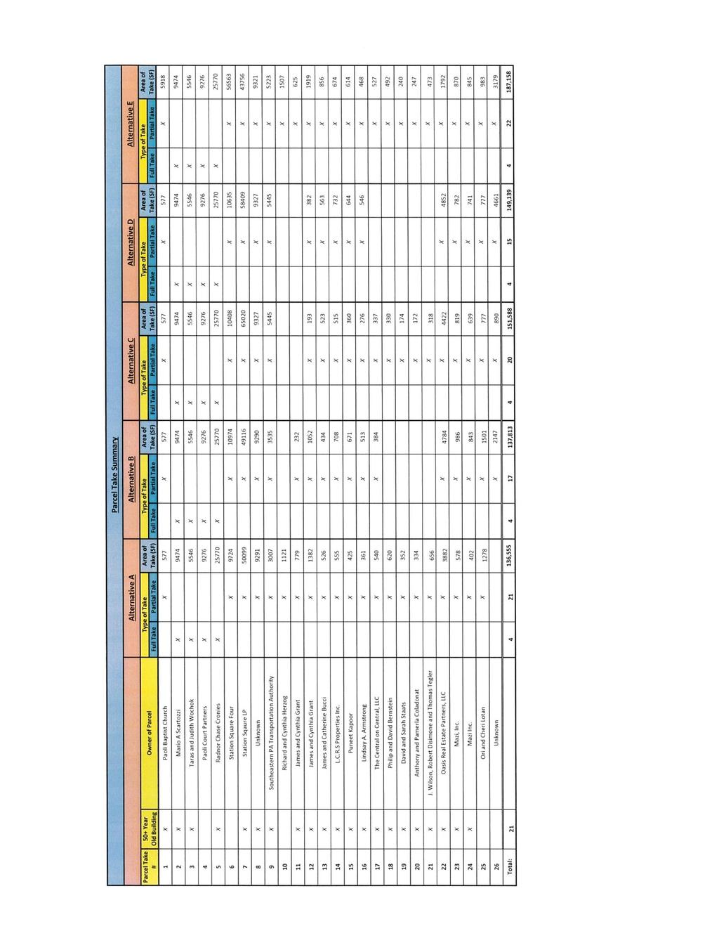
44 APPENDIX D RIGHT-OF-WAY IMPACTS
45 Darby Road Extension project Tredyffrin Township, Chester County, Pennsylvania No. Address / Parcel Number Construction Date CRGIS Information East Central Avenue Parcel ID: 4309M Fennerton Road Parcel ID: 4309M Fennerton Road Parcel ID: 4309M Fennerton Road Parcel ID: 4309L East Central Avenue Parcel ID: 4309L East Central Avenue Parcel ID: 4309L Biddle Road Parcel ID: 4309L Construction date based on aerial imagery: pre-1948 Construction date based on aerial imagery: Construction date based on aerial imagery: pre-1948 Construction date based on aerial imagery: pre-1948 Construction date based on aerial imagery: pre-1948 Construction date based on aerial imagery: pre-1950 (possibly 1948) Construction date based on aerial imagery: pre East Central Avenue Parcel ID: 4309L Construction date based on aerial imagery: East Central Avenue Parcel ID: 4309L Vacant Vacant East Central Avenue Parcel ID: 4309L Vacant Vacant Biddle Road Parcel ID: 4309L Construction date based on aerial imagery: pre North Valley Road Parcel ID: 4309L Construction date based on aerial imagery: pre North Valley Road Parcel ID: 4309L Construction date based on aerial imagery: pre North Valley Road Parcel ID: 4309L Construction date based on aerial imagery: pre North Valley Road Parcel ID: 4309L Construction date based on aerial imagery: pre North Valley Road Parcel ID: 4309L Construction date based on aerial imagery: pre North Valley Road Parcel ID 4309L Construction date based on aerial imagery: pre North Valley Road Parcel ID: 4309L Construction date based on aerial imagery: pre West Central Avenue Parcel ID: 4309L Construction date based on aerial imagery: pre West Central Avenue Parcel ID: 4309L Construction date based on aerial imagery: pre West Central Avenue Construction date based on aerial imagery: pre-1948
46 Darby Road Extension project Tredyffrin Township, Chester County, Pennsylvania Parcel ID: 4309L West Central Avenue Parcel ID: 4309L West Central Avenue Parcel ID: 4309L West Central Avenue Parcel ID: 4309L West Central Avenue Parcel ID: 4309L No Address Parcel ID: 4309L E 25 Keystone Avenue Parcel ID: 4309L E 44 West Central Avenue Parcel ID: 4309L West Central Avenue Parcel ID: 4309L E 36 West Central Avenue: Parcel ID: 4309L West Central Avenue: Parcel ID: 4309L West Central Avenue Parcel ID: 4309L West Central Avenue Parcel ID: 4309L West Central Avenue Parcel ID: 4309L West Central Avenue Parcel ID: 4309L West Central Avenue Parcel ID: 4309L West Central Avenue Parcel ID: 4309L West Central Avenue Parcel ID: 4309L West Central Avenue Parcel ID: 4309L North Valley Road Parcel ID: 4309L North Valley Road Parcel ID: 309L Construction date based on aerial imagery: pre-1948 Construction date based on aerial imagery: pre-1948 Construction date based on aerial imagery: pre-1948 Construction date based on aerial imagery: pre-1950 Vacant Vacant Construction date based on aerial imagery: pre-1948 Construction date of Pennsylvania Railroad: Paoli Tower (Key No ), per CRGIS: ca Construction date of rail-related building at western edge of parcel based on aerial imagery: pre Construction date based on aerial imagery: pre-1948 Construction date based on aerial imagery: pre-1948 Construction date based on aerial imagery: pre-1948 Construction date based on aerial imagery: pre-1950 Construction date based on aerial imagery: pre-1948 Construction date based on aerial imagery: pre-1950 Construction date based on aerial imagery: pre-1948 Construction date based on aerial imagery: pre-1950 Construction date based on aerial imagery: pre-1950 Construction date based on aerial imagery: pre-1950 Construction date based on aerial imagery: pre-1948 Construction date per CRIGS: ca. 1860, ca Vacant Vacant Parcel contains a portion of Pennsylvania Railroad: Main Line (Philadelphia to Harrisburg) (Key No ), which has been determined Eligible. Parcel also contains Pennsylvania Railroad: Paoli Tower (Key No ), which contributes to the Railroad and has an individual status of Undetermined. Approximately 800 feet west of Paoli Tower is a rail-related structure that is not shown in CRGIS. (Key No ) Undetermined
47 Darby Road Extension project Tredyffrin Township, Chester County, Pennsylvania Bracken Avenue Parcel ID: 4309L Bracken Avenue Parcel ID: 4309L Bracken Avenue Parcel ID: 4309L Bracken Avenue Parcel ID: 4309L E Bridge Carrying North Valley Road over Amtrak: Main Line No Parcel ID 1 Paoli Plaza Parcel ID: 4309L West Lancaster Avenue Parcel ID: 4309L East Lancaster Avenue Parcel ID: 4309L E Construction date per CRGIS: ca. 1860, ca Construction date per CRGIS: ca. 1860, ca Construction date per CRGIS: ca. 1860, ca Vacant Construction date per PennDOT MPMS IQ is 1983 Construction date per CRGIS: ca. 1860, 1900 Construction date based on aerial imagery: Construction date of rail-related structures, based on aerial imagery: Pre-1948 Deweas & Bracken Coal & Lumber Yard: Worker's Housing (Key No ) - Undetermined (Key No )* - Undetermined *Note: 9 and 11 Bracken Avenue are twin houses covered under the same CRGIS key. (Key No )* - Undetermined *Note: 9 and 11 Bracken Avenue are twin houses covered under the same CRGIS key. Vacant Bridge ID: Not 50+ years old Paoli Inn: Outbuilding (Key No ) Undetermined Not 50+ years old Parcel contains a portion of Pennsylvania Railroad: Main Line (Philadelphia to Harrisburg) (Key No ) which has been determined Eligible East Lancaster Avenue Parcel ID: 4309L Paoli Court Parcel ID: 4309L Paoli Court Parcel ID: 4309L Paoli Court Parcel ID: 4309L East Lancaster Avenue Parcel ID: 4309M Paoli Court Parcel ID: 4309M Paoli Court Parcel ID: 4309M East Lancaster Avenue Parcel ID: 4309M E 13 East Lancaster Avenue Parcel ID: 4309M E No Address Parcel ID: 4309M E 37 North Valley Road Parcel ID: 4309L No Address No Parcel ID Construction date based on aerial imagery: pre-1948 Vacant Construction date based on aerial imagery: pre-1948 Vacant Construction date based on aerial imagery: pre-1950 (possibly 1948) Construction date based on aerial imagery: pre-1948 Construction date based on aerial imagery: pre-1948 Vacant Construction date based on aerial imagery: pre-1948 No Structures Within Project Area Two buildings located on parcel. Construction date of both buildings based on aerial imagery: Vacant Parcel contains rail-related structures not shown in CRGIS. Vacant Vacant Vacant Parcel contains a portion of Pennsylvania Railroad: Main Line (Philadelphia to Harrisburg) (Key No ) which has been determined Eligible. Vacant
48 Darby Road Extension project Tredyffrin Township, Chester County, Pennsylvania Note: In data field Code Name, states Paper ROW (Mapped but not paved) 7 East Central Avenue Parcel ID: 4309L East Central Avenue Parcel ID: 4309M East Central Avenue Parcel ID: 4309M East Central Avenue Parcel ID: 4309M E Construction date based on aerial imagery: Construction date based on aerial imagery: Construction date based on aerial imagery: Pre-1950 Construction date of southern section of structure, per aerial imagery: pre Construction date of northern addition, per aerial imagery: AMTRAK Constructed 1833 Not 50+ years old Not 50+ years old Pennsylvania Railroad: Main Line (Philadelphia to Harrisburg) (Key No ) which has been determined Eligible.

 (KEY NO.")


49 E CENTRAL AVE 65 AMTRAK NATIONAL REGISTER-ELIGIBLE BOUNDARY OF PENNSYLVANIA RAILROAD: MAIN LINE (PHILADELPHIA TO HARRISBURG) (KEY NO ) Darby RD Darby RD AREA OF POTENTIAL EFFECT TAX PARCEL VACANT TAX PARCEL # NUMBER IN CORRESPONDING TABLE BRIDGE CARRYING NORTH VALLEY ROAD OVER AMTRAK: MAIN LINE (BRIDGE ID: ) SCALE SOURCE 0ft 275ft 0m 83.8m CHESCOVIEWS 2014 Prepared by CHRS, Inc. DARBY ROAD EXTENSION PROJECT PROPERTIES IN OR ADJACENT TO PROJECT APE 1/10/2017
50
Paoli Road Improvement Feasibility Study
 Paoli Road Improvement Feasibility Study & Public Participation Project March 24, 2015 Prepared for: Tredyffrin Township Prepared by: McMahon Associates, Inc. with Town Planning Partnership, LLC Glackin
Transportation Impact Study for Abington Terrace
 Transportation Impact Study for Abington Terrace Abington Township, Montgomery County, PA Sandy A. Koza, P.E., PTOE PA PE License Number PE059911 Prepared by McMahon Associates, Inc. 425 Commerce Drive,
Shockoe Bottom Preliminary Traffic and Parking Analysis
 Shockoe Bottom Preliminary Traffic and Parking Analysis Richmond, Virginia August 14, 2013 Prepared For City of Richmond Department of Public Works Prepared By 1001 Boulders Pkwy Suite 300, Richmond, VA
TRAFFIC STUDY GUIDELINES Clarksville Street Department
 TRAFFIC STUDY GUIDELINES Clarksville Street Department 9/1/2009 Introduction Traffic studies are used to help the city determine potential impacts to the operation of the surrounding roadway network. Two
Harrah s Station Square Casino
 Transportation Analysis Harrah s Station Square Casino Pittsburgh, Pennsylvania Submitted To: City of Pittsburgh and Pennsylvania Gaming Control Board Prepared By: DKS Associates GAI Consultants December
Roundabout Feasibility Memorandum
 Roundabout Feasibility Memorandum To From Gwen Pipkin Bill Howell Date June 18, 2013 Subject Roundabout Feasibility Study SR 29 PD&E Study From Oil Well Road to SR 82 Collier County, FL FPID 417540-1-22-01
M-58 HIGHWAY ACCESS MANAGEMENT STUDY Mullen Road to Bel-Ray Boulevard. Prepared for CITY OF BELTON. May 2016
 M-58 HIGHWAY ACCESS MANAGEMENT STUDY Prepared for CITY OF BELTON By May 2016 Introduction Missouri State Highway 58 (M-58 Highway) is a major commercial corridor in the City of Belton. As development has
Traffic Impact Analysis Chatham County Grocery Chatham County, NC
 Chatham County Grocery Chatham County, NC TABLE OF CONTENTS 1. INTRODUCTION... 1 1.1. Location and Study Area... 1 1.2. Proposed Land Use and Access... 2 1.3. Adjacent Land Uses... 2 1.4. Existing ways...
METHODOLOGY. Signalized Intersection Average Control Delay (sec/veh)
") Chapter 5 Traffic Analysis 5.1 SUMMARY US /West 6 th Street assumes a unique role in the Lawrence Douglas County transportation system. This principal arterial street currently conveys commuter traffic
Chapter 5 Traffic Analysis 5.1 SUMMARY US /West 6 th Street assumes a unique role in the Lawrence Douglas County transportation system. This principal arterial street currently conveys commuter traffic
Traffic Impact Analysis Walton Acres at Riverwood Athletic Club Clayton, NC
 Traffic Impact Analysis Walton Acres at Riverwood Athletic Club Clayton, NC 1. TABLE OF CONTENTS INTRODUCTION...1 1.1. Site Location and Study Area...1 1.2. Proposed Land Use and Site Access...2 1.3.
Clackamas County Comprehensive Plan
 ROADWAYS The County s road system permits the movement of goods and people between communities and regions, using any of a variety of modes of travel. Roads provide access to virtually all property. They
Geometric Design Tables
 Design Manual Chapter 5 - Roadway Design 5C - Geometric Design Criteria 5C-1 Geometric Design Tables A. General The following sections present two sets of design criteria tables - Preferred Roadway Elements
THIS PAGE LEFT BLANK INTENTIONALLY
 GA SR 25 Spur at Canal Road Transportation Impact Analysis PREPARED FOR GLYNN COUNTY, GEORGIA 1725 Reynolds Street, Suite 300 Brunswick, Georgia 31520 PREPARED BY 217 Arrowhead Boulevard Suite 26 Jonesboro,
Traffic Impact Study WestBranch Residential Development Davidson, NC March 2016
 Traffic Impact Study WestBranch Residential Development Davidson, NC March 216 TRAFFIC IMPACT STUDY FOR THE WestBranch Residential Development LOCATED IN DAVIDSON, NC Prepared For: Lennar Carolinas, LLC
THE FUTURE OF THE TxDOT ROADWAY DESIGN MANUAL
 THE FUTURE OF THE TXDOT ROADWAY DESIGN MANUAL Kenneth Mora, P.E. (Design Division) 10/10/2017 Table of contents 1 2 Reduction in FHWA design controlling criteria Innovative Intersection Guidance 3-7 8-42
ALLEY 24 TRAFFIC STUDY
 ALLEY 24 TRAFFIC STUDY in City of Frostburg, Maryland January 2013 3566 Teays Valley Road Hurricane, WV Office: (304) 397-5508 www.denniscorporation.com Alley 24 Traffic Study January 2013 Frostburg, Maryland
Donahue Drive Corridor Traffic Operational Evaluation
 Donahue Drive Corridor Traffic Operational Evaluation PREPARED FOR: THE CITY OF AUBURN PREPARED BY: JANUARY 2007 Donahue Drive Corridor Study--Auburn, Alabama TABLE OF CONTENTS Introduction... 1 Background
PRELIMINARY DRAFT WADDLE ROAD / I-99 INTERCHANGE PROJECT ALTERNATIVE ANALYSIS FINAL TRAFFIC SUMMARY REPORT
 PRELIMINARY DRAFT WADDLE ROAD / I-99 INTERCHANGE PROJECT ALTERNATIVE ANALYSIS FINAL TRAFFIC SUMMARY REPORT Prepared by: In Association with: November 2013 EXECUTIVE SUMMARY Patton Township, in partnership
Summary: Mercer County Princeton Avenue & Spruce Street Study January 2009
 Summary: Several recent studies have assessed potential development and redevelopment opportunities in the Mercer Crossing area of Trenton, Ewing, and Lawrence. This Princeton Avenue and Spruce Street
Table of Contents FIGURES TABLES APPENDICES. Traffic Impact Study Hudson Street Parking Garage MC Project No.: A Table of Contents
 Traffic Impact Study Hudson Street Parking Garage MC Project No.: 151714A Table of Contents Table of Contents I. INTRODUCTION... 2 II. EXISTING CONDITIONS... 5 III. 215 EXISTING TRAFFIC CONDITIONS... 6
WELCOME. Stakeholder Involvement Group Meeting #2 Round Lake Public Works October 24, 2018
 WELCOME Stakeholder Involvement Group Meeting #2 Round Lake Public Works October 24, 2018 MEETING AGENDA 1. Welcome and Introductions 2. Study Progress Update 3. Problem Statement 4. Technical Analysis
Princeton Avenue and Spruce Street Transportation and Site Access Enhancements Project
 Princeton Avenue and Spruce Street Transportation and Site Access Enhancements Project Mercer County Planning Division AECOM Transportation (formerly DMJM Harris) January 29, 2009 Agenda Project Status
Intersection Traffic Control Feasibility Study
 Intersection Traffic Control Feasibility Study CSAH 9 at CSAH 60 (185th Avenue) Prepared For: Dakota County Transportation Department Western Service Center 14955 Galaxie Avenue, 3rd Floor Apple Valley,
Chapter 4 Traffic Analysis
 Chapter 4 Traffic Analysis PURPOSE The traffic analysis component of the K-68 Corridor Management Plan incorporates information on the existing transportation network, such as traffic volumes and intersection
Recommended Roadway Plan Section 2 - Land Development and Roadway Access
 Recommended Roadway Plan Section 2 - Land Development and Roadway Access SECTION 2 Land Development and Roadway Access 2.1 Land Use and Access Management The Federal Highway Administration (FHWA) defines
TRAFFIC IMPACT STUDY COMPREHENSIVE UPDATE TOWN OF THOMPSON S STATION, TENNESSEE PREPARED FOR: THE TOWN OF THOMPSON S STATION
 TRAFFIC IMPACT STUDY COMPREHENSIVE UPDATE TOWN OF THOMPSON S STATION, TENNESSEE PREPARED FOR: THE TOWN OF THOMPSON S STATION Transportation Consultants, LLC 1101 17 TH AVENUE SOUTH NASHVILLE, TN 37212
Evaluation of M-99 (Broad Street) Road Diet and Intersection Operational Investigation
 Road Diet and Intersection Operational Investigation") Evaluation of M-99 (Broad Street) Road Diet and Intersection Operational Investigation City of Hillsdale, Hillsdale County, Michigan June 16, 2016 Final Report Prepared for City of Hillsdale 97 North Broad
Evaluation of M-99 (Broad Street) Road Diet and Intersection Operational Investigation City of Hillsdale, Hillsdale County, Michigan June 16, 2016 Final Report Prepared for City of Hillsdale 97 North Broad
TRANSPORTATION ANALYSIS REPORT US Route 6 Huron, Erie County, Ohio
 TRANSPORTATION ANALYSIS REPORT US Route 6 Huron, Erie County, Ohio December 12, 2012 Prepared for: The City of Huron 417 Main Huron, OH 44839 Providing Practical Experience Technical Excellence and Client
TRAFFIC SIGNAL WARRANT STUDY
 TRAFFIC SIGNAL WARRANT STUDY 5 th STREET & ENCHANTED PINES DRIVE JANUARY 2013 TRAFFIC OPERATIONS ENGINEERING SERVICES/PUBLIC WORKS DEPARTMENT TABLE OF CONTENTS INTERSECTION LOCATION MAP ii INTRODUCTION
Blair/Williamson Intersection Expressed Needs
 Blair/Williamson Intersection Expressed Needs NORTH Blair Street is a barrier for pedestrians and bicycles Relocate Capitol City Trail crossing from Blair Street and John Nolen Drive intersection to Williamson
Route 7 Corridor Study
 Route 7 Corridor Study Executive Summary Study Area The following report analyzes a segment of the Virginia State Route 7 corridor. The corridor study area, spanning over 5 miles in length, is a multi
Glenn Avenue Corridor Traffic Operational Evaluation
 Glenn Avenue Corridor Traffic Operational Evaluation PREPARED FOR: THE CITY OF AUBURN PREPARED BY: DECEMBER 2007 Glenn Avenue Corridor Study--Auburn, Alabama TABLE OF CONTENTS Introduction... 1 Background
6.0 PEDESTRIAN AND BICYCLE FACILITIES 6.1 INTRODUCTION 6.2 BICYCLE DEMAND AND SUITABILITY Bicycle Demand
 6.0 PEDESTRIAN AND BICYCLE FACILITIES 6.1 INTRODUCTION Bicycle and pedestrian travel along and in the vicinity of the corridor is part of the vision of Somerset and Hunterdon counties and the integrated
Public Information Meeting. Orange Camp Road. Dr. Martin Luther King Jr. Beltway to I-4. Presented by: Volusia County August 2, 2018
 Public Information Meeting Orange Camp Road Dr. Martin Luther King Jr. Beltway to I-4 Presented by: Volusia County August 2, 2018 1 Project Goals To improve the operations and safety for Orange Camp Road
Walmart (Store # ) 60 th Street North and Marion Road Sioux Falls, South Dakota
 60 th Street North and Marion Road Sioux Falls, South Dakota") Walmart (Store #4865-00) 60 th Street North and Marion Road Sioux Falls, South Dakota Prepared for: Wal-Mart Stores, Inc. Bentonville, Arkansas Prepared by: Kimley-Horn and Associates, Inc. ã2013 Kimley-Horn
Walmart (Store #4865-00) 60 th Street North and Marion Road Sioux Falls, South Dakota Prepared for: Wal-Mart Stores, Inc. Bentonville, Arkansas Prepared by: Kimley-Horn and Associates, Inc. ã2013 Kimley-Horn
DRAFT. Corridor study. Honeysuckle Road. October Prepared for the City of Dothan, AL. Prepared by Gresham, Smith and Partners
 DRAFT Corridor study Honeysuckle Road October 2017 Prepared for the City of Dothan, AL Prepared by TABLE OF CONTENTS SECTION I... 1 STUDY SUMMARY... 1 INTRODUCTION... 1 CONCLUSIONS... 5 SECTION II... 7
SECTION 1 - TRAFFIC PLANNING
 SECTION 1 - TRAFFIC PLANNING 1.1 TRAFFIC OPERATIONS 1.1.1 Roadway Functional Classification The Multnomah County Comprehensive Framework Plan s Policy 34: Trafficways and the Functional Classification
TRANSPORTATION IMPACT STUDY PROPOSED RIVERFRONT 47 MIXED USE DEVELOPMENT
 November 2016 TRANSPORTATION IMPACT STUDY PROPOSED RIVERFRONT 47 MIXED USE DEVELOPMENT & Aspinwall Borough, Sharpsburg Borough & O Hara Township, Allegheny County, Pennsylvania Prepared for: Riverfront
Traffic Impact Study Little Egypt Road Development Denver, North Carolina June 2017
 Traffic Impact Study Little Egypt Road Development Denver, North arolina June 2017 N. Little Egypt Road DQ\ QDQFLQJ VDOHV RU RWKHU SHUIRUPDQFH EDVHG FULWHULD Proposed Site Driveways Site Driveway 1 TRAFFI
DUNBOW ROAD FUNCTIONAL PLANNING
 DUNBOW ROAD FUNCTIONAL PLANNING Final Report August 3, 216 #31, 316 5th Avenue NE Calgary, AB T2A 6K4 Phone: 43.273.91 Fax: 43.273.344 wattconsultinggroup.com Dunbow Road Functional Planning Final Report
4. ENVIRONMENTAL IMPACT ANALYSIS 9. TRANSPORTATION AND TRAFFIC
 4. ENVIRONMENTAL IMPACT ANALYSIS 9. TRANSPORTATION AND TRAFFIC 4.9.1 INTRODUCTION The following section addresses the Proposed Project s impact on transportation and traffic based on the Traffic Study
9 Leeming Drive Redevelopment Ottawa, ON Transportation Brief. Prepared By: Stantec Consulting Ltd.
 9 Leeming Drive Redevelopment Ottawa, ON Transportation Brief Prepared By: Stantec Consulting Ltd. TIA GUIDELINES CHECKLIST Report Context Municipal Address Comment: Section 1.1 Location relative to major
City of Gainesville Transportation/Roadway Needs PROJECT SUMMARY
 A1 Roadway Resurfacing $23,846,000 TYPE: Preservation of existing system Roadway resurfacing A2 Signal Replacement $6,000,000 TYPE: Preservation of existing system Replace traffic signals. B1 W 6th St
102 Avenue Corridor Review
 February 26, 2015 102 Avenue Corridor Review Transportation Association of Canada Road Safety Engineering Award Submission for the City of Edmonton Introduction Transportation Association of Canada Road
Figure 1: Vicinity Map of the Study Area
 ARIZONA TEXAS NEW MEXICO OKLAHOMA May 5, 2016 Mr. Anthony Beach, P.E. BSP Engineers 4800 Lakewood Drive, Suite 4 Waco, Texas 76710 Re: Intersection and Access Analysis along Business 190 in Copperas Cove
Traffic Study North Shore School District 112
 Traffic Study North Shore School District 112 Proposed Expansion of Northwood Junior High School Prepared By: May 1, 2015 1. Introduction Kenig, Lindgren, O Hara, Aboona, Inc. (KLOA, Inc.) has been retained
Highway 49, Highway 351 and Highway 91 Improvements Feasibility Study Craighead County
 Highway 49, Highway 351 and Highway 91 Improvements Feasibility Study Craighead County Executive Summary March 2015 Highway 49, Highway 351 and Highway 91 Improvements Feasibility Study Craighead County
FRONT RANGE CROSSINGS TRAFFIC IMPACT STUDY
 FRONT RANGE CROSSINGS TRAFFIC IMPACT STUDY Prepared for: City of Thornton And Colorado Department of Transportation Prepared by: 11 Blake Street, Suite 2 Denver, Colorado 822 Contact: Brian Bern, PE, PTOE
Route 28 (South Orleans Road)/Route 39 (Harwich Road)/Quanset Road Intersection
/Route 39 (Harwich Road)/Quanset Road Intersection") TRAFFIC FEASIBILITY STUDY Route 28 (South Orleans Road)/Route 39 (Harwich Road)/Quanset Road Intersection Orleans, Massachusetts Prepared for: Town of Orleans Prepared by: Fay, Spofford & Thorndike, LLC
TRAFFIC FEASIBILITY STUDY Route 28 (South Orleans Road)/Route 39 (Harwich Road)/Quanset Road Intersection Orleans, Massachusetts Prepared for: Town of Orleans Prepared by: Fay, Spofford & Thorndike, LLC
Executive Summary Route 30 Corridor Master Plan
 Route Corridor Master Plan Project Overview The Route Corridor Master Plan is a coordinated multimodal transportation and land use plan for the entire stretch of Route through East Whiteland Township,
TRAFFIC ACTION PLAN. Laurie Meadows Neighborhood CITY OF SAN MATEO
 TRAFFIC ACTION PLAN Laurie Meadows Neighborhood CITY OF SAN MATEO Draft January 2017 Table of Contents Introduction... 2 The Traffic Forum Process... 5 Neighborhood Traffic Issues... 7 Neighborhood Recommendations
5858 N COLLEGE, LLC N College Avenue Traffic Impact Study
 5858 N COLLEGE, LLC nue Traffic Impact Study August 22, 2016 Contents Traffic Impact Study Page Preparer Qualifications... 1 Introduction... 2 Existing Roadway Conditions... 5 Existing Traffic Conditions...
Brian McHugh, Buckhead Community Improvement District. SUBJECT: Wieuca Road at Phipps Boulevard Intersection Improvements Project
 MEMO TO: FROM: Brian McHugh, Buckhead Community Improvement District Jagan Kaja, AICP, WSP Parsons Brinckerhoff SUBJECT: Wieuca Road at Phipps Boulevard Intersection Improvements Project DATE: October
Project Report. South Kirkwood Road Traffic Study. Meadows Place, TX October 9, 2015
 Meadows Place, TX October 9, 2015 Contents 1 Introduction... 1 2 Data Collection... 1 3 Existing Roadway Network... 2 4 Traffic Volume Development... 2 5 Warrant Analysis... 3 6 Traffic Control Alternative
CURBSIDE ACTIVITY DESIGN
 5 CURBSIDE ACTIVITY DESIGN This chapter provides design guidance for separated bike lanes adjacent to curbside activities including parking, loading and bus stops. Typical configurations are presented
Bluffdale/ UDOT South High-T Intersection Project Type Operations
 Bluffdale/ UDOT 14600 South High-T Intersection Project Type Operations 14600 South and Redwood Road $ 600,000 $ 550,000 This project is to install a new High-T intersection at Redwood Road and 14600 South
TRAFFIC IMPACT STUDY CRITERIA
 Chapter 6 - TRAFFIC IMPACT STUDY CRITERIA 6.1 GENERAL PROVISIONS 6.1.1. Purpose: The purpose of this document is to outline a standard format for preparing a traffic impact study in the City of Steamboat
Design Criteria. Design Criteria
 F Design Criteria Design Criteria Ministry of Transportation Ministère des Transports DESIGN CRITERIA Page: 1 of 13 WORK PROJECT NO. N/A GO Bloomington Station TYPE OF PROJECT LOCATION Bloomington Road
Capital Region Council of Governments
 March 23, 2018 Capital Region Council of Governments PROJECT CONCEPT REPORT Realignment of Swamp and Northfield Road s approaches to Route 44 (Boston Turnpike) Town of Coventry SUMMARY: The Town of Coventry
Troutbeck Farm Development
 Troutbeck Farm Development Willistown Township, Chester County PA For Submission To: Willistown Township Last Revised: October, 4 TPD# INLM.A. 5 E. High Street Suite 65 Pottstown, PA 9464 6.36.3 TPD@TrafficPD.com
APPENDIX G: INTERSECTION NEEDS AT OKEECHOBEE BOULEVARD
 APPENDIX G: INTERSECTION NEEDS AT OKEECHOBEE BOULEVARD INTERSECTION NEEDS AT SR 7 and OKEECHOBEE BOULEVARD SR 7 Extension Project Development and Environment (PD&E) Study From Okeechobee Boulevard (SR
EXISTING (2006) CONDITIONS
 CONDITIONS") Section 2 EXISTING (2006) CONDITIONS This section provides a description of the existing transportation system in the study area and a comprehensive analysis of existing traffic operations and crash history.
Section 2 EXISTING (2006) CONDITIONS This section provides a description of the existing transportation system in the study area and a comprehensive analysis of existing traffic operations and crash history.
Truck Climbing Lane Traffic Justification Report
 ROUTE 7 (HARRY BYRD HIGHWAY) WESTBOUND FROM WEST MARKET STREET TO ROUTE 9 (CHARLES TOWN PIKE) Truck Climbing Lane Traffic Justification Report Project No. 6007-053-133, P 101 Ι UPC No. 58599 Prepared by:
5. RUNNINGWAY GUIDELINES
 5. RUNNINGWAY GUIDELINES These guidelines should be considered collectively when making runningway decisions. A runningway is the linear component of the transit system that forms the right-of-way reserved
Appendix C. NORTH METRO STATION AREA TRAFFIC IMPACT STATEMENT 88th Avenue Station
 Appendix C NORTH METRO STATION AREA TRAFFIC IMPACT STATEMENT 88th Avenue Station Prepared for: Regional Transportation Department and URS Corporation as part of the North Metro EIS David Evans and Associates,
Access Location, Spacing, Turn Lanes, and Medians
 Design Manual Chapter 5 - Roadway Design 5L - Access Management 5L-3 Access Location, Spacing, Turn Lanes, and Medians This section addresses access location, spacing, turn lane and median needs, including
133 rd Street and 132 nd /Hemlock Street 132 nd Street and Foster Street MINI ROUNDABOUTS. Overland Park, Kansas
 133 rd Street and 132 nd /Hemlock Street 132 nd Street and Foster Street MINI ROUNDABOUTS Overland Park, Kansas September 1, 2017 TABLE OF CONTENTS 1. INTRODUCTION... 1 2. LITERATURE REVIEW... 1 3. CONCEPT
Bistro 6. City of Barrie. Traffic Impact Study for Pratt Hansen Group Inc. Type of Document: Final Report. Project Number: JDE 1748
 City of Barrie Traffic Impact Study for Pratt Hansen Group Inc. Type of Document: Final Report Project Number: JDE 1748 Date Submitted: June 12 th, 2017 06/12/17 John Northcote, P.Eng. Professional License
Bridge Street Corridor Study Report
 Bridge Street Corridor Study Report Prepared for: Prepared by: BRIDGE STREET CORRIDOR STUDY REPORT PREPARED FOR: CITY OF ARROYO GRANDE COMMUNITY DEVELOPMENT DEPARTMENT 300 EAST BRANCH STREET ARROYO GRANDE,
RED BANK CORRIDOR. Community Partners Committee Meeting Madisonville Recreation Center. May 21,
 RED BANK CORRIDOR Community Partners Committee Meeting Madisonville Recreation Center May 21, 2013 RED BANK CORRIDOR PROJECT Create a balance of mobility and access to better serve local communities, businesses
MEMORANDUM INTRODUCTION/PURPOSE/OVERALL FINDINGS
 MEMORANDUM Date: To: From: Subject: Steve, City of Tacoma Dan Grayuski and Will Lisska, Fehr & Peers Schuster Corridor Trail Project SE12-0265.00 INTRODUCTION/PURPOSE/OVERALL FINDINGS The City of Tacoma
Henderson Avenue Mixed-Use Development
 Zoning Case: Z145-3 Traffic Impact Analysis Henderson Avenue Mixed-Use Development Dallas, TX October 26 th, 216 Kimley-Horn and Associates, Inc. Dallas, Texas Project #644827 Registered Firm F-928 Traffic
CITY OF LOS ANGELES INTER-DEPARTMENTAL MEMORANDUM
 CITY OF LOS ANGELES INTER-DEPARTMENTAL MEMORANDUM Date: April 1, 219 To: Honorable City Council c/o City Clerk, Room 395, City Hall Attention: Honorable Mike Bonin, Chair, Transportation Committee From:
JONESBORO HIGHWAY 63 HIGHWAY 18 CONNECTOR STUDY
 JONESBORO HIGHWAY 63 HIGHWAY 18 CONNECTOR STUDY Craighead County May 2007 JONESBORO HIGHWAY 63 HIGHWAY 18 CONNECTOR STUDY Craighead County May 2007 Prepared by Planning and Research Division Arkansas State
Access Management in the Vicinity of Intersections
 Access Management in the Vicinity of Intersections FHWA-SA-10-002 Technical Summary Photo: Ralph Bentley (used with permission) 0 Access Management is: The design, implementation and management of entry
Traffic Study of Fuller Street, Cady Street, West Street and West Avenue. Final Report
 Traffic Study of Fuller Street, Cady Street, West Street and West Avenue Final Report July 2005 Prepared for: Town of Ludlow Prepared by: Pioneer Valley Planning Commission 26 Central Street West Springfield,
AGENDA REPORT. Issue: Discussion of potential improvements on Barnwell Road at Niblick Drive
 AGENDA REPORT To: From: By: Honorable Mayor and City Council Members Warren Hutmacher, City Manager Tom Black, Public Works Director Date: March 23, 2016 Agenda: March 28, 2016 WORK SESSION AGENDA: Barnwell
Traffic Analysis and Design Report. NW Bethany Boulevard. NW Bronson Road to NW West Union Road. Washington County, Oregon
 Traffic Analysis and Design Report NW Bethany Boulevard NW Bronson Road to NW West Union Road Washington County, Oregon May 2011 Table of Contents Table of Contents Section 1 Executive Summary... 2 Section
City of Homewood Transportation Plan
 City of Homewood Transportation Plan Prepared for: City of Homewood, Alabama Prepared by: Skipper Consulting, Inc. May 2007 TABLE OF CONTENTS INTRODUCTION... 1 BACKGROUND INFORMATION... 1 EXISTING TRANSPORTATION
Active Traffic Management and Part-Time Shoulder Use in Montgomery County, PA
 Active Traffic Management and Part-Time Shoulder Use in Montgomery County, PA PENN STATE TESC SESSION 8B MOVING PENNDOT AND PTC FORWARD DECEMBER 8, 2017 Agenda Define Active Traffic Management and describe
Approximately 360 trail users cross during a typical summer weekday and 420 cross during a typical summer
 5. PARKR ROAD AT MISSISSIPPI AVN CROSSIN xisting Conditions The High ine Canal trail crosses Parker Road near the Mississippi Avenue intersection (crossing location #3 on Figure 1). South of Parker, the
Technical Memorandum TRAFFIC IMPACT STUDY. RIDLEY ROAD CONVENIENCE STORE Southampton County, VA. Prepared for: Mr. David Williams.
 Technical Memorandum TRFFIC IMPCT STUDY RIDLEY ROD CONVENIENCE STORE Southampton County, V Prepared for: Mr. David Williams By: Charles Smith, P.E., PTOE EPR Charlottesville, V July 2014 1 TBLE OF CONTENTS
Comments EXECUTIVE SUMMARY
 Comments 1. Under any Alternatives, MCDOT should provide better at-grade pedestrian crossing of Georgia Avenue and Forest Glen Road, including improved crosswalks with wider medians and adequate signal
ROUNDABOUTS/TRAFFIC CIRCLES
 GENERAL 1. Description This standard identifies minimum requirements that shall be met for Roundabouts and Neighborhood Traffic Circles in the design and construction of elements for Arlington County Horizontal
Traffic Impact Study. Westlake Elementary School Westlake, Ohio. TMS Engineers, Inc. June 5, 2017
 TMS Engineers, Inc. Traffic Impact Study Westlake Elementary School Westlake, Ohio June 5, 2017 Prepared for: Westlake City Schools - Board of Education 27200 Hilliard Boulevard Westlake, OH 44145 TRAFFIC
Community Transportation Plan
 Community Transportation Plan Appendix A: Traffic Calming CITY OF DECATUR COMMUNITY TRANSPORTATION PLAN Appendix A: City of Decatur City-wide Residential Traffic Calming Program Process & Procedures The
PINESTONE TRAFFIC IMPACT STUDY Travelers Rest, South Carolina
 PINESTONE TRAFFIC IMPACT STUDY Travelers Rest, South Carolina Prepared for Longbranch Development Prepared by January 13, 219 ii Table of Contents Subject Page Signature Page... i Table of Contents...
Date: 09/22/2016 Subject: To: From: PennDOT Engineering District 5-0. Dear Applicant,
 Date: 09/22/2016 Subject: Highway Occupancy Permit Application No. 112807 Returned For Revisions To: Wal-Mart Real Estate Business Trust 2001 SE 10th Street Bentonville, AR 72716 From: PennDOT Engineering
OTTAWA TRAIN YARDS PHASE 3 DEVELOPMENT CITY OF OTTAWA TRANSPORTATION IMPACT STUDY. Prepared for:
 OTTAWA TRAIN YARDS PHASE 3 DEVELOPMENT CITY OF OTTAWA TRANSPORTATION IMPACT STUDY Prepared for: The Ottawa Train Yards Inc. 223 Colonnade Road South, Suite 212 Nepean, Ontario K2E 7K3 January 17, 2012
Status February Transportation Priority Projects in Chester County
 Transportation Priority Projects in Chester County February 2018 Highway & Trail Projects # Project Scope Current /Phase 1 US 202 over Amtrak Major bridge rehabilitation 17.6 2017-2019 2 US 202 at PA 926
INTRODUCTION THOROUGHFARE SYSTEM CLASSIFICATIONS
 INTRODUCTION The thoroughfare plan will assist public officials in the development of a specialized system for efficient and safe movement of vehicular traffic while minimizing potential conflicts with
#!! "$% ##! &! # '#! % $ #!
 Executive Summary US Highway 16 (US 16) is the primary corridor connecting Rapid City to the Black Hills region. It serves a growing population of commercial and residential traffic, as well as seasonal
Table 1.0 Grade Crossing Enhancements PVL San Jacinto Branch Line
 Grade Crossing Enhancements CPUC 1 2 3 4 5 Citrus Avenue, Riverside County Palmyrita Ave., Columbia Avenue, Marlborough Ave., Spruce St., MP 0.57 002X-0.6 027301Y MP 1.00 002X-1.0 027302F MP 1.24 002X-1.3
DRAFT. A fifth objective, other considerations, has been added to capture considerations not captured by the four primary objectives.
 TECHNICAL MEMORANDUM Albany - Washington Avenue Traffic Calming Evaluation Matrix of Conceptual Alternatives Date: May 17, 2017 Project #: 17356 To: Aleida Andrino-Chavez From: Laurence Lewis, Sara Muse,
Queensgate Drive Corridor Traffic Study
 January 2015 Prepared for: City of Richland Prepared by: J-U-B ENGINEERS, Inc. 2810 W. Clearwater Avenue, Suite 201 Kennewick, Washington 99336 Table of Contents Introduction and Background... 1 Existing
5.0 Roadway System Plan
 Southwest Boise Transportation Study Page 16 5.0 Roadway System Plan The Roadway System Plan outlines roadway improvements in the Initial Study Area. It forecasts future deficiencies on the arterial system,
Chapter 2: Standards for Access, Non-Motorized, and Transit
 Standards for Access, Non-Motorized, and Transit Chapter 2: Standards for Access, Non-Motorized, and Transit The Washtenaw County Access Management Plan was developed based on the analysis of existing
Roadway Classification Design Standards and Policies. Pueblo, Colorado November, 2004
 Roadway Classification Design Standards and Policies Pueblo, Colorado November, 2004 Table of Contents Page Chapter 1. General Provisions 1.1 Jurisdiction 3 1.2 Purpose and Intent 3 1.3 Modification 3
1609 E. FRANKLIN STREET HOTEL TRAFFIC IMPACT STUDY EXECUTIVE SUMMARY
 1609 E. FRANKLIN STREET HOTEL TRAFFIC IMPACT STUDY EXECUTIVE SUMMARY Prepared for: The Town of Chapel Hill Public Works Department Traffic Engineering Division Prepared by: HNTB North Carolina, PC 343
Marina Loft (DRC 51-R-12)
") Marina Loft (DRC 51-R-12) traffic study prepared for: Cymbal Development OCtober 2012 Traf Tech October 1, 2012 Mr. Asi Cymbal - President Cymbal Development 3470 North Miami Avenue Upper Suite Miami,
Marina Loft (DRC 51-R-12) traffic study prepared for: Cymbal Development OCtober 2012 Traf Tech October 1, 2012 Mr. Asi Cymbal - President Cymbal Development 3470 North Miami Avenue Upper Suite Miami,