AGENDA TOWN OF FLOWER MOUND TRANSPORTATION COMMISSION MEETING FEBRUARY 13, 2018 FLOWER MOUND TOWN HALL 2121 CROSS TIMBERS ROAD FLOWER MOUND, TEXAS
|
|
|
- Jordan Manning
- 6 years ago
- Views:
Transcription

1 AGENDA TOWN OF FLOWER MOUND TRANSPORTATION COMMISSION MEETING FEBRUARY 13, 2018 FLOWER MOUND TOWN HALL 2121 CROSS TIMBERS ROAD FLOWER MOUND, TEXAS 6:30 P.M. ********************************************************* AN AGENDA INFORMATION PACKET IS AVAILABLE ONLINE ********************************************************* A. CALL REGULAR MEETING TO ORDER 6:30 PM B. PLEDGE OF ALLEGIANCE C. PUBLIC PARTICIPATION Please fill out an Appearance Before Transportation Commission form in order to address the Transportation Commission, and turn the form in prior to Public Participation, or by 6:30 p.m. to the Town staff. Speakers are normally limited to three minutes. Time limits can be adjusted by the Chair as to accommodate more or fewer speakers. The purpose of this item is to allow the public an opportunity to address the Transportation Commission on issues that are not the subject of a public hearing. Any item requiring Public Hearing will allow the public to speak at the time that the item appears on this agenda as indicated as a Public Hearing. D. TRAFFIC ENGINEER REPORT Update status report related to operational issues, capital improvement projects, and TxDOT projects Future Transportation Commission meeting dates

2 Transportation Commission Meeting Agenda February 13, 2018 Page 2 E. CONSENT AGENDA Consent Items This agenda consists of non-controversial or "housekeeping" items and may be approved with a single motion. A member of the Transportation Commission may request an item(s) be withdrawn from the consent agenda and moved to regular agenda for discussion by making such request prior to a motion and vote on the Consent Agenda. 1. Consider approval of minutes from the regular meeting of the Transportation Commission held on January 9, F. REGULAR ITEMS 2. Consider a recommendation regarding a Thoroughfare Plan Amendment for the section of Silveron Boulevard from approximately 400 feet east of Long Prairie Road () to approximately 500 feet east of the Tarrant/Denton County Line to the Town Council. 3. Consider a recommendation regarding a Thoroughfare Plan Amendment for Morriss Road from Flower Mound Road (FM 3040) to Justin Road (FM 407) to the Town Council. 4. Consider a recommendation for a permanent speed limit reduction on Morriss Road between Flower Mound Road (FM 3040) to Cross Timbers Road (FM 1171) from 40 mph to 35 mph. G. ADJOURNMENT Matthew Hotelling, Traffic Engineer I do hereby certify that the Notice of Meeting was posted on the bulletin board in Town Hall of the Town of Flower Mound, Texas, a place convenient and readily accessible to the general public at all times and said Notice was posted on the following date and time: February 9, 2018 at 5:00 PM, at least 72 hours prior to the scheduled time of said meeting. Delona Verplank, Administrative Assistant The Flower Mound Town Hall and Council Chambers are wheelchair accessible. Requests for accommodations or interpretive services must be made at least 48 hours prior to this meeting by contacting Delona Verplank, Administrative Assistant at Reasonable accommodations will be made to assist your needs.
3 TRANSPORTATION COMMISSION AGENDA ITEM NO. 1 CONSENT ITEM DATE: February 13, 2018 FROM: ITEM: Matthew J. Hotelling, P.E., PTOE, Traffic Engineer Consider approval of the minutes from the regular meeting of the Transportation Commission held on January 9, BACKGROUND INFORMATION: This agenda item is to consider approval of the minutes from the January 9, 2018 regular meeting of the Transportation Commission. CITIZEN FEEDBACK: N/A ALTERNATIVES/OPTIONS: N/A FISCAL IMPACT: N/A LEGAL REVIEW: N/A ATTACHMENTS: 1. Draft minutes from the January 9, 2018 regular meeting of the Transportation Commission. RECOMMENDATION: Move to approve the minutes from the January 9, 2018 regular meeting of the Transportation Commission.
4 TRC Attachment 1 FLOWER MOUND TRANSPORTATION COMMISSION MEETING OF JANUARY 9, of 3 THE FLOWER MOUND TRANSPORTATION COMMISSION REGULAR MEETING HELD ON THE 9TH DAY OF JANUARY, 2018 IN THE FLOWER MOUND TOWN HALL, LOCATED AT 2121 CROSS TIMBERS ROAD, IN THE TOWN OF FLOWER MOUND, COUNTY OF DENTON, TEXAS AT 6:30 P.M. The Transportation Commission met in regular session with the following members present: Thomas Walker Chair Chris Reed Vice Chair Robert Gunter Commissioner, Place 1 Ron Hogue Commissioner, Place 3 Brian Smiley Commissioner, Place 4 Donald Gilmore Commissioner, Place 5 Ed Horne Commissioner, Place 8 Drew Larson Commissioner, Place 9 Constituting a quorum with the following members absent: Robert Caput Commissioner, Place 2 (Places 8 and 9 of the Commission do not vote on items unless they sit in place of one of the regular members; Places 1-7.) With the following members of the Town Staff participating: Matthew Hotelling Delona Verplank Traffic Engineer Administrative Assistant A. CALL TO ORDER - REGULAR SESSION 6:30 P.M. B. PLEDGE OF ALLEGIANCE C. PUBLIC PARTICIPATION Paul Stone, 4100 Broadway, Flower Mound, TX Mr. Stone wanted to make the Commission aware that the Morriss-Gerault Phase II project is scheduled as an upcoming agenda item at the January 18 Town Council meeting. D. TRAFFIC ENGINEER REPORT Update status report related to operational issues, capital improvement projects, and TxDOT projects Future Transportation Commission meeting dates
5 TRC Attachment 1 FLOWER MOUND TRANSPORTATION COMMISSION MEETING OF JANUARY 9, of 3 E. CONSENT AGENDA 1. Consider approval of minutes from the regular meeting of the Transportation Commission held on December 12, Commissioner Gunter made a motion to approve the December 12, 2017 minutes as presented. Vice Chair Reed seconded the motion. VOTE ON THE MOTION AYES: All in favor NAYS: None ABSTAIN: None ABSENT: Caput Motion passed F. REGULAR ITEMS 2. Next steps regarding the airbag recall and options for outreach through the Town and the Transportation Commission. Presenter Ken Benson, Consultant to the Airbag Recall North Texas Coalition Commissioner Gunter made a motion to become a partner with the Airbag Recall North Texas Coalition and to impower a three-person subcommittee, comprised of Commissioners Gilmore and Larson and Vice Chair Reed, to create a plan that outlines the activities and actions of that partnership. Vice Chair Reed seconded the motion. VOTE ON THE MOTION AYES: Gilmore, Hogue, Gunter, Reed, Smiley, Horne NAYS: None ABSTAIN: None ABSENT: Caput Motion passed G. WORKSESSION ITEMS 3. Presentation and discussion related to list of potential Transportation Commission work topics for 2018.
6 TRC Attachment 1 FLOWER MOUND TRANSPORTATION COMMISSION MEETING OF JANUARY 9, of 3 H. ADJOURNMENT 8:20 P.M. TOWN OF FLOWER MOUND TRANSPORTATION COMMISSION ATTEST: Thomas Walker, Chairman Delona Verplank, Administrative Assistant
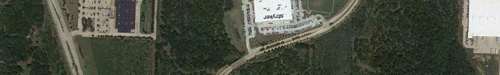
7 TRANSPORTATION COMMISSION AGENDA ITEM NO. 2 REGULAR ITEM DATE: February 13, 2018 FROM: ITEM: Matthew J. Hotelling, P.E., PTOE, Traffic Engineer Consider a recommendation regarding a Thoroughfare Plan Amendment for the section of Silveron Boulevard from approximately 400 feet east of Long Prairie Road () to approximately 500 feet east of the Tarrant/Denton County Line to the Town Council. BACKGROUND INFORMATION: This item is to consider changes to the Master Transportation Plan, more specifically the Thoroughfare Plan regarding Silveron Boulevard between approximately 400 feet east of Long Prairie Road () to approximately 500 feet east of the Tarrant/Denton County Line. A copy of the existing Thoroughfare Plan is included as Attachment 1. This section of Silveron Boulevard is currently built to the current Thoroughfare Plan designation of an Urban Minor Arterial (4 lane divided roadway that flares to a six lane divided arterial at the intersection of Long Prairie Road () to match up with Lakeside Village on the west side of Long Prairie Road (). The Town initiated a Thoroughfare Plan Analysis for this section of roadway to determine if a 2 lane divided roadway with either parallel or angled parking would be sufficient to handle the anticipated traffic through this section of Silveron Boulevard. The section of Silveron northeast of this location would remain an Urban Minor Arterial (4 lane divided roadway). The traffic study for this location is included as Attachment 2. The recently approved Point Development and an anticipated future development were used as part of this analysis to determine if this section of Silveron Boulevard would be satisfactory. The Town s TransCAD model was used to determine future volumes with a range of both high and low traffic volumes. Through the analysis, the anticipated build out of these two parcels fell within that range of traffic. Council directed staff to examine pedestrian friendly designs that include on-street parking along this section of the roadway. The Town examined two options: 1) a 2 lane divided roadway with parallel parking, and; 2) a 2 lane divided roadway with angled parking. The purpose was to determine which design supported the best LOS while remaining pedestrian friendly. Currently, under design, is a traffic signal installation at the intersection of Long Prairie Road () that will provide pedestrian signals and crosswalks at that intersection. In the midblock location, there is currently no crosswalk or warning signs of a future crossing. They are not necessary at this time because there is no development on the ground currently. When the developments do break ground there is intended to be a private trail crossing at the median opening location to cross from the north side to the south side and vice versa. As a part of those development plans, Americans with Disabilities Act (ADA) ramps and warning signs will be installed. The Point Development has asked the Town to look at the possibility of converting the current outside travel lane to parallel parking. As part of the study both parallel and angled parking were studied. Both parallel and angled parking reduce the capacity of the adjacent travel lanes by approximately 20% and 10% respectively. THOROUGHFARE CAPACITY ANALYSIS: The thoroughfare plan capacity analysis was used to determine if the new cross section would be acceptable or if the new cross section would fail Strategically Managed and Responsible Town Growth (SMARTGrowth). In order to determine if the new cross section would pass or fail, a new category within the Level of Service (LOS) Table was required. The new category would be an A2D (Arterial 2-lane Divided). The Town s acceptable LOS for arterial and collector s is LOS C. At LOS C, the upper limit for A2D was determined to be 650 vehicles without on-street parking. Therefore, and A2D with parallel parking would have an upper limit at LOS C of 520 vehicles and with angled parking an upper limit of 585. Four scenarios were evaluated to determine if the LOS for the A2D would be acceptable. Those four scenarios are: Existing, Horizon, Model Low, Model High. Both of the model scenarios were based on
8 the Town s TransCAD model in year Using the existing configuration and current traffic volumes, the traffic condition of Silveron Boulevard is acceptable. Currently, there is very little traffic along this corridor but is anticipated to increase once the traffic signal is installed at Long Prairie Road ( and Silveron Boulevard/Lakeside Village Boulevard). Using the Horizon year (2021) of both the Point Development and the future development on the south side of Silveron Boulevard, both the current configuration and angled parking are within acceptable LOS. The conversion to parallel parking is beyond LOS C and would not pass SMARTGrowth. They would be tolerable to the fact that they have not made it to a LOS F. Using the Model Low volumes of the Town s TransCAD model, all scenarios are acceptable however, the analysis of the likelihood of how both of these properties developing would be at a higher level than those indicated by the Model Low volumes. Using the Model High volumes of the Town s TransCAD model, only the current configuration of a 4 lane divided roadway would fall in the acceptable levels. Both types of parking scenarios would have failing (LOS F) sections of roadway. The directions that are not failing (LOS F) would not pass SMARTGrowth and would be beyond a LOS C. ALTERNATIVES/OPTIONS: Leave Silveron Boulevard as is with additional pedestrian treatments or change to a different cross section. FISCAL IMPACT: N/A LEGAL REVIEW: N/A ATTACHMENTS: 1. Existing Thoroughfare Plan 2. Silveron Boulevard Thoroughfare Plan Analysis DRAFT RECOMMENDATIONS: Move to recommend that Silveron Boulevard from approximately 400 feet east of Long Prairie Road () to approximately 500 feet east of the Tarrant/Denton County Line remain as currently shown on the Thoroughfare Plan. Move to recommend that Silveron Boulevard from approximately 400 feet east of Long Prairie Road (FM 2499) to approximately 500 feet east of the Tarrant/Denton County Line be changed to a two lane divided arterial with angled parking on the Thoroughfare Plan. Move to recommend that Silveron Boulevard from approximately 400 feet east of Long Prairie Road (FM 2499) to approximately 500 feet east of the Tarrant/Denton County Line be changed to a two lane divided arterial with parallel parking on the Thoroughfare Plan.

9 SIMMONS RD DUNCAN LN GARDEN RIDGE BLVD SKILLERN RD OLD SETTLERS RD LONG PRAIRIE RD RIDGECREST DR SCENIC DR SHILOH RD SHILOH RD LUSK LN RIPPY RD KIRKPATRICK LN MORRISS RD CHINN CHAPEL RD BROWNING DR TRC Attachment 1!( IH-35W!.!. WAKETON RD FM 407 DIXON LN STONE HILL VALLEY RIDGE BLV KIRKPATRICK LN FARMS PKWY D FM 1171 WAKETON RD!@ US HWY 377!@ FM 1171 RED ROCK LN KINGS RD KINGS RD QUAIL RUN LVD BRIDLEWOOD B BRU TON ORAND BLVD FM 1171 AUBURN DR!.!. W WINDSOR DR C H URCHILL DR COLLEGE PKWY TIMBER EATON DR CREEK RD CROS S TIMBERS RD PETERS COLONY RD SAG EBRUSH DR KIRKPATRICK LN FLOWER MOU N D RD DR FIREWHE EL WICHITA TRL FOR EST VISTA DR MCKAMY CREEK RD FM 3040 TOWN OF FLOWER MOUND THOROUGHFARE PLAN Functional Street Classifications!. Roundabout!@!( Grade Separation Diamond Interchange Major Arterial Greenway Urban Arterial ABERDEEN DR LA K E FOREST BLVD SPINKS RD 0 2,000 4,000 8,000 Scale in Feet November 20, 2017 Greenway Rural Arterial Urban Minor Arterial w/bike Lane Urban Minor Arterial w/on-street Parking Urban Minor Arterial Urban Minor Arterial Undivided Urban Collector. Rural Collector Service Road Denton County Tarrant County!.!.!. S LEXINGTON AVE T RAIT LN GER A ULT RD LAKESIDE PKWY D SILVERON BLV!@ Denton County Dallas County

10 TRC Attachment 2 1 MEMORANDUM To: From: Matthew J. Hotelling, P.E., PTOE Transportation Services Town of Flower Mound, Texas Jeff Whitacre, P.E., AICP, PTP Kimley-Horn and Associates, Inc. TBPE Registered Firm Number F-928 Date: January 29, 2018 Subject: Silveron Boulevard Cross Section Evaluation Flower Mound, Texas Introduction Kimley-Horn was retained by the Town of Flower Mound to perform a cross section evaluation of Silveron Boulevard. The purpose of this study is to evaluate the impact of converting the outside lanes to on-street parking. The study area for this evaluation is from to the existing bridge approximately 1,500 feet east of. Silveron Boulevard in the study area is currently a six-lane divided facility between and the existing median opening, and a four-lane facility between the existing median opening and the bridge. This evaluation will consist of an analysis of Existing (2017) and Horizon (2021) conditions. It is proposed that by the Horizon year (2021), the outside lanes of Silveron Boulevard in the study area be converted to on-street parking to serve future mixed-use development. To estimate Horizon (2021) traffic volumes in the study area, the analysis will consider development that is anticipated to be occur along Silveron Boulevard. Northwest of Silveron Boulevard, The Point is a known development anticipated to be built out by A Traffic Impact Analysis (TIA) was conducted for The Point and submitted to the Town of Flower Mound in September This TIA will be referenced in this study. The development pattern southeast of Silveron Boulevard is currently unknown. Estimates for future land uses were provided by the Town based on an anticipated growth pattern of mixed-use development, similar to The Point. This development area will be referred to in this study as Future Development. A vicinity map of the study area can be found in Exhibit 1. The following sections document the data collection and methodology used in evaluating Silveron Boulevard.

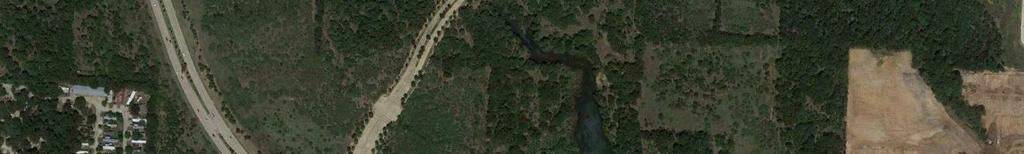
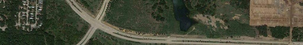


11 TRC Attachment 2 North Not To Scale Lakeside Pkwy The Point Future Development Farm to Market 2499 Exhibit 1 Vicinity Map Silveron Cross Section Analysis
12 TRC Attachment 2 Existing (2017) and Horizon (2021) Background Traffic Volumes Twenty-four-hour recording machine tube counts were obtained on December 12, 2017 on Silveron Boulevard, east of. These volumes are presented in Exhibit 2. In order to estimate future background growth along Silveron Boulevard, a growth rate of 4% was used to grow the Existing (2017) volumes to the Horizon (2021) year. This growth rate was obtained from The Point TIA. The calculated Horizon (2021) Background volumes can be found in Exhibit 3. Horizon (2021) Total Traffic Volumes The Horizon (2021) total traffic volumes were calculated by combining projected site traffic from The Point and Future Development with the Horizon (2021) Background volumes. Site traffic volumes for The Point are presented in Exhibit 4. To estimate trips generated by the Future Development, average trip generation rates from the 10 th edition of the ITE Trip Generation Manual were used. Table 1 shows the trip generation rates for the proposed land uses. Land Use Description ITE Code Units Table 1. Trip Generation Rates AM Peak Hour Daily AVG Rate PM Peak Hour Split Split AVG Rate In Out In Out Single Family 210 Units 9.44 * (X) 0.74 * (X) 25% 75% 0.99 * (X) 63% 37% Apartments (Multi-Family) 221 Rooms 5.44 * (X) 0.36 * (X) 26% 74% 0.44 * (X) 61% 39% Hotel 310 Rooms 8.36 * (X) 0.47 * (X) 59% 41% 0.60 * (X) 51% 49% Retail ft * (X) 0.94 * (X) 62% 38% 3.81 * (X) 48% 52% Restaurant ft * (X) 9.94 * (X) 55% 45% 9.77 * (X) 62% 38% Industrial ft * (X) 0.70 * (X) 88% 12% 0.63 * (X) 13% 87% Office ft * (X) 1.16 * (X) 86% 14% 1.15 * (X) 16% 84% Number of Trips Generated = Trip Rate * (Development Unit); X = Units 3 Table 2 summarizes the total number of trips that are expected to be generated at build-out of the Future Development for daily and AM and PM peak periods. The variety and intensity of land uses were estimated based on coordination with Town staff. The number of trips generated represents the number of vehicles entering and exiting the proposed development to and from the adjacent street system.
13 TRC Attachment 2 Land Use Description ITE Code Table 2. Trip Generation Analysis AM Peak Hour Intensity Units Daily PM Peak Hour Split Split Total In Out In Out Single Family Units Apartments (Multi-Family) Rooms Hotel Rooms Retail ,000 ft Restaurant ,120 ft Industrial ,000 ft Office ,000 ft Total Total The distribution and assignment of site traffic to the study area roadway network were based on existing traffic patterns and the locations of the proposed driveway access to/from the site. The following percentages of trip distribution are assumed on the surrounding roadway network: 40% -, south of the study area 30% - & Lakeside Village Boulevard intersection, southwest of the study area 30% - Lakeside Parkway, north of the study area Exhibit 5 presents the inbound and outbound directional distribution percentages for traffic during the Weekday AM and PM peak hours for the Future Development. Exhibit 6 presents the site trip assignment during the Weekday AM and PM peak hours. These site-generated traffic volumes were added to the 2021 Horizon Background traffic volumes along with site traffic from The Point to obtain the 2021 Total Traffic Volumes. These volumes are presented in Exhibit 7. Based on Exhibit 7, the traffic projected west of the bridge would be approximately 7,600 vehicles per day.
14 TRC Attachment 2 EXISTING DEVELOPMENT THE POINT FUTURE DEVELOPMENT Exhibit 2 Existing (2017) Traffic Volumes Silveron Cross Section Analysis LEGEND: Stop = Stop Controlled Approach = Travel Lane North Not To Scale
15 TRC Attachment 2 EXISTING DEVELOPMENT THE POINT FUTURE DEVELOPMENT Exhibit 3 Horizon (2021) Background Volumes Silveron Cross Section Analysis LEGEND: Stop = Stop Controlled Approach = Travel Lane North Not To Scale
16 TRC Attachment 2 EXISTING DEVELOPMENT 30% THE POINT (14) (29) (0) 0 (0) 32 (29) 48 (43) FUTURE DEVELOPMENT 30% 21 (36) 11 (18) 0 (0) (0) (36) (55) 30% of traffic entering through site drives Exhibit 4 The Point Site Traffic Silveron Cross Section Analysis 40% of traffic exiting from site drives LEGEND: Stop = Stop Controlled Approach X(Y) X = AM Peak Hour Turning Movements Y = PM Peak Hour Turning Movements = Proposed Site Access = Travel Lane 40% North Not To Scale
17 TRC Attachment 2 EXISTING DEVELOPMENT 30% THE POINT 5% 10% (5%) (5%) (20%) FUTURE DEVELOPMENT (10%) (10%) 20% 30% 10% 5% 30% of traffic entering through site drives Exhibit 5 Future Development Trip Distribution Silveron Cross Section Analysis 40% of traffic exiting from site drives LEGEND: Stop = Stop Controlled Approach X(Y) X = Inbound Distributions Y = Outbound Distributions = Proposed Site Access = Travel Lane 40% North Not To Scale
18 TRC Attachment 2 EXISTING DEVELOPMENT 30% THE POINT (0) (50) (100) 38 (41) 38 (41) 151 (165) FUTURE DEVELOPMENT 30% 0 (0) 82 (100) 41 (50) (83) (83) (200) 30% of traffic entering through site drives Exhibit 6 Future Development Site Traffic Silveron Cross Section Analysis 40% of traffic exiting from site drives LEGEND: Stop = Stop Controlled Approach X(Y) X = AM Peak Hour Turning Movements Y = PM Peak Hour Turning Movements = Proposed Site Access = Travel Lane 40% North Not To Scale
19 TRC Attachment 2 EXISTING DEVELOPMENT 30% THE POINT (14) (79) (100) 38 (41) 87 (105) 199 (208) FUTURE DEVELOPMENT 30% 21 (36) 173 (134) 41 (50) (83) (119) (255) 30% of traffic entering through site drives Exhibit 7 Total Horizon (2021) Volumes Silveron Cross Section Analysis 40% of traffic exiting from site drives LEGEND: Stop = Stop Controlled Approach X(Y) X = AM Peak Hour Turning Movements Y = PM Peak Hour Turning Movements = Proposed Site Access = Travel Lane 40% North Not To Scale
20 TRC Attachment 2 11 Future Model Volumes Based on the model update for the 2014 Impact Fees, the future year ADT along Silveron Boulevard was forecasted to be approximately 3,000 vehicles per day. Recently, the DFW model was updated to reflect 2040 demographics and roadway network, and based on the updated model, the future year ADT along Silveron Boulevard is anticipated to be approximately 10,000 vehicles per day. Based on these two points of reference, it can be expected that the future year volume along Silveron Boulevard will be between 3,000 and 10,000 vehicles per day. Note the calculations in this traffic study were in this range (7,600 vehicles per day). Thoroughfare Capacity Analysis To properly evaluate the effects of reducing the number of lanes on Silveron Boulevard, a thoroughfare capacity analysis was conducted. The analysis was completed using level of service criteria provided in Chapter 6 of the Town of Flower Mound SMARTGrowth Manual. Capacity defines the volume of traffic that can be accommodated by a roadway at a specific level of service, and is affected by various geometric factors including roadway type (divided vs undivided), number of lanes, lane widths, and grade. Level of service (LOS), which is a measure of the degree of congestion, ranges from LOS A (free flowing) to LOS F (a congested, forced flow condition). Table 3 shows the Town of Flower Mound SMARTGrowth Manual level of service criteria for the thoroughfare capacity analysis. LOS C is the minimum acceptable level of service by the Town of Flower Mound for design and evaluation purposes. Table 3. SMARTGrowth Level of Service Thresholds for Thoroughfares Roadway Type Level of Service "C" Level of Service "D" Level of Service "E" Daily Service Volumes* Hourly Service Volume Daily Service Volumes* Hourly Service Volume Daily Service Volumes* Hourly Service Volume A8D*** 52,000-58, ** 58,000-66, ** 66,000-73, ,100** A6D*** 39,000-44, ** 44,000-49, * 49,000-55, ,100** A4D*** 21,000-23, ** 23,000-26, ** 26,000-29, ** MC4U 17,000-18, ** 18,000-21, ** 21,000-23, ** C4U 15,000-17, ** 17,000-18, ** 18,000-21, ** C2U 6,000-7, ** 7,000-8, ** 8,000-9, ** * Level of service with "K" = 0.10 and "D" = 60%/40% ** Assumes signal progression; no parking; access management; increased intersection capacity and grade seperation *** Assumes 12' lanes and divided roadway; A8D = arterial 8 lane divided; A6D = arterial 6 lane divided; A4D = arterial 4 lane divided Note: Metropolitian collector MC4U = 4 lane undivided (12' lanes); C4U = collector 4 lane undivided (11' lanes)
21 TRC Attachment 2 The Town of Flower Mound SMARTGrowth Manual does not currently provide capacity values for two-lane divided roadways (A2D). It is anticipated that this classification will be added to the SMARTGrowth Manual in the near future. To estimate the appropriate hourly capacity for A2D facilities, existing NCTCOG and SMARTGrowth capacity values were referenced. It is estimated that a two-lane divided facility will provide more capacity than a standard undivided collector, but less than a traditional divided arterial due to the lack of a passing lane. Based on these assumptions, an hourly capacity of 650 vehicles was assumed for the A2D facilities at the LOS C threshold. Table 4 provides a summary of directional and two-way thoroughfare capacity analysis for Silveron Boulevard in Existing (2017), Horizon (2021), and Model volume conditions. The Model Volume analysis was split into two scenarios: a low-end scenario, and a high-end scenario. The low-end scenario is based on a daily volume of 3,000 vehicles, and the highend scenario is based on a daily volume of 10,000 vehicles. The analysis evaluates the following lane configurations: Existing lane configuration Outside lanes converted to parallel parking Outside lanes converted to parallel parking from to the existing median opening, and angled parking between the median opening and the bridge Effects of On-Street Parking It is generally accepted that the presence of on-street parking has many different impacts on a roadway, including the portion of right-of-way not used for vehicular travel. On-street parking is widely recommended as a method of enhancing a street because it provides a barrier between vehicular and pedestrian traffic, acts as a traffic calming measure, and can help to boost the economic activity of the surrounding area. The impact of on-street parking on traffic flow can vary widely depending on the type of parking that is provided and the expected hourly turnover. Studies have estimated that onstreet parking can decrease roadway capacity by up to 17% in areas with high-turnover and parking configurations requiring reverse maneuvers. This reduction in capacity can also be as little as 2% in areas with low turnover and parking configurations that result in fewer reverse maneuvers. For the purposes of this analysis, conservative reduction factors of 10% and 20% were applied to the SMARTGrowth capacity values to account for the impacts of angled parking and parallel parking, respectively. As shown in the table, both roadway segments in Existing (2017) and Horizon (2021) scenarios are anticipated to perform at acceptable operations throughout the corridor. Results Based on the results of the thoroughfare capacity analysis presented in Table 4, Silveron Boulevard is anticipated to operate at LOS C or better for all scenarios except for the highend model volume scenario along the two lane section west of the bridge. This scenario shows a potential for LOS D operation during the AM and PM peak hours in the direction of 12
22 TRC Attachment 2 peak hour flow. This represents the maximum growth along Silveron Boulevard based on the travel demand model. It is more likely that Silveron Boulevard will experience growth that is somewhere between the high and low end scenarios. 13
23 TRC Attachment 2 14 Table 4. Thoroughfare Capacity Analysis Summary Scenario Segment Lane Configuration Class (Section) SMART- Growth Capacity Capacity with On- Street Parking Direction Vol AM Peak Hour V/C Traffic Condition Vol PM Peak Hour V/C Traffic Condition Existing (2017) East of West of Bridge 6 Lanes Divided 4 Lanes Divided Urban Minor Arterial Urban Minor Arterial EB Acceptable Acceptable WB Acceptable Acceptable Total Acceptable Acceptable EB Acceptable Acceptable WB Acceptable Acceptable Total Acceptable Acceptable East of 4 Lanes Divided with Parallel Parking** Urban Minor Arterial EB Acceptable Acceptable WB Acceptable Acceptable Total Acceptable Acceptable Horizon (2021) West of Bridge 2 Lanes Divided with Parallel Parking** Urban Minor Arterial EB Tolerable Tolerable WB Acceptable Tolerable Total Acceptable Tolerable West of Bridge 2 Lanes Divided with Angled Parking* Urban Minor Arterial EB Acceptable Acceptable WB Acceptable Acceptable Total Acceptable Acceptable East of 4 Lanes Divided with Parallel Parking** Urban Minor Arterial EB Acceptable Acceptable WB Acceptable Acceptable Total Acceptable Acceptable Model (Low End) West of Bridge 2 Lanes Divided with Parallel Parking** Urban Minor Arterial EB Acceptable Acceptable WB Acceptable Acceptable Total Acceptable Acceptable West of Bridge 2 Lanes Divided with Angled Parking* Urban Minor Arterial EB Acceptable Acceptable WB Acceptable Acceptable Total Acceptable Acceptable Model (High End) East of West of Bridge West of Bridge 4 Lanes Divided with Parallel Parking** 2 Lanes Divided with Parallel Parking** 2 Lanes Divided with Angled Parking* Urban Minor Arterial Urban Minor Arterial Urban Minor Arterial EB Acceptable Acceptable WB Acceptable Acceptable Total 1, Acceptable 1, Acceptable EB Failing Tolerable WB Tolerable Failing Total 1, Tolerable 1, Tolerable EB Failing Tolerable WB Tolerable Failing Total 1, Tolerable 1, Tolerable * A 10% reduction of SMARTGrowth capacity volumes was assumed for Angled On-Street Parking capacity in the Horizon and Model scenarios. ** A 20% reduction of SMARTGrowth capacity volumes was assumed for Parallel On-Street Parking capacity in the Horizon and Model scenarios.
24 TRC Attachment 2 Conclusion Based on the results of the Silveron Boulevard cross section analysis, we offer the following conclusions and recommendations: Based on an analysis of anticipated development, Silveron Boulevard is projected to grow to a peak hour volume of vehicles by the Horizon (2021) year. Based on a model volume analysis, Silveron Boulevard is project to grow to a peak hour volume of 300-1,000 vehicles by the year It is anticipated that Silveron Boulevard in the study area will operate at LOS C or better in the Horizon (2021) and Low-End Model Volume Scenarios if the outside lanes are converted to on-street parking. If volumes approach the 2040 high-end model volume scenario (10,000-11,000 daily), it is anticipated that operating conditions in the study area will shift to LOS D. 15
25 TRC Attachment 2 16 Attachments 1. Exhibit 1 Vicinity Map 2. Exhibit 2 Existing (2017) Volumes 3. Exhibit 3 Horizon (2021) Background Volumes 4. Exhibit 4 The Point Site Traffic 5. Exhibit 5 Future Development Trip Distribution 6. Exhibit 6 Future Development Site Traffic 7. Exhibit 7 Total Horizon (2021) Volumes
26 TRANSPORTATION COMMISSION AGENDA ITEM NO. 3 REGULAR ITEM DATE: February 13, 2018 FROM: ITEM: Matthew J. Hotelling, P.E., PTOE, Traffic Engineer Consider a recommendation regarding a Thoroughfare Plan Amendment for Morriss Road from Flower Mound Road (FM 3040) to Justin Road (FM 407) to the Town Council. BACKGROUND INFORMATION: This item is to consider changes to the Master Transportation Plan, more specifically the Thoroughfare Plan regarding Morriss Road between Flower Mound Road (FM 3040) and Justin Road (FM 407). A copy of the existing Thoroughfare Plan is included as Attachment 1. Morriss Road as it is currently built resembles a Greenway Urban Arterial and is designated as a Major Arterial on the current Thoroughfare Plan. The history of Morriss Road begins as it first appeared on the Town s Thoroughfare Plan in 1981 as a major arterial. It has continued as a major arterial through various adoptions of the Thoroughfare Plan in 1985, 1994, 2000, 2004 and the most recent comprehensive master plan amendment in There have been many minor adjustments to the Thoroughfare Plan since 2009 as well. During the 2009 Master Transportation Plan update, Morriss/Gerault was evaluated and the following were the anticipated traffic volumes for Morriss/Gerault for the 2030 Model volumes, vehicles per day, where the expected Level of Service (LOS) was beyond LOS C: Morriss FM 3040 to FM ,000 34,000 Gerault FM 3040 to Spinks 33,500 38,500 Gerault Spinks to 40,000 47,000 The 2030 LOS map, LOS beyond C volumes and map showing the 2030 modeled volumes is included as Attachment 2. This attachment is an excerpt from the 2009 Master Transportation Plan. At the February 5, 2018, Town Council meeting, the direction from the Council was for the Transportation Commission to study the need for Morriss from FM 3040 to FM 407 to be a Major Arterial street. The agenda packet and video from this meeting can be found at the following links: Agenda Item, Video, Results of the Town Council meeting were unanimous that the Council was not interested in building Morriss Road to its current Thoroughfare Plan cross section (6 lane divided arterial). The Town Council voted to keep Morriss Road as a 4 lane divided roadway. Discussion amongst the Council was to change it to one of the 4 lane arterial cross sections and asked the Transportation Commission to study Morriss Road and to give their recommendation. ALTERNATIVES/OPTIONS: Leave Morriss Road as is, change to a Greenway Urban Arterial or as one of the Urban Minor Arterials. FISCAL IMPACT: N/A LEGAL REVIEW: N/A ATTACHMENTS: 1. Existing Thoroughfare Plan 2. Excerpt from the 2009 Master Transportation Plan
27 DRAFT RECOMMENDATIONS: Move to recommend that Morriss Road from Flower Mound Road (FM 3040) to Justin Road (FM 407) remain as currently shown on the Thoroughfare Plan to the Town Council. Move to recommend that Morriss Road from Flower Mound Road (FM 3040) to Justin Road (FM 407) be changed to a Greenway Urban Arterial on the Thoroughfare Plan to the Town Council. Move to recommend that Morriss Road from Flower Mound Road (FM 3040) to Justin Road (FM 407) be changed to an Urban Minor Arterial (specify type) on the Thoroughfare Plan to the Town Council.
28 SIMMONS RD DUNCAN LN GARDEN RIDGE BLVD SKILLERN RD OLD SETTLERS RD LONG PRAIRIE RD RIDGECREST DR SCENIC DR SHILOH RD SHILOH RD LUSK LN RIPPY RD KIRKPATRICK LN MORRISS RD CHINN CHAPEL RD BROWNING DR TRC Attachment 1!( IH-35W!.!. WAKETON RD FM 407 DIXON LN STONE HILL VALLEY RIDGE BLV KIRKPATRICK LN FARMS PKWY D FM 1171 WAKETON RD!@ US HWY 377!@ FM 1171 RED ROCK LN KINGS RD KINGS RD QUAIL RUN LVD BRIDLEWOOD B BRU TON ORAND BLVD FM 1171 AUBURN DR!.!. W WINDSOR DR C H URCHILL DR COLLEGE PKWY TIMBER EATON DR CREEK RD CROS S TIMBERS RD PETERS COLONY RD SAG EBRUSH DR KIRKPATRICK LN FLOWER MOU N D RD DR FIREWHE EL WICHITA TRL FOR EST VISTA DR MCKAMY CREEK RD FM 3040 TOWN OF FLOWER MOUND THOROUGHFARE PLAN Functional Street Classifications!. Roundabout!@!( Grade Separation Diamond Interchange Major Arterial Greenway Urban Arterial ABERDEEN DR LA K E FOREST BLVD SPINKS RD 0 2,000 4,000 8,000 Scale in Feet November 20, 2017 Greenway Rural Arterial Urban Minor Arterial w/bike Lane Urban Minor Arterial w/on-street Parking Urban Minor Arterial Urban Minor Arterial Undivided Urban Collector. Rural Collector Service Road Denton County Tarrant County!.!.!. S LEXINGTON AVE T RAIT LN GER A ULT RD LAKESIDE PKWY D SILVERON BLV!@ Denton County Dallas County
29 US 377 Old Settlers Rd. Kirkpatrick Rd. Garden Ridge Rd. TRC Attachment 2 Skillern Road 2030 Level of Service ARGYLE Lewisville Lake HIGHLAND VILLAGE A < 0.40 B = C = D = E = F > 1.00 N BARTONVILLE Miles FM 407 NORTHLAKE Dixon Ln. FM 1171 DOUBLE OAK Kings Rd. Waketon Rd. Valley Ridge Blv Kirkpatrick Rd. Shiloh Rd. Lusk Ln. Bridlewood Blvd. Churchill Dr. Eaton Morriss Rd. Timbercreek Rd. College Pkwy. LEWISVILLE Flower Mound Flower Mound Rd. High Rd. Firewheel Dr. Wichita Trail Forest Vista Dr. ROANOKE TROPHY CLUB Simmons Rd. Spinks Rd. FM 3040 Lexington Ave. FORT WORTH WESTLAKE Denton County Tarrant County SOUTHLAKE Grapevine Lake Silveron Blvd. Gerault Rd. Lakeside Pkwy. Denton County Dallas County COPPELL KELLER KELLER Figure Modeled Level-of-Service (LOS) Page
30 TRC Attachment 2 Dixon Lane Roadway From To Modeled Volume Lanes Shiloh Rd. FM 1171 North Town Limits 8,500 2 Wichita Trail Skillern Rd. Simmons Rd. 9,000 2 McKamy Creek Rd. Simmons Rd. Old Settlers Rd. 17,500 4 Chinn Chapel FM 407 Dixon Ln. 22,500 4 Valley Ridge Blvd. Morriss Rd. Stonehill Farms Pkwy. 23,000 4 FM 407 Stonehill Farms Pkwy. East Town Limit 23,500 4 Garden Ridge Blvd. FM 1171 Forest Vista Dr. 24,500 4 Morriss Rd. FM 3040 FM ,000-34,000 6 FM 1171 Morriss Rd. Garden Ridge Blvd. 34,500-42,500 6 FM 1171 US 377 Lusk Ln. 48,000-55,000 6 Table 2: Roadway Segments With Modeled Level of Service D Roadway From To Modeled Volume Lanes Lusk Ln. FM 1171 North Town Limits 9,000 2 Peters Colony Rd. Bruton Orand Blvd. Old Settlers Rd. 9,500 2 McKamy Creek Rd. Old Settlers Rd. Flower Mound Rd. 25,000 4 Garden Ridge Blvd. Forest Vista Dr. Spinks Rd. 26,000 4 Flower Mound Rd. Bruton Orand Blvd. McKamy Creek Rd. 28,500 4 Morriss Rd. FM 3040 Spinks Rd. 33,500-38,500 6 Lakeside Pkwy. Garden Ridge Blvd. East Town Limit 42,000 6 FM 407 FM ,000-44,000 6 FM 1171 Lusk Ln. Morriss Rd. 41,000-45,000 6 Table 3: Roadway Segments With Modeled Level of Service E Roadway From To Modeled Volume Lanes Peters Colony Rd. Old Settlers Rd. Churchill Dr. 16,000 2 Gardern Ridge Rd. Spinks Rd. Lakeside Pkwy. 29,000 4 FM 407 West Town Limit 33,000-38,000 4 Gerualt Rd. Spinks Rd. 40,000-47,000 6 Flower Mound Rd. McKamy Creek Rd. 56,000 6 FM 3040 Gerualt Rd. 51,000-66,500 6 Gerualt Rd. South Town Limit 95,000 6 Table 4: Roadway Segments With Modeled Level of Service F Page
31 US 377 Old Settlers Rd. Kirkpatrick Rd. Garden Ridge Rd. TRC Attachment 2 Bridlewood Drive ARGYLE Lewisville Lake HIGHLAND VILLAGE 2030 Modeled Volumes (vpd) 0-14,000 14,001-28,000 28,001-42,000 42,001-56,000 56,001 + N BARTONVILLE Miles FM 407 NORTHLAKE Dixon Ln. FM 1171 DOUBLE OAK Kings Rd. Waketon Rd. Valley Ridge Blv Kirkpatrick Rd. Shiloh Rd. Lusk Ln. Bridlewood Blvd. Churchill Dr. Eaton Morriss Rd. Timbercreek Rd. College Pkwy. LEWISVILLE Flower Mound Flower Mound Rd. High Rd. Firewheel Dr. Wichita Trail Forest Vista Dr. ROANOKE TROPHY CLUB Simmons Rd. Spinks Rd. FM 3040 Lexington Ave. FORT WORTH WESTLAKE Denton County Tarrant County SOUTHLAKE Grapevine Lake Silveron Blvd. Gerault Rd. Lakeside Pkwy. Denton County Dallas County COPPELL KELLER KELLER Figure Modeled Volumes Page
32 TRANSPORTATION COMMISSION AGENDA ITEM NO. 4 REGULAR ITEM DATE: February 13, 2018 FROM: ITEM: Matthew J. Hotelling, P.E., PTOE, Traffic Engineer Consider a recommendation for a permanent speed limit reduction on Morriss Road between Flower Mound Road (FM 3040) to Cross Timbers Road (FM 1171) from 40 mph to 35 mph. BACKGROUND INFORMATION: This item is a regular item to allow the Transportation Commission the opportunity to provide input and recommendation to the Town Council regarding a speed limit reduction on Morriss Road between FM 3040 and FM ENGINEERING STUDY: An engineering study to determine the speed limit of a local street consists of the following information: 85 th percentile speed Road characteristics, shoulder condition, grade, alignment, and sight distance Pace speed Roadside development and environment Parking practices and pedestrian activity Reported crash experience for at least a 12-month period The 85 th percentile speed is the speed at which 85% of the traffic travels at or below. The speed limit for a particular street is generally set within +/- 5 mph of the 85 th percentile speed. The 85 th percentile speed for this section of Morriss Road will be provided at the meeting for both northbound and southbound at various locations along Morriss Road. Staff has determined the road characteristics, shoulder condition, grade, alignment and sight distance for the streets along Morriss Road. The roadway in this section of Morriss is generally built with 11 foot wide lanes, arterial concrete street and is curvilinear. It does not have a shoulder, and generally has good sight distance. The Fuqua Drive intersection meets the minimum standards for visibility at the current speed limit but would be improved with a lower speed limit. No intersections within this section of Morriss Road are controlled by an all way stop condition. Including both Flower Mound Road (FM 3040) and Cross Timbers (FM 1171), 6 intersections are controlled by traffic signals. Two reduced speed school zones are located within this stretch of Morriss Road The pace speed is the 10 mph range of speed which the largest majority of drivers are driving. The pace speed within the subject area will be provided at the meeting for both northbound and southbound at various locations along Morriss Road. The roadside development for Morriss Road between Lake Bluff Drive and approximately 650 feet south of Cross Timbers Road (FM 1171) is primarily residential. Outside of these two limits, the roadside development changes to primarily commercial/institutional. The exception would be in the vicinity of Garden Road with the Forestwood Middle School and the adjacent commercial/institutional development on the west side of Morriss Road across from the school and the northwest corner of Morriss Road and Forest Vista with an institutional use. Regarding parking practices and pedestrian activity, pedestrian activity for this area is primarily related to the residential homes and the school. Parking practices is off street parking and illegal to park within Morriss Road itself.
33 Research of reported crash experience for the past 12 months for just the area outside of the commercial areas, reveals that 22 reported accidents have occurred. Of those 22 accidents, 5 cause factors involving speed were reported. Accidents took place primarily at intersections. Other cause factors involved changing lanes when unsafe, disregarding stop and go signal, driver inattention/distraction/texting, failing to yield ROW, impaired visibility, faulty evasive action and driving under the influence of alcohol. The natural break points for the speed limits along Morriss Road, if not consistent throughout the corridor, would be where the land use changes. If the speed limit is changed; staff recommends that the location of the reduced speed limit be from approximately 650 feet south of Cross Timbers Road (FM 1171) to Lake Bluff Drive. FISCAL IMPACT: N/A LEGAL REVIEW: N/A ATTACHMENTS: 1. Vicinity Map of Morriss Road. DRAFT RECOMMENDATIONS: Move to recommend approval of a permanent speed limit reduction on Morriss Road between Lake Bluff Drive and approximately 650 feet south of Cross Timbers Road (FM 1171) to the Town Council. Move to recommend no speed limit change on Morriss Road between Lake Bluff Drive and approximately 650 feet south of Cross Timbers Road (FM 1171) to the Town Council.

34 GARDEN RD FIRESIDE DR Vicinity Map - Morriss Rd Attachment 4 TRC Attachment 1 N CROSS TIMBERS RD CORTADERA ST ARROWHEAD DR RIVER OAKS DR YUCCA DR HENLEY CT MILFORD DR OAK DR SAGEBRUSH DR FIREWHEEL DR LAKE FOREST BLVD HARTFORD DR CHERRY BROOK WAY AMBER LN CREEKHAVEN DR COVINGTON DR TOWNE VIEW BLVD SHUMARD LN FLOWER MOUND RD HILL RIDGE DR ROBIN LN AMHEARST LN RED OAK LN ORCHID CT NOTTINGHAM ST FUQUA DR OAKWOOD CT YAGGI DR CHINABERRY DR FOREST VISTA DR MORRISS RD RESERVE CT STRAIT LN THRUSH RD ACORN TRL PAISLEY DR LAKE BLUFF DR DRAKE TRL CARTER CT BROOKWOOD DR Vicinity Map Legend MorrissRd Project Location(s)
TABLE OF CONTENTS 7.0 THOROUGHFARE PLAN. Analysis of Future Conditions Thoroughfare Plan Proposed Cross-Sections.. 7.
 TABLE OF CONTENTS 7.0 THOROUGHFARE PLAN Analysis of Future Conditions.. 7.2 Thoroughfare Plan.. 7.3 Proposed Cross-Sections.. 7.4 Arterials Minor Arterials Collectors Local Streets Thoroughfare Plan Map
Town of Flower Mound Master Transportation Plan Update
 Town of Flower Mound Master Transportation Plan Update Town Council January 5, 2009 Agenda Project Schedule Why we re here Recommended Changes to MTP; plus: Transportation Commission Recommendations (11/11/08)
Henderson Avenue Mixed-Use Development
 Zoning Case: Z145-3 Traffic Impact Analysis Henderson Avenue Mixed-Use Development Dallas, TX October 26 th, 216 Kimley-Horn and Associates, Inc. Dallas, Texas Project #644827 Registered Firm F-928 Traffic
6060 North Central Expressway Mixed-Use Site Dallas, Texas
 Volume 1 Traffic Impact Analysis 6060 North Central Expressway Mixed-Use Site Dallas, Texas April 30, 2018 Kimley-Horn and Associates, Inc. Dallas, Texas Project #063238300 Registered Firm F-928 Traffic
TRANSPORTATION ANALYSIS REPORT US Route 6 Huron, Erie County, Ohio
 TRANSPORTATION ANALYSIS REPORT US Route 6 Huron, Erie County, Ohio December 12, 2012 Prepared for: The City of Huron 417 Main Huron, OH 44839 Providing Practical Experience Technical Excellence and Client
Traffic Impact Analysis Chatham County Grocery Chatham County, NC
 Chatham County Grocery Chatham County, NC TABLE OF CONTENTS 1. INTRODUCTION... 1 1.1. Location and Study Area... 1 1.2. Proposed Land Use and Access... 2 1.3. Adjacent Land Uses... 2 1.4. Existing ways...
Chapter 4 Traffic Analysis
 Chapter 4 Traffic Analysis PURPOSE The traffic analysis component of the K-68 Corridor Management Plan incorporates information on the existing transportation network, such as traffic volumes and intersection
5858 N COLLEGE, LLC N College Avenue Traffic Impact Study
 5858 N COLLEGE, LLC nue Traffic Impact Study August 22, 2016 Contents Traffic Impact Study Page Preparer Qualifications... 1 Introduction... 2 Existing Roadway Conditions... 5 Existing Traffic Conditions...
Volume 1 Traffic Impact Analysis. Texas Odyssey TIA Dallas, Texas. Kimley-Horn and Associates, Inc. Dallas, Texas. May 23, 2018
 Volume 1 Traffic Impact Analysis Texas Odyssey TIA Dallas, Texas May 23, 2018 Kimley-Horn and Associates, Inc. Dallas, Texas Project #064529800 Registered Firm F-928 Traffic Impact Analysis Texas Odyssey
Traffic Impact Analysis Walton Acres at Riverwood Athletic Club Clayton, NC
 Traffic Impact Analysis Walton Acres at Riverwood Athletic Club Clayton, NC 1. TABLE OF CONTENTS INTRODUCTION...1 1.1. Site Location and Study Area...1 1.2. Proposed Land Use and Site Access...2 1.3.
Truck Climbing Lane Traffic Justification Report
 ROUTE 7 (HARRY BYRD HIGHWAY) WESTBOUND FROM WEST MARKET STREET TO ROUTE 9 (CHARLES TOWN PIKE) Truck Climbing Lane Traffic Justification Report Project No. 6007-053-133, P 101 Ι UPC No. 58599 Prepared by:
Walmart (Store # ) 60 th Street North and Marion Road Sioux Falls, South Dakota
 60 th Street North and Marion Road Sioux Falls, South Dakota") Walmart (Store #4865-00) 60 th Street North and Marion Road Sioux Falls, South Dakota Prepared for: Wal-Mart Stores, Inc. Bentonville, Arkansas Prepared by: Kimley-Horn and Associates, Inc. ã2013 Kimley-Horn
Walmart (Store #4865-00) 60 th Street North and Marion Road Sioux Falls, South Dakota Prepared for: Wal-Mart Stores, Inc. Bentonville, Arkansas Prepared by: Kimley-Horn and Associates, Inc. ã2013 Kimley-Horn
City of Wayzata Comprehensive Plan 2030 Transportation Chapter: Appendix A
 A1. Functional Classification Table A-1 illustrates the Metropolitan Council s detailed criteria established for the functional classification of roadways within the Twin Cities Metropolitan Area. Table
Subject: Solberg Avenue / I-229 Grade Separation: Traffic Analysis
 MEMORANDUM Transportation Bill Troe, AICP Jason Carbee, AICP 12120 Shamrock Plaza Suite 300 Omaha, NE 68154 (402) 334-8181 (402) 334-1984 (Fax) To: Project File Date: Subject: Solberg Avenue / I-229 Grade
Technical Memorandum TRAFFIC IMPACT STUDY. RIDLEY ROAD CONVENIENCE STORE Southampton County, VA. Prepared for: Mr. David Williams.
 Technical Memorandum TRFFIC IMPCT STUDY RIDLEY ROD CONVENIENCE STORE Southampton County, V Prepared for: Mr. David Williams By: Charles Smith, P.E., PTOE EPR Charlottesville, V July 2014 1 TBLE OF CONTENTS
METHODOLOGY. Signalized Intersection Average Control Delay (sec/veh)
") Chapter 5 Traffic Analysis 5.1 SUMMARY US /West 6 th Street assumes a unique role in the Lawrence Douglas County transportation system. This principal arterial street currently conveys commuter traffic
Chapter 5 Traffic Analysis 5.1 SUMMARY US /West 6 th Street assumes a unique role in the Lawrence Douglas County transportation system. This principal arterial street currently conveys commuter traffic
Existing Conditions. Date: April 16 th, Dan Holderness; Coralville City Engineer Scott Larson; Coralville Assistant City Engineer
 Date: April 16 th, 2015 To: From: Re: Dan Holderness; Coralville City Engineer Scott Larson; Coralville Assistant City Engineer Darian Nagle-Gamm, Traffic Engineering Planner Highway 6 (2 nd Street) /
3.0 Future Conditions
 3.0 Future Conditions In order to be able to recommend appropriate improvements to the transportation system of the Town, it is important to first understand the nature and volume of traffic that is expected
INDUSTRIAL BUILDING 3009 HAWTHORNE ROAD CITY OF OTTAWA TRANSPORTATION OVERVIEW REVISED. Prepared for: Canada Inc.
 INDUSTRIAL BUILDING 3009 HAWTHORNE ROAD CITY OF OTTAWA TRANSPORTATION OVERVIEW REVISED Prepared for: 7849648 Canada Inc. Octiober 1, 2015 114-598 Overview_2.doc D. J. Halpenny & Associates Ltd. Consulting
1609 E. FRANKLIN STREET HOTEL TRAFFIC IMPACT STUDY EXECUTIVE SUMMARY
 1609 E. FRANKLIN STREET HOTEL TRAFFIC IMPACT STUDY EXECUTIVE SUMMARY Prepared for: The Town of Chapel Hill Public Works Department Traffic Engineering Division Prepared by: HNTB North Carolina, PC 343
Traffic Impact Statement
 Traffic Impact Statement Mixed Use Development, US 41 and Old Trail Drive aka Tide-Starbucks 4900 9 th Street North General Development Site Plan (GDSP) Collier County, FL 10/6/2015 Prepared for: Prepared
Transportation Impact Study for Abington Terrace
 Transportation Impact Study for Abington Terrace Abington Township, Montgomery County, PA Sandy A. Koza, P.E., PTOE PA PE License Number PE059911 Prepared by McMahon Associates, Inc. 425 Commerce Drive,
Arterial Management Plan for US Route 250 and State Route 623
 Arterial Management Plan for US Route 250 and State Route 623 June 25, 2014 Brad Shelton, AICP Access Management and Traffic Impact Analysis Programs Manager Transportation and Mobility Planning Division
TOWN OF CHAPEL HILL POLICY AND PROCEDURES FOR TRAFFIC CALMING MEASURES
 TOWN OF CHAPEL HILL POLICY AND PROCEDURES FOR TRAFFIC CALMING MEASURES (Adopted by the Town Council on June 30, 2004) (Revised December 6, 2010) (Revised February 8, 2016) POLICY AND PROCEDURES FOR TRAFFIC
Intersection Traffic Control Feasibility Study
 Intersection Traffic Control Feasibility Study CSAH 9 at CSAH 60 (185th Avenue) Prepared For: Dakota County Transportation Department Western Service Center 14955 Galaxie Avenue, 3rd Floor Apple Valley,
THIS PAGE LEFT BLANK INTENTIONALLY
 GA SR 25 Spur at Canal Road Transportation Impact Analysis PREPARED FOR GLYNN COUNTY, GEORGIA 1725 Reynolds Street, Suite 300 Brunswick, Georgia 31520 PREPARED BY 217 Arrowhead Boulevard Suite 26 Jonesboro,
Traffic Circulation Study for Neighborhood Southwest of Mockingbird Lane and Airline Road, Highland Park, Texas
 ARIZONA TEXAS NEW MEXICO OKLAHOMA February 13, 2015 Mr. Meran Dadgostar P.E., R.S. Town of Highland Park 4700 Drexel Dr. Highland Park, Texas 75205 Re: Traffic Circulation Study for Neighborhood Southwest
FRONT RANGE CROSSINGS TRAFFIC IMPACT STUDY
 FRONT RANGE CROSSINGS TRAFFIC IMPACT STUDY Prepared for: City of Thornton And Colorado Department of Transportation Prepared by: 11 Blake Street, Suite 2 Denver, Colorado 822 Contact: Brian Bern, PE, PTOE
Capital Region Council of Governments
 March 23, 2018 Capital Region Council of Governments PROJECT CONCEPT REPORT Realignment of Swamp and Northfield Road s approaches to Route 44 (Boston Turnpike) Town of Coventry SUMMARY: The Town of Coventry
Traffic Impact Study. Westlake Elementary School Westlake, Ohio. TMS Engineers, Inc. June 5, 2017
 TMS Engineers, Inc. Traffic Impact Study Westlake Elementary School Westlake, Ohio June 5, 2017 Prepared for: Westlake City Schools - Board of Education 27200 Hilliard Boulevard Westlake, OH 44145 TRAFFIC
TRAFFIC IMPACT STUDY And A TRAFFIC SIGNAL WARRANT ANALYSIS FOR A SENIOR LIVING AND APARTMENT DEVELOPMENT
 TRAFFIC IMPACT STUDY And A TRAFFIC SIGNAL WARRANT ANALYSIS FOR A SENIOR LIVING AND APARTMENT DEVELOPMENT DEERFIELD TOWNSHIP, WARREN COUNTY, OHIO Nantucket Circle and Montgomery Road () Prepared for: ODLE
Traffic Impact Study WestBranch Residential Development Davidson, NC March 2016
 Traffic Impact Study WestBranch Residential Development Davidson, NC March 216 TRAFFIC IMPACT STUDY FOR THE WestBranch Residential Development LOCATED IN DAVIDSON, NC Prepared For: Lennar Carolinas, LLC
CITY OF LOS ANGELES INTER-DEPARTMENTAL MEMORANDUM
 CITY OF LOS ANGELES INTER-DEPARTMENTAL MEMORANDUM Date: April 1, 219 To: Honorable City Council c/o City Clerk, Room 395, City Hall Attention: Honorable Mike Bonin, Chair, Transportation Committee From:
CITY OF WEST LAKE HILLS. Forest View Neighborhood Traffic Calming Study
 CITY OF WEST LAKE HILLS 901 South Mopac Expressway Building V, Suite 220 Austin, Texas 78746 Texas P.E. Firm Registration No. F-929 Klotz Associates Final Report Submittal: March 20, 2015 Revised Final
TRAFFIC IMPACT STUDY COMPREHENSIVE UPDATE TOWN OF THOMPSON S STATION, TENNESSEE PREPARED FOR: THE TOWN OF THOMPSON S STATION
 TRAFFIC IMPACT STUDY COMPREHENSIVE UPDATE TOWN OF THOMPSON S STATION, TENNESSEE PREPARED FOR: THE TOWN OF THOMPSON S STATION Transportation Consultants, LLC 1101 17 TH AVENUE SOUTH NASHVILLE, TN 37212
King Soopers #116 Thornton, Colorado
 Traffic Impact Study King Soopers #116 Thornton, Colorado Prepared for: Galloway & Company, Inc. 1.0 EXECUTIVE SUMMARY King Soopers #116, a grocery marketplace anchored commercial development, is proposed
Glenn Avenue Corridor Traffic Operational Evaluation
 Glenn Avenue Corridor Traffic Operational Evaluation PREPARED FOR: THE CITY OF AUBURN PREPARED BY: DECEMBER 2007 Glenn Avenue Corridor Study--Auburn, Alabama TABLE OF CONTENTS Introduction... 1 Background
GENERAL DESCRIPTION. Page 1 of 5
 38. SH 114/SH 121 Corridor The DFW Connector : FT1345, FT 1347, FT1424, FR1424, FT1425, FR1425, FT1440, FT1500, FR1500, FT1505, FR1505, FT1507, FR1507, FT1510, FR1510, FT1715, FR1715, FT2720, FR2720, HM8190
Access Management Benefits & Techniques. Access Management Workshop June 2, 2006
 Access Management Benefits & Techniques Access Management Workshop June 2, 2006 1 Benefits of Access Management Safety As access density increases, crash rates increase Increasing the density of access
OFFICE/RETAIL DEVELOPMENT 1625 BANK STREET OTTAWA, ONTARIO TRANSPORTATION BRIEF. Prepared for: Canada Inc.
 OFFICE/RETAIL DEVELOPMENT 1625 BANK STREET OTTAWA, ONTARIO TRANSPORTATION BRIEF Prepared for: 9402209 Canada Inc. December 15, 2015 115-625 Report_2.doc D. J. Halpenny & Associates Ltd. Consulting Transportation
BETHEL ROAD AND SEDGWICK ROAD CORRIDOR STUDY
 DRAFT PLAN City Council Meeting August 14, 2017 STUDY AREA Sedgwick Corridor State Route 160, principal arterial with Class 3 access management designation, commuter and freight route, connection to SR
APPENDIX G: INTERSECTION NEEDS AT OKEECHOBEE BOULEVARD
 APPENDIX G: INTERSECTION NEEDS AT OKEECHOBEE BOULEVARD INTERSECTION NEEDS AT SR 7 and OKEECHOBEE BOULEVARD SR 7 Extension Project Development and Environment (PD&E) Study From Okeechobee Boulevard (SR
Access Management Regulations and Standards
 Access Management Regulations and Standards Efficient highway operation Reasonable property access Concept of Access Management The way to manage access to land development while simultaneously preserving
APPENDIX F SUPPLEMENTAL TRAFFIC DATA
 APPENDIX F SUPPLEMENTAL TRAFFIC DATA Environmental and Planning Consultants 440 Park Avenue South 7th Floor New York, NY 10016 tel: 212 696-0670 fax: 212 213-3191 www.akrf.com Draft Memorandum To: Michael
APPENDIXB. Traffic Operations Technical Memorandum
 APPENDIXB Traffic Operations Technical Memorandum Environmental Assessment - Lincoln County, SD 85 th Street: Sundowner Avenue to Louise Avenue November 2017 MEMORANDUM Transportation Jim Kollbaum, PE
Traffic Impact Study for Rolling Ridge Redevelopment
 Traffic Impact Study for Rolling Ridge Redevelopment Webster Groves, Missouri October 19, 2018 Prepared For: Gershman Commercial Real Estate 150 North Meramec Avenue Suite 500 St. Louis, Missouri 63105
3.9 Recreational Trails and Natural Areas
 3.9 Recreational Trails and Natural Areas 3.9.1 Introduction Parks and other recreational facilities such as trails, bicycle routes, and open space are important community resources. This section discusses
TRAFFIC STUDY. Birch Bluff Road / Pleasant Avenue 01/15/2018. City of Tonka Bay 4901 Manitou Road Tonka Bay, MN WSB PROJECT NO.
 TRAFFIC STUDY Birch Bluff Road / Pleasant Avenue 01/15/2018 City of Tonka Bay 4901 Manitou Road Tonka Bay, MN 55331 WSB PROJECT NO. 10805-000 Birch Bluff Road/ Pleasant Avenue Traffic Study For: City of
I-20 ODESSA-MIDLAND CORRIDOR STUDY. Public Meeting for Schematic Design
 I-20 ODESSA-MIDLAND CORRIDOR STUDY Public Meeting for Schematic Design The environmental review, consultation, and other actions required by applicable Federal environmental laws for this project are being,
MEDICAL/OFFICE BUILDING 1637 BANK STREET OTTAWA, ONTARIO TRANSPORTATION OVERVIEW. Prepared for:
 MEDICAL/OFFICE BUILDING 1637 BANK STREET OTTAWA, ONTARIO TRANSPORTATION OVERVIEW Prepared for: 2434984 Ontario Inc. 13-5510 Canotek Road Ottawa, Ontario K1J 9J5 June 4, 2015 115-613 Report_2.doc D. J.
Highway 49, Highway 351 and Highway 91 Improvements Feasibility Study Craighead County
 Highway 49, Highway 351 and Highway 91 Improvements Feasibility Study Craighead County Executive Summary March 2015 Highway 49, Highway 351 and Highway 91 Improvements Feasibility Study Craighead County
Transportation Advisory Board
 C I T Y O F WEATHERFORD Transportation Advisory Board AGENDA REPORT Meeting Date: October 15,2015 Staff Contact: Manny Palacios Jr. Phone: E-mail: 817-598-4296 mpalacios@weatherfordtx.gov SUBJECT: Discuss
HILTON GARDEN INN HOTEL HOTEL EXPANSION 2400 ALERT ROAD, OTTAWA TRANSPORTATION BRIEF. Prepared for:
 HILTON GARDEN INN HOTEL HOTEL EXPANSION 2400 ALERT ROAD, OTTAWA TRANSPORTATION BRIEF Prepared for: Bona Building & Management Co. Ltd. Place Vanier, 333 North River Road Vanier, Ontario K1L 8B9 October
Albany Shaker Road Corridor Study Public Meeting # 2
 Albany Shaker Road Corridor Study Public Meeting # 2 Scope / Meeting Purpose This project is a CDTC Linkage Study. The Linkage Program is designed to implement the adopted planning and investment principles
Traffic Impact Study. Roderick Place Columbia Pike Thompson s Station, TN. Transportation Group, LLC Traffic Engineering and Planning
 F i s c h b a c h Transportation Group, LLC Traffic Engineering and Planning Traffic Impact Study Roderick Place Columbia Pike Thompson s Station, TN Prepared March 2016 Ms. Gillian L. Fischbach, P.E.,
Date: April 4, Project #: Re: A Street/Binford Street Traffic/Intersection Assessment
 To: Peter Cavanaugh General Electric From: David Bohn, PE Ryan White, PE Date: April 4, 217 Project #: 13421. Re: / Traffic/Intersection Assessment Consistent with the Cooperation Agreement between the
Cheyenne Metropolitan Planning Organization
 Dell Range Boulevard Corridor Study PHASE II SECTION 20 DRAFT Prepared for: Cheyenne Metropolitan Planning Organization November 20, 2015 (Section 20 is bordered by Powderhouse Road on the west, Storey
JONESBORO HIGHWAY 63 HIGHWAY 18 CONNECTOR STUDY
 JONESBORO HIGHWAY 63 HIGHWAY 18 CONNECTOR STUDY Craighead County May 2007 JONESBORO HIGHWAY 63 HIGHWAY 18 CONNECTOR STUDY Craighead County May 2007 Prepared by Planning and Research Division Arkansas State
South Albion-Bolton Community Plan North Hill Supermarket Transportation Study Part B: Evaluation of Alternatives
 Community Plan North Hill Supermarket Transportation Study Part B: Evaluation of Alternatives Prepared for: The Town of Caledon August 9 Transportation Solutions Ltd. 43 Forest Road Cambridge, ON N1S 3B4
CHIEF PEGUIS TRAIL EXTENSION WEST
 1 PRELIMINARY DESIGN OF THE CHIEF PEGUIS TRAIL EXTENSION WEST Public Information Session June 6, 2017 Welcome 1 Thank you for attending today s public information session. The following boards provide
AGENDA REPORT. Issue: Discussion of potential improvements on Barnwell Road at Niblick Drive
 AGENDA REPORT To: From: By: Honorable Mayor and City Council Members Warren Hutmacher, City Manager Tom Black, Public Works Director Date: March 23, 2016 Agenda: March 28, 2016 WORK SESSION AGENDA: Barnwell
MEETING FACILITY 2901 GIBFORD DRIVE CITY OF OTTAWA TRANSPORTATION BRIEF. Prepared for: Holiday Inn Express 2881 Gibford Drive Ottawa, ON K1V 2L9
 MEETING FACILITY 2901 GIBFORD DRIVE CITY OF OTTAWA TRANSPORTATION BRIEF Prepared for: Holiday Inn Express 2881 Gibford Drive Ottawa, ON K1V 2L9 December 18, 2012 112-566 Brief_1.doc D. J. Halpenny & Associates
LIVERPOOL TRANSPORTATION MODELING TECHNICAL MEMO MAY 2009
 LIVERPOOL TRANSPORTATION MODELING TECHNICAL MEMO MAY 2009 Syracuse Metropolitan Transportation Council 100 Clinton Square 126 N. Salina Street, Suite 100 Syracuse, NY 13202 Telephone (315) 422-5716; Fax
CITY OF SPOKANE VALLEY Request for Council Action
 CITY OF SPOKANE VALLEY Request for Council Action Meeting Date: December 16, 2014 Department Director Approval: Check all that apply: consent old business new business public hearing information admin.
REDEVELOPMENT TRAFFIC IMPACT STUDY
 REDEVELOPMENT TRAFFIC IMPACT STUDY For Wendy s Parker, Colorado January 215 Prepared for: Sterling Design Associates, LLC 29 W. Littleton Boulevard #3 Littleton, Colorado 812 Prepared by: 1233 Airport
INTRODUCTION THOROUGHFARE SYSTEM CLASSIFICATIONS
 INTRODUCTION The thoroughfare plan will assist public officials in the development of a specialized system for efficient and safe movement of vehicular traffic while minimizing potential conflicts with
Defining Purpose and Need
 Advanced Design Flexibility Pilot Workshop Session 4 Jack Broz, PE, HR Green May 5-6, 2010 Defining Purpose and Need In your agency s project development process, when do design engineers typically get
J Street and Folsom Boulevard Lane Conversion Project (T ) Before and After Traffic Evaluation
 Before and After Traffic Evaluation") J Street and Folsom Boulevard Lane Conversion Project (T15125400) Before and After Traffic Evaluation Prepared by Transportation Division June 2014 Executive Summary On February 12, 2013, the City of Sacramento
J Street and Folsom Boulevard Lane Conversion Project (T15125400) Before and After Traffic Evaluation Prepared by Transportation Division June 2014 Executive Summary On February 12, 2013, the City of Sacramento
Appendix C. NORTH METRO STATION AREA TRAFFIC IMPACT STATEMENT 88th Avenue Station
 Appendix C NORTH METRO STATION AREA TRAFFIC IMPACT STATEMENT 88th Avenue Station Prepared for: Regional Transportation Department and URS Corporation as part of the North Metro EIS David Evans and Associates,
Project Report. South Kirkwood Road Traffic Study. Meadows Place, TX October 9, 2015
 Meadows Place, TX October 9, 2015 Contents 1 Introduction... 1 2 Data Collection... 1 3 Existing Roadway Network... 2 4 Traffic Volume Development... 2 5 Warrant Analysis... 3 6 Traffic Control Alternative
MoPac South: Impact on Cesar Chavez Street and the Downtown Network
 MoPac South: Impact on Cesar Chavez Street and the Downtown Network Prepared by: The University of Texas at Austin Center for Transportation Research Prepared for: Central Texas Regional Mobility Authority
NEW BRAUNFELS SEGUIN AREA REGIONAL TRANSPORTATION DRAFT PLAN NEW BRAUNFELS CITY COUNCIL MEETING
 NEW BRAUNFELS SEGUIN AREA REGIONAL TRANSPORTATION DRAFT PLAN NEW BRAUNFELS CITY COUNCIL MEETING February 13, 2012 This regional transportation plan will: 1. Review existing plans for the cities and counties,
List of Exhibits...ii
 One Brickell Traffic Study TABLE OF CONTENTS List of Exhibits...ii EXECUTIVE SUMMARY...1 1. INTRODUCTION...2 1.1 Study Area...2 1.2 Study Objective...5 2. EXISTING TRAFFIC CONDITIONS...6 2.1 Data Collection...6
Design Traffic Technical Memorandum
 State Road 7 Extension PD&E Study Design Traffic Technical Memorandum Palm Beach County, FL October 2010 State Road 7 Extension PD&E Study Design Traffic Technical Memorandum Palm Beach County, FL Prepared
FINAL Albertville Business Park AUAR Update Traffic Study
 FINAL Albertville Business Park AUAR Update Traffic Study Prepared for City of Albertville, MN July 20, 2017 SRF No. 10060.00 Table of Contents Introduction... 1 Existing Conditions... 1 Data Collection...
THE FUTURE OF THE TxDOT ROADWAY DESIGN MANUAL
 THE FUTURE OF THE TXDOT ROADWAY DESIGN MANUAL Kenneth Mora, P.E. (Design Division) 10/10/2017 Table of contents 1 2 Reduction in FHWA design controlling criteria Innovative Intersection Guidance 3-7 8-42
CHAPTER 4: IDENTIFICATION OF ROAD SYSTEM DEFICIENCIES: TRANSPORTATION PLANNING MODEL
 CHAPTER 4: IDENTIFICATION OF ROAD SYSTEM DEFICIENCIES: TRANSPORTATION PLANNING MODEL I. INTRODUCTION Transportation planning models are the primary tools used to predict future travel conditions. With
This page intentionally left blank.
 This page intentionally left blank. COMMUNITY Coweta Community Overview Coweta Coweta, a residential community located in Wagoner County, is a suburb of Tulsa situated southeast of the metropolitan area
OTTAWA TRAIN YARDS PHASE 3 DEVELOPMENT CITY OF OTTAWA TRANSPORTATION IMPACT STUDY. Prepared for:
 OTTAWA TRAIN YARDS PHASE 3 DEVELOPMENT CITY OF OTTAWA TRANSPORTATION IMPACT STUDY Prepared for: The Ottawa Train Yards Inc. 223 Colonnade Road South, Suite 212 Nepean, Ontario K2E 7K3 January 17, 2012
TRAFFIC IMPACT STUDY. Creekside Thornton, Colorado. For. August 2015 November 2015 Revised: August Prepared for:
 TRAFFIC IMPACT STUDY For Creekside Thornton, Colorado August 215 November 215 Revised: August 216 Prepared for: Jansen Strawn Consulting Engineers 45 West 2 nd Avenue Denver, Colorado 8223 Prepared by:
Transportation Impact Study. Eagle, Colorado. Frost Creek. Revised March 25, November 30, for PREPARED FOR: PREPARED BY:
 Transportation Impact Study for Frost Creek Eagle, Colorado November, 5 Revised March 5, 6 PREPARED FOR: BCP ARR, LLC c/o Meriwether Companies 9 Valmont Road, Suite Boulder, CO 8 Contact: Garrett Simon
Traffic Analysis and Design Report. NW Bethany Boulevard. NW Bronson Road to NW West Union Road. Washington County, Oregon
 Traffic Analysis and Design Report NW Bethany Boulevard NW Bronson Road to NW West Union Road Washington County, Oregon May 2011 Table of Contents Table of Contents Section 1 Executive Summary... 2 Section
Owl Canyon Corridor Project Overview and Summary
 Owl Canyon Corridor Project Overview and Summary December 22, 2008 The Owl Canyon corridor (generally the connection between the I-25 / Larimer County Road 70 interchange and the US 287 / Larimer County
FAIRFIELD INN & SUITES HOTEL 135 THAD JOHNSON PRIVATE OTTAWA TRANSPORTATION BRIEF. Prepared for:
 FAIRFIELD INN & SUITES HOTEL 135 THAD JOHNSON PRIVATE OTTAWA TRANSPORTATION BRIEF Prepared for: Bona Building & Management Co. Ltd. Place Vanier, 333 North River Road Vanier, Ontario K1L 8B9 August 12,
MASTER THOROUGHFARE PLAN
 MASTER THOROUGHFARE PLAN Master Thoroughfare Plan Update November 2015 Prepared for Town of Northlake AVO 30659 11/11/2015 1201 North Bowser Road Richardson, Texas 75081 Firm Registration No. 312 MASTER
TRAFFIC ACTION PLAN. Laurie Meadows Neighborhood CITY OF SAN MATEO
 TRAFFIC ACTION PLAN Laurie Meadows Neighborhood CITY OF SAN MATEO Draft January 2017 Table of Contents Introduction... 2 The Traffic Forum Process... 5 Neighborhood Traffic Issues... 7 Neighborhood Recommendations
Shockoe Bottom Preliminary Traffic and Parking Analysis
 Shockoe Bottom Preliminary Traffic and Parking Analysis Richmond, Virginia August 14, 2013 Prepared For City of Richmond Department of Public Works Prepared By 1001 Boulders Pkwy Suite 300, Richmond, VA
SH-6 Corridor Improvement Study Policy Committee Progress Report M O N D AY, J U N E 1 0, B R A Z O S C E N T E R
 SH-6 Corridor Improvement Study Policy Committee Progress Report M O N D AY, J U N E 1 0, 2 0 1 3 B R A Z O S C E N T E R Project Overview Study Goals and Objectives» Improve traffic flow» Reduce delay»
Clackamas County Comprehensive Plan
 ROADWAYS The County s road system permits the movement of goods and people between communities and regions, using any of a variety of modes of travel. Roads provide access to virtually all property. They
White Chapel Village Traffic Impact Analysis
 White Chapel Village Traffic Impact nalysis Southlake, Texas 2435 N. Central Expressway Suite 750 Richardson, Texas 75080 214.468.8200 www.stantec.com Prepared for: RREF Real Estate & Note cquisitions
Figure 1: Vicinity Map of the Study Area
 ARIZONA TEXAS NEW MEXICO OKLAHOMA May 5, 2016 Mr. Anthony Beach, P.E. BSP Engineers 4800 Lakewood Drive, Suite 4 Waco, Texas 76710 Re: Intersection and Access Analysis along Business 190 in Copperas Cove
Donahue Drive Corridor Traffic Operational Evaluation
 Donahue Drive Corridor Traffic Operational Evaluation PREPARED FOR: THE CITY OF AUBURN PREPARED BY: JANUARY 2007 Donahue Drive Corridor Study--Auburn, Alabama TABLE OF CONTENTS Introduction... 1 Background
Project Description Form 8EE
 Project Description Form 8EE Basic Project Information Submitting Jurisdiction/Agency: Town of Dumfries Project Title: Route 1 (Fraley Blvd) Widening: Brady's Hill Road to Dumfries Road Project Location:
Appendix B. Environmental Resource Technical Memorandum. Assessment on Travel Pattern and Access Impacts
 Appendix B Environmental Resource Technical Memorandum Assessment on Travel Pattern and Access Impacts TECHNICAL MEMORANDUM ENVIRONMENTAL RE-EVALUATION FOR UNION STATION TO OAK CLIFF DALLAS STREETCAR To:
Abrams Associates. Transportation Impact Analysis. City of Rocklin. Prepared for: David Mohlenbrok City of Rocklin 4081 Alvis Court Rocklin, CA 95677
 Transportation Impact Analysis Sierra College Boulevard Commercial Project City of Rocklin Prepared for: David Mohlenbrok City of Rocklin 081 Alvis Court Rocklin, CA 95677 Prepared by: 1875 Olympic Boulevard,
Enclosure 1. Crimson Drive Traffic Safety and Calming Review Report
 Enclosure 1 Crimson Drive Traffic Safety and Calming Review Report Prepared by: Tahir Hameed, P.Eng. Traffic Safety Engineer Planning Engineering and Safety Transportation Planning and Engineering Date:
RM 620 FEASIBILITY STUDY
 RM 620 FEASIBILITY STUDY Sections 5 & 6 December 7, 2015 STUDY PROCESS Study Purpose and Goals The RM 620 Feasibility Study was launched by the Texas Department of Transportation (TxDOT) to analyze transportation
Access Management Regulations and Standards
 Access Management Regulations and Standards January 2014 Efficient highway operation Reasonable property access Concept of Access Management The way to manage access to land development while preserving
TRANSPORTATION FACILITY PLANNING Waugh Chapel Road Maytime Drive to New Market Lane
 July 24, 2018 TRANSPORTATION FACILITY PLANNING Waugh Chapel Road Maytime Drive to New Market Lane DPWandYOU.com Making a difference, together Meeting Agenda Purpose of the project Overview of work conducted
Queensgate Drive Corridor Traffic Study
 January 2015 Prepared for: City of Richland Prepared by: J-U-B ENGINEERS, Inc. 2810 W. Clearwater Avenue, Suite 201 Kennewick, Washington 99336 Table of Contents Introduction and Background... 1 Existing