Springfield High School Springfield School District Delaware County - Pennsylvania Master Plan Status Update
|
|
|
- Buddy Lawson
- 5 years ago
- Views:
Transcription
1 1 WRT 1 Springfield High School Springfield School District Delaware County - Pennsylvania Master Plan Status Update Presentation to Springfield School District School Board Meeting / Executive Session- January 23, 2014
2 2 WRT 2 Outline Senior High School Projections / Education Goals Right Sizing the Box / Program Goals Existing Facility Facility Master Plan Options Financing and Schedule Discussion
3 Senior High School Projections / Education Goals 3 WRT 3

4 44WRT
5 55WRT
6 Right Sizing the Box / Program Goals 6 WRT 6
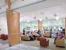
7 Enrollment Projections based on tenth day counts 7 7 WRT students 1270 students SWING ZONE Smith: 9-12 PDE: 9-12 Actual: COMMITTEE CHARGE: Assume maximum projection expandable to 1450 students (implies 4400 total students)

8 Program Comparison 8 WRT 8
9 Comparative Analysis 9 9 WRT Square Feet Per Student Springfield - Present Upper Merion Area Lower Moreland Township Centennial Upper Moreland Wissahickon Springfield - Future Unionville Garnet Valley Chadds Ford Average of Average of (60 Schools) All Ref (8 Schools) Group


10 Comparative Analysis Delaware County WRT

11 Proposed Site Program WRT Extra Field
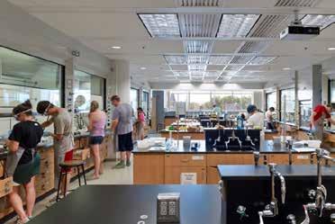
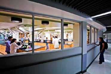
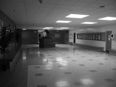
12 Existing Facility WRT


13 Zoning Zoning & Land Use WRT 1313

14 Public Use and Connection to Main Street Zoning & Land Use WRT 1414


15 Site Circulation WRT Zoning Site Circulation Parking Utilities Athletics & Fields
16 Parking Study WRT Zoning Site Circulation Parking Utilities Athletics & Fields

17 Event Parking WRT Zoning Site Circulation Parking Utilities Athletics & Fields


18 WRT 1818 Opportunities & Constraints Campus Edges Connections Construction Limits


19 Basement & First Floor WRT Below Grade Science Industrial Arts Theater and Music Fine Arts Food Services Athletics F.C.S. Special Ed. Computer Labs Large Group Instruction Administration District Administration Faculty Planning Existing Building Program

20 Summary WRT Asbestos Roofing Windows Envelope HVAC Plumbing Electric Code Renovation Challenges Building Performance Summary


21 Asbestos Roof Deck WRT Composite of All Floors Renovation Challenges Building Performance Summary


22 Roofing Replacement WRT Composite of All Floors Renovation Challenges Building Performance Summary


23 Windows Replacement WRT Legend should read Renovation Challenges Not salvageable Composite of All Floors Renovation Challenges Building Performance Summary


24 Low Performance Envelope WRT Composite of All Floors Renovation Challenges Building Performance Summary


25 Outdated HVAC WRT The only thing worth saving are the tools. Composite of All Floors Renovation Challenges Building Performance Summary

26 Outdated Plumbing System WRT Composite of All Floors Renovation Challenges Building Performance Summary


27 Electric Upgrade & Capacity WRT Composite of All Floors Renovation Challenges Building Performance Summary


28 Life Safety & Code Issues WRT Composite of All Floors Renovation Challenges Building Performance Summary
29 Summary WRT Asbestos Roofing Windows Envelope HVAC Plumbing Composite of Issues Electric Code Renovation Challenges Building Performance Summary


30 Performance Challenges Summary WRT Glare issues Along Leamy Facade Access to Daylight Circulation & Accessibility Programmatic Fit Composite of Issues Building Renovation Goals Challenges Day Lighting Circulation Building & Accessibility Performance Programmatic Fit Summary

31 Existing Building Challenges WRT Renovation Challenges Building Performance Composite of Issues Building Renovation Goals Challenges Day Lighting Circulation Building & Accessibility Performnce Programmatic Fit Summary
32 32 32 WRT Guiding Principles Create the optimal learning environment for education Strengthen connections to the broader community Promote the use of the School as a place for the community : Town Center Create a sustainable School that deploys the best in high performance building design to reduce energy consumption and promote classroom achievement. Guiding Principles Site/Campus Goals
33 33 33 WRT Site/Campus Goals Improve circulation and connections to school. Add athletic fields and improve their quality. Increase parking capacity of campus without impacting goals for athletic program. Minimize vehicular circulation within the campus. Promote walking and public transit. Increase amount of community green space. Guiding Principles Site/Campus Goals
34 Facility Master Plan Options WRT
35 Three Options Compared Detailed Review for Phasing / Cost Existing Building (Service Life Extension) Leamy Ave. New Building Saxer Ave. New Building WRT
36 36 36 WRT KEY SCOPE ITEMS Reduction of building size; consolidation of program components. PROGRAM ELEMENTS REMOVED Relocation of District Office and Bus Parking Building Performance and design upgrades : Hazmat removal Life-safety Energy performance Building Systems Accessibility NEW ENTRANCE; IMPROVE IMAGE FROM STREET NEW FIELDS Building Design / Identity Existing Building Service Life Extension Plan
37 37 37 WRT PHASING CHALLENGES Remediation of Roof Deck and building envelope: exposure to elements. Building Systems: service interruptions Significant Building Renovation scope: Cannot to be completed within Summer periods Construction Phasing Schedule long and complex Existing Building Service Life Extension Phasing

38 38 38 WRT Leamy Ave. Site Plan
39 39 39 WRT PHASING CHALLENGES Building Systems : service interruptions (location of existing plant and utilities) Significant Overlap of Existing Building with Proposed Building: Complex Construction Phasing Leamy Ave. Site Phasing

40 40 40 WRT Saxer Avenue Site Plan
41 41 41 WRT SAXER AVENUE SITE TRACK/FIELD SHIFTED TRAFFIC CALMING DROP-OFF CIRCLE SIMPLIFY INTERSECTION ACQUISITION AND REDEVELOPMENT OF ROLLING ROAD Saxer Avenue Site Plan
42 42 42 WRT PHASING OPPORTUNITIES New School can be developed while Existing School remains fully operational Track and Field can be relocated prior to any other work; only rear parking would be displaced Geothermal Wellfield : under track or parking Saxer Avenue Site Phasing
43 43 43 WRT SAXER AVENUE SITE SHARED PARKING RE-ALIGN ROAD PRIVATE PROPERTY ACQUISITION SITE IMPROVEMENTS ENTRY / PLAZA ON SAXER Saxer Avenue Site Possible Off-Campus Improvements Land Swap/Acquisition


44 Renovation vs. New Construction Maintain / Upgrade Existing vs. New Educational Opportunities WRT


45 Renovation vs. New Construction Maintain / Upgrade Existing vs. New Educational Opportunities WRT


46 Renovation vs. New Construction Maintain / Upgrade Existing vs. New Educational Opportunities WRT


47 47 47 WRT Project Cost Estimates Plan
48 Financing and Schedule WRT
49 Discussion WRT
50 50 50
51 51 51 WRT Three Options Compared Detailed Review for Phasing / Process Existing Building Service Life Extension Leamy Ave. Site Saxer Ave. Site
52 52 52 WRT KEY SCOPE ITEMS Reduction of building size; consolidation of program components. PROGRAM ELEMENTS REMOVED Relocation of District Office and Bus Parking Building Performance and design upgrades : Hazmat removal Life-safety Energy performance Building Systems Accessibility NEW ENTRANCE; IMPROVE IMAGE FROM STREET NEW FIELDS Building Design / Identity Existing School Service Life Extension Plan

53 53 53 WRT PHASING CHALLENGES Remediation of Roof Deck and building envelope : exposure to elements. Building Systems : service interruptions Significant Building Renovation scope : Cannot to be completed within Summer periods Construction Phasing Schedule long and complex Existing School Service Life Extension Phasing


54 54 54 WRT Leamy Ave. Site Existing Site with New Building Overlay

55 55 55 WRT Leamy Ave. Site Phase 1A

56 56 56 WRT Leamy Ave. Site Phase 1B

57 Leamy Ave. Site Phase WRT

58 Leamy Ave. Site Phase WRT

59 59 59 WRT LEAMY AVENUE SITE Leamy Ave. Site Completion of site improvements

60 60 60 WRT SAXER AVENUE SITE TRACK/FIELD SHIFTED TRAFFIC CALMING DROP-OFF CIRCLE SIMPLIFY INTERSECTION ACQUISITION AND REDEVELOPMENT OF ROLLING ROAD Saxer Avenue Site
61 61 61 WRT SAXER AVENUE SITE Phasing Notes New School can be developed while Existing School remains fully operational Track and Field can be relocated prior to any other work; only rear parking would be displaced Geothermal Wellfield : under track or parking Saxer Avenue Site Phasing
Springfield High School Springfield School District Delaware County - Pennsylvania Master Plan Status Update
 1 WRT 1 Springfield High School Springfield School District Delaware County - Pennsylvania Master Plan Status Update Presentation to Springfield School District School Board Meeting / Executive Session-
Roads and Vehicular Traffic Design Principles. Roads and Vehicular Traffic Recommendations
 CIRCULATION AND PARKING roads and vehicular traffic The Campus Master Plan updates the campus transportation network through a multi-modal approach that encourages walking and biking while improving vehicular
integrated action plan
 public presentation. june 24, 2009. city of portsmouth, nh islington corridor integrated action plan richardson & associates, landscape architects evan haynes, public arts consultant Islington Street Corridor
PROPOSED CONVERSION OF MYRTLE BEACH MIDDLE SCHOOL TO MYRTLE BEACH ELEMENTARY SCHOOL PMH. PIKE McFARLAND HALL ASSOCIATES, INC. ARCHITECTS & PLANNERS
 PIKE McFARLAND HALL ASSOCIATES, INC. ARCHITECTS & PLANNERS October 9, 2017 EXISTING INTERMEDIATE SCHOOL BUS ROUTE EXTENSION ELEMENTARY SCHOOL NEW SIDEWALK TO PEPPER GEDDINGS RECREATION CENTER NEW SIDEWALK
CAMPUS PARKING STUDY Analysis and Alternatives Executive Summary
 S A L E M S T A T E U N I V E R S I T Y CAMPUS PARKING STUDY Analysis and Alternatives Executive Summary M a y 2 2 0 1 8 C a m p u s C o m m u n i t y S S U N e i g h b o r h o o d A d v i s o r y C o
Miami Health District
 Miami Health District Streetscapes, Gateways, and Signage Basis of Design Report Study Miami Partnership Meeting July 21, 2008 Gannett Fleming EDAW The Corradino Group Sponsored by the Miami Partnership:
Summary: Mercer County Princeton Avenue & Spruce Street Study January 2009
 Summary: Several recent studies have assessed potential development and redevelopment opportunities in the Mercer Crossing area of Trenton, Ewing, and Lawrence. This Princeton Avenue and Spruce Street
Notes to Benefit-Cost Analysis
 Executive Summary Project Matrix Current Status/ Problem to Be Addressed University Avenue not user friendly or safe for cars, pedestrians, bicyclists, or bus riders. Notes to Benefit-Cost Analysis Change
Princeton Avenue and Spruce Street Transportation and Site Access Enhancements Project
 Princeton Avenue and Spruce Street Transportation and Site Access Enhancements Project Mercer County Planning Division AECOM Transportation (formerly DMJM Harris) January 29, 2009 Agenda Project Status
SPRINGFIELD REVITALIZATION REPORT
 SPRINGFIELD REVITALIZATION REPORT August 2015 Homewood Suites Springfield Town Center Promenade 2 SPRINGFIELD OVERVIEW This report covers recent development activity in the Springfield Commercial Revitalization
Kennedy Plaza and Providence Downtown Transit Connector PUBLIC MEETING. Stakeholder Meeting #1 October 24, 2016
 Kennedy Plaza and Providence Downtown Transit Connector PUBLIC MEETING Stakeholder Meeting #1 October 24, 2016 May 2017 1 WHAT IS THE DTC? 1.5 mile corridor between Providence Station and the Hospital
Chapter 2: Standards for Access, Non-Motorized, and Transit
 Standards for Access, Non-Motorized, and Transit Chapter 2: Standards for Access, Non-Motorized, and Transit The Washtenaw County Access Management Plan was developed based on the analysis of existing
CAMPUS MASTER PLAN UPDATE
 FLORIDA INTERNATIONAL UNIVERSITY CAMPUS MASTER PLAN UPDATE 2010-2020 Work Session #2 FOCUS GROUP 6 2 Group 6 Transportation Typical items to be discussed at each Focus Group Provide overview of Campus
Americans with Disabilities Act Transition Plan for Public Right-of-Way Improvements
 Americans with Disabilities Act Transition Plan for Public Right-of-Way Improvements Prepared by: Public Works Department Engineering Division October 2015 Table of Contents Section I Introduction.. 3
California Department of Transportation, District 4. Sloat Boulevard Project Skyline Blvd. to 19 th Ave. Community Update January 13, 2016
 California Department of Transportation, District 4 Sloat Boulevard Project Skyline Blvd. to 19 th Ave. Community Update January 13, 2016 Agenda Welcome and introductions Project overview, history and
PROJECT OBJECTIVES. Improve vehicle capacity for the intersection. Improve pedestrian and bicycle access
 COMMUNITY MEETING Project Update March 15, 2010 Purcellville, Virginia OVERVIEW Project need / objectives Project recap Design elements Proposed improvements Summary of project benefits / next steps PROJECT
Project Overview. Rolling Road Widening Fairfax County. Get Involved. Design Public Hearing. Contact Information
 Get Involved VDOT representatives will review and evaluate information received as a result of this meeting. Please fill out the comment sheet provided in this brochure if you have any comments or questions.
Brooklyn Boulevard (County Road 152) Reconstruction Project Phase I. OPEN HOUSE June 20, 2017
 Reconstruction Project Phase I. OPEN HOUSE June 20, 2017") Brooklyn Boulevard (County Road 152) Reconstruction Project Phase I OPEN HOUSE June 20, 2017 Brooklyn Boulevard (County Road 152) Phase I Project Partners Project Lead Other Project Partners include Brooklyn
Brooklyn Boulevard (County Road 152) Reconstruction Project Phase I OPEN HOUSE June 20, 2017 Brooklyn Boulevard (County Road 152) Phase I Project Partners Project Lead Other Project Partners include Brooklyn
Elmhurst Metra Station. Public Hearing Wednesday - November 30, 2016
 Elmhurst Metra Station Public Hearing Wednesday - November 30, 2016 Agenda Introduction to Hearing Format - Presentation (20 Minutes) - Exhibits/Workstations - Record (Comment Cards, Court Reporter)
SAFE ROUTES TO SCHOOL
 SAFE ROUTES TO SCHOOL Edgewood Elementary School Existing Conditions and ACTION PLAN > Oak Creek - Franklin Joint School District Table of Contents CONTEXT Enrollment Boundaries Enrollment
Mission-Geneva Transportation Study Community Workshop 2 July 8, 2006
 Community Workshop 2 July 8, 2006 Small Group Workbook 1 Basic Improvements on Mission Street Streetscape. Pedestrian-scale lighting; landscaping; community art on utility boxes; more (possibly unique)
HIGHBURY AVENUE/HAMILTON ROAD INTERSECTION IMPROVEMENTS PUBLIC INFORMATION CENTRE 1 MAY 14, 2015
 HIGHBURY AVENUE/HAMILTON ROAD INTERSECTION IMPROVEMENTS Municipal Class Environmental Assessment PUBLIC INFORMATION CENTRE 1 MAY 14, 2015 ACCESSIBILITY Under the Accessibility Standards 2015 for Customer
TRAVEL PLAN: CENTRAL EUROPEAN UNIVERSITY CAMPUS REDEVELOPMENT PROJECT TRAVEL PLAN. Central European University Campus Redevelopment Project.
 TRAVEL PLAN Central European University Campus Redevelopment Project Page 1 Table of Contents Introduction... 3 Background... 7 Building Users... 7 Transportation in Community Consultation... 7 Summary
Implementation Matrix
 Downtown Delaware Parking Study Short Term Mid Term Long Term = Within one year = Within three years = More than three years The highlighted proposed enhancements will require a substantial amount of input
About the study. North Milwaukee Ave. Key goals of this study are to: Achieve Vision Zero* by. Harmonize the space and improve walkability
 About the study Key goals of this study are to: North Milwaukee Avenue is a local and regional street for multiple modes of transportation. It is officially zoned and functions as a pedestrian street southeast
TRANSPORTATION STANDARDS
 INTRODUCTION LOCAL STREETS ON-STREET PARKING SIDEWALKS STREET LIGHTING STREET FURNISHINGS TRAFFIC CALMING STREET TREES MEDIAN PLANTING BOULEVARD LOCATIONS VILLAGE CENTER STREET LOCATIONS RESIDENTIAL STREET
CSAH 101 Preliminary Design
 CSAH 101 Preliminary Design Public Open House No. 2 January 29, 2013 CSAH 62 to Hutchins Drive Welcome / Introductions Hennepin County Craig Twinem, Transportation Maury Hooper, Transportation Nick Peterson,
Transportation. Pages E-3 to E-145 PROPOSED FY CAPITAL IMPROVEMENT PLAN (CIP) CCCRC Presentation Thursday, June 14, 2018
 CCCRC Presentation Thursday, June 14, 2018") PROPOSED FY 2019-2028 CAPITAL IMPROVEMENT PLAN (CIP) Pages E-3 to E-145 CCCRC Presentation Thursday, June 14, 2018 in the CIP Continues Arlington s commitment to a transportation system that expands travel
PROPOSED FY 2019-2028 CAPITAL IMPROVEMENT PLAN (CIP) Pages E-3 to E-145 CCCRC Presentation Thursday, June 14, 2018 in the CIP Continues Arlington s commitment to a transportation system that expands travel
Community Meeting February 27, 2007 Dorchester Avenue Transportation & Streetscape Improvements Action Plan February 27, 2007
 Community Meeting Tonight s Agenda 6:00 Introductions South Boston/Dot Ave Improvement Study Background 6:15 Consultant Introductions Review of Scope and Schedule Review of Proposed Corridor Wide Guidelines
Traffic Impact Memorandum. May 22, 2018
 BISHOP PROFESSIONAL DEVELOPMENT BUILDING Proposed Land-use Change & Parking Modification 3601 SW 31st Street Topeka, Kansas 66614 CFS Project No. 185077 Traffic Impact Memorandum May 22, 2018 Prepared
WELCOME. Stakeholder Involvement Group Meeting #2 Round Lake Public Works October 24, 2018
 WELCOME Stakeholder Involvement Group Meeting #2 Round Lake Public Works October 24, 2018 MEETING AGENDA 1. Welcome and Introductions 2. Study Progress Update 3. Problem Statement 4. Technical Analysis
Chapter 3.9 Timbercrest Elementary School. Volusia County MPO. November 2008
 Chapter 3.9 Timbercrest Elementary School Deltona, FL Volusia County MPO November 2008 Volusia County MPO School Bicycle and Pedestrian Review Study, Phase 3B School Summary Timbercrest Elementary School
Ocean Park Boulevard Streetscape Improvement Project Alternatives & Trade Offs
 City Council Study Session January 27, 2009 Ocean Park Boulevard Streetscape Improvement Project Alternatives & Trade Offs Scope of Work Purpose of Tonight s Meeting Review work to date and direct staff
Bicycle and Pedestrian Facilities Toolbox (Excerpt from Figure 3.1)
") Appendix B Neighborhood Connections Summaries This Appendix is a supplement to the information presented in Chapter 3 Connect People. The Appendix includes a summary or profile for each of the proposed
Appendix B Neighborhood Connections Summaries This Appendix is a supplement to the information presented in Chapter 3 Connect People. The Appendix includes a summary or profile for each of the proposed
Vehicular and Pedestrian Access to Herndon Metrorail Station. Robert B. Boxer, Director John Stuart, Clark Nexen October 28, 2015
 Vehicular and Pedestrian Access to Herndon Metrorail Station Robert B. Boxer, Director John Stuart, Clark Nexen Project Location The project is located in the Town of Herndon along Herndon Parkway between
6.4 RECOMMENDED IMPROVEMENTS
 6.4 RECOMMENDED IMPROVEMENTS 6.4.1 Williston Road Recommendations While all alternatives would be an improvement over existing conditions, Alternative 3B is recommended over the others because it provides
Feasibility Study of Pedestrian Crossings Along Route 7, East of Cascades Parkway and West of Dranesville Road. October 3, 2017
 Feasibility Study of Pedestrian Crossings Along Route 7, East of Cascades Parkway and West of Dranesville Road October 3, 2017 Study Area (area within a ¼-mile radius of the study intersections) Route
ROUTES 55 / 42 / 676 BUS RAPID TRANSIT LOCALLY PREFERRED ALTERNATIVE
 ROUTES 55 / 42 / 676 BUS RAPID TRANSIT LOCALLY PREFERRED ALTERNATIVE April, 2012 1 INTRODUCTION The need for transit service improvements in the Routes 42/55/676 corridor was identified during the Southern
5858 N COLLEGE, LLC N College Avenue Traffic Impact Study
 5858 N COLLEGE, LLC nue Traffic Impact Study August 22, 2016 Contents Traffic Impact Study Page Preparer Qualifications... 1 Introduction... 2 Existing Roadway Conditions... 5 Existing Traffic Conditions...
The following is submitted together with the plans and application for the staff and plan commission consideration of approval.
 October 7, 2015 Revised November 10, 2015 Revised January 13, 2016 Ms. Katherine Cornwell Department of Planning & Development City of Madison 215 Martin Luther King Jr. Blvd PO Box 2985 Madison, Wisconsin
ROUNDABOUTS. Improving Safety and Efficiency. SR83 & Smithville Western Rd. Joel Montgomery, PE Director of Administration
 ROUNDABOUTS Improving Safety and Efficiency SR83 & Smithville Western Rd. Joel Montgomery, PE Director of Administration The Ohio Department of Transportation District 3 906 North Clark Ave. Ashland, OH
SANTA MONICA BOULEVARD CORRIDOR
 CIRCULATION ELEMENT WHITE PAPER NO. 3 SANTA MONICA BOULEVARD CORRIDOR INTRODUCTION From the 1930s to the beginning of Los Angeles freeway era, Santa Monica Boulevard, (previously Route 66, the Beverly
DALLAS MIDTOWN REDEVELOPMENT PLAN FOCUS NORTH TEXAS Peer Chacko, AICP, Assistant Director, City of Dallas
 DALLAS MIDTOWN REDEVELOPMENT PLAN FOCUS NORTH TEXAS 2014 Peer Chacko, AICP, Assistant Director, City of Dallas Dallas Midtown: Strategic growth area Future transit node 2 Peterson Road Study Area Galleria
FOCUS AREA 1 - Alberta Avenue Pocket Park 3 (121 Ave and 92 St)
") FOCUS AREA 1 - Alberta Avenue Pocket Park 3 (121 Ave and 92 St) New benches Plant evergreen trees Widen existing sidewalk from 1.5m to 1.8m Marked crosswalk 1.8m wide sidewalk Add pedestrian oriented lights
FOCUS AREA 1 - Alberta Avenue Pocket Park 3 (121 Ave and 92 St) New benches Plant evergreen trees Widen existing sidewalk from 1.5m to 1.8m Marked crosswalk 1.8m wide sidewalk Add pedestrian oriented lights
Traffic Improvements for the Transit Oriented Development District (TODD) Meriden Public Library March 11, 2014
 Meriden Public Library March 11, 2014") Traffic Improvements for the Transit Oriented Development District (TODD) Meriden Public Library March 11, 2014 Project Overview Coordinate roadway improvements with other major projects HUB Flood Control
Traffic Improvements for the Transit Oriented Development District (TODD) Meriden Public Library March 11, 2014 Project Overview Coordinate roadway improvements with other major projects HUB Flood Control
BELFAST RAPID TRANSIT. Ciarán de Búrca Director, Transport Projects Division Department for Regional Development
 BELFAST RAPID TRANSIT Ciarán de Búrca Director, Transport Projects Division Department for Regional Development Objectives of Belfast Rapid Transit To provide a modern, safe, efficient and high quality
Ocean Park Boulevard Green Street Project Alternatives & Trade Offs
 Planning Commission March 4, 2009 Ocean Park Boulevard Green Street Project Alternatives & Trade Offs Purpose of Tonight s Meeting Review concept plans and options Provide input on alternatives and trade-offs
Design of Turn Lane Guidelines
 Design of Turn Lane Guidelines CTS Transportation Research Conference May 24, 2012 Howard Preston, PE Minnesota Department of Transportation Research Services Office of Policy Analysis, Research & Innovation
Transportation Corridor Studies: Summary of Recommendations
 Transportation Corridor Studies: Summary of Recommendations Route 4 Corridor Study: Route 10 Corridor Study: Route 44 Corridor Study: Route 175 Corridor Study: Route 5/15 Corridor Study: Rentschler Field
OCALA/MARION TPO CITY OF BELLEVIEW CORRIDOR PLAN STUDY PRESENTATION TO THE BELLEVIEW CITY COMMISSION JANUARY 25, :00 PM
 OCALA/MARION TPO CITY OF BELLEVIEW CORRIDOR PLAN STUDY PRESENTATION TO THE BELLEVIEW CITY COMMISSION JANUARY 25, 2016 6:00 PM STUDY AREA Ocala/Marion TPO US-441 Corridor Study 2 Ocala/Marion TPO US-441
Paoli Road Improvement Feasibility Study
 Paoli Road Improvement Feasibility Study & Public Participation Project March 24, 2015 Prepared for: Tredyffrin Township Prepared by: McMahon Associates, Inc. with Town Planning Partnership, LLC Glackin
Works Approval Application. G.2 Traffic
 Works Approval Application G.2 Traffic RO097400.WAA.23.04.2018 Floor 11, 452 Flinders Street Melbourne VIC 3000 PO Box 312, Flinders Lane Melbourne VIC 8009 Australia T +61 3 8668 3000 F +61 3 8668 3001
Figure 4-10: Pedestrian Improvements Types of Potential Station Area Improvements - Place-Making Improvements
 INCORPORATE FEATURE PAVIN IN CROSSWALK AND INTERSECTION FIELDS Identifies high-priority pedestrian areas and create a station identity through colorful and interesting patterns ADD CURB EXTENSIONS Extending
Public Involvement Outreach Requirements for Public Information Open House Meeting: C.N , HSIP-5003(12) 132 nd and West Center Road, Omaha
 132 nd and West Center Road, Omaha") To: NDOR Environmental From: Randy McCart, HDR Date: 4 April 2017 RE: Public Involvement Summary Report, HSIP-5003(12) 132 nd and West Center Road, Omaha; C.N. 22629 Public Involvement Outreach Requirements
To: NDOR Environmental From: Randy McCart, HDR Date: 4 April 2017 RE: Public Involvement Summary Report, HSIP-5003(12) 132 nd and West Center Road, Omaha; C.N. 22629 Public Involvement Outreach Requirements
Pensacola Beach. BOARD OF COUNTY COMMISSIONERS Special Meeting
 Pensacola Beach Congestion Management Plan BOARD OF COUNTY COMMISSIONERS Special Meeting Board Chambers Suite 100 Ernie Lee Magaha Government Building - First Floor 221 Palafox Place http://www.myescambia.com/pensacola-beach/congestion-management-plan
THE ALAMEDA CONCEPT DESIGN COMMUNITY MEETING 3. A Plan for The Beautiful Way JANUARY 28, 2010
 CONCEPT DESIGN COMMUNITY MEETING 3 JANUARY 28, 2010 AGENDA INTRODUCTION COMMUNITY INPUT ROADWAY STUDIES STREETSCAPE DESIGN STATIONS DISCUSSION SUMMARY AND DISCUSSION NEXT STEPS CLOSE INTRODUCTION SCHEDULE
Working Group Meeting
 Working Group Meeting February 6, 2018 Parks and Natural Resources Operations Building Transportation Analysis Draft Policy Framework Agenda 7:05 pm Welcome 7:10 pm Follow-up from Previous Meetings Schedule
Dewey Area Traffic Calming Project
 SFMTA Municipal Transportation Agency Image: Crosswalk of California Street and Grant Avenue Dewey Area Traffic Calming Project 10 08 2013 SAN FRANCISCO, CALIFORNIA Tonight s Agenda Introductions Project
Charles Barrett. Support Educational Program. Charles Barrett Total. Support Educational Program
 Site CIP Category 2016 2017 2018 2019 2020 2021 2022 2023 2024 2025 Grand Total Storm Water Management 110,000 110,000 Charles Barrett Cora Kelly Douglas MacArthur Francis C. Hammond George Mason Charles
Access Management Guidelines February 2013 THE CITY OF
 Access Management Guidelines February 2013 THE CITY OF Table of Contents Introduction 2 Review and Approval Process 5 Technical Guidelines 9... 10... 12 3. Separation Distance: Non-Signalized All-Turns
Memo. Ocean Avenue Corridor Design Project Public Workshop #2 Summary
 Ocean Avenue Corridor Design Project Public Workshop #2 Summary The second public workshop for the Ocean Avenue Corridor Design Project was held on Wednesday, May 14, 2014 from, 6 to 8 pm at Lick Wilmerding
Dartmouth College Parking, Traffic, & Pedestrian Circulation. Master Plan 2001
 Dartmouth College Parking, Traffic, & Pedestrian Circulation Master Plan 2001 Goals & Objectives of the Study Identify Existing and Projected Parking Demand & Supply Identify Existing Pedestrian & Traffic
Indiana University Campus Bus Service. Bus Stop Consolidation
 Indiana University Campus Bus Service Bus Stop Consolidation Logan Garrett 3/17/2011 1 Contents Overview... 3 Campus Core... 3 Third Street (Between Jordan Ave. and Indiana Ave.)... 3 Current Stop Spacing...
Complete Streets. Designing Streets for Everyone. Sarnia
 Complete Streets Designing Streets for Everyone Sarnia Complete Streets ~ Sarnia ~ 2018 Introduction Our City is made up of a network of streets that we use to go for a walk, cycle to work, drive to the
TRAFFIC IMPACT ANALYSIS OF PROPOSED CHESTNUT HILL COLLEGE MASTER PLAN DEVELOPMENT
 TRAFFIC IMPACT ANALYSIS OF PROPOSED CHESTNUT HILL COLLEGE MASTER PLAN DEVELOPMENT Prepared by Orth-Rodgers & Associates, Inc. December 14, 2009 Updated November 9, 2010 230 South Broad Street Philadelphia
Make Lincoln Highway an economically vibrant corridor that is safe, efficient, and beautiful for local residents and visitors.
 Lincoln Highway Streetscape Plan Stakeholder Workshop #2 Handout Contents Introduction and Project Vision Planning Principles Specific Recommendations including a Proposed Typical Roadway Section Renderings
01. VICINITY OF GREENBRAE POC: EXISTING CONDITIONS
 01. VICINITY OF GREENBRAE POC: EXISTING CONDITIONS Existing Bus Stop Existing US101 On-ramp Existing POC Old Redwood Highway Rich Street City ROW Environmental Study Limit Industrial Way NO DESIGNATED
Meadow Woods Elementary School
 Drag and drop pic and stretch/crop to the limits of the blue rectangle (delete this text box) Meadow Woods Elementary School Drag and drop pic and stretch/crop to the limits of the blue rectangle (delete
Superintendent s Proposed Capital Improvements Program. Fiscal Years (Revised January 14, 2019)
") Superintendent s Proposed Capital Improvements Program Fiscal Years 20202025 (Revised January 14, 2019) FISCAL YEARS 20202025 SUMMARY SUPERINTENDENT'S PROPOSED CAPITAL IMPROVEMENTS PROGRAM FISCAL YEARS
Superintendent s Proposed Capital Improvements Program Fiscal Years 20202025 (Revised January 14, 2019) FISCAL YEARS 20202025 SUMMARY SUPERINTENDENT'S PROPOSED CAPITAL IMPROVEMENTS PROGRAM FISCAL YEARS
SAN FRANCISCO MUNICIPAL TRANSPORTATION AGENCY
 THIS PRINT COVERS CALENDAR ITEM NO. : 10.5 DIVISION: Sustainable Streets BRIEF DESCRIPTION: SAN FRANCISCO MUNICIPAL TRANSPORTATION AGENCY SUMMARY: The South Van Ness and Mission Intersection Improvements
Circulation Improvement Strategy. Chapter 5: Improvement Strategy. Cross Street Neighborhood Improvement Plan
 Circulation Improvement Strategy Chapter 5: Circulation Improvement Strategy Circulation Observations: Sidewalks are located throughout most of the neighborhood, although several sidewalks do not have
Tonight is for you. Learn everything you can. Share all your ideas.
 Strathcona Neighbourhood Renewal Draft Concept Design Tonight is for you. Learn everything you can. Share all your ideas. What is Neighbourhood Renewal? Creating a design with you for your neighbourhood.
Project Design New Softball Stadium MU
 Project Design New Softball Stadium MU At the February 2015 meeting, the Board approved the $16,000,000 New Softball Stadium project to be funded from $13,500,000 in private gifts and $2,500,000 in debt
Other Initiatives. Highest 10 Year Value Projects Capital Budget and Financing Plan
 Other Initiatives In addition to the $867 million in projects included in the other sections, staff has also identified projects which they feel are important, however, due to funding constraints have
122 Avenue: 107 Street to Fort Road
 : 107 Street to Fort Road November 24, 2015 4:30 8:00 p.m. Meeting Purpose Summarize project work completed to date Share results of public input from Phase 1 Share the draft concept plan and proposed
Road Diets FDOT Process
 Florida Department of TRANSPORTATION Road Diets FDOT Process Humberto Castillero, PE, PTOE Roadway Design Office Purpose of Guide Develop a statewide lane elimination review process Balance state & local
ATTACHMENT 4 - TDM Checklist. TDM Checklist Overview
 ATTACHMENT 4 - TDM Checklist TDM Checklist Overview The proposed checklist rates developments on the degree to which they are TDM and transit supportive. Points are assigned based on the level of transit
Table #6 VISION CHARACTERISTICS
 Table #6 VISION White Flint is a place to live, work, play, shop, and walk with sufficient density to encourage quality redevelopment. Vibrant streets and consistent streetscapes are important. CHARACTERISTICS
Existing Transportation System
 < Open for Additional Text Transportation System Existing Transportation System This section describes vehicular transportation associated with Children s. transportation are described in a separate section
Streetscape: Core Shopping District
 Streetscape: Core Shopping District DRAFT DRAFT DRAFT May 00 Core Shopping District: Phase Blue Island s Core Shopping District is located along Western Avenue, between Grove and Union Streets. Streetscape
McGrath Boulevard Project Development Public Meeting #2 May 28 th, 2015 East Somerville Community School
 McGrath Boulevard Project Development Public Meeting #2 May 28 th, 2015 East Somerville Community School Agenda Introductions Project Context Current Construction McGrath Boulevard Project Development
City of Prince Albert Statement of POLICY and PROCEDURE. Department: Public Works Policy No. 66. Section: Transportation Issued: July 14, 2014
 Page: 1 of 8 1 POLICY 1.01 The City shall follow all of the specifications in the Manual of Uniform Traffic Control Devices for Canada, prepared by the National Committee of Uniform Traffic Control, and
Welcome to the Quebec Alternatives Analysis Public Meeting
 Welcome to the Public Meeting Please sign in. Public Comment Please fill out a comment card and tell us what you think. Check back or comment any time at: www.quebecalternatives.com Project Area Technical
including infrastructure, transit and open space, Open Space changed approximately 50 to approximately 60
 Draft North Branch Framework Plan s The below table itemizes changes made to the North Branch Industrial Corridor Framework and Design Guidelines. The original draft was posted March 17, 2017. This table
Item No. 14 Town of Atherton
 Item No. 14 Town of Atherton CITY COUNCIL STAFF REPORT CONSENT AGENDA TO: THROUGH: FROM: HONORABLE MAYOR AND CITY COUNCIL GEORGE RODERICKS, CITY MANAGER MICHAEL KASHIWAGI, COMMUNITY SERVICES DIRECTOR MARTY
A Downtown Transformed Through Partnerships: the Portland Mall Story
 A Downtown Transformed Through Partnerships: the Portland Mall Story Portland 2010 Chris Kopca, Downtown Development Group Steve Iwata, City of Portland Bureau of Planning and Sustainability Brian McCarter,
Wyldewood Estates. Pre-Application Public Engagement Summary of Issues and Responses
 Wyldewood Estates Pre-Application Public Engagement Summary of Issues and Responses March 2016 Executive Summary Morguard Residential Properties has been thoughtfully planning the redevelopment of Wyldewood
Access Management Regulations and Standards
 Access Management Regulations and Standards January 2014 Efficient highway operation Reasonable property access Concept of Access Management The way to manage access to land development while preserving
Baseball and Books. Master of Architecture. Jacob Tuzzo
 Baseball and Books Jacob Tuzzo Thesis submitted to the faculty of Virginia Polytechnic Institute and State University in partial fulfillment of the requirements of the degree of Master of Architecture
City of Vestavia Hills Traffic Calming Policy for Residential Streets
 City of Vestavia Hills Traffic Calming Policy for Residential Streets PURPOSE: The purpose of the Traffic Calming Policy for Residential Streets is to address safety concerns related to vehicular traffic
New Park Avenue Corridor West Hartford
 New Park Avenue Corridor West Hartford Current TOD Investment in the Corridor Mixed-use building currently under development by the Trout Brook Realty Advisors: a separate non-profit corporation, established
 Phasing and Cost Estimate of Downtown Oxford Master Plan Prepared By: Phasing and Cost Estimate of Downtown Oxford Master Plan Purpose of the Study The primary objective of this study is to identify priority
Areas for Redevelopment or New Development:
 Small Group Exercise Summary Areas for Redevelopment or New Development: 1. Downtown a. Job Resource Center b. Community Activities / Activities to draw youth & millennials c. Need for additional parking
DRAFT. A fifth objective, other considerations, has been added to capture considerations not captured by the four primary objectives.
 TECHNICAL MEMORANDUM Albany - Washington Avenue Traffic Calming Evaluation Matrix of Conceptual Alternatives Date: May 17, 2017 Project #: 17356 To: Aleida Andrino-Chavez From: Laurence Lewis, Sara Muse,
Inter River Sub Area Transportation Study District of North Vancouver Stakeholder Meeting #2b Meeting Minutes
 Inter River Sub Area Transportation Study District of North Vancouver Stakeholder Meeting #2b Meeting Minutes Held at: Municipal Hall - Meeting Room A Date/Time: June 2 nd 2016 at 7:00pm Adjourned: 8:30pm
Iowa Highway 58 Corridor Improvement Study
 1 Iowa Highway 58 Corridor Improvement Study Public Informational Meeting May 6, 2014 2 Welcome and Introductions Randy Lorenzen, City of Cedar Falls Engineer 3 Outline of Presentation Review of Project
Queensboro Bridge Bus Priority Study: Summary of Recommendations. Presentation to Manhattan Community Board 8 May 4, 2011
 : Summary of Recommendations Presentation to Manhattan Community Board 8 May 4, 2011 1 Overview Study Goal: Identify cost-effective ways to improve bus speed and reliability for local and express buses
CPC Parking Lot Riverside Drive. Transportation Rationale
 CPC Parking Lot Transportation Rationale Prepared By: NOVATECH Suite 200, 240 Michael Cowpland Drive Ottawa, Ontario K2M 1P6 September 2015 Novatech File: 114093 Ref: R-2015-153 Table of Contents 1.0 INTRODUCTION...
TRANSPORTATION & MOBILITY VISIONING MEETING. August 23 24, 2017
 TRANSPORTATION & MOBILITY VISIONING MEETING August 23 24, 2017 Project Team 1999 South Lakefront Framework Plan In 1999, the Chicago Park District authorized framework plans for three historic parks: Jackson,
Roundabouts The Virginia Experience
 Roundabouts The Virginia Experience Purpose of Briefing Misconceptions Background on Roundabouts How they pertain to Virginia Definition & Operational Characteristics Roundabouts Vs. Traffic signals Considerations