Traffic Impact Analysis
|
|
|
- Bertram White
- 5 years ago
- Views:
Transcription
1 Traffic Impact Analysis

2
3 TRAFFIC IMPACT ANALYSIS FOR A PROPOSED NEIGHBORHOOD SHOPPING CENTER Civic Center Way and Cross Creek Road City of Malibu Prepared for: Goldman Firth Rossi Architects Prepared by: Overland Traffic Consultants, Inc Main Street, #22 Santa Clarita, California (661) Prepared February 213 Update April 213 Updated July 213
4 Overland Traffic Consultants, Inc. TABLE OF CONTENTS Executive Summary... 1 Chapter 1 - Introduction... 1 Chapter 2 - Project Description Vehicle Access and On-Site Circulation Chapter 3 - Environmental Setting Freeway and Street Characteristics Transit Service... 2 Chapter 4 - Project Traffic Traffic Generation Traffic Distribution and Trip Assignment Chapter 5 - Traffic Conditions Analysis Analysis of Existing Traffic Conditions Analysis of Existing + Project Traffic Conditions Analysis of Future Traffic Conditions Analysis of Future Driveway Capacity Congestion Management Program Review Traffic Impacts Arterial Street... 6 Chapter 6 - Mitigation Measures Project s Traffic Mitigation Measures Traffic Signal Review Traffic Mitigation Fair Share... 7 Chapter 7 - Parking Demand Urban Land Institute (ULI) Parking Standards Malibu Local Coastal Program (LCP) Local Implementation Plan (LIP) 74 Parking Requirements... On Street Parking Modifications Loading Space Requirements Malibu Neighborhood Shopping Center Page i Updated July 213 Traffic Impact Study Table of Contents
5 Overland Traffic Consultants, Inc. APPENDIX Appendix A Internal Circulation and Truck Access Appendix B Land Use Map Appendix C Intersection Photos Appendix D Transit Routes Appendix E Traffic Count Data Appendix F Driveway Traffic Volume Appendix G Level of Service Worksheets Appendix H Related Project Information Appendix I Supplemental Stand-Alone Traffic Generation Analysis Malibu Neighborhood Shopping Center Page ii Updated July 213 Traffic Impact Study Table of Contents
6 Overland Traffic Consultants, Inc. LIST OF FIGURES Figure 1 - Project Setting... 2 Figure 2 - Project Location Figure 3 - Project Site Plan Figure 4 - Study Intersections Characteristics Figure 5 - Project Traffic Assignment % (Weekday Peak Hour) Figure 6 - Project Traffic Assignment % (Weekday PM & Saturday Mid - Day Peak Hours). 25 Figure 7 - Project Traffic Volume - Weekday Peak Hour Figure 8 - Project Traffic Volume - Weekday PM Peak Hour Figure 9 - Project Traffic Volume - Saturday Mid - Day Peak Hour Figure 1 - Existing (212) Traffic Volume - Weekday Peak Hour... 3 Figure 11 - Existing (212) Traffic Volume - Weekday PM Peak Hour Figure 12 - Existing (212) Traffic Volume - Saturday Mid - Day Peak Hour Figure 13 - Existing (212) + Project Traffic Volume - Weekday Peak Hour Figure 14 - Existing (212) + Project Traffic Volume - Weekday PM Peak Hour... 4 Figure 15 - Existing (212) + Project Traffic Volume - Saturday Mid - Day Peak Hour Figure 16 - Future (215) Traffic Volume Without Project - Weekday Peak Hour Figure 17 - Future (215) Traffic Volume Without Project - Weekday Peak Hour Figure 18 - Future (215) Traffic Volume Without Project - Saturday Mid - Day Peak Hour 46 Figure 19 - Future (215) Traffic Volume + Project - Weekday Peak Hour Figure 2 - Future (215) Traffic Volume +Project - Weekday PM Peak Hour Figure 21 - Future (215) Traffic Volume + Project - Saturday Mid - Day Peak Hour Malibu Neighborhood Shopping Center Page iii Updated July 213 Traffic Impact Study List of Figures
7 Overland Traffic Consultants, Inc. LIST OF FIGURES (CONTINUED) Figure 22 - Future (23) Traffic Volume Without Project - Weekday Peak Hour Figure 23 - Future (23) Traffic Volume Without Project - Weekday PM Peak Hour Figure 24 - Future (23) Traffic Volume Without Project - Saturday Mid - Day Peak Hour 54 Figure 25 - Future (23) Traffic Volume + Project - Weekday Peak Hour Figure 26 - Future (23) Traffic Volume + Project - Weekday PM Peak Hour Figure 27 - Future (23) Traffic Volume + Project - Saturday Mid - Day Peak Hour Figure 28 - Location of Project s Significant Traffic Impacts Figure 29 - Conceptual Traffic Mitigation, Malibu Canyon Road & Pacific Coast Highway Figure 3 - Conceptual Traffic Mitigation, Webb Way & Pacific Coast Highway Figure 31 - Conceptual Traffic Mitigation, Cross Creek Road & Pacific Coast Highway Figure 32 - Traffic Signal Warrant, Civic Center Way & Stuart Ranch Road / Webb Way Figure 33 - Traffic Signal Warrant, Civic Center Way & Cross Creek Road Malibu Neighborhood Shopping Center Page iv Updated July 213 Traffic Impact Study List of Figures
8 Overland Traffic Consultants, Inc. LIST OF TABLES Table 1 - Project Trip Generation Rates Table 2 - Project Traffic Generation Table 3 - Level of Service Definitions Signalized Intersections Table 4 - Level of Service Definitions - Stop Sign Controlled Intersections 34 Table 5 - Existing (212) Traffic Conditions Summary Table 6a - Significant Traffic Impact Criteria (Signalized Intersections) Table 6b - Significant Traffic Impact Criteria (Un-Signalized Intersections) Table 7 - Existing (212) + Project Traffic Conditions Table 8 - Future (215) Traffic Conditions Without & With Project Table 9 - Future (23) Traffic Conditions Without & With Project Table 1 - Future Driveway Traffic Conditions With Project Table 11 - Future Traffic Conditions on Arterial Streets With Project Table 12 - Existing (212) + Project Traffic Conditions + Mitigation Table 13 - Future (215) + Project Traffic Conditions + Mitigation Table 14 - Future (23) + Project Traffic Conditions + Mitigation Table 15 - ULI Parking Standards Table 16 - Malibu Municipal City Code Parking Requirements Malibu Neighborhood Shopping Center Page v Updated July 213 Traffic Impact Study List of Tables
9 Overland Traffic Consultants, Inc. EXCUTIVE SUMMARY Project Description The project being proposed is the construction of a 38,425 square foot shopping center consisting of a supermarket, restaurants and retail uses. The project is located at the northwest corner of Cross Creek Road and Civic Center Way in the City of Malibu, as shown in the following Figure 1, Project Setting. The project site is currently vacant. Prior Reviews and Approval of the Traffic Study The traffic study for the proposed project was initially submitted to the City in May 21 and received multiple reviews by Willdan Engineering, Inc., on July 28, 21 and February 24, 211. On June 6, 211, after a further review of the revised traffic study, City Public Works Department Traffic Engineering issued its referral sheet, indicating that the project was reviewed and found to be in conformance with the City s Public Works and LCP policies and can proceed through the planning process. The completed application was then scheduled for an ERB hearing on April 25, 212, a Notice of Preparation (NOP) for the project EIR was issued on April 26, 212, and an EIR scoping meeting was conducted on May 22, 212. More recently, in August 212, the City issued new Traffic Impact Analysis (TIA) Guidelines which it has required to be used for all traffic studies conducted within the City, along with the City s latest pending and approved projects list. The applicant has complied with the City s request that it comply as well with the new Guidelines. On November 2, 212, the City Public Works Department approved the scope of work submitted for the TIA, and accordingly this report updates and supplements the previously approved traffic impact analysis and applies the new TIA Guidelines. Existing traffic conditions utilize new traffic data collected by the City of Malibu in the summer of 212 with future conditions based on an updated list of cumulative project development projects provided by the City of Malibu. In all other respects, the report is unchanged. Malibu Neighborhood Shopping Center Page 1 Updated July 213 Traffic Impact Study Executive Summary

10
11 Overland Traffic Consultants, Inc. Project Parking and Access The proposed project would provide on-site parking in an at-grade parking lot with 22 parking spaces. Access to the parking lot is proposed via one driveway on Civic Center Drive near the westerly end of the property with one driveway located on Cross Creek Road near the northerly end of the property. Several access plans were reviewed with the City of Malibu and their consultants to determine the most appropriate driveway locations for the shopping center. The location of adjacent driveways and land uses, street layout and striping, and the expected driveway volume were considered in the selection of the final design review and found to be in conformance with the City s Public Works and LCP Policies. Estimated Traffic Generation Estimates of the traffic generated by the proposed project were calculated using the industry standard traffic generation rates developed by the Institute of Transportation Engineers (ITE) for a shopping center with restaurant uses. ITE, the International Council of Shopping Centers and the Urban Land Institute all define a shopping center as an integrated group of commercial establishments that is planned, developed, owned and managed as a unit. A neighborhood shopping center is further defined as a center with 3, 1, square feet usually with a supermarket and or drugstore use. This shopping center definition clearly fits the proposed project. Using this definition, it is estimated that the project would generate 2,29 daily weekday vehicle trips with 11 morning peak hour trips and 154 afternoon peak hour trips. In addition, the project will generate an estimated 2,528 trips on a Saturday with 226 Saturday mid-day peak hour trips. The shopping center trip generation is considered a conservative analysis for several reasons: A higher pass-by percentage of trips (2% applied) could be expected given the unique linear city geography of Malibu, attraction of nearby land uses within the civic center area and the high volume of pass through traffic between Calabasas and Los Malibu Neighborhood Shopping Center Page 3 Updated July 213 Traffic Impact Study Executive Summary
12 Overland Traffic Consultants, Inc. Angeles. Commuters using Malibu Canyon Road could stop at the proposed shopping center and should not be counted as new traffic to and from the civic center area. ITE 9 th Edition Table 5.6, lists a 34% average pass-by trip percentage for shopping centers. Furthermore, residents traveling from Santa Monica and the west end of the city would also be expected to stop rather than making a trip solely to and from the proposed center. Included in this study is a supplemental project traffic generation estimate based on the sum of all uses calculated individually as a stand-alone uses (Appendix I). For the reasons listed below, and as indicated in the previously prepared Traffic Impact Analysis (May 211), the stand-alone approach to trip generation is not recommended for this project: Traffic calculations based on stand-alone uses do not account for the internal trip-making characteristics between the uses of a shopping center site with common parking and therefore overstates the traffic flow to and from the shopping center. Sufficient data on internal capture trips is not available to predict the necessary stand-alone adjustments with adequate confidence. The term internal capture trip is used to describe a trip already present on site for another purpose and thus do not generate another vehicle trip to the site. For example, a restaurant patron that also shops at the supermarket does not generate a new trip but is already accounted for in the trip generation for the restaurant. The ITE traffic data for shopping centers is collected at the common access points for the shopping center as a whole. Therefore, all the internal interaction between the shopping center uses and attraction of each other s internal trip generation is accounted for. Malibu Neighborhood Shopping Center Page 4 Updated July 213 Traffic Impact Study Executive Summary
13 Overland Traffic Consultants, Inc. The traffic calculation for stand-alone uses results in a traffic generation of 2,556 daily weekday trips, 114 morning peak hour trips and 215 afternoon peak hour trips. On Saturday the daily trip generation is estimated at 4,6 daily trips with 272 Saturday mid-day peak hour trips. The table below compares the traffic generation using the stand-alone and shopping center/restaurant trips rates. Comparison of Project Traffic Generation Estimates Daily Peak Hour PM Peak Hour Weekday Traffic Generation Traffic Total In Out Total In Out Stand-Alone 2, Shopping Center/Restaurant 2, Difference Daily Weekend Mid-day Weekend Traffic Generation Traffic Total In Out Stand-Alone 4, Shopping Center/Restaurant 2, Difference 1, Project s Potential Traffic Impacts (Shopping Center/Restaurant Analysis) The focus of this traffic study is to evaluate the potential traffic impact created by the development of the shopping center/restaurant project and identify the significant traffic impacts that require traffic mitigation. In the interest of fullest disclosure, and as required by the City s new TIA Guidelines, this traffic study provides three baseline scenarios to evaluate the project s traffic impacts: (1) existing traffic conditions plus the project traffic volume ( Existing + Project ), (2) future 215 cumulative traffic conditions plus the project traffic volume ( Future 215 Cumulative + Project ) and (3) future 23 cumulative traffic conditions plus the project traffic volume ( Future 23 Cumulative + Project ). Significant Project traffic impacts (Existing + Project) Using criteria in the City s TIA Guidelines and assuming all pending and approved projects go forward, it has been determined that the change in traffic flow generated by the proposed project will significantly impact one intersection. Malibu Neighborhood Shopping Center Page 5 Updated July 213 Traffic Impact Study Executive Summary
14 Overland Traffic Consultants, Inc. 1. The intersection of Cross Creek Road and Pacific Coast Highway (study intersection #7) is significantly impacted during the weekday afternoon and Saturday mid-day peak prior to the implementation of traffic mitigation measures. Significant Project traffic impacts (Future 215 & 23 Cumulative + Project) Using criteria adopted by the City of Malibu staff, it has been determined that the change in traffic flow generated by the proposed project would exceed the significant traffic impact criteria in the two future cumulative condition at three intersections. The significant traffic impacts occur as follows: 1. The intersection of Pacific Coast Highway and Malibu Canyon Road (study intersection #2) is significantly impacted during the Saturday mid-day peak hour; 2. The intersection of Pacific Coast Highway and Webb Way (study intersection # 6) is significantly impacted during the Saturday mid-day peak hour; and 3. The intersection of Pacific Coast Highway and Cross Creek Road (study intersection #7) is significantly impacted during the weekday afternoon peak hour and during the Saturday mid-day peak hour. Project s Traffic Mitigation Measures Listed below are the recommended traffic mitigation measures for the significantly impacted intersections. It should be noted that the proposed roadway improvements on Pacific Coast Highway will require an encroachment permit from Caltrans, the permitting agency. Pacific Coast Highway is a modified urban arterial therefore roadway modifications will require design exceptions from the Caltrans highway/freeway design standards. Roadway construction permits including any engineering reports for the arterial design exceptions will be submitted to Caltrans for review and approval. Malibu Neighborhood Shopping Center Page 6 Updated July 213 Traffic Impact Study Executive Summary
15 Overland Traffic Consultants, Inc. Malibu Canyon Road and Pacific Coast Highway (#2) - The impact of project traffic on the intersection of Malibu Canyon Road and Pacific Coast Highway could be mitigated by restriping the south leg of the intersection to include a left-turn lane, one through lane and one right-turn lane. Traffic signal recommendations include installing a northbound right turn overlap phase to run concurrently with the westbound left turn phase. This mitigation would improve the traffic movement along northbound approach to the Pacific Coast Highway and Malibu Canyon Road intersection necessary for Saturday traffic when the traffic congestion is the heaviest due to the activities associated with the proposed athletic fields. Figure 29 illustrates the conceptual traffic mitigation measure for Malibu Canyon Road and Pacific Coast Highway Pacific Coast Highway and Webb Way (#6) - The impact of project traffic on the intersection of Pacific Coast Highway and Webb Way could be mitigated by installing eastbound dual left-turn lanes on Pacific Coast Highway within the existing right-of-way. This mitigation would improve the traffic movement for the eastbound approach to the Pacific Coast Highway and Webb Way intersection. Figure 3 illustrates the conceptual traffic mitigation measure for Webb Way and Pacific Coast Highway. Pacific Coast Highway and Cross Creek Road (#7) The impact of project traffic on the intersection of Cross Creek Road and Pacific Coast Highway could be mitigated by the addition of a westbound right-turn lane on Pacific Coast Highway. This mitigation would improve the traffic movement along westbound Pacific Coast Highway. It is recommended that an additional westbound right-turn lane be added by restriping Pacific Coast Highway at its intersection with Cross Creek Drive to provide additional right-turn capacity. If Caltrans does not approve of the non-standard narrower lane widths, then roadway widening on the south side of Pacific Coast Highway on the approach and departure legs would allow the standard width lanes for this mitigation measure within the existing Pacific Coast Highway right-of-way. Figure 31 illustrates the conceptual traffic mitigation measure for Cross Creek Road and Pacific Coast Highway Malibu Neighborhood Shopping Center Page 7 Updated July 213 Traffic Impact Study Executive Summary
16 Overland Traffic Consultants, Inc. Project s Fair Share Traffic Mitigation Several land developments have been recently filed with the City of Malibu and are expected to occur within a similar time frame with similar traffic impacts. Therefore, per the City s TIA Guidelines, the City may apply a mitigation funding mechanism through a fair share process to mitigate the cumulative traffic impacts created by a group of development projects enabling the installation of larger traffic improvements. The proposed project would participate in the funding program to implement the recommended traffic mitigation measures. The findings of this study also show that a new traffic signal will be necessary for the intersection of Civic Center Way and Stuart Ranch Road / Webb Way based on the land development levels presented in this study. Parking Supply and Estimated Parking Demand 1. Recommended ULI Parking Requirement The proposed project will provide 22 parking spaces. The parking demand calculated for the neighborhood shopping center is 186 parking spaces using the data provided by the Urban Land Institute publication titled Parking Requirements for Shopping Centers, Summary Recommendations and Research Study Report, Second Edition. Therefore, the shopping center project would provide 34 parking spaces above the ULI recommendations. 2. Code Calculations (all new development) Pursuant to the Malibu Local Coastal Program (LCP) Local Implementation Plan (LIP) Section , the parking requirements can be calculated using the shopping center standard when the mixture of uses is balanced or based on the sum of the peak parking demands for each individual use. An individual use calculation assumes all individual uses generate peak parking demands at the same time during the day. It is generally accepted that the parking demands of individual uses do not all peak at the same time. Therefore, simply adding the peak parking demand for each individual use assuming no variation in parking demand produces an overall parking demand value that is generally too high for mixed-use developments. The concept for shared Malibu Neighborhood Shopping Center Page 8 Updated July 213 Traffic Impact Study Executive Summary
17 Overland Traffic Consultants, Inc. parking is that a single parking space can be used to serve two or more individual uses without conflict. In other words, hourly parking demand differs between uses so that one space may provide parking for several uses during different times of the day. For these reasons, the shopping center parking standard shall be applied to this project. Using the shopping center parking standard and including the outdoor seating as an additional food court use, results in a parking requirement of 217 spaces. It should be noted that the outdoor seating area is not only being provided for food consumption, but rather as an outdoor gathering place for the center. Therefore, using this conservative assumption, the project would provide 3 parking spaces more than required by the shopping center requirements in the Malibu Municipal Code. Malibu Neighborhood Shopping Center Page 9 Updated July 213 Traffic Impact Study Executive Summary
18 Overland Traffic Consultants, Inc. CHAPTER 1 INTRODUCTION The focus of this traffic study is to evaluate the potential traffic impact created by the development of the neighborhood shopping center project. This traffic study follows and applies the City of Malibu TIA guidelines. As part of the environmental review for the proposed school project, the potential traffic impact of the development has been evaluated using the Intersection Capacity Utilization (ICU) method for signalized intersections and Highway Capacity Manual (HCM) delay methodologies for un-signalized intersections. The ICU analysis method quantifies the operating conditions of an intersection using a ratio of peak hour traffic volume to intersection capacity. Two un-signalized intersections were also evaluated using the Highway Capacity Manual (HCM) delay method for stop sign controlled intersections. Any change to the intersection s peak hour operating condition caused by an increase / decrease in traffic volume (i.e., traffic impact) can be quantified using these analysis methods. Potential traffic impacts caused by a development project that exceed limits established by the City of Malibu are deemed significant traffic impacts. All significantly impacted intersections are then evaluated for possible traffic mitigation measures. Pursuant to the City of Malibu traffic impact guidelines, the following steps have been taken to evaluate the project s traffic impact. Existing Conditions - (a) Evaluate existing 212 traffic conditions; (b) Add proposed project traffic volume to existing traffic volume to evaluate potential existing + project impacts; (c) Recommended traffic mitigation, if necessary. Malibu Neighborhood Shopping Center Page 1 Updated July 213 Traffic Impact Study Environmental Setting
19 Overland Traffic Consultants, Inc. Future 215 Cumulative Conditions (d) Existing 212 traffic volumes were increased by an ambient growth factor of 1.5 % per year growth rate (4.56% total growth at 1.5% per year growth rate) to the future 215 study year (year anticipated for project occupancy); (e) Future traffic generated by other projects in the study area was added to traffic in (d). Future cumulative baseline traffic volume was derived from a related projects list provided by city staff, see Appendix H ( future 215 without project ); (f) Add proposed project traffic volume to future 215 without project traffic to evaluate future 215 cumulative + project scenario; (g) Recommended traffic mitigation, if necessary. Future 23 Cumulative Conditions (h) Existing 212 traffic volumes were increased by an ambient growth factor of.48 % per year growth rate (9 % total growth per Los Angels County Congestion Management Program growth rate for 23); (i) Add proposed project traffic volume to future 23 without project traffic to evaluate future 23 cumulative + project scenario; (j) Recommended traffic mitigation, if necessary. An intersection capacity analysis of the existing baseline and future traffic conditions has been completed at those locations expected to have the highest potential for significant traffic impacts. Summer weekday morning and afternoon peak hour conditions along with summer Saturday mid-day peak hour conditions have been evaluated at ten key intersections selected for review by the City of Malibu. Low volume intersections or intersections with minimal project traffic are not included in this analysis. The analyses were conducted in accordance the Congestion Management Program for Los Angeles County and include all arterial monitoring intersections where the proposed project will add 5 or more trips during either the a.m. or p.m. peak hours of adjacent street traffic. Malibu Neighborhood Shopping Center Page 11 Updated July 213 Traffic Impact Study Environmental Setting
20 Overland Traffic Consultants, Inc. The intersections analyzed in this study are listed below. Figure 2 illustrates the location of the study intersections. 1. Kanan Dume Road and Pacific Coast Highway *; 2. Malibu Canyon Road and Pacific Coast Highway *; 3. Malibu Canyon Road and Civic Center Way; 4. Webb Way / Stuart Ranch Road and Civic Center Way; 5. Cross Creek Road and Civic Center Way; 6. Webb Way and Pacific Coast Highway; 7. Cross Creek Road and Pacific Coast Highway; 8. Malibu Pier Signal and Pacific Coast Highway 9. Carbon Canyon Road and Pacific Coast Highway 1. Las Flores Canyon Road and Pacific Coast Highway *; Asterisk (*) indentifies a CMP monitoring intersection. The street segments analyzed in this study are: (using July 212, City of Malibu counts) 1. Pacific Coast Highway east of Cross Creek Road; 2. Pacific Coast Highway west of Malibu Canyon Road; and 3. Malibu Canyon Road north of Civic Center Way Malibu Neighborhood Shopping Center Page 12 Updated July 213 Traffic Impact Study Environmental Setting


21
22 Overland Traffic Consultants, Inc. CHAPTER 2 PROJECT DESCRIPTION The project being proposed is the construction of a 38,425 square foot shopping center consisting of a supermarket, several restaurants and retail uses, hereafter the neighborhood shopping center. The project site is located at the northwest corner of Cross Creek Road and Civic Center Way in the City of Malibu, as shown in Figure 3. The project site is currently vacant. Parking for the project will be provided for approximately 22 vehicles in an at-grade surface parking lot. Vehicle Access and On-Site Circulation Vehicles will access the project site via two proposed driveways: one driveway is planned on Civic Center Way near the west end of the project site opposite the Country Mart shopping Center driveway and one driveway is planned on Cross Creek Road near the north end of the project site. A brief description of the driveway locations and characteristics is provided below with driveway capacity calculations included in the traffic analysis section. Internal vehicle circulation for the main parking area is provided with two-way driving aisles serving a 9 parking stall layout. The site is designed with a clockwise service access routing scheme utilizing a one-way northbound service road along the westerly property line to the loading dock area. Stop signs, stop lines and crosswalks have been added within the parking lot to provide right-of-way control and guidance to motor vehicles and pedestrians. Figure 3 illustrates the concept site plan for the project. Civic Center Way Access The Civic Center Way driveway will serve as the main entrance and exit for the shopping center. The driveway exit will have a stop sign at its intersection with Civic Center Way. The driveway will accommodate vehicular access to all on-site parking and to the service road located along the westerly property line which also provides truck access to the loading docks located behind the proposed Whole Foods market. Full access will be provided at the Civic Center Way driveway (i.e., leftturn and right-turn ingress and egress). Malibu Neighborhood Shopping Center Page 14 Updated July 213 Traffic Impact Study Environmental Setting
23
24 Overland Traffic Consultants, Inc. The Civic Center Way driveway is 44 wide consisting of two outbound lanes and one inbound lane. The Civic Center Way driveway is located approximately 27 west of the intersection of Civic Center Way and Cross Creek Road opposite the existing Country Mart commercial driveway. A center left-turn median lane is provided on Civic Center Way for left-turn access to and from the site. Offsite Street Improvements - The project proposes to remove four on-street parallel parking spaces located on the north side of Civic Center Way between the driveway and the Civic Center Way & Cross Creek Road intersection be removed as it improves the vehicle sight lines, truck access and eliminates parallel parking maneuvers that block thru traffic. Cross Creek Road Access - The Cross Creek Road driveway will serve as the secondary vehicular entrance and exit for the shopping center. The Cross Creek Road driveway will accommodate vehicular access to all on-site parking. However, no 3-axle delivery trucks are permitted to use Cross Creek Road. Full access will be provided at the Cross Creek Road driveway (i.e., left-turn and rightturn ingress and egress). The driveway is approximately 26 in width and located approximately 515 north of the intersection centerline of Civic Center Way and Cross Creek Road. The driveway will be signed for stop control at its intersection with Cross Creek Road. Truck Access - Truck turning movements have been simulated using Autoturn software to illustrate the turning path movements of a 55 semi-trailer to and from the Civic Center Way driveway. Trucks entering the site from Civic Center Way will proceed to the oneway northbound service road located along the westerly property line to access the loading dock area behind the supermarket. The site has been designed to allow trucks Malibu Neighborhood Shopping Center Page 16 Updated July 213 Traffic Impact Study Environmental Setting
25 Overland Traffic Consultants, Inc. leaving the loading dock area to exit through the parking lot to Civic Center Way. It is estimated that up to 2 semi-trailer delivery trucks would serve the site during off-peak hours. Other smaller vendor delivery trucks would arrive throughout the day and utilize the two loading spaces designated at each side of the site. Truck access routes serving the site are shown in Appendix A. Malibu Neighborhood Shopping Center Page 17 Updated July 213 Traffic Impact Study Environmental Setting
26 Overland Traffic Consultants, Inc. CHAPTER 3 ENVIRONMENTAL SETTING The project site is located on the northwest corner of Civic Center Way and Cross Creek Road in the City of Malibu. The project site is also located in the Malibu Civic Center Specific Plan area, although no specific plan has been adopted for the area, to date. Located to the north of the site are single family residential detached estate lots, and other notable land uses in the vicinity of the site include: Legacy Park, the Civic Center and Malibu Country Mart. The study area land use map is shown in Appendix B. Field surveys were conducted in the study area to determine the roadway and intersection geometry and traffic signal operations. Figure 4 illustrates the study locations, type of intersection traffic control and lane configurations for the project impact analysis. A brief description of the nearby roadway facilities is provided below with photos of the study intersections provided in Appendix C. Freeway and Street Characteristics Pacific Coast Highway (PCH, SR-1) is a state route that travels east and west through the study area. To the east in the City of Santa Monica, PCH turns into the Santa Monica Freeway (I-1) providing access to the greater Los Angeles basin. Project access to PCH is provided via the signalized intersections at Cross Creek Road and Webb Way. PCH provides 4 travel lanes (2 in each direction) with a third eastbound lane provided on its eastbound approach to Webb Way. Traffic volumes on PCH, as recorded by Caltrans, range from approximately 58, vehicles per day east of Topanga Canyon Boulevard to approximately 3, vehicles per day east of Kanan Dume Road. In the vicinity of the project site, PCH carries approximately 46, vehicles per day east of Cross Creek Road. PCH is designated as a route in the Los Angeles County Congestion Management Plan (CMP). PCH is posted with a speed limit of 5 mph west of Malibu Canyon Road and 45 mph east of Malibu Canyon Road. Malibu Neighborhood Shopping Center Page 18 Updated July 213 Traffic Impact Study Environmental Setting
27
28 Overland Traffic Consultants, Inc. Civic Center Way is designated an east-west collector road in the City s General Plan. Civic Center Way is a two-lane roadway (one lane in each direction) that connects Malibu Canyon Road on the west to Cross Creek Road on the east. Civic Center Way borders the south side of the project site. Cross Creek Road is a north-south local street with one lane in each direction. South of Civic Center Way, Cross Creek Road is a public road that provides access to the abutting commercial development and connects to Pacific Coast Highway. North of Civic Center Way, Cross Creek Road borders the east side of the site, is a private road and provides access to the residential area of Serra Retreat. Webb Way is a north-south two-lane collector roadway connecting Civic Center Way and Pacific Coast Highway. Malibu Canyon Road (County Highway N1) is a north-south major arterial roadway that extends from PCH across the Santa Monica Mountains to the Ventura Freeway (Interstate 11). Malibu Canyon Road generally has one lane in each direction; two lanes are provided between Civic Center Way and Pacific Coast Highway. Near Mulholland Highway, Malibu Canyon Road becomes Las Virgenes Road. A significant volume of vehicle trips from western portions of Los Angeles County use various canyon roads like Malibu Canyon Road. Transit Service Public transportation in the study area is provided by the Metropolitan Transportation Authority (Metro). Metro route 534 operates along Civic Center Way adjacent to the project site. Metro weekday service on this route is provided by 3 eastbound and 7 westbound buses during the morning peak hours, 5 eastbound and 3 westbound buses during the afternoon peak hours, with 3 buses in each direction during the Saturday midday peak hours. The transit schedule and route information is provided in Appendix D. Malibu Neighborhood Shopping Center Page 2 Updated July 213 Traffic Impact Study Environmental Setting
29 Overland Traffic Consultants, Inc. CHAPTER 4 PROJECT TRAFFIC Traffic Generation Traffic-generating characteristics of commercial land uses have been studied by the Institute of Transportation Engineers (ITE). The results of the traffic generation studies have been published in Trip Generation, 9 th Edition Handbook. This publication of traffic generation data has become the industry standard for estimating traffic generation for different land uses. These trip generation studies indicate that the uses associated with the proposed project generally exhibit the trip-making characteristics per 1, square feet of floor area as shown by the ITE trip rates in Table 1. Estimates of the project s driveway traffic were calculated on the basis of these ITE traffic generation rates for the project s proposed land uses. For the purposes of trip generation, it is important to note that the ITE studies and trip generation rates do not include unenclosed spaces such as the project s outdoor space. Therefore, the outdoor space is excluded from the trip calculations. Table 1 Project Trip Generation Rates (Weekday and Saturday) ITE Weekday Peak Hour PM Peak Hour Land Use Code Daily Total In Out Total In Out Shopping Center (per 1, G.L.S.F) Restaurant High-turnover (per 1, sf) Restaurant Fast Food (per 1, sf) Saturday Mid-day Peak Hour Land Use Daily Total In Out Shopping Center (per 1, G.L.S.F) Restaurant High-turnover (per 1, sf) Restaurant Fast Food (per 1, sf) Gross Leasable Square Feet - G.L.S.F. Malibu Neighborhood Shopping Center Page 21 Updated July 213 Traffic Impact Study Project Traffic
30 Overland Traffic Consultants, Inc. Traffic volumes expected to be generated by the project were estimated by applying the Table 1 ITE trip rates per 1, square feet of building area for each of the project s land use components. Due to the nature of the land uses proposed, some people traveling on Civic Center Way may stop at the project to or from another destination (pass-by trips). These vehicles normally passing the site are not new vehicle trips added to the street by the project and therefore are not considered in the project traffic impact analysis. Pass-by trip data contained in the ITE Trip Generation Manual has been applied to the trip generation rates to account for the pass-by trips. Appendix F illustrates the driveway locations and the peak hour driveway traffic volume. After these pass-by trip adjustments, it has been estimated that the net peak hour traffic added to the streets is 11 morning peak hour trips, 154 afternoon peak hour trips and 226 Saturday mid-day peak hour trips. However, in order to conduct a conservative traffic impact analysis, no vehicle trip adjustments were made to account for internal capture trips (i.e., interaction between land uses within the shopping center). Table 2 Estimated Project Traffic Generation (Weekday, PM and Saturday Mid-day Peak Hours) Weekday Traffic Generation Daily Peak Hour PM Peak Hour Proposed Land Use Traffic Total In Out Total In Out 34,425 s.f. Shopping Center 1, ,5 s.f. Restaurant (HT) ,5 s.f. Restaurant (FF) 1, Driveway Totals 2, Less 2% Pass-by New Traffic 2, Saturday Traffic Generation Daily Weekend Mid-day Proposed Land Use Traffic Total In Out 34,425 s.f. Shopping Center 1, ,5 s.f. Restaurant (HT) ,5 s.f. Restaurant (FF) 1, Driveway Totals 3, Less 2% Pass-by New Traffic 2, High turnover restaurant - HT Fast food restaurant - FF Malibu Neighborhood Shopping Center Page 22 Updated July 213 Traffic Impact Study Project Traffic
31 Overland Traffic Consultants, Inc. Traffic Distribution and Trip Assignment A primary factor affecting trip direction is the spatial distribution of population and employment centers which would generate project trip origins and destinations. The estimated project directional trip distribution is based on the study area roadway network, traffic flow patterns in and out of the project study area and other traffic studies recently prepared for the general area. Figures 5 and 6 illustrate the estimated project traffic percentages at the selected study intersections for the morning peak hour and afternoon peak hour / Saturday mid-day, respectively. Using the traffic assignment at each intersection and the estimated peak hour traffic volume as provided in Table 2, peak hour traffic volumes at each study location for each study period have been calculated and are shown in Figures 7, 8 and 9 for the weekday morning, afternoon and Saturday mid-day, respectively. This estimated assignment of the project traffic flow provides the information necessary to analyze the potential traffic impacts generated by the project at the study intersections. Note that southbound left-turns from Malibu Canyon Road are prohibited at its intersection with Civic Center Way during the morning peak period. Malibu Neighborhood Shopping Center Page 23 Updated July 213 Traffic Impact Study Project Traffic
32
33
34
35
36
37 Overland Traffic Consultants, Inc. CHAPTER 5 TRAFFIC CONDITIONS ANALYSIS Analysis of Existing Traffic Conditions To ensure updated, consistent traffic counts to be used for each pending project, traffic volume data was collected in the summer of 212 by National Data & Surveying Services, an independent third party data collection company hired by the City of Malibu for use in this study. Weekday traffic counts were conducted on Thursday, July 12th from 7: to 9: am and 4: to 6: pm. Weekend traffic counts were conducted on Saturday, July 14th from 11: am to 1: pm. The existing 212 peak hour traffic volumes at each study intersection are illustrated in Figure 1 for the weekday morning peak hour, Figure 11 for the weekday afternoon peak hour and Figure 12 for the Saturday mid-day peak hour. Data collection worksheets for the peak hour counts are contained in Appendix E. The traffic conditions analysis was conducted using the Intersection Capacity Utilization (ICU) method for the study intersections. The ICU procedure uses a ratio of the traffic volume to the intersection capacity to define the proportion of an hour necessary to accommodate all the traffic moving through the intersection assuming all approaches were operating at full capacity. For example, if an intersection has a V/C value of.7, the intersection is operating at 7% capacity with 3% unused capacity. The V/C ratios provide an appropriate means for quantifying intersection operating characteristics for planning purposes. The ICU procedure adds the highest combination of conflicting traffic volume (V) at an intersection and divides the sum by the intersection capacity value for a V/C ratio. Intersection capacity (C) represents the maximum volume of vehicles which has a reasonable expectation of passing through an intersection in one hour under typical traffic flow conditions. Malibu Neighborhood Shopping Center Page 29 Updated July 213 Traffic Impact Study Traffic Conditions Analysis
38
39
40
41 Overland Traffic Consultants, Inc. Once the intersection V/C ratio has been calculated for each time period, a level of service grade (A through F) is assigned to estimate the level of congestion and stability of the traffic flow. The term "Level of Service" (LOS) is used by traffic engineers to describe the quality of traffic flow. Level of Service standard D is generally considered the design capacity of arterial intersections and is thereby often set as the performance standard. Definitions of the LOS grades, from the City s General Plan Circulation Element, are shown in Table 3. Table 3 V/C Level of Service Definitions Signalized Intersections Level of Service Definition Equivalent ICU A EXCELLENT - Free flow conditions with low traffic density B VERY GOOD - A stable flow of traffic C D E F GOOD - Light congestion but stable, occasional backups behind left-turning vehicles FAIR -_Approaching instability, drivers are restricted in freely changing lanes. Vehicles may be required to wait through more than one cycle. POOR - At or near capacity with some long lines for left-turning vehicles. Blockage of intersection may occur if traffic signal does not provide for protected turning movements. FAILURE - Jammed conditions with stoppages of long duration and long queues. > 1. The LOS thresholds for stop sign controlled intersections differ from signalized intersections to reflect different driver expectations. The expectation is that a signalized intersection is designed to carry higher traffic volumes than a stop-controlled intersection. Therefore, an alternative methodology has been used for the all way stopcontrolled intersections analyzed in this study: Civic Center Way and Cross Creek Road and at Webb Way / Stuart Ranch Road and Civic Center Way. For the un-signalized intersections, a delay-based analysis has been conducted using procedures based on the Highway Capacity Manual, (HCM). This procedure calculates the control delay as the total elapsed time from the time a vehicle stops at the end of the Malibu Neighborhood Shopping Center Page 33 Updated July 213 Traffic Impact Study Traffic Conditions Analysis
42 Overland Traffic Consultants, Inc. queue to the time the vehicle departs from the intersection. Using this procedure the LOS is evaluated on the basis of the total delay per vehicle for selected movements (in seconds per vehicle). Definitions of the LOS grades for stop controlled intersections as defined by the Transportation Research Board are shown in Table 4. Table 4 Level of Service Definitions Stop Controlled Intersections Level of Service Average Control Delay (sec) A Less than or equal to 1 B > 1 15 C > D > E > 35 5 F > 5 By applying the ICU and HCM procedures, the V/C ratios, delay values and the corresponding LOS for existing traffic conditions were determined for each intersection. The existing V/C ratios, delay values and the corresponding LOS values are summarized in Table 5. Using the 212 traffic counts, all of the study intersections are currently operating at LOS C or better. Supporting capacity worksheets are contained in Appendix G of this report. Malibu Neighborhood Shopping Center Page 34 Updated July 213 Traffic Impact Study Traffic Conditions Analysis
43 Overland Traffic Consultants, Inc. Table 5 Existing Traffic Conditions Summary Weekday Peak Hour PM Peak Hour No. Intersection V/C (Delay) LOS V/C (Delay) LOS 1. Kanan Dume Rd. & Pacific Coast Hwy..394 A.633 B 2. Malibu Canyon Rd. & Pacific Coast Hwy..674 B.669 B 3. Malibu Canyon Rd. & Civic Center Way.53 A.472 A 4. Webb Way & Civic Center Way 1.14 sec. B sec. C 5. Cross Creek Rd. & Civic Center Way 7.8 sec. A 8.99 sec. A 6. Webb Way & Pacific Coast Hwy..526 A.661 B 7. Cross Creek Rd. & Pacific Coast Hwy..594 A.781 C 8. Malibu Pier Signal & Pacific Coast Hwy..576 A.655 B 9. Carbon Canyon Rd. & Pacific Coast Hwy..538 A.644 B 1. Las Flores Canyon Rd. & Pacific Coast Hwy..581 A.691 B Weekend Mid-day No. Intersection V/C (Delay) LOS 1. Kanan Dume Rd. & Pacific Coast Hwy..715 C 2 Malibu Canyon Rd. & Pacific Coast Hwy..777 C 3. Malibu Canyon Rd. & Civic Center Way.346 A 4. Webb Way & Civic Center Way 9.73 sec. A 5. Cross Creek Rd. & Civic Center Way 9.1 sec. A 6. Webb Way & Pacific Coast Hwy..73 C 7. Cross Creek Rd. & Pacific Coast Hwy..8 C 8. Malibu Pier Signal & Pacific Coast Hwy..638 B 9. Carbon Canyon Rd. & Pacific Coast Hwy..648 B 1. Las Flores Canyon Rd. & Pacific Coast Hwy..679 B Note: All-Way Stop Control Delay in Seconds Per Vehicle Malibu Neighborhood Shopping Center Page 35 Updated July 213 Traffic Impact Study Traffic Conditions Analysis
44 Overland Traffic Consultants, Inc. Analysis of Existing + Project Traffic Conditions The project s traffic impact has been calculated by adding the project traffic volumes to the existing traffic conditions. According to the traffic impact standards provided by the City of Malibu for this environmental assessment, a traffic impact is considered significant if the related increase in the V/C ratio value equals or exceeds the thresholds shown in Table 6a and 6b for signalized and un-signalized study intersections, respectively. Table 6a Significant Traffic Impact Criteria (Signalized Intersections) LOS Final V/C Value Increase in V/C Value C > or more D > or more E, F.91 or more +.1 or more Table 6b Significant Traffic Impact Criteria (Un-signalized Intersections) 1. Degrades the Level of Service (LOS) at an un-signalized intersection to an unacceptable level of Service (LOS D or worse); or 2. Increases delay at an un-signalized intersection operating at an unacceptable level by five or more seconds; or 3. Results in satisfying the most recent California Manual on Uniform Traffic Control Devices (CUTCD) peak hour volume warrant or other warrants for traffic signal installation at the intersection. Malibu Neighborhood Shopping Center Page 36 Updated July 213 Traffic Impact Study Traffic Conditions Analysis
45 Overland Traffic Consultants, Inc. Comparing the changes in the traffic conditions (i.e., V/C ratio) between the without and with project traffic volume scenarios provides the information necessary to determine if the project traffic volume creates a significant traffic impact which would require traffic mitigation. The existing level of service traffic conditions with the added project traffic volume are shown in Table 7. Peak hour traffic volumes for the existing + project scenario are shown in Figures 13 through 15 for the study periods. As shown in Table 7, one study intersection is impacted by the proposed project traffic volume. Using the criteria in the City s TIA Guidelines, it has been determined that the change in traffic flow generated by the proposed project will significantly impact the intersection of Cross Creek Road and Pacific Coast Highway (study intersection #7) during the weekday afternoon and Saturday mid-day peak prior to the implementation of traffic mitigation measures. Malibu Neighborhood Shopping Center Page 37 Updated July 213 Traffic Impact Study Traffic Conditions Analysis
46 Overland Traffic Consultants, Inc. Table 7 Existing + Project Traffic Conditions Existing With Project No. Intersection Peak Hour V/C (Delay) LOS V/C (Delay) LOS Impact 1. Kanan Dume Rd. & Weekday.394 A.397 A +.3 Pacific Coast Hwy. Weekday PM.633 B.639 B +.6 Saturday Mid-day.715 C.721 C Malibu Canyon Rd. & Weekday.674 B.684 B +.1 Pacific Coast Hwy. Weekday PM.669 B.677 B +.8 Saturday Mid-day.777 C.789 C Malibu Canyon Rd. & Weekday.53 A.56 A +.3 Civic Center Way Weekday PM.472 A.48 A +.8 Saturday Mid-day.346 A.346 A Webb Way / Stuart Ranch Weekday 1.14 sec. B 1.2 sec. B +.6 sec. Road & Civic Center Way Weekday PM sec. C 23.8 sec. C +.93 sec. Saturday Mid-day 9.73 sec. A 1.28 sec. B +.55 sec. 5. Cross Creek Rd. & Weekday 7.8 sec. A 8. sec. A +.2 sec. Civic Center Way Weekday PM 8.99 sec. A 9.54 sec. A +.55 sec. Saturday Mid-day 9.1 sec. A 1. sec. A +.9 sec. 6. Webb Way & Weekday.526 A.527 A +.1 Pacific Coast Hwy. Weekday PM.661 B.679 B +.18 Saturday Mid-day.73 C.728 C Cross Creek Rd. & Weekday.594 A.61 B +.7 Pacific Coast Hwy. Weekday PM.781 C.86 D +.25 * Saturday Mid-day.8 C.837 D +.37 * 8. Malibu Pier Signal & Weekday.576 A.582 A +.6 Pacific Coast Hwy. Weekday PM.655 B.667 B +.12 Saturday Mid-day.638 B.654 B Carbon Canyon Rd. & Weekday.538 A.543 A +.5 Pacific Coast Hwy. Weekday PM.644 B.653 B +.9 Saturday Mid-day.648 B.662 B Las Flores Canyon Rd. & Weekday.581 A.584 A +.3 Pacific Coast Hwy. Weekday PM.691 B.7 B +.9 Saturday Mid-day.679 B.69 B +.11 Note: All-Way Stop Control Delay in Seconds Per Vehicle; * Denotes significant traffic impact. Malibu Neighborhood Shopping Center Page 38 Updated July 213 Traffic Impact Study Traffic Conditions Analysis
47
48
49
50 Overland Traffic Consultants, Inc. Analysis of Future Traffic Conditions Future traffic volume projections have been developed to analyze the traffic conditions after completion of other planned land developments including the proposed project for two scenarios: future study years 215 and 23. Descriptions of other related projects as included in the City s TIA Guidelines, their locations and estimated traffic generation are provided in Appendix H. In addition to the traffic generated by the related project list, other projects outside the study area or projects unknown at this time may contribute to the traffic volume in the area. To account for this outside influence, an ambient annual growth factor (1.5 %) has been applied to the existing 212 traffic counts to establish the 215 study year. This growth factor is based on the growth rates in the City TIA Guidelines for the 215 study year. The use of both the related project traffic volume growth and the ambient growth factor provides a conservative estimate of future traffic growth in the study area for 215. The adopted Los Angeles Congestion Management Program (CMP) traffic growth forecasts for 23 have been applied to develop the future traffic volumes for 23. In addition to the CMP growth, the same current cumulative projects list has been included. Therefore, the total growth for the 23 project impact analysis consists of the CMP growth rate (9 %) plus the current related projects per the City of Malibu s cumulative projects list. Adding the project traffic to the two future without project conditions provides the information necessary to calculate the future cumulative project traffic impacts at the study intersections for each future scenario. Table 8 shows the estimated project traffic impacts for the 215 study year. Future cumulative 215 peak hour traffic volumes are shown in Figures 16 through 21 for the study periods. Malibu Neighborhood Shopping Center Page 42 Updated July 213 Traffic Impact Study Traffic Conditions Analysis
51 Overland Traffic Consultants, Inc. Table 8 Future (215) + Project Traffic Conditions Without With Project No. Intersection Peak Hour V/C (Delay) LOS V/C (Delay) LOS Impact 1. Kanan Dume Rd. & Weekday.474 A.478 A +.4 Pacific Coast Hwy. Weekday PM.76 C.767 C +.7 Saturday Mid-day.759 C.768 C Malibu Canyon Rd. & Weekday.753 C.763 C +.1 Pacific Coast Hwy. Weekday PM.791 C.799 C +.8 Saturday Mid-day.914 E.925 E +.11 * 3. Malibu Canyon Rd. & Weekday.518 A.521 A +.3 Civic Center Way Weekday PM.514 A.521 A +.7 Saturday Mid-day.363 A.363 A Webb Way / Stuart Ranch Weekday sec. B sec. B +.17 sec. Road & Civic Center Way Weekday PM 48.5 sec. E 49.8 sec. E sec. Saturday Mid-day 13.1 sec. B sec. B sec. 5. Cross Creek Rd. & Weekday 8.93 sec. A 9.28 sec. B +.35 sec. Civic Center Way Weekday PM sec. B sec. B sec. Saturday Mid-day sec. B sec. C sec. 6. Webb Way & Weekday.574 A.575 A +.1 Pacific Coast Hwy. Weekday PM.823 C.839 D +.15 Saturday Mid-day.87 D.895 D +.25 * 7. Cross Creek Rd. & Weekday.657 B.664 B +.7 Pacific Coast Hwy. Weekday PM.953 E.977 E +.24 * Saturday Mid-day.987 E 1.25 F +.38 * 8. Malibu Pier Signal & Weekday.631 B.637 B +.6 Pacific Coast Hwy. Weekday PM.754 C.766 C +.12 Saturday Mid-day.759 C.773 C Carbon Canyon Rd. & Weekday.6 A.64 B +.4 Pacific Coast Hwy. Weekday PM.749 C.758 C +.9 Saturday Mid-day.772 C.786 C Las Flores Canyon Rd. Weekday.64 B.643 B +.3 Pacific Coast Hwy. Weekday PM.795 C.84 D +.9 Saturday Mid-day.796 C.87 D +.11 Note: All-Way Stop Control Delay in Seconds Per Vehicle; * Denotes significant traffic impact. Malibu Neighborhood Shopping Center Page 43 Updated July 213 Traffic Impact Study Traffic Conditions Analysis
52
53
54
55
56
57
58 Overland Traffic Consultants, Inc. Based on the 215 analysis, three intersections are significantly impacted. The intersections are: Malibu Canyon Road and Pacific Coast Highway (#2) during the Saturday mid-day peak hour; Pacific Coast Highway and Webb Way (# 6) during the Saturday mid-day peak hour; and Pacific Coast Highway and Cross Creek Road (#7) during the weekday afternoon peak hour and the Saturday mid-day peak hour. As shown in Table 9, the same intersections during the same peak periods are also impacted in the 23 analysis. Future cumulative 23 peak hour traffic volumes are shown in Figures 22 through 27 for the study periods.. Malibu Neighborhood Shopping Center Page 5 Updated July 213 Traffic Impact Study Traffic Conditions Analysis
59 Overland Traffic Consultants, Inc. Table 9 Future (23) + Project Traffic Conditions Without With Project No. Intersection Peak Hour V/C (Delay) LOS V/C (Delay) LOS Impact 1. Kanan Dume Rd. & Weekday.49 A.493 A +.3 Pacific Coast Hwy. Weekday PM.787 C.793 C +.6 Saturday Mid-day.881 D.887 D Malibu Canyon Rd. & Weekday.781 C.791 C +.1 Pacific Coast Hwy. Weekday PM.822 D.83 D +.8 Saturday Mid-day.946 E.957 E +.11 * 3. Malibu Canyon Rd. & Weekday.539 A.542 A +.3 Civic Center Way Weekday PM.372 A.372 A +. Saturday Mid-day.376 A.376 A Webb Way / Stuart Ranch Weekday 11.8 sec. B B +.18 sec. Road & Civic Center Way Weekday PM sec. F sec. F sec. Saturday Mid-day 13.4 sec. B 14.6 sec. B +1.2 sec. 5. Cross Creek Rd. & Weekday 9. sec. A 9.36 sec. A +.36 sec. Civic Center Way Weekday PM sec. B sec. B sec. Saturday Mid-day sec B sec. C sec. 6. Webb Way & Weekday.594 A.595 A +.1 Pacific Coast Hwy. Weekday PM.821 D.839 D +.18 Saturday Mid-day.899 D.924 E +.25 * 7. Cross Creek Rd. & Weekday.681 B.688 B +.7 Pacific Coast Hwy. Weekday PM.985 E 1.1 F +.25 * Saturday Mid-day 1.21 F 1.58 F +.37 * 8. Malibu Pier Signal & Weekday.653 B.66 B +.7 Pacific Coast Hwy. Weekday PM.781 C.793 C +.12 Saturday Mid-day.781 C.799 C Carbon Canyon Rd. & Weekday.62 B.625 B +.5 Pacific Coast Hwy. Weekday PM.775 C.784 C +.9 Saturday Mid-day.799 C.813 D Las Flores Canyon Rd. & Weekday.664 B.667 B +.3 Pacific Coast Hwy. Weekday PM.824 D.832 D +.8 Saturday Mid-day.824 D.835 D +.11 Note: All-Way Stop Control Delay in Seconds Per Vehicle; * Denotes significant traffic impact. Malibu Neighborhood Shopping Center Page 51 Updated July 213 Traffic Impact Study Traffic Conditions Analysis
60
61
62
63
64
65
66 Overland Traffic Consultants, Inc. Analysis of Future Driveway Capacity An additional capacity analysis has been conducted at the two proposed shopping center driveways. The same HCM procedures for calculating intersection vehicle delays have been used to calculate the expected vehicle delays at the project serving driveways. Using the estimated driveway volumes and the future traffic volume forecasts for the adjacent streets, an analysis of the operating conditions at the project driveways has been conducted. The driveway capacity analysis indicates that the project s main driveway on Civic Center Way will operate at LOS B for all study periods, as shown in Table 1. Furthermore, the project s secondary driveway located on Cross Creek Road will operate at LOS A for all study periods. The driveway capacity analysis, as shown by the queue length calculations in the capacity worksheets contained in Appendix F, indicates that vehicle queuing for left-turns entering or exiting the site will not create any traffic impacts on-site or any significant onstreet conflicts with non-project traffic volume (such as the neighboring Country Mart driveway opposite the project s Civic Center Way driveway). The driveway capacity worksheets, estimated driveway volumes and adjacent street traffic volumes are provided in Appendix F. Table 1 Future Driveway Traffic Conditions With Project No. Driveway Location Peak Hour Delay LOS Delay LOS Delay LOS 1. Plaza Driveway & Weekday 9.4 B 1.2 B 1.3 B Civic Center Way Weekday PM 1.5 B 11.9 B 11.7 B Saturday Mid-day 11. B 12.7 B 12.9 B 2. Plaza Driveway & Weekday 8.6 A 8.7 A 8.7 A Cross Creek Road Weekday PM 8.9 A 8.9 A 8.9 A Saturday Mid-day 8.7 A 8.7 A 8.7 A Malibu Neighborhood Shopping Center Page 58 Updated July 213 Traffic Impact Study Traffic Conditions Analysis
67 Overland Traffic Consultants, Inc. Congestion Management Program Review The Congestion Management Program (CMP) was adopted to regulate and monitor regional traffic growth and transportation improvement programs. The CMP designates a transportation network which includes all state highways and some arterials within the County of Los Angeles. If the level of service standard deteriorates on the CMP network, then the local jurisdiction must prepare a deficiency plan to be in conformance with the LA County CMP. The intent of the CMP is to provide information to decision makers to assist in the allocation of transportation funds through the State Transportation Improvement Program (STIP) process. A CMP traffic impact analysis is required if a project will add 15 or more trips to a freeway, in either direction during either the or PM weekday peak hour. An analysis is also required at all CMP monitoring intersections where a project would add 5 or more peak hour trips. All of the CMP intersections listed below are analyzed in this study. 1. Las Flores Canyon Road and Pacific Coast Highway 2. Malibu Canyon Road and Pacific Coast Highway 3. Kanan Dume Road and Pacific Coast Highway For the purposes of the CMP, a significant traffic impact occurs when the proposed project increases the V/C ratio by 2% or more at LOS F or causes LOS F. The City of Malibu s traffic impact criteria are more stringent and were therefore applied to the CMP Intersections. The project s transit trip generation has also been calculated pursuant to the CMP. As set forth in the CMP, the estimated transit trips generated by the project during the peak hours can be calculated by multiplying the total peak hour vehicle trips by 1.4 to convert vehicle trips to person trips. A second calculation converts the person trips to transit trips by multiplying the person trips by 3.5 %. The transit trip calculations are as follows: Weekday Peak Hour Transit Trips = 5 transit trips (11 * 1.4 *.35); Weekday PM Peak Hour Transit Trips = 8 transit trips (154 * 1.4 *.35); and Saturday Mid-day Peak Hour Transit Trips = 11 transit trips (226 * 1.4 *.35) Malibu Neighborhood Shopping Center Page 59 Updated July 213 Traffic Impact Study Traffic Conditions Analysis
68 Overland Traffic Consultants, Inc. As discussed in Chapter 3, Metro transit service is provided by 3 eastbound and 7 westbound buses during the morning peak hours, 5 eastbound and 3 westbound buses during the afternoon peak hours, with 3 buses in each direction during the mid-day peak hours on Saturdays. Thus given the low number of project-generated transit trips per bus, no impacts on the existing or future transit services are expected to occur as a result of the proposed project. Traffic Impacts on Arterial Streets This study also analyzed the potential impacts of project traffic on the arterial streets serving the project site. The three street segments analyzed include: 1. Pacific Coast Highway east of Cross Creek Road, 2. Pacific Coast Highway west of Malibu Canyon Road and 3. Malibu Canyon Road north of Civic Center Way. The methodology for determining arterial street impacts is based on a comparison of the future without and future with project conditions. The percent increase in peak hour traffic is used as the measurement for the impact evaluation. Pursuant to the City TIA Guidelines, a significant traffic impact for an arterial street occurs if the volume-to-capacity (V/C) ratio on a roadway segment operating at an unacceptable level of Service (LOS D, E or F) increases by.5 or more. Recent 24-hour traffic counts on the study street segments were conducted (Thursday, July 12, 212 and on Saturday July 14, 212) to determine the amount of existing traffic currently utilizing the roadways. The traffic volume growth on the street segments was calculated using the same procedures as the study intersections, i.e., ambient growth and related project traffic volume. As shown in Table 11, the project added traffic generated by the proposed project would not exceed the arterial traffic impact significance thresholds of.5 at any study area street segments Malibu Neighborhood Shopping Center Page 6 Updated July 213 Traffic Impact Study Traffic Conditions Analysis
69 Overland Traffic Consultants, Inc. Table 11 Arterial Street Segment Traffic Impact Analysis Existing Condition Future 215 Condition Future 23 Condition Project Percent Percent Percent No. Street Segment Capacity Peak Hour Volume V/C LOS Volume Increase Volume V/C LOS Increase Volume V/C LOS Increase 1 Pacific Coast Highway 3,1 (7-9) 2,84.92 E 5 1.8% 3, F 1.5% 3, F 1.5% east of Cross Creek Road PM (4-6) 3, F 76 2.% 4, F 1.7% 4, F 1.7% 4 Lane Divided Sat. (11-1) 3, F % 4, F 2.6% 4, F 2.5% 2 Pacific Coast Highway 3,1 (7-9) 1, B % 2, C 1.5% 2,38.74 C 1.4% West of Malibu Canyon Road PM (4-6) 2, E 5 1.7% 3, F 1.4% 3, F 1.4% 4 Lane Divided Sat. (11-1) 3, F % 3, F 1.9% 4, F 1.8% 3 Malibu Canyon Road 2,8 (7-9) 1,82.65 B 15.8% 1, C.8% 2,65.74 C.7% north of Civic Center Way 2,5 PM (4-6) 2,71.83 D % 2, E 1.% 2,43.96 E 1.% 2 Lane Undivided (1,4 vpvpl) 2,65 Sat. (11-1) 1, A % 1, B 1.9% 1,843.7 C 1.8% Malibu Neighborhood Shopping Center Page 61 April 213 Traffic Impact Study Traffic Conditions Analysis
70 Overland Traffic Consultants, Inc. CHAPTER 6 MITIGATION MEASURES Project s Traffic Mitigation Measures Using criteria adopted by the City of Malibu staff, it has been determined that the change in traffic flow generated by the proposed project significantly impacts up to three intersections. Figure 28 illustrates the location and time period for the impacted study intersections. The impacted intersections for each project scenario are listed below with the recommended traffic mitigation measures for each impacted intersections. Malibu Canyon Road and Pacific Coast Highway (#2) - The significant traffic impact of project traffic on the intersection of Malibu Canyon Road and Pacific Coast Highway could be mitigated by restriping the south leg of the intersection to include a left-turn lane, one through lane and one right-turn lane. Traffic signal recommendations include installing a northbound right turn overlap phase to run concurrently with the westbound left turn phase. This mitigation would improve the traffic movement along northbound approach to the Pacific Coast Highway and Malibu Canyon Road intersection necessary for Saturday traffic when the traffic congestion is the heaviest due to the activities associated with the proposed athletic fields. Figure 29 illustrates the conceptual traffic mitigation measure. Pacific Coast Highway and Webb Way (#6) - The significant traffic impact of project traffic on the intersection of Pacific Coast Highway and Webb Way could be mitigated by installing eastbound dual left-turn lanes on Pacific Coast Highway within the existing right-of-way. This mitigation would improve the traffic movement for the eastbound approach to the Pacific Coast Highway and Webb Way intersection. Figure 3 illustrates the conceptual traffic mitigation measure. Pacific Coast Highway and Cross Creek Road (#7) The significant traffic impact of project traffic on the intersection of Cross Creek Road and Pacific Coast Highway could be mitigated by the addition of a westbound right-turn lane on Pacific Coast Highway. This mitigation would improve the traffic movement along westbound Pacific Coast Highway. It is recommended that an additional westbound right-turn lane be added by restriping Pacific Coast Highway at its intersection with Cross Creek Drive to provide additional right-turn capacity. If Caltrans does not approve of the non-standard Malibu Neighborhood Shopping Center Page 62 Updated July 213 Traffic Impact Study Parking Demand
71 Overland Traffic Consultants, Inc. narrower lane widths, then roadway widening on the south side of Pacific Coast Highway on the approach and departure legs would allow the standard width lanes for this mitigation measure within the existing Pacific Coast Highway right-of-way. Figure 31 illustrates the conceptual traffic mitigation measure. With the implementation of the proposed traffic mitigation measure, the project s traffic impacts will be fully mitigated as shown in Table 12 for the Existing + Project) conditions, Table 13 for the Future (215) Cumulative + Project conditions and Table 14 for the Future (23) Cumulative + Project conditions. Table 12 Existing (212) Traffic Conditions With Project + Mitigation Without Project With Project + Mitigation No. Intersection Peak Hour V/C LOS V/C LOS Impact Cross Creek Road & 7. Pacific Coast Hwy. Weekday.594 A.61 B +.7 Weekday PM.781 C.736 C -.45 Saturday Mid.8 C.754 C -.46 Table 13 Future (215) Traffic Conditions With Project + Mitigation Without Project With Project + Mitigation No. Intersection Peak Hour V/C LOS V/C LOS Impact Malibu Canyon Rd. & 2. Pacific Coast Hwy. Weekday.753 C.756 C Weekday PM.791 C.794 C +.3 Saturday Mid.914 E.99 E -.5 Webb Way & Pacific Coast Hwy. Weekday.574 A.575 A +.1 Weekday PM.823 D.783 C -.4 Saturday Mid.87 D.81 D -.6 Cross Creek Road & 7. Pacific Coast Hwy. Weekday.657 B.664 B +.7 Weekday PM.953 E.865 D -.88 Saturday Mid.987 E.889 D -.98 Malibu Neighborhood Shopping Center Page 63 Updated July 213 Traffic Impact Study Parking Demand
72 Overland Traffic Consultants, Inc. Table 14 Future (23) Traffic Conditions With Project + Mitigation Without Project With Project + Mitigation No. Intersection Peak Hour V/C LOS V/C LOS Impact Malibu Canyon Rd. & 2. Pacific Coast Hwy. Weekday.781 C.787 C Weekday PM.822 D.81 D -.12 Saturday Mid.946 E.94 E -.6 Webb Way & Pacific Coast Hwy. Weekday.594 A.595 A +.1 Weekday PM.821 D.783 C -.38 Saturday Mid.899 D.838 D -.61 Cross Creek Road & Pacific Coast Hwy. Weekday.681 B.688 B +.7 Weekday PM.985 E.895 D -.9 Saturday Mid 1.21 F.919 E -.12 Malibu Neighborhood Shopping Center Page 64 Updated July 213 Traffic Impact Study Parking Demand
73

74

75

76
77 Overland Traffic Consultants, Inc. Traffic Signal Review The City of Malibu requires a traffic signal warrant analysis when the level of service of an un-signalized intersection exceeds the City s acceptable limits. Two intersections have been reviewed for a future traffic signal using the City of Malibu s un-signalized traffic impact criteria; Civic Center Way at its intersection with Stuart Ranch Road / Webb Way, and at Civic Center Way at its intersection with Cross Creek Road. Criteria 1. - Degrades the Level of Service (LOS) at an un-signalized intersection to an unacceptable level of Service (LOS D or worse). As shown below, criteria #1 is not satisfied: Intersection #4, Civic Center Way and Stuart Ranch Road / Webb Way degrades to an unacceptable LOS in the two future 215 and 23 conditions because of cumulative impacts even without the project not because of the project; Intersection #5, Civic Center Way and Cross Creek Road remains at LOS C or better under existing and both future cumulative conditions (215 and 23). Existing Future 215 Future 23 Without Project With Project Without Project With Project Without Project With Project No. Intersection LOS LOS LOS LOS LOS LOS PM SAT PM SAT PM SAT PM SAT PM SAT PM SAT 4 Civic Center Way and B C A B C B B E B B E B B F B B F B Stuart Ranch Rd. / Webb Way 5 Civic Center Way and A A A A A A A B B B B C A B B A B C Cross Creek Rd. Criteria 2 - Increases delay at an un-signalized intersection operating at an unacceptable level by five or more seconds; As shown below, criteria #2 is not satisfied: Notwithstanding the LOS criteria, the project does not add 5 seconds of vehicle delay to either study intersection during any time period. Existing Future 215 Future 23 With Project With Project With Project No. Intersection LOS LOS LOS PM SAT PM SAT PM SAT 4 Civic Center Way and Stuart Ranch Road and WebbWay 5 Civic Center Way and Cross Creek Road Note: vehicle seconds of delay Malibu Neighborhood Shopping Center Page 69 Updated July 213 Traffic Impact Study Parking Demand
78 Overland Traffic Consultants, Inc. Criteria 3 - Results in satisfying the most recent California Manual on Uniform Traffic Control Devices (CUTCD, chapter 4) peak hour volume warrant or other warrants for traffic signal installation at the intersection. Pursuant to this criterion, a traffic signal warrant analysis has been prepared pursuant to the guidelines established in the Manual on Uniform Traffic Control Devices (CUTCD) handbook to evaluate the need for a new traffic signal at Civic Center Way and Webb Way / Stuart Ranch Road and at Civic Center Way and Cross Creek Road. Civic Center Way and Stuart Ranch Road / Webb Way As shown by in Figure 32, the intersection of Civic Center Way and Stuart Ranch Road / Webb Way does have the necessary peak hour traffic volume in 215 with the cumulative development to justify a traffic signal. Therefore a new traffic signal will be necessary in 215 based on the cumulative development presented in this study. The peak hour traffic signal warrant is illustrated in Figure 32. Civic Center Way and Cross Creek Road As shown by in Figure 33, the intersection of Civic Center Way and Cross Creek Road does not have the necessary peak hour traffic volume in 23 with the cumulative development to justify a traffic signal. Therefore a new traffic signal will not be necessary in 23 based on the cumulative development levels presented in this study The peak hour traffic signal warrant is illustrated in Figure 33. Traffic Mitigation Fair Share Several applications for land developments have been recently filed with the City of Malibu and are expected to occur within a similar time frame with similar traffic impacts. Therefore, per City TIA Guidelines, the City may apply a mitigation funding mechanism through a fair share process to mitigate the cumulative traffic impacts created by a group of development project enabling the installation of larger traffic improvements. Malibu Neighborhood Shopping Center Page 7 Updated July 213 Traffic Impact Study Parking Demand
79
80
81 Overland Traffic Consultants, Inc. CHAPTER 7 PARKING DEMAND Urban Land Institute (ULI) Parking Requirement The proposed project will provide 22 parking spaces as illustrated in Figure 3, Site Plan. The parking demand calculated for the neighborhood shopping center is 186 parking spaces using the ULI publication titled Parking Requirements for Shopping Centers, Summary Recommendations and Research Study Report, Second Edition. Based on recommendations from the ULI study, the amount of parking needed for this neighborhood shopping center is primarily affected by the proportion of restaurant uses and size of the center. The peak parking demand estimated by this evaluation represents the total parking demand to serve the needs of customers and employees. Employees typically require up to 2% of the peak parking demand per ULI studies. ULI recommends a single parking rate of 4 parking spaces per 1, square feet for small neighborhood centers with 1% or less of the gross leasable area (GLA) in restaurant uses. As shown in Table 15, the proposed 4, square feet of restaurant floor area represents approximately 1% of the 38,425 square foot shopping center. Similar to the trip generation, it is important to note that the ULI parking studies and parking generation rates do not include unenclosed spaces such as the project s outdoor space. However, to present a more conservative parking analysis, the 4,8 square feet of outdoor seating area was added to the restaurant use percentage, increasing the use percentage to approximately 2%. Per the ULI standard, for each restaurant percent above 1% up to 2%, a linear increase of.3 spaces per 1, square feet should be added. Using the higher percentage (2%), the base parking rate for the neighborhood shopping center is calculated at 4. + (.3 x 1) = 4.3 parking spaces / 1 square feet. Table 15 summarizes the ULI parking calculations using the increased parking rate of 4.3 parking spaces per 1, square feet including the outdoor seating area. Malibu Neighborhood Shopping Center Page 73 Updated July 213 Traffic Impact Study Parking Demand
82 Overland Traffic Consultants, Inc. Table 15 ULI Parking Standards Use Total Parking Ratio Total Number of Spaces Required Supermarket 24,549 s.f. 4.3 / 1, s.f. 16 Retail 9,876 s.f. 4.3 / 1, s.f. 42 Restaurant 4, s.f. 4.3 / 1, s.f. 17 Total 38,425 s.f. 165 Outdoor Seating 4,8 s.f. 4.3 / 1, s.f Malibu Local Coastal Program (LCP) Local Implementation Plan (LIP) Parking Requirements Pursuant to the Malibu Local Coastal Program (LCP) Local Implementation Plan (LIP) Section , To qualify for the shopping center criteria (5/1), a well balanced mixture of uses within the center must be demonstrated. Where there is an imbalance of high intensity uses, restaurants, theater, bowling alley, billiard parlors, beauty schools and other such uses and/or long-term parking uses, parking calculations will be based totally or in part on an individual basis. An individual use calculation assumes all individual uses generate peak parking demands at the same time during the day. It is generally accepted that the parking demands of individual uses do not all peak at the same time. Therefore, simply adding the peak parking demand for each individual use assuming no variation in parking demand produces an overall parking demand value that is generally too high for mixed-use developments. The concept for shared parking is that a single parking space can be used to serve two or more individual uses without conflict. In other words, hourly parking demand differs between uses so that one space may provide parking for several uses during different times of the day. For these reasons, the shopping center parking standard shall be applied to this project. The City of Malibu has determined that the project qualifies for the shopping center definition of the code as long as the square footage of the restaurant uses and outdoor seating area does not exceed the levels analyzed in this study. Malibu Neighborhood Shopping Center Page 74 Updated July 213 Traffic Impact Study Parking Demand
83 Overland Traffic Consultants, Inc. Applying the shopping center parking standard (5/1,), and for a more conservative analysis, including the 4,8 square feet of outdoor seating as a food court use, the resulting parking requirement is 217 spaces. The proposed 22 spaces is a surplus of 3 parking spaces. Table 16 shows the Malibu Local Coastal Program (LCP) Local Implementation Plan (LIP) parking calculation. Table 16 Malibu Local Coastal Program (LCP) Local Implementation Plan (LIP) Parking Requirements Use Total Parking Ratio Total Number of Spaces Required Notes Shopping Center 43,225 s.f. 1 / 2 s.f. 217 Excess 3 spaces (with outdoor seating) Shopping Center (without outdoor seating) s.f. 1 / 2 s.f. 192 Excess 28 spaces Calculation based on Shopping Center use (includes outdoor seating as food court shopping center floor area) In summary, the project has been designed to provide parking pursuant to the Malibu Local Coastal Program (LCP) Local Implementation Plan (LIP) requirements for a shopping center. Based on the Malibu Local Coastal Program (LCP) Local Implementation Plan (LIP) calculation of 217 parking spaces and the ULI parking calculation of 186 parking spaces, the project s parking supply of 22 parking spaces will accommodate the estimated parking demand at the shopping center. Including the added outdoor seating area provides for a conservative estimate of the number of required parking spaces. On Street Parking Modifications Nine (9) on-street parking spaces along the north side of Civic Center Way will be removed as part of the installation of the new driveways for the proposed project and the La Paz project. The nine parking spaces consist of: four parking spaces east of the Whole Foods Plaza driveway and 5 parking spaces west of the driveway. It should be noted that the five (5) parking spaces west of the new driveway would be removed as part of the construction of the future La Paz project access and not as part Malibu Neighborhood Shopping Center Page 75 Updated July 213 Traffic Impact Study Parking Demand
84 Overland Traffic Consultants, Inc. of the project. The installation of red curb east of the new Whole Foods Plaza driveway would remove 1 parking space with the 3 remaining spaces removed to facilitate traffic flow along Civic Center Way west of Cross Creek Road. Loading Space Requirements Pursuant to Section of the Malibu Local Coastal Program (LCP) Local Implementation Plan (LIP), a total of 4 loading spaces are required. Two loading spaces are provided at the Whole Foods loading dock area (2 spaces required for 15,1 square feet to 45, square feet). And one space provided at each side of center for buildings 1 and 2 (6,11 sf) and buildings 3 and 4 (7,775 s.f.) calculated at 1 space for 3, square feet to 15, square feet. Malibu Neighborhood Shopping Center Page 76 Updated July 213 Traffic Impact Study Parking Demand
85 APPENDIX A INTERNAL CIRCULATION AND TRUCK ACCESS
86
87
88 APPENDIX B LAND USE MAPS
89
90 APPENDIX C INTERSECTION PHOTOS


91


92


93


94


95
96 APPENDIX D TRANSIT ROUTES
97 Monday through Friday Effective Dec Eastbound (Approximate Times) MALIBU CASTELLMARE SANTA MONICA Trancas Canyon & Pacific Coast Hwy Cliffside & Dume Malibu Canyon & Civic Center Pacific Coast Hwy & Sunset Ocean & Colorado Washington/Fairfax Transit Hub B 6:A 6:18A 6:37A 6:47A 7:17A 6:27 6:45 7:5 7:15 7:45 7:1 7:23 7:33 8:3 7:1 7:19 7:41 7:52 8:22 7:19 7:37 8: 8:12 8:42 7:39 7:57 8:2 8:32 9:2 8:1 8:2 8:43 8:55 9:23 8:28 8:47 9:1 9:23 9:5 8:57 9:16 9:4 9:53 1:19 9:27 9:46 1:1 1:23 1:48 9:56 1:16 1:4 1:53 11:18 1:27 1:47 11:1 11:23 11:48 1:57 11:17 11:4 11:53 12:18P 11:27 11:47 12:1P 12:23P 12:48 11:56 12:17P 12:4 12:53 1:19 12:26P 12:47 1:1 1:23 1:5 12:56 1:17 1:4 1:53 2:23 1:2 1:43 2:6 2:19 2:51 2:4 2:28 2:42 3:17 1:59 2:22 2:46 3: 3:38 2:38 3:2 3:16 3:55 2:3 2:53 3:17 3:31 4:14 3:8 3:32 3:46 4:33 3:1 3:24 3:47 4:1 4:51 3:18P 3:39 4:2 4:15 5:5 3:32 3:54 4:17 4:3 5:2 3:48 4:9 4:32 4:45 5:35 4:2 4:24 4:47 5: 5:5 4:18 4:39 5:2 5:15 6:4 4:31 4:53 5:17 5:3 6:18 4:48 5:9 5:33 5:46 6:32 5:3 5:25 5:49 6:2 6:45 5:35 5:56 6:18 6:31 7:9 6:6 6:27 6:48 7: 7:37 6:38 6:57 7:18 7:29 8:2 7:16 7:35 7:56 8:6 8:36 8:8 8:25 8:45 8:55 9:25 9: 9:17 9:37 9:47 1:17 Monday through Friday 534 Westbound (Approximate Times) Washington/Fairfax Transit Hub C SANTA MONICA CASTELLMARE MALIBU Ocean & Colorado Pacific Coast Hwy & Sunset Malibu Canyon & Civic Center Cliffside & Dume Trancas Canyon & Pacific Coast Hwy 4:35A 4:56A 5:5A 5:24A 5:42A 5:4 5:25 5:36 5:56 6:14 5:19 5:41 5:52 6:13 6:31 5:3 5:53 6:5 6:26 5:41 6:5 6:18 6:39 6:59A 7:9 5:53 6:17 6:3 6:52 6:5 6:29 6:42 7:4 7:23 6:16 6:4 6:53 7:15 7:36 7:47 6:27 6:51 7:4 7:26 6:37 7:2 7:16 7:38 6:48 7:14 7:28 7:5 8:1 7: 7:26 7:4 8:2 8:23 8:34 7:12 7:39 7:52 8:14 7:22 7:51 8:5 8:27 8:47 7:34 8:4 8:18 8:4 7:46 8:17 8:31 8:53 9:12 8:1 8:32 8:46 9:8 8:2 8:51 9:5 9:27 9:46 8:41 9:11 9:25 9:47 1:6 9:13 9:41 9:55 1:17 1:35 9:44 1:11 1:25 1:47 11:5 1:16 1:41 1:55 11:17 11:35 1:45 11:1 11:25 11:47 12:5P 11:15 11:4 11:55 12:17P 12:35 11:46 12:1P 12:25P 12:47 1:5 12:15P 12:39 12:55 1:17 1:35 12:45 1:9 1:25 1:48 2:6 1:15 1:39 1:55 2:18 2:36 1:45 2:9 2:25 2:48 3:6 2:15 2:39 2:55 3:18 3:36 2:44 3:8 3:25 3:47 4:5 3:13 3:37 3:55 4:17 4:35 3:41 4:5 4:25 4:47 5:5 4:9 4:33 4:55 5:16 5:34 4:39 5:3 5:25 5:46 6:4 5:3 5:54 6:16 6:37 6:54 6:3 6:54 7:11 7:31 7:48 7:3 7:52 8:6 8:25 8:42
98 Saturday Effective Dec Eastbound (Approximate Times) MALIBU CASTELLMARE SANTA MONICA Trancas Canyon & Pacific Coast Hwy Cliffside & Dume Malibu Canyon & Civic Center Pacific Coast Hwy & Sunset Ocean & Colorado Washington/Fairfax Transit Hub B 6:47A 7:5A 7:24A 7:33A 7:55A 7:22 7:4 7:59 8:8 8:3 7:57 8:15 8:34 8:43 9:5 8:27 8:45 9:4 9:14 9:38 8:57 9:15 9:34 9:44 1:8 9:25 9:45 1:4 1:14 1:38 9:55 1:15 1:34 1:46 11:1 1:24 1:44 11:4 11:16 11:4 1:53 11:13 11:34 11:46 12:11P 11:23 11:43 12:4P 12:16P 12:44 11:52 12:12P 12:34 12:46 1:16 12:21P 12:41 1:4 1:18 1:48 12:51 1:11 1:34 1:48 2:18 1:21 1:41 2:4 2:18 2:48 1:51 2:11 2:34 2:48 3:19 2:1 2:21P 2:41 3:4 3:18 3:5 2:51 3:11 3:34 3:48 4:2 3:21 3:41 4:4 4:18 4:5 3:41 3:52 4:12 4:34 4:48 5:2 4:22 4:42 5:4 5:18 5:5 4:52 5:12 5:34 5:48 6:2 5:11 5:22 5:42 6:4 6:18 6:5 5:53 6:13 6:34 6:47 7:19 6:33 6:53 7:14 7:25 7:57 7:15 7:34 7:55 8:5 8:35 8: 8:17 8:37 8:46 9:16 9: 9:17 9:37 9:46 1:16 Saturday 534 Westbound (Approximate Times) Washington/Fairfax Transit Hub C SANTA MONICA CASTELLMARE MALIBU Ocean & Colorado Pacific Coast Hwy & Sunset Malibu Canyon & Civic Center Cliffside & Dume Trancas Canyon & Pacific Coast Hwy 5:15A 5:35A 5:44A 6:1A 6:19A 5:38 5:58 6:7 6:25 6:43 5:58 6:18 6:27 6:45 7:3 6:14 6:34 6:44 7:2 7:2 6:31 6:51 7:1 7:2 7:38 6:48 7:8 7:18 7:37 7:55 7:7 7:27 7:38 7:58 8:16 7:27 7:47 7:58 8:18 8:36 7:47 8:7 8:18 8:38 8:58A 9:8 8:6 8:26 8:38 8:58 9:16 8:3 8:5 9:2 9:23 9:43 9:53 8:53 9:14 9:26 9:47 1:5 9:15 9:37 9:5 1:12 1:32 1:42 9:42 1:5 1:18 1:4 1:58 1:9 1:33 1:48 11:11 11:29 1:37 11:3 11:18 11:42 12:P 11:6 11:33 11:48 12:12P 12:3 11:35 12:2P 12:18P 12:42 1: 12:5P 12:32 12:48 1:12 1:3 12:35 1:2 1:18 1:42 2: 1:5 1:32 1:48 2:12 2:3 1:35 2:2 2:18 2:42 3: 2:5 2:32 2:48 3:12 3:3 2:35 3:2 3:18 3:42 4: 3:5 3:32 3:48 4:12 4:3 3:37 4:4 4:2 4:43 5:1 4:15 4:4 4:56 5:18 5:36 4:54 5:16 5:32 5:52 6:1 5:35 5:57 6:12 6:32 6:49 6:29 6:51 7:6 7:26 7:43 7:3 7:52 8:6 8:25 8:42 Sunday 534 Eastbound (Approximate Times) MALIBU CASTELLMARE SANTA MONICA Trancas Canyon & Pacific Coast Hwy Cliffside & Dume Malibu Canyon & Civic Center Pacific Coast Hwy & Sunset Ocean & Colorado Washington/Fairfax Transit Hub B 7:A 7:18A 7:37A 7:47A 8:1A 7:58 8:16 8:35 8:46 9:9 8:53 9:11 9:3 9:41 1:6 9:36 9:55 1:15 1:26 1:52 1:18 1:38 11: 11:12 11:38 11:3 11:23 11:45 11:57 12:23P 11:53 12:13P 12:35P 12:49P 1:17 12:53P 1:13 1:35 1:49 2:17 1:38 1:58 2:2 2:34 3:2 2:23 2:43 3:5 3:19 3:5 3:8 3:28 3:5 4:4 4:35 3:42 3:53P 4:13 4:35 4:49 5:2 4:28 4:48 5:1 5:24 5:55 4:54 5:5 5:25 5:47 6:1 6:32 5:46 6:6 6:27 6:4 7:11 6:15 6:26 6:46 7:7 7:18 7:48 7:7 7:26 7:47 7:58 8:28 8: 8:17 8:37 8:46 9:16 9: 9:17 9:37 9:46 1:16 Sunday 534 Westbound (Approximate Times) Washington/Fairfax Transit Hub C SANTA MONICA CASTELLMARE MALIBU Ocean & Colorado Pacific Coast Hwy & Sunset Malibu Canyon & Civic Center Cliffside & Dume Trancas Canyon & Pacific Coast Hwy 5:4A 6:A 6:9A 6:27A 6:45A 6:12 6:32 6:41 6:59 7:17 6:37 6:57 7:7 7:26 7:44 7:3 7:23 7:33 7:52 8:1 7:3 7:5 8:1 8:21 8:41A 8:51 8:8 8:28 8:39 8:58 9:16 8:43 9:4 9:17 9:39 9:57 9:2 9:42 9:55 1:17 1:37 1:47 1:17 1:39 1:55 11:18 11:36 11:9 11:33 11:48 12:12P 12:32P 12:42P 12:1 12:25P 12:41P 1:4 1:22 12:46P 1:1 1:26 1:49 2:7 1:31 1:55 2:11 2:34 2:52 2:11 2:35 2:51 3:14 3:32 2:46 3:1 3:26 3:49 4:7 3:21 3:45 4:1 4:24 4:42 4:3 4:25 4:41 5:4 5:22 4:45 5:7 5:23 5:44 6:2 5:35 5:57 6:12 6:32 6:49 6:3 6:52 7:7 7:27 7:44 7:3 7:52 8:6 8:25 8:42 Sunday & Holiday Schedules Sunday & Holiday schedule in effect on New Year s Day, Memorial Day, Independence Day, Labor Day, Thanksgiving Day and Christmas Day. Horarios de domingo y días feriados Horarios de domingo y días feriados en vigor para New Year s Day, Memorial Day, Independence Day, Labor Day, Thanksgiving Day y Christmas Day. Special Notes B Passengers going to Downtown Los Angeles may transfer to local service on Lines 35, 37 and 38 at Washington & Fairfax Transit Hub. For connection times and exact route information please obtain timetables for these lines. C Passengers may board local service in Downtown Los Angeles on Lines 35, 37 and 38 to Washington & Fairfax Transit Hub. For connection times and exact route information please obtain timetables for these lines. ACTUAL TIMES MAY VARY DRASTICALLY DURING INCLEMENT WEATHER OR ACTS OF NATURE THAT AFFECT TRAVEL ON PACIFIC COAST HIGHWAY. CALL METRO INFORMATION FOR ANY UPDATES. Avisos especiales B Pasajeros con destino al centro de Los Angeles pueden transbordar al servicio local de Lineas 35, 37 ó 38 en Washington y Fairfax Transit Hub. C Los pasajeros pueden abordar el servicio local en Downtown Los Angeles en las Líneas 35, 37 ó 38 hacia Washington y Fairfax Transit Hub. Para horarios de conexcion y ruta exacta favor de obtener el horario de estas lineas. Horarios actuales pueden variar drasticamente dependiendo del clima y actos naturales que puedan afectar el viaje sobre Pacific Coast Highway.
99 Grayfox St Cliffside Dr ROUTE MAP N LEGEND MAP NOTES a Washington/Fairfax Transit Hub Metro 35, 37, 38, 15, 217, 75, 78; C1, 4; CE437 b 4th St & Pico Bl BBB2, 3, 9 c Santa Monica Bl & 2nd St Metro 4, 74; BBB1, BBB7, 1, Rapid 7 d Ocean Av & Santa Monica Bl Metro 2 Owl, 33 Owl, 534, 74, 72, 733; BBB1, 7, Rapid 7 e # C CE BBB Route of Line 534 Alternate route via Pt Dume Timepoint Metro Rail Metro Rail Station Transit Center Map Notes Connecting Lines Rapid Connecting Lines Culver CityBus LADOT Commuter Express Santa Monica s Big Blue Bus Sunset Bl & Pacific Coast Hwy Metro 2, 32 PACIFIC PALISADES Chautauqua Bl BBB9 217 CASTELLMARE Topanga Cyn Rd Venice Bl La Cienega Bl SANTA MONICA Malibu Cyn Rd Fairfax Av Robertson BBB12 Broadway Santa Monica Bl Colorado Av 2nd St La Brea Av BBB4 MALIBU Olympic Bl BBB5 Ocean Av Temescal Cyn Rd Sunset Bl Cadillac Av e Coastline Dr Trancas Cyn Rd Civic Ctr Way Electric Dr 1 a c 1 Pacific Coast Hwy 1 35 CULVER CITY Cross Creek Rd Webb Way Pacific Coast Hwy Pico Bl METRO EXPO LINE (TO DOWNTOWN LA) Washington Bl b CE437 C1 CULVER CITY 5th St Ocean Pk BBB8 4th St Main St d Ocean Av Palisades Beach Rd LA CIENEGA/ JEFFERSON Santa Monica Pier San Monica Beach Heathercliff Rd Fernhill Dr Dume Dr Zuma County Beach Neilson Wy PACIFIC OCEAN Point Dume
100 APPENDIX E TRAFFIC COUNT DATA
101 ITM Peak Hour Summary Prepared by: National Data & Surveying Services Kanan Dume Rd and Pacific Coast Highway, City of Malibu Peak Hour Summary Date: 7/12/212 Southbound Approach Project #: CA12_5299_1 Day: Thursday Lanes N Kanan Dume Rd NOON NOON Peak Hour NOON Peak Hour 8 PM PM PM Peak Hour 4 PM Pacific Coast Highway Eastbound Approach NOON PM NOON PM Lanes CONTROL Lanes NOON PM NOON PM Westbound Approach Count Periods Start End 7: 9: NOON NOON NOON 12: 12: PM PM PM 4: PM 6: PM Lanes Northbound Approach Total Ins & Outs Total Volume Per Leg North Leg North Leg NOON NOON PM 94 PM NOON PM East Leg NOON PM East Leg West Leg NOON PM West Leg NOON PM NOON NOON PM PM South Leg South Leg
102 Project ID: CA12_5299_1 Intersection Turning Movement Prepared by: National Data & Surveying Services Day: THURSDAY City: City of Malibu Date: 7/12/212 NS/EW Streets: Kanan Dume Rd Kanan Dume Rd Pacific Coast Highway Pacific Coast Highway NORTHBOUND SOUTHBOUND EASTBOUND WESTBOUND LANES: NL NT NR SL ST SR EL ET ER WL WT WR TOTAL 7: : : : : : : : NL NT NR SL ST SR EL ET ER WL WT WR TOTAL TOTAL VOLUMES : APPROACH %'s : #DIV/! #DIV/! #DIV/! 47.5%.% 52.5% 15.15% 84.85%.%.% 85.54% 14.46% nb a nb d sb a sb d eb a eb d wb a nb d PEAK HR START TIME : 8 TOTAL PEAK HR VOL : PEAK HR FACTOR : CONTROL :
103 Project ID: CA12_5299_1 NS/EW Streets: City: City of Malibu Intersection Turning Movement Prepared by: National Data & Surveying Services Kanan Dume Rd Kanan Dume Rd NORTHBOUND SOUTHBOUND EASTBOUND PM Pacific Coast Highway Day: THURSDAY Date: 7/12/212 Pacific Coast Highway WESTBOUND LANES: NL NT NR SL ST SR EL ET ER WL WT WR TOTAL 4: PM :15 PM :3 PM :45 PM : PM :15 PM :3 PM :45 PM NL NT NR SL ST SR EL ET ER WL WT WR TOTAL TOTAL VOLUMES : APPROACH %'s : #DIV/! #DIV/! #DIV/! 43.8%.% 56.2% 25.14% 74.86%.%.% 78.69% 21.31% nb a nb d sb a sb d eb a eb d wb a nb d PEAK HR START TIME : 4 PM TOTAL PEAK HR VOL : PEAK HR FACTOR : CONTROL :
104 ITM Peak Hour Summary Prepared by: National Data & Surveying Services Kanan Dume Rd and Pacific Coast Highway, City of Malibu Peak Hour Summary Date: 7/14/212 Southbound Approach Project #: CA12_5299_1 Day: Saturday Lanes N Kanan Dume Rd NOON NOON Peak Hour NOON Peak Hour 12 PM PM PM PM Peak Hour Pacific Coast Highway Eastbound Approach NOON PM NOON PM Lanes CONTROL Lanes NOON PM NOON PM Westbound Approach Count Periods Start End 12: 12: NOON NOON NOON 11: 1: PM PM PM PM 12: 12: Lanes Northbound Approach Total Ins & Outs Total Volume Per Leg North Leg North Leg NOON 1344 NOON PM PM NOON PM East Leg NOON PM East Leg West Leg NOON PM West Leg NOON PM NOON NOON PM PM South Leg South Leg
105 Project ID: CA12_5299_1 NS/EW Streets: City: City of Malibu Intersection Turning Movement Prepared by: National Data & Surveying Services Kanan Dume Rd Kanan Dume Rd NOON Pacific Coast Highway NORTHBOUND SOUTHBOUND EASTBOUND Day: SATURDAY Date: 7/14/212 Pacific Coast Highway WESTBOUND LANES: NL NT NR SL ST SR EL ET ER WL WT WR TOTAL 11: : : : : PM :15 PM :3 PM :45 PM NL NT NR SL ST SR EL ET ER WL WT WR TOTAL TOTAL VOLUMES : APPROACH %'s : #DIV/! #DIV/! #DIV/! 3.59%.% 69.41% 22.11% 77.89%.%.% 87.6% 12.4% nb a nb d sb a sb d eb a eb d wb a nb d PEAK HR START TIME : 12 PM TOTAL PEAK HR VOL : PEAK HR FACTOR : CONTROL :
106 ITM Peak Hour Summary Prepared by: National Data & Surveying Services Malibu Canyon Rd and Pacific Coast Hwy, City of Malibu Peak Hour Summary Date: 7/12/212 Southbound Approach Project #: CA12_5299_17 Day: Thursday N Malibu Canyon Rd Lanes NOON NOON PM PM Peak Hour NOON Peak Hour PM Peak Hour PM Pacific Coast Hwy Eastbound Approach NOON PM NOON PM Lanes CONTROL Lanes NOON PM NOON PM Westbound Approach Count Periods Start End : 9: NOON NOON NOON 12: 12: PM PM PM 4: PM 6: PM Lanes Northbound Approach Total Ins & Outs Total Volume Per Leg North Leg North Leg NOON NOON PM 199 PM NOON PM East Leg NOON PM East Leg West Leg NOON PM West Leg NOON PM NOON NOON PM 5 3 PM 8 South Leg South Leg
107 Project ID: CA12_5299_17 Intersection Turning Movement Prepared by: National Data & Surveying Services Day: THURSDAY City: City of Malibu Date: 7/12/212 NS/EW Streets: Malibu Canyon Rd Malibu Canyon Rd Pacific Coast Hwy Pacific Coast Hwy NORTHBOUND SOUTHBOUND EASTBOUND WESTBOUND LANES: NL NT NR SL ST SR EL ET ER WL WT WR TOTAL 7: : : : : : : : NL NT NR SL ST SR EL ET ER WL WT WR TOTAL TOTAL VOLUMES : APPROACH %'s : 11.11% 4.74% 48.15% 81.% 1.1% 17.99% 11.4% 87.97%.63%.68% 83.93% 15.38% nb a nb d sb a sb d eb a eb d wb a nb d PEAK HR START TIME : 8 TOTAL PEAK HR VOL : PEAK HR FACTOR : CONTROL :
108 Project ID: CA12_5299_17 NS/EW Streets: City: City of Malibu Intersection Turning Movement Prepared by: National Data & Surveying Services Malibu Canyon Rd Malibu Canyon Rd NORTHBOUND SOUTHBOUND EASTBOUND PM Pacific Coast Hwy Day: THURSDAY Date: 7/12/212 Pacific Coast Hwy WESTBOUND LANES: NL NT NR SL ST SR EL ET ER WL WT WR TOTAL 4: PM :15 PM :3 PM :45 PM : PM :15 PM :3 PM :45 PM NL NT NR SL ST SR EL ET ER WL WT WR TOTAL TOTAL VOLUMES : APPROACH %'s : 27.4% 2.55% 52.5% 6.87% 1.96% 37.18% 21.33% 77.32% 1.35% 1.22% 81.3% 17.75% nb a nb d sb a sb d eb a eb d wb a nb d PEAK HR START TIME : 445 PM TOTAL PEAK HR VOL : PEAK HR FACTOR : CONTROL :
109 ITM Peak Hour Summary Prepared by: National Data & Surveying Services Malibu Canyon Rd and Pacific Coast Hwy, City of Malibu Peak Hour Summary Date: 7/14/212 Southbound Approach Project #: CA12_5299_17 Day: Saturday N Malibu Canyon Rd Lanes NOON NOON PM PM Peak Hour NOON Peak Hour PM Peak Hour 12 PM Pacific Coast Hwy Eastbound Approach NOON PM NOON PM Lanes CONTROL Lanes NOON PM NOON PM Westbound Approach Count Periods Start End 12: 12: NOON NOON NOON 11: 1: PM PM PM PM 12: 12: Lanes Northbound Approach Total Ins & Outs Total Volume Per Leg North Leg North Leg NOON 118 NOON PM PM NOON PM East Leg NOON PM East Leg West Leg NOON PM West Leg NOON PM NOON NOON 28 PM PM South Leg South Leg
110 Project ID: CA12_5299_17 NS/EW Streets: City: City of Malibu Intersection Turning Movement Prepared by: National Data & Surveying Services Malibu Canyon Rd Malibu Canyon Rd NOON Pacific Coast Hwy NORTHBOUND SOUTHBOUND EASTBOUND Day: SATURDAY Date: 7/14/212 Pacific Coast Hwy WESTBOUND LANES: NL NT NR SL ST SR EL ET ER WL WT WR TOTAL 11: : : : : PM :15 PM :3 PM :45 PM NL NT NR SL ST SR EL ET ER WL WT WR TOTAL TOTAL VOLUMES : APPROACH %'s : 2.75% 18.24% 61.1% 39.% 3.44% 57.56% 13.6% 84.16% 2.78% 2.56% 87.12% 1.31% nb a nb d sb a sb d eb a eb d wb a nb d PEAK HR START TIME : 12 PM TOTAL PEAK HR VOL : PEAK HR FACTOR : CONTROL :
111 ITM Peak Hour Summary Prepared by: National Data & Surveying Services Malibu Canyon Rd and Civic Center Way/Seaver Dr, City of Malibu Peak Hour Summary Date: 7/12/212 Southbound Approach Project #: CA12_5299_18 Day: Thursday N Malibu Canyon Rd Lanes NOON NOON PM PM Peak Hour NOON Peak Hour PM Peak Hour PM Eastbound Approach Civic Center Way/Seaver Dr NOON PM NOON PM Lanes CONTROL Lanes NOON PM NOON PM Westbound Approach Count Periods Start End : 9: NOON NOON NOON 12: 12: PM PM PM 4: PM 6: PM Lanes Northbound Approach Total Ins & Outs Total Volume Per Leg North Leg North Leg NOON NOON PM 271 PM NOON PM East Leg NOON PM East Leg West Leg NOON PM West Leg NOON PM NOON NOON PM PM 111 South Leg South Leg
112 Project ID: CA12_5299_18 Intersection Turning Movement Prepared by: National Data & Surveying Services Day: THURSDAY City: City of Malibu NS/EW Streets: Malibu Canyon Rd Malibu Canyon Rd NORTHBOUND SOUTHBOUND Civic Center Way/Seaver Dr EASTBOUND Date: 7/12/212 Civic Center Way/Seaver Dr WESTBOUND LANES: NL NT NR SL ST SR EL ET ER WL WT WR TOTAL 7: : : : : : : : NL NT NR SL ST SR EL ET ER WL WT WR TOTAL TOTAL VOLUMES : APPROACH %'s : 8.66% 81.17% 1.17% 1.57% 86.72% 11.7% 43.18% 38.64% 18.18% 5.63% 26.27% 68.11% nb a nb d sb a sb d eb a eb d wb a nb d PEAK HR START TIME : 745 TOTAL PEAK HR VOL : PEAK HR FACTOR : CONTROL :
113 Project ID: CA12_5299_18 NS/EW Streets: City: City of Malibu Intersection Turning Movement Prepared by: National Data & Surveying Services Malibu Canyon Rd Malibu Canyon Rd NORTHBOUND SOUTHBOUND EASTBOUND PM Civic Center Way/Seaver Dr Day: THURSDAY Date: 7/12/212 Civic Center Way/Seaver Dr WESTBOUND LANES: NL NT NR SL ST SR EL ET ER WL WT WR TOTAL 4: PM :15 PM :3 PM :45 PM : PM :15 PM :3 PM :45 PM NL NT NR SL ST SR EL ET ER WL WT WR TOTAL TOTAL VOLUMES : APPROACH %'s : 4.17% 91.3% 4.53% 27.41% 66.42% 6.17% 59.93% 27.46% 12.62% 2.83% 6.37% 9.79% nb a nb d sb a sb d eb a eb d wb a nb d PEAK HR START TIME : 445 PM TOTAL PEAK HR VOL : PEAK HR FACTOR : CONTROL :
114 ITM Peak Hour Summary Prepared by: National Data & Surveying Services Malibu Canyon Rd and Civic Center Way/Seaver Dr, City of Malibu Peak Hour Summary Date: 7/14/212 Southbound Approach Project #: CA12_5299_18 Day: Saturday N Malibu Canyon Rd Lanes NOON NOON PM PM Peak Hour NOON Peak Hour PM Peak Hour 1145 Eastbound Approach Civic Center Way/Seaver Dr NOON PM NOON PM Lanes CONTROL Lanes NOON PM NOON PM Westbound Approach Count Periods Start End 12: 12: NOON NOON NOON 11: 1: PM PM PM PM 12: 12: Lanes Northbound Approach Total Ins & Outs Total Volume Per Leg North Leg North Leg NOON 1531 NOON PM PM NOON PM East Leg NOON PM East Leg West Leg NOON PM West Leg NOON PM NOON NOON 116 PM PM South Leg South Leg
115 Project ID: CA12_5299_18 NS/EW Streets: City: City of Malibu Intersection Turning Movement Prepared by: National Data & Surveying Services Malibu Canyon Rd Malibu Canyon Rd NOON Civic Center Way/Seaver Dr NORTHBOUND SOUTHBOUND EASTBOUND Day: SATURDAY Date: 7/14/212 Civic Center Way/Seaver Dr WESTBOUND LANES: NL NT NR SL ST SR EL ET ER WL WT WR TOTAL 11: : : : : PM :15 PM :3 PM :45 PM NL NT NR SL ST SR EL ET ER WL WT WR TOTAL TOTAL VOLUMES : APPROACH %'s : 7.2% 87.25% 5.73% 22.12% 74.85% 3.4% 35.21% 33.1% 31.69% 9.22% 12.77% 78.1% nb a nb d sb a sb d eb a eb d wb a nb d PEAK HR START TIME : 1145 TOTAL PEAK HR VOL : PEAK HR FACTOR : CONTROL :
116 ITM Peak Hour Summary Prepared by: National Data & Surveying Services Webb Way and Civic Center Way, City of Malibu Peak Hour Summary Date: 7/12/212 Southbound Approach Project #: CA12_5299_21 Day: Thursday Lanes N Webb Way NOON NOON Peak Hour NOON Peak Hour 8 PM PM PM Peak Hour 415 PM Civic Center Way Eastbound Approach NOON PM NOON PM Lanes CONTROL Lanes NOON PM NOON PM Westbound Approach Count Periods Start End : 9: NOON NOON NOON 12: 12: PM PM PM 4: PM 6: PM Lanes Northbound Approach Total Ins & Outs Total Volume Per Leg North Leg North Leg NOON NOON PM 89 PM NOON PM East Leg NOON PM East Leg West Leg NOON PM West Leg NOON PM NOON NOON PM PM 871 South Leg South Leg
117 Project ID: CA12_5299_21 Intersection Turning Movement Prepared by: National Data & Surveying Services Day: THURSDAY City: City of Malibu Date: 7/12/212 NS/EW Streets: Civic Center Way WESTBOUND Webb Way Webb Way NORTHBOUND SOUTHBOUND Civic Center Way EASTBOUND LANES: NL NT NR SL ST SR EL ET ER WL WT WR TOTAL 7: : : : : : : : NL NT NR SL ST SR EL ET ER WL WT WR TOTAL TOTAL VOLUMES : APPROACH %'s : 62.36% 12.64% 25.% 26.67% 6.% 13.33% 8.57% 3.71% 6.71% 4.82% 52.4% 7.14% nb a nb d sb a sb d eb a eb d wb a nb d PEAK HR START TIME : 8 TOTAL PEAK HR VOL : PEAK HR FACTOR : CONTROL :
118 Project ID: CA12_5299_21 NS/EW Streets: City: City of Malibu Intersection Turning Movement Prepared by: National Data & Surveying Services Webb Way Webb Way NORTHBOUND SOUTHBOUND EASTBOUND PM Civic Center Way Day: THURSDAY Date: 7/12/212 Civic Center Way WESTBOUND LANES: NL NT NR SL ST SR EL ET ER WL WT WR TOTAL 4: PM :15 PM :3 PM :45 PM : PM :15 PM :3 PM :45 PM NL NT NR SL ST SR EL ET ER WL WT WR TOTAL TOTAL VOLUMES : APPROACH %'s : 84.26% 2.29% 13.45% 9.2% 58.2% 32.79% 1.51% 23.12% 75.38% 27.53% 69.93% 2.53% nb a nb d sb a sb d eb a eb d wb a nb d PEAK HR START TIME : 415 PM TOTAL PEAK HR VOL : PEAK HR FACTOR : CONTROL :
119 ITM Peak Hour Summary Prepared by: National Data & Surveying Services Webb Way and Civic Center Way, City of Malibu Peak Hour Summary Date: 7/14/212 Southbound Approach Project #: CA12_5299_21 Day: Saturday Lanes N Webb Way NOON NOON Peak Hour NOON Peak Hour 12 PM PM PM PM Peak Hour Civic Center Way Eastbound Approach NOON PM NOON PM Lanes CONTROL Lanes NOON PM NOON PM Westbound Approach Count Periods Start End 12: 12: NOON NOON NOON 11: 1: PM PM PM PM 12: 12: Lanes Northbound Approach Total Ins & Outs Total Volume Per Leg North Leg North Leg 29 3 NOON 59 NOON PM PM NOON PM East Leg NOON PM East Leg West Leg NOON PM West Leg NOON PM NOON NOON 547 PM PM South Leg South Leg
120 Project ID: CA12_5299_21 NS/EW Streets: City: City of Malibu Intersection Turning Movement Prepared by: National Data & Surveying Services Webb Way Webb Way NOON Civic Center Way NORTHBOUND SOUTHBOUND EASTBOUND Day: SATURDAY Date: 7/14/212 Civic Center Way WESTBOUND LANES: NL NT NR SL ST SR EL ET ER WL WT WR TOTAL 11: : : : : PM :15 PM :3 PM :45 PM NL NT NR SL ST SR EL ET ER WL WT WR TOTAL TOTAL VOLUMES : APPROACH %'s : 52.43% 7.9% 4.49% 13.33% 71.67% 15.% 1.89% 44.13% 53.98% 5.57% 46.55% 2.87% nb a nb d sb a sb d eb a eb d wb a nb d PEAK HR START TIME : 12 PM TOTAL PEAK HR VOL : PEAK HR FACTOR : CONTROL :
121 ITM Peak Hour Summary Prepared by: National Data & Surveying Services Cross Creek Rd and Civic Center Way, City of Malibu Peak Hour Summary Date: 7/14/212 Southbound Approach Project #: CA12_5299_23 Day: Saturday Lanes N Cross Creek Rd NOON NOON Peak Hour NOON Peak Hour 12 PM PM PM PM Peak Hour Civic Center Way Eastbound Approach NOON PM NOON PM Lanes 23 CONTROL Lanes NOON PM NOON PM Westbound Approach Count Periods Start End 12: 12: NOON NOON NOON 11: 1: PM PM PM PM 12: 12: Lanes Northbound Approach Total Ins & Outs Total Volume Per Leg North Leg North Leg NOON 123 NOON PM PM NOON PM East Leg NOON PM East Leg West Leg NOON PM West Leg NOON PM NOON NOON 476 PM PM South Leg South Leg
122 Project ID: CA12_5299_23 Intersection Turning Movement Prepared by: National Data & Surveying Services Day: THURSDAY City: City of Malibu Date: 7/12/212 NS/EW Streets: Civic Center Way WESTBOUND Cross Creek Rd Cross Creek Rd NORTHBOUND SOUTHBOUND Civic Center Way EASTBOUND LANES: NL NT NR SL ST SR EL ET ER WL WT WR TOTAL 7: : : : : : : : NL NT NR SL ST SR EL ET ER WL WT WR TOTAL TOTAL VOLUMES : APPROACH %'s : 62.8% 35.2% 2.%.% 55.83% 44.17% 45.45%.65% 53.9% 4.% 6.%.% nb a nb d sb a sb d eb a eb d wb a nb d PEAK HR START TIME : 8 TOTAL PEAK HR VOL : PEAK HR FACTOR : CONTROL :
123 Project ID: CA12_5299_23 NS/EW Streets: City: City of Malibu Intersection Turning Movement Prepared by: National Data & Surveying Services Cross Creek Rd Cross Creek Rd NORTHBOUND SOUTHBOUND EASTBOUND PM Civic Center Way Day: THURSDAY Date: 7/12/212 Civic Center Way WESTBOUND LANES: NL NT NR SL ST SR EL ET ER WL WT WR TOTAL 4: PM :15 PM :3 PM :45 PM : PM :15 PM :3 PM :45 PM NL NT NR SL ST SR EL ET ER WL WT WR TOTAL TOTAL VOLUMES : APPROACH %'s : 83.9% 16.7%.21%.53% 51.87% 47.59% 18.24%.94% 8.82% 3.% 6.% 1.% nb a nb d sb a sb d eb a eb d wb a nb d PEAK HR START TIME : 415 PM TOTAL PEAK HR VOL : PEAK HR FACTOR : CONTROL :
124 ITM Peak Hour Summary Prepared by: National Data & Surveying Services Cross Creek Rd and Civic Center Way, City of Malibu Peak Hour Summary Date: 7/12/212 Southbound Approach Project #: CA12_5299_23 Day: Thursday Lanes N Cross Creek Rd NOON NOON Peak Hour NOON Peak Hour 8 PM PM PM Peak Hour 415 PM Civic Center Way Eastbound Approach NOON PM NOON PM Lanes CONTROL Lanes NOON PM NOON PM Westbound Approach Count Periods Start End : 9: NOON NOON NOON 12: 12: PM PM PM 4: PM 6: PM Lanes Northbound Approach Total Ins & Outs Total Volume Per Leg North Leg North Leg NOON NOON PM 18 PM NOON PM East Leg NOON PM East Leg West Leg NOON PM West Leg NOON PM NOON NOON PM PM 452 South Leg South Leg
125 Project ID: CA12_5299_23 NS/EW Streets: City: City of Malibu Intersection Turning Movement Prepared by: National Data & Surveying Services Cross Creek Rd Cross Creek Rd NOON Civic Center Way NORTHBOUND SOUTHBOUND EASTBOUND Day: SATURDAY Date: 7/14/212 Civic Center Way WESTBOUND LANES: NL NT NR SL ST SR EL ET ER WL WT WR TOTAL 11: : : : : PM :15 PM :3 PM :45 PM NL NT NR SL ST SR EL ET ER WL WT WR TOTAL TOTAL VOLUMES : APPROACH %'s : 81.66% 17.85%.49%.% 43.97% 56.3% 12.81%.25% 86.93% 1.%.%.% nb a nb d sb a sb d eb a eb d wb a nb d PEAK HR START TIME : 12 PM TOTAL PEAK HR VOL : PEAK HR FACTOR : CONTROL :
126 ITM Peak Hour Summary Prepared by: National Data & Surveying Services Webb Way and Pacific Coast Hwy, City of Malibu Peak Hour Summary Date: 7/12/212 Southbound Approach Project #: CA12_5299_2 Day: Thursday Lanes N Webb Way NOON NOON Peak Hour NOON Peak Hour 8 PM PM PM Peak Hour 445 PM Pacific Coast Hwy Eastbound Approach NOON PM NOON PM Lanes CONTROL Signalized Lanes NOON PM NOON PM Westbound Approach Count Periods Start End : 9: NOON NOON NOON 12: 12: PM PM PM 4: PM 6: PM Lanes Northbound Approach Total Ins & Outs Total Volume Per Leg North Leg North Leg NOON NOON PM 876 PM NOON PM East Leg NOON PM East Leg West Leg NOON PM West Leg NOON PM NOON NOON PM PM 583 South Leg South Leg
127 Project ID: CA12_5299_2 Intersection Turning Movement Prepared by: National Data & Surveying Services Day: THURSDAY City: City of Malibu Date: 7/12/212 NS/EW Streets: Webb Way Webb Way Pacific Coast Hwy Pacific Coast Hwy NORTHBOUND SOUTHBOUND EASTBOUND WESTBOUND LANES: NL NT NR SL ST SR EL ET ER WL WT WR TOTAL 7: : : : : : : : NL NT NR SL ST SR EL ET ER WL WT WR TOTAL TOTAL VOLUMES : APPROACH %'s : 46.23% 41.21% 12.56% 43.33% 3.% 26.67% 6.72% 89.26% 4.2% 11.18% 66.92% 21.9% nb a nb d sb a sb d eb a eb d wb a nb d PEAK HR START TIME : 8 TOTAL PEAK HR VOL : PEAK HR FACTOR : CONTROL : Signalized
128 Project ID: CA12_5299_2 NS/EW Streets: City: City of Malibu Intersection Turning Movement Prepared by: National Data & Surveying Services Webb Way Webb Way NORTHBOUND SOUTHBOUND EASTBOUND PM Pacific Coast Hwy Day: THURSDAY Date: 7/12/212 Pacific Coast Hwy WESTBOUND LANES: NL NT NR SL ST SR EL ET ER WL WT WR TOTAL 4: PM :15 PM :3 PM :45 PM : PM :15 PM :3 PM :45 PM NL NT NR SL ST SR EL ET ER WL WT WR TOTAL TOTAL VOLUMES : APPROACH %'s : 57.46% 29.3% 13.51% 58.66% 22.75% 18.6% 4.59% 91.32% 4.8% 11.5% 67.8% 21.15% nb a nb d sb a sb d eb a eb d wb a nb d PEAK HR START TIME : 445 PM TOTAL PEAK HR VOL : PEAK HR FACTOR : CONTROL : Signalized
129 ITM Peak Hour Summary Prepared by: National Data & Surveying Services Webb Way and Pacific Coast Hwy, City of Malibu Peak Hour Summary Date: 7/14/212 Southbound Approach Project #: CA12_5299_2 Day: Saturday Lanes N Webb Way NOON NOON Peak Hour NOON Peak Hour 12 PM PM PM PM Peak Hour Pacific Coast Hwy Eastbound Approach NOON PM NOON PM Lanes CONTROL Signalized Lanes NOON PM NOON PM Westbound Approach Count Periods Start End 12: 12: NOON NOON NOON 11: 1: PM PM PM PM 12: 12: Lanes Northbound Approach Total Ins & Outs Total Volume Per Leg North Leg North Leg NOON 562 NOON PM PM NOON PM East Leg NOON PM East Leg West Leg NOON PM West Leg NOON PM NOON NOON 647 PM PM South Leg South Leg
130 Project ID: CA12_5299_2 NS/EW Streets: City: City of Malibu Intersection Turning Movement Prepared by: National Data & Surveying Services Webb Way Webb Way NOON Pacific Coast Hwy NORTHBOUND SOUTHBOUND EASTBOUND Day: SATURDAY Date: 7/14/212 Pacific Coast Hwy WESTBOUND LANES: NL NT NR SL ST SR EL ET ER WL WT WR TOTAL 11: : : : : PM :15 PM :3 PM :45 PM NL NT NR SL ST SR EL ET ER WL WT WR TOTAL TOTAL VOLUMES : APPROACH %'s : 57.54% 3.57% 11.89% 45.35% 35.47% 19.19% 6.64% 87.93% 5.43% 14.3% 78.86% 6.84% nb a nb d sb a sb d eb a eb d wb a nb d PEAK HR START TIME : 12 PM TOTAL PEAK HR VOL : PEAK HR FACTOR : CONTROL : Signalized
131 ITM Peak Hour Summary Prepared by: National Data & Surveying Services Cross Creek Rd and Pacific Coast Hwy, City of Malibu Peak Hour Summary Date: 7/12/212 Southbound Approach Project #: CA12_5299_22 Day: Thursday Lanes N Cross Creek Rd NOON NOON Peak Hour NOON Peak Hour 8 PM PM PM Peak Hour 445 PM Pacific Coast Hwy Eastbound Approach NOON PM NOON PM Lanes CONTROL Signalized Lanes NOON PM NOON PM Westbound Approach Count Periods Start End : 9: NOON NOON NOON 12: 12: PM PM PM 4: PM 6: PM Lanes Northbound Approach Total Ins & Outs Total Volume Per Leg North Leg North Leg NOON NOON PM 68 PM NOON PM East Leg NOON PM East Leg West Leg NOON PM West Leg NOON PM NOON NOON PM PM 72 South Leg South Leg
132 Project ID: CA12_5299_22 Intersection Turning Movement Prepared by: National Data & Surveying Services Day: THURSDAY City: City of Malibu Date: 7/12/212 NS/EW Streets: Pacific Coast Hwy WESTBOUND Cross Creek Rd Cross Creek Rd NORTHBOUND SOUTHBOUND Pacific Coast Hwy EASTBOUND LANES: NL NT NR SL ST SR EL ET ER WL WT WR TOTAL 7: : : : : : : : NL NT NR SL ST SR EL ET ER WL WT WR TOTAL TOTAL VOLUMES : APPROACH %'s : 53.33% 13.33% 33.33% 58.8%.38% 41.54% 4.77% 94.74%.48%.24% 88.29% 11.47% nb a nb d sb a sb d eb a eb d wb a nb d PEAK HR START TIME : 8 TOTAL PEAK HR VOL : PEAK HR FACTOR : CONTROL : Signalized
133 Project ID: CA12_5299_22 NS/EW Streets: City: City of Malibu Intersection Turning Movement Prepared by: National Data & Surveying Services Cross Creek Rd Cross Creek Rd NORTHBOUND SOUTHBOUND EASTBOUND PM Pacific Coast Hwy Day: THURSDAY Date: 7/12/212 Pacific Coast Hwy WESTBOUND LANES: NL NT NR SL ST SR EL ET ER WL WT WR TOTAL 4: PM :15 PM :3 PM :45 PM : PM :15 PM :3 PM :45 PM NL NT NR SL ST SR EL ET ER WL WT WR TOTAL TOTAL VOLUMES : APPROACH %'s : 37.88% 18.18% 43.94% 57.75%.65% 41.6% 5.83% 93.46%.71%.67% 89.82% 9.51% nb a nb d sb a sb d eb a eb d wb a nb d PEAK HR START TIME : 445 PM TOTAL PEAK HR VOL : PEAK HR FACTOR : CONTROL : Signalized
134 ITM Peak Hour Summary Prepared by: National Data & Surveying Services Cross Creek Rd and Pacific Coast Hwy, City of Malibu Peak Hour Summary Date: 7/14/212 Southbound Approach Project #: CA12_5299_22 Day: Saturday Lanes N Cross Creek Rd NOON NOON Peak Hour NOON Peak Hour 12 PM PM PM PM Peak Hour Pacific Coast Hwy Eastbound Approach NOON PM NOON PM Lanes CONTROL Signalized Lanes NOON PM NOON PM Westbound Approach Count Periods Start End 12: 12: NOON NOON NOON 11: 1: PM PM PM PM 12: 12: Lanes Northbound Approach Total Ins & Outs Total Volume Per Leg North Leg North Leg NOON 684 NOON PM PM NOON PM East Leg NOON PM East Leg West Leg NOON PM West Leg NOON PM NOON NOON 132 PM PM South Leg South Leg
135 Project ID: CA12_5299_22 NS/EW Streets: City: City of Malibu Intersection Turning Movement Prepared by: National Data & Surveying Services Cross Creek Rd Cross Creek Rd NOON Pacific Coast Hwy NORTHBOUND SOUTHBOUND EASTBOUND Day: SATURDAY Date: 7/14/212 Pacific Coast Hwy WESTBOUND LANES: NL NT NR SL ST SR EL ET ER WL WT WR TOTAL 11: : : : : PM :15 PM :3 PM :45 PM NL NT NR SL ST SR EL ET ER WL WT WR TOTAL TOTAL VOLUMES : APPROACH %'s : 22.73% 1.% 67.27% 62.73% 1.69% 35.58% 9.42% 88.86% 1.73% 1.44% 87.67% 1.89% nb a nb d sb a sb d eb a eb d wb a nb d PEAK HR START TIME : 12 PM TOTAL PEAK HR VOL : PEAK HR FACTOR : CONTROL : Signalized
136 ITM Peak Hour Summary Prepared by: National Data & Surveying Services Malibu Pier Signal and Pacific Coast Highway, City of Malibu Peak Hour Summary Date: 7/12/212 Southbound Approach Project #: CA12_5299_24 Day: Thursday N Malibu Pier Signal Lanes 3 NOON NOON PM PM Peak Hour NOON Peak Hour PM Peak Hour PM Eastbound Approach Pacific Coast Highway NOON PM NOON PM Lanes CONTROL Lanes NOON PM NOON PM Westbound Approach Count Periods Start End 7: 9: NOON NOON NOON 12: 12: PM 1 PM PM 4: PM 6: PM Lanes Northbound Approach Total Ins & Outs Total Volume Per Leg North Leg North Leg 3 3 NOON NOON 6 1 PM 7 PM NOON PM East Leg NOON PM East Leg West Leg NOON PM West Leg NOON PM NOON NOON PM 1 PM 1 South Leg South Leg
137 Project ID: CA12_5299_24 Intersection Turning Movement Prepared by: National Data & Surveying Services Day: THURSDAY City: City of Malibu Date: 7/12/212 NS/EW Streets: Malibu Pier Signal Malibu Pier Signal Pacific Coast Highway Pacific Coast Highway NORTHBOUND SOUTHBOUND EASTBOUND WESTBOUND LANES: NL NT NR SL ST SR EL ET ER WL WT WR TOTAL 7: : : : : : : : NL NT NR SL ST SR EL ET ER WL WT WR TOTAL TOTAL VOLUMES : APPROACH %'s : #DIV/! #DIV/! #DIV/! #DIV/! #DIV/! #DIV/!.9% 99.91%.%.% 99.95%.5% nb a nb d sb a sb d eb a eb d wb a nb d PEAK HR START TIME : 73 TOTAL PEAK HR VOL : PEAK HR FACTOR : CONTROL :
138 Project ID: CA12_5299_24 NS/EW Streets: City: City of Malibu Intersection Turning Movement Prepared by: National Data & Surveying Services Malibu Pier Signal Malibu Pier Signal NORTHBOUND SOUTHBOUND EASTBOUND PM Pacific Coast Highway Day: THURSDAY Date: 7/12/212 Pacific Coast Highway WESTBOUND LANES: NL NT NR SL ST SR EL ET ER WL WT WR TOTAL 4: PM :15 PM :3 PM :45 PM : PM :15 PM :3 PM :45 PM NL NT NR SL ST SR EL ET ER WL WT WR TOTAL TOTAL VOLUMES : APPROACH %'s : #DIV/! #DIV/! #DIV/! 23.8%.% 76.92%.3% 99.94%.3%.% 99.95%.5% nb a nb d sb a sb d eb a eb d wb a nb d PEAK HR START TIME : 445 PM TOTAL PEAK HR VOL : PEAK HR FACTOR : CONTROL :
139 ITM Peak Hour Summary Prepared by: National Data & Surveying Services Malibu Pier Signal and Pacific Coast Highway, City of Malibu Peak Hour Summary Date: 7/14/212 Southbound Approach Project #: CA12_5299_24 Day: Saturday N Malibu Pier Signal Lanes NOON NOON PM PM Peak Hour NOON Peak Hour PM Peak Hour 12 PM Eastbound Approach Pacific Coast Highway NOON PM NOON PM Lanes CONTROL Lanes NOON PM NOON PM Westbound Approach Count Periods Start End 12: 12: NOON NOON NOON 11: 1: PM PM PM PM 12: 12: Lanes Northbound Approach Total Ins & Outs Total Volume Per Leg North Leg North Leg 5 9 NOON 14 NOON PM PM NOON PM East Leg NOON PM East Leg West Leg NOON PM West Leg NOON PM NOON NOON PM PM South Leg South Leg
140 Project ID: CA12_5299_24 NS/EW Streets: City: City of Malibu Intersection Turning Movement Prepared by: National Data & Surveying Services Malibu Pier Signal Malibu Pier Signal NOON Pacific Coast Highway NORTHBOUND SOUTHBOUND EASTBOUND Day: SATURDAY Date: 7/14/212 Pacific Coast Highway WESTBOUND LANES: NL NT NR SL ST SR EL ET ER WL WT WR TOTAL 11: : : : : PM :15 PM :3 PM :45 PM NL NT NR SL ST SR EL ET ER WL WT WR TOTAL TOTAL VOLUMES : APPROACH %'s : #DIV/! #DIV/! #DIV/! 5.%.% 5.%.52% 99.48%.%.% 99.4%.6% nb a nb d sb a sb d eb a eb d wb a nb d PEAK HR START TIME : 12 PM TOTAL PEAK HR VOL : PEAK HR FACTOR : CONTROL :
141 ITM Peak Hour Summary Prepared by: National Data & Surveying Services Carbon Canyon Rd and Pacific Coast Highway, City of Malibu Peak Hour Summary Date: 7/12/212 Southbound Approach Project #: CA12_5299_27 Day: Thursday N Carbon Canyon Rd Lanes NOON NOON PM PM Peak Hour NOON Peak Hour PM Peak Hour PM Eastbound Approach Pacific Coast Highway NOON PM NOON PM Lanes CONTROL Lanes NOON PM NOON PM Westbound Approach Count Periods Start End 7: 9: NOON NOON NOON 12: 12: PM PM PM 4: PM 6: PM Lanes Northbound Approach Total Ins & Outs Total Volume Per Leg North Leg North Leg NOON NOON 34 2 PM 54 PM NOON PM East Leg NOON PM East Leg West Leg NOON PM West Leg NOON PM NOON NOON PM PM South Leg South Leg
142 Project ID: CA12_5299_27 Intersection Turning Movement Prepared by: National Data & Surveying Services Day: THURSDAY City: City of Malibu Date: 7/12/212 NS/EW Streets: Carbon Canyon Rd Carbon Canyon Rd Pacific Coast Highway Pacific Coast Highway NORTHBOUND SOUTHBOUND EASTBOUND WESTBOUND LANES: NL NT NR SL ST SR EL ET ER WL WT WR TOTAL 7: : : : : : : : NL NT NR SL ST SR EL ET ER WL WT WR TOTAL TOTAL VOLUMES : APPROACH %'s : #DIV/! #DIV/! #DIV/! 5.%.% 5.% 1.42% 98.58%.%.% 99.12%.88% nb a nb d sb a sb d eb a eb d wb a nb d PEAK HR START TIME : 8 TOTAL PEAK HR VOL : PEAK HR FACTOR : CONTROL :
143 Project ID: CA12_5299_27 NS/EW Streets: City: City of Malibu Intersection Turning Movement Prepared by: National Data & Surveying Services Carbon Canyon Rd Carbon Canyon Rd NORTHBOUND SOUTHBOUND EASTBOUND PM Pacific Coast Highway Day: THURSDAY Date: 7/12/212 Pacific Coast Highway WESTBOUND LANES: NL NT NR SL ST SR EL ET ER WL WT WR TOTAL 4: PM :15 PM :3 PM :45 PM : PM :15 PM :3 PM :45 PM NL NT NR SL ST SR EL ET ER WL WT WR TOTAL TOTAL VOLUMES : APPROACH %'s : #DIV/! #DIV/! #DIV/! 38.89%.% 61.11%.55% 99.45%.%.% 99.45%.55% nb a nb d sb a sb d eb a eb d wb a nb d PEAK HR START TIME : 415 PM TOTAL PEAK HR VOL : PEAK HR FACTOR : CONTROL :
144 ITM Peak Hour Summary Prepared by: National Data & Surveying Services Carbon Canyon Rd and Pacific Coast Highway, City of Malibu Peak Hour Summary Date: 7/14/212 Southbound Approach Project #: CA12_5299_27 Day: Saturday N Carbon Canyon Rd Lanes NOON NOON PM PM Peak Hour NOON Peak Hour PM Peak Hour 12 PM Eastbound Approach Pacific Coast Highway NOON PM NOON PM Lanes CONTROL Lanes NOON PM NOON PM Westbound Approach Count Periods Start End 12: 12: NOON NOON NOON 11: 1: PM PM PM PM 12: 12: Lanes Northbound Approach Total Ins & Outs Total Volume Per Leg North Leg North Leg NOON 6 NOON PM PM NOON PM East Leg NOON PM East Leg West Leg NOON PM West Leg NOON PM NOON NOON PM PM South Leg South Leg
145 Project ID: CA12_5299_27 NS/EW Streets: City: City of Malibu Intersection Turning Movement Prepared by: National Data & Surveying Services Carbon Canyon Rd Carbon Canyon Rd NOON Pacific Coast Highway NORTHBOUND SOUTHBOUND EASTBOUND Day: SATURDAY Date: 7/14/212 Pacific Coast Highway WESTBOUND LANES: NL NT NR SL ST SR EL ET ER WL WT WR TOTAL 11: : : : : PM :15 PM :3 PM :45 PM NL NT NR SL ST SR EL ET ER WL WT WR TOTAL TOTAL VOLUMES : APPROACH %'s : #DIV/! #DIV/! #DIV/! 47.6%.% 52.94%.71% 99.29%.%.% 99.23%.77% nb a nb d sb a sb d eb a eb d wb a nb d PEAK HR START TIME : 12 PM TOTAL PEAK HR VOL : PEAK HR FACTOR : CONTROL :
146 ITM Peak Hour Summary Prepared by: National Data & Surveying Services Las Flores Canyon Rd. and Pacific Coast Hwy, City of Malibu Peak Hour Summary Date: 7/12/212 Southbound Approach Project #: CA12_5299_3 Day: Thursday N Las Flores Canyon Rd. Lanes NOON NOON PM PM Peak Hour NOON Peak Hour PM Peak Hour PM Pacific Coast Hwy Eastbound Approach NOON PM NOON PM Lanes CONTROL Signalized Lanes NOON PM NOON PM Westbound Approach Count Periods Start End 4 1 7: 9: NOON NOON NOON 12: 12: PM PM PM 4: PM 6: PM Lanes Northbound Approach Total Ins & Outs Total Volume Per Leg North Leg North Leg NOON NOON PM 147 PM NOON PM East Leg NOON PM East Leg West Leg NOON PM West Leg NOON PM NOON NOON PM PM 63 South Leg South Leg
147 Project ID: CA12_5299_3 Intersection Turning Movement Prepared by: National Data & Surveying Services Day: THURSDAY City: City of Malibu Date: 7/12/212 NS/EW Streets: Las Flores Canyon Rd. Las Flores Canyon Rd. Pacific Coast Hwy Pacific Coast Hwy NORTHBOUND SOUTHBOUND EASTBOUND WESTBOUND LANES: NL NT NR SL ST SR EL ET ER WL WT WR TOTAL 7: : : : : : : : NL NT NR SL ST SR EL ET ER WL WT WR TOTAL TOTAL VOLUMES : APPROACH %'s : 6.% 1.% 3.% 57.24%.69% 42.7% 1.31% 98.59%.1%.31% 97.16% 2.53% nb a nb d sb a sb d eb a eb d wb a nb d PEAK HR START TIME : 745 TOTAL PEAK HR VOL : PEAK HR FACTOR : CONTROL : Signalized
148 Project ID: CA12_5299_3 NS/EW Streets: City: City of Malibu Intersection Turning Movement Prepared by: National Data & Surveying Services Las Flores Canyon Rd. Las Flores Canyon Rd. NORTHBOUND SOUTHBOUND EASTBOUND PM Pacific Coast Hwy Day: THURSDAY Date: 7/12/212 Pacific Coast Hwy WESTBOUND LANES: NL NT NR SL ST SR EL ET ER WL WT WR TOTAL 4: PM :15 PM :3 PM :45 PM : PM :15 PM :3 PM :45 PM NL NT NR SL ST SR EL ET ER WL WT WR TOTAL TOTAL VOLUMES : APPROACH %'s : 37.25% 5.88% 56.86% 43.61% 1.5% 54.89% 2.23% 96.67% 1.1%.86% 96.95% 2.19% nb a nb d sb a sb d eb a eb d wb a nb d PEAK HR START TIME : 43 PM TOTAL PEAK HR VOL : PEAK HR FACTOR : CONTROL : Signalized
149 ITM Peak Hour Summary Prepared by: National Data & Surveying Services Las Flores Canyon Rd. and Pacific Coast Hwy, City of Malibu Peak Hour Summary Date: 7/14/212 Southbound Approach Project #: CA12_5299_3 Day: Saturday N Las Flores Canyon Rd. Lanes NOON NOON PM PM Peak Hour NOON Peak Hour PM Peak Hour 12 PM Pacific Coast Hwy Eastbound Approach NOON PM NOON PM Lanes CONTROL Signalized Lanes NOON PM NOON PM Westbound Approach Count Periods Start End 12: 12: NOON NOON NOON 11: 1: PM PM PM PM 12: 12: Lanes Northbound Approach Total Ins & Outs Total Volume Per Leg North Leg North Leg NOON 144 NOON PM PM NOON PM East Leg NOON PM East Leg West Leg NOON PM West Leg NOON PM NOON 9 34 NOON 124 PM PM South Leg South Leg
150 Project ID: CA12_5299_3 NS/EW Streets: City: City of Malibu Intersection Turning Movement Prepared by: National Data & Surveying Services Las Flores Canyon Rd. Las Flores Canyon Rd. NOON Pacific Coast Hwy NORTHBOUND SOUTHBOUND EASTBOUND Day: SATURDAY Date: 7/14/212 Pacific Coast Hwy WESTBOUND LANES: NL NT NR SL ST SR EL ET ER WL WT WR TOTAL 11: : : : : PM :15 PM :3 PM :45 PM NL NT NR SL ST SR EL ET ER WL WT WR TOTAL TOTAL VOLUMES : APPROACH %'s : 46.% 2.% 52.% 4.12% 8.98% 5.9% 2.6% 95.14% 2.8% 2.7% 96.7% 1.87% nb a nb d sb a sb d eb a eb d wb a nb d PEAK HR START TIME : 12 PM TOTAL PEAK HR VOL : PEAK HR FACTOR : CONTROL : Signalized
151 APPENDIX F DRIVEWAY TRAFFIC VOLUME AND DRIVEWAY CAPACITY WORKSHEETS
152
153 General Information Analyst JTO Agency/Co. OTC INC Date Performed 11/212 Analysis Time Period PEAK HOUR TWO-WAY STOP CONTROL SUMMARY Site Information Intersection PLAZA DRIVEWAY & CIVIC CENTER Jurisdiction MALIBU Analysis Year 212 Project Description EXISTING + PROJECT East/West Street: CIVIC CENTER WAY North/South Street: PLAZA DRIVEWAY Intersection Orientation: East-West Study Period (hrs):.25 Vehicle Volumes and Adjustments Major Street Eastbound Westbound Movement L T R L T R Volume (veh/h) Peak-Hour Factor, PHF Hourly Flow Rate, HFR (veh/h) Percent Heavy Vehicles Median Type Two Way Left Turn Lane RT Channelized Lanes Configuration L T T R Upstream Signal Minor Street Northbound Southbound Movement L T R L T R Volume (veh/h) Peak-Hour Factor, PHF Hourly Flow Rate, HFR (veh/h) Percent Heavy Vehicles Percent Grade (%) Flared Approach N N Storage RT Channelized Lanes 1 1 Configuration L R Delay, Queue Length, and Level of Service Approach Eastbound Westbound Northbound Southbound Movement Lane Configuration L L R v (veh/h) C (m) (veh/h) v/c % queue length Control Delay (s/veh) LOS A B A Approach Delay (s/veh) Approach LOS A Copyright 21 University of Florida, All Rights Reserved HCS+ TM Version 5.6 Generated: 12/5/212 4:34 PM
154 General Information Analyst JTO Agency/Co. OTC INC Date Performed 11/212 Analysis Time Period PEAK HOUR TWO-WAY STOP CONTROL SUMMARY Site Information Intersection PLAZA DRIVEWAY & CIVIC CENTER Jurisdiction MALIBU Analysis Year 215 Project Description PROJECT East/West Street: CIVIC CENTER WAY North/South Street: PLAZA DRIVEWAY Intersection Orientation: East-West Study Period (hrs):.25 Vehicle Volumes and Adjustments Major Street Eastbound Westbound Movement L T R L T R Volume (veh/h) Peak-Hour Factor, PHF Hourly Flow Rate, HFR (veh/h) Percent Heavy Vehicles Median Type Two Way Left Turn Lane RT Channelized Lanes Configuration L T T R Upstream Signal Minor Street Northbound Southbound Movement L T R L T R Volume (veh/h) Peak-Hour Factor, PHF Hourly Flow Rate, HFR (veh/h) Percent Heavy Vehicles Percent Grade (%) Flared Approach N N Storage RT Channelized Lanes 1 1 Configuration L R Delay, Queue Length, and Level of Service Approach Eastbound Westbound Northbound Southbound Movement Lane Configuration L L R v (veh/h) C (m) (veh/h) v/c % queue length Control Delay (s/veh) LOS A B A Approach Delay (s/veh) Approach LOS B Copyright 21 University of Florida, All Rights Reserved HCS+ TM Version 5.6 Generated: 12/5/212 4:36 PM
155 General Information Analyst JTO Agency/Co. OTC INC Date Performed 11/212 Analysis Time Period PEAK HOUR TWO-WAY STOP CONTROL SUMMARY Site Information Intersection PLAZA DRIVEWAY & CIVIC CENTER Jurisdiction MALIBU Analysis Year 23 Project Description 23 + PROJECT East/West Street: CIVIC CENTER WAY North/South Street: PLAZA DRIVEWAY Intersection Orientation: East-West Study Period (hrs):.25 Vehicle Volumes and Adjustments Major Street Eastbound Westbound Movement L T R L T R Volume (veh/h) Peak-Hour Factor, PHF Hourly Flow Rate, HFR (veh/h) Percent Heavy Vehicles Median Type Two Way Left Turn Lane RT Channelized Lanes Configuration L T T R Upstream Signal Minor Street Northbound Southbound Movement L T R L T R Volume (veh/h) Peak-Hour Factor, PHF Hourly Flow Rate, HFR (veh/h) Percent Heavy Vehicles Percent Grade (%) Flared Approach N N Storage RT Channelized Lanes 1 1 Configuration L R Delay, Queue Length, and Level of Service Approach Eastbound Westbound Northbound Southbound Movement Lane Configuration L L R v (veh/h) C (m) (veh/h) v/c % queue length Control Delay (s/veh) LOS A B A Approach Delay (s/veh) Approach LOS B Copyright 21 University of Florida, All Rights Reserved HCS+ TM Version 5.6 Generated: 12/5/212 4:37 PM
156 General Information Analyst JTO Agency/Co. OTC INC Date Performed 11/212 Analysis Time Period PM PEAK HOUR TWO-WAY STOP CONTROL SUMMARY Site Information Intersection PLAZA DRIVEWAY & CIVIC CENTER Jurisdiction MALIBU Analysis Year 212 Project Description EXISTING + PROJECT East/West Street: CIVIC CENTER WAY North/South Street: PLAZA DRIVEWAY Intersection Orientation: East-West Study Period (hrs):.25 Vehicle Volumes and Adjustments Major Street Eastbound Westbound Movement L T R L T R Volume (veh/h) Peak-Hour Factor, PHF Hourly Flow Rate, HFR (veh/h) Percent Heavy Vehicles Median Type Two Way Left Turn Lane RT Channelized Lanes Configuration L T T R Upstream Signal Minor Street Northbound Southbound Movement L T R L T R Volume (veh/h) Peak-Hour Factor, PHF Hourly Flow Rate, HFR (veh/h) Percent Heavy Vehicles Percent Grade (%) Flared Approach N N Storage RT Channelized Lanes 1 1 Configuration L R Delay, Queue Length, and Level of Service Approach Eastbound Westbound Northbound Southbound Movement Lane Configuration L L R v (veh/h) C (m) (veh/h) v/c % queue length Control Delay (s/veh) LOS A B A Approach Delay (s/veh) Approach LOS B Copyright 21 University of Florida, All Rights Reserved HCS+ TM Version 5.6 Generated: 12/5/212 4:38 PM
157 General Information Analyst JTO Agency/Co. OTC INC Date Performed 11/212 Analysis Time Period PM PEAK HOUR TWO-WAY STOP CONTROL SUMMARY Site Information Intersection PLAZA DRIVEWAY & CIVIC CENTER Jurisdiction MALIBU Analysis Year 215 Project Description PROJECT East/West Street: CIVIC CENTER WAY North/South Street: PLAZA DRIVEWAY Intersection Orientation: East-West Study Period (hrs):.25 Vehicle Volumes and Adjustments Major Street Eastbound Westbound Movement L T R L T R Volume (veh/h) Peak-Hour Factor, PHF Hourly Flow Rate, HFR (veh/h) Percent Heavy Vehicles Median Type Two Way Left Turn Lane RT Channelized Lanes Configuration L T T R Upstream Signal Minor Street Northbound Southbound Movement L T R L T R Volume (veh/h) Peak-Hour Factor, PHF Hourly Flow Rate, HFR (veh/h) Percent Heavy Vehicles Percent Grade (%) Flared Approach N N Storage RT Channelized Lanes 1 1 Configuration L R Delay, Queue Length, and Level of Service Approach Eastbound Westbound Northbound Southbound Movement Lane Configuration L L R v (veh/h) C (m) (veh/h) v/c % queue length Control Delay (s/veh) LOS A B B Approach Delay (s/veh) Approach LOS B Copyright 21 University of Florida, All Rights Reserved HCS+ TM Version 5.6 Generated: 12/5/212 4:39 PM
158 General Information Analyst JTO Agency/Co. OTC INC Date Performed 11/212 Analysis Time Period PM PEAK HOUR TWO-WAY STOP CONTROL SUMMARY Site Information Intersection PLAZA DRIVEWAY & CIVIC CENTER Jurisdiction MALIBU Analysis Year 23 Project Description 23 + PROJECT East/West Street: CIVIC CENTER WAY North/South Street: PLAZA DRIVEWAY Intersection Orientation: East-West Study Period (hrs):.25 Vehicle Volumes and Adjustments Major Street Eastbound Westbound Movement L T R L T R Volume (veh/h) Peak-Hour Factor, PHF Hourly Flow Rate, HFR (veh/h) Percent Heavy Vehicles Median Type Two Way Left Turn Lane RT Channelized Lanes Configuration L T T R Upstream Signal Minor Street Northbound Southbound Movement L T R L T R Volume (veh/h) Peak-Hour Factor, PHF Hourly Flow Rate, HFR (veh/h) Percent Heavy Vehicles Percent Grade (%) Flared Approach N N Storage RT Channelized Lanes 1 1 Configuration L R Delay, Queue Length, and Level of Service Approach Eastbound Westbound Northbound Southbound Movement Lane Configuration L L R v (veh/h) C (m) (veh/h) v/c % queue length Control Delay (s/veh) LOS A B B Approach Delay (s/veh) Approach LOS B Copyright 21 University of Florida, All Rights Reserved HCS+ TM Version 5.6 Generated: 12/5/212 4:4 PM
159 General Information Analyst JTO Agency/Co. OTC INC Date Performed 9/21 Analysis Time Period SAT MID-DAY PEAK HOUR TWO-WAY STOP CONTROL SUMMARY Site Information Intersection PLAZA DRIVEWAY & CIVIC CENTER Jurisdiction MALIBU Analysis Year 212 Project Description EXISTING + PROJECT East/West Street: CIVIC CENTER WAY North/South Street: PLAZA DRIVEWAY Intersection Orientation: East-West Study Period (hrs):.25 Vehicle Volumes and Adjustments Major Street Eastbound Westbound Movement L T R L T R Volume (veh/h) Peak-Hour Factor, PHF Hourly Flow Rate, HFR (veh/h) Percent Heavy Vehicles Median Type Two Way Left Turn Lane RT Channelized Lanes Configuration L T T R Upstream Signal Minor Street Northbound Southbound Movement L T R L T R Volume (veh/h) Peak-Hour Factor, PHF Hourly Flow Rate, HFR (veh/h) Percent Heavy Vehicles Percent Grade (%) Flared Approach N N Storage RT Channelized Lanes 1 1 Configuration L R Delay, Queue Length, and Level of Service Approach Eastbound Westbound Northbound Southbound Movement Lane Configuration L L R v (veh/h) C (m) (veh/h) v/c % queue length Control Delay (s/veh) LOS A B B Approach Delay (s/veh) Approach LOS B Copyright 21 University of Florida, All Rights Reserved HCS+ TM Version 5.6 Generated: 12/5/212 4:44 PM
160 General Information Analyst JTO Agency/Co. OTC INC Date Performed 11/212 Analysis Time Period SAT MID-DAY PEAK HOUR TWO-WAY STOP CONTROL SUMMARY Site Information Intersection PLAZA DRIVEWAY & CIVIC CENTER Jurisdiction MALIBU Analysis Year 215 Project Description PROJECT East/West Street: CIVIC CENTER WAY North/South Street: PLAZA DRIVEWAY Intersection Orientation: East-West Study Period (hrs):.25 Vehicle Volumes and Adjustments Major Street Eastbound Westbound Movement L T R L T R Volume (veh/h) Peak-Hour Factor, PHF Hourly Flow Rate, HFR (veh/h) Percent Heavy Vehicles Median Type Two Way Left Turn Lane RT Channelized Lanes Configuration L T T R Upstream Signal Minor Street Northbound Southbound Movement L T R L T R Volume (veh/h) Peak-Hour Factor, PHF Hourly Flow Rate, HFR (veh/h) Percent Heavy Vehicles Percent Grade (%) Flared Approach N N Storage RT Channelized Lanes 1 1 Configuration L R Delay, Queue Length, and Level of Service Approach Eastbound Westbound Northbound Southbound Movement Lane Configuration L L R v (veh/h) C (m) (veh/h) v/c % queue length Control Delay (s/veh) LOS A C B Approach Delay (s/veh) Approach LOS B Copyright 21 University of Florida, All Rights Reserved HCS+ TM Version 5.6 Generated: 12/5/212 4:43 PM
161 General Information Analyst JTO Agency/Co. OTC INC Date Performed 11/212 Analysis Time Period SAT MID-DAY PEAK HOUR TWO-WAY STOP CONTROL SUMMARY Site Information Intersection PLAZA DRIVEWAY & CIVIC CENTER Jurisdiction MALIBU Analysis Year 23 Project Description 23 + PROJECT East/West Street: CIVIC CENTER WAY North/South Street: PLAZA DRIVEWAY Intersection Orientation: East-West Study Period (hrs):.25 Vehicle Volumes and Adjustments Major Street Eastbound Westbound Movement L T R L T R Volume (veh/h) Peak-Hour Factor, PHF Hourly Flow Rate, HFR (veh/h) Percent Heavy Vehicles Median Type Two Way Left Turn Lane RT Channelized Lanes Configuration L T T R Upstream Signal Minor Street Northbound Southbound Movement L T R L T R Volume (veh/h) Peak-Hour Factor, PHF Hourly Flow Rate, HFR (veh/h) Percent Heavy Vehicles Percent Grade (%) Flared Approach N N Storage RT Channelized Lanes 1 1 Configuration L R Delay, Queue Length, and Level of Service Approach Eastbound Westbound Northbound Southbound Movement Lane Configuration L L R v (veh/h) C (m) (veh/h) v/c % queue length Control Delay (s/veh) LOS A C B Approach Delay (s/veh) Approach LOS B Copyright 21 University of Florida, All Rights Reserved HCS+ TM Version 5.6 Generated: 12/5/212 4:45 PM
162 General Information Analyst JTO Agency/Co. OTC INC Date Performed 9/21 Analysis Time Period PEAK HOUR TWO-WAY STOP CONTROL SUMMARY Site Information Intersection PLAZA DRIVEWAY & CROSS CREEK Jurisdiction MALIBU Analysis Year 212 Project Description EXISTING + PROJECT East/West Street: PLAZA DRIVEWAY North/South Street: CROSS CREEK ROAD Intersection Orientation: North-South Study Period (hrs):.25 Vehicle Volumes and Adjustments Major Street Northbound Southbound Movement L T R L T R Volume (veh/h) Peak-Hour Factor, PHF Hourly Flow Rate, HFR (veh/h) Percent Heavy Vehicles Median Type Undivided RT Channelized Lanes 1 1 Configuration LT TR Upstream Signal Minor Street Eastbound Westbound Movement L T R L T R Volume (veh/h) 1 Peak-Hour Factor, PHF Hourly Flow Rate, HFR (veh/h) 1 Percent Heavy Vehicles Percent Grade (%) Flared Approach N N Storage RT Channelized Lanes Configuration LR Delay, Queue Length, and Level of Service Approach Northbound Southbound Westbound Eastbound Movement Lane Configuration LT LR v (veh/h) 15 1 C (m) (veh/h) v/c % queue length.3.3 Control Delay (s/veh) LOS A A Approach Delay (s/veh) Approach LOS A Copyright 21 University of Florida, All Rights Reserved HCS+ TM Version 5.6 Generated: 12/5/212 4:5 PM
163 General Information Analyst JTO Agency/Co. OTC INC Date Performed 11/212 Analysis Time Period PEAK HOUR TWO-WAY STOP CONTROL SUMMARY Site Information Intersection PLAZA DRIVEWAY & CROSS CREEK Jurisdiction MALIBU Analysis Year 215 Project Description PROJECT East/West Street: PLAZA DRIVEWAY North/South Street: CROSS CREEK ROAD Intersection Orientation: North-South Study Period (hrs):.25 Vehicle Volumes and Adjustments Major Street Northbound Southbound Movement L T R L T R Volume (veh/h) Peak-Hour Factor, PHF Hourly Flow Rate, HFR (veh/h) Percent Heavy Vehicles Median Type Undivided RT Channelized Lanes 1 1 Configuration LT TR Upstream Signal Minor Street Eastbound Westbound Movement L T R L T R Volume (veh/h) 2 Peak-Hour Factor, PHF Hourly Flow Rate, HFR (veh/h) 2 Percent Heavy Vehicles Percent Grade (%) Flared Approach N N Storage RT Channelized Lanes Configuration LR Delay, Queue Length, and Level of Service Approach Northbound Southbound Westbound Eastbound Movement Lane Configuration LT LR v (veh/h) 15 2 C (m) (veh/h) v/c % queue length.3.6 Control Delay (s/veh) LOS A A Approach Delay (s/veh) Approach LOS A Copyright 21 University of Florida, All Rights Reserved HCS+ TM Version 5.6 Generated: 12/5/212 4:49 PM
164 General Information Analyst JTO Agency/Co. OTC INC Date Performed 11/212 Analysis Time Period PEAK HOUR TWO-WAY STOP CONTROL SUMMARY Site Information Intersection PLAZA DRIVEWAY & CROSS CREEK Jurisdiction MALIBU Analysis Year 23 Project Description 23 + PROJECT East/West Street: PLAZA DRIVEWAY North/South Street: CROSS CREEK ROAD Intersection Orientation: North-South Study Period (hrs):.25 Vehicle Volumes and Adjustments Major Street Northbound Southbound Movement L T R L T R Volume (veh/h) Peak-Hour Factor, PHF Hourly Flow Rate, HFR (veh/h) Percent Heavy Vehicles Median Type Undivided RT Channelized Lanes 1 1 Configuration LT TR Upstream Signal Minor Street Eastbound Westbound Movement L T R L T R Volume (veh/h) 1 Peak-Hour Factor, PHF Hourly Flow Rate, HFR (veh/h) 1 Percent Heavy Vehicles Percent Grade (%) Flared Approach N N Storage RT Channelized Lanes Configuration LR Delay, Queue Length, and Level of Service Approach Northbound Southbound Westbound Eastbound Movement Lane Configuration LT LR v (veh/h) 15 1 C (m) (veh/h) v/c % queue length.3.3 Control Delay (s/veh) LOS A A Approach Delay (s/veh) Approach LOS A Copyright 21 University of Florida, All Rights Reserved HCS+ TM Version 5.6 Generated: 12/5/212 4:5 PM
165 General Information Analyst JTO Agency/Co. OTC INC Date Performed 9/21 Analysis Time Period PM PEAK HOUR TWO-WAY STOP CONTROL SUMMARY Site Information Intersection PLAZA DRIVEWAY & CROSS CREEK Jurisdiction MALIBU Analysis Year 212 Project Description PROJECT East/West Street: PLAZA DRIVEWAY North/South Street: CROSS CREEK ROAD Intersection Orientation: North-South Study Period (hrs):.25 Vehicle Volumes and Adjustments Major Street Northbound Southbound Movement L T R L T R Volume (veh/h) Peak-Hour Factor, PHF Hourly Flow Rate, HFR (veh/h) Percent Heavy Vehicles Median Type Undivided RT Channelized Lanes 1 1 Configuration LT TR Upstream Signal Minor Street Eastbound Westbound Movement L T R L T R Volume (veh/h) 19 Peak-Hour Factor, PHF Hourly Flow Rate, HFR (veh/h) 19 Percent Heavy Vehicles Percent Grade (%) Flared Approach N N Storage RT Channelized Lanes Configuration LR Delay, Queue Length, and Level of Service Approach Northbound Southbound Westbound Eastbound Movement Lane Configuration LT LR v (veh/h) C (m) (veh/h) v/c % queue length.4.6 Control Delay (s/veh) LOS A A Approach Delay (s/veh) Approach LOS A Copyright 21 University of Florida, All Rights Reserved HCS+ TM Version 5.6 Generated: 12/5/212 4:52 PM
166 General Information Analyst JTO Agency/Co. OTC INC Date Performed 9/21 Analysis Time Period PM PEAK HOUR TWO-WAY STOP CONTROL SUMMARY Site Information Intersection PLAZA DRIVEWAY & CROSS CREEK Jurisdiction MALIBU Analysis Year 215 Project Description PROJECT East/West Street: PLAZA DRIVEWAY North/South Street: CROSS CREEK ROAD Intersection Orientation: North-South Study Period (hrs):.25 Vehicle Volumes and Adjustments Major Street Northbound Southbound Movement L T R L T R Volume (veh/h) Peak-Hour Factor, PHF Hourly Flow Rate, HFR (veh/h) Percent Heavy Vehicles Median Type Undivided RT Channelized Lanes 1 1 Configuration LT TR Upstream Signal Minor Street Eastbound Westbound Movement L T R L T R Volume (veh/h) 19 Peak-Hour Factor, PHF Hourly Flow Rate, HFR (veh/h) 19 Percent Heavy Vehicles Percent Grade (%) Flared Approach N N Storage RT Channelized Lanes Configuration LR Delay, Queue Length, and Level of Service Approach Northbound Southbound Westbound Eastbound Movement Lane Configuration LT LR v (veh/h) C (m) (veh/h) v/c % queue length.4.6 Control Delay (s/veh) LOS A A Approach Delay (s/veh) Approach LOS A Copyright 21 University of Florida, All Rights Reserved HCS+ TM Version 5.6 Generated: 12/5/212 4:53 PM
167 General Information Analyst JTO Agency/Co. OTC INC Date Performed 9/21 Analysis Time Period PM PEAK HOUR TWO-WAY STOP CONTROL SUMMARY Site Information Intersection PLAZA DRIVEWAY & CROSS CREEK Jurisdiction MALIBU Analysis Year 23 Project Description 23 + PROJECT East/West Street: PLAZA DRIVEWAY North/South Street: CROSS CREEK ROAD Intersection Orientation: North-South Study Period (hrs):.25 Vehicle Volumes and Adjustments Major Street Northbound Southbound Movement L T R L T R Volume (veh/h) Peak-Hour Factor, PHF Hourly Flow Rate, HFR (veh/h) Percent Heavy Vehicles Median Type Undivided RT Channelized Lanes 1 1 Configuration LT TR Upstream Signal Minor Street Eastbound Westbound Movement L T R L T R Volume (veh/h) 19 Peak-Hour Factor, PHF Hourly Flow Rate, HFR (veh/h) 19 Percent Heavy Vehicles Percent Grade (%) Flared Approach N N Storage RT Channelized Lanes Configuration LR Delay, Queue Length, and Level of Service Approach Northbound Southbound Westbound Eastbound Movement Lane Configuration LT LR v (veh/h) C (m) (veh/h) v/c % queue length.4.6 Control Delay (s/veh) LOS A A Approach Delay (s/veh) Approach LOS A Copyright 21 University of Florida, All Rights Reserved HCS+ TM Version 5.6 Generated: 12/5/212 4:53 PM
168 General Information Analyst JTO Agency/Co. OTC INC Date Performed 9/21 Analysis Time Period SAT MID-DAY PEAK HOUR TWO-WAY STOP CONTROL SUMMARY Site Information Intersection PLAZA DRIVEWAY & CROSS CREEK Jurisdiction MALIBU Analysis Year 212 Project Description EXISTNG + PROJECT East/West Street: PLAZA DRIVEWAY North/South Street: CROSS CREEK ROAD Intersection Orientation: North-South Study Period (hrs):.25 Vehicle Volumes and Adjustments Major Street Northbound Southbound Movement L T R L T R Volume (veh/h) Peak-Hour Factor, PHF Hourly Flow Rate, HFR (veh/h) Percent Heavy Vehicles Median Type Undivided RT Channelized Lanes 1 1 Configuration LT TR Upstream Signal Minor Street Eastbound Westbound Movement L T R L T R Volume (veh/h) 28 Peak-Hour Factor, PHF Hourly Flow Rate, HFR (veh/h) 28 Percent Heavy Vehicles Percent Grade (%) Flared Approach N N Storage RT Channelized Lanes Configuration LR Delay, Queue Length, and Level of Service Approach Northbound Southbound Westbound Eastbound Movement Lane Configuration LT LR v (veh/h) C (m) (veh/h) v/c % queue length.6.9 Control Delay (s/veh) LOS A A Approach Delay (s/veh) Approach LOS A Copyright 21 University of Florida, All Rights Reserved HCS+ TM Version 5.6 Generated: 12/5/212 4:54 PM
169 General Information Analyst JTO Agency/Co. OTC INC Date Performed 9/21 Analysis Time Period SAT MID-DAY PEAK HOUR TWO-WAY STOP CONTROL SUMMARY Site Information Intersection PLAZA DRIVEWAY & CROSS CREEK Jurisdiction MALIBU Analysis Year 215 Project Description PROJECT East/West Street: PLAZA DRIVEWAY North/South Street: CROSS CREEK ROAD Intersection Orientation: North-South Study Period (hrs):.25 Vehicle Volumes and Adjustments Major Street Northbound Southbound Movement L T R L T R Volume (veh/h) Peak-Hour Factor, PHF Hourly Flow Rate, HFR (veh/h) Percent Heavy Vehicles Median Type Undivided RT Channelized Lanes 1 1 Configuration LT TR Upstream Signal Minor Street Eastbound Westbound Movement L T R L T R Volume (veh/h) 28 Peak-Hour Factor, PHF Hourly Flow Rate, HFR (veh/h) 28 Percent Heavy Vehicles Percent Grade (%) Flared Approach N N Storage RT Channelized Lanes Configuration LR Delay, Queue Length, and Level of Service Approach Northbound Southbound Westbound Eastbound Movement Lane Configuration LT LR v (veh/h) C (m) (veh/h) v/c % queue length.6.9 Control Delay (s/veh) LOS A A Approach Delay (s/veh) Approach LOS A Copyright 21 University of Florida, All Rights Reserved HCS+ TM Version 5.6 Generated: 12/5/212 4:55 PM
170 General Information Analyst JTO Agency/Co. OTC INC Date Performed 9/21 Analysis Time Period SAT MID-DAY PEAK HOUR TWO-WAY STOP CONTROL SUMMARY Site Information Intersection PLAZA DRIVEWAY & CROSS CREEK Jurisdiction MALIBU Analysis Year 23 Project Description 23 + PROJECT East/West Street: PLAZA DRIVEWAY North/South Street: CROSS CREEK ROAD Intersection Orientation: North-South Study Period (hrs):.25 Vehicle Volumes and Adjustments Major Street Northbound Southbound Movement L T R L T R Volume (veh/h) Peak-Hour Factor, PHF Hourly Flow Rate, HFR (veh/h) Percent Heavy Vehicles Median Type Undivided RT Channelized Lanes 1 1 Configuration LT TR Upstream Signal Minor Street Eastbound Westbound Movement L T R L T R Volume (veh/h) 28 Peak-Hour Factor, PHF Hourly Flow Rate, HFR (veh/h) 28 Percent Heavy Vehicles Percent Grade (%) Flared Approach N N Storage RT Channelized Lanes Configuration LR Delay, Queue Length, and Level of Service Approach Northbound Southbound Westbound Eastbound Movement Lane Configuration LT LR v (veh/h) C (m) (veh/h) v/c % queue length.6.9 Control Delay (s/veh) LOS A A Approach Delay (s/veh) Approach LOS A Copyright 21 University of Florida, All Rights Reserved HCS+ TM Version 5.6 Generated: 12/5/212 4:56 PM
171 APPENDIX G LEVEL OF SERVICE WORKSHEETS Existing + Project Future Cumulative (215) Future Cumulative (23)
172 EXISTING + PROJECT
173 Intersection Capacity Utilization (ICU) Intersection No , EXISTING 212, WITH PROJECT North/South Street: Capacity: vphpl 16 In Out Total Kanan Dume Road Dual East/West Street: PM Pacific Coast Highway Northbound Southbound Eastbound Westbound WEEKDAY Peak: 8: Counts Volume Lanes V / C = Total Volume Lanes V / C Left. %. Lt-Th. %. Thru. %. Th-Rt. %. Right. %. Shared. %. Left % Lt-Th. %. Thru. %. Th-Rt. %. Right 1.69 % Shared. %. Left 1.87 % Lt-Th. %. Thru % Th-Rt. %. Right. %. Shared. %. Left. %. Lt-Th. %. Thru (2%) Th-Rt. %. Right 1.66 (5%) Shared. %. Critical Volumes: North-South:.69 North-South:.7 East-West:.275 East-West:.277 Loss Time:.5 LossTime: Level of Service (LOS): A A P R O J E C T I M P A C T Change in v/c due to project: Significantly impacted?.3 NO Volume/capacity (v/c ) ratio: + Project Volume
174 Intersection Capacity Utilization (ICU) Intersection No , EXISTING 212, WITH PROJECT North/South Street: Capacity: vphpl 16 In Out Total Kanan Dume Road Dual East/West Street: PM Pacific Coast Highway WEEKDAY Counts Total PM Peak: 4: PM Volume Lanes V / C + Project Volume Volume Lanes V / C Left. %. Lt-Th. %. Thru. %. Th-Rt. %. Right. %. Shared. %. Left % Lt-Th. %. Thru. %. Th-Rt. %. Right 1. % Shared. %. Left % Lt-Th. %. Thru % Th-Rt. %. Right. %. Shared. %. Left. %. Lt-Th. %. Thru (2%) Th-Rt. %. Right (5%) Shared. %. Critical Volumes: North-South:.54 North-South:.55 East-West:.529 East-West:.534 Loss Time:.5 Loss Time:.5 Northbound Westbound Eastbound Southbound Level of Service (LOS): B B P R O J E C T I M P A C T Change in v/c due to project: Significantly impacted?.6 NO Volume/capacity (v/c ) ratio:
175 Intersection Capacity Utilization (ICU) Intersection No , EXISTING 212, WITH PROJECT North/South Street: Capacity: vphpl 16 In Out Total Kanan Dume Road Dual 288 Trip East/West Street: Gen 1 PM Pacific Coast Highway WEEKEND Counts Total PM Peak: 12: PM Volume Lanes V / C + Project Volume Volume Lanes V / C Left. %. Lt-Th. %. Thru. %. Th-Rt. %. Right. %. Shared. %. Left % Lt-Th. %. Thru. %. Th-Rt. %. Right % Shared. %. Left 1.15 % Lt-Th. %. Thru % Th-Rt. %. Right. %. Shared. %. Left. %. Lt-Th. %. Thru (2%) Th-Rt. %. Right 1.18 (5%) Shared. %. Critical Volumes: North-South:.178 North-South:.178 East-West:.487 East-West:.493 Loss Time:.5 Loss Time:.5 Northbound Westbound Eastbound Southbound Level of Service (LOS): C C P R O J E C T I M P A C T Change in v/c due to project: Significantly impacted?.6 NO Volume/capacity (v/c ) ratio:
176 Intersection Capacity Utilization (ICU) Intersection No , EXISTING 212, WITH PROJECT 212, WITH TRAFFIC MITIGATION North/South Street: Capacity: vphpl 16 In Out Total Malibu Canyon Road Dual East/West Street: PM Pacific Coast Highway WEEKDAY Peak: Northbound Southbound Eastbound Westbound 8: Counts Volume Lanes V / C = Total Volume Lanes V / C Adjusted Volume Total Volume Lanes V / C Left. % Lt-Th 1.5 % 1.5. Thru. % Th-Rt 1.5 % 1.5. Right. % Shared. %.. Left % Lt-Th % Thru. % Th-Rt. %.. Right 1.93 % Shared. %.. Left 2.47 % Lt-Th. %.. Thru % Th-Rt % Right. % Shared. %.. Left 1.3 % Lt-Th. %.. Thru 2.23 (33%) Th-Rt. %.. Right 1. % Shared. %.. Critical Volumes: North-South:.342 North-South:.345 North-South:.344 East-West:.282 East-West:.288 East-West:.288 Loss Time:.5 LossTime:.5 Total: Level of Service (LOS): B B B P R O J E C T I M P A C T Change in v/c due to project:.9 Δv/c after mitigation:.8 Significantly impacted? NO Fully mitigated? N/A Volume/capacity (v/c ) ratio: + Project Volume
177 Intersection Capacity Utilization (ICU) Intersection No , EXISTING 212, WITH PROJECT 212, WITH TRAFFIC MITIGATION North/South Street: Capacity: vphpl 16 In Out Total Malibu Canyon Road Dual East/West Street: PM Pacific Coast Highway WEEKDAY Counts Total Adjusted PM Peak: 4:45 PM Volume Lanes V / C + Project Volume Volume Lanes V / C Volume Left. % Lt-Th 1.9 % 1.9. Thru. % Th-Rt 1.9 % 1.9. Right. % Shared. %.. Left % Lt-Th % Thru. % Th-Rt. %.. Right 1.15 % Shared. %.. Left 2.11 % Lt-Th. %.. Thru % Th-Rt % Right. % Shared. %.. Left 1.9 % Lt-Th. %.. Thru (33%) Th-Rt. %.. Right 1.63 % Shared. %.. Northbound Westbound Eastbound Southbound Total Volume Lanes V / C Critical Volumes: North-South:.125 North-South:.125 North-South:.119 East-West:.494 East-West:.52 East-West:.52 Loss Time:.5 Loss Time:.5 Total: Level of Service (LOS): B B B Volume/capacity (v/c ) ratio: Change in v/c due to project: Significantly impacted? P R O J E C T I M P A C T.8 NO Δv/c after mitigation: Fully mitigated?.2 N/A
178 Intersection Capacity Utilization (ICU) Intersection No , EXISTING 212, WITH PROJECT 212, WITH TRAFFIC MITIGATION North/South Street: Capacity: vphpl 16 In Out Total Malibu Canyon Road Dual 288 Trip East/West Street: Gen 1 PM Pacific Coast Highway WEEKEND Counts Total Adjusted PM Peak: 12: PM Volume Lanes V / C + Project Volume Volume Lanes V / C Volume Left. % Lt-Th 1.3 % 1.3. Thru. % Th-Rt 1.3 % 1.3. Right. % Shared. %.. Left 1.17 % Lt-Th 1.11 % Thru. % Th-Rt. %.. Right % Shared. %.. Left 2.67 % Lt-Th. %.. Thru % Th-Rt 1.45 % Right. % Shared. %.. Left 1.27 % Lt-Th. %.. Thru 2.49 (33%) Th-Rt. %.. Right 1.1 % Shared. %.. Northbound Westbound Eastbound Southbound Total Volume Lanes V / C Critical Volumes: North-South:.251 North-South:.251 North-South:.237 East-West:.476 East-West:.488 East-West:.488 Loss Time:.5 Loss Time:.5 Loss Time: Level of Service (LOS): C C C Volume/capacity (v/c ) ratio: Change in v/c due to project: Significantly impacted? P R O J E C T I M P A C T.12 NO Δv/c after mitigation: Fully mitigated? -.2 N/A
179 Intersection Capacity Utilization (ICU) Intersection No , EXISTING 212, WITH PROJECT North/South Street: Capacity: vphpl 16 In Out Total Malibu Canyon Road Dual East/West Street: PM Civic Center Way east-west split WEEKDAY Peak: Northbound Southbound Eastbound Westbound 7:45 Counts Volume Lanes V / C = Total Volume Lanes V / C Left 1.16 % Lt-Th. %. Thru 2.63 % Th-Rt. %. Right 1. % Shared. %. Left 1.12 % Lt-Th. %. Thru % Th-Rt. %. Right 1. % Shared. %. Left 1.13 % Lt-Th 1.13 % 1.13 Thru. % Th-Rt. %. Right 1. % Shared. %. Left 1.1 % Lt-Th. %. Thru 1.58 % Th-Rt. %. Right 1. (15%) Shared. %. Critical Volumes: North-South:.382 North-South:.385 East-West:.71 East-West:.71 Loss Time:.5 LossTime: Level of Service (LOS): A A Volume/capacity (v/c ) ratio: + Project Volume P R O J E C T Change in v/c due to project: Significantly impacted? I M P A C T.3 NO
180 Intersection Capacity Utilization (ICU) Intersection No , EXISTING 212, WITH PROJECT North/South Street: Capacity: vphpl 16 In Out Total Malibu Canyon Road Dual East/West Street: PM Civic Center Way east-west split WEEKDAY Counts PM Peak: 4:45 PM Volume Lanes V / C + Project Volume Left 1.14 % Lt-Th. %. Thru % Th-Rt. %. Right 1. % Shared. %. Left % Lt-Th. %. Thru % Th-Rt. %. Right 1. % Shared. %. Left % Lt-Th % Thru. % Th-Rt. %. Right 1. % Shared. %. Left 1.11 % Lt-Th. %. Thru 1.22 % Th-Rt. %. Right 1. (15%) Shared. %. Westbound Eastbound Southbound Northbound Total Volume Lanes V / C Critical Volumes: North-South:.283 North-South:.291 East-West:.139 East-West:.139 Loss Time:.5 Loss Time: Level of Service (LOS): A A P R O J E C T I M P A C T Change in v/c due to project:.8 Significantly impacted? NO Volume/capacity (v/c ) ratio:
181 Intersection Capacity Utilization (ICU) Intersection No , EXISTING 212, WITH PROJECT North/South Street: Capacity: vphpl 16 In Out Total Malibu Canyon Road Dual 288 Trip East/West Street: Gen 1 PM Civic Center Way east-west split WEEKEND Counts PM Peak: 11:45 PM Volume Lanes V / C + Project Volume Left 1.18 % Lt-Th % Thru 2.92 % Th-Rt % Right 1.14 % Shared % Left % Lt-Th % Thru % Th-Rt % Right 1.18 % Shared % Left 1.21 % Lt-Th 1.21 % 1.21 Thru % Th-Rt % Right 1.16 % Shared % Left 1.13 % Lt-Th % Thru 1.18 % Th-Rt % Right (15%) Shared % Northbound Westbound Eastbound Southbound Total Volume Lanes V / C Critical Volumes: North-South:.257 North-South:.257 East-West:.39 East-West:.39 Loss Time:.5 Loss Time: Level of Service (LOS): A A P R O J E C T I M P A C T Change in v/c due to project:. Significantly impacted? NO Volume/capacity (v/c ) ratio:
182 General Information Analyst JTO Agency/Co. OTC INC Date Performed 11/212 Analysis Time Period PEAK HOUR Project ID WHOLE FOODS SHOPPING CENTER East/West Street: CIVIC CENTER WAY ALL-WAY STOP CONTROL ANALYSIS Site Information Intersection CIVIC CENTER WAY & WEBB WAY Jurisdiction MALIBU Analysis Year 212 North/South Street: WEBB WAY / STUART RANCH ROAD Volume Adjustments and Site Characteristics Approach Eastbound Westbound Movement L T R L T R Volume (veh/h) %Thrus Left Lane Approach Northbound Southbound Movement L T R L T R Volume (veh/h) %Thrus Left Lane Eastbound Westbound Northbound Southbound L1 L2 L1 L2 L1 L2 L1 L2 Configuration LT R L TR LT R LTR PHF Flow Rate (veh/h) % Heavy Vehicles No. Lanes Geometry Group b Duration, T.25 Saturation Headway Adjustment Worksheet Prop. Left-Turns Prop. Right-Turns Prop. Heavy Vehicle hlt-adj hrt-adj hhv-adj hadj, computed Departure Headway and Service Time hd, initial value (s) x, initial hd, final value (s) x, final value Move-up time, m (s) Service Time, t s (s) Capacity and Level of Service Eastbound Westbound Northbound Southbound L1 L2 L1 L2 L1 L2 L1 L2 Capacity (veh/h) Delay (s/veh) LOS A A A A B A A Approach: Delay (s/veh) LOS A A B A Intersection Delay (s/veh) 1.14 Intersection LOS Copyright 21 University of Florida, All Rights Reserved HCS+ TM Version 5.6 Generated: 11/3/212 8:2 PM B
183 General Information Analyst JTO Agency/Co. OTC INC Date Performed 11/212 Analysis Time Period PEAK HOUR Project ID WHOLE FOODS SHOPPING CENTER East/West Street: CIVIC CENTER WAY ALL-WAY STOP CONTROL ANALYSIS Site Information Intersection Jurisdiction Analysis Year North/South Street: WEBB WAY / STUART RANCH ROAD CIVIC CENTER WAY & WEBB WAY MALIBU PROJECT Volume Adjustments and Site Characteristics Approach Eastbound Westbound Movement L T R L T R Volume (veh/h) %Thrus Left Lane Approach Northbound Southbound Movement L T R L T R Volume (veh/h) %Thrus Left Lane Eastbound Westbound Northbound Southbound L1 L2 L1 L2 L1 L2 L1 L2 Configuration LT R L TR LT R LTR PHF Flow Rate (veh/h) % Heavy Vehicles No. Lanes Geometry Group b Duration, T.25 Saturation Headway Adjustment Worksheet Prop. Left-Turns Prop. Right-Turns Prop. Heavy Vehicle hlt-adj hrt-adj hhv-adj hadj, computed Departure Headway and Service Time hd, initial value (s) x, initial hd, final value (s) x, final value Move-up time, m (s) Service Time, t s (s) Capacity and Level of Service Eastbound Westbound Northbound Southbound L1 L2 L1 L2 L1 L2 L1 L2 Capacity (veh/h) Delay (s/veh) LOS A A A A B A A Approach: Delay (s/veh) LOS A A B A Intersection Delay (s/veh) 1.2 Intersection LOS Copyright 21 University of Florida, All Rights Reserved HCS+ TM Version 5.6 Generated: 11/3/212 8:51 PM B
184 General Information Analyst JTO Agency/Co. OTC INC Date Performed 11/212 Analysis Time Period PM PEAK HOUR Project ID WHOLE FOODS SHOPPING CENTER East/West Street: CIVIC CENTER WAY ALL-WAY STOP CONTROL ANALYSIS Site Information Intersection CIVIC CENTER WAY & WEBB WAY Jurisdiction MALIBU Analysis Year 212 North/South Street: WEBB WAY / STUART RANCH ROAD Volume Adjustments and Site Characteristics Approach Eastbound Westbound Movement L T R L T R Volume (veh/h) %Thrus Left Lane Approach Northbound Southbound Movement L T R L T R Volume (veh/h) %Thrus Left Lane Eastbound Westbound Northbound Southbound L1 L2 L1 L2 L1 L2 L1 L2 Configuration LT R L TR LT R LTR PHF Flow Rate (veh/h) % Heavy Vehicles No. Lanes Geometry Group b Duration, T.25 Saturation Headway Adjustment Worksheet Prop. Left-Turns Prop. Right-Turns Prop. Heavy Vehicle hlt-adj hrt-adj hhv-adj hadj, computed Departure Headway and Service Time hd, initial value (s) x, initial hd, final value (s) x, final value Move-up time, m (s) Service Time, t s (s) Capacity and Level of Service Eastbound Westbound Northbound Southbound L1 L2 L1 L2 L1 L2 L1 L2 Capacity (veh/h) Delay (s/veh) LOS B B B C E A B Approach: Delay (s/veh) LOS B B D B Intersection Delay (s/veh) Intersection LOS Copyright 21 University of Florida, All Rights Reserved HCS+ TM Version 5.6 Generated: 11/3/212 8:6 PM C
185 General Information Analyst JTO Agency/Co. OTC INC Date Performed 11/212 Analysis Time Period PM PEAK HOUR Project ID WHOLE FOODS SHOPPING CENTER East/West Street: CIVIC CENTER WAY ALL-WAY STOP CONTROL ANALYSIS Site Information Intersection Jurisdiction Analysis Year North/South Street: WEBB WAY / STUART RANCH ROAD CIVIC CENTER WAY & WEBB WAY MALIBU PROJECT Volume Adjustments and Site Characteristics Approach Eastbound Westbound Movement L T R L T R Volume (veh/h) %Thrus Left Lane Approach Northbound Southbound Movement L T R L T R Volume (veh/h) %Thrus Left Lane Eastbound Westbound Northbound Southbound L1 L2 L1 L2 L1 L2 L1 L2 Configuration LT R L TR LT R LTR PHF Flow Rate (veh/h) % Heavy Vehicles No. Lanes Geometry Group b Duration, T.25 Saturation Headway Adjustment Worksheet Prop. Left-Turns Prop. Right-Turns Prop. Heavy Vehicle hlt-adj hrt-adj hhv-adj hadj, computed Departure Headway and Service Time hd, initial value (s) x, initial hd, final value (s) x, final value Move-up time, m (s) Service Time, t s (s) Capacity and Level of Service Eastbound Westbound Northbound Southbound L1 L2 L1 L2 L1 L2 L1 L2 Capacity (veh/h) Delay (s/veh) LOS B B B C E A B Approach: Delay (s/veh) LOS B B E B Intersection Delay (s/veh) 23.8 Intersection LOS Copyright 21 University of Florida, All Rights Reserved HCS+ TM Version 5.6 Generated: 11/3/212 8:53 PM C
186 General Information Analyst JTO Agency/Co. OTC INC Date Performed 11/212 Analysis Time Period SAT MID PEAK HOUR Project ID WHOLE FOODS SHOPPING CENTER East/West Street: CIVIC CENTER WAY ALL-WAY STOP CONTROL ANALYSIS Site Information Intersection CIVIC CENTER WAY & WEBB WAY Jurisdiction MALIBU Analysis Year 212 North/South Street: WEBB WAY / STUART RANCH ROAD Volume Adjustments and Site Characteristics Approach Eastbound Westbound Movement L T R L T R Volume (veh/h) %Thrus Left Lane Approach Northbound Southbound Movement L T R L T R Volume (veh/h) %Thrus Left Lane Eastbound Westbound Northbound Southbound L1 L2 L1 L2 L1 L2 L1 L2 Configuration LT R L TR LT R LTR PHF Flow Rate (veh/h) % Heavy Vehicles No. Lanes Geometry Group b Duration, T.25 Saturation Headway Adjustment Worksheet Prop. Left-Turns Prop. Right-Turns Prop. Heavy Vehicle hlt-adj hrt-adj hhv-adj hadj, computed Departure Headway and Service Time hd, initial value (s) x, initial hd, final value (s) x, final value Move-up time, m (s) Service Time, t s (s) Capacity and Level of Service Eastbound Westbound Northbound Southbound L1 L2 L1 L2 L1 L2 L1 L2 Capacity (veh/h) Delay (s/veh) LOS A A B A B A A Approach: Delay (s/veh) LOS A A B A Intersection Delay (s/veh) 9.73 Intersection LOS Copyright 21 University of Florida, All Rights Reserved HCS+ TM Version 5.6 Generated: 11/3/212 8:57 PM A
187 General Information Analyst JTO Agency/Co. OTC INC Date Performed 11/212 Analysis Time Period SAT MID PEAK HOUR Project ID WHOLE FOODS SHOPPING CENTER East/West Street: CIVIC CENTER WAY ALL-WAY STOP CONTROL ANALYSIS Site Information Intersection Jurisdiction Analysis Year North/South Street: WEBB WAY / STUART RANCH ROAD CIVIC CENTER WAY & WEBB WAY MALIBU PROJECT Volume Adjustments and Site Characteristics Approach Eastbound Westbound Movement L T R L T R Volume (veh/h) %Thrus Left Lane Approach Northbound Southbound Movement L T R L T R Volume (veh/h) %Thrus Left Lane Eastbound Westbound Northbound Southbound L1 L2 L1 L2 L1 L2 L1 L2 Configuration LT R L TR LT R LTR PHF Flow Rate (veh/h) % Heavy Vehicles No. Lanes Geometry Group b Duration, T.25 Saturation Headway Adjustment Worksheet Prop. Left-Turns Prop. Right-Turns Prop. Heavy Vehicle hlt-adj hrt-adj hhv-adj hadj, computed Departure Headway and Service Time hd, initial value (s) x, initial hd, final value (s) x, final value Move-up time, m (s) Service Time, t s (s) Capacity and Level of Service Eastbound Westbound Northbound Southbound L1 L2 L1 L2 L1 L2 L1 L2 Capacity (veh/h) Delay (s/veh) LOS B A B A B A A Approach: Delay (s/veh) LOS A B B A Intersection Delay (s/veh) 1.28 Intersection LOS Copyright 21 University of Florida, All Rights Reserved HCS+ TM Version 5.6 Generated: 11/3/212 8:55 PM B
188 General Information Analyst JTO Agency/Co. MALIBU Date Performed 11/212 Analysis Time Period PEAK HOUR Project ID WHOLE FOODS SHOPPING CENTER East/West Street: CIVIC CENTER WAY ALL-WAY STOP CONTROL ANALYSIS Site Information Intersection CROSS CREEK & CIVIC CENTER WAY Jurisdiction MALIBU Analysis Year 212 North/South Street: CROSS CREEK ROAD Volume Adjustments and Site Characteristics Approach Eastbound Westbound Movement L T R L T R Volume (veh/h) %Thrus Left Lane Approach Northbound Southbound Movement L T R L T R Volume (veh/h) %Thrus Left Lane Eastbound Westbound Northbound Southbound L1 L2 L1 L2 L1 L2 L1 L2 Configuration LT R LTR LTR LTR PHF Flow Rate (veh/h) % Heavy Vehicles No. Lanes Geometry Group 5 4a 2 2 Duration, T.25 Saturation Headway Adjustment Worksheet Prop. Left-Turns Prop. Right-Turns Prop. Heavy Vehicle..... hlt-adj hrt-adj hhv-adj hadj, computed Departure Headway and Service Time hd, initial value (s) x, initial hd, final value (s) x, final value Move-up time, m (s) Service Time, t s (s) Capacity and Level of Service Eastbound Westbound Northbound Southbound L1 L2 L1 L2 L1 L2 L1 L2 Capacity (veh/h) Delay (s/veh) LOS A A A A A Approach: Delay (s/veh) LOS A A A A Intersection Delay (s/veh) 7.8 Intersection LOS Copyright 21 University of Florida, All Rights Reserved HCS+ TM Version 5.6 Generated: 11/3/212 8:47 PM A
189 General Information Analyst JTO Agency/Co. MALIBU Date Performed 11/212 Analysis Time Period PEAK HOUR Project ID WHOLE FOODS SHOPPING CENTER East/West Street: CIVIC CENTER WAY ALL-WAY STOP CONTROL ANALYSIS Site Information Intersection Jurisdiction Analysis Year North/South Street: CROSS CREEK ROAD CROSS CREEK & CIVIC CENTER WAY MALIBU PROJECT Volume Adjustments and Site Characteristics Approach Eastbound Westbound Movement L T R L T R Volume (veh/h) %Thrus Left Lane Approach Northbound Southbound Movement L T R L T R Volume (veh/h) %Thrus Left Lane Eastbound Westbound Northbound Southbound L1 L2 L1 L2 L1 L2 L1 L2 Configuration LT R LTR LTR LTR PHF Flow Rate (veh/h) % Heavy Vehicles No. Lanes Geometry Group 5 4a 2 2 Duration, T.25 Saturation Headway Adjustment Worksheet Prop. Left-Turns Prop. Right-Turns Prop. Heavy Vehicle..... hlt-adj hrt-adj hhv-adj hadj, computed Departure Headway and Service Time hd, initial value (s) x, initial hd, final value (s) x, final value Move-up time, m (s) Service Time, t s (s) Capacity and Level of Service Eastbound Westbound Northbound Southbound L1 L2 L1 L2 L1 L2 L1 L2 Capacity (veh/h) Delay (s/veh) LOS A A A A A Approach: Delay (s/veh) LOS A A A A Intersection Delay (s/veh) 8. Intersection LOS Copyright 21 University of Florida, All Rights Reserved HCS+ TM Version 5.6 Generated: 11/3/212 8:48 PM A
190 General Information Analyst JTO Agency/Co. MALIBU Date Performed 11/212 Analysis Time Period PM PEAK HOUR Project ID WHOLE FOODS SHOPPING CENTER East/West Street: CIVIC CENTER WAY ALL-WAY STOP CONTROL ANALYSIS Site Information Intersection CROSS CREEK & CIVIC CENTER WAY Jurisdiction MALIBU Analysis Year 212 North/South Street: CROSS CREEK ROAD Volume Adjustments and Site Characteristics Approach Eastbound Westbound Movement L T R L T R Volume (veh/h) %Thrus Left Lane Approach Northbound Southbound Movement L T R L T R Volume (veh/h) %Thrus Left Lane Eastbound Westbound Northbound Southbound L1 L2 L1 L2 L1 L2 L1 L2 Configuration LT R LTR LTR LTR PHF Flow Rate (veh/h) % Heavy Vehicles No. Lanes Geometry Group 5 4a 2 2 Duration, T.25 Saturation Headway Adjustment Worksheet Prop. Left-Turns Prop. Right-Turns Prop. Heavy Vehicle..... hlt-adj hrt-adj hhv-adj hadj, computed Departure Headway and Service Time hd, initial value (s) x, initial hd, final value (s) x, final value Move-up time, m (s) Service Time, t s (s) Capacity and Level of Service Eastbound Westbound Northbound Southbound L1 L2 L1 L2 L1 L2 L1 L2 Capacity (veh/h) Delay (s/veh) LOS A A A A A Approach: Delay (s/veh) LOS A A A A Intersection Delay (s/veh) 8.99 Intersection LOS Copyright 21 University of Florida, All Rights Reserved HCS+ TM Version 5.6 Generated: 11/3/212 8:36 PM A
191 General Information Analyst JTO Agency/Co. MALIBU Date Performed 11/212 Analysis Time Period PM PEAK HOUR Project ID WHOLE FOODS SHOPPING CENTER East/West Street: CIVIC CENTER WAY ALL-WAY STOP CONTROL ANALYSIS Site Information Intersection Jurisdiction Analysis Year North/South Street: CROSS CREEK ROAD CROSS CREEK & CIVIC CENTER WAY MALIBU PROJECT Volume Adjustments and Site Characteristics Approach Eastbound Westbound Movement L T R L T R Volume (veh/h) %Thrus Left Lane Approach Northbound Southbound Movement L T R L T R Volume (veh/h) %Thrus Left Lane Eastbound Westbound Northbound Southbound L1 L2 L1 L2 L1 L2 L1 L2 Configuration LT R LTR LTR LTR PHF Flow Rate (veh/h) % Heavy Vehicles No. Lanes Geometry Group 5 4a 2 2 Duration, T.25 Saturation Headway Adjustment Worksheet Prop. Left-Turns Prop. Right-Turns Prop. Heavy Vehicle..... hlt-adj hrt-adj hhv-adj hadj, computed Departure Headway and Service Time hd, initial value (s) x, initial hd, final value (s) x, final value Move-up time, m (s) Service Time, t s (s) Capacity and Level of Service Eastbound Westbound Northbound Southbound L1 L2 L1 L2 L1 L2 L1 L2 Capacity (veh/h) Delay (s/veh) LOS A A A B A Approach: Delay (s/veh) LOS A A B A Intersection Delay (s/veh) 9.54 Intersection LOS Copyright 21 University of Florida, All Rights Reserved HCS+ TM Version 5.6 Generated: 11/3/212 8:42 PM A
192 General Information Analyst JTO Agency/Co. MALIBU Date Performed 11/212 Analysis Time Period SAT MID PEAK HOUR Project ID WHOLE FOODS SHOPPING CENTER East/West Street: CIVIC CENTER WAY ALL-WAY STOP CONTROL ANALYSIS Site Information Intersection CROSS CREEK & CIVIC CENTER WAY Jurisdiction MALIBU Analysis Year 212 North/South Street: CROSS CREEK ROAD Volume Adjustments and Site Characteristics Approach Eastbound Westbound Movement L T R L T R Volume (veh/h) %Thrus Left Lane Approach Northbound Southbound Movement L T R L T R Volume (veh/h) %Thrus Left Lane Eastbound Westbound Northbound Southbound L1 L2 L1 L2 L1 L2 L1 L2 Configuration LT R LTR LTR LTR PHF Flow Rate (veh/h) % Heavy Vehicles No. Lanes Geometry Group 5 4a 2 2 Duration, T.25 Saturation Headway Adjustment Worksheet Prop. Left-Turns Prop. Right-Turns Prop. Heavy Vehicle..... hlt-adj hrt-adj hhv-adj hadj, computed Departure Headway and Service Time hd, initial value (s) x, initial hd, final value (s) x, final value Move-up time, m (s) Service Time, t s (s) Capacity and Level of Service Eastbound Westbound Northbound Southbound L1 L2 L1 L2 L1 L2 L1 L2 Capacity (veh/h) Delay (s/veh) LOS A A A A A Approach: Delay (s/veh) LOS A A A A Intersection Delay (s/veh) 9.1 Intersection LOS Copyright 21 University of Florida, All Rights Reserved HCS+ TM Version 5.6 Generated: 11/3/212 8:38 PM A
193 General Information Analyst JTO Agency/Co. MALIBU Date Performed 11/212 Analysis Time Period SAT MID PEAK HOUR Project ID WHOLE FOODS SHOPPING CENTER East/West Street: CIVIC CENTER WAY ALL-WAY STOP CONTROL ANALYSIS Site Information Intersection Jurisdiction Analysis Year North/South Street: CROSS CREEK ROAD CROSS CREEK & CIVIC CENTER WAY MALIBU PROJECT Volume Adjustments and Site Characteristics Approach Eastbound Westbound Movement L T R L T R Volume (veh/h) %Thrus Left Lane Approach Northbound Southbound Movement L T R L T R Volume (veh/h) %Thrus Left Lane Eastbound Westbound Northbound Southbound L1 L2 L1 L2 L1 L2 L1 L2 Configuration LT R LTR LTR LTR PHF Flow Rate (veh/h) % Heavy Vehicles No. Lanes Geometry Group 5 4a 2 2 Duration, T.25 Saturation Headway Adjustment Worksheet Prop. Left-Turns Prop. Right-Turns Prop. Heavy Vehicle..... hlt-adj hrt-adj hhv-adj hadj, computed Departure Headway and Service Time hd, initial value (s) x, initial hd, final value (s) x, final value Move-up time, m (s) Service Time, t s (s) Capacity and Level of Service Eastbound Westbound Northbound Southbound L1 L2 L1 L2 L1 L2 L1 L2 Capacity (veh/h) Delay (s/veh) LOS A A A B A Approach: Delay (s/veh) LOS A A B A Intersection Delay (s/veh) 1.+ Intersection LOS Copyright 21 University of Florida, All Rights Reserved HCS+ TM Version 5.6 Generated: 11/3/212 8:4 PM B
194 Intersection Capacity Utilization (ICU) Intersection No , EXISTING 212, WITH PROJECT 212, WITH TRAFFIC MITIGATION North/South Street: Capacity: vphpl 16 In Out Total Webb Way Dual East/West Street: PM Pacific Coast Highway WEEKDAY Peak: Northbound Southbound Eastbound Westbound 8: Counts Volume Lanes V / C = Total Volume Lanes V / C Adjusted Volume Total Volume Lanes V / C Left 1.33 % Lt-Th % Thru 2% Th-Rt 1.37 % Right % Shared % Left 1.31 % Lt-Th 1.31 % Thru. (2%) Th-Rt. %.. Right 1.2 (33%) Shared. %.. Left % Lt-Th %. Thru % Th-Rt %. Right 1.43 % Shared % Left 1.83 % Lt-Th % Thru % Th-Rt % Right % Shared % Critical Volumes: North-South:.68 North-South:.69 North-South:.69 East-West:.48 East-West:.48 East-West:.48 Loss Time:.5 LossTime:.5 Loss Time: Level of Service (LOS): A A A P R O J E C T I M P A C T Change in v/c due to project:.1 Δv/c after mitigation:.1 Significantly impacted? NO Fully mitigated? N/A Volume/capacity (v/c ) ratio: + Project Volume
195 Intersection Capacity Utilization (ICU) Intersection No , EXISTING 212, WITH PROJECT 212, WITH TRAFFIC MITIGATION North/South Street: Capacity: vphpl 16 In Out Total Webb Way Dual East/West Street: PM Pacific Coast Highway WEEKDAY Counts Total Adjusted PM Peak: 4:45 PM Volume Lanes V / C + Project Volume Volume Lanes V / C Volume Left 1.93 % Lt-Th % Thru 2% Th-Rt 1.63 % Right % Shared % Left 1.14 % Lt-Th 1.14 % Thru. (2%) Th-Rt. %.. Right 1.43 (33%) Shared. %.. Left % Lt-Th % Thru % Th-Rt % Right 1.34 % Shared % Left % Lt-Th % Thru % Th-Rt % Right % Shared % Northbound Westbound Eastbound Southbound Total Volume Lanes V / C Critical Volumes: North-South:.167 North-South:.169 North-South:.169 East-West:.444 East-West:.46 East-West:.46 Loss Time:.5 Loss Time:.5 Loss Time: Level of Service (LOS): B B B Volume/capacity (v/c ) ratio: Change in v/c due to project: Significantly impacted? P R O J E C T I M P A C T.18 NO Δv/c after mitigation: Fully mitigated? -.36 N/A
196 Intersection Capacity Utilization (ICU) Intersection No , EXISTING 212, WITH PROJECT 212, WITH TRAFFIC MITIGATION North/South Street: Capacity: vphpl 16 In Out Total Critical Phases: 16 Webb Way Dual 288 Trip Capacity: East/West Street: Gen 1 PM FALSE Pacific Coast Highway % WEEKEND Counts Total Adjusted PM Peak: 12: PM Volume Lanes V / C + Project Volume Volume Lanes V / C Volume Left 1.79 % Lt-Th % Thru 2% Th-Rt 1.63 % Right % Shared % Left 1.75 % Lt-Th 1.75 % Thru (2%) Th-Rt % Right 1 (33%) Shared % Left % Lt-Th % Thru % Th-Rt % Right 1.41 % Shared % Left % Lt-Th % Thru 2.46 % Th-Rt % Right 1.36 % Shared % Northbound Westbound Eastbound Southbound Total Volume Lanes V / C Critical Volumes: North-South:.154 North-South:.155 North-South:.155 East-West:.499 East-West:.523 East-West:.471 Loss Time:.5 Loss Time:.5 Loss Time: Level of Service (LOS): C C B Volume/capacity (v/c ) ratio: Change in v/c due to project: Significantly impacted? P R O J E C T I M P A C T.25 NO Δv/c after mitigation: Fully mitigated? -.27 N/A
197 Intersection Capacity Utilization (ICU) Intersection No , EXISTING 212, WITH PROJECT 212, WITH TRAFFIC MITIGATION North/South Street: Capacity: vphpl 16 In Out Total Cross Creek Road Dual East/West Street: PM Pacific Coast Highway north-south split WEEKDAY Peak: Northbound Southbound Eastbound Westbound 8: Counts Volume Lanes V / C = Total Volume Lanes V / C Adjusted Volume Total Volume Lanes V / C Left. % Lt-Th 1.3 % Thru. % Th-Rt. %.. Right 1. % Shared. %.. Left 1.28 (5%) Lt-Th 1.28 % Thru. %.. Th-Rt. %.. Right 1. % Shared. %.. Left 1.58 % Lt-Th. %.. Thru % Th-Rt % Right. % Shared. %.. Left 1.2 % Lt-Th. %.. Thru % Th-Rt % Right. 5% Shared. %.. Critical Volumes: North-South:.31 North-South:.38 North-South:.38 East-West:.513 East-West:.513 East-West:.513 Loss Time:.5 LossTime:.5 Total: Level of Service (LOS): A B B P R O J E C T I M P A C T Change in v/c due to project:.7 Δv/c after mitigation:.7 Significantly impacted? NO Fully mitigated? N/A Volume/capacity (v/c ) ratio: + Project Volume
198 Intersection Capacity Utilization (ICU) Intersection No , EXISTING 212, WITH PROJECT 212, WITH TRAFFIC MITIGATION North/South Street: Capacity: vphpl 16 In Out Total Cross Creek Road Dual East/West Street: PM Pacific Coast Highway north-south split WEEKDAY Counts Total Adjusted PM Peak: 4:45 PM Volume Lanes V / C + Project Volume Volume Lanes V / C Volume Left. % Lt-Th 1.14 % Thru. % Th-Rt. %.. Right 1. % Shared. %.. Left 1.65 (5%) Lt-Th 1.65 % Thru. % Th-Rt. %.. Right 1. % Shared. %.. Left 1.59 % Lt-Th. %.. Thru 1.56 % Th-Rt 1.56 % Right. % Shared. %.. Left 1.9 % Lt-Th. %.. Thru % Th-Rt % Right. 5% Shared. %.. Westbound Eastbound Southbound Northbound Total Volume Lanes V / C Critical Volumes: North-South:.79 North-South:.92 North-South:.92 East-West:.652 East-West:.664 East-West:.594 Loss Time:.5 Loss Time:.5 Loss Time: Level of Service (LOS): C D C Volume/capacity (v/c ) ratio: Change in v/c due to project: Significantly impacted? P R O J E C T I M P A C T.25 YES Δv/c after mitigation: Fully mitigated? -.45 YES
199 Intersection Capacity Utilization (ICU) Intersection No , EXISTING 212, WITH PROJECT 212, WITH TRAFFIC MITIGATION North/South Street: Capacity: vphpl 16 In Out Total Critical Phases: 16 Cross Creek Road Dual 288 Trip Capacity: East/West Street: Gen 1 PM FALSE Pacific Coast Highway north-south split % WEEKEND Counts Total Adjusted Total PM Peak: 12: PM Volume Lanes V / C + Project Volume Volume Lanes V / C Volume Volume Lanes V / C Left. % Lt-Th 1.14 % Thru. % Th-Rt. %.. Right 1. % Shared. %.. Left 1.73 (5%) Lt-Th 1.73 % Thru. % Th-Rt. %.. Right 1. % Shared. %.. Left 1.9 % Lt-Th. %.. Thru 1.46 % Th-Rt 1.46 % Right. % Shared. %.. Left 1.15 % Lt-Th. %.. Thru % Th-Rt % Right. 5% Shared. %.. Critical Volumes: North-South:.87 North-South:.16 North-South:.16 East-West:.663 East-West:.681 East-West:.598 Loss Time:.5 Loss Time:.5 Loss Time:.5 Northbound Westbound Eastbound Southbound Level of Service (LOS): C D C P R O J E C T I M P A C T Change in v/c due to project:.37 Δv/c after mitigation: -.46 Significantly impacted? YES Fully mitigated? YES Volume/capacity (v/c ) ratio:
200 Intersection Capacity Utilization (ICU) Intersection No , EXISTING 212, WITH PROJECT North/South Street: Capacity: vphpl 16 In Out Total Malibu Pier Signal Dual East/West Street: PM Pacific Coast Highway WEEKDAY Peak: Northbound Southbound Eastbound Westbound 7:3 Counts Volume Lanes V / C = Total Volume Lanes V / C Left % Lt-Th % Thru % Th-Rt % Right % Shared % Left not a part of signal % Lt-Th % Thru % Th-Rt % Right % Shared 1 % 1 Left 1.1 % Lt-Th. %. Thru (5%) Th-Rt. %. Right. %. Shared. %. Left 1.3 % Lt-Th. %. Thru % Th-Rt. %. Right 1.1 % Shared. %. Critical Volumes: North-South:. North-South:. East-West:.526 East-West:.532 Loss Time:.5 LossTime: Level of Service (LOS): A A Volume/capacity (v/c ) ratio: + Project Volume P R O J E C T Change in v/c due to project: Significantly impacted? I M P A C T.6 NO
201 Intersection Capacity Utilization (ICU) Intersection No , EXISTING 212, WITH PROJECT North/South Street: Capacity: vphpl 16 In Out Total Malibu Pier Signal Dual East/West Street: PM Pacific Coast Highway WEEKDAY Counts PM Peak: 4:45 PM Volume Lanes V / C + Project Volume Left % Lt-Th % Thru % Th-Rt % Right % Shared % Left not part of signal % 3 3 Lt-Th % Thru % Th-Rt % Right % 3 3 Shared 1 % 1 Left 1. % 1. Lt-Th. %. Thru (5%) Th-Rt. %. Right. %. Shared. %. Left 1.8 % Lt-Th. %. Thru % Th-Rt. %. Right 1.1 % Shared. %. Westbound Eastbound Southbound Northbound Total Volume Lanes V / C Critical Volumes: North-South:. North-South:. East-West:.65 East-West:.617 Loss Time:.5 Loss Time: Level of Service (LOS): B B P R O J E C T I M P A C T Change in v/c due to project:.12 Significantly impacted? NO Volume/capacity (v/c ) ratio:
202 Intersection Capacity Utilization (ICU) Intersection No.8 212, EXISTING 212, WITH PROJECT North/South Street: Capacity: vphpl 16 In Out Total Malibu Pier Signal Dual 288 Trip East/West Street: Gen 1 PM Pacific Coast Highway WEEKEND Counts + Project Total PM Peak: 12: PM Volume Lanes V / C Volume Volume Lanes V / C Left % Lt-Th % Thru % Th-Rt % Right % Shared % Left % Lt-Th % Thru % Th-Rt % Right % Shared 1. % 1 Left 1.3 % Lt-Th. %. Thru (5%) Th-Rt. %. Right. %. Shared. %. Left 1.11 % Lt-Th. %. Thru % Th-Rt. %. Right 1.3 % Shared. %. Critical Volumes: North-South:. North-South:. East-West:.588 East-West:.64 Loss Time:.5 Loss Time:.5 Northbound Westbound Eastbound Southbound Level of Service (LOS): B B P R O J E C T I M P A C T hange in v/c due to project: Significantly impacted?.16 NO Volume/capacity (v/c ) ratio:
203 Intersection Capacity Utilization (ICU) Intersection No.9 212, EXISTING 212, WITH PROJECT North/South Street: Capacity: vphpl 16 In Out Total Carbon Canyon Road Dual East/West Street: PM Pacific Coast Highway WEEKDAY Peak: Northbound Southbound Eastbound Westbound 8: Counts Volume Lanes V / C = Total Volume Lanes V / C Left % Lt-Th % Thru % Th-Rt % Right % Shared % Left % Lt-Th % Thru % Th-Rt % Right % Shared 1.17 % 1.17 Left 1.18 % Lt-Th % Thru (38%) Th-Rt % Right % Shared % Left % 1 1 Lt-Th % Thru % Th-Rt % Right 1.5 % Shared % Critical Volumes: North-South:.17 North-South:.17 East-West:.471 East-West:.476 Loss Time:.5 LossTime:.5 Volume/capacity (v/c ) ratio: + Project Volume Level of Service (LOS): A A P R O J E C T I M P A C T Change in v/c due to project: Significantly impacted?.5 NO
204 Intersection Capacity Utilization (ICU) Intersection No.9 212, EXISTING 212, WITH PROJECT North/South Street: Capacity: vphpl 16 In Out Total Carbon Canyon Road Dual East/West Street: PM Pacific Coast Highway WEEKDAY Counts Total PM Peak: 4:15 PM Volume Lanes V / C + Project Volume Volume Lanes V / C Left % Lt-Th % Thru % Th-Rt % Right % Shared % Left % Lt-Th % Thru % Th-Rt % Right % Shared 1.21 % 1.21 Left 1.9 % Lt-Th % Thru (38%) Th-Rt % Right % Shared % Left % Lt-Th % Thru % Th-Rt % Right 1.6 % Shared % Critical Volumes: North-South:.21 North-South:.21 East-West:.573 East-West:.582 Loss Time:.5 Loss Time:.5 Westbound Eastbound Southbound Northbound Level of Service (LOS): B B P R O J E C T I M P A C T Change in v/c due to project: Significantly impacted?.9 NO Volume/capacity (v/c ) ratio:
205 Intersection Capacity Utilization (ICU) Intersection No , EXISTING 212, WITH PROJECT North/South Street: Capacity: vphpl 16 In Out Total Carbon Canyon Road Dual 288 Trip East/West Street: Gen 1 PM Pacific Coast Highway WEEKEND Counts PM Peak: 12: PM Volume Lanes V / C + Project Volume Left % Lt-Th % Thru % Th-Rt % Right % Shared % Left % Lt-Th % Thru % Th-Rt % Right Shared 1.2 % 1.2 Left Lt-Th % Thru (38%) Th-Rt % Right % Shared % Left % Lt-Th % Thru % Th-Rt % Right 1.8 % Shared % Northbound Westbound Eastbound Southbound Total Volume Lanes V / C Critical Volumes: North-South:.2 North-South:.2 East-West:.578 East-West:.592 Loss Time:.5 Loss Time: Level of Service (LOS): B B P R O J E C T I M P A C T Change in v/c due to project:.14 Significantly impacted? NO Volume/capacity (v/c ) ratio:
206 Intersection Capacity Utilization (ICU) Intersection No.1 212, EXISTING 212, WITH PROJECT North/South Street: Capacity: vphpl 16 In Out Total Las Flores Canyon Rd. Dual East/West Street: PM Pacific Coast Highway WEEKDAY Peak: Northbound Southbound Eastbound Westbound 7:45 Counts Volume Lanes V / C = Total Volume Lanes V / C Left % 1 1 Lt-Th % Thru % Th-Rt % Right % Shared 1.1 % 1.1 Left % 4 4 Lt-Th % Thru % 1 1 Th-Rt % Right 2% Shared 1.48 % 1.48 Left 1.14 (2%) Lt-Th % Thru 1.48 (25%) Th-Rt 1.48 % Right % Shared % Left 1.2 % Lt-Th % Thru % Th-Rt % Right 1.17 % Shared % Critical Volumes: North-South:.49 North-South:.49 East-West:.482 East-West:.485 Loss Time:.5 LossTime: Level of Service (LOS): A A Volume/capacity (v/c ) ratio: + Project Volume P R O J E C T Change in v/c due to project: Significantly impacted? I M P A C T.3 NO
207 Intersection Capacity Utilization (ICU) Intersection No.1 212, EXISTING 212, WITH PROJECT North/South Street: Capacity: vphpl 16 In Out Total Las Flores Canyon Rd. Dual East/West Street: PM Pacific Coast Highway WEEKDAY Counts PM Peak: 4:3 PM Volume Lanes V / C + Project Volume Left % 1 1 Lt-Th % Thru % 1 1 Th-Rt % Right % Shared 1.16 % 1.16 Left % 3 3 Lt-Th % Thru % 2 2 Th-Rt % Right 2% Shared 1.41 % 1.43 Left 1.26 (2%) Lt-Th % Thru (25%) Th-Rt % Right % Shared % Left 1.11 % Lt-Th % Thru % Th-Rt % Right 1.24 % Shared % Westbound Eastbound Southbound Northbound Total Volume Lanes V / C Critical Volumes: North-South:.57 North-South:.59 East-West:.584 East-West:.591 Loss Time:.5 Loss Time: Level of Service (LOS): B B P R O J E C T I M P A C T Change in v/c due to project:.9 Significantly impacted? NO Volume/capacity (v/c ) ratio:
208 Intersection Capacity Utilization (ICU) Intersection No , EXISTING 212, WITH PROJECT North/South Street: Capacity: vphpl 16 In Out Total Las Flores Canyon Rd. Dual 288 Trip East/West Street: Gen 1 PM Pacific Coast Highway WEEKEND Counts PM Peak: 12: PM Volume Lanes V / C + Project Volume Left % Lt-Th % Thru % 1 1 Th-Rt % Right % Shared 1.21 % 1.21 Left % Lt-Th % Thru % 2 2 Th-Rt % Right % Shared % 1.49 Left 1.18 (2%) Lt-Th % Thru (25%) Th-Rt % Right % Shared % Left 1.28 % Lt-Th % Thru % Th-Rt % Right 1.24 % Shared % Northbound Westbound Eastbound Southbound Total Volume Lanes V / C Critical Volumes: North-South:.69 North-South:.7 East-West:.56 East-West:.57 Loss Time:.5 Loss Time: Level of Service (LOS): B B P R O J E C T I M P A C T Change in v/c due to project:.11 Significantly impacted? NO Volume/capacity (v/c ) ratio:
209 FUTURE CUMULATIVE (215) + PROJECT
210 Intersection Capacity Utilization (ICU) Intersection No , EXISTING 215, PROJECTED CUMULATIVE BASE 215, WITH PROJECT North/South Street: Capacity: vphpl 16 Ambient Growth In Out Total Kanan Dume Road Dual 288 from: East/West Street: to: 215 PM Pacific Coast Highway at: 1.5% per year Northbound Southbound Eastbound Westbound WEEKDAY Peak: 8: Counts Volume Lanes V / C + Amb. Growth + Area Projects = Total Volume Lanes V / C = Total Volume Lanes V / C Left.. %. Lt-Th.. %. Thru.. %. Th-Rt.. %. Right.. %. Shared.. %. Left % Lt-Th.. %. Thru.. %. Th-Rt.. %. Right % Shared.. %. Left % Lt-Th.. %. Thru % Th-Rt.. %. Right.. %. Shared.. %. Left.. %. Lt-Th.. %. Thru (2%) Th-Rt.. %. Right (5%) Shared.. %. Critical Volumes: North-South:.69 North-South:.78 North-South:.79 East-West:.275 East-West:.346 East-West:.349 Loss Time:.5 Loss Time:.5 Loss Time:.5 Volume/capacity (v/c ) ratio: + Project Volume Level of Service (LOS): A A A P R O J E C T I M P A C T Change in v/c due to project: Significantly impacted?.4 NO
211 Intersection Capacity Utilization (ICU) Intersection No , EXISTING 215, PROJECTED CUMULATIVE BASE 215, WITH PROJECT North/South Street: Capacity: vphpl 16 Ambient Growth In Out Total Kanan Dume Road Dual 288 from: East/West Street: to: 215 PM Pacific Coast Highway at: 1.5% per year WEEKDAY Counts + Amb. + Area = Total Total PM Peak: 4: PM Volume Lanes V / C Growth Projects Volume Lanes V / C + Project Volume Volume Lanes V / C Left.. %. Lt-Th.. %. Thru.. %. Th-Rt.. %. Right.. %. Shared.. %. Left % Lt-Th.. %. Thru.. %. Th-Rt.. %. Right % Shared.. %. Left % Lt-Th.. %. Thru % Th-Rt.. %. Right.. %. Shared.. %. Left.. %. Lt-Th.. %. Thru (2%) Th-Rt.. %. Right (5%) Shared.. %. Critical Volumes: North-South:.54 North-South:.62 North-South:.64 East-West:.529 East-West:.648 East-West:.653 Loss Time:.5 Loss Time:.5 Loss Time:.5 Northbound Westbound Eastbound Southbound Level of Service (LOS): B C C P R O J E C T I M P A C T Change in v/c due to project: Significantly impacted?.7 NO Volume/capacity (v/c ) ratio:
212 Intersection Capacity Utilization (ICU) Intersection No , EXISTING 216, PROJECTED CUMULATIVE BASE 216, WITH PROJECT North/South Street: Capacity: vphpl 16 Ambient Growth In Out Total Kanan Dume Road Dual 288 from: 212 Trip East/West Street: to: 216 Gen 1 PM Pacific Coast Highway at: 1.5% per year WEEKEND Counts + Amb. + Area = Total Total PM Peak: 12: PM Volume Lanes V / C Growth Projects Volume Lanes V / C + Project Volume Volume Lanes V / C Left.. %. Lt-Th.. %. Thru.. %. Th-Rt.. %. Right.. %. Shared.. %. Left % Lt-Th.. %. Thru.. %. Th-Rt.. %. Right % Shared.. %. Left % Lt-Th.. %. Thru % Th-Rt.. %. Right.. %. Shared.. %. Left.. %. Lt-Th.. %. Thru (2%) Th-Rt.. %. Right (5%) Shared.. %. Critical Volumes: North-South:.99 North-South:.11 North-South:.112 East-West:.487 East-West:.599 East-West:.66 Loss Time:.5 Loss Time:.5 Loss Time:.5 Northbound Westbound Eastbound Southbound Level of Service (LOS): B C C P R O J E C T I M P A C T Change in v/c due to project: Significantly impacted?.9 NO Volume/capacity (v/c ) ratio:
213 Intersection Capacity Utilization (ICU) Intersection No , EXISTING 215, PROJECTED CUMULATIVE BASE 215, WITH PROJECT 215, WITH TRAFFIC MITIGATION North/South Street: Capacity: vphpl 16 Ambient Growth In Out Total Malibu Canyon Road Dual 288 from: East/West Street: to: 215 PM Pacific Coast Highway WEEKDAY Peak: Northbound Southbound Eastbound Westbound 8: Counts Volume Lanes V / C + Amb. Growth at: 1.5% per year + Area Projects = Total Volume Lanes V / C = Total Volume Lanes V / C Adjusted Volume Total Volume Lanes V / C Left.. % Lt-Th % 1.6. Thru.. % Th-Rt % 1.6. Right.. % Shared.. %.. Left % Lt-Th % Thru.. % Th-Rt.. %.. Right % Shared.. %.. Left % Lt-Th.. %.. Thru % Th-Rt % Right.. % Shared.. %.. Left % Lt-Th.. %.. Thru (33%) Th-Rt.. %.. Right % Shared.. %.. Critical Volumes: North-South:.342 North-South:.363 North-South:.367 North-South:.361 East-West:.282 East-West:.34 East-West:.346 East-West:.347 Loss Time:.5 Loss Time:.5 LossTime:.5 Total: Level of Service (LOS): B C C C P R O J E C T I M P A C T Change in v/c due to project:.1 Δv/c after mitigation:.3 Significantly impacted? NO Fully mitigated? N/A Volume/capacity (v/c ) ratio: + Project Volume
214 Intersection Capacity Utilization (ICU) Intersection No , EXISTING 215, PROJECTED CUMULATIVE BASE 215, WITH PROJECT 215, WITH TRAFFIC MITIGATION North/South Street: Capacity: vphpl 16 Ambient Growth In Out Total Malibu Canyon Road Dual 288 from: East/West Street: to: 215 PM Pacific Coast Highway at: 1.5% per year WEEKDAY Counts + Amb. + Area = Total Total Adjusted Total PM Peak: 4:45 PM Volume Lanes V / C Growth Projects Volume Lanes V / C + Project Volume Volume Lanes V / C Volume Volume Lanes V / C Left.. % Lt-Th % 1.2. Thru.. % Th-Rt % 1.2. Right.. % Shared.. %.. Left % Lt-Th % Thru.. % Th-Rt.. %.. Right % Shared.. %.. Left % Lt-Th.. %.. Thru % Th-Rt % Right.. % Shared.. %.. Left % Lt-Th.. %.. Thru (33%) Th-Rt.. %.. Right % Shared.. %.. Critical Volumes: North-South:.125 North-South:.143 North-South:.143 North-South:.138 East-West:.494 East-West:.598 East-West:.66 East-West:.66 Loss Time:.5 Loss Time:.5 Loss Time:.5 Loss Time:.5 Northbound Westbound Eastbound Southbound Level of Service (LOS): B C C C P R O J E C T I M P A C T Change in v/c due to project:.8 Δv/c after mitigation:.3 Significantly impacted? NO Fully mitigated? N/A Volume/capacity (v/c ) ratio:
215 Intersection Capacity Utilization (ICU) Intersection No , EXISTING 216, PROJECTED CUMULATIVE BASE 216, WITH PROJECT 216, WITH TRAFFIC MITIGATION North/South Street: Capacity: vphpl 16 Ambient Growth In Out Total Malibu Canyon Road Dual 288 from: 212 Trip East/West Street: to: 216 Gen 1 PM Pacific Coast Highway at: 1.5% per year WEEKEND Counts + Amb. + Area = Total Total Adjusted Total PM Peak: 12: PM Volume Lanes V / C Growth Projects Volume Lanes V / C + Project Volume Volume Lanes V / C Volume Volume Lanes V / C Left.. % Lt-Th % Thru.. % Th-Rt % Right.. % Shared.. %.. Left % Lt-Th % Thru.. % Th-Rt.. %.. Right % Shared.. %.. Left % Lt-Th.. %.. Thru % Th-Rt % Right.. % Shared.. %.. Left % Lt-Th.. %.. Thru (33%) Th-Rt.. %.. Right % Shared.. %.. Critical Volumes: North-South:.251 North-South:.282 North-South:.282 North-South:.266 East-West:.476 East-West:.582 East-West:.593 East-West:.593 Loss Time:.5 Loss Time:.5 Loss Time:.5 Loss Time:.5 Northbound Westbound Eastbound Southbound Level of Service (LOS): C E E E P R O J E C T I M P A C T Change in v/c due to project:.11 Δv/c after mitigation: -.5 Significantly impacted? YES Fully mitigated? YES Volume/capacity (v/c ) ratio:
216 Intersection Capacity Utilization (ICU) Intersection No , EXISTING 215, PROJECTED CUMULATIVE BASE 215, WITH PROJECT North/South Street: Capacity: vphpl 16 Ambient Growth In Out Total Malibu Canyon Road Dual 288 from: East/West Street: to: 215 PM Civic Center Way east-west split at: 1.5% per year WEEKDAY Peak: Northbound Southbound Eastbound Westbound 7:45 Counts Volume Lanes V / C + Amb. Growth + Area Projects = Total Volume Lanes V / C = Total Volume Lanes V / C Left % Lt-Th.. %. Thru % Th-Rt.. %. Right % Shared.. %. Left % Lt-Th.. %. Thru % Th-Rt.. %. Right % Shared.. %. Left % Lt-Th % 1.11 Thru.. % Th-Rt.. %. Right % Shared.. %. Left % Lt-Th.. %. Thru % Th-Rt.. %. Right (15%) Shared.. %. Critical Volumes: North-South:.382 North-South:.47 North-South:.41 East-West:.71 East-West:.61 East-West:.61 Loss Time:.5 Loss Time:.5 Loss Time:.5 Volume/capacity (v/c ) ratio: + Project Volume Level of Service (LOS): A A A P R O J E C T I M P A C T Change in v/c due to project: Significantly impacted?.3 NO
217 Intersection Capacity Utilization (ICU) Intersection No , EXISTING 215, PROJECTED CUMULATIVE BASE 215, WITH PROJECT North/South Street: Capacity: vphpl 16 Ambient Growth In Out Total Malibu Canyon Road Dual 288 from: East/West Street: to: 215 PM Civic Center Way east-west split at: 1.5% per year WEEKDAY Counts + Amb. + Area = Total Total PM Peak: 4:45 PM Volume Lanes V / C Growth Projects Volume Lanes V / C + Project Volume Volume Lanes V / C Left % Lt-Th.. %. Thru % Th-Rt.. %. Right % Shared.. %. Left % Lt-Th.. %. Thru % Th-Rt.. %. Right % Shared.. %. Left % Lt-Th % Thru.. % Th-Rt.. %. Right % Shared.. %. Left % Lt-Th.. %. Thru % Th-Rt.. %. Right (15%) Shared.. %. Critical Volumes: North-South:.283 North-South:.328 North-South:.335 East-West:.139 East-West:.136 East-West:.136 Total:.5 Total:.5 Total:.5 Westbound Eastbound Southbound Northbound Level of Service (LOS): A A A P R O J E C T I M P A C T Change in v/c due to project: Significantly impacted?.7 NO Volume/capacity (v/c ) ratio:
218 Intersection Capacity Utilization (ICU) Intersection No , EXISTING 216, PROJECTED CUMULATIVE BASE 216, WITH PROJECT North/South Street: Capacity: vphpl 16 Ambient Growth In Out Total Malibu Canyon Road Dual 288 from: 212 Trip East/West Street: to: 216 Gen 1 PM Civic Center Way east-west split at: 1.5% per year WEEKEND Counts + Amb. + Area = Total Total PM Peak: 11:45 PM Volume Lanes V / C Growth Projects Volume Lanes V / C + Project Volume Volume Lanes V / C Left % Lt-Th % Thru % Th-Rt % Right % Shared % Left % Lt-Th % Thru % Th-Rt % Right % Shared % Left % Lt-Th % 1.2 Thru % Th-Rt % Right % Shared % Left % Lt-Th % Thru % Th-Rt % Right (15%) Shared % Critical Volumes: North-South:.257 North-South:.278 North-South:.278 East-West:.39 East-West:.35 East-West:.35 Loss Time:.5 Loss Time:.5 Loss Time:.5 Northbound Westbound Eastbound Southbound Level of Service (LOS): A A A P R O J E C T I M P A C T Change in v/c due to project: Significantly impacted?. NO Volume/capacity (v/c ) ratio:
219 General Information Analyst JTO Agency/Co. OTC INC Date Performed 11/212 Analysis Time Period PEAK HOUR Project ID WHOLE FOODS SHOPPING CENTER East/West Street: CIVIC CENTER WAY ALL-WAY STOP CONTROL ANALYSIS Site Information Intersection Jurisdiction Analysis Year North/South Street: WEBB WAY / STUART RANCH ROAD CIVIC CENTER WAY & WEBB WAY MALIBU 215 WITHOUT PROJECT Volume Adjustments and Site Characteristics Approach Eastbound Westbound Movement L T R L T R Volume (veh/h) %Thrus Left Lane Approach Northbound Southbound Movement L T R L T R Volume (veh/h) %Thrus Left Lane Eastbound Westbound Northbound Southbound L1 L2 L1 L2 L1 L2 L1 L2 Configuration LT R L TR LT R LTR PHF Flow Rate (veh/h) % Heavy Vehicles No. Lanes Geometry Group b Duration, T.25 Saturation Headway Adjustment Worksheet Prop. Left-Turns Prop. Right-Turns Prop. Heavy Vehicle hlt-adj hrt-adj hhv-adj hadj, computed Departure Headway and Service Time hd, initial value (s) x, initial hd, final value (s) x, final value Move-up time, m (s) Service Time, t s (s) Capacity and Level of Service Eastbound Westbound Northbound Southbound L1 L2 L1 L2 L1 L2 L1 L2 Capacity (veh/h) Delay (s/veh) LOS A A B A B A A Approach: Delay (s/veh) LOS A A B A Intersection Delay (s/veh) Intersection LOS Copyright 21 University of Florida, All Rights Reserved HCS+ TM Version 5.6 Generated: 11/3/212 9:3 PM B
220 General Information Analyst JTO Agency/Co. OTC INC Date Performed 11/212 Analysis Time Period PEAK HOUR Project ID WHOLE FOODS SHOPPING CENTER East/West Street: CIVIC CENTER WAY ALL-WAY STOP CONTROL ANALYSIS Site Information Intersection Jurisdiction Analysis Year North/South Street: WEBB WAY / STUART RANCH ROAD CIVIC CENTER WAY & WEBB WAY MALIBU 215 WITH PROJECT Volume Adjustments and Site Characteristics Approach Eastbound Westbound Movement L T R L T R Volume (veh/h) %Thrus Left Lane Approach Northbound Southbound Movement L T R L T R Volume (veh/h) %Thrus Left Lane Eastbound Westbound Northbound Southbound L1 L2 L1 L2 L1 L2 L1 L2 Configuration LT R L TR LT R LTR PHF Flow Rate (veh/h) % Heavy Vehicles No. Lanes Geometry Group b Duration, T.25 Saturation Headway Adjustment Worksheet Prop. Left-Turns Prop. Right-Turns Prop. Heavy Vehicle hlt-adj hrt-adj hhv-adj hadj, computed Departure Headway and Service Time hd, initial value (s) x, initial hd, final value (s) x, final value Move-up time, m (s) Service Time, t s (s) Capacity and Level of Service Eastbound Westbound Northbound Southbound L1 L2 L1 L2 L1 L2 L1 L2 Capacity (veh/h) Delay (s/veh) LOS A A B A C A A Approach: Delay (s/veh) LOS A B B A Intersection Delay (s/veh) Intersection LOS Copyright 21 University of Florida, All Rights Reserved HCS+ TM Version 5.6 Generated: 11/3/212 9:35 PM B
221 General Information Analyst JTO Agency/Co. OTC INC Date Performed 11/212 Analysis Time Period PM PEAK HOUR Project ID WHOLE FOODS SHOPPING CENTER East/West Street: CIVIC CENTER WAY ALL-WAY STOP CONTROL ANALYSIS Site Information Intersection Jurisdiction Analysis Year North/South Street: WEBB WAY / STUART RANCH ROAD CIVIC CENTER WAY & WEBB WAY MALIBU 215 WITHOUT PROJECT Volume Adjustments and Site Characteristics Approach Eastbound Westbound Movement L T R L T R Volume (veh/h) %Thrus Left Lane Approach Northbound Southbound Movement L T R L T R Volume (veh/h) %Thrus Left Lane Eastbound Westbound Northbound Southbound L1 L2 L1 L2 L1 L2 L1 L2 Configuration LT R L TR LT R LTR PHF Flow Rate (veh/h) % Heavy Vehicles No. Lanes Geometry Group b Duration, T.25 Saturation Headway Adjustment Worksheet Prop. Left-Turns Prop. Right-Turns Prop. Heavy Vehicle hlt-adj hrt-adj hhv-adj hadj, computed Departure Headway and Service Time hd, initial value (s) x, initial hd, final value (s) x, final value Move-up time, m (s) Service Time, t s (s) Capacity and Level of Service Eastbound Westbound Northbound Southbound L1 L2 L1 L2 L1 L2 L1 L2 Capacity (veh/h) Delay (s/veh) LOS B C C C F B C Approach: Delay (s/veh) LOS C C F C Intersection Delay (s/veh) 48.5 Intersection LOS Copyright 21 University of Florida, All Rights Reserved HCS+ TM Version 5.6 Generated: 11/3/212 9:7 PM E
222 General Information Analyst JTO Agency/Co. OTC INC Date Performed 11/212 Analysis Time Period PM PEAK HOUR Project ID WHOLE FOODS SHOPPING CENTER East/West Street: CIVIC CENTER WAY ALL-WAY STOP CONTROL ANALYSIS Site Information Intersection Jurisdiction Analysis Year North/South Street: WEBB WAY / STUART RANCH ROAD CIVIC CENTER WAY & WEBB WAY MALIBU 215 WITH PROJECT Volume Adjustments and Site Characteristics Approach Eastbound Westbound Movement L T R L T R Volume (veh/h) %Thrus Left Lane Approach Northbound Southbound Movement L T R L T R Volume (veh/h) %Thrus Left Lane Eastbound Westbound Northbound Southbound L1 L2 L1 L2 L1 L2 L1 L2 Configuration LT R L TR LT R LTR PHF Flow Rate (veh/h) % Heavy Vehicles No. Lanes Geometry Group b Duration, T.25 Saturation Headway Adjustment Worksheet Prop. Left-Turns Prop. Right-Turns Prop. Heavy Vehicle hlt-adj hrt-adj hhv-adj hadj, computed Departure Headway and Service Time hd, initial value (s) x, initial hd, final value (s) x, final value Move-up time, m (s) Service Time, t s (s) Capacity and Level of Service Eastbound Westbound Northbound Southbound L1 L2 L1 L2 L1 L2 L1 L2 Capacity (veh/h) Delay (s/veh) LOS B C C D F B C Approach: Delay (s/veh) LOS C C F C Intersection Delay (s/veh) 49.8 Intersection LOS Copyright 21 University of Florida, All Rights Reserved HCS+ TM Version 5.6 Generated: 11/3/212 9:42 PM E
223 General Information Analyst JTO Agency/Co. OTC INC Date Performed 11/212 Analysis Time Period SAT MID PEAK HOUR Project ID WHOLE FOODS SHOPPING CENTER East/West Street: CIVIC CENTER WAY ALL-WAY STOP CONTROL ANALYSIS Site Information Intersection Jurisdiction Analysis Year North/South Street: WEBB WAY / STUART RANCH ROAD CIVIC CENTER WAY & WEBB WAY MALIBU 215 WITHOUT PROJECT Volume Adjustments and Site Characteristics Approach Eastbound Westbound Movement L T R L T R Volume (veh/h) %Thrus Left Lane Approach Northbound Southbound Movement L T R L T R Volume (veh/h) %Thrus Left Lane Eastbound Westbound Northbound Southbound L1 L2 L1 L2 L1 L2 L1 L2 Configuration LT R L TR LT R LTR PHF Flow Rate (veh/h) % Heavy Vehicles No. Lanes Geometry Group b Duration, T.25 Saturation Headway Adjustment Worksheet Prop. Left-Turns Prop. Right-Turns Prop. Heavy Vehicle hlt-adj hrt-adj hhv-adj hadj, computed Departure Headway and Service Time hd, initial value (s) x, initial hd, final value (s) x, final value Move-up time, m (s) Service Time, t s (s) Capacity and Level of Service Eastbound Westbound Northbound Southbound L1 L2 L1 L2 L1 L2 L1 L2 Capacity (veh/h) Delay (s/veh) LOS B B B B C B B Approach: Delay (s/veh) LOS B B B B Intersection Delay (s/veh) 13.1 Intersection LOS Copyright 21 University of Florida, All Rights Reserved HCS+ TM Version 5.6 Generated: 11/3/212 9:15 PM B
224 General Information Analyst JTO Agency/Co. OTC INC Date Performed 11/212 Analysis Time Period SAT MID PEAK HOUR Project ID WHOLE FOODS SHOPPING CENTER East/West Street: CIVIC CENTER WAY ALL-WAY STOP CONTROL ANALYSIS Site Information Intersection Jurisdiction Analysis Year North/South Street: WEBB WAY / STUART RANCH ROAD CIVIC CENTER WAY & WEBB WAY MALIBU 215 WITH PROJECT Volume Adjustments and Site Characteristics Approach Eastbound Westbound Movement L T R L T R Volume (veh/h) %Thrus Left Lane Approach Northbound Southbound Movement L T R L T R Volume (veh/h) %Thrus Left Lane Eastbound Westbound Northbound Southbound L1 L2 L1 L2 L1 L2 L1 L2 Configuration LT R L TR LT R LTR PHF Flow Rate (veh/h) % Heavy Vehicles No. Lanes Geometry Group b Duration, T.25 Saturation Headway Adjustment Worksheet Prop. Left-Turns Prop. Right-Turns Prop. Heavy Vehicle hlt-adj hrt-adj hhv-adj hadj, computed Departure Headway and Service Time hd, initial value (s) x, initial hd, final value (s) x, final value Move-up time, m (s) Service Time, t s (s) Capacity and Level of Service Eastbound Westbound Northbound Southbound L1 L2 L1 L2 L1 L2 L1 L2 Capacity (veh/h) Delay (s/veh) LOS B B C B C B B Approach: Delay (s/veh) LOS B B B B Intersection Delay (s/veh) Intersection LOS Copyright 21 University of Florida, All Rights Reserved HCS+ TM Version 5.6 Generated: 2/25/213 2:51 PM B
225 General Information Analyst JTO Agency/Co. MALIBU Date Performed 11/212 Analysis Time Period PEAK HOUR Project ID WHOLE FOODS SHOPPING CENTER East/West Street: CIVIC CENTER WAY ALL-WAY STOP CONTROL ANALYSIS Site Information Intersection Jurisdiction Analysis Year North/South Street: CROSS CREEK ROAD CROSS CREEK & CIVIC CENTER WAY MALIBU 215 WITHOUT PROJECT Volume Adjustments and Site Characteristics Approach Eastbound Westbound Movement L T R L T R Volume (veh/h) %Thrus Left Lane Approach Northbound Southbound Movement L T R L T R Volume (veh/h) %Thrus Left Lane Eastbound Westbound Northbound Southbound L1 L2 L1 L2 L1 L2 L1 L2 Configuration LT R LTR LTR LTR PHF Flow Rate (veh/h) % Heavy Vehicles No. Lanes Geometry Group 5 4a 2 2 Duration, T.25 Saturation Headway Adjustment Worksheet Prop. Left-Turns Prop. Right-Turns Prop. Heavy Vehicle..... hlt-adj hrt-adj hhv-adj hadj, computed Departure Headway and Service Time hd, initial value (s) x, initial hd, final value (s) x, final value Move-up time, m (s) Service Time, t s (s) Capacity and Level of Service Eastbound Westbound Northbound Southbound L1 L2 L1 L2 L1 L2 L1 L2 Capacity (veh/h) Delay (s/veh) LOS A A A A A Approach: Delay (s/veh) LOS A A A A Intersection Delay (s/veh) 8.93 Intersection LOS Copyright 21 University of Florida, All Rights Reserved HCS+ TM Version 5.6 Generated: 11/3/212 9:19 PM A
226 General Information Analyst JTO Agency/Co. MALIBU Date Performed 11/212 Analysis Time Period PEAK HOUR Project ID WHOLE FOODS SHOPPING CENTER East/West Street: CIVIC CENTER WAY ALL-WAY STOP CONTROL ANALYSIS Site Information Intersection Jurisdiction Analysis Year North/South Street: CROSS CREEK ROAD CROSS CREEK & CIVIC CENTER WAY MALIBU 215 WITH PROJECT Volume Adjustments and Site Characteristics Approach Eastbound Westbound Movement L T R L T R Volume (veh/h) %Thrus Left Lane Approach Northbound Southbound Movement L T R L T R Volume (veh/h) %Thrus Left Lane Eastbound Westbound Northbound Southbound L1 L2 L1 L2 L1 L2 L1 L2 Configuration LT R LTR LTR LTR PHF Flow Rate (veh/h) % Heavy Vehicles No. Lanes Geometry Group 5 4a 2 2 Duration, T.25 Saturation Headway Adjustment Worksheet Prop. Left-Turns Prop. Right-Turns Prop. Heavy Vehicle..... hlt-adj hrt-adj hhv-adj hadj, computed Departure Headway and Service Time hd, initial value (s) x, initial hd, final value (s) x, final value Move-up time, m (s) Service Time, t s (s) Capacity and Level of Service Eastbound Westbound Northbound Southbound L1 L2 L1 L2 L1 L2 L1 L2 Capacity (veh/h) Delay (s/veh) LOS A A A B A Approach: Delay (s/veh) LOS A A B A Intersection Delay (s/veh) 9.28 Intersection LOS Copyright 21 University of Florida, All Rights Reserved HCS+ TM Version 5.6 Generated: 11/3/212 9:32 PM A
227 General Information Analyst JTO Agency/Co. MALIBU Date Performed 11/212 Analysis Time Period PM PEAK HOUR Project ID WHOLE FOODS SHOPPING CENTER East/West Street: CIVIC CENTER WAY ALL-WAY STOP CONTROL ANALYSIS Site Information Intersection Jurisdiction Analysis Year North/South Street: CROSS CREEK ROAD CROSS CREEK & CIVIC CENTER WAY MALIBU 215 WITHOUT PROJECT Volume Adjustments and Site Characteristics Approach Eastbound Westbound Movement L T R L T R Volume (veh/h) %Thrus Left Lane Approach Northbound Southbound Movement L T R L T R Volume (veh/h) %Thrus Left Lane Eastbound Westbound Northbound Southbound L1 L2 L1 L2 L1 L2 L1 L2 Configuration LT R LTR LTR LTR PHF Flow Rate (veh/h) % Heavy Vehicles No. Lanes Geometry Group 5 4a 2 2 Duration, T.25 Saturation Headway Adjustment Worksheet Prop. Left-Turns Prop. Right-Turns Prop. Heavy Vehicle..... hlt-adj hrt-adj hhv-adj hadj, computed Departure Headway and Service Time hd, initial value (s) x, initial hd, final value (s) x, final value Move-up time, m (s) Service Time, t s (s) Capacity and Level of Service Eastbound Westbound Northbound Southbound L1 L2 L1 L2 L1 L2 L1 L2 Capacity (veh/h) Delay (s/veh) LOS A B A B A Approach: Delay (s/veh) LOS B A B A Intersection Delay (s/veh) Intersection LOS Copyright 21 University of Florida, All Rights Reserved HCS+ TM Version 5.6 Generated: 11/3/212 9:29 PM B
228 General Information Analyst JTO Agency/Co. MALIBU Date Performed 11/212 Analysis Time Period PM PEAK HOUR Project ID WHOLE FOODS SHOPPING CENTER East/West Street: CIVIC CENTER WAY ALL-WAY STOP CONTROL ANALYSIS Site Information Intersection Jurisdiction Analysis Year North/South Street: CROSS CREEK ROAD CROSS CREEK & CIVIC CENTER WAY MALIBU 215 WITH PROJECT Volume Adjustments and Site Characteristics Approach Eastbound Westbound Movement L T R L T R Volume (veh/h) %Thrus Left Lane Approach Northbound Southbound Movement L T R L T R Volume (veh/h) %Thrus Left Lane Eastbound Westbound Northbound Southbound L1 L2 L1 L2 L1 L2 L1 L2 Configuration LT R LTR LTR LTR PHF Flow Rate (veh/h) % Heavy Vehicles No. Lanes Geometry Group 5 4a 2 2 Duration, T.25 Saturation Headway Adjustment Worksheet Prop. Left-Turns Prop. Right-Turns Prop. Heavy Vehicle..... hlt-adj hrt-adj hhv-adj hadj, computed Departure Headway and Service Time hd, initial value (s) x, initial hd, final value (s) x, final value Move-up time, m (s) Service Time, t s (s) Capacity and Level of Service Eastbound Westbound Northbound Southbound L1 L2 L1 L2 L1 L2 L1 L2 Capacity (veh/h) Delay (s/veh) LOS A B A C A Approach: Delay (s/veh) LOS B A C A Intersection Delay (s/veh) Intersection LOS Copyright 21 University of Florida, All Rights Reserved HCS+ TM Version 5.6 Generated: 11/3/212 9:28 PM B
229 General Information Analyst JTO Agency/Co. MALIBU Date Performed 11/212 Analysis Time Period SAT MID PEAK HOUR Project ID WHOLE FOODS SHOPPING CENTER East/West Street: CIVIC CENTER WAY ALL-WAY STOP CONTROL ANALYSIS Site Information Intersection Jurisdiction Analysis Year North/South Street: CROSS CREEK ROAD CROSS CREEK & CIVIC CENTER WAY MALIBU 215 WITHOUT PROJECT Volume Adjustments and Site Characteristics Approach Eastbound Westbound Movement L T R L T R Volume (veh/h) %Thrus Left Lane Approach Northbound Southbound Movement L T R L T R Volume (veh/h) %Thrus Left Lane Eastbound Westbound Northbound Southbound L1 L2 L1 L2 L1 L2 L1 L2 Configuration LT R LTR LTR LTR PHF Flow Rate (veh/h) % Heavy Vehicles No. Lanes Geometry Group 5 4a 2 2 Duration, T.25 Saturation Headway Adjustment Worksheet Prop. Left-Turns Prop. Right-Turns Prop. Heavy Vehicle..... hlt-adj hrt-adj hhv-adj hadj, computed Departure Headway and Service Time hd, initial value (s) x, initial hd, final value (s) x, final value Move-up time, m (s) Service Time, t s (s) Capacity and Level of Service Eastbound Westbound Northbound Southbound L1 L2 L1 L2 L1 L2 L1 L2 Capacity (veh/h) Delay (s/veh) LOS A B A C A Approach: Delay (s/veh) LOS B A C A Intersection Delay (s/veh) Intersection LOS Copyright 21 University of Florida, All Rights Reserved HCS+ TM Version 5.6 Generated: 11/3/212 9:26 PM B
230 General Information Analyst JTO Agency/Co. MALIBU Date Performed 11/212 Analysis Time Period SAT MID PEAK HOUR Project ID WHOLE FOODS SHOPPING CENTER East/West Street: CIVIC CENTER WAY ALL-WAY STOP CONTROL ANALYSIS Site Information Intersection Jurisdiction Analysis Year North/South Street: CROSS CREEK ROAD CROSS CREEK & CIVIC CENTER WAY MALIBU 215 WITH PROJECT Volume Adjustments and Site Characteristics Approach Eastbound Westbound Movement L T R L T R Volume (veh/h) %Thrus Left Lane Approach Northbound Southbound Movement L T R L T R Volume (veh/h) %Thrus Left Lane Eastbound Westbound Northbound Southbound L1 L2 L1 L2 L1 L2 L1 L2 Configuration LT R LTR LTR LTR PHF Flow Rate (veh/h) % Heavy Vehicles No. Lanes Geometry Group 5 4a 2 2 Duration, T.25 Saturation Headway Adjustment Worksheet Prop. Left-Turns Prop. Right-Turns Prop. Heavy Vehicle..... hlt-adj hrt-adj hhv-adj hadj, computed Departure Headway and Service Time hd, initial value (s) x, initial hd, final value (s) x, final value Move-up time, m (s) Service Time, t s (s) Capacity and Level of Service Eastbound Westbound Northbound Southbound L1 L2 L1 L2 L1 L2 L1 L2 Capacity (veh/h) Delay (s/veh) LOS A C A C A Approach: Delay (s/veh) LOS C A C A Intersection Delay (s/veh) Intersection LOS Copyright 21 University of Florida, All Rights Reserved HCS+ TM Version 5.6 Generated: 11/3/212 9:25 PM C
231 Intersection Capacity Utilization (ICU) Intersection No , EXISTING 215, PROJECTED CUMULATIVE BASE 215, WITH PROJECT 215, WITH TRAFFIC MITIGATION North/South Street: Capacity: vphpl 16 Ambient Growth In Out Total Webb Way Dual 288 from: East/West Street: to: 215 PM Pacific Coast Highway WEEKDAY Peak: Northbound Southbound Eastbound Westbound 8: Counts Volume Lanes V / C + Amb. Growth at: 1.5% per year + Area Projects = Total Volume Lanes V / C = Total Volume Lanes V / C Adjusted Volume Total Volume Lanes V / C Left % Lt-Th % Thru 2% Th-Rt % Right % Shared % Left % Lt-Th % Thru.. (2%) Th-Rt.. %.. Right (33%) Shared.. %.. Left % Lt-Th % Thru % Th-Rt % Right % Shared % Left % Lt-Th % Thru % Th-Rt % Right % Shared % Critical Volumes: North-South:.68 North-South:.79 North-South:.8 North-South:.8 East-West:.48 East-West:.445 East-West:.445 East-West:.445 Loss Time:.5 LossTime:.5 LossTime:.5 Loss Time: Level of Service (LOS): A A A A P R O J E C T I M P A C T Change in v/c due to project:.1 Δv/c after mitigation:.1 Significantly impacted? NO Fully mitigated? N/A Volume/capacity (v/c ) ratio: + Project Volume
232 Intersection Capacity Utilization (ICU) Intersection No , EXISTING 215, PROJECTED CUMULATIVE BASE 215, WITH PROJECT 215, WITH TRAFFIC MITIGATION North/South Street: Capacity: vphpl 16 Ambient Growth In Out Total Webb Way Dual 288 from: East/West Street: to: 215 PM Pacific Coast Highway at: 1.5% per year WEEKDAY Counts + Amb. + Area = Total Total Adjusted Total PM Peak: 4:45 PM Volume Lanes V / C Growth Projects Volume Lanes V / C + Project Volume Volume Lanes V / C Volume Volume Lanes V / C Left % Lt-Th % Thru 2% Th-Rt % Right % Shared % Left % Lt-Th % Thru.. (2%) Th-Rt.. %.. Right (33%) Shared.. %.. Left % Lt-Th % Thru % Th-Rt % Right % Shared % Left % Lt-Th % Thru % Th-Rt % Right % Shared % Critical Volumes: North-South:.197 North-South:.219 North-South:.219 North-South:.219 East-West:.444 East-West:.554 East-West:.57 East-West:.514 Loss Time:.5 LossTime:.5 LossTime:.5 Loss Time:.5 Northbound Westbound Eastbound Southbound Level of Service (LOS): B D D C P R O J E C T I M P A C T Change in v/c due to project:.15 Δv/c after mitigation: -.4 Significantly impacted? NO Fully mitigated? N/A Volume/capacity (v/c ) ratio:
233 Intersection Capacity Utilization (ICU) Intersection No , EXISTING 216, PROJECTED CUMULATIVE BASE 216, WITH PROJECT 216, WITH TRAFFIC MITIGATION North/South Street: Capacity: vphpl 16 Ambient Growth In Out Total Webb Way Dual 288 from: 212 Trip East/West Street: to: 216 Gen 1 PM Pacific Coast Highway nort-south split at: 1.5% per year WEEKEND Counts + Amb. + Area = Total Total Adjusted Total PM Peak: 12: PM Volume Lanes V / C Growth Projects Volume Lanes V / C + Project Volume Volume Lanes V / C Volume Volume Lanes V / C Left % Lt-Th % Thru 2% Th-Rt % Right % Shared % Left % Lt-Th % Thru (2%) Th-Rt % Right 1 1 (33%) Shared % Left % Lt-Th % Thru % Th-Rt % Right % Shared % Left % Lt-Th % Thru % Th-Rt % Right % Shared % Critical Volumes: North-South:.154 North-South:.181 North-South:.182 North-South:.182 East-West:.499 East-West:.639 East-West:.663 East-West:.578 Total:.5 Total:.5 Total:.5 Total:.5 Northbound Westbound Eastbound Southbound Level of Service (LOS): C D D D P R O J E C T I M P A C T Change in v/c due to project:.25 Δv/c after mitigation: -.6 Significantly impacted? YES Fully mitigated? YES Volume/capacity (v/c ) ratio:
234 Intersection Capacity Utilization (ICU) Intersection No , EXISTING 215, PROJECTED CUMULATIVE BASE 215, WITH PROJECT 215, WITH TRAFFIC MITIGATION North/South Street: Capacity: vphpl 16 Ambient Growth In Out Total Cross Creek Road Dual 288 from: East/West Street: to: 215 PM Pacific Coast Highway WEEKDAY Peak: Northbound Southbound Eastbound Westbound 8: north-south split at: 1.5% per year Counts Volume Lanes V / C + Amb. Growth + Area Projects = Total Volume Lanes V / C = Total Volume Lanes V / C Adjusted Volume Total Volume Lanes V / C Left.. % Lt-Th % Thru.. % Th-Rt.. %.. Right % Shared.. %.. Left (5%) Lt-Th % Thru.. %.. Th-Rt.. %.. Right % Shared.. %.. Left % Lt-Th.. %.. Thru % Th-Rt % Right.. % Shared.. %.. Left % Lt-Th.. %.. Thru % Th-Rt % Right.. 5% Shared.. %.. Critical Volumes: North-South:.31 North-South:.52 North-South:.59 North-South:.59 East-West:.513 East-West:.555 East-West:.555 East-West:.555 Loss Time:.5 Loss Time:.5 LossTime:.5 Loss Time: Level of Service (LOS): A B B B P R O J E C T I M P A C T Change in v/c due to project:.7 Δv/c after mitigation:.7 Significantly impacted? NO Fully mitigated? N/A Volume/capacity (v/c ) ratio: + Project Volume
235 Intersection Capacity Utilization (ICU) Intersection No , EXISTING 215, PROJECTED CUMULATIVE BASE 215, WITH PROJECT 215, WITH TRAFFIC MITIGATION North/South Street: Capacity: vphpl 16 Ambient Growth In Out Total Cross Creek Road Dual 288 from: East/West Street: to: 215 PM Pacific Coast Highway north-south split at: 1.5% per year WEEKDAY Counts + Amb. + Area = Total Total Adjusted Total PM Peak: 4:45 PM Volume Lanes V / C Growth Projects Volume Lanes V / C + Project Volume Volume Lanes V / C Volume Volume Lanes V / C Left.. % Lt-Th % Thru.. % Th-Rt.. %.. Right % Shared.. %.. Left (5%) Lt-Th % Thru.. % Th-Rt.. %.. Right % Shared.. %.. Left % Lt-Th.. %.. Thru % Th-Rt % Right.. % Shared.. %.. Left % Lt-Th.. %.. Thru % Th-Rt % Right.. 5% Shared.. %.. Critical Volumes: North-South:.79 North-South:.138 North-South:.151 North-South:.151 East-West:.652 East-West:.765 East-West:.776 East-West:.664 Loss Time:.5 Loss Time:.5 Loss Time:.5 Loss Time:.5 Northbound Westbound Eastbound Southbound Level of Service (LOS): C E E D P R O J E C T I M P A C T Change in v/c due to project:.24 Δv/c after mitigation: -.88 Significantly impacted? YES Fully mitigated? YES Volume/capacity (v/c ) ratio:
236 Intersection Capacity Utilization (ICU) Intersection No , EXISTING 216, PROJECTED CUMULATIVE BASE 216, WITH PROJECT 216, WITH TRAFFIC MITIGATION North/South Street: Capacity: vphpl 16 Ambient Growth In Out Total Cross Creek Road Dual 288 from: 212 Trip East/West Street: to: 216 Gen 1 PM Pacific Coast Highway north-south split at: 1.5% per year WEEKEND Counts + Amb. + Area = Total Total Adjusted Total Lane PM Peak: 12: PM Volume Lanes V / C Growth Projects Volume Lanes V / C + Project Volume Volume Lanes V / C Volume Volume Lanes Volume Left.. % Lt-Th % Thru.. % Th-Rt.. %.. Right % Shared.. %.. Left (5%) Lt-Th % Thru.. % Th-Rt.. %.. Right % Shared.. %.. Left % Lt-Th.. %.. Thru % Th-Rt % Right.. % Shared.. %.. Left % Lt-Th.. %.. Thru % Th-Rt % Right.. 5% Shared.. %.. Critical Volumes: North-South:.87 North-South:.138 North-South:.158 North-South:.158 East-West:.663 East-West:.799 East-West:.817 East-West:.681 Loss Time:.5 Loss Time:.5 Loss Time:.5 Total:.5 Northbound Westbound Eastbound Southbound Level of Service (LOS): C E F D P R O J E C T I M P A C T Change in v/c due to project:.38 Δv/c after mitigation: -.98 Significantly impacted? YES Fully mitigated? YES Volume/capacity (v/c ) ratio:
237 Intersection Capacity Utilization (ICU) Intersection No , EXISTING 215, PROJECTED CUMULATIVE BASE 215, WITH PROJECT North/South Street: Capacity: vphpl 16 Ambient Growth In Out Total Malibu Pier Signal Dual 288 from: East/West Street: to: 215 PM Pacific Coast Highway at: 1.5% per year WEEKDAY Peak: Northbound Southbound Eastbound Westbound 7:3 Counts Volume Lanes V / C + Amb. Growth + Area Projects = Total Volume Lanes V / C = Total Volume Lanes V / C Left % Lt-Th % Thru % Th-Rt % Right % Shared % Left not a part of signal % Lt-Th % Thru % Th-Rt % Right % Shared 1 1 % 1 Left % Lt-Th.. %. Thru (5%) Th-Rt.. %. Right.. %. Shared.. %. Left % Lt-Th.. %. Thru % Th-Rt.. %. Right % Shared.. %. Critical Volumes: North-South:. North-South:. North-South:. East-West:.526 East-West:.581 East-West:.587 Loss Time:.5 Loss Time:.5 LossTime: Level of Service (LOS): A B B P R O J E C T I M P A C T Change in v/c due to project: Significantly impacted?.6 NO Volume/capacity (v/c ) ratio: + Project Volume
238 Intersection Capacity Utilization (ICU) Intersection No , EXISTING 215, PROJECTED CUMULATIVE BASE 215, WITH PROJECT North/South Street: Capacity: vphpl 16 Ambient Growth In Out Total Malibu Pier Signal Dual 288 from: East/West Street: to: 215 PM Pacific Coast Highway at: 1.5% per year WEEKDAY Counts + Amb. + Area = Total Total PM Peak: 4:45 PM Volume Lanes V / C Growth Projects Volume Lanes V / C + Project Volume Volume Lanes V / C Left % Lt-Th % Thru % Th-Rt % Right % Shared % Left not a part of signal % Lt-Th % Thru % Th-Rt % Right % Shared 1 1 % 1 Left % 1. Lt-Th.. %. Thru (5%) Th-Rt.. %. Right.. %. Shared.. %. Left % Lt-Th.. %. Thru % Th-Rt.. %. Right % Shared.. %. Critical Volumes: North-South:. North-South:. North-South:. East-West:.65 East-West:.74 East-West:.716 Total:.5 Total:.5 Total:.5 Northbound Westbound Eastbound Southbound Level of Service (LOS): B C C P R O J E C T I M P A C T Change in v/c due to project: Significantly impacted?.12 NO Volume/capacity (v/c ) ratio:
239 Intersection Capacity Utilization (ICU) Intersection No.8 212, EXISTING 216, PROJECTED CUMULATIVE BASE 216, WITH PROJECT North/South Street: Capacity: vphpl 16 Ambient Growth In Out Total Malibu Pier Signal Dual 288 from: 212 Trip East/West Street: to: 216 Gen 1 PM Pacific Coast Highway at: 1.5% per year WEEKEND Counts + Amb. + Area = Total + Project Total PM Peak: 12: PM Volume Lanes V / C Growth Projects Volume Lanes V / C Volume Volume Lanes V / C Left % Lt-Th % Thru % Th-Rt % Right % Shared % Left not a part of signal % Lt-Th % Thru % Th-Rt % Right % Shared 1 1 % 1 Left % Lt-Th.. %. Thru (5%) Th-Rt.. %. Right.. %. Shared.. %. Left % Lt-Th.. %. Thru % Th-Rt.. %. Right % Shared.. %. Critical Volumes: North-South:.3 North-South:.3 North-South:. East-West:.589 East-West:.75 East-West:.723 Loss Time:.5 Loss Time:.5 Loss Time:.5 Northbound Westbound Eastbound Southbound Level of Service (LOS): B C C P R O J E C T I M P A C T Change in v/c due to project: Significantly impacted?.15 NO Volume/capacity (v/c ) ratio:
240 Intersection Capacity Utilization (ICU) Intersection No.9 212, EXISTING 215, PROJECTED CUMULATIVE BASE 215, WITH PROJECT North/South Street: Capacity: vphpl 16 Ambient Growth In Out Total Carbon Canyon Road Dual 288 from: East/West Street: to: 215 PM Pacific Coast Highway at: 1.5% per year WEEKDAY Peak: Northbound Southbound Eastbound Westbound 8: Counts Volume Lanes V / C + Amb. Growth + Area Projects = Total Volume Lanes V / C = Total Volume Lanes V / C Left % Lt-Th N/B RTOR: % Thru Existing: 5% % Th-Rt Projected: 5% % Right % Shared % Left % Lt-Th S/B RTOR: % Thru Existing: 5% % Th-Rt Projected: 5% % Right % Shared % 1.18 Left % Lt-Th E/B RTOR: % Thru Existing: 5% (38%) Th-Rt Projected: 5% % Right % Shared % Left % Lt-Th W/B RTOR: % Thru Existing: 5% % Th-Rt Projected: 5% % Right % Shared % Critical Volumes: North-South:.17 North-South:.18 North-South:.18 East-West:.471 East-West:.532 East-West:.536 Loss Time:.5 Loss Time:.5 LossTime: Level of Service (LOS): A A B P R O J E C T I M P A C T Change in v/c due to project: Significantly impacted?.4 NO Volume/capacity (v/c ) ratio: + Project Volume
241 Intersection Capacity Utilization (ICU) Intersection No.9 212, EXISTING 215, PROJECTED CUMULATIVE BASE 215, WITH PROJECT North/South Street: Capacity: vphpl 16 Ambient Growth In Out Total Carbon Canyon Road Dual 288 from: East/West Street: to: 215 PM Pacific Coast Highway at: 1.5% per year WEEKDAY Counts + Amb. + Area = Total Total PM Peak: 4:15 PM Volume Lanes V / C Growth Projects Volume Lanes V / C + Project Volume Volume Lanes V / C Left % Lt-Th N/B RTOR: % Thru Existing: 5% % Th-Rt Projected: 5% % Right % Shared % Left % Lt-Th S/B RTOR: % Thru Existing: 5% % Th-Rt Projected: 5% % Right % Shared % 1.22 Left % Lt-Th E/B RTOR: % Thru Existing: 5% (38%) Th-Rt Projected: 5% % Right % Shared % Left % Lt-Th W/B RTOR: % Thru Existing: 5% % Th-Rt Projected: 5% % Right % Shared % Critical Volumes: North-South:.21 North-South:.22 North-South:.22 East-West:.573 East-West:.677 East-West:.686 Loss Time:.5 Loss Time:.5 LossTime:.5 Northbound Westbound Eastbound Southbound Level of Service (LOS): B C C P R O J E C T I M P A C T Change in v/c due to project: Significantly impacted?.9 NO Volume/capacity (v/c ) ratio:
242 Intersection Capacity Utilization (ICU) Intersection No , EXISTING 216, PROJECTED CUMULATIVE BASE 216, WITH PROJECT North/South Street: Capacity: vphpl 16 Ambient Growth In Out Total Carbon Canyon Road Dual 288 from: 212 Trip East/West Street: to: 216 Gen 1 PM Pacific Coast Highway at: 1.5% per year WEEKEND Counts + Amb. + Area = Total PM Peak: 1: PM Volume Lanes V / C Growth Projects Volume Lanes V / C + Project Volume Left % Lt-Th % Thru % Th-Rt % Right % Shared % Left % Lt-Th % Thru % Th-Rt % Right Shared % 1.21 Left Lt-Th % Thru (38%) Th-Rt % Right % Shared % Left % Lt-Th % Thru % Th-Rt % Right % Shared % Northbound Westbound Eastbound Southbound Total Volume Lanes V / C Critical Volumes: North-South:.2 North-South:.21 North-South:.21 East-West:.578 East-West:.71 East-West:.715 Loss Time:.5 Loss Time:.5 Loss Time: Level of Service (LOS): B C C P R O J E C T I M P A C T Change in v/c due to project:.14 Significantly impacted? NO Volume/capacity (v/c ) ratio:
243 Intersection Capacity Utilization (ICU) Intersection No.1 212, EXISTING 215, PROJECTED CUMULATIVE BASE 215, WITH PROJECT North/South Street: Capacity: vphpl 16 Ambient Growth In Out Total Las Flores Canyon Rd. Dual 288 from: East/West Street: to: 215 PM Pacific Coast Highway at: 1.5% per year WEEKDAY Peak: Northbound Southbound Eastbound Westbound 7:45 Counts Volume Lanes V / C + Amb. Growth + Area Projects = Total Volume Lanes V / C = Total Volume Lanes V / C Left % Lt-Th % Thru % Th-Rt % Right % Shared % 1.1 Left % Lt-Th % Thru % Th-Rt % Right 2% Shared % 1.52 Left (2%) Lt-Th % Thru (25%) Th-Rt % Right % Shared % Left % Lt-Th %. Thru % Th-Rt % Right % Shared % Critical Volumes: North-South:.49 North-South:.53 North-South:.53 East-West:.482 East-West:.537 East-West:.54 Loss Time:.5 Loss Time:.5 LossTime: Level of Service (LOS): A B B P R O J E C T I M P A C T Change in v/c due to project: Significantly impacted?.3 NO Volume/capacity (v/c ) ratio: + Project Volume
244 Intersection Capacity Utilization (ICU) Intersection No.1 212, EXISTING 215, PROJECTED CUMULATIVE BASE 215, WITH PROJECT North/South Street: Capacity: vphpl 16 Ambient Growth In Out Total Las Flores Canyon Rd. Dual 288 from: East/West Street: to: 215 PM Pacific Coast Highway at: 1.5% per year WEEKDAY Counts + Amb. + Area = Total Total PM Peak: 4:3 PM Volume Lanes V / C Growth Projects Volume Lanes V / C + Project Volume Volume Lanes V / C Left % Lt-Th % Thru % Th-Rt % Right % Shared % 1.17 Left % Lt-Th % Thru % Th-Rt % Right 2% Shared % 1.5 Left (2%) Lt-Th % Thru (25%) Th-Rt % Right % Shared % Left % Lt-Th % Thru % Th-Rt % Right % Shared % Critical Volumes: North-South:.57 North-South:.66 North-South:.67 East-West:.584 East-West:.679 East-West:.687 Total:.5 Total:.5 Total:.5 Northbound Westbound Eastbound Southbound Level of Service (LOS): B C D P R O J E C T I M P A C T Change in v/c due to project: Significantly impacted?.9 NO Volume/capacity (v/c ) ratio:
245 In Intersection Capacity Utilization (ICU) Intersection No , EXISTING 216, PROJECTED CUMULATIVE BASE 216, WITH PROJECT FALSE North/South Street: Capacity: vphpl 16 Ambient Growth Out Total Las Flores Canyon Rd. Dual 288 from: 212 Trip East/West Street: to: 216 Gen 1 PM Pacific Coast Highway at: 1.5% per year WEEKEND Counts + Amb. + Area = Total PM Peak: 12: PM Volume Lanes V / C Growth Projects Volume Lanes V / C + Project Volume Left % Lt-Th % Thru % Th-Rt % Right % Shared % 1.22 Left % Lt-Th % Thru % Th-Rt % Right 2% Shared % 1.57 Left (2%) Lt-Th % Thru (25%) Th-Rt % Right % Shared % Left % Lt-Th % Thru % Th-Rt % Right % Shared % Northbound Westbound Eastbound Southbound Total Volume Lanes V / C Critical Volumes: North-South:.69 North-South:.78 North-South:.79 East-West:.559 East-West:.668 East-West:.678 Loss Time:.5 Loss Time:.5 Loss Time: Level of Service (LOS): B C D P R O J E C T I M P A C T Change in v/c due to project:.11 Significantly impacted? NO Volume/capacity (v/c ) ratio:
246 FUTURE CUMULATIVE (23) + PROJECT
247 Intersection Capacity Utilization (ICU) Intersection No , EXISTING 23, PROJECTED CUMULATIVE BASE 23, WITH PROJECT North/South Street: Capacity: vphpl 16 Ambient Growth In Out Total Kanan Dume Road Dual 288 from: East/West Street: to: 23 PM Pacific Coast Highway at:.48% per year Northbound Southbound Eastbound Westbound WEEKDAY Peak: 8: Counts Volume Lanes V / C + Amb. Growth + Area Projects = Total Volume Lanes V / C = Total Volume Lanes V / C Left.. %. Lt-Th.. %. Thru.. %. Th-Rt.. %. Right.. %. Shared.. %. Left % Lt-Th.. %. Thru.. %. Th-Rt.. %. Right % Shared.. %. Left % Lt-Th.. %. Thru % Th-Rt.. %. Right.. %. Shared.. %. Left.. %. Lt-Th.. %. Thru (2%) Th-Rt.. %. Right (5%) Shared.. %. Critical Volumes: North-South:.69 North-South:.81 North-South:.82 East-West:.275 East-West:.359 East-West:.361 Loss Time:.5 Loss Time:.5 Loss Time:.5 Volume/capacity (v/c ) ratio: + Project Volume Level of Service (LOS): A A A P R O J E C T I M P A C T Change in v/c due to project: Significantly impacted?.3 NO
248 Intersection Capacity Utilization (ICU) Intersection No , EXISTING 23, PROJECTED CUMULATIVE BASE 23, WITH PROJECT North/South Street: Capacity: vphpl 16 Ambient Growth In Out Total Kanan Dume Road Dual 288 from: East/West Street: to: 23 PM Pacific Coast Highway at:.48% per year WEEKDAY Counts + Amb. + Area = Total Total PM Peak: 4: PM Volume Lanes V / C Growth Projects Volume Lanes V / C + Project Volume Volume Lanes V / C Left.. %. Lt-Th.. %. Thru.. %. Th-Rt.. %. Right.. %. Shared.. %. Left % Lt-Th.. %. Thru.. %. Th-Rt.. %. Right % Shared.. %. Left % Lt-Th.. %. Thru % Th-Rt.. %. Right.. %. Shared.. %. Left.. %. Lt-Th.. %. Thru (2%) Th-Rt.. %. Right (5%) Shared.. %. Critical Volumes: North-South:.54 North-South:.65 North-South:.66 East-West:.529 East-West:.672 East-West:.677 Loss Time:.5 Loss Time:.5 Loss Time:.5 Northbound Westbound Eastbound Southbound Level of Service (LOS): B C C P R O J E C T I M P A C T Change in v/c due to project: Significantly impacted?.6 NO Volume/capacity (v/c ) ratio:
249 Intersection Capacity Utilization (ICU) Intersection No , EXISTING 23, PROJECTED CUMULATIVE BASE 23, WITH PROJECT North/South Street: Capacity: vphpl 16 Ambient Growth In Out Total Kanan Dume Road Dual 288 from: 212 Trip East/West Street: to: 23 Gen 1 PM Pacific Coast Highway at:.48% per year WEEKEND Counts + Amb. + Area = Total Total PM Peak: 12: PM Volume Lanes V / C Growth Projects Volume Lanes V / C + Project Volume Volume Lanes V / C Left.. %. Lt-Th.. %. Thru.. %. Th-Rt.. %. Right.. %. Shared.. %. Left % Lt-Th.. %. Thru.. %. Th-Rt.. %. Right % Shared.. %. Left % Lt-Th.. %. Thru % Th-Rt.. %. Right.. %. Shared.. %. Left.. %. Lt-Th.. %. Thru (2%) Th-Rt.. %. Right (5%) Shared.. %. Critical Volumes: North-South:.178 North-South:.21 North-South:.21 East-West:.487 East-West:.621 East-West:.627 Loss Time:.5 Loss Time:.5 Loss Time:.5 Northbound Westbound Eastbound Southbound Level of Service (LOS): C D D P R O J E C T I M P A C T Change in v/c due to project: Significantly impacted?.6 NO Volume/capacity (v/c ) ratio:
250 Intersection Capacity Utilization (ICU) Intersection No , EXISTING 23, PROJECTED CUMULATIVE BASE 23, WITH PROJECT 23, WITH TRAFFIC MITIGATION North/South Street: Capacity: vphpl 16 Ambient Growth In Out Total Malibu Canyon Road Dual 288 from: East/West Street: to: 23 PM Pacific Coast Highway WEEKDAY Peak: Northbound Southbound Eastbound Westbound 8: Counts Volume Lanes V / C + Amb. Growth at:.48% per year + Area Projects = Total Volume Lanes V / C = Total Volume Lanes V / C Adjusted Volume Total Volume Lanes V / C Left.. % Lt-Th % 1.7. Thru.. % Th-Rt % 1.7. Right.. % Shared.. %.. Left % Lt-Th % Thru.. % Th-Rt.. %.. Right % Shared.. %.. Left % Lt-Th.. %.. Thru % Th-Rt % Right.. % Shared.. %.. Left % Lt-Th.. %.. Thru (33%) Th-Rt.. %.. Right % Shared.. %.. Critical Volumes: North-South:.342 North-South:.379 North-South:.382 North-South:.378 East-West:.282 East-West:.352 East-West:.359 East-West:.359 Loss Time:.5 Loss Time:.5 LossTime:.5 Total: Level of Service (LOS): B C C C P R O J E C T I M P A C T Change in v/c due to project:.1 Δv/c after mitigation:.6 Significantly impacted? NO Fully mitigated? N/A Volume/capacity (v/c ) ratio: + Project Volume
251 Intersection Capacity Utilization (ICU) Intersection No , EXISTING 23, PROJECTED CUMULATIVE BASE 23, WITH PROJECT 23, WITH TRAFFIC MITIGATION North/South Street: Capacity: vphpl 16 Ambient Growth In Out Total Malibu Canyon Road Dual 288 from: East/West Street: to: 23 PM Pacific Coast Highway at:.48% per year WEEKDAY Counts + Amb. + Area = Total Total Adjusted Total PM Peak: 4:45 PM Volume Lanes V / C Growth Projects Volume Lanes V / C + Project Volume Volume Lanes V / C Volume Volume Lanes V / C Left.. % Lt-Th % 1.2. Thru.. % Th-Rt % 1.2. Right.. % Shared.. %.. Left % Lt-Th % Thru.. % Th-Rt.. %.. Right % Shared.. %.. Left % Lt-Th.. %.. Thru % Th-Rt % Right.. % Shared.. %.. Left % Lt-Th.. %.. Thru (33%) Th-Rt.. %.. Right % Shared.. %.. Critical Volumes: North-South:.125 North-South:.148 North-South:.148 North-South:.128 East-West:.498 East-West:.624 East-West:.632 East-West:.632 Loss Time:.5 Loss Time:.5 Loss Time:.5 Loss Time:.5 Northbound Westbound Eastbound Southbound Level of Service (LOS): B D D D P R O J E C T I M P A C T Change in v/c due to project:.8 Δv/c after mitigation: -.12 Significantly impacted? NO Fully mitigated? N/A Volume/capacity (v/c ) ratio:
252 Intersection Capacity Utilization (ICU) Intersection No , EXISTING 23, PROJECTED CUMULATIVE BASE 23, WITH PROJECT 23, WITH TRAFFIC MITIGATION North/South Street: Capacity: vphpl 16 Ambient Growth In Out Total Malibu Canyon Road Dual 288 from: 212 Trip East/West Street: to: 23 Gen 1 PM Pacific Coast Highway at:.48% per year WEEKEND Counts + Amb. + Area = Total Total Adjusted Total PM Peak: 12: PM Volume Lanes V / C Growth Projects Volume Lanes V / C + Project Volume Volume Lanes V / C Volume Volume Lanes V / C Left.. % Lt-Th % Thru.. % Th-Rt % Right.. % Shared.. %.. Left % Lt-Th % Thru.. % Th-Rt.. %.. Right % Shared.. %.. Left % Lt-Th.. %.. Thru % Th-Rt % Right.. % Shared.. %.. Left % Lt-Th.. %.. Thru (33%) Th-Rt.. %.. Right % Shared.. %.. Critical Volumes: North-South:.251 North-South:.293 North-South:.293 North-South:.276 East-West:.476 East-West:.63 East-West:.614 East-West:.614 Loss Time:.5 Loss Time:.5 Loss Time:.5 Loss Time:.5 Northbound Westbound Eastbound Southbound Level of Service (LOS): C E E E P R O J E C T I M P A C T Change in v/c due to project:.11 Δv/c after mitigation: -.6 Significantly impacted? YES Fully mitigated? YES Volume/capacity (v/c ) ratio:
253 Intersection Capacity Utilization (ICU) Intersection No , EXISTING 23, PROJECTED CUMULATIVE BASE 23, WITH PROJECT North/South Street: Capacity: vphpl 16 Ambient Growth In Out Total Malibu Canyon Road Dual 288 from: East/West Street: to: 23 PM Civic Center Way east-west split at:.48% per year WEEKDAY Peak: Northbound Southbound Eastbound Westbound 7:45 Counts Volume Lanes V / C + Amb. Growth + Area Projects = Total Volume Lanes V / C = Total Volume Lanes V / C Left % Lt-Th.. %. Thru % Th-Rt.. %. Right % Shared.. %. Left % Lt-Th.. %. Thru % Th-Rt.. %. Right % Shared.. %. Left % Lt-Th % 1.12 Thru.. % Th-Rt.. %. Right % Shared.. %. Left % Lt-Th.. %. Thru % Th-Rt.. %. Right (15%) Shared.. %. Critical Volumes: North-South:.382 North-South:.424 North-South:.427 East-West:.71 East-West:.65 East-West:.65 Loss Time:.5 Loss Time:.5 Loss Time:.5 Volume/capacity (v/c ) ratio: + Project Volume Level of Service (LOS): A A A P R O J E C T I M P A C T Change in v/c due to project: Significantly impacted?.3 NO
254 Intersection Capacity Utilization (ICU) Intersection No , EXISTING 23, PROJECTED CUMULATIVE BASE 23, WITH PROJECT North/South Street: Capacity: vphpl 16 Ambient Growth In Out Total Malibu Canyon Road Dual 288 from: East/West Street: to: 23 PM Civic Center Way east-west split at:.48% per year WEEKDAY Counts + Amb. + Area = Total Total PM Peak: 4:45 PM Volume Lanes V / C Growth Projects Volume Lanes V / C + Project Volume Volume Lanes V / C Left % Lt-Th.. %. Thru % Th-Rt.. %. Right % Shared.. %. Left % Lt-Th.. %. Thru % Th-Rt.. %. Right % Shared.. %. Left % Lt-Th % Thru.. % Th-Rt.. %. Right % Shared.. %. Left % Lt-Th.. %. Thru % Th-Rt.. %. Right (15%) Shared.. %. Critical Volumes: North-South:.159 North-South:.179 North-South:.179 East-West:.139 East-West:.143 East-West:.143 Total:.5 Total:.5 Total:.5 Westbound Eastbound Southbound Northbound Level of Service (LOS): A A A P R O J E C T I M P A C T Change in v/c due to project: Significantly impacted?. NO Volume/capacity (v/c ) ratio:
255 Intersection Capacity Utilization (ICU) Intersection No , EXISTING 23, PROJECTED CUMULATIVE BASE 23, WITH PROJECT North/South Street: Capacity: vphpl 16 Ambient Growth In Out Total Malibu Canyon Road Dual 288 from: 212 Trip East/West Street: to: 23 Gen 1 PM Civic Center Way east-west split at:.48% per year WEEKEND Counts + Amb. + Area = Total Total PM Peak: 11:45 PM Volume Lanes V / C Growth Projects Volume Lanes V / C + Project Volume Volume Lanes V / C Left % Lt-Th % Thru % Th-Rt % Right % Shared % Left % Lt-Th % Thru % Th-Rt % Right % Shared % Left % Lt-Th % 1.21 Thru % Th-Rt % Right % Shared % Left % Lt-Th % Thru % Th-Rt % Right (15%) Shared % Critical Volumes: North-South:.257 North-South:.29 North-South:.29 East-West:.39 East-West:.36 East-West:.36 Loss Time:.5 Loss Time:.5 Loss Time:.5 Northbound Westbound Eastbound Southbound Level of Service (LOS): A A A P R O J E C T I M P A C T Change in v/c due to project: Significantly impacted?. NO Volume/capacity (v/c ) ratio:
256 General Information Analyst JTO Agency/Co. OTC INC Date Performed 11/212 Analysis Time Period PEAK HOUR Project ID WHOLE FOODS SHOPPING CENTER East/West Street: CIVIC CENTER WAY ALL-WAY STOP CONTROL ANALYSIS Site Information Intersection Jurisdiction Analysis Year North/South Street: WEBB WAY / STUART RANCH ROAD CIVIC CENTER WAY & WEBB WAY MALIBU 23 WITHOUT PROJECT Volume Adjustments and Site Characteristics Approach Eastbound Westbound Movement L T R L T R Volume (veh/h) %Thrus Left Lane Approach Northbound Southbound Movement L T R L T R Volume (veh/h) %Thrus Left Lane Eastbound Westbound Northbound Southbound L1 L2 L1 L2 L1 L2 L1 L2 Configuration LT R L TR LT R LTR PHF Flow Rate (veh/h) % Heavy Vehicles No. Lanes Geometry Group b Duration, T.25 Saturation Headway Adjustment Worksheet Prop. Left-Turns Prop. Right-Turns Prop. Heavy Vehicle hlt-adj hrt-adj hhv-adj hadj, computed Departure Headway and Service Time hd, initial value (s) x, initial hd, final value (s) x, final value Move-up time, m (s) Service Time, t s (s) Capacity and Level of Service Eastbound Westbound Northbound Southbound L1 L2 L1 L2 L1 L2 L1 L2 Capacity (veh/h) Delay (s/veh) LOS A A B A C A A Approach: Delay (s/veh) LOS A B B A Intersection Delay (s/veh) 11.8 Intersection LOS Copyright 21 University of Florida, All Rights Reserved HCS+ TM Version 5.6 Generated: 11/3/212 1:26 PM B
257 General Information Analyst JTO Agency/Co. OTC INC Date Performed 11/212 Analysis Time Period PEAK HOUR Project ID WHOLE FOODS SHOPPING CENTER East/West Street: CIVIC CENTER WAY ALL-WAY STOP CONTROL ANALYSIS Site Information Intersection Jurisdiction Analysis Year North/South Street: WEBB WAY / STUART RANCH ROAD CIVIC CENTER WAY & WEBB WAY MALIBU 23 WITH PROJECT Volume Adjustments and Site Characteristics Approach Eastbound Westbound Movement L T R L T R Volume (veh/h) %Thrus Left Lane Approach Northbound Southbound Movement L T R L T R Volume (veh/h) %Thrus Left Lane Eastbound Westbound Northbound Southbound L1 L2 L1 L2 L1 L2 L1 L2 Configuration LT R L TR LT R LTR PHF Flow Rate (veh/h) % Heavy Vehicles No. Lanes Geometry Group b Duration, T.25 Saturation Headway Adjustment Worksheet Prop. Left-Turns Prop. Right-Turns Prop. Heavy Vehicle hlt-adj hrt-adj hhv-adj hadj, computed Departure Headway and Service Time hd, initial value (s) x, initial hd, final value (s) x, final value Move-up time, m (s) Service Time, t s (s) Capacity and Level of Service Eastbound Westbound Northbound Southbound L1 L2 L1 L2 L1 L2 L1 L2 Capacity (veh/h) Delay (s/veh) LOS A A B A C A A Approach: Delay (s/veh) LOS A B B A Intersection Delay (s/veh) Intersection LOS Copyright 21 University of Florida, All Rights Reserved HCS+ TM Version 5.6 Generated: 11/3/212 1:28 PM B
258 General Information Analyst JTO Agency/Co. OTC INC Date Performed 11/212 Analysis Time Period PM PEAK HOUR Project ID WHOLE FOODS SHOPPING CENTER East/West Street: CIVIC CENTER WAY ALL-WAY STOP CONTROL ANALYSIS Site Information Intersection Jurisdiction Analysis Year North/South Street: WEBB WAY / STUART RANCH ROAD CIVIC CENTER WAY & WEBB WAY MALIBU 23 WITHOUT PROJECT Volume Adjustments and Site Characteristics Approach Eastbound Westbound Movement L T R L T R Volume (veh/h) %Thrus Left Lane Approach Northbound Southbound Movement L T R L T R Volume (veh/h) %Thrus Left Lane Eastbound Westbound Northbound Southbound L1 L2 L1 L2 L1 L2 L1 L2 Configuration LT R L TR LT R LTR PHF Flow Rate (veh/h) % Heavy Vehicles No. Lanes Geometry Group b Duration, T.25 Saturation Headway Adjustment Worksheet Prop. Left-Turns Prop. Right-Turns Prop. Heavy Vehicle hlt-adj hrt-adj hhv-adj hadj, computed Departure Headway and Service Time hd, initial value (s) x, initial hd, final value (s) x, final value Move-up time, m (s) Service Time, t s (s) Capacity and Level of Service Eastbound Westbound Northbound Southbound L1 L2 L1 L2 L1 L2 L1 L2 Capacity (veh/h) Delay (s/veh) LOS B C C D F B C Approach: Delay (s/veh) LOS C C F C Intersection Delay (s/veh) Intersection LOS Copyright 21 University of Florida, All Rights Reserved HCS+ TM Version 5.6 Generated: 11/3/212 9:52 PM F
259 General Information Analyst JTO Agency/Co. OTC INC Date Performed 11/212 Analysis Time Period PM PEAK HOUR Project ID WHOLE FOODS SHOPPING CENTER East/West Street: CIVIC CENTER WAY ALL-WAY STOP CONTROL ANALYSIS Site Information Intersection Jurisdiction Analysis Year North/South Street: WEBB WAY / STUART RANCH ROAD CIVIC CENTER WAY & WEBB WAY MALIBU 23 WITH PROJECT Volume Adjustments and Site Characteristics Approach Eastbound Westbound Movement L T R L T R Volume (veh/h) %Thrus Left Lane Approach Northbound Southbound Movement L T R L T R Volume (veh/h) %Thrus Left Lane Eastbound Westbound Northbound Southbound L1 L2 L1 L2 L1 L2 L1 L2 Configuration LT R L TR LT R LTR PHF Flow Rate (veh/h) % Heavy Vehicles No. Lanes Geometry Group b Duration, T.25 Saturation Headway Adjustment Worksheet Prop. Left-Turns Prop. Right-Turns Prop. Heavy Vehicle hlt-adj hrt-adj hhv-adj hadj, computed Departure Headway and Service Time hd, initial value (s) x, initial hd, final value (s) x, final value Move-up time, m (s) Service Time, t s (s) Capacity and Level of Service Eastbound Westbound Northbound Southbound L1 L2 L1 L2 L1 L2 L1 L2 Capacity (veh/h) Delay (s/veh) LOS B C C D F B C Approach: Delay (s/veh) LOS C C F C Intersection Delay (s/veh) Intersection LOS Copyright 21 University of Florida, All Rights Reserved HCS+ TM Version 5.6 Generated: 11/3/212 1:31 PM F
260 General Information Analyst JTO Agency/Co. OTC INC Date Performed 11/212 Analysis Time Period SAT MID PEAK HOUR Project ID WHOLE FOODS SHOPPING CENTER East/West Street: CIVIC CENTER WAY ALL-WAY STOP CONTROL ANALYSIS Site Information Intersection Jurisdiction Analysis Year North/South Street: WEBB WAY / STUART RANCH ROAD CIVIC CENTER WAY & WEBB WAY MALIBU 23 WITHOUT PROJECT Volume Adjustments and Site Characteristics Approach Eastbound Westbound Movement L T R L T R Volume (veh/h) %Thrus Left Lane Approach Northbound Southbound Movement L T R L T R Volume (veh/h) %Thrus Left Lane Eastbound Westbound Northbound Southbound L1 L2 L1 L2 L1 L2 L1 L2 Configuration LT R L TR LT R LTR PHF Flow Rate (veh/h) % Heavy Vehicles No. Lanes Geometry Group b Duration, T.25 Saturation Headway Adjustment Worksheet Prop. Left-Turns Prop. Right-Turns Prop. Heavy Vehicle hlt-adj hrt-adj hhv-adj hadj, computed Departure Headway and Service Time hd, initial value (s) x, initial hd, final value (s) x, final value Move-up time, m (s) Service Time, t s (s) Capacity and Level of Service Eastbound Westbound Northbound Southbound L1 L2 L1 L2 L1 L2 L1 L2 Capacity (veh/h) Delay (s/veh) LOS B B B B C B B Approach: Delay (s/veh) LOS B B B B Intersection Delay (s/veh) 13.4 Intersection LOS Copyright 21 University of Florida, All Rights Reserved HCS+ TM Version 5.6 Generated: 11/3/212 1: PM B
261 General Information Analyst JTO Agency/Co. OTC INC Date Performed 11/212 Analysis Time Period SAT MID PEAK HOUR Project ID WHOLE FOODS SHOPPING CENTER East/West Street: CIVIC CENTER WAY ALL-WAY STOP CONTROL ANALYSIS Site Information Intersection Jurisdiction Analysis Year North/South Street: WEBB WAY / STUART RANCH ROAD CIVIC CENTER WAY & WEBB WAY MALIBU 23 WITH PROJECT Volume Adjustments and Site Characteristics Approach Eastbound Westbound Movement L T R L T R Volume (veh/h) %Thrus Left Lane Approach Northbound Southbound Movement L T R L T R Volume (veh/h) %Thrus Left Lane Eastbound Westbound Northbound Southbound L1 L2 L1 L2 L1 L2 L1 L2 Configuration LT R L TR LT R LTR PHF Flow Rate (veh/h) % Heavy Vehicles No. Lanes Geometry Group b Duration, T.25 Saturation Headway Adjustment Worksheet Prop. Left-Turns Prop. Right-Turns Prop. Heavy Vehicle hlt-adj hrt-adj hhv-adj hadj, computed Departure Headway and Service Time hd, initial value (s) x, initial hd, final value (s) x, final value Move-up time, m (s) Service Time, t s (s) Capacity and Level of Service Eastbound Westbound Northbound Southbound L1 L2 L1 L2 L1 L2 L1 L2 Capacity (veh/h) Delay (s/veh) LOS C B C B C B B Approach: Delay (s/veh) LOS B B C B Intersection Delay (s/veh) 14.6 Intersection LOS Copyright 21 University of Florida, All Rights Reserved HCS+ TM Version 5.6 Generated: 12/17/212 11:9 PM B
262 General Information Analyst JTO Agency/Co. MALIBU Date Performed 11/212 Analysis Time Period PEAK HOUR Project ID WHOLE FOODS SHOPPING CENTER East/West Street: CIVIC CENTER WAY ALL-WAY STOP CONTROL ANALYSIS Site Information Intersection Jurisdiction Analysis Year North/South Street: CROSS CREEK ROAD CROSS CREEK & CIVIC CENTER WAY MALIBU 23 WITHOUT PROJECT Volume Adjustments and Site Characteristics Approach Eastbound Westbound Movement L T R L T R Volume (veh/h) %Thrus Left Lane Approach Northbound Southbound Movement L T R L T R Volume (veh/h) %Thrus Left Lane Eastbound Westbound Northbound Southbound L1 L2 L1 L2 L1 L2 L1 L2 Configuration LT R LTR LTR LTR PHF Flow Rate (veh/h) % Heavy Vehicles No. Lanes Geometry Group 5 4a 2 2 Duration, T.25 Saturation Headway Adjustment Worksheet Prop. Left-Turns Prop. Right-Turns Prop. Heavy Vehicle..... hlt-adj hrt-adj hhv-adj hadj, computed Departure Headway and Service Time hd, initial value (s) x, initial hd, final value (s) x, final value Move-up time, m (s) Service Time, t s (s) Capacity and Level of Service Eastbound Westbound Northbound Southbound L1 L2 L1 L2 L1 L2 L1 L2 Capacity (veh/h) Delay (s/veh) LOS A A A A A Approach: Delay (s/veh) LOS A A A A Intersection Delay (s/veh) 9. Intersection LOS Copyright 21 University of Florida, All Rights Reserved HCS+ TM Version 5.6 Generated: 11/3/212 1:7 PM A
263 General Information Analyst JTO Agency/Co. MALIBU Date Performed 11/212 Analysis Time Period PEAK HOUR Project ID WHOLE FOODS SHOPPING CENTER East/West Street: CIVIC CENTER WAY ALL-WAY STOP CONTROL ANALYSIS Site Information Intersection Jurisdiction Analysis Year North/South Street: CROSS CREEK ROAD CROSS CREEK & CIVIC CENTER WAY MALIBU 23 WITH PROJECT Volume Adjustments and Site Characteristics Approach Eastbound Westbound Movement L T R L T R Volume (veh/h) %Thrus Left Lane Approach Northbound Southbound Movement L T R L T R Volume (veh/h) %Thrus Left Lane Eastbound Westbound Northbound Southbound L1 L2 L1 L2 L1 L2 L1 L2 Configuration LT R LTR LTR LTR PHF Flow Rate (veh/h) % Heavy Vehicles No. Lanes Geometry Group 5 4a 2 2 Duration, T.25 Saturation Headway Adjustment Worksheet Prop. Left-Turns Prop. Right-Turns Prop. Heavy Vehicle..... hlt-adj hrt-adj hhv-adj hadj, computed Departure Headway and Service Time hd, initial value (s) x, initial hd, final value (s) x, final value Move-up time, m (s) Service Time, t s (s) Capacity and Level of Service Eastbound Westbound Northbound Southbound L1 L2 L1 L2 L1 L2 L1 L2 Capacity (veh/h) Delay (s/veh) LOS A A A B A Approach: Delay (s/veh) LOS A A B A Intersection Delay (s/veh) 9.36 Intersection LOS Copyright 21 University of Florida, All Rights Reserved HCS+ TM Version 5.6 Generated: 11/3/212 1:9 PM A
264 General Information Analyst JTO Agency/Co. MALIBU Date Performed 11/212 Analysis Time Period PM PEAK HOUR Project ID WHOLE FOODS SHOPPING CENTER East/West Street: CIVIC CENTER WAY ALL-WAY STOP CONTROL ANALYSIS Site Information Intersection Jurisdiction Analysis Year North/South Street: CROSS CREEK ROAD CROSS CREEK & CIVIC CENTER WAY MALIBU 23 WITHOUT PROJECT Volume Adjustments and Site Characteristics Approach Eastbound Westbound Movement L T R L T R Volume (veh/h) %Thrus Left Lane Approach Northbound Southbound Movement L T R L T R Volume (veh/h) %Thrus Left Lane Eastbound Westbound Northbound Southbound L1 L2 L1 L2 L1 L2 L1 L2 Configuration LT R LTR LTR LTR PHF Flow Rate (veh/h) % Heavy Vehicles No. Lanes Geometry Group 5 4a 2 2 Duration, T.25 Saturation Headway Adjustment Worksheet Prop. Left-Turns Prop. Right-Turns Prop. Heavy Vehicle..... hlt-adj hrt-adj hhv-adj hadj, computed Departure Headway and Service Time hd, initial value (s) x, initial hd, final value (s) x, final value Move-up time, m (s) Service Time, t s (s) Capacity and Level of Service Eastbound Westbound Northbound Southbound L1 L2 L1 L2 L1 L2 L1 L2 Capacity (veh/h) Delay (s/veh) LOS A B A C A Approach: Delay (s/veh) LOS B A C A Intersection Delay (s/veh) Intersection LOS Copyright 21 University of Florida, All Rights Reserved HCS+ TM Version 5.6 Generated: 11/3/212 1:13 PM B
265 General Information Analyst JTO Agency/Co. MALIBU Date Performed 11/212 Analysis Time Period PM PEAK HOUR Project ID WHOLE FOODS SHOPPING CENTER East/West Street: CIVIC CENTER WAY ALL-WAY STOP CONTROL ANALYSIS Site Information Intersection Jurisdiction Analysis Year North/South Street: CROSS CREEK ROAD CROSS CREEK & CIVIC CENTER WAY MALIBU 23 WITH PROJECT Volume Adjustments and Site Characteristics Approach Eastbound Westbound Movement L T R L T R Volume (veh/h) %Thrus Left Lane Approach Northbound Southbound Movement L T R L T R Volume (veh/h) %Thrus Left Lane Eastbound Westbound Northbound Southbound L1 L2 L1 L2 L1 L2 L1 L2 Configuration LT R LTR LTR LTR PHF Flow Rate (veh/h) % Heavy Vehicles No. Lanes Geometry Group 5 4a 2 2 Duration, T.25 Saturation Headway Adjustment Worksheet Prop. Left-Turns Prop. Right-Turns Prop. Heavy Vehicle..... hlt-adj hrt-adj hhv-adj hadj, computed Departure Headway and Service Time hd, initial value (s) x, initial hd, final value (s) x, final value Move-up time, m (s) Service Time, t s (s) Capacity and Level of Service Eastbound Westbound Northbound Southbound L1 L2 L1 L2 L1 L2 L1 L2 Capacity (veh/h) Delay (s/veh) LOS A B A C A Approach: Delay (s/veh) LOS B A C A Intersection Delay (s/veh) Intersection LOS Copyright 21 University of Florida, All Rights Reserved HCS+ TM Version 5.6 Generated: 11/3/212 1:12 PM B
266 General Information Analyst JTO Agency/Co. MALIBU Date Performed 11/212 Analysis Time Period SAT MID PEAK HOUR Project ID WHOLE FOODS SHOPPING CENTER East/West Street: CIVIC CENTER WAY ALL-WAY STOP CONTROL ANALYSIS Site Information Intersection Jurisdiction Analysis Year North/South Street: CROSS CREEK ROAD CROSS CREEK & CIVIC CENTER WAY MALIBU 23 WITHOUT PROJECT Volume Adjustments and Site Characteristics Approach Eastbound Westbound Movement L T R L T R Volume (veh/h) %Thrus Left Lane Approach Northbound Southbound Movement L T R L T R Volume (veh/h) %Thrus Left Lane Eastbound Westbound Northbound Southbound L1 L2 L1 L2 L1 L2 L1 L2 Configuration LT R LTR LTR LTR PHF Flow Rate (veh/h) % Heavy Vehicles No. Lanes Geometry Group 5 4a 2 2 Duration, T.25 Saturation Headway Adjustment Worksheet Prop. Left-Turns Prop. Right-Turns Prop. Heavy Vehicle..... hlt-adj hrt-adj hhv-adj hadj, computed Departure Headway and Service Time hd, initial value (s) x, initial hd, final value (s) x, final value Move-up time, m (s) Service Time, t s (s) Capacity and Level of Service Eastbound Westbound Northbound Southbound L1 L2 L1 L2 L1 L2 L1 L2 Capacity (veh/h) Delay (s/veh) LOS A B A C A Approach: Delay (s/veh) LOS B A C A Intersection Delay (s/veh) Intersection LOS Copyright 21 University of Florida, All Rights Reserved HCS+ TM Version 5.6 Generated: 11/3/212 1:4 PM B
267 General Information Analyst JTO Agency/Co. MALIBU Date Performed 11/212 Analysis Time Period SAT MID PEAK HOUR Project ID WHOLE FOODS SHOPPING CENTER East/West Street: CIVIC CENTER WAY ALL-WAY STOP CONTROL ANALYSIS Site Information Intersection Jurisdiction Analysis Year North/South Street: CROSS CREEK ROAD CROSS CREEK & CIVIC CENTER WAY MALIBU 23 WITH PROJECT Volume Adjustments and Site Characteristics Approach Eastbound Westbound Movement L T R L T R Volume (veh/h) %Thrus Left Lane Approach Northbound Southbound Movement L T R L T R Volume (veh/h) %Thrus Left Lane Eastbound Westbound Northbound Southbound L1 L2 L1 L2 L1 L2 L1 L2 Configuration LT R LTR LTR LTR PHF Flow Rate (veh/h) % Heavy Vehicles No. Lanes Geometry Group 5 4a 2 2 Duration, T.25 Saturation Headway Adjustment Worksheet Prop. Left-Turns Prop. Right-Turns Prop. Heavy Vehicle..... hlt-adj hrt-adj hhv-adj hadj, computed Departure Headway and Service Time hd, initial value (s) x, initial hd, final value (s) x, final value Move-up time, m (s) Service Time, t s (s) Capacity and Level of Service Eastbound Westbound Northbound Southbound L1 L2 L1 L2 L1 L2 L1 L2 Capacity (veh/h) Delay (s/veh) LOS A C A C A Approach: Delay (s/veh) LOS C A C A Intersection Delay (s/veh) Intersection LOS Copyright 21 University of Florida, All Rights Reserved HCS+ TM Version 5.6 Generated: 11/3/212 1:15 PM C
268 Intersection Capacity Utilization (ICU) Intersection No , EXISTING 23, PROJECTED CUMULATIVE BASE 23, WITH PROJECT 23, WITH TRAFFIC MITIGATION North/South Street: Capacity: vphpl 16 Ambient Growth In Out Total Webb Way Dual 288 from: East/West Street: to: 23 PM Pacific Coast Highway WEEKDAY Peak: Northbound Southbound Eastbound Westbound 8: Counts Volume Lanes V / C + Amb. Growth at:.48% per year + Area Projects = Total Volume Lanes V / C = Total Volume Lanes V / C Adjusted Volume Total Volume Lanes V / C Left % Lt-Th % Thru 2% Th-Rt % Right % Shared % Left % Lt-Th % Thru.. (2%) Th-Rt.. %.. Right (33%) Shared.. %.. Left % Lt-Th % Thru % Th-Rt % Right % Shared % Left % Lt-Th % Thru % Th-Rt % Right % Shared % Critical Volumes: North-South:.68 North-South:.82 North-South:.83 North-South:.83 East-West:.48 East-West:.462 East-West:.462 East-West:.462 Loss Time:.5 LossTime:.5 LossTime:.5 Loss Time: Level of Service (LOS): A A A A P R O J E C T I M P A C T Change in v/c due to project:.1 Δv/c after mitigation:.1 Significantly impacted? NO Fully mitigated? N/A Volume/capacity (v/c ) ratio: + Project Volume
269 Intersection Capacity Utilization (ICU) Intersection No , EXISTING 23, PROJECTED CUMULATIVE BASE 23, WITH PROJECT 23, WITH TRAFFIC MITIGATION North/South Street: Capacity: vphpl 16 Ambient Growth In Out Total Webb Way Dual 288 from: East/West Street: to: 23 PM Pacific Coast Highway at:.48% per year WEEKDAY Counts + Amb. + Area = Total Total Adjusted Total PM Peak: 4:45 PM Volume Lanes V / C Growth Projects Volume Lanes V / C + Project Volume Volume Lanes V / C Volume Volume Lanes V / C Left % Lt-Th % Thru 2% Th-Rt % Right % Shared % Left % Lt-Th % Thru.. (2%) Th-Rt.. %.. Right (33%) Shared.. %.. Left % Lt-Th % Thru % Th-Rt % Right % Shared % Left % Lt-Th % Thru % Th-Rt % Right % Shared % Critical Volumes: North-South:.167 North-South:.198 North-South:.2 North-South:.2 East-West:.445 East-West:.573 East-West:.589 East-West:.533 Loss Time:.5 LossTime:.5 LossTime:.5 Loss Time:.5 Northbound Westbound Eastbound Southbound Level of Service (LOS): B D D C P R O J E C T I M P A C T Change in v/c due to project:.18 Δv/c after mitigation: -.38 Significantly impacted? NO Fully mitigated? N/A Volume/capacity (v/c ) ratio:
270 Intersection Capacity Utilization (ICU) Intersection No , EXISTING 23, PROJECTED CUMULATIVE BASE 23, WITH PROJECT 23, WITH TRAFFIC MITIGATION North/South Street: Capacity: vphpl 16 Ambient Growth In Out Total Webb Way Dual 288 from: 212 Trip East/West Street: to: 23 Gen 1 PM Pacific Coast Highway nort-south split at:.48% per year WEEKEND Counts + Amb. + Area = Total Total Adjusted Total PM Peak: 12: PM Volume Lanes V / C Growth Projects Volume Lanes V / C + Project Volume Volume Lanes V / C Volume Volume Lanes V / C Left % Lt-Th % Thru 2% Th-Rt % Right % Shared % Left % Lt-Th % Thru (2%) Th-Rt % Right 1 1 (33%) Shared % Left % Lt-Th % Thru % Th-Rt % Right % Shared % Left % Lt-Th % Thru % Th-Rt % Right % Shared % Critical Volumes: North-South:.154 North-South:.188 North-South:.189 North-South:.189 East-West:.499 East-West:.661 East-West:.685 East-West:.599 Total:.5 Total:.5 Total:.5 Total:.5 Northbound Westbound Eastbound Southbound Level of Service (LOS): C D E D P R O J E C T I M P A C T Change in v/c due to project:.25 Δv/c after mitigation: -.61 Significantly impacted? YES Fully mitigated? YES Volume/capacity (v/c ) ratio:
271 Intersection Capacity Utilization (ICU) Intersection No , EXISTING 23, PROJECTED CUMULATIVE BASE 23, WITH PROJECT 23, WITH TRAFFIC MITIGATION North/South Street: Capacity: vphpl 16 Ambient Growth In Out Total Cross Creek Road Dual 288 from: East/West Street: to: 23 PM Pacific Coast Highway WEEKDAY Peak: Northbound Southbound Eastbound Westbound 8: north-south split at:.48% per year Counts Volume Lanes V / C + Amb. Growth + Area Projects = Total Volume Lanes V / C = Total Volume Lanes V / C Adjusted Volume Total Volume Lanes V / C Left.. % Lt-Th % Thru.. % Th-Rt.. %.. Right % Shared.. %.. Left (5%) Lt-Th % Thru.. %.. Th-Rt.. %.. Right % Shared.. %.. Left % Lt-Th.. %.. Thru % Th-Rt % Right.. % Shared.. %.. Left % Lt-Th.. %.. Thru % Th-Rt % Right.. 5% Shared.. %.. Critical Volumes: North-South:.31 North-South:.53 North-South:.6 North-South:.6 East-West:.513 East-West:.578 East-West:.578 East-West:.578 Loss Time:.5 Loss Time:.5 LossTime:.5 Loss Time: Level of Service (LOS): A B B B P R O J E C T I M P A C T Change in v/c due to project:.7 Δv/c after mitigation:.7 Significantly impacted? NO Fully mitigated? N/A Volume/capacity (v/c ) ratio: + Project Volume
272 Intersection Capacity Utilization (ICU) Intersection No , EXISTING 23, PROJECTED CUMULATIVE BASE 23, WITH PROJECT 23, WITH TRAFFIC MITIGATION North/South Street: Capacity: vphpl 16 Ambient Growth In Out Total Cross Creek Road Dual 288 from: East/West Street: to: 23 PM Pacific Coast Highway north-south split at:.48% per year WEEKDAY Counts + Amb. + Area = Total Total Adjusted Total PM Peak: 4:45 PM Volume Lanes V / C Growth Projects Volume Lanes V / C + Project Volume Volume Lanes V / C Volume Volume Lanes V / C Left.. % Lt-Th % Thru.. % Th-Rt.. %.. Right % Shared.. %.. Left (5%) Lt-Th % Thru.. % Th-Rt.. %.. Right % Shared.. %.. Left % Lt-Th.. %.. Thru % Th-Rt % Right.. % Shared.. %.. Left % Lt-Th.. %.. Thru % Th-Rt % Right.. 5% Shared.. %.. Critical Volumes: North-South:.79 North-South:.142 North-South:.155 North-South:.155 East-West:.652 East-West:.793 East-West:.85 East-West:.69 Loss Time:.5 Loss Time:.5 Loss Time:.5 Loss Time:.5 Northbound Westbound Eastbound Southbound Level of Service (LOS): C E F D P R O J E C T I M P A C T Change in v/c due to project:.25 Δv/c after mitigation: -.9 Significantly impacted? YES Fully mitigated? YES Volume/capacity (v/c ) ratio:
273 Intersection Capacity Utilization (ICU) Intersection No , EXISTING 23, PROJECTED CUMULATIVE BASE 23, WITH PROJECT 23, WITH TRAFFIC MITIGATION North/South Street: Capacity: vphpl 16 Ambient Growth In Out Total Cross Creek Road Dual 288 from: 212 Trip East/West Street: to: 23 Gen 1 PM Pacific Coast Highway north-south split at:.48% per year WEEKEND Counts + Amb. + Area = Total Total Adjusted Total PM Peak: 12: PM Volume Lanes V / C Growth Projects Volume Lanes V / C + Project Volume Volume Lanes V / C Volume Volume Lanes V / C Left.. % Lt-Th % Thru.. % Th-Rt.. %.. Right % Shared.. %.. Left (5%) Lt-Th % Thru.. % Th-Rt.. %.. Right % Shared.. %.. Left % Lt-Th.. %.. Thru % Th-Rt % Right.. % Shared.. %.. Left % Lt-Th.. %.. Thru % Th-Rt % Right.. 5% Shared.. %.. Critical Volumes: North-South:.86 North-South:.143 North-South:.162 North-South:.162 East-West:.663 East-West:.828 East-West:.846 East-West:.77 Loss Time:.5 Loss Time:.5 Loss Time:.5 Total:.5 Northbound Westbound Eastbound Southbound Level of Service (LOS): C F F E P R O J E C T I M P A C T Change in v/c due to project:.37 Δv/c after mitigation: -.12 Significantly impacted? YES Fully mitigated? YES Volume/capacity (v/c ) ratio:
274 Intersection Capacity Utilization (ICU) Intersection No , EXISTING 23, PROJECTED CUMULATIVE BASE 23, WITH PROJECT North/South Street: Capacity: vphpl 16 Ambient Growth In Out Total Malibu Pier Signal Dual 288 from: East/West Street: to: 23 PM Pacific Coast Highway at:.48% per year WEEKDAY Peak: Northbound Southbound Eastbound Westbound 7:3 Counts Volume Lanes V / C + Amb. Growth + Area Projects = Total Volume Lanes V / C = Total Volume Lanes V / C Left % Lt-Th % Thru % Th-Rt % Right % Shared % Left not a part of signal % Lt-Th % Thru % Th-Rt % Right % Shared 1 1 % 1 Left % Lt-Th.. %. Thru (5%) Th-Rt.. %. Right.. %. Shared.. %. Left % Lt-Th.. %. Thru % Th-Rt.. %. Right % Shared.. %. Critical Volumes: North-South:. North-South:. North-South:. East-West:.526 East-West:.63 East-West:.61 Loss Time:.5 Loss Time:.5 LossTime: Level of Service (LOS): A B B P R O J E C T I M P A C T Change in v/c due to project: Significantly impacted?.7 NO Volume/capacity (v/c ) ratio: + Project Volume
275 Intersection Capacity Utilization (ICU) Intersection No , EXISTING 23, PROJECTED CUMULATIVE BASE 23, WITH PROJECT North/South Street: Capacity: vphpl 16 Ambient Growth In Out Total Malibu Pier Signal Dual 288 from: East/West Street: to: 23 PM Pacific Coast Highway at:.48% per year WEEKDAY Counts + Amb. + Area = Total Total PM Peak: 4:45 PM Volume Lanes V / C Growth Projects Volume Lanes V / C + Project Volume Volume Lanes V / C Left % Lt-Th % Thru % Th-Rt % Right % Shared % Left not a aprt of signal % Lt-Th % Thru % Th-Rt % Right % Shared 1 1 % 1 Left % 1. Lt-Th.. %. Thru (5%) Th-Rt.. %. Right.. %. Shared.. %. Left % Lt-Th.. %. Thru % Th-Rt.. %. Right % Shared.. %. Critical Volumes: North-South:. North-South:. North-South:. East-West:.65 East-West:.731 East-West:.743 Total:.5 Total:.5 Total:.5 Northbound Westbound Eastbound Southbound Level of Service (LOS): B C C P R O J E C T I M P A C T Change in v/c due to project: Significantly impacted?.12 NO Volume/capacity (v/c ) ratio:
276 Intersection Capacity Utilization (ICU) Intersection No.8 212, EXISTING 23, PROJECTED CUMULATIVE BASE 23, WITH PROJECT North/South Street: Capacity: vphpl 16 Ambient Growth In Out Total Malibu Pier Signal Dual 288 from: 212 Trip East/West Street: to: 23 Gen 1 PM Pacific Coast Highway at:.48% per year WEEKEND Counts + Amb. + Area = Total + Project Total PM Peak: 12: PM Volume Lanes V / C Growth Projects Volume Lanes V / C Volume Volume Lanes V / C Left % Lt-Th % Thru % Th-Rt % Right % Shared % Left not a part of signal % Lt-Th % Thru % Th-Rt % Right % Shared 1 1 % 1 Left % Lt-Th.. %. Thru (5%) Th-Rt.. %. Right.. %. Shared.. %. Left % Lt-Th.. %. Thru % Th-Rt.. %. Right % Shared.. %. Critical Volumes: North-South:. North-South:. North-South:. East-West:.589 East-West:.731 East-West:.749 Loss Time:.5 Loss Time:.5 Loss Time:.5 Northbound Westbound Eastbound Southbound Level of Service (LOS): B C C P R O J E C T I M P A C T Change in v/c due to project: Significantly impacted?.18 NO Volume/capacity (v/c ) ratio:
277 Intersection Capacity Utilization (ICU) Intersection No.9 212, EXISTING 23, PROJECTED CUMULATIVE BASE 23, WITH PROJECT North/South Street: Capacity: vphpl 16 Ambient Growth In Out Total Carbon Canyon Road Dual 288 from: East/West Street: to: 23 PM Pacific Coast Highway at:.48% per year WEEKDAY Peak: Northbound Southbound Eastbound Westbound 8: Counts Volume Lanes V / C + Amb. Growth + Area Projects = Total Volume Lanes V / C = Total Volume Lanes V / C Left % Lt-Th N/B RTOR: % Thru Existing: 5% % Th-Rt Projected: 5% % Right % Shared % Left % Lt-Th S/B RTOR: % Thru Existing: 5% % Th-Rt Projected: 5% % Right % Shared % 1.18 Left % Lt-Th E/B RTOR: % Thru Existing: 5% (38%) Th-Rt Projected: 5% % Right % Shared % Left % Lt-Th W/B RTOR: % Thru Existing: 5% % Th-Rt Projected: 5% % Right % Shared % Critical Volumes: North-South:.17 North-South:.18 North-South:.18 East-West:.471 East-West:.552 East-West:.557 Loss Time:.5 Loss Time:.5 LossTime: Level of Service (LOS): A B B P R O J E C T I M P A C T Change in v/c due to project: Significantly impacted?.5 NO Volume/capacity (v/c ) ratio: + Project Volume
278 Intersection Capacity Utilization (ICU) Intersection No.9 212, EXISTING 23, PROJECTED CUMULATIVE BASE 23, WITH PROJECT North/South Street: Capacity: vphpl 16 Ambient Growth In Out Total Carbon Canyon Road Dual 288 from: East/West Street: to: 23 PM Pacific Coast Highway at:.48% per year WEEKDAY Counts + Amb. + Area = Total Total PM Peak: 4:15 PM Volume Lanes V / C Growth Projects Volume Lanes V / C + Project Volume Volume Lanes V / C Left % Lt-Th N/B RTOR: % Thru Existing: 5% % Th-Rt Projected: 5% % Right % Shared % Left % Lt-Th S/B RTOR: % Thru Existing: 5% % Th-Rt Projected: 5% % Right % Shared % 1.23 Left % Lt-Th E/B RTOR: % Thru Existing: 5% (38%) Th-Rt Projected: 5% % Right % Shared % Left % Lt-Th W/B RTOR: % Thru Existing: 5% % Th-Rt Projected: 5% % Right % Shared % Critical Volumes: North-South:.21 North-South:.23 North-South:.23 East-West:.573 East-West:.72 East-West:.711 Loss Time:.5 Loss Time:.5 LossTime:.5 Northbound Westbound Eastbound Southbound Level of Service (LOS): B C C P R O J E C T I M P A C T Change in v/c due to project: Significantly impacted?.9 NO Volume/capacity (v/c ) ratio:
279 Intersection Capacity Utilization (ICU) Intersection No , EXISTING 23, PROJECTED CUMULATIVE BASE 23, WITH PROJECT North/South Street: Capacity: vphpl 16 Ambient Growth In Out Total Carbon Canyon Road Dual 288 from: 212 Trip East/West Street: to: 23 Gen 1 PM Pacific Coast Highway at:.48% per year WEEKEND Counts + Amb. + Area = Total PM Peak: 1: PM Volume Lanes V / C Growth Projects Volume Lanes V / C + Project Volume Left % Lt-Th % Thru % Th-Rt % Right % Shared % Left % Lt-Th % Thru % Th-Rt % Right Shared % 1.22 Left Lt-Th % Thru (38%) Th-Rt % Right % Shared % Left % Lt-Th % Thru % Th-Rt % Right % Shared % Northbound Westbound Eastbound Southbound Total Volume Lanes V / C Critical Volumes: North-South:.2 North-South:.22 North-South:.22 East-West:.578 East-West:.727 East-West:.741 Loss Time:.5 Loss Time:.5 Loss Time: Level of Service (LOS): B C D P R O J E C T I M P A C T Change in v/c due to project:.14 Significantly impacted? NO Volume/capacity (v/c ) ratio:
280 Intersection Capacity Utilization (ICU) Intersection No.1 212, EXISTING 23, PROJECTED CUMULATIVE BASE 23, WITH PROJECT North/South Street: Capacity: vphpl 16 Ambient Growth In Out Total Las Flores Canyon Rd. Dual 288 from: East/West Street: to: 23 PM Pacific Coast Highway at:.48% per year WEEKDAY Peak: Northbound Southbound Eastbound Westbound 7:45 Counts Volume Lanes V / C + Amb. Growth + Area Projects = Total Volume Lanes V / C = Total Volume Lanes V / C Left % Lt-Th % Thru % Th-Rt % Right % Shared % 1.1 Left % Lt-Th % Thru % Th-Rt % Right 2% Shared % 1.54 Left (2%) Lt-Th % Thru (25%) Th-Rt % 1.56 Right % Shared % Left % Lt-Th % Thru % Th-Rt % Right % Shared % Critical Volumes: North-South:.49 North-South:.55 North-South:.55 East-West:.482 East-West:.559 East-West:.562 Loss Time:.5 Loss Time:.5 LossTime: Level of Service (LOS): A B B P R O J E C T I M P A C T Change in v/c due to project: Significantly impacted?.3 NO Volume/capacity (v/c ) ratio: + Project Volume
281 Intersection Capacity Utilization (ICU) Intersection No.1 212, EXISTING 23, PROJECTED CUMULATIVE BASE 23, WITH PROJECT North/South Street: Capacity: vphpl 16 Ambient Growth In Out Total Las Flores Canyon Rd. Dual 288 from: East/West Street: to: 23 PM Pacific Coast Highway at:.48% per year WEEKDAY Counts + Amb. + Area = Total Total PM Peak: 4:3 PM Volume Lanes V / C Growth Projects Volume Lanes V / C + Project Volume Volume Lanes V / C Left % Lt-Th % Thru % Th-Rt % Right % Shared % 1.18 Left % Lt-Th % Thru % Th-Rt % Right 2% Shared % 1.52 Left (2%) Lt-Th % Thru (25%) Th-Rt % Right % Shared % Left % Lt-Th % Thru % Th-Rt % Right % Shared % Critical Volumes: North-South:.57 North-South:.69 North-South:.7 East-West:.584 East-West:.75 East-West:.712 Total:.5 Total:.5 Total:.5 Northbound Westbound Eastbound Southbound Level of Service (LOS): B D D P R O J E C T I M P A C T Change in v/c due to project: Significantly impacted?.8 NO Volume/capacity (v/c ) ratio:
282 In Intersection Capacity Utilization (ICU) Intersection No , EXISTING 23, PROJECTED CUMULATIVE BASE 23, WITH PROJECT FALSE North/South Street: Capacity: vphpl 16 Ambient Growth Out Total Las Flores Canyon Rd. Dual 288 from: 212 Trip East/West Street: to: 23 Gen 1 PM Pacific Coast Highway at:.48% per year WEEKEND Counts + Amb. + Area = Total PM Peak: 12: PM Volume Lanes V / C Growth Projects Volume Lanes V / C + Project Volume Left % Lt-Th % Thru % Th-Rt % Right % Shared % 1.23 Left % Lt-Th % Thru % Th-Rt % Right 2% Shared % 1.59 Left (2%) Lt-Th % Thru (25%) Th-Rt % Right % Shared % Left % Lt-Th % Thru % Th-Rt % Right % Shared % Northbound Westbound Eastbound Southbound Total Volume Lanes V / C Critical Volumes: North-South:.69 North-South:.81 North-South:.82 East-West:.56 East-West:.693 East-West:.73 Loss Time:.5 Loss Time:.5 Loss Time: Level of Service (LOS): B D D P R O J E C T I M P A C T Change in v/c due to project:.11 Significantly impacted? NO Volume/capacity (v/c ) ratio:
283 APPENDIX H RELATED PROJECT INFORMATION PROVIDED BY THE CITY OF MALIBU (AUGUST 1, 212)
284
285 RELATED PROJECTS DESCRIPTIONS AND LOCATIONS Number Name/Location Size Land Use Description 1 Pepperdine Univeristy Campus Wide upgrades Pacific Coast Highway 7,1 sf Restaurant Pacific Coast Highway 5,94 sf Restaurant Pacific Coast Highway 2,63 sf Office 4,517 sf Retail Pacific Coast Highway 2,499 sf Office Pacific Coast Hghway 8 units Condominiums ,7,9 Pacific Coast Highway 3 du Single Family ,3,5,9 Pacific Coast Highway 4 du Single Family and 223 Pacific Coast Highway 2 du Single Family Serra Road 3 du Single Family and 263 Pacific Coast Highway 2 du Single Family Seaboard 4 du Single Family Trancas Canyon Road 32 units Townhomes Pacific Coast Highway 53,423 sf Shopping Center Pacific Coast Highway Public Access Improvements ,634,6312,6282,6398 Sea Star Drive 5 du Single Family Morning View Drive 35,315 sf High School Improvements 18 Broad Beach Road Morning View Drive Pacific Coast Highway 3 du Restoration Project Sports Field Lighting Single Family Pacific Coast Highway 6,33 sf Fire Station Pacific Coast Highway Galahad Road 4 du Fish Ladder Project Single Family and 6277 Zuma Mesa Drive 2 du Single Family Anacapa View Drive Trancas Highlands Water Assessment Project and Sea Level Drive 2 du Single Family and 599 Latigo Canyon Road 2 du Single Family Pacific Coast Highway 2 du Single Family Puerco Canyon Road 7 du Single Family Pacific Coast Highway 5 du Single Family 1 field Baseball Field Pacific Coast Highway 9,685 sf Office Malibu Road 7 du Single Family Malbu Canyon Road SMMC Beach Access Improvements Civic Center Way 53,825 sf Office/Institutional 77,11 sf Retail 35 Rancho Malibu Hotel 19,849 sf Hotel Retail 2,928 sf Hotel Spa 146 room Hotel 36 City of Malibu Civic Center Way 25, sf Wastewater Treatment Facility Satellite Campus (2 Students) Pacific Coast Highway 5.12 acres 12 du (6 du per acre) 2841 Pacific Coast Highway 3.25 acres 2 du (6 du per acre) 37 Laz Paz Lane 2.3 acres 14 du (6 du per acre) Civic Center Way 76, sf Shopping Center Source: City Malibu for Cumulative Listing May 212 n/a - not available
286 RELATED PROJECTS DESCRIPTIONS AND TRIP GENERATION Daily Peak Hour PM Peak Hour Sat. Mid-day Peak Hour Sat. Number Name/Location Size Land Use Description Traffic In Out Total In Out Total In Out Total Daily 1 Pepperdine Univeristy Campus Wide upgrades (744) (54) (13) (67) (15) (37) (52) (2) (14) (34) (42) Pacific Coast Highway 7,1 sf Restaurant Pacific Coast Highway 5,94 sf Restaurant Pacific Coast Highway 2,63 sf Office ,517 sf Retail Pacific Coast Highway 2,499 sf Office Pacific Coast Hghway 8 units Condominiums ,7,9 Pacific Coast Highway 3 du Single Family ,3,5,9 Pacific Coast Highway 4 du Single Family and 223 Pacific Coast Highway 2 du Single Family Serra Road 3 du Single Family and 263 Pacific Coast Highway 2 du Single Family Seaboard 4 du Single Family Trancas Canyon Road 32 units Townhomes Pacific Coast Highway 53,423 sf Shopping Center 1, , Pacific Coast Highway Public Access Improvements n/a n/a n/a n/a n/a n/a n/a n/a n/a n/a n/a ,634,6312,6282,6398 Sea Star Drive 5 du Single Family Morning View Drive 35,315 sf High School Improvements Broad Beach Road Restoration Project n/a n/a n/a n/a n/a n/a n/a n/a n/a n/a n/a Morning View Drive Sports Field Lighting n/a n/a n/a n/a n/a n/a n/a n/a n/a n/a n/a Pacific Coast Highway 3 du Single Family Pacific Coast Highway 6,33 sf Fire Station Pacific Coast Highway Fish Ladder Project n/a n/a n/a n/a n/a n/a n/a n/a n/a n/a n/a Galahad Road 4 du Single Family and 6277 Zuma Mesa Drive 2 du Single Family Anacapa View Drive Trancas Highlands Water Assessment Project n/a n/a n/a n/a n/a n/a n/a n/a n/a n/a n/a and Sea Level Drive 2 du Single Family and 599 Latigo Canyon Road 2 du Single Family Pacific Coast Highway 2 du Single Family Puerco Canyon Road 7 du Single Family Pacific Coast Highway 5 du Single Family field Baseball Field Pacific Coast Highway 9,685 sf Office Malibu Road 7 du Single Family Malbu Canyon Road SMMC Beach Access Improvements n/a n/a n/a n/a n/a n/a n/a n/a n/a n/a n/a Civic Center Way 53,825 sf Office/Institutional ,11 sf Retail 2, ,17 35 Rancho Malibu Hotel 19,849 sf Hotel Retail 2, ,167 2,928 sf Hotel Spa 146 room Hotel 36 City of Malibu Wastewater Treatment Facility n/a n/a n/a n/a n/a n/a n/a n/a n/a n/a n/a Civic Center Way 25, sf Satellite Campus (2 Students) Pacific Coast Highway 5.12 acres 12 du (6 du per acre) , Pacific Coast Highway 3.25 acres 2 du (6 du per acre) Laz Paz Lane 2.3 acres 14 du (6 du per acre) Civic Center Way 76, sf Shopping Center 4, ,56 Source: City Malibu for Cumulative Listing May 212 n/a - not available
287 Los Angeles County Pepperdine Campus L'rfe Project would develop and re-develop PCH PA; pending Six components of proposed development include County of Los Project property within an existing approval of an approximately 394,137 sf of net new development Angeles approximately 365 acre area on the amendment at CCC comprised of the following: 1) Student Housing Regional Pepperdine campus through a two- Rehabilitation; 2) Athletics and Events Center and Planning, phase development program that will Parking Structure; 3) Upgraded NCAA Soccer S. Danner take 12 years_ Field and Maintenance Facilities; 4) Town Square and Welcome Center over Subterranean Parking; 5) Enhanced Recreation Center Area; and 6) School of Law Parking Structure. East A2alibu ca..a... c:~e Planner Pierview New restaurant PCH PA; UC 7,1 sf; 7 parking spaces Qoint use parking S. Edmondson agreement with 2276 PCH to donate 1 spaces - total of 59 spaces required for this use with 1 extra Windsail New restaurant 2276 PCH PA; UC 5,94 sf; 64 parking spaces Qoint use parking S. Edmondson agreement with PCH for 1 additional spaces -total of 74 spaces required for this use);; N/A New office and retail PCH UPR 2,63 sf office; 4,517 sf retail; 31 parking spaces J. Smith N/A New office PCH PA; re-bpc 2,499 sf; 32 arkin s aces " H. L Carbon Condominiums New condominium 2265 PCH UC 8 units J. Smith N/A LLA and 3 NSFRs 1885, 1587 & PA; BPC 9,559 sf, 9,141 sf, and 7,429 sf! S. Edmondson 1889 PCH N/A 4 NSFRs 2231, 2233, PA; BPC 9,529 sf, 8,649 sf, 8,271 sf, and 9,249 sf S. Edmondson 2235 and 2239 PCH N/A LLA and 2 NSFRs and 223 PA; BPC 9,818 sf and 8,542 sf I A. Fernandez PCH Serra Retreat 3 lot subdivision 3314 Serra Rd PA; pending Final Development potential for each lot equals a S. Danner Parcel Map maximum TDSF of 7,37 sf, 7,33 sf, and 7,74``.sf a royal N/A 2 NSFR 2624 and 263 UPR 2,911 sf and 2,911 sf R. Mollica PCH Seaboard 4 lot LLA and 1 NSFR 211 Seaboard UPR 1,517 sf NSFR and improve 2,59 linear feet of A. Fernandez roadway. Proposed lot sizes are 7.6, 1.3, 2 an' 2.6 acres. Malibu Cumulative Projects Updated August 1, 212 Page 4 of 4
288 Givic CereferA~ea o..:..t n...:..+:... I..~~F:n.. C4~fi~c Cis Plannor Crummer 71ot subdivision (5 for residential) 2412 PCH UPR; final project (Preliminary) 5 NSFRs; expanded parking for i H. Ly scope pending Bluffs Park; 1.74 acre dedication to City for recreation use Ha'ian New office 2493 PCH PA; UC 9,685 sf; 44 arkin s aces H. L Towin Subdivision 7 lot subdivision 4 for residential Malibu Rd PA; BPC 4 NSFRs S. Danner Rancho Malibu Hotel New hotel and spa 4 MCR (NW UPR 146-room luxury hotel with related facilities. The S. Danner corner of MCR and hotel's 141,428 sf main building contains a retail PCH, along Winter component, day spa, fitness center, lobby, Canyon Rd) restaurant, bar, banquet and meeting facilities,'; and guest rooms. Development also includes " 133,873 sf of detached buildings which include" guest rooms. A large swimming pool, subterranean parking structure, function lawn, landscaping, and hardscape. CUP for live entertainment, events, alcohol sales and a TfM for a commercial airspace subdivision (146 hotel rooms and 2 retail spaces will be available for "s rivate ownershi SMMC Beach Public Public beach access improvements 2438 Malibu Rd PA; pre-bpc Beach access R. Mollica Access Im rovements and a new stairvva La Paz Shopping Center New retail, office and institutional Civic Center PA; BPC 112,58 sf retail and office; 2, sf institutional; S. Edmondson develo ment Wa 543 arkin s aces Whole Foods Shopping New retail development 2341 CCW UPR 25, sf grocery; 14,839 sf retail/commercial iup B. Blue Center to 4, sf restaurant I' 22 arkin s aces City of Malibu Civic Wastewater treatment and treated unknown Testing and Scheduled to be online by November 215 to " B. Blue Center Wastewater water recycling facility preliminary design serve first phase of Civic Center (commercial Treatment Facility underway, pending parcels); second phase by 219 (residential CDP submittal arcels Santa Monica College New satellite campus on 2.94 acre CCW (APN Pending CDP +/- 25, sf building to replace vacant County!!!!! B. Blue ground lease site out of 9.18 acre , lease submittal Sheriff facility; will serve +/- 2 FTE; 2 County Civic Center parcel area addressed as classrooms, 3 lab/studios, multipurpose room,!! by County) 2,1 sf lecture hall, 5,7 sf sheriff substation;: inter retive center Housing Element Update Overlay to allow up to 2D dwelling PCH, 2841 UPR 5.12, 3.25 and 2.3 ac sites -> change from S. Danner, units per acre on three sites Pacific Coast allowing 6 units per ac up to 2 units per ac R. Mollica Highway, 37 La Paz Lane (APNs and Malibu Sycamore Village New non-residential mixed use CCW (APN UPR Two projects alternatives submitted: 1) 76, sf J. Smith commercial project ); retail, restaurant, and office space with a public addressed as benefit of a 5, sf urgent care facility, and 38 Stuart Ranch Rd per LA County Assessor pkg spaces ; 2) 6, sf of retail, restaurant, and office space with 3 pkg spaces; project site is a 1 acre commercial parcel and both alternatives include outdoor exhibition space. Malibu Cumulative Projects Updated August 7, 212 Page 3 of 4
289 Malibu Cumulative Projects Updated August 1, 272 Page 2 of 4 West 1t4atibci Or.. nr4 Alum R~inf 1laecrin4inn 1_nra4inn Sfatuc Size Planner Trencas Town New residential development 6155 TCR Pending CDP Zone change from Rural Residential to Multi- B. Blue submittal; zone Family; 32 detached townhomes (preliminary) Chan e UPR HOWS / Trancas Remodel and expansion of existing 3745 PCH (at TCR) PA; UC 53,423 sf total (27,695 sf existing; 25,728 sf newj; R. Mollica Count Market retail 339 arkin s aces SMMC Lechuza Beach Several public access improvements PCH UPR Beach access stairways, view platforms, public S. Danner Public Access along the areas of East Sea Level, restroom and 4 ADA parking spaces Improvements West Sea Level and Bunnie Lane, includin stairwa s Sea Star Estates 5 NSFRs (infill) 627, 634, 6312, UPR 5 NSFRs on 5 existing parcels S. Edmondson 6282, and 6398 Sea Star Dr Malibu High and Middle New admin building, remodel existing 3215 Morning View UPR 35,315 sf of new construction, 12,59 sf of J. Smith School Campus buildings, new parking area and site Drive renovationlmodemization of existing buildings, Improvement Project improvements new 15 space parking lot, various parking and! site im rovements Broad Beach Restoration Beachwide rock revetment, off-shore Broad Beach Road UPR Westward terminus of Zuma Beach to 6525 Poirit CA State Lands Project sand dredging, sand nourishment, Lechuza Commission / dune restoration Coastal Commission, S. Danner Malibu Athletic Field Sports field lighting 3215 Morning View BPC (State) Four 7 ft tall lights installed on the MHS football J. Smith Lighting Project Drive field/track (limited usability allowed - 16 nights/yr, till 1:3pm between Nov to May and 45 nights/yr till 7:3pm between Nov to Mar - no lights used between June to Aug per year) PCH Subdivision 3 lot subdivision PCH UPR Potential development for each lot equals a S. Danner maximum TDSF of 8,62 sf; 8,342 sf; and 8,47Q sf LA County Fire Station Fire station reconstruction PCH UPR 6,33 sf total (2,881 sf existing; 3,152 sf new); 12 J. Smith No. 71 parking spaces; temporary fire station relocation to Zuma Beach L'rfe aurd HQ Solstice Creek Fish New fish ladder project at mouth of PCH BPC (State) Bridge culvert and stream channel reconstructign S. Edmondson Ladder Solstice Creek / across a portion of with rock weirs and step-pools for a total length of Dan Blocker Beach 436 feet Galahad Subdivision 5 lot subdivision; 4 buildable lots and Galahad Rd UPR Potential development for each lot equals a A. Fernandez open space lot mawmum TDSF of 7,44 sf, 7,142 sf, 7,234 sf, j and sf Zuma Mesa LLA and 2 NSFR 6271 and 6277 PA; UC 5,329 sf and 6,984 sf A. Fernandez Zuma Mesa Dr Trancas Highlands Water tank line, buster pump station Anacapa PA, assessment 5, gallon water tank, +/- 12,4 linear feet of B. Blue Water Assessment and NSFR View Dr, Anacapa district formation trenching, assessment district (+/- 66 existing District View Dr and TCR rocess underwa lots,one NSFR +/- 11, sf Sea Level 2 NSFR (infill) and road widening and UPR 2,185 sf and 1,925 sf, 2, sf; and 131inearfeet A. Fernandez ro'ect Sea Level Dr of road widenin Sea Level Dr N/A 2-lot LLA and 2 NSFR 595 and 599 UPR Lot line adjustment and construction of 2 NSFR - S. Danner Lati o Can on Rd 8,223 sf and s res ectivel N/A TPM PCH PA Subdivision of 1 lot into 2 lots H. L Puerco Canyon Road Road extension 35 Puerco UPR 3,5 linear feet of road extension to provide Y S. Danner Extension Canyon Rd access to 7 residentially zoned lots (1 City IoU6' Coun lots
290 City of Malibu Cumulative Projects Listing Updated August 1, 212 Acronyms ac =acres BPC = in building plan check CCC = California Coastal Commission CCD =Cross Creek Drive CCW =Civic Center Way CDP =coastal development permit LLA =lot line adjustment MCR = Malibu Canyon Road NSFR =new, single-family residence PA = planning approval / CDP received PCH = Pacific Coast Highway sf = square feet TCR = Trancas Canyon Road UC =under construction UPR =still under planning review Malibu Cumulative Projects Updated August 1, 272 Page 1 of 4
291
292


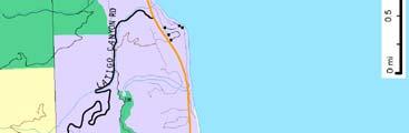


293
3.13 TRANSPORTATION AND TRAFFIC
 3.13 TRANSPORTATION AND TRAFFIC INTRODUCTION This section of the Draft EIR describes the transportation and traffic based on the Transportation Impact Analysis (TIA) prepared by Overland Traffic Consultants,
V. ENVIRONMENTAL IMPACT ANALYSIS K. TRANSPORTATION AND CIRCULATION
 V. ENVIRONMENTAL IMPACT ANALYSIS K. TRANSPORTATION AND CIRCULATION ENVIRONMENTAL SETTING The following section is based on the Draft Traffic Circulation Study for the Malibu La Paz Project (Traffic Study),
Traffic Impact Analysis Chatham County Grocery Chatham County, NC
 Chatham County Grocery Chatham County, NC TABLE OF CONTENTS 1. INTRODUCTION... 1 1.1. Location and Study Area... 1 1.2. Proposed Land Use and Access... 2 1.3. Adjacent Land Uses... 2 1.4. Existing ways...
 TRAFFIC IMPACT STUDY CANYON HILLS PROJECT LOS ANGELES, CALIFORNIA INTRODUCTION This traffic analysis has been conducted to identify and evaluate the potential traffic impacts of the proposed Canyon Hills
Overland Traffic Consultants, Inc. October 15, Mr. Bruce McBride Project Delivery Analysts, LLC Shawnee Street Moorpark, CA 93021
 Overland Traffic Consultants 952 Manhattan Beach Boulevard, Suite #100 Manhattan Beach, CA 90266 Phone (661) 799-8423 E-mail: otc@overlandtraffic.com October 15, 2015 Mr. Bruce McBride Project Delivery
TRAFFIC IMPACT STUDY And A TRAFFIC SIGNAL WARRANT ANALYSIS FOR A SENIOR LIVING AND APARTMENT DEVELOPMENT
 TRAFFIC IMPACT STUDY And A TRAFFIC SIGNAL WARRANT ANALYSIS FOR A SENIOR LIVING AND APARTMENT DEVELOPMENT DEERFIELD TOWNSHIP, WARREN COUNTY, OHIO Nantucket Circle and Montgomery Road () Prepared for: ODLE
Traffic Impact Study. Westlake Elementary School Westlake, Ohio. TMS Engineers, Inc. June 5, 2017
 TMS Engineers, Inc. Traffic Impact Study Westlake Elementary School Westlake, Ohio June 5, 2017 Prepared for: Westlake City Schools - Board of Education 27200 Hilliard Boulevard Westlake, OH 44145 TRAFFIC
Magnolia Place. Traffic Impact Analysis. Prepared for: City of San Mateo. Prepared by: Hexagon Transportation Consultants, Inc.
 Magnolia Place Traffic Impact Analysis Prepared for: City of San Mateo Prepared by: Hexagon Transportation Consultants, Inc. Updated January 4, 2010 Table of Contents 1. Introduction...1 2. Existing Conditions...6
List of Attachments. Location Map... Site Plan... City of Lake Elsinore Circulation Element... City of Lake Elsinore Roadway Cross-Sections...
 List of Attachments Exhibits Location Map... Site Plan... City of Lake Elsinore Circulation Element... City of Lake Elsinore Roadway Cross-Sections... Existing Lane Geometry and Traffic Controls... Existing
THIS PAGE LEFT BLANK INTENTIONALLY
 GA SR 25 Spur at Canal Road Transportation Impact Analysis PREPARED FOR GLYNN COUNTY, GEORGIA 1725 Reynolds Street, Suite 300 Brunswick, Georgia 31520 PREPARED BY 217 Arrowhead Boulevard Suite 26 Jonesboro,
Transportation Impact Study for Abington Terrace
 Transportation Impact Study for Abington Terrace Abington Township, Montgomery County, PA Sandy A. Koza, P.E., PTOE PA PE License Number PE059911 Prepared by McMahon Associates, Inc. 425 Commerce Drive,
3.9 - Transportation and Traffic
 Transportation and Traffic 3.9 - Transportation and Traffic This section describes the potential transportation and traffic effects of project implementation on the project site and its surrounding area.
CarMax Auto Superstore/ Reconditioning Center #6002 Murrieta, California
 CarMax Auto Superstore/ Reconditioning Center #6002 Murrieta, California TUSTIN 17782 17th Street Suite 200 Tustin, CA 92780-1947 714.665.4500 Fax: 714.665.4501 LOS ANGELES 145 S. Spring Street Suite 120
TABLE OF CONTENTS TABLE OF CONTENTS... I APPENDICES... III LIST OF EXHIBITS... V LIST OF TABLES... VII LIST OF ABBREVIATED TERMS...
 TABLE OF CONTENTS TABLE OF CONTENTS... I APPENDICES... III LIST OF EXHIBITS... V LIST OF TABLES... VII LIST OF ABBREVIATED TERMS... IX 1 INTRODUCTION... 1 1.1 Project Overview... 1 1.2 Analysis Scenarios...
Highway 111 Corridor Study
 Highway 111 Corridor Study June, 2009 LINCOLN CO. HWY 111 CORRIDOR STUDY Draft Study Tea, South Dakota Prepared for City of Tea Sioux Falls Metropolitan Planning Organization Prepared by HDR Engineering,
D.13 Transportation and Traffic
 This section addresses transportation and traffic issues and impacts related to the Proposed Project. Section D.13.1 provides a description of the affected environment for the Proposed Project. Applicable
TRAFFIC STUDY GUIDELINES Clarksville Street Department
 TRAFFIC STUDY GUIDELINES Clarksville Street Department 9/1/2009 Introduction Traffic studies are used to help the city determine potential impacts to the operation of the surrounding roadway network. Two
4. ENVIRONMENTAL IMPACT ANALYSIS 9. TRANSPORTATION AND TRAFFIC
 4. ENVIRONMENTAL IMPACT ANALYSIS 9. TRANSPORTATION AND TRAFFIC 4.9.1 INTRODUCTION The following section addresses the Proposed Project s impact on transportation and traffic based on the Traffic Study
Abrams Associates. Transportation Impact Analysis. City of Rocklin. Prepared for: David Mohlenbrok City of Rocklin 4081 Alvis Court Rocklin, CA 95677
 Transportation Impact Analysis Sierra College Boulevard Commercial Project City of Rocklin Prepared for: David Mohlenbrok City of Rocklin 081 Alvis Court Rocklin, CA 95677 Prepared by: 1875 Olympic Boulevard,
EAST AND SOUTH STREET CITY OF ANAHEIM, CALIFORNIA
 T R A F F I C I M P A C T A N A LY S I S EAST AND SOUTH STREET CITY OF ANAHEIM, CALIFORNIA April 217 T R A F F I C I M P A C T A N A LY S I S EAST AND SOUTH STREET CITY OF ANAHEIM, CALIFORNIA Submitted
5.3 TRAFFIC, CIRCULATION AND PARKING
 5.3 TRAFFIC, CIRCULATION AND PARKING This section is based upon the Downtown Lancaster Specific Plan Traffic Impact Analysis (April 2, 2008) and the Downtown Lancaster Specific Plan Parking Analysis (May
Traffic Impact Study WestBranch Residential Development Davidson, NC March 2016
 Traffic Impact Study WestBranch Residential Development Davidson, NC March 216 TRAFFIC IMPACT STUDY FOR THE WestBranch Residential Development LOCATED IN DAVIDSON, NC Prepared For: Lennar Carolinas, LLC
Henderson Avenue Mixed-Use Development
 Zoning Case: Z145-3 Traffic Impact Analysis Henderson Avenue Mixed-Use Development Dallas, TX October 26 th, 216 Kimley-Horn and Associates, Inc. Dallas, Texas Project #644827 Registered Firm F-928 Traffic
OTTAWA TRAIN YARDS PHASE 3 DEVELOPMENT CITY OF OTTAWA TRANSPORTATION IMPACT STUDY. Prepared for:
 OTTAWA TRAIN YARDS PHASE 3 DEVELOPMENT CITY OF OTTAWA TRANSPORTATION IMPACT STUDY Prepared for: The Ottawa Train Yards Inc. 223 Colonnade Road South, Suite 212 Nepean, Ontario K2E 7K3 January 17, 2012
Traffic Circulation Study for Neighborhood Southwest of Mockingbird Lane and Airline Road, Highland Park, Texas
 ARIZONA TEXAS NEW MEXICO OKLAHOMA February 13, 2015 Mr. Meran Dadgostar P.E., R.S. Town of Highland Park 4700 Drexel Dr. Highland Park, Texas 75205 Re: Traffic Circulation Study for Neighborhood Southwest
TRAFFIC IMPACT STUDY COMPREHENSIVE UPDATE TOWN OF THOMPSON S STATION, TENNESSEE PREPARED FOR: THE TOWN OF THOMPSON S STATION
 TRAFFIC IMPACT STUDY COMPREHENSIVE UPDATE TOWN OF THOMPSON S STATION, TENNESSEE PREPARED FOR: THE TOWN OF THOMPSON S STATION Transportation Consultants, LLC 1101 17 TH AVENUE SOUTH NASHVILLE, TN 37212
TRAFFIC ASSESSMENT River Edge Colorado
 TRAFFIC ASSESSMENT River Edge Colorado Submitted by: Fehr & Peers 621 17th Street, Ste. 231 Denver, CO 8293 (33) 296-43 December, 21 App. M-2 Traffic Assessment River Edge Colorado December 21 TABLE OF
Los Coyotes Country Club Development Plan Traffic Impact Analysis
 Los Coyotes Country Club Development Plan Traffic Impact Analysis Prepared For: Phil Martin Associates 2073007450 Los Coyotes Country Club Development Plan Traffic Impact Analysis June 19, 2014 Prepared
TABLE TRAFFIC ANALYSIS SCENARIOS
 4.11 TRANSPORTATION The potential traffic impacts of the proposed project are evaluated in the Buena Park Beach/Orangethorpe Mixed Use Project Traffic Analysis (Traffic Analysis) by Austin-Foust Associates
Table of Contents FIGURES TABLES APPENDICES. Traffic Impact Study Hudson Street Parking Garage MC Project No.: A Table of Contents
 Traffic Impact Study Hudson Street Parking Garage MC Project No.: 151714A Table of Contents Table of Contents I. INTRODUCTION... 2 II. EXISTING CONDITIONS... 5 III. 215 EXISTING TRAFFIC CONDITIONS... 6
INDUSTRIAL BUILDING 3009 HAWTHORNE ROAD CITY OF OTTAWA TRANSPORTATION OVERVIEW REVISED. Prepared for: Canada Inc.
 INDUSTRIAL BUILDING 3009 HAWTHORNE ROAD CITY OF OTTAWA TRANSPORTATION OVERVIEW REVISED Prepared for: 7849648 Canada Inc. Octiober 1, 2015 114-598 Overview_2.doc D. J. Halpenny & Associates Ltd. Consulting
TRAFFIC IMPACT ANALYSIS
 TRAFFIC IMPACT ANALYSIS FOR THE CHAMPAIGN UNIT#4 SCHOOL DISTRICT PROPOSED HIGH SCHOOL (SPALDING PARK SITE) IN THE CITY OF CHAMPAIGN Final Report Champaign Urbana Urbanized Area Transportation Study 6/24/2014
Traffic Impact Analysis Walton Acres at Riverwood Athletic Club Clayton, NC
 Traffic Impact Analysis Walton Acres at Riverwood Athletic Club Clayton, NC 1. TABLE OF CONTENTS INTRODUCTION...1 1.1. Site Location and Study Area...1 1.2. Proposed Land Use and Site Access...2 1.3.
Chapter 16: Traffic and Parking A. INTRODUCTION
 Chapter 6: Traffic and Parking A. ITRODUCTIO This chapter examines the potential traffic and parking impacts of the proposed Fresh Kills Park roads. The analysis of transit and pedestrians is presented
6060 North Central Expressway Mixed-Use Site Dallas, Texas
 Volume 1 Traffic Impact Analysis 6060 North Central Expressway Mixed-Use Site Dallas, Texas April 30, 2018 Kimley-Horn and Associates, Inc. Dallas, Texas Project #063238300 Registered Firm F-928 Traffic
Shockoe Bottom Preliminary Traffic and Parking Analysis
 Shockoe Bottom Preliminary Traffic and Parking Analysis Richmond, Virginia August 14, 2013 Prepared For City of Richmond Department of Public Works Prepared By 1001 Boulders Pkwy Suite 300, Richmond, VA
4.11 TRANSPORTATION 4.11 TRANSPORTATION Environmental Setting Intersection, Roadway, and Freeway Evaluation Methodology
 4.11 TRANSPORTATION This section describes the road transportation system in the vicinity of the proposed Project and the potential impacts to this system from the proposed Project. The analysis in this
Glenn Avenue Corridor Traffic Operational Evaluation
 Glenn Avenue Corridor Traffic Operational Evaluation PREPARED FOR: THE CITY OF AUBURN PREPARED BY: DECEMBER 2007 Glenn Avenue Corridor Study--Auburn, Alabama TABLE OF CONTENTS Introduction... 1 Background
OFFICE/RETAIL DEVELOPMENT 1625 BANK STREET OTTAWA, ONTARIO TRANSPORTATION BRIEF. Prepared for: Canada Inc.
 OFFICE/RETAIL DEVELOPMENT 1625 BANK STREET OTTAWA, ONTARIO TRANSPORTATION BRIEF Prepared for: 9402209 Canada Inc. December 15, 2015 115-625 Report_2.doc D. J. Halpenny & Associates Ltd. Consulting Transportation
Chapter 4 Traffic Analysis
 Chapter 4 Traffic Analysis PURPOSE The traffic analysis component of the K-68 Corridor Management Plan incorporates information on the existing transportation network, such as traffic volumes and intersection
9 Leeming Drive Redevelopment Ottawa, ON Transportation Brief. Prepared By: Stantec Consulting Ltd.
 9 Leeming Drive Redevelopment Ottawa, ON Transportation Brief Prepared By: Stantec Consulting Ltd. TIA GUIDELINES CHECKLIST Report Context Municipal Address Comment: Section 1.1 Location relative to major
TRAFFIC IMPACT ANALYSIS. Photo here CAL MET ROYAL MRF EXPANSION. City of Paramount, CA. arch beach C O N S U L T I N G.
 TRAFFIC IMPACT ANALYSIS z Photo here CAL MET ROYAL MRF EXPANSION City of Paramount, CA arch beach C O N S U L T I N G June 23, 214 TRAFFIC IMPACT ANALYSIS CAL MET ROYAL MATERIALS RECOVERY FACILITY (MRF)
CHAPTER 3. Transportation and Circulation
 CHAPTER 3 Transportation and Circulation 3.0 TRANSPORTATION AND CIRCULATION This chapter evaluates traffic circulation, transit, parking, pedestrian, bicycle, and rail operational conditions in the Project
TRANSPORTATION ANALYSIS REPORT US Route 6 Huron, Erie County, Ohio
 TRANSPORTATION ANALYSIS REPORT US Route 6 Huron, Erie County, Ohio December 12, 2012 Prepared for: The City of Huron 417 Main Huron, OH 44839 Providing Practical Experience Technical Excellence and Client
King Soopers #116 Thornton, Colorado
 Traffic Impact Study King Soopers #116 Thornton, Colorado Prepared for: Galloway & Company, Inc. 1.0 EXECUTIVE SUMMARY King Soopers #116, a grocery marketplace anchored commercial development, is proposed
QUICKIE C STORE AND GAS BAR 1780 HERON ROAD OTTAWA, ONTARIO TRANSPORTATION BRIEF. Prepared for:
 QUICKIE C STORE AND GAS BAR 1780 HERON ROAD OTTAWA, ONTARIO TRANSPORTATION BRIEF Prepared for: Quickie Convenience Stores Larny Holdings Ltd. c/o PBC Group April 15, 2015 115-615 Report_1.doc D. J. Halpenny
FINAL Albertville Business Park AUAR Update Traffic Study
 FINAL Albertville Business Park AUAR Update Traffic Study Prepared for City of Albertville, MN July 20, 2017 SRF No. 10060.00 Table of Contents Introduction... 1 Existing Conditions... 1 Data Collection...
Traffic Impact Study Little Egypt Road Development Denver, North Carolina June 2017
 Traffic Impact Study Little Egypt Road Development Denver, North arolina June 2017 N. Little Egypt Road DQ\ QDQFLQJ VDOHV RU RWKHU SHUIRUPDQFH EDVHG FULWHULD Proposed Site Driveways Site Driveway 1 TRAFFI
Mission Street Medical Office Development
 reet Medical Office Development Traffic Impact Analysis Prepared for: Palo Alto Medical Foundation February 23, 2012 Hexagon Office: 7888 Wren Avenue, Suite B121 Gilroy, CA 95020 Hexagon Job Number: 11RD11
Figure 1: East West Connector Alignment Alternatives Concept Drawing
 Page 2 of 9 Figure 1: East West Connector Alignment Alternatives Concept Drawing The Montebello Drive extension will run north south and connect Wilsonville Road to the Boones Ferry Road to Brown Road
VIVA RETIREMENT COMMUNITIES OAKVILLE TRAFFIC IMPACT STUDY
 VIVA RETIREMENT COMMUNITIES OAKVILLE TRAFFIC IMPACT STUDY VIVA RETIREMENT COMMUNITIES OAKVILLE TRAFFIC IMPACT STUDY DECEMBER 2012 READ, VOORHEES & ASSOCIATES TORONTO, ONTARIO Read, Voorhees & Associates
Traffic Impact Analysis (TIA) Process and Procedures Manual. September 2017
 Process and Procedures Manual. September 2017") Traffic Impact Analysis (TIA) Process and Procedures Manual Post Office Box 664 101 Huntersville-Concord Road Huntersville, NC 28070 Phone 704-766-2220 Fax 704-992-5528 www.huntersville.org (c) 2017, Town
Traffic Impact Analysis (TIA) Process and Procedures Manual Post Office Box 664 101 Huntersville-Concord Road Huntersville, NC 28070 Phone 704-766-2220 Fax 704-992-5528 www.huntersville.org (c) 2017, Town
METHODOLOGY. Signalized Intersection Average Control Delay (sec/veh)
") Chapter 5 Traffic Analysis 5.1 SUMMARY US /West 6 th Street assumes a unique role in the Lawrence Douglas County transportation system. This principal arterial street currently conveys commuter traffic
Chapter 5 Traffic Analysis 5.1 SUMMARY US /West 6 th Street assumes a unique role in the Lawrence Douglas County transportation system. This principal arterial street currently conveys commuter traffic
MEMORANDUM. Our project study area included the following locations:
 MEMORANDUM Date: To: From: Subject: Najib O. Habesch Nick M. Fomenko, PE, PTOE Bushnell Park North Traffic Assessment BETA Project #: 4461 As part of our contract to undertake the design of the Bushnell
TRAFFIC IMPACT STUDY. Creekside Thornton, Colorado. For. August 2015 November 2015 Revised: August Prepared for:
 TRAFFIC IMPACT STUDY For Creekside Thornton, Colorado August 215 November 215 Revised: August 216 Prepared for: Jansen Strawn Consulting Engineers 45 West 2 nd Avenue Denver, Colorado 8223 Prepared by:
APPENDIX H TRAFFIC REPORT
 APPENDIX H TRAFFIC REPORT Keith Higgins Traffic En ginee r WEST END SAND CITY TRAFFIC IMPACT ANALYSIS DRAFT REPORT SAND CITY, CALIFORNIA Prepared for DBO Development No. 3 Monterey, CA Prepared by Keith
Walmart (Store # ) 60 th Street North and Marion Road Sioux Falls, South Dakota
 60 th Street North and Marion Road Sioux Falls, South Dakota") Walmart (Store #4865-00) 60 th Street North and Marion Road Sioux Falls, South Dakota Prepared for: Wal-Mart Stores, Inc. Bentonville, Arkansas Prepared by: Kimley-Horn and Associates, Inc. ã2013 Kimley-Horn
Walmart (Store #4865-00) 60 th Street North and Marion Road Sioux Falls, South Dakota Prepared for: Wal-Mart Stores, Inc. Bentonville, Arkansas Prepared by: Kimley-Horn and Associates, Inc. ã2013 Kimley-Horn
Focused Traffic Analysis for the 200 Nellen Avenue Project
 March 13, 2017 Mr. Phil Boyle Town of Corte Madera 300 Tamalpais Drive Corte Madera, CA 94976-0159 Focused Traffic Analysis for the 200 Nellen Avenue Project Dear Mr. Boyle; W-Trans has completed a focused
Bridge Street Corridor Study Report
 Bridge Street Corridor Study Report Prepared for: Prepared by: BRIDGE STREET CORRIDOR STUDY REPORT PREPARED FOR: CITY OF ARROYO GRANDE COMMUNITY DEVELOPMENT DEPARTMENT 300 EAST BRANCH STREET ARROYO GRANDE,
TRANSPORTATION IMPACT STUDY PROPOSED RIVERFRONT 47 MIXED USE DEVELOPMENT
 November 2016 TRANSPORTATION IMPACT STUDY PROPOSED RIVERFRONT 47 MIXED USE DEVELOPMENT & Aspinwall Borough, Sharpsburg Borough & O Hara Township, Allegheny County, Pennsylvania Prepared for: Riverfront
Lyons Avenue/Dockweiler Road Extension Project Draft Environmental Impact Report. Appendix I Traffic Impact Study
 Lyons Avenue/Dockweiler Road Extension Project Draft Environmental Impact Report Appendix I Traffic Impact Study Street 0 80-1947 500.4501 RITA ld Court 0 91355-1096 400.7401 LA n Avenue 0 590-3745 300-9301
COMMERCIAL DEVELOPMENT 2015 ROBERTSON ROAD OTTAWA, ONTARIO TRANSPORTATION BRIEF. Prepared for:
 COMMERCIAL DEVELOPMENT 2015 ROBERTSON ROAD OTTAWA, ONTARIO TRANSPORTATION BRIEF Prepared for: First Bay Properties Inc. 311 Richmond Road, Suite 203 Ottawa, ON K1Z 6X3 August 8, 2017 117-663 Brief_1.doc
5858 N COLLEGE, LLC N College Avenue Traffic Impact Study
 5858 N COLLEGE, LLC nue Traffic Impact Study August 22, 2016 Contents Traffic Impact Study Page Preparer Qualifications... 1 Introduction... 2 Existing Roadway Conditions... 5 Existing Traffic Conditions...
DIMARCO CANANDAIGUA PROPERTIES HOUSING PROJECT CANANDAIGUA, ONTARIO COUNTY, NEW YORK
 TRAFFIC IMPACT STUDY FOR THE DIMARCO CANANDAIGUA PROPERTIES HOUSING PROJECT CANANDAIGUA, ONTARIO COUNTY, NEW YORK MARCH 14, 2017 PREPARED FOR: 1950 Brighton Henrietta Town Line Rd Rochester, NY 14623 PREPARED
P HA Transportation Consultants
 Attachment F P HA Transportation Consultants 2711 Stuart Street Berkeley CA 94705 Phone {510) 848-92.33 Web www.pangho.com September 8, 2017 Newell Arnerich AD Architects Via email:newell@adarch.com Dear
Project Report. South Kirkwood Road Traffic Study. Meadows Place, TX October 9, 2015
 Meadows Place, TX October 9, 2015 Contents 1 Introduction... 1 2 Data Collection... 1 3 Existing Roadway Network... 2 4 Traffic Volume Development... 2 5 Warrant Analysis... 3 6 Traffic Control Alternative
TRAFFIC IMPACT ANALYSIS OF PROPOSED CHESTNUT HILL COLLEGE MASTER PLAN DEVELOPMENT
 TRAFFIC IMPACT ANALYSIS OF PROPOSED CHESTNUT HILL COLLEGE MASTER PLAN DEVELOPMENT Prepared by Orth-Rodgers & Associates, Inc. December 14, 2009 Updated November 9, 2010 230 South Broad Street Philadelphia
HENDERSON DEVELOPMENT 213, 217, 221, 221 ½, 223 HENDERSON AVENUE and 65 TEMPLETON STREET OTTAWA, ONTARIO TRANSPORTATION OVERVIEW.
 HENDERSON DEVELOPMENT 213, 217, 221, 221 ½, 223 HENDERSON AVENUE and 65 TEMPLETON STREET OTTAWA, ONTARIO TRANSPORTATION OVERVIEW Prepared for: 2294170 Ontario Inc. February 2, 2017 117-652 Report_1.doc
Harrah s Station Square Casino
 Transportation Analysis Harrah s Station Square Casino Pittsburgh, Pennsylvania Submitted To: City of Pittsburgh and Pennsylvania Gaming Control Board Prepared By: DKS Associates GAI Consultants December
Evaluation of M-99 (Broad Street) Road Diet and Intersection Operational Investigation
 Road Diet and Intersection Operational Investigation") Evaluation of M-99 (Broad Street) Road Diet and Intersection Operational Investigation City of Hillsdale, Hillsdale County, Michigan June 16, 2016 Final Report Prepared for City of Hillsdale 97 North Broad
Evaluation of M-99 (Broad Street) Road Diet and Intersection Operational Investigation City of Hillsdale, Hillsdale County, Michigan June 16, 2016 Final Report Prepared for City of Hillsdale 97 North Broad
TRAFFIC IMPACT ANALYSIS FOR A PROPOSED HOTEL / RESIDENTIAL DEVELOPMENT. The Beverly Hilton 9876 Wilshire Boulevard City of Beverly Hills
 TRAFFIC IMPACT ANALYSIS FOR A PROPOSED HOTEL / RESIDENTIAL DEVELOPMENT The Beverly Hilton 9876 Wilshire Boulevard City of Beverly Hills Prepared for: Oasis West Realty LLC Prepared by: Overland Traffic
REDEVELOPMENT TRAFFIC IMPACT STUDY
 REDEVELOPMENT TRAFFIC IMPACT STUDY For Wendy s Parker, Colorado January 215 Prepared for: Sterling Design Associates, LLC 29 W. Littleton Boulevard #3 Littleton, Colorado 812 Prepared by: 1233 Airport
South Albion-Bolton Community Plan North Hill Supermarket Transportation Study Part B: Evaluation of Alternatives
 Community Plan North Hill Supermarket Transportation Study Part B: Evaluation of Alternatives Prepared for: The Town of Caledon August 9 Transportation Solutions Ltd. 43 Forest Road Cambridge, ON N1S 3B4
FINAL DESIGN TRAFFIC TECHNICAL MEMORANDUM
 FINAL DESIGN TRAFFIC TECHNICAL MEMORANDUM July 2014 FINAL (SR 43) Project Development and Environment Study From State Road 60 (Adamo Drive) to I-4 (SR 400) Hillsborough County, Florida Work Program Item
TRAFFIC IMPACT STUDY CRITERIA
 Chapter 6 - TRAFFIC IMPACT STUDY CRITERIA 6.1 GENERAL PROVISIONS 6.1.1. Purpose: The purpose of this document is to outline a standard format for preparing a traffic impact study in the City of Steamboat
Traffic Impact Study for Rolling Ridge Redevelopment
 Traffic Impact Study for Rolling Ridge Redevelopment Webster Groves, Missouri October 19, 2018 Prepared For: Gershman Commercial Real Estate 150 North Meramec Avenue Suite 500 St. Louis, Missouri 63105
Bistro 6. City of Barrie. Traffic Impact Study for Pratt Hansen Group Inc. Type of Document: Final Report. Project Number: JDE 1748
 City of Barrie Traffic Impact Study for Pratt Hansen Group Inc. Type of Document: Final Report Project Number: JDE 1748 Date Submitted: June 12 th, 2017 06/12/17 John Northcote, P.Eng. Professional License
Traffic Impact Statement
 Traffic Impact Statement Mixed Use Development, US 41 and Old Trail Drive aka Tide-Starbucks 4900 9 th Street North General Development Site Plan (GDSP) Collier County, FL 10/6/2015 Prepared for: Prepared
HOLIDAY INN HOTEL 235 KING EDWARD AVENUE CITY OF OTTAWA TRANSPORTATION BRIEF. Prepared for:
 HOLIDAY INN HOTEL 235 KING EDWARD AVENUE CITY OF OTTAWA TRANSPORTATION BRIEF Prepared for: Momentum Planning & Communications 1165 Greenlawn Crescent Ottawa, ON K1L 6C2 June 29, 2015 115-618 Brief_1.doc
Subject: Solberg Avenue / I-229 Grade Separation: Traffic Analysis
 MEMORANDUM Transportation Bill Troe, AICP Jason Carbee, AICP 12120 Shamrock Plaza Suite 300 Omaha, NE 68154 (402) 334-8181 (402) 334-1984 (Fax) To: Project File Date: Subject: Solberg Avenue / I-229 Grade
4.11 TRANSPORTATION/CIRCULATION
 4.11 TRANSPORTATION/CIRCULATION This section was developed using information from a Traffic Analysis Report prepared for the project by OEG, Inc. (2010), the Paradiso del Mare Ocean and Inland Estates
Prescott Plaza TRAFFIC IMPACT ANALYSIS TOWN OF YUCCA VALLEY
 Prescott Plaza TRAFFIC IMPACT ANALYSIS TOWN OF YUCCA VALLEY PREPARED BY: Aric Evatt, PTP aevatt@urbanxroads.com (949) 660-1994 x204 Charlene So, PE cso@urbanxroads.com (949) 660-1994 x222 OCTOBER 18, 2018
Traffic Impact Memorandum. May 22, 2018
 BISHOP PROFESSIONAL DEVELOPMENT BUILDING Proposed Land-use Change & Parking Modification 3601 SW 31st Street Topeka, Kansas 66614 CFS Project No. 185077 Traffic Impact Memorandum May 22, 2018 Prepared
LSC TRANSPORTATION CONSULTANTS, INC. 516 North Tejon Street Colorado Springs, CO (719) FAX (719)
 FAX (719)") LSC TRANSPORTATION CONSULTANTS, INC. 516 North Tejon Street Colorado Springs, CO 80903 (719) 633-2868 FAX (719) 633-5430 E-mail: lsc@lsccs.com May 15, 2009 Mr. Davis Farrar Western Slope Consulting, LLC
LSC TRANSPORTATION CONSULTANTS, INC. 516 North Tejon Street Colorado Springs, CO 80903 (719) 633-2868 FAX (719) 633-5430 E-mail: lsc@lsccs.com May 15, 2009 Mr. Davis Farrar Western Slope Consulting, LLC
4.10 TRAFFIC AND CIRCULATION
 4.10 TRAFFIC AND CIRCULATION The following section is based on a traffic and circulation study prepared by Fehr & Peers, Inc. (November 2003; refer to Appendix F for technical calculations). The effects
FORM A PASCO COUNTY ACCESS CONNECTION PERMIT APPLICATION
 FORM 901.3.A PASCO COUNTY ACCESS CONNECTION PERMIT APPLICATION The following information is required from all applicants directly or indirectly accessing any collector or arterial road or as otherwise
1609 E. FRANKLIN STREET HOTEL TRAFFIC IMPACT STUDY EXECUTIVE SUMMARY
 1609 E. FRANKLIN STREET HOTEL TRAFFIC IMPACT STUDY EXECUTIVE SUMMARY Prepared for: The Town of Chapel Hill Public Works Department Traffic Engineering Division Prepared by: HNTB North Carolina, PC 343
DUNBOW ROAD FUNCTIONAL PLANNING
 DUNBOW ROAD FUNCTIONAL PLANNING Final Report August 3, 216 #31, 316 5th Avenue NE Calgary, AB T2A 6K4 Phone: 43.273.91 Fax: 43.273.344 wattconsultinggroup.com Dunbow Road Functional Planning Final Report
Capital Region Council of Governments
 March 23, 2018 Capital Region Council of Governments PROJECT CONCEPT REPORT Realignment of Swamp and Northfield Road s approaches to Route 44 (Boston Turnpike) Town of Coventry SUMMARY: The Town of Coventry
CHAPTER 4 TRANSPORTATION IMPACT STUDY TABLE OF CONTENTS
 CHAPTER 4 TRANSPORTATION IMPACT STUDY TABLE OF CONTENTS Section Title Page 4.1 Introduction... 4-1 4.1.1 General... 4-1 4.1.2 Applicant Responsibility... 4-1 4.1.3 Capacity and Safety Issues... 4-1 A.
APPENDIX F SUPPLEMENTAL TRAFFIC DATA
 APPENDIX F SUPPLEMENTAL TRAFFIC DATA Environmental and Planning Consultants 440 Park Avenue South 7th Floor New York, NY 10016 tel: 212 696-0670 fax: 212 213-3191 www.akrf.com Draft Memorandum To: Michael
Traffic Impact Study. Roderick Place Columbia Pike Thompson s Station, TN. Transportation Group, LLC Traffic Engineering and Planning
 F i s c h b a c h Transportation Group, LLC Traffic Engineering and Planning Traffic Impact Study Roderick Place Columbia Pike Thompson s Station, TN Prepared March 2016 Ms. Gillian L. Fischbach, P.E.,
Traffic Study North Shore School District 112
 Traffic Study North Shore School District 112 Proposed Expansion of Northwood Junior High School Prepared By: May 1, 2015 1. Introduction Kenig, Lindgren, O Hara, Aboona, Inc. (KLOA, Inc.) has been retained
PINESTONE TRAFFIC IMPACT STUDY Travelers Rest, South Carolina
 PINESTONE TRAFFIC IMPACT STUDY Travelers Rest, South Carolina Prepared for Longbranch Development Prepared by January 13, 219 ii Table of Contents Subject Page Signature Page... i Table of Contents...
Appendix B. Environmental Resource Technical Memorandum. Assessment on Travel Pattern and Access Impacts
 Appendix B Environmental Resource Technical Memorandum Assessment on Travel Pattern and Access Impacts TECHNICAL MEMORANDUM ENVIRONMENTAL RE-EVALUATION FOR UNION STATION TO OAK CLIFF DALLAS STREETCAR To:
ALLEY 24 TRAFFIC STUDY
 ALLEY 24 TRAFFIC STUDY in City of Frostburg, Maryland January 2013 3566 Teays Valley Road Hurricane, WV Office: (304) 397-5508 www.denniscorporation.com Alley 24 Traffic Study January 2013 Frostburg, Maryland
The proposed development is located within 800m of an existing Transit Station where infill developments and intensification are encouraged.
 Stantec Consulting Ltd. 1331 Clyde Avenue, Suite 4 Ottawa ON K2C 3G4 Tel: (613) 722-442 Fax: (613) 722-2799 May 14, 213 File: 1638823 Robinson Park Development Corp. 5699 Power Road Ottawa, ON, K1G 3N4
Appendix H. Traffic Analysis
 Appendix H Traffic Analysis Allyn D. Rifkin PE Los Feliz Towers E-mail allynrifkin@gmail.com 4455 Los Feliz Boulevard Suite 1403 Telephone and fax -- (323) 664-2805 Los Angeles, CA 90027 Mobile phone (323)
MEETING FACILITY 2901 GIBFORD DRIVE CITY OF OTTAWA TRANSPORTATION BRIEF. Prepared for: Holiday Inn Express 2881 Gibford Drive Ottawa, ON K1V 2L9
 MEETING FACILITY 2901 GIBFORD DRIVE CITY OF OTTAWA TRANSPORTATION BRIEF Prepared for: Holiday Inn Express 2881 Gibford Drive Ottawa, ON K1V 2L9 December 18, 2012 112-566 Brief_1.doc D. J. Halpenny & Associates
City of Homewood Transportation Plan
 City of Homewood Transportation Plan Prepared for: City of Homewood, Alabama Prepared by: Skipper Consulting, Inc. May 2007 TABLE OF CONTENTS INTRODUCTION... 1 BACKGROUND INFORMATION... 1 EXISTING TRANSPORTATION