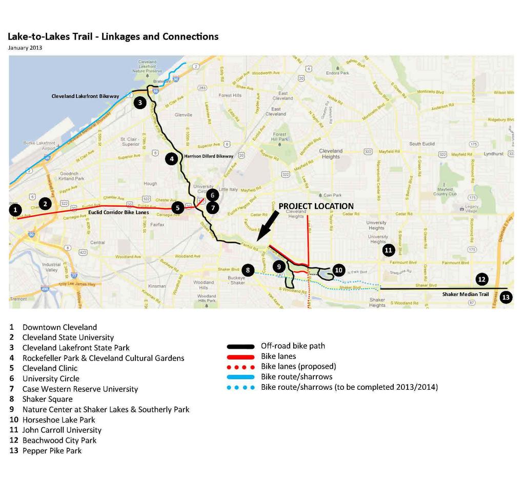
LAKE-TO-LAKES TRAIL. City Planning Commission October 7, 2014
|
|
|
- Suzan Wilkinson
- 5 years ago
- Views:
Transcription
1 LAKE-TO-LAKES TRAIL City Planning Commission October 7, 2014
2 STAGE 3 ENGINEERING PLANS
3 Project Overview Proposed in Shaker Heights Recreation & Leisure Plan (2005) Worked with regional partners to develop Master Plan (2008) Entire trail extends from Shaker Lakes to Lake Erie Cleveland section constructed in 2012 Current section under design: East 127/Fairhill (Shaker Heights) to North Park/Coventry (Cleveland Heights)
4
5 Plan Elements Approximately ¾ mile in length 10 wide asphalt multi-purpose path 10 wide striped crosswalks & ped signals at signalized intersections Coventry (Cleveland Heights) North Moreland/South Park Kemper 10 wide crosswalk & RRFB flasher beacons at East 127 unsignalized intersection Nodes (4) with seating and other amenities at each intersection Trail signage

")

6 Stage 3 Alignment (@ East 127)
7 East 127 / Existing Conditions
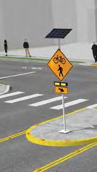
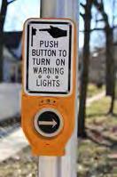
8 East 127 / Proposed RRFB Beacon

9 Stage 3 Alignment (@ Kemper)
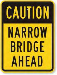
10 Stage 3 Alignment (@ N. Moreland) Trail narrows to 7.8 feet over bridge Existing railing to remain Cautionary signage will be installed


11 Stage 3 Alignment (@ Coventry - CH)

12 Stage 3 Alignment (@ Park Entry - CH)
13 DESIGN ELEMENTS AND MATERIALS
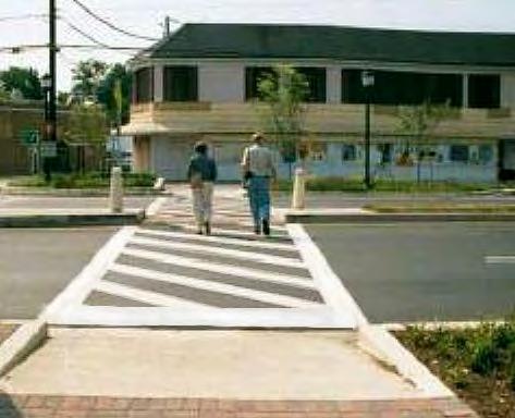
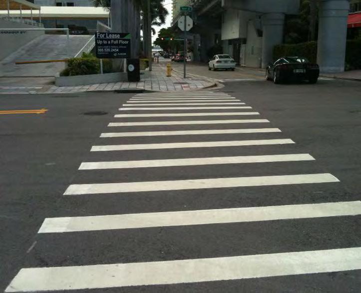
14 Crosswalks Zebra Continental Trail Ladder
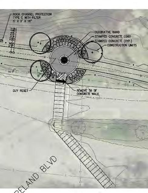
15 Crosswalks

16 Nodes/Trailheads
17 Nodes/Trailheads Landscaped areas at each node for aesthetics as well as post-construction stormwater management


18 Ornamental Tree Ornamental Grass Shrubs Redspire Pear Karl Forester Reed Grass Peewee Hydrangea Old Gold Juniper Perennial Dutch Master Daffodil Bulb Happy Returns Daylily Tracy Spiraea
19 Etched Stone or Stamped Concrete (logo medallion)

20 Node/Trailhead Materials Stamped Concrete


21 Node/Trailhead Materials Cobbles (decorative band) Brick Paver (decorative band)

22 Node/Trailhead Materials Brick Seat Wall (with historical plaque on end Liberty Row )

23 Node/Trailhead Coventry Node: Cycle Aid Station
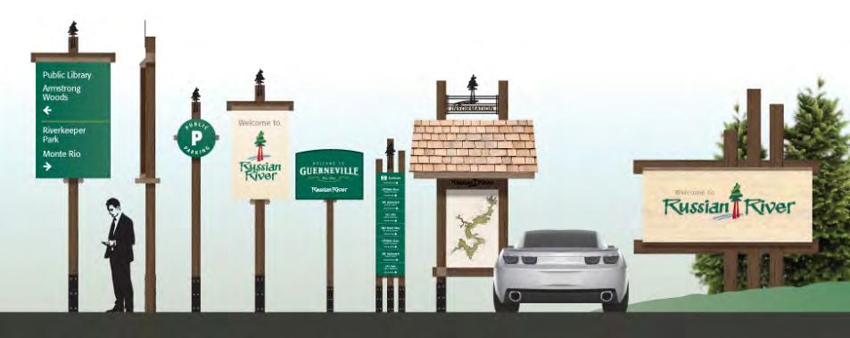
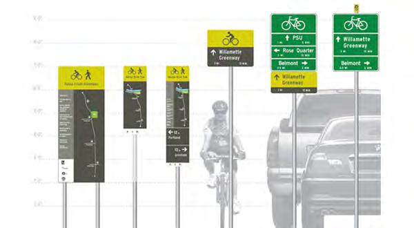

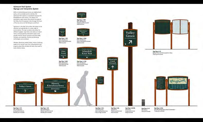
24 Signage


25 Sign Concepts
26 PROCESS, BUDGET & REVIEW OF COMMENTS
27 Funding/Process Funding available for project = $680,000 $480,000 Federal grant funds $120,000 State grant funds $ 80,000 Local funds (Shaker Heights & Cleveland Heights) Federal funding = Federal rules Must follow ODOT process for design and construction Public Meetings June 16, 2014 August 27, 2014 Much public input; all carefully evaluated & considered
28 Stage 3 Cost Estimate Project Element Estimated Cost Design/engineering services $ 80,000 Trail construction $517,000 Contingency (10%) $52,000 Construction inspection/post-bid design services $ 30,000 TOTAL $679,000 Funds available $680,000
29 Public Comments: 3 Key Issues 1. Fairhill North Moreland/South Park 2. Narrowing of trail at bridge 3. Fairhill crosswalk East 127
30 1. North Moreland Crosswalk extended across all lanes of Fairhill; will extend across South Park if ODOT allows

31 2. Narrow bridge Trail narrows to 7.8 feet over bridge Existing railing to remain Cautionary signage will be installed
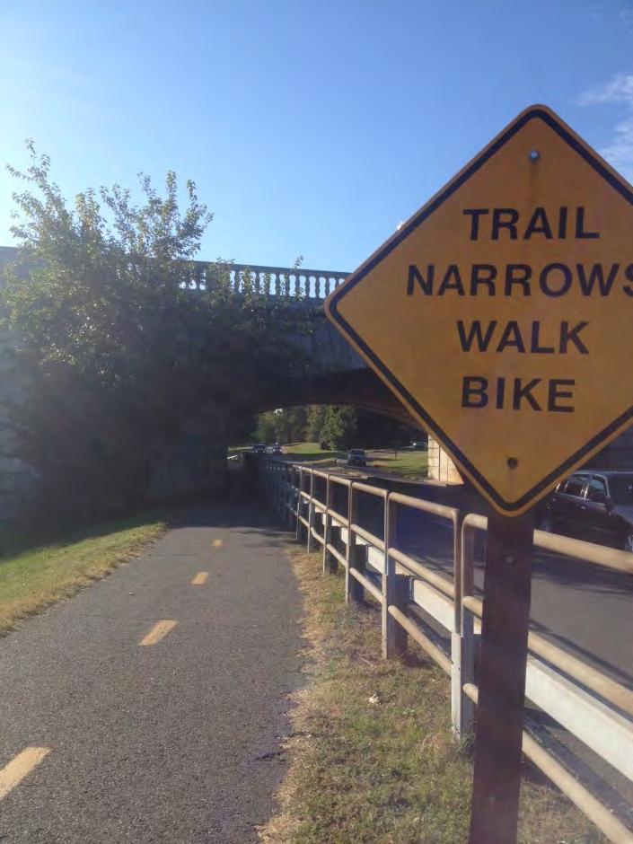
32 Cautionary Signage TBD


33 3. Fairhill East 127 Two options considered RRFB Rectangular Rapid Flash Beacon HAWK High Intensity Activated Crosswalk Beacon RRFB HAWK
34 3. Fairhill East 127 HAWK re-evaluated after public meetings City of Cleveland engineer does not support Project engineer does not recommend MUTCD does not support


35 RRFB Flasher Beacon RRFB meets safety standards based on existing car and anticipated bike/ped traffic levels Alternative for crossing at signalized intersection on Kemper (approximately 600 feet to east) Gaps in car traffic with signals at Kemper & at East 124 Pedestrian island refuge at center Crosswalk with Full Traffic Signal Located at Kemper Rd

36 East 127 / Existing Conditions
37 East 127 / Proposed RRFB Beacon

38 RRFB Example: Kamm s Corners
 Final plan submission to ODOT Project bidding Project")
39 Next Steps Date Oct 17 Nov or Dec Jan 2015 Mar 2015 Summer 2015 Action Stage 3 plan submission to ODOT Public meeting #4 (City Council) Final plan submission to ODOT Project bidding Project construction
Transportation Planning Division
 Transportation Planning Division Presentation Outline Study Tasks Recap of Previous Meetings Data Collected Focus Areas within Study Limits Design Principles Tool Box Recommended Concepts Schedule Moving
PEDESTRIAN CROSSING SOLUTIONS ANDREA HARTH, PE, PTOE TEC ENGINEERING, INC.
 PEDESTRIAN CROSSING SOLUTIONS ANDREA HARTH, PE, PTOE TEC ENGINEERING, INC. Pedestrian Safety 2017 Pedestrian Crashes in Ohio Crash Severity Number % Fatal Crash 141 4.9% Injury Crash 2546 89.1% Property
WELCOME. City of Eden Prairie West 70 th Street
 WELCOME City of Eden Prairie West 70 th Street Project Schedule Sep Oct Nov Dec Jan Feb Mar Apr May Jun Jul Aug >>> May WEST SEGMENT Concept Plan Fall 2014 Plan Development Winter 2014 Summer 2015 Construction
Click to edit Master title style
 Click to edit Master title style Public Information Meeting August 2, 2018 Town of Rotterdam Transportation Alternatives Program Main St (NYS 5S) Pedestrian/Bicycle Access Improvement Project Agenda TAP
TOWN OF MORAGA MORAGA WAY AND CAMINO PABLO/CANYON ROAD IMPROVEMENTS Town Council Meeting March 13, 2019
 TOWN OF MORAGA MORAGA WAY AND CAMINO PABLO/CANYON ROAD IMPROVEMENTS Town Council Meeting March 13, 2019 1 Edric Kwan, Public Works Director Josh Peterman, Principal, Fehr and Peers Shawn Knapp, Senior
NJDOT Complete Streets Checklist
 Background The New Jersey Department of Transportation s Complete Streets Policy promotes a comprehensive, integrated, connected multi-modal network by providing connections to bicycling and walking trip
APPENDIX A: Complete Streets Checklist DRAFT NOVEMBER 2016
 APPENDIX A: Complete Streets Checklist DRAFT NOVEMBER 2016 Complete Streets Checklist MetroPlan Orlando s Complete Streets Checklist is an internal planning tool for staff to further implementation of
City of Albert Lea Policy and Procedure Manual 4.10 ALBERT LEA CROSSWALK POLICY
 4.10 ALBERT LEA CROSSWALK POLICY PURPOSE: Pedestrian crosswalks are an integral part of our transportation infrastructure. To be effective and promote safety, marked crosswalks must be installed after
4 GENERIC COST ESTIMATING TOOL
 4 GENERIC COST ESTIMATING TOOL Table 4-1 presents a generic cost estimating tools that can serve as a conceptual planning tool for local jurisdictions to estimate the costs of pedestrian improvements.
MEMORANDUM. Date: 9/13/2016. Citywide Crosswalk Policy
 MEMORANDUM Date: 9/13/2016 Re: Citywide Crosswalk Policy Foreword Through the s Circulation Element and Complete Streets Policy, it is the City s goal to promote walking trips and provide safe facilities
Bicycle and Pedestrian Advisory Committee (BPAC) November 21, 2013
 November 21, 2013") Bicycle and Pedestrian Advisory Committee (BPAC) November 21, 2013 OVERALL LAND USE CONCEPT Overall Broadway Valdez District: 95.5 acres (35.1 acres right-of ways + 60.4 acres developable land) Plan Subareas:
Bicycle and Pedestrian Advisory Committee (BPAC) November 21, 2013 OVERALL LAND USE CONCEPT Overall Broadway Valdez District: 95.5 acres (35.1 acres right-of ways + 60.4 acres developable land) Plan Subareas:
Freeway ramp intersection study
 Freeway ramp intersection study Supporting Vision Zero: Zero traffic deaths in San Francisco by 2024 Study Goals: Primary Improve Safety Improve Accessibility Secondary Provide Efficient Circulation Accommodate
Bicycle and Pedestrian Facilities Toolbox (Excerpt from Figure 3.1)
") Appendix B Neighborhood Connections Summaries This Appendix is a supplement to the information presented in Chapter 3 Connect People. The Appendix includes a summary or profile for each of the proposed
Appendix B Neighborhood Connections Summaries This Appendix is a supplement to the information presented in Chapter 3 Connect People. The Appendix includes a summary or profile for each of the proposed
SRTS IMPLEMENTATION COSTS
 SRTS IMPLEMENTATION COSTS What Is a Estimate? A cost estimate establishes the anticipated budget required to implement the actions (the improvement projects and programs) identified in your School Travel
PEDESTRIAN CROSSING TREATMENTS
 PEDESTRIAN CROSSING TREATMENTS BEST PRACTICES Presented by: Doug Enderson, P.E., PTOE Cody Salo, P.E. 1 PRESENTER INTRODUCTIONS Doug Enderson, P.E., PTOE Ped Crossing Experience: ADA Design-Build ADA Inventory
Pedestrian Treatments by
 Pedestrian Treatments by Kay Fitzpatrick Texas A&M Transportation Institute TxDOT Short Course October 15-16, 2013 Recent Research Efforts FHWA Studies Crosswalk markings Driver yielding (DY) at rectangular
STREETSCAPE CONCEPT PLAN
 03 STREETSCAPE CONCEPT PLAN Zone 1 This zone includes the gateway into both the downtown and the Village at Harlem. The gateway features are shown closer to the Harlem intersection to make them more prominent.
Design Guidelines. Overview. Design Vision for Yellow Brick Road
 Design Guidelines Overview This section presents the design vision for the Yellow Brick Road network. The Yellow Brick Road is envisioned to be an interconnected network of safe and secure roadways where
Bicycle and Pedestrian Connectivity Study. Old Colony Planning Council
 Bicycle and Pedestrian Connectivity Study Old Colony Planning Council Outline Why consider bike/peds in road designs? Why are measures needed? Connecting Land Use with Transportation Evaluation Tools:
Chapter 5: Crossing the Street
 Chapter 5: Crossing the Street Whether walking or bicycling, a student s journey to school will more than likely require crossing one or more streets. Per the Safe Routes to School Guide, maintained by
S. Broadway Improvements Council has made a total of $533,000 available to fund streetscape improvements, mainly to the 3400 block of S Broadway
 STUDY SESSION TO: FROM: DEPARTMENT: Mayor and Council Paul Weller Public Works DATE: June 19, 2017 SUBJECT: Broadway Improvements Update DESCRIPTION: Broadway Improvements Update RECOMMENDATION: S. Broadway
ADA Training Accessible Pedestrian Signal (APS) 2018 MnDOT
 2018 MnDOT") ADA Training Accessible Pedestrian Signal (APS) 2018 MnDOT APS and ADA APS is not currently an ADA Standard and is provided at the discretion of the Title II entity APS is recognized in the MnMUTCD, but
ADA Training Accessible Pedestrian Signal (APS) 2018 MnDOT APS and ADA APS is not currently an ADA Standard and is provided at the discretion of the Title II entity APS is recognized in the MnMUTCD, but
PEDESTRIAN SAFETY ASSESSMENT SR 934/NORMANDY DRIVE AND 71 Street
 PEDESTRIAN SAFETY ASSESSMENT SR 934/NORMANDY DRIVE AND 71 Street PRESENTED BY MISLEIDYS LEON TRAFFIC SAFETY PROGRAM ENGINEER FLORIDA DEPARTMENT OF TRANSPORTATION (FDOT) BACKGROUND In response to citizen
CRESTON ROAD COMPLETE AND SUSTAINABLE STREETS CORRIDOR PLAN
 CRESTON ROAD COMPLETE AND SUSTAINABLE STREETS CORRIDOR PLAN Preferred Plan Community Presentation September 27, 2017 City of El Paso de Robles in partnership with: Local Government Commission, W-Trans,
COUNCIL COMMUNICATION
 COUNCIL COMMUNICATION TO: FROM: DEPARTMENT: Mayor and Council Paul Weller Public Works DATE: July 24, 2017 SUBJECT: Broadway Improvements Update DESCRIPTION: Broadway Improvements Update RECOMMENDATION:
Active Transportation Facility Glossary
 Active Transportation Facility Glossary This document defines different active transportation facilities and suggests appropriate corridor types. Click on a facility type to jump to its definition. Bike
BOONES FERRY ROAD IMPROVEMENT PROJECT PHASE 1
 BOONES FERRY ROAD IMPROVEMENT PROJECT PHASE 1 Project Advisory Committee Meeting Summary Lake Oswego City Hall Council Chambers August 16, 2016-9:00 a.m. to 11:00 a.m. PAC Members in Attendance: Bruce
CITY OF CASSELBERRY WINTER PARK DRIVE IMPROVEMENT STUDY
 CITY OF CASSELBERRY WINTER PARK DRIVE IMPROVEMENT STUDY Preliminary Recommendations October 2018 2014 HDR, Inc., all rights reserved. PROJECT BACKGROUND WALKING AUDIT FINDINGS PROPOSED IMPROVEMENT CONCEPTS
BICYCLE AND TRAILS ADVISORY COMMISSION Meeting Minutes
 Minutes Approved as Submitted Date: 8/10/17 Initials: EC BICYCLE AND TRAILS ADVISORY COMMISSION Meeting Minutes June 8, 2017 The Bicycle and Trails Advisory Commission was called to order at 4:00 p.m.
Knox Street Complete Streets Project
 Knox Street Complete Streets Project Meeting Purpose Get community feedback on two conceptual street design options Meeting Agenda Presentation (20 minutes) Project background and schedule Summary of preferences
AGENDA ITEM F-5 Public Works
 AGENDA ITEM F-5 Public Works Recommendation STAFF REPORT City Council Meeting Date: 9/13/2016 Staff Report Number: 16-163-CC Consent Calendar: Adopt a resolution to establish a citywide crosswalk policy
Sloat Blvd. Pedestrian Safety Improvement Project
 Sloat Blvd. Pedestrian Safety Improvement Project Department of Public Works Project team and background Budget Schedule Scope of work Sloat Blvd - Everglade Drive Sloat Blvd - Forest View Drive Sloat
ROUTE 81 CORRIDOR STUDY DESIGN CONCEPTS
 RT 81 Corridor Study CLINTON ROUTE 81 CORRIDOR STUDY DESIGN CONCEPTS View north on High Street, with potential improvements to the streetscape Draft Recommendations November 8 th, 2018 TOWN OF CLINTON
Crosswalk Policy Revisions & Pedestrian & Bicycle Connection Plans. Presentation to Sanibel City Council July 16, 2013
 Crosswalk Policy Revisions & Pedestrian & Bicycle Connection Plans Presentation to Sanibel City Council July 16, 2013 Outline Crosswalk Policy Revisions Minimum Standards Goals and Objectives Pedestrian
City of Wilsonville 5 th Street to Kinsman Road Extension Project
 City of Wilsonville 5 th Street to Kinsman Road Walking Tour & Neighborhood Workshop Summary Report Public Outreach Overview On July 18 th, 2017, the City of Wilsonville hosted a neighborhood walking tour
F L E T C H E R A V E N U E
 Jan. 29, 2014 Introduction F L E T C H E R A V E N U E FDOT Local Agency Program (LAP) Project FPN: 428214-1-58-01 CIP 63090 Hillsborough County, Traffic Engineering, PWD Stake holders and partners are
Bicycle and Pedestrian Advisory Council May 15, 2015
 Bicycle and Pedestrian Advisory Council May 15, 2015 Updates Spring Bike/Ped counts took place Tuesday May 12 Thursday, May 14 40 volunteers and locations counted across the region More than double the
Ocean Park Boulevard Green Street Project Community Workshop
 Ocean Park Boulevard Green Street Project Community Workshop 2.2.10 Project Objectives Community Priority: reclaim OPB for public open space. Build upon LUCE principles; neighborhood enhancement, connectivity,
Project Team. Refined Pedestrian Crossing Toolbox. Problem Statement. Aerial of Study Corridor. Crossing Accommodations and Pedestrian Fatalities
 Project Team Refined Pedestrian Crossing Toolbox Treatments on Wide, High Speed Urban Roadways Developed as Part of the Springfield Main Street (OR 126) Safety Study Consultants Scott Mansur, P.E., P.T.O.E.
City of Sammamish. Welcome. Issaquah-Fall City Road Improvements Project Phase I Design: 242nd Avenue SE to Klahanie Drive SE
 Welcome Welcome to the third community meeting for the Issaquah-Fall City Road Improvements Project. AGENDA 6:00 p.m. Welcome and sign-in 6:10 p.m. Presentation 6:50 p.m. Open house Learn about the roadway
WHITE STREET/ ENGLISH PLAZA STREETSCAPE IMPROVEMENT PROJECT
 WHITE STREET/ ENGLISH PLAZA STREETSCAPE IMPROVEMENT PROJECT 1 Project Goals 1 Improved Safety: Lighting, Multi-Modal Circulation, Emergency Access, Tripping Hazards; Stormwater 4 Environmental Performance:
Transportation Planning Division
 Transportation Planning Division Presentation Outline Study Tasks Recap of Previous Meeting Stakeholder Interviews Data Collection Design Principles Tool Box Recommendations Schedule Moving Forward North
Saskatchewan Drive Roadway Rehabilitation and Shared-Use Path Widening
 Saskatchewan Drive Roadway Rehabilitation and Shared-Use Path Widening We are here today to present the draft plan for the Saskatchewan Drive Roadway Rehabilitation and Shared-Use Path Widening project
Active Transportation Rail to River Corridor. Community Meeting - Segment A
 Active Transportation Rail to River Corridor Community Meeting - Segment A June 29, 2017 Tonight s Agenda > Open House (30 min) > Welcome / Project Overview > Presentation of 30% Design Refinements > Next
Complete Streets Funding Program Project Prioritization Plan
 Funding Program Project Prioritization Plan Location and Type Needs South Street Crosswalk Installation Stripe a new formalized crosswalk across South Street at the Anne T. Dunphy School pedestrian path
Pedestrian & Bicycle Safety Innovations & Applications
 Pedestrian & Bicycle Safety Innovations & Applications County Engineers Association of Maryland Spring, 2017 Conference May 25, 2017 George Branyan Pedestrian Program Coordinator District Department of
PROJECT OBJECTIVES. Improve vehicle capacity for the intersection. Improve pedestrian and bicycle access
 COMMUNITY MEETING Project Update March 15, 2010 Purcellville, Virginia OVERVIEW Project need / objectives Project recap Design elements Proposed improvements Summary of project benefits / next steps PROJECT
MARTIN LUTHER KING JR. WAY
 OCTOBER 2011 40 Vision and Goals The Martin Luther King, Jr. Way Illustrative Master Plan that follows has been developed through a process of community involvement. It expresses a long term vision for
What's in the 2012 California MUTCD for Pedestrians, Bicyclists, and School Areas?
 What's in the 2012 California MUTCD for Pedestrians, Bicyclists, and School Areas? CA MUTCD 2012 edits by John Ciccarelli Member, California Traffic Control Devices Committee Member, NCUTCD Bicycle Technical
Bicycle + Pedestrian Connectivity Gap Analysis
 Accelerated Bridge Program Bicycle + Pedestrian Connectivity Gap Analysis Tuesday, October 11 Shriners Hospital, Boston 6:30-8:00 PM Thursday, October 13 Community Rowing, Brighton 6:30-8:00 PM Tuesday,
Advancing Transportation Choices in Des Moines. MPO Environmental Roundtable January 9, 2018
 Advancing Transportation Choices in Des Moines MPO Environmental Roundtable January 9, 2018 Presented by Jennifer McCoy, PE, PTOE City Traffic Engineer Agenda Des Moines Area Transportation Planning Connect
Option W: N. Washington Street Project
 Option W: N. Washington Street Project Location: one block of North Washington Street, between West Broad Street and Park Avenue Description: upgrades to existing lighting new brick sidewalk to replace
Elm Street Business District: Streetscape and Signage Plan
 Winnetka Preliminary Streetscape & Signage Village Council Presentation 1 Elm Street Business District: Streetscape and Signage Plan VILLAGE OF WINNETKA DOWNTOWN MASTER PLAN VILLAGE COUNCIL PRESENTATION
MAG Town of Cave Creek Bike Study Task 6 Executive Summary and Regional Significance Report
 Page 1 MAG Town of Cave Creek Bike Study Task 6 Executive Summary and Regional Significance Report August 1, 2012 MAG Project #481 Page 2 Task 6 Executive Summary and Regional Significance Report Introduction
Marshall Metcalf, P.E. Dan Mlacnik, P.E. Division of Highways/District 6 February 24, 2015
 IDOT District 6 Uncontrolled Crosswalk Pedestrian Safety Project Marshall Metcalf, P.E. Dan Mlacnik, P.E. Division of Highways/District 6 February 24, 2015 Statewide Vulnerable User Fatalities 2007-2011
Watertown Complete Streets Prioritization Plan. Public Meeting #1 December 14, 2017
 Watertown Complete Streets Prioritization Plan Public Meeting #1 December 14, 2017 Goals for Public Meeting Overview of MassDOT Complete Streets Funding Program Educate the community on Complete Streets
Safety on the Fessenden / St Louis Corridor. This presentation put together by Donna Cohen
 Safety on the Fessenden / St Louis Corridor This presentation put together by Donna Cohen 1 The Fessenden / St Louis corridor is a high-volume, unusually wide, dangerous road running through the center
Columbia Pike Implementation Team (CPIT) Meeting
 Meeting") Columbia Pike Implementation Team (CPIT) Meeting November 30, 2010 Agenda Introductions / Purpose of Meeting Review of project goals Multimodal project: 10% street design between the curbs Discussion Multimodal
Columbia Pike Implementation Team (CPIT) Meeting November 30, 2010 Agenda Introductions / Purpose of Meeting Review of project goals Multimodal project: 10% street design between the curbs Discussion Multimodal
City of Darlington Beautification Report
 City of Darlington Beautification Report Approved by the City of Darlington Beautification Board February 2016 The New Downtown Darlington has seen many changes during the past decade with the rehabilitation
CITY OF KASSON TRANSPORTATION ALTERNATIVES KASSON SAFE ROUTES TO SCHOOL
 ve ha 8t G B A Mantorville Ave N 240th Ave 16th St NE 11th Ave NE K-M HIGH SCHOOL SUNRISE TRAIL TO MANTORVILLE MNTH 57 SUNSET TRAIL TO MANTORVILLE NE PARK 16TH ST NE TRAIL K-M ELEMENTARY SCHOOL K-M MIDDLE
@ FRIENDLY ACRES COMMUNITY MEETING
 @ FRIENDLY ACRES COMMUNITY MEETING April 18, 2017 INTRODUCTIONS City of Redwood City TJKM, GATES + Associates Interns Translators AGENDA Presentation Livable Neighborhood Streets Project Background Highlight
Bicycle-Pedestrian Master Plan: Chapters 3 and 4 Distribution
 Bicycle-Pedestrian Master Plan: Chapters 3 and 4 Distribution Finksburg Planning and Citizens Council March 22, 2018 Overview Progress Citizen Outreach Vision Chapter 3 - Existing Conditions Chapter 4
Appendix D: Planning Level Cost Calculator
 Appendix D: Planning Level Cost Calculator Network Costs by Facility Type Facility Type Total Miles of Facility Total Number of Intersections Cost per feature or per mile Total Cost Bicycle Boulevard 52.14
US 278 Corridor Concept Presentation. Avondale Estates Intersection Improvement/Roundabout and Road Diet Feasibility Study March 19, 2015
 US 278 Corridor Concept Presentation Avondale Estates Intersection Improvement/Roundabout and Road Diet Feasibility Study March 19, 2015 Thanks to our Partners Atlanta Regional Commission Georgia Department
City of Madison, East Johnson Street North Baldwin Street to First Street Local Street Dane County
 City of Madison, East Johnson Street North Baldwin Street to First Street Local Street Dane County Public Involvement Meeting Thursday, November 10, 2016 5:30 to 7 P.M. Festival Foods 810 E. Washington
Appendix A. Knoxville TPO Greenway Signage Guidelines. Appendix A: Knoxville TPO Greenway Signage Guidelines Knox to Oak Ridge Greenway Master Plan
 Appendix A Knoxville TPO Greenway Signage Guidelines 75 Overview: Adequate signing and marking are essential on shared-use paths, especially to alert bicyclists to potential conflicts and to convey regulatory
including shade trees; Recommend minimum 13 ft total sidewalk
 Appendix B Projects From Other Plans Location Type of Project Description West. Julian St. Intersection and streetscape along West Julian St. Intersection and scape : Add high visibility side street crosswalks
TRANSPORTATION COMMISSION. -Meeting Minutes. August 9, :00PM
 Ben Calabretta Commission Chair TRANSPORTATION COMMISSION trans@ci.moscow. id. us -Meeting Minutes August 9, 2018 http://www.ci.moscow.id.us/556ffransportation-commission Les MacDonald Staff Liaison 208.883.7028
Bicycle Pedestrian Master Plan Pre Bid Meeting Portsmouth, NH August 15, 2013
 Bicycle Pedestrian Master Plan Pre Bid Meeting Portsmouth, NH August 15, 2013 2005 Master Plan GOAL: Provide for safe and convenient bicycle and pedestrian circulation throughout the City. Develop a city
Designing for Pedestrian Safety in Washington, DC
 Designing for Pedestrian Safety in Washington, DC February 25, 2014 George Branyan Pedestrian Program Coordinator District Department of Transportation DC Journey to work mode split: 2012 Means of Transportation
PROJECT FACT SHEET March 21, 2018
 SITE CHALLENGES & PROJECT BACKGROUND In 2014, the City of Aspen identified the Castle Creek Bridge and Hallam Street corridor as a deficient link in Aspen s bicycle and pedestrian network. Safe and efficient
HILLSDALE/US101 BICYCLE/PEDESTRIAN BRIDGE PROJECT
 HILLSDALE/US101 BICYCLE/PEDESTRIAN BRIDGE PROJECT PUBLIC WORKSHOP AUGUST 19, 2014 DEPARTMENT OF PUBLIC WORKS STEWARDS OF THE INFRASTRUCTURE AND ENVIRONMENT PROJECT TEAM Aaron Lam, Associate Engineer Tracy
1 To provide direction to Administration when determining the appropriate Pedestrian Crossing Control Device for a particular location.
 Purpose: 1 To provide direction to Administration when determining the appropriate Pedestrian Crossing Control Device for a particular location. Policy Statement(s): 2 The City installs Pedestrian Crossing
Ocean Park Boulevard Green Street Project Alternatives & Trade Offs
 Planning Commission March 4, 2009 Ocean Park Boulevard Green Street Project Alternatives & Trade Offs Purpose of Tonight s Meeting Review concept plans and options Provide input on alternatives and trade-offs
Traffic Engineering Update on Bike/Ped Topics. Marc Lipschultz, P.E. PTOE Central Office Traffic Engineering Division
 Traffic Engineering Update on Bike/Ped Topics Marc Lipschultz, P.E. PTOE Central Office Traffic Engineering Division Bicycle/Pedestrian Advisory Committee August 3, 2016 Agenda Share the Road / Bikes May
Pine Hills Road Pedestrian/Bicycle Safety Study Board of County Commissioners Work Session
 Pine Hills Road Pedestrian/Bicycle Safety Study Board of County Commissioners Work Session February 20, 2018 Meeting Agenda Study Overview Existing Conditions Access Management Potential Gateway Features
Designing for Pedestrian Safety
 Designing for Pedestrian Safety Treatments at Unsignalized Pedestrian Crossings Presented by: Charlie Zegeer PBIC Director August 17, 2010 Crossing Crashes Part 1: General Principles 3 2 Why do people
Lincoln Highway Streetscape Plan Concept Plan
 Lincoln Highway Streetscape Plan Concept Plan November 14, 2014 Introduction This report provides a summary of conceptual transportation, land use, and design recommendations in the Lincoln Highway Streetscape
CITY OF SARATOGA SPRINGS PEDESTRIAN CROSSING TOOLBOX
 CITY OF SARATOGA SPRINGS PEDESTRIAN CROSSING TOOLBOX This toolbox is to be used to guide pedestrian crossing improvements within the City of Saratoga Springs. Details for each crossing type are provided.
GLOSSARY CROSSWALK. CROSSING TYPES
 CROSSWALK The part of a roadway at an intersection included within the connections of the lateral lines of the sidewalks on opposite sides of the street measured from the curbs, or in the absence of curbs
PEDESTRIAN SAFETY IMPROVEMENT EVALUATION GUIDELINE FOR UNCONTROLLED CROSSINGS
 PEDESTRIAN SAFETY IMPROVEMENT EVALUATION GUIDELINE FOR UNCONTROLLED CROSSINGS Traffic Safety Engineering Division Updated: April 2018 EXECUTIVE SUMMARY NDOT Traffic Safety Engineering Division developed
HAWK Signal. Pedestrian Safety. Illinois Traffic Engineering & Safety Conference Thursday, October 21, 2010
 HAWK Signal Pedestrian Safety Illinois Traffic Engineering & Safety Conference Thursday, October 21, 2010 Background Information High-intensity Activated crosswalk Developed by the City of Tuscon, AZ First
City of Dallas Standards and Guidelines for Traffic Control and Safety Treatments at Trail-Road Crossings
 City of Dallas Standards and Guidelines for Traffic Control and Safety Treatments at Trail-Road Crossings Prepared by Max Kalhammer Senior Planner (Bicycle Coordinator) Strategic Planning Division Department
Cincinnati Dayton Rd Widening
 Cincinnati Dayton Rd Widening Project Overview Widening of Cincinnati Dayton Rd to four lanes - providing a center turn lane and an additional northbound lane Realignment of Station Rd Widening of bridge
Traffic Improvements for the Transit Oriented Development District (TODD) Meriden Public Library March 11, 2014
 Meriden Public Library March 11, 2014") Traffic Improvements for the Transit Oriented Development District (TODD) Meriden Public Library March 11, 2014 Project Overview Coordinate roadway improvements with other major projects HUB Flood Control
Traffic Improvements for the Transit Oriented Development District (TODD) Meriden Public Library March 11, 2014 Project Overview Coordinate roadway improvements with other major projects HUB Flood Control
Public Workshop #2. September 14, 2016
 Public Workshop #2 September 14, 2016 Agenda Welcome Project Overview Where We Have Been Alternatives for State Street Land Use Street Design Next Steps 2 Project Overview Create a Vibrant State Street
Broad Street Bicycle Boulevard Design Guidelines
 Broad Street Bicycle Boulevard Design Guidelines Building from the strategies introduced in the 2013 Bicycle Transportation Plan and community input received thus far, City Transportation Staff have identified
Southcote Road Improvements Class Environmental Assessment Study
 1 Southcote Road Improvements Class Environmental Assessment Study Public Information Centre #1 May 24, 2018 Study Area 2 3 Welcome The Ancaster Transportation Master Plan (2011) outlined a long range
e. 173rd/AVALON bicycle boulevard Shaker Heights Review Meeting - May 9, 2013
 e. 173rd/AVALON bicycle boulevard Shaker Heights Review Meeting - May 9, 2013 Transforming a neighborhood barrier into Greater Cleveland s First Bicycle Boulevard Project Schedule Phase 1 Site Visit (Documentation
Bicycle & Pedestrian Advisory Committee
 Bicycle & Pedestrian Advisory Committee Meeting Minutes June 14, 2016 6:00 to 7:30 pm Springfield City Hall Jesse Maine Room, 225 5 th Street, Springfield Attendance Staff: BPAC members: Public: Emma Newman,
Mandan Commission Meeting August 2, 2016 Mandan City Hall
 Mandan-Bismarck Corridor Improvement Study Mandan Commission Meeting August 2, 2016 Mandan City Hall 2014 HDR, Inc., all rights reserved. Mandan Corridors Study Schedule 2015 2016 Study Kick Off August
General Plan Circulation Element Update Scoping Meeting April 16, 2014 Santa Ana Senior Center, 424 W. 3rd Street, Santa Ana, CA 92701
 General Plan Circulation Element Update Scoping Meeting April 16, 2014 Santa Ana Senior Center, 424 W. 3rd Street, Santa Ana, CA 92701 Meeting Agenda 1. Purpose of Scoping Meeting 2. Project Overview 3.
Waipio Point Access Road Acessible Path Concept Site Plan. Waipahu Aloha Clubhouse
 Waipio Point Access Road Acessible Path Concept Site Plan Waipahu Aloha Clubhouse Problem Statement - There is no continuous or accessible pathway for Clubhouse members to walk to and from the bus stop
THE ALAMEDA CONCEPT DESIGN COMMUNITY MEETING 3. A Plan for The Beautiful Way JANUARY 28, 2010
 CONCEPT DESIGN COMMUNITY MEETING 3 JANUARY 28, 2010 AGENDA INTRODUCTION COMMUNITY INPUT ROADWAY STUDIES STREETSCAPE DESIGN STATIONS DISCUSSION SUMMARY AND DISCUSSION NEXT STEPS CLOSE INTRODUCTION SCHEDULE
Vision Zero Task Force June 28, 2017 COUNTERMEASURE PAIRING
 Vision Zero Task Force June 28, 2017 COUNTERMEASURE PAIRING PROCESS 1 SET GOALS AND POLICY 4 COLLISION PROFILES 2 DATA COLLECTION 5 COUNTER- MEASURES 3 DATA ANALYSIS 6 ACTION PLAN ENGINEERING COUNTERMEASURES
Community Task Force November 15, 2017
 Community Task Force November 15, 2017 Welcome and Introductions Project Partners Regional Transportation District (RTD) Colorado Department of Transportation (CDOT) Denver Regional Council of Governments
Oakland Pedestrian Master Plan Oakland Pedestrian Plan Draft Recommendations Chapter Outline
 EISEN LETUNIC T R A N S P O R T A T I O N, ENVIRO N M E N TA L A N D URBAN PLANNIN G MEMORANDUM To Oakland Pedestrian Plan Technical Advisory Committee & Pedestrian Advisory Group From Victoria Eisen Date
Overview of Pinellas County Pedestrian Safety Programs and Initiatives
 Overview of Pinellas County Pedestrian Safety Programs and Initiatives FHWA Pedestrian Safety Peer Exchange Miami, FL August 2, 2012 Peter Hsu, P.E. District Safety & Special Projects Engineer Florida
Virginia Street Bus RAPID Transit Extension Project. Environmental Assessment (EA) Presentation Public Hearing June 22, 2017
 Presentation Public Hearing June 22, 2017") Virginia Street Bus RAPID Transit Extension Project Environmental Assessment (EA) Presentation Public Hearing June 22, 2017 Presentation to RTC July 17, 2015 Presentation Overview Project Timeline Environmental
Virginia Street Bus RAPID Transit Extension Project Environmental Assessment (EA) Presentation Public Hearing June 22, 2017 Presentation to RTC July 17, 2015 Presentation Overview Project Timeline Environmental
Pine Hills Road Pedestrian/Bicycle Safety Study Community Meeting #1
 Pine Hills Road Pedestrian/Bicycle Safety Study Community Meeting #1 June 8, 2017 Meeting Agenda Study Overview Community Survey Existing Conditions Access Management Potential Safety Countermeasures Potential