ROAD SAFETY AUDIT. Boston Road (Route 20) at Parker Street and Pasco Road to Dumaine Street City of Springfield Town of Wilbraham.
|
|
|
- Shana Whitehead
- 6 years ago
- Views:
Transcription


1 ROAD SAFETY AUDIT Boston Road (Route 2) at Parker Street and Pasco Road to Dumaine Street City of Springfield Town of Wilbraham October 4, 212 Prepared For: MassDOT Highway Division Prepared By: BETA Group, Inc.
2 Road Safety Audit Route 2 at Pasco Rd/Parker St to Dumaine St Springfield/Wilbraham, MA Table of Contents Project Data...1 Background...2 Project Description...2 Audit Observations...9 Potential Safety Enhancements...14 Summary of Road Safety Audit...2 List of Appendices Appendix A. Appendix B. Appendix C. Appendix D. Appendix E. RSA Meeting Agenda RSA Audit Team Contact List Detailed Crash Data Speed Regulations Traffic Volumes List of Figures Figure 1. Location Map... 3 List of Tables Table 1. Table 2. Table 3. Participating Audit Team Members... 1 Estimated Time Frame and Costs Breakdown Potential Safety Enhancement Summary... 21
3 Road Safety Audit Route 2 at Pasco Rd/Parker St to Dumaine St Springfield/Wilbraham, MA Project Data A Road Safety Audit for Boston Road (Route 2) from Pasco Road in Springfield to Dumaine Street in Wilbraham was held on August 2, 212 at the offices of the Department of Public Works in Springfield, MA. As indicated in Table 1, the audit team consisted of representatives from Federal, State, Regional and Local agencies and included a cross-section of engineering, planning and emergency response expertise. Table 1. Participating Audit Team Members Audit Team Member Lisa Schletzbaum Neil Maloney Gary Roux Khyati Parmar Laurie Scarbrough Bao Lang Tonya Basch Bill Sperrazza Phil Dromey Chris Cignoli Joseph Conant Michael Papadopoulos Christine Champeau Promise Otaluka Greg Lucas Justin Curewitz Agency/Affiliation MassDOT Highway Division Safety Section Springfield Police Department Traffic Bureau Pioneer Valley Planning Commission (PVPC) Pioneer Valley Planning Commission (PVPC) MassDOT Highway Division District 2 Planning MassDOT Highway Division District 2 Traffic Town of Wilbraham Assistant Town Engineer Town of Wilbraham Highway Superintendent City of Springfield - Planning City of Springfield City Engineer Springfield Fire Department Fire Commissioner MassDOT Highway Division Project Manager VHB Federal Highway Administration (FHWA) BETA Group, Inc. BETA Group, Inc. Page 1

4 Road Safety Audit Route 2 at Pasco Rd/Parker St to Dumaine St Springfield/Wilbraham, MA Background The Federal Highway Administration defines a Road Safety Audit (RSA) as the formal safety examination of an existing or future road or intersection by an independent, multidisciplinary team. The purpose of an RSA is to identify potential safety issues and possible opportunities for safety improvements considering all roadway users. A Road Safety Audit was scheduled for Boston Road (Route 2) from Pasco Road in Springfield to Dumaine Road in Wilbraham as required by MassDOT Highway Safety Improvement Program (HSIP) guidelines. The intersections of Boston Road (Route 2)/Pasco Road and Boston Road (Route 2)/Parker Street have been identified as high crash locations in the Pioneer Valley Planning Commission (PVPC) region, and the Boston Road corridor is scheduled to be reconstructed in 215 by the MassDOT Highway Division potentially using HSIP funds (Project File No ). 25% design plans for the project were submitted to MassDOT in 21. The RSA is intended to identify potential short and long term safety improvements that can be made along the corridor and at the intersections, which can then be incorporated into the planned reconstruction project to the greatest extent practicable. Project Description Boston Road, shown in Figure 1, is an east-west arterial roadway located in the northeastern portion of Springfield. US Route 2 follows a number of roadways along its alignment within the City of Springfield, including Pasco Road south to Boston Road, then Boston Road easterly into Wilbraham. Boston Road is classified as an Urban Minor Arterial and is under City jurisdiction within Springfield but is under MassDOT jurisdiction in Wilbraham. Boston Road provides access to residential areas of Springfield and Wilbraham, while also supporting significant commercial and retail development both in and near the study area. Pasco Road, Parker Street and the segment of Boston Road between Pasco Road and Parker Street are part of the National Highway System (NHS). The RSA focused on the intersections of Boston Road at Pasco Road and Boston Road at Parker Street, and Boston Road and Kent Road, which was discussed during the meeting and field visit portions of the audit. Boston Road/Pasco Road/Wrentham Road Boston Road, Pasco Road and Wrentham Road form a 4-way offset signalized intersection, with Pasco Road approaching from the north and Wrentham Road approaching from the south. Pasco Road is an Urban Minor Arterial under local jurisdiction and provides access to commercial and residential areas to the north.us Route 2 follows Pasco Road north of the Boston Road at Pasco Road Page 2
 \" :: f ({) ({) 2 STUDY CORRIDOR STUDY INTERSECTION 12 12 SCALE IN FEET: 1\"= 12' \" N 7 / ({) BETA N 7 ENGINEERING SUCCESS TOGETHER / Route 2 at Parker St & Pasco Rd to Dumaine St")
5 E N N (J) N - N_ " N o> ::J <( o> " "' Q_ 2 c _j / ({) ;" ::J '2' LL f Q_ Q) :: / " Q) (;, c c: Q_ (!) N c Q) E c o> ({) ({) <( / u c " ::J <( >, 2 (!) " :: f ({) ({) 2 STUDY CORRIDOR STUDY INTERSECTION SCALE IN FEET: 1"= 12' " N 7 / ({) BETA N 7 ENGINEERING SUCCESS TOGETHER / Route 2 at Parker St & Pasco Rd to Dumaine St Springfield/Wilbraham, MA Figure 1 Location Map ~ ~ ~ ~

6 Road Safety Audit Route 2 at Pasco Rd/Parker St to Dumaine St Springfield/Wilbraham, MA intersection for approximately ¼ mile, then resumes an east-west alignment along Page Boulevard. Wrentham Road is a local road providing access to a residential neighborhood. Wrentham Road intersects Boston Road approximately 6 feet east of Pasco Road, and the resultant intersection is an offset intersection under signal control via split phasing. Boston Road provides a left turn lane, a through lane, and a shared through/right turn lane in both directions at Pasco Road and Wrentham Road. Pasco Road provides a dual left turn lane and a right turn lane, while Wrentham Road provides a single lane approach. There are no marked shoulders or edge lines on any of the intersection approaches. Split phasing at the intersection serves Wrentham Road first before Pasco Road. Operations at the intersection are impacted by the nearby businesses, which include a Taco Bell on the northwest corner, an Aldi grocery store on the northeast corner, a nail salon and Men s Wearhouse & Tux on the southwest corner, and a smoke shop on the southeast corner. Sidewalks are provided on both sides of both Boston Road and Pasco Road in the vicinity of the intersection. Crosswalks are provided along all four intersection approaches, and a protected phase for pedestrians is activated by pushbutton. Boston Road/Parker Street Boston Road and Parker Street form a 4-way signalized intersection approximately 1,5 feet east of the Boston Road/Pasco Road intersection. Parker Street is an Urban Minor Arterial under local jurisdiction, and carries Routes 21 and 141 north of Boston Road. Parker Street north of Boston Road provides access to residential and commercial areas, connecting to Ludlow and eventually to the Massachusetts Turnpike (I-9), while Parker Street south of Boston Road provides access to residential neighborhoods in the eastern portion of Springfield. Boston Road eastbound at Parker Street Boston Road eastbound provides a left turn lane, two through lanes, and a right turn lane at Parker Street. Boston Road westbound provides two left turn lanes, a through lane and a shared through/right turn lane at Parker Street. Boston Road has three westbound through lanes in advance of the Parker Street intersection, but inconsistency with the lane assignments at Parker Street creates a trap lane for the inside lane and an awkward shift for the through lanes through the intersection. Parker Street provides a left turn lane, two through lanes and a right turn lane in both directions, although the southbound right turn lane is more clearly delineated. All four corners of the intersection have a delta island providing channelization of right turns, although the islands vary in shape and size. All four channelized right turns are controlled by a yield sign. The northbound right turn has a dedicated receiving lane, although it was noted that drivers typically shift left immediately after navigating the turn. Page 4

7 Road Safety Audit Route 2 at Pasco Rd/Parker St to Dumaine St Springfield/Wilbraham, MA Sidewalks are provided along both intersecting roadways on the southwest and northeast corners of the intersection, but no crosswalks or pedestrian signal equipment are provided. A sidewalk is also provided along the Warren School property on the southeast corner of the intersection. Operations at the intersection are impacted by commercial uses in the vicinity of the intersection, including a Ruby Tuesday restaurant on the southwest corner, a Walgreens on the northeast corner, and a shopping center on the northwest corner. Boston Road/Kent Road The intersection of Boston Road and Kent Road was not originally identified as a focus of the RSA but was discussed in detail on the day of the audit. Kent Road is a local road under local jurisdiction, approaching Boston Road from the south at a skewed angle. Kent Road connects to Fernbank Road approximately ½ mile south of Boston Road, and both roadways provide access to residential parts of Springfield and Wilbraham. The city/town line between the two communities is approximately 4 feet east of Kent Road. Boston Road westbound at Kent Road The intersection is under traffic signal control, with the driveway from TD Bank on the north side of Boston Road forming the fourth leg of the intersection. The signal provides an advance phase for Kent Road, then serves Kent Road and the TD Bank driveway simultaneously, which may cause confusion for drivers exiting Kent Road who may not expect drivers to exit the bank at the same time. Boston Road eastbound provides a through lane and an exclusive right turn lane at Kent Road, while Boston Road westbound provides a shared left/through lane and a through lane. Kent Road has a single lane approach. The proximity of the TD Bank building and parking lot provide limited definition for the driveway as a signalized intersection leg, and no more than one car could stack in the driveway without impacting parking lot circulation. Stocker Road is located approximately 5 feet east of the westbound stop bar and is not included under signal control, but intersection operations may be impacted by vehicles turning to and from Stocker Road, especially if westbound queues extend beyond and block Stocker Road. A sidewalk is provided along the west side of Kent Road and along the Friendly s restaurant on the southeast corner of the intersection. A crosswalk is provided across the Kent Road approach, although no pedestrian pushbuttons or signals are provided. No crosswalks are provided across Boston Road in the vicinity of Kent Road. Page 5
8 Road Safety Audit Route 2 at Pasco Rd/Parker St to Dumaine St Springfield/Wilbraham, MA Boston Road Corridor The remainder of the Boston Road corridor generally carries two through lanes in each direction in Springfield and one through lane in each direction in Wilbraham. In addition to the three signalized intersections discussed above, there are two 4-way signalized intersections providing access to the Eastfield Mall on the south side Boston Road and shopping centers located on the north side of Boston Road. Exclusive left turn lanes are provided in both directions at each intersection. Land use along the corridor is exclusively commercial, ranging from smaller, local businesses to larger retailers such as Sears, Lowe s, and Stop & Shop. Boston Road is divided by a raised median with grass and mature plantings from west of Parker Street to approximately 5 feet west of Kent Road, a total distance of approximately ¾ of a mile. The median forces vehicles bound for retail establishments on the opposite side of Boston Road to use the signalized intersections for turns or u-turns. Lane configurations along the corridor are inconsistent at times, which may cause confusion for drivers unfamiliar with the corridor. This may also cause vehicles to be trapped in the wrong lane during times of traffic congestion without an opportunity to change lanes. Boston Road eastbound widens to three lanes in advance of Parker Street, without signage indicating that the right lane becomes an exclusive right turn lane. The three lane eastbound section is continued beyond Parker Street with the previously mentioned dedicated lane for right turn vehicles from Parker Street northbound, but the right lane becomes an exclusive right turn lane once again at the western signalized intersection for Eastfield Mall. The two eastbound through lanes continue through this intersection all the way to Kent Road, when the right lane again becomes an exclusive right turn lane. The single through lane continues eastbound to a widened approach at the signalized intersection at Stony Hill Road. The proposed project will meet the widened approach at Stony Hill Road but will not include modifications to the Stony Hill Road intersection. Boston Road westbound provides two lanes departing Stony Hill Road; the two lanes then taper to a single lane, which continues until widening back to two lanes at Kent Road. The two through lanes continue westbound through both Eastfield Mall intersections, each of which has dedicated left and right turn lanes. Three westbound lanes are provided from the western signalized intersection for Eastfield Mall up to Parker Street, when the leftmost through lane becomes a left turn lane, creating a trap lane as previously discussed. Two through lanes are provided from Parker Street westward beyond Pasco Road. Crash data were provided by the Springfield Police Department, summarized by MassDOT and are included in the Appendix. Crash data were summarized for the intersections of Boston Road/Pasco Road and Boston Road/Parker Street, and for the three roadway segments between Pasco Road and Parker Street, near Kent Road, and near Dumaine Street approaching Stony Hill Road in Wilbraham. The segments reviewed do not include the entire proposed project limits, but do include the segments where no center median is present. Most data is from January 27 to December 29, although November and December 27 data are missing from the two intersection data summaries. The roadway segment in Wilbraham near Dumaine Street includes data from January 29 to December 211. There were a total of 55 crashes at the intersection of Boston Road and Pasco Road. The data show that 6 of the crashes are angle crashes, and that nearly half of the crashes occur during the time period from 2 PM to 6 PM. A significant number of the crashes involve access to and from Taco Bell on the northwest Page 6
9 Road Safety Audit Route 2 at Pasco Rd/Parker St to Dumaine St Springfield/Wilbraham, MA corner of the intersection. Twelve crashes involved vehicles turning left into Taco Bell from Pasco Road northbound, eleven of which involved a collision with a southbound through vehicle and one that involved a collision with a bicyclist. Three rear-end crashes can also be attributed to the Taco Bell driveway access, as a vehicle turning or waiting to turn into Taco Bell was struck from behind by a northbound vehicle. Nine angle crashes involved a vehicle exiting Taco Bell via the Pasco Road driveway. Poor northbound visibility due to overgrown vegetation for vehicles exiting Taco Bell is a likely factor in the exiting crashes, while the three lane Pasco Road southbound cross section is a contributing factor in the entry crashes. A vehicle in the inside lane may stop for a turning vehicle, but the turning vehicle is then struck by a vehicle traveling in one of the other two lanes. This type of crash is referred to as a courtesy crash because of the courtesy shown by the stopped driver. The intersection of Boston Road and Pasco Road also has a history of rear-end crashes on the Boston Road approaches, five in the westbound direction and four eastbound. This may indicate deficiencies with signal visibility, inadequate clearance timing or driver aggression due to traffic congestion. There were three sideswipe crashes on the Pasco Road approach and one on the Boston Road eastbound approach, which may indicate confusion over lane assignments due to a lack of adequate lane control signage. The intersection of Boston Road and Parker Street experienced 83 crashes within the study period. The data show that 64% of these crashes were rear-end crashes. The majority of rear-end crashes occurred in the channelized right turn lanes, with fourteen at Parker Street northbound, eleven for Boston Road eastbound and four at Parker Street southbound. The Parker Street northbound to Boston Road eastbound right turn has a dedicated lane on Boston Road, which may create a number of potentially conflicting driver behaviors related to this right turn. Some drivers may ignore the yield, knowing that they have a dedicated lane. Some drivers may yield, which could cause a rear-end crash if the driver behind them was not expecting to stop or yield. Some drivers may stop because they know that the exclusive lane eventually becomes a right turn lane, and they are waiting for an opportunity to turn and immediately shift left into one of the through lanes. It was previously noted that observations on the day of the audit show that most drivers shift left immediately after entering Boston Road. Variances in driver behavior may also be a factor in the eleven rear-end crashes in the Boston Road eastbound right turn lane to Parker Street southbound. It was noted that visibility may also be an issue, as a turning vehicle may not see a vehicle stopped waiting to enter onto Parker Street. A review of other crashes at the intersection reveal five rear end crashes on Boston Road eastbound, which may indicate deficiencies with signal visibility, inadequate clearance timing or driver aggression due to traffic congestion. There were six sideswipe crashes on the Boston Road westbound approach, which is likely to be a result of unclear lane assignments and the previously discussed trap lane. Three sideswipe crashes on Parker Street southbound and one on Boston Road eastbound may indicate confusion over lane assignments due to a lack of adequate lane control signage. The segment of Boston Road between Pasco Road and Parker Street (#1269 to #1349 Boston Road) experienced 41 crashes during the study period. Seven of these crashes occurred at Wrentham Road and can be assumed to be part of the intersection crash history of the Boston Road, Pasco Road and Wrentham Road intersection. Two of the seven crashes are rear-end crashes on Boston Road westbound, four are angle crashes involving vehicles turning to or from Wrentham Road, and one is a crash on Wrentham Road in which a vehicle backed up to give a truck more room to turn and backed into another stopped vehicle. The additional roadway segment crashes are rear-end and angle crashes involving vehicles Page 7
10 Road Safety Audit Route 2 at Pasco Rd/Parker St to Dumaine St Springfield/Wilbraham, MA entering and exiting commercial driveways along the corridor, which may be courtesy crashes, may be the result of drivers taking chances on unacceptable gaps, or may be a combination of these two factors. The roadway segment from #1751 to #183 Boston Road, including the intersection of Boston Road and Kent Road, experienced 41 crashes during the study period. 68% of the crashes were angle crashes involving vehicles entering or exiting Biddle Street, Hardy Street, TD Bank, Kent Road and Stocker Street. Of note are ten rear-end crashes on Boston Road eastbound. Four of these crashes occur at the approach to Kent Road, which may indicate deficiencies in signal visibility or clearance time, while six occurred at Stocker Street, which may indicate a condition where a driver is not anticipating a vehicle stopped to turn to Stocker Street immediately after traveling through the signalized intersection at Kent Road. The final segment reviewed includes the roadway segment in Wilbraham. This segment experienced 33 crashes during the study period, 7 of which were rear-end crashes. Twelve of these rear-end crashes can be attributed to the Boston Road eastbound approach at Stony Hill Road, which is not part of the proposed project, but the remainder of the rear-end and angle crashes involve vehicles entering and exiting commercial driveways and side streets within this roadway segment. These crashes may be courtesy crashes, may be the result of drivers taking chances on unacceptable gaps, or may be a combination of these two factors. Speed regulations maintained by MassDOT Highway Division establish a 3 MPH speed limit for Boston Road in Springfield, a 4 MPH speed limit for Pasco Road, a 35 MPH speed limit for Parker Street north of Boston Road, and a 4 MPH speed limit for Kent Road which reduces to 25 MPH approaching Boston Road. Complete speed regulations are included in the Appendix. A traffic volume summary was included in the information distributed to audit participants and is included in the Appendix. Page 8


11 Road Safety Audit Route 2 at Pasco Rd/Parker St to Dumaine St Springfield/Wilbraham, MA Audit Observations Following a brief introduction to the RSA process and a summary of existing geometry, crash and speed regulation information, the audit participants were asked to discuss safety issues along the Boston Road corridor, with a specific focus on the intersections of Boston Road at Pasco Road and Boston Road at Parker Street. Audit participants then conducted a site visit as a group, at which time they offered observations on safety concerns and deficiencies. A summary of those major safety considerations is as follows: Boston Road/Pasco Road/Wrentham Road Visibility/Taco Bell Access Sight distance is limited for vehicles exiting Taco Bell onto Pasco Road by shrubs and other vegetation at the edge of roadway north of the Taco Bell driveway. This is a likely contributing factor to angle crashes involving vehicles exiting Taco Bell. Taco Bell Access A significant crash history exists involving vehicles entering Taco Bell from Pasco Road. This may be Looking northbound exiting Taco Bell partially the result of courtesy crashes, where a southbound vehicle on Pasco Road stops for a vehicle turning into Taco Bell, and the turning vehicle is struck by a vehicle in one of the other southbound travel lanes. Driveways It was suggested that driveways entering Taco Bell and other businesses both at this intersection and along the corridor are elevated, requiring a vehicle to slow significantly when entering in order to avoid scraping the undercarriage of the vehicle. The photo at right shows the driveway entrance to Salvatore s Restaurant just east of Pasco Road, where evidence of undercarriage scrapes can be seen. Intersection Limits It was suggested that the intersection limits are not well delineated, and that vehicles traveling eastbound through the intersection do not realize that Wrentham Road is part of the signalized intersection. It was noted that mast arms provide safer operation when located at the far edge of the intersection, not within the intersection as currently constructed. Poor intersection delineation may be a factor in the crash history of the intersection. Lane Markings The double left turn lane from Pasco Road southbound does not have dotted guide lines through the intersection, which may cause confusion and conflicts between turning vehicles. Lane Widths It was noted that the Pasco Road intersection was reconfigured to add more lanes within the existing pavement width, and that lane widths on the Pasco Road approach are narrower Page 9


12 Road Safety Audit Route 2 at Pasco Rd/Parker St to Dumaine St Springfield/Wilbraham, MA than standard lanes in order to accommodate the three lane approach. This may be a factor in sideswipe crashes on this approach. Lane Control Signage The lack of lane control signage was noted as a potential factor in sideswipe crashes. Turning radii on Wrentham Road The single crash involving a vehicle backing up at the stop line on Wrentham Road to allow a truck to turn may indicate that turning radii are inadequate. Pavement Condition The intersection was constructed with concrete pavement, which is now showing wear, settlement, and cracking. Uncontrolled Driveway A driveway to Men s Wearhouse directly across from Pasco Concrete Pavement Road is within the limits of the intersection, but is not under traffic signal control. It should be noted that one crash at the intersection involved a vehicle entering the driveway, but no crashes were shown involving vehicles exiting the driveway. Wheelchair Ramp A wheelchair ramp on the south side of Boston Road east of Wrentham Road is not located at the crosswalk for pedestrians crossing Boston Road. It was noted that crosswalks and stop lines were relocated at this intersection after construction, and that this ramp is likely a remnant of the prior crosswalk location. It should be noted that there is a ramp at the crosswalk location at Wrentham Road. Signage The existing No Turn on Red sign on the mast arm facing Boston Road westbound traffic is mounted above the right turn signal head. The mounting height of the sign may decrease awareness and effectiveness of the sign and its message. Boston Road/Parker Street Channelized Right Turns The prevalence of rear-end crashes in the channelized right turn lanes was a concern of the audit team. The northbound right turn from Parker Street to Boston Road has a dedicated receiving lane, but varying driver behaviors may be a contributing factor in the crash history. It was also noted that signage does not clearly indicate the lane condition for approaching Boston Road traffic. The eastbound right turn from Boston Road to Parker Street may have visibility constraints that contribute to its crash history. The eastbound right turn also must yield to two lanes of Page 1

13 Road Safety Audit Route 2 at Pasco Rd/Parker St to Dumaine St Springfield/Wilbraham, MA oncoming westbound left turning traffic, which may surprise right turning drivers who expect left turning traffic to remain in the leftmost of the two Parker Street travel lanes. Lane Trap A vehicle traveling in the inside westbound through lane on Boston Road finds itself in a left turn lane at Parker Street, which likely contributes to the history of sideswipe crashes on this approach. It was also noted that westbound through vehicles must shift left when traveling through the intersection to avoid conflicts on the departure side of the intersection. Speeding It was noted that vehicles traveling northbound on Parker Street are traveling at excessive speeds. It should also be noted that no speed data were available to determine whether speeds exceed posted speed limits. Lane Control Signage The lack of lane control signage was noted as a potential factor in sideswipe crashes, specifically for the Parker Street southbound approach. Pavement Condition It was noted that severe rutting has been a continuing problem at the intersection, and that humps between lanes were recently milled as a short-term solution. Pedestrian Accommodations The lack of pedestrian accommodations at the intersection was noted as a safety concern, especially given the proximity of the Warren School. It was noted that a crossing guard is located at the intersection during the morning school arrival. Boston Road/Kent Road Lane Trap Boston Road eastbound provides two through lanes in advance of Kent Road, with the right lane becoming a turn lane at Kent Road. This lane trap may be a contributing factor in sideswipe crashes at the intersection. It was noted that through vehicles commonly use the right lane, either because they were trapped there or in an attempt to pass other through vehicles. Visibility Shrubs restrict sight distance for vehicles exiting TD Bank onto Boston Road. Signal Phasing The phase shared by Kent Road and the TD Bank driveway may cause confusion and be a factor in the number of angle crashes involving vehicles exiting the bank. It was noted that vehicles turning left from Kent Road typically do not yield for vehicles exiting the bank. Shrubs at TD Bank driveway Stocker Road While not controlled by the existing signal, Stocker Road impacts the existing intersection operation, as evidenced by the number of eastbound rear-end crashes. Eastbound vehicles may not expect a stopped vehicle immediately after passing through a green signal at Kent Road. Lane Control Signage The lack of lane control signage was noted as a potential factor in sideswipe crashes, specifically for the Boston Road eastbound approach. Page 11


14 Road Safety Audit Route 2 at Pasco Rd/Parker St to Dumaine St Springfield/Wilbraham, MA Pavement Markings Markings are faded at the intersection, which may decrease awareness of intended lane configurations. Boston Road Corridor In addition to the safety concerns noted above at specific locations, the following safety concerns either relate to all intersections or to the corridor as a whole. Signal Equipment It was noted that all intersections have older signal equipment, and that the lack of backplates decreases visibility of signals for approaching vehicles. Emergency Preemption The lack of emergency preemption was noted as a safety concern, as it affects response times for emergency vehicles. It was noted that the intersection of Boston Road and Pasco Road has preemption equipment. Shoulders The lack of shoulders along the corridor was noted as a safety concern, both because of the limited breakdown or recovery area but also because it requires vehicles to slow almost to a stop in order to enter commercial driveways along the corridor. This was discussed in tandem with the discussion related to vehicles scraping their undercarriage when entering driveways. Buses Pioneer Valley Transit Authority (PVTA) bus stops are located along the corridor, with buses stopping in the right lane to load and unload passengers. This may create conflicts with both through vehicles and turning vehicles. Left Turn Crashes The corridor has a significant history of courtesy crashes, as detailed in the crash summaries included in the Appendix. Visibility o Visibility exiting commercial driveways, noted as a concern at the Pasco Road and Kent Road intersections, is a concern along the entire corridor. A sandwich board sign at a tattoo parlor and the permanent sign for Salvatore s restaurant, shown below, were both noted as visibility constraints between Pasco Road and Parker Street on the day of the audit. A crash involving a vehicle exiting Biddle Street was denoted as a vehicle inching out because of the billboard/sign at Falcetti s Music, located immediately west of Biddle Street. Page 12
15 Road Safety Audit Route 2 at Pasco Rd/Parker St to Dumaine St Springfield/Wilbraham, MA o A vertical crest curve, horizontal curve and trees in the median west of the western signal for Eastfield Mall block visibility of the existing signal and potential queues. Utility Poles Poles are currently located in the sidewalk on the south side of Boston Road between Pasco Road and Parker Street, which may create obstructions for pedestrians. Signal Coordination Previous improvements along the corridor were done piece meal at individual locations, with no coordination between the existing traffic signals to allow smooth progression along the corridor. Page 13
16 Road Safety Audit Route 2 at Pasco Rd/Parker St to Dumaine St Springfield/Wilbraham, MA Potential Safety Enhancements After the site visit, audit participants returned to the meeting location to discuss the safety issues and consider improvements. Audit participants were encouraged to consider both short and long term improvements for each issue. Each improvement considered has been categorized as short-term, midterm, or long-term based on the definitions shown in Table 2. Additionally, a cost category has been assigned to each improvement based on the parameters set forth in Table 2. Table 2. Estimated Time Frame and Costs Breakdown Time Frame Costs Short-term <1 year Low <$1, Mid-term 1 3 years Medium $1, $5, Long-term >3 years High >$5, The following improvements were suggested by audit participants to improve safety issues along Boston Road and at the intersections of Boston Road at Pasco Road, Boston Road at Parker Street and Boston Road at Kent Road. Boston Road/Pasco Road/Wrentham Road Clear vegetation along the west side of Pasco Road north of the Taco Bell driveway. This will remove the visibility constraints that exist both for vehicles exiting the Taco Bell driveway and for approaching vehicles on Pasco Road. This is a short-term, low cost improvement. Consider restricting the Taco Bell driveway on Pasco Road to allow only right turns in and out. This improvement would restrict the ability for vehicles to make a left turn into Taco Bell from Pasco Road, which would address the significant crash history of this movement. Vehicles bound for Taco Bell from Boston Road westbound or from Wrentham Road would be able to enter Taco Bell via the driveway on Boston Road. Eastbound vehicles would need to turn left across opposing Boston Road traffic to enter the driveway on Boston Road, but would potentially benefit from gaps created by the signal phasing. This recommendation should be implemented following consultation with the property owner. This is a short-term improvement, with cost to be determined based on whether the restriction is implemented with signage, or with more permanent geometric modifications. Review driveway designs in proposed improvements. It was noted that vehicles scrape their undercarriage when entering commercial driveways along the corridor due to the elevation change from the roadway gutter to the driveway grade. Typical MassDOT construction details maintain a consistent sidewalk grade, where the driveway cross slope rises to meet the sidewalk grade. The elevation change between the roadway gutter and the sidewalk grade should not be significant enough to cause cars to scrape if properly designed and constructed. This improvement involves a short-term consideration for the design engineer, but does not require any modifications to existing conditions. Improve intersection markings, including installation of dotted guide lines for the double left turn from Pasco Road to Boston Road eastbound. Installation of dotted guide lines is a short-term, low Page 14
17 Road Safety Audit Route 2 at Pasco Rd/Parker St to Dumaine St Springfield/Wilbraham, MA cost improvement that should also be included in proposed markings included in the reconstruction project. Existing stop lines and crosswalk lines should also be repainted or reapplied as a short-term improvement. The application of markings, especially dotted guide lines, will more clearly delineate the intersection for vehicles on Boston Road. Place mast arms on the far side of the intersection. Locating primary signal faces overhead on the far side of the intersection has been shown to provide safer operation by reducing intersection entries late in the yellow interval and by reducing red signal violations, as detailed in Section 4D.11 of the Manual on Uniform Traffic Control Devices (MUTCD). This is a mid-term improvement that should be incorporated into the planned reconstruction project. Consider changing the order of Wrentham Road and Pasco Road split phases to reduce the chances of red light running that may occur today due to mast arm placement within the intersection limits. This can be implemented as a short-term improvement, and should be included in the planned reconstruction project if mast arms are not moved to the far side as recommended above. Widen the Boston Road eastbound departure lanes to accommodate the dual left turn lane from Pasco Road. The minimum lane width required by MassDOT for an arterial roadway is 11 feet, but it is preferable to have 28 to 3 feet of width for two lanes when receiving a dual left turn lane. This is a mid-term improvement that should be incorporated into the planned reconstruction project. Provide minimum 11-foot lanes on approaches. It was noted that the Pasco Road lane widths are substandard because the current lane configuration was created by changing the lane configuration without widening the roadway. The planned reconstruction project should meet MassDOT standards for lane widths along all project roadways. Provide advanced lane control signage. It is recommended that R3-8 series lane control signs be provided on each approach in advance of the turning lane(s), and that standard R3-7 series Right Lane Must Turn Right or Left Lane Must Turn Left signs be provided meeting MUTCD and MassDOT standards. This is a short-term, low cost improvement that should be implemented in advance of the planned reconstruction project, with signs retained or replaced in kind as part of the project. Provide adequate turning radii on Wrentham Road. The designer should verify that the intended design vehicle can navigate the right turn from Boston Road to Wrentham Road without encroaching on queued vehicles. This is a short-term, low cost improvement. Rehabilitate pavement. Cracking and settlement of the existing concrete pavement is visible at the intersection. The pavement should be rehabilitated along the corridor, with the appropriate method determined by the design engineer based on the results of subsurface exploration. This is a mid-term, high cost improvement which should be done as part of planned improvements. Close uncontrolled driveway to Men s Wearhouse. It was suggested that this driveway should be controlled by the traffic signal, closed, or relocated outside the limits of the intersection. It was noted that the driveway will be closed as part of planned improvements. Page 15

18 Road Safety Audit Route 2 at Pasco Rd/Parker St to Dumaine St Springfield/Wilbraham, MA Remove a wheelchair ramp that is not located at an existing crosswalk. It was noted that sidewalks along the corridor will be reconstructed as part of planned improvements, which will eliminate this unnecessary wheelchair ramp as a mid-term improvement. Relocate No Turn on Red sign on the mast arm facing Boston Road westbound traffic. The sign is presently located too high to be effective. The sign should be relocated below the signal head controlling the right turn. This is a short-term, low cost improvement. Boston Road/Parker Street Improve signage related to the channelized right turn from Parker Street northbound to Boston Road eastbound. The existing channelized right turn has a receiving lane, eliminating the need for the existing yield sign. The history of rear-end crashes at this location is a result of varying driver behaviors based on interpretation of the need for yield control. It is recommended that the yield sign be removed, and a W4-3R Added Lane sign be added to inform vehicles approaching on Boston. This is a shortterm, low cost improvement. Signage should be retained or replaced in kind if lane configurations are to remain following planned improvements. Improve visibility for the eastbound right turn, or include under signalized control. This is a mid-term improvement intended to address the history of rear-end crashes for the Boston Road eastbound right turn to Parker Street. It was noted that vehicles may not be able to see stopped vehicles when making the turn under existing conditions, and may not expect two lanes of left turning traffic from Boston Road westbound.. The proposed improvements should consider alignment changes that can be made to improve visibility of this turn, or should include the right turn in signalized control, with adequate visibility of signal heads for turning vehicles. Modify lane configuration to eliminate the existing westbound lane trap. While modifications to existing lane configurations may not be feasible, the proposed improvements should include proper lane transitions so that no trap lane conditions exist. The proposed improvements should also eliminate the inconsistent alignment of westbound through lanes across the Parker Street intersection. Provide advanced lane control signage. It is recommended that R3-8 series lane control signs be provided on each approach in advance of the turning lane(s), and that standard R3-7 series Right Lane Must Turn Right or Left Lane Must Turn Left signs be provided meeting MUTCD and MassDOT standards. This is a short-term, low cost improvement that should be implemented in advance of the planned reconstruction project, with signs retained or replaced in kind as part of the project. Rehabilitate pavement. Rutting of the existing pavement is visible at the intersection, and milling has been done to remove excessive humps in the pavement. The pavement should be rehabilitated along the corridor, with the appropriate method determined by the design engineer based on the results of subsurface exploration. This is a mid-term, high cost improvement which should be done as part of planned improvements. Page 16
19 Road Safety Audit Route 2 at Pasco Rd/Parker St to Dumaine St Springfield/Wilbraham, MA Provide pedestrian accommodations at the intersection, including sidewalks, wheelchair ramps, crosswalks and pedestrian pushbuttons. This is a mid-term, high cost improvement that was noted to be included in planned improvements. Enforce speed along Parker Street. It was noted that vehicles travel at a high rate of speed. The City should increase enforcement in this area as a short-term improvement, the cost of which is reduced enforcement elsewhere in the City. Boston Road/Kent Road Modify lane configuration to eliminate the existing Boston Road eastbound lane trap. While modifications to existing lane configurations may not be feasible, the proposed improvements should include proper lane transitions so that no trap lane conditions exist. Provide advanced lane control signage. It is recommended that R3-8 series lane control signs be provided on each approach in advance of the turning lane(s), and that a standard R3-7 series Right Lane Must Turn Right sign be provided meeting MUTCD and MassDOT standards for the Boston Road eastbound approach. This is a short-term, low cost improvement that should be implemented in advance of the planned reconstruction project, with signs retained or replaced in kind as part of the project. Remove shrubs in front of TD Bank. This is a short-term, low cost improvement intended to improve visibility for vehicles exiting TD Bank. Consider split phasing for Kent Road and TD Bank. The existing operation provides an advance phase for Kent Road, followed by a phase shared by Kent Road and the TD Bank driveway. It was suggested that vehicles turning left from Kent Road do not yield to vehicles exiting the bank, which may be a factor in the history of angle crashes involving vehicles exiting the bank. Split phasing should be considered for these two approaches, but may not be feasible due to capacity constraints. This is a mid-term, low cost improvement that if implemented can be included in planned improvements. Include Stocker Road in the signalized operation. The history of rear-end crashes on Boston Road can be attributed to vehicles stopped waiting to turn onto Stocker Road. The designer must carefully consider how turning movements are accommodated to avoid conflicts due to the offset nature of Stocker Road, Kent Road and the TD Bank driveway. This is a mid-term improvement that should be included in planned improvements. Reapply pavement markings. This should be implemented as a short-term, low cost improvement and also will be included in the planned reconstruction project. Boston Road Corridor Except where noted, all corridor improvements are to be implemented as part of the planned reconstruction project. Page 17
20 Road Safety Audit Route 2 at Pasco Rd/Parker St to Dumaine St Springfield/Wilbraham, MA Provide new signal equipment at all existing signalized intersections within the project limits. Signal reconstruction at each location will include a full upgrade with modern signal equipment. Signal head locations should be reviewed to ensure that they conform to MassDOT standards and are in the preferred location according to the MUTCD for safety. Include backplates on all overhead-mounted signal heads. This will increase visibility of overhead signals for approaching vehicles. Study clearance times at all existing signalized intersections within the project limits. The existing yellow and all red clearance times should be determined from the existing traffic signal controller and compared to minimum requirements calculated based on the Institute of Transportation Engineers (ITE) methodology. If existing clearance times are insufficient, clearance times should be increased accordingly. This change in clearance times could reduce the number of rear-end crashes occurring at the intersection. This is a short-term, low cost improvement that should be done in advance of planned improvements. Clearance times for the proposed geometry should also be calculated according to ITE methodology as part of planned improvements. Provide emergency pre-emption. It was noted that the proposed project will include pre-emption for emergency vehicles at all signalized locations. Widen shoulders. Boston Road will be widened to provide minimum 4-foot shoulders as part of the planned improvements. This will provide additional pavement width for turning vehicles and will meet MassDOT s standard for bicycle accommodation. Consider bus operations and locations of bus stops along the corridor. The City should work with PVTA to accommodate bus operations along the corridor. This may include widening the road to provide bus turnouts to avoid having a bus block a travel lane when stopped. Provide additional crash analysis using the Highway Safety Manual where Boston Road will be widened to a four-lane section without a median. There is a history of rear-end and left turn crashes, including courtesy crashes, along Boston Road in Springfield where there are two or more lanes in each direction without a median. Additional analysis should be provided regarding the possibility of these types of crashes increasing in Wilbraham, where the roadway will be widened from two to four lanes as part of the proposed reconstruction project. This is a short-term improvement, the results of which may require modifications to the proposed design. Remove any unapproved temporary signs which restrict visibility along Boston Road. It was noted that temporary signs must be approved by the City of Springfield. The sandwich board sign noted on the day of the audit should be removed if this approval was not granted, and the entire corridor should be reviewed to determine that no other such unapproved signs exist. This is a short-term, low cost improvement. Relocate all signs to the back of sidewalk, and insure that adequate visibility exists. This improvement is specifically intended to address the large sign and planter for Salvatore s Restaurant, which partially blocks the existing sidewalk, but should be expanded to include all signs along the corridor which require relocation as part of planned improvements. Page 18
21 Road Safety Audit Route 2 at Pasco Rd/Parker St to Dumaine St Springfield/Wilbraham, MA Review visibility of signals at the western Eastfield Mall driveway, and trim trees or remove vegetation if necessary. This is a short-term, low cost improvement that should be done in advance of planned improvements, but should also be considered as a mid-term improvement in conjunction with planned improvements to verify adequate sight distance and signal visibility. Reset utility poles to the back of sidewalk. It was noted that most, if not all, utility poles will need to be reset to accommodate widening along the corridor. Poles should be reset to the back of sidewalk to reduce visibility constraints and to provide an adequate clear path along the sidewalk corridor. Consider coordination along the corridor. The MUTCD suggests that traffic control signals within 1/2 mile of one another along a major route or in a network of intersecting major routes should be coordinated, preferably with interconnected controller units. Planned improvements should consider the feasibility of coordination, which would provide a smoother flow of through vehicles and may reduce rear-end crashes. Page 19
22 Road Safety Audit Route 2 at Pasco Rd/Parker St to Dumaine St Springfield/Wilbraham, MA Summary of Road Safety Audit Table 3 summarizes potential recommendations discussed by the audit team. The recommendations are categorized based on the potential safety payoff, as well as by time frame and cost. The safety payoff is a qualitative judgment of the effectiveness of the potential safety improvements. Each recommendation has a responsibility assigned to it stating whether MassDOT or the City of Springfield would be responsible for implementing the recommended improvement. Project refers to improvements that are assumed to be included or could reasonably be accommodated as part of planned improvements at the intersection. Costs provided for Project improvements are an order of magnitude estimate which estimates the cost of the improvement if completed independent of the project. Page 2
23 Road Safety Audit Route 2 at Pasco Rd/Parker St to Dumaine St Springfield/Wilbraham, MA Table 3. Potential Safety Enhancement Summary Safety Issue Safety Enhancement Responsibility Safety Payoff Time Frame Cost Boston Road/Pasco Road/Wrentham Road Visibility/Taco Bell Clear vegetation along the west side of Pasco Road north of the Access Taco Bell driveway. City High Short-term $2, Consider restricting the Taco Bell driveway on Pasco Road to Taco Bell Access allow only right turns in and out. City High Short-term TBD (This improvement requires coordination with the property owner.) Driveways Review driveway designs in proposed improvements to ensure adherence with MassDOT standards. Project Low Short-term * Lane Markings Intersection Limits Intersection Limits Lane Widths Improve intersection markings, including installation of dotted guide lines for the double left turn from Pasco Road to Boston Road eastbound. Place mast arms on the far side of the intersection, as detailed in Section 4D.11 of the MUTCD. Consider changing the order of Wrentham Road and Pasco Road split phases to reduce the chances of red light running that may occur today due to mast arm placement within the intersection limits. This should be implemented in the project if mast arms are not relocated as recommended above. Widen the Boston Road eastbound departure lanes to 14 (min.) to accommodate the dual left turn lane from Pasco Road. City/Project High Short-term (City) Mid-term (Project) $5, (Short-term) Project Medium Mid-term * City/Project Medium Short-term (City) Mid-term (Project) $5, (Short-term) Project Medium Mid-term * Lane Widths Provide minimum 11-foot lanes on all approaches. Project Medium Mid-term * Lane Control Signage Turning Radii Provide advanced lane control signage. This improvement includes R3-8 series Advance Lane Control signs, R3-7 series Mandatory Movement Lane Control signs. Provide adequate turning radii on Wrentham Road. The designer should verify that the intended design vehicle can navigate the right turn to Wrentham Road without encroaching on queued vehicles. City/Project Medium Short-term (City) Mid-term (Project) $2,5 (Short-term) Project Medium Short-term * Page 21
24 Road Safety Audit Route 2 at Pasco Rd/Parker St to Dumaine St Springfield/Wilbraham, MA Table 3. Potential Safety Enhancement Summary Safety Issue Safety Enhancement Responsibility Safety Payoff Time Frame Cost Pavement Condition Rehabilitate pavement at the intersection. Project Medium Mid-term * Uncontrolled Driveway Wheelchair Ramp Signage Channelized Right Turns Channelized Right Turns Close uncontrolled driveway to Men s Wearhouse. Project Medium Mid-term * Remove a wheelchair ramp that is not located at an existing crosswalk. Relocate No Turn on Red Sign on the mast arm facing Boston Road traffic. Boston Road/Parker Street Improve signage related to the channelized right turn from Parker Street northbound to Boston Road eastbound. This includes removing the existing yield sign and installing a W4-3R Added Lane sign. Improve visibility for eastbound right turn, or include under signalized control. The designer should consider alignment changes to improve visibility. Project Low Mid-term * City Medium Short-term $25 City High Short-term $5 Project High Mid-term * Lane Trap Modify lane configuration to eliminate the existing lane trap. Project High Mid-term * Short-term Provide advanced lane control signage. This improvement includes (City) $2,5 Lane Control Signage R3-8 series Advance Lane Control signs, R3-7 series Mandatory City/Project Medium Mid-term (Short-term) Movement Lane Control signs. (Project) Pavement Condition Rehabilitate pavement at the intersection. Project Medium Mid-term * Pedestrian Accommodations Provide pedestrian accommodations at the intersection, including sidewalks, wheelchair ramps, crosswalks and pedestrian pushbuttons. Project High Mid-term * Speeding Enforce speed along Parker Street. City Medium Short-term $ (Reduced enforcement elsewhere) Page 22
25 Road Safety Audit Route 2 at Pasco Rd/Parker St to Dumaine St Springfield/Wilbraham, MA Table 3. Potential Safety Enhancement Summary Safety Issue Safety Enhancement Responsibility Safety Payoff Time Frame Cost Boston Road/Kent Road Lane Trap Modify lane configuration to eliminate the existing lane trap. Project High Mid-term * Lane Control Signage Provide advanced lane control signage. This improvement includes R3-8 series Advance Lane Control signs, R3-7 series Mandatory Movement Lane Control signs. City/Project Medium Short-term (City) Mid-term (Project) $1,5 (Short-term) Visibility Remove shrubs in front of TD Bank. City Medium Short-term $1, Signal Phasing Consider split phasing for Kent Road and TD Bank driveway. Project High Mid-term * Signal Phasing/Stocker Road Include Stocker Road in signalized operation. Project High Mid-term * Pavement Markings Reapply pavement markings. City/Project Medium Short-term (City) Mid-term (Project) $5, (Short-term) Boston Road Corridor Signal Equipment Provide new signal equipment at all existing signalized intersections within the project limits. Project High Mid-term * Signal Equipment Provide backplates on all overhead-mounted signal heads. Project Medium Mid-term * Signal Equipment Emergency Preemption Shoulders Buses Study existing clearance times and make changes, if appropriate. Clearance time calculations should also be performed as part of the proposed improvements. City/Project High Short-term (City) Mid-term (Project) $3, (Short-term) Provide emergency pre-emption at all signalized locations. Project Medium Mid-term * Widen shoulders to provide a minimum 4-foot shoulder along Boston Road. Consider bus operations and locations of bus stops along the corridor. This improvement involves coordination with PVTA. Project High Mid-term * Project Medium Mid-term * Page 23
26 Road Safety Audit Route 2 at Pasco Rd/Parker St to Dumaine St Springfield/Wilbraham, MA Table 3. Potential Safety Enhancement Summary Safety Issue Safety Enhancement Responsibility Left Turn Crashes Visibility Visibility Visibility Visibility Provide additional crash analysis using the Highway Safety Manual where Boston Road will be widened to a four-lane section without a median. Remove any unapproved temporary signs which restrict visibility along Boston Road. Relocate all signs to the back of sidewalk, and insure that adequate visibility exists. Review visibility of signals at the western Eastfield Mall driveway, and trim trees or remove vegetation if necessary. Verify adequate sight distance and signal visibility in conjunction with planned improvements at the western Eastfield Mall driveway. Safety Payoff Time Frame Cost Project TBD Short-term * City High Short-term $1, Project High Mid-term * City Medium Short-term TBD Project Medium Mid-term * Visibility, Utility Poles Reset utility poles to the back of sidewalk. Project High Mid-term * Signal Coordination Consider signal coordination along the corridor. Project Medium Mid-term * * Improvements to be incorporated into the proposed project are assumed to be included as part of the overall project cost. Page 24
27 Road Safety Audit Route 2 at Pasco Rd/Parker St to Dumaine St Springfield/Wilbraham, MA Appendix A. RSA Meeting Agenda
28 Road Safety Audit Route 2 at Pasco Rd/Parker St to Dumaine St Springfield/Wilbraham, MA Appendix B. RSA Audit Team Contact List
29 Road Safety Audit Route 2 at Pasco Rd/Parker St to Dumaine St Springfield/Wilbraham, MA Appendix C. Detailed Crash Data
30 SRf1no-6eld COLLISION DIAGRAl\1 city/town: DATE PREPARED: I V REGION: wpc. PREPARED BY: ROADWAY NAMES: 9 (;TDQ Dad ) 'PflS n Qrtn d I. "1/lla/l2 TIME PERIOD ANALYZED: 1r:o 1 1DDt- \1-e umbfr?.thjcr SOURCE OF CRASH REPORTS:, U)C.O-[ ~DI C t ~~~~~~--~--~ t North 1CkCO BeJ\ ~ <If! ldt 1,1.,@'5'1 SYMBOLS \(,. ing \ :h1. k (((.. B :.1-.I~,; \ - h ,_ \, n-lr. I :! \ :. TYP ES OF CRASH f!:jj On SEVERITY ----+~ P:J:-rrun lurn1n,; \I 'O.: ::;o: I PJr!..:J \ :h1.l FI\:J 1"11~-t --+&< \lP Bic~cl<! -\nunji -C::S"tSCS.. R: Ir E'nJ Out nf ( 11ntr I
31 Crash Data Summary Table Intersection Boston Road and Pasco Road; Springfield, MA January 27 - December 29 (excludes crashes for November & December of 27) # Crash Date Crash Day Time of Day Manner of Collision Light Condition Weather Condition Road Surface Violations Per Crash Report Ages Comments m/d/y Type Type Type Type Type D1 D2 D3 1 4/13/7 Friday 8:51 AM Rear-end Daylight Clear Dry Unknown /29/7 Sunday 6:14 PM Rear-end Daylight Clear Dry No Improper Driving 39 unk 3 6/6/7 Wednesday 2:36 PM Angle Daylight Clear Dry No Improper Driving Taco Bell (exiting) 4 6/8/7 Friday 12:39 PM Angle Daylight Clear Dry No Improper Driving Taco Bell (exiting) 5 7/3/7 Tuesday 6:6 PM Angle Daylight Clear Dry No Improper Driving Taco Bell (entering) 6 7/26/7 Thursday 9:26 PM Angle Dark - lighted roadway Clear Dry Unknown Men's Wearhouse (entering) 7 7/27/7 Friday 9:14 AM Rear-end Daylight Clear Dry No Improper Driving /2/7 Thursday 8:1 PM Single Vehicle Crash Daylight Clear Dry Other improper action 25 Skidded into guardrail 9 8/3/7 Friday 12: PM Rear-end Daylight Clear Dry No Improper Driving unk Hit & run crash 1 8/22/7 Wednesday 4: PM Rear-end Daylight Clear Dry Unknown /4/7 Tuesday 5:2 PM Angle Daylight Clear Dry No Improper Driving 2 56 Taco Bell (entering) 12 9/9/7 Sunday 2:3 AM Angle Dark - lighted roadway Clear Dry No Improper Driving /22/7 Monday 2:17 PM Angle Daylight Clear Dry No Improper Driving Taco Bell (entering) 14 1/23/7 Tuesday 12:2 PM Rear-end Daylight Cloudy Dry No Improper Driving Taco Bell (waiting to enter) 15 1/3/7 Tuesday 5:5 PM Angle Dusk Clear Dry Failed to yield to right of way Taco Bell (exiting) 16 1/15/8 Tuesday 12:5 PM Rear-end Daylight Cloudy Wet No Improper Driving 65 unk Hit & run crash 17 1/31/8 Thursday 5:6 PM Angle Dusk Clear Dry Failed to yield to right of way Taco Bell (exiting) 18 2/9/8 Saturday 3:34 PM Angle Daylight Snow Wet Unknown 2 unk Taco Bell (entering); Hit & run crash 19 3/12/8 Wednesday 4:8 PM Angle Daylight Clear Dry Unknown Taco Bell (entering) 2 3/16/8 Sunday 5:35 PM Rear-end Daylight Clear Dry Unknown Taco Bell (waiting to enter) 21 3/18/8 Tuesday 5:45 PM Angle Daylight Clear Dry No Improper Driving Taco Bell (entering) 22 4/1/8 Thursday 1:35 PM Head on Daylight Clear Dry No Improper Driving Took turn too wide 23 6/13/8 Friday 2:13 PM Angle Daylight Clear Dry Unknown Beautiful Nails (exiting) 24 6/16/8 Monday 2:49 PM Rear-end Daylight Cloudy Dry No Improper Driving /26/8 Thursday 2:34 PM Rear-end Daylight Cloudy Wet No Improper Driving /1/8 Tuesday 2:45 PM Rear-end Daylight Clear Dry No Improper Driving Uninvolved vehicle was stopped to turn left 27 7/3/8 Wednesday 5:5 PM Angle Daylight Clear Dry Unknown Taco Bell (entering) 28 7/31/8 Thursday 12:53 PM Angle Daylight Cloudy Dry Unknown Taco Bell (exiting) 29 8/18/8 Monday 3:3 PM Angle Daylight Clear Dry Failed to yield to right of way Taco Bell (entering) 3 8/21/8 Thursday 3:46 PM Angle Daylight Clear Dry Unknown 29 6 Taco Bell (entering) 31 8/26/8 Tuesday 1:7 PM Angle Daylight Clear Dry No Improper Driving Taco Bell (exiting) 32 9/24/8 Wednesday 12:59 PM Angle Daylight Clear Dry No Improper Driving 27 2 Taco Bell (exiting) 33 11/7/8 Friday 5:33 PM Angle Dark - lighted roadway Clear Dry No Improper Driving Taco Bell (entering) 34 11/12/8 Wednesday 6:2 PM Angle Dark - lighted roadway Clear Dry Unknown Taco Bell (exiting) 35 11/14/8 Friday 1:9 PM Rear-end Daylight Rain Wet No Improper Driving /16/8 Sunday 1:24 AM Head on Dark - lighted roadway Rain Wet No Improper Driving 18 unk Hit & run crash; Took turn too wide 37 12/2/8 Saturday 11:51 AM Single Vehicle Crash Daylight Cloudy Snow No Improper Driving 17 Hit utility pole 38 12/23/8 Tuesday 5:3 AM Angle Dark - lighted roadway Clear Snow No Improper Driving /13/9 Friday 9:11 AM Angle Daylight Cloudy Dry No Improper Driving /24/9 Tuesday Angle Daylight Clear Dry Unknown /1/9 Sunday 2:3 AM Angle Dark - lighted roadway Clear Dry Unknown Taco Bell (entering) 42 3/24/9 Tuesday 4:35 PM Angle Daylight Clear Dry Made an improper turn 53 unk Hit & run crash 43 5/12/9 Tuesday 12:7 PM Unknown Daylight Clear Dry Unknown /13/9 Wednesday 1:43 AM Angle Daylight Clear Dry Disregarded traffic signs, signals, road markings Vehicle traveling Eastbound ran red light 45 7/12/9 Sunday 9:36 AM Unknown Daylight Clear Dry Failed to yield to right of way /18/9 Saturday 9:16 AM Angle Daylight Cloudy Wet Failed to yield to right of way /21/9 Tuesday 5:23 PM Angle Daylight Rain Wet Failed to yield to right of way Taco Bell (entering) 48 8/8/9 Saturday 3:45 PM Rear-end Daylight Clear Dry Other improper action /16/9 Friday 3:34 PM Rear-end Daylight Clear Dry No Improper Driving Taco Bell (entering) 5 1/29/9 Thursday 1:18 AM Angle Dark - lighted roadway Clear Dry Disregarded traffic signs, signals, road markings Vehicle turning ran red light 51 11/23/9 Monday 5: PM Angle Dark - lighted roadway Rain Wet Failed to yield to right of way Taco Bell (entering) 52 11/23/9 Monday 5:45 PM Rear-end Dark - lighted roadway Rain Wet No Improper Driving /3/9 Monday 5:28 PM Angle Dark - lighted roadway Cloudy Wet Failed to yield to right of way Taco Bell (exiting) 54 12/3/9 Thursday 12:58 PM Rear-end Daylight Clear Dry No Improper Driving /8/9 Tuesday 3:39 PM Angle Daylight Clear Dry Failed to yield to right of way Taco Bell (entering) Summary based on Crash Reports from the Springfield Police Department
32 Crash Data Summary Tables and Charts CRASH MONTH 2 16% 15% 13% 13% 1 5% 4% 5% 9% 5% 4% 9% 5% 9% 7% J F M A M J J A S O N D 3 25% 2 15% 1 5% 11% Monday CRASH DAY OF WEEK 25% 16% 16% 13% 11% 7% Tuesday Wednesday Thursday Friday Saturday Sunday % 6-1AM CRASH TIME OF DAY 48% 24% 9% 4% 6% 1-2PM 2-6PM 6-1PM 1-2AM 2-6AM % Single Vehicle Crash 29% CRASH MANNER OF COLLISION 6 Rear-end Angle Sideswipe, same direction Sideswipe, opposite direction 4% Head on Rear to Rear 4% Unknown Boston Rd & Pasco Rd.xls 1 of 2 8/3/212
33 Crash Data Summary Tables and Charts % 4% CRASH LIGHT CONDITION 2 Daylight Dawn Dusk Dark - Lighted Roadway Dark - Roadway not lighted Dark - unknown roadway lighting Other Unknown % 16% 9% CRASH WEATHER CONDITION 2% Clear Cloudy Rain Snow Sleet, Hail, Freezing Rain Fog, Smog, Smoke Severe Crosswinds Blowing sand, snow Other Unknown % 18% CRASH ROAD SURFACE 4% Dry Wet Snow Ice Sand, mud, dirt, oil, gravel Water (standing, moving) Slush Other Unknown 3 27% CRASH DRIVER AGES 2 15% 18% 17% 15% 1 6% 2% Boston Rd & Pasco Rd.xls 2 of 2 8/3/212
34 COLLISION DIAGRAl\'1 CITY/TOWN : Sffi\\'G\=1 \J) DATE PREPARED: J\j\_~ 2b,XJ12 REGION: p\fr;;(_ PREPARED BY: L.J\JAbl --~~= ROADWAY NAMES: FffiTO'---\ Rl. /PAR FR ST. TIME PERioD AN.c..LYZED. ~~.. \ :\ \..x:d7- DC:cs=-~'R rm \S<Cl"-ITS 11ia7 +12 Jal / SOURCE OF CRASH REPORTS: \ C }\\_ ~(1,err: \<'r~\s #:'JJ,~72~-J1rV.. G2U\.D \U \CCAIE r 75, S\BTON (RJ[ 2 -.!-.l-+2b.,. SYMBOLS \(,,, ing \ ::h1:l.: H Lf..~.-; \ :h.l \. n-!r. ' _! \!: _ TYP ES OF CRASH H:aJ On -\n;l: SEVERITY. I:-s;;:: I.,. PJrk:J \ :h1j: h\ :J u~,:-1 ~n1mji <s:cscs
35 # Crash Data Summary Table Intersection Boston Rd. and Parker St; Springfield, MA January 27 - December 29 (excludes crashes for November & December of 27) Crash Weather Road Date Crash Day Time of Day Manner of Collision Light Condition Condition Surface Violations Per Crash Report Ages Comments m/d/y Type Type Type Type Type D1 D2 D3 1 1/1/7 Monday 3:37 AM Single Vehicle Crash Dark - lighted roadway Rain Wet No Improper Driving 23 Hit & run crash; Hit guardrail 2 1/2/7 Tuesday 5:25 PM Rear-end Dark - lighted roadway Clear Dry Unknown 48 unk 3 1/1/7 Wednesday 6:11 PM Rear-end Dark - lighted roadway Clear Dry Unknown /17/7 Wednesday 6:17 PM Rear-end Dark - lighted roadway Clear Dry Unknown /27/7 Saturday 6:16 PM Rear-end Dark - lighted roadway Clear Dry Unknown /1/7 Thursday 5:5 PM Sideswipe, same direction Dark - lighted roadway Clear Dry Unknown /3/7 Saturday 8:8 AM Rear-end Daylight Cloudy Ice Unknown Failure to keep in proper lane or running off road Operator exited Marshall's, travelled NB, on a SB direction roadway and hit vehicle that was exiting Walgreens parking lot attempting to travel SB. 8 2/16/7 Friday 6:25 PM Angle Dark - lighted roadway Clear Dry 9 3/4/7 Sunday 5:1 PM Rear-end Daylight Clear Dry Unknown /24/7 Saturday 4:34 PM Angle Daylight Clear Dry Unknown Entering Marshall's Parking Lot 11 4/5/7 Thursday 2:5 PM Rear-end Daylight Cloudy Dry No Improper Driving /14/7 Saturday 2:35 PM Unknown Daylight Clear Dry No Improper Driving Veh #1 rear wheel fell off and struck Veh #2 13 5/17/7 Thursday 5:33 PM Rear-end Daylight Clear Dry No Improper Driving /17/7 Thursday 3:11 PM Rear-end Daylight Clear Dry Unknown /16/7 Saturday 5:45 PM Sideswipe, same direction Daylight Cloudy Dry Unknown /22/7 Friday 4:5 PM Rear-end Daylight Clear Dry Unknown /25/7 Monday 9:33 AM Angle Daylight Clear Dry Unknown /9/7 Monday 12:53 PM Unknown Daylight Clear Dry Unknown unk Hit pedestrian 19 7/22/7 Sunday 12:57 PM Rear-end Daylight Clear Dry No Improper Driving /23/7 Monday 1:4 PM Rear-end Daylight Cloudy Wet Unknown Could not locate 21 8/3/7 Friday 12:25 PM Rear-end Daylight Clear Dry No Improper Driving /18/7 Tuesday 7:41 PM Rear-end Dark - lighted roadway Clear Dry No Improper Driving /6/7 Saturday 3:1 AM Rear-end Dark - roadway not lighted Clear Dry No Improper Driving 29 5 Possible OUI 24 1/6/7 Saturday 8:1 PM Angle Dark - lighted roadway Clear Dry Unknown Veh #2 exiting Walgreens 25 1/18/7 Thursday 1:27 PM Single Vehicle Crash Daylight Rain Wet No Improper Driving /7/8 Monday 12:42 PM Rear-end Daylight Cloudy Wet No Improper Driving /2/8 Saturday 1:35 AM Rear-end Dark - lighted roadway Clear Dry No Improper Driving Veh #1 distracted by cellphone 28 2/3/8 Sunday 9:4 AM Rear-end Daylight Clear Dry No Improper Driving /13/8 Wednesday 1:39 PM Rear-end Daylight Rain Snow No Improper Driving /14/8 Thursday 7:32 AM Unknown Daylight Clear Ice Other improper action 23 Hit guardrail - icy roadway Disregarded traffic signs, signals, road markings Veh #1 struck Veh #2, then the coliision sent Veh #1 onto Veh #3 31 4/3/8 Thursday 9:12 PM Head on Dark - lighted roadway Clear Dry 32 4/14/8 Monday 6:3 PM Sideswipe, same direction Daylight Clear Dry No Improper Driving /29/8 Tuesday 1:46 AM Rear-end Daylight Rain Wet Other improper action /23/8 Friday 5:56 PM Sideswipe, same direction Daylight Clear Dry Unknown /12/8 Thursday 4:54 PM Angle Daylight Clear Dry Unknown Entering shopping plaza 36 6/16/8 Monday 11:51 AM Rear-end Daylight Clear Dry No Improper Driving /7/8 Monday 3:45 PM Rear-end Daylight Clear Dry No Improper Driving /17/8 Thursday 11:59 AM Rear-end Daylight Clear Dry No Improper Driving /9/8 Saturday 1:15 PM Angle Dark - lighted roadway Clear Dry Other improper action /17/8 Sunday 3:9 PM Sideswipe, same direction Daylight Clear Dry Unknown /2/8 Tuesday 4:46 PM Rear-end Daylight Clear Dry Unknown /23/8 Tuesday 4:33 PM Rear-end Daylight Clear Dry Unknown /24/8 Wednesday 2:26 AM Rear-end Daylight Clear Dry No Improper Driving /26/8 Friday 2:54 PM Rear-end Daylight Rain Wet No Improper Driving /28/8 Sunday 1:2 PM Rear-end Daylight Clear Dry No Improper Driving 48 5 Vehicle stopped short due to uninvolved vehicle who did an abrupt lane change which in turn caused crash
36 Crash Data Summary Table Intersection Boston Rd. and Parker St; Springfield, MA January 27 - December 29 (excludes crashes for November & December of 27) # Crash Date Crash Day Time of Day Manner of Collision Light Condition Weather Condition Road Surface Violations Per Crash Report Ages Comments m/d/y Type Type Type Type Type D1 D2 D3 46 9/29/8 Monday 3:55 PM Sideswipe, same direction Daylight Clear Dry Other improper action /7/8 Tuesday 1:23 AM Rear-end Daylight Clear Dry No Improper Driving /15/8 Wednesday 8:42 AM Rear-end Daylight Clear Dry No Improper Driving /23/8 Thursday 9:49 AM Rear-end Daylight Clear Dry No Improper Driving /26/8 Sunday 1:15 AM Sideswipe, same direction Daylight Clear Dry Made an improper turn /12/8 Wednesday 1:24 AM Sideswipe, same direction Daylight Clear Dry No Improper Driving /21/8 Friday 7: PM Rear-end Dark - lighted roadway Clear Dry No Improper Driving 44 unk Hit & run crash 53 11/21/8 Friday 1:16 AM Rear-end Daylight Clear Dry Unknown /29/8 Saturday 1:27 AM Rear-end Daylight Clear Dry Unknown Entering Walgreens 55 12/3/8 Wednesday 4:5 PM Rear-end Dark - lighted roadway Clear Dry No Improper Driving /9/8 Tuesday 1:28 PM Rear-end Dark - lighted roadway Rain Wet Unknown 5 51 Possibly slid due to wet roadway 57 12/11/8 Thursday 6:51 PM Rear-end Daylight Rain Wet No Improper Driving /11/8 Thursday 9:8 PM Rear-end Dark - lighted roadway Rain Wet Unknown /14/8 Sunday 1:5 AM Angle Daylight Clear Dry No Improper Driving /17/9 Saturday 5:56 AM Angle Dark - lighted roadway Clear Ice No Improper Driving Operator ran red light - possible OUI 61 2/4/9 Wednesday 1:28 AM Rear-end Daylight Clear Snow No Improper Driving /7/9 Saturday 3:24 AM Angle Dark - lighted roadway Clear Dry No Improper Driving 27 unk Hit & run crash 63 3/16/9 Monday 6:24 PM Angle Daylight Clear Dry No Improper Driving Exiting Walgreens 64 4/7/9 Tuesday 9:23 PM Rear-end Dark - lighted roadway Clear Dry No Improper Driving /24/9 Friday 5:58 PM Rear-end Daylight Clear Dry Unknown /15/9 Friday 11:8 AM Sideswipe, same direction Daylight Clear Dry Unknown /2/9 Saturday 11:5 PM Rear-end Dark - lighted roadway Rain Wet No Improper Driving /11/9 Saturday 2:4 AM Angle Dark - lighted roadway Clear Dry No Improper Driving /29/9 Wednesday 1:19 AM Rear-end Daylight Cloudy Dry No Improper Driving /31/9 Friday 2:44 PM Rear-end Daylight Rain Wet No Improper Driving /19/9 Wednesday 5:25 PM Angle Daylight Clear Dry No Improper Driving Exiting Walgreens 72 8/31/9 Monday 4:25 PM Rear-end Daylight Clear Dry No Improper Driving Could not locate 73 9/2/9 Wednesday 2:9 PM Rear-end Daylight Clear Dry No Improper Driving /26/9 Saturday 6:3 PM Rear-end Dark - lighted roadway Clear Dry Unknown /6/9 Tuesday 9:56 PM Unknown Dark - lighted roadway Clear Dry Unknown /16/9 Friday 1:16 PM Rear-end Daylight Cloudy Dry No Improper Driving /9/9 Monday 12:2 PM Rear-end Daylight Clear Dry No Improper Driving /13/9 Friday 7:3 PM Rear-end Dark - lighted roadway Rain Snow Unknown 24 unk Hit & run crash 79 12/6/9 Sunday 7:2 PM Rear-end Dark - lighted roadway Clear Dry Unknown /15/9 Tuesday 11:25 AM Rear-end Daylight Clear Wet Unknown Could not locate 81 12/18/9 Friday 11:12 PM Rear-end Dark - lighted roadway Clear Dry No Improper Driving /22/9 Tuesday 11:58 AM Angle Daylight Clear Dry Unknown Could not locate 83 12/28/9 Monday 4:47 PM Angle Dark - lighted roadway Cloudy Wet Unknown Exiting Walgreens Summary based on Crash Reports obtained from the Springfield Police Department
37 Crash Data Summary Tables and Charts 14% 12% 1 8% 6% 4% 2% CRASH MONTH 12% 11% 11% 11% 1 8% 8% 7% 7% 6% 5% 4% J F M A M J J A S O N D 2 15% 1 16% 13% 13% CRASH DAY OF WEEK 14% 16% 18% 1 5% Monday Tuesday Wednesday Thursday Friday Saturday Sunday CRASH TIME OF DAY 28% 3 2 7% 7% 7% 6-1AM 1-2PM 2-6PM 6-1PM 1-2AM 2-6AM % Single Vehicle Crash 64% CRASH MANNER OF COLLISION 17% 11% Rear-end Angle Sideswipe, same direction 1% Sideswipe, opposite direction Head on Rear to Rear 5% Unknown Crash Summary Data Boston Rd_Parker_St.xls 1 of 3 8/3/212
38 Crash Data Summary Tables and Charts 8 66% Daylight CRASH LIGHT CONDITION 33% Dawn Dusk Dark - Lighted Roadway 1% Dark - Roadway not lighted Dark - unknown roadway lighting Other Unknown CRASH WEATHER CONDITION % % Clear Cloudy Rain Snow Sleet, Hail, Freezing Rain Fog, Smog, Smoke Severe Crosswinds Blowing sand, snow Other Unknown % CRASH ROAD SURFACE Dry 16% 4% 4% Wet Snow Ice Sand, mud, dirt, oil, gravel Water (standing, moving) Slush Other Unknown 25% 2 15% 1 5% 9% % CRASH DRIVER AGES 21% 17% 12% 9% 7% % 8+ Crash Summary Data Boston Rd_Parker_St.xls 2 of 3 8/3/212
39 /}lf!jlq~~p.qt. J ~~ghway Division COLLISION DIAGRAM CITY/TOWN: 5PI<\\\lGF\ _\..D DATE PREPARED: REGION: PVK.- PREPARED BY: ROADWAY NAMES: EOS\DN RD/'tJ\f&Nit\8'11 Rl)/ UJC't:R.N \<D TIME PERIOD ANALYZED: JJA.~\>AR~ 2w7- DSCEMBCR ~ SOURCE OF CRASH REPORTS:. l~?::j\ \(.(_ R8=GR\S NJQ\'S\ lg,d12 L J\JAN /s PAR~ES (~1269- ~13L!q) «<~.,...~.~ -.o -.ox6 -.'J\r[J SYMBOLS Moving Vehicle Backing Vehicle Non-Involved Vehicle Pedestrian Parked Vehicle Fixed Object Bicycle Animal J ~ +. ~I ~ =v=: - <:s: <S I:S... TYPES OF CRASH Head On Angle. Turning Move Rear End Sideswipe Out ofcontrol SEVERiiY Injury Accident Fatal Acc1dent ~~.\_. -12-~ ill I,.Z8 /Jg NOT TO SffiLE
40 Crash Data Summary Table Boston Rd/Wrenthem Rd/Lucerne Rd (# ); Springfield, MA January 27 - December 29 # Crash Date Crash Day Time of Day Manner of Collision Light Condition Weather Road Driver Contributing Code Driver Ages Comments 1 2/13/7 Tuesday 1:45 AM Angle Daylight Cloudy Dry Failed to yield to right of way Veh #1 leaving Sunco Gas Sation & Veh #2 entering 2 3/3/7 Saturday 1:55 PM Rear-end Daylight Cloudy Dry No Improper Driving /3/7 Saturday 8:5 PM Head on Dark - lighted roadway Clear Wet Physical Impairment /12/7 Monday 2:15 PM Rear-end Daylight Cloudy Dry No Improper Driving /15/7 Thursday 3:15 PM Rear-end Daylight Rain Wet No Improper Driving Slowing down for traffic congestion 6 5/1/7 Tuesday 2:11 PM Rear-end Daylight Cloudy Dry No Improper Driving Uninvolved car in front was stopped to turn 7 5/4/7 Friday 3:7 PM Rear-end Daylight Clear Dry Unknown Stop and go traffic Tractor Trailer parked on side of road at #1324, PVTA bust drove around TT and hit car in front of TT 8 5/15/7 Tuesday 1:41 PM Rear-end Daylight Clear Dry No Improper Driving /29/7 Tuesday 7:15 PM Rear-end Dusk Clear Dry Unknown Uninvolved car in front was stopped to turn left into IHOP 1 6/21/7 Thursday 6:5 PM Rear-end Daylight Clear Dry Unknown Uninvolved vehicle in opposite direction crossed over the center line 11 7/12/7 Thursday 1:4 PM Rear-end Daylight Clear Dry No Improper Driving Vehicles stopped in Pasco Rd Signal queue 12 8/6/7 Monday 1:3 PM Angle Daylight Rain Wet No Improper Driving 3 2 Veh #2 exiting I-HOP 13 8/24/7 Friday 1:24 AM Rear-end Daylight Clear Dry No Improper Driving Vehicle was slowing to turn 14 8/25/7 Saturday 12:8 PM Rear-end Daylight Clear Dry No Improper Driving Vehicle was stopped to turn into IHOP 15 9/2/7 Sunday 11:9 AM Rear-end Daylight Clear Dry No Improper Driving Veh#1 stopped in traffic 16 9/4/7 Tuesday 5:36 PM Angle Daylight Clear Dry Unknown 5 49 Both cars turing into Wrentham Rd A lane of cars queued for signal let vehicle turn left out of IHOP while inside lane was still moving 17 9/24/7 Monday 11:3 AM Angle Daylight Clear Dry No Improper Driving /24/7 Monday 4:21 PM Angle Daylight Clear Dry Made an improper turn /5/7 Friday 6:51 PM Head on Dusk Clear Dry Unknown Inside lane stopped for vehicle turning left while outside lane still moving 2 1/3/8 Wednesday 8:15 AM Rear-end Daylight Rain Wet No Improper Driving Operator was backing up to give a truck more room to make the turn 21 2/9/8 Saturday 4:5 PM Rear-end Dusk Snow Wet Unknown Slowing for traffic 22 2/11/8 Monday 2:17 PM Angle Daylight Clear Dry Unknown 2 28 Both vehicles claimed a green signal 23 6/28/8 Saturday 7:23 PM Angle Daylight Cloudy Dry Unknown Exiting I-HOP 24 6/2/8 Friday 1:53 AM Rear-end Daylight Clear Dry No Improper Driving /6/8 Wednesday 5:45 PM Angle Daylight Clear Dry Made an improper turn /8/8 Monday 3:45 PM Rear-end Daylight Clear Wet No Improper Driving Oil slippery substance on the roadway 27 1/24/8 Friday 4:51 PM Angle Daylight Clear Dry Unknown /13/8 Thursday 6:18 PM Angle Dark - lighted roadway Rain Wet Unknown /26/9 Monday 4: PM Angle Daylight Clear Dry Unknown Outside lane stopped for vehicle turning left from car was, while inside lane still moving 3 2/27/9 Friday 2:59 PM Angle Daylight Cloudy Dry Failed to yield to right of way Uninvolved vehicle in inside lane stopped to let WB vehicle turn left while inside lane vehicle passed in outside lane Disregarded traffic signs, signals, 31 2/28/9 Saturday 6:4 PM Angle Dark - lighted roadway Clear Dry road markings Driver heading eastbound thought the intersection was not as wide as it is Uninvolved vehicle in outside lane stopped to let vehicle exit Applebee's while inside 32 3/5/9 Thursday 1:2 AM Angle Daylight Clear Dry No Improper Driving 79 2 lane was still moving Disregarded traffic signs, signals, 33 3/1/9 Tuesday 8: PM Angle Dark - lighted roadway Clear Dry road markings /31/9 Tuesday 11:19 AM Rear-end Daylight Rain Wet No Improper Driving Pedestrian was crossing Boston Road, a vehicle was stopped and then second vehicle rearended 35 4/18/9 Saturday 11:57 AM Rear-end Daylight Cloudy Dry No Improper Driving In traffic at signal 36 4/3/9 Thursday 1:26 PM Angle Daylight Cloudy Dry No Improper Driving /22/9 Friday 8:35 AM Rear-end Daylight Clear Dry No Improper Driving 29 2 Stopped for traffic 38 1/16/9 Friday 3:3 PM Rear-end Daylight Clear Dry Unknown 3 19 Innatentive driver 39 1/3/9 Friday 2:28 PM Rear-end Daylight Cloudy Dry No Improper Driving Uninvolved vehicle in front stopped suddenly 4 12/11/9 Friday 12:49 PM Rear-end Daylight Clear Dry No Improper Driving Stopped for traffic 41 12/19/9 Saturday 12:52 PM Rear-end Daylight Cloudy Dry Unknown Cars were stopped for red signal at Parker Street Summary based on Crash Reports obtained from the Springfield Police Department
41 Crash Data Summary Charts Boston Rd/Wrenthem Rd/Lucerne Rd (# ); Springfield, MA 2 17% CRASH MONTH 15% 1 5% 5% 12% 5% 12% 7% 2% 1 12% 1 2% 5% J F M A M J J A S O N D 3 25% 2 15% 1 5% CRASH DAY OF WEEK 17% 17% 24% 2 15% 5% 2% Monday Tuesday Wednesday Thursday Friday Saturday Sunday CRASH TIME OF DAY 39% 37% 2 5% 6-1AM 1-2PM 2-6PM 6-1PM 1-2AM 2-6AM Single Vehicle Crash 56% CRASH MANNER OF COLLISION 39% Rear-end Angle Sideswipe, same direction Sideswipe, opposite direction 5% Head on Rear to Rear Unknown Crash Summary Data Boston Rd # xls 1 of 2 8/17/212
42 Crash Data Summary Charts Boston Rd/Wrenthem Rd/Lucerne Rd (# ); Springfield, MA % CRASH LIGHT CONDITION 7% 1 Daylight Dawn Dusk Dark - Lighted Roadway Dark - Roadway not lighted Dark - unknown roadway lighting Other Unknown % 24% 12% CRASH WEATHER CONDITION 2% Clear Cloudy Rain Snow Sleet, Hail, Freezing Rain Fog, Smog, Smoke Severe Crosswinds Blowing sand, snow Other Unknown CRASH ROAD SURFACE Dry Wet Snow Ice Sand, mud, dirt, oil, gravel Water (standing, moving) Slush Other Unknown CRASH DRIVER AGES 33% 21% 17% 8% 9% 9% 2% Crash Summary Data Boston Rd # xls 2 of 2 8/17/212
43 #}J'fl!li!~.ff2.QT ~~~ighway Division COLLISION DIAGRAM CITY/TOWN : SOOC'C\ftf ld DATE PREPARED: l v f8/l o/tk REGION : o/\jp( PREPARED BY: ROADWAYNAMES: 'jl.[f{q(\ \2actd (-:!i\15\ -*183J TIME PERIOD ANALYZED: 'Ff bqj Q~ WJl - Uf(n'()bf_\.1ct SYMBOLS TYPES OF CRASH SEVERITY Moving Vehicle Head On (((. Backing Vehicle _ Non-Involved Vehicle ~ Pedestrian Injury Accident Turning Move.,.. J Angle --+t ---+~ Parked Vehicle Rear End ---+ Fixed Obj ect v: Fatal Accident _.,.ex; Bicycle Sideswipe --+'J\?P SOURCE OF CRASH REPORTS:. \ fy tli f \.( e z ~ċ;_ ~.. Animal <:s: <S IS... Out of Control ~ \\ SA NOTES:. (\j\.1) ~cr\ ~'C \-IV\ Pf'CD llo-an6lt :-v -=\f BostDYI ~d. \mttgs~\ NOT 1 SeA L'E
44 Crash Data Summary Table Boston Road - Biddle Street to Hatch Street (# ); Springfield, MA January 27 - December 29 # Crash Date Crash Day Time of Day Manner of Collision Light Condition Weather Condition Road Surface Driver Contributing Code Ages Comments 1 2/16/7 Friday 12:34 PM Angle Daylight Clear Dry No Improper Driving Uninvolved vehicle in outside lane waved vehicle on while vehicle in inside lane continued 2 2/21/7 Wednesday 12:53 PM Rear-end Daylight Clear Dry No Improper Driving 37 2 Slowing down for traffic congestion 3 3/5/7 Monday 1:25 AM Angle Daylight Clear Wet No Improper Driving Vehicle switching from left lane to right lane - vehicle in blind spot 4 3/21/7 Wednesday 1: PM Angle Daylight Clear Dry No Improper Driving WB left turning vehicle made maneuver through EB queue in inside lane but outside lane driver continued 5 4/14/7 Saturday 12:41 PM Angle Daylight Cloudy Dry No Improper Driving Veh #1 exiting driveway and Veh #2 turning from Biddle St 6 4/6/7 Friday 12:23 PM Angle Daylight Cloudy Dry Unknown WB left turning vehicle was waved on by EB driver in inside lane but outside lane driver continued 7 4/17/7 Tuesday 8:7 PM Angle Dark - lighted roadway Rain Wet Unknown 2 45 Vehicle on Boston Rd ran red light 8 4/21/7 Saturday 6:47 PM Angle Daylight Clear Dry No Improper Driving Police officer backing up to turn around for an emergency 9 6/1/7 Friday 3:1 PM Angle Daylight Clear Dry No Improper Driving EB cars stopped for Vehicle exiting Kappys while WB vehicle continued through 1 6/15/7 Friday 12:49 PM Rear-end Daylight Clear Dry No Improper Driving 22 2 Slowing down for traffic congestion after Kent Rd. 11 6/2/7 Wednesday 4:34 PM Angle Daylight Clear Dry Unknown Inside lane EB vehicle stopped for WB left turning vehicle but outside lane WB driver continued 12 6/24/7 Sunday 2:44 PM Angle Daylight Clear Dry No Improper Driving 26 9 Vehicle exiting KFC was looking the other direction 13 7/19/7 Thursday 1:49 PM Angle Daylight Rain Wet Unknown Both vehicles claimed a green signal 14 8/6/7 Monday 4:4 PM Rear-end Daylight Clear Dry Unknown /5/7 Wednesday 3:4 AM Rear-end Daylight Clear Dry No Improper Driving 4 51 Veh #1 stopped in traffic at red signal 16 9/19/7 Wednesday 1:47 AM Angle Daylight Clear Dry No Improper Driving Uninvovled vehicle slowing to turn left into lot. Veh #1 went to go around vehicle and hit Veh #2 in right lane. 17 1/3/8 Wednesday 5:11 PM Angle Dusk Clear Dry No Improper Driving Uninvolved car was stopped to turn left onto Biddle St when Vehicle exited Leslie's Pool Supplies and inside lane vehicle continued 18 2/15/8 Friday 1:5 AM Angle Daylight Cloudy Dry No Improper Driving 87 2 WB Vehicle on Boston Rd was delayed behind a turning truck before travelling around truck and through the intersection on yellow/red 19 2/19/8 Tuesday 4:5 PM Rear-end Daylight Clear Dry Unknown /13/8 Thursday 1:1 PM Rear-end Daylight Clear Dry No Improper Driving Vehicle was stopped, waiting for an uninvolved car to turn when it was rear-ended 21 5/1/8 Saturday 11:4 AM Angle Daylight Clear Dry Other improper action An EB outside lane vehicle was letting a driver exit TD Bank while a motorcycle in inside lane continued 22 6/12/8 Thursday 9:23 AM Angle Daylight Clear Dry Unknown /14/8 Thursday 11:32 AM Angle Daylight Clear Dry Unknown Vehicle traveling west with a trailer crossed over center line when trying to avoid a car turning right 24 9/5/8 Friday 4:54 PM Angle Daylight Clear Dry No Improper Driving Uninvolved EB vehicle in inside lane waved WB left turning vehicle on while EB vehicle in outside lane continued 25 9/25/8 Thursday 2:47 PM Angle Daylight Clear Dry Unknown 8 29 Uninvolved WB vehicle in outside lane waved left turning vehicle out of Stocker while EB vehicle in inside lane continued 26 9/26/8 Friday 11:55 AM Rear-end Daylight Rain Wet No Improper Driving Veh #1 stopped in traffic at red signal 27 1/2/8 Thursday 4:41 PM Angle Daylight Clear Dry No Improper Driving Uninvolved EB vehicle in inside lane waved WB left turning vehicle on while EB vehicle in outside lane continued Dark - lighted 28 12/27/8 Saturday 5:1 PM Angle roadway Clear Wet No Improper Driving Both vehicles had a green light, unprotected left turn 29 1/8/9 Thursday 9:1 AM Angle Daylight Clear Ice No Improper Driving Skidded on snow and ice attempting to turn right 3 1/13/9 Tuesday 7:3 PM Angle Dark - lighted roadway Clear Ice Unknown 2 23 Vehicle was inching out of Biddle St because of the falsetti billboard 31 2/13/9 Friday 4:5 PM Angle Daylight Clear Dry No Improper Driving Uninvolved EB vehicle in inside lane waved WB left turning vehicle on while EB vehicle in outside lane continued 32 2/24/9 Tuesday 2:56 PM Angle Daylight Clear Dry No Improper Driving 7 71 Uninvolved WB vehicle in outside lane waved left turning vehicle out of Stocker while EB vehicle in inside lane continued 33 3/28/9 Saturday 12:9 PM Angle Daylight Rain Wet No Improper Driving /5/9 Tuesday 3:2 PM Angle Daylight Rain Wet Disregarded traffic signs, signals, road markings Vehicle from Kend Rd ran red light 35 5/22/9 Friday 5:54 PM Rear-end Daylight Clear Dry No Improper Driving Vehicle stopped to let uninvovled vehicle turn right and then he was rear-ended 36 7/2/9 Thursday 9:6 PM Angle Dark - lighted roadway Rain Wet Unknown /17/9 Monday 11:29 AM Rear-end Daylight Clear Dry Unknown Veh #1 stopped in traffic at red signal 38 8/17/9 Monday 5: PM Rear-end Daylight Clear Dry Unknown Veh #1 and Veh #2 stopped in traffic at red signal. Veh #3 hit #2 and #2 hit # /31/9 Saturday 11:3 AM Rear-end Daylight Rain Wet Other improper action Veh #1 stopped to turn left onto Stocker St, Veh #2 skidded on wet leaves 4 12/2/9 Sunday 7:11 PM Rear-end Dark - lighted roadway Cloudy Ice No Improper Driving Veh #1 slowed to make right turn when vehicle #2 rear-ended Veh # /22/9 Tuesday 1:31 AM Rear-end Daylight Clear Dry No Improper Driving 3 52 Summary based on Crash Reports obtained from the Local Police Department
45 Crash Data Summary Charts Boston Road between #1751 and #183 (Biddle and Hatch); Springfield, MA 2 15% 1 5% CRASH MONTH 15% 12% 12% % 7% 7% 5% 5% J F M A M J J A S O N D 25% 2 15% 1 5% CRASH DAY OF WEEK 2 15% 15% 1 22% 15% 5% Monday Tuesday Wednesday Thursday Friday Saturday Sunday % 5% CRASH TIME OF DAY 37% 12% 2% 2% 6-1AM 1-2PM 2-6PM 6-1PM 1-2AM 2-6AM 8 CRASH MANNER OF COLLISION 68% Single Vehicle Crash 32% Rear-end Angle Sideswipe, same direction Sideswipe, opposite direction Head on Rear to Rear Unknown Crash Summary Data Boston Rd # xls 1 of 2 8/16/212
46 Crash Data Summary Charts Boston Road between #1751 and #183 (Biddle and Hatch); Springfield, MA % 2% CRASH LIGHT CONDITION 12% Daylight Dawn Dusk Dark - Lighted Roadway Dark - Roadway not lighted Dark - unknown roadway lighting Other Unknown % 1 17% CRASH WEATHER CONDITION Clear Cloudy Rain Snow Sleet, Hail, Freezing Rain Fog, Smog, Smoke Severe Crosswinds Blowing sand, snow Other Unknown % 22% CRASH ROAD SURFACE 7% Dry Wet Snow Ice Sand, mud, dirt, oil, gravel Water (standing, moving) Slush Other Unknown CRASH DRIVER AGES 33% 16% 12% 13% 9% 4% 5% % 8+ Crash Summary Data Boston Rd # xls 2 of 2 8/16/212
47 CITY!TOWN : REGION: \tj\\_brf\\--\f\)'1) ----li.~pv-=ur:klill~l = TIME PERIOD ANALYZED: -.. ~ '",-,.\ ~!!1 ~j,g h... Cf!~f2.9T way Division COLLISION DIAGRAM DATE PREPARED: PREPARED BY: =;~ '=~~~~~~KD~~~~-~~C~~~M~~~~~~):~1~----====== lc'ra\. to\ \Cf Rtffi'Z\S SOURCE OF CRASH REPORTS: - A ~ A\Xi!S\ 15,4.)12 L JU\N,/S.PARNES ROADWAY NAMES: :KB= ~~O~N~RD~/~Q~I~N;N~N~~~&~.~~ ~ =====~ -~.,.. SYMBOLS Moving Vehicle «<- Backing Veh1cle Non-Involved Vehicle ---+~ Pedestrian ---+ r::::;;:] Parked Vehicle ---+ Fixed Object ---+~ ---+'x:!p Bicycle Animal ~ ~ TYPES OF CRASH Head On Angle +._ Turning Move SEVERITY Injury Accident Rear End Fatal Accident Sideswipe \C - c::s ts =~ Out of Control THE G \UDREA\) GRP ~~ NOT TO SCALE
48 Crash Data Summary Table Boston Rd from Springfield City line to Stoney Hill Road; Wilbrham, MA January 29 - December 211 Crash Weather Road # Date Crash Day Time of Day Manner of Collision Light Condition Condition Surface Driver Contributing Code Drivers' Ages Comments 1 3/21/9 Saturday 1:26 PM Rear-end Daylight Clear Dry No Improper Driving 47 2 Veh #2 stopped in traffic to turn into Papa Gino's parking lot 2 3/27/9 Friday 12:14 AM Rear-end Dark - lighted roadway Rain Wet Inattention Stopping for a flashing red light 3 3/31/9 Tuesday 6:2 PM Rear-end Daylight Clear Dry No Improper Driving Veh #1 backed up at a traffic light and it "hit" Veh #2 4 5/1/9 Friday 1:7 PM Rear-end Daylight Rain Wet Inattention Uninvolved EB vehicle allowed WB vehicle to turn left into Balise while EB 5 5/8/9 Friday 12:5 PM Angle Daylight Clear Dry Failed to yield to right of way Disregarded traffic signs, signals, 64 5 vehicle partially in shoulder continued around stopped vehicle 6 5/3/9 Saturday 11:58 AM Sideswipe, same direction Daylight Clear Dry road markings Veh #2 passed Veh #1 to enter into the left turn lane & struck Veh #1's mirror 7 7/9/9 Thursday 3:55 PM Rear-end Daylight Cloudy Dry Distracted Veh #2 slipped off the brake pedal 8 7/2/9 Monday 3:25 PM Rear-end Daylight Cloudy Dry Inattention Veh #2 looked for some gum in her purse 9 7/23/9 Thursday 7:16 PM Angle Dusk Rain Wet Inattention Veh #1 pulling out of Peter Harris. Slippery road 1 8/17/9 Monday 3:38 PM Rear-end Daylight Clear Dry Inattention /8/9 Thursday 1:16 PM Single Vehicle Crash Daylight Clear Dry Other improper action Veh #1's mattress not secured tightly & Veh #2 struck the mattress 12 11/24/9 Tuesday 12:12 PM Rear-end Daylight Cloudy Dry Other improper action Traffic 13 1/18/1 Monday 7:38 AM Rear-end Daylight Snow Snow No Improper Driving 2 19 Slippery road due to the snow 14 2/8/1 Monday 1:41 PM Sideswipe, same direction Dark - lighted roadway Clear Dry Unknown Vehicle was passing on the right 15 2/11/1 Thursday 2:12 PM Angle Daylight Clear Dry Failed to yield to right of way Veh #1 leaving Balise Ford 16 2/17/1 Wednesday 1:47 PM Rear-end Daylight Clear Dry Inattention /23/1 Tuesday 6:14 PM Rear-end Dark - lighted roadway Snow Slush Other improper action /15/1 Monday 9:49 AM Rear-end Daylight Rain Wet Inattention Traffic 19 3/18/1 Thursday 8:45 PM Single Vehicle Crash Dark - lighted roadway Clear Dry Other improper action 25 Hit a pole 2 4/9/1 Friday 12:16 PM Rear-end Daylight Rain Wet Inattention Traffic 21 5/9/1 Sunday 12:37 PM Rear-end Daylight Cloudy Dry History Heart/Epilepsy/Fainting Veh #1 was having a seizure and rolled forward Veh #1 stopped for uninvolved vehicle turning into Balise Ford and was struck 22 7/1/1 Thursday 1:18 PM Rear-end Daylight Cloudy Dry Inattention from behind 23 7/2/1 Friday 4:12 PM Rear-end Daylight Clear Dry No Improper Driving Uninvolved EB vehicle stopped to let WB vehicle turn left into Balise, following 24 12/1/1 Friday 11:4 AM Rear-end Daylight Cloudy Dry No Improper Driving vehicles did not stop in time 25 12/18/1 Saturday 1:2 PM Rear-end Daylight Clear Dry Other improper action Vehicle was stopped to turn left when following vehicle did not stop in time 26 3/18/11 Friday 1:47 PM Rear-end Daylight Clear Dry Followed too closely /9/11 Saturday 8:45 AM Rear-end Daylight Clear Dry Inattention 43 2 Veh #1 turning onto Dudley St & Veh #2 did not notice directional activated Vehicle driver thought she was about to be hit by oncoming traffic, so she 28 5/31/11 Tuesday 2:35 PM Rear-end Daylight Clear Dry Inattention 8 54 diverted and hit vehicle in front of her 29 9/26/11 Monday 7:17 AM Rear-end Daylight Clear Dry Other improper action /18/11 Tuesday 8: AM Single Vehicle Crash Dark - lighted roadway Clear Dry Unknown unk Veh #1 struck a guide wire 31 11/8/11 Tuesday 11:21 AM Rear-end Daylight Clear Dry Inattention Veh #1 became confused after being detoured. Drove over the granite curb 32 11/12/11 Saturday 5:51 PM Single Vehicle Crash Dark - lighted roadway Clear Dry Distracted 53 onto front lawn Uninvolved EB vehicle allowed WB vehicle to turn left into Balise while EB 33 12/21/11 Wednesday 2:16 PM Angle Daylight Rain Wet Inattention vehicle continued through Summary based on Crash Reports submitted to the RMV from the Wilbraham Police Department
49 Crash Data Summary Charts Boston Rd from Springfield City line to Stoney Hill Road; Wilbrham, MA 2 15% 1 5% CRASH MONTH 18% 15% 15% 12% 9% 9% 6% 6% 3% 3% 3% J F M A M J J A S O N D 25% 2 15% 1 5% CRASH DAY OF WEEK 21% 18% 18% 18% 15% 6% 3% Monday Tuesday Wednesday Thursday Friday Saturday Sunday % 15% CRASH TIME OF DAY 24% 12% 6% 6-1AM 1-2PM 2-6PM 6-1PM 1-2AM 2-6AM CRASH MANNER OF COLLISION 2 12% Single Vehicle Crash 12% 6% Rear-end Angle Sideswipe, same direction Sideswipe, opposite direction Head on Rear to Rear Unknown Crash Summary Data Wilbraham_Boston Rd.xls 1 of 2 8/17/212
50 Crash Data Summary Charts Boston Rd from Springfield City line to Stoney Hill Road; Wilbrham, MA % 3% CRASH LIGHT CONDITION 18% Daylight Dawn Dusk Dark - Lighted Roadway Dark - Roadway not lighted Dark - unknown roadway lighting Other Unknown % 18% 18% CRASH WEATHER CONDITION 6% Clear Cloudy Rain Snow Sleet, Hail, Freezing Rain Fog, Smog, Smoke Severe Crosswinds Blowing sand, snow Other Unknown % 18% CRASH ROAD SURFACE 3% 3% Dry Wet Snow Ice Sand, mud, dirt, oil, gravel Water (standing, moving) Slush Other Unknown 25% 2 15% 1 5% 23% 8% CRASH DRIVER AGES 23% 14% 15% 6% 6% % 8+ Crash Summary Data Wilbraham_Boston Rd.xls 2 of 2 8/17/212
51 Road Safety Audit Route 2 at Pasco Rd/Parker St to Dumaine St Springfield/Wilbraham, MA Appendix D. Speed Regulations
52 Road Safety Audit Route 2 at Pasco Rd/Parker St to Dumaine St Springfield/Wilbraham, MA Appendix E. Traffic Volumes
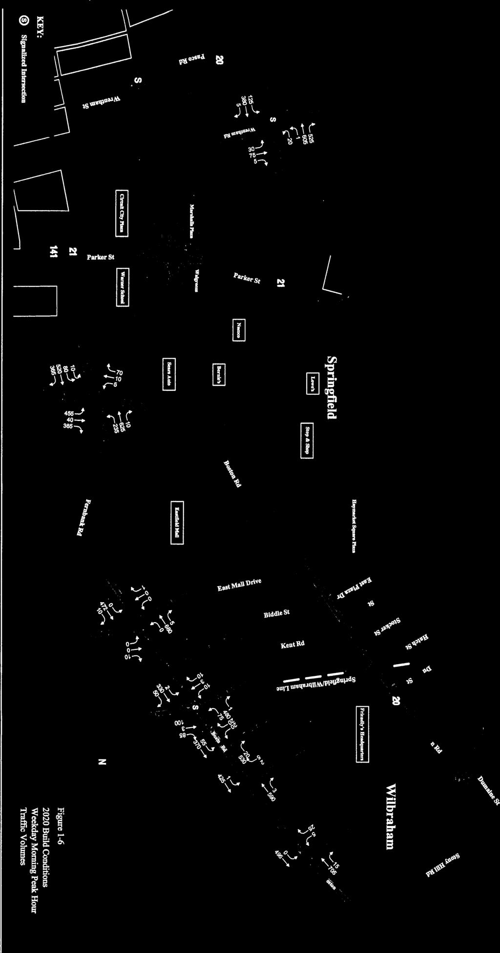


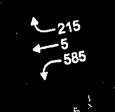
53
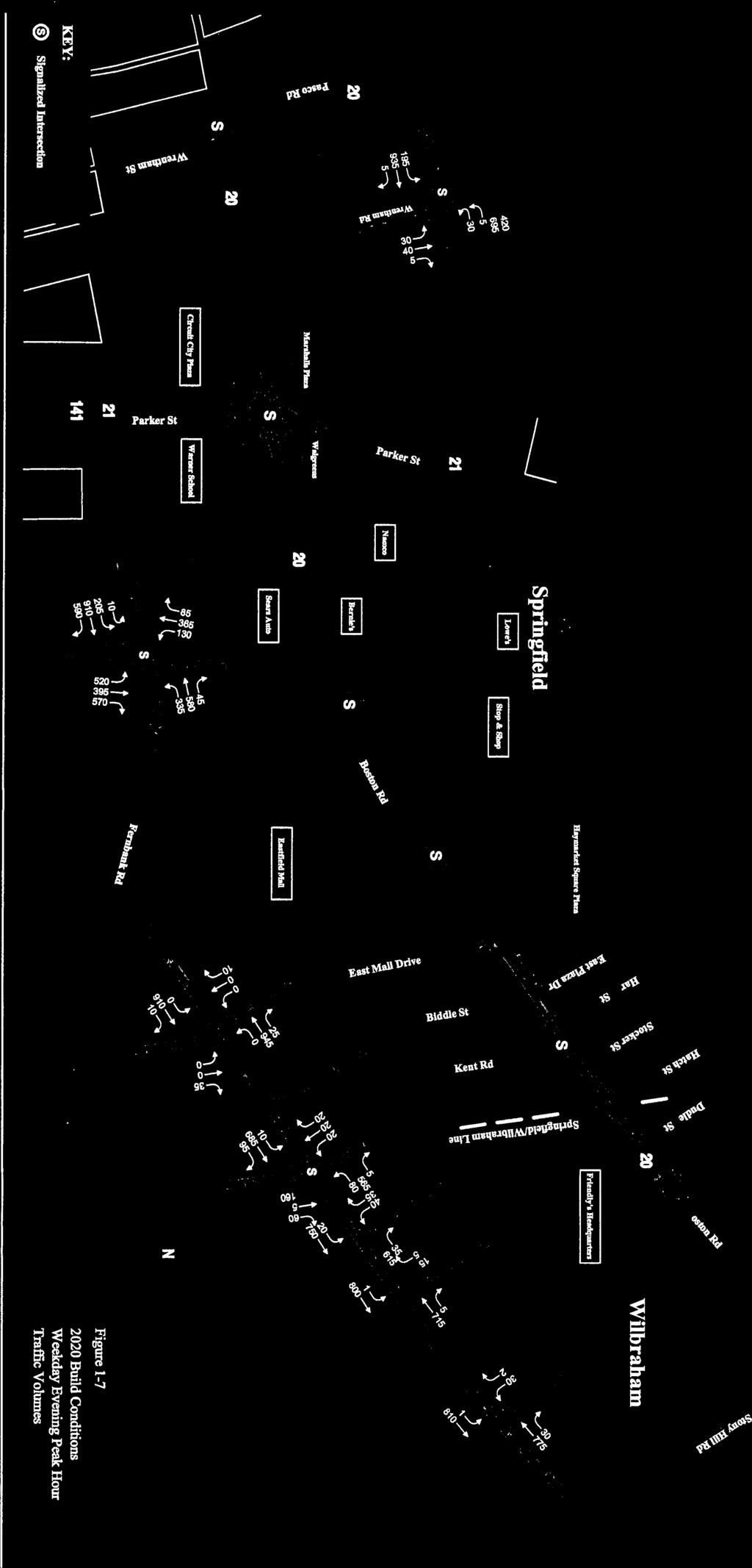


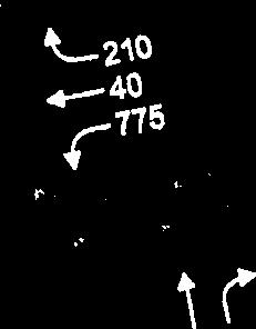


54
ROAD SAFETY AUDIT. Mass Pike Interchange 6, I-291 and Burnett Road. City of Chicopee. November 4, Prepared For: MassDOT Highway Division
 ROAD SAFETY AUDIT Mass Pike Interchange 6, I-291 and Burnett Road City of Chicopee November 4, 2013 Prepared For: MassDOT Highway Division Prepared By: BETA Group, Inc. Table of Contents Project Data...
ROAD SAFETY AUDIT. Blue Hill Avenue (Route 28) and Warren Street High Crash Locations City of Boston. November 1, 2016
 and Warren Street High Crash Locations City of Boston. November 1, 2016") ROAD SAFETY AUDIT Blue Hill Avenue (Route 28) and Warren Street High Crash Locations City of Boston November 1, 2016 Prepared For: MassDOT Highway Division Prepared By: BETA Group, Inc. Table of Contents
ROAD SAFETY AUDIT Blue Hill Avenue (Route 28) and Warren Street High Crash Locations City of Boston November 1, 2016 Prepared For: MassDOT Highway Division Prepared By: BETA Group, Inc. Table of Contents
ROAD SAFETY AUDIT. State Road (Route 6) Corridor Town of Dartmouth. March Prepared For: MassDOT
 Corridor Town of Dartmouth. March Prepared For: MassDOT") ROAD SAFETY AUDIT State Road (Route 6) Corridor Town of Dartmouth March 2015 Prepared For: MassDOT Prepared By: McMahon Associates, Inc. 300 Myles Standish Blvd. Suite 201 Taunton, MA 02780 Table of Contents
ROAD SAFETY AUDIT State Road (Route 6) Corridor Town of Dartmouth March 2015 Prepared For: MassDOT Prepared By: McMahon Associates, Inc. 300 Myles Standish Blvd. Suite 201 Taunton, MA 02780 Table of Contents
ROAD SAFETY AUDIT. Route 16 at Interstate 395 Town of Webster. October Prepared For: MassDOT
 ROAD SAFETY AUDIT Route 16 at Interstate 395 Town of Webster October 2015 Prepared For: MassDOT Prepared By: McMahon Associates, Inc. 300 Myles Standish Blvd. Suite 201 Taunton, MA 02780 Table of Contents
Route 28 (South Orleans Road)/Route 39 (Harwich Road)/Quanset Road Intersection
/Route 39 (Harwich Road)/Quanset Road Intersection") TRAFFIC FEASIBILITY STUDY Route 28 (South Orleans Road)/Route 39 (Harwich Road)/Quanset Road Intersection Orleans, Massachusetts Prepared for: Town of Orleans Prepared by: Fay, Spofford & Thorndike, LLC
TRAFFIC FEASIBILITY STUDY Route 28 (South Orleans Road)/Route 39 (Harwich Road)/Quanset Road Intersection Orleans, Massachusetts Prepared for: Town of Orleans Prepared by: Fay, Spofford & Thorndike, LLC
ROAD SAFETY AUDIT. May 18, Prepared For: MassDOT. On Behalf Of: Town of Milford
 ROAD SAFETY AUDIT East Main Street (Route 16) at Medway Road (Route 109), East Main Street (Route 16) at Quarry Square Driveways, East Main Street (Route 16) at Beaver Street/ Fortune Boulevard Town of
ROAD SAFETY AUDIT. Route 18 (Bedford Street) from Whitman Street to Central Square Town of East Bridgewater. May 14, 2014
 from Whitman Street to Central Square Town of East Bridgewater. May 14, 2014") ROAD SAFETY AUDIT Route 18 (Bedford Street) from Whitman Street to Central Square Town of East Bridgewater May 14, 2014 Prepared For: MassDOT Highway Division Prepared By: BETA Group, Inc. Table of Contents
ROAD SAFETY AUDIT Route 18 (Bedford Street) from Whitman Street to Central Square Town of East Bridgewater May 14, 2014 Prepared For: MassDOT Highway Division Prepared By: BETA Group, Inc. Table of Contents
AGENDA ITEM 6 D THOMASVILLE ROAD (HERMITAGE BOULEVARD TO LIVE OAK PLANTATION ROAD) ROADWAY SAFETY AUDIT
 ROADWAY SAFETY AUDIT") May 15, 2018 AGENDA ITEM 6 D THOMASVILLE ROAD (HERMITAGE BOULEVARD TO LIVE OAK PLANTATION ROAD) ROADWAY SAFETY AUDIT TYPE OF ITEM: Discussion STATEMENT OF ISSUE The Florida Department of Transportation
May 15, 2018 AGENDA ITEM 6 D THOMASVILLE ROAD (HERMITAGE BOULEVARD TO LIVE OAK PLANTATION ROAD) ROADWAY SAFETY AUDIT TYPE OF ITEM: Discussion STATEMENT OF ISSUE The Florida Department of Transportation
ROAD SAFETY AUDIT. Route 53 (Washington Street) High Crash Locations at Route 139 (Schoosett Street) and Route 14 (Congress Street) Town of Pembroke
 High Crash Locations at Route 139 (Schoosett Street) and Route 14 (Congress Street) Town of Pembroke") ROAD SAFETY AUDIT Route 53 (Washington Street) High Crash Locations at Route 139 (Schoosett Street) and Route 14 (Congress Street) Town of Pembroke April 29, 2016 Prepared For: MassDOT Highway Division
ROAD SAFETY AUDIT Route 53 (Washington Street) High Crash Locations at Route 139 (Schoosett Street) and Route 14 (Congress Street) Town of Pembroke April 29, 2016 Prepared For: MassDOT Highway Division
Off-road Trails. Guidance
 Off-road Trails Off-road trails are shared use paths located on an independent alignment that provide two-way travel for people walking, bicycling, and other non-motorized users. Trails specifically along
ROAD SAFETY AUDIT. Providence Street (Route 122A) at McKeon Road/Millbury Street. City of Worcester. July 14, Prepared For: MassDOT
 at McKeon Road/Millbury Street. City of Worcester. July 14, Prepared For: MassDOT") ROAD SAFETY AUDIT Providence Street (Route 122A) at McKeon Road/Millbury Street City of Worcester July 14, 2016 Prepared For: MassDOT Prepared By: Stantec Consulting Services, Inc. Burlington, Massachusetts
ROAD SAFETY AUDIT Providence Street (Route 122A) at McKeon Road/Millbury Street City of Worcester July 14, 2016 Prepared For: MassDOT Prepared By: Stantec Consulting Services, Inc. Burlington, Massachusetts
ROAD SAFETY AUDIT. Centre Street (Route 123) at Plymouth Street. Municipality of Brockton. November, Prepared For: MassDOT
 at Plymouth Street. Municipality of Brockton. November, Prepared For: MassDOT") ROAD SAFETY AUDIT Centre Street (Route 123) at Plymouth Street Municipality of Brockton November, 2017 Prepared For: MassDOT On Behalf Of: City of Brockton Prepared By: Old Colony Planning Council 70 School
ROAD SAFETY AUDIT Centre Street (Route 123) at Plymouth Street Municipality of Brockton November, 2017 Prepared For: MassDOT On Behalf Of: City of Brockton Prepared By: Old Colony Planning Council 70 School
ROAD SAFETY AUDIT. Granite Avenue at Interstate 93 Ramps. Town of Milton. May 22, Prepared for: MassDOT
 ROAD SAFETY AUDIT Granite Avenue at Interstate 93 Ramps Town of Milton May 22, 2017 Prepared for: MassDOT Prepared by: Toole Design Group 2 Oliver Street, Suite 305 Boston, MA 02109 Table of Contents Background...
ROAD SAFETY AUDIT. Route 202 (East State Street)/School Street & Route 202 (West State Street)/Pleasant Street/Amherst Street Town of Granby
/School Street & Route 202 (West State Street)/Pleasant Street/Amherst Street Town of Granby") ROAD SAFETY AUDIT Route 202 (East State Street)/School Street & Route 202 (West State Street)/Pleasant Street/Amherst Street Town of Granby March 2013 Prepared for: Massachusetts Department of Transportation
ROAD SAFETY AUDIT Route 202 (East State Street)/School Street & Route 202 (West State Street)/Pleasant Street/Amherst Street Town of Granby March 2013 Prepared for: Massachusetts Department of Transportation
ROAD SAFETY AUDIT. Washington Street (Route 53) at Pleasant Street. Town of Pembroke. June 26, Prepared For: MassDOT Highway Division
 at Pleasant Street. Town of Pembroke. June 26, Prepared For: MassDOT Highway Division") ROAD SAFETY AUDIT Washington Street (Route 53) at Pleasant Street Town of Pembroke June 26, 2014 Prepared For: MassDOT Highway Division Prepared By: BETA Group, Inc. Table of Contents Project Data... 1
ROAD SAFETY AUDIT Washington Street (Route 53) at Pleasant Street Town of Pembroke June 26, 2014 Prepared For: MassDOT Highway Division Prepared By: BETA Group, Inc. Table of Contents Project Data... 1
CURBSIDE ACTIVITY DESIGN
 5 CURBSIDE ACTIVITY DESIGN This chapter provides design guidance for separated bike lanes adjacent to curbside activities including parking, loading and bus stops. Typical configurations are presented
MEMORANDUM. Nantasket Road at Kingsley Road Kingsley Road at Sumner Street Kingsley Road at Revere Street Kingsley Road at Kenberma Street
 MEMORANDUM Date: June 28, 2012 To: From: Subject: Mr. Joseph Stigliani, Director of Public Works Kenneth J. Petraglia, P.E., PTOE Greg E. Lucas, P.E., PTOE Kingsley Road Stop Sign Warrant Analysis BETA
FLORIDA DEPARTMENT OF TRANSPORTATION DISTRICT 7 DISTRICT WIDE BICYCLE/PEDESTRIAN ACCESS TO TRANSIT SAFETY ASSESSMENT AND IMPROVEMENT PLAN
 FLORIDA DEPARTMENT OF TRANSPORTATION DISTRICT 7 DISTRICT WIDE BICYCLE/PEDESTRIAN ACCESS TO TRANSIT SAFETY ASSESSMENT AND IMPROVEMENT PLAN TRANSIT SAFETY ASSESSMENT SR 55/US 19 AT 80 TH AVE N DRAFT JUNE
TRAFFIC IMPACT ANALYSIS
 TRAFFIC IMPACT ANALYSIS FOR THE CHAMPAIGN UNIT#4 SCHOOL DISTRICT PROPOSED HIGH SCHOOL (SPALDING PARK SITE) IN THE CITY OF CHAMPAIGN Final Report Champaign Urbana Urbanized Area Transportation Study 6/24/2014
M-58 HIGHWAY ACCESS MANAGEMENT STUDY Mullen Road to Bel-Ray Boulevard. Prepared for CITY OF BELTON. May 2016
 M-58 HIGHWAY ACCESS MANAGEMENT STUDY Prepared for CITY OF BELTON By May 2016 Introduction Missouri State Highway 58 (M-58 Highway) is a major commercial corridor in the City of Belton. As development has
ROAD SAFETY AUDIT. County Street at Hart Street. City of Taunton. January 30, Prepared For: Massachusetts Department of Transportation
 ROAD SAFETY AUDIT County Street at Hart Street City of Taunton January 30, 2015 Prepared For: Massachusetts Department of Transportation Prepared By: Toole Design Group 33 Broad Street, 4 th Floor Boston,
ROAD SAFETY AUDIT. Route 38 from Route 62 to Woburn Town Line. Town of Wilmington. April 10, Prepared For: MassDOT
 ROAD SAFETY AUDIT Route 38 from Route 62 to Woburn Town Line Town of Wilmington April 10, 2017 Prepared For: MassDOT Prepared By: Green International Affiliates, Inc. 239 Littleton Road, Suite 3, Westford,
DEPARTMENT OF ENVIRONMENTAL SERVICES. North Harrison Street (Lee Highway to Little Falls Road) Comparative Analysis. Prepared for:
 Comparative Analysis. Prepared for:") DEPARTMENT OF ENVIRONMENTAL SERVICES North Harrison Street (Lee Highway to Little Falls Road) Comparative Analysis Prepared for: Arlington County Department of Environmental Services 2100 Clarendon Boulevard,
DEPARTMENT OF ENVIRONMENTAL SERVICES North Harrison Street (Lee Highway to Little Falls Road) Comparative Analysis Prepared for: Arlington County Department of Environmental Services 2100 Clarendon Boulevard,
Multi-Modal Traffic Analysis. Parisi and Associates
 Mill Valley to Corte Madera Bicycle and Pedestrian Corridor Study Appendix D: Multi-Modal Traffic Analysis Prepared by Parisi and Associates August 2009 Appendix D - Multi-Modal Traffic Analysis Table
ROAD SAFETY AUDIT. South Street (Route 1A) at East Bacon Street (Route 106) and West Bacon Street Town of Plainville.
 at East Bacon Street (Route 106) and West Bacon Street Town of Plainville.") ROAD SAFETY AUDIT South Street (Route 1A) at East Bacon Street (Route 106) and West Bacon Street Town of Plainville March 15, 2018 Prepared For: MassDOT On Behalf Of: Town of Plainville Prepared By: BETA
ROAD SAFETY AUDIT South Street (Route 1A) at East Bacon Street (Route 106) and West Bacon Street Town of Plainville March 15, 2018 Prepared For: MassDOT On Behalf Of: Town of Plainville Prepared By: BETA
ROAD SAFETY AUDIT. Damon Road. City of Northampton. October Prepared for: Massachusetts Department of Transportation
 ROAD SAFETY AUDIT Damon Road City of Northampton October 2013 Prepared for: Massachusetts Department of Transportation Prepared by: Howard/Stein-Hudson Associates 38 Chauncy Street Boston, MA 02111 Table
Truck Turning Study for Main Street Intersection, Orange
 Truck Turning Study for Main Street Intersection, Orange Franklin Regional Council of Governments September 2015 0 Truck Turning Study for Main Street Intersection, Orange September 2015 Prepared by: Franklin
10.0 CURB EXTENSIONS GUIDELINE
 10.0 CURB EXTENSIONS GUIDELINE Road Engineering Design Guidelines Version 1.0 March 2017 City of Toronto, Transportation Services City of Toronto Page 0 Background In early 2014, Transportation Services
ROAD SAFETY AUDIT. Russell Street (Route 9) at North and South Maple Streets Town of Hadley. March 2014
 at North and South Maple Streets Town of Hadley. March 2014") ROAD SAFETY AUDIT Russell Street (Route 9) at North and South Maple Streets Town of Hadley March 2014 Prepared for: Massachusetts Department of Transportation Prepared by: Howard/Stein-Hudson Associates
ROAD SAFETY AUDIT Russell Street (Route 9) at North and South Maple Streets Town of Hadley March 2014 Prepared for: Massachusetts Department of Transportation Prepared by: Howard/Stein-Hudson Associates
ROAD SAFETY AUDIT. Route 3A from Evans Street to Abigail Adams State Park. Town of Weymouth. October 12, Prepared For: MassDOT
 ROAD SAFETY AUDIT Route 3A from Evans Street to Abigail Adams State Park Town of Weymouth October 12, 2016 Prepared For: MassDOT Prepared By: Green International Affiliates, Inc. 239 Littleton Road, Suite
Orange Center Elementary School
 Drag and drop pic and stretch/crop to the limits of the blue rectangle (delete this text box) Orange Center Elementary School Drag and drop pic and stretch/crop to the limits of the blue rectangle (delete
TRAFFIC ACTION PLAN. Laurie Meadows Neighborhood CITY OF SAN MATEO
 TRAFFIC ACTION PLAN Laurie Meadows Neighborhood CITY OF SAN MATEO Draft January 2017 Table of Contents Introduction... 2 The Traffic Forum Process... 5 Neighborhood Traffic Issues... 7 Neighborhood Recommendations
Memorandum. Sunday, July 13, Saturday, July 19, 2014
 Memorandum To: David Lowin, Brooklyn Bridge Park Corporation From: Daniel Schack, AICP, PTP Date: Re: Brooklyn Bridge Park Pier 5/6 Loop Road Traffic Study Project No: 14-01-2407 At the request of Brooklyn
Traffic Study of Fuller Street, Cady Street, West Street and West Avenue. Final Report
 Traffic Study of Fuller Street, Cady Street, West Street and West Avenue Final Report July 2005 Prepared for: Town of Ludlow Prepared by: Pioneer Valley Planning Commission 26 Central Street West Springfield,
ROAD SAFETY AUDIT. West Central Street (Route 140) at Franklin Village Drive. Town of Franklin. February 03, 2016
 at Franklin Village Drive. Town of Franklin. February 03, 2016") ROAD SAFETY AUDIT West Central Street (Route 140) at Franklin Village Drive Town of Franklin February 03, 2016 Prepared for: Massachusetts Department of Transportation Prepared by: Howard Stein Hudson
ROAD SAFETY AUDIT West Central Street (Route 140) at Franklin Village Drive Town of Franklin February 03, 2016 Prepared for: Massachusetts Department of Transportation Prepared by: Howard Stein Hudson
ROAD SAFETY AUDIT. Northampton Road (Route 9) at University Drive and Snell Street Town of Amherst. November 15, Prepared For: MassDOT
 at University Drive and Snell Street Town of Amherst. November 15, Prepared For: MassDOT") ROAD SAFETY AUDIT Northampton Road (Route 9) at University Drive and Snell Street Town of Amherst November 15, 2016 Prepared For: MassDOT Prepared By: Greenman-Pedersen, Inc. 181 Ballardvale Street, Suite
ROAD SAFETY AUDIT Northampton Road (Route 9) at University Drive and Snell Street Town of Amherst November 15, 2016 Prepared For: MassDOT Prepared By: Greenman-Pedersen, Inc. 181 Ballardvale Street, Suite
Coquitlam Cross-town Bike Route Improving Bicycle Facilities in a Mature Suburban Environment
 Coquitlam Cross-town Bike Route Improving Bicycle Facilities in a Mature Suburban Environment Sarah Rocchi, Vice-President, Projects, Opus International Consultants (Main Presenter) Catherine Mohoruk,
Driveway Design Criteria
 Design Manual Chapter 5 - Roadway Design 5L - Access Management 5L-4 Driveway Design Criteria A. General For efficient and safe operations, access drives and minor public street intersections can be improved
Figure 3B-1. Examples of Two-Lane, Two-Way Marking Applications
 Figure 3B-1. Examples of Two-Lane, Two-Way Marking Applications A - Typical two-lane, two-way marking with passing permitted in both directions B - Typical two-lane, two-way marking with no-passing zones
Broad Street Bicycle Boulevard Design Guidelines
 Broad Street Bicycle Boulevard Design Guidelines Building from the strategies introduced in the 2013 Bicycle Transportation Plan and community input received thus far, City Transportation Staff have identified
ALLEY 24 TRAFFIC STUDY
 ALLEY 24 TRAFFIC STUDY in City of Frostburg, Maryland January 2013 3566 Teays Valley Road Hurricane, WV Office: (304) 397-5508 www.denniscorporation.com Alley 24 Traffic Study January 2013 Frostburg, Maryland
Recommended Roadway Plan Section 2 - Land Development and Roadway Access
 Recommended Roadway Plan Section 2 - Land Development and Roadway Access SECTION 2 Land Development and Roadway Access 2.1 Land Use and Access Management The Federal Highway Administration (FHWA) defines
AGENDA REPORT. Issue: Discussion of potential improvements on Barnwell Road at Niblick Drive
 AGENDA REPORT To: From: By: Honorable Mayor and City Council Members Warren Hutmacher, City Manager Tom Black, Public Works Director Date: March 23, 2016 Agenda: March 28, 2016 WORK SESSION AGENDA: Barnwell
ROAD SAFETY AUDIT MDM. Columbia Road at Dorchester Avenue. Dorchester, MA 10/14/2016. Prepared For: MassDOT. On Behalf Of: Edens
 ROAD SAFETY AUDIT Columbia Road at Dorchester Avenue Dorchester, MA 10/14/2016 Prepared For: MassDOT On Behalf Of: Edens Prepared By: MDM Transportation Consultants, Inc. 28 Lord Road Suite 280 Marlborough,
METHODOLOGY. Signalized Intersection Average Control Delay (sec/veh)
") Chapter 5 Traffic Analysis 5.1 SUMMARY US /West 6 th Street assumes a unique role in the Lawrence Douglas County transportation system. This principal arterial street currently conveys commuter traffic
Chapter 5 Traffic Analysis 5.1 SUMMARY US /West 6 th Street assumes a unique role in the Lawrence Douglas County transportation system. This principal arterial street currently conveys commuter traffic
TRANSPORTATION ANALYSIS REPORT US Route 6 Huron, Erie County, Ohio
 TRANSPORTATION ANALYSIS REPORT US Route 6 Huron, Erie County, Ohio December 12, 2012 Prepared for: The City of Huron 417 Main Huron, OH 44839 Providing Practical Experience Technical Excellence and Client
Pedestrian Road Safety Audit
 Pedestrian Road Safety Audit Middlebrook Road From Father Hurley Boulevard to Waring Station Road December 2017 Montgomery County Department of Transportation Table of Contents 1. Introduction... 1 1.1
CITY OF WEST LAKE HILLS. Forest View Neighborhood Traffic Calming Study
 CITY OF WEST LAKE HILLS 901 South Mopac Expressway Building V, Suite 220 Austin, Texas 78746 Texas P.E. Firm Registration No. F-929 Klotz Associates Final Report Submittal: March 20, 2015 Revised Final
ROUNDABOUTS/TRAFFIC CIRCLES
 GENERAL 1. Description This standard identifies minimum requirements that shall be met for Roundabouts and Neighborhood Traffic Circles in the design and construction of elements for Arlington County Horizontal
Figure 1: Vicinity Map of the Study Area
 ARIZONA TEXAS NEW MEXICO OKLAHOMA May 5, 2016 Mr. Anthony Beach, P.E. BSP Engineers 4800 Lakewood Drive, Suite 4 Waco, Texas 76710 Re: Intersection and Access Analysis along Business 190 in Copperas Cove
Toolbox of Countermeasures and Their Potential Effectiveness to Make Intersections Safer
 8 Toolbox of Countermeasures and Their to Make Intersections Safer Introduction Studies included in the NCHRP 17-18 (3), Guidance for Implementation of the AASHTO Strategic Highway Safety Plan, as well
Draft North Industrial Area-Wide Traffic Plan
 Summary of North Industrial and Hudson Bay Industrial Recommended Improvements Table 1. Summary of s Item Location 1 2 3 4 5 6 7 8 9 10 11 12 Millar Ave north of 51st St Super 8 Motel back lane 400 Block
Washington St. Corridor Study
 FIGURE 7.17 Bridge Alternatives - Cross Sections 86 Discarded Alternative: Short-Term Bridge Repair Short-term repairs and west bridge span replacement were considered during analysis. Short-term repairs
Windy Ridge Elementary School
 Windy Ridge Elementary School SCHOOL ROUTE PLAN For WINDY RIDGE ELEMENTARY SCHOOL LOCATION 54 ORANGE COUNTY Prepared for: ORANGE COUNTY SCHOOL ASSESSMENT PROGRAM ORANGE COUNTY PUBLIC WORKS Traffic Engineering
City of Wayzata Comprehensive Plan 2030 Transportation Chapter: Appendix A
 A1. Functional Classification Table A-1 illustrates the Metropolitan Council s detailed criteria established for the functional classification of roadways within the Twin Cities Metropolitan Area. Table
ROAD SAFETY AUDIT. Route 114 at Interstate I-495 Northbound Ramps. City of Lawrence. July 30, 2015
 ROAD SAFETY AUDIT Route 114 at Interstate I-495 Northbound Ramps City of Lawrence July 30, 2015 Prepared For: Massachusetts Department of Transportation Prepared By: Toole Design Group 33 Broad Street,
PLACEMENT OF SIGNS RECOMMENDED PRACTICES SUB-SECTION
 Page 1 of 6 RECOMMENDED PRACTICES PART SECTION SUB-SECTION HIGHWAY SIGNS GENERAL General Proper positioning of signs is an important element in the overall control of traffic within a roadway network.
ROUTE 22 CORRIDOR STUDY: CORRIDOR MANAGEMENT PLAN APPENDIX A A-12
 ROUTE 22 CORRIDOR STUDY: CORRIDOR MANAGEMENT PLAN APPENDIX A A-12 3.0 HARLEM VALLEY TRANSPORTATION PLAN Incorporates transportation systems management and safety improvements. Location: Route 22 corridor
ROAD SAFETY AUDIT. Needham Street and Highland Avenue Corridor. City of Newton and Town of Needham. March 2014
 ROAD SAFETY AUDIT Needham Street and Highland Avenue Corridor City of Newton and Town of Needham March 2014 Prepared for: Massachusetts Department of Transportation Prepared by: Howard/Stein-Hudson Associates
Appendix C. TRAFFIC CALMING PROGRAM TOOLBOX
 Appendix C. TRAFFIC CALMING PROGRAM TOOLBOX PHASE I...2 Do Not Enter Sign...3 One-Way Sign...4 Turn Prohibition...5 Pavement Markings...6 Speed Monitoring Trailer...7 Neighborhood Speed Watch...8 Police
Harrah s Station Square Casino
 Transportation Analysis Harrah s Station Square Casino Pittsburgh, Pennsylvania Submitted To: City of Pittsburgh and Pennsylvania Gaming Control Board Prepared By: DKS Associates GAI Consultants December
CHAPTER 16 PEDESTRIAN FACILITIES DESIGN AND TECHNICAL CRITERIA TABLE OF CONTENTS
 CHAPTER 16 PEDESTRIAN FACILITIES DESIGN AND TECHNICAL CRITERIA TABLE OF CONTENTS Section Title Page 16.1 General... 16-1 16.1.1 AASHTO Reference... 16-1 16.1.2 ADA Requirements... 16-1 16.2 Sidewalks...
Abstract. Background. protected/permissive operation. Source: Google Streetview, Fairview/Orchard intersection
 ITE 2015 Western District Annual Meeting Ada County Highway District s Flashing Yellow Arrow Initiative Primary Author: Tim Curns, PE Ada County Highway District Traffic Engineer Author: Andrew Cibor,
Caltrans Sloat Boulevard Pedestrian Safety Project Response to Community Questions, Comments & Concerns
 Caltrans Sloat Boulevard Pedestrian Safety Project Response to Community Questions, Comments & Concerns Revised: May 10, 2016 The California Department of Transportation (Caltrans) is planning various
Traffic Impact Analysis Chatham County Grocery Chatham County, NC
 Chatham County Grocery Chatham County, NC TABLE OF CONTENTS 1. INTRODUCTION... 1 1.1. Location and Study Area... 1 1.2. Proposed Land Use and Access... 2 1.3. Adjacent Land Uses... 2 1.4. Existing ways...
Attachment No. 13. National Committee on Uniform Traffic Control Devices RWSTC RECOMMENDATION FOLLOWING SPONSOR COMMENTS
 1 2 3 4 Attachment No. 13 5 6 7 8 9 10 11 12 13 14 15 16 17 18 19 20 21 22 23 24 25 26 27 28 29 30 31 32 33 34 35 36 37 38 39 40 41 42 43 RWSTC agenda item IV. 2 June 2011 National Committee on Uniform
MEMORANDUM. Charlotte Fleetwood, Transportation Planner
 MEMORANDUM Date: Updated August 22, 2017 To: Organization: Charlotte Fleetwood, Transportation Planner Boston Transportation Department From: Jason DeGray, P.E., PTOE, Regional Director of Engineering
CITY OF LOS ANGELES INTER-DEPARTMENTAL MEMORANDUM
 CITY OF LOS ANGELES INTER-DEPARTMENTAL MEMORANDUM Date: April 1, 219 To: Honorable City Council c/o City Clerk, Room 395, City Hall Attention: Honorable Mike Bonin, Chair, Transportation Committee From:
Military Road Safety Improvements
 Military Road Safety Improvements 26 th Road North to 31 st Street North SUMMARY OF DATA REVIEW AND PRELIMINARY RECOMMENDATIONS Prepared for: Department of Environmental Services Traffic Engineering and
Lake Whitney Elementary School
 Lake Whitney Elementary School SCHOOL ROUTE PLAN For LAKE WHITNEY ELEMENTARY SCHOOL LOCATION 18 ORANGE COUNTY Prepared for: ORANGE COUNTY SCHOOL ASSESSMENT PROGRAM ORANGE COUNTY PUBLIC WORKS Traffic Engineering
Summary: Mercer County Princeton Avenue & Spruce Street Study January 2009
 Summary: Several recent studies have assessed potential development and redevelopment opportunities in the Mercer Crossing area of Trenton, Ewing, and Lawrence. This Princeton Avenue and Spruce Street
Glenn Avenue Corridor Traffic Operational Evaluation
 Glenn Avenue Corridor Traffic Operational Evaluation PREPARED FOR: THE CITY OF AUBURN PREPARED BY: DECEMBER 2007 Glenn Avenue Corridor Study--Auburn, Alabama TABLE OF CONTENTS Introduction... 1 Background
A plan for improved motor vehicle access on Railroad Avenue in Provincetown
 A plan for improved motor vehicle access on Railroad Avenue in Provincetown February 2011 A plan for improved motor vehicle access on Railroad Avenue in Provincetown INTRODUCTION AND PROBLEM IDENTIFICATION
3.0 PROJECT DESCRIPTION
 The following section of the Draft EIR contains a description of the proposed Elk Grove Boulevard/SR 99 Interchange Modification project, consistent with the requirements of CEQA Guidelines Section 15124.
Railroad-Highway Grade Crossing Analysis for Corridor Planning Projects
 Railroad-Highway Grade Crossing Analysis for Corridor Planning Projects Word Count: 4,305 Submission Date: August 1, 2015 Author: Adriana Rodriguez, E.I Assistant Engineer Parsons Brinckerhoff 1420 South
sm1 CDMth '}lf!j1i!~~!2q[ ROAD SAFETY AUDIT County Street City of New Bedford March 22, 2017 Prepared For: MassDOT
 ROAD SAFETY AUDIT County Street City of New Bedford March 22, 2017 '}lf!j1i!~~!2q[ ~ j ighway Divl.sion Prepared For: MassDOT On Behalf Of: City of New Bedford Massachusetts Prepared By: CDM Smith 260
Forest Hills Improvement Initiative
 Forest Hills Improvement Initiative Transportation Action Plan Short Term Recommendations ONLY Final Draft as of April 30, 2008 For Community Review and Feedback Prepared for: The City of Boston Boston
Geometric Design Tables
 Design Manual Chapter 5 - Roadway Design 5C - Geometric Design Criteria 5C-1 Geometric Design Tables A. General The following sections present two sets of design criteria tables - Preferred Roadway Elements
Edgemont Village Traffic and Parking Technical Report January 2014
 Edgemont Village Traffic and Parking Technical Report January 2014 In the fall of 2013, the District of North Vancouver engaged consultants to assess existing intersection and parking conditions in Edgemont
BELCHERTOWN. Intersection of Federal Steet (Route 9) and Bay Road MAY 2012
 and Bay Road MAY 2012") BELCHERTOWN Intersection of Federal Steet (Route 9) and Bay Road MAY 2012 Prepared Under the Direction of Pioneer Valley MPO By: Pioneer Valley Planning Commission 60 Congress Street Springfield 01104-3419
BELCHERTOWN Intersection of Federal Steet (Route 9) and Bay Road MAY 2012 Prepared Under the Direction of Pioneer Valley MPO By: Pioneer Valley Planning Commission 60 Congress Street Springfield 01104-3419
What Is a Complete Street?
 Session 5 Charleen Zimmer, AICP, Zan Associates May 5-7, 2010 What Is a Complete Street? May 2010 5-1 Not a Complete Street More of a Complete Street May 2010 5-2 Benefits of Complete Streets Safety for
Active Transportation Facility Glossary
 Active Transportation Facility Glossary This document defines different active transportation facilities and suggests appropriate corridor types. Click on a facility type to jump to its definition. Bike
Chapter 2: Standards for Access, Non-Motorized, and Transit
 Standards for Access, Non-Motorized, and Transit Chapter 2: Standards for Access, Non-Motorized, and Transit The Washtenaw County Access Management Plan was developed based on the analysis of existing
5. MODIFICATIONS AT JEANNE D ARC BOULEVARD/REGIONAL ROAD 174 INTERCHANGE INTERSECTION - PUBLIC HEARING COMMITTEE RECOMMENDATION
 5. MODIFICATIONS AT JEANNE D ARC BOULEVARD/REGIONAL ROAD 174 INTERCHANGE INTERSECTION - PUBLIC HEARING COMMITTEE RECOMMENDATION Having held a public hearing, that Council approve the preliminary designs
Hidden Oaks Elementary School
 Hidden Oaks Elementary School SCHOOL ROUTE PLAN For HIDDEN OAKS ELEMENTARY SCHOOL LOCATION 13 ORANGE COUNTY Prepared for: ORANGE COUNTY SCHOOL ASSESSMENT PROGRAM ORANGE COUNTY PUBLIC WORKS Traffic Engineering
A Sample Report of TRAFFIC CONTROL DEVICES REVIEW
 A Sample Report of TRAFFIC CONTROL DEVICES REVIEW Introduction We performed a peer review of traffic control devices at selected locations on the City s street system. As the result of our review, we have
Capital Region Council of Governments
 March 23, 2018 Capital Region Council of Governments PROJECT CONCEPT REPORT Realignment of Swamp and Northfield Road s approaches to Route 44 (Boston Turnpike) Town of Coventry SUMMARY: The Town of Coventry
City of Margate, Florida. Neighborhood Traffic Management Manual
 City of Margate, Florida Neighborhood Traffic Management Manual Table of Contents Page No. I. INTRODUCTION... 1 II. TRAFFIC CALMING REQUEST AND PROCESSING PROCEDURES... 2 1. COMPLETE AND SUBMIT PROJECT
Guidance. ATTACHMENT F: Draft Additional Pages for Bicycle Facility Design Toolkit Separated Bike Lanes: Two-Way to One-Way Transitions
 ATTACHMENT F: Draft Additional Pages for Bicycle Facility Design Toolkit Separated Bike Lanes: Two-Way to One-Way Transitions This treatment provides a transition from two-way separated bike lanes to one-way
2.0 LANE WIDTHS GUIDELINE
 2.0 LANE WIDTHS GUIDELINE Road Engineering Design Guidelines Version 2.0.1 May 2018 City of Toronto, Transportation Services City of Toronto Page 0 Background In early 2014, Transportation Services initiated
Intersection Traffic Control Feasibility Study
 Intersection Traffic Control Feasibility Study CSAH 9 at CSAH 60 (185th Avenue) Prepared For: Dakota County Transportation Department Western Service Center 14955 Galaxie Avenue, 3rd Floor Apple Valley,
Traffic Control Inspection Checklist Segment:
 Traffic Control Inspection Checklist Segment: Simon Contractors Simon Contractors Originator: Description Reviewed by: Initials Date Distribution: Traffic Quality Manager, Site Assistant Traffic Manager
Chapter Twenty-eight SIGHT DISTANCE BUREAU OF LOCAL ROADS AND STREETS MANUAL
 Chapter Twenty-eight SIGHT DISTANCE BUREAU OF LOCAL ROADS AND STREETS MANUAL Jan 2006 SIGHT DISTANCE 28(i) Chapter Twenty-eight SIGHT DISTANCE Table of Contents Section Page 28-1 STOPPING SIGHT DISTANCE
ROAD SAFETY AUDIT. Falmouth Road (Route 28)/Bearses Way. Town of Barnstable. May Prepared for: Massachusetts Highway Department
/Bearses Way. Town of Barnstable. May Prepared for: Massachusetts Highway Department") ROAD SAFETY AUDIT Falmouth Road (Route 28)/Bearses Way Town of Barnstable May 2009 Prepared for: Massachusetts Highway Department Prepared by: Howard/Stein-Hudson Associates 38 Chauncy Street Boston, MA
ROAD SAFETY AUDIT Falmouth Road (Route 28)/Bearses Way Town of Barnstable May 2009 Prepared for: Massachusetts Highway Department Prepared by: Howard/Stein-Hudson Associates 38 Chauncy Street Boston, MA
TRAFFIC ACTION PLAN. North Central Neighborhood CITY OF SAN MATEO
 TRAFFIC ACTION PLAN North Central Neighborhood CITY OF SAN MATEO Draft February 2017 Table of Contents Introduction... 1 The Traffic Forum Process... 4 Neighborhood Traffic Issues... 6 Neighborhood Recommendations
Interstate Route 77 / US Route 62 / State Route 687 (Fulton Road) Transportation Improvement Project. Prepared September 6, 2017
 Transportation Improvement Project. Prepared September 6, 2017") EODOT Project: ODOT Project: STA-IR 77-.50; PID 00290 Interstate Route 77 / US Route 62 / State Route 687 (Fulton Road) Transportation Improvement Project Summary of Public Comments Received and Responses
EODOT Project: ODOT Project: STA-IR 77-.50; PID 00290 Interstate Route 77 / US Route 62 / State Route 687 (Fulton Road) Transportation Improvement Project Summary of Public Comments Received and Responses
MEMORANDUM. Layout Of Study Intersections And Traffic Control
 BOSTON REGION METROPOLITAN PLANNING ORGANIZATION Richard A. Davey, MassDOT Secretary and CEO and MPO Chairman Karl H. Quackenbush, Executive Director, MPO Staff DATE November 15, 2012 TO FROM RE Town of
HIGHBURY AVENUE/HAMILTON ROAD INTERSECTION IMPROVEMENTS PUBLIC INFORMATION CENTRE 1 MAY 14, 2015
 HIGHBURY AVENUE/HAMILTON ROAD INTERSECTION IMPROVEMENTS Municipal Class Environmental Assessment PUBLIC INFORMATION CENTRE 1 MAY 14, 2015 ACCESSIBILITY Under the Accessibility Standards 2015 for Customer
ROAD SAFETY AUDIT. Rourke Bridge at Pawtucket Boulevard (Route 113) City of Lowell. October 5, Prepared For: MassDOT.
 City of Lowell. October 5, Prepared For: MassDOT.") ROAD SAFETY AUDIT Rourke Bridge at Pawtucket Boulevard (Route 113) City of Lowell October, 2017 Prepared For: MassDOT Prepared By: Vanasse Hangen Brustlin, Inc 101 Walnut Street Watertown, MA 02472 Road
ROAD SAFETY AUDIT Rourke Bridge at Pawtucket Boulevard (Route 113) City of Lowell October, 2017 Prepared For: MassDOT Prepared By: Vanasse Hangen Brustlin, Inc 101 Walnut Street Watertown, MA 02472 Road
Overview. Updated pictures of the intersection are shown in Exhibits 1 thru 4, and the aerial photo provided by Google Maps is shown in Exhibit 5.
 Overview The (here in after referred to as the Village ) is submitting the follow up interim RLRC Safety Report for the intersection of Lincoln Highway (US 30) at Orchard Drive. Additional reports, as