ROAD SAFETY AUDIT. Falmouth Road (Route 28)/Bearses Way. Town of Barnstable. May Prepared for: Massachusetts Highway Department
|
|
|
- Hortense Gallagher
- 6 years ago
- Views:
Transcription


1 ROAD SAFETY AUDIT Falmouth Road (Route 28)/Bearses Way Town of Barnstable May 2009 Prepared for: Massachusetts Highway Department Prepared by: Howard/Stein-Hudson Associates 38 Chauncy Street Boston, MA 02111
2 Road Safety Audit Falmouth Road (Route 28)/Bearses Way, Barnstable Table of Contents Project Data...1 Background...1 Project Location Description...2 Road Safety Audit Observations...4 Safety Issue #1. Access Control...8 Safety Issue #2. Lane Configuration...9 Safety Issue #3. Pavement Markings...10 Safety Issue #4. Pedestrian Accommodations...10 Safety Issue #5. Bicycle Accommodations...11 Safety Issue #6. Bus Accommodations...11 Safety Issue #7. Traffic Signal Timing...12 Safety Issue #8. Emergency Access...12 Safety Issue #9. Presence of Utility Poles...13 Safety Issue #10. Signage Improvements...13 Safety Issue #11. Drainage Issues...14 List of Appendices Appendix A. Appendix B. Appendix C. Appendix D. RSA Meeting Agenda RSA Audit Team Contact List Detailed Crash Data Additional Information List of Figures Figure 1. Locus Map...3 Figure 2. Project Location and Observations...5 List of Tables Table 1. Table 2. Participating Audit Team Members...1 Proposed Safety Enhancement Summary...6 Page i
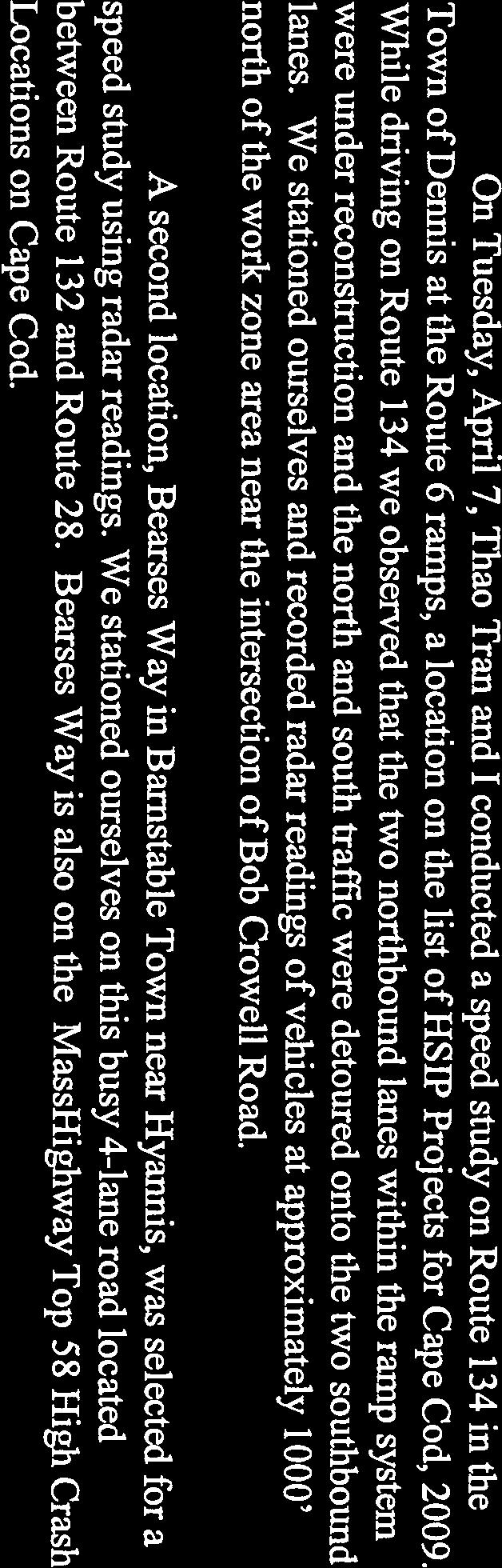
3 Road Safety Audit Falmouth Road (Route 28)/Bearses Way, Barnstable Project Data The audit team conducted a Road Safety Audit (RSA) for the intersection of Falmouth Road (Route 28) and Bearses Way in Barnstable, Massachusetts, on May 5, The RSA agenda is provided in Appendix A. Table 1 lists the audit team members and their affiliations. Appendix B provides contact information for all team members. Table 1. Participating Audit Team Members Audit Team Member Roger Parsons Bob Burgmann JoAnne Miller Buntich Stephen Seymour Dean Melanson Andy McKenna Priscilla Leclerc Bill Travers Barbara Lachance Tim White Lisa Schletzbaum Bonnie Polin Dave Matton Michelle Langone Background Agency/Affiliation Barnstable Department of Public Works Barnstable Department of Public Works Barnstable Growth Management Barnstable Growth Management Hyannis Fire Department Barnstable Police Department Cape Cod Commission MassHighway District 5 Projects Section MassHighway District 5 Traffic Section Federal Highway Administration MassHighway Safety MassHighway Safety Howard/Stein-Hudson Associates Howard/Stein-Hudson Associates The intersection of Falmouth Road (Route 28)/Bearses Way in Barnstable is in the Top 5% of High Crash Locations on Cape Cod. This intersection and three others that meet initial criteria for eligibility of the Highway Safety Improvement Project (HSIP) funding were selected by the Cape Cod Joint Transportation Committee (CCJTC) for potential future redesign to improve safety. To this end, a RSA was conducted to identify the safety issues and potential safety enhancements. Based on the results of this and several other RSAs within the Cape Cod region, the MassHighway Safety Management Unit and CCJTC will prioritize the locations to receive limited HSIP funding for design improvements. Page 1
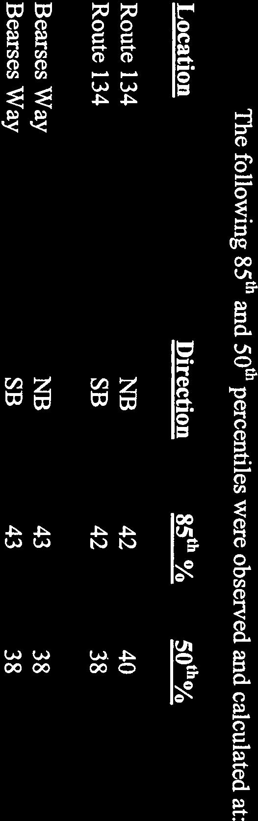
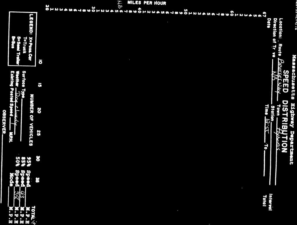
4 Road Safety Audit Falmouth Road (Route 28)/Bearses Way, Barnstable Project Location Description Falmouth Road (Route 28)/Bearses Way is located within the Hyannis district of the Town of Barnstable, as shown in Figure 1. The intersection is located within a commercial zone, with all four corners containing retail or municipal uses. At the time of the audit, the car wash located on the northeast corner of the intersection was not in operation. The intersection is a block from the Cape Cod Mall and approximately one mile west of the Barnstable Municipal Airport. Crash records supplied by the Barnstable Police Department were reviewed prior to the RSA in order to begin assessment of the possible safety issues. Of the 115 crashes from 2005 through 2008, 46% were found to be crashes related to site driveways, while nearly half, 56 crashes, were intersection crashes. Of the 56 intersection crashes, 59% were rear-end collisions occurring across all intersection approaches. MassHighway performed a speed study of Bearses Way, where the posted speed limit is 35 miles per hour. The 85 th percentile speed was 43 miles per hour in both the northbound and the southbound directions. The detailed intersection crash data for a four-year period are provided in Appendix C. Speed and volume data are provided in Appendix D. The intersection includes the following roadways, which are categorized according to Massachusetts Executive Office of Transportation Office of Transportation Planning functional classifications: Falmouth Road (Route 28) is an urban principal arterial that runs east west throughout the Cape Cod region and is owned by MassHighway. Falmouth Road (Route 28) typically has one travel lane in each direction, with the roadway widening at intersections to accommodate additional lanes. The posted speed limit along Falmouth Road (Route 28) near the intersection of Bearses Way is 35 mph for eastbound traffic and 45 mph for westbound traffic. The Falmouth Road (Route 28) state speed regulation is 35 miles per hour. Bearses Way is an urban principal arterial that runs north south from Route 132 to downtown Hyannis and is owned by the Town of Barnstable. Bearses Way typically has one travel lane in each direction, with the roadway widening at intersections to accommodate additional lanes. The posted speed limit along Bearses Way near the intersection of Falmouth Road (Route 28) is 35 mph. Bearses Way north of Falmouth Road (Route 28) was reconstructed with three approach lanes approximately three years ago. Bearses Way south of its intersection with Falmouth Road (Route 28) will be reconstructed in 2009; however, the project limit is 400 feet south of the Falmouth Road (Route 28)/Bearses Way intersection. The Town of Barnstable is currently in the planning stages for a multi-use path to run adjacent to the western side of Bearses Way north of Route 28. Improvements south of the intersection on Bearses Way are expected to be underway in Page 2

5 Road Safety Audit Falmouth Road (Route 28)/Bearses Way, Barnstable Figure 1. Locus Map SITE N Not to scale.
6 Road Safety Audit Falmouth Road (Route 28)/Bearses Way, Barnstable Road Safety Audit Observations Figure 2 and Table 2 summarize all the safety issues and proposed enhancements determined in the RSA conducted on May 5, Based on RSA discussions and field observations, major safety issues include the access driveways located near the intersection and the number of rear-end collisions. Other observations were long queues, high truck percentages, and congestion, along with the need for pedestrian facilities, consolidated bus operations, and emergency pre-emption signal capabilities. Bicycle accommodations would allow for safer bicycling through this multi-lane intersection. Several of these proposed enhancements require further study and engineering judgment before being implemented. The sections following the table provide descriptions of the safety issues determined during the RSA. For each issue, proposed enhancements, estimated safety payoff, time frame, and cost are provided. Safety payoff estimates were based on the approximate percent of crashes reduced by enhancement and are categorized as low (<30%), medium (31% to 70%), and high (>71%). The time frame is categorized as short-term (<1 year), mid-term (1 to 3 years), or long-term (>3 years). The costs are categorized as low (<$10,000), medium ($10,001 to $50,000), or high (>$50,001). Page 4
 ) ute 28 o R ( oad uth R o m l a F Barnstable DPW Drainage")
7 Road Safety Audit Falmouth Road (Route 28)/Bearses Way, Barnstable Figure 2. Project Location and Observations ay sw se ar Be Auto Dealership Car Wash (Not in Operation) ) ute 28 o R ( oad uth R o m l a F Barnstable DPW Drainage Issues Dunkin Donuts & Gas Station Plaza Path Ends Multi-use Path N Not to scale.
8 Road Safety Audit Falmouth Road (Route 28)/Bearses Way, Barnstable Table 2. Proposed Safety Enhancement Summary Safety Issue Safety Enhancement Safety Payoff Time Frame Cost Access Control Lane Configuration Pavement Markings Pedestrian Accommodations Bicycle Accommodations Bus Accommodations Restrict access movements by signage and/or barriers such as a median section on Falmouth Road (Route 28). Increase enforcement of vehicles taking illegal turns out of adjacent commercial uses. Increase enforcement of vehicles cutting through adjacent commercial uses to avoid the traffic signal. Reduce the number of travel lanes on Falmouth Road (Route 28) and Bearses Way near the site driveways to decrease the number of travel lanes that vehicles entering or exiting the adjacent site driveways need to cross. Consider changing the right-most through lane to an exclusive right-turn lane for the Falmouth Road (Route 28) approaches. Improve delineation of lanes approaching the intersection to accommodate turning lanes. Increase delineation of merge on departure side on Falmouth Road (Route 28) with the standard taper length and warning signs. Re-stripe and maintain durable intersection pavement markings. High Long-term High Low Short-term Low Low Short-term Mid High Mid-term Mid Mid Mid-term Low Low Short-term Low Low Long-term High Low Short-term Low Consider installing sidewalks for pedestrians. Mid Mid-term Medium Consider pedestrian signals, crosswalks, and handicappedaccessible ramps at all intersection approaches. Add Share the Road signs, bicycle boxes, and bicycle actuation to the intersection. Mid Long-term High Mid Short-term Low Consider bike lanes for all intersection roadways. Mid Long-term High Consider providing adequate bus pull-off areas, passenger shelters, and pedestrian accommodations for local bus routes. Low Long-term Medium Page 6
9 Road Safety Audit Falmouth Road (Route 28)/Bearses Way, Barnstable Safety Issue Safety Enhancement Safety Payoff Time Frame Cost Traffic Signal Review and adjust signal timing to adequately process vehicles through the intersection. Verify that adequate clearance times are provided for each intersection approach. Review placement and operation of Bearses Way northbound vehicle detection. High Short-term Low High Short-term Low Mid Mid-term Medium Emergency Access Install pre-emption system for emergency vehicles. Mid Mid-term Medium Presence of Utility Poles Signage Improvements Drainage Issues Install reflectors on utility poles located within the clear zone. Relocate utility poles located within the clear zone to a location 14 feet from the edge of roadway. Low Short-term Low High Long-term High Install merge warning signs on Falmouth Road (Route 28). Low Short-term Low Install Junction Route 28 signs on Bearses Way to inform drivers of the upcoming state highway. Install Left Lane Must Turn Left signs on Bearses Way northbound. Relocate No Left Turn signs located near Corporation Street to be visible from the gas station driveway. Low Short-term Low Low Short-term Low Low Short-term Low Clean out and maintain existing catch basins. Mid Short-term Low Redesign intersection and approaches to improve drainage and reduce standing water. Mid Long-term High Page 7
10 Road Safety Audit Falmouth Road (Route 28)/Bearses Way, Barnstable Safety Issue #1. Access Control Observation: Based on the crash data provided in Appendix C, approximately 49% of the crashes occurred at site driveways adjacent to the study intersection. Additionally, approximately 23% of the intersection crashes were angle crashes. As shown in Figure 2, several driveways that provide access to adjacent commercial uses are located within 150 feet of the intersection. RSA team members noted that vehicles cut through the adjacent commercial uses Vehicle exiting plaza onto Bearses to avoid the traffic signal at Falmouth Road Way. (Route 28)/Bearses Way. Field observations verified that vehicles take illegal left turns from the gas station driveway onto Falmouth Road (Route 28). Vehicles accessing the commercial uses at these driveways cause conflicts with vehicles queuing at traffic signals and vehicles accessing the commercial uses. Field observations showed that northbound vehicles on Bearses Way south of Falmouth Road (Route 28) typically back up past the commercial driveways. This restricts vehicle movements entering and exiting the site driveways and causes sight distance issues for these entering or exiting vehicles. The Barnstable Police Department noted that the most common type of crash occurs when one vehicle stops to allow a vehicle to enter or exit the adjacent site; however, the driver of the vehicle in the second travel lane does not see this vehicle until it has entered into his/her path and travel lane. Enhancements: 1. Due to the high proportion of crashes associated with the access points for adjacent commercial uses, restrict access movements by signage and/or barriers. A median could be constructed in the site driveway to allow right-in/right-out-only movements and designed so as to deter left-in/left-out movements. Additionally, signage could be posted restricting the left-in/left-out turning movements from driveways. Enforcement of the restrictions would be necessary. 2. Increase enforcement of existing regulatory signs to prevent vehicles taking illegal turns out of adjacent commercial uses. 3. Increase enforcement of vehicles cutting through adjacent commercial uses to avoid the traffic signal. 4. Reduce the number of travel lanes on Falmouth Road (Route 28) and Bearses Way near the site driveways to decrease the number of travel lanes vehicles entering or exiting the adjacent site driveways need to cross. Page 8
11 Road Safety Audit Falmouth Road (Route 28)/Bearses Way, Barnstable Safety Issue #2. Lane Configuration Observation: Based on the reviewed crash data, approximately four of the intersection crashes were sideswipe crashes. Field observations indicated that vehicles traveling through on Falmouth Road (Route 28) eastbound and westbound use the two travel lanes provided for through movements. After the intersection, the vehicles in two travel lanes must merge into one lane approximately 200 feet beyond the intersection. RSA team members noted that two lanes merging quickly into one lane caused driver frustration and erratic driver behavior. No channelization was provided to shift vehicles approaching the intersection to the through travel lane. Looking eastbound on Falmouth Road. Enhancements: 1. Consider changing the right-most through lane to an exclusive right-turn lane for the Falmouth Road (Route 28) approaches. 2. Improve delineation of lanes approaching the intersection to accommodate turning lanes. To prevent a turn-only lane trap, provide painted island pavement markings on Falmouth Road (Route 28) eastbound and westbound and on Bearses Way northbound approaches to channelize vehicles into the through lane. 3. Increase the delineation of the merge on the departure side on Falmouth Road (Route 28) using the standard taper length and warning signs. Page 9
12 Road Safety Audit Falmouth Road (Route 28)/Bearses Way, Barnstable Safety Issue #3. Pavement Markings Observation: The intersection of Falmouth Road (Route 28)/ Bearses Way has worn or missing pavement markings. The double yellow center lines, lane lines, and edge lines are worn or missing on the Bearses Way northbound approach. Enhancements: 1. The intersection of Falmouth Road (Route 28)/Bearses Way should be re-striped and maintained with durable pavement markings. Pavement markings on Bearses Way. Safety Issue #4. Pedestrian Accommodations Observation: Based on crash data, one crash involved a pedestrian being hit at a site driveway. The RSA team members noted pedestrians in the area, as evidenced by pedestrians waiting for buses at the time of the RSA and a well-worn path located along the southern side of Falmouth Road (Route 28) west of the intersection. Sidewalk on Falmouth Road eastbound. The intersection of Falmouth Road (Route 28)/Bearses Way has limited pedestrian accommodations. Sidewalks are currently provided on the eastern side of Bearses Way within the area of the intersection. An eight-foot, multi-use path on the southern side of Falmouth Road (Route 28) ends prior to the intersection, as shown in Figure 2. The existing intersection and traffic signal have no pedestrian signals, crosswalks, or handicapped-accessible ramps. Enhancements: 1. Sidewalks should be considered for both sides of Falmouth Road (Route 28) and Bearses Way due to the adjacent commercial uses and existing multi-use path. 2. The intersection of Falmouth Road (Route 28)/Bearses Way should be upgraded to include pedestrian accommodations at the intersection. These accommodations should include pedestrian signals, crosswalks, and handicapped-accessible ramps. Page 10
/Bearses Way has no bicycle accommodations.")


13 Road Safety Audit Falmouth Road (Route 28)/Bearses Way, Barnstable Safety Issue #5. Bicycle Accommodations Observation: The intersection of Falmouth Road (Route 28)/Bearses Way has no bicycle accommodations. Based on the crash data provided in Appendix C, two crashes involved a conflict between a bicycle and a motor vehicle. A multi-use path is provided on the southern side of Falmouth Road to the west of the intersection. This path ends prior to the intersection, and a Bike Route Ends sign is provided. Bicycle route ends sign. Enhancements: 1. Share the Road signs, bicycle boxes, and bicycle actuation should be considered for all intersection approaches, especially where the bike route ends. 2. Bike lanes or accommodations should be provided on each intersection approach. Safety Issue #6. Bus Accommodations Observation: On a field visit to the intersection, the audit team observed that local buses stopped to load and unload passengers, though there are no bus pull-off areas or passenger shelter on Falmouth Road (Route 28) or Bearses Way. Enhancements: 1. Consider providing adequate bus pull-off areas, passenger shelters, and pedestrian accommodations for local bus routes. Local bus stop on Falmouth Road. Page 11
14 Road Safety Audit Falmouth Road (Route 28)/Bearses Way, Barnstable Safety Issue #7. Traffic Signal Timing Observation: Based on the reviewed crash data, approximately 59% of accidents at this intersection were rear-end crashes and approximately 23% angle crashes. Field observations determined that several vehicles entered the intersection during the clearance and all-red time of each phase. RSA team members mentioned that the green time for Bearses Way northbound left-turning vehicles was too short to adequately process the number of left-turning vehicles. Enhancements: 1. Review and adjust signal timing to adequately process vehicles through the intersection. Looking eastbound on Falmouth Road. 2. Verify that adequate clearance times are provided for each intersection approach. 3. Review placement and operation of Bearses Way northbound vehicle detection. Safety Issue #8. Emergency Access Observation: The intersection of Falmouth Road (Route 28)/Bearses Way is an emergency route for several communities to access the hospital. Additionally, the nearest fire/emergency response station is located approximately one mile south of the intersection of Falmouth Road (Route 28)/Bearses Way. Currently, no emergency pre-emption system is provided for emergency vehicles. Enhancements: 1. Install pre-emption system for emergency vehicles. Page 12


 should be installed on Falmouth Road (Route 28) eastbound after the intersection")

15 Road Safety Audit Falmouth Road (Route 28)/Bearses Way, Barnstable Safety Issue #9. Presence of Utility Poles Observation: Based on the crash data provided in Appendix C, two crashes involved vehicles hitting utility poles located adjacent to the roadway. Field observations showed downed guy poles and caution tape around the utility poles. Enhancements: 1. Install reflectors on utility poles located within the clear zone. 2. Relocate utility poles located within the clear zone to a location 14 feet from the edge of Bearses Way. Looking southbound on Bearses Way. Safety Issue #10. Signage Improvements Observation: Field observations indicated that several guide and warning signs were missing from the intersection. These signs would provide useful information to drivers. Enhancements: 1. Merge warning signs (W4-2R) should be installed on Falmouth Road (Route 28) eastbound after the intersection where the roadway narrows from two travel lanes to one travel lane. A larger sign may be considered for both Falmouth Road (Route 28) approaches. 2. Install Junction Route 28 signs on Bearses Way to inform driveways of the upcoming state highway. 3. Install Left Lane Must Turn Left signs and pavement markings on Bearses Way northbound. 4. Relocate No Left Turn signs located near Corporation Street to be visible from the gas station driveway. Page 13
16 Road Safety Audit Falmouth Road (Route 28)/Bearses Way, Barnstable Safety Issue #11. Drainage Issues Observation: Field observations during a rain storm indicated drainage issues in the intersection and on the approaches. Based on crash data, two crashes occurred due to vehicles losing control because of roadway surface conditions; one out of seven crashes occurred on wet pavement. Enhancements: 1. Clean out and maintain existing catch basins. Looking westbound on Falmouth Road. 2. Redesign intersection and approaches to improve drainage and reduce standing water. Page 14
17 Road Safety Audit Falmouth Road (Route 28)/Bearses Way, Barnstable Appendix A. RSA Meeting Agenda
18 Road Safety Audit Hyannis Route 28 at Bearses Way Meeting Location: Growth Management Dept. Barnstable Town Hall, 367 Main Street Tuesday, May 5, :00 AM 1:00 PM Type of meeting: Attendees: Please bring: High Crash Location Road Safety Audit Invited Participants to Comprise a Multidisciplinary Team Thoughts and Enthusiasm!! 10:00 AM Welcome and Introductions 10:15 AM Review of Site Specific Material Crash, Speed & Volume Summaries provided in advance Existing Geometries and Conditions 10:45 AM Visit the Site Drive to the intersection As a group, identify areas for improvement 12:15 AM Completion of RSA Discuss observations and finalize findings Discuss potential improvements and finalize recommendations 1:00 PM Adjourn for the Day but the RSA has not ended Instructions for Participants: Before attending the RSA on May 5 th, participants are encouraged to drive through Route 28/Bearses Way intersection and complete/consider elements on the RSA Prompt List with a focus on safety. All participants will be actively involved in the process throughout. Participants are encouraged to come with thoughts and ideas, but are reminded that the synergy that develops and respect for others opinions are key elements to the success of the overall RSA process. After the RSA meeting, participants will be asked to comment and respond to the document materials to assure it is reflective of the RSA completed by the multidisciplinary team.
19 Road Safety Audit Falmouth Road (Route 28)/Bearses Way, Barnstable Appendix B. RSA Audit Team Contact List
20 Road Safety Audit Falmouth Road (Route 28)/Bearses Way, Barnstable Participating Audit Team Members Date: May 5, 2009 Location: Barnstable Town Hall Audit Team Members Agency/Affiliation Address Phone Number Roger Parsons Barnstable DPW (508) Bob Burgmann Barnstable DPW (508) JoAnne Miller Buntich Barnstable Growth Management Stephen Seymour Barnstable Growth Management (508) Dean Melanson Hyannis Fire Department (508) Andy McKenna Barnstable Police Department (508) Priscilla Leclerc Cape Cod Commission (508) Bill Travers MassHighway District 5 Projects Section Bill.Travers@mhd.state.ma.us (508) Barbara Lachance MassHighway District 5 Traffic Section Barbara.Lanchance@mhd.state.ma.us (508) Tim White Federal Highway Administration Timothy.A.White@fhwa.dot.gov (617) Lisa Schletzbaum MassHighway Safety lisa.schletzbaum@mhd.state.ma.us (617) Bonnie Polin MassHighway Safety bonnie.polin@mhd.state.ma.us (617) Dave Matton Howard/Stein-Hudson Associates dmatton@hshassoc.com (617) Michelle Langone Howard/Stein-Hudson Associates mlangone@hshassoc.com (617)
21 Road Safety Audit Falmouth Road (Route 28)/Bearses Way, Barnstable Appendix C. Detailed Crash Data


22
23 Summary of Route 28 at Bearses Way Intersection and adjacent site drives Crash Number Crash Date Time of Day Light Condition Weather Condition Road Surface Condition Age Comments 1 Monday, January 03, :54 Daylight Cloudy Dry 47, 21 Entrance/Exit Citgo 2 Wednesday, February 02, :08 Dark - lighted roadway Clear Dry unknown, 37 In parking lot of Christy's - Pedestrian Hit & Run 3 Saturday, February 05, :15 Dusk Cloudy Dry 40, 76, 51 Operator may have been DUI 4 Saturday, February 12, :39 Dark - lighted roadway Clear Dry 28, 19 Operator may have mistaken green turn arrow for green light 5 Sunday, February 20, :34 Daylight Clear Dry 23, 50 Exiting Christy's gas station 6 Thursday, February 24, :06 Daylight Cloudy Dry 26, 47 Entering/Exiting Bobby Byrne's Plaza 7 Saturday, March 19, :03 Daylight Clear Dry 46, unknown Exiting Christy's gas station 8 Saturday, March 19, :14 Daylight Clear Dry 22 Hit DPW fence 9 Saturday, April 09, :43 Daylight Clear Dry 54, 34 Entrance/Exit Citgo 10 Friday, April 15, :46 Daylight Clear Dry 22, 78 Entrance/Exit Hyannis Car Wash 11 Saturday, April 23, :14 Daylight Clear Dry 32, 27, Thursday, April 28, :34 Daylight Clear Dry 48, 23 Entering/Exiting Bobby Byrne's Plaza 13 Thursday, May 05, :06 Daylight Cloudy Dry 37, Monday, May 16, :44 Daylight Rain Wet 23, 31 Operator failed to stop for red light 15 Thursday, May 19, :57 Daylight Clear Dry 29, Friday, May 20, :59 Daylight Cloudy Dry 25, Saturday, May 21, :02 Daylight Rain, Cloudy Wet 33, 32 Exiting Christy's gas station 18 Thursday, May 26, :06 Daylight Cloudy Wet 43, 41 Entrance/Exit Citgo 19 Sunday, June 05, :52 Daylight Clear Dry unknown, 18 Entrance/Exit Citgo 20 Thursday, June 09, :01 Daylight Clear Dry 48, 60 Exiting Ford of Hyannis 21 Wednesday, July 06, :38 Daylight Rain, Cloudy Wet 53, 32 Exiting Christy's gas station 22 Saturday, July 30, :19 Daylight Clear Dry 52, 66 Involves a motorcycle 23 Saturday, August 06, :40 Dark - lighted roadway Clear Dry 30, Wednesday, August 31, :05 Daylight Clear Dry 30, 17 Entrance/Exit Citgo 25 Saturday, October 01, :07 Daylight Clear Dry 30, Sunday, October 30, :52 Daylight Clear Dry 95, 30 Entrance/Exit Citgo 27 Wednesday, November 16, :22 Daylight Cloudy Wet 49, 20 Exiting Christy's gas station 28 Sunday, December 04, :16 Dark - lighted roadway Rain Wet 56, Tuesday, December 06, :15 Dark - roadway not lighted Clear Ice 77, 80 Out of control due to icy road conditions 30 Thursday, December 15, :35 Daylight Clear Sand, mud, dirt, oil, gravel 18, 37, 45, 60 Entrance/Exit Hyannis Car Wash 31 Friday, December 23, :42 Daylight Cloudy, Clear Dry 42, 18 Exiting Christy's gas station 32 Sunday, January 08, :50 Daylight Cloudy Wet 40, 22 Entering/Exiting Bobby Byrne's Plaza 33 Saturday, February 04, :20 Dark - lighted roadway Rain Wet 17, 39 Site drive related 34 Monday, February 13, :12 Dark - lighted roadway Clear Wet 45, Wednesday, February 15, :15 Daylight Clear Dry 28, 55 Entrance/Exit Citgo 36 Thursday, March 16, :34 Dark - lighted roadway Clear Dry unknown, unknown 37 Saturday, March 18, :47 Daylight Clear Dry 39, 21 Exiting Christy's 38 Monday, March 27, :56 Daylight Clear Dry 22, Wednesday, April 05, :34 Dark - lighted roadway Clear Dry 28, Saturday, April 08, :31 Daylight Cloudy, Clear Wet 39, 37 Entrance/Exit DPW 41 Friday, April 21, :44 Dark - roadway not lighted Clear Dry 19, 19 Entering/Exiting Bobby Byrne's Plaza 42 Thursday, April 27, :32 Daylight Clear Dry 73, 51, 52 Entrance/Exit Hyannis Car Wash/at Car Wash? 43 Thursday, April 27, :46 Daylight Clear Dry 73, 31 Entering/Exiting Bobby Byrne's Plaza 44 Sunday, May 07, :02 Daylight Clear Dry 67, 31, Wednesday, May 10, :18 Daylight Cloudy Wet 19, 41, 23 Out of area - Pitcher's Way 46 Monday, June 05, :09 Daylight Clear Dry 52, Wednesday, June 14, :58 Daylight Cloudy Dry 21, 65 Entrance/Exit Citgo 48 Thursday, June 15, :46 Daylight Rain Wet 66, Wednesday, June 21, :36 Daylight Clear Sand, mud, dirt, oil, gravel 45, 78 Oil on roadway may have caused crash 50 Monday, July 10, :32 Daylight Clear Dry 23 Hit pole number 336/24 Source of Crash Data: Barnstable Police Department
24 Summary of Route 28 at Bearses Way Intersection and adjacent site drives Crash Number Crash Date Time of Day Light Condition Weather Condition Road Surface Condition Age Comments 51 Tuesday, July 18, :30 Daylight Clear Dry unknown, unknown Crash involving bicycle 52 Wednesday, July 19, :07 Dark - lighted roadway Clear Dry 61, 21 Cyclist traveling on wrong side of road 53 Sunday, July 30, :04 Daylight Clear Dry 40 Hit pole number 336/24 - because car turned into Dunkin Donuts 54 Monday, July 31, :16 Dark - roadway not lighted Clear Dry 54, 47, 21 Entering/Exiting Bobby Byrne's Plaza 55 Monday, August 07, :05 Daylight Clear Dry 46, Thursday, August 10, :33 Daylight Clear Dry 19, 46 Entrance/Exit Citgo 57 Sunday, August 13, :04 Dark - lighted roadway Clear Dry 44, Monday, August 14, :50 Daylight Clear Dry 30, 27 Entering/Exiting Bobby Byrne's Plaza 59 Tuesday, October 10, :10 Daylight Clear Dry 27 Pedestrian crossing street from Hyannis Ford to DD - site drive related 60 Friday, October 20, :40 Daylight Rain Wet 35, 59 location info incorrect - Exiting Christy's 61 Friday, October 27, :05 Daylight Clear Dry 52, 21 Entrance/Exit Citgo 62 Sunday, November 12, :44 Dark - lighted roadway Clear Other 44, Friday, December 01, :37 Daylight Cloudy Dry 44, 72, Sunday, December 03, :55 Daylight Clear Dry 33, 35 Entrance/Exit Citgo 65 Sunday, December 03, :56 Daylight Clear Dry 41, Wednesday, January 10, :36 Daylight Clear Dry 47, 59 Entrance/Exit Citgo 67 Tuesday, January 30, :24 Daylight Clear Dry 46, 22 Entering Christy's 68 Monday, February 12, :01 Daylight Clear Dry 50, 40 Possible OUI 69 Wednesday, February 21, :34 Daylight Clear Dry 22, 61 Entering/Exiting Bobby Byrne's Plaza 70 Saturday, February 24, :18 Daylight Clear Dry 22, 37 Entrance/Exit Citgo 71 Tuesday, March 13, :00 Daylight Clear Dry 53, 48 Out of area - Pitcher's Way 72 Tuesday, April 10, :58 Daylight Clear Dry 59, 41 Exiting Christy's 73 Friday, May 18, :50 Daylight Rain, Cloudy Wet 25, 62 Out of area - Alicia Road 74 Monday, May 21, :21 Daylight Clear Dry 19, 39 Driver may have went straight while in a turning lane 75 Wednesday, May 30, :03 Daylight Clear Dry 25, 76, Sunday, July 01, :29 Dark - lighted roadway Clear Dry 40, Thursday, July 05, :34 Daylight Clear Dry 17, Friday, July 06, :35 Dark - lighted roadway Cloudy Dry 54, 43 Lights potentially not working properly 79 Sunday, July 08, :02 Daylight Clear Dry 46, 21 Exiting Christy's - Bicycle Crash 80 Wednesday, July 11, :20 Daylight Clear Dry 56 In parking lot of Christy's 81 Saturday, July 14, :08 Daylight Clear Dry 53, Tuesday, August 14, :28 Daylight Clear Dry 22, 20 Entering/Exiting Bobby Byrne's Plaza - Bicycle Crash 83 Monday, August 20, :23 Daylight Clear Dry 58, Friday, August 24, :00 Daylight Cloudy, Fog, Smog, Smoke Dry 48, 50 Entering/Exiting Bobby Byrne's Plaza 85 Wednesday, August 29, :41 Daylight Clear Dry 39, Tuesday, September 11, :25 Daylight Rain Wet 21, Saturday, October 06, :55 Daylight Clear Dry 86, 25 Out of Area - Pitcher's Way - DriverOn/Missed Medication 88 Tuesday, October 09, :58 Dawn Cloudy Wet 20, Tuesday, October 30, :02 Daylight Clear Dry Tuesday, November 20, :16 Daylight Clear Dry 18, unknown 91 Friday, December 21, :18 Dark - lighted roadway Cloudy Dry 23, 23 Entering/Exiting Bobby Byrne's Plaza 92 Thursday, January 03, :17 Daylight Clear Dry 26, 43 Entrance/Exit Gulf? 93 Tuesday, January 08, :55 Daylight Clear Dry 51, unknown 94 Tuesday, January 29, :09 Dark - lighted roadway Clear Wet 20, 44 Exiting Christy's 95 Friday, February 15, :49 Dark - lighted roadway Clear Dry 30, 17 Entrance/Exit Gulf? 96 Monday, February 25, :18 Daylight Clear Dry 33, 20, Friday, March 14, :17 Daylight Clear Dry 29, Monday, April 21, :09 Daylight Clear Dry 58, 74 Exiting Christy's 99 Saturday, May 03, :47 Daylight Rain, Cloudy Wet 54, 27 Entering/Exiting Bobby Byrne's Plaza 100 Sunday, May 11, :55 Daylight Clear Dry 51, Thursday, May 15, :45 Daylight Clear Dry 18, 61 Entering/Exiting Bobby Byrne's Plaza Source of Crash Data: Barnstable Police Department
25 Summary of Route 28 at Bearses Way Intersection and adjacent site drives Crash Number Crash Date Time of Day Light Condition Weather Condition Road Surface Condition Age Comments 102 Monday, May 19, :58 Daylight Clear Dry 32, 36 Exiting Christy's 103 Monday, June 02, :42 Daylight Clear Dry 23, 49 Exiting Christy's 104 Tuesday, June 24, :27 Daylight Clear Dry 41, Thursday, July 24, :12 Daylight Rain 36, Saturday, August 02, :52 Daylight Rain, Cloudy Wet 30, 69 Exiting Dunkin Donuts 107 Wednesday, August 06, :36 Daylight Cloudy Wet 67, 22 Entering/Exiting Bobby Byrne's Plaza 108 Friday, August 08, :12 Dark - lighted roadway Cloudy Wet 22, 87 Red light violation 109 Saturday, August 16, :42 Dark - lighted roadway Rain Wet 20, Friday, August 22, :43 Dark - lighted roadway Clear Dry 40, Thursday, September 11, :00 Daylight Clear Dry 57, Wednesday, September 17, :06 Daylight Cloudy Dry 25, Wednesday, October 01, :26 Daylight Cloudy Dry 32, Wednesday, October 15, :14 Daylight Clear Dry 54, Friday, October 31, :11 Daylight Clear Dry 36, 18 Of the 115 crashes listed above, 53 of them were related to site driveways near the intersection (highlighted in yellow were not mapped): 17 crashes referenced the Citgo/Gulf & Dunkin Donuts drive, 15 referenced the Christy's site driveway, and 14 referenced the Bobby Byrnes site driveway 4 crashes were located outside of the area of interest (highlighted in blue were not mapped) 2 crashes occurred in parking lots and therefore were not taken into consideration (highlighted in orange were not mapped) 56 crashes were mapped in total. Of these, 33 crashes involved a rear end collision (12 in the EB direction, 8 in the NB direction, 5 in the WB travel direction, 8 in the SB travel direction), 2 crashes involved hitting a bicyclist (there were 2 other crashes involving biycle that were not mapped because they involved a site drive), 2 crashes involved cars spinning out of control due to road surface condition 2 crashes hit the same utility pole (pole # 336/24) one crash was mapped and one was not because it was site drive related 2 crashes involved hitting a pedestrian but neither were mapped - one involved a site drive and another happened in a parking lot 2 crashes may be DUI/OUI 42% of all intersection and driveway-related crashes occurred during Route 28 Peak Periods. 39% of vehicle volume occurred during the Peak Periods Summary of Intersection-Only Crashes Light Condition Dark - lighted ¬ Total Daylight lighted Dawn/Dusk % 26.8% 3.6% Road Surface Total Dry Wet Ice Sand, mud, etc. Other/Unkown % 14.3% 1.8% 1.8% 3.6% Month Total January February March April May June July % 8.9% 7.1% 3.6% 14.3% 7.1% 16.1% August September October November December % 5.4% 10.7% 3.6% 7.1% Source of Crash Data: Barnstable Police Department
26 Older Drivers Tend to Have Fewer Crashes 120 Crashes per 1000 drivers (Source NCSA, 2000) Driver Age
27 Route 28/Bearses Way Intersection and Immediate Plaza Drive Crashes - Age of Drivers Number of Drivers Number of Drivers Age of all Known Drivers
28 Intersection Volumes compared to Crashes Bearses Way, South of Rt. 28, Aug Route 28, West of Bearses Way, July 2006 Bearses Way, North of Route 28, June 2004 Area Crashes, :00 AM 8:00 AM 10:00 AM 12:00 PM 2:00 PM 4:00 PM 6:00 PM 8:00 PM 10:00 PM Time 0 12:00 AM 2:00 AM 4:00 AM Vehicles per Hour Number of Crashes
29 Road Safety Audit Falmouth Road (Route 28)/Bearses Way, Barnstable Appendix D. Additional Information
30 Route 28 (Falmouth Rd0 at Bearses Way: ATR Volume Counts Bearses Way S of Rt 28, Aug 2001 Rt 28 W of Bearses Way, July 2006 Bearses Way N of Rt 28, June :00 PM 7:00 PM 9:00 PM 11:00 PM 1:00 AM 3:00 AM 5:00 AM 7:00 AM 9:00 AM 11:00 AM 1:00 PM 3:00 PM 5:00 PM 7:00 PM 9:00 PM 11:00 PM 1:00 AM 3:00 AM 5:00 AM 7:00 AM 9:00 AM 11:00 AM 1:00 PM Time of Day 3:00 PM Vehicles per Hour
31
32
33
34
35
36 GEOMETRIC DESIGN Issue Comment A. Speed (Design Speed; Speed Limit & Zoning; Sight Distance; Overtaking Are there speed-related issues along the corridor? Please consider the following elements: Horizontal and vertical alignment; Posted and advisory speeds Driver compliance with speed limits Approximate sight distance Safe passing opportunities B. Road alignment and cross section With respect to the roadway alignment and crosssection please consider the appropriateness of the following elements: Functional class (Urban Principal Arterial) Delineation of alignment; Widths (lanes, shoulders, medians); Sight distance for access points; Cross-slopes Curbs and gutters Drainage features C. Intersections For intersections along the corridor please consider all potential safety issues. Some specific considerations should include the following: Intersections fit alignment (i.e. curvature) Traffic control devices alert motorists as necessary Sight distance and sight lines seem appropriate Vehicles can safely slow/stop for turns Conflict point management Adequate spacing for various vehicle types Capacity problems that result in safety problems D. Auxiliary lanes Do auxiliary lanes appear to be adequate? Could the taper locations and alignments be causing safety deficiencies? Are shoulder widths at merges causing safety deficiencies?
37 E. Clear zones and crash barriers For the roadside the major considerations are clear zone issues and crash barriers. Consider the following: Do there appear to be clear zones issues? Are hazards located too close the road? Are side slopes acceptable? Are suitable crash barriers (i.e, guard rails, curbs, etc.) appropriate for minimizing crash severity? Barrier features: end treatments, visibility, etc. F. Bridges and culverts (if necessary) Are there specific issues related to bridges and culverts that may result in safety concerns? G. Pavement (Defects, Skid Resistance, and Flooding) Is the pavement free of defects including excessive roughness or rutting, potholes, loose material, edge drop-offs, etc.) that could result in safety problems (for example, loss of steering control)? Does the pavement appear to have adequate skid resistance, particularly on curves, steep grades and approaches to intersections? Is the pavement free of areas where flooding or sheet flow of water could contribute to safety problems? In general, is the pavement quality sufficient for safe travel of heavy and oversized vehicles? H. Lighting (Lighting and Glare) It is important to consider to the impacts of lighting. Some specifics include the following: Is lighting required and, if so, has it been adequately provided? Are there glare issues resulting from headlights during night time operations or from sunlight?
38 TRAFFIC CONTROL DEVICES Issue Comment I. Signs Signage is a critical element in providing a safe roadway environment. Please consider the following: Are all current signs visible (consider both night and day)? Are they conspicuous and clear? Are the correct signs used for each situation? Does the retroreflectivity or illumination appear satisfactory? Are there any concerns regarding sign supports? J. Traffic signals If present, do the traffic signals appear to be designed, installed, and operating correctly? Is the signal processing the traffic efficiently? Is the controller located in a safe position? (where it is unlikely to be hit, but maintenance access is safe) Is there adequate sight distance to the ends of possible vehicle queues? K. Marking and delineation Is the line marking and delineation: appropriate for the function of the road? consistent along the route? likely to be effective under all expected conditions? (day, night, wet, dry, fog, rising and setting sun, oncoming headlights, etc.) Are centerlines, edgelines, and lane lines provided? If not, do drivers have adequate guidance?
39 ROADWAY ACTIVITY Issue With respect to roadway activity please consider safety elements related to the following: Pedestrians Bicycles Public transportation vehicles and riders Emergency vehicles Commercial vehicles Slow moving vehicles Comment ENVIRONMENTAL CONSIDERATIONS Issue Comment Weather & Animals From an environmental perspective it is important to consider any potential impacts. Most notably is likely to be the impacts of weather or animals, including: Possible effects of rain, fog, snow, ice, wind on design features. Has snow fall accumulation been considered in the design (storage, sight distance around snowbanks, etc.)? Are there any known animal travel/migration routes in surrounding areas which could affect design?
ROAD SAFETY AUDIT. Route 114 at Interstate I-495 Northbound Ramps. City of Lawrence. July 30, 2015
 ROAD SAFETY AUDIT Route 114 at Interstate I-495 Northbound Ramps City of Lawrence July 30, 2015 Prepared For: Massachusetts Department of Transportation Prepared By: Toole Design Group 33 Broad Street,
Lane. Prepared by. and. Prepared for
 Lane Departure Road Safety Audit for Interstate 290 through Worcester, Massachusetts Prepared by Central Massachusetts Regional Planning Commission and University of Massachusetts Traffic Safety Research
ROAD SAFETY AUDIT. County Street at Hart Street. City of Taunton. January 30, Prepared For: Massachusetts Department of Transportation
 ROAD SAFETY AUDIT County Street at Hart Street City of Taunton January 30, 2015 Prepared For: Massachusetts Department of Transportation Prepared By: Toole Design Group 33 Broad Street, 4 th Floor Boston,
ROAD SAFETY AUDIT. State Road (Route 6) Corridor Town of Dartmouth. March Prepared For: MassDOT
 Corridor Town of Dartmouth. March Prepared For: MassDOT") ROAD SAFETY AUDIT State Road (Route 6) Corridor Town of Dartmouth March 2015 Prepared For: MassDOT Prepared By: McMahon Associates, Inc. 300 Myles Standish Blvd. Suite 201 Taunton, MA 02780 Table of Contents
ROAD SAFETY AUDIT State Road (Route 6) Corridor Town of Dartmouth March 2015 Prepared For: MassDOT Prepared By: McMahon Associates, Inc. 300 Myles Standish Blvd. Suite 201 Taunton, MA 02780 Table of Contents
ROAD SAFETY AUDIT. Granite Avenue at Interstate 93 Ramps. Town of Milton. May 22, Prepared for: MassDOT
 ROAD SAFETY AUDIT Granite Avenue at Interstate 93 Ramps Town of Milton May 22, 2017 Prepared for: MassDOT Prepared by: Toole Design Group 2 Oliver Street, Suite 305 Boston, MA 02109 Table of Contents Background...
CHECKLIST 6: EXISTING ROADS: ROAD SAFETY AUDIT
 CHECKLIST 6: EXISTING ROADS: ROAD SAFETY AUDIT 6.1 Road alignment and cross-section 6.1.1 Visibility; sight distance Is sight distance adequate for the speed of traffic using the route? Is adequate sight
ROAD SAFETY AUDIT. Russell Street (Route 9) at North and South Maple Streets Town of Hadley. March 2014
 at North and South Maple Streets Town of Hadley. March 2014") ROAD SAFETY AUDIT Russell Street (Route 9) at North and South Maple Streets Town of Hadley March 2014 Prepared for: Massachusetts Department of Transportation Prepared by: Howard/Stein-Hudson Associates
ROAD SAFETY AUDIT Russell Street (Route 9) at North and South Maple Streets Town of Hadley March 2014 Prepared for: Massachusetts Department of Transportation Prepared by: Howard/Stein-Hudson Associates
CHECKLIST 5: ROADWORK TRAFFIC SCHEME AUDIT
 CHECKLIST 5: ROADWORK TRAFFIC SCHEME AUDIT 5.1 General items 5.1.1 Alignment Are the roadworks located safely with respect to horizontal and vertical alignment? If not, does works signing cater for this?
Route 28 (South Orleans Road)/Route 39 (Harwich Road)/Quanset Road Intersection
/Route 39 (Harwich Road)/Quanset Road Intersection") TRAFFIC FEASIBILITY STUDY Route 28 (South Orleans Road)/Route 39 (Harwich Road)/Quanset Road Intersection Orleans, Massachusetts Prepared for: Town of Orleans Prepared by: Fay, Spofford & Thorndike, LLC
TRAFFIC FEASIBILITY STUDY Route 28 (South Orleans Road)/Route 39 (Harwich Road)/Quanset Road Intersection Orleans, Massachusetts Prepared for: Town of Orleans Prepared by: Fay, Spofford & Thorndike, LLC
DEPARTMENT OF ENVIRONMENTAL SERVICES. North Harrison Street (Lee Highway to Little Falls Road) Comparative Analysis. Prepared for:
 Comparative Analysis. Prepared for:") DEPARTMENT OF ENVIRONMENTAL SERVICES North Harrison Street (Lee Highway to Little Falls Road) Comparative Analysis Prepared for: Arlington County Department of Environmental Services 2100 Clarendon Boulevard,
DEPARTMENT OF ENVIRONMENTAL SERVICES North Harrison Street (Lee Highway to Little Falls Road) Comparative Analysis Prepared for: Arlington County Department of Environmental Services 2100 Clarendon Boulevard,
Road Safety Audit for the Intersection of VFW Highway & Bridge Street in Lowell, Massachusetts
 Road Safety Audit for the Intersection of VFW Highway & Bridge Street in Lowell, Massachusetts Prepared by University of Massachusetts Traffic Safety Research Program Prepared for Massachusetts Highway
ROAD SAFETY AUDIT. East Main Street (Route 123) at Route I-495 Northbound & Southbound Ramps Town of Norton. May 11, Prepared For: MassDOT
 at Route I-495 Northbound & Southbound Ramps Town of Norton. May 11, Prepared For: MassDOT") ROAD SAFETY AUDIT East Main Street (Route 123) at Route I-495 Northbound & Southbound Ramps Town of Norton May 11, 2016 Prepared For: MassDOT Prepared By: 101 Walnut Street Watertown, MA Road Safety Audit
ROAD SAFETY AUDIT East Main Street (Route 123) at Route I-495 Northbound & Southbound Ramps Town of Norton May 11, 2016 Prepared For: MassDOT Prepared By: 101 Walnut Street Watertown, MA Road Safety Audit
RAILWAY LEVEL CROSSING CHECKLIST Road Safety Review of Railway Crossings
 RAILWAY LEVEL CROSSING CHECKLIST Road Safety Review of Railway Crossings Location: Crossing No. Date of On-Site Inspection: (Day) / / (Night) / / Weather: CHECKLIST 5. - GENERAL TOPICS Level of control
ROAD SAFETY AUDIT. West Central Street (Route 140) at Franklin Village Drive. Town of Franklin. February 03, 2016
 at Franklin Village Drive. Town of Franklin. February 03, 2016") ROAD SAFETY AUDIT West Central Street (Route 140) at Franklin Village Drive Town of Franklin February 03, 2016 Prepared for: Massachusetts Department of Transportation Prepared by: Howard Stein Hudson
ROAD SAFETY AUDIT West Central Street (Route 140) at Franklin Village Drive Town of Franklin February 03, 2016 Prepared for: Massachusetts Department of Transportation Prepared by: Howard Stein Hudson
Draft North Industrial Area-Wide Traffic Plan
 Summary of North Industrial and Hudson Bay Industrial Recommended Improvements Table 1. Summary of s Item Location 1 2 3 4 5 6 7 8 9 10 11 12 Millar Ave north of 51st St Super 8 Motel back lane 400 Block
ROAD SAFETY AUDIT. Route 53 (Washington Street) High Crash Locations at Route 139 (Schoosett Street) and Route 14 (Congress Street) Town of Pembroke
 High Crash Locations at Route 139 (Schoosett Street) and Route 14 (Congress Street) Town of Pembroke") ROAD SAFETY AUDIT Route 53 (Washington Street) High Crash Locations at Route 139 (Schoosett Street) and Route 14 (Congress Street) Town of Pembroke April 29, 2016 Prepared For: MassDOT Highway Division
ROAD SAFETY AUDIT Route 53 (Washington Street) High Crash Locations at Route 139 (Schoosett Street) and Route 14 (Congress Street) Town of Pembroke April 29, 2016 Prepared For: MassDOT Highway Division
ROAD SAFETY AUDIT. May 18, Prepared For: MassDOT. On Behalf Of: Town of Milford
 ROAD SAFETY AUDIT East Main Street (Route 16) at Medway Road (Route 109), East Main Street (Route 16) at Quarry Square Driveways, East Main Street (Route 16) at Beaver Street/ Fortune Boulevard Town of
ROAD SAFETY AUDIT. Route 135 at Route 30 Town of Westborough. January Prepared For: MassDOT
 ROAD SAFETY AUDIT Route 135 at Route 30 January 2016 Prepared For: MassDOT Prepared By: McMahon Associates, Inc. 300 Myles Standish Blvd. Suite 201 Taunton, MA 02780 Road Safety Audit Route 135 at Route
ROAD SAFETY AUDIT. Washington Street (Route 53) at Pleasant Street. Town of Pembroke. June 26, Prepared For: MassDOT Highway Division
 at Pleasant Street. Town of Pembroke. June 26, Prepared For: MassDOT Highway Division") ROAD SAFETY AUDIT Washington Street (Route 53) at Pleasant Street Town of Pembroke June 26, 2014 Prepared For: MassDOT Highway Division Prepared By: BETA Group, Inc. Table of Contents Project Data... 1
ROAD SAFETY AUDIT Washington Street (Route 53) at Pleasant Street Town of Pembroke June 26, 2014 Prepared For: MassDOT Highway Division Prepared By: BETA Group, Inc. Table of Contents Project Data... 1
CHAPTER 16 PEDESTRIAN FACILITIES DESIGN AND TECHNICAL CRITERIA TABLE OF CONTENTS
 CHAPTER 16 PEDESTRIAN FACILITIES DESIGN AND TECHNICAL CRITERIA TABLE OF CONTENTS Section Title Page 16.1 General... 16-1 16.1.1 AASHTO Reference... 16-1 16.1.2 ADA Requirements... 16-1 16.2 Sidewalks...
ROAD SAFETY AUDIT MDM. Columbia Road at Dorchester Avenue. Dorchester, MA 10/14/2016. Prepared For: MassDOT. On Behalf Of: Edens
 ROAD SAFETY AUDIT Columbia Road at Dorchester Avenue Dorchester, MA 10/14/2016 Prepared For: MassDOT On Behalf Of: Edens Prepared By: MDM Transportation Consultants, Inc. 28 Lord Road Suite 280 Marlborough,
ROAD SAFETY AUDIT. Blue Hill Avenue (Route 28) and Warren Street High Crash Locations City of Boston. November 1, 2016
 and Warren Street High Crash Locations City of Boston. November 1, 2016") ROAD SAFETY AUDIT Blue Hill Avenue (Route 28) and Warren Street High Crash Locations City of Boston November 1, 2016 Prepared For: MassDOT Highway Division Prepared By: BETA Group, Inc. Table of Contents
ROAD SAFETY AUDIT Blue Hill Avenue (Route 28) and Warren Street High Crash Locations City of Boston November 1, 2016 Prepared For: MassDOT Highway Division Prepared By: BETA Group, Inc. Table of Contents
ROAD SAFETY AUDIT. Route 16 at Interstate 395 Town of Webster. October Prepared For: MassDOT
 ROAD SAFETY AUDIT Route 16 at Interstate 395 Town of Webster October 2015 Prepared For: MassDOT Prepared By: McMahon Associates, Inc. 300 Myles Standish Blvd. Suite 201 Taunton, MA 02780 Table of Contents
11 CHECKLISTS Master Checklists All Stages CHECKLIST 1 FEASIBILITY STAGE AUDIT
 11 CHECKLISTS 11.1 Master Checklists All Stages CHECKLIST 1 FEASIBILITY STAGE AUDIT 1.1 General topics 1. Scope of project; function; traffic mix 2. Type and degree of access to property and developments
Military Road Safety Improvements
 Military Road Safety Improvements 26 th Road North to 31 st Street North SUMMARY OF DATA REVIEW AND PRELIMINARY RECOMMENDATIONS Prepared for: Department of Environmental Services Traffic Engineering and
Falmouth Road Safety Audit
 Falmouth Road Safety Audit Sandwich Road: Carriage Shop Road to Hatchville Road September 2011 Prepared by the Cape Cod Commission in cooperation with the Town of Falmouth and Massachusetts Department
Road Safety Audit Course Participant Guidebook. August 22 & 23, Cleveland Avenue Columbus, Ohio
 Road Safety Audit Course Participant Guidebook August 22 & 23, 2017 Cleveland Avenue Columbus, Ohio 1 2 Table of Contents Executive Summary... 5 Cleveland Avenue City of Columbus... 6 Road Location Details...
ROAD SAFETY AUDIT. South Street (Route 1A) at East Bacon Street (Route 106) and West Bacon Street Town of Plainville.
 at East Bacon Street (Route 106) and West Bacon Street Town of Plainville.") ROAD SAFETY AUDIT South Street (Route 1A) at East Bacon Street (Route 106) and West Bacon Street Town of Plainville March 15, 2018 Prepared For: MassDOT On Behalf Of: Town of Plainville Prepared By: BETA
ROAD SAFETY AUDIT South Street (Route 1A) at East Bacon Street (Route 106) and West Bacon Street Town of Plainville March 15, 2018 Prepared For: MassDOT On Behalf Of: Town of Plainville Prepared By: BETA
INDEX. Geometric Design Guide for Canadian Roads INDEX
 Acceleration lane, see Lanes, Acceleration Access, 8.1 Access Management and Functional Classification 8.2 Access Management by Design Classification 8.3 Access Configuration 8.4 Building Set-Back Guidelines
Ottawa Beach Road Study
 Ottawa Beach Road Study Prepared For: Park Township September 30, 2014 Project No. G140303 OTTAWA BEACH ROAD STUDY PREPARED FOR: PARK TOWNSHIP SEPTEMBER 30, 2014 PROJECT NO. G140303 TABLE OF CONTENTS 1.0
ROAD SAFETY AUDIT. Route 38 from Route 62 to Woburn Town Line. Town of Wilmington. April 10, Prepared For: MassDOT
 ROAD SAFETY AUDIT Route 38 from Route 62 to Woburn Town Line Town of Wilmington April 10, 2017 Prepared For: MassDOT Prepared By: Green International Affiliates, Inc. 239 Littleton Road, Suite 3, Westford,
ROAD SAFETY AUDIT. Route 202 (East State Street)/School Street & Route 202 (West State Street)/Pleasant Street/Amherst Street Town of Granby
/School Street & Route 202 (West State Street)/Pleasant Street/Amherst Street Town of Granby") ROAD SAFETY AUDIT Route 202 (East State Street)/School Street & Route 202 (West State Street)/Pleasant Street/Amherst Street Town of Granby March 2013 Prepared for: Massachusetts Department of Transportation
ROAD SAFETY AUDIT Route 202 (East State Street)/School Street & Route 202 (West State Street)/Pleasant Street/Amherst Street Town of Granby March 2013 Prepared for: Massachusetts Department of Transportation
ROAD SAFETY AUDIT. Auburn Street at Southbridge Street (Route 12) Town of Auburn. March Prepared For: Massachusetts Department of Transportation
 Town of Auburn. March Prepared For: Massachusetts Department of Transportation") ROAD SAFETY AUDIT Auburn Street at Southbridge Street (Route 12) Town of Auburn March 2017 Prepared For: Massachusetts Department of Transportation Prepared By: Vanasse Hangen Brustlin, Inc Union Station
ROAD SAFETY AUDIT Auburn Street at Southbridge Street (Route 12) Town of Auburn March 2017 Prepared For: Massachusetts Department of Transportation Prepared By: Vanasse Hangen Brustlin, Inc Union Station
ROAD SAFETY AUDIT. Centre Street (Route 123) at Plymouth Street. Municipality of Brockton. November, Prepared For: MassDOT
 at Plymouth Street. Municipality of Brockton. November, Prepared For: MassDOT") ROAD SAFETY AUDIT Centre Street (Route 123) at Plymouth Street Municipality of Brockton November, 2017 Prepared For: MassDOT On Behalf Of: City of Brockton Prepared By: Old Colony Planning Council 70 School
ROAD SAFETY AUDIT Centre Street (Route 123) at Plymouth Street Municipality of Brockton November, 2017 Prepared For: MassDOT On Behalf Of: City of Brockton Prepared By: Old Colony Planning Council 70 School
ROAD SAFETY AUDIT. Route 113 (Storey Avenue) at Woodman Way and Low Street. Newburyport, MA. May 27, Prepared For: MassDOT
 at Woodman Way and Low Street. Newburyport, MA. May 27, Prepared For: MassDOT") ROAD SAFETY AUDIT Route 113 (Storey Avenue) at Woodman Way and Low Street Newburyport, MA May 27, 2015 Prepared For: MassDOT Prepared By: Bayside Engineering, Inc. 600 Unicorn Park Drive Woburn, MA 01801
ROAD SAFETY AUDIT Route 113 (Storey Avenue) at Woodman Way and Low Street Newburyport, MA May 27, 2015 Prepared For: MassDOT Prepared By: Bayside Engineering, Inc. 600 Unicorn Park Drive Woburn, MA 01801
AGENDA ITEM 6 D THOMASVILLE ROAD (HERMITAGE BOULEVARD TO LIVE OAK PLANTATION ROAD) ROADWAY SAFETY AUDIT
 ROADWAY SAFETY AUDIT") May 15, 2018 AGENDA ITEM 6 D THOMASVILLE ROAD (HERMITAGE BOULEVARD TO LIVE OAK PLANTATION ROAD) ROADWAY SAFETY AUDIT TYPE OF ITEM: Discussion STATEMENT OF ISSUE The Florida Department of Transportation
May 15, 2018 AGENDA ITEM 6 D THOMASVILLE ROAD (HERMITAGE BOULEVARD TO LIVE OAK PLANTATION ROAD) ROADWAY SAFETY AUDIT TYPE OF ITEM: Discussion STATEMENT OF ISSUE The Florida Department of Transportation
CITY OF WEST LAKE HILLS. Forest View Neighborhood Traffic Calming Study
 CITY OF WEST LAKE HILLS 901 South Mopac Expressway Building V, Suite 220 Austin, Texas 78746 Texas P.E. Firm Registration No. F-929 Klotz Associates Final Report Submittal: March 20, 2015 Revised Final
Cycle Track Design Best Practices Cycle Track Sections
 Design Best Practices Sections It is along street segments where the separation and protection methods of cycle tracks offer more comfort than conventional bicycle lanes, and are more attractive to a wide
ROAD SAFETY AUDIT. Water Street (Route 129) at Vernon Street. Town of Wakefield. September Prepared For: MassDOT
 at Vernon Street. Town of Wakefield. September Prepared For: MassDOT") ROAD SAFETY AUDIT Water Street (Route 129) at Vernon Street September 2017 Prepared For: MassDOT Massachusetts Department of Transportation Prepared By: WorldTech Engineering Road Safety Audit Water Street
ROAD SAFETY AUDIT Water Street (Route 129) at Vernon Street September 2017 Prepared For: MassDOT Massachusetts Department of Transportation Prepared By: WorldTech Engineering Road Safety Audit Water Street
Design Criteria. Design Criteria
 F Design Criteria Design Criteria Ministry of Transportation Ministère des Transports DESIGN CRITERIA Page: 1 of 13 WORK PROJECT NO. N/A GO Bloomington Station TYPE OF PROJECT LOCATION Bloomington Road
Appendix C. TRAFFIC CALMING PROGRAM TOOLBOX
 Appendix C. TRAFFIC CALMING PROGRAM TOOLBOX PHASE I...2 Do Not Enter Sign...3 One-Way Sign...4 Turn Prohibition...5 Pavement Markings...6 Speed Monitoring Trailer...7 Neighborhood Speed Watch...8 Police
Vermont Permit Test Flash Cards
 Vermont Permit Test Flash Cards Study online at quizlet.com/_aormb are the most likely places for car and motorcycle collisions to occur. intersections are areas around trucks where cars disappear 2. :
Truck Climbing Lane Traffic Justification Report
 ROUTE 7 (HARRY BYRD HIGHWAY) WESTBOUND FROM WEST MARKET STREET TO ROUTE 9 (CHARLES TOWN PIKE) Truck Climbing Lane Traffic Justification Report Project No. 6007-053-133, P 101 Ι UPC No. 58599 Prepared by:
ROAD SAFETY AUDIT. Route 1 at Route 123 Route 1 at Route 1A Route 1 at May Street Route 1A and Route 123. City of Attleboro, MA. September 15, 2015
 ROAD SAFETY AUDIT Route 1 at Route 123 Route 1 at Route 1A Route 1 at May Street Route 1A and Route 123 City of Attleboro, MA September 15, 2015 Prepared For: MassDOT On Behalf Of: Prepared By: Fay, Spofford
ROAD SAFETY AUDIT. Route 27 (Crescent Street)/Quincy Street/Massasoit Boulevard. City of Brockton. July 24,2013
/Quincy Street/Massasoit Boulevard. City of Brockton. July 24,2013") ROAD SAFETY AUDIT Route 27 (Crescent Street)/Quincy Street/Massasoit Boulevard City of Brockton July 24,2013 Prepared for: Massachusetts Department of Transportation Prepared by: Howard/Stein-Hudson Associates
ROAD SAFETY AUDIT Route 27 (Crescent Street)/Quincy Street/Massasoit Boulevard City of Brockton July 24,2013 Prepared for: Massachusetts Department of Transportation Prepared by: Howard/Stein-Hudson Associates
Lane Departure Road Safety Audit for Route 130 in Mashpee, Massachusetts
 Lane Departure Road Safety Audit for Route 130 in Mashpee, Massachusetts Prepared by Cape Cod Commission and University of Massachusetts Traffic Safety Research Program Prepared for Massachusetts Highway
ROAD SAFETY AUDIT. Boston Road (Route 20) at Parker Street and Pasco Road to Dumaine Street City of Springfield Town of Wilbraham.
 at Parker Street and Pasco Road to Dumaine Street City of Springfield Town of Wilbraham.") ROAD SAFETY AUDIT Boston Road (Route 2) at Parker Street and Pasco Road to Dumaine Street City of Springfield Town of Wilbraham October 4, 212 Prepared For: MassDOT Highway Division Prepared By: BETA Group,
ROAD SAFETY AUDIT Boston Road (Route 2) at Parker Street and Pasco Road to Dumaine Street City of Springfield Town of Wilbraham October 4, 212 Prepared For: MassDOT Highway Division Prepared By: BETA Group,
CURBSIDE ACTIVITY DESIGN
 5 CURBSIDE ACTIVITY DESIGN This chapter provides design guidance for separated bike lanes adjacent to curbside activities including parking, loading and bus stops. Typical configurations are presented
ROAD SAFETY AUDIT. Santilli Circle and Sweetser Circle. Municipality of Everett. March 10, Prepared For: MassDOT
 ROAD SAFETY AUDIT Santilli Circle and Sweetser Circle Municipality of Everett Prepared For: MassDOT On Behalf Of: WYNN Design and Development Prepared By: AECOM 250 Apollo Drive Chelmsford, MA Road Safety
ROAD SAFETY AUDIT. Rourke Bridge at Pawtucket Boulevard (Route 113) City of Lowell. October 5, Prepared For: MassDOT.
 City of Lowell. October 5, Prepared For: MassDOT.") ROAD SAFETY AUDIT Rourke Bridge at Pawtucket Boulevard (Route 113) City of Lowell October, 2017 Prepared For: MassDOT Prepared By: Vanasse Hangen Brustlin, Inc 101 Walnut Street Watertown, MA 02472 Road
ROAD SAFETY AUDIT Rourke Bridge at Pawtucket Boulevard (Route 113) City of Lowell October, 2017 Prepared For: MassDOT Prepared By: Vanasse Hangen Brustlin, Inc 101 Walnut Street Watertown, MA 02472 Road
Moving Together Conference Complete Streets from the MassDOT District 5 Perspective
 Moving Together Conference Complete Streets from the MassDOT District 5 Perspective Timothy Kochan, Transportation Planner and Bicycle/ Pedestrian Coordinator District 5 Office Taunton S Overview of District
5. RUNNINGWAY GUIDELINES
 5. RUNNINGWAY GUIDELINES These guidelines should be considered collectively when making runningway decisions. A runningway is the linear component of the transit system that forms the right-of-way reserved
Public Information Centre
 WELCOME Public Information Centre Father Tobin Road Lougheed Middle School - Library Wednesday November 7, 2012 7:00 p.m.to 9:00 p.m. Please sign in Neighbourhood Traffic Calming Guide Background The City
MUTCD Part 6G: Type of Temporary Traffic Control Zone Activities
 MUTCD Part 6G: Type of Temporary Traffic Control Zone Activities 6G.01 Typical Applications Each temporary traffic control (TTC) zone is different. Many variables, such as location of work, highway type,
Active Transportation Facility Glossary
 Active Transportation Facility Glossary This document defines different active transportation facilities and suggests appropriate corridor types. Click on a facility type to jump to its definition. Bike
Duwamish Way-finding and CTR Report
 V. North Tukwila When the North Tukwila Manufacturing and Industrial Center was designated in 1992 as part of the region s land use and transportation plan, the plan called for the area to set a light-rail
ROAD SAFETY AUDIT. Neponset Street Rotary/Pendergast Circle. Town of Norwood. September Prepared For: On Behalf Of:
 ROAD SAFETY AUDIT Neponset Street Rotary/Pendergast Circle Town of Norwood September 2014 Prepared For: On Behalf Of: Westwood Marketplace Holdings LLC Prepared By: 35 New England Business Center Drive
Caltrans Sloat Boulevard Pedestrian Safety Project Response to Community Questions, Comments & Concerns
 Caltrans Sloat Boulevard Pedestrian Safety Project Response to Community Questions, Comments & Concerns Revised: May 10, 2016 The California Department of Transportation (Caltrans) is planning various
ROAD SAFETY AUDIT. Route 3A from Evans Street to Abigail Adams State Park. Town of Weymouth. October 12, Prepared For: MassDOT
 ROAD SAFETY AUDIT Route 3A from Evans Street to Abigail Adams State Park Town of Weymouth October 12, 2016 Prepared For: MassDOT Prepared By: Green International Affiliates, Inc. 239 Littleton Road, Suite
Appendix T CCMP TRAIL TRAFFIC & TRANSPORTATION DESIGN STANDARD
 Appendix T CCMP 3.3.4 TRAIL TRAFFIC & TRANSPORTATION DESIGN STANDARD 3.3.4 Trail Traffic and Transportation Design Multi-use trails have certain design standards, which vary depending on the agency that
ROAD SAFETY AUDIT. Damon Road. City of Northampton. October Prepared for: Massachusetts Department of Transportation
 ROAD SAFETY AUDIT Damon Road City of Northampton October 2013 Prepared for: Massachusetts Department of Transportation Prepared by: Howard/Stein-Hudson Associates 38 Chauncy Street Boston, MA 02111 Table
Transportation Planning Division
 Transportation Planning Division Presentation Outline Study Tasks Recap of Previous Meetings Data Collected Focus Areas within Study Limits Design Principles Tool Box Recommended Concepts Schedule Moving
M-58 HIGHWAY ACCESS MANAGEMENT STUDY Mullen Road to Bel-Ray Boulevard. Prepared for CITY OF BELTON. May 2016
 M-58 HIGHWAY ACCESS MANAGEMENT STUDY Prepared for CITY OF BELTON By May 2016 Introduction Missouri State Highway 58 (M-58 Highway) is a major commercial corridor in the City of Belton. As development has
Parental Responsibilities
 Bicycle riding is a fun way to exercise and enjoy the outdoors. To remain safe on Illinois roads, bicyclists must obey the same traffic safety laws that govern vehicle drivers. No amount of bicycle safety
City of Vallejo Traffic Calming Toolbox
 City of Vallejo Traffic Calming Toolbox June 1, 2013 Final Table of Contents Introduction... 1 Non-Physical Devices... 3 High-Visibility Crosswalk... 3 In Pavement Lighted Crosswalk... 4 Rapid Flashing
Driveway Design Criteria
 Design Manual Chapter 5 - Roadway Design 5L - Access Management 5L-4 Driveway Design Criteria A. General For efficient and safe operations, access drives and minor public street intersections can be improved
ROAD SAFETY AUDIT. Providence Street (Route 122A) at McKeon Road/Millbury Street. City of Worcester. July 14, Prepared For: MassDOT
 at McKeon Road/Millbury Street. City of Worcester. July 14, Prepared For: MassDOT") ROAD SAFETY AUDIT Providence Street (Route 122A) at McKeon Road/Millbury Street City of Worcester July 14, 2016 Prepared For: MassDOT Prepared By: Stantec Consulting Services, Inc. Burlington, Massachusetts
ROAD SAFETY AUDIT Providence Street (Route 122A) at McKeon Road/Millbury Street City of Worcester July 14, 2016 Prepared For: MassDOT Prepared By: Stantec Consulting Services, Inc. Burlington, Massachusetts
Swamp Road Residents Study
 Swamp Road Residents Study SRRG Meeting with PennDot and Elected Officials Newtown and Wrightstown, PA April 25, 2008 Newtown Township Section of Swamp Road Limited Public Funds No reconstruction of a
Alberta Infrastructure HIGHWAY GEOMETRIC DESIGN GUIDE AUGUST 1999
 Alberta Infrastructure HIGHWAY GEOMETRIC DESIGN GUIDE AUGUST 1999,1'(; A ACCELERATION Data on acceleration from stop D-29 Effects of grade D-35 Intersections D-97, D-99 Lanes D-97, F-5, F-7, F-15, F-21,
ROAD SAFETY AUDIT. Mass Pike Interchange 6, I-291 and Burnett Road. City of Chicopee. November 4, Prepared For: MassDOT Highway Division
 ROAD SAFETY AUDIT Mass Pike Interchange 6, I-291 and Burnett Road City of Chicopee November 4, 2013 Prepared For: MassDOT Highway Division Prepared By: BETA Group, Inc. Table of Contents Project Data...
Chapter 4 On-Road Bikeways
 Chapter 4: 4-1.0 Introduction On-Road Bikeways This chapter provides guidelines to help select and design safe on-road bikeways. On-road bikeways include bicycle lanes, shared lanes, shoulders, and wide
Boston Post Road Design Feasibility Study
 Boston Post Road Design Feasibility Study Prepared for the City of Rye Final Report July 18, 2007 Prepared by: Buckhurst Fish & Jacquemart (BFJ) 115 Fifth Avenue New York, NY 10003 www.bfjplanning.com
Road Safety Facilities Implemented in Japan
 Road Safety Facilities Implemented in Japan 1 Road Safety Facilities 1.Guard Fence 2.Road Lighting 3.Other Road Safety Facilities 2 Road Safety Facilities 1.Guard Fence 2.Road Lighting 3.Other Road Safety
Route 117 Review of Ownership Transfer October 2014
 Route 117 Review of Ownership Transfer October 2014 Page 1 of 27 I. INTRODUCTION... 3 II. EXISTING CONDITIONS... 4 A. Town of Lancaster Site-Investigation... 4 B. Town of Bolton Site-Investigation... 9
ROAD SAFETY AUDIT. Route 2/Taylor Road/Piper Road. Town of Acton. March 4, Prepared For: Massachusetts Department of Transportation
 ROAD SAFETY AUDIT Route 2/Taylor Road/Piper Road Town of Acton March 4, 2015 Prepared For: Massachusetts Department of Transportation Prepared By: Tetra Tech, Inc. One Grant Street Framingham, MA 01702
Lake Whitney Elementary School
 Lake Whitney Elementary School SCHOOL ROUTE PLAN For LAKE WHITNEY ELEMENTARY SCHOOL LOCATION 18 ORANGE COUNTY Prepared for: ORANGE COUNTY SCHOOL ASSESSMENT PROGRAM ORANGE COUNTY PUBLIC WORKS Traffic Engineering
VT15 / Allen Martin Drive Intersection Scoping Study
 VT15 / Allen Martin Drive Intersection Scoping Study ALTERNATIVES PRESENTATION MEETING DECEMBER 19, 2016 Agenda Study Area Project Background Existing Conditions Identified Issues Proposed Alternatives
MEMORANDUM. Charlotte Fleetwood, Transportation Planner
 MEMORANDUM Date: Updated August 22, 2017 To: Organization: Charlotte Fleetwood, Transportation Planner Boston Transportation Department From: Jason DeGray, P.E., PTOE, Regional Director of Engineering
City of Wayzata Comprehensive Plan 2030 Transportation Chapter: Appendix A
 A1. Functional Classification Table A-1 illustrates the Metropolitan Council s detailed criteria established for the functional classification of roadways within the Twin Cities Metropolitan Area. Table
2.0 LANE WIDTHS GUIDELINE
 2.0 LANE WIDTHS GUIDELINE Road Engineering Design Guidelines Version 2.0.1 May 2018 City of Toronto, Transportation Services City of Toronto Page 0 Background In early 2014, Transportation Services initiated
Appendix A. Knoxville TPO Greenway Signage Guidelines. Appendix A: Knoxville TPO Greenway Signage Guidelines Knox to Oak Ridge Greenway Master Plan
 Appendix A Knoxville TPO Greenway Signage Guidelines 75 Overview: Adequate signing and marking are essential on shared-use paths, especially to alert bicyclists to potential conflicts and to convey regulatory
TRAFFIC IMPACT ANALYSIS
 TRAFFIC IMPACT ANALYSIS FOR THE CHAMPAIGN UNIT#4 SCHOOL DISTRICT PROPOSED HIGH SCHOOL (SPALDING PARK SITE) IN THE CITY OF CHAMPAIGN Final Report Champaign Urbana Urbanized Area Transportation Study 6/24/2014
A plan for improved motor vehicle access on Railroad Avenue in Provincetown
 A plan for improved motor vehicle access on Railroad Avenue in Provincetown February 2011 A plan for improved motor vehicle access on Railroad Avenue in Provincetown INTRODUCTION AND PROBLEM IDENTIFICATION
ROAD SAFETY AUDIT. Route 18 (Bedford Street) from Whitman Street to Central Square Town of East Bridgewater. May 14, 2014
 from Whitman Street to Central Square Town of East Bridgewater. May 14, 2014") ROAD SAFETY AUDIT Route 18 (Bedford Street) from Whitman Street to Central Square Town of East Bridgewater May 14, 2014 Prepared For: MassDOT Highway Division Prepared By: BETA Group, Inc. Table of Contents
ROAD SAFETY AUDIT Route 18 (Bedford Street) from Whitman Street to Central Square Town of East Bridgewater May 14, 2014 Prepared For: MassDOT Highway Division Prepared By: BETA Group, Inc. Table of Contents
Off-road Trails. Guidance
 Off-road Trails Off-road trails are shared use paths located on an independent alignment that provide two-way travel for people walking, bicycling, and other non-motorized users. Trails specifically along
Lane Departure Road Safety Audit for Interstate 195 through Swansea, Massachusetts
 Lane Departure Road Safety Audit for Interstate 195 through Swansea, Massachusetts Prepared by The Southeast Regional Planning & Economic Development District and The University of Massachusetts Traffic
Guidance. ATTACHMENT F: Draft Additional Pages for Bicycle Facility Design Toolkit Separated Bike Lanes: Two-Way to One-Way Transitions
 ATTACHMENT F: Draft Additional Pages for Bicycle Facility Design Toolkit Separated Bike Lanes: Two-Way to One-Way Transitions This treatment provides a transition from two-way separated bike lanes to one-way
St. Francis Drive through the City of Santa Fe Corridor Study
 VII. ENGINEERING AND ENVIRONMENTAL EVALUATION TRAIL CONNECTIVITY In the southern portion of the Corridor there is a lack of a sidewalk, trail or bicycle facility within the right-ofway. However, the City
THE FUTURE OF THE TxDOT ROADWAY DESIGN MANUAL
 THE FUTURE OF THE TXDOT ROADWAY DESIGN MANUAL Kenneth Mora, P.E. (Design Division) 10/10/2017 Table of contents 1 2 Reduction in FHWA design controlling criteria Innovative Intersection Guidance 3-7 8-42
Chapter 2: Standards for Access, Non-Motorized, and Transit
 Standards for Access, Non-Motorized, and Transit Chapter 2: Standards for Access, Non-Motorized, and Transit The Washtenaw County Access Management Plan was developed based on the analysis of existing
Date: April 4, Project #: Re: A Street/Binford Street Traffic/Intersection Assessment
 To: Peter Cavanaugh General Electric From: David Bohn, PE Ryan White, PE Date: April 4, 217 Project #: 13421. Re: / Traffic/Intersection Assessment Consistent with the Cooperation Agreement between the
122 Avenue: 107 Street to Fort Road
 : 107 Street to Fort Road November 24, 2015 4:30 8:00 p.m. Meeting Purpose Summarize project work completed to date Share results of public input from Phase 1 Share the draft concept plan and proposed
Roadways. Roadways III.
 Introduction 97 Roadway Design Principles 98 Safe Speeds 99 Optimizing of Street Space 00 Minimum Lane Widths in the City of Boston 02 Design Features that Reduce Operating Speeds 05 Travel Lanes Transit
Figure 3B-1. Examples of Two-Lane, Two-Way Marking Applications
 Figure 3B-1. Examples of Two-Lane, Two-Way Marking Applications A - Typical two-lane, two-way marking with passing permitted in both directions B - Typical two-lane, two-way marking with no-passing zones
10.0 CURB EXTENSIONS GUIDELINE
 10.0 CURB EXTENSIONS GUIDELINE Road Engineering Design Guidelines Version 1.0 March 2017 City of Toronto, Transportation Services City of Toronto Page 0 Background In early 2014, Transportation Services
Acknowledgements. Mr. David Nicol 3/23/2012. Daniel Camacho, P.E. Highway Engineer Federal Highway Administration Puerto Rico Division
 Daniel Camacho, P.E. Highway Engineer Federal Highway Administration Puerto Rico Division Acknowledgements Mr. David Nicol Director, FHWA Office of Safety FHWA Office of Safety http://safety.fhwa.dot.gov/provencountermeasures/
Route 28 West Chatham Roadway Improvements
 Functional Design Report Route 28 Chatham Roadway Improvements Project No. 606596 Prepared for Massachusetts Department of Transportation Town of Chatham, Massachusetts Prepared by Howard/Stein-Hudson
WELCOME Public Information Centre
 WELCOME Public Information Centre Fernforest Drive Brampton Soccer Centre Community Room #2 Tuesday January 19, 2016 6:30 p.m.to 9:00 p.m. Please sign in Neighbourhood Traffic Calming Guide Background
Unit Six: Driving Faster with More Risk URBAN, SUBURBAN, AND RURAL DRIVING
 Unit Six: Driving Faster with More Risk URBAN, SUBURBAN, AND RURAL DRIVING What Is The Impact Of Distraction? Objectives For Unit Six Students will be able to describe the skills necessary to What safely
CHECKLIST 4: PRE-OPENING STAGE AUDIT
 CHECKLIST 4: PRE-OPENING STAGE AUDIT 4.1 General topics 4.1.1 Changes since previous audit; translation of design into practice General check: have any matters that have changed since a previous audit