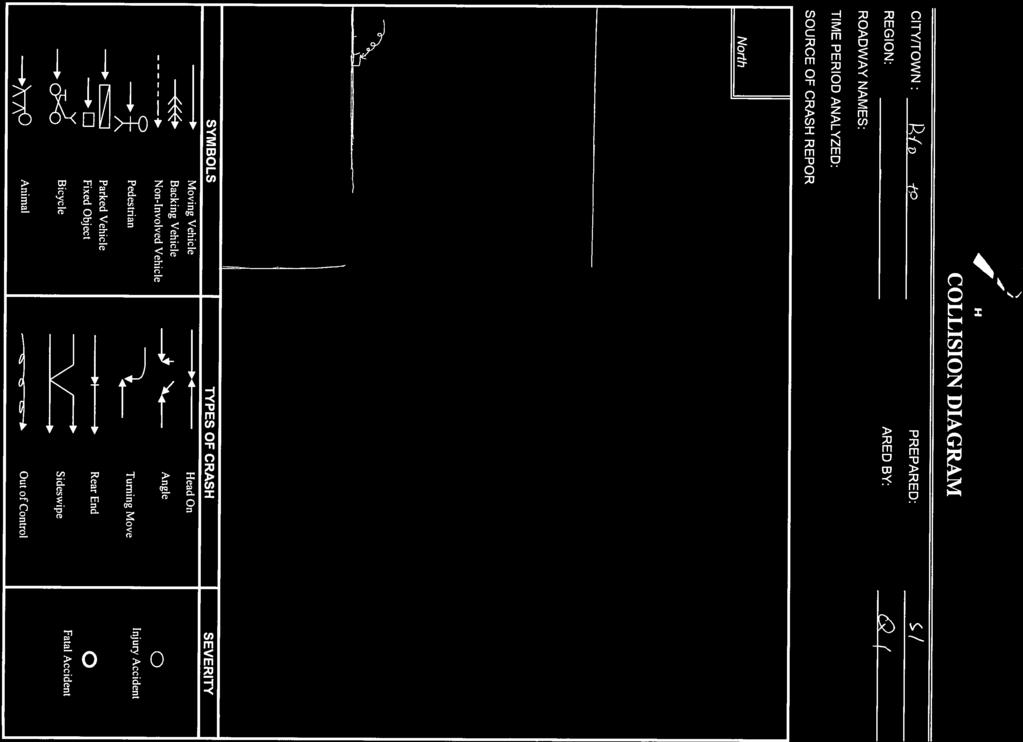
ROAD SAFETY AUDIT. Route 27 (Crescent Street)/Quincy Street/Massasoit Boulevard. City of Brockton. July 24,2013
|
|
|
- Baldwin Griffin
- 5 years ago
- Views:
Transcription

1 ROAD SAFETY AUDIT Route 27 (Crescent Street)/Quincy Street/Massasoit Boulevard City of Brockton July 24,2013 Prepared for: Massachusetts Department of Transportation Prepared by: Howard/Stein-Hudson Associates 38 Chauncy Street Boston, MA 02111
2 Table of Contents Background... 2 Project Data... 2 Project Location Description... 5 Road Safety Audit Observations and Potential Enhancements...7 Safety Issue #1. Access Management... 8 Safety Issue #2. Intersection Control and Geometry Safety Issue #3. Sight Distance Safety Issue #4. Pavement Condition and Drainage Safety Issue #5. Signage Safety Issue #6. Pavement Markings Safety Issue #7. Pedestrian and Bicycle Accommodations Safety Issue #8. Education Recommendations List of Appendices Appendix A. RSA Meeting Agenda Appendix B. RSA Audit Team Contact List Appendix C. Detailed Crash Data List of Figures Figure 1. Figure 2. Locus Map... 4 Route 27 (Crescent Street) at Quincy Street/Massasoit Boulevard... 6 List of Tables Table 1. Table 2. Participating Audit Team Members... 3 Summary of Potential Safety Enhancements Page 1
3 Background The intersection of Route 27 (Crescent Street)/Quincy Street/Massasoit Boulevard in Brockton, Massachusetts, was listed in the Top 5% of High Crash Locations within the Old Colony Planning Commission (OCPC) in The Massachusetts Department of Transportation (MassDOT) has determined that Highway Safety Improvement Program (HSIP) funding would be allowed for reconstruction of the intersection if a Road Safety Audit (RSA) were conducted and a proposed design incorporated the safety improvements identified in the RSA. The intersection is currently identified as a proposed project (#606143) with a scheduled advertising date of October 2018; however, it is not currently under design. Route 27 is a primary east-west route through the City of Brockton. The intersection of Route 27 (Crescent Street)/Quincy Street/Massasoit Boulevard experiences regular emergency vehicle traffic due to its proximity to Brockton Hospital, located north of the intersection on Route 123 (Centre Street). Massasoit Boulevard, which intersects Route 27 from the south, is an entrance driveway to Massasoit Community College. An RSA team member stated that, although the main entrance to Massasoit Community College is located on Thatcher Street, most traffic accesses Massasoit Community College using Massasoit Boulevard because it is more easily accessed from regional roadways. Representatives from Massasoit Community College attending the RSA also stated that, in addition to Massasoit Community College-related deliveries, heavy vehicle traffic often uses Massasoit Boulevard to access the used auto parts junkyard on Thatcher Street. In general, an RSA is intended to identify potential safety improvements that can be evaluated and included as part of the design process for a future reconstruction project. The short-term, low-cost potential improvements could be considered by the responsible agency for immediate implementation prior to reconstruction, as appropriate. The RSA study area is illustrated in Figure 1. Project Data The audit team conducted an RSA for the intersection of Route 27 (Crescent Street)/Quincy Street/Massasoit Boulevard on Monday, June 17, The RSA agenda appears in Appendix A. Table 1 lists the audit team members and their affiliations. Appendix B provides contact information for all team members. Page 2
4 Table 1. Participating Audit Team Members Audit Team Member Agency/Affiliation Linda Balzotti Mayor, City of Brockton Mike Mullen City of Brockton Mayor s Office Michael Curtin City of Brockton DPW Jacques A. Borges City of Brockton DPW Ernie Bethoney City of Brockton DPW James Donovan City of Brockton Fire Department Jeffrey A. Gillpatrick City of Brockton Fire Department Steven Williamson City of Brockton Police Department George A. Riddell Brockton Area Transit Charles Kilmer Old Colony Planning Council (OCPC) Ray Guarino Old Colony Planning Council (OCPC) Pat Ciaramella Old Colony Planning Council (OCPC) Bill McNulty Old Colony Planning Council (OCPC) Phil Sheppard Massasoit Community College Bill Mitchell Massasoit Community College Pamela Haznar MassDOT District 5 Project Development Allyson Wheelwright MassDOT, Highway Division Qing Qing You MassDOT, Highway Division Corey O Connor MassDOT, Highway Division Safety Section Lisa Schletzbaum MassDOT, Highway Division Safety Section Keri Pyke Howard/Stein-Hudson (HSH) Mike Tremblay Howard/Stein-Hudson (HSH) Page 3
5 QUINCY STREET Road Safety Audit Figure 1. Locus Map BROCK T ON HOSPIT AL ROUTE 123 ( CENTRE STREET) ROUTE 27 ( CRESCENT STREET) RD MASSASOIT BOULEVA ROUTE 27 ( CRESCENT STREET) ROUTE 14 (ALGER STREET) M ASSASOIT C OMMUNIT Y C OLLEGE Not to scale. Source: MassGIS Howard/Stein-Hudson Associates, Inc.
6 QUINCY STREET Road Safety Audit Figure 1. Locus Map BROCK T ON HOSPIT AL ROUTE 123 ( CENTRE STREET) ROUTE 27 ( CRESCENT STREET) RD MASSASOIT BOULEVA ROUTE 27 ( CRESCENT STREET) ROUTE 14 (ALGER STREET) M ASSASOIT C OMMUNIT Y C OLLEGE Not to scale. Source: MassGIS Howard/Stein-Hudson Associates, Inc.
7 Prior to the RSA, in order to begin assessing possible safety issues, the audit team reviewed collision diagrams and a crash detail summary for the intersection of Route 27/Quincy Street/Massasoit Boulevard based on crash records supplied by the Brockton Police Department. Between January 2010 and April 2013, 33 crashes were reported at the intersection. Of those crashes, 19 (or 58%) were angle-type crashes, nine (27%) were rear-end crashes, three (9%) were sideswipe crashes, and two (6%) were singlevehicle crashes. Twenty-one crashes (64%) occurred on dry pavement, 11 (33%) occurred on wet pavement, and one (3%) occurred on an icy roadway surface. Crashes generally occurred in the daylight hours (76%). Nine crashes (27%) resulted in personal injury, and no fatalities were reported. Appendix C provides the detailed crash data for the intersection. Project Location Description The RSA focused on the intersection of Route 27/Quincy Street/Massasoit Boulevard in the City of Brockton, as shown in the aerial image in Figure 2. Route 27 (Crescent Street)/Quincy Street/Massasoit Boulevard is a signalized intersection with four approaches. The Route 27 eastbound approach consists of a left-turn lane and a shared through/right-turn lane. The Route 27 westbound approach consists of a shared left-turn/through lane and an exclusive right-turn lane. The Massasoit Boulevard northbound approach consists of a single travel lane. The Quincy Street southbound approach consists of an exclusive left-turn lane and a shared through/right-turn lane. Sidewalks are provided along the north side of the intersection, but are not provided along the south side of the intersection. A crosswalk is not provided across the Route 27 westbound approach; however, crosswalks are provided across the other three approaches. Pedestrian indications are provided across the Route 27 eastbound approach, but are not provided for the other two crosswalks. Pedestrian ramps are not provided. During the RSA, which took place during midday hours, the Route 27 eastbound and westbound phases operated concurrently, while the Massasoit Boulevard northbound approach and Quincy Street southbound approach operated under split phasing. This intersection is the junction of the following roadways, which are categorized according to MassDOT Office of Transportation Planning functional classifications: Route 27 (Crescent Street) is classified as an urban principal arterial and falls under the City of Brockton s jurisdiction. Route 27 is a north-south roadway that originates at Route 106 in Kingston to the south and terminates in Chelmsford at Route 110 to the north. Within the study area, Route 27 runs in an east-west direction and typically consists of one travel lane in each direction. Therefore, throughout this report, Route 27 northbound will be referred to as Route 27 westbound, and Route 27 southbound will be referred to as Route 27 eastbound. East of Quincy Street, sidewalks are generally provided along the north side of Route 27 and are generally provided along the both sides of Route 27 west of Quincy Street. Bicycle accommodations are not provided on Route 27 near the study area. Page 5
8 Road Safety Audit Figure 2. Route 27 at Quincy Street and Massasoit Boulevard S QUINCY TREET SPEEDEE OIL CHANGE MASSASOIT CONFERENCE CENTER CHRISTO S SCENT (CRE UTE 27 RO STREE RAINBOW SQUARE T) MAHER BROS. AUTOMOTIVE RO UT E2 7( CR ES CE NT ST RE ET ) MA SS AS OI TB OU LE VA RD MASSASOIT PLAZA Not to scale. Source: MassGIS Howard/Stein-Hudson Associates, Inc.
9 Quincy Street is classified as an urban minor arterial and falls under the City of Brockton s jurisdiction. Quincy Street runs in a north-south direction, running between Court Street to the north, where it becomes North Quincy Street, and Route 27 to the south. Sidewalks are generally provided along both sides of the roadway, and no bicycle accommodations are provided. Massasoit Boulevard is a local, private roadway. Massasoit Boulevard runs in a north-south direction, between Route 27 to the north and Thatcher Street to the south. Massasoit Boulevard serves as an entrance to Massasoit Community College. The roadway consists of one travel lane in each direction. Sidewalks and bicycle facilities are not provided. Road Safety Audit Observations and Potential Enhancements Based on RSA team discussions on Monday, June 17, 2013, the RSA team determined that the intersection of Route 27/Quincy Street/Massasoit Boulevard has the following issues that affect safety: 1. Access management; 2. Intersection control and geometry 3. Sight distance; 4. Pavement condition and drainage; 5. Signage; 6. Pavement markings; 7. Pedestrian and bicycle accommodations; and 8. Distracted Driving. The following sections describe in more detail the safety issues and enhancements determined during the RSA. Several of these issues require further study and engineering judgment to determine the feasibility of implementing enhancements to address them. Page 7


10 Safety Issue #1. Access Management Observations: Six of the 33 crashes that were reported at Route 27/Quincy Street/Massasoit Boulevard were courtesy crashes, where, contrary to the rules of the road, a motorist yielded to a vehicle entering a driveway, which was subsequently hit by a vehicle in an adjacent lane. Five of these courtesy crashes occurred when a Route 27 eastbound vehicle stopped to allow a vehicle to exit Massasoit Plaza, located at the southwest corner, which was subsequently hit by an unsuspecting Route 27 eastbound vehicle in the left-turn lane. The Massasoit Plaza exit driveway is located just 60 feet west of the intersection, so left-turning vehicles exiting the plaza must find a gap in two lanes of Route 27 eastbound traffic and one lane of Route 27 westbound traffic. A sixth courtesy crash occurred between a Route 27 eastbound vehicle and a Massasoit Boulevard northbound vehicle. Three of the six crashes resulted in personal injury. RSA team members stated that a small curb cut located on the northwest corner of the intersection is used by customers of Christo s to pick up take-out orders. The driveway is located 35 feet west of the intersection along Route 27 westbound. Motorists may not expect vehicles to be entering this driveway, particularly Route 27 eastbound vehicles, which would enter the driveway from the left-turn lane. One crash involved a vehicle turning left into the driveway and a vehicle traveling along Route 27 westbound. Team members also noted that any vehicle parked in this driveway would need to back out of their parking space and into traffic. The driveway is not deep enough to accommodate both parked cars and pedestrian travel along the sidewalk. The Christo s driveway on the northwest corner of the intersection is informally used for take-out orders. There is no curbing between the Christo s parking lot and the Quincy Street southbound approach. At the northwest corner of the intersection, there is no vertical barrier delineating the edge of Quincy Street and providing separation from the Christo s parking lot. Vehicles are not prevented from entering or exiting the parking lot by anything aside from pavement markings. Parking spaces are striped up to the edge of the roadway, and a sidewalk is not present along the parking lot. Team members suggested that a portion of the parking lot is most likely within the City layout. Due to the layout of the parking lot, the row of parking spaces adjacent to Quincy Street is only accessible by entering directly from Quincy Street if the adjacent row of parking spaces were occupied. It was also stated that vehicles often encroach into the parking lot in order to enter the Quincy Street southbound Page 8

11 through/right-turn lane at the intersection. This, according to team members, discourages users of the parking lot from using the spaces adjacent to Quincy Street. Three crashes involved vehicles exiting the Christo s parking lot and vehicles traveling along Quincy Street southbound. The Speedee Oil Change has four driveways; one of which is located along the Route 27 westbound approach just 30 feet from the intersection. The Speedee Oil Change, located on the northeast corner of the intersection, has four driveways. Two driveways are located along Route 27, including one driveway located approximately 30 feet east of the intersection, and two on Quincy Street, including one driveway located approximately 35 feet north of the intersection. Vehicles entering or exiting the driveways along Route 27 may conflict with two lanes of queued vehicles. One crash involved an exiting vehicle turning left onto Route 27 eastbound that was struck by a Route 27 westbound vehicle. Maher Bros. Automotive, located on the southeast corner of the intersection, has two driveways on Route 27, including one driveway located 10 feet east of the intersection. Although not reflected in the crash data, left-turning vehicles from the Maher Bros. Automotive west driveway may conflict with two lanes of queued traffic. Page 9
12 Enhancements: 1. In order to reduce the occurrence of courtesy crashes, consider restricting left turns from commercial driveways located close to the intersection, including left turns from Massasoit Plaza, the southern driveway from Speedee Oil Change onto Quincy Street, the western driveway from Speedee Oil Change onto Route 27, and the western driveway from Maher Bros. Automotive onto Route To help prevent courtesy crashes, work with the owner(s) of Massasoit Plaza and the adjacent property to determine whether consolidating commercial driveways to the west of the existing Massasoit Plaza driveway is possible in order to reduce the number of travel lanes that left-turning vehicles must cross when exiting a driveway. 3. Consider adding an entrance driveway from Massasoit Plaza onto Massasoit Boulevard, in conjunction with restricting left turns into Massasoit Plaza from Route 27, to allow vehicles exiting Massasoit Plaza to access Route 27 westbound using the traffic signal at the intersection. 4. Close the existing Christo s driveway on Route 27 westbound on the northwest corner of the intersection to eliminate the occurrence of unexpected vehicles turning left into this area from Route 27 eastbound. 5. Add curbing and a sidewalk along the Christo s parking lot on the west side of Quincy Street. Reconfigure the Christo s parking lot so that it functions using the defined driveways onto Quincy Street. Review whether these changes would require changes to the drainage system. 6. At the Speedee Oil Change, in order to prevent entering and exiting vehicles from conflicting with queued vehicles or vehicles traveling through the intersection, consider closing the southern driveway onto Quincy Street and the western driveway on Route 27, if they are determined to be unnecessary for deliveries. Turning radii should be checked to ensure that fuel deliveries are not impacted. 7. Consider the feasibility of closing the western driveway at Maher Bros. Automotive, located on the southeast corner of the intersection, in order to prevent vehicles from entering or exiting the driveway close to the intersection. Page 10


13 Safety Issue #2. Intersection Control and Geometry Observations: The Route 27 eastbound and westbound approaches operate using permissive left turns. The Route 27 eastbound approach has an exclusive left-turn lane, but the Route 27 westbound approach has a shared left-turn/through lane. An RSA team member stated that it is sometimes difficult for Route 27 westbound left-turning traffic to see Route 27 eastbound through traffic due to vehicles waiting in the Route 27 eastbound left-turn lane. Three angle crashes involved vehicles turning left from Route 27 westbound onto Massasoit Boulevard and through traffic on Route 27 eastbound. Because the Route 27 westbound approach has a shared left-turn/through lane, vehicles waiting to turn left feel pressure from queued through vehicles behind them, causing them to take more risks when turning. A left-turn lane is provided on the Route 27 eastbound approach, but there is no protected signal phase. RSA team members noted that all the approaches to the intersection had one or more lanes that appear to be too narrow for comfortable travel. Team members stated that vehicles often encroach into the Christo s parking lot in order to enter the Quincy Street southbound through/right-turn lane. RSA team members noted that there is no overhead signal indication facing the Route 27 westbound approach to the intersection. Team members also observed that some of the Quincy Street southbound signal indications are smaller than 12 inches. There is no overhead signal provided on the Route 27 westbound approach. An RSA team member stated that, while the signal is actuated and coordinated with the nearby signals to the west, the coordination is based on timing, the intersections have separate controllers, and there is no direct communication between the signals. Route 27 serves as a major east/west corridor through the City of Brockton, which results in high volumes of traffic using Massasoit Boulevard to access and egress Massasoit Community College. This causes long delays on Massasoit Boulevard. RSA team members stated that motorists on Massasoit Boulevard often get distracted by electronic devices while waiting at the signal. While there is significant emergency vehicle activity at the intersection due to its proximity to the Brockton Hospital, there is currently no emergency vehicle preemption at the intersection. Page 11
14 Enhancements: 1. Consider the feasibility of adding a left-turn storage lane at the Route 27 westbound approach to the intersection to allow Route 27 westbound left-turning vehicles to wait for an acceptable gap. Consider the impact on turning radii of heavy vehicles turning right from Route 27 westbound onto Quincy Street. 2. If unable to create a left-turn storage lane on the Route 27 westbound approach, consider converting the existing shared left-turn/through lane to an exclusive left-turn lane, and converting the existing exclusive right-turn lane to a shared through/right-turn lane. 3. In order to reduce angle crashes involving Route 27 left-turning vehicles, consider adding protected/permissive left-turn phasing at the Route 27 eastbound approach and on the Route 27 westbound approach if an exclusive left-turn lane is provided. 4. Evaluate all approaches and individual lanes to determine if additional width is necessary for queuing and turning vehicles. If necessary, consider widening the roadway to provide additional capacity. 5. Provide an overhead signal for the Route 27 westbound approach to improve the visibility of the signal. 6. Replace the existing 8-inch signal heads for the Quincy Street southbound approach with standard 12-inch signal heads, per Manual on Uniform Traffic Control Devices (MUTCD) requirements. 7. Consider updating the coordination system between the intersection and the two nearby intersections at the Brockton East Shopping Plaza to the west in order to improve the flow of traffic through the Route 27 corridor. 8. Consider implementing adaptive signal control at the intersection in order to improve signal performance at the intersection. 9. Consider adding advance loop detectors on Massasoit Boulevard to reduce instances of the signal gapping out due to driver inattention. 10. Provide emergency vehicle preemption at the intersection. Page 12

15 Safety Issue #3. Sight Distance Observations: Horizontal curves along the Route 27 westbound approach and the Massasoit Boulevard northbound approach may impact the sight lines to the signal. Similarly, a crest vertical curve on the Quincy Street southbound approach may impact sight lines of the intersection. Maher Bros. Automotive, which is located on the southeast corner of the intersection, parks cars close to the edge of Massasoit Boulevard. These vehicles may impact the sight lines to the west of the intersection. Enhancements: A horizontal curve on Route 27 to the east of the intersection may obscure sightlines. 1. Provide intersection warning signage (W2-1) along all approaches to the intersection. 2. Provide curve warning signage (W1-2) in advance of the horizontal curves on Route 27 westbound and Massasoit Boulevard northbound. Provide chevrons (W1-8) along both horizontal curves. 3. Evaluate sight lines to determine if alignment or profile changes are necessary to improve sight distance at the intersection. 4. Determine if the presence of parked cars at Maher Bros. Automotive presents sight distance limitations or if vehicles are parked on City right-of-way. If necessary, work with Maher Bros. Automotive to reach an acceptable layout for parking within the property. Page 13

16 Safety Issue #4. Pavement Condition and Drainage Observations: RSA team members observed that the pavement at the intersection is in poor condition, and that the pavement has rutted in some locations. This may be the result of poor drainage and significant heavy vehicle volume. Eleven of the 33 crashes occurred on wet pavement, and one crash occurred on icy pavement. Three crashes that occurred on wet pavement were reported to involve skidding vehicles. RSA team members stated that ponding occurs at the southwest corner of the intersection. The pavement is in poor Team members also observed catch basins that were condition, and is rutting in some locations. blocked by debris; this indicates the need for additional maintenance of drainage structures to ensure adequate drainage at the intersection. Enhancements: 1. Improve drainage and the occurrence of crashes on wet pavement by maintaining existing drainage structures. 2. Resurface the intersection and surrounding approaches in order to improve drainage and vehicle traction on wet pavement. 3. Evaluate the placement of the existing catch basins at the intersection. Consider the need for additional catch basins and/or resizing of drainage pipes at the intersection, particularly at the southwest corner of the intersection, to prevent pooling of storm water and rutting pavement. 4. As part of long-term reconstruction efforts, consider the significant heavy vehicle volume that would impact the pavement design for the intersection to improve future performance of pavement. Page 14
17 Safety Issue #5. Signage Observations: There is no lane use signage along any of the approaches to the intersection. Lane use signage may prevent sideswipe crashes that occur when a motorist changes lanes suddenly. One sideswipe crash occurred along the Route 27 westbound approach to the intersection. RSA team members noted that there are no street name signs at the intersection, which may cause confusion and hesitation at the intersection. Enhancements: 1. Add lane use signage along the Route 27 eastbound, Route 27 westbound, and Quincy Street southbound approaches to help motorists to enter the appropriate lane in advance of the intersection. 2. As discussed in Safety Issue #3: Sight Distance, provide intersection warning signage (W2-1) along all approaches to the intersection, and provide curve warning signage (W1-2) ahead of the horizontal curves on the Route 27 westbound approach and the Massasoit Boulevard northbound approach to the intersection. 3. Add street name signage to improve clarity at the intersection. Page 15

18 Safety Issue #6. Pavement Markings Observations: RSA team members observed that the lane line separating the Route 27 westbound shared left-turn/through lane and exclusive right-turn lane is relatively short. A longer lane line would allow vehicles to queue in their respective lanes and reduce confusion. Team members also noted that most of the longitudinal pavement markings along the intersection approaches are faded. There is currently no edge line along Massasoit Boulevard. The lane line between the shared left-turn/through lane and rightturn lane is very short, and pavement markings are faded. Enhancements: 1. Consider the feasibility of extending the lane line along Route 27 westbound within the existing layout to increase the amount of vehicles that may queue in separate lanes along the approach. 2. Update all longitudinal pavement markings with retroreflective thermoplastic for increased visibility and clarity at the intersection. 3. Provide an edge line along Massasoit Boulevard for increased visibility, particularly in dark or inclement conditions. Page 16

19 Safety Issue #7. Pedestrian and Bicycle Accommodations Observations: While no crashes were reported to have involved pedestrians or bicyclists, RSA team members noted that pedestrian and bicycle accommodations are missing at the intersection. In the vicinity of the intersection, sidewalks are provided along the north side of Route 27 and along the east side of Quincy Street. However, the sidewalk along Route 27 may be blocked by vehicles in the Christo s Route 27 driveway. The sidewalk along the west side of Quincy Street ends at the Christo s parking lot, and vehicles sometimes encroach into this parking lot to enter the Quincy Street southbound through/right-turn lane queue. This presents a safety issue to pedestrians who would not expect a southbound vehicle to enter the parking lot area. There are no bicycle facilities or curb ramps at the intersection, and pedestrian signals are present at only one of the three crosswalks. A crosswalk is provided across the west leg of Route 27 and across Massasoit Boulevard, despite the lack of sidewalks on the south side of Route 27. A crosswalk is also provided across Quincy Street. Americans with Disabilities Act (ADA)-compliant pedestrian ramps and push buttons are not provided. Pedestrian indications are provided across the Route 27 western crosswalk, but not at the Quincy Street or Massasoit Boulevard crosswalks. Team members noted that the pedestrian walk time may need to be extended. On the morning of the audit, RSA team members observed several pedestrians crossing approximately 50 away from the intersection, between queued vehicles, but not in the crosswalk. There are no bike lanes, shoulders, designated shared lanes, or bicycle detection present at the intersection. Quincy Street does have placards posted by the Massachusetts Department of Public Works indicating that Quincy Street is a bicycle route. The Claire Saltonstall Bicycle Route, which extends from Boston to Provincetown, runs along Quincy Street and Massasoit Boulevard through the Massasoit Community College campus to Thatcher Street. Page 17
20 Enhancements: 1. Continue the existing sidewalks on the north side of Route 27 and the west side of Quincy Street through the intersection. 2. Consider the feasibility of providing a crosswalk across the Route 27 east leg of the intersection. 3. Upgrade pedestrian ramps and pedestrian push buttons to ADA standards. 4. Confirm that the existing pedestrian walk and flashing don t walk timings meet MUTCD standards. 5. Update the signal to include bicycle detection and MUTCD-compliant pedestrian signals at all crosswalks. 6. As part of long-term reconstruction efforts, consider the feasibility of providing sidewalks along Massasoit Boulevard and along the south side of Route As part of long-term reconstruction efforts, consider providing bicycle accommodations along the intersection approaches, particularly along the Saltonstall Bicycle Route, including bike lanes, a paved shoulder, or shared lane markings. Safety Issue #8. Distracted Driving Observations: RSA team members noted that the Massasoit Boulevard northbound approach to the intersection has long queues, sometimes into the Massasoit Community College parking lots, during midday periods after classes are over. An RSA team member said that delays can be exacerbated by inattentive or distracted motorists. Enhancements: 1. Work with Massasoit Community College to educate students about laws that prohibit text messaging while driving and other methods to help improve traffic flow on Massasoit Boulevard. 2. Massasoit Community College should consider ways to encourage students to use the Thatcher Street egress from campus. Page 18
21 Recommendations Based on its review of data, on-site field observations and group discussion, the RSA team identified the following possible enhancements that could improve safety at the intersection of Route 27 (Crescent Street)/Quincy Street/Massasoit Boulevard. Further study and design work will need to be conducted to determine the feasibility of making some of the improvements. Table 2 summarizes the safety issues, possible enhancements, estimated safety payoff, time frame, cost, and responsibility. Safety payoff estimates are based on engineering judgment and are categorized as low, medium, and high. The time frame is categorized as short-term (<1 year), midterm (1 to 3 years), or long-term (typically >3 years). Long-term improvements are typically considered to be substantial improvements with an expected time frame for implementation greater than 3 years. The costs are categorized as low (<$10,000), medium ($10,001 to $50,000), or high (>$50,000). Short-term enhancements include, but are not limited to: Restrict left turns out of commercial driveways close to the intersection; Add a left-turn storage lane on Route 27 westbound; Provide intersection warning signage and street name signs; Remove obstructions to sight lines; Maintain existing drainage structures; and Restripe longitudinal pavement markings. To enhance the safety of the corridor, the long-term enhancements are to: Close, relocate, or consolidate commercial driveways; Increase intersection capacity; Use curbing to define the edge of roadway on Quincy Street; Update signals with new equipment and coordination; Improve drainage; Provide curb ramps and consistent sidewalks; and Provide bicycle accommodations. Page 19
22 The RSA is intended to identify potential safety improvements that can be evaluated and included as part of the design process for a reconstruction project. The short-term, low-cost potential improvements could be considered by the responsible agency for immediate implementation, as appropriate. Page 20
23 Route 27 (Crescent Street) at Quincy Street/Massasoit Boulevard, Brockton, MA Table 2. Summary of Potential Safety Enhancements Safety Issue Access Management Safety Enhancement In order to reduce the occurrence of courtesy crashes, consider restricting left turns from commercial driveways located close to the intersection, including from Massasoit Plaza, the southern driveway from Speedee Oil Change onto Quincy Street, the western driveway from Speedee Oil Change onto Route 27, and the western driveway from Maher Bros. Automotive onto Route 27. To help prevent courtesy crashes, work with the owner(s) of Massasoit Plaza and the adjacent property to determine whether consolidating commercial driveways to the west of the existing Massasoit Plaza driveway is possible. Consider adding an entrance driveway from Massasoit Plaza onto Massasoit Boulevard, in conjunction with restricting left turns into Massasoit Plaza from Route 27, to allow vehicles exiting Massasoit Plaza to access Route 27 westbound using the traffic signal at the intersection. Close the existing Christo s driveway on Route 27 westbound on the northwest corner of the intersection to eliminate the occurrence of unexpected vehicles turning left into this area from Route 27 eastbound. Add curbing and a sidewalk along the Christo s parking lot on the west side of Quincy Street. Reconfigure the Christo s parking lot so that it functions using the defined driveways onto Quincy Street. Review whether these changes would require changes to the drainage system. In order to prevent entering and exiting vehicles from conflicting with queued vehicles or vehicles traveling through the intersection, consider closing the southern driveway onto Quincy Street and the western driveway on Route 27 at the Speedee Oil Change, if they are determined to be unnecessary for deliveries. Turning radii should be checked to ensure that fuel deliveries are not impacted. Safety Payoff Time Frame Cost Responsible Party Medium Short-term Low City of Brockton High Long-term Medium Medium Long-term Medium Low Mid-term Medium Medium Mid-term Medium Medium Mid-term Medium City of Brockton/Property owners City of Brockton/Massasoit Plaza owner City of Brockton/ Christo s City of Brockton/Christo s City of Brockton/Speedee Oil Change Page 21
24 Route 27 (Crescent Street) at Quincy Street/Massasoit Boulevard, Brockton, MA Table 2. Summary of Potential Safety Enhancements (continued) Safety Issue Access Management Intersection Control and Geometry Safety Enhancement Consider the feasibility of closing the western driveway at Maher Bros. Automotive, located on the southeast corner of the intersection, in order to prevent vehicles from entering or exiting the driveway close to the intersection. Consider the feasibility of adding a left-turn storage lane at the Route 27 westbound approach to the intersection to allow Route 27 westbound left-turning vehicles to wait for an acceptable gap. Consider turning radii of heavy vehicles turning right from Route 27 westbound onto Quincy Street. If unable to create a left-turn storage lane on the Route 27 westbound approach, consider converting the existing shared left-turn/through lane to an exclusive left-turn lane, and converting the existing exclusive right-turn lane to a shared through/right-turn lane. In order to reduce angle crashes involving Route 27 leftturning vehicles, consider adding protected/permissive leftturn phasing at the Route 27 eastbound approach and on the Route 27 westbound approach if an exclusive left-turn lane is provided. Evaluate all approaches and individual lanes to determine if additional width is necessary for queuing and turning vehicles. If necessary, consider widening the roadway to provide additional capacity. Provide an overhead signal for the Route 27 westbound approach to improve the visibility of the signal. Replace the existing 8-inch signal heads for the Quincy Street southbound approach with standard 12-inch signal heads, per Manual on Uniform Traffic Control Devices (MUTCD) requirements. Consider updating the coordination system between the intersection and the two nearby intersections to the west in order to improve the flow of traffic through the Route 27 corridor. Safety Payoff Time Frame Cost Responsible Party Medium Mid-term Medium Medium Short-term Low Medium Short-term Low City of Brockton High Mid-term Medium City of Brockton Low Short-term Low City of Brockton Medium Mid-term Medium City of Brockton Low Mid-term Low City of Brockton Medium Long-term Medium City of Brockton Page 22
25 Route 27 (Crescent Street) at Quincy Street/Massasoit Boulevard, Brockton, MA Table 2. Summary of Potential Safety Enhancements (continued) Safety Issue Safety Enhancement Safety Payoff Time Frame Cost Responsible Party Consider implementing adaptive signal control at the intersection in order to improve signal performance at the intersection. Medium Long-term High City of Brockton Consider adding advance loop detectors on Massasoit Intersection Boulevard to reduce instances of the signal gapping out due to Low Mid-term Medium City of Brockton Control and driver inattention. Geometry Provide emergency vehicle preemption at the intersection. Medium Mid-term Medium City of Brockton Provide intersection warning signage (W2-1) along all approaches to the intersection. Low Short-term Low City of Brockton Provide curve warning signage (W1-2) in advance of the horizontal curves on Route 27 westbound and Massasoit Boulevard northbound. Provide chevrons (W1-8) along both Low Short-term Low City of Brockton horizontal curves. Evaluate sight lines to determine if alignment or profile changes Sight Distance are necessary to improve sight distance. Medium Long-term High City of Brockton Determine if the presence of parked cars at Maher Bros. Automotive presents sight distance limitations or if vehicles are parked on City right-of-way. If necessary, work with Maher Bros. Automotive to reach an acceptable layout for parking within the property. Improve drainage and the occurrence of crashes on wet pavement by maintaining existing drainage structures. Low Short-term Low City of Brockton/Maher Bros. Automotive Low Short-term Low City of Brockton Pavement Condition and Drainage Resurface the intersection and surrounding approaches in order to improve drainage and vehicle traction on wet pavement. Evaluate the placement of the existing catch basins at the intersection. Consider the need for additional catch basins and/or resizing of drainage pipes at the intersection, particularly at the southwest corner of the intersection, to prevent pooling of storm water and rutting pavement. As part of long-term reconstruction efforts, consider the significant heavy vehicle volume that would impact the pavement design for the intersection to improve future performance of pavement. Medium Mid-term High City of Brockton Medium Long-term High City of Brockton Medium Long-term High City of Brockton Page 23
26 Route 27 (Crescent Street) at Quincy Street/Massasoit Boulevard, Brockton, MA Table 2. Summary of Potential Safety Enhancements (continued) Safety Issue Safety Enhancement Safety Payoff Time Frame Cost Responsible Party Add lane use signage along the Route 27 eastbound, Route 27 westbound, and Quincy Street southbound approaches to help motorists to enter the appropriate lane in advance of the Low Short-term Low City of Brockton intersection. As discussed in Safety Issue #3: Sight Distance, provide Signage intersection warning signage (W2-1) along all approaches to the intersection, and provide curve warning signage (W1-2) ahead of the horizontal curves on the Route 27 westbound approach Low Short-term Low City of Brockton and the Massasoit Boulevard northbound approach to the intersection. Add street name signage to improve clarity at the intersection. Low Short-term Low City of Brockton Consider the feasibility of extending the lane line along Route 27 westbound within the existing layout to increase the amount of vehicles that may queue in separate lanes along the approach. Low Short-term Low City of Brockton Pavement Markings Update all longitudinal pavement markings with retroreflective thermoplastic for increased visibility and clarity at the Low Short-term Low City of Brockton intersection. Provide an edge line along Massasoit Boulevard for increased visibility, particularly in dark or inclement conditions. Low Short-term Low City of Brockton Pedestrian and Bicycle Accommodations Continue the existing sidewalks on the north side of Route 27 and the west side of Quincy Street through the intersection. Upgrade pedestrian ramps and pedestrian push buttons to ADA standards. Consider the feasibility of providing a crosswalk across the Route 27 east leg of the intersection. Confirm that the existing pedestrian walk and flashing don t walk timings meet MUTCD standards. Medium Mid-term Medium City of Brockton/Christo s Medium Mid-term Medium City of Brockton Low Short-term Low City of Brockton Low Short-term Low City of Brockton Update the signal to include bicycle detection and MUTCDcompliant pedestrian signals at all crosswalks. Medium Mid-term Medium City of Brockton Page 24
27 Route 27 (Crescent Street) at Quincy Street/Massaso it Boulevard, Brockton, MA Table 2. Summary of Potential Safety Enhancements (continued) Safety Issue Safety Enhancement Safety Payoff Time Frame Cos t As part of long-term reconstruction efforts, consider the feasibility of providing sidewalks along Massasoit Boulevard and High Long -term along the south side of Route 27. Pedestrian and Bicycle Accommodati ons Distracted Driving As part of long-term reconstruction efforts, consider providing bicycle accommodations along the intersection approaches, particularly along the Saltonstall Bicycle Route, including bike lanes, a paved shoulder, or shared lane markings. Work with Massasoit Community College to educate students about laws that prohibit text messaging while driving and other methods to help improve traffic flow on Massasoit Bo ulevard. Massasoit Community College should consider ways to encourage students to use the Thatcher Street egress from camp us. Responsible Part y High City of Brockt on Medium Long -term Low City of Brockt on Low Short-te rm Low Short-te rm Low Low City of Brockton/Massasoit Comm unity College Massasoit Comm unity College Page 25
28 Route 27 (Crescent St)/Quincy Street/Massasoit Boulevard, Brockton, MA Meeting Location: Massasoit Conference Center 770 Crescent Street, Brockton, MA Monday, June 17, :00 AM 12:00 noon Type of meeting: Attendees: Please bring: High Crash Location Road Safety Audit Invited Participants to Comprise a Multidisciplinary Team Thoughts and Enthusiasm!! 10:00 AM Welcome and Introductions 10:15 AM Discussion of Safety Issues 11:00 AM Site Visit Crash history Existing Geometries and Conditions Walk to the intersection of Route 27/Quincy Street/Massasoit Blvd. As a group, identify areas for improvement 11:30 AM Discussion of Potential Improvements Discuss observations and finalize safety issue areas Discuss potential improvements and finalize recommendations 12:00 noon Adjourn for the Day but the RSA has not ended Instructions for Participants: Before attending the RSA on June 17th, participants are encouraged to drive/walk through the intersection and complete/consider elements on the RSA Prompt List with a focus on safety. All participants will be actively involved in the process throughout. Participants are encouraged to come with thoughts and ideas, but are reminded that the synergy that develops and respect for others opinions are key elements to the success of the overall RSA process. After the RSA meeting, participants will be asked to comment and respond to the document materials to assure it is reflective of the RSA completed by the multidisciplinary team.
29 Appendix B. RSA Audit Team Contact List
30 Participating Audit Team Members Date: Monday, June 17, 2013 Location: Massasoit Conference Center, 770 Crescent Street, Brockton, MA Audit Team Members Agency/Affiliation Address Phone Number Linda Balzotti Mayor, City of Brockton Mike Mullen City of Brockton Mayor s Office mmullen@cobma.us Michael Curtin City of Brockton DPW mcurtin@cobma.us Jacques A. Borges City of Brockton DPW jborges@cobma.us Ernie Bethoney City of Brockton DPW ebethoney@cobma.us James Donovan City of Brockton Fire Department jdonovan@cobma.us Jeffrey A. Gillpatrick City of Brockton Fire Department jgillpatrick@cobma.us Steven Williamson City of Brockton Police Department swilliamson@brocktonpolice.com George A. Riddell Brockton Area Transit griddell@ridebot.com Charles Kilmer Old Colony Planning Council (OCPC) ckilmer@ocpcrpa.org Ray Guarino Old Colony Planning Council (OCPC) rguarino@ocpcrpa.org Pat Ciaramella Old Colony Planning Council (OCPC) pciaramella@ocpcrpa.org x202 Bill McNulty Old Colony Planning Council (OCPC) wmcnulty@ocpcrpa.org Phil Sheppard Massasoit Community College x1106 Bill Mitchell Massasoit Community College wamitchell@massasoit.mass.edu x1510 Pamela Haznar MassDOT District 5 Project Development Pamela.haznar@state.ma.us Allyson Wheelwright MassDOT, Traffic allywheel@gmail.com Qing Qing You MassDOT qingqing.you@state.ma.us Corey O Connor MassDOT, Highway Division Safety Section corey.oconnor@state.ma.us Lisa Schletzbaum MassDOT, Highway Division Safety Section lisa.schletzbaum@state.ma.us Keri Pyke Howard/Stein-Hudson (HSH) kpyke@hshassoc.com Mike Tremblay Howard/Stein-Hudson (HSH) mtremblay@hshassoc.com
31 Appendix C. Detailed Crash Data


32
33 Vehicle 1 was stopped in traffic. Vehicle 2 was unable to stop as it was 23 5/9/12 Wednesday 8:01 AM Rear-end Daylight Rain Wet Other improper action skidding on the wet pavement and then, struck vehicle 1 from behind. 24 6/24/12 Sunday 2:10 PM Angle Daylight Clear Dry Failed to yield to right of way /27/12 Wednesday 10:34 AM Angle Daylight Clear Dry Failed to yield to right of way Vehicle 2 didn't see vehicle 1 while exiting Christo's Restaurant. 26 7/26/12 Thursday 5:32 PM Angle Daylight Cloudy Dry Visibility Obstructed Courtesy crash.* 27 8/14/12 Tuesday 1:16 PM Sideswipe, opposite direction Daylight Clear Dry Failed to yield to right of way Courtesy crash. * 28 8/16/12 Thursday 11:57 AM Angle Daylight Clear Dry Failed to yield to right of way Courtesy crash. * 29 9/18/12 Tuesday 6:54 PM Angle Dark - lighted roadway Cloudy Dry Failed to yield to right of way Courtesy crash.* 30 9/28/12 Friday 1:52 PM Rear-end Daylight Rain Wet Followed too closely Due to rain, vehicle 1 slide into vehicle /30/13 Wednesday 1:31 PM Angle Daylight Cloudy Wet Failed to yield to right of way Vehicle 1 went through red light because driver was arguing with passengers. And then, while vehicle 2 made a left turn, it was struck by 32 4/12/13 Friday 8:03 PM Angle Dark - lighted roadway Rain Wet Distracted vehicle 1 which made right turn. 33 4/18/13 Thursday 5:59 PM Angle Daylight Clear Dry Failed to yield to right of way Summary based on Crash Reports obtained from the Brockton Police Department Crash Data Summary Table Intersection of Quincy St and Massasoit Blvd and Crescent St, Brockton, MA January April 2013 Crash Weather Diagram Crash Date Crash Day Time of Day Manner of Collision Light Condition Condition Road Surface Driver Contributing Code Ages Comments Ref # m/d/y Type Type Type Type Type D1 D2 D3 Vehicle 1 pulled in front of vehicle 2 causing vehicle 2 to swerve out of 1 1/14/10 Thursday 8:09 AM Single Vehicle Crash Daylight Clear Dry Failed to yield to right of way control and hit utility pole. There was no contact between vehicles 2 2/2/10 Tuesday 10:46 AM Angle Daylight Clear Dry Failed to yield to right of way /5/10 Wednesday 11:01 AM Rear-end Daylight Clear Dry Followed too closely unk 4 5/10/10 Monday 1:34 PM Angle Daylight Clear Dry Unknown /31/10 9/11/10 8:44 AM 12:24 PM Rear-end Angle Daylight Daylight Clear Clear Dry Dry Followed too closely Failed to yield to right of way Vehicle 1 pulled out in front of vehicle 2 Heavy rain and slippery roads at time of crash. Both vehicles were in heavy 7 10/1/10 Friday 2:53 PM Rear-end Daylight Rain Wet Unknown stop and traffic. Vehicle 1 struck vehicle 2 in rear end. 8 10/18/10 Monday 8:52 AM Angle Daylight Clear Dry Other improper action Courtesy crash. * Dog in the front passenger seat in vehicle 1 pushed operators arm causing 9 1/14/11 11:25 AM Sideswipe, opposite direction Daylight Cloudy Wet Distracted him to swerve into the oncoming lane /18/11 3/3/11 Friday Thursday 4:58 PM 6:35 PM Angle Rear-end Daylight Dark - lighted roadway Cloudy Other Wet Dry Unknown Inattention Courtesy crash. * 12 4/27/11 Wednesday 7:55 PM Angle Dark - lighted roadway Cloudy Wet Unknown Both drivers stated that they had green light. Driver of vehicle 1 lighted a cigarette and was not paying attention and struck 13 4/30/11 Saturday 10:10 PM Rear-end Dark - lighted roadway Clear Dry Inattention vehicle /11/11 Saturday 8:03 AM Angle Daylight Rain Wet Failed to yield to right of way Vehicle 2 was stopped and waiting to turn left into parking lot while vehicle 1 was taking right turn and struck the rear of vehicle 2. Operator 1 stated that /2/11 8/9/11 Tuesday Tuesday 12:19 PM 5:36 PM Rear-end Angle Daylight Daylight Clear Rain Dry Wet Inattention Failed to yield to right of way she didn't see the vehicle 2 stop. 17 9/17/11 Saturday 6:14 PM Angle Daylight Cloudy Dry Unknown Operator 1 stated unknown vehicle cut her off from parking lot and she 18 11/3/11 Thursday 1:54 PM Rear-end Daylight Clear Dry Followed too closely slammed on the brakes to stop. Vehicle 2 struck vehicle 1 in rear /12/11 Monday 2:08 PM Angle Daylight Clear Dry Failed to yield to right of way Courtesy crash.* 20 12/26/11 Monday 7:20 AM Single Vehicle Crash Dawn Clear Ice No Improper Driving 44 Black ice on road caused vehicle to drive out of control and crash /28/11 Wednesday 5:49 PM Sideswipe, same direction Dark - lighted roadway Clear Dry No Improper Driving /12/12 Thursday 10:54 PM Angle Dark - lighted roadway Rain Wet Failed to yield to right of way *Courtesy Crash - A term used to describe a crash that occurs subsequent to a non-involved mainline driver who gives the right of way, contrary to the rules of the road, to another driver.
34 Crash Data Summary Tables and Charts Quincy St and Massasoit Blvd and Crescent St, Brockton, MA CRASH MONTH 20% 15% 10% 5% 12% 12% 9% 9% 6% 3% 3% 15% 12% 6% 3% 9% 0% J F M A M J J A S O N D 25% 20% 15% 10% 5% 0% CRASH DAY OF WEEK 21% 21% 14% 14% 14% 11% 4% Monday Tuesday Wednesday Thursday Friday Saturday Sunday 30% 20% 10% 0% 4% 6AM- 8AM 21% 18% 14% 11% 11% 11% 8AM- 10AM 10AM- 12PM CRASH TIME OF DAY 12PM- 2PM 2PM- 4PM4PM- 6PM6PM- 8PM 4% 7% 0% 0% 0% 8PM- 10PM 10PM- 12AM 12AM- 2AM 2AM- 4AM4AM- 6AM 70% 60% 50% 40% 30% 20% 10% 0% 27% CRASH MANNER OF COLLISION 58% 6% 3% 6% 0% 0% 0% Single Rear-end Angle Sideswipe, Sideswipe, Head on Rear to Rear Unknown Vehicle same opposite Crash direction direction Crash Summary Data (Brockton)2.0.xlsx 1 of 2 6/5/2013
35 Crash Data Summary Tables and Charts Quincy St and Massasoit Blvd and Crescent St, Brockton, MA 80% 60% 40% 20% 0% 76% 3% 0% CRASH LIGHT CONDITION 21% Daylight Dawn Dusk Dark - Lighted Roadway 0% 0% 0% 0% Dark - Roadway not lighted Dark - unknown roadway lighting Other Unknown 60% 50% 40% 30% 20% 10% 0% 55% Clear 21% 21% Cloudy CRASH WEATHER CONDITION Rain 0% 0% 0% 0% 0% 3% 0% Snow Sleet, Hail, Freezing Rain Fog, Smog, Smoke Severe Crosswinds Blowing sand, snow Other Unknown 80% 60% 40% 20% 0% 40% 30% 20% 10% 0% 64% 33% CRASH ROAD SURFACE 0% 3% 0% 0% 0% 0% 0% Dry Wet Snow Ice Sand, mud, dirt, oil, gravel 12% 29% CRASH DRIVER AGES 14% 22% Water (standing, moving) 12% Slush Other Unknown 3% 3% 5% Crash Summary Data (Brockton)2.0.xlsx 2 of 2 6/5/2013

 MA SS AS OI TB OU LE VA RD MASSASOIT")
36 Road Safety Audit Figure 2. Route 27 at Quincy Street and Massasoit Boulevard S QUINCY TREET SPEEDEE OIL CHANGE MASSASOIT CONFERENCE CENTER CHRISTO S SCENT (CRE UTE 27 RO STREE RAINBOW SQUARE T) MAHER BROS. AUTOMOTIVE RO UT E2 7( CR ES CE NT ST RE ET ) MA SS AS OI TB OU LE VA RD MASSASOIT PLAZA Not to scale. Source: MassGIS Howard/Stein-Hudson Associates, Inc.
ROAD SAFETY AUDIT. Route 202 (East State Street)/School Street & Route 202 (West State Street)/Pleasant Street/Amherst Street Town of Granby
/School Street & Route 202 (West State Street)/Pleasant Street/Amherst Street Town of Granby") ROAD SAFETY AUDIT Route 202 (East State Street)/School Street & Route 202 (West State Street)/Pleasant Street/Amherst Street Town of Granby March 2013 Prepared for: Massachusetts Department of Transportation
ROAD SAFETY AUDIT Route 202 (East State Street)/School Street & Route 202 (West State Street)/Pleasant Street/Amherst Street Town of Granby March 2013 Prepared for: Massachusetts Department of Transportation
ROAD SAFETY AUDIT. Centre Street (Route 123) at Plymouth Street. Municipality of Brockton. November, Prepared For: MassDOT
 at Plymouth Street. Municipality of Brockton. November, Prepared For: MassDOT") ROAD SAFETY AUDIT Centre Street (Route 123) at Plymouth Street Municipality of Brockton November, 2017 Prepared For: MassDOT On Behalf Of: City of Brockton Prepared By: Old Colony Planning Council 70 School
ROAD SAFETY AUDIT Centre Street (Route 123) at Plymouth Street Municipality of Brockton November, 2017 Prepared For: MassDOT On Behalf Of: City of Brockton Prepared By: Old Colony Planning Council 70 School
ROAD SAFETY AUDIT. Russell Street (Route 9) at North and South Maple Streets Town of Hadley. March 2014
 at North and South Maple Streets Town of Hadley. March 2014") ROAD SAFETY AUDIT Russell Street (Route 9) at North and South Maple Streets Town of Hadley March 2014 Prepared for: Massachusetts Department of Transportation Prepared by: Howard/Stein-Hudson Associates
ROAD SAFETY AUDIT Russell Street (Route 9) at North and South Maple Streets Town of Hadley March 2014 Prepared for: Massachusetts Department of Transportation Prepared by: Howard/Stein-Hudson Associates
ROAD SAFETY AUDIT. County Street at Hart Street. City of Taunton. January 30, Prepared For: Massachusetts Department of Transportation
 ROAD SAFETY AUDIT County Street at Hart Street City of Taunton January 30, 2015 Prepared For: Massachusetts Department of Transportation Prepared By: Toole Design Group 33 Broad Street, 4 th Floor Boston,
ROAD SAFETY AUDIT. Route 114 at Interstate I-495 Northbound Ramps. City of Lawrence. July 30, 2015
 ROAD SAFETY AUDIT Route 114 at Interstate I-495 Northbound Ramps City of Lawrence July 30, 2015 Prepared For: Massachusetts Department of Transportation Prepared By: Toole Design Group 33 Broad Street,
ROAD SAFETY AUDIT. State Road (Route 6) Corridor Town of Dartmouth. March Prepared For: MassDOT
 Corridor Town of Dartmouth. March Prepared For: MassDOT") ROAD SAFETY AUDIT State Road (Route 6) Corridor Town of Dartmouth March 2015 Prepared For: MassDOT Prepared By: McMahon Associates, Inc. 300 Myles Standish Blvd. Suite 201 Taunton, MA 02780 Table of Contents
ROAD SAFETY AUDIT State Road (Route 6) Corridor Town of Dartmouth March 2015 Prepared For: MassDOT Prepared By: McMahon Associates, Inc. 300 Myles Standish Blvd. Suite 201 Taunton, MA 02780 Table of Contents
ROAD SAFETY AUDIT. Route 53 (Washington Street) High Crash Locations at Route 139 (Schoosett Street) and Route 14 (Congress Street) Town of Pembroke
 High Crash Locations at Route 139 (Schoosett Street) and Route 14 (Congress Street) Town of Pembroke") ROAD SAFETY AUDIT Route 53 (Washington Street) High Crash Locations at Route 139 (Schoosett Street) and Route 14 (Congress Street) Town of Pembroke April 29, 2016 Prepared For: MassDOT Highway Division
ROAD SAFETY AUDIT Route 53 (Washington Street) High Crash Locations at Route 139 (Schoosett Street) and Route 14 (Congress Street) Town of Pembroke April 29, 2016 Prepared For: MassDOT Highway Division
ROAD SAFETY AUDIT. Washington Street (Route 53) at Pleasant Street. Town of Pembroke. June 26, Prepared For: MassDOT Highway Division
 at Pleasant Street. Town of Pembroke. June 26, Prepared For: MassDOT Highway Division") ROAD SAFETY AUDIT Washington Street (Route 53) at Pleasant Street Town of Pembroke June 26, 2014 Prepared For: MassDOT Highway Division Prepared By: BETA Group, Inc. Table of Contents Project Data... 1
ROAD SAFETY AUDIT Washington Street (Route 53) at Pleasant Street Town of Pembroke June 26, 2014 Prepared For: MassDOT Highway Division Prepared By: BETA Group, Inc. Table of Contents Project Data... 1
ROAD SAFETY AUDIT. May 18, Prepared For: MassDOT. On Behalf Of: Town of Milford
 ROAD SAFETY AUDIT East Main Street (Route 16) at Medway Road (Route 109), East Main Street (Route 16) at Quarry Square Driveways, East Main Street (Route 16) at Beaver Street/ Fortune Boulevard Town of
ROAD SAFETY AUDIT. Granite Avenue at Interstate 93 Ramps. Town of Milton. May 22, Prepared for: MassDOT
 ROAD SAFETY AUDIT Granite Avenue at Interstate 93 Ramps Town of Milton May 22, 2017 Prepared for: MassDOT Prepared by: Toole Design Group 2 Oliver Street, Suite 305 Boston, MA 02109 Table of Contents Background...
ROAD SAFETY AUDIT. East Main Street (Route 123) at Route I-495 Northbound & Southbound Ramps Town of Norton. May 11, Prepared For: MassDOT
 at Route I-495 Northbound & Southbound Ramps Town of Norton. May 11, Prepared For: MassDOT") ROAD SAFETY AUDIT East Main Street (Route 123) at Route I-495 Northbound & Southbound Ramps Town of Norton May 11, 2016 Prepared For: MassDOT Prepared By: 101 Walnut Street Watertown, MA Road Safety Audit
ROAD SAFETY AUDIT East Main Street (Route 123) at Route I-495 Northbound & Southbound Ramps Town of Norton May 11, 2016 Prepared For: MassDOT Prepared By: 101 Walnut Street Watertown, MA Road Safety Audit
ROAD SAFETY AUDIT. Blue Hill Avenue (Route 28) and Warren Street High Crash Locations City of Boston. November 1, 2016
 and Warren Street High Crash Locations City of Boston. November 1, 2016") ROAD SAFETY AUDIT Blue Hill Avenue (Route 28) and Warren Street High Crash Locations City of Boston November 1, 2016 Prepared For: MassDOT Highway Division Prepared By: BETA Group, Inc. Table of Contents
ROAD SAFETY AUDIT Blue Hill Avenue (Route 28) and Warren Street High Crash Locations City of Boston November 1, 2016 Prepared For: MassDOT Highway Division Prepared By: BETA Group, Inc. Table of Contents
ROAD SAFETY AUDIT. Damon Road. City of Northampton. October Prepared for: Massachusetts Department of Transportation
 ROAD SAFETY AUDIT Damon Road City of Northampton October 2013 Prepared for: Massachusetts Department of Transportation Prepared by: Howard/Stein-Hudson Associates 38 Chauncy Street Boston, MA 02111 Table
ROAD SAFETY AUDIT. West Central Street (Route 140) at Franklin Village Drive. Town of Franklin. February 03, 2016
 at Franklin Village Drive. Town of Franklin. February 03, 2016") ROAD SAFETY AUDIT West Central Street (Route 140) at Franklin Village Drive Town of Franklin February 03, 2016 Prepared for: Massachusetts Department of Transportation Prepared by: Howard Stein Hudson
ROAD SAFETY AUDIT West Central Street (Route 140) at Franklin Village Drive Town of Franklin February 03, 2016 Prepared for: Massachusetts Department of Transportation Prepared by: Howard Stein Hudson
ROAD SAFETY AUDIT. Needham Street and Highland Avenue Corridor. City of Newton and Town of Needham. March 2014
 ROAD SAFETY AUDIT Needham Street and Highland Avenue Corridor City of Newton and Town of Needham March 2014 Prepared for: Massachusetts Department of Transportation Prepared by: Howard/Stein-Hudson Associates
ROAD SAFETY AUDIT. Route 38 from Route 62 to Woburn Town Line. Town of Wilmington. April 10, Prepared For: MassDOT
 ROAD SAFETY AUDIT Route 38 from Route 62 to Woburn Town Line Town of Wilmington April 10, 2017 Prepared For: MassDOT Prepared By: Green International Affiliates, Inc. 239 Littleton Road, Suite 3, Westford,
ROAD SAFETY AUDIT. Falmouth Road (Route 28)/Bearses Way. Town of Barnstable. May Prepared for: Massachusetts Highway Department
/Bearses Way. Town of Barnstable. May Prepared for: Massachusetts Highway Department") ROAD SAFETY AUDIT Falmouth Road (Route 28)/Bearses Way Town of Barnstable May 2009 Prepared for: Massachusetts Highway Department Prepared by: Howard/Stein-Hudson Associates 38 Chauncy Street Boston, MA
ROAD SAFETY AUDIT Falmouth Road (Route 28)/Bearses Way Town of Barnstable May 2009 Prepared for: Massachusetts Highway Department Prepared by: Howard/Stein-Hudson Associates 38 Chauncy Street Boston, MA
ROAD SAFETY AUDIT. South Street (Route 1A) at East Bacon Street (Route 106) and West Bacon Street Town of Plainville.
 at East Bacon Street (Route 106) and West Bacon Street Town of Plainville.") ROAD SAFETY AUDIT South Street (Route 1A) at East Bacon Street (Route 106) and West Bacon Street Town of Plainville March 15, 2018 Prepared For: MassDOT On Behalf Of: Town of Plainville Prepared By: BETA
ROAD SAFETY AUDIT South Street (Route 1A) at East Bacon Street (Route 106) and West Bacon Street Town of Plainville March 15, 2018 Prepared For: MassDOT On Behalf Of: Town of Plainville Prepared By: BETA
ROAD SAFETY AUDIT. Water Street (Route 129) at Vernon Street. Town of Wakefield. September Prepared For: MassDOT
 at Vernon Street. Town of Wakefield. September Prepared For: MassDOT") ROAD SAFETY AUDIT Water Street (Route 129) at Vernon Street September 2017 Prepared For: MassDOT Massachusetts Department of Transportation Prepared By: WorldTech Engineering Road Safety Audit Water Street
ROAD SAFETY AUDIT Water Street (Route 129) at Vernon Street September 2017 Prepared For: MassDOT Massachusetts Department of Transportation Prepared By: WorldTech Engineering Road Safety Audit Water Street
ROAD SAFETY AUDIT. Plain Street (Route 139) at Furnace Street and Proprietors Drive Town of Marshfield. June 9, 2017.
 at Furnace Street and Proprietors Drive Town of Marshfield. June 9, 2017.") ROAD SAFETY AUDIT Plain Street (Route 139) at Furnace Street and Proprietors Drive Town of Marshfield June 9, 2017 Prepared for: MassDOT On Behalf of: Vanasse & Associates, Inc. 35 New England Business
ROAD SAFETY AUDIT Plain Street (Route 139) at Furnace Street and Proprietors Drive Town of Marshfield June 9, 2017 Prepared for: MassDOT On Behalf of: Vanasse & Associates, Inc. 35 New England Business
ROAD SAFETY AUDIT MDM. Columbia Road at Dorchester Avenue. Dorchester, MA 10/14/2016. Prepared For: MassDOT. On Behalf Of: Edens
 ROAD SAFETY AUDIT Columbia Road at Dorchester Avenue Dorchester, MA 10/14/2016 Prepared For: MassDOT On Behalf Of: Edens Prepared By: MDM Transportation Consultants, Inc. 28 Lord Road Suite 280 Marlborough,
ROAD SAFETY AUDIT. Auburn Street at Southbridge Street (Route 12) Town of Auburn. March Prepared For: Massachusetts Department of Transportation
 Town of Auburn. March Prepared For: Massachusetts Department of Transportation") ROAD SAFETY AUDIT Auburn Street at Southbridge Street (Route 12) Town of Auburn March 2017 Prepared For: Massachusetts Department of Transportation Prepared By: Vanasse Hangen Brustlin, Inc Union Station
ROAD SAFETY AUDIT Auburn Street at Southbridge Street (Route 12) Town of Auburn March 2017 Prepared For: Massachusetts Department of Transportation Prepared By: Vanasse Hangen Brustlin, Inc Union Station
ROAD SAFETY AUDIT. Route 18 (Bedford Street) from Whitman Street to Central Square Town of East Bridgewater. May 14, 2014
 from Whitman Street to Central Square Town of East Bridgewater. May 14, 2014") ROAD SAFETY AUDIT Route 18 (Bedford Street) from Whitman Street to Central Square Town of East Bridgewater May 14, 2014 Prepared For: MassDOT Highway Division Prepared By: BETA Group, Inc. Table of Contents
ROAD SAFETY AUDIT Route 18 (Bedford Street) from Whitman Street to Central Square Town of East Bridgewater May 14, 2014 Prepared For: MassDOT Highway Division Prepared By: BETA Group, Inc. Table of Contents
ROAD SAFETY AUDIT. Route 16 at Interstate 395 Town of Webster. October Prepared For: MassDOT
 ROAD SAFETY AUDIT Route 16 at Interstate 395 Town of Webster October 2015 Prepared For: MassDOT Prepared By: McMahon Associates, Inc. 300 Myles Standish Blvd. Suite 201 Taunton, MA 02780 Table of Contents
ROAD SAFETY AUDIT. Santilli Circle and Sweetser Circle. Municipality of Everett. March 10, Prepared For: MassDOT
 ROAD SAFETY AUDIT Santilli Circle and Sweetser Circle Municipality of Everett Prepared For: MassDOT On Behalf Of: WYNN Design and Development Prepared By: AECOM 250 Apollo Drive Chelmsford, MA Road Safety
ROAD SAFETY AUDIT. Route 3A from Evans Street to Abigail Adams State Park. Town of Weymouth. October 12, Prepared For: MassDOT
 ROAD SAFETY AUDIT Route 3A from Evans Street to Abigail Adams State Park Town of Weymouth October 12, 2016 Prepared For: MassDOT Prepared By: Green International Affiliates, Inc. 239 Littleton Road, Suite
ROAD SAFETY AUDIT. Route 135 at Route 30 Town of Westborough. January Prepared For: MassDOT
 ROAD SAFETY AUDIT Route 135 at Route 30 January 2016 Prepared For: MassDOT Prepared By: McMahon Associates, Inc. 300 Myles Standish Blvd. Suite 201 Taunton, MA 02780 Road Safety Audit Route 135 at Route
ROAD SAFETY AUDIT. Boston Road (Route 20) at Parker Street and Pasco Road to Dumaine Street City of Springfield Town of Wilbraham.
 at Parker Street and Pasco Road to Dumaine Street City of Springfield Town of Wilbraham.") ROAD SAFETY AUDIT Boston Road (Route 2) at Parker Street and Pasco Road to Dumaine Street City of Springfield Town of Wilbraham October 4, 212 Prepared For: MassDOT Highway Division Prepared By: BETA Group,
ROAD SAFETY AUDIT Boston Road (Route 2) at Parker Street and Pasco Road to Dumaine Street City of Springfield Town of Wilbraham October 4, 212 Prepared For: MassDOT Highway Division Prepared By: BETA Group,
AGENDA ITEM 6 D THOMASVILLE ROAD (HERMITAGE BOULEVARD TO LIVE OAK PLANTATION ROAD) ROADWAY SAFETY AUDIT
 ROADWAY SAFETY AUDIT") May 15, 2018 AGENDA ITEM 6 D THOMASVILLE ROAD (HERMITAGE BOULEVARD TO LIVE OAK PLANTATION ROAD) ROADWAY SAFETY AUDIT TYPE OF ITEM: Discussion STATEMENT OF ISSUE The Florida Department of Transportation
May 15, 2018 AGENDA ITEM 6 D THOMASVILLE ROAD (HERMITAGE BOULEVARD TO LIVE OAK PLANTATION ROAD) ROADWAY SAFETY AUDIT TYPE OF ITEM: Discussion STATEMENT OF ISSUE The Florida Department of Transportation
Multi-Modal Traffic Analysis. Parisi and Associates
 Mill Valley to Corte Madera Bicycle and Pedestrian Corridor Study Appendix D: Multi-Modal Traffic Analysis Prepared by Parisi and Associates August 2009 Appendix D - Multi-Modal Traffic Analysis Table
ROAD SAFETY AUDIT. Neponset Street Rotary/Pendergast Circle. Town of Norwood. September Prepared For: On Behalf Of:
 ROAD SAFETY AUDIT Neponset Street Rotary/Pendergast Circle Town of Norwood September 2014 Prepared For: On Behalf Of: Westwood Marketplace Holdings LLC Prepared By: 35 New England Business Center Drive
ROAD SAFETY AUDIT. Northampton Road (Route 9) at University Drive and Snell Street Town of Amherst. November 15, Prepared For: MassDOT
 at University Drive and Snell Street Town of Amherst. November 15, Prepared For: MassDOT") ROAD SAFETY AUDIT Northampton Road (Route 9) at University Drive and Snell Street Town of Amherst November 15, 2016 Prepared For: MassDOT Prepared By: Greenman-Pedersen, Inc. 181 Ballardvale Street, Suite
ROAD SAFETY AUDIT Northampton Road (Route 9) at University Drive and Snell Street Town of Amherst November 15, 2016 Prepared For: MassDOT Prepared By: Greenman-Pedersen, Inc. 181 Ballardvale Street, Suite
ROAD SAFETY AUDIT. Route 113 (Storey Avenue) at Woodman Way and Low Street. Newburyport, MA. May 27, Prepared For: MassDOT
 at Woodman Way and Low Street. Newburyport, MA. May 27, Prepared For: MassDOT") ROAD SAFETY AUDIT Route 113 (Storey Avenue) at Woodman Way and Low Street Newburyport, MA May 27, 2015 Prepared For: MassDOT Prepared By: Bayside Engineering, Inc. 600 Unicorn Park Drive Woburn, MA 01801
ROAD SAFETY AUDIT Route 113 (Storey Avenue) at Woodman Way and Low Street Newburyport, MA May 27, 2015 Prepared For: MassDOT Prepared By: Bayside Engineering, Inc. 600 Unicorn Park Drive Woburn, MA 01801
ROAD SAFETY AUDIT. Rourke Bridge at Pawtucket Boulevard (Route 113) City of Lowell. October 5, Prepared For: MassDOT.
 City of Lowell. October 5, Prepared For: MassDOT.") ROAD SAFETY AUDIT Rourke Bridge at Pawtucket Boulevard (Route 113) City of Lowell October, 2017 Prepared For: MassDOT Prepared By: Vanasse Hangen Brustlin, Inc 101 Walnut Street Watertown, MA 02472 Road
ROAD SAFETY AUDIT Rourke Bridge at Pawtucket Boulevard (Route 113) City of Lowell October, 2017 Prepared For: MassDOT Prepared By: Vanasse Hangen Brustlin, Inc 101 Walnut Street Watertown, MA 02472 Road
Meadow Woods Elementary School
 Drag and drop pic and stretch/crop to the limits of the blue rectangle (delete this text box) Meadow Woods Elementary School Drag and drop pic and stretch/crop to the limits of the blue rectangle (delete
ROAD SAFETY AUDIT. Mass Pike Interchange 6, I-291 and Burnett Road. City of Chicopee. November 4, Prepared For: MassDOT Highway Division
 ROAD SAFETY AUDIT Mass Pike Interchange 6, I-291 and Burnett Road City of Chicopee November 4, 2013 Prepared For: MassDOT Highway Division Prepared By: BETA Group, Inc. Table of Contents Project Data...
ROAD SAFETY AUDIT. Route 1 at Everett Street & University Avenue. Town of Norwood. September Prepared For: On Behalf Of:
 ROAD SAFETY AUDIT Route 1 at Everett Street & University Avenue Town of Norwood September 2014 Prepared For: On Behalf Of: Westwood Marketplace Holdings LLC Prepared By: 35 New England Business Center
Route 28 (South Orleans Road)/Route 39 (Harwich Road)/Quanset Road Intersection
/Route 39 (Harwich Road)/Quanset Road Intersection") TRAFFIC FEASIBILITY STUDY Route 28 (South Orleans Road)/Route 39 (Harwich Road)/Quanset Road Intersection Orleans, Massachusetts Prepared for: Town of Orleans Prepared by: Fay, Spofford & Thorndike, LLC
TRAFFIC FEASIBILITY STUDY Route 28 (South Orleans Road)/Route 39 (Harwich Road)/Quanset Road Intersection Orleans, Massachusetts Prepared for: Town of Orleans Prepared by: Fay, Spofford & Thorndike, LLC
Draft North Industrial Area-Wide Traffic Plan
 Summary of North Industrial and Hudson Bay Industrial Recommended Improvements Table 1. Summary of s Item Location 1 2 3 4 5 6 7 8 9 10 11 12 Millar Ave north of 51st St Super 8 Motel back lane 400 Block
Road Safety Audit Course Participant Guidebook. August 22 & 23, Cleveland Avenue Columbus, Ohio
 Road Safety Audit Course Participant Guidebook August 22 & 23, 2017 Cleveland Avenue Columbus, Ohio 1 2 Table of Contents Executive Summary... 5 Cleveland Avenue City of Columbus... 6 Road Location Details...
TRAFFIC ACTION PLAN. Laurie Meadows Neighborhood CITY OF SAN MATEO
 TRAFFIC ACTION PLAN Laurie Meadows Neighborhood CITY OF SAN MATEO Draft January 2017 Table of Contents Introduction... 2 The Traffic Forum Process... 5 Neighborhood Traffic Issues... 7 Neighborhood Recommendations
ROAD SAFETY AUDIT. Main Street (Route 38) at I-495 On/Off Ramps and Clark Relocation Road. Town of Tewksbury. April 5, Prepared For: MassDOT
 at I-495 On/Off Ramps and Clark Relocation Road. Town of Tewksbury. April 5, Prepared For: MassDOT") ROAD SAFETY AUDIT Main Street (Route 38) at I-495 On/Off Ramps and Clark Relocation Road Town of Tewksbury April 5, 2017 Prepared For: MassDOT Prepared By: HNTB Corporation 31 St. James Ave Boston, MA
ROAD SAFETY AUDIT Main Street (Route 38) at I-495 On/Off Ramps and Clark Relocation Road Town of Tewksbury April 5, 2017 Prepared For: MassDOT Prepared By: HNTB Corporation 31 St. James Ave Boston, MA
DEPARTMENT OF ENVIRONMENTAL SERVICES. North Harrison Street (Lee Highway to Little Falls Road) Comparative Analysis. Prepared for:
 Comparative Analysis. Prepared for:") DEPARTMENT OF ENVIRONMENTAL SERVICES North Harrison Street (Lee Highway to Little Falls Road) Comparative Analysis Prepared for: Arlington County Department of Environmental Services 2100 Clarendon Boulevard,
DEPARTMENT OF ENVIRONMENTAL SERVICES North Harrison Street (Lee Highway to Little Falls Road) Comparative Analysis Prepared for: Arlington County Department of Environmental Services 2100 Clarendon Boulevard,
Washington St. Corridor Study
 FIGURE 7.17 Bridge Alternatives - Cross Sections 86 Discarded Alternative: Short-Term Bridge Repair Short-term repairs and west bridge span replacement were considered during analysis. Short-term repairs
Military Road Safety Improvements
 Military Road Safety Improvements 26 th Road North to 31 st Street North SUMMARY OF DATA REVIEW AND PRELIMINARY RECOMMENDATIONS Prepared for: Department of Environmental Services Traffic Engineering and
sm1 CDMth '}lf!j1i!~~!2q[ ROAD SAFETY AUDIT County Street City of New Bedford March 22, 2017 Prepared For: MassDOT
 ROAD SAFETY AUDIT County Street City of New Bedford March 22, 2017 '}lf!j1i!~~!2q[ ~ j ighway Divl.sion Prepared For: MassDOT On Behalf Of: City of New Bedford Massachusetts Prepared By: CDM Smith 260
Windy Ridge Elementary School
 Windy Ridge Elementary School SCHOOL ROUTE PLAN For WINDY RIDGE ELEMENTARY SCHOOL LOCATION 54 ORANGE COUNTY Prepared for: ORANGE COUNTY SCHOOL ASSESSMENT PROGRAM ORANGE COUNTY PUBLIC WORKS Traffic Engineering
Date: April 4, Project #: Re: A Street/Binford Street Traffic/Intersection Assessment
 To: Peter Cavanaugh General Electric From: David Bohn, PE Ryan White, PE Date: April 4, 217 Project #: 13421. Re: / Traffic/Intersection Assessment Consistent with the Cooperation Agreement between the
ROAD SAFETY AUDIT. Providence Street (Route 122A) at McKeon Road/Millbury Street. City of Worcester. July 14, Prepared For: MassDOT
 at McKeon Road/Millbury Street. City of Worcester. July 14, Prepared For: MassDOT") ROAD SAFETY AUDIT Providence Street (Route 122A) at McKeon Road/Millbury Street City of Worcester July 14, 2016 Prepared For: MassDOT Prepared By: Stantec Consulting Services, Inc. Burlington, Massachusetts
ROAD SAFETY AUDIT Providence Street (Route 122A) at McKeon Road/Millbury Street City of Worcester July 14, 2016 Prepared For: MassDOT Prepared By: Stantec Consulting Services, Inc. Burlington, Massachusetts
Ottawa Beach Road Study
 Ottawa Beach Road Study Prepared For: Park Township September 30, 2014 Project No. G140303 OTTAWA BEACH ROAD STUDY PREPARED FOR: PARK TOWNSHIP SEPTEMBER 30, 2014 PROJECT NO. G140303 TABLE OF CONTENTS 1.0
Orange Center Elementary School
 Drag and drop pic and stretch/crop to the limits of the blue rectangle (delete this text box) Orange Center Elementary School Drag and drop pic and stretch/crop to the limits of the blue rectangle (delete
KIETZKE LANE SAFETY MANAGEMENT PLAN FINAL REPORT August, 2013 Submitted By: Parsons. Submitted to:
 KIETZKE LANE SAFETY MANAGEMENT PLAN FINAL REPORT August, 2013 Submitted By: Parsons Submitted to: KIETZKE LANE SAFETY MANAGEMENT PLAN EXECUTIVE SUMMARY The Nevada Department of Transportation (NDOT) has
Summary: Mercer County Princeton Avenue & Spruce Street Study January 2009
 Summary: Several recent studies have assessed potential development and redevelopment opportunities in the Mercer Crossing area of Trenton, Ewing, and Lawrence. This Princeton Avenue and Spruce Street
ROAD SAFETY AUDIT. Route 1 at Route 123 Route 1 at Route 1A Route 1 at May Street Route 1A and Route 123. City of Attleboro, MA. September 15, 2015
 ROAD SAFETY AUDIT Route 1 at Route 123 Route 1 at Route 1A Route 1 at May Street Route 1A and Route 123 City of Attleboro, MA September 15, 2015 Prepared For: MassDOT On Behalf Of: Prepared By: Fay, Spofford
Rank #1 Highest Priority Intersection
 Rank #1 Highest Priority Intersection Attachment 3: Proposed Interventions Pedestrian Safety City of Toronto s 10 Priority Intersections Sheppard Avenue East and Ambrose Road/Provost Drive Located in the
Improving Cyclist Safety at the Dundas Street West and Sterling Road Intersection
 STAFF REPORT ACTION REQUIRED Improving Cyclist Safety at the Dundas Street West and Sterling Road Intersection Date: August 17, 2012 To: From: Wards: Reference Number: Public Works and Infrastructure Committee
Corporate. Report COUNCIL DATE: May 25, 1998 NO: R1500 REGULAR COUNCIL. TO: Mayor & Council DATE: April 27, 1998
 R1500 : Traffic Safety at 25 Avenue and 128 Street Intersection Corporate NO: R1500 Report COUNCIL DATE: May 25, 1998 REGULAR COUNCIL TO: Mayor & Council DATE: April 27, 1998 FROM: General Manager, Engineering
ROAD SAFETY AUDIT. Route 2/Route 68 Interchange Rotary City of Gardner. August 3, Prepared For: MassDOT
 ROAD SAFETY AUDIT Route 2/Route 68 Interchange Rotary City of Gardner August 3, 2016 Prepared For: MassDOT Prepared By: Tetra Tech 100 Nickerson Avenue Marlborough, MA 01752 Road Safety Audit Route 2/Route
MEMORANDUM. DATE March 1, 2012 TO Town of Milton Mark Abbott, Seth Asante, and Efi Pagitsas Boston Region MPO Staff
 MEMORANDUM DATE March 1, 212 TO Town of Milton FROM RE Mark Abbott, Seth Asante, and Efi Pagitsas Boston Region MPO Staff FFY 211 Safety and Operations Analyses at Selected Boston Region MPO Intersections:
ROAD SAFETY AUDIT. Route 1A at Everett Street & Clapboardtree Street and Washington Street at Everett Street. Towns of Norwood & Westwood
 ROAD SAFETY AUDIT Route 1A at Everett Street & Clapboardtree Street and Washington Street at Everett Street Towns of Norwood & Westwood September 2014 Prepared For: On Behalf Of: Westwood Marketplace Holdings
RAILWAY LEVEL CROSSING CHECKLIST Road Safety Review of Railway Crossings
 RAILWAY LEVEL CROSSING CHECKLIST Road Safety Review of Railway Crossings Location: Crossing No. Date of On-Site Inspection: (Day) / / (Night) / / Weather: CHECKLIST 5. - GENERAL TOPICS Level of control
Off-road Trails. Guidance
 Off-road Trails Off-road trails are shared use paths located on an independent alignment that provide two-way travel for people walking, bicycling, and other non-motorized users. Trails specifically along
Hidden Oaks Elementary School
 Hidden Oaks Elementary School SCHOOL ROUTE PLAN For HIDDEN OAKS ELEMENTARY SCHOOL LOCATION 13 ORANGE COUNTY Prepared for: ORANGE COUNTY SCHOOL ASSESSMENT PROGRAM ORANGE COUNTY PUBLIC WORKS Traffic Engineering
Caltrans Sloat Boulevard Pedestrian Safety Project Response to Community Questions, Comments & Concerns
 Caltrans Sloat Boulevard Pedestrian Safety Project Response to Community Questions, Comments & Concerns Revised: May 10, 2016 The California Department of Transportation (Caltrans) is planning various
Traffic Study of Fuller Street, Cady Street, West Street and West Avenue. Final Report
 Traffic Study of Fuller Street, Cady Street, West Street and West Avenue Final Report July 2005 Prepared for: Town of Ludlow Prepared by: Pioneer Valley Planning Commission 26 Central Street West Springfield,
A plan for improved motor vehicle access on Railroad Avenue in Provincetown
 A plan for improved motor vehicle access on Railroad Avenue in Provincetown February 2011 A plan for improved motor vehicle access on Railroad Avenue in Provincetown INTRODUCTION AND PROBLEM IDENTIFICATION
FLORIDA DEPARTMENT OF TRANSPORTATION DISTRICT 7 DISTRICT WIDE BICYCLE/PEDESTRIAN ACCESS TO TRANSIT SAFETY ASSESSMENT AND IMPROVEMENT PLAN
 FLORIDA DEPARTMENT OF TRANSPORTATION DISTRICT 7 DISTRICT WIDE BICYCLE/PEDESTRIAN ACCESS TO TRANSIT SAFETY ASSESSMENT AND IMPROVEMENT PLAN TRANSIT SAFETY ASSESSMENT SR 55/US 19 AT 80 TH AVE N DRAFT JUNE
SCHOOL ROUTE PLAN. For HUNTER S CREEK ELEMENTARY SCHOOL LOCATION 14 ORANGE COUNTY. Prepared for:
 SCHOOL ROUTE PLAN For HUNTER S CREEK ELEMENTARY SCHOOL LOCATION 14 ORANGE COUNTY Prepared for: ORANGE COUNTY SCHOOL ASSESSMENT PROGRAM ORANGE COUNTY PUBLIC WORKS Traffic Engineering Division 42 South John
TRAFFIC ACCIDENT ANALYSIS
 TRAFFIC ACCIDENT ANALYSIS Westheimer at Chimney Rock and Westheimer at Dunvale Prepared for Prepared by Klotz Associates, Inc. 1160 Dairy Ashford, Suite 500 Houston, Texas 77079 The preparation of this
CURBSIDE ACTIVITY DESIGN
 5 CURBSIDE ACTIVITY DESIGN This chapter provides design guidance for separated bike lanes adjacent to curbside activities including parking, loading and bus stops. Typical configurations are presented
Acknowledgements. Mr. David Nicol 3/23/2012. Daniel Camacho, P.E. Highway Engineer Federal Highway Administration Puerto Rico Division
 Daniel Camacho, P.E. Highway Engineer Federal Highway Administration Puerto Rico Division Acknowledgements Mr. David Nicol Director, FHWA Office of Safety FHWA Office of Safety http://safety.fhwa.dot.gov/provencountermeasures/
Drag and drop pic and stretch/crop to the limits of the blue rectangle (delete this text box) Maxey Elementary School
 Maxey Elementary School") Drag and drop pic and stretch/crop to the limits of the blue rectangle (delete this text box) Maxey Elementary School SCHOOL ROUTE PLAN For MAXEY ELEMENTARY SCHOOL LOCATION 33 ORANGE COUNTY Prepared for:
Drag and drop pic and stretch/crop to the limits of the blue rectangle (delete this text box) Maxey Elementary School SCHOOL ROUTE PLAN For MAXEY ELEMENTARY SCHOOL LOCATION 33 ORANGE COUNTY Prepared for:
Truck Turning Study for Main Street Intersection, Orange
 Truck Turning Study for Main Street Intersection, Orange Franklin Regional Council of Governments September 2015 0 Truck Turning Study for Main Street Intersection, Orange September 2015 Prepared by: Franklin
Route 117 Review of Ownership Transfer October 2014
 Route 117 Review of Ownership Transfer October 2014 Page 1 of 27 I. INTRODUCTION... 3 II. EXISTING CONDITIONS... 4 A. Town of Lancaster Site-Investigation... 4 B. Town of Bolton Site-Investigation... 9
CHAPTER 16 PEDESTRIAN FACILITIES DESIGN AND TECHNICAL CRITERIA TABLE OF CONTENTS
 CHAPTER 16 PEDESTRIAN FACILITIES DESIGN AND TECHNICAL CRITERIA TABLE OF CONTENTS Section Title Page 16.1 General... 16-1 16.1.1 AASHTO Reference... 16-1 16.1.2 ADA Requirements... 16-1 16.2 Sidewalks...
SR/CR A1A PEDESTRIAN SAFETY & MOBILITY STUDY
 SR/CR AA PEDESTRIAN SAFETY & MOBILITY STUDY PEDESTRIAN / BICYCLE SAFETY REVIEW Focus Area H / 9th Street S to 3th Street N Prepared for: River to Sea Transportation Planning Organization 2570 West International
Toolbox of Countermeasures and Their Potential Effectiveness to Make Intersections Safer
 8 Toolbox of Countermeasures and Their to Make Intersections Safer Introduction Studies included in the NCHRP 17-18 (3), Guidance for Implementation of the AASHTO Strategic Highway Safety Plan, as well
M-58 HIGHWAY ACCESS MANAGEMENT STUDY Mullen Road to Bel-Ray Boulevard. Prepared for CITY OF BELTON. May 2016
 M-58 HIGHWAY ACCESS MANAGEMENT STUDY Prepared for CITY OF BELTON By May 2016 Introduction Missouri State Highway 58 (M-58 Highway) is a major commercial corridor in the City of Belton. As development has
Traffic Signal Phasing Study Summary & Staff Recommendations
 Traffic Signal Phasing Study Summary & Staff Recommendations Consultant Study by Skipper Consulting, Inc. Staff Committee Recommendations by Randy Pewitt, Executive Director of Emergency Mgt. and Safety
INTERSECTIONS AT GRADE INTERSECTIONS
 INTERSECTIONS 1 AT GRADE INTERSECTIONS INTERSECTIONS INTERSECTIONS = INTERRUPTED FACILITIES Definitions and key elements An intersection is defined as an area where two or more roadways join or cross.
MT. LEBANON COMPREHENSIVE PLAN UPDATE ELEVATING CONNECTIVITY FOR PEDESTRIANS AND CYCLISTS
 MT. LEBANON COMPREHENSIVE PLAN UPDATE ELEVATING CONNECTIVITY FOR PEDESTRIANS AND CYCLISTS Municipality of Mt. Lebanon, Allegheny County, Pennsylvania INTRODUCTION The Mt. Lebanon Comprehensive Plan Update
Falmouth Road Safety Audit
 Falmouth Road Safety Audit Sandwich Road: Carriage Shop Road to Hatchville Road September 2011 Prepared by the Cape Cod Commission in cooperation with the Town of Falmouth and Massachusetts Department
PEDESTRIAN SAFETY STUDY
 PEDESTRIAN SAFETY STUDY SR 699 (BLIND PASS RD/GULF BLVD) FROM 93 RD AVENUE TO PINELLAS BAYWAY PINELLAS COUNTY SECTION NO.: 15100 MILEPOST: 0.111 3.569 STUDY LIMITS Prepared For: Florida Department of Transportation
ROAD SAFETY AUDIT. Route 114 (Winthrop Av. And Parker St.) at Andover St. City of Lawrence. October 14, Prepared For: MassDOT
 at Andover St. City of Lawrence. October 14, Prepared For: MassDOT") ROAD SAFETY AUDIT Route 114 (Winthrop Av. And Parker St.) at Andover St. City of Lawrence October 14, 2011 Prepared For: MassDOT Prepared By: Merrimack Valley Planning Commission Road Safety Audit Route
ROAD SAFETY AUDIT Route 114 (Winthrop Av. And Parker St.) at Andover St. City of Lawrence October 14, 2011 Prepared For: MassDOT Prepared By: Merrimack Valley Planning Commission Road Safety Audit Route
Broad Street Bicycle Boulevard Design Guidelines
 Broad Street Bicycle Boulevard Design Guidelines Building from the strategies introduced in the 2013 Bicycle Transportation Plan and community input received thus far, City Transportation Staff have identified
District 7 Road Safety Assessment. SR 60 (Gulf to Bay Boulevard) at CR 501 (S Belcher Road)
 at CR 501 (S Belcher Road)") District 7 Road Safety Assessment Team Findings Summary SR 60 (Gulf to Bay Boulevard) at CR 501 (S Belcher Road) Section: 15 040 000 MP: 3.441 July 2014 7 /28/2014 4:04:59 PM RSA Findings Summary Gulf
District 7 Road Safety Assessment Team Findings Summary SR 60 (Gulf to Bay Boulevard) at CR 501 (S Belcher Road) Section: 15 040 000 MP: 3.441 July 2014 7 /28/2014 4:04:59 PM RSA Findings Summary Gulf
City of Albert Lea Policy and Procedure Manual 4.10 ALBERT LEA CROSSWALK POLICY
 4.10 ALBERT LEA CROSSWALK POLICY PURPOSE: Pedestrian crosswalks are an integral part of our transportation infrastructure. To be effective and promote safety, marked crosswalks must be installed after
10.0 CURB EXTENSIONS GUIDELINE
 10.0 CURB EXTENSIONS GUIDELINE Road Engineering Design Guidelines Version 1.0 March 2017 City of Toronto, Transportation Services City of Toronto Page 0 Background In early 2014, Transportation Services
Public Works Committee Meeting Richard E. Mastrangelo Council Chamber November 20, 2017
 Public Works Committee Meeting Richard E. Mastrangelo Council Chamber November 20, 2017 Purpose of Meeting Why are we here? Project Recap/Updates Project Limits/Segments Road Diet Concept Lessons Learned
Lake Whitney Elementary School
 Lake Whitney Elementary School SCHOOL ROUTE PLAN For LAKE WHITNEY ELEMENTARY SCHOOL LOCATION 18 ORANGE COUNTY Prepared for: ORANGE COUNTY SCHOOL ASSESSMENT PROGRAM ORANGE COUNTY PUBLIC WORKS Traffic Engineering
BELCHERTOWN. Intersection of Federal Steet (Route 9) and Bay Road MAY 2012
 and Bay Road MAY 2012") BELCHERTOWN Intersection of Federal Steet (Route 9) and Bay Road MAY 2012 Prepared Under the Direction of Pioneer Valley MPO By: Pioneer Valley Planning Commission 60 Congress Street Springfield 01104-3419
BELCHERTOWN Intersection of Federal Steet (Route 9) and Bay Road MAY 2012 Prepared Under the Direction of Pioneer Valley MPO By: Pioneer Valley Planning Commission 60 Congress Street Springfield 01104-3419
MEMORANDUM. Layout Of Study Intersections And Traffic Control
 BOSTON REGION METROPOLITAN PLANNING ORGANIZATION Richard A. Davey, MassDOT Secretary and CEO and MPO Chairman Karl H. Quackenbush, Executive Director, MPO Staff DATE November 15, 2012 TO FROM RE Town of
Evaluation of M-99 (Broad Street) Road Diet and Intersection Operational Investigation
 Road Diet and Intersection Operational Investigation") Evaluation of M-99 (Broad Street) Road Diet and Intersection Operational Investigation City of Hillsdale, Hillsdale County, Michigan June 16, 2016 Final Report Prepared for City of Hillsdale 97 North Broad
Evaluation of M-99 (Broad Street) Road Diet and Intersection Operational Investigation City of Hillsdale, Hillsdale County, Michigan June 16, 2016 Final Report Prepared for City of Hillsdale 97 North Broad
CAPE COD COMMISSION 3225 MAIN STREET P.O. BOX 226 BARNSTABLE, MA (508) Fax (508) Transportation Safety Report
 Fax (508) Transportation Safety Report") CAPE COD COMMISSION 3225 MAIN STREET P.O. BOX 226 BARNSTABLE, MA 02630 (508) 362-3828 Fax (508) 362-3136 2006 Transportation Safety Report Bourne: Otis Rotary Harwich: Route 137/Route 39 Orleans: Route
CAPE COD COMMISSION 3225 MAIN STREET P.O. BOX 226 BARNSTABLE, MA 02630 (508) 362-3828 Fax (508) 362-3136 2006 Transportation Safety Report Bourne: Otis Rotary Harwich: Route 137/Route 39 Orleans: Route
Pedestrian Road Safety Audit
 Pedestrian Road Safety Audit Middlebrook Road From Father Hurley Boulevard to Waring Station Road December 2017 Montgomery County Department of Transportation Table of Contents 1. Introduction... 1 1.1
TRAFFIC CONTROL DEVICES ON EDGEWATER BOULEVARD AT PORT ROYAL AVENUE (NORTH)
") Attachment 2 DATE: August 6, 2012 TO: VIA: FROM: SUBJECT: Mayor and Members of the City Council James C. Hardy, City Manager Ramon Towne, Director of Public Works Leah Edwards, Assistant Engineer TRAFFIC
Attachment 2 DATE: August 6, 2012 TO: VIA: FROM: SUBJECT: Mayor and Members of the City Council James C. Hardy, City Manager Ramon Towne, Director of Public Works Leah Edwards, Assistant Engineer TRAFFIC
ALLEY 24 TRAFFIC STUDY
 ALLEY 24 TRAFFIC STUDY in City of Frostburg, Maryland January 2013 3566 Teays Valley Road Hurricane, WV Office: (304) 397-5508 www.denniscorporation.com Alley 24 Traffic Study January 2013 Frostburg, Maryland
Intersection Traffic Control Feasibility Study
 Intersection Traffic Control Feasibility Study CSAH 9 at CSAH 60 (185th Avenue) Prepared For: Dakota County Transportation Department Western Service Center 14955 Galaxie Avenue, 3rd Floor Apple Valley,
MEMORANDUM. Nantasket Road at Kingsley Road Kingsley Road at Sumner Street Kingsley Road at Revere Street Kingsley Road at Kenberma Street
 MEMORANDUM Date: June 28, 2012 To: From: Subject: Mr. Joseph Stigliani, Director of Public Works Kenneth J. Petraglia, P.E., PTOE Greg E. Lucas, P.E., PTOE Kingsley Road Stop Sign Warrant Analysis BETA
Traffic Impact Analysis Chatham County Grocery Chatham County, NC
 Chatham County Grocery Chatham County, NC TABLE OF CONTENTS 1. INTRODUCTION... 1 1.1. Location and Study Area... 1 1.2. Proposed Land Use and Access... 2 1.3. Adjacent Land Uses... 2 1.4. Existing ways...