ROAD SAFETY AUDIT. Route 38 from Route 62 to Woburn Town Line. Town of Wilmington. April 10, Prepared For: MassDOT
|
|
|
- Colin Shepherd
- 6 years ago
- Views:
Transcription
1 ROAD SAFETY AUDIT Route 38 from Route 62 to Woburn Town Line Town of Wilmington April 10, 2017 Prepared For: MassDOT Prepared By: Green International Affiliates, Inc. 239 Littleton Road, Suite 3, Westford, MA 01886
2 Table of Contents Contents Background... 1 Project Data... 1 Project Location and Description...2 Audit Observations and Potential Safety Enhancements: Route 38 (Main Street) Corridor Audit Observations and Potential Safety Enhancements: Route 38 (Main Street) at Route 62 (Burlington Avenue/Church Street)...10 Audit Observations and Potential Safety Enhancements: Route 38 (Main Street) at Route 129 (Lowell Street) Audit Observations and Potential Safety Enhancements: Route 38 (Main Street) at Cross Street/Butters Row Audit Observations and Potential Safety Enhancements: Route 38 (Main Street) at Eames Street Summary of Road Safety Audit...26 List of Appendices Appendix A. Appendix B. Appendix C. Appendix D. RSA Meeting Agenda RSA Audit Team Contact List Detailed Crash Data Road Safety Audit References List of Figures Figure 1: Locus Map... 5
3 List of Tables Table 1: Participating Audit Team Members... 2 Table 2: Estimated Time Frame and Costs Breakdown Table 3: Potential Safety Enhancement Summary - Corridor Table 4: Potential Safety Enhancement Summary Route 38 at Route Table 5: Potential Safety Enhancement Summary - Route 38 at Route Table 6: Potential Safety Enhancement Summary - Route 38 at Cross Street and Butters Row Table 7: Potential Safety Enhancement Summary - Route 38 at Eames Street... 33
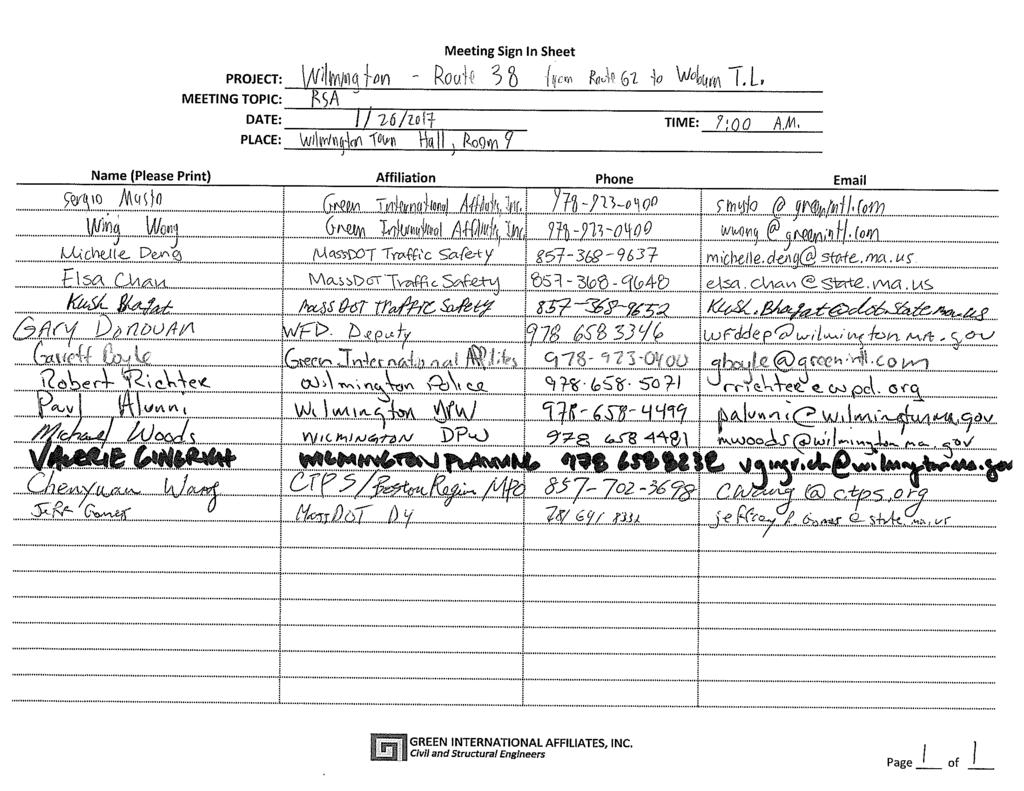
4 Road Safety Audit Route 38 from Route 62 to Woburn Town Line, Wilmington, MA Prepared by Green International Affiliates Background This Road Safety Audit (RSA) was conducted as part of MassDOT s roadway reconstruction project for Route 38 (Main Street) in Wilmington. The purpose of the RSA was to identify and discuss existing safety issues and potential improvements considering different roadway users. Both long term improvements that can be implemented as part of the Main Street project and short term improvements were discussed. There were 144 reported crashes along the corridor from 2013 to of those crashes were within the four MassDOT Highway Safety Improvement Program (HSIP) crash clusters within the project area. HSIP crash clusters are locations that are in the top 5% for the region in terms of the number of crashes. Approximately 71% of the crashes were property damage only. Approximately 74% of crashes were rearend or angle-type collisions. The safety audit team was composed of representatives from MassDOT Highway Safety, MassDOT District 4, Wilmington Police Department, Wilmington Fire Department, Town of Wilmington Planning Department, Wilmington DPW, Boston Region Metropolitan Planning Organization (MPO), and Green International Affiliates, Inc. (Green). Project Data The RSA for Main Street in Wilmington was conducted on Thursday, January 26, The RSA agenda is provided in Appendix A. Table 1 lists all members of the audit team, and the RSA Audit Team Sign-in sheet is included in Appendix B. The RSA began with Green International Affiliates, Inc. (Green) giving a brief presentation of the existing conditions and crash data history to facilitate the start of the discussion. The audit team then drove to the four intersections of Main Street identified as MassDOT HSIP crash clusters and identified observed safety issues. The group also discussed potential issues that occurred along the corridor. The four observed intersections that were observed were Main Street at Route 62, Main Street at Route 129, Main Street at Cross Street/Butters Row, and Main Street at Eames Street. Next, the audit team reconvened to summarize the safety concerns identified in the field and discussed potential improvements to address these safety concerns. Page 1
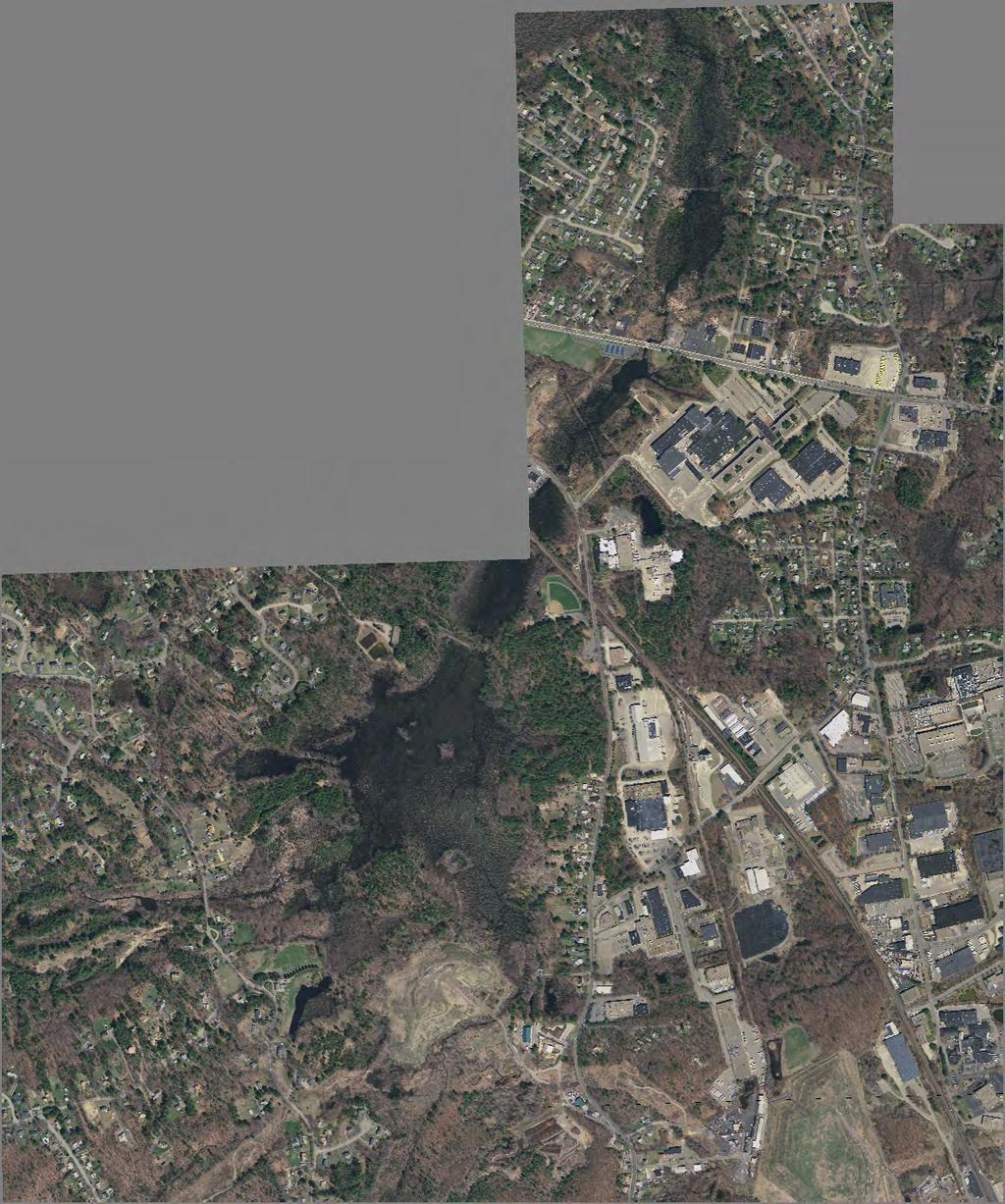
5 Road Safety Audit Route 38 from Route 62 to Woburn Town Line, Wilmington, MA Prepared by Green International Affiliates Table 1: Participating Audit Team Members Audit Team Member Agency/Affiliation Wing Wong Sergio Musto Garrett Boyle Michelle Deng Elsa Chan Kush Bhagat Robert Richter Gary Donovan Michael Woods Paul Alunni Valerie Gingrich Jeff Gomes Chenyuan Wang Timothy Paris Green International Affiliates Green International Affiliates Green International Affiliates MassDOT Traffic Safety MassDOT Traffic Safety MassDOT Traffic Safety Wilmington Police Department Wilmington Fire Department Wilmington DPW Wilmington DPW Wilmington Planning Department MassDOT D4 CIPS/Boston Region MPO MassDOT District 4 Projects Project Location and Description This RSA evaluates safety issues for the Route 38 (Main Street) corridor reconstruction project in Wilmington, MA. The project limits along Main Street extend from 400 feet north of the intersection with Route 62 to the Woburn Town Line for an approximate length of 2.2 miles. The RSA focused on the following intersections as well as the segments along Main Street between these intersections: Route 38 at Route 62 (signalized) Route 38 at Route 129 (signalized) Route 38 at Cross Street/Butters Row (unsignalized) Route 38 at Eames Street (unsignalized) Background research was performed for the above intersections, and the roadway segments between these intersections and to the project limits. Wilmington Police Department and State Police Department crash data were collected and organized into a collision map and collision diagrams. Appendix C provides the count data, collision map, crash summary table, collision diagrams, and MassDOT crash rate worksheets for each intersection and for the segment of the project roadway limits. Page 2
6 Road Safety Audit Route 38 from Route 62 to Woburn Town Line, Wilmington, MA Prepared by Green International Affiliates Existing Roadway and Intersection Descriptions Route 38 (Main Street) Route 38 (Main Street) provides access to I-495 in Tewksbury to the north and I-95 in Woburn to the south. Main Street is a two lane, two-way road that is classified as an Urban Principal Arterial roadway, and is under MassDOT jurisdiction. The roadway carries traffic in the north-south direction. The posted speed limit varies from miles per hour depending on location and direction. Main Street is approximately 30 to 35 feet wide from Route 62 to Route 129 with two foot lanes and 1-3-foot shoulders. South of the intersection with Route 129, Main Street is 32 feet wide with two 14-foot lanes and 2-foot shoulders. At the intersections with Route 62 and Route 129, which are signalized, each approach of Main Street has two lanes except for the Northbound approach at Route 129 which has only one lane. At the intersections with Cross Street/Butters Row and Eames Street, which are unsignalized, each approach of Main Street has only one lane. The project location is shown in Figure 1. Land use adjacent to Main Street north of Route 129 is commercial use. There are frequent curb cuts for driveways and side streets along this section of Main Street. South of the intersection with Route 129 the land use is commercial, residential, and recreational, with significantly fewer curb cuts and side streets. Each intersecting street is owned and maintained by the Town of Wilmington. Route 129 is classified as a Principal Arterial, Route 62 and Eames Street are classified as Minor Arterials and Butters Row and Cross Street are classified as Major Collectors under state jurisdiction. Sidewalks are present on all sides of the intersections of Route 38 and Route 62 and Route 38 and Route 129. But there are no sidewalks present at any other point in the corridor. There are no bicycle lanes or markings along the project corridor and shoulders are never more than three feet wide. Route 38 (Main Street) at Route 62 (Church Street/Burlington Avenue) - Signalized At this intersection, Church Street serves as the east leg and Burlington Avenue serves as the west leg. Main Street forms the north and south legs. Route 62 provides access to I-93 in the east and Route 3 in the west. Burlington Avenue forms the west leg as a bridge which goes over the commuter rail railroad that runs parallel to Route 38. The commuter rail railroad is part of the Haverhill Line and the Wilmington stop is just a few hundred feet north of this intersection. There is a significant increase in pedestrian and vehicular traffic at this intersection during the morning and afternoon peak hours for the commuter rail. There are two lanes for each approach with each inside lane being approximately 11 feet wide and each outside lane being approximately 12 feet wide. There are sidewalks present along both sides of Main Street and Route 62 and there are crosswalks across the north, south, and east legs. Pedestrian signal heads and pushbuttons are provided at each crosswalk. The signals operate with a leading protected leftturn phase for Main Street northbound traffic, a phase for Main Street northbound and southbound during which left turns are permitted, a lagging protected left turn phase for Main Street southbound traffic, and split phasing for Route 62 eastbound and westbound traffic. A pushbutton-actuated exclusive pedestrian phase is provided. Page 3
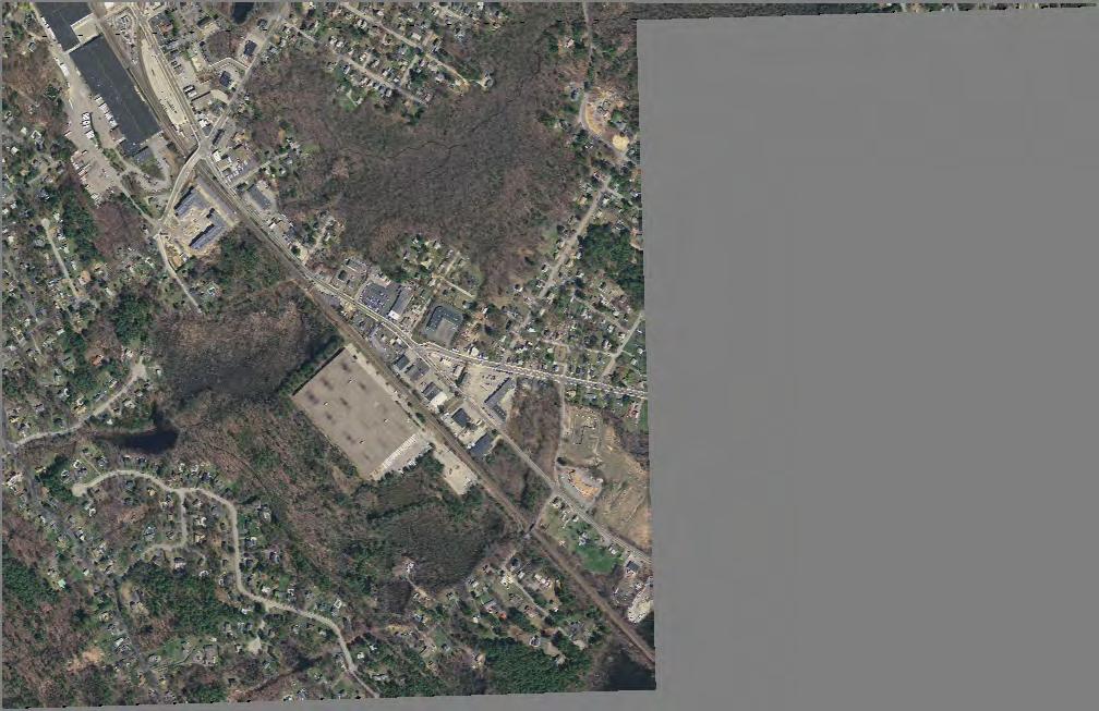
7 Road Safety Audit Route 38 from Route 62 to Woburn Town Line, Wilmington, MA Prepared by Green International Affiliates Route 38 (Main Street) at Route 129 (Lowell Street) Signalized At this four-legged intersection, Route 129 (Lowell Street) serves as the east leg, a private driveway forms the west leg, and Route 38 (Main Street) forms the north and south legs. Route 129 provides access to I-93 in the east. The intersection is surrounded by commercial businesses, which creates additional potentials for crashes within the queue lanes when cars are turning in and out of the businesses. There are two lanes for the Main Street southbound approach that are each 10 feet wide. The inside lane is a left turn only lane. There are two lanes for the westbound Lowell Street approach, including a 12-footwide shared through/left-turn lane and a 14-foot-wide exclusive right turn lane. The northbound Main Street approach has only one lane, which is 13 feet wide. There are sidewalks present along both sides of all three legs of the intersection and there are crosswalks across the north leg and the east leg. Pedestrian signal heads and pushbuttons are provided at each crosswalk. The signals operate with a leading Main Street southbound protected left turn phase, a northbound/southbound through phase with a southbound flashing yellow arrow, and an eastbound/westbound phase. A westbound right turn overlap is provided during the southbound protected left-turn phase. Turns on red are prohibited from the Route 129 westbound approach. A pushbutton-actuated exclusive pedestrian phase is provided. Route 38 (Main Street) at Cross Street/Butters Row Unsignalized At this skewed, two-way STOP-controlled intersection, Cross Street serves as the east leg and Butters Row serves as the west leg. Route 38 (Main Street) forms the north and south legs. Cross Street provides access from Route 38 to Route 129 and Butters Row primarily serves residential traffic. Opening this spring is a public park (Yentile Farm) located east of the intersection. The addition of this park is expected to increase pedestrian, cyclist, and vehicular traffic. The Butters Row eastbound and Cross Street westbound approaches are placed under STOP control. All approaches have only one lane. The Route 38 (Main Street) approaches are approximately 14 feet wide while the Butters Row and Cross Street approaches are approximately 10 feet and 8 feet wide, respectively. There are no sidewalks or crosswalks at the intersection. There is a 13-foot-wide, two-way bridge over the railroad tracks along Butters Row, approximately 300 feet west of the intersection with Main Street (Route 38). Main Street at Eames Street Unsignalized At this four legged, one-way STOP-controlled intersection, Eames Street forms the east leg, a private driveway forms the west leg, and Route 38 (Main Street) provides the north and south legs. Eames Street primarily provides access to industrial parks and connects to Woburn Street in Wilmington. The Eames Street westbound approach is placed under STOP control. Each approach has only one lane. The Route 38 (Main Street) southbound approach is approximately 12 feet wide, the Route 38 (Main Street) northbound approach is 14 feet wide and the Eames Street westbound approach is 10 feet wide. There are no sidewalks or crosswalks at the intersection. Page 4


8
9 Road Safety Audit Route 38 from Route 62 to Woburn Town Line, Wilmington, MA Prepared by Green International Affiliates Audit Observations and Potential Safety Enhancements: Route 38 (Main Street) Corridor In conducting the Route 38 Road Safety Audit, existing safety issues and possible corrective actions were identified based on audit team discussions and field observations on Thursday, January 26, The safety issues that were identified along the project corridor of Route 38 (Main Street) include: Faded or improper pavement markings Non-compliant/substandard pedestrian accommodations Lack of bicycle facilities Lack of access management Poor/insufficient signage and wayfinding Ineffective drainage Poor pavement conditions Many of these issues can or need to be addressed by long term solutions, but some short-term improvements were also identified. The following paragraphs describe the issues at and possible actions for this intersection. The identified issues by the RSA team have some similarities and commonalities and consequently, were grouped into major categories. Safety Issue #1. Faded or Improper Pavement Markings Observations There is a section of the centerline on Route 38 (Main Street) between Cross Street/Butters Row and Eames Street that is very faded. The center passing lane on Main Street between Route 129 (Lowell Street) and Cross Street/Butters Row is also faded. This stretch of Route 38 (Main Street) has a posted speed limit of 40 and 45 miles per hour. There are many points along the corridor where the shoulder line has faded as well. Faded or missing shoulder or center lines could cause drivers to drift off the road or out of their lane and into oncoming traffic. Ultimately ending in head-on collision or single vehicle crashes with objects off the road. Enhancements 1. Consider restriping the shoulder and center lines along Route 38 (Main Street). This will help drivers avoid drifting out of their lanes. Safety Issue #2. Non-Compliant/Substandard Pedestrian Accommodations Observations There are no sidewalks or crosswalks south of the intersection of Route 38 (Main Street) with Route 129 (Lowell Street). This creates a greater potential for pedestrian collisions. Page 6
10 Road Safety Audit Route 38 from Route 62 to Woburn Town Line, Wilmington, MA Prepared by Green International Affiliates Enhancements 1. To improve pedestrian safety, evaluate the feasibility of installing sidewalks along both sides of Main Street between Route 62 (Burlington Avenue / Church Street) and Route 129 (Lowell Street), due to the high amount of commercial businesses. 2. Additionally, consider the feasibility of adding sidewalks on one side of Route 38 (Main Street) between Route 129 (Lowell Street) and Cross Street/Butters Row as well as between Cross Street/Butters Row and Eames Street. Safety Issue #3. Lack of Bicycle Facilities Observations There are no bicycle accommodations along any part of the corridor and all the shoulders are less than four feet wide. With few bike lanes and narrow shoulders there is more of potential for vehicle collisions with cyclists. Additionally, the new public park (Yentile Farm) near the intersection of Main Street with Cross Street and Butters Row will potentially create more bicycle traffic. There was one collision with a cyclist between 2013 and 2015 along the corridor. It occurred along the section of Main Street between Route 62 (Burlington Avenue / Church Street) and Route 129 (Lowell Street) in the northbound direction. Enhancements 1. To improve cyclist safety, consider the feasibility of providing a continuous bicycle lane, or a shoulder wide enough to accommodate cyclists, along both sides of the Route 38 (Main Street) corridor. Roadway widening would be needed in some sections north of Route 129 (Lowell Street) which would require Right of Way takings. Safety Issue #4. Lack of Access Management Observations Due to the high density of business driveways along Route 38 (Main Street) between the Route 62 (Burlington Avenue / Church Street) and Route 129 (Lowell Street) intersections, vehicles are frequently taking left turns through gaps in Route 38 (Main Street) traffic. However, due to the high traffic volume along each direction of Route 38 (Main Street), drivers are forced to wait a long time to find a safe gap and may choose inadequate gaps posing safety risks. Furthermore, due to the lack of left-turn lanes along Route 38 (Main Street), there is a significant risk of rear-end collisions when drivers traveling straight are not suspecting the presence of stopped vehicles in their lane. Page 7
11 Road Safety Audit Route 38 from Route 62 to Woburn Town Line, Wilmington, MA Prepared by Green International Affiliates Of the total 144 crashes that occurred along the corridor between 2013 and 2015, 43 were on this portion of Main Street between the Route 62 (Burlington Avenue / Church Street) and Route 129 (Lowell Street) intersections. Enhancements 1. Consider adding a left-turn lane or two-way left-turn lane at different locations to give drivers waiting to turn left from Route 38 (Main Street) a safe place to wait for a gap in oncoming traffic. 2. Consider working with adjacent business owners to consolidate driveways and reduce the number of conflict points. Reducing the number of conflict points will make it easier for drivers to know where vehicles are entering traffic and therefore reduce the chance of crashes. 3. Coordinate with business owners and evaluate the feasibility of restricting left turns into and out of driveways. This will also reduce the number of conflict points for vehicles on Main Street Safety Issue #5. Poor/Insufficient Signage and Wayfinding Observations It was noted that many of the signs along the corridor are outdated. For example, the Lane Ends (W4-2) sign south of the Route 38 (Main Street) at Route 62 (Church Street/Burlington Avenue) intersection is not compliant with MUTCD standards. Outdated signs could lead to driver confusion which increases the risk of the driver taking a quick, unexpected turn that cause any type of collision. Enhancements 1. Replace outdated signs that are not compliant with the current MUTCD standards to avoid driver confusion. Page 8
 corridor in front of the U-Haul building location and in front of Triple Nickel Auto Body Repair.")
 at the U-Haul and in front of Triple Nickel Auto Body")
12 Road Safety Audit Route 38 from Route 62 to Woburn Town Line, Wilmington, MA Prepared by Green International Affiliates Safety Issue #6. Ineffective drainage Observations Ponding was noted in the shoulders along the Route 38 (Main Street) corridor in front of the U-Haul building location and in front of Triple Nickel Auto Body Repair. Enhancements 1. To avoid wet roadway related crashes such as hydroplaning, evaluate the feasibility of redesigning the drainage systems on Route 38 (Main Street) at the U-Haul and in front of Triple Nickel Auto Body Repair. Image 1: Ponding in front of Triple Nickel Auto Body Repair Safety Issue #7. Poor Pavement Conditions Observations Along the shoulder of Route 38 (Main Street) southbound in between Route 62 (Burlington Avenue / Church Street) and Route 129 (Lowell Street), there are large holes in the shoulder. These holes pose a hazard to vehicles traveling in the shoulder who are passing vehicles waiting to take left turns into the many businesses along this segment. Enhancements 1. Repave shoulders where there are potholes so that vehicles will not be damaged when pulling over to the side of the road. Image 2: Ponding in potholes along shoulder of Main Street Page 9
13 Road Safety Audit Route 38 from Route 62 to Woburn Town Line, Wilmington, MA Prepared by Green International Affiliates Audit Observations and Potential Safety Enhancements: Route 38 (Main Street) at Route 62 (Burlington Avenue/Church Street) In conducting the Route 38 Road Safety Audit on Thursday, January 26, The safety issues that were identified at the intersection of Route 38 (Main Street) at Route 62 (Burlington Avenue/Church Street) include: Faded or improper pavement markings Intersection geometry deficiencies Non-compliant/substandard pedestrian accommodations Substandard signal equipment and phasing Poor/insufficient signage and wayfinding Poor sight distances Many of these issues can or need to be addressed by long term solutions, but some short-term improvements were also identified. The following paragraphs describe the issues at and possible actions for this intersection. The identified issues by the RSA team have some similarities and commonalities and consequently, were grouped into major categories. Safety Issue #1. Faded or Improper Pavement Markings Observations The introduction to the left-turn pocket on the northbound approach at the intersection of Route 38 with Route 62 is abrupt. Currently, there is no white dotted extension line to delineate the opening of the left turn pocket, instead there is a faded broken white line that starts 80 feet after the opening of the left turn pocket. Additionally, northbound vehicles preparing to enter the left turn lane to turn on to Burlington Avenue drive over the double yellow line to avoiding waiting in the long queue in the right-through lane. Enhancements 1. Restripe the taper of the left-turn lane along Route 38 northbound with a dotted line to signify an opening turn lane to give notice and visibility that the left turn lane begins. This would give people more warning that the turn pocket is present and would help avoid rear-end and side-swipe crashes. Page 10

14 Road Safety Audit Route 38 from Route 62 to Woburn Town Line, Wilmington, MA Prepared by Green International Affiliates Safety Issue #2. Intersection Geometry Deficiencies Observations The southbound approach provides turn lanes that travel through the intersection, and merges to one lane just south of the intersection. Due to the heavy volume of vehicles travelling southbound during both peak periods of the day, and the short merging distance, southbound drivers often merge within the intersection. There were two sideswipe crashes reported between the years 2013 to 2015 just south of this intersection which could have been caused by the short southbound merging area. It was noted that it is difficult for tractor trailers to turn left from southbound Route 38 to Church Street or to turn right from westbound Church Street to northbound Main Street. This can be seen from crashes 13, 18, and 20. Enhancements 1. To avoid sideswipe crashes, evaluate the feasibility of widening the southbound departure to provide a longer merging area for the southbound vehicles. 2. Evaluate the feasibility of lessening the skew of Church Street to the intersection to make the tractor trailer turning movement easier to and from the north leg of the intersection. Safety Issue #3. Non-Compliant/Substandard Pedestrian Accommodations Observations There were no pedestrian related crashes at this intersection. All wheelchair ramps are missing detectable warning panels and there are non-ada compliant slopes on the sidewalk on the northwest and southwest corners of this intersection. There are inconsistent crosswalk patterns at this intersection. Two only have two 12 white lines on each side of the walk area and one is the standard ladder style crosswalk. The two crosswalks with only the two 12 lines are on the north and south legs of the intersection. The standard style crosswalk is on the east leg. The pedestrian Flashing Don t Walk (FDW) clearance time is too short for all three crosswalks, that are all about 70 feet long. The walk time is sufficient but the Image 3: The two crosswalks at the Main Street and Route 62 intersection are different. Page 11
15 Road Safety Audit Route 38 from Route 62 to Woburn Town Line, Wilmington, MA Prepared by Green International Affiliates FDW is only 5 seconds long where it should be about 20 seconds, based on MUTCD, in case someone began walking just as the FDW began. Additionally, this intersection experiences an influx of pedestrians shortly after a commuter rail train stops at the nearby station. The short pedestrian phase means that pedestrians may still be in the crosswalk during those peak times when the signal is turned off. This could cause vehicles to collide with pedestrians during their green phase. Enhancements 1. Reconstruct the non-compliant wheelchair ramps to be ADA/MAAB-compliant including detectable warning panels as to not restrict handicapped pedestrians from using the sidewalks and crosswalks. 2. Crosswalks at this intersection should be repainted using the standard ladder crosswalk pavement marking style to increase visibility of the crossings. 3. Update the timing for the pedestrian FDW clearance to meet MUTCD compliance to avoid the possibility of pedestrians still crossing the intersection during an opposing vehicle green phase. Safety Issue #4. Substandard Signal Equipment and Phasing Observations It was noted that the electrical cables for the signal heads are old and damaged at this intersection which has led to equipment failures in the past. The loop detectors are not currently operational at this intersection. At the time of the RSA, a video detection system was in use at this intersection for actuation, which occasionally malfunctions due to lowangle solar glare in the winter. The video detection system is meant to be temporary until the loop detector system is repaired. It was noted that long queues are created when the railroad preemption is activated at the intersection that is 1000 feet north of the Route 38 and Route 62 intersection. During the peak periods of the day, those long queues back up into the Route 38 and Route 62 intersection which could increase the potential for rear ends and sideswipes crashes. The signal heads are on span wires with no backplates or retroreflective stripes. It was noted during the RSA that it is sometimes difficult to see the signal heads due to solar glare. When drivers are unable to see signal heads there is a greater risk that they will operate erratically and cause any type of collision. It was suggested that if Route 62 ran concurrently instead of split phasing, it would lower queues and therefore lower the potential for rear-ends and sideswipes crashes. Enhancements 1. Evaluate the quality of the electrical cables for the signal heads and replace if necessary to ensure that equipment will function properly. Page 12
16 Road Safety Audit Route 38 from Route 62 to Woburn Town Line, Wilmington, MA Prepared by Green International Affiliates 2. Consider the feasibility of installing mast arms instead of the span wire to increase visibility of the signal heads. Installing the signal heads on mast arms will also ensure that the signals do not move when there are high winds. 3. Install backplates and retroreflective stripes for all signal heads to improve signal head visibility. 4. Evaluate whether Route 62 can have concurrent phasing instead of split phasing to avoid long queues. 5. Repair malfunctioning loop detectors and remove existing video detection system. Safety Issue #5. Poor/Insufficient Signage and Wayfinding Observations Travelling northbound along Route 38 approaching this intersection, the guide sign for Route 62 is blocked due to the proximity of the adjacent building in the southeast corner of the intersection. North of the Route 38 and Route 62 intersection there is a left lane ends sign even though the left lane has already ended and the northbound direction only has one lane. There is also no accompanying sign to the flashing yellow arrow at this intersection. This may lead to driver confusion as to what to do when given the flashing yellow arrow. Improper signage can lead to driver confusion which, as said before, can often cause drivers to operate erratically and create crashes. It was observed that vehicles were parked along the east side of the north leg of the intersection. However, there were no crashes that resulted because of parked cars on that section of the intersection. Enhancements 1. Relocate the guide sign for Route 62 northbound so that it is not blocked by the building to avoid driver confusion 2. Remove the unnecessary left lane ends sign north of the intersection to avoid driver confusion 3. Add the left turn yield on flashing yellow arrow sign (R10-12a) to the northbound Route 38 approach to avoid driver confusion when taking a left turn. 4. Evaluate the feasibility of restricting parking along the east side of the north leg of the intersection to provide safe turning movements for right turns from the eastbound of Church Street on to northbound of Main Street. This will also avoid possible collisions with parked vehicles. Page 13
17 Road Safety Audit Route 38 from Route 62 to Woburn Town Line, Wilmington, MA Prepared by Green International Affiliates Safety Issue #6. Poor Sight Distances Observations For the Burlington Avenue bridge to connect to the Route 62 and Route 38 intersection, the vertical geometry resulted in a plateau at the center of the intersection. This geometry makes it difficult to see cars travelling in the opposite direction when approaching the intersection from the north or south. Of the six angle crashes within intersection, three of the crashes were reported in which drivers spoke of not being able to see the other vehicle until it was too late, due to the intersection elevation being above that of three of its approaches. Enhancements 1. Evaluate the feasibility of re-grading the approaches for this intersection to provide adequate sight distances. 2. Evaluate the feasibility of providing protected only left turn phasing on Route 38 northbound and southbound at this intersection. This would require providing an exclusive left-turn lane along the Route 38 southbound approach. However, it would lower the potential of crash when vehicles are making a left turn within the intersection. Page 14
18 Road Safety Audit Route 38 from Route 62 to Woburn Town Line, Wilmington, MA Prepared by Green International Affiliates Audit Observations and Potential Safety Enhancements: Route 38 (Main Street) at Route 129 (Lowell Street) In conducting the Route 38 Road Safety Audit on Thursday, January 26, 2017, the safety issues that were identified at the intersection of Route 38 (Main Street) at Route 129 (Lowell Street) include: Faded or improper pavement markings Non-compliant/substandard pedestrian accommodations Substandard signal equipment and phasing Poor/insufficient signage and wayfinding Ineffective drainage Proper delegation of work Many of these issues can or need to be addressed by long term solutions, but some short-term improvements were also identified. The following paragraphs describe the issues at and possible actions for this intersection. The identified issues by the RSA team have some similarities and commonalities and consequently, were grouped into major categories. Safety Issue #1. Faded or Improper Pavement Markings Observations It was noted that vehicles turning left from Main Street southbound to Lowell Street eastbound do not make the turn correctly and often drive over the scored concrete median between the two directions on Lowell Street. Crash #27 occurred because a vehicle took this left turn too sharply and collided head-on with a queued vehicle on westbound Lowell Street. It was noted that the pavement markings at this intersection were fading. When pavement markings are not visible, the possibility of driver confusion is increased. Enhancements 1. Install dotted lane lines within the intersection to guide left turning vehicles into Lowell Street and decrease driver confusion. 2. Repaint faded markings and consider constant maintenance to sustain good visibility for the markings. Page 15
19 Road Safety Audit Route 38 from Route 62 to Woburn Town Line, Wilmington, MA Prepared by Green International Affiliates Safety Issue #2. Non-Compliant/Substandard Pedestrian Accommodations Observations There were no pedestrian related crashes at this intersection. At this intersection, crosswalks are provided for the northern and eastern legs, however they are not the standard ladder style, which is more visible than the existing 12 white lines on either side of the walk area. Since higher pedestrian volumes are expected in commercial zones it is important to have the crosswalks as visible as possible to avoid vehicle/pedestrian crashes. The two wheelchair ramps in the northeastern corner are also missing detectable warning panels. It was noted that the vehicles parking at the Route 16 Auto Brokers encroach on the sidewalk creating an obstruction for pedestrians. The sidewalk on the northbound side of Main Street just north of the intersection with Lowell Street has tree grates within it that resulted in less than the ADA requirement of three feet of sidewalk clearance. Clearances of less than three feet do not accommodate wheelchair bond pedestrians. It was noted that a No parking anytime sign and a tree grate were so close to one another in front of Z & S Gas Station that it limits access for wheelchairs on the sidewalk. Enhancements 1. Add detectable warning panels to the wheelchair ramps that do not have them to better accommodate handicapped pedestrians. 2. Increase enforcement from local police to make sure that parked vehicles are not obstructing the sidewalk to ensure pedestrian safety. 3. Reconstruct sidewalk to provide at least three feet of clearance at tree grates to improve pedestrian safety. 4. Crosswalks at this intersection should be repainted using the standard ladder crosswalk pavement marking style to increase visibility of the crossings. 5. Relocate no parking anytime near the tree grate in front of the Z & S Gas Station so that there is at least 3 feet of clearance on the sidewalk next to it and still effectively displays where the parking is restricted. Page 16

20 Road Safety Audit Route 38 from Route 62 to Woburn Town Line, Wilmington, MA Prepared by Green International Affiliates Safety Issue #3. Substandard Signal Equipment and Phasing Observations A flashing yellow arrow was installed approximately a year ago for the southbound left turn. However, drivers taking left turns from Main Street southbound onto Lowell Street sometimes fail to yield to drivers travelling along Main Street northbound. Three crashes occurred from due to left turn vehicles not yielding to on-coming traffic at this location. The 5-section signal head backplate for the Lowell Street approach is damaged. It was noted that the backplates of the signal heads at this intersection are lacking yellow retroreflective borders and that sun glare is an issue during winter and fall. When drivers are unable to see signal heads correctly there is a greater risk that they will operate erratically and cause any type of collision. Image 4: Damaged backplate, missing retroreflective border, and ineffective No Turn on Red sign at the intersection of Main Street and Route 129 Page 17
21 Road Safety Audit Route 38 from Route 62 to Woburn Town Line, Wilmington, MA Prepared by Green International Affiliates Enhancements 1. Evaluate the feasibility of providing protected only left-turn phasing for drivers turning left from Main Street southbound onto Lowell Street to avoid crashes between those left-turning vehicles and northbound vehicles on Main Street. 2. Replace or repair the damaged backplates at this intersection to improve visibility of the signal heads. 3. Add retroreflective borders to the backplates to enhance visibility of the signals heads. Safety Issue #4. Poor/Insufficient Signage and Wayfinding Observations During the site visit, drivers were observed not obeying the No Turn on Red sign for the right turn from Route 129 onto Main Street northbound. This creates a higher possibility of angle crashes due to northbound Main Street vehicles colliding with the vehicles who just took a right turn on red. Enhancements 1. Consider replacing the No Turn on Red sign with a pictorial legend (R10-11) sign, moving to a more prominent location on the mast arm, or increasing enforcement. Safety Issue #5. Ineffective Drainage Observations There is a low point at three of the four wheelchair ramps which results in ponding. Page 18

22 Road Safety Audit Route 38 from Route 62 to Woburn Town Line, Wilmington, MA Prepared by Green International Affiliates Enhancements 1. Evaluate the feasibility and effectiveness of re-grading the wheelchair ramps and pavement and or sidewalk around the ramps to avoid ponding and wet roadway related crashes such as hydroplaning. Image 5: Ponding at Wheelchair Ramps at the intersection of Main Street and Route 129 Safety Issue #6. Proper Delegation of Work Observations It was noted that it is the property owners obligation to remove snow from the sidewalks. If snow is blocking the sidewalk, pedestrians may walk in the road which could lead to a pedestrian/vehicle collision. Enhancements 1. The Town of Wilmington should notify property owners along Route 38 that it is their responsibility to remove snow from sidewalks to ensure pedestrian safety. Page 19
23 Road Safety Audit Route 38 from Route 62 to Woburn Town Line, Wilmington, MA Prepared by Green International Affiliates Audit Observations and Potential Safety Enhancements: Route 38 (Main Street) at Cross Street/Butters Row In conducting the Route 38 Road Safety Audit Thursday, January 26, 2017, the safety issues that were identified at the intersection of Route 38 (Main Street) at Cross Street/Butters Row include: Intersection geometry deficiencies Non-compliant/substandard pedestrian accommodations Many of these issues can or need to be addressed by long term solutions, but some short-term improvements were also identified. The following paragraphs describe the issues at and possible actions for this intersection. The identified issues by the RSA team have some similarities and commonalities and consequently, were grouped into major categories. Safety Issue #1. Intersection Geometry Deficiencies Observations This intersection has major geometric deficiencies. The skewed Cross Street approach makes it challenging to reach Butters Row from Cross Street or Cross Street from Butters Row. Since the intersection is at a higher grade than all legs, it is difficult to view oncoming cars when approaching the intersection. Sight distances from Cross Street are especially poor. The right turn is very sharp and vegetation on the east side of Main Street, north of this intersection, restricts sight distance for vehicles exiting Cross Street. This vegetation also blocks the sight of vehicles exiting Cross Street for vehicles travelling southbound on Main Street approaching the intersection. Of the 16 crashes reported at this intersection between 2013 and 2015, six crashes occurred when a vehicle attempted to exit Cross Street and collided with a vehicle traveling southbound on Main Street. To the south of the intersection, large boulders are lined along the east side of Route 38 blocking the sight of approaching northbound vehicles. (Because the intersection is at a higher grade) Of the 16 crashes at this intersection between 2013 and 2015, seven crashes occurred when a vehicle attempted to exit Cross Street. It was also noted that the stop bar for Butters Row is too far back from the intersection (approx. 12 feet) which may have contributed to the four crashes that occurred when a vehicle exited Butters Row and was struck by a vehicle travelling on Main Street. At least two additional rear-end crashes reported on Main Street at this location involved drivers stopping to let vehicles cross from and to the minor legs. Page 20

24 Road Safety Audit Route 38 from Route 62 to Woburn Town Line, Wilmington, MA Prepared by Green International Affiliates Enhancements 1. Consider realigning Cross Street to form a perpendicular intersection with Main Street. This would create better sight distances for drivers exiting Cross Street and for drivers on Main Street who need to see if anyone is exiting Cross Street. 2. Consider signalizing the intersection, which would lessen the confusion at the intersection when entering from Butters Row or Cross Street. 3. Consider implementing a roundabout at the intersection which would lower the number of conflict points, lower crashes, and lower the severity of crashes that do occur. 4. Consider installing channelizing lanes at Cross Street, which would lower the confusion when entering the intersection, as well as increase sight distances, and make it easier to be seen by other vehicles. 5. Evaluate the feasibility of re-grading the approaches to the Main Street at Cross Street/Butters Row intersection, or realigning the Cross Street and Butters Row approaches which would also improve sight distances within the intersection. 6. Trim overhanging vegetation on the east side of Main Street north of this intersection. If Cross Street is not redesigned to be perpendicular to Main Street this would still help to create better sight distances for drivers exiting Cross Street and for drivers on Main Street who need see to if anyone is exiting Cross Street. 7. Coordinate with the property owner to consider relocating or replacing the boulders that restrict the sight distance of drivers exiting Cross Street looking south, or replacing the boulders with shorter ornamentation that would not block sight distances. 8. Consider the feasibility of moving the Butters Row stop bar closer to the intersection to improve sight distances from Butters Row. Turning movements of a northbound vehicle on Main Street turning left on to Butters Row will need to be considered. Image 6: Grading and rocks block sight distances from Cross Street (on right) 9. Consider making Butters Row a one-way street to lower the number of conflict points within the intersection, which would decrease the possibility of angle collisions since vehicles will not be entering the intersection from Butters Row. Page 21
25 Road Safety Audit Route 38 from Route 62 to Woburn Town Line, Wilmington, MA Prepared by Green International Affiliates Safety Issue #2. Non-Compliant/Substandard Pedestrian Accommodations Observations With the new public park (Yentile Farm) near this intersection, it is anticipated that there will be significantly more pedestrian activity than there is now. Even though there are no pedestrian related crashes, it was noted that there are no sidewalks or crosswalks at the intersection of Main Street with Cross Street/Butters Row Enhancements 1. Consider the feasibility of adding sidewalks at this intersection to increase pedestrian safety. 2. Due to the anticipated increase in pedestrian activity created by the adjacent Yentile Farm, evaluate the feasibility of installing pedestrian signals at this intersection. 3. Consider installing marked crosswalks with pedestrian crossing warning signage and rectangular rapid flashing beacons (RRFBs) across Route 38 (Main Street) at this intersection with pedestrian warning signs and diagonal arrow when the park opens. Page 22
26 Road Safety Audit Route 38 from Route 62 to Woburn Town Line, Wilmington, MA Prepared by Green International Affiliates Audit Observations and Potential Safety Enhancements: Route 38 (Main Street) at Eames Street In conducting the Route 38 Road Safety Audit Thursday, January 26, 2017, the safety issues that were identified at the intersection of Route 38 (Main Street) at Eames Street include: Intersection geometry deficiencies Non-compliant/substandard pedestrian accommodations Insufficient lighting Ineffective drainage Many of these issues can or need to be addressed by long term solutions, but some short-term improvements were also identified. The following paragraphs describe the issues at and possible actions for this intersection. The identified issues by the RSA team have some similarities and commonalities and consequently, were grouped into major categories. Safety Issue #1. Intersection Geometry Deficiencies Observations Due to the skewed approach, taking right turns from Eames Street westbound onto Main Street northbound or taking left turns from southbound Main Street to eastbound Eames Street are difficult for tractor trailers. (See crash #7) Drivers often encroach upon the opposing lane on Main Street to maneuver either turn, which poses a serious safety risk if a vehicle is travelling in the opposite direction. Additionally, an increase in tractor trailer traffic is expected on Eames Street due to a new warehouse. It is very difficult to see vehicles travelling southbound on Main Street when exiting Eames Street due to a horizontal curve just north of the intersection. Of the 17 crashes at this intersection between 2013 and 2015, two crashes occurred when a vehicle attempted to exit Eames Street and collided with a vehicle traveling southbound on Main Street. Five crashes involved vehicles exiting Eames Street colliding with northbound vehicles. Enhancements 1. Consider realigning Eames Street to form a perpendicular intersection with Main Street. This would make the right turn out of Eames Street or the left turn into Eames Street much easier. 2. Consider creating a right-turn lane for the Eames Street westbound approach. This would improve the right turn out of Eames Street 3. Consider installing flashing beacons at the intersection to highlight the presence of a side street and entering traffic. Page 23

27 Road Safety Audit Route 38 from Route 62 to Woburn Town Line, Wilmington, MA Prepared by Green International Affiliates 4. Evaluate the feasibility of constructing medians or channelizing islands which lowers the confusion when entering the intersection, as well as increases sight distances, and makes it easier to be seen by other vehicles. Safety Issue #2. Non-Compliant/Substandard Pedestrian Accommodations Observations Even though there are no pedestrian related crashes, it was noted that there are no sidewalks or crosswalks at the intersection of Main Street with Eames Street. Enhancements 1. Consider the feasibility of adding sidewalks at this intersection to increase pedestrian safety. 2. Consider installing marked crosswalks with pedestrian crossing warning signage and rectangular rapid flashing beacons (RRFBs) across Main Street at this intersection with pedestrian warning signs and diagonal arrow. 3. If sidewalks and crosswalks are installed, also consider installing a High-intensity Activated Crosswalk beacon (HAWK) or a pedestrian signal if it meets the signal warrant. Image 7: No sidewalks or crosswalks are provided at the Eames Street and Main Street intersection Page 24

28 Road Safety Audit Route 38 from Route 62 to Woburn Town Line, Wilmington, MA Prepared by Green International Affiliates Safety Issue #3. Insufficient Lighting Observations There is poor overhead lighting at this intersection which could have contributed to the relatively high amount of dusk crashes at this location. Of the 17 crashes at this intersection between 2013 and 2015, four crashes occurred when at night, or during dusk or dawn. Enhancements 1. Evaluate the feasibility of improving the existing lighting (possibly LED) or installing additional overhead lighting at this intersection. Safety Issue #4. Ineffective drainage Observations The catch basin at the corner between the north leg of Main Street and Eames Street is too far from the curb and is slightly higher than the surrounding pavement. Thus, the catch basin is not catching sufficient runoff, resulting in the erosion of the edge of pavement. Of the 17 crashes at this intersection between 2013 and 2015, 10 crashes occurred during wet or icy road conditions. Enhancements 1. Evaluate the feasibility of relocating the catch basin to improve drainage. Image 8: Catch basin is not next to the curb at the corner of Eames Street with Route 38. Page 25
29 Road Safety Audit Route 38 from Route 62 to Woburn Town Line, Wilmington, MA Prepared by Green International Affiliates Summary of Road Safety Audit Based on the audit team members review of observations and discussions, issues and possible solutions were identified that could help reduce safety risks along the Route 38 (Main Street) between Route 62 (Burlington Avenue/Church Street) and the Woburn Table 2 defines estimated safety payout, time frame, cost, and responsibility. The issues and possible solutions from the previous sections are summarized in Table 3. These estimates are based on engineering judgement and typical construction practices. Safety Payoff: the enhancement could reduce the number of crashes along the corridor by a low (<3), medium (3-7), or high (>7). Time frame: the enhancement can be completed within a time frame of short-term (<1 year), mid-term (1-3 years), or long-term (>3 years). Cost: cost is estimated to be within one of three categories of cost of low ($10,000), medium ($10,001- $50,000) or high (>$50,000). Responsibility: which entity or organization will be responsible for completing the work. Table 2: Estimated Time Frame and Costs Breakdown Time Frame Costs Short-Term <1 Year Low <$10,000 Mid-Term 1-3 Years Medium $10,001-$50,000 Long-Term >3 Years High >$50,000 Page 26
30 Road Safety Audit Route 38 from Route 62 to Woburn Town Line, Wilmington, MA Prepared by Green International Affiliates Safety Issue Faded or Improper Pavement Markings Non- Compliant/Substandard Pedestrian Accommodations Non- Compliant/Substandard Pedestrian Accommodations Lack of Bicycle Facilities Lack of Access Management Poor/Insufficient Signage and Wayfinding Ineffective Drainage Poor Pavement Conditions Table 3: Potential Safety Enhancement Summary - Corridor Potential Safety Enhancement Restripe all existing lane lines and shoulder lines. Evaluate the feasibility of installing sidewalks along both sides of Main Street between Route 62 and Route 129 Consider the feasibility of adding sidewalk along one side of Main Street between Cross Street/Butters Row and Eames Street. Provide a continuous bicycle lane, or a shoulder wide enough to accommodate cyclists, along both sides of the entire Route 38 corridor. Provide left turn lanes or two-way left-turn lanes for entering businesses in commercial sections along Route 38. Consider working with adjacent business owners to consolidate driveways and reduce the number of conflict points. Evaluate the feasibility of restricting left turns into and out of driveways. Replace outdated signs that are not MUTCD-compliant. Redesign the drainage systems on Route 38 at the U-Haul and in front of Triple Nickel Auto Body Repair. Repave shoulders where there are potholes Safety Payoff Time Frame Cost Responsible Agency medium Short-term medium MassDOT medium Long-term high MassDOT medium Long-term high MassDOT medium Long-term high MassDOT high Long-term high MassDOT medium Long-term high MassDOT / property owners high Short-term low MassDOT / property owners low Short-term low MassDOT medium Long-term medium MassDOT / property owners medium Long-term high MassDOT Page 27
31 Road Safety Audit Route 38 from Route 62 to Woburn Town Line, Wilmington, MA Prepared by Green International Affiliates Safety Issue Faded or Improper Pavement Markings Intersection Geometry Deficiencies Non- Compliant/Substandard Pedestrian Accommodations Substandard Signal Equipment and Phasing Table 4: Potential Safety Enhancement Summary Route 38 at Route 62 Potential Safety Enhancement Paint dotted line along taper opening of northbound left-only lane at the Route 38 / Route 62 intersection. Widen the southbound departure to provide a longer merging area for the southbound vehicles of the Route 38 / Route 62 intersection. Evaluate the feasibility of lessening the skew of Church Street to the intersection to make tractor trailer turning movement easier to and from the north leg of the intersection. Reconstruct sidewalk and wheelchair ramps to be fully ADA/MAAB-compliant at Route 62 / Route 38 intersection Crosswalks at the Route 38 and Route 62 intersection should be repainted using the standard ladder crosswalk pavement marking style to increase visibility of the crossings. Lengthen pedestrian FDW clearance time at intersection of Route 62 and Route 38. Evaluate the quality of the electrical cables for the signal heads at the intersection of Route 38 and Route 62, and replace if necessary. Consider the feasibility of installing mast arms at the Rt. 62 and Rt. 38 intersection to increase visibility of the signal heads. Installing the signal heads on mast arms will also ensure that the signals do not move when there are high winds. Safety Payoff Time Frame Cost Responsible Agency low Short-term low MassDOT medium Long-term high MassDOT, MBTA high Long-term high MassDOT medium Mid-Term medium MassDOT low Short-term low MassDOT low Short-term low MassDOT low Mid-term medium MassDOT low Long-term high MassDOT Page 28
32 Road Safety Audit Route 38 from Route 62 to Woburn Town Line, Wilmington, MA Prepared by Green International Affiliates Safety Issue Table 4 (Continued): Potential Safety Enhancement Summary Route 38 at Route 62 Substandard Signal Equipment and Phasing Poor/Insufficient Signage and Wayfinding Poor Sight Distances Potential Safety Enhancement Evaluate whether Route 62 can have concurrent phasing instead of split phasing at the Route 38 and Route 62 intersection. Install backplates and retroreflective stripes on all signal heads at the Route 62 and Route 38 intersection Repair malfunctioning loop detectors and remove existing video detection system. Move the guide sign for Route 62 at its intersection with Route 38 so that it is not blocked by the building Remove the unnecessary left lane ends sign north of the Route 38/Route 62 intersection. Add the left turn yield on flashing yellow arrow sign (R10-12a) to the northbound Route 38 approach. Evaluate the feasibility of restricting parking along the east side of the north leg of the intersection to provide safe turning movements for right turns from the eastbound of Church Street on to northbound of Main Street. Evaluate the feasibility of regrading the approaches to the intersection of Route 38 and Route 62. Evaluate the feasibility of providing protected only left turn phasing on Route 38 northbound and southbound at the intersection with Route 62. This would require providing an exclusive left-turn lane along the Route 38 southbound approach. Safety Payoff Time Frame Cost Responsible Agency low Short-term low MassDOT low Short-term low MassDOT low Short-term low MassDOT low Short-term low MassDOT low Short-term low MassDOT low Short-term low MassDOT low Long-term low MassDOT high Long-term high MassDOT medium Mid-term medium MassDOT Page 29
33 Road Safety Audit Route 38 from Route 62 to Woburn Town Line, Wilmington, MA Prepared by Green International Affiliates Safety Issue Faded or Improper Pavement Markings Table 5: Potential Safety Enhancement Summary - Route 38 at Route 129 Potential Safety Enhancement Add dotted lane lines within the Route 38 / Route 129 intersection to guide vehicles turning left on Route 129 Repaint faded markings and consider constant maintenance to sustain good visibility for the markings. Safety Payoff Time Frame Cost Responsible Agency medium Short-term low MassDOT low Short-term low MassDOT Non- Compliant/Substandard Pedestrian Accommodations Add detectable warning panels to the wheelchair ramps that do not have them at the intersection of Route 38 and Route 129. Increase enforcement from local police to make sure that sidewalks are clear of encroaching cars in front of the Route 16 Auto Brokers. Rebuild sidewalks with three feet of clearance at tree grates on the northbound side of Main Street north of the intersection with Route 129 Restripe all existing crosswalks with the standard ladder style. Relocate no parking anytime sign near the tree grate in front of the Z & S Gas Station so that there is at least 3 feet of clearance on the sidewalk next to it but s effectively displays where there parking is restricted. low Short-Term low MassDOT low Short-Term low Town of Wilmington low Long-term high MassDOT low Short-term low MassDOT low Short-term low MassDOT Page 30
34 Road Safety Audit Route 38 from Route 62 to Woburn Town Line, Wilmington, MA Prepared by Green International Affiliates Safety Issue Table 5 (Continued): Potential Safety Enhancement Summary - Route 38 at Route 129 Substandard Signal Equipment and Phasing Poor/Insufficient Signage and Wayfinding Ineffective Drainage Proper Delegation of Work Potential Safety Enhancement Evaluate the feasibility of providing protected only left-turn phasing for drivers turning left from Route 38 southbound onto Route 129 eastbound. Replace or repair the damaged signal heads at the intersection of Route 38 at Route 129. Install 2009 MUTCD-compliant yellow reflective signal head backplates at the intersection of Route 38 at Route 129. Consider replacing the No Turn on Red sign with a pictorial legend (R10-11) sign, moving to a more prominent location on the mast arm, or increasing enforcement. Evaluate the feasibility and effectiveness of re-grading the wheelchair ramps and pavement and or sidewalk around the ramps to avoid ponding. The town of Wilmington should notify businesses along Route 38 that it is their responsibility to remove snow from sidewalks to ensure pedestrian safety. Safety Payoff Time Frame Cost Responsible Agency medium Short-term low MassDOT low Short-term low MassDOT low Short-term low MassDOT low Short-term low MassDOT medium Long-term medium MassDOT low Short-term low Town of Wilmington/Property owners Page 31
35 Road Safety Audit Route 38 from Route 62 to Woburn Town Line, Wilmington, MA Prepared by Green International Affiliates Table 6: Potential Safety Enhancement Summary - Route 38 at Cross Street and Butters Row Safety Issue Intersection Geometry Deficiencies Non- Compliant/Substandard Pedestrian Accommodations Page 32 Potential Safety Enhancement Consider realigning Cross Street to form a perpendicular intersection with Main Street. Consider signalizing the intersection of Cross Street with Main Street. Consider installing a roundabout at the intersection of Cross Street with Main Street. Consider channelizing the entrance of Cross Street to Main Street. Regrade approaches to Cross Street/Butters Row and Route 38 intersection, or realign the minor approaches. Trim vegetation on the east side of Route 38 north of the intersection with Cross Street / Butters Row. Relocate boulders or replace boulders with shorter rocks or other ornamentation at the intersection of Route 38 and Cross Street. Consider the feasibility of moving Butters Row stop bar closer to the intersection Consider making Butters Row a one-way street to lower the number of conflict points within the intersection Consider the feasibility of adding sidewalks at the intersection of Route 38 and Cross Street / Butters Row. Install pedestrian signals at intersections of Cross St, and Butters Row with Main Street. Consider installing marked crosswalks with pedestrian crossing warning signage and rectangular rapid flashing beacons across Route 38 at the Butters Row/Cross Street and Eames Street intersections Safety Payoff Time Frame Cost Responsible Agency high Long-term high MassDOT high Long-term high MassDOT high Long-term high MassDOT medium Long-term high MassDOT high Long-term high MassDOT medium Short-term low MassDOT / property owners medium short-term low MassDOT / property owners medium Short-term low MassDOT medium Mid-term low MassDOT high Long-term high MassDOT medium Mid-term medium MassDOT medium Mid-term medium MassDOT
36 Road Safety Audit Route 38 from Route 62 to Woburn Town Line, Wilmington, MA Prepared by Green International Affiliates Safety Issue Intersection Geometry Deficiencies Non- Compliant/Substandard Pedestrian Accommodations Insufficient Lighting Ineffective Drainage Table 7: Potential Safety Enhancement Summary - Route 38 at Eames Street Potential Safety Enhancement Consider making the approaches perpendicular and/or providing channelized lanes to the Eames St at Route 38 intersection. Consider providing a right-turn lane for the Eames Street westbound approach. Consider installing flashing beacon at the Eames St at Route 38 intersection. Construct median or channelized islands at the intersection of Route 38 at Eames Street. Consider the feasibility of adding sidewalks at the intersection of Route 38 and Eames Street. Consider installing marked crosswalks with pedestrian crossing warning signage and rectangular rapid flashing beacons across Route 38 at the Butters Row/Cross Street and Eames Street intersections Install a High-intensity Activated Crosswalk beacon (HAWK) or a pedestrian signal if it meets the warrant at the intersection of Route 38 and Eames Street. Add or improve overhead lighting at Eames Street and Main Street intersection Relocate the catch basin at the north corner of the Eames Street and Route 38 (Main Street) intersection. Safety Payoff Time Frame Cost Responsible Agency medium Long-term high MassDOT medium Long-term high MassDOT medium Mid-term medium MassDOT medium Long-term high MassDOT high Long-term high MassDOT medium Mid-term medium MassDOT medium Mid-term medium MassDOT low Mid-term low MassDOT low Mid-term low MassDOT Page 33
37 Appendix A. RSA Meeting Agenda
38 Road Safety Audit Meeting Location: Wilmington Town Hall, Room 9 January 26, :00 AM 12:00 PM Type of meeting: Attendees: Please bring: Route 38, Main Street Road Safety Audit Invited Participants to Comprise a Multidisciplinary Team Thoughts and Enthusiasm!! 9:00 AM Welcome and Introductions 9:15 AM Review of Site Specific Material Crash Summaries provided in advance Existing Geometries and Conditions 10:00 AM Visit the Site Drive to LOCATION As a group, review site & identify areas for improvement 11:30 AM Post Visit Discussion / Completion of RSA Discuss observations and finalize findings Discuss potential improvements and finalize recommendations 12:00 PM Adjourn for the Day but the RSA has not ended Instructions for Participants: Before attending the RSA on DATE, participants are encouraged to drive through the project area and complete/consider elements on the RSA Prompt List (enclosed) with a focus on safety. All participants will be actively involved in the process throughout. Participants are encouraged to come with thoughts and ideas, but are reminded that the synergy that develops and respect for others opinions are key elements to the success of the overall RSA process. After the RSA meeting, participants will be asked to comment and respond to the document materials to assure it is reflective of the RSA completed by the multidisciplinary team. Route 38 Wilmington Road Safety Audit
39 Appendix B. RSA Audit Team Contact List
40 Participating Audit Team Members Date: January 26, 2017 Location: Wilmington, MA Audit Team Members Agency/Affiliation Address Phone Number Wing Wong Green International Affiliates, Inc. (978) Sergio Musto Green International Affiliates, Inc. (978) Garrett Boyle Green International Affiliates, Inc. (978) Elsa Chan MassDOT Highway Safety (857) Kush Bhagat Michelle Deng MassDOT Highway Safety MassDOT Highway Safety Jeff Gomes MassDOT District 4 Gary Donovan Robert Richter Paul Alunni Michael Woods Valerie Gingrich Chenyuan Wang Timothy Paris Wilmington Fire Department Wilmington Police Department Wilmington DPW Engineer Wilmington DPW Wilmington Planning Department CTPS/Boston Region MPO MassDOT District 4 Projects kush.bhagat@state.ma. us michelle.deng@state.m a.us jeffrey.r.gomes@state. ma.us wfddep@wilmingtonma. gov (857) (857) (781) (978) rrichter@wpd.org (978) palunni@wilmingtonma. gov mwoods@wilmingtonm a.gov vgingrich@wilmingtonm a.gov (978) (978) (978) cwang@ctps.org (857) timothy.paris@state.ma.us (781)
41
42 Appendix C. Detailed Crash Data
43 COLLISION DIAGRAM FUNCTIONAL DESIGN REPORT WILMINGTON, RT. 38 (MAIN STREET) INTERSECTION OF RT. 38 AND RT. 62 WILMINGTON, MA GREEN INTERNATIONAL AFFILIATES, INC. CIVIL & STRUCTURAL ENGINEERS WESTFORD, MASSACHUSETTS
44 Crash Diagram Ref # 1 Crash Date Crash Day m/d/y 1/19/13 Saturday Time of Day 3:15 PM Manner of Collision Type Rear end Light Condition Type Daylight Crash Data Summary Table Main Street (Route 38) at Church Street (Route 62), Wilmington, MA Weather Condition Type Clear Road Surface Type Dry Driver Contributing Code Type Other improper action 2 3/18/13 Monday 4:33 PM Angle Daylight Clear Dry Visibility Obstructed D1 Driver Ages D2 D3 D4 Comments Vehicles in right travel lane stopped to let Vehicle 2 make left turn onto Route 38. Vehicle 1 travelling in the left lane did not see Vehicle 2 making a left turn to get on Route 38 S. Vehicle 2 did not see the Vehicle /12/13 Wednesday 6:08 PM Angle Daylight Clear Dry Made an improper turn Travelling WB on Church St, Vehicle 2 made right turn from left lane on to NB Main St and collided with other WB vehicle in right lane. 4 6/26/13 Wednesday 10:40 AM Rear end Daylight Clear Dry Inattention Travelling SB on Main St, Vehicle 2 rear ended other SB vehicle who stopped for emergency vehicle 5 8/16/13 Friday 4:06 PM Rear end Daylight Clear Dry Inattention 6 10/26/13 Saturday 11:44 PM Head on Daylight Clear Dry No Improper Driving Vehicle 2 turned left on to WB Burlington Ave from NB Main St but did not yield to SB vehicle, causing a crash 7 11/14/13 Thursday 11:34 AM Rear end Daylight Clear Dry Operating defective equiptment Operator claimed rear end collision was due to mechanical problems. Failure to keep in proper lane or running 8 12/17/13 Tuesday 7:43 AM Angle Daylight Clear Dry off road 9 2/21/14 Friday 8:36 AM Rear end Daylight Wet Followed too closely V1 (tractor trailer) collided with WB stopping V2 while making left turn from RT 38 SB onto RT 62 EB 10 3/6/14 Thursday 1:59 PM Rear end Daylight Clear Dry Distracted One vehicle rear ended the stopped vehicle in front. 11 4/20/14 Sunday 2:00 PM Angle Daylight Cloudy Dry Inattention Vehicle 2 travelling southbound. Vehicle exiting parking lot of Big Joes to travel northbound collided with Vehicle /25/14 Friday 7:24 AM Angle Daylight Clear Dry Glare Vehicle 2 was turning onto Route 38 and collided with Vehicle 1 due to glare. Vehicle 1 was travelling southbound. 13 5/21/14 Wednesday 1:58 PM Sideswipe, same direction Daylight Clear Dry Failed to yield right of way Travelling WB on Church St, Vehicle 2 (tractor trailer) made right wide turn onto NB Main St and collided with other WB vehicle in right lane who didn't realize the truck was taking a right turn. 14 9/5/14 Friday 1:26 PM Head on Daylight Clear Dry Operating Vehicle in erratic, reckless, careless, negligent, or aggressive manner 15 10/11/14 Saturday 12:09 PM Single Vehicle Crash Daylight Rain Wet Over correcting/over steering /6/14 Thursday 4:32 PM Sideswipe, same direction Dusk Rain Wet Unknown /20/15 Tuesday 5:40 PM Angle Dark lighted roadway Clear Dry Failed to yield right of way /24/15 Tuesday 2:20 PM Angle Daylight Clear Dry Failure to keep in proper lane or running off road SB vehicle on Main St, allowed school bus to turn left onto WB Burlington Ave in front of it, but Vehicle 2 also travelling SB on Main Street drove around yielding vehicle and collided, head on, with school bus. Driver was making a left turn from RT 38 SB onto RT 62 EB, overcorrected and crashed into utility pole Vehicle 1 attempted to change lanes at the merge and did not see Vehicle 2 beside them. Vehicle 2 turned left on to SB Main St from WB Church St but did not yield to EB vehicle, causing a crash Travelling SB on Main St, Vehicle 1 (tractor trailer) took a sharp left on to EB Church St and collided with a stopped WB vehicle. 19 3/13/15 Friday 4:52 PM Sideswipe, same direction Daylight Clear Dry Failed to yield right of way Travelling SB on Main St, Vehicle 1 side swiped SB vehicle while changing lanes 20 4/6/15 Monday 9:56 AM Angle Daylight Clear Dry Other improper action Travelling WB on Church St, Vehicle 2 (tractor trailer) made right turn onto NB Main St but lost control, crossed the double yelow line and collided with stopped SB vehicle on Main Street. 21 4/14/15 Tuesday 10:56 AM Rear end Daylight Clear Dry Followed too closely Travelling WB on Church St, Vehicle 2 rear ended a stopped WB vehicle 22 6/8/15 Monday 12:18 PM Angle Daylight Clear Dry Visibility Obstructed /25/15 Thursday 10:51 AM Angle Daylight Clear Dry Unknown /14/15 Monday 5:51 PM Angle Daylight Clear Dry Visibility Obstructed Vehicle 2 turning left onto Route 38S did not realize there were two travel lanes and pulled out into traffic and hit Vehicle 1 in the left travel lane. Vehicle 2 turned left on to WB Burlington Ave from NB Main St but did not yield to SB vehicle, causing a crash Vehicle 2 turned left on to WB Burlington Ave from NB Main St but did not yield to SB vehicle, causing a crash 25 11/4/15 Wednesday 5:42 PM Rear end Dark lighted roadway Clear Dry Failed to yield right of way Travelling SB on Main St, Vehicle 1 rear ended another SB vehicle 26 11/22/15 Sunday 5:06 PM Angle Dark lighted roadway Rain Wet Inattention /21/15 Monday 1:57 PM Angle Daylight Cloudy Dry Unknown *Courtesy Crash - A term used to describe a crash that occurs subsequent to a non-involved mainline driver who gives the right of way, contrary to the rules of the road, to another driver. Summary based on Crash Reports obtained from the Town of Wilmington Police Department and MassDOT Travelling WB on Burlington Ave, Vehicle 2 ran red light and collided with NB vehicle on Main St. Vehicle 2 turned left on to EB Church St from SB Main St but did not yield to NB vehicle, causing a crash
45 Crash Data Summary Tables and Charts Main Street (Route 38) at Church Street (Route 62), Wilmington, MA 16% 14% 12% 1 8% 6% 4% 2% CRASH MONTH 15% 15% 15% 11% 7% 7% 7% 7% 7% 4% 4% J F M A M J J A S O N D 2 18% 16% 14% 12% 1 8% 6% 4% 2% CRASH DAY OF WEEK 19% 19% 15% 15% 15% Monday Tuesday Wednesday Thursday Friday Saturday Sunday 11% 7% CRASH TIME OF DAY 35% 3 25% 2 15% 1 5% 7% 7% 6AM- 8AM 8AM- 10AM 15% 10AM- 12PM 22% 12PM- 2PM 3 11% 4% 2PM- 4PM 4PM- 6PM 6PM- 8PM 8PM- 10PM 4% 10PM- 12AM 12AM- 2AM 2AM- 4AM 4AM- 6AM % 3 CRASH MANNER OF COLLISION 48% 11% 7% Single Rear-end Angle Sideswipe, Sideswipe, Head on Rear to Rear Unknown Vehicle same opposite Crash direction direction ash Data Spreadsheet Rte 62 at Rte 38 2 of 3 1/20/2017
46 Crash Data Summary Tables and Charts Main Street (Route 38) at Church Street (Route 62), Wilmington, MA % 4% CRASH LIGHT CONDITION 11% Daylight Dawn Dusk Dark - Lighted Roadway Dark - Roadway not lighted Dark - unknown roadway lighting Other Unknown 9 81% % 12% CRASH WEATHER CONDITION Clear Cloudy Rain Snow Sleet, Hail, Fog, Smog, Severe Blowing Other Unknown Freezing Smoke Crosswinds sand, snow Rain CRASH ROAD SURFACE 85% 15% Dry Wet Snow Ice Sand, mud, Water Slush Other Unknown dirt, oil, (standing, gravel moving) 3 25% 2 15% 1 5% CRASH DRIVER AGES 28% 13% 15% 17% 11% 7% 7% 2% ash Data Spreadsheet Rte 62 at Rte 38 3 of 3 1/20/2017
47 COLLISION DIAGRAM FUNCTIONAL DESIGN REPORT WILMINGTON, RT. 38 (MAIN STREET) INTERSECTION OF RT. 38 AND RT. 129 (LOWELL STREET) WILMINGTON, MA GREEN INTERNATIONAL AFFILIATES, INC. CIVIL & STRUCTURAL ENGINEERS WESTFORD, MASSACHUSETTS
48 Crash Diagram Ref # 1 Crash Date m/d/y 1/31/13 Crash Day Thursday Time of Day 10:33 AM Rear end Manner of Collision Type Daylight Light Condition Type Crash Data Summary Table Main Street (Route 38) at Lowell Street (Route 129), Wilmington, MA Clear Weather Condition Type Dry Road Surface Type Inattention Driver Contributing Code Type 2 3/1/13 Friday 8:19 AM Angle Daylight Clear Dry Failed to yield right of way D1 30 Driver Ages D2 D D4 Comments Vehicle 1 was stopped in southbound lane waiting to take a left turn into Jiffey Lub and was struck by Vehicle 2. The collision pushed Vehicle 1 into oncoming traffic in the northbound lane and was struck by Vehicle 3, a tractor trailer. Vehicle 1 was travelling south when Vehicle 2 pulled out of Heavenly Donuts and struck the rear passenger side of Vehicle /7/13 Thursday 2:01 PM Rear end Daylight Snow Wet Inattention Vehicle travelling northbound rear ended the car in front in stop and go traffic. 4 6/3/13 Monday 11:57 AM Angle Daylight Rain Wet Driving too fast for conditions /12/13 Wednesday 10:15 PM Rear end Dark lighted roadway Clear Dry Operating Vehicle in erratic, reckless, careless, negligent, or aggressive manner /14/13 Saturday 2:47 PM Angle Daylight Clear Dry Failed to yield right of way /27/13 Friday 2:23 PM Sideswipe, same direction Daylight Clear Dry Inattention /9/13 Wednesday 8:06 AM Angle Daylight Clear Dry No Improper Driving /7/13 Saturday 12:20 AM Single Vehicle Crash Dark lighted roadway Snow Ice Unknown /22/13 Sunday 2:01 PM Angle Daylight Cloudy Wet Failed to yield right of way /14/14 Tuesday 4:18 PM Rear end Daylight Rain Wet Operating Vehicle in erratic, reckless, careless, negligent, or aggressive manner Tractor Trailer attempting to take left turn out of drive way on to northbound Main Street, was struck in the side by car travelling south on main street. Both northbound vehicles speed up to pass each other before abruptly braking multiple times. In one such instance Vehicle 2 rear ended Vehicle 1. Vehicle 2 made a left turn out of the Shell Gas Station and did not see Vehicle 1 in the southbound travel lane. Travelling WB on Lowell St Vehicle 2 swerved into Vehicle 1's lane to avoid another vehicle and hit Vehicle 1 Operators disagree on how crash occurred. Vehicle 1 was making a left onto Route 38S out of Kiernan Ave and pulled into the left turn only lane and struck Vehicle 2 in the rear driver side tire. Travelling WB on Lowell St Vehicle 1 misjudged right turn on to Main St and crashed into light pole. It was snowing Vehicle 2 (SB) incorrectly thought NB vehicle motioned for them to take left onto Lowell St in front of them, causing a crash Travelling SB on Main St Vehicle 2 rear ended Vehicle 1 and then fled scene. Was followed and caught by off duty officer. 12 3/14/14 Friday 6:24 AM Head on Dawn Clear Dry Inattention Travelling SB on Main St, Vehicle 2 did not yield to NB vehicle causing a crash 13 3/25/14 Tuesday 7:09 AM Rear end Daylight Clear Dry Glare /8/14 Tuesday 6:00 AM Sideswipe, same direction Daylight Rain Wet Exceeded authorized speed limit Travelling SB on Main St, Vehicle 1 rear ended Vehicle 2 who was stopped at red light due to solar glare Travelling SB on Main St, Vehicle 1 was speeding and struck Vehicle 2 when he was tunring right 15 5/23/14 Friday 10:23 PM Angle Dark lighted roadway Clear Dry Failed to yield right of way Travelling SB on Main St, Vehicle 2 did not yield to NB vehicle, causing a crash 16 6/6/14 Friday 6:37 AM Angle Daylight Clear Dry Visibility Obstructed /10/14 Tuesday 6:45 PM Rear end Daylight Clear Dry Distracted /25/14 Friday 2:19 PM Angle Daylight Clear Dry 19 10/3/14 Friday 4:28 PM Rear end Daylight Clear Dry Inattention 20 12/28/14 Sunday 4:05 PM Rear end Dusk Clear Dry Failure to keep in proper lane or running off road Operating Vehicle in erratic, reckless, careless, negligent, or aggressive manner /6/15 Tuesday 3:53 PM Angle Daylight Clear Wet Visibility Obstructed /29/15 Monday 7:50 PM Angle Daylight Clear Dry Failed to yield right of way Vehicle 1 travelling southbound when the vehicle in front made a quick right turn and Vehicle 1 had to swerve to avoid collision. At the same time Vehicle 2 was pulling out onto Route 38 when struck by the swerving Vehicle 1. Vehicle 2 claimed Vehicle 1 was hidden from view by the vehicle making the right turn. Travelling SB on Main St, Vehicle 2 was distracted and rearended Vehicle 1 who was stopped in traffic Vehicle 1 was making a left turn onto Route 38N when Vehicle 2 went around a stopped vehicle. Vehicle 1 crashed into Vehicle 2. Vehicle 2 was not paying attention and rearended Vehicle 1 who was stopped in traffic Vehicle 1 was seen speeding and on wrong side of road. Vehicle 1 rear ended Vehicle 2 into Vehicle 3 in northbound lane. Vehicle 1 attempted to make a left turn into the car wash. Traffic in the inner southbound lane stopped for Vehicle 1. Vehicle 2 went around the stopped traffic and did not see Vehicle 1 and collided. Vehicle 1 travelling northbound had blinker on to turn right at the upcoming intersection, after the parking lot driveway. Vehicle 2 was turning out of parking lot and thought the vehicle was turning into the same parking lot so she pulled out into traffic and collided with Vehicle 1.
49 Crash Diagram Ref # Crash Date m/d/y Crash Day Time of Day Manner of Collision Type Light Condition Type Crash Data Summary Table Main Street (Route 38) at Lowell Street (Route 129), Wilmington, MA Weather Condition Type Road Surface Type Driver Contributing Code Type D1 Driver Ages D2 D3 D4 Comments 23 7/22/15 Wednesday 3:17 PM Single Vehicle Crash Daylight Clear Dry Failed to yield right of way Vehicle 1 attempting to exit the driveway of #2 Lowell street did not stop for pedestrian who was crossing the driveway and collided with pedestrian. 24 7/29/15 Wednesday 5:58 PM Angle Daylight Clear Dry Failed to yield right of way /5/15 Monday 4:57 PM Angle Daylight Cloudy Dry 26 10/17/15 Saturday 6:36 PM Angle Dusk Cloudy Dry Disregarded traffic signs, signals, road markings Failure to keep in proper lane or running off road /28/15 Saturday 6:49 PM Head on Dusk Cloudy Dry Wrong side or wrong way /23/15 Wednesday 4:56 PM Rear end Dusk Clear Wet Swerving or avoiding due to wind, slippery surface, vehicle, object, nonmotorist in roadway, etc A vehicle heading south stopped for Vehicle 2 to make a left turn. Vehicle 1 crashed into Vehicle 2 when Vehicle 1 made the turn, claiming he could not see Vehicle 2 until it was too late. Vehicle 2 passed an uninvolved vehicle over double solid line and struck Vehicle 1 exiting #2 Lowell Street. Travelling WB on Lowell St, Vehicle 2 took too wide of a right turn on to NB main street, crossed onto the wrong side of the road and sideswiped Vehicle 1 who was stopped at the red light. D2 fled the scene and was not caught Travelling SB on Main St, Vehicle 2 took too sharp of a left turn onto EB Lowell street, crossed onto the wrong side of the road and collided, head on, with Vehicle 1. Vehicle 1 stopped suddenly when a pedestrian ran into the road. Vehicle 2 could not stop in time and crashed into Vehicle 1. *Courtesy Crash - A term used to describe a crash that occurs subsequent to a non-involved mainline driver who gives the right of way, contrary to the rules of the road, to another driver. Summary based on Crash Reports obtained from the Town of Wilmington Police Department and MassDOT
50 Crash Data Summary Tables and Charts Main Street (Route 38) at Lowell Street (Route 129), Wilmington, MA 2 18% 16% 14% 12% 1 8% 6% 4% 2% CRASH MONTH 19% 15% 15% 15% 11% 7% 7% 4% 4% 4% J F M A M J J A S O N D 3 25% 2 15% 1 5% CRASH DAY OF WEEK 25% 18% 18% 14% 11% 7% 7% Monday Tuesday Wednesday Thursday Friday Saturday Sunday CRASH TIME OF DAY 3 25% 2 15% 14% 25% 21% 14% 1 5% 6AM- 8AM 7% 7% 8AM- 10AM 10AM- 12PM 12PM- 2PM 2PM- 4PM 4PM- 6PM 6PM- 8PM 8PM- 10PM 7% 10PM- 12AM 4% 12AM- 2AM 2AM- 4AM 4AM- 6AM 5 45% 4 35% 3 25% 2 15% 1 5% 32% CRASH MANNER OF COLLISION 46% 7% 7% 7% Single Rear-end Angle Sideswipe, Sideswipe, Head on Rear to Rear Unknown Vehicle same opposite Crash direction direction ash Data Spreadsheet Rte 38 at Lowell St, Kieman 3 of 4 1/20/2017
51 Crash Data Summary Tables and Charts Main Street (Route 38) at Lowell Street (Route 129), Wilmington, MA % 4% CRASH LIGHT CONDITION 14% 11% Daylight Dawn Dusk Dark - Lighted Roadway Dark - Roadway not lighted Dark - unknown roadway lighting Other Unknown % 14% 11% CRASH WEATHER CONDITION 7% Clear Cloudy Rain Snow Sleet, Hail, Fog, Smog, Severe Blowing Other Unknown Freezing Smoke Crosswinds sand, snow Rain CRASH ROAD SURFACE 8 71% % 2 1 4% Dry Wet Snow Ice Sand, mud, Water Slush Other Unknown dirt, oil, (standing, gravel moving) CRASH DRIVER AGES 35% 3 25% 2 15% 1 5% 29% 29% 9% 13% 11% 7% 2% ash Data Spreadsheet Rte 38 at Lowell St, Kieman 4 of 4 1/20/2017
52 COLLISION DIAGRAM FUNCTIONAL DESIGN REPORT WILMINGTON, RT. 38 (MAIN STREET) INTERSECTION OF RT. 38 AND CROSS STREET WILMINGTON, MA GREEN INTERNATIONAL AFFILIATES, INC. CIVIL & STRUCTURAL ENGINEERS WESTFORD, MASSACHUSETTS
53 Crash Diagram Ref # Crash Data Summary Table Main Street (Route 38) at Cross Street and Butters Row, Wilmington, MA Weather Condition Type Crash Date Crash Day Time of Day Manner of Collision Light Condition Road Surface Driver Contributing Code Driver Ages Comments m/d/y Type Type Type Type D1 D2 D3 D4 1 1/23/13 Wednesday 6:21 PM Single Vehicle Crash Dusk Clear Dry Operating defective equiptment 33 There was a water bottle under brake pedal, Vehicle 1 could not brake and lost control of vehicle, driving off the road and into adjacent front lawn. 2 6/27/13 Thursday 6:15 AM Angle Daylight Rain Wet No Improper Driving 3 8/9/13 Friday 4:11 PM Rear end Daylight Rain Wet Followed too closely Vehicle 1 stopped in traffic and was rear ended by Vehicle 2 4 8/27/13 Tuesday 5:35 PM Angle Daylight Clear Dry Failed to yield right of way Vehicle 1 attempting to cross Main St from Cross St to Butters Row did not yield to WB vehicle, causing a crash 5 11/20/13 Wednesday 1:57 PM Angle Daylight Clear Dry Failed to yield right of way Vehicle 1 attempting to cross Main St from Butters Row to Cross St did not yield to EB vehicle causing a crash 6 5/6/14 Tuesday 4:43 PM Angle Daylight Clear Dry Failed to yield right of way /27/14 Tuesday 5:44 PM Angle Daylight Clear Dry Operating Vehicle in erratic, reckless, careless, negligent, or aggressive manner /11/14 Wednesday 6:49 PM Angle Daylight Clear Dry Failed to yield right of way /18/14 Thursday 3:16 PM Rear end Daylight Clear Dry Followed too closely /15/14 Wednesday 5:12 PM Angle Daylight Clear Dry Failed to yield right of way /2/14 Tuesday 4:29 PM Angle Dusk Clear Dry Failed to yield right of way /16/15 Monday 10:20 AM Rear end Daylight Clear Slush Inattention /14/15 Thursday 2:49 PM Angle Daylight Cloudy Dry Failed to yield right of way /29/15 Friday 3:43 PM Angle Daylight Clear Dry Failed to yield right of way /29/15 Friday 3:47 PM Angle Daylight Clear Dry Unknown /15/15 Thursday 2:39 PM Rear end Daylight Clear Dry Unknown *Courtesy Crash - A term used to describe a crash that occurs subsequent to a non-involved mainline driver who gives the right of way, contrary to the rules of the road, to another driver. Summary based on Crash Reports obtained from the Town of Reading Police Department and MassDOT An unknown vehicle stopped short in northbound lane. Vehicle 1 came to a quick stop and was rear ended by Vehicle 2. Vehicle 2 attempting to cross Main Street from Butters Row to Cross Street did not yield to EB vehicle causing a crash Vehicle 1 stopped in traffic to turn left, there was slush on the road and Vehicle 2 did not stop in time and rear ended Vehicle 1 Vehicle 2 was turning left onto Main Street from Cross Street when struck by vehicle who was crossing Main street from Butters Row to Cross street but did not stop at the stop sign Vehicle 1 attempting to cross Main Street from Butters Row to Cross Street did not yield to WB vehicle causing a crash Vehicle 2 attempted to take left turn on to Butters Row but did not yield to Vehicle 3, who was travelling EB on Main Street, causing a crash Vehicle 1 slowed down in traffic to allow another vehicle to cross Main Street, Vehicle 2 did not slow down in time and rear ended Vehicle 1.
54 Crash Data Summary Tables and Charts Main Street (Route 38) at Cross Street and Butters Row, Wilmington, MA CRASH MONTH 35% 31% 3 25% 2 15% 13% 13% 13% 1 6% 6% 6% 6% 6% 5% J F M A M J J A S O N D 3 25% 2 15% 1 5% CRASH DAY OF WEEK 25% 25% 25% 19% 6% Monday Tuesday Wednesday Thursday Friday Saturday Sunday 4 35% 3 25% 2 15% 1 5% 6% 6AM- 8AM 8AM- 10AM 6% 6% 10AM- 12PM 12PM- 2PM CRASH TIME OF DAY 38% 31% 13% 2PM- 4PM 4PM- 6PM 6PM- 8PM 8PM- 10PM 10PM- 12AM 12AM- 2AM 2AM- 4AM 4AM- 6AM % 25% CRASH MANNER OF COLLISION 69% Single Rear-end Angle Sideswipe, Sideswipe, Head on Rear to Rear Unknown Vehicle same opposite Crash direction direction ash Data Spreadsheet Rte 38 at Butters, Cross St 2 of 3 1/20/2017
55 Crash Data Summary Tables and Charts Main Street (Route 38) at Cross Street and Butters Row, Wilmington, MA % CRASH LIGHT CONDITION 13% Daylight Dawn Dusk Dark - Lighted Roadway Dark - Roadway not lighted Dark - unknown roadway lighting Other Unknown % 6% 13% CRASH WEATHER CONDITION Clear Cloudy Rain Snow Sleet, Hail, Fog, Smog, Severe Blowing Other Unknown Freezing Smoke Crosswinds sand, snow Rain CRASH ROAD SURFACE 81% 13% 6% Dry Wet Snow Ice Sand, mud, Water Slush Other Unknown dirt, oil, (standing, gravel moving) CRASH DRIVER AGES 3 25% 2 15% 1 5% 27% 23% 13% % ash Data Spreadsheet Rte 38 at Butters, Cross St 3 of 3 1/20/2017
56 COLLISION DIAGRAM FUNCTIONAL DESIGN REPORT WILMINGTON, RT. 38 (MAIN STREET) INTERSECTION OF RT. 38 AND EAMES STREET WILMINGTON, MA GREEN INTERNATIONAL AFFILIATES, INC. CIVIL & STRUCTURAL ENGINEERS WESTFORD, MASSACHUSETTS
57 Crash Diagram Ref # Crash Data Summary Table Main Street (Route 38) at Eames Street, Wilmington, MA Weather Condition Type Crash Date Crash Day Time of Day Manner of Collision Light Condition Road Surface Driver Contributing Code Driver Ages Comments m/d/y Type Type Type Type D1 D2 D3 D4 1 6/13/13 Thursday 10:43 PM Head on Dark lighted roadway Rain Wet Operating Vehicle in erratic, reckless, Vehicle 2 was heading northbound and crossed the yellow line into southbound careless, negligent, or aggressive manner lane and hit Vehicle 1 head on. Operator of Vehicle 2 was arrested for O.U.I. 2 5/25/14 Sunday 1:53 PM Rear end Daylight Clear Dry Distracted Vehicle 1 stopped in traffic to turn left, Vehicle 2 was distracted and did not stop in time and rear ended Vehicle1 3 5/28/14 Wednesday 7:09 AM Rear end Daylight Rain Wet Followed too closely Vehicle 1 slowed in traffic to turn left, Vehicle 2 did not stop in time and rearended Vehicle 1 Vehicle 1 was entering Main Street from Eames Street, Vehicle 2 was travelling 4 1/25/15 Sunday 11:21 AM Angle Daylight Cloudy Wet Unknown northbound on Main Street. A witness and Vehicle 1 said that Vehicle 2 had its right turn signal on to turn right onto Eames Street. Seeing this, Vehicle 1 pulled onto Main Street, but D2 did not turn right, causing a crash. Vehicle 1 turned left on to Southbound Main Street from Eames St but did not 5 2/17/15 Tuesday 8:47 PM Head on Dusk Clear Ice Exceeded authorized speed limit yield to Vehicle 2 who was travelling southbound on Main St, causing Vehicle 2 to 18 collide with her and then veer into the northbound lane, colliding with Vehicle 3 and Vehicle 4. While Vehicle 1 was travelling northbound on Main st, another vehicle pulled on 6 2/19/15 Thursday 6:13 PM Single Vehicle Crash Dusk Cloudy Wet Unknown 18 to Main Street from Eames Street causing Vehicle 1 to lose control and run off the road. 7 3/2/15 Monday 9:46 AM Single Vehicle Crash Daylight Clear Wet Failure to keep in proper lane or running Vehicle 1 driving a large truck (Tractor Trailer) turned right too sharply from 22 off road Eames St to Main Street and hit a street sign 8 5/14/15 Thursday 3:31 PM Single Vehicle Crash Daylight Clear Dry Swerving or avoiding due to wind, slippery surface, vehicle, object, nonmotorist in roadway, etc. 9 5/19/15 Tuesday 2:06 PM Sideswipe, same direction Daylight Cloudy Wet Failed to yield right of way /30/15 Tuesday 1:45 PM Single Vehicle Crash Daylight Clear Dry Physical Impairment /22/15 Wednesday 4:14 PM Rear end Daylight Clear Dry No Improper Driving /30/15 Thursday 6:25 PM Angle Daylight Rain Wet Failed to yield right of way /4/15 Tuesday 5:30 PM Rear end Daylight Rain Wet Unknown /5/15 Wednesday 12:59 PM Rear end Daylight Clear Dry Unknown /13/15 Tuesday 7:44 AM Angle Daylight Cloudy Wet Failed to yield right of way /7/15 Saturday 4:04 PM Angle Dusk Clear Dry Failed to yield right of way /8/15 Tuesday 6:56 AM Angle Daylight Cloudy Dry Failed to yield right of way *Courtesy Crash - A term used to describe a crash that occurs subsequent to a non-involved mainline driver who gives the right of way, contrary to the rules of the road, to another driver. Summary based on Crash Reports obtained from the Town of Wilmington Police Department and MassDOT 54 Vehicle 1's brakes failed so they drove off of the road in order to avoid traffic Vehicle 1 turned left on to Southbound Main Street from Eames St but did not yield to Vehicle 2 who was travelling southbound on Main St, causing a crash Operator of vehicle heading northbound was having a medical episode and struck 3 4 boulders. Travelling northbound on Main St, Vehicle 1 and Vehicle 2 stopped abruptly to allow a tractor trailer to turn left on to southbound Main Street, D3 did not stop in time and rear ended Vehicle2, who then rear ended Vehicle 1. Vehicle 2 turned right on to northbound Main St from Eames St but did not yield to NB vehicle, causing a crash Vehicle 2 slowed in traffic to allow another vehicle to turn left into #1 Jewel Drive, Vehicle 1 did not stop in time, atleast partially due to the wet road and rearended Vehicle 2 Vehicle 2 slowed in traffic to turn left, Vehicle 1 did not stop in time and rearended Vehicle 1 D1 turned right on to northbound Main St from Eames St but did not yield to D2 who was travelling nouthbound on Main St, causing a crash and causing D2 to spin into the southbound lane and collide with D3 Driving eratically, Vehicle 2 (SB) struck SB vehicle as it was turning left onto Eames St. (double left) Vehicle 2 turned left on to southbound Main St from Eames St but did not yield to NB vehicle, causing a crash
58 Crash Data Summary Tables and Charts Main Street (Route 38) at Eames Street, Wilmington, MA 25% CRASH MONTH 24% 2 15% 1 5% 12% 12% 12% 12% 6% 6% 6% 6% 6% J F M A M J J A S O N D 4 35% 3 25% 2 15% 1 5% CRASH DAY OF WEEK 35% 24% 18% 12% 6% 6% Monday Tuesday Wednesday Thursday Friday Saturday Sunday CRASH TIME OF DAY 2 18% 16% 14% 12% 1 8% 6% 4% 2% 18% 6AM- 8AM 6% 6% 8AM- 10AM 10AM- 12PM 18% 12PM- 2PM 18% 12% 12% 2PM- 4PM 4PM- 6PM 6PM- 8PM 6% 6% 8PM- 10PM 10PM- 12AM 12AM- 2AM 2AM- 4AM 4AM- 6AM 35% 3 25% 2 15% 1 5% 24% 29% 29% CRASH MANNER OF COLLISION 6% Single Rear-end Angle Sideswipe, Sideswipe, Head on Rear to Rear Unknown Vehicle same opposite Crash direction direction 12% ash Data Spreadsheet Rte 38 at Eames St 2 of 3 1/20/2017
59 Crash Data Summary Tables and Charts Main Street (Route 38) at Eames Street, Wilmington, MA % CRASH LIGHT CONDITION 18% 6% Daylight Dawn Dusk Dark - Lighted Roadway Dark - Roadway not lighted Dark - unknown roadway lighting Other Unknown 5 45% 4 35% 3 25% 2 15% 1 5% 47% 29% 24% CRASH WEATHER CONDITION Clear Cloudy Rain Snow Sleet, Hail, Fog, Smog, Severe Blowing Other Unknown Freezing Smoke Crosswinds sand, snow Rain CRASH ROAD SURFACE 6 53% 5 41% % Dry Wet Snow Ice Sand, mud, Water Slush Other Unknown dirt, oil, (standing, gravel moving) CRASH DRIVER AGES 4 35% 3 25% 2 15% 1 5% 35% 18% 12% 12% 9% 9% 6% ash Data Spreadsheet Rte 38 at Eames St 3 of 3 1/20/2017
 SCALE 1\" = 200'")
60 LEGEND APPROXIMATE CRASH LOCATION 11 (XX) CRASH NUMBER (CRASH TYPE) SCALE 1" = 200'
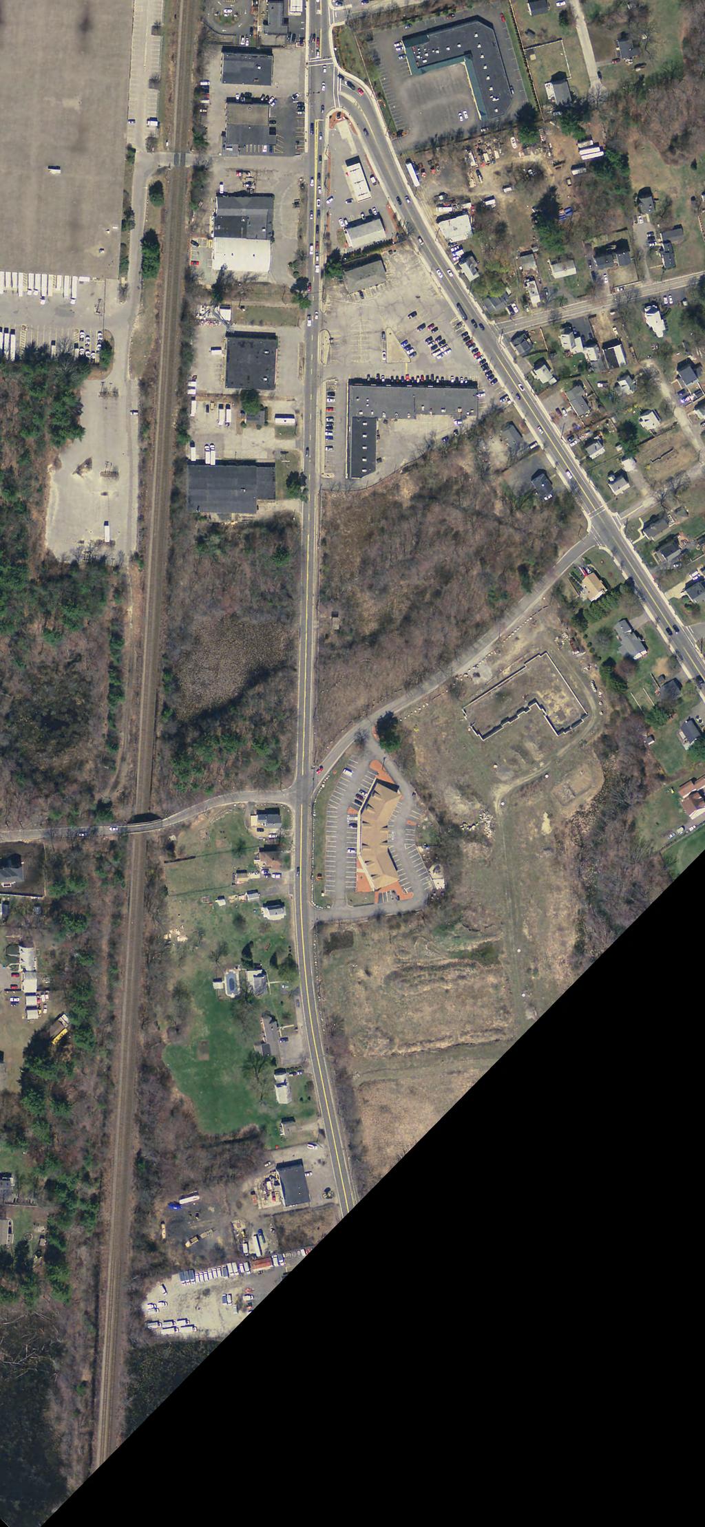


61 LEGEND APPROXIMATE CRASH LOCATION 11 (XX) CRASH NUMBER (CRASH TYPE) SCALE 1" = 200'
")


62 LEGEND 11 (XX) APPROXIMATE CRASH LOCATION CRASH NUMBER (CRASH TYPE) SCALE 1" = 200'

63 LEGEND APPROXIMATE CRASH LOCATION 11 (XX) CRASH NUMBER (CRASH TYPE) SCALE 1" = 200'
ROAD SAFETY AUDIT. State Road (Route 6) Corridor Town of Dartmouth. March Prepared For: MassDOT
 Corridor Town of Dartmouth. March Prepared For: MassDOT") ROAD SAFETY AUDIT State Road (Route 6) Corridor Town of Dartmouth March 2015 Prepared For: MassDOT Prepared By: McMahon Associates, Inc. 300 Myles Standish Blvd. Suite 201 Taunton, MA 02780 Table of Contents
ROAD SAFETY AUDIT State Road (Route 6) Corridor Town of Dartmouth March 2015 Prepared For: MassDOT Prepared By: McMahon Associates, Inc. 300 Myles Standish Blvd. Suite 201 Taunton, MA 02780 Table of Contents
ROAD SAFETY AUDIT. May 18, Prepared For: MassDOT. On Behalf Of: Town of Milford
 ROAD SAFETY AUDIT East Main Street (Route 16) at Medway Road (Route 109), East Main Street (Route 16) at Quarry Square Driveways, East Main Street (Route 16) at Beaver Street/ Fortune Boulevard Town of
ROAD SAFETY AUDIT. Blue Hill Avenue (Route 28) and Warren Street High Crash Locations City of Boston. November 1, 2016
 and Warren Street High Crash Locations City of Boston. November 1, 2016") ROAD SAFETY AUDIT Blue Hill Avenue (Route 28) and Warren Street High Crash Locations City of Boston November 1, 2016 Prepared For: MassDOT Highway Division Prepared By: BETA Group, Inc. Table of Contents
ROAD SAFETY AUDIT Blue Hill Avenue (Route 28) and Warren Street High Crash Locations City of Boston November 1, 2016 Prepared For: MassDOT Highway Division Prepared By: BETA Group, Inc. Table of Contents
ROAD SAFETY AUDIT. Granite Avenue at Interstate 93 Ramps. Town of Milton. May 22, Prepared for: MassDOT
 ROAD SAFETY AUDIT Granite Avenue at Interstate 93 Ramps Town of Milton May 22, 2017 Prepared for: MassDOT Prepared by: Toole Design Group 2 Oliver Street, Suite 305 Boston, MA 02109 Table of Contents Background...
ROAD SAFETY AUDIT. Centre Street (Route 123) at Plymouth Street. Municipality of Brockton. November, Prepared For: MassDOT
 at Plymouth Street. Municipality of Brockton. November, Prepared For: MassDOT") ROAD SAFETY AUDIT Centre Street (Route 123) at Plymouth Street Municipality of Brockton November, 2017 Prepared For: MassDOT On Behalf Of: City of Brockton Prepared By: Old Colony Planning Council 70 School
ROAD SAFETY AUDIT Centre Street (Route 123) at Plymouth Street Municipality of Brockton November, 2017 Prepared For: MassDOT On Behalf Of: City of Brockton Prepared By: Old Colony Planning Council 70 School
ROAD SAFETY AUDIT. Route 3A from Evans Street to Abigail Adams State Park. Town of Weymouth. October 12, Prepared For: MassDOT
 ROAD SAFETY AUDIT Route 3A from Evans Street to Abigail Adams State Park Town of Weymouth October 12, 2016 Prepared For: MassDOT Prepared By: Green International Affiliates, Inc. 239 Littleton Road, Suite
Draft North Industrial Area-Wide Traffic Plan
 Summary of North Industrial and Hudson Bay Industrial Recommended Improvements Table 1. Summary of s Item Location 1 2 3 4 5 6 7 8 9 10 11 12 Millar Ave north of 51st St Super 8 Motel back lane 400 Block
ROAD SAFETY AUDIT. Water Street (Route 129) at Vernon Street. Town of Wakefield. September Prepared For: MassDOT
 at Vernon Street. Town of Wakefield. September Prepared For: MassDOT") ROAD SAFETY AUDIT Water Street (Route 129) at Vernon Street September 2017 Prepared For: MassDOT Massachusetts Department of Transportation Prepared By: WorldTech Engineering Road Safety Audit Water Street
ROAD SAFETY AUDIT Water Street (Route 129) at Vernon Street September 2017 Prepared For: MassDOT Massachusetts Department of Transportation Prepared By: WorldTech Engineering Road Safety Audit Water Street
ROAD SAFETY AUDIT. Providence Street (Route 122A) at McKeon Road/Millbury Street. City of Worcester. July 14, Prepared For: MassDOT
 at McKeon Road/Millbury Street. City of Worcester. July 14, Prepared For: MassDOT") ROAD SAFETY AUDIT Providence Street (Route 122A) at McKeon Road/Millbury Street City of Worcester July 14, 2016 Prepared For: MassDOT Prepared By: Stantec Consulting Services, Inc. Burlington, Massachusetts
ROAD SAFETY AUDIT Providence Street (Route 122A) at McKeon Road/Millbury Street City of Worcester July 14, 2016 Prepared For: MassDOT Prepared By: Stantec Consulting Services, Inc. Burlington, Massachusetts
ROAD SAFETY AUDIT. South Street (Route 1A) at East Bacon Street (Route 106) and West Bacon Street Town of Plainville.
 at East Bacon Street (Route 106) and West Bacon Street Town of Plainville.") ROAD SAFETY AUDIT South Street (Route 1A) at East Bacon Street (Route 106) and West Bacon Street Town of Plainville March 15, 2018 Prepared For: MassDOT On Behalf Of: Town of Plainville Prepared By: BETA
ROAD SAFETY AUDIT South Street (Route 1A) at East Bacon Street (Route 106) and West Bacon Street Town of Plainville March 15, 2018 Prepared For: MassDOT On Behalf Of: Town of Plainville Prepared By: BETA
sm1 CDMth '}lf!j1i!~~!2q[ ROAD SAFETY AUDIT County Street City of New Bedford March 22, 2017 Prepared For: MassDOT
 ROAD SAFETY AUDIT County Street City of New Bedford March 22, 2017 '}lf!j1i!~~!2q[ ~ j ighway Divl.sion Prepared For: MassDOT On Behalf Of: City of New Bedford Massachusetts Prepared By: CDM Smith 260
ROAD SAFETY AUDIT. Route 16 at Interstate 395 Town of Webster. October Prepared For: MassDOT
 ROAD SAFETY AUDIT Route 16 at Interstate 395 Town of Webster October 2015 Prepared For: MassDOT Prepared By: McMahon Associates, Inc. 300 Myles Standish Blvd. Suite 201 Taunton, MA 02780 Table of Contents
ROAD SAFETY AUDIT. Santilli Circle and Sweetser Circle. Municipality of Everett. March 10, Prepared For: MassDOT
 ROAD SAFETY AUDIT Santilli Circle and Sweetser Circle Municipality of Everett Prepared For: MassDOT On Behalf Of: WYNN Design and Development Prepared By: AECOM 250 Apollo Drive Chelmsford, MA Road Safety
ROAD SAFETY AUDIT. Route 202 (East State Street)/School Street & Route 202 (West State Street)/Pleasant Street/Amherst Street Town of Granby
/School Street & Route 202 (West State Street)/Pleasant Street/Amherst Street Town of Granby") ROAD SAFETY AUDIT Route 202 (East State Street)/School Street & Route 202 (West State Street)/Pleasant Street/Amherst Street Town of Granby March 2013 Prepared for: Massachusetts Department of Transportation
ROAD SAFETY AUDIT Route 202 (East State Street)/School Street & Route 202 (West State Street)/Pleasant Street/Amherst Street Town of Granby March 2013 Prepared for: Massachusetts Department of Transportation
ROAD SAFETY AUDIT. Rourke Bridge at Pawtucket Boulevard (Route 113) City of Lowell. October 5, Prepared For: MassDOT.
 City of Lowell. October 5, Prepared For: MassDOT.") ROAD SAFETY AUDIT Rourke Bridge at Pawtucket Boulevard (Route 113) City of Lowell October, 2017 Prepared For: MassDOT Prepared By: Vanasse Hangen Brustlin, Inc 101 Walnut Street Watertown, MA 02472 Road
ROAD SAFETY AUDIT Rourke Bridge at Pawtucket Boulevard (Route 113) City of Lowell October, 2017 Prepared For: MassDOT Prepared By: Vanasse Hangen Brustlin, Inc 101 Walnut Street Watertown, MA 02472 Road
ROAD SAFETY AUDIT. Route 114 at Interstate I-495 Northbound Ramps. City of Lawrence. July 30, 2015
 ROAD SAFETY AUDIT Route 114 at Interstate I-495 Northbound Ramps City of Lawrence July 30, 2015 Prepared For: Massachusetts Department of Transportation Prepared By: Toole Design Group 33 Broad Street,
ROAD SAFETY AUDIT. Route 53 (Washington Street) High Crash Locations at Route 139 (Schoosett Street) and Route 14 (Congress Street) Town of Pembroke
 High Crash Locations at Route 139 (Schoosett Street) and Route 14 (Congress Street) Town of Pembroke") ROAD SAFETY AUDIT Route 53 (Washington Street) High Crash Locations at Route 139 (Schoosett Street) and Route 14 (Congress Street) Town of Pembroke April 29, 2016 Prepared For: MassDOT Highway Division
ROAD SAFETY AUDIT Route 53 (Washington Street) High Crash Locations at Route 139 (Schoosett Street) and Route 14 (Congress Street) Town of Pembroke April 29, 2016 Prepared For: MassDOT Highway Division
ROAD SAFETY AUDIT. West Central Street (Route 140) at Franklin Village Drive. Town of Franklin. February 03, 2016
 at Franklin Village Drive. Town of Franklin. February 03, 2016") ROAD SAFETY AUDIT West Central Street (Route 140) at Franklin Village Drive Town of Franklin February 03, 2016 Prepared for: Massachusetts Department of Transportation Prepared by: Howard Stein Hudson
ROAD SAFETY AUDIT West Central Street (Route 140) at Franklin Village Drive Town of Franklin February 03, 2016 Prepared for: Massachusetts Department of Transportation Prepared by: Howard Stein Hudson
ROAD SAFETY AUDIT. Russell Street (Route 9) at North and South Maple Streets Town of Hadley. March 2014
 at North and South Maple Streets Town of Hadley. March 2014") ROAD SAFETY AUDIT Russell Street (Route 9) at North and South Maple Streets Town of Hadley March 2014 Prepared for: Massachusetts Department of Transportation Prepared by: Howard/Stein-Hudson Associates
ROAD SAFETY AUDIT Russell Street (Route 9) at North and South Maple Streets Town of Hadley March 2014 Prepared for: Massachusetts Department of Transportation Prepared by: Howard/Stein-Hudson Associates
Washington St. Corridor Study
 FIGURE 7.17 Bridge Alternatives - Cross Sections 86 Discarded Alternative: Short-Term Bridge Repair Short-term repairs and west bridge span replacement were considered during analysis. Short-term repairs
AGENDA ITEM 6 D THOMASVILLE ROAD (HERMITAGE BOULEVARD TO LIVE OAK PLANTATION ROAD) ROADWAY SAFETY AUDIT
 ROADWAY SAFETY AUDIT") May 15, 2018 AGENDA ITEM 6 D THOMASVILLE ROAD (HERMITAGE BOULEVARD TO LIVE OAK PLANTATION ROAD) ROADWAY SAFETY AUDIT TYPE OF ITEM: Discussion STATEMENT OF ISSUE The Florida Department of Transportation
May 15, 2018 AGENDA ITEM 6 D THOMASVILLE ROAD (HERMITAGE BOULEVARD TO LIVE OAK PLANTATION ROAD) ROADWAY SAFETY AUDIT TYPE OF ITEM: Discussion STATEMENT OF ISSUE The Florida Department of Transportation
MEMORANDUM. Date: 9/13/2016. Citywide Crosswalk Policy
 MEMORANDUM Date: 9/13/2016 Re: Citywide Crosswalk Policy Foreword Through the s Circulation Element and Complete Streets Policy, it is the City s goal to promote walking trips and provide safe facilities
MEMORANDUM. DATE March 1, 2012 TO Town of Milton Mark Abbott, Seth Asante, and Efi Pagitsas Boston Region MPO Staff
 MEMORANDUM DATE March 1, 212 TO Town of Milton FROM RE Mark Abbott, Seth Asante, and Efi Pagitsas Boston Region MPO Staff FFY 211 Safety and Operations Analyses at Selected Boston Region MPO Intersections:
ROAD SAFETY AUDIT. Northampton Road (Route 9) at University Drive and Snell Street Town of Amherst. November 15, Prepared For: MassDOT
 at University Drive and Snell Street Town of Amherst. November 15, Prepared For: MassDOT") ROAD SAFETY AUDIT Northampton Road (Route 9) at University Drive and Snell Street Town of Amherst November 15, 2016 Prepared For: MassDOT Prepared By: Greenman-Pedersen, Inc. 181 Ballardvale Street, Suite
ROAD SAFETY AUDIT Northampton Road (Route 9) at University Drive and Snell Street Town of Amherst November 15, 2016 Prepared For: MassDOT Prepared By: Greenman-Pedersen, Inc. 181 Ballardvale Street, Suite
ROAD SAFETY AUDIT. Boston Road (Route 20) at Parker Street and Pasco Road to Dumaine Street City of Springfield Town of Wilbraham.
 at Parker Street and Pasco Road to Dumaine Street City of Springfield Town of Wilbraham.") ROAD SAFETY AUDIT Boston Road (Route 2) at Parker Street and Pasco Road to Dumaine Street City of Springfield Town of Wilbraham October 4, 212 Prepared For: MassDOT Highway Division Prepared By: BETA Group,
ROAD SAFETY AUDIT Boston Road (Route 2) at Parker Street and Pasco Road to Dumaine Street City of Springfield Town of Wilbraham October 4, 212 Prepared For: MassDOT Highway Division Prepared By: BETA Group,
ROAD SAFETY AUDIT. County Street at Hart Street. City of Taunton. January 30, Prepared For: Massachusetts Department of Transportation
 ROAD SAFETY AUDIT County Street at Hart Street City of Taunton January 30, 2015 Prepared For: Massachusetts Department of Transportation Prepared By: Toole Design Group 33 Broad Street, 4 th Floor Boston,
ROAD SAFETY AUDIT. Plain Street (Route 139) at Furnace Street and Proprietors Drive Town of Marshfield. June 9, 2017.
 at Furnace Street and Proprietors Drive Town of Marshfield. June 9, 2017.") ROAD SAFETY AUDIT Plain Street (Route 139) at Furnace Street and Proprietors Drive Town of Marshfield June 9, 2017 Prepared for: MassDOT On Behalf of: Vanasse & Associates, Inc. 35 New England Business
ROAD SAFETY AUDIT Plain Street (Route 139) at Furnace Street and Proprietors Drive Town of Marshfield June 9, 2017 Prepared for: MassDOT On Behalf of: Vanasse & Associates, Inc. 35 New England Business
ROAD SAFETY AUDIT. Mass Pike Interchange 6, I-291 and Burnett Road. City of Chicopee. November 4, Prepared For: MassDOT Highway Division
 ROAD SAFETY AUDIT Mass Pike Interchange 6, I-291 and Burnett Road City of Chicopee November 4, 2013 Prepared For: MassDOT Highway Division Prepared By: BETA Group, Inc. Table of Contents Project Data...
ROAD SAFETY AUDIT. Auburn Street at Southbridge Street (Route 12) Town of Auburn. March Prepared For: Massachusetts Department of Transportation
 Town of Auburn. March Prepared For: Massachusetts Department of Transportation") ROAD SAFETY AUDIT Auburn Street at Southbridge Street (Route 12) Town of Auburn March 2017 Prepared For: Massachusetts Department of Transportation Prepared By: Vanasse Hangen Brustlin, Inc Union Station
ROAD SAFETY AUDIT Auburn Street at Southbridge Street (Route 12) Town of Auburn March 2017 Prepared For: Massachusetts Department of Transportation Prepared By: Vanasse Hangen Brustlin, Inc Union Station
ROAD SAFETY AUDIT. Route 135 at Route 30 Town of Westborough. January Prepared For: MassDOT
 ROAD SAFETY AUDIT Route 135 at Route 30 January 2016 Prepared For: MassDOT Prepared By: McMahon Associates, Inc. 300 Myles Standish Blvd. Suite 201 Taunton, MA 02780 Road Safety Audit Route 135 at Route
ROAD SAFETY AUDIT. Damon Road. City of Northampton. October Prepared for: Massachusetts Department of Transportation
 ROAD SAFETY AUDIT Damon Road City of Northampton October 2013 Prepared for: Massachusetts Department of Transportation Prepared by: Howard/Stein-Hudson Associates 38 Chauncy Street Boston, MA 02111 Table
ROAD SAFETY AUDIT. Washington Street (Route 53) at Pleasant Street. Town of Pembroke. June 26, Prepared For: MassDOT Highway Division
 at Pleasant Street. Town of Pembroke. June 26, Prepared For: MassDOT Highway Division") ROAD SAFETY AUDIT Washington Street (Route 53) at Pleasant Street Town of Pembroke June 26, 2014 Prepared For: MassDOT Highway Division Prepared By: BETA Group, Inc. Table of Contents Project Data... 1
ROAD SAFETY AUDIT Washington Street (Route 53) at Pleasant Street Town of Pembroke June 26, 2014 Prepared For: MassDOT Highway Division Prepared By: BETA Group, Inc. Table of Contents Project Data... 1
Route 117 Review of Ownership Transfer October 2014
 Route 117 Review of Ownership Transfer October 2014 Page 1 of 27 I. INTRODUCTION... 3 II. EXISTING CONDITIONS... 4 A. Town of Lancaster Site-Investigation... 4 B. Town of Bolton Site-Investigation... 9
ROAD SAFETY AUDIT MDM. Columbia Road at Dorchester Avenue. Dorchester, MA 10/14/2016. Prepared For: MassDOT. On Behalf Of: Edens
 ROAD SAFETY AUDIT Columbia Road at Dorchester Avenue Dorchester, MA 10/14/2016 Prepared For: MassDOT On Behalf Of: Edens Prepared By: MDM Transportation Consultants, Inc. 28 Lord Road Suite 280 Marlborough,
ROAD SAFETY AUDIT. East Main Street (Route 123) at Route I-495 Northbound & Southbound Ramps Town of Norton. May 11, Prepared For: MassDOT
 at Route I-495 Northbound & Southbound Ramps Town of Norton. May 11, Prepared For: MassDOT") ROAD SAFETY AUDIT East Main Street (Route 123) at Route I-495 Northbound & Southbound Ramps Town of Norton May 11, 2016 Prepared For: MassDOT Prepared By: 101 Walnut Street Watertown, MA Road Safety Audit
ROAD SAFETY AUDIT East Main Street (Route 123) at Route I-495 Northbound & Southbound Ramps Town of Norton May 11, 2016 Prepared For: MassDOT Prepared By: 101 Walnut Street Watertown, MA Road Safety Audit
ROAD SAFETY AUDIT. Route 18 (Bedford Street) from Whitman Street to Central Square Town of East Bridgewater. May 14, 2014
 from Whitman Street to Central Square Town of East Bridgewater. May 14, 2014") ROAD SAFETY AUDIT Route 18 (Bedford Street) from Whitman Street to Central Square Town of East Bridgewater May 14, 2014 Prepared For: MassDOT Highway Division Prepared By: BETA Group, Inc. Table of Contents
ROAD SAFETY AUDIT Route 18 (Bedford Street) from Whitman Street to Central Square Town of East Bridgewater May 14, 2014 Prepared For: MassDOT Highway Division Prepared By: BETA Group, Inc. Table of Contents
Truck Turning Study for Main Street Intersection, Orange
 Truck Turning Study for Main Street Intersection, Orange Franklin Regional Council of Governments September 2015 0 Truck Turning Study for Main Street Intersection, Orange September 2015 Prepared by: Franklin
Acknowledgements. Mr. David Nicol 3/23/2012. Daniel Camacho, P.E. Highway Engineer Federal Highway Administration Puerto Rico Division
 Daniel Camacho, P.E. Highway Engineer Federal Highway Administration Puerto Rico Division Acknowledgements Mr. David Nicol Director, FHWA Office of Safety FHWA Office of Safety http://safety.fhwa.dot.gov/provencountermeasures/
MT. LEBANON COMPREHENSIVE PLAN UPDATE ELEVATING CONNECTIVITY FOR PEDESTRIANS AND CYCLISTS
 MT. LEBANON COMPREHENSIVE PLAN UPDATE ELEVATING CONNECTIVITY FOR PEDESTRIANS AND CYCLISTS Municipality of Mt. Lebanon, Allegheny County, Pennsylvania INTRODUCTION The Mt. Lebanon Comprehensive Plan Update
Ottawa Beach Road Study
 Ottawa Beach Road Study Prepared For: Park Township September 30, 2014 Project No. G140303 OTTAWA BEACH ROAD STUDY PREPARED FOR: PARK TOWNSHIP SEPTEMBER 30, 2014 PROJECT NO. G140303 TABLE OF CONTENTS 1.0
ROAD SAFETY AUDIT. Needham Street and Highland Avenue Corridor. City of Newton and Town of Needham. March 2014
 ROAD SAFETY AUDIT Needham Street and Highland Avenue Corridor City of Newton and Town of Needham March 2014 Prepared for: Massachusetts Department of Transportation Prepared by: Howard/Stein-Hudson Associates
Date: April 4, Project #: Re: A Street/Binford Street Traffic/Intersection Assessment
 To: Peter Cavanaugh General Electric From: David Bohn, PE Ryan White, PE Date: April 4, 217 Project #: 13421. Re: / Traffic/Intersection Assessment Consistent with the Cooperation Agreement between the
Military Road Safety Improvements
 Military Road Safety Improvements 26 th Road North to 31 st Street North SUMMARY OF DATA REVIEW AND PRELIMINARY RECOMMENDATIONS Prepared for: Department of Environmental Services Traffic Engineering and
Road Safety Audit Course Participant Guidebook. August 22 & 23, Cleveland Avenue Columbus, Ohio
 Road Safety Audit Course Participant Guidebook August 22 & 23, 2017 Cleveland Avenue Columbus, Ohio 1 2 Table of Contents Executive Summary... 5 Cleveland Avenue City of Columbus... 6 Road Location Details...
Route 28 (South Orleans Road)/Route 39 (Harwich Road)/Quanset Road Intersection
/Route 39 (Harwich Road)/Quanset Road Intersection") TRAFFIC FEASIBILITY STUDY Route 28 (South Orleans Road)/Route 39 (Harwich Road)/Quanset Road Intersection Orleans, Massachusetts Prepared for: Town of Orleans Prepared by: Fay, Spofford & Thorndike, LLC
TRAFFIC FEASIBILITY STUDY Route 28 (South Orleans Road)/Route 39 (Harwich Road)/Quanset Road Intersection Orleans, Massachusetts Prepared for: Town of Orleans Prepared by: Fay, Spofford & Thorndike, LLC
Pedestrian Road Safety Audit
 Pedestrian Road Safety Audit Middlebrook Road From Father Hurley Boulevard to Waring Station Road December 2017 Montgomery County Department of Transportation Table of Contents 1. Introduction... 1 1.1
Active Transportation Facility Glossary
 Active Transportation Facility Glossary This document defines different active transportation facilities and suggests appropriate corridor types. Click on a facility type to jump to its definition. Bike
Lake Whitney Elementary School
 Lake Whitney Elementary School SCHOOL ROUTE PLAN For LAKE WHITNEY ELEMENTARY SCHOOL LOCATION 18 ORANGE COUNTY Prepared for: ORANGE COUNTY SCHOOL ASSESSMENT PROGRAM ORANGE COUNTY PUBLIC WORKS Traffic Engineering
ROAD SAFETY AUDIT. Route 27 (Crescent Street)/Quincy Street/Massasoit Boulevard. City of Brockton. July 24,2013
/Quincy Street/Massasoit Boulevard. City of Brockton. July 24,2013") ROAD SAFETY AUDIT Route 27 (Crescent Street)/Quincy Street/Massasoit Boulevard City of Brockton July 24,2013 Prepared for: Massachusetts Department of Transportation Prepared by: Howard/Stein-Hudson Associates
ROAD SAFETY AUDIT Route 27 (Crescent Street)/Quincy Street/Massasoit Boulevard City of Brockton July 24,2013 Prepared for: Massachusetts Department of Transportation Prepared by: Howard/Stein-Hudson Associates
City of Albert Lea Policy and Procedure Manual 4.10 ALBERT LEA CROSSWALK POLICY
 4.10 ALBERT LEA CROSSWALK POLICY PURPOSE: Pedestrian crosswalks are an integral part of our transportation infrastructure. To be effective and promote safety, marked crosswalks must be installed after
APPENDIX A: Complete Streets Checklist DRAFT NOVEMBER 2016
 APPENDIX A: Complete Streets Checklist DRAFT NOVEMBER 2016 Complete Streets Checklist MetroPlan Orlando s Complete Streets Checklist is an internal planning tool for staff to further implementation of
C. Best Practice Pedestrian Treatment Toolbox
 C. Best Practice Pedestrian Toolbox The Best Practice Pedestrian Toolbox presents the recommended tools in striping, signalization, signage, geometry and other categories for improving both uncontrolled
ROAD SAFETY AUDIT. Route 2/Route 68 Interchange Rotary City of Gardner. August 3, Prepared For: MassDOT
 ROAD SAFETY AUDIT Route 2/Route 68 Interchange Rotary City of Gardner August 3, 2016 Prepared For: MassDOT Prepared By: Tetra Tech 100 Nickerson Avenue Marlborough, MA 01752 Road Safety Audit Route 2/Route
M-58 HIGHWAY ACCESS MANAGEMENT STUDY Mullen Road to Bel-Ray Boulevard. Prepared for CITY OF BELTON. May 2016
 M-58 HIGHWAY ACCESS MANAGEMENT STUDY Prepared for CITY OF BELTON By May 2016 Introduction Missouri State Highway 58 (M-58 Highway) is a major commercial corridor in the City of Belton. As development has
FLORIDA DEPARTMENT OF TRANSPORTATION DISTRICT 7 DISTRICT WIDE BICYCLE/PEDESTRIAN ACCESS TO TRANSIT SAFETY ASSESSMENT AND IMPROVEMENT PLAN
 FLORIDA DEPARTMENT OF TRANSPORTATION DISTRICT 7 DISTRICT WIDE BICYCLE/PEDESTRIAN ACCESS TO TRANSIT SAFETY ASSESSMENT AND IMPROVEMENT PLAN TRANSIT SAFETY ASSESSMENT SR 55/US 19 AT 80 TH AVE N DRAFT JUNE
Windy Ridge Elementary School
 Windy Ridge Elementary School SCHOOL ROUTE PLAN For WINDY RIDGE ELEMENTARY SCHOOL LOCATION 54 ORANGE COUNTY Prepared for: ORANGE COUNTY SCHOOL ASSESSMENT PROGRAM ORANGE COUNTY PUBLIC WORKS Traffic Engineering
Orange Center Elementary School
 Drag and drop pic and stretch/crop to the limits of the blue rectangle (delete this text box) Orange Center Elementary School Drag and drop pic and stretch/crop to the limits of the blue rectangle (delete
Toolbox of Countermeasures and Their Potential Effectiveness to Make Intersections Safer
 8 Toolbox of Countermeasures and Their to Make Intersections Safer Introduction Studies included in the NCHRP 17-18 (3), Guidance for Implementation of the AASHTO Strategic Highway Safety Plan, as well
BELCHERTOWN. Intersection of Federal Steet (Route 9) and Bay Road MAY 2012
 and Bay Road MAY 2012") BELCHERTOWN Intersection of Federal Steet (Route 9) and Bay Road MAY 2012 Prepared Under the Direction of Pioneer Valley MPO By: Pioneer Valley Planning Commission 60 Congress Street Springfield 01104-3419
BELCHERTOWN Intersection of Federal Steet (Route 9) and Bay Road MAY 2012 Prepared Under the Direction of Pioneer Valley MPO By: Pioneer Valley Planning Commission 60 Congress Street Springfield 01104-3419
TRAFFIC ACTION PLAN. Laurie Meadows Neighborhood CITY OF SAN MATEO
 TRAFFIC ACTION PLAN Laurie Meadows Neighborhood CITY OF SAN MATEO Draft January 2017 Table of Contents Introduction... 2 The Traffic Forum Process... 5 Neighborhood Traffic Issues... 7 Neighborhood Recommendations
Meadow Woods Elementary School
 Drag and drop pic and stretch/crop to the limits of the blue rectangle (delete this text box) Meadow Woods Elementary School Drag and drop pic and stretch/crop to the limits of the blue rectangle (delete
Summary: Mercer County Princeton Avenue & Spruce Street Study January 2009
 Summary: Several recent studies have assessed potential development and redevelopment opportunities in the Mercer Crossing area of Trenton, Ewing, and Lawrence. This Princeton Avenue and Spruce Street
Transportation Planning Division
 Transportation Planning Division Presentation Outline Study Tasks Recap of Previous Meetings Data Collected Focus Areas within Study Limits Design Principles Tool Box Recommended Concepts Schedule Moving
Document 2 - City of Ottawa Pedestrian Crossover (PXO) Program
 Program") 40 Document 2 - City of Ottawa Pedestrian Crossover (PXO) Program OVERVIEW The City of Ottawa Pedestrian Crossover (PXO) Program provides the basis for PXO implementation in Ottawa. The program s processes
40 Document 2 - City of Ottawa Pedestrian Crossover (PXO) Program OVERVIEW The City of Ottawa Pedestrian Crossover (PXO) Program provides the basis for PXO implementation in Ottawa. The program s processes
PART 4 HIGHWAY TRAFFIC SIGNALS
 2016 Edition Page 111 PART 4 HIGHWAY TRAFFIC SIGNALS CHAPTER 4A. GENERAL [This is a new section. There is no corresponding section in the MUTCD.] Section 4A.100 Traffic Control Device Alternatives for
Rank #1 Highest Priority Intersection
 Rank #1 Highest Priority Intersection Attachment 3: Proposed Interventions Pedestrian Safety City of Toronto s 10 Priority Intersections Sheppard Avenue East and Ambrose Road/Provost Drive Located in the
Multi-Modal Traffic Analysis. Parisi and Associates
 Mill Valley to Corte Madera Bicycle and Pedestrian Corridor Study Appendix D: Multi-Modal Traffic Analysis Prepared by Parisi and Associates August 2009 Appendix D - Multi-Modal Traffic Analysis Table
Improving Cyclist Safety at the Dundas Street West and Sterling Road Intersection
 STAFF REPORT ACTION REQUIRED Improving Cyclist Safety at the Dundas Street West and Sterling Road Intersection Date: August 17, 2012 To: From: Wards: Reference Number: Public Works and Infrastructure Committee
CHAPTER 3A. GENERAL PAGE CHAPTER 3B. PAVEMENT AND CURB MARKINGS PAGE
 Virginia Supplement to the 2009 MUTCD Revision 1 Page TC-3-1 PART 3. MARKINGS CHAPTER 3A. GENERAL PAGE Section 3A.01 Functions and Limitations Section 3A.02 Standardization of Application Section 3A.03
MEMORANDUM. Layout Of Study Intersections And Traffic Control
 BOSTON REGION METROPOLITAN PLANNING ORGANIZATION Richard A. Davey, MassDOT Secretary and CEO and MPO Chairman Karl H. Quackenbush, Executive Director, MPO Staff DATE November 15, 2012 TO FROM RE Town of
TRANSPORTATION ANALYSIS REPORT US Route 6 Huron, Erie County, Ohio
 TRANSPORTATION ANALYSIS REPORT US Route 6 Huron, Erie County, Ohio December 12, 2012 Prepared for: The City of Huron 417 Main Huron, OH 44839 Providing Practical Experience Technical Excellence and Client
ROAD SAFETY AUDIT. Route 113 (Storey Avenue) at Woodman Way and Low Street. Newburyport, MA. May 27, Prepared For: MassDOT
 at Woodman Way and Low Street. Newburyport, MA. May 27, Prepared For: MassDOT") ROAD SAFETY AUDIT Route 113 (Storey Avenue) at Woodman Way and Low Street Newburyport, MA May 27, 2015 Prepared For: MassDOT Prepared By: Bayside Engineering, Inc. 600 Unicorn Park Drive Woburn, MA 01801
ROAD SAFETY AUDIT Route 113 (Storey Avenue) at Woodman Way and Low Street Newburyport, MA May 27, 2015 Prepared For: MassDOT Prepared By: Bayside Engineering, Inc. 600 Unicorn Park Drive Woburn, MA 01801
Duwamish Way-finding and CTR Report
 V. North Tukwila When the North Tukwila Manufacturing and Industrial Center was designated in 1992 as part of the region s land use and transportation plan, the plan called for the area to set a light-rail
Broad Street Bicycle Boulevard Design Guidelines
 Broad Street Bicycle Boulevard Design Guidelines Building from the strategies introduced in the 2013 Bicycle Transportation Plan and community input received thus far, City Transportation Staff have identified
BENNING ROAD & BRIDGES TRANSPORTATION IMPROVEMENTS CRASH DATA AND SAFETY ANALYSIS TECHNICAL MEMORANDUM DRAFT MAY 2016
 BENNING ROAD & BRIDGES TRANSPORTATION IMPROVEMENTS CRASH DATA AND SAFETY ANALYSIS TECHNICAL MEMORANDUM DRAFT MAY 2016 This page left intentionally blank. Table of Contents 1.0 Introduction... 1 1.1 Crash
ROAD SAFETY AUDIT. Route 2/Taylor Road/Piper Road. Town of Acton. March 4, Prepared For: Massachusetts Department of Transportation
 ROAD SAFETY AUDIT Route 2/Taylor Road/Piper Road Town of Acton March 4, 2015 Prepared For: Massachusetts Department of Transportation Prepared By: Tetra Tech, Inc. One Grant Street Framingham, MA 01702
ROAD SAFETY AUDIT. Falmouth Road (Route 28)/Bearses Way. Town of Barnstable. May Prepared for: Massachusetts Highway Department
/Bearses Way. Town of Barnstable. May Prepared for: Massachusetts Highway Department") ROAD SAFETY AUDIT Falmouth Road (Route 28)/Bearses Way Town of Barnstable May 2009 Prepared for: Massachusetts Highway Department Prepared by: Howard/Stein-Hudson Associates 38 Chauncy Street Boston, MA
ROAD SAFETY AUDIT Falmouth Road (Route 28)/Bearses Way Town of Barnstable May 2009 Prepared for: Massachusetts Highway Department Prepared by: Howard/Stein-Hudson Associates 38 Chauncy Street Boston, MA
Readington Road (C.R. 637) Construction
 Construction") Public Information Meeting Thursday, August 2, 2012 Readington Road (C.R. 637) Construction from Dreahook Road to Harlan School Road Branchburg Township, Somerset County Readington Township, Hunterdon
Public Information Meeting Thursday, August 2, 2012 Readington Road (C.R. 637) Construction from Dreahook Road to Harlan School Road Branchburg Township, Somerset County Readington Township, Hunterdon
CAPE COD COMMISSION 3225 MAIN STREET P.O. BOX 226 BARNSTABLE, MA (508) Fax (508) Transportation Safety Report
 Fax (508) Transportation Safety Report") CAPE COD COMMISSION 3225 MAIN STREET P.O. BOX 226 BARNSTABLE, MA 02630 (508) 362-3828 Fax (508) 362-3136 2006 Transportation Safety Report Bourne: Otis Rotary Harwich: Route 137/Route 39 Orleans: Route
CAPE COD COMMISSION 3225 MAIN STREET P.O. BOX 226 BARNSTABLE, MA 02630 (508) 362-3828 Fax (508) 362-3136 2006 Transportation Safety Report Bourne: Otis Rotary Harwich: Route 137/Route 39 Orleans: Route
Road Safety Audit for the Intersection of VFW Highway & Bridge Street in Lowell, Massachusetts
 Road Safety Audit for the Intersection of VFW Highway & Bridge Street in Lowell, Massachusetts Prepared by University of Massachusetts Traffic Safety Research Program Prepared for Massachusetts Highway
PEDESTRIAN SAFETY STUDY
 PEDESTRIAN SAFETY STUDY SR 699 (BLIND PASS RD/GULF BLVD) FROM 93 RD AVENUE TO PINELLAS BAYWAY PINELLAS COUNTY SECTION NO.: 15100 MILEPOST: 0.111 3.569 STUDY LIMITS Prepared For: Florida Department of Transportation
Traffic Engineering and Highway Safety Bulletin June Overview
 Traffic Engineering and Highway Safety Bulletin 18-03 June 2018 INTERSECTION GEOMETRIC DESIGN In This Issue Overview... 1 Intersection Types... 2 Traffic Control Selection... 3 Capacity Analysis... 6 Design
City of Scotts Valley CITY COUNCIL STAFF REPORT
 DATE: April 19, 2017 City of Scotts Valley CITY COUNCIL STAFF REPORT AGENDA ITEM 2 DATE: 4-19-2017 TO: FROM: APPROVED: SUBJECT: Honorable Mayor and City Council Scott Hamby, Public Works Director Jenny
ROAD SAFETY AUDIT. Route 1A at Everett Street & Clapboardtree Street and Washington Street at Everett Street. Towns of Norwood & Westwood
 ROAD SAFETY AUDIT Route 1A at Everett Street & Clapboardtree Street and Washington Street at Everett Street Towns of Norwood & Westwood September 2014 Prepared For: On Behalf Of: Westwood Marketplace Holdings
ROAD SAFETY AUDIT. Route 1 at Route 123 Route 1 at Route 1A Route 1 at May Street Route 1A and Route 123. City of Attleboro, MA. September 15, 2015
 ROAD SAFETY AUDIT Route 1 at Route 123 Route 1 at Route 1A Route 1 at May Street Route 1A and Route 123 City of Attleboro, MA September 15, 2015 Prepared For: MassDOT On Behalf Of: Prepared By: Fay, Spofford
Developed by: The American Traffic Safety Services Association (ATSSA) 15 Riverside Parkway, Suite 100 Fredericksburg, VA
 15 Riverside Parkway, Suite 100 Fredericksburg, VA") Addendum Developed by: The American Traffic Safety Services Association (ATSSA) 15 Riverside Parkway, Suite 100 Fredericksburg, VA 22406-1022 800-272-8772 This material is based upon work supported by
Addendum Developed by: The American Traffic Safety Services Association (ATSSA) 15 Riverside Parkway, Suite 100 Fredericksburg, VA 22406-1022 800-272-8772 This material is based upon work supported by
GLOSSARY CROSSWALK. CROSSING TYPES
 CROSSWALK The part of a roadway at an intersection included within the connections of the lateral lines of the sidewalks on opposite sides of the street measured from the curbs, or in the absence of curbs
MEMORANDUM. Nantasket Road at Kingsley Road Kingsley Road at Sumner Street Kingsley Road at Revere Street Kingsley Road at Kenberma Street
 MEMORANDUM Date: June 28, 2012 To: From: Subject: Mr. Joseph Stigliani, Director of Public Works Kenneth J. Petraglia, P.E., PTOE Greg E. Lucas, P.E., PTOE Kingsley Road Stop Sign Warrant Analysis BETA
PEDESTRIAN CROSSING SOLUTIONS ANDREA HARTH, PE, PTOE TEC ENGINEERING, INC.
 PEDESTRIAN CROSSING SOLUTIONS ANDREA HARTH, PE, PTOE TEC ENGINEERING, INC. Pedestrian Safety 2017 Pedestrian Crashes in Ohio Crash Severity Number % Fatal Crash 141 4.9% Injury Crash 2546 89.1% Property
Evaluation of M-99 (Broad Street) Road Diet and Intersection Operational Investigation
 Road Diet and Intersection Operational Investigation") Evaluation of M-99 (Broad Street) Road Diet and Intersection Operational Investigation City of Hillsdale, Hillsdale County, Michigan June 16, 2016 Final Report Prepared for City of Hillsdale 97 North Broad
Evaluation of M-99 (Broad Street) Road Diet and Intersection Operational Investigation City of Hillsdale, Hillsdale County, Michigan June 16, 2016 Final Report Prepared for City of Hillsdale 97 North Broad
CHAPTER 6H. TYPICAL APPLICATIONS
 2006 Edition Page 6H-1 CHAPTER 6H. TYPICAL APPLICATIONS Section 6H.01 Typical Applications Support: Whenever the acronym TTC is used in this Chapter, it refers to temporary traffic control. Standard: The
July 5, Arthur R. Ware, Jr. Elementary School 2017 Safe Routes to School Walkabout Report
 July 5, 2017 Arthur R. Ware, Jr. Elementary School 2017 Safe Routes to School Walkabout Report 1 Walkabout Report Introduction On April 28, 2017, City, School, and SAWMPO staff met to conduct a Safe Routes
DEPARTMENT OF ENVIRONMENTAL SERVICES. North Harrison Street (Lee Highway to Little Falls Road) Comparative Analysis. Prepared for:
 Comparative Analysis. Prepared for:") DEPARTMENT OF ENVIRONMENTAL SERVICES North Harrison Street (Lee Highway to Little Falls Road) Comparative Analysis Prepared for: Arlington County Department of Environmental Services 2100 Clarendon Boulevard,
DEPARTMENT OF ENVIRONMENTAL SERVICES North Harrison Street (Lee Highway to Little Falls Road) Comparative Analysis Prepared for: Arlington County Department of Environmental Services 2100 Clarendon Boulevard,
SR/CR A1A PEDESTRIAN SAFETY & MOBILITY STUDY
 SR/CR AA PEDESTRIAN SAFETY & MOBILITY STUDY PEDESTRIAN / BICYCLE SAFETY REVIEW Focus Area H / 9th Street S to 3th Street N Prepared for: River to Sea Transportation Planning Organization 2570 West International
C/CAG. Sunnybrae Elementary School Walking and Bicycling Audit. San Mateo-Foster City School District JUNE 2013
 Sunnybrae Elementary School Walking and Bicycling Audit JUNE 2013 San Mateo-Foster City School District C/CAG City/County Association of Governments of San Mateo County SUNNYBRAE ELEMENTARY SCHOOL WALKING
ROAD SAFETY AUDIT. Route 1 at Everett Street & University Avenue. Town of Norwood. September Prepared For: On Behalf Of:
 ROAD SAFETY AUDIT Route 1 at Everett Street & University Avenue Town of Norwood September 2014 Prepared For: On Behalf Of: Westwood Marketplace Holdings LLC Prepared By: 35 New England Business Center
ROAD SAFETY AUDIT. Neponset Street Rotary/Pendergast Circle. Town of Norwood. September Prepared For: On Behalf Of:
 ROAD SAFETY AUDIT Neponset Street Rotary/Pendergast Circle Town of Norwood September 2014 Prepared For: On Behalf Of: Westwood Marketplace Holdings LLC Prepared By: 35 New England Business Center Drive
Broadway Street Pedestrian Safety Study Cass Street to 700 Feet North of Randall Avenue
 Broadway Street Pedestrian Safety Study Cass Street to 700 Feet North of Randall Avenue Prepared for: City of De Pere, Wisconsin Prepared by: June, 2017 Broadway Street Pedestrian Safety Study Cass Street
Memorandum. Sunday, July 13, Saturday, July 19, 2014
 Memorandum To: David Lowin, Brooklyn Bridge Park Corporation From: Daniel Schack, AICP, PTP Date: Re: Brooklyn Bridge Park Pier 5/6 Loop Road Traffic Study Project No: 14-01-2407 At the request of Brooklyn
BOSTON REGION METROPOLITAN PLANNING ORGANIZATION
 PLANNING ORGANIZATIO BOSTON REGION MPO NMETROPOLITAN BOSTON REGION METROPOLITAN PLANNING ORGANIZATION Stephanie Pollack, MassDOT Secretary and CEO and MPO Chair Karl H. Quackenbush, Executive Director,