ROAD SAFETY AUDIT. Route 202 (East State Street)/School Street & Route 202 (West State Street)/Pleasant Street/Amherst Street Town of Granby
|
|
|
- Angela Reed
- 5 years ago
- Views:
Transcription
1 ROAD SAFETY AUDIT Route 202 (East State Street)/School Street & Route 202 (West State Street)/Pleasant Street/Amherst Street Town of Granby March 2013 Prepared for: Massachusetts Department of Transportation Prepared by: Howard/Stein-Hudson Associates 38 Chauncy Street Boston, MA 02111
2 Route 202 (East State Street)/School Street & Route 202 (West State Street)/Pleasant Street/Amherst Street, Granby, MA Table of Contents Background... 2 Project Location Description... 5 Road Safety Audit Observations... 9 Location 1: Route 202/School Street Location 2: Route 202/Pleasant Street/Amherst Street (Five Corners) Potential Safety Enhancements List of Appendices Appendix A. RSA Meeting Agenda Appendix B. RSA Audit Team Contact List Appendix C. Detailed Crash Data Appendix D. Additional Information List of Figures Figure 1. Locus Map... 3 Figure 2. Route 202 (East State Street)/School Street... 6 Figure 3. Route 202 (West State Street)/Pleasant Street and Amherst Street... 7 List of Tables Table 1. Participating Audit Team Members... 4 Table 2. Summary of Potential Safety Enhancements Page 1
3 Route 202 (East State Street)/School Street & Route 202 (West State Street)/Pleasant Street/Amherst Street, Granby, MA Background The Road Safety Audit (RSA) focused on two locations along Route 202 in Granby, Massachusetts: the intersection of Route 202 at School Street and the intersection of Route 202 at Pleasant Street and Amherst Street (known locally as the Five Corners ). Both locations are ranked within the Top 5% of High Crash Locations within the Pioneer Valley Planning Commission (PVPC) area. The RSA study area is illustrated in Figure 1. Approximately six years ago, the Town of Granby restriped and narrowed the School Street southbound approach at the Route 202/School Street intersection so that vehicles would no longer form two lanes and block each others sightlines. MassDOT also recently removed a line of trees along the north side of Route 202, just west of the intersection, in order to improve the sightlines to the west of the intersection. Additional short-term, low-cost improvements are scheduled to be completed by MassDOT at this intersection in the summer of 2013 through the Federal Highway Administration s Low-Cost Safety Enhancements for Stop-Sign Controlled Intersections program. These improvements include removing the westbound passing zone on Route 202 in the vicinity of the intersection, providing improved regulatory and warning signage, and trimming trees to improve sightlines. Meanwhile, the Five Corners intersections have also undergone several changes in recent years. In 2005, left-turn lanes were added on the Route 202 eastbound and westbound approaches to the Route 202/Pleasant Street intersection, and a left-turn lane was also added to the Route 202 eastbound approach to the Route 202/Amherst Street intersection. Then, in 2009, protected left-turn signal indications were added to allow protected and permissive left-turn phasing on the Route 202 eastbound and westbound approaches. Finally, in 2011, the Pleasant Street northbound and southbound right-turn slip lanes were converted from signal control to yield control. The Massachusetts Department of Transportation (MassDOT) has determined that the Town of Granby would be eligible to receive Highway Safety Improvement Program (HSIP) funding for reconstruction of these intersections if a RSA were conducted and the proposed design incorporated the safety improvements identified in the RSA. In general, the RSA is intended to identify potential safety improvements that can be evaluated and included as part of future design efforts for future reconstruction. The short-term, low-cost potential improvements could be considered by the responsible agency for implementation prior to reconstruction, as appropriate. Page 2
/School Street &")
/Pleasant")


 PL E A S AN T STREET A")
")

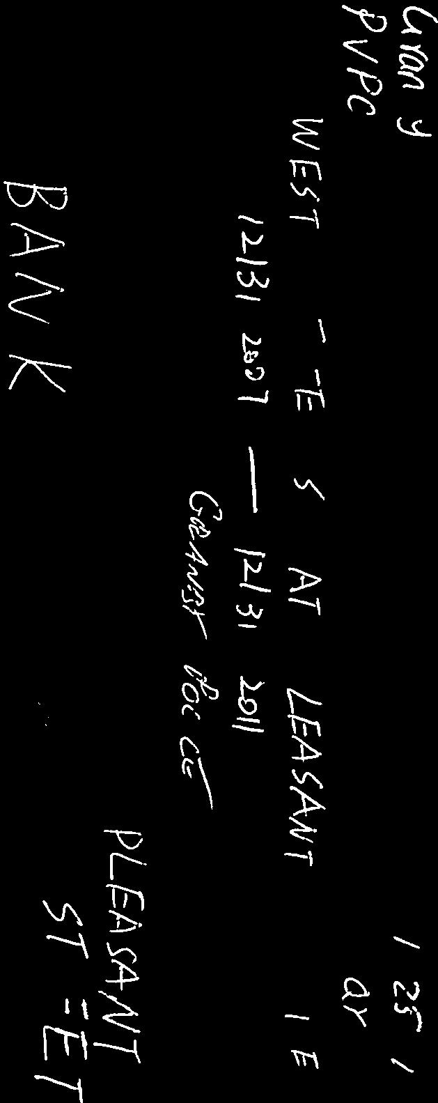
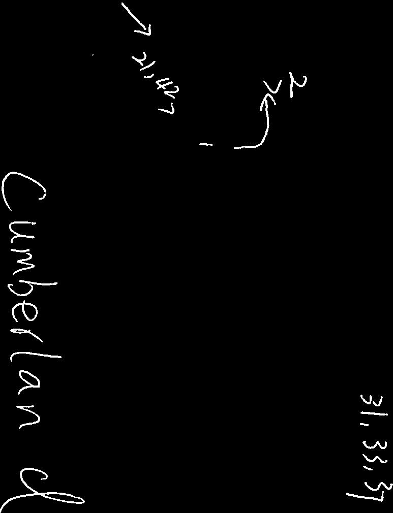
4 Route 202 (East State Street)/School Street & Route 202 (West State Street)/Pleasant Street/Amherst Street, Granby, MA Figure 1. Locus Map RSA Study Area SCHOOL STREET R O U T E ( E AST STATE STREET ) PL E A S AN T STREET A M H E R S T STREET ROUTE 202 (WEST STATE STREET) PLEASANT STREET Source: MassGIS Howard/Stein-Hudson Associates, Inc. Not to scale.
5 Route 202 (East State Street)/School Street & Route 202 (West State Street)/Pleasant Street/Amherst Street, Granby, MA Project Data The audit team conducted an RSA at Route 202/School Street and the Five Corners intersections in Granby on Tuesday, March 26, The RSA agenda appears in Appendix A. Table 1 lists the audit team members and their affiliations. Appendix B provides contact information for all team members. Prior to the RSA, in order to begin assessing possible safety issues, the team reviewed collision diagrams and a crash detail summary based on crash records supplied by the Granby Police Department for the corridor. Appendix C provides the detailed crash data for the study area. Speed regulations are shown in Appendix D. Table 1. Participating Audit Team Members Audit Team Member Agency/Affiliation Gary Roux Pioneer Valley Planning Commission David Desrosiers Granby Highway Department Russ Anderson Granby Fire Department Al Wishart Granby Police Rebecca Fricke Representative Ellen Story s Office Steve Griffin The MacDuffie School Peter Calves MassDOT Highway Division Qing Qing You MassDOT Highway Division Chunxia Feng MassDOT Highway Division John Hillman MassDOT Highway Division District 2 Lisa Schletzbaum MassDOT Highway Division Safety Section Mike Tremblay Howard/Stein-Hudson Associates Joe SanClemente Howard/Stein-Hudson Associates According to the data provided by the Granby Police Department, 18 crashes were reported at the intersection of Route 202/School Street between January 2008 and December Of the 18 crashes, eleven involved vehicles traveling from School Street southbound, including nine angle crashes. Only one crash (6%) occurred on wet pavement or rainy conditions, and 14 crashes (78%) occurred during daylight hours. Forty-three percent of the drivers involved in crashes were under the age of 30. Six of the 18 crashes (33%) resulted in personal injury. During the same time period, 45 crashes were reported between January 2008 and December 2011 at the Five Corners intersections. Eleven crashes (24%) involved vehicles turning left into or out of the Dunkin Donuts or Cumberland Farms driveways, and four (9%) crashes involved vehicles attempting to cut across Route 202 from the Dunkin Donuts driveway to the Cumberland Farms entrance driveway. Four crashes involving vehicles exiting Dunkin Donuts were courtesy crashes, where an uninvolved vehicle stopped in order to yield the right-of-way to a vehicle exiting the Dunkin Donuts driveway, which was subsequently hit by an unsuspecting westbound vehicle on Route 202. A majority of crashes (40, or 89%) Page 4
6 Route 202 (East State Street)/School Street & Route 202 (West State Street)/Pleasant Street/Amherst Street, Granby, MA occurred on dry pavement, 39 (or 87%) occurred during the daylight hours, and 14 (or 31%) resulted in personal injury. No fatal crashes were reported during this time period. Project Location Description The RSA focused on the intersections of Route 202/School Street and the Five Corners intersections (Route 202/Pleasant Street and Route 202/Amherst Street), shown in Figure 2 and Figure 3, respectively. Route 202/School Street is an unsignalized four-way intersection. The Route 202 eastbound and westbound approaches allow for free movement through the intersection, while the School Street northbound and southbound approaches are stop-controlled. Route 202 westbound traffic is permitted to pass in the vicinity of the intersection. There is a horizontal curve in the Route 202 roadway alignment approximately 500 feet east of School Street. The Granby Café is located at the northwest corner of the intersection, with driveways on both Route 202 and School Street. There are no pedestrian sidewalks or crosswalks in the vicinity of the intersection. The MacDuffie School is located on School Street, approximately one quarter mile north of the intersection, and the Granby Junior-Senior High School is located on Route 202, approximately one mile west of the intersection. The MacDuffie School moved to this location in 2011 and has approximately 62 employees and 240 students. RSA team members noted that School Street is a popular route used to access Interstate 90 and Interstate 291, and that traffic on School Street can be significant, particularly during commuter and school peak periods. Route 202/Pleasant Street/Amherst Street, known locally as Five Corners, consists of two closely spaced, but separate intersection locations. The eastern intersection, Route 202/Amherst Street, is unsignalized and has four approaches, including the Cumberland Farms east driveway. The Route 202 eastbound approach consists of a left-turn lane, with a storage length of approximately 60 feet, and a shared through/right-turn lane. The Route 202 westbound approach consists of a single travel lane, however; a gored median approximately 10 feet wide is often used as an informal left-turn lane. The Amherst Street southbound approach operates under stop sign control and consists of a single travel lane. The Cumberland Farms driveway is offset from the Amherst Street southbound approach by approximately 20 feet to the west. The western intersection, Route 202/Pleasant Street, located approximately 250 feet west of Amherst Street, is a signalized intersection with four approaches. The Route 202 eastbound and westbound approaches each consist of a 60-foot long exclusive left-turn lane and a shared through/right-turn lane. Protected and permissive left-turn phasing is provided on the Route 202 eastbound and westbound approaches. The Pleasant Street northbound and southbound approaches each consist of a shared leftturn/through lane and a yield-controlled right-turn slip lane. The right-turn slip lanes had been signalcontrolled, but were replaced with yield-control in Team members noted that a quarry located on Amherst Street approximately 4 miles north of Route 202 generates significant heavy vehicle traffic through the area, typically traveling between Pleasant Street, south of Route 202, and Amherst Street. Sidewalks are provided only along the southwest corner of the intersection, adjacent to CVS Pharmacy. Page 5
/School Street")


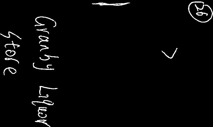
7 Route 202 (East State Street)/School Street & Route 202 (West State Street)/Pleasant Street/Amherst Street, Granby, MA Figure 2. Route 202 (East State Street)/School Street SCHOOL STREET Granby Cafe ROUTE 202 (EAST STATE STREET) Source: MassGIS Howard/Stein-Hudson Associates, Inc. Not to scale.

 Florence Savings Bank Cumberland Farms Post Office ROUTE 202 (WEST STATE")
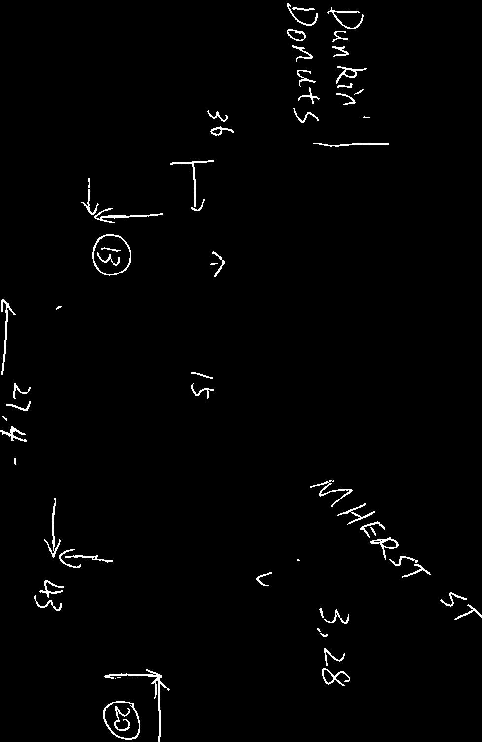
8 Route 202 (East State Street)/School Street & Route 202 (West State Street)/Pleasant Street/Amherst Street, Granby, MA Figure 3. Route 202 (West State Street)/Pleasant Street/Amherst Street PLEASANT STREET Dunkin Donuts A M H E R S T STREET ROUTE 202 (WEST STATE STREET) Florence Savings Bank Cumberland Farms Post Office ROUTE 202 (WEST STATE STREET) CVS PLEASANT STREET Source: GoogleMaps Howard/Stein-Hudson Associates, Inc. Not to scale.
9 Route 202 (East State Street)/School Street & Route 202 (West State Street)/Pleasant Street/Amherst Street, Granby, MA Driveways for Cumberland Farms and Dunkin Donuts are located along Route 202, approximately halfway between Pleasant Street and Amherst Street. The driveway to Cumberland Farms is entranceonly, but both directions of travel are permitted at the Dunkin Donuts driveway. These intersections are the junction of the following roadways, which are categorized according to MassDOT Office of Transportation Planning functional classifications: East State Street (Route 202) is classified as a rural minor arterial and falls under MassDOT jurisdiction. East State Street generally runs in an east-west direction between the Belchertown Town Line to the east, where it becomes State Street, and West Street to the west, where it becomes West State Street. East State Street consists of one travel lane in each direction. Passing is permitted along the roadway in most locations. The speed limit on East State Street is posted at 45 mph in each direction in the vicinity of School Street. West State Street (Route 202) is classified as a rural minor arterial and falls under MassDOT jurisdiction. West State Street generally runs in an east-west direction between West Street to the east, where it becomes East State Street, and the South Hadley Town Line to the west, where it becomes Granby Road. West State Street consists of one travel lane in each direction. Passing is permitted on East State Street in most locations. The speed limit on West State Street is posted at 40 mph in each direction in the vicinity of Pleasant Street and Amherst Street. School Street is classified as a rural minor collector and falls under the jurisdiction of the Town of Granby. School Street runs in a north-south direction between Batchelor Street to the north and Chicopee Street to the south. School Street consists of one travel lane in each direction. Pleasant Street is classified as a rural major collector south of Route 202, and as a rural minor collector north of Route 202, and is under the jurisdiction of the Town of Granby. Pleasant Street runs in a northsouth direction, between Morgan Street to the north and East Street to the south. Pleasant Street consists of one travel lane in each direction. Amherst Street is classified as a rural major collector and falls under the jurisdiction of the Town of Granby. Amherst Street runs in a north-south direction between Amherst Road to the north and Route 202 to the south. Amherst Street consists of one travel lane in each direction. Page 8
10 Route 202 (East State Street)/School Street & Route 202 (West State Street)/Pleasant Street/Amherst Street, Granby, MA Road Safety Audit Observations Based on field observations on Tuesday, March 26, 2013, the RSA team determined that the study area intersections have the following issues that affect safety: Congestion and Driver Frustration; Speed and Sight Distance; Intersection geometry; Signage; Turning Lanes; Signal Indications and Clearance Intervals; Access management; and Pedestrian Accommodations. The following sections describe in more detail the safety issues and potential enhancements determined during the RSA. Several of these issues require further study and engineering judgment to determine the feasibility of implementing the improvements to address them. Page 9
11 Route 202 (East State Street)/School Street & Route 202 (West State Street)/Pleasant Street/Amherst Street, Granby, MA Location 1: Route 202/School Street The intersection of Route 202/School Street experienced 18 crashes between January 2008 and December Nine of the 18 crashes (5) were angle crashes between School Street southbound vehicles and vehicles traveling along Route 202. A team member noted that 43% of the motorists involved in crashes at the Route 202/School Street intersection were under the age of 30. In the summer of 2013, the intersection is scheduled to receive low-cost, short-term improvements that include new intersection warning signs, Stop Ahead signs, improved pavement markings, and trimming over overgrown vegetation to improve sightlines. The passing zone along Route 202 within the vicinity of School Street will also be removed and replaced with a double yellow centerline. Observations: The RSA team made the following observations with respect to congestion and driver frustration, speed and sight distance, intersection geometry, signage, and pedestrian accommodations: Congestion and Driver Frustration RSA team members noted that vehicles at the School Street northbound and southbound stop-controlled approaches often have difficulty finding acceptable gaps, particularly during peak commuter and school periods, when School Street is used as a popular local cut-through to access Interstates 90 and 291 as well as the nearby schools. Team members commented that traffic volumes at the intersection have further increased since the MacDuffie School opened on School Street in According to team members, this results in long queues and delays at the School Street approaches, and driver willingness to accept smaller gaps in traffic, which may contribute to Vehicles on School Street have difficulty finding acceptable gaps on Route 202. the occurrence of angle crashes at this intersection. Angle crashes between Route 202 and School Street traffic may be indications of excessive delay, and in turn, more aggressive driver behavior, of traffic on the School Street northbound and southbound approaches. Page 10
12 Route 202 (East State Street)/School Street & Route 202 (West State Street)/Pleasant Street/Amherst Street, Granby, MA Speed and Sight Distance A horizontal curve on Route 202 east of School Street obscures sightlines east of School Street. A horizontal curve in the Route 202 roadway alignment is located approximately 500 feet east of School Street, and limits the sightlines to the east of the intersection. Team members questioned whether there was adequate sight distance at the intersection, given that prevailing travel speeds on Route 202 often exceed the 45 mph speed limit. The presence of the horizontal curve, combined with higher travel speeds, may make it difficult for motorists to judge when it is safe to enter the intersection and may contribute to the occurrence of angle crashes at the intersection. For example, in one angle crash involving a Route 202 westbound vehicle and a School Street northbound vehicle, one of the motorists reportedly did not see the other vehicle. During field observations, team members noted that a fence located at the southwest corner of the Route 202/School Street intersection had been recently hit. Public safety officials stated that the vehicle was traveling too fast on School Street southbound and lost control of the vehicle. The stop bar on School Street northbound is currently set back from the intersection by approximately 35 feet. The placement of the stop bar may have been intentional to allow for trucks to safely turn from Route 202 onto School Street southbound. However, a line of evergreen trees at the southwest corner of the intersection along Route 202 obstructs sightlines west of the intersection. Vehicles were observed stopping well past of the stop bar to wait for a gap in Route 202 traffic. These trees are scheduled to be trimmed in the summer of 2013 as part of the low-cost improvements project. Similarly, several years ago, trees along the north side of Route 202, west of School Street, were removed, resulting in improved sightlines at the School Street southbound approach. Intersection Geometry The School Street southbound approach intersects Route 202 at a slightly skewed angle, making it harder for motorists to look left to see oncoming Route 202 westbound traffic. As a result, RSA team members observed School Street southbound vehicles stopping on top of the double yellow centerline when waiting for a gap in Route 202 traffic. However, this may make it more difficult for heavy vehicles to turn onto School Street. One crash involved a School Street southbound vehicle and a vehicle turning right onto School Street from Route 202 westbound. Page 11
13 Route 202 (East State Street)/School Street & Route 202 (West State Street)/Pleasant Street/Amherst Street, Granby, MA Signage Team members observed that there are no advanced Stop Ahead (W3-1) warning signs along the School Street northbound approach to the Route 202/School Street intersection; pavement markings indicating Stop Ahead are provided, but are badly worn and illegible. It was also suggested that the intersection warning signage (W2-1) on Route 202 westbound may be too close to the intersection of Route 202/School Street for motorists to perceive and react to given the prevailing travel speeds. Short-term improvements scheduled to occur in the summer of 2013 will place improved intersection warning signage (W2-1) and Stop Ahead (W3-1) signage in the appropriate locations. Team members noted that the street name plaque, located at the southeast corner of the intersection, is difficult to read due to its size and placement with respect to the edge of the roadway. Meanwhile, a street name sign for School Street is not provided on the north side of the intersection. One rear-end crash was reported involving vehicles traveling along Route 202 eastbound, which may have occurred because a vehicle stopped or slowed unexpectedly at the intersection. Pedestrian Accommodations There are currently no pedestrian accommodations at the intersection. Potential Enhancements: 1. Collect motor vehicle speed data along School Street and Route 202 in the vicinity of the Route 202/School Street intersection, to identify the most appropriate times of day for increased enforcement. Evaluate safety conditions after the short-term improvements are implemented in the summer of Collect traffic volume data at the intersection of Route 202/School Street to determine if a change in intersection control (e.g. traffic signal or roundabout) is warranted and feasible. 3. As part of long-term reconstruction efforts, consider the feasibility and safety benefits of changing the intersection control, either through introduction of a traffic signal or roundabout, if warranted according to traffic volume data. Consider heavy vehicle traffic, pedestrian accommodations, and sight distance limitations east of the intersection due to the horizontal curve of the roadway. 4. Consider providing safety education for young drivers at The MacDuffie School and the Granby Junior-Senior High School, specifically noting the high-crash locations and emphasizing safe driving techniques. 5. As part of long-term reconstruction efforts, consider the feasibility of realigning the School Street southbound approach to intersect Route 202 at a right angle and ensure that it is narrow enough to preclude vehicles from forming two lines and obstructing each other s sight lines while accommodating turning radius requirements for heavy vehicles.. Page 12
14 Route 202 (East State Street)/School Street & Route 202 (West State Street)/Pleasant Street/Amherst Street, Granby, MA 6. Consider installing street name signage for the north leg of School Street at the intersection. 7. Relocate street name signage at the southeast corner of the intersection so that it is visible from Route 202. Replace signage as appropriate to meet current MassDOT standards. Page 13

15 Route 202 (East State Street)/School Street & Route 202 (West State Street)/Pleasant Street/Amherst Street, Granby, MA Location 2: Route 202/Pleasant Street/Amherst Street (Five Corners) Observations: The Five Corners intersections consist of two separate but closely spaced intersections; the intersection of Route 202/Amherst Street/Cumberland Farms east driveway is located approximately 250 feet east of the Route 202/Pleasant Street intersection. At the Five Corners intersections, 45 crashes were reported between January 2008 and December Eight of the 45 crashes reported (18%) involved vehicles turning left into or out of the Dunkin Donuts driveway, or cutting across Route 202 to the Cumberland Farms west driveway. Four of these crashes were reported to have been courtesy crashes, where a westbound vehicle stopped to allow a vehicle to exit the Dunkin Donuts driveway, but an unsuspecting vehicle entering the adjacent left-turn lane struck the exiting vehicle. Seven of the 45 crashes reported at the Five Corners intersections (16%) involved vehicles turning left from Route 202 westbound into the Cumberland Farms east driveway. Four rear-end crashes occurred on the Route 202 westbound approach to the Route 202/Pleasant Street intersection, and one rear-end crash occurred along the Route 202 eastbound approach to the intersection. Three angle crashes involved vehicles turning left from Route 202 onto Pleasant Street. The RSA team made the following observations with respect to turning lanes, signal indications and timing, access management, signage, and pedestrian accommodations: Turning Lanes At the unsignalized intersection of Route 202/Amherst Street, an approximately 60-foot long dedicated left-turn lane is provided at the Route 202 eastbound approach, but a left-turn lane is not provided to Route 202 westbound traffic. RSA team members noted that vehicles making a left turn into Cumberland Farms from Route 202 typically use the painted gore area. Using this gore area gives turning vehicles a dedicated place to wait for an acceptable gap in opposing traffic, but also provides a better angle to view oncoming Route 202 eastbound traffic, since vehicles Vehicles use the gore area on Route 202 westbound to wait for a gap in Route 202 waiting in the opposing left-turn lane may eastbound traffic before turning left into obscure sightlines. According to the crash Cumberland Farms. data, one crash involving a Route 202 eastbound vehicle and a Route 202 westbound left-turning vehicle reportedly occurred because of Page 14
16 Route 202 (East State Street)/School Street & Route 202 (West State Street)/Pleasant Street/Amherst Street, Granby, MA obstructed visibility. Team members stated that using the gore area to make left turns is so common that westbound vehicles may not expect vehicles slowing or stopping in the travel lane to make a left turn. One triple rear-end crash occurred on the Route 202 westbound approach to this intersection. Meanwhile, vehicles approaching Amherst Street on Route 202 eastbound were observed entering the short left-turn pocket, without using their directional, and then quickly turning onto Amherst Street. Team members commented that the left-turn lane combined with the short distance between the Pleasant Street and Amherst Street intersections may not give motorists adequate time to realize they need to shift into the turning lane to access Amherst Street. Thus, vehicles traveling along Route 202 westbound may not have adequate time to react. Similarly, team members noted that the left-turn lanes along the Route 202 eastbound and westbound approaches to the Route 202/Pleasant Street intersection are only long enough to hold two to three vehicles; likely due to the limited cross-section of the roadway. Signal Indications and Timing In 2009, post-mounted left-turn signal indications were added to the Route 202/Pleasant Street intersection to allow for protected and permissive leftturn phasing for Route 202 eastbound and westbound. A team member noted that the locations of these signal indications may cause confusion, as left-turning vehicles may expect overhead left-turn indications. The visibility of these post-mounted signals may also be obscured by opposing Vehicles exiting the Dunkin Donuts driveway may cut across three travel lanes on Route 202 to access Cumberland Farms. traffic or heavy vehicles. Team members also noted that the length of the left-turn phases on Route 202, when called, are relatively short, and may cause drivers to be aggressive when turning. Two angle crashes involved vehicles turning left from Route 202 onto Pleasant Street that were the result of motorist failure to yield. In addition, four rear-end crashes occurred along the Route 202 westbound approach to the intersection; driver indecision over whether to turn left during the permitted left turn phase may have contributed to these crashes. An RSA team member also questioned whether the clearance intervals at the intersection may have contributed to these rear-end crashes. Page 15
17 Route 202 (East State Street)/School Street & Route 202 (West State Street)/Pleasant Street/Amherst Street, Granby, MA Access Management In the vicinity of the Dunkin Donuts driveway, the Route 202 westbound approach transitions from one to two travel lanes to accommodate a left-turn lane. According to the crash records, four courtesy crashes were reported involving vehicles exiting the Dunkin Donuts driveway and vehicles traveling along Route 202 westbound. Thus, a motorist traveling along Route 202 westbound may stop to allow a vehicle to turn out of the Dunkin Donuts driveway; however, a vehicle in the other westbound lane may not expect, or be able to perceive and react to, a turning vehicle exiting the driveway. Additionally, vehicles exiting the Dunkin Donuts driveway may attempt to weave through queued vehicles, which may not be expected by Route 202 westbound vehicles entering the left-turn lane. RSA team members noted that vehicles often cut through commercial driveways in order to avoid the congestion and confusion on the segment of Route 202 between Pleasant Street and Amherst Street. According to team members, vehicles often enter the Dunkin Donuts parking lot from Amherst Street, travel behind the building, and exit onto Pleasant Street. Similarly, vehicles also cut through Cumberland Farms by turning right from Pleasant Street, cutting through the parking lot, and turning right onto Route 202 eastbound. One crash involved a turning vehicle that turned left out of the Florence Savings Bank onto Route 202, even though the driveway is restricted to right-only. Intersection Geometry During field observations at the Pleasant Street northbound slip lane, RSA team members noted that large heavy vehicles have difficulty making right turns onto Route 202 eastbound and often need to cross the double yellow centerline on Route 202 and/or run over the inside curb in the slip lane. Team members also observed that the Yield and Do Not Enter signage that had been mounted on the old signal post had been knocked down. Four crashes occurred in the Pleasant Street northbound rightturn slip lane between January 2008 and December 2011; two of these crashes involved vehicles hitting the signal post located on the inside of the slip lane. Signage Heavy vehicles have difficulty making right turns from Pleasant Street onto Route 202. On the Route 202 eastbound approach to the Route 202/Pleasant Street intersection, a Do Not Block Driveway (R10-7m) sign obscures a guide sign for Breezy Acres Farm. Motorists on Page 16
18 Route 202 (East State Street)/School Street & Route 202 (West State Street)/Pleasant Street/Amherst Street, Granby, MA Route 202 eastbound may not be able to see the guide sign, or may divert their attention from the roadway to read the sign. One rear-end crash was reported along Route 202 eastbound in the vicinity of these signs. The signs are also in close proximity to an upstream Left Lane Must Turn Left (R3-7) sign. RSA team members noted that signs indicating street names for streets that can be accessed from Amherst Street or Pleasant Street are located along Amherst Street northbound, just north of Route 202; Pleasant Street northbound, just north of Route 202; and along Pleasant Street southbound, just south of Route 202. These signs are not standard and have small text, making them difficult for motorists to read without stopping in the travel lane. An RSA team member noted that the Yield (R1-2) and Do Not Enter (R5-1) signs that had previously been posted on Regulatory signage obstructs guide signage along Route 202 eastbound. an old signal post in the Pleasant Street northbound right-turn slip lane at the Route 202/Pleasant Street intersection had been struck and knocked down. A Do Not Pass (R4-1) sign was also struck on the Route 202 westbound approach to the Route 202/Amherst Street intersection, resulting in a bent sign post. The Stop (R1-1) sign at the Amherst Street southbound approach to the Route 202/Amherst Street/Cumberland Farms east driveway intersection was also struck, resulting in a slightly bent sign post. Pedestrian Accommodations The intersection of Route 202/Pleasant Street currently has sidewalks along the southwest corner of the intersection, adjacent to the CVS Pharmacy. Crosswalks are also provided across the two CVS driveways. However, this is the only location in the area where sidewalks are provided. There are no crosswalks or pedestrian ramps that connect to other local businesses. Pedestrian accommodations adjacent to the CVS Pharmacy end without making local connections. Page 17
19 Route 202 (East State Street)/School Street & Route 202 (West State Street)/Pleasant Street/Amherst Street, Granby, MA Potential Enhancements: 1. Consider the safety benefits of formalizing a left-turn lane on Route 202 westbound at Amherst Street/Cumberland Farms east driveway in order to formalize a safe, dedicated place for vehicles to make a left turn. 2. As part of long-term reconstruction efforts, consider signalizing the Route 202/Amherst Street/Cumberland Farms intersection and coordinating with the Route 202/Pleasant Street signalized intersection if safety conditions do not improve as a result of adding the left-turn lane. 3. As part of long-term planning efforts, consider replacing the existing mast arms with longer mast arms to align signal faces with the travel lanes and provide redundancy of signal indications to improve visibility. 4. Evaluate the length of the protected left-turn phase and clearance intervals for protected left turns at the Route 202/Pleasant Street intersection to ensure that there is adequate time for vehicles to safely exit the intersection before a conflicting movement is given the right-ofway. Consider the safety benefits of implementing protected-only left-turn phasing. 5. Consider the feasibility of lengthening the left-turn lanes on the Route 202 eastbound approach at the Route 202/Amherst Street intersection and on the Router 202 approach at the Route 202/Pleasant Street intersection as part of long-term reconstruction efforts. 6. Restrict left turns with signage at the Dunkin Donuts and the Cumberland Farms entrance driveway on Route 202 to reduce the occurrence of angle-type crashes. 7. As part of long-term reconstruction efforts, consider the feasibility of constructing a raised median on Route 202 between Pleasant Street and Amherst Street to prevent left turns at driveways if turn restrictions through signage are deemed ineffective or create an enforcement issue. 8. As part of long-term reconstruction efforts, consider realigning Amherst Street westerly so that it aligns with the Cumberland Farms driveway, which would facilitate left turns from Route 202 onto Amherst Street and Cumberland Farms. 9. Consider the feasibility and appropriateness of either removing or modifying the geometry of the right-turn slip lanes on Pleasant Street to accommodate heavy vehicles as part of longterm reconstruction efforts. 10. Reduce sign clutter along Route 202 eastbound. Ensure there is adequate spacing between signs and remove unnecessary signage, as appropriate. 11. Remove the nonstandard street name signage on Pleasant Street and on Amherst Street northbound. Page 18
20 Route 202 (East State Street)/School Street & Route 202 (West State Street)/Pleasant Street/Amherst Street, Granby, MA 12. Reinstall the Yield (R1-2) and Do Not Enter (R5-1) signage on the Pleasant Street northbound slip lane away from the curb line and remove the unused signal post so that it is not struck by turning heavy vehicles. 13. Repair or replace sign posts for the Do Not Pass (R1-4) sign on Route 202 westbound and the Stop sign on Amherst Street southbound to improve sign visibility. 14. Consider options to discourage or eliminate cut-through traffic between Amherst Street and Pleasant Street via the adjacent businesses driveways either through turn restrictions or by modifying access to parcels as they are redeveloped. 15. As part of long-term reconstruction efforts, evaluate the feasibility of providing additional pedestrian facilities in the area, and form connections with the pedestrian facilities that already exist, to encourage visitors to walk between the businesses in the Five Corners area. Page 19
21 Route 202 (East State Street)/School Street & Route 202 (West State Street)/Pleasant Street/Amherst Street, Granby, MA Potential Safety Enhancements Based on its observations and discussions, the RSA team identified the issues and possible enhancements that could improve safety at Route 202/School Street and the Five Corners intersections in Granby, MA. Short-term enhancements include, but are not limited to: Continued enforcement; Provide driver safety education at the area schools; Restrict left turns at the Dunkin Donuts and Cumberland Farms driveways; Replace missing, damaged, or outdated signage; Evaluate clearance intervals; and Formalize a left-turn lane at the Route 202 westbound approach to the Route 202/Amherst Street intersection. To enhance the safety of the corridor, the long-term enhancements are to: Evaluate the benefits of changing the intersection control at Route 202/School Street; Realign the School Street southbound approach so that it intersects Route 202 at a right angle; Lengthen the left-turn lanes on Route 202 between Pleasant Street and Amherst Street; Evaluate the feasibility of a median on Route 202 between Pleasant Street and Amherst Street; Modify the geometry of the Pleasant Street slip lanes to better accommodate heavy vehicles; Evaluate the safety benefits of signalizing the Route 202/Amherst Street intersection; and Provide pedestrian facilities where needed. Page 20
22 Route 202 (East State Street)/School Street & Route 202 (West State Street)/Pleasant Street/Amherst Street, Granby, MA Table 2 summarizes these safety issues, possible enhancements, estimated safety payoff, time frame, cost, and responsibility. Safety payoff estimates are based on engineering judgment and are categorized as low, medium, and high. The time frame is categorized as short-term (<1 year), mid-term (1 to 3 years), or long-term (typically >3 years). The costs are categorized as low (<$10,000), medium ($10,000 to $50,000), or high (>$50,000). It is the responsibility of MassDOT to ensure that the designer incorporates the relevant safety enhancements identified as part of this RSA. The RSA is intended to identify potential safety improvements that can be evaluated and included as part of the design process for future reconstruction efforts. The short-term lowcost potential improvements could be considered by the responsible agency for implementation prior to reconstruction. Page 21
23 Route 202 (East State Street)/School Street & Route 202 (West State Street)/Pleasant Street/Amherst Street, Granby, MA Table 2. Summary of Potential Safety Enhancements Location Location 1: Route 202/School Street Safety Enhancement Collect motor vehicle speed data along School Street and Route 202 in the vicinity of the Route 202/School Street intersection, to identify the most appropriate times of day for increased enforcement. Evaluate safety conditions after the short-term improvements are implemented in the summer of Collect traffic volume data at the intersection of Route 202/School Street to determine if a change in intersection control (e.g. traffic signal or roundabout) is warranted and feasible. As part of long-term reconstruction efforts, consider the feasibility and safety benefits of changing the intersection control, either through introduction of a traffic signal or roundabout, if warranted according to traffic volume data. Consider heavy vehicle traffic, pedestrian accommodations, and sight distance limitations east of the intersection due to the horizontal curve of the roadway. Consider providing safety education for young drivers at The MacDuffie School and the Granby Junior-Senior High School, specifically noting the high-crash locations and emphasizing safe driving techniques. As part of long-term reconstruction efforts, consider the feasibility of realigning the School Street southbound approach to intersect Route 202 at a right angle and ensure that it is narrow enough to preclude vehicles from forming two lines and obstructing each other s sight lines while accommodating turning radius requirements for heavy vehicles. Consider installing street name signage for the north leg of School Street at the intersection. Relocate street name signage at the southeast corner of the intersection so that it is visible from Route 202. Replace signage as appropriate to meet current MassDOT standards. Safety Payoff Time Frame Cost Responsible Party Low Short-term Low Low Short-term Low MassDOT/Town of Granby MassDOT/Town of Granby High Long-term High MassDOT Low Short-term Low Town of Granby Low Long-Term High MassDOT Low Short-term Low MassDOT Low Short-term Low MassDOT Page 22
24 Route 202 (East State Street)/School Street & Route 202 (West State Street)/Pleasant Street/Amherst Street, Granby, MA Table 2. Summary of Potential Safety Enhancements (continued) Location Location 2: Route 202/Pleasant Street and Route 202/Amherst Street Safety Enhancement Consider the safety benefits of formalizing a left-turn lane on Route 202 westbound at Amherst Street/Cumberland Farms east driveway in order to formalize a safe, dedicated place for vehicles to make a left turn. As part of long-term reconstruction efforts, consider signalizing the Route 202/Amherst Street/Cumberland Farms intersection and coordinating with the Route 202/Pleasant Street signalized intersection if safety conditions do not improve as a result of adding the left-turn lane. As part of long-term planning efforts, consider replacing the existing mast arms with longer mast arms to align signal faces with the travel lanes and provide redundancy of signal indications to improve visibility. Evaluate the length of the protected left-turn phase and clearance intervals for protected left turns at the Route 202/Pleasant Street intersection to ensure that there is adequate time for vehicles to safely exit the intersection before a conflicting movement is given the right-of-way. Consider the safety benefits implementing protected-only left-turn phasing. Consider the feasibility of lengthening the left-turn lanes on the Route 202 eastbound approach at the Route 202/Amherst Street intersection and on the Router 202 approach at the Route 202/Pleasant Street intersection as part of long-term reconstruction efforts. Restrict left turns with signage at the Dunkin Donuts and the Cumberland Farms entrance driveway on Route 202 to reduce the occurrence of angle-type crashes. As part of long-term reconstruction efforts, consider the feasibility of constructing a raised median on Route 202 between Pleasant Street and Amherst Street to prevent left turns at driveways if turn restrictions through signage are deemed ineffective or create an enforcement issue. Safety Payoff Time Frame Cost Responsible Party High Short-term Low MassDOT High Long-term High MassDOT Medium Long-term High MassDOT Low Short-term Low MassDOT High Long-term High MassDOT Low Short-term Low MassDOT High Long-term High MassDOT Page 23
25 Route 202 (East State Street)/School Street & Route 202 (West State Street)/Pleasant Street/Amherst Street, Granby, MA Table 2. Summary of Potential Safety Enhancements (continued) Location Location 2: Route 202/Pleasant Street and Route 202/Amherst Street Safety Enhancement Consider the feasibility and appropriateness of either removing or modifying the geometry of the right-turn slip lanes on Pleasant Street to accommodate heavy vehicles as part of long-term reconstruction efforts. As part of long-term reconstruction efforts, consider realigning Amherst Street westerly so that it aligns with the Cumberland Farms driveway, which would facilitate left turns from Route 202 onto Amherst Street and Cumberland Farms. Reduce sign clutter along Route 202 eastbound. Ensure there is adequate spacing between signs and remove unnecessary signage, as appropriate. Remove the nonstandard street name signage on Pleasant Street and on Amherst Street northbound. Reinstall the Yield (R1-2) and Do Not Enter (R5-1) signage on the Pleasant Street northbound slip lane away from the curb line and remove the unused signal post so that it is not struck by turning heavy vehicles. Repair or replace sign posts for the Do Not Pass (R1-4) sign on Route 202 westbound and the Stop sign on Amherst Street southbound to improve sign visibility. Consider options to discourage or eliminate cut-through traffic between Amherst Street and Pleasant Street via the adjacent businesses driveway either through turn restrictions or by modifying access to parcels as they are redeveloped. Safety Payoff Time Frame Cost Responsible Party Medium Long-term High MassDOT Medium Long-term High MassDOT Low Short-term Low MassDOT Low Short-term Low Town of Granby Low Short-term Low MassDOT Low Short-term Low MassDOT Low Short-term Low MassDOT/Town of Granby Page 24
26 Route 202 (East State Street)/School Street & Route 202 (West State Street)/Pleasant Street/Amherst Street, Granby, MA Table 2. Summary of Potential Safety Enhancements (continued) Location Location 2: Route 202/Pleasant Street and Route 202/Amherst Street Safety Enhancement As part of long-term reconstruction efforts, evaluate the feasibility of providing additional pedestrian facilities in the area, and form connections with the pedestrian facilities that already exist, to encourage visitors to walk between the businesses in the Five Corners area. Safety Payoff Time Frame Cost Responsible Party High Long-term High MassDOT Page 25
27 Cranberry Highway (Routes 6 and 28), Granby, MA Appendix A. RSA Meeting Agenda
28 Granby, MA Route 202 (East State St)/School Street & Route 202 (West State St)/Pleasant St/Amherst St Meeting Location: Granby Police Department 259 A East State Street, Granby, MA Tuesday, March 19, :00 AM 12:00 noon Type of meeting: Attendees: Please bring: High Crash Locations Road Safety Audit Invited Participants to Comprise a Multidisciplinary Team Thoughts and Enthusiasm!! 9:00 AM Welcome and Introductions 9:15 AM Discussion of Safety Issues 10:00 AM Site Visit Crash history, Speed Regulations provided in advance Existing Geometries and Conditions Drive to the intersections of Route 202 at School St and Route 202 at Pleasant St/Amherst St As a group, identify areas for improvement 11:00 AM Discussion of Potential Improvements Discuss observations and finalize safety issue areas Discuss potential improvements and finalize recommendations 12:00 noon Adjourn for the Day but the RSA has not ended Instructions for Participants: Before attending the RSA on March 19th, participants are encouraged to drive/walk through the intersections and complete/consider elements on the RSA Prompt List with a focus on safety. All participants will be actively involved in the process throughout. Participants are encouraged to come with thoughts and ideas, but are reminded that the synergy that develops and respect for others opinions are key elements to the success of the overall RSA process. After the RSA meeting, participants will be asked to comment and respond to the document materials to assure it is reflective of the RSA completed by the multidisciplinary team.
29 Cranberry Highway (Routes 6 and 28), Granby, MA Appendix B. RSA Audit Team Contact List
30 Route 202 (East State Street)/School Street & Route 202 (West State Street)/Pleasant Street/Amherst Street, Granby, MA Appendix C. Detailed Crash Data


31
32 Crash Data Summary Table East State Street and School Street, Granby, MA 1/1/ /31/2011 Crash Diagram Crash Date Time of Day Manner of Collision Light Condition Weather Condition Road Surface Driver Contributing Code Ages Comments Ref # m/d/y Type Type Type Type Type D1 D2 D3 D4 1 1/25/08 6:41 AM Sideswipe, opposite direction Dawn Cloudy Dry No Improper Driving Vehicle 1 diverted and collided with Vehicle 2 in a side-swipe manner 2 4/8/08 2:07 PM Angle Daylight Clear Dry Inattention /26/08 4:59 PM Rear-end Daylight Clear Dry Inattention /26/08 5:27 PM Angle Daylight Clear Dry Inattention Police officer directing through traffic, Vehicle 1 turns left without signaling 5 7/8/08 6:29 PM Angle Daylight Cloudy Dry Inattention /19/08 8:32 PM Angle Dusk Clear Dry Failed to yield to right of way /6/08 11:15 AM Angle Daylight Cloudy Dry Inattention /3/08 8:07 AM Angle Daylight Clear Dry Glare /23/09 6:28 PM Sideswipe, same direction Daylight Clear Dry Failed to yield to right of way 37 unk Hit and run, drivers diverted vehicles and collided in a side-swipe manner 10 1/30/09 8:45 AM Angle Daylight Clear Dry Inattention /7/09 8:20 PM Rear-end Dusk Rain Wet No Improper Driving /22/09 3:30 PM Angle Daylight Clear Dry Failed to yield to right of way Driver in vehicle 2 stated that he didn't see vehicle /2/10 8:31 AM Rear-end Daylight Clear Dry No Improper Driving Unable to be located. 30 ft east of MECO pole # /3/11 5:03 PM Angle Daylight Clear Dry Failed to yield to right of way Vehicle 2 didn't see vehicle /16/11 3:03 PM Angle Daylight Clear Dry No Improper Driving /17/11 1:02 PM Angle Daylight Clear Dry Inattention /20/11 5:11 PM Sideswipe, opposite direction Dark, unknown roadway lighting Clear Dry Failed to yield to right of way /26/11 2:50 PM Angle Daylight Clear Dry Failed to yield to right of way Vehicle 2 entered the westbound travel lane while turning to go eastbound Summary based on Crash Reports obtained from the Granby Police Department
33 Crash Data Summary Tables and Charts East State Street and School Street, Granby, MA 25% 2 15% 1 5% CRASH MONTH 22% 22% 17% 17% 11% 6% 6% J F M A M J J A S O N D 3 28% CRASH DAY OF WEEK 28% 28% 2 1 6% 6% 6% Monday Tuesday Wednesday Thursday Friday Saturday Sunday % 6AM 8AM 17% 8AM 10AM 6% 6% 10AM 12PM CRASH TIME OF DAY 12PM 2PM 22%22% 2PM 4PM 4PM 6PM 11% 11% 6PM 8PM 8PM 10PM 10PM 12AM 12AM 2AM 2AM 4AM 4AM 6AM Single Vehicle Crash 17% CRASH MANNER OF COLLISION 67% 6% Rear-end Angle Sideswipe, same direction 11% Sideswipe, opposite direction Head on Rear to Rear Unknown E STATE ST AND SCHOOL ST.xlsx 1 of 3 3/1/2013
34 % Crash Data Summary Tables and Charts East State Street and School Street, Granby, MA 6% 11% CRASH LIGHT CONDITION Daylight Dawn Dusk Dark Lighted Roadway 6% Dark Roadway not lighted Dark unknown roadway lighting Other Unknown % Clear 17% Cloudy CRASH WEATHER CONDITION 6% Rain Snow Sleet, Hail, Freezing Rain Fog, Smog, Smoke Severe Crosswinds Blowing sand, snow Other Unknown % CRASH ROAD SURFACE 6% Dry Wet Snow Ice Sand, mud, dirt, oil, gravel 19% 24% CRASH DRIVER AGES 14% 8% Water (standing, moving) 16% 8% Slush Other 11% Unknown 80+ E STATE ST AND SCHOOL ST.xlsx 2 of 3 3/1/2013


35
ROAD SAFETY AUDIT. Route 114 at Interstate I-495 Northbound Ramps. City of Lawrence. July 30, 2015
 ROAD SAFETY AUDIT Route 114 at Interstate I-495 Northbound Ramps City of Lawrence July 30, 2015 Prepared For: Massachusetts Department of Transportation Prepared By: Toole Design Group 33 Broad Street,
ROAD SAFETY AUDIT. County Street at Hart Street. City of Taunton. January 30, Prepared For: Massachusetts Department of Transportation
 ROAD SAFETY AUDIT County Street at Hart Street City of Taunton January 30, 2015 Prepared For: Massachusetts Department of Transportation Prepared By: Toole Design Group 33 Broad Street, 4 th Floor Boston,
ROAD SAFETY AUDIT. Russell Street (Route 9) at North and South Maple Streets Town of Hadley. March 2014
 at North and South Maple Streets Town of Hadley. March 2014") ROAD SAFETY AUDIT Russell Street (Route 9) at North and South Maple Streets Town of Hadley March 2014 Prepared for: Massachusetts Department of Transportation Prepared by: Howard/Stein-Hudson Associates
ROAD SAFETY AUDIT Russell Street (Route 9) at North and South Maple Streets Town of Hadley March 2014 Prepared for: Massachusetts Department of Transportation Prepared by: Howard/Stein-Hudson Associates
ROAD SAFETY AUDIT. Route 16 at Interstate 395 Town of Webster. October Prepared For: MassDOT
 ROAD SAFETY AUDIT Route 16 at Interstate 395 Town of Webster October 2015 Prepared For: MassDOT Prepared By: McMahon Associates, Inc. 300 Myles Standish Blvd. Suite 201 Taunton, MA 02780 Table of Contents
ROAD SAFETY AUDIT. State Road (Route 6) Corridor Town of Dartmouth. March Prepared For: MassDOT
 Corridor Town of Dartmouth. March Prepared For: MassDOT") ROAD SAFETY AUDIT State Road (Route 6) Corridor Town of Dartmouth March 2015 Prepared For: MassDOT Prepared By: McMahon Associates, Inc. 300 Myles Standish Blvd. Suite 201 Taunton, MA 02780 Table of Contents
ROAD SAFETY AUDIT State Road (Route 6) Corridor Town of Dartmouth March 2015 Prepared For: MassDOT Prepared By: McMahon Associates, Inc. 300 Myles Standish Blvd. Suite 201 Taunton, MA 02780 Table of Contents
ROAD SAFETY AUDIT. Route 27 (Crescent Street)/Quincy Street/Massasoit Boulevard. City of Brockton. July 24,2013
/Quincy Street/Massasoit Boulevard. City of Brockton. July 24,2013") ROAD SAFETY AUDIT Route 27 (Crescent Street)/Quincy Street/Massasoit Boulevard City of Brockton July 24,2013 Prepared for: Massachusetts Department of Transportation Prepared by: Howard/Stein-Hudson Associates
ROAD SAFETY AUDIT Route 27 (Crescent Street)/Quincy Street/Massasoit Boulevard City of Brockton July 24,2013 Prepared for: Massachusetts Department of Transportation Prepared by: Howard/Stein-Hudson Associates
ROAD SAFETY AUDIT. Damon Road. City of Northampton. October Prepared for: Massachusetts Department of Transportation
 ROAD SAFETY AUDIT Damon Road City of Northampton October 2013 Prepared for: Massachusetts Department of Transportation Prepared by: Howard/Stein-Hudson Associates 38 Chauncy Street Boston, MA 02111 Table
AGENDA ITEM 6 D THOMASVILLE ROAD (HERMITAGE BOULEVARD TO LIVE OAK PLANTATION ROAD) ROADWAY SAFETY AUDIT
 ROADWAY SAFETY AUDIT") May 15, 2018 AGENDA ITEM 6 D THOMASVILLE ROAD (HERMITAGE BOULEVARD TO LIVE OAK PLANTATION ROAD) ROADWAY SAFETY AUDIT TYPE OF ITEM: Discussion STATEMENT OF ISSUE The Florida Department of Transportation
May 15, 2018 AGENDA ITEM 6 D THOMASVILLE ROAD (HERMITAGE BOULEVARD TO LIVE OAK PLANTATION ROAD) ROADWAY SAFETY AUDIT TYPE OF ITEM: Discussion STATEMENT OF ISSUE The Florida Department of Transportation
ROAD SAFETY AUDIT. Washington Street (Route 53) at Pleasant Street. Town of Pembroke. June 26, Prepared For: MassDOT Highway Division
 at Pleasant Street. Town of Pembroke. June 26, Prepared For: MassDOT Highway Division") ROAD SAFETY AUDIT Washington Street (Route 53) at Pleasant Street Town of Pembroke June 26, 2014 Prepared For: MassDOT Highway Division Prepared By: BETA Group, Inc. Table of Contents Project Data... 1
ROAD SAFETY AUDIT Washington Street (Route 53) at Pleasant Street Town of Pembroke June 26, 2014 Prepared For: MassDOT Highway Division Prepared By: BETA Group, Inc. Table of Contents Project Data... 1
ROAD SAFETY AUDIT. Granite Avenue at Interstate 93 Ramps. Town of Milton. May 22, Prepared for: MassDOT
 ROAD SAFETY AUDIT Granite Avenue at Interstate 93 Ramps Town of Milton May 22, 2017 Prepared for: MassDOT Prepared by: Toole Design Group 2 Oliver Street, Suite 305 Boston, MA 02109 Table of Contents Background...
ROAD SAFETY AUDIT. East Main Street (Route 123) at Route I-495 Northbound & Southbound Ramps Town of Norton. May 11, Prepared For: MassDOT
 at Route I-495 Northbound & Southbound Ramps Town of Norton. May 11, Prepared For: MassDOT") ROAD SAFETY AUDIT East Main Street (Route 123) at Route I-495 Northbound & Southbound Ramps Town of Norton May 11, 2016 Prepared For: MassDOT Prepared By: 101 Walnut Street Watertown, MA Road Safety Audit
ROAD SAFETY AUDIT East Main Street (Route 123) at Route I-495 Northbound & Southbound Ramps Town of Norton May 11, 2016 Prepared For: MassDOT Prepared By: 101 Walnut Street Watertown, MA Road Safety Audit
ROAD SAFETY AUDIT. May 18, Prepared For: MassDOT. On Behalf Of: Town of Milford
 ROAD SAFETY AUDIT East Main Street (Route 16) at Medway Road (Route 109), East Main Street (Route 16) at Quarry Square Driveways, East Main Street (Route 16) at Beaver Street/ Fortune Boulevard Town of
ROAD SAFETY AUDIT. West Central Street (Route 140) at Franklin Village Drive. Town of Franklin. February 03, 2016
 at Franklin Village Drive. Town of Franklin. February 03, 2016") ROAD SAFETY AUDIT West Central Street (Route 140) at Franklin Village Drive Town of Franklin February 03, 2016 Prepared for: Massachusetts Department of Transportation Prepared by: Howard Stein Hudson
ROAD SAFETY AUDIT West Central Street (Route 140) at Franklin Village Drive Town of Franklin February 03, 2016 Prepared for: Massachusetts Department of Transportation Prepared by: Howard Stein Hudson
ROAD SAFETY AUDIT. Route 53 (Washington Street) High Crash Locations at Route 139 (Schoosett Street) and Route 14 (Congress Street) Town of Pembroke
 High Crash Locations at Route 139 (Schoosett Street) and Route 14 (Congress Street) Town of Pembroke") ROAD SAFETY AUDIT Route 53 (Washington Street) High Crash Locations at Route 139 (Schoosett Street) and Route 14 (Congress Street) Town of Pembroke April 29, 2016 Prepared For: MassDOT Highway Division
ROAD SAFETY AUDIT Route 53 (Washington Street) High Crash Locations at Route 139 (Schoosett Street) and Route 14 (Congress Street) Town of Pembroke April 29, 2016 Prepared For: MassDOT Highway Division
ROAD SAFETY AUDIT. Needham Street and Highland Avenue Corridor. City of Newton and Town of Needham. March 2014
 ROAD SAFETY AUDIT Needham Street and Highland Avenue Corridor City of Newton and Town of Needham March 2014 Prepared for: Massachusetts Department of Transportation Prepared by: Howard/Stein-Hudson Associates
ROAD SAFETY AUDIT. Mass Pike Interchange 6, I-291 and Burnett Road. City of Chicopee. November 4, Prepared For: MassDOT Highway Division
 ROAD SAFETY AUDIT Mass Pike Interchange 6, I-291 and Burnett Road City of Chicopee November 4, 2013 Prepared For: MassDOT Highway Division Prepared By: BETA Group, Inc. Table of Contents Project Data...
ROAD SAFETY AUDIT. Route 135 at Route 30 Town of Westborough. January Prepared For: MassDOT
 ROAD SAFETY AUDIT Route 135 at Route 30 January 2016 Prepared For: MassDOT Prepared By: McMahon Associates, Inc. 300 Myles Standish Blvd. Suite 201 Taunton, MA 02780 Road Safety Audit Route 135 at Route
ROAD SAFETY AUDIT. Centre Street (Route 123) at Plymouth Street. Municipality of Brockton. November, Prepared For: MassDOT
 at Plymouth Street. Municipality of Brockton. November, Prepared For: MassDOT") ROAD SAFETY AUDIT Centre Street (Route 123) at Plymouth Street Municipality of Brockton November, 2017 Prepared For: MassDOT On Behalf Of: City of Brockton Prepared By: Old Colony Planning Council 70 School
ROAD SAFETY AUDIT Centre Street (Route 123) at Plymouth Street Municipality of Brockton November, 2017 Prepared For: MassDOT On Behalf Of: City of Brockton Prepared By: Old Colony Planning Council 70 School
ROAD SAFETY AUDIT. Route 38 from Route 62 to Woburn Town Line. Town of Wilmington. April 10, Prepared For: MassDOT
 ROAD SAFETY AUDIT Route 38 from Route 62 to Woburn Town Line Town of Wilmington April 10, 2017 Prepared For: MassDOT Prepared By: Green International Affiliates, Inc. 239 Littleton Road, Suite 3, Westford,
Route 28 (South Orleans Road)/Route 39 (Harwich Road)/Quanset Road Intersection
/Route 39 (Harwich Road)/Quanset Road Intersection") TRAFFIC FEASIBILITY STUDY Route 28 (South Orleans Road)/Route 39 (Harwich Road)/Quanset Road Intersection Orleans, Massachusetts Prepared for: Town of Orleans Prepared by: Fay, Spofford & Thorndike, LLC
TRAFFIC FEASIBILITY STUDY Route 28 (South Orleans Road)/Route 39 (Harwich Road)/Quanset Road Intersection Orleans, Massachusetts Prepared for: Town of Orleans Prepared by: Fay, Spofford & Thorndike, LLC
ROAD SAFETY AUDIT. Route 113 (Storey Avenue) at Woodman Way and Low Street. Newburyport, MA. May 27, Prepared For: MassDOT
 at Woodman Way and Low Street. Newburyport, MA. May 27, Prepared For: MassDOT") ROAD SAFETY AUDIT Route 113 (Storey Avenue) at Woodman Way and Low Street Newburyport, MA May 27, 2015 Prepared For: MassDOT Prepared By: Bayside Engineering, Inc. 600 Unicorn Park Drive Woburn, MA 01801
ROAD SAFETY AUDIT Route 113 (Storey Avenue) at Woodman Way and Low Street Newburyport, MA May 27, 2015 Prepared For: MassDOT Prepared By: Bayside Engineering, Inc. 600 Unicorn Park Drive Woburn, MA 01801
ROAD SAFETY AUDIT. South Street (Route 1A) at East Bacon Street (Route 106) and West Bacon Street Town of Plainville.
 at East Bacon Street (Route 106) and West Bacon Street Town of Plainville.") ROAD SAFETY AUDIT South Street (Route 1A) at East Bacon Street (Route 106) and West Bacon Street Town of Plainville March 15, 2018 Prepared For: MassDOT On Behalf Of: Town of Plainville Prepared By: BETA
ROAD SAFETY AUDIT South Street (Route 1A) at East Bacon Street (Route 106) and West Bacon Street Town of Plainville March 15, 2018 Prepared For: MassDOT On Behalf Of: Town of Plainville Prepared By: BETA
ROAD SAFETY AUDIT. Boston Road (Route 20) at Parker Street and Pasco Road to Dumaine Street City of Springfield Town of Wilbraham.
 at Parker Street and Pasco Road to Dumaine Street City of Springfield Town of Wilbraham.") ROAD SAFETY AUDIT Boston Road (Route 2) at Parker Street and Pasco Road to Dumaine Street City of Springfield Town of Wilbraham October 4, 212 Prepared For: MassDOT Highway Division Prepared By: BETA Group,
ROAD SAFETY AUDIT Boston Road (Route 2) at Parker Street and Pasco Road to Dumaine Street City of Springfield Town of Wilbraham October 4, 212 Prepared For: MassDOT Highway Division Prepared By: BETA Group,
Traffic Study of Fuller Street, Cady Street, West Street and West Avenue. Final Report
 Traffic Study of Fuller Street, Cady Street, West Street and West Avenue Final Report July 2005 Prepared for: Town of Ludlow Prepared by: Pioneer Valley Planning Commission 26 Central Street West Springfield,
BELCHERTOWN. Intersection of Federal Steet (Route 9) and Bay Road MAY 2012
 and Bay Road MAY 2012") BELCHERTOWN Intersection of Federal Steet (Route 9) and Bay Road MAY 2012 Prepared Under the Direction of Pioneer Valley MPO By: Pioneer Valley Planning Commission 60 Congress Street Springfield 01104-3419
BELCHERTOWN Intersection of Federal Steet (Route 9) and Bay Road MAY 2012 Prepared Under the Direction of Pioneer Valley MPO By: Pioneer Valley Planning Commission 60 Congress Street Springfield 01104-3419
ROAD SAFETY AUDIT MDM. Columbia Road at Dorchester Avenue. Dorchester, MA 10/14/2016. Prepared For: MassDOT. On Behalf Of: Edens
 ROAD SAFETY AUDIT Columbia Road at Dorchester Avenue Dorchester, MA 10/14/2016 Prepared For: MassDOT On Behalf Of: Edens Prepared By: MDM Transportation Consultants, Inc. 28 Lord Road Suite 280 Marlborough,
ROAD SAFETY AUDIT. Neponset Street Rotary/Pendergast Circle. Town of Norwood. September Prepared For: On Behalf Of:
 ROAD SAFETY AUDIT Neponset Street Rotary/Pendergast Circle Town of Norwood September 2014 Prepared For: On Behalf Of: Westwood Marketplace Holdings LLC Prepared By: 35 New England Business Center Drive
ROAD SAFETY AUDIT. Blue Hill Avenue (Route 28) and Warren Street High Crash Locations City of Boston. November 1, 2016
 and Warren Street High Crash Locations City of Boston. November 1, 2016") ROAD SAFETY AUDIT Blue Hill Avenue (Route 28) and Warren Street High Crash Locations City of Boston November 1, 2016 Prepared For: MassDOT Highway Division Prepared By: BETA Group, Inc. Table of Contents
ROAD SAFETY AUDIT Blue Hill Avenue (Route 28) and Warren Street High Crash Locations City of Boston November 1, 2016 Prepared For: MassDOT Highway Division Prepared By: BETA Group, Inc. Table of Contents
ROAD SAFETY AUDIT. Falmouth Road (Route 28)/Bearses Way. Town of Barnstable. May Prepared for: Massachusetts Highway Department
/Bearses Way. Town of Barnstable. May Prepared for: Massachusetts Highway Department") ROAD SAFETY AUDIT Falmouth Road (Route 28)/Bearses Way Town of Barnstable May 2009 Prepared for: Massachusetts Highway Department Prepared by: Howard/Stein-Hudson Associates 38 Chauncy Street Boston, MA
ROAD SAFETY AUDIT Falmouth Road (Route 28)/Bearses Way Town of Barnstable May 2009 Prepared for: Massachusetts Highway Department Prepared by: Howard/Stein-Hudson Associates 38 Chauncy Street Boston, MA
ROAD SAFETY AUDIT. Northampton Road (Route 9) at University Drive and Snell Street Town of Amherst. November 15, Prepared For: MassDOT
 at University Drive and Snell Street Town of Amherst. November 15, Prepared For: MassDOT") ROAD SAFETY AUDIT Northampton Road (Route 9) at University Drive and Snell Street Town of Amherst November 15, 2016 Prepared For: MassDOT Prepared By: Greenman-Pedersen, Inc. 181 Ballardvale Street, Suite
ROAD SAFETY AUDIT Northampton Road (Route 9) at University Drive and Snell Street Town of Amherst November 15, 2016 Prepared For: MassDOT Prepared By: Greenman-Pedersen, Inc. 181 Ballardvale Street, Suite
Draft North Industrial Area-Wide Traffic Plan
 Summary of North Industrial and Hudson Bay Industrial Recommended Improvements Table 1. Summary of s Item Location 1 2 3 4 5 6 7 8 9 10 11 12 Millar Ave north of 51st St Super 8 Motel back lane 400 Block
ROAD SAFETY AUDIT. Santilli Circle and Sweetser Circle. Municipality of Everett. March 10, Prepared For: MassDOT
 ROAD SAFETY AUDIT Santilli Circle and Sweetser Circle Municipality of Everett Prepared For: MassDOT On Behalf Of: WYNN Design and Development Prepared By: AECOM 250 Apollo Drive Chelmsford, MA Road Safety
ROAD SAFETY AUDIT. Water Street (Route 129) at Vernon Street. Town of Wakefield. September Prepared For: MassDOT
 at Vernon Street. Town of Wakefield. September Prepared For: MassDOT") ROAD SAFETY AUDIT Water Street (Route 129) at Vernon Street September 2017 Prepared For: MassDOT Massachusetts Department of Transportation Prepared By: WorldTech Engineering Road Safety Audit Water Street
ROAD SAFETY AUDIT Water Street (Route 129) at Vernon Street September 2017 Prepared For: MassDOT Massachusetts Department of Transportation Prepared By: WorldTech Engineering Road Safety Audit Water Street
MEMORANDUM. DATE March 1, 2012 TO Town of Milton Mark Abbott, Seth Asante, and Efi Pagitsas Boston Region MPO Staff
 MEMORANDUM DATE March 1, 212 TO Town of Milton FROM RE Mark Abbott, Seth Asante, and Efi Pagitsas Boston Region MPO Staff FFY 211 Safety and Operations Analyses at Selected Boston Region MPO Intersections:
ROAD SAFETY AUDIT. Providence Street (Route 122A) at McKeon Road/Millbury Street. City of Worcester. July 14, Prepared For: MassDOT
 at McKeon Road/Millbury Street. City of Worcester. July 14, Prepared For: MassDOT") ROAD SAFETY AUDIT Providence Street (Route 122A) at McKeon Road/Millbury Street City of Worcester July 14, 2016 Prepared For: MassDOT Prepared By: Stantec Consulting Services, Inc. Burlington, Massachusetts
ROAD SAFETY AUDIT Providence Street (Route 122A) at McKeon Road/Millbury Street City of Worcester July 14, 2016 Prepared For: MassDOT Prepared By: Stantec Consulting Services, Inc. Burlington, Massachusetts
Chapter 2: Standards for Access, Non-Motorized, and Transit
 Standards for Access, Non-Motorized, and Transit Chapter 2: Standards for Access, Non-Motorized, and Transit The Washtenaw County Access Management Plan was developed based on the analysis of existing
Corporate. Report COUNCIL DATE: May 25, 1998 NO: R1500 REGULAR COUNCIL. TO: Mayor & Council DATE: April 27, 1998
 R1500 : Traffic Safety at 25 Avenue and 128 Street Intersection Corporate NO: R1500 Report COUNCIL DATE: May 25, 1998 REGULAR COUNCIL TO: Mayor & Council DATE: April 27, 1998 FROM: General Manager, Engineering
Road Safety Audit for the Intersection of VFW Highway & Bridge Street in Lowell, Massachusetts
 Road Safety Audit for the Intersection of VFW Highway & Bridge Street in Lowell, Massachusetts Prepared by University of Massachusetts Traffic Safety Research Program Prepared for Massachusetts Highway
M-58 HIGHWAY ACCESS MANAGEMENT STUDY Mullen Road to Bel-Ray Boulevard. Prepared for CITY OF BELTON. May 2016
 M-58 HIGHWAY ACCESS MANAGEMENT STUDY Prepared for CITY OF BELTON By May 2016 Introduction Missouri State Highway 58 (M-58 Highway) is a major commercial corridor in the City of Belton. As development has
Forest Hills Improvement Initiative
 Forest Hills Improvement Initiative Transportation Action Plan Short Term Recommendations ONLY Final Draft as of April 30, 2008 For Community Review and Feedback Prepared for: The City of Boston Boston
ROAD SAFETY AUDIT. Auburn Street at Southbridge Street (Route 12) Town of Auburn. March Prepared For: Massachusetts Department of Transportation
 Town of Auburn. March Prepared For: Massachusetts Department of Transportation") ROAD SAFETY AUDIT Auburn Street at Southbridge Street (Route 12) Town of Auburn March 2017 Prepared For: Massachusetts Department of Transportation Prepared By: Vanasse Hangen Brustlin, Inc Union Station
ROAD SAFETY AUDIT Auburn Street at Southbridge Street (Route 12) Town of Auburn March 2017 Prepared For: Massachusetts Department of Transportation Prepared By: Vanasse Hangen Brustlin, Inc Union Station
ROAD SAFETY AUDIT. Route 1 at Everett Street & University Avenue. Town of Norwood. September Prepared For: On Behalf Of:
 ROAD SAFETY AUDIT Route 1 at Everett Street & University Avenue Town of Norwood September 2014 Prepared For: On Behalf Of: Westwood Marketplace Holdings LLC Prepared By: 35 New England Business Center
CAPE COD COMMISSION 3225 MAIN STREET P.O. BOX 226 BARNSTABLE, MA (508) Fax (508) Transportation Safety Report
 Fax (508) Transportation Safety Report") CAPE COD COMMISSION 3225 MAIN STREET P.O. BOX 226 BARNSTABLE, MA 02630 (508) 362-3828 Fax (508) 362-3136 2006 Transportation Safety Report Bourne: Otis Rotary Harwich: Route 137/Route 39 Orleans: Route
CAPE COD COMMISSION 3225 MAIN STREET P.O. BOX 226 BARNSTABLE, MA 02630 (508) 362-3828 Fax (508) 362-3136 2006 Transportation Safety Report Bourne: Otis Rotary Harwich: Route 137/Route 39 Orleans: Route
DEPARTMENT OF ENVIRONMENTAL SERVICES. North Harrison Street (Lee Highway to Little Falls Road) Comparative Analysis. Prepared for:
 Comparative Analysis. Prepared for:") DEPARTMENT OF ENVIRONMENTAL SERVICES North Harrison Street (Lee Highway to Little Falls Road) Comparative Analysis Prepared for: Arlington County Department of Environmental Services 2100 Clarendon Boulevard,
DEPARTMENT OF ENVIRONMENTAL SERVICES North Harrison Street (Lee Highway to Little Falls Road) Comparative Analysis Prepared for: Arlington County Department of Environmental Services 2100 Clarendon Boulevard,
Road Safety Audit Course Participant Guidebook. August 22 & 23, Cleveland Avenue Columbus, Ohio
 Road Safety Audit Course Participant Guidebook August 22 & 23, 2017 Cleveland Avenue Columbus, Ohio 1 2 Table of Contents Executive Summary... 5 Cleveland Avenue City of Columbus... 6 Road Location Details...
ROAD SAFETY AUDIT. Route 18 (Bedford Street) from Whitman Street to Central Square Town of East Bridgewater. May 14, 2014
 from Whitman Street to Central Square Town of East Bridgewater. May 14, 2014") ROAD SAFETY AUDIT Route 18 (Bedford Street) from Whitman Street to Central Square Town of East Bridgewater May 14, 2014 Prepared For: MassDOT Highway Division Prepared By: BETA Group, Inc. Table of Contents
ROAD SAFETY AUDIT Route 18 (Bedford Street) from Whitman Street to Central Square Town of East Bridgewater May 14, 2014 Prepared For: MassDOT Highway Division Prepared By: BETA Group, Inc. Table of Contents
ROAD SAFETY AUDIT. Rourke Bridge at Pawtucket Boulevard (Route 113) City of Lowell. October 5, Prepared For: MassDOT.
 City of Lowell. October 5, Prepared For: MassDOT.") ROAD SAFETY AUDIT Rourke Bridge at Pawtucket Boulevard (Route 113) City of Lowell October, 2017 Prepared For: MassDOT Prepared By: Vanasse Hangen Brustlin, Inc 101 Walnut Street Watertown, MA 02472 Road
ROAD SAFETY AUDIT Rourke Bridge at Pawtucket Boulevard (Route 113) City of Lowell October, 2017 Prepared For: MassDOT Prepared By: Vanasse Hangen Brustlin, Inc 101 Walnut Street Watertown, MA 02472 Road
ROAD SAFETY AUDIT. Route 1 at Route 123 Route 1 at Route 1A Route 1 at May Street Route 1A and Route 123. City of Attleboro, MA. September 15, 2015
 ROAD SAFETY AUDIT Route 1 at Route 123 Route 1 at Route 1A Route 1 at May Street Route 1A and Route 123 City of Attleboro, MA September 15, 2015 Prepared For: MassDOT On Behalf Of: Prepared By: Fay, Spofford
Figure 3B-1. Examples of Two-Lane, Two-Way Marking Applications
 Figure 3B-1. Examples of Two-Lane, Two-Way Marking Applications A - Typical two-lane, two-way marking with passing permitted in both directions B - Typical two-lane, two-way marking with no-passing zones
Edgemont Village Traffic and Parking Technical Report January 2014
 Edgemont Village Traffic and Parking Technical Report January 2014 In the fall of 2013, the District of North Vancouver engaged consultants to assess existing intersection and parking conditions in Edgemont
ROAD SAFETY AUDIT. Plain Street (Route 139) at Furnace Street and Proprietors Drive Town of Marshfield. June 9, 2017.
 at Furnace Street and Proprietors Drive Town of Marshfield. June 9, 2017.") ROAD SAFETY AUDIT Plain Street (Route 139) at Furnace Street and Proprietors Drive Town of Marshfield June 9, 2017 Prepared for: MassDOT On Behalf of: Vanasse & Associates, Inc. 35 New England Business
ROAD SAFETY AUDIT Plain Street (Route 139) at Furnace Street and Proprietors Drive Town of Marshfield June 9, 2017 Prepared for: MassDOT On Behalf of: Vanasse & Associates, Inc. 35 New England Business
Evaluation of M-99 (Broad Street) Road Diet and Intersection Operational Investigation
 Road Diet and Intersection Operational Investigation") Evaluation of M-99 (Broad Street) Road Diet and Intersection Operational Investigation City of Hillsdale, Hillsdale County, Michigan June 16, 2016 Final Report Prepared for City of Hillsdale 97 North Broad
Evaluation of M-99 (Broad Street) Road Diet and Intersection Operational Investigation City of Hillsdale, Hillsdale County, Michigan June 16, 2016 Final Report Prepared for City of Hillsdale 97 North Broad
Summary: Mercer County Princeton Avenue & Spruce Street Study January 2009
 Summary: Several recent studies have assessed potential development and redevelopment opportunities in the Mercer Crossing area of Trenton, Ewing, and Lawrence. This Princeton Avenue and Spruce Street
Military Road Safety Improvements
 Military Road Safety Improvements 26 th Road North to 31 st Street North SUMMARY OF DATA REVIEW AND PRELIMINARY RECOMMENDATIONS Prepared for: Department of Environmental Services Traffic Engineering and
Multi-Modal Traffic Analysis. Parisi and Associates
 Mill Valley to Corte Madera Bicycle and Pedestrian Corridor Study Appendix D: Multi-Modal Traffic Analysis Prepared by Parisi and Associates August 2009 Appendix D - Multi-Modal Traffic Analysis Table
ROAD SAFETY AUDIT. Route 2/Route 68 Interchange Rotary City of Gardner. August 3, Prepared For: MassDOT
 ROAD SAFETY AUDIT Route 2/Route 68 Interchange Rotary City of Gardner August 3, 2016 Prepared For: MassDOT Prepared By: Tetra Tech 100 Nickerson Avenue Marlborough, MA 01752 Road Safety Audit Route 2/Route
ROAD SAFETY AUDIT. Route 3A from Evans Street to Abigail Adams State Park. Town of Weymouth. October 12, Prepared For: MassDOT
 ROAD SAFETY AUDIT Route 3A from Evans Street to Abigail Adams State Park Town of Weymouth October 12, 2016 Prepared For: MassDOT Prepared By: Green International Affiliates, Inc. 239 Littleton Road, Suite
TRAFFIC IMPACT ANALYSIS
 TRAFFIC IMPACT ANALYSIS FOR THE CHAMPAIGN UNIT#4 SCHOOL DISTRICT PROPOSED HIGH SCHOOL (SPALDING PARK SITE) IN THE CITY OF CHAMPAIGN Final Report Champaign Urbana Urbanized Area Transportation Study 6/24/2014
ROAD SAFETY AUDIT. Main Street (Route 38) at I-495 On/Off Ramps and Clark Relocation Road. Town of Tewksbury. April 5, Prepared For: MassDOT
 at I-495 On/Off Ramps and Clark Relocation Road. Town of Tewksbury. April 5, Prepared For: MassDOT") ROAD SAFETY AUDIT Main Street (Route 38) at I-495 On/Off Ramps and Clark Relocation Road Town of Tewksbury April 5, 2017 Prepared For: MassDOT Prepared By: HNTB Corporation 31 St. James Ave Boston, MA
ROAD SAFETY AUDIT Main Street (Route 38) at I-495 On/Off Ramps and Clark Relocation Road Town of Tewksbury April 5, 2017 Prepared For: MassDOT Prepared By: HNTB Corporation 31 St. James Ave Boston, MA
ROAD SAFETY AUDIT. Route 114 (Winthrop Av. And Parker St.) at Andover St. City of Lawrence. October 14, Prepared For: MassDOT
 at Andover St. City of Lawrence. October 14, Prepared For: MassDOT") ROAD SAFETY AUDIT Route 114 (Winthrop Av. And Parker St.) at Andover St. City of Lawrence October 14, 2011 Prepared For: MassDOT Prepared By: Merrimack Valley Planning Commission Road Safety Audit Route
ROAD SAFETY AUDIT Route 114 (Winthrop Av. And Parker St.) at Andover St. City of Lawrence October 14, 2011 Prepared For: MassDOT Prepared By: Merrimack Valley Planning Commission Road Safety Audit Route
TRAFFIC ACTION PLAN. Laurie Meadows Neighborhood CITY OF SAN MATEO
 TRAFFIC ACTION PLAN Laurie Meadows Neighborhood CITY OF SAN MATEO Draft January 2017 Table of Contents Introduction... 2 The Traffic Forum Process... 5 Neighborhood Traffic Issues... 7 Neighborhood Recommendations
Toolbox of Countermeasures and Their Potential Effectiveness to Make Intersections Safer
 8 Toolbox of Countermeasures and Their to Make Intersections Safer Introduction Studies included in the NCHRP 17-18 (3), Guidance for Implementation of the AASHTO Strategic Highway Safety Plan, as well
Mandan Commission Meeting August 2, 2016 Mandan City Hall
 Mandan-Bismarck Corridor Improvement Study Mandan Commission Meeting August 2, 2016 Mandan City Hall 2014 HDR, Inc., all rights reserved. Mandan Corridors Study Schedule 2015 2016 Study Kick Off August
Falmouth Road Safety Audit
 Falmouth Road Safety Audit Sandwich Road: Carriage Shop Road to Hatchville Road September 2011 Prepared by the Cape Cod Commission in cooperation with the Town of Falmouth and Massachusetts Department
Traffic Signal Phasing Study Summary & Staff Recommendations
 Traffic Signal Phasing Study Summary & Staff Recommendations Consultant Study by Skipper Consulting, Inc. Staff Committee Recommendations by Randy Pewitt, Executive Director of Emergency Mgt. and Safety
INTERSECTIONS AT GRADE INTERSECTIONS
 INTERSECTIONS 1 AT GRADE INTERSECTIONS INTERSECTIONS INTERSECTIONS = INTERRUPTED FACILITIES Definitions and key elements An intersection is defined as an area where two or more roadways join or cross.
Date: April 4, Project #: Re: A Street/Binford Street Traffic/Intersection Assessment
 To: Peter Cavanaugh General Electric From: David Bohn, PE Ryan White, PE Date: April 4, 217 Project #: 13421. Re: / Traffic/Intersection Assessment Consistent with the Cooperation Agreement between the
MEMORANDUM. Nantasket Road at Kingsley Road Kingsley Road at Sumner Street Kingsley Road at Revere Street Kingsley Road at Kenberma Street
 MEMORANDUM Date: June 28, 2012 To: From: Subject: Mr. Joseph Stigliani, Director of Public Works Kenneth J. Petraglia, P.E., PTOE Greg E. Lucas, P.E., PTOE Kingsley Road Stop Sign Warrant Analysis BETA
AGENDA REPORT. Issue: Discussion of potential improvements on Barnwell Road at Niblick Drive
 AGENDA REPORT To: From: By: Honorable Mayor and City Council Members Warren Hutmacher, City Manager Tom Black, Public Works Director Date: March 23, 2016 Agenda: March 28, 2016 WORK SESSION AGENDA: Barnwell
ROAD SAFETY AUDIT. Route 2/Taylor Road/Piper Road. Town of Acton. March 4, Prepared For: Massachusetts Department of Transportation
 ROAD SAFETY AUDIT Route 2/Taylor Road/Piper Road Town of Acton March 4, 2015 Prepared For: Massachusetts Department of Transportation Prepared By: Tetra Tech, Inc. One Grant Street Framingham, MA 01702
Chapter Twenty-eight SIGHT DISTANCE BUREAU OF LOCAL ROADS AND STREETS MANUAL
 Chapter Twenty-eight SIGHT DISTANCE BUREAU OF LOCAL ROADS AND STREETS MANUAL Jan 2006 SIGHT DISTANCE 28(i) Chapter Twenty-eight SIGHT DISTANCE Table of Contents Section Page 28-1 STOPPING SIGHT DISTANCE
MEMORANDUM. Charlotte Fleetwood, Transportation Planner
 MEMORANDUM Date: Updated August 22, 2017 To: Organization: Charlotte Fleetwood, Transportation Planner Boston Transportation Department From: Jason DeGray, P.E., PTOE, Regional Director of Engineering
Improving Cyclist Safety at the Dundas Street West and Sterling Road Intersection
 STAFF REPORT ACTION REQUIRED Improving Cyclist Safety at the Dundas Street West and Sterling Road Intersection Date: August 17, 2012 To: From: Wards: Reference Number: Public Works and Infrastructure Committee
Appendix C. TRAFFIC CALMING PROGRAM TOOLBOX
 Appendix C. TRAFFIC CALMING PROGRAM TOOLBOX PHASE I...2 Do Not Enter Sign...3 One-Way Sign...4 Turn Prohibition...5 Pavement Markings...6 Speed Monitoring Trailer...7 Neighborhood Speed Watch...8 Police
MEMORANDUM. Layout Of Study Intersections And Traffic Control
 BOSTON REGION METROPOLITAN PLANNING ORGANIZATION Richard A. Davey, MassDOT Secretary and CEO and MPO Chairman Karl H. Quackenbush, Executive Director, MPO Staff DATE November 15, 2012 TO FROM RE Town of
Capital Region Council of Governments
 March 23, 2018 Capital Region Council of Governments PROJECT CONCEPT REPORT Realignment of Swamp and Northfield Road s approaches to Route 44 (Boston Turnpike) Town of Coventry SUMMARY: The Town of Coventry
10.0 CURB EXTENSIONS GUIDELINE
 10.0 CURB EXTENSIONS GUIDELINE Road Engineering Design Guidelines Version 1.0 March 2017 City of Toronto, Transportation Services City of Toronto Page 0 Background In early 2014, Transportation Services
TRANSPORTATION ANALYSIS REPORT US Route 6 Huron, Erie County, Ohio
 TRANSPORTATION ANALYSIS REPORT US Route 6 Huron, Erie County, Ohio December 12, 2012 Prepared for: The City of Huron 417 Main Huron, OH 44839 Providing Practical Experience Technical Excellence and Client
Intersection Traffic Control Feasibility Study
 Intersection Traffic Control Feasibility Study CSAH 9 at CSAH 60 (185th Avenue) Prepared For: Dakota County Transportation Department Western Service Center 14955 Galaxie Avenue, 3rd Floor Apple Valley,
ROAD SAFETY AUDIT. Route 1A at Everett Street & Clapboardtree Street and Washington Street at Everett Street. Towns of Norwood & Westwood
 ROAD SAFETY AUDIT Route 1A at Everett Street & Clapboardtree Street and Washington Street at Everett Street Towns of Norwood & Westwood September 2014 Prepared For: On Behalf Of: Westwood Marketplace Holdings
BENNING ROAD & BRIDGES TRANSPORTATION IMPROVEMENTS CRASH DATA AND SAFETY ANALYSIS TECHNICAL MEMORANDUM DRAFT MAY 2016
 BENNING ROAD & BRIDGES TRANSPORTATION IMPROVEMENTS CRASH DATA AND SAFETY ANALYSIS TECHNICAL MEMORANDUM DRAFT MAY 2016 This page left intentionally blank. Table of Contents 1.0 Introduction... 1 1.1 Crash
Developed by: The American Traffic Safety Services Association (ATSSA) 15 Riverside Parkway, Suite 100 Fredericksburg, VA
 15 Riverside Parkway, Suite 100 Fredericksburg, VA") Addendum Developed by: The American Traffic Safety Services Association (ATSSA) 15 Riverside Parkway, Suite 100 Fredericksburg, VA 22406-1022 800-272-8772 This material is based upon work supported by
Addendum Developed by: The American Traffic Safety Services Association (ATSSA) 15 Riverside Parkway, Suite 100 Fredericksburg, VA 22406-1022 800-272-8772 This material is based upon work supported by
Swamp Road Residents Study
 Swamp Road Residents Study SRRG Meeting with PennDot and Elected Officials Newtown and Wrightstown, PA April 25, 2008 Newtown Township Section of Swamp Road Limited Public Funds No reconstruction of a
CITY OF WEST LAKE HILLS. Forest View Neighborhood Traffic Calming Study
 CITY OF WEST LAKE HILLS 901 South Mopac Expressway Building V, Suite 220 Austin, Texas 78746 Texas P.E. Firm Registration No. F-929 Klotz Associates Final Report Submittal: March 20, 2015 Revised Final
Existing Conditions. Date: April 16 th, Dan Holderness; Coralville City Engineer Scott Larson; Coralville Assistant City Engineer
 Date: April 16 th, 2015 To: From: Re: Dan Holderness; Coralville City Engineer Scott Larson; Coralville Assistant City Engineer Darian Nagle-Gamm, Traffic Engineering Planner Highway 6 (2 nd Street) /
TRAFFIC CALMING GUIDE FOR TORONTO CITY OF TORONTO TRANSPORTATION SERVICES DIVISION
 TRAFFIC CALMING GUIDE FOR TORONTO CITY OF TORONTO TRANSPORTATION SERVICES DIVISION CITY OF TORONTO TRANSPORTATION SERVICES DIVISION 2016 TRAFFIC CALMING GUIDE FOR TORONTO TABLE OF CONTENTS Introduction
MEMORANDUM. Date: 9/13/2016. Citywide Crosswalk Policy
 MEMORANDUM Date: 9/13/2016 Re: Citywide Crosswalk Policy Foreword Through the s Circulation Element and Complete Streets Policy, it is the City s goal to promote walking trips and provide safe facilities
Pedestrian Road Safety Audit
 Pedestrian Road Safety Audit Middlebrook Road From Father Hurley Boulevard to Waring Station Road December 2017 Montgomery County Department of Transportation Table of Contents 1. Introduction... 1 1.1
TRAFFIC ACTION PLAN. North Shoreview Neighborhood CITY OF SAN MATEO
 TRAFFIC ACTION PLAN North Shoreview Neighborhood CITY OF SAN MATEO Draft February 2017 Table of Contents Introduction... 1 The Traffic Forum Process... 4 Neighborhood Traffic Issues... 6 Neighborhood Recommendations
Glenn Avenue Corridor Traffic Operational Evaluation
 Glenn Avenue Corridor Traffic Operational Evaluation PREPARED FOR: THE CITY OF AUBURN PREPARED BY: DECEMBER 2007 Glenn Avenue Corridor Study--Auburn, Alabama TABLE OF CONTENTS Introduction... 1 Background
Realignment & Intersection Improvement Alternatives for the Intersection of Lorain Road & Brookpark Road
 Realignment & Intersection Improvement Alternatives for the Intersection of Lorain Road & Brookpark Road City of North Olmsted, Ohio September 2011 Prepared By noaca.org 5854t 2 5854t 3 1) Title & Subtitle:
ALLEY 24 TRAFFIC STUDY
 ALLEY 24 TRAFFIC STUDY in City of Frostburg, Maryland January 2013 3566 Teays Valley Road Hurricane, WV Office: (304) 397-5508 www.denniscorporation.com Alley 24 Traffic Study January 2013 Frostburg, Maryland
STILLWATER AVENUE CORRIDOR STUDY Old Town, Maine
 Draft Study STILLWATER AVENUE CORRIDOR STUDY Old Town, Maine SUBMITTED TO: BANGOR AREA COMPREHENSIVE TRANSPORTATION SYSTEM SUBMITTED BY: I MAY 23, 2017 DRAFT STILLWATER AVENUE STUDY FINAL REPORT Table
ROAD SAFETY AUDIT. Marston s Corner Route 113 at Jackson and Howe Sts. City of Methuen. February 14, 2014
 ROAD SAFETY AUDIT Marston s Corner Route 113 at Jackson and Howe Sts. City of Methuen February 14, 2014 Prepared For: Merrimack Valley Metropolitan Planning Organization Prepared By: Merrimack Valley Planning
FLORIDA DEPARTMENT OF TRANSPORTATION DISTRICT 7 DISTRICT WIDE BICYCLE/PEDESTRIAN ACCESS TO TRANSIT SAFETY ASSESSMENT AND IMPROVEMENT PLAN
 FLORIDA DEPARTMENT OF TRANSPORTATION DISTRICT 7 DISTRICT WIDE BICYCLE/PEDESTRIAN ACCESS TO TRANSIT SAFETY ASSESSMENT AND IMPROVEMENT PLAN TRANSIT SAFETY ASSESSMENT SR 55/US 19 AT 80 TH AVE N DRAFT JUNE
Broadway Street Pedestrian Safety Study Cass Street to 700 Feet North of Randall Avenue
 Broadway Street Pedestrian Safety Study Cass Street to 700 Feet North of Randall Avenue Prepared for: City of De Pere, Wisconsin Prepared by: June, 2017 Broadway Street Pedestrian Safety Study Cass Street
Designing for Pedestrian Safety. Alabama Department of Transportation Pre-Construction Conference May 2016
 Designing for Pedestrian Safety Alabama Department of Transportation Pre-Construction Conference May 2016 1 Designing for Pedestrians Marking Crosswalks at Signalized intersections High Visibility Markings
Truck Turning Study for Main Street Intersection, Orange
 Truck Turning Study for Main Street Intersection, Orange Franklin Regional Council of Governments September 2015 0 Truck Turning Study for Main Street Intersection, Orange September 2015 Prepared by: Franklin
Orange Center Elementary School
 Drag and drop pic and stretch/crop to the limits of the blue rectangle (delete this text box) Orange Center Elementary School Drag and drop pic and stretch/crop to the limits of the blue rectangle (delete
A Sample Report of TRAFFIC CONTROL DEVICES REVIEW
 A Sample Report of TRAFFIC CONTROL DEVICES REVIEW Introduction We performed a peer review of traffic control devices at selected locations on the City s street system. As the result of our review, we have