Transport Impact Assessment
|
|
|
- Duane Ellis
- 6 years ago
- Views:
Transcription
 LTD (021) 914 6211 (T) Page B-i e-mail: mail@itsglobal.co.")
1 Transport Impact Assessment King David Golf Course Redevelopment Airport Industria Cape Town October th Floor Imperial Terraces Carl Cronje Drive Tyger Waterfront Bellville, 7530 INNOVATIVE TRANSPORT SOLUTIONS (PTY) LTD (021) (T) Page B-i
2 SUMMARY SHEET Report Type Title Location Client Transport Impact Assessment King David Golf Course Redevelopment Airport Industria Cape Town Atterbury Reference Number ITS 3795 Project Team Christoff Krogscheepers Johan Brink Wendy Muller Contact Details Tel: Date October 2017 Report Status File Name Second Draft G:\3795 King David Redevelopment\12 Reports\Draft\3795_King David Redevelopment _First Draft_wm docx INNOVATIVE TRANSPORT SOLUTIONS (PTY) LTD Page i
3 TABLE OF CONTENTS 1 Purpose of Study Locality Land Use Existing Access Existing Roadways in Site Vicinity Analyses Hours Scenarios Analysed Study Intersections (existing control) Existing Intersection Operations Approved Developments/Latent Rights Future Road Network/Road Planning Future Background Traffic Conditions Trip Generation Rates Development Trips Trip Distribution Access to Site Total Traffic Conditions Cost of Upgrades NMT Public Transport Parking On-Site Circulation Conclusion & Recommenda-tions REFERENCES INNOVATIVE TRANSPORT SOLUTIONS (PTY) LTD Page ii
4 Annexures Annexure A: Annexure B: Annexure C: Annexure D: Annexure E: Figures Tables Photographs Borcherds Quarry Road realignment Site Development Plans List of Tables Table 1 Table 2 Table 3 Table 4 Table 5 Table 6 Comparison between Existing and 2022 Background Traffic Conditions Comparison between 2022 Background and Total Traffic Conditions with recommended Upgrades Proposed Trip Generation Rates Estimated Peak Hour Trips King David Development Charges Estimated Construction Costs Abbreviations AMP Access Management Plan CM Critical Movement GLA Gross Leasable Area HCM Highway Capacity Manual LOS Level of Service MOE Measures of Efficiency MR Provincial Main Road N1 National Route 001 RAP&G Road Access Policy and Guidelines SARTSM South African Roads Traffic Signs Manual SATGR South African Trip Generation Rates SDP Sight Development Plan SQM Square Meters (m 2 ) SSD Shoulder Sight Distance STSD Stopping Sight Distance TIA Transport Impact Assessment V/C Volume to Capacity Ratio INNOVATIVE TRANSPORT SOLUTIONS (PTY) LTD Page iii
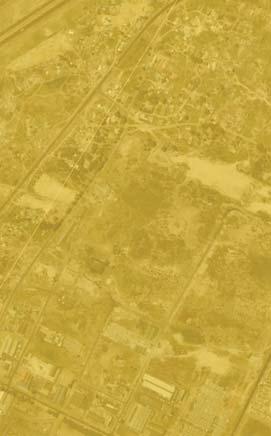
5 October 2017 King David Golf Course Redevelopment ITS 3795 Transport Impact Assessment 1 Purpose of Study 2 Locality Refer to Figure A1 (Annexure A) 3 Land Use Refer to SDPs in Annexure E 4 Existing Access Refer to Figure A1 (Annexure A) 5 Existing Roadways in Site Vicinity Refer to Figure A1 (Annexure A) Transport Impact Assessment (TIA) for the proposed redevelopment of King David Golf course as a future industrial development. Erf Number: RE The physical address of the Golf Course is 90 Pallotti Road which is south of Robert Sobukwe Road. (MR 176). The m 2 property is located in Airport Industria North, west of the Cape Town International Airport and Borchards Quarry Road (MR 5401). The development site is currently zoned as Special Open Space 3 and it is proposed to rezone this area as General Business and Industrial zones with a total Gross Leasable Area (GLA) of m 2. The total site will have the following land uses: 1. General Industrial (GI1) including warehousing: m 2 GLA 2. Mixed Use (MU)/General Business m 2 GLA Two development layouts were proposed. Option 1 includes three site accesses, namely along Bahrain Drive and two along Pallotti Road. Option 2 proposes two accesses namely one directly from Robert Sobukwe Road and another indirectly from Bahrain Drive. This option also proposes a realignment of Pallotti Road. Refer to Section 16 for detailed access descriptions and Annexure E for the corresponding site development plans. Existing access to the site is on Pallotti Road just east of the Golden Arrow Bus (GABS) Depot access. Pallotti Road intersects with Robert Sobukwe Road and Salm Road north of the proposed development. Refer to Section 16 for proposed access locations for the proposed development site. Robert Sobukwe Road (MR176): Class 3 Road in a suburban environment. Dual lanes per direction with a speed limit of 60km/h with shoulders, median and sidewalks. Borchards Quarry Road (MR54/01): (Provincial MR 221, R46): Class 1 expressway with dual lanes per direction. Pallotti Road: Single lane per direction, Class 4 road with sidewalk north bound along road. Bahrain Drive: Single lane per direction, Class 4 road with sidewalks on both sides of the road. 6 Analyses Hours Weekday a.m. (06:45 to 07:45) Weekday p.m. (17:00 to 18:00) The transport impact of the proposed development was analysed for the following scenarios: 7 Scenarios Analysed 2017 Existing conditions 2022 Background traffic conditions 2022 Total traffic conditions INNOVATIVE TRANSPORT SOLUTIONS (PTY) LTD Page 1
6 October 2017 King David Golf Course Redevelopment ITS 3795 Traffic analysis for the following intersections in the study area were conducted: 8 Study Intersections (existing control) Refer to Figure A2 (Annexure A) Intersection 1: Pallotti/Adriaan Louw Street Intersection 2: Robert Sobukwe/Salm/Pallotti Road Intersection 3: Robert Sobukwe/Borchards Quarry Road Intersection 4: Bahrain/Borchards Quarry Road Intersection 5: Airport Approach On Ramp/Borchards Quarry Intersection 6: Airport Approach Off Ramp/Borchards Quarry Intersection 7: Michigan/Borchards Quarry Intersection 8: N2 Off-Ramp/Robert Sobukwe South Terminal Intersection 9: N2 On-Ramp/Robert Sobukwe South Terminal Intersection 10: N2 Off-Ramp/Robert Sobukwe North Terminal Intersection 11: N2 On-Ramp/Robert Sobukwe North Terminal Intersection 12: Robert Sobukwe/Valhalla Drive Priority Control Signalised Signalised Signalised Signalised Signalised Signalised Signalised Signalised Signalised Signalised Signalised Refer to Figure A-2 in Annexure A for the lane configuration and intersection control. Traffic surveys were conducted to determine the peak hour traffic volume at intersections in the study area. The surveys were conducted on the following dates at the following intersections: Airport Approach Road/ Borcherds Quarry Interchange: 26 October 2016 Robert Sobukwe N2 Interchange: 26 October 2016 Robert Sobukwe/ Borcherds Quarry: 25 October Existing Intersection Operations Refer to Figures A3-1 and A3-2 (Annexure A) Robert Sobukwe/ Valhalla Drive: 25 October 2016 Robert Sobukwe/Pallotti Road: 14 September 2016 Borcherds Quarry/ Bahrain Road: 14 September 2016 Intersections in the study area were analysed to determine the level of service (LOS), delay per vehicle (in seconds) and volume per capacity (V/C) for each intersection in the peak hour. The results of the analysis indicate the following intersections with capacity constraints: Robert Sobukwe/Borchards Quarry Road: Operates at capacity with long queues on Robert Sobukwe Road westbound and delays exceeding 60 seconds per vehicle during the morning peak hour. Mitigation: An additional westbound lane on Robert Sobukwe Road Refer to Figure A3-1 and Figure A3-2, Annexure A for the respective existing a.m. and p.m. peak hour traffic operation. The results also indicate long queues southbound on Borcherds Quarry Road at the Michigan intersection (Intersection 7) during the p.m. peak hour. Congestion on the N2 INNOVATIVE TRANSPORT SOLUTIONS (PTY) LTD Page 2
. Although the analysis of the Michigan /Borcherds Quarry intersection indicated an acceptable level of service during the p.m.")
7 October 2017 King David Golf Course Redevelopment ITS 3795 causes traffic to spillback onto Borcherds Quarry Road between Michigan and the northern terminal of the N2. (Refer to Photo 1 and Photo 2 in Annexure C). Although the analysis of the Michigan /Borcherds Quarry intersection indicated an acceptable level of service during the p.m. peak hour, the results also confirm that the intersection is operating at capacity with a degree of saturation of 1. The analysis results for the southern terminal intersection of the N2 Off-ramp (Intersection 8) also indicate capacity constraints during the p.m. peak hour although the intersection still operates at acceptable levels of service. Therefore, no intersection improvements are recommended. 10 Approved Developments/ Latent Rights The development site is located adjacent to Airport Industria and is surrounded by industrial land uses and with residential land uses to the north. Since this is an established area it was assumed that no additional trips will be generated by new developments in the area, accept trips incidental to growth based on the historical annual growth rate of traffic on the road network. It was thus assumed that trips from the surrounding area could be estimated by the growth of existing trips at an annual rate, calculated from historical data from the Western Cape Government (WCG) Road Network Information System (RNIS) website. An annual growth rate of 4% for the road network in the study area were thus assumed based on the RNIS growth rates. The current City of Cape Town s Road Network Right-of-Way Plan indicated a Class 3 (Secondary Arterial) parallel to the realignment of the existing Borcherds Quarry Road. The latter is classified as a Class 1 expressway. This allows for the realignment of Borcherds Quarry Road to link with New Eisleben Road in the south and connect with the N2 with a new full-diamond interchange. These alignments are shown below. 11 Future Road Network/Road Planning Refer to Annexure D Proposed Road Network for Study Area The implementation of the Class 3 Road across Airport Approach Road relies on the completion of the realigned Borcherds Quarry as it would align with the southern portion of the existing Borcherds Quarry and utilise a portion of the existing N2 on-ramp towards the west. The realignment of Borcherds Quarry Road is to create a direct mobility link between Robert Sobukwe Road and New Eisleben Road which continues southwards and connects with Baden Powell Drive. Currently, the Western Cape Government (WCG) is conducting the geometric design of this realignment. A number of options are being investigated which include options to INNOVATIVE TRANSPORT SOLUTIONS (PTY) LTD Page 3
8 October 2017 King David Golf Course Redevelopment ITS 3795 reconfigure the current Borcherds Quarry connection with the N2 via a proposed halfdiamond interchange. Refer to Annexure D for a concept design of the future road upgrade of the new realigned Class 3 road across Airport Approach Road. However, the completion of this realignment of Borcherds Quarry Road and of the of the Class 3 road parallel to Borcherds Quarry Road have not been included in this study as is it not seen to coincide with the timing of the proposed development. The background traffic scenario entails traffic operation in the study area based on existing trips with additional trips due to future traffic growth. These added trips do not include trips from the proposed development. An annual growth rate is applied to existing traffic volumes to estimate the future traffic volumes on the study network. According to the RNIS data the average historical growth rate of roads in the study network is 4 % annually. A horizon period of 5 years was selected for this traffic scenario assessment. Lane configuration upgrades as required for the existing traffic scenario were applied to the background traffic scenario. According to the results of the analysis for the background scenario the following intersections will experience capacity constraints: 12 Future Background Traffic Conditions Refer to Figures A4-1 and A4-2 (Annexure A) Intersection 3 (Robert Sobukwe /Borchards Quarry): Long delays for right turning vehicles on Robert Sobukwe road eastbound with delays per vehicle exceeding 80 seconds. Mitigation: A shared through and right-turn lane eastbound on Robert Sobukwe. Intersection 7 (Borcherds Quarry/Michigan Road): Operates at capacity with long queues on Borchards Quarry Road southbound and delays exceeding 50 seconds per vehicle. Mitigation: None. Future network upgrades will include the realignment of Borcherds Quarry to intersect directly with Klipfontein Road south of the N2. An arterial between the King David redevelopment site and Airport Approach intersection will create additional capacity on Borcherds Quarry Road. Improving capacity at this intersection is therefore regarded as abortive in the longer term. Intersection 8 (Robert Sobukwe /N2 Off-Ramp Southern Terminal): Long delays for westbound vehicles on the N2 off-ramp. Mitigation: An additional westbound lane for through movements and reconfigure the existing through lane to a shared through and left-turn lane Refer to Figure A4-1 and Figure A4-2, Annexure A for the respective future a.m. and p.m. peak hour background traffic operation. 13 Trip Generation Rates Refer to Table 3 in Annexure B The following trip rates were assumed for the proposed new land uses of the proposed development: Business/ Offices 2.1 trips/100m 2 GLA Industrial Park : 0.8 trips/ 100m 2 GLA Refer to Table 3 (Annexure B) for rates and directional distribution Reference: South African Trip Generation Rates, COTO INNOVATIVE TRANSPORT SOLUTIONS (PTY) LTD Page 4
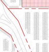
9 October 2017 King David Golf Course Redevelopment ITS 3795 The following peak hour trips were calculated based on the above trip rates for the proposed land uses for the development: AM Peak Hour Total Trips: Trips (2 219 In /856 Out) 14 Development Trips Refer to Table -4 in Annexure B PM Peak Hour Total Trips: Trips(747 In /2 329 Out) Since the development site is located within a zone with many public transport facilities and the business land use will be of a mixed-use, a 20% and 5% trip reduction for business and industrial trips were assumed respectively. These trip reductions resulted in the following net driveway peak hour trips: AM Peak Hour Total Trips: Trips (2 052 In /803 Out) PM Peak Hour Total Trips: Trips(696 In /2 159 Out) Refer to Table -4 (Annexure B). The following distribution of trips were assumed for the King David Redevelopment based on traveling patterns on the surrounding road network: 15 Trip Distribution Refer to Figures A5-1 and A5-2 (Annexure A) 16 Access to Site Refer to Annexures E 20% along Borchards Quarry towards N2 5% along Michigan Road, Airport Industrial east 5% along Michigan Road, Airport Industrial west 3% along Airport Approach road 5% along Bahrain Road 5% along Pallotti Road 20% along Robert Sobukwe to Bellville, Parow and Stellenbosch Arterial 10% along Valhalla Drive Northern Approach 2% along Valhalla Drive Southern Approach 5% along Duinefontein road south of the Robert Sobukwe/N2 interchange 20% along N2 to Cape Town Refer to Figure A5-1 and Figure A5-2 for the trip distribution during the a.m. and p.m. peak hours respectively. Currently the site has access from Robert Sobukwe Road via a Class 4 road (Pallotti Road). Pallotti Road currently serves the Montana residential township but also provides a link with Steve Biko Street to the west. Pallotti Road is the only access route for the Golden Arrow Bus Service (GABS) depot which is located directly to the west of the proposed King David development. Two internal road layouts are proposed to accommodate the future Class 3 road and to accommodate all existing traffic utilising Pallotti Road. The two proposed Class 3 route alignment options to connect the internal road network with Robert Sobukwe Road is presented in Annexure E with extracts shown below: INNOVATIVE TRANSPORT SOLUTIONS (PTY) LTD Page 5

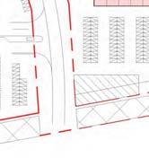
10 October 2017 King David Golf Course Redevelopment ITS 3795 Option 1 Access Roads According to the Option 1 SDP layout three accesses are proposed. Option 1 is to link the proposed Class 3 road with Pallotti Road. This option will have the least impact on existing traffic patterns. The Class 3 road will intersect with Pallotti Road at approximately 120 metres east of the current GABS exit and 425 metres west of the Pallotti/Robert Sobukwe intersection. No change to the current access to the Montana residential development is necessary. A possible left-in/left-out is proposed approximately midway between the Class 3 intersection and Robert Sobukwe Road. According to the traffic analysis, the access intersections will operate at acceptable levels of service with the associated intersection geometry except the existing stop-controlled Adrian Louw Street intersection (Intersection 1). No further improvements to this intersection can be done to accommodate the right-turners into Adrian Louw Street due to the access spacing requirement for a reclassified class 3 Pallotti Road. The main intersection providing access from Pallotti Road will operate acceptable from a capacity point of view for either a signal or roundabout. It is however recommended that a signal would be more acceptable for the bus traffic using Pallotti Road than a roundabout. The spacing between the GABS depot access and the proposed signal will be 120 metres. The minimum access spacing requirement (reference) for a District Distributor (Pallotti Road) for a high-volume generator driveway within an Intermediate Environment is 75 metres which is less than the spacing provided. Option 2 proposes a more direct link between the Class 3 road and Robert Sobukwe Road. This option requires a realignment of Pallotti Road with an intersection along the Class 3 road approximately 400 metres south of Robert Sobukwe Road. The access to the Montana residential development via Adrian Louw Street will need to be extended towards the realigned Pallotti Road. Option2 is approximately 150 metres shorter than Option 1 and has one less intersection. However, existing traffic and especially GABS will be mostly affected by Option 2 which INNOVATIVE TRANSPORT SOLUTIONS (PTY) LTD Page 6

11 October 2017 King David Golf Course Redevelopment ITS 3795 would require all vehicles to travel through the development site. Approximately buses use Pallotti Road on average on a weekday. Option 2: Access Roads The advantages and disadvantages of the two options are summarised below: Option 1 Advantages Development traffic and future traffic attracted by the Class 3 road will not be affected by the GABS buses along Pallotti Road with the current proposed roundabout intersection with Pallotti Road (reverse flows). Inbound traffic is distributed via two access points, namely a leftin/left-out and the Class 3 road. The construction of the internal roads and access is not dependent on any further application and approval processes. Disadvantages Exiting traffic will be required to travel a longer distance (200m) to Robert Sobukwe Road and through one more intersection compared to Option 2. The Adrian Louw/Pallotti intersection (stop-controlled) will operate at poor levels of service Option 2 Advantages Disadvantages More direct link with Robert Sobukwe Road and thus 200m shorter route than Option 1 Bus traffic will not pass the residential area directly Residential traffic will be required to drive through an industrial area to gain access to their properties. GABS buses need to enter the proposed development Total Traffic Conditions For the total traffic future conditions, the mitigations recommended for the existing and background traffic conditions at the following intersections were assumed to be in place: Additional through lane for westbound traffic along N2 off-ramp/robert Sobukwe southern terminal. INNOVATIVE TRANSPORT SOLUTIONS (PTY) LTD Page 7
12 October 2017 King David Golf Course Redevelopment ITS 3795 Additional westbound through lane on Robert Sobukwe Road at the Borcherds Quarry intersection. Refer to Figure A7-1, Figure A7-2 and Figure A7-3 in Annexure A for the proposed concept upgrades of the above intersections. With the above road upgrades in place the following intersections were identified with capacity constraints: Intersection 2 (Robert Sobukwe/Salm/Pallotti Road): Long delays at side road approaches during both peak hours and insufficient capacity due to the development traffic Mitigation (Refer to Figure A7-4): 2022 Total Traffic Conditions Refer to Figures A6-1 to A6-4 and A7-1 to A7-9 (Annexure A) - Robert Sobukwe western approach: add a through lane and an acceptance lane on the exit approach - Robert Sobukwe eastern approach: remark the left-turn lane to a shared through and left-turn lane and add a dedicated left-turn lane and an acceptance lane on the exit approach - Pallotti southern approach: widen approach for four lanes - one left turn only, shared left and through and two right turn only lanes. Widen Pallotti southbound for two accepting lanes - Salm Road northern approach: add separate left-turn and through lanes and reconfigure the existing shared lane to a right-turn lane only Intersection 3 (Robert Sobukwe/ Borcherds Quarry): Over Capacity during both peak hours Mitigation (Refer to Figure A7-5): - Robert Sobukwe western approach: widen accepting lane for through moving vehicles. Remark left-turn lane as shared through and left-turn lane. Remark outer right through lane as right-turn lane. Add an acceptance lane - Robert Sobukwe eastern approach: reconfigure the inner left-turn lane to a shared through and left-turn lane and add an acceptance lane - Heilbot northern approach widen to add right turn lane. Remark left turn lane as shared left and through lane. Remark shared through and right lane as through lane only. - Borcherds Quarry southern approach: add an accepting lane Robert Sobukwe/Valhalla Drive (Refer to Figure A7-6): Mitigation (Refer to Figure A7-6): - Valhalla Drive north and southbound widen to add left turn lane - Robert Sobukwe: Add a through and acceptance lane to each approach Road link capacity along Robert Sobukwe Road: It is recommended to add a third through lane in each direction along Robert Sobukwe Road from Borcherds Quarry Road to Valhalla Drive. INNOVATIVE TRANSPORT SOLUTIONS (PTY) LTD Page 8
13 October 2017 King David Golf Course Redevelopment ITS 3795 In addition to the intersections with capacity constraints the following intersections were also recommended for upgrades to accommodate additional traffic generated by the development site: Intersection 1 (Pallotti/Adriaan Louw): Left-in/left-out only access to development site (Refer to Figure A7-7) Intersection 14 (Pallotti/ Main Access -Option 1): Signalised (Refer to Figure A7-8) Intersection 14 (Pallotti/ Main Access -Option 2): Roundabout (Refer to Figure A7-8) Intersection 4 (Borcherds Quarry/Bahrain) :(Refer to Figure A7-9) - Eastern approach: Reconfigure the left-turn lane to a shared left and through lane. Reconfigure the shared through and right-turn lane to a right-turn only lane - Sidewalks on both sides of Bahrain western approach. Refer to Figure A6-1 and Figure A6-2, Annexure A for the total traffic operations for the respective peak hours and Figure A6-3 and Figure A6-4 for the total traffic operations with implemented road upgrades. The current zoning of the site is Special Open Space 3 and the total extent of the development of m 2. Table -5, Annexure B summarises the expected Development Charges (DCs) with the associated land use extents as listed in Section 3. The DC calculation for the proposed industrial land use was split 50/50 between the calculator s land use categories for Industrial and Warehousing. The DC allocation towards roads, transport and storm water would be approximately R57 million (excluding VAT). A high-level estimate of the expected road construction costs is presented in Table 6, Annexure B. 18 Cost of Upgrades It is concluded that the required external road works and associated construction of the Class 3 internal road for Option 1 will cost approximately R80million of which approximately R78 million could be constructed in lieu of DCs. This would result in a DC deficit of approximately R21 million for the Option 1 road layout if the stormwater service is cross-subsidised. The estimated road construction for Option 2 is R72million of which approximately R60 million could be deducted from DCs. This would result in a deficit of approximately R3 million based on the high-level calculations. Further negotiations between the developer and road authorities will be required to agree on which road improvements can be constructed in lieu of DCs and to confirm the actual Development Contribution. Existing Facilities: 19 NMT Refer to Figures A8-1 to A8-4 All high order roads leading to the proposed development has pedestrian sidewalks. The grade-separated roads (Borcherds Quarry Road and Valhalla Drive) over the N2 and Airport Approach Road also have pedestrian facilities to provide pedestrian linkage to the proposed development. Pedestrian stairs are also provided from Valhalla Drive towards Pallotti Road as shown in Photo 1 and Photo 2 in Appendix C. Pallotti Road is equipped with a sidewalk on the western side of the road. There is a pedestrian crossing south of the existing access of the GABS depot at the La Sagra/ Pallotti INNOVATIVE TRANSPORT SOLUTIONS (PTY) LTD Page 9
14 October 2017 King David Golf Course Redevelopment ITS 3795 intersection 55 m from the Astra Special Needs School access as well as a raised pedestrian crossing at Pallotti and Chain Street. Refer to Photo 3 to Photo 6 in Annexure C. for the rest of the NMT facilities. The following intersections were fitted with pedestrian signals: Robert Sobukwe/ Borcherds Quarry Robert Sobukwe/ Salm/ Pallotti Road Borcherds Quarry/ Bahrain street Pedestrian surveys were conducted at these intersections on the 4 July 2016 from 06:00 to 8:30. The intersection with the lowest pedestrian activity was Pallotti/Salm/ Robert Sobukwe with 258 pedestrians and 15 cyclists crossing between 06:00 and 8:30 am. The highest pedestrian activity was at the Borcherds Quarry/ Bahrain intersection with 878 pedestrians and 38 cyclists between 06:00 to 8:30. The number of pedestrians at Robert Sobukwe/Borcherds Quarry was 329 and 24 cyclists. Refer to the pedestrian profiles at each of the intersections below :15-08:30 08:00-08:15 07:45-08:00 07:30-07:45 07:15-07:30 07:00-07:15 06:45-07:00 06:30-06:45 06:15-06:30 06:00-06:15 Pedestrians Cyclists Pedestrian Profile at Robert Sobukwe/Salm/Pallotti intersection Pedestrian movement at Robert Sobukwe/ Salm/ Pallotti intersection was low compared to Borcherds Quarry/ Bahrain. The number of pedestrians in the east west direction was the highest (approximately 190) compared to south-north movement approximately 70). Refer to Figure A8-1 (Annexure A). INNOVATIVE TRANSPORT SOLUTIONS (PTY) LTD Page 10
15 October 2017 King David Golf Course Redevelopment ITS :15-08:30 08:00-08:15 07:45-08:00 07:30-07:45 07:15-07:30 07:00-07:15 06:45-07:00 06:30-06:45 06:15-06:30 06:00-06:15 Pedestrians Cyclists Pedestrian Profile at Robert Sobukwe/Borcherds Quarry intersection The pedestrian movement at the Robert Sobukwe/ Borcherds Quarry intersection with the highest number of pedestrians was the north-south movement along Borcherds Quarry with 213 pedestrians compared to the east-west movement with 116 pedestrians. Refer to Figure A8-2, Annexure A :30-06:45 06:15-06:30 06:00-06:15 06:45-07:00 Pedestrians 07:00-07:15 07:15-07: :30-07:45 07:45-08:00 Cyclists 08:00-08:15 08:15-08:30 Pedestrian Profile at Borcherds Quarry/ Bahrain intersection The intersection with the highest pedestrian movement was Borcherds Quarry / Bahrain intersection. The east-west movement was the highest with 684 pedestrians and the north-south 194 pedestrians. Refer to Figure A8-3 in Annexure A. Street lights are also provided along Robert Sobukwe, Borcherds Quarry, Bahrain and INNOVATIVE TRANSPORT SOLUTIONS (PTY) LTD Page 11
16 October 2017 King David Golf Course Redevelopment ITS 3795 Pallotti Road. Proposed Facilities: Sidewalks along Bahrain and around the frontage of the King David development, along Pallotti Road are proposed for NMT activity. In addition it is proposed that sidewalks along the internal roads of the development be provided. Refer to concept layouts of Pallotti and Bahrain Drive in Figure A7-7, Figure A7-8 and Figure A7-9 in Annexure A. Existing Facilities: Currently there are public transport facilities available along Robert Sobukwe, Pallotti and Bahrain Street. Refer to Figure A9 in Annexure A for existing bus stop facilities. 20 Public Transport Refer to Figure A9, Annexure A Proposed Facilities: As part of the MyCiTi roll out plan express, trunk and feeder routes are planned for the study area. The trunk routes include Borcherds Quarry, Robert Sobukwe, Airport Approach road and N2 express service. A bus stop as part of the planned feeder route on Pallotti Road is located at the existing bus stop. Refer to Figure A9 in Annexure A, for MyCiTi bus routes and bus stops. For Option 1, it is also proposed to provide a bus embayment along Pallotti Road between the left-in/left-out and main accesses in the westbound direction and one downstream of the proposed main access intersection in the eastbound direction. Refer to Figure A7-7 and Figure A7-8 in Annexure A. For Option 2, the main access to the proposed development is directly from Robert Sobukwe Road which currently provides two bus embayments on either side of the road. It is however recommended to provide at least two bus embayments (one in eacah direction) along the Class 3 road between Robert Sobukwe and the internal roundabout. The King David redevelopment site is located in a public transport zone. Due to the proximity of the bus depot and airport the proposed zoning for this site should be Transport zone 1 (TR1) as prescribed by the Zoning Scheme Regulations of the City of Cape Town. The prescribed off street parking requirements for TR1 zone for the proposed land uses are as follows: Industrial/Warehousing: 1.5 bays/100 m 2 21 Parking Business/Offices: 2.5 bays/100 m 2 The required number of parking bays for the extent of the above land uses are: Industry/Manufacturing m bays Business/Offices m bays Total m bays It is proposed to develop the site in precincts or phases over time. The required parking bays per precinct will be confirmed and provided by the developers during each phase. 22 On-Site Circulation Two options for the internal road network for the King David redevelopment were proposed. Option 1 includes a main access along Pallotti Road with an additional left-inleft-out only access north of the main access as well as access from Bahrain street. This option will not change the existing access of GABS buses to Pallotti and Robert Sobukwe road. Option 2 on the other hand include realignment of Pallotti with Robert Sobukwe INNOVATIVE TRANSPORT SOLUTIONS (PTY) LTD Page 12
17 Number of Buses Number of Buses October 2017 King David Golf Course Redevelopment ITS 3795 with the resulting realignment of Adriaan Louw intersection with Pallotti Road. This option will result in rerouting the GABS buses through the King David development site enroute to Robert Sobukwe/ Pallotti intersection. Refer to Section 16. Data for GABS buses operating along Pallotti for 2016 indicate that approximately 1500 buses operated along Pallotti on a daily basis during the week and on weekends between 350 and 500 buses as illustrated below Day of the Month Daily bus volumes along Pallotti (February 2016) Realignment of Pallotti as proposed in Option 2 will result in rerouting between 350 and buses through the King David development site on a daily basis. The peak hours for the GABS buses however does not coincide with peak hours of the Robert Sobukwe and Pallotti intersection. The peak hours for Pallotti and Robert Sobukwe intersection were between 6:45 7:45 and 17:00 18:00 for the a.m. and p.m. respectively while the bus peak hours were one hour earlier during the a.m. peak and two hours later during the p.m. peak hour. Refer to graph below for the average hourly bus volumes along Pallotti Road in February Hour Average Hourly Bus Volumes along Pallotti (Weekday, February 2016) INNOVATIVE TRANSPORT SOLUTIONS (PTY) LTD Page 13
18 October 2017 King David Golf Course Redevelopment ITS 3795 Subsequent to comments from the public, Option 2 would be preferred as these buses would be redirected away from the Montana township. The following is concluded from the transport impact assessment. Option 2 is the preferred development layout option for the follwiong reasons: - The Class 3 alignment through the development links more directly with the Class 2 rod network - Access to the entire site is more direct from Robert Sobukwe - The Adrian Louw priority-controlled intersection will perform poorly for Option 1 - Option 2 supports the concerns raised by the public about the GABS buses making noise along the existing Pallotti Road. Option 2 will realign Pallotti Road further southwards away from the residents. However, this option is not ideal from the GABS perspective as all buses need to travel through the internal roundabout. - Option 1 would require less road construction costs than Option 1 which makes it more favourable when compared to the possibility to offset these costs from Development Charges. The existing road network can accommodate the proposed development provided that the following improvements are in place: 23 Conclusion & Recommendations Intersection 2 (Robert Sobukwe/Salm/Pallotti Road): - Robert Sobukwe western approach: add a through lane and an acceptance lane on the exit approach - Robert Sobukwe eastern approach: remark the left-turn lane to a shared through and left-turn lane and add a dedicated left-turn lane and an acceptance lane on the exit approach - Pallotti southern approach: widen approach for four lanes - one left turn only, shared left and through and two right turn only lanes. Widen Pallotti southbound for two accepting lanes - Salm Road northern approach: add separate left-turn and through lanes and reconfigure the existing shared lane to a right-turn lane only Intersection 3 (Robert Sobukwe/ Borcherds Quarry): Over Capacity during both peak hours - Robert Sobukwe western approach: widen accepting lane for through moving vehicles. Remark left-turn lane as shared through and left-turn lane. Remark outer right through lane as right-turn lane. Add an acceptance lane - Robert Sobukwe eastern approach: reconfigure the inner left-turn lane to a shared through and left-turn lane and add an acceptance lane - Heilbot northern approach widen to add right turn lane. Remark left turn lane as shared left and through lane. Remark shared through and right lane as through lane only. - Borcherds Quarry southern approach: add an accepting lane INNOVATIVE TRANSPORT SOLUTIONS (PTY) LTD Page 14
19 October 2017 King David Golf Course Redevelopment ITS 3795 Robert Sobukwe/Valhalla Drive (Refer to Figure A7-6): - Valhalla Drive north and southbound widen to add left turn lane - Robert Sobukwe: Add a through and acceptance lane to each approach Intersection 1 (Pallotti/Adriaan Louw): Left-in/left-out only access to development site (Refer to Figure A7-7) Intersection 14 (Pallotti/ Main Access -Option 1): Signalised (Refer to Figure A7-8) Intersection 14 (Pallotti/ Main Access -Option 2): Roundabout (Refer to Figure A7-8) Intersection 4 (Borcherds Quarry/Bahrain) :(Refer to Figure A7-9) - Eastern approach: Reconfigure the left-turn lane to a shared left and through lane. Reconfigure the shared through and right-turn lane to a right-turn only lane Sidewalks on both sides of Bahrain western approach To facilitate pedestrian movement sidewalks are required along the frontage of the King David development along Pallotti and Bahrain Drive. The main access to the proposed development is directly from Robert Sobukwe Road (Option 2) which currently provides two bus embayments on either side of the road. (Refer to Figure A7-7 and Figure A7-8 for proposed bus embayments and sidewalks along Pallotti Road) Parking rates as prescribed by the City of Cape Town s zoning regulation for a transport zone 1 was used to calculate the number of bays required for the proposed development. The number of parking bays recommended for the proposed development was bays which included bays for industrial manufacturing and 530 bays for offices. The expected DCs payable by the developer towards roads, transport and stormwater is estimated at R57 million (excluding VAT). The road construction costs including land acquisition, is estimated at approximately R80 million for Option 1 and R72 million for Option 2. Of these costs, approximately R78 million and R60 million would be deductible from DCs for Option 1 and 2 respectively. Further negotiations between the developer and road authorities will be required to agree on the road improvements that can be constructed in lieu of the DCs. INNOVATIVE TRANSPORT SOLUTIONS (PTY) LTD Page 15
20 October 2017 King David Golf Course Redevelopment ITS 3795 REFERENCES 1. Zoning Scheme Regulations, City of Cape Town Road Access Guideline (RAG), Western Cape Provincial Government, 2002 INNOVATIVE TRANSPORT SOLUTIONS (PTY) LTD Page 16
21 Annexure A Figures
22
23
24
25
26
27
28
29
30
31
32
33
34
35
36
37
38
39

40
41
42

43 SCHEMATIC Salm Road 90 peds, 4 cyclists 24 peds, 4 cyclists 47 peds, 3 cyclists Robert Sobukwe Robert Sobukwe 97 peds, 4 cyclists Palloti Road PROJECT: 3795 King David Redevelopment FIGURE: Pedestrian Activity: Robert Sobukwe/Pallotti/Salm NUMBER: A8 1


44 SCHEMATIC PROJECT: 3795 King David Redevelopment FIGURE: Pedestrian Activity: Robert Sobukwe/Borcherds Quarry NUMBER: A8 2

45 SCHEMATIC PROJECT: 3795 King David Redevelopment FIGURE: Pedestrian Activity: Borcherds Quarry/ Bahrain road NUMBER: A8 3


46 SCHEMATIC King David Development Site Trunk Routes Feeder Routes Express Way Proposed bus stop Existing bus stop PROJECT: 3795 King David Redevelopment FIGURE: Bus Stops and Future MyCiti Routes NUMBER: A9
47 October 2017 King David Golf Course Redevelopment ITS 3795 List of Figures Figure A 1 Figure A 2 Figure A 3 Figure A 4 Figure A 5 Figure A 6 Figure A 7 Figure A 8 Figure A 9 Locality Map Existing Lane Configuration and Traffic Control Devices Existing 2017 Traffic Conditions 2022 Background Traffic Conditions Site Generated Trip Distribution 2022 Total Traffic Conditions Recommended Road Upgrades Pedestrian Activity Bus stops and Planned MyCiTi Routes INNOVATIVE TRANSPORT SOLUTIONS (PTY) LTD Page A-1
48 Annexure B Tables
49 Table -1 Comparison between Existing and 2022 Background Traffic Conditions Existing Weekday Peak Hour 2022 Background Weekday Peak Hour Intersection AM Peak Hour PM Peak Hour AM Peak Hour PM Peak Hour LOS Delay V/C LOS Delay V/C LOS Delay V/C LOS Delay V/C 1. Pallotti/Adriaan Louw 2. Robert Sobukwe/ Pallotti/Salm Road 3. Robert Sobukwe/ Borchards Quarry 4. Bahrain Road/Borchards Quarry 5. Airport Approach Northern Terminal/ Borchards Quarry 6. Airport Approach Southern Terminal/ Borchards Quarry 7. Michigan Street/ Borchards Quarry 8. N2 Off-Ramp South Terminal/ Robert Sobukwe 9. N2 On-Ramp South Terminal/ Robert Sobukwe 10. N2 Off-Ramp North Terminal/ Robert Sobukwe 11. N2 On-Ramp North Terminal/ Robert Sobukwe 12. Robert Sobukwe/ Valhalla Drive A A B A C B C B D C F > D A A A A B B B B A B A C C C C E C C C D B B C B A B B B B B C B C C D D LOS Level-of-Service, Delay in seconds per vehicle, V/C Volume-to-capacity Ratio. Data for Two-way Stop is for Critical Movement Data for Signals & All-Way Stop is average of all approaches. INNOVATIVE TRANSPORT SOLUTIONS (PTY) LTD Page B-1
50 Table-2 Upgrades Comparison between 2022 Background and Total Traffic Conditions with recommended Intersection 2022 Total Weekday Peak Hour (with 2022 Background Weekday Peak Hour Upgrades) AM Peak Hour PM Peak Hour AM Peak Hour PM Peak Hour LOS Delay V/C LOS Delay V/C LOS Delay v/c LOS Delay v/c 1. Pallotti/Adriaan Louw B A D F >50 > Robert Sobukwe/ Pallotti/Salm Road 3. Robert Sobukwe/ Borchards Quarry 4. Bahrain Road/Borchards Quarry 5. Airport Approach Northern Terminal/ Borchards Quarry 6. Airport Approach Southern Terminal/ Borchards Quarry 7. Michigan Street/ Borchards Quarry 8. N2 Off-Ramp South Terminal/ Robert Sobukwe 9. N2 On-Ramp South Terminal/ Robert Sobukwe 10. N2 Off-Ramp North Terminal/ Robert Sobukwe 11. N2 On-Ramp North Terminal/ Robert Sobukwe 12. Robert Sobukwe/ Valhalla Drive C B C C F > D D D A A C D B B C C A C A C C E D E 58.9 >1.0 C D B B C B C B B B B B C B B C D D D C LOS Level-of-Service, Delay in seconds per vehicle, V/C Volume-to-capacity Ratio. Data for Two-way Stop is for Critical Movement Data for Signals & All-Way Stop is average of all approaches INNOVATIVE TRANSPORT SOLUTIONS (PTY) LTD Page B-2
51 Table 3 Proposed Trip Generation Rates Weekday AM Peak Hour Land Use Units Source Size/ Volume Rate In Out Public Transport Office 100 m² COTO % 15% 20% Industrial 100 m² COTO % 30% 5% Weekday PM Peak Hour Office 100 m² COTO % 80% 20% Industrial 100 m² COTO % 75% 5% Table -4 Estimated Peak Hour Trips Land Use Trip Type Weekday AM Peak Hour Weekday PM Peak Hour In Out Total In Out Total Office Industrial Driveway Total Driveway Trips Office Industrial Public Transport Total PT Trips Office Industrial Net New Total Net External Trips INNOVATIVE TRANSPORT SOLUTIONS (PTY) LTD Page B-3
52 Table -5 Estimated King David Development Charges (October 2017) Service Amount VAT Total Roads R R R Transport R R R Stormwater R R R Sewerage R R R Water R R R Solid Waste R R R Total R R R Table 6 Estimated Construction Costs OPTION 1 20 October 2017 Item Road area* Road Cost* Sidewalks Property Cost* R1 200 R600 R300 Total DC deductable Robert Sobukwe/Valhalla 280 R R R R Robert Sobukwe/Borcherds Quarry 120 R R R R Robert Sobukwe/N2 370 R R Robert Sobukwe/Pallotti 851 R R R Pallotti/Access intersections - R R Robert Sobukwe bi-directional 3rd lane R R R R Sub-total R R R - R R Internal Class 3 (single carriageway) R R R R Internal Class 3 (double carriageway) R R R R Sub-total R R R R Total R R OPTION 2 Item Road area* Road Cost* Sidewalks Property Cost* R1 200 R600 R300 Total DC deductable Robert Sobukwe/Valhalla 280 R R R R Robert Sobukwe/Borcherds Quarry 120 R R R R Robert Sobukwe/N2 370 R R Robert Sobukwe/Pallotti 851 R R R Pallotti/Access intersection - R R Robert Sobukwe bi-directional 3rd lane R R R R Sub-total R R R - R R Internal Class 3 (single carriageway) R R R R Internal Class 3 (double carriageway) 7296 R R R R Realignment of Pallotti Road 5130 R R R Sub-total R R R R Total R R INNOVATIVE TRANSPORT SOLUTIONS (PTY) LTD Page B-4
53 Annexure C Photographs


54 Photo 1: Valhalla Drive Pedestrian Bridge over N2 Photo 2: Valhalla Drive Pedestrian Ramp Off N2 Bridge Photo 3: Bahrain westbound from Borcherds Quarry Intersection Photo 4: Pallotti northbound to Robert Sobukwe intersection INNOVATIVE TRANSPORT SOLUTIONS (PTY) LTD Page C-1

")
55 Photo 5: Raised Pedestrian Crossing in Pallotti road Photo 6: Existing bus embayment at proposed main access INNOVATIVE TRANSPORT SOLUTIONS (PTY) LTD Page C-2
56 Annexure D Conceptual Road Alignment
57 SCHEMATIC PROJECT: FIGURE: 3795 KING DAVID BORCHERDS QUARRY BYPASS NUMBER: 10


 Y")


58 T ES TW E RS ME TO SO DELFT SOUTH SY N2/R300 SWARTKLIP INTERCHANGE MP HO NY WA RT KWE SOBU (MODD ERDAM ROAD ) Y ROBE CTIA MAIN RUN WAY CTIA TER AY MINA EW L N2 E FR FORMER INTERSITE LAND (UNDEVELOPED) IAL TER DA VI D. AR ROAD BE OC D AY RP AI NEW CROSSROADS KR OA NM T ST EEW AD OL VA O IPF L DK OR EF LAN R KI R T ON PHILIPPI EAST GO OA Y PR RO OA EIN R CH AR U AD AIRPORT INDUSTRIA AP D( Q RO S D AD ER SD OAD H C R YR LD BO ARR OW QU RO NE ) RDS 0 FR ETER CHE AD PERIM BOR SH PO CTIA NEW FIE SS IB LE KI NG PHILIPPI INDUSTRIA (NORTH) R30 PHILIPPI INDUSTRIA (SOUTH) KLIPFONTEIN RD ETENDED UNDER ELEVATED NEW EISLEBEN RD NE W AD N EI EIS LE RO BE NR OA NT O PF D I KL ET RE N OW PE TO ER ST NYANGA LL T MI CA EIS LE BE NR OA D LEGEND BROWNS FARM EISTING FREEWAYS EISTING PRIMARY/SECONDARY ARTERIALS NEW ROAD WORKS PROPOSED PRIMARY ACCESS LOCATIONS INTO PHILIPPI INDUSTRIA EISTING BORCHERDS QUARRY INTERCHANGE DECOMMISSIONED NEW BORCHERDS QUARRY FULL INTERCHANGE WITH ELEVATED DIRECTIONAL RAMP AND NORTH/SOUTH BRT EASTERN RAMPS OF N2/AIRPORT APPROACH RD INTERCHANGE WESTERN RAMPS OF N2/R300 SYSTEMS INTERCHANGE YLBP 1555m (1300m)* TO CAPE TOWN (N2 FREEWAY) YLBP 2855m (2100m)* 500m (300m)** YLBP 2105m (1300m)* TO SOMERSET WEST (N2 FREEWAY) YLBP 2500m YLBP 1895m (1400m)* Client Project Title Client Number N2/BORCHERDS QUARRY INTERCHANGE AND RELATED WORKS CONCEPTUAL DESIGN REPORT CONTRACT: C1039 Scale A3 SYMPHONY WAY DIAGRAMMATIC SKETCH SHOWING RAMP TERMINAL SPACING TO ADJACENT EISTING INTERCHANGES. (FIGURES IN BRACKETS SHOW SANRAL*/AASHTO** MINIMUM SPACING REQUIREMENTS) PLAN N 5.3 Drawing Title ALTERNATIVE 03A 14 BREE STREET CAPE TOWN 8001 SOUTH AFRICA TEL: FA: enquiries@hho.co.za Drawing Number PLAN N 5.3 Robertk J:\data\7144 N2 BQ Upgrade PL (JRJ)\20 Transport\03 Drawings\01 Layout\Alternatives 1-5\Report Figures\A3-Alternative 3A_Rev24.dwg Rev A 29/08/2014
59 FUTURE ROAD RESERVE BOUNDARY ALONG EISTING FENCELINE TRE EISTING ROAD RESERVE & PROPERTY BOUNDARY MON FUTURE ROAD RESERVE BOUNDARY REALIGNED BORCHERDS QUARRY AIRPORT INTERCHANGE TO N2. CONCEPTUAL LAYOUT PLAN Drawing Title N2/BORCHERDS QUARRY INTERCHANGE AND RELATED WORKS CONCEPTUAL DESIGN REPORT Project Title 14 BREE STREET CAPE TOWN 8001 SOUTH AFRICA TEL: FA: AL D RIVE AV IO IAT RE S. EE AY A Rev 29/08/2014 A3 PLAN N 6.1 Drawing Number Scale CONTRACT: C1039 Client Number PLAN N 6.1 Robertk J:\data\7144 N2 BQ Upgrade PL (JRJ)\20 Transport\03 Drawings\01 Layout\Concept Layouts\N2 Borcheds Quarry - Alt 8 Diamond with existing ramps dwg FR 1.8m SIDEWALK W EISTING FENCELINE TO BE REMOVED NMT FACILITY Client EISTING FENCELINE TO BE RETAINED 3.5m BRT LANE KEY: RY ROAD AR HERDS QU NEW BORC QUARRY ROAD BORCHERDS OAD RRY R S QUA CHERD OR NEW B NC EET AN STR N2 MICHIG FUTURE ROAD RESERVE BOUNDARIES
60 Annexure E Site Development Plans


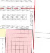


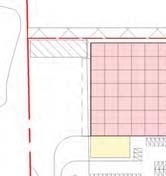
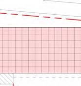


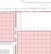


61 GENERAL NOTES ALL WORKS TO COMPLY WITH SANS OR BY RATIONAL APPROVED DESIGN TO COMPLY WITH FOLLOWING GUIDELINES YARD CANOPY ERF m² WAREHOUSE B: Structural Design SANS B, Structural design C: Dimensions SANS C, Dimensions D: Public Safety SANS D, Public safety F: Site Operations SANS F, Site operations G: Excavations SANS G, Excavations H: Foundations SANS H, Foundations J: Floors SANS J, Floors K: Walls SANS K, Walls L: Roofs SANS L, Roofs M: Stairways SANS M, Stairways N: Glazing SANS N, Glazing O: Lighting and Ventilation SANS O, Lighting and ventilation P: Drainage SANS P, Drainage Q: Non-water-borne Means of Sanitary Disposal SANS Q, Non-water-borne means of sanitary disposal R: Stormwater Disposal SANS R, Stormwater disposal S: Facilities for Persons with Disabilities SANS S, Facilities for persons with disabilities. T: Fire Protection SANS T, Fire protection V: Space Heating SANS V, Space heating W: Fire Installation SANS W, Fire installation GENERAL BUSINESS offices GENERAL BUSINESS ERF m² PARKING 255 BAYS PARKING 107 BAYS PARKING 103 BAYS 8500 offices SWALE GENERAL BUSINESS ERF m² 8101 ERF m² PARKING 508 BAYS PARKING 157 BAYS OFFICE offices ERF m² offices YARD CANOPY ERF m² WAREHOUSE offices ERF m² PARKING 62 BAYS WAREHOUSE CANOPY YARD CANOPY ATT m² ERF m² SWALE offices PARKING 116 BAYS WAREHOUSE ERF m² CANOPY YARD CANOPY ERF m² WAREHOUSE PARKING 186 BAYS offices ERF m² WAREHOUSE SWALE YARD PARKING 419 BAYS SWALE offices PARKING 288 BAYS PARKING 210 BAYS WAREHOUSE CANOPY YARD YARD CANOPY WAREHOUSE ERF m² ERF m² offices offices PARKING 217 BAYS offices offices ERF m² WAREHOUSE WAREHOUSE ERF m² PARKING 177 BAYS YARD CANOPY CANOPY YARD ATT m² YARD CANOPY WAREHOUSE YARD CANOPY offices WAREHOUSE ERF m² ERF m² SWALE PARKING 87 BAYS offices YARD PARKING 132 BAYS WAREHOUSE ERF m² CANOPY offices PARKING 67 BAYS PARKING 359 BAYS offices ERF m² WAREHOUSE CANOPY YARD YARD CANOPY tel: /6 fax : Holt Street, Glenadrienne P.O Box 5178, Rivonia,2128 info@espaces.co.za YARD CANOPY ERF m² offices PARKING 169 BAYS offices ERF m² offices PARKING 162 BAYS ERF m² ATT m² PARKING 166 BAYS ERF m² offices ERF m² WAREHOUSE CANOPY YARD ERF m² PARKING 248 BAYS WAREHOUSE offices COPYRIGHT NOTE This drawing is subject to copyright and may not be reproduced, in whole or part, or in any manner whatsoever without written permission from the architect. DISCLAIMER NOTE This drawing is produced in autodesk revit. Exported drawings should be read in conjunction with hard copies at all times SCALING Drawings not to be scaled, report any discrepancies to architect before construction or manufacturing client ATTERBURY signature project KING DAVID WAREHOUSE PARKING 373 BAYS YARD WAREHOUSE WAREHOUSE CANOPY WAREHOUSE offices PARKING 153 BAYS stand number KING DAVID COUNTRY CLUB engineer contact AREA SCHEDULE CANOPY YARD signature project architect contact General business 9,000m2 Retail / shop 8,000m2 Warehouse 283,000m2 Industrial 40,000m2 Open spaces 66,000m2 Total 340,000m2 CANOPY YARD signature drawing description MASTER PLAN - OPTION 1 job number drawing number C074 DR-02 A0 drawn BT scale 1 : 1250 date revision number issued for 1 INFORMATION 2017/06/30 01:21:16 PM


62 GENERAL NOTES ALL WORKS TO COMPLY WITH SANS OR BY RATIONAL APPROVED DESIGN TO COMPLY WITH FOLLOWING GUIDELINES B: Structural Design SANS B, Structural design C: Dimensions SANS C, Dimensions D: Public Safety SANS D, Public safety F: Site Operations SANS F, Site operations G: Excavations SANS G, Excavations H: Foundations SANS H, Foundations J: Floors SANS J, Floors K: Walls SANS K, Walls L: Roofs SANS L, Roofs M: Stairways SANS M, Stairways N: Glazing SANS N, Glazing O: Lighting and Ventilation SANS O, Lighting and ventilation P: Drainage SANS P, Drainage Q: Non-water-borne Means of Sanitary Disposal SANS Q, Non-water-borne means of sanitary disposal R: Stormwater Disposal SANS R, Stormwater disposal S: Facilities for Persons with Disabilities SANS S, Facilities for persons with disabilities. T: Fire Protection SANS T, Fire protection V: Space Heating SANS V, Space heating W: Fire Installation SANS W, Fire installation MUNICIPAL ROAD - CLASS 5 ATT 1 MUNICIPAL ROAD - CLASS 3 PHASE 1 PHASE 2 PRIVATE ROAD PRIVATE ROAD ATT 2 PRIVATE ROAD PRIVATE ROAD B REVISED ROADS LAYOUT AS PER ENGINEERS DRAWING A REVISED ROADS LAYOUT. 2. REVISED MASTER PLAN revision date drawn description ATT 3 PHASE 3 FUTURE MUNICIPAL ROAD - CLASS 3 tel: /6 fax : Holt Street, Glenadrienne P.O Box 5178, Rivonia,2128 info@espaces.co.za COPYRIGHT NOTE This drawing is subject to copyright and may not be reproduced, in whole or part, or in any manner whatsoever without written permission from the architect. DISCLAIMER NOTE This drawing is produced in autodesk revit. Exported drawings should be read in conjunction with hard copies at all times SCALING Drawings not to be scaled, report any discrepancies to architect before construction or manufacturing client ATTERBURY PRIVATE ROAD signature project KING DAVID DEVELOPMENT stand number KING DAVID COUNTRY CLUB engineer contact signature project architect contact signature REWRWER RWERWER REWRWE REWRWER N LEGEND FUTURE MUNICIPAL ROAD - CLASS 3 drawing description PHASING LAYOUT MUNICIPAL ROAD - CLASS 3 job number C074 drawing number 0002 PHASING LAYOUT Scale 1 : 1250 PRIVATE ROAD TO BE BUILT WITH PHASE A0 drawn scale date revision number B GN As indicated Issue Date issued for INFORMATION 2017/10/24 11:59:40 AM
CONTRACT C1039: N2/BORCHERDS QUARRY INTERCHANGE AND RELATED WORKS SARF SEMINAR 11 AUGUST 2016
 CONTRACT C1039: N2/BORCHERDS QUARRY INTERCHANGE AND RELATED WORKS SARF SEMINAR 11 AUGUST 2016 Current Spatial Pattern - MSDF MSDF City Of Cape Town CTOD City Of Cape Town CTOD Project Planning Objectives
SAMRAND DEVELOPMENT (PTY) LTD C2562/01TIA FEBRUARY 2019
 LTD C2562/01TIA FEBRUARY 2019") SAMRAND DEVELOPMENT (PTY) LTD C2562/1TIA PROPOSED MIXED-USE DEVELOPMENT TO BE LOCATED ON ERVEN 1 AND 2, KOSMOSDAL EXTENSION 14 CENTURION, PRETORIA TRAFFIC IMPACT ASSESSMENT FEBRUARY 219 REPORT SHEET PROJECT
SAMRAND DEVELOPMENT (PTY) LTD C2562/1TIA PROPOSED MIXED-USE DEVELOPMENT TO BE LOCATED ON ERVEN 1 AND 2, KOSMOSDAL EXTENSION 14 CENTURION, PRETORIA TRAFFIC IMPACT ASSESSMENT FEBRUARY 219 REPORT SHEET PROJECT
PROVISION OF A LEFT SLIP LANE TO THE NORTHERN SECTION OF THE HAASENDAL DEVELPOMENT, KUILSRIVIER
 Date: 10 August 2016 Contact: Liezl du Plooy (tel 082 338 6466) Our ref: D122 Transport for Cape Town PO Box 19 Somerset West 7129 Attention: Mr. Bill Jones Sir PROVISION OF A LEFT SLIP LANE TO THE NORTHERN
INDUSTRIAL BUILDING 3009 HAWTHORNE ROAD CITY OF OTTAWA TRANSPORTATION OVERVIEW REVISED. Prepared for: Canada Inc.
 INDUSTRIAL BUILDING 3009 HAWTHORNE ROAD CITY OF OTTAWA TRANSPORTATION OVERVIEW REVISED Prepared for: 7849648 Canada Inc. Octiober 1, 2015 114-598 Overview_2.doc D. J. Halpenny & Associates Ltd. Consulting
DUNBOW ROAD FUNCTIONAL PLANNING
 DUNBOW ROAD FUNCTIONAL PLANNING Final Report August 3, 216 #31, 316 5th Avenue NE Calgary, AB T2A 6K4 Phone: 43.273.91 Fax: 43.273.344 wattconsultinggroup.com Dunbow Road Functional Planning Final Report
INDUSTRIAL BUILDING 1660 COMSTOCK ROAD CITY OF OTTAWA TRANSPORTATION OVERVIEW. Prepared for:
 INDUSTRIAL BUILDING 1660 COMSTOCK ROAD CITY OF OTTAWA TRANSPORTATION OVERVIEW Prepared for: Simluc Contractors Limited 2550 Blackwell Street, Ottawa K1B 5R1 October 18, 2013 113-584 Overview_1.doc D. J.
Roundabouts along Rural Arterials in South Africa
 Krogscheepers & Watters 0 0 Word count: 00 text + figures = 0 equivalent words including Title and Abstract. Roundabouts along Rural Arterials in South Africa Prepared for: rd Annual Meeting of Transportation
OTTAWA TRAIN YARDS PHASE 3 DEVELOPMENT CITY OF OTTAWA TRANSPORTATION IMPACT STUDY. Prepared for:
 OTTAWA TRAIN YARDS PHASE 3 DEVELOPMENT CITY OF OTTAWA TRANSPORTATION IMPACT STUDY Prepared for: The Ottawa Train Yards Inc. 223 Colonnade Road South, Suite 212 Nepean, Ontario K2E 7K3 January 17, 2012
QUICKIE C STORE AND GAS BAR 1780 HERON ROAD OTTAWA, ONTARIO TRANSPORTATION BRIEF. Prepared for:
 QUICKIE C STORE AND GAS BAR 1780 HERON ROAD OTTAWA, ONTARIO TRANSPORTATION BRIEF Prepared for: Quickie Convenience Stores Larny Holdings Ltd. c/o PBC Group April 15, 2015 115-615 Report_1.doc D. J. Halpenny
URBAN QUARRY HEADQUARTERS 2717 STEVENAGE DRIVE CITY OF OTTAWA TRANSPORTATION OVERVIEW. Prepared for: Urban Quarry 4123 Belgreen Drive, Ottawa K1G 3N2
 URBAN QUARRY HEADQUARTERS 2717 STEVENAGE DRIVE CITY OF OTTAWA TRANSPORTATION OVERVIEW Prepared for: Urban Quarry 4123 Belgreen Drive, Ottawa K1G 3N2 February 27, 2014 113-584 Overview_1.doc D. J. Halpenny
Draft Report. Traffic Impact Study. Superstore, Wal-Mart, and Kent Development. Yarmouth, Nova Scotia. Prepared for
 oad & Traffic Management Road & Traffic Management R Atlantic Traffic Engineering Specialists Draft Report Traffic Impact Study Superstore, Wal-Mart, and Kent Development Yarmouth, Nova Scotia Prepared
PROPOSED RESIDENTIAL SUBDIVISION
 PROPOSED RESIDENTIAL SUBDIVISION PART OF TARNEIT ROAD & 1121 DOHERTYS ROAD, TARNEIT Prepared For: TCG (RM) Developments Pty Ltd MARCH 2014 OUR REF: 16740R#1 PROPOSED RESIDENTIAL SUBDIVISION PART OF TARNEIT
Traffic Circulation Study for Neighborhood Southwest of Mockingbird Lane and Airline Road, Highland Park, Texas
 ARIZONA TEXAS NEW MEXICO OKLAHOMA February 13, 2015 Mr. Meran Dadgostar P.E., R.S. Town of Highland Park 4700 Drexel Dr. Highland Park, Texas 75205 Re: Traffic Circulation Study for Neighborhood Southwest
Traffic Impact Study. Roderick Place Columbia Pike Thompson s Station, TN. Transportation Group, LLC Traffic Engineering and Planning
 F i s c h b a c h Transportation Group, LLC Traffic Engineering and Planning Traffic Impact Study Roderick Place Columbia Pike Thompson s Station, TN Prepared March 2016 Ms. Gillian L. Fischbach, P.E.,
MEETING FACILITY 2901 GIBFORD DRIVE CITY OF OTTAWA TRANSPORTATION BRIEF. Prepared for: Holiday Inn Express 2881 Gibford Drive Ottawa, ON K1V 2L9
 MEETING FACILITY 2901 GIBFORD DRIVE CITY OF OTTAWA TRANSPORTATION BRIEF Prepared for: Holiday Inn Express 2881 Gibford Drive Ottawa, ON K1V 2L9 December 18, 2012 112-566 Brief_1.doc D. J. Halpenny & Associates
Transportation Impact Study for Abington Terrace
 Transportation Impact Study for Abington Terrace Abington Township, Montgomery County, PA Sandy A. Koza, P.E., PTOE PA PE License Number PE059911 Prepared by McMahon Associates, Inc. 425 Commerce Drive,
Highway 49, Highway 351 and Highway 91 Improvements Feasibility Study Craighead County
 Highway 49, Highway 351 and Highway 91 Improvements Feasibility Study Craighead County Executive Summary March 2015 Highway 49, Highway 351 and Highway 91 Improvements Feasibility Study Craighead County
Figure 1: Vicinity Map of the Study Area
 ARIZONA TEXAS NEW MEXICO OKLAHOMA May 5, 2016 Mr. Anthony Beach, P.E. BSP Engineers 4800 Lakewood Drive, Suite 4 Waco, Texas 76710 Re: Intersection and Access Analysis along Business 190 in Copperas Cove
OFFICE/RETAIL DEVELOPMENT 1625 BANK STREET OTTAWA, ONTARIO TRANSPORTATION BRIEF. Prepared for: Canada Inc.
 OFFICE/RETAIL DEVELOPMENT 1625 BANK STREET OTTAWA, ONTARIO TRANSPORTATION BRIEF Prepared for: 9402209 Canada Inc. December 15, 2015 115-625 Report_2.doc D. J. Halpenny & Associates Ltd. Consulting Transportation
South Albion-Bolton Community Plan North Hill Supermarket Transportation Study Part B: Evaluation of Alternatives
 Community Plan North Hill Supermarket Transportation Study Part B: Evaluation of Alternatives Prepared for: The Town of Caledon August 9 Transportation Solutions Ltd. 43 Forest Road Cambridge, ON N1S 3B4
Traffic Impact Analysis Chatham County Grocery Chatham County, NC
 Chatham County Grocery Chatham County, NC TABLE OF CONTENTS 1. INTRODUCTION... 1 1.1. Location and Study Area... 1 1.2. Proposed Land Use and Access... 2 1.3. Adjacent Land Uses... 2 1.4. Existing ways...
MEDICAL/OFFICE BUILDING 1637 BANK STREET OTTAWA, ONTARIO TRANSPORTATION OVERVIEW. Prepared for:
 MEDICAL/OFFICE BUILDING 1637 BANK STREET OTTAWA, ONTARIO TRANSPORTATION OVERVIEW Prepared for: 2434984 Ontario Inc. 13-5510 Canotek Road Ottawa, Ontario K1J 9J5 June 4, 2015 115-613 Report_2.doc D. J.
TRAFFIC IMPACT STUDY CRITERIA
 Chapter 6 - TRAFFIC IMPACT STUDY CRITERIA 6.1 GENERAL PROVISIONS 6.1.1. Purpose: The purpose of this document is to outline a standard format for preparing a traffic impact study in the City of Steamboat
Traffic Impact Statement. Durbanville Development Erf 40, Re 72, Erf and Erf 91, Durbanville
 Traffic Impact Statement Durbanville Development Erf 40, Re 72, Erf 5732 and Erf 9, Durbanville PREPARED FOR: CONTACT PERSON: Gerhard Nel e-mail: gnel@jubelie.co.za PREPARED BY: KERNEELS LION CACHET ENGINEERS
TRAFFIC IMPACT STUDY
 TRAFFIC IMPACT STUDY for the GLEN ELLEN COUNTRY CLUB SENIOR RESIDENTIAL REDEVELOPMENT 84 Millis, Massachusetts Prepared by: McMahon Associates, Inc. Prepared for: Toll Brothers, Inc. August 216 DRAFT
State Road 54/56 Tampa Bay s Northern Loop. The Managed Lane Solution Linking I-75 to the Suncoast Parkway
 State Road 54/56 Tampa Bay s Northern Loop The Managed Lane Solution Linking I-75 to the Suncoast Parkway SUNCOAST PARKWAY Both I 75 and the Suncoast Parkway are planning, or in the process of constructing,
Proposed Residential & Retail Development at Geelong Rd Portarlington
 Batman Invest Traffic Impact Assessment Proposed Residential & Retail Development at 30-32 Geelong Rd Portarlington Batman Invest Traffic & Parking Impact Assessment for Proposed Residential & Retail Development
5858 N COLLEGE, LLC N College Avenue Traffic Impact Study
 5858 N COLLEGE, LLC nue Traffic Impact Study August 22, 2016 Contents Traffic Impact Study Page Preparer Qualifications... 1 Introduction... 2 Existing Roadway Conditions... 5 Existing Traffic Conditions...
APPENDIX G: INTERSECTION NEEDS AT OKEECHOBEE BOULEVARD
 APPENDIX G: INTERSECTION NEEDS AT OKEECHOBEE BOULEVARD INTERSECTION NEEDS AT SR 7 and OKEECHOBEE BOULEVARD SR 7 Extension Project Development and Environment (PD&E) Study From Okeechobee Boulevard (SR
Traffic Impact Study. Westlake Elementary School Westlake, Ohio. TMS Engineers, Inc. June 5, 2017
 TMS Engineers, Inc. Traffic Impact Study Westlake Elementary School Westlake, Ohio June 5, 2017 Prepared for: Westlake City Schools - Board of Education 27200 Hilliard Boulevard Westlake, OH 44145 TRAFFIC
Clackamas County Comprehensive Plan
 ROADWAYS The County s road system permits the movement of goods and people between communities and regions, using any of a variety of modes of travel. Roads provide access to virtually all property. They
Traffic Impact Study WestBranch Residential Development Davidson, NC March 2016
 Traffic Impact Study WestBranch Residential Development Davidson, NC March 216 TRAFFIC IMPACT STUDY FOR THE WestBranch Residential Development LOCATED IN DAVIDSON, NC Prepared For: Lennar Carolinas, LLC
84-88 Columbia Street West Waterloo, Ontario Transportation Impact Study. Paradigm Transportation Solutions Limited
 84-88 Columbia Street West Waterloo, Ontario Transportation Impact Study Paradigm Transportation Solutions Limited June 217 Project Summary Project Number 15255 June 217 Client Masri O Inc. Architects
Appendix B. Environmental Resource Technical Memorandum. Assessment on Travel Pattern and Access Impacts
 Appendix B Environmental Resource Technical Memorandum Assessment on Travel Pattern and Access Impacts TECHNICAL MEMORANDUM ENVIRONMENTAL RE-EVALUATION FOR UNION STATION TO OAK CLIFF DALLAS STREETCAR To:
Henderson Avenue Mixed-Use Development
 Zoning Case: Z145-3 Traffic Impact Analysis Henderson Avenue Mixed-Use Development Dallas, TX October 26 th, 216 Kimley-Horn and Associates, Inc. Dallas, Texas Project #644827 Registered Firm F-928 Traffic
#!! "$% ##! &! # '#! % $ #!
 Executive Summary US Highway 16 (US 16) is the primary corridor connecting Rapid City to the Black Hills region. It serves a growing population of commercial and residential traffic, as well as seasonal
HILTON GARDEN INN HOTEL HOTEL EXPANSION 2400 ALERT ROAD, OTTAWA TRANSPORTATION BRIEF. Prepared for:
 HILTON GARDEN INN HOTEL HOTEL EXPANSION 2400 ALERT ROAD, OTTAWA TRANSPORTATION BRIEF Prepared for: Bona Building & Management Co. Ltd. Place Vanier, 333 North River Road Vanier, Ontario K1L 8B9 October
METHODOLOGY. Signalized Intersection Average Control Delay (sec/veh)
") Chapter 5 Traffic Analysis 5.1 SUMMARY US /West 6 th Street assumes a unique role in the Lawrence Douglas County transportation system. This principal arterial street currently conveys commuter traffic
Chapter 5 Traffic Analysis 5.1 SUMMARY US /West 6 th Street assumes a unique role in the Lawrence Douglas County transportation system. This principal arterial street currently conveys commuter traffic
VIVA RETIREMENT COMMUNITIES OAKVILLE TRAFFIC IMPACT STUDY
 VIVA RETIREMENT COMMUNITIES OAKVILLE TRAFFIC IMPACT STUDY VIVA RETIREMENT COMMUNITIES OAKVILLE TRAFFIC IMPACT STUDY DECEMBER 2012 READ, VOORHEES & ASSOCIATES TORONTO, ONTARIO Read, Voorhees & Associates
REDEVELOPMENT TRAFFIC IMPACT STUDY
 REDEVELOPMENT TRAFFIC IMPACT STUDY For Wendy s Parker, Colorado January 215 Prepared for: Sterling Design Associates, LLC 29 W. Littleton Boulevard #3 Littleton, Colorado 812 Prepared by: 1233 Airport
Design Criteria. Design Criteria
 F Design Criteria Design Criteria Ministry of Transportation Ministère des Transports DESIGN CRITERIA Page: 1 of 13 WORK PROJECT NO. N/A GO Bloomington Station TYPE OF PROJECT LOCATION Bloomington Road
FAIRFIELD INN & SUITES HOTEL 135 THAD JOHNSON PRIVATE OTTAWA TRANSPORTATION BRIEF. Prepared for:
 FAIRFIELD INN & SUITES HOTEL 135 THAD JOHNSON PRIVATE OTTAWA TRANSPORTATION BRIEF Prepared for: Bona Building & Management Co. Ltd. Place Vanier, 333 North River Road Vanier, Ontario K1L 8B9 August 12,
Traffic and Transport Assessment
 Traffic and Transport Assessment Section 96 Residential Subdivision, Davis Road Tarneit CG120370 Prepared for Stockland Pty Ltd 19 February 2013 Document Information Prepared for Stockland Pty Ltd Project
1609 E. FRANKLIN STREET HOTEL TRAFFIC IMPACT STUDY EXECUTIVE SUMMARY
 1609 E. FRANKLIN STREET HOTEL TRAFFIC IMPACT STUDY EXECUTIVE SUMMARY Prepared for: The Town of Chapel Hill Public Works Department Traffic Engineering Division Prepared by: HNTB North Carolina, PC 343
TRAFFIC IMPACT STUDY COMPREHENSIVE UPDATE TOWN OF THOMPSON S STATION, TENNESSEE PREPARED FOR: THE TOWN OF THOMPSON S STATION
 TRAFFIC IMPACT STUDY COMPREHENSIVE UPDATE TOWN OF THOMPSON S STATION, TENNESSEE PREPARED FOR: THE TOWN OF THOMPSON S STATION Transportation Consultants, LLC 1101 17 TH AVENUE SOUTH NASHVILLE, TN 37212
CarMax Auto Superstore/ Reconditioning Center #6002 Murrieta, California
 CarMax Auto Superstore/ Reconditioning Center #6002 Murrieta, California TUSTIN 17782 17th Street Suite 200 Tustin, CA 92780-1947 714.665.4500 Fax: 714.665.4501 LOS ANGELES 145 S. Spring Street Suite 120
CHAPTER 3 STUDY AREA OPERATIONAL OVERVIEW
 HPTER 3 STUY RE OPERTIONL OVERVIEW This chapter describes the overall traffic operations within the study area under existing and future conditions and focuses on individual intersections not directly
Los Altos Hills Town Council - June 18, 2015 Palo Alto City Council June 22, AGENDA ITEM #2.B Presentation
 Los Altos Hills Town Council - June 18, 2015 Palo Alto City Council June 22, 2015 AGENDA ITEM #2.B Presentation Previous Presentations Los Altos Hills Town Council in May 2014 and February 2015 Palo Alto
CITY OF OTTAWA ROADWAY MODIFICATION APPROVAL UNDER DELEGATED AUTHORITY
 RMA-2015-ATM-038 CITY OF OTTAWA ROADWAY MODIFICATION APPROVAL UNDER DELEGATED AUTHORITY DATE: April 22, 2015 SUBJECT Approval of Roadway Modifications Recommended through an Area Traffic Management Study
9 Leeming Drive Redevelopment Ottawa, ON Transportation Brief. Prepared By: Stantec Consulting Ltd.
 9 Leeming Drive Redevelopment Ottawa, ON Transportation Brief Prepared By: Stantec Consulting Ltd. TIA GUIDELINES CHECKLIST Report Context Municipal Address Comment: Section 1.1 Location relative to major
TRAFFIC IMPACT STUDY And A TRAFFIC SIGNAL WARRANT ANALYSIS FOR A SENIOR LIVING AND APARTMENT DEVELOPMENT
 TRAFFIC IMPACT STUDY And A TRAFFIC SIGNAL WARRANT ANALYSIS FOR A SENIOR LIVING AND APARTMENT DEVELOPMENT DEERFIELD TOWNSHIP, WARREN COUNTY, OHIO Nantucket Circle and Montgomery Road () Prepared for: ODLE
ENHANCED PARKWAY STUDY: PHASE 2 CONTINUOUS FLOW INTERSECTIONS. Final Report
 Preparedby: ENHANCED PARKWAY STUDY: PHASE 2 CONTINUOUS FLOW INTERSECTIONS Final Report Prepared for Maricopa County Department of Transportation Prepared by TABLE OF CONTENTS Page EXECUTIVE SUMMARY ES-1
Walton Acres at Riverwood Athletic Club Clayton, North Carolina
 9. CONCLUSIONS This Traffic Impact Analysis Update was conducted to determine the potential traffic impacts of the proposed Walton Acres at Riverwood Athletic Club residential development, located east
3.0 PROJECT DESCRIPTION
 The following section of the Draft EIR contains a description of the proposed Elk Grove Boulevard/SR 99 Interchange Modification project, consistent with the requirements of CEQA Guidelines Section 15124.
TRAFFIC ASSESSMENT River Edge Colorado
 TRAFFIC ASSESSMENT River Edge Colorado Submitted by: Fehr & Peers 621 17th Street, Ste. 231 Denver, CO 8293 (33) 296-43 December, 21 App. M-2 Traffic Assessment River Edge Colorado December 21 TABLE OF
Acland Street, St Kilda
 Acland Street, St Kilda Traffic Redistribution Client: Yarra Trams Project No. 122531 Draft_4 Report 16/09/13 Suite 1, 1 st Floor 132 Upper Heidelberg Road Ivanhoe Vic 3079 PO Box 417 Ivanhoe Vic 3079
Chapter 4 Traffic Analysis
 Chapter 4 Traffic Analysis PURPOSE The traffic analysis component of the K-68 Corridor Management Plan incorporates information on the existing transportation network, such as traffic volumes and intersection
Recommended Roadway Plan Section 2 - Land Development and Roadway Access
 Recommended Roadway Plan Section 2 - Land Development and Roadway Access SECTION 2 Land Development and Roadway Access 2.1 Land Use and Access Management The Federal Highway Administration (FHWA) defines
LYNNWOOD ROAD ARTERIAL STUDY The effect of intersection spacing on arterial operation
 LYNNWOOD ROAD ARTERIAL STUDY The effect of intersection spacing on arterial operation A J Joubert*, S L Burnett**, and T Ueckermann* *PWV Consortium, PO Box 1109, Sunninghill 2157 **Gautrans, Gauteng Department
HOLIDAY INN HOTEL 235 KING EDWARD AVENUE CITY OF OTTAWA TRANSPORTATION BRIEF. Prepared for:
 HOLIDAY INN HOTEL 235 KING EDWARD AVENUE CITY OF OTTAWA TRANSPORTATION BRIEF Prepared for: Momentum Planning & Communications 1165 Greenlawn Crescent Ottawa, ON K1L 6C2 June 29, 2015 115-618 Brief_1.doc
DEPARTMENT OF ENVIRONMENTAL SERVICES. North Harrison Street (Lee Highway to Little Falls Road) Comparative Analysis. Prepared for:
 Comparative Analysis. Prepared for:") DEPARTMENT OF ENVIRONMENTAL SERVICES North Harrison Street (Lee Highway to Little Falls Road) Comparative Analysis Prepared for: Arlington County Department of Environmental Services 2100 Clarendon Boulevard,
DEPARTMENT OF ENVIRONMENTAL SERVICES North Harrison Street (Lee Highway to Little Falls Road) Comparative Analysis Prepared for: Arlington County Department of Environmental Services 2100 Clarendon Boulevard,
THIS PAGE LEFT BLANK INTENTIONALLY
 GA SR 25 Spur at Canal Road Transportation Impact Analysis PREPARED FOR GLYNN COUNTY, GEORGIA 1725 Reynolds Street, Suite 300 Brunswick, Georgia 31520 PREPARED BY 217 Arrowhead Boulevard Suite 26 Jonesboro,
Appendix C. NORTH METRO STATION AREA TRAFFIC IMPACT STATEMENT 88th Avenue Station
 Appendix C NORTH METRO STATION AREA TRAFFIC IMPACT STATEMENT 88th Avenue Station Prepared for: Regional Transportation Department and URS Corporation as part of the North Metro EIS David Evans and Associates,
Michael A. Werthmann, PE, PTOE Principal
 9575 West Higgins Road, Suite 400 Rosemont, Illinois 60018 p: 847-518-9990 f: 847-518-9987 MEMORANDUM TO: FROM: Brian Lorenc GHB-630, LLC Michael A. Werthmann, E, TOE rincipal Luay R. Aboona, E rincipal
NEW YORK CENTRAL PARK SUBDIVISION BLAIS STREET/ST-PIERRE STREET EMBRUN, ONTARIO TRAFFIC IMPACT STUDY. Prepared for:
 NEW YORK CENTRAL PARK SUBDIVISION BLAIS STREET/ST-PIERRE STREET EMBRUN, ONTARIO TRAFFIC IMPACT STUDY Prepared for: Solidex Holdings Limited & Investissement Maurice Lemieux Investments Attn: Mr. Anthony
Operational Comparison of Transit Signal Priority Strategies
 Operational Comparison of Transit Signal Priority Strategies Revision Submitted on: November, 0 Author: Adriana Rodriguez, E.I Assistant Engineer Parsons Brinckerhoff 0 South Orange Avenue, Suite 00 Orlando,
TRAFFIC IMPACT STUDY. Creekside Thornton, Colorado. For. August 2015 November 2015 Revised: August Prepared for:
 TRAFFIC IMPACT STUDY For Creekside Thornton, Colorado August 215 November 215 Revised: August 216 Prepared for: Jansen Strawn Consulting Engineers 45 West 2 nd Avenue Denver, Colorado 8223 Prepared by:
WEST AND SOUTH WEST RING ROAD DOWNSTREAM TRAFFIC IMPACTS
 Page 1 of 9 EXECUTIVE SUMMARY Alberta Transportation ( AT ) is preparing to construct the final sections of the Calgary Ring Road. This includes the South West Ring Road ( SWRR ) (from Lott Creek Blvd
BROMPTON LODGE, CRANBOURNE PRECINCT STRUCTURE PLAN TRAFFIC ENGINEERING ASSESSMENT WOLFDENE PTY LTD PREPARED FOR
 BROMPTON LODGE, CRANBOURNE PRECINCT STRUCTURE PLAN TRAFFIC ENGINEERING ASSESSMENT PREPARED FOR WOLFDENE PTY LTD TRAFFIC ENGINEERING ASSESSMENT PRECINCT STRUCTURE PLAN AT BROMPTON LODGE, CRANBOURNE Document
Highway 111 Corridor Study
 Highway 111 Corridor Study June, 2009 LINCOLN CO. HWY 111 CORRIDOR STUDY Draft Study Tea, South Dakota Prepared for City of Tea Sioux Falls Metropolitan Planning Organization Prepared by HDR Engineering,
Traffic Impact Analysis Walton Acres at Riverwood Athletic Club Clayton, NC
 Traffic Impact Analysis Walton Acres at Riverwood Athletic Club Clayton, NC 1. TABLE OF CONTENTS INTRODUCTION...1 1.1. Site Location and Study Area...1 1.2. Proposed Land Use and Site Access...2 1.3.
PINESTONE TRAFFIC IMPACT STUDY Travelers Rest, South Carolina
 PINESTONE TRAFFIC IMPACT STUDY Travelers Rest, South Carolina Prepared for Longbranch Development Prepared by January 13, 219 ii Table of Contents Subject Page Signature Page... i Table of Contents...
TABLE OF CONTENTS TABLE OF CONTENTS... I APPENDICES... III LIST OF EXHIBITS... V LIST OF TABLES... VII LIST OF ABBREVIATED TERMS...
 TABLE OF CONTENTS TABLE OF CONTENTS... I APPENDICES... III LIST OF EXHIBITS... V LIST OF TABLES... VII LIST OF ABBREVIATED TERMS... IX 1 INTRODUCTION... 1 1.1 Project Overview... 1 1.2 Analysis Scenarios...
Blair/Williamson Intersection Expressed Needs
 Blair/Williamson Intersection Expressed Needs NORTH Blair Street is a barrier for pedestrians and bicycles Relocate Capitol City Trail crossing from Blair Street and John Nolen Drive intersection to Williamson
FINAL Albertville Business Park AUAR Update Traffic Study
 FINAL Albertville Business Park AUAR Update Traffic Study Prepared for City of Albertville, MN July 20, 2017 SRF No. 10060.00 Table of Contents Introduction... 1 Existing Conditions... 1 Data Collection...
COMMERCIAL DEVELOPMENT 2015 ROBERTSON ROAD OTTAWA, ONTARIO TRANSPORTATION BRIEF. Prepared for:
 COMMERCIAL DEVELOPMENT 2015 ROBERTSON ROAD OTTAWA, ONTARIO TRANSPORTATION BRIEF Prepared for: First Bay Properties Inc. 311 Richmond Road, Suite 203 Ottawa, ON K1Z 6X3 August 8, 2017 117-663 Brief_1.doc
Traffic Analysis and Design Report. NW Bethany Boulevard. NW Bronson Road to NW West Union Road. Washington County, Oregon
 Traffic Analysis and Design Report NW Bethany Boulevard NW Bronson Road to NW West Union Road Washington County, Oregon May 2011 Table of Contents Table of Contents Section 1 Executive Summary... 2 Section
Project Report. South Kirkwood Road Traffic Study. Meadows Place, TX October 9, 2015
 Meadows Place, TX October 9, 2015 Contents 1 Introduction... 1 2 Data Collection... 1 3 Existing Roadway Network... 2 4 Traffic Volume Development... 2 5 Warrant Analysis... 3 6 Traffic Control Alternative
Transportation Impact Study. Eagle, Colorado. Frost Creek. Revised March 25, November 30, for PREPARED FOR: PREPARED BY:
 Transportation Impact Study for Frost Creek Eagle, Colorado November, 5 Revised March 5, 6 PREPARED FOR: BCP ARR, LLC c/o Meriwether Companies 9 Valmont Road, Suite Boulder, CO 8 Contact: Garrett Simon
HENDERSON DEVELOPMENT 213, 217, 221, 221 ½, 223 HENDERSON AVENUE and 65 TEMPLETON STREET OTTAWA, ONTARIO TRANSPORTATION OVERVIEW.
 HENDERSON DEVELOPMENT 213, 217, 221, 221 ½, 223 HENDERSON AVENUE and 65 TEMPLETON STREET OTTAWA, ONTARIO TRANSPORTATION OVERVIEW Prepared for: 2294170 Ontario Inc. February 2, 2017 117-652 Report_1.doc
University Hill Transportation Study Technical Memorandum Alternatives Modeling and Analysis May 2007
 Technical Memorandum May 2007 Syracuse Metropolitan Transportation Council Edwards and Kelcey with Wallace Roberts and Todd Alta Planning and Design CONTENTS SECTION ONE- INTRODUCTION...1 SECTION TWO-
CAPE COD COMMISSION 3225 MAIN STREET P.O. BOX 226 BARNSTABLE, MA (508) Fax (508) Transportation Safety Report
 Fax (508) Transportation Safety Report") CAPE COD COMMISSION 3225 MAIN STREET P.O. BOX 226 BARNSTABLE, MA 02630 (508) 362-3828 Fax (508) 362-3136 2006 Transportation Safety Report Bourne: Otis Rotary Harwich: Route 137/Route 39 Orleans: Route
CAPE COD COMMISSION 3225 MAIN STREET P.O. BOX 226 BARNSTABLE, MA 02630 (508) 362-3828 Fax (508) 362-3136 2006 Transportation Safety Report Bourne: Otis Rotary Harwich: Route 137/Route 39 Orleans: Route
Markings Technical Committee Chapter 3H: Roundabout Markings APPROVED IN NCUTCD COUNCIL ON JANUARY 20, 2006
 ATTACHMENT NO. 30 Markings Technical Committee Chapter 3H: Roundabout Markings APPROVED IN NCUTCD COUNCIL ON JANUARY 20, 2006 Roundabouts are becoming an increasingly utilized form of intersection design
Bistro 6. City of Barrie. Traffic Impact Study for Pratt Hansen Group Inc. Type of Document: Final Report. Project Number: JDE 1748
 City of Barrie Traffic Impact Study for Pratt Hansen Group Inc. Type of Document: Final Report Project Number: JDE 1748 Date Submitted: June 12 th, 2017 06/12/17 John Northcote, P.Eng. Professional License
Harriet Fraser Traffic Engineering & Transportation Planning
 Appendix 5: Traffic Assessment 71 26 February 2015 Mr James Beban Senior Resource Consents Planner Cuttriss Consultants Ltd PO Box 30429 Lower Hutt PO Box 40170 Upper Hutt 5140 P 04 526 2979 M 027 668
Gateway Transportation Study
 Gateway Transportation Study Amherst, Massachusetts SUBMITTED TO University of Massachusetts Amherst Town of Amherst SUBMITTED BY Vanasse Hangen Brustlin, Inc. Watertown, Massachusetts March 213 Back of
Technical Memorandum TRAFFIC IMPACT STUDY. RIDLEY ROAD CONVENIENCE STORE Southampton County, VA. Prepared for: Mr. David Williams.
 Technical Memorandum TRFFIC IMPCT STUDY RIDLEY ROD CONVENIENCE STORE Southampton County, V Prepared for: Mr. David Williams By: Charles Smith, P.E., PTOE EPR Charlottesville, V July 2014 1 TBLE OF CONTENTS
PRELIMINARY DRAFT WADDLE ROAD / I-99 INTERCHANGE PROJECT ALTERNATIVE ANALYSIS FINAL TRAFFIC SUMMARY REPORT
 PRELIMINARY DRAFT WADDLE ROAD / I-99 INTERCHANGE PROJECT ALTERNATIVE ANALYSIS FINAL TRAFFIC SUMMARY REPORT Prepared by: In Association with: November 2013 EXECUTIVE SUMMARY Patton Township, in partnership
Lyons Avenue/Dockweiler Road Extension Project Draft Environmental Impact Report. Appendix I Traffic Impact Study
 Lyons Avenue/Dockweiler Road Extension Project Draft Environmental Impact Report Appendix I Traffic Impact Study Street 0 80-1947 500.4501 RITA ld Court 0 91355-1096 400.7401 LA n Avenue 0 590-3745 300-9301
FRONT RANGE CROSSINGS TRAFFIC IMPACT STUDY
 FRONT RANGE CROSSINGS TRAFFIC IMPACT STUDY Prepared for: City of Thornton And Colorado Department of Transportation Prepared by: 11 Blake Street, Suite 2 Denver, Colorado 822 Contact: Brian Bern, PE, PTOE
Bluffdale/ UDOT South High-T Intersection Project Type Operations
 Bluffdale/ UDOT 14600 South High-T Intersection Project Type Operations 14600 South and Redwood Road $ 600,000 $ 550,000 This project is to install a new High-T intersection at Redwood Road and 14600 South
Existing Conditions. Date: April 16 th, Dan Holderness; Coralville City Engineer Scott Larson; Coralville Assistant City Engineer
 Date: April 16 th, 2015 To: From: Re: Dan Holderness; Coralville City Engineer Scott Larson; Coralville Assistant City Engineer Darian Nagle-Gamm, Traffic Engineering Planner Highway 6 (2 nd Street) /
APPENDIXB. Traffic Operations Technical Memorandum
 APPENDIXB Traffic Operations Technical Memorandum Environmental Assessment - Lincoln County, SD 85 th Street: Sundowner Avenue to Louise Avenue November 2017 MEMORANDUM Transportation Jim Kollbaum, PE
Corporation of the Town of Oakville. December 16, 2013
 Corporation of the Town of Oakville Transportation Impact Analysis and Parking Study for Proposed Secondary School, Oakville Draft Final Report Submitted by: HDR Corporation 100 York Boulevard, Suite 300
CHAPTER 2G. PREFERENTIAL AND MANAGED LANE SIGNS
 2011 Edition - Revision 2 Page 275 Section 2G.01 Scope CHAPTER 2G. PREFERENTIAL AND MANAGED LANE SIGNS 01 Preferential lanes are lanes designated for special traffic uses such as high-occupancy vehicles
Memorandum Pershing Road Suite 400 Kansas City, MO Tel Fax
 Memorandum 2400 Pershing Road Suite 400 Kansas ity, MO 64108 Tel 816 329 8600 Fax 816 329 8601 www.transystems.com To: Mr. avid Gurss Kansas epartment of Transportation wight. Eisenhower State Office ldg.
TRAFFIC IMPACT ANALYSIS OF PROPOSED CHESTNUT HILL COLLEGE MASTER PLAN DEVELOPMENT
 TRAFFIC IMPACT ANALYSIS OF PROPOSED CHESTNUT HILL COLLEGE MASTER PLAN DEVELOPMENT Prepared by Orth-Rodgers & Associates, Inc. December 14, 2009 Updated November 9, 2010 230 South Broad Street Philadelphia
M-58 HIGHWAY ACCESS MANAGEMENT STUDY Mullen Road to Bel-Ray Boulevard. Prepared for CITY OF BELTON. May 2016
 M-58 HIGHWAY ACCESS MANAGEMENT STUDY Prepared for CITY OF BELTON By May 2016 Introduction Missouri State Highway 58 (M-58 Highway) is a major commercial corridor in the City of Belton. As development has
Gene Dillon Elementary School Traffic Study Division Street Site
 To: From: Dr. James Hess, Superintendent Jordan Schwarze, PE, Senior Engineer Matt Pacyna, PE, Senior Associate Date: March 30, 2016 Subject: Gene Dillon Elementary School Traffic Study reet Site Memorandum
Giles Run Connector Road
 Giles Run Connector Road Laurel Hill Adaptive Reuse Area to Laurel Crest Drive South County Federation Meeting June 14, 2016 History Connector road included in the Laurel Hill Comprehensive Plan amendment