Table of Figures. Table of Tables. Table 1: Traffic Volumes Ramblas Delay. Table 2: Las
|
|
|
- Meryl Morton
- 5 years ago
- Views:
Transcription
1
2 Table of Contents 1. Executive Summary Analysiss Methodology Introduction Roadway Geometric Conditions Las Ramblas Community Access/ Egress Roads Traffic Data Collection Proposed Gate Access and Operations Residents New Traffic Assignment Level off Service Analysis Queue Analysis Storage Length Evaluation Emergency Vehicles Access Summary of Findings and Recommendations Table of Figures Figure 1: Proposed Project Site... 5 Figure 2: Existing AM Peak Hour TMCs... 9 Figure 3: Existing PM Peak Hour TMCs... 1 Figure 4: Proposed Gate System AM Peak TMCs Figure 5: Proposed Gate System PM Peak TMCs Figure 6: Future AM Peak Hour TMCs Figure 7: Future PM Peak Hour TMCs Table of Tables Table 1: Traffic Volumes... 8 Table 2: Las Ramblas Delay Study... 8 Table 3: Proposed Access Road Operations Table 4: Level of Service Analysis Tables Table 5: Proposed Access Road Operations N.W. 17 th Avenue, Suite 115 Miami, FL Tel: Fax: Page 1
3 Table of Appendixes Appendix A: Residential Gate Entrance Plan Appendix B: Traffic Data Collection Appendix C: OTISS Reports-Trip Generation Appendix D: Growth Analysis Appendix E: Level Of Services Appendix F: : Concurrency Appendix G: Queueing Theory (Rest of Page Blank Intentionally) 73 N.W. 17 th Avenue, Suite 115 Miami, FL Tel: Fax: Page 2
4 DATE FROM: TO: SUBJECT: February 7, 216 Juan S. Calderon, P.E., PTOE, Project Manager Neil Kalin Fontainebleau Lakes CDD District Manager Ext 194 Las Ramblas Community Gates Study Engineer s Certification I, Juan S. Calderon, certify that I currently hold an active Professional Engineer s License in the State of Florida and I am competent through education and experience to provide engineering services in the civil and traffic engineering disciplines contained in this report. I further certify that this report was prepared by me, or under my responsible charge, as required by Chapter 61G F.A.C. and that all statements, conclusions and recommendationss made herein are true and correct to the best of my knowledge and ability. Juan S. Calderon, P.E.. PTOE State of Florida Board of Professional Engineers, Professional Engineer License No State of Florida Board of Professional Engineers Certificate of Authorization No N.W. 17 th Avenue, Suite 115 Miami, FL Tel: Fax: Page 3
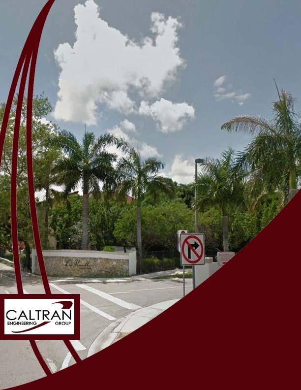
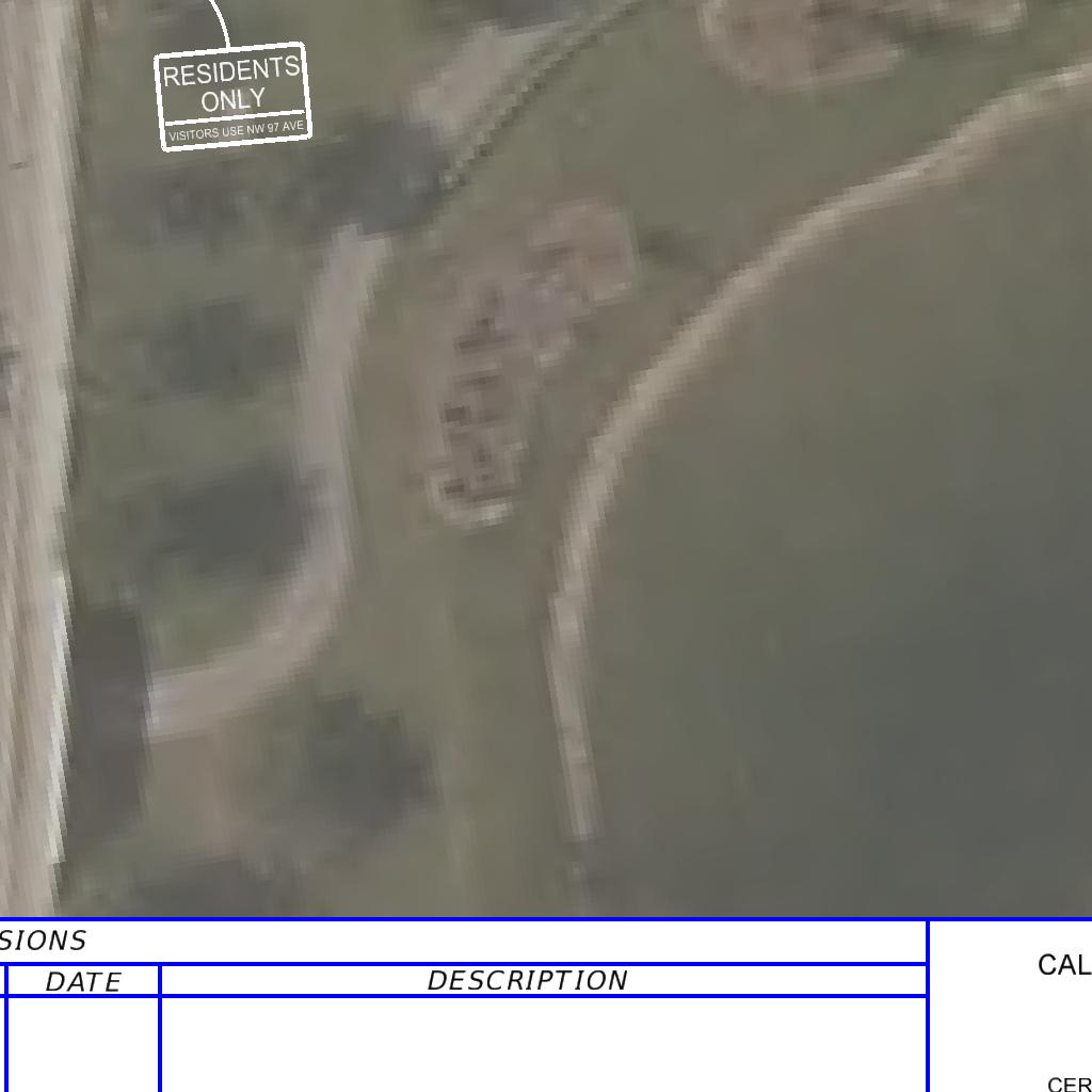
5 1. Executive Summary CALTRAN Engineering Group, Inc. was retained by the Fontainebleau Lakes Community Development District (CDD) to provide a comprehensive assessment to modify the current gate access locations in order to reduce residents queue delay and enhance safety procedures upon visitors at Las Ramblas Community located along Fontainebleau Boulevard within the CDDD under Miami-Dade County jurisdiction. Las Ramblas Community is located at 9934 NW 1 th Street, Miami FL Analysis Methodology The Gate Traffic Impact Analysis was performed in accordance with Miami Dade county Guidelines for Gate Traffic Impact Studies; field observations, data collection, and traffic operations were analyzed usingg the capacity analysis methodology published in the 21 Highway Capacity Manual (HCM) through Trafficware, Synchro 8 analysis software. Considering Miami Dade County standardd approach, two development scenarios were analyzed as part of the traffic impact analysis. The scenarios are as follows: Scenario 1- Existing Gate Operation Analysis: Current gate service time evaluation for a baseline condition during the Weekday, 7 to 9 AM and 4 to 6 PM time periods. A level of service analysis is provided for Fontainebleau Boulevard at the intersections of Northwest 999 th Court and Northwest 97 th Avenue. In addition, to the intersection of Northwest 97 th Avenue at Northwest 9 Block. Scenario 2-Future Gate Operation Analysis: Evaluation and re-distribution access. Intersections analysiss was performed consistent with 21 of the AM & PM Trips generated by Las Ramblas Community due to a new entrance gate HCM methodologies. A Synchro 8. Network Simulation was evaluated with a fully operational proposed residents-only entrance gate along Northwest 99 th Court in order to identify areas of potential deficiencies in which measures of mitigation were recommended as appropriate. 3. Introduction Las Ramblas Community is composed by 45 single family residential dwelling units located at 9934 NW 1th Street, Miami FL under Miami-Dade County jurisdiction within the Fontainebleau Lakes CDD. Community access is provided through the intersection of NW 97 Avenue at NW 9 Block. The physical design characteristics of the main access gate consist of a one- full lane entry, for f visitors and residents, and a one-lane exit divided by a guard house in which visitors are required to provide name and house destination number as a safety procedure. Additionally, a separate exit-only driveway serves the community at Fontainebleau Boulevard with NW 99 Court. Figure 1 shows the location of the Community site relative to the surrounding roadway network. 73 N.W. 17 th Avenue, Suite 115 Miami, FL Tel: Fax: Page 4
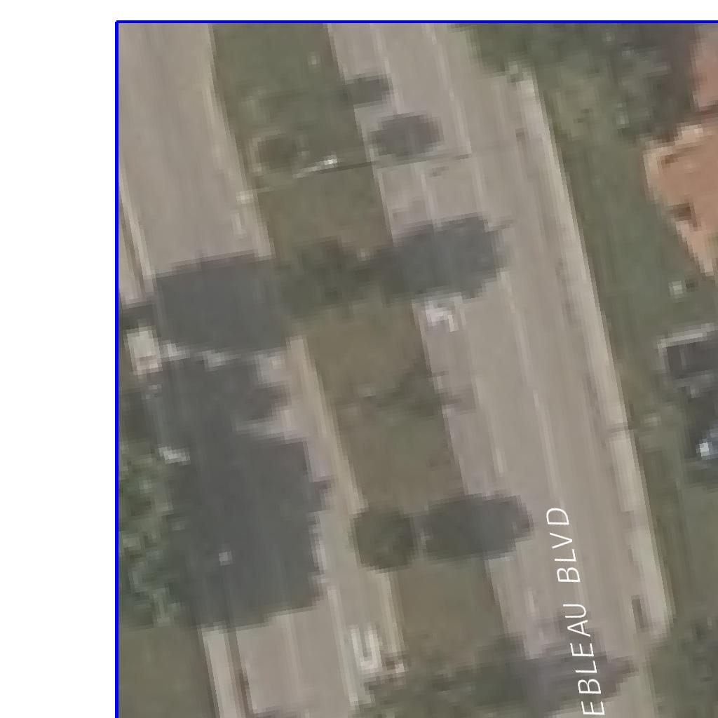
6 Dolphin Expressway/836 Las Ramblas Community Legend Signalized Intersection Stop-controlled Intersection Las Ramblas CDD TMC Intersection Figure 1: Proposed Project Site
7 4. Roadway Geometric Conditions A detailed field review was conducted to determine the existing intersectionn geometry, traffic control devices, signal phasing and other factors, which may affect intersectionn or roadway segment capacity. The following iss a detailed description of roadways in the study area: Fontainebleau Boulevard is an east-westt Urban Minor Arterial that runss along the south side of the community development under Active-On System FDOT Section ID 8753 with a 4 mph posted speed limit. The roadway typical section consists of three lanes of 33 feet of pavement width divided by a 25 foot raised median. Northwest 97 th Avenue runs north-south as a two-way divided Urban Principal Minor Arterial that runs along the east side of the community development under Active-On System FDOT Section ID 8747 with a 4 mph posted speed limit. The roadway typical section consists of three lanes of 33 feet of pavement width divided by an 11 foot raised median with a posted speed limit of 4 mph. Three intersections were selected for evaluation; existing geometric conditions are as follows: Fontainebleau Blvd & Northwest 97 th Avenue is a four legged signalized intersection under the asset ID 2811 by the Miami- with a Dade Signal Division. This intersection provides a Semi-Actuated Time of Day Plan (TOD) in which all approaches operatee lead protected-permissive left-turn phase. Fontainebleau Blvd and Northwest 97 th Avenue consist of a single and double through lanes respectively. All Four approaches present exclusive left turn lanes. There are No Turn on Red (NTOR) restrictionss on all four approaches. Sidewalks are provided along both sidess of all four approaches and crosswalks are provided across all four intersection legs. Northwest 97 th Avenue & Northwest 9 Block is a four legged signalized intersection under the asset ID 4253 by the Miami- with a Dade Signal Division. This intersection provides a Semi-Actuated Time of Day Plan (TOD) in which all approaches operatee lead protected-permissive left-turn phase. Northwest 97 th Avenue and Northwest 9 th Block consist of double and single through lanes respectively. All Four approaches present exclusive left turn lanes. There are No Turn on Red (NTOR) restrictionss on all four approaches. Sidewalks are provided along both sides of all four approaches and crosswalks are provided across the south and west legs. Fontainebleau Blvd and Northwest 99 Court provide a two-way (three-legged) unsignalized intersection. Northwest 99 th Court operates as one-way southbound with a STOP controlled approach. Thee East and West of Fontainebleau Blvd approaches consist of dual through lanes as well as auxiliary left turn lanes. Sidewalks are provided along both sides of all three approaches and a crosswalk is providedd across the north leg. 73 N.W. 17 th Avenue, Suite 115 Miami, FL Tel: Fax: Page 6


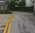


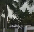


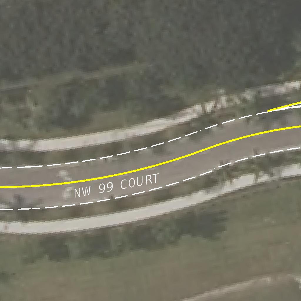
8 4.1 Las Ramblas Community Access/ Egress Roads Northwest 9 th Block serves as an access/ /egress point for the community of Las Ramblas. Gate design characteristics provide a two-way divided segment. Typical section consists of two lanes of 11 feet of pavement width divided by a +/- 18 foot raised median in which guard house is located. Northwest 9 th Block Northwest 99 th Court Block serves as an egress point for the community of Las Ramblas. Gate design characteristics provide a one-way undivided segment. Typical section consists of two lanes of 2 feet of pavement width. Northwest 99 th Court 73 N.W. 17 th Avenue, Suite 115 Miami, FL Tel: Fax: Page 7
9 5. Traffic Data Collection Traffic data was collected on a typical weekday Wednesday, January 14 th h, 216. The data collection includes 24-hour machine counts along Fontainebleau Boulevard and a turning movement counts (TMCs) at the three concerned intersections. In addition, a delay study was performed in order to evaluate queue lengths and determine gate processing service time at Northwest 9 th Block. Raw data reports can be found in Appendix A. 24-Hour Bi-directional Machine Count: The 24-hour bi-directional machinee volume countss on Fontainebleau Boulevard east of Northwest 99 th Court. Raw traffic counts were adjusted to a peak seasonal factor of 1.4. Traffic volumes are summarized as follows: Table 1: Traffic Volumes Location Direction 24 Hour Volume AMM Peak Volume PM Peak Volume Fontainebleau Blvd East of NW 99 th Court EB WB Total 11,133 12,49 23, , ,144 1,986 Peak Traffic Volumes: Turning Movement Counts were performed on Thursday, January 14 st, 216 at the concern intersections. Volumes were obtained att 15-Minute intervals. The peak hour was determined for each traffic period. The existing turning movement volumes, lane geometry, and intersection controls are illustratedd in Figure 2 & Figure 3- Scenario 1 Queue Analysis: A queue and delay study was performed on Wednesday, January 14 th, 216 at Northwest 9 th Block, main access point for the community of Las Ramblas. Volumes were countedd on intervals of 1 minute For the AM and PM peak periods. Queue traffic reports and service times are summarized as follows: Table 2: Las Ramblas Delayy Study Location Las Ramblas Period AM PM Peak Period Peak Hour Peak Hour Entrance Residents Visitors Volume Volume Volume Averagee Residents Processing time 9 Sec 5 Sec Average Visitors Processing time 27 Sec 34 Sec 1. As visitors and residents shared a single lane vehicles with a processing time > than 15 sec were categorized as visitors. 73 N.W. 17 th Avenue, Suite 115 Miami, FL Tel: Fax: Page 8
10 4 2 NW 97 th Ave PHF = PHF =.98 PHF =.98 Seasonal Factor = 1.4 Figure 2: Existing AM Peak Hour TMCs
11 28 6 NW 97 th Ave PHF = PHF =.98 PHF =.98 Seasonal Factor = 1.4 Figure 3: Existing PM Peak Hour TMCs
12 6. Proposed Gate Accesss and Operations As part of the new entrance gate location, it is anticipated a change in traffic patterns off the vehicles entering and exiting the community. In addition, it is expected that residents will access the community through Fontainebleau Boulevard and NW 99 th Court for rapid community access. On the other hand, visitors will experience a higher average service time due to a change in safety procedures upon arrival. Table 3 presents the proposed restrictions. Table 3: Proposed Access Road Operations Location Authorization Operation Authorization Operation NW 97 th Avenue & NW 9 Block Fontainebleau Boulevard & NW 99 th Court Residents Residents Ingress Egress Ingress Egress Visitors Visitors Ingress Egress Egress 1. All visitors will enter the community through Northwest 97th Avenue & Northwest 9 Block. 2. Fontainebleau Boulevard & NW 99th Court will serve the community as ingress for Residents and egress for both; visitorss and residents. 3. Northwest 97th Avenue & Northwest 9 Block and Fontainebleau Boulevard & Northwest 99th Court will serve as egress for visitors and residents. 7. Residents New Traffic Assignment Trip distribution and assignment are a function of the origin and destination of the site users and the available roadway system. For the proposed gate at Fontainebleau Boulevard and Northwest 99 t th Court, the trip distribution of the residents traffic generated by the Community of Las Ramblas was determined based on the existing percentage of traffic heading northbound and southbound along Northwest 97 th Avenue at Fontainebleau Boulevardd and Northwestt 9 th Block. Scenario 2 - Figure 4 & Figure 5 describe traffic assignment distribution followed by Figures 6 & 7 illustrating future gate operations. 73 N.W. 17 th Avenue, Suite 115 Miami, FL Tel: Fax: Page 11
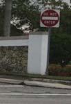
13 NW 97 th Ave 37 69% (-33) 17 31% (-15) 41 74% (+15) Proposed Visitor Entrance Proposed Residence Entrance Fontainebleau Blvd Black Blue Red Current Background Traffic Current Approach Percent Volume Addition/Reduction Figure 4: Proposed Gate System AM Peak TMCs

14 NW 97 th Ave 59 55% (-43) 48 45% (-35) % (+35) Proposed Visitor Entrance Proposed Residence Entrance Fontainebleau Blvd Black Blue Red Current Background Traffic Current Approach Percent Volume Addition/Reduction Figure 5: Proposed Gate System PM Peak TMCs
15 Proposed Visitor Entrance NW 97 th Ave Proposed Residence Entrance Fontainebleau Blvd Black Blue Background Traffic Change in Traffic Figure 6: Future AM Peak Hour TMCs
16 Proposed Visitor Entrance NW 97 th Ave Proposed Residence Entrance Fontainebleau Blvd Black Blue Background Traffic Change in Traffic Figure 7: Future PM Peak Hour TMCs
17 8. Level of Service Analysis The existing and proposed conditions were analyzed for Northwest 97 th Avenue at Northwest 9 th Block & Fontainebleau Blvd in addition to Fontainebleau Blvd at Northwest 99 th Court for the existing and proposed traffic operation scenarios: Scenario 1- LOS evaluation at Northwest 97 th Avenue at Northwest 9 th Block & Fontainebleau Blvd, as well as, LOS analysis at Fontainebleau Blvd and Northwest 99th Court for the AM and PM peak hour. Scenario 2- LOS analysis after traffic re-distribution of residents generated by Las Ramblas during the AM and PM due to proposed gate System. This traffic analysis utilizes Synchro 8., which applies methodologies are outlined in the Highway Capacity Manual, 21 Edition. LOS Analysis for signalized/unsignalized intersections are based on the amount off control delay which is a measurement in seconds per vehicle that act as an indicator of lost time, fuel consumption, frustration and driver s discomfort at the signalized intersections. The level of services for signalized intersections is a scale from A to F in accordance with control delay thresholds that range from less than 1 seconds to greater than 8 secondss of delay per vehicle. In order to perform this analysis, cycle lengths and clearance intervals usedd in the analysiss are consistent with the current Miami- and Dade County signal control sections and signal operating plans for thee study intersection in conjunction with physical operational characteristics observed during peak hours (Asset 5117 & 655). Table 4 shows the existing and future LOS and delay for the identified intersections per each scenario; details of the LOS results and Operational analysis (TOD Schedule) are documentedd in Appendix C. 73 N.W. 17 th Avenue, Suite 115 Miami, FL Tel: Fax: Page 14
18 LEVEL OF SERVICE ANALYSIS WEEKDAY AM & PM HOUR OF ADJACENT STREET Table 4: Level of Service Analysis Tables EXISTING CONDITIONS Intersection Period Approach NB Northwest 97 th Avenue and SB Northwest 9 th Block AM EB WB Intersection Delay NB Fontainebleau Blvd and SB Northwest 97 th Avenue AM EB WB Intersection Delay Fontainebleau Blvd and Northwest 99 th Court AM SB EB WB Intersection Delay Delay LOS 17.1 B 1.4 B 33.6 C 32.3 C 17.7 B 42.5 D 36.2 D 4.1 D 81.1 F 54.4 D B.3 A EXISTING CONDITIONS Intersection Period Northwest 97 th Avenue and Northwest 9 th Block PM Intersection Delay Fontainebleau Blvdd and Northwest 97 th Avenue PM Intersection Delay Fontainebleau Blvdd and Northwest 99 th Court PM Intersection Delay Approach Delay LOS NB 9.7 A SB 17.2 B EB 48.9 D WB D B NB 58.1 E SB 57.9 E EB F WB F F SB 16 C EB WB.3 A FUTURE CONDITIONS Intersection Period Approach NB Northwest 97 Avenue and Northwest 9 th Block AM SB EB WB Intersection Delay NB Fontainebleau Blvd and SB Northwest 97 th Avenue AM EB WB Intersection Delay Fontainebleau Blvd and Northwest 99 th Court AM SB EB WB Intersection Delay Delay LOS 21.4 C 1.8 B 33.1 C 27.3 C 2.3 C 41.1 D 36.6 D 4.4 D 79.6 E 53.5 D 12.4 B.4 A FUTURE CONDITIONS Intersection Period Northwest 97 th Avenue and Northwest 9 th Block PM Intersection Delay Fontainebleau Blvdd and Northwest 97 th Avenue PM Intersection Delay Fontainebleau Blvdd and Northwest 99 th Court PM Intersection Delay Approach Delay LOS NB 9.4 A SB B EB D WB D B NB 68.5 E SB 63.7 E EB F WB F F SB C EB WB.4 A Existing Conditions: This scenario evaluates existing traffic volumes and roadway conditions based on Year 215 traffic counts and field surveys. Future Conditions: This scenario shows the re-distribution of traffic volumes andd roadway conditions based on the proposed gate system. Results indicate that delays at the intersections of Northwest 97th Avenue at Northwest 9th Block & Fontainebleau Blvd Avenue will continue to operate att the same level of service prior to system implementation. After thee re distributing Las Ramblas residents travel patterns, a nominal increment of delay, could affect certain approaches. 73 N.W. 17 th Avenue, Suite 115 Miami, FL Tel: Fax: Page 15
19 9. Queue Analysis In order to determine the future f stacking length accumulations under thee proposed gatee system while improving the existing processing rates of visitorss and residents, a queuing analyses was performed using the collected Trip generation rates and service rates for the PM peak hour, which indicates a total ingress of 17 vehicles in which 27% (29) are visitors; The analysis encompassed comparing the results obtained from simulations of the gatess as per the queue traffic model calculations using the latest Synchro 8. model. In order to simulate a more detailed and conservative safety protocol, the average processing time was increased to 6 seconds per vehicle for visitors. As a result, the queue analysis concludes that the overall 95 th percentile queuee will be 56 feet of the available 343 feet of storage. Synchro reports can be found on Appendix D 9.1 Storage Length Evaluation According to the gated development requirements in Transportation and Land Development 2nd Edition, ITE, 22, the following recommendations should be met for a gated community: Communities with more than 2 dwelling units, the minimum gate storage length is 1 feet. Also, storage distance in advance of the gate needs to be of sufficient length to have a very high probability of storing all arriving vehicles. A 98% probability is suggested forr gated access for a major arterial and 9% probability to lower road categories. Peak 15-minute interval volume expressed in vehicles per hour should be used for delay and queue analysis. According to the gated development equirements by Miami Dade recommendations should be met for a gated community: County Publicc Works Department, the following Communities with more than 2 dwelling units, the minimum gate storage length is 175 feet. Therefore, in i order to determine the stacking length accumulation under the future traffic conditions, a queuing analysis was performed encompassing the M/M/C/K (Queue can only hold K customers) queuing trafficc model. Table 5 presents a summary of the queuing analysis based on the proposed conditions and procedures. Table 5: Proposed Access Road Operations C ( No. of Server) 1 ρ (Serv ver Utilization) L ( Average Entities in System) K ( Queue Capacity) ) λ ( In ncoming Rate) (veh/hour) Lq (Average Entities in Queue).4519 µ ( services/ s/hour) 6 (veh /hour) W (Average Time Sp pent in System).3222 Wqq (Average Time Waitin ng in Line).156 Probability of Entities being in the System seconds for visitors credentials at northwest 97 th Avenue and Northwest 9 th Block feet of storage length per vehicle feet storage capacity An MMCK probability analysis was performed for the 29 vehicles that willl ingress the Community through during the PM peak hour. Based on the 6 seconds of visitors registration time at main entrance, it is concluded that a probability of less than 15% of having 2 vehicles in queue. Therefore, the 343 feet of storage capacity for the proposedd gate system safety improvement will satisfy the traffic demand. 73 N.W. 17 th Avenue, Suite 115 Miami, FL Tel: Fax: Page 16
20 9.2 Emergency Vehicles Access According to Miami-Dade Fire Rescue Access Road Requirements, for Gated communities or properties: Gates to communities or properties shall be a minimum 15 feet clear width if the approach to and/or departure from the gate is not within a turn radius, Gates that are within a turn radius shall be a minimum 2 feet clear width, Fire Department access to gated communities shall be by Knox Key Switchh model 352 ONLY or Knox padlock model 3753 on manual gates where permitted. As a result, fire departments minimum requirements are being included as part of the concept development. 1. Summary of Findings and Recommendations Based on the gate operation analysis performed during the development of this report, the following conclusions and recommendations were determined: As part of the proposed gate system, 1% of the visitors will enter the community through Northwest 97th Avenue at Northwest 9 th Court while Residents will access the community through Fontainebleau Blvd at Northwest 9 th Court. Both access points will serve as exit for visitors and residents only. Appendix A show the proposed gate concept development layout for the community of Las Ramblas. As part of the LOS analysis, a microscopic increase of delay forr certain lane groups and movements will occur under the AM and PM Peak hours once the new gate system is implemented. Differentials cannot be perceived by drivers. Intersections will continue operating at the same current LOS. A simulation of the gate and keypad operations was performed using SYNCHRO 8.. The queue analysis concluded that the proposed gates and closures queues will be of 56 feet, which is less thann the 343 feet available. Based on the M/M/C/K method of queue theory, it is concluded that the 343 feet of storage capacity for the proposed gate system safety improvement processed within a 6 seconds will have sufficient capacity to serve traffic demand. It is recommended a smart gate system with features such as priority arm opening given to residents at arrival time in order to ensure high processing speed and optimum traffic flow at community entrance. In summary, the gate access traffic pattern modification at Las Ramblas Community would not have an adverse impact on the surrounding roadway network and/or affect other traffic generators in the area. 73 N.W. 17 th Avenue, Suite 115 Miami, FL Tel: Fax: Page 17
21 Appendix A: Residential Gate Entrance Plan


22
23 Appendix B: Traffic Data Collection
24 County: 99 Station: 5 Description: FONTAINEBLEU BLVD E NW 99TH COURT Start Date: 1/14/216 Start Time: Direction: E Direction: W Combined Time 1st 2nd 3rd 4th Total 1st 2nd 3rd 4th Total Total Hour Totals: Peak Volume Information Direction: E Direction: W Combined Directions Hour Volume Hour Volume Hour Volume A.M P.M Daily Generated by SPS 5..3P
25 & NW 9 BLK Southbound Northbound Groups Printed- Veh - Trucks - Turns NW 9 BLK Westbound File Name : Blvd & NW 9 BLK Site Code : Start Date : 1/14/216 Page No : 1 NW 9 BLK Eastbound Start Time /Bike App. Total /Bike App. Total /Bike App. Total /Bike App. Total Int. Total 7: AM :15 AM :3 AM :45 AM Total : AM :15 AM :3 AM :45 AM Total *** BREAK *** 4: PM :15 PM :3 PM :45 PM Total : PM :15 PM :3 PM :45 PM Total Grand Total Apprch % Total % Veh % Veh Trucks % Trucks U-Turns % U-Turns
26 & NW 9 BLK File Name : Blvd & NW 9 BLK Site Code : Start Date : 1/14/216 Page No : NW 9 BLK North 1/14/216 7: AM 1/14/216 5:45 PM Veh Trucks U-Turns NW 9 BLK
27 & NW 9 BLK File Name : Blvd & NW 9 BLK Site Code : Start Date : 1/14/216 Page No : 3 Southbound Northbound NW 9 BLK Westbound NW 9 BLK Eastbound Start Time /Bike App. Total /Bike App. Total /Bike App. Total /Bike App. Total Int. Total Peak Hour Analysis From 7: AM to 8:45 AM - Peak 1 of 1 Peak Hour for Entire Intersection Begins at 7:3 AM 7:3 AM :45 AM : AM :15 AM Total Volume % App. Total PHF
28 & NW 9 BLK File Name : Blvd & NW 9 BLK Site Code : Start Date : 1/14/216 Page No : Peak Hour Data NW 9 BLK Peak Hour Begins at 7:3 AM Veh Trucks U-Turns North NW 9 BLK
29 & NW 9 BLK Southbound Northbound NW 9 BLK Westbound File Name : Blvd & NW 9 BLK Site Code : Start Date : 1/14/216 Page No : 5 NW 9 BLK Eastbound Start Time /Bike App. Total /Bike App. Total /Bike App. Total /Bike App. Total Int. Total Peak Hour Analysis From 4: PM to 5:45 PM - Peak 1 of 1 Peak Hour for Entire Intersection Begins at 4:45 PM 4:45 PM : PM :15 PM :3 PM Total Volume % App. Total PHF
30 & NW 9 BLK File Name : Blvd & NW 9 BLK Site Code : Start Date : 1/14/216 Page No : Peak Hour Data NW 9 BLK Peak Hour Begins at 4:45 PM Veh Trucks U-Turns North NW 9 BLK
31 & NW 9 BLK Southbound Northbound Groups Printed- Turns NW 9 BLK Westbound File Name : Blvd & NW 9 BLK Site Code : Start Date : 1/14/216 Page No : 1 NW 9 BLK Eastbound Start Time /Bike App. Total /Bike App. Total /Bike App. Total /Bike App. Total Int. Total *** BREAK *** 7:45 AM Total : AM :15 AM *** BREAK *** 8:45 AM Total *** BREAK *** 4: PM *** BREAK *** 4:3 PM *** BREAK *** Total : PM :15 PM :3 PM *** BREAK *** Total Grand Total Apprch % 1 1 Total %
32 & NW 9 BLK 2 2 File Name : Blvd & NW 9 BLK Site Code : Start Date : 1/14/216 Page No : 2 2 /Bike NW 9 BLK 9 9 /Bike 1/14/216 7: AM 1/14/216 5:45 PM U-Turns North /Bike 2 2 NW 9 BLK 9 /Bike 9 9
33 & NW 9 BLK File Name : Blvd & NW 9 BLK Site Code : Start Date : 1/14/216 Page No : 3 Southbound Northbound NW 9 BLK Westbound NW 9 BLK Eastbound Start Time /Bike App. Total /Bike App. Total /Bike App. Total /Bike App. Total Int. Total Peak Hour Analysis From 7: AM to 8:45 AM - Peak 1 of 1 Peak Hour for Entire Intersection Begins at 7:3 AM 7:3 AM 7:45 AM : AM :15 AM Total Volume % App. Total 1 PHF
34 & NW 9 BLK File Name : Blvd & NW 9 BLK Site Code : Start Date : 1/14/216 Page No : 4 Peak Hour Data NW 9 BLK 4 4 Peak Hour Begins at 7:3 AM U-Turns North NW 9 BLK 4 4 4
35 & NW 9 BLK Southbound Northbound NW 9 BLK Westbound File Name : Blvd & NW 9 BLK Site Code : Start Date : 1/14/216 Page No : 5 NW 9 BLK Eastbound Start Time /Bike App. Total /Bike App. Total /Bike App. Total /Bike App. Total Int. Total Peak Hour Analysis From 4: PM to 5:45 PM - Peak 1 of 1 Peak Hour for Entire Intersection Begins at 4:3 PM 4:3 PM :45 PM 5: PM :15 PM Total Volume % App. Total 1 PHF
36 & NW 9 BLK File Name : Blvd & NW 9 BLK Site Code : Start Date : 1/14/216 Page No : 6 Peak Hour Data NW 9 BLK 4 4 Peak Hour Begins at 4:3 PM U-Turns North NW 9 BLK 4 4 4
37 & NW 9 BLK Southbound Northbound Groups Printed- Trucks NW 9 BLK Westbound File Name : Blvd & NW 9 BLK Site Code : Start Date : 1/14/216 Page No : 1 NW 9 BLK Eastbound Start Time Bikes App. Total Bikes App. Total Bikes App. Total Bikes App. Total Int. Total 7: AM :15 AM :3 AM :45 AM Total : AM :15 AM :3 AM :45 AM Total *** BREAK *** 4: PM :15 PM :3 PM :45 PM Total : PM :15 PM :3 PM *** BREAK *** Total Grand Total Apprch % Total %
38 & NW 9 BLK File Name : Blvd & NW 9 BLK Site Code : Start Date : 1/14/216 Page No : Bikes NW 9 BLK Bikes 1/14/216 7: AM 1/14/216 5:45 PM Trucks North 2 5 Bikes NW 9 BLK Bikes
39 & NW 9 BLK File Name : Blvd & NW 9 BLK Site Code : Start Date : 1/14/216 Page No : 3 Southbound Northbound NW 9 BLK Westbound NW 9 BLK Eastbound Start Time Bikes App. Total Bikes App. Total Bikes App. Total Bikes App. Total Int. Total Peak Hour Analysis From 7: AM to 8:45 AM - Peak 1 of 1 Peak Hour for Entire Intersection Begins at 7: AM 7: AM :15 AM :3 AM :45 AM Total Volume % App. Total PHF
40 & NW 9 BLK File Name : Blvd & NW 9 BLK Site Code : Start Date : 1/14/216 Page No : Peak Hour Data NW 9 BLK Peak Hour Begins at 7: AM Trucks North NW 9 BLK
41 & NW 9 BLK Southbound Northbound NW 9 BLK Westbound File Name : Blvd & NW 9 BLK Site Code : Start Date : 1/14/216 Page No : 5 NW 9 BLK Eastbound Start Time Bikes App. Total Bikes App. Total Bikes App. Total Bikes App. Total Int. Total Peak Hour Analysis From 4: PM to 5:45 PM - Peak 1 of 1 Peak Hour for Entire Intersection Begins at 4: PM 4: PM :15 PM :3 PM :45 PM Total Volume % App. Total PHF
42 & NW 9 BLK File Name : Blvd & NW 9 BLK Site Code : Start Date : 1/14/216 Page No : Peak Hour Data NW 9 BLK Peak Hour Begins at 4: PM Trucks North NW 9 BLK
43 Fontainebleau Blvd & NW 99th Court NW 99th Court Southbound NW 99th Court Northbound Groups Printed- Veh - Trucks - Turns Fontainebleu Blvd Westbound File Name : Fontainebleau Blvd & NW 99th Court Site Code : Start Date : 1/14/216 Page No : 1 Fontainebleau Blvd Eastbound Start Time /Bike App. Total /Bike App. Total /Bike App. Total /Bike App. Total Int. Total 7: AM :15 AM :3 AM :45 AM Total : AM :15 AM :3 AM :45 AM Total *** BREAK *** 4: PM :15 PM :3 PM :45 PM Total : PM :15 PM :3 PM :45 PM Total Grand Total Apprch % Total % Veh % Veh Trucks % Trucks U-Turns % U-Turns
44 Fontainebleau Blvd & NW 99th Court NW 99th Court File Name : Fontainebleau Blvd & NW 99th Court Site Code : Start Date : 1/14/216 Page No : Fontainebleau Blvd North 1/14/216 7: AM 1/14/216 5:45 PM Veh Trucks U-Turns Fontainebleu Blvd NW 99th Court
45 Fontainebleau Blvd & NW 99th Court File Name : Fontainebleau Blvd & NW 99th Court Site Code : Start Date : 1/14/216 Page No : 3 NW 99th Court Southbound NW 99th Court Northbound Fontainebleu Blvd Westbound Fontainebleau Blvd Eastbound Start Time /Bike App. Total /Bike App. Total /Bike App. Total /Bike App. Total Int. Total Peak Hour Analysis From 7: AM to 8:45 AM - Peak 1 of 1 Peak Hour for Entire Intersection Begins at 8: AM 8: AM :15 AM :3 AM :45 AM Total Volume % App. Total PHF
46 Fontainebleau Blvd & NW 99th Court NW 99th Court File Name : Fontainebleau Blvd & NW 99th Court Site Code : Start Date : 1/14/216 Page No : Peak Hour Data Fontainebleau Blvd Peak Hour Begins at 8: AM Veh Trucks U-Turns North Fontainebleu Blvd NW 99th Court
47 Fontainebleau Blvd & NW 99th Court NW 99th Court Southbound NW 99th Court Northbound Fontainebleu Blvd Westbound File Name : Fontainebleau Blvd & NW 99th Court Site Code : Start Date : 1/14/216 Page No : 5 Fontainebleau Blvd Eastbound Start Time /Bike App. Total /Bike App. Total /Bike App. Total /Bike App. Total Int. Total Peak Hour Analysis From 4: PM to 5:45 PM - Peak 1 of 1 Peak Hour for Entire Intersection Begins at 4:45 PM 4:45 PM : PM :15 PM :3 PM Total Volume % App. Total PHF
48 Fontainebleau Blvd & NW 99th Court NW 99th Court File Name : Fontainebleau Blvd & NW 99th Court Site Code : Start Date : 1/14/216 Page No : Peak Hour Data Fontainebleau Blvd Peak Hour Begins at 4:45 PM Veh Trucks U-Turns North Fontainebleu Blvd 1 1 NW 99th Court
49 Fontainebleau Blvd & NW 99th Court NW 99th Court Southbound NW 99th Court Northbound Groups Printed- Turns Fontainebleu Blvd Westbound File Name : Fontainebleau Blvd & NW 99th Court Site Code : Start Date : 1/14/216 Page No : 1 Fontainebleau Blvd Eastbound Start Time /Bike App. Total /Bike App. Total /Bike App. Total /Bike App. Total Int. Total 7: AM *** BREAK *** Total *** BREAK *** 4:15 PM *** BREAK *** Total : PM *** BREAK *** Total Grand Total Apprch % 1 1 Total %
50 Fontainebleau Blvd & NW 99th Court NW 99th Court 3 3 File Name : Fontainebleau Blvd & NW 99th Court Site Code : Start Date : 1/14/216 Page No : 2 /Bike Fontainebleau Blvd /Bike 1/14/216 7: AM 1/14/216 5:45 PM U-Turns North 2 /Bike 2 2 Fontainebleu Blvd /Bike 2 2 NW 99th Court
51 Fontainebleau Blvd & NW 99th Court File Name : Fontainebleau Blvd & NW 99th Court Site Code : Start Date : 1/14/216 Page No : 3 NW 99th Court Southbound NW 99th Court Northbound Fontainebleu Blvd Westbound Fontainebleau Blvd Eastbound Start Time /Bike App. Total /Bike App. Total /Bike App. Total /Bike App. Total Int. Total Peak Hour Analysis From 7: AM to 8:45 AM - Peak 1 of 1 Peak Hour for Entire Intersection Begins at 7: AM 7: AM :15 AM 7:3 AM 7:45 AM Total Volume % App. Total 1 PHF
52 Fontainebleau Blvd & NW 99th Court NW 99th Court 1 1 File Name : Fontainebleau Blvd & NW 99th Court Site Code : Start Date : 1/14/216 Page No : 4 Peak Hour Data Fontainebleau Blvd Peak Hour Begins at 7: AM U-Turns North Fontainebleu Blvd NW 99th Court
53 Fontainebleau Blvd & NW 99th Court NW 99th Court Southbound NW 99th Court Northbound Fontainebleu Blvd Westbound File Name : Fontainebleau Blvd & NW 99th Court Site Code : Start Date : 1/14/216 Page No : 5 Fontainebleau Blvd Eastbound Start Time /Bike App. Total /Bike App. Total /Bike App. Total /Bike App. Total Int. Total Peak Hour Analysis From 4: PM to 5:45 PM - Peak 1 of 1 Peak Hour for Entire Intersection Begins at 4:15 PM 4:15 PM :3 PM 4:45 PM 5: PM Total Volume % App. Total 1 1 PHF
54 Fontainebleau Blvd & NW 99th Court NW 99th Court 2 2 File Name : Fontainebleau Blvd & NW 99th Court Site Code : Start Date : 1/14/216 Page No : 6 Peak Hour Data Fontainebleau Blvd Peak Hour Begins at 4:15 PM U-Turns North Fontainebleu Blvd 2 2 NW 99th Court
55 Fontainebleau Blvd & NW 99th Court NW 99th Court Southbound NW 99th Court Northbound Groups Printed- Trucks Fontainebleu Blvd Westbound File Name : Fontainebleau Blvd & NW 99th Court Site Code : Start Date : 1/14/216 Page No : 1 Fontainebleau Blvd Eastbound Start Time Bikes App. Total Bikes App. Total Bikes App. Total Bikes App. Total Int. Total 7: AM :15 AM :3 AM :45 AM Total : AM :15 AM :3 AM :45 AM Total *** BREAK *** 4: PM :15 PM :3 PM :45 PM Total : PM :15 PM :3 PM :45 PM Total Grand Total Apprch % Total %
56 Fontainebleau Blvd & NW 99th Court NW 99th Court 9 9 File Name : Fontainebleau Blvd & NW 99th Court Site Code : Start Date : 1/14/216 Page No : Bikes Fontainebleau Blvd Bikes 1/14/216 7: AM 1/14/216 5:45 PM Trucks North 48 Bikes Fontainebleu Blvd Bikes NW 99th Court
57 Fontainebleau Blvd & NW 99th Court File Name : Fontainebleau Blvd & NW 99th Court Site Code : Start Date : 1/14/216 Page No : 3 NW 99th Court Southbound NW 99th Court Northbound Fontainebleu Blvd Westbound Fontainebleau Blvd Eastbound Start Time Bikes App. Total Bikes App. Total Bikes App. Total Bikes App. Total Int. Total Peak Hour Analysis From 7: AM to 8:45 AM - Peak 1 of 1 Peak Hour for Entire Intersection Begins at 7: AM 7: AM :15 AM :3 AM :45 AM Total Volume % App. Total PHF
58 Fontainebleau Blvd & NW 99th Court NW 99th Court 3 3 File Name : Fontainebleau Blvd & NW 99th Court Site Code : Start Date : 1/14/216 Page No : Peak Hour Data Fontainebleau Blvd Peak Hour Begins at 7: AM Trucks North Fontainebleu Blvd NW 99th Court
59 Fontainebleau Blvd & NW 99th Court NW 99th Court Southbound NW 99th Court Northbound Fontainebleu Blvd Westbound File Name : Fontainebleau Blvd & NW 99th Court Site Code : Start Date : 1/14/216 Page No : 5 Fontainebleau Blvd Eastbound Start Time Bikes App. Total Bikes App. Total Bikes App. Total Bikes App. Total Int. Total Peak Hour Analysis From 4: PM to 5:45 PM - Peak 1 of 1 Peak Hour for Entire Intersection Begins at 4: PM 4: PM :15 PM :3 PM :45 PM Total Volume % App. Total PHF
60 Fontainebleau Blvd & NW 99th Court NW 99th Court 4 4 File Name : Fontainebleau Blvd & NW 99th Court Site Code : Start Date : 1/14/216 Page No : Peak Hour Data Fontainebleau Blvd Peak Hour Begins at 4: PM Trucks North Fontainebleu Blvd NW 99th Court
61 Fontainebleau Blvd & Southbound Northbound Groups Printed- Veh - Trucks - Turns Fontainebleu Blvd Westbound File Name : Fontainebleau Blvd & Site Code : Start Date : 1/14/216 Page No : 1 Fontainebleau Blvd Eastbound Start Time /Bike App. Total /Bike App. Total /Bike App. Total /Bike App. Total Int. Total 7: AM :15 AM :3 AM :45 AM Total : AM :15 AM :3 AM :45 AM Total *** BREAK *** 4: PM :15 PM :3 PM :45 PM Total : PM :15 PM :3 PM :45 PM Total Grand Total Apprch % Total % Veh % Veh Trucks % Trucks U-Turns % U-Turns
62 Fontainebleau Blvd & File Name : Fontainebleau Blvd & Site Code : Start Date : 1/14/216 Page No : Fontainebleau Blvd North 1/14/216 7: AM 1/14/216 5:45 PM Veh Trucks U-Turns Fontainebleu Blvd
63 Fontainebleau Blvd & File Name : Fontainebleau Blvd & Site Code : Start Date : 1/14/216 Page No : 3 Southbound Northbound Fontainebleu Blvd Westbound Fontainebleau Blvd Eastbound Start Time /Bike App. Total /Bike App. Total /Bike App. Total /Bike App. Total Int. Total Peak Hour Analysis From 7: AM to 8:45 AM - Peak 1 of 1 Peak Hour for Entire Intersection Begins at 7:3 AM 7:3 AM :45 AM : AM :15 AM Total Volume % App. Total PHF
64 Fontainebleau Blvd & File Name : Fontainebleau Blvd & Site Code : Start Date : 1/14/216 Page No : Peak Hour Data Fontainebleau Blvd Peak Hour Begins at 7:3 AM Veh Trucks U-Turns North Fontainebleu Blvd
65 Fontainebleau Blvd & Southbound Northbound Fontainebleu Blvd Westbound File Name : Fontainebleau Blvd & Site Code : Start Date : 1/14/216 Page No : 5 Fontainebleau Blvd Eastbound Start Time /Bike App. Total /Bike App. Total /Bike App. Total /Bike App. Total Int. Total Peak Hour Analysis From 4: PM to 5:45 PM - Peak 1 of 1 Peak Hour for Entire Intersection Begins at 4:45 PM 4:45 PM : PM :15 PM :3 PM Total Volume % App. Total PHF
66 Fontainebleau Blvd & File Name : Fontainebleau Blvd & Site Code : Start Date : 1/14/216 Page No : Peak Hour Data Fontainebleau Blvd Peak Hour Begins at 4:45 PM Veh Trucks U-Turns North Fontainebleu Blvd
67 Fontainebleau Blvd & Southbound Northbound Groups Printed- Turns Fontainebleu Blvd Westbound File Name : Fontainebleau Blvd & Site Code : Start Date : 1/14/216 Page No : 1 Fontainebleau Blvd Eastbound Start Time /Bike App. Total /Bike App. Total /Bike App. Total /Bike App. Total Int. Total 7: AM :15 AM :3 AM :45 AM Total *** BREAK *** 8:15 AM :3 AM :45 AM Total *** BREAK *** 4: PM :15 PM :3 PM :45 PM Total *** BREAK *** 5:15 PM :3 PM *** BREAK *** Total Grand Total Apprch % 1 1 Total %
5858 N COLLEGE, LLC N College Avenue Traffic Impact Study
 5858 N COLLEGE, LLC nue Traffic Impact Study August 22, 2016 Contents Traffic Impact Study Page Preparer Qualifications... 1 Introduction... 2 Existing Roadway Conditions... 5 Existing Traffic Conditions...
Traffic Impact Study WestBranch Residential Development Davidson, NC March 2016
 Traffic Impact Study WestBranch Residential Development Davidson, NC March 216 TRAFFIC IMPACT STUDY FOR THE WestBranch Residential Development LOCATED IN DAVIDSON, NC Prepared For: Lennar Carolinas, LLC
Traffic Impact Analysis Chatham County Grocery Chatham County, NC
 Chatham County Grocery Chatham County, NC TABLE OF CONTENTS 1. INTRODUCTION... 1 1.1. Location and Study Area... 1 1.2. Proposed Land Use and Access... 2 1.3. Adjacent Land Uses... 2 1.4. Existing ways...
TRAFFIC IMPACT STUDY And A TRAFFIC SIGNAL WARRANT ANALYSIS FOR A SENIOR LIVING AND APARTMENT DEVELOPMENT
 TRAFFIC IMPACT STUDY And A TRAFFIC SIGNAL WARRANT ANALYSIS FOR A SENIOR LIVING AND APARTMENT DEVELOPMENT DEERFIELD TOWNSHIP, WARREN COUNTY, OHIO Nantucket Circle and Montgomery Road () Prepared for: ODLE
Traffic Impact Analysis Walton Acres at Riverwood Athletic Club Clayton, NC
 Traffic Impact Analysis Walton Acres at Riverwood Athletic Club Clayton, NC 1. TABLE OF CONTENTS INTRODUCTION...1 1.1. Site Location and Study Area...1 1.2. Proposed Land Use and Site Access...2 1.3.
Marina Loft (DRC 51-R-12)
") Marina Loft (DRC 51-R-12) traffic study prepared for: Cymbal Development OCtober 2012 Traf Tech October 1, 2012 Mr. Asi Cymbal - President Cymbal Development 3470 North Miami Avenue Upper Suite Miami,
Marina Loft (DRC 51-R-12) traffic study prepared for: Cymbal Development OCtober 2012 Traf Tech October 1, 2012 Mr. Asi Cymbal - President Cymbal Development 3470 North Miami Avenue Upper Suite Miami,
Traffic Impact Study. Westlake Elementary School Westlake, Ohio. TMS Engineers, Inc. June 5, 2017
 TMS Engineers, Inc. Traffic Impact Study Westlake Elementary School Westlake, Ohio June 5, 2017 Prepared for: Westlake City Schools - Board of Education 27200 Hilliard Boulevard Westlake, OH 44145 TRAFFIC
Traffic Impact Study Little Egypt Road Development Denver, North Carolina June 2017
 Traffic Impact Study Little Egypt Road Development Denver, North arolina June 2017 N. Little Egypt Road DQ\ QDQFLQJ VDOHV RU RWKHU SHUIRUPDQFH EDVHG FULWHULD Proposed Site Driveways Site Driveway 1 TRAFFI
REDEVELOPMENT TRAFFIC IMPACT STUDY
 REDEVELOPMENT TRAFFIC IMPACT STUDY For Wendy s Parker, Colorado January 215 Prepared for: Sterling Design Associates, LLC 29 W. Littleton Boulevard #3 Littleton, Colorado 812 Prepared by: 1233 Airport
Transportation Impact Study for Abington Terrace
 Transportation Impact Study for Abington Terrace Abington Township, Montgomery County, PA Sandy A. Koza, P.E., PTOE PA PE License Number PE059911 Prepared by McMahon Associates, Inc. 425 Commerce Drive,
FINAL DESIGN TRAFFIC TECHNICAL MEMORANDUM
 FINAL DESIGN TRAFFIC TECHNICAL MEMORANDUM July 2014 FINAL (SR 43) Project Development and Environment Study From State Road 60 (Adamo Drive) to I-4 (SR 400) Hillsborough County, Florida Work Program Item
Walmart (Store # ) 60 th Street North and Marion Road Sioux Falls, South Dakota
 60 th Street North and Marion Road Sioux Falls, South Dakota") Walmart (Store #4865-00) 60 th Street North and Marion Road Sioux Falls, South Dakota Prepared for: Wal-Mart Stores, Inc. Bentonville, Arkansas Prepared by: Kimley-Horn and Associates, Inc. ã2013 Kimley-Horn
Walmart (Store #4865-00) 60 th Street North and Marion Road Sioux Falls, South Dakota Prepared for: Wal-Mart Stores, Inc. Bentonville, Arkansas Prepared by: Kimley-Horn and Associates, Inc. ã2013 Kimley-Horn
Traffic Impact Statement
 Traffic Impact Statement Mixed Use Development, US 41 and Old Trail Drive aka Tide-Starbucks 4900 9 th Street North General Development Site Plan (GDSP) Collier County, FL 10/6/2015 Prepared for: Prepared
MEMORANDUM. DATE March 1, 2012 TO Town of Milton Mark Abbott, Seth Asante, and Efi Pagitsas Boston Region MPO Staff
 MEMORANDUM DATE March 1, 212 TO Town of Milton FROM RE Mark Abbott, Seth Asante, and Efi Pagitsas Boston Region MPO Staff FFY 211 Safety and Operations Analyses at Selected Boston Region MPO Intersections:
Harrah s Station Square Casino
 Transportation Analysis Harrah s Station Square Casino Pittsburgh, Pennsylvania Submitted To: City of Pittsburgh and Pennsylvania Gaming Control Board Prepared By: DKS Associates GAI Consultants December
TRANSPORTATION ANALYSIS REPORT US Route 6 Huron, Erie County, Ohio
 TRANSPORTATION ANALYSIS REPORT US Route 6 Huron, Erie County, Ohio December 12, 2012 Prepared for: The City of Huron 417 Main Huron, OH 44839 Providing Practical Experience Technical Excellence and Client
Troutbeck Farm Development
 Troutbeck Farm Development Willistown Township, Chester County PA For Submission To: Willistown Township Last Revised: October, 4 TPD# INLM.A. 5 E. High Street Suite 65 Pottstown, PA 9464 6.36.3 TPD@TrafficPD.com
MEETING FACILITY 2901 GIBFORD DRIVE CITY OF OTTAWA TRANSPORTATION BRIEF. Prepared for: Holiday Inn Express 2881 Gibford Drive Ottawa, ON K1V 2L9
 MEETING FACILITY 2901 GIBFORD DRIVE CITY OF OTTAWA TRANSPORTATION BRIEF Prepared for: Holiday Inn Express 2881 Gibford Drive Ottawa, ON K1V 2L9 December 18, 2012 112-566 Brief_1.doc D. J. Halpenny & Associates
TRAFFIC IMPACT STUDY. Creekside Thornton, Colorado. For. August 2015 November 2015 Revised: August Prepared for:
 TRAFFIC IMPACT STUDY For Creekside Thornton, Colorado August 215 November 215 Revised: August 216 Prepared for: Jansen Strawn Consulting Engineers 45 West 2 nd Avenue Denver, Colorado 8223 Prepared by:
Design Traffic Technical Memorandum
 State Road 7 Extension PD&E Study Design Traffic Technical Memorandum Palm Beach County, FL October 2010 State Road 7 Extension PD&E Study Design Traffic Technical Memorandum Palm Beach County, FL Prepared
Table of Contents FIGURES TABLES APPENDICES. Traffic Impact Study Hudson Street Parking Garage MC Project No.: A Table of Contents
 Traffic Impact Study Hudson Street Parking Garage MC Project No.: 151714A Table of Contents Table of Contents I. INTRODUCTION... 2 II. EXISTING CONDITIONS... 5 III. 215 EXISTING TRAFFIC CONDITIONS... 6
Chapter 4 Traffic Analysis
 Chapter 4 Traffic Analysis PURPOSE The traffic analysis component of the K-68 Corridor Management Plan incorporates information on the existing transportation network, such as traffic volumes and intersection
OFFICE/RETAIL DEVELOPMENT 1625 BANK STREET OTTAWA, ONTARIO TRANSPORTATION BRIEF. Prepared for: Canada Inc.
 OFFICE/RETAIL DEVELOPMENT 1625 BANK STREET OTTAWA, ONTARIO TRANSPORTATION BRIEF Prepared for: 9402209 Canada Inc. December 15, 2015 115-625 Report_2.doc D. J. Halpenny & Associates Ltd. Consulting Transportation
NEW YORK CENTRAL PARK SUBDIVISION BLAIS STREET/ST-PIERRE STREET EMBRUN, ONTARIO TRAFFIC IMPACT STUDY. Prepared for:
 NEW YORK CENTRAL PARK SUBDIVISION BLAIS STREET/ST-PIERRE STREET EMBRUN, ONTARIO TRAFFIC IMPACT STUDY Prepared for: Solidex Holdings Limited & Investissement Maurice Lemieux Investments Attn: Mr. Anthony
INDUSTRIAL BUILDING 1660 COMSTOCK ROAD CITY OF OTTAWA TRANSPORTATION OVERVIEW. Prepared for:
 INDUSTRIAL BUILDING 1660 COMSTOCK ROAD CITY OF OTTAWA TRANSPORTATION OVERVIEW Prepared for: Simluc Contractors Limited 2550 Blackwell Street, Ottawa K1B 5R1 October 18, 2013 113-584 Overview_1.doc D. J.
MEDICAL/OFFICE BUILDING 1637 BANK STREET OTTAWA, ONTARIO TRANSPORTATION OVERVIEW. Prepared for:
 MEDICAL/OFFICE BUILDING 1637 BANK STREET OTTAWA, ONTARIO TRANSPORTATION OVERVIEW Prepared for: 2434984 Ontario Inc. 13-5510 Canotek Road Ottawa, Ontario K1J 9J5 June 4, 2015 115-613 Report_2.doc D. J.
List of Exhibits...ii
 One Brickell Traffic Study TABLE OF CONTENTS List of Exhibits...ii EXECUTIVE SUMMARY...1 1. INTRODUCTION...2 1.1 Study Area...2 1.2 Study Objective...5 2. EXISTING TRAFFIC CONDITIONS...6 2.1 Data Collection...6
INDUSTRIAL BUILDING 3009 HAWTHORNE ROAD CITY OF OTTAWA TRANSPORTATION OVERVIEW REVISED. Prepared for: Canada Inc.
 INDUSTRIAL BUILDING 3009 HAWTHORNE ROAD CITY OF OTTAWA TRANSPORTATION OVERVIEW REVISED Prepared for: 7849648 Canada Inc. Octiober 1, 2015 114-598 Overview_2.doc D. J. Halpenny & Associates Ltd. Consulting
Road Conversion Study Plumas Street
 Plumas Street Phase I Submitted to The Regional Transportation Commission of Washoe County Submitted by Zong Tian, Ph.D., P.E. Saeedeh Farivar Haiyuan Li, Ph.D. Center for Advanced Transportation Education
Traffic Circulation Study for Neighborhood Southwest of Mockingbird Lane and Airline Road, Highland Park, Texas
 ARIZONA TEXAS NEW MEXICO OKLAHOMA February 13, 2015 Mr. Meran Dadgostar P.E., R.S. Town of Highland Park 4700 Drexel Dr. Highland Park, Texas 75205 Re: Traffic Circulation Study for Neighborhood Southwest
Glenn Avenue Corridor Traffic Operational Evaluation
 Glenn Avenue Corridor Traffic Operational Evaluation PREPARED FOR: THE CITY OF AUBURN PREPARED BY: DECEMBER 2007 Glenn Avenue Corridor Study--Auburn, Alabama TABLE OF CONTENTS Introduction... 1 Background
FRONT RANGE CROSSINGS TRAFFIC IMPACT STUDY
 FRONT RANGE CROSSINGS TRAFFIC IMPACT STUDY Prepared for: City of Thornton And Colorado Department of Transportation Prepared by: 11 Blake Street, Suite 2 Denver, Colorado 822 Contact: Brian Bern, PE, PTOE
Henderson Avenue Mixed-Use Development
 Zoning Case: Z145-3 Traffic Impact Analysis Henderson Avenue Mixed-Use Development Dallas, TX October 26 th, 216 Kimley-Horn and Associates, Inc. Dallas, Texas Project #644827 Registered Firm F-928 Traffic
HENDERSON DEVELOPMENT 213, 217, 221, 221 ½, 223 HENDERSON AVENUE and 65 TEMPLETON STREET OTTAWA, ONTARIO TRANSPORTATION OVERVIEW.
 HENDERSON DEVELOPMENT 213, 217, 221, 221 ½, 223 HENDERSON AVENUE and 65 TEMPLETON STREET OTTAWA, ONTARIO TRANSPORTATION OVERVIEW Prepared for: 2294170 Ontario Inc. February 2, 2017 117-652 Report_1.doc
THIS PAGE LEFT BLANK INTENTIONALLY
 GA SR 25 Spur at Canal Road Transportation Impact Analysis PREPARED FOR GLYNN COUNTY, GEORGIA 1725 Reynolds Street, Suite 300 Brunswick, Georgia 31520 PREPARED BY 217 Arrowhead Boulevard Suite 26 Jonesboro,
Shockoe Bottom Preliminary Traffic and Parking Analysis
 Shockoe Bottom Preliminary Traffic and Parking Analysis Richmond, Virginia August 14, 2013 Prepared For City of Richmond Department of Public Works Prepared By 1001 Boulders Pkwy Suite 300, Richmond, VA
TRAFFIC ASSESSMENT River Edge Colorado
 TRAFFIC ASSESSMENT River Edge Colorado Submitted by: Fehr & Peers 621 17th Street, Ste. 231 Denver, CO 8293 (33) 296-43 December, 21 App. M-2 Traffic Assessment River Edge Colorado December 21 TABLE OF
TRAFFIC IMPACT STUDY
 TRAFFIC IMPACT STUDY for the GLEN ELLEN COUNTRY CLUB SENIOR RESIDENTIAL REDEVELOPMENT 84 Millis, Massachusetts Prepared by: McMahon Associates, Inc. Prepared for: Toll Brothers, Inc. August 216 DRAFT
OTTAWA TRAIN YARDS PHASE 3 DEVELOPMENT CITY OF OTTAWA TRANSPORTATION IMPACT STUDY. Prepared for:
 OTTAWA TRAIN YARDS PHASE 3 DEVELOPMENT CITY OF OTTAWA TRANSPORTATION IMPACT STUDY Prepared for: The Ottawa Train Yards Inc. 223 Colonnade Road South, Suite 212 Nepean, Ontario K2E 7K3 January 17, 2012
URBAN QUARRY HEADQUARTERS 2717 STEVENAGE DRIVE CITY OF OTTAWA TRANSPORTATION OVERVIEW. Prepared for: Urban Quarry 4123 Belgreen Drive, Ottawa K1G 3N2
 URBAN QUARRY HEADQUARTERS 2717 STEVENAGE DRIVE CITY OF OTTAWA TRANSPORTATION OVERVIEW Prepared for: Urban Quarry 4123 Belgreen Drive, Ottawa K1G 3N2 February 27, 2014 113-584 Overview_1.doc D. J. Halpenny
Evaluation of M-99 (Broad Street) Road Diet and Intersection Operational Investigation
 Road Diet and Intersection Operational Investigation") Evaluation of M-99 (Broad Street) Road Diet and Intersection Operational Investigation City of Hillsdale, Hillsdale County, Michigan June 16, 2016 Final Report Prepared for City of Hillsdale 97 North Broad
Evaluation of M-99 (Broad Street) Road Diet and Intersection Operational Investigation City of Hillsdale, Hillsdale County, Michigan June 16, 2016 Final Report Prepared for City of Hillsdale 97 North Broad
Donahue Drive Corridor Traffic Operational Evaluation
 Donahue Drive Corridor Traffic Operational Evaluation PREPARED FOR: THE CITY OF AUBURN PREPARED BY: JANUARY 2007 Donahue Drive Corridor Study--Auburn, Alabama TABLE OF CONTENTS Introduction... 1 Background
DUNBOW ROAD FUNCTIONAL PLANNING
 DUNBOW ROAD FUNCTIONAL PLANNING Final Report August 3, 216 #31, 316 5th Avenue NE Calgary, AB T2A 6K4 Phone: 43.273.91 Fax: 43.273.344 wattconsultinggroup.com Dunbow Road Functional Planning Final Report
EAST AND SOUTH STREET CITY OF ANAHEIM, CALIFORNIA
 T R A F F I C I M P A C T A N A LY S I S EAST AND SOUTH STREET CITY OF ANAHEIM, CALIFORNIA April 217 T R A F F I C I M P A C T A N A LY S I S EAST AND SOUTH STREET CITY OF ANAHEIM, CALIFORNIA Submitted
James M. Moore, Director of Planning & Building Services, Town of Fairfax. Victory Village Senior Housing Development Traffic Study
 Traffic Study To: From: James M. Moore, Director of Planning & Building Services, Town of Fairfax David Parisi, PE, TE, Parisi Transportation Consulting Date: October 14, 216 Subject: Victory Village Senior
NO BUILD TRAFFIC OPERATIONS
 3. 23 NO BUILD TRAFFIC OPERATIONS This section addresses the operations of the transportation system and details how it would be expected to function under year 23 No Build conditions with the projected
TABLE TRAFFIC ANALYSIS SCENARIOS
 4.11 TRANSPORTATION The potential traffic impacts of the proposed project are evaluated in the Buena Park Beach/Orangethorpe Mixed Use Project Traffic Analysis (Traffic Analysis) by Austin-Foust Associates
TABLE OF CONTENTS TABLE OF CONTENTS... I APPENDICES... III LIST OF EXHIBITS... V LIST OF TABLES... VII LIST OF ABBREVIATED TERMS...
 TABLE OF CONTENTS TABLE OF CONTENTS... I APPENDICES... III LIST OF EXHIBITS... V LIST OF TABLES... VII LIST OF ABBREVIATED TERMS... IX 1 INTRODUCTION... 1 1.1 Project Overview... 1 1.2 Analysis Scenarios...
HOLIDAY INN HOTEL 235 KING EDWARD AVENUE CITY OF OTTAWA TRANSPORTATION BRIEF. Prepared for:
 HOLIDAY INN HOTEL 235 KING EDWARD AVENUE CITY OF OTTAWA TRANSPORTATION BRIEF Prepared for: Momentum Planning & Communications 1165 Greenlawn Crescent Ottawa, ON K1L 6C2 June 29, 2015 115-618 Brief_1.doc
Traffic Impact Analysis (TIA) Process and Procedures Manual. September 2017
 Process and Procedures Manual. September 2017") Traffic Impact Analysis (TIA) Process and Procedures Manual Post Office Box 664 101 Huntersville-Concord Road Huntersville, NC 28070 Phone 704-766-2220 Fax 704-992-5528 www.huntersville.org (c) 2017, Town
Traffic Impact Analysis (TIA) Process and Procedures Manual Post Office Box 664 101 Huntersville-Concord Road Huntersville, NC 28070 Phone 704-766-2220 Fax 704-992-5528 www.huntersville.org (c) 2017, Town
QUICKIE C STORE AND GAS BAR 1780 HERON ROAD OTTAWA, ONTARIO TRANSPORTATION BRIEF. Prepared for:
 QUICKIE C STORE AND GAS BAR 1780 HERON ROAD OTTAWA, ONTARIO TRANSPORTATION BRIEF Prepared for: Quickie Convenience Stores Larny Holdings Ltd. c/o PBC Group April 15, 2015 115-615 Report_1.doc D. J. Halpenny
Project Report. South Kirkwood Road Traffic Study. Meadows Place, TX October 9, 2015
 Meadows Place, TX October 9, 2015 Contents 1 Introduction... 1 2 Data Collection... 1 3 Existing Roadway Network... 2 4 Traffic Volume Development... 2 5 Warrant Analysis... 3 6 Traffic Control Alternative
The proposed development is located within 800m of an existing Transit Station where infill developments and intensification are encouraged.
 Stantec Consulting Ltd. 1331 Clyde Avenue, Suite 4 Ottawa ON K2C 3G4 Tel: (613) 722-442 Fax: (613) 722-2799 May 14, 213 File: 1638823 Robinson Park Development Corp. 5699 Power Road Ottawa, ON, K1G 3N4
DRAFT Davidson Elementary School Expansion Transportation Impact Analysis
 DRAFT Davidson Elementary School Expansion Transportation Impact Analysis Prepared for: Town of Davidson 216 S. Main Street Davidson, NC 28036 Prepared by: Stantec Consulting Services Inc. 2127 Ayrsley
HILTON GARDEN INN HOTEL HOTEL EXPANSION 2400 ALERT ROAD, OTTAWA TRANSPORTATION BRIEF. Prepared for:
 HILTON GARDEN INN HOTEL HOTEL EXPANSION 2400 ALERT ROAD, OTTAWA TRANSPORTATION BRIEF Prepared for: Bona Building & Management Co. Ltd. Place Vanier, 333 North River Road Vanier, Ontario K1L 8B9 October
List of Attachments. Location Map... Site Plan... City of Lake Elsinore Circulation Element... City of Lake Elsinore Roadway Cross-Sections...
 List of Attachments Exhibits Location Map... Site Plan... City of Lake Elsinore Circulation Element... City of Lake Elsinore Roadway Cross-Sections... Existing Lane Geometry and Traffic Controls... Existing
3.9 - Transportation and Traffic
 Transportation and Traffic 3.9 - Transportation and Traffic This section describes the potential transportation and traffic effects of project implementation on the project site and its surrounding area.
Walton Acres at Riverwood Athletic Club Clayton, North Carolina
 9. CONCLUSIONS This Traffic Impact Analysis Update was conducted to determine the potential traffic impacts of the proposed Walton Acres at Riverwood Athletic Club residential development, located east
EXECUTIVE SUMMARY. Page 1 of 6
 EXECUTIVE SUMMARY The purpose of this report is to identify conformance with the original traffic impact study for the proposed retail development on Lot 5 of Riverdale Retail Filing No. 1 located on the
Technical Memorandum TRAFFIC IMPACT STUDY. RIDLEY ROAD CONVENIENCE STORE Southampton County, VA. Prepared for: Mr. David Williams.
 Technical Memorandum TRFFIC IMPCT STUDY RIDLEY ROD CONVENIENCE STORE Southampton County, V Prepared for: Mr. David Williams By: Charles Smith, P.E., PTOE EPR Charlottesville, V July 2014 1 TBLE OF CONTENTS
FAIRFIELD INN & SUITES HOTEL 135 THAD JOHNSON PRIVATE OTTAWA TRANSPORTATION BRIEF. Prepared for:
 FAIRFIELD INN & SUITES HOTEL 135 THAD JOHNSON PRIVATE OTTAWA TRANSPORTATION BRIEF Prepared for: Bona Building & Management Co. Ltd. Place Vanier, 333 North River Road Vanier, Ontario K1L 8B9 August 12,
Chapter 16: Traffic and Parking A. INTRODUCTION
 Chapter 6: Traffic and Parking A. ITRODUCTIO This chapter examines the potential traffic and parking impacts of the proposed Fresh Kills Park roads. The analysis of transit and pedestrians is presented
Waterford Lakes Small Area Study
 Waterford Lakes Small Area Study Existing Traffic Conditions PREPARED FOR: ORANGE COUNTY PUBLIC WORKS DEPARTMENT TRAFFIC ENGINEERING DIVISION ORLANDO, FLORIDA PREPARED WITH: INWOOD CONSULTING ENGINEERS
VIVA RETIREMENT COMMUNITIES OAKVILLE TRAFFIC IMPACT STUDY
 VIVA RETIREMENT COMMUNITIES OAKVILLE TRAFFIC IMPACT STUDY VIVA RETIREMENT COMMUNITIES OAKVILLE TRAFFIC IMPACT STUDY DECEMBER 2012 READ, VOORHEES & ASSOCIATES TORONTO, ONTARIO Read, Voorhees & Associates
Figure 1: Vicinity Map of the Study Area
 ARIZONA TEXAS NEW MEXICO OKLAHOMA May 5, 2016 Mr. Anthony Beach, P.E. BSP Engineers 4800 Lakewood Drive, Suite 4 Waco, Texas 76710 Re: Intersection and Access Analysis along Business 190 in Copperas Cove
TRANSPORTATION IMPACT STUDY PROPOSED RIVERFRONT 47 MIXED USE DEVELOPMENT
 November 2016 TRANSPORTATION IMPACT STUDY PROPOSED RIVERFRONT 47 MIXED USE DEVELOPMENT & Aspinwall Borough, Sharpsburg Borough & O Hara Township, Allegheny County, Pennsylvania Prepared for: Riverfront
Gene Dillon Elementary School Traffic Study Division Street Site
 To: From: Dr. James Hess, Superintendent Jordan Schwarze, PE, Senior Engineer Matt Pacyna, PE, Senior Associate Date: March 30, 2016 Subject: Gene Dillon Elementary School Traffic Study reet Site Memorandum
PRELIMINARY DRAFT WADDLE ROAD / I-99 INTERCHANGE PROJECT ALTERNATIVE ANALYSIS FINAL TRAFFIC SUMMARY REPORT
 PRELIMINARY DRAFT WADDLE ROAD / I-99 INTERCHANGE PROJECT ALTERNATIVE ANALYSIS FINAL TRAFFIC SUMMARY REPORT Prepared by: In Association with: November 2013 EXECUTIVE SUMMARY Patton Township, in partnership
Subject: Solberg Avenue / I-229 Grade Separation: Traffic Analysis
 MEMORANDUM Transportation Bill Troe, AICP Jason Carbee, AICP 12120 Shamrock Plaza Suite 300 Omaha, NE 68154 (402) 334-8181 (402) 334-1984 (Fax) To: Project File Date: Subject: Solberg Avenue / I-229 Grade
Gateway Transportation Study
 Gateway Transportation Study Amherst, Massachusetts SUBMITTED TO University of Massachusetts Amherst Town of Amherst SUBMITTED BY Vanasse Hangen Brustlin, Inc. Watertown, Massachusetts March 213 Back of
FORM A PASCO COUNTY ACCESS CONNECTION PERMIT APPLICATION
 FORM 901.3.A PASCO COUNTY ACCESS CONNECTION PERMIT APPLICATION The following information is required from all applicants directly or indirectly accessing any collector or arterial road or as otherwise
Bistro 6. City of Barrie. Traffic Impact Study for Pratt Hansen Group Inc. Type of Document: Final Report. Project Number: JDE 1748
 City of Barrie Traffic Impact Study for Pratt Hansen Group Inc. Type of Document: Final Report Project Number: JDE 1748 Date Submitted: June 12 th, 2017 06/12/17 John Northcote, P.Eng. Professional License
Patuxent Green Golf Course
 Patuxent Green Golf Course Laurel, Maryland February 23, 2018 Traffic Impact Analysis Prepared for: ADC Builders Alan Cohen 2701 Tower Oaks Boulevard, Suite 200 Rockville, Maryland 20852 TABLE OF CONTENTS
Los Coyotes Country Club Development Plan Traffic Impact Analysis
 Los Coyotes Country Club Development Plan Traffic Impact Analysis Prepared For: Phil Martin Associates 2073007450 Los Coyotes Country Club Development Plan Traffic Impact Analysis June 19, 2014 Prepared
APARTMENT BUILDING DEVELOPMENT 1161 HERON ROAD OTTAWA, ONTARIO TRANSPORTATION IMPACT STUDY. Prepared for:
 APARTMENT BUILDING DEVELOPMENT 1161 HERON ROAD OTTAWA, ONTARIO TRANSPORTATION IMPACT STUDY Prepared for: 1649362 Ontario Inc. c/o Manor Park Management 231 Brittany Drive, Suite D Ottawa ON K1K 0R8 July
Intersection of Massachusetts Avenue and Maple Street in Lexington Signalized Intersection and Roundabout Comparison
 Intersection of Massachusetts Avenue and Maple Street in Lexington Signalized Intersection and Roundabout Comparison Michael Wallwork, Roundabout Expert, Orange Park, Florida Tom Bertulis (MS, PE, PTOE),
Traffic Impact Study for Rolling Ridge Redevelopment
 Traffic Impact Study for Rolling Ridge Redevelopment Webster Groves, Missouri October 19, 2018 Prepared For: Gershman Commercial Real Estate 150 North Meramec Avenue Suite 500 St. Louis, Missouri 63105
MEMORANDUM. Our project study area included the following locations:
 MEMORANDUM Date: To: From: Subject: Najib O. Habesch Nick M. Fomenko, PE, PTOE Bushnell Park North Traffic Assessment BETA Project #: 4461 As part of our contract to undertake the design of the Bushnell
Traffic Study North Shore School District 112
 Traffic Study North Shore School District 112 Proposed Expansion of Northwood Junior High School Prepared By: May 1, 2015 1. Introduction Kenig, Lindgren, O Hara, Aboona, Inc. (KLOA, Inc.) has been retained
TRAFFIC OPERATIONS ANALYSIS REPORT. Pacheco Boulevard Alignment Study and Alternatives Analysis
 TRAFFIC OPERATIONS ANALYSIS REPORT Pacheco Boulevard Alignment Study and Alternatives Analysis PREPARED FOR: CITY OF MARTINEZ AND CONTRA COSTA COUNTY OCTOBER 2016 FINAL REPORT Prepared By: under contract
COMMERCIAL DEVELOPMENT 2015 ROBERTSON ROAD OTTAWA, ONTARIO TRANSPORTATION BRIEF. Prepared for:
 COMMERCIAL DEVELOPMENT 2015 ROBERTSON ROAD OTTAWA, ONTARIO TRANSPORTATION BRIEF Prepared for: First Bay Properties Inc. 311 Richmond Road, Suite 203 Ottawa, ON K1Z 6X3 August 8, 2017 117-663 Brief_1.doc
Low Level Road Improvements Traffic Analysis. Report
 Low Level Road Improvements Traffic Analysis Report June, 22 Table of Contents. INTRODUCTION.... LOW LEVEL ROAD PROJECT....2 STUDY AREA....2. West-End Corridor Improvements... 2.2.2 East-End Corridor Improvements...
Appendix B. Environmental Resource Technical Memorandum. Assessment on Travel Pattern and Access Impacts
 Appendix B Environmental Resource Technical Memorandum Assessment on Travel Pattern and Access Impacts TECHNICAL MEMORANDUM ENVIRONMENTAL RE-EVALUATION FOR UNION STATION TO OAK CLIFF DALLAS STREETCAR To:
December 4, Merrimac Zoning Board of Appeals 2-8 School Street Merrimac, MA Attn: Kathy Marshall. Dear Board Members:
 December 4, 28 Merrimac Zoning Board of Appeals 2-8 School Street Merrimac, MA 86 Attn: Kathy Marshall RE: RAMSHEAD MERRIMAC, MA Dear Board Members: Bayside Engineering, Inc. has received the MDM Transportation
Traffic Impact Study. Roderick Place Columbia Pike Thompson s Station, TN. Transportation Group, LLC Traffic Engineering and Planning
 F i s c h b a c h Transportation Group, LLC Traffic Engineering and Planning Traffic Impact Study Roderick Place Columbia Pike Thompson s Station, TN Prepared March 2016 Ms. Gillian L. Fischbach, P.E.,
Volume 1 Traffic Impact Analysis. Texas Odyssey TIA Dallas, Texas. Kimley-Horn and Associates, Inc. Dallas, Texas. May 23, 2018
 Volume 1 Traffic Impact Analysis Texas Odyssey TIA Dallas, Texas May 23, 2018 Kimley-Horn and Associates, Inc. Dallas, Texas Project #064529800 Registered Firm F-928 Traffic Impact Analysis Texas Odyssey
6060 North Central Expressway Mixed-Use Site Dallas, Texas
 Volume 1 Traffic Impact Analysis 6060 North Central Expressway Mixed-Use Site Dallas, Texas April 30, 2018 Kimley-Horn and Associates, Inc. Dallas, Texas Project #063238300 Registered Firm F-928 Traffic
Draft Report. Traffic Impact Study. Superstore, Wal-Mart, and Kent Development. Yarmouth, Nova Scotia. Prepared for
 oad & Traffic Management Road & Traffic Management R Atlantic Traffic Engineering Specialists Draft Report Traffic Impact Study Superstore, Wal-Mart, and Kent Development Yarmouth, Nova Scotia Prepared
Traffic Impact Analysis
 Traffic Impact Analysis Isle of Capri Casinos, Inc. Waterloo, Iowa SEH No. A-CLAAS0501.00 November 16, 2004 Table of Contents (Continued) Table of Contents Certification Page Table of Contents Page 1.0
2136 And 2148 Trafalgar Road Townhouse Development Traffic Brief. Paradigm Transportation Solutions Limited
 2136 And 2148 Trafalgar Road Townhouse Development Traffic Brief Paradigm Transportation Solutions Limited March 217 March 217 Project: 1627 Diana Vlasic, M.C.I.P., R.P.P Metropolitan Consulting 445 Paletta
PINESTONE TRAFFIC IMPACT STUDY Travelers Rest, South Carolina
 PINESTONE TRAFFIC IMPACT STUDY Travelers Rest, South Carolina Prepared for Longbranch Development Prepared by January 13, 219 ii Table of Contents Subject Page Signature Page... i Table of Contents...
Traffic Signal Optimization Project (Hosman Road) (Future Coordinated Corridor)
 (Future Coordinated Corridor)") Onondaga County Department of Transportation Traffic Signal Optimization Project (Hosman Road) (Future Coordinated Corridor) Prepared for: Syracuse Metropolitan Transportation Council 126 North Salina
Onondaga County Department of Transportation Traffic Signal Optimization Project (Hosman Road) (Future Coordinated Corridor) Prepared for: Syracuse Metropolitan Transportation Council 126 North Salina
TRAFFIC IMPACT STUDY
 675 Millcreek Drive, Unit 1 Mississauga, Ontario L5N 5M4 T: 416.213.7121 F: 95.89.8499 www.transtech.co TRAFFIC IMPACT STUDY PROPOSED MOSQUE DEVELOPMENT 4269 REGIONAL ROAD 25 TOWN OF OAKVILLE PREPARED
Durrance Elementary School
 Durrance Elementary School SCHOOL ROUTE PLAN For DURRANCE ELEMENTARY SCHOOL LOCATION 9 ORANGE COUNTY Prepared for: ORANGE COUNTY SCHOOL ASSESSMENT PROGRAM ORANGE COUNTY PUBLIC WORKS Traffic Engineering
DIMARCO CANANDAIGUA PROPERTIES HOUSING PROJECT CANANDAIGUA, ONTARIO COUNTY, NEW YORK
 TRAFFIC IMPACT STUDY FOR THE DIMARCO CANANDAIGUA PROPERTIES HOUSING PROJECT CANANDAIGUA, ONTARIO COUNTY, NEW YORK MARCH 14, 2017 PREPARED FOR: 1950 Brighton Henrietta Town Line Rd Rochester, NY 14623 PREPARED
TRAFFIC IMPACT ANALYSIS
 TRAFFIC IMPACT ANALYSIS FOR THE CHAMPAIGN UNIT#4 SCHOOL DISTRICT PROPOSED HIGH SCHOOL (SPALDING PARK SITE) IN THE CITY OF CHAMPAIGN Final Report Champaign Urbana Urbanized Area Transportation Study 6/24/2014
4. ENVIRONMENTAL IMPACT ANALYSIS 9. TRANSPORTATION AND TRAFFIC
 4. ENVIRONMENTAL IMPACT ANALYSIS 9. TRANSPORTATION AND TRAFFIC 4.9.1 INTRODUCTION The following section addresses the Proposed Project s impact on transportation and traffic based on the Traffic Study
Lake Whitney Elementary School
 Lake Whitney Elementary School SCHOOL ROUTE PLAN For LAKE WHITNEY ELEMENTARY SCHOOL LOCATION 18 ORANGE COUNTY Prepared for: ORANGE COUNTY SCHOOL ASSESSMENT PROGRAM ORANGE COUNTY PUBLIC WORKS Traffic Engineering
9 Leeming Drive Redevelopment Ottawa, ON Transportation Brief. Prepared By: Stantec Consulting Ltd.
 9 Leeming Drive Redevelopment Ottawa, ON Transportation Brief Prepared By: Stantec Consulting Ltd. TIA GUIDELINES CHECKLIST Report Context Municipal Address Comment: Section 1.1 Location relative to major
Highway 111 Corridor Study
 Highway 111 Corridor Study June, 2009 LINCOLN CO. HWY 111 CORRIDOR STUDY Draft Study Tea, South Dakota Prepared for City of Tea Sioux Falls Metropolitan Planning Organization Prepared by HDR Engineering,