2.0 VISIONING DIRECTION
|
|
|
- Meagan Golden
- 5 years ago
- Views:
Transcription

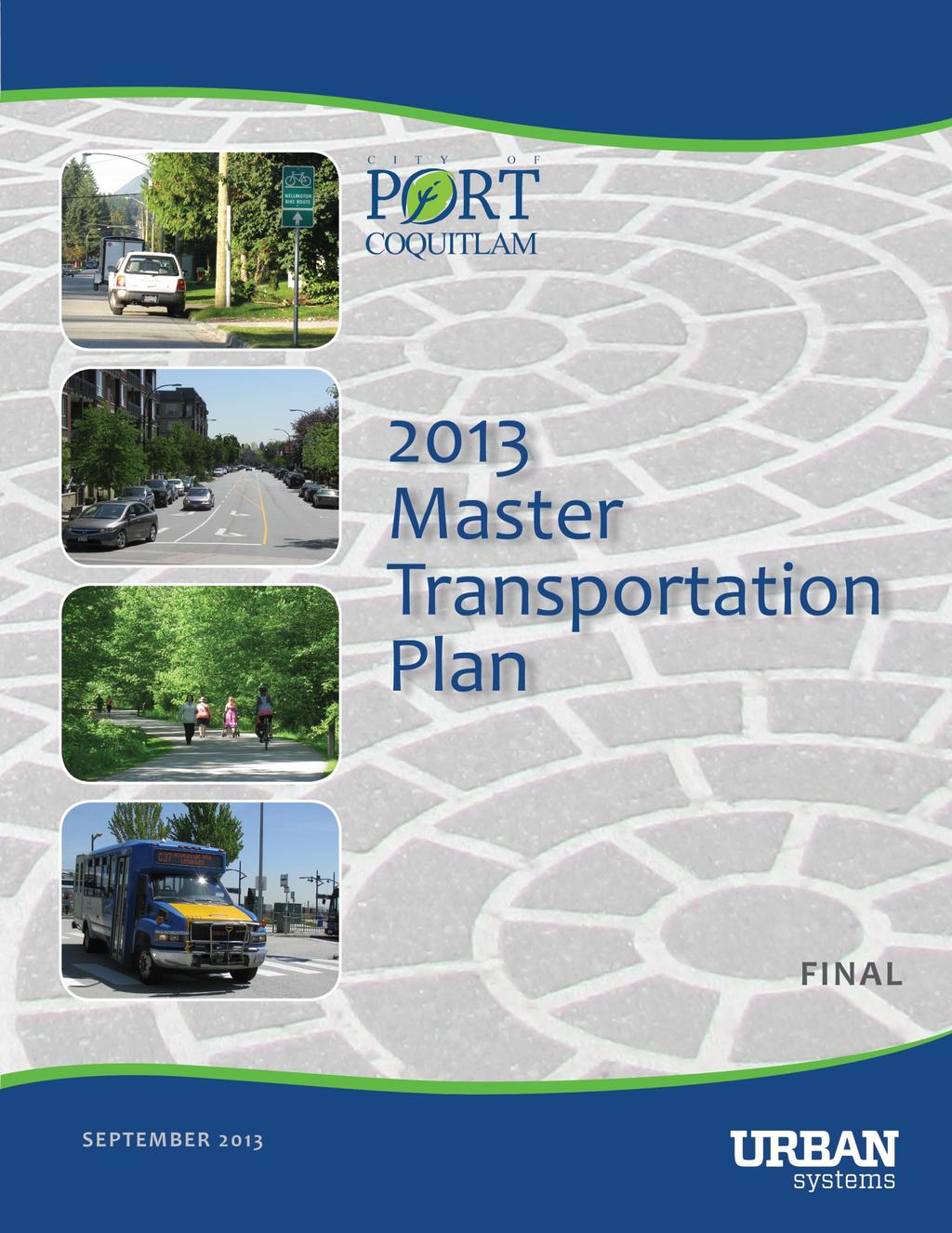
1 NOVEMBER 2013
2 TABLE OF CONTENTS 1.0 INTRODUCTION VISIONING DIRECTION Cntext fr Sustainable Grwth The Official Cmmunity Plan Transprtatin Visin Integrated Gals & Objectives STRATEGIC DIRECTIONS Pedestrian Strategy Bicycle Strategy Transit Strategy Rad Netwrk Strategy IMPLEMENTATION PRIORITIES i
3 1.0 INTRODUCTION The City s 2000 Master Transprtatin Plan (MTP) recmmended a number f transprtatin imprvements t meet the demands f grwth, t a planning hrizn f Since that Plan was prepared, the City has experienced significant grwth and develpment. This rapid grwth is expected t cntinue in the cming years bth in Prt Cquitlam and in surrunding municipalities, which will place increasing pressures n the lcal and reginal transprtatin systems. In rder t accmmdate increasing pressures and t enhance mbility and accessibility fr residents and visitrs, the City, TransLink, ICBC, the Prvince f BC and the federal gvernment have invested significantly in the transprtatin system ver the past decade. Significant prjects include the Cast Meridian Overpass, the Pitt River Bridge, the Glden Ears Bridge, the David Avenue Cnnectr and the Prt Mann Hwy 1 Imprvement Prject. In additin t these prjects, a number f lcal, reginal, and prvincial plicy initiatives have placed an increasing emphasis in Prt Cquitlam n sustainability and imprved transprtatin ptins. With all the changes in the transprtatin landscape and expected grwth n the hrizn, the emphasis f the 2013 Master Transprtatin Plan update is n a transprtatin system that will supprt grwth, develpment, and cnnectins between key areas f Prt Cquitlam. In particular, the City has identified that future develpment, redevelpment, and infill will be directed t the fur mixed use areas f Dwntwn, Nrthside, Westwd, and Dminin Triangle, while supprting businesses in Prt Cquitlam s ecnmic engine. The City s Reginal Cntext Statement (2013) supprts this directin f cncentrated urban grwth, seeking the creatin f cmpact urban areas, and cmplete cmmunities with sustainable transprtatin chices. Ultimately, the 2013 MTP is intended t help shape Prt Cquitlam s transprtatin investments in and arund each f the cmmunity and business ndes, prviding residents, visitrs, and businesses with key cnnectins t, frm, and within these fur cre areas as they cntinue t grw and develp ver time. The transprtatin system is als intended t supprt the mvement f peple and gds t key destinatins utside f the City, such as nrtheast Cquitlam, Pitt Meadws, Cquitlam Centre, as well as the future Evergreen Line, and t cnnect peple with ther parts f Metr Vancuver. This prcess f updating the MTP is imprtant t ensure that transprtatin investments wrk twards achieving this strategic visin and cmmunity gals, and t make the best use f available resurces. In rder t prvide the City with clear directins and pririties, the 2013 MTP will prvide the City f Prt Cquitlam with a clear visin f the multi-mdal transprtatin system t serve the residents and businesses f the cmmunity int the future. 1
4 2.0 VISIONING DIRECTION The visin fr the 2013 Master Transprtatin Plan (MTP) builds n key cmmunity plicies and plans and has been develped thrugh input and feedback received frm the cmmunity and City staff. The MTP encurages increased walking, transit and cycling while als accmmdating general vehicle and cmmercial gds mvements. The visin includes increasing the nn-autmbile mde share frm 14% t 25%. Cuncil will cnsider pririties and capital investments t supprt this visin as part f the annual Financial Plan review prcess. 2.1 Cntext fr Sustainable Grwth The Official Cmmunity Plan Prt Cquitlam is cmmitted t being mre sustainable and smart as it grws by incrprating new ideas and appraches int planning and develpment. These ideas and appraches are expressed in the City s Official Cmmunity Plan (OCP) and will result in a mre integrated apprach t cmmunity develpment that cnsiders the City s ecnmic, envirnmental and scial future. Smart grwth is a cllectin f urban develpment t reduce sprawl and encurage develpment that is fiscally, envirnmentally and scially respnsible. Develpment patterns in traditinal suburban areas have raised cncerns abut sprawl, land cnsumptin, lss f farmland, autmbile-riented cmmercial develpment such as big bx retail, habitat and stream destructin, waste prductin, air pllutin and greenhuse gases, energy cnsumptin, reduced ecnmic efficiency and infrastructure csts. Smart grwth is develpment that enhances quality f life, prtects the envirnment, and uses tax revenues wisely with strategies which fcus n cmpact cmmunities, affrdable husing, transprtatin, ecnmic develpment, agricultural land, green space, alternative develpment standards, and cmmunity invlvement. Reginal Grwth Strategy Gals Create a cmpact urban area Supprt a sustainable ecnmy Prtect the envirnment and respnd t climate change Develp cmplete cmmunities, and Supprt sustainable transprtatin chices. One f the key gals f the Metr Vancuver Reginal Grwth Strategy (RGS) is fr a cmpact urban area which will serve t supprt cleaner air, mre efficient infrastructure utilizatin, land cnservatin, effective waste management, enhanced greenways, and a reduced eclgical ftprint regin-wide. Prt Cquitlam s dwntwn is identified in the RGS as a Municipal Twn Centre, which is described as an area supprting lcal transprtatin hubs, frequent transit, and having a high quality and accessible walking and cycling envirnment. The OCP reinfrces a cmmunity develpment pattern that reflects a cmpact, mixed-use cmmunity fcused n a vibrant cmmercial cre in Dwntwn. In additin t Dwntwn, the OCP als identifies three additinal cre cmmercial and mixed-use areas in Prt Cquitlam Westwd, Dminin Triangle, and Nrthside as areas t cncentrate the city s cmmercial develpment. The OCP describes these fur cmmercial areas as becming 2

5 activity ndes, serving lcal and neighburhd ppulatins with a range f services and amenities. Higher residential densities are als identified fr the cmmercial areas, with mixed-use, pedestrian-riented develpment, and a range f mbility ptins available t residents. Recgnizing that Prt Cquitlam is a highly develped cmmunity with mre grwth anticipated, the City aspires t fcus future cmmercial and residential develpment within these fur identified mixed-use areas, each develping ver time with a distinct identity. The OCP als emphasizes the imprtance f supprting the emplyment in the industrial lands (i.e. Mary Hill Business Park and Dminin Triangle). These mixed use and industrial areas f the city are shwn belw in Map 1. Map 1 - Mixed Use and Industrial Areas f Prt Cquitlam 3
6 Over the last ten years, medium-density grwth has been directed t these cmmercial areas, and in the future, these areas will becme the vibrant, mixed-used grwth areas f Prt Cquitlam. These areas will cntinue t have a primarily cmmercial fcus, mixed with ffice uses, and sme increase in residential uses t supprt vibrancy. The OCP reinfrces that a diverse mixture f cmmercial activity can stimulate the lcal ecnmy and prvide incentives fr residential and ecnmic grwth, but must be carefully cntrlled s that ptential businesses and custmers are nt drawn away frm the centres. This means encuraging cmmercial centres t have services and amenities that attract the lcal r neighburhd ppulatin, with a mix f retail, ffices, persnal services, and pedestrian-riented designs. The distinct identity f cmmercial centres must be supprted thrugh integrated land use and transprtatin decisins. The smart grwth attributes f these cmmunity ndes pints t cmmunity ndes where there is a: Strng sense f place where residents and visitrs will want t spend time; Ecnmic vitality and cmpetitiveness with significant develpment ptential and strng ecnmic anchrs; Residential and emplyment density with the critical mass f peple can wrk, live, shp and scialize; and, Multi-mdal transprtatin system with attractive ptins t getting arund and between cmmunity ndes, adjacent activity centres, majr trip generatrs, and the cmmitted Evergreen Line statins. 4
7 2.2 Transprtatin Visin With this fcus n cncentrating future grwth in Prt Cquitlam t the mixed-use ndes f Dwntwn, Dminin Triangle, Westwd, and Nrthside, the City s transprtatin system will need t supprt mvements, t, frm, and within these ndes. It is imprtant that the transprtatin system int the future supprts a range f mbility and gds mvement ptins with these cmmunity ndes, such as driving, cycling, walking, and facilitates cnnectins t reginal and lcal transit service. Vibrant urban streets in and arund these cmmunity ndes shuld supprt the lcal ppulatin t walk, cycle, and take transit within and between key areas. In additin, it is imprtant t ensure that the transprtatin system supprts making rad, transit, walking and cycling cnnectins t majr reginal destinatins, including nrtheast Cquitlam, the future Evergreen Line statins, Cquitlam Centre, Pitt Meadws, and Maple Ridge. The visin fr Prt Cquitlam s transprtatin system reinfrces the cmmunity s gals fr sustainable grwth patterns as fllws: Prt Cquitlam s transprtatin system will supprt the develpment f diverse, vibrant and safe neighburhds, supprting a prsperus lcal ecnmy, facilitating sustainable transprtatin, encuraging a healthy envirnment and high quality f life, and prviding a range f transprtatin chices. Recgnizing that changes within the transprtatin landscape, such as the Evergreen Line, and future develpment within the cmmunity, will create changes in travel behaviurs ver time, the 2013 MTP supprts this visin with aspiratins t prvide integrated and sustainable transprtatin chices. This includes getting arund each cmmunity nde, between the ndes themselves, and t and frm ther neighburing cmmunities. Within each area, facilities and supprt strategies t encurage walking and cycling will strengthen the verall accessibility as well as the attractiveness and place making f the area. The Plan als reinfrces sustainable transprtatin chices that make the cmmunity ndes mre accessible t each ther as well as t the neighburing municipalities t Prt Cquitlam. The MTP encurages increased walking, transit and cycling while als accmmdating general vehicle and cmmercial gds mvements. The visin includes increasing the nn-autmbile mde share frm 14% t 25%. Cuncil will cnsider capital investments t supprt this visin as part f the annual Financial Plan review prcess. 5

8 Transprtatin Themes in Supprt f Cmmunity Ndes Walkable envirnment Driving supprt fr car share & carpls Lcal serving transit & supprting passenger amenities WITHIN Cmmunity Ndes Cycling rutes & supprt facilities Frequent & direct reginal transit service and supprting passenger amenities BETWEEN Cmmunity Ndes & Neighburing Areas Attractive cycling rutes Shrt-term and managed public parking Supprt access fr gds & services 2.3 Integrated Gals & Objectives Achieving the visin fr the 2013 MTP requires transprtatin-specific gals t guide and measure the prgress f the City ver time. In additin, aligning the gals f the MTP with the Crprate Strategic Plan, Official Cmmunity Plan (updated in 2005), and Envirnmental Strategic Plan will ensure that the transprtatin netwrk f Prt Cquitlam will grw, develp and be managed in such a way that reflects shared cmmunity values. The gals f the 2013 MTP are designed t align with the ther bjectives and plicies fr the majr themes f the OCP, which are summarized belw as OCP Gals. As the OCP wrks in cnjunctin with ther Prt Cquitlam plans t ensure the cmmunity develps in a crdinated manner, establishing the OCP themes as a fundatin fr the MTP gals ensures cmpatibility with cmmunity interests. The City will cnsider these relatinships as part f the next verall OCP review (planned fr 2014). Grwth Management and Sustainability OCP Gal: T plan fr the rderly and efficient develpment f land fr husing, businesses, jbs, and cmmunity amenities and facilities. Crrespnding MTP Gal: T encurage high densities and mixed land uses in the dwntwn cre, arund majr cmmercial areas, and alng Frequent Transit Netwrk crridrs t supprt walking, cycling, and transit t cmmunity services and amenities. 6


9 Husing and Neighburhds OCP Gal: T facilitate the prvisin f husing that prvides residents with chice in husing frm, lcatin, tenure, and price and facilitates neighburhd identity and cnnectins between residents. Crrespnding MTP Gal: T manage traffic in residential neighburhds t imprve safety, enhance quality f life, and t facilitate pprtunities fr scial cnnectins and recreatin. Ecnmy OCP Gal: T facilitate business and emplyment pprtunities in the industrial, retail, ffice, service, public and agricultural sectrs in supprt f a mre diversified lcal ecnmy and a higher quality f life. Crrespnding MTP Gal: T maximize the efficiency f the transprtatin netwrk in rder t enhance the mvement f peple and gds. Envirnment and Parks OCP Gal: T prtect envirnmentally sensitive areas, prvide adequate park space and establish links between public pen spaces. Crrespnding MTP Gal: T develp a netwrk f active transprtatin and recreatinal links that cnnect t parks, schls, dwntwn, and ther cmmercial areas. Transprtatin OCP Gal: T ensure that the transprtatin netwrk is safe and efficient, and accmmdates different mdes f travel fr pedestrians, bicycles, bus and rapid transit, trucks, and private passenger cars. Crrespnding MTP Gal: T prvide safe, accessible, cnvenient and affrdable transprtatin chices, with a greater pririty n walking, cycling and transit 7


10 Design OCP Gal: T ensure that develpment imprves the appearance f buildings, public spaces and streetscapes in a manner that is reflective f the cmmunity s cntext and heritage and respectful f the natural setting and existing built envirnment. Crrespnding MTP Gal: T supprt high quality urban envirnments that prvide a strng sense f place, and t encurage built frm design that supprts a walkable and bikeable envirnment Cmmunity OCP Gal: T ensure that public and private services and facilities, such as thse fr arts and culture, recreatin, library, fire, plice, educatin, faith, health and scial needs, are prvided t meet the present and future needs f ur residents. Crrespnding MTP Gal: T supprt the develpment f a cmplete cmmunity, with services and amenities accessible t residents f all ages and abilities. Utilities and Services OCP Gal: T ensure the efficient prvisin f water, drainage, liquid and slid waste, and ther utility services thrughut the cmmunity while accmmdating changing technlgy and new regulatry requirements fr these services. Crrespnding MTP Gal: T ensure that transprtatin rutes prvide fr the effective delivery f gds, services, and cmmunity infrastructure. 8
11 3.0 STRATEGIC DIRECTIONS Lng-term strategic directins have been develped fr Prt Cquitlam s transprtatin system that reinfrce the cmmunity s aspiratins t create sustainable transprtatin chices within and between key cmmunity ndes. Future develpments within Prt Cquitlam, alng with the anticipated Evergreen Line, will lead t mde shifts in the cmmunity, particularly twards mre sustainable travel mdes. In particular, the strategic directins are the pillars f the Master Transprtatin Plan (MTP), and reflect the aspiratins f the City and residents fr the lcal walking, cycling, transit and rads netwrk. Recgnizing the strategic rle and lcatin f Prt Cquitlam within Metr Vancuver, as well as the invlvement f several jurisdictins and agencies in key parts f the city s transprtatin system, the strategic directins als ensure that the lcal netwrk is integrated with the larger reginal transprtatin system, and facilitating key cnnectins t neighburing areas. The strategic directins, as articulated thrugh the lng-term walking strategy, cycling strategy, transit strategy, and rad netwrk strategy, will guide planning and investment decisins in Prt Cquitlam s transprtatin facilities and supprt strategies ver the next 20 t 30 years. These strategic directins utline the needs and pririties fr the lcal transprtatin netwrk, and will effectively shape the develpment f an integrated transprtatin system in Prt Cquitlam that prvides bth functinal and balanced transprtatin chices fr residents and visitrs. Ultimately, the strategic directins fr the Master Transprtatin Plan will guide the City f Prt Cquitlam s financial plans and investments, and will shape pprtunities fr the City t wrk with ther agencies, as well as the private sectr, n develping a sustainable and attractive transprtatin system in Prt Cquitlam. Strategic directins are summarized belw, and presented mre in-depth in the technical appendices. 9
12 ROAD NETWORK STRATEGY TRANSIT STRATEGY BICYCLE STRATEGY PEDESTRIAN STRATEGY STRATEGIC ASPIRATION T make walking safe, attractive and cmfrtable fr peple f all ages and abilities. T develp a safe and cmprehensive bicycle netwrk t get arund the cmmunity and t prmte healthy living. T increase the imprtant rle f transit thrugh attractive and accessible services, supprt facilities and land use patterns. T accmmdate the efficient mvement f gds and peple by all mdes with a rad netwrk that balances space fr all mdes. KEY THEMES Increase the pedestrian netwrk Enhance walkability f key cmmunity ndes Address critical barriers and gaps Pedestrian supprt prgrams Build a cmplete and cnnected bicycle netwrk Address critical barriers and gaps Bicycle supprt facilities and prgrams Plan fr rapid and express transit crridrs Enhance lcal and neighburhd services Integrate land use and transprtatin plans Implement pririty measures fr transit Implement accessible and attractive passenger facilities Plan fr key majr radway netwrk imprvements Implement minr intersectin imprvements Upgrade arterial rads t full functinality Expand Intelligent Transprtatin Systems (ITS) 10
13 # f Daily Walking Trips 3.1 Pedestrian Strategy Supprting walking is a key element t develping a sustainable transprtatin system in Prt Cquitlam, and t enhancing the cncept thrughut the City. The Pedestrian Strategy seeks t influence and shape the develpment f the pedestrian netwrk t make walking a safe, attractive, and cmfrtable mde fr peple f all ages and abilities, primarily in the fur cmmunity ndes f Dwntwn, Dminin Triangle, Nrthside, and Westwd. The strategic directin fr the Pedestrian Strategy recgnizes that in these areas f the City, the prvisin f cmfrtable and attractive sidewalks is necessary in rder t cmplete the netwrk and t prvide cntinuity fr walking trips. In that regard, the imprvement cncepts fr pedestrians include cmpleting the sidewalk netwrk in these key areas f the City. The Pedestrian Strategy recgnizes that certain areas f the City will generate mre pedestrian demand ver a larger area than thers. Fr many areas f the City, such as the Dwntwn and ther mixed-use areas where walking will be mst prminent, treatments abve and beynd the prvisin f sidewalks are required t make walking even mre attractive. This will require treatments within and leading t thse areas that are accessible fr all levels f mbility. With imprved facilities, walking will becme a cnvenient and attractive mde chice fr mre residents and visitrs. Imprvement cncepts fr the Pedestrian Strategy will be undertaken thrugh and in cnjunctin with develpment t ptimize the use f public funds. Specific imprvement cncepts fr the Pedestrian Strategy are described belw: The shaping influences fr the Pedestrian Strategy include: Pedestrian treatments can be tailred t areas f higher pedestrian activity, such as cmmercial areas, schls, and bus stps. Many walking trips in Prt Cquitlam are shrt trips, indicating that pedestrian imprvements shuld fcus n shrt-distance and lcal trips. Imprving walkability can encurage children and yuth t walk at an early age. With an aging ppulatin, there is a grwing need t ensure that pedestrian facilities are universally accessible. " Apprximately 94% f all walking trips generated by Prt Cquitlam are less than 4km. 6,000 5,000 4,000 3,000 2,000 1, Distance Travelled (kilmetres) 11


14 1. Increased Pedestrian Netwrk There are several areas where sidewalk cverage is limited, fragmented, r nnexistent. In additin, the sidewalk netwrk in Prt Cquitlam includes steep hills and unsafe pedestrian crssings that can deter walking activity. It is imprtant t supprt the pedestrian netwrk, as 9% f daily trips in the City are by walking, and 90% f these trips are within the City itself. Hwever, implementing a full sidewalk upgrade prgram thrughut the City t meet existing standards is beynd the City s current financial resurces. The Pedestrian Strategy recmmends strategically increasing sidewalk cverage in areas that reflect higher pedestrian demand, as well as areas that address safety cncerns. The lng-term strategic directin fr encuraging and supprting walking trips in Prt Cquitlam has been priritized fr mixed-use ndes, schls, and bus stps as illustrated in Map 2. Nte that Map 2 des nt include pedestrian imprvements that will be prvided as part f larger transprtatin prjects (Lincln Avenue Cnnectr, arterial rad cmpletin prjects etc.). 2. Enhance Cmmercial Walkability Cmmercial walkability is t be enhanced in the cmmercial and mixed-use areas f Dwntwn, Westwd, Nrthside, and Dminin Triangle. Dwntwn Prt Cquitlam has the mst welldevelped sidewalk netwrk in the City, resulting in a vibrant area f pedestrian activity. Hwever, there are still parts f its sidewalk netwrk that culd be enhanced t imprve walkability and cnnectivity thrughut this cre cmmercial area f the City, as well as in the ther key cmmercial ndes, t attract mre pedestrians, and ensure a safe and cnnected pedestrian envirnment. 3. Address Barriers and Cnnectins Walkability f Dwntwn Prt Cquitlam, Westwd, Nrthside, and Dminin Triangle is challenged by infrastructure and natural barriers (such as highways, railways, and watercurses) that can prevent cnnectivity between different neighburhds. Sme f the key imprvements t address these barriers include the Shaughnessy Street Underpass, Trabulay PC Trail Underpass and the Cquitlam River Crssings 12

15 4. Pedestrian Supprt Prgrams In additin t prviding a netwrk f pedestrian facilities, supprt plicies and prgrams are essential t cnsider as part f a cmprehensive apprach t make walking mre cnvenient and attractive in Prt Cquitlam. The City and its partners have undertaken a number f pedestrian awareness and pedestrian safety prgrams including City Trails Brchure, TravelSmart Prt Cquitlam, schl educatin, and pedestrian safety events at the West Cast Express statin and n Shaughnessy Street at Elgin Avenue. The City s educatin prgrams will als reach ut t schl aged children t encurage walking and transit as preferred mdal chices at an early age. This will als imprve verall health and will help manage the traffic cngestin presently ccurring at and arund schls. These effrts are very imprtant, and cntinued educatin and encuragement initiatives are recmmended. 13

16 Map 2 Strategic Directin fr Sidewalk Expansin 14
17 3.2 Bicycle Strategy Althugh it is ften used primarily fr leisure and recreatin purpses in Prt Cquitlam, the bicycle is increasingly seen in Prt Cquitlam and elsewhere as a viable mde f transprtatin fr many trip purpses. Develping a safe and cmprehensive bicycle netwrk is an imprtant way t supprt healthy lifestyles and t recgnize the psitive envirnmental aspects f cycling as a cnvenient and attractive mde f transprtatin. With apprpriate facilities, cycling can be time cmpetitive with bth autmbiles and transit, particularly ver shrt-t-mderate distances during peak travel perids. The strategic directin f the Bicycle Strategy seeks t influence and shape the develpment f the cycling netwrk t make cycling a safe, cmfrtable, and cnvenient mde fr peple t cnnect between and within the fur mixed-use ndes f Dwntwn, Dminin Triangle, Nrthside, and Westwd. The strategic directin als recgnizes the imprtance f high quality cycling cnnectins t adjacent cmmunities, the Evergreen Line statins and ther key trip generatrs. The imprvement cncepts fr cycling include recmmendatins fr prviding a netwrk f high quality bicycle facilities that cnnect cyclists safely and cnveniently t majr cmmunity destinatins, key mixed-use areas f Prt Cquitlam, adjacent cmmunities and transit services. The imprvement cncepts als The shaping influences fr the Bicycle Strategy include: A cmplete, cnnected bicycle netwrk is required t make cycling an attractive ptin, with cnnectins t key destinatins such as cmmunity facilities, cmmercial spaces and activity centres. Many cycling trips in Prt Cquitlam are shrt, lcal trips. There is an pprtunity t tailr bicycle investments twards thse wh are interested but cncerned abut safety Prt Cquitlam s bicycle netwrk shuld be integrated with surrunding municipalities, with links t bicycle facilities and rutes/trail in Cquitlam and Pitt Meadws. Bicycle facilities shuld be integrated with transit. invlve supprt facilities such as bicycle parking, end-f-trip facilities, imprved signage and wayfinding t make cycling a mre attractive transprtatin ptin. Ultimately, as bicycle ridership in Prt Cquitlam is lw, this indicates a significant ptential fr grwth in this mde. The imprvement cncepts are t be affrdable and practical imprvements t the bicycle netwrk, ccurring in cnjunctin with city rad imprvements and land develpment, where pssible. Specific imprvement cncepts fr the Bicycle Strategy are described belw: 1. Cmplete, Cnnected Bicycle Netwrk Cmplete, Cnnected Bicycle Netwrk is the first theme f the lng-term Bicycle Strategy. This bicycle netwrk, when cmplete, wuld place all residents and businesses within 400 metres f a bicycle rute, and will cnnect t all majr destinatins thrughut the City, including the dwntwn cre and ther cmmercial areas, as well as all parks and schls in Prt Cquitlam (Map 3). This will ensure that cycling is a viable ptin fr a variety f trip purpses, whether it be cmmuting, shpping, ging t schl, r recreatin. This bicycle netwrk is an aspiratinal gal that may be achieved ver the next 30 t 40 years. The cmpletin f the bicycle netwrk is beynd the City s current financial resurces. 15


 t imprve the cmfrt fr cyclists using these crssings.")
18 In additin t prviding a netwrk that is accessible t all residents and businesses and cnnects t majr destinatins thrughut the cmmunity, the Bicycle Strategy fcuses n bicycle facilities that are cmfrtable fr peple f all ages and abilities. In that regard, the Bicycle Strategy includes a hierarchy f bicycle facilities, including ff-street pathways, lcal street bikeways, bicycle lanes, marked wide curb lanes, and paved shulders. In additin, the Bicycle Strategy recmmends imprved crssings fr cyclists, including imprvements t crssings by implementing bicycle activated pushbuttns at key intersectins thrughut the City. 2. Barriers and Cnnectins Cyclists in many areas f Prt Cquitlam are challenged by tpgraphy, limited cnnectivity t Dwntwn, limited east-west bicycle rutes, and few crssings f the Cquitlam River and the CPR yards. These barriers can prevent cnnectivity within and between the fur principle cmmunity ndes, t neighburing cmmunities and t transit services. Barriers t cycling in Prt Cquitlam can be vercme thrugh a variety f imprvements, which include: Accessibility upgrades t existing crssings acrss the Cquitlam River, such as ramps fr cyclists, and remval f gates (r replacement with bllards) t imprve the cmfrt fr cyclists using these crssings. A new pedestrian / bicycle cnnectin acrss the Cquitlam River at Lincln Avenue as part f the prpsed rad crssing, t facilitate safety, netwrk cnnectivity, and imprved travel times fr cyclists between Prt Cquitlam and Cquitlam. Enhancing the cnnectin under the CP rail yard alng the Trabulay PC Trail by imprving cnnectins t the trail, widening the trail at the pinch pint underneath the rail yard, and als cnsidering safety and lighting imprvements fllwing crime preventin thrugh envirnmental design principles. Imprving access t Dwntwn fr pedestrians and cyclists alng Shaughnessy Street t the dwntwn cre by building a new 4m wide underpass f the railway crridr n the east side f Shaughnessy Street. Imprving cnnectins t the Pitt River Bridge, including imprved bicycle rute signage and pathway cnnectins, t ensure that this crssing is cnvenient and accessible fr cyclists. 16

19 Map 3 Prt Cquitlam Existing and Prpsed Bicycle Netwrk 17


20 3. Supprt Facilities and Prgrams In additin t expanding the bicycle netwrk, supprtive facilities and prgrams must als be in place t encurage peple t cycle t and within Prt Cquitlam. A number f hard and sft supprt measures briefly described belw can be undertaken t make cycling a mre attractive and cnvenient mde f transprtatin fr lcal trips. a. Bicycle Parking and End-f-Trip Facilities. The prvisin f n-site bicycle parking fr cmmercial sites, ffice buildings, larger industrial buildings and retail buildings supprts increased cycling use. In additin, businesses shuld be encuraged t prvide endf-trip facilities, such as shwers and clthing lckers at majr wrkplaces. The bicycle netwrk can als benefit frm enhanced bicycle parking at City cmmunity facilities, the West Cast Express statin, schls, and varius n-street lcatins (i.e. Dwntwn). b. Bicycle-Transit Integratin t accmmdate lnger-distance cmmute trips, thrugh the prvisin f bicycle racks n buses, secure parking at majr transit facilities as nted abve, and adequate infrastructure arund bus stps and statins t facilitate accessibility fr cyclists. c. Educatin and Encuragement t ensure that residents have the skills, infrmatin, cnfidence and supprt t bicycle mre. In additin t existing City initiatives, the City can develp and supprt, with its partners, supprting cycling skills prgrams and safe rutes t schl prgrams. d. Marketing and Prmtin Strategies t actively market and prmte Prt Cquitlam s bicycle facilities, plicies, and prgrams using varius media. This includes Prt Cquitlam s Bicycle User Map and cllabratin with the ther tw Tri-Cities, and displaying infrmatin such as bicycle rutes, key destinatins, transit rutes, bicycle parking and bicycle retailers, fr example. The City has develped a dedicated web presence and the use f ther scial media tls t prmte and market cycling initiatives. 18

21 3.3 Transit Strategy Transit services in Prt Cquitlam, and thrughut Metr Vancuver, are planned/funded by TransLink and perated by varius subsidiary cmpanies and cntractrs. The definitin f a Transit Strategy in the Master Transprtatin Plan is essential t defining the City f Prt Cquitlam s verall transprtatin visin. The Transit Strategy als cmmunicates the cmmunity s gals and needs t key decisin makers such as TransLink, Metr Vancuver, the prvincial gvernment and the federal gvernment. Municipalities thrughut Metr Vancuver nt nly participate in the planning and design f transit services and majr facilities such as rapid transit lines and statins, but als prvide the lcal infrastructure in which t accmmdate transit services and passengers. As the City intends t fcus future grwth n the fur mixed-use ndes f Dwntwn, Westwd, Nrthside and Dminin Triangle, transit services and supprt facilities t, frm, and between these areas is critical. In additin, ensuring that reginal cnnectins are facilitated between these ndes is als an imprtant part f making transit service an attractive The shaping influences fr the Transit Strategy include: Land use patterns fundamentally affect the success f transit. The Evergreen Line will enhance transit cnnectins t and frm cmmunities west f Prt Cquitlam Cmmunities t the east and suth culd be strng grwth markets fr transit t achieve lcal gals. Peak and ff-peak transit service frequencies within the City need t be increased t make transit mre attractive Transit services and facilities must be accessible in rder t serve a grwing ppulatin f peple with mbility challenges. Passenger cmfrt and security at transit stps is an imprtant ingredient t make transit an attractive alternative t driving. transprtatin ptin fr Prt Cquitlam residents and visitrs. T achieve a transit netwrk that reflects these cmmunity pririties, the Transit Strategy prvides directin and guidance fr future dialgue between the City and TransLink in regards t the transit planning and service prvisin in Prt Cquitlam. In general, significantly imprved transit services, supprt facilities that make transit mre attractive and transit supprtive land use patterns that enable greater investments in transit are required fr the City and regin t achieve the cllective gals fr transit. Althugh TransLink recently intrduced service changes within the City and acrss Metr Vancuver that reflect current ridership and fiscal realities, the Area Transit Plan update will ccur in 2013 and This 2013 MTP has and will prvide input and guidance t that prcess fr Prt Cquitlam. Mst transit trips riginating frm Prt Cquitlam tday remain in the Nrth East Sectr r Burnaby, Maple Ridge, and Pitt Meadws (surce TransLink Trip Diary Survey). 19

22 The transit imprvement cncepts described belw are intended t prvide strategic directin t TransLink and the City regarding the lng-term needs f the cmmunity with respect t transit services t help infrm the Nrtheast Sectr Area Transit Plan Update. Specific imprvement cncepts cnsidered fr the Transit Strategy include the prvisin f rapid transit services between Prt Cquitlam and neighburing municipalities; transit service facilitating cnnectins t and frm Prt Cquitlam s cre mixed-use areas, enhanced lcal services within and t the edges f the City (particularly cnnectins with Cquitlam) transit supprtive design which als enhances walking and cycling; and investments in universally accessible transit facilities. Ptential lng-term services are cnceptually illustrated in Map 4. Map 4 Prt Cquitlam Transit Service Imprvement Cncepts 20
23 1. Rapid Transit The lack f rapid transit cnnectins t Prt Cquitlam has been identified by residents as a significant barrier t increasing the lng-term transit mde share fr the cmmunity. The transit strategy identifies pririties t achieve frequent, reliable transit service t Prt Cquitlam in bth the medium and lng term. The lnger term ptin f extending the Evergreen Line int Prt Cquitlam is highly anticipated and a key transit pririty fr Prt Cquitlam. The City sees the reginal and rapid transit cnnectins prvided by the recmmended Evergreen Line extensin as a key part f the lng-term transprtatin system. The prvisin f rapid transit service can make transit mre attractive, efficient, and cmpetitive with driving, and can als facilitate mre reginal cnnectins by transit instead f by car. Rapid transit ptins that have been identified fr Prt Cquitlam include: Evergreen Line Extensin in rder t address the market ptential fr a rapid transit extensin t Prt Cquitlam, and that this extensin will serve the demands better than a rapid bus cnnectin fr a shrt segment and transfer. It is recmmended that Prt Cquitlam pursue this extensin t achieve the strategic bjective f a mde shift t transit frm the single ccupant vehicle. Expanding West Cast Express services (daytime & weekend) t capitalize n its success and make it a mre cnvenient alternative t cmmuting t and frm dwntwn and ther parts f Vancuver. In supprt f the ecnmic grwth f the Prt Cquitlam, reverse peak service has been identified as a high pririty t bring cmmuters frm ther parts f the regin t the City, as well as midday train services t augment TrainBus and weekend train service. 2. Frequent Transit Netwrk Direct, frequent transit services (including B-Line services) are needed t cnnect majr trip generatrs in the City and the neighburing areas f Cquitlam, Pitt Meadws, Maple Ridge etc. These services cnstitute a Frequent Transit Netwrk, prviding frequent reliable service fr mst f the day and night. Increased densificatin and mixture f uses within dwntwn Prt Cquitlam, Dminin Triangle, Westwd, and Nrthside and the increased travel generated by grwth in Cquitlam City Centre will ensure efficient use f the expanded Frequent Transit Netwrk. The expansin f TransLink s Frequent Transit Netwrk is als recmmended t prvide a crdinating element fr the City s cmmunity land use. 3. Rapid Bus (B-Line) Services The prvisin f a limited stp, express bus service shuld be prvided alng the Lugheed Highway crridr between Cquitlam Statin (and the cmmitted Evergreen Line), Prt Cquitlam, Pitt Meadws and Maple Ridge. Rapid Bus service wuld allw Prt Cquitlam residents t easily cnnect t the Evergreen Line, with the added benefit f being nly ne-bus away frm the reginal SkyTrain netwrk. This service wuld cnnect with the dwntwn areas f each cmmunity and ptentially supprt attractive transfers frm ther services as well as passenger drp-ff and park-and-ride facilities. Transit pririty treatments (such as intersectin queue jumpers r bus bypass shulders) shuld be cnsidered t address delay and cngestin, and t prvide enhanced transit travel speeds and maintain reliability fr passengers. 21

24 4. Lcal and Neighburhd Services The Transit Strategy recmmends increasing frequency n mst lcal rutes, prviding enhanced weekend and evening services, and imprving cnnectins t the key cmmercial areas f Prt Cquitlam. This includes increased frequency n mst lcal rutes during the weekday peak and ffpeak and weekend services with lcal services perating at frequencies f less than 15 minutes during the peak perids and n mre than 30 minutes during the midday and evening perids and weekends. 5. Integrated Land Use and Transprtatin Planning Land use patterns significantly influence verall travel and, cnsequently, the success f transit. Cmmunities that are mre transit riented nt nly supprt higher levels f transit, but als are mre pedestrian and bicycle friendly. Transit-riented develpment means cncentrating higher density, mixed-use, human scale develpment arund frequent transit stps and statins, in cmbinatin with mbility management measures t discurage unnecessary driving. In Prt Cquitlam, integrating the land use and the transprtatin system arund the fur mixed-use ndes f Dwntwn, Westwd, Nrthside and the Dminin Triangle can encurage these areas t be cmmunity activity ndes, as well as transprtatin hubs, supprting walking, cycling, transit, and driving t these areas. With supprtive adjacent residential and ffice uses, and strng lcal and reginal transprtatin cnnectins t and frm these areas, this can have the added benefit f supprting the ecnmic vibrancy f these cmmercial uses. 6. Transit Pririty Transit pririty treatments are recmmended alng rapid and frequent transit crridrs. Where delays and cngestin exist tday r are anticipated t get wrse in the future, the City will examine pprtunities fr pririty treatments that reduce delays t bus services. These transit pririty treatments will imprve service fr transit, typically n radways with capacity fr tw general purpse lanes and a bus queue jumper. Althugh treatments will impact vehicles, they are key t supprting lng-term transit ridership grwth by priritizing transit ver vehicles. The primary pprtunities will be alng Lugheed Highway and the Mary Hill Bypass. Planning fr the transit pririty system wuld be cnducted in cnjunctin with TransLink and the Prvince. 22


25 7. Passenger Facilities and Accessibility Passenger accessibility and facilities at bus stps, transit exchanges and rapid transit statins can als have a significant impact n passenger safety and cmfrt in additin t attracting new custmers. This can include striving t have 100% f bus stps in the City fully accessible in the lngterm. Imprving passenger amenities can include shelters, benches, trash receptacles, as well as system maps and wayfinding at bus stps. In the lng-term, the City shuld strive t prvide seating, lighting and custmer infrmatin at all bus stps, rapid transit statins, and transit exchanges in Prt Cquitlam. In additin, shelters are desirable in areas f higher pedestrian activity such as the Dwntwn cre, cmmercial areas, at high activity bus stps, and alng frequent transit crridrs. 23
26 3.4 Rad Netwrk Strategy Maintaining a safe and efficient street netwrk t supprt all mdes is ne f the key elements t supprting mbility and quality f life in the City. The Radway Netwrk Strategy is a critical cmpnent f the Master Transprtatin Plan as it accmmdates the efficient mvement f gds and peple by all mdes f travel. With a rapidly grwing ppulatin, vehicle travel will cntinue t increase ver the next 20 years, placing increased pressure n the existing rad facilities. T date, the significant radway netwrk investments have been made within Prt Cquitlam and the surrunding areas t imprve mbility and accessibility n a lcal and reginal basis, including the cmpletin f the David Avenue Cnnectr, the Cast Meridian Overpass, Pitt River Bridge replacement, and currently, the Prt Mann/Highway 1 prject. Sme f the recmmendatins in the previus plan have yet t be cmpleted and are being revisited thrugh this MTP update t ensure the gals and bjectives f this new strategy are still being met. The ptential radway netwrk imprvement cncepts explred within this sectin f the assessment are separated int majr netwrk imprvements, minr crridr and intersectin imprvements, functinal upgrades t arterial rads, as well as intelligent transprtatin systems investments. These rad imprvement cncepts wuld be The shaping influences fr the Rad Netwrk Strategy include: Planned lcal and reginal grwth cntinues t generate additinal traffic within and thrugh the City, placing pressures n the majr radway netwrk. Planned netwrk imprvements at the periphery f the City will influence travel and traffic patterns. Peak perid traffic vlumes in Prt Cquitlam are expected t increase by anywhere frm 20% t 50% n varius crridrs by Future grwth in peak traffic vlumes will result in significant delays and cngestin n several crridrs. A limited grid system f majr rads frces mst traffic grwth nt the few east-west and nrth-suth arterial rads in the City. Safety issues n the City s rad netwrk will need t be addressed thrugh cntinued investments n safety imprvements. integrated with ther crridr imprvements fr transit, cycling and pedestrians, benefiting a brad range f transprtatin users. In additin, many f the radway netwrk imprvement cncepts are als specifically designed t address east-west mbility challenges currently experienced in Prt Cquitlam. While nrth-suth peratins in Prt Cquitlam are generally satisfactry, imprvements are needed t address and imprve eastwest mvements in many areas f the city. The rad netwrk imprvements described in this reprt are aspiratinal and may be achieved ver the next 30 t 40 years. As the rad imprvement prgram is beynd the City s current financial resurces, staff and Cuncil will need t priritise investments based n cst and benefit. 24
 r grade separatin at signalized")
27 1. Majr Radway Netwrk Imprvements Fur majr radway netwrk imprvements have been identified and evaluated in the MTP update. These include: Fremnt Cnnectr - Dminin Avenue t Victria Drive; Lincln Avenue Cnnectr - new crssing f Cquitlam River; Mary Hill Bypass - widening (6 lanes) r grade separatin at signalized intersectins; Lugheed Highway - widening (6 lanes) fr High Occupancy Vehicles (HOV)/transit lane. Each f these ptential majr netwrk imprvements examined within this sectin f the reprt are illustrated in Map 5. Map 5 Majr Netwrk Imprvement Cncepts 25
28 Other than the Mary Hill Bypass, these prjects have the ptential fr funding thrugh TransLink s Majr Rad Netwrk capital prgrams. The Suth Cast British Clumbia Transprtatin Authrity Act defines TransLink s authrity regarding the Majr Rad Netwrk MRN). The act authrizes TransLink t designate new MRN rads, subject t lcal gvernment supprt. The City currently receives annual funding frm TransLink t perate, maintain and rehabilitate the MRN. The MRN in Prt Cquitlam currently includes Lugheed Hwy, Cast Meridian Rad, the Cast Meridian Overpass and Bradway Street. Lincln Avenue and the Fremnt Cnnectr are future arterial rads that may qualify fr inclusin in TransLink s MRN. Once apprved as an MRN rad, the lcal gvernment may nt take any actin that wuld reduce the peple mving capacity f the rad. a. Lincln Avenue Cnnectr (ptential TransLink Majr Rad Netwrk element). There are currently five east-west cnnectins acrss the Cquitlam River including (frm suth t nrth): Mary Hill Bypass, Pitt River Rad, Kingsway Avenue, Lugheed Highway, and David Avenue. With planned grwth in the Nrtheast Sectr f Metr Vancuver, east-west travel demands will cntinue t increase, placing greater pressure n the existing river crssings. The prpsed Lincln Avenue Cnnectr is a new crssing f the Cquitlam River between Shaughnessy Street (Prt Cquitlam) and Pipeline Rad (Cquitlam). The City f Cquitlam s Strategic Transprtatin Plan Update identified the Lincln Avenue Cnnectr as the mst effective and beneficial majr rad prject that can be cnstructed in the City f Cquitlam. Implementatin f the Lincln Avenue Cnnectr will require crdinatin between the City f Cquitlam and the City f Prt Cquitlam. Cquitlam is expected t initiate planning (rute, impacts etc.) fr the Lincln Avenue Cnnectr in the next few years. With the implementatin f the Lincln Avenue crssing f the Cquitlam River, frecast traffic vlumes were prjected t decrease n the Lugheed Highway, Shaughnessy Street and Prairie Avenue crridrs, thus reducing frecast delays and cngestin at several majr intersectins. In this regard, the prject benefits f a Lincln Avenue cnnectr and related imprvements within Prt Cquitlam include, but are nt limited t: Prvisin f alternative east-west access between the Cquitlam City Centre area, NE Cquitlam and nrth Prt Cquitlam; Accmmdatin f increased traffic frm grwth in Nrth Prt Cquitlam and Nrtheast Cquitlam; Supprts mre effective transit service fr Nrth Prt Cquitlam and Prt Cquitlam; Enhances east-west cycling cnnectivity; Enhances east-west pedestrian cnnectivity; Relieves traffic pressures (grwth) n Lugheed Highway, Prairie Avenue, and Shaughnessy Street. 26
29 In additin t these netwrk benefits, the Lincln Avenue crssing als prvides enhanced access fr transit t the Cquitlam City Centre and the cmmitted Lincln Statin fr the Evergreen Line. In cnjunctin with the crssing, Prt Cquitlam will have t plan fr upgrades t Lincln Avenue frm Oxfrd Street t the Cast Meridian Overpass. The updated traffic analysis indicates a fur-lane crss sectin is required frm Oxfrd Street t Wellingtn Street, and a tw lane crss-sectin is required frm Wellingtn Street t Cast Meridian Rad. The selectin f an apprpriate cycling facility (i.e. multi-use path r marked bicycle lanes) n Lincln Avenue is subject t mre detailed planning. b. Mary Hill Bypass (MTI). The Mary Hill Bypass is a Ministry f Transprtatin and Infrastructure crridr prviding access t and frm Highway 1 and the Prt Mann Bridge. Grwth in the Nrtheast Sectr f Metr Vancuver and imprvements t the Highway 1 crridr are prjected t result in significant grwth in vehicle traffic thrugh the suthern prtins f Prt Cquitlam. In rder t accmmdate the significant grwth prjected alng the Mary Hill Bypass and ther east-west crridrs, ptential lngterm imprvement cncepts examined in the MTP Update include crridr widening. The widening f the existing crridr frm fur t six lanes between Shaughnessy Street and Lugheed Highway wuld include additinal thrugh and in sme cases turn lanes at each f the existing signalized intersectins. Althugh the Mary Hill Bypass is the respnsibility f the Ministry, the crridr and related intersectin imprvements wuld supprt prjected 2031 reginal travel demands between the Highway 1 and the Nrtheast Sectr and reduce pressures n ther cngested radways in Prt Cquitlam as fllws: Vehicle trips reduced by apprximately 10% n Lugheed Highway between Westwd Street and the Pitt River Bridge in the peak directin during bth the AM and PM perids; Vehicle trips reduced by apprximately 20% n Shaughnessy Street suth f Pitt River Rad in the peak directin during bth the AM and PM perids; Significant traffic grwth diverted frm ther east-west crridrs, including relieving traffic pressures n Lugheed Highway, Kingsway Avenue, and Pitt River Rad; and Minr reductin f vehicle trips n Pitt River Rad and Kingsway Avenue. Shaughnessy Street experiences a high vlume f turning vehicles t and frm the Mary Hill Bypass. It is recmmended that the City pursue a grade separated interchange as a higher pririty with the Ministry f Transprtatin and Infrastructure. The City shuld als pursue grade level imprvements t the intersectin f Bradway Street and the Mary Hill Bypass, t supprt increased vlumes t Prt Cquitlam and Nrtheast Cquitlam. Prvisin f a grade separated interchange at this lcatin will als be required in time. Failure t implement these imprvements will result in diversin f reginal traffic nt Prt Cquitlam s arterial and cllectr rads, which are nt designed t handle these vlumes. 27
30 c. Lugheed Highway Widening (existing TransLink Majr Rad Netwrk element). The Lugheed Highway crridr between Pitt River Bridge and Westwd Street serves city-wide and reginal travel between the cmmunities in the Nrtheast Sectr. It is designated as part f Translink s Majr Rad Netwrk and the City receives funding fr the peratin, maintenance and rehabilitatin f the existing rad infrastructure (excluding bridges). It als serves as a Frequent Transit Netwrk (FTN) crridr, supprting services between ther Nrtheast Sectr cmmunities and Cquitlam s West Cast Express Statin (and future Evergreen Line SkyTrain Statin). East-west mbility within and thrugh Prt Cquitlam was identified as ne the key challenges in the 2000 MTP and cntinues t exist tday. As a result, the widening f Lugheed Highway frm fur t six lanes fr pririty vehicles such as transit and high-ccupant vehicles (HOV) was identified as a ptential strategy t reduce prjected delays and cngestin alng the crridr. The traffic analysis f the widening indicates average vehicle delays wuld be reduced at Hastings, Oxfrd and Ottawa, but the intersectins f Shaughnessy and Westwd at Lugheed Highway wuld cntinue t perate at failing levels f service during the PM peak hur. The verall travel time fr HOVs (and buses) wuld be well belw that f the general purpse traffic lanes. In the lnger term, the ptential f develping an HOV lane cncept may evlve frm the ptential transit pririty imprvements at these intersectins. The ptential widening f Lugheed Hwy t six lanes is nt recmmended as a pririty fr the City f Prt Cquitlam. The Lugheed Hwy widening is nt as effective a slutin fr east-west travel as the prpsed Lincln Avenue crssing f the Cquitlam River. The ptential widening f Lugheed Hwy can be recnsidered during a future update f the MTP, r as part f a TransLink initiative t extend rapid transit alng the Lugheed Hwy crridr. d. Fremnt Cnnectr (ptential TransLink Majr Rad Netwrk element). The Fremnt Cnnectr is a planned nrth-suth arterial rad cnnecting Lugheed Highway and Mary Hill Bypass in the suth with Victria Drive at Cedar Drive in the nrth. The Fremnt Cnnectr was ne f the recmmended imprvements in the 2000 MTP. The Fremnt Cnnectr wuld accmmdate a prtin f the traffic generated by prpsed develpments in Prt Cquitlam nrth f Lugheed Highway and in Nrtheast Cquitlam (Burke Muntain area). Phase 1 f the Fremnt Cnnectr has been cmpleted between the new Pitt River Bridge interchange and the intersectin f Dminin Avenue at Burns Rad (pened December 2012). The prjected traffic vlumes in Phase 2 f the Fremnt Cnnectr (Dminin Avenue t Prairie Avenue) will require capacity f tw lanes in each directin. The alignment f this Phase 2 was defined as Burns Rad between Dminin Avenue and the extensin f Riverside Drive in the 2005 OCP Update. Hwever, the alignment f the Fremnt Cnnectr between the extensin f Riverside Drive and Prairie Avenue has nt been determined, and remains subject t a cmprehensive study. 28
31 The prjected traffic vlumes fr Phase 3 (between Prairie Avenue and Victria Drive) are much lwer than Phase 2, and wuld be accmmdated by a tw lane radway (ne lane in each directin). Traffic prjectins indicate that abut 400 vehicles per hur wuld perate n Phase 3 in the peak directin (in the peak perids). The fllwing describes the rle and character f Phase 3 f the Fremnt Cnnectr: Diverts a prtin f the thrugh vehicle trips ff f Cedar Drive Accmmdates abut 200 vehicles per hur t/frm Nrtheast Cquitlam Accmmdates abut 200 vehicles per hur that are generated within nrth Prt Cquitlam The transprtatin netwrk analyses indicate that the Fremnt Cnnectr will accmmdate a small prprtin f the traffic generated by develpment in Nrtheast Cquitlam. Based n preferred destinatins, mst f the NE Cquitlam generated traffic will travel west r suth, using David Avenue, Victria Drive r Cast Meridian Rad. The City culd defer the rute planning fr the nrtherly phases f the Fremnt Cnnectr until sme f the additinal rad capacity is cmpleted in NE Cquitlam. Fr example Cquitlam will be extending David Avenue (further east) and will be upgrading Victria Drive in the next few years. These prjects will draw sme f the ptential traffic away frm Cedar Drive. The Fremnt Cnnectr culd be reassessed when the MTP is revisited in apprximately five years, as a stand alne crridr alignment study, r as part f a mre cmprehensive neighburhd plan subsequent t the OCP review. Cuncil passed a reslutin is 2005 prviding clear directin n the scpe f study required t determine a preferred alignment f the future Fremnt Cnnectr. e. Rail Crssings. There are three at-grade rail crssings n the edges f Prt Cquitlam that affect lcal and reginal traffic flws as well as the mvement f gds and services: Westwd Street (near Davies Avenue); Kingsway (near Westwd Street); and Pitt River Rad (near lwer Lugheed Highway). Each f these radways crss the CP Rail tracks at-grade and are frequently blcked by train crssings thrughut the day and night. The Westwd/Davies rail crssing is part f the CPR mainline fr lnghaul gds t and frm the Lwer Mainland. A study by Transprt Canada (the Suth Shre Trade Area Study) cncluded that a ptential verpass f Kingsway Avenue at Westwd Street wuld be much higher cst than the tw ther grade separatin prjects. This prject was nt recmmended as a pririty fr Transprt Canada and the railway peratr. 29
32 Transprt Canada s Suth Shre Trade Area Study als examined cnceptual layuts fr the gradeseparatin f Pitt River Rad at Lugheed Hwy and f Westwd Street at Davies Avenue. The study recmmended cnstructin f a fur lane underpass structure at Westwd Street t eliminate the existing at-grade crssing f the CP Rail trunk line. The study als recmmended imprvements at Pitt River Rad and Lugheed Highway, a three-leg intersectin that prvides ne f the mst direct rutes t access Prt Cquitlam frm Highway 1. The imprvement cncept fr this intersectin included a grade-separated cnnectin f Pitt River Rad with Lugheed Highway. This imprvement wuld supprt uninterrupted travel alng Lugheed Highway and Pitt River Rad in all directins. Prt Cquitlam shuld supprt the Westwd/Davies and Lugheed Hwy/Pitt River Rad grade separatin prjects fr their traffic safety and capacity benefits. Given the high prject csts, these prjects shuld be led and funded by Transprt Canada and the railway peratr. Mst f these majr netwrk rad imprvement cncepts are fcused n imprving east-west vehicle mbility thrughut the city, with many f these prjects als prviding enhancements fr alternative transprtatin mdes. In summary, the majr rad imprvement cncepts recmmended within the 2013 MTP are: Lincln Avenue Cnnectr (ptential TransLink MRN), an east-west arterial prviding a key cnnectin between Nrth Prt Cquitlam and Cquitlam City Centre. This prject will have multimdal benefits, enhancing east-west travel by vehicle, transit, bicycle and pedestrian; Mary Hill Bypass widening (MTI), t significantly enhance the capacity f the prvincial crridr, and divert significant traffic grwth frm ther east-west crridrs in Prt Cquitlam and Lwer Lugheed; Fremnt Cnnectr (ptential TransLink MRN), which wuld prvide a nrth-suth cnnectin between Lugheed Highway and Prairie Avenue, accmmdating traffic mvements between nrth Prt Cquitlam and Nrtheast Cquitlam; and Grade-separated rail crssings (by Transprt Canada and railways), t supprt uninterrupted travel acrss rail lines. 2. Minr Intersectin Imprvements (Capacity & Safety) In urban areas such as Prt Cquitlam, the peratin f the netwrk is principally cnstrained at signalized intersectins. The City has recently implemented imprvements at several intersectins including, but nt limited t: Bradway Street at Kingsway Avenue (capacity and signal imprvements); Bradway Street at Mary Hill Bypass (capacity imprvements n Bradway Street); and Oxfrd Street at Lugheed Highway (suthbund left-turn lane). 30
33 Over the next 20 years, additinal intersectins beynd thse included in the crridr imprvements discussin will experience increasing delays with the prjected traffic grwth. The City will need t cnsider the prvisin f minr intersectin imprvements such as left turn lanes and left turn signal phases t reduce delays and imprve safety fr all rad users. In key pedestrian areas and cycling crridrs, pririty must be given t allcate rad space fr pedestrians and cyclists at intersectins t supprt ther aspects f the plan. Intersectin imprvements will be cnsidered at varius lcatins ver the next 20 years that include, but are nt limited t the fllwing lcatins: Cast Meridian Rad (MRN) at Lincln Avenue (widen t prvide left turn bays n Cast Meridian Rad); Cast Meridian Rad (MRN) at Laurier Avenue (widen t prvide suthbund left turn bay n Cast Meridian Rad); and Pitt River Rad at McLean Avenue (widen t prvide westbund left turn bay n McLean Avenue). Map 6 illustrates sme f the intersectins being cnsidered fr minr capacity and safety imprvements. In additin t varius capacity imprvements that are designed t maximize the capacity f the existing rad netwrk, the City f Prt Cquitlam als places a high pririty n traffic safety. The City has cmpleted numerus traffic safety prjects in partnership with ICBC ver the last 20 years. It is recmmended that the City cntinue t invest in varius rad netwrk safety imprvements in partnership with ICBC, the Ministry f Transprtatin and Infrastructure, and TransLink. The prpsed imprvements n TransLink s Majr Rad Netwrk (MRN) may be partially funded by TransLink, subject t available funding. 31

34 Map 6 Ptential Safety and Capacity Imprvements 32
35 3. Arterial Rad Upgrades t Full Functinality The City s transprtatin system includes a netwrk f arterial and cllectr rads. This netwrk has been planned t accmmdate the transprtatin needs f the City based n the grwth in ppulatin and emplyment prjected in the Official Cmmunity Plan. Several prtins f the rad netwrk have nt been cnstructed t prvide the full functinality required fr pedestrians, cyclists, transit, cmmercial gds mvement and general traffic. Map 7 shws the crridrs in Prt Cquitlam that shuld be upgraded ver the next 20 years. 4. Intelligent Transprtatin Systems Intelligent Transprtatin Systems (ITS) refers t the use f infrmatin and cmmunicatins technlgy t manage the transprtatin system and vehicles, including pririty mdes such as transit and emergency vehicles. ITS includes the prvisin f signal upgrades (such as new cntrllers, fibre ptics, and central cntrl systems) that permit cmmunicatins between signalized intersectins t prvide real-time cntrls and vehicle detectin and signal pre-emptin that give pririty t transit and ther vehicles. In general, installatin f ITS is designed t make best use f existing transprtatin infrastructure fr general purpse traffic r pririty mdes in the lng-term. The City currently has 61 signalized intersectins, including pedestrian / bicycle signals. Over the next 20 years, the number f signals will cntinue t increase as described in the MTP and at ther lcatins when warranted. ITS equipment is prvided at the Cast Meridian Overpass between Rbertsn Avenue in the nrth and Kingsway Avenue in the suth. Over the next five r s years, Bradway Street, Cast Meridian Rad and Lugheed Highway may be cnsidered fr expansin f the ITS system. Because these are amng the highest traffic crridrs in the City, real-time management f the traffic flw will maximize their utilizatin and serve t supprt pririty mdes such as transit and emergency vehicles. ITS equipment shuld be utilized as new signals are warranted and installed ver time within the City as part f ther capital rad prjects. 33

36 Map 7 Arterial & Cllectr Rad Functinal Upgrades 34
37 4.0 IMPLEMENTATION PRIORITIES The City f Prt Cquitlam s 2013 Master Transprtatin Plan (MTP) prvides the lng-term directin fr walking, cycling, transit, and radways t make the transprtatin system mre effective, efficient and balanced in terms f mving peple and gds within the cmmunity. The cmprehensive strategies are intended t guide the City f Prt Cquitlam s planning and capital investment decisins, and t prvide the City with clear directins and pririties. The MTP prvides the City with a visin fr the future f transprtatin in the cmmunity ver the lng-term. Hwever, recgnizing the lng-term visin f the Plan will require significant investment, an implementatin strategy is required t priritize shrt-term imprvements that are within the range f the City s current capital budget fr investment in new transprtatin infrastructure. Ultimately, these shrt-term prjects will wrk twards strengthening mbility within and between the key cmmunity ndes f Dwntwn, Westwd, Nrthside, and Dminin Triangle, as well as facilitating cnnectins t key destinatins utside f Prt Cquitlam. Over the next 5 t 10 years, the highest pririty imprvements are designed t supprt and reinfrce the City s aspiratins fr a sustainable and integrated transprtatin system that supprt mbility within and between key cmmunity ndes. In this regard, the shrt-term pririties fr walking, cycling, transit and radway netwrk investments are briefly highlighted. 1. Walking While the MTP Update cntains lng-term sidewalk imprvements that result in a ptential sidewalk prgram f $16 millin in the lng-term (30 t 40 years), the City must priritize the wrks fr funding ver the next 5 t 10 years. The criteria used t rank sidewalk prjects fcus n imprvements in areas f high pedestrian demand, including schls, cmmercial areas, and destinatins, and are: Pedestrian vlumes Traffic vlumes Prximity t schl Prximity t cmmercial develpments Prximity t senirs facility Using these criteria, a sidewalk pririty prgram has been recmmended fr the next 5 t 10 years as illustrated in Map 8. In general, shrt-term sidewalk imprvements are identified fr schl areas (City wide) and in the mixed use areas f Dwntwn, the Shaughnessy Prairie Area, the Nrthside and the Dminin Triangle. Many sidewalk imprvements (Dwntwn etc.) will be funded thrugh redevelpment, ptimizing the use f public funds. The sidewalk imprvements in the Dwntwn area will be priritized based n the Dwntwn Pedestrian Circulatin Study and Cuncil directin. 35


38 Map 8 Ptential Shrt t Medium-Term Sidewalk Pririty Prjects 36
39 The City will als cntinue t undertake a number f pedestrian awareness and safety prgrams and initiatives that include: City trails brchures; TravelSmart Prt Cquitlam Prtal fr educatin and utreach; Pedestrian safety events; and, Schl educatin prgrams. 2. Cycling Recgnizing that bicycle ridership in Prt Cquitlam is currently lw, there is a significant ptential fr grwth in bicycle use and the 2013 MTP cntains lng-term bicycle netwrk imprvements. Several prjects have been identified as ptential bicycle capital imprvements t be implemented in the next five years as illustrated in Map 9. Many f the prjects can be implemented in cnjunctin with rad imprvements t ensure a practical and affrdable apprach t bicycle imprvements. Many f these prpsed bicycle prjects prvide imprved cyclist cnnectins t Dwntwn Prt Cquitlam, and the Nrthside and Dminin Triangle mixed-use areas, as well as facilitate reginal cycling cnnectins t destinatins utside f Prt Cquitlam. The key shrt-term bicycle prjects that have been identified are: Fraser Avenue: Signed Bicycle Rute. The prvisin f a signed and marked bicycle rute n this lw traffic vlume radway will cnnect the PC Trabulay Trail with the Wellingtn Street signed bicycle rute. The City has recently cnstructed a traffic signal t assist cyclists crssing Shaughnessy Street. Kingsway Avenue Wilsn Avenue t Bradway Avenue Mixed Use Trail. A design fr a mixed use trail n the nrth side f Kingsway Avenue has been cmpleted, and the City is pursuing funding, and negtiating fr the use f BC Hydr and private prperty fr the cnstructin/peratin f the trail. Shaughnessy Street Pedestrian/Cyclist Underpass. As mentined earlier, there is a need t prvide an imprved active transprtatin envirnment n Shaughnessy Street between Elgin Street and Lins Way. The City is prceeding with pursuing the design and cnstructin f a new tunnel fr a mixed use trail under the CP Rail line. TransLink and the Prvince f BC are expected t cst share in the prject. Shaughnessy Street at Fraser Avenue, cyclist-activated signal. The prvisin f a bicycle activated traffic signal has prvided prtected crssings f Shaughnessy Street and supprts the Fraser Avenue bicycle rute. Dwntwn t Westwd Street Bicycle Rute. The prvisin f a cycling rute alng this crridr is under cnsideratin t prvide a key east-west rute between Dwntwn Prt Cquitlam and destinatins in Cquitlam and beynd. The rute wuld als cnnect directly with the PC Trabulay Trail. Dnald Park Mixed Use Trail. The prvisin f a high quality mixed use trail will supprt the high densities in Dwntwn Prt Cquitlam, supprt schl access and prvide netwrk cnnectivity with the Shaughnessy Street Underpass. 37

40 Map 9 Ptential Shrt t Medium-Term Bicycle Netwrk Imprvements 38
41 In additin t the cnstructin f physical imprvements, the City will cntinue t undertake and supprt initiatives t prmte cycling such as: Cycling netwrk and trails brchures; Bike mnth campaigns and bike t wrk week prmtins; TravelSmart Prt Cquitlam Prtal fr educating and utreach; and, Schl educatin prgrams. 3. Transit The 2013 MTP cntains a lng-term transit strategy t guide and influence future dialgue with TransLink n the structure f transit services and supprt facilities in Prt Cquitlam, t ensure transit prvisin reflects cmmunity aspiratins and needs. The fllwing prjects have been identified as likely transit initiatives in the shrt-term t be advanced between the City and TransLink. Area Transit Plan Update. TransLink has nw initiated the Nrth East Sectr Area Transit Plan (ATP) update study, which will include Prt Cquitlam, Cquitlam, Prt Mdy, Anmre, and Belcarra. The updated ATP will identify a lng-term visin and near-term pririties fr the transit netwrks in these municipalities, guiding future bus service expansin in Prt Cquitlam, and infrming the bus integratin plan required fr the pening f the Evergreen Line in The City has identified the Evergreen Line as a high transit pririty, as the reginal and rapid transit cnnectins prvided by the Evergreen Line are a key part f the cmmunity s aspiratins fr its future transprtatin netwrk. In particular, the ATP will include develping lng-term visin (30-year) aligned with expected land use and travel patterns, as well as a near-term (1-10 year) service and infrastructure pririties t supprt the visin. The imprvement cncepts fr transit identified in the MTP Update will be taken int cnsideratin during the ATP develpment prcess. Evergreen Line Bus Integratin Plan. When the Evergreen Line pens, the City and TransLink will carefully mnitr the changes t the supprting transit netwrk. The City will utilize the Area Transit Plan fr guidance in seeking apprpriate imprvements after the Evergreen Line has been put int full service. Evergreen Line Extensin. The City shuld pursue the extensin f the Evergreen Line t Prt Cquitlam in rder t achieve the desired mde shift t frm the autmbile t transit. West Cast Express Strategy. Prt Cquitlam and ther municipalities with West Cast Express Service have been prmting varius WCE service imprvements with TransLink. These imprvements may be cnsidered as part f TransLink s Reginal Transprtatin Strategy Implementatin Plan. Reginal Transprtatin Strategy. The City will wrk with TransLink t ensure that the City s and the Nrth East Sectr s transit service needs are addressed in the Reginal Transprtatin Strategy 30-year plan. This wrk will ccur in 2013 and OCP Update. The City f Prt Cquitlam will be updating the Official Cmmunity Plan in 2014/2015. The OCP update will cnsider the ptential fr increased density alng TransLink s current (Lugheed Hwy) and future Frequent Transit Netwrk. The OCP update will als cnsider crdinatin with TransLink s 39
42 Reginal Transprtatin Strategy. The City will encurage TransLink t include the Nrthside area and the Dwntwn in TransLink s Frequent Transit Netwrk. This will ccur as part f the NE Sectr Area Transit Plan Update prcess, and the nging Reginal Transprtatin Plan prcess. The designatin f additinal Frequent Transit Netwrk within Prt Cquitlam wuld supprt the mdal shift frm the autmbile t transit. 4. Rads The 2013 MTP cntains several lng-term rad netwrk imprvements. The fllwing prjects have been identified as rad prjects that shuld be cnsidered in the shrt term (next 5 t 10 years), and are als reflected in Map 10. Many f these majr crridr imprvements will invlve ther jurisdictins, such as the Ministry f Transprtatin and Infrastructure, the City f Cquitlam, and TransLink, and thus mving frward with these prjects will require cllabratin with key agencies and rganizatins utside f the City. Crridr Imprvement Prjects. The City has a number f arterial crridrs that have nt been cnstructed t their intended capacity and character. The fllwing crridrs will be cnsidered ver the next 5 t 10 years: Cedar Drive frm Prairie Avenue t Victria Drive; Kingsway Avenue frm Langan Avenue t the Mary Hill Bypass; McLean Avenue frm Brwn Street t Pitt River Rad; Oxfrd Street frm Prairie Avenue t Lincln Avenue; Lincln Avenue (ptential MRN) frm Oxfrd Street t Cast Meridian Rad; Fremnt Cnnectr (ptential MRN) frm Dminin Avenue t Prairie Avenue; Pitt River Rad frm Reeve Street t Parkview Lane; Nicla Avenue frm Ottawa Street t Hawkins Street; Hawkins Street frm Nicla Avenue t Dminin Avenue; and Nile Gate frm Riverside Drive t Dminin Avenue, and Victria Drive (with Cquitlam) Cast Meridian Rad t Cedar Drive The majrity f these rad imprvements wuld ccur in the 5 t 10 year timeframe. The City will mnitr develpment related traffic t determine when t advance specific prjects t the current 5 year Financial Plan. The City will als wrk clsely with TransLink regarding prjects n the existing and ptential Majr Rad Netwrk. Intersectin Capacity Imprvements. Pending cmpletin f larger crridr upgrades, there are many lcalized intersectin imprvements that prvide additinal capacity and imprve traffic, pedestrian and cyclist safety. The fllwing intersectin capacity imprvement prjects will be cnsidered fr cnstructin ver the next 5 t 10 years. Cedar Drive at Prairie Avenue prvide suthbund left turn lane; Cast Meridian Rad (MRN) at Lincln Avenue prvide nrth/suth left turn lanes; 40
43 Kingsway Avenue at Langan Avenue prvide westbund left turn lane; Kingsway Avenue at Cast Meridian Rad prvide westbund left turn lane; McLean Avenue at Pitt River Rad prvide westbund left turn lane; Oxfrd Street at Prairie Avenue prvide nrth/suth left turn lanes; and Prairie Avenue at Shaughnessy Street prvide westbund dual left turn lane. The need fr ther intersectin imprvement prjects shuld be recnsidered annually as part f the City s Financial Plan review prcess, and during future updates f the Master Transprtatin Plan. The impact f larger crridr prjects, the Evergreen Line, and the rate f land develpment will infrm the need and schedule fr intersectin specific capacity imprvement prjects. Traffic Signal Imprvements. The Transprtatin Assciatin f Canada (TAC) has develped a methdlgy fr evaluating the need r warrant fr new traffic signals. The City applies the TAC methdlgy t specific intersectins t determine the need fr and the relative pririty f ptential traffic signals. The TAC methdlgy supprts signalizatin if the numerical warrant meets r exceeds 100. There are ther factrs that may supprt advancing the traffic signal such as: Apprved land develpment will increase traffic vlumes; Crdinatin f rad wrk with traffic signal cnstructin will reduce verall cnstructin csts; Traffic signal will imprve access t/frm the transit system; Traffic signal will imprve access t/frm the cycling netwrk; and Traffic signal will imprve accessibility f pedestrian riented areas (i.e. Dwntwn). There can be situatins where the installatin f a traffic signal wuld have significant negative impacts n the rad netwrk. The alternate f installing pedestrian bulges wuld reduce the length f the pedestrian crssing and prvide adequate pedestrian crssing pprtunities. Recent examples f pedestrian bulges include the intersectins f Mary Hill Rad at McAllister Avenue, Pitt River Rad at Camern Avenue, Pitt River Rad at Tyner Avenue, and Shaughnessy Street at Kelly Avenue. The fllwing intersectins will be cnsidered fr signalizatin r alternate traffic imprvements ver the next 5 t 10 years: Shaughnessy Street at Fraser Avenue; Cast Meridian Rad (MRN) at Apel Drive; Cast Meridian Rad (MRN) at Cquitlam Avenue; Fremnt Cnnectr (ptential MRN) at Dminin Avenue; Kingsway at Prt Cquitlam Transit Centre (CMBC funded) Riverwd Gate at Riverside Drive and Amazn Drive; Ottawa Street at Riverside Drive; Pitt River Rad at Langan Avenue; Shaughnessy Street at Eastern Drive; Lincln Avenue (ptential MRN) at Oxfrd Street; and Prairie Avenue at Newberry Street. 41

44 The traffic signal imprvement prgram shuld be recnsidered annually as part f the City s Financial Plan review prcess, and during future updates f the Master Transprtatin Plan. The impact f larger crridr prjects, the Evergreen Line, and the rate f land develpment will further infrm the need and schedule fr specific traffic signals. Map 10 Ptential Shrt t Medium-Term Rad Netwrk Imprvements 42
CHAPTER 4 VISION, GOALS AND OBJECTIVES
 CHAPTER 4 VISION, GOALS AND OBJECTIVES Defining a visin, gals, and bjectives creates the structure fr a plan. T develp the visin fr this Plan, the team reviewed the 2012 MPO Cmprehensive Pathways Plan
PUBLIC OPEN HOUSE. Panet Road / Molson Street Reconstruction. April 24, 2013
 PUBLIC OPEN HOUSE Panet Rad / Mlsn Street Recnstructin April 24, 2013 T address issues assciated with traffic grwth arund Mlsn Street. Prject issues include: Delay at rail crssings Traffic cngestin at
Comments Heard PUBLIC INFORMATION CENTRE #1: SUMMARY
 Images f cmmunity cmments n the Study Area maps The first Public Infrmatin Centre was held fr bth the Casablanca Bulevard and GO Access Envirnmental Assessment and the Livingstn Avenue Extensin Envirnmental
Federal Way City Center Access Study Comment Log Summary
 Prject verview The City f Federal Way is pursuing the City Center Access prject t find ways t imprve access t Federal Way s City Center and the surrunding area. The City is studying slutins t cngestin
The timelines for the proposed short-term, medium-term, and long-term improvements to the corridor be accelerated.
 100 20111 93A Avenue Langley, BC V1M 4A9 e bcta@bctrucking.cm t 604 888 5319 f 604 888 2941 tll free 1 800 565 2282 bctrucking.cm 16 th Avenue Crridr Imprvements BCTA Survey Results & Recmmendatins September
3 ways to build a healthy future for NSW
 3 ways t build a healthy future fr NSW Healthy cities Healthy lifestyle Healthy children Dear Treasurer, As yu prepare fr the 2016-2017 Budget there are 3 key prgrams the Heart Fundatin NSW asks yu t fund
Long-Term Transportation Plan
 Lng-Term Transprtatin Plan Implementatin & Mnitring Strategy TABLE OF CONTENTS 1.0 INTRODUCTION... 3 2.0 IMPLEMENTATION PLAN... 5 2.1 RESPONSIBILITY AND METHODS FOR IMPLEMENTATION...5 2.2 EVALUATION...8
PUBLIC OPEN HOUSE. Preliminary Engineering Study to Upgrade the Pembina Highway Underpass MAY 9, 2012
 PUBLIC OPEN HOUSE Preliminary Engineering Study t Upgrade the Pembina Highway Underpass MAY 9, 2012 The number f nrthbund traffic lanes at the Pembina Highway Underpass need t be increased frm tw lanes
Phase 1: Station Area Planning. Golden Valley Road Parking Management Strategies Assessment. Purpose. Context. Parking Management Options
 Glden Valley Rad Parking Management Strategies Assessment Purpse The purpse f the Parking Management Strategy Assessment is t synthesize parking discussins during the Metr Blue Line Extensin (Bttineau
Presented by: Presented to:
 The Challenge f Implementing Prtected Bike Lanes Delaware Avenue: A Case Study Demnstratin Presented by: Presented t: Octber 25, 2016 Presentatin Outline FAST Act Impact n Bicycle Facilities Planning Ptential
2017 Active Allegheny Grant Program Program Guidelines
 Redevelpment Authrity f Allegheny Cunty Nte: Fr infrmatin purpses nly. Prgram guidelines subject t change prir t next funding cycle. 2017 Active Allegheny Grant Prgram Prgram Guidelines Intrductin The
Technical Briefing Rapid Transit
 Technical Briefing Rapid Transit T Rapid Transit Implementatin Wrking Grup Date March 6, 2017 Frm Subject The Shift Team Preferred Dwntwn Ruting The preferred Dwntwn rutes fr Rapid Transit are illustrated
DRAFT - TRANSPORTATION AND PUBLIC HEALTH
 DRAFT - TRANSPORTATION AND PUBLIC HEALTH Backgrund/Intrductin Transprtatin Outlk 2040, the Kansas City regin s lng-range transprtatin plan, includes a public health gal t facilitate healthy, active living.
CITY of LOMPOC 2030 General Plan
 2030 General Plan INTRODUCTION AND AUTHORITY The Circulatin Element is required by the Gvernment Cde [Sectin 65302(b)], which states that the Circulatin Element must include the general lcatin and extent
Project No.: Notes taken by:
 Transprtatin Land Develpment Envirnmental S e r v i c e s 101 Walnut Street Pst Office Bx 9151 Watertwn, MA 02471-9151 Telephne (617) 924-1770 Fax (617) 924-2286 Meeting Ntes Attendees: Attached Date/Time:
DRAFT Goals, Principles and Objectives
 DRAFT Gals, Principles and Objectives September 2010 Page 1. GUIDING POLICIES AND SYSTEM GOALS AND OBJECTIVES... 1 1.1 GROWTH PLAN FOR THE GREATER GOLDEN HORSESHOE... 1 1.2 REGIONAL NIAGARA SUSTAINABLE
DRAFT Active Transportation Work Plan
 DRAFT Active Transprtatin Wrk Plan T achieve the visin and gals utlined in the Plicy Framewrk SCAG will adpt the Active Transprtatin Wrk Plan which is based n plicies and gals frm the 2012 RTP/SCS. The
ELLERSLIE AFC OPERATIONAL PLAN (Game Development and Football Success)
") ELLERSLIE AFC OPERATIONAL PLAN (Game Develpment and Ftball Success) Ellerslie AFC has a reputatin thrughut the Auckland ftball cmmunity as a family-friendly club that prvides an enjyable and rewarding
ELLERSLIE AFC OPERATIONAL PLAN (Game Develpment and Ftball Success) Ellerslie AFC has a reputatin thrughut the Auckland ftball cmmunity as a family-friendly club that prvides an enjyable and rewarding
Working Group Meeting #2. One Financial Plaza 1350 Main Street 3rd Floor, Community Room A Springfield, Massachusetts
 One Financial Plaza 1350 Main Street 3rd Flr, Cmmunity Rm A Springfield, Massachusetts 1 Leading the Natin in Transprtatin Excellence www.mass.gv/massdt April 9, 2015 Agenda Welcme & Intrductins Overview
EXECUTIVB SUMMARY Regular Board Action Item 98 Approval of Revised Regional Roadway Network M"p, Revised Criteria and Joint Resolution
 EXECUTIVB SUMMARY Regular Bard Actin Item 98 Apprval f Revised Reginal Radway Netwrk M"p, Revised Criteria and Jint Reslutin Objective: Fr the Bard t apprve the revised Reginal Radway Netwrk Map, Revised
Advisory Group Meeting #7. March 9, Transcribed Breakout Group Discussion Notes.
 Advisry Grup Meeting #7. March 9, 2017. Transcribed Breakut Grup Discussin Ntes. Discussin Questins. What feedback have yu heard frm yur cmmunities abut the near-term strategies? What d yu think wrks abut
SANDYFORD BUSINESS DISTRICT SUMMARY OF AREA WIDE MOBILITY MANAGEMENT PLAN.
 SANDYFORD BUSINESS DISTRICT SUMMARY OF AREA WIDE MOBILITY MANAGEMENT PLAN www.sandyfrdsmartertravel.ie What is a Mbility Management Plan? A wrkplace Mbility Management Plan is a lng-term management strategy
Bikeway Classification
 Bikeway Classificatin Classificatin f bikeway types is an imprtant step t help planners cmprehend hw parts f the bike netwrk functin and wrk tgether. Classificatin can als prvide an understanding f the
COMPLETE STREETS HANDBOOK CHECKLIST Philadelphia City Planning Commission
 Philadelphia City Planning Cmmissin INSTRUCTIONS This Checklist is an implementatin tl f the Philadelphia Cmplete Streets Handbk (the Handbk ) and enables City engineers and planners t review prjects fr
CARLSON BOULEVARD CARLSON BOULEVARD CORRIDOR OVERVIEW EXISTING CONDITIONS. Maine Avenue to El Cerrito Plaza BART Station
 CARLSON BOULEVARD CORRIDOR OVERVIEW The prtin f Carlsn Bulevard within the study area stretches apprximately 3.25 miles nrth t suth frm Maine Avenue t the El Cerrit Plaza BART Statin area near San Pabl
Stakeholder Working Group (SWG) Meeting #2 Summary
 Meeting #2 Summary") Stakehlder Wrking Grup (SWG) Meeting #2 Summary Date: Thursday, September 22, 2016 Time: 5:30-7:30 PM Lcatin: Fur Mile Histric Park Overview The G Speer Leetsdale Mbility Study is explring ptential imprvement
Stakehlder Wrking Grup (SWG) Meeting #2 Summary Date: Thursday, September 22, 2016 Time: 5:30-7:30 PM Lcatin: Fur Mile Histric Park Overview The G Speer Leetsdale Mbility Study is explring ptential imprvement
Appendix C. Travel Demand Forecasting Technical Memorandum
 Appendix C Travel Demand Frecasting Technical Memrandum MEMORANDUM Date: T: Frm: Subject: Bb Watts, Twn f Castle Rck Karl Buchhlz, Muller Engineering Chris Sheffer, Nick VanderKwaak, Fehr & Peers Travel
TRANSPORTATION DISCUSSION GROUP Laptop notes (as projected on screen during the meeting) Monday, June 10, 2013
 Monday, June 10, 2013") TRANSPORTATION DISCUSSION GROUP Laptp ntes (as prjected n screen during the meeting) Mnday, June 10, 2013 What d yu like / what will wrk well abut the draft prpsed plicies? What dn t yu like / cncerns
TRANSPORTATION DISCUSSION GROUP Laptp ntes (as prjected n screen during the meeting) Mnday, June 10, 2013 What d yu like / what will wrk well abut the draft prpsed plicies? What dn t yu like / cncerns
Oregon s Transportation System Planning Integration and Consistency
 Date: Nvember 12, 2014 T: Prject Management Team Frm: Zach Pelz, Assciate Planner and Gail Curtis, Senir Planner, ODOT Subject: Draft City f West Linn Transprtatin System Plan Plicy Framewrk, Tech Mem
Completed Project Justification Package Example
 Cmpleted Prject Justificatin Package Example Nature f the Prblem: Describe the nature f the prblem that the prject intends t mitigate r fix. Fr example, is it designed t address a current cngestin, peratinal
Cycling Strategy Group. Terms of Reference
 Cycling Strategy Grup Terms f Reference 1. Cntext In May 2014 the Ecnmic and Envirnmental Wellbeing Scrutiny and Plicy Develpment Cmmittee cncluded its Cycling Inquiry. It set ut an ambitius visin fr cycling
City of London Transport Strategy
 City f Lndn Transprt Strategy Sustrans respnse August 2018 Abut Sustrans Sustrans is the charity making it easier fr peple t walk and cycle. We are engineers and educatrs, experts and advcates. We cnnect
Kilkivan State School Executive Summary
 Kilkivan State Schl Executive Summary 1. Intrductin 1.1 Backgrund This reprt is a prduct f a review carried ut at Kilkivan State Schl frm 17 t 18 August 2015. It prvides an evaluatin f the schl s perfrmance
Mount Gravatt State School Executive Summary
 Munt Gravatt State Schl Executive Summary 1. Intrductin 1.1 Backgrund This reprt is a prduct f a review carried ut at Munt Gravatt State Schl frm 27 t 29 April 2015. It prvides an evaluatin f the schl
REGIONAL SWIMMING HUB STRATEGIC OVERVIEW
 REGIONAL SWIMMING HUB STRATEGIC OVERVIEW Updated 1 May 2017 P a g e 1 INDEX EXECUTIVE SUMMARY THE REQUIREMENT THE SOLUTION LAYING THE FOUNDATION THE GOALS THE IMPLEMENTATION POSITION DESCRIPTION HUB HEAD
Jobs in Green and Healthy Transport
 Infrmal dcument n. 6 THE PEP Steering Cmmittee, 11th sessin, 27-28 Nvember 2013 Item 7 (c) f the prvisinal agenda Implementing the Amsterdam Declaratin THE PEP Partnerships Implementing the Amsterdam Declaratin
Byfield State School Executive Summary
 Byfield State Schl Executive Summary 1. Intrductin 1.1 Backgrund This reprt is a prduct f a review carried ut at Byfield State Schl frm 3 t 4 August, 2015. It prvides an evaluatin f the schl s perfrmance
ORANGE LINE BUS RAPID TRANSIT SUSTAINABLE CORRIDOR IMPLEMENTATION PLAN
 FINAL PLAN ORANGE LINE BUS RAPID TRANSIT SUSTAINABLE CORRIDOR IMPLEMENTATION PLAN JUNE 29, 2012 ORANGE LINE BUS RAPID TRANSIT SUSTAINABLE CORRIDOR IMPLEMENTATION PLAN Final Plan June 29, 2012 This is
Transportation Vision
 TRANSPORTATION 77 2.8 Transprtatin Visin Successful mixed-use develpments are busy places where peple want t be fr a wide variety f reasns. Successful streets cllect wrkers, visitrs, turists, custmers,
Ipswich Central State School Executive Summary
 Ipswich Central State Schl Executive Summary 1. Intrductin 1.1 Backgrund This reprt is a prduct f a review carried ut at Ipswich Central State Schl frm 8 t 11 September 2015. It prvides an evaluatin f
Deer harvest objective for the Deer Plan
 Deer harvest bjective fr the Deer Plan December 12, 2017 Summary and Backgrund fr DMPAC April 2018 NOTE: THIS IS A COPY OF A DOCUMENT DISCUSSED WITH DMPAC IN 2017. IT CONTAINS INFORMATION CONSIDERED BY
Orange Line Bus Rapid Transit Sustainable Corridor Implementation Plan
 Orange Line Bus Rapid Transit Sustainable Crridr Implementatin Plan Administrative Draft May 9, 2012 This page is intentinally left blank. ii Orange Line Bus Rapid Transit Sustainable Crridr Implementatin
PSOMAS MEMORANDUM. North Santa Monica Boulevard Resonsturction PROJECT: 1BEVO PSOMAS Project No.
 MEMORANDUM PROJECT: Nrth Santa Mnica Bulevard Resnsturctin Prject N. 1BEVO41000 T: frm: City f Beverly Hills Traffic and Cmmissin Psmas Iteris Date: July,9 2015 Subject: Traffic Mitigatin During NSMB Cnstructin
Session A3-10:00am AND THE MONEY CAME ROLLING IN: REGIONAL INFRASTRUCTURE UPDATE ROADWAYS & TRANSPORTATION
 Sessin A3-10:00am AND THE MONEY CAME ROLLING IN: REGIONAL INFRASTRUCTURE UPDATE ROADWAYS & TRANSPORTATION Mderatr: Bb MacDugall, Senir Managing Directr, Cushman & Wakefield Speakers: Jsh Kaufman, Senir
Tallebudgera Beach Outdoor Education School Executive Summary
 Tallebudgera Beach Outdr Educatin Schl Executive Summary 1. Intrductin 1.1 Backgrund This reprt is a prduct f a review carried ut at Tallebudgera Beach Outdr Educatin Schl frm 17 t 19 August 2015. It prvides
PORT MACQUARIE-HASTINGS PEDESTRIAN ACCESS AND MOBILITY PLAN
 PORT MACQUARIE-HASTINGS PEDESTRIAN ACCESS AND MOBILITY PLAN May 2015 Table f Cntents Table f Cntents... 1 1 Intrductin... 2 1.1 What is a Pedestrian Access and Mbility Plan?... 2 1.2 Objectives... 2 1.3
Subject: Recommended Updates to Transportation Development Parameters
 T: Frm: Members f the Balba Reservir Cmmunity Advisry Cmmittee ( CAC ) Jeremy Shaw, Planning Department Date: 5/20/2016 Subject: Recmmended Updates t Transprtatin Develpment Parameters This memrandum cntains
Technical Appendices Transportation Appendix. Transportation Contents
 Technical Appendix Cntents Intrductin... T Appendix 4 Cnditins and Trends... T Appendix 5 Land Uses and Key Destinatins... T Appendix 5 Dwntwn Bremertn... T Appendix 6 Kitsap Cnference Center... T Appendix
Peregian Springs State School Executive Summary
 Peregian Springs State Schl Executive Summary 1. Intrductin 1.1 Backgrund This reprt is a prduct f a review carried ut at Peregian Springs State Schl frm 22 t 24 July 2015. It prvides an evaluatin f the
North Avenue Reconstruction Project Context Sensitive Solutions Advisory Group Meeting #4
 MEETING SUMMARY Nrth Avenue Recnstructin Prject Cntext Sensitive Slutins Advisry Grup Meeting #4 ATTENDEES: LOCATION: PREPARED BY: COPIES: Sign-in sheet attached Brkfield Library, Snia Bielmeier Cmmunity
A template mass rescue operations plan
 The Internatinal Maritime Rescue Federatin Mass Rescue Operatins Prject: A template mass rescue peratins plan Cntents This paper prvides a template fr a mass rescue peratins plan. 1 Overview 1.1 Fr a general
Crow s Nest State School Executive Summary
 Crw s Nest State Schl Executive Summary 1. Intrductin 1.1 Backgrund This reprt is a prduct f a review carried ut at Crw s Nest State Schl frm 25 t 27 August 2015. It prvides an evaluatin f the schl s perfrmance
Nine Elms Lane and Battersea Park Road
 Nine Elms Lane and Battersea Park Rad Sustrans respnse t Transprt fr Lndn Summary Sustrans welcmes the cnsultatin n prpsals fr changes t Nine Elms Lane and Battersea Park Rad, and supprts the ambitin t
Hambledon State School Executive Summary
 Hambledn State Schl Executive Summary 1. Intrductin 1.1 Backgrund This reprt is a prduct f a review carried ut at Hambledn State Schl frm 9 t 11 September 2015. It prvides an evaluatin f the schl s perfrmance
Minutes of the KENOSHA COUNTY JURISDICTIONAL HIGHWAY PLANNING COMMITTEE. Members Present Gary Sipsma... Director of Highways/Highway Commissioner,
 Minutes f the KENOSHA COUNTY JURISDICTIONAL HIGHWAY PLANNING COMMITTEE DATE: December 10, 2015 TIME: PLACE: 10:00 a.m. Cnference Rm B Kensha Cunty Center 19600 75 th Street Bristl, WI Members Present Gary
Alternative Ways to Improve Traffic on Loop 360 Paul Schumann 1
 Alternative Ways t Imprve Traffic n Lp 360 Paul Schumann 1 February 13, 2015 Intrductin "Lp 360 prvides primary access t far west Austin, acting as a thrughfare fr residents and as a cmmuter rute fr thse
Technical Memorandum. Introduction. Projected Traffic Volumes
 Technical Memrandum T: Mr. Eduard Garcia, PSW Real Estate, LLC Frm: Christy Lambeth, P.E., PTOE Lambeth Engineering Assciates, PLLC, F-19508 Date: May 29, 2018 Re: Traffic Assessment fr Prpsed Single-Family
Lamb Boulevard Safety Management Plan Between E. Desert Inn Rd. to Lake Mead Blvd. Clark County, NV
 Lamb Bulevard Safety Management Plan Between E. Desert Inn Rd. t Lake Mead Blvd. Clark Cunty, NV Tuesday, December 5, 2017 4-7 p.m. Presentatin at 5:30 p.m. Walnut Cmmunity Center 3075 N. Walnut Rd. Las
System Development Principles
 CHAPTER 6 TABLE OF CONTENTS Overview / Summary... 1... 3 System Develpment Guidelines... 3 Implementatin Directins n System Develpment:... 6 Functinal Designatin Map... 6 Street Design Classificatin Map...
Wondall Heights State School Executive Summary
 Wndall Heights State Schl Executive Summary 1. Intrductin 1.1 Backgrund This reprt is a prduct f a review carried ut at Wndall Heights State Schl frm 15 t 19 May 2015. It prvides an evaluatin f the schl
Currimundi Special School Executive Summary
 Currimundi Special Schl Executive Summary 1. Intrductin 1.1 Backgrund This reprt is a prduct f a review carried ut at Currimundi Special Schl frm 8 t 10 September 2015. It prvides an evaluatin f the schl
Paradise Beach State School
 Paradise Beach State Schl 1. Intrductin 1.1 Backgrund This reprt is a prduct f a review carried ut at Paradise Beach State Schl frm 16 t 18 February 2015. It prvides an evaluatin f the schl s perfrmance
Cecil Plains State School Executive Summary
 Cecil Plains State Schl Executive Summary 1. Intrductin 1.1 Backgrund This reprt is a prduct f a review carried ut at Cecil Plains State Schl frm 2 t 4 June 2015. It prvides an evaluatin f the schl s perfrmance
Urangan State High School Executive Summary
 Urangan State High Schl Executive Summary 1. Intrductin 1.1 Backgrund This reprt is a prduct f a review carried ut at Urangan SHS frm 22 t 25 June, 2015. It prvides an evaluatin f the schl s perfrmance
Kingsthorpe State School Executive Summary
 Kingsthrpe State Schl Executive Summary 1. Intrductin 1.1 Backgrund This reprt is a prduct f a review carried ut at Kingsthrpe State Schl frm 7 t 11 May 2015. It prvides an evaluatin f the schl s perfrmance
Atherton Middlefield Road Bicycle Lane Improvements Public Meeting
 MEETING MINUTES Athertn Middleield Rad Bicycle Lane Imprvements Public Meeting Date: Octber 2, 2017 Time: 4:00 pm 6:00 pm Lcatin: 94 Ashield Rad, Athertn, CA Presenters: Nadia Bsan, Interwest Cnsulting
ma , Red Wing Port Authority An Economic Development Agency
 wf 1 0-0. ma- 001000, Red Wing Prt Authrity An Ecnmic Develpment Agency TO: FROM: Red Wing Prt Authrity Bard Shari Chrney, Interim Directr Agenda Item N.: 11. B. Meeting Date: March 7, 2017 ACTION REQUESTED:
Ferny Grove State High School Executive Summary
 Ferny Grve State High Schl Executive Summary 1. Intrductin 1.1 Backgrund This reprt is a prduct f a review carried ut at Ferny Grve State High Schl frm 15 t 18 August 2016. It prvides an evaluatin f the
Pomona State School Executive Summary
 Pmna State Schl Executive Summary 1. Intrductin 1.1 Backgrund This reprt is a prduct f a review carried ut at Pmna State Schl frm 13 t 15 July 2015. It prvides an evaluatin f the schl s perfrmance against
Highfields State School Executive Summary
 Highfields State Schl Executive Summary 1. Intrductin 1.1 Backgrund This reprt is a prduct f a review carried ut at Highfields State Schl frm 31 March t 2 April 2015. It prvides an evaluatin f the schl
Binghamton Metropolitan Transportation Study Pedestrian & Bicycle Advisory Committee Meeting Minutes April 14, 2008
 Binghamtn Metrplitan Transprtatin Study Pedestrian & Bicycle Advisry Cmmittee Meeting Minutes April 14, 2008 Attendance: Sctt Reigle, Tby Wllin, Christine Muss, Kris Gilbert, Warren Wetzelberg, Steven
Sellwood Bridge AM Traffic Evaluation
 Sellwd Bridge AM Traffic Evaluatin SMILE Transprtatin Cmmittee Meeting Prtland Bureau f Transprtatin Jamie Jeffrey, Rich Newlands, Jake Milligan Gals and Objectives Understand and reduce the impacts f
Kenmore South State School Executive Summary
 Kenmre Suth State Schl Executive Summary 1. Intrductin 1.1 Backgrund This reprt is a prduct f a review carried ut at Kenmre Suth State Schl frm 26 t 28 Octber 2015. It prvides an evaluatin f the schl s
Location Consider areas in your community to focus attention on pedestrian safety. Example locations include:
 Crsswalk event verview (Saint Paul) A crsswalk event ccurs when an individual r grup f individuals prmte pedestrian safety by demnstrating the prper use f a crsswalk. During the event, a grup f cmmunity
Mudgeeraba State School Executive Summary
 Mudgeeraba State Schl Executive Summary 1. Intrductin 1.1 Backgrund This reprt is a prduct f a review carried ut at Mudgeeraba State Schl frm 16 t 20 July 2015. It prvides an evaluatin f the schl s perfrmance
Prepared by: TH STREET SUITE 2301 DENVER, CO CITY AND COUNTY OF DENVER. n W
 Bl vd lb e ville Rd N Maripsa St n NG N 5 E 35th Ave Int er sta te 2 Br ig ht E 36th Ave E Bruce Randlph Ave E Martin Luther King Blvd E 31St Ave 30 St er St St ut th n al W rim St th St Pl m ar en Gl
Demonstrate the capability to carry out emergency response functions in an unannounced exercise or drill.
 OBJECTIVE 32: UNANNOUNCED EXERCISE OR DRILL OBJECTIVE Demnstrate the capability t carry ut emergency respnse functins in an unannunced exercise r drill. INTENT This bjective is derived frm NUREG-0654,
Tewantin State School Executive Summary
 Tewantin State Schl Executive Summary 1. Intrductin 1.1 Backgrund This reprt is a prduct f a review carried ut at Tewantin State Schl frm 6 t 8 Octber 2015. It prvides an evaluatin f the schl s perfrmance
Mooloolaba State School Executive Summary
 Mllaba State Schl Executive Summary 1. Intrductin 1.1 Backgrund This reprt is a prduct f a review carried ut at Mllaba State Schl frm 14 t 16 June 2016. It prvides an evaluatin f the schl s perfrmance
LOS ANGELES COUNTYWIDE Bicycle Policy. ~M_~ Metropolitan. Transportation.. Authority. I.E" Korve. I...Engineering
 LOS ANGELES COUNTYWIDE Bicycle Plicy ~M_~ Metrplitan Transprtatin.. Authrity I.E" Krve I...Engineering Adpted by Ls Angeles Cunty Metrplitan Transprtatin Authrity April 1994 Patti Helm, Prject Manager
Ayios Nikolaos Primary School s Attendance Policy
 Attendance Plicy 1 1. Every Child Matters Ayis Niklas Primary Schl s Attendance Plicy ANPS Attendance Plicy links directly t the Every Child Matters utcme f Enjying and Achieving. Whilst children are in
TECHNICAL MEMORANDUM
 TECHNICAL MEMORANDUM Date: T: Frm: Subject: Adam Varat and Ilaria Salvadri, City f San Francisc Clin Burgett, Fehr & Peers Intersectin Level f Service Analysis f Ptential Missin Streetscape Plan Imprvements
Glenmore State School Executive Summary
 Glenmre State Schl Executive Summary 1. Intrductin 1.1 Backgrund This reprt is a prduct f a review carried ut at Glenmre State Schl frm 14 t 16 Octber 2015. It prvides an evaluatin f the schl s perfrmance
Bundamba State School Executive Summary
 Bundamba State Schl Executive Summary 1. Intrductin 1.1 Backgrund This reprt is a prduct f a review carried ut at Bundamba State Schl frm 20 t 22 Octber 2015. It prvides an evaluatin f the schl s perfrmance
Training Teams and Selection Criteria:
 January 17, 2019 Biathln Canada 2019-2020 Training Selectin Criteria Intrductin: The purpse f this dcument is t define the selectin criteria fr athletes t be selected fr a Training. A Training is a grup
Redland District Special School Executive Summary
 Redland District Special Schl Executive Summary 1. Intrductin 1.1 Backgrund This reprt is a prduct f a review carried ut at Redland District Special Schl frm 17 t 19 August 2016. It prvides an evaluatin
DEDWORTH ROAD MASTERPLANNING AND DESIGN ADVICE Windsor Neighbourhood Plan Forum
 Design Planning and Ecnmics Submitted t Windsr Neighburhd Plan Frum Submitted by AECOM 6-8 Greencat Place Lndn SW1P 1PL DEDWORTH ROAD MASTERPLANNING AND DESIGN ADVICE Windsr Neighburhd Plan Frum Draft
Jinibara State School Executive Summary
 Jinibara State Schl Executive Summary 1. Intrductin 1.1 Backgrund This reprt is a prduct f a review carried ut at Jinibara State Schl frm the 13 t 15 Octber 2015. It prvides an evaluatin f the schl s perfrmance
Canadian Sport Institute Pacific and BC Sailing Athlete and Coach Nomination Criteria
 Athlete/Cach Nminatin Criteria 1 Canadian Sprt Institute Pacific and BC Sailing Athlete and Cach Nminatin Criteria CSI Pacific Representative Criteria Apprved June 12, 2018 Kevin Black Representative Signature
Hilder Road State School Executive Summary
 Hilder Rad State Schl Executive Summary 1. Intrductin 1.1 Backgrund This reprt is a prduct f a review carried ut at Hilder Rad State Schl frm 11 t 13 Nvember 2015. It prvides an evaluatin f the schl s
Appendix A. Bicycle Design Guidelines
 Appendix A This Appendix includes the fllwing guidelines: Appendix A. Bicycle Design Guidelines The design guidelines presented in this appendix are a cmbinatin f minimum standards utlined by the Califrnia
The impact of safety perception in route choice of e-bike commuters. Paola Astegiano, Ir.
 The impact f safety perceptin in rute chice f e-bike cmmuters Pala Astegian, Ir. Intrducing myself Bachelr s degree in Civil Engineer at RmaTre University - Cmparisn between high speed train and plane
Capella State High School Executive Summary
 Capella State High Schl Executive Summary 1. Intrductin 1.1 Backgrund This reprt is a prduct f a review carried ut at Capella State High Schl frm 8 t 10 June 2016. It prvides an evaluatin f the schl s
Moura State School Executive Summary
 Mura State Schl Executive Summary 1. Intrductin 1.1 Backgrund This reprt is a prduct f a review carried ut at Mura State Schl frm 25 t 27 May 2016. It prvides an evaluatin f the schl s perfrmance against
MEASURE K BICYCLE, PEDESTRIAN, AND SAFE ROUTES TO SCHOOL AND SMART GROWTH INCENTIVE PROGRAM GUIDELINES
 2017-2021 MEASURE K BICYCLE, PEDESTRIAN, AND SAFE ROUTES TO SCHOOL AND SMART GROWTH INCENTIVE PROGRAM GUIDELINES September 28, 2017 San Jaquin Cuncil f Gvernments 2017-2021 Measure K Bicycle, Pedestrian,
Meeting 2 Workshop Summary
 Muscy Cmmunity, San Bernardin Cunty Values and Aspiratins Review During the secnd wrkshp in Muscy, cmmunity members were shwn values and aspiratins segments that they helped develp during the previus wrkshp.
PILKINGTON RESPONSE o Rich Martinko returned call on 8/10/2014 at 2:50pm and spoke with Ms. Pilkington o The information below was given to her.
 1 2 3 4 5 6 7 8 9 10 11 12 13 14 PILKINGTON RESPONSE Rich Martink returned call n 8/10/2014 at 2:50pm and spke with Ms. Pilkingtn The infrmatin belw was given t her. She thanked me fr the fllw-up. Thank
Birkdale State School Executive Summary
 Birkdale State Schl Executive Summary 1. Intrductin 1.1 Backgrund This reprt is a prduct f a review carried ut at Birkdale State Schl frm 8 t 10 March 2016. It prvides an evaluatin f the schl s perfrmance
Lota State School Executive Summary
 Lta State Schl Executive Summary 1. Intrductin 1.1 Backgrund This reprt is a prduct f a review carried ut at Lta State Schl frm 16 t 18 September 2015. It prvides an evaluatin f the schl s perfrmance against
Parking Committee Report to Commissioners AUGUST 17, 2018
 Parking Cmmittee Reprt t Cmmissiners AUGUST 17, 2018 REHOBOTH IN THE SUMMER The Cmmittee Linda Kauffman Chair Trey Krause Mark Saunders Je Hill Jess Behringer Randy Masn Brian Barry Jeff Hamer The Basics