Narrabeen Lagoon Trail (from Middle Creek)
|
|
|
- Dwayne Goodwin
- 5 years ago
- Views:
Transcription


1 Narrabeen Lagoon Trail (from Middle Creek) 2 hrs 30 mins 8.6 km Circuit Very easy 1 105m The Narrabeen Lagoon Trail is a wonderful and accessible walk on the Northern Beaches of Sydney. The trail is used by walkers, runners cyclists, kids on scooters and people in wheelchairs to explore the stunning bushland and lagoon views. There are bridges over rivers, quiet spots to enjoy the view, cafes to refuel as well as toilets and picnic areas. A quick lap for exercise or take the time enjoy all the facilities along the way. 13m 0m Warringah LGA Maps, text & images are copyright wildwalks.com Thanks to OSM, NASA and others for data used to generate some map layers.
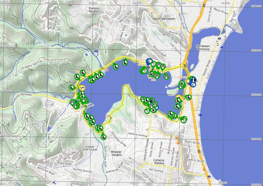
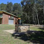
2 Middle Creek Reserve Before You walk Middle Creek Reserve, is signposted on Wakehurst Parkway, Ingleside at the northwestern edge of Narrabeen Lagoon. The modern picnic area hosts a public toilet and change areas and an accessible toilet. There are a series of picnic tables scattered throughout the picnic area. There are also plenty of bench seats, BBQs and drinking fountain. There is space to park about 50 cars, including two mobility parking bays. Parking is metered at $6 per hour. There is also a concrete boat ramp Bushwalking is fun and a wonderful way to enjoy our natural places. Sometimes things go bad, with a bit of planning you can increase your chance of having an ejoyable and safer walk. Before setting off on your walk check Sport and Rec boat shed picnic area Beside the Sport and Recreation boat shed is a simple clearing and picnic area on edge of Narrabeen Lagoon. There are large seating platforms in the open grassy area. Jamison Park Jamison Park is a large picnic area on the southern shoreline of Narrabeen Lagoon, at the end of The Esplanade, Narrabeen. The picnic area has a large paid parking area, including two mobility parking bays and is home to the 'Narrabeen Lakes Sailing Club'. There is a boat ramp, picnic tables, BBQ's, drinking fountain, public and accessible toilets. A pleasant area to enjoy the lagoon. Wheeler Park Wheeler Park is an open picnic area and playground between Lakeside Rd and Narrabeen Lagoon. There is a drinking fountain and bench seat beside the footpath. A great fenced and shaded children's playground as well as rubbish bins. Behind the playground is a sheltered BBQ and sheltered picnic tables (as well as some other unsheltered picnic tables) beside the open grassy area. The Boatshed cafe The Boatshed Cafe is a pleasant waterfront cafe & bar. There is a sheltered outside seating area and an upstairs indoor section. Lift access to the inside area is via the road side of the building, where there are also accessible toilets. theboatshedcafe.com.au. Beside the cafe is 'Pro-Kayaks' where you can hire kayaks and paddle boats. The upper story of the same building (11 Narrabeen St, Narrabeen) is 'Limani', a seafood restaurant if you want to get even more fancy. limani.com.au 1) Weather Forecast (BOM Metropolitan District) 2) Fire Dangers (Greater Sydney Region, unknown) 3) Park Alerts () 4) Research the walk to check your party has the skills, fitness and equipment required 5) Agree to stay as a group and not leave anyone to walk solo Think before you TREK The 'Think before you TREK' program developed by NSW Police & NPWS promotes the benefits of planning ahead for your bushwalking trip by using an easy to remember acronym: adequate supplies of food, water, navigation and first T Take aid equipment. your planned route and tell friends and family when R Register you expect to return. beacon (PLB's) should be carried on walks with E Emergency significant gaps in mobile coverage (check terrain profile). to your planned route and follow the map and walking K Keep trails. Topo Maps The maps provided on wildwalks are helpful, but there are times where you may need maps covering a broader area. Maps that cover this walk include; 1: Map Series:91301S MONA VALE 1: Map Series:9130 SYDNEY Grade This walk has been graded using the AS The overall grade of the walk is dertermined by the highest classification along the whole track. 1 Grade 1/6 Very easy Length 8.6 km Circuit Time 2 hrs 30 mins Quality of track Smooth and hardened path (1/6) Signs Clearly signposted (1/6) Experience Required No experience required (1/6) Weather Weather generally has little impact on safety (1/6) Infrastructure Generally useful facilities (such as fenced cliffs and seats) (1/6)
3 Are you ready to have fun? Please ensure you and your group are well prepared and equipped for all possible hazards and delays. Check park closures, weather information and Fire Danger Rating before setting out. Optional side trips and alternate routes noted are not included in this walks overall grade, length or time estimate. Please allow extra time for resting and exploring areas of interest. The authors, staff and owners of wildwalks take care in preparing this information but will not accept responsibility for any inconvenience, loss or injury you may experience. Please take care, have fun - Happy Walking. Getting there Traveling by car is the only practical way to get to Middle Creek Reserve boat ramp (gps: , ). Car: Parking fees apply in the area. This is a circuit walk, so you will finish back at the start. Find up to date and more information inlcuding; travel directions, weather, park closures and walker feedback at 0 Middle Creek Reserve Middle Creek Reserve, is signposted on Wakehurst Parkway, Ingleside at the northwestern edge of Narrabeen Lagoon. The modern picnic area hosts a public toilet and change areas and an accessible toilet. There are a series of picnic tables scattered throughout the picnic area. There are also plenty of bench seats, BBQs and drinking fountain. There is space to park about 50 cars, including two mobility parking bays. Parking is metered at $6 per hour. There is also a concrete boat ramp 0 Middle Creek Reserve boat ramp (460 m 7 mins) From the Middle Creek Reserve boat ramp, this walk follows the concrete path along the edge of Middle Creek Reserve keeping the lagoon to the left. This walk meanders through the picnic area with a couple of sheltered picnic tables, a toilet block and car parking. At the southern end of the picnic area just before Middle Creek the path bends left past the sheltered tables to a seat (on the right) and a 'The Jim Somerville Bridge' sign on a rock (on the left) just before a bridge. The seat continues the the Jim Somerville Bridge ramp then after about 60m the bridge turns right and flattens out for 70m to cross the creek and after 70m then leads gently downhill for about 50m, passing a fenced off abseiling area. At the end of the bridge this walk continues on a concrete path for another 60m to come to a grassy clearing (on the left) with two seats just before the boat shed for the Sport and Recreaction Center Sport and Rec boat shed picnic area Beside the Sport and Recreation boat shed is a simple clearing and picnic area on edge of Narrabeen Lagoon. There are large seating platforms in the open grassy area Sport and Recreation boat shed (750 m 12 mins) Continue straight: From the Sport and Recreation boat shed clearing, this walk follows the concrete path past the boat shed and archery range keeping the lagoon to the left. This walk then follows the concrete path for about 110m to pass the 'Caution you are next to an active golf course' sign (on the right) just before the start of the fibreglass boardwalk. After about 50m this path continues along a small bridge with handrails for 25m, then follows the concrete path to come to a seat (on the left). From this seat this walk continues along the footpath for about 190m past a seat (on the left) to come to a another seat (on the left). From the seat this walk continues along the concrete path gently uphill for about 35m to the start of fence and fiberglass bridge with handrails. This walk zig zags on the bridge for about 70m, offering beautiful views across the lagoon. This walk then heads gently downhill for about 20m to come to a concrete path and end of handrails where the path flattens out and comes to another seat (on the left). From here this walk follows the concrete path for about 190m past a seat (on the left) to come to another seat (on the left) just before the intersection beside James Wheeler Place, marked by a 'South Creek Reserve' sign (on the left) James Wheeler Place Intersection (440 m 7 mins) Turn left: From the intersection beside James Wheeler Place, this walk follows the 'Jamieson Park 2.3km' arrow gently dowhnill along the wide gravel track initially keeping James Wheeler Place to your right. This walk continues past a 'Cyclists slow down' sign (on the left) and a 'Wildlife Protection Area' sign (on the right) and follows the gravel track for about 90m to come to an intersection with a short informal track to the water (on the left). This walk then continues along the wide track for another 110m past a series of signs (on the left) remembering each war before coming to a Yintersection marked by a sign (on the right). This walk then veers left, following the 'Jamieson Park 2.1km' arrow along the track for the next 80m past more signs in the series (on the left) remembering each war before crossing a 40m long fiberglass 'RSL War Veterans Footbridge' with timber handrails. At the end of the footbridge this walk comes to an intersection with a faint informal steep rough track to the right just below the Dardanelles coffee shop. Continue straight: From the intersection, this walk follows the 'Jamieson Park 2km' arrow along the gravel track keeping the road and village a short distance to the right. This walk continues for about 50m past the continuing series of information signs (on the left) remembering each war before crossing to a 15m long fiberglass bridge with timber handrailing and then continues along the gravel track for about 40m past more information signs (on the left). This walk then heads gently uphill to a 3-way intersection marked by a 'RSL War Veterans North' signpost (on the right) RSL War Veterans access intersection (1.6 km 28 mins) Turn left: From the intersection, this walk follows the 'Jamieson Park 1.9km' arrow gently downhill, directly away from the buildings. After just a few meters this walk leads past the war information sign '14', then leads past another 15 signs in the same series over the next 220m (all on the left). About 60m after the last of these signs (no. '29'), the track leads up a short moderately steep hill then continues through the dense forest for another 130m to cross a wide timber bridge. The walk continues along the wide track for another 300m when it leads up the the lagoons edge. About 150m along the edge of the lagoon the walks passes a 'Pipeclay Point' arrow post where the track soon bends right to lead away from the lagoon into the forest. After another 400m the track leads back close to the lagoon for a short distance then back into the denser forest for another 150m to then cross a flat fibreglass bridge. About 60m past this bridge the track comes to a Y-intersection on edge of a clearing, the walk turns right leading past the metal bench seat to find the 'Jamieson Park Trail Entry' post. The walking continues along the wide gravel track for 30m, to pass the 'Jamieson Park' to then come to a 3-way intersection (with a concrete track and picnic area on the left) Alternate Route Northern end of Jamison Park to In (260 m 4 mins) Turn sharp left: From the intersection, this walk heads along the concrete footpath heading towards the lagoon. After about 20m the path leads past a nearby picnic table (on the right), (and past the other picnic facilities) as the path then bends right and leads beside the lagoon for about 80m to come to, then cross a small creek on a narrow (1.07m wide) timber footbridge with metal handrails (1.02m high. On the other side of the bridge this walk leads past a picnic table to come beside the boat ramp at the end of Jamison Park car park. Turn right: From just beside the boat ramp at the end of Jamison Park car park, this walk follows the footpath gently uphill towards the sailing club. After about 20m this walk passes a picnic table, BBQ, as well at the accessible and public toilets (in the 'Narrabeen Lakes sailing Club' building). The walk continues along the footpath for just over 100m, as it leads behind the club building, past another picnic table, to come to a T-intersection beside the 'Water Refill Jamison Park' station. Now Turn left to rejoin the main walk Northern end of Jamison Park (230 m 4 mins) Veer right: From the intersection, this walk heads directly away from the clearing and lagoon along the wide gravel trail, past the 'Warning - Vehicles on track at any time' sign, to then lead between the timber fences. This trail may become boggy after prolonged rain. After about 150m this trail leads over a culverted creek (with timber handrails), where the trail continues for another 100m through the lovely dense forest to come to a 3-way intersection with a concrete path, beside the 'Water Refill Jamison Park' station Jamison Park Jamison Park is a large picnic area on the southern shoreline of Narrabeen Lagoon, at the end of The Esplanade, Narrabeen. The picnic area has a large paid parking area, including two mobility parking bays and is home to the 'Narrabeen Lakes Sailing Club'. There is a boat ramp, picnic tables, BBQ's, drinking fountain, public and accessible toilets. A pleasant area to enjoy the lagoon Int behind Jamison Park (760 m 13 mins) Continue straight: From the intersection (beside the 'Water Refill Jamison Park' station), this walk heads along the wide concrete footpath 30m towards the road, to pass the large 'Narrabeen Lagoon Trail' sign then cross 'The Esplanade' at the main entrance to Jamison Park. Continue straight: From the entrance to 'Jamison Park', this walk follow the footpath out of the park keeping 'The Esplanade' to the right. The path leads between the lagoon and the road for about 130m to pass the end of 'Nioka Rd'. The walk continues beside the lagoon for another 250m to find a green timber bench seat, then just 100m later to find another metal and timber seat. The walk continues along the footpath for 70m to pass a roundabout, then past some houses to turn left onto the footpath beside 'Lakeside Rd'. The walk continues beside 'Lakeside Rd' for about 70m to come to the 'water refill' station beside the playground at Wheeler Park Wheeler Park Wheeler Park is an open picnic area and playground between Lakeside Rd and Narrabeen Lagoon. There is a drinking fountain and bench seat beside the footpath. A great fenced and shaded children's playground as well as rubbish bins. Behind the playground is a sheltered BBQ and sheltered picnic tables (as well as some other unsheltered picnic tables) beside the open grassy area Wheeler Park (470 m 7 mins) Continue straight: From the 'water refill' station beside the playground at Wheeler Park (Lakeside Rd Narrabeen), this walk follows the footpath, past the garbage bins and seat, initially keeping the road to the right. After about 25m this walk leads past the large 'Narrabeen Lagoon Trail' sign to continue for just shy of 100m past the scout hall to head between the timber bollards (1.2m wide and 1m high). The walk continues along the footpath for another 50m to pass the end of 'Devitt St', then continues for another 120m to come to a seat (on the left) at the end of 'Roberston St'. From here this walk continues straight, following the 'Berry Reserve 500m' arrow along the footpath for 90m to pass another bench seat (on the left) and continues for another 80m to come to the 'Pro-kayaks' and the 'The Boatshed' cafe (on the right), beside the lagoon The Boatshed cafe
4 The Boatshed Cafe is a pleasant waterfront cafe & bar. There is a sheltered outside seating area and an upstairs indoor section. Lift access to the inside area is via the road side of the building, where there are also accessible toilets. theboatshedcafe.com.au. Beside the cafe is 'Pro-Kayaks' where you can hire kayaks and paddle boats. The upper story of the same building (11 Narrabeen St, Narrabeen) is 'Limani', a seafood restaurant if you want to get even more fancy. limani.com.au 4.75 Coffee and Kayaks (370 m 6 mins) Continue straight: From beside the cafe, this walk heads along the concrete footpath keeping the lagoon to the left (being mindful of the unguarded drop from the path into the lagoon). After about 40m the path leads past the end of 'Narrabeen St' and past the seat (on the left) then continues for just shy of 200m beside the lagoon, through the casuarina grove, to find a picnic table (on the left). About 45m further along this path this walk passes a BBQ shelter then continues for another 70m through the open park (beside the car park) to come to the 'Narrabeen Lagoon Trail Berry Reserve' signposted intersection (beside the exercise equipment ) Berry Reserve Berry Reserve is a waterside open grassy picnic area found at 1417 Pittwater Rd Narrabeen. Public toilets, picnic tables, 2hr car parking, short basketball court, exercise area, garbage bins, and sheltered BBQs. There are a wide range of shops within 100m along Pittwater Rd as well as bus stops. warringah.nsw.gov.au Berry Markets are held on the 3rd Sunday of every month. It is a busy time with around 80 stalls offering arts & crafts, home wares & fashion as well as yummy food Berry Reserve (120 m 2 mins) Continue straight: From Berry Reserve, this walk follows the Narrabeen Lagoon Trail 'Bilarong Reserve 1.2km' arrow along the footpath (keeping the lagoon to the left.) After about 30m the path leads behind some fenced properties beside the lagoon. Over the next 80m the path leads to another open grassy area and the back of the 'H2O Cafe Restaurant' (on the right) H20 cafe H2O Cafe Restaurant is a pleasant cafe and function facility at 1431 Pittwater Road, Narrabeen. The cafe sits on the edge of Narrabeen Lagoon, just north of Berry Reserve and offers indoor and outdoor options. h2ocafe.com.au 5.23 H20 cafe (90 m 1 mins) Continue straight: From the back of the 'H2O Cafe Restaurant', this walk follows the footpath between timber bollards keeping the water to the left. Over the next 80m this walk passes 4 bench seats as the path bends right and headhill up to a T-intersection with another footpath beside Pittwater Road South end of Pitwater Rd Bridge (610 m 10 mins) Turn left: From the intersection, this walk follows the 'Billarong Reserve 1km' arrow over Pittwater Road Bridge, keeping the road to your right. After about 30m this walk passes the 'No fishing, climbing or jumping' sign and continues over the beautiful lagoon with lovely views, the narrowest section of the footpath here is 1.4m.. At the far end of bridge this walk continues along the footpath beside past the large 'Wakehurst Parkway' sign to come to the 'Welcome to Pittwater' sign (near the pedestrian lights). The walk continues along the footpath (keeping Wakehurst Parkway to your right) for 110m to cross 'Wimbledon Avenue', then pass between the timber bollards. Continue along the footpath for another 150m to cross the the other end of 'Wimbledon Avenue'. From this intersection, this walk continues along the main footpath very gently uphill, (still keeping Wakehurst Parkway to your right) for 90m to come to the end of the concrete path at the signposted entrance to 'Billarong Reserve' East end of Bilarong Reserve (330 m 5 mins) Continue straight: From the 'Bilarong Reserve' sign beside the Wakehurst Parkway, this walk heads along the flat gravel track, towards the distant lagoon and away from the road. After about 170m this walk heads past two picnic tables (one on each side of the track) to then cross a concrete ford with 57cm high timber guiding (2.6m wide). From the ford the track heads gently uphill to pass the exercise area (on the right). Here this walk flattens and continues for another 130m passing a scattering of picnic tables (on both sides of the path), a drinking fountain (on the left), a double BBQ (on the right) to come to Y-intersection beside a picnic area with another drinking fountain and a playground (on the right) Bilarong Reserve playground and picnic area Bilarong Reserve playground is accessed from Wakehurst Parkway, North Narrabeen. The main Picnic area has twin sheltered BBQs (97cm high, 2.3m wide, 88cm deep) with hot plates (44/44cm). The distance between BBQs is 1.4m. Each of the 4 picnic tables sits on a concrete slab 3x3.2m. Tables are 79cm high, 2m wide and 60cm deep. s are 46cm high and 39cm deep. Drinking fountain is 70cm high. The playground has a shaded fenced area with a slide and see-saw and a more open naturally shaded soft fall area with many climbing nets, single pole see-saw and a large sand area. In the centre of the carpark is a scout hall with toilets Bilarong Reserve playground (140 m 2 mins) Veer left: From the intersection, this walk follows the arrow post on the lower gravel track (2.5m wide) keeping the lagoon to the left. This walk soon passes a seat (on the right) and continues for about 40m to cross a flat fiber glass bridge (6m long, 2.6m wide, no handrails) over a small creek. This walk heads below the carpark for about 90m to just before the boat ramp where there's a 1.8m high shower (on the left). (Opposite the canoe ramp across the parking lot are accessible public toilets.) 6.41 Bilarong Reserve car park Bilarong Reserve car park is located just off Wakehurst Parkway, Narrabeen. There are 2 signposted mobility parking bays, a space for motor bikes and plenty of car parking. Parking fees ($6hr) apply. There is a boat ramp opposite the scout hall. Also beside the scout hall are accessible public toilets Bilarong Reserve boat ramp (180 m 3 mins) Continue straight: From the boat ramp by the Bilarong Reserve car park, this walk follows the gravel track keeping the lagoon to your left. This walk continues for about 100m to soon pass a drinking fountain, a scattering of picnic tables, a seat and a BBQ (all on the left). From here this walk bends right and through the forest for about 20m to lead up to a T-intersection with a road (at the end of car park area). Turn left: From the intersection, this walk heads along the road past the timber bollards keeping the lagoon (through the trees) to the left. This walk continues for about 60m to come to the 'Bilarong Sanctuary' gate (1.3m wide) at the far end of the turning circle Billarong Reserve turning circle (1 km 19 mins) Veer left: From the gate in the fence at the far end of the turning circle at the end of Billarong Reserve carpark, this walk follows the gravel track away from the road and towards the 'Bilarong Sanctuary' sign. This walk continues along the gravel track past the 'Dogs prohibited' sign through the mixed forest beside the lagoon. After 300m the track comes gently up beside the Wakehurst Parkway (on the right) to a 1.9m wide gap in the fence, and heads moderately steeply up the gravel track to be behind the safety barrier on Wakehurst Parkway. This track (1.4m wide) continues for about 130m beside the road (behind the safety barrier) along the Wakehurst Parkway, past a rock with 'Wakehurst Parkway' and 'Gateway to Pittwater' signs (on the left) and a seat (on the left) to come to a '80' km/h sign (on the right). From the sign this walk starts to head moderately steeply downhill for about 30m to a flat fibreglass bridge. From here this walk continues for the next 100m, crosses another flat fibreglass bridge and follows the 80m section of timber boardwalk (1.78m wide). This walk continues along the gravel track for the next 70m, across another 12m long flat fiberglass bridge to come to timber lookout with 2 seats (at time of writing the platform was closed of for repair), located by a gorgeous angophora tree. This walk continues gently uphill to then pass a 15m long moderately steep dowhnill section of gravel track and a flat fibreglass bridge. This walk follows the gravel track for about 140m past a timber fence (on the left) and a facing away 'Welcome to Pittwater' sign (opposite the fence) to come to a Y-intersection at the start of the concrete path Deep Creek Intersection (310 m 5 mins) Turn right: From the intersection, this walk follows the main path arrow up a 15m moderately steep (8.4 incline) section of concrete footpath. The walk then leads over a long pedestrian bridge with handrails offering beautiful views along Deep Creek. At the end of the bridge this walk follows the gravel track for about 30m gently downhill to come to a timber lookout(on the left) and 2 seats. This walk now continues along the fiberglass footpath with handrails (handrails stop after 45m) for about 90m to come to another seat (on the left). This walk then leads into a forest and zig-zags a little bit away from the Wakehurst Parkway to come to a handrailed (116cm high) lookout (on the left) with a seat, just by the 'Cement Works' sign (on the left) and a shaded seat (on the right). 7.9 Cement Works Lookout Cement Works Lookout is a pleasant viewing platform on the northern edge of Narrabeen Lagoon. On display are some remains from the long since removed lime and cement works that were established here by Edward Giles Stone. These works never reached their full potential due to the construction of Wakehurst Parkway. The lookout offers beautiful views across the lagoon and unique seats as a reminder of the works that were done here. There is a 1.2m high railing at the main viewing area. 7.9 Cement Works Lookout (630 m 12 mins) Continue straight: From the 'Cement Works' Lookout sign, this walk heads gently downhill across a short section of fibreglass boardwalk keeping the lagoon to the left. This walk continues along the wide gravel track for about 60m. After crossing another short section of fiberglass boardwalk gently uphill this walk comes to a seat (on the right) and an unfenced timber viewing platform (on the left) with 4 steps, offering beautiful views across the lagoon. From beside this viewing platform this walk continues straight, along the 15m section of boardwalk with handrails then another 80m of boardwalk to come to another viewing platform (on the left) and a seat (on the right). This walk continues along the fibreglass board for the next 140m as it meanders through the forest to come to the next viewing platform (on the left) and a seat (on the right). From this viewing platform this walk continues along the fibreglass board for the next 120m through the forest to come to yet another viewing platform (on the left) with a trip hazard and a seat (on the right). From the viewing platform this walk continues along the fibreglass board and after about 70m this walk comes closer to the road and to yet another similar viewing platform (on the left) and a seat (on the right). This walk continues along fiberglass board for the next 40m to come across a small handrailed bridge then the end of the fiberglass boardwalk and a start of the gravel track. This walk continues
 at the start of the Middle Creek Reserve. 8.")
5 along the wide gravel track for the next 80m to come to a seat and a timber viewing platform (on the left), marked by a 'Middle Creek Reserve' sign(on the right) and 'The Graham Jones Track' sign on a rock (on the left) at the start of the Middle Creek Reserve Northern end of Middle Creek Reserve (90 m 2 mins) Continue straight: From the viewing platform at the Northern end of Middle Creek Reserve, this walk follows the 'South Creek Reserve 1.2km' sign along the concrete footpath along the edge of Middle Creek Reserve parking area. After about 60m this walk passes a seat (on the left) and 15m later a parking pay station (on the left), to come to the boat ramp in the middle of the Middle Creek Reserve parking area (be mindful of a 'Give way' sign when crossing).
6
7 Summary navigation sheet for the Narrabeen Lagoon Trail (from Middle Creek) km From 0.00 Middle Creek Reserve boat ramp , (GR Mona Vale, ) Sport and Recreation boat shed , (GR Mona Vale, ) James Wheeler Place Intersection , (GR Mona Vale, ) RSL War Veterans access intersection , (GR Mona Vale, ) Northern end of Jamison Park , (GR Mona Vale, ) Northern end of Jamison Park , (GR Mona Vale, ) Int behind Jamison Park , (GR Mona Vale, ) Wheeler Park , (GR Mona Vale, ) Coffee and Kayaks , (GR Mona Vale, ) Berry Reserve , (GR Mona Vale, ) H20 cafe , (GR Mona Vale, ) South end of Pitwater Rd Bridge , (GR Mona Vale, ) East end of Bilarong Reserve , (GR Mona Vale, ) Bilarong Reserve playground , (GR Mona Vale, ) Bilarong Reserve boat ramp , (GR Mona Vale, ) Billarong Reserve turning circle , (GR Mona Vale, ) Deep Creek Intersection , (GR Mona Vale, ) Cement Works Lookout , (GR Mona Vale, ) Northern end of Middle Creek Reserve , (GR Mona Vale, ) Up/Dwn Length Initial directions (Use full tracknotes and maps for more detail) m 7 mins 750 m 12 mins 440 m 7 mins 1.6 km 28 mins 260 m 4 mins 230 m 4 mins 760 m 13 mins 470 m 7 mins 370 m 6 mins 120 m 2 mins 90 m 1 mins 610 m 10 mins 330 m 5 mins 140 m 2 mins 180 m 3 mins 1 km 19 mins 310 m 5 mins 630 m 12 mins 90 m 2 mins From the Middle Creek Reserve boat ramp, this walk follows the concrete path along the edge of Middle Creek Reserve keeping the lagoon to the left. Continue straight: From the Sport and Recreation boat shed clearing, this walk follows the concrete path past the boat shed and archery range keeping the lagoon to the left. Turn left: From the intersection beside James Wheeler Place, this walk follows the 'Jamieson Park 2.3km' arrow gently dowhnill along the wide gravel track initially keeping James Wheeler Place to your right. Turn left: From the intersection, this walk follows the 'Jamieson Park 1.9km' arrow gently downhill, directly away from the buildings. Alternate Route Northern end of Jamison Park. Turn sharp left: From the intersection, this walk heads along the concrete footpath heading towards the lagoon. Veer right: From the intersection, this walk heads directly away from the clearing and lagoon along the wide gravel trail, past the 'Warning - Vehicles on track at any time' sign, to then lead between the timber fences. Continue straight: From the intersection (beside the 'Water Refill Jamison Park' station), this walk heads along the wide concrete footpath 30m towards the road, to pass the large 'Narrabeen Lagoon Trail' sign then... Continue straight: From the 'water refill' station beside the playground at Wheeler Park (Lakeside Rd Narrabeen), this walk follows the footpath, past the garbage bins and seat, initially keeping the road to the right. Continue straight: From beside the cafe, this walk heads along the concrete footpath keeping the lagoon to the left (being mindful of the unguarded drop from the path into the lagoon). Continue straight: From Berry Reserve, this walk follows the Narrabeen Lagoon Trail 'Bilarong Reserve 1.2km' arrow along the footpath (keeping the lagoon to the left.) After about 30m the path leads behind some fenc... Continue straight: From the back of the 'H2O Cafe Restaurant', this walk follows the footpath between timber bollards keeping the water to the left. Turn left: From the intersection, this walk follows the 'Billarong Reserve 1km' arrow over Pittwater Road Bridge, keeping the road to your right. Continue straight: From the 'Bilarong Reserve' sign beside the Wakehurst Parkway, this walk heads along the flat gravel track, towards the distant lagoon and away from the road. Veer left: From the intersection, this walk follows the arrow post on the lower gravel track (2.5m wide) keeping the lagoon to the left. Continue straight: From the boat ramp by the Bilarong Reserve car park, this walk follows the gravel track keeping the lagoon to your left. Veer left: From the gate in the fence at the far end of the turning circle at the end of Billarong Reserve carpark, this walk follows the gravel track away from the road and towards the 'Bilarong Sanctuary' sign. Turn right: From the intersection, this walk follows the main path arrow up a 15m moderately steep (8.4 incline) section of concrete footpath. Continue straight: From the 'Cement Works' Lookout sign, this walk heads gently downhill across a short section of fibreglass boardwalk keeping the lagoon to the left. Continue straight: From the viewing platform at the Northern end of Middle Creek Reserve, this walk follows the 'South Creek Reserve 1.2km' sign along the concrete footpath along the edge of Middle Creek Reserve par...
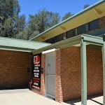
8 Accessibility Profile This page is designed to give you a sense of the facilities that help improve access for people with disabilities or mobility restrictions. See tracknotes and map for navigation, point of interest and other information. See the Accessibility Details page for specific information about each facility. Parking: There are 4 designated accessible parking areas on this walk. They are on average 2140m apart, with a maximum gap of 3480m. Toilets: There are 2 toilets on this walk. They are 6390m apart. s: There are 58 seats on this walk. They are on average 150m apart, with a maximum gap of 1990m. Surface Smooth & hard surface footpath half the way. Just under half the walk is on fairly smooth compacted gravel track, this may become boggy after rain. Steepness Mostly flat with a few moderately steep slopes. This graph shows how steep the track is. 1 Grade 1/6 Very easy Length 8.6 km Circuit Time 2 hrs 30 mins Quality of track Smooth and hardened path (1/6) Signs Clearly signposted (1/6) Experience Required No experience required (1/6) Weather Weather generally has little impact on safety (1/6) Infrastructure Generally useful facilities (such as fenced cliffs and seats) (1/6)
 Toilet Accessible (60m) There are")


 and baby change table.")

 (80m) Male and female toilet blocks and changing")

, a")
 (90m) A")


 A BBQ on a concrete slab. BBQ is 91cm high, 2.")
9 Accessibility Details 1 (0m) 2 (20m) 2m wide with a 46cm 3 4 Parking Accessible (30m) Toilet Accessible (60m) There are about 50 car parking bays. Two are marked mobiilty parking bays at the southern end. The mobility parking area is ashphalt, 2.3m wide and 5.3m deep. Shared male/female accessible toilet with a shower (faucet at 1m high, bench by the shower 49cm high) and baby change table. Entrance is 98cm wide, hand basin 80cm high, toilet seat 47cm high with a handrail. Toilet is accessible by a concrete ramp leading from the 5 6 Toilet (60m) (80m) Male and female toilet blocks and changing rooms. Toilets have 2 hand basins 88cm high, toilet seats 41cm high. Male toilet has 2 urinals 67cm high. No handrails. Change rooms have entrance 84cm wide, a bench (40cm high), a shower (faucet at 1.2m). Toilet 2m wide with a 46cm 7 8 Potable Water (90m) (90m) A 88cm high water fountain (working at the time of writting). 2 sheltered timber slat picnic tables and bench seats on a concrete platform. The table are 80cm high, 90cm deep and 2.4m wide. The seats are 46cm high, 29cm deep and 9 10 (120m) (130m) 2 timber slat bench seats on a concrete slab, 12m away from the path, 45cm high and 2m wide with a 46cm high backrest. seat. The table is 80cm high, 90cm deep and 2.4m wide. The seats are 46cm high, 29cm deep and Bbq (140m) (140m) A BBQ on a concrete slab. BBQ is 91cm high, 2.3m wide and 88cm deep. Hot plates are 44/44cm. seat. The table is 80cm high, 90cm deep and 2.4m wide. The seats are 46cm high, 29cm deep and (140m) (170m) 2 sheltered timber slat picnic tables and bench seats. The table are 80cm high, 90cm deep and 2.4m wide. The seats are 46cm high, 29cm deep and 2.4m wide (no backrest).

 (770m) 2m wide with a 46cm")

 A timber slat bench seat, 44cm")


 (3280m) seats on a")

 (3290m) 79cm")
 A BBQ on a")

 Shared")

10 15 (210m) 16 (450m) 2m wide with a 46cm 2 timber low seats, 50cm high, 1.7m deep, 1.8m wide (660m) (770m) 2m wide with a 46cm 2m wide with a 46cm (850m) (1010m) 2m wide with a 46cm 2m wide with a 46cm (1100m) (1200m) 2m wide with a 46cm 2m wide with a 46cm (3190m) (3240m) A timber slat bench seat, 44cm high, 45cm deep and 2m wide with a 45cm 2 sheltered timber slat picnic tables and bench seats on a concrete platform. The table are 79cm high, 62cm deep and 3m wide. The seats are 45cm high, 40cm deep and 3m wide (no backrest) (3240m) (3280m) seats on a concrete platform 3x4m. The table is 79cm high, 62cm deep and 2m wide. The seats are 45cm high, 40cm deep and 2m wide (no backrest). seats on a concrete platform 3x4m. The table is 79cm high, 62cm deep and 2m wide. The seats are 45cm high, 40cm deep and 2m wide (no backrest) (3280m) (3290m) 79cm high, 62cm deep and 3m wide. The seats are 45cm high, 40cm deep and 3m wide (no backrest). 79cm high, 62cm deep and 3m wide. The seats are 45cm high, 40cm deep and 3m wide (no backrest) Bbq (3480m) A BBQ on a concrete slab. BBQ is 91cm high, 2.3m wide and 88cm deep. Hot plates are 44/44cm. Toilet Accessible (3490m) Shared male/female accessible toilet. Toilet is locked with a MLAK key, doors are heavy.


 Parking Accessible(3510m) 79cm high, 62cm")


 (4280m) A BBQ on a concrete slab.")

 (4660m) 3 timber slat")


11 31 Toilet (3500m) 32 Potable Water (3510m) Male and female toilet block. Entrance is 78cm wide with a 7cm step at the door, hand basins 75cm high, toilet seat 42cm high. Male toilet has a urinal with 10cm step. Open 6am 9pm, otherwise locked. Doors to the toilet are heavy. A 81cm high water fountain (working at the time of writting) (3510m) Parking Accessible(3510m) 79cm high, 62cm deep and 3m wide. The seats are 45cm high, 40cm deep and 3m wide (no backrest). There are about 30 car parking bays. Two are marked mobiilty parking bays in front of the sailing club. The mobility parking area is ashphalt, 2.3m wide and 5.3m deep (3940m) (4040m) A timber slat bench seat dedicated to Jack Frederick Eaton, 43cm high, 32cm deep and 2m wide with a 50cm high backrest. 2 timber slat bench seats, 46cm high, 42cm deep and 2m wide with a 47cm (4260m) Potable Water (4260m) 84cm high, 86cm deep and 2.4m wide. The seats are 45cm high, 28cm deep and A 81cm high water fountain (working at the time of writting) Bbq (4270m) (4280m) A BBQ on a concrete slab. BBQ is 92cm high, 1.7m wide and 88cm deep. Hot plates are 44/44cm. A timber slat bench seat, 41cm high, 33cm deep and 2m wide with a 49cm (4560m) (4660m) 3 timber slat bench seats, 43cm high, 41cm deep and 2m wide with a 47cm A timber slat bench seat, 43cm high, 41cm deep and 2m wide with a 47cm Trip Hazard (4730m) (4790m) The footpath beside the Boastshed Cafe has an unfenced direct 1m drop into the lagoon. There is a white line marking the edge but no change in texture. A timber slat bench seat, 43cm high, 41cm deep and 2m wide with a 47cm (4990m) 79cm high, 65cm deep and 2m wide. The seats are 44cm high, 42cm deep and 2m wide (no backrest). (5010m) 79cm high, 65cm deep and 2m wide. The seats are 44cm high, 42cm deep and 2m wide (no backrest).


 Toilet (5100m) There")


 (5990m) 4 timber slat bench seats, 43cm")


. seat on a concrete platform.")
 is 79cm")
 (6170m) seat on a concrete")
 Potable Water (6250m) seat")

 A timber slat bench seat, 51cm high,")
12 47 (5020m) 48 Bbq (5030m) 79cm high, 65cm deep and 2m wide. The seats are 44cm high, 42cm deep and 2m wide (no backrest). A sheltered BBQ on a concrete slab. BBQ is 92cm high, 1.7m wide and 88cm deep. Hot plates are 44/44cm Parking Accessible(5080m) Toilet (5100m) There are about 90 car parking bays. Two are marked mobiilty parking bays. The mobility parking area is ashphalt, 2.2m wide and 5.2m deep. Male and female toilet block. Narrowest hall is 100cm wide with a 15cm step at the door, hand basin 95cm high, 4 toilet seats 42cm high. Male toilet has 2 urinals with 10cm step (5230m) (5990m) 4 timber slat bench seats, 43cm high, 41cm deep and 2m wide with a 47cm seat. The table is 80cm high, 90cm deep and 2.4m wide. The seats are 46cm high, 29cm deep and 18m from the footpath (6030m) (6120m) seat on a concrete platform 2.9x3.7m. The table is 80cm high, 90cm deep and 2.4m wide. The seats are 46cm high, 29cm deep and 9m from the footpath (on the right). seat on a concrete platform. The table is Potable Water (6130m) (6140m) A water fountain (working at time of writting) is 79cm high. seat on a concrete platform. The table is (6160m) (6170m) seat on a concrete platform. The table is seat on a concrete platform. The table is (6210m) Potable Water (6250m) seat on a concrete platform. The table is A water fountain (working at time of writting) (6270m) A timber slat bench seat, 51cm high, 31cm deep and 1.75m wide with a 51cm Toilet Accessible (6390m) Male and female accessible toilet. Entrance male toilets) is 78cm wide (no step), hand basin 80cm high, urinal has a 10cm step, toilet seat 47cm high with a handles, in a 1.5x2.05m room. There is a 42cm high bench.


.")
 seat on a concrete slab.")
 68")

 from the path.")
 Bbq (6470m) The table")

 (7300m) A timber slat bench seat,")

 (7670m) A timber slat bench seat,")


13 63 Parking Accessible(6410m) 64 (6420m) There are about 80 car parking bays. Two are marked mobiilty parking bays. The mobility parking area is ashphalt, 2.2m wide and 5.2m deep. seat on a concrete slab 3x3.2m. The table is 79cm high, 60cm deep and 2m wide. The seats are 46cm high, 39cm deep and 2m wide (no backrest) Potable Water (6450m) An 88cm high water fountain. 67 (6450m) seat on a concrete slab. The table is 80cm high, 90cm deep and 2.4m wide. The seats are 46cm high, 29cm deep and (6460m) 68 (6460m) A timber slat bench seat dedicated to Matthew Lloyd Hammond, 48cm high, 31cm deep and 1.8m wide with a 49cm is on a conrete slab and about 20m (across grass) from the path. seat on a concrete slab 3x3.2m. The table is (6470m) Bbq (6470m) seat on a concrete slab 3x3.2m. The table is A BBQ on a concrete slab 5x3.5m. BBQ is 95cm high, 2.3m wide and 88cm deep. Hot plates are 44/44cm (6970m) (7300m) A timber slat bench seat, 42cm high, 31cm deep and 2.4m wide with a 49cm A timber slat bench seat, 51cm high, 23cm deep and 2.3m wide (7300m) (7670m) A timber slat bench seat, 51cm high, 23cm deep and 2.3m wide. 2 timber slat bench seats, 43cm high, 30cm deep and 2.5m wide, with a 34cm (7770m) (7870m) 2 timber slat bench seats, 43cm high, 30cm deep and 2.5m wide, with a 34cm A timber slat bench seat, 43cm high, 30cm deep and 2.5m wide, with a 35cm high and 1.73m long backrest (7870m) A concrete set of blocks, 51cm high (no backrest), 23cm deep and 2.4m wide. (7940m) A timber slat bench seat, 43cm high and 2.5m wide with a 35cm high backrest (1.73m long).

.")

 A")


14 79 (8030m) (8170m) A timber slat bench seat, 43cm high and 2.5m wide with a 35cm high backrest (1.73m long) Trip Hazard (8290m) (8300m) A 15cm step on a timber viewing platform with no handrails. A timber slat bench seat, 43cm high and 2.5m wide with a 35cm high backrest (1.73m long) (8360m) A timber slat bench seat, 43cm high and 2.5m wide with a 35cm high backrest (1.73m long). 85 (8560m) 2m wide with a 46cm Powered by TCPDF ( 80 A timber slat bench seat, 43cm high and 2.5m wide with a 35cm high backrest (1.73m long). (8500m) A timber slat bench seat, 43cm high and 2.5m wide with a 35cm
Hunters Hill to Epping Road
 Hunters Hill to Epping Road 2 hrs 30 mins 5.5 km One way Moderate track 154m An enjoyable walk through lower sections of the Lane Cove National Park, this walk features plenty of mangroves next to the
Morgans Creek to Padstow
 Morgans Creek to Padstow 2 hrs 45 mins 8 km One way Moderate track 3 144m This pleasant walk starts from the Morgans Creek park, at Henry Lawsons Drive, and follows the Georges River past the Boomerang
Currie Rd to Davidson Park
 Currie Rd to Davidson Park 3 hrs 7.2 km One way Moderate track 28m Starting at Currie Rd in Forestville, this walk follows Middle Harbour to Davidson Park, under Roseville Bridge. There are two optional
Sid Pulsford Walk. 175m. 33m. 1 hr 45 mins 4.1 km One way. Hard track 118m. Gosford LGA
 Sid Pulsford Walk 1 hr 5 mins.1 km One way Hard track 118m Sid Pulsford Walk explores the ridge top of Kincumber Mountain, from Honeman's Rock to Green Point. The walk mostly follows wide management trails.
Echo Point to Leura Forest via Three Sisters and Giant Stairs loop
 Echo Point to Leura Forest via Three Sisters and Giant Stairs loop 3 hrs 3.8 km Circuit Hard track 512m This walk starts from the popular Echo Point, in Katoomba, and winds down to the base of the Three
Teralba to Charlestown Park track head
 Teralba to Charlestown Park track head 4 hrs 30 mins 13.3 km One way Moderate track 3 220m This section of the Great North Walk starts from the Teralba train station and winds down and around the edge
The Foreshore Walk. 24m. 1m Lake Macquarie LGA. 1 hr 15 mins 2.9 km One way. Hard track 81m
 The Foreshore Walk 1 hr 15 mins 2.9 km One way Hard track 81m This walk traverses the coastline of the Green Point reserve. By following a variety of tracks and occasionally traveling inland through eucalyptus
Epping to Pennant Hills Station (via Lane Cove River)
") Epping to Pennant Hills Station (via Lane Cove River) 3 hrs 5 mins 8.4 km One way Hard track 249m This walk, from Epping to Pennant Hills Station, is a great way to see the upper Lane Cove River Valley.
Epping to Pennant Hills Station (via Lane Cove River) 3 hrs 5 mins 8.4 km One way Hard track 249m This walk, from Epping to Pennant Hills Station, is a great way to see the upper Lane Cove River Valley.
Wallarah Coastal Walk
 Wallarah Coastal Walk 3 hrs 8.3 km Return Hard track 247m This walk starts at Caves Beach and travels south along the coastline, until reaching the Pinney s Headland Lookout. There are many opportunities
Katoomba Falls Circuit
 Katoomba Falls Circuit hr 5 mins.5 km Circuit Hard track 59m For those looking for a walk involving more than simple boardwalk, this trail winding through the temperate rain forest could be just the thing.
Rail to River Walk. 3 hrs. Hard track 7.5 km Circuit. 222m
 Rail to River Walk 3 hrs Hard track 7.5 km Circuit 4 222m This walk is a great one from Chatswood Station to the Lane Cove River National Park. The walk descends through the vegetated bushland which fills
Popes Glen, Pulpit Rock, Govetts Leap and Braeside Walk
 Popes Glen, Pulpit Rock, Govetts Leap and Braeside Walk 8 hrs Hard track 13.6 km Circuit 4 1068m This large circuit walk, from Popes Glen to Pulpit Rock, Govetts leap and along the Braeside Track, passes
Hornsby Blue Gum Walk
 Hornsby Blue Gum Walk 3 hrs Hard track 6.7 km Circuit 4 374m This delightful loop is one of the prettiest and most popular walks in the Hornsby area. Going from an environment of ferns and clear bushland
Carrington Park to Leura Forest and pass loop
 Carrington Park to Leura Forest and pass loop 3 hrs Hard track 4.8 km Circuit 4 674m This walk is a fantastic way to see Leura Forest. The walk descends from Carrington Park, visiting Leura Forest and
Waterfall to Heathcote
 Waterfall to Heathcote 5 hrs Hard track 10.8 km One way 4 467m This walk explores the heart of Heathcote National Park, and is easily accessed with a train station at either end. Although relatively close
Govetts Leap Loop. 1065m. 909m Blue Mountains National Park. 4 hrs 30 mins 8.7 km Circuit. Hard track 380m
 Govetts Leap Loop 4 hrs 30 mins 8.7 km Circuit Hard track 380m This walk, from Blackheath Train Station, is a fantastic way to see some of the iconic areas of the Blue Mountains in the Blackheath area.
Campbell Drive to Snapper Point
 Campbell Drive to Snapper Point 1 hr 45 mins 4.2 km One way Experienced only 135m This walk follows the Coast Track to Frazer Beach, along the Geebung and (overgrown) Grass Tree Tracks. From the northern
Wattamolla to Big Marley Beach
 Wattamolla to Big Marley Beach 4 hrs 10.4 km Circuit Moderate track 4m This walk is an excellent loop which takes in both the coast and the heathy inland of Royal National Park. Nearly the whole walk has
Little Digger Track to Davidson Reserve and Lyrebird Circuit
 Little Digger Track to Davidson Reserve and Lyrebird Circuit 4 hrs 3 mins 11.5 km One way Hard track 4 47m Exploring both the eastern and western sides of Middle Harbour Creek, this walk follows the Little
Wentworth Falls Conservation Hut Loop
 Wentworth Falls Conservation Hut Loop 3 hrs Hard track 6.7 km Circuit 4 341m This scenic walk from Wentworth Falls Station, winds along the Nature Trail to Conservation Hut, then drops into the magnificent
Green Point Circuit Walk
 Green Point Circuit Walk 3 hrs 7.7 km Circuit Hard track 269m This walk visits all of the popular locations in Green Point Reserve, as well as some of the lesser-visited areas inland. Taking in Sea Eagle
Balmoral Beach to The Spit
 Balmoral Beach to The Spit 2 hrs 30 mins.3 km One way Hard track 85m This walks follows the coast from Balmoral to the Spit and across Spit Bridge. There are some alternate tracks to consider at high-tides,
De Burgs Bridge to Thornleigh station
 De Burgs Bridge to Thornleigh station 3 hrs 45 mins 9.7 km One way Hard track 4 363m This walk follows a section of the Great North Walk, starting from De Burghs bridge. The walk winds north west, through
The Basin Track and Mackerel Track
 The Basin Track and Mackerel Track 3 hrs 5.9 km Circuit Hard track 226m This walk is a great way to see some popular areas in Ku-ring-gai Chase National Park. The walk from West Head Rd travels to The
Scenic World to Echo Point
 Scenic World to Echo Point 1 hr 15 mins 2.1 km One way Moderate track 192m This is one of the most popular tourist walks in the Katoomba area. The walk follows the cliffs along a well maintained and signposted
Dead Horse Gap Loop track
 Dead Horse Gap Loop track 4 hrs 30 mins Hard track 9.8 km Circuit 144m 4 This walk starts with a ride up the Kosciuszko Express Chairlift. There is an opportunity to eat at Australia's highest restaurant,
Mackerel Beach, West Head Loop
 Mackerel Beach, West Head Loop 5 hrs 8.6 km Circuit Hard track 422m The Mackerel Beach, West Head Loop is a walk which explores a large part of the West Head. The journey starts and finishes with a ferry
Little Digger Track. 68m. 1 Hr 2.2 km One way. Moderate track 93m. Moores Creek Reserve
 Little Digger Track Hr 2.2 km One way Moderate track 93m This walk follows Moores Creek through several reserves in east Roseville and East Lindfield. The track is named after Australia's 7th Prime Minster,
Callicoma Loop. 174m. 98m. 2 hrs. Hard track 5.1 km Circuit. 153m
 Callicoma Loop 2 hrs Hard track 5.1 km Circuit 153m This great circuit walk passes through some really nice forest around the fringe of Cherrybrook. Highlights of the walk include some beautiful rock overhangs
Sphinx, Warrimoo and Bobbin Head tracks
 Sphinx, Warrimoo and Bobbin Head tracks 4 hrs 9.6 km Circuit Moderate track 499m This great walk starts at the Sphinx Memorial and loops around via Cowan Creek, exploring diverse environments as it changes
Berowra to Mt Kuring-gai
 Berowra to Mt Kuring-gai 4 hrs 30 mins 9.4 km One way Hard track 4 551m From the ridges above Cowan Creek, this walk takes in some great lookouts (especially around Mt Kuringgai) as well as enjoying an
Heathcote to Engadine via Audley
 Heathcote to Engadine via Audley 6 hrs 3 mins 5 km One way Hard track 4 635m Covering a large section of central Royal National Park, this walk goes through the heath and scrub along a well managed and
Epping to Eastwood Station (via Lane Cove River)
") Epping to Eastwood Station (via Lane Cove River) hrs 45 mins 10.2 km One way Moderate track 189m Epping to Eastwood, via Lane Cove River, is the longer route through the bush between the stations. This
Epping to Eastwood Station (via Lane Cove River) hrs 45 mins 10.2 km One way Moderate track 189m Epping to Eastwood, via Lane Cove River, is the longer route through the bush between the stations. This
Rail to River and Stringybark Creek Reserve Walk
 Rail to River and Stringybark Creek Reserve Walk 4 hrs Hard track 11.2 km Circuit 4 302m This walk begins in the busy city of Chatswood and soon enters the nearby bushland around the Lane Cove River. The
Woolwich Wharf to Boronia Park
 Woolwich Wharf to Boronia Park 2 hrs 5.8 km One way Moderate track 175m Going through the streets of Hunters Hill, this walk is on the first segment of the Great North Walk. The majority of the walk is
Under and Over Cliff Walk
 Under and Over Cliff Walk 4 hrs 9.4 km Circuit Moderate track 576m This walk from Wentworth Falls Station is a fantastic way to see a large majority of the Wentworth Falls cliffline. The track winds under
Middle Harbour Creek Loop
 Middle Harbour Creek Loop 5 hrs 45 mins 15.1 km Circuit Experienced only 5 570m This walk explores the upper reaches of Middle Harbour Creek, starting and ending at the great parklands at Davidson Park,
Mackerel Beach and Resolute Loop
 Mackerel Beach and Resolute Loop 3 hrs 5.4 km Circuit Hard track 384m This walk is another great walk in Ku-ring-gai Chase National Park, accessed by ferry. From the Mackerel Beach wharf, this walk uses
Upper Rumbalara circuit
 Upper Rumbalara circuit 1 hr 30 mins 3.3 km Circuit Hard track 176m A great circuit walk, covering most of the walking tracks and sights in the upper section of the Rumbalara Reserve. There is some really
National Pass from Wentworth Falls to Conservation Hut
 National Pass from Wentworth Falls to Conservation Hut 3 hrs Hard track 3.6 km One way 739m Starting at Wentworth Falls picnic area, this scenic and historic walk explores many waterfalls, lookouts and
Spit Bridge to Middle Head Forts
 Spit Bridge to Middle Head Forts 2 hrs 30 mins 6.3 km One way Hard track 4 181m This scenic walk takes you from the Spit Bridge, along the coast to explore the Middle Head Forts. There are a few alternate
De Burghs Bridge to Fullers Bridge
 De Burghs Bridge to Fullers Bridge 2 hrs 3 mins Hard track 6 km One way 2m 4 Following the Lane Cove River, this walk mostly follows a section of the Great North Walk and is well maintained and signposted.
Bouddi Coastal Walk. 5 hrs. Hard track 8.1 km One way. 364m
 Bouddi Coastal Walk 5 hrs Hard track 8.1 km One way 4 364m This is one of the longer walks in the Bouddi National Park and it is rich in scenery. The walk follows the coastline with many side trips to
Epping to Gordon Station
 Epping to Gordon Station 4 hrs 15 mins 11.7 km One way Hard track 4 365m This walk, from Epping Station to Gordon Station, passes below the homes which sit on the hills high above the Lane Cove River.
Patonga to Woy Woy. 5 hrs 45 mins 15.5 km One way. Hard track. 497m
 Patonga to Woy Woy 5 hrs 45 mins 15.5 km One way Hard track 4 497m This walk explores a variety of environments from the shore line and coastal cliffs near Patonga, to the dry, rocky and open ridge line.
Taronga Wharf to Chowder Bay
 Taronga Wharf to Chowder Bay 2 hrs 4.4 km One way Moderate track 246m Starting at Taronga Wharf, this walk passes many icons of Sydney, including Taronga Zoo, HMAS Sydney Mast, Chowder Bay. The walk also
Roseville to Macquarie Park
 Roseville to Macquarie Park 3 hrs 3 mins 8.8 km One way Hard track 4 29m This walk starts at Roseville station and explores the streets and alleyways of Roseville before joining the main spine of the Great
Thornleigh to Hornsby
 Thornleigh to Hornsby 4 hrs Hard track 10.2 km One way 4 526m Starting at Thornleigh station you walk through suburban streets for a short while before diving into the bush at the southern end of Berowra
Wentworth Falls Station Loop (Undercliff Walk)
") Wentworth Falls Station Loop (Undercliff Walk) 4 hrs 3 mins Hard track 8.9 km Circuit 658m 4 This walk passes some stunning waterfalls and views into the Jamison Valley, following the cliff edges around
Wentworth Falls Station Loop (Undercliff Walk) 4 hrs 3 mins Hard track 8.9 km Circuit 658m 4 This walk passes some stunning waterfalls and views into the Jamison Valley, following the cliff edges around
Charlestown Park trackhead to Newcastle station
 Charlestown Park trackhead to Newcastle station 5 hrs 30 mins 12.1 km One way Hard track 4 287m This section of the Great North Walk starts from the Charleston Park track head and winds through the streets
Federal Pass Walking Track
 Federal Pass Walking Track 5 hrs Hard track 8 km One way 4 989m This classic trail follows along the base of the cliffs from Leura to the Golden Stairs, passing many of the more popular sights of the Katoomba
Sphinx to Mt Kuring-gai
 Sphinx to Mt Kuring-gai 4 hrs 45 mins 1.7 km One way Hard track 673m This walk starts at the Sphinx War Memorial and follows some well maintained and popular walking tracks down to Cowan Creek. Enjoy the
North Ryde Fairyland circuit
 North Ryde Fairyland circuit 2 hrs 30 mins Hard track 6.9 km Circuit 193m 4 Starting at North Ryde train station this walk explores a stretch of the Lane Cove River, visiting the historic Fairlylands Pleasure
Dubbo Gully and Ten Mile Hollow Circuit (via Clares Bridge)
") Dubbo Gully and Ten Mile Hollow Circuit (via Clares Bridge) 2 Days Hard track 24.3 km Circuit 4 1117m This two day (or ten hour) walk follows several historic roads, now closed to traffic. Starting with
Dubbo Gully and Ten Mile Hollow Circuit (via Clares Bridge) 2 Days Hard track 24.3 km Circuit 4 1117m This two day (or ten hour) walk follows several historic roads, now closed to traffic. Starting with
Echo Point to Leura Forest Circuit
 Echo Point to Leura Forest Circuit 3 hrs 4.8 km Circuit Hard track 588m Forming a circuit around the cliffs and then the valley floor, this is a walk more then capable of convincing a walker of the beauty
Lane Cove Tourist Park River Circuit
 Lane Cove Tourist Park River Circuit 5 hrs 12 km Circuit Hard track 383m This walk follows a large section of Lane Cove River. The walk follows the Riverside Walking track up the Lane Cove River to De
Hermitage Foreshore Track
 Hermitage Foreshore Track 1 Hr 2.2 km One way Moderate track 123m The Hermitage Foreshore Walk is a wonderful way to explore Sydney Harbour from the perspective of South Head. This walk starts from Nielsen
Glenbrook and Euroka Circuit
 Glenbrook and Euroka Circuit 2 Days 16.6 km Circuit Experienced only 790m This two day circuit, returning to Glenbrook Station, is a scenic walk which passes many of the tourist attractions within the
Blackheath Station to Junction Rock Loop (via Grand Canyon and Popes
 Blackheath Station to Junction Rock Loop (via Grand Canyon and Popes 8 hrs 30 mins 18.2 km Circuit Hard track 4 1254m This circuit starts in Blackheath and heads down into the Grand Canyon and Rodriguez
Wentworth Falls Loop. 893m. 665m. 6 hrs 10.2 km Circuit. Hard track 1093m. Blue Mountains National Park
 Wentworth Falls Loop 6 hrs 1.2 km Circuit Hard track 193m This is a great walk, both in size and spectacular views. The walk makes its way from Wentworth Falls train station and drops off the plateau,
Rumbalara Explorer. 158m. 5m Rumbalara Reserve. 2 hrs 45 mins 6.1 km Circuit. Hard track 326m
 Rumbalara Explorer 2 hrs 5 mins 6.1 km Circuit Hard track 326m Pretty well the grand tour of the Rumbalara Reserve, this walk takes in much of the great scenery the reserve has to offer. The walk covers
Wentworth Falls Station Loop
 Wentworth Falls Station Loop 5 hrs 3 mins 9.5 km Circuit Hard track 4 13m The Wentworth Falls Station Loop takes in most of the upper tracks around Wentworth Falls. There are many scenic views near the
Bobbin Head Loop. 166m. 0m Ku-ring-gai Chase National Park. 5 hrs 12.9 km Circuit. Hard track 619m
 Bobbin Head Loop 5 hrs 12.9 km Circuit Hard track 619m This great circuit walk enjoys a variety of landscapes in Ku-ring-gai Chase National Park. The walk starts at the historic Sphinx war memorial and
Gordon to Chatswood Station
 Gordon to Chatswood Station 4 hrs 30 mins 12.2 km One way Hard track 4 381m This walk is a great way to get into the bush without being far from civilisation. The walk wanders through untouched valleys
Scenic world to Three Sisters Loop via Furber Steps
 Scenic world to Three Sisters Loop via Furber Steps 5 hrs 5.8 km Circuit Hard track 722m This walk starts from the popular Scenic World, in Katoomba, and winds down the Furber steps into the Jamison Valley,
Gosford to Lisarow. 202m
 Gosford to Lisarow 4 hrs 3 mins Hard track 11.3 km One way 4 479m This walk is a great way to explore the ridge-top bushland between Gosford and Lisarow. Passing through Rumbalara and Katandra Reserves,
Cape Banks Circuit. 50m. 2m Botany Bay National Park. 3 hrs 7.3 km Circuit. Hard track 190m
 Cape Banks Circuit 3 hrs 7.3 km Circuit Hard track 19m This Cape Banks Circuit has a lot to offer and is thoroughly recommended. The walking travels over beaches, through coastal forest and across exposed
Spit Bridge to Manly (Manly Scenic Walkway)
") Spit Bridge to Manly (Manly Scenic Walkway) 3 hrs 45 mins 9.1 km One way Moderate track 349m The Spit to Manly walk is a classic bushwalk on Sydney's Northern Beaches. The walk follows a well-maintained
Spit Bridge to Manly (Manly Scenic Walkway) 3 hrs 45 mins 9.1 km One way Moderate track 349m The Spit to Manly walk is a classic bushwalk on Sydney's Northern Beaches. The walk follows a well-maintained
The Coast Track. 2 Days. Hard track 27.4 km One way. 1351m
 The Coast Track 2 Days Hard track 27.4 km One way 4 1351m Heading south, this walk covers the coastline of the Royal National Park and can truly only be described as amazing. With breathtaking coastal
Manly to Seaforth Oval
 Manly to Seaforth Oval 5 hrs 45 mins 13.7 km One way Moderate track 3 624m This walk follows the Manly to Spit Scenic Walkway, then continues past The Spit Bridge to Seaforth Oval. The walk provides magnificent
Chatswood to Epping Station
 Chatswood to Epping Station 6 hrs Hard track 16.3 km One way 4 533m This walk, from Chatswood to Epping, is a long but enjoyable walk along the Lane Cove valley. The walk mostly follows the Lane Cove River
Faulconbridge to Blaxland
 Faulconbridge to Blaxland 2 Days Experienced only 15.2 km One way 5 693m This two-day walk, or very solid one-day walk, takes you from station to station, through lush, scenic forest in the lower Blue
Taronga Zoo to Spit Bridge
 Taronga Zoo to Spit Bridge 5 hrs Hard track 1.4 km One way 4 41m This is a scenic and culturally rich walk with views over Sydney Harbour and many interesting heritage buildings along the way. The start
Bouddi Ridge and Coastal Walk
 Bouddi Ridge and Coastal Walk 2 Days Hard track 27 km Circuit 4 126m This overnight walk takes in the majority of the magnificent Bouddi National Park. The walk starts from the pleasant Putty Beach camping
Six Foot Track. 1212m
 Six Foot Track 3 Days 44.8 km One way Hard track 4 2066m This classic walk takes you from Katoomba to Jenolan Caves via a historic horse route. The walk travels mainly along well-maintained service tracks
Sydney to Thornleigh via Lane Cove Tourist Park
 Sydney to Thornleigh via Lane Cove Tourist Park 2 Days 33 km One way Hard track 4 1114m This overnight walk starts from the Obelisk in Macquarie Park, Sydney, at the official start of the Great North Walk.
Heartwood Forest, in Sandridge, Hertfordshire, is a place where everyone can find space, peace, wildlife and miles of beautiful woodland to explore.
 Heartwood Forest Accessibility Statement September 2016 Purpose: This accessibility statement outlines the available facilities and access information for Heartwood Forest. Welcome We, the Woodland Trust,
The Year Of Mercy Pilgrimage Sts Peter and Paul s Church, Bulimba To The Cathedral of St Stephen
 The Year Of Mercy Pilgrimage Sts Peter and Paul s Church, Bulimba To The Cathedral of St Stephen Dist Route Photos Photos 0.0km St Peter and Paul s Church, 235 Riding Rd & Cnr Main Ave, Balmoral. http://www.bulimbacatholic.com/
Access Statement for Loch of Strathbeg
 This access statement does not contain personal opinions as to our suitability for those with access needs, but aims to accurately describe the facilities and services that we offer all our guests/visitors.
Walking Audit Supporting Information
 Walking Audit Supporting Information Planning to do a walking audit of your streets? Here s some helpful suggestions to help get you started. 1. Preparing for your audit Decide where you want to walk.
LDWA SOUTH DOWNS MARATHON 13 th MAY 2018
 AHD ahead SDW South Downs Way BL/BR bear left/bear right TL/TR turn left/turn right X cross LEG 1 - EAST DEAN to WP1 NORTON GR 470019. Open 1030 to 1300. 9.7 miles. 1.1 From village hall TL and walk to
THE FIRST MOUNTAIN BIKE TRAIL CENTRE IN THE GCC & MIDDLE EAST
 THE FIRST MOUNTAIN BIKE TRAIL CENTRE IN THE GCC & MIDDLE EAST INTRODUCTION WELCOME TO HATTA TRAIL CENTRE WEBSITE Hatta Trail Centre is a first MTB Centre in the Middle East, and is a home to multiple cross
NEWLANDS CORNER AND ST MARTHAS
 NEWLANDS CORNER AND ST MARTHAS 10k CIRCULAR ROUTE 2½-3HRS GU4 8SE From Newlands Corner on the North Downs just outside Guildford, you can enjoy one of the most beautiful panoramas of quintessential English
Light to Light Walk 2 days
 Light to Light Walk 2 days 2 Days Hard track 3.9 km One way 4 794m Over two days, this classic walk explores the coast from Boyd Tower to the Green Cape Lighthouse in the south. Hegartys Bay Camp is over
VELINDRE VALLEYS WALK FOR STEFFAN
 VELINDRE VALLEYS WALK FOR STEFFAN IMPORTANT INFORMATION FOR WALKERS AND MARSHALS 1 Table of Contents Key Contact Numbers:... 3 Timetable and locations... 4 T-shirts... 4 Important Advice for Walkers...
Wye Valley Visitor Centre Symonds Yat West, Ross-on-Wye, HR9 6DA Access Statement
 Introduction Wye Valley Visitor Centre Symonds Yat West, Ross-on-Wye, HR9 6DA Access Statement The Jubilee Park in Symonds Yat West is a great place for families and friends to be together, and fantastic
A Walk from Our Lady of Victories Church, Bowen Hills to The Cathedral of Saint Stephen
 A Walk from Our Lady of Victories Church, Bowen Hills to The Cathedral of Saint Stephen 1 0.0km 30m 185m 270m From the Start to Breakfast Creek Rd is 8 minutes This pilgrimage walk should take the average
All Season Age Friendly Pedestrian Safety and Walkability Checklist *
 FOSTERING AGE FRIENDLY, WALKABLE NEIGHBOURHOODS Walkability is a key component of optimal aging in Age Friendly cities. Walkable neighbourhoods promote physical and mental health and well-being, support
LDWA SOUTH DOWNS MARATHON
 AHD ahead SDW South Downs Way BL/BR bear left/bear right TL/TR turn left/turn right SP signpost/fingerpost X cross LEG 1 - EAST DEAN to WP1 NORTON GR 470019. Open 1030 to 1300. 9.6 miles. 1.1 From village
Birches Valley Forest Centre is located in the heart of Cannock Chase Forest between Stafford, Cannock and Rugeley in Staffordshire, England.
 Birches Valley Forest Centre Introduction The Forestry Commission is the biggest provider of outdoor recreation in the UK and aims to offer quality woodland access to the widest range of visitors as possible.
MELBOURNE MIDDAY MILERS MARCH MADNESS BARWON HEADS 5MS RELAY
 MELBOURNE MIDDAY MILERS MARCH MADNESS BARWON HEADS 5MS RELAY 2013 Pre-race admin 1. We will meet at 8.15am on Sunday 17 March in the car park opposite the Barwon Heads Hotel & fronting the beach on Ewing
Detailed Descriptions and Maps of Woodside s Nature Trails
 Detailed Descriptions and Maps of Woodside s Nature Trails Access Mill Road Trail Park along Anderson Mill road. Signs on West Pleasant Colony and Anderson Mill road clearly point to the beginning of the
COPE PARK MASTER PLAN
 COPE PARK MASTER PLAN CBJ Parks & Recreation Department is in the process of creating a Master Plan for the Cope Park Area. New restrooms are designated to be constructed in the park in the next year.
Falls Lake Trail (A part of the NC Mountains-to-Sea Trail) East to West
 East to West") Falls Lake Trail (A part of the NC Mountains-to-Sea Trail) East to West Section 1 (Falls of the Neuse Rd to Raven Ridge Rd) 0.0 mi Parking area of the Tailrace Fishing Area, just below the dam, off Falls
Falls Lake Trail (A part of the NC Mountains-to-Sea Trail) East to West Section 1 (Falls of the Neuse Rd to Raven Ridge Rd) 0.0 mi Parking area of the Tailrace Fishing Area, just below the dam, off Falls
RILLINGTON TO MALTON by Tania Dickinson
 RILLINGTON TO MALTON by Tania Dickinson This walk takes you from the Vale of Pickering up on to the Wold scarp, before dropping down again through the pretty village of Settrington and joining the Centenary
The Mendip Way. Route Directions and Maps Wells to Frome
 The Mendip Way Route Directions and Maps Wells to Frome Website: www.mendiphillsaonb.org.uk Email: mendip@mendiphillsaonb.org.uk Facebook & Twitter: @MendipHillsAONB Phone: 01761462338 1 Wells to Shepton
Wye Valley Visitor Centre Symonds Yat West, Ross-on-Wye, HR9 6DA Access Statement
 Introduction Wye Valley Visitor Centre Symonds Yat West, Ross-on-Wye, HR9 6DA Access Statement The Jubilee Park in Symonds Yat West is a great place for families and friends to be together, and fantastic
Hammer Vale and Linchmere Common
 point your feet on a new path Hammer Vale and Linchmere Common Distance: 9 km=5½ miles or 6 km=3¾ miles easy walking with one steep section Region: Hampshire, West Sussex Author: Botafuego Refreshments:
Location: Cariboo, One Hundred Mile House, Cariboo Chilcotin Coast - Provincial : Park (Heritage Discovery Circle Route)
") Mt Robson Visitors Centre Information Date of Audit: 2016-08-04 Park Name: Emerald Bay Sunset View Key Features: Camping,Picnic_Site,Beach,Trails,Playground,Fishing Location: Cariboo, One Hundred Mile
Mt Robson Visitors Centre Information Date of Audit: 2016-08-04 Park Name: Emerald Bay Sunset View Key Features: Camping,Picnic_Site,Beach,Trails,Playground,Fishing Location: Cariboo, One Hundred Mile
Green Man Ultra Route Directions 2018
 Green Man Ultra Route Directions 2018 Start-CP1 (9 miles) Community Forest Path (CFP) Frome Valley Way (FVW) From the starting line cross the playing fields diagonally to the metal gates in the hedge lined